AND BRIGHSTONE FOREST
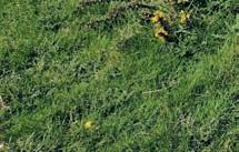
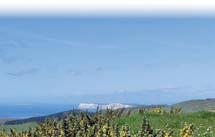
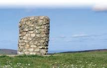
The top of Limerstone Down has a stone-built view indicator pointing out places you can easily see, as well as those that are rarely visible, like the French coast. And those views are extensive, with the white cliffs of Tennyson Down and Brighstone village clearly in view, and some of the south coast of England. For very little effort, the airy outward route gives you all the reward of a wonderful hill walk; the return is through lovely broadleaved woodland.
OS information
SZ 420 845
Explorer OL29
Distance 3.1 miles / 5 km
Time 1¾ hours
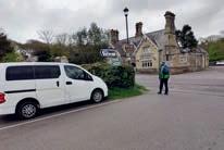
Start / Finish
Jubilee car park
Parking PO30 4JH
Jubilee car park, Lynch Lane, Brighstone
Public toilets
None; nearest in Brighstone village car park, PO30 4AH
Cafés / pubs
Ice cream van (seasonal) at ; Wolvesey House & Tandem Tea Room and The Three Bishops pub, Brighstone
Did you know? First recorded as Westcowe, Cowes got its name from one of two sandbanks offshore in the Medina estuary, whose outline resembled a cow. In the 16th century, ‘cow’ was the name adopted for a type of coastal fortification built by Henry VIII, and cowforts were positioned along the River Medina to guard against French invasion. Until the 19th century, the town was called West Cowes to distinguish it from East Cowes across the river.


Local legend The Bargeman’s Rest, an inn passed on this walk just before you come into Newport, is said to be haunted. One of the ghosts is a sailor who once captained a boat moored in the nearby harbour; another apparition is an unknown woman in old-fashioned attire.
STORIES BEHIND THE WALK
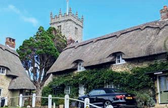
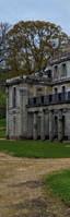
All Saints’ Church The parish of Godshill dates back to before the Domesday Book, when it was known as Godeshulle. The medieval, square-towered All Saints’ Church lies on a hill overlooking the village and is notable for a wall painting of a Lily Crucifix, which was obscured from view until the 19th century when the wall covering started to peel away. Today, the church features in one of the island’s most photographed views, enhanced by the surrounding thatched cottages.
Worsley Trail/ Godshill Park Road
The Griffin
Old Smithy car park
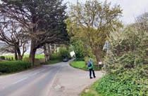
Turn left out of the car park, opposite The Griffin pub, and walk along the pavement of the main road for 300 yards to the turning for Godshill Park Road (right).
The Worsley Family
The family’s origins date back to Sir Elias de Workesley, an 11thcentury Norman knight, who fought in the First Crusade. He was killed in action and buried on the Greek island of Rhodes, leaving a son, Richard. The family was based in Workesley, Lancashire, which later became Worsley. Sir James Worsley, founder of the Appuldurcombe branch of the family, came down from Lancashire to the court of Henry VII and married Anne Leigh of
mile
Signed GL44 Worsley Trail, turn right along Godshill Park Road.
Stay on the tarred bridleway, which becomes a gated stony lane beyond Godshill Park Farm, for ¾ mile to reach the grand arch of Freemantle Gate.
NATURE NOTES
If the tide’s not out, you may be lucky enough to see frolicking bottlenose dolphins, which can sometimes ‘breach’, leaping out of the water entirely. They are very sociable creatures and will often swim alongside boats. You’re quite likely to spot Atlantic grey and common seals bobbing up out of the water to take a breather.
The dark-bellied Brent goose is a winter visitor from Siberia between October and March, and is often seen close to the Hovercraft terminal and Ryde Pier. It is Britain’s smallest goose, not much bigger than a mallard, and is dark grey-brown in colour with just a small white patch on its neck. Gathering in large flocks, Brent geese feed mainly on eel grass and seaweed. You can beachcomb for razor shells and cuttlefish bones on the extensive tidal sand flats.
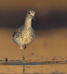
One of the waders you might see at Hersey Nature Reserve is the greenshank, with its distinctive green legs and long, slightly up-curved bill, which it uses for probing soft mud for food or skimming the shallows for small fish.
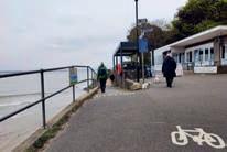
At the café, take the lower path beside the shore, which rounds Puckpool Point to reach The Boat House pub.
(The upper path involves a climb over Puckpool Hill, but does visit Puckpool Battery before dropping to The Boat House.)
Join the road and keep ahead, past the pub. Follow the sea wall for almost ⅔ mile (initially, Springvale Road pavement, and then a parallel path along Duver Road) to a right-angled corner with Salterns Road.
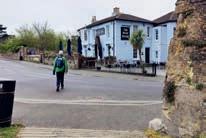
The Boat House
Greenshank