Local Development Plan 2032 Part 1: Plan Strategy September 2023 www.lisburncastlereagh.gov.uk
This page is left intentionally blank
Local Development Plan 2032 Part 1: Plan Strategy September 2023 1 Foreword 5 How to Use the Plan 6 1 Introduction 9 2 Policy and Spatial Context 17 3 Vision and Plan Objectives 26 4 Strategic Policies and Spatial Strategy 35 A: A Quality PlaceEnabling Sustainable Communities and Delivery of New Homes 48 B: A Thriving PlaceDriving Sustainable Economic Growth 64 C: A Vibrant PlaceGrowing our City, Town Centres, Retailing and Other Uses 87 D: An Attractive PlacePromoting Sustainable Tourism, Open Space, Sport and Outdoor Recreation 99 E: A Green PlaceProtecting and Enhancing the Historic and Natural Environment 112 F: A Connected PlaceSupporting Sustainable Transport and Other Infrastructure 122 5 Monitoring and Review 147 Glossary 150 Appendices 155 Contents
Local Development Plan 2032 Part 1: Plan Strategy September 2023 2 Strategic Policy 01 Sustainable Development 36 Strategic Policy 02 Improving Health and Well-being 36 Strategic Policy 03 Creating and Enhancing Shared Space and Quality Places 36 Strategic Policy 04 Supporting Sustainable Economic Growth 37 Strategic Policy 05 Good Design and Positive Place-Making 37 Strategic Policy 06 Protecting and Enhancing the Environment 38 Strategic Policy 07 Section 76 Planning Agreements 38 Strategic Policy 08 Housing in Settlements 52 Strategic Policy 09 Housing in the Countryside 60 Strategic Policy 10 Education, Health, Community and Culture 62 Strategic Policy 11 Economic Development 70 Strategic Policy 12 Economic Development in the Countryside 82 Strategic Policy 13 Mineral Development 84 Strategic Policy 14 Town Centres, Retailing and Other Uses 91 Strategic Policy 15 Evening/Night-time Economy 96 Strategic Policy 16 Tourism 104
Index
Policy
Local Development Plan 2032 Part 1: Plan Strategy September 2023 3 Strategic Policy 17 Open Space, Sport and Outdoor Recreation 108 Strategic Policy 18 Protecting and Enhancing the Historic Environment and Archaeological Remains 115 Strategic Policy 19 Protecting and Enhancing Natural Heritage 118 Strategic Policy 20 Transportation Infrastructure 128 Strategic Policy 21 Renewable Energy 135 Strategic Policy 22 Telecommunications and Other Utilities 138 Strategic Policy 23 Waste Management 142 Strategic Policy 24 Flooding 145 STRATEGIC MIXED USE POLICIES SMU01 West Lisburn/Blaris 72 SMU02 Purdysburn/Knockbracken 75

Local Development Plan 2032 Part 1: Plan Strategy September 2023 4
Foreword
On behalf of Lisburn & Castlereagh City Council, we present the publication of this Plan Strategy which is the first part of the Council’s new Local Development Plan. The Plan Strategy focuses on the future wellbeing of our citizens in conjunction with the Community Plan.
The adoption of the Plan Strategy represents a key milestone for the Council, and provides the framework for the future investment in the Council area. It sets the strategic direction for the sustainable economic growth of the Council area and provides a framework for better connectivity between places and opportunities for healthier lifestyles, which are key aims to shaping good quality places in which to work, live and play.
The Vision, Objectives and Spatial Strategy address the economic, social and environmental challenges facing our Council area whilst reflecting the rich variety of our settlements and their diverse roles and functions, set against a vibrant rural hinterland.
The Plan Strategy will be part of the Development Plan for the purpose of dealing with planning applications, appeals and enforcement.
The Plan is supported through a range of Strategic Policies. These provide the basis for

the suite of Operational Policies for housing, economic development, our city and town centres, tourism, infrastructure and the natural and historic environment. Account has been taken of policies which are cross-cutting in nature, including flooding, climate change adaptation and mitigation, health and active travel. The Strategic Planning Policy Statement (SPPS) states that where a Council adopts its Plan Strategy, existing policy retained under the transitional arrangements shall cease to have effect. This will represent a change for stakeholders and the Council is committed to building capacity in relation to the new policy framework.
The Council acknowledge the assistance provided by a variety of stakeholders including the key statutory consultees, the private sector and local communities. We believe the depth and breadth of engagement undertaken when considered alongside the partnership approach to our Community Plan, ensures real opportunity for growth and change which will better serve all of our people and ensure a sustainable future.


FOREWORD Local Development Plan 2032 Part 1: Plan Strategy September 2023 5
Councillor Andrew Gowan Councillor John Laverty BEM Chair of Regeneration and Growth Committee
Councillor Martin Gregg Chair of Planning Committee
How to use the plan
The Plan Strategy is set out in two parts which is subdivided as follows:
Part 1 – Plan Strategy:
• Chapter 1 Introduction –outlines the background and purpose.
• Chapter 2 Policy and Spatial Context –provides detail on the policy framework and profile of the Council area.
• Chapter 3 Vision and Plan Objectives –sets out the Local Development Plan (LDP) vision and objectives which drive its delivery.
• Chapter 4 Strategic Policies and Spatial Strategy –provides the strategic policies for the LDP for implementation of the Plan objectives.
• Chapter 5 Monitoring and Implementationsets out how we will measure the effectiveness of the LDP.
• Glossary and Appendices.
A A Quality Place
B A Thriving Place
C A Vibrant Place
Enabling Sustainable Communities and Delivery of New Homes
Driving Sustainable Economic Growth
D An Attractive Place
Growing our City, Town Centres, Retailing and Offices
Promoting Sustainable Tourism, Open Space and Recreation
E A Green Place
Protecting and Enhancing the Historic and Natural Environment
F A Connected Place
Supporting Sustainable Transport and Other Infrastructure
HOW TO USE THE PLAN Local Development Plan 2032 Part 1: Plan Strategy September 2023 6
Part 2 – Operational Policies:
• Preambleprovides the context for operational policies including how all policies must be considered.
• Topic-based operational policiesthese will guide development across the Council area. Policies are grouped under the six objectives identified under the Spatial Strategy.
• Glossary
Supporting Documents
The Plan Strategy is accompanied by:
• Sustainability Appraisal
• Habitats Regulations Assessment
• Rural Needs Impact Assessment
• Equality Impact Screening Report.
Further detail on these documents are provided in Chapter 1.
Additional supporting documents include:
• Technical Supplements –The Plan Strategy is underpinned by a robust evidence base which will be reviewed periodically to inform the future Local Policies Plan. The policies and proposals contained within the Plan Strategy are informed by and assessed against relevant available evidence. The list of documents and sources making up this evidence base is set out in Appendix B which comprise of specialist studies for the Plan Strategy.
• Supplementary Planning Guidance (SPG) –comprising of guidance to be used in conjunction with the operational policies of the Plan Strategy.
All supporting documents are available to view on the Council’s website at www.lisburncastlereagh.gov.uk
Maps
A Map Viewer is available on the Council’s website at www.lisburncastlereagh.gov.uk which combines the following proposals maps and indicates those designations relevant to the Plan Strategy.
• Spatial Strategy Map –provides the Council area boundary and key strategic designations.
• Settlement Hierarchy Map –shows the key settlements across the Council area.
• Environmental Designations Map –identifies the key environmental designations which are subject to legislation and protection. Additional LDP environmental designations will be identified in the Local Policies Plan.
The Plan Strategy and supporting documents are available in different formats upon request.
HOW TO USE THE PLAN Local Development Plan 2032 Part 1: Plan Strategy September 2023 7
Introduction

1. Introduction
Adopted Plan Strategy
The Plan Strategy for Lisburn & Castlereagh City Council is the first document in a twostage process, the second being the Local Policies Plan. Together these will constitute the Council’s new Local Development Plan.
It follows the publication of the Preferred Options Paper (POP) on 30 March 2017 which included an eight week public consultation period ending on 25 May 2017. A Public Consultation Report detailing those representations to the POP was published in September 2017.
The draft Plan Strategy was subject to extensive public consultation from 11 October 2019 to Friday 10 January 2020. Following consideration of the representations and counter representations received to the draft Plan Strategy, in accordance with Development Plan Practice Note 10 [Submitting Development Plan Documents for Independent Examination] the draft Plan Strategy was subject to a further 8 week period of public consultation on a range of focused and minor changes in January 2021, ending on Friday 12 March 2021.
The draft Plan Strategy was submitted to the Department for Infrastructure on 22 March 2021 for an Independent Examination to be caused. The Independent Examination was carried out by the Planning Appeals Commission from March – May 2022. The Department for Infrastructure subsequently issued its direction to adopt the Plan with modifications on 28 June 2023.
The Council’s adopted Plan Strategy:
• provides a 15-year framework to support the economic and social needs in line with regional strategies and policies, while providing for the delivery of sustainable development
• facilitates sustainable growth by co-ordinating public and private investment to encourage development where it can be of most benefit to the well-being of the community
• allocates sufficient land to meet the needs of the community for which it is intended
• provides an opportunity for all stakeholders, including the public, to have a say about where and how development within their local area should take place
• provides a plan-led framework for rational and consistent decision-making by the public, private and community sectors and those affected by development proposals
• delivers the spatial aspects of the Council’s Community Plan.
Effective engagement with the public is essential during the plan making process. The Council’s Statement of Community Involvement (SCI) outlines the purpose of the Plan Strategy which is to inform the general public, statutory authorities, developers and other interested bodies of the policy framework and land use proposals that will accord with the strategic objectives of the Regional Development Strategy 2035 (RDS) and guide development decisions within the Lisburn & Castlereagh City Council area.
CHAPTER 1 INTRODUCTION Local Development Plan 2032 Part 1: Plan Strategy September 2023 9
The Council in accordance with the Planning (Local Development Plan) Regulations (Northern Ireland) 2015 approved its revised Timetable in December 2020. This was agreed by the Department of Infrastructure in December 2020. The Timetable sets out information on the main stages in the Local Development Plan process and the indicative timeframe for each stage. It also provides information on the Sustainability Assessment process that will run in parallel with the LDP process. Further revisions will be undertaken as necessary.


Both the Statement of Community Involvement and Timetable are available on the Council’s website at www.lisburncastlereagh.gov.uk.
The Plan Strategy forms a strategic spatial interpretation for the Council area (see Map 1 Spatial Context) and provides the statutory policy framework for the future development of the Council area from 2017-2032 aligned with the Council’s Community Plan.
CHAPTER 1 INTRODUCTION Local Development Plan 2032 Part 1: Plan Strategy September 2023 10
© Crown copyright and database right 2019 CS&LA156
Map 1 Spatial Context Lisburn & Castlereagh City Council Area
Preparation of the Local Development Plan
The Council in accordance with relevant legislation and guidance (detailed in Chapter 2) is preparing its Local Development Plan in four stages shown at Figure 1 Key Stages in Local Development Plan Preparation. These are:
• Initial Plan Preparation with publication of Preferred Options Paper (complete)
• Preparation and Adoption of Plan Strategy (complete)
• Preparation and Adoption of Local Policies Plan
• Monitoring and Review.
The Plan Strategy provides the strategic policy framework across a range of areas such as housing, employment, tourism and infrastructure. It takes account of the Regional Development Strategy 2035 (RDS), the Strategic Planning Policy Statement (SPPS) and other advice and guidance issued by the Northern Ireland Government Departments.
CHAPTER 1 INTRODUCTION Local Development Plan 2032 Part 1: Plan Strategy September 2023 11
Preferred
Plan Strategy Local Policies Plan 5 Year Review Flexibility for change Monitoring & Review Agreement of SCI & Timetable S u s t a i n a b i l i t y A p p r a i s a l
Options Paper
Figure 1 Key Stages in Local Development Plan Preparation
LDP Transitional Arrangements
Transitional arrangements will apply in relation to the existing Plan designations. The existing Development Plans which remain in effect for different parts of the Council area are set out in Chapter 2 (Existing Development Plans). Following adoption the Development Plan will be the Plan Strategy and any old Development Plan, with the Plan Strategy having priority in the event of a conflict. Regulations1 state that the old Development Plans will cease to have effect on adoption of the new LDP at Local Policies Plan (LPP) stage.
The Belfast Metropolitan Area Plan (BMAP) was intended to be the Development Plan on its adoption in September 2014. This Plan was subsequently declared unlawful following a successful legal challenge and therefore remains in its entirety unadopted.
BMAP in its post-inquiry forms was at an advanced stage and therefore remains a material consideration. Draft BMAP (November 2004) in its pre-inquiry form also remains a material consideration in conjunction with recommendations of the Planning Appeals Commission Public Local Inquiry Reports. Within the Plan Strategy any reference made to ‘BMAP’ refers to the post-inquiry form of that document.
Paragraph 1.11 of the SPPS states that ‘where a council adopts its Plan Strategy, existing policy retained under the transitional arrangements shall cease to have effect in the district of that council and shall not be material from that date, whether the planning application has been received before or after that date’. In practice this means the existing suite of Planning Policy Statements (PPSs) and the remaining provisions of ‘A Planning Strategy for Rural Northern Ireland’ (PSRNI) no longer applies within the Council area following adoption of the LDP Plan Strategy. Any relevant supplementary planning guidance2 produced by the Council and the retained supplementary Departmental guidance will continue to apply.
The LPP will set out the Council’s local policies with site specific proposals for the development and use of land within the Council area and contain designations and zonings to deliver the vision, strategic objectives and policies of the LDP.
The Council’s Community Plan 2017-2032
This Plan Strategy is the spatial representation of Lisburn & Castlereagh City Council’s Community Plan 2017-2032.3 The Community Plan themes and outcomes are linked to the objectives of this Plan Strategy which are found in Chapter Three.
The Plan Strategy is informed and guided in its physical development ambitions by the Community Plan vision of:
‘An empowered, prosperous, healthy, safe and inclusive community’4
This vision places individual and community engagement with decisions that affect their lives as central to well-being. This is reflected in the engagement and consultation that has been integral to the development of this Plan Strategy.
It is also reflected in the partnership approach, central to the delivery of the outcomes agreed by members of the Community Planning Partnership. This plan and the actions it will generate depend on the full involvement of citizens, community groups and businesses.
Inclusiveness not only applies to public engagement in decisions that impact them but also to the prosperity, economic growth and social benefit envisaged both within the Community Plan and this Plan Strategy. In placing value on reducing inequalities and supporting people across Lisburn and Castlereagh to lead active and fulfilling lives based on physical and mental health, the Community Plan draws on the vital role of the historic and natural environment.
CHAPTER 1 INTRODUCTION Local Development Plan 2032 Part 1: Plan Strategy September 2023 12
The Planning (Local Development Plan) Regulations (Northern Ireland) 2015 2 Published on the Department for Infrastructure website 3 As legislated under the Local Government (Northern Ireland) Act 2014
4 For Community Plan Vision, see pages 19-20 of Community Plan
With partnership working central to delivering a sense and perception of safety, the Plan Strategy has a critical role to play in making everyday activities safe for everyone that live or work in Lisburn and Castlereagh, as well as visitors.
A shared vibrant sense of community and belonging drives this Plan Strategy. From the streets, schools and shops, to places of work and leisure, fostering a connection with both our built and green spaces is complimented by connections based on shared interests such as the arts and sports.
Cooperation, collaboration as well as creativity and innovation are some of the defining features of the approaches and relationships required to overcome the social, economic and environmental challenges across Lisburn and Castlereagh.
In addition to the sharing of this vision, the Plan Strategy also aims to reflect the three core principles of sustainable development, equality and participation that underpin the Community Plan.5
Meeting the needs of current generations without compromising the ability of future generations to meet their own needs, accepting that inequality undermines the well-being of people, our communities, our economy and our
environment and valuing the full involvement of citizens, community groups and businesses, is central to this Plan Strategy. Further detail on how the Plan Strategy delivers the themes of the Community Plan is contained in Appendix C.
The Council’s Corporate Plan 20182022
The Council’s Corporate Plan 2018-20226 sets out a clear purpose for the Council of ‘Working together to deliver better lives for all’. Its vision up to 2022 and beyond for Lisburn & Castlereagh City Council is to be a connected, growing place and recognised locally and regionally as a progressive, dynamic and inclusive Council working in partnership to develop our community and improve the quality of people’s lives.
The Council’s priorities have been developed taking account of the Programme for Government; the Regional Development Strategy; the Community Plan 2017-2032; and the Local Development Plan 2017-2032.
Consultation and Engagement Strategy
In the preparation of this Plan Strategy consultation has played a vital role in the
formulation of the Plan Objectives, strategies and policies ensuring a balanced and equitable approach. The Council at every opportunity has engaged with a wide range of stakeholders and statutory consultees and has actively encouraged and facilitated engagement in line with the Statement of Community Involvement (SCI).
To this end, the Council has attended a range of forums on specific issues including the Lough Neagh Forum; the Minerals Working Group; and the Metropolitan Area Spatial Working Group. In relation to neighbouring council areas, the Council shares boundaries with the following five neighbouring councils (see Map 2 Neighbouring Council Areas):
• Antrim and Newtownabbey Borough Council
• Ards and North Down Borough Council
• Armagh City, Banbridge and Craigavon Borough Council
• Belfast City Council
• Newry, Mourne and Down District Council.
A key element of the LDP process is the Council’s regard for other relevant plans, policies and strategies, not only in its own district but also in adjoining council areas.
CHAPTER 1 INTRODUCTION Local Development Plan 2032 Part 1: Plan Strategy September 2023 13
5 For Community Plan Principles, see page 21 of Community Plan 6 See also Interim Corporate Plan 2021-2024
Whilst there is no legislative duty to cooperate with neighbouring councils, meaningful consultation and engagement is a requirement. To address this issue, the Council has consulted with neighbouring councils through its ‘Consultation and Engagement Strategy with Neighbouring Councils’ which provided an opportunity to discuss:
• Cross-boundary issues
• Matters of collective interest
• Possible resolution and mitigation in areas of disagreement.
This Consultation and Engagement Strategy is available on the Council’s website at www.lisburncastlereagh.gov.uk.
Map 2 Neighbouring Council Areas

CHAPTER 1 INTRODUCTION Local Development Plan 2032 Part 1: Plan Strategy September 2023 14
Sustainability Appraisal (SA)
In preparing this LDP Plan Strategy the Council is required to undertake a Sustainability Appraisal (SA) to promote sustainable development through the integration of social, environmental and economic considerations of policies and proposals.
SA is a continual process running in parallel with the preparation of the LDP from Preferred Options Paper stage through to adoption of the Local Policies Plan. It incorporates the legal requirements of the Strategic Environmental Assessment (SEA) Regulations7 which places a duty on the Council to consider environmental issues with a view to promoting sustainable development.
Habitats Regulation Assessment (HRA)
The Habitats Regulation Assessment (HRA) relates to Natura 2000 sites which are areas protected for their conservation value and comprise of:
• Special Protection Areas (SPAs) for protection of certain sites for birds
• Special Areas of Conservation (SACs) for protection of certain natural habitats
• Ramsar sites, which are wetlands of international importance.

The HRA for the Plan Strategy has been produced along with the SA to ensure the processes inform each other. Both the SA and HRA have been produced by the Shared Environmental Service.8
Rural Needs Impact Assessment
The LDP Plan Strategy is subject to Rural Proofing through a Rural Needs Impact Assessment (RNIA) to ensure it considers rural needs when developing, adopting, implementing or revising policies, strategies and plans.9
Equality of Opportunity and Good Relations
The LDP Plan Strategy is accompanied by an Equality Impact Screening Report which examines the likely effects of policies and proposals on the promotion of equality of opportunity between persons of different religious belief, political opinion or racial group.
Deprivation
In preparing the Plan Strategy for the LDP, regard is given to ‘Lifetime Opportunities –Government’s Anti-Poverty and Social Inclusion Strategy for Northern Ireland’ (November 2006) which aims to eliminate poverty and social exclusion by 2020. The LDP creates a
framework for facilitating opportunities for growth and development which is accessible to everyone.
CHAPTER 1 INTRODUCTION Local Development Plan 2032 Part 1: Plan Strategy September 2023 15
7 The Environmental Assessment of Plans and Programmes Regulations (Northern Ireland) 2004 8 A Council ‘Shared Service’, within Mid and East Antrim Borough Council 9 The Rural Needs Act which came into effect on 1 June 2017
Enler River, Dundonald
Policy and Spatial Context

2. Policy and Spatial Context
Policy Context
This Plan Strategy is prepared under the provisions of Part 2 of the Planning Act (Northern Ireland) 2011 (the Planning Act) which sets out the statutory requirements for the LDP.
Part 2 Section 8(5) of the Planning Act requires the Council to ‘take account’ of the Regional Development Strategy 2035 (RDS), the Strategic Planning Policy Statement for Northern Ireland (SPPS) and other Northern Ireland Government Department policy and guidance. It must also have regard to other relevant plans, policies and strategies in the Council and adjoining councils.
The Planning (Local Development Plan) Regulations (Northern Ireland) 2015 (LDP Regulations) provide further statutory requirements which detail the steps required to produce the LDP including the Plan Strategy and the Local Policies Plan.
Practice notes and other guidance have also been published by a number of Northern Ireland Government Departments and are taken account of in the preparation of the LDP.
In addition, the Local Government Act 2014 introduces a statutory link between the Community Plan and the Council’s LDP. The LDP will provide a spatial expression to the Community Plan, thereby linking public and private sector investment through the land use planning system.
This Plan Strategy has taken account of the following key policy and guidance documents. These are set in the context of the draft Programme for Government 2016-21 which is designed to help deliver improved well-being for all citizens in Northern Ireland.
Sustainable Development Strategy 2010
The Northern Ireland Executive’s ‘Everyone’s Involved – Sustainable Development Strategy’ published in May 2010 puts in place measures to deliver economic prosperity, social cohesion and environmental protection whilst meeting national and international responsibilities. The six guiding principles supported through the Strategy are:
• Living within environmental limits
• Ensuring a strong, healthy, just and equal society
• Achieving a sustainable economy
• Using sound science responsibly
• Promoting opportunity and innovation
• Promoting good governance.
Regional Development Strategy 2035 (RDS)
The RDS ‘Building a Better Future’ published in March 2012 is the spatial strategy of the Executive and provides the overarching strategic planning framework to facilitate and guide the public and private sectors. The RDS helps to shape:
• The Programme for Government (PfG)
• The Investment Strategy for Northern Ireland (ISNI)
• Departments’ investments
CHAPTER 2 POLICY AND SPATIAL CONTEXT Local Development Plan 2032 Part 1: Plan Strategy September 2023 17
• Council’s decisions and investments
• Investment by the private sector.
The RDS has a statutory basis and influences the future distribution of development throughout Northern Ireland. It extends beyond land use, addressing economic, social and environmental issues aimed at achieving sustainable development.
Ensuring a Sustainable Transport Future: A New Approach to Regional Transportation
Regional Transportation is addressed through ‘Ensuring a Sustainable Transport Future (ESTF) – A New Approach to Regional Transportation’ which was published in June 2011. It complements the RDS and sets out how regional transportation will be developed and guide investment decisions beyond 2015. Its aim is to provide a transportation network that supports economic growth while meeting the needs of society and reducing environmental impacts.
Sustainable Water –A Long Term Water Strategy for Northern Ireland 2015-2040
The Sustainable Water Strategy published in March 2016 presents a framework to facilitate implementation of a range of initiatives aimed at delivering its long term vision to have a sustainable water sector in Northern Ireland. It sets out four high level aims which cover the key water needs and is accompanied by a strategy implementation action plan. Actions are a mix of short, medium and long term to cover the Strategy’s twenty-five year outlook.
The Strategy sets out ways in which the amount of energy needed to move and treat both drinking water and wastewater can be reduced. It also encourages cross-departmental working to develop the water and sewerage industry; to meet environmental commitments by improving the quality of inland and coastal waters and reducing pollution; to be affordable in the current economic climate; and to deliver reliable high quality services to the public.
Strategic Planning Policy Statement for Northern Ireland (SPPS)
The SPPS published in September 2015 sets out strategic planning policy and provides the core planning principles underpinning delivery of the two-tier planning system.
In preparing the new Local Development Plan, planning authorities must balance and integrate a variety of complex social, economic, environmental and other matters that are in the long-term public interest. In so doing, the following five core planning principles are outlined in the SPPS:
• Improving health and well-being
• Creating and enhancing shared space
• Supporting sustainable economic growth
• Supporting good design and positive placemaking
• Preserving and improving the built and natural environment.
The provisions of the SPPS apply to the whole of Northern Ireland. They must be taken into account in the preparation of Local Development Plans (LDP) and are material to all decisions on individual planning applications and appeals.
Existing Planning Policy Statements (PPSs)
The SPPS states that following adoption of the Plan Strategy the existing suite of Planning Policy Statements (PPSs) and any policy
CHAPTER 2 POLICY AND SPATIAL CONTEXT Local Development Plan 2032 Part 1: Plan Strategy September 2023 18
previously retained under the transitional arrangements ceases to have effect in the district of that council and shall not be material from that date, whether the planning application has been received before or after that date.
A policy review of existing PPSs was carried out by the Council as part of preparing this Plan Strategy. Details of all operational policies which replace those PPSs are provided in Part 2 of the Plan Strategy. Any relevant supplementary and best practice guidance will also continue to apply.
Existing Development Plans
As referred to previously, the Belfast Metropolitan Area Plan (BMAP) was intended to be the Development Plan on its adoption in September 2014. This Plan was subsequently declared unlawful following a successful legal challenge and therefore remains in its entirety unadopted.
As a result, the existing Development Plans covering the Council area are as follows:
• Belfast Urban Area Plan (BUAP) 2001
• Lisburn Area Plan (LAP) 2001
• Carryduff Local Plan 1988-1993
• Ballymacoss Local Plan
• Lisburn Town Centre Plan
• Lagan Valley Regional Park Local Plan 2005.
The transitional arrangements relating to the Development Plan are set out in Chapter 1.
Guidance
A range of regional guidance prepared by the Department for Infrastructure (DfI) is retained and will continue to be applied to support the Plan Strategy including: Living Places
– An Urban Stewardship and Design Guide (September 2014); Building on Tradition – A Sustainable Design Guide for the Northern Ireland Countryside (May 2012); Creating Places (May 2000) and a suite of Development Control Advice Notes (DCANs).
Local guidance in respect of the Council’s three Conservation Areas is also retained consisting of Moira Conservation Area guide (May 1983); Hillsborough Conservation Area guide (June 1976); and Lisburn City Centre Conservation Area guide (April 1992). Subject to resources, these will be reviewed at the Local Policies Plan stage.
In addition Supplementary Planning Guidance (SPG) has been prepared to accompany the
Plan Strategy, which includes relevant guidance relating to the various topic areas transcribed from the existing suite of PPSs. This is provided in a separate document and supports the Operational Policies contained in Part 2 of the Plan Strategy.
Council Masterplans and Strategies
The Council has produced a range of nonstatutory Masterplans and Strategies including:
• Lisburn & Castlereagh City Council ‘Connect, Invest, Transform’ - 10 Year Investment Plan Proposition, 2019
• Lisburn City Centre Masterplan Review, 2019 (Draft)
• Lisburn & Castlereagh City Council Car Park Strategy, 2019 (Draft)
• West Lisburn Development Framework Review, 2018 (Draft)
• Castlereagh Urban Integrated Development Framework, 2014
• Lisburn & Castlereagh City Council Open Space Strategy, 2019 (Draft)
• Lisburn & Castlereagh City Council Tourism Strategy, 2018
CHAPTER 2 POLICY AND SPATIAL CONTEXT Local Development Plan 2032 Part 1: Plan Strategy September 2023 19
• Laganbank Quarter Comprehensive Development Scheme 2015
• Lisburn’s Lagan Corridor, 2003.
These documents have informed the preparation of the Plan Strategy.
Spatial Context
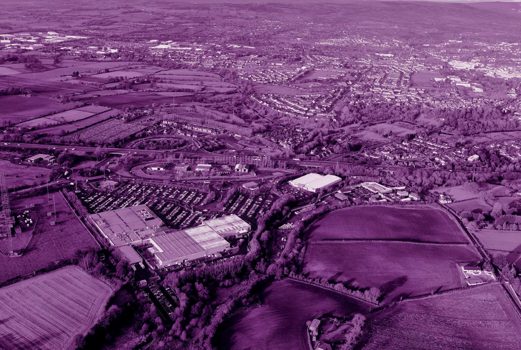
The Lisburn & Castlereagh City Council area stretches from the shores of Lough Neagh in the west to the Castlereagh Hills rising above Dundonald in the east and from the Belfast Hills in the north to the source of the Lagan in the south. The Council covers an area of almost 200 square miles (520 square km).
From a regional perspective (see Map 3 RDS Spatial Framework) the Regional Development Strategy (RDS) recognises that the Council is strategically located at the junction of two key transport corridors running East-West across Northern Ireland and along the major NorthSouth, Belfast to Dublin economic corridor. There are also easily accessible links to the two major airports and ferry ports.
Due to its geographical location Lisburn & Castlereagh City Council is at the centre of five neighbouring council areas (referred to in Chapter 1), consisting of Antrim and Newtownabbey Borough Council; Ards and

North Down Borough Council; Armagh City, Banbridge and Craigavon Borough Council; Belfast City Council; and Newry, Mourne and Down District Council.
The Council area has a diverse mix of both urban and rural areas with the main centre being Lisburn City located at the heart of the Council’s urban area. The landscape is diverse in nature ranging from the lowlands of the Lagan Valley Regional Park to its uplands to the north and south of the district.
CHAPTER 2 POLICY AND SPATIAL CONTEXT Local Development Plan 2032 Part 1: Plan Strategy September 2023 20
Lagan Valley Regional Park
Map 3 RDS Spatial Framework for Northern Ireland


CHAPTER 2 POLICY AND SPATIAL CONTEXT Local Development Plan 2032 Part 1: Plan Strategy September 2023 21
© Crown copyright and database right 2019 CS&LA156 0 5 10 20 Kilometres N
Population
The population within the Council area continues to grow and age, which is a pattern consistent with all Council areas across Northern Ireland. In 2017 the population of Lisburn & Castlereagh City Council was estimated at 142,640.10
The population is divided into the following age ranges:
• 0 – 14 - 26,997 (19%)
• 15 – 29 - 24,807 (17%)
• 30 – 44 - 27,998 (20%)
• 45 – 59 - 30,703 (21%)
• 60 – 74 - 20,790 (15%)
• 75 & over - 11,345 (8%)
In terms of population projections, data from NISRA11 estimate that the population of the Council area is expected to grow to 159,847 by 2032, a projected population increase of 12%. It is also projected that the percentage of the population within the Council area aged 65 and over will increase by 9%. In contrast, children under 16 as a proportion of the overall population will slightly decrease to 18% of the population in 2032.
Approximately 85% of the total population live within existing settlements. This consists of Lisburn City and the Greater Urban Areas of Lisburn and Castlereagh; followed by the towns of Carryduff, Royal Hillsborough12 & Culcavy and Moira; thirteen villages; and thirtythree small settlements.13 The remainder of approximately 15% reside outside settlements14 in the rural area.
Community
The current age profile of the Council area is consistent with the Northern Ireland average of which 20% of the population is aged 0-15 while 63% are aged 16-64. The population aged 65 and over equate to 17% with this figure expected to grow to 53% by 203015, forming over half the total population.
Lisburn & Castlereagh City Council is the least deprived Council area in Northern Ireland (NI). Of the 67 Super Output Areas or SOAs (average population of 2,000) just one, Old Warren, is within the 120 most deprived SOAs. Approximately 14% of the population of Lisburn and Castlereagh is employment deprived compared with an NI average of 20.6%. Statistics at this higher level do not reveal smaller areas of urban deprivation and pockets of rural deprivation.
Housing
Based on the figures from the Department for Infrastructure through the revised Housing Growth Indicators (HGIs, September 2019), an allocation of 10,700 dwelling units was apportioned to the Council area covering the period 2016-2030. This figure was extrapolated to provide a housing requirement figure for the fifteen year Plan period from 2017-2032 equating to 11,250 dwelling units. The Housing Growth Study outlined in Chapter 4A indicates the revised HGI figure of 10,700 plus an allowance of 1,500 dwelling units for strategic housing growth at West Lisburn/Blaris. Further information is detailed in Chapter 4A.
Household size is expected to decrease over the Plan period. However, the total number of households is predicted to increase from 55,786 in 2017 to 64,508 in 2032, as a consequence of continued net in-migration equating to a 16% increase within the Council area.16
In terms of affordable housing need, this is addressed through the Housing Needs Assessment17, supplied by the Northern Ireland Housing Executive as the statutory housing authority. The projected social housing need for the district from 2017-2022 is 800 units. Extrapolating this figure over the Plan period from 2017-2032 equates to an estimated figure of approximately 2,400 social housing units. An additional need is also indicated for
CHAPTER 2 POLICY AND SPATIAL CONTEXT Local Development Plan 2032 Part 1: Plan Strategy September 2023 22
10 NISRA 2017 mid-year population estimates for Northern Ireland published 28 June 2018 11 2016 Based Population Projections for Areas within Northern Ireland published 26 April 2018 12 Please note Hillsborough was awarded Royal status on 20 October 2021 13 See Chapter 4A Settlement Hierarchy 14 NISRA Headcount & Household Estimates for Settlements, published March 2015, based on 2011 Census Figures 15 NISRA Local Government District Summary Infographics 2017/18 16 NISRA 2016 based household projections for Northern Ireland, published in December 2018 17 Updated through the Housing Investment Plan, Annual Update 2018
intermediate housing, which equates to an additional projected need for 1,920 units over the Plan period.
Housing land is distributed within the settlement hierarchy. An element of housing in the countryside is also allowed for, to sustain the rural area in accordance with the SPPS.
Economy
The Council’s sectoral employment structure highlights the reliance on the health, retail and public administration sectors. Historically within Lisburn there has been a strong construction and engineering base and this continues to remain the case today. The draft Socio-Economic Report Profile and Forecast (September 2018) indicates that one in five jobs are in the retail sector.
Figures from the 2011 Census indicates that the Council area has the strongest education and skills profile of any Council area in Northern Ireland. It has the lowest percentage of working age population with no qualifications and also the highest percentage of the working age population with NVQ 4+ qualifications. This provides a positive baseline to encourage and attract inward investment across all sectors of the economy. Additionally, the abundance of a well educated workforce allows for a level of entrepreneurship in the Council area.
Almost half the registered businesses in the Council area are in the agricultural, construction, professional service and retail sectors. Of these almost 99% of PAYE registered companies are SmallMedium Enterprises with the majority in the construction and agricultural sectors.
In terms of employment, economic activity is high (at 70% compared to the NI average of 66%) however it is recognised that there is potential to further grow and expand the employment base with the creation of additional jobs. Economic inactivity is low (21.1%) when compared to the NI average (27.2%).
Given the key strategic location of the Council area regionally, there are significant opportunities to attract inward investment across all sectors of the economy.
In particular, growth is anticipated to occur at the two Strategic Mixed Used sites at West Lisburn/Blaris and Purdysburn/Knockbracken, both of which are located on key transportation corridors. The Maze provides an additional land reserve for regionally significant proposals.
The rural area provides important opportunities for employment through agriculture, forestry, tourism and other rural related enterprises. The relationship between the rural area and the settlements is interdependent on sustaining
rural communities and is an important focus of the LDP. The overall aim is to ensure a balance between protecting the countryside and allowing further opportunities for sustainable economic development.
The Council recognises that to diversify the economic base it must provide a strong office focus, and aim to strengthen both the retail and leisure offer. Modern society desires a ‘destination’ location where work and leisure co-exist. This builds on the Plan’s strategic policies for sustainable development and positive place-making through ensuring that the right development is in the right place and through creating the conditions in which attractive places can grow and prosper.
An Office Study and Employment Land Review were undertaken as part of the evidence base for this Plan Strategy. Further details on the economic growth in the Council area are outlined in Chapters 4B-4C.
Environment
In relation to the historic environment, the Council area has three Conservation Areas (Royal Hillsborough, Moira and Lisburn City), seven Areas of Townscape Character and seven Areas of Village Character. The Council has a rich heritage portfolio including Hillsborough Castle, and six historic parks, gardens and
CHAPTER 2 POLICY AND SPATIAL CONTEXT Local Development Plan 2032 Part 1: Plan Strategy September 2023 23
demesnes including Castle Gardens and Moira Demesne, in addition to a rich industrial heritage and rural assets. These are to be preserved and enhanced for future generations to enjoy.
There are a significant range of environmental designations, including a Ramsar Site located at Lough Neagh/Lough Beg, six Areas of High Scenic Value and nine Areas of Special Scientific Interest. The Lagan Valley Regional Park and Area of Outstanding Natural Beauty are predominantly located within the Council area. This landscape is rich in heritage and biodiversity, being easily accessible to the wider urban population. These areas are to be preserved and enhanced to ensure the scenic beauty and biodiversity of the area is retained and protected. Further detail is provided in Chapter 4E.
Infrastructure
The Council area benefits from its advantageous strategic location at the junction of two key transport corridors, the cross-border Belfast-Dublin transport corridor and the Northern Ireland East-West transport corridor. It occupies a central location in the Belfast Metropolitan Area in close proximity to other key road infrastructure routes and has ease of access to the principal maritime gateways and logistics hubs of Belfast Harbour, the Port of
Larne and Warrenpoint Port which serve both passengers and freight traffic. The two main airports, Belfast International and George Best Belfast City are also easily accessible.
Rail services are provided from the main station in Lisburn which connects with the cross border Belfast-Dublin service. There is also a commuter service connecting Belfast and Portadown with several stations and halts within the Council area. A Park & Ride is proposed in conjunction with a new rail halt at Knockmore, West Lisburn, offering further opportunities for business and economic growth at this key strategic location.
The Council is well served by additional physical and digital infrastructure supporting growth over the Plan period. Further detail is provided in Chapter 4F.
CHAPTER 2 POLICY AND SPATIAL CONTEXT Local Development Plan 2032 Part 1: Plan Strategy September 2023 24
Vision and Plan
Objectives

3.
Vision and Plan Objectives
The Local Development Plan Vision
The vision for Lisburn & Castlereagh City Council’s Local Development Plan derives from a spatial analysis of the Council area supported by clear evidence with the objective of meeting the outcomes of the Community Plan.
The Council’s Community Plan 2017-2032 seeks to improve the social, economic and environmental well-being of the people and the Lisburn and Castlereagh area. It also promotes sustainable development for current and future generations and equality of opportunity through promotion of good relations, the tackling of poverty, social exclusion and patterns of deprivation.
The Community Plan Vision is:
‘An empowered, prosperous, healthy and inclusive community.’
The Community Plan headlines five key themes each with an outcome to be achieved over its lifetime. These outcomes are:
• Theme One –‘Children and Young People’: our children and young people have the best start in life
• Theme Two –‘The Economy’: everyone benefits from a vibrant economy
• Theme Three –‘Health and Well-being’: we live healthy, fulfilling and long lives
• Theme Four –‘Where We Live’: we live and work in attractive, resilient and environmentally friendly places
• Theme Five –‘Our Community’: we live in empowered, harmonious, safe and welcoming communities.
The outcomes will be delivered through the Council’s Strategic Community Planning Partnership detailed Action Plan, details of which are available on the Council’s website at www.lisburncastlereagh.gov.uk.
Aligning the Local Development Plan with the Community Plan provides the opportunity for the Council to move away from a narrow land use planning approach to a place-shaping focus. As such this LDP forms the spatial reflection of the Community Plan and is a unique opportunity to reflect the aspiration of our community and shape the district for current and future generations.
The LDP Vision
The Local Development Plan (LDP) will respond to the needs of the community in providing a sustainable economy, society and environment. It will support a thriving, vibrant and connected place in which people live, work, visit and invest; and an attractive, green and quality place which will enhance the wellbeing and quality of life for all.
CHAPTER 3 VISION AND PLAN OBJECTIVES Local Development Plan 2032 Part 1: Plan Strategy September 2023 26
Plan Objectives
Six Plan Objectives have been developed to deliver the vision for the Local Development Plan.
The Plan Objectives set out the aims of the LDP and what it seeks to achieve over the 15 year period from 2017-2032. These include an appropriate balance between improving quality of life, economic prosperity for all, the protection of the Council’s environmental assets, and to ensure that development is sustainable in the interests of future generations.
Figure 2 identifies how the Plan Objectives relate to and achieve the spatial aspects of the Community Plan.
In addition to delivering the spatial aspects of the Community Plan, the Plan Objectives link directly and are implemented through the strategic policies and spatial strategy detailed in Chapter 4 and operational policies contained in Part 2 of the Plan Strategy.
These Plan Objectives are:
A: A Quality Place
B: A Thriving Place
C: A Vibrant Place
D: An Attractive Place
E: A Green Place
F: A Connected Place Figure
CHAPTER 3 VISION AND PLAN OBJECTIVES Local Development Plan 2032 Part 1: Plan Strategy September 2023 27
2 Community Plan and Plan Objectives THEME 1 Children and Young People PLAN OBJECTIVE A: A Quality Place D: An Attractive Place F: A Connected Place THEME 2 The Economy PLAN OBJECTIVE B: A Thriving Place C: A Vibrant Place D: An Attractive Place F: A Connected Place THEME 3 Health and Well-Being PLAN OBJECTIVE
An Attractive Place F: A Connected Place THEME 4 Where We Live PLAN OBJECTIVE A: A Quality Place B: A Thriving Place C: A Vibrant Place
An Attractive Place
A Green Place
A Connected Place THEME 5 Our Community PLAN OBJECTIVE A: A Quality Place E: A Green Place
D:
D:
E:
F:
A: A Quality Place
Enabling Sustainable Communities and Delivery of New Homes
1. Support the existing settlement hierarchy, recognising Lisburn and Castlereagh as a growth area consistent with the RDS and reflective of its strategic location
2. Encourage the creation of accessible and connected places to sustain communities with good access to jobs, housing, public transport, education, community and recreation facilities
3. Provide for strategic growth at West Lisburn/Blaris including the delivery of new homes
4. Support towns, villages and small settlements in the Council area as vibrant and attractive centres providing homes and services appropriate to their role in the settlement hierarchy whilst protecting their identity from excessive development

5. Provide appropriate opportunities for housing in settlements with a range of types and tenures, including affordable housing
6. Encourage good design and positive place-making in all development appropriate to its locality and context
7. Support the provision of adequate infrastructure (including water, sewage and transport) for sustainable residential development
8. Support vibrant rural communities with appropriate opportunities for dwellings and sustainable development in the countryside.
CHAPTER 3 VISION AND PLAN
B: A Thriving Place
Driving Sustainable Economic Growth

1. Support a thriving and diverse economy with a sufficient supply of land and in locations for a range of employment uses facilitating the creation of new jobs and to encourage existing and new businesses to invest with confidence
2. Accommodate population growth to ensure a continuous supply of labour and allow the resident population the opportunity to avail of high quality employment opportunities in sustainable locations close to where they live
3. Promote Mixed Use development at strategic locations at West Lisburn and Purdysburn with appropriate employment uses to facilitate opportunities for economic growth and inward investment
4. Promote access to higher and further education to meet employment needs
5. Support Lisburn City, greater urban areas, the towns and villages as employment and service centres for their surrounding hinterland
6. Support the provision of infrastructure both physical and digital to facilitate employment growth, economic regeneration, inward investment and physical renewal
7. Manage mineral resources in a sustainable manner, protecting and safeguarding vulnerable landscapes where appropriate.
VISION AND PLAN Local Development Plan 2032 Part 1: Plan Strategy September 2023 29
C: A Vibrant Place
Growing our City, Town Centres, Retailing and Other Uses
1. Promote the regeneration of our city and town centres as quality places to live, work, shop and visit
2. Promote Lisburn City Centre as a vibrant destination offering a mix of residential, shopping, employment, high grade office development, leisure and community uses; and better transportation linking people and places
3. Support our towns and villages, encouraging appropriate retailing, offices, mixed use and housing opportunities
4. Support the role of the District and Local Centres in accordance with the Retail Hierarchy (Figure 5, page 92)
5. Promote regeneration and reuse of existing buildings and previously developed land for mixed use development, whilst maintaining environmental quality and protecting residential amenity
6. Promote a vibrant and thriving night-time economy in our city and town centres to support economic growth, furthering opportunity for enhancing their vitality and viability.

CHAPTER 3 VISION AND PLAN OBJECTIVES Local Development Plan 2032 Part 1: Plan Strategy September 2023 30
D: An Attractive Place

Promoting Sustainable Tourism, Open Space, Sport and Outdoor Recreation
1. Support and develop tourism infrastructure as a key growth area
2. Facilitate tourism development whilst protecting heritage assets, encouraging development in appropriate locations, including a wide range of tourist accommodation
3. Safeguard key tourism/recreation assets from inappropriate development
4. Support the recreation and leisure offer to grow in a sustainable manner
5. Protect and enhance open space recognising its value in promoting health and well-being and resolving flood issues through the introduction of sustainable urban drainage infrastructure
6. Support and encourage accessibility to open space including the Lagan Valley Regional Park and Lagan Navigation as key assets within the Council area.
CHAPTER 3 VISION AND PLAN OBJECTIVES Local Development Plan 2032 Part 1: Plan Strategy September 2023 31
E: A Green Place
Protecting and Enhancing the Historic and Natural Environment

1. Protect our historic and natural environment recognising their contribution to sustainable communities, economic growth, sustainable transport and health and well-being
2. Protect, conserve and enhance our historic environment, optimising the use of brownfield sites and promoting heritage-led regeneration
3. Recognise the value of our Conservation Areas and Areas of Townscape/Village Character as important heritage assets
4. Shape our places, the quality of new buildings and our town and village centres by promoting good design and maximise benefits to communities
5. Protect our natural heritage assets and promote their sensitive reuse to help create a sense of place
6. Ensure new development does not cause harm to biodiversity and other natural resources such as air, water and soil
7. Protect and enhance our designated natural heritage assets including the Lagan Valley Regional Park and Area of Outstanding Natural Beauty (AONB) and other high quality landscapes such as Areas of High Scenic Value (AoHSV) and secure, through appropriate designations, to ensure they remain unspoilt for future generations.
CHAPTER 3 VISION AND PLAN OBJECTIVES Local Development Plan 2032 Part 1: Plan Strategy September 2023 32
F: A Connected Place
Supporting Sustainable Transport and Other Infrastructure
1. Support the growth of the Council area, exploiting its strategic location on Key Transport Corridors and the rail network
2. Designate and protect the location of strategic infrastructure, promote strategic transport schemes and linkages, maximising accessibility by sustainable modes across the Council area, ensuring infrastructure development is flood resilient
3. Promote opportunities for sustainable travel through development of Active Travel Networks to support walking, cycling and public transport, reducing the need to travel by private car
4. Develop and promote strategic greenways to provide opportunities for walking, cycling, biodiversity, health and wellbeing
5. Recognise the contribution green and blue infrastructure offers to human health and sustainable urban drainage
6. Mitigate and adapt to climate change by minimising greenhouse gas emissions
7. Support renewable energy infrastructure whilst affording protection to the environment
8. Facilitate the delivery of telecommunications and utilities infrastructure throughout the Plan period
9. Support effective waste management through reuse, recycling and reduction of waste to landfill, minimising environmental impacts
10. Prevent inappropriate development in areas at risk of flooding or that increase flood risk elsewhere, whilst managing flood risk and providing mitigation where necessary.
VISION AND PLAN
Strategic Policies and Spatial Strategy

4. Strategic Policies and Spatial Strategy
Consistent with our Vision and Plan Objectives, a range of strategic policies have been developed to support the implementation of the operational policies contained in Part 2 of the Plan Strategy and will therefore need to be taken into account in the decision-making process.
These strategic policies underpin the Spatial Strategy of the Plan and must be read together and in conjunction with other planning policy, including the RDS 2035, SPPS, and Operational Policy in Part 2 of this Plan Strategy.
CHAPTER 4 STRATEGIC POLICIES AND SPATIAL STRATEGY Local Development Plan 2032 Part 1: Plan Strategy September 2023 35
Strategic Policy 01 Sustainable Development
The Plan will support development proposals which further sustainable development including facilitating sustainable housing growth; promoting balanced economic growth; protecting and enhancing the historic and natural environment; mitigating and adapting to climate change and supporting sustainable infrastructure.
Justification and Amplification
The Plan Strategy accords with the Regional Development Strategy 2035 (RDS) definition of sustainable development as ‘meeting the needs of the present without compromising the ability of future generations to meet their own needs.’
This is in keeping with the Strategic Planning Policy Statement for Northern Ireland (SPPS) which states that furthering sustainable development requires the integration and balancing of a range of complex social, economic and environmental factors and requires consideration of the inter-relationship between the location of local housing, jobs, facilities and services and infrastructure.
The Plan Strategy seeks to support the provision of jobs, services, and economic
growth; and delivery of homes to meet the full range of housing needs integrated with sustainable infrastructure (physical and digital) whilst recognising the balance to be achieved in protecting environmental assets.
Furthering sustainable development also recognises that there is a need to reduce emissions of greenhouse gases and to respond to the impacts brought about by climate change such as promoting sustainable patterns of development and avoiding development in areas at risk from flooding.
Strategic Policy 02 Improving Health and Well-being
The Plan will support development proposals that contribute positively to the provision of quality open space; age-friendly environments; quality design; enhanced connectivity (physical and digital); integration between land use and transport; and green and blue infrastructure. Noise and air quality should also be taken into account when designing schemes, recognising their impact on health and well-being.
Justification and Amplification
Quality open space within or close to settlements plays a vital role in promoting
healthy living and tackling inequality through facilitating play and sporting activities, leading to healthier more active lifestyles. Welldesigned buildings and better connected places can positively impact peoples’ lives including creating safer more physically accessible environments.
Improved connectivity through enhanced digital infrastructure can help reduce isolation in rural areas and reduce the need to travel. The location of development should integrate with public transport, walking and cycling, providing better linkages and opportunities for sharing greenways and waterways. The Council will expect that all new development in terms of its location, layout and design should take account of noise and air quality, and mitigate for any other negative impacts on health and wellbeing.
Strategic Policy 03 Creating and Enhancing Shared Space and Quality Places
The Plan will support development proposals that contribute to the creation of an environment which is accessible to all and enhances opportunities for shared communities; has a high standard of connectivity and supports shared use of public realm. Good quality housing that supports
CHAPTER 4 STRATEGIC POLICIES AND SPATIAL STRATEGY Local Development Plan 2032 Part 1: Plan Strategy September 2023 36
more balanced communities must offer a variety of house types, sizes and tenures to meet different needs.
Creating shared neighbourhoods should provide opportunities for communities to access local employment, shopping, leisure, education and community facilities.
Justification and Amplification
The Council will encourage the development of shared spaces which promote a sense of belonging for everyone, where relationships between people from different backgrounds are most likely to be positive, and where differences are valued and respected. Balanced communities can contribute positively to the creation and enhancement of shared spaces.
The Council will expect a variety of house types, sizes and tenures to be provided in every new housing development taking account of the specific characteristics of the development, the site and its context.
Providing an integrated comprehensive design approach should encourage appropriate housing density, promoting distinctive well connected neighbourhoods with community facilities and associated infrastructure resulting in high-quality sustainable balanced
communities. Regeneration initiatives should aim to address environmental issues and address the social and economic challenges of multiple deprivation and social exclusion.
Strategic Policy 04 Supporting Sustainable Economic Growth
The Plan will support development proposals that support sustainable economic growth without compromising on environmental standards. Economic growth can contribute to an enhanced society and improve health and well-being through the creation of job opportunities.
Justification and Amplification
The promotion of medium to long-term economic growth is a key aim of government at all levels. Growth-generating activities which contribute to society must ensure appropriate consideration of the general public and wider regional interests.
The Council seeks to promote medium to longterm economic growth across the Council area. Growth-generating activities which contribute to society in this regard must ensure appropriate consideration of the public interest and the wider region.
The Council through the Local Development Plan will seek to minimise the effects of external market influences in terms of impacts on traditional employment markets and encourage initiatives to introduce new employment-generating activities through its related economic Plans and Strategies.18 Strengthening employment activity will be encouraged through the provision of a range of employment sites across the Council area offering flexibility and choice for investors.
Strategic Policy 05 Good Design and Positive PlaceMaking
The Plan will support development proposals that incorporate good design and positive place-making to further sustainable development, encourage healthier living, promote accessibility and inclusivity and contribute to safety. Good design should respect the character of the area, respect environmental and heritage assets and promote local distinctiveness. Positive place-making should acknowledge the need for quality, placespecific contextual design which promotes accessibility and inclusivity, creating safe, vibrant and adaptable places.
CHAPTER 4 STRATEGIC POLICIES AND SPATIAL STRATEGY Local Development Plan 2032 Part 1: Plan Strategy September 2023 37
18 Includes the Council’s Investment Plan Proposition and Belfast Region City Deal
Justification and Amplification
All development must take account of the Department for Infrastructure’s ‘Living Places Urban Stewardship and Design Guide’ and where appropriate ‘Building on Tradition: a Sustainable Design Guide for the Northern Ireland Countryside’.
A Design and Access Statement, in addition to where it is mandatory19, will be encouraged for all new development proposals. The statement should analyse the site and its setting and indicate how design principles have been used to achieve good design.
Strategic Policy 06 Protecting and Enhancing the Environment
The Plan will support development proposals that respect the historic and natural environment and biodiversity. Proposals must aim to conserve, protect and where possible enhance the environment, acknowledging the rich variety of assets and associated historic and natural heritage designations. Proposals should respect the careful management, maintenance and enhancement of ecosystem services which form an integral part of sustainable development.
ecosystems and their components which need to be healthy and resilient to change in order to function effectively.
The Council will expect development in all cases to respect the environment and its ecosystem services recognising how they can provide benefits that enhance economic performance, offer new opportunities for investment and employment, improve living standards, health and well-being, and quality of life.
Accessible and
adaptable
accommodation should be considered in all residential development to ensure that housing maximises the ability of occupants to live independently in their homes for as long as possible.
Successful place-making is a people-centred approach which incorporates quality, placespecific, design. The Council will expect all new development to have considered the compatibility of the development with its immediate and wider context, including the settlement pattern and its positive contribution to place-making including deterring crime and promoting personal safety. The Council will support creating better places, in which to live, work, visit and explore.
Justification and Amplification
The Plan Strategy supports the RDS key aim to ‘Protect and enhance the environment for its own sake.’
The Council area has a great variety of natural and historic heritage assets, which make the Council an attractive place in which to live, work, explore and invest.
Ecosystem services are the processes by which the environment produces resources such as clean air, water, food and materials. Our health and well-being, and economic prosperity depend upon the services provided by
A good quality environment can also improve resilience to climate change through providing ecosystem services which can reduce the effects of climate change, for example, flooding through the use of Sustainable Drainage Systems (SuDS).
Strategic Policy 07 Section 76 Planning Agreements
Development will be required to deliver more sustainable communities by providing, or making contributions to, local and regional infrastructure in proportion to its scale, impact of the development and the sustainability of its location.
A developer will be expected to provide or contribute to the following infrastructure in
CHAPTER 4 STRATEGIC POLICIES AND SPATIAL STRATEGY Local Development Plan 2032 Part 1: Plan Strategy September 2023 38
19 Includes major applications (with exceptions); applications within a ‘designated area’ (subject to criteria) and all Listed Building Consent applications
order to mitigate any negative consequences of development:
a) improvements to the transport network, including walking and cycling routes, public transport or, where necessary appropriate parking provision
b) affordable housing
c) educational facilities and/or their upgrades
d) outdoor recreation
e) protection, enhancement and management of the natural and historic environment
f) community facilities and/or their upgrades
g) improvements to the public realm
h) service and utilities infrastructure
i) recycling and waste facilities.
Justification and Amplification
Planning agreements are provided for under Section 76 of the Planning Act and can be used to address issues to the granting of planning permission where these cannot be addressed through the use of appropriate planning conditions. A planning agreement may facilitate or restrict the development or use of land in any specified way and require certain operations or activities to be carried out. It may also require a sum or sums to be paid to the Council.
In order to mitigate the impact of development, Section 76 Planning Agreements will be sought to provide necessary community facilities/ infrastructure. The Section 76 Planning Agreements Framework will provide the framework and requirements for planning agreements for new developments.
Section 76 Planning agreements will continue to ensure that site specific mitigation is sought to make a development acceptable in planning terms. The Council will negotiate planning agreements on a site-by-site basis where these are necessary to make the development acceptable in planning terms. Planning agreements will be directly related to the development and fairly and reasonably related in scale and kind to the development.
CHAPTER 4 STRATEGIC POLICIES AND SPATIAL STRATEGY Local Development Plan 2032 Part 1: Plan Strategy September 2023 39
Spatial Strategy
A key aim of the LDP is to define a spatial strategy that supports the development and regeneration of the area socially, economically and environmentally.
The Spatial Strategy, having regard to the LDP vision and objectives, gives effect to the purpose and principles of planning as set out in the Regional Development Strategy (RDS) and the Strategic Planning Policy Statement for Northern Ireland (SPPS).
It provides the basis for the LDP strategic policies which address the Council’s priorities for the development and use of land across the Council area, underpinned by furthering the principles of sustainable development and improving well-being.
The spatial strategy comprises the following elements:
• support the growth and regeneration of our city, greater urban areas, towns and villages, sustaining a living and working countryside and protecting environmentally sensitive areas
• provide a settlement hierarchy, defining development limits and allocating land for housing growth in accordance with the sequential approach of the RDS
• encourage good design and positive placemaking creating places in which people want to live, work, visit and explore
• allocate employment land to provide an adequate and continuous supply, taking account of accessibility to major transport routes and proximity to sustainable locations near large centres of population
• identify, define and designate land for retailing, recreation, education or community facilities where appropriate
• identify, protect and enhance our historic and natural heritage environment, promote green and blue infrastructure and ecological networks
• accommodate sustainable development in the countryside in accordance with prevailing regional planning policy
• provide key site requirements where required to achieve good quality development that is reflective of the context within which it is set
• promote, influence and deliver a shift to more sustainable travel modes and integrated land use proposals in accordance with the regional transportation policy, promoting reduced reliance on the private car.
CHAPTER 4 STRATEGIC POLICIES AND SPATIAL STRATEGY Local Development Plan 2032 Part 1: Plan Strategy September 2023 40
Map 4 Spatial Strategy © Crown copyright and database right 2019 CS&LA156


CHAPTER 4 STRATEGIC POLICIES AND SPATIAL STRATEGY Local Development Plan 2032 Part 1: Plan Strategy September 2023 41
Settlement Hierarchy
The designated settlement hierarchy for Lisburn and Castlereagh provides the basis for the framework upon which the Local Development Plan is devised. It is consistent with the RDS Spatial Framework20 recognising the relationship between people and places with an appreciation of where people live, work and access services. It supports regional guidance within the RDS, namely strengthen community cohesion (RG6); support urban and rural renaissance (RG7); and manage housing growth to achieve sustainable patterns of development (RG8).
This settlement hierarchy will ensure that the growth of settlements, the provision of housing, employment land, other key land uses and related infrastructure, are in the right place to benefit the community as a whole.
The composition of places within the settlement hierarchy, in terms of the range of services and functions they provide to citizens, is a defining reason why people choose to live, work or socialise in a particular part of the City Council area.
Figure 3 and Table 1 depict the designated settlement hierarchy for the Council area. This includes the city, greater urban areas, towns, villages and small settlements as hubs for the provision of housing, employment and services to its citizens. It provides the urban component servicing those living in the remainder of the rural area. Further details on the Settlement Characteristics is contained in Appendix D.
GREATER URBAN AREAS
Castlereagh Greater Urban and Lisburn Greater Urban areas
TOWNS
Carryduff, Royal Hillsborough & Culcavy, Moira
VILLAGES
Aghalee, Annahilt, Dromara, Drumbeg, Drumbo, Glenavy, Lower Ballinderry, Maghaberry, Milltown, Moneyreagh, Ravernet, Stoneyford, Upper Ballinderry
SMALL SETTLEMENTS
Ballyaughlis, Ballycarn, Ballyknockan, Ballylesson, Ballynadolly, Ballyskeagh, Boardmills, Carr, Crossnacreevy, Drumlough, Drumlough Road, Dundrod, Duneight, Feumore, Halfpenny Gate, Halftown, Hillhall, Kesh Bridge, Lambeg, Legacurry, Long Kesh, Lower Broomhedge, Lurganure, Lurganville, Lurgill, Magheraconluce, Morningside, Purdysburn, Ryan Park, St James, The Temple, Tullynacross, Upper Broomhedge
CHAPTER 4 STRATEGIC POLICIES AND SPATIAL STRATEGY Local Development Plan 2032 Part 1: Plan Strategy September 2023 42
Figure 3 Settlement Hierarchy
CITY Lisburn
20 Page 22 RDS 2035
Table 1 Settlement Hierarchy and Population Lisburn & Castlereagh City Council
Carryduff (6,947); Royal Hillsborough & Culcavy (3,953); Moira (4,584)
Villages Aghalee (863); Annahilt (1,045); Dromara (1,006); Drumbeg (813); Drumbo (375); Glenavy (1,791); Lower Ballinderry (912); Maghaberry (2,468); Milltown (1,499); Moneyreagh (1,379); Ravernet (564); Stoneyford (605); Upper Ballinderry (226)
Small Settlements Ballyaughlis (99); Ballycarn (105); Ballyknockan; Ballylesson (111); Ballynadolly (79); Ballyskeagh (194); Boardmills; Carr; Crossnacreevy (317); Drumlough (74); Drumlough Road; Dundrod (193); Duneight (88); Feumore; Halfpenny Gate (80); Halftown (197); Hillhall (81); Kesh Bridge (122); Lambeg; Legacurry (82); Long Kesh (358); Lower Broomhedge (239); Lurganure (467); Lurganville (87); Lurgill; Magheraconluce (459); Morningside (55); Purdysburn; Ryan Park (141); St James (115); The Temple; Tullynacross (129); Upper Broomhedge (78)
NISRA Census Office have reported the headcounts and household estimates for Settlements from the 2011 Northern Ireland Census - March 2015. These counts are based on the boundaries defined by the BMAP which does not take account of the new LGD boundaries. However, it has been possible for NISRA to take the SDL boundaries (Metropolitan Lisburn and Metropolitan Castlereagh) and split them to provide 2011 Census headcounts for the constituent parts. These are renamed as Lisburn Greater Urban Area and Castlereagh Greater Urban Area in the Settlement Hierarchy in the Plan Strategy.
The total population for the small settlements does not include any settlement with under 50 resident population. The settlements under 50 resident population are Ballyknockan, Boardmills, Carr, Drumlough Road, Feumore, Lambeg, Lurgill, Purdysburn and The Temple.
Population for the Countryside (outside settlement development limits) based on taking NISRA Mid-Year Population Estimates 2015, published 31st August 2016 for the Local Government District (140,205) and subtracting the total population in settlements (114,055).
CHAPTER 4 STRATEGIC POLICIES AND SPATIAL STRATEGY Local Development Plan 2032 Part 1: Plan Strategy September 2023 43
Settlement Hierarchy Lisburn & Castlereagh City Council Settlements and Countryside (Population in brackets) (%) of District Total City Lisburn (45,410) 32% Lisburn Greater Urban Area Lisburn Greater Urban Area (4,948) 3% Castlereagh Greater Urban Area Castlereagh
22%
11%
10%
Greater Urban Area including Dundonald (30,717)
Towns
3% Countryside All areas outside Settlement Development Limits within Local Government District Boundary (26,150) 19% Total Population 140,205 100%
In determining where each settlement sits in the hierarchy, account has been taken of a wide range of factors, including the population of individual settlements and an assessment of their role or function, employment opportunities, level of community services (educational, recreational) and existing physical infrastructure including spare capacity and public transport provision.
A strategic ‘Settlement Appraisal’ of all settlements in the Council area was carried out using the RDS spatial framework and associated hierarchy of settlements and infrastructure wheel. Each settlement was defined in accordance with this guidance, including its population and the level of services and facilities available and opportunities for accommodating development. This forms part of Technical Supplement 6 Countryside Assessment - Settlement Appraisals.

The settlement appraisal confirmed the settlement hierarchy is defined at the top tier by the main urban area of Lisburn City and the Greater Urban Areas of Lisburn and Castlereagh, which includes Dundonald and Newtownbreda; followed by the three towns of Carryduff, Royal Hillsborough & Culcavy and Moira; thirteen villages and thirty-three small settlements at the lower tier settlements servicing the rural area.
Map 5 indicates the spatial distribution of these settlements in the hierarchy. The transitional arrangements outlined in Chapter 1 will apply to the settlement boundary designations.
CHAPTER 4 STRATEGIC POLICIES AND SPATIAL STRATEGY Local Development Plan 2032 Part 1: Plan Strategy September 2023 44
Dromara Village
Map 5 Settlement Hierarchy


CHAPTER 4 STRATEGIC POLICIES AND SPATIAL STRATEGY Local Development Plan 2032 Part 1: Plan Strategy September 2023 45
©
copyright and database right 2019 CS&LA156
Crown
The urban components of the Council area consist of Lisburn City and the Greater Urban Areas and the three towns of Royal Hillsborough & Culcavy, Carryduff and Moira. Each of these settlements provides an important role within the hierarchy which, in addition to jobs and services, has a strong community focus, including health, education, leisure and recreation. Encouraging consolidation of these urban settlements prevents the need for urban sprawl, and provides opportunity for infrastructure improvements where it is most needed.
Of equal importance is the Council’s rural hinterland in which approximately a third of the population resides. The villages and small settlements each have a unique part to play in sustaining vibrancy, creating a sense of place, and providing education and local services. This myriad of settlements across the hierarchy should respect the character and context of the surrounding area, and build on the opportunities for cohesion and renewal.
Positive place-making is central to supporting a strong settlement hierarchy. This is a people centred approach to planning, design and stewardship of new development proposals and public spaces that seeks to enhance the unique qualities of a place taking account of how they have developed over time and considering what they will look like in the future. In order
to achieve successful places, our settlements should be supported by local distinctiveness and address the connections between people, places and new development.
Identifying the assets of a particular place as well as understanding its future potential and constraints is key to positive place-making. The relationship between urban and rural environments, buildings and streets, recreation, open space and the natural environment, and the pattern of movement and activity, are equally important.
The Plan Objectives detailed in Chapter 3 seek to ensure new development is directed to the appropriate place within the settlement hierarchy and that proposals respect the immediate and wider context and the settlement pattern of a particular area. These objectives will ensure the settlements and rural hinterland, develop to their full potential, balancing the need for sustainable growth with the need to protect the environment into the future.
CHAPTER 4 STRATEGIC POLICIES AND SPATIAL STRATEGY Local Development Plan 2032 Part 1: Plan Strategy September 2023 46
A: A Quality Place
Enabling Sustainable Communities and Delivery of New Homes

A: A Quality Place
Enabling Sustainable Communities and Delivery of New Homes
Plan Objective A details those actions the Council will adopt to deliver new homes to create sustainable communities within the Council area:
1) Support the existing settlement hierarchy, recognising Lisburn and Castlereagh as a growth area consistent with the RDS and reflective of its strategic location
2) Encourage the creation of accessible and connected places to sustain communities with good access to jobs, housing, public transport, education, community and recreation facilities
3) Provide for strategic growth at West Lisburn/Blaris including the delivery of new homes
4) Support towns, villages and small settlements in the council area as vibrant and attractive centres providing homes and services appropriate to their role in the settlement hierarchy whilst protecting their identity from excessive development
5) Provide appropriate opportunities for housing in settlements with a range of types and tenures, including affordable housing
6) Encourage good design and positive place-making in all development appropriate to its locality and context
7) Support the provision of adequate infrastructure (including water, sewage and transport) for sustainable residential development
8) Support vibrant rural communities with appropriate opportunities for dwellings and sustainable development in the countryside.
Lisburn & Castlereagh Community Plan 2017-2032
As the spatial representation of the Community Plan, this Plan Strategy will contribute to outcomes contained within Theme 1 ‘Children and Young People’; Theme 4 ‘Where We Live’ and Theme 5 ‘Our Community’.
Theme 1 focuses on giving everyone the best start in life with the right support for our children and young people to fulfil their potential.
Theme 4 links the social and physical with a focus on neighbourhoods designed and regenerated to promote well-being and ensure everyone lives in an affordable home that meets their needs.
Theme 5 moves from good housing provision to good community infrastructure and the importance of services and approaches that foster a sense of belonging and cohesion in local neighbourhoods.
A: A QUALITY PLACE ENABLING SUSTAINABLE COMMUNITIES AND DELIVERY OF NEW HOMES Local Development Plan 2032 Part 1: Plan Strategy September 2023 48
Within these themes, this Plan Strategy will directly support outcomes:
1A – All children and young people have an equal chance to fulfil their educational potential.
4B – Neighbourhoods are designed and regenerated to promote well-being.
4C – Everyone lives in an affordable home that meets their needs.
5D – We feel a sense of belonging in our local neighbourhoods: urban, suburban and rural.
Plan Objective A will be delivered through the following strategic policies:
• Housing in Settlements
• Housing in the Countryside
• Education, Health, Community and Cultural Facilities.
A: A QUALITY PLACE ENABLING SUSTAINABLE COMMUNITIES AND DELIVERY OF NEW HOMES Local Development Plan 2032 Part 1: Plan Strategy September 2023 49
Housing in Settlements Policy Context
Regional Development Strategy 2035 (RDS)
The RDS recognises that sustainable communities are places where people want to live, work and play, now and in the future. They meet the diverse needs of existing and future residents of the Council area, are sensitive to their environment and contribute to a high quality of life. These communities should be safe and inclusive, well planned, built and run, and offer equality of opportunity and good services for all.
Regional Guidance (RG6) aims to strengthen community cohesion by developing integrated services and facilities; foster a stronger community spirit and sense of place; and encourage mixed housing development.
Supporting urban and rural renaissance is provided under Regional Guidance (RG7) which aims to develop innovative ways to bring forward under-utilised land and buildings particularly for mixed use development; promote regeneration in areas of social need; ensure that environmental quality in urban areas is improved and maintained, particularly with adequate provision of green infrastructure; and reduce noise pollution.
Regional Guidance (RG8) seeks to manage housing growth to achieve sustainable patterns of residential development.
In this guidance it is recognised that in settlements, policy should:
• promote more sustainable housing development within existing urban areas encouraging compact urban forms and promoting more housing within existing urban areas
• ensure an adequate and available supply of quality housing to meet the needs of everyone including affordable housing
• use a broad evaluation framework to assist judgements on the allocation of housing growth.
Strategic Planning Policy Statement for Northern Ireland (SPPS)
The SPPS identifies that good quality housing plays a significant role in shaping our lives and our communities. Emphasis is placed on the relationship between the location of local housing, jobs, facilities, services and infrastructure as a home is a vital part of people’s lives and contributes to creating a safe, healthy and prosperous society.
Its regional strategic objectives in relation to housing in settlements are to:
• manage housing growth to achieve sustainable patterns of residential development
• support urban and rural renaissance
• strengthen community cohesion.
Achieving sustainable residential development in settlements is achieved by assessing the future housing need and the allocation of land to meet this. The SPPS identifies that housing allocations in Local Development Plans should be informed by:
1. RDS Housing Growth Indicators
2. Use of the RDS housing evaluation framework
3. Allowance for existing housing commitments
4. Urban capacity studies
5. Allowance for windfall housing
6. Application of a sequential approach and identification of suitable sites for settlements of over 5,000 population
A: A QUALITY PLACE ENABLING SUSTAINABLE COMMUNITIES AND DELIVERY OF NEW HOMES Local Development Plan 2032 Part 1: Plan Strategy September 2023 50
7. Housing Needs Assessment/Housing Market Analysis (HNA/HMA)
8. Transport Assessments.
This approach was used by the Council in assessing its housing land allocation (see Strategic Housing Allocation, page 53).
West Lisburn Development Framework Review, 2018 (Draft)

The revised draft Framework identifies West Lisburn as an important strategic location for growth. In considering this strategically important location it provides a range of objectives which include prioritising the development of the Knockmore Link Road as the key piece of infrastructure required to unlock the development potential of West Lisburn; improving existing and developing new integrated multi-modal transport infrastructure into and throughout West Lisburn; and encouraging new residential development to support and complement economic growth in the area, whilst respecting existing settlements. It recommends that future development should be in accordance with a comprehensive Masterplan.
Lisburn City Centre Masterplan Review 2019 (Draft)
The revised Lisburn City Centre Masterplan was published in draft form in June 2019.
The Masterplan encourages city centre living, and highlights the opportunity to provide residential accommodation in key locations, namely those with good access to local amenities and connections to other areas, or as part of mixed use development.
It recognises that creating a resident population within the city centre will generate activity outside traditional business hours, to help sustain shops and services and a growing leisure industry. It also provides opportunity for affordable housing located in close proximity to existing services and amenities.
A: A QUALITY PLACE ENABLING SUSTAINABLE COMMUNITIES AND DELIVERY OF NEW HOMES Local Development Plan 2032 Part 1: Plan Strategy September 2023 51
Kilwarlin, Royal Hillsborough
Strategic Policy 08 Housing in Settlements
The Plan will support development proposals that:
a) are in accordance with the Strategic Housing Allocation provided in Table 3
b) facilitate new residential development which respects the surrounding context and promotes high quality design within settlements
c) promote balanced local communities with a mixture of house types of different size and tenure including affordable and specialised housing
d) encourage compact urban forms and appropriate densities while protecting the quality of the urban environment.
Justification and Amplification
The strategic policy for housing in settlements has been informed by regional and local policy which aims to increase housing density without town cramming, encourage sustainable forms of development, promote good design and deliver balanced communities.
In order to enable the needs of the community to be met, the policy encourages mixed tenure housing including affordable housing and specialised housing where a need is identified, for example, residential care homes to help cater for an ageing population. Details are provided in the Operational policies in Part 2 of the Plan Strategy.
It recognises the need to consolidate and encourage higher density development in the city centre, with mixed use schemes on brownfield land to help promote regeneration and dereliction in urban areas.
To ensure that housing in settlements can provide sufficient capacity for accommodating future housing growth, a Housing Growth Study was undertaken to inform the Plan. Further details are provided under the Strategic Housing Allocation.
For the purposes of this Plan Strategy, affordable housing is defined as per the SPPS and is set out in the Glossary of this Plan Strategy.
A: A QUALITY PLACE ENABLING SUSTAINABLE COMMUNITIES AND DELIVERY OF NEW HOMES Local Development Plan 2032 Part 1: Plan Strategy September 2023 52
Strategic Housing Allocation
The allocation of housing growth across the Council area has been informed by the following eight indicators provided in the SPPS.
1. RDS Housing Growth Indicators (HGI):
The HGI provides a guide for the provision of residential accommodation within the Council area in the future. The Council was provided with a 2012 based Housing Growth Indicator (HGI)21 of 9,600 covering the period 2012-2025. Annually this equated to 738 dwellings.
The 2012-based HGI includes provision for both housing in settlements and housing in the countryside. Projecting this figure annually from 2017 to 2032 would provide an allocation of 11,070 dwellings over the lifetime of the Local Development Plan.
Given the importance of the HGI which sets the baseline level of future growth across all eleven council areas, the Council commissioned a Housing Growth Study22 which examined the robustness of the RDS Housing Growth Indicators (HGI). DfI published revised HGI figures in September 2019 covering the period 2016-2030 and identified a total need of 10,700 for LCCC (713 dwellings per annum) for a 15 year time period. The Council commissioned a review of these published figures23. The period
covered by the latest HGIs do not coincide with the period of the emerging LDP (2017-2032).
Taking account of adjustments, the review identified a new baseline future growth of 723 dwellings per annum. An adjustment was made to reflect the mid-point between the two employment-led scenarios that were included in the Housing Growth Study (as updated). This resulted in a dwelling requirement of 746 dwellings per annum. This has been rounded up to 750 dwellings per annum equating to 11,250 dwellings for the plan period. This baseline figure is used in Table 3.
There is a requirement for the Council to ensure that the identified HGI figure can be met. A buffer of 10% over-supply has been applied to the HGI baseline figure which takes into consideration the possibility that an element of the identified potential might not come forward during the plan period. This gives a resultant figure of 12,375 units (825 dwellings per annum) over the Plan period from 2017 to 2032 and provides the overall strategic housing allocation figure (SHA). A total of 1,559 dwellings were completed between April 2017 and March 2019. As such, the remaining housing need that is to be met over the remainder of the Plan period (2019-2032) equates to 10,816 dwellings (832 dwellings per annum).
The council is mindful of its responsibility to ensure housing growth aligns with the requirements for sustainable balanced regional growth identified through the RDS. In order to facilitate the Council’s strategic economic ambition at West Lisburn up to 50 hectares of land is identified for residential use which could accommodate approximately 1,500 units (based on an average density of 30 units per hectare). This strategic location is also considered to be the most sustainable for future residential expansion taking account of environmental, social and economic factors. This level of housing growth in the future would help support the associated economic growth details of which are provided in the Employment Land Review, Technical Supplement 3.
2. Use of the RDS housing evaluation framework: The existing settlements in the Council area have been assessed against the RDS Housing Evaluation Framework using the six tests set out under Table 2.
The existing settlements are considered to provide a strong framework for the urban and rural areas. At the top of the hierarchy, sits Lisburn City; followed by the two Greater Urban Areas of Lisburn and Castlereagh; the three towns of Royal Hillsborough & Culcavy, Moira and Carryduff; thirteen villages; and thirty-three small settlements.
A: A QUALITY PLACE ENABLING SUSTAINABLE COMMUNITIES AND DELIVERY OF NEW HOMES Local Development Plan 2032 Part 1: Plan Strategy September 2023 53
21 HGI provided by the former Department for Regional Development now Department for Infrastructure 22 See Technical Supplement 1 Housing Growth Study 23 See Addendum to Technical Supplement 1 Housing Growth Study, November 2020
Table 2 RDS Housing Evaluation Framework
Resource Test Studies should be carried out to assess and detail the existence of community assets and physical infrastructure such as water, waste and sewage, including spare capacity.
Environmental Capacity Test
An assessment of the environmental assets of the settlement, the potential of flooding from rivers, the sea or surface water run-off and its potential to accommodate future outward growth without significant environmental degradation should be made.
Transport Test Studies should be carried out to assess the potential for integrating land use and public transport and walking and cycling routes to help reduce reliance on the car.
Economic Development Test
The potential to facilitate an appropriate housing and jobs balance and to unlock any major strategic development opportunities should be assessed and detailed.
Urban and Rural Character Test Assessment should be made of the potential to maintain a sense of place, and to integrate new development in a way that does not detract from the character and identity of the settlement.
Community Services Test
The potential to underpin and, where necessary, reinforce the community service role and function of the settlement should be assessed and detailed.
Details of the outcomes of the above settlement assessment are provided in the strategic Settlement Appraisal which forms part of the Countryside Assessment Technical Supplement 6.
3. Allowance for existing housing commitments: The assessment of existing commitments takes account of information provided through the Council’s Housing Monitor.24 Monitored sites consists of existing housing zonings and committed sites (with planning permission). The Housing Monitor also assesses the available potential of land and dwellings that remain undeveloped within settlements in the Council Area.
The Housing Monitor (using the baseline of 31st March 2019) identified that in total 7,311 units are committed (with planning permission) with a further 943 potential units remaining on zoned land not committed within the urban settlement limits. This gives an overall total of 8,254 units25.
When taken together and allowing for the potential in villages, small settlements and the open countryside this figure rises to 10,072 units. These figures have been reduced by 10% due to the possibility of non-deliverability of sites over the Plan period, resulting in an assumed capacity of 9,064 units (See Table 3).
The Housing Growth Study (Technical Supplement 1) provides further detail regarding the proposed housing growth within the Council area. It identifies West Lisburn/Blaris as a key area of future strategic growth which is a priority for the Council over the Plan
A: A QUALITY PLACE ENABLING SUSTAINABLE COMMUNITIES AND DELIVERY OF NEW HOMES Local Development Plan 2032 Part 1: Plan Strategy September 2023 54
24 Published annually on the Council’s website 25 Includes adjustment for lapsed sites
period. The future development of the area is supported by the West Lisburn Development Framework Review 2018, which recognises the need for investment in the transport infrastructure to secure its future potential.
It is recommended that future development is proposed to be a mix of housing and employment use. West Lisburn has the capability of delivering a significant number of new homes which would contribute to ensuring the future economic aspirations are aligned with housing growth. This is important in addressing the wider strategic objectives to address the ageing population and help retain and attract younger people to the area and is in addition to the HGI figure provided above.
Based on an assessment of the developable land available at West Lisburn/Blaris, this could provide for additional growth of up to 1,500 dwellings at this location as part of a Strategic Mixed Use Site. Further details are provided under Chapter 4B – SMU01 West Lisburn/Blaris and associated designation. For the purposes of Table 3, an allowance of 1,350 units has been made for this site.
4. Urban capacity studies: It is a requirement of the SPPS that an Urban Capacity Study (UCS)26 informs the LDP. To assist with the identification of land required for new housing over the plan period, an UCS was carried
out for the settlements in excess of 5,000 population and identified land that would be suitable for housing and employment within the Urban Footprint.27 The study included the urban footprint of Lisburn City, the Castlereagh Greater Urban Area and for completeness the three towns of Carryduff, Moira and Royal Hillsborough & Culcavy.
The UCS identifies that within the Council area approximately 68% of the population reside in the urban areas.
It identifies that approximately 40% of the growth requirement can be accommodated within the urban footprint of settlements. This is less than the RDS requirement to locate 60% of future housing growth within the urban footprints of settlements in excess of 5,000 population. The reason for this not being met is that the previous Development Plan (BMAP) already zoned a significant number of urban capacity sites for housing. The current definition of the urban footprint does not include committed units on zonings inside the settlement development limits. It should be noted when these are taken into account that over 80% of housing growth can be accommodated within the existing settlements.
The UCS identifies an additional 35 sites (after applying absolute constraints) equating to a further 901 units over the Plan period from
2019. This figure has been reduced by 10% due to the possibility of non-deliverability of sites over the Plan period, resulting in an assumed capacity of 813 units (See Table 3).
It was indicated that higher density development would be appropriate within Lisburn City Centre in the range of 120-160 dwellings per hectare. Beyond the city centre within the existing urban footprint (including the Greater Urban areas and towns) a range of 25-35 dwellings per hectare is considered appropriate, having regard to the existing densities and local character.
It concluded that for the Plan period there was sufficient supply of housing land to accommodate the growth ambitions of the Council.
5. Allowance for windfall housing: Windfall potential is a key element of the UCS. It consists of housing sites that were neither zoned nor anticipated but which could become available over the lifetime of the Plan. An analysis of projected windfall based on historical trends (over a five year period from 2012-2017) identified on average a potential of between 243 units (sites under 5 units) and 1,605 units (sites of more than 5 units) depending on the type, size and density of units proposed. In order to avoid potential double counting with sites that already benefit from planning
A: A QUALITY PLACE ENABLING SUSTAINABLE COMMUNITIES AND DELIVERY OF NEW HOMES Local Development Plan 2032 Part 1: Plan Strategy September 2023 55
27 The continuous built-up area of the settlement (2012 urban footprint used to align with the RDS HGI figure) 26 See Technical Supplement 2 Urban Capacity Study
permission or urban capacity sites, a windfall allowance is only applied for a ten-year period between 2022 and 2032.
The UCS recommended that a discount rate be applied to both the delivery of identified sites and housing allocations to allow for uncertainty within the market. Based on best practice within other parts of the United Kingdom, this is usually around 10%. Applying this rate suggests that a total of 1,108 dwellings would be expected to come forward on windfall sites over the remaining Plan period. This figure would comprise 145 dwellings on small windfall sites and 963 units on large windfall sites.
6. Housing Needs Assessment/Housing
Market Analysis: The Northern Ireland Housing Executive (NIHE) are responsible for carrying out a Housing Needs Assessment (HNA) to assist the Council in the preparation of the Local Development Plan. The HNA seeks to provide a reasonable mix and balance of housing types to cater for a range of housing needs. The total affordable housing requirement for the plan period is 4,320 units of which 2,400 are social housing units. The deliverability of affordable housing and in particular the social housing element will largely depend on the zoned sites remaining to be developed and other sites lying outside these zonings (urban capacity and windfall). The projected units on these sites over the plan period will
facilitate the deliverability of more affordable housing beyond the Council’s current housing commitments. Any future identified shortfall may be addressed at LPP Stage through the zoning of land for affordable housing. This will be done in consultation with the NIHE as the statutory housing authority.
The purpose of a Housing Market Analysis (HMA) is to provide evidence in order to develop integrated housing policies and approaches. The HMA identifies Housing Market Areas, defined as a geographical area, where most people live and work. The Housing Growth Study provides a review of the existing housing market for the Lisburn and Castlereagh area. It acknowledges that the Council forms part of the wider Belfast Metropolitan Housing Market Area, and therefore cognisance must be given to housing growth in this market area, and how it could impact on the Council area. In terms of the Housing Market Area, the Council area has a strong housing market with high house prices compared to other local government districts in Northern Ireland. There is also evidence of affordability concerns.
Providing jobs aligned with future housing is an important consideration for the Council area, to enable future residents to live and work in Lisburn and Castlereagh.
7. Application of a sequential approach and identification of suitable sites for settlements of over 5,000 population: The SPPS identifies a sequential approach for site selection. The first step of the process focuses on land within the existing urban footprint (as informed by the urban capacity study). This includes those sites that are committed within the settlement limits and opportunity for windfall. If housing cannot be accommodated within settlement limits, only then would an extension to a city or town be considered.
The settlement hierarchy has been identified and as such residential development is mainly directed to those settlements. The findings of both the Housing Growth Study and Urban Capacity Study indicate that given the extent of the existing settlement limits (which were zoned through the previous Development Plan) sufficient land remains for housing to be delivered across the Council area within settlements whilst allowing for additional strategic housing growth at West Lisburn/ Blaris to support the projected economic growth (see SMU01 West Lisburn/Blaris). The Strategic Housing Allocation presented in Table 3 negates the need to provide any greenfield extension to allow for future housing growth.
8. Transport Assessments: The successful integration of transport and land use is essential to the objective of furthering
A: A QUALITY PLACE ENABLING SUSTAINABLE COMMUNITIES AND DELIVERY OF NEW HOMES Local Development Plan 2032 Part 1: Plan Strategy September 2023 56
sustainable development. In determining a development proposal likely to generate traffic, the Council may require the developer to submit a Transport Assessment to facilitate the assessment of transport impacts. This may include a Travel Plan that sets out a package of complementary measures to secure the overall delivery of more sustainable travel.28
The allocations provided in the Plan Strategy and subsequent Local Policies Plan will take full account of the integration of land use and transportation. Further detail on the transport measures to be considered in the LDP are set out in Chapter 4F Infrastructure and the accompanying Local Transport Study (DfI) provided in Technical Supplement 8.
Meeting Future Housing Need
The Housing Growth Study states that in order to identify the appropriate level of housing growth in the emerging LDP, the Council should consider whether an adjustment is required to:
• address the housing market conditions in the Council area
• meet a particular identified strategic economic ambition, such as supporting the strategic proposals at West Lisburn/Blaris, particularly given the need to ensure there is alignment between future economic and housing needs
• help address the impact of an ageing population through the provision of a diverse choice of homes in the right location which will attract and retain younger households
• support net in-migration, particularly of a younger economically-active population.
The evidence base concludes that future housing growth for the Plan period identifies affordability as a particular issue, and supporting the need for a percentage-based mixed tenure policy approach will be important for the wider Belfast Housing Market Area.
Jobs-led scenarios tested within the Study, indicate that the HGI is largely aligned with long term past jobs growth.
In terms of housing delivery completions between 2004/5 and 2018/19 have averaged at 705 dwellings per annum. The level of housing growth aligned with the updated HGI would be broadly aligned with the level of past housing delivery and would also support a level of future jobs growth aligned with past trends. Analysis of the demographic characteristics highlight that the area is projected to experience strong population growth going forward over the Plan period. It is important that the future housing supply meets the needs of the younger working age population to ensure there is a sufficient labour force to support future jobs growth and
rebalance the impact of an ageing population, resulting in the need to uplift beyond the demographic baseline.
In terms of housing land supply, when measured against the updated residual requirement figure of 10,816 dwellings between 2019 and 2032 and set against the latest available evidence (as of 31 March 2019) there appears to be a healthy supply of housing across the Council area.
West Lisburn is a key area of future growth and remains a significant priority for the Council area. Future development of this area is proposed to be a mix of housing and employment uses, which would contribute to ensuring future needs can be met within the Council area and support job growth. The provision for housing at West Lisburn forms part of the supply to meet the identified need over the Plan period. This will be important in addressing the wider strategic objectives to address the aging population and help and retain younger people to the area.
In conclusion, after review, there is an identified future need for 12,375 dwelling units across the Council area over the LDP period from 2017 to 2032. Taking account of completions between April 2017 and March 2019, the residual requirement is 10,816 dwellings between 2019 and 2032. Currently, when taking
A: A QUALITY PLACE ENABLING SUSTAINABLE COMMUNITIES AND DELIVERY OF NEW HOMES Local Development Plan 2032 Part 1: Plan Strategy September 2023 57
28 See Operational Policies Part 2 for details
account of existing commitments and allowing for strategic housing growth to support the economic proposals at West Lisburn, there is a future potential of 10,414 dwelling units which falls just under the residual housing requirement of 10,816 dwelling units. This level of supply is dependent on the West Lisburn/Blaris strategic site coming forward to ensure deliverability in the longer term.
Given the direction of regional policy and guidance to focus housing within existing urban areas, it is acknowledged that it will be important as the LDP moves forward to Local Policies Plan, to consider the future deliverability on all housing sites across the Plan period. Taking account of urban capacity sites and windfall releases, the expected supply over the remainder of the Plan period is 12,335 dwellings29
Table 3 Strategic Housing Allocation over remainder of Plan Period (2019-2032)
Figures in brackets taken as percentage of residual housing requirement (10,816). Note that some percentages may not sum due to rounding.
Villages and small settlements based on Housing Policy Areas and committed sites with planning permission
Countryside based on building control completion notices between 2012/13 and 2016/17 at an average of 54 dwellings per year projected (excludes replacement dwellings) All figures have been reduced by 10% to take account of the potential non deliverability during the plan period.
A: A QUALITY PLACE ENABLING SUSTAINABLE COMMUNITIES AND DELIVERY OF NEW HOMES Local Development Plan 2032 Part 1: Plan Strategy September 2023 58
Settlement Potential Units Remaining Potential Units on Urban Capacity Sites Windfall Potential 1-4 Units Projected over 12 year period Windfall Potential 5+ Units Projected over 12 year period Total Potential Lisburn City 3,757 (34.7%) 553 (5.1%) 81 (0.7%) 350 (3.2%) 4,741 (43.8%) Lisburn Greater Urban Area 60 (0.6%) 0 2 (0.01%) 180 (1.7%) 242 (2.2%) Castlereagh Greater Urban Area 1,359 (12.6%) 104 (1%) 36 (0.3%) 207 (1.9%) 1,706 (15.8%) Carryduff 1,356 (12.5%) 120 (1.1%) 8 (0.1%) 63 (0.6%) 1,547 (14.3%) Royal Hillsborough & Culcavy 432 (4.0%) 14 (0.1%) 18 (0.2%) 37 (0.3%) 501 (4.6%) Moira 464 (4.3%) 22 (0.2%) 0 126 (1.2%) 612 (5.7%) Urban Settlement Total 7,428 (68.7%) 813 (7.5%) 145 (1.3%) 963 (8.9%) 9,349 (86.4%) Villages & Small Settlements 1,004 (9.3%) 1,004 (9.3%) Countryside 632 (5.8%) 632 (5.8%) Total Units 9,064 (83.8%) 813 (7.5%) 145 (1.3%) 963 (8.9%) 10,985 (101.6%) Strategic Mixed Use site West Lisburn/Blaris 1,350 (12.5%) 1,350 (12.5%) Total no of units 10,414 11,227 11,372 12,335 12,335 Total % of residual housing requirement (10, 816) 96.3% 103.8% 105.1% 114% 114%
29 This figure is net of the 10% non-implementation discount
Housing in the Countryside Policy Context
Regional Development Strategy 2035 (RDS)
The RDS recognises the importance of keeping our rural areas sustainable to ensure that the people who live there have access to services and are offered opportunities in terms of accessing education, jobs, healthcare and leisure. To sustain rural communities, new development and employment opportunities which respect local, social and environmental circumstances are required.
Spatial Framework Guidance (SFG 13) seeks to sustain rural communities living in smaller settlements and the open countryside. The distinctive settlement pattern of towns, villages and dwellings in the open countryside is unique. The aim is to sustain the overall strength of the rural community living in towns, villages, small rural settlements and the open countryside. A sustainable approach to furthering development includes:
• establish the role of multi-functional town centres
• connect rural and urban areas
• revitalise small towns and villages
• facilitate the development of rural industries, businesses and enterprises in appropriate locations
• encourage sustainable and sensitive development.
Additionally, Spatial Framework Guidance (SFG 14) aims to improve accessibility for rural communities through improving the overall connectivity to services and other parts of the Region, and integrating local transport.
Strategic Planning Policy Statement for Northern Ireland (SPPS)
The aim of the SPPS with regard to the countryside is to manage development in a way which strikes a balance between the protection of the environment from inappropriate development while supporting and sustaining rural communities consistent with the RDS.
Its regional strategic objectives for housing in the countryside are to:
• manage growth to achieve appropriate and sustainable patterns of development which supports a vibrant rural community
• conserve the landscape and natural resources of the rural area, to protect it from excessive, inappropriate or obtrusive development and from the actual or potential effects of pollution
• facilitate development which contributes to a sustainable rural economy
• promote high standards in the design, siting and landscaping of development.
A: A QUALITY PLACE ENABLING SUSTAINABLE COMMUNITIES AND DELIVERY OF NEW HOMES Local Development Plan 2032 Part 1: Plan Strategy September 2023 59
Strategic Policy 09 Housing in the Countryside
The Plan will support development proposals that:
a) provide appropriate, sustainable, high quality rural dwellings, whilst protecting rural character and the environment
b) resist urban sprawl in the open countryside which mars the distinction between the rural area and urban settlements
c) protect the established rural settlement pattern and allow for vibrant sustainable communities.
Justification and Amplification
The strategic policy for housing in the countryside has been informed by regional and local policy which aims to support sustainable housing development in the countryside.
The countryside is defined for the purposes of this policy as land lying outside a defined settlement limit. The strategic policy recognises the importance of good quality design, appropriate siting and integration in order to minimise the impact on the character of the rural area in accordance with operational policy contained in Part 2 of the Plan Strategy.
The needs of people who live in the countryside is recognised. The policy encourages a strong network of settlements to meet local need and foster a sense of community. It therefore aligns with the strategic policy for housing in settlements which encourages vibrant rural communities in the towns, villages and small settlements, and aims to protect the countryside through supporting the existing settlement pattern.
A: A QUALITY PLACE ENABLING SUSTAINABLE COMMUNITIES AND DELIVERY OF NEW HOMES Local Development Plan 2032 Part 1: Plan Strategy September 2023 60
Education, Health, Community and Culture
Policy Context
Regional Development Strategy 2035 (RDS)
The RDS aims to promote development which improves the health and well-being of communities. The health of our society enables opportunities to be more readily taken advantage of in both economic and social terms. This is derived from easy access to services and facilities, allied to a strong economy and an attractive environment.
The ‘Hierarchy of Settlements and Related Infrastructure Wheel’ (Figure 4) illustrates the range of public and private services needed to ensure the community has access to the necessary economic, social and cultural opportunities. The Wheel outlines patterns of service provision that are likely to be appropriate at different spatial levels including neighbourhoods, smaller towns, regional towns and cities, recognising the strong relationship between settlement size and the levels of service that can be supported.

Strategic Planning Policy Statement for Northern Ireland (SPPS)
One of the core planning principles of the SPPS is to improve health and well-being. The planning system has an active role to play in helping to better the lives of people and
communities and in supporting the priority of improving health and well-being. The SPPS states that Local Development Plans should allocate sufficient land to meet the anticipated needs of the community, in terms of health, education and other public services.
Level 1
Villages
Level 2
Urban Centres/ Smaller Towns
Level 3
Regional Towns/ Clusters
Level 4
Principal Cities
A: A QUALITY PLACE ENABLING SUSTAINABLE COMMUNITIES AND DELIVERY OF NEW HOMES Local Development Plan 2032 Part 1: Plan Strategy September 2023 61
Figure 4 The Hierarchy of Settlements and Related Infrastructure Wheel RDS 2035
Strategic Policy 10 Education, Health, Community and Culture
The Plan will support development proposals that:
a) meet an identified need for services and facilities across the Council area
b) cater for expansion of existing facilities to meet the anticipated needs of the community in terms of health, education, community and cultural services.
Justification and Amplification
The strategic policy for education, health, community and culture takes account of regional and local policy which aims to support balanced communities and opportunities for the community to access essential services and facilities over the Plan period.
Operational policy will support the strategic policy by allowing for education, health, community and cultural uses in appropriate locations.
Land identified for such purposes by the relevant providers will be identified for
protection from development for alternative uses through the Local Policies Plan. If land is identified as surplus by a service provider alternative uses will be considered at the Local Policies Plan stage.
A: A QUALITY PLACE ENABLING SUSTAINABLE COMMUNITIES AND DELIVERY OF NEW HOMES Local Development Plan 2032 Part 1: Plan Strategy September 2023 62
B: A Thriving Place
Driving Sustainable Economic Growth

B: A Thriving Place
Driving Sustainable Economic Growth
Plan Objective B outlines those actions the Council will adopt to drive sustainable economic growth to appropriate locations within the Council area:
1) Support a thriving and diverse economy with a sufficient supply of land and in locations for a range of employment uses facilitating the creation of new jobs and to encourage existing and new businesses to invest with confidence
2) Accommodate population growth to ensure a continuous supply of labour and allow the resident population the opportunity to avail of high-quality employment opportunities in sustainable locations close to where they live
3) Promote Mixed Use development at strategic locations at West Lisburn and Purdysburn with appropriate employment uses to facilitate opportunities for economic growth and inward investment
4) Promote access to higher and further education to meet employment needs
5) Support Lisburn City, greater urban areas, the towns and villages as employment and service centres for their surrounding hinterland
6) Support the provision of infrastructure both physical and digital to facilitate employment growth, economic regeneration, inward investment and physical renewal
7) Manage mineral resources in a sustainable manner, protecting and safeguarding vulnerable landscapes where appropriate.
Lisburn & Castlereagh Community Plan 2017-2032
As the spatial representation of the Community Plan, this Plan Strategy will contribute to outcomes contained within Theme 2 ‘The Economy’ and Theme 4 ‘Where We Live’.30
Theme 2 focuses on creating a vibrant economy that works for everyone, reducing inequality and encouraging entrepreneurship and growth in local business. We also want to match employment needs with skills and provide the right infrastructure to support growth.
Economic growth must however be balanced with environmental protection and enhancement. Theme 2 recognises the need to promote sustainability, particularly the circular economy, while in Theme 4 there is a focus on tackling climate change and protecting our natural and built heritage.
Within these themes, this Plan Strategy will directly support outcomes:
2B – Our local workforce is equipped with the right skills to secure employment and/or start a business.
B: A THRIVING PLACE DRIVING SUSTAINABLE ECONOMIC GROWTH Local Development Plan 2032 Part 1: Plan Strategy September 2023 64
30 See Community Plan, pages 26-27 and 30-31
2C – New businesses and social enterprises are created and existing ones grow, employing more people.
2D – There is growth in tourism based on our natural and historic assets with a focus on international visitors.
2E – Our transport and digital infrastructure supports our economy and our people.
4A – The built and natural environment is protected and enhanced.
4G – Greenhouse gas emissions are reduced.
Plan Objective B will be delivered through the following strategic policies:
• Economic Development
• Economic Development in the Countryside
• Mineral Development.
Economic Development Policy Context
Regional Development Strategy 2035 (RDS)
The RDS provides a framework for strong sustainable economic growth across the region, recognising that a growing regional economy needs a co-ordinated approach to the provision of services, jobs and infrastructure.
The RDS Spatial Framework recognises the role of the Belfast Metropolitan Urban Area (BMUA), of which a substantial part of Lisburn & Castlereagh City Council is contained, as the major driver for regional growth.
As such, regional guidance (RG1) of the RDS protects zoned land31, promotes economic development opportunities focused on the BMUA, as well as Derry-Londonderry and hubs. It provides a network of economic development opportunities with provision to be made in the Local Development Plan for an adequate and continuous supply of land for employment purposes.
The framework provided in the following Table 4 provides the basis on which the Council can identify a robust and defensible portfolio of both strategic and locally important employment sites.
B: A THRIVING PLACE DRIVING SUSTAINABLE ECONOMIC GROWTH Local Development Plan 2032 Part 1: Plan Strategy September 2023 65
31 Land zoned for economic use in development plans
Table 4 RDS Employment Land Evaluation Framework
Stage 1
Taking Stock of the Existing Situation
Stage 2
Understanding Future Requirements
An initial assessment of the ‘fitness for purpose’ including the environmental implications of the existing employment land portfolio. This is principally in order to identify the ‘best’ employment sites to be retained and protected and identifying sites that should clearly be released for other uses.
Quantify the amount of employment land required across the main business sectors during the development plan period. This is achieved by assessing both demand and supply elements and assessing how they can be met in aggregate by the existing stock of business premises and by allocated sites. Account should also be taken of turnover of existing sites due to relocation or closures.
Both short/medium term and strategic provision need to be considered in this process.
Stage 3
Identifying a ‘New’ portfolio of sites
Devise qualitative site appraisal criteria to determine which sites meet the occupier or developer needs. Confirm the existing sites to be retained, replaced or released, and any gaps in the portfolio. In this allocation, consideration should be given to previously used sites, and in the reallocation, the environmental impact of one site relative to others should be included. The results of Stage 2, together with this site appraisal should provide a robust justification for altering allocations for employment land.
Spatial Framework Guidance (SFG1) of the RDS acknowledges the important role Lisburn City plays in the BMUA, being located at the meeting point of the Belfast/Dublin economic corridor and the East/West Key Transport Corridor. The Maze Lands are recognised as a site of regional significance and the
two ‘Major Employment Locations’, West Lisburn/Blaris and Purdysburn as driving a range of opportunities for job creation. There is potential to provide a range of flexible commercial accommodation and business parks at West Lisburn/Blaris and the Maze Lands.
The policy also acknowledges there is potential to create a high-quality office offer in Lisburn City, through the creation of employment in business services.
Strategic Planning Policy Statement for Northern Ireland (SPPS)
The SPPS recognises that support for sustainable economic growth is a core planning principle. Its regional strategic objectives in relation to facilitating economic development are to:
• promote sustainable economic development in an environmentally sensitive manner
• tackle disadvantage and facilitate job creation by ensuring the provision of a generous supply of land suitable for economic development and a choice and range in terms of quality
• sustain a vibrant rural community by supporting rural economic development of an appropriate nature and scale
• support the re-use of previously developed economic development sites and buildings where they meet the needs of particular economic sectors
B: A THRIVING PLACE DRIVING SUSTAINABLE ECONOMIC GROWTH Local Development Plan 2032 Part 1: Plan Strategy September 2023 66
• promote mixed use development and improve integration between transport, economic development and other land uses, including housing
• ensure a high standard of quality and design for new economic development.
Enabling Success: A Strategy to Tackle Economic Inactivity in Northern Ireland (published 2015)
‘Enabling Success’ sets out the Northern Ireland Executive’s long-term approach to tackling economic inactivity in a progressive and sustainable way. The strategy outlines a range of measures, based on voluntary participation, which are designed to help individuals in economically inactive groups to make the transition towards, and into work.
The labour market barriers faced by these groups are varied and complex, ranging from a lack of skills and qualifications to low levels of self-confidence and motivation and negative perceptions of, and attitudes towards work.
This strategy seeks to address these issues by recognising the diverse nature of these groups and ensuring that interventions designed to help them towards the labour market will be person-focused and based upon voluntary participation. The strategy also seeks to ensure
that wider issues, such as societal attitudes towards older workers or individuals with mental health conditions, do not impede their progress towards work.
Northern Ireland Multiple Deprivation Measure (NIMDM 2017)
The Northern Ireland Multiple Deprivation Measure (NIMDM 2017) identifies small area concentrations of multiple deprivation across Northern Ireland.
Of the 67 Super Output Areas (SOAs)32 in Lisburn & Castlereagh City Council (LCCC), only two (Hilden 1 and Old Warren) lie within the top 21% most deprived SOAs in Northern Ireland.
The Old Warren is the most deprived SOA within LCCC ranked 118, while LCCC has one of the least deprived SOAs in Northern Ireland, Galwally (ranked 883). Just under one fifth (19.11%) of SOAs in this Council area were in the most deprived half of SOAs in Northern Ireland. Map 6 shows the extent of deprivation across the Council area, which can be categorised as follows:
• approximately 9.8% of the population in the Council area are income deprived, compared with an NI value of 25%
• approximately 14% of the working age population is employment deprived in the Council area, while 25% across Northern Ireland are considered employment deprived
• the proportions of working age adults (25-64) with no or low levels of qualification is 27.8%, some way below the NI average of 35.6%
• the Council area was ranked 11th of all the council areas on these 3 measures.
B: A THRIVING PLACE DRIVING SUSTAINABLE ECONOMIC GROWTH Local Development Plan 2032 Part 1: Plan Strategy September 2023 67
32 A new geography developed by NISRA to improve the reporting of small area statistics. A set of slightly revised Super Output Areas were created for the 2011 census outputs (but the NIMDM is not updated to reflect this)
Map 6 LCCC 2017 Multiple Deprivation Order


B: A THRIVING PLACE DRIVING SUSTAINABLE ECONOMIC GROWTH Local Development Plan 2032 Part 1: Plan Strategy September 2023 68
Key
Multiple Deprivation Measure Rank (where 1 is the most deprived)
1 - 98 99 - 197 198 - 296 297 - 395 396 - 494 495 - 593 594 - 692 693 - 791 792 - 890
Lisburn & Castlereagh City Council Connect, Invest, Transform - 10 Year Investment Plan Proposition (2019)
The Council aims to connect the objectives of its Corporate Plan, Community Plan and the Local Development Plan through a comprehensive Investment Plan. This £250 million Investment Plan Proposition includes the Council’s Capital Investment Programme and will be supplemented through existing funding streams such as Belfast Region City Deal. This is consistent with the place shaping agenda, the ambition of which is to create a new era for Lisburn & Castlereagh City Council.
To do this the Council will:
• develop and implement long-term investment that is sustainable
• focus on improved outcomes for residents and our communities
• make better use of the Community Planning process to engage citizens and our stakeholders to find solutions
• transform service delivery to ensure it is fit for the future needs of our area and residents
• embrace an innovative, digital-first approach to how we deliver value-for-money services.
Lisburn & Castlereagh City Council Corporate Plan - 2018/2022 and Beyond
The Corporate Plan aims to support a growing and vibrant economy, promoting the Council area as the preferred place to do business and the number one choice for investment in Northern Ireland. The Council will promote its ambition to grow the economy by its unique location on the North-South economic corridor, access to a talented and skilled workforce, competitive costs and supporting infrastructure.
To do this the Council will promote an ambitious investment programme prioritising key infrastructure projects to attract new employers and grow the prosperity of the Council area; engage with local, regional, national and international organisations, businesses, social enterprises and partners to access funding opportunities, increase employment and drive sustainable economic growth in our urban and rural areas; help education and training providers to equip our local workforce with the right skills to secure employment or start a business; and build on our reputation as a place to visit, promoting the natural and historic assets of our city, towns, villages and countryside to attract greater numbers of international and national tourists thereby building our economy.
West Lisburn Development Framework Review 2018 (Draft)
This Framework identifies West Lisburn as a potential location for wider regeneration and growth. The vision will require major investment in infrastructure to, from and within the Framework area to unlock its potential and act as a catalyst for sustainable economic growth.
This vision will be achieved through the implementation of the following objectives in relation to employment:
• prioritise the development of the Knockmore Link Road as a key piece of infrastructure required to unlock the development potential of West Lisburn
• improve existing and develop new integrated multi-modal transport infrastructure into and through West Lisburn
• promote new and expand existing employment in the West Lisburn area
• promote and encourage appropriate development at the Maze to reflect its status as a ‘Strategic Land Reserve of Regional Importance’.
B: A THRIVING PLACE DRIVING SUSTAINABLE ECONOMIC GROWTH Local Development Plan 2032 Part 1: Plan Strategy September 2023 69
Strategic Policy 11 Economic Development
The Plan will support development proposals that:
a) support and promote the Strategic Mixed Use Sites at West Lisburn/Blaris and Purdysburn/Knockbracken in accordance with key site requirements
b) support and promote the local employment sites throughout the Council area, to help provide opportunities for a range of economic needs and businesses
c) encourage mixed use schemes supporting regeneration on sites previously used for economic purposes to help tackle inequality and deprivation
d) provide Class B1 Business within the strategic mixed use sites at West Lisburn/ Blaris and Purdysburn/Knockbracken in accordance with key site requirements.
Justification and Amplification
The strategic policy for economic development has been informed by regional and local policy which aims to promote employment, encourage job creation, facilitate
growth of existing businesses, attract inward investment and address deprivation.
Employment land should offer a variety of sizes, in a range of locations and in close proximity to major roads, rail network or bus routes in the Council area in order to promote accessibility to employment opportunities for all.
To ensure an adequate supply of land, in accordance with the strategy, an Employment Land Review33 was undertaken to inform the Plan Strategy. Further detail is provided in the Strategic Employment Allocation.
The Plan retains a continuous supply of employment land, both developed/ undeveloped, which will continue to meet the district’s economic needs throughout the period of the plan and beyond.
Strategic Mixed Use Sites will serve to attract inward investment whilst Local Employment sites will help support local employment needs through providing a range of sites suitable for all economic sectors. All sites will be subject to review at the Local Policies Plan stage.
The Council commissioned an Office Study34 to assess existing Class B1 Business uses35 and future need across the council area. Its recommendations in relation to future office supply identified:
• The opportunity for office growth at West Lisburn/Blaris is specifically promoted to allow for the creation of a high-tech business park in line with the ambitions of the Council to provide economic growth in this key location
• Office development on employment zonings is presently limited. Allowing greater flexibility on employment zonings for office development (B1) is considered a more flexible and prudent option that would not detract from city/town centres. This is reflective of the emerging requirements of the office sector.
The rationale for retaining these zoned lands reinforces the Council’s commitment to support investment, provides certainty to investors on the type of developments that will or will not be permitted; and, for the community a clear understanding that this is a place they will want to live and work in.
B: A THRIVING PLACE DRIVING SUSTAINABLE ECONOMIC GROWTH Local Development Plan 2032 Part 1: Plan Strategy September 2023 70
33 Technical Supplement 3 Employment Land Review 34 Technical Supplement 4 Office Capacity Study 35 In accordance with the Planning (Use Classes) Order (Northern Ireland) 2015
Strategic Employment Allocation
The supply of employment land is identified through a hierarchy of sites which consist of:
• Strategic Mixed Use sites (SMU) - Land designated at:
1. West Lisburn/Blaris
2. Purdysburn/Knockbracken
• Local Employment Sites
The Employment Land Review focused on sites zoned in the existing development plan as the basis for assessment. These existing zonings are carried forward under the transitional arrangements outlined in Chapter 1.
Overall the Employment Land Review identified that there remains 220 hectares of developable land for economic uses within industrial zoned sites (See Table 5). The Employment Land Review sought to qualify future employment land requirements over the plan period by consideration of 5 scenarios, derived from both UK economic forecasts and past completion trends on employment sites in the district. None of the scenarios can be given certainty as their subsequent outcomes are merely forecasts.
Scenario 5: Past Completions is considered the most appropriate as it builds upon the quantifiable completion figures of previous years and is therefore the most likely forecast outcome for the council area. Scenario 5 forecasts a need for 44.85 ha of developable land need over the plan period. This equates to approximately 2,250 new Class B jobs on the basis of 50 jobs per hectare of new build. This figure aligns very closely with Scenario 3: Past Employment Trends that records 2,230 Class B employment jobs in the period 1993 to 2017.
Additionally the 2,250 new Class B employment jobs represents an average of the upper and lower forecasted figures in Scenario 1 and almost matches the forecasted figure of 2,510 jobs in Scenario 4: Labour Supply.
At the top tier, sites for strategic mixed use are identified at West Lisburn/Blaris and Purdysburn/Knockbracken. Detail on the future growth of these key sites is provided in SMU01 West Lisburn/Blaris and SMU02 Purdysburn/ Knockbracken, and their accompanying designations. These strategic sites provide opportunities for a range of employment and business uses at key locations in the west and east of the Council area and offer opportunities for significant inward investment.
Local employment sites consist of the previously zoned land from the existing development plan. This is employment land which is classified as developed and undeveloped (with or without planning permission). Details of the range and quantum of employment land is contained in Table 5.
The Maze Lands, which encompass an area of approximately 141 hectares south-west of Lisburn City, are designated as a Strategic Land Reserve of Regional Importance.36 Whilst not forming part of the overall quantum of employment land, it will continue to retain this status in the Plan Strategy. It is recognised that this site offers potential development of regional significance and as stated in the RDS will enable a mix of uses for major physical, economic and social development. It is safeguarded from development proposals that could undermine its regional/strategic significance. As such it is excluded from the Employment Land Review and any accompanying figures.
B: A THRIVING PLACE DRIVING SUSTAINABLE ECONOMIC GROWTH Local Development Plan 2032 Part 1: Plan Strategy September 2023 71
36 Responsibility for the development of
Office
First
this site rests with the
of the First Minister and Deputy
Minister
SMU01 West Lisburn/Blaris
The Plan will support development of the Strategic Mixed Use Site at West Lisburn/ Blaris in accordance with an overall Concept Masterplan for the site incorporating a Transport Assessment to be agreed with the Council.
The Masterplan shall outline:
a) The provision of the M1-Knockmore Link Road
b) The overall design concept, objectives and priorities for the site, including provision of approximately half of the developable area for employment uses and up to half of the developable area for residential dwellings
c) A block structure defined by a hierarchy of routes and spaces
d) Appropriate scale, massing and design variety of building blocks
e) A linear riverside park and other appropriate open space and public realm works with linkages to Blaris Old Cemetery and the wider Lagan Corridor
f) Appropriate landscaping including site boundary planting to include along the M1Knockmore Link Road and around Blaris old cemetery
g) Appropriate provision for public transport, walking and cycling infrastructure, both within the site and linking to existing or planned networks, including the West Lisburn railway halt
h) Implementation within the site of a car-free Primary Strategic Greenway linking the National Cycle Network (NCN9) from Union Locks west towards Portadown
i) The proposed phasing of development
j) The following uses, as defined in the Planning (Use Classes) Order (Northern Ireland) 2015 (or as amended) will only be acceptable:
• employment (Use Classes B1, B2, B3 and B4)
• dwellings (Use Class C1)
• small scale local needs convenience retailing (Use Class A1)
• healthcare facilities (Use Class D1(a))
k) The total amount of floor space for use within Use Class B1(a) within the overall zoning shall not exceed 10,000 square meters
l) Funding of the M1-Knockmore Link Road shall be the responsibility of the developers either in full or a very substantial part.
Justification and Amplification
This strategic site provides approximately 100 hectares of developable land in a highlyaccessible location along a major transport corridor. Approximately half of the site (52 hectares) is designated for the creation of new employment opportunities which are accessible to all sections of the community. The provision of the Knockmore Link Road is central to realising the potential of this zoning. It will also facilitate further growth in Lisburn City and unlock the development potential of West Lisburn in general. While acting as a strong physical and visual boundary to the edge of the city it also has the potential to realise the wider government ambitions for the Maze Lands.
The development of this site will only be permitted subject to a Comprehensive Masterplan in accordance with these key site requirements. The Masterplan shall detail a block structure that demonstrates compatibility between acceptable uses and ensures residential amenity. Uses deemed acceptable are employment (industrial and business/ light industrial/general industrial/storage or distribution) and dwellings in addition to healthcare, open space and small-scale retail developments.
B: A THRIVING PLACE DRIVING SUSTAINABLE ECONOMIC GROWTH Local Development Plan 2032 Part 1: Plan Strategy September 2023 72
Proposals for office development (details of which are provided in Technical Supplement 4 Office Capacity Study) include the provision of office development in this location up to 10,000 square meters, where it can be demonstrated that the proposal cannot be accommodated within Lisburn City Centre.
The Masterplan must identify a linear riverside park which will form part of the West Lisburn Strategic Greenway (refer to Strategic Policy 20) to include pedestrian and cycle corridors connecting the proposed development with the Blaris Old Cemetery and the wider Lagan corridor. The need for a Section 76 Planning Agreement will be considered through the parallel development of a Section 76 Development Framework.
B: A THRIVING PLACE DRIVING SUSTAINABLE ECONOMIC GROWTH Local Development Plan 2032 Part 1: Plan Strategy September 2023 73
Map 7 Strategic Mixed Use Designation West Lisburn/Blaris


B: A THRIVING PLACE DRIVING SUSTAINABLE ECONOMIC GROWTH Local Development Plan 2032 Part 1: Plan Strategy September 2023 74
© Crown copyright and database right 2019 CS&LA156
SMU02 Purdysburn/Knockbracken
The Plan will support development of the Strategic Mixed Use Site at Purdysburn/ Knockbracken in accordance with an overall Concept Masterplan for the site incorporating a Transport Assessment to be agreed with the Council.
The Masterplan shall outline:
a) Primary access to be from the Saintfield Road
b) The overall design concept, objectives and priorities for the site
c) A block structure defined by a hierarchy of routes and spaces
d) The Grahamholm Building shall be retained as a focal point and its spatial setting respected by development proposals
e) A comprehensive landscaping scheme to take account of the existing parkland character, supplemented with additional planting throughout the site and to its boundaries including a 5-10 metre buffer along the western site boundary
f) Appropriate provision for public transport, walking and cycling infrastructure, both within the site and linking to existing or planned networks
g) Implementation within the site of a car free secondary Strategic Greenway linking Carryduff with Cairnshill Park and Ride
h) An appropriate mix of the following uses as defined in the Planning (Use Classes) Order (Northern Ireland) 2015 (or as amended):
• Employment (Use Class B1(a), B1(b) and B1(c))
• Residential (Use Class C3 and C4 only)
• Medical or Health Services (Use Class D1(a)) only
i) The total amount of floor space for use within Use Class B1(a) shall not exceed 3,000 square metres
j) Proposed employment uses in close proximity to health uses shall provide appropriate open space/landscape buffers to ensure no adverse impact on the amenity of health or residential occupiers
k) An area identified on Map 8 shall be kept free from built development
l) Development proposals shall take account of the landscape character and site topography and shall be set within a generous parkland setting interspersed with high quality landscaping
m) Development proposals shall take account of the existing landmark buildings.
Justification and Amplification
This strategic site provides 85.54 hectares of land zoned for mixed use on the Key Transport Corridor along the A24 Saintfield Road.
Proposals for office development (details of which are provided in Technical Supplement 4 Office Capacity Study) include the provision of office development in this location not exceeding 3,000 square metres.
Given the existing use of the Purdysburn land, a mix of appropriate employment uses provide the most appropriate balance between the development of the land and protection of its high-quality landscape setting, a large portion of which forms part of Purdysburn House Historic Park, Garden and Demesne.
Account must be taken of landmark buildings. The Grahamholm Building is to be retained as part of any future proposals and the area of the zoning adjacent to the Saintfield Road kept free from development.
Where employment uses are proposed in close proximity to existing health uses provision must be made for an open space/ landscape buffer. A comprehensive landscaping scheme will be required for any development proposal. Development of any part of this site will only be permitted in accordance with an overall comprehensive Masterplan for the whole zoning.
B: A THRIVING PLACE DRIVING SUSTAINABLE ECONOMIC GROWTH Local Development Plan 2032 Part 1: Plan Strategy September 2023 75
Map 8 Strategic Mixed Use Designation Purdysburn/Knockbracken


B: A THRIVING PLACE DRIVING SUSTAINABLE ECONOMIC GROWTH Local Development Plan 2032 Part 1: Plan Strategy September 2023 76
© Crown copyright and database right 2019 CS&LA156
Local Employment Sites
In keeping with regional policy, it is vitally important to provide for a range and type of business and employment opportunity sites across the Council area. The Council will identify and safeguard a range of sites for employment in the Local Policies Plan. Protecting sufficient employment land from other types of development provides a measure of certainty about availability of land for employment purposes.
The baseline for the Employment Land Review for the Plan Strategy consists of land zoned in BMAP which comprises both developed and undeveloped land of 0.5 hectares and over. There are 30 key employment sites across the Council area. (Details of these sites are contained in Table 5 with further supplementary information contained in Technical Supplement 3, Employment Land Review).
Approximately 220 hectares of this employment land remains undeveloped. This includes the land identified as Strategic Mixed Use Sites at West Lisburn/Blaris and Purdysburn, taking into account its redesignation for mixed use development.
The population of the Council area is expected to increase by approximately 12%, based on 2016 population projections. This is broadly in line with the anticipated level of population growth across Northern Ireland.
The economically active population of the Council area is expected to increase, based on 2011 Census figures, from 71,202 in 2015 to 77,603 by 2030.
This figure supports the Department for Economy’s37 publication ‘Enabling Success: A Strategy to Tackle Economic Inactivity in Northern Ireland’ which seeks to achieve an employment rate of over 70% of the overall working-age population classed as economically inactive figures by 2023.
The Employment Land Review identified that the Council area has a growing and relatively skilled population with higher than average economic activity. It benefits from good strategic transport connections and outperforms the job growth rate for Northern Ireland as a whole. The area is an important economic centre in the wider region, also attracting significant inflow of workers. The largest sectors in the Council area are health and social work, wholesale and retail, followed by manufacturing, public administration and construction.
Meeting Future Employment Land Needs
The Plan Strategy identifies approximately 220 hectares of employment land remaining to be developed across the council area. This indicates that there is more than sufficient land supply for employment purposes over and beyond the 15 year plan period.
In the context of the policy requirements under the SPPS and the RDS, the policy approach adopted by the Council aims to positively plan to support the employment needs of the area, so that the local economy is not unduly constrained over the Plan period. Pressure to release existing employment land for alternative uses could be detrimental in the long term to this continuous supply.
Distribution and Quality of Land Supply
The Employment Land Review assessed two thirds of the total thirty key employment sites. Each was scored in terms of its access, site context, environment and market strength. The majority of sites scored an average to high score. It is anticipated that these different locations will appeal to a range of businesses and sectors and it is important to maintain sites with development potential in locations with good road and rail connectivity.
B: A THRIVING PLACE DRIVING SUSTAINABLE ECONOMIC GROWTH Local Development Plan 2032 Part 1: Plan Strategy September 2023 77
37 Formerly the Department of Enterprise Trade and Investment DETI
The distribution of zoned employment sites takes into account the wider spatial strategy of the LDP, including the settlement hierarchy (Chapter 4) and the balance of growth that the Council seeks to achieve across the Council area.
Key Employment Areas
The Employment Land Review identified that in addition to the Strategic Mixed Use locations at West Lisburn/Blaris and Purdysburn there are five key employment areas across the Council area in the following locations:
The distribution and quality of employment land is important to ensure that there is a continuous supply in suitable locations. Providing this supply and choice will support the well-being of residents allowing opportunity for job creation close to where they live, and ensure that growth is not stifled.
Rural sites
Two rural sites at Glenavy and Crossnacreevy are also identified in Table 5, which provide employment opportunities for uses which because of their size or scale would not be suitable within the nearby settlement. These are also carried forward from the existing Development Plan and provide opportunities for start-up/small-medium businesses.
Further review of employment land will be carried out at the Local Policies Plan stage.

B: A THRIVING PLACE DRIVING SUSTAINABLE ECONOMIC GROWTH Local Development Plan 2032 Part 1: Plan Strategy September 2023 78
A. Lisburn - Knockmore
B. Lisburn Greater Urban Area - Derriaghy
C. Dundonald
D. Carryduff
E. Newtownbreda
Crescent Business Park, Lisburn
Table 5 Strategic Employment Allocation over Plan Period
B: A THRIVING PLACE DRIVING SUSTAINABLE ECONOMIC GROWTH Local Development Plan 2032 Part 1: Plan Strategy September 2023 79
Site Ref. Site Name Location Total Area Zoned (Ha) Area Developed (Ha) Total Area Remaining (Ha) Total Area Developable (Ha) Status STRATEGIC MIXED USE SITES SMU01 (LC05*) Blaris Road Lisburn City 119.48 0 60.00 52.49 Not Started SMU02 (MCH13) Knockbracken Healthcare Park, Saintfield Road Castlereagh Greater Urban Area 85.54 41.51 69.72 44.03 Not Started LOCAL EMPLOYMENT SITES LC08** Barbour Threads Mill Lisburn City 5.53 5.53 2.87 2.83 Not Started DA05** Land South of Woodvale Development, Rathfriland Road Dromara 3.54 0 3.54 3.28 Not Started LC06 Knockmore/Lissue Road Lisburn City 3.09 0 3.09 3.09 Not Started LC07 Lissue Road Lisburn City 14.34 0 14.34 10.86 Not Started LC09 Ballinderry/Knockmore Road Lisburn City 44.3 23.63 20.67 17.74 On-going LC10 Blaris Industrial Estate Lisburn City 25.23 24.46 2.28 0.77 On-going (almost complete) LC11 Enterprise Crescent, Ballinderry Road Lisburn City 13.19 13.19 0.73 0 Complete LC12 Ballinderry Road Lisburn City 7.43 7.43 0.18 0 Complete LC13 Flush Park Industrial Estate, Knockmore Road/Moira Road Lisburn City 8.47 4.91 3.55 3.55 On-going LC14 Lissue Industrial Estate Lisburn City 52.82 49.09 8.1 3.73 On-going LC15 Coca-Cola Plant, Lissue Road Lisburn City 18.47 17.3 3.55 1.17 On-going ML05 Seymour Hill Industrial Estate Lisburn Greater Urban Area 10.8 6.07 4.73 4.73 On-going ML06 Derriaghy Industrial Estate Lisburn Greater Urban Area 44.54 39.27 5.27 5.27 On-going
B: A THRIVING PLACE DRIVING SUSTAINABLE ECONOMIC GROWTH Local Development Plan 2032 Part 1: Plan Strategy September 2023 80 Site Ref. Site Name Location Total Area Zoned (Ha) Area Developed (Ha) Total Area Remaining (Ha) Total Area Developable (Ha) Status MCH05 Lands SE of Millmount/Comber Road Dundonald 9.27 0.68 8.59 8.56 Not Startedroad only MCH06 Upper Newtownards Road/Carrowreagh Dundonald 34.93 11.56 23.26 23.08 On-going MCH07 Newtownbreda Factory Estate Cedarhurst Road Castlereagh Greater Urban Area 2 2 0 0 Complete MCH08 Cedarhill Industrial Estate, Beechill Road Castlereagh Greater Urban Area 2.02 1.64 0.38 0.38 On-going (almost complete) MCH12 Forster Green, Saintfield Road Castlereagh Greater Urban Area 2.54 0 2.54 0.2 Not Started CF05 Ballynahinch Road Carryduff 11.74 0.44 11.29 9.04 On-going CF06 Lands at Comber Road Carryduff 5.55 0.27 5.28 5.28 On-going CF07 Cyril Johnston & Co, Ballynahinch Road Carryduff 5.1 5.1 0 0 Complete CF08 Carryduff Business Park, Comber Road Carryduff 5.13 4.97 0.16 0.09 On-going (almost complete) CF09 Saintfield Road Carryduff 3.8 3.33 0.47 0.47 On-going (almost complete) CF10 Eastbank Road Carryduff 1.96 0.79 1.17 1.10 On-going CF11 Edgar Industrial Estate Carryduff 6.73 6.05 0.68 0.76 On-going GY05 Land North West of Gobrana Road Glenavy 6.27 0 6.27 6.27 Not Started RURAL EMPLOYMENT SITES LN07 Lands at Glenavy Road, Moira Lisburn Countryside 24.06 12.26 11.8 11.8 On-going CR01 Maryland Industrial Estate, Crossnacreevy Castlereagh Countryside 5.58 5.47 0.11 0.11 On-going (almost complete) TOTALS 583.45 286.95 237.02 220.68
* Strategic Mixed Use Site at West Lisburn/Blaris with up to 50% of the site for residential development ** denotes mixed use
Economic Development in the Countryside Policy Context
Regional Development Strategy (RDS)
Strategic Guidance in the RDS (SFG 13) recognises the importance of sustaining rural communities living in small settlements and the open countryside. A sustainable approach to further development will be important to ensure that growth does not exceed the capacity of the environment or the essential infrastructure for modern living. In particular, it highlights the need to facilitate the development of rural industries, businesses and enterprises in appropriate locations. It recognises the contribution of farming, forestry and fishing to communities and other industries such as tourism and renewable energy which can provide further jobs and opportunities in rural areas as long as they are integrated appropriately within the settlement or rural landscape.
Strategic Planning Policy Statement for Northern Ireland (SPPS)
The SPPS states that the guiding principle for policies and proposals for economic development in the countryside is to facilitate proposals likely to benefit the rural
economy and support rural communities while protecting or enhancing rural character and the environment.
Its regional strategic objectives for economic development are applicable to the rural economy.

B: A THRIVING PLACE DRIVING SUSTAINABLE ECONOMIC GROWTH Local Development Plan 2032 Part 1: Plan Strategy September 2023 81
Streamvale Open Farm
Strategic Policy 12 Economic Development in the Countryside
The Plan will support development proposals that:
a) facilitate and benefit the rural economy and support rural communities, whilst protecting rural character and the environment.
As referred to previously, two rural sites at Glenavy and Crossnacreevy are identified as existing Local Employment Sites (see Table 5). These provide for start-up/small-medium businesses opportunities allowing for job creation in the rural area.
Major development proposals may be acceptable in the countryside where it is demonstrated that they cannot be accommodated on zoned land within a settlement and that they will make a significant contribution to the regional economy, in accordance with operational policy.
The strategic policy for economic development in the countryside has been informed by regional and local policy which aims to encourage sustainable development. It is recognised that certain economic development, namely those associated with farm diversification and expansion of existing enterprises, require a countryside location having been established at that location.
The conversion and reuse of existing buildings for appropriate economic development uses will be encouraged in order to protect rural amenity and achieve wider sustainability objectives.
B: A THRIVING PLACE DRIVING SUSTAINABLE ECONOMIC GROWTH Local Development Plan 2032 Part 1: Plan Strategy September 2023 82
Justification and Amplification
Mineral Development Policy Context
Regional Development Strategy (RDS)
Regional Guidance in the RDS (Policy RG11) advocates the protection and management of important geological and geomorphological features. It recognises that there is a diverse range of these resources across the region and while selected sites require protection for their scientific, education and research value, other topographical and geological features, if sensibly managed can play an active role in economic development.
Strategic Planning Policy Statement for Northern Ireland (SPPS)
The SPPS recognises the contribution the minerals industry makes to the region’s economy and quality of life, and that it serves as a valuable provider of employment, particularly in rural areas.
Its regional strategic objectives for minerals are to:
• facilitate sustainable minerals development through balancing the need for specific minerals development proposals against the need to safeguard the environment
• minimise the impacts of minerals development on local communities, landscape quality, built and natural heritage, and the water environment
• secure the sustainable and safe restoration, including appropriate reuse of mineral sites, at the earliest opportunity.

B: A THRIVING PLACE DRIVING SUSTAINABLE ECONOMIC GROWTH Local Development Plan 2032 Part 1: Plan Strategy September 2023 83
Sculpture Trail, Belshaw’s Quarry
Strategic Policy 13 Mineral Development
The Plan will support development proposals that:
a) facilitate a sufficient supply of minerals through balancing the need for the mineral development against the need to safeguard the environment, taking account of appropriate designations
b) allow for careful exploitation of minerals
c) provide for the sustainable and safe restoration and reuse of mineral sites.
Justification and Amplification
The strategic policy for mineral development has been informed by regional and local policy, which aims to support sustainable economic growth whilst recognising the limits of our natural resources and the need to protect and improve the quality of our natural environment.
Minerals are essential to support sustainable economic growth and quality of life. It is therefore vital that there is sufficient supply of raw materials for manufacturing, construction, power generation, transportation and infrastructure.
The Council area has a diverse range of rocks and geomorphological features (See Technical Supplement 6 – Landscape Character Areas) which provide the resource for mineral development in the Council area.
There are a number of existing operational quarries in the Lisburn & Castlereagh City Council area. The Council, in consultation with the Department for the Economy38, recognise that the extraction of minerals across Northern Ireland requires a regional approach and that the issue of supply and demand means that identifying the need for mineral development may extend beyond the geographical boundary of any one council area. In order to both protect land for mineral development and prevent damage to our most sensitive landscapes consideration is given to the regional picture.
An important aspect of the Local Development Plan is to consider the safeguarding of mineral resources which are of economic or conservation value by introducing ‘mineral safeguarding areas’ where there would be a presumption against further inappropriate development which may affect the mineral source. Lough Neagh and the area around Portmore Lough have lignite resources and could contain oil or gas at greater depths. This lignite deposit is a strategically significant resource albeit one that is highly unlikely to be developed in the near future.
In support of local councils, the Department for the Economy has commenced a data gathering exercise in order to enable an evidence-based approach to be developed in relation to mineral safeguarding regionally.
Likewise, it is acknowledged that certain sensitive areas, because of their natural heritage or scenic value, may benefit from additional protection as ‘Areas of Mineral Constraint’ to protect them from further mineral extraction.
The areas most at risk in terms of environmental impacts of mineral development include the existing Areas of High Scenic Value (Portmore Lough, Magheraknock Loughs, Belfast Basalt Escarpment, Craigantlet Escarpment, Castlereagh Slopes and Castlereagh Escarpment) and the Lagan Valley Area of Outstanding Natural Beauty. These high value assets in our natural environment require particular sensitivity in terms of mineral development.
Further work in identifying mineral safeguarding areas and areas of mineral constraint will be taken forward at the Local Policies Plan stage.
B: A THRIVING PLACE DRIVING SUSTAINABLE ECONOMIC GROWTH Local Development Plan 2032 Part 1: Plan Strategy September 2023 84
38 Geological Survey of Northern Ireland (GSNI)

B: A THRIVING PLACE DRIVING SUSTAINABLE ECONOMIC GROWTH Local Development Plan 2032 Part 1: Plan Strategy September 2023 85
© Crown copyright and database right 2019 CS&LA156
Map 9 Operational Quarries in Lisburn & Castlereagh City Council
C: A Vibrant Place
Growing our City, Town Centres, Retailing and Other Uses

C: A Vibrant Place
Growing our City, Town Centres, Retailing and Other Uses39
Plan Objective C outlines those actions the Council will adopt to grow our city and town centres, retailing and other uses within the Council Area:
1) Promote the regeneration of our city and town centres as quality places to live, work, shop and visit
2) Promote Lisburn City Centre as a vibrant destination offering a mix of residential, shopping, employment, high-grade office development, leisure and community uses; and better transportation linking people and places
3) Support our towns and villages, encouraging appropriate retailing, offices, mixed use and housing opportunities
4) Support the role of the District and Local Centres in accordance with the retail hierarchy (figure 5, page 92)
5) Promote regeneration and reuse of existing buildings and previously developed land for mixed use development, whilst maintaining environmental quality and protecting residential amenity
6) Promote a vibrant and thriving night-time economy in our city and town centres to support economic growth, furthering opportunity for enhancing their vitality and viability.
Lisburn & Castlereagh Community Plan 2017-2032
As the spatial representation of the Community Plan, this Plan Strategy will contribute to outcomes contained within Theme 2 ‘The Economy’ and Theme 4 ‘Where We Live’.40
The ambition in Theme 2 of creating a vibrant economy that works for everyone requires investment in our city and town centres to facilitate and drive inclusive economic growth. Retail and office provision along with good transport and housing will help contribute to the growth of new and existing businesses.
Theme 4 recognises that access to amenities and essential services such as workplaces, shops, places for leisure, transport, the built heritage and wild and green spaces is important in creating better places to live.
Within these themes, this Plan Strategy will directly support outcomes:
2C – New businesses and social enterprises are created and existing ones grow, employing more people.
C: A VIBRANT PLACE GROWING OUR CITY, TOWN CENTRES, RETAILING AND OTHER USES Local Development Plan 2032 Part 1: Plan Strategy September 2023 87
40
39
Includes cultural and community facilities, retail, leisure, entertainment and businesses (Strategic Planning Policy Statement, Paragraph 6.271)
See Community Plan, pages 26-27 and 30-31
4D – We have access to essential services, shops, leisure and workplaces.
Plan Objective C will be delivered through the following strategic policies:
• Town Centres, Retailing and Other Uses (including the Retail Hierarchy)
• Evening/Night-time Economy.
Town Centres, Retailing and Other Uses
Policy Context
Regional Development Strategy 2035 (RDS)
The RDS recognises the importance of accessible, vibrant city and town centres which offer people more local choice for shopping, social activity and recreation.
Almost half of all Northern Ireland’s net new jobs are expected to be created in the four Cities of Belfast, Derry/Londonderry, Lisburn and Newry. The reasons for this urban focus are the availability of skills, quality infrastructure and the efficiencies to be gained from the clustering of businesses in these locations.
The RDS Spatial Framework Guidance (page 52) acknowledges the important role Lisburn has within the Belfast Metropolitan Urban Area. It states that potential exists to grow the retail and high-quality office offer through the creation of employment in business services. Potential exists to grow the night-time economy and to provide flexible commercial accommodation and parks at strategic locations (outside the city and town centres) such as West Lisburn/Blaris, Purdysburn and Maze/Long Kesh.
SFG 1 recognises the important role of Lisburn City within the Belfast Metropolitan Urban Area and identifies the following specifically in relation to Lisburn:
• Lisburn City is recognised as a major employment and commercial centre with a vibrant city centre with a strong focus on retail provision and the arts, community and cultural uses. Potential exists to grow the leisure offer and create a high-quality office offer through the creation of employment in business services
• Sprucefield will continue to retain its status as a regional out-of-town shopping centre.
Strategic Planning Policy Statement for Northern Ireland (SPPS)
The SPPS acknowledges that town centres can have a positive impact on those who live, work and visit them and play an important role in fostering a sense of community and place. An appropriate scale of development can enhance the attractiveness of town centres. The overarching aim is to support and sustain vibrant town centres, with priority given to the location of retailing and other amenities in town centres.
Its regional strategic objectives in relation to town centres and retailing are to:
C: A VIBRANT PLACE GROWING OUR CITY, TOWN CENTRES, RETAILING AND OTHER USES Local Development Plan 2032 Part 1: Plan Strategy September 2023 88
• secure a town centres first approach for the location of future retailing and other main town centre uses
• adopt a sequential approach to the identification of retail and main town centre uses in Local Development Plans and when decision-taking
• ensure plans and decisions are informed by robust and up-to-date evidence in relation to need and capacity
• protect and enhance diversity in the range of town centre uses appropriate to their role and function, such as leisure, cultural and community facilities, housing and business
• promote high-quality design to ensure that town centres provide sustainable, attractive, accessible and safe environments
• maintain and improve accessibility to and within the town centre.
Regional Strategic objectives in relation to economic development relevant to town centres in the SPPS encourage the promotion of sustainable economic development in an environmentally sensitive matter; promote mixed use development and integration between transport, economic development and
other land uses, including housing; and ensure a high standard of quality and design for new economic development.
Lisburn City Centre Masterplan Review, 2019 (Draft)
The revised Masterplan document vision is for a thriving, well connected and welcoming regional city centre with a vibrant and independent character.
The objectives aim to provide a more vibrant and mixed use city centre, an expanded city centre, a more diverse city centre shopping offer, a more welcoming and better connected city centre and a city centre public realm of distinction. It also acknowledges the complementary role of Sprucefield and its relationship with the city centre to deliver a range of choice for consumers.
In relation to economic development, the Masterplan recognises that in order to achieve a successful city centre, there is a need to provide job opportunities. Office developments create footfall which is important to the success of the retail, hospitality and leisure sectors.
It focuses on delivering key development sites that will grow the city centre providing a
critical mass which will drive future investment. It recognises the importance of business and office space to establish a thriving and vibrant city centre. There is opportunity to provide commercial office space which is well connected, with a range of unit sizes, and is attractive to businesses.
Laganbank Quarter Comprehensive Development Scheme 2015 (Draft)
This scheme’s main objective is to secure a comprehensive, major mixed use scheme, which would regenerate the Laganbank Quarter area of Lisburn and enhance the city centre’s regional role. The connectivity between Lisburn City and its environs is heavily promoted to take advantage of all possible social and economic benefits that new development may bring. The scheme remains a key driver in regenerating the city centre as a whole.
The aims of the scheme in relation to the city centre and retailing include:
• enhancing the retail function and overall attractiveness of the city centre
• enhancing the commercial leisure offer and generating a new driver for the evening economy
C: A VIBRANT PLACE GROWING OUR CITY, TOWN CENTRES, RETAILING AND OTHER USES Local Development Plan 2032 Part 1: Plan Strategy September 2023 89
• encouraging and strengthening links between the commercial core of the city centre and the River Lagan.
The scheme recognises that Laganbank Quarter is an important catalyst for regeneration. This Quarter is a gateway into the city centre. In relation to office development it aims to:
• provide modern, flexible office space to strengthen the office accommodation offer in the city
• introduce a mix of uses to strengthen the vitality of the city centre through increased footfall
• develop high-quality landmark buildings.
West Lisburn Development Framework Review, 2018 (Draft)
Sprucefield Regional Shopping Centre forms part of this Framework, however the document recognises the linkages between Sprucefield and Lisburn City Centre, reinforcing the complementarity of uses and functions.
Castlereagh Urban Integrated Development Framework, 2014
This Framework focuses on Carryduff, Dundonald and Forestside as centres for
investment, setting out a distinctive role for each.
In Carryduff the redevelopment of the shopping centre is key and a mix of uses including retail, restaurants, health uses and a library are recommended.
At Forestside a diverse range of businesses is proposed to balance the dominance of retail development. The retail function should act as a focus for expanding this centre with complementary uses. The Framework identifies Forestside and in particular Galwally House as an area which could support office development. Under this scheme a business hub was suggested with the possible creation of purpose built high specification office accommodation.

Dundonald has three main commercial nodes at Dundonald Local Centre, Comber Road Shops and Dundonald Leisure Park. The local centre should retain its retailing function supported by local service provision.
Opportunities exist to further enhance the connections between the three nodes recognising the relationship between the leisure and retailing provision.
C: A VIBRANT PLACE GROWING OUR CITY, TOWN CENTRES, RETAILING AND OTHER USES Local Development Plan 2032 Part 1: Plan Strategy September 2023 90
Forestside Shopping Centre
Strategic Policy 14 Town Centres, Retailing and Other Uses
The Plan will support development proposals that:
a) promote town centres, retailing and other uses within the City and town centres to enhance their vitality and viability in accordance with their role and function in the retail hierarchy
b) support the role of District and Local Centres.
Justification and Amplification
The strategic policy for town centres, retailing and other uses, has been informed by regional and local policy, which aims to protect and enhance the range of town centre uses appropriate to their role and function, including business, leisure, entertainment, cultural and community facilities.
To ensure the vitality and viability of the existing urban centres, the Council commissioned a Retail Capacity Study41 to inform the Plan and retail hierarchy for the Council area. This policy has been developed recognising the role of different places in terms of their scale, offering and function.
A range of town centre uses including office development is promoted within Lisburn City Centre and the towns of Carryduff, Royal Hillsborough & Culcavy and Moira. The promotion of office development supports sustainable development, urban renaissance and job creation.
Retailing in the countryside will be by exception based on an identified need only.
C: A VIBRANT PLACE GROWING OUR CITY, TOWN CENTRES, RETAILING AND OTHER USES Local Development Plan 2032 Part 1: Plan Strategy September 2023 91
41 See Technical Supplement 5 Retail Capacity Study
The Retail Hierarchy
In accordance with regional policy, the hierarchy of retailing42 in the Council area is as follows:
Lisburn City Centre
Lisburn City Centre has a strong retail base and the opportunity exists for small to medium scale investment reflective of its city status and strategic location. The City Centre provides excellent opportunities for mixed use development including office, entertainment and community facilities driving footfall and boosting the evening economy. The primary retail core and retail frontage are designated to provide a critical mass. The mix of uses is vital to maintaining the long-term viability and vitality of the city centre.
The Retail Capacity Study identified that any future retail development will greatly depend on maintaining and improving the infrastructure in the City Centre while supporting the retail offer with leisure and other commercial uses. The combination of these complementary uses will generate increased attraction of the public to the City Centre as a destination. Strengthening the combined retail and leisure sectors will provide the essential critical mass to compete successfully. Expanding the City Centre boundary to include the Lisburn LeisurePlex along with other extensions including Wallace Park is acknowledged in the City Centre Masterplan. It is intended to review the existing city centre boundary in full at the Local Policies Plan stage.
Town Centres – Carryduff, Moira, Royal Hillsborough & Culcavy
The towns of Carryduff, Moira, Royal Hillsborough & Culcavy provide a level and scale of service provision consummate with their place in the hierarchy and meeting the daily and weekly needs of the surrounding population.
The towns of Royal Hillsborough & Culcavy and Moira both benefit positively from a designated Conservation Area and care must be exercised when locating retail and other commercial activity in these locations.
The study indicated that for the towns of Carryduff, Royal Hillsborough & Culcavy and Moira the level of potential market interest in the future is more likely to relate to modest additions to the convenience retail offer, rather than significant comparison retail opportunities. There is scope for Royal Hillsborough & Culcavy and Moira to draw a small share of the forecast capacity in the Lisburn catchment.
In Carryduff significant further additions are likely to rely on any new town centre regeneration projects. Currently, a town centre boundary only exists for Carryduff. However it is intended to identify a suitable town centre boundary for the towns of Royal Hillsborough & Culcavy and Moira at the Local Policies Plan Stage.
C: A VIBRANT PLACE GROWING OUR CITY, TOWN CENTRES, RETAILING AND OTHER USES Local Development Plan 2032 Part 1: Plan Strategy September 2023 92
Figure 5 The Retail Hierarchy
Lisburn City Centre Primary Retail Core and Retail Frontage
Lisburn City Centre
District Centres Local Centres Villages and Small Settlements
Town Centres Carryduff, Moira, Royal Hillsborough & Culcavy
42 Excludes the Regional Shopping Centre at Sprucefield
District Centre - Forestside
The District Centre of Forestside provides an important role in the retail hierarchy, offering convenience and choice in a highly accessible location. It co-exists with other centres and fulfils a complementary role to those services provided across the Council area.
The study forecasted that retail capacity in the Forestside catchment would support modest additions to the comparison retail offer.
Consideration of a possible extension to the District Centre boundary to consolidate and strengthen its role, focusing on the mix of office and retailing uses, will be considered at the Local Policies Plan stage.
Local Centre - Dundonald
A Local Centre is designated at Dundonald providing shoppers with accessible convenience and non-bulky comparison shopping close to where they live. It is located on a main bus route with the Glider service operating from Dundonald Park and Ride, and is accessible by public transport.
The study forecasted very minor levels of spare capacity for convenience which could support small shop developments and extensions, with similar predictions for comparison expenditure.
Consideration of Dundonald’s status as a possible town centre, and its associated designation, will be considered at the Local Policies Plan stage.
Villages and Small Settlements
In the Council area, there are thirteen villages and thirty three small settlements. Whilst the opportunity for retailing may be limited owing to the scale of these settlements, preference will be given to these locations where a local need has been identified and can be accommodated. Small retail operations can be at the core of sustaining these places and may have other complementary functions such as a community meeting place maintaining a sense of local community.
Office Development
The Council commissioned an Office Capacity Study43 to inform the Plan Strategy. Its recommendations in relation to future office supply identified:
• development opportunities such as flexible offices within Lisburn City Centre itself to be prioritised (as a means of assisting with the regeneration of the City Centre)
• within the existing towns and villages, office growth will cater for its own market needs and circumstances
• the potential for future development on the existing site at Forestside to meet the criteria of modern, high-quality office accommodation, should be further considered at the Local Policies Plans stage.
C: A VIBRANT PLACE GROWING OUR CITY, TOWN CENTRES, RETAILING AND OTHER USES Local Development Plan 2032 Part 1: Plan Strategy September 2023 93
43 See Technical Supplement 4 Office Capacity Study
Evening/Night-Time Economy
Policy Context
Regional Development Strategy 2035 (RDS)
The RDS aims include supporting strong, sustainable growth; supporting our towns, villages and rural communities to maximise their potential; promoting development which improves the health and well-being of communities.
Regional Guidance (RG6) seeks to develop integrated services and facilities, foster a stronger community spirit and sense of place, and encourage mixed use housing. Supporting urban and rural renaissance is the focus of (RG7) which recognises that regeneration is necessary to create more accessible, vibrant city and town centres which offer people more local choice for shopping, social activity and recreation.
Strategic Planning Policy Statement for Northern Ireland (SPPS)
The core principles of the SPPS are also relevant to growing the evening/night-time economy. These include improving health and well-being; creating and enhancing shared space; supporting sustainable economic
growth; supporting good design and positive place making; and preserving and improving the built and natural environment.
In particular, place-making seeks to enhance the unique qualities of a place involving a collaborative approach that recognises the value of cooperating and communicating with people that use a place.
Paragraph 4.33 of the SPPS states that successful place-making promotes accessibility and inclusivity for all, and acknowledges the importance of creating hospitable and safe places, the contribution that vibrancy, adaptability and diversity of use can make to the viability of place and how it will endure into the future.
Lisburn City Centre Masterplan Review, 2019 (Draft)
Part of the vision for the Masterplan is to create a new driver for the night time economy. This is predicated on the growth of the leisure sector and the connectivity with the leisure park. One of the regeneration objectives is the revitalisation of Market Square and several key civic events have already taken place in this shared space.
Another objective is to improve the leisure, visitor and evening economy. The increase
in the hospitality sector and hotel provision, particularly in Lisburn Square, is encouraged. Increasing footfall, encouraging a more diverse range of restaurants and shops will enhance the city centre as a place to visit for food, entertainment, shopping or leisure.
Laganbank Quarter Comprehensive Development Scheme 2015 (Draft)
The works proposed in this scheme include accessibility principles and to this extent it states that there should be 24 hour pedestrian access to facilitate both the evening and day-time economies of the city linked to public transport provision. Within the land use proposals for the scheme it encourages a diverse range under the heading of leisure/ hospitality. The provision of additional leisure uses such as a hotel would contribute significantly to the evening economy and support the development of other leisure proposals. The concept of shopping as a leisure activity is also recognised.
Castlereagh Urban Integrated Development Framework
The vision for the three areas of Carryduff, Dundonald and Forestside is to see each fulfilling its own unique role and to provide a focus and sense of belonging for residents. An example of this is the proposal to create
C: A VIBRANT PLACE GROWING OUR CITY, TOWN CENTRES, RETAILING AND OTHER USES Local Development Plan 2032 Part 1: Plan Strategy September 2023 94
a public space in Carryduff which can host community events as part of its redevelopment. A mix of uses is promoted at all these locations to create a sense of vibrancy irrespective of the time of day. Public realm and shop front improvements are suggested ways to raise a sense of civic pride in these areas.

C: A VIBRANT PLACE GROWING OUR CITY, TOWN CENTRES, RETAILING AND OTHER USES Local Development Plan 2032 Part 1: Plan Strategy September 2023 95
Lisburn LeisurePlex
Strategic Policy 15 Evening/Night-time Economy
The Plan will support development proposals that:
a) promote the City and Town Centres as the main locations for growing the evening/ night-time economy, to enhance their vitality and viability
b) encourage regeneration in the city and town centres to help develop a vibrant and accessible shared space
c) promote sustainable tourism, leisure and culture facilities appropriate to their location.
Justification and Amplification
The strategic policy has been informed by regional and local policy which aims to create more accessible, vibrant city and town centres and support positive place-making.
Securing a thriving and vibrant evening/nighttime economy is fundamental to the success and future growth of Lisburn City Centre and makes an important contribution to the overall economic growth of the area.
The evening and night-time economy has grown exponentially over the last decade and includes a multitude of activities within the hospitality sector. This sector (which includes the provision of accommodation, meals and drinks for both residents and tourists) is inextricably linked to the wider commercial leisure sector of the economy which is focused on individuals increasing leisure time and disposable income.
Major investment has been made in upgrading the public realm of Lisburn City Centre and this continues through projects such as ‘Lisburn Linkages’ creating improvements to the linkages and connectivity between key developments at Castle Gardens, Market Square and Bow Street Mall.
Upgrading of the public realm in other locations across the Council is also underway which is vital in building a sense of place and fostering a sense of civic pride. This also provides a sense of safety through an increase in the overall footfall, appropriate lighting and surveillance due to an increase in business activity, which leads to an enhanced shared space allowing for wider usage.
The Council has promoted many evening events from the ‘Lisburn Light Festival’ at Christmas to cultural events and markets. Lisburn City Centre has considerable potential to develop the evening arts and culture offer by capitalising on the influx of visitors to the Island Arts Centre, the Irish Linen Centre and Lisburn Museum and Lisburn LeisurePlex. Opportunity exists to further strengthen the role of the City Centre by providing closer linkages between the leisure and entertainment offer at the LeisurePlex. This will be assessed further at the Local Policies Plan stage.
The evening and night-time economy can lead to the regeneration of neighbouring areas through city centre residential living. The development of new residential accommodation and hotels within Lisburn City Centre in particular, would boost the development of a night-time economy allowing for further growth.
The historic towns of Royal Hillsborough & Culcavy and Moira offer a range of facilities, including local shops, restaurants and bars in a high-quality built environment, which help sustain a vibrant evening and night-time economy. Independent stores, built around a
C: A VIBRANT PLACE GROWING OUR CITY, TOWN CENTRES, RETAILING AND OTHER USES Local Development Plan 2032 Part 1: Plan Strategy September 2023 96
niche and unique retail offer, provide interest and choice. Opportunity also exists to tap into the emerging tourism market, particularly in Royal Hillsborough.
A new Carryduff Town Centre has the potential to develop its evening and night-time economy through the provision of retailing units, restaurants/bars and entertainment venues. The redevelopment of Carryduff Shopping Centre is key, providing a renewed focus for shoppers and residents and enhancing the existing town centre.
Eastpoint Entertainment Village in Dundonald is a hub of restaurants and entertainment venues which appeal to both local residents and visitors alike.
In growing the evening and night-time economy, the Council wants to encourage the provision of a range of retail, commercial and cultural venues alongside new hotel development and restaurants/bars in the most appropriate locations which are sensitively located within the existing city and town centres, taking cognisance of their setting and respecting surrounding uses.
Providing a mix of uses within the City and town centres can help to grow the evening/ night-time economy, create jobs and enhance
the historic environment through regenerating previously unused buildings. There is considerable opportunity for these to be developed further, and to offer greater diversity attracting a wider age range of people through promotion of the arts, culture and leisure activities.
Promotion of such opportunities is facilitated by the relevant operational policies contained in Part 2 of the Plan Strategy.
C: A VIBRANT PLACE GROWING OUR CITY, TOWN CENTRES, RETAILING AND OTHER USES Local Development Plan 2032 Part 1: Plan Strategy September 2023 97
D: An Attractive Place
Promoting Sustainable Tourism, Open Space, Sport and Outdoor Recreation

D: An Attractive Place
Promoting Sustainable Tourism, Open Space, Sport and Outdoor Recreation
Plan Objective D outlines those actions the Council will adopt to drive sustainable tourism, open space, sport & recreation within the Council area:
1) Support and develop tourism infrastructure as a key growth area
2) Facilitate tourism development whilst protecting heritage assets, encouraging development in appropriate locations, including a wide range of tourist accommodation
3) Safeguard key tourism/recreation assets from inappropriate development
4) Support the recreation and leisure offer to grow in a sustainable manner
5) Protect and enhance open space recognising its value in promoting health and well-being and resolving flood issues through the introduction of sustainable urban drainage infrastructure
6) Support and encourage accessibility to open space including the Lagan Valley Regional Park and Lagan Navigation as key assets within the Council area.
Lisburn & Castlereagh Community Plan
2017-2032
As the spatial representation of the Community Plan, this Plan Strategy will contribute to outcomes contained within Theme 1 ‘Children and Young People’; Theme 2 ‘The Economy’; Theme 3 ‘Health and Well-being’; and Theme 4 ‘Where We Live’.44 Theme 1 focuses on the relationship between what happens in the earliest years of life and future experience of health and well-being, with emphasis on ensuring children and young people enjoy good physical and mental health.
The ambition for economic growth and vibrancy in Theme 2 includes a focus on increasing the number of domestic and international tourists visiting Lisburn and Castlereagh. Theme 3 empowers citizens to live healthier, providing access to green spaces and countryside and encouraging physical activity.
Theme 4 moves to ensure citizens have access to amenities, essential services and leisure facilities, balanced with protecting and enhancing the environment both now and in the future.
D: AN ATTRACTIVE PLACE PROMOTING SUSTAINABLE TOURISM, OPEN SPACE SPORT AND OUTDOOR RECREATION Local Development Plan 2032 Part 1: Plan Strategy September 2023 99
44 See Community Plan, pages 24-31
Within these themes, this Plan Strategy will directly support outcomes:
1E – Children and young people are physically active and enjoy good mental health.
2D – There is growth in tourism based on our natural and historic assets with a focus on international visitors.
3C – People of all ages are more physically active more often.
3D – There is good access to countryside and other green spaces for everyone.
4A – The built and natural environment is protected and enhanced.
4D – We have access to essential services, shops, leisure and workplaces.
Plan Objective D will be delivered through the following strategic policies:
• Tourism
• Open Space, Sport & Outdoor Recreation.
Tourism Policy Context
Regional Development Strategy 2035 (RDS)
The RDS seeks to promote a sustainable approach to the provision of tourism infrastructure (RG4) through promoting an approach that safeguards tourism infrastructure while benefiting society and the economy; improving facilities for tourists in support of Tourist Signature Destinations45 and encouraging environmentally sustainable tourism development.
It acknowledges that investment in tourism brings new facilities to the city, towns and rural communities and provides opportunity to maximise environmental and heritage assets. It also recognises that our built heritage is a key tourism and recreational asset and can make a valuable contribution to our tourism economy.

Strategic Planning Policy Statement for Northern Ireland (SPPS)
The SPPS states that tourism makes a vital contribution to the economy in terms of the revenue it generates, employment opportunities and the potential it creates for economic growth. Tourism can improve existing assets and provide infrastructure for both local
D: AN ATTRACTIVE PLACE PROMOTING SUSTAINABLE TOURISM, OPEN SPACE SPORT AND OUTDOOR RECREATION Local Development Plan 2032 Part 1: Plan Strategy September 2023 100
Moira Demesne
45 Tourist signature destinations are projects that standout as world-class visitor experiences at unique tourist destinations in Northern Ireland
people and tourists supporting the vibrancy of our culture and heritage and sustaining communities.
The Executive identifies tourism as one of the building blocks to underpin its priority of growing a sustainable economy and investing in the future. Sustainable tourism development (including tourist accommodation and amenities) is brought about by balancing the needs of tourists and the tourism industry whilst conserving the tourism asset.
The aim of the SPPS in relation to tourism is to manage the provision of sustainable and highquality tourism developments in appropriate locations within the built and natural environment.
Its regional strategic objectives in relation to tourism are to:
• facilitate sustainable tourism development in an environmentally sensitive manner
• contribute to the growth of the regional economy by facilitating tourism growth
• safeguard tourism assets from inappropriate development
• utilise and develop the tourism potential of settlements by facilitating tourism
development of an appropriate nature, location and scale
• sustain a vibrant rural community by supporting tourism development of an appropriate nature, location and scale in rural areas
• ensure a high standard of quality and design for all tourism development.
Draft Northern Ireland Tourism Strategy 2020
The Draft Tourism Strategy for Northern Ireland 2020 was published for consultation in March 2010. It sets out the principles of sustainable tourism and the basis for growing the tourism sector by identifying five critical success factors – earning more from visitors; investing in development; targeted marketing; policy support from government and industry leadership. The draft strategy aims to support tourism stakeholders in the production and delivery of tourism projects in their local area through working collaboratively.
A revised draft Tourism Strategy is currently being developed that will set the future direction for tourism within the context of a refocused Economic Strategy, however the absence of Ministers has delayed public consultation and the finalisation of the draft strategy. Consideration is now being given to
extending the draft Tourism Strategy period to 2030 to align with the draft Industrial Strategy, published by the Department for the Economy in January 2017.
Lisburn & Castlereagh City Council Tourism Strategy, 2018
The Council’s Tourism Strategy (February 2018) is a blueprint for developing tourism across the Council area and is summarised in the Council’s Vision for Tourism, 2018-2022. It identifies several development priorities including:
• Hillsborough – founded on Historic Royal Palaces major investment in Hillsborough Castle and Gardens, the Old Fort and Courthouse; the village itself; Hillsborough Forest Park and its facilities; and encouraging an events programme and visitor accommodation
• Lisburn Historic Quarter – potential to develop a new hotel, relocation of The Island Arts Centre to Castle Street and relocation of the Irish Linen Centre and Lisburn Museum to more suitable premises
• Moira – as a ‘foodie’ destination
• Down Royal Racecourse – including the need for a quality hotel development in the surrounding area
D: AN ATTRACTIVE PLACE PROMOTING SUSTAINABLE TOURISM, OPEN SPACE SPORT AND OUTDOOR RECREATION Local Development Plan 2032 Part 1: Plan Strategy September 2023 101
• Maze Long Kesh (MLK) and a new National Museum – significant opportunity exists to enhance the transformational scope of MLK
• Lagan Valley Regional Park and Navigation – providing further local and wider opportunities to attract tourism to this natural resource. It includes the Discover Waterways Lisburn Project which proposes restoration of the Lagan Navigation heritage and buildings and restoration of Union Locks
• Castlereagh Hills and Dundonald International Ice Bowl – whilst this area is topographically challenged it benefits from the popular National Trust walkway at Lisnabreeny. Significant renewal plans are underway for Dundonald International Ice Bowl which will provide a major leisure asset with tourism potential. Other proposals include revamping the caravan park, and possible development of a budget hotel.
Lisburn City Centre Masterplan Review, 2019 (Draft)
The document seeks to ensure that Lisburn plays a significant role within the region by developing a range of facilities and attractions expected of a regionally significant city. The need to develop 200 hotel bedrooms and explore future opportunities with respect to the evening/night-time economy is emphasised.
The Masterplan recognises that public realm improvements could be linked to areas around the Cathedral and Castle Gardens and on to the Island Civic Centre to provide an attractive walking route through the City Centre and ultimately reconnect the city with the River Lagan.

Laganbank Quarter Comprehensive Development Scheme 2015
This scheme sets out the former Department for Social Development (now Department for Communities) proposals for redevelopment of the Laganbank Quarter, which includes land on both sides of the River Lagan as it flows through Lisburn City Centre. The aims of this scheme in relation to tourism, open space and recreation are:
• comprehensive and integrated redevelopment of the Laganbank Quarter
• maximising and capitalising on the undeveloped riverside location
• enhancement of the overall attractiveness of the City Centre
• major environmental and public realm improvements in the surrounding streets and public spaces.
Castlereagh Urban Integrated Development Framework, 2014
This document focuses on the commercial centres of Carryduff, Dundonald and Forestside, setting out a long-term, high-level vision up to the year 2022. It considers how to achieve improvements to the appearance of areas, pedestrian linkages and accessibility as well as proposals for Dundonald Leisure Park and the provision of a tourist standard hotel. Map 11 provides an overview of the Council’s existing tourism assets and amenities across the Council area.
D: AN ATTRACTIVE PLACE PROMOTING SUSTAINABLE TOURISM, OPEN SPACE SPORT AND OUTDOOR RECREATION Local Development Plan 2032 Part 1: Plan Strategy September 2023 102
Main Street, Moira
Map 11 Overview of Tourism Assets and Amenities

D: AN ATTRACTIVE PLACE PROMOTING SUSTAINABLE TOURISM, OPEN SPACE SPORT AND OUTDOOR RECREATION Local Development Plan 2032 Part 1: Plan Strategy September 2023 103 © Crown copyright and database right 2019 CS&LA156
Strategic Policy 16 Tourism
The Plan will support development proposals that:
a) promote a sustainable approach to tourism development and accommodation across the district
b) safeguard key tourism assets
c) provide further opportunities for tourism growth having regard to the environment recognising its contribution to economic development, conservation and urban regeneration.
Justification and Amplification
The strategic policy for tourism has been informed by regional and local policy which aims to manage tourism development through identifying appropriate opportunities and safeguarding tourism assets from harmful development. This strategic policy seeks to facilitate sustainable tourism growth that is reflective of wider government tourism initiatives.
The Council area has a rich variety of historic, architectural and industrial heritage. The
Council recognises the contribution of its built heritage in supporting the growth of tourism, culture and leisure activities and seeks to encourage appropriate initiatives to support sustainable tourism in key locations.
The development of Hillsborough Castle, managed by Historic Royal Palaces, is a unique key tourism asset within the district which is attracting visitors worldwide. In 2017, Hillsborough Castle and Gardens attracted 17,000 visitors, an increase of 17% on the number of visitors in 2016.46 A multi-stage project, has been rolled out in 2019 including opening Hillsborough Castle daily to visitors, as opposed to only on selected days of the year. This project also included the creation of a new café, interpretative and visitor information centre, meeting spaces for groups and the restoration of the Castle’s gardens.
The tourism potential of Royal Hillsborough will be further enhanced by the Council’s proposals for the development of Hillsborough Forest Park and improvements to the public realm in Hillsborough Conservation Area, with its rich array of high quality buildings dating to the 18th and early 19th Centuries.
The tourism potential of Royal Hillsborough in association with Historic Royal Palaces development of the Castle will continue to be
a key focus, requiring a sustainable approach which respects the historic setting and historic park, garden and demesne.
In terms of tourism accommodation, the Council is keen to attract a range of hotels which will meet demand, taking account of the local context and setting. Recent approvals have been granted for hotels including one adjacent to Lisburn LeisurePlex and Lisburn Square, identifying hotel development as a growing area.
The Council area has a wealth of tourism assets and amenities (see Map 11) which provide a diverse range of attractions for residents and visitors alike. Opportunities to expand the tourism industry across the Council area can attract investment, jobs and visitors, however these opportunities must be balanced against safeguarding existing assets from unnecessary or inappropriate development and the wider need to respect our historic and natural environments.
The Lagan Valley Regional Park (LVRP) is a unique tourism/recreation asset that requires protection for future generations. Approximately two thirds of the LVRP and the Lagan Valley Area of Outstanding Natural Beauty (AONB) is situated within the Council area. It is a significant recreational resource
D: AN ATTRACTIVE PLACE PROMOTING SUSTAINABLE TOURISM, OPEN SPACE SPORT AND OUTDOOR RECREATION Local Development Plan 2032 Part 1: Plan Strategy September 2023 104
46 Source: Tourism NI
with mature woodland, agricultural fields and grassland. It comprises some small settlements and is part of the buffer between the built edge of Belfast and Lisburn.
Whilst the majority of the LVRP is in agricultural use, there are areas within the Settlement Development Limit of Lisburn City which consist of amenity parklands and casual recreation areas on the Lagan river corridor. These recreation areas make a monetary contribution to the enjoyment of the LVRP, as well as playing a vital role in sustaining the well-established parkland character.
The LVRP welcomed 1.3 million visitors in 2018, making it the number one Country Park, Forest & Garden destination in Northern Ireland.47 Opportunity exists to further enhance its tourism/recreational potential by identifying additional nodes along the River Lagan for the provision of seating, picnic areas, lighting, signage, public art, footbridges, pathways and viewpoints of an appropriate scale and location provided they visually integrate into the Park. These opportunities will be further explored at the Local Policies Plan stage.
The Lagan Navigation is also a key tourism/ recreation asset, with ‘Discover Waterways Lisburn’ canal project-led approach by the Council in partnership with the Lisburn
Navigation Trust, which seeks to reopen the Lagan Navigation from Belfast to Lisburn. The project consists of the potential restoration of the 27 mile route from Belfast Harbour through Lisburn and on to Lough Neagh. It boasts the only flight of four locks in the Irish Waterway Network, and its reopening would create opportunities for water-based tourism, outdoor recreation, in addition to contributing to the hospitality and leisure industries.
In addition to safeguarding existing tourism assets, opportunities may arise for further tourism proposals as a result of regeneration initiatives. The promotion of appropriate tourism proposals are supported by the Council’s Tourism Strategy, subject to their compliance with the operational planning policies contained in Part 2 of the Plan Strategy. Proposals should clearly demonstrate a sustainable approach to development and that there is no detriment to existing tourism assets, the well-being of our citizens or the historic and natural environment.
D: AN ATTRACTIVE PLACE PROMOTING SUSTAINABLE TOURISM, OPEN SPACE SPORT AND OUTDOOR RECREATION Local Development Plan 2032 Part 1: Plan Strategy September 2023 105
47 http://www.nisra.gov.uk/publications/visitor-attraction-survey-publications
Open Space, Sport & Outdoor Recreation
Policy Context
Regional Development Strategy 2035 (RDS)
The RDS recognises the importance of accessible green infrastructure, the network of natural and semi-natural features within and between our city, towns and villages, and the benefits it offers not only to people but to urban and rural renaissance and the overall improvement to the environment.
The guidance as set out in Regional Guidance (RG7) ‘Supporting urban and rural renaissance’ promotes recreational space within cities, towns and neighbourhoods, and advises that new developments or plans should make provision for adequate green and blue infrastructure.48
Regional Guidance (RG11) seeks to conserve, protect and, where possible enhance our natural environment and the biodiversity it contains. Ecological networks should be identified, established, protected and managed, this can often be linked to the retention or provision of green and blue infrastructure. Green and blue infrastructure also serves the purpose of mitigating against the adverse effects on the surrounding man-made environment.
In addition the Spatial Framework guidance (SFG5) highlights the importance of community greenways as part of the network of open spaces in the Belfast Metropolitan Urban Area. Such greenways provide opportunities to link walking and cycling routes to heritage assets and other areas of recreational interest.
These networks present an opportunity to promote the health and well-being of those living in the Council area, particularly those living in urban areas.
Strategic Planning Policy Statement for Northern Ireland (SPPS)
The SPPS requires the Council, in developing this Plan Strategy, to bring forward an Open Space Strategy that reflects the aim, objectives and policy approach of the SPPS. Adequate provision for open space should be identified in the Local Development Plan, informed by an assessment of existing open space provision and future needs, and by liaising with other interested bodies.
Its regional strategic objectives in relation to open space, sport and outdoor recreation are to:
• safeguard existing open space and sites identified for future such provision
• ensure that areas of open space are provided as an integral part of new residential development and that appropriate arrangements are made for their management and maintenance in perpetuity
• facilitate appropriate outdoor recreational activities in the countryside that do not negatively impact on the amenity of existing residents
• ensure that new open space areas and sporting facilities are convenient and accessible for all sections of society, particularly children, older people and those with disabilities
• achieve high standards of siting, design and landscaping for all new open space areas and sporting facilities
• ensure that the provision of new open space areas and sporting facilities is in keeping with the principles of environmental conservation and helps sustain and enhance biodiversity.
D: AN ATTRACTIVE PLACE PROMOTING SUSTAINABLE TOURISM, OPEN SPACE SPORT AND OUTDOOR RECREATION Local Development Plan 2032 Part 1: Plan Strategy September 2023 106
48 Green infrastructure includes parks and green spaces; blue infrastructure includes ponds, streams and lakes
West Lisburn Development Framework Review, 2018 (Draft)
This Framework in relation to open space, sport and recreation identifies the objective to increase sport, recreation and leisure activity in the West Lisburn area, with a particular focus on the River Lagan Corridor.
It recognises that leisure, recreation and sport are important social and economic activities for the city and can generate a wide range of local business and employment opportunities in this sector.
Sport Matters – The NI Strategy for Sport and Physical Recreation 2009-2019
Delivered by Sport NI, working in partnership with the former Department of Culture, Arts and Leisure (now the Department for Communities) the strategy sets out a new sporting vision of a culture of lifelong enjoyment and success in sport. A number of key strategic priorities of this publication aim to deliver a range of sporting outcomes and support the wider social agenda in areas such as education, health, the economy and the development of communities over the period 2009-2019.
Active Places Research Report 2009 and 2014 Update
Sport NI has assessed the adequacy of existing sports facilities and identifies the need for new provision in Northern Ireland through its Active Places Research Report ‘Bridging the Gap’ (2009). The report identifies existing sports facility provision in Northern Ireland and presents a number of areas for concern regarding the current condition of these facilities including; location, quantity, quality, condition, specification, accessibility and universal access.
Play and Leisure Statement for Northern Ireland
This policy statement produced by the Office of the First Minister and Deputy First Minister in 2011, aims to improve current play and leisure provision for all children and young people aged 0-18 years.
Council Playability Audit of Existing Fixed Play Provision
The Council commissioned a Playing Pitch Strategy in 2016 that allowed the Council to make informed planning decisions regarding pitch provision, assisted with the targeting of financial investment and the planning of the delivery of sports development programmes.
The Playing Pitches Strategy was preceded by a detailed Audit in September 2015 which provided a record of playing pitches and ancillary accommodation in the ownership of Lisburn & Castlereagh City Council.
Lisburn & Castlereagh Local Biodiversity Action Plan (LBAP)
The LBAP launched in 2018 provides an overview of priority sites including key habitats and species within the Council area which have been identified for conservation and enhancement through partnership working.
Lagan Valley Regional Park Five Year Management Plan 2017-2022
The Lagan Valley Regional Park (LVRP) 5 Year Management Plan follows the framework laid out in the LVRP 10 Year Strategic Vision, focusing on 6 key themes. The Plan takes into consideration the priorities and main objectives of the wider UK and Northern Ireland governments and the other main Regional Park stakeholder partners.
D: AN ATTRACTIVE PLACE PROMOTING SUSTAINABLE TOURISM, OPEN SPACE SPORT AND OUTDOOR RECREATION Local Development Plan 2032 Part 1: Plan Strategy September 2023 107
Strategic Policy 17 Open Space, Sport and Outdoor Recreation
The Plan will support development proposals that:
a) protect and enhance existing open space and provide new open space provision
b) support and protect a network of accessible green and blue infrastructure
c) support and promote the development of strategic and community greenways.
Justification and Amplification
The strategic policy for open space, sport and outdoor recreation has been informed by regional and local policy and recognises the positive benefits of sport and outdoor recreation on both the physical and mental health of our community. The Local Policies Plan will identify existing areas of open space and potential new areas requiring protection as part of the future open space provision.
Open space is not only used for exercise and relaxation purposes, it can significantly enhance the character of an area and improve quality of life by providing important green
lungs, visual breaks from development, flood risk mitigation and protection of wildlife/ habitats in urban areas. Its benefits are widespread and can further opportunities for regeneration and tourism, for example, enhancement of the public realm within urban areas and linkages to green/blue spaces.
The Council owns and maintains a large variety of open space, sport and outdoor recreational areas throughout the Council area. There are also privately-owned playing fields and other recreational open spaces, including those areas within the education sector, and grassland areas, glens, parks, walkways and amenity green space provided within housing areas.
The Council commissioned a review of all existing open space49 as part of preparing the Plan Strategy. The review not only identifies existing facilities but highlights future needs in terms of the provision of quality open space, sport and outdoor recreational facilities in the Council area. This review includes an Open Space Strategy, which is currently under consideration by the Council.
Further detail is provided on Map 12 and Technical Supplement 7 Open Space Review.
The operational planning policies contained in Part 2 of the LDP will require, where necessary, the provision of open space appropriate to the nature and scale of development proposals.
Green and blue infrastructure are important elements of open space provision that can facilitate opportunities for walking and cycling, connecting people and places with improved accessibility whilst reducing reliance on the use of the private car. The Local Development Plan will support adequate provision and protection of a network of accessible green and blue infrastructure which, in addition to connecting places, will enhance open spaces and their associated natural habitats in and around the settlements.
Strategic Greenways have evolved from the Northern Ireland Government Greenway Strategy50 which over a 25 year period seeks to create 1,000 kilometres of routes. These are split into ‘Primary’ routes for long distance and strategic connectivity, and ‘Secondary’ routes for more local access-style projects.
Further detail on these Strategic Greenways is provided at Chapter 4F Transportation Infrastructure.
D: AN ATTRACTIVE PLACE PROMOTING SUSTAINABLE TOURISM, OPEN SPACE SPORT AND OUTDOOR RECREATION Local Development Plan 2032 Part 1: Plan Strategy September 2023 108
49 Technical Supplement 7 Open Space Review 50 Explore, Enjoy: A Strategic Plan for Greenways (Department for Infrastructure) November 2016
Community Greenways seek to re-establish links between the countryside and urban areas of open space such as parks, playing fields and natural areas to create a network of urban open spaces. These local-scale community greenways provide places for recreation and exercise alongside opportunities for pedestrian and cycle routes as well as wildlife habitats. Both publicly-owned open space and private land are included, even where public access is not permitted. Such green space can provide important linkages and visual amenity within the urban area.
Community Greenways provide a recreational link; an ecological/environmental linkage; or offer a source of visual/recreational amenity. These designations are carried forward from the existing development plan, however further work in reviewing existing and future community greenways will be undertaken as part of the Local Policies Plan.
D: AN ATTRACTIVE PLACE PROMOTING SUSTAINABLE TOURISM, OPEN SPACE SPORT AND OUTDOOR RECREATION Local Development Plan 2032 Part 1: Plan Strategy September 2023 109
Map 12 Lisburn & Castlereagh City Council Open Space

D: AN ATTRACTIVE PLACE PROMOTING SUSTAINABLE TOURISM, OPEN SPACE SPORT AND OUTDOOR RECREATION Local Development Plan 2032 Part 1: Plan Strategy September 2023 110
© Crown copyright and database right 2019 CS&LA156
E: A Green Place
Protecting and Enhancing the Historic and Natural Environment
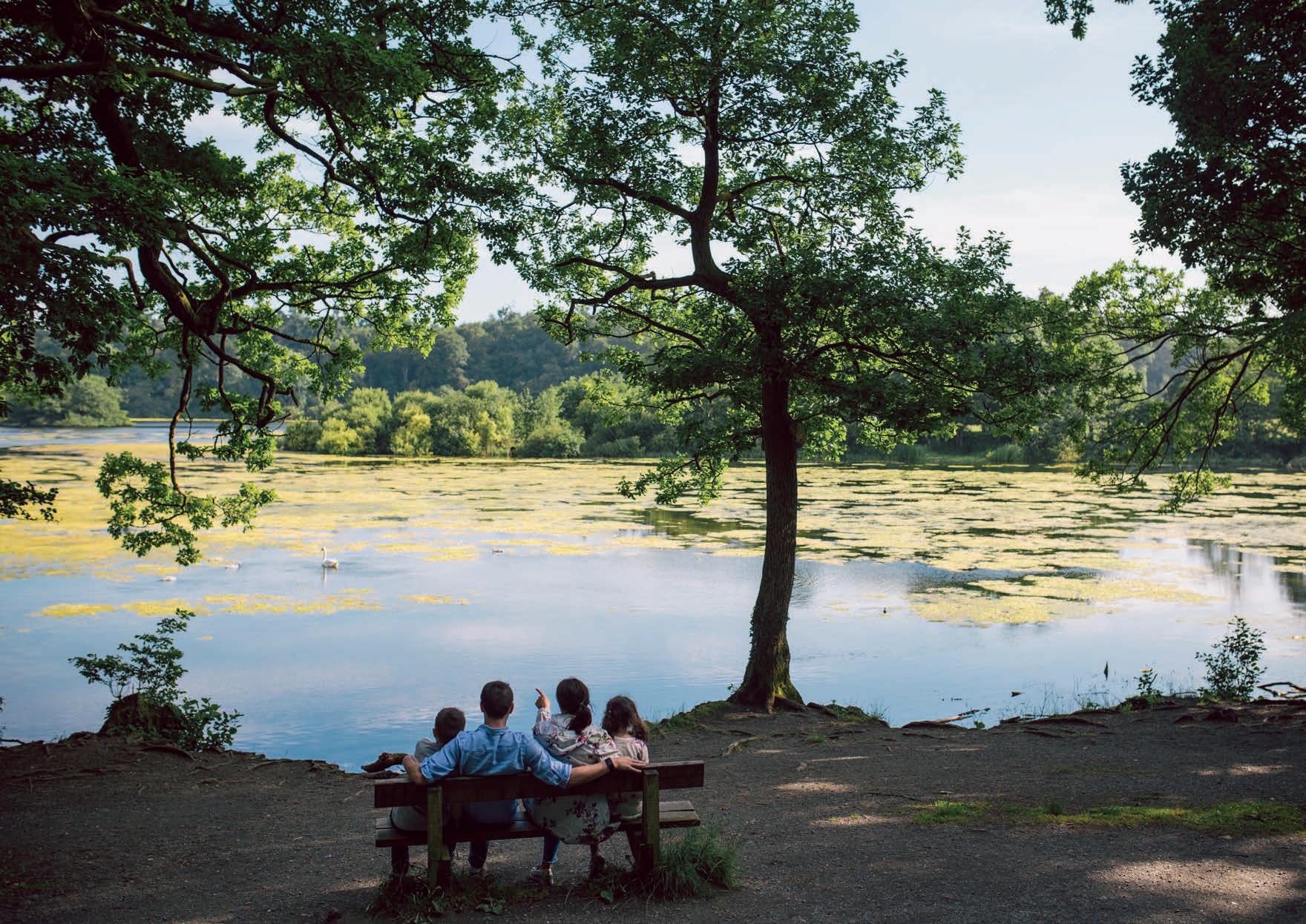
E: A Green Place
Protecting and Enhancing the Historic and Natural Environment
Plan Objective E outlines those actions the Council will adopt to protect and enhance the historic and natural environment within the Council area:
1) Protect our historic and natural environment, recognising their contribution to sustainable communities, economic growth, sustainable transport and health and well-being
2) Protect, conserve and enhance our historic environment, optimising use of brownfield sites and promoting heritageled regeneration
3) Recognise the value of our Conservation Areas and Areas of Townscape/Village Character as important heritage assets
4) Shape our places, the quality of new buildings and our town and village centres by promoting good design and maximise benefits to communities
5) Protect our natural heritage assets and promote their sensitive reuse to help create a sense of place
6) Ensure new development does not cause harm to biodiversity and other natural resources such as air, water and soil
7) Protect and enhance our designated natural heritage assets including the Lagan Valley Regional Park and Area of Outstanding Natural Beauty (AONB) and other high-quality landscapes such as Areas of High Scenic Value (AoHSV) and secure, through appropriate designations, to ensure they remain unspoilt for future generations.
Lisburn & Castlereagh Community Plan 2017-2032
As the spatial representation of the Community Plan, this Plan Strategy will contribute to outcomes contained within Theme 4 ‘Where We Live’ and Theme 5 ‘Our Community’.51
The ambitions in Theme 4 of growing the economy, delivering an appropriate mix of housing and providing retail space in our towns and cities require us to be sensitive to the surrounding environment, all the while informed by an understanding of sustainable development as meeting the needs of current generations without compromising the ability of future generations to meet their own needs.
Theme 5 looks to facilitate and increase the involvement of people in the everyday life of the community, empowering them to participate in decisions that affect them and to be actively engaged with community planning partners in delivering local services and managing local assets including the built and natural environment.
E: A GREEN PLACE PROTECTING AND ENHANCING THE HISTORIC AND NATURAL ENVIRONMENT Local Development Plan 2032 Part 1: Plan Strategy September 2023 112
51 See Community Plan, pages 30-33
Within these themes, this Plan Strategy will directly support outcomes:
4A – The built and natural environment is protected and enhanced.
5C – There is community ownership and management of local assets and facilities.
Plan Objective E will be delivered through the following strategic policies:
• Protecting and Enhancing the Historic Environment and Archaeological Remains
• Protecting and Enhancing Natural Heritage.
Historic Environment and Archaeological Remains
Policy Context
Regional Development Strategy 2035 (RDS)
Regional Guidance (RG11) of the RDS states that society should ‘conserve, protect and, where possible, enhance our built heritage and our natural environment’. To this end, RG11 recognises the valuable contribution of the historic environment to the environment, economy and society. This is achieved through identifying, protecting and conserving the built heritage including archaeological sites, monuments and historic buildings; identifying, protecting and conserving the character and built heritage assets within cities, towns and villages; and maintaining the integrity of built heritage assets, including historic landscapes.
Strategic Planning Policy Statement for Northern Ireland (SPPS)
The SPPS aims to manage change in positive ways so as to safeguard that which society regards as significant whilst facilitating development that will contribute to the ongoing preservation, conservation and enhancement of these assets.
Its regional strategic objectives in relation to archaeology and built heritage are to:
• secure the protection, conservation and where possible, the enhancement of our built and archaeological heritage
• promote sustainable development and environmental stewardship with regard to our built and archaeological heritage
• deliver economic and community benefit through conservation that facilitates productive use of built heritage assets and opportunities for investment, whilst safeguarding their historic or architectural integrity.
Lisburn City Centre Masterplan Review, 2019 (Draft)
The main aim of the Masterplan is the rejuvenation of Lisburn City Centre. The renovation and re-use of buildings is promoted along with a decluttering of the streetscape to improve the pedestrian experience. This is focused on the historic core of Lisburn City in order to help maintain the existing cultural and historic feel of the City.
E: A GREEN PLACE PROTECTING AND ENHANCING THE HISTORIC AND NATURAL ENVIRONMENT Local Development Plan 2032 Part 1: Plan Strategy September 2023 113
Lisburn Historic Quarter Development Strategy 2011-2021
A strategy for Lisburn Historic Quarter was developed in 2011 covering the period up to 2021. Lisburn Historic Quarter Strategy fits within the overarching vision of the Lisburn City Centre Masterplan which promotes Lisburn City Centre as ‘A regional city with a historic heart’.
To implement this vision, the Lisburn Historic Quarter Strategy identified five strategic themes with associated actions as priorities going forward including investment and development; access, environment and heritage; employment and wealth creation; tourism, culture, arts and creative industries and civic pride and community engagement.
The strategy places emphasis on promoting heritage restoration as a value adding economic activity and the promotion of the historic quarter.
Laganbank Quarter Comprehensive Development Scheme 2015
A major objective of this scheme is the regeneration of an area of strategic significance in the city centre. The area that the scheme covers includes part of Lisburn Conservation Area and is also in the vicinity of several key listed buildings. This scheme carries through the guiding principles of the Lisburn Historic Quarter Development Strategy which seeks to secure and promote its physical and economic regeneration.
E: A GREEN PLACE PROTECTING AND ENHANCING THE HISTORIC AND NATURAL ENVIRONMENT Local Development Plan 2032 Part 1: Plan Strategy September 2023 114
Strategic Policy 18 Protecting and Enhancing the Historic Environment and Archaeological Remains
The Plan will support development proposals that:
a) protect and enhance the Conservation Areas, Areas of Townscape Character and Areas of Village Character
b) protect, conserve and, where possible, enhance and restore our built heritage assets including our historic parks, gardens and demesnes, listed buildings, archaeological remains and areas of archaeological potential
c) promote the highest quality of design for any new development affecting our historic environment.
Justification and Amplification
The strategic policy for protecting and enhancing the historic environment and archaeological remains has been informed by regional and local policy which aims to facilitate appropriate development to secure our heritage for future generations.
Conservation can play a key part in promoting economic prosperity which in turn can help secure attractive living and working environments. The Council benefits from a range of historic environment designations outlined as follows:
Conservation Areas
Conservation Areas are spaces of special architectural or historic interest, the character or appearance of which it is desirable to preserve or enhance. The Council’s three Conservation Areas are:
• Lisburn Conservation Area - an attractive largely 17th and 18th Century streetscape which provides a focus for the physical and economic regeneration of the area
• Hillsborough Conservation Area –Hillsborough has been described as one of the most interesting small towns in Ireland and owes much to its position between the open parklands and lakes surrounding Hillsborough Castle to its juxtaposition with Hillsborough Fort
• Moira Conservation Area - Moira is characterised by a broad main street flanked by mainly terraced Georgian buildings. The form and design of these buildings create its distinctive and appealing character.
It is important that these Conservation Areas are protected and enhanced, recognising their contribution economically, socially, and environmentally. The regeneration of dilapidated buildings and vacant sites within Conservation Areas provide the means of urban regeneration to promote economic vitality and sustainable growth.
Areas of Townscape and Village Character
There are certain areas within our cities, towns and villages which exhibit a distinctive character based on their historic built form or layout. Whilst some of these have merited statutory designation as Conservation Areas, others are identified as areas of townscape or village character. Within the Council area these are:
E: A GREEN PLACE PROTECTING AND ENHANCING THE HISTORIC AND NATURAL ENVIRONMENT Local Development Plan 2032 Part 1: Plan Strategy September 2023 115
• Dundonald
• Newtownbreda
• Lisburn - Bachelors Walk
• Lisburn - Hilden
• Lisburn - Seymour Street
• Lisburn - Wallace Park
• Lisburn - Warren Park
• Drumbeg
• Glenavy
• Lower Ballinderry
• Upper Ballinderry
• Lambeg
• Purdysburn
• Moneyreagh.
Further work in reviewing existing and future Conservation Areas, Areas of Townscape/ Village Character will be undertaken as part of the Local Policies Plan.
Historic Parks, Gardens and Demesnes
There are six Historic Parks, Gardens and Demesnes located in Royal Hillsborough, Moira, Kilwarlin, Larchfield and two in Lisburn City (Castle Gardens and Wallace Park).52
Listed Buildings/Scheduled Monuments
A number of listed buildings and scheduled sites are located throughout the Council area in rural and urban locations. Whilst not
individually identified in the Plan, these are afforded appropriate protection through their statutory designation and the corresponding operational planning policies contained within Part 2 of the Plan Strategy. A range of defence and industrial heritage features are also identified through statutory listing.
Archaeological Remains
Archaeological remains of regional importance include monuments in State Care, scheduled monuments and Areas of Significant Archaeological Interest (ASAI) and sites that would merit scheduling. Archaeological remains of local importance include other sites recorded on the Sites and Monuments Record, the Industrial Heritage Record and the Defence Heritage Record.
Areas of Archaeological Potential
There are presently six areas of Archaeological Potential in Dundonald, Dromara, Royal Hillsborough, Lisburn, Drumbo and Glenavy and more may be identified at Local Policies stage.
The Council will promote economic vitality and growth through the ongoing regeneration of our historic environment. This may be achieved by ensuring that our historic environment remains in continuing use, or active reuse as
an integral part of the living and working community.
The exceptional quality of our environment is an important contributor to our sense of place, history and cultural identity through the quality of landscapes and the biodiversity it contains. As such it plays an important role in support of the local economy and the health and wellbeing of all who live and visit the area.
The erosion of our natural environment through inappropriate and unsustainable development proposals can have a negative impact on the historic environment. It is important that a balanced approach is adopted in terms of achieving growth and protecting and enhancing this asset in order to maintain the character and attractiveness of the area. New development proposals should be of a high quality design in order to promote the Council area as an attractive place to live, work and invest.
E: A GREEN PLACE PROTECTING AND ENHANCING THE HISTORIC AND NATURAL ENVIRONMENT Local Development Plan 2032 Part 1: Plan Strategy September 2023 116
52 Historic
Buildings and other
monuments including
in State Care, Scheduled Monuments and
of Significant Archaeological Interest (ASAIs) are designated or identified by Historic Environment Division, Department for Communities
Parks, Gardens and Demesnes, Listed
scheduled
monuments
Areas
Natural Heritage Policy Context
Regional Development Strategy 2035 (RDS)
Regional Guidance (RG11) of the RDS guides that society should ‘conserve, protect and, where possible, enhance our built heritage and our natural environment’. To this end, RG11 requires the following considerations and actions towards our natural environment:
• sustain and enhance biodiversity
• identify, establish, protect and manage ecological networks
• protect and encourage green and blue infrastructure
• protect and manage important geological and geomorphological features
• protect, enhance and manage the coast
• protect, enhance and restore the quality of inland water bodies
• recognise and promote the conservation of local identity and distinctive landscape character
• conserve, protect and where possible enhance areas recognised for their landscape quality
• protect designated areas of the countryside from inappropriate development and continue to assess areas for designation
• consider the establishment of one or more National Parks.
Spatial Framework Guidance (SFG5) ‘Protect and enhance the quality of the setting of the BMUA and its environmental assets’ acknowledges the significance of the existing environmental assets and protected Areas of High Scenic Value. It identifies that the Lagan Valley Regional Park and hills around the BMUA to be protected from development stating ‘these areas should be safeguarded, but opportunities should be sought where appropriate, to increase access to them for residents and tourists, consistent with protecting their integrity and value.’
Strategic Planning Policy Statement for Northern Ireland (SPPS)
The SPPS recognises that our natural and cultural landscapes are an essential aspect of our sense of place and belonging and are part of our national and community identity.
Its regional strategic objectives in relation to natural heritage are to:
• protect, conserve, enhance and restore the abundance, quality, diversity and distinctiveness of the region’s natural heritage
• further sustainable development by ensuring that natural heritage and associated diversity is conserved and enhanced as an integral part of social, economic and environmental development
• assist in meeting international, national and local responsibilities and obligations in the protection and enhancement of the natural heritage
• contribute to rural renewal and urban regeneration by ensuring developments take account of the role and value of natural heritage in supporting economic diversification and contributing to a highquality environment
• take actions to reduce our carbon footprint and facilitate adaptation to climate change.
E: A GREEN PLACE PROTECTING AND ENHANCING THE HISTORIC AND NATURAL ENVIRONMENT Local Development Plan 2032 Part 1: Plan Strategy September 2023 117
Strategic Policy 19 Protecting and Enhancing Natural Heritage
The Plan will support development proposals that:
a) protect, conserve and, where possible, enhance and restore our natural heritage
b) maintain and, where possible, enhance landscape quality and the distinctiveness and attractiveness of the area
c) promote the highest quality of design for any new development affecting our natural heritage assets
d) safeguard the Lagan Valley Regional Park allowing appropriate opportunities for enhanced access at identified locations thereby protecting their integrity and value.
Justification and Amplification
The strategic policy for natural heritage has been informed by regional and local policy which aims to balance the growth of the area whilst protecting and enhancing key assets in order to maintain landscape character, distinctiveness and attractiveness of the
area. This strategic policy takes account of our natural heritage features and landscape character within and extending beyond the geographical extent of the area.
There are a number of key environmental assets within the Council area, afforded protection under International, National and Local Designations. The Local Development Plan designates Areas of High Scenic Value, Local Landscape Policy Areas, Landscape Wedges and Sites of Local Nature Conservation Interest.
The Local Policies Plan will protect and integrate features of the natural heritage through appropriate designations and when zoning sites for development. The Local Policies Plan will also identify and promote green and blue infrastructure53 where this will add value to the provision, enhancement and connection of open space and habitats in and around settlements.
The Plan Strategy has also considered the natural and cultural components of the various landscapes of the district through its Landscape Character Assessment (see Technical Supplement 6). This assessment has ensured that potential effects on landscape and natural heritage, including the cumulative effect of development, have been considered in the preparation of the Plan, and are reflected in the
operational policies contained in Part 2 of the Plan Strategy.
The Council, when determining the impacts of a proposed development on international or national designations, will consider the precautionary principle as set out in the Rio Declaration on Environment and Development 1992 that states; Where there are threats of serious or irreversible damage, lack of full scientific certainty shall not be used as reasons for postponing cost effective measures to prevent environmental degradation.
The following natural heritage assets within the Council area are afforded statutory nature conservation designation (See Figure 6).
International Designations
Within the Council area there is one Special Protection Area (SPA) and Ramsar Site at Lough Neagh including the water body of Portmore Lough.
National Designations
National designations include:
• Nature Reserve at Belshaw’s Quarry
E: A GREEN PLACE PROTECTING AND ENHANCING THE HISTORIC AND NATURAL ENVIRONMENT Local Development Plan 2032 Part 1: Plan Strategy September 2023 118
53 RDS 2035, Regional Guidance RG11 ‘Natural Environment’
• Lagan Valley Area of Outstanding Natural Beauty (AONB) – The Lagan Valley Regional Park (LVRP) is a significant natural environmental asset within the Council area and is safeguarded to ensure its natural beauty and character is retained. The park remains as a major regional recreational asset benefitting from its statutory designation as an Area of Outstanding Natural Beauty (AONB) which was designated in 1965 and largely aligns with the boundary of the LVRP. This AONB has been designated in recognition of its importance as a landscape of distinctive character and special scenic value. The designation is designed to protect and enhance the qualities of the area and to promote it for the enjoyment of the public.
• Areas of Special Scientific Interest (ASSIs) at Belshaw’s Quarry, Leathemstown, Slievenacloy, Portmore Lough, Maghaberry, Ballynanaghten, Craigantlet Wood, Lough Neagh and Clarehill.
6 Environmental Designations afforded Statutory Protection through Legislation
International Designations
Ramsar, Special Protection Area, Special Area of Conservation
National Designations
Areas of Special Scientific Interest, (National) Nature Reserves, Marine Nature Reserves, Areas of Outstanding Natural Beauty
Local Designations
Local Nature Reserves and Wildlife Refuges, Trees & Woodland
E: A GREEN PLACE PROTECTING AND ENHANCING THE HISTORIC AND NATURAL ENVIRONMENT Local Development Plan 2032 Part 1: Plan Strategy September 2023 119
Figure
There are no local level designations within the Council area.
Local Development Plan Designations
• Areas of High Scenic Value (AoHSV) – there are six AoHSV that protect the setting of urban areas and provide areas of particular landscape merit, consisting of:
- Portmore Lough
- Magheraknock Loughs
- Belfast Basalt Escarpment (part of Belfast Hills)
- Craigantlet Escarpment
- Castlereagh Slopes
- Castlereagh Escarpment.
• Local Landscape Policy Areas (LLPAs) – there are one hundred and eighteen LLPAs within or adjoining settlements which are considered to be of greatest nature conservation or heritage interest, amenity value, landscape quality or local significance
• Landscape Wedges – there are six landscape wedges, both Urban and Rural, which provide visual separation within parts of the built up urban areas, or between settlements.
• Sites of Local Nature Conservation Interest (SLNCIs) – there are one hundred and fourteen SLNCIs located throughout the Plan Area, designated because of their characteristic habitats, species or earth
science features. As well as making a contribution to the local natural heritage, they contribute to National and European biodiversity.
These designations are carried forward from the existing development plan however further work in reviewing existing and future AoHSV, LLPAs, Landscape Wedges and SLNCIs will be assessed as part of the Local Policies Plan.
Trees and Woodland
Trees and woodland contribute significantly to the natural environment and green and blue infrastructure networks.
They have a number of important benefits, including creating a varied and attractive landscape, and creating and defining a sense of place. Trees can help screen and integrate development, provide wildlife habitats, contribute to the health and well-being of society, reduce air pollution, provide shade and mitigate flood risk.
Individual trees, groups of trees or woodland which is of particular amenity value may be subject to additional protection through the implementation of a Tree Preservation Order (TPO).
Trees in Conservation Areas are also provided the same level of protection as trees afforded a TPO, in accordance with Section 127 of the Planning Act.

E: A GREEN PLACE PROTECTING AND ENHANCING THE HISTORIC AND NATURAL ENVIRONMENT Local Development Plan 2032 Part 1: Plan Strategy September 2023 120
Wallace Park
F: A Connected Place
Supporting Sustainable Transport and Other Infrastructure

F: A Connected Place
Supporting Sustainable Transport and Other Infrastructure
Plan Objective F outlines those actions the Council will adopt to promote sustainable transport and other infrastructure within the Council area
1) Support the growth of the Council area, exploiting its strategic location on Key Transport Corridors and the rail network
2) Designate and protect the location of strategic infrastructure, promote strategic transport schemes and linkages, maximising accessibility by sustainable transport modes across the Council area, ensuring infrastructure development is flood resilient
3) Promote opportunities for sustainable travel through development of Active Travel Networks to support walking, cycling and public transport, reducing the need to travel by private car
4) Develop and promote strategic greenways to provide opportunities for walking, cycling, biodiversity, health and well-being
5) Recognise the contribution green and blue infrastructure offers to human health and sustainable urban drainage
6) Mitigate and adapt to climate change by minimising greenhouse gas emissions
7) Support renewable energy infrastructure whilst affording protection to the environment
8) Facilitate the delivery of telecommunications and utilities infrastructure throughout the Plan period
9) Support effective waste management through reuse, recycling and reduction of waste to landfill, minimising environmental impacts
10) Prevent inappropriate development in areas at risk of flooding or that increase flood risk elsewhere, whilst managing flood risk and providing mitigation where necessary.
Lisburn & Castlereagh Community Plan 2017-2032
As the spatial representation of the Community Plan, this Plan Strategy will contribute to outcomes contained within Theme 1 ‘Children and Young People’; Theme 2 ‘The Economy’; Theme 3 ‘Health and Well-being’; and Theme 4 ‘Where We Live’.
Theme 1 focuses on developing our open spaces and recreational areas in a way that contributes to young people being physically active and enjoying good mental health. This is enhanced by Theme 3 with its focus on empowering people at every life stage to lead healthy active lives regardless of where we live or what income we have. The importance of physical and digital infrastructure in driving economic grow is a focus for Theme 2.
Theme 4 highlights particular geographical areas, Carryduff, Lisburn City Centre, Royal Hillsborough & Culcavy and Moira that will benefit from improvements in the future. It also draws the link between the local and the global, from local biodiversity to climate change, outlining the need to ensure that the
F: A CONNECTED PLACE SUPPORTING SUSTAINABLE TRANSPORT AND OTHER INFRASTRUCTURE Local Development Plan 2032 Part 1: Plan Strategy September 2023 122
environment is enhanced and protected both now and in the future.
Within these themes, this Plan Strategy will directly support outcomes:
1E – Children and young people are physically active and enjoy good mental health.
2E – Our transport and digital infrastructure supports our economy and our people.
3A – Good health will no longer be dependent on where we live or what income we have.
3C – People of all ages are more physically active more often.
4D – We have access to essential services, shops, leisure and workplaces.
4E – There is a modal shift to sustainable and healthy transport options.

4F – We produce less waste and reuse and recycle the waste that we do produce.
4G – Greenhouse gas emissions are reduced.
Plan Objective F will be delivered through the following strategic policies:
• Transportation Infrastructure
• Renewable Energy
• Telecommunications & Other Utilities
• Waste Management
• Flood Risk.
F: A CONNECTED PLACE SUPPORTING SUSTAINABLE TRANSPORT AND OTHER INFRASTRUCTURE Local Development Plan 2032 Part 1: Plan Strategy September 2023 123
Glider at Dundonald Park & Ride
Transportation Infrastructure Policy Context
Regional Development Strategy 2035 (RDS) and New Approach to Regional Transportation
The RDS vision for regional transportation is ‘to have a modern, sustainable, safe transportation system which benefits society, the economy and the environment and which actively contributes to social inclusion and everyone’s quality of life’.
The RDS and A New Approach to Regional Transportation54 consider the integration between transport and land use as being fundamental to implementing the regional approach to transportation.
The aims of the RDS in relation to transport include:
• improve connectivity to enhance the movement of people, goods, energy and information between places
• take action to reduce our carbon footprint and facilitate adaption to climate change
• strengthen links between north and south, east and west, Europe and the rest of the world.
The RDS Regional Guidance (RG2) identifies that in order to deliver a balanced approach to transport infrastructure, the focus is on managing the use of road and rail space and how the network can be used in a better, smarter way. This includes improving connectivity; maximising the potential of the Regional Strategic Transport Network; using road space and railways more efficiently; improving social inclusion; managing the movement of freight; improving access to our cities and towns; and improving safety by adopting a ‘safe systems’ approach to road safety.
RG7 identifies the need to support urban and rural renaissance, which recognises that development and redevelopment is dependent on the availability of necessary infrastructure. In order to ensure that environmental quality in urban areas is improved and maintained, plans should make provision for adequate green and blue infrastructure. Additionally, noise levels can be caused by traffic, construction, industrial and sometimes recreational activities. New development must therefore take noise mitigation into account.
RG9 aims to reduce our carbon footprint and facilitate mitigation and adaption to climate change whilst improving air quality. Mitigation in relation to transport, includes reducing greenhouse gas emissions; reducing noise and air pollution; and using more energy efficient forms of transport.
Spatial Framework Guidance recognises that Lisburn benefits from its location at the meeting point of the Belfast/Dublin economic corridor and the East/West Key Transport Corridor.
Spatial Framework Guidance (SFG1) seeks to enhance Lisburn City as a major employment and commercial centre being strategically located at the meeting of key transport corridors with high development potential and the scope to generate additional jobs.
SFG4 seeks to manage the movement of people and goods within the Belfast Metropolitan Urban Area (BMUA) recognising the key role transport plays in developing competitive cities and regions. An efficient transport infrastructure is not only important for a successful economy but it can help promote social inclusion by providing an affordable alternative to the private car.
SFG14 aims to improve accessibility for rural communities through improving the overall connectivity of rural communities to services and other parts of the region by exploring innovative ways of bringing these services to the communities; and integrating local transport, such as promoting integrated rural transport initiatives.
F: A CONNECTED PLACE SUPPORTING SUSTAINABLE TRANSPORT AND OTHER INFRASTRUCTURE Local Development Plan 2032 Part 1: Plan Strategy September 2023 124
54 Ensuring a Sustainable Transport Future – A New Approach to Regional Transportation DRD 2012
Ensuring a Sustainable Transport FutureA New Approach to Regional Transportation
This document sets out how the former Department for Regional Development (now Department for Infrastructure) aims to develop regional transportation beyond 2015.
Unlike the 2002 Regional Transportation Strategy (RTS), the new approach does not include details of schemes or projects. Rather, the Department set three High Level Aims for transportation along with twelve supporting Strategic Objectives, covering the economy, society and the environment, as follows:
A. Support the growth of the economy
B. Enhance the quality of life for all
C. Reduce the environmental impact of transport.
Against each High Level Aim a number of Strategic Objectives were developed to address the challenges identified during the review.
A. Support the Growth of the Economy
1: Improve connectivity within the region
2: Use road space and railways more efficiently
3: Better maintain transport infrastructure
4: Improve access in our towns and cities
5: Improve access in rural areas
6: Improve connections to key tourism sites
B. Enhance the Quality of Life for All
7: Improve Safety
8: Enhance Social Inclusion
9: Develop transport programmes focused on the user
C. Reduce the Environmental Impact of Transport
10: Reduce greenhouse gas emissions from transport
11: Protect biodiversity
12: Reduce water, noise and air pollution
Strategic Planning Policy Statement for Northern Ireland (SPPS)
The SPPS states that the successful integration of transport and land use is fundamental to the objective of furthering sustainable development. Planning has a vital contributing role for improving connectivity and promoting more sustainable patterns of transport and travel.
Its regional strategic objectives for transportation and land use planning are to:
• promote sustainable patterns of development which reduce the need for motorised transport, encourages active travel, and facilitate travel by public transport in preference to the private car
• ensure accessibility for all, with the needs of people with disabilities and others whose mobility is impaired given particular consideration
• promote the provision of adequate facilities for cyclists in new development
• promote parking policies that will assist in reducing reliance on the private car and help tackle growing congestion
• protect routes required for new transport schemes including disused transport routes with potential for future re-use
• restrict the number of new accesses and control the level of use of existing accesses onto Protected Routes
• promote road safety, in particular for pedestrians, cyclists and other vulnerable road users.
Northern Ireland Changing Gear –A Bicycle Strategy for Northern Ireland (2015)
This document outlines the Department for Infrastructure’s vision for the kind of cycling community it would like Northern Ireland to be in 25 years. The vision is ‘A community where people have the freedom and confidence to travel by bicycle for every day journeys.’
F: A CONNECTED PLACE SUPPORTING SUSTAINABLE TRANSPORT AND OTHER INFRASTRUCTURE Local Development Plan 2032 Part 1: Plan Strategy September 2023 125
The aim of the strategy is to have a comprehensive bicycle network which comprises urban and rural networks and linkages between the two.
The design and maintenance of this network is fundamental to the promotion of a modal shift in transport. It is recognised this shift will take time requiring funding and support however the strategy contains ambitious targets over and beyond its life span.
Belfast Metropolitan Transport Plan (BMTP)
The Department for Infrastructure (DfI) have confirmed through consultation with the Council that the Belfast Metropolitan Transport Plan (BMTP) will be reviewed as part of the next stage of the Local Development Plan process.
The BMTP outlines a number of key proposals building on the RDS which are of particular strategic significance for the next stage of Plan preparation. A brief summary is provided as follows:
Rapid Transit Schemes
Glider (formerly EWAY55) – which runs east to west and has a terminus in Dundonald Park & Ride.
Railways
West Lisburn/Knockmore Halt, replacing the existing halt at Knockmore, with associated Park & Ride.
Park & Ride Sites
• Cairnshill
• Sprucefield
• West Lisburn at proposed new halt.
Strategic Road Schemes
M1/A1 Bypass and Widening of the M1 between Blacks Road and Sprucefield (Lisburn)These schemes involve the widening of the M1 between Blacks Road and Sprucefield Regional Shopping Centre; and the provision of a new road scheme between the M1 and A1 at Sprucefield (Lisburn) to improve connectivity. The M1/A1 (A101) Link Road is now constructed.
A24 Saintfield Road Relief Road - This scheme involves the provision of a link road between the A24 at Cairnshill and the A55 at Newtownbreda.
Non-Strategic Road Schemes
• Knockmore - M1 Link (not commenced)
• North Lisburn Feeder Road (near completion)
• Quarry Corner – Comber Road (ongoing).
Disused Railway
The BMTP identified the need to retain the option of re-instating the Antrim–Lisburn railway as a part of a potential passenger circle line which could serve Belfast international Airport as envisaged in the RDS.
Post Publication of BMTP
A number of proposals have not transpired that were originally outlined in the BMTP, including the provision of Park & Ride at Lisburn Train Station and the provision of an informal Park & Ride at Carryduff.
A number of schemes have also evolved postBMTP, including:
• A3 Moira Road upgrade
• Dundonald (Dunlady Road) Park & Ride
• extension to Sprucefield Park & Ride
• potential new Park & Ride facility at Moira Train Station.
F: A CONNECTED PLACE SUPPORTING SUSTAINABLE TRANSPORT AND OTHER INFRASTRUCTURE Local Development Plan 2032 Part 1: Plan Strategy September 2023 126
55 The Glider route terminates close to Lisburn Greater Urban Area on the Stewartstown Road in Belfast City Council
It is considered that the detail and provision of schemes will be identified at the Local Policies Plan stage through an integrated Local Transport Plan, as part of the wider updated Belfast Metropolitan Transport Plan (BMTP).
Lisburn & Castlereagh City Council Car Park Strategy, 2019 (Draft)
As a result of Local Government Reform in Northern Ireland in 2015, the Department for Infrastructure Roads (DfI) transferred all of its off street car parks, excluding Park and Ride/ Park and Share which are owned by DfI but managed by Translink, to local councils. Lisburn & Castlereagh City Council is now responsible for the operation of twelve car parks previously operated by DfI, as well as five legacy Council sites.
The car park strategy was developed in four stages:
Stage 1 – consideration of the baseline in terms of parking provision and policies and also an assessment and review of usage, operation and tariffs.
Stage 2 – detailing current issues, challenges and trends in relation to car parking within the Council area, and identifying through successful scheme examples, best practice in terms of the management and operation of parking facilities.
Stage 3 – detailing potential future developments and the impact they may have upon parking provision in off street car parks within Lisburn City Centre.
Stage 4 – Parking Strategy and Action Plan
The issues considered in the Car Park Strategy (which assesses the Council’s off-street car parks) relate to the availability of spaces and the conflict between long and short stay parking serving the differing needs both of the individual and the Council area.
It is considered that this document will provide part of the evidence base and analysis necessary to develop a long-term parking strategy to fit with the Local Development Plan. The long-term parking strategy will be prepared by the Council and DfI jointly at Local Policies Plan stage through an integrated Car Parking Strategy.
West Lisburn Development Framework Review 2018, (Draft)
The Framework acknowledges key infrastructure that will assist and deliver the development potential of West Lisburn, including the proposed Park & Ride and Knockmore Rail Halt, West Lisburn, which is also identified in the BMTP and BMAP. These additional facilities, twinned with improved
frequencies in public transport, will serve to reduce road traffic to the area and promote alternative sustainable travel modes.
Lisburn City Centre Masterplan, 2019 (Draft)
The City Centre Masterplan 2019 has regeneration objectives which include reconnecting the city centre to the Lagan corridor and improving connectivity throughout the City Centre. This is achieved through enhancements to promote pedestrian movements; new phases of public realm works and proposed pedestrian/cycle connections across the River Lagan. This supports sustainable travel modes within the city centre which is vital to reducing private car usage.
F: A CONNECTED PLACE SUPPORTING SUSTAINABLE TRANSPORT AND OTHER INFRASTRUCTURE Local Development Plan 2032 Part 1: Plan Strategy September 2023 127
Strategic Policy 20 Transportation Infrastructure
The Plan will support development proposals that:
a) provide or improve an integrated transport network servicing the needs of our community and future growth
b) deliver sustainable patterns of development, including safe and accessible environments
c) encourage a modal shift from private car dependency through integration of transport and land use
d) facilitate Park & Ride, active travel (public transport, cycling and walking) and strategic greenways to move towards more sustainable modes of travel both within the Council area and linking to wider regional networks.
Justification and Amplification
The strategic policy for transportation infrastructure has been formulated in accordance with regional and local policy which aims to support and deliver sustainable transport and integration with land use.
The Department for Infrastructure (DfI), as the statutory transport authority, through consultation with the Council has prepared a Local Transport Study (LTS) which supports this strategic policy.
This sits within the context of the wider Belfast Metropolitan Transport Study (BMTS) prepared by DfI. Each of these documents is referred to below.
Local Transport Study (LTS)
The Local Transport Study (LTS) was prepared by DfI in consultation with the Council, details of which are provided in Technical Supplement 8. The LTS does not propose identified schemes but introduces a framework against which future proposals will be delivered. The overall focus of the LTS at Plan Strategy stage is to improve transport connections for people, goods and services whilst protecting the environment.
The seven objectives to support the Plan Strategy are as follows:
• Objective 1: Enhance regional accessibility by road and public transport from the centres of Lisburn City, Castlereagh Greater Urban Area, Moira, Hillsborough & Culcavy and Carryduff to Belfast, Derry/Londonderry, gateways and hubs.
• Objective 2: Ensure viable local public transport accessibility to essential services for people living in the Lisburn & Castlereagh Council area.
• Objective 3: Ensure there are attractive and safe active travel networks (walking and cycling) linking all existing and new residential, employment, retail and leisure developments in the urban areas of Lisburn City, Castlereagh Greater Urban Area, Moira, Hillsborough & Culcavy and Carryduff.
• Objective 4: Deliver high-quality public realm in the centres of Lisburn City, Castlereagh Greater Urban Area, Moira, Hillsborough & Culcavy and Carryduff, with reduced vehicle dominance, to make the towns attractive places to live and work and to improve safety for active modes.
• Objective 5: Enhance accessibility by sustainable modes of transport to the centres of Lisburn City, Castlereagh Greater Urban Area, Moira, Hillsborough & Culcavy and Carryduff to safeguard their viability.
• Objective 6: Enhance safety for all modes of transport and reduce the number and severity of casualties.
F: A CONNECTED PLACE SUPPORTING SUSTAINABLE TRANSPORT AND OTHER INFRASTRUCTURE Local Development Plan 2032 Part 1: Plan Strategy September 2023 128
• Objective 7: Ensure our transport systems are resilient to climate change and wellmaintained.
The ten confirmed measures identified in the LTS are:
• improved inter-urban roads on key transportation corridors
• improved ‘limited stop’ bus services to key hubs (i.e. Lisburn City, Castlereagh Greater Urban Area, Moira, Hillsborough & Culcavy and Carryduff )
• maintained and improved rail services and connections
• new urban road links and sustainable transport infrastructure to facilitate key development funded by developers
• town centre parking strategies
• provision of improved walking facilities in towns
• improvements to existing cycle network and provision of a new network of radial cycling routes in towns and greenways
• traffic management schemes in urban areas to re-balance modal hierarchy
• implement road safety measures
• transport infrastructure designed, provided and maintained to best practice standards.
These measures are consistent with the ‘New Approach to Regional Transportation’ as they are outcome based and are considered more deliverable and relevant for the Plan Strategy.
The Local Transport Study does not list specific infrastructure schemes. The intention is that this provides more flexibility, with detail of specific schemes being identified at the Local Policies Plan stage when land use zonings are identified, thereby integrating land-use proposals and transportation.
Belfast Metropolitan Transport Study (BMTS)
The BMTS has been conducted to help inform the Local Development Plans within the Belfast Metropolitan Study area. The Belfast Strategic Transport Model (BSTM) investigates to what degree the levels of growth proposed by the Councils within the study area can be accommodated and what blend of measures may be needed to deliver on the outcomes set by these Councils and the Department.
The study comprised a list of twelve illustrative measures (IM01-IM12) which were modelled using the BSTM, applying a base line of 2013 demand and a 2030 demand scenario.
Schemes identified within the illustrative measures in the Council area are as follows:
• IMO1 Highway - Dualling of A26; M1/A1/ Sprucefield Bypass (2 lanes in each direction and M1 widening (3 lanes in each direction)
• IMO4 Goldline - provision of local park and rides
• IMO5 BRT Phase 2 - South route, Ormeau Road, continuing onto the Saintfield Road
• IMO6 Metro – Frequency of all metro services doubled and speed increased
• IM09 Demand management - Introduction of toll roads, including M1
• IM10 Fares – reduction in public transport fares
• IM11 Rail B – increased frequency on Lisburn Line.
F: A CONNECTED PLACE SUPPORTING SUSTAINABLE TRANSPORT AND OTHER INFRASTRUCTURE Local Development Plan 2032 Part 1: Plan Strategy September 2023 129
These illustrative measures were developed into two Alternative Networks (AN01 and AN02). This modelling was used to inform the draft Belfast Metropolitan Transport Study (BMTS). The study concludes that whilst the introduction of new public transport schemes and a reduction in fares can stimulate public transport, car usage is likely to remain high. In order to reduce car modal share within the metropolitan area, more comprehensive intrusive demand management measures are likely to be required.
Further work is still required to determine the most appropriate demand management approach for the BMTS area to maximise the modal shift to sustainable modes of travel while supporting local growth and trade.
This will be explored with Councils through the provision of a new Belfast Metropolitan Transport Plan at the Local Policies Plan stage.
Meeting Future Transportation Needs
The Council is keen to explore further improvements to transportation provision at Local Policies Plan and Local Transport Plan stage in conjunction with DfI, including the following:
Key Transportation Infrastructure Schemes
The Council recognises the importance in providing a high quality, integrated transport system that supports future growth. The Council remains committed to working with DfI Roads and public transport operators to deliver major improvements to the existing transportation network over the Plan period.
A number of key transport proposals as previously identified through the BMTP that have not yet been implemented, include:
• the M1-A1 link road
• the A24 Saintfield Road Relief Road
• the Knockmore-M1 link road
• the West Lisburn/Knockmore Halt, with associated park and ride
• completion of the North Lisburn feeder road
• Quarry Corner – Comber Road link road.
These schemes remain of strategic importance to the council area, in addition to:
• a potential new Park & Ride facility at Moira Train Station
• reinstating of the Antrim-Lisburn line for operational use.
In addition, the Local Transport Study will consider the strengths and weaknesses of various modes of transport, including walking, cycling, public transport and roads. This will provide clarity on the transport measures that DfI expect to deliver during the LDP period to 2032 and which will become evident at Local Policies Plan stage.
Park & Ride/Park & Share
The provision of Park & Ride/Park & Share at key locations benefits not only those residing and working in the Council area, but those travelling through Lisburn and Castlereagh from neighbouring Councils. Park & Ride or Park & Share sites have the potential to deliver a shift to more sustainable travel modes (by reducing car usage and encouraging the use of public transport), reduce pollution and congestion and improve air quality and public health.
F: A CONNECTED PLACE SUPPORTING SUSTAINABLE TRANSPORT AND OTHER INFRASTRUCTURE Local Development Plan 2032 Part 1: Plan Strategy September 2023 130
The existing Development Plan (BMAP) identified the provision of Park & Ride sites at Sprucefield and Cairnshill to assist and improve traffic management. The Council recognises the value of the existing Park & Ride sites in supporting a modal shift between private car and public transport usage and supports the proposed schemes at West Lisburn adjacent to the proposed new rail halt; Moira, adjacent to the railway station; and the extension of other Park & Ride sites which benefit from planning approval.
Park & Share sites are not linked directly to public transport but encourage car sharing which can save users money and driving stress whilst reducing congestion. There are two Park & Share sites in the Council area located at the Temple roundabout and Saintfield Road M1 Lisburn/Junction 6.
Further assessment of Park & Ride/Park & Share sites will be undertaken at the Local Policies Plan stage in conjunction with the development of the Local Transport Plan.
Active Travel
Sustainable modes of transport which promote a modal shift away from reliance on the private car will reduce demand on the road network helping to reduce emissions, increase the
efficiency of the network and provide overall benefit to the residents of the Council area.
A modal shift requires development to provide improved accessibility to public transport and promote walking and cycling. This is a key feature of active travel operational policy contained in Part 2 of the Plan Strategy.
Linking people and communities through green infrastructure promotes the use of active travel which will help lead to longer, healthier and more active lifestyles.
Adopting a proactive approach to schemes which reduce reliance on the private car will be a key theme of the emerging Belfast Metropolitan Transport Plan (BMTP) to accompany the Local Policies Plan.
Implementation of Phase ll of the Belfast Rapid Transport (Glider) completing the linkages beyond the Council area will be a vital component in reducing reliance on the private car.
Strategic Greenways and Disused Transport Routes
‘Excercise, Explore, Enjoy - A Strategic Plan for Greenways’ published by the Department for Infrastructure in 2016 defines greenways as ‘traffic-free routes connecting communities
to all kinds of destinations for commuting, everyday journeys or leisure and recreation.’
The aim of the Strategic Greenways Plan is to encourage a substantial increase in the number of people walking and cycling as a regular part of everyday life through the building of a connected and accessible regional greenway network which significantly increases the length of traffic-free routes.
Three strategic greenways are located/ proposed in the Council area:
• a primary route extending the existing Sustrans National Cycle Route No. 9 from Sprucefield, through the Maze Lands to Moira and onwards towards Portadown
• a secondary route connecting Carryduff to the Primary Belfast Greenway
• a further secondary route connecting Lisburn to Banbridge.
The Council is supportive of the future provision of strategic greenways recognising the benefits they provide, including reducing reliance on the private car, connecting communities with facilities, services, schools and places of work, promoting health and well-being, reducing pollution and congestion, increasing access and awareness of the natural and historic
F: A CONNECTED PLACE SUPPORTING SUSTAINABLE TRANSPORT AND OTHER INFRASTRUCTURE Local Development Plan 2032 Part 1: Plan Strategy September 2023 131
environment, along with the potential for tourism opportunities.
At present the railway connection between Lisburn and Antrim is disused. The Plan proposes that this disused railway route is protected for possible re-use for transport purposes. In consultation with Translink, the Council has established that any work that might be carried out to enhance the network to bring back services to the Antrim/Lisburn line with connections to Belfast International Airport would require a robust financial, economic and transportation case.
The Council is keen to pursue this option further with DfI and neighbouring Council (Antrim and Newtownabbey Borough Council) through the Local Transport Plan and wider Belfast Metropolitan Transport Plan. Further assessment of strategic greenways and the Lisburn-Antrim disused transport route will be undertaken at Local Policies Plan stage.

Car Parking
A comprehensive joined up approach will be required between the Council and DfI to address parking issues. An area of parking restraint exists within Lisburn City Centre and this designation will be carried forward under the Transitional arrangements outlined under Chapter 1. Areas of parking restraint along with other measures to reduce the impact of car parking across the Council area will require further detailed assessment at the Local Policies Plan stage.
F: A CONNECTED PLACE SUPPORTING SUSTAINABLE TRANSPORT AND OTHER INFRASTRUCTURE Local Development Plan 2032 Part 1: Plan Strategy September 2023 132
Park
Moat
Map 13 Department for Infrastructure Strategic Plan for Greenways

F: A CONNECTED PLACE SUPPORTING SUSTAINABLE TRANSPORT AND OTHER INFRASTRUCTURE Local Development Plan 2032 Part 1: Plan Strategy September 2023 133
Renewable Energy Policy Context
Regional Development Strategy 2035 (RDS)
The aims of the RDS include to protect and enhance the environment for its own sake and take actions to reduce our carbon footprint.
Regional guidance (RG5) aims to deliver a sustainable and secure energy supply. One of the ways this can be achieved is to increase the contribution that renewable energy can make to the overall energy mix. It acknowledges that there needs to be a significant increase in all types of renewable electricity installations and renewable heat installations, including a wide range of renewable resources for electricity generation both onshore and offshore to meet the region’s needs.
Additionally, Regional Guidance (RG9) seeks to reduce our carbon footprint and facilitate mitigation and adaptation to climate change whilst improving air quality. In relation to renewables, it considers how to reduce energy consumption and move to more sustainable methods of energy production. In relation to mitigation, there is a drive to improve the energy efficiency and adaptability of buildings; increase the use of renewable energies; and utilise local production of heat and/or
electricity from low or zero carbon energy sources.
Strategic Planning Policy Statement for Northern Ireland (SPPS)
Renewable energy technologies support the wider Northern Ireland economy and also offer new opportunities for additional investment and employment, as well as benefitting our health and well-being, and our quality of life.
The aim of the SPPS in relation to renewable energy is to facilitate the siting of renewable energy generating facilities in appropriate locations within the built and natural environment in order to achieve Northern Ireland’s renewable energy targets and to realise the benefits of renewable energy
without compromising other environmental assets of acknowledged importance.
Its regional strategic objectives for renewable energy are to:
• ensure that the environmental, landscape, visual and amenity impacts associated with or arising from renewable energy development are adequately addressed

• ensure adequate protection of the region’s built, natural, and cultural heritage features
• facilitate the integration of renewable energy technology into the design, siting and layout of new development and promote greater application of the principles of Passive Solar Design.
F: A CONNECTED PLACE SUPPORTING SUSTAINABLE TRANSPORT AND OTHER INFRASTRUCTURE Local Development Plan 2032 Part 1: Plan Strategy September 2023 134
Solar Farm, Lisburn Countryside
Strategic Policy 21 Renewable Energy
The Plan will support development proposals that:
a) facilitate the delivery of renewable energy generating facilities (wind, solar, thermal, biomass and other technologies) in the most appropriate locations which aim to meet the regional target56 for renewable energy production
b) minimise any potential visual intrusion and environmental impacts to protect both the rural and urban landscape, and natural and historic environment.
Justification and Amplification
The strategic policy for renewable energy has been informed by regional and local policy which supports the diverse range of renewable energy development that have a key role in reducing dependency on fossil fuels for energy production.
Solar and energy generated from waste is becoming more widely used on a commercial
scale. With all renewable energy technologies, the key consideration is the potential impacts on public safety, human health and the amenity of the surrounding area. A balance will always be required between the economic/ environmental benefits of any scheme and the potential impacts on people and the environment.
A cautious approach for renewable energy development proposals will apply within designated landscapes which are of significant value, such as Areas of Outstanding Natural Beauty and their wider settings. In such sensitive landscapes it may be difficult to accommodate renewable energy proposals, including wind turbines, without detriment to the region’s cultural and natural heritage assets.
Consideration of all renewable energy proposals will take account of their contribution to the wider environmental benefits arising from a clean, secure energy supply; reductions in greenhouse gases and other polluting emissions; and contributions towards meeting Northern Ireland’s target for use of renewable energy sources.
In relation to renewable energy development, details of future decommissioning including
proposals for site restoration will be required, as most renewable technologies have a definitive lifespan. Planning conditions (or a legal agreement where appropriate) can be used to ensure removal of disused facilities.
The factors to be considered on a case by case basis will depend on the scale of the development and its local context in accordance with the operational policy contained in Part 2 of the Plan Strategy.
Additional guidance including ‘Wind Energy Development in Northern Ireland’s Landscapes’ (DfI, August 2010) and other relevant best practice should be taken into account in assessing proposals.
F: A CONNECTED PLACE SUPPORTING SUSTAINABLE TRANSPORT AND OTHER INFRASTRUCTURE Local Development Plan 2032 Part 1: Plan Strategy September 2023 135
56 Executive’s 2010-20 Strategic Energy Framework which includes a target to achieve 40% of electricity consumption from renewable sources by 2020
Telecommunications and Other Utilities
Policy Context
Regional Development Strategy 2035 (RDS)
Telecommunications
The RDS is cognisant that the telecommunications market is a fast moving sector and investment in its infrastructure is key so as competitive advantage is not eroded or lost. Opportunities provided by access to highquality communications need to be exploited to improve regional, national and international connectivity.
Regional Guidance (RG3) of the RDS aims to ‘implement a balanced approach to telecommunications infrastructure that will give a competitive advantage’ and consists of the following:
• invest in infrastructure for higher broadband speeds
• improve telecommunication services in rural areas to minimise the urban/rural divide
• increase the use of broadband
• capitalise on direct international connectivity.
Other Utilities
Regional Guidance (RG5) of the RDS seeks to deliver a sustainable and secure energy supply. Northern Ireland needs a robust and sustainable energy infrastructure delivering reliable and secure sources of energy to communities and businesses across the Region. New generation or distribution infrastructure must be carefully planned and assessed to avoid adverse environmental effects, particularly on or near protected sites.
The RDS advises that decision makers will have to balance impacts against the benefits from a secure renewable energy stream, and the potential for cleaner air and energy for industry and transportation. In addition to increasing the contribution of renewable energy, this includes:
• strengthening the grid
• providing new gas infrastructure
• working with neighbours
• developing ‘Smart Grid’ Initiatives. Additionally, Regional Guidance (RG12) of the RDS seeks to promote a more sustainable approach to the provision of water and sewerage services. It states that planning for the provision of water and sewerage
infrastructure and treatment facilities is both a practical and environmental necessity for regional development. This includes:
• integrating water and land use planning - this should be informed by current water and sewerage infrastructure and future investment programmes
• managing future water demand
• encouraging sustainable surface water management.
Strategic Planning Policy Statement for Northern Ireland (SPPS)
Telecommunications
The SPPS recognises that a world-class telecommunications network is essential for sustainable economic growth. The aim is to facilitate the development of such infrastructure in an efficient and effective manner whilst keeping the environmental impact to a minimum.
Other Utilities
The aim of the SPPS in relation to utilities infrastructure is to facilitate the development of such infrastructure in an efficient and effective manner whilst keeping the environmental impact to a minimum.
F: A CONNECTED PLACE SUPPORTING SUSTAINABLE TRANSPORT AND OTHER INFRASTRUCTURE Local Development Plan 2032 Part 1: Plan Strategy September 2023 136
In relation to utilities, the SPPS states that sufficient lands should be allocated through the LDP to meet the anticipated needs of the community, in terms of health, education and other public services.
All power lines will be subject to (ICNIRP) guidelines and other codes of practice. The precautionary approach will be adopted in all cases and proposals will be considered having regard to potential impacts on amenity and sensitive areas, Areas of Outstanding Natural Beauty are to be avoided.
Its regional strategic objectives for telecommunications and other utilities are to:
• ensure that, where appropriate new telecommunications development is accommodated by mast and site sharing
• ensure that the visual and environmental impact of telecommunications and other utility development is kept to a minimum
• minimise, as far as practicable, undue interference that may be caused to radio spectrum users (for example mobile phone services, media broadcasting and wireless broadband services) by new telecommunications development
• encourage appropriate provision for telecommunications systems in the design of other forms of development.
Lisburn & Castlereagh City Council Connect, Invest, Transform 10 Year Investment Plan Proposition (2019)
The Council has identified that one of the key enabling factors in driving forward its plans for transformation will be a focus on digital technologies. The use of digital innovation to help future-proof plans and investment decisions will be key, such as promoting the building of new space which will be ready for 5G capabilities. A ‘digital-first’ approach will be promoted through the Investment Plan.
F: A CONNECTED PLACE SUPPORTING SUSTAINABLE TRANSPORT AND OTHER INFRASTRUCTURE Local Development Plan 2032 Part 1: Plan Strategy September 2023 137
Strategic Policy 22 Telecommunications and Other Utilities
The Plan will support development proposals that:
a) facilitate the delivery of sustainable telecommunications and other utilities infrastructure requirements to meet need over the Plan period, encouraging future proofing to adapt to technological change
b) minimise any potential visual intrusion and environmental impacts to protect both the rural and urban landscape, and natural and historic environment.
Justification and Amplification
The strategic policy for telecommunications and other utilities has been informed by regional and local policy and supports the delivery of necessary digital and physical infrastructure to facilitate the diverse needs of the economy and society in the Council area.
Communications infrastructure is a rapidly evolving sector with access to highspeed reliable digital telecommunications regarded as one of the most important enabling infrastructures in terms of
economic development and social uplift. The telecommunications market in Northern Ireland, as in the rest of the UK, is fully privatised and independently regulated on a national basis by the Office of Communications (OFCOM).
Technological advances in the way we communicate are evolving rapidly. This strategic policy allows the flexibility and adaptability to take advantage of such technological change. Mobile technologies and broadband technologies57 are critical for businesses to advance and grow. Individuals similarly require this level of connectivity as modern society becomes more heavily reliant on this technology.
The way we communicate therefore impacts on our local and rural communities, businesses, and economy.
The UK Digital Strategy58 recognises that for businesses to thrive and grow, government needs to create the conditions and provide the framework for investment in up-to-date infrastructure in all locations. Digital infrastructure is a critical component of this and digital connectivity is now considered a utility, which drives productivity and innovation.
Other utilities consist of water, sewerage, gas and electricity infrastructure which is
essential for a fully functioning society and economy. The Utility Regulator is responsible for regulating the electricity, gas, water and sewerage industries in Northern Ireland, promoting the short and long-term interests of consumers. In consultation with the relevant government departments, the Council will support sustainable utilities infrastructure to meet growing needs.
The abstraction, treatment and supply of drinking water and the conveyance and treatment of sewage are the responsibility of Northern Ireland Water (NI Water) which is responsible for further improvements to this infrastructure. The Council area is supplied by a series of impounding reservoirs and treated at water treatment plants. The issue of capacity of the existing Wastewater Treatment Works (WwTWs) in the various settlements across the Council area requires a joined-up approach between NI Water and the Council to ensure that the needs of our community and economy can be met over the Plan period.
Electricity and gas are purchased from the wholesale market and transported to businesses and homes through the electricity and gas networks. Northern Ireland Electricity Networks will continue to develop the existing 33kV and 11kV distribution networks in order to meet customer requirements and demand
F: A CONNECTED PLACE SUPPORTING SUSTAINABLE TRANSPORT AND OTHER INFRASTRUCTURE Local Development Plan 2032 Part 1: Plan Strategy September 2023 138
57 See Department for Economy, Broadband and mobile in Northern Ireland fact sheet 58 Policy paper UK Digital Strategy 2017, Published 1 March 2017
change during the Plan period. There are several suppliers of electricity for domestic customers in Northern Ireland including the largest, Power NI. The natural gas distribution network across the Council area is operated by Phoenix Natural Gas Ltd.
The impacts of telecommunications and other utility infrastructure on our environment requires careful consideration and the operational policies contained in Part 2 of the Plan Strategy will facilitate the development of these whilst keeping environmental impact to a minimum, with particular regard to infrastructure siting, design and visual impact.
F: A CONNECTED PLACE SUPPORTING SUSTAINABLE TRANSPORT AND OTHER INFRASTRUCTURE Local Development Plan 2032 Part 1: Plan Strategy September 2023 139
Waste Management Policy Context
Regional Development Strategy 2035 (RDS)
One of the eight aims of the RDS is ‘Take actions to reduce our carbon footprint and facilitate adaption to climate change’. This states that we should aim to prevent waste and deal with it in line with the revised Waste Framework Directive.
Regional Guidance (RG10) identifies the principle of the waste hierarchy which aims to encourage the management of waste materials in order to reduce the amount of waste materials produced and to recover maximum value from the wastes that are produced. It encourages the prevention of waste, followed by re-use and refurbishment of goods, then value recovery through recycling and composting.
RG10 also encourages application of the proximity principle emphasising the need to treat or dispose of waste as close as practicable to the point of generation to minimise the environmental impacts of waste transport.
Strategic Planning Policy Statement for Northern Ireland (SPPS)
The SPPS aims to support wider government policy focused on the sustainable management of waste and a move towards resource efficiency.
Its regional strategic objectives in relation to waste management are to:
• promote development of waste management
and recycling facilities in appropriate locations
• ensure that detrimental effects on people, the environment, and local amenity associated with waste management facilities (e.g. pollution) are avoided or minimised
• secure appropriate restoration of proposed waste management sites for agreed afteruses.
The application of the ‘Proximity Principle’ is also highlighted, emphasising the need to treat and/or dispose of wastes in reasonable proximity to their point of generation. The principle works to minimise the environmental impact and cost of waste transport and therefore will further sustainable development.
Delivering Resource Efficiency – Northern Ireland Waste Management Strategy (WMS)
The key aim of the WMS is to achieve fully sustainable waste management through the controlled reduction in landfill, waste minimisation and a significant increase in waste recycling and recovery. The Waste Hierarchy is a core principle of the WMS. The primary purpose of the hierarchy is to minimise adverse environmental effects from waste and to increase resource efficiency in waste management and policy.
F: A CONNECTED PLACE SUPPORTING SUSTAINABLE TRANSPORT AND OTHER INFRASTRUCTURE Local Development Plan 2032 Part 1: Plan Strategy September 2023 140
Prevention
Preparing for re-use
Recycling Recovery
Figure 7 The Waste Hierarchy
Disposal
The key principles of the WMS are:
• The Waste Hierarchy - indicates the relative priority of the different methods of managing waste
• Life Cycle Approach - to take into account the overall impacts that an approach or service will have throughout its whole life, that is, from ‘cradle to grave’
• Polluter Pays Principle - requires waste generators to pay the costs of providing services to manage their wastes
• Principles of Proximity and Self-Sufficiency - requires the network to enable waste to be disposed of or recovered in one of the nearest appropriate installations by means of the most appropriate methods and technologies in order to ensure a high level of protection for the environment and public health
• Integration of Waste Streams - encourages the development of waste management solutions that encompass all waste.
arc21 Waste Management Plan (WMP)
Lisburn & Castlereagh City Council is part of the arc21 Region, which is the first Waste Management Group of its kind to be established in the UK representing six Councils in the east of the region. The Waste Management Plan (WMP) was prepared by

Map 14 arc21 Councils
• meeting strategic targets for recycling and recovery, and potentially for reduction
• the protection of the environment for present and future generations
• optimising resource utilisation in the arc21 Region.
Cemeteries
The provision and maintenance of cemeteries in the Council area is a statutory responsibility of Lisburn & Castlereagh City Council.
arc21 in fulfilment of its obligations under Article 23 of the Waste and Contaminated Land (Northern Ireland) Order 1997. It provides details on the forward planning of waste management requirements for collecting, recovering, treating and disposing of controlled waste across the area.
The Principle objective of the WMP is to identify options for managing waste within the arc21 Region which draws the correct balance between:
• the provision and maintenance of sufficient capacity to deal with the waste produced
Currently Belfast City Council manage and maintain Roselawn Cemetery and Crematorium which lies within the Council area. The process of assessing future cemetery provision falls to each individual Council however the Council is currently exploring options with neighbouring councils in relation to identifying future need requirements. Should a collective need be established through collaboration, such provision could be appraised to enable a more joined-up approach.
If a need is identified for the requirement of additional cemetery provision, the LDP will take account of this, zoning sufficient lands where appropriate at Local Policies Plan stage.
F: A CONNECTED PLACE SUPPORTING SUSTAINABLE TRANSPORT AND OTHER INFRASTRUCTURE Local Development Plan 2032 Part 1: Plan Strategy September 2023 141
arc21 Councils Key
© Crown copyright and database right 2019 CS&LA156
Strategic Policy 23 Waste Management
The Plan will support development proposals that:
a) facilitate the delivery of appropriate waste management infrastructure in the most appropriate locations paying due regard to the proximity principle and in accordance with the waste hierarchy
b) employ the most appropriate technology to meet the wide range of environmental targets while ensuring all the appropriate environmental protections are in place
c) secure appropriate restoration and aftercare of waste management sites.
Justification and Amplification
The strategic policy for waste management has been informed by regional and local policy to ensure that waste management is managed safely so that any detrimental effects on people, the environment, and local amenity including pollution, are avoided or mitigated.
The Council, through its Waste Management Plan, seeks to implement the waste hierarchy thereby reducing the amount of waste going to landfill and increasing the re-use, recycling and composting of waste consistent with sustainable waste management. There are two landfill sites within the Council area at Aughrim and Mullaghglass consisting of a range of nonhazardous waste streams and mixed municipal waste.
In addition, there are three Council-operated Household Recycling Centres at The Cutts (Derriaghy), Drumlough and Comber Road (Carryduff ). An additional facility may be required over the Plan period, which would likely (depending on timescale) be earmarked through the Local Policies Plan.
A joined-up approach between relevant government departments, agencies and the Council with responsibility for various aspects of waste management will be necessary in securing an overall sustainable approach to waste management. This joined up approach will also extend to neighbouring councils under the arc21 arrangements.
The policy will ensure that detrimental effects on people, the environment and local amenity associated with waste management facilities are avoided or minimised in accordance with operational policy set out in Part 2 of the Plan Strategy.
In assessing all proposals the Council will be guided by the precautionary approach in accordance with paragraph 6.322 of the SPPS.
F: A CONNECTED PLACE SUPPORTING SUSTAINABLE TRANSPORT AND OTHER INFRASTRUCTURE Local Development Plan 2032 Part 1: Plan Strategy September 2023 142
Flood Risk Policy Context
Regional Development Strategy 2035 (RDS)
Regional Guidance (RG12) of the RDS seeks to promote a more sustainable approach to the provision of water and sewerage services and flood risk management. It recognises that changes in population distribution, household formation, urban development and our lifestyles continue to put increased pressure on our water resources and drainage systems. Climate change will also have an impact on our water environment.
These issues can be addressed by integrating water and land use planning; managing future water demand; and encouraging sustainable surface water management.
The RDS recommends that greater use of Sustainable Drainage Systems (SuDS) should be encouraged, particularly as part of significant development proposals. SuDS provide a water quality benefit and if designed appropriately can help control flows into rivers and drains thereby reducing the risk of flooding. All new urban storm water drainage systems should incorporate measures to manage the flow of waters which exceed design standards (exceedance flows) in order to help protect vulnerable areas.
Strategic Planning Policy Statement for Northern Ireland (SPPS)
The aim of the SPPS in relation to flood risk is to prevent future development that may be at risk from flooding or that may increase the risk of flooding elsewhere.
Its regional strategic objectives for the management of flood risk are to:
• prevent inappropriate new development in areas known to be at risk of flooding, or that may increase the flood risk elsewhere
• ensure that the most up-to-date information on flood risk is taken into account when determining planning applications and zoning land for development in Local Development Plans (LDPs)
• adopt a precautionary approach to the identification of land for development through the LDP process and the determination of development proposals, in those areas susceptible to flooding where there is a lack of precise information on present day flood risk or future uncertainties associated with flood estimation, climate change predictions and scientific evidence
• manage development in ways that are appropriate to the four main sources of flood risk in Northern Ireland, i.e. fluvial, coastal, surface water and water impoundment (reservoir) breach or failure
• seek to protect development that is permitted within flood risk areas by ensuring that adequate and appropriate measures are employed to mitigate and manage the flood risks
• promote sustainable development through the retention and restoration of natural flood plains and natural watercourses as a form of flood alleviation and an important environmental and social resource
• promote sustainable development through encouraging the use of sustainable drainage for new development and redevelopment/ regeneration schemes
• promote public awareness of flood risk and the flood risk information that is available and of relevance to undertaking development
F: A CONNECTED PLACE SUPPORTING SUSTAINABLE TRANSPORT AND OTHER INFRASTRUCTURE Local Development Plan 2032 Part 1: Plan Strategy September 2023 143
• promote an integrated and sustainable approach to the management of development and flood risk which contributes to:
- the safety and well-being of everyone
- the prudent and efficient use of economic resources
- the conservation and enhancement of biodiversity
- the conservation of archaeology and the historic environment.

F: A CONNECTED PLACE SUPPORTING SUSTAINABLE TRANSPORT AND OTHER INFRASTRUCTURE Local Development Plan 2032 Part 1: Plan Strategy September 2023 144
Weir, Lagan Valley Island, Lisburn
Strategic Policy 24 Flooding
The Plan will support development proposals that:
a) reduce the risks and impacts of flooding by managing development to avoid, where possible the potential for flooding
b) encourage the use of Sustainable Drainage Systems to alleviate issues around surface water flooding
c) adopt a precautionary approach in instances where the precise nature of any risk is as yet unproven but a potential risk has been identified.
Justification and Amplification
The strategic policy for flooding has been informed by regional and local policy which seeks to ensure that development proposals are adequately mitigated to reduce the potential of flooding primarily from rivers and surface water run-off. While the policy aims to reduce the risks, other wider global factors (including climate change) are having an impact in this area.
Development is recognised as one of the key ways that flooding can be exacerbated. Urban areas have been previously dominated by hard surfacing which is non-permeable. With increasing development demands and greater frequency of high intensity events, drainage systems can become overwhelmed. The policy actively encourages sustainable drainage systems in an attempt to reduce areas which are at risk from surface water flooding.
The need to regulate proposed development in areas where there is an identified risk of flooding is a priority. The latest flood risk information must always be employed managing development in a sustainable way.
DfI Rivers, within the Department for Infrastructure is the statutory drainage and flood defence authority for Northern Ireland. DfI Rivers act as a key consultee where proposals are likely to impact on watercourses and floodplains.
Full account must be taken of the information held by DfI Rivers in relation to strategic flood mapping and modelling. This provides present day predictive flood risk information but also has wider implications in predicting future flood risk due to climate change.
A precautionary approach should be taken in relation to applications where flooding is a material consideration in accordance with operational policy set out in Part 2 of the Plan Strategy.
F: A CONNECTED PLACE SUPPORTING SUSTAINABLE TRANSPORT AND OTHER INFRASTRUCTURE Local Development Plan 2032 Part 1: Plan Strategy September 2023 145
Monitoring and Review

5. Monitoring and Review
The Planning Act (Northern Ireland) 2011 provides requirements under Section 21 for the Council’s Annual Monitoring Report which must set out how the objectives of the LDP are being achieved. Regulation 25 of the Planning (Local Development Plan) Regulations (Northern Ireland) 2015, states that this report must be annual covering the period between 1st April to 31st March of each year and specify:
• The housing land supply at the beginning and end of the reporting period
• The number of net additional housing units built in the period since the LPP was first adopted
• The supply of land for economic development purposes
• Any other issues relevant to the implementation of the LDP.
Where a policy is not being implemented the report must identify that policy stating:
• reasons why that policy is not being implemented
• steps the Council intend to take to secure the implementation of it
• whether the Council intend to prepare a revision of the Local Development Plan to replace or amend the policy.
The SPPS advises that the Council must keep under review the implementation of their Plan and report annually to the Department on whether the objectives in the Plan Strategy (or Local Policies Plan) are being achieved. Better monitoring, together with regular reviews of the LDP will provide more flexibility and enable the Council to adapt to changing circumstances.
Development Plan Practice Note 06 further advises that monitoring is essential for the delivery of the LDP and must show how objectives, policies and proposals for the area will be implemented. It states that arrangements for monitoring and implementation may include setting up appropriate structures to monitor and assess development on housing and economic land and ensuring appropriate delivery mechanisms. It must also undertake monitoring requirements as part of the SA and EQIA of the LDP.
To assist the Council in monitoring the objectives and policies in the Plan Strategy, a Monitoring Framework has been developed which measures the relevant objectives and policies against a range of indicators and targets. Details of these are provided in Appendix E.
The framework contains the key elements which inform the annual report under each of the Plan objectives, listing the indicators and targets. These include:
• The housing land supply taken from the annual housing monitor
• Total housing units built on zoned housing sites, total housing provision built on windfall sites within the urban footprint and number of affordable housing units
• Permissions on zoned employment land and amount of land remaining
• Retail and office development permitted within the strategic locations (outside city and town centres) plus the district and local centre
CHAPTER 5 MONITORING AND REVIEW Local Development Plan 2032 Part 1: Plan Strategy September 2023 147
• The number of demolition consents within Conservation Areas and Areas of Town and Village Character
• Tree Preservation Orders
• Education and community facility permissions by area.
This list is not exhaustive and will be subject to review at Local Policies Plan stage. Where action is required, for example in relation to the monitoring of housing supply, this will be identified and may lead to a review of the LDP.
A five yearly review will be carried out following the adoption of the Local Policies Plan to ensure the LDP is kept up-to-date and is fully reflective of the monitoring framework.
CHAPTER 5 MONITORING AND REVIEW Local Development Plan 2032 Part 1: Plan Strategy September 2023 148
Glossary

Glossary
Affordable Housing – affordable housing is:
a) Social rented housing; or
b) Intermediate housing for sale; or
c) Intermediate housing for rent, that is provided outside of the general market, for those whose needs are not met by the market.
Affordable housing which is funded by Government must remain affordable or alternatively there must be provision for the public subsidy to be repaid or recycled in the provision of new affordable housing.
Areas of High Scenic Value (AoHSV) –designated to protect the setting of urban areas and other areas of particular landscape merit.
Areas of Mineral Constraint – sensitive areas because of their natural heritage, built heritage or scenic value, protected from further mineral extraction.
Areas of Outstanding Natural Beauty (AONB) –areas designated in recognition of their national importance as landscapes of distinctive character and special scenic value.
Areas of Significant Archaeological Interest (ASAIs) – areas of the historic landscape that are likely to include a number of archaeological sites and monuments.
Areas of Special Scientific Interest (ASSIs) – areas that represent the best wildlife and geological sites that make a considerable contribution to the conservation of our most valuable natural places.
Areas of Townscape Character (ATC) – areas of our city and towns which exhibit a distinct character, normally based on their historic built form or layout.
Areas of Village Character (AVC) – areas of our villages which exhibit a distinct character, normally based on their historic built form or layout.
Belfast Metropolitan Area Plan (BMAP) – draft Local Development Plan published in November 2004.
Blue Infrastructure – canals, rivers, streams, ponds and lakes.
Building on Tradition – a Sustainable Design Guide for the Northern Ireland Countryside.
Community Greenways – enhance existing open space provision by linking urban green space areas and the countryside. They can serve recreational, ecological, environmental and visual amenity roles. They offer pedestrians and cyclists the opportunity to travel from one green area to another via pleasant green surroundings; and provide an ecological haven and green linkage along river corridors, pathways and disused railway lines.
Conservation Areas – places of special architectural or historic interest where it is desirable to preserve and enhance the character and appearance of such areas.
GLOSSARY Local Development Plan 2032 Part 1: Plan Strategy September 2023 150
Design and Access Statement – A Design & Access Statement (D&AS) is a single document that explains the design thinking behind a planning application. It provides a framework for applicants to explain and to justify how a proposed development is a suitable response to the site and its setting.
Equality Impact Assessment (EQIA) – to ensure public authorities comply with their responsibilities under Section 75 of the Northern Ireland Act 1998 to take into account the needs and effects of policy development on people within the Section 75 equality groups.
Executive – the Northern Ireland Executive.
Geological Survey of Northern Ireland (GSNI) – part of the Department for the Economy NI, provides geoscience information and services to inform decision making.
Green Infrastructure – parks, green spaces and street trees.
Habitats Regulations Assessment – Regulation 43 of the Conservation (Natural Habitats, etc.) Regulations (Northern Ireland) 1995 (as amended), requires an appropriate assessment of a land use plan on International habitats in view of their conservation objectives.
Heritage Asset – a building, monument, site, place, area or landscape identified as having a degree of significance meriting consideration in planning decisions, because of its heritage interest.
Historic Parks, Gardens and Demesnes – An identified site of international or regional importance within Northern Ireland, included in the Register of Parks, Gardens and Demenses of special historic interest, maintained by the Department for Communities.
Housing Growth Indicators (HGI) – an estimate of future housing need in Northern Ireland. HGIs are used in the preparation of the Local Development Plan as a guide to where development should be directed.
Lagan Navigation – a Trust formed in 2009, funded by Central Government Departments and the three local councils along the 27 mile route; Belfast City Council, Lisburn & Castlereagh City Council and Armagh City, Banbridge and Craigavon Borough Council. The Trust is a registered Charity with the primary objective of reopening the Lagan Navigation from Belfast Harbour to Lough Neagh.
Lagan Valley Regional Park – designated in 1967 it is Northern Ireland’s only Regional Park lying within the council areas of Lisburn & Castlereagh City Council and Belfast City
Council. The aim is to protect and conserve its unique landscape character, enhance the Park’s biodiversity, cultural heritage and promote its benefit to visitors and the community.
Landscape Character Assessment – an overview of the landscape of the district, subdivided into 15 Landscape Character Areas based upon local patterns of geology, landform, land use, cultural and ecological features which makes each area unique.
Landscape Wedges – are designated in both Urban and Rural areas to provide visual separation in built up areas, or between settlements.
Listed Buildings – a listed building is a structure which the Department for Communities has included in a statutory list of buildings of special architectural and/or historic interest.
Living Places Urban Stewardship and Design Guide – a guide to establish the key principles behind good urban place making.
Local Landscape Policy Areas (LLPAs) –features and areas within and adjoining settlements considered to be of greatest amenity value, landscape quality or local significance and worthy of protection from undesirable or damaging development.
GLOSSARY Local Development Plan 2032 Part 1: Plan Strategy September 2023 151
National Nature Reserve – as defined under the Nature Conservation and Amenity Lands (Northern Ireland) Order 1985.
Northern Ireland Housing Executive (NIHE) – as the overall housing authority it seeks to ensure that everyone has access to a good affordable home in a safe and healthy community.
Northern Ireland Statistics and Research Agency (NISRA) – is the principal source of official statistics and social research on Northern Ireland. These statistics and research inform public policy.
Ramsar Site – designated for wetland conservation and wise use, recognising wetlands as ecosystems that are extremely important for biodiversity conservation in general and for the well-being of human communities. Stems from the Convention on Wetlands, called the Ramsar Convention that provides the framework for national action and international cooperation for the conservation and wise use of wetlands and their resources.
Regional Development Strategy 2035 (RDS) – the spatial strategy of the Executive’s Programme for Government. It informs the spatial aspects of the strategies of all Government Departments.
Retail Impact Assessment – undertaken for an application for retail use to assess its impact on the vitality and viability of existing retailing centres within the catchment area of the proposed development.
Rural Proofing – consideration of the needs of people living in rural areas when developing, revising or implementing strategies, policies or plans.
Scheduled Monuments – Statutory designations of archaeological sites or other heritage assets of national importance protecting them from damage or disturbance.
Sites of Local Conservation Interest (SLNCIs) – designated for their characteristic habitats, species or earth science features. As well as making a contribution to local natural heritage, they contribute to National and European biodiversity.
Special Areas of Conservation (SAC) – are those which have been given greater protection under the European legislation of The Habitat’s Directive. They have been designated because of a possible threat to the special habitats or species which they contain and to provide increased protection to a variety of animals, plants and habitats of importance to biodiversity both on a national and international scale.
Special Protection Area (SPA) – designated internationally important area for breeding, over-wintering and migrating birds.
Strategic Greenways – connect towns and cities to the villages and countryside across all eleven councils. Greenways aim to bring back into use much of the disused railway network and give people ready access to a safe traffic-free environment for health, active travel and leisure.
Strategic Planning Policy Statement for Northern Ireland (SPPS) – regional planning policies for securing the orderly and consistent development of land in Northern Ireland under the reformed two-tier planning system.
Strategic Settlement Evaluation – evaluation of all existing settlements in the district and identification of their role within the settlement hierarchy of the Local Development Plan.
Supplementary Planning Guidance (SPG) –guidance to be used in conjunction with the operational policies of the Plan Strategy.
Sustainability Assessment (SA) – to promote sustainable development through the integration of social, environmental and economic considerations of policies and proposals.
GLOSSARY Local Development Plan 2032 Part 1: Plan Strategy September 2023 152
Sustainable Drainage Systems (SuDS) –alternatives to the direct channelling of surface water through networks of pipes and sewers to nearby watercourses. SuDS mimic natural drainage regimes by lowering flow rates and increasing water storage capacity to reduce surface water flooding, improve water quality and enhance the amenity and biodiversity value of the environment.
Sustrans – leading UK charity enabling people to travel by foot, bike or public transport for more of the journeys made every day. Sustrans works with communities, policy-makers and partner organisations so that people are able to choose healthier, cleaner and cheaper journeys, with better spaces to move through and live in. Sustrans supports development of the National Cycle Network.
Technical Supplements – specialist studies forming the evidence base for the Plan Strategy.
GLOSSARY Local Development Plan 2032 Part 1: Plan Strategy September 2023 153
Appendices

Appendix A:
Extract from Development Plan Practice Note 6 Soundness April 2015
PROCEDURAL TESTS
P1 Has the development plan document (DPD) been prepared in accordance with the Council’s timetable and the Statement of Community Involvement?
P2 Has the Council prepared its Preferred Options Paper and taken into account any representations made?
P3 Has the DPD been subject to sustainability appraisal including Strategic Environmental Assessment?
P4 Did the Council comply with the regulations on the form and content of its DPD and procedure for preparing the DPD?
CONSISTENCY TESTS
C1 Did the Council take account of the Regional Development Strategy?
C2 Did the Council take account of its Community Plan?
C3 Did the Council take account of policy and guidance issued by the Department?
C4 Has the plan had regard to other relevant plans, policies and strategies relating to the Council’s district or to any adjoining Council’s district?
COHERENCE AND EFFECTIVENESS TESTS
CE1 The DPD sets out a coherent strategy from which its policies and allocations logically flow and where cross boundary issues are relevant it is not in conflict with the DPDs of neighbouring Councils;
CE2 The strategy, policies and allocations are realistic and appropriate having considered the relevant alternatives and are founded on a robust evidence base;
CE3 There are clear mechanisms for implementation and monitoring; and
CE4 It is reasonably flexible to enable it to deal with changing circumstances.
APPENDICES Local Development Plan 2032 Part 1: Plan Strategy September 2023 155
Appendix B:
Technical Supplements accompanying the Plan Strategy
Technical Supplement 1 – Housing Growth Study
Technical Supplement 2 – Urban Capacity Study
Technical Supplement 3 – Employment Land Review
Technical Supplement 4 – Office Capacity Study
Technical Supplement 5 – Retail Capacity Study
Technical Supplement 6 – Countryside Assessment
Technical Supplement 7 – Open Space, Sport and Outdoor Recreation
Technical Supplement 8 – Local Transport Study (LTS)
APPENDICES Local Development Plan 2032 Part 1: Plan Strategy September 2023 156
Appendix C:
Statutory Link with Community Plan
Theme One: Children and Young People
Outcome: Our children and young people have the best start in life.
Supporting Outcome 1A: All children and young people have an equal chance to fulfil their educational potential
Supporting Outcome 1E: Children and young people are physically active and enjoy good mental health.
Plan Objective A: Enabling Sustainable Communities and Delivery of New Homes
To encourage sustainable communities with good access to jobs, housing, public transport, education, community and recreation services and facilitate their future development at accessible and connected locations.
Plan Objective D: Supporting Sustainable Tourism, Open Space and Recreation
Plan Objective F: Supporting Sustainable Transport and Other Infrastructure
To support tourism development whilst protecting tourism assets and encouraging development in appropriate locations, including a wide range of tourist accommodation.
To promote increased opportunities for sustainable travel through the development of Active Travel Networks to support walking, cycling and public transport and reduce the need to travel by private car and traffic dominance in Lisburn Town Centre.
To develop and promote our Strategic Greenways to provide opportunities for walking, cycling, biodiversity, health and well-being.
APPENDICES Local Development Plan 2032 Part 1: Plan Strategy September 2023 157
Theme Two: The Economy
Outcome: Everyone benefits from a vibrant economy.
Supporting Outcome 2B: Our local workforce is equipped with the right skills to secure employment and/or start a business.
Supporting Outcome 2C: New businesses and social enterprises are created and existing ones grow, employing more people.
Plan Objective B: Driving Sustainable Economic Growth
Plan Objective B: Driving Sustainable Economic Growth
Plan Objective C: Growing our City, Town Centres, Retailing and Offices
To promote the provision of accessible higher and further education to meet employment needs.
To support a thriving and diverse economy by providing sufficient supply of land and locations for a range of employment facilitating the creation of new jobs to accommodate population growth and encourage existing and new businesses to invest with confidence.
To promote our Strategic Employment Locations at West Lisburn and Purdysburn including appropriate mixed use and facilitate opportunities for growth and inward investment.
Supporting Outcome 2D: There is growth in tourism based on or natural and historic assets with a focus on international visitors.
Plan Objective B: Driving Sustainable Economic Growth
Plan Objective D: Promoting Sustainable Tourism, Open Space and Recreation
To support a thriving and diverse economy by providing sufficient supply of land and locations for a range of employment facilitating the creation of new jobs to accommodate population growth and encourage existing and new businesses to invest with confidence.
To support and develop tourism infrastructure as a key growth area within the Council.
To support tourism development whilst protecting tourism assets and encouraging development in appropriate locations, including a wide range of tourist accommodation.
Supporting Outcome 2E: Our transport and digital infrastructure supports our economy and our people
Plan Objective B: Driving Sustainable Economic Growth
Plan Objective F: Supporting Sustainable Transport and Other Infrastructure
To support a thriving and diverse economy by providing sufficient supply of land and locations for a range of employment facilitating the creation of new jobs to accommodate population growth and encourage existing and new businesses to invest with confidence.
To promote increased opportunities for sustainable travel through the development of Active Travel Networks to support walking, cycling and public transport and reduce the need to travel by private car and traffic dominance in Lisburn Town Centre.
To develop and promote our Strategic Greenways to provide opportunities for walking, cycling, biodiversity, health and well-being.
APPENDICES Local Development Plan 2032 Part 1: Plan Strategy September 2023 158
Theme Three: Health and WellBeing
Outcome:
We live healthy, fulfilling and long lives.
Supporting Outcome 3A: Good health will no longer be dependent on where we live or what income we have.
Supporting Outcome 3C: People of all ages are more physically active more often.
Plan Objective F: Supporting Sustainable Transport and Other Infrastructure
Plan Objective D: Promoting Sustainable Tourism, Open Space and Recreation
Plan Objective F: Supporting Sustainable Transport and Other Infrastructure
To recognise the value of blue infrastructure to contribute to sustainable urban drainage infrastructure and its contribution to human health.
To support and develop tourism infrastructure as a key growth area within the Council.
To support tourism development whilst protecting tourism assets and encouraging development in appropriate locations, including a wide range of tourist accommodation.
To develop and promote our Strategic Greenways to provide opportunities for walking, cycling, biodiversity, health and well-being.
To recognise the value of blue infrastructure to contribute to sustainable urban drainage infrastructure and its contribution to human health.
Supporting Outcome 3D: There is good access to countryside and other green space for everyone.
Plan Objective D: Promoting Sustainable Tourism, Open Space and Recreation
To support and encourage accessibility to open space including the Lagan Valley Regional Park and Lagan Navigation as key environmental assets within the Council area.
APPENDICES Local Development Plan 2032 Part 1: Plan Strategy September 2023 159
Theme Four: Where we live
Outcome:
We live and work in attractive, resilient and environmentally friendly places.
Supporting Outcome 4A: The built and natural environment is protected and enhanced.
Plan Objective B: Driving Sustainable Economic Growth
Plan Objective D: Promoting Sustainable Tourism, Open Space and Recreation
Plan Objective E: Protecting and Enhancing the Built and Natural Environment
To support a thriving and diverse economy by providing sufficient supply of land and locations for a range of employment facilitating the creation of new jobs to accommodate population growth and encourage existing and new businesses to invest with confidence.
To support and develop tourism infrastructure as a key growth area within the Council.
To support tourism development whilst protecting tourism assets and encouraging development in appropriate locations, including a wide range of tourist accommodation.
To conserve and where possible enhance our Conservation Areas and Areas of Townscape/Village Character as important assets.
Supporting Outcome 4B: Neighbourhoods are designed and regenerated to promote well-being
Supporting Outcome 4C: Everyone lives in an affordable home that meets their needs
Supporting Outcome 4D: We have access to essential services, shops, leisure and workplaces
Plan Objective A: Enabling Sustainable Communities and Delivery of New Homes
Plan Objective A: Enabling Sustainable Communities and Delivery of New Homes
Plan Objective C: Growing our City, Town Centres, Retailing and Offices
Plan Objective D: Promoting Sustainable Tourism, Open Space and Recreation
Plan Objective F: Supporting Sustainable Transport and Other Infrastructure
To enhance the design quality of new buildings and town and village centres to promote place shaping and maximise benefits for communities.
To provide appropriate opportunities for housing and support the provision of a range of types and tenures, including social and affordable housing.
To promote Lisburn City Centre as a vibrant destination offering a mix of shopping, employment, high grade office development, leisure and community uses and improve connectivity better linking people and places.
To support and develop tourism infrastructure as a key growth area within the Council.
To support tourism development whilst protecting tourism assets and encouraging development in appropriate locations, including a wide range of tourist accommodation.
To develop and promote our Strategic Greenways to provide opportunities for walking, cycling, biodiversity, health and well-being.
To recognise the value of blue infrastructure to contribute to sustainable urban drainage infrastructure and its contribution to human health.
APPENDICES Local Development Plan 2032 Part 1: Plan Strategy September 2023 160
Theme Five: Our Community Outcome: We live in empowered, harmonious, safe and welcoming communities.
Supporting Outcome 4E: There is a modal shift to sustainable and healthy transport options.
Supporting Outcome 4F: We produce less waste and reuse and recycle the waste that we produce.
Supporting Outcome 4G: Greenhouse gas emissions are reduced
Plan Objective F: Supporting Sustainable Transport and Other Infrastructure
Plan Objective F: Supporting Sustainable Transport and Other Infrastructure
Plan Objective B: Driving Sustainable Economic Growth
Plan Objective F: Supporting Sustainable Transport and Other Infrastructure
To promote increased opportunities for sustainable travel through the development of Active Travel Networks to support walking, cycling and public transport and reduce the need to travel by private car and traffic dominance in Lisburn Town Centre.
To support effective waste management through recycling and reduction of waste, reducing environmental impacts.
To contribute to reducing climate change by minimising greenhouse gas emissions, and mitigating and adapting to climate change.
To support effective waste management through recycling and reduction of waste, reducing environmental impacts.
Supporting Outcome 5C: There is community ownership and management of local assets and facilities.
Supporting Outcome 5D: We feel a sense of belonging in our local neighbourhoods: urban, suburban and rural.
Plan Objective E: Protecting and Enhancing the Built and Natural Environment
Plan Objective A: Enabling Sustainable Communities and Delivery of New Homes
To conserve and where possible enhance our Conservation Areas and Areas of Townscape/Village Character as important assets.
To support the Council’s towns, villages and small settlements as vibrant and attractive local centres providing a level of homes and services appropriate to their role in the settlement hierarchy whilst protecting their identity from excessive development.
To support and provide for vibrant rural communities by providing appropriate opportunities for housing and sustainable development in the countryside.
APPENDICES Local Development Plan 2032 Part 1: Plan Strategy September 2023 161
Appendix D:
Evaluation of Settlement Characteristics
Settlement Hierarchy Population (based on 2011 Census)
City Lisburn (45,410)
Role and Function (Level 1-4)
1= lower tier of hierarchy & 4 is top tier
Level 4 Principal City in RDS Hierarchy of Settlements & Infrastructure Wheel as it has a high level of services and facilities to cater for the larger population including a hospital, police station, a wide variety of chain and independent shops, a leisure complex with cinema and variety of restaurants and concert venue at the Island Complex and community facilities with a number of churches and associated halls.
Existing Infrastructure Provision (Roads, Rail, Sewerage)
Lisburn City has good infrastructure with provision of road and rail services and within close proximity to the airport.
Lisburn New Holland Waste Water Treatment Works has remaining capacity. The catchment includes Royal Hillsborough & Culcavy, Duneight, Halftown, Hillhall, Kesh Bridge, Long Kesh, Lower Broomhedge, Lurganure & Morningside.
Part of Lisburn City is also served by Dunmurry Waste Water Treatment Works with remaining capacity.
Future Potential (Strengths, Opportunities, Constraints, Growth Potential)
The RDS marks Lisburn City out as benefiting from its location at the meeting point of the Belfast/Dublin economic corridor with the potential to grow economically.
Focus major population and economic growth on Lisburn City thus maximising benefits from efficient use of existing facilities, infrastructure and its strategic location on the transport corridors.
Good supply of housing & employment land remaining as identified in the Monitoring Reports.
A good range of health, schools and further education opportunities and community services including a hospital and local government offices. Good transport infrastructure including road and rail. Future potential is high including key and link transport corridors and potential greenways and additional Park & Ride facilities.
Good potential for additional retail, leisure and recreational opportunities. Attractive built heritage assets including numerous buildings with Listed status, a Conservation Area and Areas of Townscape Character.
Easy access to Lagan Valley Regional Park, Lagan Navigation and tow path. Key Challenges include regenerating Lisburn City Centre including night-time economy, adhering to Lisburn City Centre Masterplan, linking Lisburn city centre to the river and promoting riverside development, maintaining the Landscape Wedge between Lisburn City and its surrounding smaller settlements, promoting recreation/tourism with access to river and encouraging office development, the need for the Knockmore Link Road/rail halt and continue to promote expansion for industry to the west of Lisburn.
Other key areas of concern include promoting development at Sprucefield that does not have significant negative effects for Lisburn city centre and development of Maze Strategic Land Reserve.
APPENDICES Local Development Plan 2032 Part 1: Plan Strategy September 2023 162
Settlement Hierarchy Population (based on 2011 Census)
Greater Urban Areas Lisburn Greater Urban Area (4,948)
Castlereagh Greater Urban Area including Dundonald (30,717)
Role and Function (Level 1-4)
1= lower tier of hierarchy & 4 is top tier
Level 3 Status in RDS Hierarchy of Settlements & Infrastructure Wheel as these places have a high range of services within them or in close proximity to transport links to gain access to these services, including shopping centres, warehousing, hospitals and schools. The Greater Urban Areas could act as possible Regional Town Status.
Existing Infrastructure Provision (Roads, Rail, Sewerage)
Lisburn Greater Urban Area is served by WwTWs at Dunmurry which serves Milltown, Lambeg and Tullynacross and has remaining capacity. The location has access to the railway network and good bus linkages.
Castlereagh Greater Urban Area at Newtownbreda and Cairnshill is served by WwTWs located in Belfast City Council Area and includes flows from Carryduff, Ballylesson and Purdysburn. It has remaining capacity. However, it should be noted that Newtownbreda Drainage Area Plan (DAP) has identified deficiencies within the existing sewerage network. Parts of the sewerage network are operating significantly above design capacity, increasing the risk of out of sewer flooding and pollution to the local environment. Delivery of solutions will be subject to adequate funding of NI Water.
The area has no railway network and depends on a bus network and private car journeys.
Castlereagh Greater Urban Area at Dundonald is served by WwTWs at Kinnegar located within Ards & North Down Council Area. This includes flows from Crossnacreevy & Ryan Park. It has remaining capacity. Dundonald has access to the Glider Rapid Transit bus system linking with Belfast and it also depends on car journeys to the wider area including Lisburn City and other neighbouring council areas.
Future Potential (Strengths, Opportunities, Constraints, Growth Potential)
Lisburn & Castlereagh Greater Urban Areas act as main service centres. It is therefore intended to focus major population and economic growth on maximising benefits from efficient use of existing facilities, infrastructure and their strategic location on the transport corridors.
In terms of expansion, Lisburn Greater Urban Area has limited scope for new development. Any proposals that impact on the setting should be strongly resisted in order to preserve the green wedge surrounding the settlement to the west and Lagan Valley Regional Park to the south.
Lisburn Greater Urban Area provides most of its employment through the industrial estates and business park, but there is also employment in the primary school and commercial units.
In Castlereagh Greater Urban Area potential exists to develop Purdysburn Major Employment Location for offices and high-tech clean industry.
In Castlereagh Greater Urban Area potential for expansion of the District Centre at Forestside.
Cairnshill Park and Ride has potential to reduce the need to travel by car and support public transport.
Future development may be constrained in all directions in Castlereagh Greater Urban Area due to the many environmental designations tightly enclosing the settlement.
Dundonald has a good range of services including a hospital, ice bowl and cinema providing leisure and recreation opportunities. In terms of expansion of Dundonald, there is limited scope for new development to the east. To the north-west and east/south-east are Urban/Rural Landscape Wedges. To the north and south are Areas of High Scenic Value. The Glider Rapid Transit System will reduce the need to travel by car between Dundonald and Belfast.
APPENDICES Local Development Plan 2032 Part 1: Plan Strategy September 2023 163
Settlement Hierarchy Population (based on 2011 Census)
Towns Carryduff (6,947)
Royal Hillsborough & Culcavy (3,953) Moira (4,584)
Role and Function (Level 1-4) 1= lower tier of hierarchy & 4 is top tier
Level 2 Status in RDS Hierarchy of Settlements & Infrastructure Wheel as these places have a wide range of services including supermarkets, health centres, pharmacies, schools, libraries and community facilities.
Existing Infrastructure Provision (Roads, Rail, Sewerage)
Carryduff has bus links but does not have access to the railway network. Carryduff does not have a Waste Water Treatment Works and flows are directed to Newtownbreda works located within Belfast City Council Area with capacity remaining. However, it should be noted that Newtownbreda Drainage Area Plan (DAP) has identified significant deficiencies within the existing sewerage network. Parts of the sewerage network are operating significantly above design capacity, increasing the risk of out of sewer flooding and pollution to the local environment. Delivery of solutions will be subject to adequate funding of NI Water.
Royal Hillsborough & Culcavy does not have a Waste Water Treatment Works and flows are directed to Lisburn New Holland works which has remaining capacity.
Moira has access to the railway and bus links. The town has its own Waste Water Treatment Works with remaining capacity.
Future Potential (Strengths, Opportunities, Constraints, Growth Potential)
These are important local service centres providing a range of goods, services, leisure and cultural facilities to meet the needs of their rural hinterland. Growth should be balanced across these towns to sustain, consolidate and revitalise them, focusing new retail and services within their town centres and providing opportunity for privately led economic investment in business and industry. These towns also can accommodate residential development in the form of housing estates, smaller groups or individual houses subject to infrastructure capacity.
Carryduff is an elevated satellite town which has resulted in high level commuting to Belfast and other areas. At the centre of the settlement is a shopping centre which is disused for the most part and is in need of redevelopment.
Carryduff has sufficient land remaining for housing and other uses and no additional land is required to meet these requirements.
In Carryduff future development is constrained by many environmental designations to the north, resistance to ribbon development to the south, and open countryside to the west and east.
Land in Carryduff is subject to flooding including lands north of Queensfort Court (west of Saintfield Road), lands north of St. Ignatius church (C of I) (Saintfield Road) and lands east of Winchester Road along the Carryduff River.
Royal Hillsborough has potential for further tourism development with Historic Royal Palaces, the historic setting and park. However, the impact needs to be carefully assessed as transport and congestion in the narrow streets is an issue in the settlement. Royal Hillsborough lies in close proximity to the main route (M1) and (A1) from Belfast to Newry/ Dublin.
Royal Hillsborough has attractive Georgian Buildings and a Conservation Area. Future development In Royal Hillsborough is constrained by the many environmental designation including listed buildings. The forest park to the south restricts development in that direction, and there is open countryside to the west and east. The A1 Protected Route also restricts development. There is a good supply of undeveloped housing land still remaining in the settlement.
In Moira there are almost 35 listed buildings, which form the basis of the conservation area. There are also many monuments and industrial heritage features within and surrounding the settlement including raths within the settlement at Old Kilmore Road and Claremont Drive. In Moira coalescence with Magheralin to the west should be resisted, the Demesne to the north restricts development in that direction, and there is an LLPA to the south and east. Land to the south east of the existing development limit could be subject to flooding. Traffic issues and congestion are a recurring theme through the settlement.
APPENDICES Local Development Plan 2032 Part 1: Plan Strategy September 2023 164
Settlement Hierarchy Population (based on 2011 Census)
Villages Aghalee (863)
Annahilt (1,045)
Dromara (1,006)
Drumbeg (813)
Drumbo (375)
Glenavy (1,791)
Lower Ballinderry (912)
Maghaberry (2,468)
Moneyreagh (1,379)
Milltown (1,499)
Ravernet (564)
Stoneyford (605)
Upper Ballinderry (226)
Role and Function (Level 1-4) 1= lower tier of hierarchy & 4 is top tier
Level 1 Status in RDS Hierarchy of Settlements & Infrastructure Wheel as these places have small scale facilities including shops, petrol filling stations, local community halls and a mix of housing.
Existing Infrastructure Provision (Roads, Rail, Sewerage)
A number of the villages have limited access to public transport and the capacity of the sewerage network varies. Aghalee, Annahilt, Dromara, Glenavy, Maghaberry, Stoneyford & Upper Ballinderry have available capacity in their WwTWs. WwTWs reaching capacity include Drumbeg, Lower Ballinderry and Ravarnet. Milltown is served by Dunmurry treatment works and has capacity. Moneyreagh has no additional capacity but a scheme to pump the catchment to Newtownbreda WwTWs via Carryduff is subject to the necessary regulatory approvals.
Future Potential (Strengths, Opportunities, Constraints, Growth Potential)
These important local service centres provide goods, services and facilities to meet the daily needs of the rural area. They are good locations for rural businesses and can accommodate residential development in the form of small housing estates, housing groups and individual dwellings.
APPENDICES Local Development Plan 2032 Part 1: Plan Strategy September 2023 165
Settlement Hierarchy Population (based on 2011 Census)
Small Settlements
Ballyaughlis (99)
Ballycarn (105)
Ballyknockan
Ballylesson (111)
Ballynadolly (79)
Ballyskeagh (194)
Boardmills
Carr
Crossnacreevy (317)
Drumlough (74)
Drumlough Road
Dundrod (193)
Duneight (88)
Feumore
Halfpenny Gate (80)
Halftown (197)
Hillhall (81)
Kesh Bridge (122)
Lambeg
Legacurry (82)
Long Kesh (358)
Lower Broomhedge (239)
Lurganure (467)
Lurganville (87)
Lurgill
Magheraconluce (459)
Morningside (55)
Purdysburn
Ryan Park (141)
St. James (115)
The Temple
Tullynacross (129)
Upper Broomhedge (78)
Role and Function (Level 1-4) 1= lower tier of hierarchy & 4 is top tier
Level 1 Status in RDS Hierarchy of Settlements & Infrastructure Wheel as these places have very limited small scale facilities with some having only housing and depend on the larger settlements in the hierarchy for health, education, entertainment and comparison and convenience goods such as food and clothing.
Existing Infrastructure Provision (Roads, Rail, Sewerage)
Public transport is limited and connections are limited.
A number of the small settlements have no public sewerage network available and some have individual works including Ballynadolly, Drumlough, Dundrod with remaining capacity.
A number of individual works have limited capacity including Feumore, Legacurry and Lurganville. St. James has no capacity remaining.
Small settlements with no public sewerage network available include Ballyknockan, Boardmills, Carr, Drumlough Road, Halfpenny Gate, Lurgill, The Temple and Upper Broomhedge.
Future Potential (Strengths, Opportunities, Constraints, Growth Potential)
These act as a focal point for the rural community and take the form of a rural cluster or cross roads development where consolidation of the built form can provide opportunity for individual dwellings and/or small groups of houses and small rural businesses.
Mostly Infill and small scale opportunities available for housing and other opportunities to sustain rural communities without changing the character of these settlements.
APPENDICES Local Development Plan 2032 Part 1: Plan Strategy September 2023 166
Settlement Hierarchy Population (based on 2011 Census)
The Open Countryside (26,150) based on overall population of council area 140,205 and subtracting total settlement population of 114,055
Role and Function (Level 1-4) 1= lower tier of hierarchy & 4 is top tier
Existing Infrastructure Provision (Roads, Rail, Sewerage)
Public transport is limited and the area depends on car journeys. Single dwellings and small business depends on septic tanks for waste water treatment.
Future Potential (Strengths, Opportunities, Constraints, Growth Potential)
Outside settlements, residential and other types of development may also be facilitated so long as it is balanced between protection of the environment from inappropriate development, while supporting and sustaining vibrant rural communities.
The rural area offers opportunities in terms of the potential for growth in new sectors, the provision of rural recreation and tourism, its attractiveness as a place to invest, live and work, and its role as a reservoir of natural resources and highly valued landscapes.
APPENDICES Local Development Plan 2032 Part 1: Plan Strategy September 2023 167
Appendix E: Monitoring Framework
Plan Objective A: Enabling Sustainable Communities and Delivery of New Homes Indicator Monitoring Target Trigger Point
Total number of housing units built in each settlement on zoned and windfall sites and within/outside the urban footprint
(HGI) figure of (10,700 housing units 2016-2030) and projection in Plan Strategy for 12,375 housing units 20172032
(Strategic Housing Allocation)
Total Affordable Housing 2,400 Social housing units identified in Housing Needs Assessment over lifetime of the Plan
To monitor that 20% of units on sites of 0.5 hectares or comprising of more than 5 residential units are affordable
Traveller and Specialist Accommodation Identify any need for Traveller Accommodation
For Specialist Accommodation the homes and/or bed spaces to be provided meet an identified community need demonstrated through a statement of specialist housing need
Building more than 750 housing units per year or less than 700 housing units per year in the Council Area
Data Source
Relevant Policies
Annual Housing Monitor 1st April to 31st March SP01-SP07 (Strategic) SP08 – SP09 (Strategic)
HOU1-HOU12 (Operational)
Building less than 160 Social Housing Units per year in the Council Area
Annual Housing Monitor 1st April to 31st March
NIHE Housing Needs Assessment NI
Housing Statistics (DfC)
SP01-SP07 (Strategic)
SP08 – SP09 (Strategic)
HOU10 (Operational)
COU5 (Operational)
Average housing density from planning applications/approvals
Planning approvals
Annual Housing Monitor 1st April to 31st March
NIHE Housing Needs Assessment
NI Housing Statistics (DfC)
SP01-SP07 (Strategic)
SP08 – SP09 (Strategic)
HOU11, HOU12 (Operational)
COU5 (Operational)
Available capacity of Waste Water Treatment Works to support residential development
Total number of housing units built in countryside outside settlements
Density Band City Centre
120-160 dwellings per hectare
Density Band Outside City Centre and within Greater Urban Areas and Towns 25-35 dwellings per hectare
All housing applications connecting to the existing WWTWs
Planning approvals above the Density Bands which are not located in the city centre, town centres or other highly accessible locations.
NI Water raising capacity issues in existing WWTWs
Annual Housing Monitor 1st April to 31st March SP01-SP07 (Strategic) SP08 (Strategic)
HOU1-HOU12 (Operational)
To monitor housing numbers built in the countryside.
To monitor rural trends in the countryside and a baseline average build of 54 single dwellings annually
NI Water Annual Report and Data on WWTWs capacity
Annual Housing Monitor 1st April to 31st March
SP01-SP07 (Strategic)
SP08 – SP23 (Strategic)
WM2, WM5 (Operational)
Annual Housing Monitor 1st April to 31st March SP01-SP07 (Strategic) SP09 (Strategic)
COU1-COU10 (Operational)
APPENDICES Local Development Plan 2032 Part 1: Plan Strategy September 2023 168
Plan Objective B: Driving Sustainable Economic Growth
Retention of Zoned Land for Economic Development Uses
Employment Uses shall be directed to Zoned Employment Land and the Strategic Mixed Use Sites at West Lisburn/Blaris and Purdysburn/ Knockbracken
Loss of zoned employment land to other uses.
Shortage of Zoned Employment land including the 2 Strategic Mixed Use Sites at West Lisburn/Blaris and Purdysburn/Knockbracken
Master Plan for SMU sites not meeting the key site requirements.
Annual Employment Land Monitor 1st April to 31st March
SP01-SP07, SP11-SP12 (Strategic) SMU01-SMU02 (Strategic) ED1-ED9 (Operational)
Education, Health, Community and Cultural services floor space built
Identify land for Education, Health, Community and Cultural Use at Local Policies Plan to meet any identified need from Providers.
Section 76 Planning agreements where a community infrastructure need is identified
Annual Mineral extraction rates in the Council Area Industry extraction figures
A shortage of Education or Health, Community and Cultural land identified to accommodate providers
Annual Reports from providers Number of planning approvals from planning portal.
Section 76 Planning Register.
SP01-SP07, SP10 (Strategic) CF01-CF02 (Operational)
Tonnage extracted in excess of industry figures or pressure on vulnerable landscapes
Number of planning approvals from planning portal
DFE Annual Monitoring Report on operational quarries in the Council Area
SP01-SP07, SP13 (Strategic) MD1-MD9 (Operational)
APPENDICES Local Development Plan 2032 Part 1: Plan Strategy September 2023 169
Indicator Monitoring Target Trigger Point Data
Source Relevant Policies
Plan Objective C: Growing our City, Town Centres, Retailing and Offices
Retail and office development (sq. m.) permitted within established primary retail core and frontage, city or town centre, district and local centres, edge of centre, out of centre and outside these designations
Number of approvals annually for Class A1 Retail and Class A2 Financial, Professional Services as in the Use Class Order in the designated primary retail core and frontage and city, town, district and local centres
Proposed B1(a) office developments do not exceed 400 square metres of gross floor space in District and Local Centres
Loss of retailing and other Town Centre Uses in (primary retail core, city or town centre, district and local centres
Increasing level of vacant units within primary retail frontage and town centres Planning Approvals for offices exceeding 400 square metres floor space in District and Local Centres
Planning approvals from planning portal Retail Impact Assessments
Town Centre Health Checks and Assessment of Use Class
SP01-SP07 (Strategic)
SP14-SP15 (Strategic)
TC1-TC6 (Operational)
An improved Night-Time Economy in City and Town Centres
Increasing Planning approvals to promote the night-time economy such as hotels, bars/restaurants, leisure and entertainment venues
Increasing level of vacant units within the primary shopping frontage, city and town centres
Planning approvals from planning portal Town Centre Health Checks
Tourism Statistics data and accommodation/bed spaces available from Tourism NI
SP01-SP07 (Strategic)
SP15 (Strategic)
TC1-TC4 (Operational)
APPENDICES Local Development Plan 2032 Part 1: Plan Strategy September 2023 170
Indicator Monitoring Target Trigger Point Data Source Relevant Policies
Plan Objective D: Promoting Sustainable Tourism, Open Space and Recreation
Number of tourism amenity planning approvals in settlements and countryside
Number of tourism accommodation planning approvals in settlements and countryside
To monitor tourism amenity development applications
To monitor tourism amenity development applications N/A
Planning approvals from planning portal Tourism health checks – visitor numbers, overnight stays from Tourism NI Statistics
Planning approvals from planning portal Tourism health checks – visitor numbers, overnight stays from Tourism NI Statistics
Total amount of Open Space Retain level of open space Loss of existing Open Space Planning approvals from planning portal
Open Space Audit
SP01-SP07 (Strategic)
SP16 (Strategic)
TOU1-TOU8 (Operational)
SP01-SP07 (Strategic)
SP16 (Strategic)
TOU1-TOU8 (Operational)
SP01-SP07 (Strategic)
SP16-SP17 (Strategic)
OS1 (Operational)
New public open space gained through housing development (Ha)
To monitor new open space Proposals for new residential development of 25 or more units, or on sites of one hectare or more, must provide public open space as an integral part of the development
Planning approvals from planning portal
Open Space Audit
SP01-SP07 (Strategic)
SP08 (Strategic)
HOU5, OS1 (Operational)
Provision of equipped children’s play areas
To monitor equipped children’s play areas Development proposals of 100 units or more, or on sites of 5 hectares or more, must be provided with an equipped children’s play area unless one already exists within a reasonable and safe walking distance
Planning approvals from planning portal
Open Space Audit
SP01-SP07 (Strategic)
SP08- SP17 (Strategic)
HOU5, OS1 (Operational)
APPENDICES Local Development Plan 2032 Part 1: Plan Strategy September 2023 171
Indicator Monitoring Target Trigger Point Data Source Relevant Policies
N/A
Plan Objective E: Protecting and Enhancing the Historic and Natural Environment
Number of demolitions/conversions within Conservation Areas and Areas of Town and Village Character
Number of demolitions/conversions of listed buildings
Number of planning permissions in Historic Parks, Gardens and Demesnes
Number of permissions on International, National, Local sites, designated sites and plan designations: Ramsar, ASSI, national nature reserve, local nature reserve, wildlife refuge, AONBs, Areas of High Scenic Value, Green Wedges and Local Landscape Policy Areas
To monitor demolitions/conversions within Conservation Areas and Areas of Town and Village Character
To monitor demolitions/conversions of listed buildings
To monitor planning approvals within existing Historic Parks, Gardens and Demesnes
To monitor planning applications within sensitive or protected landscapes
Number of demolitions in Loss Conservation Areas or Areas of Townscape and Village Character
Planning approvals from planning portal SP01-SP07 (Strategic) SP18 (Strategic) HE10, HE12 ,HE14 (Operational)
Number of demolitions of listed buildings Planning approvals from planning portal SP01-SP07 (Strategic) SP18 (Strategic) HE6, HE8 ,HE9 (Operational)
N/A
Loss of designated sites protected or damage to sensitive landscapes and biodiversity through planning approvals
Planning approvals from planning portal Open Space Audit SP01-SP07(Strategic) SP18, (Strategic) HE5 (Operational)
Planning approvals from planning portal SP01-SP07 (Strategic) SP19 (Strategic) NH1, NH3, NH4, NH6 (Operational)
APPENDICES Local Development Plan 2032 Part 1: Plan Strategy September 2023 172
Indicator Monitoring Target Trigger Point Data Source Relevant Policies
Plan Objective F: Supporting Sustainable Transport and Other Infrastructure
Identified transport schemes Delivery of identified transport schemes including the Knockmore Link Road and Knockmore Rail Halt
The number of new Park and Ride/ Share Schemes or extensions to existing facilities
Commencement of identified transport schemes Statistics from DfI Roads Number of planning approvals
SP01-SP07 (Strategic)
SP20 (Strategic)
TRA2 – TRA4, TRA6, TRA9 (Operational)
Active Travel schemes which provide improved linkages
Protection of Strategic Greenways and reuse of disused Transport Routes
Delivery of schemes which support Active Travel (Walking, Cycling, Public Transport)
Number of Strategic Greenway or transport schemes on disused transport routes
Consideration of modal shift to walking, cycling, public transport Commencement of schemes which support Active Travel
N/A
Statistics from DfI and Translink on modal shift
Number of planning approvals
Statistics from DfI and Translink on modal shift
Number of planning approvals
DfI publication ‘Strategic Plan for Greenways’
SP01-SP07 (Strategic) SP20 (Strategic) TRA6, TRA8 (Operational)
SP01-SP07 (Strategic)
SP20 (Strategic) TRA5, TRA8 (Operational)
Renewable Energy schemes in accordance with Government targets
Compliance with Government targets on energy supply from renewable sources N/A
Statistics from DfE and NISRA on renewable energy production and supply
Number of planning approvals
SP01-SP07 (Strategic) SP21 (Strategic) RE1-RE2 (Operational)
Provision of telecommunications and digital infrastructure
Waste Management schemes in accordance with National and Local targets
Delivery of a fit for purpose telecommunications and digital infrastructure
Compliance with National and Local targets on waste management
N/A
Statistics and reports from Ofcom
Number of planning approvals
SP01-SP07 (Strategic) SP22 (Strategic) TEL1 (Operational)
Development within Fluvial or Pluvial Zones
To monitor the number of planning applications in areas that are prone to flooding and its potential adverse impacts.
The capacity remaining at existing waste management facilities, the number of new waste management facilities approved and the tonnage of waste going to landfill or recycling
The NI Waste Management Strategy
Council’s Waste Management Plan
Northern Ireland Environment Agency statistics on tonnage to landfill or recycling
Number of planning approvals
SP01-SP07 (Strategic) SP23 (Strategic) WM1, WM3, WM4 (Operational)
Increased or new flooding impacts at, or elsewhere, as a result of new development approved within identified areas at risk of fluvial flooding or areas at risk of surface water inundation
DfI Rivers Agency Flood Maps NI
DfI Rivers Agency consultation responses
Number of planning approvals in areas at risk
SP01-SP07 (Strategic) SP24 (Strategic) FLD1-FLD5 (Operational)
APPENDICES Local Development Plan 2032 Part 1: Plan Strategy September 2023 173
Indicator Monitoring Target Trigger Point Data Source Relevant Policies
Monitoring Indicators and Trigger Points
The monitoring framework of the LDP includes a set of indicators and targets which are set against trigger points to indicate if one part of the plan is not achieving the desired outcomes. Trigger points have been included to assess the level to which an objective or policy has diverged from the monitoring target to such an extent that it could identify that the objective or policy is failing to be implemented or needs to be amended.
The monitoring indicators are linked to LDP strategic and operational policies. The following options will be used when a target is reviewed and recommends an appropriate response.
Continue Monitoring (Green)
Where indicators are suggesting the LDP Policies are being implemented effectively and there is no cause for review
Training Required (Blue)
Where indicators are suggesting that LDP Policies are not being implemented as intended and further Officer or Member training is required
Supplementary Planning Guidance Required and Development Masterplans/ Concepts (Purple)
Indicators may suggest the need for further guidance to be provided in addition to those already identified in the Plan. Additionally, should sites not be coming forward as envisaged, the Council will actively engage with developers/landowners to bring forward Development Masterplans/ Concepts on key sites to help commence the development process
Policy Research (Yellow)
Where indicators are suggesting the LDP Policies are not being as effective as they should further research and investigation is required. This may also include the use of contextual indicators and comparisons with other local neighbouring councils and Regional statistics for Northern Ireland where appropriate may be required
Policy Review (Amber)
Where indicators are suggesting the LDP Policies are failing to implement the strategy a formal review of the Policy is required. Further investigation and research may be required before a decision to formally review is confirmed
Plan Review (Red)
Where indicators are suggesting the LDP strategy is failing and a formal review of the Plan is required. This option to fully review the Plan will need to be fully investigated and undertaken following serious consideration
APPENDICES Local Development Plan 2032 Part 1: Plan Strategy September 2023 174
This page is left intentionally blank