


What you are holding is a county-by-county layout of Route 66 through Oklahoma. Each section contains maps, directions, tourist attractions, town overviews, and more. Throughout its history, Route 66 has been an engine of westward exploration; tourists today frequently follow the same east-to-west path when searching for the old highway. This guide is laid out accordingly. We have tried to be as accurate as possible, but
Route 66 is ever-evolving. Changes are inevitable, so be prepared to improvise. It’s all part of the adventure of traveling!
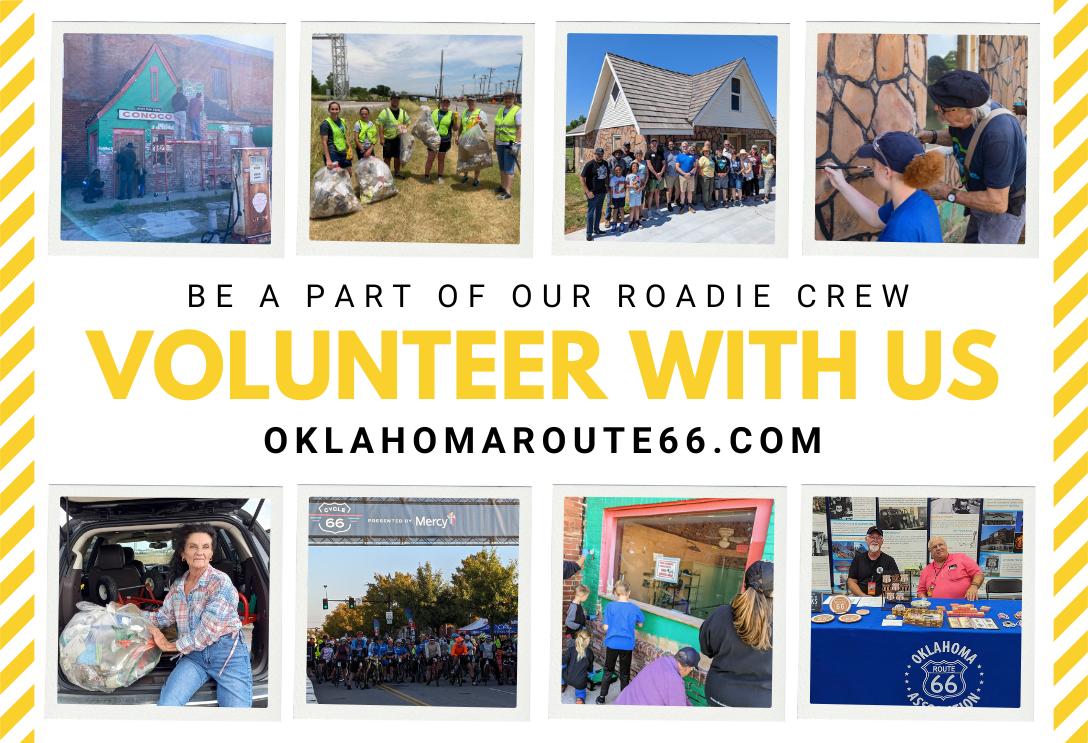
General copy: Association members and local city organizations. A true team effort!
Maps: University of Oklahoma and Oklahoma Scenic Byways Program, updated by Rhys Martin
Trivia/facts: Michael Wallis, author of Route 66: The Mother Road; Jim Ross, author and historian; and the greater Route 66 community of roadies and advocates.
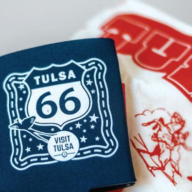
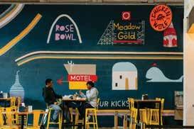
The new mural at our office in Tulsa, painted by Ryan Smart of Splinter Block! It features the state’s Route 66 Centennial logo. Stop by for a selfie next time you’re in town!
For additional information about Oklahoma Route 66 and upcoming events, contact us! We are always happy to assist travelers.
(405) 258-0008 www.oklahomaroute66.com
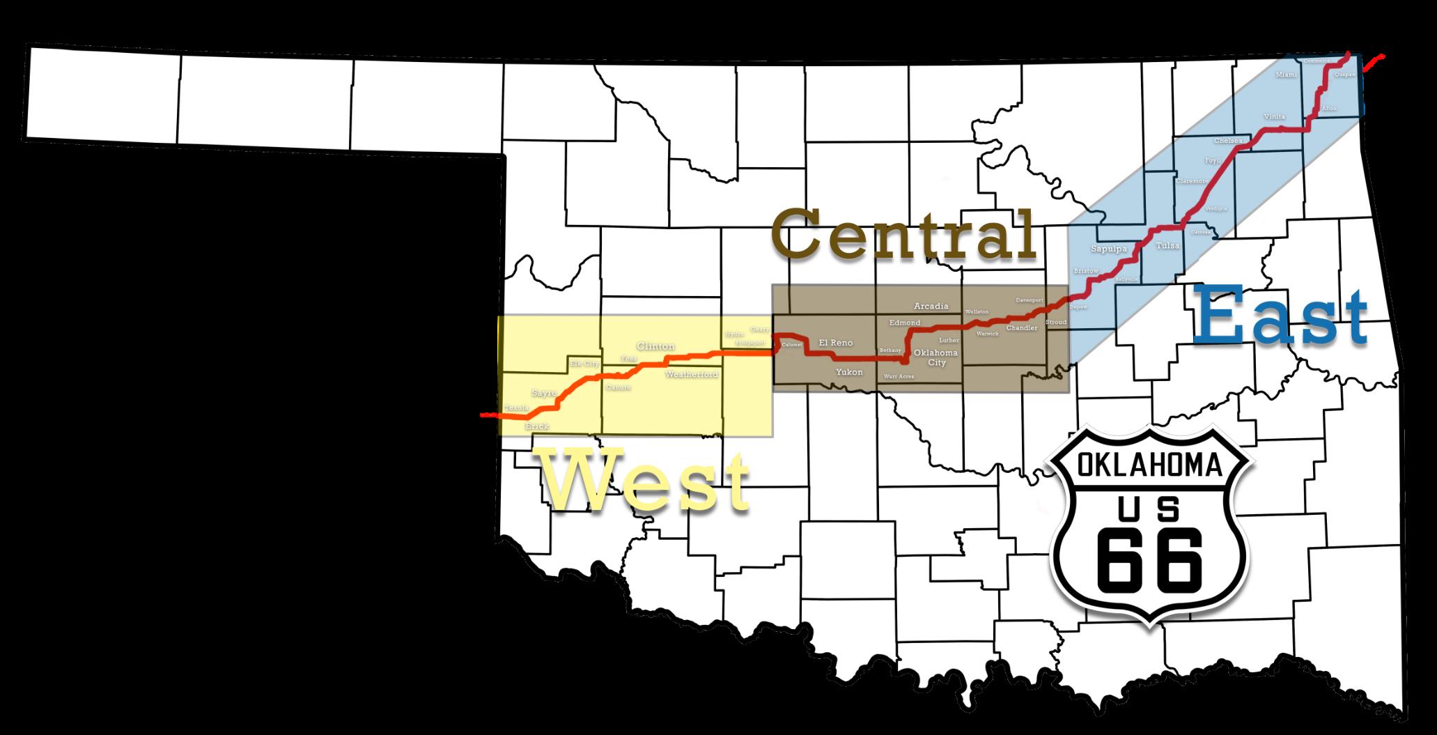
Business Members are listed throughout this guide in each community. There is also a directory at the beginning of each section. East covers Quapaw to Depew, Central covers Stroud to Calumet, and West covers Geary to Texola. The Members listed here are current as of the time of printing - for the most up-to-date listing, please check out our website. Every effort has been made to ensure accuracy. The Association assumes no liability for errors or omissions.
© 2025. All rights reserved.
Hello, and thank you for picking up the Oklahoma Route 66 Association Trip Guide!
For over thirty-five years, the Oklahoma Route 66 Association has been a champion for the Mother Road in the Sooner State. Our mission is to help preserve and protect the historic road while celebrating the new additions that make Route 66 a unique experience. For most of that time, we have been producing this annual guide to help travelers find their way and have the best time on the most famous road in the world.
Not only does this guide include maps to keep you on the road itself, but it also provides historical context behind each community you’ll drive through. This guide also highlights attractions along the way and our Business Members. Without their support, this guide would not be possible and we would not be able to execute our mission:
To celebrate and preserve Route 66 in Oklahoma through education, promotion, and advocacy, ensuring the future of the Mother Road while honoring its community and history.
Please stop and visit with as many of them as you can – and show YOUR support by spending some money when you do. Let them know you learned about them in this booklet!
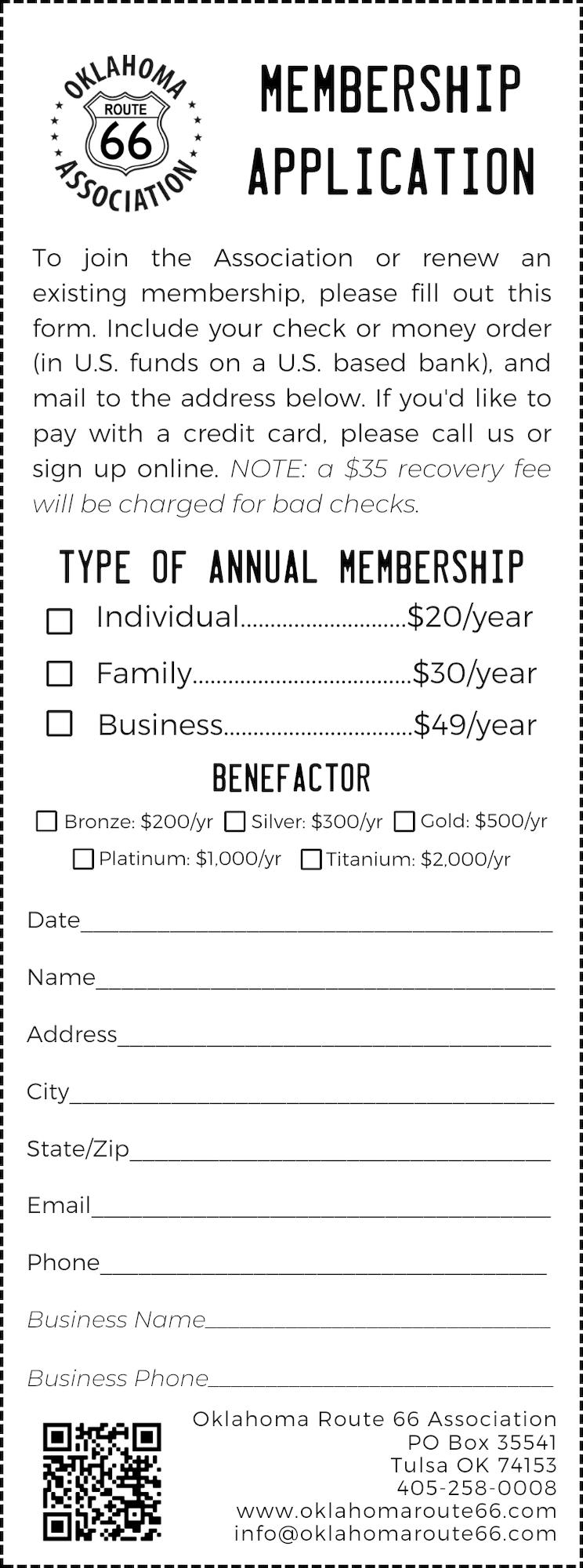
We want to continue serving Oklahoma’s 400+ miles of Route 66 far into the future. If you find value in this Trip Guide and want to be a part of our journey, join the Oklahoma Route 66 Association today! You can join via our website, by calling us, or by sending us a check in the mail. Check out the Membership Application on Page 52 for more information.
As Oklahoma author and historian Michael Wallis says: Life begins at the off-ramp.
We’ll see you on the road!
Rhys Martin
Without the support of our Business Members, we wouldn’t be here. Support them as you travel Oklahoma Route 66!
City of Commerce
618 Commerce Ave | 918-6754373
Dairy King
100 Main St | 918-675-4261
Hitch N’ Post Antique & Flea Market
401 Commerce Ave | 918-6754519
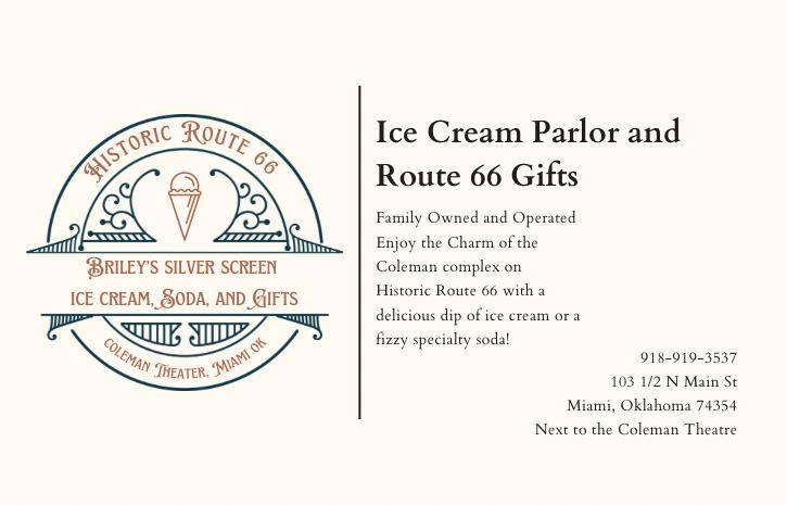
Briley’s Silverscreen Ice Cream, Soda, & Gifts
103 ½ N Main St | 918-919-3537
Chapters
31 N Main St | 918-540-0468
The Coleman Theatre Beautiful
103 N Main St | 918-540-2425
Dobson Museum/Ottawa County Historical Society
110 “A” Street SW | 918-542-5388
The Frozen Elephant
329 S Main St | 918-961-7014
Goodfella’s Pizzeria 34 N Main St | 918-919-3803
Pizza Hut Express
101 “A” Street NW | 918-540-2471
Pizza Hut of Miami
1320 N Main St | 918-542-6642
Visit Miami OK
111 N Main St | 918-542-4435
Waylan’s Ku-Ku Burger 915 N Main St | 918-542-1696
Woody’s Bar-N-Grill 227 S Main St | 918-919-3748
VINITA
66 Apparel 117 S Wilson | 918-256-8573
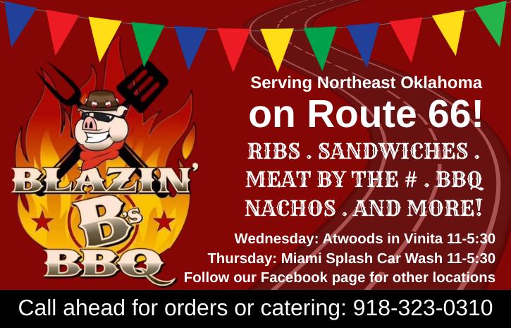
Blazin’ B BBQ & Catering 134 S Wilson | 918-323-0310
Cabin Creek RV
441915 US-60 | 918-256-8000
City of Vinita 104 E Illinois Ave | 918-418-3631
Clanton’s Cafe 319 E. Illinois | 918-256-9053
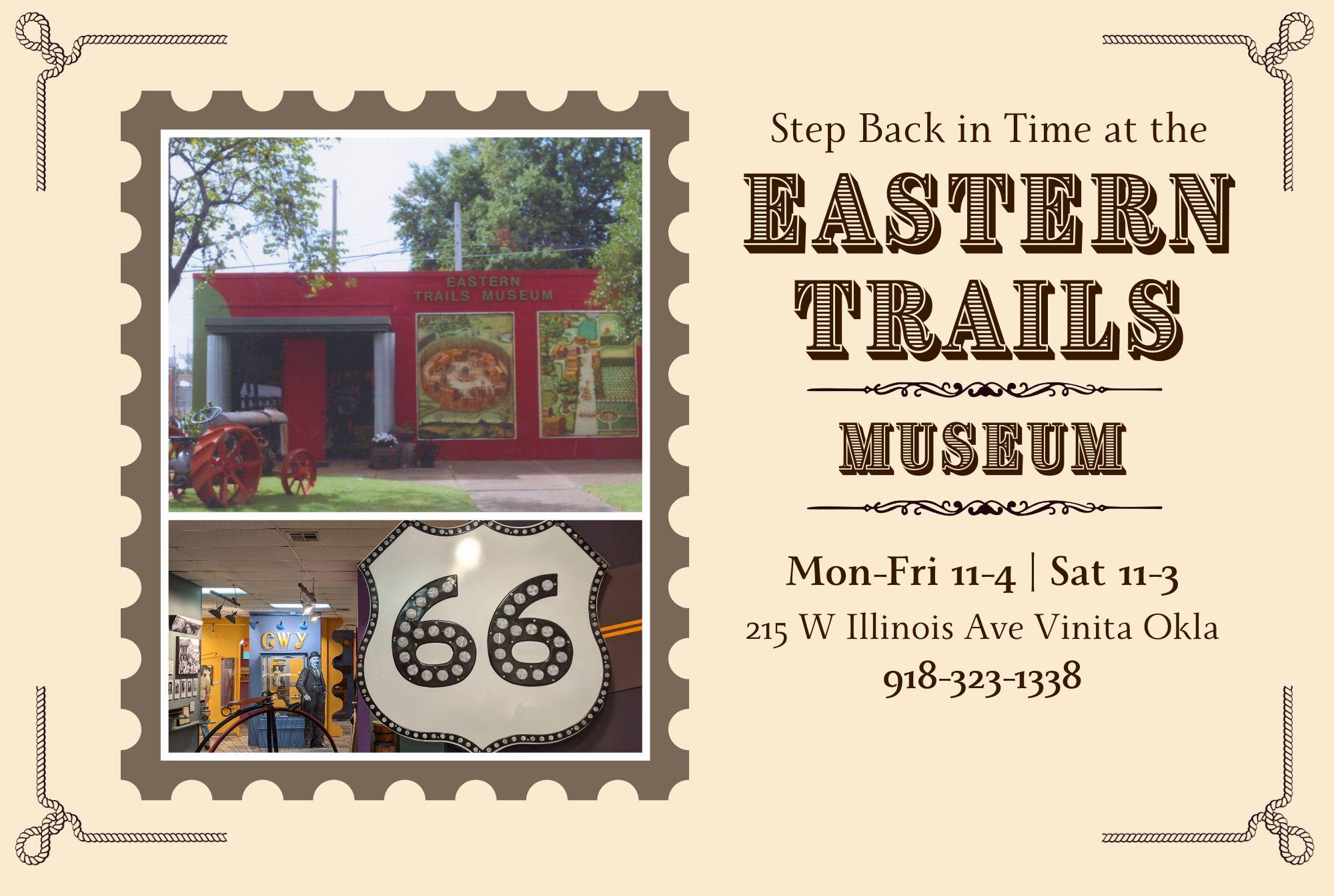
Eastern Trails Museum 215 W. Illinois | 918-244-5355
Hi-Way Café
437918 E Highway 60 | 918256-5465
Holiday Inn Express - Vinita 232 S 7th St | 918-256-4900
Home of Hope
226 W Dwain Willis Ave | 918236-0212
Kelley’s Therapeutic Massage 420 W South Ave | 918-6132246
Northeast OK Electric CoOp PO Box 948 | 918-256-9417
Official Rt 66 Pin Trading Co 136 S Wilson | 702-308-9200
Park Hills Motel & RV Park 438415 US-60 | 918-256-5511
RCB Bank
120 W Canadian | 918-7130222
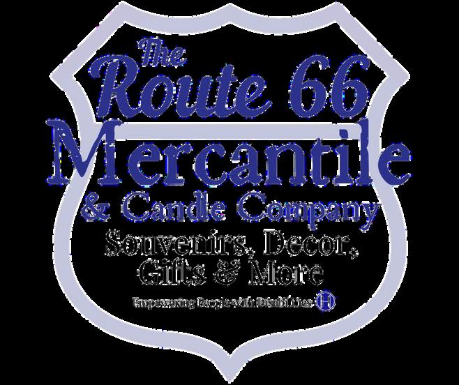
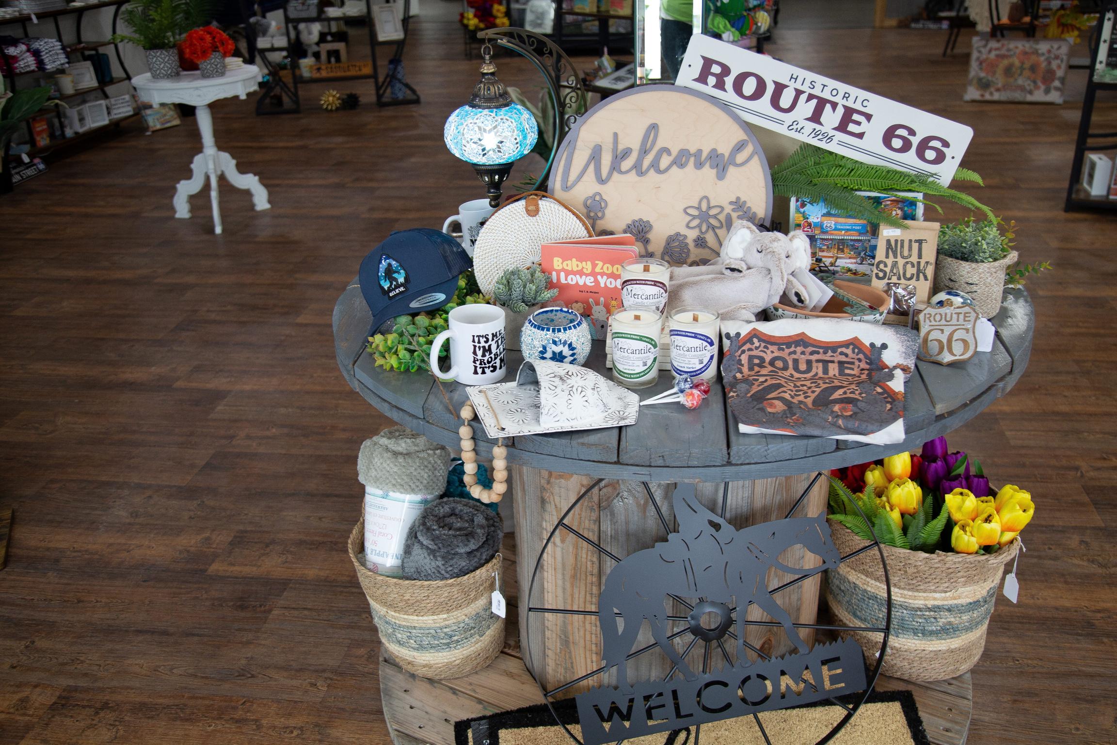
The Route 66 Mercantile
320 S Wilson St | 918-2568406
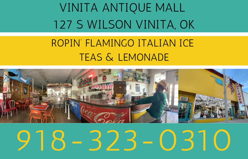
Vinita Antique Mall 127 S Wilson St | 918-3230310
Vinita Daily Journal 138 S Wilson | 918-256-6422
Vinita Friends of Route 66 104 E Illinois | 918-323-1918
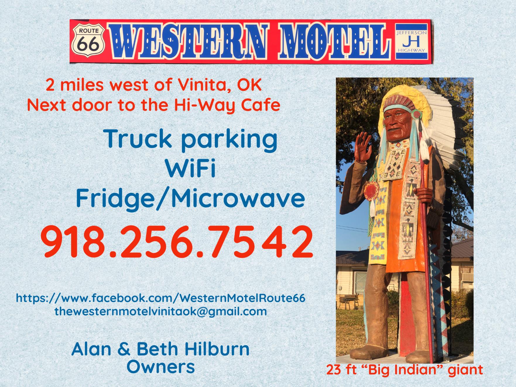
Western Motel 437866 E Highway 60 | 918256-7542
Chelsea Area Historical Society PO Box 404 | 918-923-1409
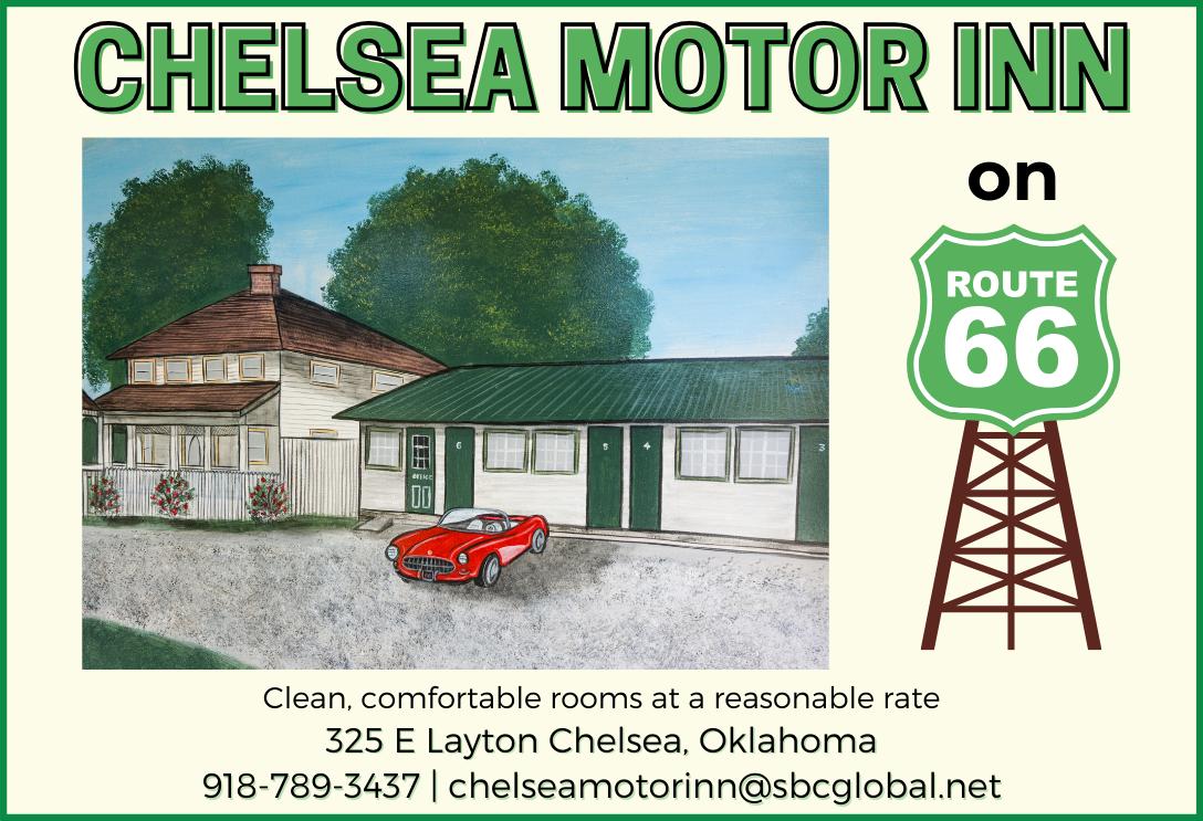
Chelsea Motor Inn 321 E Layton | 918-789-3437
Main Street Diner 251 W 6th St | 918-489-2001
Project Chelsea OK 918-789-2511
Claremore Area Chamber of Commerce
419 W Will Rogers Blvd | 918-3412818
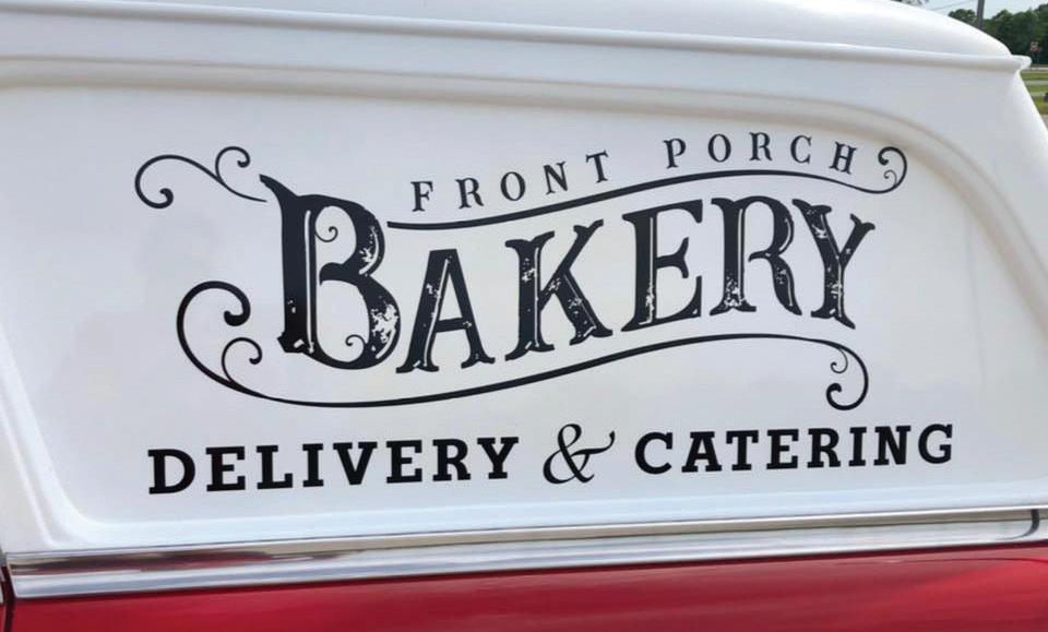
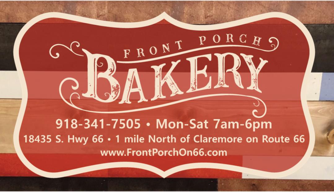
Front Porch Bakery 18435 S Highway 66 | 918-3417505
J.M. Davis Arms & Historical Museum
330 N Lynn Riggs Blvd | 918-3415707
Okie Snack Wagon 918-340-8385
Rogers County Development 1503 N Lynn Riggs Blvd Ste D | 918-343-8959
Rogers County Historical Society 121 N Chickasaw Ave | 918-3421127
Sailor Antiques and Collectibles 422 W Will Rogers Blvd | 918-3414838
Shepherd’s Cross 16752 E 450 Rd | 918-342-5911
Visit Claremore 400 Veterans Pkwy | 918-341-8688
Will Rogers Memorial Museum 1720 W Will Rogers Blvd | 918-3438118
Will Rogers Productions 661-399-5832
The Blue Whale 2860 N Hwy 66 | 918-266-2505
Catoosa Chamber of Commerce 650 S Cherokee Suite C | 918266-6042
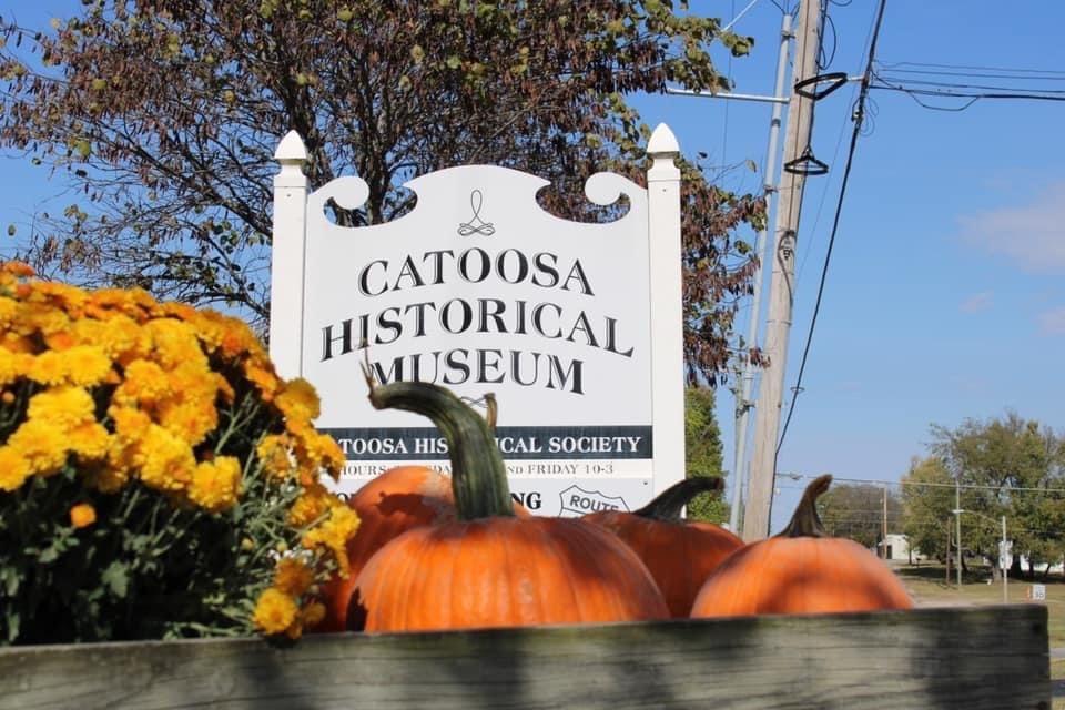
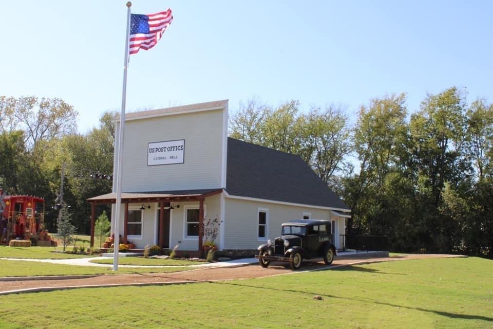
Catoosa Historical Society 207 N Cherokee | 918-266-6592
City of Catoosa 214 S Cherokee | 918-266-2505
D.W. Correll Museum 19934 E Pine St | 918-266-3612
Hampton Inn & Suites 100 McNabb Field Rd | 918-7393939
Visit Cherokee Nation 877-760-6700
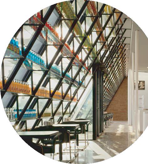
TULSA
AAA Oklahoma 2121 E 15th St | 918-748-1000
Admiral Twin Drive-In 7355 E Easton St | 918-878-8099
Agitsi Stained Glass 2615 W 40th Pl #3 | 918-340-8030
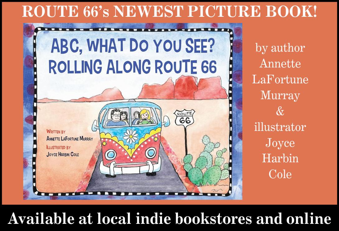
Annette Murray, Author 918-230-8388
Anybody’s Guest 2219 E 11th St Ste 3 | 918-5766887
Apertures Photo
4602 E 11th St | 918-742-0500
Art Emporium 66 2615 W 40th Pl | 918-706-7715
Atlas Automotive Repair 4625 E 11th St | 918-910-2886
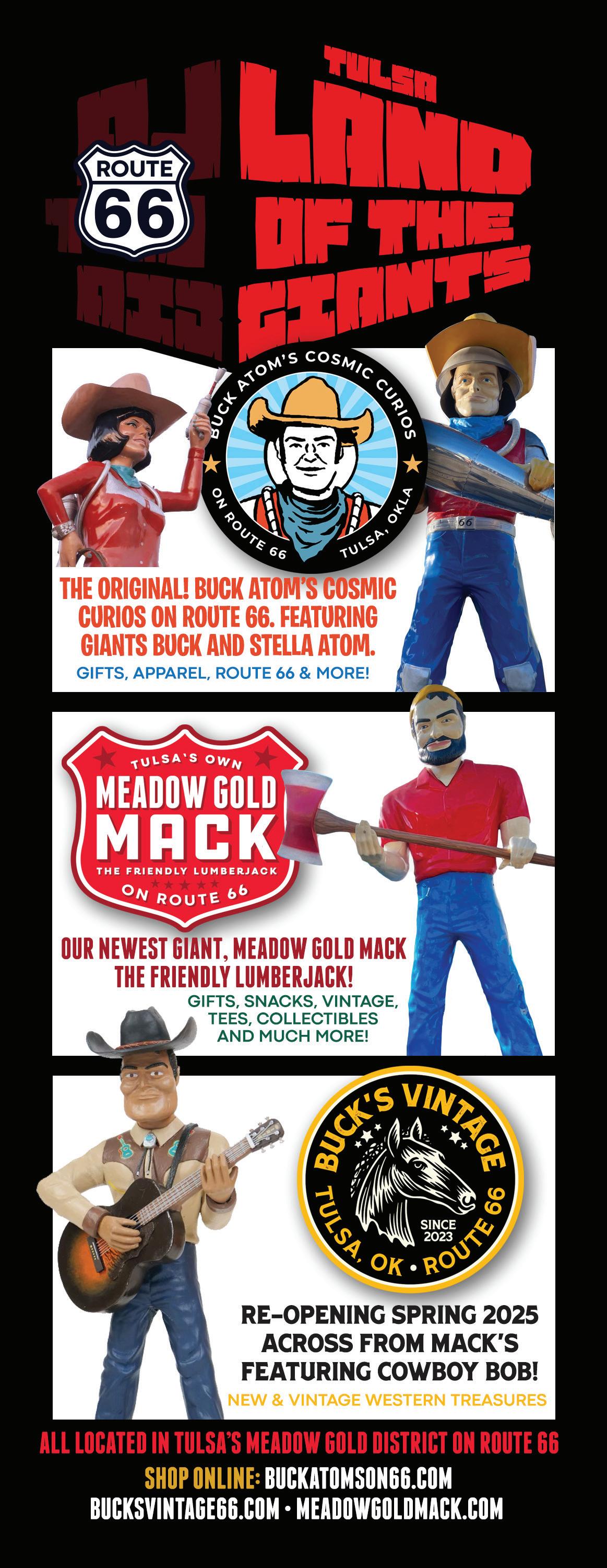
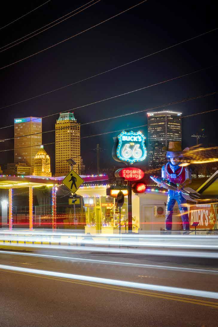
Buck Atom’s Cosmic Curios on 66 1347 E 11th St | 918-629-4606
Cedar Rock Inn 4501 W 41st St | 918-447-4493
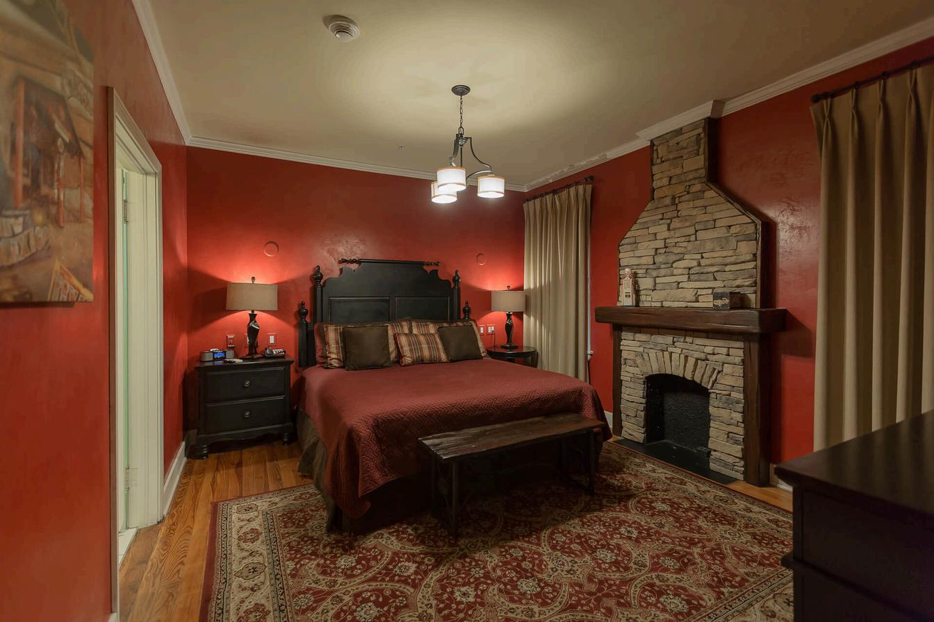
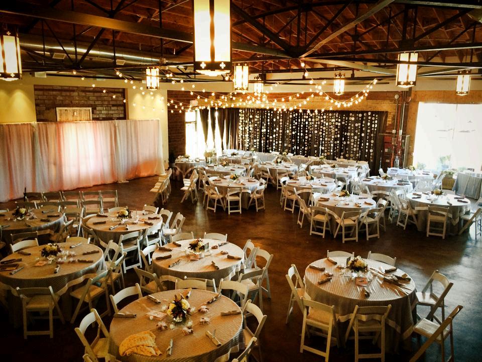
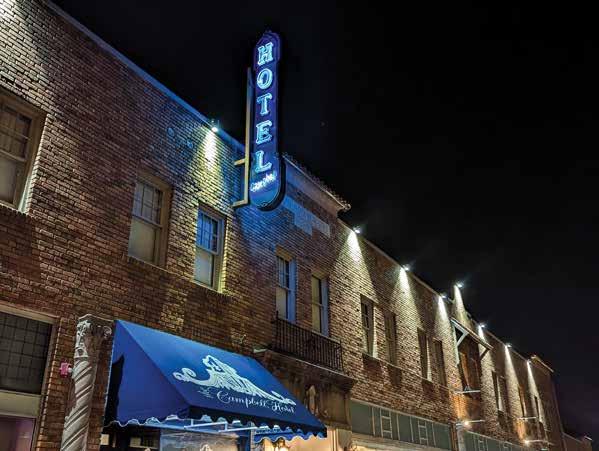
The Campbell Hotel & Event Center
2636 E 11th St | 918-744-5500
Circle Cinema 10 S Lewis Ave | 918-585-3456
Cottage in the Pearl 1153 S Quaker Ave | 918-900-4020
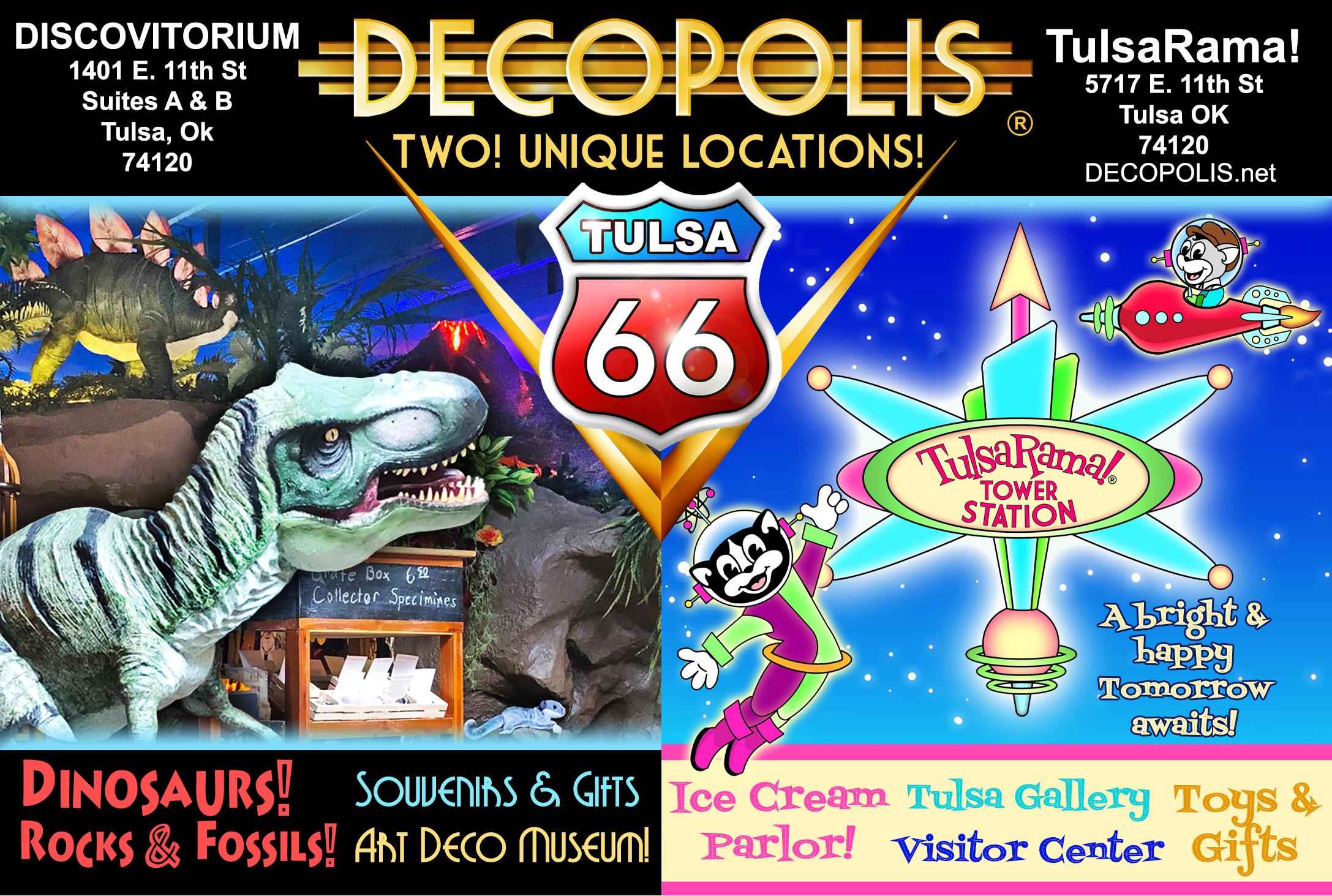
Decopolis 1401 E 11th St | 918-382-7388
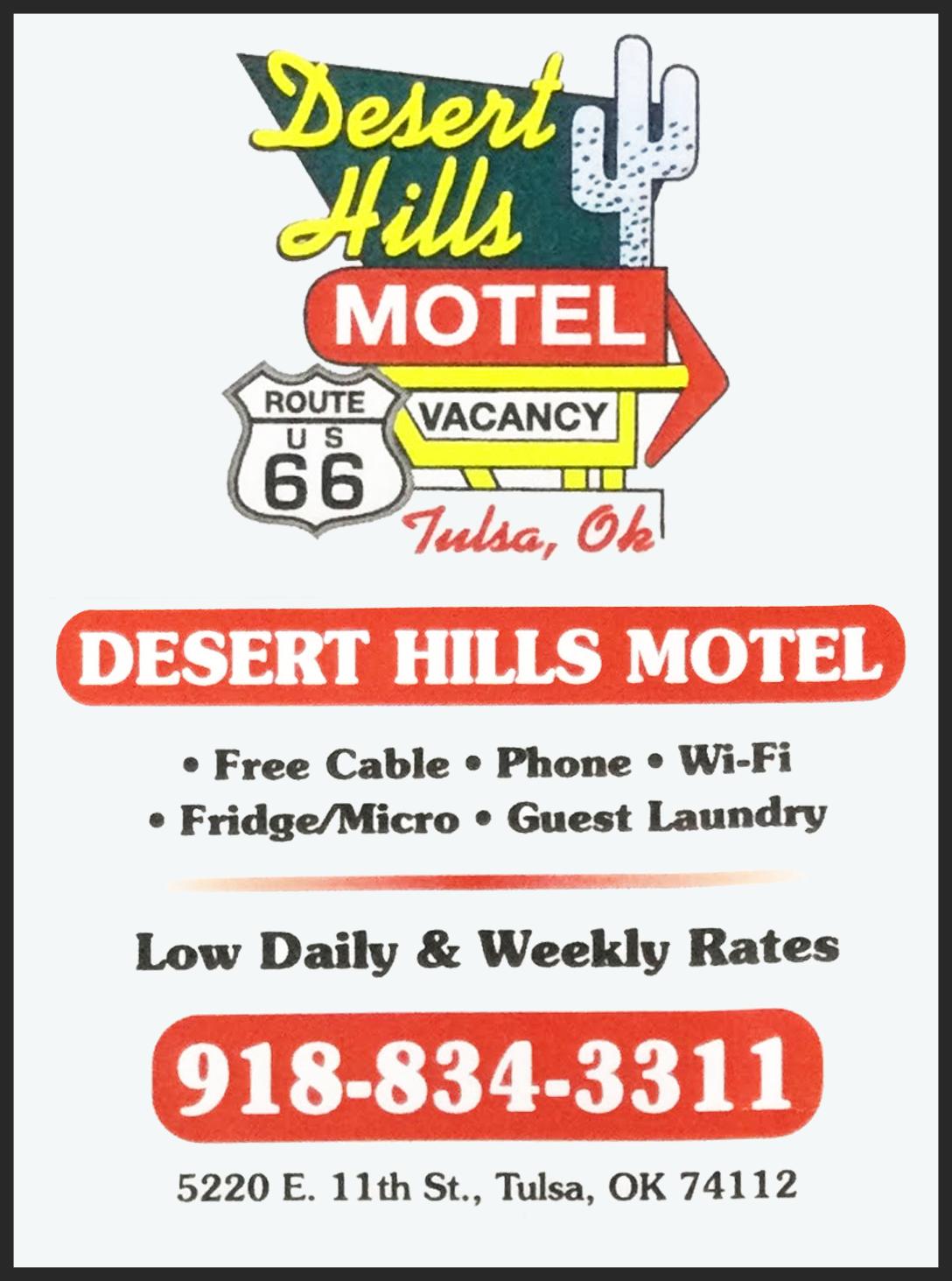
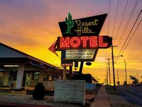
Desert Hills Motel 5220 E 11th St | 918-834-3311
Expressly Gifts
10032 S Sheridan Rd Ste H2A | 918-664-3320
Freddie’s Hamburgers 9130 E 11th St | 918-836-5600
Generations Antique Mall 4810 E 11th St | 918-834-7577
Gusher Newspaper 1125 S 110th E Ave | 918-437-7470
Hank’s Hamburgers 8929 E Admiral Pl | 918-832-1509
Jerlissa’s Trading Post 2010 E 11th St | 918-906-2782
Jesse’s Restaurant 1134 S Memorial | 918-832-9052
John’s Classics on Rt 66 8702 E 11th St | 539-867-3000
Joseph Gierek Fine Art 1342 E 11th St | 918-592-5432
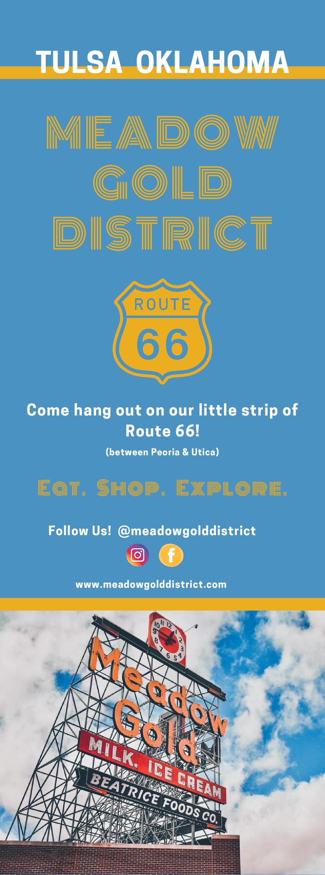
Meadow Gold District PO Box 521094 | 918-695-7249
Meadow Gold Mack 1306 E 11th St Ste A & B
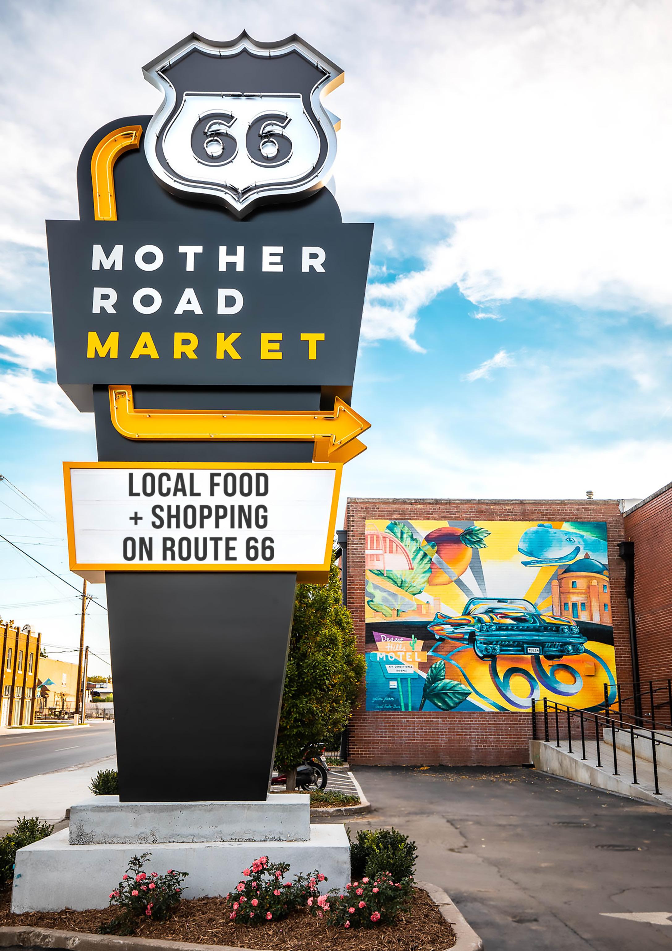
Mother Road Market 1124 S Lewis Ave | 918-984-9001
Mother Road Real Estate/KW Advantage 2651 E 21st St Ste 100 | 918-7122252
Mythic Press 2015 E 3rd St | 918-516-8255
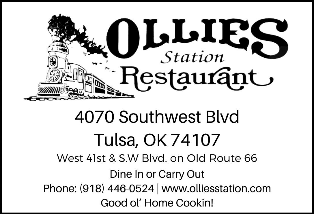
Ollie’s Station Restaurant 4070 SW Blvd | 918-446-0524
Paula’s Treasures 17619 E 11th St | 918-829-1480
Route 66 Alliance PO Box 54214 | 918-629-2984
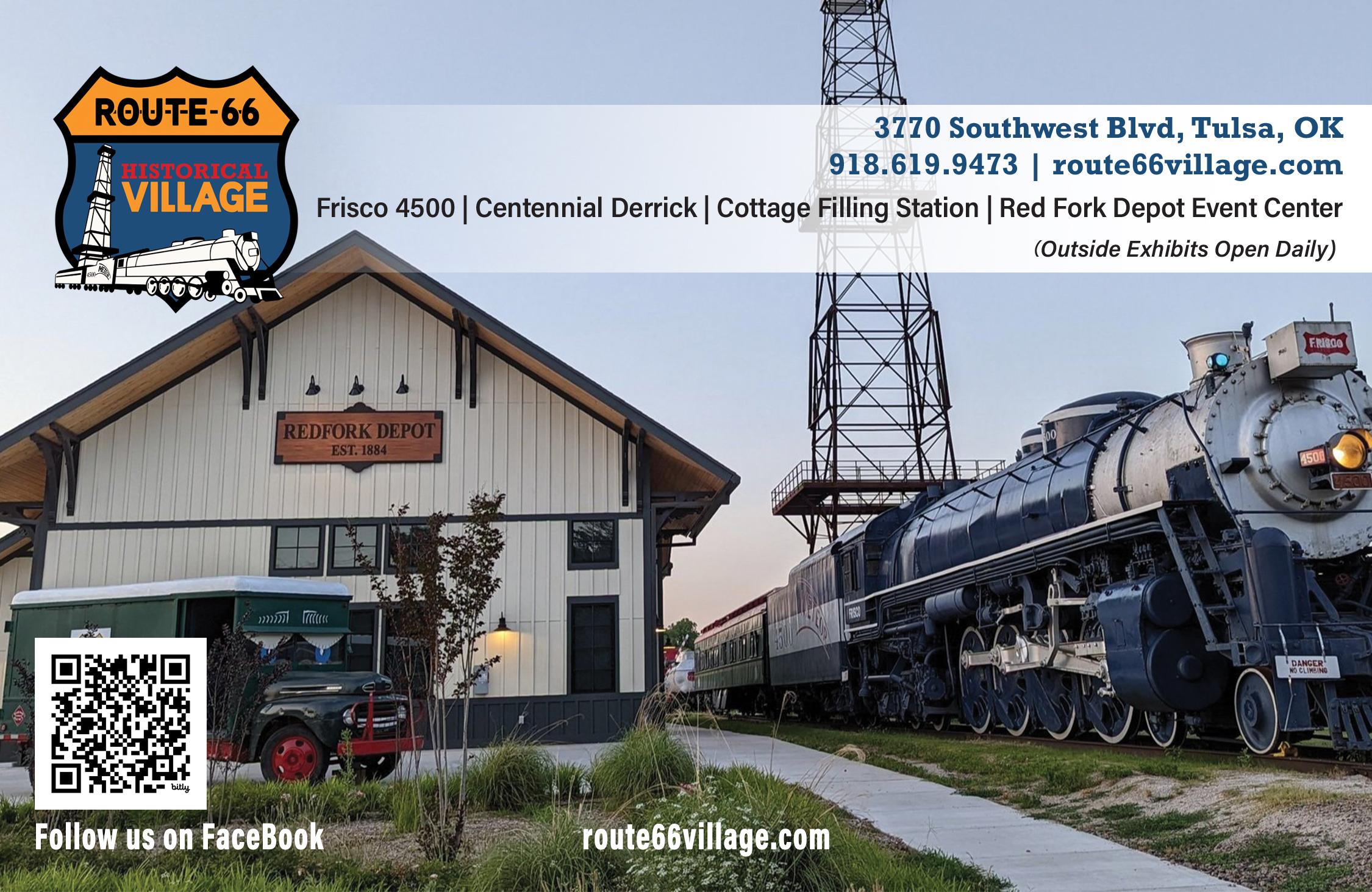
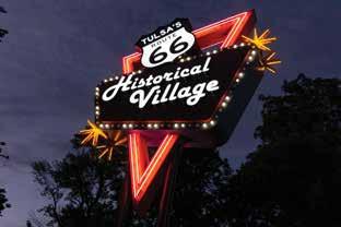
Route 66 Historical Village 3770 Southwest Blvd | 918-6199473
Splinter Block 3306 Charles Page Blvd | 918-7245150
Standing Horse Acres 8223 Frankoma Rd | 918-724-5150
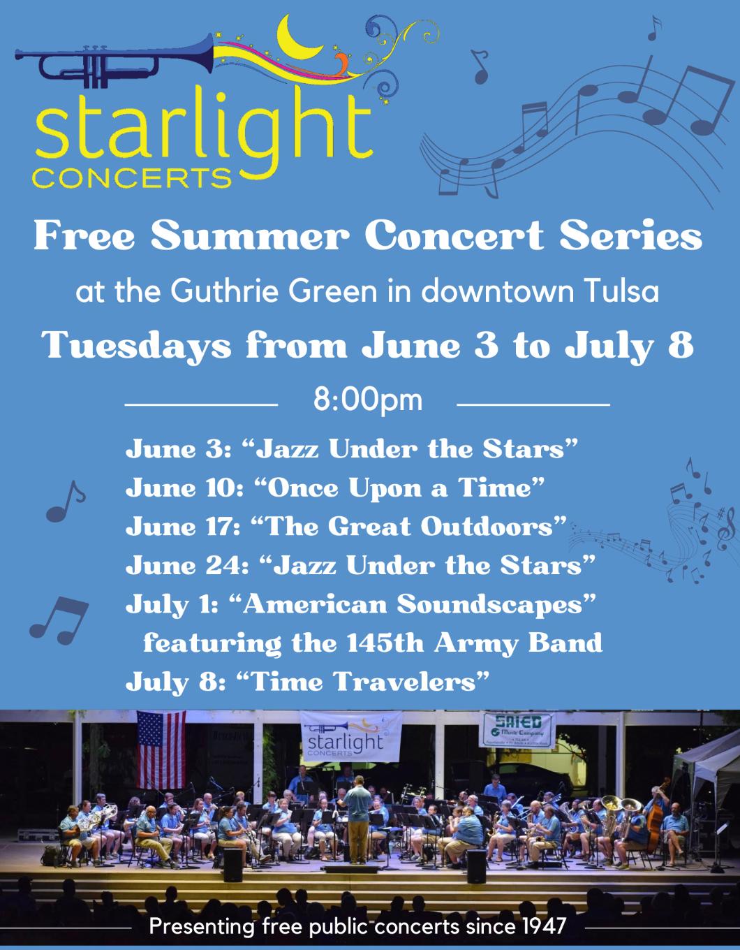
Starlight Concerts PO Box 35158 | 918-706-6615
Tulsa Air & Space Museum & Planetarium 3624 N 74th E Ave | 918-834-9900
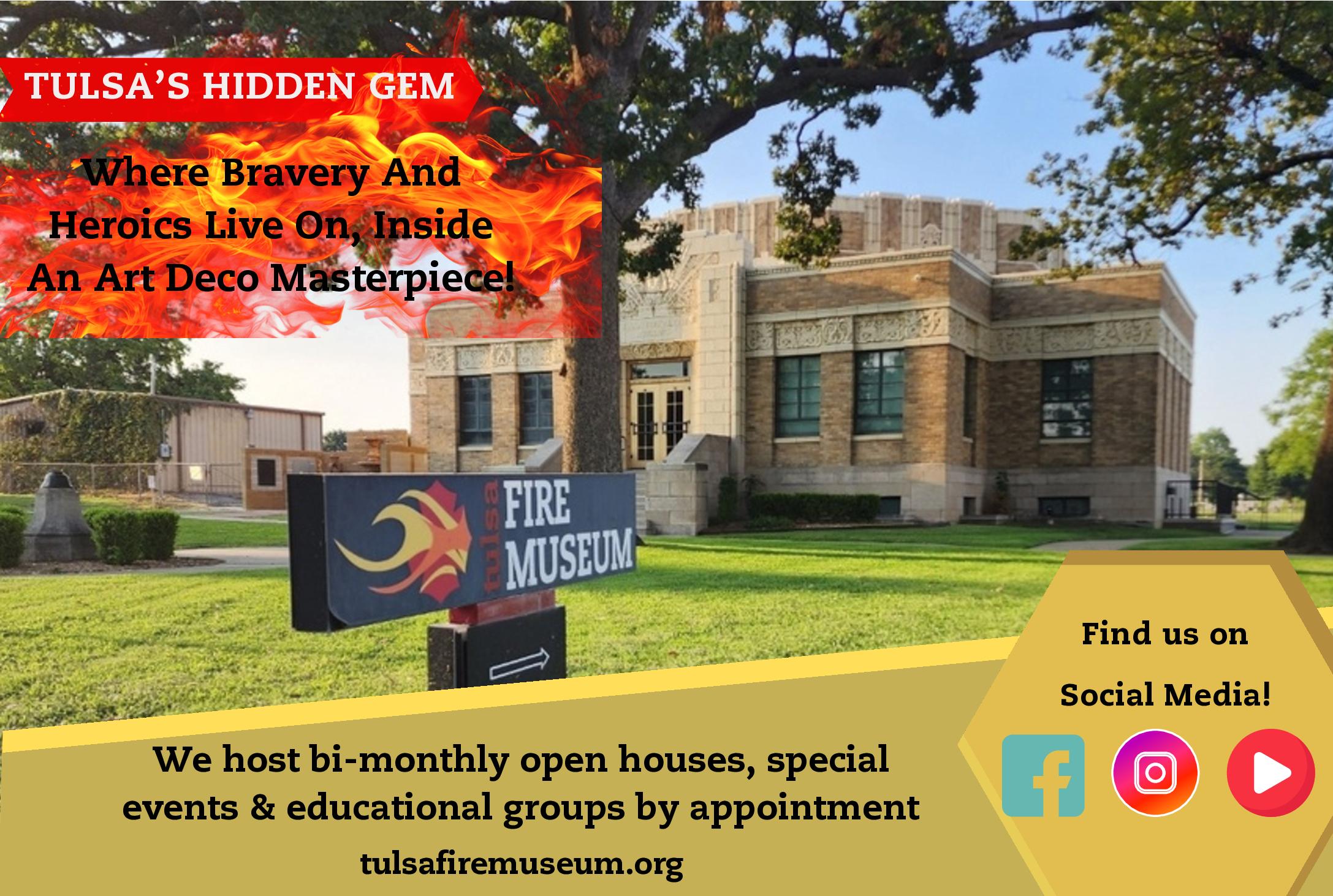
Tulsa Fire Museum 1010 E 8th St | 918-619-6103
Tulsa Regional Early Ford V8 Club 407-314-0498
Tulsa Route 66 Main Street 2215 W 38th Pl | 918-445-4457
Tulsa Spotlight Theater 1381 Riverside Dr | 918-587-5030
Visit Tulsa 1 W 3rd Street Suite 100 | 918560-0238
Wings of Freedom 10338 E 11th St | 918-888-4097
SAPULPA
Crossroads Cookery 117 E Dewey Ave | 918-851-3314
Gasoline Alley Classics 24 N Main | 918-806-1000
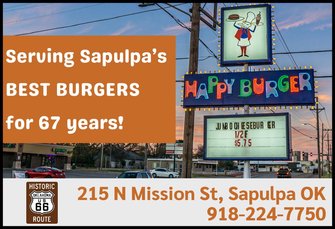
Happy Burger 215 N Mission | 918-224-7750
Heart of Route 66 Auto Museum 13 Sahoma Lake Rd | 918-2161171
Route 66 Electric
1003 E Lee Avenue | 918-8502056
Route 66 Tree Service
12904 W 86th St S | 918-918-8554398
Sapulpa Area Chamber of Commerce 101 E Dewey | 918-224-0170
Sapulpa Historical Society 100 E Lee Ave | 918-224-4871
Sapulpa Main Street 15 N Water St | 918-224-5709
Tee-Pee Drive-In Theater 13166 W Ozark Trail | 918-9285500
Tulsa-Sapulpa Union Railway 701 E Dewey | 918-224-1515
Waypoint Lounge 111 S Main St | 918-600-2055
High on a Hill Dairy Goats 15362 S 217th W Ave | 918-8419951
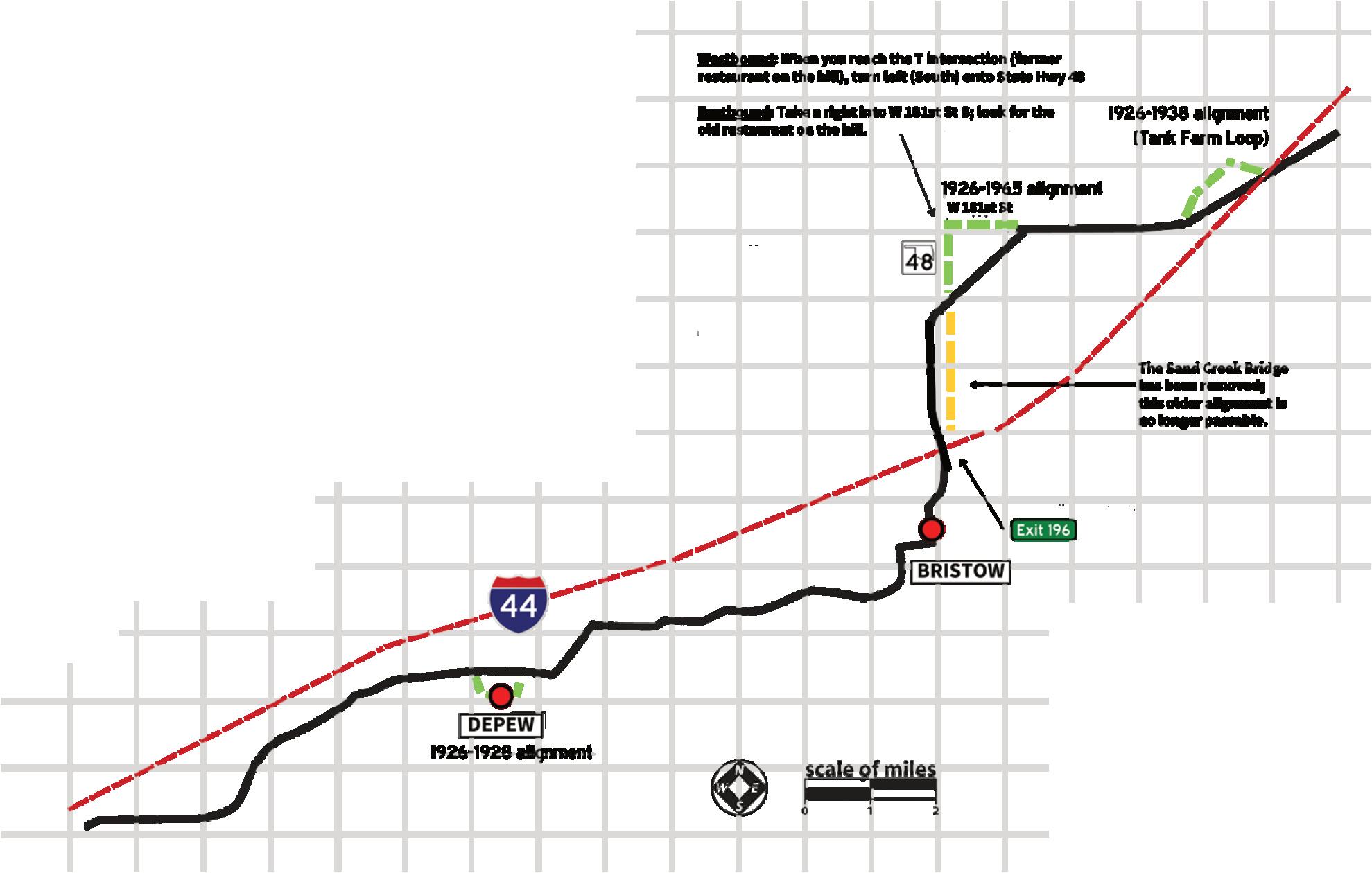
BRISTOW
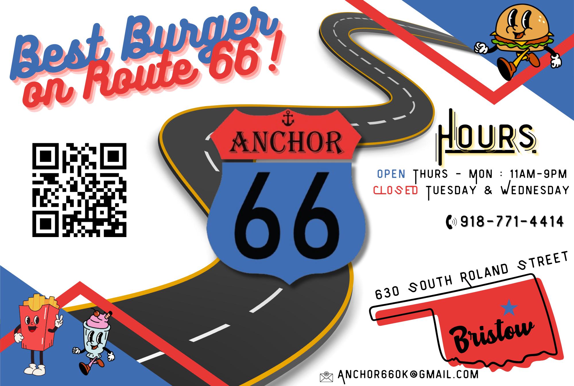
Anchor 66 630 S Roland St | 918-813-1182
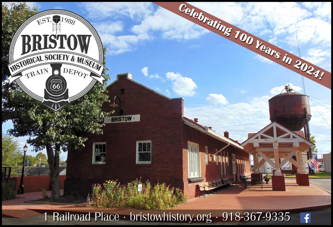
Bristow Historical Society & Museum 1 Railroad Pl | 918-367-9335
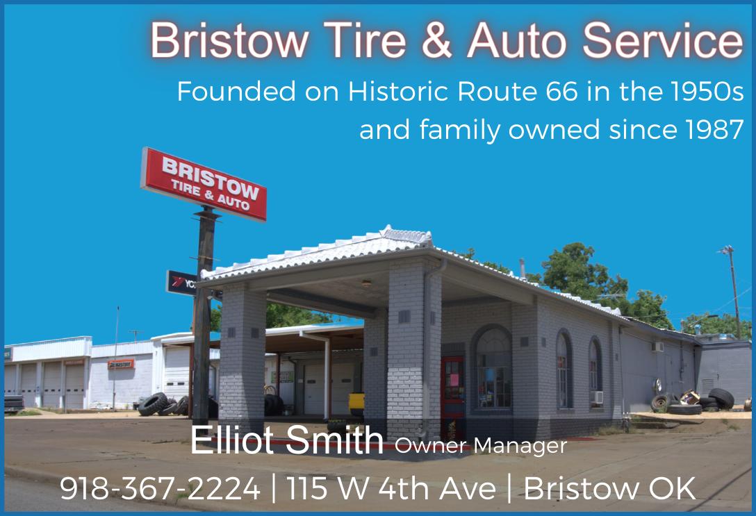
Bristow Tire & Auto Service 115 W 4th Ave | 918-367-2224
Bristow Toy Museum 118 N Main St | 918-629-2852
City of Bristow 110 W 7th Ave | 918-367-2237
Evergreen RV Park 37661 W Hwy 66 | 918-367-2610
Granny’s Emporium 709A S Roland | 918-367-1727
Oklahoma Venue 66 116 W 8th St | 918-381-4624

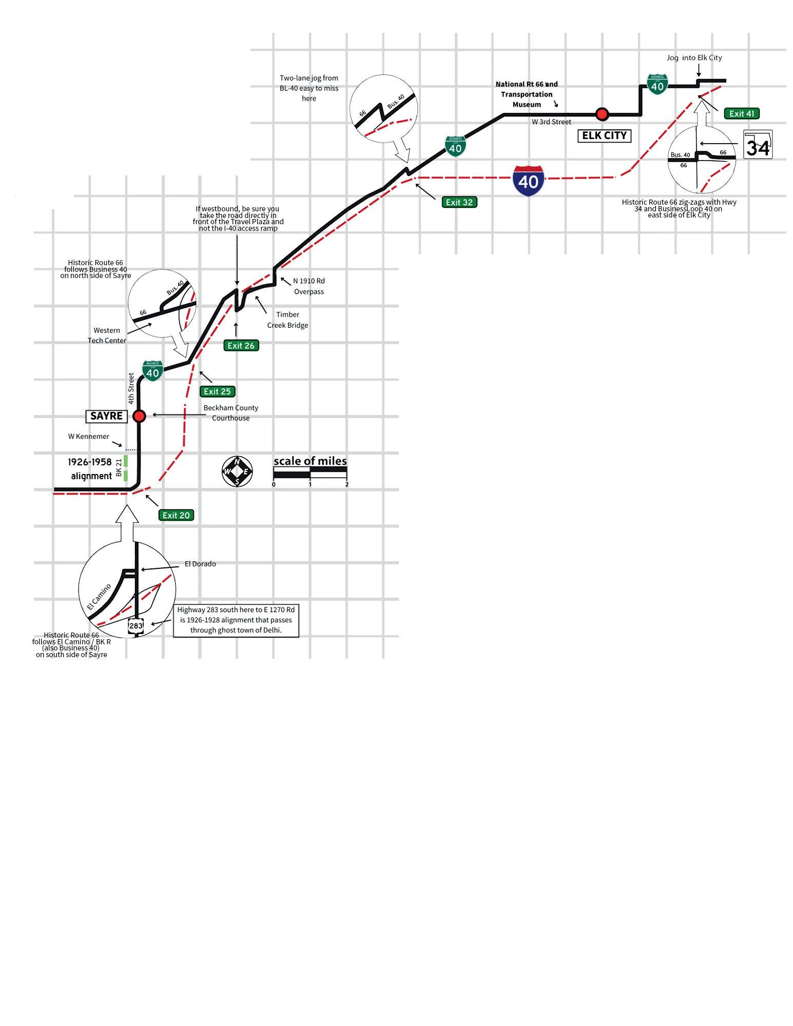
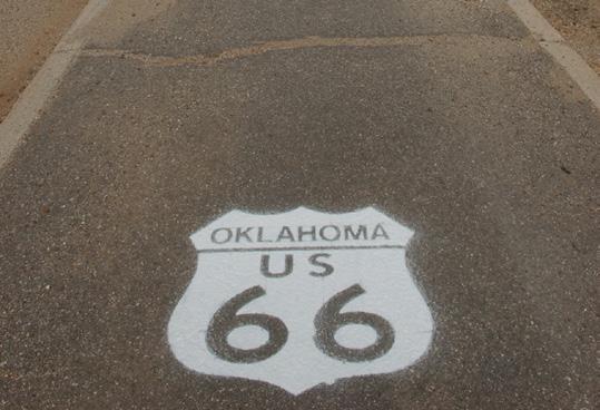
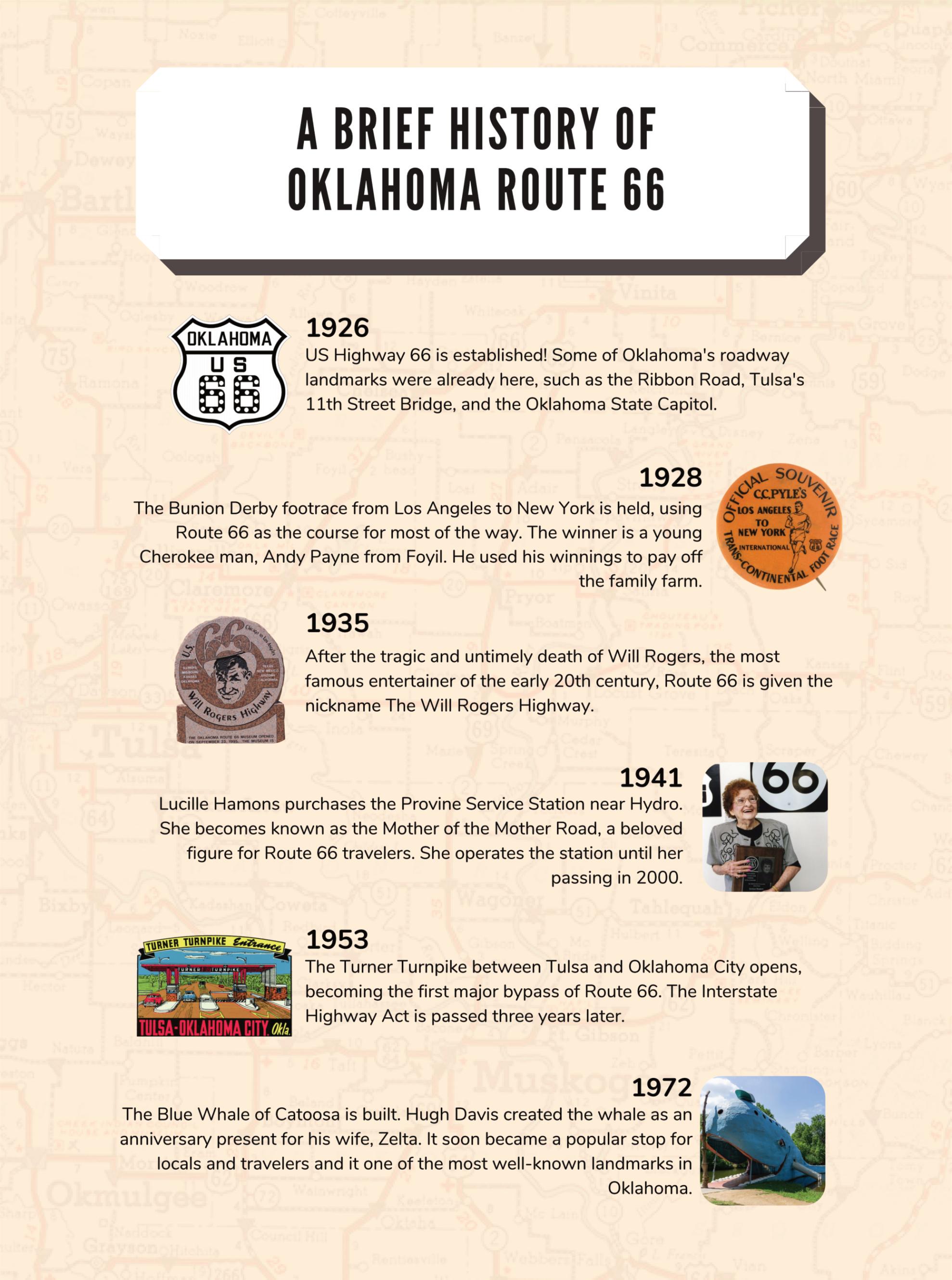
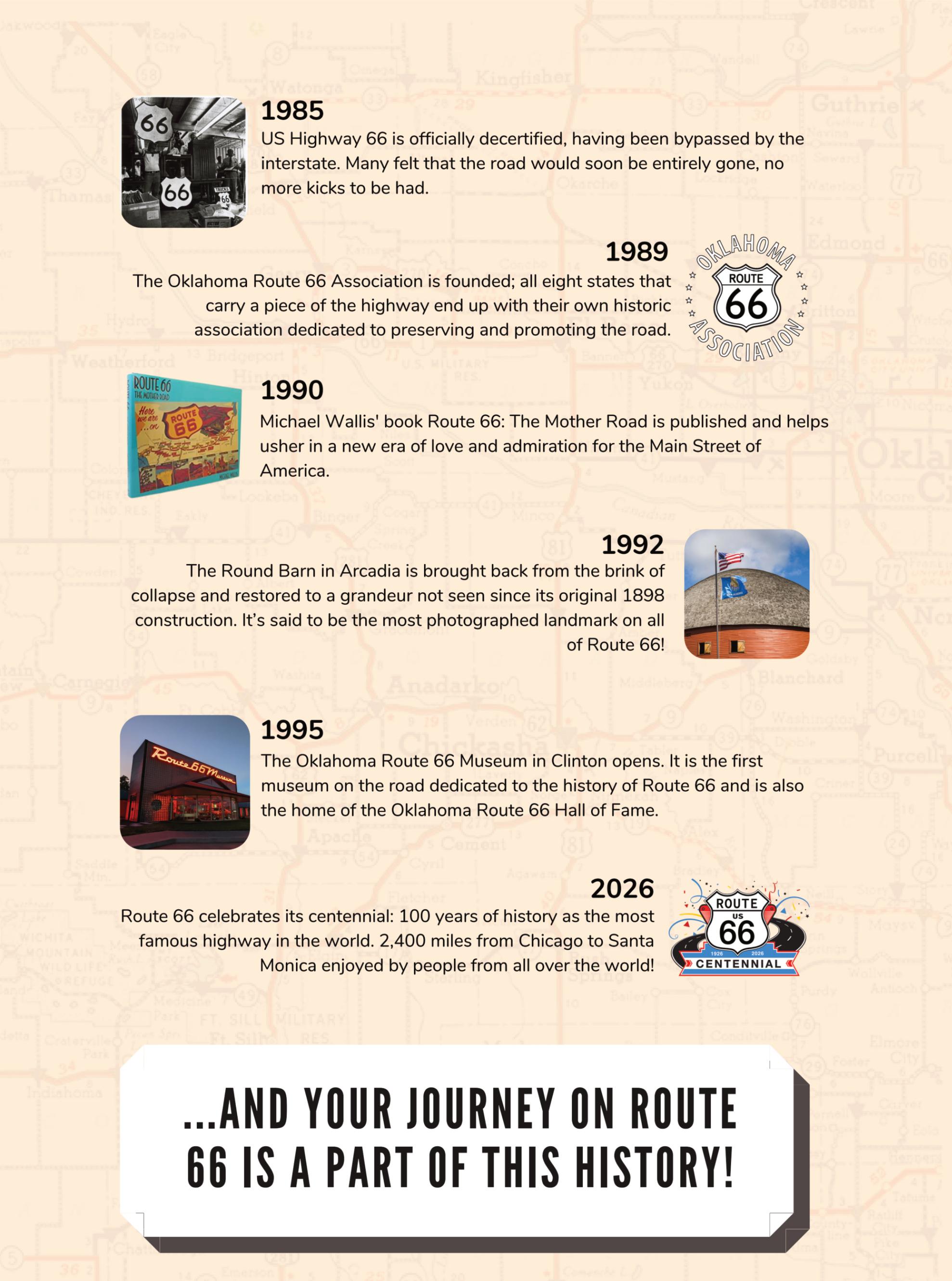
Since Route 66 was federally de-certified in 1985, the road itself now carries many names and numbers Modern highways overlay the original pavement or bypass it nearby. In Oklahoma, there’s even a State Highway 66 - which is sometimes but not always Historic Route 66 Even when Route 66 was in full swing the road was re-aligned multiple times for various reasons It can be confusing! That’s why our guide gives you maps and calls out alternative street names to help you find your way
Oklahoma was the first state to mark former US Highway 66 with what became the distinctive Historic Route 66 signage The first one was installed in Warr Acres on June 6 1990 thanks in part to the fundraising and awareness efforts that the Oklahoma Route 66 Association led Thirty years later the Association once again led the effort to replace those signs with a new version, working with the Oklahoma Department of Transportation to identify areas where signage was lacking
State Highway 66 (SH 66) exists in northeastern and central Oklahoma. Specifically, it starts just east of Vinita and goes all the way to El Reno This can be deceiving however In Tulsa SH 66 signs mirror Interstate 44; following them will cause you to miss the historic road entirely When State Highway 66 ends in El Reno, Business Loop I-40 signs begin These will put you on the Interstate, too, if you ’ re not careful
It’s a good idea to look through this guide before you travel and keep it with you while you ’ re on the road Signage is there to help you but it’s not perfect If you get lost one of our many Business Members would be more than happy to help you find your way again It’s part of the adventure!
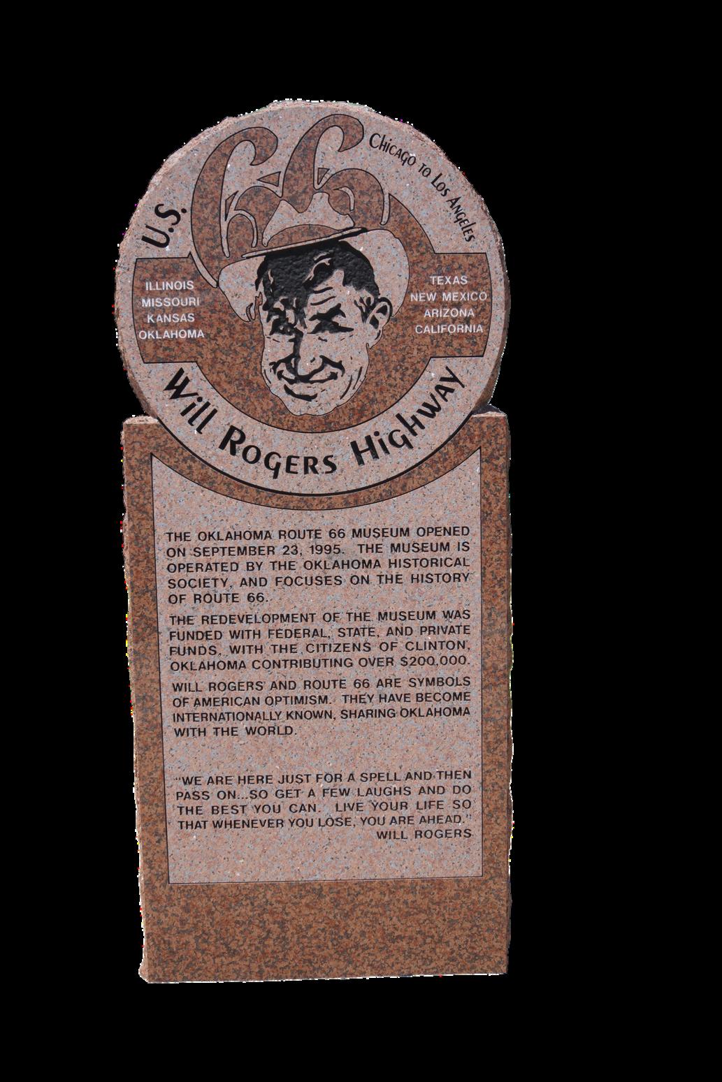
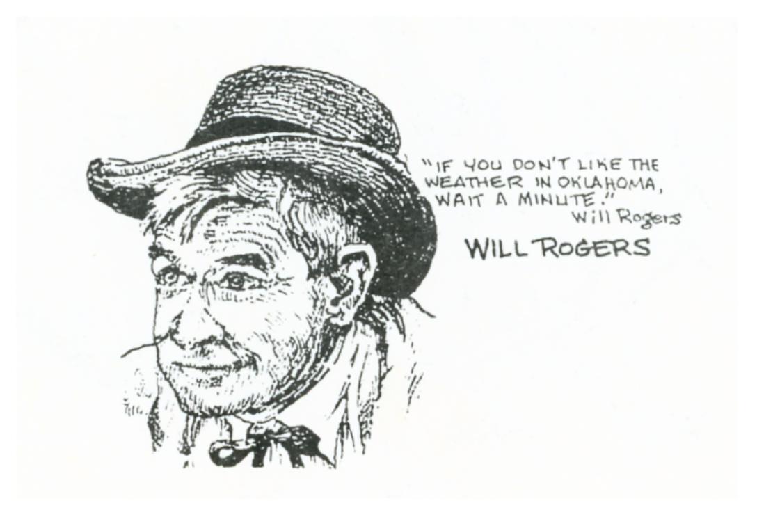
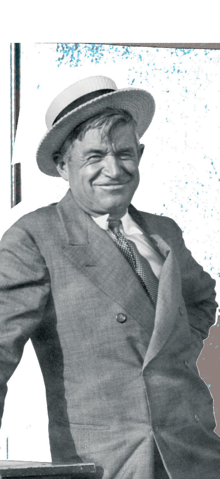
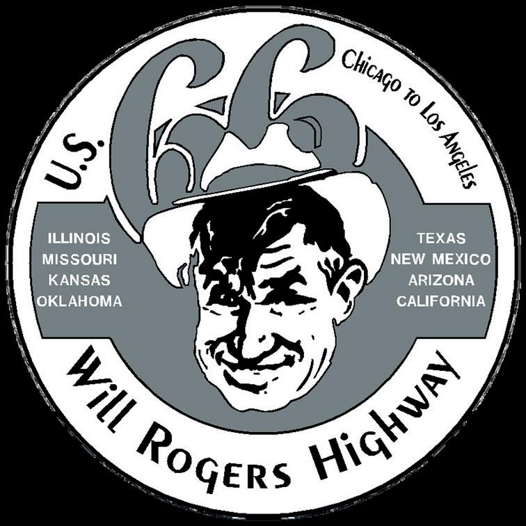
Will Rogers was the most famous public figure of the early 20th century A radio and movie star known for his wit and wisdom, he was at the peak of his prosperity as a humorist-philosopher entertainer when he tragically died in an airplane crash on August 15, 1935
Just days later, a group of leaders from Tulsa suggested that US Highway 66, which connected Rogers’ hometown to Hollywood, be symbolically named The Will Rogers Highway In January of 1936, the US Highway 66 Association made it official with a logo and a formal proclamation.
The Oklahoma Route 66 Association has replaced many of the early 2000s Hampton Inn signage, which had gone missing or were faded by the Oklahoma sun New signs have been added, too! Keep an eye out for these signs, signaling that a Route 66 roadside attraction or side trip are nearby
Each sign provides bitesized content and history for the location you're visiting

General Information
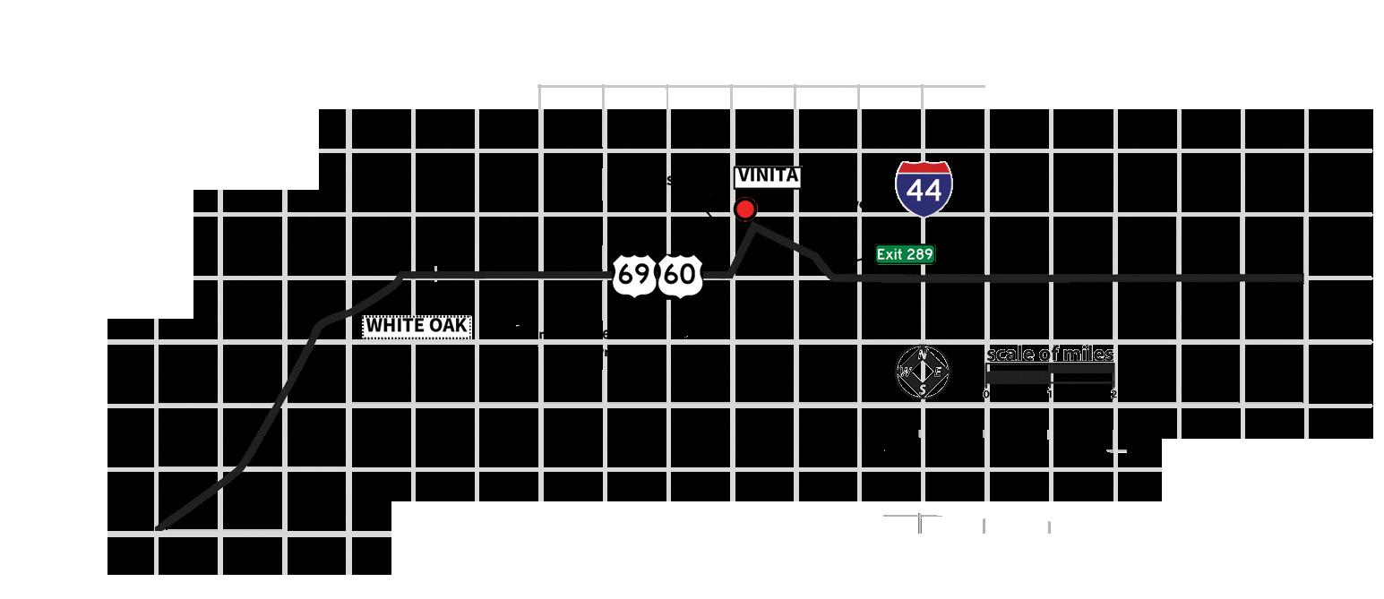
Starting at the Kansas border and continuing through Ottawa and Delaware counties, Historic Route 66 has multiple designations: US 69 Alt., US 69, US 59, and US 60. It can be confusing!
In Miami, if you are westbound, take care that you don’t turn off Main when you see a sign for US 69 South. The modern alignment bypasses the beautiful downtown district and you’ll miss the Coleman Theatre Beautiful….among many other places!
Continue south on Main until you reach the major intersection that indicates State Highway 10/Steve Owens Blvd. Either turn right (west) here to take the newer way out of town, or go straight to access the 9-foot road. (See the directions on the right side of this page.)
Street names of Route 66 in towns (east to west):
Quapaw: 69 Alt. • Main • 69 Alt. Commerce: 69 • Mickey Mantle Blvd. • 69 (or 69 • Commerce St. • Main St. • 69 for older alignment) Miami: 69 • Main • Third Ave. SW/Steve Owens Blvd./SH 10 • 69
Afton: 60/69 • South First • 60/69
Ottawa County has a unique stretch of historic highway. The 9-foot-wide segment that connected Miami and Afton through a series of zigzags has been known by various nicknames, including the Scotch Highway, Ribbon Road and Sidewalk Highway. The road is rough, but a cautious, careful driver can handle it just fine.
Drive slowly, as the road is narrow (you’ll have to pull over to the shoulder if you meet another vehicle), and gravel is periodically spread across the road surface. If you look carefully, you will see white curbs on either side of the road.
The county has plans to resurface this road and we’re working to preserve as much as possible. Stay tuned!
2025-2026
Miami segment:
Westbound: At the Steve Owens and Main intersection in Miami, stay on Main Street. This will turn into E. Street SW and 125 as you cross over the Neosho River. Continue straight until you reach a T intersection (E 130 Rd), then turn right. After a half-mile, the asphalt ends and the 9-foot roadbed begins.
Eastbound: One mile north of Narcissa (a half-mile after the blue cylindrical water tower), turn right. This road is marked E 140 Rd. on the other side of the highway. There is a granite historic marker on the right.
Southern segment:
Westbound: Look for the NE Tech Center on the right side of current 66. The interstate will be in front of you. Turn right onto E 200 Rd in front of the Center.
Eastbound: One mile east of Afton, there is an old fragment on the right side of the road with a Will Rogers Highway marker. Look to the left and you’ll see a gravel road marked S 520 Rd opposite the end of the fragment on the right. Turn left here.
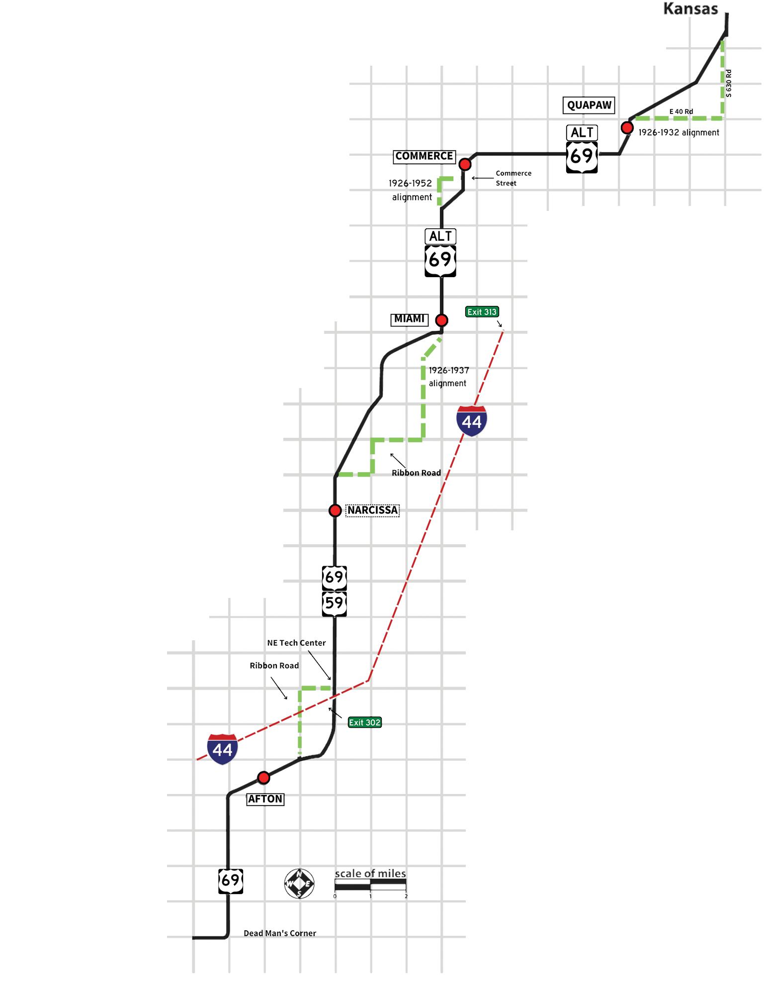
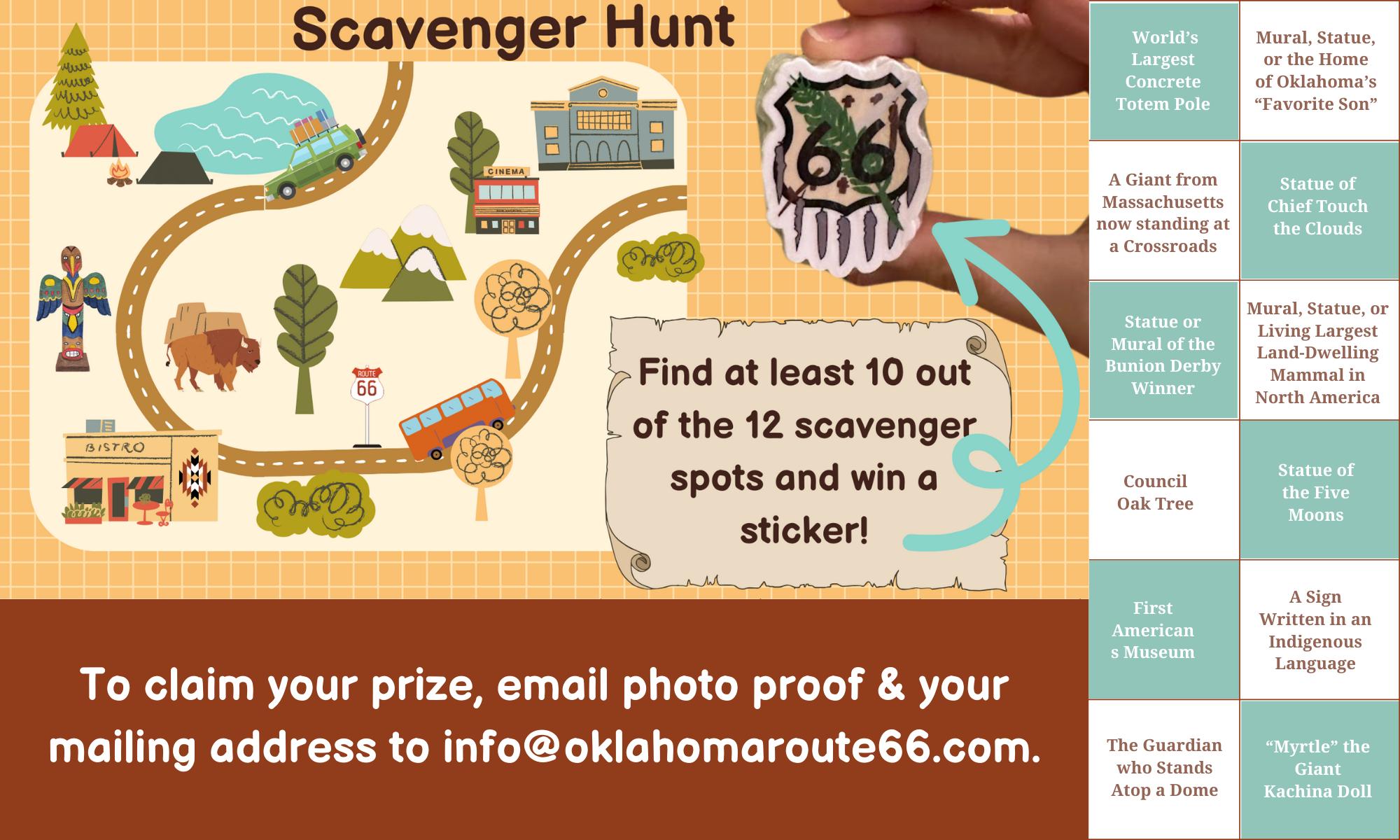
See if you can find the following landmarks (listed in no particular order):
• Dead Man’s Corner w/gas station ruins on the north side.
• Chat piles. These are the tailings (leftovers) from mining.
• Abandoned motor court southwest of Miami (on the newer alignment, past the Neosho River.) These were the Riviera Courts / Holiday Motel and is on the National Register of
Historic Places. Be mindful of Private Property!
• Brick farm silo.
• Eagle-Picher Plant.
The first town east-to-west travelers encounter on Historic Route 66 is Quapaw. The town is named for Chief John Quapaw of the Quapaw Tribe, one of the founders of the community. It was a railroad stop in the early days but the discovery of nearby lead and zinc deposits brought rapid prosperity.
It was also an early celebrator of the Good Roads Movement; in 1933, the town held a big celebration when the road was paved. A zinc tablet (since gone missing) was laid on Main Street commemorating the spot as where “East Meets West” since the road completion linked Ottawa County pavement all the way to Chicago, IL.
The Quapaw Tribe hosts one of the state’s oldest powwows, held around Independence Day annually. It lasts several days and brings in nearly 50 tribes from the region.
Quapaw is also close to the famous Spook Light, an unexplained phenomenon on a section of road known as the Devil’s Promenade! Dusk sightings of this mysterious ball of light date back to the late 1800s. It’s not directly on Route 66 and is on the east side of I-44; check online or ask locally for directions. Please be respectful of local residents and private property.
-Historic Marker: Entering Indian Territory (KS/OK Border)
-Quapaw Signing Stone (403 S Main St)
Like its northern neighbor, Commerce was a mining town in the heyday of the Tri-State Mining District (the nearby town of Picher was entirely abandoned due to over-mining; you can see the tall piles of gravel from Route 66). Check out the Will Rogers
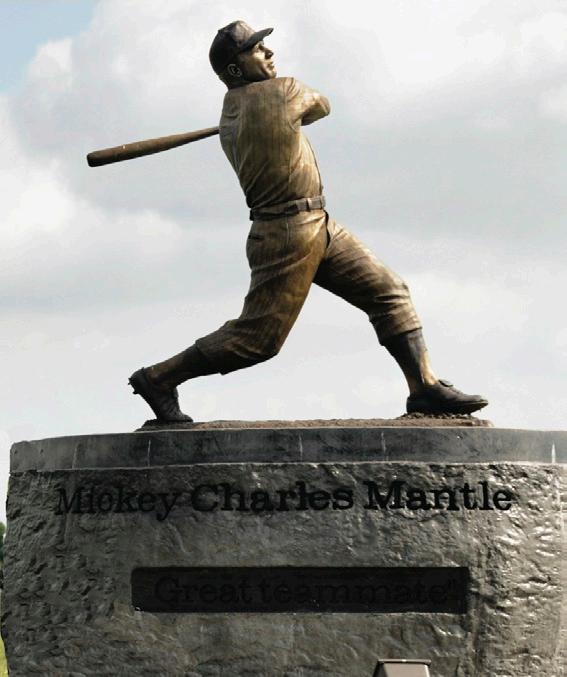
Highway Marker on the NE side of town (as Historic Route 66 curves south) for more! Commerce is better known for its famous resident: Mickey Mantle. There’s a statue honoring the New York Yankee baseball player next to the 1952 bypass alignment of Route 66 – but don’t skip the original route that goes through downtown. Otherwise, you’ll miss some great shops and converted service station photo ops! Mickey Mantle’s Boyhood Home is also here on Quincy Street.
-City of Commerce, 618 Commerce Ave, 918-675-4373
-Dairy King, 100 Main St, 918675-4261
-Hitch N’ Post Antique & Flea Market, 401 Commerce Ave, 918-675-4519
-Will Rogers Highway Marker (56050 E 50 Rd)
-Commerce Water Tower (400 Commerce Ave)
-Mickey Mantle’s Boyhood Home (319 S Quincy)
-Mickey Mantle Statue (400 S Mickey Mantle Blvd)
-Hole in the Wall Conoco Station (101 S Main)
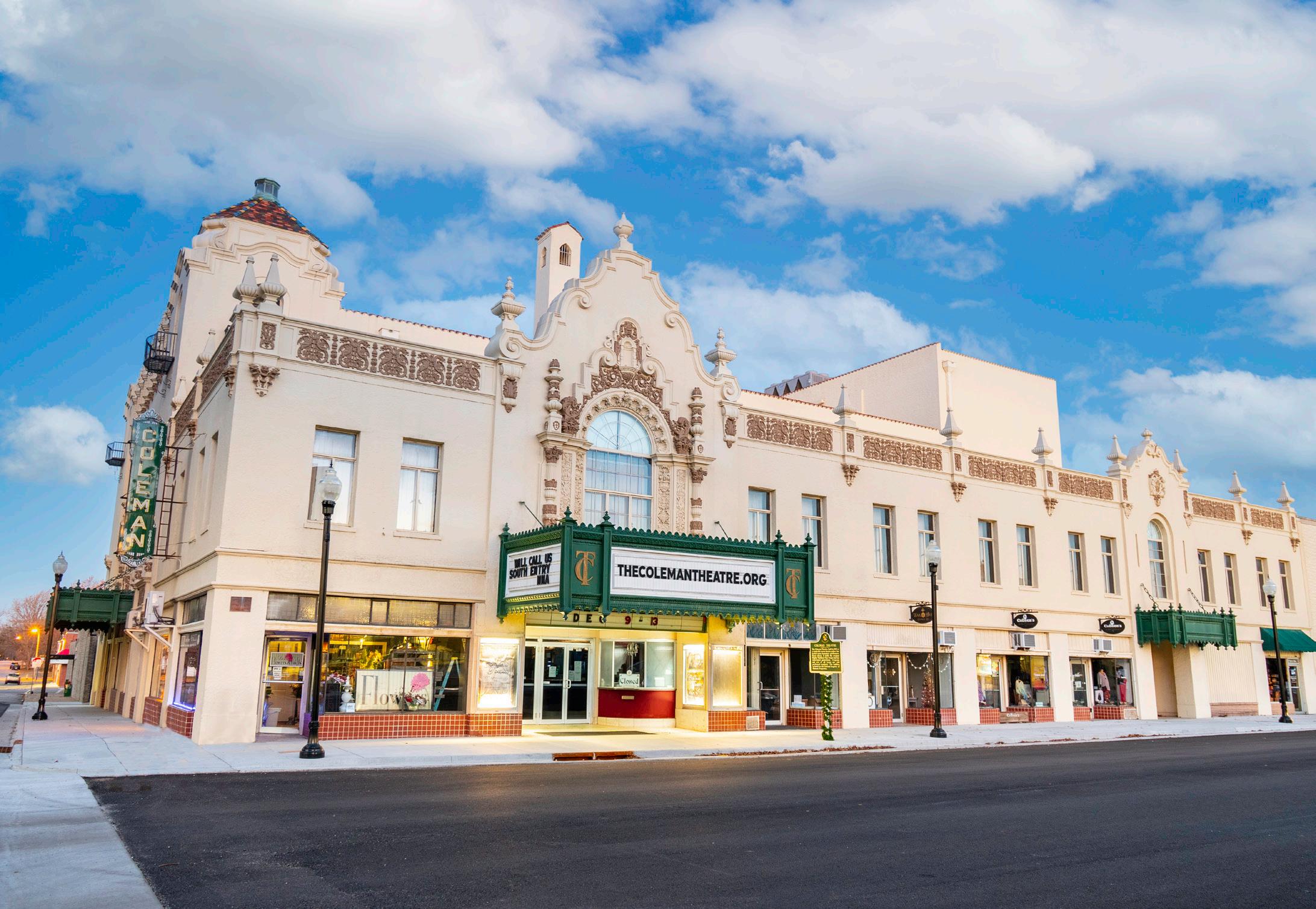
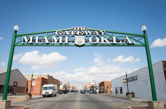
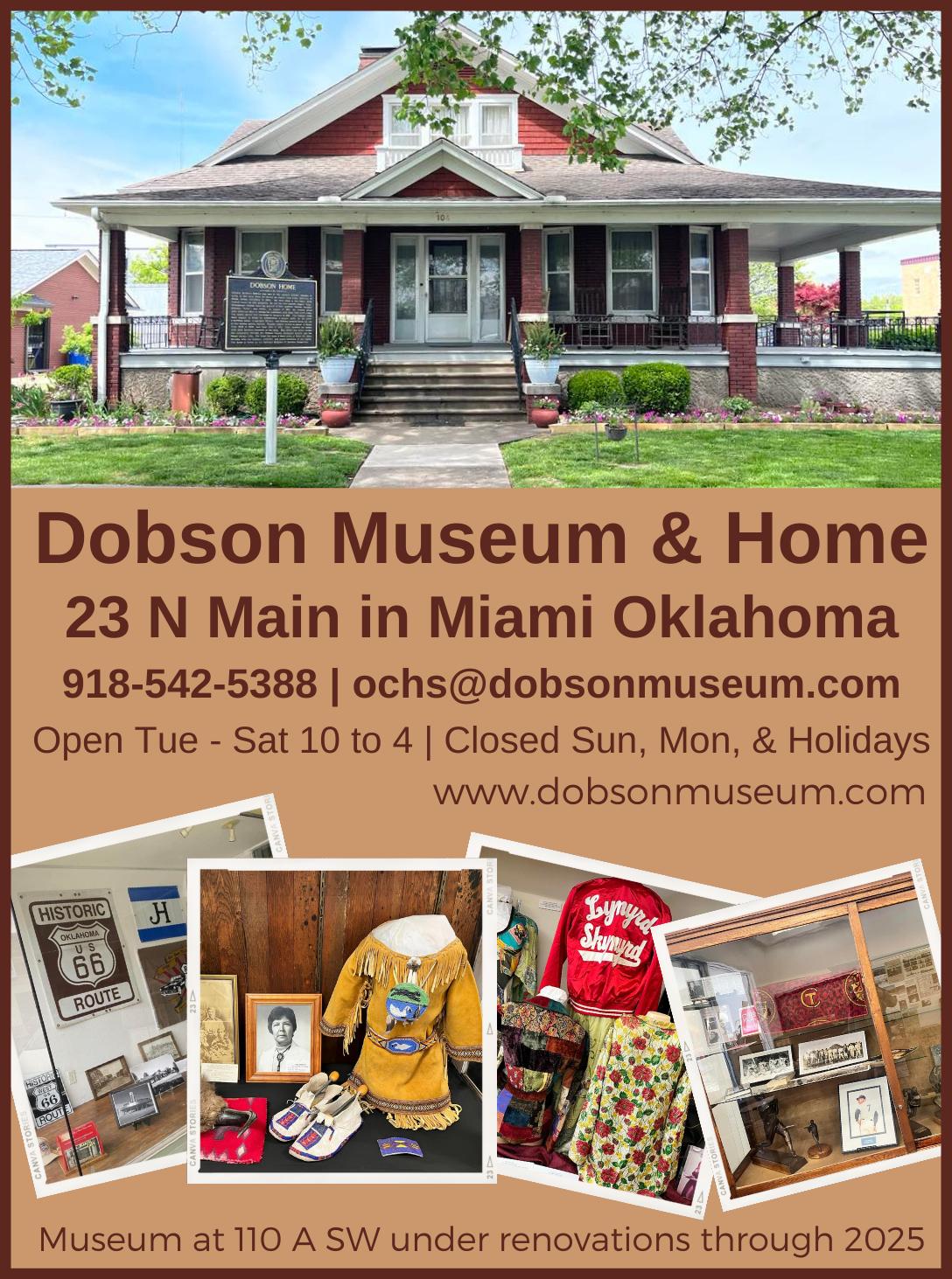
Pronounced “My-am-uh” after the Native American tribe for which it’s named, the eventual seat of Ottawa County was founded by Congressional Decree in 1891 (fun fact: Miami, Florida wouldn’t come along for another five years!) It started as a cattle town and then also prospered from the local mining industry. George L. Coleman, Sr. built his stunning vaudeville theatre and movie palace in 1929 because he couldn’t convince the top acts to stop here without such a venue.
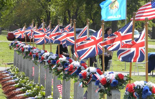
Miami was also the site of World War II aircraft training by British
pilots. There is a Grand Army of the Republic (G.A.R.) section of the cemetery on the north side of town that flies a Union Jack flag at the grave sites of several fliers that tragically died during flight exercises.
Miami today is the home of many local-owned businesses, shops, and colorful murals. There are nearly a dozen Native American tribes in or near town and a variety of cultural sites in the area. South of Miami are two sections of Route 66 called the Sidewalk Highway, or Ribbon Road In 1922, there was only enough money to either pave half the road from Miami to Afton or pave it the whole way…only half as wide. The single asphalt lane is nine feet wide with concrete curbs. The Association is working with the county to help preserve one mile of this historic road.
-Briley’s Silverscreen Ice Cream, Soda, & Gifts, 103 ½ N Main St, 918-919-3537
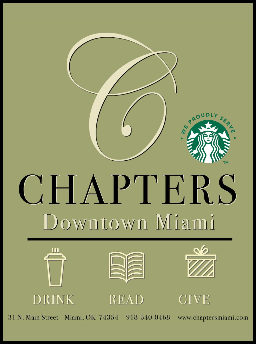
-Chapters, 31 N Main St, 918540-0468
-Coleman Theatre Beautiful, 103 N Main St, 918-540-2425
-Dobson Museum / Ottawa
County Historical Society, 110 A Street SW, 918-542-5388
-The Frozen Elephant, 1931 N Main St, 918-961-7014
-Goodfella’s Pizzeria, 24 Main St, 918-919-3803
-Pizza Hut Express, 101 A Street NW, 918-540-2471
-Pizza Hut of Miami, 1320 N Main St, 918-542-6642
-Visit Miami OK, 111 N Main St, 918-542-4435
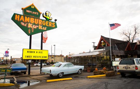
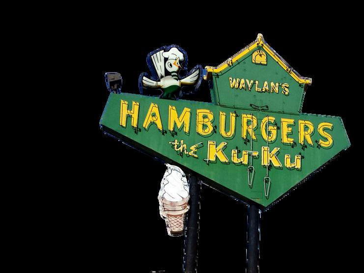
-Waylan’s Ku-Ku Burger, 915 N Main St, 918-542-1696
-Woody’s Bar-N-Grill, 227 S Main St, 918-919-3748
-G.A.R. Cemetery (2801 N Main St)
-Murals (throughout downtown)
-Coleman Theatre Beautiful (103 N Main St)
-Marathon Station (331 OK-125)
-Former Riviera Courts (Intersection of US Rt 66 and S 545 Rd; Private Property)
-Sidewalk Highway Historic Marker (Intersection of US Rt 66 and E 140 Rd)
Afton has been around since 1886 and is either named after the daughter of a Scottish railroad surveyor or the Robert Burns poem, “Flow Gently Sweet Afton.” Both claims honor the Afton River in Scotland. This railroad town (along the Frisco line) has always counted on local agriculture as a primary industry but also serves as a gateway to the Grand Lake O’ the Cherokees to the east.
Unfortunately, several historic buildings and sites have been lost
2025-2026
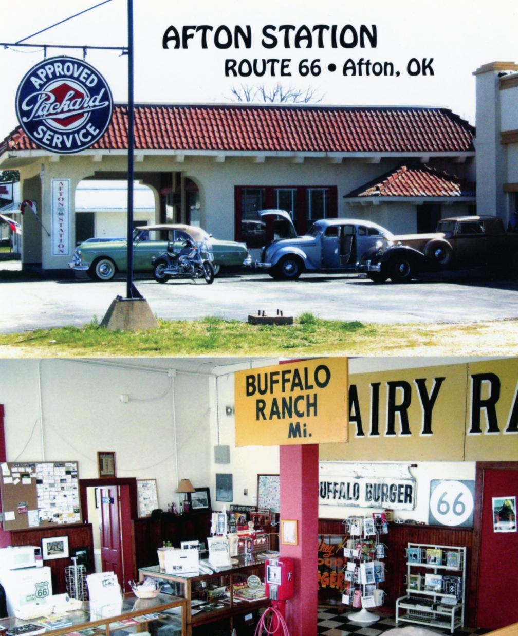
in the last few decades – including the Palmer Hotel and the Horse Creek Bridge – and Afton Station closed after long-time Route 66 advocate and roadie Laurel Kane passed away. Still, there are a few sites that recall the so-called glory days of the road. Afton is also the home of 2022 Oklahoma Route 66 Hall of Fame inductee Betty Wheatley.
-Buffalo Ranch Historic Marker (21600 S US-69)
-Crosstar Flag and Tag Museum (103 S Central Ave)
-Will Rogers Highway Marker (21875 S 520 Rd)
-Former Avon Courts (703 S 1st St)


953 E. ILLINOIS AVE. | VINITA, OK 74301
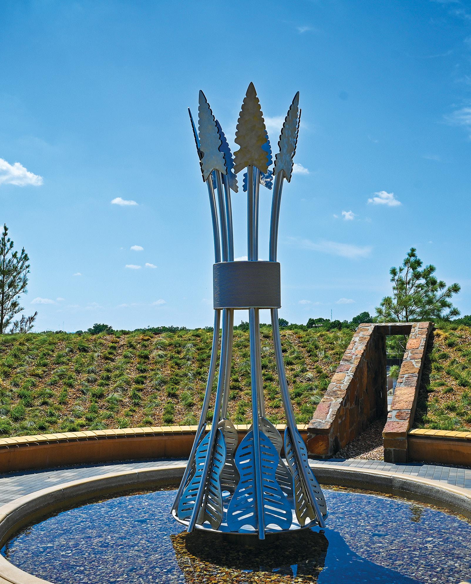
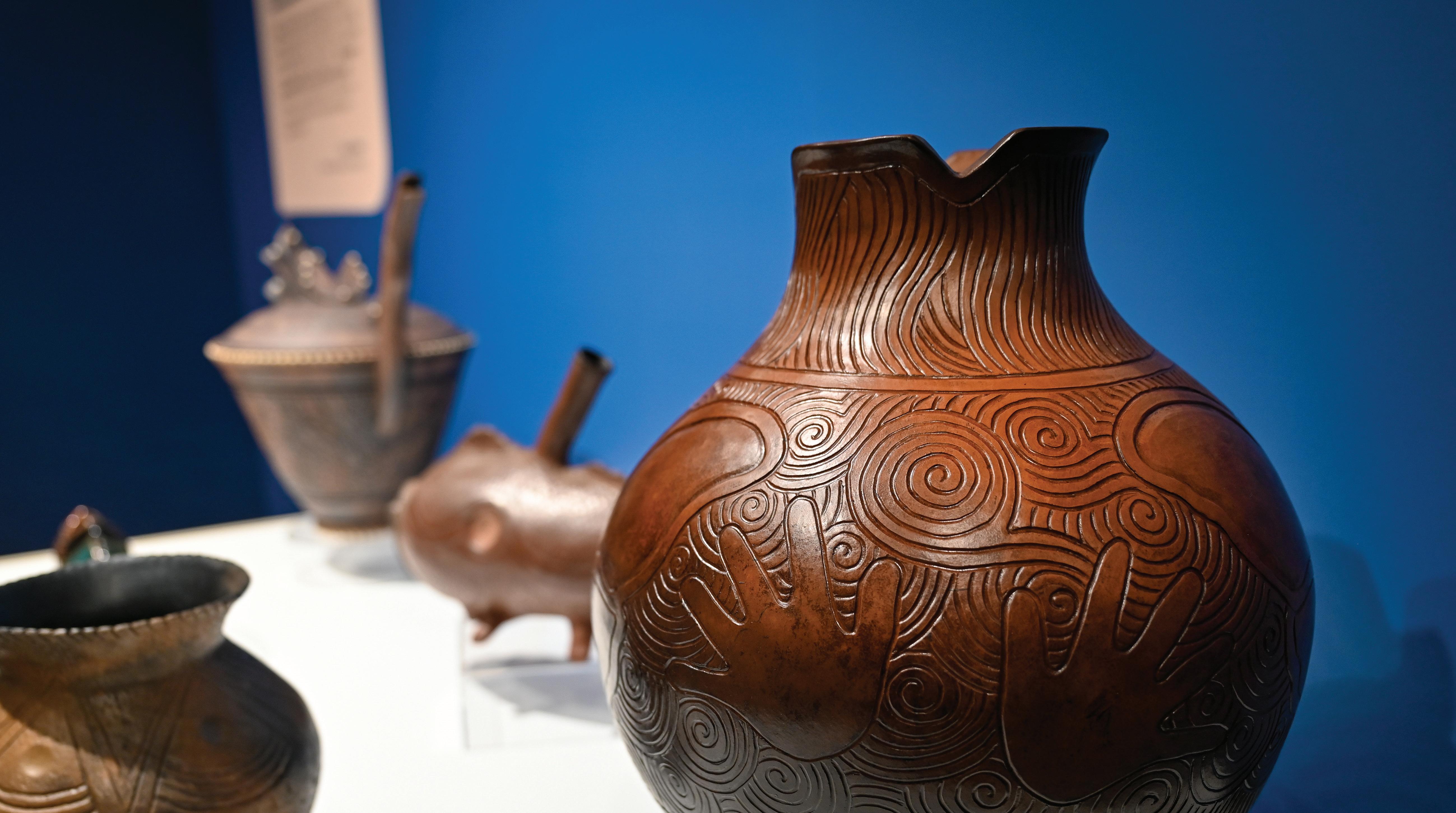
Going on a Route 66 adventure? Take a moment to rest, refresh and admire Cherokee art and culture at the Cherokee Nation Anna Mitchell Cultural and Welcome Center, with its permanent exhibition featuring beautiful pottery by the renowned Cherokee National Treasure.
Outside, take a photo beside the awe-inspiring sculpture “A Bundle of Seven Arrows.” Inside, enjoy refreshments at the grab-and-go café and find something special for loved ones at the gift shop. The center also presents cultural classes, events and the rich Cherokee history of Vinita, Oklahoma.


General Information
In Craig County, Historic Route 66 is overlaid with US 60 and US 69. As you enter Vinita, State Highway 66 signs begin to appear and you’ll see them off-and-on until you reach El Reno in Western Oklahoma (see note on Page 9). The route takes a south turn at Wilson Street and Illinois Ave in town and continues east-southeast towards Rogers County. Keep an eye out for Jefferson Highway signs here, too - it was a named highway that pre-dates Route 66!
See if you can find the following landmarks (listed in no particular order):
• A single arch truss bridge.
• Will Rogers Memorial Highway sign commemorating the Grand River Dam.
• McDougal Filling Station; a small giraffe stone building right by the Will Rogers sign. On the National Register of Historic Places.

& RV Park

Single and Double Bedrooms
Cable TV / WiFi / Microwave / Fridge / Coffeemaker
Laundry Facility / Large Recreation Area
RV Park with Pull Thru Sites 30/50 AMP www.parkhillsmotelrvpark.com
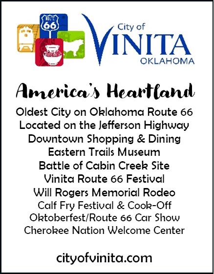
Vinita planted their flag in Indian Territory in 1871, making it the oldest incorporated town on Oklahoma’s 400+ miles of Route 66. It became the county seat when Oklahoma was founded 36 years later. The name of the town is in honor of Vinnie Ream, the sculptor behind the life-size statue of Abraham Lincoln at the US Capitol. Vinita served as a railroad junction of the BNSF and Katy lines, both of which are still in use today.
Will Rogers went to school here and suggested the town start a rodeo, which has been going annually since 1935. Cyrus Avery, the Father of Route 66, operated a land office here for a time which still stands on Wilson Street, part of the famous highway Avery would later have a part in creating.
-66 Apparel, 117 S. Wilson, 918256-8573
-Blazin’ B BBQ & Catering, 134 S. Wilson, 918-323-0310
-Cabin Creek RV, 441915 E. Hwy 60, 918-256-8000
-City of Vinita, 104 E. Illinois Ave, 918-418-3631
-Clanton’s Cafe, 319 E. Illinois, 918-256-9053
-Eastern Trails Museum, 215 W. Illinois, 918-323-1338
-Hi-Way Cafe, 437918 E Highway 60, 918-256-5465
-Holiday Inn Express, 232 S. 7th Street, 918-256-4900
-Home of Hope, 226 W Dwain Willis Ave, 918-236-0212
-Kelley’s Therapeutic Massage, 420 W South Ave, 918-613-2246
-Northeast Oklahoma Electric Cooperative, PO Box 948, 918256-9417
-Official Route 66 Pin Trading Co, 136 S Wilson St, 702-3089200
-Park Hills Motel & RV Park, 438415 E Highway 60, 918-2565511
-RCB Bank, 120 W Canadian, 918-713-0222
-The Route 66 Mercantile, 320 S Wilson St, 918-256-8406
-Vinita Antique Mall, 127 S Wilson St, 918-323-0310
-Vinita Daily Journal, 138 S Wilson, 918-256-6422
-Vinita Friends of Route 66, 104 E Illinois, 918-323-1918
-Western Motel, 437866 E Highway 60, 918-256-754
-Little Cabin Creek Bridge (East of town, near S 4420 Rd)
-Cherokee Nation Visitor’s Center (953 E Illinois Ave)
-Historic Marker: FDR (319 E Illinois Ave)
-Vintage service stations (south of downtown on S Wilson St)
General Information
State Highway 66 signs will lead you across Rogers County, but you also have the option of taking older alignments through Foyil, Claremore, and Catoosa. Consult Jim Ross’ book Oklahoma Route 66 for more details.
Street names of Route 66 in towns (east to west):
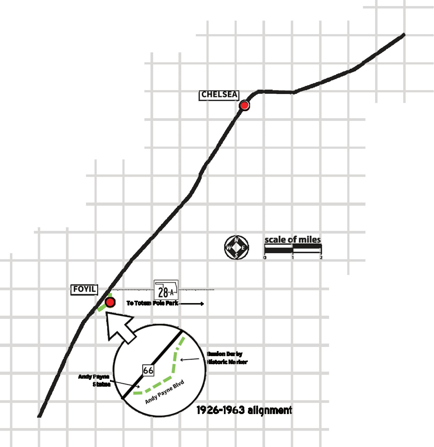
Chelsea: 66/Layton turns into 66/Walnut. Foyil: Poplar St. • Andy Payne Blvd.
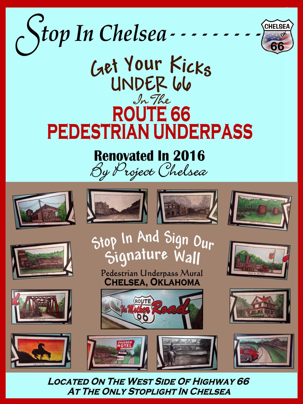
Back when Route 66 was the main road through the area, it was so busy that crossing it on foot was dangerous. That’s why some communities, like Chelsea, constructed pedestrian underpasses to allow safe passage. Check theirs out at the 6th Street stoplight.
There is a segment of original Portland cement in Foyil, on the original alignment that goes through town. It starts just south of City Hall and goes down past Andy Payne’s statue before reconnecting with SH-66 on the south side of town.
See if you can find the following landmarks (listed in no particular order):
• Water tower with a town’s name and the 66 shield on it.
• Old 1926 steel truss bridge. Hint: look on the east end of Chelsea, south side of 66.
• A restored Texaco station. Hint: it’s on an older alignment.
Chelsea is another town named by a homesick railroad worker –this time for a town in England. This has been a ranch and farm town for the most part, though it’s also where the first oil well was drilled for the lucrative ChelseaAlluwe field. Gene Autry lived here when he worked for the Frisco Railroad and Will Rogers visited often to see his sister, Allie McSpadden. A local park here is named after her.
Chelsea is also home to the Hogue House, a Sears Kit Home from 1913. The house was ordered via catalog and the materials (nails, lumber, and all) were shipped via rail. It was the first Sears Kit Home built in Oklahoma. It’s a private residence today so be respectful. The Pedestrian Underpass, once an absolute necessity due to the high volume of traffic on Highway 66, contains several colorful murals about the town’s history. Downtown Chelsea has some great historic buildings and shops!
-Chelsea Area Historical Society, 918-923-1409
-Chelsea Motor Inn, 321 E Layton, 918-789-3437
-Main Street Diner, 251 W 6th Street, 918-489-2001
-Project Chelsea OK, 918-7892511
-Pryor Creek Bridge (58 S4260 Rd)
-Former Chelsea Motel (185 OK-66)
-Pedestrian Underpass
(Intersection of US Rt 66 and E 6th St)
-Murals (downtown)
-Relocated 1930 Pony Bridge in Bud Beck Park (1101 Walnut St)
-Hogue House (1001 Olive St; private property)
Although it contains fewer than 500 people, Foyil has some great history. It’s named after the first postmaster, who also owned the first general store.
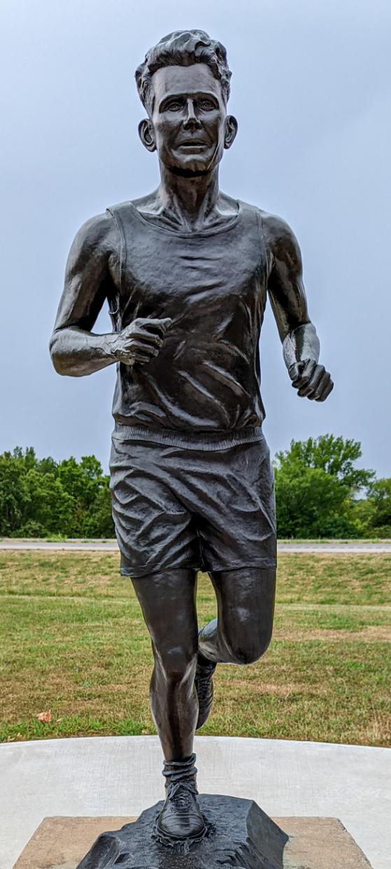
In 1928, local boy Andy Payne entered the Transcontinental Footrace (popularly known as the Bunion Derby). The race was organized by Charles C Pyle and the US Highway 66 Association to promote the new road that would take runners from Los Angeles to Chicago and then on to New York City. 275 men entered the race and 20-year-old Cherokee Andy Payne won the $25,000 prize. He paid off the family farm with the money.
There’s a statue commemorating Andy’s triumph on the south side of town, right next to a segment of curbed, original Portland Cement roadway. This was the original alignment of Route 66 through town. The restored Tex-
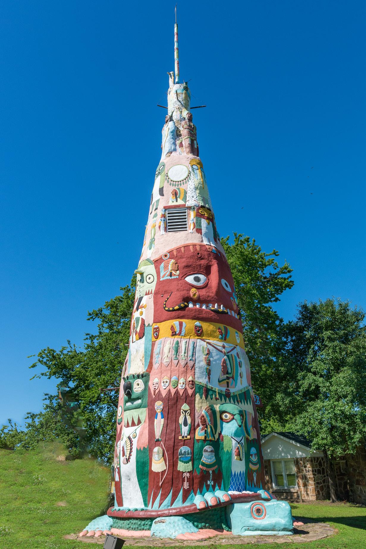
aco Service Station (also on the original alignment) is a passion project by local owner Kean Isaacs. Totem Pole Park is a short side-trip down OK-28A and is a remarkable folk-art roadside attraction that is well worth the detour. Learn more about Oklahoma’s Tribal Nations by visiting oklahomaroute66.com/tribal-nations.
-Totem Pole Park (21300 OK-28 A)
-Bunion Derby Historic Marker (Intersection of E 4th St and E Andy Payne Blvd)
-Foyil Filling Station (12243 Andy Payne Blvd)
-Andy Payne Statue (Andy Payne Blvd on the southwest side of town)


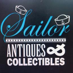
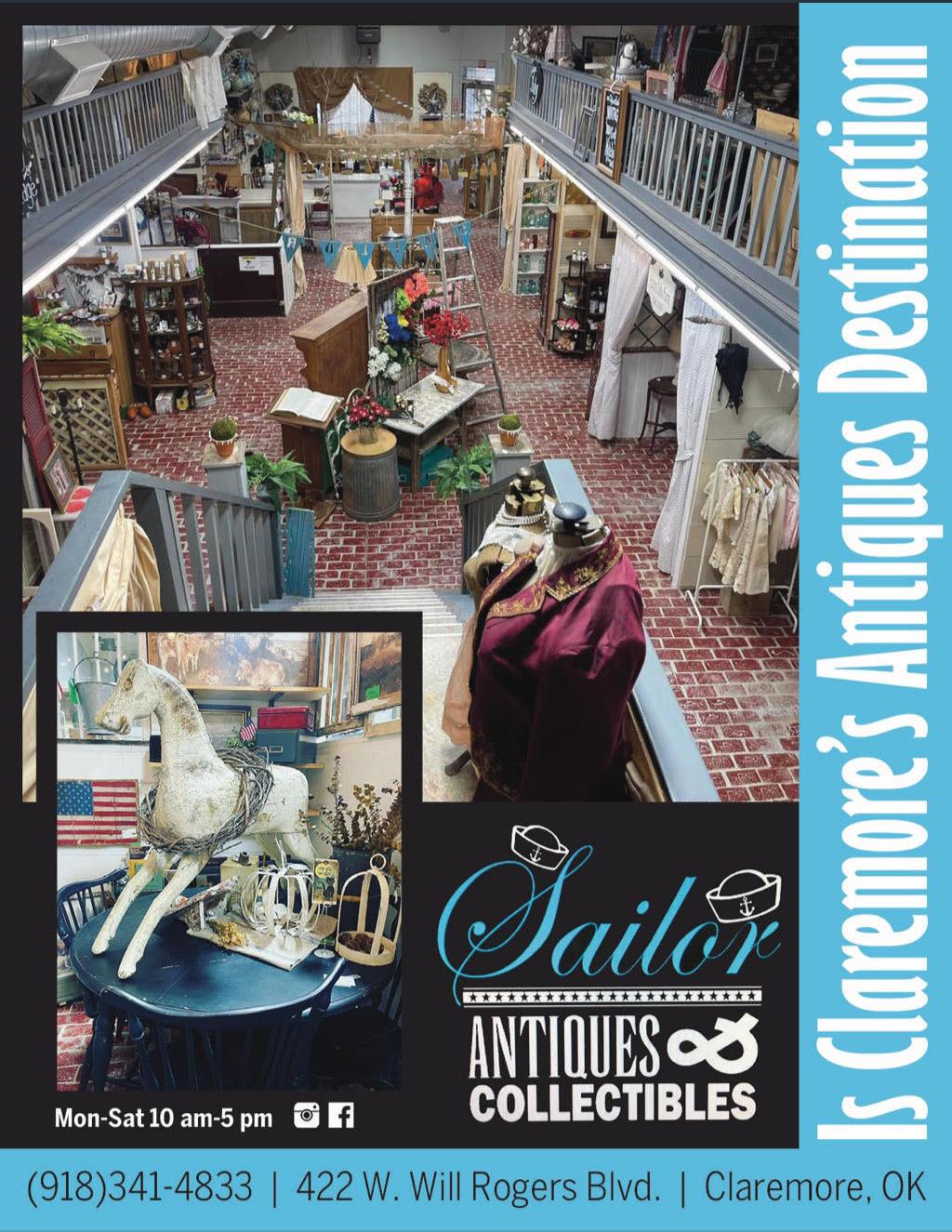
Located in Historic Downtown Claremore, Sailor Antiques & Collectibles has two floors of antiques, vintage, collectibles, home decor, unique gift ideas, architectural salvage and so much more! Stop by and see what treasures you can find for yourself or find unique gifts for friends and family.
Mon-Sat 10am-5pm
El Azteca is a favorite with visitors and locals alike, especially because of its proximity to the Claremore Expo Center in the West Bend district. Locally owned and operated, El Azteca has been voted “Best of Claremore” numerous years running—for best tacos, best margaritas, and best dinner.
15901 OK-66, Claremore, OK (918) 342-2577
441 S Brady St, Claremore, OK (918) 342-2401
Oklahoma is home to the longest continuous stretch of original Route 66, spanning nearly 400 miles, making it an essential destination for any true Mother Road enthusiast. Discover unique shopping, delicious dining and unforgettable experiences for the whole family!
422 W. Will Rogers Blvd 918.341.4838 • VisitClaremore.com/Route66

Claremore’s newest hot spot serving artisan style pizza, or build your own while enjoying a relaxing libation in historic downtown.

Mon-Thu 11am-8pm, Fri-Sat 11am-9pm Closed Sundays
408 E. Will Rogers Blvd • 918.387.8510 OKPizzaCo.com •
Americanized Irish Pub, serving traditional pub fare along with some Irish selections in our “Across the Pond” menu category. J. Farley’s is one of Claremore’s favorite places for great food and entertainment for the whole family. Let us take care of your groups and private events.
Mon-Thu 11am-10pm Fri 11am-12am, Sat 10am-12am Sun 11am-8pm
820 S Lynn Riggs • 918.923.6130 JFarleysPub.com •
Bakery, smokehouse and gift shop offering fresh baked goods, the best smoked meats in the area, take and heat meals, and gifts including candles, lotions, and more.
Catering services available.
Smoking meats and baking treats!
Pickup, Curbside & Carry Out Available 18435 US Rt. 66 • 918.341.7505 FrontPorchon66.com •

400 S. Veterans Pkwy | Claremore, OK 74017 | 918-341-8688
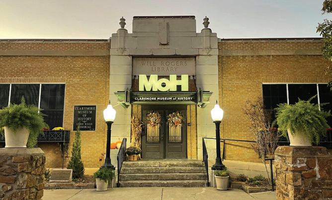
The original Will Rogers Library in historic downtown Claremore features exhibits on local icons like the 50’s Patti Page, Apollo XIV pilot Stuart Roosa, playwright Lynn Riggs, transcontinental athlete Andy Payne and the Surrey With the Fringe on Top from the movie “Oklahoma!”, showcasing the history of our amazing community.
121 N. Weenonah Ave • 918.923.6490 ClaremoreMOH.org •
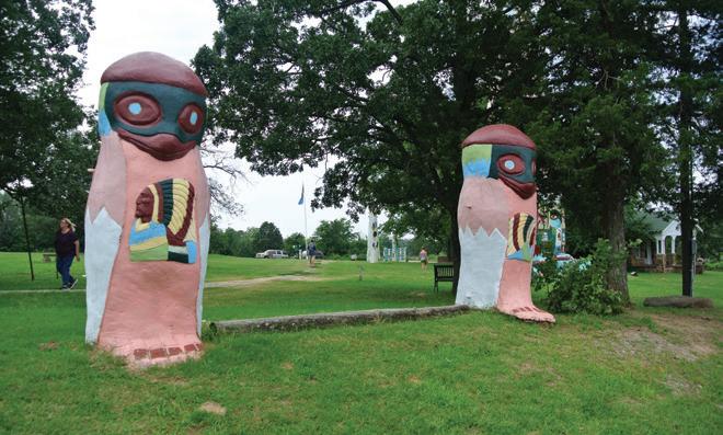
The largest Totem Pole in the world is a premiere example of Folk Art. The totem stands 90 feet tall and features over 200 images of Native American culture. The Museum/ Gift Shop has many examples of Mr. Galloway’s woodworking, and Native American art.
Free Admission Park Open dawn to dusk Gift Shop Open Nov.-Dec. 10am-4pm
21300 Hwy 28A • 918.283.8035 rchs1.org/totem-pole-park •
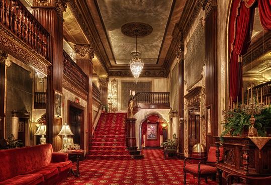
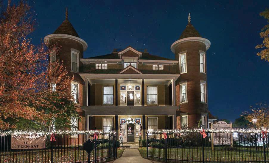
A historic Victorian style, three-story, 9,000 sf mansion, completed in 1907. Within the mansion, the Pink House Restaurant offers lunch, a gift shop, and space for parties and receptions. The Pink House Restaurant was recently voted “Best Place for Lunch” by Claremore Daily Progress readers.
Open Mon-Sat 11am-2pm PinkHouseOfClaremore.com 918.342.2544
Mansion Tours 918.342.1127 121 N. Chickasaw • RCHS1.org •
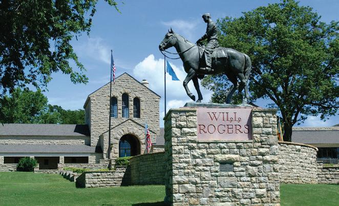
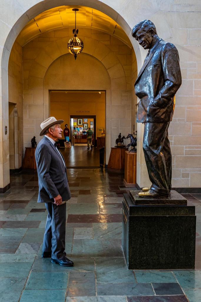
Travel the Will Rogers Highway! Visit the Will Rogers Memorial Museum—a Route 66 icon in Claremore, Oklahoma, that preserves the legacy of a famed cowboy philosopher and humorist, Will Rogers. Discover 12 galleries of artifacts and memorabilia from his entertainment career and learn why Route 66 was named in his honor.
1720 W. Will Rogers Blvd 918.341.0719 • WillRogers.com •
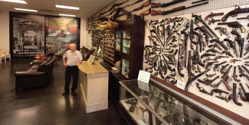
Home to the unique collection of J.M. Davis including over 12,000 firearms and thousands of non-firearm artifacts ranging from Old West saddles and spurs, John Rogers statuary, Toby mugs and Beer Steins, World War I posters, Native American artifacts and local Claremore and Rogers county history. Multi-media exhibits for a family-friendly walk through history.
World’s largest privately-held firearms collection.
Tues-Sat 10-5 Admission By Donation
5th & JM Davis Blvd • 918.341.5707 TheGunMuseum.com •
General Information
Street names of Route 66 in towns (east to west):
Claremore: 66/Lynn Riggs Blvd., J.M. Davis Blvd.
Catoosa: 66 • N. 225th E. Ave. • 66 • Ford St. • S. Cherokee St. • 193rd E. Ave.
Claremore has two alignments of 66 that parallel each other. The older alignment, J.M. Davis Blvd, runs alongside the railroad tracks west of the newer, SH 66 alignment. Another partial older alignment exists just south of the Verdigris River, but it’s a residential street today. Be respectful of private property.
See if you can find the following landmarks (listed in no particular order):
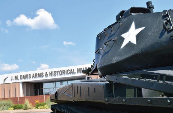
• A gorilla statue at Kong’s Korner
• A real army tank
• A 65-ft tall guitar
Navigating I-44 junction in Catoosa:
Eastbound: Do not get on I-44 from 193rd E. Ave; go under the interstate and take a right on Cherokee Street.
Westbound: Stay on SH 66 as it merges with I-44 and take the immediate 193rd E. Ave. Exit; turn left (south) towards Tulsa.
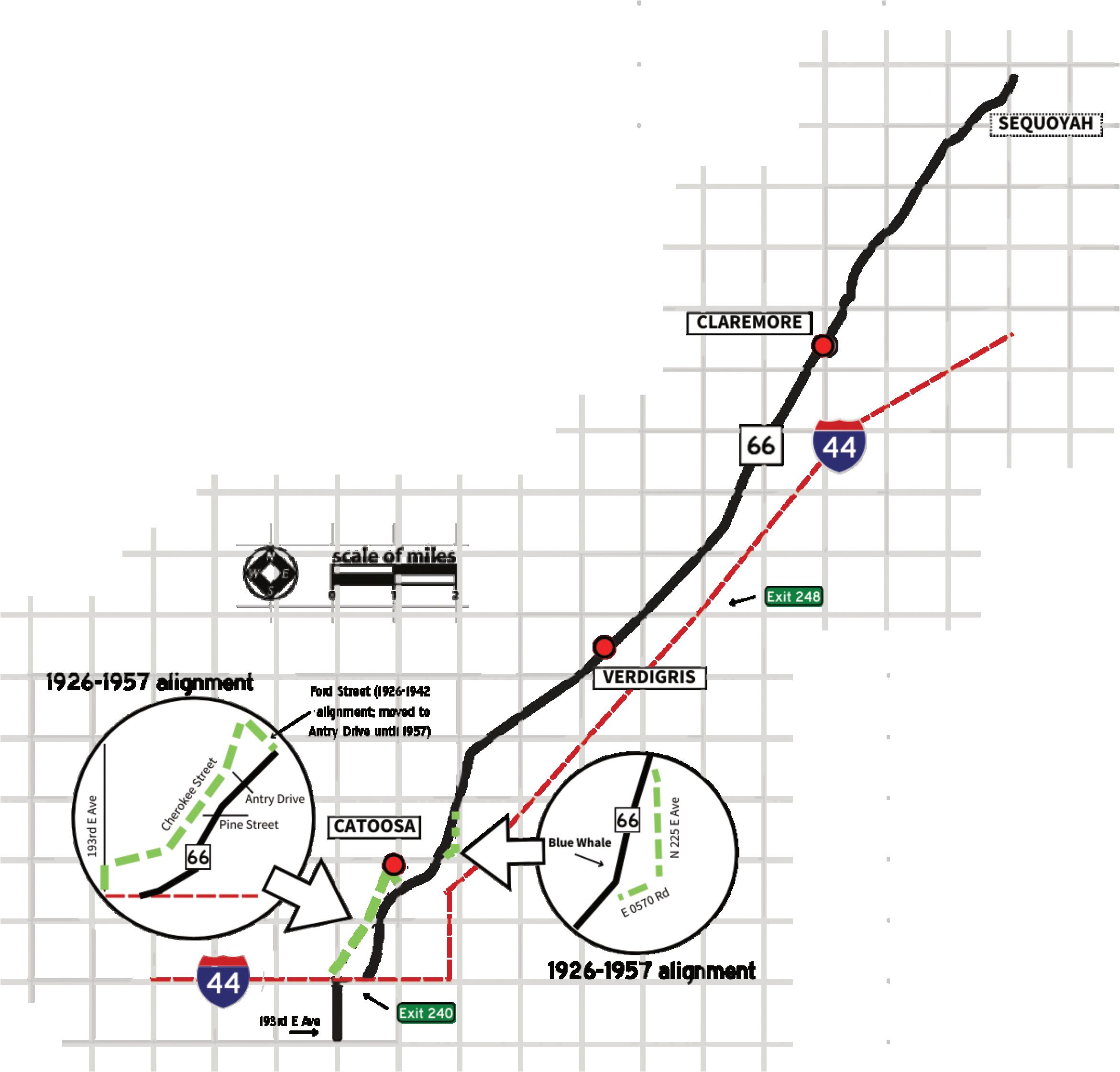
To take the Old Hwy. 66 loop on east side of Catoosa:
Eastbound: Turn right just before the Arrowood Trading Post. You might want to visit the Blue Whale first on current 66 before taking the older alignment as you will bypass it. Follow it around to the north and it will take you back to SH 66.
Westbound: After you cross the Verdigris bridge, you will
see a gravel road to the left. Ignore it and look for the next left, which is paved and goes up a hill. There is no median crossover point there, so go about a tenth of a mile farther to the next crossover and make a U-turn to head back and pick up the old loop.
Drive south for about half-a-mile and curve right; this will lead you back to SH 66. Take a right and backtrack slightly to see the famous Blue Whale!
Claremore, named after a chief of the Osage tribe, is best known as the Home of Will Rogers…though Oklahoma’s Favorite Son was actually born in nearby Oologah. He famously said that Claremore was easier to spell! The Will Rogers Memorial Museum overlooks the city a few blocks off of Route 66 and is the site of his tomb. The former hotel that bears his name was famous for its radium baths, supposedly good for the health.
This is also the home of Lynn Riggs, author of “Green Grow the Lilacs” which was made into the musical Oklahoma! The Claremore Museum of History houses the original “surrey with the fringe on top” from the movie version. Singer Patti Page and astronaut Stuart Roosa also hail from the seat of Rogers County.
-Claremore Area Chamber of Commerce, 419 W. Will Rogers Blvd, 918-341-2818
-Front Porch Bakery, 18435 S. Highway 66, 918-341-7505
-J.M. Davis Arms & Historical Museum, 330 N. Lynn Riggs Blvd, 918-341-5707
-Okie Snack Wagon, 918-3408385
-Rogers County Development, 1503 N Lynn Riggs Blvd Ste D, 918-343-8959
-Rogers County Historical Society, 121 N. Chickasaw Avenue, 918-342-1127
-Sailor Antiques and Collectibles, 422 W. Will Rogers Blvd, 918-341-4838
-Shepherd’s Cross, 16752 E. 450 Road, 918-342-5911
-Visit Claremore, 400 Veterans Parkway, 918-341-8688
-Will Rogers Memorial Museum, 1720 W. Will Rogers Blvd, 918343-811
-Will Rogers Productions, 661332-3477
-Former El Sueno Motor Court (402 N J.M. Davis Blvd; private property)
-Will Rogers Highway Markers (in the median through town; use


caution)
-Former Will Rogers Hotel (524 W Will Rogers Blvd)
-Will Rogers seated statue (315 W Will Rogers Blvd)
-Murals (115 N Missouri Ave)
-Belvidere Mansion (121 N Chickasaw Ave)
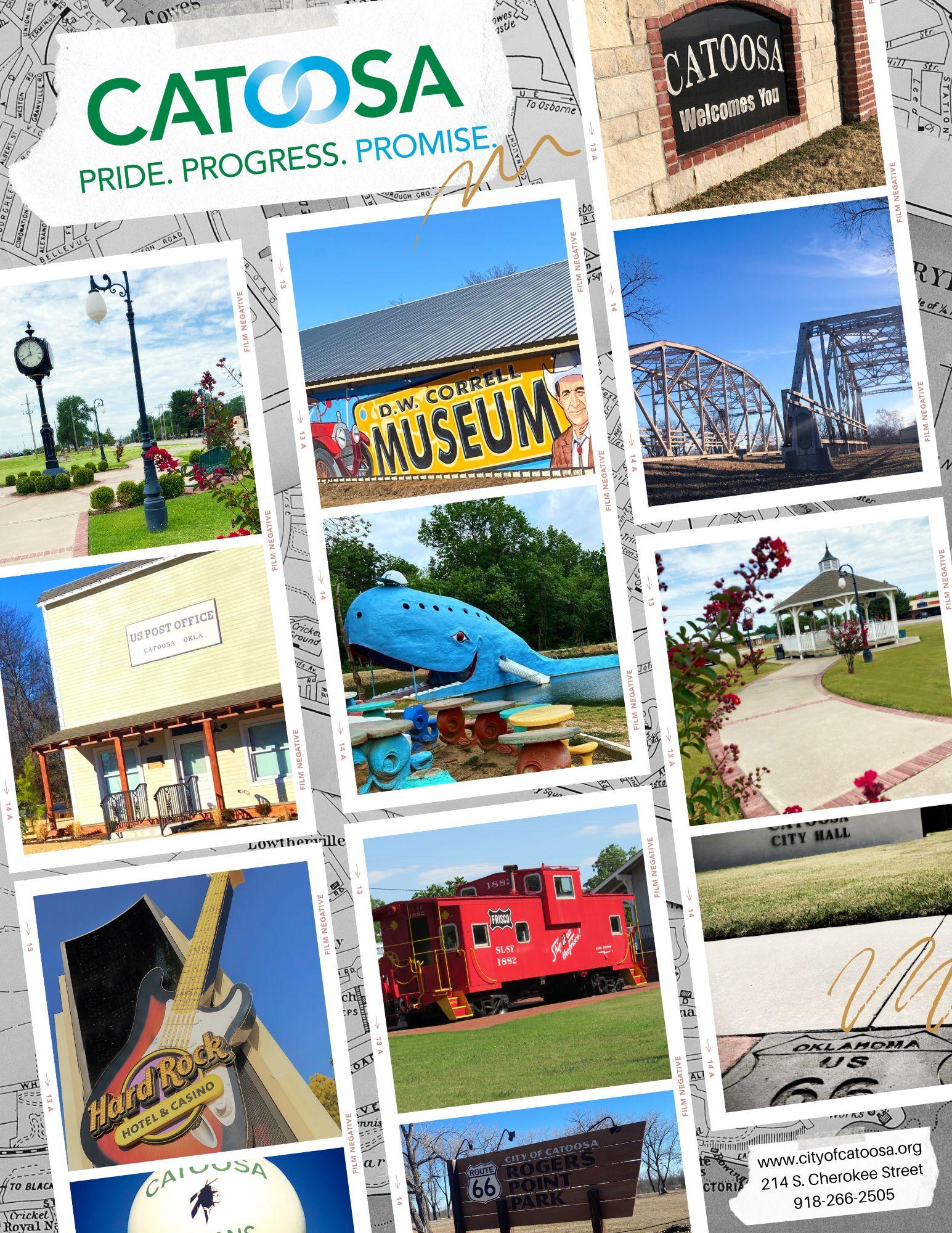
From its frontier days as a cow town to its modern status as the farthest inland seaport in the country, Catoosa has always been a unique stop along the Mother Road. Although the Twin Bridges over Bird Creek near the Verdigris River are down to a single truss bridge, the relocated span can be seen at Rogers Point Park on the east side of the highway.
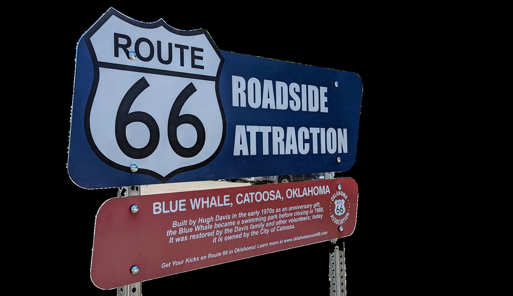
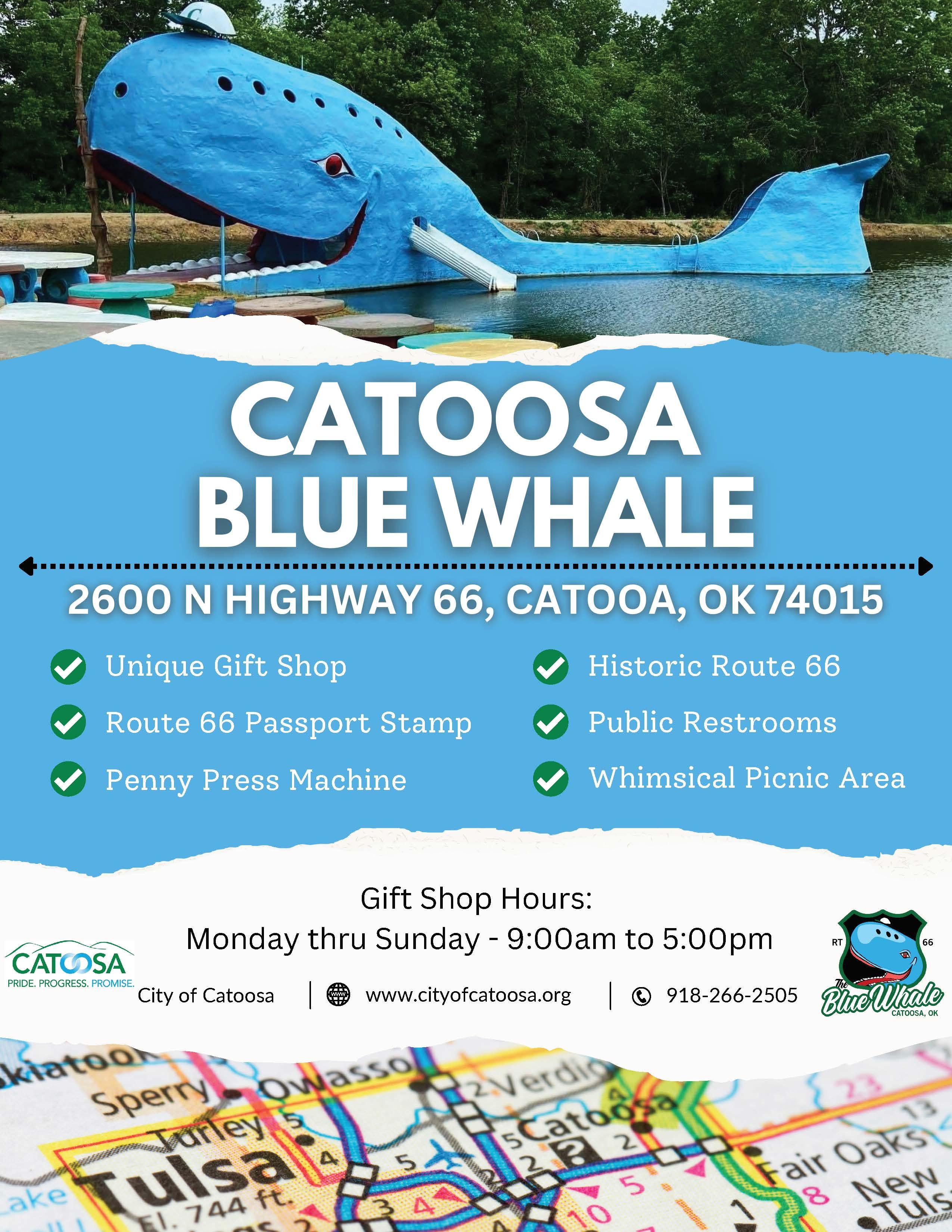
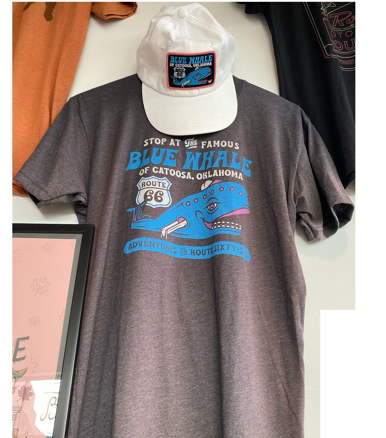
The world-famous Blue Whale is here, built by Hugh Davis in the 1970s as an anniversary present to his wife, Zelta. The Whale and the grounds are now cared for by the City of Catoosa. Don’t miss the original alignment of Route 66 here, which goes by the Catoosa Historical Museum and other sites.
-The Blue Whale, 2860 N Highway 66, 918-266-2505
-Catoosa Chamber of Commerce, 650 S Cherokee Suite C, 918-266-6042
-Catoosa Historical Society, 207 N Cherokee, 918-266-6592
-City of Catoosa, 214 S Cherokee, 918-266-2505
-D.W. Correll Museum, 19934 E Pine Street, 918-266-3612
-Hampton Inn & Suites, 100 McNabb Field Road, 918-7393939
-Visit Cherokee Nation, 777 W Cherokee St, 877-779-6977
-Relocated Truss Bridges at Rogers Point Park (4000 US Rt 66)
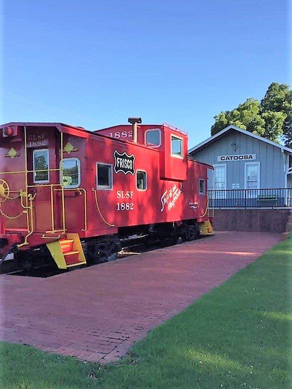
-Restored Frisco Caboose (217 S Cherokee St)
-65-ft tall Musical Guitar (777 W Cherokee St)


General Information
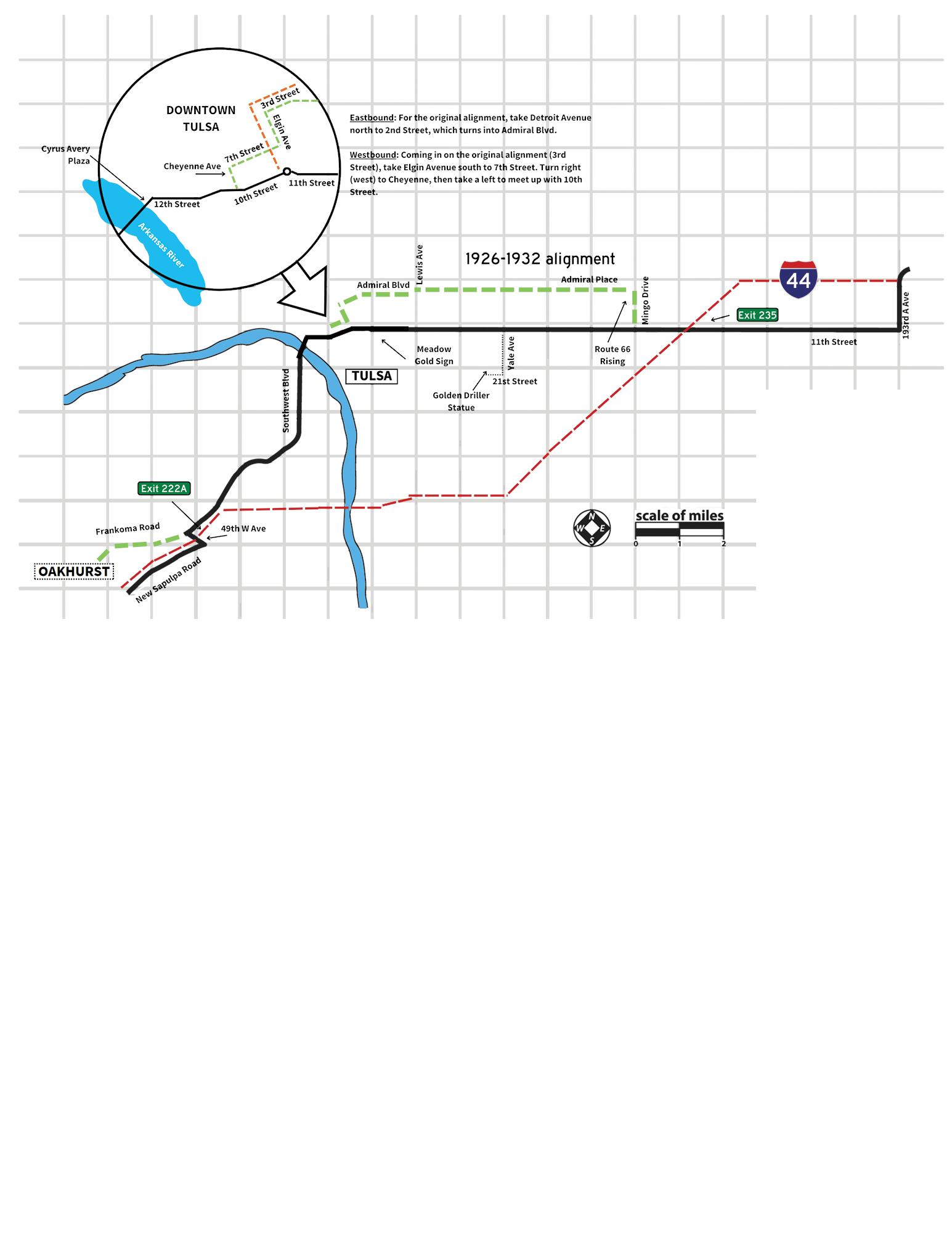
Once you are in Tulsa proper, DO NOT follow the SH-66 signs. They will put you on the interstate and you’ll miss all the cool stuff!
Detailed directions for Central Downtown:
Westbound: Eleventh Street curves to the right as you pass the Art Deco Warehouse Market Building on the edge of downtown. At Elgin, enter the traffic circle and exit on 10th street, which is going the same general westbound direction. You’ll continue straight past Cathedral Square, before bearing left slightly past Denver Ave and crossing over the interstate. After passing a stop sign, you’ll come to a T-junction at Southwest Blvd. Turn left here, passing under a pedestrian bridge and beside the Cyrus Avery Centennial Plaza, home of the East Meets
See if you can find the following landmarks (listed in no particular order):
• Neon sign with a cactus on it (hint: there are two!)
• A vintage fire truck
• A giant oil derrick
• Statue of a Model T Ford
• An intersection with churches on three corners
West statue. Stay on Southwest Blvd all the way out of town.
Eastbound: You’ll enter Tulsa on Southwest Blvd. Stay on that road until you cross the Arkansas River.
Once you drive past Cyrus Avery Memorial Plaza and under the Route 66 Pedestrian Walkway, turn right on 12th Street. Stay on this road (through a stop sign and several stoplights) until you come to a traffic circle at Elgin Avenue (the Art Deco Warehouse Market building will be in front of you.) Enter the traffic circle and exit at your first opportunity (11th Street) and continue east. Stay on 11th through the rest of town. After you’ve driven through the eastern countryside of Tulsa County a few miles, you’ll eventually come to 193rd East Avenue. Take a left here and head into Catoosa.
• 29 Historical Markers with vintage photos
• A friendly pig statue
• Meadow Gold neon sign
• An old service station with a blue dome on top
• A giant Route 66 shield coming out of the ground
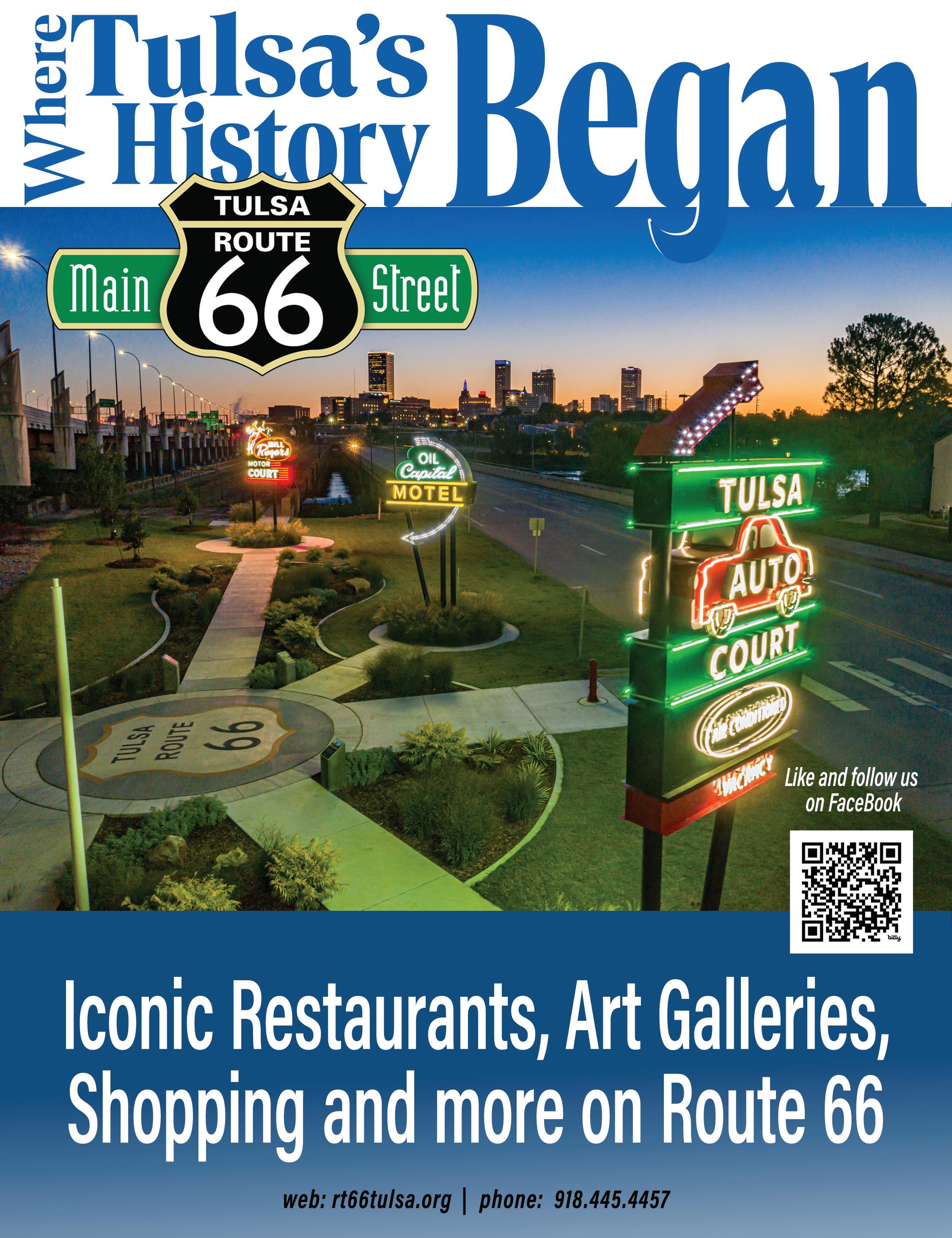
Tulsa began as a Muscogee (Creek) settlement on the Arkansas River in 1836, following removal of the Creek from their ancestral homelands in Georgia and Alabama. The Creek called their new community Tallasi, which means “old town” in the Muscogee language. The name officially became Tulsa when the first post office was established in 1879.
Tulsa is the only place in the United States where the borders of three sovereign nations touchMuscogee (Creek), Osage, and Cherokee Nations. The railroad was the lifeblood of this town until oil was discovered in the early 1900s. The site of the first oil well in Tulsa County, in what was then the community of Red Fork, is marked with a historic marker right alongside Route 66 on the southwest side of town. The oil fields in and around Tulsa were so vast that it earned the city the title, “Oil Capital of the World.” The wealth generated from them is responsible for the many Art Deco architectural treasures downtown and the city’s vibrant arts community.
There are several sites in town that contain historic markers that tell more of the Tulsa and Route 66 story. Nearly 30 historic markers are scattered along both alignments of Route 66 itself, but there are dedicated plazas in the east (south of the 11th and Mingo directional sign), the west (at the Crystal City Shopping Center), under the Meadow Gold sign near 11th and Peoria, and perched on the eastern bank of the Arkansas River at Cyrus Avery Centennial Plaza.
Tulsan Cyrus Avery, known as the Father of Route 66, was a leader in the Good Roads movement and a designer of the National Highway System in 1926. A larger-than-life sculpture of him and his family in a Model T sits in the plaza bearing his name, forever surprised at their encounter with an oil field wagon. Because of Avery’s involvement in establishing Route 66 and because it served as headquarters for the US Highway 66 Association for many years, Tulsa is today known as the Capital of Route 66.
On the west side of the river, next to the historic (but closed) 11th Street Bridge, is a Neon Sign Park that also pays tribute to the multiple eras of Route 66 growth and development in the city. Further west takes you past the Route 66 Village attraction and towards the West Gateway.
Tulsa’s Route 66 Corridor covers 28 miles over two different alignments and navigates through multiple defined business districts. Dozens of historic markers and neon signs line the street here thanks to the Tulsa Route 66 Commission. There are also multiple defined districts along and near Route 66, such as the Market District (anchored by Mother Road Market.) The Blue Dome District downtown, part of the original alignment, is close to historic Greenwood and the Tulsa Arts District, home of museums like the Woody Guthrie Center and the Bob Dylan Center.
There is much to see; the only limit is how much time you have to spend in Tulsa!
-AAA Oklahoma, 2121 E 15th St, 918-748-1000
-Admiral Twin Drive-In, 7355 E Easton Street, 918-878-8099
-Agitsi Stained Glass, 2615 W 40th Pl #3, 918-340-8030
-Annette Murray, Author, 918230-8388
-Anybody’s Guest, 2219 E 11th St, Ste 3, 918-576-6887
-Apertures Photo, 4602 E 11th St, 918-742-0500
-Art Emporium 66, 2615 W 40th Pl, 918-706-7715
-Atlas Automotive Repair, 4625 E. 11th Street, 918-910-2886
-Buck Atom’s Cosmic Curios on 66, 1347 E. 11th Street, 918-6294606
-Cedar Rock Inn, 4501 W. 41st Street, 918-447-4493
-The Campbell Hotel & Event Center, 2636 E. 11th Street, 918744-5500
Our new office neon sign! 2620 E 11th St - office hours are by appointment.
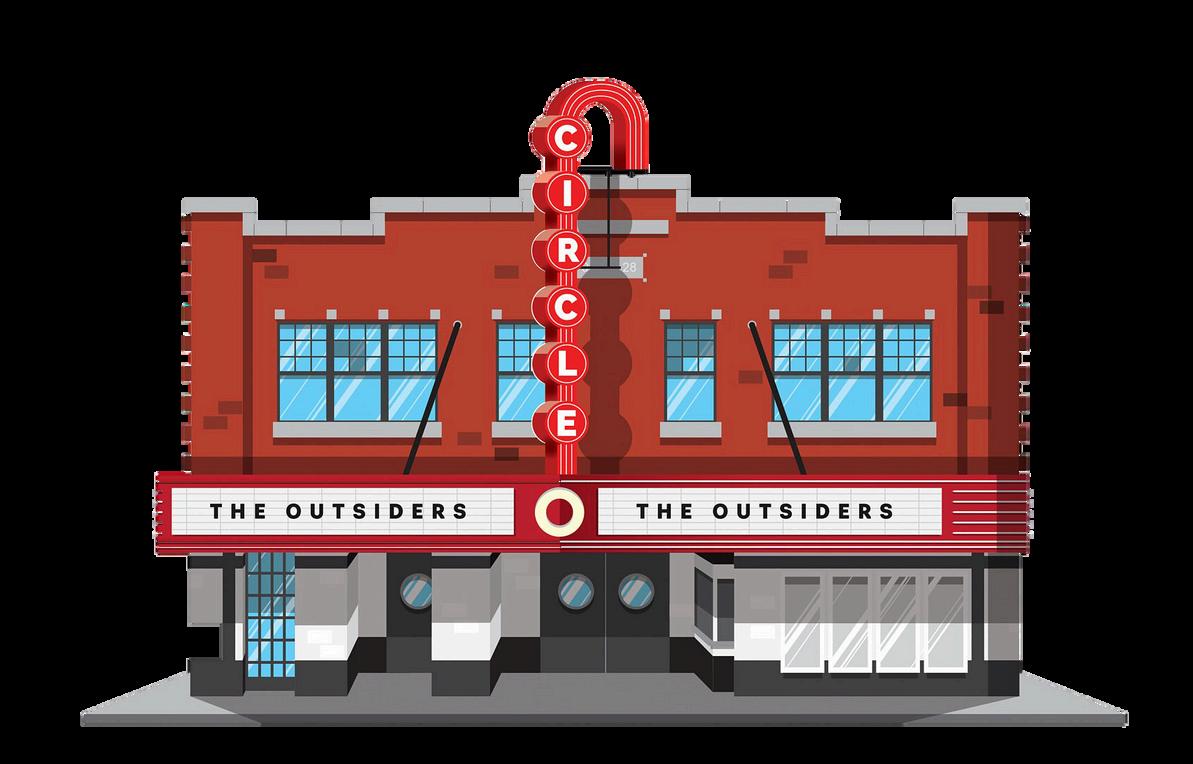

-Circle Cinema, 10 S. Lewis Avenue, 918-585-3456
-Cottage in the Pearl, 1153 S Quaker Ave, 918-900-4020
-Decopolis, 1401 E. 11th Street, 918-382-7388
-Desert Hills Motel, 5220 E. 11th Street, 918-834-3311
-Expressly Gifts, 10032 S Sheridan Rd, Suite H2A, 918664-3320
-Freddie’s Hamburgers, 9130 E. 11th Street, 918-836-5600
-Generations Antique Mall, 4810 E 11th St, 918-834-7577
-Gusher Newspaper, 1125 S. 110th East Ave, 918-437-7470
-Hank’s Hamburgers, 8929 E Admiral Pl, 918-832-1509
-Jerlissa’s Trading Post, 2010 E 11th St, 918-906-2782
-Jesse’s Restaurant, 1134 S Memorial, 918-832-9052
-John’s Classics on Rt 66, 8702 E 11th St, 539-867-3000
-Joseph Gierek Fine Art, 1342 E. 11th Street, 918-592-5432
-Meadow Gold District, PO Box 521094, 918-695-7249
-Meadow Gold Mack, 1306 E 11th St, Ste A & B
-Mother Road Market, 1124 S. Lewis Avenue, 918-984-9001
-Mother Road Real Estate, 2651 E 21st St Ste 100, 918-712-2252
-Mythic Press, 2015 E. 3rd Street, 918-516-8255
-Ollie’s Station Restaurant, 4070 Southwest Blvd, 918-4460524
-Paula’s Treasures, 17619 E 11th St, 918-829-1480
-Route 66 Alliance, PO Box 54214, 918-629-2984
-Route 66 Historical Village, 3770 Southwest Blvd, 918-6199473
-Splinter Block, 3306 Charles Page Blvd, 918-724-5150
-Standing Horse Acres, 8223 Frankoma Rd, 918-724-5150
-Starlight Concerts, PO Box 35158, 918-706-6615
-Tulsa Air & Space Museum, 3624 N 74th E Ave, 918-834-9900
-Tulsa Fire Museum, 1010 E 8th St, 918-619-6103
-Tulsa Regional Early Ford V8 Club of America, P.O. Box 4109, 918-371-2437
-Tulsa Route 66 Main Street, 2215 W 38th Pl, 918-445-4457
-Tulsa Spotlight Theater, 1381 Riverside Dr, 918-587-5030
-Visit Tulsa, 1 W. 3rd Street Suite 100, 918-560-0238
-Wings of Freedom, 10338 E 11th St, 918-888-4097
-Station 66 Fire Station (14333 E 11th St)
-East Gateway (11707 E 11th St)
-Rebuilt Saratoga Motor Hotel
neon sign (10338 E 11th St)
-Route 66 Rising (Traffic Circle at E Admiral Pl and S Mingo Rd)
-Whittier Square (1 S Lewis Ave)
-Meadow Gold Neon Sign (1324 E 11th St)
-Blue Dome Station (320 E 2nd St)
-Council Oak Tree (1750 S Cheyenne Ave)
-Cyrus Avery Plaza + 11th Street
Bridge (Intersection of Southwest Blvd and Riverside Dr)
-Avery Plaza SW Neon Park (1450 Southwest Blvd)
-Howard Park Monuments (2500 Southwest Blvd)
-West Gateway (4207 Southwest Blvd)


The
Upon completion of each challenge, kids will receive a prize. When they complete all four challenges, they get a special gift & certificate! All year-long, they will enjoy special kids member benefits.


Tulsa's 28-mile stretch of the Mother Road is not only a path to the past, but also a road to the future. The Capital of Route 66® is home to a community of enthusiastic locals building new roadside attractions, neon signs, and quirky shops that capture the essence of the highway's heyday. There's no better place to explore 100 years of history... and celebrate a hundred more.


Make your way to the Tulsa Market District to discover a meal for every foodie in your group. Wherever you go, good eats are waiting for you.

With a grant supporting $1.1M of neon, the night shines bright with over 66 neon signs in Tulsa.


With both a thriving nightlife and daytime attractions, Kendall Whittier Main Street and the Meadow Gold District have a mixture of art studios, music venues, restaurants and shopping.

Tulsa's 100 years of the Mother Road leaves history to surprise around every bend. Dig in and discover historic landmarks, attractions, and more!


Find a place full of wonder, excitement, history, and memories waiting to be made for you and your family.

Do n ip Tulsa!
Stop and stay in Tulsa on route 66
memorable and comfortable. From contemporary, to retro motels, find your perfect match while staying in Tulsa on Route 66.


Route 66 Navigation app is the first and only reliable Route 66 offline turn-by-turn navigation for iPhone and Android
Stay on historic sections of Route 66 without worry about getting lost all the way from Chicago to Santa Monica or vice versa
Never miss an attraction on historic Route 66 thanks to interactive notifications
WESTBOUND & EASTBOUND DIRECTIONS
Route 66 Navigation is a reliable guide for every traveller on Route 66, whether travelling from west to east or vica-versa
ROUTE A OR ROUTE B
On ROUTE A you will find all the most famous attractions of the Mother Road. Route B will help you discover chosen older or less known parts of Route 66
OFFLINE NAVIGATION
Offline navigation will still reliably and safely take you through sections of Route 66 without mobile signal
ALWAYS UP TO DATE
During the whole year we are watching closures on Route 66 and always navigate you around current detours. We are constantly updating the POI directory, so you won’t miss anything interesting on Route 66
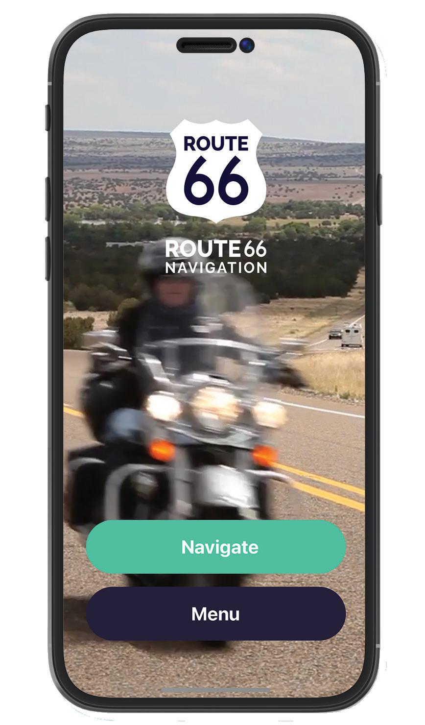

TURN BY TURN NAVIGATION
Enjoy advantages of our turn by turn navigation which will safely keep you on historic Route 66 and will show you all the attractive points of interest on the road
MORE THAN 1000 POIs
Discover more than 1000 interesting sites on Route 66. We are constantly looking for new sites and points of interest. Descriptions written by respected author Jim Hinckley
EASY TO USE
If you are riding a motorbike or drive a car, our app is always easy to use. It is designed for your comfortable travels
SAVE YOUR TRIPS
Prepare your itinerary in advance and then you can activate the saved routes when you need them on your trip
Will Rogers was perhaps the most famous person in the world during his lifetime. He was an entertainer, a writer, an actor, and a trusted voice. His humble Oklahoma roots and charming wit made this Cherokee citizen a household name by the time of hisuntimelydeathin 1935.Becauseofhis fameandhisjourney fromthehomesteadtoHollywood, Route66was giventhenickname oftheWillRogersHighway.
Take Will with you as you explore the most famous highway in the world! Be sure to visit the Will Rogers Memorial Museum in Claremore, OK, and see his Birthplace Ranch in nearby Oologah. Continue your Will Rogers experience to the Santa MonicaPierandvisitthe Will Rogers State Historic Park a fewmilesaway.
Learn more about how to get a Flat Will (or color him yourself!) at rogers66.com! Use the hashtag #FlatWill when you share your photos!

General Information
Follow the State Highway 66 signs to navigate through towns and to remain on the current alignment of 66 throughout Creek County.
Street names of Route 66 in towns (east to west):
Sapulpa: 66/New Sapulpa Road OR Frankoma Road/Old Sapulpa Road • 66/Mission • 66/Dewey • 66 Kellyville: 66/no special name given
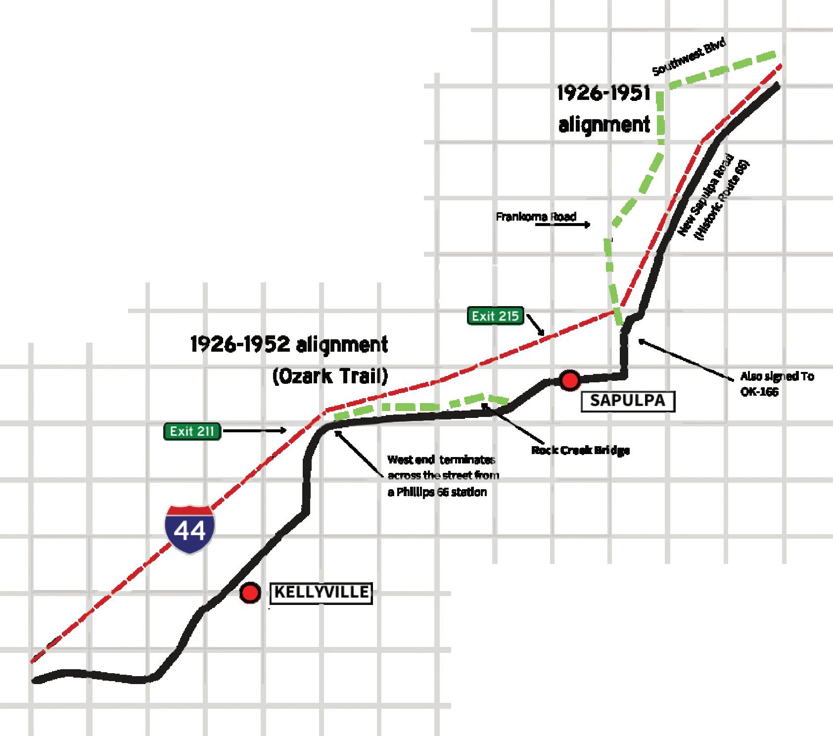
NOTE: For most of 2025, the section of Historic Route 66 in downtown Sapulpa will be closed to automobile traffic due to construction. Businesses are still open and the area is walkable! Hobson Ave or Lee Ave are parallel detours.
There are many older surviving sections of Route 66 in Creek County — especially west of Depew and between Bristow and Sapulpa. We have highlighted the most drivable ones.
Accessing an older alignment usually requires a slight jog, so keep your eyes open and check your distances on the map. They are generally signed as Old Hwy 66. Jim Ross’ book Oklahoma Route 66 can also help you locate these old stretches.
The Ozark Trail Loop west of Sapulpa is especially great, though it can be rough. Some of the Portland cement concrete is lightly covered with asphalt, you can catch a few glimpses of it along the edges. It is bumpy and curvy and has an old brick-decked through truss bridge. Although the bridge was closed to traffic at the time of printing, plans are underway to create a roadside park here. It’s still worth stopping to see along with the large water tank with a colorful wildflower mural.
If you are eastbound, access to this stretch is across the street from a gas station just east of the interchange of Highway 33 and I-44. If you are westbound, take a right at the stoplight right after the Tee-Pee Drive-In.
See if you can find the following landmarks (listed in no particular order):
• Old manufacturing plant — west of Kellyville.
• Old telephone poles. Hint: look just north of Bristow on old alignment by a cemetery.
• Rock Creek Bridge. This is the brick-decked bridge on the old alignment west of Sapulpa.
“Chief” James Sapulpa wasn’t an actual chief, but the Creek elder opened a trading post here circa 1850 where he served fellow Creek tribesmen, the Yuchi, and eventually white settlers. The town wasn’t incorporated until the railroad came to town three decades later. Sapulpa became known for glass and brick manufacturing in addition to the oil industry. The Glenn Pool oil field, the largest oil field in the region discovered during the oil boom days, is only six miles southeast of town.
World-renowned Frankoma Pottery was also based in Sapulpa and made using local clay; there is a Manufacturing Sculpture on the north side of town that features a facsimile Frankoma plate and glass bottle. Downtown Sapulpa is well preserved with many historic brick buildings that date back to the 1920s. Sapulpa is also home to one of the largest annual car shows on Oklahoma Route
66. The TeePee Drive-In, on the west side of town, has been fully restored.
-Crossroads Cookery, 117 E Dewey Ave, 918-851-3314
-Gasoline Alley Classics, 24 N. Main, 918-806-1000
-Happy Burger, 215 N. Mission, 918-224-7750
-Heart of Route 66 Auto Museum, 13 Sahoma Lake Road, 918-216-1171
-Route 66 Electric, 1003 E Lee Avenue, 918-850-2056
-Route 66 Tree Service, 12904 W 86th St S, 918-855-4398
-Sapulpa Area Chamber of Commerce, 101 E. Dewey, 918224-0170
-Sapulpa Historical Society, 100 E. Lee Avenue, 918-224-4871
-Sapulpa Main Street, 15 N. Water Street, 918-224-5709

-Tee-Pee Drive-In Theater, 13166 W Ozark Trail, 918-9285500
-Tulsa-Sapulpa Union Railway, 701 E. Dewey, 918-224-1515
-Waypoint Lounge, 111 S Main St, 918-600-2055
-Guardian of the Plains sculpture (10169 OK-66)
-Frankoma/manufacturing sculpture (901 N Mission St)
-Murals (throughout downtown)
-Vintage Barnsdall service station (26 E Lee Ave)
-Giant gas pump (13 Sahoma Lake Rd)
-Rock Creek Bridge + Original Ozark Trail alignment (Ozark Trail Rd and W Dewey Ave)


Historic Route 66 doesn’t go through the heart of the community; rather, it clips the northwest edge of town. Kellyville didn’t enjoy the same robust growth from the local oil and gas industries like neighboring Sapulpa and never had more than 1,000 residents.
The town has two “claims to fame” as it were: it’s the site of Oklahoma’s worst train disaster (two Frisco trains collided in 1917) and it was almost the state’s only ski resort. SNOW skiing, that is! Snow Valley was the idea of California ski instructor Willis Barrows. In 1971, after hounding locals for money and other support, the “resort” opened…but failed immediately.
-High on a Hill Dairy Goats, 15362 S 217th W Ave, 918-8419951
Born and raised along the Mother Road, long time Oklahoma Route 66 Association member Clay Fees has written the definitive history of the American muscle car. He lives in Sapulpa, Oklahoma.
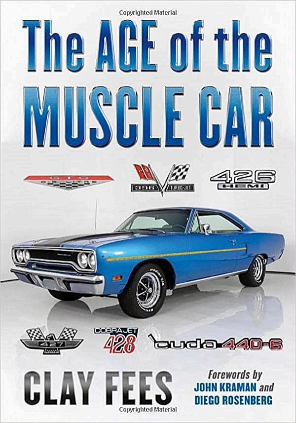
Readable and nontechnical, this comprehensive book traces American muscle cars from the unleashing of the thundering Pontiac GTO in 1964 to their last breaths in the early 1970s and their rightful place in the tapestry of American history.
With forewords by preeminent automotive commentator the late John Kraman and prolific automotive author Diego Rosenberg, this is the one car book to own.

CREEK COUNTY
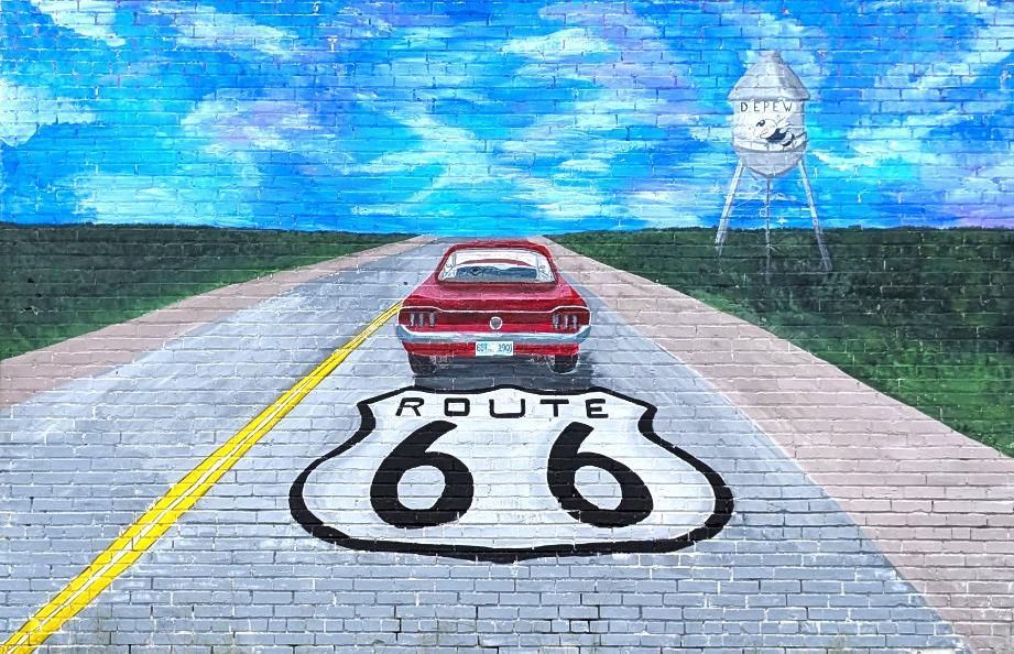
Mural in downtown Depew
Street names of Route 66 in towns (east to west):
Bristow: 66 • 66/Main • 66/4th Ave. • 66/Roland St.
Depew: Flynn Ave. • Main • Ladd Ave.
-Original 66 pavement (19839 OK-66)
The town of Bristow, known as “the Woodland Queen” of the Creek Nation, was the original county seat when Oklahoma was established in 1907 but Sapulpa took that crown after just one year. The Frisco Railroad was key to the town’s growth along with the local cotton, oil, and gas industries. It was also where one of Oklahoma’s first radio stations went on the air in 1925. It’s said that Bristow has more brick streets than any other town in the state.
Many of the brick buildings downtown are well-kept, including listings on the National Register of Historic Places. The former railroad depot houses a museum and sits next to one of only two Frisco water towers in existence. Don’t
miss the Wake Island Memorial on the west side of town; it’s the only one in the United States!
-Anchor 66, 630 S Roland St, 918813-1182
-Bristow Historical Society & Museum, 1 Railroad Pl, 918-3679335
-Bristow Tire & Auto Service, 115 W. 4th Avenue, 918-367-2224
-Bristow Toy Museum, 118 N Main St, 918-629-2852
-City of Bristow, 110 W. 7th Avenue, 918-367-2237
-Granny’s Emporium, 709A S. Roland, 918-367-1727
-Oklahoma Venue 66, 116 W. 8th Street, 918-381-4624
-Chrysler-Plymouth Sign (210 E 9th Ave)
-Town Plaza (111 N Main St)
-Frisco Depot (1 Railroad Pl)
-Post Office (124 W 6th Ave)
-Wake Island Memorial (37033 Veterans Memorial Dr)
This little town has the distinction of being the first one bypassed by a re-alignment of US Highway 66 (October 1928) but don’t let that stop you from taking the short detour to the picturesque main street district. Since the road changed so early, it retains much of its character from when Route 66 was new.
It’s quiet today, but once upon a time Depew held multiple drugstores, grocery stores, movie theaters, an auto dealership, hotels, and more. The road through town is still the original 1920s-era concrete that Route 66 is known for. Take a look around and visit with
the locals here; they are proud of their little piece of Route 66 history! If City Hall is open, they have many books of vintage town photographs available to the public.
-Historic downtown district (412 Main St)
-Former Gimmel gas station (325 Main St)

Without the support of our Business Members, we wouldn’t be here. Support them as you travel Oklahoma Route 66!
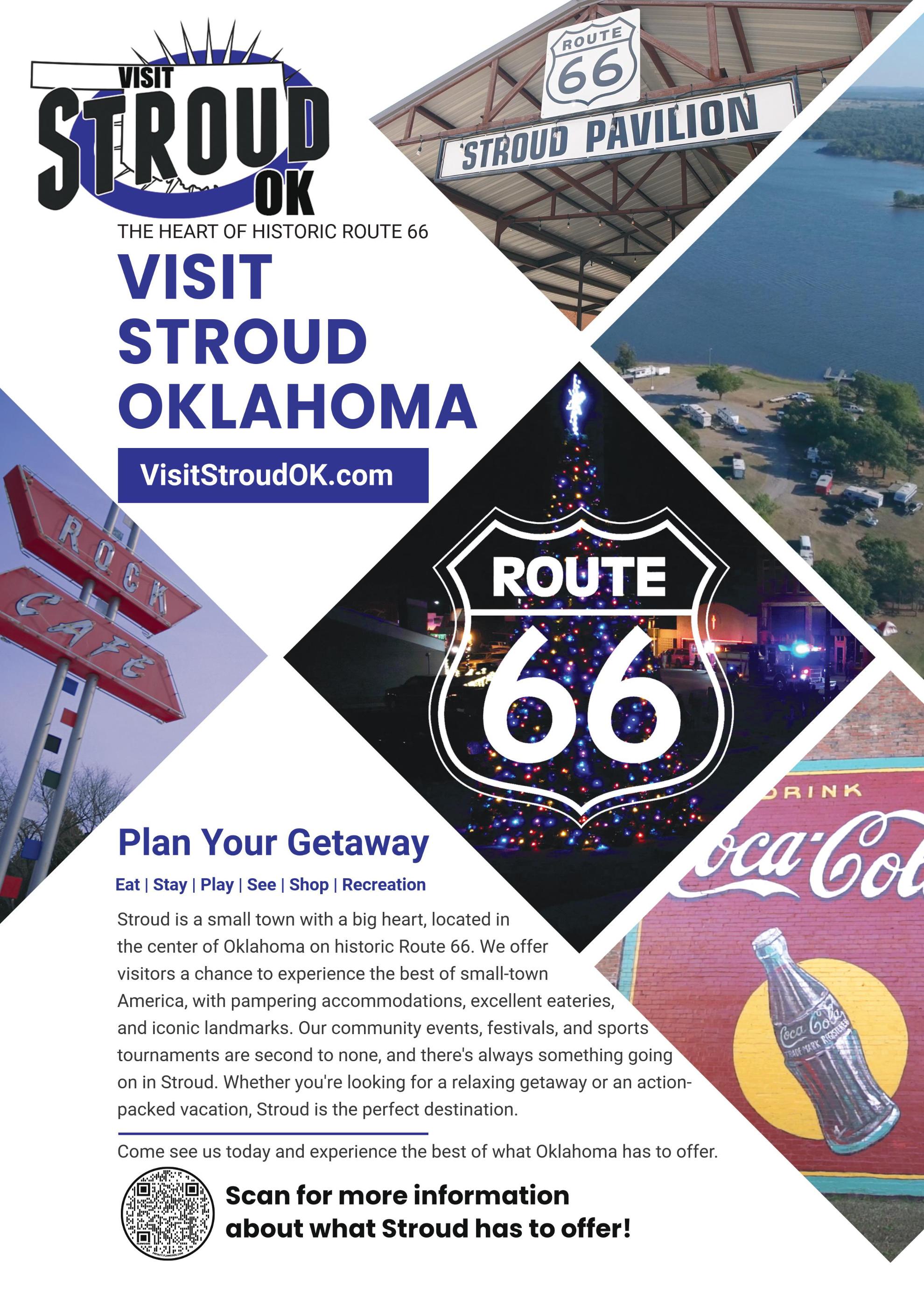
City of Stroud
220 W 2nd St | 918-968-2571
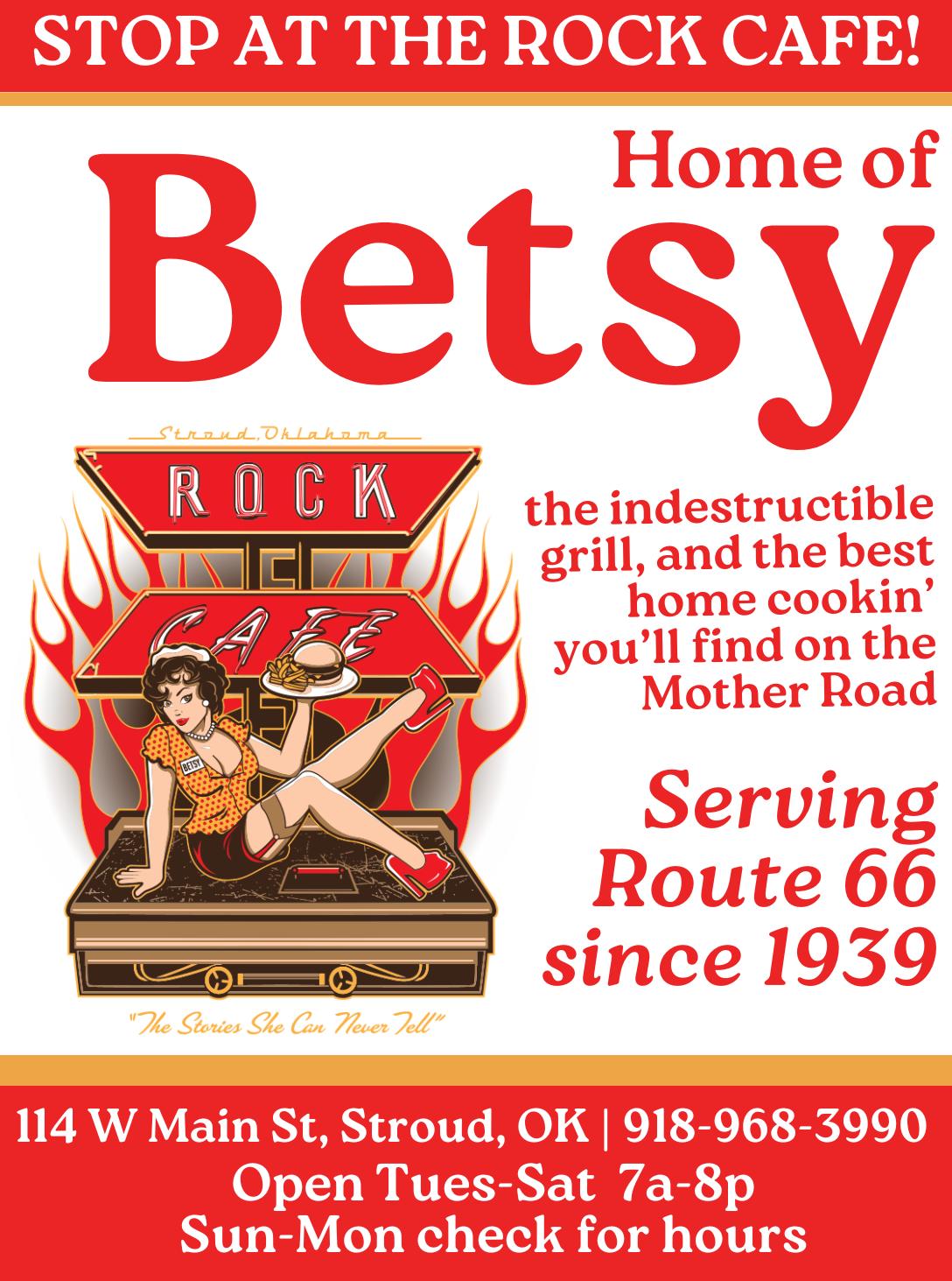
Rock Cafe
114 W Main St | 918-968-3990
Route 66 Flower Shoppe
316 W Main St | 918-968-2586
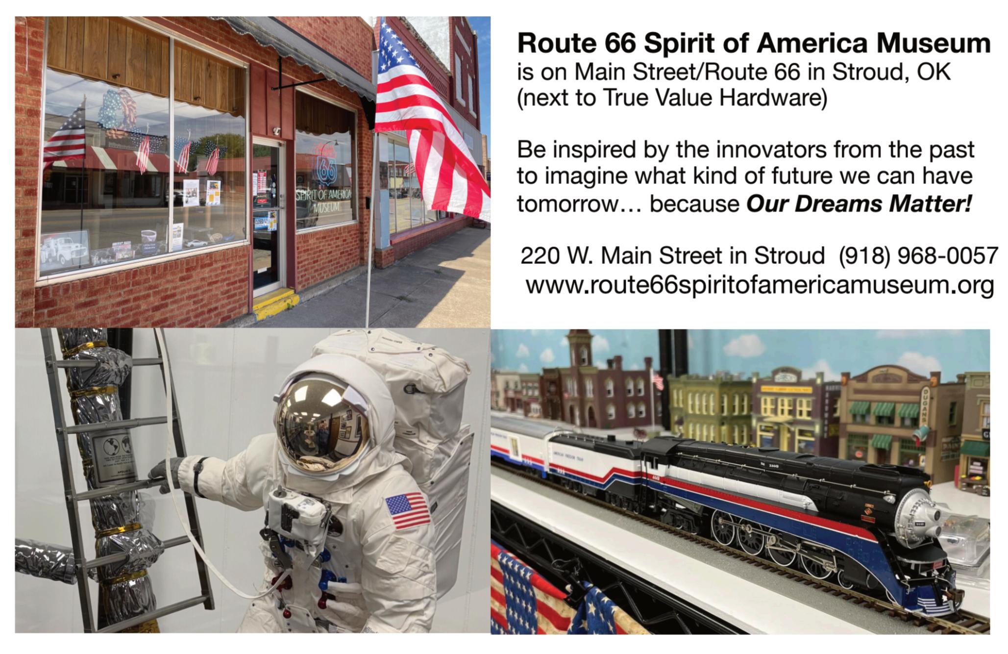
Route 66 Spirit of America Museum
220 W Main St | 646-221-1933
Stroud Chamber of Commerce
216 W Main St | 918-968-3321
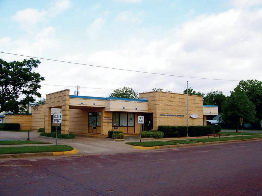
Central Oklahoma Telephone Company
223 Broadway | 800-252-8854
Davenport Chamber of Commerce
223 Broadway | 918-377-2241
The New Era Community Newspaper
209 Broadway | 918-377-2259
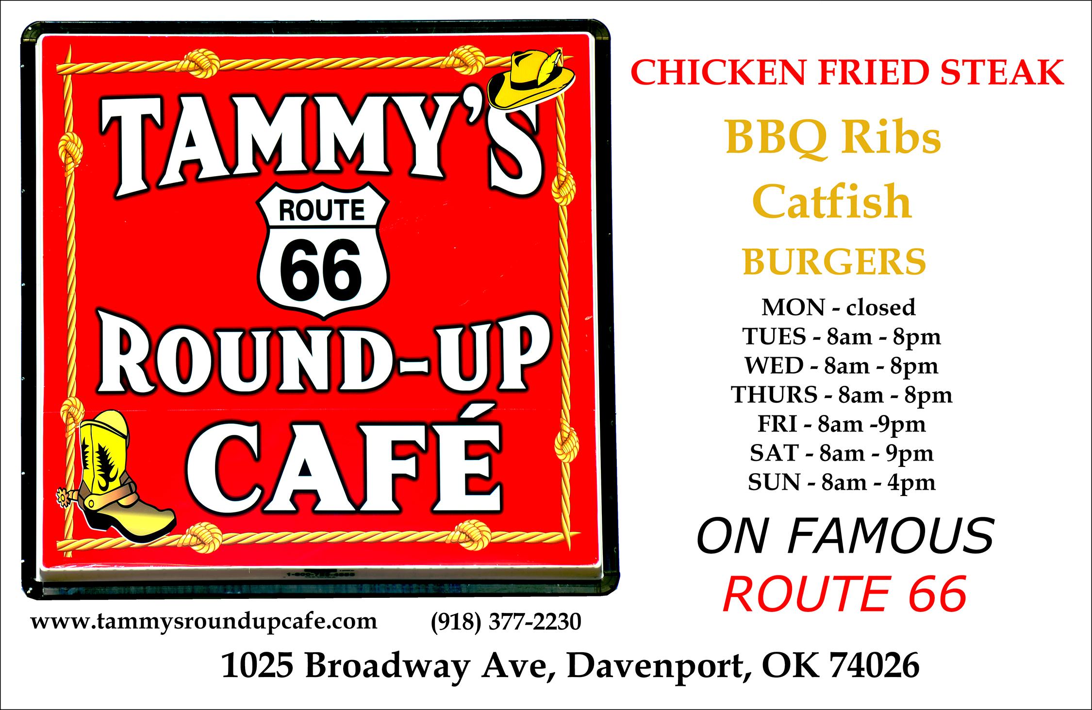
Tammy’s Route 66 Round-up Cafe
1023 N Broadway | 918-3772230
Town of Davenport 214 Broadway | 918-377-2235
Chandler Area Chamber of Commerce
400 East Route 66 | 405-2580673
City of Chandler
414 Manvel Ave | 405-258-3200
LD’s Wrecker Service
341723 E Highway 66 | 405258-2120
Lincoln County On-Stage 108 E 8th St | 405-258-1718
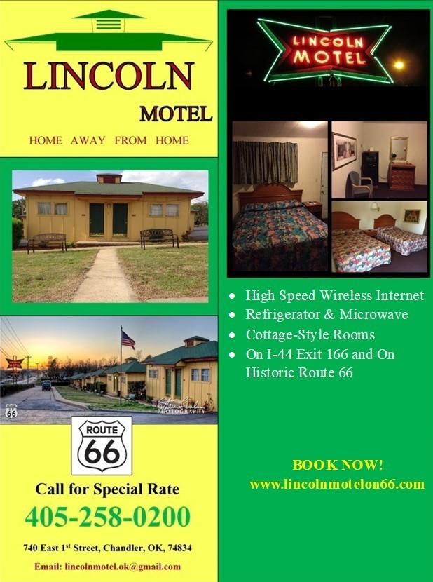
Lincoln Motel
740 E 1st St | 405-258-0200
Manvel Avenue Coffee Company 905 Manvel Ave | 405-258-0905
McJerry’s Route 66 Gallery 306 Manvel Ave | 405-240-7659
Nostalgic Chandler OK 1123 Manvel Ave | 405-8160536
Quilt 66 907-699-6696
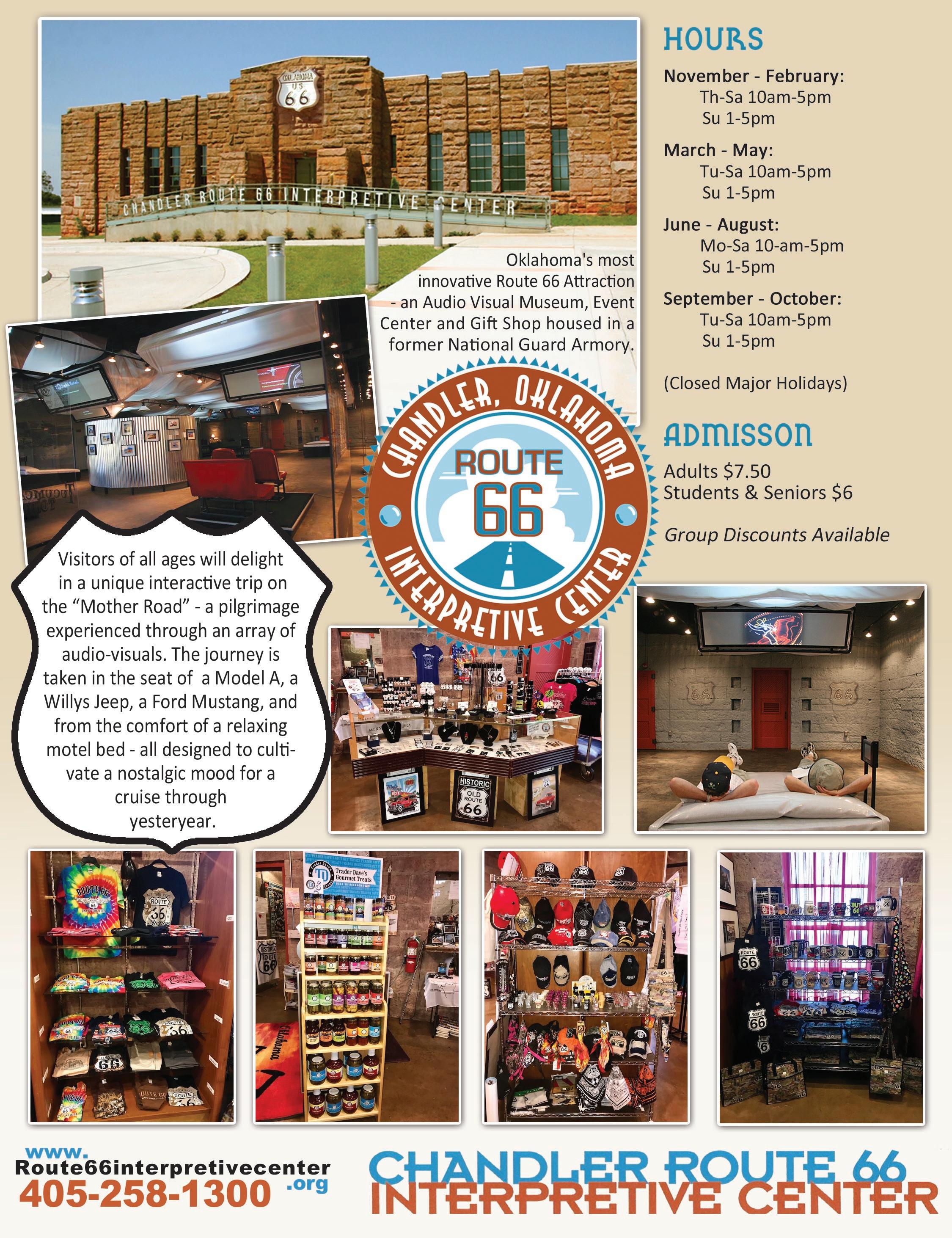
Route 66 Interpretive Center
400 East Route 66 | 405-2581300
VFW Post 1719
900726 S 3420 Rd | 405-2589171
Seaba Station Motorcycle Museum
336992 E Hwy 66 | 405-2589141
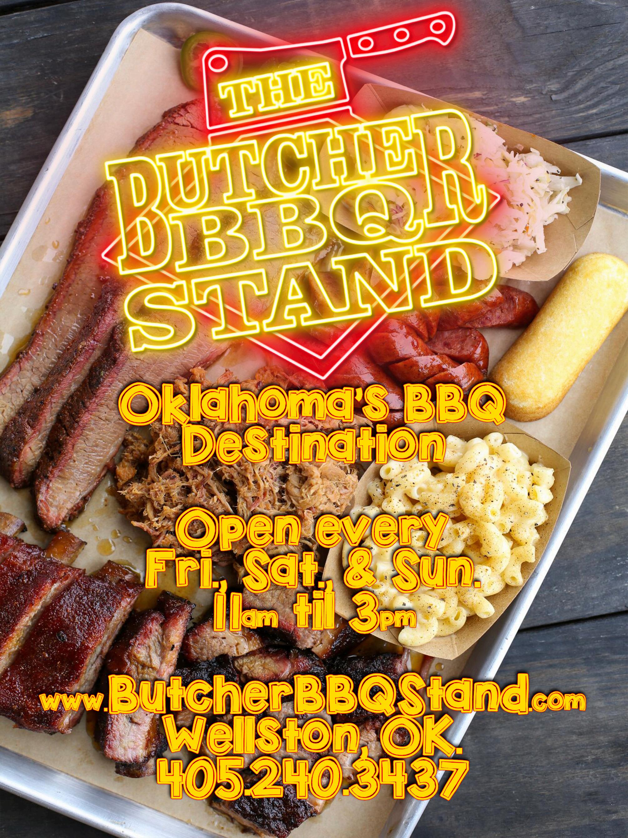
Butcher BBQ Stand
3402 W Hwy 66 | 405-240-3437
Kincaid Farms 331955 E Hwy 66 | 405-2298445
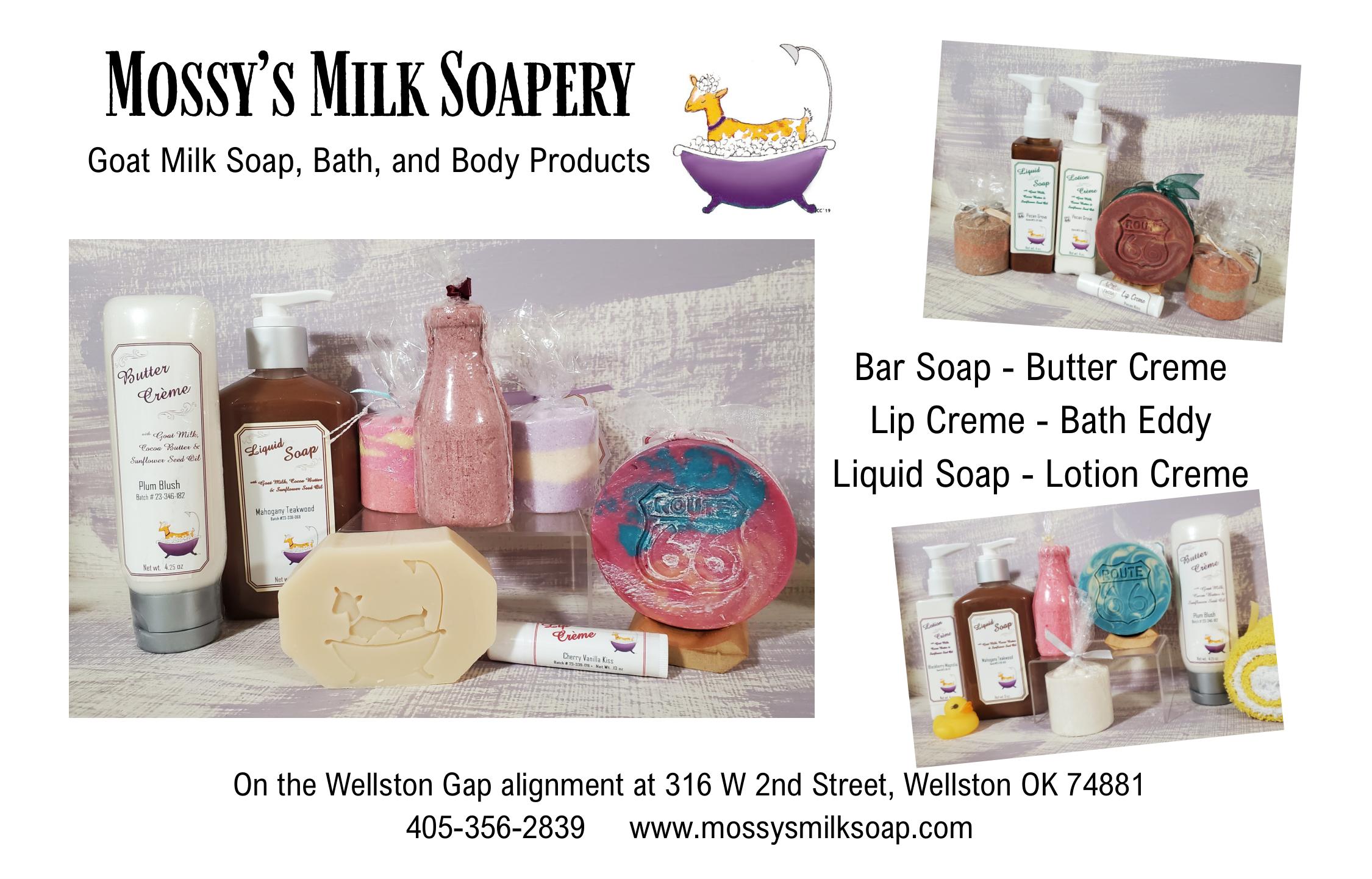
Mossy’s Milk Soapery 316 2nd St | 405-356-2839
Luther Register News PO Box 311 | 405-888-9946
Threatt Filling Station Foundation 21940 OK-66 | 240-605-1062
Threatt Legacy 405-443-6655
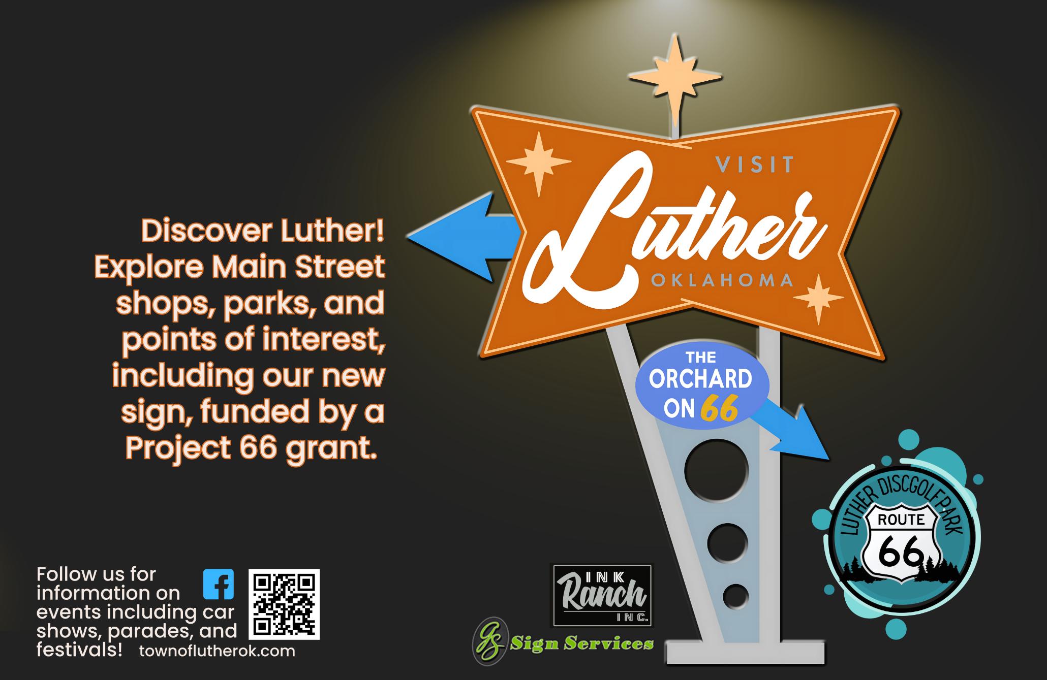
Town of Luther
108 S Main St | 405-277-3833
Arcadia Farmer’s Market 101 OK-66 | 405-226-0346
Arcadia Farmers Market Gen. Store
210 N Odor St Ste 210 | 405226-0346
Arcadia Historical & Preservation Society / The Round Barn 107 E Highway 66 | 405-3960824
Arcadia Tag & Title 230 N Odor St | 405-396-0824
The Chicken Shack 212 OK-66 | 405-277-5020
Parkhurst Ranch PO Box 592 | 405-215-6814
660 W Highway 66 | 405-9277677
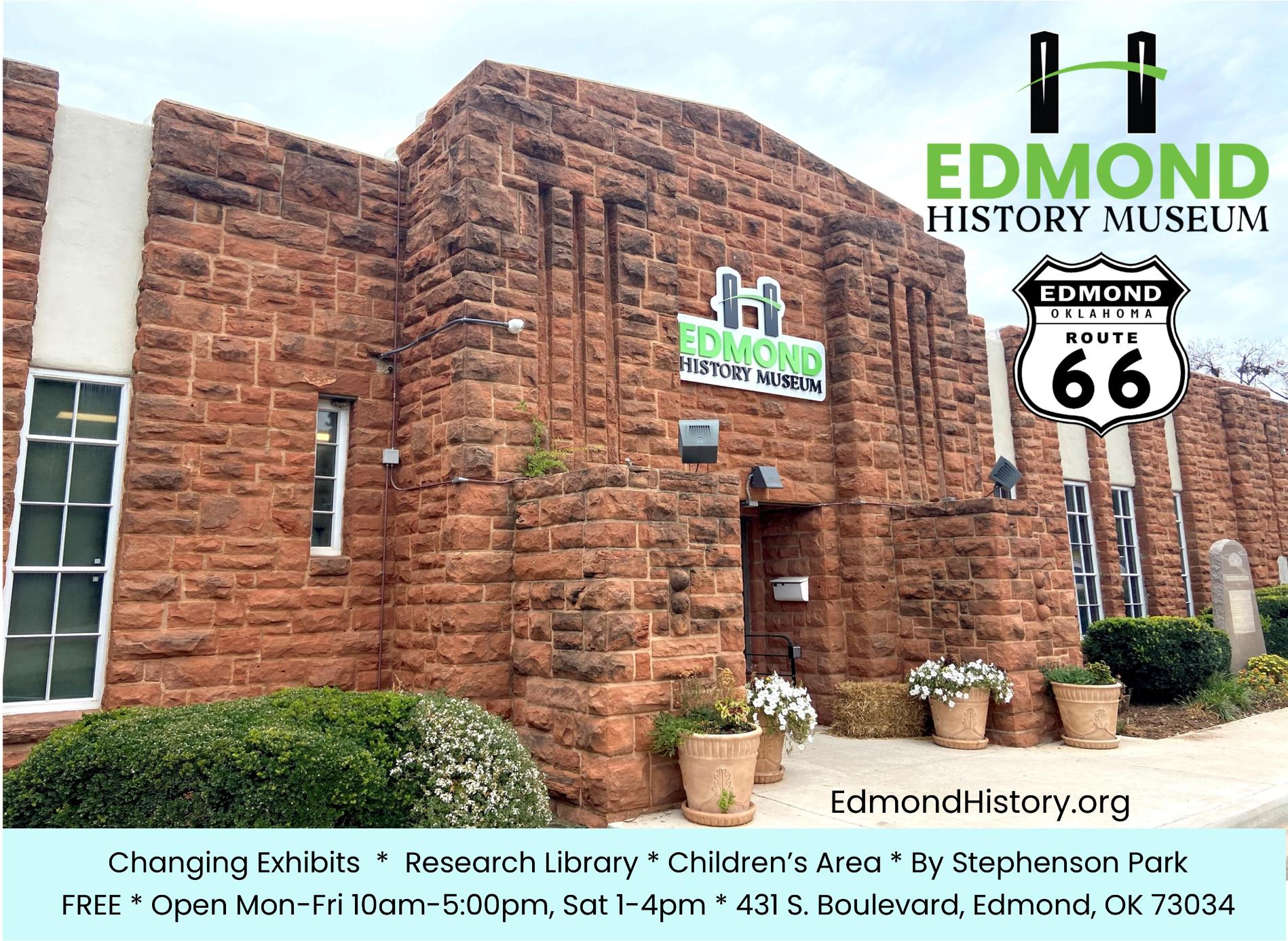
Edmond Historical Society & Museum
431 S Boulevard | 405-340-0078
Route 66 Balloon Festival 405-496-4626
Uncommon Ground Sculpture Park
209 French Park Pl, Ste 101 | 405-982-7377
Visit Edmond
2901 Conference Dr | 405-3414344
OKLAHOMA CITY
39th Street District 3926 Flynn Ave | 405-301-1888
Automotive Repairs & Maintenance 2 3612 S Kelley Ave | 405-8870329
The Britton District PO Box 13536
Central Antique Market 916 W Britton Rd | 405-8401001
Collision Clinic
444 W Wilshire Blvd | 405-8487035
The Ellison, Oklahoma City, A Tribute Portfolio Hotel 6201 N Western Ave | 405-4630055
Jimmy Dale Richardson Music and Oklahoma Showgirls 1112 N Broadway Ave | 405404-9493
Keep Oklahoma Beautiful 720 W Wilshire Blvd, Ste 114 | 405-286-9141
The Mansion 3101 NE 50th St | 405-845-9456
Oklahoma History Center
800 Nazih Zuhdi Dr | 405-5220765
Oklahoma Museums Association 2100 NE 52nd St | 405-424-7757
Oklahoma Railway Museum
3400 NE Grand Blvd | 405-4248222
Oklahoma Tourism & Recreation Department
900 N Stiles | 405-522-4553
Oklahoma Travel Industry Association
3800 N Portland | 405-942-1121
SL Designs
701 NE 19th St | 405-630-7333
Visit OKC
123 Park Ave | 405-297-8913
Voorhees & Voorhees, P.C.
2200 Shadowlake Dr | 405-6825800
Watches, etc.
5934 NW 39th St | 405-789-2824
Western Avenue Association PO Box 54902
Zero Tolerance Coffee and Siyo Chocolate!
919 W Britton Rd | 405-3140048
BETHANY
Anderson Productions PO Box 1032 | 405-341-1646
Apple Tree Antique Gallery
6740 NW 39th Expy | 405-4950602
Route 66 Visitor Center of Metro OKC
6644 NW 39th Expy | 405-7891256
YUKON
Archery Traditions
328 Elm Ave | 405-350-1100
BancFirst
120 S Mustang Rd | 405-3249615
Blossoms Blessings Flowers & Gifts
815 E Main St | 405-467-4476
Bridging Vines Winery & Brewery
11216 N Cimarron Rd | 405669-6892
City of Yukon
500 W Main St | 405-350-3938
Emma Elle’s Italian Kitchen 4401 Grant Blvd, Ste 3 | 405870-7211
Green Chile Kitchen Rt. 66 12 E Main St | 405-265-4346
Honey Do Checklist
505 Greenwood Dr | 405-9230302
ReJenneration Wellness
420 W Main St | 405-723-2872
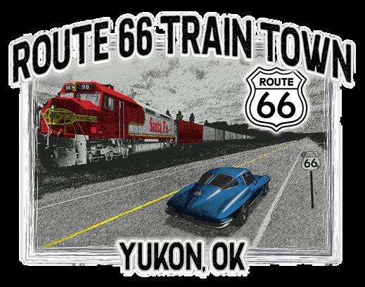
Route 66 Train Town 328 Elm Ave | 405-350-1100
TruNorth Agency Sherri L North PO Box 851057 | 405-249-2910
Yukon 66 Main Street Assoc. 528 W Main St | 405-350-5999
Yukon Chamber of Commerce
10 W Main St Suite 130 | 405354-3567
Bill & Clara’s Prairie Land Ranch 2701 W 10th | 405-650-6651
CDT Synthetics
1804 Mulberry Ln | 405-831-8741
El Reno Chamber of Commerce 206 N Bickford | 405-262-1188
El Reno Main Street 119 S Rock IslandAve | 405-2628888
Historic Fort Reno 16705 SW 29th St | 405-262-3987
US CavalryAssociation
3220 N Jesse Reno St | 405-4226330
Visit El Reno 101 N Choctaw | 405-262-4070
CALUMET
2025-2026
Cherokee Trading Post
301 S Walbaum Rd | 405-8842502

General Information
Follow SH 66 signs both in town and out in the country. Follow 66B to go through the downtown business district of Wellston.
Street names of Route 66 in towns (east to west):
Stroud: Main St.
Davenport: Broadway/6th St. Chandler: 1st St. • Mickey Clarkson Ave for sweeping curve • Manvel Ave • 66/W 15th St just west of hard curve by old gas station
Lincoln County has two single arch steel truss bridges. The first one is on an older fragment about half a mile east of Stroud on the north side of the road off in the brush off of E Seventh Street. The second bridge is on 66B on the west side of Wellston over Captain Creek; notably, this bridge was replaced in 2021 but the original trusses were re-attached to keep the historic aesthetic. You can spot old alignments east of Stroud on into Creek County. Please consult Jim Ross’ book Oklahoma Route 66 for more details.
There’s a replica Ozark Trail obelisk in downtown Stroud, too. These markers predated Route 66 and helped early travelers find their way on mostly-unpaved roads. The original obelisk is west of town on a dirt road.
Historic Route 66 is called Broadway in Davenport and curves west, avoiding downtown. Take some time to detour slightly and check out their brick Main Street and murals!
See if you can find the following landmarks (listed in no particular order):
• Spherical Magnolia Oil Co. Storage Tank. Hint: it’s on the short Ozark Trail segment on the north side of Davenport.
• Meramec Caverns Barn. If you are traveling east, you can’t miss it. If you are westbound, here’s a hint: It’s about 3.5 miles west of Chandler and faces west, so you’ll have to keep looking over your shoulder or into your rear view mirror to find it. This is the only remaining Meramec Caverns structure left on Oklahoma Route 66. This landmark was heavily damaged in a 2023 windstorm and the building has been restored - look for the mural to come back soon!


Prior to Oklahoma statehood, this town was one mile from the Indian Territory border and already had quite a reputation as a roughand-tumble place. It didn’t help when the Henry Starr gang robbed both banks in town at the same time in 1915. Today, Stroud is a tight community and the headquarters of the Sac and Fox Nation. Stroud Lake is just a few minutes from the Mother Road and offers a professional-level disc golf course as well as fishing, boating, and swimming from a white sand beach.
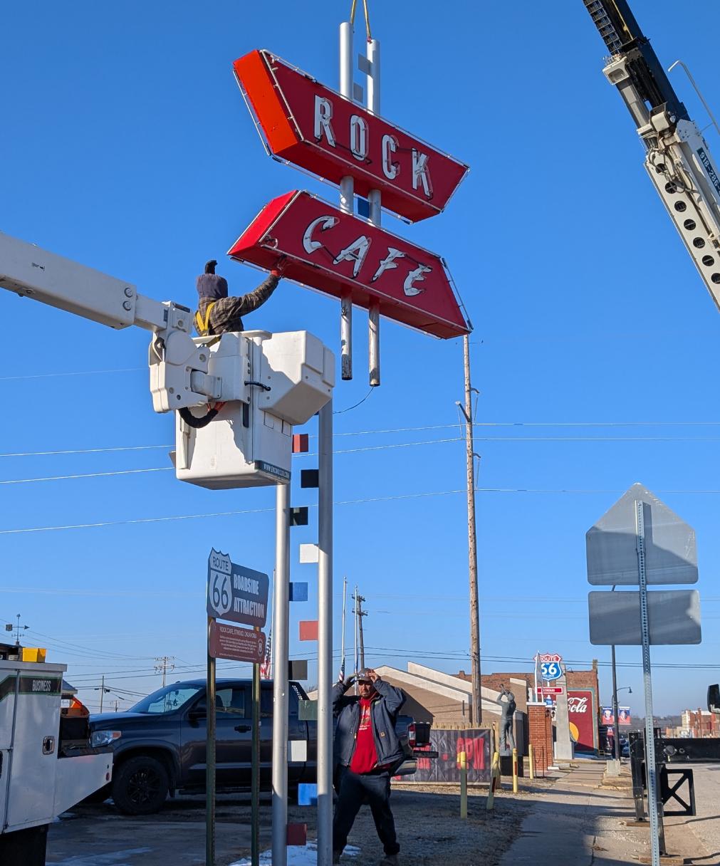
The Stroud Public Library on 7th Street is a notable Art Deco building that contains historic documents and artifacts. Downtown boasts several colorful murals, neon signs, a replica Ozark Trail obelisk, and a beautifully carved tree sculpture. The Rock Cafe is built out of the native stone that was excavated when Route 66 was paved. It survived a devastating fire in the mid-2000s and continues to serve locals and travelers alike. For an interesting mobile ex-
perience to visualize the town’s history, check out www.TimeFrameTours.com.
There’s an original Ozark Trail marker between Stroud and Davenport, the only one along Oklahoma’s Route 66 corridor! Check the Lincoln County map page for details.
-City of Stroud, 220 W. 2nd Street, 918-968-2571
-Rock Cafe, 114 W. Main Street, 918-968-3990
-Route 66 Flower Shoppe, 316 W Main St, 918-968-2586
-Route 66 Spirit of America Museum, 220 W. Main Street, 646-221-1933
-Stroud Chamber of Commerce, 216 W. Main St, 918-968-3321
-Lincoln County Express childsize train (215 E Main St)
-Replica Ozark Trail Obelisk (212 W Main St)
-Murals (throughout downtown)
-Original Ozark Trail Obelisk (N 3540 Rd and E 890 Rd)
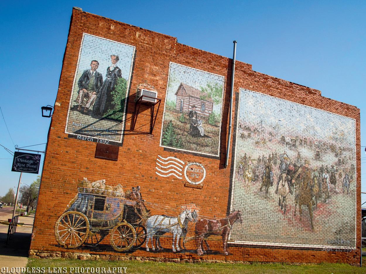
Route 66 weaves through Davenport with graceful curves, but if you drive straight through you’ll miss a lot! From the Y at Seventh and Broadway, travelers can take a short detour to Davenport’s historic brick main street. The bricks were made right in town at the Davenport Brick and Tile Company (gone since 1930) and the road segment is listed on the National Register of Historic Places. There are also several large, colorful murals in the downtown area, one of which is a tribute to their first postmaster and the town’s namesake, Nettie Davenport.
-Central Oklahoma Telephone Company, 223 Broadway, 800252-8854
-Davenport Chamber of Commerce, 223 Broadway, 918377-2241
-The New Era Community Newspaper,209 Broadway, 918377-2259
-Tammy’s Route 66 Round-up Cafe, 1023 N. Broadway, 918377-2230
-Town of Davenport, 214 Broadway, 918-317-2235
-World’s First Spherical Oilfield Tank (north of E 890 Rd and N 3503 Rd)
-Brick Main Street and Downtown Murals (2nd and Broadway)
-Historic Sinclair station (615 Broadway)
-WPA chapel at Davenport Cemetery (Route 66 and N 3490 Rd)

Wellston has the only segment designated ‘66B’ in the entire country. It dates back to a controversy about paving the original downtown alignment versus a bypass to the south, known as the ‘Wellston Gap’.
Street names of Route 66 in towns (east to west): Warwick: 66/no alternate name
Wellston: Ash/66B • 2nd/66B • 66B
Chandler is one of only two towns in Oklahoma that was settled by its own land run in 1891. It survived a devastating tornado six years later and today it’s the seat of Lincoln County and has nearly 20 sites listed on the National Register of Historic Places. Two blocks of pioneer-era homes and churches (known as Silk Stocking Row) can be seen on 8th Street west of the courthouse. A walk downtown will reveal ghost signs, historic horse hitching posts, and more.
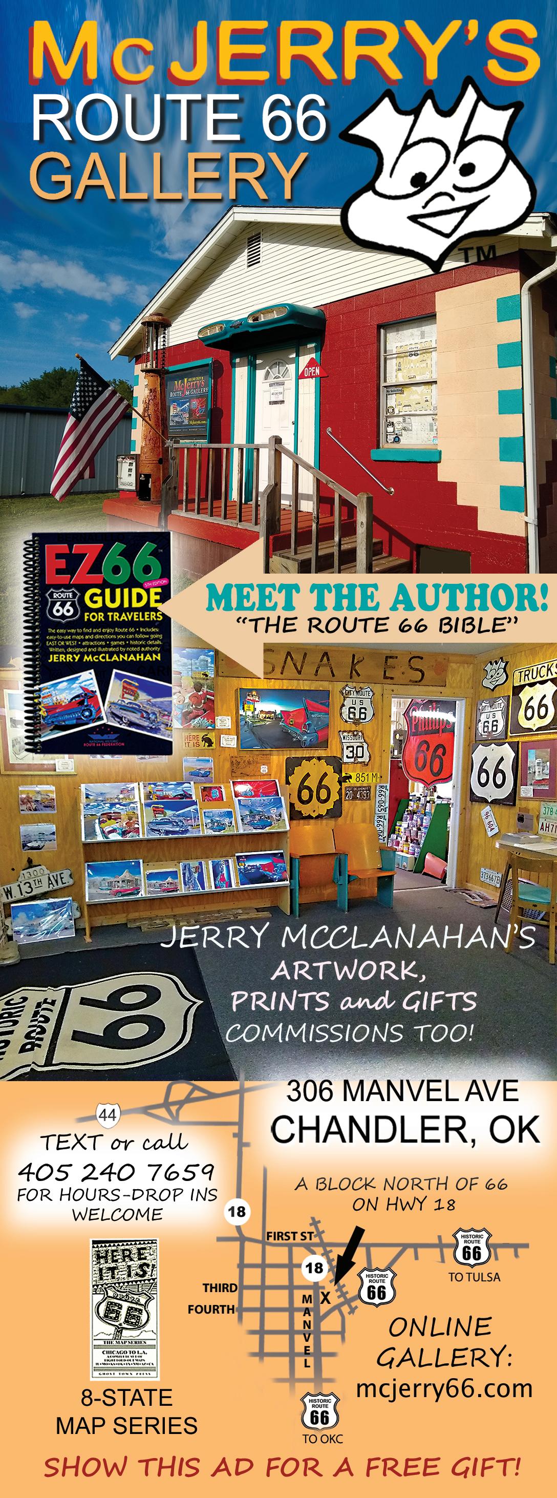
The route through the heart of town is known as Manvel Avenue, in honor of the Santa Fe Railroad president. The historic National Guard Armory has been fully restored and houses the Route 66 Interpretive Center. The Lincoln County Historical Society downtown features a large collection of artifacts (including a local teacher’s vintage marionette collection) and a cottage-style Phillips 66 station is currently being renovated. Chandler is also the home of Jerry McClanahan, artist and author of the EZ-66 Guide for Travelers, a wellknown and highly recommended book that provides turn-by-turn directions along all 2,448 miles of Historic Route 66. Stop by McJerry’s Route 66 Gallery and say hello!
-Chandler Area Chamber ofCommerce, 400 East Route 66, 405-258-0673
-City of Chandler, 414 Manvel Ave, 405-258-3200
-LD’s Wrecker Service, 341723 E. Highway 66, 405-258-2120
-Lincoln County On-Stage, 108 E 8th St, 405-258-1718
-Lincoln Motel, 740 E. 1st Street
405-258-0200
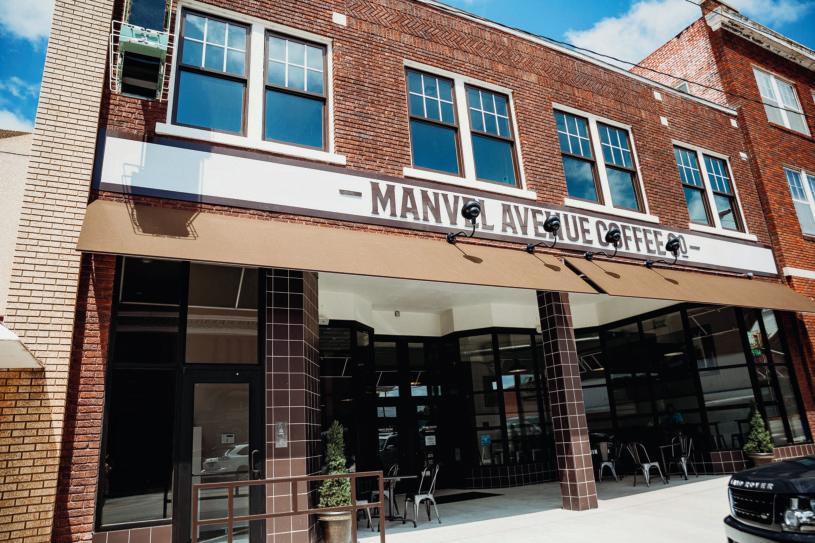
-Manvel Avenue Coffee Company, 905 Manvel Avenue, 405-258-0905
-McJerry’s Route 66 Gallery, 306 Manvel Avenue, 405-240-7659
-Nostalgic Chandler OK, 1123 Manvel Avenue, 405-816-0536
-Quilt 66, 907-699-6696
-Route 66 Interpretive Center, 400 East Route 66, 405-258-1300
VFW Post 1719, 900726 S 3420 Rd, 405-404-0517
-Restored 66 Bowl neon sign (920 E 1st St) – originally in Oklahoma City
-Vintage Sonic Drive-In sign (801 E 1st St)
-Historic WPA Armory (400 E 1st St)
-Phillips 66 Cottage station (701 Manvel Ave)
-Murals (throughout downtown)
-Meramec Caverns mural (being restored in 2025!) Route 66 and S 3400 Rd)
There isn’t much to Warwick today beyond a collection of houses and a 1920s-era brick service station, which is the home of Seaba Station Motorcycle Museum. Actually, even though the town was settled in 1903, it wasn’t formally incorporated for sixty years to preserve their school district from being annexed by nearby Wellston. When it was, the citizens marked it as 1,800 acres making it the largest “town” in the county! Despite their efforts, the schools were consolidated in 1968 and the Warwick post office closed in 1972. The WPA-era schoolhouse still stands on Commercial Street.
-Seaba Station Motorcycle Museum, 336992 E Hwy 66, 405258-9141
-WPA Schoolhouse (Commercial St and S Broadway)
When US Highway 66 was first established, the road wove through
downtown Wellston. However, it wasn’t paved and in 1932 the state re-aligned the highway south of town. The town sued the state, fearing the change would doom their survival. TheWellston Gap, as it was known, remained but did eventually get paved. It is now marked as OK-66b.
The 1930s-era Captain Creek Bridge on the west side of downtown was replaced in 2021. The Oklahoma Department of Transportation re-attached the original truss elements of the bridge to maintain the historic aesthetic, making it a landmark project showing a compromise between modern safety requirements and historic preservation. Wellston also serves as the mid-point of Oklahoma Route 66, located exactly halfway between the Kansas and Texas borders on the old pavement.
-Butcher BBQ Stand, 3402 W Hwy 66, 405-240-3437
-Kincaid Farms, 331955 E Hwy 66, 405-229-8445
-Mossy’s Milk Soapery, 316 2nd St, 405-356-2839
-Murals (throughout downtown)
-Captain Creek Bridge (OK-66b west of downtown)
Lincoln
Lincoln County On-Stage Community Theatre
Ioway Casino
Phillips 66 Gas Station
Seaba Station Motorcycle Museum Wineries
General Information
State Highway 66 signs are used east of Edmond and from the I-44 interchange to Bethany. Follow street names everywhere else. New Historic Route 66 signs were placed throughout the Oklahoma City Metro area in recent years but it can still be difficult to navigate without preparation.
Street names of Route 66 in towns (east to west):
Luther: 192nd St./Danforth/66
Arcadia: 66/no alternate name
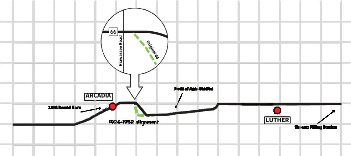
Just west of Luther Road (the turn-off to downtown Luther) you’ll notice some former bridge abutments to the north. These date back to the 1930 alignment of the road, which is on private property now. The 1926-1952 alignment east of Arcadia is a remarkably well-preserved segment of Portland cement, listed on the National Register of Historic Places.
See if you can find the following landmarks (listed in no particular order):
• Three historical markers
• Old rock gas station with a criminal past.
• House built to resemble a Phillips 66 cottage-style gas station on old alignment east of Arcadia
• Old Portland Concrete alignment fragment just west of Luther
• A Volkswagen emerging from house and tribute to 66 sights on SH 66 east of Arcadia

Historic Route 66 runs along the north side of town – but don’t drive past Luther without taking a closer look. The town was established in 1898 along what became the Frisco rail line near the Deep Fork River. When Oklahoma became a state in 1907, more cotton gins operated here than anywhere else in the new state. The Booker T Washington High School was considered one of the premier high schools for black students in the United States; local Allen Threatt, Sr. operated a service station on Highway 66 that was the only black-owned-and-operated station on the entire route during the Jim Crow era.
Luther is not just a community of the past – the town holds a vibrant Pecan Festival every autumn and prides itself on a continuing legacy as an agricultural hub. The Threatt Filling Station is listed on the National Register of Historic Places and is currently being restored by the family. The site of the former Booker T Washington High School is a city park and memorial. Downtown Luther has several shops, restaurants, and colorful murals that make for lovely photo ops.
-Luther Register News, P.O. Box 311, 405-888-9946
-Threatt Filling Station Foundation, 21940 OK-66, 240-6051062
-Threatt Legacy, PO Box 593, 405-443-6655
-Town of Luther, 108 S. Main Street, 405-277-3833
-Threatt Filling Station (21940 OK-66)
-Old bridge abutments (18725 E US Rt 66)
Arcadia gets its name from a region of Greece that was known as a rural paradise. Indeed, this
town has always been seen as a quiet and peaceful place away from the hustle and bustle of the big city. In fact, there’s a historic marker on the east side of town that marks the occasion that Washington Irving set up camp here during his Tour of the Prairies in the 1830s!
There’s also a stretch of original pavement on the east side marked by National Historic Register signage and a marker that tells the story when Paul McCartney, the famous Beatle, stopped by on a road trip to make sure he was on ‘THE’ Route 66!
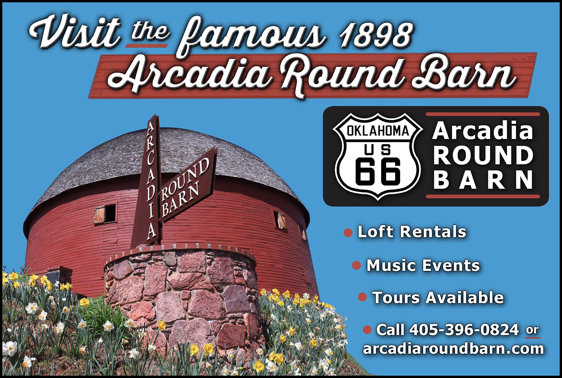
These days, Arcadia is perhaps best-known for the iconic Round Barn, built in 1898 by William Odor. Supposedly he built it that way to help avoid damage from high winds and tornadoes. The barn survived a fire in 1924 that destroyed much of the rest of the town and has since gone on to become the “most photographed attraction” on all of Route 66. By the early 1990s, the barn had fallen into serious disrepair – the roof had even collapsed. Local efforts led by Luke Robison of Midwest City were successful in restoring the barn for future generations to enjoy. When you stop by, don’t forget to visit the second floor to check out the beautiful craftsmanship!
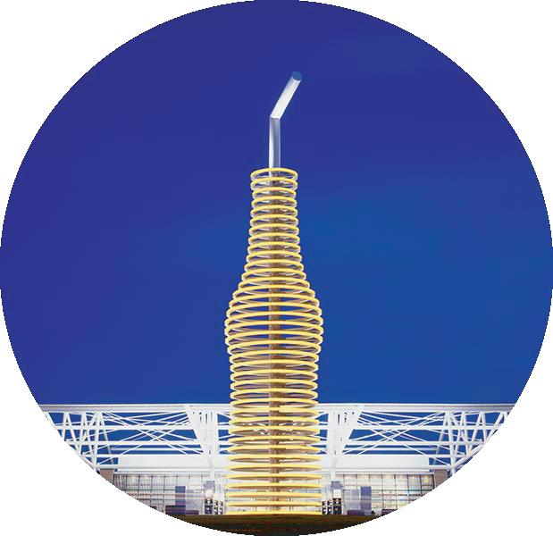
The other big – and we do mean BIG – landmark here is the 66ft tall soda bottle outside of Pops Soda Ranch. It’s a stunning sight day OR night!
-Arcadia Farmer’s Market, 101 OK-66, 405-226-0346
-Arcadia Farmer’s Market General Store, 1210 N Odor St, Ste 210, 405-226-0346
-Arcadia Historical & Preservation Society/ The Round Barn, 107 E. Highway 66, 405-3960824
-Arcadia Tag & Title, 230 N Odor St, 405-396-0824
-The Chicken Shack, 212 OK66, 405-277-5020
-Parkhurst Ranch, PO Box 592, 405-215-6814
-POPS, 660 W. Highway 66, 405-927-7677
-Rock of Ages Station (west of N Choctaw Rd and US Rt 66)
-Original pavement (13222 E Old Hwy 66)
-Historic Marker: Paul McCartney (13162 E Old Hwy 66)
-Historic Marker: Washington Irving (US Rt 66 and N Anderson Rd)
-1898 Round Barn (107 OK-66)
-66-ft tall soda bottle (660 US Rt 66)
Edmond is 20 miles north of Oklahoma City and has a growing culture of arts and history. Situated near Arcadia Lake (where bike trails and camping opportunities abound) it is the home of the University of Central Oklahoma, the first institution of higher learning in the state. Edmond sits along Route 66 and is punctuated by an 18-ft-tall bronze statue of Miniconjou Chief TouchtheClouds. In fact, Edmond boasts more than 300 sculptures and other public art; a walk around downtown reveals many of them! Edmond is also home to Cycle 66, an annual cycling event that takes over the heart of downtown.
The 1889 Territorial Schoolhouse is the earliest one-room schoolhouse from the days before Oklahoma statehood. It’s open for tours on Saturday afternoons, but you can email ehptcontact@gmail.com to make an appointment. Edmond is also the home of Shannon Miller, the most decorated gymnast in United States history.
-Edmond Historical Society & Museum, 431 S. Boulevard, 405340-0078
-Route 66 Balloon Festival, 405496-4626
-Uncommon Ground Sculpture Park, 209 French Park Pl Ste 101, 405-982-7377
-Visit Edmond, 2901 Conference Dr, 405-341-4344
-Chief Touch the Clouds statue (732 US-77)
-1889 Territorial Schoolhouse (124 E 2nd St)
-Blue Hippo (1129 S Broadway)

In 1954, 66 was shunted over to what is now the I-35 corridor, bypassing Edmond. Although there are several alternate alignments through Oklahoma City, we have shown only two. Please consult Jim Ross’ Oklahoma Route 66 for the other alignments. If you are westbound, as you leave Bethany, consider taking the older route around Lake Overholser. And no matter which direction you are traveling, try to take the older alignment loop just east of Arcadia. It is on the National Register of Historic Places.
DidyouknowthatOklahomais the only state that has oil derricks on the grounds of the Capitol? It’s also one of three where US Highway 66 ran right past the seat of state government (Springfield, IL and Santa Fe, NM being the others) though the other two states re-aligned away from their Capitol buildings in the early days. Route 66 in OKC did have many re-alignments over the years, though, which can make following the historic path(s) a bit difficult.
many new Historic Route 66 signs along several alignments to help travelers navigate the road through our largest city. You can get full details of the various alignments in Jim Ross’ book Oklahoma Route 66 or at www. jimross66.com
and the Milk Bottle Grocery building. This area is also home to “Little Saigon”, the city’s Asian District. There’s a Vietnam Memorial just north of the Milk Bottle.
-Automotive Repairs & Maintenance 2, 3612 S Kelley Ave, 405-887-0329
-The Britton District, PO Box 13536
The Oklahoma City National Memorial is a somber but worthwhile side-trip in downtown Oklahoma City.
-39th Street District, 3926 Flynn Ave, 405-301-1888
-Central Antique Market, 916 W Britton Rd, 405-840-1001
-Collision Clinic, 444 W. Wilshire Blvd, 405-848-7035
The Ellison, Oklahoma City, A Tribute Portfolio Hotel, 6201 N Western Ave, 405-463-0055
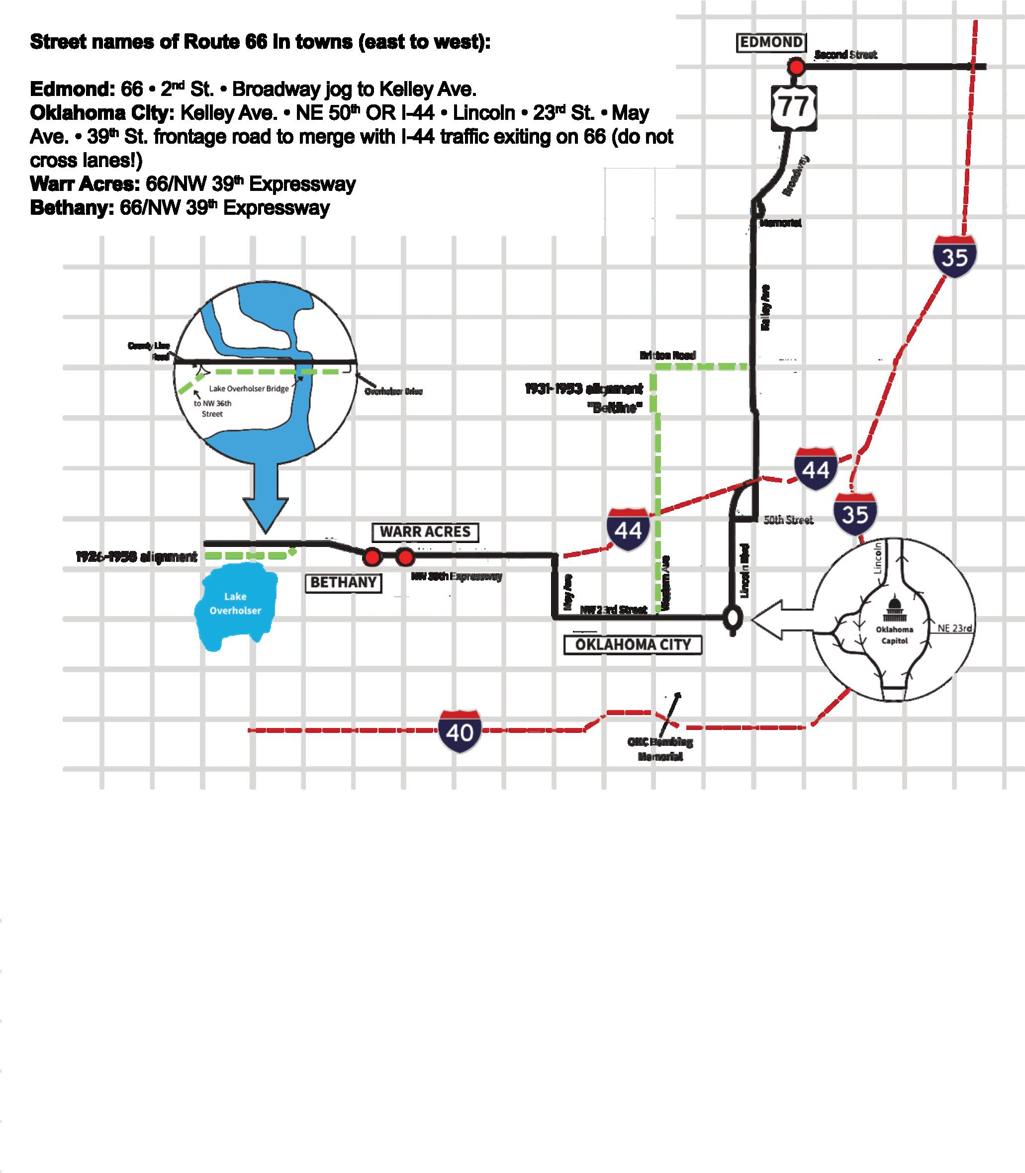
Thankfully, the city has placed
No matter which alignment of Route 66 you choose to follow in OKC, there are plenty of things to see and do on and near old 66. The 23rd Street Corridor just west of the Capitol has some great neon and a Route 66 Robot across from the Tower Theatre. At 23rd and Classen, you can see the historic Gold Dome
-Jimmy Dale Richardson Music and Oklahoma Showgirls, 1112 N Broadway Ave, 405-404-9493
-Keep Oklahoma Beautiful, 720 W Wilshire Blvd Ste 114, 405286-9141
-The Mansion, 3101 NE 50th St, 405-845-9456
-Oklahoma History Center, 800 Nazih Zuhdi Dr, 405-522-0762
-Oklahoma Museums Association, 2100 NE 52nd St, 405-424-7757
-Oklahoma Railway Museum, 3400 NE Grand Blvd, 405-4248222
-Oklahoma Tourism & Recreation Dept, 900 N Stiles, 405-522-4553
-Oklahoma Travel Industry Association, 3800 N Portland, 405-942-1121
-SL Designs, 701 NE 19th St, 405630-7333
-Visit OKC, 123 Park Ave, 405297-8913
-Voorhees & Voorhees, P.C., 2200 Shadowlake Dr, 405-6825800
-Watches, etc., 5934 NW 39th St, 405-789-2824
-Western Avenue Association, PO Box 54902
-Zero Tolerance Coffee and Ziyo Chocolate!, 919 W Britton Rd, 405-314-0048
-Capital Building (2300 N Lincoln Blvd)
-Uptown Robot (432 NW 23rd St)
-Gold Dome (1112 NE 111 23rd St)
-Milk Bottle Grocery & Vietnam Memorial (2426 N Classen Blvd)
-Will Rogers Gardens (3400 NW 36th St)
The community of Warr Acres lobbied strongly to relocate the original state capital from Guthrie after statehood, but they were unsuccessful. The town wasn’t formally incorporated until 1948 and although it only
covers about three square miles it has a notable spot in Route 66 history. On June 4, 1990 it was the very first location – in any state – to have a brown Historic Route 66 road sign installed.
Bethany, immediately to the west of Warr Acres, has a wellkept stretch of historic brick buildings that contain a variety of boutique shops, restaurants, and antique stores. Murals painted by internationallyknown artist Dr. Bob Palmer tell the town’s story in beautiful detail. On the west side of town, the 1924 Lake Overholser Bridge is on the National Register of Historic Places and even had a mention in John Steinbeck’s famous novel The Grapes of Wrath. It was bypassed in the 1950s but still carries local traffic!
-Anderson Productions, P.O. Box 1032, 405-341-1646
2025-2026
-Apple Tree Antique Gallery, 6740 NW 39th Expy, 405-4950602
-Route 66 Visitors Center of Metro OKC, 6644 NW 39th Expy, 405-789-1256
-Murals (6698 NW 39th Expy)
-Lake Overholser Bridge (8703 Overholser Dr)

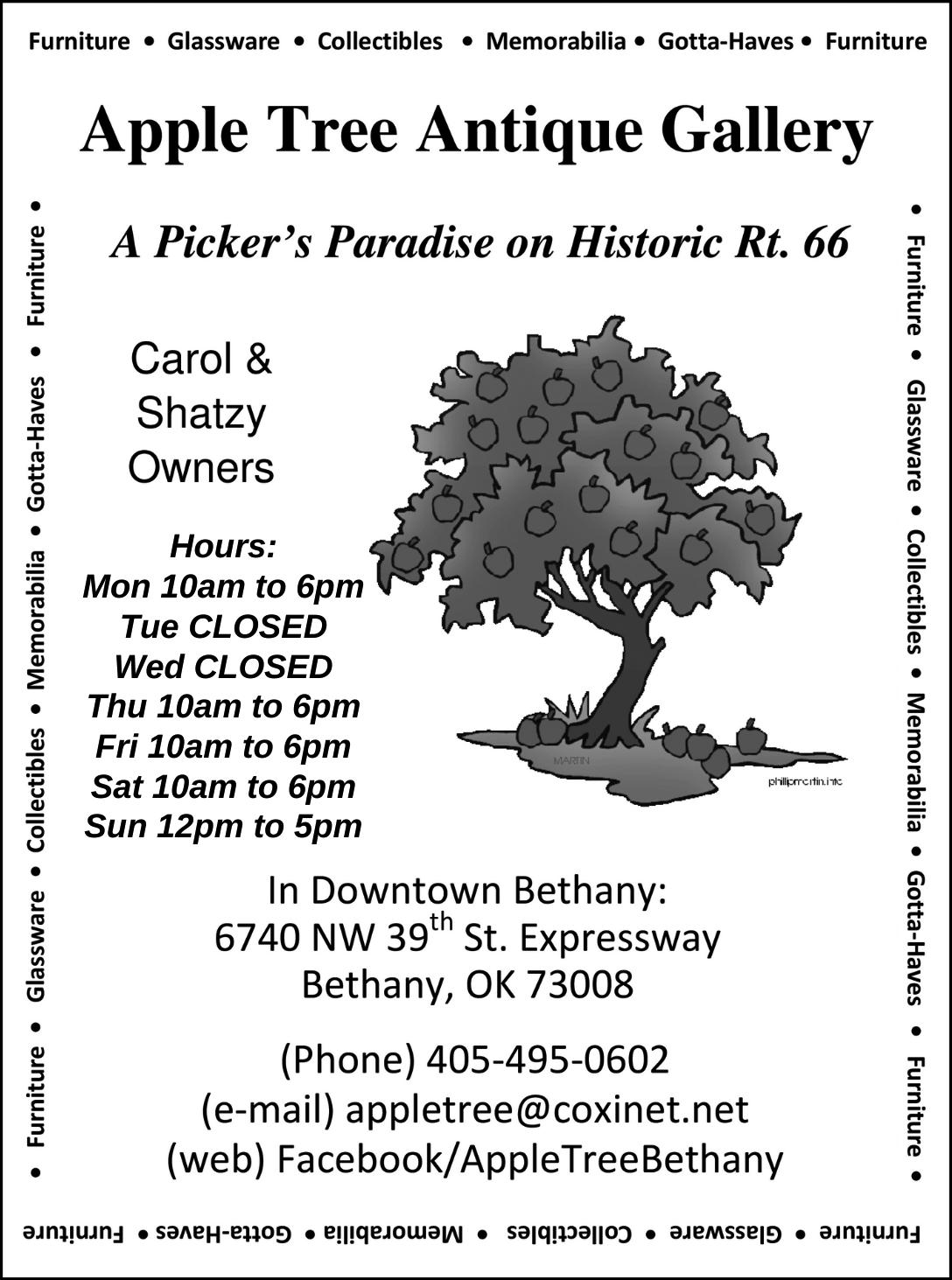
When cruising Route 66, Oklahoma City is a must-see destination. OKC’s vibrant districts welcome visitors into their diverse local restaurants and shops. Our classic neon signs and inspired murals evoke the nostalgia of the Mother Road, providing fun by day or night. Our world-class museums and only-in-OKC experiences will ignite memories for a lifetime.
Start your journey at VisitOKC.com.
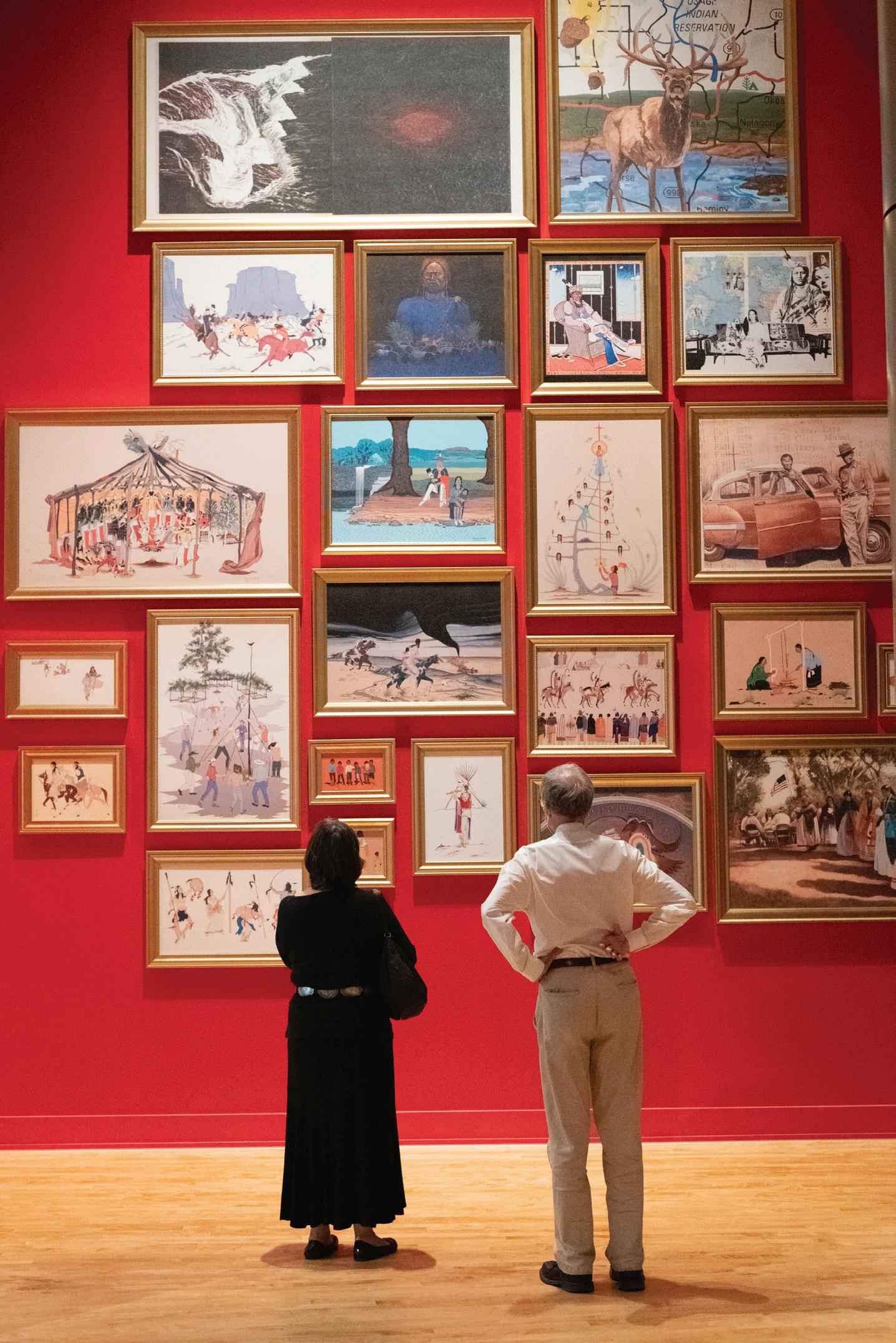


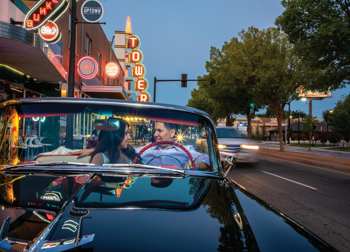

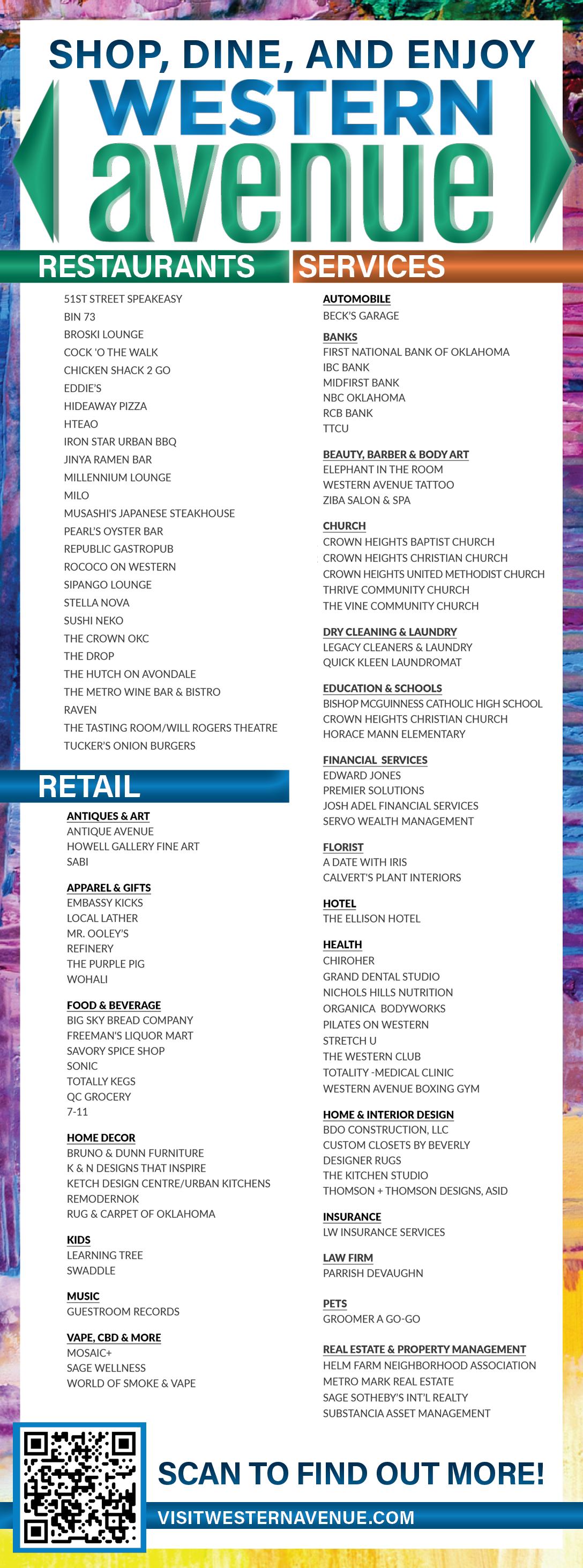


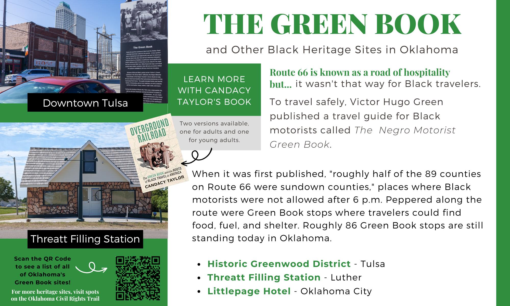


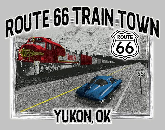


General Information
Coming out of Bethany, we suggest you follow the older 36th Street/Lakeshore Drive alignment as you head towards Yukon. State Highway 66 signs will continue to serve as a guide until you enter El Reno, where Historic Route 66 becomes Business Loop 40. Follow Business 40 signs through El Reno, being careful you don’t wind up on I-40 at either end. See the next map for details on the west side of town.
Street names of Route 66 in towns (east to west):
Yukon: 66 • 66/Main
El Reno: 66 • Business 40/Rock Island • Business 40/Wade • Business 40/Choctaw • Business 40/Sunset Drive
The older alignment in El Reno goes north at the intersection where SH-66 ends. Be mindful of the zig-zag downtown; it’s all signed Business Loop 40 but each street has a local name, too.
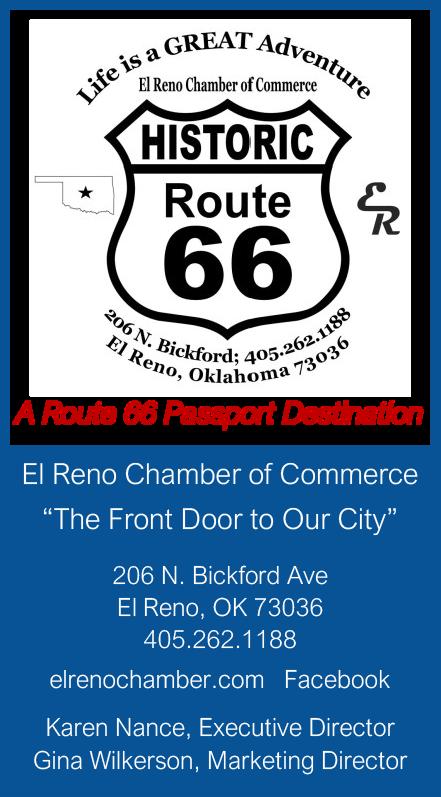
The Chisolm Trail crossed what would become US Highway 66 in Yukon as cattlemen guided their herds from Texas to the railroad stockyards in Kansas. There are multiple markers and murals in town dedicated to the region’s early heritage. The town is a crossroad of culture, too: it is the Czech Capital of Oklahoma and holds an annual festival every October.
For a time, the largest flour mill in the southwest operated here. The silo for Yukon Mill and Grain (complete with restored “Yukon’s Best” neon sign!) sits on the south side of Route 66 while competitor Dobry Mills’ silo stands on the north side. Both are vacant today but overlook the rest of the town as silent monuments to the industry that made the town what it is today.
Yukon is also the hometown of country music legend Garth Brooks!
-Archery Traditions, 328 Elm Avenue, 405-350-1100
-BancFirst, 120 S Mustang Rd, 405-324-9615
-Blossoms Blessings Flowers & Gifts, 815 E Main St, 405-4674476
-Bridging Vines Winery & Brewery, 11216 N Cimarron Rd, 405-669-6892
-City of Yukon, 500 W. Main Street, 405-350-3938
-Emma Elle’s Italian Kitchen, 4401 Grant Blvd Ste 3, 405-8707211
-Green Chile Kitchen Rt. 66, 12 E. Main Street, 405-265-4346
-Honey Do Checklist, 505 Greenwood Dr, 405-923-0302
-Rejenneration Wellness, 402 W Main St, 405-723-2872
-Route 66 Train Town, 328 Elm Ave, 405-350-1100
-TruNorth Agency Sherri L North, PO Box 851057, 405-2492910
-Yukon 66 Main Street Association, 528 W Main St, 405350-5999
-Yukon Chamber of Commerce, 10 W Main St Suite 130, 405-3543567
-Yukon’s Best Flour Silo (S 3rd St and US Rt 66)
-Chisholm Trail Marker (just west of the railroad track on the north side of 66)
-Yukon Sunset Mural (528 W Main St)
El Reno is famous for the onionfried hamburger – a local dish popularized during the Great Depression. It’s not just any old burger with some onion on it, either. Shredded onion is mixed with ground beef and grilled together on a flat-top, unlocking delicious flavor! There’s a big festival the first Saturday in May honoring this local culinary cornerstone and there are multiple establishments in town that serve them the same way they’ve been served since the 1920s. Come hungry!
Strolling down El Reno’s Historic Downtown you will find the Historic Centre Theatre, which hosts live performances, movies, and other events. A refurbished 1924 Heritage Express Trolley travels down Main Street and is a great way to experience El Reno’s shopping and dining options.
There’s a Route 66 photo op at the corner of Wade and Choctaw complete with a Rock Island railroad caboose. There’s a huge mural of a scissor tail flycatcher, the Oklahoma State Bird, on the back of an old drive-in screen on the west side of downtown. If it looks a little worn, that’s because a tornado came through not long after it was painted!
FortReno, a few miles west of town proper, was established in 1875 and named after a Civil War veteran. The Post contains over a dozen buildings on the National Register and the cemetery contains a section of Italian and German World War II P.O.W.s. The Visitor’s Center and United States Cavalry Museum are open year-round but hours can vary depending on the
season. The grounds also house the Grazinglands Research Laboratory of the United States Department of Agriculture. There’s much more to this historic site; make time to visit!
-Bill & Clara’s Prairie Land Ranch, 2701 W. 10th, 405-6506651
-CDT Synthetics, 1804 Mulberry Lane, 405-831-8741
-El Reno Chamber of Commerce, 206 N. Bickford, 405-262-1188
-El Reno Main Street, 119 S Rock Island Ave, 405-262-8888
-Historic Fort Reno, 7107 W Cheyenne St, 405-262-3987
-US Cavalry Association, 3220 N Jesse Reno St, 405-422-6330
-Visit El Reno, 101 N. Choctaw, 405-262-4070
-El Reno 66 Shield + Rock Island caboose (NE corner of W Wade St and S Choctaw Ave)
-Murals (throughout downtown)
-Guardian of the Mother Road mural (600 Sabra Pass)
From 1926 to 1933, the loop of Calumet – Geary – Bridgeport was a part of the original alignment of US Highway 66, a dirt road in those early days. Although the road was re-aligned as paving was completed between El Reno and Hydro, these communities are proud of their heritage as a part of the Mother Road.
Calumet’s first post office, established in 1893, was on the homestead of Anna Cowdry. The coming of the Choctaw, Oklahoma, and Gulf Railroad brought early prosperity to the town and was one of the largest in Canadian County at one time. The downtown district still has some historic brick buildings and a few ghost signs to see.
-Cherokee Trading Post, 301 S Walbaum Rd, 405-884-2502
-Ghost signs and water tower (Main St and N 2740 Rd)
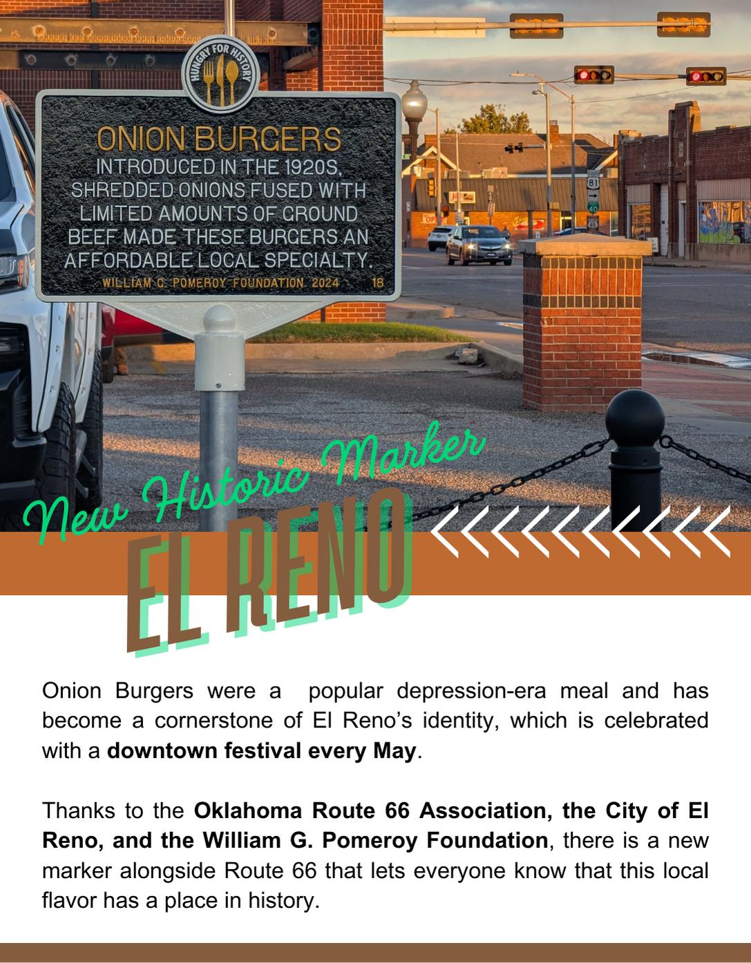
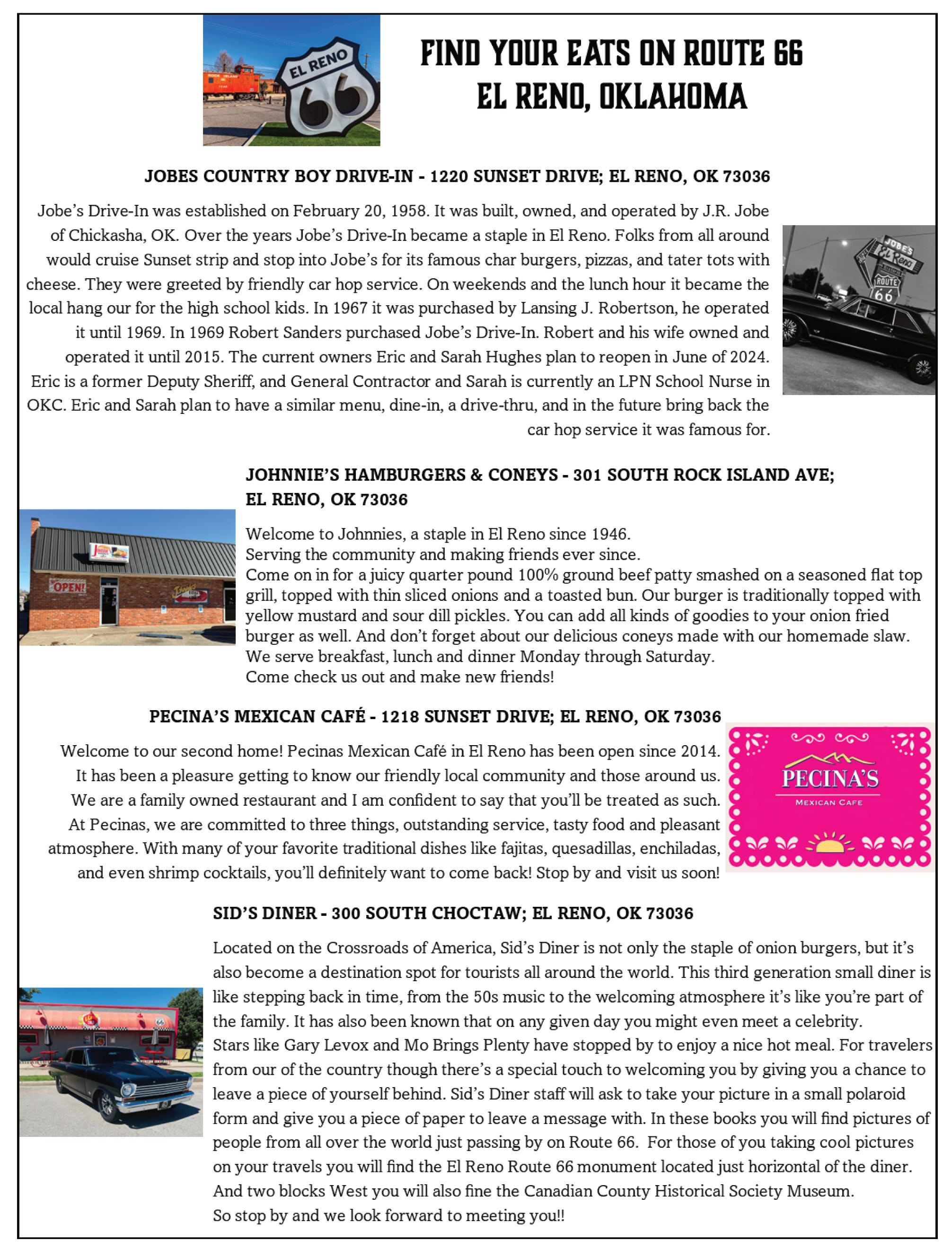
2025-2026

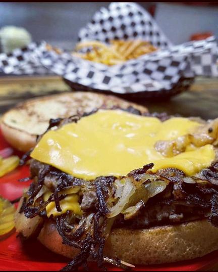
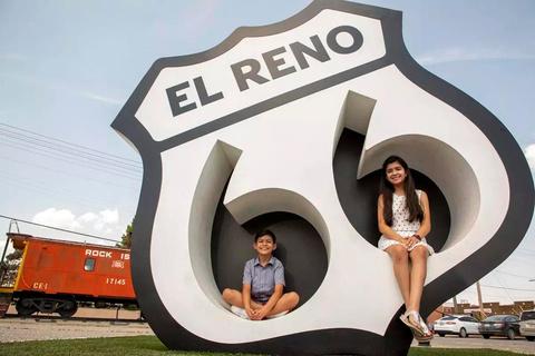
OfficialHomeofthe
FriedOnionBurger
ElReno,Oklahoma,isa charmingcityknownforits richhistoryandtheiconic friedonionburger,alocal staplefordecades
Visitorscanenjoythis mouthwateringdishatclassic diners,wheretime-honored recipesandwarmhospitality createanunforgettable experience
CruiseDown Route66
Take a nostalgic drive through El Reno along historic Route 66, where every mile tells a story of Americana charm.
Stop by our historic downtown to shop and enjoy a ride on our Heritage Express Trolley, as seen in the blockbuster movie, Twisters.
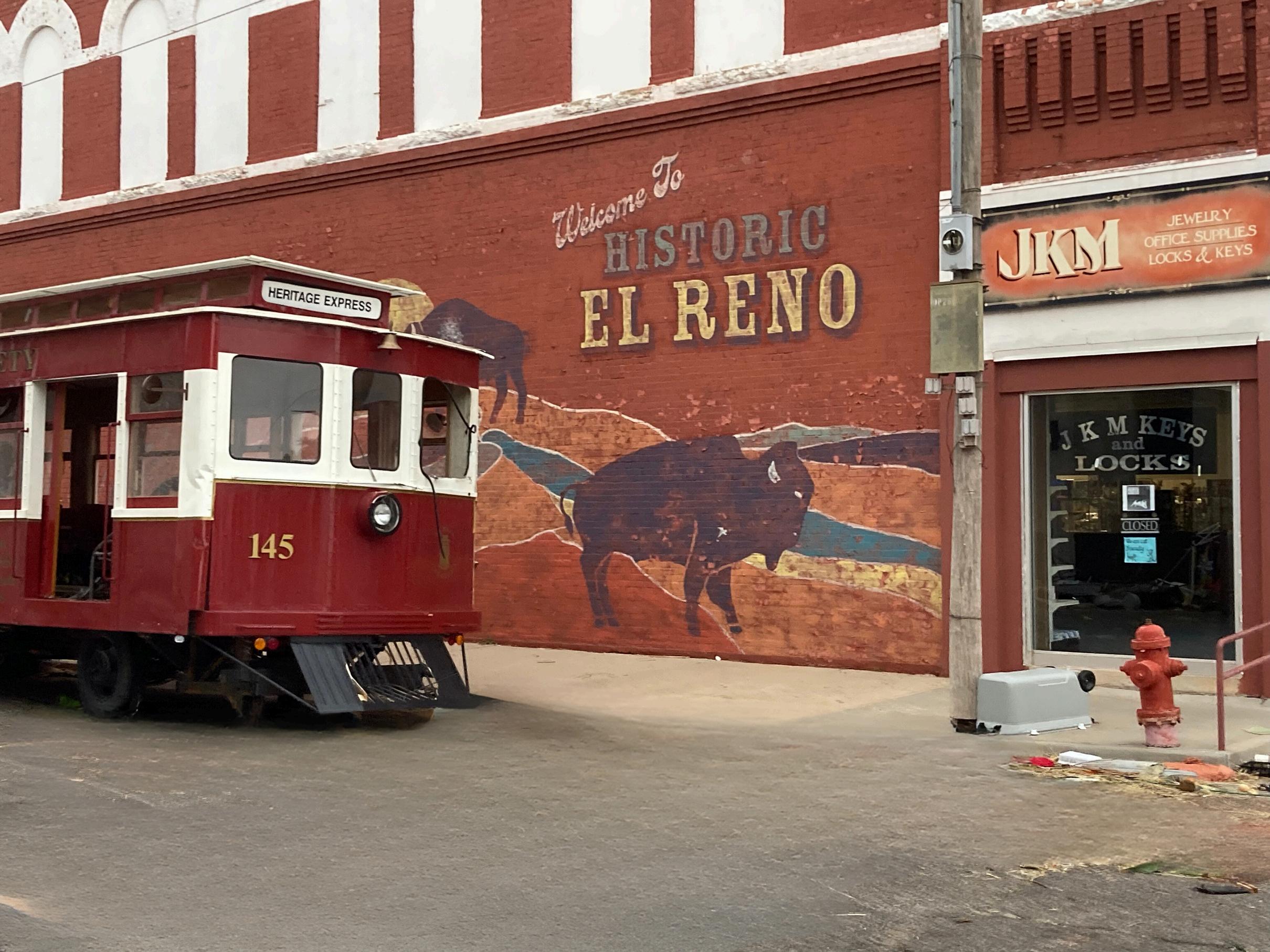
TeeTimeatCrimson CreekGolfCourse
Bookateetimeatthe picturesqueCrimsonCreek GolfCourseandenjoyaround ofgolfsurroundedby stunningviews Formoreoutdoor adventures,LakeElReno offersawalkingtrail, swimming,fishing,andmore. There’ssomethingfor everyonetoenjoy!


General Information
West of El Reno,Business Loop 40 connects back to the interstate. There’s a turn-off to a two-lane road (signed E 1020 Rd) right as BL-40 south near Fort Reno; take that and you will be rewarded with a long stretch of original Portland cement 66.
Street names of Route 66 in towns (east to west):
Calumet: 270 • 270/Calumet Road • 270 Geary: 270/South St. • 281 & 8/Broadway
Westbound 66ers will need to decide whether to follow the older alignment of 66 up through Calumet and Geary (now Highway 270) or take the 1933 “newer” alignment straight through to the Cherokee Travel Center. There are rewards either way, but if time is an overriding factor go straight and take the “newer” alignment. The decision point is marked by a four-way stop about five miles west of Fort Reno. For eastbound travelers, the decision point is right after crossing the Pony Bridge. Rather than taking a right and going up Bridgeport Hill (the newer route), stay on Highway 281 and take a left when you reach the divided four-lane.
Between Calumet and Geary, an earlier 1926-29 alignment, still unpaved, can be accessed. See the map above for details.
The section between the Cherokee Travel Center and Bridgeport Hill is a modern, divided four-lane road marked Highway 281. See the map note above to learn more about the history of this stretch of Route 66. For westbound 66ers, take a right when you reach the four-lane section (behind the Travel Center), then left 2.3 miles later. It will take you across traffic and up Bridgeport Hill. If you pass the former Bridgeport Hill Service Station (on the National Register of Historic Places; photo on opposite page) you’re going the right way!
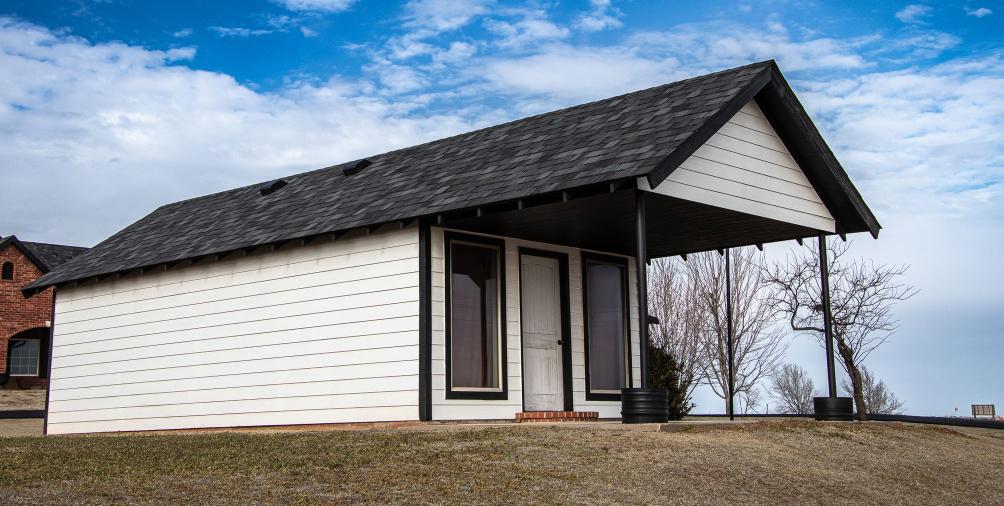
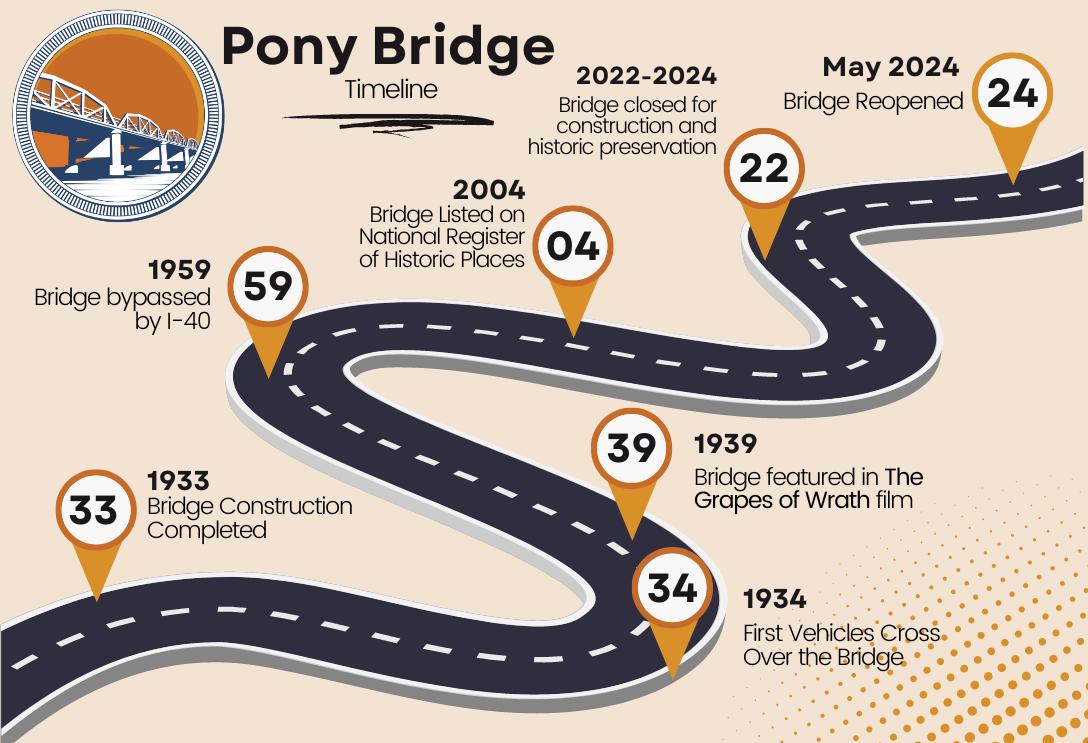
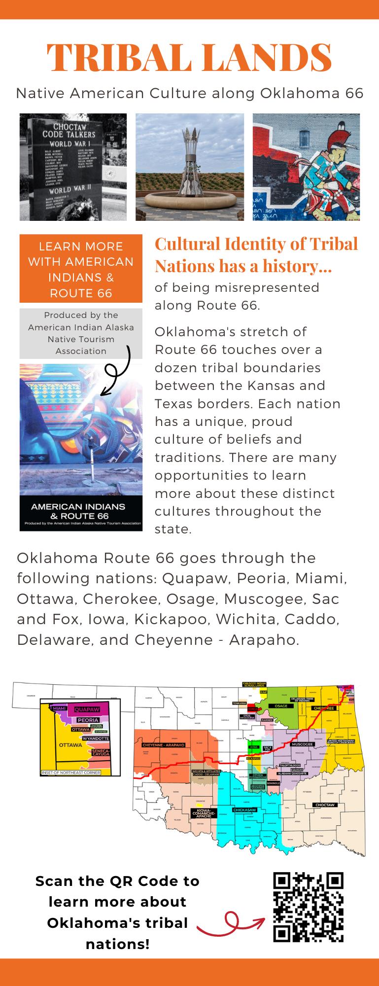
GEARY
Without the support of our Business Members, we wouldn’t be here. Support them as you travel Oklahoma Route 66!
Canadian Rivers Hist. Museum 114 S Broadway | 405-884-5466
BRIDGEPORT/HINTON
Casino Oklahoma 220 E Cummins Rd | 405-480-6100
Red Rock Canyon Campground & Park 116 Red Rock Canyon Rd | 405-542-6344
Territory Route 66 RV Park 14144 Old 66 Rd | 405-542-6566
Whirlwind Photography PO Box 92 | 405-929-9991
HYDRO
Deer Creek Market / Nutopia 109 W Main | 405-663-2354
Gloria’s 104 E Main St | 405-663-3451
WEATHERFORD
Best Western Plus Weatherford 525 E Main St | 580-772-3325
City of Weatherford 522 W Rainey | 580-774-4505
Heartland of America Museum 1600 S Frontage Rd | 580-774-2212
Lucille’s Roadhouse - Weatherford 1301 N Airport Rd | 580-772-8808
Stafford Air & Space Museum 3000 E Logan Rd | 580-772-5871
Travelin’ Adventures by Michelle 113 N Bradley St | 580-302-0103
Weatherford Area Chamber of Commerce
210 W Main St | 580-774-7744
Weatherford Daily News 118 S Broadway St | 580-772-3301
City of Clinton 415 Gary Blvd | 580-335-0261
Clinton Chamber of Commerce
101 S 4th Street | 580-323-2222
Lucille’s Roadhouse - Clinton 2020 Lexington Ave | 580-275-2800
Oklahoma Route 66 Museum 2229 W Gary Blvd | 580-323-7866
Elk City/Clinton KOA Campground 21167 Rt 66 North (Foss) | 580-592-4409
Red Rock Custom 21393 Route 66 N | 580-660-1176
CANUTE
Friends Pub & Pizza 215 Main | 580-472-3388
Town of Canute PO Box 220 | 580-472-3111
ELK CITY
66 ToGo 19677 Route 66 North | 580-225-6666
The Depot Trading Co. 318 S Main St | 580-210-6309
Elk City Chamber of Commerce 102 S Main St | 580-225-0207
Janice’s Cafe 2103 S Main St Ste A | 580-303-9022
Main Street Market 115 N Main | 580-374-2311
National Route 66 Museum Complex 2717 W Third St | 580-225-6266
Visit Elk City 102 S Main St | 580-225-0207
Western Oklahoma Historical Society PO Box 542
SAYRE
Bobcat Creek RV Park & C-Store 2003 NE Hwy 66 | 580-210-6870
City of Sayre 102 W Main St | 580-928-2260
Cotts Electric 213 N 4th St | 580-928-2928
Deep Creek Ranch and RV 18911 N Route 66 | 580-277-1304
Dust Bowl Days Farm & Ranch Festival Co. 129 E Main St | 580-729-0469
Epp Rentals 10 S 4th St | 580-729-5266
First Response Coffee House 101 E Main St | 580-729-6363
Gallery @ 112 112 West Main St | 580-928-0002
Sayre National Golf Course 1630 S Highway 66 | 580-928-9046
Western Motel 315 NE Highway 66 | 580-928-3353
ERICK
100th Meridian Museum 101 Sheb Wooley St | 580-799-5054
City of Erick 206 S Sheb Wooley Ave | 580-526-3924
TEXOLA
Tumbleweed Grill 12726 Route 66 S | 702-265-4634
Business Directory Greater OK, US, and International
Special Thanks to our out-of-state members for supporting all that we do in Oklahoma!
Chamberlain Shores RV Park & Event Center
406 E Hwy 85A, Bernice OK 918-915-0819
Grove Area Chamber of Commerce
111 W 3rd St, Grove OK 918-786-9079
Grove Area Convention & Tourism
111 W 3rd St, Grove OK 918-786-9079
Metcalfe Museum & Break O’Day Farm
8647 N 1745 Rd, Durham OK 580-655-4467
Ocra-Projects
502 N Main St, Thomas OK 580-302-3818
Texoma Transportation
701 NW 4th St, Lindsay OK 405-428-2234
Boots Court Motel
107 S Garrison Ave, Carthage MO 417-310-2989
Cactus Inn & Motel
101 Pine St, McLean TX 806-779-2346
Cozy Dog Drive-In
2935 S Sixth St, Springfield IL 217-525-1992
Dr. Joe Sanders www.route66lovers.com
First+Main Films Olympia, WA 716-867-6488
Gearhead Curios 520 S Main, Galena KS 785-554-7694
Historic Rt 66 Assn of Arizona
120 W Andy Devine Ave, Kingman AZ 928-753-5001
Lebanon/Laclede County Route 66 Society 915 Jefferson, Lebanon MO 417-532-2148
Mother Road Naturals
414 N. Graystone Ln, Amarillo TX 559-360-0159
National Park Service Route 66
Corridor Preservation Program 1100 Old Santa Fe Trail, Santa Fe NM 505-988-6701
Red Oak II
10917 County Loop 22, Carthage MO 417-237-0808
Samantha Brown Media
200 6th St, Unit 3E, Brooklyn NY 917-208-3618
Spencer Station
19720 Lawrence 2062, Miller MO 8477572246
Supertam on 66
221 W Main St, Carterville MO 417-499-3992
Texas Ivy Antiques 3511 SW 6th Ave, Amarillo TX 806-373-1427
Visit Joplin
602 S Main St, Joplin MO 417-625-4789
INTERNATIONAL
Route 66 Navigation www.route66navigation.com
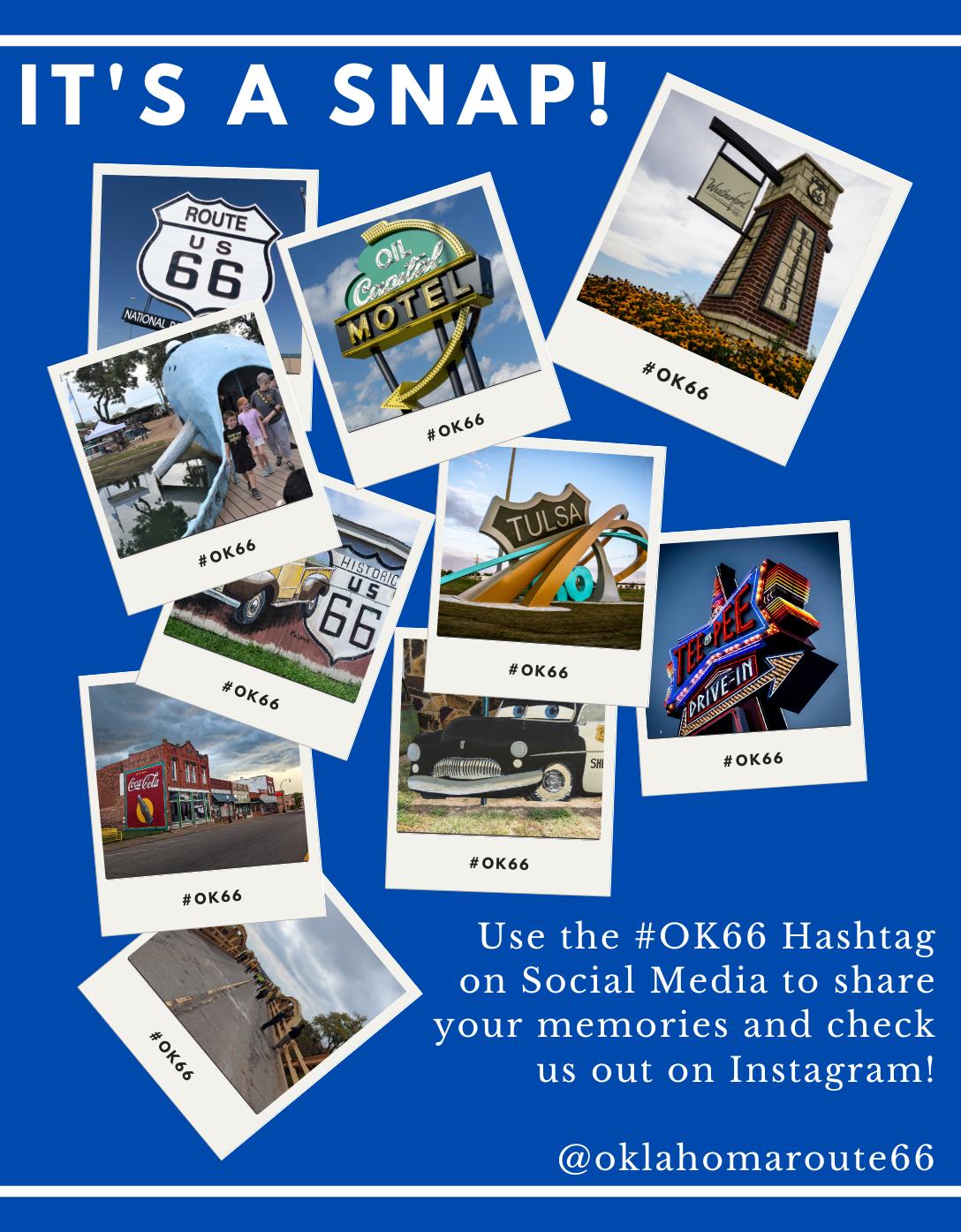
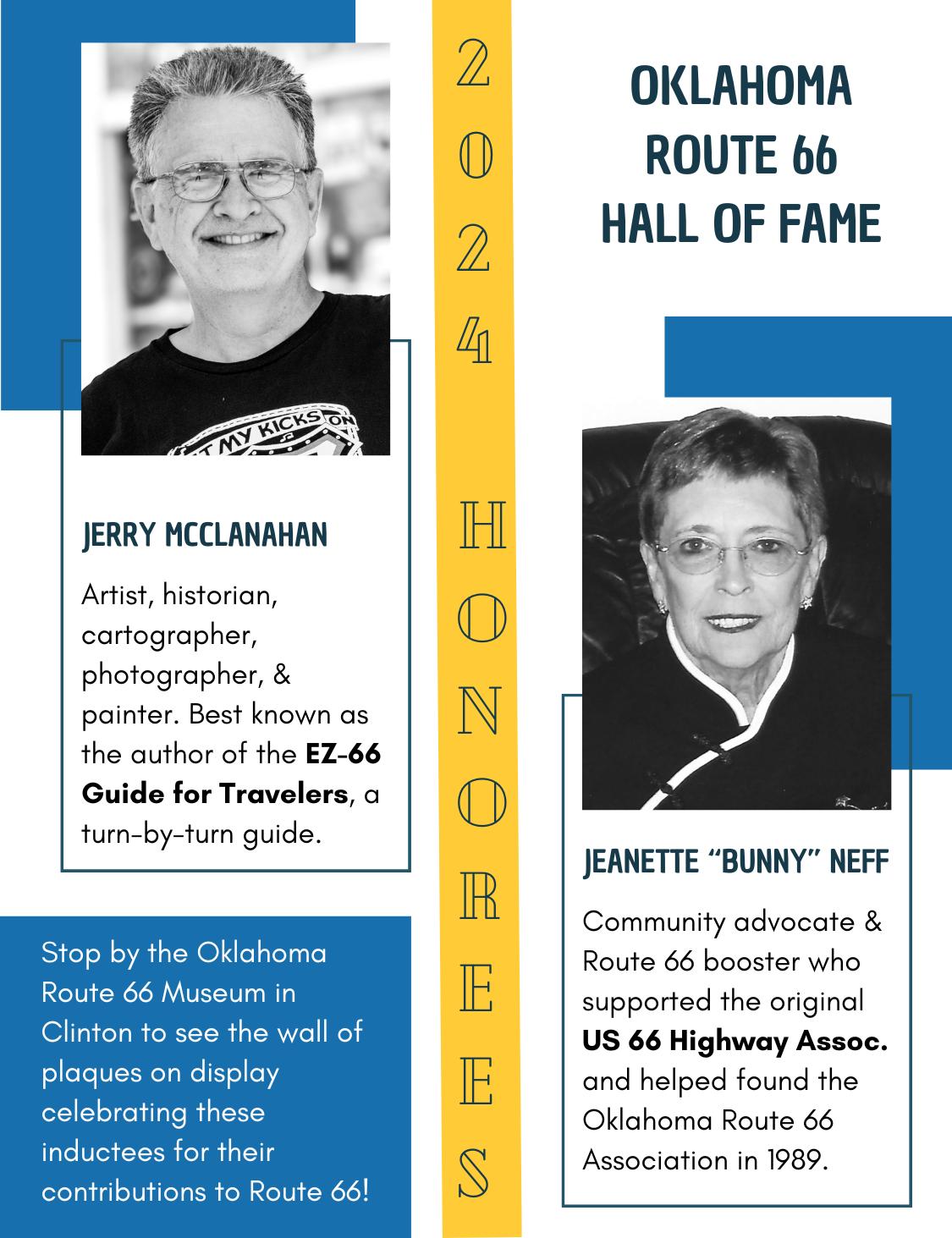
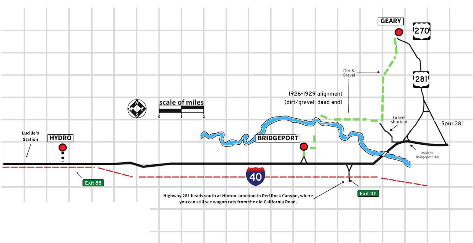
General Information
Like much of 66 in western Oklahoma, the road between Hinton Junction, Bridgeport, and Hydro has no State Highway number. It runs roughly parallel to I-40 on the north side of the interstate. The curbed section of Historic Route 66 here is among the best quality vintage cement from when the road was first paved.
Street names of Route 66 in towns (east to west):
Geary: 270/South St. • 281 & 8/Broadway
Bridgeport: Market St.
If you are eastbound and want to bypass the older Geary and Calumet alignment, look for the turn to the right after you cross the Pony Bridge. There’s a small section of older pavement here too! For more information on heading east, check out the previous map.
Although Highway 66 never went into Hydro proper, be sure to check out their downtown. It retains much of its historic integrity. The town is also working on a fabulous roadside attraction along Route 66 using an original 1930 truss bridge as a centerpiece. It should be completed by the Centennial!
See if you can find the following landmarks (listed in no particular order):
• Out-thrust porch/live-over gas station (not Lucille’s), now a residence
• The remains of Hinton Junction
• Three steel truss single arch bridges still in use (the long Pony Bridge does not count!)
• A roadside park near Hydro
• Distinctive drains of the Portland cement concrete road on the slopes and bottoms of the hills
• Steen’s Buttes/Caddo Mounds — distant mounds south of 66 and I-40 halfway between Hydro and Bridgeport; they were guiding landmarks for travelers along the California Road
Pronounced GEER-y, this town is named after French-Cheyenne Army scout Edmund Guerriere. It was an early trading post in the Cheyenne-Arapaho Nation and prospered when the railroad came to town. The residents of Geary worked hard to get US Highway 66 routed through their town along part of the old Postal Road – they even graded and graveled part of the road themselves.
The former First National Bank downtown, the oldest bank in Blaine County, today houses the Canadian Rivers Historical Museum. There’s a beautiful Route 66 mural downtown and a historic standalone log jail cell, too. The nearby grave of Jesse Chisolm is on the National Register of Historic Places.
BUSINESS MEMBERS
-Canadian Rivers Historical Museum, 114 S Broadway, 405884-5466
-Rock Island caboose + jail cell (101 E Main St)
-Route 66 mural (118 W Main St)
Bridgeport was a strategic stagecoach crossing across the South Canadian River and became a wellused railroad crossing. A series of bridges across the river were built and washed out - the Key Bridge came along in 1921 and charged a $1.00 toll per car. That’s nearly $17 apiece today! Early Route 66 travelers were outraged. The State of Oklahoma commissioned a new bridge, completed in 1933. The 38span Pony Bridge is state-of-the-art and nearly a mile long. It also completely bypassed Bridgeport. The Oklahoma Department of Transportation rebuilt the bridge in 2022-2024 to be four feet wider but kept the iconic trusses in place.
Bridgeport never really recovered from the bypass or Great Depression, though a few historic buildings (including a former post office)
CANADIAN, BLAINE &
remain. The former rest stop at Hinton Junction finally collapsed in 2022. Be respectful of private property.
The town of Hinton, south of I-40, was not formally on Route 66 until recent years when their borders expanded north of the interstate but they now own the former ODOT Roadside Park at the Y west of Hinton Junction.
-Casino Oklahoma, 220 E Cummins Rd, 405-480-6100
-Red Rock Canyon Campground & Park, 116 Red Rock Canyon Rd, 405-542-6344
-Territory Route 66 RV Park, 14144 Old 66 Rd, 405-542-6566
-Whirlwind Photography, PO Box 92, 405-929-9991
-38-truss Pony Bridge
-Former Hinton Junction (just east of US-281 roadside park)
It’s probably not a surprise that the town’s name is based on the early abundance of well water – which made it a robust agricultural hub around Oklahoma statehood. Although our favorite highway never went through town proper, take the slight detour north and check out the quaint downtown. Main Street has a good amount of historic integrity and an American Flag right in the middle of the road. The Hydro Free Fair is reportedly the longest running in the state.
Lucille’s Historic Station, located a half-mile west of town, is one of Oklahoma Route 66’s most wellknown landmarks. The late Lucille Hamons was known as the “Mother of the Mother Road.” Her service station and motel advertised the “coldest beer on Route 66” but it was Lucille herself that brought people in from all over the country. The station survived the I-40 bypass and operated until 2000. A few years later, Rick Koch of ASAP Energy restored the station and rebuilt the motel building. The original Hamons Court sign hangs in the Smithsonian. The two Lucille’s
ADDO COUNTIES
Roadhouse restaurants (Weatherford and Clinton) are tributes to the station and Lucille’s legacy.
-Deer Creek Market / Nutopia, 109 W Main, 405-663-2354
-Gloria’s, 104 E Main St, 405663-3451
-Lucille’s Historic Station + Historic Marker (US Rt 66 and S Coleman Ave)
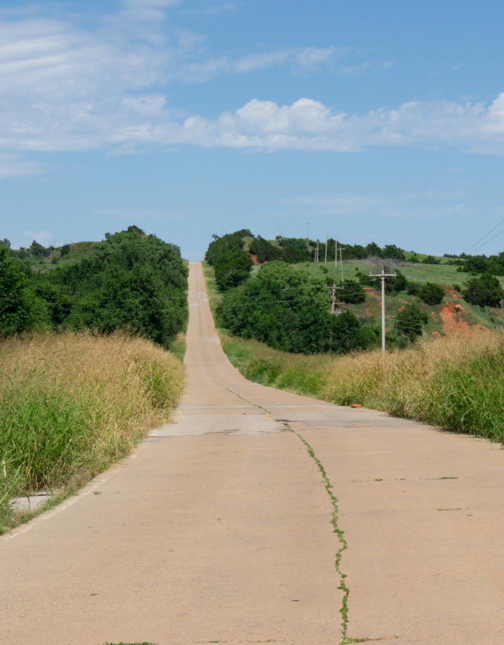
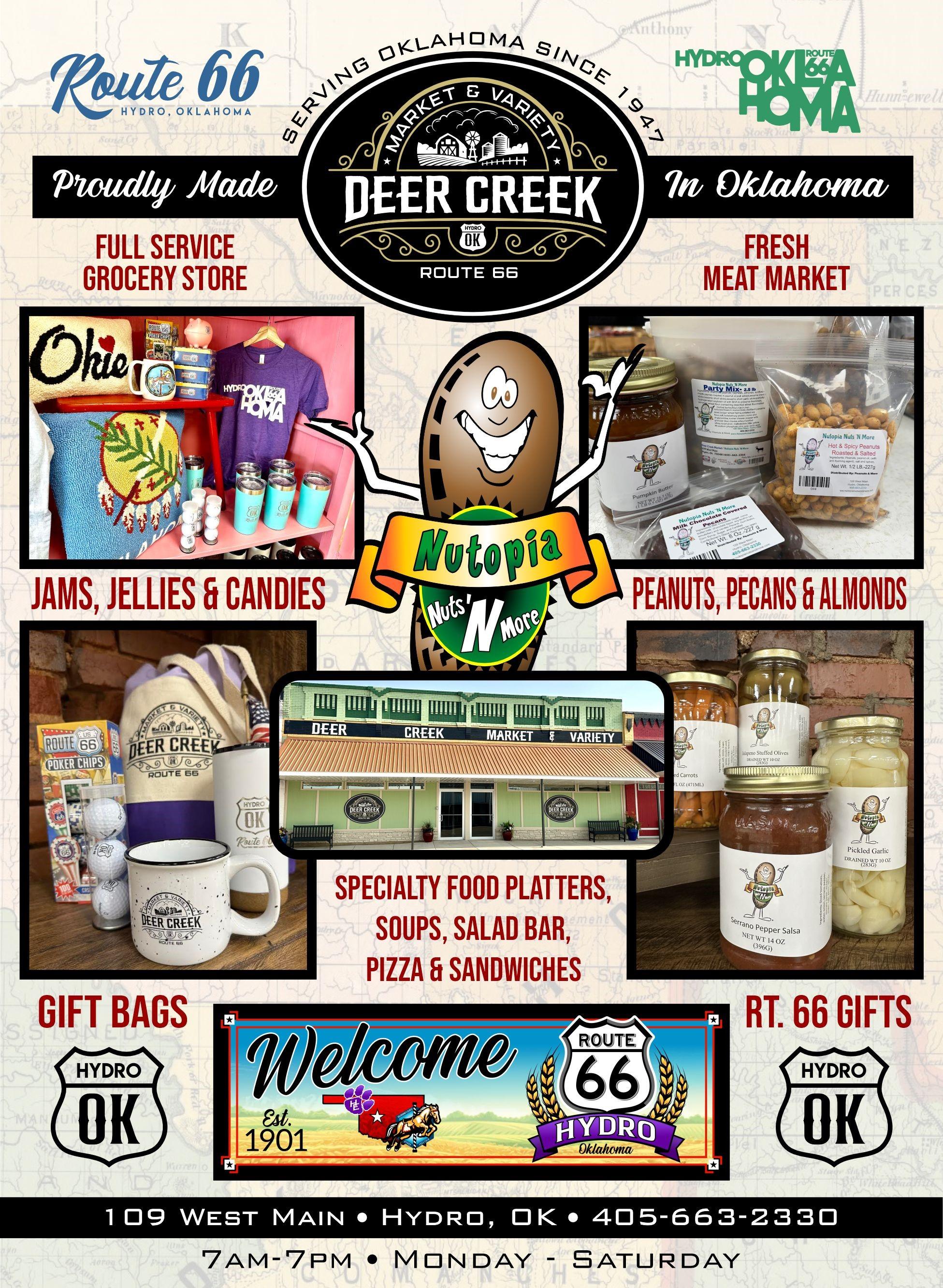
General Information
In Washita County, there are no alternate highway signs to watch for. In Custer County, Business 40 is valid for the eastern part of Clinton and most of Weatherford. In between towns in Custer County, the route has no official designation at all.
Street names of Route 66 in towns (east to west):
Weatherford: Davis • East Main • Washington • Main/Bus. 40/SW Main • Rainey • 4th
Clinton: Bus. 40/Gary Blvd. • 10th • Neptune
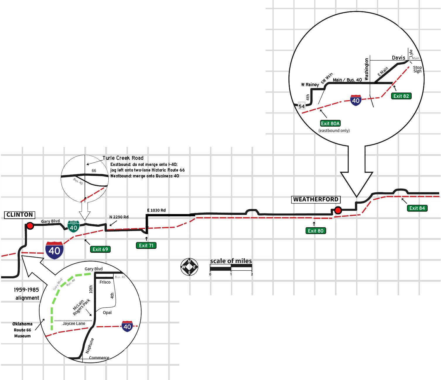
I-40 really sliced through the path of Route 66 in these two counties and the historic road switches from the north side of the interstate to the south and back again. In Washita County, you will find four jogs (one under I-40 and three over it) within a five-mile stretch.
Custer County also has four jogs — two under I-40 west of Clinton and two over it between Clinton and Weatherford.
Be prepared to avoid getting caught up in the access ramps around the various I-40 exits. Signs mark Route 66 through town from I-40 Exit 80 to Exit 84. The brown Historic Route 66 signs out here are not always accurate.


The first post office here was in the home of homesteaders William and Lorinda Weatherford (Lorinda served as the first postmaster) and thus the town was named. It had an early reputation as a wild place thanks to the volume of saloons near the railroad depot, but things calmed down as the rail line extended west. Astronaut General Thomas P. Stafford was a Weatherford native and there is a museum here bearing his name.
Weatherford’s power is supplied by nearly 100 turbines, the secondlargest wind farm in Oklahoma. Tours can be arranged through the Heartland of America Museum. A park next to City Hall features a turbine blade emblazoned with beautiful mural work on both sides as well as a replica Vietnam War memorial wall.
-Best Western Plus Weatherford, 525 E. Main Street, 580-7723325
-City of Weatherford, 522 W. Rainey, 580-774-4505
-Heartland of America Museum, 1600 S. Frontage Road, 580-7742212
-Lucille’s RoadhouseWeatherford, 1301 N Airport Rd, 580-772-8808
-Stafford Air & Space Museum, 3000 E. Logan Road, 580-7725871
-Travelin’ Adventures by Michalle, 113 N Bradley St, 580302-0103
-Weatherford Area Chamber of Commerce, 210 W. Main Street, 580-774-7744
-Weatherford Daily News, 118 S Broadway St, 580-772-3301
-Airplane monuments (Jim Cobb Rd and E Main St)
-Wind turbine Blade Mural and Replica Vietnam Memorial (522 W Rainey Ave)
Like many towns along Oklahoma Route 66, Clinton popped up along the railroad. It was a junction for the Rock Island and Frisco lines; today both lines are owned by Farmrail. In addition to the normal industries of the area (livestock, cotton, agriculture) it was also home to the Swift Meat Packing Company, today known as Bar-S Foods and the town’s largest employer.
When it comes to Route 66, Clinton has a long and important history. For decades after World War II, it was the home of the US 66 Highway Association. The nationally focused Association (started by Cyrus Avery of Tulsa in 1927) was responsible for promoting the road and securing its place in American Pop Culture until it was disbanded in 1979. They also made efforts to keep the road relevant in the Interstate Era; for example, the idea of creating Business Loops off of the Interstate started with them! Both Jack and Gladys Cutberth, who were major contributors to the Association’s success, are inductees into the Oklahoma Route 66 Hall of Fame.
Speaking of which, the Hall of Fame resides within the Oklahoma Route 66 Museum, the first statesponsored Route 66 museum in the country. It sits on the aforementioned Business Loop I-40, which is also the last alignment of Route 66 before it was bypassed. There are several interesting sights along the two main alignments of 66 inside the city limits, including McLain Rogers Park (a WPA-era park with an ornate neon sign and a Route 66-themed miniature golf course), the former Ray’s Motel (repainted by the Oklahoma Route 66 Association in 2007; private property now), and a former roadhouse at the southern Y.
-City of Clinton, 415 Gary Blvd, 580-335-0261
-Clinton Chamber of Commerce, 101 S. 4th Street, 80-323-2222
-Lucille’s Roadhouse - Clinton, 2020 Lexington Ave, 580-2752800
-Oklahoma Route 66 Museum, 2229 W. Gary Blvd, 580-3237866
-Former Glancy Motel sign (217 W Gary Blvd)
-McLain Rogers Park (S 10th St and Bess Rogers Dr)
-National Guard Armory (723 Opal Ave)
-WPA Firehouse (521 W Gary Blvd)
-Will Rogers Highway Marker (2229 W Gary Blvd)
-Roadhouse Y (1733 Neptune Dr)
-Original pavement (3602 W Commerce Rd)
Foss was originally going to be named Graham, but the name was already taken. The townsfolk opted for Maharg (an anagram) but a 1902 flood of Turkey Creek wiped it off the map. It was rebuilt as Foss and stayed that way to present day. The town’s fortunes were closely tied to the nearby military base but couldn’t quite compete with nearby Clinton or Elk City. Originally, Route 66 went through town but when concrete paving came in the early 1930s the town was bypassed to the south. The Great Depression and Dust Bowl had an impact here, as it did in many western Oklahoma communities.
At the intersection of Route 66 and State Highway 44 sit the remains of Kobel’s Station, an abandoned service station, cafe, and bus stop.
-Elk City/Clinton KOA
Campground, 21167 Rt 66 North (Foss), 580-592-4409
-Red Rock Custom, 21393 Route 66 N, 580-660-1176
-Former Kobel’s Station (SW corner of Rte 66 N and OK-44)
-Foss Lake/State Park (10252 OK-44)
The town of Canute is not named after the King of Denmark as some have assumed, but early merchant Bob Keene whose last name sounded like Canute in the Cheyenne - Arapaho language. This town was more-or-less cut off when the Interstate opened in 1970 but folks here are passionate about their place on the Mother Road.
Take the Route through Canute and you’ll see picturesque remnants of Route 66’s heyday, such as the old Uniroyal service station (listed on the National Register) and a few vintage motels (now private residences) with some picturesque neon signs. East of the main intersection is the town cemetery (home to a 1920s-era Catholic grotto) and a set of four historic markers that talk about the Great Western Trail and other local history such as the St. Francis of Assisi Church, the “Mother Parish of the West.”
On the west side of town, after crossing beneath the former Rock Island railroad trestle, you can see some original Route 66 pavement before it is cut off by Interstate 40.
-Friends Pub & Pizza, 215 Main, 580-472-3388
-Town of Canute, 580-472-3111
-Holy Family Cemetery Grotto + Historic Markers (East of N 2080 Rd on Old US Hwy 66)
-Canute 66 knight (8th St and Old US Hwy 66)
-Former Cotton Boll Motel –private property (605 Old US Hwy 66)
-Former Washita Motel – private property (1st St and Old US Hwy 66)
-Original pavement (west of N 2070 Rd on S Frontage Rd, just west of town)
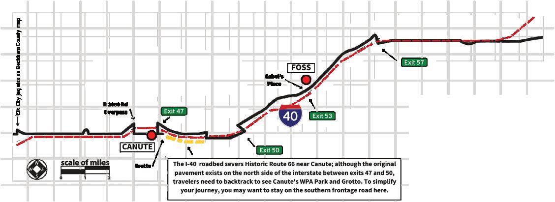
Street names of Route 66 in towns (east to west):
Foss: State Highway 44/66A Canute: Highway 66
See if you can find the following landmarks (listed in no particular order):
• A steel truss single arch bridge
• Row of big shade trees down below an I-40 jog, indicating where the road originally tracked
• A grotto in a small-town cemetery
• A large wind turbine blade and a veterans’ memorial display
• The remains of an old service station
• A grouping of granite historical markers
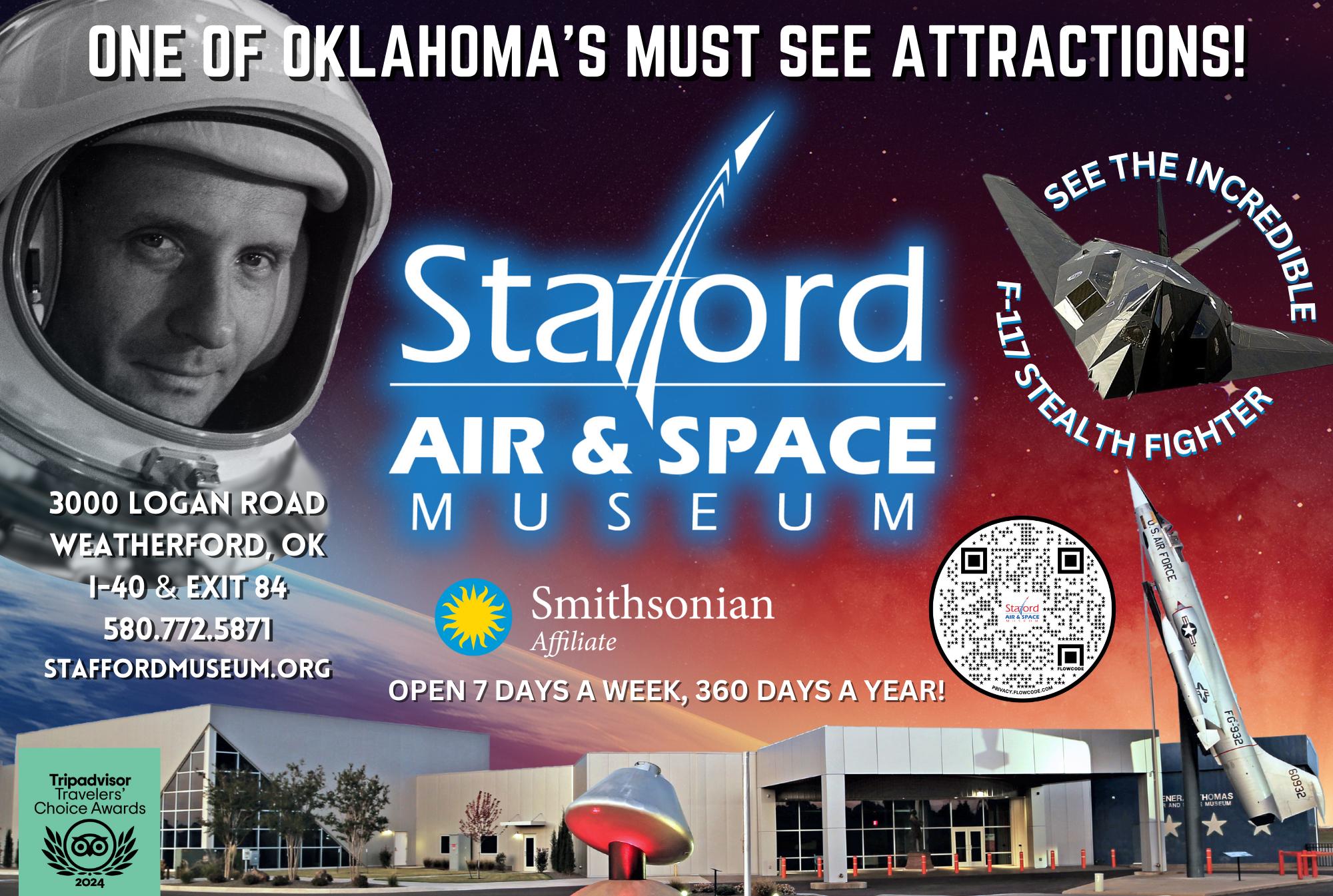
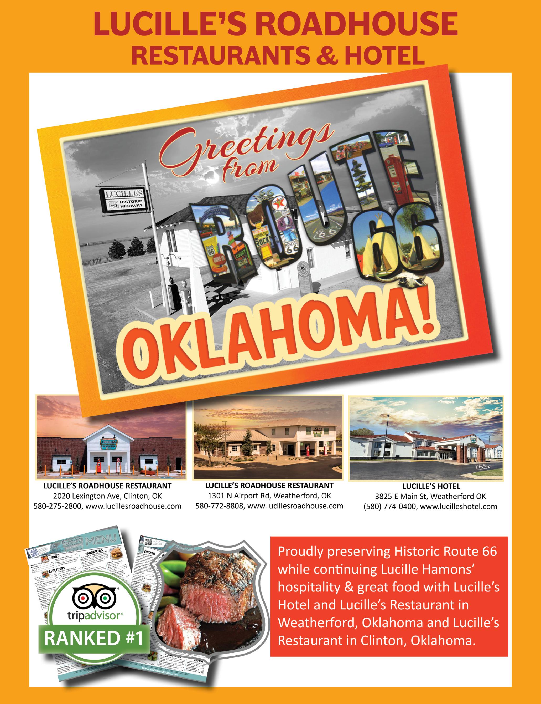
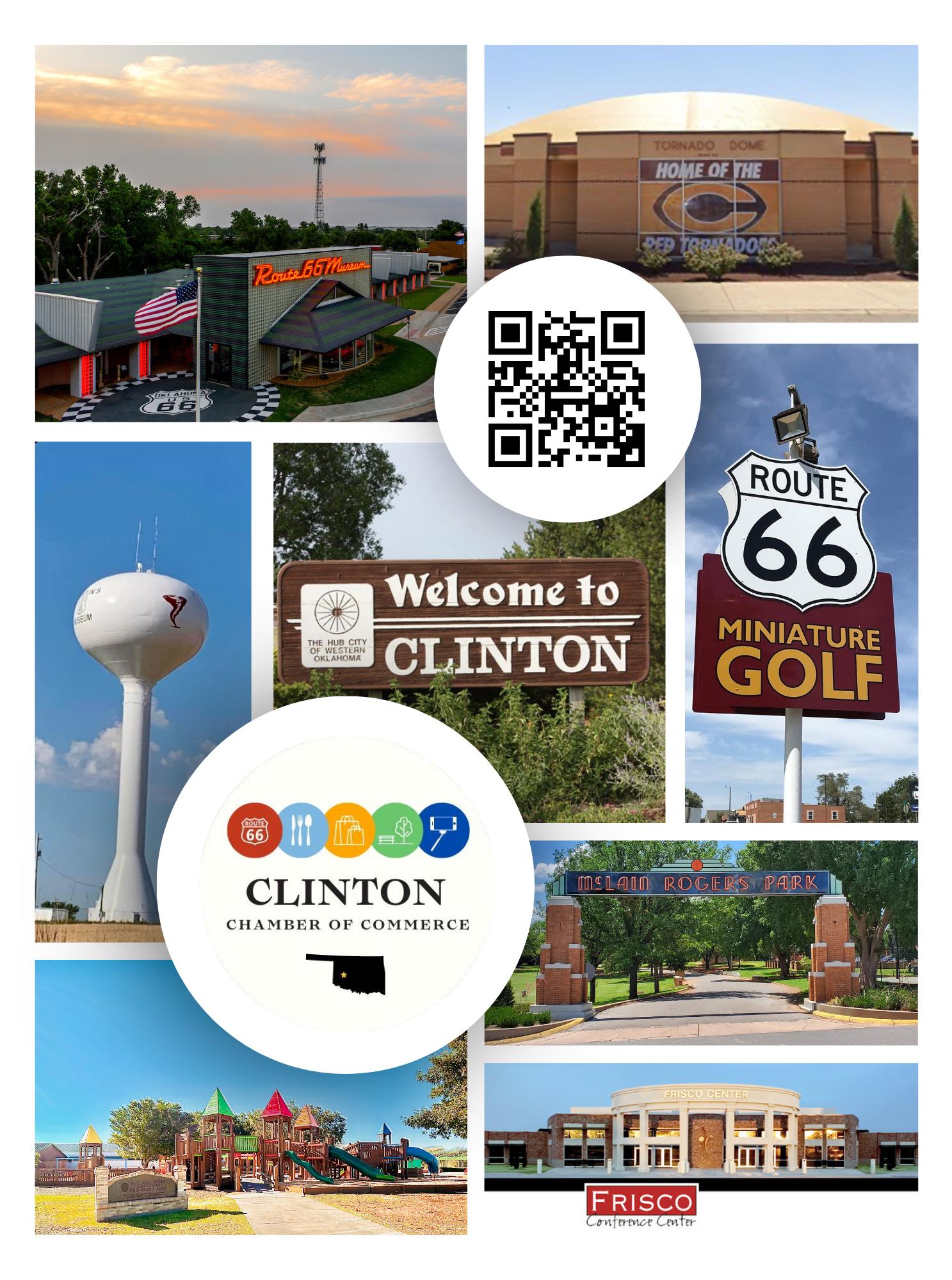
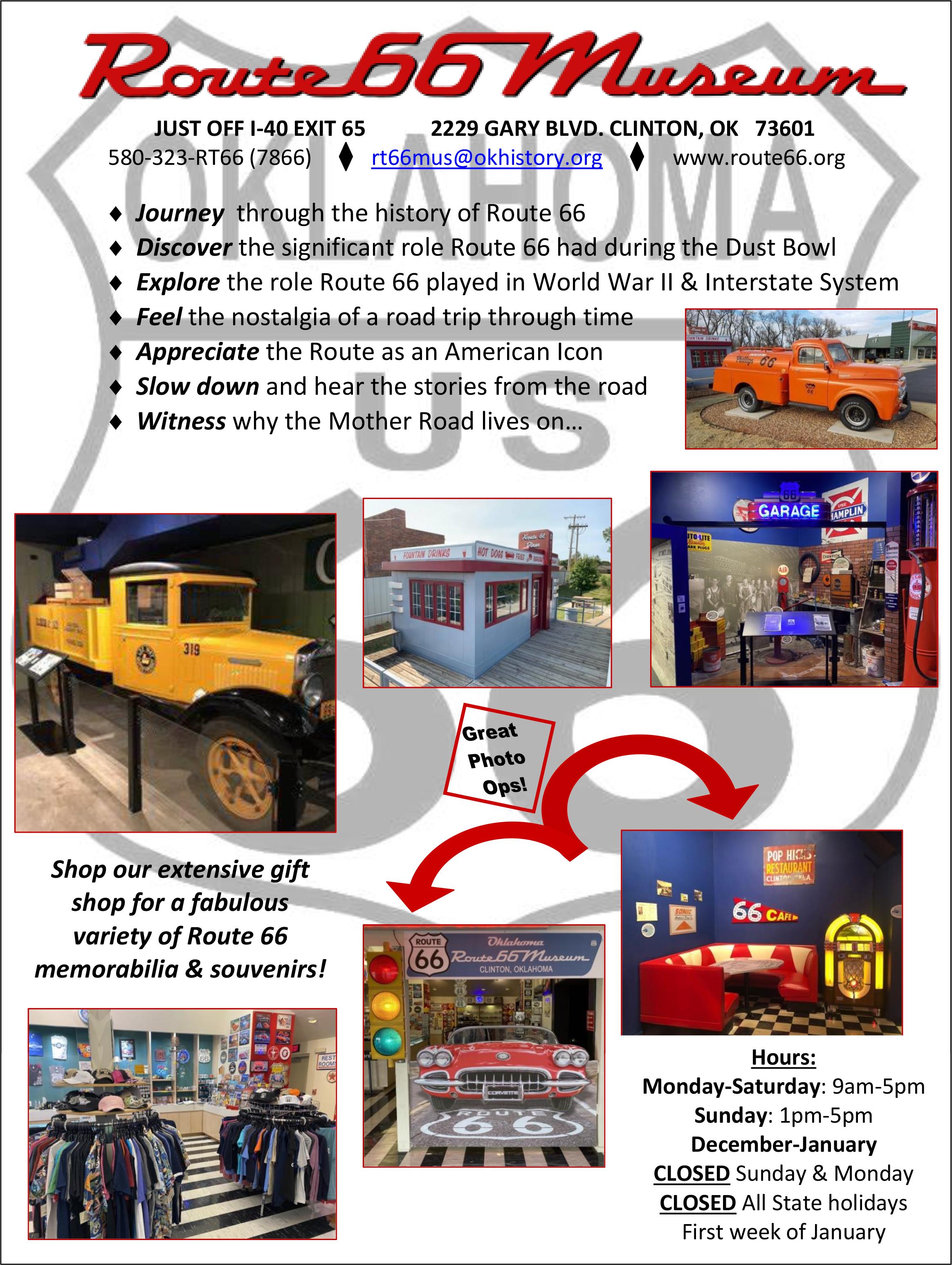
2025-2026
Two turnpikes parallel Historic Route 66 in eastern Oklahoma, both part of I-44 If you do need to hop off of Route 66 and take the super slab, they are now converted to the cashless "plate pay" system A bill will be mailed automatically to the address registered to your vehicle. Learn more at platepay.com.
A variety of out-of-state automated toll pass systems work with Oklahoma's PikePass network Check turnpikeinfo com for details
24/7 ROADSIDE ASSISTANCE: AAA OKLAHOMA: 800-AAA-HELP (800-222-4357)

Route 66 is a highway of the future and there are diverse fuels available throughout the state
For a searchable map of alternative fuel stations and electric charging stations, visit afdc.energy.gov/stations# or chargefinder com
To search for the closet gas station near you, visit cluballiance.aaa.com/public-affairs/gas-information.
You can also check out electricroute66 com for more information across all of Route 66!
LAW ENFORCEMENT NUMBERS - DIAL 911 FOR EMERGENCY
We hope your trip on Route 66 goes smoothly, but if you run into bumps along the way, it’s good to know where to turn for help
OKLAHOMA HIGHWAY PATROL - Dial 911
Delaware, Ottawa and Craig Counties Troop L (918) 256-3388
Rogers, Tulsa and Creek Counties Troop B (918) 627-3881
Lincoln, Oklahoma and Canadian Counties Troop A (405) 686-9105
Blaine County Troop J (580) 234-6147
Caddo County Troop G (580) 353-0783
Washita, Custer, and Beckham Counties Troop H (580) 323-2424
City Police
Quapaw (918) 674-2516
Commerce (918) 675-4373
Miami (918) 542-5585
Afton (918) 257-4744
Vinita (918) 256-6414
Chelsea (918) 789-3533
Claremore (918) 341-1212
Catoosa (918) 266-2424
Tulsa (918) 596-9222
Sapulpa (918) 224-3862
Kellyville (918) 247-6103
Bristow (918) 367-2252
Depew (918) 324-5060
Stroud (918) 968-2733
Davenport (918) 377-2911
Chandler (405) 258-1460
Wellston (405) 356-2476
Luther (405) 277-3500
Arcadia (405) 396-2899
Edmond (405) 359-4420
Oklahoma City (405) 297-1000
Warr Acres (405) 789-3329
Bethany (405) 789-2323
Yukon (405) 354-2553
El Reno (405) 262-6941
Calumet (405) 893-2323
Geary (405) 884-2167
Hinton (405) 542-3244
Hydro (405) 663-2242
Weatherford (580) 772-7791
Clinton (580) 323-2323
Canute (580) 472-3134
Elk City (580) 225-1212
Sayre (580) 928-2122
Erick (580) 526-3924

Oklahoma is a state where severe weather can occur just about any time of the year and it can quickly change. Being weather aware while traveling Oklahoma’s highways could save your life. Flooding, wildfires, severe thunderstorms, hail, and tornadoes are among some of the severe weather you may encounter in Oklahoma
Before you travel, check the weather online (resources below) or via local television or radio stations.
Weather.gov NOOA.gov/weather Mesonet.org
You should also check road conditions before you travel in case of inclement weather.
Drive Oklahoma mobile app: ( Available in Apple App Store & Google Play Store) This one-stop shop app puts all of Oklahoma Department of Transportation’s (ODOT's) online travel tools in one place to make it easier for users to check conditions before leaving for their destination
Online: okroads.org Facebook & Twitter: Follow @OKDOT Phone: (Toll Free) 1-844-4OKHWYS (465-4997)
The best way to avoid being caught in a tornado or severe thunderstorm is to stay informed about the weather Remember these basic guidelines during a tornado:
GET IN - get as far inside a strong building as you can, away from doors and windows
GET DOWN - get to the lowest floor
COVER UP - use whatever you can to protect yourself from flying or falling debris
If you are caught in your vehicle during a tornado, find shelter in a building if possible. If a building is not available, get out of your vehicle and find the lowest level of shelter such as a ditch or ravine. Protect your head and neck with your hands However, be sure to watch for rising water if taking shelter in a ditch or ravine
Do not take shelter under overpasses or bridges The wind from a tornado can accelerate as it blows through the underpass, likely sweeping everything away.
Don’t try to outrun a storm. Heavy winds may cause a loss of control of the vehicle Motorists are advised to get off the road as quickly and safely as they can
If you spot a tornado moving in your direction use the 90-degree rule That means driving away from the tornado at a 90-degree angle or in a different direction from the tornado's path. If the tornado is headed right toward you, don’t stay in your car.
Learn more driving safety tips at oklahoma.gov/odot/travel


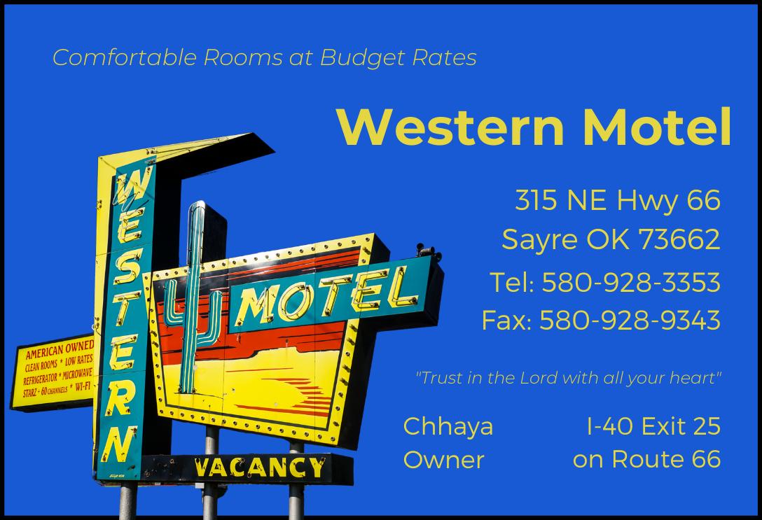

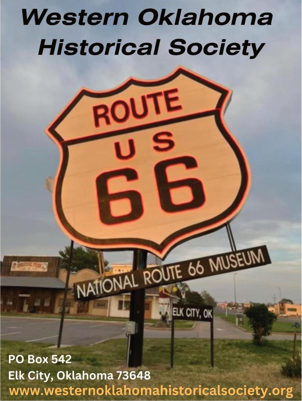
BECKHAM COUNTY
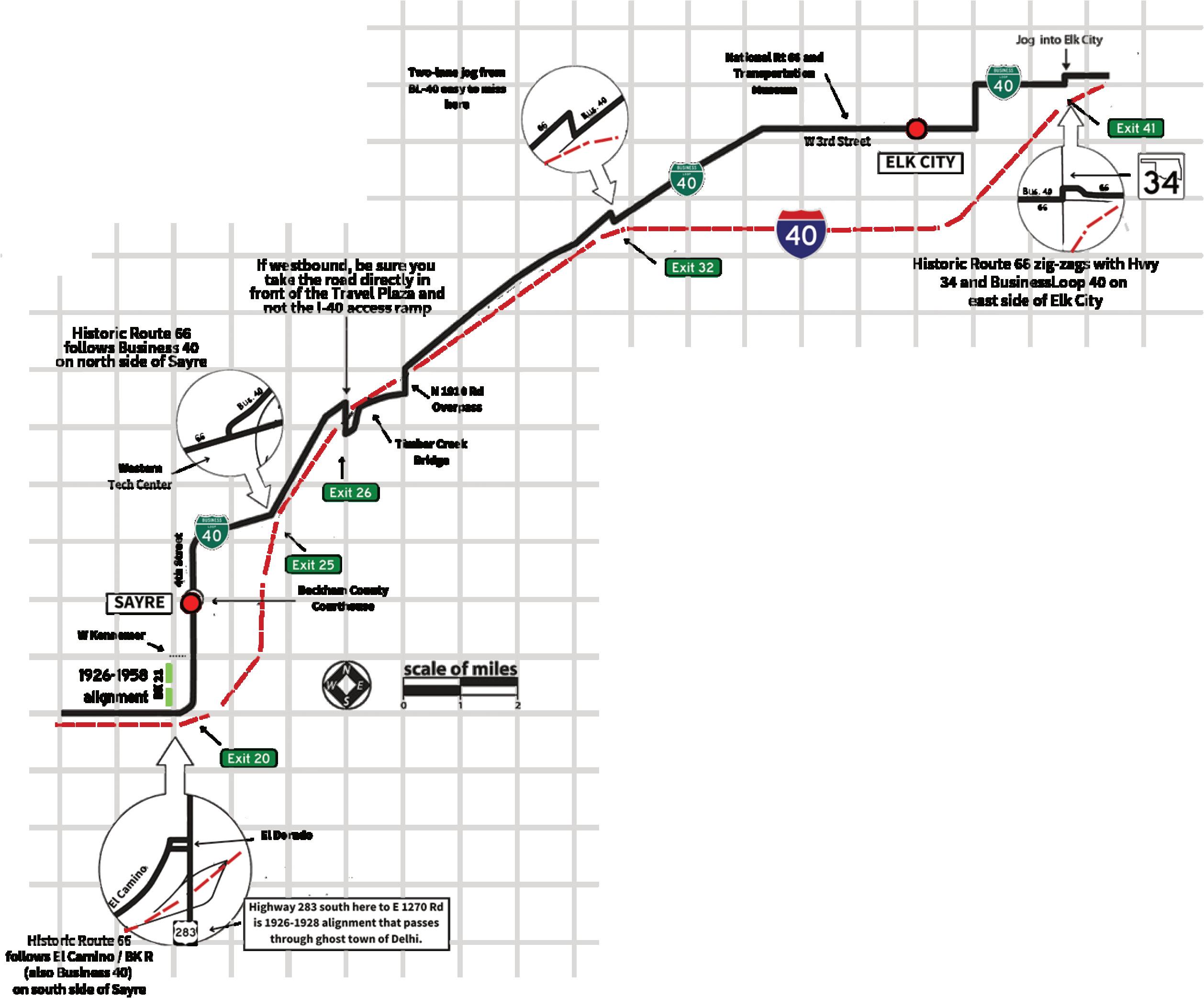
General Information
Business 40 will take you through the towns of Elk City, Sayre, and Erick. Parts of the open road between these communities are also signed Business 40. The rest of it may or may not have county numbers. Don’t follow Business 40 blindly, however, as it loops back into I-40.
Street names of Route 66 in towns (east to west):
Elk City: North frontage road • State Highway 34 • Airport Blvd. • Bus. 40/East 66 • Bus. 40/Van Buren • Bus. 40/ Third
Sayre: Bus. 40/Hwy 66 • Bus. 40/Fourth
Between Elk City and Sayre you have two jogs across I-40 with a pretty yellow through truss bridge in between them. There aren’t many locations on Oklahoma Route 66 that still have these erector-set-type bridges with the overhead structure. In Beckham County, much of 66 was originally paved in asphalt over a concrete base. Toward the western end, however, Portland cement was used.
There is an older, abandoned alignment on the north side of Historic Route 66 east of Erick that can occasionally be driven, but use caution.
See if you can find the following landmarks (listed in no particular order):
• Older strip of 66 between Erick and Texola.
• Abandoned north lanes between Sayre and Erick.
• Timber Creek through-truss bridge.
• Sayre Brine Station/Oklahoma Salt Works. Hint: two miles west of the jog from Business 40 onto the old road south of Sayre, then four-tenths of a mile north.
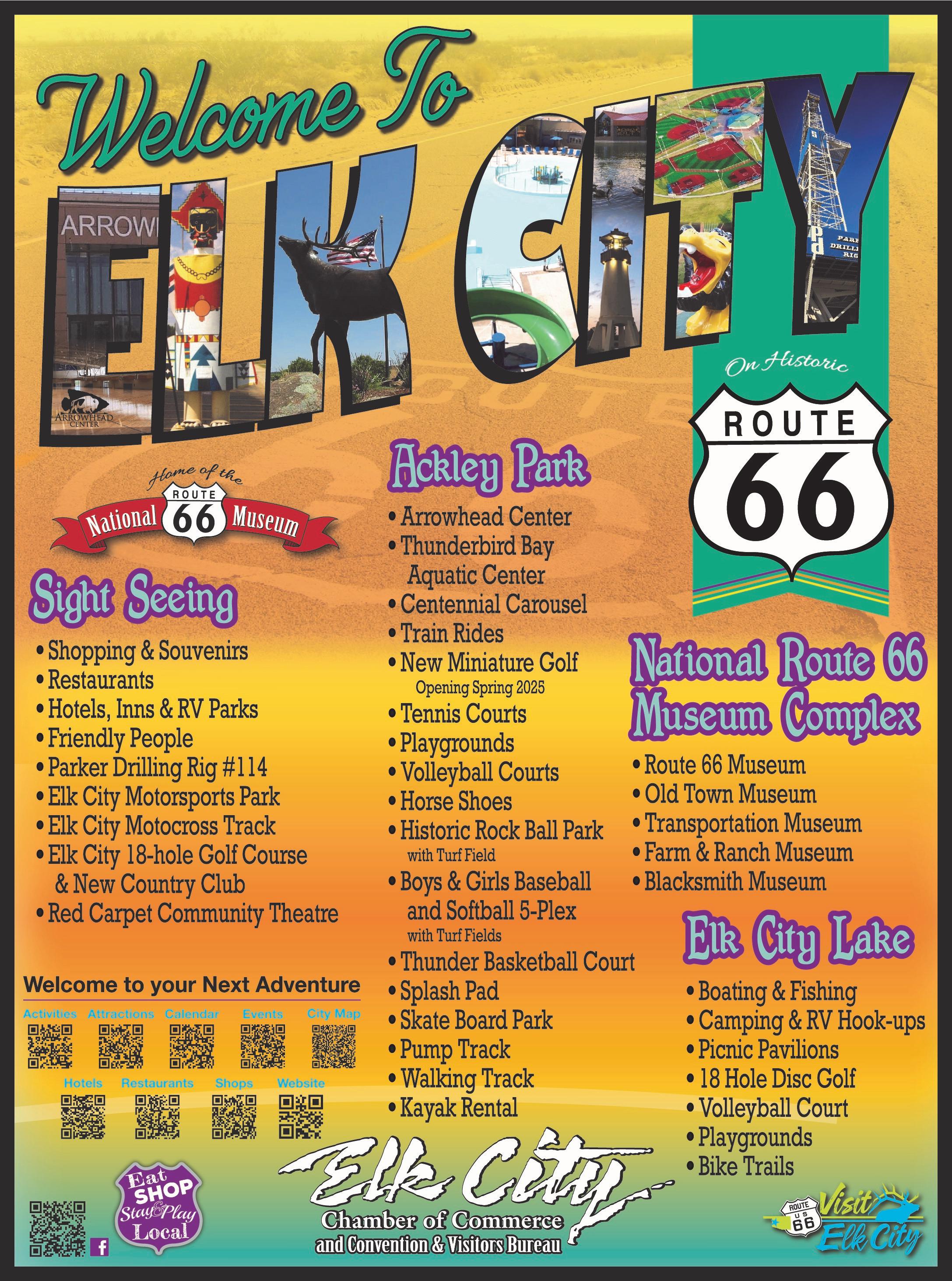
The Great Western Cattle Trail wasn’t as well-known as the Chisholm Trail, but it stretched from Texas to Dodge City, Kansas and came right through Elk City. Some locals wanted to name the town Busch (to woo the beer maker to build a brewery there) but that failed to materialize. It grew quickly and became one of western Oklahoma’s largest towns.
In 1931, Elk City hosted the US Highway 66 Association’s national meeting at the Casa Grande Hotel, bringing more than 30,000 people to town. The Casa Grande is the only multi-story hotel between Oklahoma City and Amarillo. Today, the hotel is shuttered but a group of passionate locals are hoping to restore the property. Just east of the hotel is the towering Parker Drilling Rig.
The Old Town Museum Complex on the east side of town offers many turn-of-the-century artifacts and stories from Oklahoma’s pioneer days. They
added the National Route 66 Museum in 1997, its large neon shield blazing next to the historic road. The complex also houses the vintage oil-drum Kachina statues that once stood outside of Queenan’s Trading Post, a now-lost long-time business on the west side of town.
-66 To Go, 19677 Route 66 North, 580-225-6666
-The Depot Trading Co., 318 S. Main Street, 580-210-6309
-Elk City Chamber of Commerce, 102 S. Main Street, 580-225-0207
-Janice’s Cafe, 2103 S Main St Ste A, 580-303-9022
-Main Street Market, 115 N Main, 580-374-2311
-National Route 66 Museum Complex, 2717 W. Third Street, 580-225-6266
-Visit Elk City, 102 S. Main Street, 580-225-0207
-Western Oklahoma Historical Society, PO Box 542
-Parker Drilling Rig + Casa Grande Hotel (201 E 3rd St)
-WPA park (N Pioneer Rd and W State Hwy 66)
Doxey is a ghost town. A cemetery is all that remains of the community, which was named after local rancher Sam Doxey. Doxey residents worked to promote the Postal Highway. When the Postal was changed to U.S. 66 in 1926, local boosters were excited to be part of the new highway system. Their excitement was short-lived: A newer alignment bypassed Doxey to the north in 1928.
It’s easy to tell that Sayre is the seat of Beckham County – you can’t miss the impressive courthouse on Main Street! It’s so impressive that in the 1940 movie The Grapes of Wrath the building stood in for the Oklahoma State Capitol!
Sayre was a bustling frontier town with multiple banks, cotton gins, hotels, and the like. Downtown Sayre has a lot of historic integrity and is listed on the National Register of Historic Places. Don’t miss the Art Deco post office! On the other side of the North Fork of theRedRiver,SayreCityParkfeatures a remarkably well-kept 9 hole golf course and some great WPA-era construction.
-Bobcat Creek Rv Park & C Store, 2003 NE Hwy 66, 580210-6870
-City of Sayre, 102 W Main St, 50-928-2260
-Cotts Electric, 213 N 4th St, 580-928-2928
Deep Creek Ranch and RV, 18911 N Route 66, 580-2771304
-Dust Bowl Days Farm and Ranch Festival Co, 129 E Main St, 580-729-0469
-Epp Rentals, 10 S 4th St, 580729-5266
-First Response Coffee House, 101 E Main St, 580-729-6363
-Gallery @ 112, 112 West Main Street, 580-928-0002
-Sayre National Golf Course, 1630 S Highway 66, 580-9289046
-Western Motel, 315 NE Highway 66, 580-928-3353
-Beckham County Courthouse (104 S 3rd St)
-Sayre City Park (BK 21 and W Kennemer)
From 1926 to 1928, Route 66 passed through the tiny community of Delhi, which is located southwest of Sayre, west of the municipal airport.
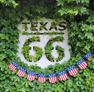

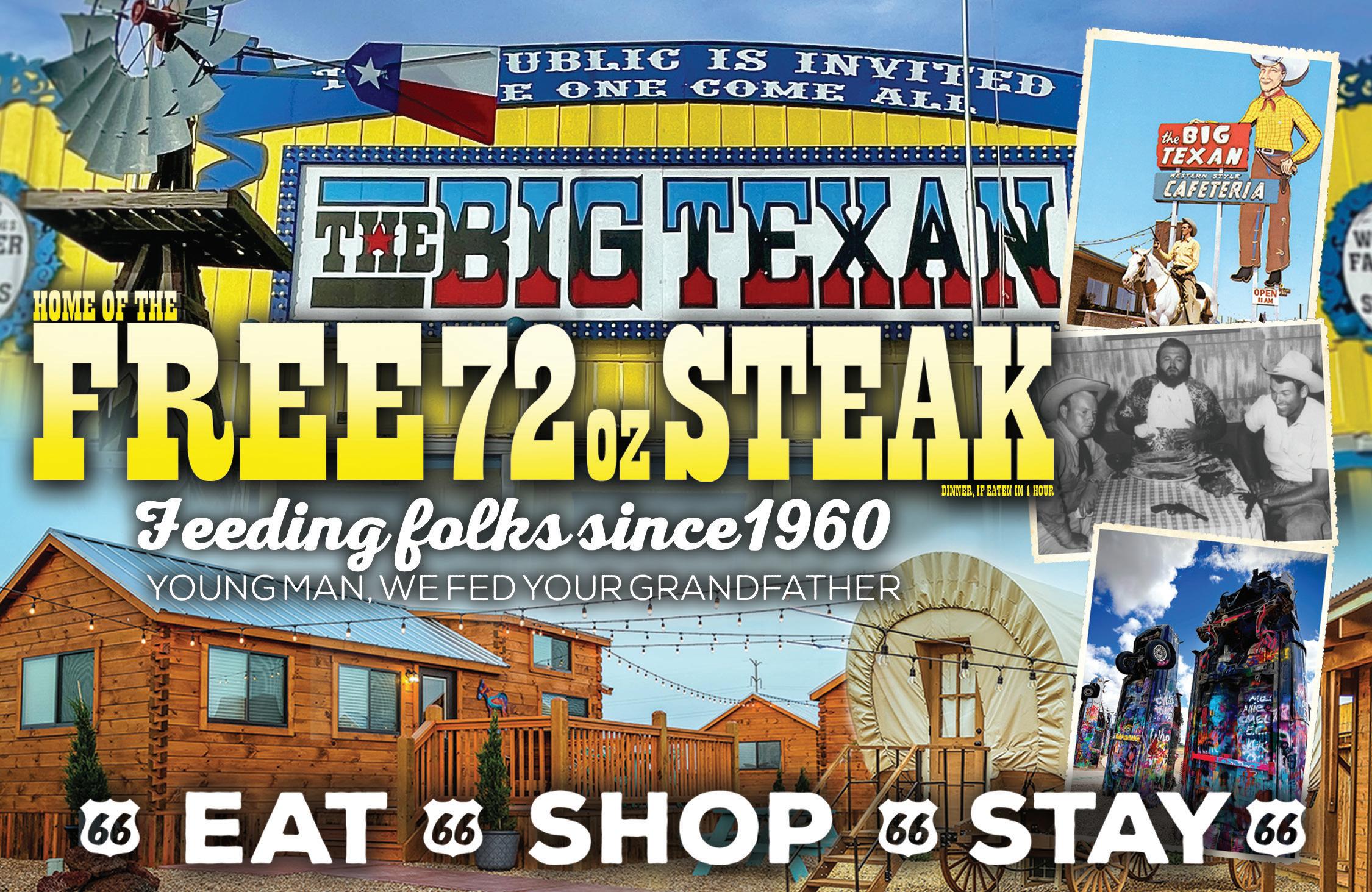

General Information
Between Erick and Texola, Bus. 40 turns north off Route 66, so be sure to continue straight.
Street names of Route 66 in towns (east to west):
Erick: Texola:
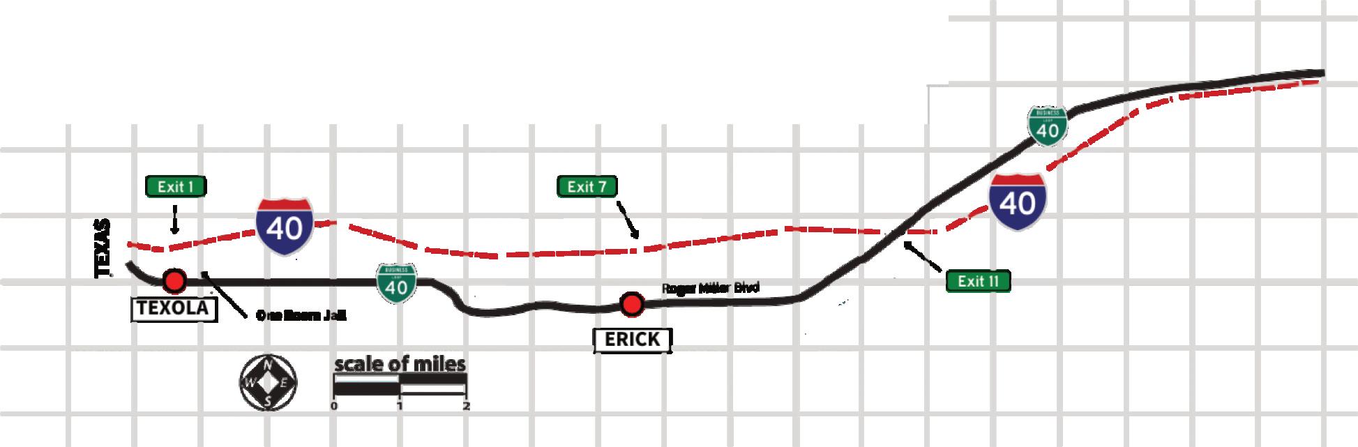
Erick has a colorful history, including a run-in with outlaws Bonnie and Clyde. When US Highway 66 came to town, it brought with it a number of motor courts, cafes, and filling stations. Guidebooks from the post-war era remarked that Erick was the “first town you encounter, going west, which has a true ‘western’ look,” complete with men on horseback in the streets.
This community was among the last in Oklahoma to be bypassed by the Interstate. Today, the 100th Meridian Museum tells a bit about the region and the nearby Roger Miller mural reminds folks of the town’s most famous resident. Erick is also the home of musician Sheb Wooley and the Mediocre Music Makers, Harley and Annabelle Russell. Harley still entertains travelers at the Sandhills Curiosity Shop just off of 66. He provides a one-of-a-kind experience that many travelers count as the highlight of their trip, though be advised his bawdy humor is 100% unfiltered!
BUSINESS MEMBERS
-100th Meridian Museum, 101 Sheb Wooley Ave, 580-799-5054
-City of Erick, 206 S Sheb Wooley Ave, 580-526-3924
LANDMARKS
-Roger Miller mural (102 S Sheb Wooley St)
-Former Phillips 66 cottage station - heavily modified (204 Roger Miller Blvd)
The western border of Oklahoma is defined by the 100th meridian, the line that explorer John Wesley Powell famously defined as the boundary to the West. That line shifted slightly multiple times in the town’s early days; residents had been both Texans and Oklahomans while living under the same roof! It’s little more than a ghost town today, but there is a Will Rogers Highway Marker close to the Texas border that marks the site where Route 66 was ceremonially designated the Will Rogers Highway in 1952.
You can also check out the One Room Jail, which doesn’t leave much to the imagination.
BUSINESS MEMBERS
-Tumbleweed Grill, 12726 Route 66 S, 702-265-4634
LANDMARKS
-Territorial jail cell (just north of Main Ave and US Rt 66)
-Will Rogers Highway Marker (near Texas border on US Rt 66)