


“Why do they live there?”
It’s a fair question. One we, in central Oklahoma get asked a lot after a disastrous tornado sweeps through. Loss of life, property, livestock, livelihoods – all squashed in a matter of seconds by something you know could happen again.
But, if you know it could happen or even worse, is an eventuality, why do you live there?
What do we say every time – without fail?
“Because it’s home.”
No, not everybody stays, but many do. They rebuild. Their homes, their businesses, their lives. Another layer of scar tissue develops, but they endure. And, we learn.
Even with all we’ve known about central Oklahoma's climate and propensity for natural disasters for more than two centuries, there is a lot that stands out about May 3, 1999. Among the strongest and most destructive natural phenomena to ever be recorded on the face of the Earth.
It spurred a lot of new science, birthed a lot of new scientists, taught government and nonprofit agencies how to be better prepared for the next time and taught us how to build better homes and shelters.
And we learn not to take anything for granted, and to be a little more thankful for what we have.
In this magazine, marking the 25-year anniversary of the Moore-Bridge Creek tornado, we see first-hand what it means to be resilient, maybe even stubborn, living in Tornado Alley.
Because it’s home.
- Beau Simmons
PUBLISHER
Katherine MILLEREDITOR
Beau SIMMONS
ADVERTISING ACCOUNT EXECUTIVES
Jan GIZA
Jennifer JEPSON
CONTRIBUTING WRITERS
Andrea HANCOCK
Brian KING
Kyle PHILLIPS
Andy RIEGER


CONNECT WITH US @normantranscript /thenormantranscript desk@NormanTranscript.com
Tale of a Twister is a publication of The Norman Transcript. 215 E. Comanche, Norman, OK 73069. Phone: 405.366.3559
Letters or editorial contributions should be sent to: Norman Transcript
P.O. Drawer 1058, Norman, OK, 73070 or emailed to desk@normantranscript.com
Norman Transcript is not responsible for unsolicited submissions. Reproduction or use of editorial or graphic content in any manner, without permission is prohibited.




‘I
Bridge Creek couple have solemn memories of destructive day

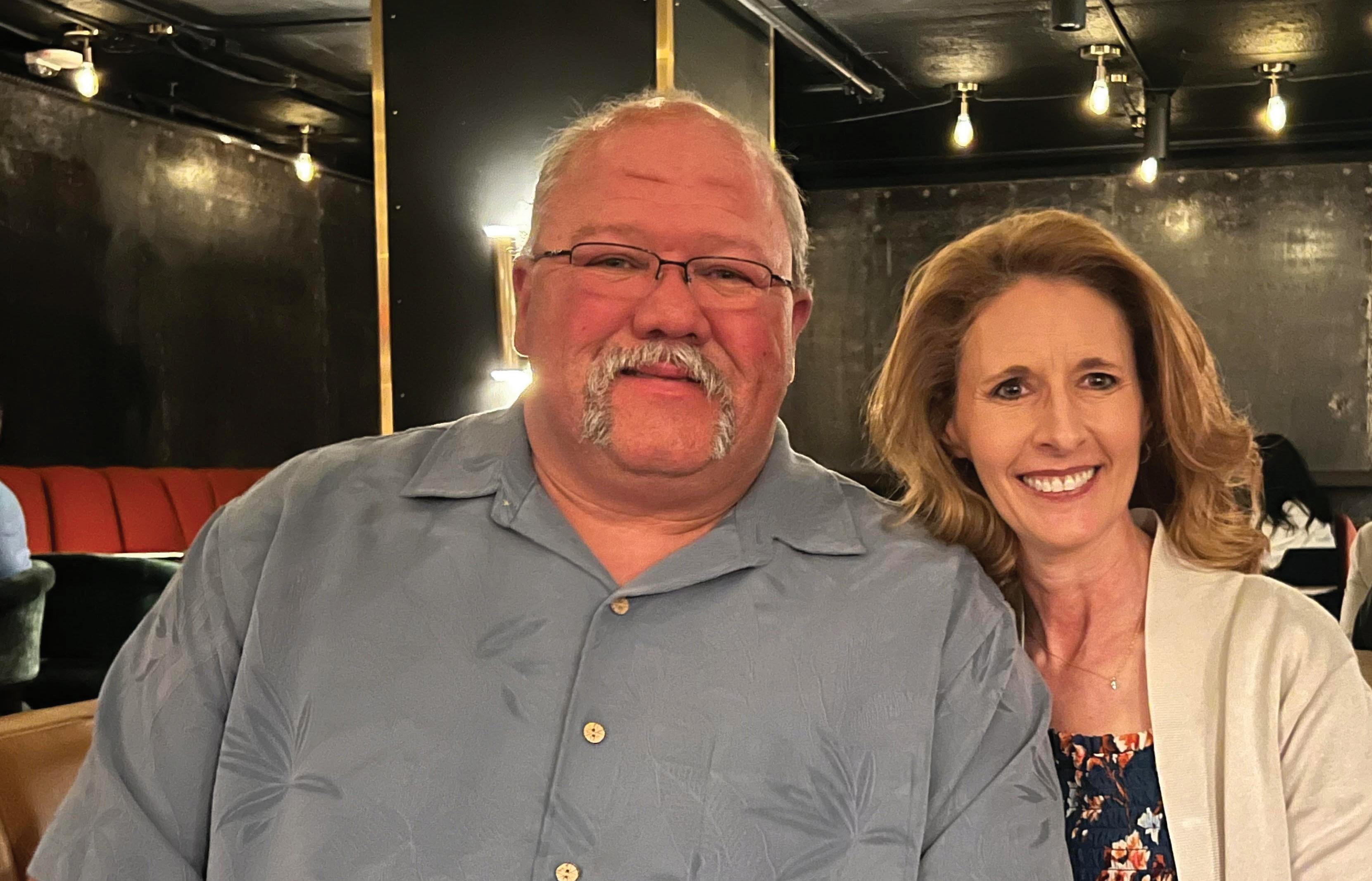
A Bridge Creek resident had left for a revival on May 3, 1999. Only 13 minutes after she walked out the door, a tornado struck her home, ravaging everything she owned.
Tonja McCawley is a retired EMSSTAT worker who was enjoying her day off at the time. She didn’t know that the most powerful tornado in history was about to change life as she knew it.
By Brian KingThe revival was canceled, and so she turned around. Her neighborhood had been blocked off, so she went in for work. At 3 a.m., she made it home to find nothing there but a turned over oak tree.
“I didn’t find out until 3 a.m. that I had nothing left in my life,” Tonja said. “It took our asphalt on the road and took us down to dirt. A lot of the homes in our area, it took the foundations. It was the first
time that had been recorded on the face of the Earth doing that.”
The tornado ate up all the yard signs, road signs, trees, bushes and markers that would help her to identify where her home was. It even ate up grass, leaving nothing but mud.
A 100-year-old oak tree, whose root system was as large as the tree as she described, was the only remnant of her property.
Inside the roots, she found a couple of knick knacks that she recognized.
“Since there were no trees, there were no roads, no road signs, and no markers, we had to count miles where our property was. Everything you notice that your mind recognizes as markers, or landmarks, were gone – completely gone,” Tonja said.
She never found out what happened to the house, beds, sofas or large items in or around the house.
“We stayed with my mother for a while, then we started staying in motels. There was no place in the Bridge Creek area we could rent because everybody lost their home,” she said.
In the coming days, welfare opportunities started to crop up, but she couldn’t even take
advantage of them.
“They said, come get clothes, come get canned goods, but we had no place to put those things,” she said. “We had no underclothes, no toothbrushes, or anything. All we had were the clothes we left our home with only 13 minutes before it hit it.”
“We didn’t take anything because we expected to come back. We had been through tornadoes before. We didn’t even fathom the fact that we wouldn’t even have grass.”
She said people take for granted the small things that aren’t replaceable.
“Just all those little things you don't think of. Our children's first footprints that we put in baby books, they were all gone,” Tonja said.
The one thing she took in her car on the way to her church was her documentation, including
Social Security cards, which came as a blessing.
“I don't know why I thought to grab those, but I did,” she said.
The Red Cross helped her to get medications, eyeglass prescriptions and vouchers to Walmart for items, which was expedited because she had her documents.
She said her church community became integral to her recovery.
“One of the people at our church had a rental place that they allowed us to stay at for a while during that time where we tried to rebuild our life,” she said.
Tonja said some of her neighbors had it worse. She at least had a toppled oak tree that held down a few items that were salvaged. How those items got there, she doesn’t know.
“The whole area to the west
of me had not even one piece of debris on their land. They had nothing,” Tonja said.
One year after the tornado, Tonja met Billy McCawley. The two dated, and three years later, they got married.
After the tornado, Tonja signed up for Habitat for Humanity, who built her a house.
“It was very small, but it was big enough for me and my two children,” Tonja said. “I lived in that home until I paid it off. Now my son and his wife and my two grandsons live in that home.”
She and Billy, a firefighter for the Norman Fire Department, live just across the road.
Billy was living in Bridge Creek at the time of the tornado. He said he feels lucky because he only had to replace his roof from hail damage and make other minor exterior fixes.
Like Tonja, he had the day off on May 3, 1999, so he spent it as a volunteer for the Bridge Creek Fire Department.
He was responding to a medical incident on the H.E. Bailey Turnpike just 15 minutes before the tornado hit.
“We were en route to the turnpike to figure out this car wreck before the tornado got it,” Billy said. “We were able to get those patients loaded in an ambulance and sent to the hospital just before the tornado came through and wiped out the entire scene where we just were.”
Before taking the call to help at the turnpike crash, he was on his way to Blanchard where he was taking his son to a baseball game.
“We pulled in and found out they canceled the baseball game,” he said.
At the time, Billy held certifications in EMT Basic and Firefighter 1 and had been practicing for 12 years.
After the tornado hit, Billy was called to assist in recovery efforts. He said he pulled out bodies from the rubble that belonged to people he knew.
“We recovered friends,” he said. “It was a day I hope we never do again.
“I hate tornadoes.”
He said tornado victims whose lives were taken were living in mobile homes and had no storm shelter.
“They went and got in a creek behind their house,” he
cutting dams on ponds to drain them to search for bodies.”
He took off from the Norman Fire Department for two weeks, doing nothing but cleaning up storm damage.
The Bridge Creek School cafeteria, he said, turned into a morgue.
“We went searching and dig-

said. “My youngest son and her son played T-ball together, and she didn’t make it. Her son did. She laid on top of him. That’s how he survived. I haven’t seen him now for 25 years.”
He said the tornado touched down on the southwest corner of Bridge Creek and drove through the town to the northeast corner, taking out everything in its path.
“You could see the path the tornado took. It’s just dirt. We call it a meat grinder because it ground everything up,” he said. “For two weeks, we went around
ging, helping people out. Once we found all of the bodies, we started trying to help people find their belongings,” he said.
As someone who lost nearly everything, Tonja offered advice to anyone who lives in the area: consolidate your possessions you don’t want to lose.
“I keep all our important documents in one place, as well as on a flash drive, and I keep them in a tote that goes in the storm shelter,” she said. “Be sure to have water and a five gallon bucket.”
LATE MORNING
EARLY A.M.
6:54 P.M.
EARLY AFTERNOON
5:30
5:45 P.M.
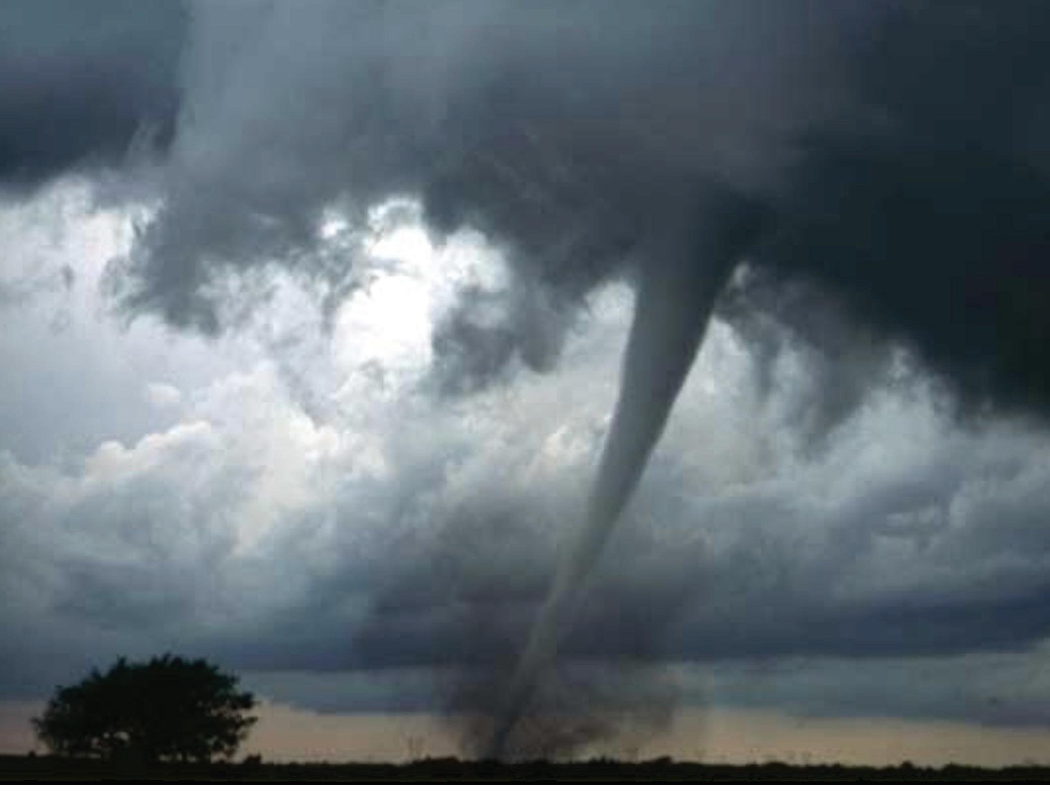
This F3 tornado was the first of a dozen tornadoes documented by scientists in the field on May 3. The same storm later produced an F5 tornado in Newcastle, Moore, and Del City, OK. The photo was taken from inside one of three VORTEX-99 mobile mesonet vehicles. Mobile mesonets - cars outfitted with mounted surface weather stations - are positioned near tornadoes to study the airflow around them. Research teams from VORTEX-99, a major field experiment designed to study tornado rotation, surrounded this tornado throughout its entire lifecycle, providing data that will either support or refute different ideas regarding tornado formation by NSSL scientists. Photo by Daphne Zaras/NSSL.
The report from the National Oceanic and Atmospheric Administration:
A record outbreak of tornadoes struck Oklahoma from late afternoon of May 3, 1999, through early morning of May 4, 1999. To date, 58 tornadoes have been recorded across portions of western and central Oklahoma. Additional tornadoes were reported across eastern Oklahoma from late evening of May 3 through the early morning of May 4, and are listed under the eastern Oklahoma portion of Storm Data, provided by the National Weather Service Office in Tulsa, Oklahoma.
All direct fatalities (40) and all direct injuries (675) occurred in the Norman National Weather Service warning area. The most notable tornado was rated F5 and formed over Grady County near Amber and tracked northeast for 37 miles
eventually into the Oklahoma City metropolitan area. Bridge Creek, Oklahoma City, Moore, Del City, and Midwest City suffered tremendous damage. Thirty-six direct fatalities and 583 direct injuries were recorded.
There were many other significant tornadoes as well, including F4 tornadoes in Kingfisher and Logan Counties, and F3 tornadoes in Caddo, Grady, Kingfisher, Logan, and Lincoln Counties. Due to the magnitude of the tornado outbreak, and for easier reference, each tornado has received its own identification. There were 8 tornadic producing thunderstorms, called supercells, and most of them spawned numerous tornadoes, one after another. Occasionally, these thunderstorms spawned tornadoes at the same time.






By mid-afternoon on May 3, 1999, the television weather forecasts turned downright scary and the sky began turning just as bleak. It was going to be a long night in central Oklahoma.
Transcript reporters were pre-assigned to stories in case communication was limited, which it was. Photographers, led by Jerry Laizure, were dispatched to the scene or as close as they could get. For Laizure, it was often too close as his images of approaching tornadoes would make any editor cringe.
He picked up the path of the deadly tornado as it touched down in Grady County near Amber. It traveled nearly 38 miles northwest, ripping through Bridge Creek, Newcastle, Moore, Midwest City and Del City before losing steam on the east edge of Oklahoma City. Laizure’s photos were prize winners and picked up by newspapers around the world.
After making sure family members were safe, (My wife just missed the storm’s path on her commute home from downtown Oklahoma City) I headed
By Andy Riegerto the office where a few staff members were retreating from the newspaper’s basement, which doubled as the office storm shelter.
This was long before reporters and photographers carried cell phones, and I remember paging reporters to call into the office with their locations and whatever damage they see.
It was beyond description. More than 40 of our neighbors were killed. Police and fire counted 800 injuries and 8,000 buildings damaged or destroyed. All told, the May 3 outbreak was the costliest to date in U.S. history.
My publisher, David Stringer, was an Oklahoman and a working journalist before heading into the publisher role. He understood there would be additional costs associated with our coverage and he never said no.
After a few days with reporters and photographers at near exhaustion, our corporate office sent in replacements from sister newspapers. Thankfully, they pulled from Oklahoma and Missouri newspapers where

journalists understood that tornadoes were a way of life in the Midwest.
The key to surviving such storms is in the timing of alerts. Our researchers and forecasters in the National Weather Service in Norman had an 18-minute jump on the twister. If not for that extra time, the death toll would likely had been much higher.
People had time to assess whether to drive home from work or take shelter where they were. In the Bridge Creek community, 11 persons lost their lives. The storm began picking up speed and velocity. A mobile Doppler Radar unit clocked wind speeds in excess of 300 miles per hour.
Now classified as an EF-5, the storm struck Westmoore High School where about 500 people

were attending an end-of-the-year awards assembly. All survived but most of their vehicles in the parking lot were tossed about like children’s toys.
Storms sounded in Norman at 6:30 p.m. My family huddled in a closet with my police scanner. Looking back, the chaotic police and fire calls were not something I should have shared with my family. Kids are resilient, and no one has mentioned it since.
About 250 homes in Moore’s Greenbriar Eastlake Addition were destroyed. In the Mid-Del area, about 1,200 homes were destroyed. All told, the storm stayed on the ground for nearly 90 minutes and did nearly $1 billion damage.
Most of my co-workers had moved on by the 2013 tornado that took a similar path through Moore, taking down the hospital. Our pre-assignments had been rewritten. Our disaster playbook was updated.
By week’s end in May of 1999, it was time to exhale and assess the cost to our staff. Mental health counseling was offered and accepted by some. It was also time for a few moments of levity which
helped us get through the chaos. My favorite story involved a new photographer who had moved here from California where tornadoes are rare. (We have weather. They have climate). She was paged out on the storm and immediately called the office. Her pre-assignment was to go to any scene where there was damage.

Today, you are a real journalist.
“Where are you and what do you see?” I asked. “Well, my husband and I got under our bed like they said on TV so I don’t see anything,” she responded in a muffled voice. “Well, your job is go to the tornado scene,” I said. “Leave your husband under the bed and get out there. Today, you are a real journalist.”
On May 3, 1999, meteorologists used every tool at their disposal to track the exceptionally violent tornado that ripped through central Oklahoma. The technology of the time helped meteorologists warn residents — preventing hundreds of additional deaths, by some estimates. But in the 25 years since, that technology has transformed, giving meteorologists more real-time data at their disposal than they’ve ever had before.
On the morning of May 3, the Storm Prediction Center issued a slight risk of severe thunderstorms for that evening. At about 11 a.m., the SPC elevated the risk to “moderate;” by 4 p.m., the SPC issued a high risk of severe weather. Now, the SPC can issue elevated risks of severe weather as far as a week in advance.
“The models that we have are just exponentially better than what we had 25 years ago,” said Scott Curl, a senior meteorologist at the Norman Weather Forecasting Office. “They’re so much better, and so much more accurate farther into the future than they were at that point.”
Like today, the meteorologists in 1999 used continuously-updating satellite images to monitor storm systems. According to Harold Brooks, a senior researcher with the National Severe Storms Laboratory, satellite images came in about every

five minutes. But the satellite temporarily stopped updating every day at about 4:15 p.m. in order to take a full scan of the northern hemisphere. On May 3, the satellite took its long scan just as the first storm cells took shape.
“There was a gap of about 10 minutes, 15

minutes when there was no satellite imagery, and that was a little unfortunate,” Brooks said.
“When the first U.S. picture came back in at 4:25, bang, tornado watch comes out, because there were storms starting.”
Curl says meteorologists don’t have to worry about gaps in satellite images now.
“We can get pictures every minute from a satellite that’s 240 miles up in the air,” Curl said. “There’s what they call mesosectors, which are really high definition, smaller scale sectors over the United States. If we overlap two of those, we can actually get a satellite picture every 30 seconds.”
It’s not just the satellites that have improved, of course. Curl mentioned the popularization of dual-polarimetric radar as particularly helpful in remotely identifying tornadoes, because dual-pol radar can record a
tornado debris signature — what you might hear David Payne or Mike Morgan call a “debris ball.”
There’s also convection-allowing models (CAMs), which Curl said
We did not, early on or even in '99, have direct measures of a forecasted updraft rotation “
“
help meteorologists forecast severe thunderstorms more accurately.
“There is a distinction between what happened in 1999 and probably what
would happen today, and that difference is I think the forecast that was a few hours out — 12 hours out — would have been better today than it was then,” said David Andra, who at the time was a science and operations officer with the Norman Weather Forecasting Office.
Andra, who retired as the meteorologist-in-charge of the Norman Weather Forecasting Office in 2021 after 34 years with the National Weather Service, said modern numerical models are much more exacting now than at the beginning of his career.
“We get a very high resolution, and by that I mean in space and time, small-scale details that are on the order or the processes that develop supercell thunderstorms,” Andra said. “We did not, early on or even in ’99, have direct measures
of a forecasted updraft rotation. We have that now. We have better measurements and forecasts of low level shear than we used to have.”
Curl said in general, the modern models help meteorologists make more accurate forecasts further in advance. The only thing is, with so many tools at their disposal, meteorologists must know exactly what they’re looking for.
“Sometimes it’s almost like information overload. You have to be able to pick out what information is important every day, because you just can’t look at it all,” he said.
Andra said events like May 3 contribute to research topics and goals for meteorologists; Brooks noted May 3 also contributed to improvements in the ways cities in the metro respond to storms.
“For future planning purposes, it exposed every little weakness in what were good plans … We thought, ‘Wow, we didn’t think that that could break that way,’ and yeah, it did,” Brooks said. “And so May 20 [of 2013], I think the metropolitan area was much more prepared.”
Brooks said between the 1995 bombing and the May 3, 1999 tornado, Oklahoma City refined its emergency response plans down to minutiae.
“It was simple things, like, ‘Make sure every chainsaw in the Park Department is oiled and fueled,’” Brooks said.
Other changes enacted during the response to the May 20, 2013 tornado included sending in Brush Hog rotary cutters ahead of ambulances, which had trouble getting to victims in 1999, and having Oklahoma City’s fire department take over fire calls for the City of Moore so Moore’s personnel could devote themselves to search and rescue for the first few days after the tornado.
It wasn’t just city officials who changed their tornado preparedness plans, either. In 1999, Oklahoma City’s search and rescue teams used the Rock Church as a temporary command post. When the May 20 tornado took a similar path 14 years later, officials called the Rock Church again, and the church’s directors said they had already started moving furniture in anticipation the search and rescue teams would return.
The May 3 tornado also unfortunately challenged notions of the best ways to stay safe from a tornado. Three individuals
died while trying to seek shelter under a highway overpass. Five months later, a team of scientists including Brooks presented their conclusion that highway overpasses are inadequate sheltering locations, and instead instructed motorists to leave their vehicles and lie flat in a nearby ditch if unable to seek shelter in a building.
One other takeaway from May 3 was the necessity for a new research facility for the National Oceanic and Atmospheric Administration’s meteorologists, and in his address after arriving to Oklahoma, President Bill Clinton pledged such a facility would be built in Oklahoma.
“He came out, and part of his talk was, ‘We will build a National Weather Center in Norman.’ That’s where the name came from, was Bill Clinton’s speech,” Brooks said.
The NWC now houses many federal, state and University of Oklahoma entities including the Norman Weather Forecasting Office, National Severe Storms Laboratory, Storm Prediction Center, Radar Operations Center, Oklahoma Mesonet and OU College of Atmospheric and Geographic Sciences.
“We had been talking about building and getting everybody together between the university and the federal side for years, and it was like one year, the state would be ready with funding, one year, the federal would be ready with funding, and we couldn’t get everybody together,” Brooks said. “May 3 was the catalyst.”T

Doppler reflectivity: A National Weather Service NEXRAD radar image of central Oklahoma at 7:00 pm on May 3rd shows four tornadic supercell thunderstorms occurring simultaneously.
Beverly Ann Arthur, 51, Oklahoma City
Anthony Battaglia, 37, Norman
Tram Thu Bui, 26, Marlow
Esther Coburn, 35, Oklahoma City
Suzanne Mary Cox, 55, Bridge Creek
Catherine L. Crago, 44, Bridge Creek
Asheton M. Darnell, 3 weeks, Bridge Creek
Lucille Darnell, 53, Bridge Creek
Bill Doty, 54, Oklahoma City
Noah K. Fish Jr., 67, Del City
Naomi Greaser, 58, Bridge Creek
John Berry Green Sr., 84, Oklahoma City
David A. Henry, 36, Oklahoma City
Linda B. Hogan, 50, Oklahoma City
Herbert F. "Bub” Imler, 25, Oklahoma City
Charles Russell "Rusty” Keithline IV, 24, Oklahoma City
Molly Kughn, 76, Guthrie
Vera Lamon, 94, Oklahoma City
Leona Mae King Lucas, 41, Bridge Creek
William "Bill” Lucas III, 38, Bridge Creek
Alan D. McClure, 45, Augusta, Kansas
Gustia Arlandous "Gus” Miller, 76, Del City
Patricia "Patsy” Payne, 44, Midwest City

Ralph C. Payne, 80, Midwest City
Bonnie Jean Mead Price, 46, Bethany
Naomi J. Rawlings, 71, Bridge Creek
James A. Rawlings, 73, Bridge Creek
James Russell Reeves, 33, Moore
Loretta M. Richard, 60, Oklahoma City
Danette H. Rodgers, 30, Oklahoma City
Herbert "Jake” Self, 86, Del City
Robert W. Siano, 28, Oklahoma City
Glynda Kay Parsons Stanfield, 43, Oklahoma City
Thelma Anderson Steel, 89, Oklahoma City
Victoria J. Sweatt, 41, Shawnee
Hugh A. Underwood, 50, Bridge Creek
Lillie Pauline Underwood, 59, Bridge Creek
Guadalupe Urice, 60, Del City
Kathleen Walton, 40, Anadarko
Jerry Webb, 52, Wayne
Cara Lynn Webster, 4, Moore
Kara Wiese, 26, Bridge Creek
Aleatha J. "Lee” Wilkerson, 69, Oklahoma City
Jeffrey Yonnes, infant, Midwest City
— Archived by The Daily Oklahoman
T



As Mark Hamm stood in the parking lot of First Baptist Church in Moore looking at the destruction the May 3, 1999 tornado caused, he knew the people of the town had a long road to recovery ahead of them. But he had no doubt they would rebuild.
Twenty-five years later, as Hamm starts his first term as mayor, he has seen the same scenario time and time again: people living and rebuilding their lives in Moore, Oklahoma.
“It has always been a people that are just kind of a blue-collar group,” Hamm said. “They go to their jobs and go home and try to enjoy their lives.”
Hamm was a Cleveland County Sheriff’s Deputy at the time of the tornado, and recalls seeing the destruction for the first time as he patrolled the town after the storm.
“I was in my patrol car and was coming into Moore because of the tornado, and I was there right after it hit,” Hamm said. “I remember all of the destruction; just sitting in a neighborhood and not recognizing or knowing where you were at because all of the landmarks were gone. And just looking around thinking ‘How in the world can anyone recover from this?’ But the city of Moore did, and people cleaned up and rebuilt.”
And it’s in that rebuilding process that the people of Moore have learned how to live in a community that is plagued by severe weather.
“Most every new home in Moore is built with a storm shelter, because it is something you need to do here and people want it,” Hamm said. “ We are not living ignorant to what might happen. We are prepared in the event that it might happen, but we are also not going to pack up and leave the city. That would not make sense. You have to continue to live life. You can have a great life in Moore, America, in spite of tragedy that comes.”
Hamm says these and other safety measures city leaders have put in place help residents feel more secure in going on about their daily lives as the threat of tornadoes looms overhead.
“Just by adding small things such as the hurricane straps, we also increaser the wind
rating for garage doors” Hamm said. “So by implementing more stringent building codes for more residential homes, we have made it safer.”
But Hamas says it’s also the spirit and strength of people that helps the community move forward and deal with the threat of severe weather. A sense of community that is found among the destruction.
“The people are just resilient. They want to live here, people want to live in Moore,” Hamm said. “I think that’s within the spirit of everybody. As long as we have the will to live we are going to make it happen and make it work. but we can’t do it alone, we have to have people in our lives to help us ” Hamm says he sees that resilience in the people of Moore every time they have to fight to rebuild their lives after they survive another tornado.
“It amazing how people go on regardless of what happens, it’s just within us to want to live and not give up,” Hamm said. “We want to fight and that’s what the people of Moore have done over the years with these tornadoes. When they are standing there in front of their home they’re not thinking, ‘I give up, they are thinking' I am gong to figure this out. It is gong to be OK.'”
Hamm says despite the negatives in life, he has faith that the people of Moore will continue to rise up and make their community bigger and better each time they rebuild and continue to hold their neighbors close to their hearts.
“If you choose to live in Moore, Norman or Oklahoma City, sometimes tragedies happen. Whether it’s a tornado, maybe it’s flooding; just these natural disasters,” Hamm said. “But that does not keep us from living life. In spite of the advisory we are going to rise above. Whatever personal adversity we face in our on lives, or if it is an entire community, we are going to rise above that and not let it beat us.”
City of Moore Director of Public Affairs/Economic Development Deidre Ebrey has lived in Moore her entire life, and says she asks herself all of the time what keeps her in in the area despite the severe weather threat.
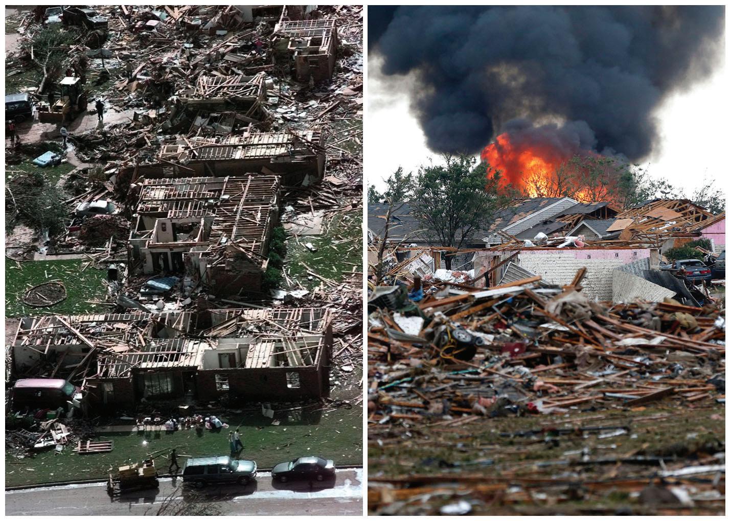
“I am one of those people,” Ebrey said. “I have not lived anywhere but here and weirdly enough, I personally did not have a storm shelter until the 2013 tornado event, though I have been through many of the storms here.”
But though her work with the CIty of Moore, Ebrey sees the numbers that prove residents and businesses continue to flock to the community despite the severe weather threat. Ebrey says, in fact, after the 1999 tornado, Moore continues to prosper.
“It was 95% a resident disaster as far as homes were destroyed,” Ebrey said. “It was remarkable that we lost no population as far as our numbers. Every year since 1999 we have seen growth, not only regular growth, but substantial growth.”
The severe weather Moore
has in the spring is not a secret. In fact, it’s pretty well nationally known, but Ebrey says in her opinion, the good outweighs the bad.
“There is more positives here than the negative, And the negatives are known, we are not hiding it, Ebrey said. “People know about it [tornadoes] moving in. I’ve never spoken to one developer, financial institution or actual business executive that has said one thing about storms or been worried about that.”
Ebrey said the key to learning to live with the storms can come in preparedness, Something the residents of the city have learned over the years, sometimes the hard way.
“After '99 there were some folks that got caught not having adequate insurance at the time,” Ebrey said. “And that was just a lesson learned
so everybody for the most part really made sure they had adequate insurance.”
With safeguards like storm shelters and insurance policies in place, Ebrey said residents leave themselves in a good position to start the rebuilding process if and when a storm hits and she know the people of Moore will continue to do just that again and again.
“It’s a phenomenon that really even FEMA looks at and really can’t get their head wrapped around because very, very, very few people are left with absolute nothing after a storm,” Ebrey said. “They have insurance, and that insurance pays out. And the great majority of people are able to build back bigger and better, and they do. They choose to and that just goes back to the community spirit that we have here.”
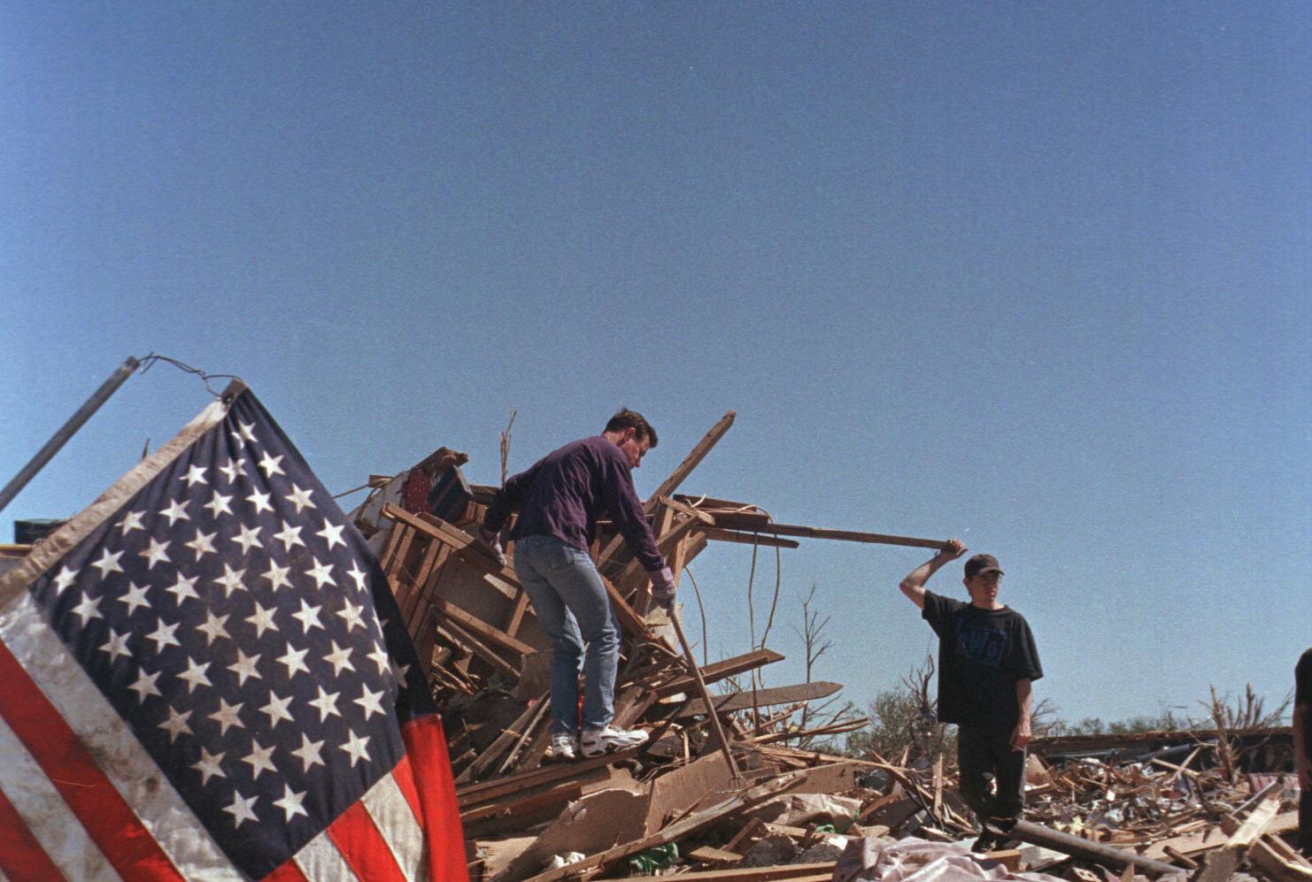
When Scott Curl got to work at 8 a.m. on May 3, 1999, he anticipated he might have to stay at the office a little later than usual.
Curl, a meteorologist with the Norman Weather Forecasting Office, knew the NOAA Storm Prediction Center had reported a slight risk of severe weather for later that day. On spring afternoons, it wasn’t unusual for meteorologists on the 8 a.m. to 4 p.m. shift to stick around and help issue warnings in the case of thunderstorms.
“We were anticipating that we'd have severe weather that day,” Curl says. “I don't think we had any idea of what would unfold.”
What unfolded was a storm system that spawned 74 tornadoes across Oklahoma and Kansas. The most violent of them, an F5 tornado that devastated central Oklahoma, reached wind speeds of approximately 302 miles per hour — the fastest ever recorded on the surface of the Earth.
While Scott Curl got a start to his morning, meteorologists across the street at the Storm Prediction Center and National Severe Storms Laboratory discussed the day’s convective outlook. Some of their observational data suggested the outlook should be upgraded from a slight risk of severe weather to a moderate or high risk. Harold Brooks, a senior researcher with the Severe Storms Laboratory, said they used a checklist of conditions to determine if a high risk should be issued. A little after 10 a.m., every question on the checklist was

answered “yes,” suggesting a high risk.
But the forecasters had some doubts about their data. A 2001 review completed by meteorologists from the National Weather Service and Storm Prediction Center found that some of the forecasters’ numerical models gave “inaccurate, inconsistent, and/or ambiguous guidance” on May 3.
Brooks says in the face of that ambiguity, the Storm Prediction Center forecaster he consulted with decided not to elevate the risk to “high” in the 11 a.m. outlook.
“I said, ‘Well, why? Why moderate? If all the questions got answered "yes," why didn't you go high?’ And he said, ‘Well, we know we still have another forecast.’ That's what we were thinking about,” Brooks says. “We didn't want to go high, and then have to back off later on.”
At 1 p.m., weather balloons recorded a highly unstable atmosphere and concerning wind profiles. By the time the Storm Prediction Center issued their final convective outlook of the day, there was no doubt: conditions were favorable for tornadoes. At 3:49 p.m., the center upgraded the risk of severe weather to “high.”
Over in the Norman Weather Forecasting Office, Curl finished up his shift, but was assigned to stay late as a warning forecaster.
“When I moved from one desk to the other, we didn't have any storms ongoing, but I can
remember one of the initial storms was a storm that developed on the north side of the Wichitas,” Curl says. “That storm went from basically, there was nothing on radar, and I want to say within 10 or 15 minutes, I'd issued a severe thunderstorm warning on it.”
Soon after, that storm began to produce tornadoes. In fact, several supercells were producing tornadoes across the state at that point, but David Andra, who at the time was the office’s Science and Operations Officer, instructed Curl to stay focused on the supercell that seemed to be traveling right up Interstate 44.
“At that point, it never even entered my mind that we would be dealing with something in the metro,” Curl says. Instead, he was primarily concerned with Chickasha, and he issued tornado warnings for Comanche, Caddo and Grady Counties.
The supercell produced a tornado that caused F3 damage in Chickasha, and it didn’t show signs of slowing. For the first time, Curl turned his attention to the metro.
observed.”
The meteorologists at the forecasting office had a television in the office, where they watched storm chasers provide the first footage of the devastation, and their partners with the Oklahoma Highway Patrol and the Department of Public Safety called in to share their own accounts.
And still, the supercell continued its path up I-44, heading directly for Oklahoma City and its suburbs.
“The storm’s structure on radar, the reports from the field … it was apparent that we
extremely dangerous and life threatening situation. If you are in the path of this large and destructive tornado, take shelter immediately.”
The first tornado emergency was issued as a severe weather statement, the type of message the weather service issues to update people on a tornado or severe storm’s position. Since, the National Weather Service has standardized the tornado emergency and issued it nearly 200 times across the country.
Andra wasn’t thinking about setting a precedent, though. He was thinking about minimizing loss of life.

“Most tornadoes don't stay on the ground for an extremely long amount of time, so we were obviously hoping that it would lift,” Curl says. “Unfortunately, it didn't.”
At about 6:30 p.m., Curl’s supercell produced a tornado that razed whole sections of Bridge Creek. It was there that the tornado increased to F5 intensity.
“We had a Doppler radar at that point,” Andra says. “The velocities measured by that radar were very high, and they were substantially higher than 99.9% of the other rotating thunderstorms that we had
could most likely have a really significant tornado event in the population center, one that most people would not have a recollection of being a part of before,” Andra says.
Andra felt like the uniquely powerful tornado necessitated a special type of messaging, something to make Oklahomans, notorious for heading out onto their porches when tornado sirens sound, understand the extent of the threat.
At 6:57 p.m., Andra issued the first tornado emergency in the National Weather Service’s history.
“Tornado emergency in south Oklahoma City metro area,” it read. “This is an

“There was no intention to create a new message for the National Weather Service,” Andra says. “We wanted to grab people’s attention, that this was going to be very serious and likely would continue into the population centers of Moore and the south Oklahoma City metro.”
As Curl tracked the supercell, a new concern arose: he had family in the path of the storm. Still, he continued issuing warnings as the storm finally began to weaken. He finally relinquished his duties when he learned his mother-in-law’s house had been significantly damaged, causing her minor injuries.
Curl tried in vain to make it to her house in south Oklahoma City to help her evacuate her neighborhood, but I-35 was closed, and every back road was jammed with cars. After sitting in traffic for an hour, he retreated back to the forecasting office. He ended up spending the night at his parents’ house in Newcastle.
When he returned to the
office the next morning, a different kind of storm was brewing.
“That was really the chaotic day. When weather is going on, and the storms of that nature are going on, we just do our job, and it went pretty smoothly,” Curl says. “But the next day, when you’re coming in, the stuff that’s going on is out of your control.”
There were meteorologists trying to rally teams to survey the damage from the previous day’s tornadoes. There were new thunderstorm threats that the forecasters had to track. There was a great loss of human life to process.
On top of it all, there were news organizations from across the planet trying to get a hold of someone who could explain what had happened.
“The next day was trying to come to terms with what had happened, what was the human impact of the event,” Andra says. “And of course, what happens at the office is a crush of media inquiries.”
The tornado left 41 dead, 583 injured, and what would today be $1.8 billion in damages. The world turned its eyes to Oklahoma.
For Keli Pirtle, who was hired in January 1999 to be the public information specialist for the Norman-based NOAA agencies, it meant a baptism by fire.
“There were scientists at the time who said, ‘No, we don’t need a communication person, we need another scientist,” Pirtle said. “I was told at the time, I was hired as an experiment. I was hired as an experiment in January, and I proved what I could contribute.”
“We wouldn’t have survived without Keli,” Brooks says.
The night of May 3, Brooks felt the need to warn Pirtle about the mayhem he anticipated the next day, but phone lines were down. So he drove to her house to tell her.
“Harold said, ‘This is big. You need to get ready,’” Pirtle says. “And I really appreciated that so much. Then I was ready.”

11 p.m. Some of the calls were from far away — he spoke on a BBC radio broadcast that night — and some were more familiar, as evidenced by his quotes in the May 4, 1999 edition of The Norman Transcript.
For the first two days, Brooks went from interview to interview, losing track of who he was speaking to at times. He didn’t see the damage for a week, devoting his time instead to putting the storm into historical context for reporters.
“You took breaks by making phone calls to print (journalists),” Brooks says. “That was sort of the break, was to not have to sit in front of the camera for a while.”
“The world reached out to us for information, and I mean the world, because we have the world's best tornado experts here in Norman, Oklahoma.

“The first thing Pirtle did on May 4 was organize a press conference. Then, she transformed the conference room shared by the Storm Prediction Center and Severe Storms Laboratory into a command post. She brought in several landline phones and had volunteers manning them constantly, and she created a board instructing scientists when, where and to which media organizations they’d be speaking. She also developed a list of talking points, so the meteorologists’ messaging would stay consistent.
“For the first 72 hours, I spent 48 hours either preparing for or doing media,” Brooks said.
For Brooks, the media crush began late on May 3. He began fielding calls from reporters at about
A couple of weeks later, when the media inquiries were finally thinning out, Brooks accompanied a reporter from NBC’s “Dateline” to the Shields Boulevard overpass on I-35, where a woman had died seeking shelter. She was one of about a dozen people who sought safety under the bridge.
“You could see the shadow outline of people under the bridge where the mud had hit the people,” Brooks says. “You could actually see one person who was hunched over and see the outline of his body.”
“It’s hard to even explain the horror at what was happening, and what did happen,” Pirtle said. “We’re part of this community, and I think it all affected us emotionally as well. I had tornado nightmares for a while.”
But through the death and damage, Pirtle and NOAA’s meteorologists did their best to keep the community as informed as possible, both during the tornado and in its aftermath.
“The world reached out to us for information,” Pirtle said. “And I mean the world, because we have the world’s best tornado experts here in Norman, Oklahoma.”
I was only nine but I remember that it felt really eerie and it was really quiet outside as everyone was taking shelter. We went across the street to my neighbors’ house as they had a shelter. All the adults were glued to the television and we had a weather radio on in the storm shelter. The sky was weird shades of green and purple. After the tornado passed, I remember being horrified at the destruction and that there were tarps on so many buildings from the damage."
– Stefanie Nees ThomasI was teaching at Santa Fe Elementary in Moore. I remember when the kids left at the end of the day you could just tell that something was not right. It was already eerily still and the sky was a strange greenish yellow color!"
– Brooke Bruno MuldrowI remember it being a mile wide as it passed through my side of town. My grandpa watched it from his back porch as it destroyed the back half of his neighborhood."
–Travis Totten
I worked for Cox Communications in the engineering department. We built fiber optic network. Including the feed to Tinker AFB. We physically stood and held the fiber the day after the tornado to keep crews from driving over it and breaking it. I remember looking around at the destruction and there was a field of unrecognizable debris. And upon closer examination the debris included bodies of livestock ... when I realized I was looking at dead horses … oof… it gutted me."
– Sereta WilsonI was 9 and my parents and I were on our way to a softball game. We made it to a teammate's house who was watching the weather. News 9 was advising shelter immediately. We got back home, about a mile away, but didn't have a shelter. My parents were calm but quick and ushered me to the tree line downhill of our home and into a divet. I was in charge of our little dog. I tucked her under my arm and laid face down in the divet. My dad put his arms over me and mom and held a tarp down. I don't know how he held on but he did. After the noise was over, we walked up the hill and everyone around us had damage or their house was demolished. Ours was perfectly fine. My mom, a former EMT, immediately went with everyone to the (Bridge Creek) gym at the school and helped people as much as she could. Then went looking for anyone that needed help. Dad and I stayed home and had all the neighbors over and made food on the fire. The next day and every day for two weeks, while dad was at work, mom and I loaded up our truck with supplies from the school and went up and down every road and corner passing them out and helping when we could."
– Keri MarieI was in my apartment on the east side of Norman. I was studying for law school finals and didn’t even know anything was happening until I heard the sirens. So, I turned on the TV and then I couldn’t take my eyes off the coverage."
– Holly Iker
“I lived in Little Axe. I remember Gary England saying for days prior it was going to be bad. I remember when it started in Lawton area Gary already started saying Moore needed to watch out. Watching it on News 9 coming to town and just the pure worry that Gary had and the worry I had because my GMA and Papa lived in Moore. Then later that night my uncle's house was destroyed by one north of Shawnee."
- TJ Jones
I was in my first year at OU and we had our chemistry final that night. I remember people listening to weather reports leading up to the final and some of the out-of-state students being pretty nervous about the whole thing. It wasn’t until we finished and came out of our final that we heard a tornado had hit and what had happened."
– Gabriel BirdI was in seventh grade at Westmoore for our awards ceremony when it hit the school, then by the time we hitched a ride home learned our house was also gone at 149th and May Ave. There’s also video of it going through our house from News 9. I have quite the long story of that day!"
– Amanda ChandlerI was 14 playing a softball game at Griffin Park in Norman. They called the game and as everyone got into their cars to exit the park it became utter chaos. Gary England was on every radio station saying if you are not underground you will die. Cars started jumping curbs and just driving to get the heck out of there. It is forever imprinted in my mind like a scene from a movie."
– Anne GottschalkI remember my father, Richard Carter, being a supervisor for DHS at the Moore location, and teaming with FEMA to bring assistance to those who were impacted. I remember him and my mother going directly to Moore that evening after the tornado passed to see how they could help."
– Benjamin Carter

