

NORA OQUENDO
Personal Information
Francisco de la Torre E12-38 y Cesar Endara. : 170307 Quito. Ecuador
+593 02 3454 965 +593 998891091
nora.michelle@hotmail.com
I’m an architect with professional experience in Ecuador and an internationally diverse outlook. I have a master’s degree in landscape and sustainability, and high experience in Universal Accessibility to built environments. Research and teamwork are really important for me and I find them as part of my strengths. My interests are mainly related to urban regeneration, public space, environmental design, and particularly to green infrastructure as a contribution to the climate change resilience of cities.
Languages
Spanish (mother tonghe)
English (proficient)
Italian (medium level)
Education and Capacitation
Master in Sustainable architecture and Landscape Design
Politecnico di Milano (Italia)
Architect
Universidad Central del Ecuador
Software
Architectural and Engineering Project Coordinator in the Technical Secretary of Public Real State Management (INMOBILIAR)
September 2016-October 2018
September 2009 - September 2013
August 2019- Present
- Studies for remodeling, adaptations and maintenance of administrative offices of public institutions
- Studies for construction of administrative buildings and urban parks.
- Coordination of a multidisciplinary team for the preparation of architecture and engineering studies.
Universal Accessibility analyst in the Technical Secretary of Disabilities (SETEDIS)
February 2014- August 2016
- Support in projects of Assesment related to Universal Accessibility: Adequations, surveys, and proposals in buildings and urban environments. Adequation prioritization and referential budget estimation.
- Creation and development of instruments and methodologies for the elaboration of Universal Accessibility plans.
- Support in the generation of the Universal Accessibility Chapter in the Ecuadorian Technical Building Standards NEC.
Drawing and architecture design assistant in ARQUIMAC S.A.
September 2012- February 2013
- Drawing and architectonical design of Hospitals: Hospital General de Latacunga, Policlínico Ambato, Hospital Oskar Handl Galápagos (ICO).
- Manejo de portal de compras públicas y elaboración de ofertas Técnicas.
- Architectonical survey of existent projects (drawing of offices and other spaces)
CONTENT


06
CULTURAL CENTER
Architectural design proposal of a cultural center in QuitoEcuador
10
CIVIC CENTER
Architectural design proposal of a civic center building of municipality service in Quito -Ecuador
14
NEIGHBORHOOD INTERVENTION
Granda Centeno Neighborhood intervention proposal.
16
HIGHSCHOOL
Bachelor Thesis- Architectural design proposal of a Educational Center of Technical Specialities in Cayambe -Ecuador
20
FARM REGENERATION
Regeneration proposal for a Farm. Environmental design, building reuse, and requalification of the rural heritage. Milan-Italy
46
-ENVIRONMENTAL DESIGN PROPOSAL
Master’s Thesis. Environmental Design proposal of an urban transformation area in Milano-Italia. Green Infrastructure
26
FISH MARKET
Urban and Environmental Design proposal of a fish market in BarcelonaSpain
58
PROFESSIONAL EXPERIENCE
-Design proposals, space remodelling and renovation
30
QUARRY REGENERATION
Landscape regeneration proposal of a abbandoned limestone quarry in Youghwa-Ghana
62
ACCESSIBILITY SURVEYS
-Accessibility surveyUrban adjustments. Cuenca’s Downtown
Accessibility plan- Carmen Alto Museum
38
MULTIFUNCTIONAL PUBLIC SPACE
Architectonical and landscape proposal of a multifunctional center in Oporto-Portugal
66
PROJECTS, RESEARCH CONTRIBUTIONS AND PUBLICATIONS
Cultural Center of ´´La Morita´´ Central University Campus. (2012)
The Central University in Ecuador has planned to create a new campus, where several faculties can have their own researching centers. This campus is located in La Morita, a rural parish close to the city of Quito.
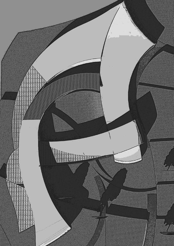
The master plan of the new project includes several buildings for faculties, and is a result of a composition of forms based on the environment, such as sunlight axes, topography axes and road connection. The complete architectural plan of three buildings in the campus where developed during the course. One of them is the cultural center shown here.
The concept used for this Cultural Center is the continuity where all forms could be seen as one. In addition, all the activities and spaces are versatile and flexible. The program consists in: multimedia rooms, workshop, administration office, cultural square, museum, library, gallery, coffee shop and a theatre.
. Software:
Autocad, Sketch UP+Vray and Photoshop
Skillis:
3D model elaboration, Renderization, Image post production


Governmental Offices Building in The Civic Center of ´´San Antonio´´ (2012)
For this exercise, the theme chosen was found in the Urban and territorial management plan for Quito. The terrain and location were found in the same document.
San Antonio is a parish which principal activities are related with tourism and symbolism due to its proximity with the monument Middle of the world. Therefore, several needs like governmental and management equipment has to be satisfied by the construction of a new Civic Center.
The project has three groups of uses. The first one consists in the UNASUR building. The second one consists in: Auditorium, and a complementary services building. The third group consists in Municipality offices, Parish offices, civil register and public tenancy offices. Additionally a Civic square for cultural events and subterranean parking spaces have been also proposed.
The complete architectural plans were elaborated for the Municipality offices building.
Software:
Autocad, Sketch UP+Vray and Photoshop, Diagramation in Illustrator
Skillis:
3D model elaboration, Renderization, Image post production


UNASUR
Auditorium
Services
Municipality Offices
Public Tenancy
Offices
Parish offices
Parking
Civil Register
Civic Square
Lineal Park
- Ecological pathways
- Arterial routes
- Collector routes
Granda Centeno Neighborhood- Intervention proposal (2010)
Granda Centeno Neighborhood is located in the north center of Quito. It is a residential area connected with two important avenues of the city and malls. With the aim to control the expansion of the city, this zone was selected for practice of proposals or interventions that have to be done in order to adapt the urban space for the number of inhabitants, which will increase in the following 30 years. In order to identify the current situation of this area, some data was gathered: identification of urban landmarks, age and height of building, route system analysis and land use. The project was developed by calculating the number of equipment (health, education) and housing needed for accommodate the growing population of this zone.
A proposal for space organization is also presented, which consists in the selection of location of equipment. In this proposal, ecological pathways connect the equipment with the houses and three typologies of housing were created according to local regulations.
Software:
Autocad, Excel
Skillis: Urban planning, analysis and design

- (R) Recreation: 4 parks
- (E) Education: Primary school and kinder garden

- (H) Health: one sanitary unit


- Individual Plots of land: up to two families of 4 members each one.
- Buildings: up to 6 floor buildings accommodates six families of 4 members each one
- Condominiums: a three floor building accommodates three families of 4 members each one
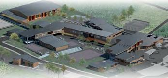
The complex is generated by two types of environments, one for each type of education:
- Formal education where orthogonal shapes suggest and ordered and functional system
- Inormal education where organic shapes express dynamism between opened spaces. It transmits informality and movement.




ACADEMIC ZONE


ACTIVITIES
The channel plans to become a recreational hinge by the implementation of kayak, bycicle and other attractions. Because of that, the main strategy is to conect the dock with the farm buildings through the creation of a phat with several activities among it. The first stop proposed in the phat is the info point followed by resting spaces and finally the cafeteria with guess room and acco-


The materials selected for the intervention (wood and steel) harmonize wih the existing landscape and buildgins.The interventions are reversible, it means that their implementation does not modify of affect the original structures and landscapes at all. The intervention made in the historical farm building is detailed in the following graph which also shows the scale of details that the project reached.


FISH MARKET
Urban and Environmental Design proposal of a fish market in Barcelona-Spain (2017)
The Old Port of Barcelona is a is a non-resolved area characterized for having obsolete, abandoned or underutilized spaces, in spite of the presence of strong and important places located near, like the Maremagnum and a new boulevard. One of these spaces is the old fish market where artisanal fishermen have installed their facilities.
In order to improve the conditions of the spaces, as well as connect this space to the city, a new fish market is proposed as part of a new public centrality. This structure aims to bring new experiences as an engine of activities next to the old market wholesale and port facilities for fishermen. With the concept of the artisanal fishermen and its nets, the proposal is strongly anchored to the historical and social values of Barcelona. In this sense, the general idea is to design a place as an active space capable of modifying, transforming and reactivating what is obsolete, abandoned or underutilized, while giving importance to the social actors and historical values of the city.
Software:
Autocad, SketchUp, Adobe illustrator and Photoshop.
Skills:
Urban and planning design, sociology of the environment, urban regeneration, environmental design, building reuse, 3D model elaboration, Image post production.
Other Team members: Molina


Julieta, Sagramola Sara, Pederzani Carola,
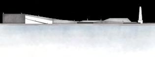
The proposal focuses the fishermen and one of its characteristical activities, the net repairing, at the cuore of the project. In this sense, the public space is projected to create a journey for visitors, completelly separated for the spaces of exclusive use of fishermen. The public spaces starts with the old fish market in the entrance, and finishes with a lookout that surrounds the net repairing area.


ELEVATION 1

PERSPECTIVE

QUARRY REGENERATION
M S C 3 R D S E M E S T E R
Landscape regeneration proposal of an abandoned limestone quarry in YoughwaGhana (2017)
Located near to Younghwa, there was a quarry of limestone straction which used to be the main economical activity of a small community. After the activities of the quarry stopped, the people started to look for other source of sustain. One of it is the wood extraction, causing more damage and negative impacts in the ecosystem and landscape of the area.
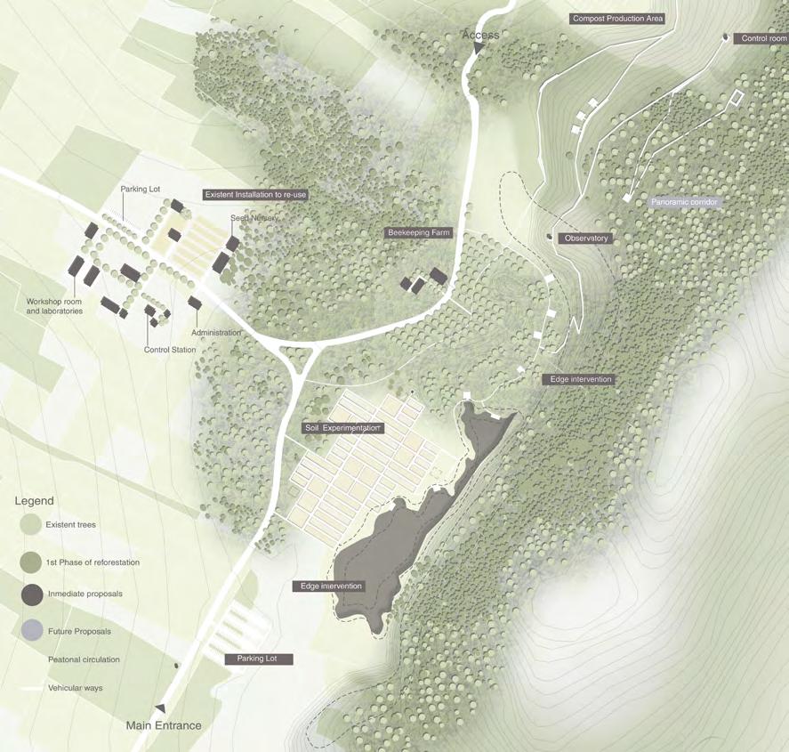
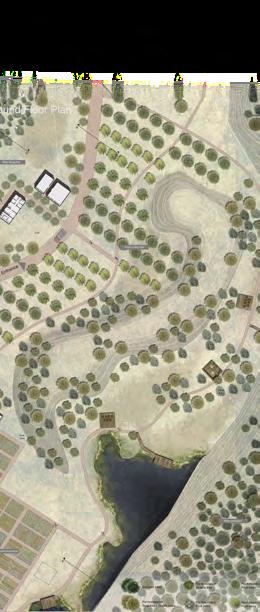
With the aim to stop the environmental degradation and to provide a sustainable way of economical and social improvement, this landscape regeneration proposal has been designed in several phases and considers all the aspects of a sustainable process. The first activities to be developed have to do with the creation of a tree nursery, a compost formation system to reclaim the soil of the quarry, the implementation of a new economic activity like planting or bee-keeping, and the socialization or community participation of the process. The following phases include the reforestation, and the creation of economic activities like eco-tourism.
Software:
Qgis, Autocad, SketchUp, Adobe illustrator and Photoshop.
Skillis:
Interventions in natural sensible areas, strategies for nature and forest reclaim (reforestation techniques) considering geological characteristics, design in contexts of landscape and environment value/sensitivity 3D model elaboration, Image post production.


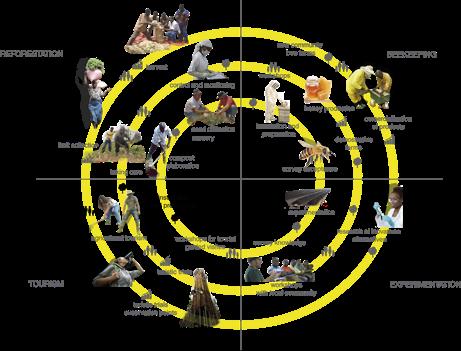
The proposal is focused on the three main topics of sustainability. The environmental one, with the reforestation, soil reclaim and other ecological succession strategies. From the economic perspective: beekeeping, fruit collection and tourism facilities are strategies to foster the economy of the place without comprising the ecological values of the place. Finally, considering the social component, the activities are planned to be developed under community participation and experimentation.
3-5YEARS

10-15YEARS

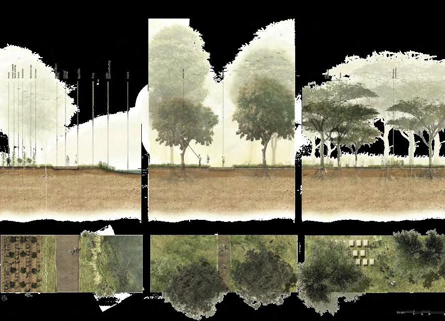
SECTION B
SECTION C
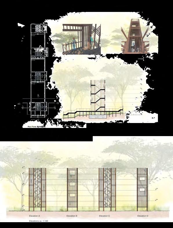
The strategy developed also includes an architectonical proposal for the final stage of the recovery and succession of the place. A wood tower, located at the end of an ecological pathway used for visitors, will act as a lookout. The pathway and the tower are light interventions that respect all the landscape and natural values of the place. The tower design concept in the facade is based on a geometrical pattern, typical from African fabrics.


MULTIFUNCTIONAL PUBLIC SPACE
M S C 4 T H S E M E S T E R
Architectonical and landscape proposal of a multifunctional center in OportoPortugal (2018)
The place selected for the intervention is in Porto’s major Public park (Parque da Cidade), in an abandoned area of the park that faces the Atlantic Ocean and Matosinhos city - in the Northwest limit of town. It is requested to create a new flexible building that will work as a new entrance to the park, that can protect people from the rain or other climate aggressions.
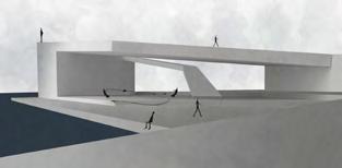
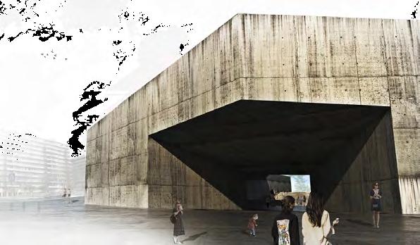
The concept of the proposal is developed as the creation of a Portoscape which main idea is to combine and mix all the main landscapes and landmarks present in the city and bring them into one place, with all the sensations and experiences. The place has three main characteristics, from one side the sea, in the other side the park and in the other, one sculpture and monument which is one of the main landmarks of the city. Because of that, the project brings the park inside the intervention area, with all the forest and nature, and converts it slightly into architecture, crowning this transition with a strong concrete building which brings the idea of a fortress that contains the nature. This building acts as a Duomo or a cover square for cultural activities that link the surrounding urban space and that is related with the natural landscape. Tree species and plants have been selected according to the functions and activities proposed in the spaces, giving the users different sensations and landscapes in just one place.
Software: Autocad, SketchUp, Adobe illustrator and Photoshop.
Skills:
Strategies to relate Architecture and nature, public space and landscape design, urban regeneration.
Other Team members:

Molina Julieta, Chapanon Phat, Pili Enrica, Serra Eleonora, Suhari Gaia
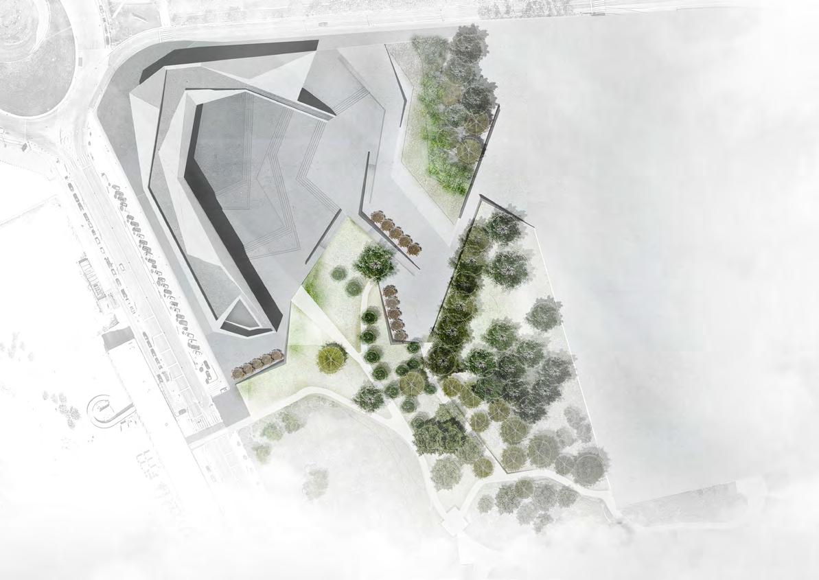

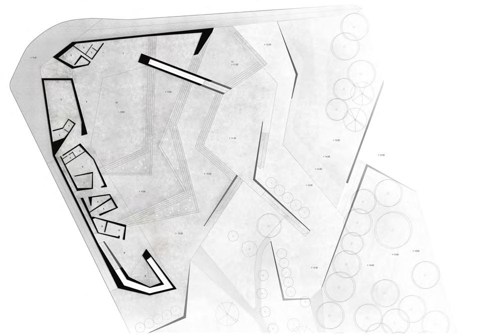


Apart from the architectonical proposal, the project includes a landscape proposal, for the outside spaces. It includes tree selection according the different spaces and uses and a strategy for tree growing. All the species and materials have been selected considering the impacts at environmental and economic levels.
ENVIRONMENTAL DESIGN PROPOSAL
MASTER THESIS
Environmental Design proposal of an urban transformation area in Milan-Italy. (2018)
The urban areas in the world are dealing with new challenges from a rapidly changing climate. The main concern about climate change in the cities now is how to be adapted to these changes and how to mitigate them. On this context, the concept of Nature-based solution (NBS), appears as an alternative which has the capacity of help to the environmental issues while providing a wide breadth of benefits for both, people and the environment.
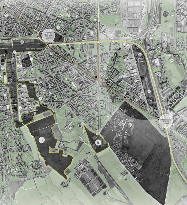
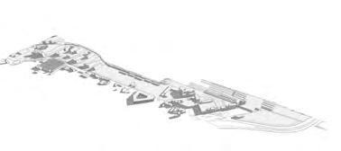
This thesis is focused on an area of critical importance in the Southern sector of Milano, particularly, the Toffetti-Rogoredo, one of the most dynamic and transformative of the city. A masterplan proposal, developed during a workshop promoted by the Cultural Association TAT, and the Municipio 4, plans complexity and interrelation of different utilities and activities for the area. This previous UCTAT proposal, is analyzed, detecting the main issues and then, a new alternative is proposed, mainly focused on the environmental design of the exterior and public spaces. This new proposal aims to create human spaces, having the best interests of the society and natural environment in mind. It looks for landscape and community spaces to be functional and aesthetically enjoyable while promoting community advancement and harmonic relationships with the natural environment.
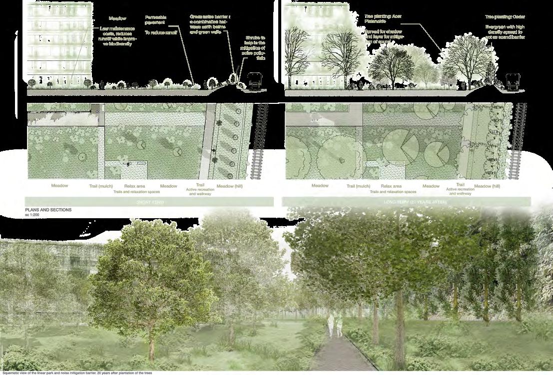
Additionally, having identified the main environmental issues to be addressed in the place and in order to improve the climate change resilience, some Naturebased solution (NBS) common practices have been implemented in exterior and public spaces of the complex. As a way of illustration and to show the importance and significant impact that these solutions have on the environment and for the people, the benefits of some NBS practices are estimated. All the analysis, estimations and practices are supported by documents developed and certified by international organizations.
Software: Revit, Qgis, Autocad, SketchUp, Adobe illustrator and Photoshop.
Skillis:
Green infrastructure implementation in urban consolidated areas, environmental design, urban regeneration, tree and plant selection, nature-benefit estimation (co2 reduction, energy savings, runoff reduction)



According to their capacity of delivering the breadth of benefits mentioned in the table, the green areas can be classified in :
1. Green areas with low capacity: areas that provide some of the social, ecological and economical benefits described on the table
2. Green areas with medium capacity: areas that provide the majority of social, ecological and economical benefits described on the table with some limitations
3. Green areas with high capacity: areas that provide the majority of social, ecological and economical benefits described on the table






WESCO MITAD DEL MUNDO
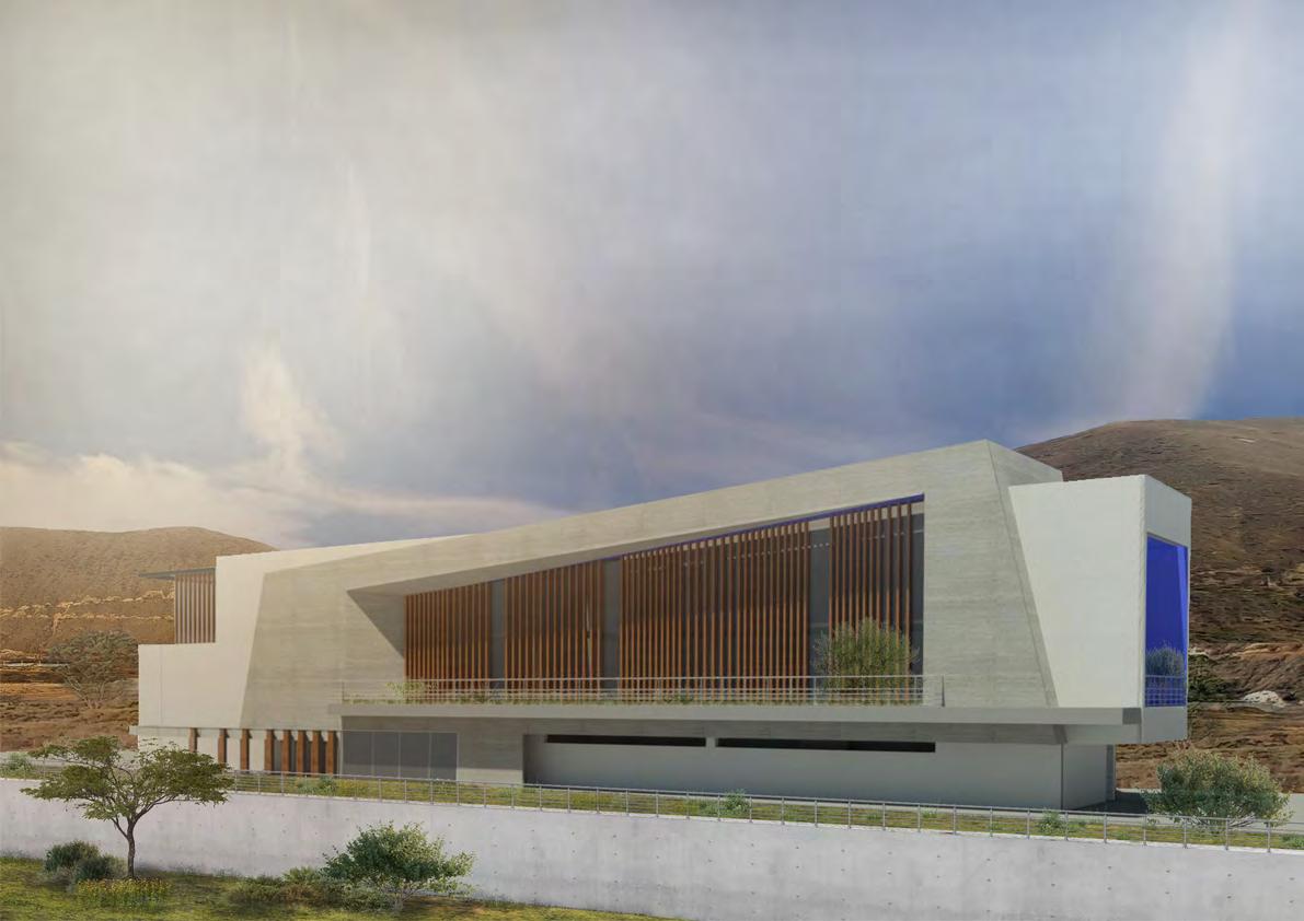
Architectural design of administrative offices in the new Wesco industrial plant. Quito-Ecuador (2023)
The project consisted of designing the new Administrative building as part of the industrial complex of the paint company Wesco, located near the Middle of the World in Quito-Ecuador. The concept of the project aims to represent the importance of the location and placement of the building. The building consists of two main volumes, one intersecting the other, while imitating the inclined lines of mountains of the surroundings. The materials and shape of the building were selected, considering: low maintenance, energy saving, and universal Accessibility Principles.
The project is in the process of getting the EDGE Certification.
Software:
Autocad, SketchUp, Adobe illustrator and Photoshop.
Skills:
Architectural design, Interventions in natural sensible areas, Image post production, multidisciplinary team work.
Other team members: Alejandra Borja

DESIGN PROPOSALS, SPACE REMODE -
LLING AND RENOVATION
PROFESSIONAL EXPERIENCE
Professional experience as Architectural and Engineering Project Coordinator At INMOBILIAR (2019- Present).
The surveys and the images set here are property of the Secretaría Técnica de Gestión Inmobiliaria del Sector Público.
The projects developed as part of the Infrastrucure team of INMOBILIAR, have to do mainly with office spacial organization. This projects consist on create architectural and engineering design proposals of office spaces that will be used by public institutions.
Some examples of this experience are:
- Spacial organization of offices at the Governmental Buildings “Plataforma Financiera”, and “Plataforma Social”
- Remodelling of Presidential Palace “Carondelet” for the use of the General Secretary,
- Park Projects Desingn: “Parque Tachina” “Parque Portoviejo”
Software:
Autocad, SketchUp, Adobe illustrator and Photoshop.
Skills:
Teamwork, leadership, office design, spacial organization and regeneration, buil-
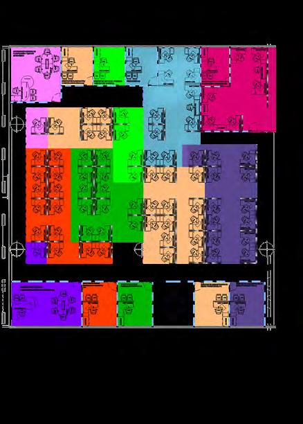
Space organization and asjustments at the existing buildings. Components of the projects:
- Electrical engineering
- Structural engineering
- Hydraulic & Sanitary Engineering
- Mechanical engineering
- Electronic engineering




Cover Entrance architecrure propossal (Plataforma Financiera)
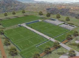
Aquatic Park (Parque Tachina)
Soccer fields (Parque Tachina)
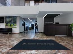
Remodelling Entrance (Edificio CACES-CES)
Parque Tachina (Project)
Parque El Florón (Project)
ACCESSIBILITY PLAN
CARMEN ALTO MUSEUM
Accessibility plan for Carmen Alto Museum in Quito. (2015)
The survey and the images set here are property of the Technical Secretary for the Inclusive Management in Disabilities.
El Carmen Alto museum is a patrimonial building located in the historical center of Quito. At first it was used as a monastery, but recently it has changed, becoming a museum. The aim of the project is to guarantee the access to the attractions and exhibitions for all the people, regardless of their physical or intellectual condition.
The accessibility plan developed consists in two stages: Diagnosis and proposals with prioritization criteria. On the diagnosis, the building is evaluated according to the accessibility standards in Ecuador. After that, the level of accessibility is defined, and the possible interventions are identified.
Because of the historical value of this building, the interventions must be reversible.
The proposals, which are several improvements in the route that visitors follow in the museum, do not affect the integrity of the building. They consist in: signaling substitution, visual warnings in certain places, alternatives of vertical circulation, bathroom interventions, among others.
GROUND LEVEL: Architectural elements where interventions are necessary
Example: Escalera1= Stairs 1 It needs handrails, and visual warnings.
A C C E S S I B I L I T Y P L A N
HISTORICAL CENTER OF CUENCA
Accessibility plan for The Historical Center of Cuenca. (2015)
The survey and the images set here are property of the Technical Secretary for the Inclusive Management in Disabilities.
Cuenca, one of the three more important cities in Ecuador, is one of the main touristic attractions of the country, because of its Historical Center, considered as Cultural Heritage of Humanity. The study presented here was the first stage of the project for become Cuenca in an accessible city.
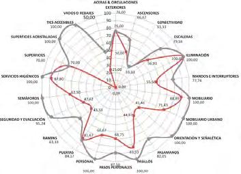
The study involved around 480 hectares, where elements such as: sidewalks, crosswalks, urban furniture, signaling, traffic lights, ramps, fords, stairs, among others, where analyzed according to the accessibility standards in Ecuador.
The survey started with a diagnosis stage, where the accessibility level as well as the barriers were identified. After that, the information was consolidated and the data was analyzed. Several adjustments were proposed in order to increase de level of accessibility of the area. These adjustments do not affect the historical value of authentic elements.
The prioritizing criteria used for the survey was the accessibility chains analysis, in which the order of interventions where defined in an effective way


The graph shows the level of compliance of the accessibility standards that each element has during the diagnosis phase.
PROJECTS, RESEARCH CONTRIBUTIONS AND PUBLICATIONS
With the aim to contribute for the creation of an inclusive country, several surveys were developed during 2014 and 2015. This surveys contains accessibility diagnosis, methodology and accessibility plans for existing buildings, which constitute an important basis for the construction of accessible spaces for people in Ecuador
The documents were elaborated in coordination with the Accessibility Team of the Technical Secretary for the Inclusive Management in Disabilities. The surveys are property of the mentioned institution
Currently, the documents are in process of publication, and they are only in digital format.

ACCESSIBILITY PLANS GUIDE
This document summarizes the methodology created for accessibility surveys and plans. The methodology is used for determine the level of accessibility of a building or urban space using an accessibility index, and how to improve it by identifying and prioritizing potential adaptations.

DIAGNOSIS OF 149 PUBLIC SCHOOLS
This document shows the results obtained as well as an important budget analysis of 149 public schools during 2014. Individual accessibility implementation plans for each school were developed for this project.
DIAGNOSIS OF THREE PROVINCES
Three representative provinces were diagnosed in order to recognize the current situation in accessibility of Ecuador. Several touristic, public and governmental buildings were studied, as well as urban spaces and elements, such as sidewalks, crosswalks, benches, trash cans, bus stops, among others. This is the first accessibility survey made in Ecuador.

PRIN ( Progetti di Rilevante Interesse Nazionale)
Participation as intern and elaboration of the Master Thesis in relation with the PRIN 2015 research in Italy. Adaptative design and technological innovation for resilient urban regeneration. Development of instruments for the classification and impact of Nature-based solutions in urban requalification projects.
Participant in the elaboration and revision of the of the Universal Accessibility Chapter in the Ecuadorian Technical Building Standards NEC. NEC-HS-AU
Participant in the revision of the of the Universal Accessibility Chapter in the Ecuadorian Technical Building Standards NEC. Guadúa structures. NEC-SE-GUADÚA
Design for All Foundation. Development of tools for the equipment of accessibility needed for accessible shelters in risk situations. Selected as one of the best Universal Accessibility practicces in the world.
Design for All Foundation. Participation with the Ecuadorian Methodology for the elaboration of Universal Accessibility Plans. Selected as one of the best Universal Accessibility practices in the world.
Assessment and recommendations for Universal Accessibility implementation in the project Tranvía los 4 Ríos de Cuenca.
PArticipation in the Quantitative and Qualitative diagnosis of Universal Accessibility in three provinces in Ecuador.

Politécnico di Milano. Architecture and planning department (DIAP) Milano-Italia. November 2017-Enero 2018
SETEDIS-MIDUVI 2016
MIDUVI 2016
SETEDIS 2016 (Best practice Design for All)
SETEDIS 2015 (Best practice Design for All)
SETEDIS 2015
SETEDIS 2014
Publications
▪ Oquendo, N. (2018). Environmental Design proposal for the Urban Transformation Areas Toffetti and Rogoredo in Milano-Italia. Master Thesis.
▪ Ministerio de Desarrollo Urbano y Vivienda. (2016). Norma Ecuatoriana de la Construcción. Accesibilidad Universal. NEC-HS-AU. Quito. (Colaboration in the elaboration of the chapter)
▪ Camacho, A., Oquendo, N., Ortega, P., Páez, F., Pacheco, A., Quezada, E., & Villacrés, P. (2015). Guía para la elaboración de Planes de Accesibilidad Universal. Quito: SETEDIS. (Methodology selected as best pratice in the world.)
▪ Camacho, A., Pacheco, A., Orellana, A., Páez, F., Chacón, K., & Oquendo, N. et al. (2015). Diagnóstico de accesibilidad de:149 establecimientos Educativos a nivel Nacional. Quito: SETEDIS.
▪ Camacho, A., Pacheco, A., Orellana, A., Páez, F., Chacón, K., & Oquendo, N. et al. (2015). Diagnóstico de accesibilidad del centro histórico de Cuenca. Quito: SETEDIS.
▪ Camacho, A., Pacheco, A., Orellana, A., Páez, F., Chacón, K., & Oquendo, N. et al. (2015). Diagnóstico de accesibilidad en establecimientos culturales de Quito. Quito: SETEDIS.
▪ Camacho, A., Pacheco, A., Orellana, A., Páez, F., Chacón, K., & Oquendo, N. et al. (2015). Guía para la elaboración de documentos accesibles. Microsoft Excel, Word, y Power Point. Quito: SETEDIS.
