IMAGINE NOMA PARKS
The innovative public-private partnership that brought great parks and public spaces to NoMa in Washington, D.C.


10-YEAR RETROSPECTIVE REPORT
CREDITS
AUTHOR Trueblood.City
Andrew Trueblood is the principal of Trueblood.City, a housing, economic development, policy, and land use firm. He previously served as the Director of D.C.’s Office of Planning and Chief of Staff for D.C.’s Deputy Mayor for Planning and Economic Development. He is currently a senior advisor for economic development at America Achieves, a nonresident fellow at the Urban Institute, a senior advisor for housing at the D.C. Policy Center, and a visiting faculty member at Georgetown University. He was assisted in developing this report by Savannah Elpers.
QUANTITATIVE REAL ESTATE BENEFITS ANALYSIS RKG Associates

EDITOR Braulio Agnese
PHOTOGRAPHY Sam Kittner Photographer, Nina Ramadan Photography, Sahar Coston-Hardy/Esto, Allen Russ Photography, Tom Holdsworth Photography, EXP, NoMa Parks Foundation

REPORT DESIGN Friendly Design Co
 ©Sahar Coston-Hardy/Esto
©
Sam Kittner/Kittner.com
© Sam Kittner/Kittner.com
Cover Photos © Sam Kittner, Nina Ramadan, and Allen Russ
NoMa Background
Three Foundational Elements
NPF Community Engagement
NoMa Parks and Public Space Projects

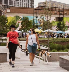
Swampoodle Park
Alethia Tanner Park
Swampoodle Terrace
Underpass Art Installations
Pocket Parks and Corridors
Florida-New York Avenue Intersection Project
Value Created by Three Parks
Preface Executive Summary
Learned and Replicability Looking to the Future Afterward Appendix Methodology Stakeholder Mapping Key Document References 4 6 10 14 18 23 25 28 35 38 43 46 49 50 54 58 59 59 60 61 ©
Lessons
Allen Russ Photography, LLC
PREFACE
It is hard to believe that the 10-year chapter in NoMa’s history devoted to conceiving and building a network of parks and public spaces in NoMa — one that residents and visitors will enjoy for many years to come — has arrived at an end. Many dreams were pursued and brought to fruition, while a few dreams still await future action. This report was commissioned to share what was undertaken and what was accomplished on that journey. It is our hope that it may serve as a valuable case study of a public-private partnership that was built on an innovative plan and grounded in a community’s aspirations. The effort was executed by remarkable partners dedicated to serving the public interest and making a difference in people’s health and well-being, as well as their enjoyment of an extraordinary new urban neighborhood.*

The NoMa Parks Foundation started in 2012 with a call to “Imagine NoMa Parks,” which would become the tagline for the effort. At that time, NoMa was largely an urban desert of abandoned buildings, warehouses, and empty lots, plus a smattering of newer office buildings. At the time, there was concern that development in this rapidly-changing area in the geographic heart of Washington, D.C., would miss the opportunity to address the critical need for parks and other public space amenities.

NoMa is now a thriving, dynamic mixed-use neighborhood, a remarkable success by any measure. And part of that success is the role played by the Foundation and the community in developing parks and public spaces before the opportunity was lost forever. The challenges were daunting and many, including: the absence of publicly owned sites, the lack of a master developer for the neighborhood, no legal requirements mandating the inclusion of parks and open spaces in new developments, and skyrocketing land values. NoMa is still a work in progress, and there is much left to do, but 2022 — the Foundation’s 10-year anniversary — is an excellent time to take stock of the NoMa Parks initiative. And to celebrate it.
The success of this effort did not result from the work of any one individual or single organization. The remarkable success of the Foundation’s efforts depended on the commitment, hard work, expertise, and vision of a community built around a shared purpose. The success of this effort belongs to all involved.

*We are mindful that the history of neighborhoods is multi-layered and complex. NoMa was considered to be “new” because of a long period of waning industrial use. The NoMa BID has taken time to document the longer arc of NoMa’s history. Learn more at nomabid.org/noma-history.
 Sandy Wilkes Board Chair, NoMa Parks Foundation
Robin-Eve Jasper President, NoMa Parks Foundation
Sandy Wilkes Board Chair, NoMa Parks Foundation
Robin-Eve Jasper President, NoMa Parks Foundation
© Sam Kittner/Kittner.com
©
4 5
© Sam Kittner/Kittner.com
Sam Kittner/Kittner.com
Alethia Tanner Park
EXECUTIVE SUMMARY
The successful effort to bring critical public spaces to the rapidly developing urban neighborhood of NoMa in the District of Columbia is an important achievement for the city. The NoMa Parks Project,1 through the alignment of planning, funding, execution, and a public-private partnership, enriched both the NoMa community and its surrounding neighborhood. The NoMa Parks Foundation (NPF or the Foundation) took the lead; not only did it serve as the steward of $50 million in public funds to invest in the public realm, but it was able to leverage over $28 million in additional value creation for NoMa’s parks and public spaces.2 As the lead in an innovative public-private partnership, it created value that would not have been possible with either the private or the public sector working alone. The NoMa Parks Project represents a clear case in which the overall impact was much greater than the sum of each of the individual projects. NPF leaves a legacy of parks and public spaces that are not just amenities, but places that create community and a neighborhood identity. It leaves parks and public spaces of interaction, socialization, and delight that will serve residents, workers, and visitors, now and for generations to come.
As the NoMa Parks Project winds down, this report, which is based on a careful review of documents, media reports, interviews and surveys, and a quantitative analysis by RKG Associates, explores the work of the Foundation over the past decade.3 It is a reference report for the entire effort, reviewing the context for NoMa parks and traversing the
project’s complete journey, from the first public space analyses to the opening of Swampoodle Terrace. It reveals how the challenge of public space became an increasingly pressing issue as the neighborhood developed; it walks through the ways community stakeholders worked and advocated for the issue. In 2012, thanks to the persistence of key stakeholders, a governance structure, funding, and planning aligned to spark forward momentum on the project. With NPF launched, $50 million in funding and political support from the D.C. government, and a strong NoMa Public Realm Design Plan as the guiding document, the effort turned from planning, visioning, and fundraising to execution — an enormous task.
Throughout the process, ongoing and energetic community engagement was a key element to ensuring success and long-term neighborhood support. Each of the parks and public realm investments that came out of the NoMa Parks Project has its own story, and each is shared in the middle sections of this report.
The final sections explore the value created by the parks, the lessons learned from the efforts, and potential paths forward. The NoMa Parks Project serves as a case study of a successful public-private partnership for communities across the country. The following are the key markers of success, discussed in the Lessons Learned and Replicability section:
1 We use the term “NoMa Parks Project” to signify the broad effort to build parks and public spaces in the NoMa community. That effort began before NPF was created and funding provided and has involved many partners and stakeholders.

2 NoMa Parks Value Creation Analysis. RKG Associates.
3 Please see the Methodology Appendix for more detail on the various sources.
Florida-New York Avenue
Intersection Project
New York Ave & N Street Public Art
“The Chicken and the Egg”
NoMa Meander
M Street Park**
Highpoint Park*
L Street Plaza*
Metropolitan Branch Trail Improvements Florida Ave
Underpass Art
Oak Leaf Plaza N Street Park**
M Street Underpass Art “Rain”
L Street Underpass Art
“Lightweave”
Swampoodle Terrace
Swampoodle Park
Loree Grand Park
K Street Underpass Art
“Virtual Gallery”
Identified in 2012 Design Plan and built as of December 2022
Burnham Benches
Identified in 2012 Design Plan and not yet complete as of December 2022
Indentified in 2012 Design Plan and not built
*Project still possible
**Property could not be aquired
Tracks Park**
©Sahar Coston-Hardy/Esto
MAP KEY 6
Clarity of Vision and Alignment of Goals
• NPF had a singular, clear mission, and it was able to sustain focus on and alignment around a long-term vision.
• NPF ensured that each public or private partner had a clearly defined role, which resulted in strong collaboration.
• Partner engagement was not just about gaining project approvals, but also about developing long-term ownership of the projects.
• This alignment and clarity of goals unlocked additional contributions from private entities.
A Focus on Building and Sustaining Community
• NPF was a neighborhood-serving organization that committed to developing strong and long-term relationships with key stakeholders and residents.
• NPF was an authentic community partner.
• NPF was able to employ best practices in community engagement and deliver world-class design.

NOMA PARKS TIMELINE
• Community engagement was not just about gaining valuable insight into community priorities and project feedback, but also about developing long-term community ownership.
• NPF committed to transparency and to document its work for stakeholders and others interested in the initiative.
• NPF was able to leverage short-term investments into long-term, place-specific impacts.
• NPF built park spaces that connect and bridge neighboring communities.


Speed, Expertise, and Flexibility
• NPF’s close relationship with the NoMa Business Improvement District reduced the startup time of the organization, so it could begin delivering on its mission sooner.

• NPF had the ability to move at the speed of the market when a site was available for acquisition.
• NPF was able to effectively deploy the expertise of its supporters and board members.
• NPF’s public funding and the structure with the D.C. government allowed for essential flexibility and speed of execution.
• Success bred more success.
Finally, the report looks to the future of NoMa’s parks and public spaces and considers questions of delivering the final projects and supporting the parks in the long run. It also explores a range of options for the future of NPF, including:
• Sunset the organization as originally envisioned and transfer any ongoing responsibilities to other organizations.
• Focus on operations and raising private funds to continue to support and enliven NoMa’s public spaces and to maintain the parks.
• Realign around a new big vision and take on new ambitious projects. While NPF has accomplished what it set out to do, there are still a few large-impact
opportunities in the neighborhood, including a ramp for the Metropolitan Branch Trail at L Street NE and a civic gathering space in the heart of NoMa. These may be stretch goals, but NPF has shown that big, bold ideas can be brought to fruition.

This report brings together numerous plans, documents, and project stories into one place. It is meant to serve as a comprehensive reference for neighbors, government officials, developers, and designers, as well as a detailed case study for other communities that may be interested in addressing similar challenges. The report also references and includes links to key documents and materials for stakeholders to support ongoing efforts as well as others who may be interested in those examples.4 Although the report is structured more or less chronologically, here is a reference timeline that shows key actions and deliverables.
4 Throughout the report are text or footnote references with more detail and links, as well as a full list of primary documents in the Key Document References Appendix.
2012 2013 2014 2015 2016 2017 2018 2019 2020 2021 2022 2023 JUNE 2020 Alethia Tanner Park Fully Opens (After Covid-19 Delay) APRIL 2012 NoMa Public Realm Design Plan Completed DECEMBER 2012 NoMa Parks Foundation Established SEPTEMBER 2012 D.C. Provides First Planning Grant for NoMa Parks 2013 NoMa Parks Grant Approved by Mayor and D.C. Council OCTOBER 2014 NoMa Parks Foundation Grant Agreement Signed OCTOBER 2015 Swampoodle Park Site Acquisition MAY 2016 Aquisition of Adjacent 1/2 Acre at Harry Thomas Way 2014 International Design Competition for NoMa Underpass Installations DECEMBER 2015 Aquisition of 2 Acres of Property on Harry Thomas Way from PEPCO SEPTEMBER 2020 Swampoodle Terrrace Site Aquisition OCTOBER 2018 M St Underpass Rain Opens 2019 First Building on NoMa Meander (RESA) Opens JUNE 2019 ULI Panel Recommends Concepts for Florida-NY Avenue Intersection (“Virtual Circle”) Public Spaces
JANUARY 2023 K St Underpass K Street VIrtual Gallery Planned Opening OCTOBER 2022 Swampoodle Terrrace Opens 2020–2021 Virtual Circle Designs Submitted to DDOT SEPTEMBER 2021 16 Burnham Benches Installed at 3 Locations in NoMa DECEMBER 2022 Design for Meander Crossing at M Street Submitted for Permitting APRIL 2019 L St Underpass Lightweave Opens NOVEMBER 2018 Swampoodle Park Opens 8 9
NOMA BACKGROUND
NoMa is a Washington, D.C., neighborhood named for its location: north of Massachusetts Avenue, in the area north of Union Station. The NoMa Business Improvement District (BID) was established in 2007 and represents this neighborhood that has grown, and continues to grow, into an ever more vibrant and vital part of the nation’s capital. NoMa is now one of the District’s newest, most-prominent, well-connected, and mixed-use urban destinations.
The beginning of NoMa as a mixed-use neighborhood can be traced back to the late 1990s, when the city was emerging from economic turmoil and a federally imposed financial control board. As officials and stakeholders considered ideas on how various D.C. neighborhoods could grow and prosper, some proposed the construction of a Metro station between Union Station and Rhode Island Avenue along the Washington Metropolitan Area Transit Authority’s (WMATA’s) Red Line.5 In the early 2000s, landowners, the District government, the federal government, and WMATA formed a unique public-private partnership to fund, design, and build the station, which would be the first infill station (built between existing stations) in the system’s 25-year history. The city contributed $54 million, the federal government contributed $31 million, local property owners agreed to a special assessment to raise $25 million for a bond to be paid over 30 years, and adjacent property owners donated $10 million in land. The partnership also funded the elevated portion of the Metropolitan Branch
Trail (MBT), a walk-bike path that runs alongside the Metro tracks. The station, now named the NoMa-Gallaudet U Metro Station, opened in 2003, and it presented the first example in NoMa of how to effectively use public-private partnerships to implement major infrastructure investments to catalyze development.
A NEW, TRANSIT-ORIENTED DEVELOPMENT NEIGHBORHOOD

At a pace not fully anticipated at the time, the NoMa-Gallaudet U Metro station quickly fostered more than 20 million square feet (SF) of transit-oriented development in NoMa. The area, much of which was once known as Swampoodle, was cleared when Union Station was built as part of the City Beautiful plans implemented in the early 1900s. Located just north of the train station, the area was used primarily for printing, warehousing, industrial, and rail-support functions for much of the 20th century. As industrial enterprises and rail freight in D.C. declined, the area transitioned to parking lots and vacant or underused warehouse and industrial buildings. Although the area had attractive land values, Union Station, accessible transit options, and good highway access, the neighborhood’s industrial character was deemed undesirable by many tenants, and development was slow to arrive.
The establishment of the Metro station added to the already remarkable array of other transit assets, including regional and commuter rail, and Union Station with its Red Line Metro station. In the early 2000s, NoMa’s early development was primarily commercial office space

made possible by these transit assets, favorable zoning, and leases by federal agencies, including the Bureau of Alcohol, Tobacco, Firearms and Explosives. In 2008, the District government also created a tax abatement for residential development that helped spur the construction of multifamily buildings.6
These new commercial and residential developments in NoMa not only added to D.C.’s vibrancy by creating a new neighborhood at the geographical center of the city, but they also brought significant additional tax revenue to the District. A 10-year Metro station anniversary study found that the completion of the station was followed by approximately 3.8 million SF of new office space, 183,000 SF of new retail, and 3,057 residential units.7 Given displacement pressures across the city, this growth was notable for occurring in an area with virtually no existing residents — and, more importantly, no residential structures were demolished to create these new buildings. In 2007, NoMa had less than 1,400 residents; in 2021, more than 11,000 people called NoMa home.8 In addition, in 2021, it had 12.7 million SF of office space, 545,000 SF of retail, and 622 hotel rooms. This significant development has been a net positive for all of D.C., and it was conservatively projected in 2014 to generate more than $1 billion through fiscal year 2019 for city services.9
PUBLIC AND OPEN SPACES AS A CHALLENGE TO SUCCESS
With all of the progress, there were still challenges to realizing a vibrant and healthy new neighborhood. When the Metro station opened in 2004 and the BID was created in 2007, NoMa had no accessible public parks. Community members and stakeholders became increasingly aware that the lack of parks and open spaces would be a serious challenge to a neighborhood that was seeking to become a vibrant place for both workers and residents. D.C. has so many neighborhoods with significant amounts of parks and public spaces that NoMa would suffer by comparison if its blocks were filled only with buildings. Moreover, public and open space is not merely an amenity — research has shown it to be a critical element of physical and mental well-being.10
6 NoMa Residential Tax Abatement Act of 2008.
7 NoMa-Gallaudet U Metro Station: Success Built on Transit.
8 NoMa BID 2021 Annual Report.
9 NoMa-Gallaudet U Metro Station: Success Built on Transit.
10 https://www.pps.org/article/pps-releases-new-report-the-case-for-healthyplaces-how-to-improve-health-through-placemaking
5 The Economic Resurgence of Washington, D.C.: Citizens Plan for Prosperity in the 21st Century.
NoMaGallaudet Metro Union Market Union Station NEW YORK AVE FLORIDAAVE MASSACHUSETTSAVE H ST NE K ST NE L ST NE N CAPITOL ST FIRST ST NE METROPOLITAN BRANCH TRAIL M ST NE M ST NE N ST NE Q ST NE R ST NE G ST NE 2ND S T NE 3RD S T NE F ST NOMA BUSINESS IMPROVEMENT DISTRICT BOUNDARY MAP © Sam Kittner/Kittner.com © Sam Kittner/Kittner.com 10 11
NoMa’s lack of public and open spaces grew more evident in the mid-2000s through a series of reports: The 2006 NoMa Vision Plan and Development Strategy and the 2008 Center City Action Agenda underscored NoMa’s need for public investment, recognizing the challenges of aging infrastructure and the lack of parks and open spaces. In 2011, the D.C. Office of Planning (OP) completed the NoMa Public Space and Water Management Study, which stressed the unique challenge the neighborhood faced due to lack of open space within and around it.
In the early 2010s, the Center for Urban Park Excellence at the Trust for Public Land authored a white paper, Greening NoMa, that highlighted the need for parks and recreational spaces to support expected residents and workers, while


also providing national examples of the benefits and costs of parks from other municipalities.11 The American Planning Association used that document to host a community planning workshop to further consider the importance of public space and envision options.12 Both made the case that a truly vibrant and healthy neighborhood would need to provide workers, visitors, and especially residents of NoMa with places for relaxation and recreation that connected them to their community and to each other. While the problem was clear, and potential approaches were beginning to crystalize, the biggest hurdle was the resources required to meet the challenge. In 2010, Ward 6 Councilmember Tommy Wells and Ward 5 Councilmember Harry Thomas Jr., with the support of Mayor Vincent Gray, introduced legislation to fund public parks in NoMa with $51.5 million in tax increment financing over 10 years.13 This was reintroduced in 2011, but it did not move forward, in part due to concerns expressed by the Office of the Chief Financial Officer. Although it never passed, it helped create an understanding of the need for parks in NoMa and established an expectation for the funding required to address that need.
As NoMa’s development continued to shift from office to residential in the early 2010s and its population began growing rapidly, stakeholders and District leaders increasingly realized the need to create parks and open spaces in the neighborhood. But time was of the essence, because nearly all of the land in NoMa was privately owned, values were escalating, and developers large and small were seeking to secure properties in the neighborhood.
As the NoMa Parks Foundation Business Plan put it in 2012: NoMa currently contains no publicly accessible park spaces. With the rapid pace of development, it is now urgently important to promote the development of parks and other public spaces. The opportunity to create parks in NoMa is diminishing with each new building that is constructed. Bold action is needed to assure that NoMa residents, workers, and visitors have places for relaxation and recreation, as well as places to gather and engage with each other, with art, and with culture. … This will enable NoMa to take its rightful place as one of the great neighborhoods in Washington, D.C.14
TACTICAL URBANISM AS A SHORT-TERM SOLUTION

While the work to plan, fund, acquire, and build parks would take many years — NoMa had no permanent, large civic gathering spaces until the opening of Alethia Tanner Park in 2020 — the NoMa BID recognized the opportunity to use temporary, “tactical urbanism” efforts to activate vacant sites and parking lots as public spaces. The BID’s efforts began early on through the creation of a series of temporary sites for NoMa Summer Screen, a signature BID event that invited residents to watch movies outdoors. This gathering was held at four different sites in the roughly 10-year period before Alethia Tanner Park opened, moving to another space once the empty lot it was on was under development.

At one site, now the Union Place mixed-use complex, an active and highly social community of dog owners predominated. This dog-owner community formed a core group of advocates for the first dog park in NoMa, Swampoodle Park. And when the NoMa BID used the site that is now NoMa CNTR, it was able to explore public art through a community project that produced what was, at the time, the largest public mural in D.C. That artwork, executed with the help of the D.C. arts and education nonprofit Words, Beats & Life, engaged professional artists and the community in the creation of a 15,000 square foot “ground quilt” that proved enormously popular in the neighborhood. Other temporary projects, like the Wunder Garten popup at Constitution Square, next to the MBT and the new Metro station, and the Lunch Box popup at 51 N Street NE, both held in 2015, demonstrated the public’s enthusiastic embrace of community gathering spaces and the value of providing food and beverage options.
One criticism of tactical urbanism is that it is temporary and can often leave communities and neighborhoods unchanged after the project is over. Yet the NoMa experience shows that when it is done thoughtfully and with a longer-term view, tactical urbanism can help bridge community needs while more permanent solutions are pursued. And, as will be shown, these events helped initiate community engagement and guide long-term approaches to parks and public spaces. In NoMa, what started as short-term activations became longer-term successes — witness the Wunder Garten beer garden, which is still in operation seven years later in 2022, in a much larger space at the corner of L and First Streets NE.
Greening NoMa.
Urban
Excellence at the
for
Land.
Strategies for Parks and Open
in NoMa. AICP Community Planning Workshop Final Report.
NoMa Public
Act of 2010.
11
Center for
Park
Trust
Public
12
Spaces
13
Parks
14 NoMa Parks Foundation Business Plan.
15,000 square foot ground mural at what is now NoMa CNTR.
Wunder Garten’s first popup in NoMa at Constitution Square.
NoMa Summer Screen temporary location at 1150 First Street NE.
© Sam Kittner/Kittner.com © Sam Kittner/Kittner.com Words Beats & Life 12 13
The NoMa area was largely vacant lots in 2000 as shown in this aerial image.
THREE FOUNDATIONAL ELEMENTS
Successfully addressing the long-term parks and open space needs required three critical elements to converge: a unifying vision and plan, an aligned organization, and significant funding. While each of these had been part of the discussion, in 2012 all three converged through the NoMa Public Realm Design Plan, the NoMa Parks Foundation, and initial grant funding from the D.C. government that led to a $50 million allocation in Mayor Gray’s capital budget the following year.
NOMA PUBLIC REALM DESIGN PLAN
In 2012, the NoMa BID, recognizing the need for a plan to guide and support development of NoMa’s parks and public spaces, hired AECOM to work with stakeholders to develop the NoMa Public Realm Design Plan. It would lay out how to provide the appropriate level of pedestrian, environmental, recreational, and social amenities required to ensure a high quality of life for NoMa’s residents, workers, and visitors. It would also identify an open space framework: destinations and design opportunities that would enhance private development and establish a distinctive, active, and sustainable public realm in NoMa.
Development of the parks and public realm plan for NoMa first had to confront its most formidable obstacles: no viable sites existed, the cost of purchasing privately owned land was high and getting higher, and there were few, if any, willing sellers. Because of this reality, previous concepts
15 https://hbr.org/2016/09/know-your-customers-jobs-to-be-done
calling for one central park in the neighborhood were reassessed. A new approach contemplated an array of park spaces that included outdoor fitness facilities, dog parks, public art installations, chairs and tables, bike racks, and tree-lined plazas. The team from AECOM worked with NPF and stakeholders to identify potentially available private and public lots (both District- and federal-owned) and explored how public spaces might be combined with private spaces to increase the size and impact of potential NoMa parks. As designer Ryan Bouma noted, the team asked, “How many little interventions could we make?” and sought to identify as many interventions as possible that could be stitched together, recognizing that not every opportunity would ultimately be successful. The resulting map of potential park spaces and projects that are complete or underway in 2022 is shown in the Executive Summary.
The AECOM team reviewed previous planning efforts but took a fresh approach to NoMa park planning. Borrowing from the “jobs to be done” theory described by Clayton Christensen,15 AECOM’s team avoided pre-established notions of what a park should include, or what a stereotypical “NoMa demographic” might want in a park. Instead, the team asked probing questions about what people wanted most in their parks and what needed to be done to serve NoMa community members. And it asked those questions for each of the many locations that had been identified as potential park sites.
Residents consistently raised the need to overcome barriers like New York Avenue and North Capitol Street and to have better east-west connectivity across the community.
NoMa office workers were most interested in new outdoor amenities that could be enjoyed at lunch. And a common theme among all groups was that one central park would not be sufficient, and that a system of connected and flexible open spaces with a variety of amenities would best serve the community.
The stakeholder interviews, independent research, and collaboration between AECOM and the NoMa team eventually led to a vision plan of what was needed and what would best fit the neighborhood. To address NoMa’s needs, the plan recognized that the public realm had to be designed as part of a new type of neighborhood. This new NoMa was an environment where an active lifestyle coincided with historical significance, interactive art, and enhanced urban ecology. The concepts and recommendations in the NoMa Public Realm Design Plan were based on the following principles:
• Focus on enhancing public property first. Integrate new public space with adjacent private development.
• Design streetscapes to function as linear parks.
• Provide scalable gathering spaces to support a variety of events.
• Create signature spaces that become community focal points.
• Establish a series of park spaces throughout NoMa.

• Create streetscapes that are unified in appearance but not uniform.
• Optimize pedestrian and bicycle convenience and comfort.
• Incorporate low-impact development-runoff management.
• Create interactive artistic experiences.
• Embrace historical elements and incorporate the railroad influence.
• Accommodate the needs of families with children.
The NoMa Public Realm Design Plan was published after months of careful analysis and development, with input from a cross-section of community stakeholders. This flexible framework for the development of parks and public spaces became the guiding star of the NoMa Parks Project, and its significant community engagement set the tone for an ongoing partnership with residents. But a plan alone
would not be enough to make the effort successful. It would also need a capable organization to manage things, as well as significant funding.
NOMA PARKS FOUNDATION ESTABLISHMENT
As the NoMa BID and other stakeholders worked to create a plan for public and open spaces in the neighborhood, they recognized that there would be significant hurdles to execution. For example, site acquisition would be an enormous undertaking, given that the vast majority of the land in NoMa was privately owned and planned for development. As the design plan showed, in 2012 there were only a few sites that could accommodate the development of parks, playgrounds, public art, and other gathering spaces, and many of the available sites were privately owned and had complex ownership structures.
Neighborhood leaders once again saw an opportunity for a public-private partnership, as with the Metro initiative a decade earlier and establishment of the NoMa BID a few years later. In this case, the partnership would play a central role in coordinating the public and private sectors to develop and build the system of parks and accessible public spaces throughout the neighborhood envisioned in the NoMa Public Realm Design Plan. NoMa BID leadership determined that creating a separate 501(c)(3) nonprofit organization would provide the most leverage to bring in the type of public and private support needed to create public spaces that serve both the core of the neighborhood as well as adjacent, and underserved, neighborhoods.
In 2012, NoMa BID leadership created the NoMa Parks Foundation. The new organization’s mission was clear: “To establish welcoming, sustainable, beautiful spaces where people can play, refresh, and connect in NoMa, now and in the future.”16 NPF was charged with engaging and consulting with community stakeholders, identifying funding sources, negotiating with property owners, developing designs, obtaining regulatory approvals, and, ultimately, constructing parks and public spaces.
The Foundation’s board included six members appointed by the NoMa BID in 2014. These appointees comprised a group of senior professionals with deep subject matter expertise. Although board members commit to only threeyear terms, each of NPF’s original six board members remained steadfastly committed to the NoMa parks project and provided exemplary service through December 2022.
16 NoMa Parks Foundation Business Plan.
© Sam Kittner/Kittner.com 14 15
As shown below, the board included a range of expertise critical to NPF for the NoMa Parks Project:
• Developer and Arts Advocate: Sandy Wilkes, Chairman, The Wilkes Company
• Planner: Uwe Brandes, Professor of the Practice, Urban and Regional Planning Group, Georgetown University
• Landscape Architect: Sunny Alsup, Founding Principal, LSG Landscape Architecture
• Accountant: Steven Chad, retired Deloitte partner, former lead of the firm’s Mid-Atlantic real estate audit practice
• Lawyer: Stephen Marcus, real estate litigation expert
• Nonprofit Manager: Mike Smith, President of the Washington Center for Internships and Academic Seminars
• Ex Officio Board Members
• NoMa BID President: Robin-Eve Jasper (2012–2021); Maura Brophy (2021–present)
• NoMa BID Board Chair: Doug Firstenberg (2012–2018), Founding Principal, Stonebridge; Brigg Bunker (2018–present), Managing Partner, Foulger-Pratt
The NoMa BID provided administrative staffing and services for NPF, for which it was reimbursed, to promote efficiency and reduce administrative costs. Most notably, Robin-Eve Jasper served as the President of NPF and President of the NoMa BID. She brought a background as a corporate attorney, commercial developer, and affordable housing provider to lend her considerable expertise toward acquiring land and building the parks and public spaces.
The relationship between the BID and the Foundation provided many more benefits than just an economical way to obtain “back office” support. NPF was able to leverage the BID’s deep community connections, knowledge of community conditions and future development plans, relationships with developers, and experience with public agencies. Equally important was the BID’s experience with temporary urbanism and the ability to pilot ideas and approaches.
Many of the relationships that were critical before and on “day one” are shown in the Stakeholder Mapping Appendix. Accessing the BID’s infrastructure, relationships, and
17 Grant Letter from Mayor Vincent Gray.
18 FY 2014 Proposed Budget and Financial Plan.
experiences allowed the young Foundation to save years of startup work and learning.
NPF came to the NoMa Parks Project with the momentum of the support of a solid organization to provide administrative support and leadership, a highly qualified board of directors, and a valuable knowledge base to undertake the work ahead.
DISTRICT FUNDING AND AUTHORIZING OF NPF INITIATIVE
The NoMa BID, residents, and other stakeholders aligned around the goals of the NoMa Public Realm Design Plan along with the newly created NoMa Parks Foundation to make a case to the District government for the funding required to realize the vision for public and open spaces in the neighborhood. Through active discussions with city officials, NoMa parks received their first grant on September 12, 2012, when Mayor Vincent Gray reprogrammed $490,000 to the OP for the planning and development of parks in the neighborhood.17 This public funding was intended to support the BID’s work developing plans for a parks network and was one of the first displays of a strong partnership between the D.C. government and the NoMa community around the parks effort — and served as another example of the long-term collaboration that started with the Metro station and included the establishment of the NoMa BID. The reprogrammed funds would “enable further assessment of the potential and feasibility of neighborhood sites” for the future parks.
Just six months later, in March 2013, Mayor Gray included $50 million in capital funding for NoMa parks and public spaces in his proposed FY 2014 capital budget.18 These funds were allocated from FY 2014 to FY 2019 for the purpose of improving the recreational opportunities for residents of the NoMa community by acquiring property and developing public parks.19 At the same time, the NoMa Parks Grant Authorization Act of 2013 was introduced, which adopted the NoMa Public Realm Design Plan as the framework for the District’s investment in parks in NoMa and provided the legal authority for implementing NoMa parks development. This action established the basis for the funding and plan for the creation of parks to serve the residents of NoMa. In May and June 2013, the Council of

19 The ultimate funding amount was reduced to $48,675,851 and provided over eight years instead of six due to various reprogrammings by the D.C. government. The uncertain availability of funding during some fiscal years impacted NPF’s ability to pursue some acquisitions.
the District of Columbia unanimously approved the funding and authorizing act.
Securing this funding was a significant milestone for the Foundation, because having government support early on as well as a collective vision for NoMa was essential. Stakeholders recall the “collective yes” from the District, especially from Mayor Gray, Councilmember Wells, and Councilmember McDuffie, who realized the need for NoMa to create park spaces and understood what these amenities could do not just for the area, but for the city as a whole. They understood that when developing a new neighborhood, it takes resources to ensure it has all of the components necessary for success. Mayor Muriel Bowser’s continued support was a critical element in the NoMa Parks Project’s success.
The community played a critical role in building the support needed to raise the funding. Many residents advocated their support to D.C. councilmembers and participated in community workshops and other planning efforts, thereby showing their belief in the future of NoMa as the place they call home. Because of this, it helped community leaders and elected officials justify the significant investment.
With these three components in place, it was up to the Foundation to execute on the vision and goals. NPF was
now at the starting line and responsible for acquiring land in the rapidly escalating and developing NoMa real estate market. This would be a formidable task, with most owners interested in developing, not selling, their properties.20 Additionally, NPF needed to move with speed to ensure that its funding would not be eroded or supplanted by other D.C. government priorities. This was especially important given that most capital budget projects are for specific and discrete things, such as a library or a school. With $50 million allocated to a more general goal without specific projects or parcels, it would take a concerted effort by stakeholders to ensure that the funding remained for this effort each following budget year. Ward 6 Councilmember Charles Allen shared how it helped that some of the park locations were in or adjacent to neighboring Ward 5. But it still required ongoing engagement from stakeholders, the support of Councilmember Kenyan McDuffie, and a few targeted admonitions from Councilmember Allen when colleagues eyed redirecting some of the large funding for other purposes.
The following sections discuss how NPF successfully implemented its plan, starting with its approach to community engagement and followed by a project-by-project review.
20 In the end, NPF acquired four properties (Swampoodle Terrace on the second attempt), as discussed in the NoMa Parks and Public Space Projects chapter. There were an additional eight efforts — including LOIs and developer negotiations to acquire or build public space on other parcels — that did not come to fruition.
© Allen Russ Photography, LLC
16 17
Alethia Tanner Park when newly complete in 2020.
NPF COMMUNITY ENGAGEMENT
From the beginning, the NoMa BID and NPF prioritized close collaboration with residents, businesses, property owners, and other neighborhood stakeholders. The extraordinary number of people who participated and the diverse modes of engagement over the course of the 10year project is a testament to the value placed on community dialogue and the value that the community placed on participating in the effort.
At the outset, the Foundation engaged stakeholders through direct personal invitations to participate in relatively small visioning sessions. These gatherings helped set the framework for large community-engagement forums that ultimately involved thousands of people in providing feedback on park plans and assisting with the development of identities for each of the NoMa parks.
The extensive outreach undertaken for parks development even inspired the city’s Department of Parks and Recreation (DPR) to modify its approach to public engagement when creating and rehabilitating other D.C. government–owned parks, according to Capital Planning and Design Officer Brent Sisco. The Foundation’s efforts helped DPR better understand the importance of designing and working through the unique identity of each park. In addition, the process highlighted how community outreach can help designers be very intentional about the different and specific user needs that each park can serve, and how that can be part of a broader park network.
COMMUNITY ENGAGEMENT PRINCIPLES
According to NPF President Robin-Eve Jasper, the guiding principles of NPF’s efforts built upon the earlier efforts of the NoMa BID. In those efforts, the BID sought to ensure that in the diverse and rapidly growing NoMa neighborhood, everyone would feel invited and welcome to participate in all events through the organization’s establishment of and adherence to a few key values:
• No one would ever be required to pay to participate in events.
• Free food and drink would be provided at longer events.
• Residents and visitors were notified about upcoming events through both digital and analog channels to ensure that a lack of digital access did not prevent participation. Examples of outreach included distribution of flyers to apartment buildings and row houses within and on the borders of the NoMa BID, distribution of event cards by NoMa hospitality ambassadors to people on the streets of NoMa, digital newsletters, social media, and sandwich board signs.
These principles concerning the approaches to outreach served as the foundation for NPF’s community engagement efforts, which the Foundation expanded on.
The similarity in approach and priorities of the NoMa BID and NPF were mutually reinforcing. The consistent primary messages that the organizations sought to convey to community members was: “We care about you, the neighborhood, and your input.” The message was reinforced through activities and studies undertaken by the BID that
were of interest to community members but outside the purview of work that was funded through the parks grant, such as the North Capitol Street Needs Assessment. Finally, NPF explicitly ensured that its definition of neighbors and stakeholders was not limited to those who lived or worked within the BID boundaries. While the NoMa BID was funded through a defined taxing district, the success of the NoMa neighborhood depended on engaging and serving a broader constituency.
The following pages share details of the methods NPF employed to engage residents.
THROUGHOUT
Direct outreach to community leaders, business and property owners, and D.C. agency personnel for in-person stakeholder engagement. This was especially significant during early planning efforts, including an American Planning Association study, preliminary concept development for the NoMa Public Realm Design Plan, and garnering support for NPF’s involvement in the design of public spaces that will be built as part of the New York–Florida Avenue intersection redevelopment.
Engagement with community organizations, including Advisory Neighborhood Commissions (ANCs) and civic associations. The Foundation regularly reported on design, acquisitions, and construction at these civic organization meetings, which were also one of the avenues used to obtain feedback on project designs.21 Remaining closely connected to these organizations created an essential, long-term bond and feedback mechanism.


In-person and digital outreach to individual residents and visitors. Community meetings were held, and digital and paper community surveys taken, in 2014 and 2015 to present and garner feedback on finalists’ designs for NoMa’s underpass art parks.
NPF-sponsored Community Conversations. These events were professionally facilitated by Public Engagement Associates and focused on gathering feedback on concepts and schematic designs for Swampoodle Park, Alethia Tanner Park, and Swampoodle Terrace. This series of conversations typically took place at NoMa’s Hilton Garden Inn on First Street
21 One ANC, ANC6C, established an Environment, Parks and Events Committee for the specific purpose of engaging on matters related to NoMa Parks development.
COMMENCING IN 2013 2015 – 2021
18 19
NE, near the Metro station, and since they happened in the dinner hour after work, food was provided. To help facilitate participation by families with children, the Foundation sometimes made provision for children’s activities during the meetings. Hundreds of people participated in these gatherings — and a significant number of attendees returned and participated in multiple meetings, an indication that people considered them to be worthwhile.
Continuous digital engagement. NPF used the MySidewalk website as an early digital option for feedback from people who may not have been able to attend the Community Conversations. This platform supported direct engagement through questions and answers about NPF park designs that could be shared with the entire community.22 NPF shared digital surveys with NoMa neighbors to obtain suggestions for park identity and naming options, which helped NPF learn more about the neighborhood and its history. Participation in these naming surveys alone totaled more than 5,000 submissions. NPF’s digital presence through Zoom and online surveys became a vital tool for ongoing engagement during the COVID-19 pandemic and supported the transition to the virtual public meeting approach described below.
Direct-mail survey. NPF issued a direct-mail survey of neighbors of the planned Alethia Tanner Park to enhance participation in the development of the park’s identity and to invite feedback on the space’s design.
In addition to the various forms of outreach and feedback, NPF set up a number of channels to ensure that residents and stakeholders were aware of engagement efforts and the latest updates on the Foundation’s efforts.
NOMA PARKS WEBSITE
The website provides documentation on the background of the NoMa Parks Foundation, information about various projects, and news about upcoming meetings, events, surveys, awards, and more. The website will soon also include park design documents as well as operations and maintenance manuals.
FLYERS AND SIGNS
Nondigital communication concerning upcoming meetings and events was continuously provided using neighborhood sandwich boards and flyers.
NPF NEWSLETTER
The NPF newsletter provides progress updates and events notices distributed as needed to people who signed up to be on the email list.
NOMA BID NEWSLETTER
This biweekly newsletter had a much larger distribution and also provided progress updates and notices about NPF meetings.
NPF AND NOMA BID SOCIAL MEDIA CHANNELS
Real-time announcements regarding meetings, parks construction status (especially road and MBT closures that would impact the neighborhood), events, and awards.
Virtual public meetings. During the pandemic, community engagement, by necessity, occurred through online platforms. Several public meetings were held on Zoom on the designs for the parks that were part of the District Department of Transportation’s (DDOT) Florida Avenue–New York Avenue intersection redesign and the design of Swampoodle Terrace. The meetings hosted by the Foundation were professionally facilitated by Public Engagement Associates and featured question-and-answer sessions as well as post-meeting surveys. Additional feedback meetings were hosted by DDOT, and representatives from the NPF design team participated.23 All of these virtual meetings could be attended live, or people could watch the recorded videos at their convenience. Participation in all of these meetings included hundreds of participants reviewing the DDOT intersection designs.

23 https://www.floridaaveproject.com/florida-avenew-york-ave-intersection
In 2016, the NoMa Parks Foundation received the Merit Award for Distinction in Community Outreach and Engagement from the National Capital Area Chapter of the American Planning Association.

 22 MySidewalk eventually pivoted from community engagement to data visualization and so the Foundation’s digital engagement strategy migrated to other platforms over time.
2015 – 2021 2018 2020 – 2022
20 21
© Sam Kittner/Kittner.com
NOMA PARKS AND PUBLIC SPACE PROJECTS


GETTING STARTED AND DEFINING ROLES
The process of setting a clear vision, building an organization, securing funding, and consistently engaging the community was successful, but actually delivering on that vision would require consistent effort to overcome significant practical, legal, and financial challenges.
GRANT AGREEMENT AND ROLES
Approved funding and authorizing legislation were only the first hurdles in actually receiving the funding, as the Foundation and the D.C. government would need to memorialize various agreements to ensure that city-provided dollars could flow with clear roles and proper oversight in place. In October 2014, NPF and the city entered into the grant agreement, as authorized by the NoMa Parks Grant Authorization Act, that allowed funding to begin to be disbursed. This agreement provided DPR, through the implementing agency of the Department of General Services (DGS), with a budget of $50 million in capital funds. The Office of the Chief Financial Officer played a critical role in disbursing funding, providing solutions to partner concerns about the ability of NPF to fund large contract obligations associated with property acquisition and construction, and ensuring that the Foundation’s expenditures of grant funds were properly accounted for in the DIstrict’s financial systems.
The grant agreement described the park projects and how sites would be evaluated; established budget and performance measures; and laid out processes for site acquisition, design, construction, and delineation of operating responsibilities. It also outlined the overarching structure of the public-private partnership. All park sites acquired for NoMa parks would be District-owned property and titled to the city. Each of the parks — Swampoodle Park, Alethia

Tanner Park, and Swampoodle Terrace — was constructed by NPF with oversight from DGS, and each is now owned by the District and maintained by DPR and DGS. District government representatives would be actively engaged in decision-making and oversight for park projects, in a manner consistent with the District’s role as an owner with ultimate responsibility for operations and maintenance, as well as long-term capital repairs. The responsibility for operations and maintenance of individual projects was typically the subject of a memorandum of agreement that each party would sign when a project’s design was complete and the full scope of operations and maintenance could be documented.

As with many public-private endeavors, executing the legal paperwork was not a fast process; the 2014 grant agreement alone took almost seven months to finalize. According to those on both sides of the agreement, mutual respect and trust between the parties were key to negotiating the document and to enabling the process to come to a positive conclusion. Alignment of ultimate goals across the parties and a collective understanding and belief in the NoMa Parks Project were fundamental elements of the success of this pioneering program, with its flexible guidelines and significant public and private involvement. Moreover, it required the support of various city agencies’ leadership, as well as the engagement and responsiveness of agency staff at various levels.
PUBLIC OVERSIGHT AND PROJECT TURNOVER
Typical District government oversight touchpoints included review and approval of all site acquisitions, annual budget approval, construction contract review and approval, review of applications for reimbursement of all contractor payments, and engagement by DPR and DGS in project design from both functionality and maintenance perspectives. As mentioned previously, each year, the Mayor
© Allen Russ Photography, LLC
© Nina Ramadan
© Sam Kittner/Kittner.com 22 23
© Sam Kittner/Kittner.com
and D.C. Council approved a new capital budget, which provided another point of oversight. It also offered a risk of funding pauses and reallocation. The fact that the funding, allocated in 2014, remained in place through project completion is a testament to the strength of the effort and the city’s trust that the money was being well used.
Once projects approached completion, the team engaged in a careful project-handover process to ensure that the D.C. government was satisfied with the quality of construction and had all information required for long-term maintenance.24 This process would start with a project walkthrough with key contractors to discuss ongoing and annual/occasional maintenance requirements. This was the time when those involved in the maintenance could raise a variety of questions, from how gates and locks operate to the operation of complex equipment, like the motorized projection screen at Alethia Tanner Park.
NPF also provided complete project documentation to the D.C. government as part of the handover process. This included construction drawings, including as-builts, operations and maintenance manuals, and all contractor and equipment warranties. NPF required contractors to provide at least one and sometimes two years of maintenance to ensure plant viability during the warranty period.
Even with clearly defined roles, some stakeholders were concerned that the District would not be able to provide sufficient ongoing maintenance. The NoMa BID stepped in to fill this potential gap by agreeing to provide day-to-day cleaning and trash removal and engaging contractors for landscape and bioretention management as well as irrigation system maintenance. Dog park cleaning and maintenance was addressed in agreements between DPR and dog park “friends” organizations. This worked well at Alethia Tanner Park, where the Eckington Parks and Arts organization has done a commendable job. On the other hand, the Friends of NoMa Dogs, responsible for dog park maintenance at Swampoodle Park, ceased its services during the pandemic, and the NoMa BID was forced to step in and provide them.
Repairs to park elements have been handled through warranty enforcement by NPF during the warranty periods and primarily by DGS and DPR staff post-warranty. The Ambassador Team at the NoMa BID developed the necessary relationships with DGS property management
personnel to move repairs forward when needed. Having a dedicated group of NoMa BID Ambassadors “on the ground” every day has been a distinct advantage in the maintenance of NoMa parks. Nonetheless, it is important to put information, in the form of project drawings and maintenance manuals, in the hands of citizens to further ensure the proper long-term maintenance of these popular community assets.
LAND ACQUISITION CHALLENGES
Armed with a clear agreement on roles and approach, as well as city-provided funding, NPF moved on to the most challenging task: acquiring property in a place where most parcels were already assembled and slated for development. It would require at times painstaking work convincing property owners and developers to sell their land, in addition to managing the process of acquiring, designing, and constructing a network of parks within a comparatively short period. The first acquisition target was a parcel of land at 301 Florida Avenue NE, at the corner of Florida Avenue and 3rd Street and N Street NE, which had been called out as the “N Street Park” in the NoMa Public Realm Design Plan. After months of negotiation with the owner, the Foundation learned from the owner’s legal counsel that the parcel was subject to a right-to-purchase that was vested with a small private developer. NPF approached the developer, but he was unwilling to convey his option. A great deal of effort was spent on this ultimately unsuccessful undertaking.
This setback reinforced how difficult it would be to successfully secure land for parks and public spaces because of the increasingly competitive development market in NoMa. NPF President Robin-Eve Jasper, who was charged with acquiring land to build NoMa’s network of parks, reflected: “It was incredibly frustrating to learn we’d spent more than a year negotiating to buy a property that was already essentially sold. No one in NoMa wanted to sell land, but our persistence in reaching out to owners with properties that would satisfy the needs identified in the NoMa Public Realm Design Plan paid off in the end. With only one exception, each of our land acquisitions was many years in the making.” NPF’s acquisition strategy would have to be one of strategic opportunism and creativity, as each of the three park projects discussed ahead illustrates.
SWAMPOODLE PARK
SITE ACQUISITION
Swampoodle Park is the first park that NPF delivered to the neighborhood. While the park’s siting was not part of a master plan and was based on an opportunistic sale, it has turned out to be one of NoMa’s greatest success stories.
In 2015, an affiliate of Cohen Siegel Investors advised the Foundation that their 5,295 SF parcel at the southwest corner of 3rd and L Streets NE was available for purchase,25 and NPF moved quickly to consider the site. It determined that the site was consistent with the NoMa Public Realm Design Plan’s goal of having a variety of park spaces throughout the neighborhood, including the southeast area of NoMa. Critically, NPF determined that the site could be combined with adjacent “public parking” open space,26 which was possible only because the District would be the ultimate owner of the site. Because of this, the acquisition could yield an 8,200 SF park.
A significant hurdle to actually acquiring the site was the owner’s interest in closing within 30 days, an ambitious timeline. In order to incentivize a fast closing, the owner offered to discount the property from its April 2015 appraised value of $3,735,000 to a sale price of $3,200,000. NPF had not yet executed an acquisition transaction, but after consulting with DGS, believed it would be possible to address the owner’s interest in an expedited closing on this property.
LOCATION: 325 L Street NE, the southwest corner of 3rd Street and L Street NE
ACQUIRED: October 2015
GROUNDBREAKING: August 2017
OPENING: November 2018
DESIGNER: Lee & Associates
AWARDS (as of December 2022): Society of American Registered Architects (SARA) National; SARA Regional; Potomac ASLA Merit; Runner-Up, Washington City Paper Best of D.C. 2022 — Best Dog Park

CONSTRUCTION: Blue Skye Construction; guaranteed maximum-price contract based on 100% construction drawings
SIZE: private land: 5,295 SF with adjacent public space; total park: 8,200 SF
MAJOR FUNCTIONS: children’s playground, dog park, public seating
25 https://www.bizjournals.com/washington/breaking_ground/2015/07/last-piece-of-union-place-in-noma-for-sale.html
26 Public parking is not actually about car parking and is a unique aspect of D.C.’s building regulations. https://planning.D.C..gov/sites/default/files/D.C./sites/op/ publication/attachments/Important%20Definitions.pdf
24 For later projects, maintenance training sessions were recorded on video for future reference.
NoMaGallaudet Metro Union Market Union Station NEWYORKAVE FLORIDAAVE MASSACHUSETTSAVE H ST NE K ST NE L ST NE N CAPITOL ST FIRST ST NE METROPOLITAN BRANCH TRAIL M ST NE M ST NE N ST NE Q ST NE R ST NE G ST NE 2ND S T NE 3RD S T NE F ST
© Sam Kittner/Kittner.com 24 25
Already, most critical documents were available, including current environmental assessment, appraisal, survey, and title report. Additionally, because of the public-private structure, the Foundation would not need to obtain private financing, like most other potential buyers. The District understood NPF’s need to be opportunistic and to move quickly and facilitated the transaction with alacrity, and it closed in October 2015.
SITE DESIGN AND COMMUNITY ENGAGEMENT
Having acquired the site, in early 2016 the Foundation began a significant community engagement process for the park’s design. NPF launched a website, ImagineNoMaParks.org, to serve as a facilitator of community engagement and feedback. The site allowed the community to engage in polls, answer open-ended questions, share photos, and receive updates on the design process, and it enabled NPF to share and solicit information from residents throughout the design processes of various park sites.
For this park, three functional priorities stood out based on NPF’s community outreach: dogs, children, and seating for relaxation. D.C.-based landscape architecture firm Lee & Associates, a D.C. Certified Business Entity, developed concept designs based on these priorities and presented them to community members in the first of NoMa’s Community Conversations.27
One of the most notable components of the final park design was the inclusion of a remarkable vertical play structure, called a Wallholla, that takes advantage of height to create more play space than would normally be possible


in a confined space. The space also includes a dog park with an agility structure and gathering spaces for the community. For landscaping and infrastructure, the design included planting beds, a bioretention structure, specialty lighting, irrigation and water stations, and custom fencing with two electronic dog-entry gates. Overall, through innovative design and a thoughtful combination with adjacent public space, NPF created a park that was far more impactful than the 5,295 SF of purchased land.
NAMING AND CONSTRUCTION
After the design was complete, NPF solicited ideas for park names. Through another community-engagement process, the public was invited to submit ideas, with the three best and most-common options then put to a public vote. More than 1,500 votes were cast for a name in a three-week online poll, with 67% of respondents selecting “Swampoodle Park” over “Old City Corner” and “3rd and L Park.” “Swampoodle” is a reference to the vanished 19th century Irish neighborhood that sat just to the west and south of the park site, and which was erased by the construction of Union Station and the tracks behind it. Ward 6 Councilmember Charles Allen introduced legislation to name the park, and the D.C. Council voted in April 2018 to officially adopt the name Swampoodle Park for the property.
The Foundation selected Blue Skye Construction, a D.C.based general contractor and Certified Business Entity, to build the park. Initial plans were for the park to open in 2017, but setbacks and construction challenges delayed this, and Swampoodle Park officially opened to the public, and its many dogs, on November 17, 2018.


Since then, Swampoodle Park has become the beating heart of southeast NoMa for its many residents and their dogs. People of all ages have found a community at the corner of 3rd and L Street NE and have developed a strong sense of civic pride because of Swampoodle Park. Despite its small footprint, the park has helped establish an enduring identity for the neighborhood. The Wallholla and the dog park have had especially significant impacts in helping to lay the foundation for the residential community in NoMa.
27 https://ggwash.org/view/41682/check-out-these-ideas-for-the-new-third-street-park-in-noma
 © Sam Kittner/Kittner.com
© Sam Kittner/Kittner.com
© Sam Kittner/Kittner.com
26 27
© Sam Kittner/Kittner.com
stakeholders, NPF was able to convince those resistant to the purchase that it would be a transformative project for the neighborhood.
In 2015, after nearly two years of work with Pepco, during which the company’s leadership coalesced in support of the park project, NPF acquired 2 acres of vacant land for $14 million and secured an option to purchase the balance of the nearly 4-acre site (known as the Option Parcel) at a future date. As one resident shared, the acquisition was a “moment of real excitement” for the neighborhood. The site was given the working name “NoMa Green.”
ALETHIA TANNER PARK
LOCATION: 227 Harry Thomas Way NE
YEAR ACQUIRED: December 2015 / May 2016
GROUNDBREAKING: March 2019
SITE ACQUISITION
Alethia Tanner Park sits on what was formerly a fenced-off vacant lot just north of the New York Avenue bridge between the Metropolitan Branch Trail and Harry Thomas Way NE. A park on this site was first conceived of in the NoMa Public Realm Design Plan. With the working name “Pepco Park,” the undeveloped Pepco-owned site on the east side of Harry Thomas Way, adjacent to an existing Pepco substation, was recognized as the largest and most significant open space in the area. It had the scale and proximity to be a very meaningful recreation resource for the neighborhood. Following the approval of the city’s $50 million funding, the Foundation identified the Pepco site as a key opportunity and began exploring its acquisition.
During this process, some stakeholders were concerned that the location would not serve NoMa’s residents, given the significant barrier of the New York Avenue bridge that crossed the railroad track and the need to navigate the treacherous Florida Avenue/New York Avenue intersection. To dispel these worries, on a pleasant D.C. summer afternoon, NPF President Jasper took some members of the Foundation’s board of directors for a walk along the MBT from the NoMa Metro station to the Pepco site, which helped them realize that for pedestrians and cyclists, the potential park was surprisingly close. By sharing experiences such as these with various
OPENING: June 2020
DESIGNER: Nelson Byrd Woltz Landscape Architects
AWARDS (as of December 2022): Washington Business Journal Best Real Estate Deal 2016; Potomac ASLA Honor Award 2021; Washington City Paper Best of D.C. 2022 — Best Dog Park
CONSTRUCTION: Forrester Construction; 95% construction drawings; guaranteed maximum price construction contract; separate contract for preconstruction services
SIZE: 2.5 acres
MAJOR FUNCTIONS: large lawn, playground, dog park, gardens, bioremediation meadow with a boardwalk, plaza areas, performance area adjacent to a large gently sloped lawn for audiences, cafe space with seating, and connections to the Metropolitan Branch Trail


Acquiring the Option Parcel was essential to one of the most important improvements to the MBT: straightening out the dangerous “z-turn” at R Street NE, which posed a hazard to pedestrians and cyclists. NPF did not have sufficient funds to purchase it directly, so it issued an RFP to private developers seeking to enter into a transaction with the requirement that the buyer enable nearly half an acre of land to become a new alignment for the MBT and a dog park to be owned by the D.C. government.
Foulger-Pratt provided the best offer, as it committed to paying the full purchase price, transferring the half-acre, funding $245,000 for the MBT trail realignment and dog park, and providing $350,000 for improvements to the future park.28 Foulger-Pratt would build a multifamily residential building on its site and provided the Foundation with design review rights. NPF simultaneously closed on
the Option Parcel with Pepco and sold the 1.5 acres to Foulger-Pratt, acquiring additional park property without the use of any NPF funds. This transaction earned a nod from the Washington Business Journal as a Best Real Estate Deal of 2016.
Foulger-Pratt recognized the opportunity and value that Tanner Park could bring to its development project and NoMa and chose to invest in an amenity for the entire neighborhood. The nearby Eckington Yards project developed by JBG Smith and the Boundary Companies also recognized the value the park could offer to their developments and offered funding to the Foundation for the park site as well as to install a bikeshare station and other public amenities near the site.
This particular transaction serves as one distinct example of how public and private sectors can work together to create something that might not be possible by one sector alone. Sandy Wilkes, chair of NPF board, explained how significant private sector involvement and expertise were required to execute these complex acquisitions and secure necessary funding. He noted that the project required the speed and know-how of the private sector to align the numerous components through complex documentation.
SITE DESIGN
The new site was always intended to serve as a large park for community gatherings and recreation, but not for sports activities, which were already being accommodated at the nearby Harry Thomas Sr. Recreation Center. Following the two acquisitions, NPF issued a Request for Proposal and selected Nelson Byrd Woltz Landscape Architects to design the park. The design process envisioned a park that would be enjoyed by generations of D.C. residents. Hiring a great landscape architecture firm to design each
NoMaGallaudet Metro Union Market Union Station NEWYORKAVE FLORIDAAVE MASSACHUSETTSAVE H ST NE K ST NE L ST NE N CAPITOL ST FIRST ST NE METROPOLITAN BRANCH TRAIL M ST NE M ST NE N ST NE Q ST NE R ST NE G ST NE 2ND S T NE 3RD S T NE F ST
“There were tears in my eyes when I saw the plans for Tanner Park.” —Conor Shaw, Eckington Civic Association
28 It would end up funding the South Plaza of Alethia Tanner Park.
©
Allen Russ Photography, LLC
28 29
© Allen Russ Photography, LLC
of the parks throughout the NoMa Parks Project helped all stakeholders, including DPR, to think about park design from a legacy and stewardship perspective.


The NPF team once again centered the design process around the community. Conor Shaw of the Eckington Civic Association described the community engagement process for Alethia Tanner Park as “unusually participatory, which was refreshing.” He noted how well attended and engaged the meetings were, reflecting NPF’s focus on ensuring broad community engagement. The Foundation and the design team hosted Community Conversations with the park’s designers to get feedback on design concepts, presented at Advisory Neighborhood Commission and civic association meetings, and stayed continually present online to maximize local reach.
The community shared priorities around children’s play, dog spaces, natural plantings, and shade trees, In addition child, pet, and personal safety were mentioned as hopes for the park, presaging how safety would be woven into the planning, design, and aesthetics of the park from the beginning. This community engagement process helped build a sense of ownership among community members, which NPF knew was a critical element to ensuring the park’s long-term success.
As noted above, a primary objective for Alethia Tanner Park was to provide an expansive, open green space for informal recreation or large community gatherings. In addition, the park’s design represented an opportunity to improve safety on the MBT, as discussed in detail below. The park design
ALETHIA “LETHE” TANNER
(1781–1864)
Alethia Tanner, or “Lethe” as she was known, was born into slavery in 1781 on a plantation in Prince George’s County, Maryland, where she lived and worked with her sisters, Laurana and Sophia, before coming to Washington in the early 1800s.

Alethia’s resourcefulness and resilience as an entrepreneur enabled her to not only buy her own freedom, but to free 23 family members and friends as well. She uplifted her community despite the obstacles to Black advancement. She and her family established schools and churches in early Washington that have helped generations of African Americans to the present day.
Alethia Tanner died in 1864 after a long life in which she witnessed the creation of the nation’s capital, gathered the means to help herself and others break free from slavery, and became a founding member of Black institutions that still exist today.
features a large, gently sloped lawn, a playground with areas to serve children from toddlers to teens, a dog park, gardens, a bioremediation meadow, plaza areas, flexible seating areas, a bosque, an allée of elms, a cafe structure, connections to an improved MBT, and art.

The design team and NPF also wanted to ensure a strong connection to history. The site was originally a rail yard serving both the Baltimore and Ohio Railroad and the Eckington and Soldier’s Home Railway, D.C.’s first electric streetcar line. The park reflects this history through a variety of design elements, including the project’s graphics and signage, which are derived from old railroad schedule signage. Visual reference to trains is also a happy consequence of the park’s adjacency to the above-ground section of the Red Line Metro and railroad tracks leading to Union Station.
NAMING
As with Swampoodle Park, the naming process for this space was centered around a community-engagement process. During the summer of 2018, four possible names for the 2.5-acre space, drawn from a public call for suggestions, were presented to the community for a vote. More than 2,100 people participated in the online and direct mail polling. From among the choices, “Alethia Tanner Park” received 65% of the total vote and was the community’s clear choice for the park’s name.
Alethia Tanner, who was born enslaved in Maryland in the 1780s, purchased her freedom in 1810, as well as the freedom of many family members. She was a strong
Portrait of
Alethia
Tanner, ca. 1810 Credit: Cook Family Collection, Moorland-Spingarn Research Center, Howard University.
Alethia Tanner descendants, Susan and Peter Cook, with D.C. public officials and NPF representatives at the dedication of Alethia Tanner Park.
©Sahar Coston-Hardy/Esto
©Sahar Coston-Hardy/Esto
© Allen Russ Photography, LLC
© Nina Ramadan
© Sam Kittner/Kittner.com
proponent of educational initiatives for African Americans in the District. In addition to supporting several schools for free African American children through her entrepreneurial ventures, including a produce stand in Lafayette Park next to the White House, she funded the education of family members who would later become prominent leaders in the city’s education scene. In March 2019, Ward 5 Councilmember Kenyan McDuffie introduced legislation to officially name the park “Alethia Tanner Park,” and the D.C. Council passed the legislation later that year.
As with the other two NPF parks, the naming process reflected an effort to establish the site as a place for and by the community. It enabled community members to feel ownership of the park, and it reinforced the importance of community involvement and support when developing parks.
CONSTRUCTION
After a long permitting process that was complicated as a result of remediation needs, which is common along railroad corridors, Forrester Construction began construction in March 2019. In June 2020, after 15 months of construction, Alethia Tanner Park officially opened. Doing so at the height of the pandemic precluded the kind of community celebration that the park deserved — but, on the other hand, the park’s opening provided the community with a new space in a time where the opportunity to be outdoors safely was more critical than ever. Alethia Tanner Park quickly welcomed neighbors walking its paths, enjoying its lawn, and working at benches and picnic tables. Inviting children to enjoy the playground would wait just a bit longer, until stakeholders were confident that it did not pose a health risk.
METROPOLITAN BRANCH TRAIL CONNECTIONS

The MBT is a unique and lively asset for the neighborhood, serving as the premier non-motorized travel corridor for a large portion of northeast D.C. Enhancing safety on the MBT, better integrating the MBT into the neighborhood, and getting more people to use the trail has been a key goal for NPF and the NoMa BID since establishment of the BID.
Alethia Tanner Park and the MBT are symbiotically linked: the MBT runs along the east side of the park and then bisects the northern portion through a new alignment that better connects with the trail as it continues to the north. The park provides MBT users with a respite from narrow sections to the north and south. It also improved trail safety through an improved alignment and by attracting far more people to the trail and the park. For the park, the MBT improves its accessibility from many surrounding neighborhoods, especially the southmost portion of NoMa.
The MBT was not always as lively as it is today. In 2015, after numerous public safety incidents, the NoMa BID — in partnership with the Metropolitan Police Department and DDOT, and with support from private developers Level 2, Edens, and JBG Smith — commissioned the Metropolitan Branch Trail Safety and Access Study. The study, led by Nelson Nygaard and supported by ZGF Architects, included community input gathered in meetings, workshops/intercepts, and surveys from 900 trail users. Published in 2017, it identified ways to improve safety and access, as well as enhance the identity of the trail. The project enabled a broad group of stakeholders to align on what improvements could be made to make the MBT fundamentally different, and to garner support for the trail itself. Many of these recommendations were integrated into projects implemented pursuant to the NoMa Public Realm Design Plan 29
29 Many of the recommendations of the MBT Safety and Access Study have been implemented. Several, however, have not yet been addressed. Further improvements to the MBT should be a high priority, given the trail’s manifest importance as a transitway for the area.

The MBT study identified the Pepco site as an important area for trail improvements, as it was adjacent to critical existing and planned trail connections. Q Street and Harry Thomas Way NE were physically cut off from the trail. The report recommended a better connection at Q Street to improve safety and access. It also recommended redesigning the trail to eliminate the dangerous “z-turn” at R Street, which had poor sightlines, a history of crashes, and numerous public safety incidents.
Straightening out that MBT section and integrating it into the proposed park was a potential solution, and NPF’s deal to acquire the additional half-acre of park space at the northeast corner of the park as part of the Foulger-Pratt transaction enabled this to happen. Additionally, straightening the trail created a triangular space between the trail, the railroad tracks, and R Street — the ideal location for a dog park. With their regular and devoted users, dog parks help ensure that there are people observing adjacent spaces. The dog park and development of Foulger-Pratt’s One501 apartment building at the edge of the MBT across from the dog park have been critically important to improving the actual — as well as the perceived — safety of the MBT.
Acquisition of the Pepco site also enabled NPF to construct the long hoped-for connection to the MBT at Q Street. The
Q Street connection was the subject of a PUD proffer by Mill Creek Residential several years earlier, when it built the Trilogy project (now named the Gale and owned by JBG SMITH) at 151 Q Street NE. The connection project had languished because of concerns that developing one portion of the Pepco site would trigger a requirement that Pepco remediate contamination across the entire 4-acre site.30 Ultimately, the District’s acquisition of the Pepco site enabled construction of the MBT’s Q Street connection, which now sits in the elm tree allée adjacent to the cafe in the south portion of Alethia Tanner Park.
Alethia Tanner Park transformed the MBT from a utilitarian, remote transitway to a lively and highly used trail that enables riders and pedestrians to experience a wonderful variety of urban art, dynamic and muscular rail infrastructure, carefully designed park space, and an ever-changing urban landscape. Efforts on these related projects — to improve the MBT and to build Alethia Tanner Park — were richly rewarded when the MBT was selected as the Best BIke Trail in D.C. in the Washington City Paper’s 2022 Best of D.C. awards. The projects provide an important example of how to modify and reuse infrastructure in a meaningful and purposeful way that generates considerable value to the neighborhood.
owner of the block between the MBT and 1st Street NE between M and L streets NE, have prevented construction of the planned ramp to bring the elevated MBT to street level at L Street NE, as discussed in the Continuing Efforts section.
 30 It has been suggested that similar concerns of the Bristol Group,
© Nina Ramadan
© Sam Kittner/Kittner.com
30 It has been suggested that similar concerns of the Bristol Group,
© Nina Ramadan
© Sam Kittner/Kittner.com
32 33
© Sam Kittner/Kittner.com
IMPORTANCE OF MURALS


Since 2016, the NoMa BID has worked with the D.C. Walls mural festival (formerly known as POW! WOW! D.C.) to add murals to blank walls in the neighborhood. The mural festival is an annual opportunity for local, national, and international artists to undertake projects at scale and with creative freedom. Participating property owners agree to allow their walls to be used and relinquish design and subject matter control to the artists. The result is more than 90 murals, and a series of memorable events through which artists connect directly with the D.C. community. Although some murals have been replaced due to the construction of new buildings, there are currently 42 D.C. Walls murals on display in NoMa.31
31 Participating artists understand that this is a possibility.
WMATA, through its Art-in-Transit program, has been a longtime partner of the D.C. Walls festival. One of the most significant canvases of the annual festival has been the nearly 900-foot-long wall that is adjacent to the Metro tracks and the MBT on the eastern edge of Alethia Tanner Park. The murals showcased there make the space even more unique and exciting. They treat park and MBT users to a rotating exhibit of fabulous works produced by a diverse group of artists. The mural program is an important feature of Alethia Tanner Park and yet another example of temporary activations becoming permanent parts of a neighborhood’s public realm.
SWAMPOODLE TERRACE
SITE ACQUISITION
In September 2020, the NoMa Parks Foundation acquired 1100–1102 and 1104 3rd Street NE at the northwest corner of 3rd Street and L Street NE. As with the Swampoodle Park site across the street, the vacant property, which consisted of 5,800 SF of private land, was combined with adjacent “public parking” open space that enabled the development of an 8,400 SF park. The Foundation acquired the land for $3.4 million from an affiliate of Douglas Development. NPF first approached Douglas Development in 2015 seeking to acquire this site as a companion space to Swampoodle Park. At the time, the owner responded with a counteroffer well in excess of the Foundation’s budget, and NPF did not pursue the acquisition. In July 2020, the owner became interested in an expedited sale and reached out to the Foundation. As with Swampoodle Park, NPF knew it could move forward expeditiously and as quickly as other potential private buyers. The acquisition was completed on September 28, 2020, and was NoMa Parks Foundation’s fourth successful land acquisition.

SITE DESIGN AND COMMUNITY ENGAGEMENT
Support and guidance throughout the concept development and design process were provided by DPR, DGS, DDOT, and ANC6C — especially through its Environment, Parks, and Events and Transportation and Public Space committees — as well as by NoMa residents.
Lee & Associates was selected to design Swampoodle Terrace to complement the

LOCATION: 1100 3rd St NE
YEAR ACQUIRED: September 2020
GROUNDBREAKING: February 2022
OPENING: October 2022
DESIGNER: Lee & Associates
CONSTRUCTION: Forrester Construction; design/build, firm fixed-price contract based on 90% design drawings
SIZE: private land: 5,800 SF with adjacent public space; total park: 8,400 SF
MAJOR FUNCTIONS: community gathering space, flexible play and performance spaces, community herb garden, park equipment storage/service structure, and ample vegetated spaces; additional improvements to public space included the construction of curb “bulb-outs” to slow traffic and improve pedestrian mobility, a widened crosswalk, and the placement of two micro-mobility corrals that would improve bike and scooter access as well as enhance visibility between Swampoodle Park and Swampoodle Terrace
THE
NoMaGallaudet Metro Union Market Union Station NEWYORKAVE FLORIDAAVE MASSACHUSETTSAVE H ST NE K ST NE L ST NE N CAPITOL ST FIRST ST NE METROPOLITAN BRANCH TRAIL M ST NE M ST NE N ST NE Q ST NE R ST NE G ST NE 2ND S T NE 3RD S T NE F ST
©Sahar Coston-Hardy/Esto
© Nina Ramadan
© Sam Kittner/Kittner.com
© Sam Kittner/Kittner.com
34 35
© Sam Kittner/Kittner.com
precedents established at Swampoodle Park. The development of this site amplified the utility of Swampoodle Park by addressing the need for community gathering spaces and providing more public green space in the area. Swampoodle Terrace includes a great deal of seating, flexible play and performance space, mounds for toddler play, serving capability for events and storage for park equipment in a specially designed shipping container, chess tables, a shade pergola, and beautiful plantings, including a community herb garden. Changes to adjacent public spaces consist of a lovely terraced entry, curb bulb-outs for traffic-calming, new bike racks, and two micro-mobility corrals. Together, Swampoodle Park and Swampoodle Terrace address a wide range of neighborhood needs, providing the elements anyone would want in a park space: children’s play areas, a space for dogs, places for gathering, and gardens.


NAMING AND CONSTRUCTION
The name “Swampoodle Terrace,” as with the other NPF parks, was chosen in a community nomination and voting process that garnered more than 900 participants in a tworound process. Several hundred names were submitted that reflected the neighborhood’s strong history. Ultimately, however, “Swampoodle Terrace” won out, highlighting the park as a companion and bookend to Swampoodle Park across the street.


Construction on Swampoodle Terrace started in February 2022, and the park opened eight months later in October 2022, the last major construction project for NPF. As a sign of how closely they are linked, Swampoodle Park and Swampoodle Terrace are now fondly referred to by some community members as “The Swampoodles.”
 © Sam Kittner/Kittner.com
© Sam Kittner/Kittner.com 36 37
© Sam Kittner/Kittner.com
UNDERPASS ART INSTALLATIONS
While the three park projects reviewed above were the largest investments by the Foundation, its efforts were not limited to green spaces, as it was also able to improve the public realm more broadly, including three of the four connections between the east and west sides of NoMa beneath Union Station’s elevated railroad tracks:

• K Street between First and 2nd Streets NE
• L Street between First and 2nd Streets NE
• M Street between First and 2nd Streets NE
• Florida Avenue between 2nd and 3rd Streets NE
These spaces were identified in the 2012 NoMa Public Realm Design Plan as barriers or “disconnects” that needed to be addressed to promote neighborhood connectivity.
Through the NoMa Parks Project, the Foundation strove to improve the condition of NoMa’s underpasses and enliven and beautify them using major art installations that would provide light, interest, and appeal.

These four underpasses in NoMa are critical connections between First Street NE — NoMa’s “Main Street” — and 2nd Street NE for the tens of thousands of residents and
workers in and around NoMa. They provide access to area attractions including Gallaudet University, Union Market, the Swampoodles, REI, NPR, Wunder Garten, and the bustling H Street NE corridor, as well as new residential buildings and hotels on both sides of the tracks. In addition, they help connect the MBT to major bike lanes to the east.
The underpasses presented special challenges, given existing conditions and the variety of stakeholder interests. Significant underpass stakeholders include Amtrak, WMATA, DDOT and other city agencies, and NoMa community members. NPF worked closely with each of these stakeholders throughout the process to ensure that all of their engineering, mobility, access, and safety concerns were addressed.
The Foundation saw these spaces as opportunities to create “art parks” that would turn dank, dark, industrial underpasses into positive and safe experiences for all who pass through them: pedestrians, bicyclists, and drivers. The commitment of NPF to include public art as a foundational element of its plan was deliberate. The vision supported the idea that public art not only enriches the experience of individuals, but that it is also a shared community experience.
Engaging artists to create installations required a great deal of effort to plan and implement. The unique conditions in each underpass first needed to be comprehensively documented to understand everything from size and layout to lighting levels, utilities, and vibration and water infiltration from the tracks above. In 2014, architecture firm RTKL completed a study documenting those conditions, paving the way for design proposals.
Through an international design competition, NPF sought to bring in the best ideas from around the globe. It launched the competition in April 2014, with 248 teams from 14 countries providing their qualifications to produce and implement underpass improvements. A NoMa Underpass jury reviewed submissions and determined the teams qualified to submit design concepts.32 The jury ultimately deemed 49 teams qualified to receive a Request for Proposals for specific design concepts; 10 finalists received honoraria, enabling them to further develop their design concepts for presentation to the community. This type of international design competition, one that also
allowed for honoraria, might not have been possible in a standard public agency process.
On October 16, 2014, all final design concepts were presented to the community for input on aesthetics and functionality. Survey forms were available at the community meeting for the public to provide comments and ask questions about the submissions. Several of the finalists attended the meeting and responded to questions. Additionally, NPF used its community engagement website to present the final designs to the public and collect input on which design schemes were preferred. In all, more than 370 public responses were received and carefully considered.
The underpass transformation designs involved using light as art and art as light. Each would be complicated works of art and engineering, sometimes referred to as “infrastructural art,” that provide improved visibility within otherwise dark, unwelcoming spaces. One goal for this project, similar to the plan to improve safety by attracting more users and observers to the MBT, was making the underpasses interesting and attractive spaces which would also improve actual and perceived safety for pedestrians and bicyclists.
While the underpass makeovers once again exemplify how beautification can achieve functional as well as aesthetic
NoMaGallaudet Metro Union Market Union Station NEWYORKAVE FLORIDAAVE MASSACHUSETTSAVE H ST NE K ST NE L ST NE N CAPITOL ST FIRST ST NE METROPOLITAN BRANCH TRAIL M ST NE M ST NE N ST NE Q ST NE R ST NE G ST NE 2ND S T NE 3RD S T NE F ST RAIN LIGHTWEAVE VIRTUAL GALLERY
32 Jury: Elizabeth Broun, Margaret and Terry Stent Director of the Smithsonian American Art Museum; Sandy Wilkes, NPF Board Chair; Roger K. Lewis, Professor Emeritus of Architecture at the University of Maryland, College Park; George Hemphill, owner, Hemphill Fine Arts; and Robin Rose, D.C.-based artist.
© Sam Kittner/Kittner.com 38 39
© Sam Kittner/Kittner.com
goals, the underpass beautification journey that began with the NoMa Public Realm Design Plan was to prove far more challenging than expected. Beginning in the 2016–2017 timeframe, significant numbers of people experiencing homelessness found shelter from the elements in NoMa’s underpasses. By the time construction began on the second installation, Lightweave, in the L Street underpass, there were encampments in NoMa’s underpasses that complicated project construction and maintenance and undermined the goals of neighborhood connectivity and improved safety that these projects were intended to address. Then, in 2020, an explosion and fire destroyed nearly half of Lightweave
During the pandemic, controversy, unsafe conditions, and the population of people living in NoMa’s underpasses grew. Providing services to people experiencing homelessness there became more difficult with the threat of infection, but the need to offer services to people living in the underpasses became ever more urgent. Several agencies and organizations, including the D.C. departments of Health and Human Services and Mental Health, the McKenna Center at St. Aloysius, So Others Might Eat, and the NoMa BID’s homeless outreach consultant, the h3 Project, bravely persevered through the height of the pandemic. They were responsible for caring for people’s
physical needs, providing solace, and, without a question, saving lives during this period.
When Mayor Muriel Bowser, working through the Deputy Mayor for Health and Human Services, prioritized providing housing and services to all people encamped in NoMa’s underpasses, controversy swirled again regarding the best approach to balancing rights to use public space among neighbors. Beginning in 2022, with all people previously in NoMa’s underpasses now in safe housing, the NoMa BID and NPF undertook delayed maintenance and repairs, including to Lightweave. Ensuring that these important neighborhood connections can remain safe, appealing, shared public resources will continue to require thoughtful and constant attention.
M STREET NE UNDERPASS
In April 2015, the NoMa Parks Foundation announced the selection of Thurlow Small and NIO architecten to create the design for the M Street NE underpass: Rain. The two firms had provided the design preferred by the judges and the community, had worked together over the previous two decades on several infrastructure and public realm projects, and had also completed more than 10 underpass projects. The construction partner was M.C. Dean.
Rain, which opened on October 25, 2018, features cascading LED lights housed in roughly 2,000 hanging polycarbonate tubes that bathe the space in a soft bluewhite light and pulse in response to vehicular traffic in the underpass, giving the effect of a gentle rain shower. “Our tunnel proposal for NoMa does what all good urban parks do,” wrote the design team when the project was announced by NPF. “It offers a moment of openness, a space to breathe, and a place where thoughts can drift away.” M Street’s Rain installation glows with ever-changing, soft white light, making an enormously dramatic improvement in how pedestrians and cyclists experience the space. In 2019, Rain received the American Institute of Architects San Francisco Chapter Special Commendation for Infrastructure Enhancement.
L STREET NE UNDERPASS
Improving the L Street underpass was the second phase of NPF’s plan to transform the railway underpasses into sites of contemporary light-art installations. After the international design competition described above, San Francisco–based firm FUTUREFORMS (formerly known as Future
Cities Lab) was named in June 2015 as the designer for the space. The firm is an award-winning interdisciplinary studio employing a team of artists, designers, architects, technologists, lighting designers, and more. Lead artist Jason Kelly Johnson said of Lightweave, “It was exciting working with the NoMa Parks Foundation and the community to bring this concept to reality. The idea was to create something interactive, playful, and unique to the site. We were inspired by the idea of translating sounds from the site into sculptural forms.” The installation work for Lightweave began in 2018, a few weeks after the unveiling of Rain.
The installation comprises six spiraling lattices of stainless steel and bent LED tubing suspended above the underpass sidewalks — three above each passageway, hung from freestanding armatures — that light up the space 24 hours a day, with LED colors changing and moving in response to sound waves from the sidewalk spaces and vibrations from trains passing overhead.

Lightweave was lit up and opened to the public on April 9, 2019. Sadly, as described above, it was severely damaged

© Sam Kittner/Kittner.com 41
© Sam Kittner/Kittner.com
by a 2020 fire in the underpass. Because of the pandemic, the installation could not be repaired until 2022, when the Foundation paid for and supervised the restoration.

K STREET NE UNDERPASS

At more than 400 feet long, the K Street underpass is the longest in NoMa. It comprises six traffic lanes, including the K Street bikeway, and two narrow sidewalks that are each approximately 8 feet wide. The sidewalks are impinged upon by streetlight poles, posts supporting the elevated tracks, and drainage grates. Considering these constraints, NPF, with the input of local stakeholders and government partners, selected a digital display strategy called the “K Street Virtual Gallery” as a unique and exciting solution to the dark, unwelcoming conditions. For this underpass, instead of the project being the installation of infrastructural art to provide permanent lighting and
appeal, the Foundation chose to leave the existing lighting in place and enhance it by providing the means for artists to project digital art pieces and light up the walls.
The K Street Virtual Gallery employs 12 laser projectors to create a series of large “canvases” on the reticulated stone walls in the darkest areas of the underpass, and it can be reprogrammed as often as wanted and practical. As a dynamic piece of technology, it will allow for a wide variety of artistic and cultural themes to be addressed and for different curators to be engaged to develop exhibits offering different perspectives. Finally, the K Street Virtual Gallery will provide a platform for artists to develop and adapt their work for digital display.
The first call for artist entries for the K Street Virtual Gallery was issued on November 8, 2022, and the first exhibit will open in early 2023. The NoMa BID and NPF will support the first several exhibits, in order to understand and demonstrate the capabilities of the equipment, with the help of contractor and concept designer Design Communications Ltd. In the future, however, the Foundation and the BID anticipate that other organizations will be invited to participate in creating and curating exhibits.
FLORIDA AVENUE NE UNDERPASS
NPF continues to consider Florida Avenue underpass improvements to be important to enhancing connectivity within the neighborhood, especially pedestrian and bicyclist access to Union Market and beyond. However, given numerous calls for major changes to that underpass, the focus on the redevelopment of the nearby intersection of Florida Avenue and New York Avenue (described below), and limited resource availability, NPF pursued other priorities with its funds.
POCKET PARKS AND CORRIDORS
CREATING AN INVITING PUBLIC REALM

Given the NoMa Public Realm Design Plan’s strategy of creating a variety of public spaces as well as greater connectivity throughout the neighborhood, NPF also invested in a collection of small projects. These projects approached NoMa’s spine of First Street NE as a “linear park” and sought to both direct private improvements and foster public improvements that would establish a safe and inviting public realm.
STREETSCAPE DESIGN GUIDELINES


The NoMa Streetscape Guidelines, adopted in 2017, were developed by the Foundation in partnership with OP and DDOT, and with the support of Michael Vergason Landscape Architects (MVLA). They sought to fulfill the goal of the NoMa Public Realm Design Plan to transform each street into a linear park space by focusing on trees and plantings, a consistent palette of materials, and site furnishings. One focus of the guidelines was to encourage developers to provide adequate, aerated soil that would both promote the development of lush, healthy trees and also maximize stormwater retention. The recommended palette of materials for paving and furnishings ensures that NoMa’s sidewalks are durable, comfortable places that provide places to engage with colleagues, friends, and neighbors. The guidelines cover NoMa’s six primary streets, running north-south from K Street NE to N Street NE and east-west from North Capitol Street to 2nd Street NE and also apply to other streets in NoMa with similar right-of-way dimensions and characteristics.


BURNHAM BENCHES
The Burnham Bench project, also designed by MVLA, was a complement to the Streetscape Guidelines. The benches serve to enhance the experience of NoMa residents and visitors and provide exemplars to be incorporated into
GUIDELINES L, M & N STREETS TYPICAL BLOCK MINIMUM L,M&N STREET SECTION- TYPICAL CONDITION MAXIMUM MINIMUM SCENARIO MINIMUM SOIL VOLUME 6,834 CF 8-9 MEDIUM TREES SOIL VOLUME 16,932 MAXIMUM SCENARIO CANOPY LIGHTING GRID SOIL VOLUME MATERIALITY GAPS IN PLANTING
First Street NE guidelines. NoMa’s Streetscape Guidelines were developed by Michael Vergason Landscape Architects and adopted by the D.C. Office of Planning and DDOT.
NoMaGallaudet Metro Union Market Union Station NEWYORKAVE FLORIDAAVE MASSACHUSETTSAVE ST NE ST NE ST NE N CAPITOL ST FIRST ST NE M ST NE PATTERSON ST NE PIERCE ST NE M ST NE N ST NE ST NE R ST NE ST NE 2ND S T NE 3RD S T NE ST THE MEANDER METROPOLITAN BRANCH TRAIL BURNHAM BENCHES
42 43
future developments. By providing places for people to engage with one another or to rest, they also help serve the goal of improving connectivity in NoMa. Made of stone, the Burnham Benches are designed to match the appearance of the “Burnham Wall,” the massive stone wall that runs from Union Station through the NoMa neighborhood on either side of the elevated train tracks. A total of 16 Burnham Benches were installed at three locations in 2021 in a layout that was guided by DeafSpace Design guidelines developed by NoMa’s neighbor, Gallaudet University.33 In many of the locations, they filled a gap in public seating, which has been found to be critical for healthy and vibrant public spaces.34
• Location: Metro Entrance at 2nd Street and N Street NE
Eight benches provide seating in the public plaza adjacent to the Journeys sculpture.

• Location: Uline Arena at 1140 3rd Street NE

Three benches provide seating near the retail and amenities offered at Uline Arena, which had no public seating.
• Location: 1050 First Street NE
Five benches provide a place of rest on a busy block of First Street NE that also previously had no public seating.
THE MEANDER
The Meander is envisioned as a set of pedestrian-retail promenades between the “superblocks” between North Capitol Street and First Street NE. These large blocks are an artifact of the L’Enfant Plan street grid, which The Meander breaks up through a mid-block alley system. The

2006 NoMa Vision Plan and Development Strategy suggested the inclusion of a midblock alley along this space, in part to relieve pressure to create curb cuts on First Street NE for garage and loading dock access to the buildings that line it.

NPF reimagined this idea in service of pedestrians and retail and offered concept designs for The Meander’s north-south placement based on development plans on the drawing board at the time. These concept designs provided ideas about the look and feel of The Meander within the private sites, but focused more on the safety and appeal of the street crossings between the different blocks that would be included in The Meander. As development trended toward more residential development and finer-grained, more-vibrant retail in NoMa, developers saw the potential benefits of this pedestrian promenade. It would provide both retail opportunities and publicly-accessible private spaces in a north-south alignment between North Capitol Street and First Street NE. Several developers owning property along the envisioned corridor embraced the idea.
Skanska was the first to build improvements on The Meander. Its RESA building includes an apartment building with a main lobby entrance on The Meander as well as two retail spaces, one currently occupied by King Street Oyster Bar and the other by the Duncan Dog Hotel.

JBGSmith also embraced the concept of The Meander when planning its development at 51 N Street NE. Project plans for 51N included a retail courtyard along The Meander called Lacebark Alley that was anchored by a Chinese Lacebark Elm. Lacebark Alley was expected to include
33 https://gallaudet.edu/campus-design-facilities/campus-design-and-planning/deafspace/ These guidelines were provided to and considered by designers for each NoMa park project.

34 https://www.sociallifeproject.org/have-a-seat-how-seating-shapes-welcoming-cities/


retail amenities like a Landmark movie theater and an art gallery, as well as residential building entrances. While revisions to JBGSmith’s plans for this development site are anticipated, those plans still include publicly-accessible space adding to The Meander.

Anticipating development of The Meander helped encourage Avalon Bay to include the retail space currently occupied by Streets Market in its mid-block location on M Street. Finally, and most significantly, MRP Realty has committed to extending The Meander to the block between M Street and Pierce Street NE as part of its redevelopment of the D.C. Housing Authority site.
Developers including The Meander in their projects as publicly accessible private space are giving up developable space at their projects and creating public improvements estimated to be worth more than $8 million as of 2022. In the future, developers adjacent to The Meander are expected to create significant additional value in the form of more publicly accessible private spaces. While some of this forgone development might have occurred without The Meander, the vision for a passageway helped property owners align around an idea that they believed would serve as an amenity for their properties. It also helped encourage developers to design and construct these spaces as public spaces rather than private spaces, vastly enhancing their value to NoMa neighbors and to the District.
In addition to advocating for The Meander, NPF has focused on the quality and safety of the midblock road cross -


ings between its various sections. The Foundation worked with DDOT and OP to identify and plan crossing conditions that would alert drivers about these midblock crossings and encourage residents and visitors to use them. Without highly visible, dedicated crossings, there was concern that pedestrians might cross randomly between sections of The Meander and that their safety would be compromised.
The first Meander street crossing will be built on M Street NE in 2023. The plans for this project include a “table top” section of pavers at the crossing with elements that will draw attention to pedestrians and slow down vehicles. It will also include seating, special lighting and signage, and bollards to prevent drivers from accidentally driving into these pedestrian spaces. Skanska is providing additional public space amenities, including bioretention areas, trees, and more seating to improve the public space.
This first crossing is intended to serve as a model to be replicated at other midblock crossings in The Meander at Patterson Street NE and N Street NE when the adjacent projects are built. Because the timeframe for construction of The Meander crossings is dependent on adjacent development and did not coincide with the grant period, alternative plans have been made for NPF to pay for The Meander crossing improvements at M Street. The private sector’s investments and the Foundation’s funding represent more value that will be added as a result of this public-private partnership.
Patterson St. M St. NE Pierce St. L St. NE N St. NE North Capitol St.
MEANDER
FloridaAveNE NewYorkAveNE
NoMa Meander
Lee and Associates design for the Meander crossing at M Street.
Possible route for the Meander.
Journeys sculpture at NoMa Gallaudet Metro entrance.
Newly-installed Burnham Benches at 1050 First Street NE.
44 45
© Tom Holdsworth Photography LLC
The area adjacent to the planted public spaces at the headquarters of the Bureau of Alcohol, Tobacco, Firearms and Explosives incorporates a large sculptural play and exercise structure suitable for use by people of all ages, as well as seating areas and gardens.


FLORIDA-NEW YORK AVENUE INTERSECTION PROJECT

The intersection of New York Avenue and Florida Avenue NE on the northeast side of NoMa has been both a gateway and a chronic challenge for the District for generations. Because it was one of the city’s most dangerous intersections, in 2010 DDOT attempted to improve vehicular and pedestrian interaction through a “virtual circle” configuration. The intersection was known locally as “Dave Thomas Circle” for the Wendy’s that had been on an island in the middle of numerous lanes of traffic since the early 1980s. However, the intersection continued to be plagued by severe traffic and safety challenges. For many years, the neighborhood, including the NoMa BID, advocated for improvements that would improve safety and connectivity.
Parcel 2 views
of traffic lanes. While the broad parameters established through the roadway placements were set during the federal environmental approval process, NPF saw the project as a one-in-a-generation opportunity to not only improve traffic, but to transform the hostile and car-centered
In 2019, Mayor Muriel Bowser included $35 million in the District’s capital budget to complete the intersection’s reconfiguration, which the D.C. Council approved. DDOT had already gained federal environment approval for a proposed new road alignment, design, and overall number


 Final approved concept plan for the Florida-NY Avenue intersection project meaningfully increases green and usable community space in NoMa.
NoMaGallaudet Metro Union Market Union Station NEWYORKAVE FLORIDAAVE MASSACHUSETTSAVE ST NE ST NE ST NE N CAPITOL ST FIRST ST NE METROPOLITAN BRANCH TRAIL M ST NE PATTERSON ST NE PIERCE ST NE M ST NE N ST NE ST NE R ST NE ST NE 2ND S T NE 3RD S T NE ST
Parcel 1 views
46 47
firm SWA/Balsley to design public spaces. The firm brought extensive experience working with transportation agencies to transform unwieldy, high-traffic urban spaces into community assets.


NPF worked closely with the community to ensure the new design offered the amenities that neighbors wanted and that users were protected from noise and traffic with planted berms and lots of trees and greenery. The final design includes 1.3 acres of new land available for community use across three great new parks, each with a distinct character. By creating the ability to close the segment of First Street NE between New York Avenue and Florida Avenue, the design allows for a connection between the park adjacent to 64 New York Avenue NE and a triangular park where the Wendy’s once was. This large area includes a play/performance area, seating, and plantings. Its planned uses include farmers markets and other events. The area adjacent to the planted public spaces at the headquarters for the Bureau of Alcohol, Tobacco, Firearms and Explosives (ATF&E) incorporates a large sculptural play and exercise structure suitable for people of all ages, as well as seating areas and gardens. This design is compatible with future public use of the plaza in front of the ATF&E
headquarters, as was originally envisioned by architect Moshe Safdie for that building. The easternmost parcel will be affected the most by traffic. It includes planted berms with benches to mitigate the noise and visual impact of traffic and provides a comfortable passage connecting the northern and southern parts of NoMa. Space among planted beds with trees is included for future sculpture placement. In 2020, NPF delivered the completed design drawings to DDOT.
Unlike the other NoMa park spaces, the Foundation is not involved in the land acquisition or construction of these park spaces, but instead used its grant funds to pay for the designs and manage the design and community input processes for the new spaces. The spaces will be constructed and owned by DDOT. But in order to ensure they are far more than grassy medians, they involve many nonstandard features that DDOT does not maintain. As a result, the NoMa BID agreed to fund the maintenance of these critical elements. While different from the other NoMa parks projects, this new high-quality public space would not have been possible without the advocacy and funding that NPF provided. The project is set to begin construction in spring 2023.
VALUE CREATED BY THREE PARKS
The greatest value of the parks and public spaces created by the NoMa Parks Project is the unquantifiable positive experiences of the residents of NoMa and the surrounding communities. Whether it’s the utility of Alethia Tanner Park for a dog owner, or the benefit to a family that enjoys the Wallholla at Swampoodle Park, the value of these public spaces and the way they make their communities more vibrant and safer is ultimately unmeasurable in strictly financial terms.
Even so, these parks have created quantifiable value for the neighborhood and the District of Columbia. Research shows a value connection between park improvements and adjacent real estate values, particularly within 500 to 2,000 feet of a park. Real estate consultant RKG Associates analyzed the benefits attributable to the NoMa Parks Project, with a focus on Swampoodle Park, Swampoodle Terrace, and Alethia Tanner Park. RKG’s report, which is included as an electronic companion to this report, provides a literature review, as well as a thoughtful analysis of the benefits attributable to NoMa’s parks and improved public spaces based on developer and neighbor interviews, prior studies, and incremental property and tax value calculation.35
The analysis identified significant financial, liveability, and environmental benefits that accrued to the District as a result of the NoMa Parks Project. Developers and residents alike acknowledged the inherent value of having amenities like parks and trails near their homes and developments.

35 NoMa Parks Value Creation Analysis. December 2022, RKG Associates.
During the period analyzed, RKG noted, “the city’s housing market has experienced significant market fluctuations due to COVID-19, which caused many Washington, D.C., submarkets to lose population to suburban locations in the greater Metro area. These severe and rapid changes resulted in rising vacancy rates and declining lease rates as apartment managers competed for a dwindling number of renters.” While this complicated efforts to calculate value, using conservative estimates of value creation, RKG identified between roughly $750,000 and $3 million a year in incremental annual real estate tax revenue to D.C. based on value creation for nearby properties. It is important to note that this value creation occurred while at the same time adding to the total amount of affordable housing in the area as well as improving the quality of life for all neighborhood residents. This is in addition to the more than $28 million in public park benefits created by virtue of private partner contributions to public space and the tactical adaptation of public spaces for park purposes.
Perspective view looking west along New York Avenue.
©Sahar Coston-Hardy/Esto 48 49
©Sahar Coston-Hardy/Esto
LESSONS LEARNED & REPLICABILITY
“The NoMa parks project represents a model for successful public-private partnerships.”
—Jonathan Kayne, former Director of Portfolio and Chief Operating Officer, D.C. Department of General Services, currently Director, Special
Projects and Finance, Office of the Deputy Mayor for Planning and Economic Development
As shared throughout the sections above, the structure and approach of the NoMa Parks Project allowed it to achieve successful outcomes that would likely have been impossible if pursued through traditional methods. This section outlines the most important lessons learned and is intended for practitioners who may be considering similar efforts in their communities.
The NoMa Parks Project sought to leverage public funding with private-sector speed and expertise for the acquisition and development of much-needed public spaces that would be government owned and operated. Over the last few decades, public-private partnerships have become a common tool for new public spaces, including the High Line and Bryant Park in New York City and Centennial Park in Atlanta. In these cases, the private sector is often in charge of implementation and operations, with some role in funding. The public sector provides varied levels of resources, support, and collaboration, as well as oversight of public funding.
Like these other efforts, the NoMa Parks Project relied heavily on the advantages of the private sector, as discussed in detail below. It also took advantage of the public sector’s willingness to provide significant funding. One way in which the project stands apart from other major public-private efforts around public spaces was that it was first and foremost a neighborhood-focused and community-driven effort. While it may not receive the same amount
of national or international attention as other destination parks, it offers perhaps a more relevant and replicable case study for communities across the country.


CLARITY OF VISION AND ALIGNMENT OF GOALS
NPF had a singular, clear mission and was able to sustain focus on, and alignment around, a long-term vision. The Foundation was established with the straightforward mission of addressing the public space needs of the NoMa neighborhood. This allowed for the various stakeholders to be aligned and prevented mission creep. In addition, NPF had a touchstone document, the NoMa Public Realm Design Plan, to guide the effort. By synthesizing numerous plans and efforts and ensuring community input, this document served to align the government, stakeholders, and the community, and to ensure continuity. It was especially important that the NoMa Parks Authorization Act supported the plan’s approach. Even as leadership and staff changed in the D.C. government and in neighborhood organizations, NPF could maintain a steady and ongoing focus on the mission and approach while educating new elected officials, community leaders, and agency staff to this direction.
This was especially important given that the specific investments and locations of parks were not known at the start
of the process. Clarity of vision, mission, and approach allowed NPF to be nimble while also always working toward clearly defined goals. Whether it was the ability to be opportunistic about park sites, or the Foundation’s ability to make creative investments in the public realm throughout the neighborhood, every investment helped improve NoMa in alignment with the design plan’s vision.
NPF ensured that each public or private partner had a clearly defined role, which resulted in strong collaboration. As the Stakeholder Mapping Appendix shows, there were a large number of partners and stakeholders, so it was critical for the Foundation to ensure clarity of roles. This was especially important for the various District government agencies, which provided guidance and oversight. The grant agreement, ongoing updates, and strong relationships with District agencies helped sustain a clear understanding of requirements and responsibilities, which led to more effective implementation. These documents are shared in the electronic companion to this report, both as a resource to the NoMa community as well as for others that may be interested in replicating elements of the approach.
Partner engagement was not just about gaining project approvals, but also about developing long-term project ownership. NPF was a partner executing a plan on behalf of D.C. agencies, especially DPR and DDOT. The success of these projects requires ownership by the city agencies that, over the long term, are charged with the support and capital maintenance of these projects. Developing parks that are consistent with their objectives and actual capacities was very important.
This alignment and clarity of goals unlocked additional contributions from private entities. As described in the RKG Associates report, over $28 million in additional parks and public space resources came from contributions, forgone construction, DDOT construction funding, and PUD proffers. Because of the clear plan and support from the District, it made it easy for developers to complement NPF efforts, and make proffers that were consistent with community aspirations and potentially significantly leveraged with public funding to create even greater public benefits. At The Meander, NPF’s focus and advocacy helped ensure alignment across various site owners, a number of which actually changed over time.
A FOCUS ON BUILDING AND SUSTAINING COMMUNITY
NPF was a neighborhood-serving organization that committed to developing strong and long-term relationships with key stakeholders and residents. The Foundation was able to create strong, well-conceived plans and consistently engage the community. Often, public agencies are resource constrained and focused on individual projects, which limits ongoing engagement and discourse, especially across multiple projects over longer periods of time. NPF, because of its mandate, was able to maintain ongoing relationships with community members across all projects across a decade of work.
NPF was an authentic community partner. The Foundation gave the community true opportunities to shape these parks, building their sense of ownership. Feedback clearly guided programmatic decisions, such as the dog space at Swampoodle Park, that would help ensure success. Engagement went well beyond design feedback, driving, for example, the process for naming NoMa’s parks and helping guide the relationships with and support of the Friends of NoMa Dogs and Eckington Parks and Arts.
NPF was able to employ best practices in community engagement and deliver world-class design. Public agencies face lengthy and burdensome procurement requirements and processes, which can often result in extended timelines, constrained partner options, and quality challenges. For example, NPF’s community meetings included food, something the D.C. government cannot easily provide. Providing a meal during evening meetings enabled families and others to attend these evening meetings, even when
© Sam Kittner/Kittner.com © Nina Ramadan 50 51
their schedules were pressing. Additionally, NPF was able to hire a best-in-class firm, Public Engagement Associates, to ensure strong and authentic interactions.
On the design side, the Foundation had the flexibility, financial wherewithal, expertise, and neighborhood support to ensure that each of its parks and public spaces would be unique, of the highest quality, and tailored to its users. This was demonstrated at each of the parks, and especially through the international design competition for the underpasses.

Community engagement was not just about gaining valuable insight into community priorities and project feedback, but also about developing long-term community ownership. NPF was a custodian of these efforts, and long-term success required a sense of ownership among park users in NoMa, who would support, appreciate, and advocate for the parks. This helped in the short term to ensure that the funding would not be shifted to other priorities, but it will be just as important in the long-term, enabling the community to ensure proper maintenance and funding.
NPF committed to transparency and to document its work for stakeholders and others. Throughout the process, the Foundation found ways of making certain that residents and stakeholders were aware of the projects and of opportunities to engage. In addition, through its website and hopefully this report, it devoted resources to ensuring that the community has the information needed to continue to care for these parks for generations. Many public projects are so focused on successful completion of their projects and meeting their near-term mission that they do not take the time or devote the resources to making the documents and manuals available after project completion.
NPF was able to leverage short-term investments into long-term, place-specific impacts. One criticism of tactical urbanism is that it is often temporary and leaves a place not much different than it was originally. Because of the Foundation’s ability to build interest, funding, and vision around public spaces in the neighborhood, it was able to leverage the temporary urbanism investments of the NoMa BID into larger, longer-term investments and spaces. Moreover, because of the public funding, it was able to consider long-term goals — for example, how Alethia Tanner Park could be a park not just for the residents in the neighborhood today, but for the residents there over the next century.
NPF built park spaces that connect and bridge to neighboring communities. By forgoing a single, large central park, the Foundation was better able to help connect NoMa to surrounding neighborhoods, which was even more critical given the major road, underpass, and rail barriers that border NoMa. By not defining the community strictly in terms of the legal boundaries of the NoMa BID, NPF was able to elicit broad buy-in for the parks across neighborhoods and even across city wards.

SPEED, EXPERTISE, AND FLEXIBILITY
NPF’s close relationship with the NoMa BID reduced the startup time of the organization, so it could start delivering on its mission sooner. The Foundation was able to leverage NoMa BID’s organizational infrastructure for logistical and office support and lessons learned on tactical urbanism. Moreover, it could access the deep well of knowledge about the community and its relationships with developers, community leaders, and public officials. This saved the organization critical time in getting up and running and allowed it to start the process of identifying and acquiring sites immediately. It was a distinct advantage that the president of the NoMa BID was asked by the Foundation to serve as its president as well.
NPF had the ability to move at the speed of the market when a site was available for acquisition. As it became clear that a single, large park in the commercial core of NoMa would be both logistically challenging as well as less appealing to the community, the Foundation needed to be able to acquire parcels, which required both nimbleness and speed. Both owners of Swampoodle Park and Swampoodle Terrace were interested in selling to NPF only if they could close on the deal quickly.
NPF was able to effectively deploy the expertise of its supporters and board members. 36 When a site would go on the market or its possible availability was considered, NPF could quickly turn to pro bono support and analysis from its board members and developer partners active in the BID. Critical review of initial offers to buy/sell property, purchase and sale agreements, and construction contracts all received deeply thoughtful review by some of the best experts in Washington, D.C., real estate. Support at this level of quality could not be purchased at any price. NPF’s ability to lean on its relationships with savvy professionals helped the organization to assess project and organizational risk, critique project plans and budgets, and develop creative solutions to challenges. The board members provided a critical level of pro bono expertise that enabled the Foundation to move projects forward with confidence.
NPF’s public funding and the structure of its relationship with the D.C. government allowed for both essential flexibility and speed. The NoMa Parks Authorization Act set out broad funding requirements in alignment with the NoMa Public Realm Design Plan. The details were then filled in through the NoMa Parks Grant Agreement, which clearly outlined the requirements for public funding. By setting these up prior to any specific acquisition, it allowed NPF to move quickly once it identified an appropriate site, sometimes within days and weeks. By contrast, it can take the government months or years of negotiations and approvals, including by elected bodies, to acquire a site.
As NPF had access to the full funding as authorized by each fiscal year, it was able to quickly close on acquisitions of sites as if it were a cash buyer. Property sellers learned that the authorized funding was available for release upon approval by DGS and city’s Office of the Chief Financial Officer, and that if the transaction met the requirements of the Act, the funding could be provided quickly. There
was no waiting for a political approval process, and there was also no waiting on bank or partner funding. Many other private entities would have had to go through lender processes or other capital raise requirements that would have extended the timelines.
Success bred more success. As NPF quickly developed a reputation for successfully addressing difficult challenges and completing complex projects, public agencies, community stakeholders and private partners all became even more willing to work in partnership with the organization. While NPF’s early efforts at acquisition and construction of parks were met with a degree of skepticism, later projects undertakings benefitted from considerable partner respect from the outset. The high quality of the Foundation’s built projects also helped engender support and respect from community, government, and private partners.
The overall success of the NoMa Parks Foundation was not inevitable, and it was not easy. It took intentional efforts to build broad partnerships, combined with expert planning and implementations. It leveraged the best aspects of public and private sector strengths to deliver what it committed to in less than a decade and within the budget, despite the significant disruption of a global pandemic. It serves as both a model for other communities and as a legacy for the NoMa neighborhood and its surrounding communities.
36 See the NoMa Parks Foundation Establishment section for details on the board makeup.
© Sam Kittner/Kittner.com 52 53
© Nina Ramadan
LOOKING TO THE FUTURE
Now that the parks and public spaces funded through the NoMa Parks Grant are substantially complete, the public funding is expended, and the goals of the Foundation have been achieved, it is a moment to assess both what is needed for the future success of the parks and public spaces and what options there may be for NPF as an organization in the future.
CONTINUING EFFORTS
While NPF has successfully delivered the capital projects under its primary control, there are still a few opportunities related to NoMa’s public realm that will require continued energy and engagement. Although DDOT will deliver the Dave Thomas Circle project, it will take a community effort to ensure the full execution of the vision articulated in SWA/Balsley’s final design drawings: a place of gathering and interaction that transforms what would otherwise be a commuter corridor that separates neighborhoods. While components of The Meander are built, there are still future developments between Pierce Street and New York Avenue NE that can make this unique feature of NoMa even more vibrant and a magnet for neighbors and visitors. Finally, while Alethia Tanner Park addressed several of the Metropolitan Branch Trail Safety and Access Study recommendations, there are still others that could still be implemented to make the MBT’s contribution to NoMa’s public realm even more substantial. This includes a potential accessible terminus to L Street NE that is discussed in detail below.
Further, the parks may be complete, but they will need ongoing care and funding, both for regular operations and maintenance and also for capital improvements and repairs. NPF and the NoMa BID were incredibly successful in envisioning these transformative spaces and bringing them to life. As each of the parks moves out of its warranty period, many stakeholders have shared concerns about whether there will be sufficient ongoing funding and support to ensure each park and public space will continue to be the high-quality place it is today.
As discussed above, each of these parks and spaces is a public asset owned and maintained by D.C. government agencies. Yet because they were supported by the NoMa BID and NPF, their success may leave many, including some in government, with the idea that they are for the private organizations to maintain. For example, after Lightweave was damaged, DDOT looked to them to repair it. And when the Friends of NoMa Dogs stopped functioning for Swampoodle Park during the pandemic, the NoMa BID had to step in.
Ensuring the parks and spaces are well-maintained is outside NPF’s scope, leaving important questions about the ongoing funding and approach. One stakeholder commented that this could have been included within the Foundation’s mission, such that there would have been more upfront certainty about the long-term. For example, while NPF funded the designs for Dave Thomas Circle, and DDOT will be constructing them, there was a deadlock over who would maintain them. Because the agency would not maintain nonstandard design elements, the impasse
was broken only when the NoMa BID agreed to long-term responsibility for many of these items.
Ensuring that the significant investments in these parks continue to deliver value for the community may require a degree of ongoing investment that D.C. government agencies are not entirely capable of supporting. Determining how best to ensure ongoing operations and maintenance funding will require ongoing engagement from stakeholders and the community. The next section discusses ways in which NPF may be able to continue to help address these questions.
POTENTIAL FUTURES FOR THE NOMA PARKS FOUNDATION

One key to NPF’s success was its clear mission combined with an equally clear budget and plan. Given that its original mandate has been reached and funding expended, it is a moment for stakeholders to consider what the next chapter will be. Below are three potential approaches along a continuum of complexity and ambition and can be pursued singularly or in combination.
1. SUNSET THE ORGANIZATION AS ORIGINALLY ENVISIONED
When the organization was created, it was seen as a time-delimited operation to deliver parks and public spaces according to the plan and funding. This helped guide a clear mission and focus that has been immensely successful. Under the original plan, some stakeholders envisioned NPF winding down once its investments were made.
This is a possible approach, as the original board is changing in 2023, so it could oversee the sunset of operations. Going forward, the daily operations and staffing support of the organization would be minimal and focused on transferring any agreed-upon arrangements and ongoing compliance. In such a case, future operations, maintenance, programming, and community engagement would shift to the NoMa BID, DPR, and the parks’ neighborhood nonprofit organizations. Currently, not all of the neighborhood organizations
are fully functioning, so NPF could use the transition time to build up their capacity, help define their role and duties, and ensure that they are set up for continued success.
2. FOCUS ON OPERATIONS, PROGRAMMING, AND RAISING PRIVATE FUNDS
As discussed above, there are still outstanding questions of who will fund the level of ongoing operations and maintenance required to keep these parks at the highest quality. In the previous scenario, this would likely be supported through a mix of other organizations, but NPF could help serve as the focal point and a nonprofit supporter of these.
Because NPF is a nonprofit, it can raise tax-deductible donations, so it could help attract more funding for these critical efforts, both from nearby developers and landowners and also from foundations and fundraising events. Madison Square Park Conservancy in New York City provides a great example of how this is done well. Finally, as illustrated by its success over the last 10 years, a single point of contact for public and private sector organizations that have an interest in these spaces, in and of itself, can be critical to maintain focus on these issues. NPF could continue to provide that focus and serve as a single point of contact or clearinghouse to help ensure the implementation of Dave Thomas Circle, The Meander, and MBT safety improvements.
3. REALIGN AROUND A NEW BIG VISION
Although NPF achieved the mission set forth a decade ago, it has not exhausted the potential for public realm improve -

© Nina Ramadan 54 55
Central plaza at First and Pierce Streets NE as it was envisioned in response to Amazon’s request for proposals for a second headquarters.
ments in NoMa. Through a new, big vision, there is the chance to make NoMa an unparalleled place for urban living.
While the concept of a central NoMa park was pivoted away from for practical and financial reasons, it is still not out of the realm of possibility, as development has not yet occurred in the block defined by L Street, M Street, and First Streets NE. There could still be a central public square, if there were interest and funding. While a large signature green space would be exceptional, there is also the opportunity for public civic space along L Street NE between First Street NE and the railroad track. The NoMa CNTR development created a large setback that, if matched with a large setback on the north side, could create a set of gathering spaces. Paired with temporary or ongoing closures of L Street, it could become a large civic plaza and place for farmers markets and events. A central plaza in the commercial core of NoMa is still a realizable vision, as it was included in NoMa’s bid for Amazon HQ2 and in designs for a civic plaza on L Street discussed below.
As the MBT improvements in Alethia Tanner Park show, the trail is a critical and
symbolic element of NoMa’s public realm. Yet the start of the raised section in NoMa requires cyclists and pedestrians to make an awkward turn from the M Street bike lane or underpass across the sidewalk, and then up a challenging switchback. The L Street access point is a substandard wooden staircase that requires ongoing maintenance by DDOT. The Metropolitan Branch Trail Safety and Access Study identified this section as a problem area on the trail because of vandalism as well as challenging access. It highlighted that conceptual drawings do exist to re-envision the entrance (see below) and recommended working
with adjacent property owners to create a ramp that would vastly improve access as well as the vitality of L Street.


Studies of how to integrate this planned ramp with a civic plaza on L Street between the MBT and First Street show another approach to fulfilling the aspiration to include a community gathering space in the commercial core of NoMa. This plan takes advantage of the setback provided by NoMa CNTR on the southeast corner of First Street and L Street and couples that with public space along the north side of L Street. The bike ramp could be integrated on the eastern end of this space. This concept, provided by Michael Vergason Landscape Architects, extends the architectural lighting precedent provided in Lightweave and would provide an area that is roughly 300 feet long by 90 to 110 feet wide.
Without an organization that is singularly and proactively focused on public spaces, ambitious projects are less likely to come to fruition. This is especially true of those that require a bigger vision because they are more complicated
and more expensive. If stakeholders see value in creating more public realm spaces in NoMa, they could reconceptualize NPF to capture these opportunities.
Regardless of its precise future, as the NoMa Park Foundation wraps up its first decade, it is a case study for how to successfully make a big investment in public spaces. In interviews, a number of stakeholders recognized that looking back from the vantage point of today, the success of the project seems inevitable. Yet as this report shows, it took incredible vision, energy, and expertise of countless stakeholders to develop a series of connected interventions that would add together to be much more than the sum of each individual project or effort. Together, they now support and sustain a thriving community.
Met Branch Trail - Concept Design 08.28.12 District Department of Transportation 20 40 Scheme 1 Longitudinal Section Site Plan L Street
Preliminary DDOT Concept for MBT Ramp Access at L Street NE.
56 57
Concept for a pedestrian and vehicular spaces at First and L Streets by Michael Vergason Landscape Architects.
APPENDIX
AFTERWARD
During the course of this past decade, countless people contributed their energy, passion, and an overarching desire to understand and benefit from each other’s perspectives and roles to imagining NoMa parks and to making that vision a reality. We will not thank each of you individually here, because it is indeed a very long list of those to whom we are truly grateful. But we wish to end this report by expressing our deepest appreciation to the scores of dedicated District employees, engaged and supportive community members, property owners, talented architects and engineers, great builders, dedicated consultants, terrific project partners, our colleagues working on exclusively on NoMa Parks Projects—Curtis Clay and Stacie West—and the tireless staff at the NoMa Business Improvement District. The success of this effort belongs to all involved. We are honored to have worked with each of you.
Thank you.
METHODOLOGY
This report is based on a careful review of documents, media reports, interviews and surveys, and a quantitative analysis by RKG Associates. Throughout the text, footnotes are provided for relevant references. In addition, the Key Documents Reference Appendix available in the digital companion to this report includes a list of the primary documents that informed the report.
The following individuals generously provided their time for interviews:
• Honorable Charles Allen, D.C. Councilmember, Ward 6
• Ryan Bouma, Principal + Urbanism Lead, AECOM
• Uwe Brandes, Professor of the Practice, faculty director of the Urban & Regional Planning Program and faculty director of the Georgetown Global Cities Initiative, Georgetown University
• Terri Brooks, NoMa BID Director of Public Space Operations
• Maura Brophy, President & CEO, NoMa Business Improvement District
• Robin-Eve Jasper, President, NoMa Parks Foundation
• Sanju Misra, Misra Law PLLC
• Joe McCann, ANC6C Representative
• Jonathan Kayne, former Director of Portfolio and Chief Operating Officer, D.C. Department of General Services, currently Director, Special Projects and Finance, Office of the Deputy Mayor for Planning and Economic Development
• Conor Shaw, Eckington Civic Association
• Brent Sisco, Capital Planning and Design Officer, D.C. Department of Parks and Recreation
• Sandy Wilkes, Board Chair, National Parks Foundation
In addition, members of the NoMa Parks Foundation Board completed a survey to share their reflections and experiences.
The RKG report provided a literature review of park impacts on nearby property values, a review of environmental impacts, intercept surveys and interviews of individuals in the neighborhood, and a quantitative analysis of the value creation that can be attributed to the parks. The value creation analysis was focused on Swampoodle Park, Swampoodle Terrace, and Alethia Tanner Park and based on an observed increase in values of residential development, both rental and ownership, within 500 feet of the parks.
 Sandy Wilkes Board Chair, NoMa Parks Foundation
Robin-Eve Jasper President, NoMa Parks Foundation
Sandy Wilkes Board Chair, NoMa Parks Foundation
Robin-Eve Jasper President, NoMa Parks Foundation
59
© Nina Ramadan
STAKEHOLDER MAPPING
RESPONSIBLE Have some responsibility for project implementation including project oversight
Overall
• NoMa Parks Foundation
• Department of General Services — reporting and oversight for project administration construction and financing, maintenance and repairs, utility services
• Office of the Chief Financial Officer — financial reporting
• D.C. Department of Transportation — lead on Dave Thomas Circle public spaces
By Project
• Department of Parks and Recreation — approval of park designs
• Department of General Services — acquisition and project approval
• D.C. Department of Transportation — approval of public space use and designs
• Underpass Designers:
• Thurlow Small and NIO architecten (Rain, M Street)
• FUTUREFORMS (Lightweave, L Street)
• Design Communications Ltd. (K Street Virtual Gallery)
• Architects/Engineers:
• AECOM (NoMa Public Realm Design Plan)
• Lee & Associates (Swampoodle Park, Swampoodle Terrace)
• Nelson Byrd Woltz Landscape Architects (Alethia Tanner Park)
• SWA/Balsley (Dave Thomas Circle)
• Michael Vergason Landscape Architects (Streetscape guidelines, Burnham Benches)
• Counsel to NPF
• Michael Goodwin, Arnold and Porter
• Sanju Misra, Misra Law LLC
• General Contractors
• Blue Skye Construction (Swampoodle Park)
• Forrester Construction (Swampoodle Terrace, Alethia Tanner Park)
• Construction Managers
• HNTB
• EXP
• Public Engagement Firm:
• Public Engagement Associates
• Park Management
• Friends of NoMa Dogs
• Eckington Parks and Arts
ACCOUNTABLE There is an outcome related to a project or the overall project that they must answer for
• NoMa Parks Foundation
• Councilmembers Charles Allen and Kenyan McDuffie, Council Chair Phil Mendelson — funding provision
• Department of General Services — acquisition, approvals, construction contract approvals, project delivery and close-out
• Department of Parks and Recreation — park design, park use
• Department of Energy & Environment — environmental matters, including site remediation and stormwater management
• D.C. Department of Transportation — public space use, traffic safety
• Office of the Chief Financial Officer — financial reporting
• Commission of Fine Arts & National Capital Planning Commission — park design consistency with federal objectives
• U.S. National Park Service — use of reservation space (Chicken and Egg sculpture)
• Amtrak — permitting
• NoMa BID — Foundation support
• Councilmembers
• Advisory Neighborhood Commission Officials
KEY DOCUMENT REFERENCES
CONSULTED/ENGAGED
• NoMa BID staff and board (BID board had approval authority for NPF contracts in excess of $500,000)
• D.C. Commission on Arts and Humanities
• Neighbors
• Civic organizations
• NoMa businesses
• Adjacent property owners
• Designers
• Historians
• Arborists/firms specializing in soil cells and structural soils
INFORMED
• Non-NoMa public through community outreach
All documents are available in the document archive at NoMaParks.org.
Center City Action Agenda 2008.
The Economic Resurgence of Washington, D.C.: Citizens Plan for Prosperity in the 21st Century November 1998.
FY 2014 Proposed Budget and Financial Plan. Volume 6 FY 2014 to FY 2019 Capital Improvements Plan.
Fiscal Year 2014 Budget Support Act of 2014.
Grant Letter from Mayor Vincent Gray. September 12, 2012.
Greening NoMa. Center for Urban Park Excellence at the Trust for Public Land report. Can be found as appendix of AICP Community Planning Workshop NoMa document.
Metropolitan Branch Trail Safety and Access Study. September 2017.
NoMa BID 2021 Annual Report.
NoMa-Gallaudet U Metro Station: Success Built on Transit. 2014.
NoMa Parks Foundation Business Plan. November 1, 2012.
NoMa Parks Foundation Bylaws. 2014.
NoMa Parks Foundation Grant Agreement. 2014.
NoMa Parks Grant Authorization Act of 2013 approved (as part of Fiscal Year 2014 Budget Support Act of 2013).
NoMa Public Parks Act of 2010. November 2010.
NoMa Parks Value Creation Analysis. RKG Associates. 2022.
NoMa Public Realm Design Plan. April 2012.
NoMa Public Space and Water Management Study. 2011.
NoMa Residential Tax Abatement Act of 2008.
NoMa Strategic Plan. October 2016.
NoMa Streetscape Guidelines. 2017.
NoMa Vision Plan and Development Strategy. October 2006.
North Capitol Street Needs Assessment. January 2019.
Strategies for Parks and Open Spaces in NoMa. AICP Community Planning Workshop NoMa. October 2011.
Transforming the Virtual Circle to Reconnect the Neighborhoods. ULI Washington Technical Assistance Panel. June 2019.
60
