GreenLink Port Angeles
December
2023
Master Plan for Valley Creek
“We as a community need to decide the future of all the urban streams in Port Angeles. The small streams represent an important part of the fabric of the tapestry of our salmon heritage. These streams have traditionally been viewed as impediments to development or as conduits for the disposal of our wastes. This view is no longer consistent with society’s demand for sustainable natural resources. Doing nothing is no longer an option. Valley Creek represents a chance to invigorate and focus community spirit and to provide a legacy to those who follow. Such opportunities present themselves all too infrequently.”
- Lower Elwha Tribal Biologist Mike McHenry August 31, 1998
iii
Acknowledgments
GreenLink Advisory Committee Participants & Attendees
City of Port Angeles
Jonathan Boehm
Emma Bolin
Allyson Brekke
Shannen Cartmel
Vince McIntyre
Nathan West
Sissi Bruch
Clallam Conservation District
Kim Williams
Clallam County
Ed Chadd
Joel Green Ph.D.
Cathy Lear
Rebecca Mahan
Mary Ellen Winborn
Project Team
Futurewise
Susannah Spock
Nicole Harris
Alex Brennan
Tiernan Martin
Katherine Walton
Amy Waterman
Chris Wierzbicki
Feiro Marine Life Center
Melissa Williams
Lower Elwha Klallam Tribe
Matt Bierne
Rebecca Mahan
Mike McHenry
Alice Miller
Sonny Sampson
Justin Stapleton
Jamie Valdez
Natural Systems Design
Aaron Lee
Olympic National Park
Pat Crain
Herrera
David Cortese
Matt Fontaine
Jeff Parsons Ph.D.
Joy Michaud
Jennifer Schmidt
Stacey Vayanos
Katie Wingrove
Port of Port Angeles
Chris Hartman
Jesse Waknitz
Washington Department of Fish and Wildlife
Danielle Zitomer
Washington Sea Grant
Ian Miller Ph.D.
North Olympic History Center
David Brownell and volunteer staff
Residents
Helle Andersen (former Clallam County Marine Resource Committee)
Jeff Bohman (Olympic Discovery Trail Board President)
Other Contributors
Grace Arsenault
Beth Batchelder
Catherine Copass Ph.D.
Scott Gremel
Phil Johnson Ph.D.
Tiantian Ding
Sue Nattinger
iv
Frequently Used Acronyms
DNR – Department of Natural Resources
ESA – Endangered Species Act
GLAC – GreenLink Advisory Committee
GSI – Green stormwater infrastructure
WDFW - Washington Department of Fish and Wildlife
WDOE - Washington State Department of Ecology



This program has been funded wholly or in part by the United States Environmental Protection Agency under assistance agreement 01J18101 to Futurewise. The contents of this document do not necessarily reflect the views and policies of the Environmental Protection Agency, nor does mention of trade names or commercial products constitute endorsement or recommendation for use.
v Contents Overview ............................................................................................... 1 Context................................................................................................ 13 Greenlink Planning Process ............................................................67 The Vision for Lower Valley Creek .............................................. 73
Additional support for this project has been provided by the Washington Department of Ecology.
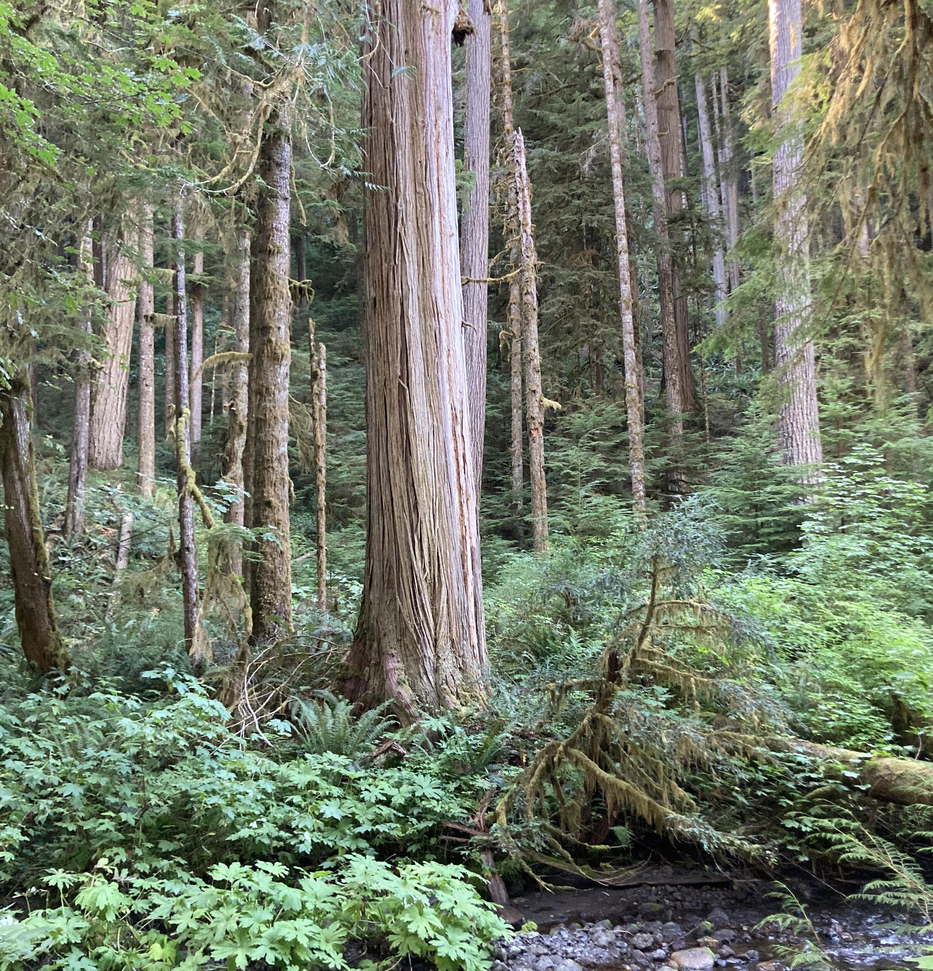
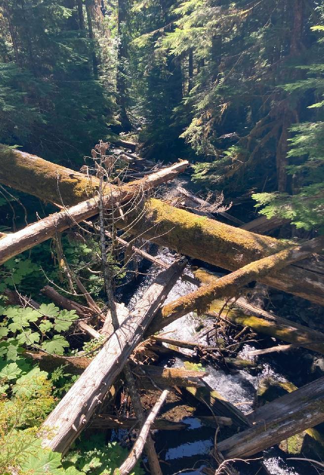
Figure 1. Opposite: Old growth forest on the Little River Trail that could connect to Olympic National Park to a Valley Creek Watershed trail system
Overview
What is this project about?
2 Overview
CITY OF PORT ANGELES
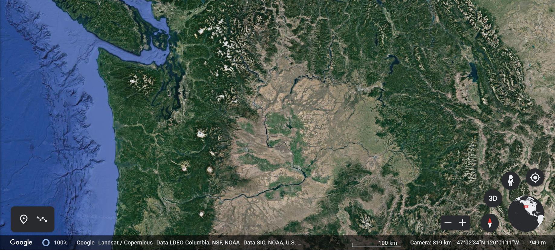
This watershed planning process, called GreenLink Port Angeles, was funded through a National Estuaries Program grant in 2018 that was coordinated by Futurewise in partnership with the City of Port Angeles and was initially intended to identify potential GSI projects that offered overlapping, co-benefits to water quality, habitat, and other community assets like walkability across multiple city watersheds. A GreenLink Advisory Committee (GLAC) comprising local, environmental experts, tribal representatives, and stakeholders helped guide the evaluation of project options using a holistic, data-driven approach informed by input obtained from community outreach. Conceptual project designs were assessed based on the opportunities to provide co-benefits to ecological health and quality of life. Ultimately, the GLAC decided to focus on restoring lower Valley Creek as a starting point. If proven successful, it is hoped this planning approach will be used as a template that is replicated in the other watersheds of Port Angeles and beyond.
PEABODY CREEK
3 Overview N
PORT ANGELES HARBOR
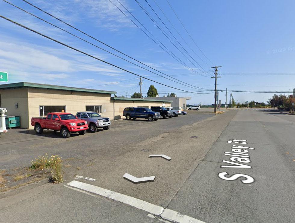
Figure 3. Valley Creek Watershed
PORT ANGELES TUMWATER CREEK VALLEY CREEK
Valley Creek Watershed
Valley Creek
LEGEND


Creating a vision for Valley Creek
The overlapping goals of restoring ecological health to Valley Creek while improving community quality of life, supporting economic development goals, and maintaining a connection to the area’s deep tribal history are not only achievable, but in the best interest of the community. The Vision intends to ensure that the community derives the greatest possible benefit from this shared asset and that the resources under their purview are cared for appropriately. Community input will further help shape these ideas and determine a final plan.
4 Overview
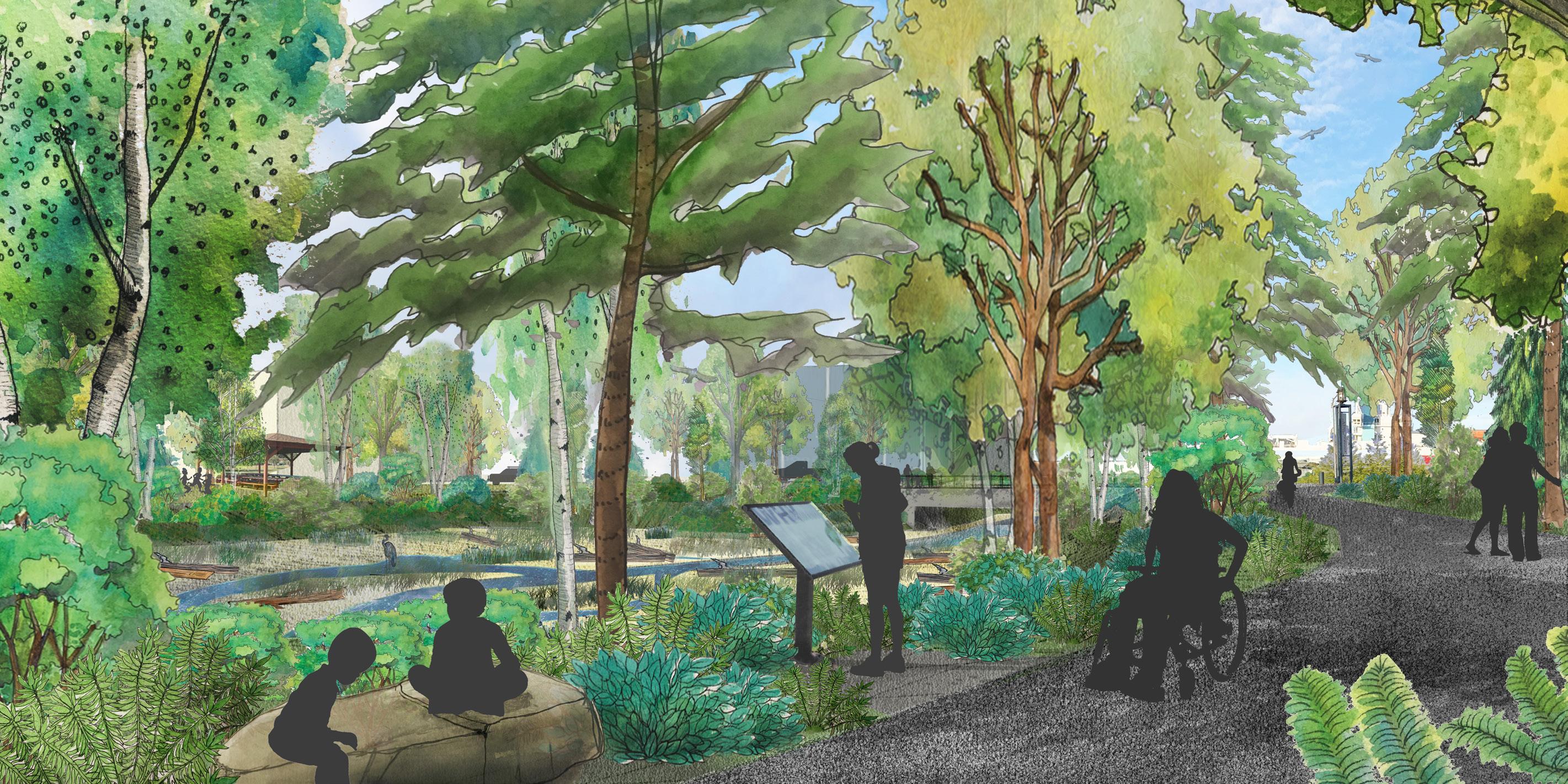
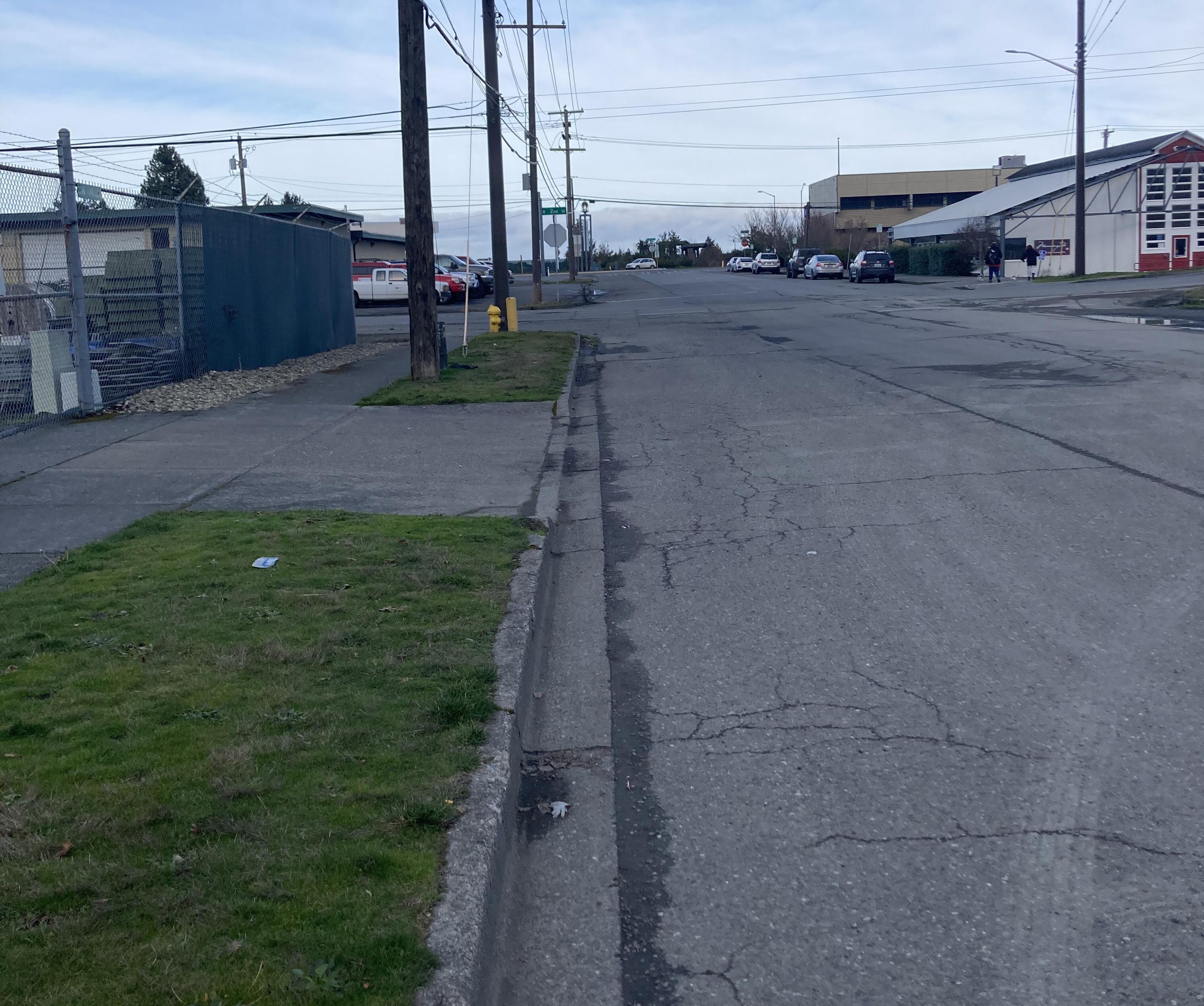
Figure 4. Current view from the fully paved intersection of South Valley Street and West 2nd Street looking towards Valley Creek’s end and the Port Angeles Harbor beyond
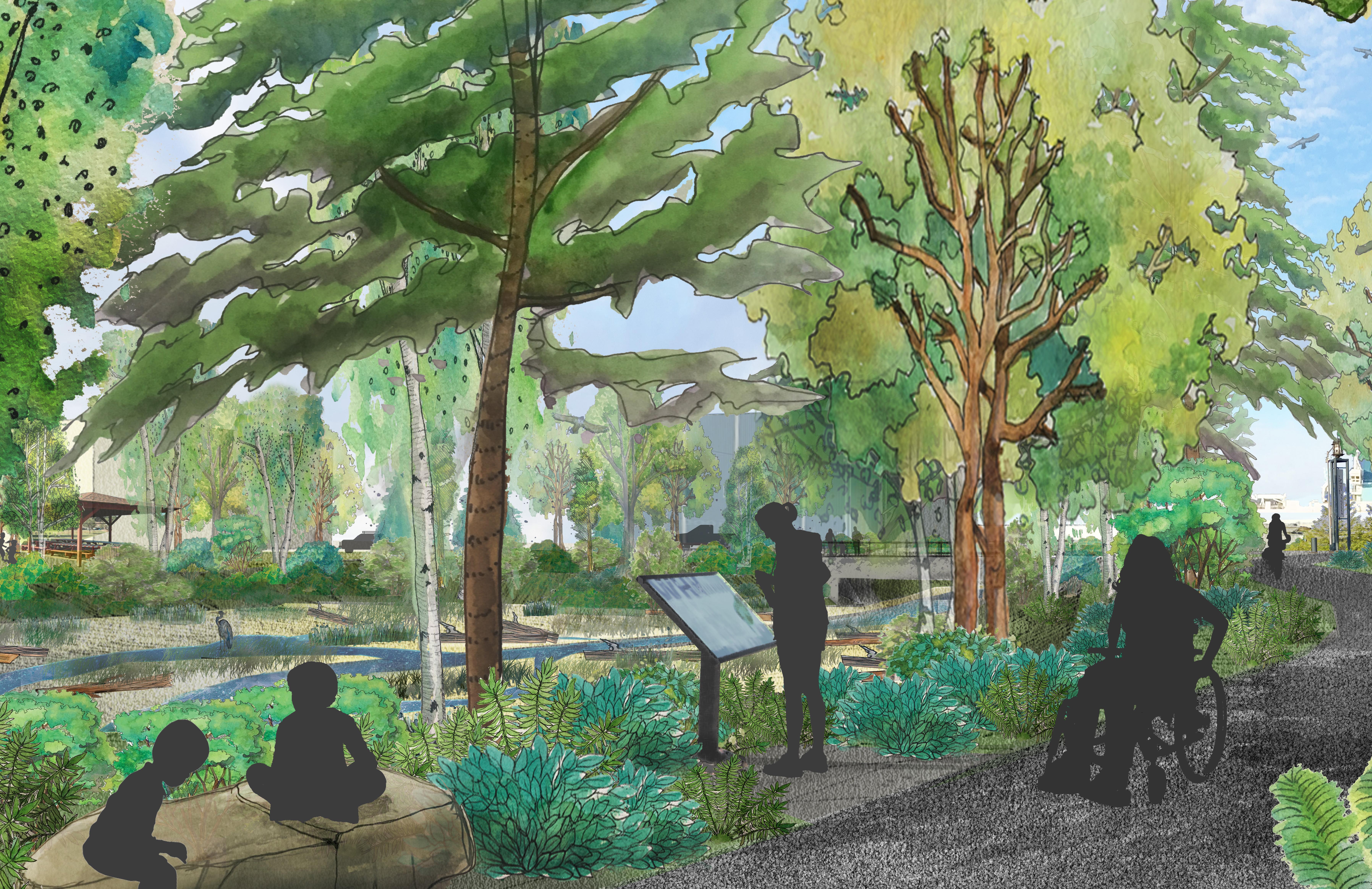
Figure 5. Rendering of the potential view, including a lush greenscape with trails for community members and visitors to access nature and appreciate the unfettered beauty of Valley Creek
What a Valley Creek Stormwater Park could look like…
KEY MAP
ROUNDABOUT WITH RAIN GARDEN SCULPTURE
RESTROOMS
COVERED MEETING AREA PICNIC AREA
VALLEY CREEK TRAIL
W2ndSt
CONNECTION TO ESTUARY PARK TRAIL
FORESTED BUFFER
VALLEY CREEK
LOOKOUT POINT PASSABLE CULVERT
W2ndSt
FISH PASSABLE CROSSING OVER VALLEY CREEK Marine
W1stSt


Dr
N
The Case for Restoration: Why Does it Matter?
Failing Ecosystem Has Broad Impacts
Declines in fish populations, contamination of soils and water, climate change, and other ecosystem damage not only threaten the perpetuation of ancient cultural practices and tribal sovereignty but the health and quality of life for all people and wildlife. None of us are free from the risks of the dioxin contamination left by the Rayonier Mill at the former site of the Klallam Village ʔiʔínəs at Ennis Creek, or the contamination in the soils surrounding lower Valley Creek. This contamination is likely leaching into the groundwater and needs remediation to prevent it from spreading towards the estuary and the Strait of Juan de Fuca.
Large swaths of uninterrupted pavement currently cover the entire lower watershed and as a result, the area is unsightly and ecologically nonfunctional. Animals no longer have access to the shoreline and marine-derived nutrients they require. The ailing riparian buffer at the outlet park is only 50 feet wide as opposed to the recommended minimum 250 feet for Priority Species. In other locations, there is no buffer and the roadway is crumbling into the creek delivering sediment and contaminants directly to the water and fish. People and wildlife are at risk from predicted increases in temperatures and flooding in urban areas from climate change, which, exacerbated by impervious surfaces and a lack of shade, are likely to become increasingly problematic for the growing numbers of people that will be living and working downtown.
These worsening extremes in temperature and hydrologic regimes caused by climate change alter growing cycles and otherwise stress vulnerable species. Removing pavement and adding vegetation will provide cooling shade, refreshing green space, modulate and filter rainwater and road runoff, and extend the functionality and aesthetics of this high-profile location. Fish and wildlife need
6 Overview
Figure 7. View looking north on South Valley Street, where the roadway overlays the Valley Creek culvert system
immediate relief from the mounting pressures of climate change and cannot afford to wait until conditions have further deteriorated, lessening potential for recovery. Some experts recommend prioritizing restoration of the healthiest creeks, thereby increasing the odds of success. Valley Creek is under duress but not among the most severely damaged systems in Port Angeles and recovery is still possible. The time to act to enhance the creek’s climate resiliency is now.
Inaction Threatens Treaty Rights
The Klallam people successfully stewarded Valley Creek for thousands of years and the salmon foundational to Klallam culture were abundant in all six of the creeks running through the area now known as Port Angeles. The once carefully managed lands of the Klallam people have been intensively used, manipulated, and damaged, to the extent that several species of the treaty protected fish have been extirpated from Valley Creek and these other Systems.
These impacts are part of a larger, repeating pattern destroying fisheries and the broader ecosystem, and the cumulative effect of these losses imperils tribal treaty rights and the lifeways they were intended to protect. Winter steelhead, once present in Valley Creek, is listed as “threatened” under the Endangered Species Act (ESA), and this status is currently being considered for a change to “endangered”. Miles of upstream habitat in Valley Creek are inaccessible to this and other struggling species due to improperly designed culverts.
Among the many relevant components of the United Nations Declaration on the Rights of Indigenous People, Article 29 states that “Indigenous peoples have the right to the conservation and protection of the environment and the productive capacity of their lands or territories and resources.” And in Article 24, “Indigenous peoples have the right to their traditional medicines and to maintain their health practices, including the conservation of their vital medicinal plants, animals and minerals.”. Clearly, we are not close to meeting these standards in Port Angeles.
A precedent was set when Treaty Tribes sued the State of Washington and won, requiring the repair of thousands of barrier culverts limiting anadromous fish access to upstream habitat. Though local jurisdictions were not included in the lawsuit, this case demonstrates that city-owned culverts like those found in Valley Creek are a liability that must eventually be fixed. The City of Port Angeles (City) has a rare opportunity to be proactive and optimize the potential of this inevitable requirement and expense by identifying and prioritizing multi-benefit solutions to increase the value of interventions taken and provide the biggest “bang for the buck.”
Environmental Justice
These impacts to the environment disproportionately affect lowincome households and Black, Indigenous, People of Color and other historically marginalized groups. The soil contamination, loss of fish, and other ecological problems in Valley Creek are environmental justice concerns and need to be considered and addressed accordingly.
7 Overview
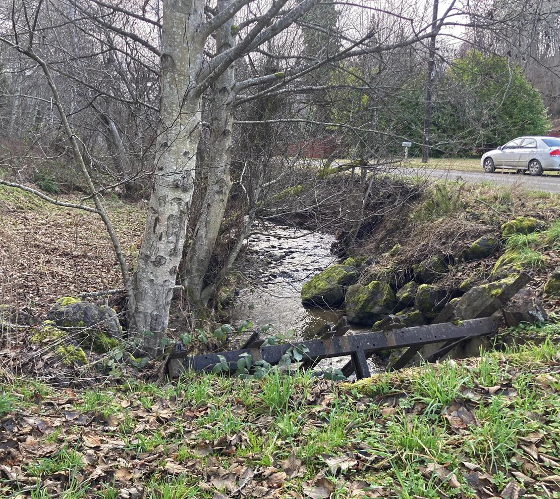
Figure 8. Riprap at inlet to Lower Valley Creek culvert system, adjacent to South Valley Street
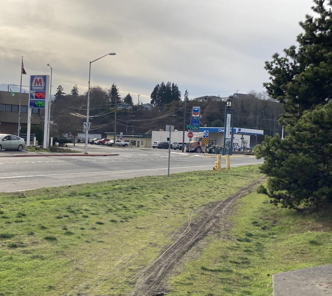
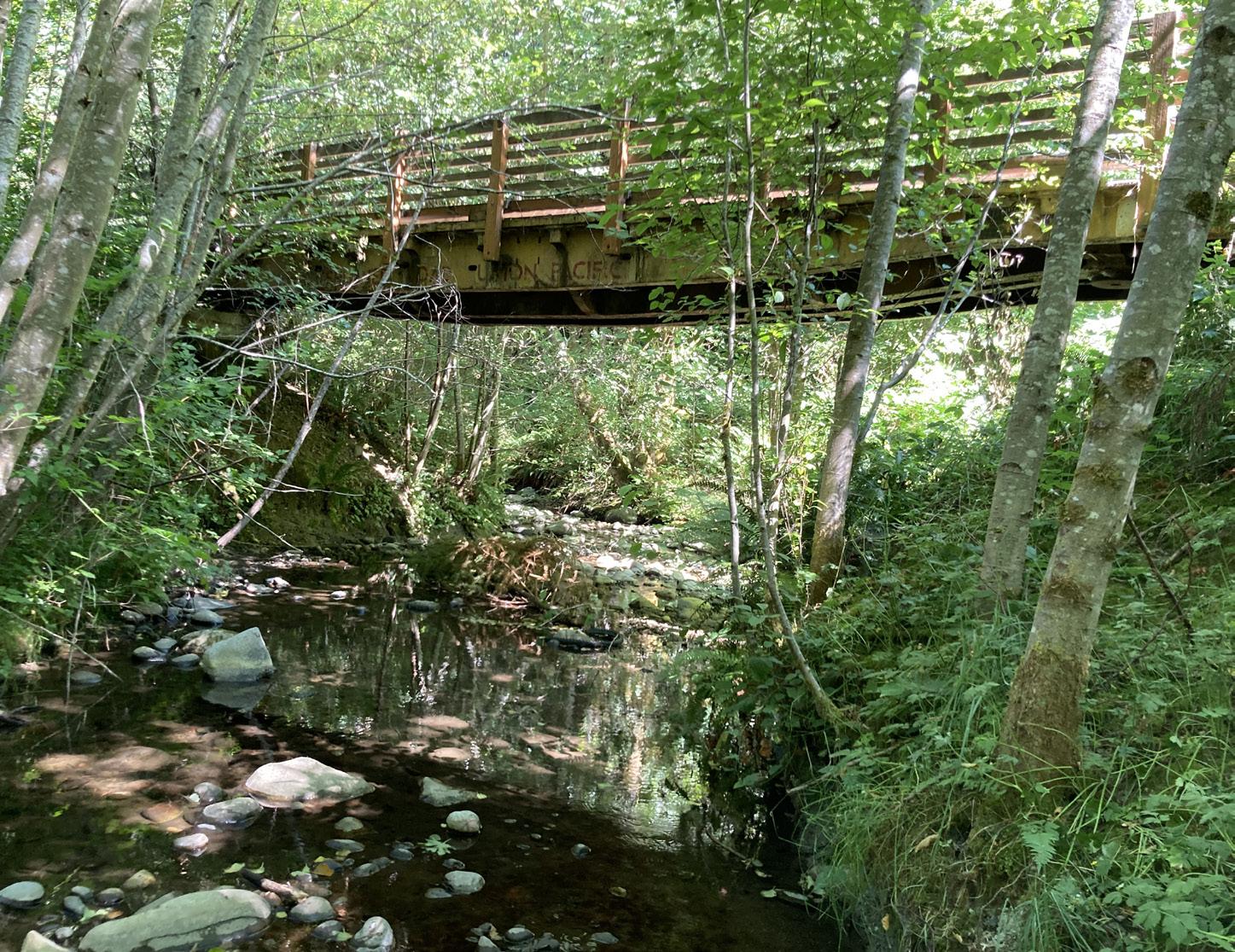
Figure 9. Current view of the Valley Creek Daylighting Project area from the Valley Creek Estuary Park and Olympic Discovery Trail
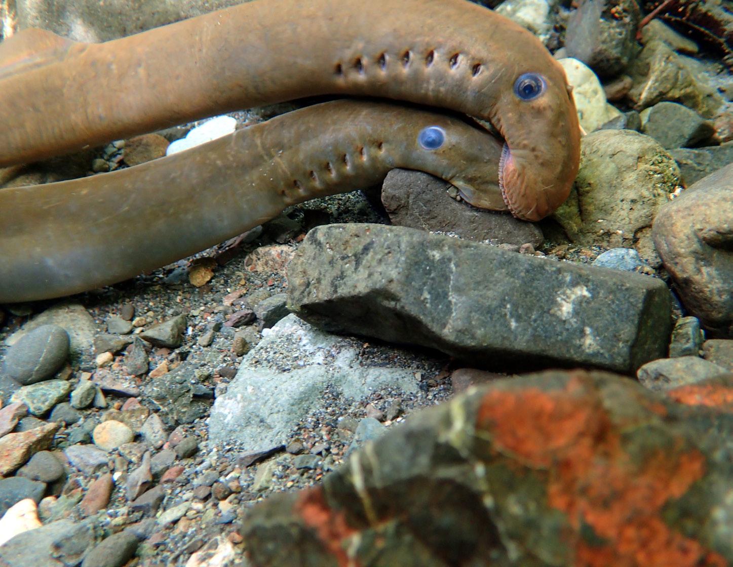
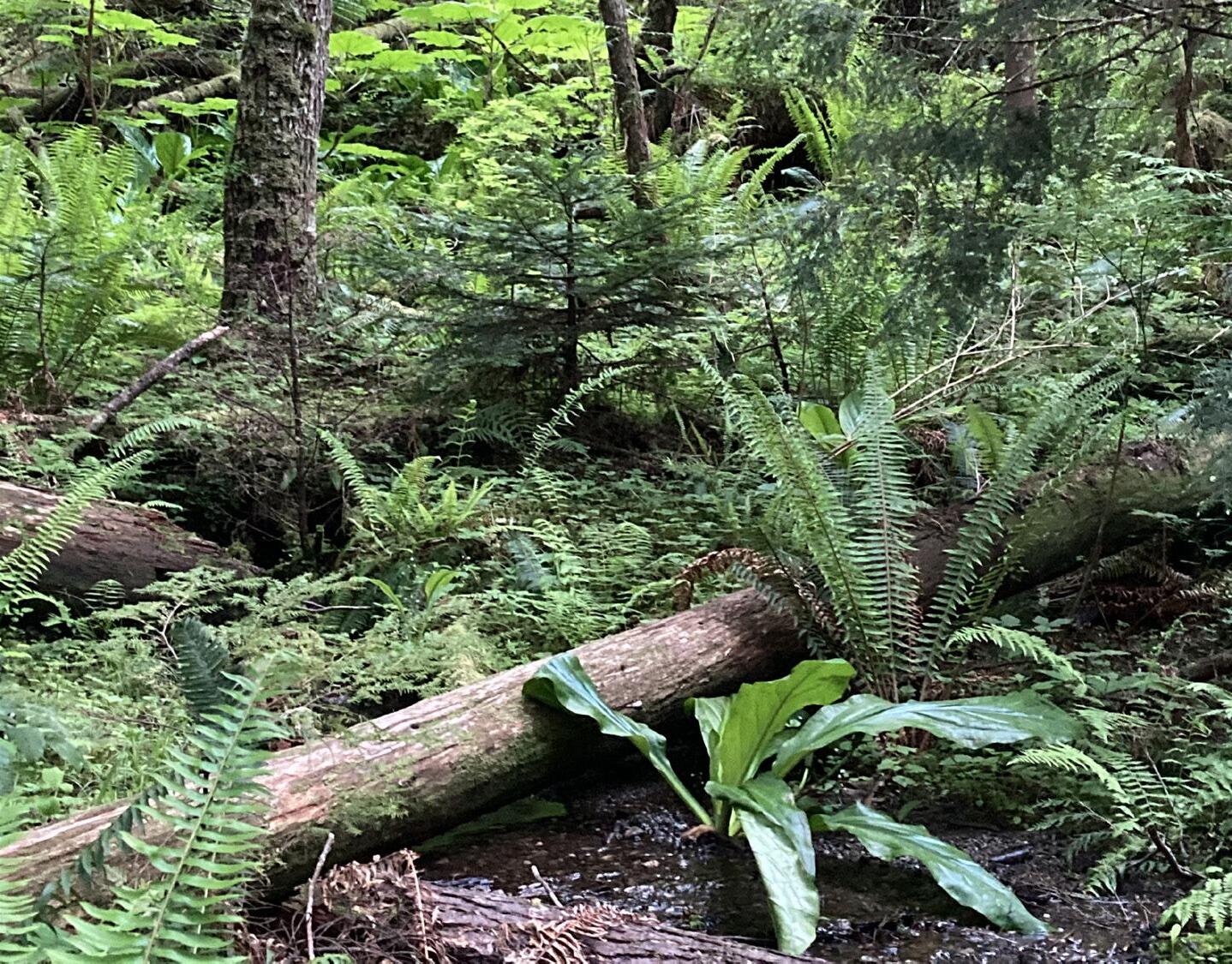
Project Goals
The Master Plan highlights goals for the Valley Creek Watershed that are based on restoration and management recommendations originally made by the Lower Elwha Klallam Tribe and the Valley Creek Committee, and further developed through the GreenLink planning process (see “Greenlink Planning Process” on page 65). The same categories of water quality, habitat, and community assets used to evaluate the potential GreenLink projects became the basis for the preliminary overarching watershed management goals guiding the development of this document and were approved by the GLAC. The following goals can be adapted and adjusted as needed based on further community input. Note that there will be more specific goals for component projects.
Overarching Goals
1. Improve stormwater management
2. Address other water quality issues
3. Preserve and restore habitat
4. Enhance recreational access and use
5. Provide educational opportunities
6. Provide social benefits
7. Support economic vitality
8 Overview
Figure 10. Valley Creek trails (pictured) would link downtown to Olympic National Park and potentially Peabody Creek
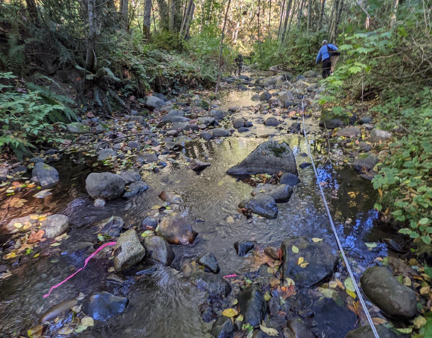
Figure 11. Streamkeepers of Clallam County water quality monitoring on Valley Creek
Figure 12. Restoring passage on Valley Creek for all species of fish
Figure 13. Habitat is diverse, robust, and healthy
Specific Targets
These vetted, high-level goals, established by the Lower Elwha Klallam Tribe and Friends of Valley Creek Committee (see Appendix A and B), have been further refined by the Greenlink Advisory Committee (GLAC) into the following more specific targets.
Water quality is excellent - problems are identified and potential solutions proposed and pursued ex. known septic issues
Stormwater is managed effectively with GSI, Best Management Practices (BMPs) and possibly a stormwater park
Habitat is preserved, restored, and connected
Riparian and instream function and ecological health are reestablished- see Appendix A and B
Unimpeded passage is provided for all species of fish at all stages of life
Creek is daylighted and meandering
Invasive species are managed and controlled
Robust vegetative buffer lines the entire length of the stream
Opportunities for education and interpretation are incorporated throughout the project planning and design
Recreational opportunities and expanded community access to greenspace
Trail systems link downtown to Olympic National Park and potentially Peabody Creek
Facilities improve visitor experience - may include: restrooms, managed camping, outdoor classroom, viewing platform, signs, seating, storage lockers, and bike racks
Facilities, including lower trail and interpretive elements, are compatible with the Americans with Disabilities Act and inclusive wherever possible
Multi-benefit GSI projects are incorporated throughout (GL model: habitat, WQ, and community assets)
Houseless population interaction is managed with compassion and dignity
Social, economic and ecological benefits of this undervalued community asset is maximized
Tribal perspectives and cultural natural resource management recommendations are considered and incorporated whenever possible
Downtown aesthetics are improved, zones of use are decipherable
Sculpture and other art is included in the design (possibly Indigenous)
Access and circulation for vehicles, pedestrians and wheelchair user is improved
9 Overview
Improve stormwater management Address water quality issues Increase habitat restoration Enhance recreational uses Enhance educational opportunities Improve social conditions
Why now?
The Community Supports Restoration
Interest in restoring Valley Creek began in earnest with the creation of the Valley Creek Estuary Park in 1997 and has remained strong for over thirty years. Several restoration projects and other significant community investments Valley Creek have demonstrated a long term commitment to correcting the watershed management missteps made over 75 years ago that still impact us today. The rapid deterioration of the broader ecosystem has only increased the urgency and will to take action.
More than a dozen local planning documents call for the restoration of the Valley Creek Watershed, including (see Appendix C for complete list of planning documents referencing restoration):
• City of Port Angeles Capital Facilities and Transportation Plan 2022-2027
• City of Port Angeles Comprehensive Plan (2019)
• Harbor Resources Management Plan (2011)
Inspiration and direction on the vision for Valley Creek has also come from the Port Angeles Waterfront Art Framework Plan (2011), the Regional Open Space Conservation Plan (2018) and other publicly funded planning efforts.
Culvert Case
The Treaty Tribes successful lawsuit against the State of Washington to repair culverts impeding fish passage was precedent setting and demonstrated that these culverts are a liability and must be repaired. Local jurisdictions will eventually have to address their barrier culverts. By taking a proactive approach, Port Angeles can shape the outcome of this inevitable requirement to provide the greatest possible benefit to the community and the watershed from this investment.
Restoration Funding is Feasible
With passage of the federal Infrastructure Bill and the availability of other new funding sources, there is unprecedented amounts of money available for tackling the Valley Creek Daylighting and Watershed Projects. Action must be taken now to ensure that Port Angeles is able to take advantage of and benefit from these opportunities to address issues of long standing community concern Another factor spurring timely implementation is that since the idea of restoring lower Valley Creek was first proposed,construction costs have risen dramatically, a trend that is anticipated to continue.
Relationship to Other Plans
Several new residential and public facilities are being developed near lower Valley Creek. Without active intervention, this prime downtown location will remain an unsightly bookend to the neighboring revitalization efforts underway, potentially detracting from these substantial investments. Enhanced aesthetics downtown would support this extensive redevelopment activity, increase the draw for visitors, and establish a visual delineation and screen between the retail core and nearby industrial activity.
Restoration of Valley Creek aligns with the Port of Port Angeles’ (Port) commitment and responsibility to effectively manage the Critical Areas on their property and the Valley Creek restoration can be coordinated with the development of the Marine Trade Center for maximum efficiency and the greater likelihood of a favorable outcome. Activities occurring in the Port’s Maintenance Annex are not site dependent and could be moved if a comparable location can be found. The current site could instead provide ongoing mitigation for the Port’s planned Marine Trade Center.
10 Overview
Master Plan
When conducting background research during the project vetting process, some associated records were difficult to access or at risk of being lost. The need to document and integrate this past work with current plans became evident, as did the need for a way to conceptualize and convey the shared vision for the future. By creating a record of the work that has brought us to this point, we can prevent duplication of these efforts and further taxation of limited resources. This efficiency will support forward momentum and the likelihood that this important work will be carried into the future.
The Valley Creek Master Plan (Master Plan) is a tool to support ongoing planning and project development to restore health and vitality to the Valley Creek Watershed. It provides a framework to help prioritize and sequence the connected projects and components and makes it easy for those planning within the Valley Creek Watershed to understand what has transpired and where we hope to go while providing a mechanism for adding new contributions to the record. This plan also supports the City of Port Angeles’ National Pollution Discharge Elimination System Stormwater Action Plan being developed for the Valley Creek. This Master Plan will provide a useful starting point for the extensive outreach and community conversations that will be needed to advance this effort to realize the full potential of the Valley Creek Daylighting and Watershed Projects. It is expected that input from the community will continue to shape and strengthen the vision for Valley Creek
Topics are explored and recommendations provided throughout the document in support of the overall vision. The Master Plan will provide a useful starting point for the extensive outreach and community conversations that will be needed to advance this effort to realize the full potential of the Valley Creek daylighting and watershed projects. It is expected that input from the community will continue to shape and strengthen the vision for Valley Creek.
Document Organization
Intended as a flexible living document, the Master Plan can be adapted through time as information becomes available and community conditions, perspectives, and goals change. We have tried to tell the story of Valley Creek here and, while we recommend reading the entire plan, we hope that this document can also be referenced by section as needed.
The Valley Creek Master Plan is organized as follows:
• Overview - Project background, the case for restoration, overarching project goals, the vision, and the master plan
• Context - Summarizes the extensive background research done on Valley Creek, and includes history, community information, infrastructure, and environmental information.
• Greenlink Planning Process – Planning process overview, feasibility assessment, and creek routing alternatives.
• The Vision for Lower Valley Creek - Creating the vision, planning recommendations, and other projects proposed for the Valley Creek Watershed.
• Appendix
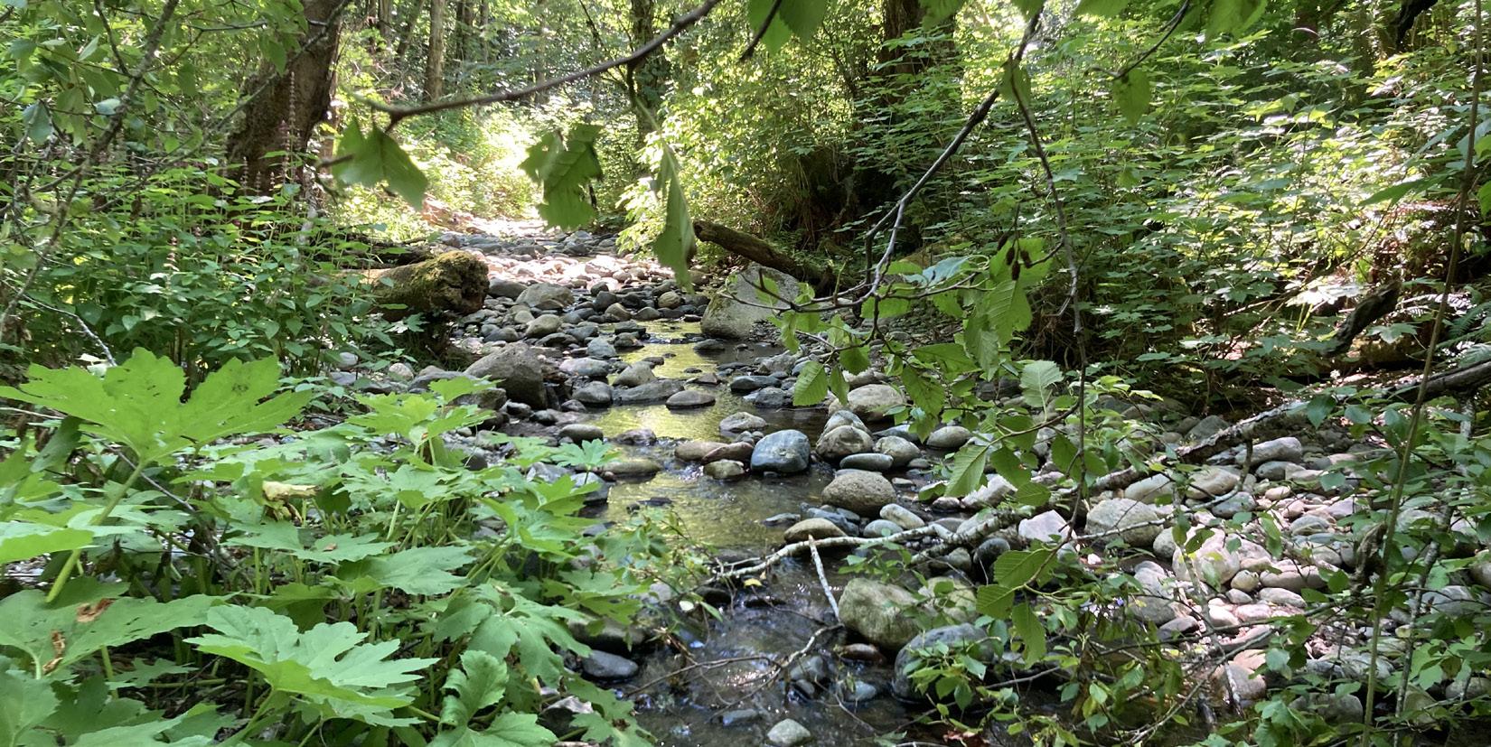
This Master Plan is a:
• Planning framework for synthesizing, updating, and building upon previous work
• Reference for existing background materials and research
• Cohesive, high-level vision for the future that strikes balance between substance and accessibility
• Outward-facing public outreach document to be used for soliciting community input, seeking funding, and more
• Tool to assist with project prioritization and phasing, and the identification of future projects
• Flexible, living document that can be adapted and updated through time as needed
The Master Plan is not:
• An in-depth scientific study of creek conditions and mitigation recommendations
• New scientific research
• An exhaustive record of the existing relevant background information
11 Overview
Figure 14. Valley Creek above Highway 101
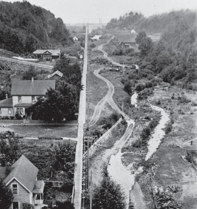
Figure 15. Opposite: Valley Creek, date unknown. Source: photo courtesy of North Olympic History Center, 2023
Context
Context - Watershed Overview
Watershed Overview
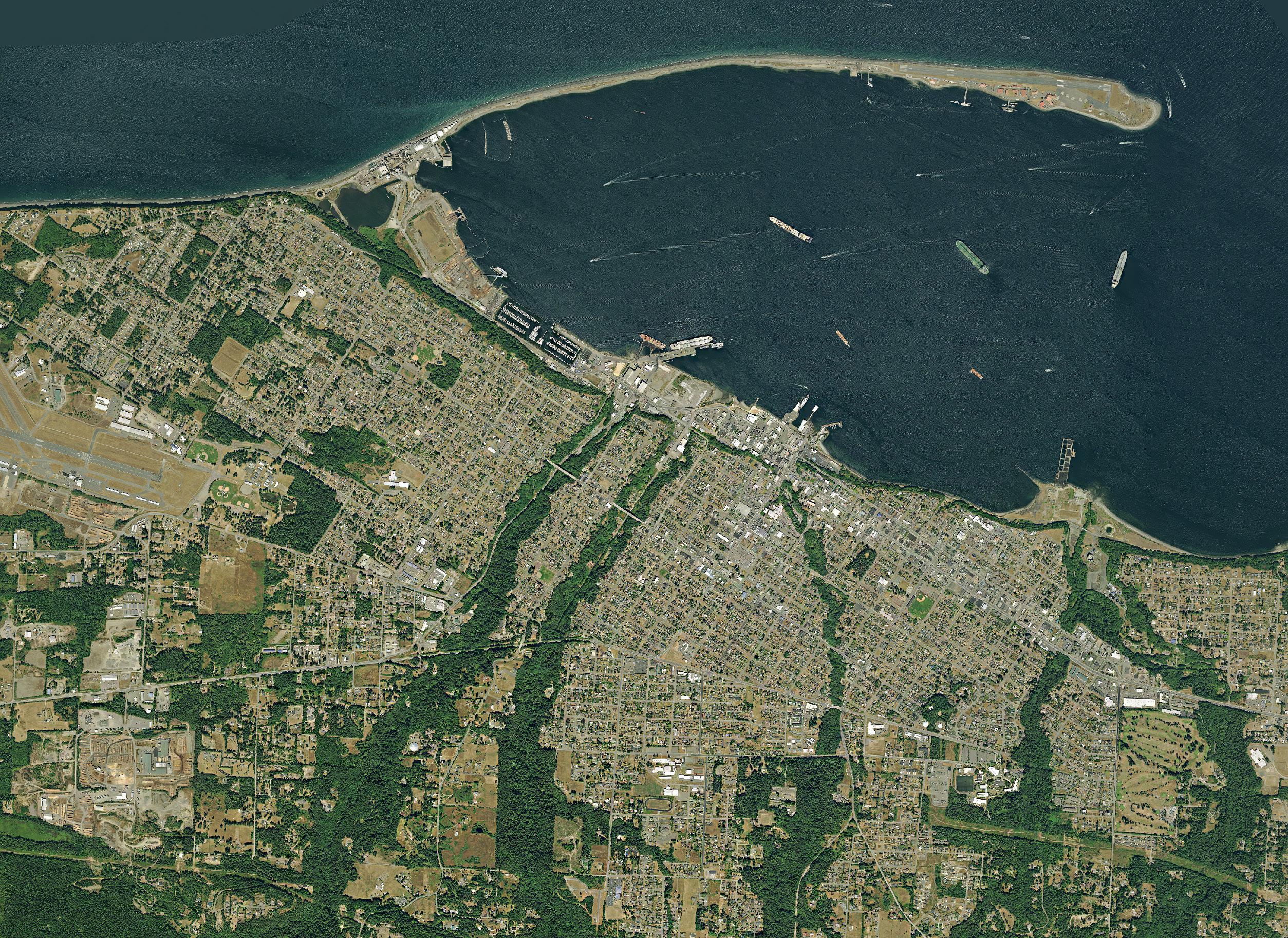
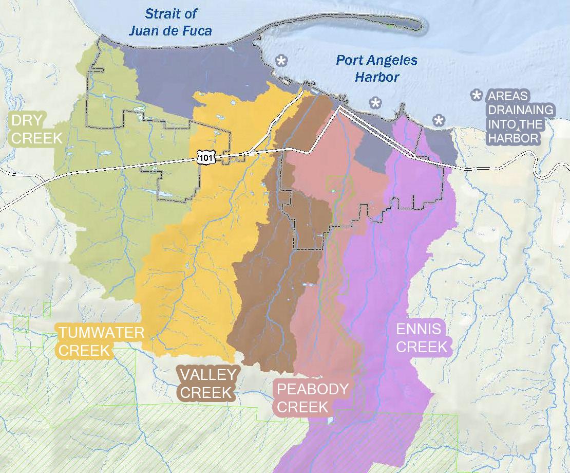
The Valley Creek basin is a 4.2 square mile sub-watershed (see Figure 17) of the larger Port Angeles Watershed, located in Water Resource Inventory Area 18 in Clallam County on the North Olympic Peninsula of Washington (see Figure 16). Valley Creek originates just north of the boundary of Olympic National Park at an elevation of 2,200 feet, in the forested timberlands of the Olympic Mountain Foothills before flowing 4.9 miles north through a series of varying landscapes and emptying into the marine waters of the Strait of Juan de Fuca. Three major tributaries enter Valley Creek along the route to Valley Creek (see map to right): Mill Creek, also called East Valley Creek, less than 0.5 miles south of HWY 101, an unnamed .5 long tributary at river mile 2.5, and a .8 mile long tributary at river mile 1.15.

 WRIA 18
LEGEND
Figure 16. Water Resource Inventory Area 18
Figure 17. Port Angeles Watershed. Source: ESRI, Garmin, NOAA, NGDC & other sources
In the Lower Watershed, Valley Creek flows through culverts under several paved city blocks starting from South Valley Street at West 6th Street to the outlet at the restored semi-naturalized Valley Creek Estuary Park on the Strait of Juan de Fuca. The area adjacent to and above the estuary is characterized by intense urbanization and industrialization. Port facilities, gas stations, an apartment building, offices, and other businesses occupy this area and heavy east-west vehicle traffic intersects the site.
The creek in the Lower Middle Watershed, south of West 6th Street, is highly altered and channelized and bound by residential properties on both sides. There is minimal to no riparian buffer and the existing vegetation is dominated by deciduous trees and invasive species, and residential neighborhoods on both sides. Towards the north end of South Valley Street there are some businesses and light industry. At the south end of South Valley Street is a semi-natural forested area and an unnamed recreational trail that runs along the creek and dead ends below the large culvert crossing under Highway 101. Residential neighborhoods line the ridges above the creek drainage and riparian forest here. (Entrix Inc.)
In the Upper Middle Watershed, the creek is more natural with a substantial riparian buffer of mature, second growth, coniferous forest protecting the creek from the residential neighborhoods that line the ridges above the drainage. These watershed neighborhoods become increasingly less dense the further south they are. The Verne Samuelson Trail runs along this section from Highway 101 to Wellman Road.
The Upper Creek Watershed is mostly managed for timber by the Washington Department of Natural Resources (DNR) State Lands, and is now a mosaic of forests of different ages and the associated logging roads. There has been recent clearcutting in the headwaters of Valley Creek where no riparian buffer was left. Over the ridge line (a 1/4 mile or less), to the south of the Valley Creek headwaters, is the Little River Road that can be used to access the Little River Trail head to Hurricane Ridge or the Heart of the Hills in Olympic National Park.
NLower Watershed
Lower Middle Watershed
Upper Middle Watershed
Upper Creek Watershed
15 Context - Watershed Overview
PORT ANGELES HARBOR TUMWATER CREEK
PEABODY CREEK
VALLEY CREEK
LEGEND
Figure 18. Watershed Overview
Culvert Case
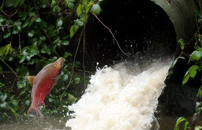
In 2001, Treaty Tribes sued the State of Washington to repair the thousands of culverts blocking anadromous fish passage access to thousands of miles of critical upstream habitat. The Tribes won and as a result, the State of Washington is funding much of the resulting culvert work, however no mechanism was created for funding these repairs at the local level where the need is high. With the precedence of the culvert case, it is probable that financial assistance will eventually have to be made available to local jurisdictions to address their fish barriers.
Tribal Co-Governance and Co-Management
The full potential of the Valley Creek Watershed projects can only be realized with the input and guidance of the tribes that have made the North Olympic Peninsula their home for thousands of years. This unique relationship to the landscape is further affirmed through treaties with the US Government that impelled tribes to cede vast areas of their ancestral homelands.
The signatories of these treaties acted only with the understanding that they reserved the right to hunt, fish, and gather in their Usual and Accustomed areas (U&A). These tribes are federally recognized sovereign nations with a government-to-government relationship and status with the United States. Consequently, Treaty Tribes have co-government and co-management rights over treaty protected “resources” that fall within their U&A hunting, fishing, and gathering areas. The role of co-governors and managers is therefore fundamentally different from that of “stakeholders”.
Recommendations:
• Expand tribal outreach and engagement efforts beyond the legal requirements
• Incorporate tribal perspectives and recommendations throughout planning to the extent and in the manner determined by interested tribes
• Plan to offer financial support for tribal participation
The S’Klallam people signed the Point No Point Treaty in 1855 ensuring in perpetuity their rights to the treaty-protected resources foundational to their ways of life. The Valley Creek Watershed lies within the U&A hunting, fishing, and gathering areas of the Lower Elwha Klallam, Jamestown S’Klallam Tribe, Port Gamble S’Klallam Tribe and Suquamish Tribe (Treaty of Point No Point, 1855 | GOIA, n.d.). The ecological unraveling and precipitous decline of many species of salmon, plants, and animals, such as those found in the Valley Creek Watershed, is a threat to these treaty rights and the cultural survival of the people who are reliant upon them. As a result, a combination of laws and executive orders, including Section 106 of the National Historic Preservation Act, dictate that affected tribes must be consulted throughout a project, from planning to implementation (Tribal Consultation Information, 2023). The State of Washington affirms the federal treaty rights and government-to-government consultation requirements and proper tribal consultation that is early, robust, and in accordance with tribal protocol, is a requirement of state funded projects (Tribal Consultation Information, 2023)
16
Context - Co-Governance and Co-Management
Figure 19. Salmon attempting migration up an undersized, perched culvert. Source: Meegan M. Reid/Kitsap Sun via AP, 2019)
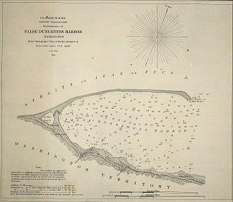
Figure 20. 1853 Nautical Map of False Dungeness showing people living at the Valley and Tumwater Creeks. Photo courtesy of the North Olympic History Center, 2023
Time Immemorial
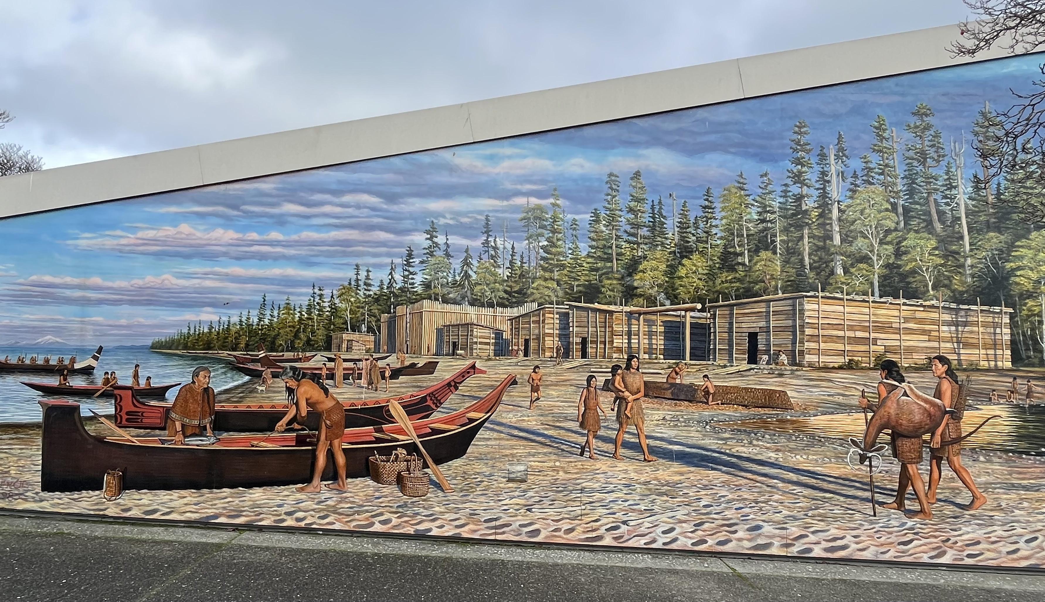
From the Hoko River in the west to the Puget Sound in the east for many thousands of years, villages were found on both sides of the Strait of Juan de Fuca. Downtown Port Angeles was once a thriving Klallam village known as č’ixwícǝn (Tse-whit-zen) in the Klallam language (Lower Elwha Klallam Tribe, 2019). To the east, was the village of ʔiʔínəs at the mouth of what is now called Ennis Creek. A 1853 hydrographic survey of Port Angeles Harbor, formerly known as “False Dungeness” by early European explorers, indicates that people were living in the vicinity of the outlets of Tumwater and Valley Creeks then (see Figure 20). This site is likely buried under 10-20 feet of fill used to build up the waterfront over the tidal flats (Sargent, 2022). There were also seasonal camps on the harbor as it was a regional tribal trading hub and people from other tribes would stop here on longer journeys.
Marine and riverine environments were the base of economic activities of the Klallam people. They were skilled fishers, hunters, and gatherers with an abundance of knowledge of locally available resources (Baldwin et al., 2022). Many culturally important plants are documented to have grown throughout the area that is now Port Angeles including páʔqɬč (maple), ocean spray, páʔqɬč (maple), púʔqʷɬč (devils club), qáʔəxʷ (Pacific crab apple), táqaʔ (salal berry), and ʔəlíluʔ (salmonberry) (Lane & James, n.d.). Norman Smith, who arrived in Port Angeles in 1861 as a child when his father became the Custom House attendant, gave the following description of the wealth of food available:
“Old Hunter came with venison. He is the only real nimrod of the tribe. The others just paddled their canoes around the bay, catching salmon by trolling around the point of the spit that formed the harbor, or catching halibut on the halibut grounds at Morse Creek, or spearing the great hard shelled crabs that swarmed all over the bottom of the bay. They were the most delicious of the seafood of this paradise for fishermen or hunters of big game, such as deer, bear, elk, mountain lions and wolves.” (Smith 1950:36)” (Lane & James, n.d. European Settlement and Forced Removal of Klallam People)
17 Context - Co-Governance and Co-Management
Figure 21. Pre-Contact Klallam Village at ʔiʔínəs (Ennis Creek), mural at Hollywood Beach in Port Angeles
Context - Co-Governance and Co-Management
Cultural Ecosystems
A common misconception is that Indigenous people of North America did not actively manage the landscapes on which they depend. According to the Jamestown S’Klallam Tribe’s website “Cultural Ecosystems” are those that incorporate people and require their intervention to thrive and the “S’Klallam Tribes have cultivated ecosystems of the North Olympic Peninsula, Whidbey, San Juan and Vancouver Islands since time immemorial. These ecosystems range from mountain meadows, and prairies to wetlands and beaches.” (Yəhúməct Traditional Foods & Culture, n.d.-d). There may be Indigenous management strategies that should be adopted or reinstituted in Valley Creek to ensure that the cultural benefits of this ecosystem is also restored
Recommendation:
• Incorporate tribal management recommendations into watershed planning processes to promote the perpetuation of cultural landscapes and healthy ecosystems
18
1300 1200 1100 1000 900 800 Time Immemorial
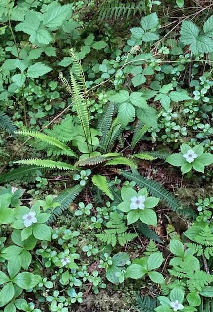
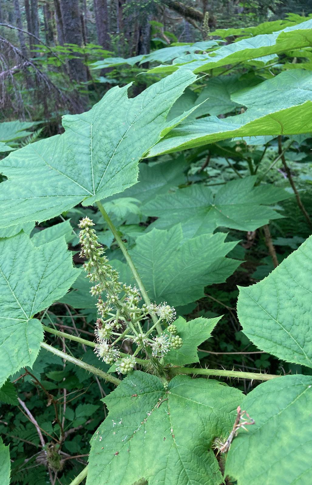
Figure 22. púʔqʷɬč (devils club) and downed trees left to shade a creek (left) and native groundcover (right) are part of the cultural ecosystem
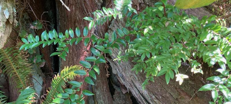
Figure 23. yéʔxəm (evergreen huckleberry)
Epidemics
Though we don’t know when introduced diseases first began affecting the population size of North America, between the late 1700’s and 1800’s multiple epidemics ravaged the Klallam and other tribal communities along the northwest coast. Scholars estimate that these epidemics killed up to 90% of the population of some places (Woodward, 2019). In 1862, a horrific disregard for the lives of Indigenous people living in Victoria, British Columbia led to a preventable smallpox epidemic that killed thousands of people and was needlessly spread to Indigenous communities throughout the region (Lange, 2003). A smallpox census in 1862 documented a population of 1300 Klallam people but in the 1878 census only 597 Klallam are listed. Some Klallams left Port Angeles around this time as well. These reductions in population coincided with the beginning of settlers making claims to Klallam territory, undoubtedly reducing tribal resistance and helping facilitate the ongoing transfer of land from Indigenous ownership.
19 Context - Co-Governance and Co-Management 1700 1600 1500 1400 1800 1900 2000 Colonial Watershed Management Era Expanded Colonial Watershed Management Era timeline on next page
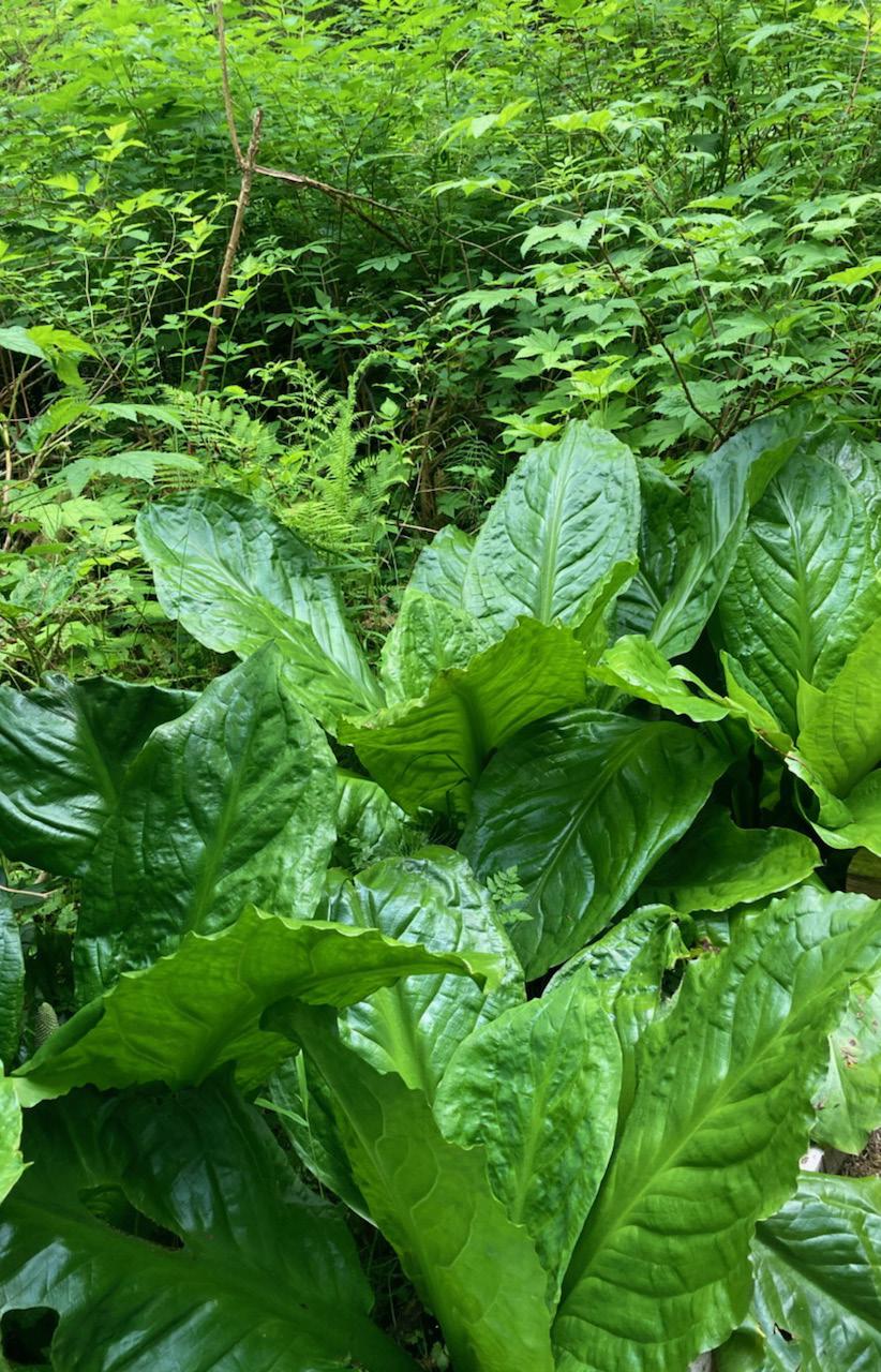
Figure 24. púʔqʷɬč (devils club) (left) and skunk cabbage (right)
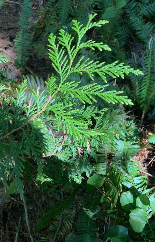
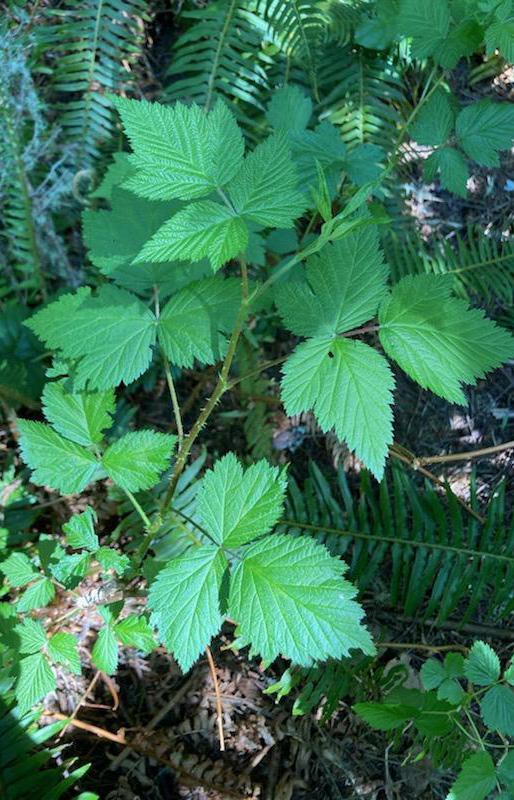
Figure 25. xpáy (Western red cedar) with salal (left) and ʔəlíluʔ (salmonberry) (right)
Context - Co-Governance and Co-Management
Colonial Watershed Management Era
1788“Robert Duffin encounters Klallam Indians at Discovery Bay “ *
1791 –”Spanish navigator names Port Angeles ‘Nuestra Senora de los Angeles’” *
1848 –“Measles and dysentery epidemic” *
1851-53“Indian Appropriations Act of 1851, creates the reservation system, authorizes the US Government to ‘negotiate with Indian tribes to extinguish title to their lands so that citizens of the U.S. could settle these lands.’ Washington Territory established” *
1855“Point No Point Treaty signed” *
1857-59“First settlers in Port Angeles” *
1862-1865 –Relocation of United States Custom House from Port Townsend to Port Angeles (Baldwin et.al. 2022)
1875 –“Smallpox epidemic” *
1910 –“Construction begins on the Elwha Dam” * 1914 –Elwha Dam completed. A Monumental re-grading project begins in downtown Port Angeles, raising some streets 15 ft or more.
20
1800 1900
1929 –“squatter shacks” on Ediz Hook were burned by the U.S. Navy. (Baldwin et.al. 2022)
1933 –“Relocation of families from Ediz Hook”
1935-36 –“Lower Elwha Klallam Tribe Reservation established.” *
1954 –Valley Creek estuary filled and the creek routed through a culvert.
1974“Boldt Decision upholds tribal fishing rights” *
1997 –Valley Creek Estuary restoration and Park complete.
1998 –Phase i and II of Valley Creek restoration
2003 –“Construction begins in Port Angeles on the WSDOT dry dock, uncovering ancient Klallam Village Tse Whit-Zen” *
Phase III Valley Creek restoration, designed but not funded.
201113 –Elwha Dams removed.
Port Angeles Planning process initiated
2018 –GreenLink
2021-22 –GreenLink
Port Angeles Advisory Committee selects Valley Creek Daylighting and Watershed Project for advancement and a feasibility study is initiated.
Note: Unless otherwise noted, the historical information was primarily collected from the Lower Elwha Klallam Tribe’s website in April, 2023.
Lower Elwha Klallam Tribe. (2019b, October 28). Elwha Klallam Historical Timeline, Lower Elwha Klallam Tribe. https://www.elwha.org/culture-
21 Context - Co-Governance and Co-Management
2000
Context - Co-Governance and Co-Management
Colonial Settlement and Forced Removal of Klallam People
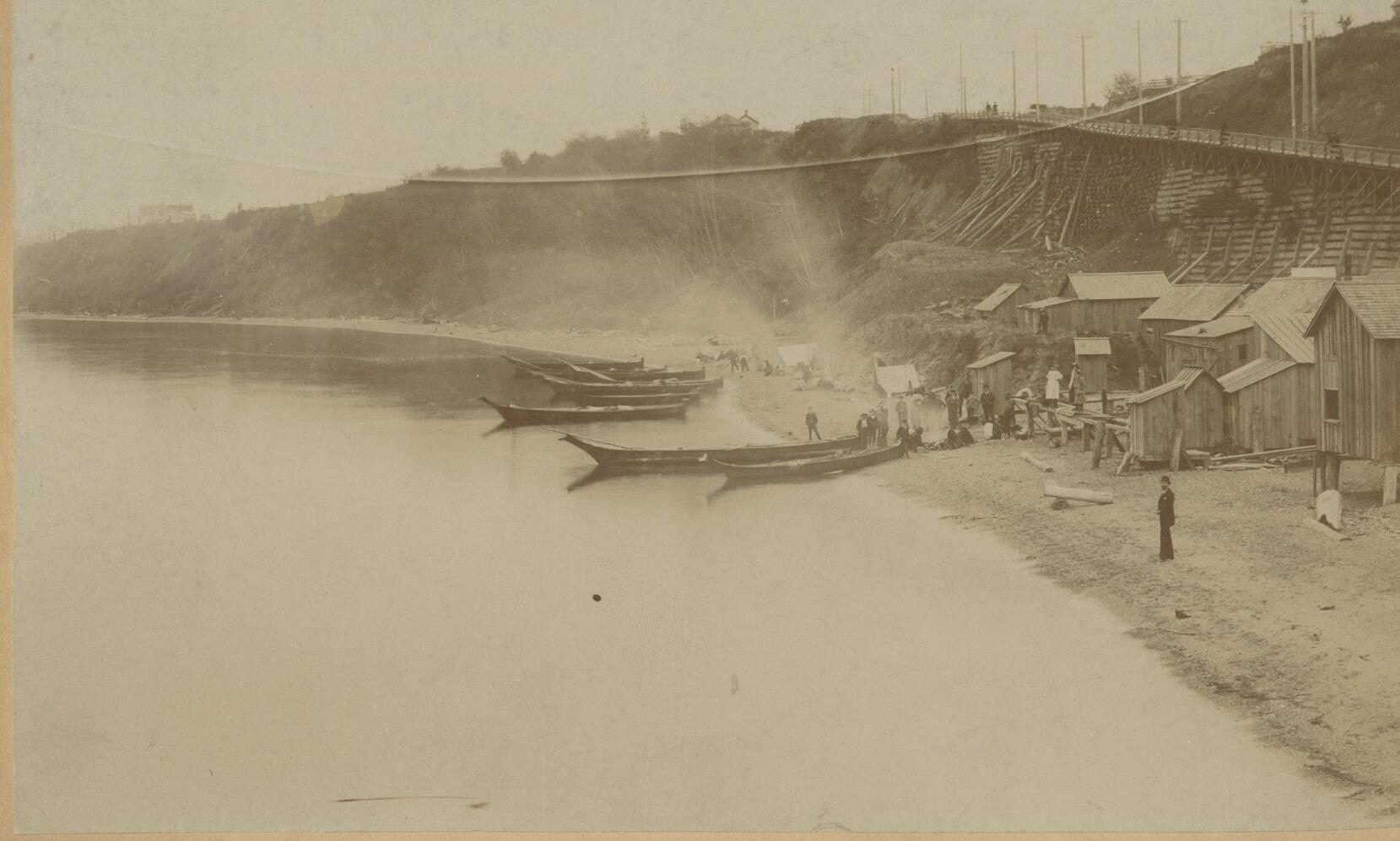
Settlers did not start living on the harbor until the late 1850s and by the early 1860s Port Angeles had ten non-Indigenous residents, some of whom had a small settlement at ʔiʔínəs called Cherbourg. The economy and the population was temporarily boosted in response to the relocation of the U.S. Customs House from Port Townsend to the outlet of Valley Creek in 1862, making Port Angeles, the official “port of entry” where every ship entering American waters was required to stop. This coincides with passage of the Indian Homestead Act of 1862 which permitted Indigenous people to legally claim homestead land, conditional upon residential and essential separation from their tribe (Lower Elwha Klallam Tribe, 2019b).
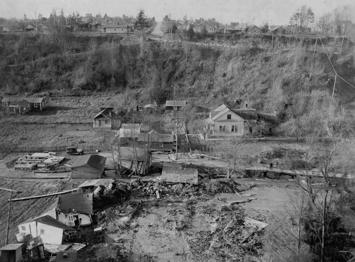
The Customs House was sited on the Valley Creek estuary where local Indigenous people had reportedly advised against building (Banel, 2019). These warnings were disregarded and soon after, a flood, likely originating from an upstream mudslide dam or log jam giving way, flattened an area 100 yards wide and a mile long, destroying the Customs House and several other buildings and killing two people (Banel, 2019). This put an end to the dream some had of making Port Angeles the second capital city after Washington, D.C., and as a result the population declined and then remained stagnant for another 25 years (Campbell, 1972, Chapter 20).
The population began growing again when a short-lived Utopian community called the Puget Sound Cooperative Colony was located at the outlet of Ennis Creek in 1887 (Campbell,1972, Chapter 3). Though that community did not last long, the associated population growth and development continued a series of forced relocations of the Kallam people from their ancestral homes on the harbor, aided in part by laws such as the Homestead Act of 1862 and Dawes Severalty Act of 1887 which required Native Americans submit to the division of their lands in order to gain U.S. Citizenship. Only U.S. citizens could own land. This resulted in “the government stripping over 90 million acres of tribal land, then selling that land to nonnative US citizens” (The Dawes Act U.S. National Park Service), n.d.). Klallam people unwilling to sever their tribal relationships were denied U.S. citizenship and pushed from permanent homes by colonists and the growing town of Port Angeles whereupon many moved to Ediz Hook (Lower Elwha Klallam Tribe, 2019c).
22
Figure 26. Village at Hollywood Beach before it was intentionally burned down. Source: Photo courtesy of North Olympic History Center, 2023
Figure 27. Valley Creek Customs House flood site. Source: Photo courtesy of North Olympic History Center, 2023
When Thomas Aldwell (who would later lead construction of the Elwha Dam) arrived in Port Angeles in 1890, he wrote that “between 200 and 300 Indians were living and camping on the beach in front of the town (Aldwell 1950:18)” (Lane & James, n.d.). This observation did not deter Aldwell from making other plans for the waterfront as it was he who would later initiate the filling and industrialization of downtown waterfront in pursuit of his aspiration of creating a market for the new supply of water and power coming from the Elwha Dam.
Industrialization of the Waterfront
In 1920 construction of the Crown Zellerbach Paper Mill at the base of Ediz Hook further industrialized the immediate area and Lower Elwha Klallam residents were again forced to leave. During the Mill’s construction, hundreds of Indigenous remains were unearthed. Both Klallam and non-Indigenous people lived along the spit at this time, most engaged as loggers or in small-scale fishing (Oldham, 2007).
In September of 1929, 36 “squatter shacks” on Ediz Hook were burned by the U.S. Navy near its installation. At least five Lower Elwha Klallam families lived in dwellings along the Hook at this time, some occupied for decades on land claimed by the Navy. By the 1930s, several significant structures were constructed along Ediz Hook including the Port Angeles Shingle Mill (Baldwin et.al., 2022). City of Port Angeles and Clallam County attorneys wrote to the Tatoosh Superintendent that they were planning to move families living on the beach at Port Angeles. In 1937, the U.S. Coast Guard established the Coast Guard Station at the end of Ediz Hook and closed the spit to residents; however, some people continued to live on the spit until after the Second World War (Baldwin et.al., 2022). S’Klallam camps were common in Port Angeles as far east as Hollywood Beach until the establishment of the Lower Elwha Klallam Reservation in the later 1930s when a neighborhood of Klallam and non-Klallam homes on Hollywood Beach were deemed a “slum” and burned to the ground (see Figure 26).
“The Tribe’s current landbase was initially acquired by the United States in trust for the Tribe in 1935-36 and these lands were proclaimed as the Lower Elwha Reservation in 1968. Today tribal lands include about a thousand acres of land on and near the Elwha River.”(Lower Elwha Klallam Tribe, 2022b)
23 Context - Co-Governance and Co-Management
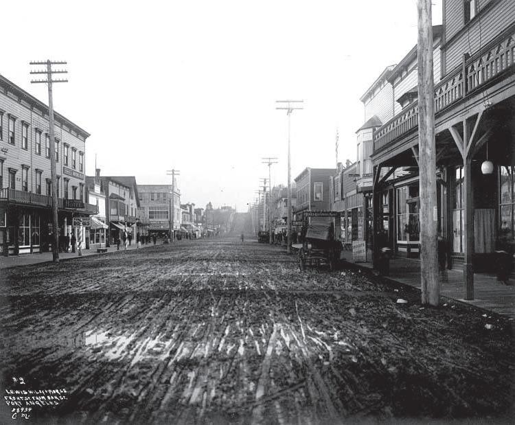
Figure 28. Downtown Port Angeles c.a 1914. Source: Photo courtesy of North Olympic History Center, 2023
Context - Co-Governance and Co-Management
Post-Contact Watershed Management History
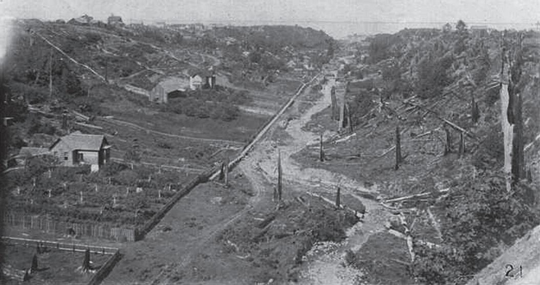
Lower Valley Creek; including the delta, estuary, and shoreline adjacent to the creek’s mouth; was heavily modified during the development of Port Angeles between approximately 1890 and the present. Development and large-scale modifications of lower Valley Creek occurred at least as early as 1891, with episodes of filling occurring at intervals until at least the mid-1950s. (Wegmann, et al., 2012)
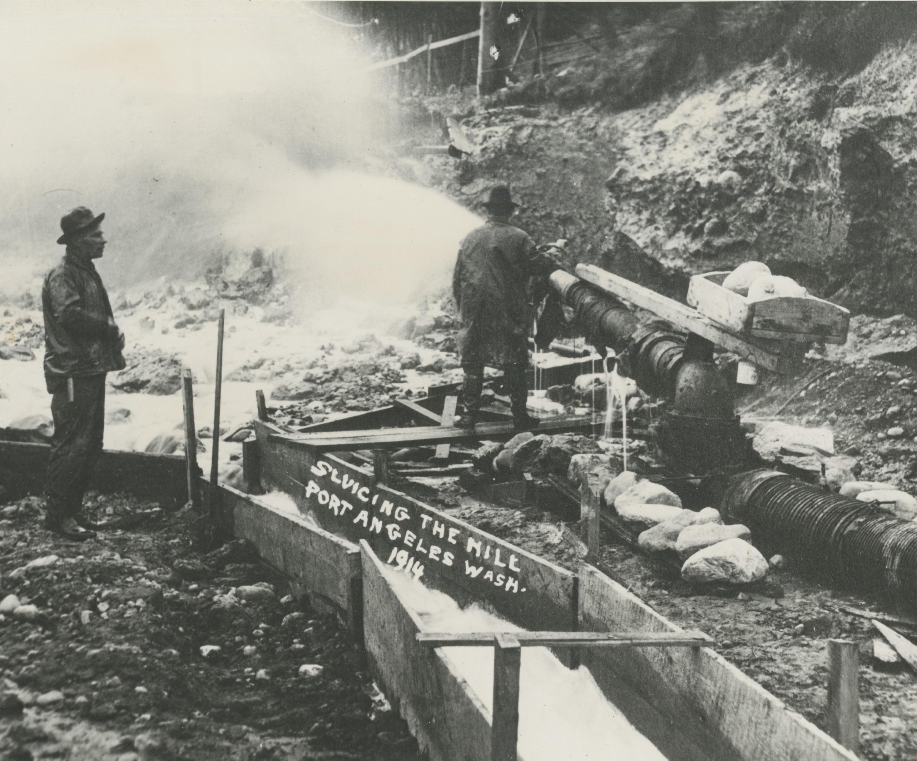
A monumental re-grading project was undertaken in 1914, when a hill (or hogback) located between West First and West Front Streets was sluiced with fresh water from Peabody Creek and sea water from Port Angeles Harbor. The resulting mud and debris raised sections of downtown streets by 15 feet to prevent flooding of downtown businesses and ended the dumping of raw human waste into the harbor with the installation of sewage lines. This was said to have cured the “curse of Port Angeles” but also resulted in the culverting of the salmon-bearing creeks in downtown.
The completion of a railroad line between Port Townsend and Twin Rivers in 1914 linked Port Angeles and other growing towns in the region. Construction began in the same year on a number of significant buildings: a permanent county courthouse, a new sawmill at the base of Ediz Hook, and a new hydroelectric dam on the Elwha River that brought power to Port Angeles. (Port Angeles - Thumbnail History, n.d)
Mud flats and open water from Front Street to Railroad Avenue and from North Cherry to South Valley streets were filled in during the 1920s, as well as the property at the north corner of Oak in the 1950s. By 2006, the mouth of Valley Creek had prograded into Port Angeles harbor a distance of at least 500 feet, such that the contemporary estuary and creek mouth enters Port Angeles harbor in what historically would have been marine habitats, and the previously large creek delta was diminished in size. Fill depths in and around lower Valley Creek exceed 25 feet in places (Wegmann, et al., 2012). See “Soils and Geology” on page 49 for more information.
24
Figure 29. Sluicing the Hill. Source: Photo courtesy of North Olympic History Center, 2023
Industrialization of Downtown and Disregard of Klallam Cultural Resources
Mills were built on top of the Tse Whit Zen village site west of Valley Creek site in the 1920’s and increasingly Port Angeles appeared to retain little of the Klallam villages that had so recently lined the harbor.
This well-known history of human habitation was again disregarded when the Washington State Department of Transportation (WSDOT) initiated construction of a “graving yard” or staging area for a bridge construction project directly over a large graveyard in the Tse Whit Zen Village site. The project was subsequently halted mid-implementation upon the discovery of a large number of human remains and artifacts at what turned out to be one of the most prolific archaeological sites in the country.
ʔéʔʔɬxʷaʔ nəxʷsƛáyəm̕ – The Strong People
In spite of these many affronts to the health and well-being of the Indigenous people of Port Angeles and beyond, the Klallam people maintain a strong regional presence and influence and continue fighting to protect their cultural traditions and treaty rights. The Lower Elwha Klallam Tribe has been leading numerous important economic and community development, cultural revitalization, and ecological restoration efforts, several of which are in or near Valley Creek. Among the Tribe’s recent efforts in downtown Port Angeles, has been the ongoing transformation of the inner beaches of Ediz Hook back into functional habitat, planning a new hotel and conference center, leading the cleanup of industrial waste from the inner harbor, developing a new Cultural Center, opening a new museum in the Carnegie Building, and restoring Ennis Creek.
Community Investments in Valley Creek
Over the last 25 years, there have been significant community investments in restoring Valley Creek made by a wide range of groups and individuals including the Washington Department of Fish and Wildlife (WDFW), City of Port Angeles, Port of Port Angeles, Lower Elwha Klallam Tribe, Clallam County, DNR, Valley Creek Committee, Friends of Valley Creek, and many others. The Lower Elwha Klallam Tribe has led multiple restoration and planning efforts on Valley Creek which have become the basis for much of this plan.
Removing the Elwha River Dam
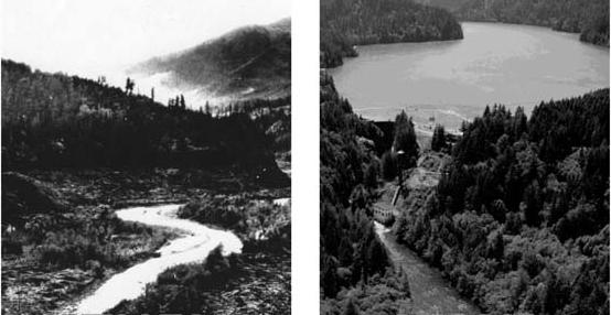
When Thomas T. Aldwell arrived in Port Angeles in 1890, he saw economic potential in the abundant forests of the area and spent the next twenty years pursuing his dream of building a hydroelectric dam on the Elwha River. Construction of the Elwha Dam was completed in 1914, with the Glines Canyon Dam completed in 1927. For a century, these dams blocked miles of upstream habitat preventing use by anadromous fish and the downward flow of tons of sediment and wood, starving the lower river and nearshore of needed sediment and woody debris.
Decades of lobbying by the Lower Elwha Klallam Tribe and their allies led Congress to pass the Elwha River Ecosystem and Restoration Act in 1992 authorizing the removal of the dams to achieve “full restoration of the Elwha River and the native anadromous fisheries therein”. Both Elwha River dams were removed between 2011 and 2014. This historic event opened up more than 70 miles of pristine salmon habitat, and anadromous fish are now repopulating the area above the dams.
25 Context - Co-Governance and Co-Management
Figure 30. Early logging and development in Valley Creek, date unknown. Source: Photo courtesy of North Olympic History Center, 2023
Figure 31. Elwha River before dam and with dam Source: Olympic National Park
Context - Co-Governance and Co-Management
LEGEND
Project complete
Project in design phase
NTimeline of Community Investments
The following list of the restoration investments into Valley Creek over the last 25 years was mostly curated by the City (City of Port Angeles, 2023).
1997 Valley Creek Estuary Park was created through a multi-jurisdictional effort, including the Soroptomists, the Port, and the City, as mitigation for filling the K-Ply Mill log pond. 450 linear feet of creek from Marine Drive north to the harbor was daylighted and this project was the catalyst for renewed community interest in restoring Valley Creek.
1998 Valley Creek Restoration Lower Elwha Klallam Tribe Habitat Assessment and Restoration Recommendations.
2000 Phase I: Highway 101/Valley Creek Culvert Fish
Passage, WDFW/WSDOT installed baffles (horizontal wooden bars) in existing culvert to restore fish passage, and stabilized and restored historic channel.
2002 Phase II Valley Creek Channel Restoration: WDFW removed road, re-meandered channel, enhanced habitat installed trail with two bridges.
2008 8th Street Bridge Replacement: Category III wetland mitigation and improvements within the Valley Creek ravine.
2008 Phase III Valley Creek Restoration: WDFW developed conceptual design
2011 Valley Creek Culvert Clearing: included restoration and improvements at the mouth.
2011 Phase III Valley Creek Restoration: grant funded design work, report and plans proposed daylighting and re-meandered stream between 2nd and 9th streets. Implementation was not funded.
2019 Futurewise, GreenLink Port Angeles Phase I: continued grant funded effort to identify and rank potential multi-benefit GSI projects in Port Angeles watersheds.
N2022 Futurewise, GreenLink Port Angeles Phase II: Valley Creek Daylighting Project selected for advancement with a Feasibility Report and Valley Creek Master Plan.
26
Figure 32. History of Valley Creek Restoration
ESTUARY
RESTORATION
PHASE II
PHASE I
PHASE III
City Acquisition of Valley Creek Properties
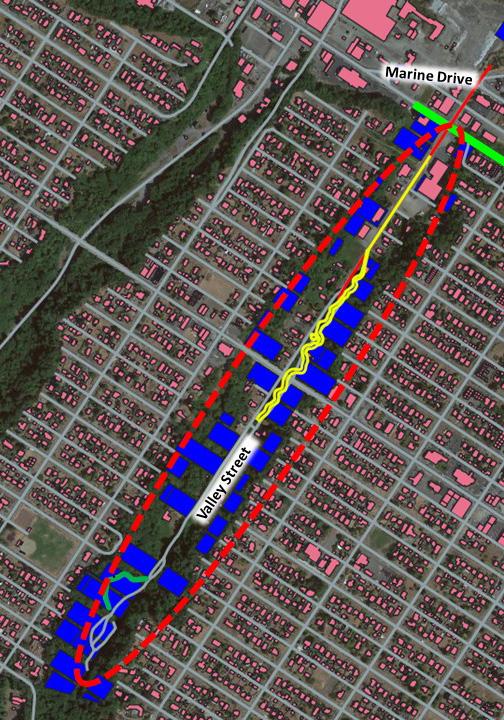
In support of community restoration goals for Valley Creek, the City has acquired 49 properties in the riparian zone between West 2nd Street and the end of South Valley Street (see Figure 33).
Downtown Redevelopment
Valley Creek serves as the boundary between the retail core and the industrial shoreline. Both areas are important to the longterm vitality of Port Angeles and have been the focus of extensive redevelopment planning efforts. The hub of this activity (described below), is a short walk or roll from Valley Creek and is likely to increase use of the surrounding neighborhood and features. The Olympic Discovery Trail that runs along the waterfront, is a draw for pedestrians and wheelchair users downtown and leads directly to the Valley Creek Estuary Park, Viewing Tower, Overlook, and the Friendship Bridge. The Viewing Tower can be seen from afar and is a natural destination for pedestrians headed west though they are unlikely to continue past the bridge as the scenery becomes more industrial with busy traffic running adjacent to the sidewalk.
Remodeled Waterfront with GSI
The City made major changes to the downtown waterfront ten years ago by creating an esplanade with pedestrian walkways and gathering areas, two pocket beaches, landscaping, and GSI features. Located just east of Valley Creek Estuary Park, these efforts have helped make the waterfront and Olympic Discovery Trail more of a draw for locals and tourists alike. The Valley Creek Daylighting project would build upon and extend this improved area.
The Lower Elwha Klallam Tribe Hotel and Conference Center
The Lower Elwha Klallam Tribe is building a hotel and conference center on property purchased by the Tribe at 111 East Front Street (see Figure 35). This four-story 106- room hotel will front East Railroad Avenue, overlooking the Port Angeles Harbor, and East Front Street, with a view of the Olympic Mountains in the distance to the south.
27 Context - Co-Governance and Co-Management
Figure 33. Valley Street property ownership map along Valley Street area. Source: Herrera
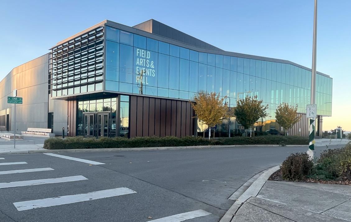
Figure 34. The Field Arts and Events Hall, part of the Port Angeles Waterfront Center just east of Valley Creek.
City-owned parcel
LEGEND N
Privately-owned parcel Project area
Context - Co-Governance and Co-Management
The Port Angeles Waterfront Center
Located at 219 North Oak Street at the intersection with West Front Street just east of Valley Creek, the Port Angeles Waterfront Center is intended as a celebration of the people, history, and natural environment of the Olympic Peninsula. Phase 1 of this campus, the Field Arts and Events Hall opened in July of 2023. The campus will
Ninclude a Lower Elwha Klallam Tribe Cultural Center and a Marine Discovery Center. The Port Angeles Waterfront Center will offer opportunities to experience art, culture, and science to residents and visitors alike and the Marine Discovery Center (currently Feiro Marine Life Center/NOAA Olympic Coast Discovery Center) has indicated interest in using Valley Creek as the focus of their watershed education work due to the close proximity.
Port of Port Angeles Marine Trades Center
The Port is planning to build a Marine Trades Center on Marine Drive on the now vacant 18-acre site of the former K-Ply Mill at the western boundary of Valley Creek Estuary Park (a collaborative Port restoration project). The park provides a visible delineation between the downtown retail core and the working waterfront of the Port to the west. The Marine Trade Center would be uniquely situated on the United State’s closest deep water port to the Pacific Rim and aims to provide family wage jobs. A daylighted creek with a trail and greenspace to take breaks and eat lunch across the street from this facility would be an asset for employees that could improve job satisfaction and health outcomes.
Anian Shores
Anian Shores is a seven-story mixed use apartment building that will have up to 100 living units and 8,000 square feet of retail space planned for the 1.1-acre property on the southwest corner of North Oak and West Front Streets. Sited across the street from the Port Angeles Waterfront Center’s Field Arts and Events Hall, Anian Shores will be one block east of the industrial shoreline and Valley Creek. A Valley Creek park trail would provide needed greenspace for residents, a potential selling point.
28
VALLEY CREEK
MARINE TRADES CENTER
PORT ANGELES WATERFRONT CENTER
ANIAN SHORES COMPLEX LOWER ELWHA KLALLAM TRIBE HOTEL AND CONFERENCE CENTER
Figure 35. Redevelopment in downtown Port Angeles
Modern Social Context
persons under 5 years persons 5-17 years persons 18-24 persons 25-34 persons 35-54 persons 55-64 persons 65 years and over
Community Demographics
Race
Port Angeles is a slowly growing city that is less diverse than much of Washington State. Almost 85% of the residents are White with smaller populations of Latino/ LatinX, Multi-Racial, Indigenous, Asian, and Black or African American people (United States Census Bureau QuickFacts, n.d.)
Age
The population of people over the age of 65 is 21%, higher than the state average of 17.1%, and still growing (United States Census Bureau QuickFacts, n.d.).
Education Attainment
While the 91% of Port Angeles residents with a high school degree is higher than the state average of 87%, the number of people attaining a bachelor’s degree is 28%, below the state average of 42% (United States Census Bureau QuickFacts, n.d.).
Income
The median household income of $53,690 in 2021 is well below 80% of the state median income of $82,400, the threshold for being considered an economically disadvantaged community (United States Census Bureau QuickFacts, n.d.).
AGE
Houselessness
Housing is in short supply in Port Angeles and the number of people experiencing homelessness has burgeoned as a result. The Point in Time Count is a snapshot of homelessness in Clallam County conducted for the City of Port Angeles. According to Lacy Frye, local coordinator of the Point in Time count for Port Angeles, the 2021 count found “231 people were experiencing homelessness in and around Port Angeles, including a record 148 people living unsheltered, meaning in tents, doorways or cars, rather than in an official shelter” (Westneat, 2021). This problem has greatly increased the impacts from encampments and other incompatible activity in all the creeks of Port Angeles, including Valley Creek. Future property acquisition in the Valley Creek riparian corridor could marginally exacerbate the housing shortage were any houses removed from the available stock. Homeless people are likely to be a user group of any new park facilities.
persons under 5 years
persons 5-17 years
persons 18-24
persons 25-34
persons 35-54
persons 55-64
persons 65 years and over
RACE
Washington State
Port Angeles
LEGEND
White American Indian or Alaska Native Latino
Black or African American Asian
Two or more races
Figure 36. Racial demographics of Washington State compared to Port Angeles
AGE
LEGEND
65+ 18-64 5-17
persons under 5 years
Under 5
persons 5-17 years
Figure 37. Age demographics of Port Angeles
persons 18-24
persons 25-34
persons 35-54
persons 55-64
persons
29 Context - Modern Social Context
$53,690 Median annual income in Port Angeles $82,400 Median annual income in Washington 0 5000 10000 15000 20000 25000 2 0 0 0 2 0 0 1 2 0 0 2 2 0 0 3 2 0 0 4 2 0 0 5 2 0 0 6 2 0 0 7 2 0 0 8 2 0 0 9 2 0 1 0 2 0 1 1 2 0 1 2 2 0 1 3 2 0 1 4 2 0 1 5 2 0 1 6 2 0 1 7 2 0 1 8 2 0 1 9 2 0 2 0 2 0 2 1
White American Indian & Alaskan Native Hispanic or Latino 0% 20% 40% 60% 80% 100% WA Clallam Co. persons 65 years and over High School Degree Bachelor's Degree 0 5000 10000 15000 20000 25000 2 0 0 0 2 0 0 1 2 0 0 2 2 0 0 3 2 0 0 4 2 0 0 5 2 0 0 6 2 0 0 7 2 0 0 8 2 0 0 9 2 0 1 0 2 0 1 1 2 0 1 2 2 0 1 3 2 0 1 4 2 0 1 5 2 0 1 6 2 0 1 7 2 0 1 8 2 0 1 9 2 0 2 0 2 0 2 1 popula�on White American Indian & Alaskan Native Hispanic or Latino 0% 20% 40% 60% 80% 100% WA Clallam Co.
popula�on
High School Degree Bachelor's Degree Washington State Port Angeles 0% 20% 40% 60% 80% 100% LEGEND Bachelor’s degree High School degree 0 5000 10000 15000 20000 25000 0 0 0 1 0 2 0 3 0 4 0 5 0 6 0 7 0 8 0 9 1 0 1 1 1 2 1 3 1 4 1 5 1 6 1 7 1 8 1 9 2 0 2 1
popula�on
65 years and over
Economy and Workforce
The economy of the North Olympic Peninsula was built around the timber and fishing industries that persist today in spite of significant, long-term declines. All but one of the lumber and wood product mills have closed and Port Angeles has struggled to find economic footing and to provide living wage jobs ever since these industry shifts. Tourism and the associated service sectors are growing but tend not to provide living wage jobs once available through resource extraction.
The economy in Clallam County has grown gradually but steadily over the past 20 years (ESDWAGOV - Clallam County Profile, n.d.).
Healthcare is the current leading employment industry in Port Angeles, followed by retail and accommodations (Data USA, 2020), parts of the service sector that has been growing over the past decade. This growth has been buoyed by the increasingly popular Olympic National Park, which attracted over 2.7 million visitors in 2021. Other industries have moved into Clallam County, including Port Angeles, increasing overall employment rates over the last ten years. In 2021, goods producing industries advanced 6.8 percent over 2020, including both construction, up 8.6%, and manufacturing, up 5.1% (ESDWAGOV - Clallam County Profile, n.d.).
Tourism
Tourism is a vital component of the economy of the Olympic Peninsula. Port Angeles serves as the gateway to Olympic National Park and Hurricane Ridge and as a hub for international tourists coming and going from Victoria, British Columbia on the BlackBall Ferry’s MV Coho. According to the Olympic Peninsula Tourism Commission’s (OPTC) Visitor Spending Impacts in Clallam County report, Clallam County visitors spent 300.7 million dollars in 2018. That same visitor spending generated 21.9 million dollars in state and local taxes in Clallam County, and supported 4,260 jobs.
The local and regional area is increasingly popular as a recreation destination and Olympic National Park has become one of the most visited National Parks in the nation. Olympic National Park states in their Interpretive Report for 2022 that the Hurricane District, accessed through Port Angeles, had 156,784 recreational visits, an increase of 156% from the 62,305 recreational visits reported in 2021.
Recommendations
• Economic Study to evaluate the potential impacts of the Valley Creek Daylighting Project on the Port Angeles economy and future plans. Grant funding is being sought for this study.
30
Context - Modern Social Context
31 Context - Modern Social Context
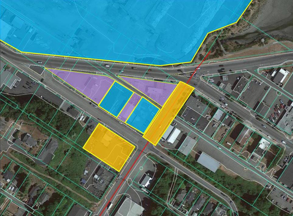
Figure 38. Property ownership around lower Valley Creek
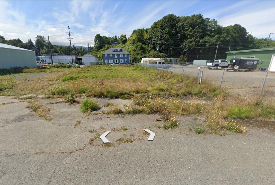
Figure 39. Vacant lot facing south and apartment building in the background April, 2023
Private Property Port of Port Angeles City of Port Angeles Valley Creek Culvert 1 1 2
LEGEND 2
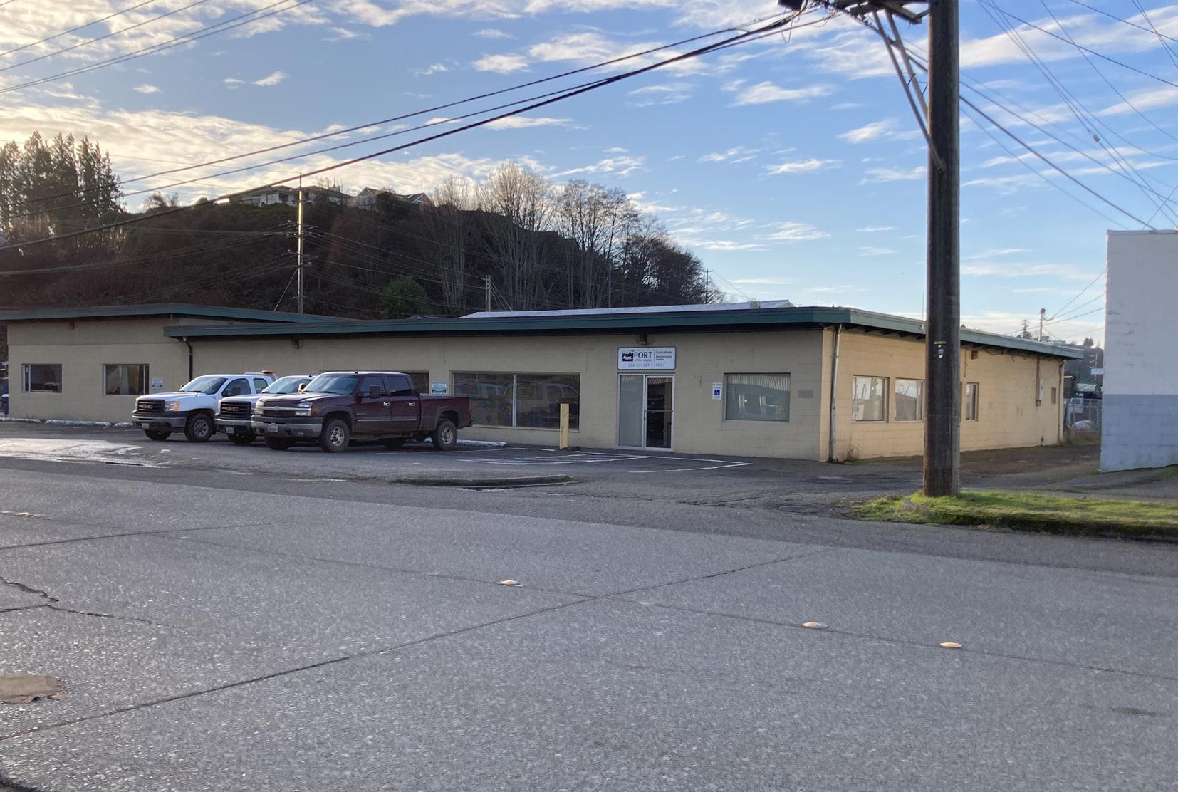
Figure 40. Port of Port Angeles Maintenance Annex building
N
Property Ownership
Lower Watershed
Property in the Valley Creek Watershed is publicly and privately owned in varying combinations depending on where in the watershed the lots are located (See Figure 33 on page 27).
Port of Port Angeles
The owners of the properties located within the Daylighting Project area include the Port, the City, the Washington DNR and four private owners (See Figure 38). The extent of impacts on properties located to the east of the project area will depend on the final design but might result in reductions in street parking and improved views from adjoining sites.
The Port owns five properties within the potential project area that could be affected by the proposal. Two properties north of West Front Street encompass the Valley Creek Estuary Park, mitigation for filling the K-Ply Mill log pond. The Port has been planning to build a Marine Trades Center in the lot adjoining the Valley Creek Estuary Park and conceptual plans show new buildings 50 feet from Valley Creek. The 18-acre site is on schedule for redevelopment in 2024 with improvements to include stormwater bio-retention treatment and infrastructure development.
The Maintenance Annex, located on South Valley Street, is the home base for some of the Port’s essential daily functions that would have to be relocated to implement any of the workable creek routing alternatives. The Port has a policy of “no net-loss” for their properties so a comparable lot would have to be acquired to replace the current site or it would need to be used as mitigation for the Marine Trade Center. A recent attempt to locate a new site for this building on Port properties was unsuccessful though it is unknown if there are non-Port owned properties that might suffice. The Port owns another property in the middle of the project area that is an unmaintained empty lot.
City of Port Angeles
The City of Port Angeles owns eight properties in the immediate project area. On the southwest corner of West 2nd Street and South Valley Street, at the border of where the daylighting is currently proposed, is a power substation and utility storage yard. This property is likely not needed for project implementation though it has been proposed that a non-essential part of the storage yard might be repurposed for the Daylighting Project. The remaining six City properties are all small parcels located along Marine Drive or are road right-of-ways.
Between 2nd and 6th Streets, the City owns nine properties, including the Valley Street Right of Way south of the power station that may be available to some extent for future creek daylighting efforts further upstream.
Private Property Owners
There are five privately owned business and residential properties in the Daylighting Project area, four with structures including a gas station and a currently unoccupied garage building. There is an apartment building and office on the west end of lower West 2nd Street directly across from the proposed project site that might experience an increase in traffic in front of their building, improved aesthetics and property values, and other possible changes to the immediate neighborhood.
32 Context - Property
Ownership
Lower Middle Watershed
The current daylighting effort focuses on the area north of West 2nd Street, however the creek runs from a channelized section into culverts beginning at West 6th Street and property owners to the south may be particularly affected by future creek daylighting and restoration efforts in the Lower Middle Watershed. Along Valley Creek between 2nd Street and Highway 101, there are 29 privately owned properties with mostly residential structures, a bottling plant, a restaurant meats supplier, and some additional lots without structures. There are also 49 City-owned properties in the riparian zone south of South 2nd Street that were acquired in support of the long-held community goal of restoring Valley Creek and creating a trail system into Olympic National Park.
Upper Middle Watershed
South of Highway 101, the land outside of the riparian zone is owned by numerous private, mostly residential property owners. The City of Port Angeles and Clallam County own nine lots comprising the Verne Samuelson Trail that follows the riparian corridor up from Highway 101 on Clallam County land before eventually crossing onto City of Port Angeles property.
Upper Watershed
The upper watershed is owned by DNR State Lands and a few small forest landowners and is managed intensively for timber.
Future Property Acquisition
A combination of Port, City, and private property is required to daylight Valley Creek. Assessing the relative benefits of the current uses over future potential uses will need to be studied. There may be ways to reduce acquisition needs through creative use of easements or, in the case of Port property, to provide an ongoing mitigation opportunity for their Marine Trade Center development plans.
There is a minimum of three privately owned lots that would likely have to be acquired in order to daylight the lowest section of Valley Creek (north of West 2nd Street). South of West 2nd Street there are a few businesses but South Valley Street becomes increasingly residential. There are options for routing the creek that may not require acquisition of additional properties, though this approach does not allow enough space for the recommended buffer. The City is currently exploring options to start a fund for acquiring additional property in the Valley Creek riparian corridor, if and when they become available.
Recommendations:
• Continue exploring options for relocating the Port Maintenance Annex and determine if there are suitable city properties that could be traded or private property that could be acquired to meet this need
• Conduct preliminary outreach to evaluate level of interest in the project by private property owners
• Develop a property acquisition plan
• Explore opportunities to create easements and tax incentives to support riparian management improvements
• Use new City fund to acquire key properties in the Lower Middle Valley Creek riparian area and broader watershed
Lower Watershed
Lower Middle Watershed
Upper Middle Watershed
Upper Creek Watershed
33 Context - Property Ownership
TUMWATER CREEK PEABODY CREEK VALLEY CREEK N
Figure 41. Valley Creek Watershed sections map
LEGEND
Legal and Regulatory Framework
Environmental Justice
In a little over a 100 years, Valley Creek and the other waterways and natural habitats in Port Angeles have been drastically modified and severely degraded, see Figure 42. The vibrant Klallam villages that once dotted the shoreline were intersected by six creeks, abundant with the salmon foundational to the tribal way of life. Today, all of the streams and surrounding habitat in Port Angeles, and the harbor they empty into, are severely altered and damaged through the urbanization and industrial development that continues to this day. The impacts from varying combinations of channelization, culvert installation, estuary and tidal flat filling, land clearing, paving, soil contamination and more have prevented tribal members from freely practicing their traditions and exercising their treaty rights. Tribes have borne disproportionate burdens from this wholesale exploitation of the homelands they had effectively managed to be so abundant while receiving little to no benefit from their sale. For many Tribal communities, their identity is intertwined with the foods they gather, harvest, share and consume, and respect for these resources is tantamount to respect for life. Restoring the plants, animals, and ecological function central to indigenous identity and lifeways is necessary for achieving environmental justice, a federal priority and a moral imperative representing a turnabout from centuries of initiatives, actions, and policies used to intentionally disconnect tribal people from the ecosystems that sustain Indigenous health and identity (Lower Elwha Klallam Tribe, Lamprey, and Restoring a Way of Life, 2021).
Recommendation:
• Acknowledge the disproportionate burden that the tribes have had to bear in the transition to a colonial power structure and center the protection of Indigenous identity and way of life in the restoration of ecosystem health to Port Angeles
Legal Requirements
One of the first steps in the legal process will be to reach agreement with all affected property owners. The properties affected will depend on the final project design but at a minimum, is likely to include the Port, the City, and a few private owners. This process may include creating easements and exploring different acquisition options.
Regulatory Framework and Requirements
The Daylighting and Watershed Projects must comply with the regulatory framework provided by local, state and federal agencies through the permitting process. The list of required permits is long and depends on the final project design, however some overarching permits will be required for all designs. For a complete list of potential permit requirements please see Appendix D. The permitting process for daylighting the lower section of the creek is expected to take a year or longer.
The City of Port Angeles will require a Conditional Use Permit to ensure potential land uses are consistent, compatible, and not contrary to public use or interest. Several environmental permits will be required, including the City’s Environmentally Sensitive Area Permit, the State’s Joint Aquatic Resource Permit Application (JARPA) and the State Environmental Policy Act (SEPA) Checklist. The JARPA must be submitted to all permitting agencies. The JARPA initiates the WDFW Hydraulic Permit Application (HPA) and the Washington Department of Ecology’s (WDOE) 401 permit process. The 401-permit project process is an umbrella for several state permits and for several federal permits under the supervision of the WDOE. This process cannot be completed until all local, state, and federal permits are granted. This 401-permit process will require the completion of an archaeological study of the project area.
Once the U.S. Army Corps of Engineers (USACE) obtains the JARPA and accepts the position as lead agency for the federal permitting process, the USACE 404 permitting process begins. The USACE will supervise the ESA consultation with National Marine Fisheries and government to government consultations with Treaty Tribes. They will also require compliance with a number of other federal
34 Context -
Legal and Regulatory Framework
Figure 42. The historical site of ʔiʔínəs (village at Ennis Creek). The site is heavily contaminated with toxins, a legacy of the now-defunct Rayonier Pulp Mill. Image 2022.
permit requirements including Section 106 of the National Historic Preservation Act (NHPA). To begin the 404 USACE permitting process the project must either have an exemption from or have completed the SEPA process.
Zoning
The zoning within the Daylighting Project area falls into three categories – Light Industrial, Heavy Industrial, and Commercial Arterial (see Figure 43). The project area is in the very western tip of the Commercial Arterial Zone, a narrow band extending east to just past Del Guzzi Road (intersected by the Downtown Business District), that is intended to create and preserve areas for businesses that serve the entire City and require an arterial because of the nature of their work or the intensity of associated traffic. These must be commercial businesses largely devoid of detrimental impacts to the environment. All the properties within the triangular project area fall under this type of zoning. Due west of the Valley Creek, there is limited Heavy Industrial Marine zoning along the shoreline where the Port can conduct their marine based operations, including the Port’s Marine Trade Center site that abuts the Valley Creek Estuary Park and encompasses most of the western lower riparian area (ArcGIS Web Application, n.d.).
Heavy Industrial
Light Industrial
Commercial Arterial
Community Shopping District
Public Buildings and Parks
Residential Single Family
Residential High Density
Community Shopping District
35 Context - Legal and Regulatory Framework
TUMWATER CREEK VALLEY CREEK N
Figure 43. Downtown Port Angeles zoning
LEGEND
Context - Built Environment
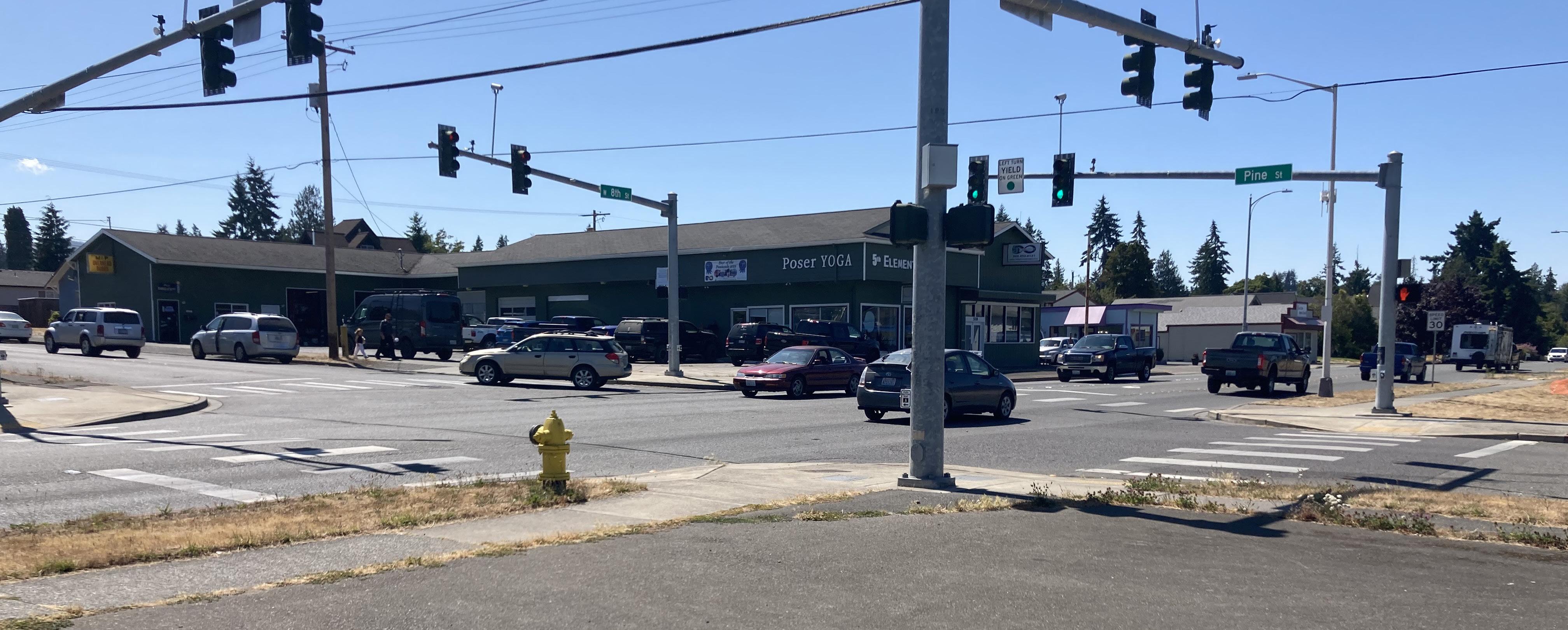
On the south side of West 2nd Street, and continuing along South Valley Street to West 6th Street, the zoning is Light Industrial at street level backed by bluffs zoned for Public Buildings and Parks. From West 6th Street south, the entire riparian area is zoned Public Buildings and Parks, likely in part, to facilitate the proposed trail system. The neighborhoods on the bluffs above the creek are zoned as Residential Single Family, Residential High Density, and Community Shopping District (ArcGIS Web Application, n.d.).
Above Highway 101, Valley Creek moves back and forth between City and County jurisdiction and the zoning changes accordingly. Here, the City Public Buildings and Parks zoning continues past a short section of county Rural Neighborhood Conservation zoning before the riparian area becomes Parks and Recreation zoning at the County line. The Mill Creek tributary (or East Valley) remains within city limits and the land immediately adjacent to the creek is zoned Public Buildings and Parks while the surrounding neighborhoods are zoned Residential, Single Family, Residential Low Density, and Urban Growth Area. This Public Buildings and Park zoning also applies where the mainstem passes back into the City of Port Angeles. In the County, south of Wellman Road, there are short sections of Open Space zoned property on the east side of the creek. The rest of this area is zoned a combination of Rural Character Conservation 3 and 5 up to the boundary with the DNR land (Regional Zoning Maps, n.d.).The Upper Watershed land is Commercial Forestry (Regional Zoning Maps, n.d.).
36
Figure 44. Site of the planned Marine Trade Center in the background, zoned Heavy Industrial
Figure 45. The intersection of West 8th Street and South Pine Street, Zoned Residential Single Family.
Built Environment
Buildings and Land Use
Though overall the Lower Watershed is highly paved and urbanized, there is open space at the outlet at the Valley Creek Estuary Park which is bordered by the large empty lot to the west, slated for the Port’s planned Marine Trade Center. The vicinity of the project area between Marine Drive and West Front Street includes two gas stations, the Port’s main administrative building and Maintenance Annex, a city power sub station and storage facility, a currently unoccupied garage building, and an employment services non-profit. There is an apartment building and an office in a house on West 2nd Street. Between West 2nd and West 6th Street there is a bottling plant and a meat distributor. Valley Creek is entirely culverted under this section of the roadway.
Along Valley Street, in the Lower Middle Watershed between West 2nd and West 12th Streets is a residential neighborhood of less than 20 homes some with garages, sheds, and other small buildings sited within the riparian zone of the channelized creek. All but four of these homes are located on the west side of the creek. Behind the homes are the mostly forested valley walls. At the top of these slopes are dense residential neighborhoods of mostly single family homes with some apartment buildings. South of 12th Street and to Highway 101 the creek runs through a forested ravine with the residential areas perched above.
The Upper Middle Watershed south of Highway 101 includes rural residential areas along the mainstem of Valley Creek and its western tributaries. An area immediately south of Highway 101 on the west of the creek, is the wooded Verne Samuelson Trail. Mill Creek (or East Valley Creek), the primary eastern tributary, passes through more densely populated residential areas.
The Upper Watershed in the Olympic Mountains Foothills is mostly managed forest in varying stages of growth intersected by logging roads.
37 Context - Built Environment
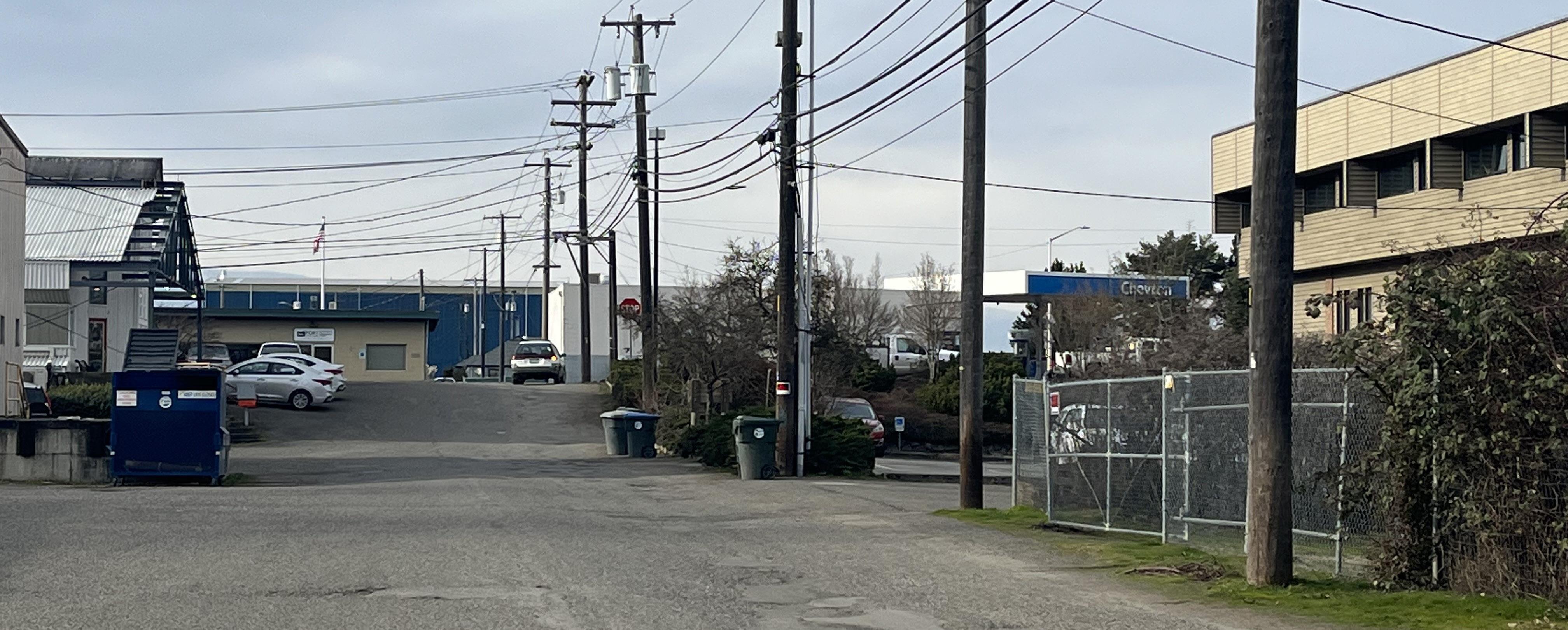
Figure 46. From West 2nd street alley, looking west toward Valley Street.
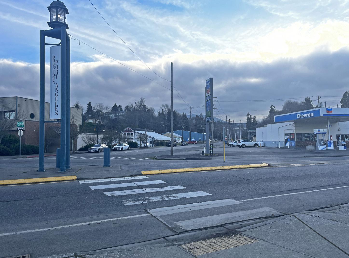
Figure 47. Looking South across Marine Drive, zoned light industrial at the intersection of Valley Street and Marine Drive.
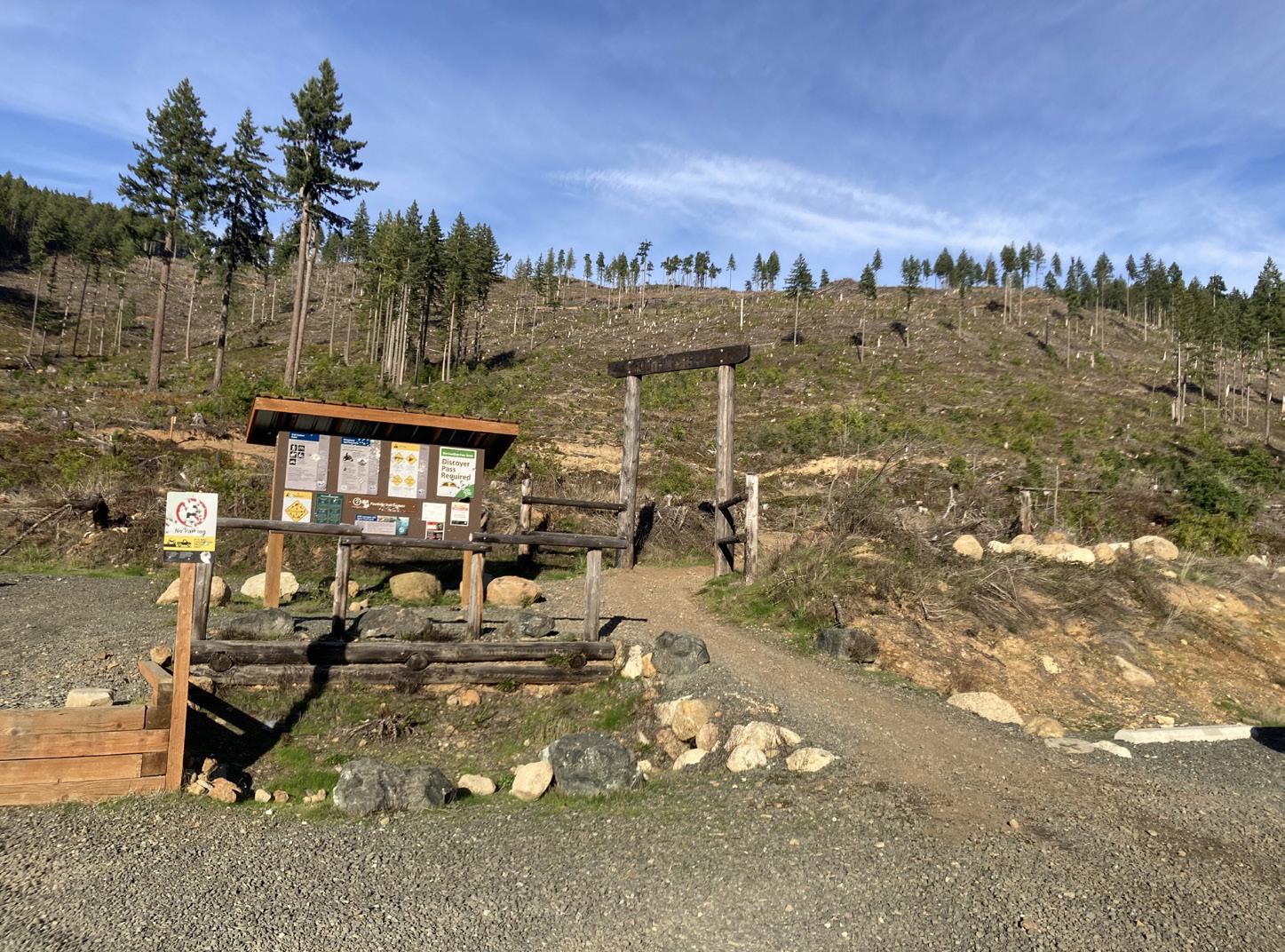
Figure 48. Newly built DNR multi-use trail system in Foothills
Context - Built Environment
NViewsheds
What are the views that shape our sense of place and relationship to downtown and the Lower Valley Creek Watershed? Where is there room for improvement or views worth preserving? Daylighting Lower Valley Creek will change how this area looks. The following are descriptions of some of these key perspectives today.
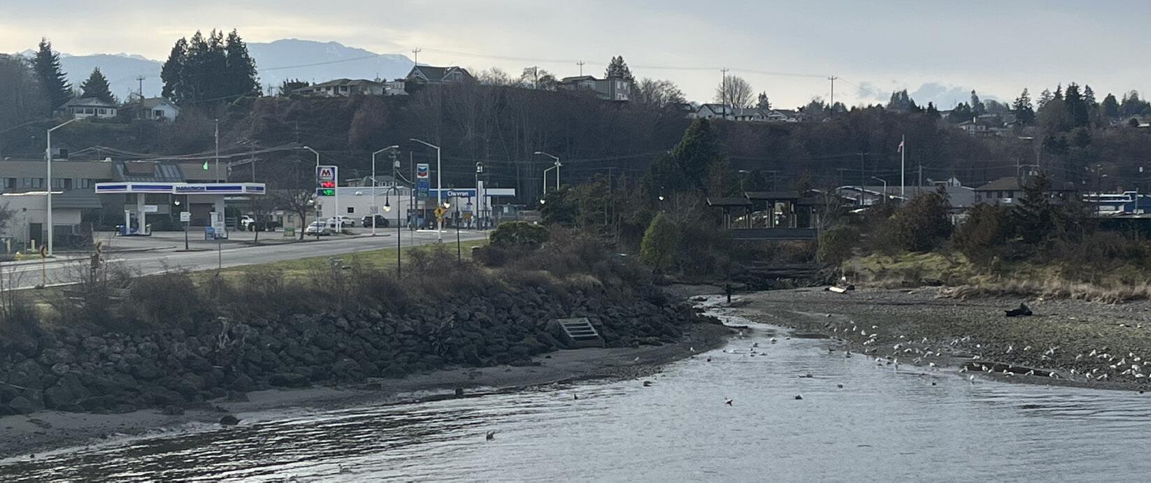
Eastern bank of the mouth of Valley Creek
To the southwest, is an overview of the Valley Creek Estuary Park with riprap along the eastern shore leading to the Friendship Bridge with the Olympic foothills in the distance. This view predominates in spite of the busy roadway with gas stations and signs behind the short shrubbery of the eastern bank. On the western bank, a narrow vegetated buffer of shrubs above the beach is edged by a single row of struggling cedar trees, partially obscuring the empty lot and industrial shoreline beyond.
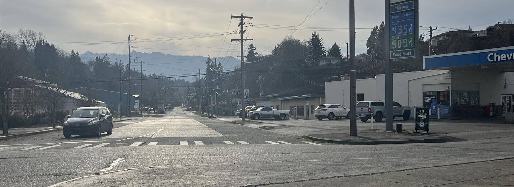
Valley Street and Marine Drive
Dramatic views of the Olympic Foothills and Valley Creek drainage can be seen facing south down South Valley Street (overlying Valley Creek), but the extensive paving, power poles and cars in the forefront are more noticeable and detract from the vista. To the west, the road bleeds into the paved parking lots of a gas station and commercial buildings without interruption. This view is dominated by the built environment, which is mostly lacking in aesthetic appeal and visual connectivity to the watershed so apparent in the background.
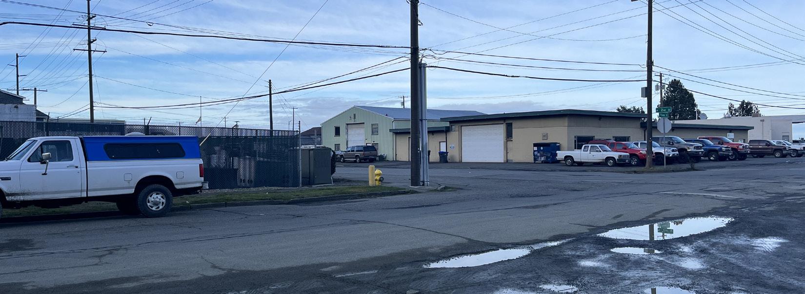
South Valley Street and West 2nd street
NLEGEND
Desirable view
Undesirable view
Looking west across South Valley Street, on the southwest corner, is the City’s utilities storage yard surrounded by a chain link fence. On the northwest corner, is an older Port building and adjoining private warehouse bounded by an unmaintained lot. Across the street is an apartment building with historic character and appeal but the excessive pavement in poor condition, power lines, substation and other less aesthetically pleasing buildings disrupt this view.
38
1 1 6
2 5 3 3 4
2
Figure 49. Downtown viewsheds
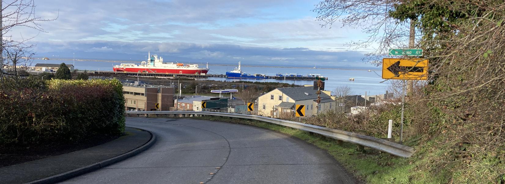
4
Upper West 2nd street and South Cherry Street
From the top of the hill driving down South 2nd Street, there are sweeping views of the harbor, historic downtown and working waterfront. Massive ships utilizing Port facilities with Ediz Hook in the background provide variety and a sense of place while helping to connect the community to Port operations and the marine industries they support and the natural environment.
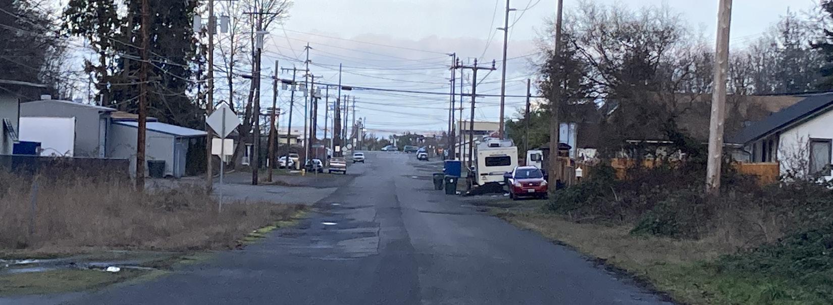
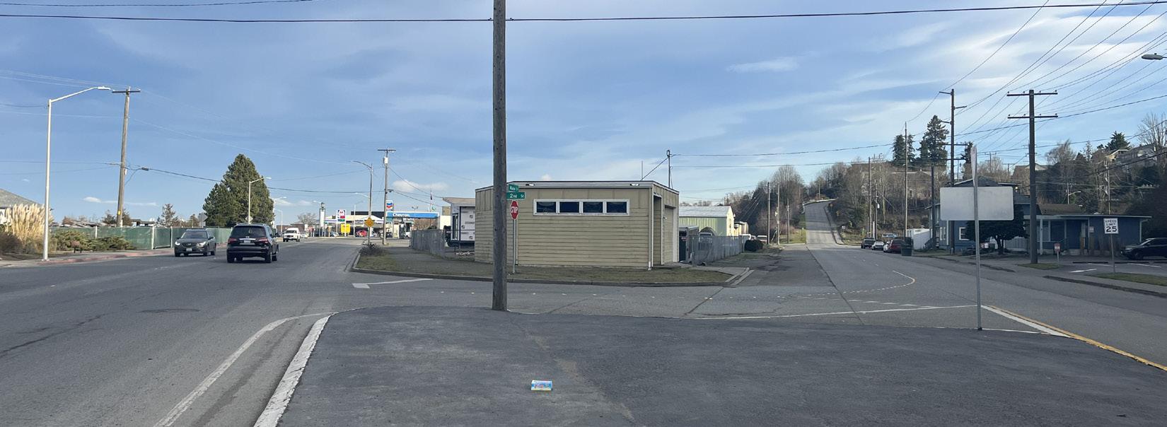
6 5
South Valley Street and West 6th Street
Looking north along South Valley Street, one sees a wide street in varying states of repair with a jumble of power lines and a handful of trees scattered along both sides of the street. The harbor and Ediz Hook are just visible in the distance but proximity to downtown or relationship to Valley Creek is not suggested from this perspective.
Marine Drive looking East
Heading towards Valley Creek and downtown from the west, wide streets, busy traffic and light and industrial commercial buildings are the dominating features. Vegetation is minimal to non-existent through this area.
Recommendations:
• Reduce overall extent and continuity of pavement
• Place vegetation and other facilities strategically to serve as a screens for undesirable views and provide visual relief
• Maintain existing vegetation and replace dead vegetation
• Expand vegetative buffer
• Implement creek daylighting
• Incorporate GSI
• Upgrade, replace or relocate unsightly structures, facilities,
• Install interpretive signs, art, and vegetation that would provide a screen for the downtown from the industrial shoreline, while celebrating the marine industry as part of the fabric of Port Angeles
39 Context - Built Environment
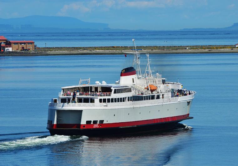
Access and Circulation
Ferry and International Border
The Black Ball Ferry Line operates the M.V. Coho passenger and vehicle ferry linking Victoria, the provincial capital of British Columbia on Vancouver Island, Canada, and Port Angeles, with twice daily round trips in the summer (see Figure 50). The ferry is used by crowds of seasonal visitors from all over the world and the terminal is just a few blocks east of Valley Creek. It is common for people to have their vehicle in line for many hours while they wait for the next boat leaving the passengers with significant time to spend in the immediate downtown area.
Recommendation:
• Create a destination at Valley Creek for visitors using the ferry system that does not require a vehicle to access and provides opportunities to see salmon spawning and otherwise experience and learn about the local ecology and history
Roads, Bike Lanes and Sidewalks
First Street, Front Street, and Marine Drive
West First and West Front Streets merge into Marine Drive at South Valley Street. Trucks using Highway 101 are diverted through downtown using this busy east-west thoroughfare and Highway 117, also called the Tumwater Truck Route just west of the Valley Creek crossing. There are dedicated bike lanes through downtown until South Valley Street (see Figure 51 for details).
The Olympic Discovery Trail also passes over Valley Creek here, mostly hugging the waterfront. West of South Valley Street, the bike lane ends and the Olympic Discovery Trail continues on through an industrial area next to heavy vehicle traffic. This section of the Olympic Discovery Trail is used by both pedestrians and cyclists and the lack of trees or other vegetation combined with heavy traffic detracts from enjoyment of the trail. The City has plans to install planters to create a barrier between traffic and the Olympic Discovery Trail along this section of Marine Drive.
People without vehicles are most likely to access Valley Creek from downtown by taking the Esplanade along the waterfront on West Front Street from the retail core and ferry. The traffic is unpleasant for those using the sidewalk between the last pocket beach and the pedestrian Friendship Bridge on Marine Drive.
Recommendations:
• Replace the undersized culvert crossing at Marine Drive and Valley Creek with a crossing designed to safely and comfortably accommodate multiple user groups
• Create a buffer from traffic for cyclists and pedestrians and enhanced aesthetics by increasing street trees and other plantings in areas lacking vegetation along Marine Drive
Valley Street
South Valley Street runs north-south and is directly above the culverted creek, between Marine Drive and West 6th Street. To the south of West 6th Street, where the creek is daylighted but channelized, South Valley Street is directly adjacent to the straightened stream until the point where the roadway dead ends at West 12th Street and an unnamed trailhead. The vegetative buffer on this notably flat street is minimal to non-existent and the roadway is crumbling into the creek in several places.
South Valley Street provides the only access to residents and the handful of businesses located to the south of West 2nd Street and local residents often drive to and from Cherry Hill and the downtown core via South Valley Street and/or the West 2nd Street alley. A sidewalk provides pedestrian access to the downtown core via South Valley Creek from West 2nd Street but is lacking south of West 2nd Street where the roadway is currently too narrow.
A small bridge that crosses the creek from South Valley Street to an unnamed gravel road that leads to a few homes on the east side. Here the creek channel has chewed into the active roadway and the sediment is falling right into the water. This bridge and culvert are in need of repairs that the City is responsible for and has been listed in the Capital Facilities Plan with an estimated construction cost of 1.5 million dollars.
40
Context - Built Environment
Figure 50. Black Ball Ferry to Victoria, British Columbia
Recommendations:
• Consider closing South Valley Street to vehicle traffic between Marine Drive and West 2nd Street to allow lower Valley Creek to be daylighted
• Move the road and/or creek to create adequate room for a vegetative buffer and trail
• Consider acquiring houses on the east side of the creek to ensure highest standards of ADA compliance and give consideration to all aspects of transportation planning and allow trail system development
• Provide bike and other storage facilities for those arriving by bicycle and planning to hike up Valley Creek into the Olympics
2nd Street
This popular and convenient vehicle and pedestrian route and “back door” to downtown, provides sweeping views of the harbor and Port activities when descending from Cherry Hill on West 2nd Street to the retail core or to Marine Drive and destinations west. The bike lanes on Cherry Hill do not extend down West 2nd Street but there are sidewalks the entire length, some sections of which are very steep.
Recommendation:
• To allow room for creek daylighting, close South Valley Street and reroute traffic to the downtown core via West 2nd Street and Marine Drive with a roundabout, consider narrowing West 2nd Street which is excessively wide and underused
LEGEND
Major Road
Minor Road
Project Site
41 Context - Built Environment
N 117 101 W8THST WFRONTSTW1STST W5THST MARINE DR SVALLEYST. SPINEST. CHERRYST 117 101
Figure 51. Port Angeles main roads and possibly narrow West 2nd Street which is excessively wide and underused
W2NDST
Context - Built Environment
South Cherry and South Pine Streets
These two broad streets run along the top of the Valley Creek ravine from the bluffs above downtown to just below Highway 101. The cross streets at every block dead end at Valley Creek. There are sidewalks but no dedicated bike lanes through this section of the watershed and little shade or vegetation to enhance the experience.
Recommendation:
• Consider creating “greenstreets” here with GSI, trees, bike lanes and other enhancements to encourage alternatives to vehicle transportation to access the watershed and reduce runoff
8th Street
An arterial route through the center of town, heavy vehicle and pedestrian traffic crosses the Valley Creek ravine over the 8th Street Bridge at river mile 0.8, providing a high overlook of the drainage and harbor in the distance. Road runoff from 8th Street runs directly into Valley Creek in the vicinity of the bridge. There are designated bike lanes on West 8th Street.
Recommendation:
• Implement multi-benefit GSI projects to capture stormwater runoff going into Valley Creek from West 8th Street, provide shade and relief form extensive paving and improve aesthetics
42
Figure 52. Port Angeles main roads
N
BLACK
DIAMONDROAD
117
101
Highway or Truck Route Black Diamond Street Project Site LEGEND
101
Highway 101
At river mile 1.4, the main east-west route (for non-truck traffic) through Port Angeles crosses Valley Creek over a large culvert under deep fill. On the south side of the road is the beginning of the Verne Samuelson Trail with a pullout for two cars. The heavy vehicle traffic here, which becomes more intense during the tourist season, contributes road runoff directly to Valley Creek, imperils pedestrians, and makes using the trailhead pullout risky.
You often see students, workers, and other pedestrians crossing the drainage to and from west Port Angeles on the dangerously narrow shoulder next to speeding traffic in all types of weather and light. Sometimes people also access the Verne Samuelson Trailhead by foot here for hiking or illegal activities like camping. Foot travel along the creek bed is difficult at the Highway 101 crossing. Heading upstream, the culvert is a scramble up a steep vegetated slope. Then one must wade through the culvert or climb over additional fill to the roadway before dodging fast moving vehicles to continue on the other side.
Recommendations:
• Improve vehicle pullout safety, perhaps by enlarging the space Improve pedestrian safety along Highway 101 at the Valley Creek crossing
• Consider installing a pedestrian culvert under Highway 101 as part of a Valley Creek Trail extension
Middle and Upper Watershed
Above Highway 101, there are dense neighborhoods and streets on the east side of the watershed. On the west side, Black Diamond Road is used to access the Wellman Road Trailhead of the Verne Samuelson Trail and many of the logging roads of the upper watershed. A short distance south of the upper watershed is the Little River Road, a potential future connection point for trails into Olympic National Park.
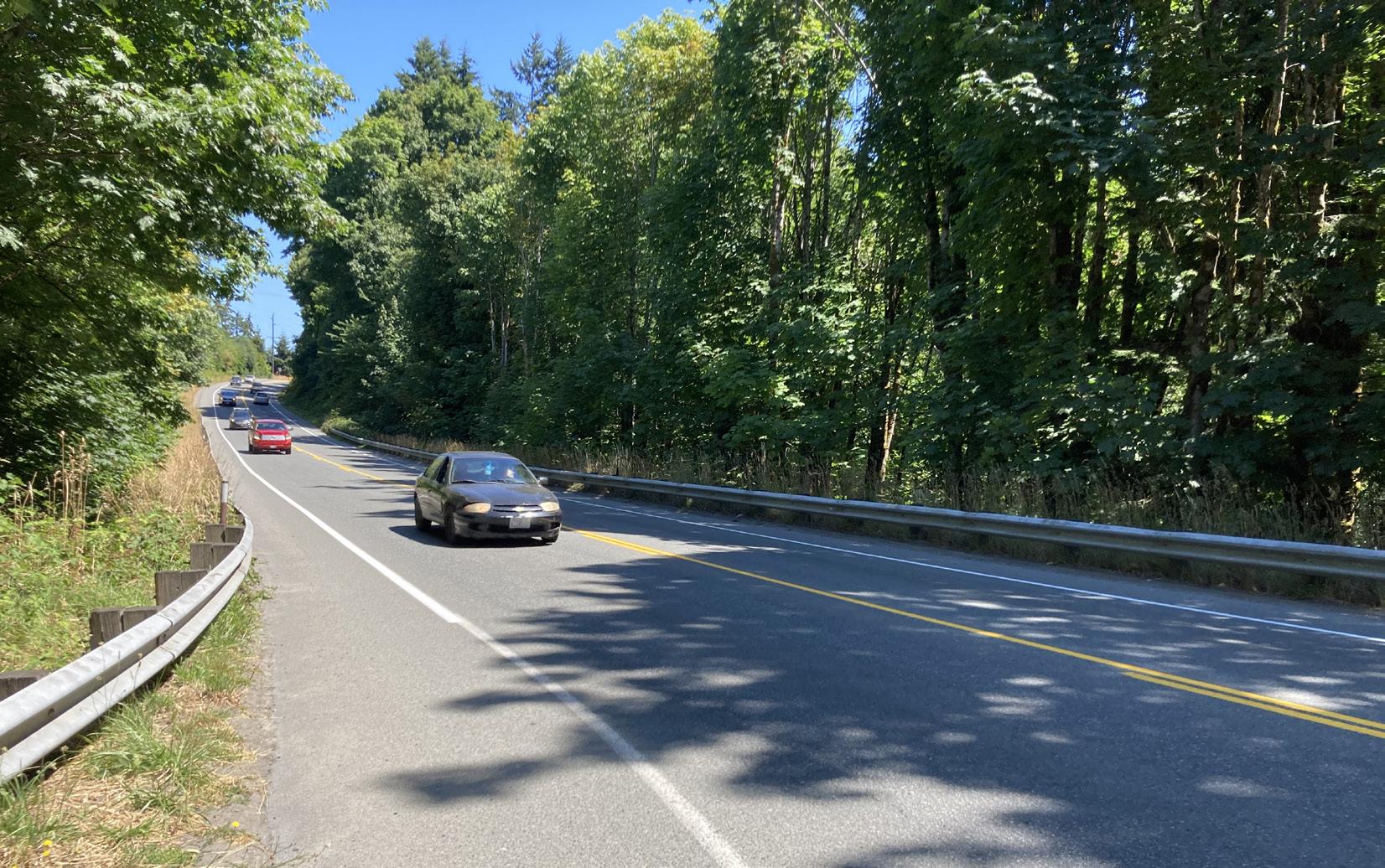
Accessibility
There are varying degrees of wheelchair accessibility in and around the project area in the Lower Watershed. There are flat, well maintained sidewalks along West Front Street and Marine Drive leading to and from the Valley Creek Estuary Park but the sidewalk disappears part way down South Valley Street and non-vehicular traffic must share the street with cars.
The current degree of wheelchair accessibility on the roadways of the middle watershed is also inconsistent and there the different segments of the watershed are not directly connected for wheelchair users. The upper watershed is entirely inaccessible to wheelchair users without a vehicle due to the rugged uneven terrain.
Recommendations:
• Consult specialists to ensure the maximum degree of accessibility is achieved throughout the Daylighting Project and trail design, including features like Braille on interpretive signs and audio crosswalk signals
• Incorporate planning for accessibility into all watershed projects whenever practicable
43 Context - Built Environment
Figure 53. Vehicle traffic at the Verne Samuelson Trailhead on Highway 101
Context - Built Environment
ESTUARY PARK TRAIL
PORT ANGELES HARBOR
OLYMPIC DISCOVERY TRAIL
Trails
Olympic Discovery Trail
The Olympic Discovery Trail is a nationally significant, non-motorized multi-use recreational trail across the North Olympic Peninsula. This 135-mile trail starts in the Victorian seaport of Port Townsend and ends on the shores of the Pacific Ocean. It is a combination of roads and multi-use paths with more than half of the route being nonmotorized (Peninsula Trails Coalition, 2022). The Olympic Discovery Trail runs along the downtown waterfront of Port Angeles, past the Black Ball Ferry terminal to the Friendship Bridge across the Valley Creek Estuary before continuing west past the Port’s industrial shoreline.
Valley Creek Estuary Park Trail
There is a short trail from the Friendship Bridge on Marine Drive to
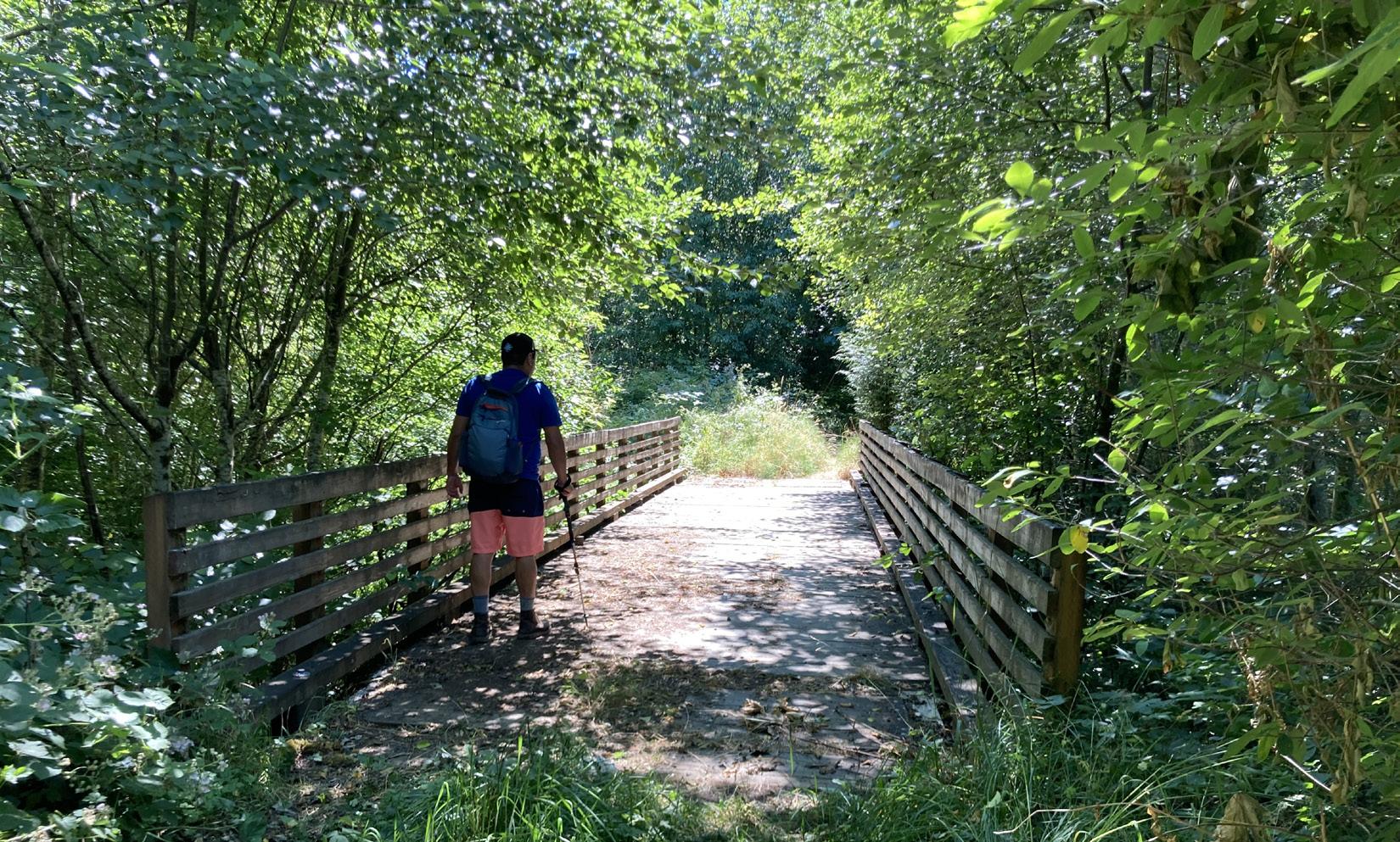
NLEGEND
Paved
Pedestrian
Proposed pedestrian trail
Informal way trail
44
PEABODY CREEK TRAIL
VALLEY STREET TRAIL
VERNE SAMUELSON TRAIL
Figure 54. Trails around Valley Creek
Figure 55. Pedestrian bridge over Valley Creek on unnamed South Valley Street trail
bike trail
trail
the Estuary Park beach.
South Valley Street Trail
A section of unnamed trail starts at the end of South Valley Street, at West 12th Street and heads south along the creek until it ends just below the large culvert that passes under Highway 101 (see Figure 54.
Verne Samuelson Trail
The 1.5 mile long Verne Samuelson Trail begins at the south side of Highway 101 where there is a pullout with parking for two vehicles at the trailhead. A second access point to the Valley Creek Trail is found at the end of Wellman Road off of Black Diamond Road. This trail system is owned by the City of Port Angeles and Clallam County and is primarily used by Port Angeles residents.
Way Trails
There are numerous informal access trails throughout the Valley Creek Watershed, many of which drop down from the neighborhoods lining the lower and middle watershed. One such example is a large trail leading from the bluffs on West 3rd Street to South Valley Street. Some of these trails were mapped through the GreenLink Planning process (see Appendix E).
Other Trails
Other local popular trails, including the Peabody Creek Trail and trails around Heart of the Hills in Olympic National Park, are easily accessible and could be connected through city streets to trails in the Valley Creek Watershed. The Department of Natural Resources has recently created the Foothills multi-use trail (including all-terrain vehicles) through a recently logged area that looks out over the Upper Valley Creek Watershed. This trail departs from the Little River Road and is a potential connection point to the Little River Trail and other trails in Olympic National Park. (See appendix E.)
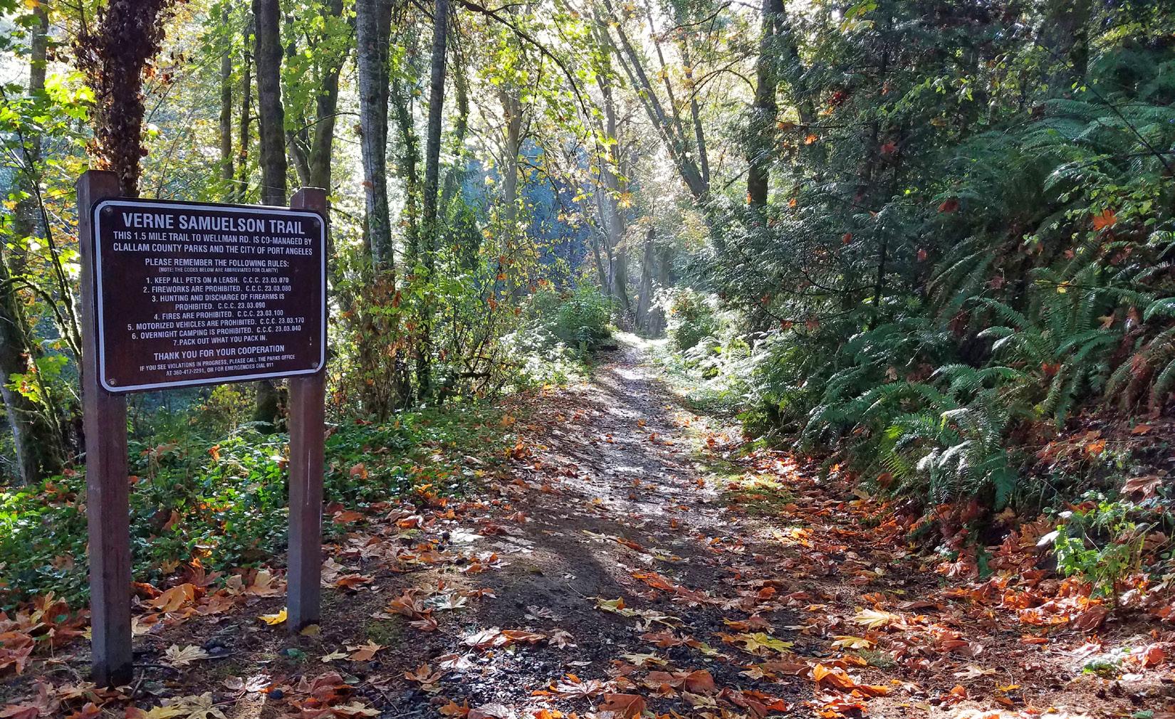
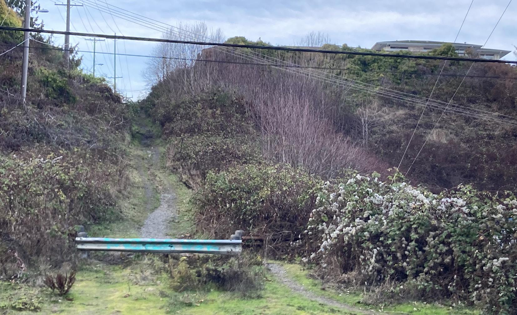
45 Context - Built Environment
Figure 56. Verne Samuelson Trailhead at Highway 101
Figure 57. Informal way trail to Valley Street from West 3rd Street
Context - Built Environment
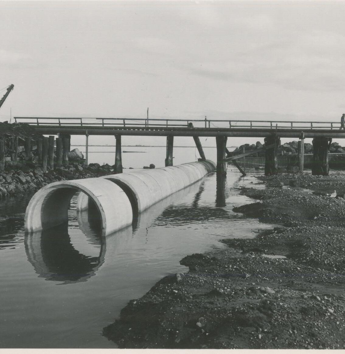
Creek Use By People Experiencing Houselessness
People experiencing houselessness have been known to use the Valley Creek trails and Valley Creek Estuary Park for camping and storing possessions. Despite no suitable alternatives, the evidence left behind can deter other people from enjoying these public facilities. The trails south of West 12th street have had somewhat less use by houseless people following a 2018 cleanup of an abandoned camp on Valley Creek. The work of organizations like 4PA, a local non-profit working to clean the city while simultaneously working to provide shelter for the houseless population, has led to significant improvements in the trails and downtown waterfront aesthetics, enhancing the quality of life for everyone.
Recommendations:
• Take advantage of the flat landscape to make a fully wheelchair accessible trail and park along the length of Valley Creek until West 11th Street, allowing wheelchair users to experience local ecology and reap the benefit of this community asset from the ferry and other points downtown
• Create a trail from the downtown waterfront and Olympic Discovery Trail to Olympic National Park up the Valley Creek Watershed with connections to the Peabody Creek, Heart of the Hills, and Little River trails
• Communicate with interested houseless population to identify concerns about the project and ways the restoration projects might support their needs, an example might include providing lockers, limited camping, or bathrooms
• Develop a security and maintenance plan for Valley Creek
• Establish stewardship groups
• Support the other organizations already working to improve conditions for the houseless people in Port Angeles
Culverts
The installation of culverts on Valley Creek put an end to the once abundant runs of anadromous fish that resided there. Until these culverts are repaired, treaty protected fish, including winter steelhead, which is federally listed as a threatened species, cannot access the upstream habitat they require for reproduction and rearing.
The fish passage in Valley Creek for treaty protected fish and its tributaries are impeded by eight culverts (see Appendix F for more detail). Two of these culverts are located on the creek’s mainstem, five are located on Mill Creek (East Valley), and the last culvert is located on an unnamed tributary approximately 3.5 miles south of HWY 101.
From West 6th Street to the Strait of Juan De Fuca outlet, approximately 2,100 feet of culverts convey Valley Creek under South Valley Street through downtown Port Angeles (see Figure 60 on page 47). The culvert’s lower section is the focus of the first phase of the Daylighting and Restoration Projects. Sections of culvert were added over different time periods and there is some documentation suggesting the pipe diameters are not consistent (see Figure 58). Where Valley Creek first enters the culvert, it passes through a large grate into a seven-foot pipe. At the outlet, the pipe is mostly submerged and buried in sediment but appears to be five feet in diameter. The lower end culvert is not considered large enough to pass a 100-year flood event.
The lowest 400-foot section of this culvert was removed with construction of the Valley Creek Estuary Park and the current outlet is now aggraded with decades of accumulated sediment severely constricting the opening. There is a steep interior gradient break where the culvert must bend around the old disused industrial water pipe that once supplied the mills with water front the Elwha River. Fish must navigate the narrow, submerged opening and wait until the pipe is sufficiently backwatered by the tide twice a day, to try and jump up into the next section of undersized pipe.
The WDFW has rated the culvert 33% passable, based on field data collected in 2016 and the online DNR Forest Practices Application map lists the culvert as 20% passable. However, there is little evidence of current fish use. These undersized and otherwise improperly designed culverts are smooth and featureless with no natural meander, rocks, or woody debris to slow the flow or provide the places fish need to rest.
The lowest section of culvert is listed as an unfunded project in the City of Port Angeles Capital Facilities Plan 2023 - 2028 and was estimated to cost just over one-million dollars. Part of the original incentive to repair this pipe was due to the high estimated cost to
46
Figure 58. Valley Creek culvert installation, 1957
Source: Photo courtesy of North Olympic History Center, 2023
maintain the pipe and remove the accumulated sediment and debris (upstream of the outlet). This task has proven less expensive than anticipated though the need to provide fish passage remains. As the most significant barrier to fish on Valley Creek, repairing this culvert must be the first priority since few fish are likely making it past this point to the habitat above. While the mechanism for funding culvert repairs at the local level has not been established, the culvert case brought by the treaty tribes of Washington State is generally seen as precedent setting and it is thought that funding will eventually be made available to local jurisdictions where need is high.
Though Highway 101 and Highway 117 (Tumwater Truck Route) are connected through downtown Port Angeles, this stretch of the road is not part of the state highway system. Repair of the culvert at Tumwater Creek and Marine Drive, less than .25 miles west of Valley Creek, is considered to be the responsibility of the State of Washington because trucks using Highway 101 are required to pass through Port Angeles via downtown and Highway 117. The Valley Creek culvert is not currently considered to be the State’s responsibility but what differentiates the qualification of these culverts for state funded repair is not immediately evident.
The second Lower Middle Watershed culvert and bridge on the mainstem provides road access from South Valley Street to several houses on the east bank. This culvert has a slope barrier and is considered to be 67% fish passable. This bridge needs repairs with construction costs estimated at 1.5 million dollars and is also on the City’s list of unfunded capital projects.

GRADIENT JUMP
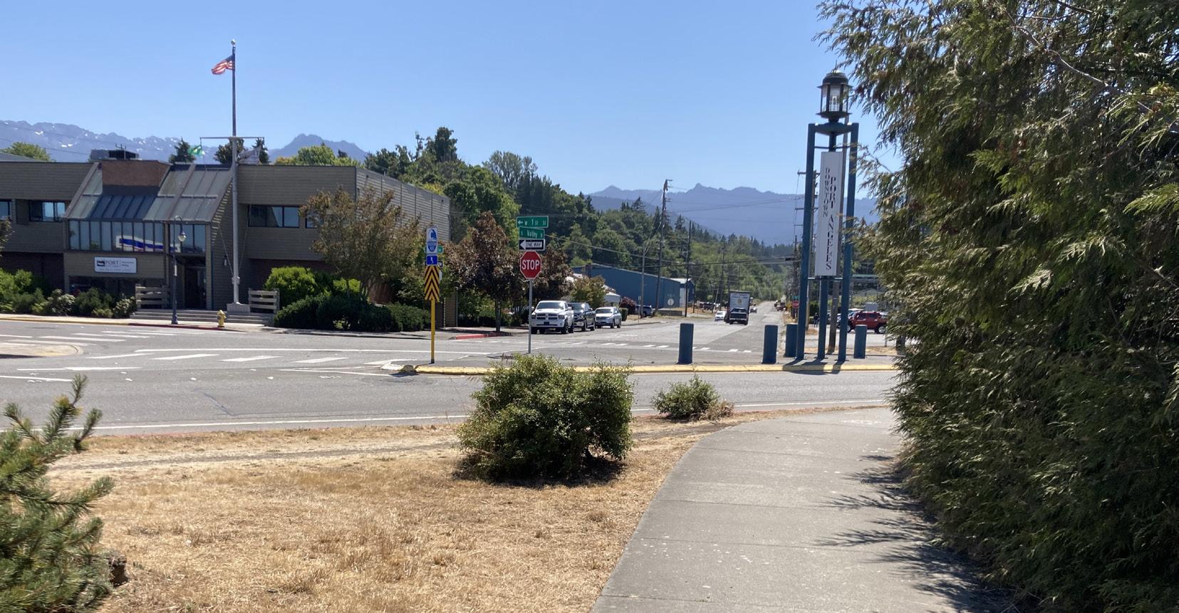
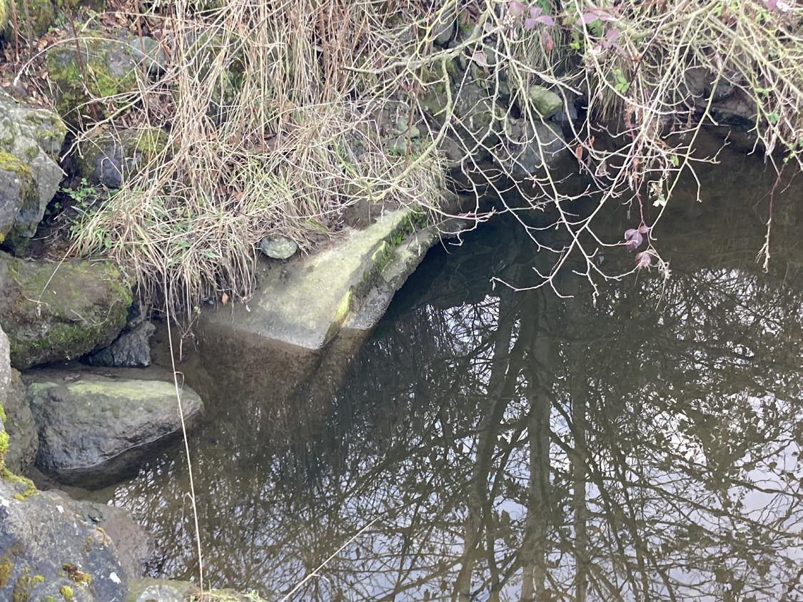
Valley Creek flows under Highway 101 through a large box culvert. In 2000, WDFW installed 24 wood baffles in the culvert and a concrete weir was installed at the edge of the apron. A roughened channel was constructed downstream of the culvert and the culvert is now considered to be completely passable to fish according to the WDFW (see Figure 62).
There is a series of culverts in the Upper Middle Watershed on Mill Creek (East Valley Creek) of unknown significance to fish, meaning the physical characteristics for potential fish use are present but their current or historic use is unknown. The culvert of the tributary near Laurel Street is perched and impassable to fish. Two other culverts at South Crabapple Place and South Coyote Run Lane are also assessed as total barriers. The remaining two culverts on Mill Creek at East Ahlvers Road and Rhodes Road are assessed as 33% passable and still meet the criteria for potential fish use. The last culvert on an unnamed tributary to the mainstem near Fors Road, has been assessed as impassable by WDFW.
Recommendation:
• Replace and repair all barrier culverts working from the lowest barrier up
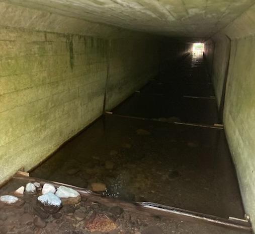
47 Context - Built Environment
Figure 59. 6th street culvert section showing internal gradient break that fish must jump. Source: Herrera
Figure 60. View looking south up South Valley Street where Valley Creek flows through culverts under the roadway
Figure 61. Submerged outlet of Valley Creek culvert
Figure 62. View of wooden baffles installed along the bottom of the Valley Creek culvert under Highway 101
Context - Built Environment
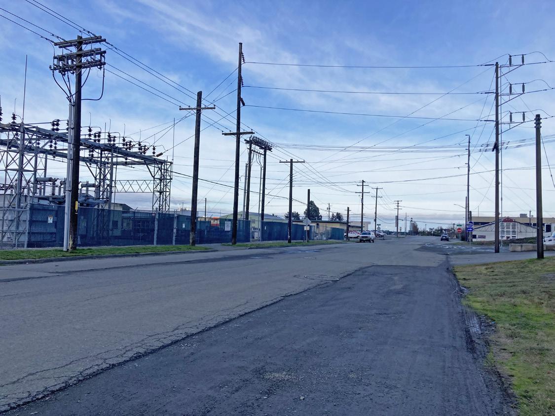
Utilities
Within the Valley Creek Daylighting Project area, the concentration of utilities is reflective of the highly developed nature of the site (see Figure 64). An abundance of underground utilities includes sanitary sewer (pressure mains and gravity lines), water, and storm drains, and power lines run overhead. Most of the utilities in the Daylighting Project area, in the South Valley Street Right of Way, and on the private properties to the west, would need to be relocated to implement the Daylighting Project.
There are two sewer lines running parallel to the creek on South Valley Street, approximately 36 feet apart. Both drain by gravity towards the harbor. A sewer line runs parallel to the south part of
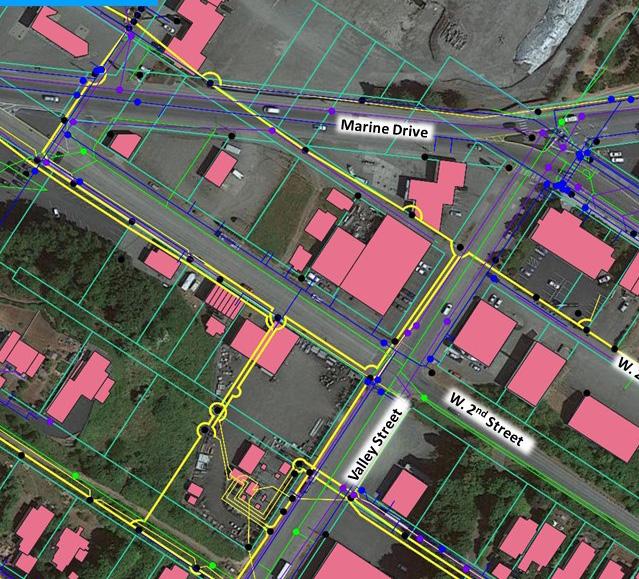
NWest 2nd Street (the alley) and there is also a sewer main that runs along the center of Marine Drive and a water main that runs along the south side of Marine Drive and the north side of West 2nd Street. A section of the abandoned 48-inch industrial water line that runs from West First Street along the north side of Marine Drive, crossing Valley Street, would also need to be removed (for more information see Appendix G).
Throughout the project area and along South Valley Street, the numerous overhead power lines are unsightly and distract from the exceptional natural beauty of South Valley Creek and the surrounding landscape.
Further upstream, all the residences on South Valley Street, from West 6th Street to the dead-end at West 11th Street, are connected to a city sewer line with the exception of the last five properties. Of those last five properties, at least three of the homes are on septic systems within the riparian zone (for more information see Appendix H). Reportedly, some of the older homes along the tops of the ravine may be on outdated septic systems of unknown condition and status of which needs to be evaluated.
Utilities through the rest of the watershed would need to be assessed based on the location and goals for a specific potential project, however the stormwater conveyance system collecting runoff form the neighborhoods around Cherry and Pine Streets, Black Diamond Road and others in the watershed, is having significant impacts to the health of Valley Creek. There is a detailed assessment of stormwater in “Water” on page 52.
Recommendations:
• Relocate utilities as needed to implement Daylighting Project and subsequent watershed projects
• Bury power lines to improve safety and aesthetics
• Assess the of status of septic systems along the Valley Creek ravine
• Work with interested homeowners to make any needed sanitary system upgrades
48
Figure 63. Power lines in the Valley Creek Daylighting project area.
Power Water Sewer
Stormwater Buildings LEGEND
Figure 64. Lower Valley Creek Utilities Map. Source: Herrera
Environmental Conditions
Soils and Geology
The 1978 Tabor and Cady Geologic Map of the Olympic Peninsula, shows moraine and stratified deposits of sand, gravel, silt, and clay, characterized by rocks foreign to the Olympic Peninsula, indicating that glaciers have been the primary sculptors of the Valley Creek Watershed. The surface geology was formed by Pleistocene materials deposited by the Juan De Fuca Lobe of the Cordilleran ice sheet during the Fraser Glaciation, and the Holocene deposits left as the glaciers receded (Henry W., [Schasse] & Washington Department of Natural Resources, 2003. Geologic Map).
The Daylighting Project area is located almost entirely on 12 to 18 feet of Holocene artificial fill and modified land (Department of Natural Resources, 2023). Soils within the Daylighting Project area are mostly mapped “beaches” north of West 2nd Street because the tidelands there were hydraulically filled to support industrial development. Landform mapping (Wegmann et al. 2012) shows that the Daylighting Project area is located on the historic Valley Creek delta and supratidal beach. Deltas are the landforms created by streams, rivers, and creeks depositing sediment at the confluences with larger bodies of water like lakes and oceans. Because the Daylighting Project area is on the historic delta, deposition and sedimentation has buried most of the opening of the culvert. This sedimentation required dredging by the City in 2011 and ongoing deposition should be anticipated in the Daylighting Project design. A band of soils along bluffs just south of West 2nd Street are mapped as colluvial Dystric Xerorthents (Natural Resource Conservation Service, 2023) which are deep, moderately well drained to excessively drained soils located on the sidewalls of river valleys and entrenched streams. In the Middle and Upper Watershed, a steep ravine has been carved out by the glacier and the downcutting of Valley Creek.
There are numerous deep-seated landslides mapped in the Valley Creek riparian corridor, meaning that the soil has the potential to slip below the rooting zone of trees if they are active (Geologic Hazard Maps | WA - DNR, 3 C.E.).
South of Highway 101, there is a finger of thin-bedded sandstone, primarily fine to medium-grained, and calcareous with some conglomerate and pebbly deposits found in places. In the foothills, the upper watershed is part of the Crescent Formation which is characterized by marine Basalt, where pillows and tube structures are common. Thin tongues and isolated lenses of sedimentary rocks are found in this upper watershed as well as small pockets of landslide deposits (Tabor and Cady, 1978).
Recommendation:
• Evaluate landslide risks and phase out structures in potentially hazardous locations
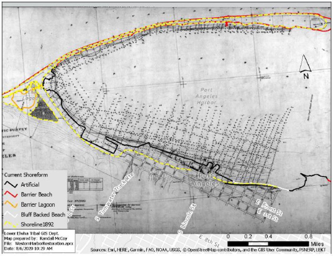
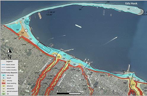
49 Environmental Conditions
Figure 65. Map of Valley Creek soils and shoreline soils underlying fill
Figure 66. Historic shoreline
Environmental Conditions
Soil Contamination
According to the WDOE, there are four hazardous waste sites in or adjacent to the Daylighting Project site that may be affected depending on the final project routing and design (see Figure 67 for locations and Appendix I for detailed information). City Manager Nathan West has expressed that cleanup of any of the extensive soil contamination in downtown as result of the Daylighting Project would be a genuine benefit to the City.
K-Ply Property
Various owners operated plywood mills at the former K-Ply property between 1941-2012. The site, now owned by the Port, is contaminated with diesel, gasoline, and other organic chemicals found in petroleum products and in manufacturing processes. Cleanup to an industrial use standard was completed in 2018 and the Port conducts performance monitoring. No contaminants have been found in the southeast corner of the property where it has been proposed that a short portion of the restored creek channel might pass through.
331 West 1st Street
This site of a gas station and convenience store, was identified as a potential hazardous waste site in 1991. Cleanup was completed under the WDOE’s voluntary program in 2001 and is now listed as requiring “No Further Action.” This site is approximately 200 feet east of the Valley Creek culvert and none of the proposed alternatives bring the creek closer.
402 Marine Drive
This 0.38-acre parcel with a gas station and convenience store is listed as having “Cleanup Started” by WDOE. Soil contamination was detected during underground storage tank removal and more than 1,800 cubic yards of contaminated soil was removed by 1996, however known contamination remains. The owner previously entered the voluntary cleanup program, but participation was canceled due to a lack of action. The preferred alternative would reroute Valley Creek through this property, requiring site cleanup.
50
N 1stSt. FRONTST. W2NDST.
FORMER K-PLY
W. 1ST STREET
Figure 67. Identified hazardous waste sites in the Valley Creek Daylighting Project area. Source: Washington State Department of Ecology
MARINE DR.
SITE 331
MARINE DRIVE Cleanup complete Contaminated Contamination status unknown LEGEND
436 MARINE DRIVE
402
436 Marine Drive
This property is listed as “Cleanup Started”by the DOE. In 2015 the Department of Ecology sent a letter encouraging the owner to enter the voluntary cleanup program. Soil contamination was documented from a leaking underground storage tank that was later removed but no further information on the cleanup status of the site is provided on the Department of Ecology website. This site is included in the area that is being proposed for a park around lower Valley Creek and would need to be evaluated and possibly cleaned-up or stabilized.
Recommendations:
• Study extent of contaminated soils
• Develop clean-up plans
• Seek funding for clean-up and possibly property acquisition
• Implement plans
• Create open space and room for water to move where damage is less likely
Seismic Hazards
The Cascadia Subduction Zone is a 600-mile fault running from Northern California into central coastal British Columbia just west of the Pacific coastline. The Juan de Fuca Plate is being pushed, or subducted, under the North American Plate and the friction is causing pressure to build. The plate will eventually slip causing a megathrust earthquake that is expected to cause coastal flooding and inundation and widespread infrastructure damage. The last major event occurred on January 26, 1700 and the resulting tsunami reached the coast of Japan over 4,500 miles away. A large-scale earthquake is “overdue” and anticipated on the North Olympic Peninsula.
Modeled tsunami inundation zones show the Valley Creek Estuary under six or more feet of water and water being pushed up South Valley Street as far as West 5th Street. The entire Valley Creek Daylighting Project area is within the inundation zone in the event of a magnitude 9 Cascadia earthquake. In the event of a magnitude 9 Cascadia earthquake, the Washington DNR projects the sea level would drop approximately 6.5 feet before the first tsunami waves arrive on the Strait of Juan de Fuca (McMacken, 2018). For this reason, it may be prudent to minimize large infrastructure investments in the expected tsunami inundation zone. The proposed open space and park are likely to absorb the impacts of this type of event better than the surrounding structures.
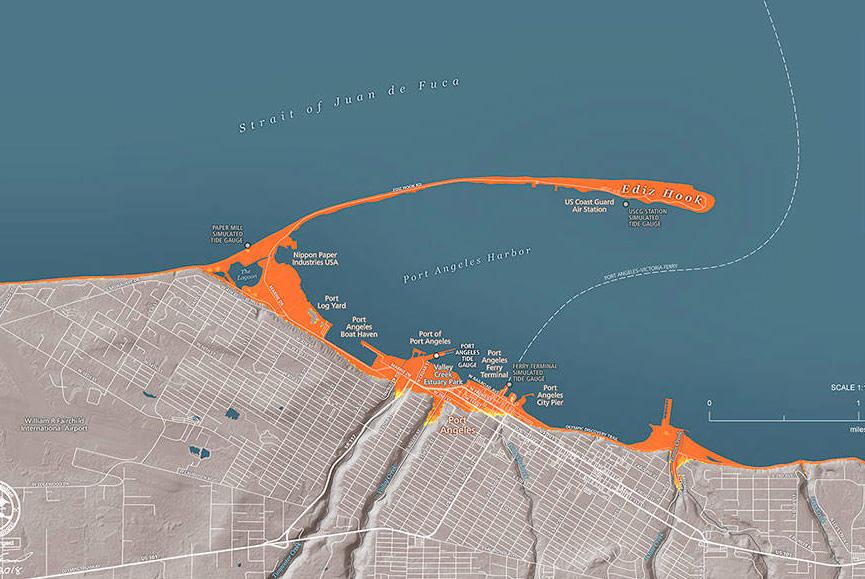
LEGEND
51
Environmental Conditions
>6 2.5-6 0-2.5
Figure 68. Predicted impacts from a tsunami on Port Angeles. Source: Peninsula Daily News
Modeled inundation depth (feet)
Environmental Conditions
1%
1%
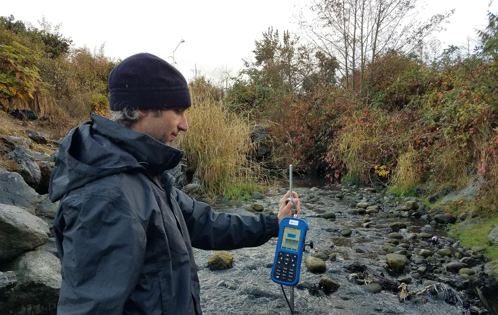
Water
Hydrology
Development, lack of vegetation, and extensive impervious surfaces have severely altered the natural infiltration of rainwater in the Valley Creek Watershed. Reduced groundwater recharge and modulation of water flowing on the landscape are causing “flashier”, more extreme variations in creek flow that leads to scour and flooding inhospitable to fish and other aquatic organisms. Though this is a concern throughout much of the Valley Creek Watershed, the effect is most intense downtown and gradually decreases the further up the watershed you travel.
Logging operations in the headwaters disrupts hydrologic regimes with vegetation removal and road construction causing soil compaction, erosion, sedimentation, increased runoff, and flashier conditions.
Precipitation and Flows
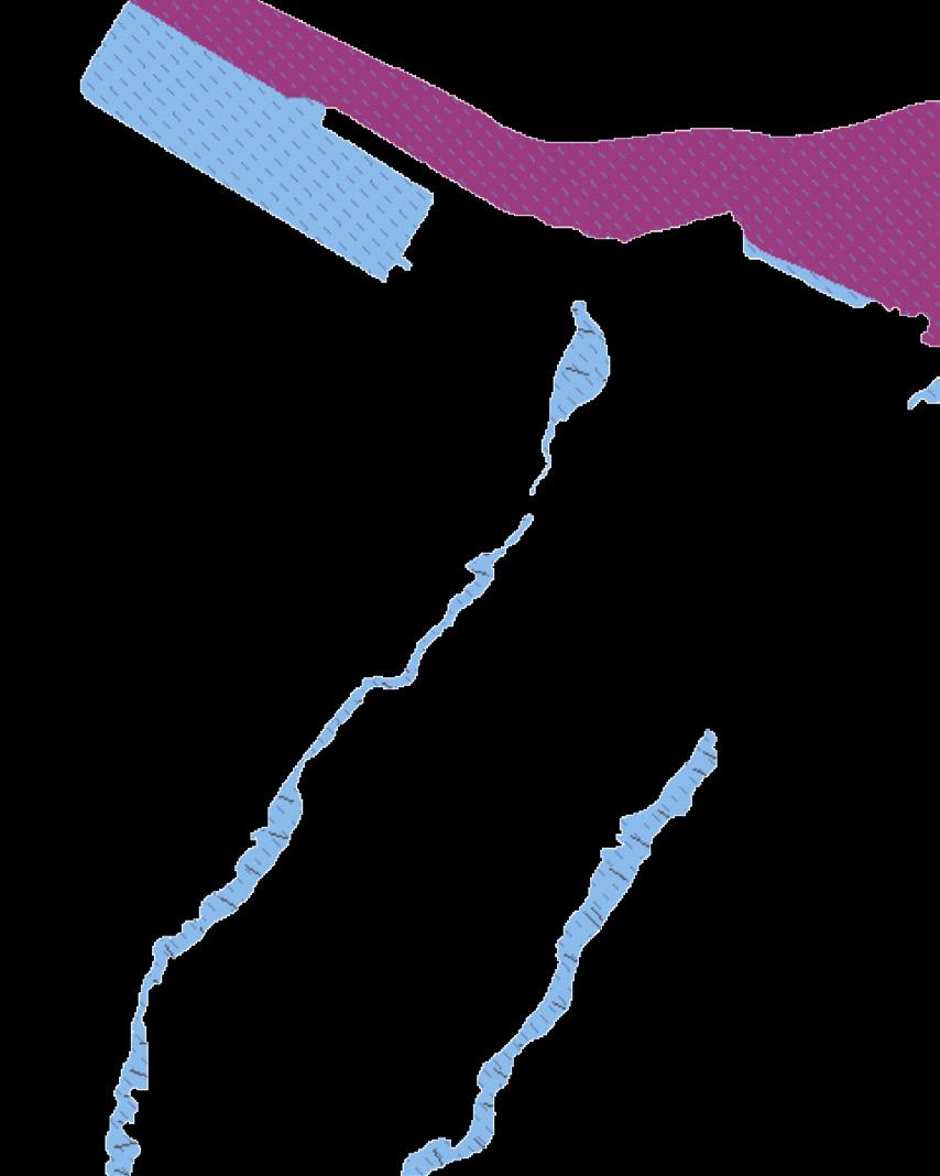
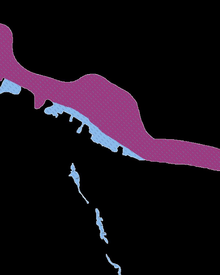
Valley Creek is a rain-fed system (as opposed to snowmelt) that originates in the foothills of the Olympic Mountains with average annual watershed precipitation from twenty-five inches at the coast to more than thirty inches in the headwaters. The stream’s monthly total flow typically declines during the spring and early summer with increased seasonal flow generally observed in late fall (ElwhaDungeness Watershed Plan, 2005). Stable summer temperatures indicate the moderating influence of groundwater inputs (Green, 2023).
WDFW has monitored Valley Creek flows, eight blocks south of the outlet, since 1999. From 1999-2000 the average flow rate was 4.6 cubic feet per second (cfs). On December 15, 1999, the high flow rate was measured at 225 cfs. The low flow rate was 2 cfs in summer (Elwha-Dungeness Watershed Plan, 2005). Streamkeepers of Clallam County have also collected Valley Creek flow data since the 1990’s, (see Appendix J for Streamkeepers flow data).
52
Figure 69. Streamkeepers volunteer Dan Lieberman measures flow in Valley Creek, April 2022. Source: Streamkeepers of Clallam County
Flood Insurance Rate Map © 2023 Microsoft Corporation © 2022 Maxar ©CNES (2022) Distribution Airbus DS © 2022 TomTom January 29, 2023 0 0.2 0.4 0.1 mi 0 0.3 0.6 0.15 km 1:18,056
Figure 70. Flood hazard areas. Source: Department of Ecology
Floodway
annual chance (floodplain)
annual
LEGEND N
chance (velocity zone)
Flooding
Valley Creek has a history of repeated and significant flooding. Considered to be Port Angeles’ worst and deadliest flooding disaster, a large log jam or landslide gave way in 1863, sending a 15foot wave of water, mud, and debris down Valley Creek, destroying the new Customs House and many other buildings and residences and killing two people. According to a memoir written by Phoebe Goodell Judson, the Klallam people had warned the settlers about the danger of building around the outlet to Valley Creek but this advice was ignored (Banel, 2019). The lack of large woody debris in Valley Creek today and a higher level of awareness has led to the conclusion that there is no risk of repeated flooding on this scale. However, Valley Creek does have many deep-seated landslides along the ravine and it is possible a slope failure resulted in the tremendous volume of material being released during that event. There is photographic evidence of other serious floods in Valley Creek in the 1920s and again in the 1950s, and personal interviews suggest there have been other large floods in Valley Creek as recently as 30 years ago. The creek was culverted from West 2nd Street to West 6th Street in 1957 to control flooding but the lowest section of culvert may be too small to withstand 100-year floods exacerbated by the rising sea levels and extreme precipitation events resulting from climate change (McHenry & Odenweller, 1998). The upper end of the downtown culvert is documented to be seven feet in diameter and was modeled by Herrera Environmental as being able to handle a 100-year flood event, but the portion of pipe from Marine Drive north may be only five feet in diameter and would not be big enough for a 100-year event (see Appendix G). The outlet of the pipe is buried in sediment and there are conflicting reports and evidence about the diameter of this section that will be important to verify regardless of the outcome of this project.
The Valley Creek Estuary and nearshore are in a Federal Emergency Management Agency Flood Zone subject to 1% risk of inundation by flooding and hazards due to storm-induced wave action (Washington Department of Ecology, 2023; see Figure 70 on page 52). Flooding on the street over the culvert is modeled to be less likely then from West 6th Street up where the creek is still above ground. Valley Creek is categorized as having a 1% or greater chance of annual flooding in the areas above West 6th Street which is considered high and requires mandatory flood insurance and adherence to floodplain management standards (Federal Emergency Management Agency, 2022).
Recommendations:
• Determine size of culvert at the outlet
• Size creek conveyance system adequately to reduce flooding risks and remove structures from highest risk locations
• Remove unnecessary paving and add vegetation to increase precipitation infiltration and uptake and to moderate extremes in water volume and rates of flow
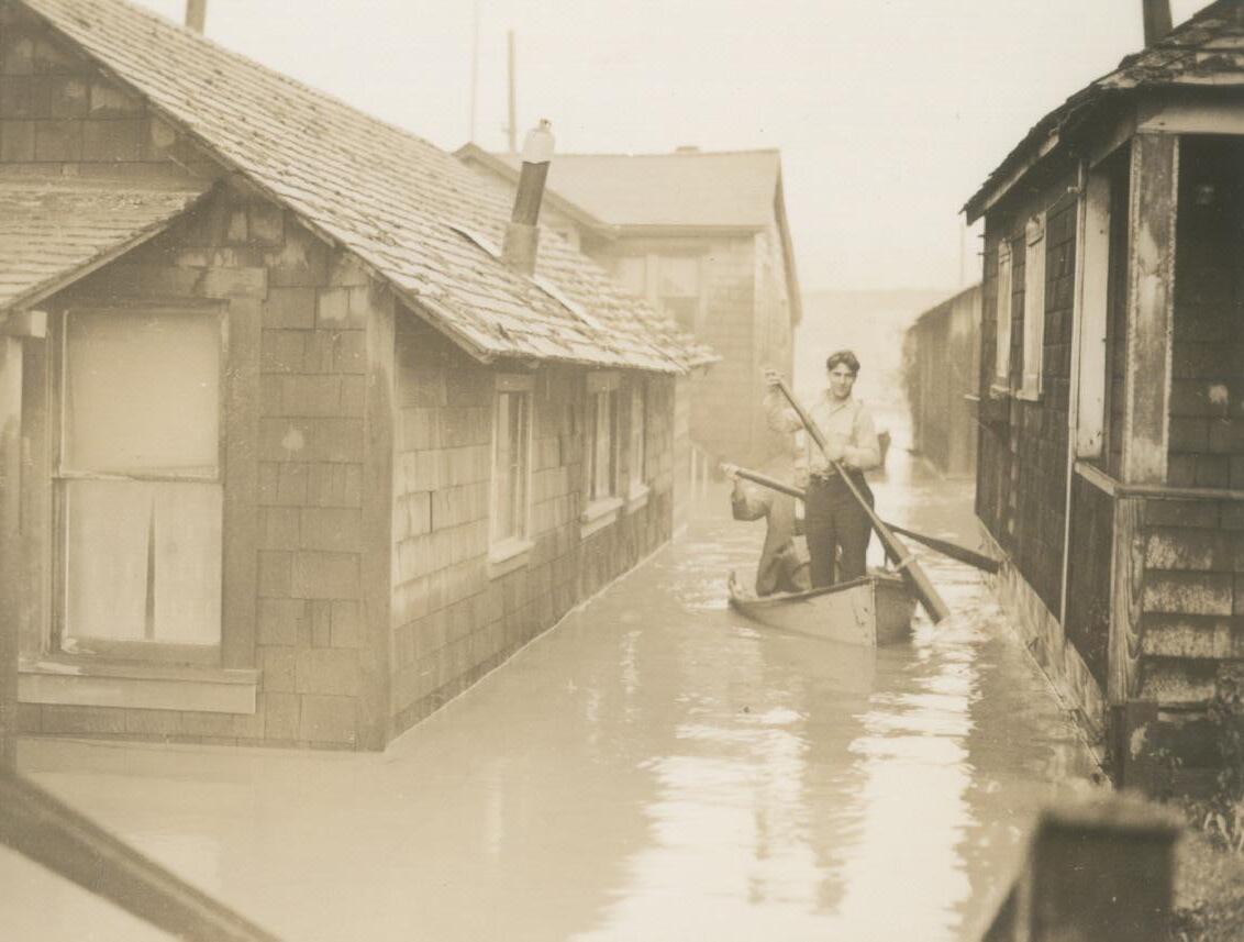
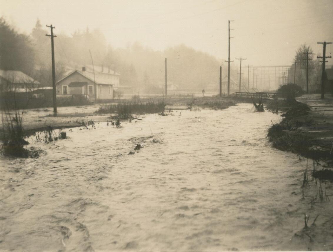
53 Environmental Conditions
Figure 71. Valley Creek flooding in the 1950’s.
Source: North Olympic History Center, 2023
Figure 72. Valley Creek flooding in the 1920s. Source: North Olympic History Center, 2023
Environmental Conditions
Leaky Septic Systems
Previous communications with Clallam County Habitat Biologists have indicated elevated levels of fecal coliforms present in Valley Creek. This may be an indication of leaking septic tanks in the floodplain. A search on the City of Port Angeles’ multi-use map showed all houses, except the last 5 properties, on Valley Street connected to a sewage line. Houses with septic tanks are located on at least 3 of the 5 properties though one of these septic tanks is only 50 feet from the creek.
Wetlands
There are several small wetlands on the tributaries running through the neighborhoods of the Upper Middle Watershed south of Highway 101, mostly classified as Freshwater Emergent Wetlands on the National Wetlands Inventory. The largest of these sites is a 5.34 acre wetland at the south end of Laurel Street that is bound by a neighborhood development recently experiencing an uptick in new home construction. Many of these wetlands are on private property and are potentially vulnerable from development and other impacts.
Recommendations:
• Evaluate the status and health of watershed wetlands and identify potential threats to wetland health and opportunities for enhancement and protection
• Work with interested property owners to implement wetland management best practices
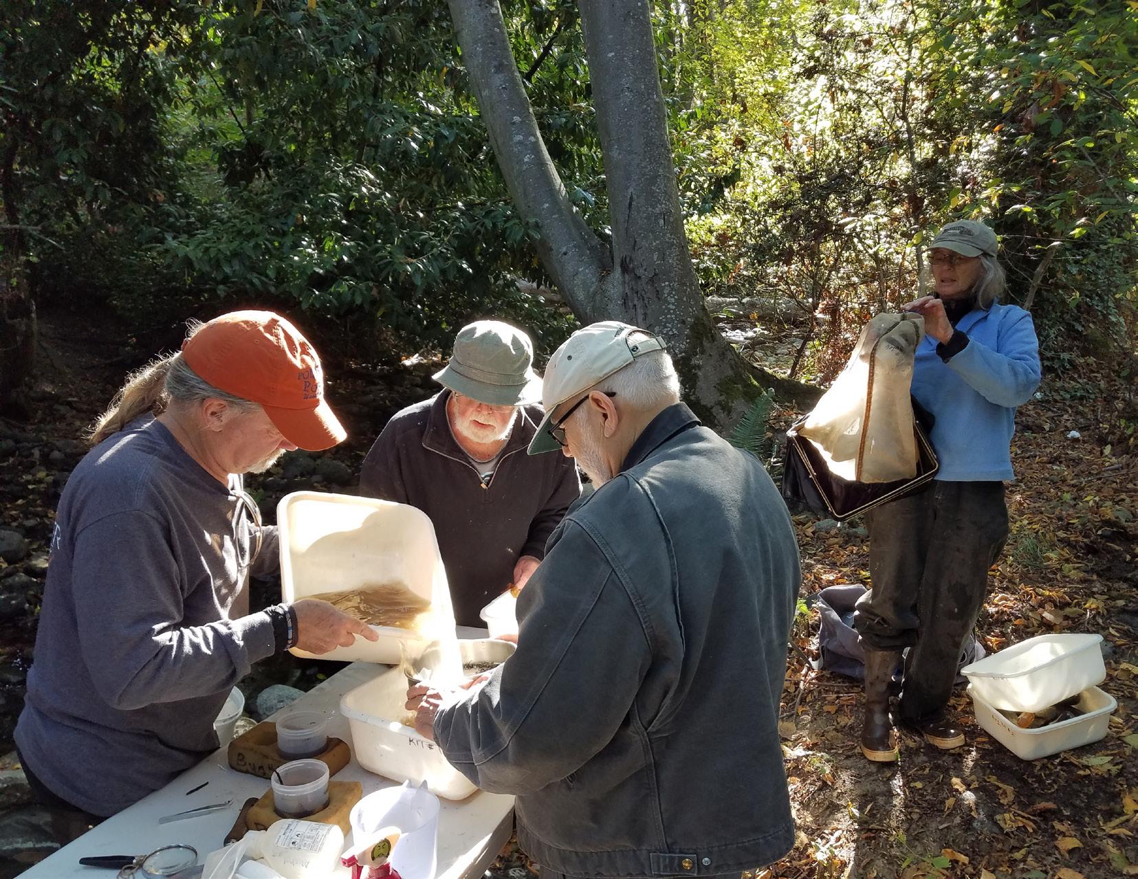
Water Quality
According to the US Environmental Protection Agency, Valley Creek is listed as “impaired” under Section 303 (d) of the Clean Water Act due to the presence of fecal coliform bacteria and therefore requires a “Total Maximum Daily Load restoration plan”. As a result, Valley Creek is on the long list of “threatened and impaired waters” in need of a plan to address the problem. Dissolved oxygen, PH, temperature, and turbidity were not evaluated due to insufficient data (How’s My Waterway? | US EPA, n.d.).
The listings in this assessment are based on data submitted to the Department of Ecology by Streamkeepers of Clallam County (Streamkeepers). Since the 1990s, citizen scientist volunteers with Streamkeepers have performed water quality measurements in Valley Creek, including temperature, turbidity, dissolved oxygen, PH, conductivity, salinity, and stream flow. Streamkeepers also assess ecosystem health using the Benthic Index of Biotic Integrity (B-IBI). The B-IBI is a quantitative method for grading stream health based on the aquatic invertebrates found.
The health of Valley Creek is rated “good” north of Highway 101 and in Mill Creek (East Valley Creek) and excellent in the mainstem south of Highway 101. The Department of Ecology considers a rating of “good” to be impaired. Many experts suggest that prioritizing the restoration of somewhat less damaged systems like Valley Creek is likely to provide the greatest benefit for effort expended because recovery is still achievable.
The Washington State Water Quality Assessment (2018 Cycle), published in 2022, describes water quality and biological integrity of Valley Creek based on data submitted to Department of Ecology by Streamkeepers (a subset of the data they collect). Following, is a summary of that information.
54
Figure 73. Streamkeepers volunteers Stephen White, Coleman Byrnes, Sue Nattinger, and Ted Oldenburg processing benthic macroinvertebrate samples, October 2022. Photo credit: Streamkeepers of Clallam County
Bacterial Pollution
Fecal coliform bacteria is an indicator of bacterial pollution, and of whether water is safe for swimming and wading. Valley Creek is in Category 5 for fecal coliform, or “Polluted Water that Requires an Improvement Project”. Note that after January 1 of 2021 E. Coli was used as the bacterial indicator. Fecal coliform should not be above an average of 100 colony-forming units (CFU) per 100 ml. with no more than ten percent of samples containing 200 CFU per 100 ml. In 2016, of four samples collected in Valley Creek, two exceeded 200 CFU per 100 ml and the highest daily average was calculated as 728 CFU/100 ml. In nine the years from 1999 to 2010 (water and calendar years combined) more than 10% of samples also exceeded 200 CFU/100 ml in Valley Creek.
Recommendations:
• Identify non-functioning septic systems and work with homeowners to develop plans to find funding and repair them or connect to the City sewer system
• Provide community education on the importance of cleaning up pet waste and properly maintaining septic systems
Benthic Macroinvertebrates
Benthic macroinvertebrates bioassessments involve collecting samples of insects and other invertebrates that live on the bottoms of creeks, and then identifying and counting them (see Figure 73 on page 54). Different species of benthic macroinvertebrates vary in their tolerance of poor water and habitat quality, and their presence or absence are indicators of stream health. Streamkeepers has conducted benthic macroinvertebrates bioassessments in Valley Creek since 1999. State Water Quality Assessments in 2004, 2008, and 2010 placed Valley Creek in Category 2, or “Water of Concern”. Based on the two benthic macroinvertebrate bioassessments most recently submitted (prior to 2018), Valley Creek is now in Category 1 and meets tested standards for clean water.
Recommendation:
• Improve habitat quality in Valley Creek with increased vegetative buffers, large woody debris, and restored sinuosity.
Dissolved Oxygen
To thrive, salmon and trout require high levels of dissolved oxygen in the water where they live. Based on measurements in Valley Creek from 2000 to 2017, dissolved oxygen was usually found to meet or exceed the water quality criterion of 8 mg/L, though there were occasional exceptions. Based on these results, dissolved oxygen, Valley Creek is in Category 2, a “Water of Concern”. Low oxygen levels are worsened by high temperatures and the input of too many nutrients from sources such as pet waste.
Recommendation:
• Evaluate and repair leaky septic systems
Turbidity
Turbidity is a measure of the water clarity and the level of suspended solids or mud in the water (see Figure 74). Salmon and trout require water with low turbidity to live and thrive. Washington State Water Quality Criteria for turbidity states that designated Core Summer Salmonid Habitat turbidity should not exceed 5 NTU above background when the background turbidity is 50 NTU or less (WAC 173-201A-200). Based on data previously submitted to the Department of Ecology by Streamkeepers, there were two exceedances (6%) of the 5 NTU criteria out of 31 sample sites. Based on these results, Valley Creek turbidity is in Category 2, a “Water of Concern”.
Recommendation:
• Reduce sedimentation and turbidity by controlling erosion with removal of roads next to the creek, increasing vegetative buffers, protecting the tributary headwaters in the managed forests, and filtering stormwater.
Temperature
Measurements show summer water temperatures at stable values, indicating the presence of groundwater. The monitoring of temperature and other water quality parameters like turbidity and dissolved oxygen need to be established.
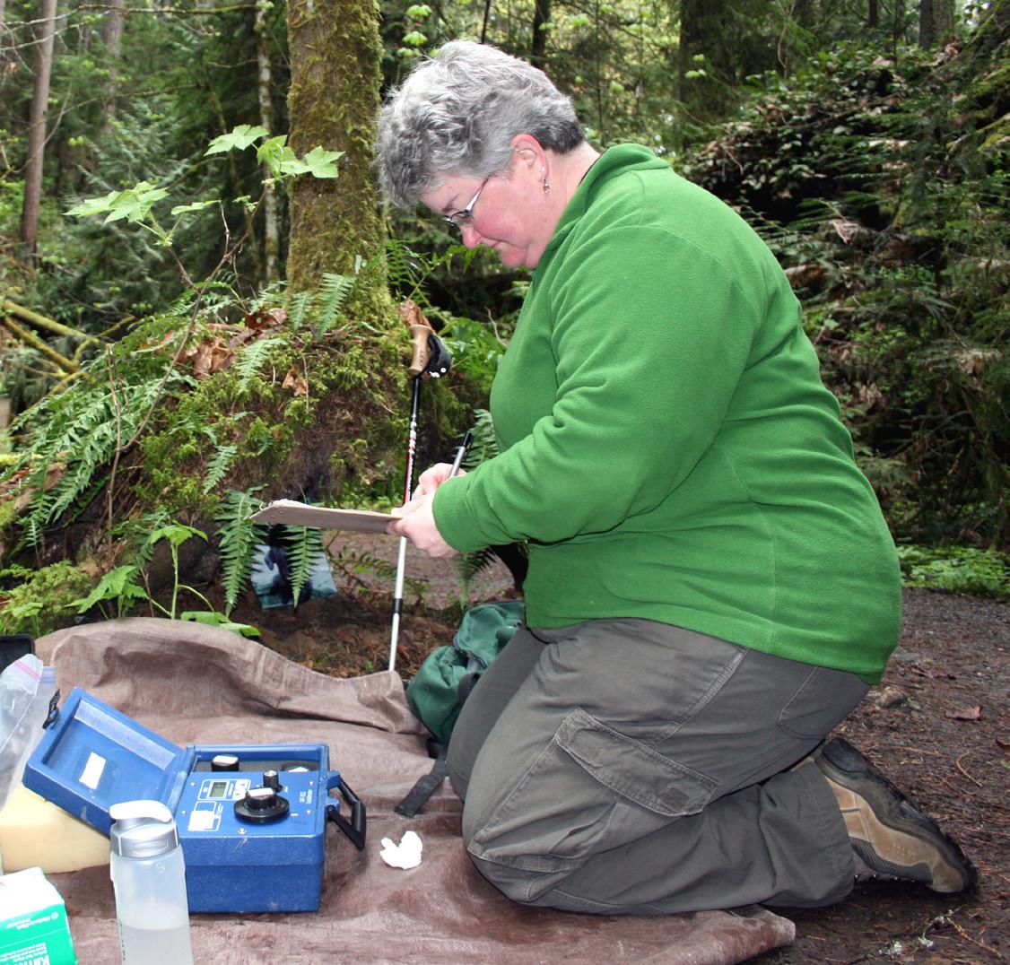
55 Environmental Conditions
Figure 74. Streamkeepers volunteer Robin Sidwell measuring turbidity. Source: Streamkeepers of Clallam County
Environmental Conditions
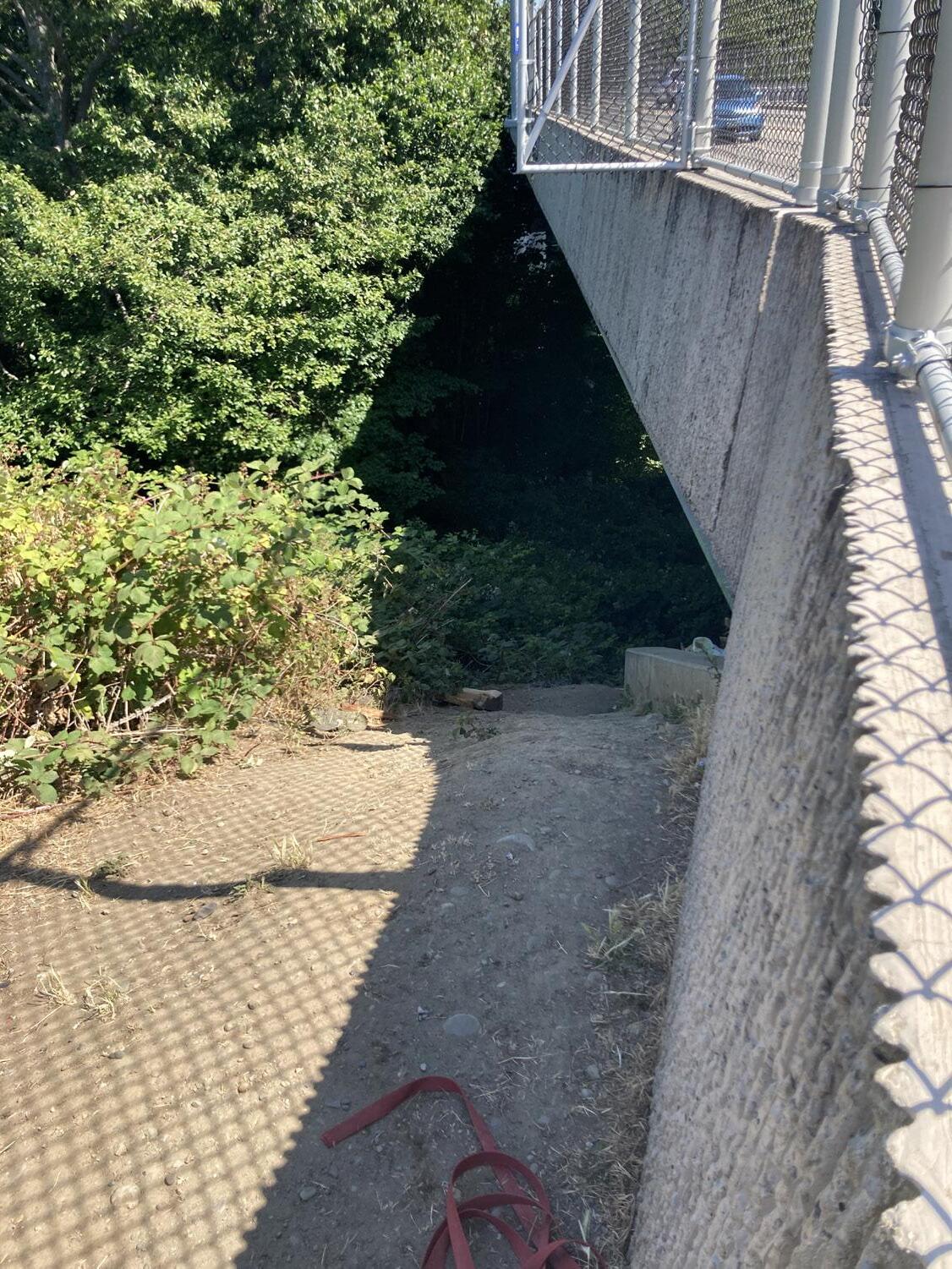
Stormwater
Stormwater impacts to Valley Creek are considered severe, especially in the lower reaches of the creek (Haring, 1999). Untreated stormwater runoff from streets and other impervious surfaces is piped from the surrounding neighborhoods directly into Valley Creek, including large areas of Pine and Cherry Streets, altering the water chemistry with fecal coliform, sediment, metals, hydrocarbons, and other contaminants (Haring, 1999., ElwhaDungeness Watershed Plan, 2005). In 1998, sixty percent of the Valley Creek Watershed was in urban use, with fifty percent of that land covered in impervious surfaces (Tetra Tech, 1998). Conditions have not improved in the last 25 years.
City of Port Angeles stormwater overflow drains also input directly into the Valley Creek estuary (ArcGIS Web Application, n.d.-b), (see Appendix K for detailed information). An analysis done for Clallam County by Battelle concluded that metals associated with stormwater events (i.e. zinc and lead) and hydrocarbons are elevated in streams with human land use activities (Brandenberger et al., 2003). Stormwater contaminants in urban streams in Valley Creek are elevated but are generally below freshwater thresholds. However, levels of zinc may exceed these thresholds.
At several locations, especially downstream of the confluence of Mill Creek (East Valley Creek), untreated stormwater is discharged along the tops of the slopes along the Valley Creek ravine, resulting in erosion and the delivery of other contaminants. During storm events, these outlets are often observed blasting water under pressure onto the hillside, further exacerbating the erosion and resulting sedimentation. Increased peak flows contribute to scouring of the stream bed and a reliance on rip-rap and armoring for bank stabilization. This sediment is also causing aggradation of the outlet to Valley Creek which is gradually and significantly narrowing the opening that anadromous fish must pass through. In the 1999 Valley Creek Limiting Factors Analysis, Haring states that the volume of stormwater release will have to be effectively addressed before restoring the lower channel.
The City of Port Angeles has decided to make Valley Creek the focus of their Stormwater Action Plan, a requirement of their National Pollution Discharge Elimination System permit and they are in the process of developing multiple stormwater projects there. It is hoped that this Master Plan will support that effort.
Recommendations:
• Continue to seek funding to support City stormwater management goals including for repairs and new facilities
• Pursue implementation of GSI and other City stormwater projects, including those identified through the Herrera heat mapping process
• Implement Green Streets projects. Locations might include Cedar Street, Cherry Street and, Marine Drive
• Identify other water quality hotspots and prioritize repair, leaky septic systems for example
• Align actions with City National Pollutant Discharge Elimination System Permit requirements and needs when possible
• Improve riparian buffer conditions (expand width, remove invasive species, plant native plants)
• Conduct educational campaign on pet waste and other stormwater issues
56
Figure 75. Erosion above Valley Creek at northeast corner of West 8th and South Pine
Fish and Wildlife
Fish Salmonids
Though Resident Coastal Cutthroat trout (Oncorhynchus clarkii) apparently predominate in Valley Creek today, all the streams flowing through Port Angeles once had “abundant runs of salmon” according to an article in the November 28, 1953 edition of the Port Angeles Evening News. Summer Steelhead (Oncorhynchus mykiss) and Winter Steelhead (Oncorhynchus mykiss) listed as threatened under the ESA, Fall Chum (Oncorhynchus keta), Resident Coastal Cutthroat trout (Oncorhynchus clarkii), and Coho salmon (Oncorhynchus kisutch) have all been documented in Valley Creek according to the WDFW’s SalmonScape. A combination of impacts from culverts preventing access to spawning grounds to degraded spawning and rearing habitat has caused dramatic declines in the populations of fish in these creeks. Lower Elwha Klallam Tribe biologists state that though remnant populations of wild fish may persist, it is generally presumed that the salmon observed in Valley Creek are hatchery strays and the native salmon and steelhead populations are extirpated, or locally extinct.
The available data on Valley Creek fish populations is limited. WDFW conducted thirteen total spawning ground surveys on Valley Creek clustered between 1974 and 1975, 1995 and 1996, and 2001 and 2002. Between 85 and 90 Coho fry were observed on six separate occasions, one or more times per grouping of survey years (see Appendix L). The data also shows that ninety-five chum fry were seen once in 2002. Lower Elwha Klallam Tribe biologists caught “numerous resident fish to 12 inches referring to Resident Coastal Cutthroat but no other species, in the channelized section of the creek, and they observed three coho redds in the creek below Highway101 (McHenry et al.,1998). Sue Nattinger also reported seeing a few Coho redds in Valley Creek (personal communication, 2023). A 1998 smolt trap study found three Coho salmon and 55 Resident Coastal Cutthroat and no Steelhead, whereas traps in neighboring Tumwater Creek, a smaller system without a comparable barrier culvert, had 119 Coho, 464 Coastal Cutthroat Trout, and 323 Steelhead (SRP Project, n.d.).
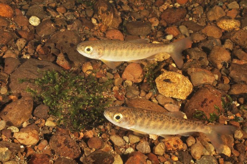
Hamilton Elementary School students have released coho fry into Valley Creek 16 times since March of 2012 as part of the WDFW Schools Cooperative Program (formerly Salmon in the Classroom). The students receive approximately 250 eyed salmon eggs spawned at the WDFW Dungeness Fish Hatchery to raise in the classroom before releasing them into Valley Creek.
57 Environmental Conditions
Figure 76. Juvenile coho salmon. Source: NOAA
Environmental Conditions
Lamprey
The use of Valley Creek by anadromous Pacific lamprey (Entosphenus tridentatus) is unknown though they have been documented in Tumwater Creek very close by. The Lower Elwha Klallam Tribe is conducting lamprey surveys in Valley Creek and other urban streams over the next two years (2023-2025). The surveyors have noted that Valley Creek appears to have better lamprey habitat than Tumwater Creek (personal communication with Sonny Sampson, April 24, 2023) so until the culverts blocking their access to their upstream spawning grounds is repaired and the habitat is restored, any failure to detect lamprey or other fish is not indicative of the potential of the site to support past or future populations. Overall, Pacific lamprey are struggling due to habitat loss, blocking culverts, and more.
Russ Hepfer, vice chairman of the Lower Elwha Klallam Tribe and tribal elder Jamie Valdez (personal communication, March 11, 2023) have both stated that lamprey were a source of food for tribal members. The vice chairman has expressed interest in seeing the reintroduction of lamprey into the S’Klallam diet.
“... among Tribes, food, such as the lamprey, is more than a resource. In many Tribal histories, plants and animals gave of themselves to sustain human life. Villages, lifeways, languages, religions, and cultures were built around and upon them. The very identity of a people is intertwined with the foods that they gathered, harvested, shared, and consumed. Respect for these resources is tantamount to respect for life.”
- The Lower Elwha Klallam Tribe, Lamprey, and Restoring a Way of Life, US Fish and Wildlife Service, 2021
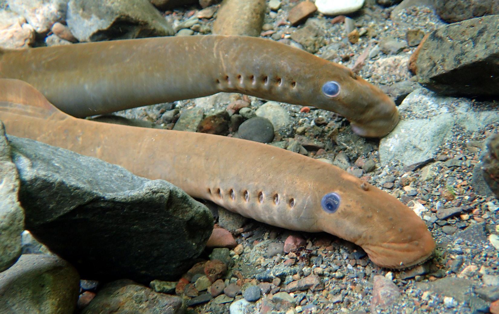
The Impacts of Lost Fish
The lack of fish in these once abundant systems is detrimental to wildlife and people. Animals like bears are unable to obtain the marine derived nutrients they need and local tribal people are increasingly unable to obtain the fish they need to sustain their traditional diets and cultural practices, undermining treaty rights and jeopardizing their health and well being. The fish that are available are seriously contaminated with toxins from stormwater, air pollution, waste water and more, imperiling all who eat it, particularly at the levels typical of the traditional tribal diet in this area. The commercial fisheries these populations once supported in Port Angeles are mostly closed down (personal communication, 2023).
Recommendations:
• Conduct pre- and post-restoration surveys of fish populations in Valley Creek
• Develop plan for reestablishment of historic fish runs
• Ensure fish passage structures are deigned to accommodate all species at all stages of life, including Pacific lamprey
58
Figure 77. Pacific Lamprey in Madison Creek, 2016. Source: Amanda Anderson
Habitat for Aquatic Species
Though the current condition of the Valley Creek habitat varies significantly by creek reach depending on differing land use practices, Valley Creek is too severely degraded to support significant salmonid populations today (McHenry et al.,1998). WDFW lists the creek and the Fall Chum, Resident Coastal Cutthroat, Coho, and Summer and Winter Steelhead that live there as Priority Species by the WDFW meaning that they warrant special conservation efforts. The recommended minimum buffer for Type 3 fish bearing streams (5-20 feet wide) with Priority Species like Valley Creek is 250 feet but this is not a legal requirement (Ryan Gatchell, WDFWHabitat Program. n.d.).
The culvert at the outlet of Valley Creek is submerged in accumulated sediment, significantly narrowing the opening that anadromous fish must navigate to access the first 2,100 feet of culverts leading to their spawning grounds upstream. Inside the culvert, there is a three to five foot jump in gradient where the culvert pipe bends around an old industrial water line (McHenry et al.,1998). Fish must wait until the high tide backwaters the pipe and reduces the distance they must jump before they can continue upstream (McHenry et al.,1998). The culverts are undersized and improperly designed for the passage of anadromous fish and though this culvert is technically rated as 33% passable by WDFW, it is unlikely many fish are successfully using it.
There is a minimal 50-foot buffer of planted native shrubs and some trees at the Valley Creek Estuary (see Vegetation for more detail). The single row of Western red cedars bordering the former K-Ply site fence line are dying or in poor condition. The buffer there appears worn from camping and overuse and is intersected by informal way trails and thus doesn’t provide the functional benefits of a properly sized buffer. For several blocks south of Valley Creek Estuary Park, where the creek travels entirely underground, there is no riparian buffer and minimal vegetation or landscaping of any sort at the street level.
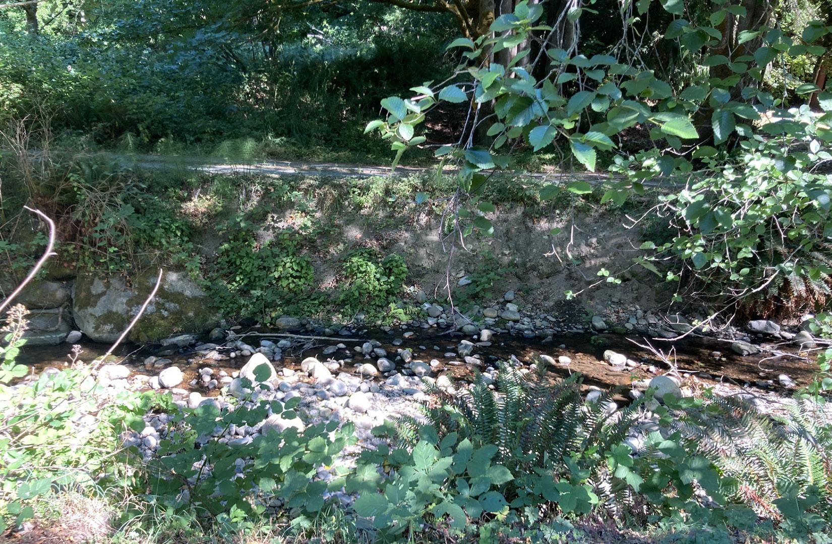
Between West 6th Street and the end of South Valley Street the creek was realigned and channelized for flood control and the stream bed is constricted by roads, no longer meanders, and is functionally disconnected from the floodplain (McHenry et al.,1998). Here the vegetative riparian buffer is narrow or non-existent and there are roads and housing in the riparian zone. The roadways are crumbling into the stream channel in places delivering sediment directly to the water and nearby residents are maintaining the creekside by mowing invasive blackberries.
The buffer is composed of mostly deciduous, quick-decaying trees like red alder (Alnus rubra) and Sitka willow (Salix stichensis) that don’t provide the habitat and large wood recruitment potential of coniferous trees (see “Vegetation” on page 62 for more detail) and a high number of invasive species like Himalayan blackberry (Rubus discolor) (McHenry et al.,1998). It should be noted that these deciduous tree species are beneficial for many birds and other wildlife, and often are undervalued and not included in riparian restoration planning (Gremel, 2023).
59 Environmental Conditions
Figure 78. Road eroding into Valley Creek
Environmental Conditions
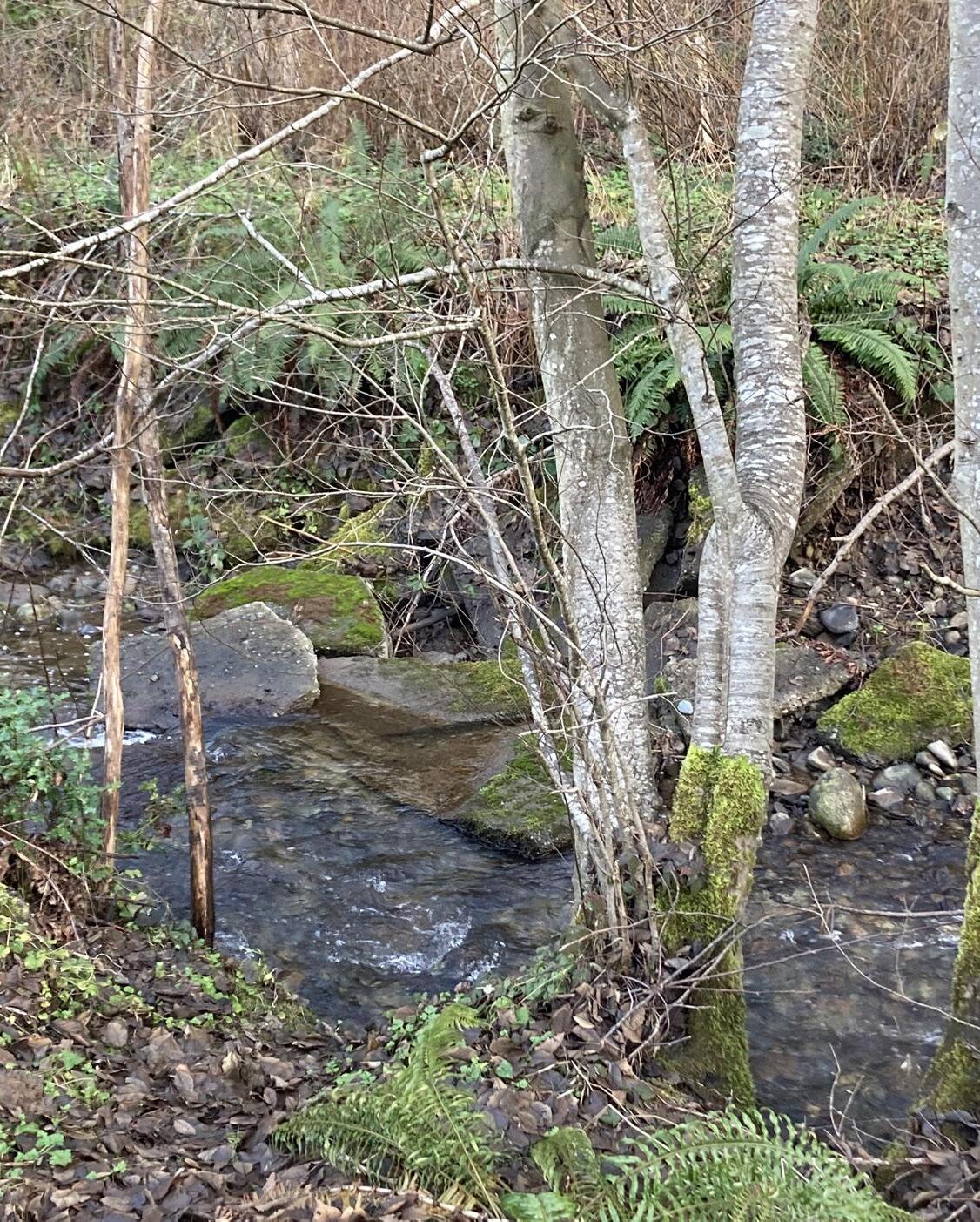
Due to a combination of factors including the lack of large woody debris, a legacy of past land clearing, and extensive paving, water speeds up through this section of Valley Creek which has caused at least two to three feet of downcutting and scour of spawning gravel (McHenry et al.,1998). Riffles, more suited to the Resident Coastal Cutthroat, predominate rather than the pools Coho need, and the pools that do remain are poor quality and approximately 33% of the depth expected for this stream type (McHenry et al.,1998). Flashy conditions associated with high levels of impervious surfaces like those in lower Valley Creek in addition to climate change exacerbate this scour and the lack of substrate suitable for fish and other wildlife.
The semi-naturalized, forested reach below Highway 101 is described by McHenry as providing the best salmonid habitat below Highway 101, though this section is only marginally healthier than the section below with a similar lack of large woody debris and suitable spawning gravel. Wood was found to be 10% of what would be expected from a comparable stream in an old-growth forest and though there was somewhat more pool habitat it was too shallow (McHenry et al.,1998).
Above Highway 101 the riparian zone is mature second growth coniferous forest and the habitat is more natural with some woody debris and cover (McHenry et al.,1998). There is potential use by Coho for the first ~6,600 feet before the gradient reaches 10% whereas Steelhead and Coastal Cutthroat may use more of the habitat (McHenry et al.,1998).
Recommendations:
• Begin at the outlet and work upstream removing barrier culverts for salmonids and lamprey
• Restore creek sinuosity to channelized and culverted sections
• Restore Valley Creek habitat and ecological function by reestablishing connection to the floodplain, establishing and maintaining a healthy vegetative buffer, adding large woody debris and spawning gravel, creating deep pools and side channels, and improving water quality (see Water Quality Recommendations)
Wildlife
Wildlife are mostly excluded from the lower watershed due to the presence of people and the extreme lack of habitat. The section of South Valley Street which runs directly over the culverted creek and other streets in the immediate vicinity is excessively paved and devoid of vegetation. Sensitive wildlife not adapted to living closely with humans are more likely to be found the further up the watershed you travel where the habitat and riparian areas become increasingly natural and connected.
Lower Elwha Klallam Tribe biologists have radio telemetry data documenting use of the Valley Creek estuary by North American river otters (Lontra canadensis), and state it is likely that river otters would make use of Valley Creek with daylighting of the culverted section. River otters were located via telemetry upstream in nearby Dry Creek, Ennis Creek, and Morse Creek which do not have the same barriers to access as lower Valley Creek.
Coyotes (Canis latrans) and the abundant black-tailed deer (Odocoileus hemionus columbianus) are commonly seen in the residential neighborhoods of the middle watershed, indicative of the lack of large predators like the wolves (Canis canadensis) that once lived here. Raccoons (Procyon lotor) and invasive species like rats (Rattus species) and house cats (Felis catus) are also ubiquitous there.
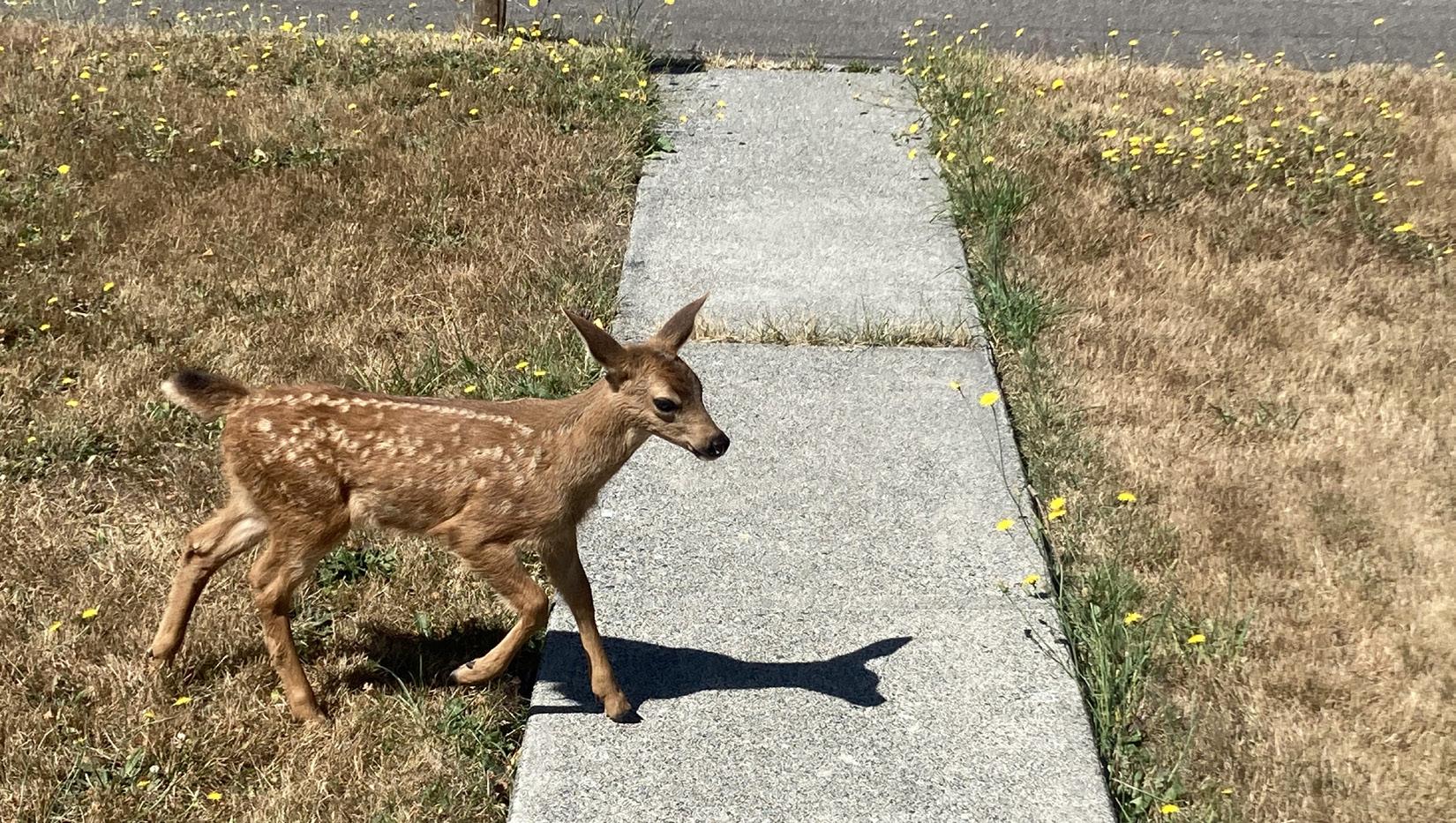
60
Figure 79. Bank armoring along Valley Creek that is falling into the water
Figure 80. Fawn on residential lawn in Upper Middle Watershed
In the fall of 2022, Streamkeepers collected benthic invertebrates from Valley Creek and documented calls from Pacific Wrens (Troglodytes pacificus) and Steller’s Jays (Cyanocitta stelleri). The presence of benthic invertebrates suggests that American Dippers could be present, although a lack of adequate cover would prevent them from nesting in the area. Nearby landowners have seen Rufous Hummingbirds (Selasphorus rufus), Black-Eyed Juncos (Junco hyemalis), Varied Thrush (Ixoreus naevius), Black-Capped Chicakdees (Poecile atricapillus), Northern Flickers (Colaptes auratus), Cedar Waxwings (Bombycilla cedrorum), Turkey Vultures (Cathartes aura), Hawks (species unknown), occasionally Bald Eagles (Haliaeetus leucocephalus), and invasive species European Starlings (Sturnus vulgaris), and the Eurasian Collared-Dove (Streptopelia decaocto), to name a few.
The WDFW has identified Priority Habitats and Species “for which special conservation measures should be taken” in Valley Creek, including Northern Spotted Owls (Strix occidentalis) listed as threatened under the federal ESA and endangered by the State of Washington, and Marbled Murrelets (Brachyramphus marmoratus) listed as threatened under the ESA and endangered by the State of Washington.
Both species are dependent on mature, preferably old-growth forests for nesting and though sections of the upper and middle watershed are designated as Priority Habitat, most of this public and private land has already been, or is planned to be logged. Northern spotted owls are extirpated (locally extinct) in Valley Creek due to the loss of the older forests they require and the increased presence of Barred Owls (Strix varia) which residents have observed in the middle watershed.
Barred owls are a larger species, better adapted to human disturbance and tolerant of a wider range of habitat types than Northern Spotted Owls. As a result, Barred Owl populations have expanded, pushing Spotted Owls from their former territories. Spotted Owls have now disappeared from the North Olympic Peninsula in all but a few higher elevation sites at the outer extents of their former range over the last 20 years (personal communication with Scott Gremel, 2022).
Marbled Murrelets are likely still present in the Valley Creek Watershed however, the ongoing cutting of the mature forests in the Upper Watershed is an additional stressor for a species already struggling from the cumulative losses of reproductive habitat across their range. Marbled Murrelets are seabirds that must travel daily between the sea where they dive for zooplankton and interior oldgrowth forests where they nest during the breeding season in trees typically at least 200 years old (Marbled Murrelet Overview, All About Birds, Cornell Lab of Ornithology, n.d.).
At approximately river mile 3.2, Lower Elwha Klallam Tribe wildlife biologists have a camera trap as part of their Olympic Cougar Project. This camera has documented the presence of black-tailed deer (Odocoilious americanus), black bear (Ursis americanus), bobcat (Lynx rufus), cougar (Felis concolor), raccoon, and opossum (Didelphis virginiana) with the landowner reporting sightings of coyotes.
Recommendations:
• Collect pre and post restoration data on Valley Creek wildlife, including amphibians and birds
• Develop wildlife management goals for the Valley Creek Watershed
• Work with landowners to protect the remaining critical habitat
• Increase incentives for habitat protection for the most vulnerable species
• Daylight lower Valley Creek and restore habitat connectivity and ecological function by creating a robust vegetative buffer and corridor connecting the shoreline to the uplands
• Enhance and maintain upland habitat connectivity
• Route trails and other human activity away from important habitat when and where possible and helpful to wildlife
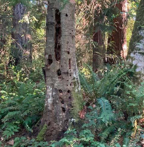
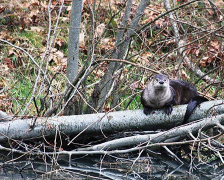
61 Environmental
Conditions
Figure 81. Snag habitat tree with woodpecker (species unknown) holes on Verne Samuelson Trail in Valley Creek
Figure 82. Otter image captured by wildlife biologists with the Lower Elwha Klallam Tribe
Environmental Conditions
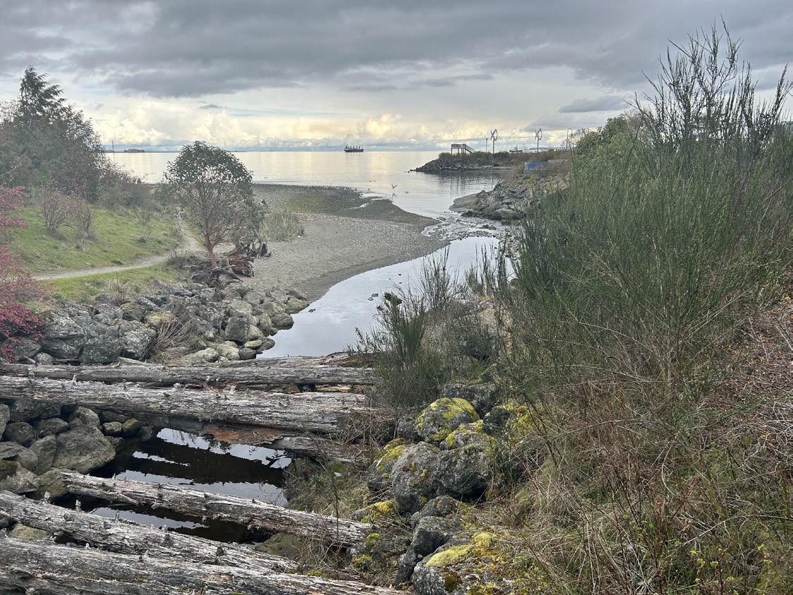
Vegetation
The following is an overview of the vegetation communities observed in the Valley Creek Watershed that reflect both land use ownership and patterns.
Lower Watershed
Very limited vegetation occurs in this zone because it is dominated by roads, paved parking areas, and structures, with the exception of the restoration planting surrounding the Valley Creek Estuary Park. Because the creek is highly channelized where it emerges from the culvert, there is limited opportunity for the mix of estuary species one might expect within a connected floodplain. The native shrubs, including red currant (Ribes sanguineum), Nootka and dwarf rose (Rosa nutkana, gymnocarpa), manzanita (Arctostaphylos columbiana), and Oregon grape (Berberis nervosa) mixed with young conifers, primarily Western red cedar (Thuja plicata) and shore pine (Pinus contorta) are generally appropriate for the upland setting but the mix of species has no native plant community correlate. Adjacent to the creek, the native replantings face intense competition from invasive Himalayan blackberry (Rubus armeniacus) and Scotch broom (Cytisus scoparius). Additional upland native shrubs which would be highly appropriate to add to this area would be oceanspray (Holodiscus discolor) and snowberry (Symphoricarpos albus).
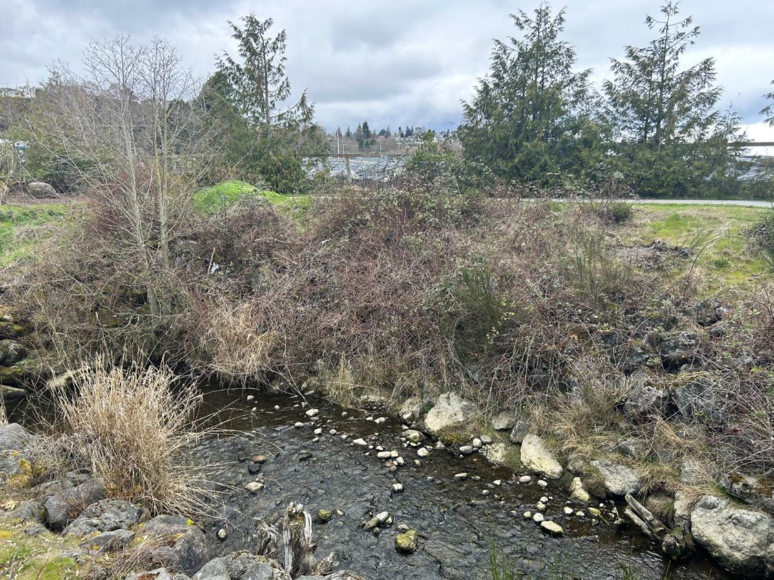
Lower Middle Watershed
Moving up the watershed, the vegetation shifts significantly from the north to south, and can be described in two distinct zones. In the northern zone, Valley Creek is highly channelized and runs adjacent to the paved South Valley Street and between residences. In this northern zone, red alders (Alnus rubra) grow thickly in the channel, mixed with willows (Salix sp.). This vegetation has an unusual thicket-like feel because the frequent topping of these canopy species due to their conflict with a low hanging power line, causing a growth response of unnaturally dense stems.
Although the same list of native species is found throughout the Lower Middle Watershed, the proportion of native to non-native elements changes significantly. Within five feet of Valley Creek there is an upper canopy layer of primarily red alders with a few big-leaf maples (Acer macrophylla), and an understory shrub layer that includes willows (Salix sp.), osoberry (Oemlaria cerasiformis), salmonberry (Rubus spectabilis), and red elderberry (Sambucus racemosa). Understory herbaceous species include blackberry (Rubus ursinus), sword fern (Polystichum munitum) and miners’ lettuce (Claytonia sibirica). Non-native species dominate in patches and include tall shrubs such as holly (Ilex aquifolium) and laurel (Laurus sp), blackberry, English ivy (Hedera helix) and non-native grasses including reed canary grass (Phalaris arundinacea). Himalayan blackberry is exceptionally thick on the west side of the creek. Although highly degraded, the forest in this area could key to a red alder and Western sword fern forest. This forest type widely occurs as a successional association following disturbances such as landslides or logging.
62
Figure 83. Invasive Scotch broom along Valley Creek at the Estuary Park
Figure 84. Small western red cedar in the background of the Estuary Park with Himalayan blackberry posing challenges for planted shrubs
The second, southern half of this zone starts roughly at 12th Street where the houses end and Valley Street is gated. In this southern zone, the proportion of native species increases significantly, particularly in understory areas that include youth on age (Tolmiea menziesii), fringe cups (Tellima grandiflora), and spring beauty (Claytonia perfoliate and sibirica). The proportion of coniferous trees in the canopy increases, from less than 5% to 20-30%. Canopy coniferous trees include Western red cedar and Douglasfir (Pseudotsuga menziesii). The forest also includes an understory (10-15 feet) of grand fir (Abies grandis) and Sitka spruce (Picea sitchensis) saplings that were likely planted in previous restoration efforts. Within this southern zone are areas that appear to have been cleared homesites, with grass and non-native trees and dense blackberry. There are also patches of young, dense alder reclaiming previously open ground along the road.
In the southern zone, the forest is still mainly red alder/Western swordfern forest and varies from highly degraded to moderately intact depending largely on the cover of Himalayan blackberry, which forms a dense and continuous ground cover in some areas. There are several distinctive and large Western red cedars along Valley Creek. On the east side of the creek, moving from the creek upslope, coniferous cover increases significantly. These conifers are mainly Western red cedar, but include some Douglas-fir and Western hemlock. On the west side of the creek, red alder and big-leaf maple maintain dominance. While the coniferous cover in the canopy is greater than lower in the watershed, the forest still keys out to red alder/Western swordfern. However, there are some notable areas on the valley walls with patches of big-leaf maple, red alder, Western swordfern, and fragrant fringecup forest (Chappell, 2006). Other wet seeps on the valley wall had notable pockets of horsetail (Equisetum sp.), devils club (Oplopanax horridus), or skunk cabbage (Lysichiton americanus) indicating locally very moist soils.
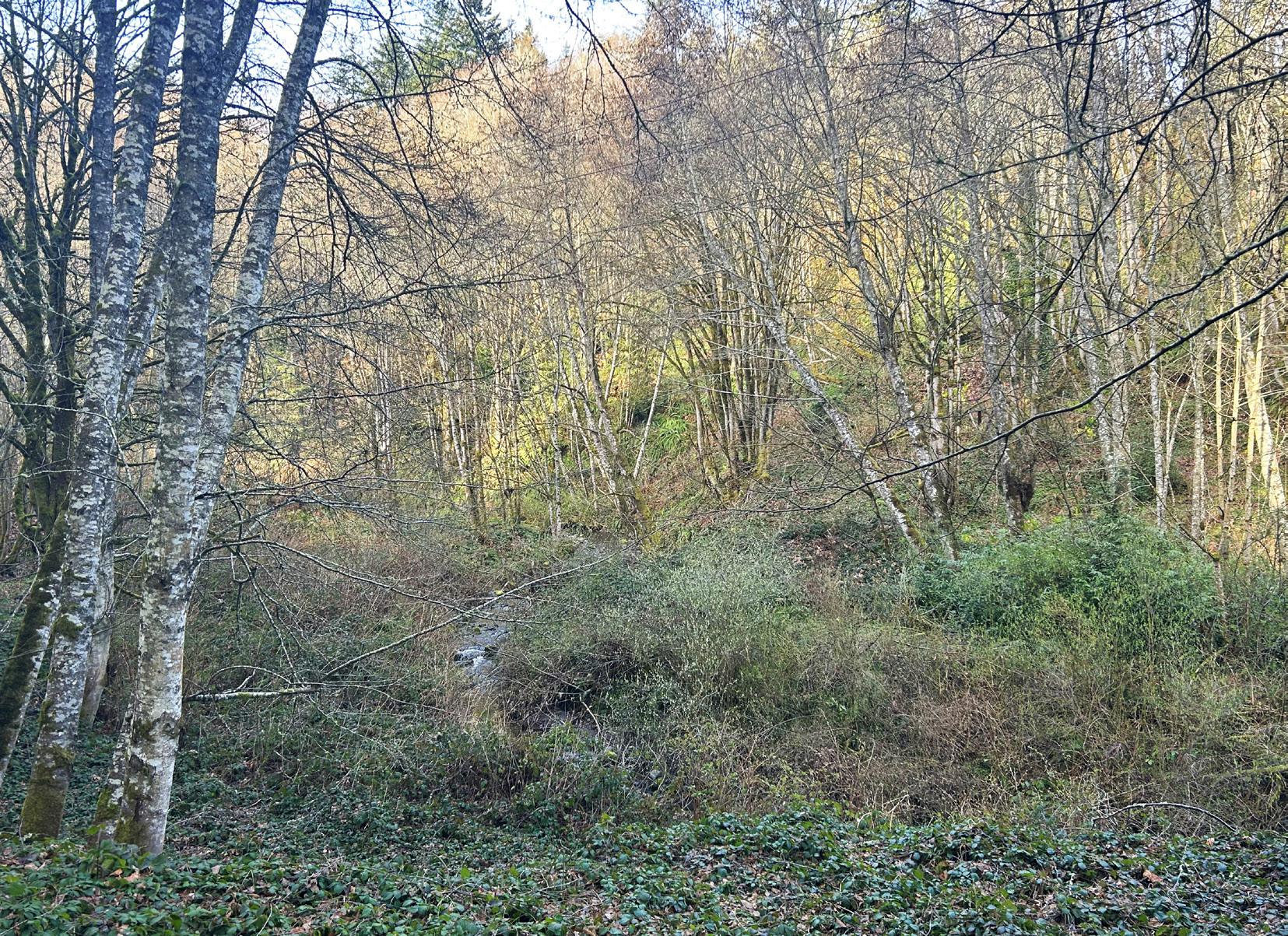
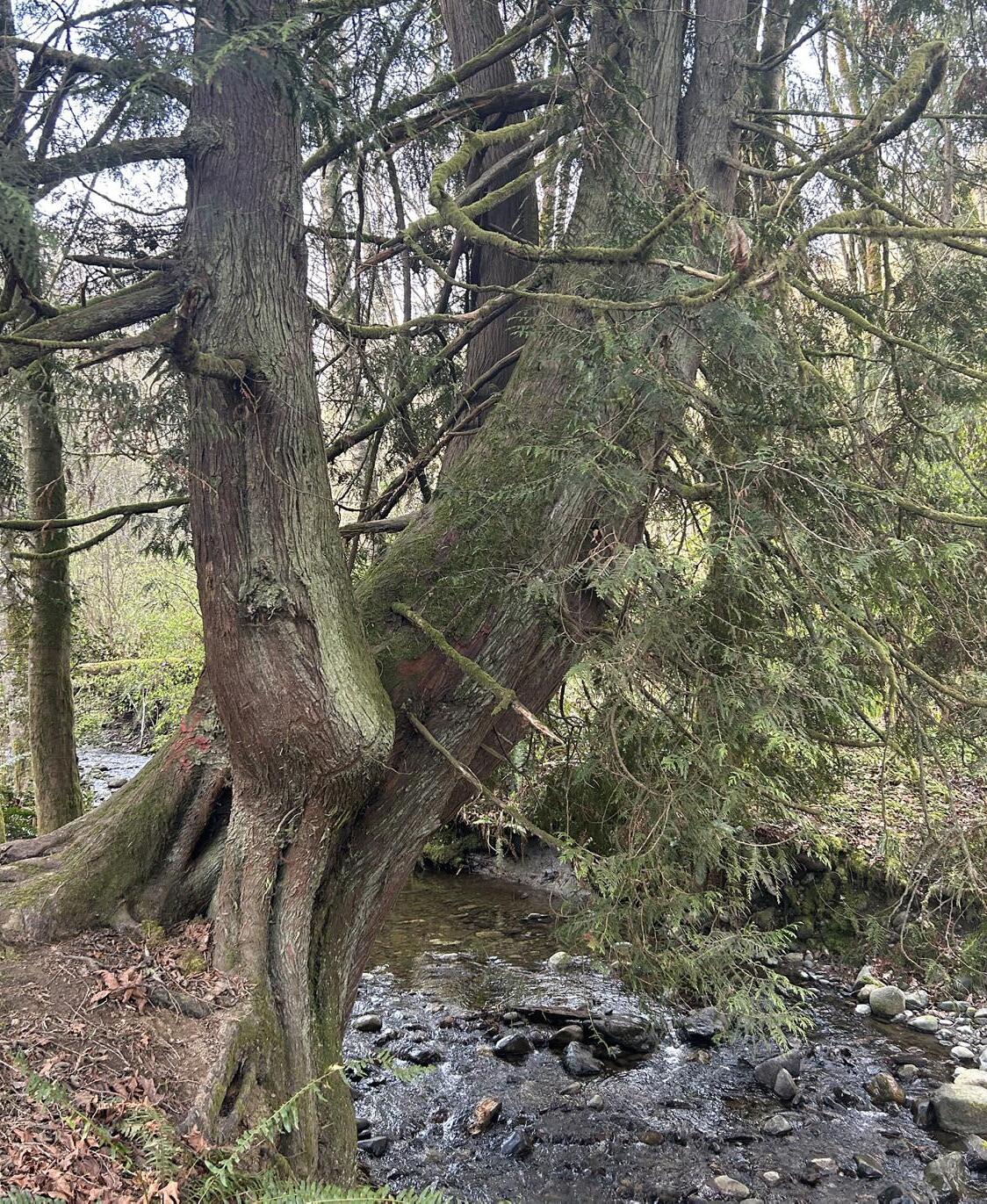
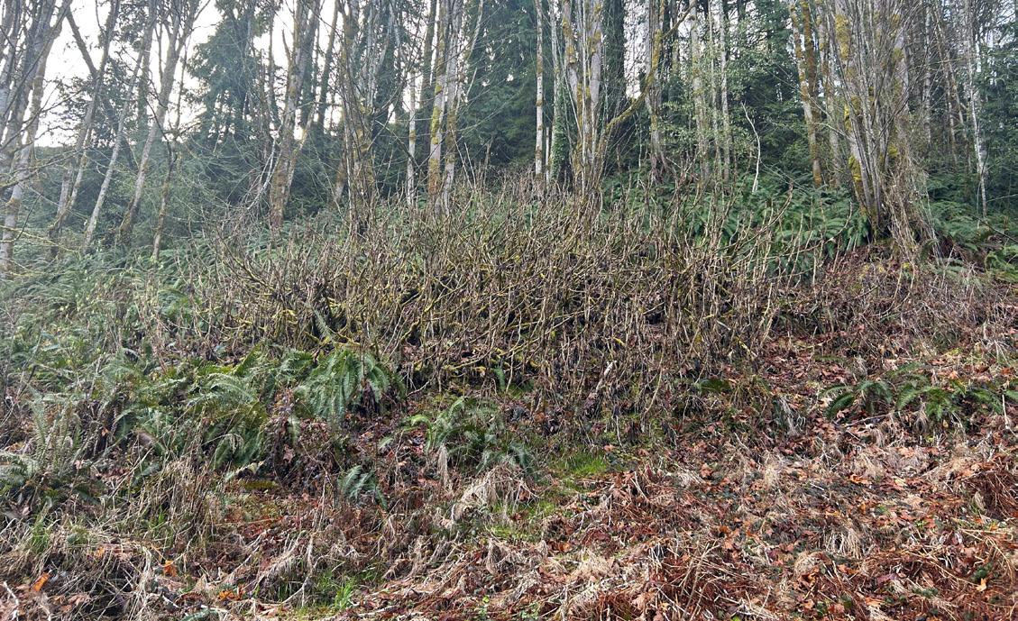
63 Environmental Conditions
Figure 85. Red alder with patches of dense blackberry and salmonberry
Figure 86. Distinctive Western red cedar along Valley Creek on the unnamed trail below Highway 101
Figure 87. Devil’s club patch and young red alder
Environmental Conditions
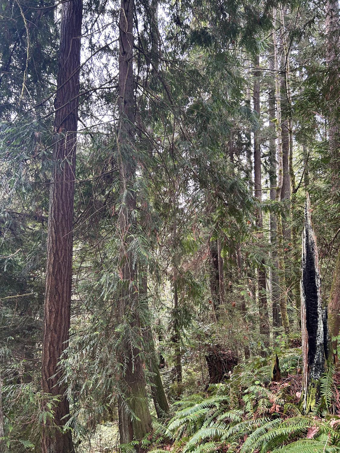
Upper Middle Watershed
There is a remarkable vegetation shift north of where the creek crosses the Highway 101 embankment. Here the vegetation communities are significantly less degraded. The cover of non-native invasives, especially the Himalayan blackberry, declines very quickly. The forest just south of the embankment where the riparian zone is wider and flatter, keys to Douglas-fir - Western hemlock - red alder - salmonberry. Coniferous cover is lower here than further upstream where the channel steepens.
The conifers in the riparian management zone are large and appear to be fairly old second growth. Moving upslope and out of the moist soils of the salmonberry zone, the forest transitions to Douglas fir-Western Hemlock / salal / sword fern forest. This older second growth is in fairly nice condition with mixed species composition, multi-age structure, and a dominant canopy of large Douglas-fir and Western red cedar. This forest contains legacy elements including the large Douglas fir trees, snags, and downed wood. Understory species in this area include salal (Gaultheria shallon), Oregon grape (Berberis aquifolium), red huckleberry (Vaccinium parvifolium), and sword fern (Polystichum munitum).
Upper Creek Watershed
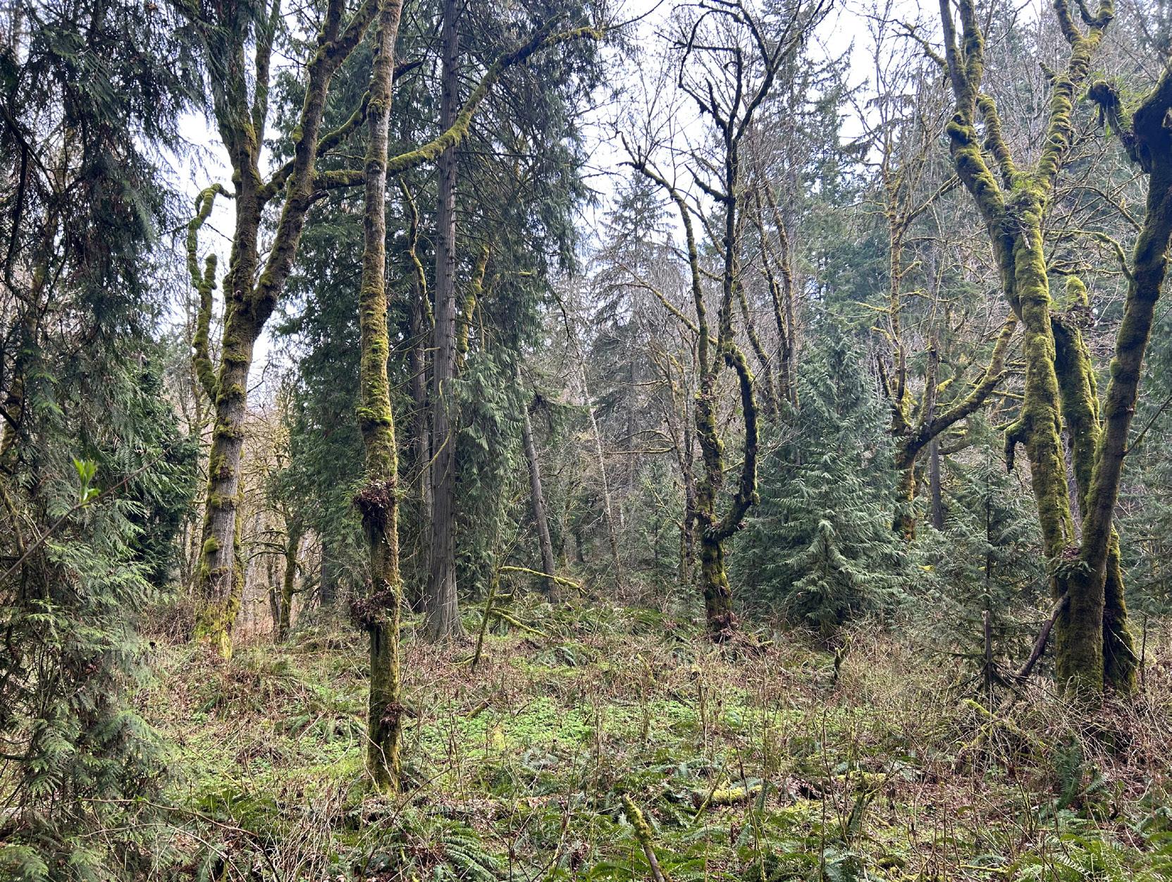
In the upper reaches where the forest is managed by DNR, the vegetation is predominately conifer forests in various stages of forest management. Areas along the headwater streams of Valley Creek are protected with riparian buffers determined by the size and type of the stream. The smallest headwater streams with perennial flow and/or channels less than two feet, receive no stream buffers. Independent mapping of forests in DNR land shows that there is a 1,500-acre patch of older, structurally complex forests that overlap the headwaters of Valley Creek. Recent timber harvests in this area include the Rio Timber Sale (2022) and importantly the planned 2023-2024 Tree Well and Kicker Timber Sales which will harvest nearly 200 acres of these remaining older forests.
Recommendations:
• Remove invasive species
• Restore riparian vegetation
• Protect the remaining mature forests in the Valley Creek Watershed, particularly on State Lands in the headwaters (State listed Priority Habitat for multiple species)
• Develop a plan to support the perpetuation of tribal cultural landscapes and culturally significant plants
64
Figure 88. Older forest in the upper part of the riparian management zone featuring large Western red cedar and Douglas fir with sword fern understory
Figure 89. Where the topography in the Valley Creek is relatively flat, a deciduous- conifer mix forest with abundant native understory species including salmonberry and devil’s club
Climate Change
The North Olympic Peninsula, including the community of Port Angeles, are increasingly experiencing the impacts of climate change, including declining snowpack, prolonged heat waves, destructive flooding events, and economic and ecosystem disruptions. Coastal infrastructure has long been at risk of winter storms, and a changing climate is increasing intensity and frequency of storms, coupled with rising sea levels and tidal surges, exacerbating those risks (Port Angeles Climate Resiliency Plan, 2022).
The EPA recently released a report, Health Impacts of Climate Change on Children in the United States, showing that while signs of climate change are all around us, children are uniquely vulnerable to its impacts. Reduced air quality from increased summer wildfires, extreme heat waves, changing seasons and infectious diseases can all have disproportionate impacts on children that can affect learning, physical health and housing security (EPA, 2023).
The outlet of the lower Valley Creek culvert is located in the sea level rise zone which will cause the outlet to eventually become completely submerged by the rising waters, further impacting the ability of fish to travel upstream. The undersized culvert pipes are also ill suited to handle the extreme variability of flows in a changing climate. With a history of flooding in the Valley Creek Watershed, extreme precipitation events, and the inadequate riparian buffer of Valley Creek along roads and adjacent to residential houses will increase the potential of damage to infrastructure. This lack of vegetation also worsens the health effects of climate change like due to increasing urban temperatures, poor air quality and more.
Recommendations:
• Daylight Valley creek with properly sized infrastructure to accommodate expected increased variations in water flow
• Implement GSI to reduce stormwater runoff and mitigate flood risks
• Prioritize public projects that connect trails and transit reducing community reliance on fossil fuels
• Create room for coast-dependent species to migrate inland as water levels rise
• Enhance vegetation to support community resiliency to climate change by providing easy access to cooling air pollution reducing green spaces for relaxation and recreation
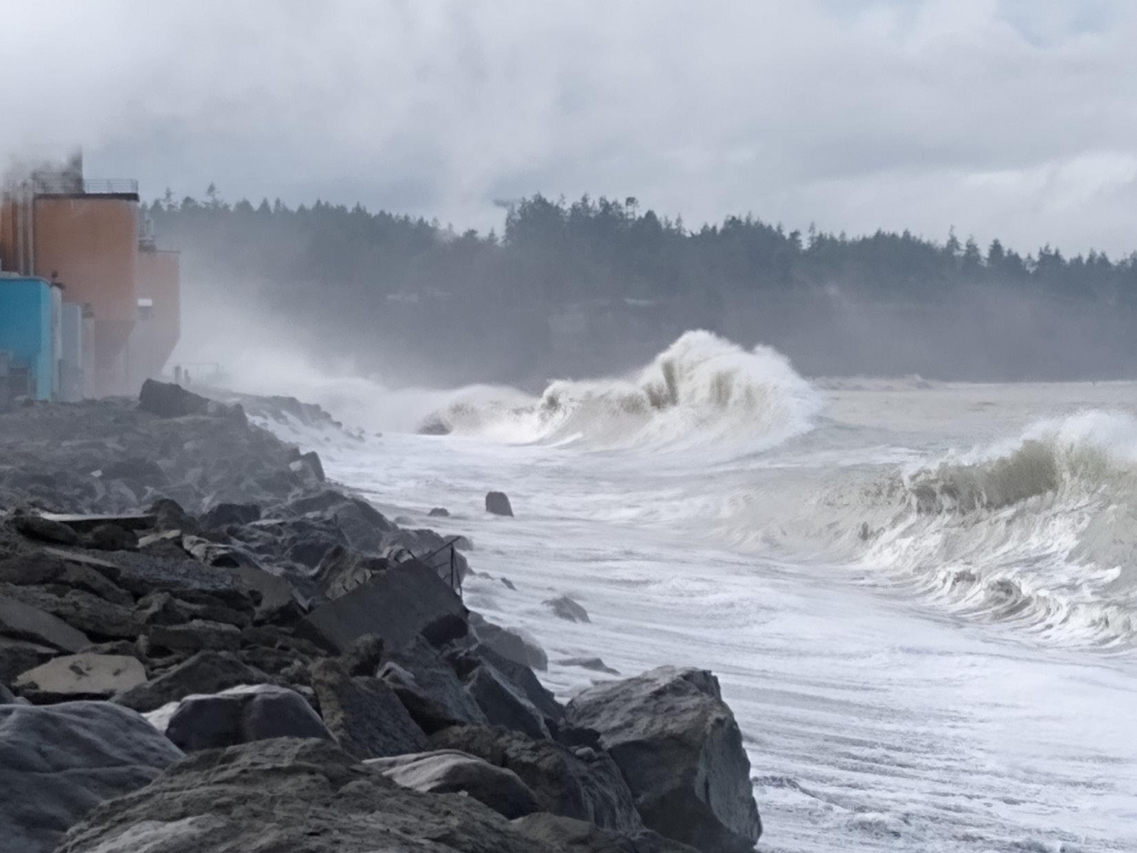
65 Environmental Conditions
Figure 90. King Tides coinciding with winter storm waves, part of a widespread and damaging event along Washington’s shorelines in Jan 2021. Image credit Ian Miller, Washington Sea Grant
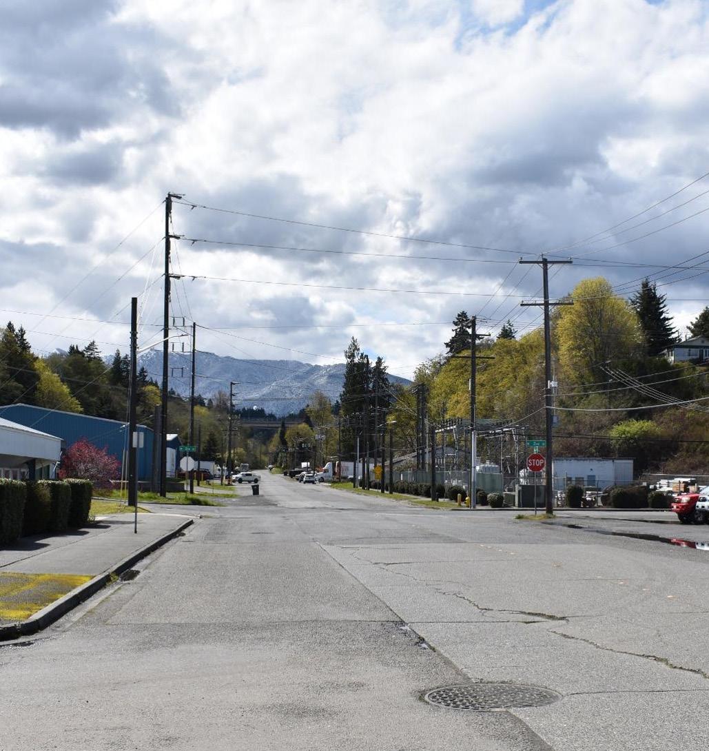
Greenlink Planning Process
Greenlink Planning Process
Project Co-Governers and CoManagers, and Stakeholders
Treaty Tribes
Lower Elwha Klallam Tribe, Jamestown S’Klallam Tribe, Port Gamble S’Klallam Tribe, and the Suquamish Tribe
Stakeholders
The Port Angeles community, including residents, the unhoused population, Peninsula College students, public school students, tourists, property owners, business owners, employees and the ecosystem
Community Organizations
Social service, economic, and environmental organizations including Feiro Marine Life Center, Port Angeles Waterfront Center, Chamber of Commerce
Local Government
City of Port Angeles, Port of Port Angeles, Clallam County, Streamkeepers, Marine Resource Committee
State of Washington
Washington Department of Fish and Wildlife, Washington Department of Ecology, Washington Department of Natural Resources, Washington State Department of Transportation
Federal Government
U.S. National Oceanic and Atmospheric Administration, U.S. Fish and Wildlife Service, Olympic National Park, U.S. Army Corps of Engineers
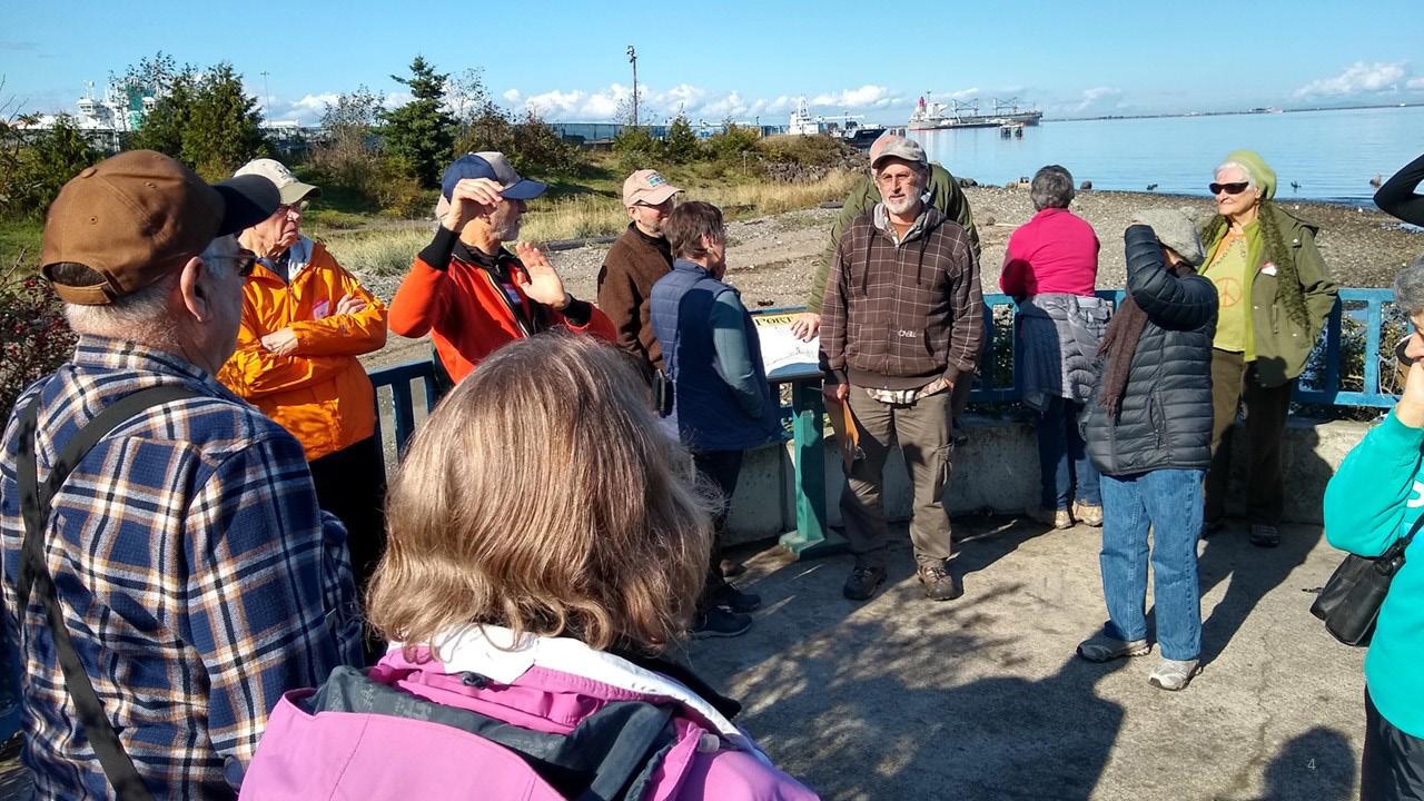
Planning Process Overview
The GLAC was formed to provide expertise, local knowledge, and guidance throughout the iterative GreenLink planning process. To identify areas with a high potential of benefiting from GSI projects, the team used GIS “heat mapping” informed by input from a series of community outreach events and the GLAC (see Appendix M). These sites were evaluated and scored based on their ability to provide benefits to habitat, water quality, and public assets such as walkability. After multiple rounds of additional analysis, the GLAC ranked the projects and the Valley Creek Daylighting Project that included a recreational trail into Olympic National Park was selected for advancement.
Feasibility Assessment
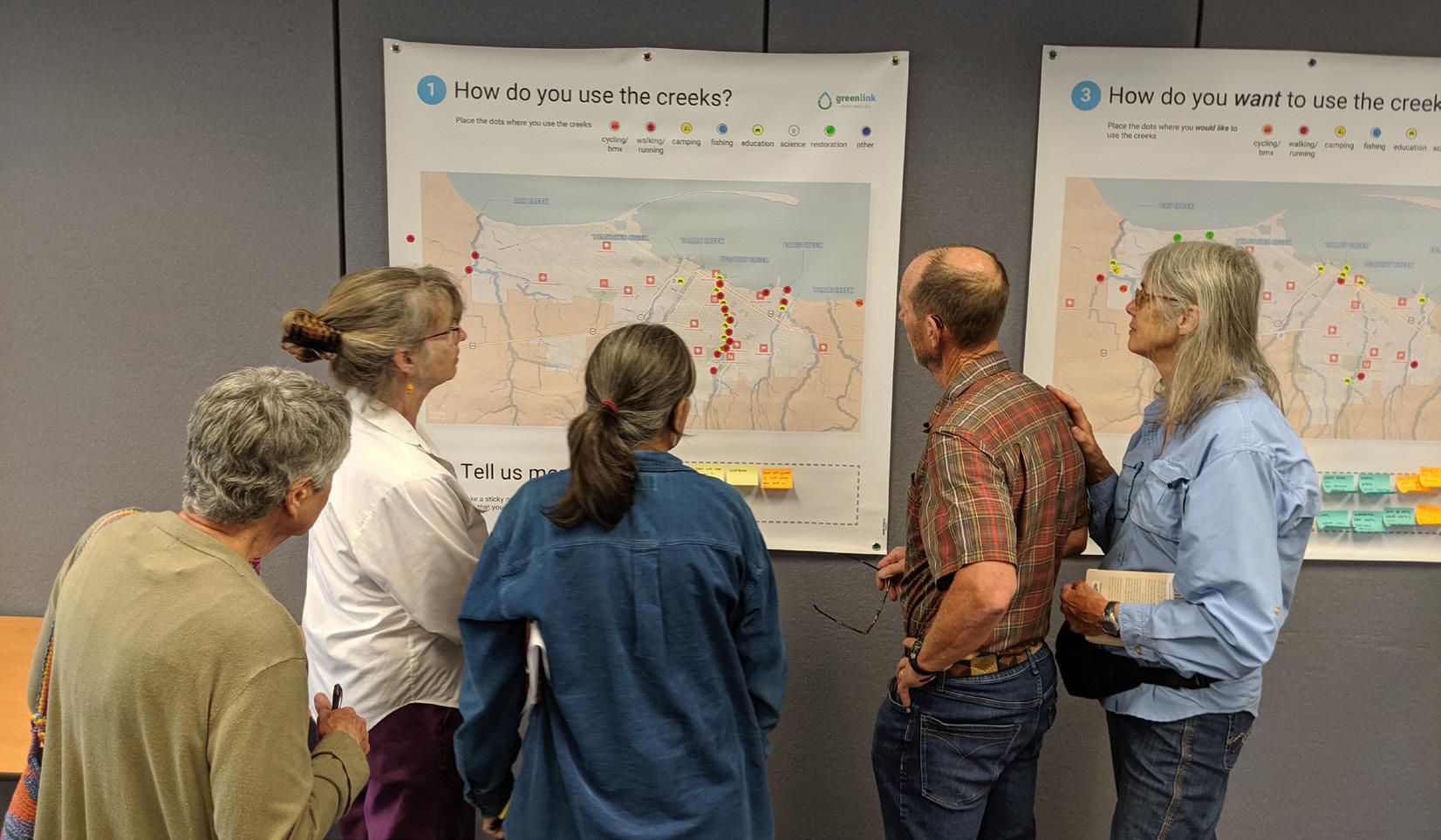
An in-depth Feasibility Assessment was then initiated to explore the many complexities and constraints associated with daylighting lower Valley Creek due to the highly urbanized nature of the site. See the Appendix G for the full assessment. This study focused on evaluating the physical site conditions to provide the background and understanding necessary to have an informed discussion about potential creek routing alternatives. Site analyses included evaluating property ownership, transportation, habitat, cultural resources, and more.
Though the Feasibility Assessment does not attempt to consider all relevant factors that will ultimately inform the final design, this study does provide a basis for comparing similar aspects of some of the project’s most critical components.
68
Figure 91. GreenLink tour of Port Angeles watersheds led by GreenLink Advisory Committee member Ed Chadd
Figure 92. People sharing local watershed knowledge at a community ourtreach event
Study Area
The Feasibility Assessment focused on the lower culverted section of creek between West 2nd Street and the Valley Creek estuary (see Figure 94). The project area covers an approximately 7-acre triangle from the Valley Creek Estuary west to the corner of West 2nd Street and Marine Drive and east to, and including part of, the City of Port Angeles power station property.

NMARINE TRADES CENTER (Former K Ply Site) MARINE
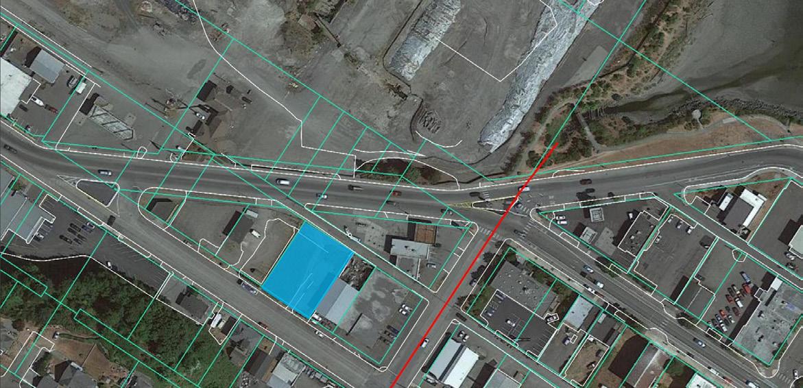
Marine Drive W2ndStreet W2ndStreetW1stStreet
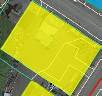

LEGEND
Port of Port Angeles Property
City of Port Angeles Property
LEGEND
Lower Watershed
Lower Middle Watershed
Upper Middle Watershed
Upper Creek Watershed
Study Area
69 Greenlink Planning Process
Figure 93. The Feasibility Study focused on a project area in the Lower Watershed
N
DRIVE CHEVRON SUBSTATION
Figure 94. Feasibility Assessment Study Area
Greenlink Planning Process
Creek Routing Alternatives
It was initially presumed that a daylighted Valley Creek would be routed directly down Valley Street, however an alternative western alignment was suggested as a way to avoid known soil contamination and the time and expense of clean-up. The iterative analysis of these two options led to the identification of two additional possible routing alternatives. A total of four alternatives were ultimately considered and defined by the GLAC.
Herrera Environmental Consultants devised a scoring system using a variety of relevant criteria to compare similar elements of the four alternatives. Because all criteria were weighted equally for the purposes of this exercise, this attempt to summarize highly complex conditions was intended only as a tool to support the additional analysis and discussion that led to selection of the recommended alternative, and not a way to determine the recommended alternative. See Appendix N for more details on the four alternatives and scoring system.
GLAC Recommended Routing Alternative
After reviewing the options and having an opportunity for discussion, members of the GLAC ranked the alternatives to determine their preferences. Alternative 4: Valley Creek Park Extension was selected as the GLAC’s top choice. This alternative provides the most habitat gain with room for the creek to meander and the widest vegetated buffer. This option is also the most flexible, leaving all of the design options still on the table and providing the greatest range of potential community uses and benefits.
Through the analysis we learned that the original plan of routing the creek down South Valley Creek would not provide the room needed for the creek to function ecologically. The habitat gains from this routing are likely insufficient to secure funding for restoration under a habitat track, which some see as the best match for this multibenefit project. The significant limitations of this alternative led the GLAC participants to rank the original plan as their last choice.
All workable potential alternatives would require using some Port, City, and private property, and implementation of Alternative 4 would require relocation of the Port Maintenance Annex. There is the possibility for the creek to cross over a small corner of the Port’s planned location for the Marine Trade Center, though this can be avoided with longer road crossing structure.
70
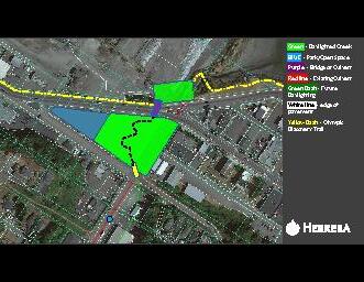
DAYLIGHTING WIDTH SHOWN ~80 FT
DOES NOT AVOID K PLY SITE
WIDE CREEK BUFFER WITH ROOM FOR TRAIL AND OTHER PARK FACILITIES
150-250 WIDTH FOR DAYLIGHTING
POTENTIAL BAFFLES ADDED (MAY NOT BE NECESSARY
FISH PASSABLE CROSSING
ADDITIONAL BUFFER FROM CLOSING PORTION OF VALLEY ST
TEMPORARY 7 FT PIPE CONNECTION TO EXISTING CULVERT
LEGEND
Park/Open Space
Daylighted Creek Bridge or Culvert
Future Daylighting
Existing Culvert Olympic Discovery Trail
71
Planning Process W1stStreet
Greenlink
W2ndStreet W2ndStreet
Marine Drive
Figure 95. GLAC’s recommended routing alternative
N
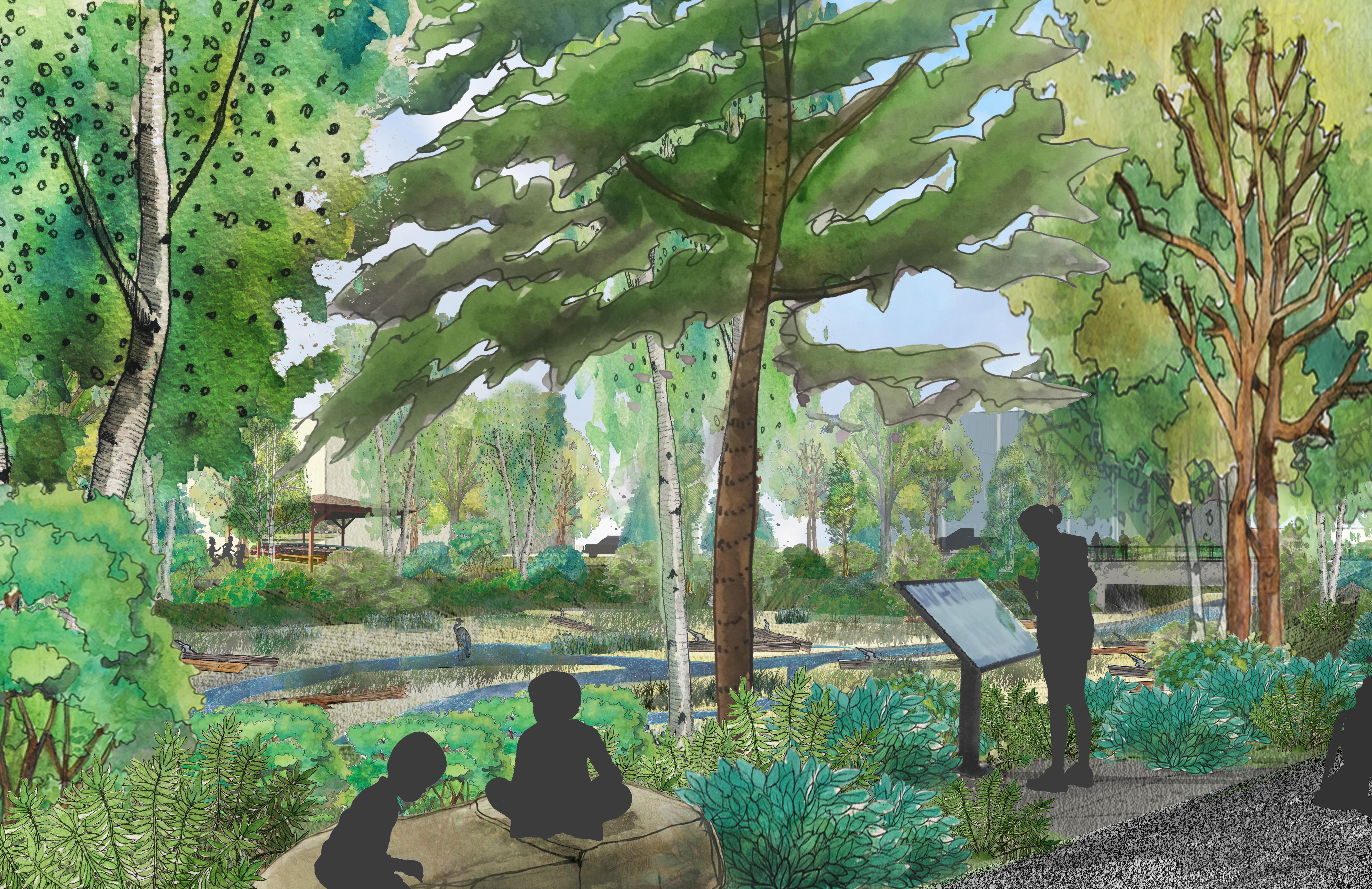
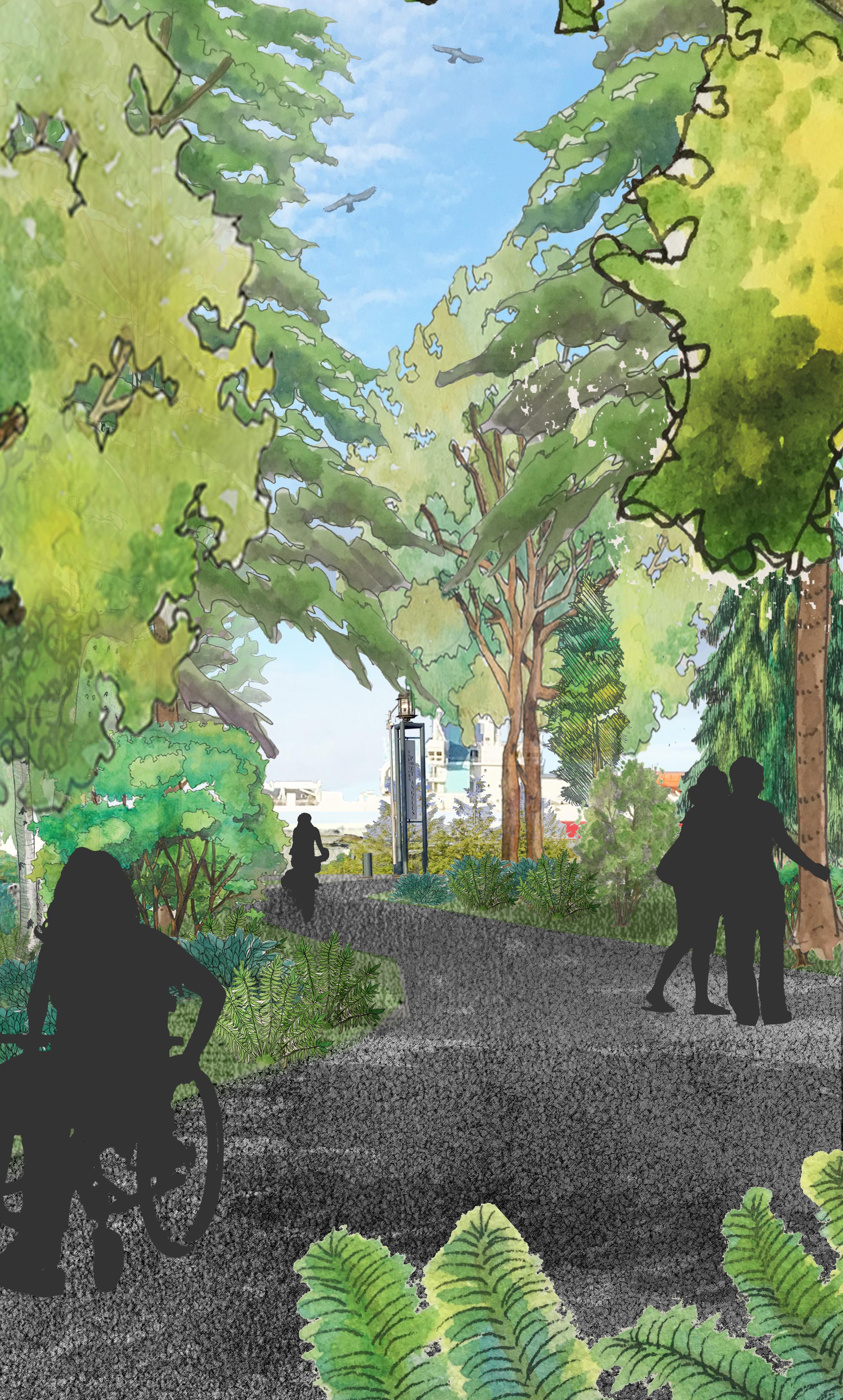
The Vision for Lower Valley Creek
73
The Vision for Lower Valley Creek


Creating a vision for Valley Creek stormwater park

74
The Vision for Lower Valley Creek
Figure 96. Current view from the fully paved intersection of South Valley Street and West 2nd Street looking towards Valley Creek’s end and the Port Angeles Harbor beyond
Figure 97. Rendering of the potential view, including a lush greenscape with trails for community members and visitors to access nature and appreciate the unfettered beauty of Valley Cree
The Vision
The overlapping goals of restoring ecological health to Valley Creek while improving community quality life, supporting economic development goals, and maintaining a connection to the area’s deep tribal history are not only achievable, but in the best interest of the community. The elements of a proposed Vision described below are intended to ensure that the community derives the greatest possible benefit from this shared asset and that the resources under our purview are cared for appropriately. Many of these ideas and recommendations emerged from the earlier planning work of the Lower Elwha Klallam Tribe and the Valley Creek Committee though some additions have come out of the GreenLink planning process. It is assumed that community input will help shape these ideas and determine the actual components of a final plan.
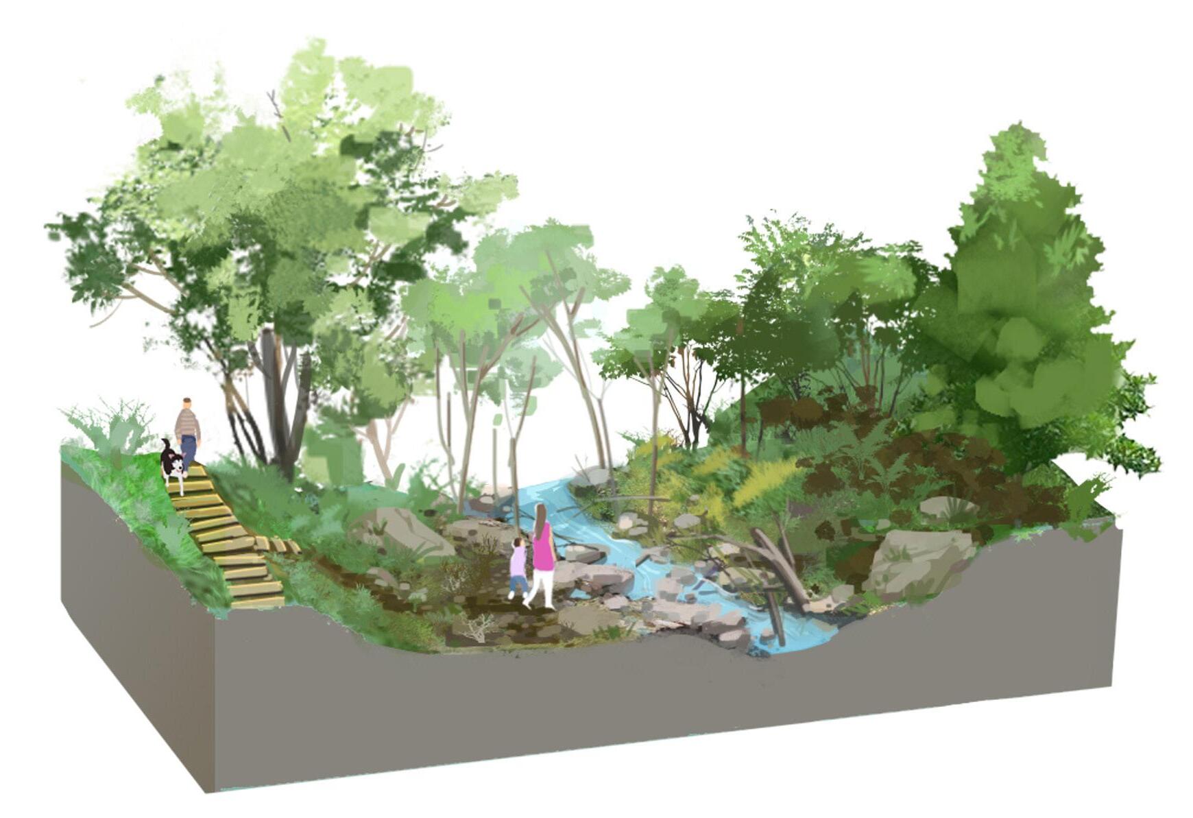
Planning Recommendations
This effort will move through a number of steps prior to implementation. Intensive community outreach will be needed to solicit feedback on the ideas presented in the master plan and the Valley Creek Daylighting and Watershed Projects. Funding is currently being sought for this outreach and additional studies needed to ready the plan for implementation. The project will then move into development of conceptual designs that reflect community and stakeholder input. In the final stage, a plan will be made for phased development and refinement.
Tribal Co-Management and Perspectives
• Prioritize tribal perspectives, guidance, and recommendations throughout the design and implementation
• Prioritize incorporation of natural cultural “resource” management into all watershed planning processes
• Represent tribal perspectives in interpretative elements that have been generated or vetted by interested tribes
• Consider adding a First Foods garden to demonstrate the relationship between natural and cultural resource management
• Engage tribal youth and the broader community in determining design elements and themes that tell the story of Valley Creek
Downtown Revitalization and Economic Development
• Create a downtown destination that residents, students, and tourists where they can walk to see salmon spawning from the new Marine Discovery Center, the Lower Elwha Klallam Tribe Cultural Center, the Victoria ferry, and other points downtown
• Provide critical shade and relief from the urban heat dome effect for downtown users and residents
• Support nearby redevelopment efforts with improved aesthetics by providing visual relief from excessive pavement with native vegetation
• Delineate zones of use and create a visual screen between the industrial Port and other downtown activities uses including the Olympic Discovery Trail and nearby investments in redevelopment
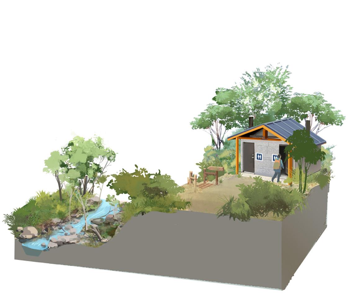
75
The Vision for Lower Valley Creek
Figure 98. Families with children learn about salmon spawning in a restored Valley Creek. Source: GreenLink
Figure 99. Restroom facilities provided to all trail users. Source: GreenLink
REDEVELOPED ROUNDABOUT
SCULPTURE
RESTROOMS
FORESTED BUFFER
PICNIC AREA
FISH PASSABLE CROSSING OVER VALLEY CREEK
What Valley Creek Park could look like...
CONNECTION TO ESTUARY PARK TRAIL
FORESTED BUFFER
VALLEY CREEK
VALLEY CREEK TRAIL LOOKOUT POINT PASSABLE CULVERT
Marine Dr


N
SValleySt
W1stSt
W2ndSt
W2ndSt
• Provide an attractive benefit for downtown employees of the Port and other businesses, and residents of the planned Anion Shores Apartments with access to outdoor green space for breaks and recreation and the associated improvements to quality of life and health
• Bolster economic growth through responsible stewardship of public resources with a Marine Trade Center that successfully coexists with a healthy ecosystem
Educational Opportunities
• Interpretive elements pertaining to the history, stormwater, ecology and/or other relevant topics are provided throughout the project area and eventually the watershed
• Students are able to access Valley Creek easily from the new Marine Discovery Center and there are facilities to accommodate groups such as an outdoor classroom
• A Stormwater sculpture park provides a fun destination for families and other community members with opportunities to learn about stormwater management while reducing contamination inputs to Valley Creek and other community members to learn about stormwater management and reducing contaminated inputs to Valley Creek
• Consider developing a Valley Creek and/or watersheds of Port Angeles educational curriculum
Ecological Vitality
• Daylight Lower Valley Creek and restore sinuosity by providing room to meander and a robust riparian buffer reconnecting the stream to the floodplain and Strait
• Restore in-stream habitat by adding large woody debris and spawning gravel and consider creating side channel habitat for coho
• Improve water quality by managing stormwater
• Clean up contaminated soils
• Restore habitat connectivity between the uplands and the shore
• Locate septic systems in need of repairs and incorporate necessary repairs into planning
• Incorporate stormwater best management practices and GSI features throughout the Valley Creek Watershed, using features like bioswales and permeable paving
• Repair all fish barrier culverts with structures suitable to ensure full fish passage to all species at any stage of life, including salmonids and possibly lamprey, to re-establish healthy populations
Recreational Opportunities and Access to Greenspace
• Provide access to green space and respite from the urbanized downtown landscape with a Valley Creek park that connects downtown residents, businesses, students, and visitors to nature and recreational opportunities
• Develop a trail system up the watershed linking the waterfront to Olympic National Park, making the park accessible without a vehicle, and to the Peabody Creek watershed and trail system
• Create a wheelchair accessible trail to the end of South Valley Street and explore the possibility of a wheelchair accessible trail from Morse Creek to the end of South Valley Street
• Public facilities are provided where ecologically appropriate, including restrooms, seating, trails, signs, parking, picnic areas, bike racks, storage lockers, interpretive signs, public art (potential focus on Indigenous art), and other artwork (potential focus on Indigenous art), stormwater park, viewing platform, outdoor classroom or other gathering area, and limited parking
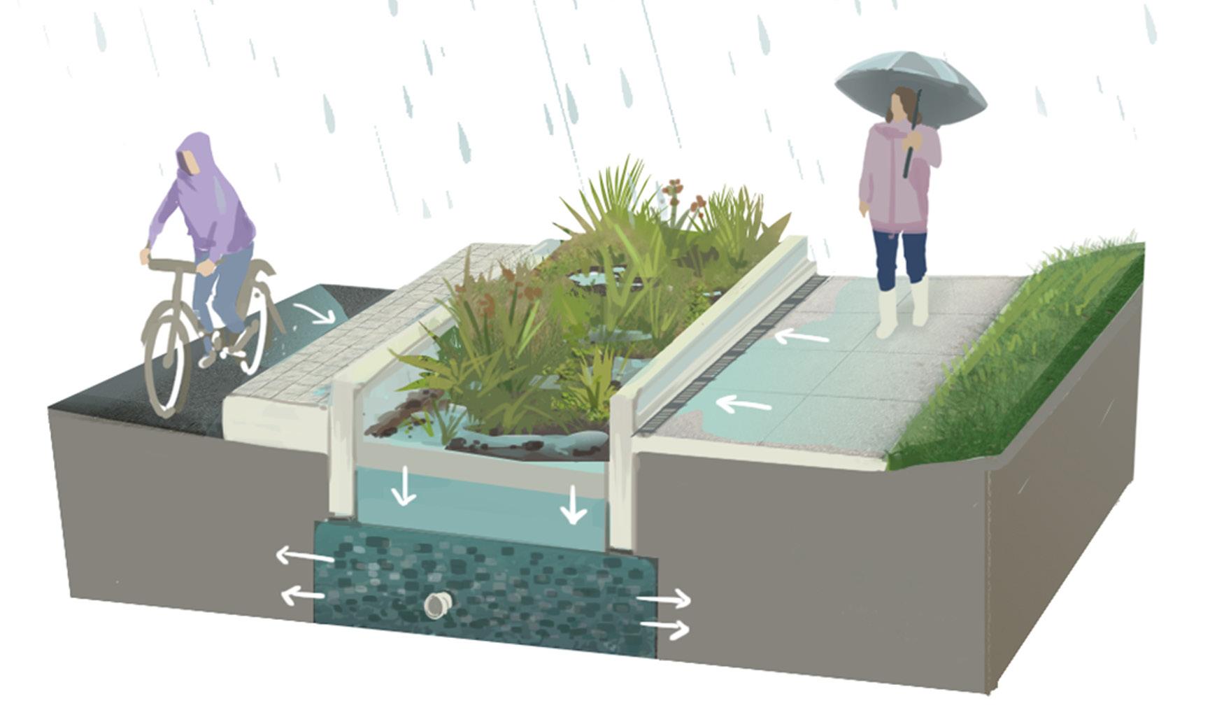
77
The Vision for Lower Valley Creek
Figure 101. Permeable paving and bioswales help filter contaminants out of the stormwater running into Valley Creek and the Strait of Juan de Fuca
The Vision for Lower Valley Creek
Additional ideas that have been proposed for consideration
• Identify native vegetation and shrubs that can be included in the street trees list and continue planting in underutilized spaces
• Add a “sluice box” to retain water to mitigate impacts from climate change, location to be determined - suggestion of Port Commissioner Beauvais
• Drill under the culvert to allow improved fish passage - suggestion of Port Commissioner Beauvais
• Develop a sculpture park that provides a fun destination for families
• Families with children are encouraged to spend time in the park and facilities are geared towards their needs
• Houseless people are brought into the project including in the planning, design, and stewardship. Design elements consider the needs of houseless people might include limited camping, restrooms with showers, or free lockers
Access and Circulation Improvements
• Improve vehicle, pedestrian and wheelchair circulation, access and safety through downtown with additional pedestrian crossings and more
• Add a roundabout at West 2nd Street and Marine Drive
• The lower trail and associated facilities meet the highest standards of Americans with Disabilities Act (ADA) compliance and accessibility and include interpretive elements such as braille signs or audio street crossing signals
Management & Planning
• Consider and incorporate management of tribal cultural natural resources into all watershed planning processes
• Evaluate short- and long-term maintenance and security requirements and opportunities
• Create a safe pedestrian walkway along and across Highway 101 above Valley Creek
• Link to other watershed planning efforts
• Develop greenstreets and other GSI projects in the contributing basins
• Develop connected trails between Valley Creek to Peabody Creek
Regulatory
• Determine property needs and plan for acquisition or easements
• Assess legal ADA requirements and incorporate into design
• Evaluate ongoing mitigation and easement opportunities
• Ensure archaeologists are on site to oversee any ground disturbing activities
Next Steps
Analyses
• Collect baseline, pre-implementation ecological data
• Determine septic systems needing repair and incorporate necessary repairs in plans
• Study the economic implications of the project
• Assess and characterize soil contamination
• Study property acquisition needs and opportunities
Engagement
• Solicit feedback and guidance on project planning from people with disabilities
• Work with the Tribes and Port Angeles community to solicit feedback and develop the Vision
• Engage community groups such as County Adopt a Trail Program, Friends of Valley Creek, student groups, Streamkeepers, and others
• Meet with project site property owners to understand needs and identify solutions
• Approach the unhoused community as potential project allies and contributors
• Develop a community stormwater education campaign
• Start a stewardship group and/or campaign for Valley Creek and eventually other watersheds
78
Proposed Future Restoration Projects in the
Valley Watershed
Lower Watershed
1. Valley Creek Culvert & Outfall repair
2. Land Acquisition - Greenstreets on Cherry and Pine StreetsFW
3. Stormwater management best management practices
Lower Middle Watershed
4. Regional Facility at Lower Valley Creek - Add regional facility to manage stormwater runoff from existing S Pine St. system outfall to Valley Creek (or divert flow off Pine St. or Cherry St.).
5. Valley Creek Restoration Phase III - removal and/or baffling of lower culvert south of West 2nd Street
6. Daylight Valley Creek and add stormwater facilities - open creek channel and pedestrian access along Valley Creek from the beginning of existing pipe to the waterfront.
7. Wilson Park Vicinity Green Street - Green Street program in a residential area near Wilson Park. Manage surface runoff with bioretention facilities
8. Regional Facility at Moose Lodge Parking Lot - Divert flow from Pine St. storm main into new treatment system under Moose Lodge parking lot
9. Regional Facility at Moose Lodge (near 9th and Pine) - Divert flow off Pine St. into open field area behind Moose Lodge
10. Valley Street Culvert Crossing
11. Regional Facility at Valley Creek Trailhead - Divert flow off S Pine St. into regional facility in Valley Creek valley bottom
12. Elks Playfield Vicinity Green Street - Green Street program in a residential area near Elks Playfield. Manage surface runoff with bioretention facilities.
13. Coho side channel habitat - Lower Elwha Klallam Tribe
Upper Middle Watershed
14. Stormwater updates at Laurel Street & US Hwy 101
15. West End of Park Ave WQ Treatment Facility - Install Filterra or larger treatment facility near existing mountain bike trail access (along proposed loop). Opportunity to formalize recreation connection.
16. Valley Creek Trail Loop
Project Generated through the Greenlink Planning Process City of Port Angeles Capital Facilities Plan Other Ideas
79
The Vision for Lower Valley Creek
N
VALLEY CREEK 7 12 11 15 4 14 5 5 2 1 16 14 10 13 9 8 3 6
Figure 102. Future restoration projects in the Valley Creek Watershed
LEGEND
Citations
ArcGIS Web Application. (n.d.). https://pawa.maps.arcgis.com/apps/webappviewer/index. html?id=201b67adeee447f89d720a9fbb9569f9
ArcGIS Web Application. (n.d.). Retrieved April 18, 2023, from https://pawa.maps.arcgis.com/apps/webappviewer/index. html?id=201b67adeee447f89d720a9fbb9569f9
Banel, F. (2019, December 20). All Over The Map: A deadly forgotten flood leveled Port Angeles in 1863. MyNorthwest.com. https://mynorthwest.com/1650140/all-over-the-map-port-angelesforgotten-flood/
Brandenberger, J. M., May, C. W., Kohn, N. P., & Bingler, L. S. (2003). Potential Stormwater Impacts on Sediment Quality in Urbanizing Clallam County Streams. Batelle Marine Science laboratory.
Campbell, P. (1972). A History of the North Olympic Peninsula [Print]. The Daily News.
Chappell, Chris B. 2006. Upland Plant Associations of the Puget Trough Ecoregion, Washington. Washington Natural Heritage Program. https://www.dnr.wa.gov/publications/amp_nh_upland_ puget.pdf
City of Port Angeles. (2011). LOWER VALLEY CREEK CULVERT MAINTENANCE PROJECT Biological Evaluation and Essential Fish Habitat Assessment (pp. 6–7) [Review of LOWER VALLEY CREEK CULVERT MAINTENANCE PROJECT Biological Evaluation and Essential Fish Habitat Assessment] Data USA: “Data USA: Port Angeles, WA,” 2020. Accessed April 3, 2023. https://datausa.io/ profile/geo/port-angeles-wa/.
Data USA: “Data USA: Port Angeles, WA,” 2020. Accessed April 3, 2023. https://datausa.io/profile/geo/port-angeles-wa/.
The Dawes Act (U.S. National Park Service). (n.d.). Retrieved March 30, 2023, from https://www.nps.gov/articles/000/dawes-act.htm
DNR 2023 DNR. 2023. Washington Department of Natural Resources Geologic Information Portal. Accessed January 2023
Ecology.wa. “Flood Hazard Areas,” 2023. Accessed February 20, 2023. https://gis.ecology.wa.gov/portal/apps/webappviewer/index. html?id=7779e901b22340f8892c8dcb1181a677.
Elwha-Dungeness Watershed Plan : Water Resource Inventory Area 18 and Sequim Bay in West WRIA 17 Volume 1. (2005).
Entrix, Inc. Retrieved May 1, 2023, from https://www. clallamcountywa.gov/812/Elwha-Dungeness-Watershed-Plan EPA. 2023. Climate Change and Children’s Health and Well-Being in the United States. U.S. Environmental Protection Agency, EPA 430R-23-001.
ESDWAGOV - Clallam County profile. (n.d.). Retrieved April 3, 2023, from https://esd.wa.gov/labormarketinfo/county-profiles/clallam Fisheries, N. (n.d.). Coho Salmon. NOAA. Retrieved May 7, 2023, from https://www.fisheries.noaa.gov/species/coho-salmon
Flood Hazard Areas. (2023). Ecology.wa. Retrieved February 20, 2023, from https://gis.ecology.wa.gov/portal/apps/webappviewer/ index.html?id=7779e901b22340f8892c8dcb1181a677
Geologic Hazard Maps | WA - DNR. (3 C.E.). Retrieved May 1, 2023, from https://www.dnr.wa.gov/programs-and-services/geology/ geologic-hazards/geologic-hazard-maps#landslides-and-landforms
Haring, D. (1999). Salmon and Steelhead Habitat Limiting Factors : Water Resource Inventory 18. Washington State Conservation Commission.
Henry W., [Schasse] & Washington Department of Natural Resources. (2003). Geologic Map.
L Baldwin, M. A. R., K Hillstrom, J., J. Paton, C., & R. Parsons, H. (2022). Cultural Resources Desktop Review for the Valley Creek Daylighting Feasibility Assessment in the City of Port Angeles, Clallam County, Washington.
Lane, B., & James. (n.d.). Collection Of Kallam History. Lange, G. (2003, February 4). Smallpox Epidemic of 1862 among Northwest Coast and Puget Sound Indians. HistoryLink.org. Retrieved April 5, 2023, from https://www.historylink.org/File/5171
Lange, G. (2003, February 4). Smallpox Epidemic of 1862 among Northwest Coast and Puget Sound Indians. HistoryLink.org. Retrieved April 5, 2023, from https://www.historylink.org/File/5171
80
Citations
Lower Elwha Klallam Tribe. (2019b, October 28). Historical Village Sites | Lower Elwha Klallam Tribe. Retrieved March 30, 2023, from https://www.elwha.org/culture-history/historical-village-sites/
Lower Elwha Klallam Tribe. (2019c, October 28). Historical Village Sites | Lower Elwha Klallam Tribe. https://www.elwha.org/culturehistory/historical-village-sites/
Lower Elwha Klallam Tribe. (2022, August 2). Culture and History |
Lower Elwha Klallam Tribe. Retrieved March 30, 2023, from https:// www.elwha.org/culture-history/
Lower Elwha Klallam Tribe. (2022b, August 2). Culture and History |
Lower Elwha Klallam Tribe. Retrieved March 30, 2023, from https:// www.elwha.org/culture-history/
The Lower Elwha Klallam Tribe, Lamprey, and Restoring a Way of Life. (2021, August 19). U.S. Fish And Wildlife Service. Retrieved January 10, 2023, from https://www.fws.gov/story/2021-08/lowerelwha-klallam-tribe-lamprey-and-restoring-way-lifeLower
Marbled Murrelet Overview, All About Birds, Cornell Lab of Ornithology. (n.d.). Retrieved May 5, 2023, from https://www. allaboutbirds.org/guide/Marbled_Murrelet/overview
McHenry, M., & Odenweller, L. (1998). Restoration of an Urbanized Watershed in the City of Port Angeles: Recommendations for Improved Salmonid Habitat in Valley Creek, Washington.
NatureServe Explorer 2.0. (n.d.-b). Retrieved April 10, 2023, from https://explorer.natureserve.org/Taxon/ELEMENT_ GLOBAL.2.942422/Pseudotsuga_menziesii_-_Tsuga_ heterophylla_-_(Alnus_rubra)_-_Rubus_spectabilis_Forest
NRCS 2023 NRCS. 2023. Natural Resources Conservation Service Web Soil Survey. Accessed January, 2023.
Oldham, Kit. “Port Angeles - Thumbnail History.” History Link.org, July 8, 2007. Accessed March 30, 2023. https://www.historylink. org/File/8210#:~:text=Port%20Angeles%2C%20the%20county%20 seat%20of%20Clallam%20County,on%20the%20north%20shore%20 of%20the%20Olympic%20Peninsula.
Peninsula Evening News. 1953. Washington Centennial Celebrated. November 28, 1953, Port Angeles, WA
Port Angeles Climate Resiliency Plan. (2022). In https://www.cityofpa. us/1010/Climate-Resiliency-Plan. City of Port Angeles. Retrieved May 5, 2023, from https://www.cityofpa.us/1010/Climate-Resiliency-Plan
Port Angeles, WA | Data USA. (n.d.). Data USA. https://datausa.io/ profile/geo/port-angeles-wa/
Regional Zoning Maps. (n.d.). Retrieved April 18, 2023, from https:// clallam-county-portal-clallam.hub.arcgis.com/pages/regional-zoningmaps
Ryan Gatchell @ WDFW - Habitat Program. (n.d.). PHS on the Web - WDFW. Retrieved May 6, 2023, from https://geodataservices. WDFW.wa.gov/hp/phs
Sargent, A. (2022, September 12). S’Klallam Villages. Jamestown S’Klallam Tribe. https://jamestowntribe.org/history-and-culture/ sklallam-villages/
SRP Project. (n.d.). Retrieved May 4, 2023, from https://srp.rco. wa.gov/project/180/11923
Tabor, R.W., & Cady, W.M. (1978). Geologic Map of the Olympic Peninsula, Washington. USGS_I-994-Print.
Tetra Tech. 1998. Clallam County Watershed Ranking Project for the Management of NonPoint Source Pollution, Prepared for the Board of Clallam County Commissioners, Port Angeles, Washington.
Treaty of Point No Point, 1855 | GOIA. (n.d.). Retrieved March 30, 2023, from https://goia.wa.gov/resources/treaties/treaty-point-nopoint-1855
Tribal Consultation Information. (2023, January 12). Washington State Department of Archaeology & Historic Preservation (DAHP). https://dahp.wa.gov/tribal-consultation-information
U.S. Coast Guard. (1853). U.S. Coast Survey Reconnaissance of False Dungeness Harbor Washington, by the Hydrographic Party under the command of Lieut. James Alden U.S.N. Assist. 1853.
81 Citations
United States Census Bureau QuickFacts. (n.d.). U.S. Census Bureau QuickFacts: Washington; Port Angeles city, Washington. Census Bureau QuickFacts. Retrieved March 30, 2023, from https://www. census.gov/quickfacts/fact/table/WA,portangelescitywashington/ INC110221
Washington Administrative Code, Title 173, Chapter 173-201a, Section 173-201a-200, Fresh water designated uses and criteria. Washington State Legislature
Washington State Department of Archaeology & Historic Preservation (DAHP). “Tribal Consultation Information,” January 12, 2023. https://dahp.wa.gov/tribal-consultationinformation#:~:text=Though%20formal%20Government%20 to%20Government,own%20definition%20of%20appropriate%20 consultation.
Washington State Dept. of Ecology. (2022, August). Washington State Water Quality Assessment. Retrieved from Department of Ecology State of Washington: https://apps.ecology.wa.gov/ ApprovedWQA/ApprovedPages/ApprovedSearch.aspx
Welcome to the Olympic Discovery Trail - The Pathway to the Pacific. (2022, November 7). The Pathway to the Pacific. https:// olympicdiscoverytrail.org/
Westneat, D. (2021, June 19). ‘They’re always from somewhere else’: A Northwest town debates who owns its homelessness crisis. The Seattle Times. Retrieved March 23, 2023, from https:// www.seattletimes.com/seattle-news/politics/theyre-alwaysfrom-somewhere-else-a-northwest-town-debates-who-owns-itshomelessness-crisis/#:~:text=In%20Port%20Angeles%2C%20Fry%20 said%20this%20year%20volunteers,they%20had%20been%20 living%20when%20they%20became%20homeless
Woodward, A. (2019). European colonizers killed so many indigenous Americans that the planet cooled down, a group of researchers concluded. Business Insider. https://www. businessinsider.com/climate-changed-after-europeans-killedindigenous-americans-2019-2
yəhúməct Traditional Foods & Culture. (n.d.-c). Yəhúməct Traditional Foods & Culture. Retrieved March 30, 2023, from https:// sklallamtraditionalfoods.weebly.com/
82
Citations
83 Citations


 WRIA 18
LEGEND
Figure 16. Water Resource Inventory Area 18
Figure 17. Port Angeles Watershed. Source: ESRI, Garmin, NOAA, NGDC & other sources


