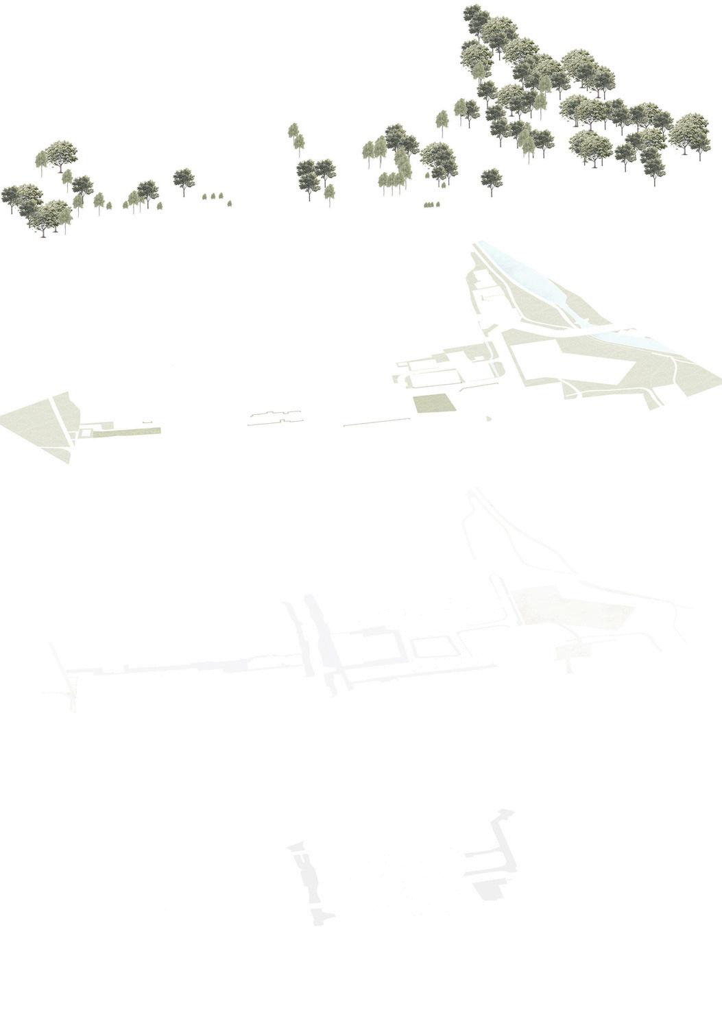
BROOKLEIGH-DETAILEDMASTERPLAN
The Brookleigh project is a key component of the Burgess Hill masterplan, with the potential to deliver up to 3,500 new homes, along with employment space, educational facilities, and supporting infrastructure. The principles guiding the development of Burgess Hill focus on delivering a sustainable, well-connected, and communityorientedtownthatsupportslong-termgrowth.Centraltothevisionis the creation of high-quality, mixed-use neighbourhoods that offer a range of housing types, including affordable homes, to meet diverse local needs. The development promotes active travel through integrated pedestrian and cycling networks, supported by enhanced public transport links. Green infrastructure plays a key role, with strategic open spaces, green corridors, and sustainable drainage systemscontributingtobiodiversityandclimateresilience.

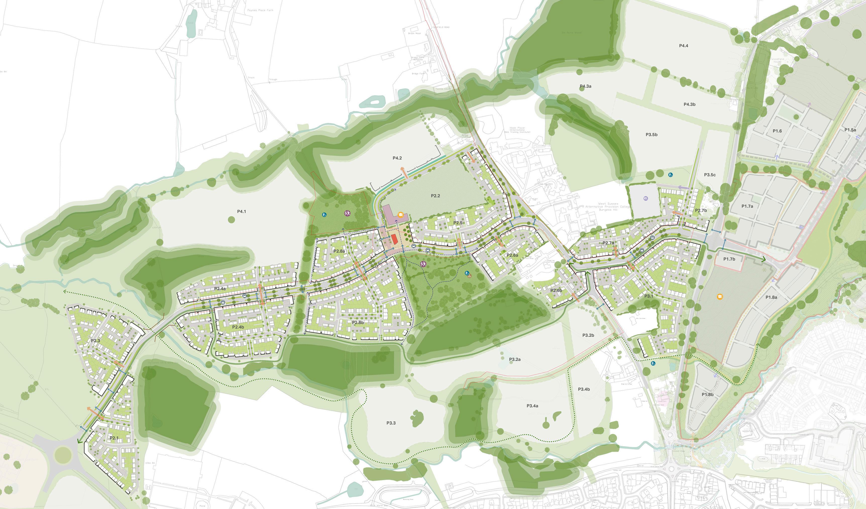
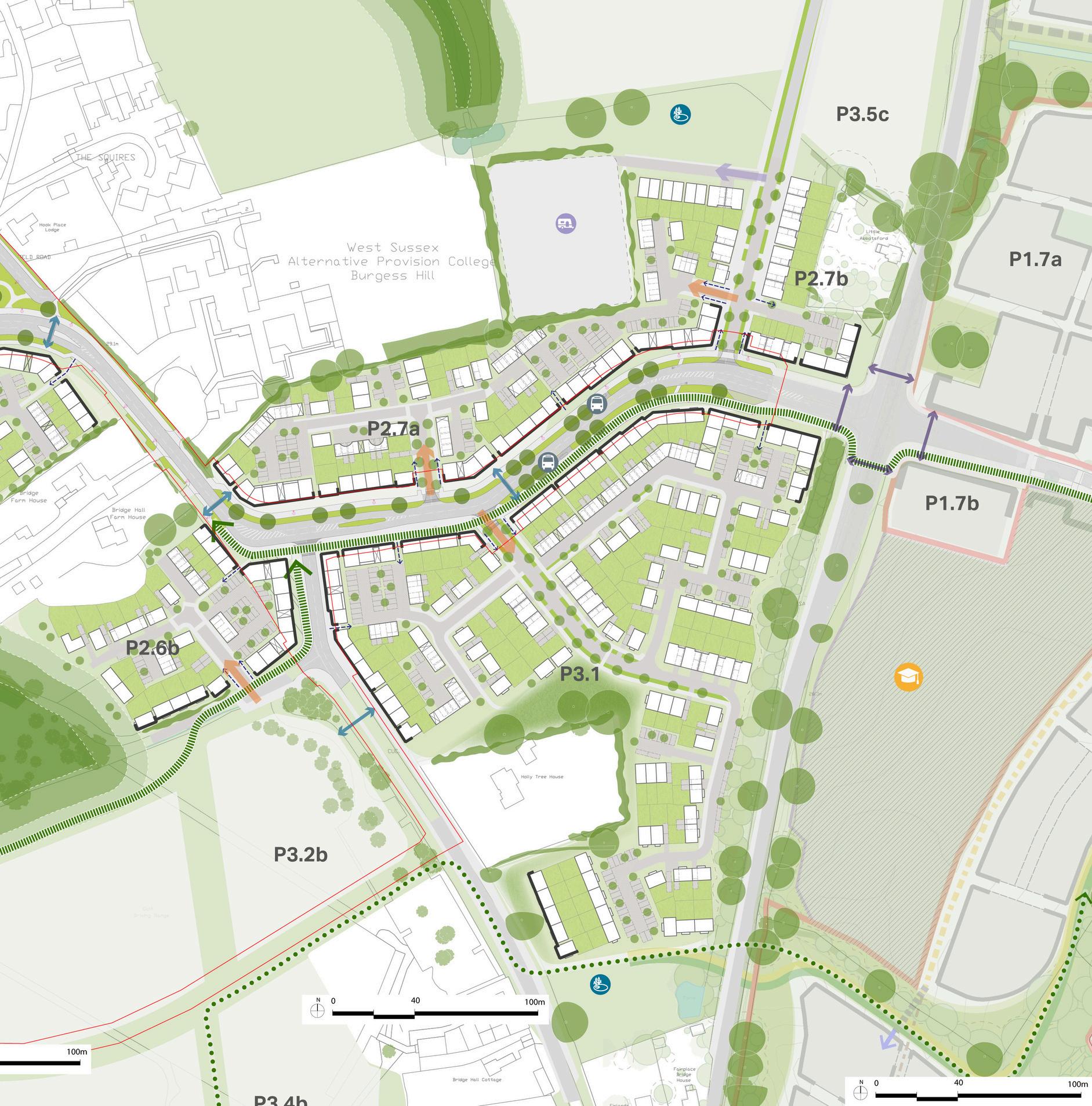
My contribution involved refining the strategic masterplan concept and developing it into a detailed and accurate masterplan This included improving vehicular routes, adjusting turning angles, and refining plot layouts and building orientations to client’s feedback, working closely with the transport and sustainability teams, as well as other designers, to ensure consistency, graphic clarity, and alignment with the project scope and approved land budget.
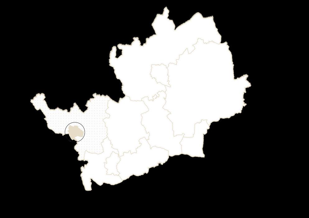
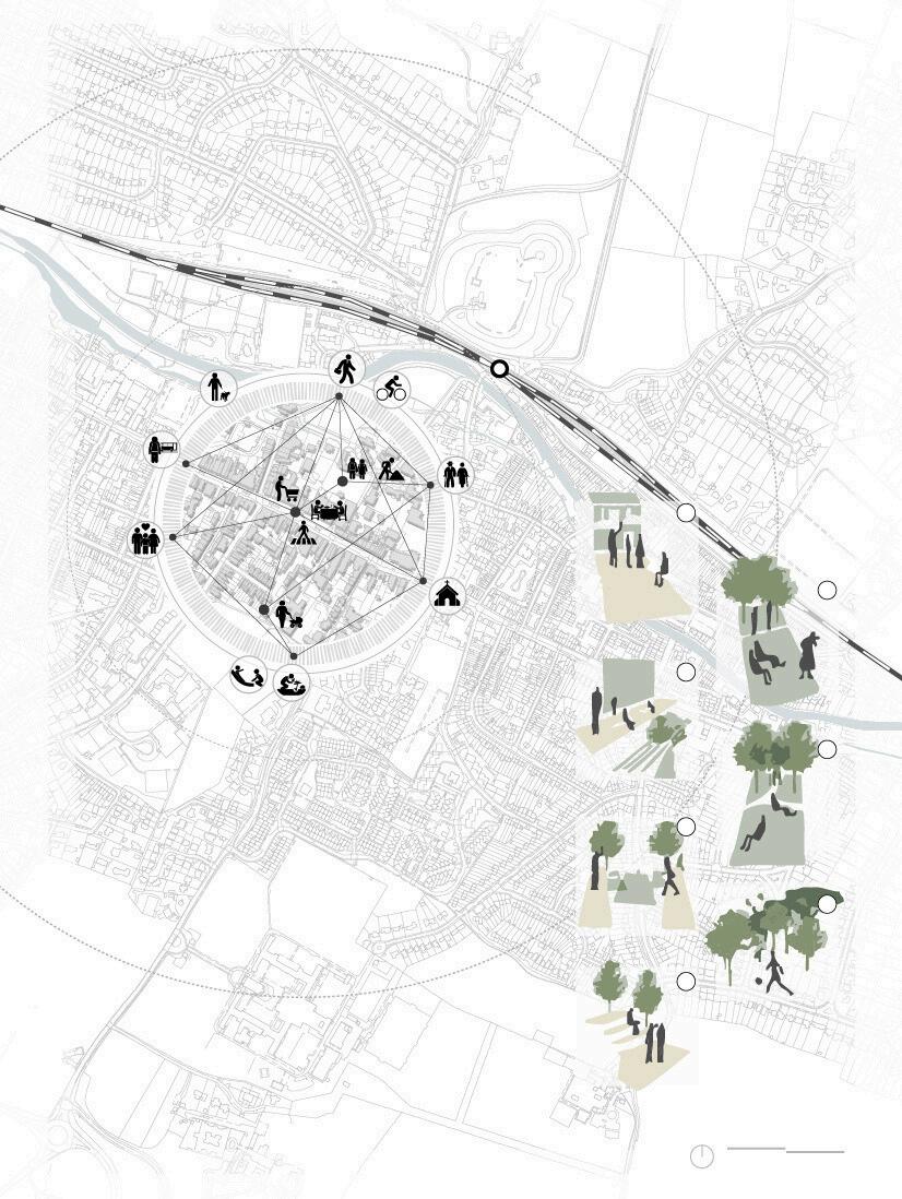
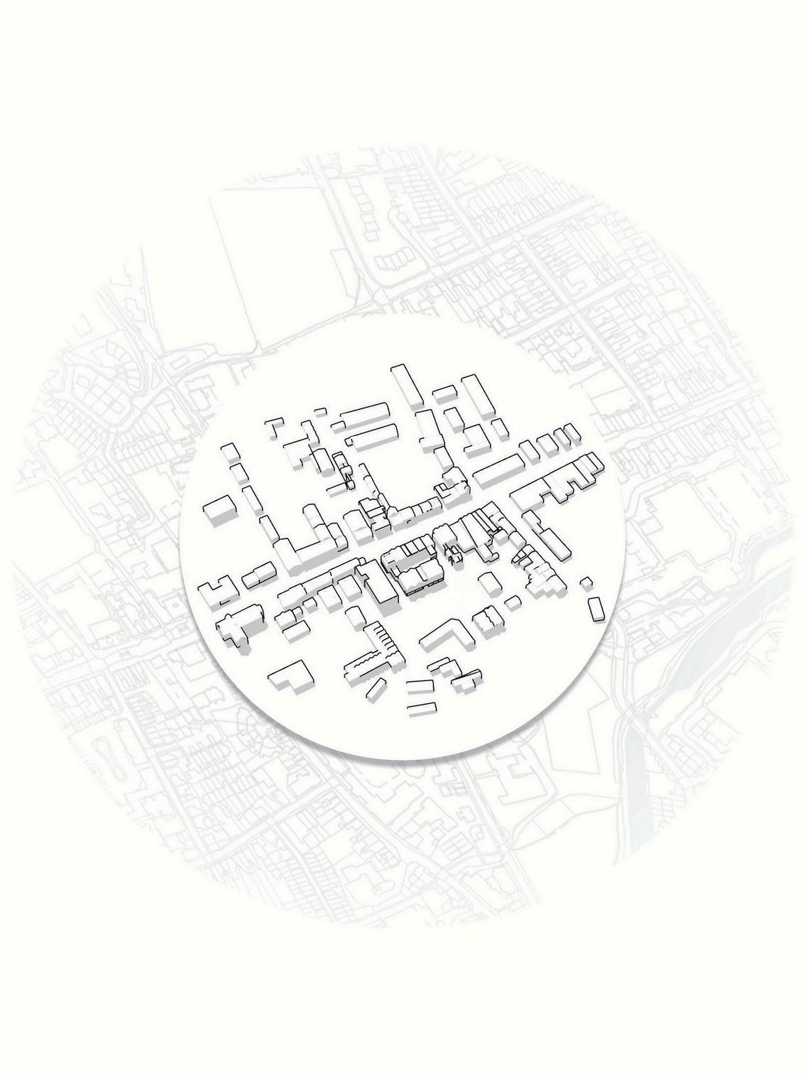
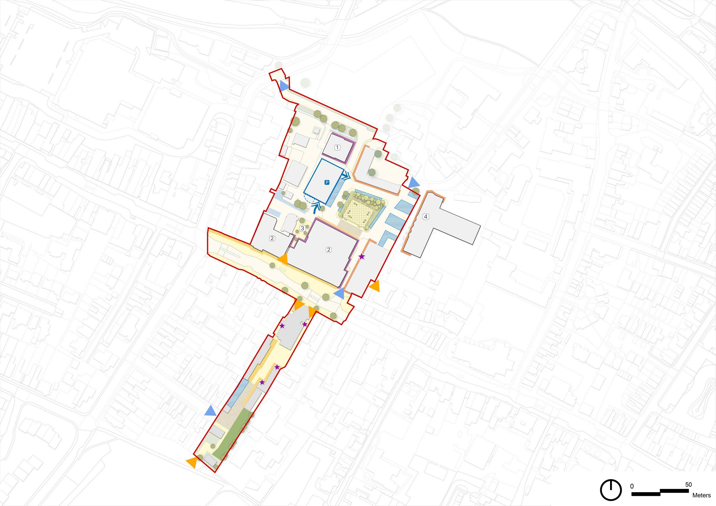
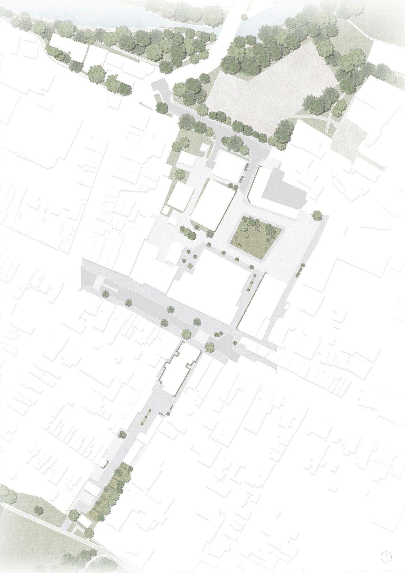
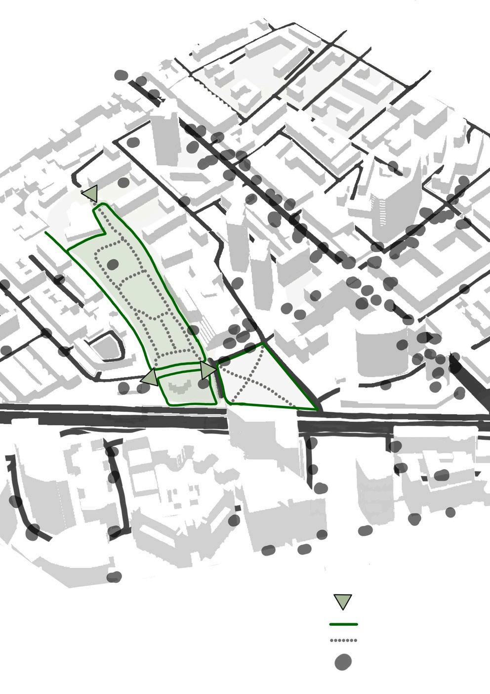
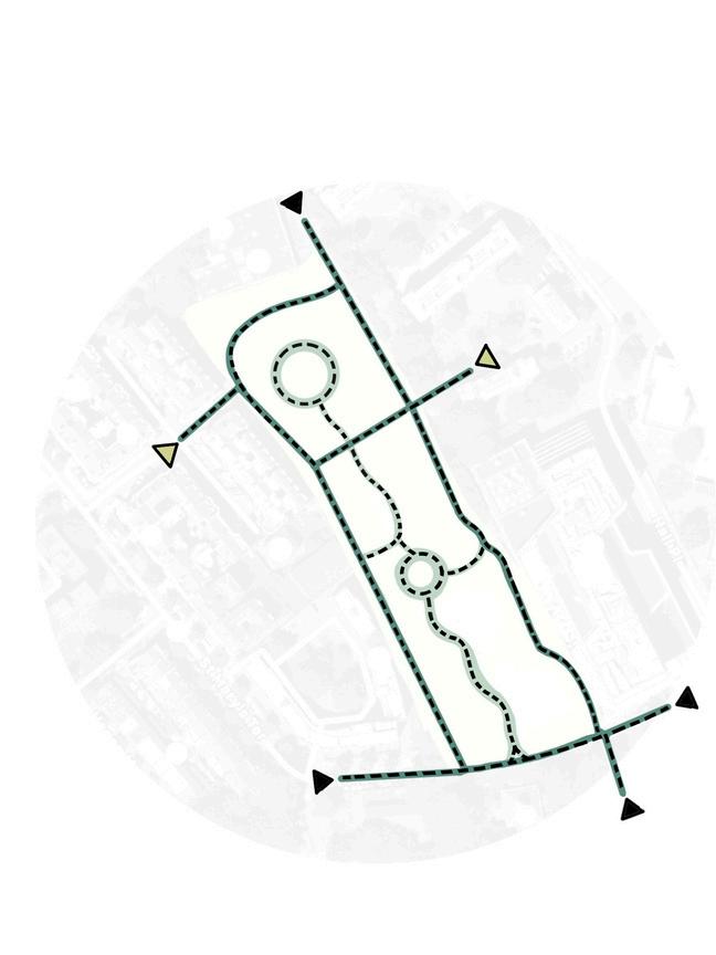
TOWNCENTRE-STRATEGICMASTERPLAN
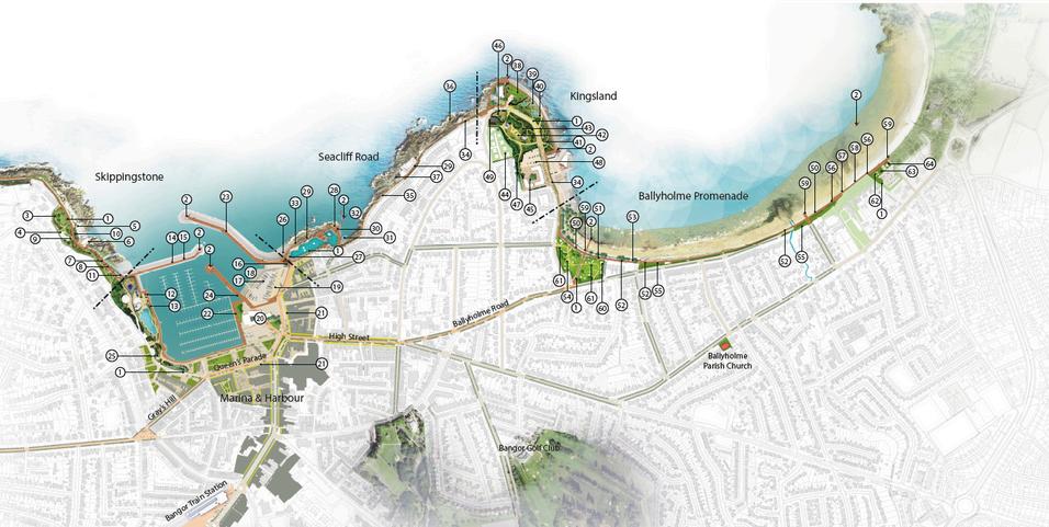
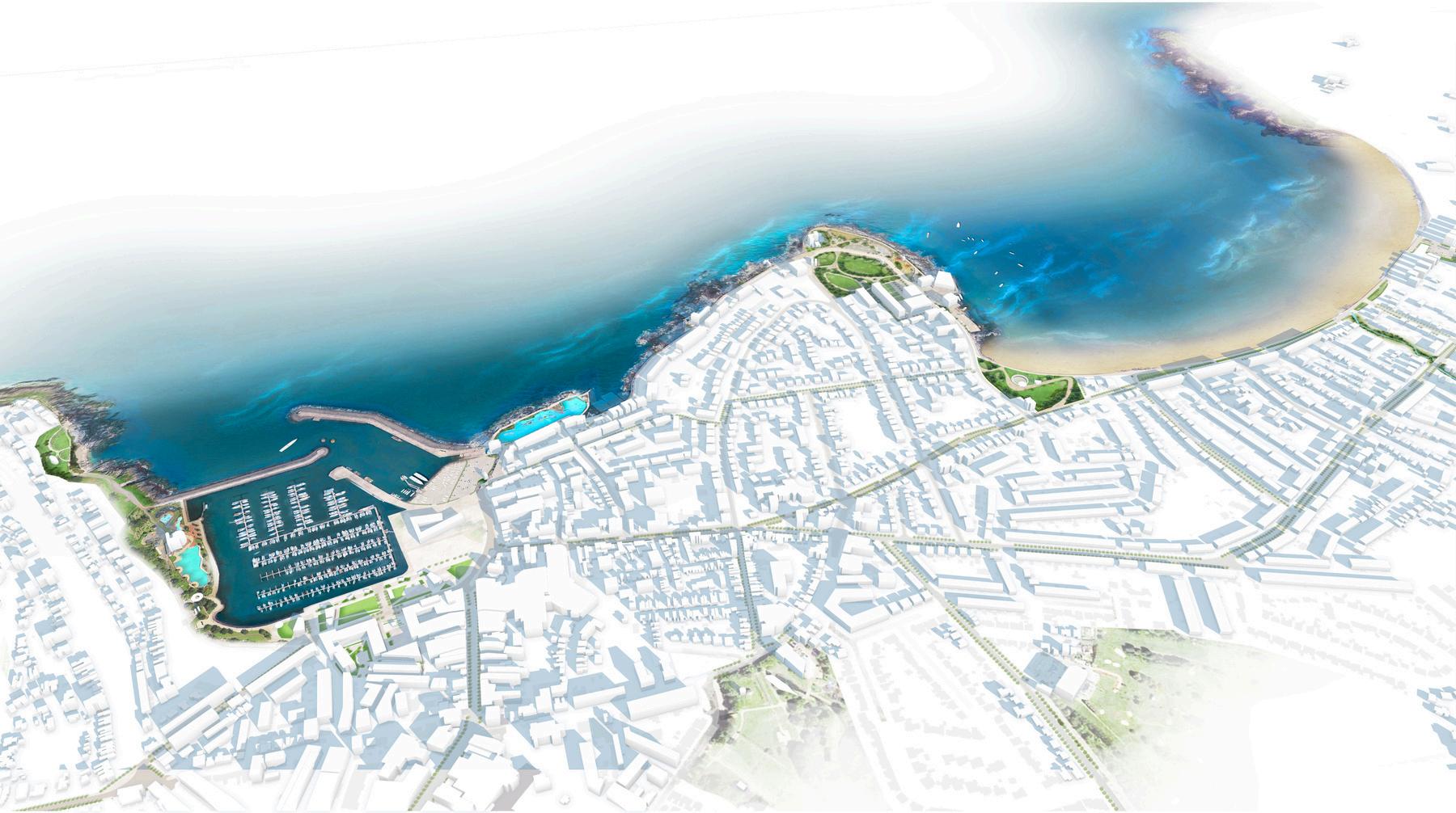
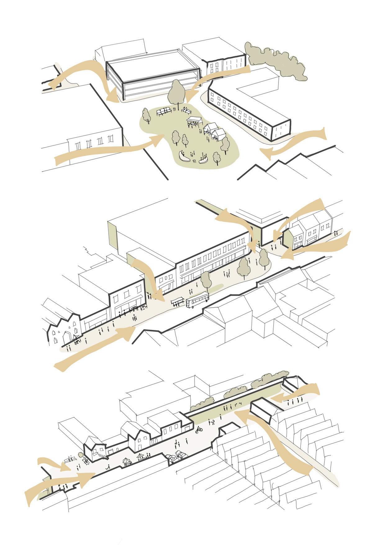
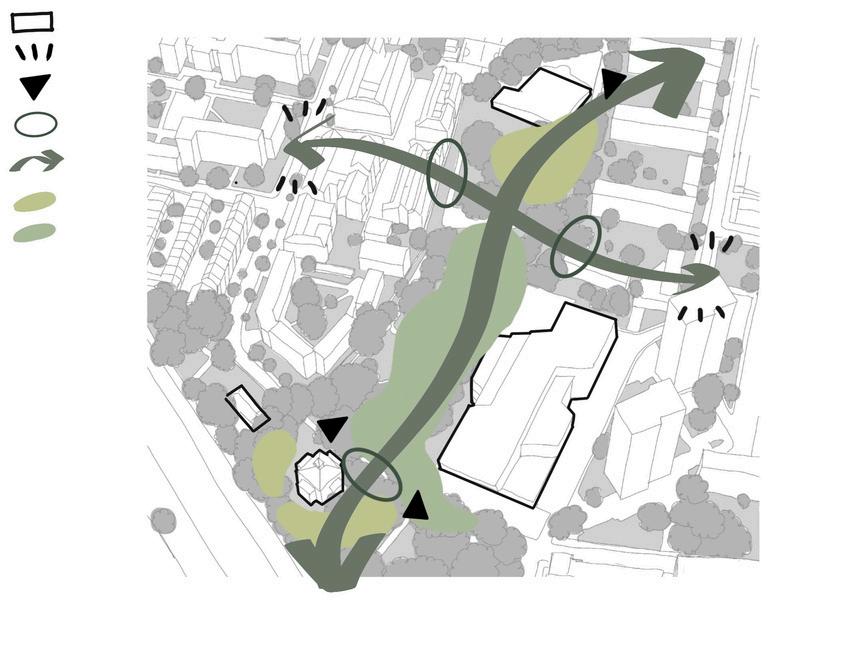
This project focuses on the sensitive development and placemaking of the blackland sites, located on both sides of Berkhamsted’s busy High Street, following completion of town-wide design code document. Developed in collaboration with transport planners, a robust design code underpins the approach, aiming to deliver a highlevel contextually responsive urban environment that promotes walkability, inclusivity, and local character. Building on these principles, the masterplanning phase introduces a mix of uses, enhanced public realm, and sustainable infrastructure. The design addresses key challenges such as high street severance, movement connectivity, and landscape integration, ensuring the area evolves intoathriving,accessible,andcommunity-focusedplace.
5-minuteswalkingradius
The masterplan was required to respect the BerkhamstedDesignCode,whichwasproduced byourteam Thedocumentdrewontheexisting form and character of the Conservation Area, setting out codes and guidance that the masterplancarefullyfollowed.
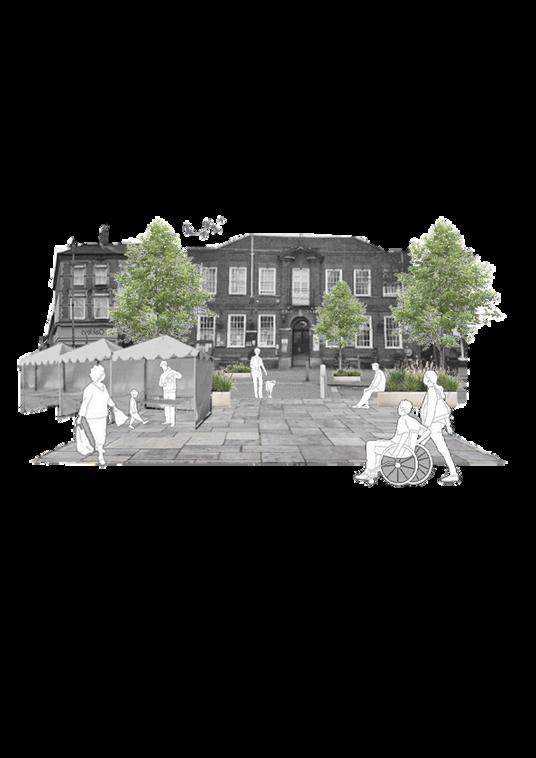
MARKET
Regular marketplace on theHighStreet.
HERITAGE
Located within designated Conservation Area and adjoiningheritageassets.
GREENASSETS
Existing mature trees and localgreenopenspaces
ACCESS
One-way vehicular system dominated by car parking with unattractive and unsafepedestrianroutes.
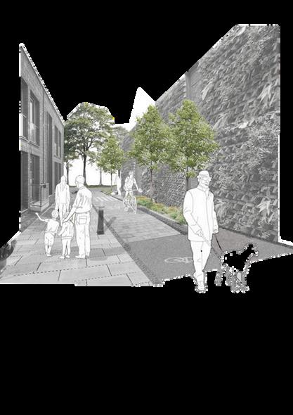
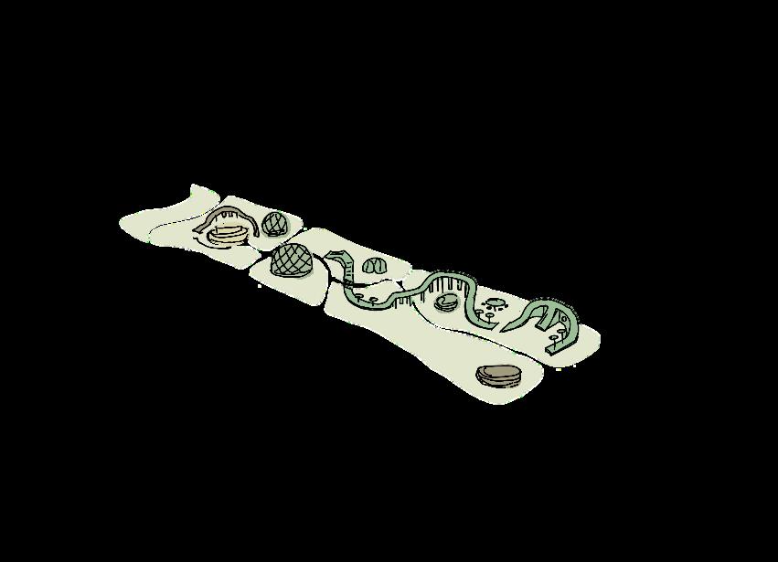
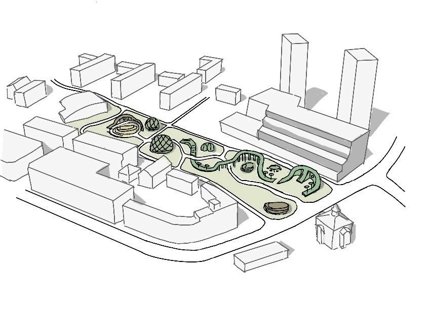
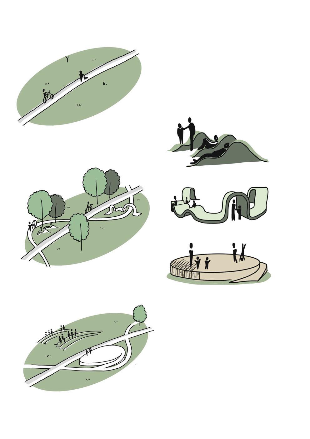
The proposed series of open spaces and their elements, including trees, green spaces, soft and hard surfaces, and highways, support a variety of activities that shift throughout the day and as people movethroughdifferentpartsofthetown
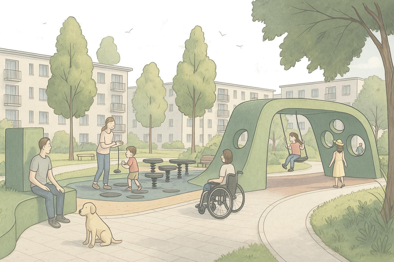
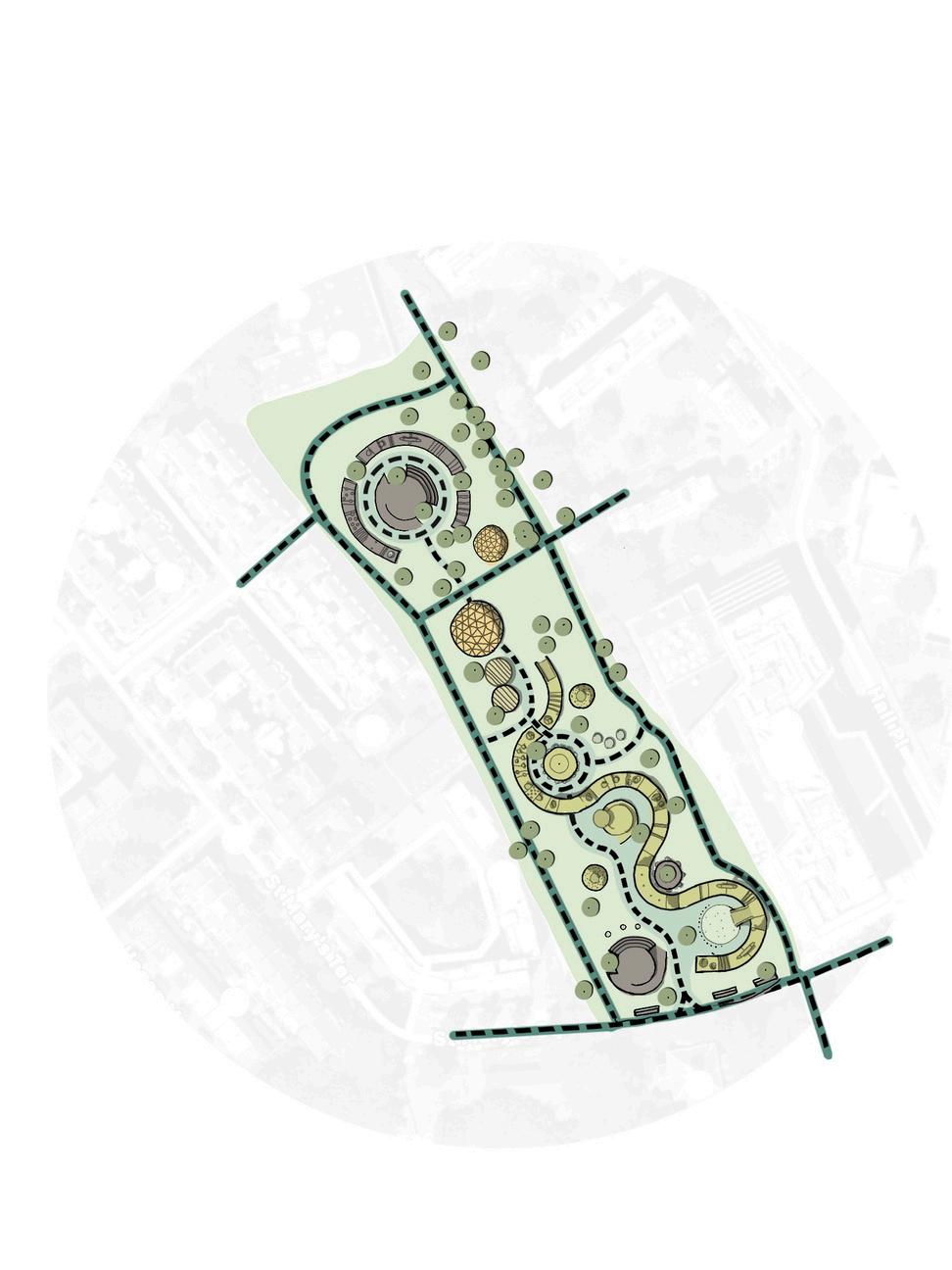
PADDINGTONGREEN-PLACEMAKING(MAURBANDESIGN)
The Paddington Green Project was dedicated to transforming an underutilised green space into a vibrant, inclusive community asset. Nestled between St Mary’s Church, the City of Westminster College, residential blocks and the commercial Edgeware Road, the project seeks to address the pressing need for a restorative recreational area - a green, restorative space where people can relax and engage withthepulseofcommunitylife.PaddingtonGreenwaspositionedto serve as a unifying hub for a broad spectrum of urban stakeholders: from property owners and families from council estates who contribute to the vitality of the local markets, daily commuters, dog walkers, and college students. This richly layered context called for a public realm that supports both everyday moments and communitywidegatherings.
ImagegeneratedwithAI(originalimageonpage36).
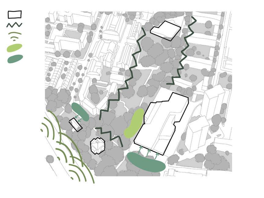
The site access is constrained by two busy roads that act as physical and acoustic barriers. The site’s gated entrances and impermeableedgesalongboththeeastand westsidescreateasecludedenvironment.
EY mportantbuilding hysicalbarrier afficnoise xistingplayground chooldrop-off
y y physical barriers and gatedaccess,thesiteisimpactedbyhightrafficnoiseandtheschooldrop-off.
KEY mportantbuilding safecrossing existingsiteentry newaccessopening mainconnectivity quietarea playarea
g p p y y linking key community assets and school facilities along the north–south axis, while enhancing access betweenresidentialareastotheeastandwest.
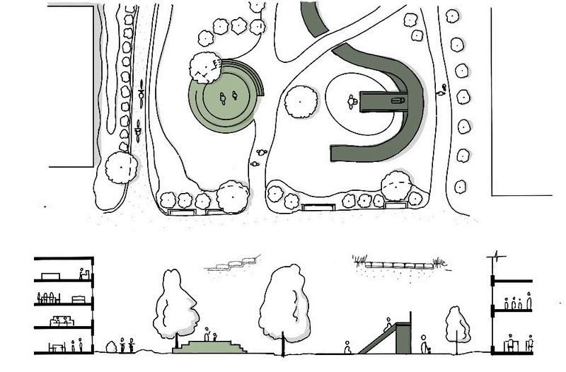
RESTORATIVESPACE
The park’s northern edge is a quiet, restorative zone buffered from road noise, with soft planting, muted colours, gentle swings to support mentalhealth.
COMMUNITYSPACE
Central seating supports daily use, socialising, and play oversight, while open spaces and community-led gardensencourageinteraction
MEANINGFUL CONNECTIONS
The park removes barriers and provides pedestrian and cycle routes and links to nearby community assets like the Edgware Roadmarket.
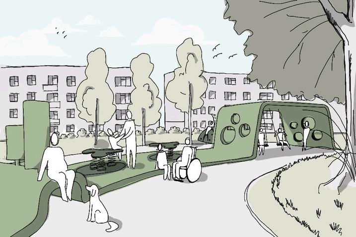
INCLUSIVEPLAY
Play areas support physical and sensory needs with accessible equipment and level surfaces, and quiet, creative zones for girls and youngerchildren.
INCLUSIVEOFALLAGES
Design ensures universal access with smooth paths, shallow gradients, rest points, and step-free routes, supporting dignified movementforallusers.
Working with landscape that enhances biodiversity, supports local ecosystems, and providesopportunitiesforinteractionwithnature.
Working with low-carbon materials that are locally sourced and contribute to human and environmentalwellbeing.
Working with natural colour palette and organic forms that spark curiosity and creative play, attractiveforallages.
MAPKEY pedestrianroute inclusivesurface routewithcyclinglane existingaccess newaccess
Naturalwoodenplaystructures designedtogentlystimulate children'ssensesandcognition, complementedbyseatingareas forrestandobservation.
Community-ledgreenhousesand toiletswithgreenroofs,restoring greenerylosttobuildingfootprint whilesupportinglocal stewardship.
Landscapedseatingand flexibleperformancespaces designedtofostercommunity gathering
Sharedsurfacepathwithpermeable blockpavingandboundgravel, offeringcontrastingtexturestoguide movementandindicatethecycling lane,ensuringcomfort,safety,and accessibilityforallusers.
Stimulatingplayspaces overlookedbytheschool, withsociallunchareas designedforinclusiveplay, withzoneswheregirlsfeel comfortabletoconnect.
Restingspacesoverlooking thechurchandworking aroundtheexistingtrees, withnoremovalnecessary.
The final design creates a human-scaled, inclusive public space that fosters community building through open sightlines, accessible routes, and flexible social areas that invite interaction, play, and everyday use by all abilities and age groups. This project was displayed at the London Festival of Architecture among other selected work at the University of Westminster (2023).
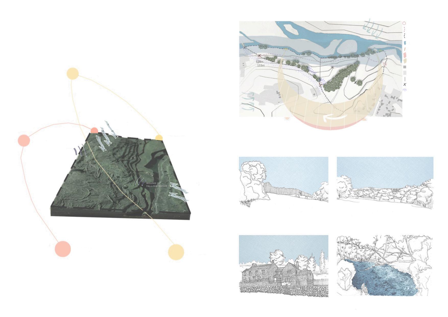
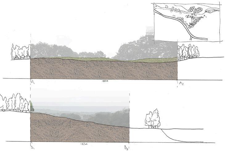
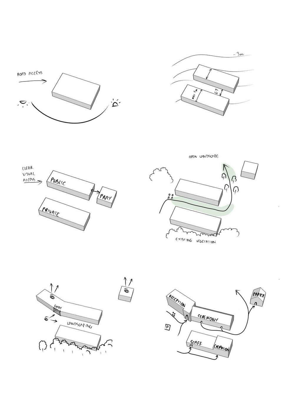
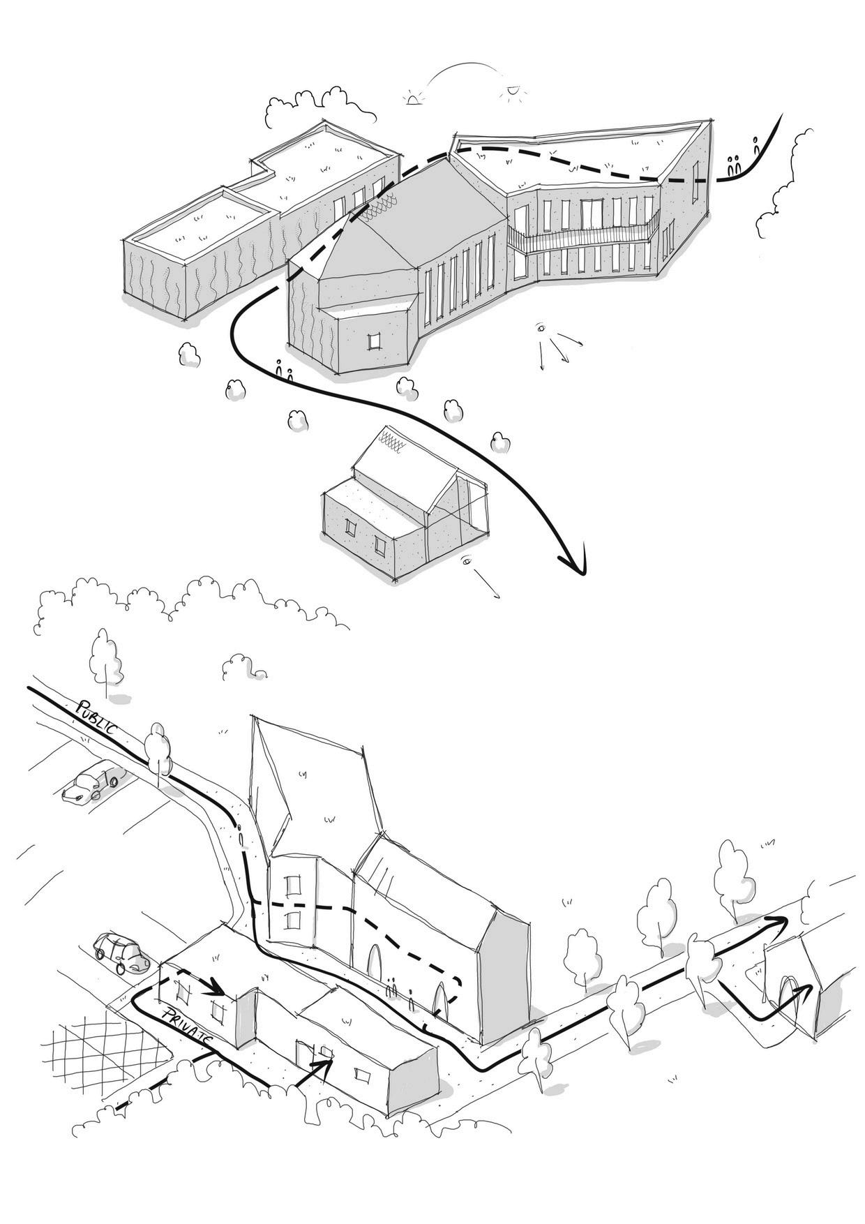
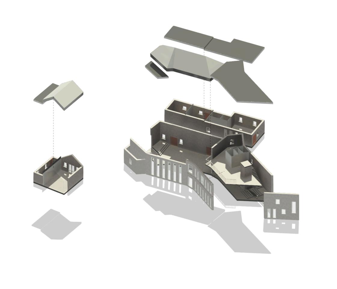
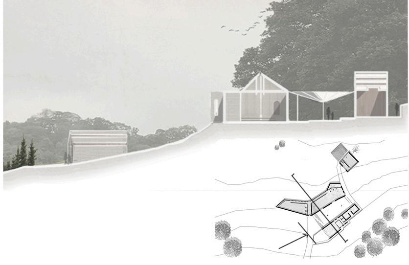
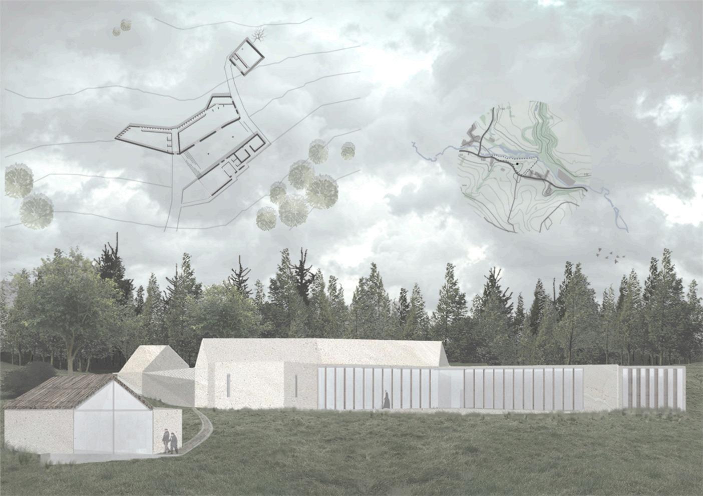
PEAKDISTRICT-ARCHITECTURALPROJECT(BSCARCHITECTURE)
This architectural project proposes a sensitively designed chapel and crematorium located in the Peak District near Bakewell. The scheme includes a gathering space, a cafe, records room, and both indoor and outdoor ceremonial areas, thoughtfully oriented to maximise the sweeping north-west views across the landscape and towards the distant forested areas of the national park. Accessed from the treelined south-east, where the main road lies, the site benefits from a naturallyquietandcontemplativecharacter.Thedesigndrawsonthe local materiality of the area, blending harmoniously with its surroundings to create a peaceful, respectful setting for remembranceandreflection.