TONBRIDGE CONSERVATION AREA
Introduction
The objective of the Tonbridge Conservation Area Appraisal is to analyse and record the special character of the Conservation Area, which was originally designated in 1969 with further extensions in 1981, 1985 and 1990. Following an assessment of these earlier conservation area boundaries, the Borough Council updated them in 2008 to include new areas and exclude others. The appraisal covers the area within the revised ConservationArea boundary and provides further details to assist with the interpretation and use of planning policies. It will help guide the Council in making planning decisions on planning applications and to this end has been adopted for development control purposes.
It is intended that this appraisal will inform and influence the activities of the Council and other bodies (eg Kent County Council and other statutory agencies), where these impact on the Conservation Area. It will also assist in the identification of any programmes of action that are considered appropriate by these bodies, subject, of course, to financial limitations and other priorities they may have.
Importantly, it is hoped that the appraisal will prove to be of help to residents, businesses and landowners. For anyone proposing new development or changes within the Conservation Area, the appraisal should be read in conjunction with the Borough Council’s Conservation Area Advice Note. This includes guidance on the broad issues to be considered and the special controls that apply in Conservation Areas.
As the purpose of this appraisal is to describe the character of the area, it does not include a detailed description of every feature or building. Omission of any particular building, feature or space should not be taken, therefore, to imply that it is not of interest or similarly that there are no opportunities to improve the character of the area.
CONSERVATION AREA APPRAISAL
Location, Setting and Physical Form
Tonbridge is situated at a crossing point of the River Medway about 6 km north of Tunbridge Wells, 10 km south east of Sevenoaks and 20 km south west of Maidstone. The old settlement stood on the north side of the river which was less prone to flooding but, protected by flood control barriers, the town now extends across the floodplain.

The town is narrow at this point and consequently the countryside setting is never far from the town centre. To the west, the low lying, flat countryside penetrates into the centre as the river and its floodplain extends up to the motte. Views of the countryside unfold along riverside walks to the west and are visible as an expanse of open space when viewed from the raised motte. The river and low lying countryside with mature trees acts an important setting for the historic motte and castle and the town centre as a whole. The gently rising ground occupied by Tonbridge School playing fields and grounds also acts as an important setting to the school buildings and the conservation area as a whole. The wooded, hills and ridges of the Greensand Ridge and the High Weald rise sharply to the north and south of the town creating an attractive long distance back drop to the town. This landscaped setting is important to the character of the conservation area seen as it is from a number of vantage points including the motte.
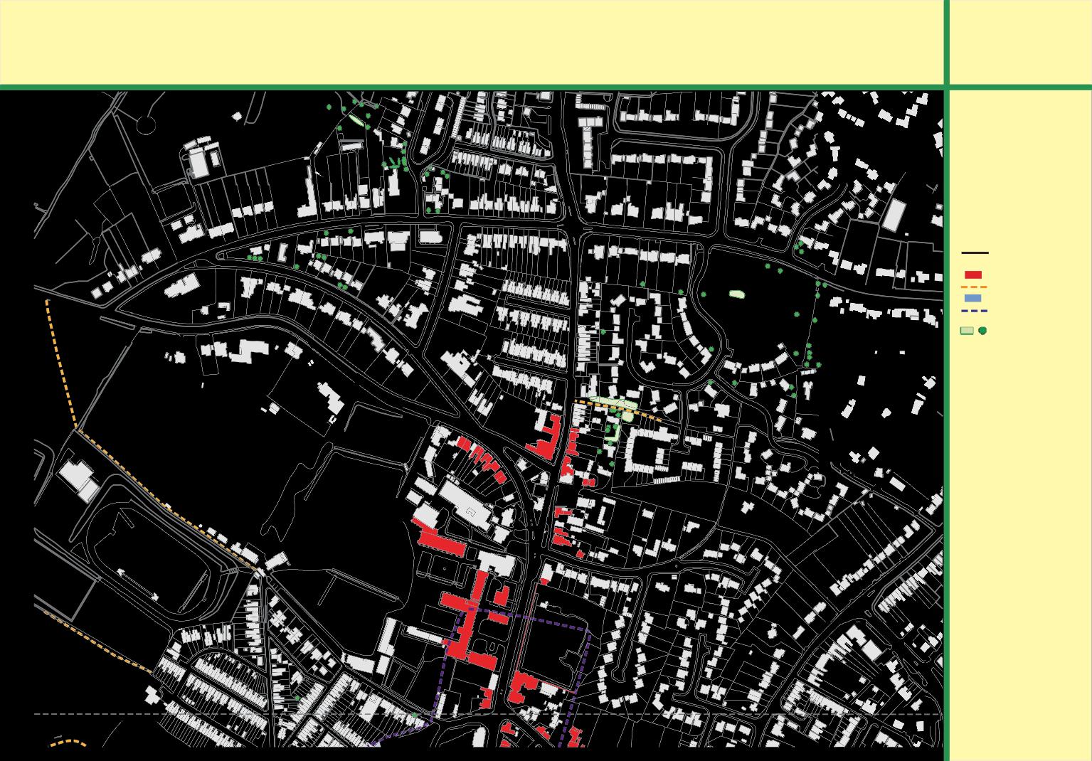
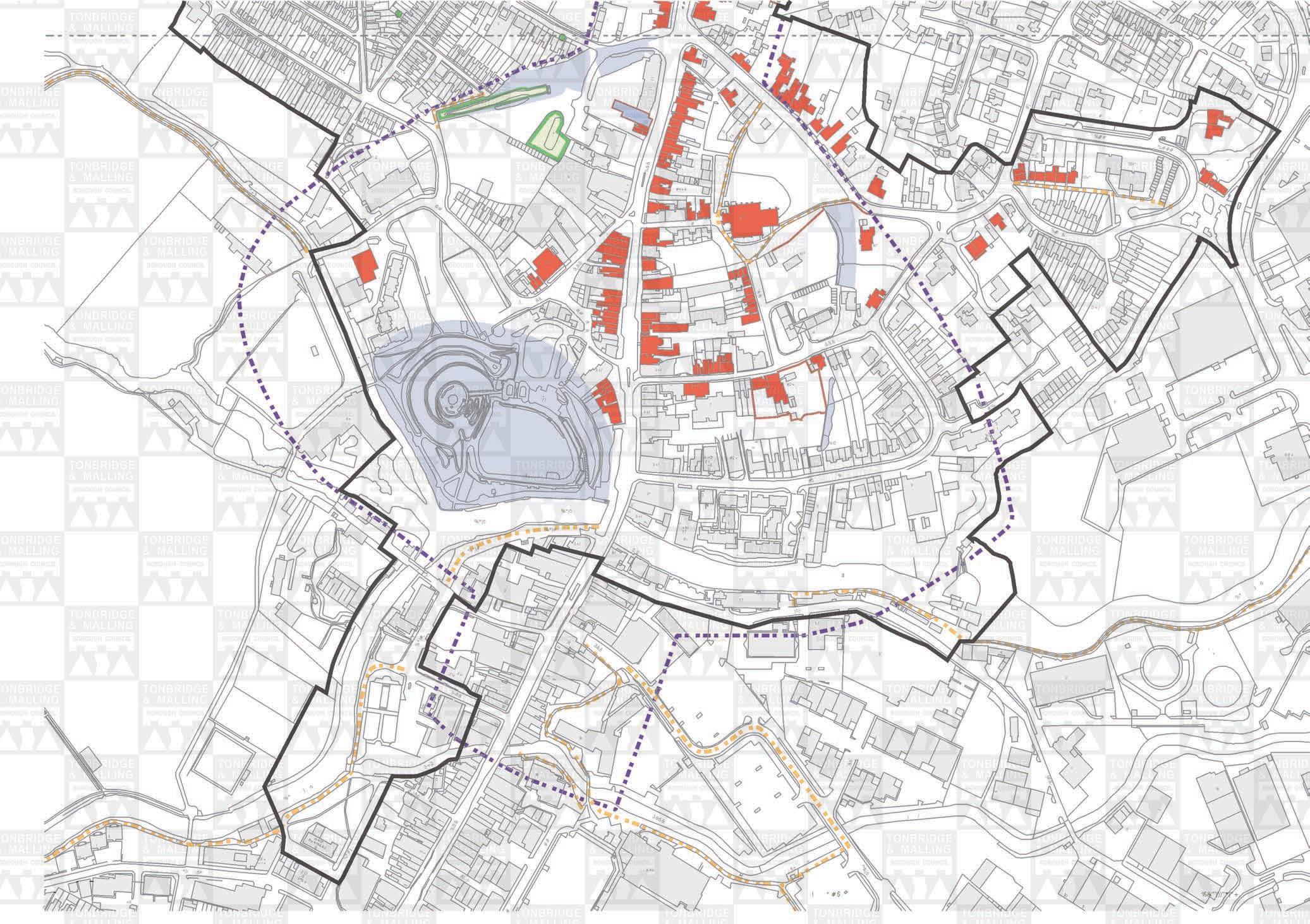
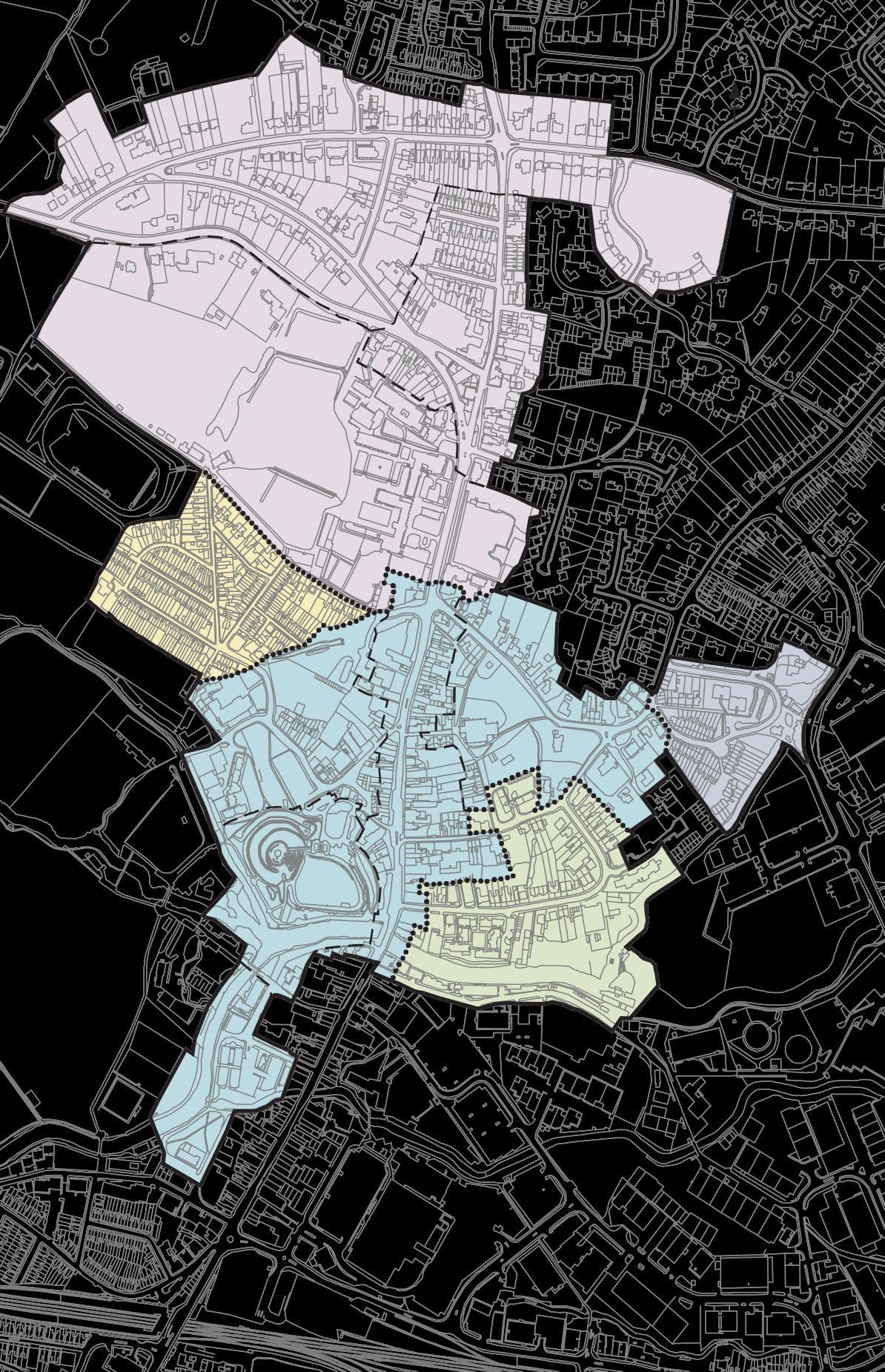
The ConservationArea covers an area of the town from the River Medway in the South to Yardley Park Road in the north incorporating the ancient castle and historic High Street. Tothe south and north of the Conservation Area mainly 20th century housing developments fan out onto higher land giving the town its characteristic dumb bell shape. Maps 1a and 1b (opposite) show the extent of the Conservation Area. One of the characteristics of the Conservation Area is its diversity. The ConservationArea can be divided into areas of similar character (see Map2).
2
© Crown Copyright. All rights reserved. Tonbridge and Malling Borough Council. Licence No 100023300.
TONBRIDGE
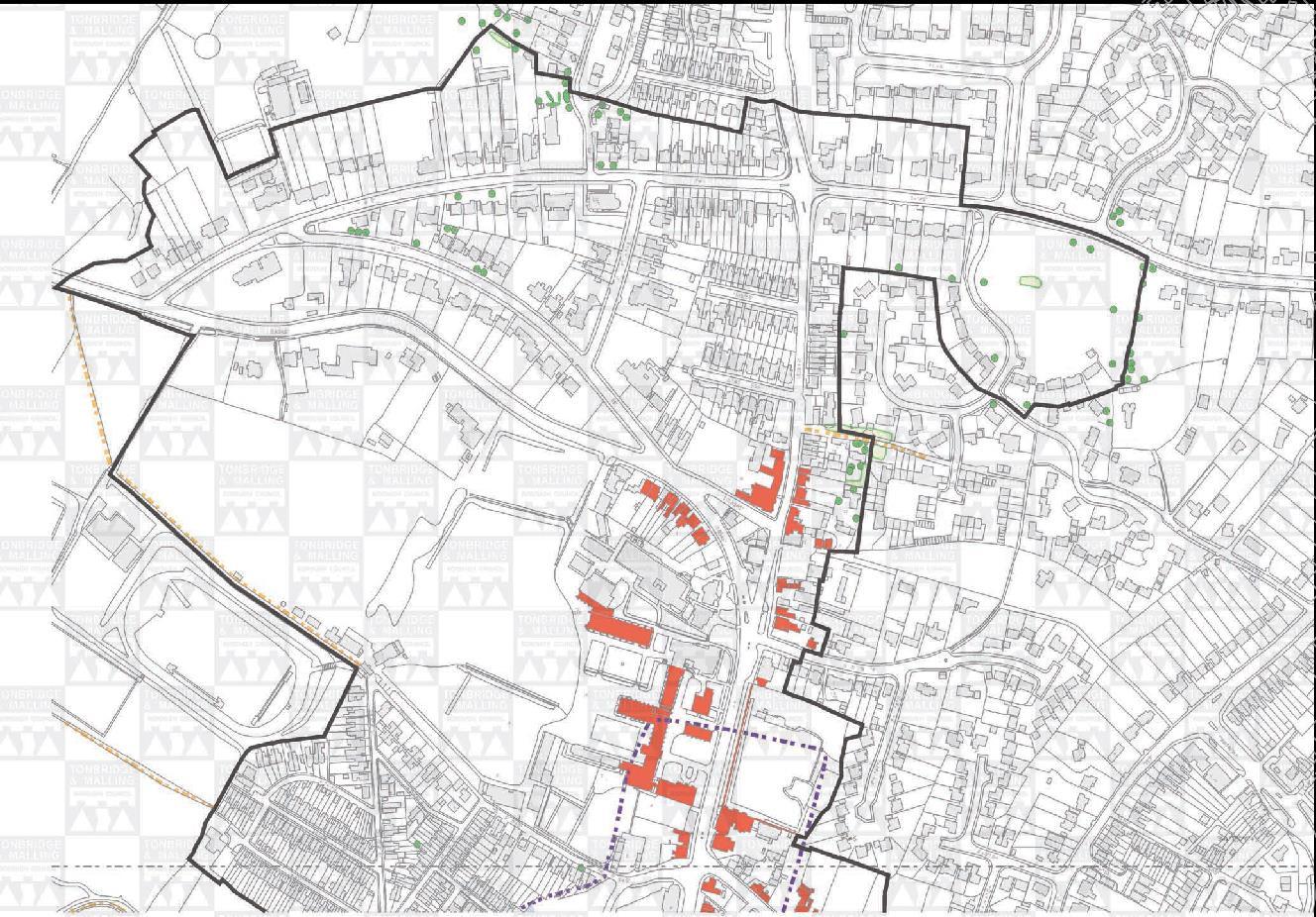
))2 4 % % !$&$&$" *.) ’(( (/)0 *) *(( KEY Boundary of Conservation Area Listed Buildings Publicright of way AncientMonuments Area of Archaeological Potential Tree Preservation Order % + *(( +’. 6) "22 *(( 2( *2 8/(9 "# ,4 !.4) *)( ,4 #* ,4 )(’ */ *)( ,4 7:) $ #$ %&’’’())’’*(’’+, Map 1a
TONBRIDGE


*+ 42 #" ".2 3"2/ "4 !0+" &! !0+" #4+4 7" "+0/ .+ .+" +4 .5! &!" KEY Boundary of Conservation Area 3, +" 4+ &!* + 3+/ Listed Buildings Publicright of way AncientMonuments Area of Archaeological Potential Tree Preservation Order 3+/ 3+/ &+0" (0 !" #2+ )/ 77 4+ 7 3+/ 8! &!0 .+" 3+/ &+0" )/+ +5 #2+ &8!+ %*)6 %*)#, %*)6 3+/ 3" 3+/ &! )/ 2 !" +&! )!7 9.: )/ 24" )!7 + $ )#, Map 1b &8!+ !+ &#& " #$ %&’’’())’’*(’’+, +8
Area A This covers the medieval core of the town. It has been divided into four sub areas:
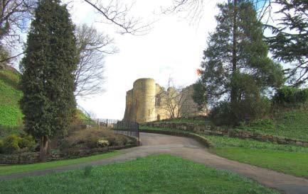
Sub area A1 The 13th Century castle and grounds are a unique historical feature and dominant landmark in the Conservation Area.
Sub area A2 The historic High Street has a busy commercial character and contains many buildings of medieval origin and several historic inns.
Sub area A3 This mixed use area incorporates the small scale streets of the old market. The area is evolving with the creation of a new high density residential development on the former cattle market.
Sub area A4 The area is characterised by a large number of substantial listed 18th and 19th Century buildings set within large plots. The Church of St Peter and St Paul is of medieval origin and stands within an extensive landscaped churchyard, creating a green oasis just off the High Street.
Sub-area A5 This area comprises the landscaped area around the River Medway.
Sub-Area B A mixed use area which has seen considerable redevelopment but retains some important Saxon and medieval elements. The wharf area of the Medway reflects the industrial heritage of the town.
Sub-Area C Agroup of historic buildings clustered around the medieval Mill Pond lie at the heart of this predominantly 19th Century residential area. A small parade of Victorian shops fronts the HadlowRoad.
Sub-Area D The SladeArea is a Victorian residential neighbourhood of tight knit terraced and semi detached houses which have retained many original features.
Area E The northern part of the Conservation Area lies outside the medieval defences and has a spacious, predominantly Victorian character. It has been divided into three sub areas:
Sub area E1 Tonbridge School and its grounds dominate the townscape of the upper High Street. The Gothic style 19th Century sandstone buildings create an impressive frontage on the High Street and the chapel tower is a landmark feature visible from many parts of the Conservation Area.
Sub area E2 The London Road/Shipbourne Road junction is wide and spacious and framed by trees and listed buildings. The Shipbourne Road is narrow and enclosed and the historic buildings retain many original architectural details.
Sub area E3 Dry Hill Park was developed in the late 19th Century. Substantial houses surrounded by mature trees stand in large plots in an elevated position with long views northwards towards the Sevenoaks Ridge.
These sub areas of special architectural and historic character are not intended to be precisely split, as there will inevitably be some overlapping of characteristics of the various areas due to the diversity of the character of the Conservation Area.
3
Key to sub areas
A1 Castle
A2 High Street (Including East Street(w))
A3 Market Quarter (Including The Slade Bank Street Castle Street Castle Fields Stafford Road(s))
A4 Church & Bordyke (Including The Bordyke Hadlow Road(w) East Street (e) Church Street
Church Lane(e))
A5 River Walk (Including River Lawn Road Bradford Street)
B Lyons Crescent (Including Lockside (w) Medway Wharf Road East Street (part) Church Street(s))
C Mill Stream (Including Mill Crescent Mill Lane Charlton Crescent Mill Bank)
D Slade Area (Including Stafford Road Hawden Road Houselands Road Fosse Road Lodge Road The Avenue Havelock Road Lansdowne Road The Crescent)
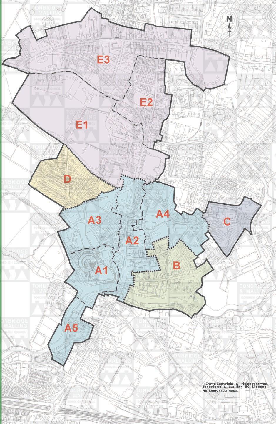
E1 Tonbridge School (Including High Street (n))
E2 Shipbourne Road (Including Ashburnham Road Manor Grove Old London Road London Road (e) Portman Park (w))
E3 Dry Hill Park Road (Including Dry Hill Road London Road Dry Hill Park Crescent Yardley Park Road (w))
TONBRIDGE TOWNSCAPE CHARACTER ANALYSIS - SUB AREA
N
E3 E2
E1
D A3 A4 C A2 A1 B
A5 Map 2 4 □ Crown Copyright. All rights reserved. Tonbridge & Malling BC Licence No 100023300 2008.
Origins and Development of the Settlement
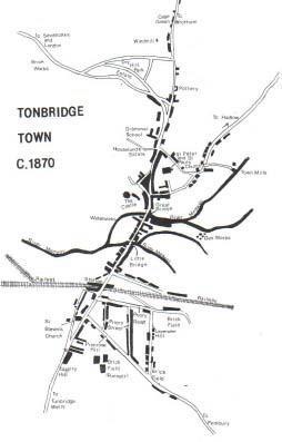
The name Tonbridge is derived from the Old English tun brycg which means ‘the bridge of, at, or near the manor or settlement. It is thought that the town evolved at a clearing in the great Andredsweald forest at a point where several tracks from the North Downs to the Weald met at a ford in the river Medway. The first bridge and church of St Peter and St Paul are thought to have been constructed between the 9th and 11th centuries.
After 1066, William 1 granted land in the TonbridgeArea to Richard FitzGilbert who built a Motte and Bailey castle to defend the river crossing. Tonbridge at this time was a small roadside town standing on the higher more defensible land to the north of the river. The only significant building south of the river was the Priory of St Mary Magdalene which was founded in 1192.
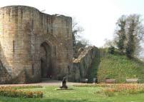
By the mid 13th century the castle had a sandstone three storey gatehouse and a high stone curtain wall. In addition, a defensive fosse was built around the north, west and east perimeters of the town. The wide ditch and bank started and ended at the river and enclosed the castle, church and main street. The Medway formed the southern defense for the town. The Gatehouse and sections of the castle wall and fosse still stand today.
Medieval development was enclosed within these defenses giving the town a compact form. It was only well into the post medieval period that the settlement expanded beyond them. The High street formed the principal axis of the town. There were houses on each side of the High street from the Great Bridge to the North Gate with small side streets leading off to the east and west. The church, castle (which also served as the manor house) and Tonbridge School were the only stone buildings in the town. The settlement remained principally north of the river as the south side was still frequently flooded. There was a weekly market in the town and shops, inns and other trades based around agriculture, mills, cloth making and iron working became well established.
The market originally lay outside the castle gate between Bank Street and Castle Street. It flourished and in the 16th century the market place was moved to the east side of the High Street between East Street and Church Lane and houses and shops were built on the old site. The pens and stalls of the markets and fairs stood where the High Street broadens out by the Chequers Inn. The general market ceased in the early nineteenth century but a cattle market (granted in 1671) continued. Due to the congestion it caused it was relocated behind the Corn Exchange. The site is now being redeveloped.
Castle Gatehouse
Chequers Inn 5
In 1553Andrew Judde,Master of the Skinners Company and Lord Mayor of London, founded and endowed a free grammar school at Tonbridge. The school buildings stand north of the town walls on the west of the High Street. Today it is a private school and the 19th Century Gothic frontage dominates the townscape of the upper High Street.
The earliest inns were established in the Tudor period, possibly as a result of the Priory ceasing to offer accommodation. During the 18th and 19th Centuries the number of inns increased rapidly. By 1672 Tonbridge had become a post town with a post master. It was on the main road from London to the coast and was also on the main postal route from London to France. Tonbridge was an important staging post for coaching and carrier services connecting between London, Hastings, Maidstone, the Wells, Brighton and Rye. However, road conditions were poor. The river at that time ran through five channels and the road ran over a series of hump backed bridges across land that frequently flooded.
In 1740 the River Medway was made navigable and a town quay was constructed. The following year the Upper Medway Navigation company started to ship out timber and iron and bring back coal, stone, gravel and lime mainly to make bricks (with local clay) for the growing town. Tonbridge became the port for the upper reaches of the Medway and an important trading centre. Tonbridge formed the focus of a large agricultural hinterland and the town acted as a centre for processing and trading agricultural products.
During the 17th, 18th and early 19th centuries, many new buildings were constructed within the confines of the town defenses, particularly in the High Street, Bank Street and East Street, often replacing earlier structures or infilling gaps. Bricks were made from the good quality local clay and began to replace timber as the main building material in the town. The 18th century weather boarded wooden houses, shops and inns were either replaced with brick houses or had a ‘brick skin’ put over them and featured tiled roofs. Today large parts of the town feature mid 18th century exteriors enclosing internal structures dating from much earlier in the 16th and 17th centuries. The Rose and Crown which remains in the High Street was one such Tudor building which was given a brick frontage. The town began to expand beyond the Fosse. Much of the bank and ditch on the east side of the town was levelled and filled in, and houses were built along theBordyke.
After the arrival of the railway in 1842 and a more direct line to London via Sevenoaks in 1868, there was rapid increase of housing and population. Tonbridge grew from what was predominantly a farming community and became a market town centre of commerce and light industry. Small terraced housing for the poor and light industry were built on the frequently flooded land to the south, while fine houses were built for the middle classes on the higher, drier land to the north and east. The demand for trade, shops, public buildings and services increased markedly. The Dry Hill Park suburban area and Slade community were built during the late19th Century.
Tonbridge continued to grow in the 20th Century with the expansion of residential estates particularly to the north and east of the town. A trading estate developed on the low lying land east of the town centre.
6
During the 1960s, in an attempt to reduce traffic congestion, two rows of historic buildings had been demolished on the western side of the High Street just north of the Big Bridge and at the Bordyke junction. This raised awareness of the pressures and threats facing the historic town centre and in 1969, following the introduction of the Civic Amenities Act, Tonbridge Conservation Area was designated.
7
Townscape/Landscape Analysis
Maps 3 13 show the key features of the ConservationArea and form part of the townscape appraisal. They should be looked at in conjunction with thistext.
Special Character
Close to the river, features representing the ancient origins of the town remain visible adding a strong sense of history to the Conservation Area around the motte and castle and, although less visible, the fosse.
Water is a feature of the Conservation Area. The River Medway formed the southern boundary of the medieval settlement and the Big Bridge forms the entry point to the Conservation Area from the south. On the western side of the High Street the river forms part of the defenses of the castle and to the east, the industrial heritage of Tonbridge is apparent from the wharf style buildings on both banks. The TownLock, Mill Stream and Mill Pond and other ponds and channels of the Medway are important historical and townscape features which contribute to the area’s special character.
The medieval road layout, the river and town quay, and the coaching inns in the High Street are all indicative of the town’s importance as a transport hub located at a river crossing of the Medway on the route from London to the south coast.
The High Street forms the main axis of the Conservation Area with narrow strongly enclosed streets leading off to the east and west. The scale of development with generally continuous facades and increased height, and the monumental buildings of Tonbridge School, appropriately signify the centre of the town. A significant proportion of buildings in the High Street area are medieval in origin and consequently have narrow widths. Most were refronted with brick Georgian facades. The mixed ages of buildings results in a lively street frontage. A limited number of gaps in the frontage formed by side streets and carriage arches allow glimpses of complex backland development to the rear of plots which has resulted in tight enclosed courtyards and enclaves.
At the northern end of the High Street, the road forks and the spacious, well landscaped Victorian suburbs are laid out as a planned residential park. Tothe west, the tight knit form of Victorian terraced and semi-detached properties radiate out along narrow streets from a breach in the fosse. Victorian social distinctions are reflected in the style and scale of housing with more modest tightly developed terraced housing to the west and middle class housing to the north.
There is a contrast between the historic core of the town centred around the High Street, which has evolved and changed through time reflecting building styles and materials over a period of seven centuries, and the more homogeneous outer areas of the Slade, Dry Hill Park, Mill Crescent and the Bordyke which reflect the architecture of a particular period.
8
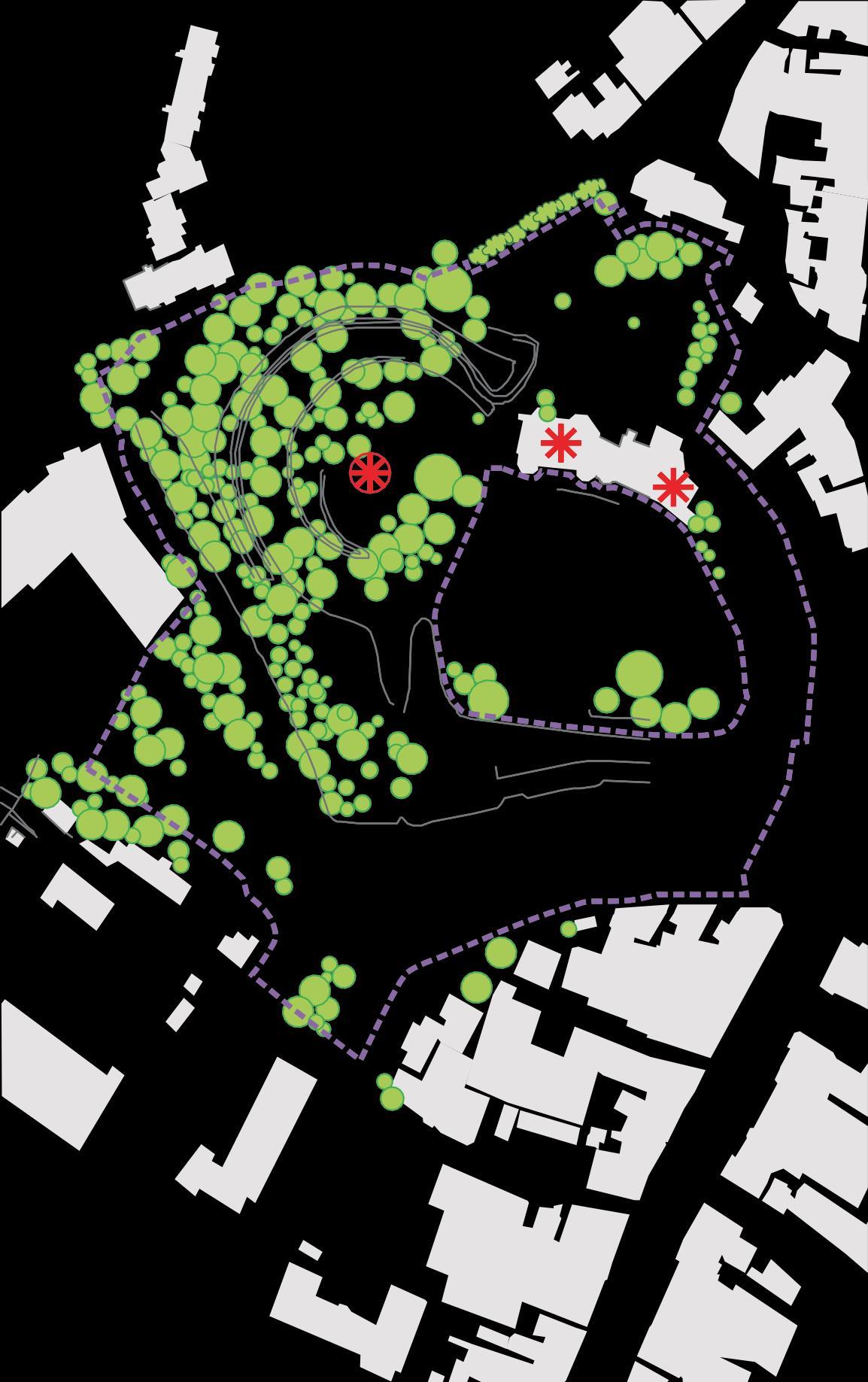
Sub Area A1 – Castle including the River Walk.
The castle occupies an elevated position bounded by the Medway to the south and west and by the High Street to the East. It is a scheduled ancient monument and the gate house, adjoining office building and castle walls are Grade 1 listed buildings. The motte and solid 3 storey gatehouse are landmark features visible from various points in the ConservationArea and the wider setting. The importance of the larger scale buildings of the castle (as well as Tonbridge School and the Church of Ss Peter and Paul outside this sub area) is symbolised in their sandstone construction in a town with predominantly brick facades. The castle provides a window on the past and an important link with the origins of the town. Its dominant impact on the townscape of the Conservation Area is enhanced by its spacious green setting.

The Motte and Bailey are surrounded by the moat on the north and west sides which connects with the River Medway. Sections of the mellow sandstone castle walls remain around the Bailey and on the top of the Motte. The three storey gatehouse, built in 1230 1260 consists of a large square building with a wide carriage arch and four circular towers. To the east of the gatehouse, the Council Offices occupy an L shaped house with a hipped dormers and a tiled roof built in 1793 using stone from the castle walls.
The three tier topography of the River Walk, Castle Bailey and Castle Motte provides a series of vantage points from which to view the town and the surrounding landscape setting. From the River Walk level there are views westwards of the diverging arms of the Medway against a backdrop of trees which screen views of the recreation ground beyond. A house at the fork in the river provides a visual focal point. Tothe east, the white ironwork of the Big Bridge is an attractive feature. To the north the mellow weathered castle walls and grassed motte enclose the space but between the two a vista of the castle gatehouse opens up.
Castle gatehouse 9
The top of the bailey is a lawned bowl which is not visible from the lower level. It is enclosed by the gatehouse and offices to the north, the Motte to the west and trees on the southern side. The enclosed space feels separate from the bustling town and is a unique, centrally located open space used for civic functions and community events. Between the trees there are long views over south Tonbridge to hills and open countryside beyond.
A footpath climbs the Motte and from the top, between the trees, there are commanding views over the recreation ground and northwards to open countryside. Tothe east there are views of the castle gatehouse, the Church of St Peter and St Paul and across the fascinating roofscape of the Conservation Area. From this vantage point, the consistently low scale of buildings in the town is apparent.
In this sub area, the River Medway wraps around the southern and western sides of the raised castle and gives the feeling of space around the mound. The natural beauty and tranquillity of the river can be appreciated from both the riverside and from higher on the castle.

A feature of this sub area is the quality of the landscaping. The mown lawns and banks, flowers and shrubs create a setting worthy ofthe historic
The north bank of theMedwaystructures. The trees soften the landscape and mask the modern sports buildings to the west. There is however some debate over the trees on the motte and castle walls which obscure the true outline of the castle defences. The paths are naturally coloured gravel in tarmac and the black lamp posts, railings and bins enhance the scene. Well designed interpretation boards provide information on the history and layout of the castle.

To the north of the gatehouse, a small unobtrusive car park is laid out around a lawn and groups of trees which creates an uncluttered approach to the castle. The whole area has a peaceful quality that belies its position adjoining the busy High Street and the riverside footpaths create a green corridor linking the High Street directly to the edge of town and the countryside beyond.
There are some detracting elements. The footbridge to New Wharf Road is in poor condition and the area to the south of New Wharf Road, with 20th century offices, a retail unit and an open unsightly car parking area, provides a disappointing setting for the Conservation Area. The Central Area Action Plan provides the context for the redevelopment, refurbishment and enhancement of thisarea.
10
The north bank of the Medway and castle walls
Key Features
• Unique town centre feature of castle in this elevated, prominent position forms a dominant landmark and important link with thepast
• River Medway, River Walk and moat provide an important open aspect to this part of the conservation area and setting for thecastle
• Sandstone symbolising an importantbuilding
• Mellow appearance of the weathered sandstone and cream render
• Peaceful, landscaped setting with quality streetfurniture
• Changes in elevation creating a sense of separation from surrounding uses and changing vistas and views of the countryside setting of the town and fascinating roofscapes
• Mature trees screen development, enclose space and provide visual amenity.
11


TONBRIDGE TOWNSCAPE ANALYSIS SUB-AREA A1- CASTLE &’ Landmark Focal point Views/vista Visual hinge Lack of enclosure Important visual space Visual pinch point Rhythm group of buildingswithsimilar proportion or details *#02 "’7# %’ "’0#11#! 23# #! 0#11#! *#06’ % 4 " 22" *#0 "/’"/ "# $%%#" Visual intrusion Important trees acting as focal points etc. Important hedges ’"’# !’ 6##3%’1#!/’ Boundary treatment contributing to &’ special character *#0%!/ "0 )*+,& *#0 /’"/2#’ *#02 "’7# )*& )*+,& ’ % #’2 !#’ ’ &’ Map 3 + ’3# #!4"’2’5 # ! % ’ ’6#’ ! " # $ % &’’’())’’*(’’+,12
Sub Area A2 – High Street and vicinity including High Street and western part of East Street.
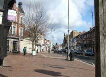
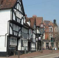
The High Street from the Bordyke in the north to the Big Bridge in the south lies within the medieval town defences and retains a number of timber framed medieval buildings, most of which now have Georgian brick facades. The narrow and deep medieval plots remain evident with the majority of buildings two to three storeys in height (often with roof space used as an additional floor). The buildings are in mixed use including shops, hotels, cafes, inns and offices. The character of the High Street is created through a strong sense of enclosure, a unifying scale and subtle blend and limited range of materials and the bustling activity of the town centre.
The northern and southern entry points to this Sub area are marked by a distinct change in character. From the South, a bank and public house form a gateway. The Big Bridge over the Medway in white painted wrought iron and the views of the castle to the west provide an impressive entry to the Conservation Area reflecting the town’s origins as a fortified river crossing. At the northern end, there is a pronounced change of character at the junction with the Bordyke, where the grand sandstone buildings of Tonbridge School give way to the tighter grained predominantly brick buildings of the High Street. This junction stands at the medieval entrance to the town.
The High Street gradually descends and curves southwards towards the river creating a series of vistas and views. There is a strong sense of enclosure with the 2 3 storey buildings on both sides generally set close to the pavement. However, the width of the road and pavement varies creating pinchpoints and wider more spacious sections. At the Bordyke junction the road is relatively wide giving the junction a more spacious character. Tothe south of Bank Street the road gradually widens until South of Castle Street a triangular area of pavement (representing the remnants ofthe historical market area) creates a sense of space.
High Street looking north from the The Chequers Inn encloses this spaceto the Chequers Inn south and creates another pinchpoint.
South of the Chequers Inn the space widens out suddenly where 15th century buildings were demolished as part of a road widening scheme. A narrow grassed area planted with silver birches and wide bus lay by allow clear vistas of the castle elevated above the High Street to the west. To the east the space is enclosed by 3 storey relatively large scale buildings with use of the roof space adding extra height. Further vistas open out at the bridge particularly to the west along the river. At some points there are rare longer views southwards over South Tonbridge towards wooded hills and countryside which contrast with the enclosed space and add an important backdrop to the Conservation Area.
13
The predominantly 18th and 19th century buildings on the east side hug the back of the pavement, whilst on the west side there is a greater variety in the age of the buildings and an irregular building line with some buildings set behind front gardens and others set at an angle to theroad.
Three buildings with timber frame details are visually unifying features spread through the High Street from the Hall House in the north, the Chequers and adjoining building in the centre and the Castle public house to the south. At either end of the High Street the Hall House, and turrets and short pyramidal spire on Tonbridge School beyond, a nd the Castle public house are landmark features.

On either side of the High Street narrow, strongly enclosed side roads lead off providing tantalising glimpses and vistas. The church of Ss Peter and Paul can be seen to the east down Church Lane. Wide former carriage arches on some properties also provide glimpses into courtyards and rear outbuildings.
The historic inns are a feature of the High Street. The 17th century Ivy House is situated at the entrance point to the medieval town. The Rose and Crown Inn is of Tudor origin with an 18th century façade and a porch which projects across the pavement and is surmounted by a lion and unicorn. The Chequers Inn and the adjacent building to the north are very prominent elements in the townscape due to their impressive 15th century half timbered front elevations with projecting upper storeys which contrast with the brick construction of surrounding properties. Theirprominence is enhanced bytheir orientation to the street and the gap in the buildinglinebeyond.
The ChequersInn
Other notable buildings in the High Street include no. 186. The two storey brick building is partly tile hung and has a steeply pitched tile roof. However behind the 19th Century brickwork is a portion of timber framed building (possibly a hall house) dating from the late 15th Century. On the east side, numbers 127 131 and number 157 are also timber framed buildings which have later been brick faced. Numbers 145 147 also on the east side are eye catching partly due to height (3 storeys and attics) but also because of their flamboyant gothic style. The attic gable is visible from the castle gatehouse.
14
However,whilstindividualbuildings form focal points and architectural highlights, the special historic character of the High Street is created by the combined impact of the number and variety of historic buildings. The subtle variations in height, age, style and roof pitch in a limited palate of colours and narrow range of traditional materials combine to give a harmonious character. The High Street looking south from Lansdowne Road majority of buildings are brick and the prominent materials are red brick, painted render, roof and hung tiles and half timbering. Colours are muted reds, browns, black and light paint. Many architectural details are evident on upper storeys above the shop fronts. Details include brick stringcourses, moulded wooden eaves cornices, original glazing and doorways. The historic buildings have been adapted through time but havegenerally retained an integrity of character. A number of shop fronts (some boarded up), however, do not fit well with the context of the building or the street scene.
As a result of the relatively low scale of the buildings, the variations in building design and age, the piecemeal adaptation of buildings and the sloping topography, the High Street is notable for its roofscapes. These can be most readily viewed from the castle motte but are an important feature along the High Street and from other parts of the Conservation Area. Bulky roofs in synthetic materials like those visible on the eastern side of the High Street south of the river, stand out starkly against the mellow tones of red brick and grey slate.

The brick, flagstone and settpavements and coordinated black and gold street furniture enhance the High Street’s historic character. There are a few street trees but in general the development is tightly packed with little green open space except at the southern end. The variations in building line to the west however, have allowed for the creation of small areas of paved public open space.
There are few 20th Century buildings, but a low scale office block (no. 182)set back behind a treed frontage and a three storey block at the Lansdowne Road junction blend into the townscape. A new 3 storey mixed use development is under construction in a prominent position north of BankStreet.
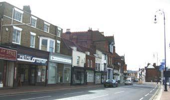
No. 184 High Street 15
High Street has a bustling character
is generally busy with pedestrians and traffic. Traffic noise and congestion have a negative impact on the pedestrian environment.
Key Features
High Street of medieval origin with narrow medieval plot widths and
of medieval street
enclosed space with typically 2 and 3 storey buildings
Sloping topography, curving road alignment and changes in width
a series of changing vistas and
side streets and carriage arches provide side vistas
number of listed buildings from 15th 19
Centuries
range of traditional materials, predominance of red brick
Bustling High Street character
Inns
of uses, pedestrians and traffic
details many on upperlevels
Traditional style lighting and street furniture with brick
•
remnants
layout • Generally
•
create
views • Narrow
• Large
th
• Limited
•
variety
• Historic
• Architectural
• Roofscapes •
paving The
and
16
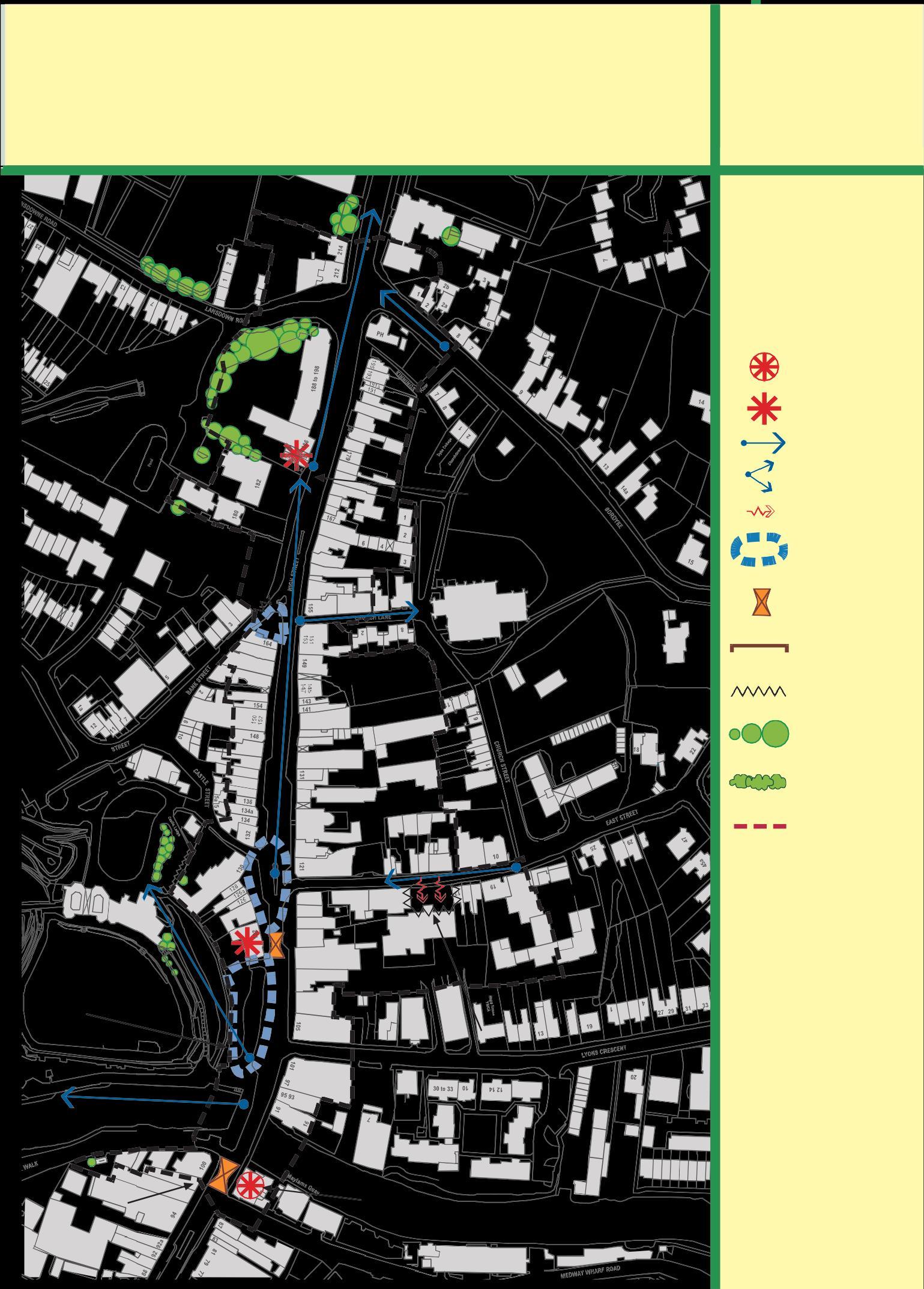
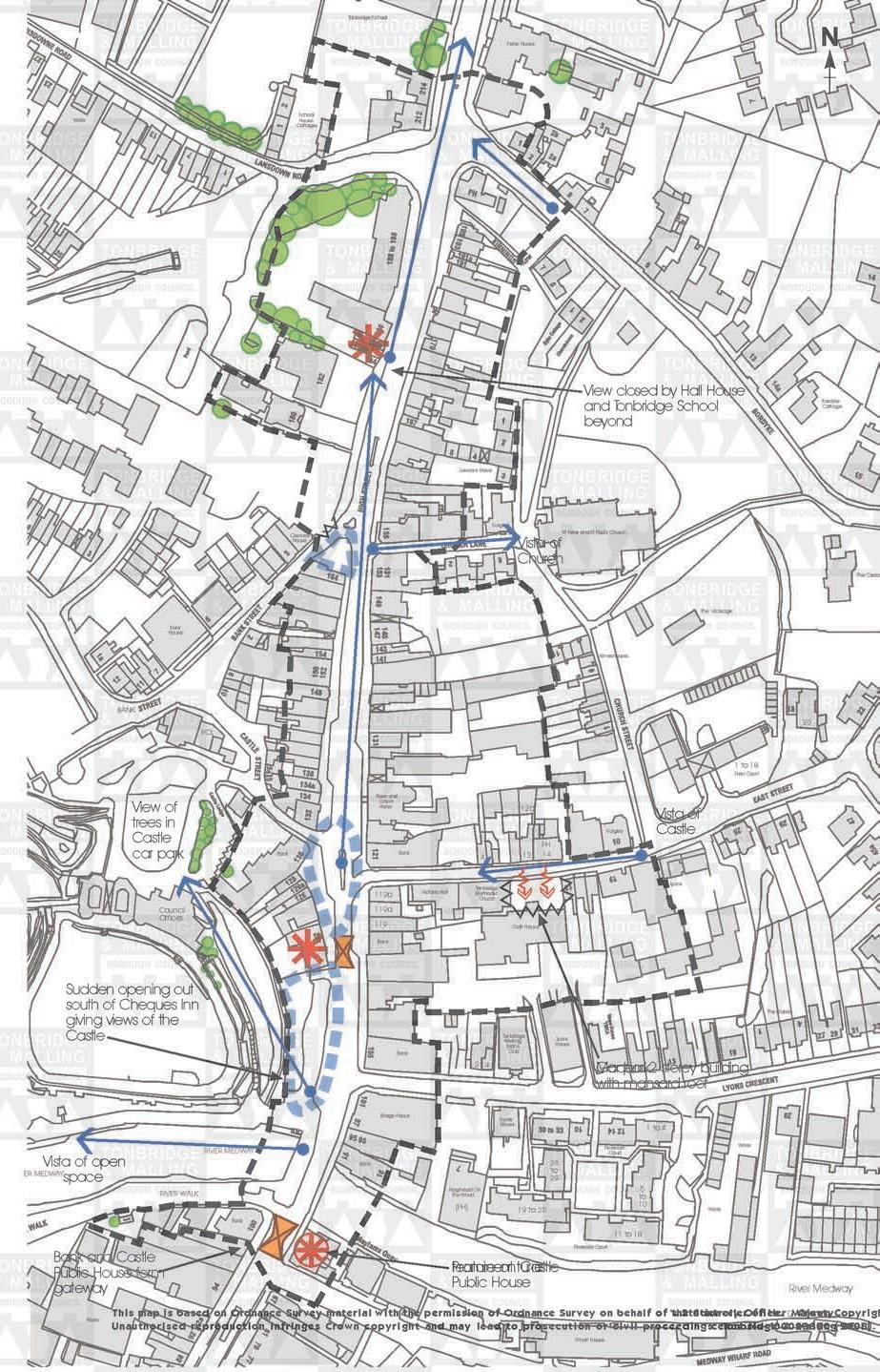
TONBRIDGE TOWNSCAPEANALYSIS SUB-AREA A2- HIGHSTREET Tonbridge School Ferox House N Works School House Cottages Landmark Focal point Views/vista Lawsons Mews ViewclosedbyHallHouse and TonbridgeSchool beyond Bordyke Cottage Visual hinge Lack of enclosure Important visual space Cornwall House Surger Vistaof St Peter and St Paul’s Church Visual pinch point Church The Cedars Rhythm group of buildings with similar proportion or details The Vicarage Bank House Visual intrusion BANK View of treesin Castle car park PCs Bank Rose and Crown Hotel Bank 12a PH 4 12 14 Almeshouses Surger y Vistaof Castle 20 1 to 18 New Court Important trees acting as focal points etc. Important hedges Boundary treatment contributing to special character Council Offices 119b 119a 119 Bank Victoria Hall Tonbridge Methodist Church Croft House Lyons C PH Sudden openingout southof ChequesInn givingviews of the Castle Bank Tonbridge Working Man’s Club 2 4 Lyons House M Caordpearnrk2 storey building withmansardroof The Gables Vistaof openER MEDWAY RIVER MEDWAY Bank Bridge House Surely House 26 to Riverside Court 1 to 4 Works space RIVER WALK Bank The Castle Hogshead On The Wharf (PH) 29 19 to 25 RiversideCourt 5 to 10 11 to 18 Works Map 4 Bank and Castle PublicHouseform gateway PH f Peroamtuirneeonn t tuCraresttle PublicHouse River Medway 17 Works This map is based on Ordnance Survey material with the permission of Ordnance Survey on behalf of t shSetCatoinotnreorllyerOofficHeer©MCarjoewstnyCopyright. Unauthorised reproduction infringes Crown copyright and may lead to prosecution or civil proceedingsceTnocnebrNidog1e00&02M3a3ll0i0ng(2B0C0L8i). Wharf House
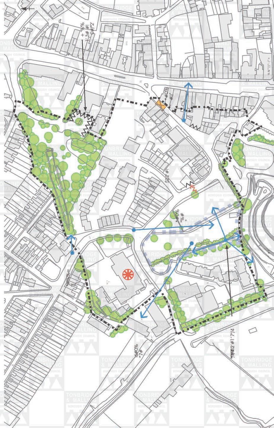
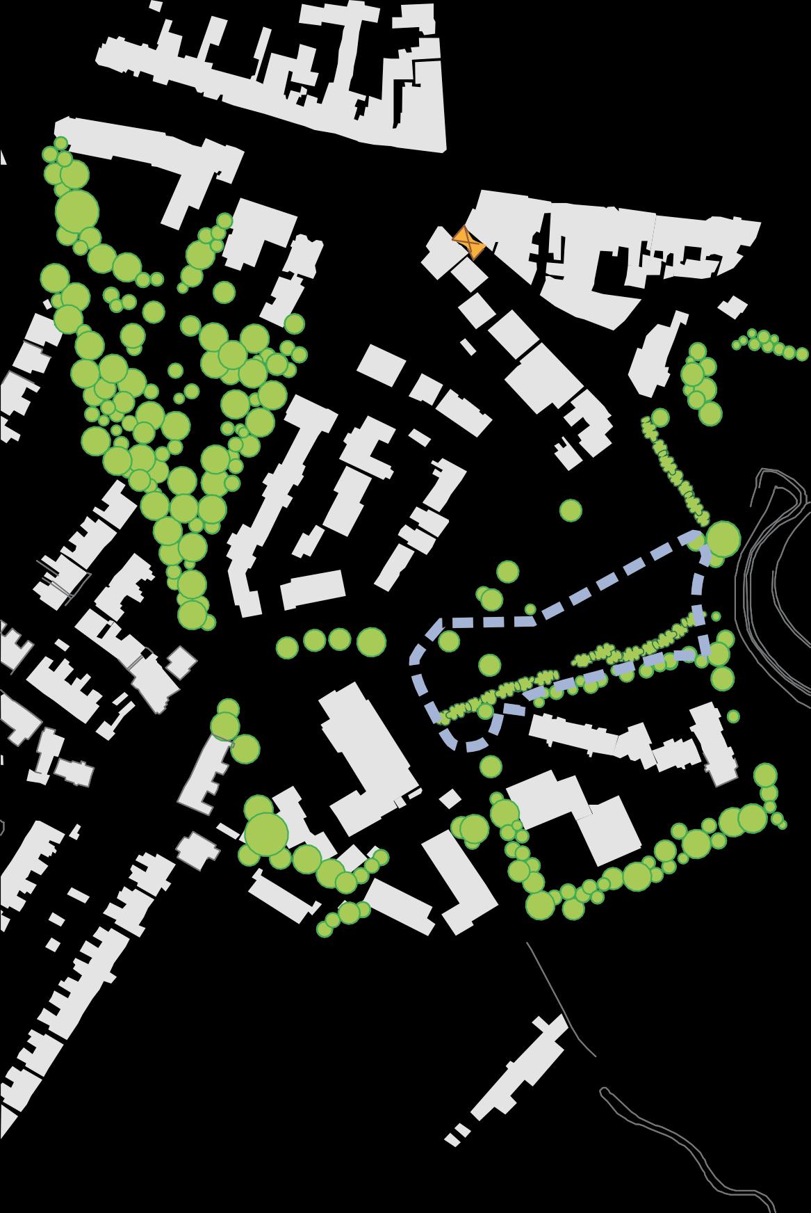
Sub-area A3 – The Market Quarter including the Slade, Bank Street, Castle Street, Castle Fields and Stafford Road (south)
This part of the historic core lies within the defences of the Medieval Town. It has a mixed character and uses and a large proportion of it, the old Cattle Market, is being redeveloped as a high density housing scheme which runs through to the High Street The area has a transitional character connecting the bustling High Street, the extensive recreation open space to the west of the town, and the tightly grained Victorian residential Slade area to the north. Uses include residential, school, shops, office, open space andparking.
The northern boundary of this Sub area runs along the line of the medieval town ditch and bank and a section is still visible running north east from Stafford Road almost to the High Street. This Fosse is a Scheduled Ancient Monument but its historical significance is not immediately apparent as it has become overgrown by trees and weeds and is enclosed by dilapidatedfencing.
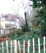
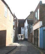
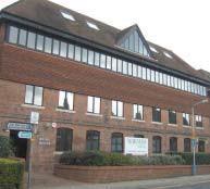
In the south eastern part of the Sub area, the medieval street pattern is retained in Castle and Bank Streets and the medley of mainly 19th century buildings creates a small scale, intimate character which The Fosse provides a pleasing contrast with the imposing castle buildings and open landscaped grounds to the west. The entrance to Castle Street from the High Street is narrow and strongly enclosed. The north side of Bank Street has seen more redevelopment but the cottages on the corner into the Slade form an attractive group. The listed former workhouse built in 1726 for the education of poor children has been redeveloped as offices with a retained but adapted frontage. Due to its height, bulk and the large modern window in the centre of the top floor, the building has a strong impact on the townscape. The Corn Exchange (formerly 17th century chapel) has been retained. The 19th century fire station forms a focal point at the western end of Bank Street. The poorly maintained road and footpaths and modern street furniture and public toilets detract from the character of the area. The traffic along the narrow streets has a detrimental impact on the intimate character of the area.
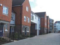
The redevelopment of the former cattle market introduces a new residential area.
The housing is predominantly 2-3 storeys with some taller units and utilises a blend of locally appropriate colours and materials. The development is designed around curving, enclosed streets and the vertical emphasis of the narrow buildings, the strong sense of enclosure, domestic scale and layout respect the context of the development.
18
New development, The Market Quarter
Bank Street


Tothe west of the historic market area, development is at a much lower density. The Slade, which follows the line of the castle outer bailey, curves around an slightly elevated open area comprising a car park and public open space. The open space has an important visual impact both because it is elevated above the surrounding development and because it forms an extension of the castle grounds. From this area there are views north westwards towards the Slade school and beyond. There are also views of the recreation ground, the castle and the Church of Ss Peter and Paul. The space is enhanced by some small trees. Tothe west Castle Fields and a listed former electricity power station, nestle behind a hedge.
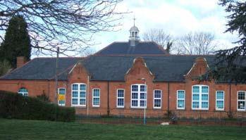
The Slade Primary School 19
The Slade Primary School is a wide 19th century low red brick and slate structure with an attractive cupola which forms a landmark feature visible from the Slade area.
The tarmac surfacing and street furniture in the area is of poor quality and the parking area off Lansdowne Road offers considerable scope for enhancement. The area is identified for housing development in the Tonbridge Central Area Action Plan.
Key Features
• Transitional area with mixed density, character anduses
• Retained medieval street pattern and historic buildings in the old market area
• Creation of a new residential area with tight grain and intimate character
• 19th Century civic buildings Slade Primary School and the Old Fire Station
• Important visual open space with views of landmark buildings and open countryside
• Fosse Scheduled Monument
20
TONBRIDGE TOWNSCAPEANALYSIS


BANK STREET & THE SLADE
Landmark
Focal point
Views/vista
Visual hinge
Lack of enclosure
Important visual space
Visual pinch point


Rhythm group of buildings with similar proportion or details
Visual intrusion
Important trees acting as focal points etc.
Important hedges
Boundary treatment contributing to special character
SUB-AREA A3-
Map 5 21 (’’+
Sub-Area A4 Church of St Peter and St Paul and the Bordyke including western Hadlow Road, eastern East Street, Church Street and eastern Church Lane
This sub area forms part of the historic core of the town. The church lay within the medieval defensive Fosse which ran along the Bordyke and curved southwards to the east of the Vicarage to East Street. The majority of properties in the sub-area are substantial detached or attached houses dating from the 18th and 19th centuries set within generous plots. However, there are some older listed properties dating back to the 16th and 17th centuries. Tothe west and south of the Church, close to the High Street, the buildings are smaller scale and the grain is tighter. The sub area is primarily residential with some commercial uses.
The street pattern is medieval in origin. The medieval road from Maidstone and Hadlow to Tonbridge ran along Hadlow Road and East Street. Church Lane and Church Street are also medieval lanes. In recent times, the Bordyke has become the main route into North Tonbridge from Hadlow and the road is busy and noisy. The curving main roads and narrow lanes give rise to continuously changing vistas.
The scale of building reflects the importance of the roads. Buildings along Hadlow Road and the Bordyke are generally grander in scale, rising to 3 and 4 storeys and set within large plots. A group of substantial buildings stands around the junction with East Street. The buildings along the narrow lanes however are mainly small scale 2 storey semi detached and terraced properties. The smaller buildings front directly onto the street or pavement. Traditional front boundary treatments are generally red brick or stone walls and hedges but some wooden fences have been introduced. Materials vary in the area dependant on the period of development and the importance of the building and include the sandstone church, timber framed 16th Century buildings and red brick, ashlar and stuccoed houses of the 19th Century.
Trees and soft landscaping are important features of the area. In addition to the churchyard trees and hedges, there are mature trees in the gardens of properties and the north side of East Street is particularly verdant giving a semi rural character. The bends in the Bordyke create a series of vistas framed by trees, hedges andbuildings.
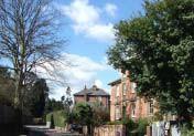
Bordyke west of East Street junction There are many notable buildings in the area but the dominant landmark is the Church of St Peter and St Paul. Constructed of mellow honey coloured sandstone, the Church was fully restored by Ewan Christian in the 1870s but preserves eleventh to fifteenth century masonry. This landmark building is set within an extensive, tranquil churchyard enclosed by buildings, walls and beech hedges and to the north by the road and houses fronting the Bordyke.
The early 19th century brick wall on the south eastern boundary is a grade II listed structure. The churchyard is planted with mature specimen trees and a footpath lined with pollarded trees leads to the Bordyke. Initially the church yard extended southwards to East Street but buildings encroached onto this area in the post medieval period.
22
The Church is approached from the High Street via Church Lane which is narrow and strongly enclosed and has a special historic character. A grade II listed timber framed 16th century building with a half timbered protruding first floor and the adjoining building with 18th century front of weatherboarding and hung tiles are charming features. The approach from East Street via Church Street also has a historic character being lined on the west side by a row of listed 18th century 2 storey stuccoed cottages and 19th century almshouses in cottage gothic style. This historic character is lost however on the eastern side of theStreet.
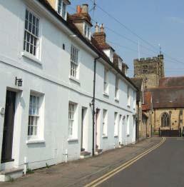
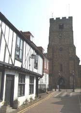
Church Lane Church Street
The tranquillity and intimacy of the area around the Church contrasts with the character of The Bordyke and Hadlow Road.
Travelling eastwards along The Bordyke, the building line becomes progressively closer to the road with the last few buildings, including the red brick Red House, set immediately against the pavement. These attractive Grade II listed town houses were built outside the defensive ditch along a well line and retain many original features including glazing bars, cornices, porches and moulded architraves. No 9, The Priory, set at right angles to the road, is the oldest of the group, dating from the 17th Century, constructed of ironstone ashlar, with a tiledroof,
The Red House, The Bordyke dormer windows and a massive chimney breast terminating in 3 octagonal red brick stacks. The south side of the road is open and green with the church tower visible through the trees. There is an attractive vista eastwards towards the white painted school houses at the High Street junction. However, the special character of this section of road is marred by a small car park and the footpath entrance to the Church is unprepossessing.
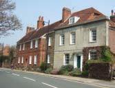
23
The buildings around the junction with East Street are of a grander scale, set further back from the roadside behind landscaped front gardens. Situated on a curve in the road, Elmfield is particularly prominent when seen from East Street but a substantial side extension has been sensitively designed. A recent four storey residential building to the west also blends in well matching the neighbouring building in terms of height, bulk, glazing, materials
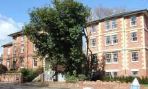
Recent development on the Bordyke and boundary treatment. Situated in the fork of the Bordyke and East Street behind high hedges, Cedars is a landmark building. This late 18th century house has a Flemish gable and 16 tall Tudor style chimney stacks which create a striking roofscape.
East Street is quieter than the Bordyke with less traffic. The eastern end has a semi rural character with the verdant bank and hedge on the north side and trees framing the road. The Hermitage, a 16th Century timber framed house which stands above the road on the north side is a prominent feature and its informal cottage character contrasts with the more formal town housing of the Bordyke.
The Hermitage, East Street
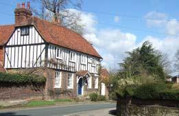
24 Key Features ◼ Building scale appropriate to the function of the building and importance and scale of the roads ◼ Sandstone Church and roofline of the Cedars are landmark buildings ◼ Landscaped church yard ◼ 18th and 19th century town houses in substantialplots ◼ Small scale historic buildings in the vicinity of thechurch ◼ Changing vistas created by the medieval road layout ◼ Importance of trees and soft landscaping including landmark trees in the churchyard and the hedge and treed approach into East Street ◼ Mix of materials reflecting the age and importance of buildings: sandstone, timber framed, ashlar, red brick and stuccoed buildings
Landmark
Focal point
Views/vista
Visual hinge
Lack of enclosure
Important visual space
Visual pinch point


Rhythm group of buildings with similar proportion or details
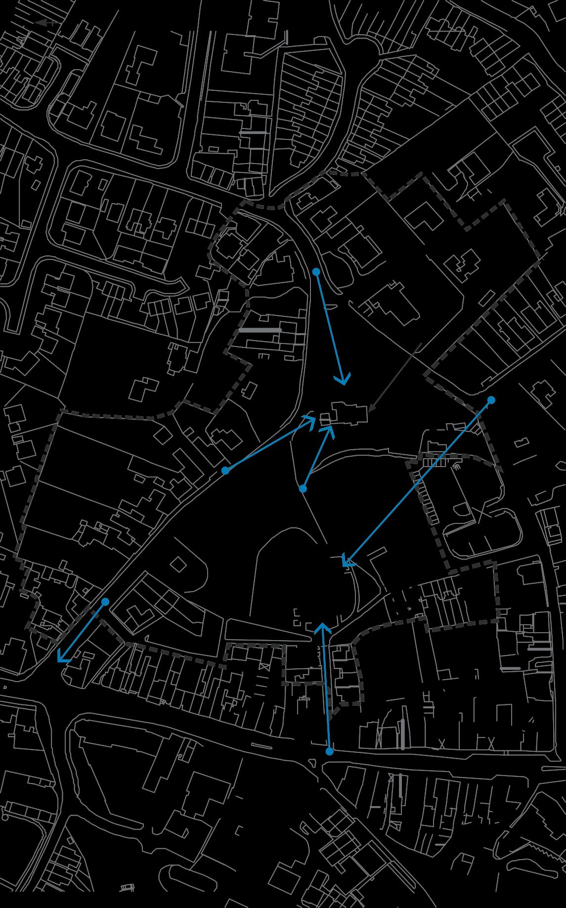
Visual intrusion
Important trees acting as focal points etc.
Important hedges
Boundary treatment contributing to special character
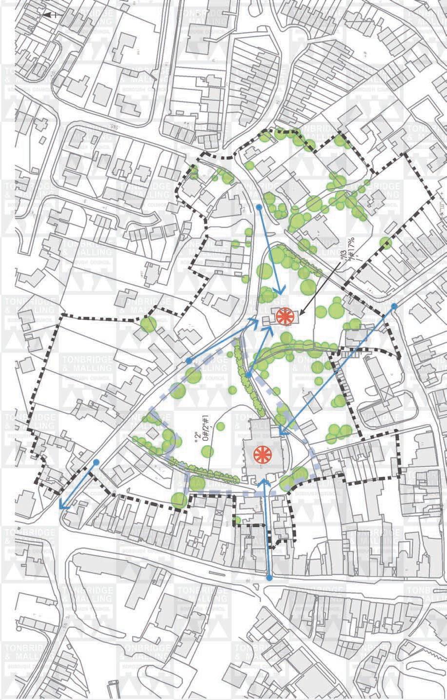
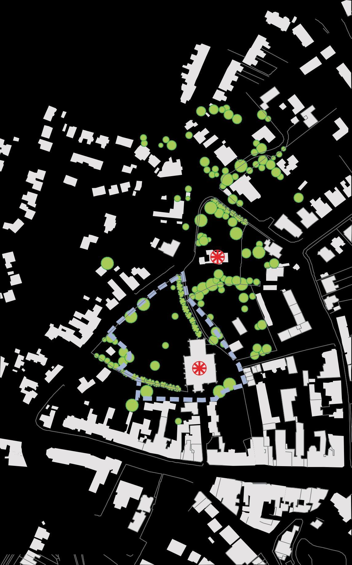
TONBRIDGE TOWNSCAPEANALYSIS SUB-AREA A4- CHURCH &BORDYKE
Map 6 25 "/ 8’ 6 8’6 (#’0 7 7 " 2" 0#/2"#1 ’ /’ 3 /’ 3 0+0 1%# ’! ’7 9/’" 0 /*#" ’! + #" 1/ ,"/!3"/#17% / ’ +# 0 ’! ’7 ! " # $ % &’’’())’ (’’+ 7
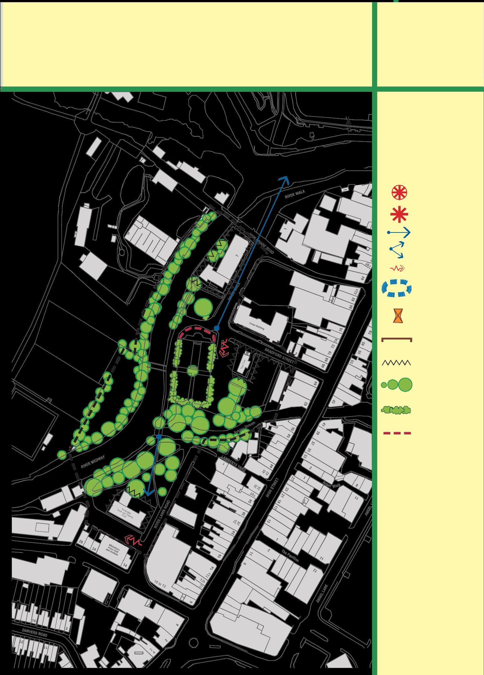
Sub-area A5 - Riverside Walk and River Lawn Road
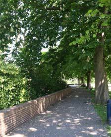
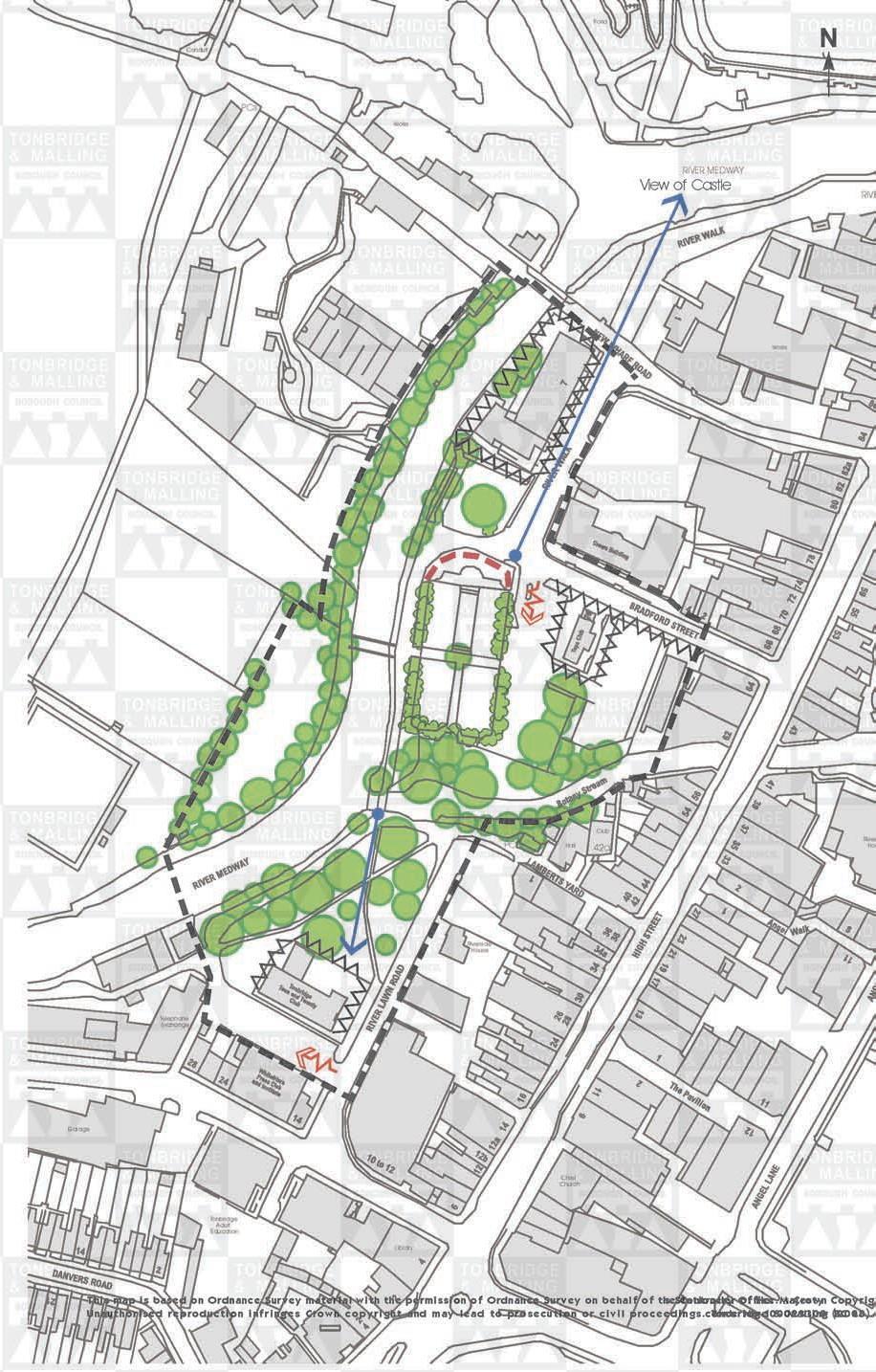
This area is based around the historically important river Medway and the New Cut canal dug between the north and south branches of the river in the mid nineteenth century and is dominated by open space, trees and hedges. The Riverside Walk sub area leads out from the historic Castle into the adjoining open space to the south of the town and contains visual links to the Castle and to the countryside to the south west.
The river is tree lined on both sides enclosing the river space

The west bank of the Medway and generally screening development beyond.
There are a number of walkways throughout the area which are connected across the river by a series of footbridges.
Two lengths of walkway are narrow. The first leads south from the New Wharf Road bridge on the western side of the waterway. It is enclosed on one side by a dense row of trees, and on the other by a tall blue painted spiked railing enclosing the Water Works. The space is both intimate and somewhat intimidating and contains no lighting.
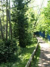
The Riverside Walk west bank of the Medway
The second more enclosed space is the walkway between the River Lawn and the river at the southern end of the conservation area which is tree-lined on both sides.
Walkways are given an informal, rural character by the use of a natural gravel.
Some historic lantern style lamps are used effectively in the area.
26
The west bank of the Medway
There are two important visual spaces close to the river.
The Garden of Remembrance is an intimate and tranquil space enclosed by a low beech hedge and curved brick wall. The Garden has a formal layout with paved straight paths contrasting with the less formal riverside walkways.
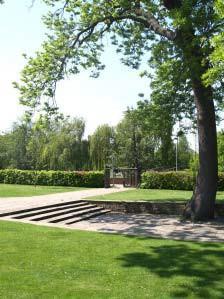
The second area is on the opposite bank of the river and is enclosed by a row of silver birch trees to the west and the tree lined river. The space is informally laid out with tables and seating. There are views to the west towards playing fields and beyond.
Garden of Remembrance
There are only five buildings within this sub area. The oldest is the Ebenezer Chapel which was built in 1898. The two storey red brick building appears to have had an unusual first floor extension. The gable end of the Chapel faces the road whilst the pitched roof and side elevation enclose the car park. The building marks the eastern boundary of the conservation area.
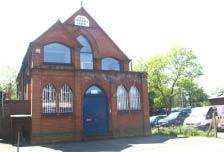
Ebenezer Chapel
The other four buildings are more modern and detract from the character of the area. Two single storey temporary looking wooden buildings adjoin each other within the car park close to the road. The car park presents a degree of visual clutter with barriers and signs.
7 River Walk is a three storey building with a pitched roof and a horizontal emphasis formed by lengths of glazing. Whilst the height and materials of the building are not inappropriate, the traditional vertical emphasis of wharf type buildings with gable end to the river would be more appropriate. The building is set above the floodplain on brick piers but this gives the ground floor an unattractive appearance with no active uses at roadlevel.
27
The Teen and Twenty building terminates the vista across the River Lawn. Although partially screened by trees, the building has a flat roof, is partially set on stilts, contains a mix of windows and is out of character with the conservation area.
There are otherbuildings off River Walk and Bradford Street which are viewed from the conservation area and form an important part of its setting. Thebuildings detract from the character of the area.
Teen and Twenty building
The Crown Building is a three storey flat roofed building dominated by glazing. The car park fronting River Walk leads to a loss of enclosure of the street.
Key Features
• Dominant trees and open space with fewbuildings
• River Medway and River Walk provide an important open aspect to this part of the conservationarea
• Mature trees screen development, enclose space and provide visual amenity
• Peaceful, enclosed, formally laid out space of the Garden of Remembrance
• Informal footpath layout and surfacing
• Buildings and car parks significantly detract from the area and its setting

28
TONBRIDGE
Landmark
Focal point
Views/vista
Visual hinge
Lack of enclosure
Important visual space
Visual pinch point
Rhythm group of buildings with
proportion
Visual intrusion
Important trees acting as focal
Important hedges
Boundary treatment
TOWNSCAPEANALYSIS SUB-AREA A5- RIVER LAWN/RIVERWALK Conduit Pond N PCs Works RIVERMEDWAY View of Castle RIVER
Works
similar
or details
points etc.
PC Hall Club 42a Riverban House
contributing to special character Riverside House Telephone Exchange Garage Christ Church Tonbridge Adult Education Library Map 7 29 This map is based on Ordnance Survey material with the permission of Ordnance Survey on behalf of thseSCtaotnitornoellreyr OoffHicee r M©aCjeroswtyn Copyright Unauthorised reproduction infringes Crown copyright and may lead to prosecution or civil proceedings cTeonncberiNdoge10&00M2a3l3li0n0g (B2C00L8 i )
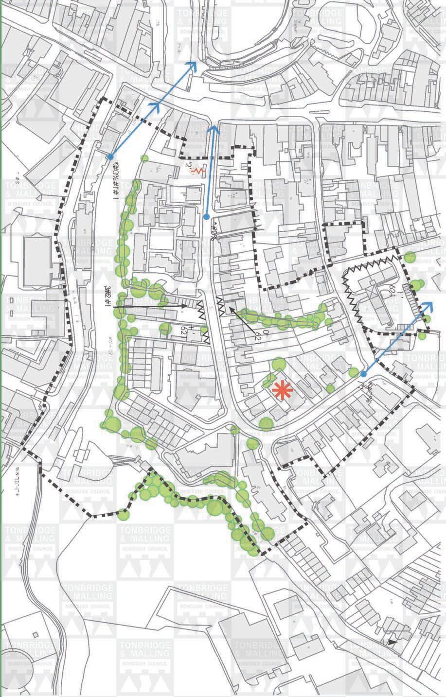
Sub-Area B – Lyons Crescent including Mortley Close, Lockside (west), East Street (part) and Medway Wharf Road.
A map of 1897 shows the alignment of Lyons Crescent but no buildings had yet been developed except for a Fire Station. The south of the river at that time is shown as Medway Wharf with large wharf buildings, coal pens and mooring posts. Currently this area appears unattractive but development proposals and the Town Lock improvement scheme funded by the Borough Council aim to enhance the setting of the Conservation Area. Today the sub area retains historical elements that link back to the town’s origins. The plot boundaries preserve the outline of curving Saxon burgage plots. The fosse ran southwards across the area, crossing East Street and connecting to the river and one section scheduled as an ancient monument is still visible running through the back gardens. The Town Lock and Mill Stream have historical associations. Some buildings retain the height and character of wharf buildings and an old forge/workshop provides a link with the industrial heritage of thearea.
However, in general, the sub area has suffered from unsympathetic piecemeal development that has affected the quality of the townscape and historical character. At the western end of Lyons Crescent an open parking area, 20th century 3 4 storey office buildings and a blank facade create a harsh, uninteresting townscape from the High Street. There is a view westwards of the Castle. Further east, the buildings comprise an eclectic mix of heights, styles and materials and are in variable condition. There are two recent housing developments. The high density development in Mortley Close comprises 3 4 storey wharf style buildings in pale brown and orange brick with attractive gables and wide arched windows.
Tothe south side, the buildings face the river, Mill Stream and Town Lock. A combination of brick, tarmac and cobbled surfaces and discrete black street furniture helps to create a cohesive and interesting townscape which relates well to its context and enhances the river frontage.

Lyons Crescent looking towards East Street
As Lyons Crescent curves northwards, its character becomes more cohesive with the visual focal point of the Catholic Church, built in 1903, and red brick 3 storey 30 semi detached houses on either side of the road. Towards the northern end there is a view of the Church of St Peter and St Paul.
 Mortley Close, overlooking Mill Stream
East Street was the original route into the town centre until its narrowness required the Bordyke to replace it.
The most notable building in the Sub area is Port Reeve’s House on East Street. This Grade II* building stands on a raised bank fronted with sandstone and is a good example of a 15th Century timber framed house. The first floor and gable over hang. The building has a tiled roof, two oriel windows and a large chimney breast of red brick and sandstone at the eastern end. The ‘L’ shaped, elevated 3 storey block of flats and parking at the entrance to Church Street are out of character with the area in terms of bulk, form, materials and lack of detailing.
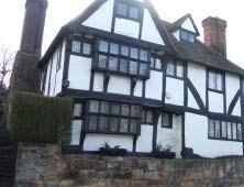
The Old Judd School building provides an attractive focal point at the junction with Church Street.
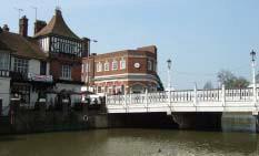
A footpath follows the northern side of the Medway. Here the large scale warehouses of Medway Wharf Road are partially screened by a band of riverside trees that continues along the Mill Stream. The footpath however is not continuous and does not link through to the Mill Pond. The Castle Public House and Big Bridge form an attractive vista to the west.
View from the riverside footpath
Key Features
• Mixed character, mixed usearea
• Grade II* listed Port Reeve’s House
• Wharf style buildings that provide a link to the industrial heritage of the area
• Views of the Castle, Church of St Peter and St Paul and the Big Bridge
 Port Reeves House
31
TONBRIDGE TOWNSCAPEANALYSIS


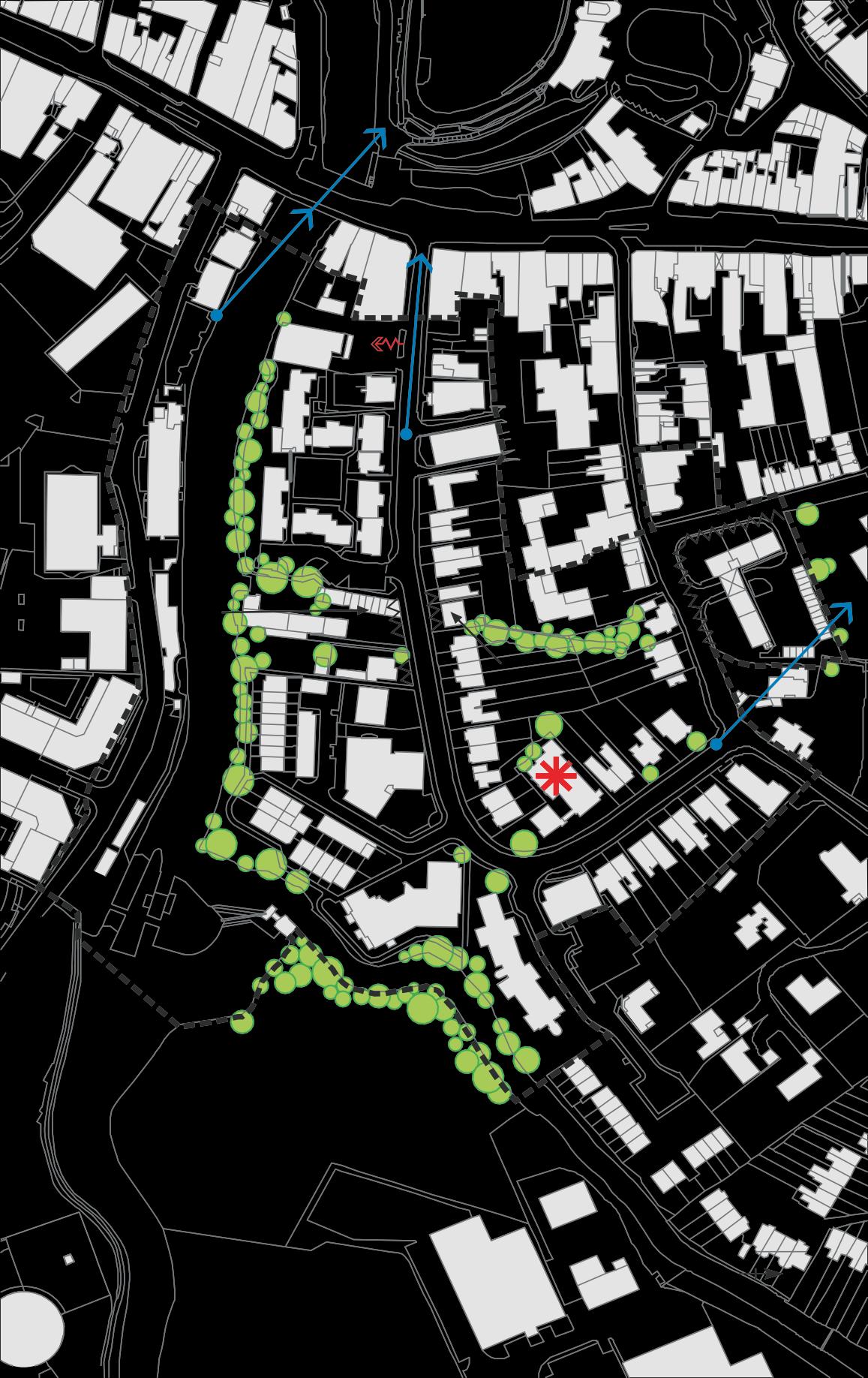
SUB-AREA B- LYONS CRESCENT Landmark Focal point Views/vista Visual hinge Lack of enclosure Important visual space Visual pinch point Rhythm group of buildings with similar proportion or details Visual intrusion Important trees acting as focal points etc. Important hedges Boundary treatment contributing to special character Map 8 32 + #" 1/ )"!’1 ’621 +# *#0%/’"/ 0 ’!’7 7 #+/ #/’"/ *#"’# & .3 "#$%%#" & (#/ % ’2/’#/#"/’" 0"621 /83 # 7 &’#+93 *#0% ’# 7 + ’621 ’2’ & #6’# )*+,& $/&/’% )*& ;< & #6’# * 0 #0%#!’# ! #6’+07 ,3 # # 2 # ! &/’% ! " # $ %(’’+&’’’())’’
Sub-Area C – Millstream including Mill Crescent, Mill Lane, Charlton Crescent and Mill Bank.
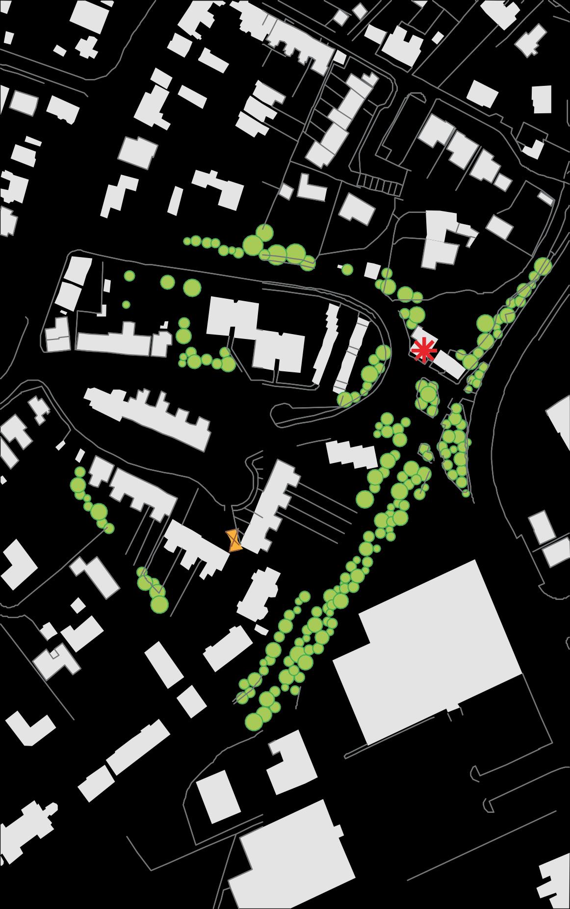
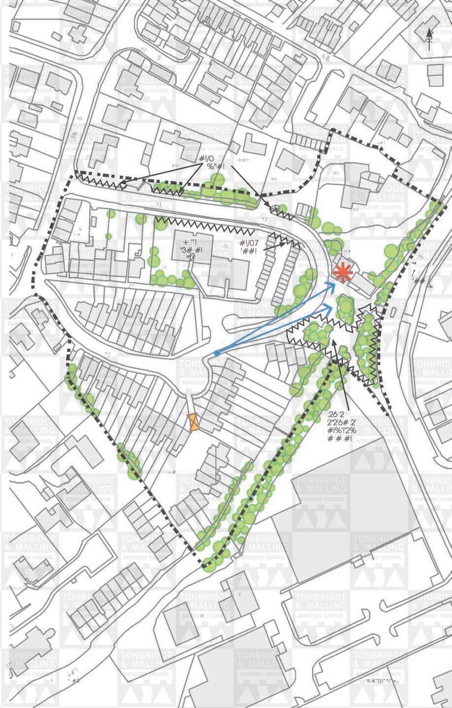
This sub area was designated as part of the Conservation Area in 1990. It lies between two busy routes the Bordyke to the west and Cannon Lane to the east and adjoins more modern development to the north. The buildings are located around, and within, the loop formed by Mill Crescent and Mill Lane. The age of the Sub area is predominantly 19th century but it incorporates a group of earlier buildings which cluster around the historic Mill Pond and Mill Stream at the eastern edge of the area. There is also some 20th century development. The plot sizes and scale of the buildings vary. The listed buildings are tucked away which gives them a secretive charm, but limits their impact on the townscape. The sub area is primarily residential except for a small parade of 19th Century shops on Hadlow Road.
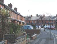
Mill Crescent consists of an attractivegroup of largely unaltered Victorian red brick 2 storey terraced houses formed around an open space. Whilst the road curves, the houses are set in straight rows creating front gardens of varying depths. The view is enclosed to the south by a terrace of houses set at right angles to the rest. The houses have projecting bay windows and slate covered porches at ground level. The Crescent retains its Victorian character and a coherent style despite some replacement windows, tiling and velux windows to the
Mill Crescent roofs and loss of boundary walls to provide frontage parking. The houses are set in long narrow plots similar to those in the Slade Area but the relatively wide curving road, the low scale of the buildings and the wide turning/parking area create a more spacious character.
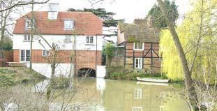
Tucked between Mill Lane and Cannon Lane is an important group of listed buildings clustered around the historic (possibly medieval) Mill Pond. This group comprises the 18th Century Grove House, the adjacent Grove Cottage and the 17th Century Mill Cottage which are all Grade II listed buildings.Anew house on the site of the original Mill House enhances the group. All three listed buildings are red brick 2 storey buildings with half hipped tiled roofs. The cottages are tile hung on the upper storey and Grove House has a steeply pitched roof, string course, cornice and parapet. Grove House and Grove Cottage are set back from, and at an angle to, Mill Lane and are barely visible from the street but Mill Cottage and the new Mill House front directly onto public space. The charming group value of the buildings can be more fully appreciated from the private gardens to the rear where they cluster around a Mill Pond enhanced by a weeping willow and informal shrub planting. The 1980s paved square, green railings and modern street furniture on the public side provide a more formal and less sympathetic setting for these historic buildings. A band of conifers on the inside of the curve in Mill Lane and deciduous trees to the east partially screen the listed buildings from surrounding roadsand development.
33
The MillPond
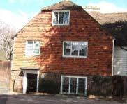
A further group of listed buildings is hidden away along Charlton Terrace, a footpath leading from the Bordyke to Mill Crescent. Two pairs of Grade II listed two storey early 19th century houses of mellow red and brown brick with slate roofs retain many original features. A fifth detached tiled house is also listed for group value. The tranquility of the narrow footpath together with the intimate scale and cottage appearance of the buildings contrast strongly with the more imposing buildings and traffic on the Hadlow Road. A white painted 17th century listed timber framed house (refronted in brick) stands at the junction of Charlton Terrace and the Hadlow Road.
Some 20th Century development has taken place in the Sub area. Mill Bank is a recent development that can be glimpsed from Mill Crescent and blends well in terms of scale and design. However the apartment buildings of Shrublands are out of scale with surrounding development and the buff brick, asymmetric rooflines, horizontal glazing, formal landscaping and parking areas contrast sharply with the more informal, small scale character of surrounding development.
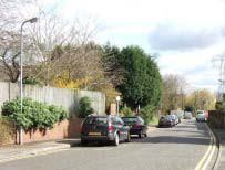
Mill Lane offers less townscape interest. There are no buildings fronting directly onto the lane. Although the landscaping on the northern side provides a soft edge to the Conservation Area, high wooden fences are prominent in the street scene. The brick boundary walls, raised enclosed footpath and railings on the south side also detract from the character of the ConservationArea.
Key Features
Mill Lane looking south
MillCottage
34
◼ Quiet mainly residential area set between two busyroads ◼ Cluster of listed buildings around medieval mill pond ◼ Intimate, historic character of Charlton Terrace ◼ Intact Victorian character of MillCrescent ◼ The Mill Stream is an attractive natural feature with historical associations ◼ Tree screen to east and north
Focal point
Views/vista
Visual hinge
Lack of enclosure

Important visual space
Visual pinch point


Rhythm group of buildings with similar proportion or details

Visual intrusion
Important trees acting as focal points etc.
Important hedges
Boundary treatment contributing to special character
TONBRIDGE TOWNSCAPEANALYSIS SUB-AREA C- MILLSTREAM Landmark 8’6 ! #!/0 %"#! 8’6$’"/’ 8’6’ 8’6 ! 8’6 +#’1
0 /’3 + ’’! "3##! "’2’ /’3 #!/07 ’##! /+# .26 2 2"2’6#2’ #!%’!’2% # # #! ’"’ /’ ’##
+# &’ &’ Map 9 35 ! " # $ % &’’’())’’*(’’+,
Sub-Area D – Slade Area including Stafford Road, Hawden Road, Houselands Road, Fosse Road, Lodge Road, The Avenue, Havelock Road, Lansdowne Road and The Crescent
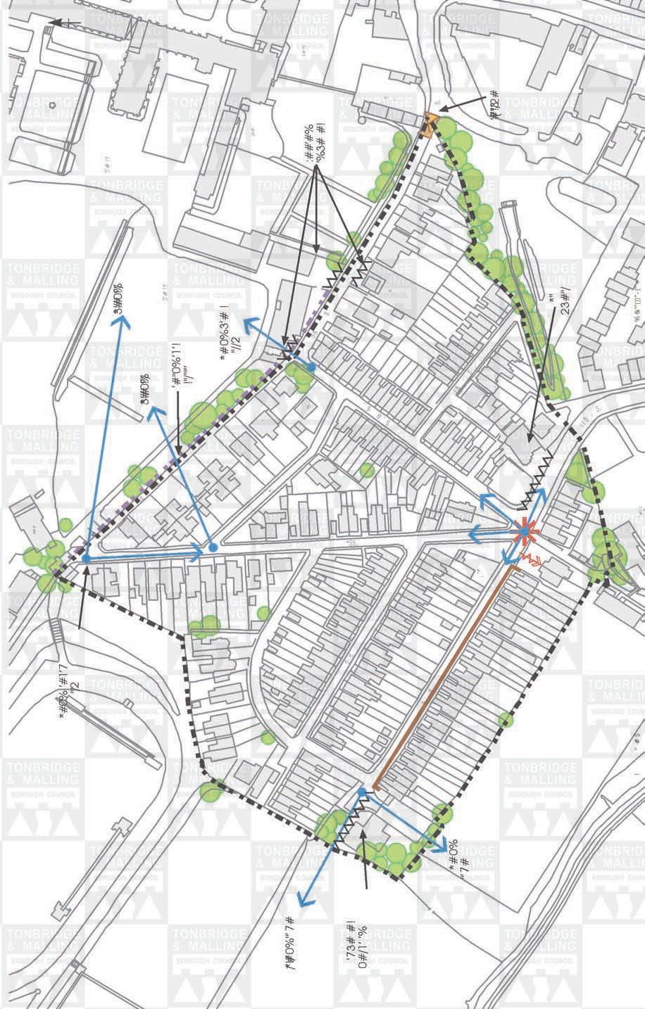
The Slade area was designated as an addition to the Conservation Area in 1990. It is a residential area comprising mid to late 19th century high density modest scale housing in narrow plots. The properties are mainly terraced or semi detached, set close to the road behind shallow front gardens with a variety of boundary treatments. However there are also some larger town houses. Whilst each street is slightly different in character, the area as a whole has a strongly cohesive Victorian character. In this respect the Slade Area is quite different from the historic core sub-areas which contain a more heterogeneous mix of buildings in terms of age and use. The Slade Area provides a snapshot of residential architecture in the late Victorian period. It has a strong sense of place and community and a slightly informal character.
The Sub area is clearly defined being surrounded on three sides by open space. There is a very abrupt edge to development. On the fourth (south eastern) side, the Fosse with its band of self seeded trees forms a strong boundary. Although in close proximity to the High Street, the Slade Area was quite separated from it in the past, having only one access for vehicles via Lansdowne Road. The pinchpoint at the eastern end of Lansdowne Road increases this sense of separation and there is a pronounced change of character beyond this point as Lansdowne Road widens sharply and the building scale increases. Today there are still only two access points via Lansdowne Road and Stafford Road which breach the line of the Fosse, with trees either side forming a gateway. The new Market Quarter development may reduce the physical separation of the Slade Area by infilling the area between it and the back of the HighStreet.
The limited road access, narrow streets, on street parking and proximity to the countryside result in a quiet residential character. A footpath runs north west past the Tonbridge School grounds towards North Tonbridge and Hildenborough. However there is no direct footpath link along the Fosse to the High Street but it is proposed that one be created.
The road pattern is a particular feature of the Slade Area. Hawden Road, Havelock Road and Lodge Road radiate out and gently upwards from the junction with Stafford Road. These straight streets allow vistas beyond the edge of the sub area. The view of Tonbridge School Chapel along Lodge Road is particularly striking as, with the rising ground, the monumental Sandstone building appears to dominate the smaller scale development of the Slade area. Although surrounded by open space on three sides, there are few long views except from the higher north eastern side of the area and from the western end of Hawden Road. On the southern side, the densely packed housing blocks longer views giving the area a self contained character.

36
Along the straight streets, the narrow mainly terraced houses are set along a consistent building line, close to the road behind shallow front gardens which results in a strong sense of enclosure. The houses were built in consistent groups and are predominantly of red, brown or yellow stock brick or painted with tile or slate roofs. They have unifying features of vertical fenestration and chimneys. Each street has a slightly different character and architectural details. In Hawden Road for example the houses face towards the playing fields, their backs presented to the road with the gable ends creating a strong sense of rhythm. In Houselands Road the bay fronted houses with decorative window details are painted white. Fosse Road has a strongly enclosed, intimate character. Boundary treatments include low brick walls, hedges, open frontages and wooden fences. The variety of boundary and garden design contributes to the informal character of the area.
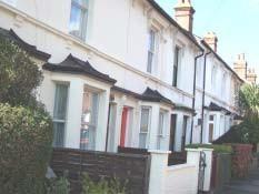
HouselandsRoad Lansdowne Road
In The Crescent and Lansdowne Road the building line and house sizes are more variable with several larger town houses overlooking the school grounds.

There are no listed buildings in the area but there are several buildings of interest, in particular the two unusual 3 storey buildings on the Avenue, each comprising four houses. In The Crescent , a considerably renovated three storey building dated 1841 is a striking feature. No. 35 Lansdowne Road was built for a local banker who owned much of the Slade area.
The character of the Victorian neighbourhood was further strengthened by the presence of corner shops denoted today by the appropriate retention of a traditional shop front. A vacant public house and converted corner shop are situated by the junction in Stafford Road giving it the appearance of a small former community hub. There are further corner shop conversions in Lodge Road.
Whilst the Victorian character and detailing have been retained to a large extent, there has been some modernisation of houses with, for example, some inappropriate replacement doors, windows and roofs, together with rendered brickwork and porches. Other detrimental features include overhead wiring, wheelie bins, wide double yellow lines and on street and pavement parking. The mansard roof on a modern apartment block in Hawden Road is a discordant feature as are the flat roofed, white and green school outbuildings to the north of Lansdowne Road. Tarmac road and pavement surfaces are generally in poor condition.
37
38 Key Features • Strongly cohesive, compact Victorian neighbourhood with quietresidential character • Sense of place and self-contained community • Intimate scale • Architectural variations between streets • Retained architectural features including original doors, windows, brick detailing • Retained shop fronts • Abrupt edge to the built up area.
TONBRIDGE TOWNSCAPEANALYSIS

Landmark
Focal point
Views/vista
Visual hinge
Lack of enclosure
Important visual space
Visual pinch point


Rhythm group of buildings with similar proportion or details
Visual intrusion
Important trees acting as focal points etc.
Important hedges
Boundary treatment contributing to special character
SUB-AREA D- THE SLADEAREA
& Map 10 39 &’’’())’’(’’+ ’7 "/
Sub-Area E1 – Tonbridge School and grounds including the northern High Street, Lansdowne Road (northern side) and London Road (southern side).
Originally founded by Sir Andrew Judd under Letters Patent in1553 as a free grammar, meaning free from Church control, Tonbridge School is now an independent public school. The buildings stand to the west of the High Street beyond the limits of the medieval town. The Tonbridge tradition of building grand buildings in sandstone was followed and, with extensions in the 18th, 19th and 20th centuries, the monumental school buildings and well kept grounds dominate the townscape of the upper High Street providing a strong contrast with the more domestic scale and mix of materials in the High Street to the south and the Shipbourne Road to the north. All the buildings and grounds within this sub area belong to theschool.
The Grade II listed school buildings, although in some cases set back from the west side of the High Street, form an impressive group. Dating from the 18th and 19th centuries the neo-gothic styling, use of sandstone and manicured lawns create an impression of grandeur and importance. The main school buildings are orientated parallel to the High Street behind a lawned courtyard flanked to the north by the Old Chapel
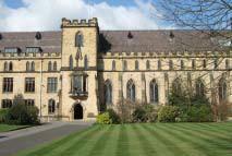
Tonbridge School MainBuildings and to the south by the Headmaster’s House and library building. The main building, designed by E H Burnell dates from 1864 and is in a gothic style with a castellated parapet and blue slate roof. A 4 storey tower in the centre has buttresses at angles and an oriel window on the first floor. The Headmaster’s House and library buildings, set at right angles to the street, are of 18th Century origin. Also in Gothic style with castellated parapets and projecting wings with gables these sandstone buildings have casement windows with diamond-shaped panes flanked by buttresses. To the north, the sandstone Old Chapel dating from 1859 is now the school museum and used as a lecture theatre.
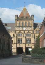
The north half of the main school buildings was added in 1894, designed by Campbell Jones. A 3 storey tower at the southern end has carriage arches on the ground floor which provide glimpses through to the sports fields behind. The tower is topped by a clock, octago nal turrets with parapet between and a tall pyramidal tiled roof, forming a landmark building. A smaller tower stands at the northern end with a 2 storey oriel window. Between the 1894 building and the High Street stands the 18th Century Old Judd House constructed of red brick with a stone base and stringcourse. The School Chapel is located behind the main buildings but the lantern is a landmark feature visible from many points in the Conservation Area. The Chapel, built
around 1900 in Gothic Perpendicular style has been restored following a major fire in 1988. There are attractive vistas ofthe Chapel from the west.
40
Tonbridge School
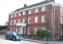
On the eastern side of the High Street, Ferox Hall is an 18th Century mansion which is now owned by Tonbridge School. It is built of red brick with pilasters, hipped tiled roofs and a porch supported by Doric columns. Set close to the road, the scale and height of the building and high wall help enclose the upper High Street and balance the main school buildings across the road. A garden lies to the north which is not visible from the High Street as it is enclosed by a long weathered
Ferox Hall stone and brick wall. A narrow green verge, two street trees and vegetation tumbling down over the wall soften the impact on the townscape. Both the house and garden wall are Grade II listedbuildings.
The lawns, trees and shrubs in this section of the High Street are important in providing a setting for the grand scale buildings. The groups of trees to the south and north of the school buildings together with the trees in the garden of Ferox Hall provide an attractive setting for the sandstone and brick buildings and contribute to the spacious landscaped character of this section of the road. The low sandstone wall that fronts the school buildings and the square flagstones of the pavement further enhance this setting. However, the school is situated between two important road junctions and traffic noise and congestion are features which detract from the character. Standard grey lamp posts and highway railings also detract from the townscape.
To the west, the school grounds and playing fields create an extensive green expanse running from the High Street to the edge of the town. The grounds are framed to the north by a row of large detached school houses and mature trees. The cupola on one of the buildings is a landmark feature. An avenue of trees runs north south across the mown grass and helps divide the space. The grounds can be viewed from the school entrance on London Road but the most impressive views are from the footpath that leads from Havelock Road in the Slade Area towards north Tonbridge and Hildenborough. The trees and wall along the southern school boundary form a definite edge to this sub area, with the trees visible from the Slade area.
Whilst the grounds are well maintained, some utilitarian outbuildings along the north side of Lansdowne Road are detracting features.
Key Features
• Listed sandstone school buildings of monumental scale dominate the townscape
• 19th Century Gothic architecture
• Spacious landscaped character of the western side of High Street in the vicinity of the School enhances the setting of the buildings
• Contrasting enclosed eastern side of the HighStreet
• Extensive park and sports grounds and mature trees create an extensive parkland setting for the schoolbuildings
41
TONBRIDGE TOWNSCAPEANALYSIS
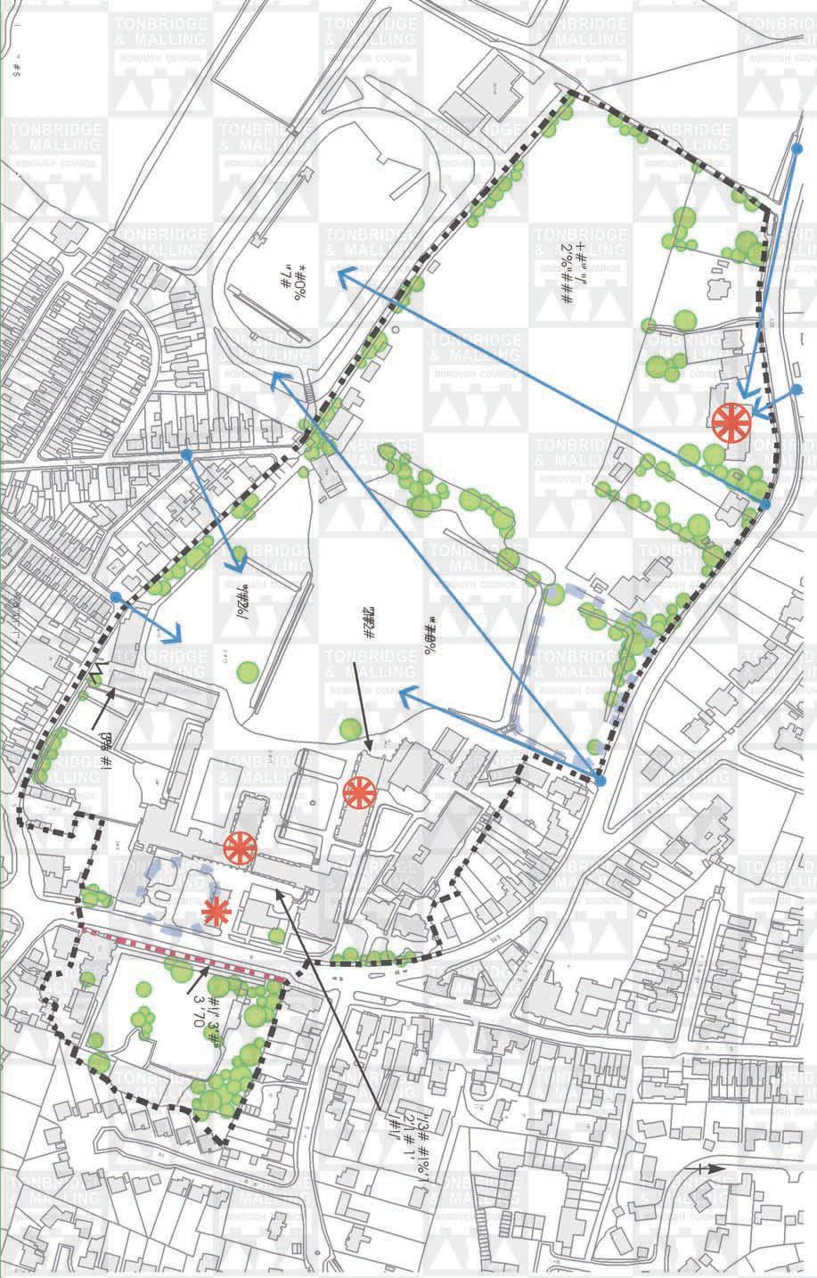


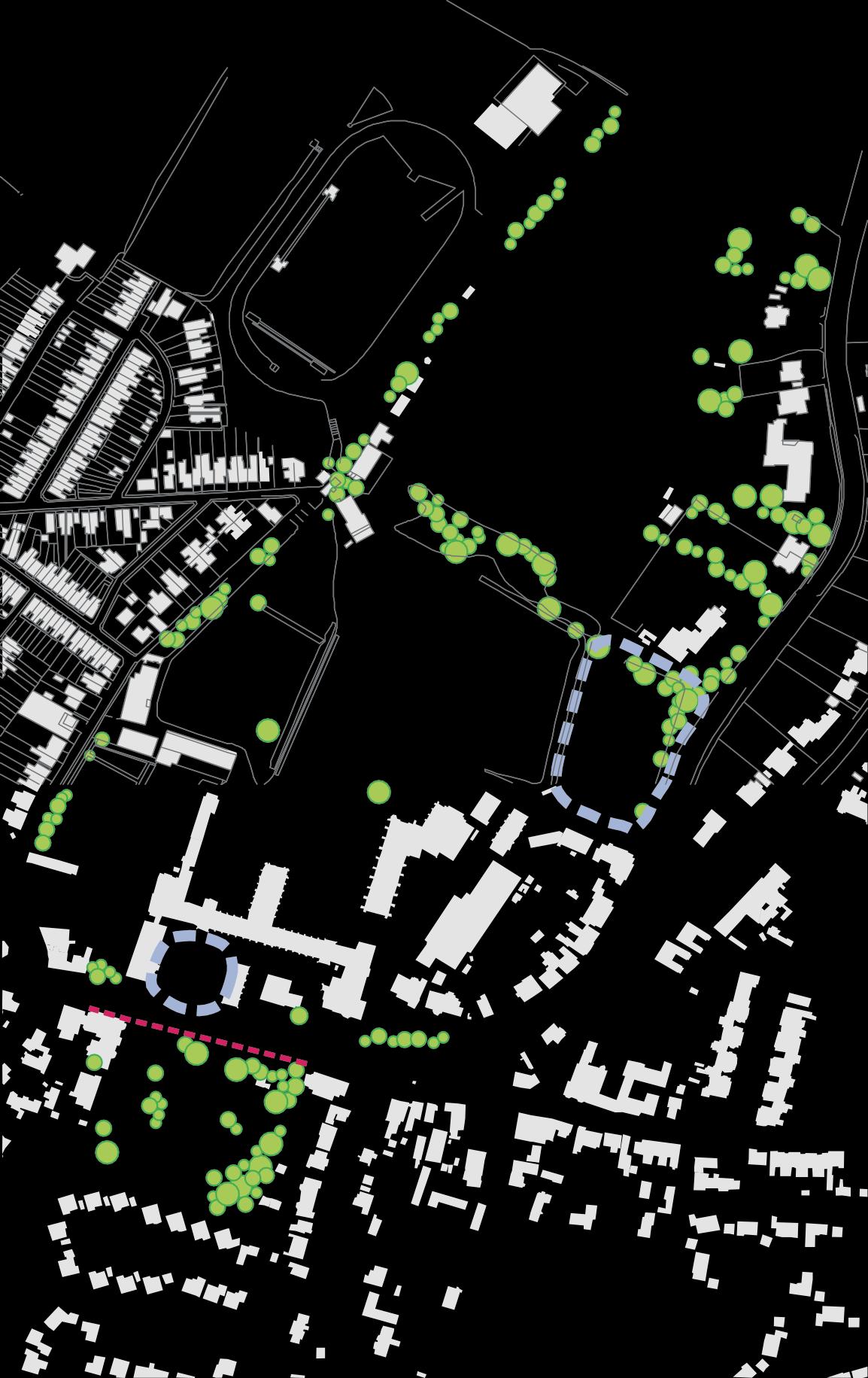
SUB-AREA E1- TONBRIDGE SCHOOL Landmark Focal point Views/vista Visual hinge Lack of enclosure Important visual space Visual pinch point Rhythm group of buildings with similar proportion or details Visual intrusion Important trees acting as focal points etc. Important hedges Boundary treatment contributing to special character Map 11 42 $,$$, +#"’ "/’2’%"### + 22& 0#11#! ,’7# (’1 ,2 * " ’ # 7 # 0 % "/3#2’1##!%’1 1’ /#!/’ ’! ;’#6 " 2 / 1 " # / 2’# 6## *#0%"’7# 3’#!"/ 73’ * " / # " / 2 %/ 3’#!"/ #!/’3’#"3 ’70 3’#!"/ /&#! 3’#!"/ ( 3 ’ 7’ % # #! " # $ %(’’+&’’’())’’
Sub-Area E2 – Shipbourne Road including AshburnhamRoad, Manor Grove, Old London Road, Portman Park (west) and London Road (east)
At the top of the High Street, the road forks with the London Road curving to the west and the narrower Shipbourne Road continuing due north. The road pattern dates from the medieval period but as late as 1880, the Shipbourne Road consisted of a narrow strip of ribbon development surrounded by fields and orchards. In the 20th century Tonbridge has expanded greatly to the north and east and this narrow, historic section of the Shipbourne Road has become a busy traffic route connecting the residential estates of north Tonbridge to the rest of the town.
The sub area is characterised by 18th and 19th Century and earlier properties ranging in height from two to four storeys. There is a strong contrast between the open spacious character of the London Road/Shipbourne Road junction and the narrow enclosed Shipbourne Road. Traditional building materials are predominant with the buildings being of red brick or painted render with some weatherboard and hung tiles. The roofs are slate or tiled and the roofscape in Shipbourne Road is a particular feature. The area is in mixed use and includes educational, residential and commercial uses. The tarmac road and pavement surfaces are in moderate condition and the quality of the street furniture is mixed. The historic quality and attractive layout of the buildings is marred by the heavy volumes of traffic passing through the junction, traffic lights and sign clutter.
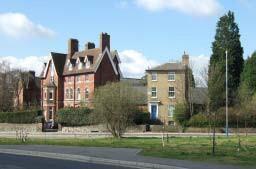
The area focuses around the London Road/Shipbourne Road junction. The junction is framed on all three sides by buildings and trees except in the north east corner where an open car park with obtrusive signage is a harmful element. Approaching the junction from the north Shipbourne Road is narrow and enclosed with buildings and walls set close to the road. The building materials include red brick, hung tiles, weatherboard and light painted render and there is predominance of white which brightens the townscape. Passing through this gateway, the junction has an open spacious green character. The triangle of open space, created following the demolition of the Star and Garter Public House, has been planted with young trees and the openness and view of Manor House will change as the trees mature. The wide low red brick listed Manor House currently closes the view from the south. Approaching from the West, the rendered 2 storey building set in the fork between the Old London and new London Roads acts as a focal point.
The western side of the junction is enclosed by the elegant curve of 2 and 3 storey narrow 19th century Grade II listed houses of red brick and pastel shades with slate roofs and original sash glazing. Set close together and close to the road behind narrow front gardens, the houses lead the eye around the curve. As the road turns south, large gaps between the buildings are filled by trees and shrubs creating a verdant character. A four storey school house with steeply pitched roof, tall chimneys and attic dormers is a prominent feature and marks the change of scale and character associated with Tonbridge School.
43
ShipbourneRoad
There is some small scale modern commercial development in Shipbourne Road set back from the road behind a wide tarmac frontage. Some modern shop fronts introduce bright colours into an otherwise muted townscape. The pavement surfacing is a mix of grey flagstones, brick pavers and tarmac. The black street lights are discrete and attractive. Elm Lane running eastwards towards the Haydens is lined on both sides by protected trees. At the junction with Old London Road there are views to the north, west and long views southwards down the HighStreet.
The haphazard character of Shipbourne Road contrasts with the more formal planned character of Ashburnham Road and Manor Grove. The semi-detached red brick and painted bay fronted houses with slate roofs are set close together behind narrow front gardens. Manor Grove is slightly grander with 3 storeys, double gable ends and painted bay windows. Park House and a tall cedar tree close the view at the western end. There is a strong rhythm created by bay fronts, gable ended properties, fenestration and chimneys in both streets. However, some front boundaries have been lost and the townscape in both streets is affected by on street parking and overhead wires.

Key Features
• Enclosed historic character and interesting roofscape of ShipbourneRoad
• Enclosed but spacious character of the London Road/Shipbourne Road junction
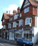
• Traditional materials including red brick, tiles, slates, weatherboard and paintedrender
• Retention of architectural details particularly on upperstoreys
• Rhythm of houses inAshburnham Road and Manor Grove
19th century houses, London Road junction Schoolbuilding,LondonRoadjunction
44
Landmark
Focal point
Views/vista
Visual hinge
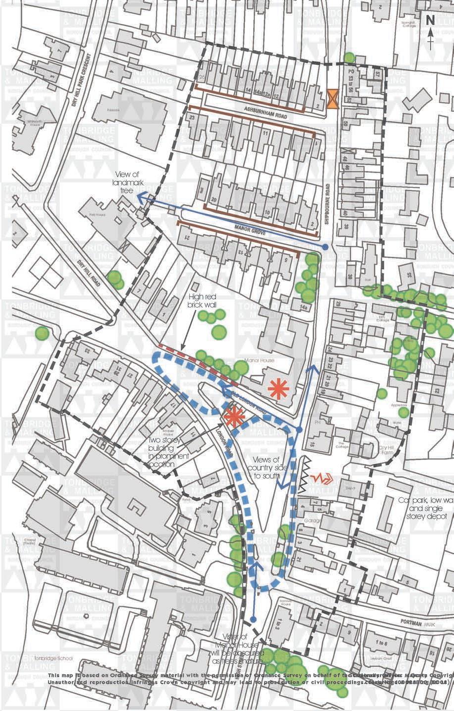
Lack of enclosure

Important visual space
Visual pinch point
Rhythm group of buildings with
Visual intrusion
Important trees
Boundary
TONBRIDGE TOWNSCAPEANALYSIS SUB-AREA E2- SHIPBOURNEROAD Springhill Cottage 26 Wh itwor th House Park House Parkside View of landmark tree Highred brickwall Manor House Hall Elm Cottage Elm Way
similar proportion or details
acting as focal points etc. Important hedges Andrew House Twostorey building in prominent location Viewsof country side to south PH The Cottage Appledore Works Dr y Hill Farm
treatment contributing to special character Pond Garage Depot Car park,lowwall and single storey depot Chapel (Private) Hanover House Tonbridge School Visterof ManorHouse will be obscured as treesmature Leyburn Court PARK Map 12 This map is based on Ordnance Survey material with the permission of Ordnance Survey on behalf of tsheStCaotniotrnoelrleyrOofffiHceer M © aCjreoswty n Copyright. 45 Unauthorised reproduction infringes Crown copyright and may lead to prosecution or civil proceedings cTeonncberiNdoge10&00M2a3l3li0n0g (B2C00L8 i). N
Sub-Area E3 – Dry Hill Park Road including Dry Hill Road, London Road (north side), Dry Hill Park Crescent and Yardley Park Road.
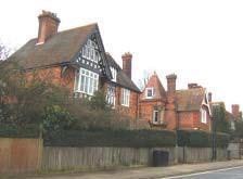
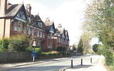
The Dry Hill Park Estate appears on a map of about 1870 with the current road layout but no buildings shown. The area was developed during the 1870s 1890s following creation of a reliable piped water supply. The houses were individually designed but laid out as a residential park. The area remains residential, although there are two private schools in Dry Hill Park Road and some properties are owned by Tonbridge School. There are also a number of residential and nursing homes. The buildings are generally substantial detached or semi detached properties in large plots, set back from the road behind brick boundary walls and landscaped front gardens. Building heights range from 2 4 storeys and the predominant building materials are red brick and tiles with stone details and white painted windows.
The sub area is located to the north of the historic core on a ridge of high land and has an elevated spacious character, enhanced by the relatively wide gently curving roads. There are long views across open countryside to the west and south and houses on the north side of Dry Hill Park Road have views northwards towards the Sevenoaks Ridge. These views can be glimpsed through the gaps between somehouses.
The buildings display a wealth of architectural details typical of the period and the English Revival style. These include decorative brickwork, string courses, stone parapets and hung tiles. Different coloured and shaped tiles have been used to create patterned roofs with decorated bargeboards, dormer windows and pierced ridge tiles. Many of the buildings have very prominent chimneys, some of which are highly decorative. Single storey and two storey canted bay windows are a common feature and windows are generally white painted sashes (some with a divided top sash), often with stone lintels and raised window surrounds and pediments. The more elaborate designs incorporate fanciful towers and turrets.
Traditional front boundaries consist of red brick walls, some with decorative brick work, pillars, stone caps and hedges although some uncharacteristic wooden fences have been introduced. Some frontages have black railings. Behind the boundaries, trees and shrubs give additional privacy and create a verdant townscape. The black street lamps and bollards enhance the historic character but the tarmac pavements are of moderate quality.
46
Dry HillPark Road
Dry HillRoad
There are no listed buildings in the sub-area, but St Saviours Church is a local landmark. Built in 1875 as a chapel of ease to reduce overcrowding at the Church of St Peter and St Paul, St Saviours was designed by E Christian. It is constructed in red brick with a curved chancel and slate roof which is steeply pitched along the central section and topped by a narrow spire.

No. 40 Dry Hill Park Road is anArts St Saviour’sChurch and Crafts House dating from 1870.
The area has a verdant character, created by mature trees which front and occasionally overhang the streets and hedges and shrubs within gardens. The mature landscaping contributes to the high environmental quality and provides a pleasant foil to the red brick. A group of trees at the western end of Dry Hill Park Road creates a landscaped entrance to the area from the London Dry Hill Park Crescent looking south Road. Trees and a small grassed area frame the fork into Dry Hill Road. Dry Hill Crescent is heavily landscaped, with two tall landmark trees (one close to the church) which are visible from various points in the Conservation Area.
On the London Road, trees, hedges and thick vegetation along the tops of the walls form a strong edge to the sub area and give the road an enclosed character despite its width.
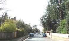
The eastern section of Dry Hill Park Road has fewer trees and the building height reduces to 2 storeys. The individual or semi detached villas are constructed of red or yellow brick with slate or tiled roofs. The boundaries are lower or open and the plots are narrower than in the western section.
To the east of the Shipbourne Road junction, Yardley Park Road comprises large detached and semi-detached interwar and post war houses in generous plots. A group of mature garden trees create a green entrance to this area and the houses are set behind landscaped front gardens. To the south of Yardley Park Road is an open grassed area with fine specimen trees representing the remnants of the original playing fields for Tonbridge School. This represents a marked change in character and announces the entrance to the Conservation Area along Dry Hill Park Road. It is overlooked and contained by a crescent of modern two storey detached houses which front directly onto the open space without boundaries.
47
The sub area is notable for its concentration of buildings of similar date which have retained their architectural integrity and have suffered remarkably few alterations. The large plots which contribute to the spacious character of these affluent Victorian suburbs, have also generally been retained. However, in the central sections of Dry Hill Park Road and Dry Hill Road three groups of modern detached houses have been built. Constructed in buff bricks with low open boundaries and concrete tiled shallow pitched roofs, these houses do not respect the context in terms of materials, scale, design or boundary treatment.
There are a number of harmful elements which affect the special character of this sub area. In particular, Dry Hill Park Road is busy with traffic, particularly at peak school times and is used as cut through by vehicles avoiding the busy London Road. There has been some loss of front boundaries to create frontage parking and at the Shipbourne Road/Dry Hill Park Road junction, poor quality railings, tarmac and footpath design and highway clutter harm the townscape.
Key Features
• Elevated position, with views to opencountryside
• Spacious Victorian residential suburb with substantial houses in largeplots
• Houses set back behind enclosed, landscaped front gardens
• Predominant materials of red brick and tiles with stone details and white windows
• Red brick, sometimes decorative, boundary walls with brick pillars and stone copings
• Wealth of original late 19th Century architectural details
• St Saviours Church is local landmark
• Verdant character created by trees, hedges and shrubs
48
TONBRIDGE TOWNSCAPEANALYSIS
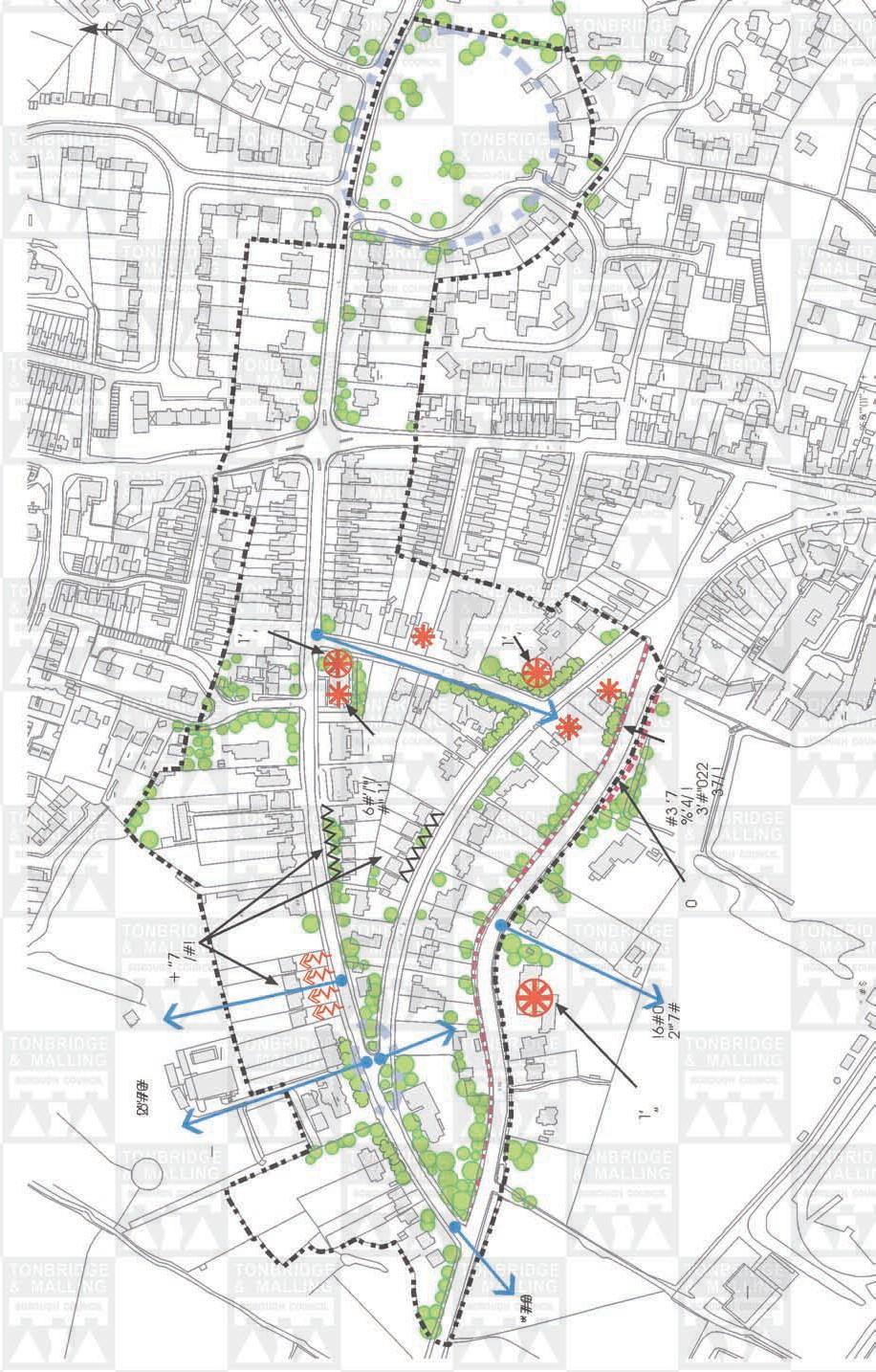

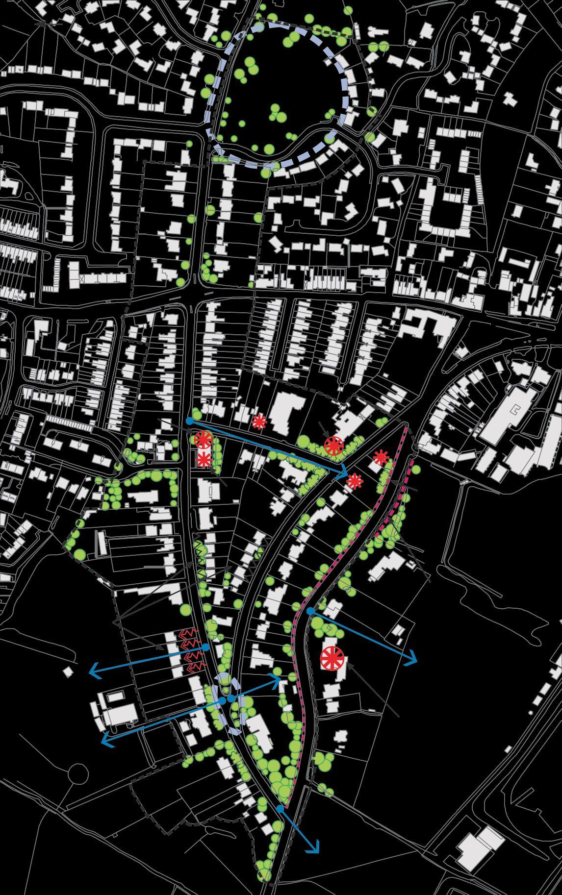
E3- DRY HILL PARK ROAD
Landmark
Focal point
Views/vista
Visual hinge
Lack of enclosure
Important visual space
Visual pinch point


Rhythm group of buildings with similar proportion or details
Visual intrusion
Important trees acting as focal points etc.
Important hedges
Boundary treatment contributing to special character
SUB-AREA
Map 13 49 ! 2 6 " # 7 0 # + ’’7 /#! 8’!"/ 0#11#! 1 ’ ## 3 !# 6#’ /’"/ ’7 6#’/ ’"/ #" 1’ ,’7# 2’#!/ $ ’# &/#0’ $,$$, 1 ’ ’ * " ’ # 7 # 0 1 ’ ’ ’ !6#0 2"’7 # 1&7 #3 ’7 %’4/ !3’#"0 22 37/ ! 0 22 0#11#! ,’7 (’1 ,2 8’ /2 ;’#6 ! " # $ % &’’’())’ (’’+
Physical Fabric
The ConservationArea contains a variety of building styles reflecting changing fashions and technology. However, the use of traditional building materials primarily bricks, half timber, slates and sandstone creates a subtle palette of colours based around red, pale yellow, black, white and grey.
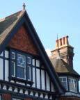
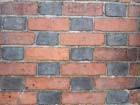
The dominant structure in the Conservation Area is the Castle which is constructed in honey coloured sandstone. Other prestigious buildings including the Church of St Peter and St Paul, Tonbridge School and a few Georgian town houses were also built of this locally quarried stone.
Medieval buildings were built by craftsmen using local materials and in this area they were timber framed. There are several good examples of timber framed buildings in the Conservation Area, some with overhung upper storeys supported on protruding floor joists. The Chequers Inn and Port Reeve’s House are two notable examples.
IntheGeorgian period, brick buildings becamefashionable and many of the original timber framed buildings were rebuilt in brick or refronted with elegant brick facades. This occurred particularly along the High Street, no doubt to raise the prestige of the town. These facades are frequently embellished with decorative features including wood or stone cornices, parapets, string courses, bands and pilasters and quoins. The bricks were handmade at this period and vary in size with rough textures and edges. The use of a Flemish bond contrasting blue headers and red bricks is noticeable on the Rose and Crown Inn, Some of the buildings are stuccoed to give the appearance of stone. The buildings that were not refaced in brick were sometimes clad in weatherboard or hung tiles on the upperstoreys.
The Victorian properties are also predominantly red brick with occasional use of white or yellow bricks. The smaller properties are relatively simple flat or bay fronted designs but some of the larger properties, particularly in Dry Hill Park haveveryelaborateGothic orItalianatedesigns some with ornate embellishments.
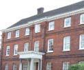
Roofs are almost exclusively traditional clay tiles or slates. On some of the bigger Victorian properties patterns have been created using different coloured and shaped tiles, topped by decorative ridge tiles. Prominent gables and dormer windows create interesting rooflines. Turrets, spires, cupolas and elaborate tudor style chimneys act as landmarks. Parts of the Tonbridge School are roofed in blue slate.

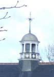
50
There is a wide variety of window types but white painted wooden sash windows are the most numerous. Other buildings have casement windows, some with small square leaded panes. The Tudor buildings and more prestigious Victorian buildings feature oriel windows. There are a few 19th Century shop fronts in the Conservation Area but many buildings in the High Street have modern shop windows at the ground floor. Single and double storey bay windows can be seen in some parts of the Conservation Area. Some windows are very elaborate and the narrow arched Gothic style windows are a particular feature on the Tonbridge School buildings. Traditional front doors are also a feature of the Conservation Area with a number of the 18th Century propertieshaving elegant semi circular or rectangular fanlights. Door hoods and pilasters are decorative features.

Boundary treatments include red brick and sandstone walls, hedges, wooden fences and black railings. The tall brick walls bordering the Tonbridge School grounds, the Churchyard and Ferox Hall gardens are particular features. Some of the walls have decorative brickwork and are capped in stone. The larger Victorian houses are shielded from the road by walls with tall shrubs and trees behind. Many of the smaller and older properties have very narrow front gardens or front directly onto the pavement.
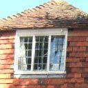

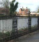
The decorative ironwork of the Big Bridge, River Walk and in the Churchyard are attractive features of the Conservation Area. Some shop fronts have iron brackets for hanging signs on upper storeys.The black and gold coordinated street furniture and lamp posts found in some of the Conservation Area enhances the character. However, in other parts standard grey railings and lamp posts and concrete or plastic bollards have a harmful impact. Some of the pavements have been surfaced in brick pavers or grey flagstones and combinations of different treatments, for example in Church Lane, enliven the floorscape. There are some features including the stone trough at the lower end of the High Street, the Rose and Crown tap, the replica hanging noose outside the Chequers Inn which contribute to the historical character of the Conservation Area.


51
Features affecting the character and appearance of the Conservation Area
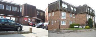


Tounderstand what is special about the Conservation Area it is useful to note those features that are out of character with the area. This not only emphasises the importance of the remaining special features of the area but also allows potential improvements to be identified.
◼ Whilst the area has a reasonable consistency of street furniture, the materials, style and colour are not consistent throughout, leading to a dilution of the special character of the area and the sense of place. The proliferation of road signs also harms the visual appearance. The poor quality and condition of surfacing following repair works is visually harmful.


◼ Some modern development significantly erodes the character of the area because of its bulk, materials, height, boundary treatment, detailed design or landscaping.
52
Utilitarian railings
Utilitarian and poorly maintained street furniture and surfaces
◼
A number of traditional shop fronts remain within the High Street and The Slade neighbourhood. These shop fronts are an essential part of the character of the area but insensitive shopfronts, which do not respect the traditional features or widths of upper storeys, have been introduced inplaces.
◼ The inappropriate replacement of traditional materials and features such as windows and doors with unsympathetic modern materials and designs has occurred incrementally in some areas. Concrete tiles replacing slate or clay tiles, or replacement plastic windows or modern door designs are evident particularly on traditional Victorian residential properties. Such changes can have a detrimental visual impact on the integrity of groups of buildings and the character and appearance of the area as awhole.
◼ Overhead wires detract from the attractiveness of the ConservationArea though the cost of replacing these underground is normally prohibitive.
◼ The removal of traditional boundary treatment to properties (normally to create parking spaces) or the lack of such boundaries to properties can harm the unity with adjoining properties and expose views of car parking.
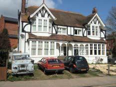
Incongruous or lack of boundary treatment
◼ Unlike the motte and castle, the importance of the historic Fosse is underplayed. The former mound and ditch, which has influenced the layout of the town so strongly, has been submerged by development and self sown saplings and trees. The boundary treatment is alsoutilitarian.
◼
The Fosse
Whilst there are public spaces which act as oases from the traffic noise in the area, the noise and presence of traffic on the High Street, Dry Hill Park Road and the main road junctions detracts from the enjoyment of many parts of the

Conservation Area.

53
Management Proposals for the Conservation Area
English Heritage good practice advocates that local authorities should prepare a management plan to address the issues arising from the Conservation Area Appraisal and set out recommendations for action. Some of these actions will be applied generally to Conservation Areas in the Borough, whilst others, such as enhancement proposals, are specific to the Tonbridge Conservation Area.
Management Proposals applicable to all Conservation Areas in the Borough
Application of Planning Policy
The Borough Council will consistently apply adopted and future planning policy to ensure high quality design which is appropriate to protecting and enhancing the character and appearance of the Conservation Area. This will be applied to all development requiring planning or listed building consent including new development such as replacement or new buildings, small scale alterations and extensions to buildings, boundary treatment and surfacing front gardens. This approach will be followed for proposals both within the Conservation Area and those which affect its setting or impact on its character.
Implications for Tonbridge Conservation Area
Within the Tonbridge Conservation Area the Borough Council will encourage the replacement of existing, including recent, buildings with development where this preserves or enhances the character of the area. Such development may be of different architectural styles but should still be able to demonstrate a good relationship with its setting and the character of the area.
Development will also come forward outside the area and to be acceptable this must preserve or enhance the special qualities of the area. For example, significant develop ment in the Botany area will be visible from the Castle and special attention should there fore be paid to ensuring the roofscape is interesting and attractive and does not contain plant or rooftop parking in a way which would detract from views from the Castle. Similarly, the site to the north of the Lock is proposed for residential, leisure, hotel and open space use. This development will affect the setting of the Conservation Area and should aim to ensure that there are public realm enhancements along the River Medway and that quality designs are achieved to complement that recently built along the northern bank of the river within the ConservationArea.
Shop Fronts and Advertisements Supplementary Planning Document
The Borough Council will bring forward a new supplementary planning document on shop fronts and advertisements which will have special consideration for Conservation Areas. It will amplify, illustrate and potentially replace Saved Local Plan policy P4/13
Implications for Tonbridge Conservation Area
The High Street in particular contains a number of inappropriate shop fronts (or boarded up units) which, when proposals come forward, should be replaced with designs which harmonise with the original character of the area and the design elements of the buildings to which they are to be fitted.
54
Currently, there is not a proliferation of advertising within the Conservation Area and the number of projecting signs is limited. Strict control should be maintained over the amount and type of advertising in the Conservation Area to maintain this delicate balance. Owners of buildings, designers and development control officers would benefit from a more detailed and illustrated Supplementary Planning Document.
Repairs to Buildings in Conservation Area Good Practice Guide
It would particularly assist home owners if the Borough Council’s Listed Buildings and Conservation Areas Good Practice Guides were complemented by an information leaflet on replacement doors, windows and roof materials considered to be suitable within Conservation Areas. This will have much wider application. It will recognise the need for replacement features and will also give practical guidance on design, acceptable materials and products and may assist with the selection of suppliers.
Implications for Tonbridge ConservationArea
Original doors, windows and roof materials have been replaced in a significant number of properties, especially Victorian, within the Conservation Area. The Leaflet will be publicised within the Conservation Area and distributed to households and be available on the website.
Grants
The Borough Council will continue to offer Listed Building Grants to assist with the repair of listed buildings within the Conservation Area.
The Borough Council will consider the costs and benefits of extending the application of its Grant Scheme to include shop fronts within the Conservation Area with a view to encouraging the replacement of inappropriate shop fronts with designs which better reflect the design elements of the building to which it is to be fitted and the character of the area.
Implications for Tonbridge ConservationArea
Tonbridge Conservation Area contains a large number of Grade 1 and 2 listed buildings which are generally well maintained. The Listed Building Grants offer financial assistance towards repairs to such buildings.
Tonbridge Conservation Area also contains a number of shopfronts which could be more appropriately designed. For this reason the Council will consider whether to expand the grants available to cover such properties in the Tonbridge Conservation Area.
Building Regulations
Government Guidance (PPG15) makes it clear that “in exercising their responsibilities for the safety of buildings under the building and fire legislation, local planning authorities should deal sympathetically with proposals for the repair or conversion of historic buildings”. The Borough Council will continue to apply Building and Fire Regulations sensitively in Conservation Areas and to Listed Buildings to attempt to ensure that there is no conflict with the preservation of the character of the area or the building.
55
Management Proposals for Tonbridge Conservation Area
Street Furniture and Surface Materials Guide for Tonbridge

The Borough Council will produce a street furniture and surface materials guide for Tonbridge Conservation Area. This should feature a limited palette of street surfaces including predominantly red brick footways laid stretcher bond, granite sets and granite kerbs to follow the existing distinctive colour palette.Any painted yellow lines should be narrow in width.
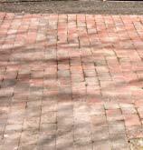
In relation to street furniture, there is some consistency of black painted lamps and bins. However, as street furniture is replaced, repaired or maintained, there is a real opportunity to upgrade and group together the existing items to a common suite of specified components such as lamp standards, benches, bins, railingsand bollards.
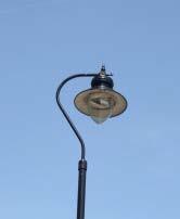
Tall modern lamps comprising a lantern design, evocative of a more traditional l historic pattern, mounted on a simplified black column have been introduced within the High Street to complement the larger scale buildings. Elsewhere, within new housing development, smaller scale ‘period’ lanterns in the style of Victorian gas lamps have been appropriately introduced. Through enhancement measures or gradual replacement, there is an opportunity to unify some of the sub areas with a consistent use of lamp columns appropriate to the scale of development.
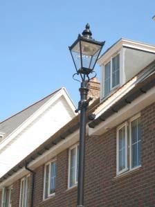
56
There are a large number of prominent guard rails within Tonbridge Conservation Area. An audit should be carried out to see how many remain necessary and, for those which are required, a programme of replacement by a more sympathetic design should be undertaken. New highway proposals (see below) are likely to bring the opportunity to remove or replace existing railings.
The Conservation Area contains a range of wooden, concrete, plastic and metal bollards (of different colours). A unified design of metal bollard would help reinforce the sense of place.
There is also a real opportunity to move to a more distinctive livery for the Conservation Area such as black with gold or red details, or a different combination of colours, to ensure a common identity and to reinforce the sense of place.
The Guide will apply to all agencies in relation to replacement surfaces and to all maintained or new street furniture.
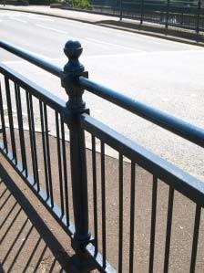
The Borough Council will cost a set of priority proposals for street furniture and surface material enhancements as part of the works required to the public realm within the town centre and, in addition to any funding from its Capital Plan budget for enhancement schemes, will seek contributions from development towards such improvements. Contributions resulting from development will be pooled in the Tonbridge Central Area Fund.
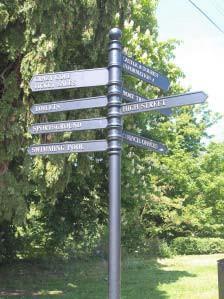
57
Enhancement of Bank Street/ Castle Street area
The Market Quarter is currently something of a backwater to the High Street and contains a number of vacant or underused buildings. The pedestrian environment is compromised by traffic and poor quality surfaces and the street furniture is uncoordinated. Following the completion of the Lansdowne Road Link Road, Castle Street and Bank Street will experience a reduction in traffic and there is a significant opportunity for a comprehensive enhancement scheme for this area bringing new life to old buildings and creating an attractive, pedestrianfriendly environment. Co-ordinated street furniture to include replacement lighting and seating should be introduced. A shared surface street with vehicles subordinate to the pedestrian should be created with a new public space created in front of the former fire station. The Borough Council will review the provision of
Former Fire Station a new focus for public realm improvements public toilets in this area.
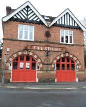
Once the Lansdowne Road Link is complete the Borough Council will cost a set of enhancement proposals as part of the works required to the public realm within the town centre and will seek contributions from development towards such improvements. Contributions resulting from development will be pooled in the Tonbridge Central Area Fund.
Enhancement of the Fosse
The historic Fosse, part of the town’s medieval defences, which has influenced the layout of the town so strongly has been submerged by development and self sown saplings and trees.AdjoiningThe Slade, boundary treatment of chespale fencing is alsoutilitarian.
The Borough Council will work with English Heritage, and through the development proposals encompassing the Fosse alignment (including those set out in the Central Area Action Plan), to bring for ward proposals for improvements along the remaining visible lengths of the Fosse and will consider positioning uniquely designed metal plates to depict the original alignment of the former town boundary. An interpretive board should be placed at strategic points to explain the origins, position and influence of the Remains of the Fosse Fosse in the development of Tonbridge.Atrail of this unique feature may supplement visits to the motte and bailey and castle.

58
Enhancement of Medway Wharf Road and Town Lock
The protection and enhancement of the riverside is a key issue for the Conservation Area. Tothe east of the Big Bridge there has been a lot of new development both north and south of the river. In order to improve public accessibility to, and the visual appearance of, this area the river bank and adjacent areas need attention.
The Council has approved an enhancement scheme for the Town Lock area which will provide an opportunity to significantly improve its appearance. The design will need to reflect the urban riverside and link areas together. As a major project it will need to set high standards of design and use of materials that others might follow.
It is being funded by a partnership between the Borough Council, the Environment Agency and developers of sites in Medway Wharf Road.

Traffic
A number of traffic calming measures have been introduced into the High Street and Dry Hill Park Road. As well as the shorter term opportunities for further traffic calming within the Market Quarter, there is a longer term proposal for the London Road Hadlow Road link which aims to reduce traffic in the High Street by providing a more direct traffic link. The alignment is safeguarded but funding is required through the Local Transport Plan.
Following the introduction of the new road there may be opportunities for further traffic calming measures in the High Street.
There will be a need to ensure that the new road and design of the Shipbourne Road/ London Road junction do not detract from the character of the conservation area. Signage and street clutter should be kept to a minimum with any new street furniture selected from within the Borough Council’s Street Furniture and Surface Materials Guide.
LondonRoad ShipbourneRoad junction
59
Design Guidelines
◼
The scale, massing, height, form, alignment, density and layout of any new development should respect the character of the area within which it is proposed as described in this Appraisal. Within the central sub areas of the High Street, Bank Street and the Slade, Lyons Crescent and Shipbourne Road, development should be tightly arranged to adjoining buildings and close to the road with narrow frontages to give a clear vertical emphasis. Buildings should generally be 3 4 storeys in height although parts would only suit 2- 3 storeys. This would also be appropriate in the Riverside Walk sub area. Within the Dry Hill Park Road sub area, development should be more loose knit, set back from the road and giving space around buildings for substantial landscaping. Within the tight knit domestic scale of the Slade and Mill Stream sub areas development is generally limited to 2 storeys inheight.
◼
There are a number of isolated properties which are out of keeping with the general character of the Conservation Area. These properties may remain largely unchanged over time but there may be opportunities for new development. When assessing development proposals within the Conservation Area, the Borough Council will seek improvements to the character of the area by focusing on these areas of opportunity where new development should aim to enhance the character of the area through high quality design.
◼
Good quality design relies, amongst other things, on the choice and combination of materials. This is crucial to the success of a scheme. A richness of design and texture can be achieved through careful detailing and use of materials, and through a fine balance between variety and uniformity in a building or development. The number of different materials used should generally be kept to a minimum. New buildings should consist of materials which respect the character of the sub area within which they are proposed. The materials listed in the Physical Fabric section and described in the relevant sub area section are appropriate.
◼ Extensions and new outbuildings should be well designed and be subordinate to the original building. Where buildings are set back a consistent distance from the street along a common building line the visual integrity of a whole street should not be compromised by porches or front extensions For corner buildings, careful attention to the design of prominent side elevations will be necessary.
◼ It is important that new buildings respect the alignment of buildings in order to fit well within the local context. This not only applies to the front building line but also to the width of the development within the plot. In areas of loose knit development such as the Dry Hill Park Road sub area, there should be sufficient width within a plot to locate the building(s) and provide adequateseparation between them. There are considerable pressures to maximise the use of sites but this should not be achieved at the cost of an erosion of the distinctive character of the sub area.
◼
Within the central sub areas and Dry Hill Park Road sub area, roofs should follow the rich and complex mix of roof forms, should be steeply pitched and should consist of peg or plain clay tiles. Within the smaller scale residential environments of the Slade and Mill Stream sub areas, unified, simple roof lines fronting the street should be protected from dormer windows and slate should be retained. Concrete tiles should not beused.
60
◼ Replacement doors, windows and roofs should closely match the design and materials of the original features of the building. Where inappropriate new windows, doors and roofs are to be replaced, the opportunity should be taken to put back in the original style andmaterials.
◼ Traditionally designed shop fronts should be retained. New shop fronts should respect the scale, period, design and detail of the individual building of which it forms part, as well as harmonising with the wider shopping area.
◼
Careful consideration should be given to ensuring that good quality traditional detailing on buildings is retained eg brick detailing such as string courses and quoins, tile patterns, brick bonding, decorative chimneys and decorative barge boards, eaves and soffits. Where removed, efforts should be made to restore them.
◼ Additions such as satellite dishes, flues, extractor fans and alarm boxes should preferably be located where they are not visible from public vantage points.
◼ Front boundaries should be retained or restored to the prevailing feature in the sub area: for example, approximately 1 metre high red brick wall with a coping and entrance gate pillars; brick wall topped by hedge; hedge and railings or mature 2 metre high hedge. Detailed brick patterns should be followed. Parking areas have been created on some frontages leading to an erosion of the street enclosure, a loss of defensible space around the building and the link to the history of the area and the locally derived material. Wherever possible, traditional boundary enclosure should be reinstated. Some boundaries are formed by close boarded fences which are out of character with the area and the period of the building. Where the oppor tunity arises, new boundaries should use the prevailing materials and designs in the sub area.
◼ Off street parking should not diminish the character of the conservationarea.
◼ Trees which form landmark features, or which are important to the character of the conservation area, should beretained.
◼ The area contains a number of local landmarks and focal points which help give reference points and prevent a monotony of appearance. These features should be protected.
◼ Views and vistas of townscape features, such as landmarks and focal points, and the countryside beyond the built up area should be preserved.
◼ Important open spaces should be retained and their tranquil character respected.
◼ When a proposal creates new surfaces or street furniture within its boundaries, it should be selected from the Borough Council’s Street Furniture and Surface Materials GuideforTonbridgeConservationArea.
◼ Buildings which would be visible from the Conservation Area, or form part of its
setting, should preserve or enhance the Conservation Area.
61
Planning Policy Background
The Appraisal will help interpret
• Planning Policy Guidance Note 15,
• the emerging South East Plan,
• the Tonbridge and Malling Core Strategy (Policies CP1 Sustainable Development; CP23 Tonbridge Town Centre; CP24 Achieving a High Quality Environment and CP25 Mitigation of Development Impacts), and
• the Tonbridge CentralAreaAction Plan (Policies TCA1 Quality of Development; TCA2 Mixed-use Development; TCA5 Secondary Shopping Areas; TCA10 Public Realm Priorities and TCA13 Pedestrian Priority Areas).
• Saved Local Plan Policy P4/13 ShopfrontDesign
Policies within the adopted Development Plan Documents seek to preserve and enhance the natural and built environment.
The Core Strategy expects all development to be well designed and of a high quality in terms of detailing and use of appropriate materials, and must through its scale, density, layout, siting, character and appearance be designed to respect the site and its surroundings. Within the town centre the Core Strategy seeks enhancements to the public realm, including protecting and enhancing important open spaces and the creation of new ones.
Within the Tonbridge Central Area Action Plan there are specific proposals relating to the Tonbridge Central Area within which the Conservation Area is located. However, where changes are anticipated, the Borough Council seeks high quality designs and provision of, or contributions towards, enhancement measures.
Planning Consultants Tony Fullwood Associates and the Borough Council would like to thank members of the Tonbridge Civic Society the Slade Area Residents’ Association and individual residents who contributed to the Appraisal.
Adopted July 2009 62


 Mortley Close, overlooking Mill Stream

 Port Reeves House


