Tonbridge Character Areas

Supplementary Planning Document Adopted February 2011
Context
Character Area Appraisals
A Main Road Frontages
A1 Pembury Road and Goldsmid Road 17
A1.1 Pembury Road West 17
A1.2 Pembury Road East 20 A1.3 Goldsmid Road 24
A2 Quarry Hill Road 27
A3 London Road 30
A3.1 London Road Frontage and Courtlands 30
A4 Shipbourne Road Area Frontage 34
A4.1 Shipbourne Road (South) Area 34
A4.2 Shipbourne Road (Central) Area 38 A4.3 Shipbourne Road (North) 43
A5 Hadlow Road 46
A5.1 Hadlow Road (West) 46
A5.2 Cornwallis Avenue 50 A5.3 Hadlow Road (East) 53
A6 Higham Lane Area 56
B Nineteenth Century Cottages 60
B1 Douglas Road/Barden Road Area 63
B2 Priory Road Area 67
B3 St Mary's Road Area 70
C Edwardian Villas 74
C1 Springwell Road Area 75
D Early Public Housing Schemes
D1 Barden Park Road Area
D2 Baltic Road
Contents 1 What is the Supplementary Planning Document 1 2 Purpose of the Supplementary Planning Document 3 3 Policy
3 3.1 National Planning Policies 3 3.2 Core Strategy 2007 5 3.3 Managing Development and the Environment DPD 5 4 Methodology 6 5 Community Involvement 7 6 How to use this Document 8 7 Origins and Development of Tonbridge 9 8
13
14
79
81
84
D3 Lodge Oak Lane (North) Area 86
D4 King’s Road Area 89
E Inter-war Semi-Detached Housing 92
E1 Deakin Leas Area 94
E2 Quarry Rise Area 97
E3 Estridge Way Area 100
F Post-war Public Housing Schemes 103
F1 Trench Road Area 105
F2 Royal West Kent Avenue Area 108
F3 Hunt Road Area 112
F4 Bishops Oak Ride Area 115
F5 Lodge Oak Lane (South) Area 118
F6 Masefield Way Area – Radburn Layout 121
F7 Waveney Road Area – Radburn Layout 125
G Open Plan Housing Developments 130
G1 Tulip Tree Close 132
G2 Audley Rise 135
G3 Stacey Road Area 137
G4 Molescroft Way Area 139
G5 Royal Avenue 141
G6 Longmead Way Area 143
G7 Whistler Road Area 146
G8 Willow Lea Area 148
G9 Hopgarden Road Area 151
G10 Barchester Way Area 154
G11 Chiltern Way 157
G12 Shelton Close 159
G13 Gorham Drive Area 161
G14 Dowgate Close Area 163
G15 Farm Lane Lane 166
G16 Keswick Close 168
G17 Whitelake Road 170
G18 Pine Ridge Area 172
H Lower Density Detached Housing 174
H1 Exeter Close 176
H2 Ridgeway Crescent 179
H3 Yardley Park Road 182
H4 The Ridgeway 184
H5 Vauxhall Gardens 188
H6 Streamside 190
H7 College Avenue Area 192
H8 Old Hadlow Road Area 195
H9 Dry Bank Road 198
I Clustered Cul-de-sac Development 200
I1 Douglas Road (West) Area 202
I2 Brindle’s Field 205
I3 Brickworks Close Area 208
I4 The Haydens 211
I5 Brook Lane Area 215
I6 Quarry Bank Area 218
I7 Bickmore Way Area 220
I8 Old Barn Close 223
I9 Townacres Area 225
I10 Portman Park (East) 228
I11 Royal Rise 231
J Bungalows 233
J1 Thorpe Avenue Area 235
J2 Orchard Drive Area 238
J3 Audley Avenue (West) Area 241
J4 Cranford Road Area 243
K Arcadian Areas 246
K1 Bourne Lane Area 248
K2 High Hilden Area 251
K3 Hadlow Stair Area 254
L Mixed Character Area 257
L1 Portman Park (West) 259
L2 Kendal Drive Area 261
L3 Garden Road Area 264
M Chalets 268
M1 Towngate Wood Park Area 268
N Commercial Areas 271
N1 Vale Road and Woodgate Way Areas 271 N2 Drayton Road Area 275
9 Design Guidance 279
Appendix 1 By Design: Urban design in the planning system towards better practice 287
Appendix 2 Glossary 289
to Maps
Key
ì Views ì ììì Panoramas ? Local Landmark IIIIIIII Visual Intrusion Nodes ! ` Protected Trees Õ Õ Õ ÕÕ ÕÕ ÕÕ ÕÕ Õ Õ Õ ÕÕ Õ Õ Õ ÕÕ ÕÕÕÕ ÕÕ Õ Protected Woodland or Groups of Trees nnnnnn nnnnnn Important Tree and Hedge Belts Conservation Area Tonbridge Central Area Action Plan Open Space Listed Buildings
1 What is the Supplementary Planning Document?
Good design is a key element of sustainable development, so the Borough Council will promote a high standard of design. A high quality, well designed, development can enhance the sense of place and identity of an area and can bring significant benefits to the local environment and economy.
The ‘character of an area’ is often mentioned in the context of considering development proposals. What is often missing is a clear identification of, and agreement about, the locally distinctive features of an area that give it character that should be given careful regard in considering proposals for development. This Character Area Appraisals Supplementary Planning Document (SPD) sets out to define the character of identifiable local areas across the Borough for that purpose.
The Managing Development and the Environment DPD states that it is important that unique characteristics of an area are identified and protected and where practicable enhanced having regard to the Character Area Appraisals SPD in order to strengthen this diversity rather than eroding its character and local distinctiveness. Government guidance (PPS3) advocates that Local Planning Authorities should develop a shared vision with their local communities of the type(s) of residential environments they wish to see and develop design policies that set out the quality of development that will be expected for the local area.
The Borough Council is undertaking character area appraisals of all of the main urban areas in the Borough, including the larger villages, defined in the Local Development Framework (LDF) as Rural Service Centres. The Character Area Appraisals SPD therefore comprises a number of separate volumes. Appraisals are being prepared for:
• the Tonbridge Urban Area;
• The northern urban areas (including the Medway Gap, Kings Hill, Snodland and Walderslade) and
• the Rural Service Centres – Hildenborough (including Hilden Park), Hadlow, East Peckham, Borough Green and West Malling
It should be noted that the Hilden Park area which, in planning terms, is regarded as part of the urban area of Tonbridge is covered by the Hildenborough Character Area Appraisal.
This particular part of the SPD sets out to define the character of, and appropriate design guidance for, the urban area of Tonbridge, including Hilden Park, but excluding the two Conservation Areas and the Town Centre - for which separate guidance has already been prepared (see Map 1).
The SPD will be adopted as part of the LDF. It provides further detail about how planning policies will be applied in those parts of Tonbridge not within a Conservation Area or the Town Centre AAP boundary. Once adopted, it will be a material consideration in determining planning applications in that part of Tonbridge to which it applies. Developers and householders should refer to the document in formulating proposals.
1
01,5003,000 Metres Tonbridge Character Area Appraisal Map 1: Tonbridge Area Boundary
The document aims to raise the standard of design of new proposals such that they fit well with the locally distinctive character of an area. Design which is considered to be inappropriate in its context is unlikely to be acceptable and efforts will be made to improve the character and quality of an area through the preparation and consideration of development proposals.
2 Purpose of the Supplementary Planning Document
This SPD aims:
• To supplement adopted design policies for assessing development proposals within an area;
• To identify the locally distinctive features that define the character of those parts of Tonbridge not included within the town’s two Conservation Areas or the Town Centre AAP boundary;
• To raise awareness of, and provide guidance on, the appropriateness of the design of development within an area in order to strengthen diversity rather than erode character and local distinctiveness;
• To assist the appraisal of planning and allied applications; and
• To deliver improved designs, in practice, which enhance the character of the area
3 Policy Context
The SPD is consistent with national planning policy and in general conformity with regional planning policies and is supplementary to the policies set out in the Development Plan Documents (DPDs) contained in the LDF.
3.1 National Planning Policies
Planning Policy Statement 1 (Delivering Sustainable Development) states that the Government is committed to protecting and enhancing the quality of the natural and historic environment, in both rural and urban areas. Planning policies should seek to protect and enhance the quality, character and amenity value of the countryside and urban areas as a whole.
Planning authorities should seek to maintain and improve the local environment and help to mitigate the effects of declining environmental quality through positive policies on issues such as design, conservation and the provision of public space.
Planning authorities should plan positively for the achievement of high quality and inclusive design for all development, including individual buildings, public and private spaces and wider
3
area development schemes. Good design should contribute positively to making places better for people and take the opportunity to improve the character and quality of an area.
Design policies should avoid unnecessary prescription or detail and should concentrate on guiding the overall scale, density, massing, height, landscape, layout and access of new development in relation to neighbouring buildings and the local area more generally. Local planning authorities should not attempt to impose architectural styles or particular tastes and they should not stifle innovation, originality or initiative through unsubstantiated requirements to conform to certain development forms or styles. It is, however, proper to seek to promote or reinforce local distinctiveness particularly where this is supported by clear plan policies or supplementary planning documents on design.
Planning Policy Statement 3 (Housing) affirms that good design should contribute positively to making places better for people. Design which is inappropriate in its context, or which fails to take the opportunities available for improving the character and quality of an area and the way it functions, should not be accepted.
The guidance advocates that Local Planning Authorities should develop a shared vision with their local communities of the type(s) of residential environments they wish to see and develop design policies that set out the quality of development that will be expected for the local area, aimed at:
– Creating places, streets and spaces which meet the needs of people, are visually attractive, safe, accessible, functional, inclusive, have their own distinctive identity and maintain and improve local character.
– Promoting designs and layouts which make efficient and effective use of land, including encouraging innovative approaches to help deliver high quality outcomes.
Good design is fundamental to using land efficiently. Local Planning Authorities should facilitate good design by identifying the distinctive features that define the character of a particular local area.
Careful attention to design is particularly important where the chosen local strategy involves intensification of the existing urban fabric. More intensive development is not always appropriate. However, when well designed and built in the right location, it can enhance the character and quality of an area.
PPS3 states that the density of existing development should not dictate that of new housing by stifling change or requiring replication of existing style or form. If done well, imaginative design and layout of new development can lead to a more efficient use of land without compromising the quality of the local environment.
4
3.2 Core Strategy – September 2007
One of the prime aims of the Core Strategy is to ensure that new development results in a high quality environment by, for example, promoting and delivering new development that can positively contribute to the spatial quality of towns and maintaining or enhancing local distinctiveness.
Core Policy CP24 states that all development must be well designed and of a high quality in terms of detailing and use of appropriate materials, and must, through its scale, density, layout, siting, character and appearance, be designed to respect the site and its surroundings. Wherever possible, all development should make a positive contribution towards the enhancement of the appearance of the area.
3.3 Managing Development and the Environment DPD – April 2010
The DPD states that the diverse character of Tonbridge should be protected and enhanced for its own sake as it is important for the social, economic and environmental wellbeing of the Borough. It is important that the unique characteristics of the area are identified and protected and where practicable enhanced in line with Core Policy CP24 having regard to the Character Area Appraisals SPD in order to strengthen this diversity rather than eroding its character and local distinctiveness.
Policy SQ1 requires proposals for development to reflect the local distinctiveness, condition and sensitivity to change of the local character areas as defined in the Character Area Appraisals SPD.
All new development should protect, conserve and, where possible, enhance:
(a) the character and local distinctiveness of the area including its historical and architectural interest and the prevailing level of tranquillity;
(b) the distinctive setting of, and relationship between, the pattern of settlement, roads and the landscape, urban form and important views…
5
4 Methodology
Planning Policy Statement 1 (Delivering Sustainable Development) advises local authorities to prepare robust policies on design. These should be based on an understanding and evaluation of the present defining characteristics of an area and that is the purpose and function of this SPD.
The evaluation of the Tonbridge area has involved an assessment of the character of the development of the area through the review of historic maps; comprehensive site surveys using the approach and characteristics advocated in By Design – Urban design in the planning system: towards better practice (DETR, 2000) – see Appendix 1.
An initial appraisal was undertaken of all areas of the town covered by this SPD and it was evident that a number of areas shared similar characteristics. From this assessment it was possible to identify a typology of character areas such as Nineteenth Century Cottages, Public Housing Schemes, Open Plan Housing and Compact Cul-de-sac Development.
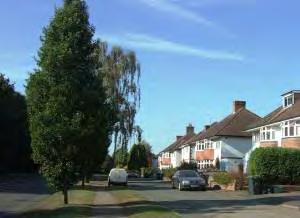
The main road frontages, together with adjoining side roads, form the framework around which Tonbridge has developed and spread out from the medieval core. Although each road frontage is different, they also share a number of common characteristics. As main frontages accommodating the most journeys, they also have a disproportionate influence on the perception of the town. For these reasons, Main Road Frontages are classified as a character area typology.
Where an area grew up sporadically over time through piecemeal development and redevelopment, this has led to mixed house types and layouts. These areas have been classified as Mixed Character Areas.
Although not necessarily physically adjoining each other, each character area typology generally grew up over the same period (with the exception of Mixed Character Areas) using layouts, designs and materials which were based on the technology, legislation and planning and design philosophies of that time. Thus these character area typologies shared common generic characteristics which were recorded using the following matrices:
• Locally Distinctive Contextual Features (including the age, type and height of buildings, the main uses, the predominant building materials and boundary treatments, and the types of open space).
• Locally Distinctive Positive Features
• Negative Features worthy of Enhancement
Street by street surveys were then undertaken of each of the separate areas which made up the broad character area typologies. These surveys identified features which were specific to each area such as landscape features, landmarks, views and detracting features. Locally Distinctive Positive and Negative Features were recorded for each area as text and on a Townscape Analysis Map.
6
Identifying the generic and area-specific Locally Distinctive Contextual and Positive Features should assist in interpreting Core Strategy Core Policy CP24 and Managing Development and the Environment DPD Policy SQ1 which seek designs which fit well with the local context and protect and conserve the character and local distinctiveness of an area. By identifying the Locally Distinctive Negative Features, the SPD also indicates features which could, through the application of Policy SQ1, be enhanced particularly through development opportunities.
Representative groups and elected Members of the Borough Council assisted at each of these stages – see Community Involvement below.
5 Community Involvement
Community involvement in the preparation of the SPD has closely followed the Borough Council’s adopted Statement of Community Involvement which states that specific consultation will take place at an early stage on a draft of the document. Consultation is to be targeted at particular groups and individuals, depending on the specific nature of the issue or location dealt with by the SPD. There has been close stakeholder involvement in preparing this SPD in order to develop a shared vision with the local community of the type(s) of residential environments they wish to see and to develop appropriate design guidance.
Prior to the drafting of the SPD, three local stakeholder events were held.
Firstly, a briefing session was held involving Borough Council officers, local amenity groups1 and local Ward Councillors followed by a discussion on draft character area typologies and character area boundaries.
Secondly, a series of walkabouts were held involving Borough Council officers, local amenity groups and local Ward Councillors. The area was sub-divided into north and south Tonbridge and appropriate groups visited each sub-area to observe and record the key features which made up the character of the area.
As a third exercise the recorded features were then presented back as summarised text and photographs to the local representatives at a locally held workshop for review and discussion. Representatives were also asked about the elements of the environment they most valued about their local area and important detractors to the character of the town.
Ward Councillors were kept informed from the inception of the SPD and participated in the process of assisting with the preparation of the consultation document.
The Planning Consultants preparing the SPD and the Borough Council would like to thank the individuals and organisations who have contributed to the process to date.
1 Tonbridge Civic Society, Tonbridge Historical Society, Higham Residents Association, Longmead Residents Association
7
Formal consultation under Regulation 17 on the Tonbridge Character Assessment SPD took place between Monday 13 September and Friday 22 October 2010. This included an exhibition held in the Foyer of the Angel Centre from 12.00 pm on Wednesday 15 September till 12.00 pm on Wednesday 22 September 2010 which was manned from 12.30 pm till 4.30 pm on Saturday 18 September.
Copies of the SPD will also be made available for comment at the Borough Council offices, local libraries and on the website. Statutory consultees as well as the existing network of resident, community and specialist interest groups were also consulted. The SPD was publicised in the local press and on the Council’s website and there was a formal Public Notice under Regulation 17.
The Council recognises that it is important to report back to the community and other stakeholders the response to their comments. The Council has published the feedback to all consultation on its website and in document format that is available in all Council offices and libraries.
6 How to use the Document
Section 8 divides Tonbridge into separate character areas based on the methodology set out above.
Each separate character area is named and numbered on Map 2 below. If you are interested in a particular area, locate it on Map 2 and turn to the section on that character area in Section 8. The relevant page can be found by reference to the Contents page.
For each of the individual areas there is an assessment of the locally distinctive contextual features such as age, height and types of buildings; main uses; prominent building materials and boundary treatments and open spaces. Locally distinctive positive features and negative features worthy of enhancement are also recorded.
There are also three Areas of Landscape Significance. It is not appropriate to consider locally distinctive contextual features in the same way for such areas, and they are not identified as separate character areas in Section 8. Nevertheless, reference is made to these areas in the introduction to Section 8.
In setting out the important features and overall character of identifiable areas of the Borough, a local context is provided for the preparation and consideration of development proposals. This forms a canvas within which proposals for development should be conceived and determined. Generic Design Guidelines based on the identified locally distinctive features may be found in Section 9. These will form the basis for decision making which will interpret the individual character area appraisals.
8
7 Origins and Development of Tonbridge
Environments grow in response to local circumstances and it is therefore important to understand the principal influences which created the distinctive character areas of Tonbridge.
The name Tonbridge is derived from the Old English tun brycg which means ‘the bridge of, at, or near the manor or settlement’. It is thought that the town evolved at a clearing in the great Andredsweald forest at a point where several tracks from the North Downs to the Weald met at a ford in the river Medway. The first bridge and church of St Peter and St Paul are thought to have been constructed between the 9th and 11th centuries.
After 1066, a Motte and Bailey castle was constructed to defend the river crossing. Tonbridge at this time was a small roadside town standing on the higher more defensible land to the north of the river. The only significant building south of the river was the Priory of St Mary Magdalene which was founded in 1192. By the mid 13th century the castle’s defences were strengthened and a wide ditch and bank enclosed the castle, church and main street. The Medway formed the southern defence for the town. Medieval development was enclosed within these defences giving the town a compact form although routes arrived from the north and south. It was only well into the post-medieval period that the settlement expanded beyond them. The High Street formed the principal axis of the town.
In the Georgian period, the river Medway ran through five channels and south of the river, the road ran over a series of hump-backed bridges across this area that frequently flooded. In 1740 the river Medway was made navigable and a town quay was constructed. The following year the Upper Medway Navigation company started to ship out timber and iron and bring back coal, stone, gravel and lime mainly to make bricks (with local clay) for the growing town. Tonbridge became the port for the upper reaches of the Medway and an important trading centre. Tonbridge formed the focus of a large agricultural hinterland and the town acted as a centre for processing and trading agricultural products.
During the 17th, 18th and early 19th centuries, new buildings were concentrated within the confines of the town defences, but it was not until after the arrival of the railway in 1842 and a more direct line to London via Sevenoaks in 1868, that there was a rapid increase of housing and population and the town expanded mainly to the south of the river. Tonbridge grew from what was predominantly a farming community and became a market town of commerce and light industry.
Between 1841 and 1871, the population doubled. The demand for trade, shops, public buildings and services increased markedly.
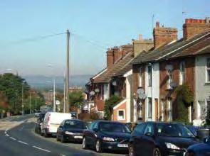
Fine houses were built for the middle classes on the higher, drier land to the north and east, whilst rows of terraced cottages were constructed on the lower land either side of the railway line for the railway workers. In this area much of the building consisted of small brick terraced cottages in straight streets connected with narrow alleys. This land was frequently subject to flooding. The construction of the railway line disrupted the traditional road pattern south of the river and as former farm land was sold off for development, the new straight Pembury Road and a section of Quarry Hill Road were constructed.
The housing stock of Tonbridge increased by four fifths between 1881 and 1911, partly as a result of two printing firms relocating to the town from London. In South Tonbridge, most of the development took place in the area between Pembury and Quarry Hill Roads. St Mary’s Road,
9
the Drive, Springwell and Woodfield Roads were built in the 1890s. In the same period short roads were developed either side of Douglas Road to the west of St Stephen’s Church and leading off Barden Road, where larger bay fronted properties faced onto the river and open countryside. Pembury Road had almost continuous housing but Quarry Hill was developed only as far as Baltic Road. Most of the housing stock survives from this period forming identifiable character areas of tight knit Victorian cottages and late Victorian and Edwardian villas.
In North Tonbridge, terraces of cottages were constructed along the Shipbourne Road to just beyond the cemetery and in Uridge Road and Dernier Road. Only the eastern end of Hadlow Road was developed, beyond which stretched orchards, hop gardens and some isolated groups of cottages along the country roads.
In the first decade of the twentieth century villa style homes were still being built and can be found in Goldsmid Road, the Drive, Hectorage Road, Baltic Road, St Mary’s Road and off Douglas Road. The period of rapid expansion ended in 1909 and new development was limited until after the First World War.
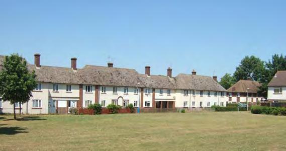
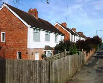
In the 1920s, following the passing of the Addison Act in 1919, local authorities became involved in providing housing. These early public developments were influenced by the Homes for Heroes and Garden City movements and consisted in Tonbridge of cottage style brick and rendered homes set in relatively spacious layouts and plots along curving roads and cul-desacs. The earliest in Tonbridge was in Barden Park, begun in 1920, but other developments followed along the Shipbourne Road, Lodge Oak Lane and in Baltic Road. In 1936 92 homes were constructed on the Little Trench Estate.
During the 1920s, some private housing was developed along Yardley Park Road, Portman Park, Bourne Lane, Goldsmid Road and the Drive. However, it was not until the 1930s that private housing development took off again. In 1930 a winding section of Hadlow Road was bypassed with the construction of Cornwallis Avenue and a new drainage system was developed which facilitated development on the former farmland. Housing spread along the Shipbourne Road and Hadlow Road and new roads were created including Thorpe Avenue, a speculative development of bungalows running parallel to the Shipbourne Road, and the Ridgeway. In south Tonbridge a new road, Deakin Leas, was constructed south of the Pembury Road and further semi-detached housing was built at Quarry Rise, King’s Road and in Brook Street.
From 1935 onwards, the backland between the Shipbourne and Hadlow Roads began to be developed with the construction of the Greentrees Estate, Estridge Way and Orchard Drive. However none of these developments were completed until after the Second World War.
In the early post war period, the greatest expansion of housing was in the public sector, with Tonbridge Urban District Council funding the development of a number of estates, mainly in north Tonbridge. These estates were constructed using cheaper mass produced materials than the earlier cottage style developments. They comprised mainly semi detached and terraced housing laid out along curving roads and culs-de-sac with substantial open space and traversed by a network of footpaths. These areas include Trench Estate, Trench Woods, Cage Green, Higham Wood and the Poet’s Estate in south Tonbridge. The layout of these developments and the distinctive design of the housing, gives these areas a clearly identifiable character.
Higham Lane, running north from Hadlow Road, was largely undeveloped until it was widened in 1956.
10
During the 1960s and 1970s there was a private housing boom alongside industrial expansion (see below) and private residential estates expanded across north Tonbridge, filling in gaps in the built-up area and expanding out across former orchards and hop gardens, so that area from Trench to the Hadlow Road became continuously built up, whilst leaving a corridor of green space along the Woodland Walk. These estates typically consisted of semi-detached houses with private garages set back behind open lawned frontages along curving roads and cul-desacs.
In the early 1950s and 1970s two publicly-funded high density estates designed on Radburn principles were constructed in the Masefield Way area and to the west of the Shipbourne Road respectively. Houses face onto footpaths and grassed amenity areas with vehicular access to the rear of the properties.
The industrial area to the east of the town centre, began in the early twentieth century, but it comprised two separate areas at Cannon Lane and Vale Road until the 1970s when the Cannon Lane Bridge was rebuilt and a mini-bypass created linking the two areas. This area saw rapid development after the completion of the Leigh Flood Barrier which reduced the risk of flooding on this low lying land. A further major development was the construction of the A21 in 1971 which bypassed the town to the west and completely altered the landscape of the upper section of Quarry Hill.
Since the 1980s, new development has been more compact, comprising mainly smaller detached developments at the edge of the built up area, redeveloping brownfield sites or infilling vacant sites. Three examples of larger such developments comprise the construction of new compact style housing on the former brickworks to the east of Quarry Hill, the construction of the Haydens on former school playing fields off Yardley Park Road (after Yardley Court School had relocated) and the redevelopment of the Dowgate (printing) Works in Douglas Road. Although in the Central Area, extensive recent flatted development alongside the river comprises compact development of a much larger scale.
On the London Road to the west of the main settlement of Tonbridge and separated from it by a strip of protected open space, lies Hilden Park. The earliest record of a manor at this location was in 1240 when the Manor House and a small community clustered around a green. The present Hilden Manor was constructed in the 14th and 15th centuries on this important route from London to the coast but was rebuilt in 2005 following a fire. Several substantial villas were built in the late Victorian and Edwardian periods in the vicinity of the Manor, but the built up area expanded rapidly in the 1960s and 1970s when open plan detached housing developments were constructed on land to the south of London Road and in Farm Lane.
Today Tonbridge has a distinctive dumb-bell shape typical of towns on lowland rivers, with a narrow town centre on the floodplain, and extensive suburbs fanning out on the higher land to the south and north. Further expansion of the town is constrained by Green Belt which tightly surrounds the built up area. There is a strong distinction between the major through routes which are wide and busy with buildings of mixed age and use and the relatively homogeneous residential areas behind which clearly reflect the housing styles and planning principles of the times in which they were built, creating a patchwork of distinctive character areas.
11
0 750 1,500 Metres¯ Tombridge Character Area Appraisal Map 3: Evolution of Tonbridge
8 Character Area Appraisals
Close analysis has been undertaken to identify the distinctive features that define the character of the different parts of Tonbridge using recognised methodologies and with public involvement. The next sections of the SPD describe the locally distinctive contextual features of each area as well as locally distinctive positive features and negative features worthy of enhancement.
Key characteristics of each Character Area are illustrated on a Townscape Analysis map and are summarised in table form. Annotated photographs are also included to depict part of the character of the area.
Whilst the principal characteristics for all areas have been summarised, it has not been possible to illustrate each individual feature and consequently the absence of a feature from this document does not necessarily mean that it is unimportant to the character of the local area.
There are three Areas of Landscape Significance within Tonbridge which provide an extensive landscape framework. Whilst it is not appropriate to consider locally distinctive contextual features in the same way for such areas, it is important to note the wider value of these extensive areas of landscape. The areas are shown on Map 2 and comprise the Tonbridge Cemetery, the Woodland Walk both in north Tonbridge and the extensive wooded margins to the A21 in the south.
These areas contain mature trees which are visible from, and form a backdrop or edge to, a number of character areas. Within these areas, the landscape is the dominant feature with buildings glimpsed through mature trees and vegetation or above surrounding boundaries.
The Woodland Walk is a narrow linear, informal natural space following the path of a stream. The natural vegetation creates an enclosed space for most of its length. The space is ‘announced’ at each end by contrasting larger open spaces. The walk is interrupted by Romney Way and is unfortunately bounded by the backs of properties.
The Cemetery comprises a more formal layout of rectilinear paths but some informality is given by a significant number of mature trees and a sloping topography. The area is much less enclosed than the Woodland Walk with views out to open countryside to the west from higher ground.
The woodland areas adjacent to the A21, both to the east and west of Quarry Hill, screen development from the road and the road from the built up area and form a backdrop to this part of the town.
The character of these areas is important in their own right but also in providing an extensive landscape framework to a number of surrounding character areas.
13
Tonbridge grew up at a key crossing point of the River Medway where the north-south and eastwest land routes met. The medieval High Street developed along the line of the main LondonHastings road and around its junction with the Hadlow and Maidstone roads.
The pattern of development of Tonbridge has been shaped strongly by historic routes serving the town.
The London and Shipbourne Roads today follow the line of the medieval routes into the town from the north. The Hadlow Road, outside the Conservation Area, also follows a medieval route except for the Cornwallis Avenue section which was built in 1930, bypassing a winding section of the Old Hadlow Road. To the south of the river, the road originally forked with the western branch following the route of Waterloo Road before again dividing along Brook Street and up the old road over Quarry Hill. The eastern branch followed a route up Lavender Hill and Primrose Hill. The straight, wide sections of Pembury Road and Quarry Hill Road closest to St Stephen’s Church and the town centre were constructed in the Victorian period when parcels of farm land were being sold off for development.
These historic roads, together with adjoining side roads developed at a similar time, form the framework around which the town has subsequently developed as it has spread out from the medieval core along and between these routes. Although each road frontage is different, they also share a number of characteristics in common. In particular, the routes have the most vehicular movements along them, and, as a result, have a disproportionate influence on the perception of the town.
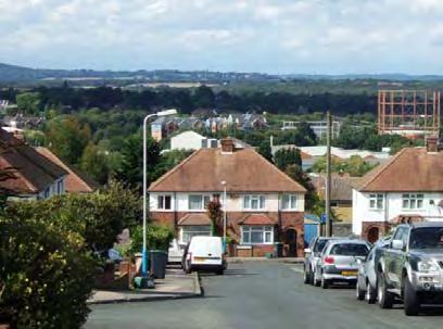
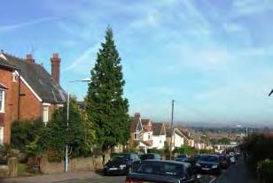
Tonbridge is situated on the flood plain of the river Medway sandwiched between the North and South Downs. As a result, the main access routes from the north and south slope down towards the town centre, allowing some long views over the rooftops. Hadlow Road and the London Road to the east and west have a gently undulating topography as they follow the contours.
Quarry Hill entrance to the town from the south provides long panoramic views over the town and the setting of the Sevenoaks Ridge beyond
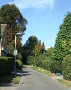
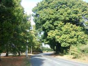
In most of these character areas, the outer sections of the routes are extremely verdant with tall trees and hedges bordering both sides creating a gradual transition from the town into the country.
14 A – MAIN ROAD FRONTAGES
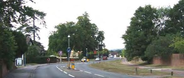
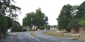
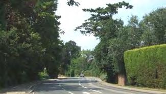
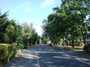
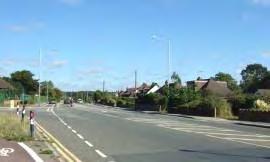
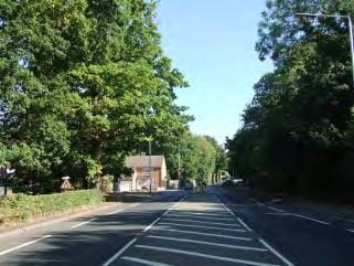
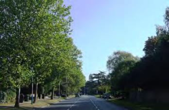
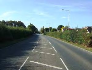
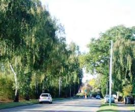
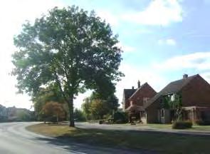
London Road with wide verge, hedges and tall trees, providing a gradual transition from countryside to the town
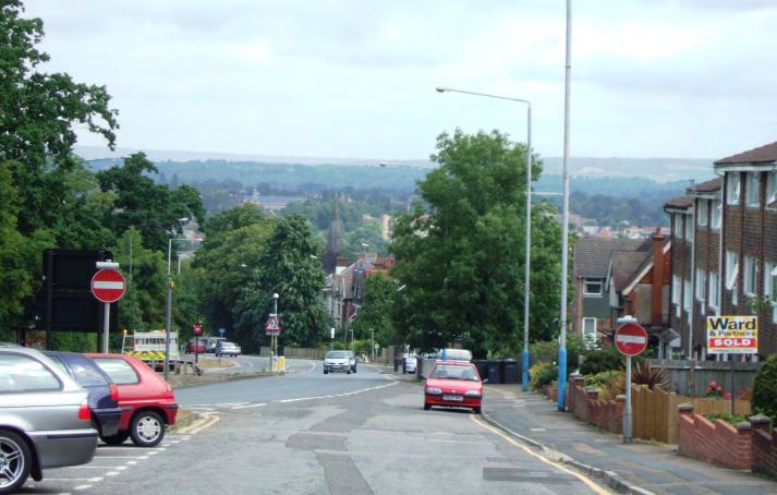
The buildings along the frontages are generally of a variety of ages. The frontage buildings are frequently older than the backland development to the rear. In most cases the age of the buildings progresses along the length of the road with the oldest located close to the town centre. For example in the Shipbourne Road, the Victorian properties at the southern end, give way to 1930s houses, then 1960s/70s and finally recent development at the northern edge of the town. A similar effect is seen in the Hadlow Road. However Pembury Road shows a more complicated pattern for reasons explained above.
The use of the buildings is more varied than in the primarily residential areas behind. Uses found on the frontages include public houses, shops, garages, places of worship and, in the case of the London Road, restaurants, hotels and a theatre. At some junctions, clusters of community shops and services form a focal place or node.
The buildings are generally of a greater scale, particularly nearer to the centre of the town, with some forming landmarks along the routes by virtue of their scale, historical importance and/or function. Whilst most of the buildings in Tonbridge are 1-2 storeys high, along the main road frontages taller more bulky buildings extend up to 3 or 4 stories reflecting the historical and current importance of these routes.
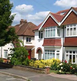
The buildings along these frontages are often of more varied design than the residential areas to the rear. There is a greater proportion of individually designed buildings and more decorative detail.
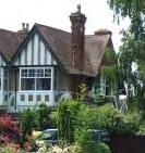
Pembury Road larger scale building with decorative detail
Since these areas are all situated on or adjoining busier routes, traffic noise and movement affect the character.
15
LOCALLY DISTINCTIVE CONTEXTUAL FEATURES
Age of buildings
Type of buildings
Main uses
Building Heights
Prominent building materials
Predominant boundary treatments
Open Spaces
The age, type and height of buildings, the main uses, materials and boundary treatments are so different along the main roads that it is not possible to generalise the contextual features.
Instead, the Locally Distinctive Contextual Features are included in the individual Character Areas in the Main Road Frontages Section.
Locally Distinctive Positive Features
• Larger scale of building, particularly towards the town centre and mix of uses reflects historical and current importance of these roads.
• Frontages towards the edges of the built up area are generally verdant with hedges and tall trees, providing a gradual transition from countryside to the town.
• On some roads, the progression of building styles and ages provides a window on the historical development of Tonbridge.
• Individual listed and unlisted buildings form prominent local landmarks.
• Curving roads and sloping topography provide ever changing vistas and occasional views of the town centre and out over open countryside.
Negative Features Worthy of Enhancement
• Traffic noise and movement detracts from the historic character of these major routes.
• In some cases, uncoordinated road signage and street furniture, some of which is in poor condition, detracts from the character of these areas creating a mixed impression along the entry points into the town.
• Loss of front boundaries
16
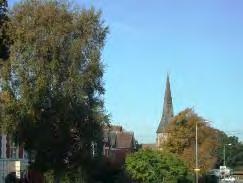
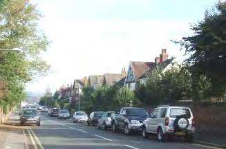
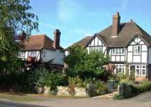
A1 – PEMBURY ROAD AND GOLDSMID ROAD
Comprising: Pembury Road and Goldsmid Road.
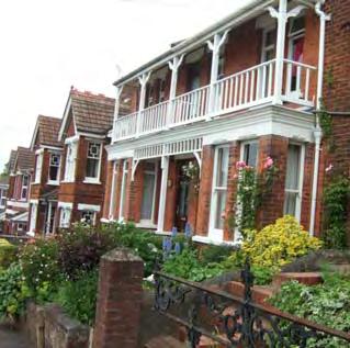
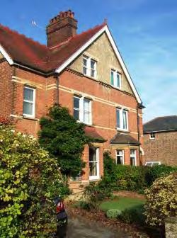
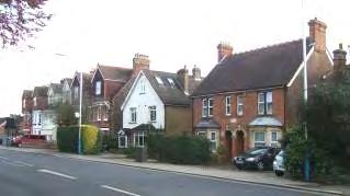
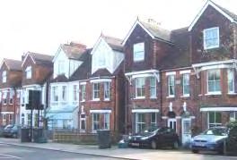
The historic route to Hastings followed the line of Priory Road and then ran parallel to Lavender Hill where it joined the current route over Primrose Hill. However, in the mid 19th century the straight, wide western section of Pembury Road leading to St Stephen’s Church was built. As a result, the buildings closest to the town centre are principally late Victorian villas and civic buildings, whilst the buildings at the eastern end comprise smaller, older cottages. However, there has been some infill and redevelopment resulting in a mix of buildings of different ages, particularly at the eastern end.
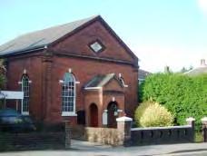
The character area has been divided into three distinct sub-areas.
A1.1– PEMBURY ROAD WEST
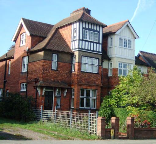
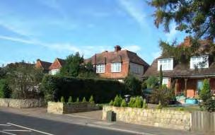
This section of road is lined by elegant 2-3 storey mid to late Victorian villas and institutional buildings set back along a relatively even building line behind deep garden frontages bordered by brick walls with coping, hedges and picket fences. Red brick and painted render in pastel shades predominate. The scale and bulk of the buildings reflect the historical and current importance of the road as a primary access route to the town centre. Many decorative details have been retained which enhance the elegant character. These include white woodwork, half timbering, carved barge boards, gently pitched slate hipped roofs or steeper tiled gabled roofs, ridge tiles, columns, stone quoins, date and commemorative plaques and two/three storey bays.
17
St Stephen's Church spire is a landmark to the west. Date plaques such as this one on the Zion Chapel 1867 add historical interest.
LOCALLY DISTINCTIVE CONTEXTUAL FEATURES
Age of buildings 1850 – present day
Type of buildings
Main uses
Building Heights
Prominent building materials
Detached and semi detached
Mainly residential, chapel, public house, some commercial.
2-3 storeys
Red brick, slate and clay tile roofs, white wood, white sash windows, painted render, stone quoins and lintels, clay hung tiles, lead, yellow brick details.
Predominant boundary treatments Brick walls (some painted), hedges, black railings, wooden fences.
Open Spaces None
Locally Distinctive Positive Features
• Views of St Stephen’s Church spire to the west.
• Wide straight road retains planned qualities of large properties set along an even building line behind deep garden frontages.
• Individually designed buildings of larger scale and mixed uses.
• Retention of traditional building materials and architectural details that contribute to the elegant historical character.
• Attractive landscaped front gardens and retention of traditional front boundaries.
Negative Features Worthy of Enhancement
• Traffic noise
18
050100 10203040 Metres¯ A1.1 Tonbridge Character Area AppraisalRef Title Pembury Road (West)
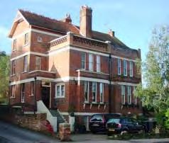
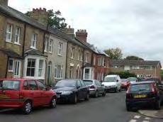
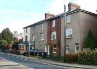
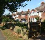
– PEMBURY ROAD EAST
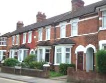
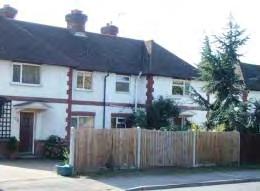
The eastern section of Pembury Road is more mixed in character. Rows of two storey terraced Victorian cottages are interspersed with larger scale three storey Victorian villas and twentieth century development.
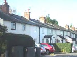
Substantial Victorian three storey villas retain many original features and are set back from the road behind deep frontages some of which are used as parking areas.
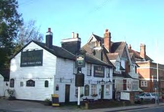
East of Lavender Hill, a row of Victorian weatherboarded and painted cottages on the south side in light pastel shades is visually linked with the Primrose Public House, forming an attractive group that enlivens the townscape with traditional Kent materials and pastel colours in contrast to the predominant red brick along this route.
The two storey public house with slate roof is a local landmark as a result of its distinctive white weatherboarding, use and signage
20 A1.2
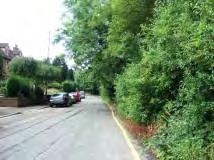
Beyond the Primrose Inn several villas are set in large plots. From this point eastwards, the buildings on the south side are hidden from view behind a verdant frontage of trees and hedges. These trees are a prominent landscape feature, enclosing the view from the west and forming a visual edge to the town.
On the north side, rows of Victorian terraced cottages sit close to the road on narrow plots. There are long views westwards over the Sevenoaks Ridge. Porch extensions, satellite dishes, replacement doors/ windows and bins detract from the historic character of the cottages.
LOCALLY DISTINCTIVE CONTEXTUAL FEATURES
Age of buildings 1800s - present
Type of buildings
Main uses
Building Heights
Prominent building materials
Detached, semi detached and terraced.
Mainly residential with public house and some other commercial use.
2-3 storeys
Red brick, slate, clay and concrete tile roofs, white wood, white sash windows, painted render, clay hung tiles.
Predominant boundary treatments
Hedges, brick walls, open plan and wooden fences.
Open Spaces None
21
Locally Distinctive Positive Features
• Views of St Stephen’s Church spire to the west
• Wide straight road with larger scale buildings.
• Individually designed buildings of interest set on an irregular building line.
• Retention of traditional building materials and architectural details on older properties that contribute to the elegant historical character.
• Important historic group of weather boarded cottages close to the landmark building of the Primrose public house.
• Landscaped front gardens and retention of traditional front boundaries.
Negative Features Worthy of Enhancement
• Traffic noise.
• Cluttered townscape due to on-street parking, satellite dishes, bins, parking on forecourts and some loss of front boundaries.
22


0150300 306090120 Metres¯ A1.2 Tonbridge Character Area AppraisalRef Title Pembury Road (East)
A1.3 – GOLDSMID ROAD
In common with Pembury Road, Goldsmid Road is relatively wide and straight and has a number of Victorian villas and more recent development set along a regular building line behind landscaped gardens enclosed by walls, hedges and wooden fences.
The age of the buildings is mixed with Victorian and 1930s houses interspersed with more recent infill development.
24
Goldsmid Road provides long views northwards over Tonbridge towards the Sevenoaks Ridge.
LOCALLY DISTINCTIVE CONTEXTUAL FEATURES
Age of buildings 1800 - present
Type of buildings
Detached and semi detached
Main uses Residential
Building Heights 2-3 storeys
Prominent building materials
Red and red/brown brick, red clay and brown concrete tile roofs, white painted wood, painted render, hung tiles.
Predominant boundary treatments
Hedges, brick walls and wooden fences.
Open Spaces None
Locally Distinctive Positive Features
• Long views to the north over the industrial area to the Sevenoaks Ridge.
• Houses set back along an even building line behind enclosed landscaped front gardens.
• Harmonious use of scale and materials in houses of different ages and styles.
Negative Features Worthy of Enhancement
• No significant detractors
25
0100200 20406080 Metres¯ A1.3 Tonbridge Character Area AppraisalRef Title Goldsmid Road
A2 – QUARRY HILL ROAD
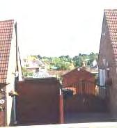
Much of Quarry Hill Road lies within the Conservation Area. However the southern section, which follows the eastern side of the road, lies outside it. At the edge of the built up area, the housing follows the route of the old road over Quarry Hill which now forms a cul-de-sac. The frontage is almost entirely residential but the buildings are very mixed in age and character.

Quarry Hill Road slopes down sharply northwards with panoramic views over the Tonbridge Conservation Area towards the Sevenoaks Ridge. The frontage on the northern section faces the current road, but the southern section follows the route of the old road.
Southern end is screened from the main road by a tall band of mature trees. Individually designed detached and semi-detached houses of various ages are set within relatively wide plots.
Mixed ages and designs with no common building line and varied roofline.
27
Listed Buildings
114 – 115 Quarry Hill Road
Semi-detached pair of late 18th century 3 storey white stuccoed houses with intact glazing bars and hipped slate roof.
Grade II
LOCALLY DISTINCTIVE CONTEXTUAL FEATURES
Age of buildings
1700 - Present
Type of buildings Terraced, semi detached and detached
Main uses Residential
Building Heights 2 – 3 storeys
Prominent building materials
Predominant boundary treatments
Red and brown brick, painted stucco, slate, clay and concrete roof tiles
Low brick walls, hedges and wooden panel fences
Open Spaces Southern section overlooking tree screen.
Locally distinctive positive features
• Panoramic views of Conservation Areas including Tonbridge School, St Stephens and Church of St Peter and St Paul and Tonbridge Castle.
• Tree screen at the entrance to the town.
• Listed 18th century building.
Negative Features Worthy of Enhancement
• Traffic noise
• Poor surfacing and street furniture clutter
28


0100200 20406080 Metres¯ A2 Tonbridge Character Area AppraisalRef Title Quarry Hill Road
A3 – LONDON ROAD
London Road connects Tonbridge to Hildenborough and beyond to Sevenoaks.
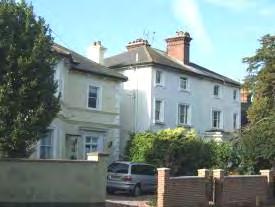
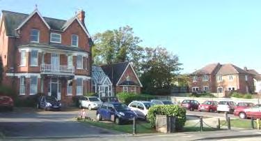
A3.1 – LONDON ROAD FRONTAGE AND COURTLANDS
Comprising: London Road and Courtlands

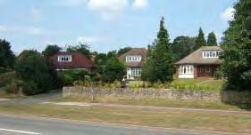
Stretching along both sides of London Road this character area is dominated by the wide, busy road but has a very verdant character. The widely spaced buildings are of mixed age and use and form a series of landmarks giving the area a strong identity. The area also incorporates some higher density 1970s semi detached properties and three bungalows in spacious plots, but these do not impact on the primarily Victorian character.
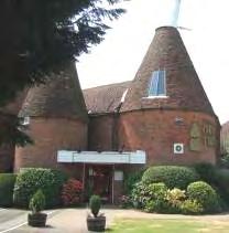
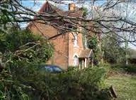
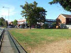
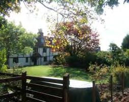
A series of substantial historic buildings set within wide, landscaped plots form a series of landmarks and give the area a strong identity and unique character. Hilden Manor and Manor Cottages are listed buildings. Their historic character and mass make them a local landmark. The Oast Theatre, Langley Hotel and several large Victorian villas also have a strong visual impact. The historic significance and use of the oast distinguish the building as a local landmark
A small gap of open land separates the character area from Tonbridge giving a pronounced urban/rural edge at the eastern end of the character area. The frontage onto the road is heavily vegetated with trees, hedges and verges There are long views north westwards towards the Sevenoaks Ridge.
30
Listed Buildings
Nos 1 and 2 Manor Cottages
Two storey timber framed cottages with tiled half-hipped roof and hipped dormer.
Grade II
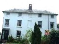
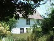
Hilden Manor
Single storey 17th century or earlier building with attic, frontfacing gables, hipped dormer windows, tiled roof and three tall chimney stacks (rebuilt following fire damage)
Grade II
LOCALLY DISTINCTIVE CONTEXTUAL FEATURES
Age of buildings 1600s– 1970s
Type of buildings
Main uses
Detached and semi detached.
Mixed including hotel, restaurant, theatre, residential.
Building Heights 1 – 3 storeys
Prominent building materials
Red and yellow brick, painted render, red roof tiles.
Predominant boundary treatments High hedges
Open Spaces
Wide grassed and treed verges.
31
Locally distinctive positive features
• Heavily landscaped frontage with trees and high hedges with arcadian character rising on the northern side
• Substantial properties set back from the road give a spacious character suitable for the importance of the road
• Listed buildings
• Interesting generally steeply pitched roofscape enhanced by the oast roundels on the Oast Theatre
• Series of local landmark buildings enhance sense of history and place
• Long views of open countryside
• Predominance of traditional building materials
Negative features worthy of enhancement
• Erosion of the road verge by Farm Lane private garden encroachment.
32


2 0150300 306090120 Metres¯ A3.1 Tonbridge Character Area AppraisalRef Title London Road Frontage and Courtlands
A4 – SHIPBOURNE ROAD AREA FRONTAGE
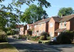
Shipbourne Road stretches north from the town centre. The Character Area changes significantly from tight-knit, principally Victorian, terraced housing to a much more verdant character where the road widens with treed verges and the houses are detached.
A4.1 – SHIPBOURNE ROAD (SOUTH) AREA
Comprising: Dernier Road, Rowan Mews, Shipbourne Road (south), Uridge Crescent, Uridge Road and Welland Road (east).
The southern section of Shipbourne Road has a predominantly Victorian character but there has been some considerable infill development and redevelopment. Mature trees visible behind the houses soften the townscape but the area is dominated by the Shipbourne Road.
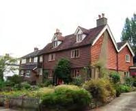
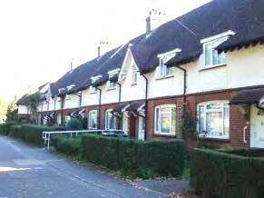
Dernier Road is a straight narrow road running parallel to the Shipbourne Road. It has retained its intimate Victorian character and is lined on both sides by two storey flat fronted red brick terraced cottages with sash windows and small enclosed front gardens. The even building line and roofplane contribute to the strong distinctive character of the street. The road dips away sharply at the northern end giving long views of trees. Rowan Mews, a small-scale, recent gated development is tucked discretely behind the cottages.
Uridge Road has some attractive red brick Victorian villas on the north side and yellow brick terraced cottages on the south but the historic character of the street is almost lost due to infill development, traffic noise from the Shipbourne Road, pavement parking and loss of front boundaries.
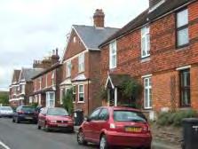
34
Uridge Crescent is narrow, winding and intimate. The red brick two storey Victorian cottages have slate roofs and single storey canted bay windows. More recent infill development respects the colour palette and intimate scale but does not observe the building line, roofline or detail. There are short views of the leafy cemetery to the north. Pavement parking, overhead wires and roadside bins are detracting elements as is the parking area at the junction with Welland Road.
The Shipbourne Road between Uridge Road and Welland Road is wide. A garage forecourt and other parking areas create large gaps in the frontage on the west side and the street furniture is poorly coordinated. A wall with hedge above encloses the street on the east side. North of Welland Road, Shipbourne Road narrows and is again tightly enclosed on both sides by Victorian terraced housing set close to the road behind narrow front gardens bordered by brick walls.
On low ground at the northern end of Dernier Road, there is a modest green area surrounded on three sides by 1960s 3 storey town houses with open frontages on small plots. Mature trees are visible between the buildings at the north eastern corner.
35
LOCALLY DISTINCTIVE CONTEXTUAL FEATURES
Age of buildings 1800 - present
Type of buildings
Main uses
Detached, semi detached and terraced.
Mixed use – residential, public house, commercial.
Building Heights 2 storeys
Prominent building materials
Orange/red, red and black brick with brown brick on more recent properties, white painted sash windows, slate and concrete tiled roofs, plain brick chimneys.
Predominant boundary treatment Brick walls, wooden panels and picket fences.
Open Space
Views of the Cemetery, grassed area at north end of Dernier Road
Locally Distinctive Positive Features
• Some attractive Victorian cottages and villas and retention of original features.
• Orange/red, red brick, slate roofs and white painted sash windows on older buildings.
• Regular building line and roofplane in Dernier Road.
• Intimate scale of Uridge Crescent and Dernier Road.
• Mature trees both within and outside the character area which soften the townscape. Views of the cemetery.
Negative Features Worthy of Enhancement
• Unsightly gaps in the frontage on the western side of Shipbourne Road created by parking areas and forecourts.
• Street furniture clutter.
• Pavement parking in Uridge Road, Uridge Crescent and on parts of Shipbourne Road.
36


0100200 20406080 Metres¯ A4.1 Tonbridge Character Area AppraisalRef Title Shipbourne Road (South) Area
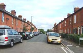
A4.2 – SHIPBOURNE ROAD (CENTRAL) AREA
Comprising: Arnolds Court, Cage Green Road (west), Forest Grove, Peach Hall, Shelton Close, Shipbourne Road from south of Shelton Close to north of White Cottage Road, The Chase, Trench Road (south) and White Cottage Road (west).
A gently curving flat section of the Shipbourne Road lined on both sides primarily by 1930s houses and some more recent development.
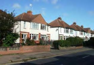
A short row of 1930s semi-detached houses on the western side with white painted upper storeys, two storey bays, wide windows and hipped tiled roofs have a pleasant rhythm and uniformity. They are set back from the road behind landscaped gardens, low walls and hedges.
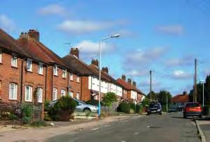
On the east side of the road a row of 1920s former Tonbridge Urban District Council cottage-style semidetached and terraced houses is set along a service road behind a wide grassed strip with trees, which partially screens them from the busy road. Short rows of flat fronted terraces are interspersed with bay fronted semi-detached houses. The consistent roof line, evenly spaced gables, chimneys and porch canopies, wide gently curved window openings and neatly clipped hedges give the cottages a charming rhythm and symmetry.
Approaching the Ridgeway Roundabout from the south, Shipbourne Road is enclosed on both sides by trees and hedges and has a very verdant aspect which contrasts strongly with the urban Victorian character of the road further south. On the west side some older cottages with red hanging tiles and dormers enhance the character of the area. The listed Cage Green Farm House is screened from the road by tall trees.
38
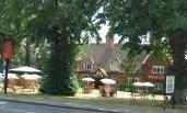
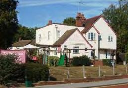
The Shipbourne/Ridgeway roundabout is cluttered with street furniture. It is enhanced by tall trees which frame the roads and the Pinnacles Public House which, as a result of it’s location, mass, use and signage is a local landmark.

North of the roundabout former TUDC cottages line the eastern side behind a wide band of grass and trees. The western side has a more mixed character with some recent development.
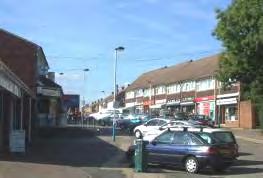
North of Cage Green Road the Shipbourne Road widens and has a much more open aspect being lined by bungalows on the east side. There are long views northwards of the Sevenoaks Ridge. The area to the west of the road comprises the 1930s/1950s cottage style housing of the Trench Estate. Around the junction of Trench Road there are a few community buildings including a medical practice and the Six in One Social Centre. There are a few shops in Northwood Road.
Forest Grove is a small peaceful enclave of semi detached two storey 1930s brick houses, with painted upper storeys in pastel shades, and brown tiled, half hipped or gabled roofs, small chimneys and porch canopies on wood brackets. The uniformity of scale and materials contributes to the distinct character. Arranged around a small landscaped area, Forest Grove is inward looking with no long views. The small front gardens are enclosed by black railings or hedges but many have been lost to provide off-street parking.
The Chase has an elevated position and slopes down westwards giving long views. The uniformity of the building line, roofline and fenestration gives a distinct identity to the street. The hedges, fences and walls enclosing the front gardens contribute to the informal cottage character. However the character is marred by loss of front boundaries and poor quality surfacing.
39
Listed Buildings
Cage Green Farm House,198 Shipbourne Road
Fine timber-framed 16th or 17th century two storey house with white painted brick ground floor, weather-boarding above and mansard slate roof.
Grade II
Nos 313-315 Shipbourne Road
Early 19th century pair of cottages of red brick in Flemish bond with grey headers, tiled roof with central chimney, gabled to front and side with ornate wooden bargeboard and arched 12 pane windows.
Grade II
LOCALLY DISTINCTIVE CONTEXTUAL FEATURES
Age of buildings
Type of buildings
Main uses
Building Heights
Prominent building materials
1930s with older cottages from 1600 and early 19th century with some more recent development.
Detached, semi detached and short terraces.
Residential and community facilities.
2 storeys
Red and brown brick, painted upper storeys, hung tiles, red clay and brown roof tiles, white painted casement windows, porch canopies with white wood brackets.
Predominant boundary treatments
Open Spaces
Clipped and informal hedges, low brick walls with hedges above.
Wide treed verges and amenity areas, small grassy spaces at junctions.
40
Locally Distinctive Positive Features
• The long line of former TUDC cottages on the east side of the road, set behind a treed grassed frontage enclose the road and are a distinctive feature of this part of Tonbridge.
• Listed buildings and old cottages.
• The verdant tree-lined frontage, particularly south of the Ridgeway roundabout.
• Grassed open spaces fronting the Shipbourne Road and within the Trench Estate.
• The semi-detached houses on the Trench Estate have a uniformity which gives the area a strong identity.
• Long views to the north and west of open countryside.
• Similarity of design, roofline and central chimneys of the semi-detached 1930s houses at the southern end of this section provide rhythm in the streetscene and give unity to the 1930s housing at the southern end of this section.
Negative Features Worthy of Enhancement
• Some poor quality surfacing and street furniture including railings at the Ridgeway roundabout
• Poorly maintained and lit fenced footpath linking Arnolds Court and The Chase.
41


0250500 50100150200 Metres¯ A4.2 Tonbridge Character Area AppraisalRef Title Shipbourne Road (Central) Area
A4.3 – SHIPBOURNE ROAD (NORTH)
Comprising: Shipbourne Road, Bishops Oak Ride (east), Hazel Shaw and Rowan Shaw.

This wide section of road slopes gently down northwards.
The northern section of the Shipbourne Road is wide and open south of the Bishops Oak Public House, lined by bungalows and two storey detached houses set back from the road. North of this point the road is enclosed by mature trees which mask the housing behind.
In Rowan Shaw and Hazel Shaw the two storey detached houses are sited on service roads running parallel to the Shipbourne Road and separated from it by grass and mature trees, creating a verdant residential character despite the traffic noise.
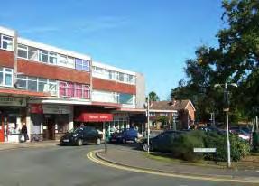
A three storey flat roofed shopping parade with flats above and open space flank the entrance to Bishops Oak Ride. The parade has a range of convenience shops and forms a node of activity in the area but its form (flat roofed) and fenestration (continuous horizontal glazing on upper floors) does not reflect the surrounding development. The parking area and street furniture could be further enhanced.
43
LOCALLY DISTINCTIVE CONTEXTUAL FEATURES
Age of buildings
Type of buildings
Main uses
Building Heights
Prominent building materials
Predominant boundary treatments
Mainly 1960s - present
Detached, shopping parade with apartments above
Residential, public house, shopping parade
2-3 storeys
Brown, buff, grey and yellow brick, brown roof tiles, brown and red hung tiles.
Open plan, low brick walls with or without hedges above, wooden fences.
Open Spaces Wide grassy strips with tall trees separating housing from the road. Small amenity area at Bishops Oak Drive.
Locally Distinctive Positive Features
• Verdant frontage of mature trees acting as a transition from town to country.
Negative Features Worthy of Enhancement
• Appearance, paving and street furniture of the York Parade shopping area.
44

0150300 306090120 Metres¯ A4.3 Tonbridge Character Area AppraisalRef Title Shipbourne Road (North)
A5 – HADLOW ROAD
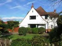
The curving, undulating road travels eastwards from the Tonbridge Conservation Area in the direction of Maidstone. It is a busy wide road being the main access route to Tonbridge from the east. The western end comprises mainly 19th century and early 20th century properties with some more recent infill and backland development. Residential expansion eastwards was facilitated by the construction of Cornwallis Avenue in 1930 which bypasses a section of the Old Hadlow Road. The character area is split into three distinct sub-sections.
A5.1 – HADLOW ROAD (WEST)
At the western end (south side) the street has a distinctively Victorian character with two or three storey terraced houses and two storey semi-detached or detached villas in narrow plots. The northern side of the road and both sides east of Mill Stream Place, are characterised by 1920s and 1930s detached houses set in wider plots. These older buildings are interspersed with more recent infill development and redevelopment.

The Victorian properties are constructed of red brick with slate or tiled steep gabled or shallower hipped roofs. On the southern side, a row of semi-detached, late Victorian 3 storey townhouses with two storey bays and prominent gable ends are set behind shallow paved frontages. The tight knit form, narrow plots and less verdant frontages contrast with the more spacious development along the remainder of the road. Some alterations and loss of front boundaries to create off road parking detracts from the historic character. Traffic flows are heavy and the street scene is dominated by traffic lights, signage and other street furniture. There is some poor pavement surfacing.
46
The Victorian development is interspersed with more recent development designed to respect the scale, rooflines and materials of the older properties.
The houses in Yardley Close have distinctive half-timber and herringbone brick detailing. To the rear, more recent housing is plainer in style.
47
Red brick or white painted 1920s and 1930s detached and semi detached houses are set behind landscaped front gardens with a variety of boundary treatments including hedges, wooden fences and brick or stone walls.
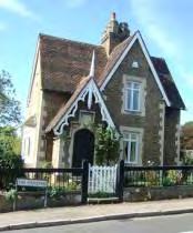
Monk's Cottage is a charming individual property with traditional detailing and forms a local landmark.
LOCALLY DISTINCTIVE CONTEXTUAL FEATURES
Age of buildings 19th Century – 1970s
Type of buildings Semi detached and detached.
Main uses Residential
Building Heights
Prominent building materials
1-3 storeys
Red brick, white painted render, half timbering, hanging tiles, plain and pantile brown and red roof tiles.
Predominant boundary treatments Brick and stone walls, hedges, railings and wooden panel fences with some open frontages.
Open Spaces None
Locally distinctive positive features
• 19th century buildings including 3 storey houses hinting at the historical importance of the route.
• Monk’s Cottage is a local landmark.
Negative Features Worthy of Enhancement
• Traffic noise and street clutter.
• Loss of front gardens and boundaries.
48


77 0150300 306090120 Metres¯ A5.1 Tonbridge Character Area AppraisalRef Title Hadlow Road West
AVENUE
Comprising: Cornwallis Avenue and Hadlow Road (central section)
Cornwallis Avenue is a gently undulating, curving section of road built in the 1930s to bypass a tortuous section of the Old Hadlow Road. It is lined on the north side by substantial mainly 1930s individually designed detached and semi detached houses in spacious plots. The south side comprises open countryside, smaller scale chalet bungalows and mainly detached houses.
Cornwallis Avenue is lined with trees planted in 1930 by the Cornwallis family. The section of road to the east of Higham Lane is particularly verdant and spacious. The tree belt along the stream and footpath to the east of Rodney Avenue is a prominent feature
50 A5.2 – CORNWALLIS
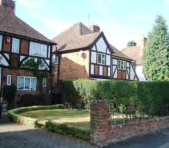
The two storey detached and semi-detached 1930s houses set back in an elevated position on the north side of the main road encompass a variety of styles typical of the period including mock tudor with half timbering, hung tiles and tall narrow chimneys, and brick or white painted bay fronted properties with hanging tiles, hipped roofs and suntrap windows.
The section of Hadlow Road between The Ridgeway and Higham Lane comprises some substantial detached 1930s houses on the north side and a row of 1970s houses. The latter are set behind a service road and treed frontage and do not detract from the spacious 1930s character of the area. The south side of this section of Hadlow Road is undeveloped apart from a farm and quarry entrance. The open countryside is obscured by a high hedge which is a strong linear feature enclosing the road.
LOCALLY DISTINCTIVE CONTEXTUAL FEATURES
Age of buildings
1920s – present day
Type of buildings Semi detached and detached.
Main uses Residential
Building Heights
Prominent building materials
1 – 2 storeys
Red/brown brick, white painted render, red and brown roof tiles, white painted windows, half timbering.
Predominant boundary treatments
Hedges, low brick and stone walls and wooden panel fences.
Open Spaces Wide treed verges. Grassed triangles with trees at either end of Old Hadlow Road.
Locally distinctive positive features
• Verdant frontages with houses set back behind an avenue of trees, hedges and mature landscaped gardens. Hedgerow on south side is a strong linear feature.
• Spacious, curving, gently undulating road creates changing vistas.
• Substantial individually designed 1930s houses in large plots with many original design details and materials in elevated position on north side of Hadlow Road.
Negative Features Worthy of Enhancement
• Traffic noise
51


0250500 50100150200 Metres¯ A5.2 Tonbridge Character Area AppraisalRef Title Cornwallis Avenue
A5.3 – HADLOW ROAD (EAST)
Comprising: Barclay Avenue and Hadlow Road (east)
To the east of the junction with Estridge Way, only the north side of Hadlow Road is developed. The south side is lined with high hedges and trees with open countryside beyond landscaped front gardens providing a verdant gateway to the town. Sections of the road are tree-lined. The silver birches are a visually attractive feature. The area comprises principally 1930s and 1970s semi detached and detached two storey houses, as well as bungalows, set back from the road behind landscaped front gardens and along two stretches, service roads set behind grass strips with trees. Hadlow Road is wide and straight with a slight bend at the centre.
At the western end of this sub-area, there is a strong 1930s character. Barclay Avenue comprises a row of white painted semi detached 2 storey properties with brown tiled hipped roofs, central chimneys, curved two storey tile hung bays and wide fenestration. The uniformity of design and materials creates a strong sense of identity. To the east of Cranford Road there is a short section of 1930s bungalows which continue the theme with white painted render, red brick details and red/brown tiled hipped roofs.
53
There has been some more recent infill and backland development which being set back from the road behind landscaped frontages and respecting the building line, blends into the streetscene.
LOCALLY DISTINCTIVE CONTEXTUAL FEATURES
Age of buildings
1920s – present day
Type of buildings Semi detached, detached and attached
Main uses Residential
Building Heights
Prominent building materials
Predominant boundary treatments
Open Spaces
1 – 2.5 storeys
Red/brown brick, white painted render, red and brown roof tiles, white painted windows.
Hedges, low brick and stone walls and wooden panel fences.
Wide treed verges and glimpses of open countryside to the south.
Locally distinctive positive features
• Verdant frontage with tall trees and hedges, providing transition from country to town. Hedgerow on south side is a strong linear feature.
• Consistency of design and colour palette of 1930s houses at the western end of the sub-area.
• Consistent building line with houses set back from the roadside behind gardens and, in places, service roads, allowing the soft landscaping to dominate.
• Glimpses of open countryside to south from ground level.
Negative Features Worthy of Enhancement
• Traffic noise
54
0150300 306090120 Metres¯ A5.3 Tonbridge Character Area AppraisalRef Title Hadlow Road (East)
A6 – HIGHAM LANE AREA
Comprising: Higham Gardens, Higham Lane, Hunt Road (east), Martin Hardie Way (east) and Tilebarn Corner.
Higham Lane principally serves the residential areas of north east Tonbridge. It was originally a small lane accessing a farm but was widened in the 1950s as new housing development spread over former farmland and orchards. It has retained some of its lane qualities being relatively narrow and winding with substantial trees and hedges. The majority of the buildings date from post 1930 and there are no buildings over 2 storeys high. However, the style, age and materials of the buildings are varied.
South of Martin Hardie Way, the lane is less enclosed and is less verdant than further north. There are views eastwards at junctions and between houses and trees and the roofscape of the bungalows of the Greentrees estate.
56
The White House is an imposing 1930s property with an eye catching green roof situated in a prominent position.
There are no listed buildings in this character area, but a 16th century half timbered farm cottage (with later additions) provides a link with the past.
The small parades of shops at the entrance of Martin Hardie Way, the Red House Public House and church form a functional, but visually unremarkable, community hub. The Red House is in a prominent position on a curve in the road.
57
LOCALLY DISTINCTIVE CONTEXTUAL FEATURES
Age of buildings 1500 - present
Type of buildings
Main uses
Building Heights
Prominent building materials
Detached, semi detached and terraced.
Mainly residential with community hub including shops, public house and church.
1 – 2 storeys
Very varied. Red, buff and brown bricks, red, brown and green plain and pantiled roofs, white/pastel painted render, concrete, half-timber, shaped and plain hanging tiles.
Predominant boundary treatments
Open Spaces
Hedges, brick and stone walls, open plan and wooden fences.
Wide grassed and treed verges on northern section.
Locally distinctive positive features
• Heavily landscaped frontage and substantial properties set back from the road in mature landscape give a spacious verdant character at the northern end.
• The winding road and undulating topography recall the historic character of the lane and provide changing vistas, but few long views.
• Individual buildings of interest, including the White House and 16th century farm cottage, provide a link with the past.
• Open aspect of the central section with views east across the rooftops.
• The recreation open space and Woodland Walk add landscape and amenity value to the character area.
Negative features worthy of enhancement
• Street furniture clutter at Martin Hardie Way.
58


0250500 50100150200 Metres¯ A6 Tonbridge Character Area AppraisalRef Title Higham Lane Area
Medieval and Georgian Tonbridge lay almost exclusively north of the Medway and it was only with the arrival of the railway in the mid nineteenth century that new housing extended south of the river. Cottages were built for the railway workers on the low lying land immediately south of the railway line around Priory Road and Douglas Road and just to the north off Barden Road. Further terraced cottages were built to the east of Quarry Hill Road. This land was prone to flooding prior to the installation of the flood barrier, so the larger Victorian villas tended to be built on higher land beyond the flood plain. There is also a cluster of Victorian cottages on the Shipbourne Road.
Although some Victorian properties were demolished in the 20th century, quite extensive areas still remain and despite some infill and redevelopment, the original character, scale and sense of enclosure of these narrow streets has been retained. The terraced or semi detached two storey houses are set in narrow plots fronting directly onto the road or set behind shallow front gardens and low brick walls. Often the cottages in a particular street will be of a uniform design giving each street an individual character.
The narrow, straight streets are arranged in a grid pattern with constant building lines giving a tight knit character with few public open spaces, although street trees provide a contrast to the urban character in some streets.
The buildings are constructed in red brick and (originally) slate roofs with flat fronts or single storey canted bay windows. Arched brickwork or stone lintels span window and door opening. Some properties have simple decorative features including name and date plaques, string courses of contrasting brick and ridge tiles. In semi detached properties the doors are usually placed in pairs centrally or in the side elevations. In terraced houses the front doors and rear extensions are paired together. The unified, simple roof lines fronting the street generally slope
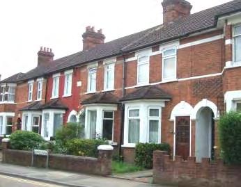
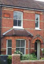
60 B - NINETEENTH CENTURY COTTAGES
Barden Road
Chichester Road
down towards the road and are tiled with clay, concrete or slate tiles. Plain chimneys are centrally placed on the roof ridge. The repetition of details along a constant building line gives the streets a strong rhythm.
The overall effect is a distinct character with blocks of uniform front elevations creating a strong sense of identity. Although the original sash windows, panelled front doors and roof tiles or slates have been replaced on many properties, intrusive extensions and dormer windows visible from the public realm have generally been kept to a minimum. Since these Victorian streets are narrow and the properties are set close to the road and each other, there is little off street parking space. As a result the historic character and the pedestrian environment is frequently affected by on-street/pavement parking and wheelie bins.
LOCALLY DISTINCTIVE CONTEXTUAL FEATURES
Age of buildings
1850s to early 20th century.
Type of buildings Semi-detached and terraced.
Main uses Residential
Building Heights
Prominent building materials
Predominant boundary treatments
Open Spaces
2 storey, with some 3 storey.
Red brick, slate or brown roof tiles, white painted sash windows.
Red brick walls and railings.
Tight knit development with few open spaces.
Locally Distinctive Positive Features
• Straight streets, narrow plots and similarities in building age, height, materials and design give strong cohesive character and intimate scale
• Repeated designs give an individual identity to each street
• Constant roof line and regular chimneys
• Many decorative features retained and little infill or re-development
• Original brick boundaries and narrow front gardens retained on many properties
• Street trees help to soften the predominant red brick
61
Negative Features Worthy of Enhancement
• No significant detractors but unsympathetic replacement windows, doors and porches and the loss of original decorative features have disrupted the uniform design of buildings and the historic character, rhythm and/or symmetry of some streets.
• Loss of front boundaries to create frontage parking has harmed some streets.
62
B1- DOUGLAS ROAD/BARDEN ROAD AREA
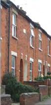
Comprising: Albert Road, Barden Road, Caistor Road, Chichester Road, Cromer Street, Douglas Road, Gladstone Road, Lawn Road, Lionel Road, Mabledon Road, Meadow Road, Newton Avenue, Northcote Road, Preston Road, Sussex Road, Waterloo Road, Wincliff Road
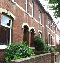
A mainly residential area set along short, straight streets off Douglas Road and Barden Road. Most of the houses are mid Victorian with some Edwardian and later. The buildings at the eastern end of Douglas Road date from the 1920s.
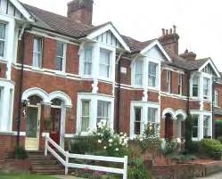
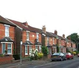
Along Barden Road and Douglas Road there is greater variety in the design, height and use of buildings than in the side roads. A few original Victorian corner shop buildings retain their traditional features.
The Nelson Arms Public House, a well preserved Victorian building with many original features, imposes itself as a distinct building through its mass, use and location at the junction of residential streets and is a local landmark.
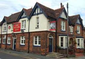
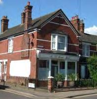
63
Repeated designs within a consistent roof and building line give the individual streets a unified character and rhythm.
To the north side of Barden Road lie the river moorings where a number of long boat cruisers and smaller boats are moored. A belt of trees and hedgerow runs along Barden Road partially screening the moorings, allowing glimpses through to the river and recreation ground beyond. These trees have particular townscape value in an otherwise tightly developed area.
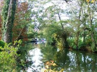
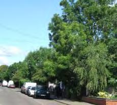
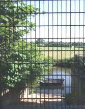
Viewed from the north, the colourful boats on this attractive stretch of river and the tract of land to the rear adjoining Barden Road with its collection of low sheds and boathouses, forms an area of special character unique in Tonbridge which enhances the character and historical interest of the adjoining public open spaceand footpaths. It provides a link with early 20th century boat building. The low buildings are framed by ornamental trees.
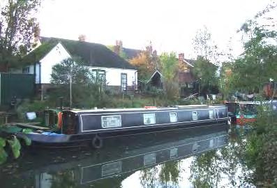
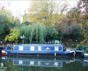
64
At the eastern end of Douglas Road, 1920s semidetached properties are of a similar scale to the earlier houses but of a different style with flat roofed single storey bays and rendered upper storeys. The repeated designs give rhythm and unity to the street.
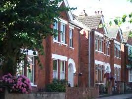
Meadow Road and Lionel Road comprise larger villas with two storey bays and decorated gable ends hung with decorative tiles.
Locally Distinctive Positive Features
• View of St Stephen’s spire from Preston Road.
• Street trees
• Bands of trees along the river, railway and Judd school boundary which provide a verdant landscape framework and define the edge of the character area.
• The tract of land north of Barden Road comprising the river boat moorings which forms an area of special character of landscape, historical and amenity value visible and accessible from the character area and more particularly the adjoining recreation ground and public footpaths.
• Retention of Victorian corner shops.
• The Nelson Arms Public House local landmark building.
• The side streets have a quiet residential character despite their proximity to the town centre and railway.
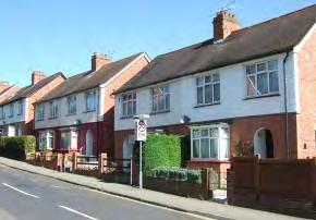
Negative Features Worthy of Enhancement
• Some loss of front boundaries.
65


0150300 306090120 Metres¯ B1 Tonbridge Character Area AppraisalRef Title Douglas Road / Barden Road Area
B2 - PRIORY ROAD AREA
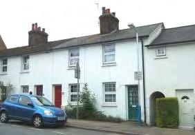
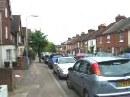
Comprising: Bishops Mews, Hectorage Road (west), Lavender Hill, The Lowry, Pembury Grove, Priory Grove, Priory Road, Priory Street, Priory Walk, Rose Street, St Eanswythes Court and St Stephens Street.
The area between Priory Road and Pembury Road was developed after Priory Farm and Tile House Farm were sold off in plots to a number of builders in the mid 19th century. Now, a series of narrow quite steeply sloping streets run up southwards from Priory Road to Pembury Road. The streets themselves are relatively quiet but there is some traffic noise from Pembury Road and the railway. The area is primarily residential but other uses are evident including a public house and small businesses with some evidence of the area’s past industrial heritage. There has been some redevelopment and infill development with modern mews and apartments built on the long rear gardens and between the older properties. However, the tight knit Victorian character and street layout has for the most part been retained.
Hectorage Road differs from the other Victorian streets in that it is curved and relatively wide with the western end being late nineteenth/early twentieth century and the eastern end primarily 1930s. The semidetached houses with single storey canted bays and arched porches have a pleasing regularity of design and scale and an even roof and building line. Many front boundaries have been lost to provide off-street parking.
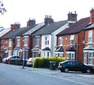
67
Locally Distinctive Positive Features
• Decorative brick details including bands of yellow brick and Flemish bond.
• Uninterrupted frontages with uniform scale and even roof and building lines.
• Some retention of original boundary treatments
• Historical references including name plaques and painted signs.
• Views of Tonbridge Castle from Priory Street and St Stephen’s Church spire from Hectorage Road.
Negative Features Worthy of Enhancement
• No significant detractors but replacement doors and windows, on street parking, some loss of front boundaries, wheelie bins, satellite dishes and telephone wires erode the historic character.
• Through traffic and on-street parking impact on the character of these narrow streets.
• Poor surfacing
68


0250500 50100150200 Metres¯ B2 Tonbridge Character Area AppraisalRef Title Priory Road Area
B3 - ST MARY’S ROAD AREA
Comprising: Baltic Road (west), St Mary’s Road (south), Woodlands Road, Woodside Road
These steeply sloping streets run parallel to Quarry Hill. They occupy a more elevated position than the other cottage areas in South Tonbridge and benefit from long views northwards across Tonbridge towards the Sevenoaks Ridge. This area is therefore less inward looking and enclosed than the others. The character is also more mixed.
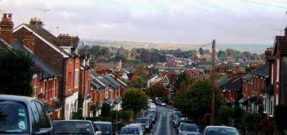
St Mary’s Road is long, extending up the hill from Pembury Road to Baltic Road and comprises a variety of terraced houses and larger semi-detached villas. There has been more recent development at the southern end and in the vicinity of Springwell Road. The northern end of the road is enclosed on both sides by buildings set close to the road behind narrow front gardens fronted by brick walls and hedges. Some properties retain original features including canted and square single storey bay windows with leaded roofs, sash windows, stone lintels, plain brick chimneys and slate roofs.
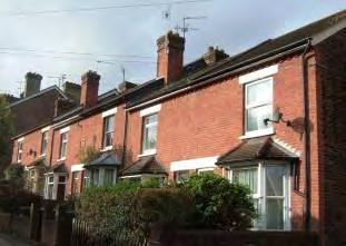
70
There are panoramic views northwards across Tonbridge Conservation Area towards the Sevenoaks Ridge.
The southern section of St. Mary’s Road is more mixed in character with Victorian villas on the east side and more recent development on the west which is set back from the road on an uneven building line behind open frontages and parking areas which has resulted in a loss of enclosure.
Baltic Road (west) is gently undulating and comprises a traditional shop front and semidetached 2 - 3 storey villas, some with castellated roofline and pebble dash upper storeys.
Woodlands Road has a quiet enclosed character, the vistas to the north and south being closed by buildings. The 19th and early 20th century houses in various designs with hipped or gabled roofs sit close to the road behind narrow frontages, the roofline stepping up the hill. Parked cars affect the historic character.
71
Woodside Road was built in 1911 and the terraced yellow or red brick cottages built close to the road on an even building line give a strong sense of enclosure. There are long views northwards over the Tonbridge Conservation Area and the Sevenoaks Ridge. The even roof line is punctuated by gable ends facing the street. Occasional arches lead through the buildings to give access to the rear. Some original features have been retained but replacement windows and doors, satellite dishes, bins and on street parking detract from the historic character. Infill development has respected the scale but not the building line of the older properties. The northern and southern links to Quarry Hill have a more mixed character, incorporating modern town houses. The old barn at the southern end of the street is an interesting feature.
Locally Distinctive Positive Features
• Long views across Tonbridge Conservation Area towards the Sevenoaks Ridge from St Mary’s Road, Baltic Road and Woodside Road.
• Enclosed intimate character of parts of St Mary’s Road, Woodlands Road and Woodside Road. Consistent building line, scale and uninterrupted frontage.
• Retention of original features on some properties including slate tiles, brick and stone sills and lintels, sash windows, half timbered gable ends and brick boundary walls.

• Quiet residential character of Woodside Road.
• Street trees in St Mary’s Road soften the brick architecture.
Negative Features Worthy of Enhancement
• On-street parking, overhead wires, satellite dishes and wheelie bins.
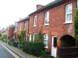
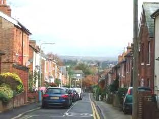
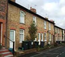
• Some of the 20th century development does not respect the materials or building line of this principally 19th Century area.
• View of telecom tower from St Mary’s Road.
72


0100200 20406080 Metres¯ B3 Tonbridge Character Area AppraisalRef Title St. Mary's Road Area
Weald View Road
The housing stock in Tonbridge increased rapidly between 1881 and 1911. The biggest area of expansion outside the designated Conservation Areas was between the Pembury Road and Quarry Hill Road on the Quarry Hill Park Estate which was owned by the Punnett family of builders. Located on this rising ground, clear of the flood plain of the River Medway, is an area of substantial late Victorian and Edwardian villas. The character and appearance of the area has been well-preserved.

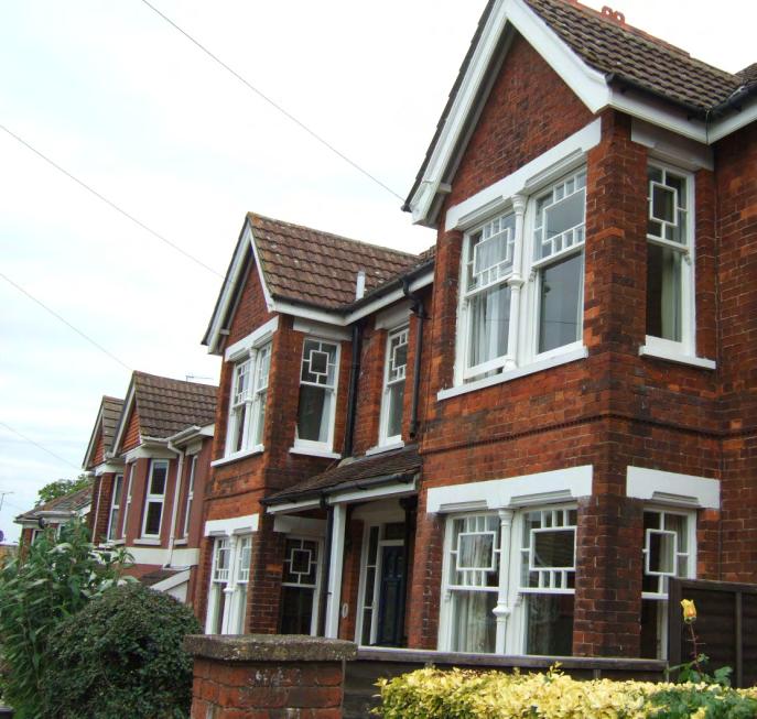
The 2-3 storey semi-detached properties are situated on a consistent building line behind narrow front gardens and are more ornate than the cottage style terraced houses in nearby streets. Many have two storey canted bay windows and gable ends facing onto the road, giving a relatively consistent roofline, made more interesting by the topography. The original dimensions of the houses have generally been retained, preserving the balance and harmony of the streetscene. In addition decorative details have been preserved, contributing greatly to the character of the area. The roofs are embellished with ridge tiles, carved painted bargeboards and finials and the gable ends have hung tiles or half timber. Some sash windows have divided upper panes and stained glass. A number of properties have white painted pillars, porches and balustrade balconies. The area has a relatively quiet, elegant residential character although there is some through traffic and noise from the Pembury Road. Street trees in The Drive and Springwell contribute to the elegant character. There are no public open spaces but there are far-reaching views northwards across Tonbridge Conservation Area towards the Sevenoaks Ridge.
The proximity of the houses to each other and to the road creates pressure for on-street parking. However, the relatively spacious roads can accommodate parked cars without causing congestion.
74 C - EDWARDIAN VILLAS
ROAD AREA
Comprising: The Drive (north), Judd Road (north), St Mary’s Road (north), Springwell Road, Weald View Road (north) and Woodford Road
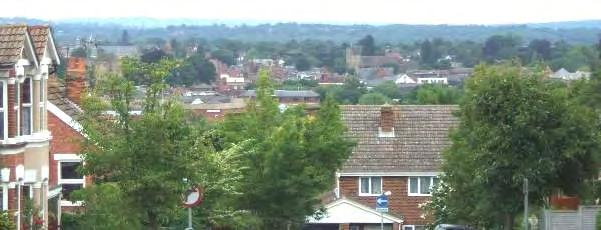
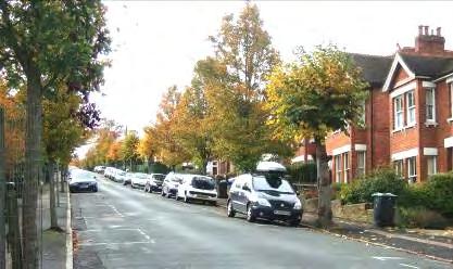
Weald View Road and The Drive were laid out in the late 19th century but most of the houses were constructed around 1910. The property, formerly known as Marl Field House, that originally gave the Drive its name, is a large Victorian mansion, now split in two. The gardener’s bothy, known as Marlfield Cottage, is further down the hill with access from Pembury Road. There is a considerable area of garden land retained between The Drive and Deakin Leas and the garden trees are visible between the houses in both of these roads. This combined with the wider plot sizes contributes to the verdant character of The Drive which contrasts with the higher density development of the Victorian cottages to the west. .
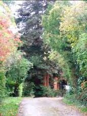
75 C1 ‐ SPRINGWELL
View northwards over Tonbridge Conservation Area, including Tonbridge Castle, Tonbridge School and Church of St Peter and St Paul, towards the Sevenoaks Ridge.
Large distinctive Edwardian houses in The Drive with pitched roofs. Most front boundaries have been retained.
Entrance to Victorian Mansion
Prominent
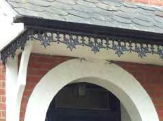
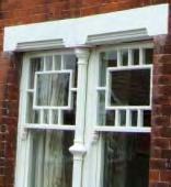
DISTINCTIVE
FEATURES
76 Garden trees are visible to the east of The Drive and contribute to the verdant character. Example of decorative details which enhance the historic character of the area LOCALLY
CONTEXTUAL
Age of buildings 1850s to early 20th century Type of buildings Semi-detached Main uses Residential Building Heights 2-3 storeys
building materials Red brick, brown roof tiles, white painted sash windows and woodwork Predominant boundary treatments Red brick walls, railings and hedges Open spaces None
Locally Distinctive Positive Features
• Views northwards over Tonbridge Conservation Area towards the Sevenoaks Ridge including views of Tonbridge Castle and Church of St Peter and St Paul.
• View of St Stephen’s Church spire in the Quarry Hill Conservation Area.
• Dominance of traditional materials including red brick, red/brown roof tiles, white painted sash windows and woodwork.
• Consistent building height and scale.
• Consistent building line and few gaps in the frontage maintaining sense of enclosure.
• Retention of original building dimensions and architectural details that contribute to the elegant historical character.
• Attractive landscaped front gardens and retention of traditional front boundaries.
• Views of trees in garden area to the east of The Drive.
• Street trees soften the townscape.
• Verdant character of the Edwardian area in contrast to the higher density Victorian development to the west.
Negative Features Worthy of Enhancement
• No significant detractors but unsympathetic replacement windows, doors and porches and the loss of original decorative features have disrupted the uniform design of buildings and the historic character, rhythm and/or symmetry of some streets.
• Loss of front boundaries to create frontage parking has harmed some streets.
77


3a 0150300 306090120 Metres¯ C1 Tonbridge Character Area AppraisalRef Title Springwell Road Area
D - EARLY PUBLIC HOUSING SCHEMES
The Homes for Heroes Campaign and Housing Act of 1919 placed a requirement on councils to provide housing in an effort to improve the living conditions and health of working people. Tonbridge has several early housing developments which still retain a distinctive design and character. These early developments were influenced by the Garden City Movement and were built at medium density which contrasts sharply with the neighbouring tight knit grids of Victorian housing. On these early public housing schemes, the houses are generally built in a vernacular cottage style. The two storey family homes, often with rendered upper stories and gently pitched hipped roofs have enclosed front gardens. The homes were built in traditional local materials – brick and rendered with wooden casement windows and tiled roofs. Many had small gables or dormer windows.
In Tonbridge early housing developments can be seen at Barden Park Road, Hectorage Road and off the Shipbourne Road. The development at Hectorage Road was begun in 1923 and in 1925 the Cage Green Farm was bought by the Council and the first 40 homes were built south of the Ridgeway as 3 bed houses in part rendered cottage style. Further houses were subsequently built north of the Ridgeway. During the 1930s two further housing developments were built at Baltic Road (commenced 1929) and on the Little Trench Estate where 92 homes were built from 1936 onwards.
These areas today have a distinctive character. The uniformity of design and age of the houses, the consistent colours of the red brick and cream render and the enclosed cottage style front gardens provide a strong sense of identity, differentiating these character areas from surrounding development.
The early housing developments in North Tonbridge are appraised as part of the Shipbourne Road frontage in Section A (Main Road Frontages). The areas appraised in this section are all situated in South Tonbridge.
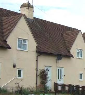
79
LOCALLY DISTINCTIVE CONTEXTUAL FEATURES
Age of buildings
Type of buildings
Main uses
Building Heights
Prominent building materials
Predominant boundary treatments
1920s – 1930s
Detached, semi-detached and terraced.
Residential
2 storey
Red brick, brown roof tiles, rendered painted upper storeys in cream, white painted casement windows
Walls, hedges and picket fences
Open Spaces Communal allotments
Locally Distinctive Positive Features
• Uniform design and scale give strong cohesive character
• Original boundaries and shallow front gardens retained on many properties
• Mature landscaping
• Painted render provides a contrast to the predominance of red brick
• Historic significance as early examples of ‘Homes for Heroes’ early social housing and the Garden City influence.
Negative Features Worthy of Enhancement
• No significant detractors
• Loss of front boundaries to create frontage parking has harmed the appearance of some streets.
80
D1- BARDEN PARK ROAD AREA
Comprising: Audley Avenue, Barden Park Road, Clare Avenue, Ives Road and Pembroke Road.
Barden Park Road is an early public housing development with semi detached and terraced cottage style homes set along mostly straight roads linked by a curved street. The area extends beyond the limits of the Victorian town into the countryside, straddling the railway. The housing to the east of the railway line is on relatively flat lower lying land with no long views. The area west of the railway line is more tightly knit and occupies a more elevated position.
The semi-detached and terraced houses have steeply pitched brown plain tiled hipped or gabled roofs with small chimneys on the ridge. On many the upper storey windows are set within front facing gables or in half dormers. The houses are painted in pastel shades with white doors and windows. The repeated designs, uniform roofline and limited colour palette give the area a distinctive uniformity of character. The small front gardens are enclosed by informal picket fences or hedges.
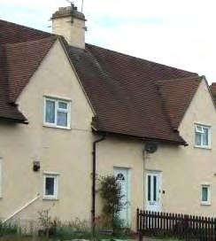
Clare Avenue occupies a more elevated position. The houses are red/brown brick or have cream painted upper storeys embellished with geometric terracotta designs. There are views along Clare Avenue to the east of St Stephen’s Church spire.
Some larger properties have distinctive front facing gables with the roof sweeping down to door height.
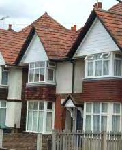
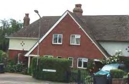
At the entrance to Barden Park Road from Barden Road, three villas dating from 1912 have two storey bay windows and prominent gables facing the road. The facades are red brick or white painted and the bays are tile hung. The verticality of these houses contrasts with the lower, wider frontages of the later cottage style housing.

81
Allotments on the northwest side of the character area provide the only area of public open space in this otherwise developed area. A belt of trees bordering the Medway River forms a strong edge to the character area. The recreation ground can be glimpsed through the trees.
Locally distinctive positive features
• Repeated designs, uniform roofline and chimneys and limited colour palette give the character area a uniformity and distinctive character
• The belt of trees along the River Medway provides an edge to the character area.
• The area has a quiet residential character with little traffic.
• Allotments provide an open contrast to the built up area
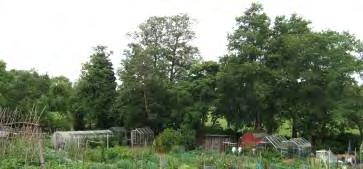
• Views from Clare Avenue of St Stephen’s Church spire
• Glimpses of recreation ground through the trees.
Negative features worthy of enhancement
• No significant detractors but some houses appear poorly maintained.
82
0175350 3570105140 Metres¯ D1 Tonbridge Character Area AppraisalRef Title Barden Park Road Area
ROAD
Comprising: Central section of Baltic Road
A small linear development of 1930s public housing on elevated land in south Tonbridge. The houses are of uniform design contrasting with the more varied design of larger privately built houses of the same age in neighbouring streets.
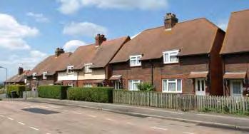
The two storey flat fronted brick terraced and semi-detached houses have plain tiled hipped, gabled or half hipped roofs with central chimneys and tiled porch canopies supported by painted brackets. Some properties have cream painted upper storeys, whilst others have decorative red brick bands. The houses are set behind front gardens enclosed by picket fences or hedges. The repetition of designs, consistent building line, scale and colour scheme create an attractive unified character.
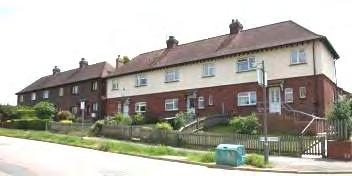
The Road dips westwards giving panoramic views of open countryside. At the junction with Weald View Road there are long views northwards of the Sevenoaks Ridge
Locally Distinctive Positive Features
• Repeated designs, uniform roofline and chimneys and limited colour palette give the character area a uniformity and distinctive character
• Panoramic views to west and north of the Sevenoaks Ridge
Negative Features Worthy of Enhancement
• No significant detractors
84 D2 - BALTIC
0100200 20406080 Metres¯ D2 Tonbridge Character Area AppraisalRef Title Baltic Road
D3 – LODGE OAK LANE (NORTH) AREA
Comprising: Brionne Gardens, Hectorage Road (east), Lodge Oak Lane (north) and Somerhill Road.
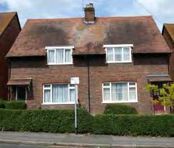
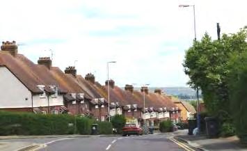
A gently undulating area of semi-detached houses arranged along generally straight streets south of the railway line. Built as a single development in the 1930s, the original street layout and houses have been retained creating a cohesive and distinctive character.
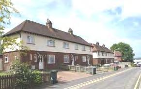

The houses replicate designs found in other schemes in the town comprising two storey red brick semidetached houses with plain tiled pitched or half hipped roofs and central chimneys, set behind small front gardens usually enclosed by clipped hedges or picket fences. Some houses are all red brick whilst others have a cream rendered first storey and red brick sills. The porch canopies supported by white painted brackets are a prominent feature, as are the distinctive half dormer windows set within the line of the roof.
The undulating topography allows long views to the north from Lodge Oak Lane. The uniform height and pitch of the roofs and spacing of the chimneys, contribute to the rhythm and unity of the townscape and create an attractive stepped roofscape
The buildings of Hillview and St Stephen's Schools close the view at the western end of Brionne Gardens.
86
Hectorage Road curves down steeply westwards in a broad sweep with long views over Tonbridge and the Sevenoaks Ridge, contrasting with the more enclosed character of the other streets. As the road dips, the elevated St Stephens Primary School and Hillview School dominate the townscape by their scale.
Locally Distinctive Positive Features
Hectorage Road has a more mixed character than the rest of the area and incorporates a group of distinctive 1920s houses with symmetrical gable ends.
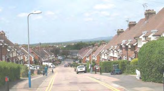
• Retention of original street layout, buildings of uniform style and design details gives the area a cohesive, distinctive character.
• This character area together with the Gorham Drive area are enclosed by bands of trees to the south and north giving a strong landscape framework and backdrop to the housing.
• Long views northwards from Lodge Oak Lane towards Sevenoaks Ridge, panoramic views southwards from southern edge of the Character Area and views westwards along Hectorage Road across Tonbridge towards Sevenoaks Ridge.
• Small area of public amenity open space
• Distinctive blocks of 1920s buildings in Hectorage Road with symmetrical gable ends.
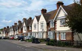
Negative Features Worthy of Enhancement
• Garage block off Gorham Drive.
• Some poorly enclosed and maintained gardens.
87

0150300 306090120 Metres¯ D3 Tonbridge Character Area AppraisalRef Title Lodge Oak Lane (North) Area
D4- KING’S ROAD AREA
Comprising: King’s Road (west), Mountfield Park, Fairfield Crescent, Royal Avenue (south)
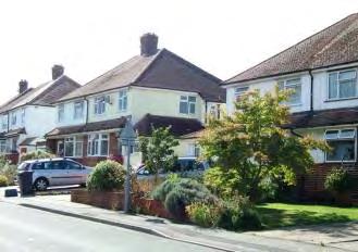
A mixed area of speculative and public 1930s housing on gently sloping land. The two storey semi-detached houses have brick or painted lower storeys with white upper storeys, white casement windows and gently pitched hipped roofs. The houses in the central section of King’s Road have a uniform design with single storey canted bay windows and porch covers which extend across the front elevation and side or integral garages with pitch roofs. Small front gardens are generally enclosed by fences or low brick walls. At the junction with Mountfield Park there are panoramic views to the north. Mountfield Park falls away sharply northwards with the houses stepping down the hill.
Bands of trees create a green backdrop to the south and east of the character area. There are sharp breaks in character at the eastern end of King’s Road (1950s housing) and around the corner in Royal Avenue (1970s housing).
Houses of uniform design in King's Road, the half hipped roofs and central chimneys create a rhythm to the streetscene. The set back of the houses behind partially enclosed landscaped front gardens on relatively wide plots contributes to the spacious character
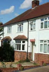
89
The houses in Mountfield Park maintain the red and white colour palette.
The topography and straightness of Mountfield Park allows panoramic views northwards over the top of the industrial estate, the wharf buildings along the Medway, across Tonbridge Conservation Area to the Sevenoaks Ridge. Belts of trees within and outside the urban area create a very verdant outlook. The gasometer is prominent in views.

Locally Distinctive Positive Features
• Buildings of uniform or similar style and the limited red/white colour palette give the area a distinctive character.
• The topography and straightness of Mountfield Park create panoramic views and a sense of spaciousness.
• The gentle curve of King’s Road and set back of houses from the road gives a spacious character.
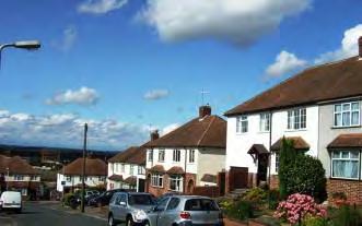
• Bands of trees to the south and east screen neighbouring development and create a green backdrop. Tree belts within and beyond the urban area create a green outlook.
Negative Features Worthy of Enhancement
• The gasometer is prominent in views northwards.
90
The houses in Mountfield Park create a stepped roofline
8 1 0100200 20406080 Metres¯ D4 Tonbridge Character Area AppraisalRef Title King's Road Area
Private residential development prospered in the early 1930s in Tonbridge and housing from this period is found south of Pembury Road in Deakin Leas and neighbouring roads, around the junction of Quarry Hill and Brook Street and in north Tonbridge off the Shipbourne Road and Hadlow Road where the town expanded over former orchards and agricultural land. Some of the largest houses were built in Yardley Park Road and the Ridgeway.
Substantial semi-detached properties set back behind front gardens line each side of long straight streets. The properties are more widely spaced than the earlier Edwardian properties, some having a garage to the side. The semi-detached properties are of similar design with gently sloping hipped tiled roofs and wide casement windows. Many have curved bays and porches. Although frequently built to a standard design, the individual buildings were enhanced with painted cement render generally in white or cream and embellished with hung tiles, terracotta plaques, brick detailing or oriel windows. Many had two storey bay windows with mock half timbered or tile hung gables. In the 1930s it became common for the doorways to be situated on the outer sides of semi-detached properties.
Properties from this period are usually set back from the road behind enclosed front gardens and often have generous gardens to the rear giving these areas a spacious, verdant character.
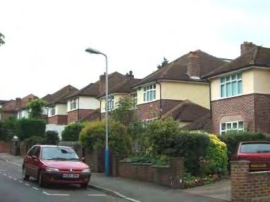
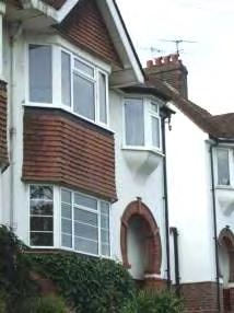
92 E ‐ INTER ‐ WAR SEMI ‐ DETACHED HOUSES
Brook Street Quarry Rise
LOCALLY DISTINCTIVE CONTEXTUAL FEATURES
Age of buildings
Type of buildings
Late 1920s – 1930s
Mainly semi-detached
Main uses Residential
Building Heights 2 storeys
Prominent building materials
Red brick, cream or white render, tiled roofs, casement windows, decorative details including hanging tiles, mock half-timber gable ends, decorative brickwork.
Predominant boundary treatments Brick walls, hedges.
Open spaces
Generally few public open spaces but generous private space.
Locally Distinctive Positive Features
• Substantial semi-detached properties set back behind front gardens
• Long straight streets.
• Similar designs with gently sloping hipped tiled roofs and wide casement windows.
• Retention of original features
• Landscaped front gardens and parking within the curtilage.
Negative Features Worthy of Enhancement
• No significant detractors
93
LEAS AREA
Comprising: Baltic Road (east), Deakin Leas, The Drive (south) and Weald View Road (south),
Situated on land that rises southwards from Pembury Road, Deakin Leas was a new road constructed in the 1930s on former farm land. The houses were built by several local firms with 18 houses completed by 1932 and the rest by 1939. The Edwardian streets of The Drive and Weald View Road were extended southwards at this time, but the age and style of housing in these roads is more mixed. At the southern end of Deakin Leas there is a small 1970s development.
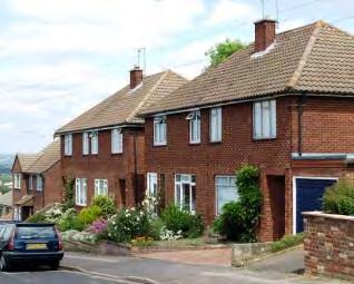

The semi-detached houses in Deakin Leas are set in wide plots, back from the road behind landscaped front gardens and driveways. The majority of houses are white painted with brown or red tiled hipped roofs, attached garages and many have arched porches and two storey bays, frequently tile hung. Some properties have prominent gables. The road has a wide spacious character enhanced by the street trees, elevated position and long views northwards. Groups of houses of similar design, height, roofline and colour, albeit with personalised detailing, give the street a distinctive and cohesive character.
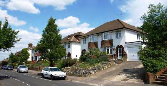
94 E1 - DEAKIN
These sloping straight roads give long views over North Tonbridge towards the Sevenoaks Ridge. There are particularly fine views from Weald View Road over Tonbridge Conservation Area including the Castle, the Church of St Peter and St Paul and Tonbridge School.
Locally Distinctive Positive Features
• Views across the Tonbridge Conservation Area from Weald View Road and views from all roads to the Sevenoaks Ridge.
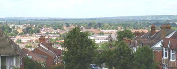
• Properties set back from the road along a constant building line behind enclosed, landscaped front gardens contributing to the spacious character and softening the architecture.
• Retention of original building designs and detailing.
• Provision of off-street parking.
• Street trees.
Negative Features Worthy of Enhancement
• No significant detractors.
95

0150300 306090120 Metres¯ E1 Tonbridge Character Area AppraisalRef Title Deakin Leas Area
E2 - QUARRY RISE AREA
Comprising: Brook Street (east) and Quarry Rise
Quarry Rise, begun in 1936, was the first development in Tonbridge to be constructed on a service road set back from the main road. Also in the 1930s Brook Street was widened and the steep banks cut back allowing a short row of houses to be constructed on the south side.
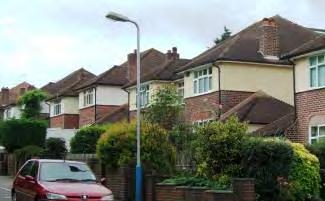
Tall trees to the east of Quarry Rise screen it from Quarry Hill. This combined with trees and shrubs in front gardens, a belt of trees to the rear of the houses and long views northwards over Tonbridge to open countryside contribute to the verdant character of the street.
The semi-detached houses in Quarry Rise with attached garages are of standard design but decorative details personalise the properties. The uniform design, restricted colour palette and lack of recent alterations or extensions creates a rhythm and unity to the streetscene. There are some individually designed detached houses at either end of the Rise.
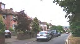
Examples of original decorative details which personalise the properties.
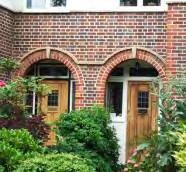
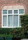
97
The semi-detached two storey properties in Brook Street are painted in white and cream and retain original 1930s features including bay windows, horseshoe brick porches, tile hung bays and gable ends. The oriel windows are a distinctive feature. The houses are set back from, and above, the road. Front gardens and boundary treatments have been lost to provide off-street parking by this busy access route. The uniform colour palette and repeated housing design creates a rhythm and unity.
Locally Distinctive Positive Features
• Views towards the Sevenoaks Ridge from Quarry Rise
• Properties set back from the road along a constant building line behind enclosed, landscaped front gardens contributing to the more spacious character and softening the architecture
• Retention of original building designs and detailing, including decorative brickwork and textured walls, giving the area a distinctive 1930s character.
• Verge and trees in Quarry Rise.
Negative Features Worthy of Enhancement
• Loss of front gardens and boundaries to accommodate parking on Brook Street.
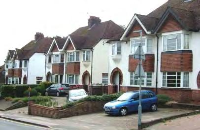
98
050100 10203040 Metres E2 Tonbridge Character Area AppraisalRef Title Quarry Rise Area
E3 - ESTRIDGE WAY AREA
Comprising: Croft Close, Estridge Way and Godfrey Evans Close
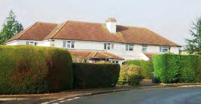
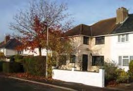
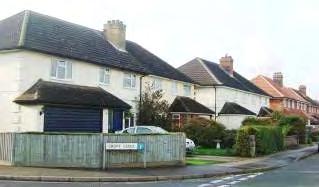
Estridge Way forms a quadrangle with short culs-de-sac leading off it and is accessed from Cornwallis Avenue and Orchard Drive via Colin Blythe Road. The development was begun in the 1930s but was not completed until after the war. There has also been some more recent infill development which gives this area a more mixed character than the other areas.
The majority of the properties are 1930s semi detached houses set in relatively wide plots behind landscaped front gardens enclosed by walls, fences and hedges. The properties have shallow hipped tiled roofs and plain chimneys set on the ridge or down the front pitch. Many properties have porches and integral garages also with pitched tiled roofs and wide white painted casement windows. The elevations are brown or red brick or rendered, some painted cream or white and several properties have decorative quoins, curved door openings and brick details. The houses vary in footprint and design but the even building line, larger plots, consistent roof height and limited colour palette give the area a distinctive character.
The properties on the northern side of Estridge Way are wider and set in more spacious plots.
100
Locally Distinctive Positive Features
Post war housing is interspersed with the 1930s properties. This house has a steeper roofline and plain brickwork but blends into the streetscene.
On the south eastern arm of Estridge Way, a short symmetrical row of semi detached houses set closer to the road form a distinctive group with open frontage, forward projecting gable ends and roofs extending down to first floor level.
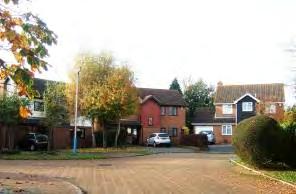
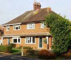
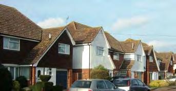
Godfrey Evans Close is a small more recent cul de sac development at the northwest corner of Estridge Way. The two storey detached properties with open plan frontages incorporate a variety of materials including red and orange brick, weatherboard, hung tiles and have gabled tiled roofs. The properties are tucked back and do not have a significant impact on the character of the area.
• Quiet residential character with little through traffic
• Distinctive character with houses of similar bulk and height, with common design features and materials, set on an even building line behind landscaped generally enclosed front gardens.
Negative Features Worthy of Enhancement
• No significant detractors.
101


BA110 3 0100200 20406080 Metres¯ E3 Tonbridge Character Area AppraisalRef Title Estridge Way Area
SCHEMES
These developments have a distinctive layout and design of housing which gives them a clearly recognisable and unique character.
The houses are built along curving streets and culs-de-sac arranged around grassed and treed communal amenity areas. Often set back from the road the properties frequently face onto the footpaths and open spaces or are set at an angle to the road. The semi detached houses are generally of two designs. The first have flat fronted elevations and distinctive steeply pitched gabled or hipped roofs and tall chimneys, sometimes paired. They are constructed in a number of standard designs which are repeated within each development and in different developments making them easily recognisable. The front elevations are red brick or cream with some use of decorative brick bands. One design incorporates wide vertical cream panels between brick columns and is particularly distinctive.
The second style of housing also has flat front elevations but is generally pebble-dashed and painted in pastel shades. The hipped roofs are less steeply pitched and the plain chimneys are smaller.
These character areas have a spacious feel which is enhanced by the mature landscaping, grassed public areas and private gardens. They are generally designed to segregate the houses and pedestrian routes from the street, providing traffic free routes within the character areas and linking with surrounding development.
103 F - POST-WAR PUBLIC HOUSING
Two post war neighbourhoods in Tonbridge to the west of Masefield Way and west of the Shipbourne Road are designed on Radburn principles: Masefield Way area and Waveney Road area. This style of development originating in the USA in the 1920s was intended to make provision for ‘the motor age’ without giving cars priority over pedestrians and became very influential in the new town movement in the UK. The housing is arranged around a heart of communal open space and is accessed via a network of footpaths which is separated from the road network. The properties front onto the footpaths and open spaces whilst vehicular access is provided to the rear of properties by short culs-de-sac.
LOCALLY DISTINCTIVE CONTEXTUAL FEATURES
Age of buildings
Type of buildings
1950s – 1970s
Semi-detached, terraced and some blocks of flats.
Main uses Residential with some community and retail uses.
Building Heights 1- 4 storeys
Prominent building materials
Red, brown, or buff brick, brown roof tiles, brown and buff hung tiles, cream or white painted render, white weatherboard, concrete and pebbledash.
Predominant boundary treatments
Picket fences, hedges and some brick walls.
Open Spaces Road network and houses arranged around grassed amenity areas, wide verges and a network of footpaths.
Locally Distinctive Positive Features
• Retention of distinctive original design and informal curved street layout of this planned development.
• Repeated building designs give a uniform character and strong sense of place. There has been little harm from unsympathetic additions, alterations or materials.
• Front gardens are separated from the public open space by low picket fence, hedge or brick wall boundaries.
• Network of green amenity areas overlooked by housing.
• Wide verges, mature trees and shrubs in public and private areas contribute to spacious, verdant character.
Negative Features Worthy of Enhancement
• No significant detractors but replacement doors and windows, on street parking, some loss of front boundaries, storage of bins and telephone wires erode the historic character.
• Communal garage blocks.
• Some poor road and footway surfacing.
104
AREA
Comprising: Northwood Road, Trench Road and Waveney Road (east).
Estate built in the 1950s and 1960s on high land.
The estate is arranged around curved grassed public open spaces many of which are planted with trees. The semi-detached and terraced houses have red brick and light coloured rendered frontages, steep tiled roofs and chimneys. The elevated position and ample provision of public open space gives the estate a spacious, verdant character.
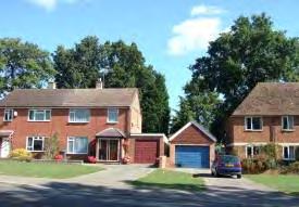
The tall mature oaks at the northern end of the development dwarf the buildings and are a prominent feature. Some more recent red brick family homes fit harmoniously in the townscape.

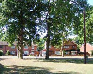
Northwood Road is open with long views to the south. The houses are set back on an uneven building line behind front gardens and wide grassed areas bordered by dwarf walls. The houses on the east side are arranged around a crescent shaped amenity area, forming an attractive group.
Tall bands of trees form a backdrop on both sides of the road at the north western end. However, around Waveney Road long views open up south westwards.
105 F1 - TRENCH ROAD
There are long views to the southwest at the southern end of Northwood Road.
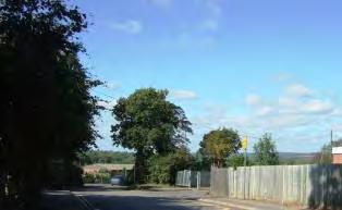
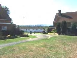
Locally Distinctive Positive Features
At the western end of Trench Road there is an abrupt edge to the urban area and panoramic views open out of the Sevenoaks Ridge.
• Long views northwards of Sevenoaks Ridge
Negative Features Worthy of Enhancement
• No significant detractors but replacement doors and windows, on street parking, some loss of front boundaries, storage of bins and telephone wires erode the historic character.
106
0100200 20406080 Metres F1 Tonbridge Character Area AppraisalRef Title Trench Road Area
- ROYAL WEST KENT AVENUE AREA
Comprising: Canterbury Crescent, Coventry Road, Helen Keller Close, Royal West Kent Avenue, St Pauls Close, Salisbury Road (west), Winchester Road, York Road.
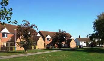
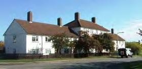
The Cage Farm estate comprises 1950s and 1960s 2 storey houses laid out along curving roads and culs-de-sac. The grassed amenity areas with footpath links and verdant landscape framework of trees to the north and south contribute to the green, spacious, planned character. Most roads are named after cathedrals.

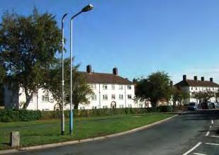
Rows of distinctive 2-3 storey white painted flat fronted terraced houses and flats face onto Royal West Kent Avenue and Salisbury Road. The location, mass and colour of the group make them a local landmark in the area. The brick door surrounds, wide regular windows, steeply pitched brown tiled roofs and evenly spaced tall chimneys give a strong rhythm and identity to the buildings. The properties are set back behind grassed frontages bordered by clipped hedges. A wide, treed verge runs in front of the hedge, creating a green open townscape.
Helen Keller Close is a more recent development of short terraces with prominent projecting single storey porches with gable ends. The houses overlook the grassed amenity areas which flank Royal West Kent Avenue, creating a neat, verdant entrance to the character area.
108 F2
The curving streets and culs-de-sac are lined by semi-detached houses which are similar in scale and design with flat fronted elevations, steeply pitched tiled gabled roofs and regularly spaced chimneys. However, a variety of brick colours and decorative finishes have been applied to give each street a separate identity and rhythm of repeated designs.
The houses in this character area are set back from the roadside behind wide treed verges and front gardens bordered by hedges and picket fences, which soften the architecture giving a spacious character. Some properties face onto small grassed amenity areas and footpaths. Canterbury Crescent is arranged around a half moon shaped treed amenity area. The Crescent has a symmetry of form.
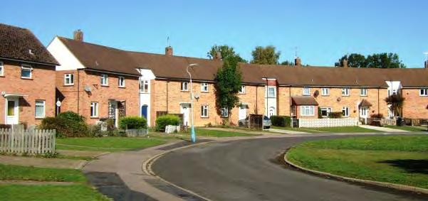
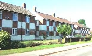
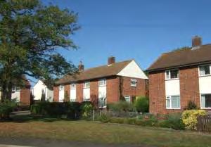
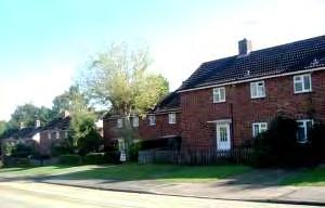
109
Some personalisation of properties has taken place, but in general the coherent planned character of the area has been retained.
Locally Distinctive Positive Features
The houses do not have garages and the communal garage blocks are discreetly located.
• Wide verges and mature trees in public and private areas contribute to spacious, verdant character. Large public open space south of Royal West Kent Avenue.
• 2-3 storey white painted blocks facing Royal West Kent Avenue and Salisbury Road are a distinctive local landmark.
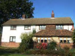
Negative Features Worthy of Enhancement
• Some road and pavement surfacing in poor repair.
110


0150300 306090120 Metres¯ F2 Tonbridge Character Area AppraisalRef Title Royal West Kent Avenue Area
Comprising: Constable Road, Dodd Road, Gainsborough Gardens, Higham School Road, Hunt Road, Landseer Close, Lawrence Road, Martin Hardie Way, Raeburn Close, Rembrandt Close, Reynolds Close, Romney Way, Turner Road, Wilson Road, Whistler Road,
An area of 1950s public housing situated between the Woodland Walk landscape corridor and Higham Lane. The development of semi detached and terraced two storey housing was constructed along curving roads and culs-de-sac on elevated, undulating land which slopes down to the south and east. Roads are named after painters.
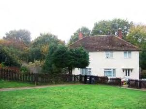
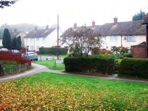
The majority of houses in the character area are constructed of concrete with pebble dash finish painted in pastel shades with hipped or gabled relatively shallow pitch brown tiled roofs and small chimneys on the ridge of the roof. The houses have small front gardens enclosed by picket and panel wooden fences with some brick walls and hedges. Many have flat porch canopies. Although built post World War II, the houses refer back to 1930s design.
The houses are set at angles to the road behind deep verges and grassed amenity areas. A network of footpaths run through the area and connects with the Woodland Walk and neighbouring housing and school. Some houses face onto footpaths.
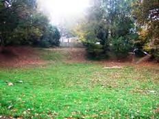
The band of trees along the Woodland Walk and north of Whistler Road provide a strong landscape framework, forming a backdrop to the housing on the west, south and north sides. In the vicinity of Higham School Road, the Woodland Walk green corridor penetrates right into the housing area.
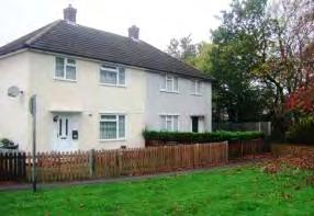
112 F3 - HUNT ROAD AREA
In addition to painted housing, the area incorporates red and orange brick semi-detached and terraced housing with hipped or gabled roofs. Some of these properties have unenclosed gardens.

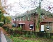
The majority of houses do not have private garages and parking is on roads and pavements or in flat roofed communal garage blocks. Some have been built on former grassed amenity areas.

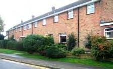
Locally Distinctive Positive Features
• Landscape and amenity value of the Woodland Walk which forms a landscape framework for the area, backdrop to the housing and traffic-free route for pedestrians.
Negative Features Worthy of Enhancement
• No significant detractors but the condition of street furniture and the communal garage blocks could be improved.
113
0250500 50100150200 Metres¯ F3 Tonbridge Character Area AppraisalRef Title Hunt Road Area
OAK RIDE AREA
Comprising: Beech, Bishops Oak Ride, Bracken Walk, Cedar Crescent, Greenfrith Drive, Heather Walk, Oakmead, Bishops Ride, Nordic Crescent, Silverhurst Drive and Quincewood Gardens.
This area was constructed in the mid 1960s and comprises pebbledash and brick semi detached and terraced properties set along curving roads and culs-de-sac.
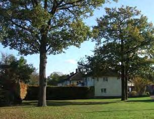
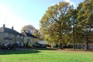
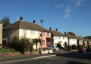
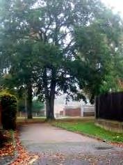
Bishops Oak Ride is broad and straight leading from the Shipbourne Road up to the west. The houses in the area are mainly two storey with hipped roofs, small plain chimneys and pebble dash finish painted in pastel shades. Many properties have flat roofed porch canopies and single storey canted bay windows. The repetition of this standard design gives the area a distinct, identifiable character. There are also some brick houses with gable ends of the same era and other more recent infill development.
Bishops Oak Ride passes through a grassed amenity area, a remnant of Trench Wood, which forms a focal point for the area. Short rows of houses and a crescent of bungalows face onto the open area. To the west the network of curving roads continue to the edge of the built up area.
115 F4 - BISHOPS
Few houses have garages. Parking is on the road side or in communal garage blocks.
Oakmead comprises red brick semi detached houses arranged around two small amenity areas. The houses are red brick with hipped or pitched roofs and small chimneys. Some of the houses date from the 1930s whilst others are more recent infill development.
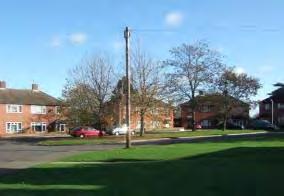
A level expanse of public open space abutting the countryside north of Quincewood Gardens and Cedar Crescent enhances the character of the area.
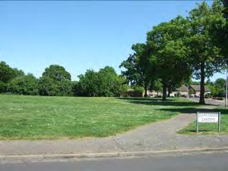
Locally Distinctive Positive Features
• Clustering of buildings around public open spaces. The open space on Bishops Oak Ride forms a focal point for the area and open space north of Cedar Crescent enhances the character.
Negative Features Worthy of Enhancement
• No significant detractors but the communal garage blocks could be improved.
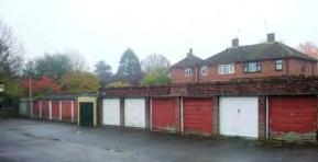
116 Insert Map F4


0250500 50100150200 Metres¯ F4 Tonbridge Character Area AppraisalRef Title Bishops Oak Ride Area
Comprising: King’s Road (east), Lodge Oak Lane (south), Mann Square and Tudeley Lane
The residential area to the north side of Tudeley Lane and to the west of Lodge Oak Lane comprises typical 1950s public housing in two principal designs.
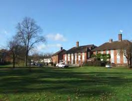
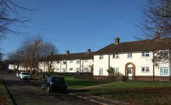
The first arranged at an angle to a footpath running parallel to Tudeley Lane consists of rendered 2 storey terraced houses with pantile roofs and matching arched doorways. The regular roofline and identical design of these houses contribute to the character and identity of the area and create a carefully planned townscape with few additions or alterations.
The second type, along King’s Road (east) and Lodge Oak Lane, consists of semi-detached two storey houses with steeply sloping tiled roofs, tall paired chimneys and flat part-brick, partrendered ‘striped’ frontages, set back from the road and arranged along curved streets and around grassed public amenity areas and footpaths. Both house styles have small private front gardens bordered by informal low hedges and picket fences.
The houses at the southern end of Lodge Oak Lane overlook a broad expanse of grass bordered by hedgerow. A row of trees bordering the Weald Grammar School playing fields form an edge to the character area. At the western end of the area, there are far reaching views to the east across open countryside to Castle Hill.
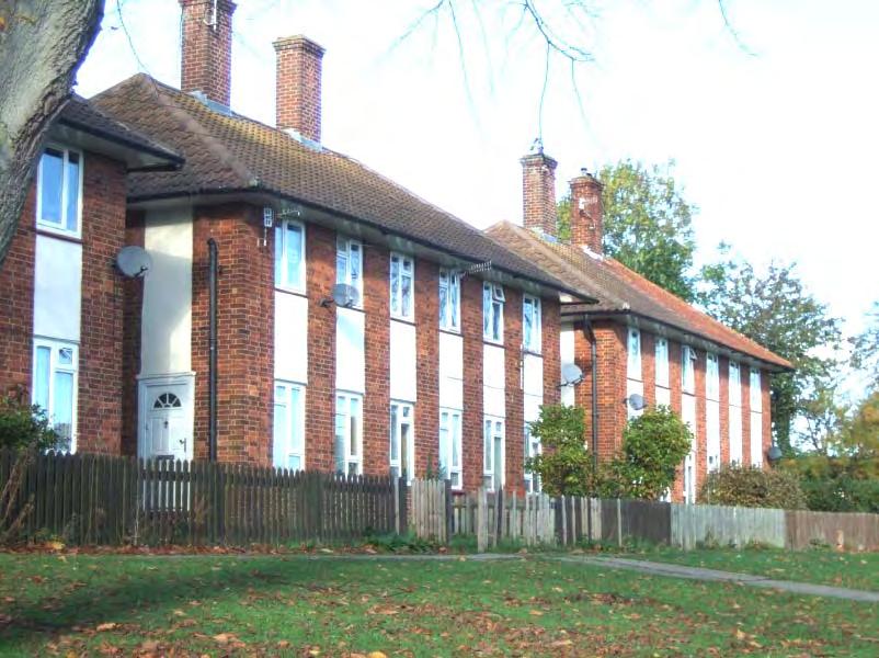
118 F5 ‐ LODGE OAK LANE (SOUTH) AREA
The area to the east of Lodge Oak Lane is more varied in age and includes some spacious 1930s semi-detached houses and the 14th century listed Cardinal’s Error public house. The historic significance and use of the building make this a landmark building. The 1930s houses occupy a prominent position when viewed from the south.
Listed Buildings
The Cardinal’s Error Inn, Lodge Oak Lane
A former cottage, now a public house. The small Lshaped building is probably timber framed beneath, but is now fronted with red brick and grey headers on the ground floor and tiles above. It has two storeys with a steeply pitched tiled roof.
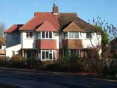
Grade II
Locally Distinctive Positive Features
• Long views eastwards of Castle Hill.
• The Listed Cardinal’s Error Inn landmark building.
• Belt of trees to the eastern side of Lodge Oak Lane (south) which form an edge to the character area.
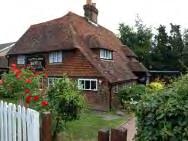
Negative Features Worthy of Enhancement
• Condition and coordination of street furniture.
• The garage block to the south of Kings Road has graffiti and litter and is accessed via an unlit overgrown footpath.
119
0 150 300306090120 Metres¯ F5 Tonbridge Character Area AppraisalRef Title Lodge Oak Lane (South) Area
- MASEFIELD WAY AREA - RADBURN LAYOUT
Comprising: Burns Crescent, Chaucer Gardens, Keyes Gardens, Masefield Way, Milton Gardens, Scott Road and Shakespeare Road.
This estate development lies off Brook Street on land that rises towards the south and represents the earliest influence of the Radburn layout in Tonbridge. The western part consists of a symmetrical arrangement of six short parallel rows of houses coming off Masefield Way at right angles, each of which faces onto footpaths and grassed amenity areas. The rear gardens give onto three culs-de-sac – Chaucer, Milton and Keyes Gardens. The scheme also includes 4 blocks of apartments and is surrounded on three sides by grassed amenity areas. This area has a more enclosed, inward looking character. Some properties are dated TUDC 1950.
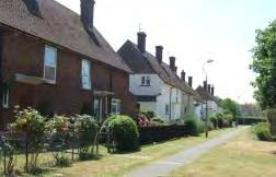
The eastern part of the development consists of long curved streets – Masefield Way, Shakespeare Road and Burns Avenue arranged in a triangular layout around a small central roundabout with bus stops and garage area. A treed/hedged landscape frontage buffers the housing from Brook Street. This area has a more open, unenclosed character.
The houses are constructed in a series of standard designs typical of the period with steeply pitched roofs, prominent chimneys and part brick, part painted frontages. Each property has an enclosed private front garden with a variety of boundary treatments including hedges, picket fences and some brick walls. The extensive grassed amenity areas and verdant landscape framework of trees to the south and along Brook Street contribute to the green, spacious, planned character.
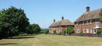
121 F6
Properties face onto footpaths and landscaped public amenity areas. Mature trees and long views northwards of the Sevenoaks Ridge contribute to the green spacious character.
Semi-detached houses of standard design in Masefield Way. The road has an unenclosed character with panoramic views northwards.
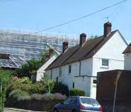
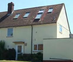
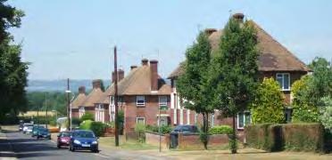
The long sweeping curve of Burns Crescent. As in Masefield Way and Shakespeare Road, the houses are set back behind wide verges.
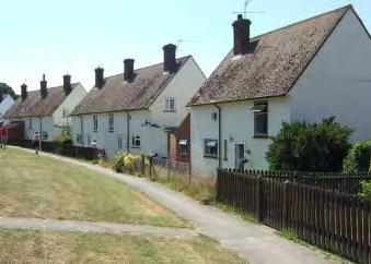
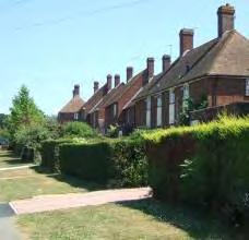
The height and scale of the new buildings at West Kent College will dominate the eastern end of the character area
Traditional street furniture adds character but has been partially replaced by modern fixtures. Modern lighting has in some cases been installed alongside the traditional posts. The lack of coordination and variable condition of the street furniture detracts from the character of the area.
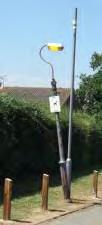
Due to the uniformity of roof design, changes to the roofline through dormer windows or roof lights may be visually prominent
122
Hedges, landscaped gardens and wide verges in Shakespeare Road contribute to the verdant character.
The chimney at Hayesbrook School is a detracting element seen from Shakespeare Road
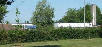
The small roundabout in Scott Road forms the hub of the character area but is somewhat featureless with a mix of modern and traditional street furniture
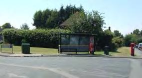
Locally Distinctive Positive Features
• Long views northwards of Sevenoaks Ridge and Sevenoaks Ridge.
• Clustering of buildings around public open spaces.
• Traffic free pedestrian network.
• Extensive public open space.
Negative Features Worthy of Enhancement
• Condition and coordination of street furniture.
• Views of chimney at Hayesbrook School.
123
0 150 300306090120 Metres¯ F6 Tonbridge Character Area AppraisalRef Title Masefield Way Area
- WAVENEY ROAD AREA – RADBURN LAYOUT
Comprising: Avon Close, Clyde Road, Colne Road, Darenth Avenue (west), Derwent Road, Dove Road, Hamble Road, Kennet Road, Longmead Way (north), Medina Road, Mersey Road, Severn Close, Speyside, Stour Close, Tamar Road, Thames Road, The Brent, Tweed Road, Tyne Road, Waveney Road, Whitelake Road, Wye Road.
The Waveney Road development in Tonbridge is designed around a central footpath flanked by communal open space which runs south/north with footpaths leading off at right angles on both sides leading to short terraces of houses. The area represents a later development of post war public housing based on Radburn principles. Vehicular access is via two parallel roads also running south/north which have short cul-de-sacs leading off either side providing parking at the rear of the houses. To the south, adjoining Darenth Avenue, there are some apartment blocks and community buildings.
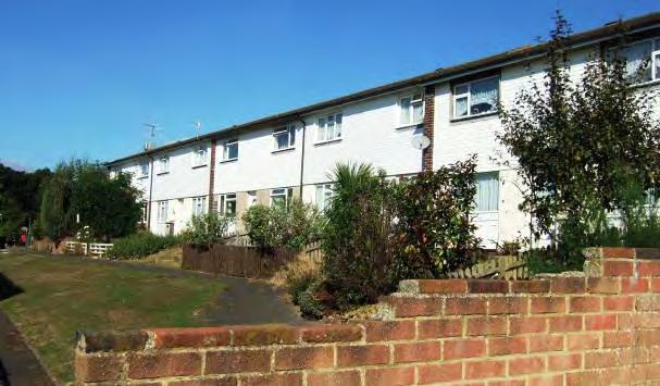
125 F7
The short terraces of two storey houses are arranged parallel, or at right angles to, the main footpath which runs the length of the development from south to north. There are extensive sloping open grassed areas flanking the footpath which create a spacious open feel but have limited amenity or landscape value. The houses face onto the footpaths and are arranged facing each other around grassed amenity areas often planted with trees. The front gardens are enclosed by picket fences. The rows of houses, in small even sized plots, are given different finishing treatments but the basic design is uniform, with the low pitched roofs stepping up the hill creating a somewhat regimented townscape.
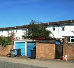
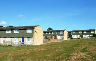
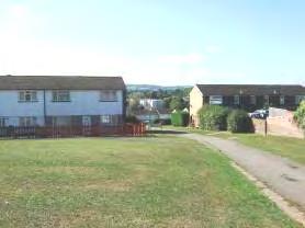
The topography rises sharply from south to north, creating long panoramic views towards Bidborough Ridgefrom the northern parts of the development.
The townscape seen from the road is less appealing with views along the short cul-de-sacs of the rears of the properties, high brick walls, garage blocks and bins. The lack of connectivity between the road and footpath networks and east/west across the development creates a maze-like layout with no landmarks which make it difficult to navigate for both pedestrians and cars.
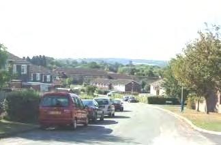
126
From Waveney and Derwent roads however, the character of the rather stark buildings is softened by the curving road layout, hedgerows, verges, trees and the panoramic views to the south and west. Tree belts to the west of Waveney Road are an important landscape feature which forms the edge of the character area.
To the south adjoining Darenth Avenue, a number of 3 and 4 storey flat roofed apartment blocks are set back from the road surrounded by flat grassed public areas in a format typical of the period.
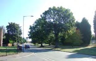
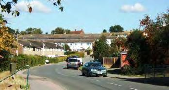
To the rear of Tonbridge Baptist Church, Leslie Tew Court is a small, more recent infill development of apartment blocks and shops facing directly onto a large parking area. Their bulk and height (up to 4 stories) can be accommodated on this low lying site.
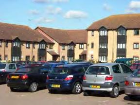

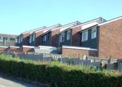
127
Darenth Avenue has a verdant character with a wide tree-lined verge and the cemetery adjoining the southern side.
Locally Distinctive Positive Features
• Panoramic views across the Bidborough Ridge to the south and west from northern parts of the area.
• Tree belts to the west provide a strong landscape framework.
• Traffic free pedestrian network.
• Extensive public open space.
• The uniformity of building design and regular roofscape contributes to the distinctive character of the area.
Negative Features Worthy of Enhancement
• Open grassed areas along the central spine and around the apartment blocks lack a strong amenity value or character.
• Lack of connectivity and legibility of the design, particularly east to west.
• Poor quality surfacing and street furniture.
• Streetscape marred by high brick walls and garage blocks.
128


0 150 300306090120 Metres¯ F7 Tonbridge Character Area AppraisalRef Title Waveney Road Area
Molescroft Way
Tonbridge expanded rapidly during the 1960s and 1970s with extensive housing developments spreading across the former fields and orchards at the outer edges of the urban area, particularly to the north. The housing accompanied rapidly expanding local industry –particularly the printing industry - and also served commuters to London.
The housing developments comprise mainly semi-detached two storey properties with integral or attached garages evenly spaced along curved roads and cul-de-sacs of uniform widths. The developments were designed principally to make easy access by car.
The distinctive feature of these areas is the open plan character with the houses generally set behind open lawns and driveways which are not enclosed. There are few areas of public open space, community facilities or other uses.
The buildings are constructed in red/brown or buff coloured brick and are generally decorated with hung tiles. Wide white painted casement windows with a distinctive horizontal emphasis are a general characteristic. Windows and doors appear to be randomly distributed within elevations without aligning vertically or horizontally with each other. Significant openings make the buildings appear less robust. Properties characteristically have a shallow roof pitch with brown concrete roof tiles and no chimneys. Many properties have porches and single storey bay or bow windows. In some developments, the properties are of uniform design, whilst others are more varied. The buildings show few local references in terms of materials or design and there are no local landmarks.
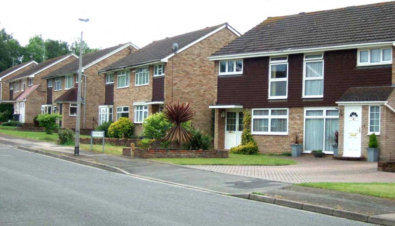
130 G - OPEN PLAN HOUSING DEVELOPMENTS
Landscaping features such as trees or shrubs provide some reference points, as do the street names which are frequently themed within each development (musicians, scientists or tree species for example).
These character areas are generally quiet and well-maintained with a peaceful residential ambience. They are set back from major roads with little through or fast moving traffic and ample off-street parking.
LOCALLY DISTINCTIVE CONTEXTUAL FEATURES
Age of buildings 1960s-1970s
Type of buildings
Mainly semi-detached.
Main uses Residential
Building Heights 1-2 storeys
Prominent building materials
Red/brown or buff coloured brick, concrete roof tiles, wide casement windows, hung tiles often coloured and shaped.
Predominant boundary treatments
Open spaces
Deep, open grassed frontages, occasional dwarf walls.
Unenclosed privately owned frontages create an open character. Limited public grassed spaces.
Locally Distinctive Positive Features
• Cul-de-sac layout reduces through traffic giving a quiet, residential character.
• Generally unenclosed lawned frontages create open, green character.
Negative Features Worthy of Enhancement
• No significant detractors but these large developments lack visual interest or local references in terms of materials or design. They tend to be single use (residential estates) with uniform road layouts and generally lacking in landmarks and reference points.
131
G1 – TULIP TREE CLOSE
Comprising: Tulip Tree Close and Waterloo Road (south)
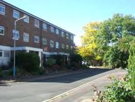
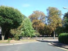
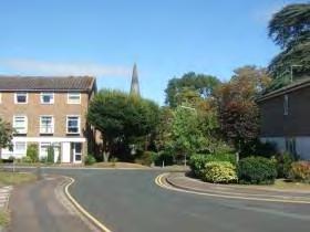
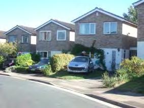
Tulip Close is an infill development on land formerly belonging to Judd School. The Close rises quite steeply from the entrance on Waterloo Road. An older property stands to the rear of the development. A more recent four storey red brick apartment block adjoins the Close on Waterloo Road. Set back from the road in treed grounds, it respects the street scene.
The buff brick houses are set at an angle to the road but parallel to each other, the gable ends and uniform design creating a strong rhythm and identity.
The three storey terraced town houses at the entrance to the Close are of plain red brick design with flat facades and flat roofed porches.
132
Locally Distinctive Positive Features
• Specimen trees and shrubs and small front lawns soften the architecture.
• Uniformity of design creates rhythm and identity.
• Views of St Stephen’s spire, protected trees by Waterloo Road and mature trees in the churchyard enhance the ambience.
Negative Features Worthy of Enhancement
• No significant detractors.
133
2 0 50 10010203040 Metres¯ G1 Tonbridge Character Area AppraisalRef Title Tulip Tree Close
G2 – AUDLEY RISE
Comprising: Audley Rise
A small, inward-looking development of brown/buff brick and yellow brick 2 storey semidetached and attached houses on low-lying land at the edge of the urban area adjoining Haysden Country Park.
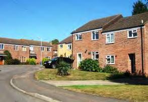
Street trees at the entrance to the Rise and the band of trees to the rear of the houses soften the architecture and enhance the character of the cul-de-sac.
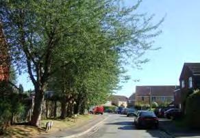
Locally Distinctive Positive Features
• Street trees create a leafy entrance to the close.
• A band of trees along the boundary of Hayden Country Park create a green backdrop to the development and mark the edge of the urban area.
Negative Features Worthy of Enhancement
• No significant detractors.
135

0 50 10010203040 Metres¯ G2 Tonbridge Character Area AppraisalRef Title Audley Rise
G3 – STACEY ROAD AREA
Comprising: Correnden Road, Seabrook Road and Stacey Road
An area of 1960s and 1970s development located on level, quite elevated, land south of the London Road giving some views onto surrounding countryside. The one and two storey detached and attached houses are closely arranged along a generally regular building line behind unenclosed lawns on curving roads and short culs-de-sac.
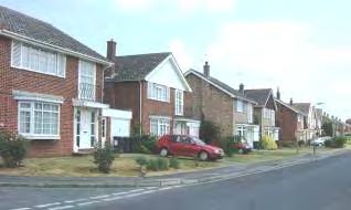
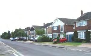
Locally Distinctive Positive Features
• Views over Medway Valley and towards Sevenoaks Ridge.
Negative Features Worthy of Enhancement
• No significant detractors.
137
The variations in building design, detailing, roof orientation, chimneys and brick colours add interest. The wide gently curving roads have a quiet residential character, enhanced by lawns, trees and shrubs.


0 150 300306090120 Metres¯ G3 Tonbridge Character Area AppraisalRef Title Stacey Road Area
– MOLESCROFT WAY AREA
Comprising: Beverley Crescent, Brantingham Close, Driffield Gardens, Leconfield Close, Lockington Close, Molescroft Way, Swanland Drive and Welton Close
A residential area of two storey semi-detached properties surrounded by a treed and hedged edge. Closely arranged properties along curved culs-de-sac behind open lawned gardens. Views to the north west towards the Sevenoaks Ridge.
The buff or red/brown brick houses with low pitched roofs, concrete hanging tiles, white painted wide casement windows and single storey flat roofed bays and porch covers.

Locally Distinctive Positive Features
• Views towards Sevenoaks Ridge.
• Repetition of design features creates some rhythm and identity.
• Belts of trees provide a backdrop to the houses, mark the edge of the character area and help to screen the A21.
Negative Features Worthy of Enhancement
• Traffic noise from the A21 and Brook Street.
139 G4
0 100 20020406080 Metres¯ G4 Tonbridge Character Area AppraisalRef Title Molescroft Way Area
G5 – ROYAL AVENUE
Comprising: Royal Avenue (north and east)
Royal Avenue is a small street of closely arranged 1960s houses which loops around to connect Goldsmid Avenue with Mountfield Park. The southern section comprises 1930s housing, but there is a sharp change of character as the road swings around a right angle bend. The semidetached 2 storey houses are set back from the road along an uneven building line behind open grassed or paved and planted frontages.
The north/south section of the street is the most verdant with a belt of tall trees to the rear of the houses forming the edge of the character area and screening Hillview School, grassed open frontages and long views northwards towards the open countryside of the Sevenoaks Ridge.
House designs and brick colours vary, but all the houses have horizontal white painted windows and shallow gabled pantiled brown roofs with small or no chimneys. The houses have side or integral flat roofed garages.
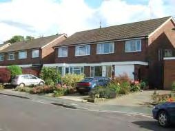
Specimen trees and shrubs soften the architecture. On street parking and a garage block detract from the street scene.
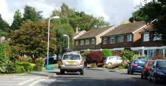
Locally Distinctive Positive Features
• Specimen trees, shrubs and small front lawns soften the architecture.
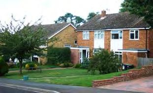
• Tree belt to the east forms an edge to the character area and a green backdrop.
• View northwards of hills and open countryside.
• Rising topography (west to east) and curving road promotes hidden away, private, character.
Negative Features Worthy of Enhancement
• No significant detractors but on-street parking and garage block clutter the street scene
141


0 50 10010203040 Metres¯ G5 Tonbridge Character Area AppraisalRef Title Royal Avenue
G6 – LONGMEAD WAY AREA
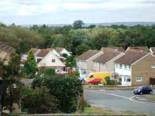
Comprising: Beaulieu Road, Cherwell Close, Dry Bank Court, Dry Bank Road, Longmead Way and Welland Road.
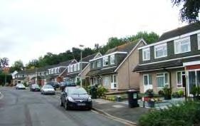
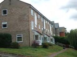
Welland Road was built in 1971 to link through to the Longmead South Wimpey housing scheme. The estate has altered little from its original design. Flats have since been added to the upper reaches of Welland Road on garden land taken from No. 19 Dry Bank in the Conservation Area and a new block has been built on a former small play area at the bottom of the hill. On the other side of the hill is the entrance to a footpath and the cemetery.
The closely arranged houses on the estate are in grey concrete with brown concrete tiles. The houses are two storey semidetached or terraced, some with the upper storey in the roof with prominent wide dormers and gable ends. Over time some properties have been painted and modified which has increased variety to the appearance of the housing.
More recent apartments in Dry Bank Road are three storey but are built into the hill so do not dominate. The uniform buff colour does not enhance the character of the area.
A green corridor runs along the western edge of the area with woodland visible behind, and between, properties.
The character of the estate is greatly enhanced by its setting and landscaping. The area nestles in a verdant landscape. There are panoramic views westwards from Welland Road across trees and open countryside. To the east side, on higher ground, a belt of trees along the boundary forms a green backdrop to the houses in Cherwell Close. Within the development, a network of footpaths and small green open spaces planted with mature specimen trees further softens the architecture.
143
Locally Distinctive Positive Features
• Sloping topography creates interesting views and vistas. Panoramic views westwards from Welland Road.
• Surrounded by trees which act as a strong edge to the character area and are visible above and between dwellings.
• View southwards from Cherwell Close of tree belt.
• Small green open spaces planted with mature specimen trees add to the verdant character.
Negative Features Worthy of Enhancement
• No significant detractors but the quality of surfacing and street furniture is poor.
144


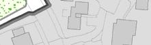
57 0 100 20020406080 Metres¯ G6 Tonbridge Character Area AppraisalRef Title Longmead Way Area
G7 – WHISTLER ROAD AREA
Comprising: Cavendish Close, Darwin Drive, Faraday Ride, Fleming Way, Kelvin Close, Newton Avenue, Priestley Drive, Rutherford Way and Whistler Road (west).
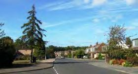
Whistler Road connects the Shipbourne Road to the residential areas of north east Tonbridge. At its western end it passes through a 1960s development of closely arranged detached and semi-detached 2 storey houses and bungalows set along curving roads and short culs-de-sac named after scientists.
The houses encompass a variety of styles and materials including brown, buff and yellow brick, brown pantiled roofs, brown or green concrete hanging tiles, synthetic weatherboard and some pebbledash. The horizontal windows have white or brown frames. Some properties have prominent front dormers. The roofs are generally gabled with some gables facing the street. Repeated designs in a number of streets provide some rhythm. Frontages are open plan with the houses set back behind lawns and shrubs. There are a few picket fences and hedges. Due to the variations in building styles, roof line and building line, extensions and alterations generally blend in and are unobtrusive.
Bands of trees to the north, south and west form the edge to the character area, provide a green backdrop and enclose the views. Specimen trees within gardens enhance the character of the area.
Locally Distinctive Positive Features
• Specimen trees and shrubs and front lawns and open space leading to the woodland enhance the character of the area.
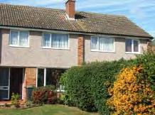
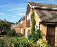
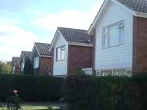
• Belts of trees to north, south and west create a green backdrop to the area.
• Repeated designs and gable ends facing the street in a number of streets provide some rhythm.
Negative Features Worthy of Enhancement
• No significant detractors.
146
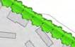

1 0 100 20020406080 Metres¯ G7 Tonbridge Character Area AppraisalRef Title Whistler Road Area
G8 – WILLOW LEA AREA
Comprising: Willow Lea, Fernholt, Elmhurst Gardens, Hawthorn Walk, St Bernards Road, Larch Crescent, Silverhurst Drive.
An extensive closely arranged 1960s development built by Gough Cooper on the northern edge of Tonbridge designed on long curving roads and short culs-de-sac. Belts of trees to the north and west and along the Shipbourne Road are visible from the area and provide a strong structural framework. Away from the Shipbourne Road, the area has a quiet residential character.
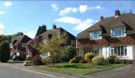
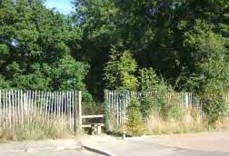
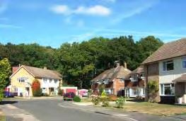
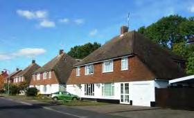
The northern part of the area comprises 2 storey, mainly semi detached houses of various designs, with small groups of repeated design giving some rhythm to the street scene. The properties are constructed of red, buff or occasionally yellow brick with tile roofs. Some houses have painted storeys and red or brown hung tiles. The properties have small chimneys, gabled or hipped roofs, some chalet style with a catslide, and integral or attached garages with flat or pitched roofs. Due to the variations in building styles, roof line and building line, extensions and alterations generally blend in and are unobtrusive. Tall trees to the north and west provide a strong structural framework being visible over and between the houses and enclose the views. Further specimen trees in gardens contribute to the verdant character. The long curving roads, flat topography and open frontages give a spacious feel.
The treed edge brings the character of the surrounding countryside up to the edge of this character area
148
Locally Distinctive Positive Features
• Belts of mature trees to the north, west and east provide a strong edge to the countryside and are visible behind and between the houses and enclose the views.
• Street trees and specimen garden trees enhance the character, particularly in the southern part of the area which is less verdant than the north.
• Long curving roads, flat topography and deep, open frontages create a feeling of spaciousness.
• Small groups of repeated designs give some rhythm to the street scene in places.
Negative Features Worthy of Enhancement
• No significant detractors but the quality of surfacing and street furniture is poor in some areas.
149


0150300 306090120 Metres¯ G8 Tonbridge Character Area AppraisalRef Title Willow Lea Area
ROAD AREA
Comprising: Hopgarden Road, Nursery Close, Parkway, Salisbury Close and Salisbury Road (east).
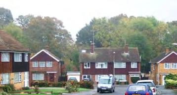
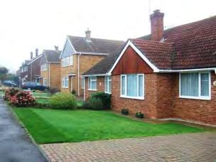
A gently undulating area of curving roads and culs-de-sac constructed in the early 1960s on a green wedge of land between the Hunt Road and Royal West Kent Avenue. A green corridor, the Woodland Walk, runs across the eastern and northern sides of this area. The area north of Salisbury Road has no through routes and has a very quiet residential character.
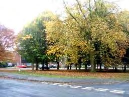
The character area incorporates a variety of designs and materials including yellow, brown and orange/red brick, white, black and brown weatherboard hung horizontally or vertically and brown or red concrete pantiled roofs. The roof line and building line is very varied with single and two storey houses intermingled and roof gables orientated facing the road or at right angles to it. There are some hipped and cat slide roofs. Chimney heights vary. The houses have wide or square white windows and a variety of porches. The lawned front gardens with shrubs are open plan or behind dwarf walls. Many pairs of semi-detached properties have different decorative finishes.
Parkway bisects the ellipse of Hopgarden Road providing a densely treed open space in the centre of the development which the houses overlook.
The character area is framed on all but the south east side by belts of mature trees which are visible both between and over the buildings and which enhance the character area.
151 G9 – HOPGARDEN
Nursery Close comprises detached and semi detached 2 storey houses and bungalows constructed in brown brick with hipped brown tiled roofs, white window frames, flat porch canopies and small chimneys. The front gardens are enclosed by low brick walls and hedges or are open plan. The bungalows are brick or white painted render with hipped roofs. The street has a quiet residential character and the similarities in design and materials give the street a cohesive character. Belts of trees to the south and north form a backdrop to the housing, screening it from neighbouring development and contributing to the private character. The pavement surfacing is very poor and mars the townscape.
Locally Distinctive Positive Features
• Belts of protected and unprotected trees on all sides except the south east are visible behind and between the houses, enclose the views, mark the edge of the character area and enhance its character.
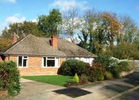
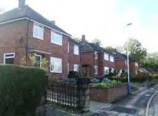
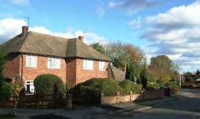
• Parkway provides a treed open space within the development.
• Long curving roads and open frontages create a feeling of spaciousness.
• Nursery Close has a more unified character with a greater consistency of design.
Negative Features Worthy of Enhancement
• No significant detractors but the quality of surfacing is poor in some areas.
152


0 150 300306090120 Metres¯ G9 Tonbridge Character Area AppraisalRef Title Hopgarden Road Area
This category incorporates primarily areas of 1930s and 1950s housing and an area of mixed age in Old Hadlow Road. Exeter Close and Ridgeway Crescent were built off the Ridgeway in the 1950s. Later developments in the 1960s and 70s emulated the character.
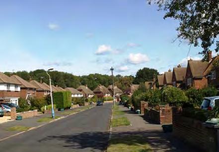
Development often consisted of detached, wide double fronted houses spaced out evenly along, and facing, the road on a relatively consistent building line. Earlier developments were set widely apart with road space, including verges, and front gardens.
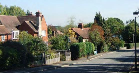
The two storey houses incorporate a limited range of traditional materials and designs and the buildings in one development or street will often be of one or repeated designs. Designs are individualised by varying the types and use of materials within estates. The buildings are typically constructed in orange/red or red/brown brick with some white render and mock Tudor detailing. The houses generally have a shallow rectangular plan form and pitched red/brown tiled roofs. The use of hips and gables roofs produces complex roof patterns. Many incorporate bay windows, porches, white or brown horizontal cottage-style casement windows and decorative features such as pillars.
Front gardens are often enclosed by mature hedges or with fencing or walls. Often deep rear gardens contain mature trees and vegetation.
174 H - LOWER DENSITY DETACHED HOUSING
LOCALLY DISTINCTIVE CONTEXTUAL FEATURES
Age of buildings
Type of buildings
1930s, 50s, 60s and 70s
Detached, some attached.
Main uses Residential.
Building Heights 2 storeys
Prominent building materials
Orange/red, buff and red/brown brick, white render, concrete tiled roofs, hung tiles, white horizontal cottage-style casement windows.
Predominant boundary treatments
Open spaces
Low brick walls and hedges or shrubs.
Retention of a few green open spaces and trees. Allotments on the earlier developments.
Locally Distinctive Positive Features
• Cohesive character created by a relatively consistent building line, common height, scale, materials and similar or repeated designs and details.
• Use of hips and gables produces complex roof patterns.
• Enclosed boundaries with hedges and mature trees within and framing the character areas add to the informal verdant character.
Negative Features Worthy of Enhancement
• No significant detractors
175
Comprising: Exeter Close
A small development of 39 houses built in a curved T shape off the south side of the Ridgeway in the 1950s by Crouch Homes.
The detached houses are set back behind a pavement, verge and landscaped front gardens bordered by low stone walls, some topped by hedges and wooden panel fences giving the development a spacious green character.
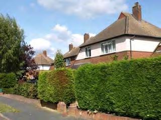
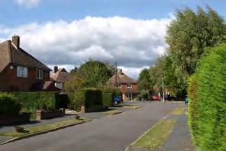
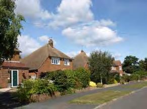
The level Close occupies an elevated position but there are no long views. The buildings are framed by belts of tall mature trees. There are also a number of attractive specimen trees within gardens.
The houses have distinctive brown tiled pyramid shaped roofs with a triangular face at the apex and small chimneys. On some houses the roof sweeps downwards on one side to give an asymmetric design. The houses are red/brown brick, some with the upper storey painted render in a pastel shade.
176 H1 – EXETER CLOSE
Locally Distinctive Positive Features
• Cohesive identity created through consistent use of materials and similarity in the design and scale of the houses.
• Detached houses in quite wide plots set back from the road give a spacious character enhanced by the verges, trees and shrubs in the gardens and belts of mature trees which form a backdrop.
Negative Features Worthy of Enhancement
• No significant detractors.
177

050100 10203040 Metres¯ H1 Tonbridge Character Area AppraisalRef Title Exeter Close
Comprising: Ridgeway Crescent
The crescent is a horseshoe-shaped development on the north side of the Ridgeway comprising detached and semi-detached houses in relatively large plots primarily dating from the 1950s.
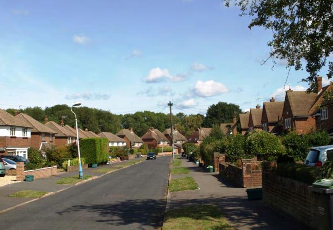
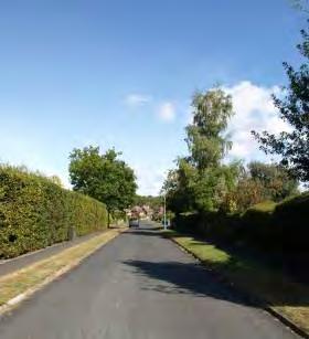
High hedges running the length of the gardens of houses on the Ridgeway border both sides of the entrances to the Crescent creating a gateway and separating the Crescent from the bustle of the Ridgeway.
The red/brown brick houses, some with painted rendered upper storeys have brown pantiled or plain tiled roofs, some pyramid shaped, others with gables facing the street. Some roofs sweep down on one side to give an asymmetric design. Whilst roof designs vary, the roof height is quite consistent throughout the development. Low brick walls form the front boundaries. Repeated designs on the western arm of the Crescent give rhythm to the streetscene.
179 H2 - RIDGEWAY CRESCENT
A belt of mature trees to the north creates a backdrop to the housing. The original houses are set quite wide apart with single storey flat roofed garages allowing views through to the tree belt behind. In some cases side extensions have closed this gap creating a more continuous frontage, reducing the feeling of spaciousness. The houses are set behind a pavement, verge and landscaped front garden enclosed by low walls, some with hedges above.
Locally Distinctive Positive Features
• Consistency of materials and building height. Some rhythm.
• Detached and semi detached houses in wide plots set back from the road behind front gardens, pavement and verges giving a spacious character.
• Belt of trees to the north is visible between and over the houses. Hedges by entrance are strong linear features visually separating the development from the Ridgeway.
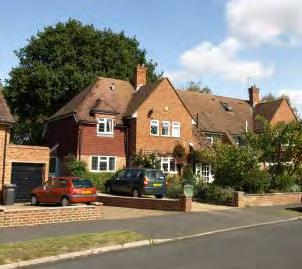
• Quiet residential character particularly further away from the Ridgeway with low traffic levels.
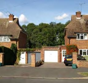
Negative Features Worthy of Enhancement
• Side extensions which reduce the feeling of spaciousness.
180


0100200 20406080 Metres¯ H2 Tonbridge Character Area AppraisalRef Title Ridgeway Crescent
H3 – YARDLEY PARK ROAD
Comprising: Yardley Park Road
This spacious curving road slopes down eastwards from Shipbourne Road to Hadlow Road. It has a verdant character and is lined by detached individually designed houses in large plots of various styles and ages from Victorian to the present day.

The reds and browns of the traditional bricks and tiled roofs blend harmoniously with the landscape setting. The chimneys, gables and dormers on the one and two storey buildings create an interesting and varied roofscape. Hedges, stone walls and wooden fences give an informal, rural frontage, enhanced by decorative lampposts.
Locally distinctive positive features
• Spacious green, semi-rural character formed by substantial buildings set in large plots.
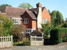
• Hedges, mature landscaped gardens and varied but harmonious boundary treatments.
• Individually designed buildings of various ages and styles most constructed of traditional materials including red brick, red and brown roof tiles, half timbering and weatherboard.
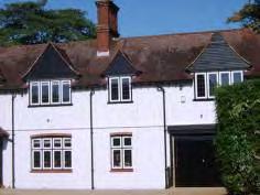
• Steeply sloped, interesting and varied roofscape.
Negative Features Worthy of Enhancement
• No significant detractors.
182

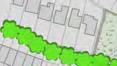

0 150 300306090120 Metres¯ H3 Tonbridge Character Area AppraisalRef Title Yardley Park Road
Comprising: The Ridgeway and Wells Close
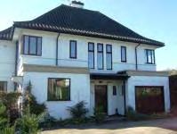
The Ridgeway links the Shipbourne Road to Hadlow Road. The road was constructed in the 1930s and control measures have been introduced to reduce traffic speeds on this long straight road. The character is similar to that along the Hadlow Road with substantial 1930s individually designed properties set within larger plots set back from the road behind landscaped front gardens.
The long straight road is bordered by a variety of boundary treatments including hedges, brick and stone walls, railings and wooden fences. Street trees at the eastern end and trees and shrubs within gardens contribute to the verdant character. There are long views eastwards.
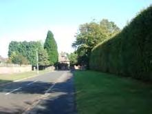
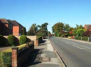
Close to the junction with Royal West Kent Avenue, a late Victorian property with decorative shaped bargeboards and tall Tudor style chimneys is a prominent feature.
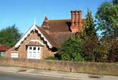
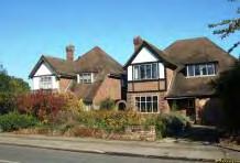
Rochester Way constructed in the 1930s - 1970s has a private secluded character. The long access with wide verges is enclosed by the side boundaries of adjoining gardens. Some of the houses overlook a treed open space.
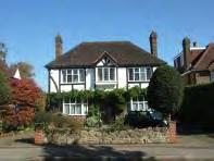
184 H4 – THE RIDGEWAY
The mainly 2 storey houses are built in a variety of styles and materials typical of the era. These include mock-Tudor houses with half timbering, tall narrow chimneys, decorative herringbone brickwork and hung tiles. Number 25 (left) shows the influence of the moderne movement with its white painted brickwork, coloured pantiles, flat roofs and suntrap windows.
Wells Close has a more traditional layout with the houses facing the road set back behind open front gardens on a relatively even building line. Wide grass verges and a belt of trees on the south side contribute to the verdant spacious character. The houses are constructed of red/brown or buff brick with hung tiles and brown plain tiled roofs. The roofline is varied with hipped and gabled roofs and long front pitches sloping down to first floor level on some properties. Many properties have wide dormers and prominent gables facing the road. The houses have integral or attached garages.
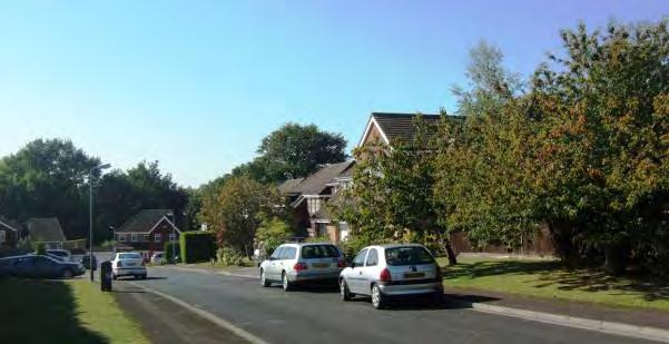
Listed Buildings
Nos 77 & 79 Cage Farm House, The Ridgeway
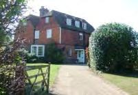
18th century two storey farmhouse with later additions. Red brick with grey headers and half hipped tiled roof with dormers.
Grade II
185
Locally Distinctive Positive Features
• Spacious character.
• Street trees, hedges, mature landscaped gardens, large specimen trees and varied but harmonious boundary treatments.
• Belt of trees to the south of Wells Close contributes to the verdant character.
• Listed 18th century building.
• 19th century buildings.
• Substantial individually designed 1930s houses with original features set well back from the road in large plots.
• Long view to the east.
Negative Features Worthy of Enhancement
• Poor surfacing.
• Electricity sub-station.
186

0 150 300306090120 Metres¯ H4 Tonbridge Character Area AppraisalRef Title The Ridgeway
Comprising: Vauxhall Gardens
A short cul-de-sac development between the Pembury Road and the railway line on the edge of the built up area which slopes up gently from east to west and is screened by tree belts. The detached two storey 1960s houses and chalet bungalows are set in wide plots.
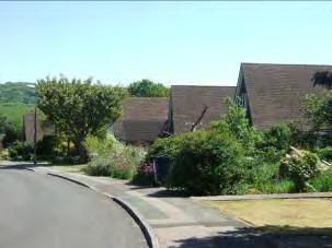

The chalet bungalows are painted cream with hanging green/brown shaped tiles and prominent gable ends facing the road, whilst the two storey houses have shallow pitched roofs and chimneys. The properties have wide white casement windows. The open plan frontages are grassed with side hedges, shrubs and tall trees.
Belts of trees flank the entrance to the development and there are long views eastwards of Castle Hill.
Locally Distinctive Positive Features
• Trees screen the development from Pembury Road and the railway line.
Negative Features Worthy of Enhancement
• The quality of surfacing and street lighting is poor.
188 H5 – VAUXHALL GARDENS


050100 10203040 Metres¯ H5 Tonbridge Character Area AppraisalRef Title Vauxhall Gardens
Comprising: Streamside
A cul-de-sac of detached two storey houses accessed off Denbeigh Drive but facing onto the stream and treebelt of the woodland walk.
The two storey houses of orange brick with red hung tiles and brown pantiled roofs are of similar age and design. Some have two storey bay windows with gable ends facing the street. The properties are set back from the access road behind planted front gardens bordered by dwarf walls and clipped hedges.
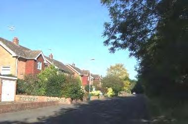
Locally Distinctive Positive Features
• Open space and a tall belt of trees.
• Similar materials and design of buildings creates a cohesive character.
Negative Features Worthy of Enhancement
• No significant detractors.
190 H6 – STREAMSIDE


0100200 20406080 Metres¯ H6 Tonbridge Character Area AppraisalRef Title Streamside
Comprising: College Avenue, The Spinney, Hillside and West Rise.
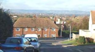
A sloping area of curving roads and culs-de-sac in an elevated position on the south side of Tonbridge, rising to the south and east.
College Avenue is a curving road of two storey houses and bungalows from which The Spinney, Hillside and West Rise cul-de-sacs lead off to the south. There are panoramic views to the north towards the Sevenoaks Ridge.
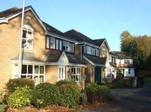
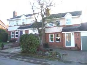
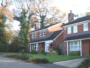
The houses are constructed of red or buff brick with some cream render and decorative brick work, white windows and doors. They have gently pitched brown tiled roofs and some have canted single storey bay windows, porches and integral garages. Each of the culsde-sac has a distinctive character with several repeated designs. Traffic levels are low but there is traffic noise from the A21. The houses are set back on medium sized plots behind open or hedged, grassed frontages planted with shrubs and trees.
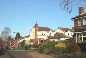
192 H7 – COLLEGE AVENUE AREA
Hillside
West Rise
The Spinney
A fenced pond surrounded by trees and a small grassed area complete with picnic bench provides the focal point of The Spinney contributing to the verdant character of this culde-sac.
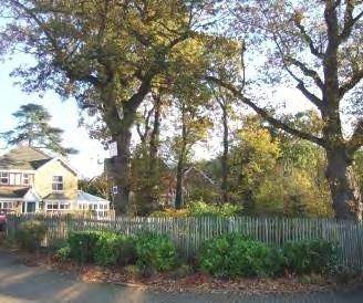
Locally Distinctive Positive Features
• Residential area in elevated position with panoramic views to the north from College Avenue and West Rise.
• Belts of trees on high land to the south and west frame the development.
• Repeated designs and limited materials and colour palette give the area a distinctive character, whilst each cul-de-sac has a different identity.
• The pond in The Spinney is a particularly attractive feature.
Negative Features Worthy of Enhancement
• Traffic noise from the A21.
• The tall buildings of West Kent College dominate the vista east along Hillside and are visible from the Spinney.
193

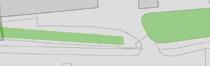
0100200 20406080 Metres¯ H7 Tonbridge Character Area AssessmentRef Title College Avenue Area
– OLD HADLOW ROAD AREA
Comprising: Foalhurst Close, Old Hadlow Road (south), Stair Road and Valley Forge Close.
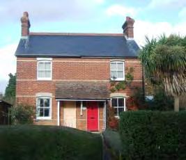
The Old Hadlow Road was bypassed in 1930 when Cornwallis Avenue was constructed. It is now a quiet residential street that forms a loop off Cornwallis Avenue and is lined by mainly detached houses of various ages and styles in generous plots. Stair Road and Foalhurst Close lead off it. Valley Forge Close is accessed via Cornwallis Avenue. Some of the properties are Victorian, but many date from the 1930s and 1950s up to the present day. The street has a winding historical quality and is densely vegetated giving it a semi rural character.
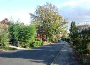
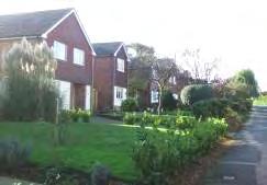
Looking east along Old Hadlow Road, the vegetation dominates over the architecture. The houses are set well back on an even building line behind mainly enclosed front gardens bordered by hedges, low walls and wooden fences, giving the street an informal, almost rural appearance.
The mainly detached houses are a variety of ages from Victorian to the 1970s. The predominant materials include red and brown brick, cream and white render, pantiled and plain clay and machined tiles, slate and hanging tiles. The houses have gabled or half hipped roofs, many have large gables facing the road. Most of the properties have chimneys. Window styles vary but are generally white painted. The properties are set within landscaped gardens. The majority of properties on the northern side of Old Hadlow Road date from the 1930s or earlier, including some substantial 1920s and 1930s houses, whereas the properties on the south side are principally post-war. This semi-detached Victorian cottage retains original details.
195 H8
Stair Road has a more open plan character and is less verdant than Old Hadlow Road. The post 1970s brick houses are set closer to the road and have tiled hipped roofs and narrow chimneys. At its eastern end Stair Road becomes narrow, twisting and arcadian in character (see Section L).
Foalhurst Close is a 1970s cul-de-sac development of detached houses with open plan frontages. The houses are of repeated designs constructed of buff brick with gabled brown tiled roofs, red or brown hanging tiles and wide white windows. There are long views southwards between the houses over the flat roofed garages.
Locally Distinctive Positive Features
• Curving historic road with houses set well back behind verdant frontages.
• Harmonious blend of one and two storey houses of different ages and designs set within large landscaped gardens.
• View of Listed Buildings.
Negative Features Worthy of Enhancement
• Some traffic noise close to Hadlow Road.
196
Valley Forge Close is a late1950s development of detached 2 storey houses in large gardens. The Close has a verdant character and the layout makes a feature of the stream that runs through the development.
0150300 306090120 Metres¯ H8 Tonbridge Character Area AppraisalRef Title Old Hadlow Road Area
H9 – DRY BANK ROAD
Comprising: Dry Bank Road.
This short cul-de-sac runs northwards off Dry Hill Park Road. The southern section lies within the Conservation Area. The northern section consists of a short row of detached houses dating from the 1970s onwards and a semi-detached Victorian property.
Dry Bank Road is a private road with a quiet, secluded, informal character. It is screened from surrounding development by tall trees and hedges and is a narrow, partially unmade road. The houses are set on the west side in relatively large plots, below the level of the road behind open plan or partially enclosed front gardens and garages. They are constructed of red or red/brown brick with some tile hanging and gabled roofs. The Victorian properties are constructed in red brick with steeply pitched gabled slate roofs and wide chimney stacks.
Locally Distinctive Positive Features
• Quiet, secluded character enhanced by tall trees and hedgerows which screen surrounding development.
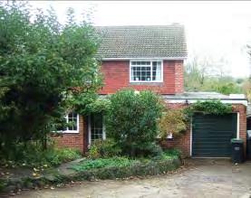
Negative Features Worthy of Enhancement
• No significant detractors.
198


050100 10203040 Metres¯ H9 Tonbridge Character Area AppraisalRef Title Dry Bank Road
Brickworks Close
In the last twenty years several opportunities have been taken to redevelop redundant sites for housing or create new residential areas on previously open land within the built up area. These developments are not as extensive as the earlier open plan estates characteristic of the 1960s and 70s. In line with Government policy of making the best use of sites, these housing schemes are generally designed to a higher density than in the previous decades and using different design principles.
Whereas development in the 1960s, 70s and early 80s often consisted of houses spaced out evenly along, and facing, the road on a relatively consistent building line, more recent developments in Tonbridge primarily consist of detached or attached houses , with integral or attached garages, set along an uneven building line or at angles to the road. The different roof forms and details often give interesting and varied roofscapes. Properties often front directly onto the pavement/road or shared surface or are set behind a shallow unenclosed front garden of low planting or have traditional metal railings and have private enclosed space to the side or rear. Houses have parking spaces or garages. The steep roofs and more compact form give the development a more enclosed urban character. The urban form is softened by the use of short curved cul-de-sac layouts which keep traffic speeds low and often encourage shared road use for pedestrians and cars. Sometimes the access roads will be cobbled or paved in a contrasting colour to emphasise this shared use. The enclosed cul de sac layouts create a quiet, private character.
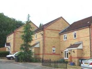
The curved street layout combined with the variable building line, also creates a series of enclosed spaces and changing vistas and views which to some extent replicates the ad hoc development found in traditional town and village centres. Whilst a variety of materials and building designs are used, the overall form, materials, scale and character is generally very cohesive.

200 I - CLUSTERED CUL-DE-SAC DEVELOPMENT
Silver Close
Properties are finished in a variety of traditional materials with relevance to the Tonbridge and Kent vernacular such as red/orange bricks, weatherboarding, white painted render and hanging clay tiles (sometimes decorative). The designs also incorporate traditional details such as dormer or half dormer windows, arched brickwork over doors and windows, contrasting brick string courses, chimneys, cupolas and ridge tiles. Windows and doors are often well aligned with each other and the dominant areas of brickwork over glazing gives the facades a robust appearance.
LOCALLY DISTINCTIVE CONTEXTUAL FEATURES
Age of buildings
Type of buildings
Main uses
Building heights
Prominent building materials
Late 1980s onwards
Detached, semi-detached and attached with some low rise apartment blocks.
Residential
2-3 storeys
Red, orange/red and yellow brick, tiled and slate roofs, weatherboard, hung tiles, white casement windows.
Predominant boundary treatments
Open frontages or various boundary treatments including hedges, walls, wooden fences and black metal railings.
Open spaces
Landscaped public amenity space often incorporated in the developments.
Locally Distinctive Positive Features
• Enclosed urban form whose scale and materials create a cohesive character.
• Traditional materials represent the local vernacular.
• Traditional brick, tile and roof details.
• Interesting roofscapes.
• Quiet residential character, may include shared road space.
• Soft landscaping usually incorporated as part of the design scheme.
• Curving layout and varied building line creates a series of vistas and views.
Negative Features Worthy of Enhancement
• No significant detractors.
201
ROAD (WEST) AREA
Comprising: Amberley Close, Arundel Close, Copper Beech View and Douglas Road (west). Douglas Road dips towards the west and this development is located on lower ground flanked by the railway line to the north and school playing fields to the west and south. It was built in the 1990s on the site of a former printing works and comprises a series of small closes of detached, attached and semi-detached houses set facing or at an angle to the road, built in red, brown and yellow brick with slate roofs and decorative hanging tiles and bands of brickwork. There is no through traffic and the area has a quiet residential character and is inward looking with no long views. The communal amenity area and network of footpaths connect different parts of the development and link with the town centre and across the railway line.
At the northern edge of the area, 2/3 storey apartment blocks face onto a footpath and communal grassed area which incorporates a small, well-equipped children’s play area. Wooden balconies enliven the frontages. Bands of trees form a backdrop along the western and northern edges and screen the apartments from the railway line
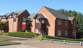
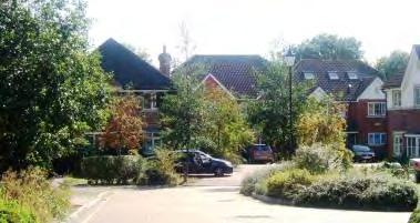
202 I1 ‐ DOUGLAS
Copper Beach View and Amberley Close comprise larger detached and attached family homes with many decorative details and have a leafy, private character. The front gardens are unenclosed or semi-enclosed by shrub planting, hedges, low fences and walls.
Properties are provided with garages or communal parking areas are designed into the scheme ensuring that there is little onstreet parking.
Locally Distinctive Positive Features
• The individual closes each have a private, enclosed character.
• Bands of trees to the west and north enhance the leafy character, define the edge of the built up area and screen the railway.
• Soft landscaping, amenity area and small scale, partially concealed, communal parking areas have been designed into the scheme, contributing to the area’s leafy, uncluttered character.
• Footpath network and low traffic levels.
Negative Features Worthy of Enhancement
• No significant detractors.
203


# 050100 10203040 Metres¯ I1 Tonbridge Character Area AppraisalRef Title Douglas Road (West) Area
FIELD
Comprising: Brindle’s Field
Brindle’s Field is a 1990s development on the southern edge of the urban area just inside the Tonbridge By-Pass.
Brindle's Field occupies an elevated position on the south side of Tonbridge with long views north westwards over the houses towards the Sevenoaks Ridge.
An extensive landscape area of tall trees to the south and east of the development provides a green backdrop and screens the houses from the A21 Tonbridge By-pass and Quarry Hill Road, dulling but not removing traffic noise. There are also a number of attractive trees within the development.
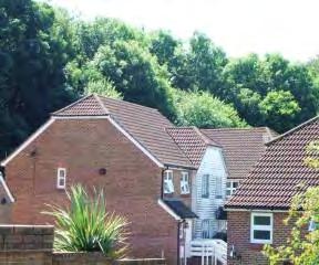
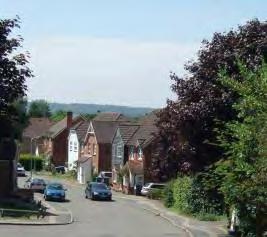
The elevations have a variety of finishes including red brick, white or black weatherboard, decorative clay hung tiles or yellow brick with red brick details and sills. The roof orientation is varied with some gables facing the road and some half hipped. The properties have white casement windows, porches with pitched tiled roofs or porch canopies. The plots are compact and bordered by brick walls, hedges, wood panel fences or open plan. The white paint and yellow brick work brightens the townscape whilst the red brick ties it in with the predominant colour in the town.
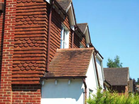
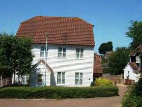
205 I2 ‐ BRINDLE’S
Locally Distinctive Positive Features
• Long views north westwards over the houses towards the Sevenoaks Ridge.
• Use of different bricks and decorative finishes provides variety whilst the development retains a cohesive identity.
• Bands of trees to the south and east enhance the leafy character, define the edge of the built up area and screen the A21 By-pass and Quarry Hill Road.
Negative Features Worthy of Enhancement
• No significant detractors but some traffic noise.
206


0100200 20406080 Metres¯ I2 Tonbridge Character Area AppraisalRef Title Brindle's Field
BRICKWORKS CLOSE AREA
Comprising: Birches, Brickworks Close, Fairview Close, Hilltop, Lambs Bank, Silver Close, Treetops, Quarry Hill Road (south) and Woodlands Road (south).
A 1990s development built on the former Quarry Hill Brickworks site on the southern edge of the town.
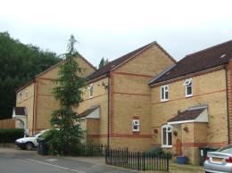
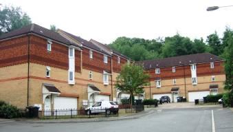
Each street within this character area has been given a unique identity. In Silver Close the colour scheme is reversed with red/orange brick buildings and yellow or black details. Decorative porches and canopies form a further unifying feature. The houses are built close to the road behind narrow landscaped frontages and black railings, giving a tight urban character.
Fairview Close has a more verdant character with the houses set in larger front gardens, set back from the road behind unenclosed lawns
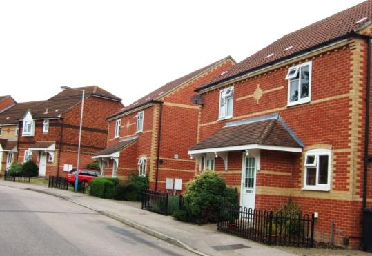
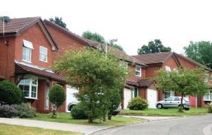
208 I3 ‐
Brickworks Close occupies an elevated position and comprises yellow brick three storey apartments and 2 storey attached houses with red/orange details and brown plain tiled roofs. The yellow bricks are not characteristic of Tonbridge. The building line and roof line are stepped down the hill creating a strong rhythm. A landscape area with tall trees forms a backdrop to the housing, an edge to the urban area and screens the development from the A21.
There are panoramic views northwards over the Tonbridge Conservation Area to the Sevenoaks Ridge. The Character Area slopes up to the south. The topography and curving road layout create changing views and vistas.
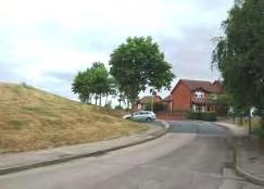
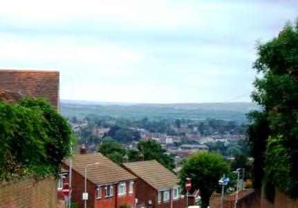
The Character Area is laid out around grassed banks giving a spaciousness which contrasts with the enclosed urban form. The mounds also sub-divide the area into discrete parts. However, these green spaces are barren of vegetation and visual interest.
Locally Distinctive Positive Features
• The elevated position, undulating topography and curving road layouts creates long views northwards and interesting vistas.
• Use of different bricks and decorative finishes provides variety whilst the development retains a cohesive design. Each street has a different identity.
• Bands of trees to the south and east enhance the leafy character, define the edge of the built up area and screen the A21 By-pass.
• Grassed hillocks within the character area provide visual relief from the tight urban form.
Negative Features Worthy of Enhancement
• No significant detractors but some traffic noise.
209


55 0150300 306090120 Metres¯ I3 Tonbridge Character Area AppraisalRef Title Brickworks Close Area
Comprising: The Haydens and Haydens Mews.
The Haydens is a development of substantial detached and terraced mews houses. The houses are set at angles along curving roads and culs de sac and clustered around shared driveways. The development is accessed via a pillared entrance off Yardley Park Road. To the south there are footpath connections with Portman Park and Hadlow Road via Bourne Lane. Long views of Bidborough Ridge can be glimpsed through the trees towards the south east.
Within the Character Area, grassed amenity areas and broad verges with mature trees contribute to the verdant spacious character. The hedge and trees along Bourne Lane form an edge to the area on the north eastern side. Other protected belts of trees running along the historic lanes and footpaths within the area – Lover’s Walk and Elm Lane - provide a landscape framework for the development.
The curving entrance from Yardley Park Road lies within the Tonbridge Conservation Area and is bordered by an extensive grassed area with mature trees and a row of substantial detached houses set back behind a broad grassed area and shrubs. Coordinated black bollards and lamp posts enhance the setting of the development.
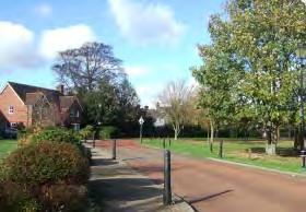
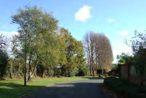
The houses are set at angles to the roads some behind parking areas and lawns, others fronting directly onto shared driveways. Some frontages are open plan whilst others are partially enclosed by shrubs, hedges and some tall brick walls. Where there are no pavements, shared space is denoted by pavers. Pavers also indicate where footpaths cross the access roads.
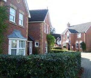
211 I4 – THE HAYDENS
A Victorian-style villa with shallow slate roof and cream painted elevations is enclosed by a high panel fence. The adjoining open space provides an elegant setting.
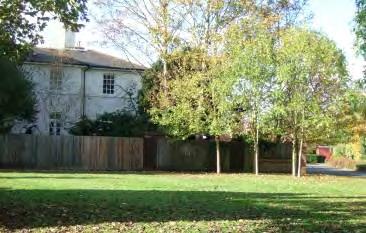
The two storey houses are constructed of red/brown brick with brown steeply pitched gabled roofs with front facing gables and white shaped bargeboards. Some have single storey canted bay windows and dormer windows with decorative finials. The houses incorporate decorative details including decorative brickwork, stone lintels, hanging tiles, false half timbering, white wooden porches, brick arches over windows and ridge tiles. The windows are white in a sash style. Some properties are white painted. Although of standard designs the houses have individual design details which create variety whilst maintaining the cohesion of the overall design of the development.
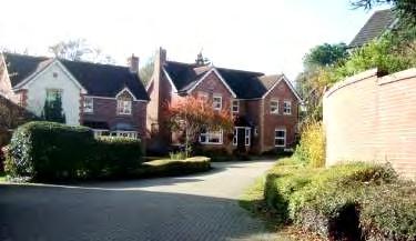
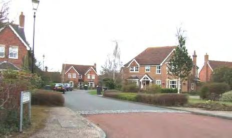
212
.
Locally Distinctive Positive Features
• Spacious landscape areas.
• Use of traditional detail provides variety whilst the development retains a cohesive identity through the uniform scale, roof pitch and limited range of materials used.
• Bands of protected trees provide a backdrop to the houses.
• Belts of trees running along the historic lanes and footpaths provide a landscape framework for the development.
• The curving roads and gently sloping topography create changing vistas.
• The clustering of houses around shared parking areas creates a private, intimate character.
Negative Features Worthy of Enhancement
• No significant detractors.
213


0100200 20406080 Metres¯ I4 Tonbridge Character Area AppraisalRef Title The Haydens
Comprising: Brook Lane, Dawes Close and Millstream Place.
The area forms a strip to the south of Hadlow Road abutting open countryside.
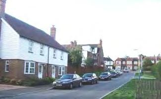
The two storey detached and semi detached houses are constructed in brown brick with red/orange brick details and white weatherboard or hung tiles. The half hipped or gabled roofs are tile or slate, often with front facing gables with hung tiles. The houses have white casement windows and decorative white lattice porches or white flat bracketed porch canopies and some have single storey bay windows with pitched roofs. The properties have attached or integral garages and are set close to the road behind open plan small lawns, shrubs and occasional hedges. The houses are on an uneven building line, at angles to the curving roads and culs-de-sacand are clustered around shared driveways. Sections of the road are paved denoting shared space. The area has little traffic although the adjoining Hadlow Road and Cannon Lane are very busy.
The entrance to Millstream Place is spacious with a wide grassed verge on the eastern side. Belts of trees on the south eastern and south western sides of the area form an edge to the character area, a backdrop to the housing whilst blocking longer views.

215 I5 ‐ BROOK LANE AREA
Locally Distinctive Positive Features
• Use of different decorative details provides variety whilst the developments retain a cohesive identity through the limited range of materials used.
• Bands of trees provide a green backdrop to the houses and an edge to the urban area.
• Curving culs de sac create changing vistas.
• The clustering of houses around shared parking areas creates a private, intimate character.
Negative Features Worthy of Enhancement
• Traffic noise close to the major roads.
216


0100200 20406080 Metres¯ I5 Tonbridge Character Area AppraisalRef Title Brook Lane Area
I6– QUARRY BANK AREA
Comprising: Fosse Bank and Quarry Bank
Two cul-de-sac developments leading off the west side of Quarry Hill Road, surrounded by and separated by a band of protected trees. Fosse Bank is a short cul-de-sac of a more traditional design with houses on an even building line behind landscaped front gardens with long rear gardens. The belt of trees to the south creates a strongly enclosed, verdant character.
The land dips away northwards but there are no long views due to the belt of trees that surrounds Quarry Bank on three sides giving it a verdant, inward-looking character. This greenness is enhanced by low cover planting, shrubs, hedges and trees lining the road. The road is paved and curving, designed for shared use. The houses are orientated facing the road or sideways to it. The area has a quiet, residential character, although some traffic noise is audible
Locally Distinctive Positive Features
• Verdant character created by tree belts and landscaping.
• Private, residential character designed to encourage a pedestrian dominated environment .
• Design details add interest and character.
Negative Features Worthy of Enhancement
• No significant detractors but some background traffic noise.
218


050100 10203040 Metres¯ I6 Tonbridge Character Area AppraisalRef Title Quarry Bank Area
I7 – BICKMORE WAY AREA
Comprising: Bickmore Way and Ely Gardens.
These three separate cul-de-sac developments are situated on steeply sloping land between the Ridgeway and Yardley Park Road. They were constructed in the 1980s and 1990s and comprise detached houses.
The houses are constructed in red or red/brown bricks of various shades with contrast brick details, pantiled roofs with gable ends and decorative white bargeboards. Each house is slightly different but blends harmoniously into the scheme. Design details include 1-2 storey bay windows, ridge tiles, clay hung tiles, brick patterns and porch canopies. The houses have integrated or separate/ attached garages with pitched roofs, private parking areas and compact rear gardens.
Ely Gardens leads off the Ridgeway, curving down the hillside. The houses are set on an uneven building line, some facing the road, others onto communal driveways and parking areas. The detached family houses are of different designs using a variety of locally appropriate decorative finishes including red brick, white painted render, dark weatherboard, decorative wooden porches, clay hung tiles, brown and red pantiled roofs. The roofs are gabled or half hipped with small plain chimneys and pitched dormer windows. The layout and topography creates ever changing vistas. The frontages are open plan with grass, shrubs and specimen trees. The development has a harmonious quiet residential character.
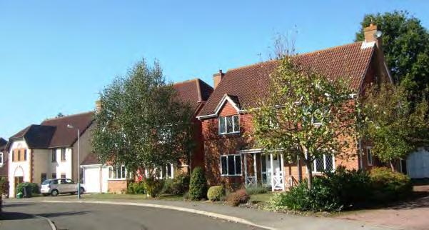
220
To the south of Ely Gardens, a footpath and small grassed amenity area provide a connection to Bickmore Way.
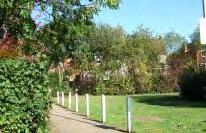
Bickmore Way is accessed from Yardley Park Road and stands on the site of Yardley Court which was demolished in the 1980s. The road falls away sharply northwards before flattening out. To the north, the rear of the houses in Ely Gardens close the view. Bickmore Way comprises detached houses in a variety of locally appropriate materials including red and buff brick with detached garages, brick pavements and open plan or hedged frontages. The houses have prominent gable ends facing the road, some half timbered. The development has a secluded, private, verdant character with the topography and layout providing changing vistas.
Locally Distinctive Positive Features
• Curving cul-de-sac layout and sloping topography create a quiet, private residential character.
• Houses set within verdant plots with large specimen trees.
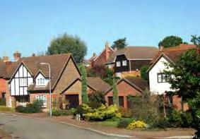
• Harmonious blend of designs, colours and materials based on the local vernacular.
• Design details add interest and character.
• Attractive mix of boundary treatments including open plan, clipped hedges and railings.
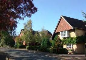
• Good quality, varied surface treatments.
Negative Features Worthy of Enhancement
• No significant detractors.
221

0100200 20406080 Metres¯ I7 Tonbridge Character Area AppraisalRef Title Bickmore Way Area
Comprising: Old Barn Close and Brook Street Farm House
The two storey detached houses are clustered around a shared access. The houses have brown tiled roofs with small plain chimneys and red brick frontages with white painted render, white windows and doors and half timber details. The grassed frontages are partially enclosed by hedges. Trees to the north and east form a green backdrop. The Close has a private character but there is some traffic noise from Brook Street.
A listed farm house and adjacent small development of four detached houses.
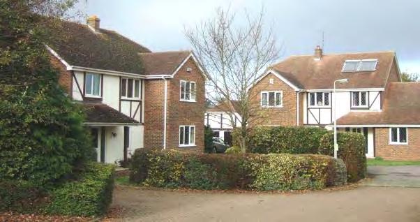
Listed Buildings
Brook Street Farm House and adjoining cottage
L-shaped timber framed house mostly rebuilt in brick on the ground floor with tile hung above. Tiled roof with half-hipped gable. 2 storeys and attic. At the west end of the house is an attached cottage from around 1830.
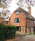
Grade II
Locally Distinctive Positive Features
• Listed building
• Design details add interest and character
• Trees to the north and east
Negative Features Worthy of Enhancement
• Traffic noise
223 I8 – OLD BARN CLOSE
050100 10203040 Metres¯ I8 Tonbridge Character Area AppraisalRef Title Old Barn Close
Comprising: Townacres and Penruddock House
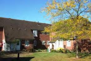
A 1980s residential development of detached, semi-detached and terraced properties on a curving road and short cul-de-sac on flat land to the south of the Ridgeway. The area also includes Penruddock House which is sheltered housing.
The two storey houses are constructed in orange/brown or buff brick with pantiled and plain tiled brown roofs which are gabled or half-hipped with small dormers and no chimneys. Decorative details include orange brick details, orange hung tiles, pitched roof porches and porch canopies. The doors and windows are brown. The houses sit at varying depths from the road behind open plan paved or grass frontages planted with shrubs and occasional hedges. Some high brick walls face the road. The plots are various sizes but relatively compact. The houses have integral or separate garages. Some properties front onto shared driveways and footpaths.
The sheltered housing on the western side of the road is constructed in 1-2 storey blocks set behind footpaths and open plan grassed areas planted with trees. The properties have tall narrow white windows and steeply pitched catslide roofs. Some have two storey bay windows. There is a communal parking area. To the east, the rear of the 1930s cottage style housing and tree belt beside the Shipbourne Road form an attractive back drop.
225 I9 ‐ TOWNACRES AREA
A small grassed amenity area on the south side is planted with trees. Belts of trees frame the development to the east, west and south.
Locally Distinctive Positive Features
• Use of different decorative finishes provides variety whilst the developments retain a cohesive identity through a common scale and the limited range of materials used.
• Bands of trees and grassed amenity areas setting for the clustered development.
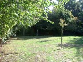
• The clustering of houses around shared parking areas creates a private, intimate character.
Negative Features Worthy of Enhancement
• No significant detractors.
226

050100 10203040 Metres¯ I9 Tonbridge Character Area AppraisalRef Title Townacres Area
I10 PORTMAN PARK (EAST)
Comprising: Portman Park (east)
A self-contained cul-de-sac development dips down at the eastern end of Portman Park.
The detached houses are clustered around the road on an uneven building line. A tall row of poplar trees to the north are a prominent feature. The detached two storey houses are constructed in yellow, orange and buff brick with brown tiled roofs. The buildings vary in design but have gabled brown tiled roofs, pitched porch canopies and attached or integral garages. Some properties have brown hung tiles or weatherboard and gable ends facing the road. The culde-sac curves and dips giving rise to changing vistas and tall trees frame the development on all sides. The development has a quiet private character.
The properties in Portman Park (east) are facing or at angles to the road and are set at varying depths in variable sized plots. The frontages comprise driveways, small lawns and shrub planting and are unenclosed. A few specimen trees enhance the character. Traffic activity is low but background traffic noise can be heard.
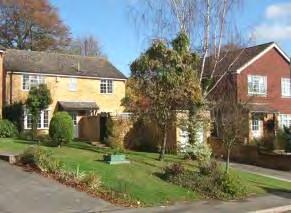
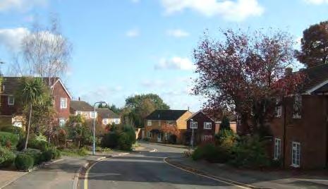
228
Locally Distinctive Positive Features
• Quiet residential character.
• Sloping topography and curving layout in Portman Park create changing vistas and enhances the private, secluded character.
• Trees to the rear of the buildings and on the frontages soften the architecture. Bands of protected trees in Portman Park provide a green backdrop to the houses. The poplars to the north are a prominent feature.
• Variation in design and materials of properties provides interest whilst the development has a cohesive identity.
Negative Features Worthy of Enhancement
• Traffic noise
229


0 50 10010203040 Metres¯ I10 Tonbridge Character Area AppraisalRef Title Portman Park (East)
ROYAL RISE
A small development of semi detached and attached houses off Royal Avenue. The Rise forms the entrance to Hillview and St Stephen’s Schools but has a private quiet atmosphere at off peak times.
A yellow brick and an orange/brown brick house with hipped roofs, decorative brick bands and attractive porches frame the entrance to the development. The other houses are orange/brown brick, some with painted upper storeys or hung tiles. Pitched porch canopies with decorative brackets are topped with slates. Some properties have two storey bays.
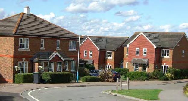
The properties have open frontages with grass and shrubs. Some of the houses are set at right angles to the road facing onto footpaths. The Rise has an enclosed private character. The red, green and blue garage doors are a quirky touch.
Locally Distinctive Positive Features
• Use of traditional decorative details provides variety whilst the development retains a cohesive identity through the common scale and the limited range of materials used.
• The grassed area at the western end provides an attractive vista.
Negative Features Worthy of Enhancement
• No significant detractors.
231 I11 ‐
0 50 10010203040 Metres¯ I11 Tonbridge Character Area AppraisalRef Title Royal Rise
Bungalows became a popular form of development initially in the 1930s particularly on what would have been relatively cheap suburban land. The largest areas of bungalows are found in North Tonbridge to the east of the Shipbourne Road. Bungalows also formed a component part of larger estates. The majority of these bungalows date from the 1930s and the 1960s/1970s. The design of the bungalows changed in these two periods with the earlier bungalows generally being squarer and having more elaborate rooflines, hipped roofs, porches and more design detail than the later buildings which tend to be plainer and more rectangular in design with gabled roofs. Later in the 1960s, the form evolved into chalet bungalow with bedrooms in the roof spaces, with dormers. The 1930s bungalows often have front gardens enclosed by walls, hedges and picket fences, whereas the 1960s and 1970s properties are usually open plan. Despite these differences, where bungalows predominate, even where the building style is different, the character of the area tends to be similar as the single storey buildings create an open, relatively uniform townscape. The low building height together with the location on the elevated land of Cage Green allows long views over the rooftops and between the buildings.
LOCALLY DISTINCTIVE CONTEXTUAL FEATURES
Age of buildings
Type of buildings
Main uses
Building Heights
Prominent building materials
Predominant boundary treatments
Open Spaces
1930s onwards
Detached, semi-detached and some terraced bungalows.
Residential
1 storey or with upper storey in the roof.
Red, brown, yellow or buff brick, brown or red roof tiles, cream or white painted render, white windows.
Open plan, dwarf walls, some hedges and picket fences
Occasional grassed amenity areas and wide verges at road junctions.
233 J - BUNGALOWS
Wheatsheaf Way
Locally Distinctive Positive Features
• Streets have open spacious character particularly in the later developments which have open plan or dwarf wall frontages and long curving streets.
• Retention of original details on older properties.
• Low buildings provide opportunities for long views, and short views of surrounding tree belts.
Negative Features Worthy of Enhancement
• Over-sized dormer additions on some properties do not relate well to the scale or form of the building and are too prominent in the street scene.
• These large developments lack visual interest or local references in terms of materials or design. They tend to be single use (residential estates) with uniform layouts generally lacking in landmarks and reference points.
234
J1 - THORPE AVENUE AREA
Comprising: Cage Green Road (east), Cornfield Way, Denbeigh Drive, Harvest Road, Pippins Close, Thorpe Avenue, Wheatsheaf Way and White Cottage Road (east).
Thorpe Avenue was built by Thorpe, a Southborough builder, in the 1930s and is a long straight tree-lined road running parallel to the Shipbourne Road. To the north lies a 1960s bungalow development on sloping land which is bordered by the Shipbourne Road to the west and Hugh Christie School and the open landscape area, the Woodland Walk to the east and north.
In Thorpe Avenue, the detached and semi-detached bungalows date from the 1930s and are brick or rendered with brown plain tiled hipped roofs and white casement windows. Some have porches with pitched tiled roofs and half timbered gables. Most have tall chimneys. The small front gardens are enclosed by brick walls, wooden fences and some hedges. The building line is regular and the roofline is uniformly low, but uneven. The street trees enclose the street and the flat straight street allows long views northwards of trees and hills. The street has a quiet residential character and has retained a coherent 1930s character despite the more recent addition of velux windows and dormers on many properties.
The bungalows in White Cottage Road sit below road level and the wide pavement and verge create an open unenclosed streetscape. A footpath connects through to Denbeigh Drive.
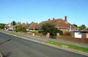
Pippins Close is a discreet, small compact cul-de-sac development of terraced two storey houses set back to the rear of Thorpe Avenue with a spacious landscaped entrance.
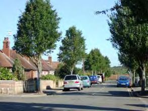
235
Denbeigh Drive, Wheatsheaf Way and Cornfield Way are accessed from the Shipbourne Road, the curving street layout contrasting strongly with the grid layout of the earlier Thorpe Avenue. The detached and semidetached 1960s bungalows are constructed of brick with wide white casement windows, integral garages and gable ended roofs of brown pantiles. Some properties are embellished with green hanging tiles or white synthetic weatherboard and have small chimneys. Gable ends facing the road are a prominent feature. The wide sweeping roads with wide pavements combined with the low building height, sloping topography and lack of on street parking creates a very open, unenclosed, uniform townscape. The houses are set back behind small front gardens and driveways bordered by dwarf walls. Specimen trees and shrubs enhance the character and the development is framed by belts of tall trees visible on all sides over the roof tops. The lack of through routes creates a quiet residential character.
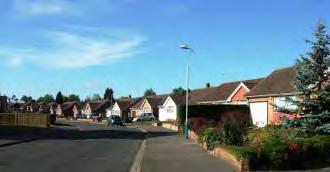
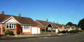
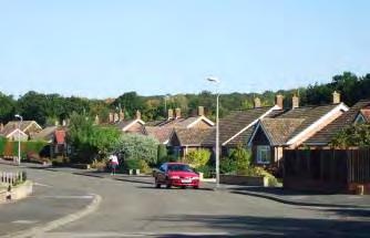
A grassed amenity space with tall trees at the northern junction of Wheatsheaf Way with Denbeigh Drive is an attractive feature enlivening the somewhat uniform townscape.
Locally Distinctive Positive Features
• Uniform design and scale give cohesive spacious character.
• Belts of trees which frame the development on all sides mark the edge of the character area and provide a green backdrop visible over and between the houses.
• Grassed amenity space at the northern junction of Wheatsheaf Way with Denbeigh Drive.
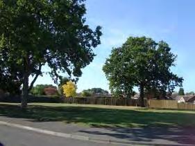
Negative Features Worthy of Enhancement
• No significant detractors.
236


0 250 50050100150200 Metres¯ J1 Tonbridge Character Area AppraisalRef Title Thorpe Avenue Area
J2 - ORCHARD DRIVE AREA
Comprising: Cherry Grove, Colin Blythe Road, Eastfield Gardens, Frank Woolley Road, Greentrees Avenue, Hartfield Close, Merlin Close, Orchard Drive, Rodney Avenue and Pen Way,
An extensive area of bungalows on long curving roads and short culs-de-sac sloping down from Higham Lane to Cornwallis Avenue. The development was begun in the 1930s but only completed after the war. The older properties are at the eastern end close to Cornwallis Avenue.
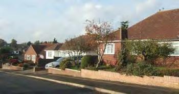
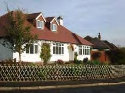
The long curving roads, sloping topography and low buildings set back behind dwarf walls and picket fences, parking areas and lawned gardens with low shrubs and trees create an open, unenclosed townscape with long views to the south and south east. On the western part of the development, the 1960s semi detached and detached bungalows are set in wide plots and are in a variety of styles with red brick or white painted render and brown or red tiled hipped roofs and wide white windows. Some have bow windows and forward projections with gable ends facing the road. The lack of on street parking creates an uncluttered townscape but some surfacing is poor.
There are short views westwards looking over the rooftops to HIgham Lane from Eastfield Gardens and Cherry Grove.

238
In Colin Blythe Road, the detached1930s bungalows are more uniform in design, the eyebrow windows, consistent roofline, bay windows and tall chimneys giving a strong rhythm to the street. The front gardens are enclosed by brick walls and hedges and the character is more intimate and less open than Orchard Drive.
Locally Distinctive Positive Features
• Spacious character created by curving roads, sloping topography, lack of on street parking and low buildings set back behind low boundaries.
• Long views to the south and south east.
• Retention of 1930s design features in Colin Blythe Road.
Negative Features Worthy of Enhancement
• Some poor surfacing.
239


0 150 300306090120 Metres¯ J2 Tonbridge Character Area AppraisalRef Title Orchard Drive Area
AUDLEY AVENUE (WEST) AREA
Comprising: Alders Meadow and Chestnut Walk
A small area of attached and semi-detached bungalows situated on flat ground at the edge of the built up area dating from the 1930s-1970s. Alders Meadow comprises properties around a communal parking area on very compact plots constructed in brown/orange brick with shallow slate roofs and white windows and doors. The area has a quiet residential character although passing trains can be heard. Tree belts to the west and north frame the development.
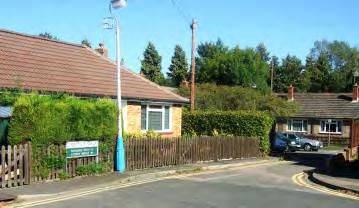
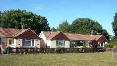
The houses at the western end of Chestnut Walk are semi detached with cream painted pebble dash and hung tiles on the gable ends situated around a grassed amenity area and communal parking. The compact gardens are enclosed by picket fences.
Chestnut Walk comprises 1930s bungalows and more recent bungalows in yellow, red and buff brick. The eastern end of Chestnut Walk has a more mixed character.
Locally Distinctive Positive Features
• Tree belts to west and north which frame the development and screen the railway line.
• Open space with trees
Negative Features Worthy of Enhancement
• No significant detractors.
241 J3 -
0 100 20020406080 Metres¯ J3 Tonbridge Character Area AppraisalRef Title Audley Avenue (West) Area
CRANFORD ROAD AREA
Comprising: Barchester Way (south), Cranford Road and Guestwick.
An area of bungalows on flat land to the north of Hadlow Road East built in the early 1970s. The houses are situated on long curving roads and culs-de-sac with glimpses between the houses of open countryside to the north east. The development connects to and is visually linked to the 1960s Barchester Way development.
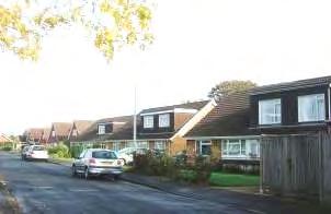
Guestwick is a straight road of yellow brick semi detached and detached chalet bungalows with wide horizontal windows and prominent gable ends or dormer windows. The properties are set behind open plan front gardens and parking areas and the landscape is enhanced by a small grassed area at the eastern junction with Barchester Way.
The southern end of Barchester Way is lined by bungalows and chalet bungalows set in wide plots with prominent gable ends decorated with hung tiles set behind front gardens which are partially enclosed by shrubs and hedges, giving a verdant character
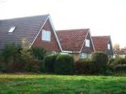
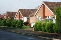
Cranford Road forms a wide loop off Hadlow Road. Bungalows in repeated designs with prominent gable ends set behind open lawns and parking areas create a rhythm of uniform, unenclosed townscape. There are some two storey properties on the south side of the Street.
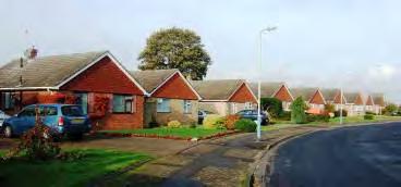
243 J4
Locally Distinctive Positive Features
• Glimpses and views of countryside.
• Prominent gable ends set behind open lawns and parking areas create a rhythm of uniform, unenclosed townscape.
Negative Features Worthy of Enhancement
• Some poor surfacing
244
0 100 20020406080 Metres¯ J4 Tonbridge Character Area AppraisalRef Title Cranford Road Area
High Hilden
In some areas of the town landscape dominates the buildings, creating a verdant, almost rural character. Mature trees rather than buildings contain the public space.

In these areas the houses are generally individually designed and built at a low density set within extensive private gardens. Buildings are scarcely noticeable. They tend to be apparent at intervals at drive entrances but generally no more than one or two are apparent from any viewpoint. They are often screened from the road by high hedges, shrubs and mature trees. Trees within side and rear gardens provide a visual link between one house and the next, unify the composition and contain the character area.
The historic road pattern has in some places been preserved and the narrow, winding lanes contribute to the informal character.
Three such areas have been identified in Tonbridge, two at the edge of the built up area off London Road and along the route of the Old Hadlow Road. The third forms a small enclave to the north of Hadlow Road. All three areas are located close to major access routes, but provide a strong contrast to the bustle of these busy roads. They have little or no through traffic and have a peaceful, private ambience.
246 K – ARCADIAN AREAS
LOCALLY DISTINCTIVE CONTEXTUAL FEATURES
Age of buildings
Type of buildings
Main uses
Building Heights
Prominent building materials
Predominant boundary treatments
Open Spaces
Various
Detached
Residential
1-2 storeys
Various, but predominantly red brick and white painted render and windows.
Hedges, trees, shrubs, fences and walls
Some views over and access to open countryside.
Locally Distinctive Positive Features
• Dominance of landscape over buildings.
• Mature trees contain the public space.
• Trees within side and rear gardens provide the visual link between one house and the next, unifying the composition and framing the character area.
• Low density development.
• Retention of historic road patterns and informal character
• Individually designed houses.
• Little or no through traffic creating a quiet, private character despite proximity to major roads.
Negative Features Worthy of Enhancement
• No significant detractors although functional street furniture interrupts the informal landscape character.
• Some traffic noise from the London and Hadlow Roads near the boundaries of the character areas.
247
Comprising: Bourne Close and Bourne Lane
A narrow lane leading off the Hadlow Road and connecting through to the recent housing at the Haydens to Lover’s Walk.
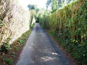
Bourne Close is narrow and is bordered by high clipped hedges giving a strong sense of enclosure.
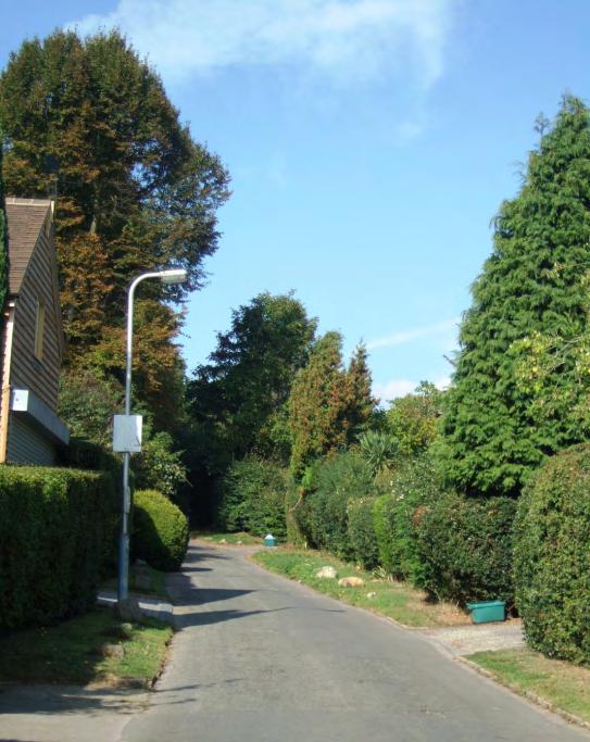
The houses along Bourne Lane and at the end of Bourne Close are of mixed age, design and materials. However, they are all detached, two storey and set within extensive private gardens.
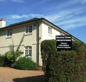
248 K1 - BOURNE LANE AREA
Locally Distinctive Positive Features
• Historic and narrow lanes lined by mature hedges and trees.
• Detached houses of various ages and designs, including well conserved Victorian villas.
• Very quiet residential character despite proximity to the Hadlow Road.
Negative Features Worthy of Enhancement
• No significant detractors although functional street furniture interrupts the informal landscape character
249


0 50 10010203040 Metres¯ K1 Tonbridge Character Area AppraisalRef Title Bourne Lane Area
Comprises: High Hilden, Hilden Fields and Oast Lane.
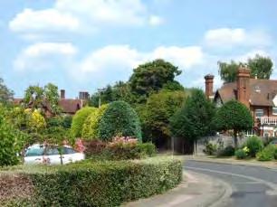
This curving narrow lane slopes up to the north from London Road.
High Hilden is a curving narrow lane rising to the north of London Road. The lane is bordered by trees, shrubs and hedges. The houses are of mixed age with substantial late Victorian villas and more recent infill development. All are set back from the road in extensive private gardens.
The flamboyant chimneys on the late Victorian/ Edwardian villas are visible from the London Road rising above the trees. High Hilden House, now a residential home for the elderly is a particularly impressive landmark building with shaped gables, stone cross windows and tall Tudor style chimneys. The Lodge Building on London Road also has prominent chimneys.
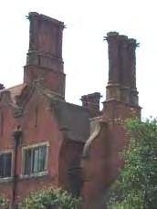
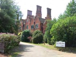
251 K2 - HIGH HILDEN AREA
The frontage of London Road is heavily vegetated in this part. Oast Lane is bordered by grass verges and trees on both sides. Looking south down Oast Lane there is a pleasant vista of the listed Manor Cottages on the London Road (see Character Area A3.1).
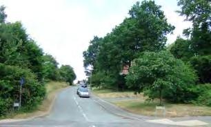
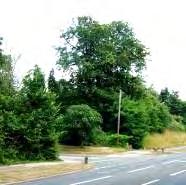
Locally Distinctive Positive Features
• Narrow historic lanes lined by mature hedges and trees.
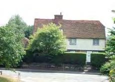
• Some interesting examples of late Victorian/Edwardian villas and a lodge house with many original details and prominent Tudor style chimneys rising above the trees and visible from character areas to the south.
Negative Features Worthy of Enhancement
• No significant detractors.
252
0 100 20020406080 Metres¯ K2 Tonbridge Character Area AppraisalRef Title High Hilden Area
K3 - HADLOW STAIR AREA
Comprising: Hadlow Stair, Old Hadlow Road (north) and Stair Road (east).
The Old Hadlow Road was bypassed in 1930 when Cornwallis Avenue was constructed. It is now a quiet residential street that forms a loop off Cornwallis Avenue and is lined by mainly detached houses of various ages and styles in substantial plots. The north eastern section is assessed in this section. The southern section is appraised in the section on Lower Density
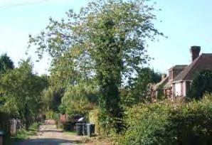
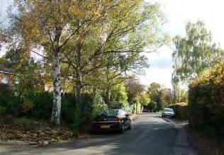
Detached Developments. Stair Road leads off Old Hadlow Road to a group of Listed Buildings. Hadlow Stair runs from Hadlow Road along the edge of the built up area.
The eastern end of Stair Road becomes narrow and twisting leading to a cluster of historic listed buildings and a riding stables. There are panoramic views south over meadows to the South Downs.
Hadlow Stair is a narrow private road with individually designed detached houses in large plots on the north side overlooking open countryside to the south. It has a private, informal rural character which belies its proximity to a main route.
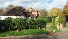
254
Listed Buildings
Hadlow Stair Farm House, Old Hadlow Road
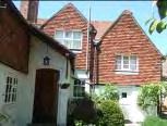
Farm house dating from the late C17 and later with a ground floor of red brick and a tile hung upper storey, hipped tiled roof and casement windows.
Grade II
Hadlow Stair House, Stair Road
Early C17 house with later wings in brown and red brick with hung tiles, part hipped roof and many original internal features.
Grade II
Barn to the south of Hadlow Stair House, Stair Road
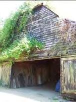
Early C18 barn. Timber frame weatherboarded on brick base with half-hipped roof.
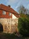
Grade II
Locally Distinctive Positive Features
• Winding historic road with houses set well back behind verdant frontages of mature hedges and trees
• Views south across meadows to the South Downs.
• Listed buildings.
• Peaceful residential character.
• Rural character of Hadlow Stair.
Negative Features Worthy of Enhancement
• Some traffic noise close to Hadlow Road.
255
0 100 20020406080 Metres¯ K3 Tonbridge Character Area AppraisalRef Title Hadlow Stair Area
In some areas, piecemeal development and redevelopment can result in a frontage that is very mixed in terms of the layout, style and age of buildings. In Tonbridge, whilst the character is more mixed along the principal routes, the housing areas to the rear have generally retained a distinctive character related to the period in which they were designed, by whom and for whom they were constructed and the physical factors of their location. There are however exceptions where the individual houses vary so much in age, materials and appearance that no particular character predominates. However, whilst there is a mix of architectural style and detail, the housing is generally traditional in form with pitched roofs. For the purposes of this appraisal, these areas have been designated as being of mixed character.
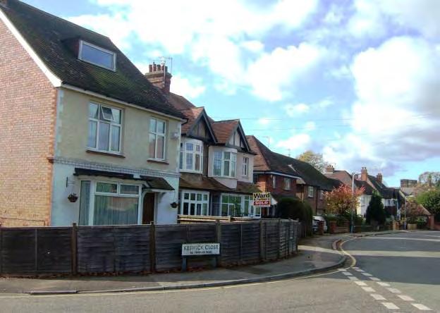
257 L - MIXED CHARACTER AREA
Portman Park
LOCALLY DISTINCTIVE CONTEXTUAL FEATURES
Age of buildings
Type of buildings
Main uses
Building Heights
Prominent building materials
Mixed age, principally 19th century onwards.
Detached, semi-detached and terraced.
Residential
1 - 2 storeys
Brown and red brick, painted render, half timbering, tile hanging on upper storeys, tiled and slate roofs.
Predominant boundary treatments
Various including brick walls, wood panel fences, hedges and open plan.
Open spaces None
Locally Distinctive Positive Features
• Relatively quiet residential streets.
Negative Features Worthy of Enhancement
• No significant detractors, but these developments lack a unified character in terms of materials or design.
258
L1- PORTMAN PARK (WEST)
Comprising: Portman Park (west)
A short road, adjacent to Tonbridge Conservation Area, leading eastwards directly off the High Street. A small turning circle with a tall tree at the centre marks the eastern end of the character area. Keswick Close, a 1970s cul-de-sac leads off to the south and beyond the turning area there is a cul-de-sac of 1980s housing. On the north side large detached houses dating from the 1990s form part of the Haydens development.
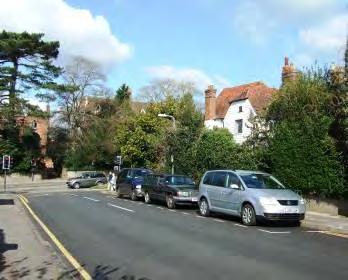
The detached two storey houses in Portman Park date from the 19th and 20th centuries. They front the street behind narrow front gardens enclosed by low brick walls, hedges and fences. The roofline is varied including gabled and hipped roofs and some forward facing gables on the 1920s/30s properties. The front elevations are red brick or painted in pastel shades. The roofs are slate or tiles.
Looking westwards along Portman Park towards the Conservation Area
Locally Distinctive Positive Features
• A relatively quiet residential street set back from the bustle of the High Street.
• Trees and tall hedgerows at the eastern end create a verdant vista. At the western end the buildings of Tonbridge School are visible in the conservation area. A listed cottage and trees and shrubs to the north form an attractive vista.
Negative Features Worthy of Enhancement
• Traffic noise at western end.
259


0 50 10010203040 Metres¯ L1 Tonbridge Character Area AppraisalRef Title Portman Park (West)
– KENDAL DRIVE AREA
Comprising: Kendal Drive and Lime Tree Close
Cul-de-sac developments built in three phases in the 1960s – 1980s on former garden land to the west of Hadlow Road.
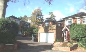
The style and materials of the houses vary according to the age of the development. The earlier properties are in buff brick with gabled, shallow roofs, part white painted elevations and wide white windows. The properties at the eastern end of Kendal Close are red brick with hipped roofs and decorative porches and are clustered around communal accesses. The houses are set back behind open or fenced grassed frontages planted with trees and shrubs and have flat or pitched roof attached garages.
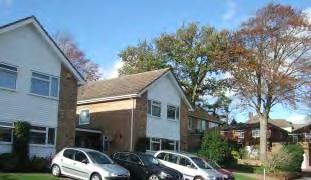
261 L2
Limetree Close is higher density with detached and terraced red brick housing with slate roofs, dormer windows, porches, shaped bargeboard and chimneys. On the south side there is a short row of three storey terraced town houses in yellow brick with orange brick details and integral garages nestling on low ground to the rear of Hadlow Road. There are some bungalows. There are glimpses of tall chimneys to the west and the houses on Hadlow Road to the south. A visitor’s car park on the north side is backed by a belt of trees
Locally Distinctive Positive Features
• Quiet residential character
• Trees to the rear of the buildings and on the frontages soften the architecture.
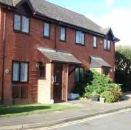
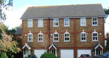
Negative Features Worthy of Enhancement
• No significant detractor
262


ion Plan 050100 10203040 Metres¯ L2 Tonbridge Character Area AppraisalRef Title Kendal Drive Area
– GARDEN ROAD AREA
Comprising: Garden Road and Cannon Lane
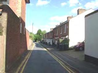
This compact area of mixed age housing is encircled on three sides by the busy Hadlow Road and Cannon Lane. The west sides abuts the Conservation Area. Garden Road is a narrow straight single lane cul-de-sac connecting Hadlow Road to a footbridge onto Cannon Lane. It has a surprisingly quiet residential character.
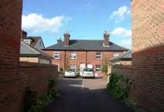
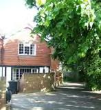
The entrance to Garden Road from Hadlow Road is enclosed by the side elevations of houses fronting Hadlow Road and Garden Terrace on the western side. The terraced cottages have wide porch covers and single storey bay windows with many replacement windows and doors. They are set close to the road behind narrow paved unenclosed frontages. There is a vista of trees at the southern end and along the Mill Stream.
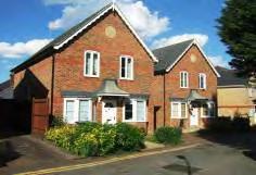
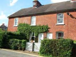
On the eastern side there is a further short terrace of Victorian cottages with panelled front doors and sash windows in gently arched openings and tiled roofs. The properties are set behind hedges with white picket gates. An narrow informal access runs eastwards past houses of mixed age to the Victorian properties backing onto Cannon Lane.
Towards the southern end a small development of clustered modern housing constructed in yellow and red/brown brick with vertical fenestration, slate roofs with gables facing the road and single storey canted bay windows blends sympathetically with the Victorian cottages. A tile hung, half timbered property and group of trees forms a focal point at the end of the street. There is a glimpse through to a symmetrical hipped terrace backing onto Cannon Lane.
264 L3
On the western side of the road, a short cul-de-sac of 1970s terraced housing and three more recent detached houses contrast strongly with each other and the other properties in the street both in terms of style and materials. The 1970s housing is constructed or red/brown brick with flat porch covers, shallow gabled brown tiled roofs and orange shaped hung concrete tiles. The brown brick detached houses have brown wooden windows and integral garages.
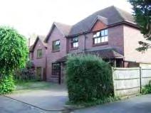
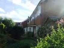
In Cannon Lane, the backs of Victorian gabled properties are visible over high fences and Victorian brick walls. The properties are set back behind a wide verge and parking areas and make little impact on the streetscene.
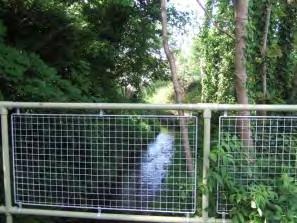
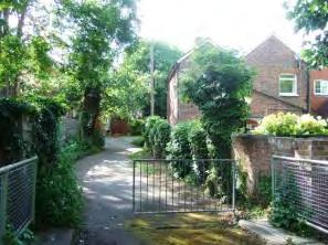
265
A footbridge crosses the Mill Stream to join the busy Cannon Lane which runs through a commercial area forming a bypass to the town centre. Tall trees along the Mill Stream and within Garden Road help to screen the area from traffic noise and movement. The standard metal barriers and railings detract from the townscape. An old garden wall adds interest.
Locally Distinctive Positive Features
• Northern section of Garden Road has a Victorian cottage character
• Southern section is verdant with a relatively quiet residential character.
• Retention of architectural details including arched window and door openings, shaped barge boards, slate and tile roofs, chimneys and contrast brickwork on some Victorian properties.
• Historical interest of the Mill Stream.
• Tree belt along the Mill Stream.
Negative Features Worthy of Enhancement
• Railings and barriers
• Some traffic noise
266


050100 10203040 Metres¯ L3 Tonbridge Character Area AppraisalRef Title Garden Road Area
CHALETS
M1 - TOWNGATE WOOD PARK AREA
This small enclave of chalets to the north of Tonbridge has a unique character. The chalets are arranged around a narrow looped road with passing spaces. The character area contains some individual specimen trees. The chalets are arranged in a series of short closes at right angles to the loop road.
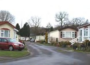
The chalets are arranged in a series of short closes at right angles to the loop road. The tree belt to the north frames and screens the area from adjoining countryside
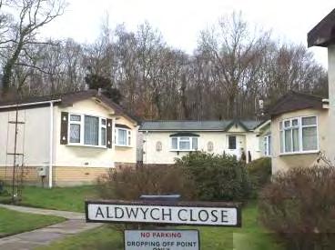
268 M-
Single storey chalets with pitched roofs arranged in rows around narrow access roads.
Comprising: Cherry Tree Road, Aldwych Close, Guards Close, Portland Close, St. James Close and Saville Close.
LOCALLY DISTINCTIVE CONTEXTUAL FEATURES
Age of buildings
Type of buildings
1950’s onwards
Chalets
Main uses Residential
Building Heights
Prominent building materials
Predominant boundary treatments
Open spaces
Single storey
Brick base, rendered walls and felt roofs.
None
Small grasses areas around the plots.
Locally Distinctive Positive Features
• Mature trees within, and creating the edge to, the character.
Negative Features Worthy of Enhancement
• No significant detractors.
269
0100200 20406080 Metres¯ M1 Tonbridge Character Area AppraisalRef Title Townsgate Wood Park Area
The main commercial areas of Tonbridge are located to the east and south east of the town, bordering the countryside at one edge, and the area covered by the Town Centre Area Action Plan to the west. Development is generally located along the wide, curving Vale Road, or short, narrower culs-de-sac served by it. Units are single storey with shallow roofs and built from a variety of coloured panel materials and brick. Car parking areas and acesss tends to dominate and landscape treatment is often minimal in earlier developments.
N1 - VALE ROAD AND WOODGATE WAY AREAS
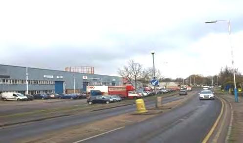
Vale Road, Vale Rise, Woodgate Way, Sanderson Way, Cannon Lane, Swanmead Way, Tudeley Lane.
Car parking areas are prominent and generally lack lanscaping.
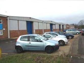
271 N - COMMERCIAL AREAS
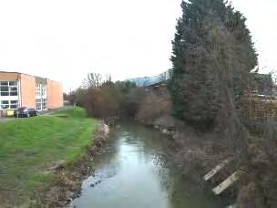
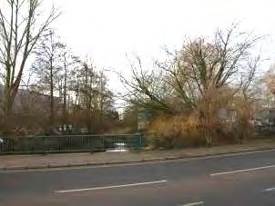
272
Landscape adjoining the river is an important feature of the character area.
Mature tree boundaries are minimal but important in attempting to screen the development from the countryside.
Wide views over the town and Castle Hill from Woodgate Way
LOCALLY DISTINCTIVE CONTEXTUAL FEATURES
Age of buildings
Type of buildings
Main uses
Building Heights
Prominent building materials
1950s onwards
Large individual buildings or groups of linked units.
Industrial. retail warehouses and car showrooms.
1 -2 storeys
Steel and brick.
Predominant boundary treatments None
Open spaces None
Locally Distinctive Positive Features
• River Medway and its structural landscape setting.
• Trees forming the edge of the character area abutting the countryside.
• Views from Woodgate Way.
Negative Features Worthy of Enhancement
• Undistinguished buildings with no local references.
• Wide streets generally lacking in landmarks and reference points.
• Extensive areas of car parking fronting the street without enclosure or landscaping.
• Functional but unattractive fencing as boundary treatment.
• Units east of Cannon Lane and north of the Medway turn their backs on the river leaving it unsightly and not overlooked.
273


0 350 70070140210280 Metres¯ N1 Tonbridge Character Area AppraisalRef Title Vale Road and Woodgate Way Areas
Comprising: Drayton Road
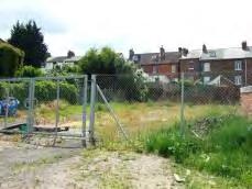
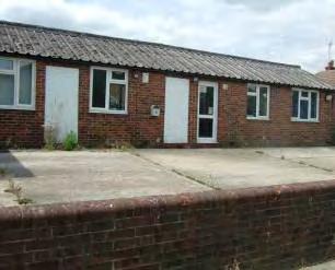
A compact industrial area within the urban area accessed via Lavender Hill.
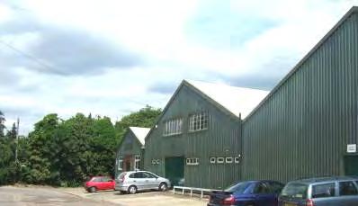
A short straight road leads from Lavender Hill to a row of linked green metal clad units with an extensive poorly paved parking area to the front and further units and workshops to the rear. The buildings are situated in a slight dip and enclosed by tree belts along the railway line to the east and north of the access road. To the south and west the terraced properties in Lavender Hill and Pembury Road screen the development from surrounding areas, minimising its impact on the wider townscape.
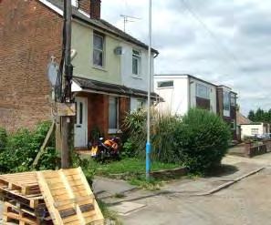
275 N2 – DRAYTON ROAD
On the west side a miscellaneous group of single and two storey buildings includes Victorian residential cottages and more recent flat and pitched roof offices behind concrete parking areas partially enclosed by brick walls.
On the south side there are further residential properties and vacant land.
LOCALLY DISTINCTIVE CONTEXTUAL FEATURES
Age of buildings 1800s onwards
Type of buildings
Main uses
Linked and detached units, offices and houses.
Light industrial, offices and residential.
Building Heights 1 -2 storeys
Prominent building materials Steel and brick
Predominant boundary treatments Brick walls and wire fences
Open spaces None
Locally Distinctive Positive Features
• Trees forming the edge of the character area.
• Siting and screening of development protects the historical character of Lavender Hill and Pembury Road.
Negative Features Worthy of Enhancement
• Miscellaneous collection of buildings, some in poor state of repair.
• Extensive areas of poorly surfaced car parking.
276
0 50 10010203040 Metres¯ N2 Tonbridge Character Area AppraisalRef Title Drayton Road
278
9 Design Guidance
New development of whatever scale cannot be viewed in isolation. The design of all new development should take into account the character of the building or site on which it is situated and the surroundings (the locally distinctive contextual features). This will help ensure that the design of new buildings evolves, where appropriate, from the qualities that make many parts of Tonbridge distinctive. It is important that new development creates a place that is valued and well related to local character. Where such distinctiveness is present and is ignored, new development can be bland, lose reference to essential local features and, as a result, erode local character and distinctiveness.
Whilst some minor development is permitted by Parliament without the need for a planning application (usually known as “permitted development”) home owners and developers who are considering such alterations should refer to the distinctive characteristics of their area as described in this SPD when considering even minor development to ensure an acceptable result. The Council’s planning staff will also use the SPD as a basis for giving advice to those who intend to exercise permitted development rights. Although the Council will not be in a position to require these good design principles in such cases, it will nevertheless encourage their use where possible.
There are four principles which the Council will apply in protecting, conserving and, where possible, enhancing the character and local distinctiveness of the area. The principles are consistent with, and supplement, the policies in the Core Strategy and the Managing Development and the Environment DPD. In applying these principles, regard must also be paid to the need to achieve sustainably designed properties that, where practicable, take advantage of local site conditions and incorporate materials, technologies and planting that help to reduce their energy requirements and therefore lower their carbon footprint. This is a key priority of the Council as well as being an objective of the Managing Development and the Environment DPD. Providing this objective is addressed early in the design process in a sensitive way that respects the local character as identified in the Character Area Appraisals, there is no reason why it should not be effectively delivered without compromising the principles set out below:
Where validation provisions require it proposals should be accompanied by a design and access statement that explains how the proposal:
• respects the locally distinctive positive features of the character area identified in the SPD. The positive features of an area such as building and roof lines, scale, massing, design characteristics, boundary treatments, landscape and layout should normally be reinforced by the proposal. Using local historic details and materials will also reinforce the character and local distinctiveness of the area.
• wherever possible, improves the character and design quality of the character area, and thus the town of Tonbridge, by reinstating or reinforcing locally distinctive positive features of the character area identified in the SPD and/or replacing, screening or otherwise mitigating negative features worthy of enhancement, or
• creates a new local character in areas where there are few locally distinctive positive features or on more extensive sites where there is a greater opportunity to create a new local character.
279
Proposals may come forward that can, exceptionally justify a departure from the local context. Such proposals will need to establish clear and overriding planning and design justification if they are to prove acceptable.
Local analysis and consultation has been used to interpret these design principles and develop appropriate design guidance for assessing development proposals within each character area. This is set out below.
Respecting the locally distinctive positive features of the character areas identified in the SPD.
In order to respect the locally distinctive positive features of a character area, development will be expected to:
(1) Protect or enhance the setting of the conservation areas and listed buildings
The topography of Tonbridge gives views across the town’s two Conservation Areas. Given that some character areas are built on higher ground set above the Conservation Areas, the impact of development within them could have greater impact. It is therefore important that any development in such areas and in Character Areas immediately adjacent to the Tonbridge and Quarry Hill Conservation Areas preserves or enhances their character.
There are a number of listed buildings situated within the character areas of Tonbridge. Listed building controls apply to all works affecting a Listed Building. The design of new buildings in proximity to historic buildings also needs very careful consideration since the setting of a listed building is often an essential part of its character, especially if a garden or grounds have been laid out to complement its design or function. An important aspect of the design process in such situations will be to balance the impact on both the listed building and the character area.
(2) Respect the scale, height, form, alignment, space, layout and density, materials and character of the area
For each character area there are identified locally distinctive contextual features and positive features which new development should respect. In considering new designs, visual clues are seen, at the large scale, in terms of the form, height and alignment of the buildings and the rhythms formed, for example, by chimneys, porches, brick details and fenestration and, at the small scale, in relation to details such as materials, colour and brick patterning, the shape and pattern of windows and doors and boundary treatment.
At the large scale, the height and form of buildings are often relatively uniform within character areas, although some variation may be evident. Significant differences in height may not respect the local context. Roofscape patterns are often repeated through a street, bringing unity or a rhythm of repeated shapes (hipped or half-hipped roofs, gable ends facing the road, or unified, simple roof lines which front the street with no projections such as dormer windows). The unity or rhythm of rooflines should preferably not be compromised by inappropriate roof extensions.
280
In relation to alignment of the buildings, in some instances regular building lines are established. For example, groups of substantial detached properties set back along a common building line in large plots behind walled mature landscaped gardens giving a spacious, verdant character. In other clusters, properties are situated on a straight building line with a minimal set back from the street providing a tight knit urban form. A distinctive unity is retained. It is important that new buildings respect the alignment of buildings in order to fit well within the local context. Where buildings are set back a consistent distance from the street along a common building line the visual integrity of a whole street should not be compromised by porches or front extensions
These considerations apply to the front building line and also to the width of the development within the plot and the space that exists between and around buildings. There should be sufficient width within a plot to locate the building(s) and provide adequate separation between them in order to reflect the general spacing characteristics of an area. There are considerable pressures to maximise the use of sites but this should not be to the detriment or erosion of the distinctive character of the area.
Many of the character areas possess a strong unified palette of materials. For example, the 19th Century cottages and Edwardian villas of red brick and slate or brown tiled roofs or the 1920s and 30’s public and semi-detached housing of red brick, brown tiles and white/ cream painted render. The choice and combination of materials is crucial to the success of a scheme. In creating a locally distinctive environment, the number of different materials used should generally be kept to a minimum. New buildings, or extensions, should be constructed of materials which respect those used in the character area within which they are proposed.
A richness of design and texture can be achieved through careful detailing eg brick detailing such as arches above windows and doors, string courses and quoins, decorative tile patterns and ridge tiles, finials, brick bonding, decorative chimneys and decorative barge boards, eaves and soffits, white painted pillars, porches and balustrade balconies. The following typologies of character areas contain significant examples of original and valuable detailing:
• Parts of the Principal Road Frontages
• 19th Century cottages
• Edwardian Villas
• Parts of the Arcadian areas
• Early 1920’s and 30’s public and semi-detached housing
New buildings, or extensions, should, where appropriate, apply local detailing which reinforces the character of the area within which they are proposed.
Careful consideration should also be given to ensuring that good quality traditional detailing on buildings is retained. Where these have been removed, efforts should be made to restore them. Replacement doors, windows and roofs should closely match the design and materials of the original features. Where inappropriate new windows, doors and roofs are to be replaced, the opportunity should be taken to put back in the original style.
The principles set out above should drive the design process in the vast majority of cases. However, they should not necessarily be regarded as a deterrent to the creation of imaginative high quality contemporary designs using appropriate contemporary materials in the right setting.
281
(3) Retain traditional boundary treatment and natural features
Brick walls, hedges and mature trees, picket fences and black metal railings are prevalent features in different character areas. They help enclose the road space, define the boundary between public and private space and help reinforce the character of an area. Areas can be distinctive by virtue of their well-treed appearance. Development should not erode such features through the loss of walls, hedges/ trees or the use of unsympathetic boundary treatment.
Parking areas have been created on some frontages leading to an erosion of the street enclosure, a loss of defensible space around the building and the link to the character of the area. Wherever possible, traditional boundary enclosure should be reinstated. Where the opportunity arises, new boundaries should use the prevailing materials and designs in the character area. So far as possible, some space should be allowed for planting or other features to soften the effect of parked vehicles upon the street scene.
(4) Protect local landmarks
Tonbridge contains a number of landmark buildings which help give historic and visual reference points, assist legibility of the area and help prevent a monotonous appearance. Such buildings can sometimes be somewhat unusual features in a particular character area. There are a number of local landmark buildings identified within the character areas shown on the Townscape Analysis Maps. These buildings are important in the street scene and, where appropriate in the context of the development proposed, there will be a strong presumption that they will be retained and incorporated in any new development. There are also important longer distant views of landmarks within the town centre Conservation Area which need to be taken into account. These landmarks are identified and protected in the Conservation Area Appraisals and important views of these buildings from the surrounding character areas are identified in this SPD (see Guidance Note (6) below)
5) Protect and Enhance Landscape Features
Some character areas such as the post-war public housing schemes have significant areas of public open space (shown on the Townscape Analysis Maps) as an integral part of their character. Important open spaces may already be protected for their recreational value by other polices in the LDF but they should also be retained, and their tranquil character respected, because of their importance to the amenity and character of the area.
The appraisal also identifies a number of tree belts which are visible from the public domain (shown on the Townscape Analysis Maps) some of which may form an edge to the character area (sometimes representing an original field boundary), and some form a backdrop to development or act as a visual amenity (sometimes in an area where the buildings themselves may have little distinctive character). These features perform an important function within a character area(s) and should be protected and, so far as possible, retained in any new development.
There are two Areas of Landscape Significance which provide a landscape framework within Tonbridge. Within both areas, the landscape is the dominant feature. Development should not erode the character of these areas which are valuable in their own right but also in providing an extensive landscape framework to a number of surrounding character areas.
282
There are three character areas in Tonbridge where landscape dominates the buildings, creating a verdant, almost rural character. Mature trees rather than buildings contain the public space and the narrow, winding lanes of the historic road pattern has in some places been preserved and contributes to the informal character.
Development should not erode these unique features through the loss of trees which are important to the character or the generation of substantial additional traffic that would cause the erosion of the boundary features.
6) Protect views of the open countryside and across the town
The topography of the area and the disposition and scale of development allows long views of the Sevenoaks Ridge, Castle Hill, Medway Valley and the Low Weald from some of the character areas (shown on the Townscape Analysis Maps). These views are important to the character of the area and should not be lost through future development.
A number of long distance views from a range of high points extend across the town. Some areas of town are visible from a number of vantage points where views intersect. Development within these most visible areas becomes strategically important. There will be a presumption against development that unacceptably intrudes into these important views or competes with recognised landmarks.
7) Respect the quiet residential character
The cul de sac layout with no through traffic; distance from the main roads; proximity of the countryside and almost exclusively residential development has resulted in a quiet residential character within a large number of the Tonbridge character areas. This character should not be adversely affected by new development.
8) Improve the character and design quality of a character area, and as a result the town of Tonbridge
(a) Residential areas
Many parts of the town are likely to remain largely unchanged by substantial redevelopment over time but there may be opportunities for new development. For example, isolated properties or in some cases garage courts may be replaced (subject to there being satisfactory alternative parking provision). In such cases, the scale and form of the surrounding development as well as the locally distinctive positive features should be respected.
283
In some cases there may be opportunities to enhance the area through the creation of individual buildings of interest or additional landscape features. Landmark buildings can lift a design from the ordinary and may be justified on the basis of a sound urban design appraisal of their context and a perceived environmental uplift to the quality of the area.
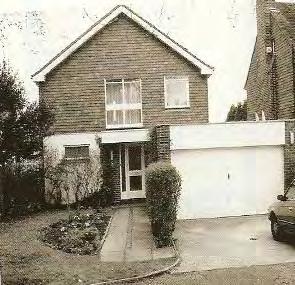
In designing new development a high standard of intrinsic design quality is required. Interesting detailing such as created by brick patterning and the shape and pattern of roofs, windows and doors can enhance a design whether for new build or alteration to an existing building which can add to the character and distinctiveness of an area.
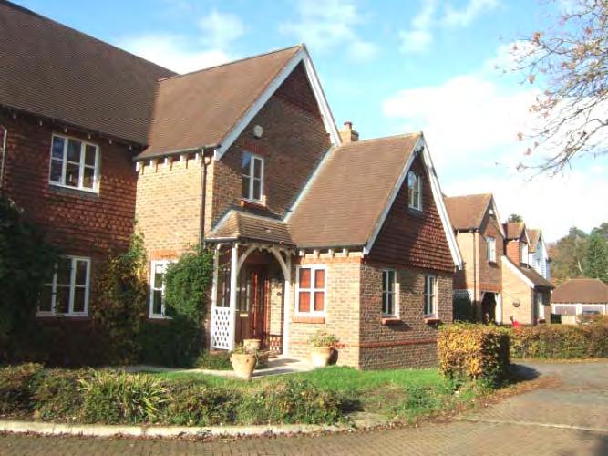
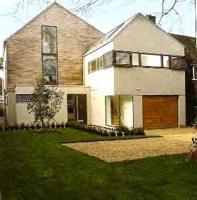
Over-generous road space should be avoided and streets should be defined by a coherent and well structured layout using different road widths which create a hierarchy of spaces with the buildings providing a strong sense of enclosure where the setting demands it (as in the example shown left). However, it would be inappropriate to seek to impose such a design solution in every case and where this would be inappropriate to the character of the area. (e.g. areas of open plan housing).
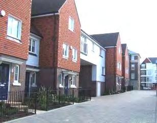
284
There is likely to be a demand to retrofit some buildings, not built to current energy efficiency standards, with new cladding, solar panels and added insulation (such as the example shown above). Whilst it would be desirable to minimise the impact of such changes on buildings of quality, it may be a virtue to use such improvements to uplift undistinguished, standardised architecture and add a new distinctiveness to an area. Likewise, new development built to a high sustainable standard can achieve similar benefits, providing the principles of passive design are addressed sensitively at the conception stage of the scheme having regard to the character of the area.
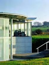
(b) Commercial Areas
The industrial and commercial buildings outside the Town Centre AAP comprise generally wide roads and unenclosed front parking areas, standard low rise units and a wide range of materials which have tended to create places that are unattractive with very little sense of place. Cannon Lane/Vale Road form a strategic route and as a result this has a disproportionate influence on the image of the character area and the town.
Over time, as buildings become outworn, there may be opportunities for new development in this area. Where this occurs, high quality designs, materials and landscaping should be used in order to uplift the quality of the commercial areas. In appropriate locations such as at road junctions, landmark buildings may be appropriate in adding interest and legibility to the Character Area. The use of high quality materials would help to firmly establish the character and identity of place, in terms of both the public realm of streets and the built form of buildings and structures.
In particular the aim should be to make car parking a less dominant or obtrusive element within the public realm. In this respect, a significant landscaping component should be included within any new development as a contrast to the built development, and enclosure to any parking areas, ultimately providing a continuous landscape belt along the strategic routes and to act as a buffer to the river or the countryside. In addition, development in the commercial character area should positively address the river which runs through it in recognition that water is a key asset and, in effect, an important public space within Tonbridge.
9) Reinstate or reinforce positive features
Through the development process there will be opportunities to reinstate or reinforce the positive features which contribute to the character of an area. This could
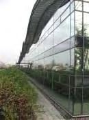

285
mean reinforcing the verdant landscape character with substantial specimen trees and boundary hedges.
There are examples where open frontages are created to the road leaving no definition of the space, reducing security and in many cases a loss of pride in the maintenance of the space. Where appropriate to the character of an area, private space should be defined by a clear boundary. Front boundaries should be retained or restored to the prevailing feature in the character area: such as approximately 1 metre high red brick wall with a coping and entrance gate pillars; brick wall topped by hedge; hedge and railings or mature 2 metre high hedge.
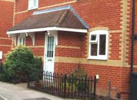
10) Provide streetscape enhancements
Opportunity should be taken as part of development proposals to ameliorate the negative features of an area identified in the Character Area Appraisals. Reduction in the street clutter of signs or improvements to street furniture or footway/road surfaces, would contribute to improving the character of the area.
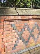
11) Noise
The main generator of noise in Tonbridge is traffic on the busier routes and the railway. The level of traffic and rail noise are not matters that can be addressed by this SPD or in most cases by the Borough Council. However, where new development is proposed that might generate noise which could adversely affect the character of an area then the LDF contains a policy that aims to address the matter. However, the Council is not normally able to control noise disturbance during the construction period under planning legislation.
286
By Design – Urban design in the planning system: towards better practice (DETR 2000)
The guide is intended as a companion to Planning Policy Guidance (PPGs) [and subsequent Planning Policy Statements (PPSs)] and aims to encourage better design and to stimulate thinking about urban design.
The guide states that understanding the local context should be the prelude to drawing up the planning ‘toolkit’.
A range of techniques is available, but the guide states that carrying out an appraisal is more important than the specific technique used and a simple assessment is better than none. The guide provides pointers to understanding an area in terms of its urban design.
The guide sets out a series of checklists to act as a guide to the assessment of an area. They are not meant to be followed slavishly. Understanding the local context does not require every item on the checklists to be examined on every occasion and in every place or in the same depth. The checklists provide pointers to understanding an area in terms of its urban design and the following elements have been particularly relevant to the assessment of the Tonbridge area.
Character
A place with its own identity
Appraisals can include assessments of:
• the origins and development of the topography of the area, including surviving elements of historic street patterns, plot subdivisions, boundary treatments and the relationships between buildings and spaces;
• the architecture and historic quality, character and coherence of buildings, both listed and unlisted, and the contribution they make to the special interest of the area;
• the character and hierarchy of spaces and their townscape quality;
• prevalent and historic building materials;
• the contribution made to the character of the area by green spaces, trees, hedges and other cultivated elements;
• the area’s prevailing (or former) uses, plan forms and building types;
• the relationship of the built environment to landscape or open countryside, including significant landmarks, vistas and panoramas;
• features which have been lost, or which intrude on or detract from the character of the area.
Continuity of building frontages and enclosure of public spaces
A place where public and private spaces are clearly distinguished
Techniques include identifying and mapping:
287 Appendix 1
• gap sites and abnormal setbacks which interrupt the common building line of the street;
• instances where the backs of buildings are exposed to public view and access (as in the case of back gardens on to roads, alleys and public spaces);
• active and dead frontages at ground floor level: positive factors such as entrances, shopfronts and windows; and negative factors such as long blank facades and high boundary walls, and service entrances and yards;
• active and dead frontages at upper floors: positive factors such as windows of habitable rooms overlooking public space; and negative factors such as blank gable walls and unused space over shops;
• places where buildings meet the public realm: boundary treatments such as gates, railings, fences and boundary walls; front gardens and in-curtilage parking; and servicing;
• spatial enclosure: the relationship between the heights of buildings and the spaces they define;
• planting (such as trees and hedges), natural features, land form, and retaining walls which define and enclose blocks and spaces.
Quality of the public realm
A place with attractive and successful outdoors
Public realm audits can include assessments of:
• hard landscaping (paving materials, kerbs, walls, steps and ramps);
• planting (trees, planters, grassed areas, flowers and borders);
• street furniture (seats, bins, bollards and railings);
• lighting (pavement, pedestrian, highway, security, building and feature);
• shopfronts (thresholds, glazing, stall risers, signs, banners and shutters).
• advertisements (hoardings, kiosks and banners);
• traffic and highways installations (including highway markings, traffic signals and control boxes);
• public space use and management (informal use as well as formal, events, markets, graffiti removal, litter collection and street cleansing).
Legibility
A place that has a clear image and is easy to understand
Appraisals of:
• gateways and points of transition (at main entry points, between different areas and at transitions between different uses);
• nodes (important junctions and points of interaction);
• landmarks and features (important buildings, corners);
• views and vistas (seen from within the area and from the outside);
• edges, seams and barriers (including the boundaries between different zones and areas, and streets which integrate or sever).
288
Glossary
Amenity Green Space
Arcadian
Areas of Landscape Significance
Balustrade
Bargeboards
Bond
Cladding
Cohesive Character
Conservation Area
Coping or Coping Stone
Core Strategy
Informal recreational open space most commonly, but not exclusively in housing areas, other incidental landscaped areas including private greenspace that has visual or other value, even if no physical public access is possible.
Areas where the landscape dominates the buildings, creating a verdant almost rural character. Mature trees rather than buildings contain the public space.
Substantial areas of landscaping which provide an extensive landscape framework.
Series of short posts supporting a handrail.
Exterior visible board placed against the incline of the gable roof.
The type of bond is the pattern in which bricks are laid.
External covering or skin applied to a structure usually timber or tile.
Areas that share common features which combine to create a unified character.
An area of special architectural and/or historic interest, the character or appearance of which it is desirable to preserve or enhance.
Protective course of masonry or brickwork capping a wall.
The main Development Plan Document which sets out the long-term spatial vision for the Borough and the main strategic policies and proposals to deliver that strategy.
Course Continuous layer of brick or stone, etc in a wall.
Dentil Course
The alternation of projecting brick headers or stone blocks along cornices or string courses at regular intervals.
289 Appendix 2
Development Plan Document (DPD)
A document containing planning policies guiding the spatial development of the Borough. The Local Development Framework comprises a set of DPDs including the Core Strategy, the Development Land Allocations DPD, Tonbridge Central Area Action Plan and the Managing Development and the Environment DPD. The policies in DPDs can be amplified by Supplementary Planning Documents
Eaves
Façade
Fenestration
Flat Porch Canopies
Frontages
Gable
Header
Jettied Upper Storey
Underpart of a sloping roof overhanging a wall.
The face of a building (generally the front).
The arrangement of windows in a façade.
Small flat roofed opening above the principal entrance.
The full length of a plot of land or a building measured alongside the road onto which the plot or building fronts.
The triangular upper portion of a wall at the end of a pitched roof
The short side of a brick laid so that it appears on the face of the wall
Upper storey of a building that projects out above the lower storey.
Lintel Horizontal beam or stone bridging an opening, usually above a window or door.
Local Development Documents (LDD)
Local Development Framework (LDF)
The collective term for the Development Plan Documents and Supplementary Planning Documents in the Local Development Framework
A portfolio of Local Development Documents forming the planning framework for delivering the spatial planning strategy.
Managing Development and the Environment DPD
Massing
Metropolitan Green Belt
Panel Fence
Panoramic
The Development Plan Document that sets out policies and proposals to manage development and protect the environment of the Borough.
The overall volume of a building.
Defined area of open countryside where there is a strong presumption against inappropriate development.
Fence consisting of metal or wooden vertical panels.
Wide view of a surrounding area.
290
Parapets
Pebble Dash
Planning Policy Statement 1 (PPS1)
Planning Policy Statement 3 (PPS3)
Quoins
Low wall for protection at any sudden drop. Also used to conceal a roof.
Render of cement mortar and pebbles.
Document that sets out the Government's national planning policies and guidance on creating sustainable communities.
Document that sets out the Government's national planning policies and guidance on Housing.
Dressed stones at the corners of a building. Sometimes all the stones are of the same size; more often they are alternately large and small.
Render A coat of exterior cement or plaster applied to a masonry wall.
Ribbon Development Development one property deep that strings along a road.
Roof - Cat Slide
Roof – Half-Hipped
Roof - Hipped
Roof - Monopitch
Roof - Pitched
Rural Service Centres
Rusticated
A pitched roof, one side of which is much longer than the other.
A roof which has a half gable with the upper ends of the roof being sloped rather than vertical.
A roof which has sloped rather than vertical gable ends.
A roof which slopes in one direction only.
Double pitched roof with vertical gable ends.
Larger villages in the Borough that provide a range of shops, services and facilities.
A bold textured look, often by bevelling the edges of brick, stonework or render to form deep-set joints while leaving the central face rough-hewn or carved with various pointed or channelled patterns.
Sill Horizontal member at the bottom of a window or door frame.
Soffit
Streetscape
Stringcourse
underside of an arch or lintel, etc.
the appearance of the entire street.
Horizontal brick or stone course or moulding projecting from the surface of a wall often using a different coloured material and sometimes patterned.
291
Stucco
Supplementary Planning Document (SPD)
A durable finish for exterior walls, usually composed of cement, sand, and lime, and applied while wet.
A document that sets out further detail on certain policies in Development Plan Documents.
Sustainable Development Development that meets the needs of the present without compromising the ability of future generations to meet their own needs.
Tile - Hung Tiles that are hung on the façade of a building.
Tile - Kent Peg
Tile - Ridge
Tiles traditionally made from clay and "pegged" onto the roof or fascia and overlap each other.
A tile that is bent in cross section; used to cover the ridge of a roof.
Tile - Scalloped Tiles that have curved edges on the bottom side.
Tile - Pantile Roof tile of ‘S’-shaped section.
Tree Preservation Order (TPO)
Special protection afforded to individual trees and groups of trees that seek to retain and protect them.
Verdant Green with vegetation.
Vernacular
Vista
Weatherboarding
Window - Bay
Methods of construction which use locally available resources and traditions to address local needs and circumstances. Vernacular architecture tends to evolve over time to reflect the environmental, cultural and historical context in which it exist.
A short view, often through an avenue of trees or row of buildings, etc. normally terminated by a building or group of trees, etc
Wall cladding of overlapping horizontal boards.
Three-sided window of one of more storeys that projects from the face of a building.
Window - Bow Curved window of one of more storeys projecting from the face of a building.
Window – Canted Bay
Window - Casement
Window - Dormer
Three-sided window of one of more storeys projecting from the face of a building with angled sides.
Side hinged window.
Window placed vertically in the sloping plane of a roof with a roof of its own.
292
Window - Glazing Bars
Window - Leaded
Window - Mullion
Window - Oriel
Window - Sash
Window - Transom
Wooden, sometimes metal, bars that separate and support window panes.
Small glass panels, often diamond shaped, joined by lead strips.
Vertical post or upright dividing a window into two or more window panes.
Window of one of more storeys projecting from the face of a building resting on corbels or brackets and starting above ground level.
A window with sashes sliding glazed frames running in vertical grooves.
Horizontal bar across the openings of a window dividing it into two or more window panes.
293
294
If you are having difficulty reading this document and would like the information in another format, please call the Planning Policy Team on (01732) 876266 or email LDF@tmbc.gov.uk
