SOUTH MOUNTAINS STATE PARK MASTER PLAN

Burke County, NC
November 2007
Prepared for: North Carolina Department of Environment and Natural Resources Division of Parks and Recreation
Prepared by: Swanson and Associates, P.A. Carrboro, NC


November 2007
Prepared for: North Carolina Department of Environment and Natural Resources Division of Parks and Recreation
Prepared by: Swanson and Associates, P.A. Carrboro, NC
ADA Americans with Disabilities Act
CCC
Civilian Conservation Corps
DHHS North Carolina Department of Health and Human Services DNP Dedicated Nature Preserve
EEC Environmental Education Center
FIIP Facility Inventory and Inspection Program
GMP General Management Plan
HQW High Quality Waters
ITRE Institution for Transportation Research & Education
LEED Leadership in Energy and Environmental Design
LIDAR Light Detection and Ranging
DENR North Carolina Department of Environment and Natural Resources NC DPR North Carolina Division of Parks and Recreation NC DOT North Carolina Department of Transportation NC DWQ North Carolina Division of Water Quality NC NHP North Carolina Natural Heritage Program NWI National Wetland Inventory
ORW Outstanding Resource Waters PEP Project Evaluation Program
USGBC US Green Building Council WRC North Carolina Wildlife Resources Commission WS Water Supply watershed
Jacob Fork Section
Center
Visitor Center
Visitor Center
Visitor Center
Tent
Tent
Trailer
Existing Equestrian
Existing Horsetrailer
Existing Primitive
Picnicking
Jacob Fork Parking Area
Picnic Area
of Former Park Office Building
Separation of Activities
Henry Fork Section
Circulation
Access
Potential Trail Development
Creek Section
Access
Clear Creek
Day-Use Picnic Area
Education Center
Vehicular Circulation and Parking.................................
Facilities and Interpretive Trails
Cabins
Camping
Amphitheaters and Fire Ring
Residences
Area
Access and Hike-In Primitive

North Carolina Department of Envi ronment and Natural Resources Division of Parks and Recreation
North Carolina Department of Envi ronment and Natural Resources Division of Parks and Recreation
North Carolina Department of Envi ronment and Natural Resources Division of Parks and Recreation
North Carolina Department of Envi ronment and Natural Resources Division of Parks and Recreation


Michael F. Easley, Governor William G. Ross Jr., Secretary Lewis R. Ledford, Director
Michael F. Easley, Governor William G. Ross Jr., Secretary Lewis R. Ledford, Director
Michael F. Easley, Governor
Michael F. Easley, Governor William G. Ross Jr., Secretary Lewis R. Ledford, Director
William G. Ross Jr., Secretary Lewis R. Ledford, Director
Greetings to all friends of South Mountains—today and tomorrow:
Nestled deep in the woods, South Mountains State Park is a magnificent place to enjoy nature. At the park, you can view a majestic mountain range jutting from the wilderness of gently rolling piedmont landscape in one of North Carolina’s rugged state parks.
The park wa� Though proposals for the park surfaced in the 1940s, it was not until 1974 that funds were appropriated to purchase the land, the first acquisition totaling 5,779 acres. Additional acquisitions have brought the park to its current size of roughly 18,000 acres.
In � Watershed, to the park. This followed the transfer in 2000 of 2,532 acres, property known locally as the Broughton Watershed, from the North Carolina Department of Agriculture and Consumer Services. The park’s dramatic growth and the addition of the two watersheds, known as the Clear Creek area along the park’s western boundary, created a true need for the division to update the 1979 master plan for South Mountains State Park.
The additional land acquired at South Mountains offers the opportunity to open another gateway to North Carolina’s largest state park. The state parks system and the Department of Health and Human� special needs – to connect with nature in a very special way.
With this new master plan for the� with DHHS and the many park supporters and visitors. Swanson and Associates, P.A., a Carrboro-based landscape architecture firm, developed this plan in full consultation with state park staff, our many partners, stakeholders, and the people who use the park. The result is a long-range, attainable plan that balances recreation opportunities with our overriding mission as stewards of this remarkable wilderness.
At all our state parks, we are commi� recreation opportunities. The vast South Mountains State Park offers us an outstanding opportunity to realize those goals. That commitment, the continued support of our partners and thoughtful planning will combine for a lasting legacy.
Sincerely,
Lewis R. Ledford1615 Mail Service Center, Raleigh, North Carolina 27699-1615
South Mountains State Park is a unique and special place with a rich history. The park is located in the South Mountains Range, situated in the Piedmont Province near the foothills of the Blue Ridge Mountains. The park lies entirely within Burke County, south of the city of Morganton, and is adjacent to Cleveland and Rutherford counties. Recent acquisitions in the western area of the park, now known as the Clear Creek section, have increased the park’s size to 17,481 acres, making South Mountains State Park the largest park in the state parks system.
The park’s primary interpretive theme is the ecology of its out standing resource waters. Secondary interpretive themes include plant communities, stream recreation, local cultural history, rare and endangered species, conservation ethic, park system history, reptiles, camping and back country safety, horseback riding, changing land-use patterns, and geology. A thorough site inventory and analysis was performed as a component of this planning process. Through this process, the project consultant and other stakehold ers in the park gained a better understanding of the opportunities and constraints within the park and how these might influence site planning and development of new and improved facilities that will support the current interpretive themes.
The park has historically been focused on providing opportunities for backcountry experiences to the general public. The master plan for South Mountains State Park maintains this as a focus for the park. It provides for further conservation and protection of the park’s unique lands and natural resources while establishing a blueprint for long-term development of facilities, recreation, and environmental education opportunities. In recognition of the sensitive natural resources and challenging topography, most of the park will remain natural and undeveloped.
The master plan outlines specific project opportunities within the three designated park sections: Jacob Fork, Henry Fork, and Clear Creek. The plan for the Jacob Fork section includes circulation and access elements, expanded tent and trailer camping, shower house facilities, picnic expansion, equestrian improvements, and improved facilities for maintenance and operations functions, among others.
The additional land acquired for South Mountains State Park within the Clear Creek section creates an opportunity to access the western part of the park. Based upon a joint agreement between the North Carolina Department of Environment and Natural Resources and the North Carolina Department of Health and Human Services, the master plan outlines a proposal for an environmental education center in this section that focuses on serving people of all abilities, with special attention to universal design for populations with special needs. Group overnight facilities will enhance the environmental education experience. In addition, the plan incorporates a day-use area including picnicking, pier, boat house, and walking trail around the existing lake.
Though planning is a dynamic process, the availability of more detailed information over time may result in a final built product that is different than that depicted in this plan. This plan presents a balanced approach for a clear development plan and guide for future activities and recreational opportunities while meeting the mission of the state parks system to conserve and protect the park’s significant resources and provide for environmental education opportunities about the natural heritage of this park.
The purpose of a master plan is to serve as a guide for development of park resources. It includes an analysis of cultural, scenic, recre ational, geologic, and natural resources as well as site analysis and development recommendations. It also considers public demand.
The North Carolina State Parks system exists for the enjoyment, education, health and inspiration of all our citizens and visitors. The mission of the state parks system is to conserve and protect repre sentative examples of the natural beauty, ecological features and recreation resources of statewide signifi cance; to provide outdoor recreation opportunities in a safe and healthy environment; and to provide en vironmental educational opportunities that promote stewardship of the state’s natural heritage.
The state parks system tries to update each park’s master plan as needed. The first master plan for South Mountains was prepared in 1979 when the park was 5,779 acres. At that time, the park encom passed the upper watershed of Jacob Fork. Subsequent acquisitions have protected the upper reaches of the Henry Fork and Clear Creek watersheds, and have resulted in a park of 17,481 acres*. The western extent of the Clear Creek watershed brings the park boundaries near US Highway 64, offering the potential to open another gateway to North Carolina’s largest state park with new types of facilities.
In 2003, a 454-acre tract of land was transferred from the NC Department of Health and Human Services (DHHS) to the NC Department of Environment and Natural Resources (DENR) for inclusion as a part of South Mountains State Park. Through this land transfer, the two named parties made a joint commitment to create a residential environmental education center, to serve all citizens,
*As of July 1, 2007.
that will offer state-of-the-art accessibility features for special needs groups (See Appendix A).
The NC Division of Parks and Recreation (NC DPR) has revised the master plan for South Mountains State Park. For any state park, careful planning is crucial to balancing recreational demands with protection of the state’s valuable natural resources. In essence, the master plan is a strategy for long-term development of facilities and recreation opportunities, and for protection of a park’s natural resources.
The landscape architecture firm Swanson and Associates, P.A. of Carrboro served as the design consultant for preparation of the master plan. A part of the consultant’s mission was to examine the park as a whole and evaluate opportunities and constraints for new facilities, with particular attention to be given to the Clear Creek section. Swanson and Associates, P.A. explored ways the Clear Creek section could complement existing facilities in the Jacob Fork (eastern) section of the park.
The consultant performed a thorough site inventory and analysis in order to fully understand the opportunities and constraints offered by South Mountains State Park. The consultant also analyzed us age trends for the park based on use logs kept by park staff. The North Carolina Outdoor Recreation Plan 2003-2008, was also reviewed. This plan for North Carolina prioritizes future public outdoor recreation needs in North Carolina (see Table 1) based on input from public meetings, outreach efforts and a statewide issues survey. Current uses of the park with the highest priority ranking (rankings from 1 - highest to 9 - lowest) combined for future de mand and support for public funding include walking for pleasure, camping (tent or vehicle), picnicking, freshwater fishing, attending outdoor cultural events, visiting natural areas, bicycling for plea sure, viewing scenery, trail hiking, and use of open areas. Other park uses that fall within a lower priority ranking include primitive camping, horseback riding, and nature study.
Concurrently, the consultant worked closely with the NC Division of Parks and Recreation design and development, resource management, and trails program teams, as well as the park’s superin tendent and staff, to refine a program of use for the park.
Future Demand
Support for Public Funding Combined Ranking
Walking for pleasure High High 1
Camping, tent or vehicle High High 1
Picnicking High High 1
Beach activities High High 1
Fishing - freshwater High High 1
Attend outdoor cultural events High High 1
Visiting natural areas Moderate High 2
Use of play equipment Moderate High 2
Visiting zoos Moderate High 2
Visiting historical sites Moderate High 2
Bicycling for pleasure High Moderate 3
Swimming in pools High Moderate 3
Viewing scenery Moderate Moderate 4
Hunting Moderate Moderate 4
Trail hiking Moderate Moderate 4
Use of open areas Moderate Moderate 4
Target shooting Moderate Moderate 4
Swimming (Lakes, Rivers, Ocean) Moderate Moderate 4
Fishing - saltwater Moderate Moderate 4
Camping, primitive Low Moderate 7
Driving for pleasure Moderate Low 8
Horseback riding Moderate Low 8 Golf Moderate Low 8
Attending sports events Moderate Low 8
Jogging or running Low Low 9 Nature study Low Low 9
Softball and baseball Low Low 9 Basketball Low Low 9 Football Low Low 9 Soccer Low Low 9 Tennis, volleyball Low Low 9
Skateboarding Low Low 9
Sailboarding Low Low 9
Windsurfing Low Low 9
Canoeing and kayaking Low Low 9
Power boating Low Low 9
Water skiing Low Low 9
Downhill skiing Low Low 9
Cross country skiing Low Low 9
Other winter sports Low Low 9
Use of motorcycles, dirt bikes, ATV Low Low 9
Use of four-wheel-drive vehicles Low Low 9
from: NC Outdoor Recreation Plan 2003-2008
The master plan was developed in response to this program of use and the park opportunities and constraints.
The master plan is based upon the best mapping data available at the time of its preparation (See Resources and References: Digital Mapping Data). This data is not survey quality; therefore, more detailed soil, geotechnology, topographic, floodplain, wetland, ecological and other studies may be warranted in future phases of design in order to fully assess feasibility. Since planning is a dynamic process, the availability of more detailed information over time may result in a final built product that is different than that depicted in this plan.
The public in general, as well as the park’s neighbors, local governments, and other agencies, were invited to participate in a pub lic meeting on May 17, 2007. The meeting took place at the Burke County Services Building, 110 N. Green Street, Entrance E, Commissioners Board Room, Morganton, NC, from 7 p.m. to 9 p.m.
The meeting was attended by approximately 100 people, including 17 NC Division of Parks and Recreation staff and three staff from Swanson and Associates, P.A.
The meeting included a presentation of the proposed improvements, maps and renderings of the park, and staff and design con sultants were available to answer questions. Comments about the plan were accepted at the meeting and afterward by letter, e-mail, telephone and numerous individual conversations. A summary of all comments received is appended to this document (see Appendix B).
Additionally, several other agencies were solicited for input on this plan, including but not limited to the NC Department of Health and Human Services, the NC State Clearinghouse, and the US Fish and Wildlife Service. All input from these organizations, as well as that received during the public review process, was thoroughly evalu ated and considered through this master plan process.
South Mountains State Park Master Plan Public Meeting, May 2007
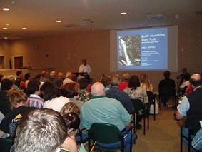
Any proposed capital project in the state parks system is individu ally scored and assigned priority by the park before being combined with projects for other state parks. The priorities are peri odically re-evaluated. This will be the case for new infrastructure (roads, utilities, etc.), facilities, or trails at South Mountains State Park. The time frame for building new facilities will depend on how each new project is evaluated in relation to others in the state.
Generally, funding for park development comes from the Parks and Recreation Trust Fund, created in 1994 and supported by a portion of the state’s tax on real estate deed transfers. The Parks and Rec reation Authority, an appointed body, allocates money for capital projects and land acquisition after considering recommendations from the state parks system staff.
Land acquisition objectives for South Mountains State Park include protecting water quality and natural resources, buffering these resources and visitor activities, protecting scenic views, providing land for park facilities and recreational opportunities, and improving park operations. Properties that contain or buffer rare species, natural communities, high water quality, and natural features are given the highest priority. Protecting the Outstanding Resource Waters in the Jacob Fork, Henry Fork, and Clear Creek watersheds is especially important at South Mountains State Park. Data and surveys from the NC Division of Parks and Recreation, NC Natural Heritage Program, and NC Division of Water Quality have been used to identify properties in need of protection. Where land suitable for facility development is not currently available, the master plan includes alternates dependent on additional property.
The master plan recommends acquisition of approximately 3,380 acres, bringing the total planned size of the park to 20,861 acres. The NC Division of Parks and Recreation works in conjunction with the State Property Office to acquire property from willing sellers. Each transaction with a landowner is unique and includes an independent appraisal and approval by the Joint Legislative Committee on Governmental Operations and Council of State. Funding for land acquisition generally comes from the Parks and Recreation, Natural Heritage, and/or Clean Water Management trust funds. The Parks and Recreation Trust Fund is described in more detail in the State Parks Act included in Appendix C.
South Mountains Range
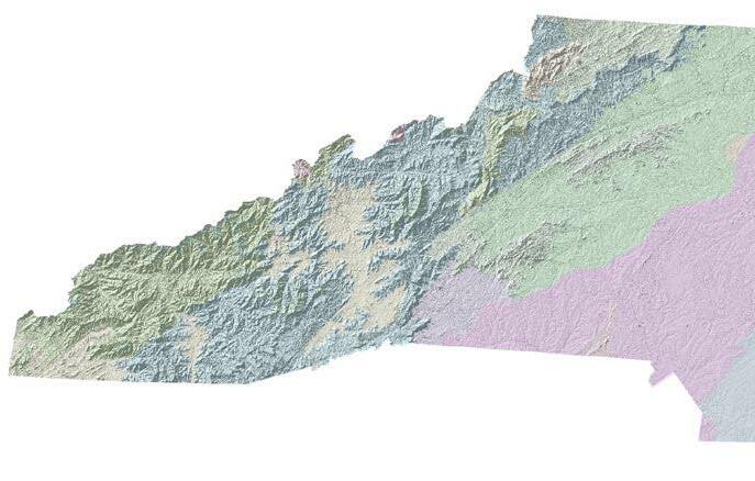
The South Mountains Range, carved out of the Blue Ridge by erosion, covers approximately 100,000 acres in the Piedmont Province of North Carolina. This range is easily identified on the physiographic map shown in Figure 1. The range is characterized by prominent ridges, knobs, and valleys with steep side slopes. It is situated at the convergence of Burke, Cleveland, and Rutherford counties.
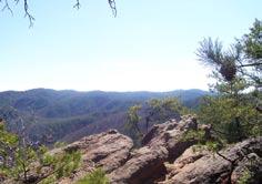
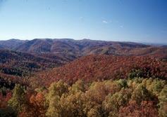
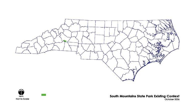
South Mountains State Park encompasses almost 18,000 acres of the South Mountains Range and is located along the southwestern boundary of Burke County. Its context within the state and its re gion are indicated in Figures 2 and 3. The park borders Rutherford and Cleveland counties to its south. Morganton, the county seat of Burke County, is located approximately 18 miles north of the Jacob Fork section of the park.
South Mountains State Park contains a portion of one of the largest remaining continuously-forested areas in the North Carolina Piedmont. It is also known for its many miles of Outstanding Resource Water streams and Trout Waters. Drainage of the park occurs through three primary watersheds. These watersheds are named Jacob Fork, Henry Fork, and Clear Creek. The watershed names are used within this document to define very distinct sections of the park.
Though a significant portion of the park was logged in the late nineteenth and early twentieth centuries (Idol, 1999), it contains a number of examples of ecological communities that are typically found in the Blue Ridge and are rather uncommon in the Piedmont. The predominant natural vegetation in the park is deciduous hardwoods including oak, hickory, and formerly chestnut, mixed with pine, with an understory of rhododendron, laurel, and holly.
Past development within the park has been minimal. Much of its history revolves around the several reservoirs that are still in ex
istence today, though no longer functioning as water supply reser voirs. These reservoirs are now known as the Clear Creek Reser voir, the Henry Fork Reservoir, and the Bailey Fork Reservoir.
Past development in the park, other than the reservoirs, has included several old homesteads, cemeteries, and schools. The Office of State Archaeology lists several sites that have been identified within the park boundaries. These include six family cemetery sites and seven other historic sites, including four homesites, identi fied based on the presence of remains of structures and various
Winston-Salem
Hickory
Morganton
Asheville
South Mountains State Park
Gastonia
Raleigh Durham
Piedmont Province Blue Ridge Province

Inner Coastal Plain
Outer Coastal Plain
South Mountains State Park
Municipal Boundaries
Regional Context
South Mountains State Park State Context
other artifacts, a home or school site, a wooden bridge, and a stone wall. In 1999, an archaeological study was performed for the NC Division of Parks and Recreation on these 13 sites by TRC Garrow Associates, Inc. All of these 13 sites are located within the Jacob Fork and Henry Fork sections of the park. Documentary and archaeological evidence indicates that all of these sites were abandoned in the late nineteenth or early twentieth centuries. No Na tional Register of Historic Places recommendations were made for any of the sites. This master plan does not propose development in any of these locations; however, if any development is proposed in these areas in the future, further investigation may be warranted. Although cemeteries typically are not eligible for National Register of Historic Places status, all cemeteries are protected under North Carolina law, and no ground disturbing activity will occur in these sites (Idol, 1999).
In historic aerials from 1954 and 1967 (NC State Archives, 1954 and 1967), the park area in the vicinity of the Clear Creek Reservoir appeared to be heavily forested except for an area to the northwest of the reservoir dam, which appeared to be an open field, and an area of land near what is now known as Pealot Drive. This area appeared to be used for agricultural crops during that time period. Park staff refers to this area of the park as the Pealot, and confirms
that Broughton Hospital used a portion of this area for agricultural purposes in the past. Distinct agricultural activity was also appar ent to the northwest of the park in 1954 and 1967. There is an old log cabin, formerly used by the School for the Deaf, in the vicinity of the Bailey Fork Reservoir.
The large old willow oaks in the vicinity of the Clear Creek Reser voir dam were planted in the early 1950s by Mr. Henry Lyles, then lead maintenance supervisor for the reservoir, in charge of carpentry, shop and grounds. Park staff suspects the trees were planted mostly for aesthetics, and possibly to help dry up the area below the dam since willow oaks take up a lot of water.
A pre-1979 history description of the Jacob Fork section of the park has been excerpted from the 1979 Master Plan for South Mountains State Park and is provided in Appendix D.
More recent development in the park has been limited to the construction of park-related roads, trails, structures, and most recently a visitor center for the park in the Jacob Fork section. Most of the trails within the park have been located on historic logging or fire roads, as well as along roads developed by the Civilian Conserva tion Corps (CCC) in the 1930s.
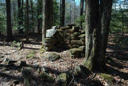
Remains of a homestead chimney near Jacob Branch campsites.
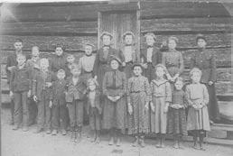
School photo from one of several schools that were located within the park boundary. (School and year unkown)
The South Mountains area was first recommended as a state park by a National Park Service study in 1940. A state park was established in 1974. At that time, the park consisted primarily of the Jacob Fork section. Conservation of the outstanding rivers, stream, and water quality of this watershed was one of the primary consid erations for establishing the park and remains one of the primary interpretive themes of the park today.
The Henry Fork section of the park, a pristine watershed, was added to the property in several pieces, primarily between 1996 and 1999. This portion of the park contains the Henry Fork Reser voir, formerly the drinking water supply for the city of Morganton. During its days as a water supply watershed, this section of the park was patrolled by city staff to maintain its security as a drinking water source.
In 2000, 2,532 acres of the Clear Creek section of the park, locally known as the Broughton Watershed, and formerly the drinking wa ter supply for Broughton Hospital, was transferred to the park from the NC Department of Agriculture. In 2003, the NC Department of Health and Human Services agreed to transfer 450 acres known as the School for the Deaf (Bailey Fork) Watershed to the park. This property is located in the northernmost portion of the park. Through the transfer of this latter tract of land, the NC Department of Environment and Natural Resources and NC Department of Health and Human Services entered into a joint agreement to create an environmental education center in the Clear Creek section of the park, intended to serve all citizens as well as including state-ofthe-art accessibility features for special needs populations.
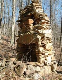
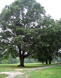
Figure 4 illustrates circulation patterns in and around the park. The current park entrance on its east side is located approximately 20.5 miles to the south of Interstate 40, Exit 105. This mileage is an estimate based on travel along the primary route to the park via NC Highway 18 and several secondary roads leading to South Mountain Park Avenue.
The west side of the park, near the Clear Creek Reservoir, can be accessed from Interstate 40 from the north via US Highway 64. The entrance to the parking area for the Clear Creek section is approximately 6.7 miles from Interstate 40, Exit 103. Currently access to the Clear Creek parking area from Highway 64 takes a circuitous route along Jenkins Road, Clark Loop, and Branstrom Orchard Street.
Two North Carolina scenic and historic road systems pass near the park boundaries. Highway 226 to the southwest of the park is designated a North Carolina Scenic Byway between Metcalf in Rutherford County and Marion in McDowell County.
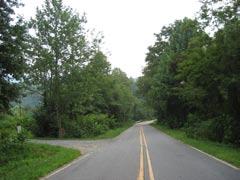
Highway 64, to the northeast of the park, is part of the Overmountain Victory National Historic Trail, a commemorative motor route that covers approximately 220 miles from Abingdon, Virginia to Kings Mountain National Military Park in South Carolina.
National Highway / Interstate
State Highway
State / County Roads providing access to park or with direct adjacency to park
South Mountains State Park
South Mountains Game Lands
County Boundary
Other Roads
Interstate Exchanges
Gravel
The Greater Hickory Recreation/Tourism Plan is a regional plan for the Greater Hickory Metro Area that includes Alexander, Burke, Caldwell, and Catawba counties. This plan’s stated purpose is “to achieve the goal to develop a strategy, built upon community consensus, for repositioning the region’s economy by leveraging the natural, cultural, and recreational resources for sustainable economic growth and prosperity.” (Western Piedmont Council of Governments and Unifour Recreation and Open Space Task Force, 2006) South Mountains State Park is listed in this document as one of a number of “Public Recreation Key Lands and Facilities” in the area.
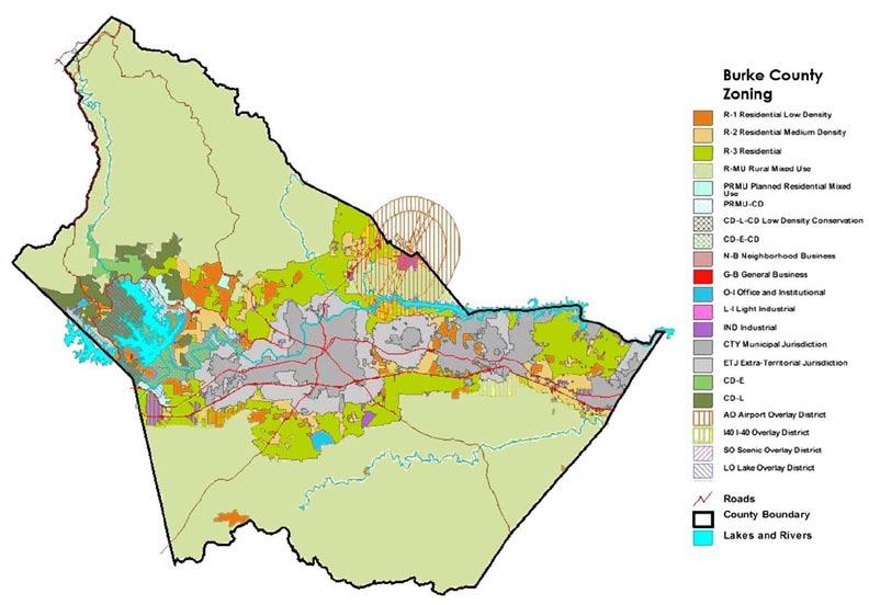



Properties within Burke County south of the Interstate 40 corridor including South Mountains State Park, are predominantly zoned R-MU (Rural Mixed Use). According to the Burke County Zon
Aerial photography (2005) and visual surveillance of the area in the vicinity of the park confirm primarily single-family residential and agricultural land uses, with limited commercial/industrial land use. Much of the land to the immediate south of the park in both

South Mountains
Tables 2 and 3 define the regular activities taking place within the Jacob Fork section of the park. Annual use records, available from the park for 2000 through 2006, provide a summary of total visitors each month of the year for certain activities. Annual totals are rep resented here. Camping data is based on receipts. A traffic counter is located on the entrance road that records all vehicles entering and leaving the park. The multiplier of traffic counts for total attendance is based on an average of four people per car and is divided by two, to account for entrance and exit of one vehicle. Approximately 10% of visitors fish, 72% hike, and 41% picnic.
Overall park attendance, picnicking, hiking, and fishing increased by around 20% between 2000 and 2006. Primitive camping and backcountry camping combined have increased by more than 40%. Interpretive program participation decreased from 2001 to 2005 and then showed a strong increase of more than 40% from 2005 to 2006 due to an increase in numbers of programs.
Table 2: Annual State Park Use Record (Jacob Fork Section only)
Annual State Park Use Record (Jacob Fork Section only)Activity 2000 2001 2002 2003 2004* 2005 2006
Total Vehicles Entering Park
Total Attendance 159,580 186,242 167,509 183,792 49,194 192,440 205,814
Total Individual Participants in Activity
Fishing (trout fishing) 17,317 19,559 17,588 20,540 5,833 20,203 21,573
Hiking 114,897 134,095 120,607 132,329 35,419 138,554 147,777
Interpretive Programs 3,944 4,135 3,591 3,510 1,058 2,158 5,607
Picnicking 65,830 78,945 82,227 75,816 20,296 79,385 84,652
Horse Camping -- 171 480 939 118 708 1,236 Backcountry Camping -- 1,263 1,276 2,750 386 2,247 2,246
Primitive Camping -- 5,301 5,179 3,137 421 3,504 4,065
*Totals for 2004 were lower than preceding years due to a park closure due to a landslide event.
Monthly visitation, on average, was highest from April through July and lowest in December and January. The South Mountains State Park General Management Plan (NC DEHNR, 1993) states an eight-month peak season for the park, from March through October. Totals for peak season months appears to have doubled since 1990, based on the visitation trends reported in the general man agement plan.
The park is well known for its equestrian facilities, including trails and campground. According to park staff, equestrian trail usage numbers have not been documented, and would be difficult to doc ument since equestrians have historically accessed the park lands from other areas in addition to the main entry in the Jacob Fork section of the park. The most riding activity occurs in the spring and fall, though equestrians do ride year round if the weather is favorable.
(not tracked in annual use records)

Other Activities in Jacob Fork Section (not tracked in annual use record) Backcountry Backpacking Backcountry Camping Day Visitation to View Waterfall Equestrian Camping Group Camping Horseback Riding Mountain Biking Nature Photography Self-Guided Nature Interpretation
Benn Knob Trail 3.0 � � �
Chestnut Knob Trail 2.1 �
Dogwood Trail 2.6 � � �
Fox Trail 3.6 � �
Headquarters Trail 4.3 � � �
Hemlock Nature Trail 0.3 � �
High Shoals Falls Loop 1.2 �
Horseridge Trail 3.3 � �
Jacob Branch Trail 1.1 �
Jacob Fork River Trail 0.5 �
Little River Trail 2.0 � �
Lower CCC Trail/Road 2.5 � � �
Possum Trail 1.5 �
Raven Rock Trail 1.9 � �
Sawtooth Trail 2.5 � �
Shinny Trail 2.2 �
Short Trail 0.7 �
Turkey Ridge Trail 1.7 � �
Upper CCC Trail/Road 1.6 � �
Upper Falls Trail 1.8 � � �
Trail Symbol Hiking Equestrian Biking Inte mri � � � � � � � � �
Figure 6 illustrates uses and internal circulation for the entire park. The following sections describe in more detail infrastructure, facilities, and circulation existing in South Mountains State Park at the time of development of this master plan.
Figure 7 illustrates the existing infrastructure, facilities, uses and circulation in the Jacob Fork section of the park in close proximity to South Mountain Park Avenue.
Access to the Jacob Fork section of the park is provided by South Mountain Park Avenue (SR 1904). This road provides the primary visitor vehicular circulation in the Jacob Fork section of the park. Other secondary circulation is provided through parking areas for the visitor center and Jacob Fork trailheads area as well as through the campgrounds.
Near the gated entry to the park, a driveway to the north provides access to a ranger residence. Three bridges provide access over Jacob Fork, with parking and a driveway for the South Mountains State Park Visitor Center on the north side of South Mountain Park Avenue between the last two bridges.
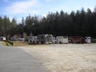
Farther west on South Mountain Park Avenue, on its south side, is an approximately 1½-acre horse-trailer parking area. The gravel lot is not striped, and a portion is used at times for gravel storage. An
estimate of ‘parking spaces’ is not feasible. With the exclusion of outer edges of the space to allow for circulation, it is estimated that approximately three-quarters to one acre of land is available for parking. Park staff reports that this parking lot has held upwards of 35-40 trailer rigs. A small building containing two pit toilets flanks this parking area to the south. A bridge, leading to the equestrian campground, is located to the southwest of the parking area.
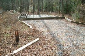
The equestrian campground consists of 15 campsites, a 33-stall barn, and a bathhouse with flush toilets and hot showers. Each campsite has a parking area, picnic table, tent pad, and grill. Potable water spigots are located throughout the campground.
Going west along South Mountain Park Avenue, a ranger residence and park storage area are adjacent to the road to the south.
Farther west on South Mountain Park Avenue, again on its south side, is the existing primitive campground. It consists of 11 campsites, each with a picnic table and grill. Two pit toilet facilities and drinking water are provided in this area. The Cicero Branch Park ing Area connects to this campground to its west.
The Jacob Fork parking area is located at the end of South Moun tain Park Avenue. This parking area is flanked by a picnic shelter, the former park office and interim maintenance facility, a ranger residence, and trail heads into the park.
The Jacob Fork picnic shelter contains 12 tables and four grills. It has electric service and is used by park staff to provide interpretive presentations to visiting groups.
A second picnic area is located just beyond a kiosk at the end of the parking lot between the Headquarters Trail and the Hemlock Nature Trail. This picnic area has 12 tables and nine grills. A restroom facility is located adjacent to the picnic area.
The Hemlock Nature Trail connects to Headquarters Trail about three-tenths of a mile from the Jacob Fork parking area. The Hemlock Nature Trail follows Jacob Fork with several overlooks for fishing and nature viewing. Several informational kiosks and display areas are provided for the visitor along this trail. A rustic amphitheater is located in this vicinity as well.
A third picnic area is located approximately one-half mile down the Headquarters Trail and consists of four tables and three grills.
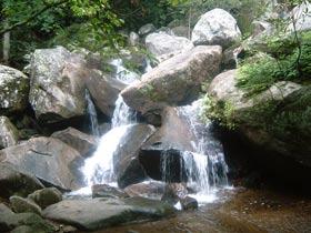
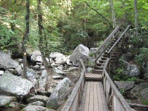
Headquarters Trail connects to High Shoals Falls Loop which leads the visitor to one of the park’s most visited attractions, High Shoals Falls. Access to the falls on one side of the loop is up numerous boardwalks and steps. The falls plummet 80 feet over bare rock, with several cascades below.
Many of the other park trails are accessed off of Headquarters Trail and High Shoals Falls Loop. Most of these trails were sited on old road beds. In total, seventeen trails encompass 42 total miles. All trails are open for hiking. Bridle trails total 29 miles. For mountain bikers, there is also a strenuous 18-mile loop trail.
Other park facilities include a total of 20 backpack camping sites in six locations in the Jacob Fork section of the park. Each location integrates a pit toilet nearby. Four camping sites are also provided for group camping off of Shinny Creek Trail.
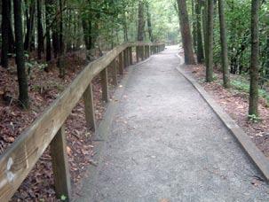
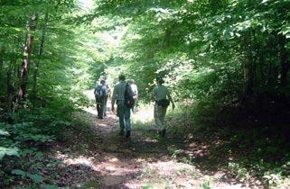
In summary, the primary activities occurring in the Jacob Fork section of the park include hiking, backpacking, picnicking, trout fishing, camping (including backcountry camping), horseback riding and equestrian camping, mountain biking, and natural heritage interpretation and nature appreciation.
Currently, the Henry Fork watershed portion of the park has limited access to the public. There are some existing ‘named’ trails/ old roads within this area, predominantly representing old logging roads and surveillance roads for patrolling the area when the reservoir was utilized as the Morganton water supply. However, no trails are maintained for public use at this time.
No known buildings exist in this section of the park. There is an old reservoir that formerly served the city of Morganton, now known as the Henry Fork Reservoir. It is two to three acres in size and approximately 30 feet deep near the concrete dam. This reservoir is no longer in use as a water supply source.
Figure 8 illustrates the existing infrastructure, facilities, uses, and circulation in the Clear Creek section of the park in close proximity to the Clear Creek Reservoir.
There are old roads and trails in this section of the park that have traditionally been used primarily by local residents for horseback riding and fishing access. The area currently is open as a day-use area only. It is served by a small gravel parking lot, with an ap proximate capacity for 10 to 14 cars. Fishing is allowed in this section per state regulations, and there is an interim 2½-mile trail that passes the reservoir and generally follows Clear Creek to a ridge.
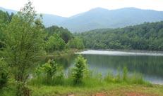
There are two old reservoirs in this section of the park. The largest reservoir was formed by damming Clear Creek (Clear Creek Reservoir) and covers approximately 20+ acres. It was formerly the water supply source for Broughton Hospital. It is no longer in use as a water supply source. The spillway and intake tower were renovated in 2006 and 2007. There are several old buildings that were associated with the reservoir located in the vicinity of the dam.
The second reservoir in this section, Bailey Fork Reservoir, for merly supplied the School for the Deaf with drinking water. It was formed by damming Bailey Fork in the northernmost area of the park and is less than one acre in size. It also is no longer in use as a water supply source. An old, tree-damaged log cabin and associated outbuildings are situated near this reservoir.
Information for the building and structures inventory is based on the Facility Inventory and Inspection Program (FIIP): South Mountains State Park performed by North Carolina State University (1992), and has been updated with several new buildings that have been constructed since that time. The buildings are listed with the inventory number and date of construction and approximate square footage and description. A more detailed evaluation of the older structures is provided in the original inventory document.

Most of the park’s infrastructure was already in existence when the state acquired the original park land in 1975.
Visitor Center and Park Offices (no building inventory number available) (2006) 7,500 square feet, heated, wood structure used as main visitor center and offices for park personnel. Approximately 2,000 square feet of private/staff use and 5,500 square feet of public use. Condition - Excellent.
Ranger Residence (#31-001) (1945)
1,421 square feet. Heated wood frame building used as ranger residence located adjacent to the Jacob Fork parking area. Condition - Good.
Office and Interim Maintenance Facility (#31-002) (1945)
1,280 square feet. Heated wood frame building formerly used as park office and currently used as interim maintenance facil ity. Located adjacent to Jacob Fork parking area. Condition - Fair.
Picnic Area Toilet Building (#31-004) (1986) 532 square feet. Heated wood frame structure used as toilet building. Condition - Good.

Superintendent’s Residence (#31-018) (1978) 3,530 square feet. Heated log structure on concrete masonry unit base. Located south of South Mountain Park Avenue approximately halfway between current park entrance and Jacob Fork park ing area. Condition - Good.
Poteat Cabin (#31-021) (ca. 1980) 880 square feet. Heated wood frame structure, formerly used as a cabin. Located on the south side of the park just north of Benn Knob Trail. Limited access to the cabin. No electrical service. Condition - Fair.


Ranger Residence (#31-022) (ca. 1970)
1,497 square feet. Heated log structure that is used as a ranger residence. Located north of South Mountain Park Avenue, immediately northeast of the current park entrance. Purchased by the park in 1995. Condition - Good.
Garage (#31-023) (ca. 1970) 464 square feet. Unheated wood frame structure used for a garage at building #022. Condition - Fair.

Shed (31-024) (ca. 1970)
240 square feet. Unheated wood frame structure used for vehicle and equipment storage. Condition - Fair.


Storage Shed (31-026) (1994)
278 square feet. Unheated manufactured metal frame and siding building used for storage. Located adjacent to former Office and Shop building and the Jacob Fork parking area. Condition - Fair.
Picnic Shelter (031-027) (1999)
1,624 square feet. Unheated post and beam structure used as a picnic shelter. Located on the eastern end of the Jacob Fork parking area. Condition - Good.

Equestrian Campground Washhouse (031-028) (1999)
716 square feet. Heated wood structure on concrete slab used as a washhouse build ing. Adjacent to new horse barn. Condition - Good.
Horse Barn (031-029) (1999)
4,800 square feet. Unheated wood post and beam structure used as a horse barn. Condition - Good.


Information for the roads and utility inventory was developed from the South Mountains State Park General Management Plan (GMP) (NC DEHNR, 1993). The GMP based its information on “an inspection of the park facilities in October 1992, as well as on original construction drawings, and information from NC Division of Parks and Recreation staff and the Institute for Transportation Research and Education’s study on roads.” Information on new facilities built or renovated since the GMP was published has been provided by park staff or delineated in the field.
There are approximately 22/5 miles of paved roads along South Mountain Park Avenue. There are over 42 miles of unpaved roads/ trails in the park.
The main entrance road is a paved asphalt and macadam road ap proximately 18-20 feet wide, with varying shoulder widths.
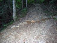
Of the 30 miles of unpaved roads, 287/10 miles are single lane (eight to 11 feet wide) fire access roads and bridle trails. Most of these roads were in existence prior to acquisition of the land by the NC Division of Parks and Recreation, and some areas of these roads are heavily eroding due to steep slopes. The park staff has added numerous water bars and water trail ditches to help address this erosion, with some success. However, there are still areas where erosion has not been resolved. The park staff maintains these roads using park equipment.
Maintenance of South Mountain Park Avenue (SR 1904) from the superintendent’s residence to the Jacob Fork parking lot is part of the State Parks Road System. There is a request in to the NC Department of Transportation (NC DOT) to abandon the rest of the road within park property behind the new park gate and turn it over to the State Parks Road System. At the time of printing of this document, this transfer had not yet taken place.
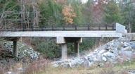
Currently, there are three new bridges along South Mountain Park Avenue which span Jacob Fork. These bridges are constructed to NC DOT standards and are two lanes with guard rails. Another one-lane vehicular bridge in the park connects the horsetrailer parking area to the existing equestrian campground.
Pipe culverts along the park roads are both concrete and corru gated metal, but the majority of the piping is metal. Most are in fair shape. Minor tail ditching is required on several culverts.
The new visitor center has 35 paved parking spaces for use by the public. This includes two accessible parking spaces. A lower park-
ing lot provides five staff parking spaces. The main parking lot also has four bus parking spaces.
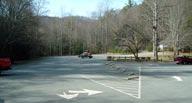
The paved parking lot at the day-use area (Jacob Fork parking area) has 149 designated parking spaces. There are four accessible spaces in this parking lot. This parking lot is in good condition and is striped with signage to mark the travel ways.
On busy weekends, the Jacob Fork parking lot is full. The park staff manages the parking in 44 additional spaces (including one accessible space) in the Cicero Branch parking lot located to the west of the existing primitive campground. This parking lot also serves as access for those fishing in Jacob Fork. Seven additional parking spaces exist off of South Mountain Park Avenue, one
group of three and one group of four. These are primarily used by those fishing in Jacob Fork as well as for access to Turkey Ridge Trail.
All sewer facilities at South Mountains State Park have septic tanks and separate drain fields. Descriptions of the systems follow:
Picnic Area Toilet Building (Building #031-004).
This system has a 2,000-gallon, pre-cast septic tank with a five-line distribution box. There are five 140-linear-foot nitrification lines. The nitrification field is located approximately 25 feet behind the toilet building in a wooded area. Picnic tables are located in the drainfield. A gravel interceptor drainage ditch above the drainfield catches surface water that runs across it. The septic tanks do not have risers.
Ranger Residence (Building #031-002).
The size and age of this system is unknown, but it is probably a 1,000-gallon tank with approximately three 100-foot drainfield lines. The tank does not have a riser.
Ranger Residence (Building #031-022).
The size and age of this system is unknown.
Superintendent’s Residence (Building #031-018).
The size and age of this system is unknown, but it is likely a 1,000gallon tank. This tank does have a riser.
There are 12 privies at South Mountains State Park. Four of the privies are vault/pump-out and are located at the 11-site primi tive campground and the horse trailer parking area. The remaining eight are pit privies and are located at the hike-in group and primitive campsites.
There are no public restrooms at the former office and maintenance area.
The visitor center toilet facilities are served by approximately 900 linear feet of field line, a 3,000-gallon septic tank, and a 1200-gallon pump tank which doses approximately 250 gallons. The septic field is located to the northeast of the visitor center building.
Equestrian Campground Washhouse Sewer System (Building #031-028).
This septic system consists of six flush toilets, two urinals, and four shower stalls. The septic field is located to the north of the site. This is currently the only pumped system in the park.
The seven water systems that serve the park are each supplied by potable wells with submersible pumps.
Picnic Toilet Building Water System (Building #031-004).
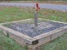
This system is served by a 302-foot deep, six-inch diameter well with a flow rate of 24 gallons per minute. The well is located about 200 feet north of the picnic toilet building. The pump control, storage tank, and chlorinator are located inside the toilet building. The pump is a submersible pump of unknown horsepower. The water quality is fair with a high sulphur content.
Ranger Residence Water System (building #031-002).
This system is served by a well of unknown age with an estimated depth of 120 feet. The piping and jet pump were replaced about 1985. The well supplies only the ranger residence, picnic shelter, and the former park office. The pump house is located just west of the ranger residence.
Ranger Residence Water System (building #031-022).
This system is served by a well of unknown age and depth.
Superintendent’s Residence Water System (Building #031-018).
This system is served by a water well of unknown age and depth. It is a six-inch diameter drilled well with an estimated depth of 150 feet. The water has a high sulphur content. A submersible pump of unknown horsepower pumps the water.
This system consists of a well located approximately 100 feet from the northeast corner of the building and is served by a 7.5-horse power pump.
Equestrian Campground Washhouse Water System (Building #031-028).
This system is served by a well just to the south of the day use horsetrailer parking lot, on the north side of Jacob Fork.
This system is of unknown age and depth.
Rutherford Electric Membership Corporation in Morganton provides electrical power to the park. Underground single phase power lines run along the South Mountain Park Avenue road shoulder to a series of transformers located along this entry road. The line ends at the picnic area toilet building.
Potable Water in the Equestrian Campground
AT&T in Morganton provides phone service to the park. The phone line runs underground along the South Mountain Park Avenue road shoulder. A 25-pair line services the visitor center and a 25-pair line services the rest of the park. The visitor center has three voice lines, one fax line, one fire alarm line, and one elevator line. A pay phone is planned for the visitor center in the near future. The maintenance area and former park office have one voice line and one pay phone. There are three phone extensions in the office and shop area, and each ranger residence has its own phone line.
Average temperature and precipitation data for Morganton, NC is the most local data available through the Southeast Regional Climate Center for 1/1/1933 to 12/31/2005. Average maximum temperatures ranged from 51.6º F in January to 88.6º F in July. Average minimum temperatures ranged from 28.2º F in January to 64.7º F in July. Average Total Precipitation ranged month to month from 3.43 inches (November) to 4.81 inches (March). The average annual rainfall was 49.65 inches. Average annual snowfall was 7.0 inches.
Prevailing wind data is available for Asheville, NC from the Na tional Climatic Data Center located in Asheville, NC. Prevailing winds for Asheville from 1930-1996 were from the North-Northwest with average speeds from six to 10 miles per hour.
Average temperature, precipitation, and prevailing winds are vari able across the park due to the mountainous topography creating distinct microclimates on peaks and in valleys and coves.
South Mountains State Park is located in the vicinity of latitude 35° 35’ north, longitude 81° 40’ west. This latitude reflects a solar azimuth altitude angle (essentially the angle of the sun relative to the horizon) of approximately 33° on the winter solstice (December 21) and approximately 79° on the summer solstice (June 21). On the winter solstice, the sun rises (without correction for topography) approximately 62° east of south and sets at approximately 62° west of south. On the summer solstice, the sun rises (without correction for topography) approximately 117° east of south and sets at approximately 117° west of south. This information is use ful for siting buildings and other structures for energy efficiency and solar comfort, both important in designing for sustainability.
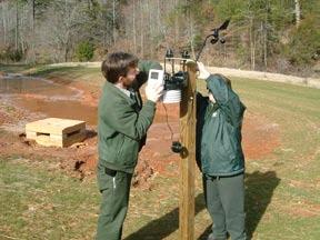
A weather station was installed in the vicinity of the South Mountains State Park Visitor Center in January 2007. It measures wind, rainfall, barometric pressure, soil temperature, and evapotranspiration rates.
It is visually apparent from the physiographic map in the first section of this document that the South Mountains Range stands out from its surroundings. As a portion of the South Mountains Range, the park encompasses several headwater streams, natural commu nities of significance, rare plants, rare animal species, extreme elevations for the Piedmont Province, and significantly steep slopes exceeding 65% in a number of areas.
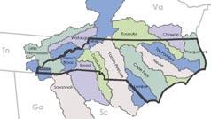
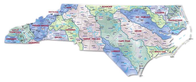
South Mountains State Park is dissected by a number of streams of various sizes that flow north, northeast, and east, eventually con verging with the Catawba River. The park’s southern boundary follows the northernmost ridge of a portion of the Broad River Basin to the south. Figure 9 illustrates the Catawba River’s relationship to other river basins in North Carolina. Figures 10, 11, and 12 illustrate the park’s hydrologic context.
The Catawba River is located to the north and east of South Moun tains State Park. It flows generally to the south, eventually flowing into the Wateree River in South Carolina. The Wateree River flows southeast to its confluence with the Congaree River, which also flows to the southeast. The Congaree ends at the Atlantic Ocean in Charleston, South Carolina.
The primary interpretive theme for South Mountains State Park is the ecology of its outstanding resource waters. South Mountains State Park contains headwater streams for both the Jacob Fork and the Henry Fork watersheds. Clear Creek and Bailey Fork primar ily drain the western section of the park and are both headwater watersheds that flow into Silver Creek. All three of these smaller hydrologic units flow to the Catawba River Basin.
Note: Data utilized for site inventory and analysis was provided by multiple sources and represents the best data available at the time of creation of the maps. Data descriptions, sources, and dates are provided under Resources and Refer ences, near the end of this document.
All, except two* of the named tributaries within the park boundaries are classified by the NC Division of Water Quality as High Quality Waters (HQW). The named streams in the Jacob Fork watershed are classified as Outstanding Resource Waters (ORW) and Trout (Tr) waters, and are all designated as Water Supply (WS) watershed streams. The named tributaries within the Henry Fork watershed are attributed the highest class of waters, WS-I, from their beginnings up to the Henry Fork Reservoir. Downstream of the reservoir, they are classified as C ORW.
Overall, the park contains nine named streams with an ORW designation. This is the state’s highest designation for water quality. ORW, as defined by the NC Division of Water Quality, is a “classification intended to protect unique and special waters having excellent water quality and being of exceptional state or national ecological or recreational significance.” To qualify as ORW, waters must be rated excellent by the NC Division of Water Quality and have one of the following outstanding resource values:
• Outstanding fish habitat or fisheries,
• Unusually high level of waterbased recreation,
• Some special designation such as NC or National Wild/Scenic/Natural/ Recreational River, National Wildlife Refuge, etc.,
• Important component of state or national park or forest, or
• Special ecological or scientific significance (rare or endangered species habitat, research or educational areas).
Protection of high water quality is an extremely important aspect of the park’s role in landscape-scale conservation. A summary table of other NC Division of Water Quality classification of waters within the park boundaries as well as stream classification descriptions are included in Appendix E.
Waters classified as Trout waters require maintenance of a 25-foot vegetative buffer on both sides based on State regulation. Due to most of the park’s presence within designated water supply watersheds, the Burke County Watershed Protection Ordinance permits no new development within a 30 to 100-foot vegetated buffer along these streams, depending on the level of development, “except for water dependent structures, projects such as road crossings and greenways where no practical alternative exists.”
*Double Branch and Ivy Creek
Surface waters within the park are subject to jurisdictional oversight by the US Army Corps of Engineers and the NC Division of Water Quality under Sections 401 and 404 of the Clean Water Act. Rare species within the park are subject to jurisdictional consid eration under state and federal laws enforced by the NC Wildlife Resources Commission, the NC Plant Conservation Program, and the US Fish and Wildlife Service.
According to the North Carolina Administrative Code, 15A NCAC 02H .1003, most development activities within the park will re quire a State Stormwater Permit due to the presence of Outstanding Resource Waters and High Quality Waters. Specific stormwater
requirements for HQW areas are described in 15A NCAC 02H .1006. Stormwater requirements for ORW areas are described in 15A NCAC 02H .1007. Henry Fork ORW Area is listed in 15A NCAC 02B .0225e in the ‘Listing of Waters Classified ORW with Specific Actions.’
Preliminary Flood Insurance Rate Maps have been issued for Burke County (dated preliminary Sep 05 2006). These maps indicate the presence of flood hazard areas only in the vicinity of the current eastern entrance into the Jacob Fork section of the park. A base flood elevation determination for specific areas should be performed during the design and construction phases for any project in the park.
South Mountains
State Park
The National Wetland Inventory identifies several areas within the park boundaries. These areas are in the vicinity of the Clear Creek Reservoir, including the reservoir and areas to its southeast, an area adjacent to Double Branch also in the Clear Creek section, the Henry Fork Reservoir, and several areas to the north and west of the equestrian campgrounds along Jacob Fork. Other wetlands occur in the park that are not mapped by the National Wetland Inventory (NWI)*. Wetland delineation for specific areas should be performed during the construction design phase for any project in the park.
*According to the US Fish & Wildlife Service, “The NWI maps do not show all wetlands since the maps are derived from aerial photointer pretation with varying limitations due to scale, photo quality, inventory techniques, and other factors.”
Park Boundary
Hydrologic Unit Boundary (defined by ‘hu’ dataset provided by NC Division of Parks and Recreation)
Stream / Creek

Water Body / Reservoir
FEMA Flood Hazard Zone AE (defined as areas where Base Flood Elevations have been determined - pre liminary Sept 05 2006) County Boundary Roads
Areas identified in the National Wetland Inventory
Contours
Figure 13 represents aerial photography of South Mountains State park flown in 2005 for the development of Light Detection and Ranging (LIDAR) contour data for Burke County. This provides a literal snapshot of existing development in and around the park as well as providing a visual sense of the terrain of the park.
Figure 14 illustrates 20’ topographic contours* for South Mountains State Park and surrounding areas. The peaks and valleys and stream corridors are highly apparent. The more shear ridge line on the northwest facing slope of the Clear Creek watershed may be attributed to its aspect and more impact from stormwater erosion from western ap proaching storms over time.
contour data.
not represent
South Mountains State Park is defined by prominent ridges, knobs, and valleys with extensive steep side slopes. These topographic land forms dominate the park landscape. Development areas with gentler slopes in areas appropriate for development have often been difficult to identify. Figure 15 illustrates slopes in percents for South Mountains State Park.
Ideally, development will not take place on slopes greater than 18%. In some cases, this objective may be difficult to achieve, as is conveyed in the map to the right where the two shades of green represent slopes less than 18%. Maximum conditions for slope with various development-related activities are listed in the legend to the right. The data used to create the slope map was the best available at the time of creation of this map. It is based on LIDAR and therefore is not survey quality. Topographic surveys should be performed during the construction design phase for any project in the park.
Steep
Easily
The direction that land faces impacts vegetative communities that grow upon them, as well as movement of animals based on the vegetative food sources available in these areas. Due to differences in vegetation and microclimate, it also impacts burn rates and heat levels during controlled burn and wildfire events.
Figure 16 illustrates aspects in South Mountains State Park. Generally, southerly aspects are rep resented by yellows and oranges, and northerly aspects by blues.
In South Mountains State Park, park staff has recognized differences in burns in prescribed burn areas in the park relative to aspect. It was reported that burns in areas with southerly aspects burn hotter and faster than those on more northern aspects. This was attributed both to solar angle as well as vegetative material present.
Aspect is also relevant when siting buildings and public use areas. Southerly aspects are ideal for pas sive solar, energy-efficient building design as well as public spaces used in the winter time. Shading through structure or tree canopy should be provided to public spaces with southerly aspects that are also used in the summer.
Flat (-1)
North (0-22.5)
Northeast (22.5-67.5)
East (67.5-112.5)
Southeast (112.5-157.5)
South (157.5-202.5)
Southwest (202.5-247.5)
West(247.5-292.5)
Northwest (292.5-337.5)
North (337.5-360)
Figure 17 illustrates elevation ranges within South Mountains State Park. The elevations within the park range from a low of approximately 1,140 feet in the Jacob Fork stream bed to a high of approximately 2,990 feet. The highest points in the park ex ist along the ridge line between the Clear Creek and Henry Fork Watersheds. These peaks include Propst Mountain (~2,960’), Buzzard Roost (2,980’), and Hickory Knob (~2,960’)*. The slopes that relate to these high elevations result in extreme challenges for trail connections between the two watersheds.
Walker Top is located on Burkemont Road along this same ridge line. It is part of a park inholding. It represents another high point along this ridge and is the location of a communication tower. Other high points in the park include Rainbow Mountain and Hickory Nut Mountain in the Henry Fork water shed, and Benn Knob on the ridge line of the Jacob Fork watershed.

Clear Creek Reservoir is in the lower elevations of the Clear Creek section of the Park. The high water elevation of the reservoir is anticipated to increase by about 10 feet above its current level with completion of the dam renovation project underway during the creation of this document. Any further planning and design of facilities within the vicinity of this reservoir should take into account this future change in high water line.
1,075 - 1,250
1,250 - 1,500
1,500 - 1,750
1,750 - 2,000
- 2,250
- 2,500
- 2,750
- 2,985
Detailed digital soil data for Burke County, dated 2004, was provided by the Burke County Department of Planning and Development (illustrated in Figure 18). Detailed information on the soil data, not yet published, was provided by the Morganton Field Office of the Natural Resources Conservation Service.
Twenty-six soil units are represented in and around the current South Mountains State Park boundaries. The predominant soils in the eastern portion of the Jacob Fork section of the park are of the EdvardCowee complex. Predominant soils in the western portion of the Jacob Fork section and in the Henry Fork section are of the Cliffield-Pigeonroost com plex. Predominant soils in the Clear Creek section are also of the Edvard-Cowee complex, with AsheCleveland-Rock outcrop complex soils approaching the ridge with the Henry Fork section.
Seven of the identified soil types within the park are considered hydric. These soils are noted as existing in floodplain landforms.
All of the soils, except two, have a ‘somewhat limited’ or ‘very limited’ status for campsites/picnic areas/playgrounds. Limitations on these soils are primarily due to steep slopes, stones, or poor drain age.
All soils are considered ‘somewhat limited’ to ‘very limited’ for sewage disposal. Also, all are considered ‘somewhat limited’ to ‘very limited’ for local road construction and excavation.
More detailed soils analysis will be required during the design and development of any new facilities within the park.
South Mountains State Park is situated in the inner Piedmont geologic division of the State of North Carolina. It is within the Chauga Belt Anticlinorium (North Carolina Geologic Survey, 1985).
NC Geological Survey (1998) characterizes the geology of the park and surrounding areas as primarily mica schist and metamorphosed granitic rock with some areas of biotite gneiss and schist in the Jacob Fork section of the park, primarily mica schist and biotite gneiss and schist in the Henry Fork section of the park, and primarily biotite gneiss and schist and megacrystic biotite gneiss in the Clear Creek section of the park, with areas of inequigranular biotite gneiss and migmatitic granite gneiss in the immediate vicinity of the Clear Creek Reservoir and the Bailey Fork Reservoir. Figure 19 illustrates the geology of South Moun tains State Park.
The 1998 data also indicate a geologic fault to the immediate northwest of the Clear Creek Reservoir, paralleling Highway 64 between the park boundary and Highway 64.
More detailed mapping of a portion of the park was per formed by a University of Tennessee graduate student in 2001 (Bier, 2001). This study provides more detail on the types of schists, gneisses and granites within a portion of the Jacob Fork and Henry Fork sections of the park. According to Tyler W. Clark, P.G., with the NC Geological Survey, this data does not indicate any geological constraints to any development activities within the park (See Appendix F).
Due to the rocky nature of this area, more geotechnical studies may be required during the construction design phase of any new development.
Legend
PzZu - Meta-ultra mafic rock
OcG - Metamorphosed Granitic Rock
OCgm - Migmatitic Granitic Gneiss
CZpg - Inequigranular Biotite Gneiss
CZba - Megacrystic Biotite Gneiss
CZms - Mica Schist
CZbg - Biotite Gneiss and Schist
The South Mountains are an outlying range located east of the Blue Ridge Escarpment. Although the range’s highest elevation is only around 3,000 feet, its location has resulted in an unusually diverse combination of Piedmont and mountain habitats.
The South Mountains have been described as a “…curious crossroads in nature….”, and its unusual geographic location has allowed lowland and mountain species to occur in improbable combinations. Numerous unusual plant species, many of them rare and at the limits of their natural ranges, converge on the range from all directions. Biologists have documented over 800 plant species in and around the park, including over 100 state-listed rare species, and the range’s biodiversity is little-matched in North Carolina. It is believed that well over 1,000 plant species eventually will be documented, making the South Mountains Range and the park a center of biological di versity that is of national importance (Moye, 1994).
South Mountains State Park encompasses all or part of six significant natural heritage areas. The NC Natural Heritage Program defines significant natural heritage areas as terrestrial or aquatic, with significance based on the presence of rare species, rare or high quality natural commu nities, or other important ecological features.* Significant Natural Heritage Areas are ranked from level ‘A’ (national significance) to level ‘D’ (local significance).
Figure 20 illustrates the significant natural heritage areas within the park and its nearby surroundings. The three largest natural areas in South Mountains State Park (Clear Creek Watershed Natural Area, Henry Fork Watershed
*The North Carolina Natural Heritage Program notes that Significant Natu ral Heritage Area information can quickly become outdated. Therefore verification of information should take place before use of the data set in future design phases of a project to ensure data currency.
Natural Area, and Jacob Fork Watershed Natural Area), areas of which cover a large part of the park land, are of state significance as a natural heritage area (level ‘B’). Level ‘B’ sites are defined as containing occurrences of plants, animals, exemplary or high qual ity natural communities, or important animal assemblages within the state that are not already considered of national significance. The Deaf School Watershed on the northwest side of the park is a level ‘C’ natural area. Level ‘C’ sites are defined as “the best occurrences within a given Priority Region that are not already considered of national or state significance.”
To the west of the park property are the Hall Knob and Shoal Creek Watershed natural areas. These areas are partially located on property included in the park acquisition plan and are considered to be of regional significance.
Jimmy Knob, partially located inside the park’s northern boundary and also partially located on property in the park acquisition plan, is a level D natural heritage area, considered of local significance.
The Simms Hill/Little River Uplands (level ‘C’) is located to the northeast of the Jacob Fork section and is included in the park acquisition plan.
Oakley (2002) provides a recent, thorough description of the three major natural areas within South Mountains State Park and the significant natural areas included in the park acquisition plan, including important, rare and significant species and natural com munities within these natural areas. The special status species and high quality natural communities in each area within the park are summarized in Table 4. The natural area descriptions follow.
The Jacob Fork Watershed Natural Area is described as an “almost entirely forested ecosystem” and “a topographically complex area of narrow ridges, ravinelike valleys, and steep slopes with very little flat land.” The Henry Fork Watershed Natural Area is “rug ged and quite convoluted by ridge lines, peaks, slopes, and coves.” The Clear Creek Watershed Natural Area “covers a three mile-long expanse of well-defined cove, slope, and spur ridge topography
*NCNHP notes that these data can quickly become outdated. The NCNHP (Office of Conservation and Community Affairs, Department of Environment and Natural Resources) should be contacted before use of the data set at the construction design phase of a project to ensure data currency.
which culminates at several summit peaks.” The Deaf School Watershed consists of “northwest-facing slopes, spur ridges, and coves along the western end of Burkemont Mountain.”
The ecologically most important areas of the park are designated as Dedicated Nature Preserves (Figure 21). The shaded area shown within the South Mountains State Park property in Figure 21 is a ‘primary’ Dedicated Nature Preserve. This status represents one of the highest quality preserves in the state, assigning it the greatest protection. Dedicated Nature Preserves are governed by very strict rules for management which limit development within these areas. These rules are included in Appendix G.
Several areas of the park are not included within the preserve, most notably the area in the vicinity of the existing develop ment around South Mountain Park Avenue in the Jacob Fork section of the park as well as the area in the vicinity of the Clear Creek Reservoir in the Clear Creek section of the park. The Bailey Fork watershed area, a portion of the northern area of the Henry Fork section and an
Interior of bat house, with two Rafinesque’s big-eared bats in residence.

Table 4: Summary of Special Status Species and High Quality Natural Communities in South Mountains State Park (Oakley, 2002)
Appalachian Golden-banner Thermopsis mollis
SR --
Ash-leaved Golden-banner Thermopsis fraxinifolia
T
SR Bear Oak Quercus ilicifoli
Bleeding Heart Dicentra eximia
Blunt-lobed Grape Fern Botrychium oneidense
Bradley's Spleenwort Asplendium bradleyi
SR
SR Blue Ridge Bindweed Calystegia catesbiana ssp. sericata
SR --
SR
SRFSC Daisy-leaf Moonwort Botrychium matricariifolium
Carolina Saxifrage Saxifraga caroliniana
SR Godfrey's Thoroughwort Eupatorium godfreyanum
SR
SR -Lance-leaf Moonwort Botrychium lanceolatum var. angustisegmentum
Greenland Sandwort Minuartia groenlandica
SR
Large Witch-alder Fothergilla major
Small Whorled Pogonia Isotria medeoloides
Sweet Pinesap Monotropsis odorata
SR
SR Shale-barren Blazing Star Liatris turgida
SR T
SRFSC
SR -Thin-pod White Wild Indigo Baptisia albescens
Sweet White Trillium Trillium simile
SR Yellow Honeysuckle Lonicera flava
SR
SR -Hoary Bat Lasiurus cinereus
Golden-banded Skipper Autochton cellus
Northern Long-eared Bat Myotis septentrionalis
SR
SC
T FSC Silver-haired Bat Lasionycteris noctivagans
Rafinesque's Big-eared Bat Corynorhinus rafinesquii
NATURAL COMMUNITIES
Acidic Cove Forest
Carolina Hemlock Bluff
Chestnut Oak Forest
High Elevation Seep
Low Elevation Rocky Summit
Montane Acidic Cliff
Montane Oak--Hickory Forest
Pine--Oak/Heath
Rich Cove Forest Spray Cliff
Notes:
State Status: E - Endangered; T - Threatened; SC -
Federal Status: T - Threatened; FSC - Federal
-
SR
of Concern
area near the end of Baptist Camp Road, north of South Mountain Park Avenue, are also not included in the pre serve.
The areas within the park boundary that are not part of the dedicated nature preserve are generally of lower quality and, therefore, include preferred development sites. Areas excluded from the preserve still require a thorough examination of logistical and ecological constraints prior to any development activity.
South Mountains State Park is the largest park in the state system and is located within a relatively short driving distance to the large metropolitan cities of Asheville, Charlotte and Hickory as well as other medium sized towns. The park, due to its size and unique to pography and other sensitive environmental features, is physically divided into three sections, two of which are more easily accessible by vehicle.
The eastern portion of the park, the Jacob Fork section, is already developed with facilities described in the previous inventory and analysis portion of this document. The current park facilities include access to the beautiful, pristine streams and waterfalls along with other natural features. There are hiking, day-use picnicking, fishing, equestrian, mountain biking and other backcountry experi ence opportunities. The master plan improvements to these facili ties, along with new facilities, are presented in the next section of this master plan.
The western portion of the park is currently undeveloped and provides an excellent opportunity for long-range planning that will guide the growth in a manner that fulfills the state parks mission of protecting the park’s natural diversity, promoting outdoor recre ational opportunities, and encouraging good stewardship of the park’s natural resources for all visitors and citizens of North Carolina. Access to Highway 64 and Interstate 40 is in close proximity to this section of the park, which encourages visitation. In addition, there is an opportunity to develop this section of the park with an emphasis on universal design, making it “usable by everyone regardless of their age, ability, or circumstance” (The Center for Universal Design, 2007), to share the outdoor experience.
Since development other than trails and low impact campsites should occur outside areas of high ecological significance, two of the primary constraints used to define focus areas for development at the park scale were the natural resources and slopes. Referring to Figure 22, areas of focus were defined as the areas in direct relation to South Mountain Park Avenue in the Jacob Fork section and the area in direct relation to the current access point and the Clear Creek Reservoir in the Clear Creek section. Other areas within the

Clear Creek
Focus Area
Map Legend
South Mountains State Park
Dedicated Nature Preserve
South Mountains Game Land
Dedicated Nature Preserve
park were identified with major constraints that would make development in those areas too costly either financially or ecologically. Primarily these constraints are related to steep slopes, existing road access, and public safety issues.
Once the focus areas were defined, a more detailed assessment of opportunities and constraints within the focus areas was performed. Other primary constraints encountered at this scale included areas with slopes greater than 18%, wetland areas as defined by the National Wetlands Inventory, floodplain as defined by the most recently available 100 year floodplain data and based on park staff input on floodplain areas, and 50 foot buffers defined for streams and other water bodies within the park. Figures 23 and 24, more detailed summary analysis maps, illustrate the opportunities and constraints in the Jacob Fork and Clear Creek focus areas, and refine focus areas to the denoted areas of development opportunity.
Since 1979, when the original master plan for South Mountains State Park was completed, the park has grown in size to become the largest park in the state park system. The park currently has 17,481 acres, is approximately 10 miles from end to end, and is approximately 42 miles around its boundaries. With the exceptions of logging activities, prospecting, and mining during the early 1800’s, the land has remained relatively unimpeded by development. Even the settlement patterns on the land were very sparse, due in large part to the difficult terrain. Protection of the land and its waters was further afforded when some of the significant tracts of land in the Henry Fork and Clear Creek watersheds were re tained for water supply.
As identified in the earlier circulation maps, points of access into the park lands are limited. For its size and proximity to large metropolitan areas, this is still a remote area and a very natural and unspoiled place.
The extensive areas identified as most important for protection are shown as Dedicated Nature Preserves. With few exceptions, this limits development opportunities within the central part of the park, including the majority of the Henry Fork and the Clear Creek
Park Boundary
Water Body
Areas identified in the National Wetland Inventory
50’ Stream Buffer
FEMA Flood Hazard Zone AE (defined as areas where Base Flood Elevations have been deter mined - preliminary Sept 05 2006)
0-10 % slope
10-18 % slope 18-25 % slope 25-30 % slope 30-50 % slope
>50 % slope
Development Focus Areas
watersheds. The very steep topography in these areas also limits the connectivity and extension of roads or trails.
A primary goal of this master planning process has been to locate future programmatic elements and facilities in a manner that, to the best extent possible, ensures the protection of the significant natural resources of the park. As the NC State Parks Mission Statement articulates: “…the mission of the state park system is to conserve and protect representative examples of the natural beauty, ecological features and recreation resources of statewide significance; to provide outdoor recreation opportunities in a safe and healthy environment; and to provide environmental educational opportunities that promote stewardship of the state’s natural heritage.”
The master plan meets this mission by taking a comprehensive look at the entire park property, including possible acquisition properties within surrounding environs, in order to provide a clear development plan and guide for future activities. As outlined in the beginning of this document, the plan analyzes and evaluates the park land’s data and extensive environmental information, conveys a design program of use, presents alternative design proposals that respond to the program, and considers other factors that affect the management of the park.
With increased park size and increased park attendance since the original master plan was prepared for the park, needs and demands have been expressed which form a program to improve current public use and recreation activities. Values have been articulated that protect and conserve significant ecological assets. Many opportunities exist for increasing the quality of user experience by expanding and enhancing existing facilities. The main goal of this planning effort is to best locate proposed development in order to protect natural resources, preserving the park lands for future generations.
The focus areas within the Jacob Fork and Clear Creek sections comprise a relatively small geographic footprint of the park property, designated on land with fewer constraints to park develop ment. In the Jacob Fork section, all development proposals utilize the main spine road of South Mountain Park Avenue and already impacted old road beds in order to minimize further impact by the use of road extensions (see Figure 23). In the Clear Creek section,
Park Boundary
Water Body
Areas identified in the National Wetland Inventory
50’ Stream Buffer
% slope
10-18 % slope
% slope
% slope
% slope
% slope
Development Focus Areas
access to the west and south of the reservoir is extremely limited by steep topography and the presence of the reservoir. However, suitable developable areas are located directly to the northwest and to the north/northeast of the reservoir (see Figure 24). Other areas are identified as being simply too difficult and challenging or too precious to compromise and are left in their natural state. All these opportunities and challenges will be explored and presented in the next section of the master plan.
The framework for this master plan is based on a design program thoroughly coordinated among the consultant, the NC Division of Parks and Recreation, The South Mountains State Park Advisory Committee, other agencies, and public comments received during the planning process. The design program outlines specific project opportunities within the three significant park sections. The pro gram elements identify circulation and access issues, specific user activities such as camping, picnic expansion and hiking and equestrian improvements, and a unique opportunity for an environmental education center that focuses on serving people of all abilities, with special attention to universal design for populations with special needs. Another key program element is to provide adequate facili ties for maintenance and management by park personnel.
Upon completing the analysis phase, the consultant prepared alternative development plans for the initial design program that explored various concepts for depicting development options.
These alternative studies were then critiqued and evaluated by the consultant and the NC Division of Parks and Recreation and the best options selected to reflect the written program.
After a public presentation of the preliminary master plan, the key elements of the plan and program were posted on the website for further input and comment. The final design program was deter mined by the consultant after review and evaluation of the alternatives and the many other environmental and regulatory factors that influence the park development.
The master plan for the park is described in the following pages of this document. The plan divides the proposed development into three sections: Jacob Fork, Henry Fork, and Clear Creek, illustrated in Figure 25.
The master plan recommends the development of a number of facilities that will be accompanied by increased park visitation. These facilities and increased visitation rates result in a direct need for additional park staff. Anticipated staffing needs are summarized in Appendix H.
On the master plan maps, colored/rendered areas illustrate areas where new facilities are recommended. Specifically, new buildings are indicated in red, existing buildings (when surrounded by new development plans) are indicated in burgundy, new pedestrian paths are indicated in yellow/orange, and new roads are indicated in grey. A labeled plan is included at the introduction to each park section master plan. Subsequently, following their text descriptions, certain areas are enlarged for more detailed legibility. Labels shown on the plans in italics denote existing facilities, trails or destinations. Labels shown in regular text (not in italics) indicate elements recommended by the master plan.
This master plan design is based upon the best available data*. Though space is available for noted design features and areas, more detailed soil, geotechnology, topographic, floodplain, wetland, ecological and other studies will be warranted to fully assess
The data used for master planning is not survey quality. Data utilized is summarized in the Resources and References section of this document.Clear Creek Reservoir from top of dam, August 2007
*

feasibility. Planning is a dynamic process. The availability of more detailed information over time may result in a final built product that is different than that depicted in this plan.
The master plan proposes several projects that will have impacts on surface waters and plant and animal habitats; however, design specifications for stream crossings, buffers, building footprints, final building locations, etc., are not yet finalized. An environmental assessment will be produced as part of the review process for this master plan, and the NC Division of Parks and Recreation will seek comments from all review agencies regarding potential regulatory requirements. As construction plans are developed, appropri ate consultations with state and federal agencies will be undertaken to ensure compliance with all resource protection regulations. It will be the intention of the NC Division of Parks and Recreation to avoid or minimize impacts for all projects involving wetlands, streams, rare species, and their habitats. Appropriate delineations will be conducted for all stream crossings that are deemed by the NC Division of Water Quality and the US Army Corps of Engi-
neers to require permitting under Section 401/404 of the Clean Water Act. The NC Division of Parks and Recreation expects that all stream crossings will be constructed with the strictest adherence to all state and federal water quality regulations and permit require ments. Appropriate rare species surveys and consultations with the appropriate agencies will be conducted to avoid or minimize impacts and to ensure compliance with all regulatory requirements. Comments provided on the master plan by the NC State Clearinghouse and the US Fish and Wildlife Service are included in Appen dix B.

This master plan makes recommendations for short trails associ ated with facilities. A larger overall assessment of the existing park trails and proposed future trails is outside the scope of this master plan. It is recommended that park staff work with NC Division of Parks and Recreation trails, natural resources, and design and development staff to produce a comprehensive trails assessment. It is further recommended that this assessment include a baseline inventory of the existing trail system; an evaluation of the existing construction, maintenance, safety, and resource protection con straints; and recommendations for the trail system’s overall scope, including new trails, closures or re-routes, connections from existing to proposed areas, and construction and maintenance standards.
Based on public input for this master plan, an estimate of future needs (such as additional trail miles) is recommended through a comprehensive trails assessment. It is also recommended that the trails needs assessment include input of user groups such as hikers, bikers, backpackers, equestrians, and anglers.
The overall master plan for the Jacob Fork section of the park is illustrated in Figure 26. Enlargements of specific areas for more detailed review are included in following figures.

The Jacob Fork section of the park is accessed along South Moun tain Park Avenue, described in more detail in the Roads and Utility Inventory earlier in this document and illustrated in Figure 26.
The point of entry to the park currently is through a gate just to the east of the easternmost bridge in the vicinity of the visitor center and the first ranger residence as one enters the park. A new entry gate will be built just to the west of the existing ranger residence driveway, providing a turnaround opportunity for after hours and relieving the current safety issue of multi-point turns at the gate. This entry gate will include stone columns and a new park sign feature.
Three bridges carry South Mountain Park Avenue over Jacob Fork. All bridges appear to be in good condition. These bridges were
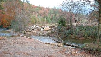

designed for vehicular access only, not providing separate passage for pedestrians crossing the stream on the bridge.
Figure 27 illustrates the master plan recommendations in the vicinity of the South Mountains State Park Visitor Center.
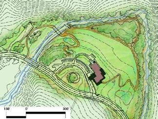
An approximately ½-mile interpretive trail, proposed to meet Americans with Disabilities Act (ADA) guidelines, will originate at the visitor center, providing several different experiences for the hiker as it winds through a meadow, woodland edge, woodland interior, and stream side to the north of the center. Wayside exhibits will help interpret the trail. This short trail system will provide a convenient and accessible trail, allowing the user to experience a little of what the park has to offer in a short time period.
This paved trail 1 will begin at the visitor center porch and wind down the grade to the area by the current erosion control basin.
This basin area will be converted into an educational opportunity with modification into a stormwater filtration basin. The visitor can then learn about the types of native plants and filtration systems that protect Jacob Fork. The trail will split towards a woods edge trail and a stream side trail, eventually looping back up towards the northern portion of the parking area, returning the visitor back to the visitor center.
As was described in the Roads and Utility Inventory earlier in this document, the visitor center currently has 35 paved parking spaces for the use of the public, a lower lot providing five staff parking spaces, and four bus parking spaces 2 .
Once the exhibit hall opens in the visitor center, the need for additional parking in this area is anticipated. Additional parking in direct connection with the existing parking lot is not considered feasible at this time due to several constraints. These primary constraints include the existence of steep slope banks between the visitor center and Jacob Fork, as well as the presence of a large white oak tree, fairly centrally located within the existing parking area, which was preserved through the construction of the center. This tree is beginning to show signs of stress.
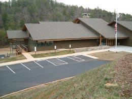
If this tree degrades to such a point that it requires removal, some opportunity may exist for additional parking in this area, as well as realignment of the road adjacent to the tree.
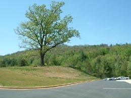
Stream bank restoration and stabilization of the old road bed near the visitor center was addressed in the 1995 environmental assess ment for the construction of the visitor center. It is recommended that this restoration 3 be undertaken in order to protect the water quality of Jacob Fork and to discourage further foot traffic on unstable stream banks in the area. Figure 27 illustrates this area for restoration. This area of repair is one of the few places along the Jacob Fork which is in need of restoration.
Additional parking (12-18 spaces) 4a and a picnic area (7-10 ta bles) 4b will be located on a shallow sloped area on the northwest side of Jacob Fork to the northwest of the visitor center. Figure 27 illustrates this area. The location for this picnic and parking area is suitable for this use because of its easy access off of the main park road, the reasonable topography, and its proximity to both the river and the visitor center.
A strict buffer to Jacob Fork will be maintained in this area (minimum of 50 feet) to protect the stream during and after construction of this parking and picnic area.
A pedestrian bridge 5 across Jacob Fork would afford a safer connection from the picnic area to the visitor center via the proposed interpretive trails than would otherwise be available on foot across the vehicular bridge along South Mountain Park Avenue. It is recommended that the park have an engineer evaluate the bridge abutments from the former road in this location for their reuse as a pedestrian stream crossing.
A hiking trail connection to link this proposed picnic/parking area and the existing park trails that begin at the current horsetrailer parking area will be evaluated through a comprehensive trails as sessment and is recommended if it is feasible.
New Tent and Trailer Campground (Land-Dependent Preferred Alternate)
A tent and trailer campground 6 is proposed on a tract being considered for acquisition, located to the southeast of Red Hill, and across South Mountain Park Avenue from the visitor center (illustrated in Figures 26 and 27). This proposed tent and trailer campground is the preferred alternate to the existing primitive campground expansion, described later in this section, due to the location’s proximity to the visitor center, providing for simpler wayfinding, and its protection of Jacob Fork due to no need for a stream crossing. Site selection also is based upon the relatively flat, selectively cleared land that is not prone to flooding compared to other flat, undeveloped land in the vicinity of South Mountain Park Avenue. Additionally, it has good access to the main park road. The campground will be intended to continue the park’s theme of campsites with a backcountry character.
This proposal includes two camping areas: the primary camping area is proposed as a larger tent and trailer campground, based around a loop road, in an already selectively cut open area; ex pansion to this area is proposed over time as a smaller tent campground, also based around a loop road, and adjacent to a natural draw.
The proposed tent and trailer campground would provide for 35-40 sites. The sites would provide a sense of privacy and backcountry character through spacing at approximately 150 feet on center.
Each campsite would have a tent pad, picnic table, lantern hook, and fire ring. The majority of sites would likely be accessed by backup space parking, sized to accommodate a vehicle and trailer. A percentage of the sites would be designed to accommodate pullthroughs for longer trailers and large rigs.
These facilities will require potable water. If a new well is cost prohibitive, access from the visitor center well via pump will be explored.
It is preferred that 100 percent of the sites in this campground loop have individual access to potable water. However, if sewer hookup is required by code for any site that has water, spigots scattered at regular intervals throughout the loop will be used to provide potable water. At least one site should be provided with a sewer hookup.
Electricity would be desirable at all sites in this loop. Solar energy or other renewable energy options both for heating water and pro viding electricity should be explored whenever possible.
Providing trail access from this new campground to Raven Rock Trail is recommended.
A sewer dump station is proposed along the road that would lead to the new tent and trailer campground.
New Tent Campground (Land-Dependent Potential Expansion of Preferred Alternate)
A land-dependent small tent campground is proposed as a future expansion to the land-dependent tent and trailer campground (refer to Figure 26). Pending further ecological analysis of this site, if it is deemed unfeasible, the expansion of the primitive campground across Jacob Fork as a tent and trailer campground will be considered.
This land-dependent expansion alternate would likely provide for 20-30 tent sites approximately 80-120 feet on center. It is proposed to contain a toilet facility appropriate to its final determined size. Water would be provided by spigots scattered at regular intervals throughout the site. Electricity would be provided as a centralized amenity.
Figure 28 illustrates the location and schematic layout for the Jacob Fork maintenance area. Site selection for this maintenance area in the Jacob Fork section of the park was based on reasonable topography for the programmed use of the space, a location behind Red Hill out of view of South Mountain Park Avenue, and a somewhat central location to the rest of the developed park area off the main park road. The designated area is comprised of approximately one and one-quarter acres. Access to the maintenance area will be constructed primarily on an existing old road bed in order to minimize impact to surrounding trees and slopes in the area.
This maintenance area 7 will be enclosed by security fencing and will include two 40 feet by 100 feet buildings. One of these build ings will be a warehouse building and mechanic shop including a vehicle lift. The other building will include offices, restroom facilities with a universally-designed emergency shower station, and a carpentry shop.
An equipment storage shed also is included in the program for the maintenance area. This shed will have five bays, similar to the shed at Raven Rock State Park. The shed will be covered, with no side walls.
Three small metal storage buildings will be relocated and reused from existing locations within the park. These buildings are approximately 16 feet by 20 feet and can be sited on blocks, but do require vehicular access from the entry drive.
The site also will include an outdoor vehicle wash area, encom passing up to 15 feet by 20 feet. This area will be covered and have direct access to a hand-held hose. Wash water will be delivered to the septic area through an oil/water separator.
The site also will include a 100-gallon used oil storage bin, a six-bay vehicle storage shed (~24 feet by 50 feet), 10 to 12 paved parking spaces, and above-ground 1,500-gallon gas and 500-gal lon diesel pumps that are concrete encased and 5 feet from any building at a minimum. Drive access to the site will be designed to accommodate tractor trailer access.
The site will require electric, water, phone, and wastewater utili ties. Electric may be trenched during construction under the entry drive from South Mountain Park Avenue. It is recommended that the park explore renewable energy options for this project. The well at the equestrian parking area may be appropriate as a potable water supply. An appropriate septic area will be defined for the site
prior to construction, and will be sized appropriately to accommodate restrooms and equipment wash runoff.
Stormwater runoff will be directed through a filtering system, including an oil/water separator where appropriate, in order to cleanse the water prior to it entering the groundwater or surface waters of the site.
The site will be appropriately buffered from adjacent land uses, including the existing equestrian campground. Impervious sur face will be kept to a minimum. The site’s proximity to the sensitive waters of Jacob Fork will require extreme care and sensitive planning through the next phases of design to protect this water. A minimum 50-foot buffer will be maintained between any construction on newly impacted areas of this site and Jacob Fork. The exist ing old road bed that will be used for access to the site may encroach on this 50-foot buffer. Additional precautions will be taken in these areas during construction in order to minimize impacts to Jacob Fork.
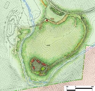
Figure 28 illustrates the location and context of the existing eques trian campground and horsetrailer parking. The equestrian campground consists of 15 campsites. Based on needs expressed to park staff by existing users of this campground 8 as well as public comment received through this master planning process, electricity will be provided to all of the existing equestrian campsites.
Water in this campground currently is provided by spigots scattered through the site. If code does not require the provision of septic hookup for any site with water hookup, it is recommended that potable water be provided to each campsite.
The existing horsetrailer parking area (refer to Figure 28) provides approximately three-quarters to one acre of area for parking, excluding circulation around the vicinity of the area. This parking area currently is unmarked.
Improvements will be made to the planted buffer between the horsetrailer parking area 9 and South Mountain Park Avenue to help screen the large parking area from the entry road and to pro vide shade opportunities at the edge.
Currently, the parking area is serviced by two pit toilets. These will be upgraded to flush toilets, pending identification of an appropriate area for septic treatment.
A dump station will be provided in this parking lot. It will be de signed for clear and safe access and to minimize impact on existing parking capabilities of the lot.
Figure 29 illustrates the recommendations for the renovations and expansion of the existing primitive campground as well as the area surrounding the Cicero Branch parking area.
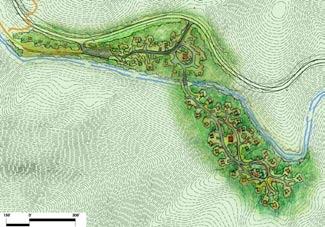
The existing primitive campground is located on the south side of South Mountain Park Avenue, adjacent to Jacob Fork. It currently has eleven campsites, two pit toilets, and two water spigots.
The Cicero Branch parking lot formerly was used for horsetrailer parking. Since the completion of the horsetrailer parking lot along South Mountain Park Avenue to the east of this facility, this lot has not been fully utilized. Therefore a portion of the eastern end of this parking area will be renovated into two to four new primitive camp sites 10a .
The current facility also will be renovated on its eastern end by renovation of the road and addition of three to four new primitive camp sites 10b , while respecting Jacob Fork to the south.
This campground is proposed to contain a shower house. Water and electricity will remain as a centralized amenity in this campground.
A land-dependent proposal for a new tent and trailer campground was described earlier in this section. If that new campground is found to be unfeasible, this alternate will further expand and improve the existing primitive campground with a new tent and trailer campground 11 .
This proposal will require one stream crossing of Jacob Fork. This will be provided by a bridge with both vehicular and pedestrian access.
Based on available space, the site may have the potential for 15 to 30 campsites spaced 50 to 100 feet on center along several loop roads. Special attention will be paid to minimizing impacts on Jacob Fork’s water quality during the construction stages of this project.
The site is proposed to contain a toilet facility appropriate to its final determined size. Potable water should be provided by spigots scattered at regular intervals across the site. Electricity should be provided at each campsite.
The Jacob Fork picnic areas are in very high demand. Additional picnic areas in the park that are in good proximity to the river and adjacent to safe and convenient parking will help relieve the de mands and pressure on the Jacob Fork picnic areas and parking.
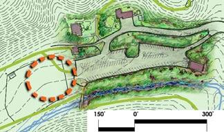
Therefore, the picnic area adjacent to the Cicero Branch Parking area will be expanded 12 . It is estimated that six to ten new picnic sites will be possible to the north of Raven Rock Trail in the vicin ity of its trailhead in this parking area. This picnic area expansion is illustrated in Figure 29.
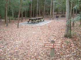
The Jacob Fork parking area is the terminus of South Mountain Park Avenue, and it provides access to a number of trailheads into the park. Therefore, parking spaces in this area do not meet demand during busy weekends. Park usage continues to increase. Expansion and improved circulation patterns in this parking area could help to alleviate the heavy demands on this parking lot. Land to the west of the parking area, currently used for picnicking, is relatively flat, and could potentially support additional parking spaces. It is recommended that further evaluation be performed on the feasibility for expansion of parking facilities into this area 13 at the western end of the parking lot. Figure 30 represents the area
recommended for improvement. An additional 30 to 40 spaces are recommended if feasible in this area.
The parking expansion would provide for more visual connection between the parking lot and the restroom facilities provided in the existing comfort station.
Several constraints in this area necessitate the recommended further evaluation, including the exact location of the septic area for the comfort station and, based on the amount of area deemed suit able for parking, evaluation of a suitable site for relocation of the displaced picnic facilities.
storage. The architectural review of this building identified this as a compatible use.
The existing toilet building is located approximately 350 feet from the primary parking. This distant location has caused confusion for park visitors in the past, resulting in unnecessary disturbance at the nearby existing ranger residence and former park office. Fur ther architectural study will be performed to evaluate the potential to renovate the former park office building for public restrooms. Evaluation for septic feasibility will also be required.
The area in front of and in the vicinity of this building will be fur ther evaluated for its potential to provide additional parking area.
If this parking is deemed feasible, as with any development in the park, special attention must be given to buffering the parking from Jacob Fork, sedimentation and erosion control during construction, as well as water quality treatment of any runoff from the new park ing lot prior to its entry into the creek post-construction.

An architectural review of the former park office was performed as a part of this master planning process. The review is included in Appendix I.
Based on staff needs, the workshop area of the former park office building 14 , located to the north of the Jacob Fork parking area, will be utilized for emergency/maintenance equipment parking and
The ranger residence located at the end of the Jacob Fork parking area was built as a private residence in the 1950s. It is not an ideal location for a ranger residence, since its proximity adjacent to the Jacob Fork parking area, as well as its driveway configuration, lead to an inadequate separation of activities in this area (see Figure 30). If a new appropriate location for this residence can be identi fied, it is recommended that the residence be moved from this loca tion in the future. In the meantime, the residence’s driveway from the parking area will be reconfigured for more clear delineation of private and public space, and additional evergreen plantings will be provided for screening for the parking area 15 .
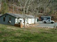
Access to the Henry Fork section from the north was explored through this master planning process. Based on extensive studies of these areas by NC Division of Parks and Recreation staff and the consultant, neither vehicular nor trail access will be provided to the Henry Fork section of the park from the north. The following reasons justify this conclusion:
1) The old trails in this area have seven major stream cross ings within the first mile of entry into the park. These streams are classified as Outstanding Resource Waters. In addition, the first mile of trail is subject to frequent flood ing. Therefore, construction and maintenance of this trail for regular use would be expensive and environmentally damaging.
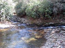
2) The relatively small reservoir was designed for water supply, not to support recreational use. It has extremely steep (65%+) and treacherous sides and a 35-foot high dam. Access to this reservoir would be ill-advised due to extreme concerns for public safety.
3) Access provided through this remote area would not serve to open the park to a significant new user base, as a Henry Fork entrance is no closer to any major population area than the current Jacob Fork parking area or proposed Clear Creek section entrance.
Two old logging roads within the Henry Fork section may be suitable for use as trails pending additional erosion control and appro priate surfacing. They tend to parallel the river on each of its sides and have good grades. If converted to trails, these could provide approximately 14 miles or more of trail access within the Henry Fork section of the park.
Although these trails have been identified as suitable for equestrian use, accessibility to these trails from either of the other two sec tions of the park as well as connectivity between the trails them selves has not been identified. An assessment of this connectivity
is recommended through the comprehensive trails assessment described earlier in this document.
Due to the length of trail required to access the Henry Fork section, and the length of potential trails in this section, planning for back country campsites in a reasonable location to trails will be included in the comprehensive trails assessment.

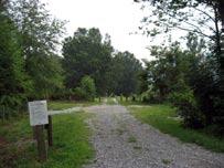
Access into the Clear Creek section of the park from US High way 64 is currently somewhat circuitous and confusing (Figure 31). Access requires three turns that are more akin to forks in the road than true intersections. These turns are from Jenkins Road to Clark Loop, from Clark Loop to Branstrom Orchard Street, and then remaining on Branstrom Orchard Street at a fork with Pearson Avenue. Though another satisfactory route of entry was not fully resolved through this master planning process, it is recommended that this issue receive further study. Until such time as a more di rect route from US Highway 64 to the entrance to the Clear Creek facilities can be developed, it is recommended that the park visitor be directed along the current access way by signage that utilizes clear wayfinding language and graphics to indicate the route to the park entrance.
Two parcels of land directly across from the Clear Creek section park entry are proposed for acquisition. These two parcels will allow for improved park buffering from neighboring land uses, as well as allowing for any potential reconfiguration to Branstrom Or chard Street that might be deemed necessary in the future to create a safer entry into the Clear Creek section of the park.
The current water elevation of the lake is predicted to rise by approximately 10 feet with the completion of dam renovation taking place during this master planning process. The master plan graphics represent that approximate elevation increase of the lake. Any development within the vicinity of Clear Creek Reservoir stem ming from this master plan must take current and future lake elevations into consideration.
The design intent for the entry road to the Clear Creek section of the park is to protect the significant oak trees below the dam, to avoid grading in proximity of the dam in order to protect the
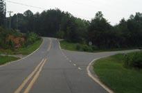

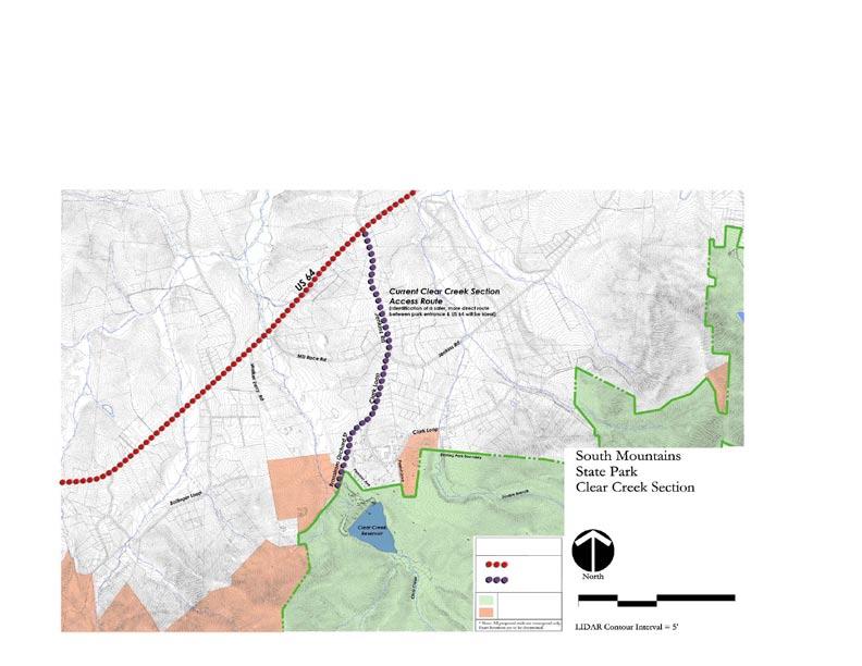
integrity of the dam, and to allow for some curvature in the road to smooth out the slopes.
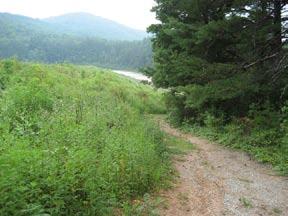
Figure 32 illustrates the master plan for the Clear Creek section of the park. The entry road within the park will be realigned from its current configuration. The beginning of the road will be in approximately the same location as the existing gravel parking lot. A gated entry with an external backup space will highlight transition into the park property.
In order to achieve appropriate slopes on the entry road, the road will increase in grade earlier than the current gravel access road. The road will be located more to the north, closer to the park property line. In later design stages for the entry road, special attention will be given to buffering the park from adjacent properties.
The entry road will curve around to a drop-off/turnaround and parking for an Environmental Education Center described later in this section. A side road will intersect with the entry road, and will lead to group cabins, group camping, ranger residences, and a maintenance area.
Figure 33 illustrates the master plan recommendations in the vicinity of Clear Creek Reservoir.
A day-use picnic area 1 will be located below the dam, just to the right as one enters the park. This site was selected for day use because of its proximity to the park entrance, the flat topography, and its proximity to Clear Creek and large oak shade trees.
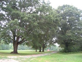
This area will be served by a 25-40 space visitor parking area and will contain a picnic shelter/toilet facility and a septic area located away from Clear Creek (minimum 100 feet from stream). The picnic shelter, sized to accommodate at least 12 tables, will be centrally sited, along with 20 scattered picnic sites to be located among the large oak trees on suitably flat land.
A pedestrian bridge 2 will cross Clear Creek below the dam and lead to an open play field 3 . This site has been selected due to its flat topography, excellent proximity to the public road, and its

compatible use as an emergency landing zone (100-foot radius).
pedestrian trail will skirt the open field and will lead to an interpretive/educational hiking trail 4 around the lake. The trail plan is described in more detail under the Facilities and Interpretive Trails section to follow.
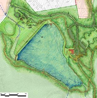
The NC Department of Environment and Natural Resources
5,000 to 7,000 square foot energy-efficient building, with a focus on serving people of all abilities, with special attention to universal design for populations with special needs.
A potential site for the EEC 5 has been identified as a small, relatively flat patch of land near an area that has been invaded by kudzu on the eastern side of the Clear Creek Reservoir. Figure 33 illustrates the site for the EEC and its surroundings. The site will have good access to the lake as well as views to the lake and mountain range in the distance. The building will be sited to leave an ample buffer around the lake and allow room for stormwater/ water quality features. Some minor adjustments to the site of the EEC may be required during design or development once the reservoir achieves its new high water elevation.
The program activities for this facility include classrooms, a resource room, an auditorium, staff conference room, main lobby/ex hibit hall, offices, break room, and public toilets.
The building will have a southerly exposure, providing passive solar opportunities. If enough slope advantage is gained due to the changing grades around the site, there may be opportunity for a lower level storage area.
NC Department of Health and Human Services
A) entered into a joint agreement to assist in obtaining funds for the development of an Environmental Education Center (EEC) in the Clear Creek section of the park. When implemented, it will be a

Figure 33 illustrates a drop-off/turnaround area 6 , sized to accommodate buses, recommended in direct relationship to the front door of the EEC. Fifteen to 25 parking spaces will be located in close proximity to the entrance. Additional parking 7 for the center will terrace up the adjacent slope to the north and northeast. An ad ditional 50-70 spaces will be provided to serve the EEC, as well as 70-80 overflow spaces ideally as stable and grassed lots. These grassed lots also will serve as open play fields. Parking for three to four buses will be accommodated in close proximity to the EEC.
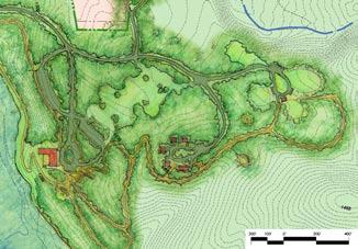
Pedestrian trailheads will be located at the EEC, leading to trails and amenities surrounding the lake, including the following (illustrated in Figures 32, 33 and 34):
Amphitheater in close proximity to the EEC for outdoor interpretive presentations and other events
Hike-in Primitive Campsites
Interpretive trail surrounding the lake
Overlook across the lake from the EEC
Trail crossing and pedestrian bridge over the spillway and dam
Canoe Pier and Boathouse
Fishing Pier
To Parking and Group Cabins and Group Camping
All trails and trail destinations will be opportunities for wayside in terpretive signage and educational exhibits. All signage and exhibits will incorporate Braille for accessibility to those with varying sight abilities.
Group overnight facilities have been sited in an area with slopes predominantly less than 10%, with predominant vegetation type of successional pine forest due to historical agricultural activities in this area, and within reasonable walking distance from the EEC.
Figure 34 illustrates a pod of four barracks-style group cabins 16 located to the east of the EEC. These cabins are intended to provide an overnight opportunity to meet the needs of people of all abilities, with special emphasis on populations with special needs. The group cabins will be sleeping rooms with wash and toilet facilities. Additional space is available in the vicinity for future expansion if needed.
A ‘mess hall’ type dining facility will be associated with the group cabins. This facility will include a kitchen/prep room, a dining/ public gathering room, and toilet facilities. Parking for the group cabins will be adjacent to the structures, with vehicular drop-off capability extending directly into the pod at each cabin in order to aid accessibility for special populations.
Figure 34 also illustrates group camping 17 farther up the slope from the group cabins, to the east. It will include two open camp ing fields approximately ½-acre in area each, and a larger, approxi-
mately 1- acre open camping field. Open areas will be separated by a woods edge in order to facilitate support of one large group or several small groups. An additional open field may be located to the north for future expansion of the group camping area. One wash house, that includes hot showers and flush toilets, will be centrally located in relation to the three camping areas.
For accessibility to people of all abilities, drop-off access will be as close to the use area as possible, with several parking spaces in close proximity. One bus parking space will also be in close prox imity. For larger groups with more vehicles, additional parking will be available in overflow lots 18 down the hill.
Within a short walk from the group camping facilities and the group cabins will be a fire ring 19 and an amphitheater 20 for group activities. These facilities are proposed to be open to the night sky and are illustrated in Figure 34.
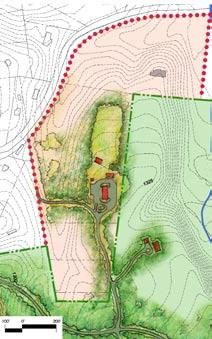
For the purpose of public safety and security, two ranger residences will be in close proximity to the EEC and associated facilities. These residences are illustrated in Figure 35. The location for one new residence 21a will be the bluff above Double Branch, near the former pealot area of the park.
A second ranger residence 21b is proposed on land-dependent property to the north of the bluff area described above. The exist ing residence will be evaluated for use as a ranger residence. This location could provide direct access to Clark Loop as well as ac cess to the EEC, group cabins, camping, lake, and other facilities for increased public safety and security.
Acquisition of additional property off of Clark Loop is proposed for a maintenance area 22 to serve this section of the park. This location and schematic layout are illustrated in Figure 35. This area is proposed on the adjacent property due to its relatively flat topography and the lack of a suitable site on park property that would
allow for appropriate buffers to adjacent land uses. The proposed acquisition land would also allow for a secondary access of maintenance vehicles and delivery trucks to the maintenance area from Clark Loop without having to pass through the main activity areas of the park.
The site maintenance area for the Clear Creek section will be similar in character and function to that in the Jacob Fork section, except with fewer amenities. There are fewer constraints on the proposed land for this facility than in the Jacob Fork section, so it
is estimated to require approximately 1½ acres. The entire area will be enclosed by a security fence.
The facility will contain the following amenities:
- Two 30-foot by 70-foot buildings, including garage bays, carpenter’s shop and office, auto shop, storage, office space, restrooms
- Six-bay vehicle storage shed - Dry storage - Outdoor vehicle wash area - Above-ground gas/diesel pumps - Paved parking (10 spaces)
- Septic appropriately sized for restrooms and equipment wash water
- In addition, the site is large enough to accommodate a barracks facility (with washroom) for seasonal employees.
Drive access width and radii will be sized to accommodate tractor trailers. A filtering system will be provided for stormwater runoff, and the area will be well buffered from adjacent land uses.
Site analysis reveals much of the Clear Creek section of the park to have inherent constraints for the development of any trail system. These constraints include its bowl-shaped form with slopes exceeding 65% in the upper portions of the watershed. In addition, there are areas that contain sensitive plants as well as high quality natural communities, and many areas that have not yet been fully studied in that respect.
Extensive study of the Clear Creek watershed to try to identify potential trail links between this section of the park and the Henry Fork section led to the conclusion that the lower region of the Clear Creek Watershed, behind and above the proposed Environmental Education Center and group overnight facility development, is fairly gentle and would lend itself well to some shorter hiking loops of one to two miles. It will be important to perform more ecological studies of the lower portions of the watershed, particularly during the spring and summer, in order to identify a sustainable trail alignment that will not impact sensitive plants and
natural communities in this area. This will be included in the comprehensive trails assessment recommended in an earlier section of this master plan.
A hike-in, primitive camping area will be located on the crest of a ridge, within this lower portion of the watershed, overlooking the Clear Creek Reservoir (illustrated in Figure 32). There will be 12 sites cleared and spaced at a minimum of 200 feet on center for a backcountry type of experience along with a backcountry toilet facility. This location is a relatively short hike from the proposed Environmental Education Center.
In the future, equestrian access will not be provided into the Clear Creek section of the park for the following reasons:
1) The agreement made between the NC Department of Environment and Natural Resources (DENR) and the NC Department of Health and Human Services during property transfer of 454 acres of NC School for the Deaf land to DENR through South Mountains State Park, was to work together on the design, financing, and development of a “fully accessible, year-round, residential environmen tal education facility.... The facility will be located on the western side of South Mountains State Park.” This agreement further focused this center on state-of-the-art univer sally designed facilities available for the benefit of people of all ages and abilities (McKnelly, 2003).
It is anticipated that special attention to universal-design details in this section of the park will lead to an increase in field trips by groups of special needs populations. It is unsafe to allow equestrian trail use in the lower portions of the property in association with these anticipated higher visitation numbers of special populations.
2) The upper slopes of the Clear Creek watershed are extremely steep and contain sensitive natural communities. Construction and long-term maintenance of equestrian trails in this terrain would be extremely costly and environmentally damaging.
Figure 36 illustrates an overall acquisition plan for South Mountains State Park.
The current park size is 17,481 acres. The properties shown proposed for acquisition total approximately 3,380 acres, bringing the total planned size of the park to 20,861 acres.

In addition to properties mentioned in earlier sections, the NC Di vision of Parks and Recreation will also evaluate the potential for acquisition of several parcels of land to the west of the Clear Creek section of the park.
Currently, no multi-use trail connection has been identified be tween Clear Creek and these western parcels proposed for acquisition due to the presence of extremely steep slopes and high quality natural communities. However, additional land acquisition may support other opportunities for multi-use trail connections from the vicinity of US Highway 64. Further field review will be needed.

The NC Department of Environment and Natural Resources’ Green Building Policy, drafted by the NC Department of Environment and Natural Resources Sustainability Team and signed by Secretary Bill Ross, directs the department and its divisions “to take real and permanent steps to integrate sustainable and green building practices for projects in capital construction, facility renovations, facility leasing, land development, landscaping and facility purchases.”
All components of the master plan have been evaluated and designed based on principles of sustainable design/green design with reference to the Leadership in Energy and Environmental Design (LEED®) design criteria. LEED® is a rating system for green design first developed in 1999 by the US Green Building Coun cil (USGBC). According to the USGBC, “Green design not only makes a positive impact on public health and the environment, it also reduces operating costs, enhances building and organizational marketability, potentially increases occupant productivity, and helps create a sustainable community (USGBC, 2005).”
Though a project does not have to be rated through the LEED® system to be considered ‘green’, the system provides a well-de fined baseline from which to begin conversations in design regarding how to develop any new construction project or major renova tion in a manner that will be sustainable. The NC Division of Parks and Recreation staff directive states, “The Division is to pursue LEED certification through the US Green Building Council’s LEED Green Building Rating System for all new, or significantly renovated, buildings having 5,000 square feet or more. For build ings less than 5,000 square feet, project team members are to be familiar with the use of LEED as a tool to help guide the project.”
Much of the LEED® system is focused on structures and will be addressed more thoroughly at later design and development phases for buildings.
LEED® accreditation is based on six areas of sustainability. These include sustainable site, water efficiency, energy and atmosphere, materials and resources, indoor environmental quality, and innova
tion and design process. Further description of these areas in the context of South Mountains State Park follows.
For this master plan, specific attention has been focused on selection of sustainable sites for future development. Site selection has been based on areas with the following qualities:
• Slopes less than 18%
• Areas more than 50 feet from a water body (construction should not take place within a 100 feet buffer from perennial streams whenever practicable)
• Areas more than 100 feet from a wetland as defined by the National Wetlands Inventory *
• Land that is specifically identified as habitat for any species on Federal or State threatened or endangered lists.
Other focus areas for sustainable sites, elaborated on below, include:
1) Use low impact design strategies
a) Reduce imperviousness
b) Conserve natural resources and ecosystems
c) Maintain natural drainage courses
d) Reduce use of pipes for stormwater management
e) Minimize clearing and grading
2) Minimize soil erosion, waterway sedimentation, and airborne particulate/dust generation during construction
3) Disperse stormwater management facilities/structures uniformly across a site
4) Mimic natural systems for stormwater quality control
5) Minimize heat island effects
6) Minimize light pollution.
During the design and construction phases of any project in the park, special attention will be focused on protecting the site from sedimentation, soil erosion, as well as airborne particulate/dust generation during the construction process. Use of best available technology for sedimentation and erosion control is critical. Devices and structures used for sedimentation and erosion control
*
Further design and development will require evaluation for wetlands based on 40 CFR Parts 230-233 and Part 22.
will be maintained in good working condition at all times during construction.
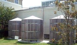
Appropriate design for stormwater is important in maintaining a sustainable site. Not only should stormwater design meet state and local codes, it should go beyond these regulations to ensure stormwater quality as the water re-enters the surface and subsurface water cycles. Water quantity controls will minimize the potential for downstream flooding and erosion from site development in the
through identification of overflow parking areas that use pervious and plantable materials. Additional attention can be focused on this issue in design and construction phases of a development project through, for example, provision of ample shade in parking areas, use of high reflectance materials for paving (selected with attention to potential glare issues for those with visual disabilities), minimization of structure footprints and therefore roof areas, use of roofing materials with a high reflectance, and/or use of a vegetated roof.
Efficient use of water will be considered in every phase of a project for both the site and the buildings. Use of innovative wastewater technologies when possible and water use reduction, through the use of low-flow toilets, showers and other means, are also considered sustainable design practices.
Use of cisterns to harvest rainwater from roof structures can provide water for uses including, but not limited to, landscape irriga tion and toilet flushing.
future. Water quality controls, performed by structures such as bioretention areas, will help to maximize sequestration of pollutants to the site of creation as well as protecting areas downstream from these pollutants. All stormwater should flow through a vegetated upland prior to entering a stream or wetland (NC Wildlife Resourc es Commission, 2002).
During construction, all equipment will be kept out of streams as much as practicable. Also, utility lines and infrastructure will be installed outside of stream buffers.
The heat island effect is defined by USGBC as “thermal gradient differences between developed and undeveloped areas” (USGBC, 2005). This effect can have negative impact on microclimates as well as human, animal, and plant habitats. Heat islands are most often caused by large areas of unshaded pavement and large roof areas. The master plan begins to address this issue
During the design phase of any project at the park, sustainable design principles will dictate design of water efficient landscaping, with an ideal focus toward landscaping requiring no potable water use and no irrigation beyond plant establishment.
Green building practices cost less to operate and maintain. They also provide an opportunity to use natural resources efficiently and responsibly and to reduce the site and building’s overall impact on the environment.
Buildings should be optimized for energy-efficiency, including siting buildings with an east-west axis, where practicable, to optimize for passive solar design and the use of broad roof overhangs to block mid-day summer sun. Use of on-site renewable energy sources where possible, including opportunities for solar energy, hydropower, and/or wind power, will make the development more self-sufficient and reduce economic and ecological impacts from fossil fuel use.
Energy-efficient heating and cooling systems, such as geothermal/ ground source wells, use the constant earth temperature to heat and cool the workplace.
It is recommended that a demonstration micro-hydro system be ex plored at the Clear Creek dam to provide an energy source for the Environmental Education Center or other facilities in this section of the park. Passive solar design of the Environmental Education Center and solar hot water design for wash houses is also recommended where practicable.
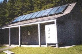
Another means of ensuring energy-efficiency as defined by LEED® includes increasing energy performance and commissioning of buildings to ensure that systems are designed and perform in an energy-efficient manner.
Sustainable design and construction ensures waste reduction through the design of the building and the construction process. When waste is produced, recycling should be a priority. Reuse of existing building material should also be prioritized.
Design for use of new building materials in the construction process should focus on those materials utilizing recycled content. When recycled content is not possible, products made from rapidly
renewable products are desirable and resource friendly. Wood certified using the Forest Stewardship Council’s Principles and Criteria will promote sustainable forestry practices.
Ideally, materials will be sourced from producers and manufactur ers in the surrounding region. A focus on indigenous materials can replicate a ‘local vernacular’ as well as minimize environmental impacts from transportation and add to local economic prosperity.
A focus on indoor air quality enhances the health and experience of building occupants. There are many aspects of sustainable indoor air quality performance that can be addressed by a qualified designer, such as adequate ventilation and use of low-emitting mate rial selection (e.g. paints, sealants, adhesives, etc.).
Indoor environmental quality also addresses issues related to lighting controls, thermal comfort, daylighting, and views.
Sustainable design practitioners can be precedent setters for new, innovative practices in design and construction of sites and buildings. The NC Division of Parks and Recreation can set guidelines for all new construction at South Mountains State Park based on
successes displayed and monitored in other projects. The Environmental Education Center proposed in this master plan will provide opportunities for educating the general public and other designers about the ecological, cultural, and economic benefits of green design and construction.
The NC Division of Parks and Recreation staff directive on sustainable and green building practices indicates a particular interest in sustainable and green building technologies that address the following:
• Ecological site design; on-site erosion control, water purification/pollution reduction, and stormwater management.
• Transportation; promoting bicycle, pedestrian, and transit use where possible.
• Waste reduction; building reuse, job site recycling, and efficient use of materials.
• On-site management of sewage and organic wastes, such as graywater systems and biological wastewater treatment.
• Energy efficiency; efficient thermal envelopes, efficient space and water heating, lighting, controls and monitoring, and appliances.
• Renewable energy; photovoltaics, geothermal pumps, and wind turbines.
• Water efficiency, both domestic and irrigation, including rainwater harvesting for irrigation and toilet flushing. Con sider waterless urinals in all applications.
• Materials and resources; durable building envelopes and long-lived materials or assemblies, recycled-content materials, safer, less toxic materials, such as alternatives to CCAtreated wood, innovative application of natural materials (characterized by low embodied energy, local availability, good performance, biodegradable, safe, esthetic) such as straw, earth, and other composites.
• Indoor environmental quality; pollution reduction, worker and occupant safety, air cleaning, humidity control, and thermal comfort.
• Operations and maintenance; monitoring energy, water, waste, air quality, and transportation use along with resource-efficient operation practices.
1. Camping Improvements: new tent and trailer campground renovation and expansion of existing campground. $6,496,925.00
2. Equestrian Area Improvements: toilet building, water and electrical service to camp sites $816,068.75
3. Maintenance Area $4,175,069.25
4. Day Use Areas Improvements: new picnic area, improvements to existing picnic area, renovation of old park office $2,651,210.00
5. Improvements to Multi-Use Trails $2,173,500.00
6. Improvements to Hiking Trails $1,207,500.00
7. New Multi-Use Trails $897,000.00
Total for Jacob Fork Section $18,417,273.00
1. Connection to County Water $264,500.00
2. Day-Use Picnic Area $2,508,035.00
3. Environmental Education Center and Support Facilities $7,703,275.00
4. Group Cabins $2,657,075.00
5. Group Camping $798,876.25
6. Maintenance Area $3,232,960.50
7. Ranger Residence $921,495.00
8. Trail Access & Hike-In Primitive Camping $339,250.00
9. Trail Improvements $3,283,250.00
10. Roper Hollow Tent and Trailer Campground $3,409,750.00
Total for Clear Creek Section $25,118,466.75
Project Cost
1. Trail Improvements $3,550,625.00
Total CI Needs for South Mountain State Park $47,086,364.75
These cost�
These estimates are to be used for budgeting purposes only and not for construction. This estimate reflects a master planning level of design and does not account for material availability, escalation, or the economy of construction at the time of actual construction. The individual line items include an industry average 10% design fee and 5% contingency.
Brad Davis, Maintenance Mechanic III
Michael Eisch, Park Ranger I
Jonathan Griffith, Park Superintendent
Kerry Huffman, former Office Assistant III
Lance Huss, Park Ranger I
Timothy Johnson, Park Ranger I
Tina Keller, Office Assistant III
Fitzhugh McMurry, Maintenance Mechanic II
Allen Rogers, Park Ranger II
Katharine Scala, Park Ranger I Matt Schnabel, former Park Ranger I Wade Stubbs, Park Ranger II Ray Walker, Maintenance Mechanic IV
Cheryl Waltz, Park Ranger I
Steve Padgett, Chairman
Janice Branstrom, Vice Chair
Lenore Grigg Wortman, Secretary Walter Gravley
Steve Gurley
Gary McCurry
NC Division of Parks and Recreation
Especially,
Lewis Ledford, Director
Adrienne McCoig, Executive Assistant
Susan Tillotson, Chief of Operations
Tom Jackson, West District Superintendent
Kelly Hoke, West District I&E Specialist
Bruce Garner, Chief of Design and Development
Elizabeth Chesnut, Head of Park Design Program, Project Manager
for South Mountains State Park Master Plan
John Amoroso, Park Design GIS Technician
Robert Gron, Head of Engineering Program
Alan Jeffreys, Project Manager
Owen Daniels, Project Manager
Kim Huband, Head of General Management Planning Program
Don Reuter, Assistant Director of Planning and Administration
Carol Tingley, Chief of Regional Planning/Natural Resources
Bayard Alcorn, Head of Grants and Special Studies Program
Darrell McBane, Head of State Trails Program
Dwayne Stutzman, Mountain Region Trails Specialist
Brian Strong, Head of Natural Resources Program
Marshall Ellis, Mountain Region Biologist
Sue Regier, Head of Land Protection Program
Katie Armstrong, Land Protection Specialist
Charlie Peek, Public Information Officer
Misty Franklin, Botanist
James Padgett, Inventory Biologist/Botanist
Representative Walter G. Church, Sr., NC House of Representatives, District 86
Representative Mitch Gillespie, NC House of Representatives, District 85
Representative Debbie A. Clary, NC House of Representatives, District 110
Representative Tim Moore, NC House of Representatives, District 111
Representative Bob England, M.D., NC House of Representatives, District 112
Senator Jim Jacumin, NC Senate, District 44
Senator Walter H. Dalton, NC Senate, District 46
Especially,
Marc Collins, Planning Director
Scott Black, GIS Manager
Cyndie Bennett, Director, Office of Education Services, NC Department of Health and Human Services
John A. Broadbooks, Broadbooks Associates, PA
Timothy (Tyler) Clark, Former Chief Geologist, DENR
Judy Francis, Swannanoa Field Office, DENR Asheville Regional Office
Rachel Golden, DENR Office of Environmental Education
Alan Hamrick, Cleveland County GIS Department
Dr. Robert D. Hatcher, Jr., UT Distinguished Scientist and Professor, Department of Earth & Planetary Sciences, University of Tennessee Marie Hogan, GIS Coordinator, Rutherford County, NC
Susie Hamrick Jones, Executive Director, Foothills Conservancy of NC Steve McEvoy, PE, WK-Dickson, Raleigh, NC John Mintz, Assistant State Archaeologist, NC Office of State Archaeology
Ken Suttles, Suttles Surveying, PA
Dr. Gene W. Wood, Professor and Extension Trails Specialist, Department of Forestry and Natural Resources, Clemson University
All the concerned individuals who attended the public meeting.
Swanson and Associates, PA
Landscape Architecture, Planning, and Design
David T. Swanson, RLA, Landscape Architect
Joanna Massey Lelekacs, RLA, Project Manager
Terri Swanson, Office Manager
sfL+a Architects
Charles Brown, AIA LEED AP
Ambient Design Group, PLLC
Mike Dale, RLA, Manager and Director of Landscape Architectural Services
Tony Hauser, RLA, PE, Manager and Director of Engineering Services
Martin Nicholes, GIS Analysis
ADS, PA. Horse Camp Development Construction Drawings. 6/17/97. (Located in the South Mountains State Park files.)
Bier, Sarah. Geology of the Southeastern South Mountains, North Carolina. Mas ters Thesis. University of Tennessee, Knoxville, TN. August 2001. (Located in the South Mountains State Park files.)
Burke County Planning and Development. Burke County Zoning Ordinance. Ac cessed via http://www.co.burke.nc.us/wp-content/uploads/zoning_ordinance.pdf. October 2006.
The Center for Universal Design. North Carolina State University. http://www.design. ncsu.edu/cud/about_us/about_us.htm. Accessed July 2007.
Department of Environment, Health, and Natural Resources. NC Division of Parks and Recreation, Annual State Park Use Record, South Mountains State Park, 2000, 2001, 2002, 2003, 2004, 2005, and 2006. (Located in the South Mountains State Park files.)
Department of Environment, Health, and Natural Resources. NC Division of Parks and Recreation, Planning and Development Section. South Mountains State Park General Management Plan. October 1993.
Idol, Bruce. Final Report: An Archaeological Survey of Thirteen Historic Sites, South Mountains State Park, Burke and Rutherford Counties, North Carolina. Report prepared by TRC Garrow Associates, Inc, NCARPA Permit #39. May 1999. (Located in the South Mountains State Park files.)
McKnelly, Phil. Reallocation of NCSD Property to South Mountains State Park. Memorandum to Bill Ross, Secretary. November 12, 2003.
NC DEHNR. NC Division of Parks and Recreation. General Management Plan for South Mountains State Park. October 1993.
NC Division of Parks and Recreation (NC DPR). Environmental Assessment and Finding of No Significant Impact: Construction of Park Facilities at South Mountains State Park, Burke and Cleveland Counties, North Carolina. Pro duced for NC DPR by Environmental Services, Inc. 1995.
NC Division of Parks and Recreation. Environmental Sustainability Initiatives http://www.p2pays.org/ref/07/06568/2001/nframe.asp?type=AGY&page=AGYparks.htm. Accessed August 2007.
NC Division of Parks and Recreation (NC DPR). NC Outdoor Recreation Plan 20032008. http://www.ils.unc.edu/parkproject/resource/scorp/scorp_ch2.pdf.
NC Division of Parks and Recreation (NC DPR). South Mountains State Park: His tory. http://ils.unc.edu/parkproject/visit/somo/history.html. Accessed January 2007.
NC Geological Survey. Geologic Map of North Carolina. NC Geological Survey, Raleigh. 1985
North Carolina State University (NCSU). Facility Inventory and Inspection Pro gram: South Mountains State Park. October 1992.
NC Wildlife Resources Commission. Guidance Memorandum to Address and Miti
gate Secondary and Cumulative Impacts to Aquatic and Terrestrial Wildlife Resources and Wildlife Quality. August 2002.
Oakley, Shawn, C. An Inventory of the Significant Natural Areas of Burke County, North Carolina. NC Natural Heritage Program, NC Division of Parks and Recre ation, NC Department of Environment and Natural Resources, Raleigh, NC. May 2002.
South Mountains State Park/NC DPR. Files, Correspondence, and Personal Communi cations.
US Department of Agriculture, Natural Resources Conservation Service. Burke County Soil Survey. Unpublished data (on the ground survey work completed between 1987-1998).
US Green Building Council (USGBC). LEED-NC: Green Building Rating System for New Construction and Major Renovations, Version 2.2. US Green Building Council, October 2005.
Western Piedmont Council of Governments and Unifour Recreation and Open Space Task Force. Greater Hickory Recreation / Tourism Plan. Prepared by Woolpert, Inc. December 2006.
Wise, Doug and Becky Townsend Bowers. South Mountains State Park User Survey. NC DPR. Summer 1999.
Aerial Photography of Burke County. MrSids created from LIDAR. 2005. Broadbrooks & Associates. Inc. Construction Drawings for the South Mountains State Park Visitor Center. Digital file date: 10/26/06.
Suttles Surveying, PA. Aerial Photography for: South Mountain State Park Lower Fork Township, Morganton, North Carolina. Project #: 12445C. Digital File Date: 10/12/02. (Located in the South Mountains State Park files.)
WK Dickson. Construction Drawings for Clear Creek Dam Renovations. Digital file date: 10/30/06. (Located in the South Mountains State Park files.)
Data below listed as:
Data Name. Data Description. Data Source direct to Swanson and Associates, PA. Date of Digital Data.
Area_gen_spm. GPS data for proposed maintenance area. NC Division of Parks and Recreation. GIS.
brd-ar. Broad River Basin Hydrography 1:24,000-scale (arcs). NC Division of Parks and Recreation. GIS. 2/27/04. 1/8/2007. brd-pl. Broad River Basin Hydrography 1:24,000-scale (polygons). NC Division of Parks and Recreation. GIS. 2/27/04. brdgs. NC DOT Bridges. NC One Map. 6/25/05.
Burke_Southeast. MrSid file – aerial image of southeastern Burke County. Burke County Planning. 6/29/06.
Burke_Southwest. MrSid file – aerial image of southwestern Burke County. Burke County Planning. 6/29/06.
burnunits. GPS of South Mountains State Park burn units. South Mountains State Park Ranger. Tim Johnson. 10/31/06. cb100_poly. Boundaries-county (North Carolina). NC One Map. 1984-1986. Centerlines. Rutherford County road centerlines. Rutherford County Planning. 10/2/2006.
con_burke_05. Burke County 5’ contours (LIDAR). Burke County Planning. 3/16/05. con_burke_10. Burke County 10’ contours (LIDAR). Burke County Planning. 3/16/05.
con_burke_20. Burke County 20’ contours (LIDAR). Burke County Planning. 3/16/05.
con_clevelan_05. Cleveland County 5’ contours (LIDAR). NC Division of Parks and Recreation. 3/13/05.
con_clevelan_10. Cleveland County 10’ contours (LIDAR). NC Division of Parks and Recreation. 3/13/05. con_clevelan_20. Cleveland County 20’ contours (LIDAR). NC Division of Parks and Recreation. 3/13/05.
con_rutherfo_05. Rutherford County 5’ contours (LIDAR). NC Division of Parks and Recreation. 3/13/05. con_ rutherfo _10. Rutherford County 10’ contours (LIDAR). NC Division of Parks and Recreation. 3/13/05.
con_ rutherfo _20. Rutherford County 20’ contours (LIDAR). NC Division of Parks and Recreation. 3/13/05. ctb_ar. Catawba River Basin Hydrography 1:24,000-scale (arcs). NC Division of Parks and Recreation. 2/27/04. ctb_pl. Catawba River Basin Hydrography 1:24,000-scale (polygons). NC Division of Parks and Recreation. 2/27/04. dedreg. Dedicated and registered areas. NC Division of Parks and Recreation. 5/3/06. dotprimrds. DOT county road data. NC Division of Parks and Recreation. 4/13/06. facility arcs 2006. South Mountains State Park Trails and old roadbeds (Created by J. Amoroso using GPS). NC Division of Parks and Recreation. 8/24/06. facility arcs 2007. South Mountains State Park Trails and old roadbeds (Created by J. Amoroso & T. Johnson using GPS). NC Division of Parks and Recreation. 3/17/07.
facility polys 2006. South Mountains State Park facilities. NC Division of Parks and Recreation. 8/24/06.
GDC. Geodetic markers. NC Division of Parks and Recreation. 4/11/00. gml. Gamelands - Wildlife Resource Commission. NC One Map. 2003-2004. hu. Hydrologic units with 14 digit and below codes. NC Division of Parks and Recre ation. 12/2/97.
marea. NC Natural Heritage Program Managed Areas. NC Division of Parks and Recreation. 6/2/06.
mbpow. Municipal Boundaries - Powell Bill. NC One Map. 2004. NC DEHNR-Division of Land Resources, NC Geological Survey Title and File Name: onemap.SDEADMIN.geol Publication date: 19981201
Geospatial data presentation form: vector digital data
Publication place: Raleigh, NC NCCGIA distributes this dataset geol. Geology of North Carolina. NC One Map. 1985 w/rev. 1993. geoldikes. Geology - NC Dikes. NC One Map. 1985 w/rev. 1993. geolfaults. Geology - NC Faults. NC One Map. 1985 w/rev. 1993. ncprk_South Mountains State Park. Park boundary. NC Division of Parks and Rec reation. 12/8/06.
nheo_ln. Natural Heritage Element Occurrences ln (line). NC Division of Parks and Recreation. 5/1/06. nheo_pt. Natural Heritage Element Occurrences pt (point). NC Division of Parks and Recreation. 5/1/06. nheo_py. Natural Heritage Element Occurrences py (polygon). NC Division of Parks and Recreation. 5/1/06. nheo_rep. Natural Heritage Element Occurrences. NC Division of Parks and Recre ation. 5/1/06. parcel_polygon. Burke County tax parcels. Burke County Planning. 7/31/06. parpoly. Cleveland County parcel data. Cleveland County Planning. 10/26/06. rc_parcels. Rutherford County parcel data. Rutherford County Planning. 10/2/2006. roads. Cleveland County road centerlines. Cleveland County Planning. 10/26/06. rutherford_soils. Rutherford County Soils. NC Division of Parks and Recreation. 5/7/04.
snha. Significant Natural Heritage Areas. NC Division of Parks and Recreation. 6/6/06. soils_detailed2004. Burke County Soils. Burke County Planning. 3/24/06. somo_gml07. WRC Game Land in vicinity of South Mountains State Park. NC Divi sion of Parks and Recreation. 7/5/07. somo_facilityarcs. Updated South Mountains State Park trails and potential trails (Created by J. Amoroso & T. Johnson using GPS). NC Division of Parks and Recreation. 6/13/07.
State of North Carolina and Federal Emergency Management Agency. Flood Insurance Rate Map, Panel 2626, Panel 2628, Panel 2608. State of North Carolina and FEMA, Preliminary September 5, 2006.
flood_hazards. FEMA flood hazard areas. www.ncfloodmaps.com. Prelim 9/5/2006.
streams. Streams - Burke County. Burke County Planning. 9/3/03. streets. Streets - Burke County. Burke County Planning. 7/24/06. U.S. Fish & Wildlife Service, National Wetlands Inventory Title: National Wetlands Inventory -- Information for this element varies for each 7.5’ quad. See the quad-specific metadata file.
Publication Date: Ranges from Oct. 1981 to present; information for this element varies for each 7.5’ quad. See the quad-specific metadata file.
Publication Place: St. Petersburg, Florida
Publisher: U.S. Fish & Wildlife Service, National Wetlands Inventory
NWI-SOMO-brd. National Wetlands Inventory for Broad River basin. NC Division of Parks and Recreation. 1/9/07.
NWI-SOMO-cat. National Wetlands Inventory for Catawba River basin. NC Division of Parks and Recreation. 1/9/07.
Between NC Department of Environment and Natural Resources (DENR) and NC Department of Health and Human Services (DHHS)
Both parties agree to coordinate and collaborate on the protection of important natural resources in the School for the Deaf Watershed, and on the development of an environmental education facility to all North Carolina’s citizens.
DHHS further agrees:
1) To transfer the School for the Deaf Watershed property to DENR, in accordance with established procedures for the real location of state property,
2) To contribute their expertise and knowledge of accessibility standards and needs to DENR’s design and operation of a yearround, residential environmental education facility;
3) To assist in obtaining funds for the development of the environ mental education facility, particularly from federal grants for which DHHS is eligible;
4) To provide two management positions for educational support designated from the Office of Education Services.
DENR further agrees:
1) To protect and manage the School for the Deaf Watershed prop erty as a part of South Mountains State Park;
2) To design a fully accessible, year-round, residential environmen tal education facility which is financially and environmentally feasible to construct and operate. The facility will be located on the western side of South Mountains State Park;
3) To incorporate the design ideas and suggestions of DHHS within the constraints of funding, the environmental features of the site, and the mission of the state parks system;
4) To place priority on obtaining funds for construction of the facility, in conjunction with DHHS’s ability to obtain matching funds;
5) To solicit and consider input from DHHS in the development of operating, scheduling, and programming policies for the facility.
Comment sheets received: 25 (21 returned at meeting; 4 mailed in) E-mails received: 59
Total Responses 84
General Comments 10*
Clear Creek/Walker Perry Road Access 8, plus petition with 33 signatures
Fishing 1
Hiking Trails 5
Equestrian Trails 17
Mountain Bike Trails 45
Other 2
*Some respondents mentioned more than one subject in their general comments.
General Comments 10 responses (7 comment sheets, 3 emails)
- Provide ways to bring children and families back to nature.
- Plan allows families to “stay close to the car” and near the park entrances.
- Consider changing “South Mountain Park Avenue” to a “road” designation.
- Work with NC Wildlife Resources on non-hunting uses of South Mountains Game Lands.
- Boy and Girl Scouts used to use shed for weekend campouts.
- Add lights for deaf, education classroom like Lowe Sanctuary in Nebraska, picnic shelter for up to 50 people, climb ing skills, boating.
- Will Clear Creek cabins and amphitheater be available for rental?
- In favor of the proposed Clear Creek improvements to serve the people of Rutherford County and other areas west of the Park (including tourists).
- Keep park development at the outer margins and leave the interior as pristine as possible. - Provide a backcountry hut system.
8 responses (4 comment sheets, 4 e-mails, and 1 e-mail attachment of a petition with 33 signatures opposing the access road)
All respondents, plus 33 people who signed a petition, were op posed to using Walker Perry Road as a new connector to South Mountains State Park. Concerns included increased traffic, dust, trash, strangers, noise, safety of children, increased taxes, and diminished property values. The properties of many respondents have been in their families for generations. Some feel that a third entrance to South Mountains State Park is not necessary, or that Roper Hollow Road or Jenkins Road/Clark Loop can be used.
Fishing 1 e-mail
One response in favor of better access to Henry’s Fork for fishing.
Hiking 5 responses (4 comment sheets, 1 e-mail)
- Keep hiking trails separate from equestrian and biking trails.
- Keep picnic areas separate from quieter hiking and primi tive camping areas.
- Consider erosion issues when trails are used by equestrians and cyclists.
- Improve trail hiking map and color code the trails.
- Keep Clear Creek for hikers only.
- Establish a trail from Clear Creek side to Jacob Fork side.
- Work with Burke County to do a greenway from South Mountains State Park to US 64 with a parking lot at 64 so people can walk in and out.
Equestrians 17 responses (12 comment sheets, 5 e-mails)
Other than the comments above which addressed keeping hiking trails separate from equestrian use and expressing erosion control
issues, all 17 comments on this subject, most of which were from equestrian groups, were in favor of development and expansion of equestrian trails and facilities into the Clear Creek area, and some respondents advocating extending them into all areas of the park.
Some comments included praise for the existing equestrian facility and extending the bridle trail into the Jacob Fork section. Other comments included:
- Don’t put a dump station in the equestrian parking lot.
- What have we learned from the 2004 landslide and 9 month park closure and how is that fitting into the master plan?
- Put tie-ups, picnic tables, and port-a-johns along the eques trian trails.
- Differentiate levels of trails – easy, moderate, difficult.
- Will horses be allowed on the game lands?
- Put combination lock on gates and give number to equestrians for emergencies.
- Turn existing road beds into trails.
- Provide more horse trailer access.
- Purchase Pine Mountain lots along Dogwood Trail to keep road “wild’ on both sides.
- Install water and power at every camp site. No one uses tents anymore; horse trailers are now self-contained with living quarters.
- Provide a waste dump station for campers to dump their holding tanks.
- Provide ice every afternoon at 6:00 p.m. for campers. This would cut back on traffic flow to local stores miles away.
- The trail system should allow more than one-way in and out. A new trail located out the back side of the camp ground would be great.
- When will proposed access trail from equestrian camp ground to Pine Mountain Resort be finished?
- Provide a parking lot suitable for about 12 horse trailers in the Highway 64 area with easy access away from the camp ing/picnicking areas but very accessible to the CCC road and trails already being ridden.
Other than the comments under “Hiking Trails” which addressed keeping hiking trails separate from biking use and expressing erosion control issues, these 45 comments were in favor of biking trails. Most of the comments were from organized groups or from bike trail facilitators. Many of the comments were similar to these:
- Make the trails multi-use or “single track”, to be used by both hikers and bikers.
- Provide challenging grades.
- Provide another “biking destination” in NC that is a little closer to the center of the state.
- Off-road cyclists are a growing demographic and would bring a large user base to South Mountains State Park and help the economy.
- Consider using one of the organizations that hold trailbuilding clinics and assist in designing, building and main taining single-track trails in North Carolina. A clinic was held at Lake Norman State Park.
- Single track trails are typically built and maintained with volunteer labor supplied by local mountain bike clubs.
- Funds may be available through “Clean Water” or other funding.
- Bike trails cause less erosion than equestrian trails.
Other 2 responses (1 comment sheet, 1 e-mail)
- Include an off-road vehicle trail on the old CCC road connecting Watershed Rd. and Roper Hollow., developed in a regulated and environmentally friendly way, with primitive camping facilities.
- Provide areas for hunting with a permit system to allow limited opportunities, especially in the areas away from hiking and horse trails.
In order to identify important issues early in the environmental review process, the Natural Resources Program circulated a scoping letter through the NC State Clearinghouse that requested comments on pertinent regulatory and resource protection issues. We received comments from the NC Natural Heritage Program (NHP) and re quest that these be included in Appendix A. The NHP noted:
1. Appreciation that none of the facilities are sited within Significant Natural Heritage Areas or the Dedicated Nature Preserve.
2. Concerns over important bat habitat and the bat species documented from the proposed camping loop on the Jacob Fork area. (These species include the Rafinesque’s Big-eared Bat, which is federally-listed as a Species of Special Concern; Silver-haired Bat, which is state-listed as Significantly rare; Hoary Bat, which is state-listed as Significantly rare; and the Northern long-eared Myotis, which is state listed as Special Concern). NHP requested survey of the bats and habitat in the area and that extra care be taken to study the compatibility of placing a camping area in this area.
3. Concern about siting a maintenance area close to the river. Would this increase the risk of fuel spills or effluent tanks getting into the river? How wide and intact will the buffer between the river and the maintenance area be?
4. Concern about presence of wetland habitat and potential impacts from crossings.
1. Rare Species: If it is determined that any proposed activities may adversely affect any species federally-listed as endangered of threatened, formal consultation with the US Fish and Wildlife Ser vice must be initiated. Although federal species of concern such as the Rafinesque’s big-eared bat are not subject to the provisions of the Endangered Species Act, the US Fish and Wildlife Service has included them in its response with a request to protect them.
2. Erosion Control and Wetland/Stream Protection: The Service’s principal concern is the potential impacts to wetlands and streams. It strongly prefers that the equestrian trail be routed through the existing equestrian campground and that stream crossings be routed to existing bridges. Other alternatives - new bridges or in-stream fords - are considerably more environmentally damaging. The Service prefers Alternative 1 (the land-dependent Tent and Trailer Campground) for the tent and trailer campgrounds at Jacob Fork because it will not involve a new crossing of the Jacob Fork or the three tributaries in the area.
3. Storm water: The expansion will create more impervious sur faces, which collect more pollutants and quickly transmit them to receiving waters. This nonpoint source pollution is one of the major threats to water quality in the United States. Best manage ment practices can reduce, but not eliminate, pollutant loadings of common storm water pollutants. The NC Wildlife Resources Commission has developed a “Guidance Memorandum to Address and Mitigate Secondary and Cumulative Impacts to Aquatic and Terrestrial Wildlife Resources and Water Quality” that we support and encourage you to use. It is available at: http://www.ncwildlife.org/pg07_wildlifespeciescon/pg7c3_im pacts.pdf
4. Recommendations for addressing impacts associated with this project:
- Use on-site storm water management (i.e., bioretention areas) that result in no net change to watershed hydrology. All storm water outlets should drain through a vegetated upland prior to reaching any stream or wetland.
- Preserve or restore forested riparian buffers. Because of the aquatic resources in the project area, forested riparian buffers should be created or protected for a minimum of 100-feet wide along perennial streams and 50-feet wide along intermittent streams.
- Install and maintain stringent measures to control erosion and sediment and to prevent unnecessary impacts to aquatic resources within and downstream of the project site.
- Use bridges for all permanent roadway crossings of streams and associated wetlands. We recommend the use of spanning structures because they minimize impacts to aquatic resources. All wetland/ stream crossings should be made perpendicular to the stream. If culverts are used, arched culverts are preferred; however, any type of culvert that is used should allow for the passage of aquatic life. We recommend the use of multiple barrels (other than the baseflow barrel), placed on or near stream bank-full or floodplain bench elevation, in order to accommodate floodwaters within the stream corridor.
- Install utility lines and infrastructure outside the above-recom mended riparian buffers. Crossings should be kept to a minimum, and should be near perpendicular to stream flow.
- Directional boring beneath streambeds should be used for utility crossings.
- Keep equipment out of streams by operating from the banks in a fashion that minimizes disturbance to woody vegetation.
- Avoid the complete clearing of land. If clearing is necessary, efforts should be made to avoid the removal of large trees at the edges of construction corridors.
§ 113-44.7. Short title.
This Article shall be known as the State Parks Act. (1987, c. 243.)
§ 113-44.8. Declaration of policy and purpose.
(a) The State of North Carolina offers unique archaeologic, geologic, biological, scenic, and recreational resources. These resources are part of the heritage of the people of this State. The heritage of a people should be preserved and managed by those people for their use and for the use of their visitors and descendants.
(b) The General Assembly finds it appropriate to establish the State Parks System. This system shall consist of parks which include representative examples of the resources sought to be preserved by this Article, together with such surrounding lands as may be appropriate. Park lands are to be used by the people of this State and their visitors in order to promote understanding of and pride in the natural heritage of this State.
(c) The tax dollars of the people of the State should be expended in an ef ficient and effective manner for the purpose of assuring that the State Parks System is adequate to accomplish the goals as defined in this Article.
(d) The purpose of this Article is to establish methods and principles for the planned acquisition, development, and operation of State parks. (1987, c. 243.)
§ 113-44.9. Definitions.
As used in this Article, unless the context requires otherwise:
(1) “Department” means the Department of Environment and Natural Resources.
(2) “Park” means any tract of land or body of water comprising part of the State Parks System under this Article, including existing State parks, State natural areas, State recreation areas, State trails, State rivers, and State lakes.
(3) “Plan” means State Parks System Plan.
(4) “Secretary” means the Secretary of Environment and Natural Resources.
(5) “State Parks System” or “system” mean all those lands and waters which comprise the parks system of the State as established under this Article. (1987, c. 243, s. 1; 1989, c. 727, s. 218(50); 1989 (Reg. Sess., 1990), c. 1004, s. 19(b); 1997-443, s. 11A.119(a).)
§ 113-44.10. Powers of the Secretary. The Secretary shall implement the provisions of this Article and shall be responsible for the administration of the State Parks System. (1987, c. 243.)
§ 113-44.11. Preparation of a System Plan.
(a) The Secretary shall prepare and adopt a State Parks System Plan by December 31, 1988. The Plan, at a minimum, shall:
(1) Outline a method whereby the mission and purposes of the State Parks System as defined in G.S. 113-44.8 can be achieved in a reasonable, timely, and cost-effective manner;
(2) Evaluate existing parks against these standards to determine their statewide significance;
(3) Identify duplications and deficiencies in the current State Parks System and make recommendations for correction;
(4) Describe the resources of the existing State Parks System and their current uses, identify conflicts created by those uses, and propose solutions to them; and
(5) Describe anticipated trends in usage of the State Parks System, detail what impacts these trends may have on the State Parks System, and recommend means and methods to accommodate those trends successfully.
(b) The Plan shall be developed with full public participation, including a series of public meetings held on adequate notice under rules which shall be adopted by the Secretary. The purpose of the public meetings and other public participation shall be to obtain from the public:
(1) Views and information on the needs of the public for recreational resources in the State Parks System;
(2) Views and information on the manner in which these needs should be addressed;
(3) Review of the draft plan prepared by the Secretary before he adopts the Plan.
(c) The Secretary shall revise the Plan at intervals not exceeding five years. Revisions to the Plan shall be made consistent with and under the rules providing public participation in adoption of the Plan. (1987, c. 243.)
§ 113-44.12. Classification of parks resources.
After adopting the Plan, the Secretary shall identify and classify the major resources of each of the parks in the State Parks System, in order to establish the major purpose or purposes of each of the parks, consistent with the Plan and the purposes of this Article. (1987, c. 243.)
§ 113-44.13. General management plans.
Every park classified pursuant to G.S. 113-44.12 shall have a general management plan. The plan shall include a statement of purpose for the park based upon its relationship to the System Plan and its classification. An analysis of the major resources and facili ties on hand to achieve those purposes shall be completed along with a statement of management direction. The general manage ment plan shall be revised as necessary to comply with the System Plan and to achieve the purposes of this Article. (1987, c. 243.)
§ 113-44.14. Additions to and deletions from the State Parks System.
(a) If, in the course of implementing G.S. 113-44.12 the Secretary deter mines that the major purposes of a park are not consistent with the purposes of this Article and the Plan, the Secretary may propose to the General Assembly the deletion of that park from the State Parks System. On a majority vote of each house of the General Assembly, the General Assembly may remove the park from the State Parks System. No other agency or governmental body of the State shall have the power to remove a park or any part from the State Parks System.
(b) New parks shall be added to the State Parks System by the Department after authorization by the General Assembly. Each additional park shall be authorized only by an act of the General Assembly. Additions shall be consistent with and shall address the needs of the State Parks System as described in the Plan. All additions shall be accompanied by adequate authorization and appropriations for land acquisition, development, and operations. (1987, c. 243.)
From:
State of North Carolina, Department of Natural Resources and Community Development, Division of Parks and Recreation, Mas ter Planning Unit. Master Plan: South Mountains State Park. pp. 4-5. January, 1979.
“The South Mountains Range is oriented 60 degrees north of east and includes parts of Burke, Cleveland, and Rutherford Counties. The area encompasses some 100,000 acres.
The mountains are thought to have served as a buffer zone separat ing the Cherokee and Catawba Indians. Prehistoric hunting and gathering groups probably established temporary camps on the summits of upland divides near streams, and main ridges above large valleys. However, the permanent agricultural villages were along the Catawba and First Broad Rivers. Very little archaeologi cal information is available, and no habitation sites have been identified in the Park.
The first English, Welch, Scotch-Irish, and German settlers chose the fertile bottomland along the Catawba River. By the late 1700’s the population of the Burke County area was 2,100 with a few settlers on the fringe of the South Mountains.
The Dave [Bivens] family constructed a cornmill and home on the plateau above High Shoal Falls during this period. The mill was located at the top of the Falls, and the homesite was approximately 250 yards west on Jacob’s [sic] Fork. The foundation and chimney of the home remains; however, the mill has deteriorated completely over the years.
A second homesite was established by the Johnny Smith family at the present location of the park residence below High Shoals Falls. He and his wife’s grave are located next to the residence, however, nothing remains of the original house.
The 1828 gold rush at Brindleton prompted a tremendous population influx in the area. According to local history, Sam Martin discovered gold flakes and grains in the mud use to seal Bob Anderson’s log cabin. Martin borrowed a dishpan from Anderson’s
A
wife and panned more gold from a nearby stream. Anderson and Martin became partners, and within a year had mined $40,000 worth of gold.
Prospecting and mining spread rapidly, mostly in the Brindleton and Silver Creek areas. According to early reports, more than one million dollars worth of gold were found. Many new people and wealthy slave holders were lured by the gold rush. By 1833, over 5,000 slaves were mining in addition to the thousands of individual prospectors. Brindleton, Brackettown, Huntsville, and Jamestown were several mining towns that developed overnight.
The bigger mining companies began moving out by 1834, although new immigrants and local residents continued to mine. Only 100 Burke County residents listed ‘miner’ as an occupation by 1850, and no company or individual was producing annual yields of gold in excess of $500 by 1860.
The South Mountains area was settled by a few pioneers and immigrants from the gold rush. The soil was light and rich in humus in the broad valleys, and could be worked with flimsy tools and plows. New ground was cleared and fenced for planting and live stock.
Tobacco and corn were the primary agricultural crops, and hog farming was very popular. Most small farmers were very independent and depended little on the rest of the county for commodities. Therefore, the South Mountain area changed very little from the late 1800’s to the early 1900’s.
The first major opening of the park area came in the 1930’s when Camp Dryer, a Civilian Conservation Corps camp, (C.C.C.) was established at Enola. Camp Dryer housed over 200 unemployed youths aged 18 to 25. They cleaned stream beds, constructed forest service roads, and built a forest observation tower on Horse Ridge in the Park. The Lower and Upper C.C.C. roads running through the Park are still maintained for fire protection.
Most of the undeveloped mountain land was owned by timber companies, primarily Wright-Bachman (16,480 acres) and Hut ton and Bourbonnais (9,900 acres). Historically, these companies removed most of the merchantable timber from the mountains,
leaving the second and third growth forests that characterize the area today. In addition, the Town of Morganton, Broughton State Hospital and the State School for the deaf acquired land (4,500 acres, 3,000 acres, and 513 acres respectively) for water supply on the Henry Creek watershed in the South Mountains. Together these landowners formed the South Mountains Association to coordinate a fire protection program with the State Forestry Office.
A Recreation Study completed in April, 1941, by the NC Department of Conservation and Development indicated a need for a State Park in the Burke-Alexander-Caldwell County region, and a National Park Service Study conducted in coordination with the State recommended a site in the South Mountains on Henry Creek. A four-year park feasibility study resulted in an acquisition proposal to the 1945 General Assembly which was defeated, temporarily ending hope for a South Mountain State Park.
Through leasing agreements with private landowners, the North Carolina Wildlife Resources Commission (WRC) established the 11,560- acre South Mountains Wildlife Management Area in the early 1950’s. They managed game populations for hunting and fishing. Trout streams were monitored and stocked, and wildlife fields for deer and wild turkeys were maintained during 20 years of management. However, most of the programs were dropped in the late 1960’s. A checking station and residence [was] constructed at the old Johnny Smith homesite to monitor hunting activities, and with the cooperation of the NC Forest Service, the old C.C.C. roads were maintained and the old Horse Ridge fire tower was replaced with a new one at Benn Knob.
Ownership gradually changed in the Mountains. Champion International Company acquired much of the Hutton and Bourbonnais property and currently [in 1979] leases 4,690 acres to the WRC for a State Game land. Liberty Life Insurance Company purchased 9,344 acres and leased part of it for a second-home recreational development, Pine Mountain Lakes. The NC Division of State Parks eventually acquired 5,779 acres of Liberty Life’s property establishing South Mountains State Park.”
Table 5 summarizes the NC Division of Water Quality stream clas sification for named tributaries within the park.
Class C - Waters protected for secondary recreation, fishing, wildlife, fish and aquatic life propagation and survival, agriculture and other uses suitable for Class C. Secondary recreation includes wad ing, boating, and other uses involving human body contact with water where such activities take place in an infrequent, unorganized, or incidental manner. There are no restrictions on watershed development or types of discharges.
Trout Waters (Tr) - Supplemental classification intended to protect freshwaters for natural trout propagation and survival of stocked trout. This designation affects wastewater quality but not the type of discharges and there are no watershed development restrictions except stream buffer zone requirements of NC Division of Land Resources. DWQ’s classification is not the same as the NC Wildlife Resources Commission’s Designated Public Mountain Trout Waters classification.
High Quality Waters (HQW) - Supplemental classification intended to protect waters with quality higher than state water quality standards. In general, there are two means by which a water body may be classified as HQW. They may be HQW by definition or they may qualify for HQW and then be supplementally classified as HQW through the rule-making process. The following are HQW by definition:
• WS-I,
• WS-II,
• SA (shellfishing),
• ORW,
• Waters designated as Primary Nursery Areas or other functional nursery areas by the Marine Fisheries Commission, or
• Native and special native (wild) trout waters as designated by the Wildlife Resources Commission.
Water Supply I (WS-I) - Waters used as sources of water supply for drinking, culinary, or food processing purposes for those users de siring maximum protection for their water supplies. These waters are also protected for Class C uses. WS-I waters are those within
Ivy Creek Henry Fork C Tr+
He Creek Henry Fork WS-I ORW � C ORW
Jerry Branch Henry Fork WS-I ORW � C ORW
Henry Fork Henry Fork WS-I OWR
Shinny Creek Jacob Fork WS-III Tr ORW
Jacob Fork Jacob Fork WS-III Tr ORW
Nettle Branch Jacob Fork WS-III Tr ORW
Murray Branch Jacob Fork WS-III Tr ORW
Little River Jacob Fork WS-III Tr ORW
Double Branch Silver Creek C
Shoal Creek Silver Creek C HQW
Bailey Fork Silver Creek C HQW
Clear Creek Silver Creek C HQW � C ORW
Park’s Surface Waters
natural and undeveloped watersheds in public ownership with no permitted point source (wastewater) discharges. All WS-I waters are HQW by definition.
Water Supply II (WS-II) - Waters used as sources of potable water where a WS-I classification is not feasible. These waters are also protected for Class C uses. WS-II waters are generally in pre dominantly undeveloped watersheds and only general permits for discharges are allowed. All WS-II waters are HQW by definition.
Water Supply III (WS-III) - Waters used as sources of potable water where a more protective WS-I or II classification is not feasible. These waters are also protected for Class C uses. WS-III waters are generally in low to moderately developed watersheds. General discharge permits only are allowed near the water supply intake whereas domestic and nonprocess industrial discharges are allowed in the rest of the water supply watershed.
Outstanding Resource Waters (ORW) - Supplemental classification intended to protect unique and special waters having excellent water quality and being of exceptional state or national ecological or recreational significance. To qualify, waters must be rated excellent
A PPENDIX
by the NC Division of Water Quality and have one of the following outstanding resource values:
• Outstanding fish habitat or fisheries,
• Unusually high level of waterbased recreation,
• Some special designation such as NC or National Wild/ Scenic/Natural/Recreational River, National Wildlife Refuge, etc.,
• Important component of state or national park or forest, or
• Special ecological or scientific significance (rare or endangered species habitat, research or educational areas).
No new discharges or expansions of existing discharges shall be permitted. There are associated development controls enforced by the NC Division of Water Quality. ORW areas are HQW by defini tion.
The adjacent map represents data collected by Sarah Bier in the South Mountains Range for her University of Tennessee thesis in 2001 (Bier, 2001).
Qal - Alluvium - Unconsolidated stream deposits of gravel, sand, silt, and clay.
wtg - Walker Top orthogneiss - Granite to granodiorite, grey, massive, weakly foliated, porphyroblastic. Microcline megacrysts (18-35%) are often rimmed with myrmekite. Matrix is composed dominantly of fine- to medium-grained quartz (14-16%), bioite (13-22%), pla gioclase (15-26% An25-35), microcline (5-18%), and minor amounts of muscovite (1-3%). Accessory minerals include garnet, zircon, apatite, and opaques.
utf - Upper Tallulah Falls Formation - Metagraywacke-schist, light-gray to dark-gray, medium to fine-grained, massive- to thick-layered, well-foliated, commonly porphyroblastic. Major minerals are quartz (19-40%), plagioclase (16-32%, An20-30), biotite (32-38%), and mus covite (3-9%). Minor constituents are sillimanite, epidote, microcline, chlorite, and opaques. Layer thickness varies from a few millimeters to several meters. Foliation is defined by biotite and muscovite in the gneiss and schist. Biotite schist, granitic gneiss, and calc-silicate occur throughout the unit.Probably derived from feldspathic sand stone.
ss - Tallulah Falls aluminous schist - Aluminous schist, light- to dark-silvergray, inequigranular to porphyroblastic. Minerals include quartz (19-32%), plagioclase (6-15%, An20-30), muscovite (6-41%), sillimanite (16-42%), biotite (2-25%), and garnet (4-13%). Accessory minerals include chlorite, epidote, zircon, and opaques. Subhedral garnet porphyroblasts up to 4 mm in diameter occur in a fine-grained ma trix. Weathers to grayish-red-purple saprolite. Probably derived from argillaceous rocks.
ltf - Lower Tallulah Falls Formation - Metagraywacke-biotite gneiss, light-gray to dark-gray,medium- to fine-grained, massive- to thicklayered, wellfoliated, commonly porphyroblastic. Major minerals include quartz (12-45%), plagioclase (22-36%, An45-55), biotite (1526%), muscovite (1-19%), k-feldspar (<1-19%), and garnet (1-25%). Minor contituents include sillimanite, chlorite, and opaques. Musco vite-biotite schist, granitic gneiss, and amphibolite occur throughout the unit. Probably derived from feldspathic sandstone. (Description from Giorgis, 1999).
tg - Toluca Granite - Granite, gray, gneissic, medium-grained, granoblas tic. Major minerals include plagioclase (18-42%, An20-30), microcline (15-44%), quartz (17-25%), muscovite (2-22%), biotite (1-16%), and garnet (<1-4%). Accessory minerals include monazite, zircon, ilmen ite, and rutile. Weathers to white and tan saprolite, and contains xenoliths of biotite gneiss (utf).
1. Definitions: As used in this allocation, the terms “natural area,” and “nature preserve” have the same meaning as contained in North Carolina General Statutes 113A-164.3.
2. Dedication: The Preserves, as described in this Allocation, are hereby dedicated as nature preserves for the purposes provided in the Nature Preserves Act.
3. Primary Custodian: The primary Custodian of the Preserves will be the Department of Environment and Natural Resources, Division of Parks and Recreation.
4. Primary Classification: The primary classification and purpose of the Preserves will be conservation, scientific research, pas sive recreation, and nature education.
5. Rules for Management:
A. Character of Visitor Activity: The principal activities in the Preserves shall be non-consumptive outdoor recreation and education in designated areas. These activities may be regulated by the Custodian to protect and conserve the natural values of the pre serve.
Activities and uses unrelated to those listed above are prohibited except as provided in this Dedication or unless necessary to carry out the purposes of the Preserves. Prohibited activities include, but are not limited to, commercial development, commercial silviculture, agriculture and grazing, gathering of plants or plant products for purposes other than approved research, the removal, distur bance, molestation, or defacement of minerals, archaeological and natural resources, and those activities specifically restricted in this Dedication.
B. Visitors and Visitor Facilities: The Custodian reserves the right to orient and guide visitors for educational programs, scientific research, and Preserve management. Exhibits, programs and printed materials may be provided by the Custodian. The Custodian may create and maintain nature trails, overlooks, boardwalks, and primitive campsites adequate to promote the permitted use of the Preserves. Guardrails, fences, steps, bridges, and boardwalks may be provided when appropriate. The Custodian reserves the
right to erect structures necessary to protect the Preserves from unwanted or excessive visitor traffic and structures to restrict visitor access to sensitive environmental resources.
The Custodian may construct and maintain service roads for patrol, fire control, right-of-way maintenance, and other management activities. The Custodian may maintain roads presently existing within the Preserves. Otherwise, the construction of roads will be prohibited.
C. Other Structures and Improvements: Buildings or facilities other than those defined above shall not be erected by the Custodian within the Preserves.
D. Research and Collecting Permits: Any person wishing to engage in scientific research or collecting shall first secure written permission from the Custodian.
E. Vehicles: There will be no horseback riding or bicycling except on trails designated for these purposes and no use of any motorized vehicles except boats. The Custodian may use vehicles as necessary for the management of the Preserves.
F. Excavation: There will be no mining, drilling, removal of top soil, sand, gravel, rock, minerals, or other material, nor any change in topography or surface hydrology of the Preserves.
G. Water Level Control: The purpose of water level control shall be to maintain the Preserves’ natural water regimes. Water levels that have been altered by human activities may be changed, if necessary, to restore the Preserve to its natural condition. In a Preserve with a long history of managed hydrology, water levels may be managed to perpetuate the ecosystems that have evolved around the hydrology. Millponds are an example of situations in which water levels have been historically managed.
H. Bringing in Flora and Fauna: No exotic flora and no animals except leashed dogs and cats, horses on trails designated for horseback riding, or animals being reintroduced shall be brought into the Preserves. Any reintroduction will be of species native to the natural community and shall be done according to an approved resource management plan.
I. Fire: Use of prescribed burning is permitted as necessary for the biological management of the Preserves. Any prescribed burn ing must be done according to an approved fire management plan
for the park unit in question. Fires are also permitted in conjunction with supervised activities of the Custodian, or in designated areas within primitive campsites.
J. Disturbance of Natural Features: The disturbance of other natural features is prohibited except for control of disease that would damage or reduce the significance of the Preserves, reduction of fire fuel load after severe storm damage, or for purposes of ecological management as stipulated in the Park unit’s approved management plan and that which is consistent with the purposes of this Dedication.
K. Control of Populations (natural and exotic): Any control of animal or plant populations, other than fishing, shall be only to correct situations where populations have been significantly altered from natural conditions. The Custodian may, in accordance with an approved resource management plan, apply biological controls, herbicides and pesticides, and other means deemed necessary or appropriate to control or eradicate exotic or native species of plant or animal that are degrading the natural character of the Preserves.
L. Control of Natural Processes: Natural processes will be managed according to the policy of the North Carolina State Parks Natural Resource Management Policy. Generally, natural resources will be managed by allowing natural environments to evolve through natural processes with minimal influence from human activities. Exceptions are enumerated in the Policy Statement.
M. Management Plan: These rules for management constitute a management plan within the meaning of NCAC T15A:12H.Q401 until detailed plans for each park are prepared. The dedicated nature preserves will continue to be subject to other applicable regulations within NCAC Title T15A, chapter 12. Where contradictions may arise between this instrument of dedication and other management regulations, the terms of this Dedication shall take precedence.
6. Amendment, Modification, and Termination: Any changes to this Dedication must be made in accordance with the provisions of North Carolina General Statutes 113A-164.8, which require the approval of the Governor and the Council of State.
7. Permanent Plaque: The Custodian should display a permanent plaque or other appropriate marker at a prominent location in the office of the appropriate park unit.
Traditionally with the construction of new facilities or the acquisition of land, new staff are hired to assist in supporting maintenance, operations and visitor use. The staffing requests shown below are based on levels needed to support the various types of planned uses in the Clear Creek Section and the Jacob Fork Sec tion of the park.
Facilities supported: Environmental Education Center, Day-use Picnic Area, Maintenance Area
Permanent staff: Environmental Education Director, Park Ranger I, Maintenance Mechanic IV
Seasonal staff: 2 General Utility Workers, Peak Load Office Assistant
Facilities supported: Group Cabins, Group Camp, Ranger Residence(s), Hike-in Campsites
Permanent staff: Maintenance Mechanic III, Environmental Education Assistant Director
Seasonal staff: 2 General Utility Workers, 4 Environmental Education Instructors
Facilities supported: Trail Construction/Improvements, Highway 64 Property Improvements (Equestrian Parking, Tent and Trailer Camping, Day-use/Pic nic Area)
Permanent staff: Park Ranger I (only if a campground facility is constructed.)
Seasonal staff: General Utility Worker
Facilities supported: Maintenance Area, Picnic Area Expansion
Permanent staff: Maintenance Mechanic III
Facilities supported: Tent and Trailer Campground, Existing Campground Improvements, Equestrian Area Improvements, Visitor Center Picnic Area
Seasonal staff: 2 General Utility Workers
Building 31-002, located within South Mountains State Park, formerly served as offices for the park rangers, visitor information and reception, and a workshop. Two metal portable storage sheds and a wood frame lean-to for storage are located adjacent to the former office/workshop building. The metal storage sheds are used for storage of ATVs, chain saws, and other maintenance equipment. An above-ground gas tank is also located adjacent to the former park office/workshop. Current office
and maintenance square footage is well below NC Division of Parks and Recreation standards. A new headquarters building and park visitor center was completed in late 2006, and a new maintenance facility will replace the functions currently in building 31-002. The former office and shop is located at the park’s major parking area, serving most trail heads and day areas. Access to the building from the parking lots is by asphalt and concrete walks, but there are currently no ADA compliant routes into the building. It appears that the building was built in three phases. The original building was constructed in 1945 with subsequent additions for storage and a shop. The back office and restroom were added in 1996. The building footprint is L-shaped with the longest dimensions at 64’ by 35’-8” (see attached plan). Primary entrances to the building are along the south façade.
A park building inventory was completed (by others) in 1997 and is partially included in this master plan under Building Inventory and Analysis. The intent of this assessment is general in nature. It is not a comprehensive evaluation of the building components and systems. The building is single-story construction, with approximately 1,580 heated square feet. The foundation appears to be spread concrete footings with CMU for the foundation walls to above-grade backfilled and concrete slab on grade. The exterior enclosure is a 2” by 4” wood frame construction at 16” on center, with painted plywood siding. Insulation type in the wall cavity and roof is unknown. The roof framing is 2” by 6” rafters at 24” on center and 1” by 4” purlins and a 5V crimp metal panel exposed fastener roofing. The metal panel roof appears to have received a galvanized coat ing. This likely indicates the original galvanized finish has deteriorated. If the building is renovated for any occupancy other than basic equipment storage, the roof should be replaced at that time.
The roll up overhead door serving the storage room provides on-grade access to the storage area. There is no direct exterior access into the shop
except for a 3’-0” door. The office area is separated from the storage shop area by an 8” CMU interior wall.
The L-shaped plan creates a somewhat hidden yard area north of the building. Portions of the exterior grade on the north side of the building are slightly above the interior finish floor, but there is no apparent water intrusion at this condition. A change in finish floor elevation occurs be tween storage and shop areas which has been retrofitted with a concrete ramp at the cased opening.
Overall, the former park office and workshop building appears to be structurally sound with no evidence of settling floors and walls. No significant irregularities are apparent in the roof line. All finishes need replacing.
The most economical use for this building with the offices moved out would be equipment storage as this would require minimum renovation. Proximity to trail heads makes ATV and rescue equipment storage a likely future use. It is recommended that the portable metal sheds be moved to the proposed maintenance facility.
The building location is suitable for a remote ranger station. Rehabilitation of the office area for public or office use, while feasible, will be more expensive. The interior finishes, windows and HVAC systems are in need of upgrading. All A/C is provided by window units. A second ADA toilet will be required for most occupancies and it is likely a new septic field/system is needed. Accessibility improvements will also be required. The building size meets the current code construction type ap propriate for all occupancy types.
Interior ceiling height is 7’-4”+/- in office areas, 8’+/- in the shop area, and the ceiling is exposed in the storage room. Interior walls and ceiling are drywall and painted plywood. Flooring in the office and toilet areas is vinyl, whereas storage and shop areas have concrete slab on grade. Windows are double hung or awning and are single pane. The building is serviced by three window A/C units and two wall-mounted gas heaters. The shop and storage comprise approximately 680 square feet of space, the offices approximately 870 square feet, and the single unisex toilet 30 square feet.
No sampling or testing of materials for hazardous content is included in this report.
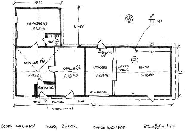
Document printed on 100% recycled paper.