

"NATIONAL HISTORIC TRAILS PROVIDE THAT TANGIBLE SPACE WHERE WE CAN CONNECT WITH SIGNIFICANT EVENTS IN OUR NATION'S HISTORY.”
~ Diana Bramble, Group Superintendent, Southern Campaign of the American Revolution Parks Group
MORGANTON >> RUTHERFORDTON
PRODUCED FOR
US National Park Service
Overmountain Victory Trail Association

NC Division of Parks and Recreation
Burke County, NC Rutherford County, NC City of Morganton, NC Town of Rutherfordton, NC
PRODUCED BY
Destination by Design Planning, LLC | 136 Furman Road, Suite 6 | Boone, North Carolina 28607 | 828.386.1866 | www.DbDplanning.com
@destination_by_design
@dbdplanning
@dbdplanning FACEBOOK YOUTUBE INSTAGRAM
ACKNOWLEDGMENTS
NATIONAL PARK SERVICE
Diana Bramble, Group Superintendent, Southern Campaign of the American Revolution Parks Group
PROJECT OVERSIGHT COMMITTEE
Doug Barrick, Town Manager, Town of Rutherfordton
Michael Berley, Project Designer, City of Morganton
Chivous Bradley, Historian, Rutherford County Michael Berley, Project Designer, City of Morganton
Aubrey Clay, Project Manager, Rutherford County Planning Department
Mary C. Griffen, Park Ranger, South Mountains State Park
Jonathan Griffith, Park Superintendent, South Mountains State Park
Tom Kenny, Land Protection Director, Foothills Conservancy of North Carolina
Andrew Kota, Executive Director, Foothills Conservancy of North Carolina
Bryant Lindsey, Board Member, Overmountain Victory Trail Association
Phillip Lookadoo, Director of Development and Design Services, City of Morganton
Shane Prisby, Operations Manager, Burke County Community Development
Smith Raynor, State Trails Planner, NC State Parks
Danny Searcy, Director, Rutherford County Planning Department
Nick Shaver, Mountain Region Supervisor, NC Wildlife Resources Commission
Jerry Stensland, President, Rutherford Outdoor Coalition
Paul Thompson, Northern Mountains Land Management Biologist, NC Wildlife Resources Commission
Tom Vaughan, Treasurer, Overmountain Victory Trail Association
OVERMOUNTAIN VICTORY TRAIL ASSOCIATION
David Doan, President
RG Absher, Vice President
Tom Vaughan, Treasurer
Leigh Anne Hunter Surber, Secretary
Mark Anthony, Board Member
Donna Atkins, Board Member
Joella Johnson Barbour, Board Member
Chivous Bradley, Board Member
Camille Chidiac, Board Member
Tony DeVault, Board Member
RUTHERFORD COUNTY, NC
Steve Garrison, County Manager
Bryan King, Chairman
Greg Lovelace, Commissioner
BURKE COUNTY, NC
Bryan Steen, County Manager
Jeffrey C. Brittain, Chairman
Scott Mulwee, Vice Chairman
CITY OF MORGANTON, NC
Ronnie Thompson, Mayor
Butch McSwain, Council Member
Chris Jernigan, Council Member
TOWN OF RUTHERFORDTON
Jimmy Dancy, Mayor
Henry C. Giles, Jr., Council Member
Dr. Doug Sheets, Council Member
Joe Epley, Board Member
John Garrou, Board Member
Dan Hopping, Board Member
Garrett Jackson, Board Member
Brad Knight, Board Member
Ronnie Lail, Board Member
Bryant Lindsey, Board Member
Carson Sayor, Board Member
Mel McKay, Board Member
LANDOWNER OUTREACH VIDEO INTERVIEWEES
Senator Jim Broyhill
Diana Bramble, Group Superintendent, Southern Campaign of the American Revolution Parks Group
Smith Raynor State Trails Planner NC State Parks
Andrew Kota
Executive Director
Foothills Conservancy of NC
Doug Barrick
Town Manager
Rutherfordton, NC
Jerry Stensland President Rutherford Outdoor Coalition
David Hunt, Commissioner
Michael Benfield, Commissioner
Alan Toney, Commissioner
Wayne F. Abele, Sr., Commissioner Johnnie Carswell, Commissioner Maynard M. Taylor, Commissioner
Chivous Bradley Historian, Rutherford County, NC & Board Member, OVTA
Chris Hawkins, Council Member
Wendy Cato, Council Member
Terry D. Cobb, Council Member
Stanley L. Clements, Council Member
TABLE OF CONTENTS
INTRODUCTION 1
Background 2 Plan Goals 3 Planning Process 4 Plan Organization 5
CHAPTER
1: EXISTING CONDITIONS, ANALYSIS, AND PRELIMINARY ALIGNMENTS
Study Area Description 8 The Natural Environment 10 The Built Environment 14

Map And Photo Series: Preliminary Trail Route Alternatives 19
CHAPTER 2:
LANDOWNER ENGAGEMENT
27
Identifying the Landowners 28 Landowner Communications 29 Landowner Workshop 30 Trail Route Re-Evaluation 32
CHAPTER 3: TRAIL CHARACTER & DESIGN GUIDELINES
7
CHAPTER 4:
RECOMMENDATIONS
39
Planning Sections Overview 40 Trail Section Recommendations 42
CHAPTER
5: IMPLEMENTATION
65
Implementation Details by Planning Section 66 Implementation Focus Areas 67 Trail Type Profile 68 Trail Support Spectrum 70 Economic Impact Analysis 71
APPENDIX 73
(A1) Budget 74 (A2) Landowner Invitation 76 (A3) Landowner Interest Survey 76 (A4) Funding Sources 77 (A5) The National Trails System Act 78 (A6) NC S.L. 2019-20 HB 532 97
33
Trail Types 34
Signage and Wayfinding 36
Social Media: The New Word of Mouth 38
vii

viii
LIST OF MAPS LIST OF EXHIBITS
Map 1: OVNHT Planning Areas 2
Map 2: General Study Area 8
Map 3: Study Area 1 Site Analysis 20
Map 4: Study Area 2 Site Analysis 22
Map 5: Study Area 3 Site Analysis 24
Map 6: Landowner Map Sample 28
Map 7: Landowner Sentiment 32
Map 8: Planning Sections Overview 40
Map 9: Planning Section 1 43
Map 10: Planning Section 2 47
Map 11: South Mountains State Park & Gamelands 49

Map 12: Planning Section 3 51
Map 13: Planning Section 4 55
Map 14: Brittain Presbyterian Church Connection 57
Map 15: Planning Section 5 59
Map 16: Thermal Belt Rail Trail & Purple Martin Connection 62
Map 17: Gilbert Town Connection 63
Map 18: Implementation Focus Areas 67
Map 19: Economic Impact Market 69
Exhibit 1: South Mountains Range 13
Exhibit 2: Social Media: The New Word of Mouth 38
Exhibit 3: HWY 70 Underpass 44
Exhibit 4: Catawba River Soccer Complex Trail Nexus 45
Exhibit 5: Roper Hollow Rd Trailhead 48
Exhibit 6: WGST & OVNHT Shared Trailhead 52
Exhibit 7: Cane Creek Skirmish 53
Exhibit 8: Brittain Presbyterian Church & Cemetery 56
Exhibit 9: Mt Vernon-Ruth Trailhead 60
Exhibit 10: Rock Rd Enhancements 61
Exhibit 11: Planning Section Implementation Matrix 66
Exhibit 11 Focus Area Implementation Matrix 67
Exhibit 12: Trail Type Profile 68
Exhibit 13: Trail Support Spectrum 70
Exhibit 14: Economic Impact Analysis 71
ix
INTRODUCTION
The Overmountain Victory National Historic Trail is APPROXIMATELY 330 miles in length and is located in portions of Virginia, Tennessee, North Carolina, and South Carolina. The Trail commemorates the significance of the patriot militia that marched from the Appalachian Mountains and their foothills to defeat the British-led loyalist army at the Battle of Kings Mountain on October 7, 1780.
This Trail Master Plan serves as a road map for establishing a section of the Overmountain Victory National Historic Trail (OVNHT) From morganton, NC to rutherfordton, nC.

BACKGROUND


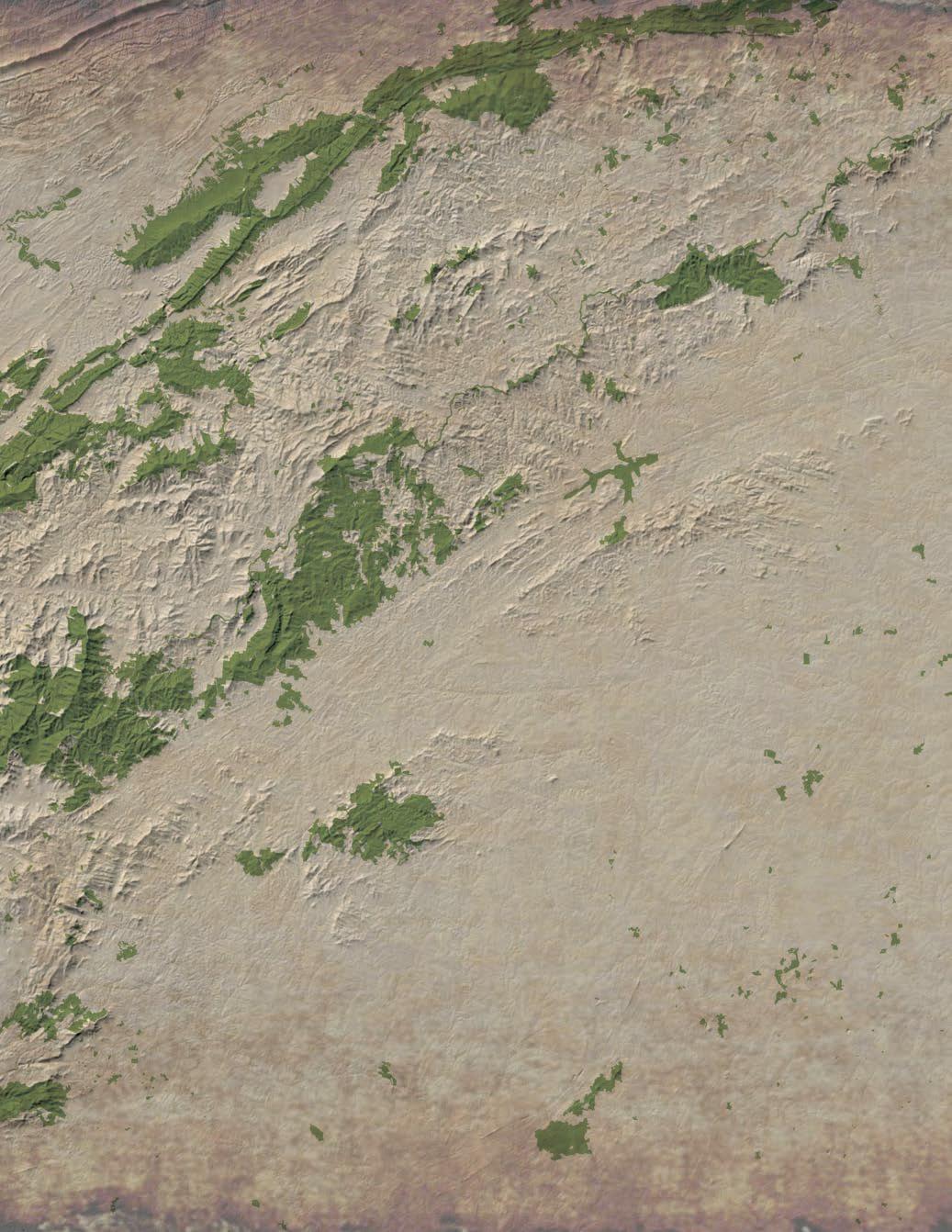
This project is part of ongoing efforts by the National Park Service (NPS) to develop regional trail master plans in order to strengthen multi-jurisdictional partnerships and engage landowners to expand and connect the growing network of certified OVNHT segments throughout Virginia, Tennessee, and North and South Carolina.
In 2021, the National Park Service, North Carolina State Parks, and the Overmountain Victory Trail Association partnered to fund a comprehensive master plan for the OVNHT from Morganton, NC to Rutherfordton, NC. In addition, the City of Morganton, Town of Rutherfordton, and Burke and Rutherford Counties participated as important stakeholders in the planning effort.
It is expected that trails developed along recommended routes within the plan study area will be eligible for certification by the NPS as part of the official Overmountain Victory National Historic Trail non-motorized route.


STATE TRAIL DESIGNATION
In June of 2019, NC Governor Roy Cooper signed S.L. 2019-20 into law, authorizing the Overmountain Victory Trail as a designated State Trail within the NC State Parks system. The North Carolina Trails System Act (GS 143B- 135.90) defines a State Trail as a linear corridor on land or water, separated from vehicular traffic, providing public access for non-motorized recreation or transportation.
As units of the NC State Parks system, State Trails are distinguished from other regional and local trails, by offering opportunities for regional connectivity and public access.
While a State Park is operated and managed by the NC Division of Parks and Recreation (NCDPR), a State Trail is comprised of multiple trail sections that are sponsored by state or federal agencies, local governments, non-profit organizations, and landowners. NCDPR provides guidance, coordination, and assistance for the section sponsors. The sponsors build, maintain, and manage their section of the trail deciding on location, design, surface, permitted uses, and amenities.
1: OVNHT PLANNING AREAS
THIS PLAN'S STUDY AREA
COMPLETED MASTER PLANS
This trail plan was developed in the same spirit as seven other OVNHT Master Plans completed from 2015 - 2019: Abingdon to Elizabethton (Section 1); Spruce Pine to Lake James (Section 3); Lake James to Morganton (Section 4); Elkin to W. Kerr Scott Reservoir (Section 5); Lenoir to Morganton (Section 7); Rutherfordton to Chesnee (Section 9); and Chesnee to Kings Mountain (Section 10). The NPS is working to develop similar plans for all areas included within the congressionally-designated OVNHT corridor.
2
SC NC VA TN N RUTHERFORDTON TO CHESNEE MORGANTON TO RUTHERFORDTON ELIZABETHTON TO SPRUCE PINE ABINGDON TO ELIZABETHTON W KERR SCOTT RESERVOIR TO LENOIR LENOIR TO MORGANTON SPRUCE PINE TO LAKE JAMES CHESNEE TO KINGS MOUNTAIN ELKIN TO W KERR SCOTT RESERVOIR LAKE JAMES TO MORGANTON 40 Spruce Pine Morganton Lenoir Chesnee Elizabethton Abingdon Elkin 77 85 26 Rutherfordton 40 77 26 W Kerr Scott Reservoir Lake James Kings Mountain National Military Park 1 2 3 4 7 8 9 10 6 5
MAP
Rutherfordton,
This plan's study area examines Section 8 of the OVNHT and incorporates 29 miles of trail corridor from Morganton, NC to
NC.
PLAN GOALS LANDOWNER OUTREACH IS
CRITICAL
Specific Trail Routes. Identify a specific and feasible trail route within or near the known historic corridor of the Overmountain Victory National Historic Trail as determined by NPS.

5 2 4
Landowner Outreach. Make a direct appeal to landowners identified during the analysis phase and record their sentiments for providing a trail easement.

Visual Plan. Create a visual plan that provides renderings and schematics to demonstrate trail character.
Support
Other Community Goals. To the extent possible, identify opportunities to leverage the trail to further other community goals, including economic development, historic preservation, public health, and environmental stewardship.
INTRODUCTION 3
1 3
A
COMPONENT OF THE
Social Media. Incorporate modern social media marketing tools within the trail and signage infrastructure to promote the development of “user generated” marketing content. PLANNING PROCESS.
OVNHT
Landowner Outreach | May-June 2021








Plan Development | June-October 2021
The
Final Plan Preparation | October-November 2021
4 FEB. ‘21FEB. - MAY. ‘21MAY. - JUNE. ‘21JUNE. - OCT. ’21 • Kick Off • Facilitating Planning Oversight Committee DIRECTION SETTING & PROJECT LAUNCH • Physical Inventory • Physiographic Analysis • Natural Inventory • Points of Interest & Structures • Environmental • Infrastructure & Utilities • Video Development • Public Meeting & Engagement • Landowner Outreach Workshops • Design Alternatives • Wayfinding & Structural Elements • Branding • Opinion of Probable Cost • Route Feasibility • Landowner Follow-up RESEARCH AND PRELIMINARY ANALYSIS PUBLIC ENGAGEMENT & LANDOWNER OUTREACH DRAFT PLAN, DESIGN CONCEPTS, COSTS OCT. ‘21 - NOV. ’21 • Funding • Implementation FINAL DRAFT DEVELOPMENT DIRECTIONAL sign 24 typical parking spaces ada parking spaces pull through equestrian parking spaces parallel equestrian parking spaces connection restroom and hitches kiosk restroom kiosk us-64 roperhollowroad overmountain victory trail 02550 =50' project
PLANNING PROCESS
environmental constraints and opportunities for trail connectivity.
timeline
Direction Setting and Project Launch | February 2021 The consultant team met with local trail and government leaders (virtually) to generally discuss
site
trail route options.
routes
landowner contact
Research | March 2021 The consultant team conducted a thorough
analysis of the study area and determined feasible
With the trail
identified, a
list was developed.
Landowners with property along an identified feasible trail route were invited to a special meeting to learn more about the trail project. After receiving comments from landowners, the preferred trail route was revised accordingly.
consultant team worked in tandem with local leaders to develop a preferred trail alignment. Renderings and schematics were provided to visually support the trail recommendations.
1. 2. 3. 4. 5.
The final plan is published for review by stakeholders, elected officials, and the public.
Chapter I.
Existing Conditions, Analysis, and Preliminary Alignments
Chapter II.
Chapter III.
Trail character & Design guidelines
MILE MARKER
This chapter provides a comprehensive overview and analysis of the opportunities and constraints found throughout the study area. The analysis begins with a brief description of the study area followed by a comprehensive discussion of the natural and built environments and their implications for trail suitability, permitting, and costs. This chapter concludes with a map and photographic series that highlights a host of preliminary trail route alternatives.

The second chapter showcases the significant efforts that were made to reach out to landowners who, according to the analysis in Chapter 1, have land that is most suitable to trail development.
This chapter outlines the process and results of that landowner outreach, including a map illustrating landowner sentiment.
Chapter IV.
Recommendations
The fourth chapter breaks the study area into five (5) planning sections. Each planning section includes a map that displays a preferred alignment. Each planning section further incorporates the analysis and design elements from the previous chapters along with a host of supporting renderings and design schematics.
Implementation Chapter V.
This chapter provides a summary of implementation priorities organized by planning section and focus area. Chapter 5 concludes with an economic impact analysis.
INTRODUCTION 5 PLAN ORGANIZATION ! ! ! ! ! ! ! ! ( ! ! ! ! ! ! ! ! ! ! Barn House House House House House Store House Houses Houses Houses Houses Houses Storage Storage Laundry Old Gym Hoey Hall Creekside The Aerie Tate House Webb House Bridge #45 Hoke House Houk House Swan Ponds Wading Pool Scout Cabin Joiner Hall Staff House Hogan House Mull School Giles House Tate Cottage Howard House Goodwin Hall Alva Theater Hudson House Falls Castle Patton House Salem School Mimosa Cinema Bristol House Frisard House Leonard House Gaither House Gaston Chapel Burleson House Harbison House Magnolia Place Joiner Hall Gym Rusmisell House Rondthaler Hall Warlick Grocery Chambers Chapel Leonhardt House Crutchfield Hall J.D. Pitts House Taylor Farmhouse J.M. Orders House Tillinghast House Lyman House (Gone) John Simpson House Commercial Building Commercial Building Commercial Building Commercial Building Isaac Lazarus House M. Kistler House Giles Motor Company McElrath AME Church Commercial Building Glen Alpine Schools Samuel Huffman House Kistler-Stoney House Perkins House (Gone) Horace Kincaid House Nathan Lazarus House Broad Oaks Sanitorium Connelly House (Gone) Hapholdt House (Gone) Davis-Collett Building Morganton Furniture Co. Ira Smith House (Gone?) Quaker Meadows Cemetery NC National Guard Armory Claywell-McGimpsey House Glen Alpine Knitting Mill Cornerstone Baptist Church Avery Wilson House (Gone?) Randolph/Hogan St. District JONESBORO HISTORIC DISTRICT Presbyterian Church Jerome Duckworth House (Gone) Glen Alpine Business District Thomas Duckworth House (Gone) Wilson and Edna Taylor's Store D.M. Walker Lumberyard (Gone?) Catawba Industries Inc. Complex Otis Pitts, Sr. House (Ebony Funeral Home) Silver Creek HuntingCreek Bailey Fork CatawbaRiver LittleSilverCreek CanoeCreek James Branch Jack Branch CatawbaRiver Catawba River Greenway Proposed North Bend Access Catawba River Soccer Complex Existing Freedom Park Trailhead Existing Watermill River Access Morganton Salem Glen Alpine Burke 1142 70 1102 1223 Enola Jamestown 1112 126 181 1206 1147 Hopewell Union 1940 1177 Green 1230 1949 Byrd 1107 CarbonCity 1113 Salem Dixie Main 1168 Propst Burkemont Causby King 1150 1304 1275 1228 1110 Sanford Kathy Pitts Ucle Reep 1999 1226 Sundown 1145 1164 Poteat Concord 1152 1158 Meeting 1163 Valdese Mill 1950 Ida 1941 1942 1932 2012 Cornwell 1208 Bouchelle Ridgecreek 1222 1203 Bennett Colony Chain Lane 1160 Avery Flint 1166 1227 Oakdale Rutherford Linville PeteBrittain London Elm Golf Course Collett Davis Burke Ridge Asheville Conley Bumgarner Park Garrison 1185 Ruritan 1182 Riverside Walker Crawley Allen la 1309 Docastee 1st 1990 Turkey Tail Mount Olive Church Spa 1103 1292 Ann 1312 Brentwood Plantation Pollard 1297 Ridge Silver 1927 Fletcher Evans 1146 1943 CeramicTile Independence Terrace Pearson BillEpley 1284 Williams 1167 Bobs 1952 1197 Ross Industrial Rand Trestlewood Ford Liberty 1946 Arnold Valley Secrest Crestwood Hilltop 1178 2102 1148 Lynn Herron Wesley 1951 Delta WatermillGlenAlpine Hennessee 2010 Walton 1948 Morehead Homestead Harry Brittian Whitley Buff DavidBryant Bay Normandy Roper Silver Creek 1220 Carolina Helton Stamey 1311 1179 1947 Creekwood Rink AirPark 1986 Metcalf Nelson 1303 1218 Stephens Case Church SaintPaulsChurch Craftsman RiverClub 1114 Stroupe Lee Arney Bailey Glendale RiverGlen Bedford 1215 DoeRun Coulter Maloney Cascade 2104 CrestHill Advent Lumber Dellwood Patriot 2110 Henredon Bradley Rice Lyle 1992 Anderson Powell 1144 2014 Ora Boulder Huffman Brookstone 1288 Wilson Wood Glen Genes 1283 WillieRay 1175 Messer WamsuttaMill Watering Bristol 1302 Riverhills Sherwood Freedom Raintree River Breeze Brandy Jefferson 1181 Pump 1278 Canoe Self Long Cox Grandview Henson Jay Bird Cedar Hills 1189 Bluebird 2101 McEntire Belaire Blankenship Perpons McConnaughey Myrtle McGalliard Harry Nova Quarry Linda Way 1294 Harris GarlandJohnson Pony JugWilson Romarco Lr Walker SwanPond Martin Vineta Hyder Jewel Morgan Poplar Kennedy Brittain McAlpine Chapman Greenbriar Southview Hushpuppy Chambers Chapel Murphy Fernwood Sullivan Washboard Ross DogwoodRidge Keller Creekside Belmont RabbitRidge 1290 Pearl Rhyne YellowMountain Epley Clyde Branstrom Burkley Alpine 1192 Circle Springdale Brookwood Spainhour Quail Country Club Roberts Don Johnson Derby Emory Wood Diane Sara Bellevue Dierdorf Apex Suburban Woodland Topaz Vue Smith Gilesbrook Caldwell Lipscomb Fawn Regina CommunityCollege Wilbur Newton Linden 2106 Michaels Beechmont Payne River ThomasCline Sunrise RiverBend Magnolia RussWood Francis 3rd Valley Bennett Epley Williams Wood Camellia Garden Ray Riddle Wallace BellsRun Norville Hill ScottAcres Royal Kinwood Hamp Willowood Buena Vista KnobCreek Benjamin MimosaHills Starmount MasonValley Greenlee Ford Cline Eric Kenmark River Bluff Birdy Shadowood Hickory Hills Fairfield Hudson RiverHills Cobb Hollow William Parks Gilliam Leonard Carbondale ForestGlen Bolick Foxfire Highlander Whisnant JrHenry 6th Smith Church Bowers JulianWelborn Dale Phoenix Garden Clearview Candy Faet Moses Mull Oak Bluff Lynn Wood KimballGlass Tallent Sweetbrier FrogHollow RiverSound Crosscreek Holland Skymont Viewmont Westview OnesBranch Butler Hollow Palmer Croydon AcreWood 1985 White Plain Harold Shore QualityProducts Goodson Bridges View Terrabrook Faith Temple Church McGalliard Homestead Sunrise Duckworth Causby Raintree Oakwood Arney Silver Creek Suburban 1983 Patton Concord Salem Park Riverside Park 40 Conley Sara Parker SilverCreek Reep Clontz Conley Lail 1147 Homestead Lail View Roper 4th Anderson Pitts Meadow Mount Olive Church Park Maple Ridge Bedford Williams Ora 1st Crestwood Grandview Colony 1113 Acorn Morganton to Rutherfordton: Analysis: NORTH CatawbaRiver South Muddy Broad River CatawbaRiver § ¨ £ 70 £ 221 £ ¤ 221 £ ¤ 221 £ 221 £ ¤ 74 Morganton Marion Rutherfordton Valdese Valdese Drexel Glen Alpine West Marion
RESTROOM AND KIOSK floodplain entry sign 24 typical parking spots 2 ada parking spots mowed grass loop through meadow us-64 canecreek wilderness gateway state trail wilderness gateway state trail overmountain victory trail kellybranch N 03060 1"=60'
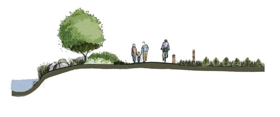
Landowner Engagement 30’ PREFERRED BUFFER TO RIVER TO PROTECT WATER QUALITY 10’ PAVED ASPHALT
FENCING TO MARK PRIVATE PROPERTY BOUNDARY
This chapter is dedicated to visually defining the various trail types to be used throughout the corridor. Also, design concepts are provided for all types of trail user orientation signage, mile markers, historic markers, and other trail support facilities.

6
CHAPTER 1
EXISTING CONDITIONS, ANALYSIS, AND PRELIMINARY ALIGNMENTS

this chapter features An OVERVIEW AND ANALYSIS OF THE OPPORTUNITIES AND CONSTRAINTS FOUND throughout THE STUDY AREA.
The analysis begins with a brief description of the study area followed by a comprehensive discussion of the natural and built environments and their implications for trail suitability, trail design features, permitting, and costs. This chapter concludes with a map and photographic series that highlights a host of preliminary trail route alternatives.
IN THIS CHAPTER
A. Study Area Description
B. Natural Environment Analysis
C. Built Environment Analysis
D. Map and Photo Series: Preliminary Trail Route Alternatives
STUDY AREA
GENERAL STUDY AREA
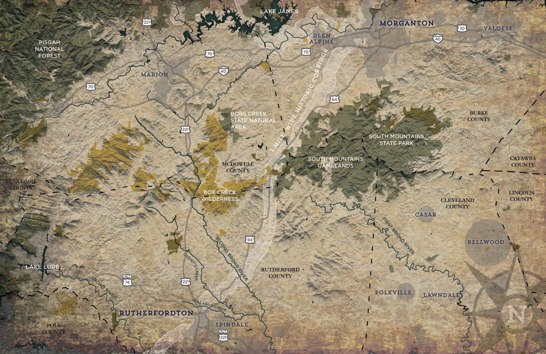
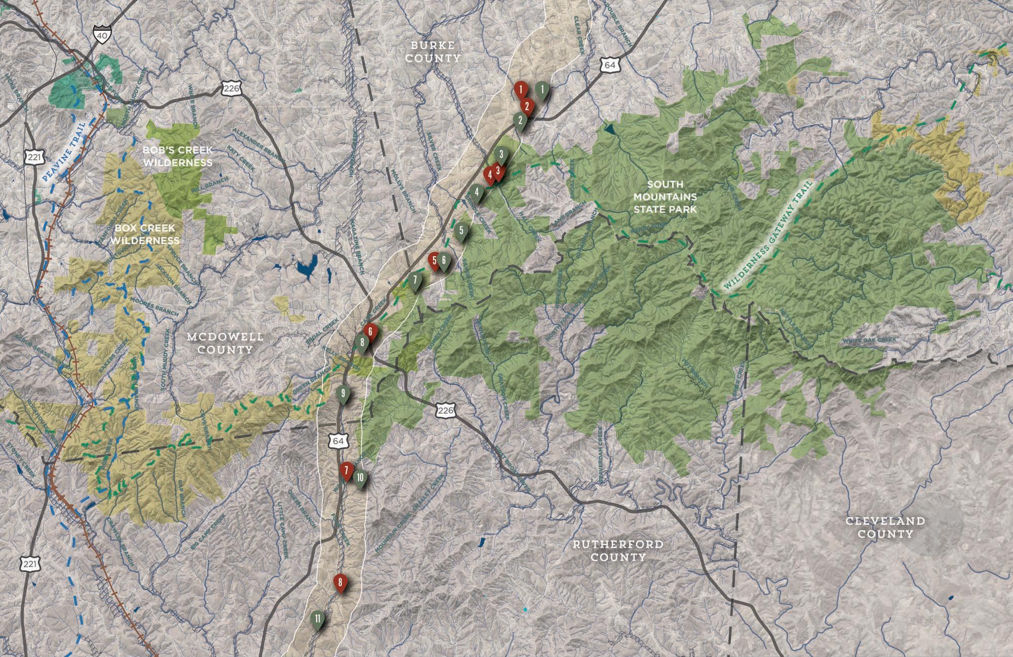
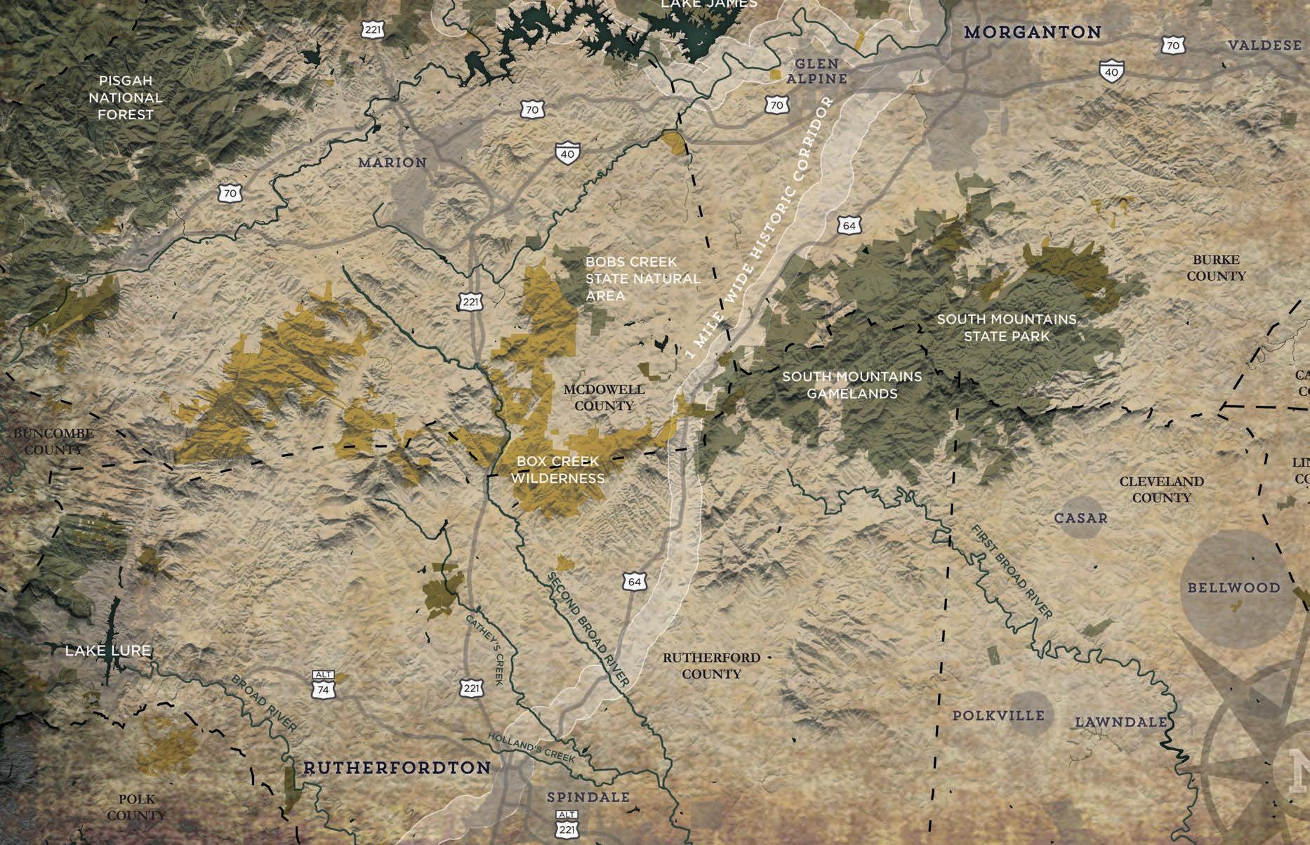
DESCRIPTION: in accordance with the ovnht comprehensive management plan , the morganton , nc to rutherfordton , nc study area is anchored by the one - mile wide historic corridor . the corridor spans a half mile on either side of what is known to be the historic route of the overmountain men . this planning corridor was determined to allow for changes in the historic route based on prevailing research , as well as to allow for a continuous adjusted route in response to constraints of the modern built environment . the study area extends approximately 29 miles from the catawba river soccer complex in morganton , nc to the thermal belt rail trail in ruth , nc . the corridor extends southwest from the catawba river soccer complex along us hwy 64, where it passes between south mountains state park and game lands and the box creek wilderness area . the corridor then turns further west and continues to the theraml belt rail trail near the intersection of us hwy 221 and us hwy 64 in ruth nc . the corridor traverses large undeveloped tracts of land in southwest b urke c ounty , southeast m c d owell c ounty , and northeast r utherford c ounty . the study area ’ s topography consists largely of rolling foothills throughout . the study area includes approximately 0.7 miles of existing ovnht located in downtown morganton at the catawba river soccer complex , and approximately 0.9 miles of existing ovnht on the thermal belt rail trail in ruth and rutherfordton , nc

The 29-mile study area begins at the Catawba River Soccer Complex in Morganton, NC and ends at the thermal belt rail trail North of downtown rutherfordton, NC.
8
2:
AREA
MAP
GENERAL STUDY
ANALYSIS WORKFLOW

ANALYSIS

CHAPTER 1 9
ALTERNATE TRAIL ROUTES WERE DETERMINED BASED ON AN ANALYSIS OF THE NATURAL AND BUILT ENVIRONMENTS.
THE NATURAL ENVIRONMENT
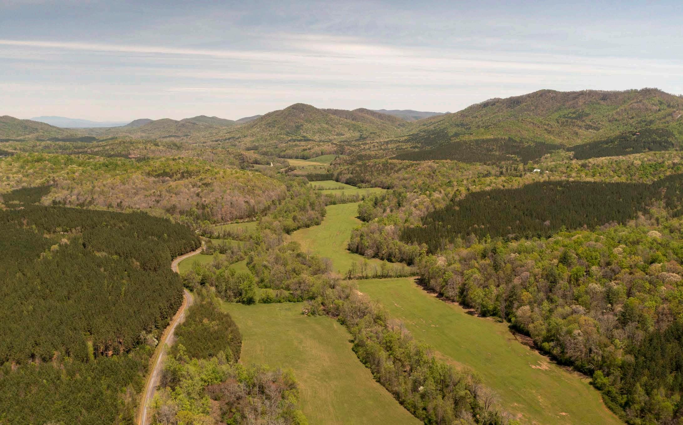
The opportunities and constraints found within the natural environment are critical for determining suitable trail locations and feasibility, ideal user experiences, construction costs, and necessary permits.

This section explores the implications of the study area’s natural environment for establishing the Overmountain Victory National Historic Trail from Morganton, NC to Rutherfordton, NC and includes five (5) parts: 1) Floodplains; 2) Wetlands and Hydric Soils; 3) Rivers, Streams, and Lakes; 4) Steep Slopes; and 5) Rare Flora and Fauna.
10
FLOODPLAINS
Floodplain areas provide both an opportunity and constraint for trail development. Since traditional development is not suitable within floodplain areas, private landowners are often more willing to provide access for public trails within these locations. Also, these scenic areas often attract wildlife, which creates an engaging trail experience. Within the study area, the floodplain areas along Silver Creek, Clear Creek, and Cane Creek provide an opportunity for trail development.
Although development is regulated within the floodplain, greenways and trails are allowed and can be permitted. Sound trail engineering techniques are necessary to ensure trails can sustain flooding. To the extent possible, greenway alignments should be avoided within the floodway
Avoid disturbance in the floodway. Avoid placement of structures or disturbance within the floodway. Floodways are regulated locally and by the Federal Emergency Management Agency (FEMA). Fill, structures (walls, kiosks, etc), and impervious surfaces are discouraged. Any structures located within the floodway require a no-impact/no-rise certification through FEMA. These studies vary in cost but can range from $2,500$15,000 depending on complexity.
WETLANDS AND HYDRIC SOILS

The study area includes several wetland areas as identified on the National Wetland Inventory (NWI). According to NWI, there are likely smaller wetland areas within the study corridor that are not indicated within their inventory that could impact final trail alignments2. Hydric soils in combination with wetland plant species and wetland hydrology are considered indicators of a wetland, which require costly permitting if impacted.
2 If wetlands are unavoidable, utilize elevated boardwalk systems. Boardwalks allow for travel over flat, poorly draining soils, standing water, and wetland features and have significantly less impact than other options. A section 404 (Clean Water Act) Permit may be required if the wetland is considered jurisdictional by the USACE. This means that the wetland is not isolated and part of a broader lake or water system. A small boardwalk for a non-isolated wetland with limited fill or dredging may qualify for a programmatic Nationwide Permit. Nationwide Permits are designed to streamline the permitting process for actions with limited disturbances. In addition to permitting, disturbances exceeding a tenth (0.1) of an acre would require mitigation which can increase project costs. Impacts under a tenth (0.1) of an acre do not trigger mitigation fees.
STREAMS, LAKES, AND PONDS
The County, State3, and Federal4 governments regulate the many water bodies found throughout the study area. The Catawba River, Broad River and their tributaries, Clear Creek, Silver Creek, and Cane Creek are some of the most important waterways found within the study area; there are permitting implications for crossing and bridging these water bodies.
3 Maintain a 50-foot bufferfrom all waterways, particularly those regulated under the Catawba River Buffer Rules.
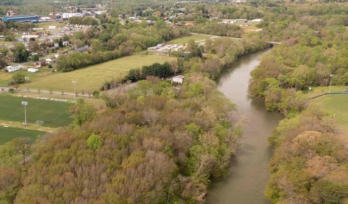
The state requires a 50-foot buffer along the shorelines of the Catawba River and associated lakes. Streams within the study area are identified by the State of North Carolina as having poor water quality and maintaining or improving an adequate vegetated buffer is crucial to improving the quality. Zone 1 of this buffer includes an undisturbed 30-foot buffer from top of bank in which trails are discouraged. Zone 2 is an additional 20-foot buffer. This zone allows for managed vegetation, trails, and greenways. While trails are an allowable use within Zone 2, the NC Division of Water Quality requires a permit (through DWQ or designated local government). The applicant must show that disturbance has been minimized and no other alternatives exist.
Plan for permits related to waterway Impacts. Federal 401/404 Certifications will likely be required in cases where any stream or waterway alterations occur. These alterations would be most likely in conjunction with bridge improvements or addition of structures near waterways. Triggers for the permit include disturbance to the stream bed, banks, damming of the waterway, or placement of material within the waterway (i.e. culverts/pipes).
CHAPTER 1 11
“Portions of floodplain areas along silver creek, clear creek, and cane creek are ideal for TRAIL development.”
STEEP SLOPES

Topography of the study area is characterized by the rolling hills of the southern Blue Ridge foothills throughout Burke, McDowell, and Rutherford Counties. Trail type and design will transition with the varying terrain. Where possible, the trail should provide for grades under 5 percent. Natural surface trails can vary up to a 10 percent slope. Proposed trail alignments may require a wider trail corridor to ensure that a more gradual trail grade can be achieved through switchbacks.
RARE FLORA AND FAUNA

The North Carolina Natural Heritage Program and South Carolina Department of Natural Resources (SCDNR) Office of Environmental Programs provide data identifying each states' most sensitive environmental areas. Rare flora and fauna species can also exist outside of these designated areas, which can alter final trail alignments prior to construction. As of April 2018, nineteen (19) rare species were identified within this study area by the North Carolina Natural Heritage Program: 1. Narrowleaf Bluecurls; 2. Tricolored Bat; 3. Virginia Stickseed; 4. Tall Boneset; 5. Southern Loosestrife; 6. Balsam Ragwort; 7. Bryum limbatum (A Moss); 8. Red Turtlehead; 9. Hazel Dodder; 10. Elm-leaf Goldenrod; 11. Smooth Sunflower; 12. Chiloscyphus appalachianus (A Liverwort); 13. Long-beaked Water Feather Moss; 14. Carolina Foothills Crayfish; 15. Clammy Locust; 16. Rough Blazing Star; 17. Eastern Creekshell; 18. Sweet White Trillium; and 19. Glade Wild Quinine.
Coordination with the North Carolina Natural Heritage Program and the U.S. Fish and Wildlife Service (USFWS) is an important aspect of the design process. Involving USFWS early on in the process can help avoid potential planning obstacles related to federally protected species. Additionally, permits like Section 401 and 404 (described previously in the Wetland and Streams sections) will initiate the review of the State Natural Heritage Program database. If species are found within the project area, State or Federal requirements may dictate avoidance or mitigation.
12
SUPERB JEWELWING
Photo by Dennis Doucet

CHAPTER 1 13 SOUTH MOUNTAINS RANGE t
range
maximum
and are
and
QUICK FACTS: Range Area: ~100,000 Acres Max Elevation: 3,000 Ft EXHIBIT 1: SOUTH MOUNTAINS RRANGE
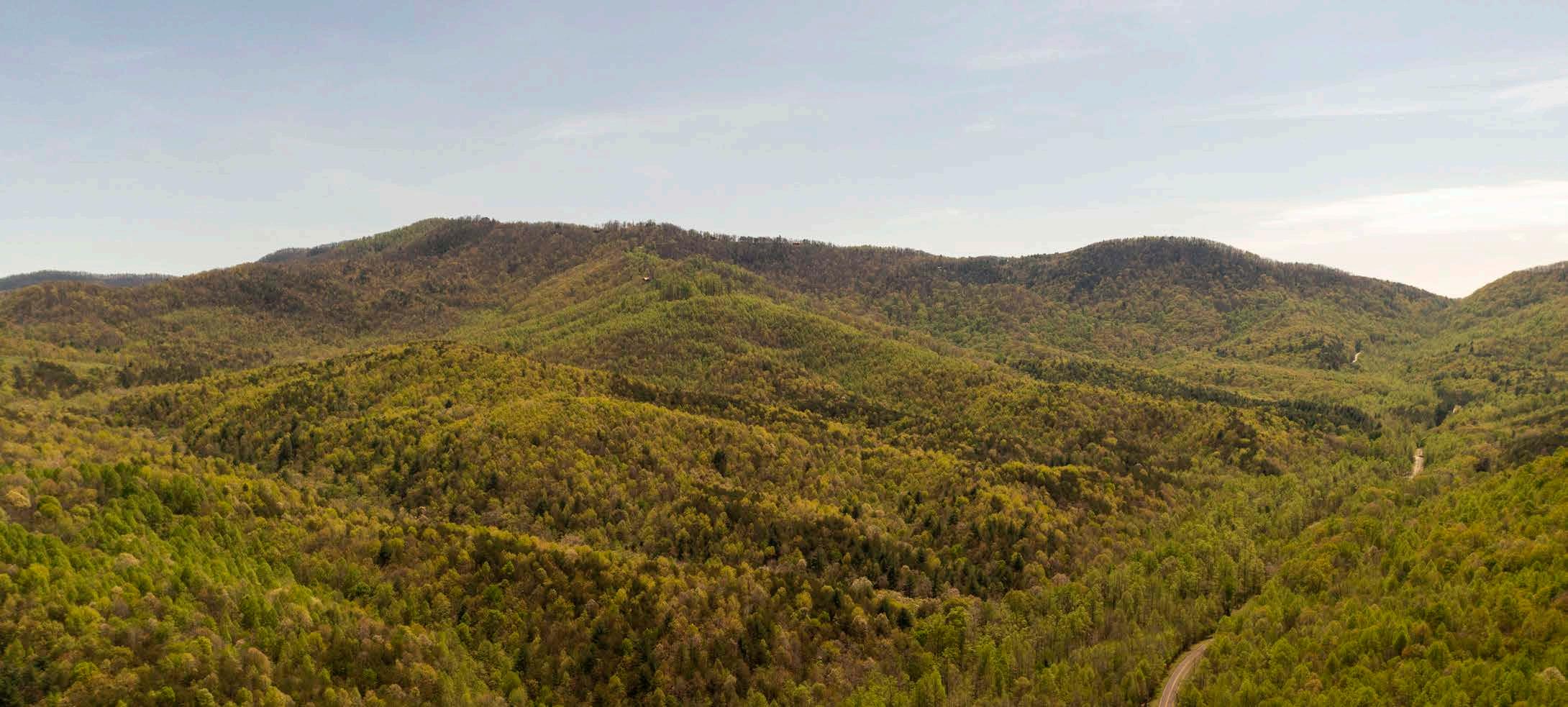
he South Mountains are an isolated group of mountains in the North Carolina Piedmont, known for its rugged terrain, waterfalls, cascades, and 19th century prospecting. This
occupies approximately 100,000 Acres in Burke, McDowell, Rutherford, and Cleveland counties, and is seperated from the rest of Western North Carolina's mountains by the Catawba River Valley. The South Mountains have a
elevation of 3,000 ft above sea level,
home to a dense mixed forest. The Range is also home to a large state park
gamelands area.
THE BUILT ENVIRONMENT

The opportunities and constraints found within the built and human environment are critical for determining suitable and feasible trail locations, ideal user experiences, construction costs, and necessary permits.
This section highlights five (5) built environmental features and their implications for developing the OVNHT from Morganton to Rutherfordton, including: 1) Land Use; 2) Existing Trails and Parks; 3) Utilities; 4) Transportation; and 5) Historic Resources.
14
LAND USE SNAPSHOT
City of Morganton

The City of Morganton (pop. 17,474) serves as the county seat of Burke County and the northern terminus of this plan’s study area. Founded in 1777, the city, built near the remains of a significant Mississippian Culture site, is home to 31 sites listed on the National Register of Historic Places. The Town features a walkable downtown core, a large park, soccer complex, and a riverside greenway.
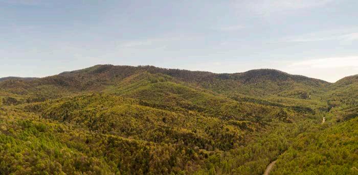
South Mountains Range

The South Mountains are an isolated group of mountains in the North Carolina Piedmont, known for its rugged terrain, waterfalls, cascades, and 19th century prospecting. The area includes a 20,918 acre state park and a 22,575 acre gamelands area.

Town of Rutherfordton
The Town of Rutherfordton (pop. 3,640) serves as the county seat of Rutherford County and the southern terminus of this plan’s study area. Founded in 1787, the town served as a major commercial and political hub for western North Carolina and the Blue Ridge Foothills from the late 1700s to the mid-1800s. Rutherfordton is home to ten sites listed on the National Register of Historic Places, including the Bechtler Mint Site. The Town features a walkable downtown core, a one-mile segment of OVNHT-designated trail, and is located just south of the Overmountain Men’s Gilbert Town encampment site.
CHAPTER 1 15
“The city of morganton and the town of rutherfordton, as well as the south mountains, serve as critical anchor points for trail development.”
EXISTING PARKS AND TRAILS
SOME OF THESE MAJOR ASSETS INCLUDE:
Catawba River Greenway
The Catawba River Greenway in Morganton offers 4.4 miles of paved accessible greenway trail and serves as a significant recreation and tourism asset in Morganton and Burke County. The greenway has five access points and connects a number of local parks managed by the City of Morganton Parks and Recreation Department.
South Mountains State Park & Game Lands

South Mountains State Park and Game Lands conserve approximately 40,000 acres of the 100,000 acres encompassed by the South Mountains range. These public lands managed by NC State Parks and the NC WIldlife Resources Commission provide outdoor recreation amenities that serve hikers, mountain bikers, equestrians, and hunters.
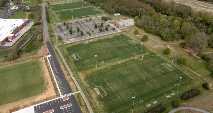
Catawba River Soccer Complex
The Catawba River Soccer Complex was built in the year 2000, and can be found south of the Catawba River from Freedom High School and Freedom Park. The complex sits on 30 acres and includes: four regulation soccer fields, petanque courts, a dog park, a field house with an office, a concessions stand, first aid room, storage building, a multi-feature playground, an eighty person picnic shelter, and a greenway loop.
Fonta Flora State Trail
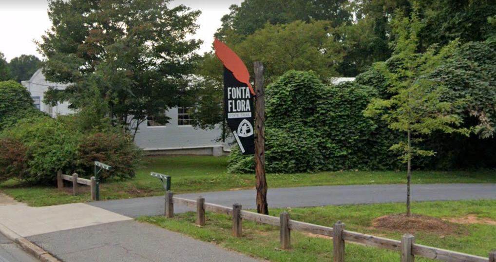
The Fonta Flora State Trail is proposed to span approximately 100 miles through Burke, McDowell, and Buncombe Counties. The NC General Assembly authorized the trail in 2015, and its route includes a loop around Lake James and connections through Lake James State Park, Marion, Old Fort, Black Mountain, and Pisgah National Forest.
Thermal Belt Rail Trail

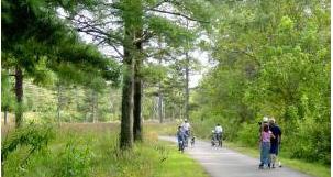
The Thermal Belt Rail Trail (TBRT) is a 13.5-mile rail trail that extends from Gilkey, NC to Forest City, NC. The TBRT connects the communities of Ruth, Rutherfordton, Spindale, and Forest City and serves as a significant recreation and tourism asset in Rutherford County.

16
THE STUDY AREA boasts a collection of parks, trails, and recreation destinations that are ideal connections for the ovnht.
TRANSPORTATION
UTILITIES


The incorporated towns located within the study area maintain a complex matrix of water and sewer infrastructure which, in many instances, are held in fee simple ownership by a public agency or have easements that can be modified to provide for trail development.

The analysis of the study area includes a review of public infrastructure and associated easements.
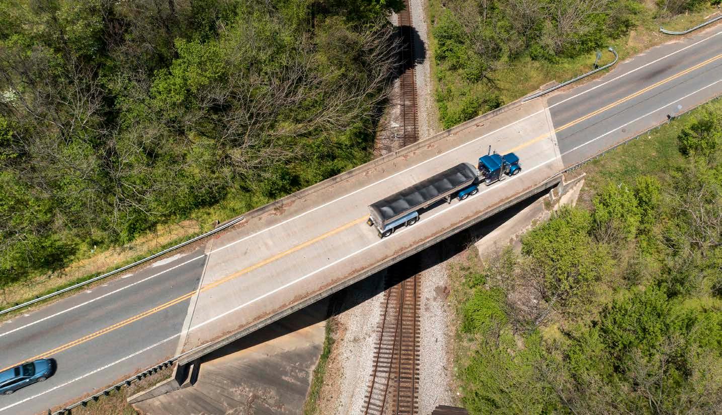
The analysis of the study area includes a review of the North Carolina and County Departments of Transportation (DOT) right-of-way (ROW), DOT plans, local bicycle and pedestrian infrastructure and plans, and railways.
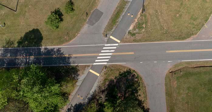
DOT right-of-way was analyzed to determine where there could be opportunities for developing OVNHT side paths. These areas are shown on the Site Analysis Maps with corresponding opportunities and constraints notes.
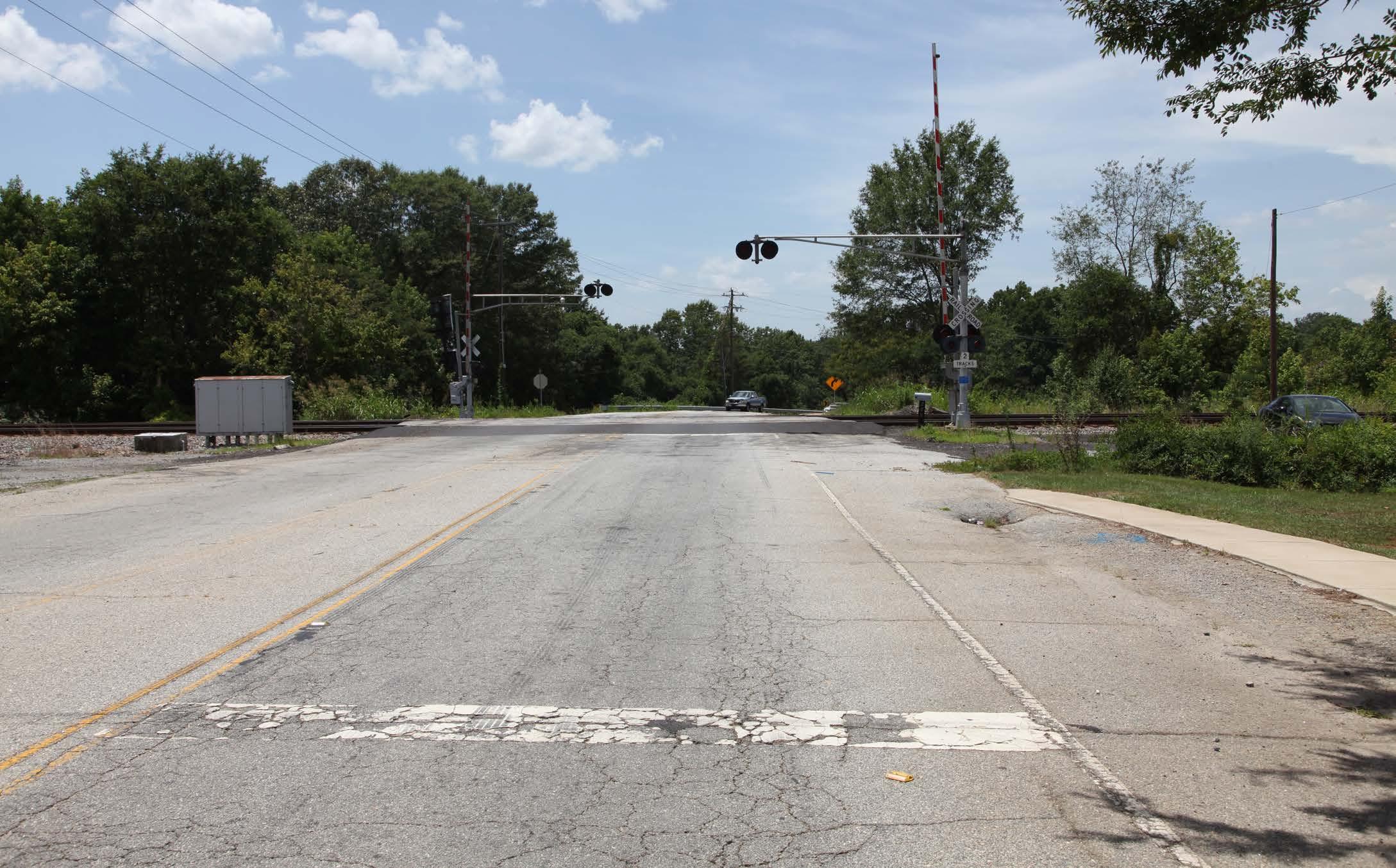
Significant sections of the study area are typified by rural roads with limited opportunities for DOT side-path development. This, combined with the lack of a consistent waterway and riparian area within the corridor present significant barriers to trail development.
CHAPTER 1 17
“Rural Road networks and the presence of rail lines within the study area present significant barriers to trail development.”
HISTORIC RESOURCES
HISTORIC AND CULTURAL SITES ALONG
The Overmountain Victory National Historic Trail Route and Corridor
The Overmountain Victory National Historic Trail route was identified by a National Park Service research team. The team relied on the 1881 account of the march, which has been amended by local historians, descendants of battle participants, and other sources. As part of this congressionally-designated trail, officially designated portions of the OVNHT must lie within or very near the one-mile corridor (half-mile on either side) of the historic route.
Historic Sites and Landscape
The North Carolina State Historic Preservation Office (SHPO) oversees a large database of historic sites and resources. Many resources, including those related to the OVNHT, are included within the subsequent analysis map series. These resources include information from SHPO as well as sites related to the National Register of Historic Places (which the National Park Service oversees, but is managed by individual States). The most critical sites include those listed on the National Register (NR) or determined eligible (DOE) as they have further protection under Section 106 of the National Historic Preservation Act. The National Park Service has emphasized that historic/cultural resources should be linked, preserved, and interpreted as part of this study and subsequent trail development. Specific resources that directly relate to the
history of the OVNHT are noted on the subsequent maps and include:


A. Brittain Presbyterian Church & Cemetery

Sensitive Cultural Resources and Permitting: Any construction funded or permitted by the federal government will trigger a project review by SHPO of any resources covered under Section 106 (National Historic Preservation Act). These resources could include human remains, burial sites, archeology sites, and historic sites. If it is found that the action of trail construction could potentially adversely affect cultural resources, the SHPO will work with the related Federal Agency to eliminate or minimize the effect.
Historic Sites and Permitting: In general, a greenway would have no effect or a complementary relationship to preservation of these sites, but may require SHPO coordination in circumstances like alterations to historic bridges or whole properties. If federal funds or permitting is required, the SHPO will review this database and analyze for any adverse impacts.
18
“THE OVNHT SHOULD LINK, PRESERVE, AND INTERPRET
ITS ROUTE.”
THE BRITTAIN PRESBYTERIAN CHURCH & CEMETERY IS HOME TO THE GRAVES OF 16 REVOLUTIONARY WAR SOLDIERS, INCLUDING THE GRAVE OF LT. THOMAS MCCULLOCH, WHO FOUGHT AND WAS WOUNDED AT THE BATTLE OF KINGS MOUNTAIN.
MAP AND PHOTO SERIES: PRELIMINARY TRAIL ROUTE ALTERNATIVES

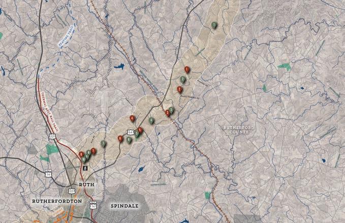
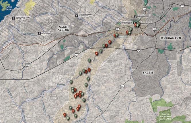
The map and photographic series, which spatially incorporates the natural and built environment analysis, highlights a host of preliminary trail route alternatives. These routes were further refined by local leaders to identify and engage landowners. This information will serve as an ongoing reference guide as alternative routes may need to be developed due to unforeseen barriers.

CHAPTER 1 19

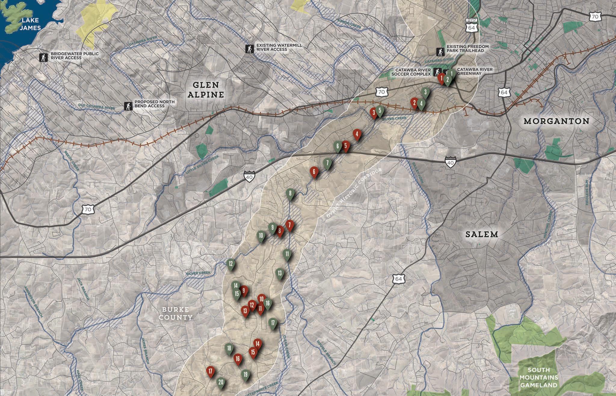


20 MAP 3: STUDY AREA 1 SITE ANALYSIS OVNHT and other Recreation Federal; State; Local Government Historic Landmark Site Managed Lands Hydrography Floodzone OVNHT 1 Mile Historic Corridor Existing Trail Constraint Opportunity Proposed Trail Existing Trail LEGEND STUDY AREA 1 SITE ANALYSIS
STUDY AREA 1 OPPORTUNITIES & CONSTRAINTS
OPPORTUNITIES CONSTRAINTS
Large public parcel next to river
Large vacant parcels along Silver Creek
Large vacant parcels along Silver Creek
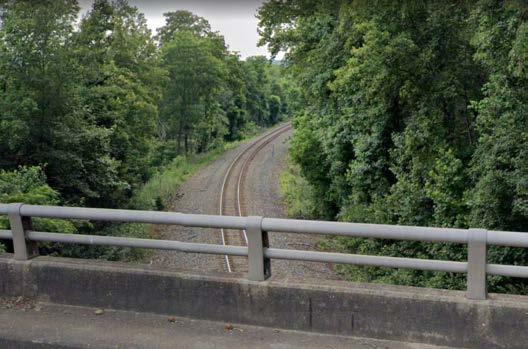
Railroad trestle; possible underpass
Large vacant parcels along Silver Creek
Spacious I-40 underpass along Silver Creek
Large vacant parcels along Silver Creek
Large vacant parcels along Silver Creek
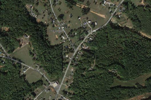
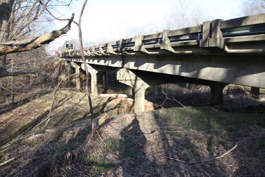
Conley Rd bridge underpass

Large parcels along Silver Creek
Large vacant parcels along Clear Creek
Large low density parcels
Low density residential
Large low density parcels

Riparian area through low density residential parcels
Shared drive onto low density farm
Large low density parcels
Large low density parcels
Large low density parcels
Large low density parcels
HWY 70 crossing
Railroad crossing
Silver Creek crossing
Tight, residential parcelization
I-40 crossing
Residential development
Byrd Rd crossing
Conley Rd crossing
Residential Area
Shared drive onto low density farm
Tight residential area
Tight residential area
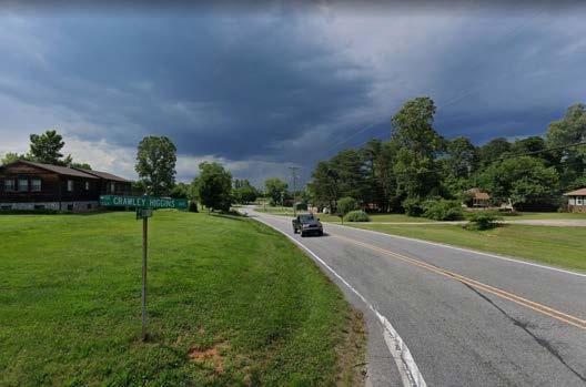
Crawley Higgins Avenue crossing
Residential development on Arthur Mill Rd
Hayes Water Rd crossing
Residential development along Reese Store Ave
Residential development along Conley Rd & Foreman St
CHAPTER 1 21
1 1 2 2 3 3 8 13 4 4 9 14 5 6 7 5 10 15 6 11 16 7 12 17 8 9 10 11 12 13 14 15 16 17 19 18 20
The railroad on the south side of Morganton presents a barrier to trail alignment.
Tighter parcelization and numerous driveways around Conley Rd and Crawley Higgins Rd present a barrier to trail alignment.
Residential development along Conley Rd presents a barrier to trail development.
Large low density parcels near Conley Rd present an ideal environement for natural surface trail development.
Large parcels lining Silver Creek provide an ideal trail alignment environment.
1 6 17 19 5 4
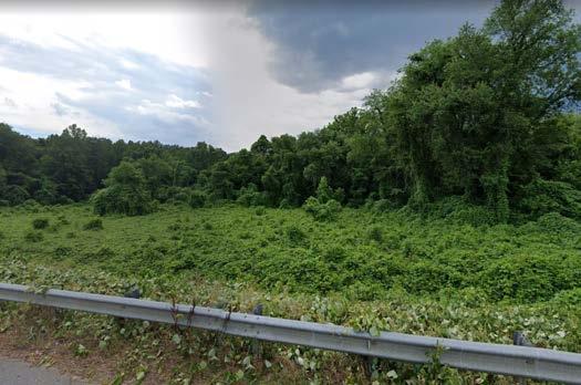
The I-40 bridge over Silver Creek is spacious enough to accomodate trail alignment.



22 MAP 4: STUDY AREA 2 SITE ANALYSIS STUDY AREA 2 SITE ANALYSIS OVNHT and other Recreation Federal; State; Local Government Historic Landmark Site Managed Lands Hydrography Floodzone OVNHT 1 Mile Historic Corridor Existing Trail Constraint Opportunity Proposed Trail LEGEND
STUDY AREA 2 OPPORTUNITIES & CONSTRAINTS
OPPORTUNITIES CONSTRAINTS
Large low density parcels and farms

Large undeveloped parcels
Large undeveloped parcels
Large undeveloped parcels
Large undeveloped parcels
Existing easement access to large parcels on either side of road
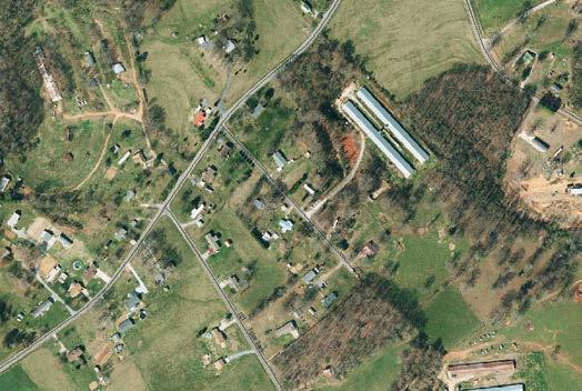
Large undeveloped parcels from here to 226
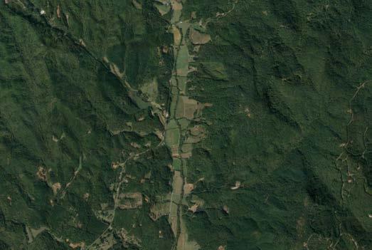
Large vacant or low density parcels here to Cane Creek Mtn. Rd

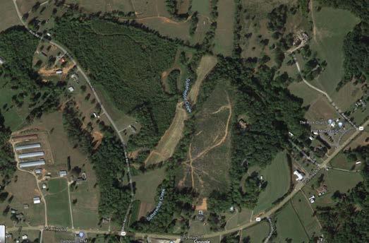
Cane Creek riparian corridor runs south with historic corridor
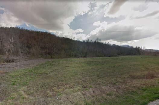
Large low density parcels here to Ed Thompson Rd
Cane Creek riparian corridor continues south through large parcel
Tight residential parcelization along Conley & Holland
HWY 64 crossing and residential development
Rope Hollow Rd crossing
Hall Creek crossing
Bollinger Gap St crossing
HWY 226 crossing
Cane Creek Mtn. Rd crossing Ed Thompson Rd crossing
1
10
Low density farmland provides an opportunity for scenic trail alignment. 1 2 11
Tight residential parcelization near Conley and Holland Rd presents a barrier to trail development.
Cane
HWY 64 presents a saftey crossing challenge due high volumn traffic and high speeds.
A swath of large undeveloped parcels on either side of Cane Creek from Cane Creek Mtn Rd to Ed Thompson Rd presents an opportunity for a scenic trail alignment.
CHAPTER 1 23
1 2 7 2 3 8 3
9
10
6 11
1
4 4
5 5
6
7 8
Creek flows south within and along the historic corridor and HWY 64 presenting an ideal area for trail alignment.


24 MAP 5: STUDY AREA 3 SITE ANALYSIS STUDY AREA 3 SITE ANALYSIS OVNHT and other Recreation Federal; State; Local Government Historic Landmark Site Managed Lands Hydrography Floodzone OVNHT 1 Mile Historic Corridor Existing Trail Constraint Opportunity Proposed Trail LEGEND
STUDY AREA 3 OPPORTUNITIES & CONSTRAINTS
OPPORTUNITIES
Cane Creek riparian corridor continues south through large parcel
Cane Creek riparian corridor continues south through large parcel
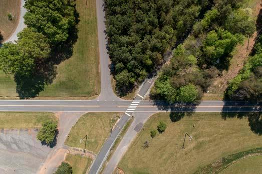

Large vacant parcels

Large low density parcels

Public land and school connection
Large low density agricultural parcel
Large low density parcels along Cathey's Creek
Large vacant parcels
Potentially vacant lot
Existing TBRT access at Rock Rd
CONSTRAINTS
Pearidge Rd crossing

Mackey Freeman Rd crossing
Railroad crossing & Parton Lumber Company
Tight residential development along Hudlow Rd
Hudlow Rd crossing
HWY 64 crossing
Old Gilberttown Rd crossing
Rock Rd crossing Rock Rd
CHAPTER 1 25
1 1 2 2 3 6 3 7 4 4 8 5 5 9 10 6 7 8
An active railroad and Parton Lumber Company present a major barrier to trail development near the Second Broad River. Hwy 64 is a heavily traveled, high speed road that must be crossed in more than one location. The 13 miles of existing Thermal Belt Rail Trail present an opportunity for co-alignmnet and local downtown connectivity.
Mt Vernon-Ruth Elementary School provides an opportunity for a trailhead and educational programs.
3 10 6 5
CHAPTER 2
LANDOWNER ENGAGEMENT


LANDOWNER

The environmental analysis (Chapter 1) was critical for determining physically feasible areas for trail development. However, significant portions of these routes impact private property and require landowner outreach to fully assess trail feasibility. This chapter highlights a good-faith effort to engage landowners throughout the planning process.

THE
ENGAGEMENT
OUTREACH AND
are KEY Components OF THE OVNHT PLANNING PROCESS.
the Landowners Landowner Communications
Workshop Trail Route Re-evaluation
ENGAGEMENT PROCESS Identifying
Landowner


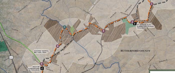
28 ! ! ! ! ! ( ! ! ! ! ! ( ! ! ! ( ! ! ! ! ! ! ! ( ! ! ! ! ! ( ! ! ! ! ! ! ! ( ! ! ! ( ! ! ( ! ! ! ! ! ( ! !( ( ! £ 221 £ ¤ 64 £ ¤ 74 Litchfield 1591 Ridgecrest Reservoir Hill Meridian Teakwood Gantt Peppercorn Oak BarkingLot S parks Brookstone Chisholm Freedom Map lewood Cemetary Simplicity Gold Tree Ransom Spring Champion Fattcatt 1537 Rock Palomino Fernwood Honey Dew Reeve s North MajorFergusonHill EveningShade Broad Kipling Allen Miller Deen Sullivan CandyTurf Cassidy Autumn Heffner 1369 GoldRun Acorn Evergreen Huber Sapphire Kanaan Dolorosa 1598 Long Ridgeway Grace Shelter HudginsLake Baytree RuthSchool Carnegie HealthCare Fashion HollandHollar Shepherds Creek Justice Wilson 1366 Skyview Yelton Fuller Farmington Brown Jennifer Shelley BelAir DeaconsRidge McCandless Woods Dallas Crescent Hickory Deter McKinney 1541 Twitty BallPark Pebblestone Stoneway Dove Oak 1164 NewHope HosannaRidge Cisco Beehive Pasture DorothyGlenn 1383 Fleming Kitten 1366 FlatGap Hannah Hildebrand 1369 Highland Hardin Floyd Green Fashion Chisholm Long Duke Pumkin Patch Primrose Davis ForeverLilys Fernwood Roper Loop Northview-Dorsey White Oak Harley Sassafras Reece Walnut Grove Sleepy Hollow HighPeak WilliamGilbert Worsham Hardy Patriot Dimsdale 1168 SilverplateGrill TurkeyRoost SugarMaple HuntersCove Stagecoach Whispering Youngs Ridgeland MtVernonCemetary Meadow Crossing Pineview York Keeter Cedar Grayson Mountain PadgettBurns Cardinal 1556 Parton Whaley 1554 MountVernonChurch Sherwood Park Goshe n 1197 Fernwood BreezeHill Justice Boykin Sherry Frady Marion US221N Balmy 1367 Thompson Main Bates Washington Shady Woods Church 1625 RoyGoins JohnCLogan 1534 Edwards 1546 Spindale ChimneyRock 1552 McFadden 1592 SilversLake 1555 Jobe Lake Jobes Lake Southern Railroad Shepherds Creek 1598 Long 1522 Rob Long Hunting 1178 MapleCreek 1623 JonesRadiator Indian 1539 Gilberttown 1524 J A Hampton 1614 Airport 1533 ChillyBowl Cougar Janua Coeli 1532 Gilboa Church 1523 OscarJustice 1368 Westbrook 221 1550 Lee BallPark 1535 Broyhill 1531 Aydlotte 1548 1548 Ross 1536 1547 1527 OakSprings 74 1526 GilmerEdwards 221 1520 Rock 1510 Hudlow 64 Rutherford Ruth Spindale Rutherfordton Rutherfordton Cane Creek Case Branch Hollands Creek CleghornCreek Hollands Creek Second Broad River Cherry Creek CatheysCreek Big Camp Creek HollandsCreek Bridge #127 (Gone) Robert J. Norris House GILBERT TOWN HISTORIC DISTRICT George W. Logan House Ruth Elementary School Washington Geer House Commercial Building Alexander House (Gone) Fairview School Hampton-Morgan Weldon Geer House Adam A. Weeks House Rev. James M. Webb House Hardin-Watson House (Gone?) Andrew Logan House (Gone?) James Keeter House Bud Keeter House Koone-Groves House Thomas Jefferson Hampton House J.M. Goode House Twitty-McKinney House Bridge #227 Mitchum-Hensley House Edmond Clarence Geer Farm ¬ 81 ¬ 63 ¬ 82 ¬ 84 ¬ « 67 ¬ « 83 ¬ « 85 ¬ 86 ¬ 58 ¬ « 87 ¬ 87 ¬ 66 ¬ 78 ¬ 65 ¬ 64 ¬ 79 ¬ 73 ¬ 75 ¬ « 72 ¬ 71 ¬ 90 ¬ 76 ¬ 69 ¬ « 89 ¬ « 68 ¬ 80 ¬ « 77 ¬ 74 ¬ « 88 ¬ 70 Rock Rd Redevelopment Area Potential Trailhead Mt Vernon-Ruth Elementary Potential Trailhead OVNHT Morganton to Rutherfordton: Landowner Outreach: South Landowner Outreach OVNHT Historic 1 Mile Corridor ! NC Historical Resources & Schools County Bounds Municiple Bounds ! Dedicated Nature Preserve Conservation Easement Federal Ownership Local Government Ownership Other Protection Existing Fonta Flora State Trail Planned Fonta Flora State Trail Planned Wilderness Gateway Trail Planned Peavine Trail Planned Peavine Trail Alternative Existing Thermal Belt Rail Trail IDENTIFY THE L ANDOWNERS MAP 6: LANDOWNER MAP SAMPLE Feasibility Analysis. Trail alternatives were developed based upon an environmental feasibility analysis. Landowner Database.
mailing database was
that
property owners
trail alignment(s). STEP 1: DETERMINE WHERE THE TRAIL IS FEASIBLE (CHAPTER 1) STEP 2: START A CONVERSATION WITH LANDOWNERS.
A
created
included all
within the preliminary
LANDOWNER COMMUNICATIONS

Video Production. A custom video, specifically produced for landowners, highlighted the story of the Overmountain Victory National Historic Trail and made an appeal for landowner participation.



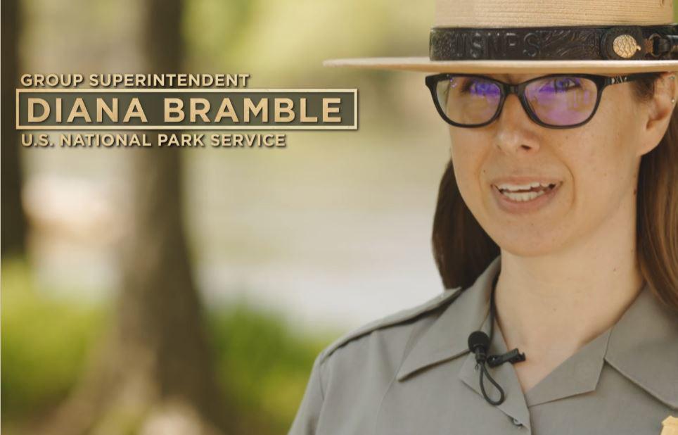

Web Portal. The project website, www.OVTplan.com, provides information about the planning process and features the landowner outreach video.


Landowner Invitation. Formal invitations were sent to all landowners included in the landowner database directing them to the website and requesting their attendance at a special meeting.
LANDOWNER INVITATON

WEB PORTAL


VIDEO PRODUCTION
view the project video.
Participation in establishing this trail connection entirely voluntary, the trail will not be planned or built on private property without the consent of the owner. The trail will either be relocated or not constructed in situations where voluntary participation cannot be established.
You are invited to discuss this project with representatives from the National Park Service and trail planners during one of two special landowner meetings: Tuesday, June 22, 2021 at 6:00 pm Thursday, June 24, 2021 at 6:00 pm Collett Street Recreation Center Woodrow Jones Building 300 Collett Street 146 North Main Street Morganton, NC 28655 Rutherfordton, NC 28139 you plan to attend the meeting, or you cannot attend but would like to discuss the project and your potential interest in providing for the trail on your property, please let us know by using the contact information below. Thank you. On behalf of, Overmountain Victory Trail Planning Committee RSVP Email: info@OVTplan.com Phone: 828.386.1866
CHAPTER 2 29
Dear Landowner The Overmountain Victory Trail Association has partnered with the National Park Service and local government leaders to explore the opportunity to create public trail that will connect Morganton to Rutherfordton, North Carolina. This trail will follow the route traveled by the Overmountain Men as they marched to Kings Mountain, South Carolina; where on October 7, 1780, they secured significant victory for the patriot cause in the American Revolution. Their triumph in this battle considered a turning point that led to the ultimate patriot victory in the American Revolutionary War. The Overmountain Victory National Historic and State Trail preserves this history. The project planning team has been working to identify areas where establishing public trail within the historic corridor would be feasible. The enclosed map identifies the corridor that was evaluated for suitable trail locations. Analysis of the historic route revealed that the trail corridor falls within, or very close to your property, in location where the public trail could potentially be constructed. Please visit the project website, www.OVTplan.com to learn more and
LANDOWNER WORKSHOP

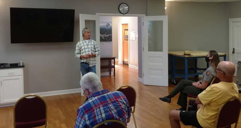
Video Screening. After signing in, the landowner workshop began with a viewing of the custom video.
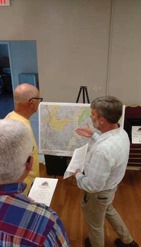
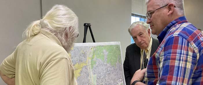
Focus Groups. Various focus groups were set up around the room in which landowners could ask questions about their specific property and the associated trail alignment.
Sentiment Card.
Before landowners left, they were encouraged to fill out a landowner sentiment card describing their level of interest for providing for the trail.


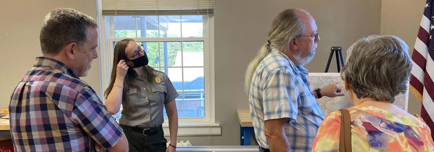
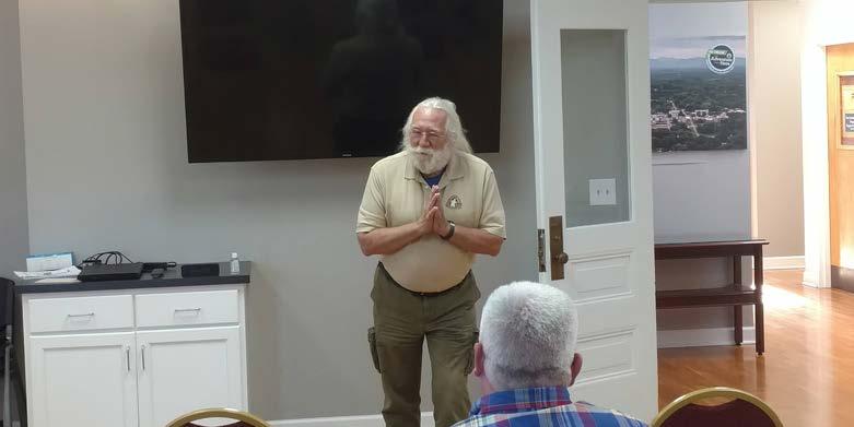
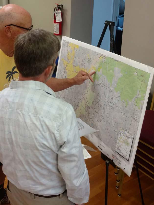
Follow up Contact. DbD staff continued to follow-up with landowners throughout development of the plan document, and adjusted plan recommendations accordingly.
30
Outreach efforts included engaging approximately 7 landowners by phone, email, or in person at the june 22nd AND 24th LANDOWNER WORKSHOPS HELD AT the collett Street recreation center in morganton and the woodrow jones building in rutherfordton.


CHAPTER 2 31
TRAIL ROUTE RE-EV ALUATION
Revise Trail Alignments. “Landowner Sentiment” was helpful in determining the preferred alignment and is included as a component of the final map series (Chapter 4).


A COMBINATION OF FACTORS INCLUDING THE NATURAL ENVIRONMENT, THE BUILT ENVIRONMENT, AND LANDOWNER SENTIMENT WERE USED TO DETERMINE THE PREFERRED TRAIL ALIGNMENT (CHAPTER 4).
32
MAP
SENTIMENT
7: LANDOWNER
CHAPTER 3
TRAIL CHARACTER & DESIGN GUIDELINES
PROVIDES DESIGN DETAILS FOR VARIOUS TRAIL TYPES and SIGNAGE, AND ALSO OFFERS INSIGHTS FOR INCORPORATING SOCIAL MEDIA.
THIS CHAPTER
Between Morganton and Rutherfordton exists a diverse natural and built environment. Specific trail types must be applied throughout the corridor to ensure minimal maintenance and the best user experience.
This Chapter defines four trail types and describes their tread features and general specifications for construction.
A specific theme is presented for signage, wayfinding, and trail support facilities. Previous OVNHT Master Plans recommend identical trail branding to provide uniformity and recognition throughout the trail corridor.
IN THIS CHAPTER
A. Trail Types
B. Signage and Wayfinding
C. Social Media Marketing

TRAIL TYPES
Four primary trail types are proposed along the preferred alignment. A specific trail type is proposed according to its surrounding environment, location in a rural or urban area, and the opportunity to create a meaningful and unique user experience.
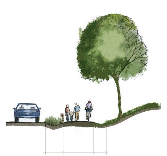
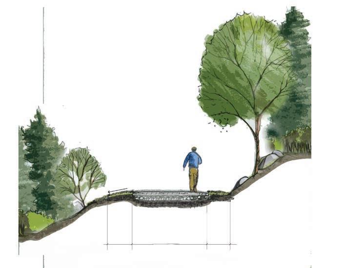


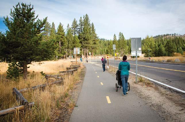
DOT SIDE PATH
8’ PAVED ASPHALT
User Group: Multi-use
Material: Paved Asphalt

Preferred Width: 8’

Average Construction Cost: $120/ln. ft.
Preferred Easement Width: 25’
Minimum Easement Width: 25’
*Note: Trail to be approved in accordance with NCDOT and County DOT encroachment agreements.
TYPICAL GREENWAY

10’ PAVED ASPHALT
User Group: Multi-use
Material: Paved Asphalt
Preferred Width: 10’
Average Construction Cost: $90/ln. ft.
Preferred Easement Width: 50’
Minimum Easement Width: 20’
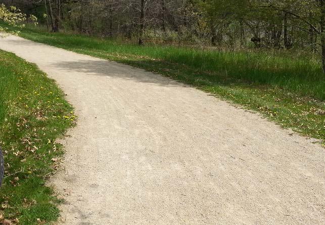
DUAL-USE PATH

8’ CRUSHED GRAVEL FINES
User Group: Hikers and Equestrians/Cyclists
Material: Crushed Gravel Fines
Preferred Width: 8’
Average Construction Cost: $60/ln. ft.
Preferred Easement Width: 50’
Minimum Easement Width: 10’
34
30’ PREFERRED BUFFER TO RIVER TO PROTECT WATER QUALITY 10’ PAVED ASPHALT MILE MARKER FENCING TO MARK PRIVATE PROPERTY BOUNDARY
SURFACE
CRUSHED GRAVEL FINES
6
TRAIL CHARACTER PRECEDENTS


Natural surface trails will be located primarily in forested natual areas with topographical challenges. These trails will provide a more primitive experience for the user, and create trail connections at a lower overall cost.

DOT sidepaths will be used in areas where the trail alignment is located within the DOT right-of-way. These paths are typically multiuse asphalt trails.
Typical
A dual-use path is surfaced with crushed gravel fines and used in overland and riparian corridors that will sustain light to moderate use. This trail type will support hiker, biker, and equestrian use.


CHAPTER 3 35 3 NATURAL SURFACE 3-6’ NATURAL TREAD User Group:
and
Material: Native Soil
Width: 3’ - 6'
Construction Cost: $10/ln. ft.
Easement Width: 25’
Easement Width: 10’
Hikers
Mountain Bikers
Preferred
Average
Preferred
Minimum
The OVNHT will provide a linear trail system of different walking, biking, and equestrian trail types that link key community and historical assets along the trail's historic corridor.
greenways will be located in overland and riparian corridors that sustain moderate to heavy use by hikers and bikers.
Photo by others
Photo by others
Photo by others
Photo by others
SIGNAGE AND WAYFINDING
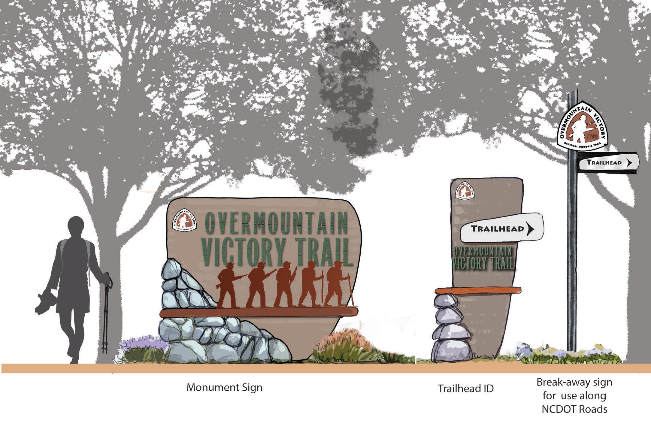
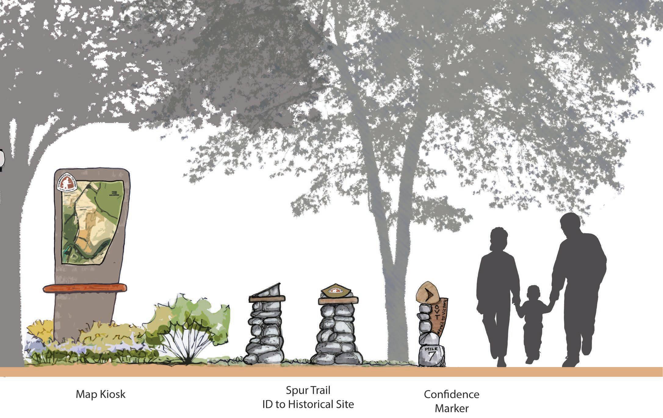
The OVNHT signage family provides for a modern-rustic theme and incorporates materials consisting of metal, rock, and concrete. The signage family serves as a template and can be altered and refined depending on local preferences and specific site needs. Signage marking the physical trail is required to include the official OVNHT logo of the NPS.

36
for use
Monument Sign Trailhead IDBreak-away sign
along DOT roads

CHAPTER 3 37
SOCIAL MEDIA: THE NEW WORD OF MOUTH


Trail users should be encouraged to utilize social media to share their experiences with their friends and “followers”. Special signage along the trail will signal users to consider posting pictures of themselves or their friend groups as they walk or ride bikes along the trail. In addition, special photo opportunities and features should be developed during the final design phase. After all, who better to market this destination-quality trail than the users themselves? Take advantage of social media – the new word of mouth.
#TRAIL2VICTORY
The proposed official hashtag for the OVNHT is #trail2victory. The use of this hashtag will allow local tourism leaders to curate local photography and content that can be shared on websites and re-posted through other social media platforms.

#FINDYOURPARK
“Find your park” is the official centennial campaign of the National Park Service. The NPS is encouraging national park enthusiasts to use the hashtag #findyourpark when posting to social media. The OVNHT can help continue this campaign for years to come by encouraging the use of this hashtag at unique locations along the trail.
“FIND YOUR PARK” IS THE OFFICIAL CENTENNIAL CAMPAIGN OF THE NATIONAL PARK SERVICE. THE NPS IS ENCOURAGING NATIONAL PARK ENTHUSIASTS TO USE THE HASHTAG #FINDYOURPARK WHEN POSTING TO SOCIAL MEDIA.
38
TRAIL USERS SHOULD BE ENCOURAGED TO UTILIZE SOCIAL MEDIA TO SHARE THEIR EXPERIENCES WITH THEIR FRIENDS AND “FOLLOWERS”.
101 likes dbdplanning great day on the #trail2victory at the Bradley Nature Preserve! # ndyourpark #polkcounty #wnc
Polk County, NC
EXHIBIT 2: SOCIAL MEDIA: THE NEW WORD OF MOUTH
CHAPTER 4
RECOMMENDATIONS

THIS CHAPTER SERVES AS THE HEART OF THE morganton to rutherfordton OVNHT MASTER PLAN.
IN THIS CHAPTER
A. Overview of Planning Section Maps B. Planning Section Descriptions
PLANNING SECTIONS


planning s ections
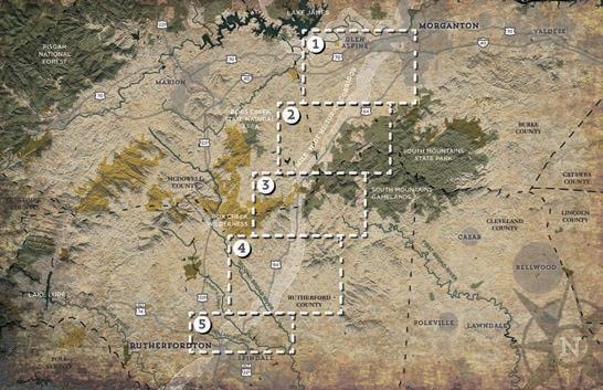
t he 29- mile study area from m organton to r utherfordton is divided into five (5) planning sections . t he geographic extent of each section includes a beginning and ending terminus that features a key asset or significant connectivity point for the trail . e ach planning section includes project areas that can be developed independently over time , providing a logical method for implementation as landowner willingness , funding , and other opportunities arise .
40
MAP 8: PLANNING SECTIONS OVERVIEW
The study area from morganton to rutherfordton is divided into Five (5) planning sections; this chapter is organized accordingly.
ABOUT THE PLANNING SECTION MAPS




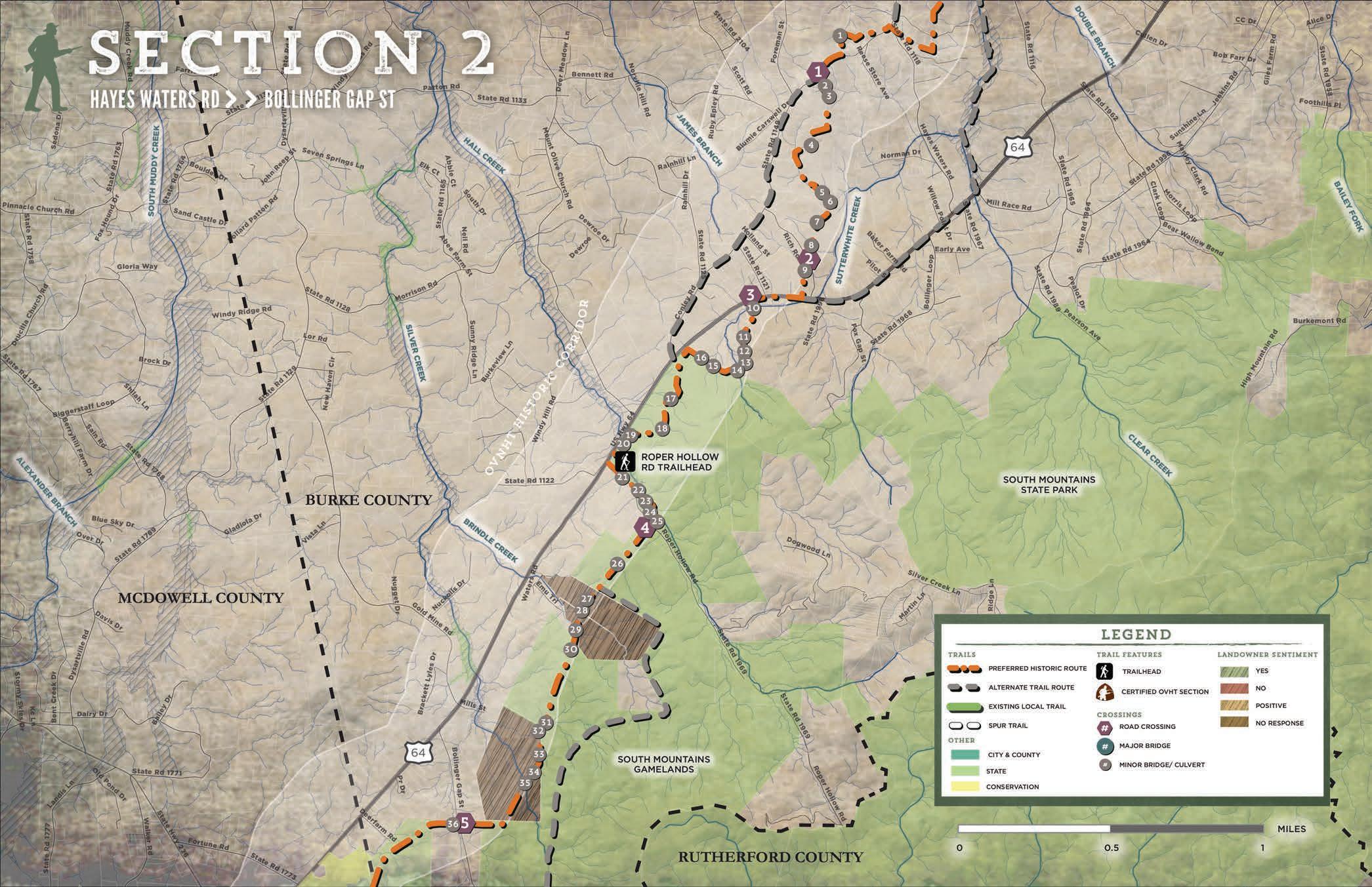
Each planning section is anchored by a map that highlights proposed trail routes, trail features, and landowner sentiment. The proposed routes are identified as either preferred-historic, alternate, or existing local. These trail alignments are the result of extensive analysis, including environmental feasibility, landowner willingness, and insights provided by the National Park Service, local government and local trail-development leaders.
The National Trails System Act states that “a designated trail should generally accurately follow the historic route, but may deviate somewhat on occasion of necessity to avoid difficult routing through subsequent development, or to provide route variations offering a more pleasurable recreational experience.”
In accordance with this directive, the trail is planned as close as possible and practicable within the one-mile Historic Corridor. Where trail construction is not feasible within the Historic Corridor, the NPS may recognize routes outside the corridor as preferred alignments. Such routes are planned for the greatest public benefit and enjoyment, as well as to promote tourism, economic development and rural prosperity.
The NPS refers to routes outside the Historic Corridor as alternate routes to the historic route. In some locations, the preferred routes identified in this chapter are located outside of the Historic Corridor. Such routes can be marked and signed the same as routes within the Historic Corridor, but must provide on-site interpretation that indicates the known historic trail location and provides justification for construction of the trail outside of the Historic Corridor.
Noted trail features include the physical infrastructure and facilities that support the proposed trail. These features are highlighted along the preferred routes and provide critical information for developing an estimate of probable cost for each section. These features include trailheads and crossings associated with either a road or water feature. Trailheads will provide for parking and trail user orientation. Road crossings indicate the need to provide for traffic calming measures and appropriate signage for both trail users and motorists. Major bridges indicate a significant stream or river crossing that requires a bridge greater than 20 feet in length. A minor bridge/ culvert demonstrates the need to cross a relatively small stream; at this broad level of planning, it remains uncertain whether a small bridge or culvert is necessary.
QUICK FACTS
Each planning section begins with a “quick facts” exhibit. This information includes the trail distance, trail type, and key features and assets associated with each section. Also, an estimate of probable cost is noted; see the appendix for further details. Reported numbers for length and cost include all preferred routes in the planning section.
CHAPTER 4 41
EACH PLANNING SECTION IS ANCHORED BY A MAP THAT HIGHLIGHTS PROPOSED TRAIL ROUTES, TRAIL FEATURES, AND LANDOWNER SENTIMENT. i BY THE NUMBERS MORGANTON >> RUTHERFORDTON 5National Trails System Act, Section 5(b), Part 11(a). The NTSA provides regulations for the management of National Historic Trails. VICINITY MAP EXISTING TRAIL: 0.7 MILES PROPOSED TRAIL: 7.5 MILES TRAIL TYPE: MULITI-USE PATH NATURAL SURFACE ESTIMATED COST: $ 1,886,850 POINTS OF INTEREST: CATAWBA RIVER SOCCER COMPLEX SHUEY PARK CATAWBA RIVER GREENWAY CATAWBA RIVER SOCCER COMPLEX 1.6 >> EXISTING TRAIL MILES 34.8 >> PROPOSED TRAIL MILES 6 >> TRAILHEADS 20 >> ROAD CROSSINGS 7 >> MAJOR BRIDGES 110 >> MINOR BRIDGES/CULVERTS $8,533,060 >> APPROXIMA TE COST HAYES WATERS RD
SECTION 1 PROPOSED TRAILS


The preferred historic route in Section 1 extends for approximately 8.2 miles from the Catawba River Soccer Complex to Hayes Waters Rd. From the Catawba River Soccer Complex, the route extends south on 0.7 miles of existing greenway to the HWY 70 underpass. A spur trail traverses east to connect the trail with Shuey Park. From the underpass the primary trail continues southwest as a dual-use path along Silver Creek, passes under Interstate 40, and then splits from Silver Creek and follows Clear Creek south.
An alternative route continues southwest along Silver Creek. This alignment splits into two possible routes that attempt to navigate the private land around the area of Conley Rd. and Jeeter Carswell Rd. before returning to the preferred historic route at Hayes Waters Rd.
Another alternative route to the southeast continues outside the historic corridor following Clear Creek towards HWY 64 and South Mountains State Park into section 2.
TRAIL FEATURES
This planning section includes one (1) trailhead, two (2) major bridges, twenty-one (21) minor bridges/culverts, and three (3) road crossings.
TRAILHEADS
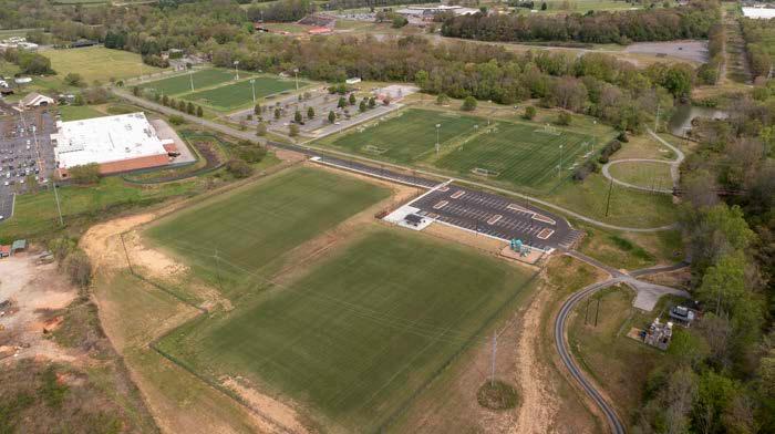
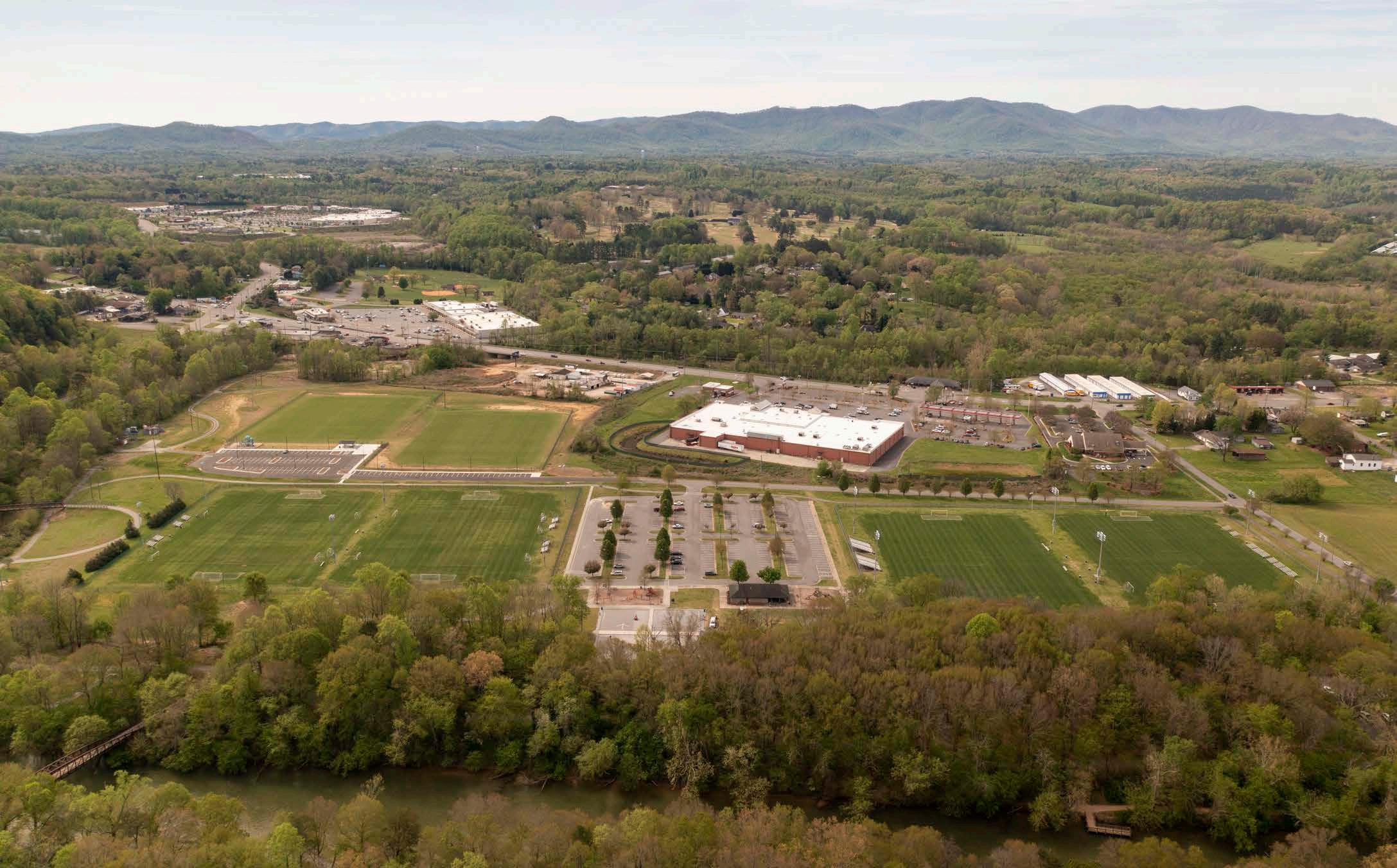
The northern terminus of this planning section is located at the Catawba River Soccer Complex. Ample parking and an existing greenway connection to the HWY 70 underpass make this an ideal launching pad for the section. This trailhead also provides a connection to the Catawba River Greenway and Fonta Flora State Trail.


CROSSINGS
This planning section includes two (2) major bridges and twenty-one (21) minor bridges/culverts. The first major bridge crosses Silver Creek to align the trail on its eastern side. The second major bridge crosses Clear Creek allowing the trail to continue west towards Hayes Water Rd.
Planning section 1 also includes twenty-one (21) minor bridges and culverts throughout that may be necessary to route the trail over the many smaller creeks and drainages feeding into Silver and Clear Creeks.
This planning section includes three (3) road crossings. Crossing #1 passes over Byrd Road as the trail heads south along Clear Creek. Crossing #2 passes over Jeeter Carswell Rd as it winds through larger parcels near a residential neighborhood. Crossing #3 passes over Conley Rd, allowing the trail to pass through larger parcels on the west side of Conley Rd instead of tighter residential parcels located on the east side.
42
EXISTING TRAIL: 0.7 MILES PROPOSED TRAIL: 7.5 MILES TRAIL TYPE: MULTI-USE PATH NATURAL SURFACE ESTIMATED COST: $1,886,850 POINTS OF INTEREST: CATAWBA RIVER SOCCER COMPLEX SHUEY PARK CATAWBA RIVER GREENWAY
MAP CATAWBA RIVER SOCCER COMPLEX HAYES WATERS RD 01
VICINITY
PHOTOS: (1) Existing parking and greenway at the Catawba River Soccer Complex.


CHAPTER 4 43 MAP 9: PLANNING SECTION 1

LOOP TRAIL CATAWBA RIVER SOCCER COMPLEX
PARK US70CARBONCITYROAD HWY 70 UNDERPASS EXHIBIT 3: HWY 70 UNDERPASS
DOWNTOWN
MORGANTON SHUEY
The OVNHT will leave the Catawba River Soccer Complex and head south under HWY 70. On the south side of HWY 70 the OVNHT will continue along Silver Creek, and a spur trail will cross Silver Creek to provide a connection to Shuey Park.
CATAWBA RIVER SOCCER
COMPLEX TRAIL NEXUS
The Catawba River Soccer Complex serves as a nexus for the local Catawba River Greenway system, the Fonta Flora State Trail, and the Overmountain Victory National Historic trail. This nexus will connect Freedom High School and existing sports facilities to a regional trail network and serve as an ideal northern terminus for this segment of the OVNHT.
OVNHT/FFST SHARED ALIGNMENT

CHAPTER 4 45 EXHIBIT 4: CATAWBA RIVER SOCCER COMPLEX TRAIL NEXUS
OVNHT south towards rutherfordton
PROPOSED TRAILS

The preferred route in Section 2 extends for approximately 7.8 miles from the crossing at the intersection of Hayes Waters Rd. and Conley Rd. to Bollinger Gap St. The natural surface trail heads southwest briefly before crossing Conley Rd once again. The trail continues south overland until it reaches HWY 64. After crossing the highway, the trail winds south further, entering the western edge of South Mountains State Park, and connecting to the proposed Roper Hollow Rd. trailhead. From here the trail continues south through the South Mountains Game Lands and 3 large private parcels before reaching Bollinger Gap St.
Two alternative trail routes are proposed within this planning section. From Conley Rd, one route follows alongside Conley Rd. until reaching HWY 64 and South Mountains State Park. The other alternative trail route begins just south of Roper Hollow Rd. and remains on the South Mountains Game Lands. However, this route would take the trail outside the historic corridor.
Additionally, an alternative route that continues from Section 1 brings the trail south along Clear Creek until it reaches HWY 64. From here the trail follows the highway southwest until it returns to the preferred route. This alternative would require the trail to leave the historic corridor, but could help avoid a complicated area of road crossings and private landowners while utilizing DOT right-of-way.
TRAIL FEATURES

This planning section includes one (1) trailhead, no major bridges, thirty-six (36) minor bridges/culverts, and five (5) road crossings

TRAILHEADS
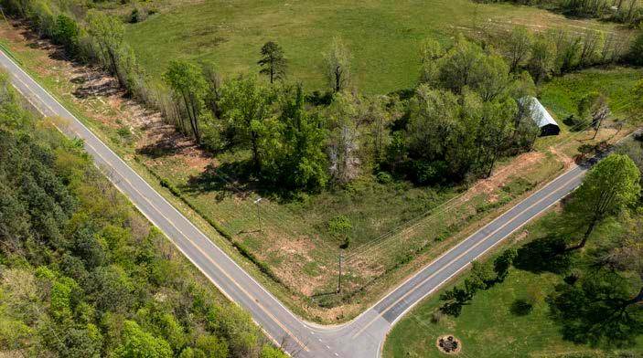
The proposed Roper Hollow Rd. trailhead allows visitors to access South Mountains State Park lands and South Mountains Gamelands via the OVNHT and the Wilderness Gateway State Trail (WGST). Equestrian use will be permitted on the WGST as it leads east from this proposed trailhead, but currently is not planned for the OVNHT in this section. However, it would be ideal for equestrian use to be permitted from Roper Hollow Rd to the joint OVNHT/WGST trailhead loacted in Section 3.
CROSSINGS

The preferred route requires thirty-six (36) minor bridges/ culverts in this planning section. The trail in this section typically runs perpendicular to drainages from the surrounding hills and mountains, and as a result encounters numerous small tributaries to Silver Creek and Clear Creek.
Five (5) road crossings are located within this planning section. Crossing #1 is located at Conley Rd. Crossing #2 is located at Rich Rd. just north of HWY 64. From here the trail will follow HWY 64 briefly before crossing it to continue south (Crossing #3). Crossing # 4 is located on Roper Hollow Rd. as the trail turns east and then south to access the South Mountains Gamelands. Crossing #5 is located at Bollinger Gap St where the trail turns west briefly in order to remain in the historic corridor before turning southwest in Section 3.
46
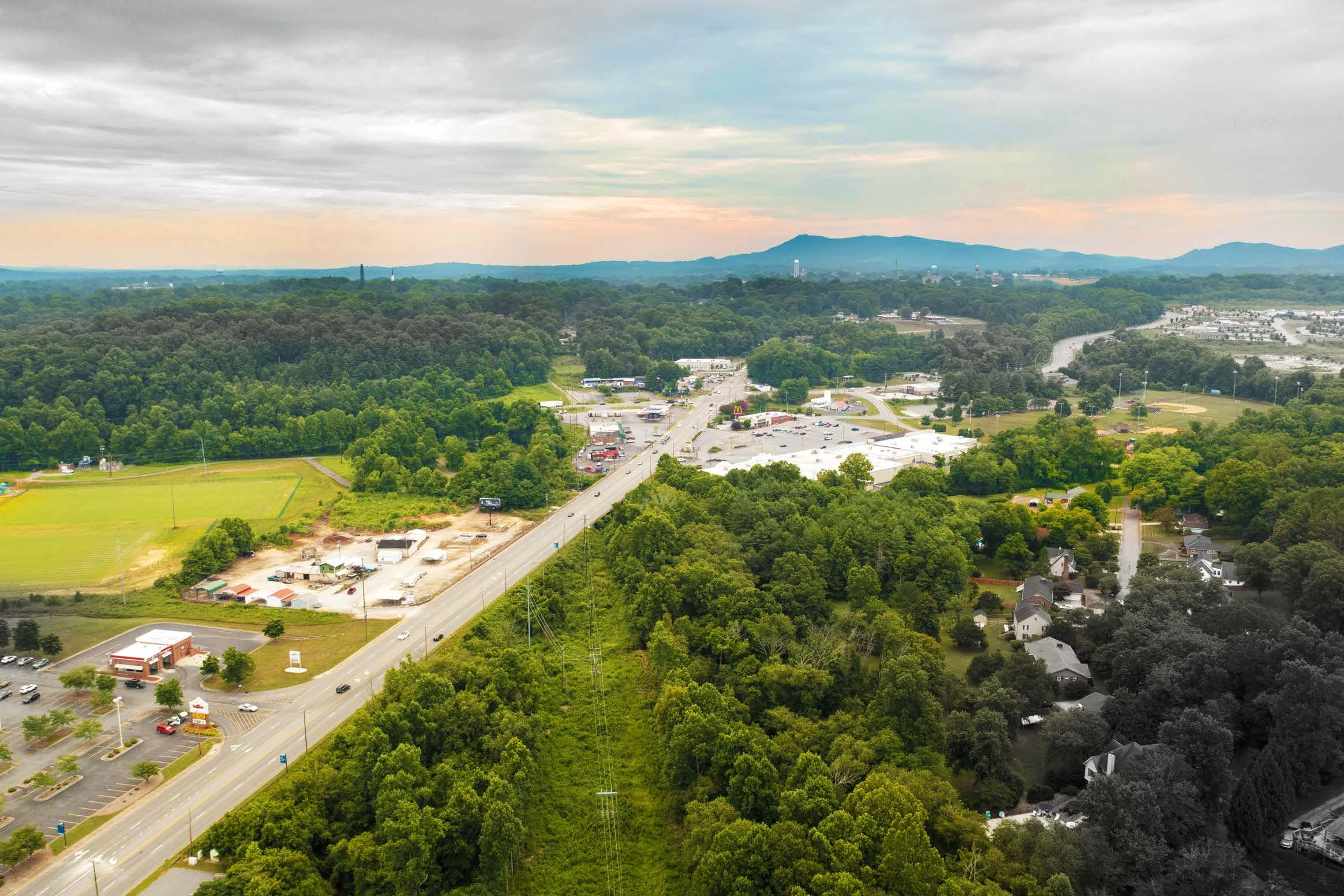
01 BOLLINGER GAP ST HAYES WATERS RD VICINITY MAP SECTION 2 EXISTING TRAIL: 0 MILES PROPOSED TRAIL: 7.8 MILES TRAIL TYPE: NATURAL SURFACE ESTIMATED COST: $1,531,840 POINTS OF INTEREST: SOUTH MOUNTAINS STATE PARK SOUTH MOUNTAINS GAMELANDS ROPER HOLLOW RD TRAILHE AD PHOTOS: (1) Existing conditions at the proposed trailhead site on Roper Hollow Rd.

CHAPTER 4 47 MAP 10: PLANNING SECTION 2


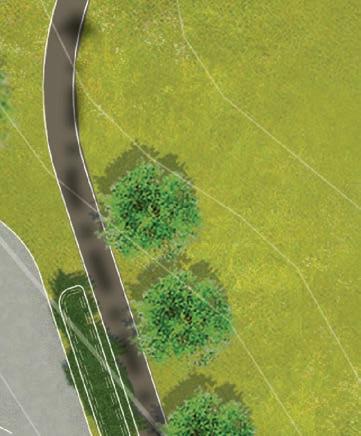
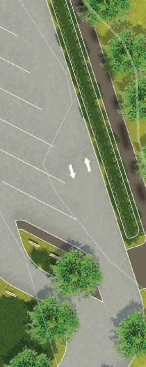
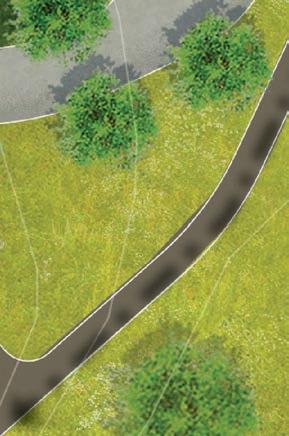




48 entry sign DIRECTIONAL sign 24 typical parking spaces 12 Optional Gravel Spaces 2 ada parking spaces 8 pull through equestrian parking spaces 2 parallel equestrian parking spaces connection to restroom and hitches bioretention bioretention kiosk restroom kiosk us-64 roperhollowroad overmountain victory trail N 02550 1=50'
he proposed trailhead on Roper Hollow Rd will serve both hikers and equestrians with parking and restrooms. While horses will not be allowed on this section of the OVNHT, riders can access South Mountains State Park via the Wilderness Gateway State Trail to the east. ROPER HOLLOW RD TRAILHEAD EXHIBIT 5: ROPER HOLLOW RD TRAILHEAD
T
SOUTH MOUNTAINS STATE PARK & GAME LANDS

The South Mountains State Park and Game Lands is a 40,000 acre area of state land that serves as a major recreation destination for Burke, McDowell, Rutherford, and Cleveland Counties. The northern half of the area is designated as a State Park featuring hiking and equestrian trails, waterfalls, camping, and restroom facilities. The southern half of the area is managed by the NC Wildlife Resources Commission and is primarily used for hunting.
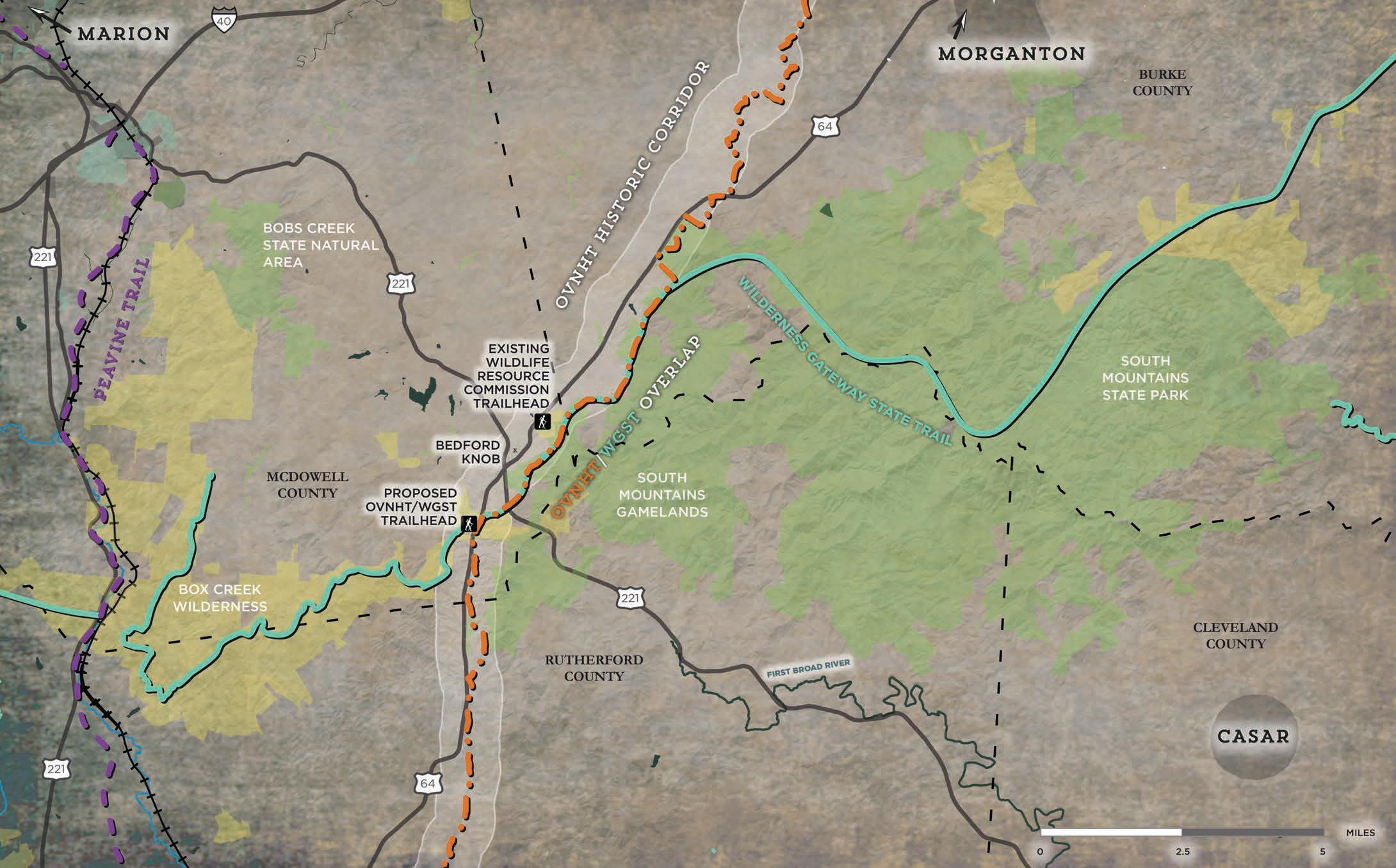
CHAPTER 4 49
MAP 11: SOUTH MOUNTAINS STATE PARK & GAMELANDS
VICINITY MAP


BOLLINGER GAP ST
CANE CREEK MOUNTAIN RD
PROPOSED TRAILS
The preferred route in Section 3 extends for approximately 6.2 miles from Bollinger Gap St. to Cane Creek Mountain Rd. From Bollinger Gap St. the trail continues southwest as a natural surface path that re-enters the South Mountains Gamelands, and passes near an existing NC Wildlife Resources Commission trailhead. Eventually, the trail crosses HWY 226 and turns west towards Cane Creek. Shortly after joining the creek, the trail will briefly share an alignment with the WGST and connect to a proposed site on privately conserved lands that will serve as a joint trailhead for the OVNHT and the WGST. From here the trail will turn south and continue through private land within the Cane Creek riparian corridor until it reaches Cane Creek Mountain Rd.
Three alternative routes are proposed in theis planning section. The first continues south from Section 2 through the game lands, and outside of the historic corridor, until it nears Cane Creek Mountain Rd, where it rejoins the preferred alignment and re-enters the historic corridor. The second alternate route takes the trail east of Cane Creek to avoid houses and farm buildings near a segment of Cane Creek located just south of the proposed joint trailhead trailhead. The third alternate route aligns the trail along Cane Creek just north of Cane Creek Mountain Rd. The riparian corridor alignment would be preferred, but based on landowner feedback in this area the preferred route is proposed to pass east of Cane Creek near the game lands boundary.
TRAIL FEATURES
This planning section includes two (2) trailheads, two (2) major bridges, thirty-three (33) minor bridges/culverts, and two (2) road crossings.
Trailheads
There are two (2) trailheads in this section. The first is an existing NC Wildlife Resources Commission trailhead that could connect to the OVNHT with a short spur trail. Additional facilities are not proposed here due to the proximity of a second proposed trailhead that will include liimited amenities. This second trailhead is located on HWY 64 and will share parking and kiosk information for both the Wilderness Gateway State Trail and the OVNHT. The trailhead is located on privately conserved land between the South Mountains Game Lands and Box Creek Wilderness.
Crossings

The preferred route will require thirty-three (33) minor bridges/ culverts in this section. This section, like Section 2, runs perpendicular to drainages coming from the South Mountains range and as a result the trail will cross numerous small creeks and streams.

Two (2) major bridges will be required in this section. Both bridges will cross Cane Creek near the OVNHT/WGST shared trailhead, and will allow the trail to pass through areas more ideal for trail development while avoiding private residences.
Two (2) significant road crossings are located in this planning section. The first is HWY 226, north of the OVNHT/WGST shared trailhead. The second is at the terminus of the planning section on Cane Creek Mountain Road.
SECTION 3 EXISTING TRAIL: 0 MILE PROPOSED TRAIL: 6.2 MILES TRAIL TYPE: NATURAL SURFACE ESTIMATED COST: $1,497,360 POINTS OF INTEREST: SOUTH MOUNTAINS STATE PARK WILDLIFE RESOURCE COMMISSION TRAILHE AD CANE CREEK SKIRMISH SITE SOUTH MOUNTAINS GAMELANDS OVNHT/WGST TRAILHE AD 01
PHOTOS: (1) The existing conditions at the proposed shared WGST/OVNHT trailhead site on HWY 64.

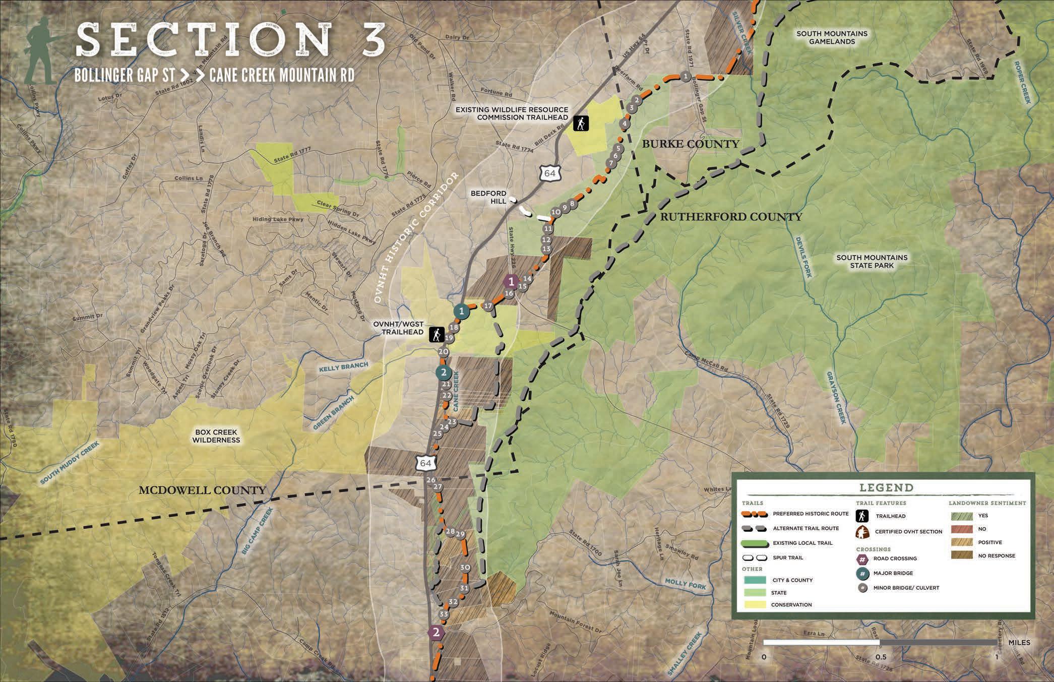
CHAPTER 4 51 MAP 12: PLANNING SECTION 3

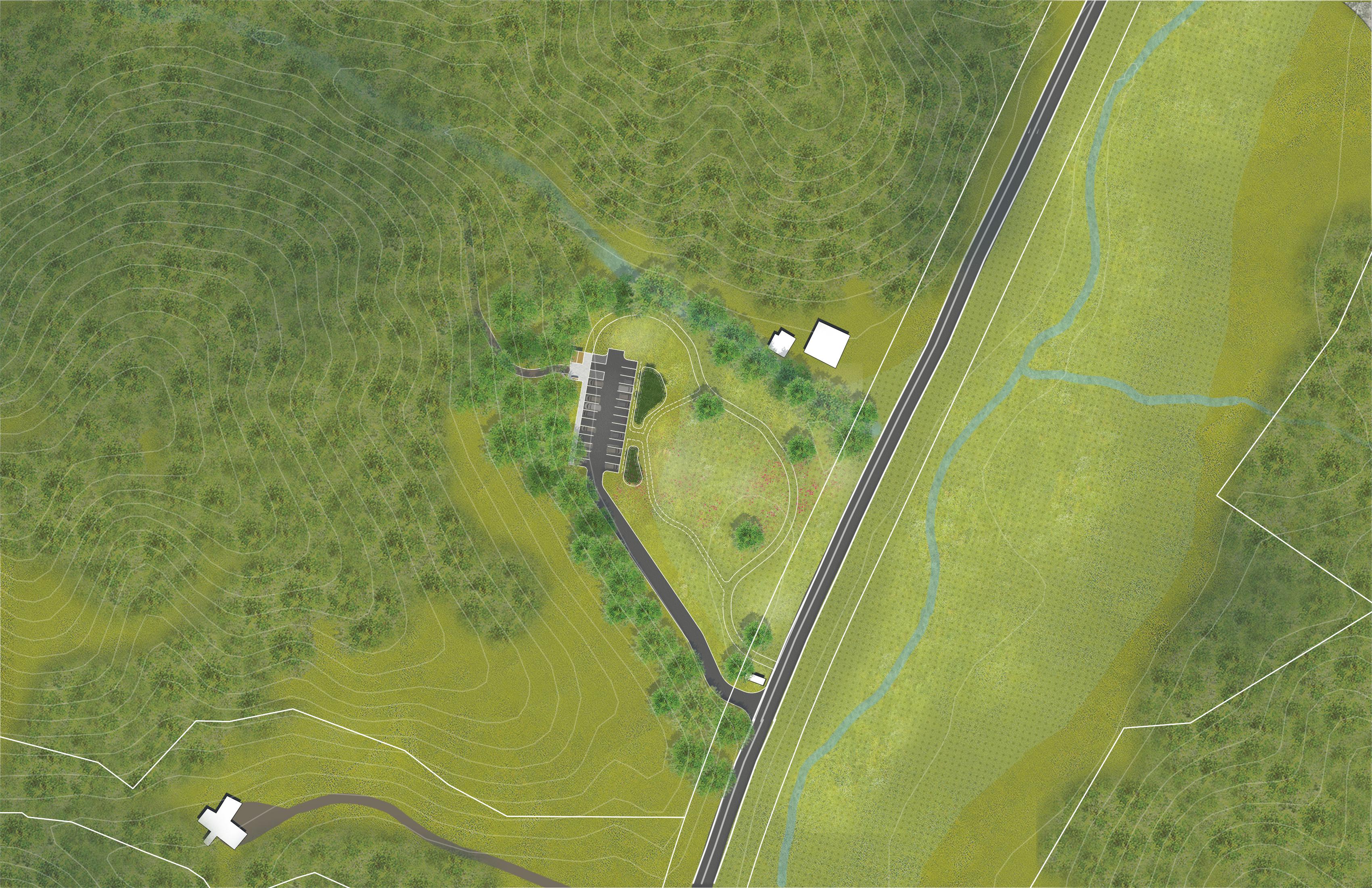
RESTROOM AND KIOSK floodplain entry sign 24 typical parking spots 2 ada parking spots mowed grass loop through meadow us-64 canecreek wilderness gateway state trail wilderness gateway state trail overmountain victory trail kellybranch N 03060 1"=60'
will share
trailhead
HWY
WGST & OVNHT SHARED TRAILHEAD EXHIBIT 6: WGST & OVNHT SHARED TRAILHEAD
The Wilderness Gateway Trail and the OVNHT
a
along US
64 near the site of the Cane Creek Skirmish. The site will include restrooms, an informational kiosk, and an entry sign that will raise awareness for the trail. Due to deed restrictions, trailhead development will require approval by the US Fish and Wildlife Service.
CANE CREEK SKIRMISH

The site of the skirmish along Cane Creek is believed to be in the area near the proposed OVNHT/WGST trailhead. This small battle, and the Torie victory here, is believed to have had a partial influence over Major Patrick Ferguson's decision to issue his infamous warning to the settlers of the area. This warning would serve as a rallying call for the militia. Within three weeks of the battle at Cane Creek 1,400 militia mustered and camped near this site on their way to Kings Mountain. The above map depicts the area of the Cane Creek Provisional Study Area. (Source:KennethRobinson-Archaeologicaland Historic Services-Prepared for Foothills Conservancy of North Carolina)
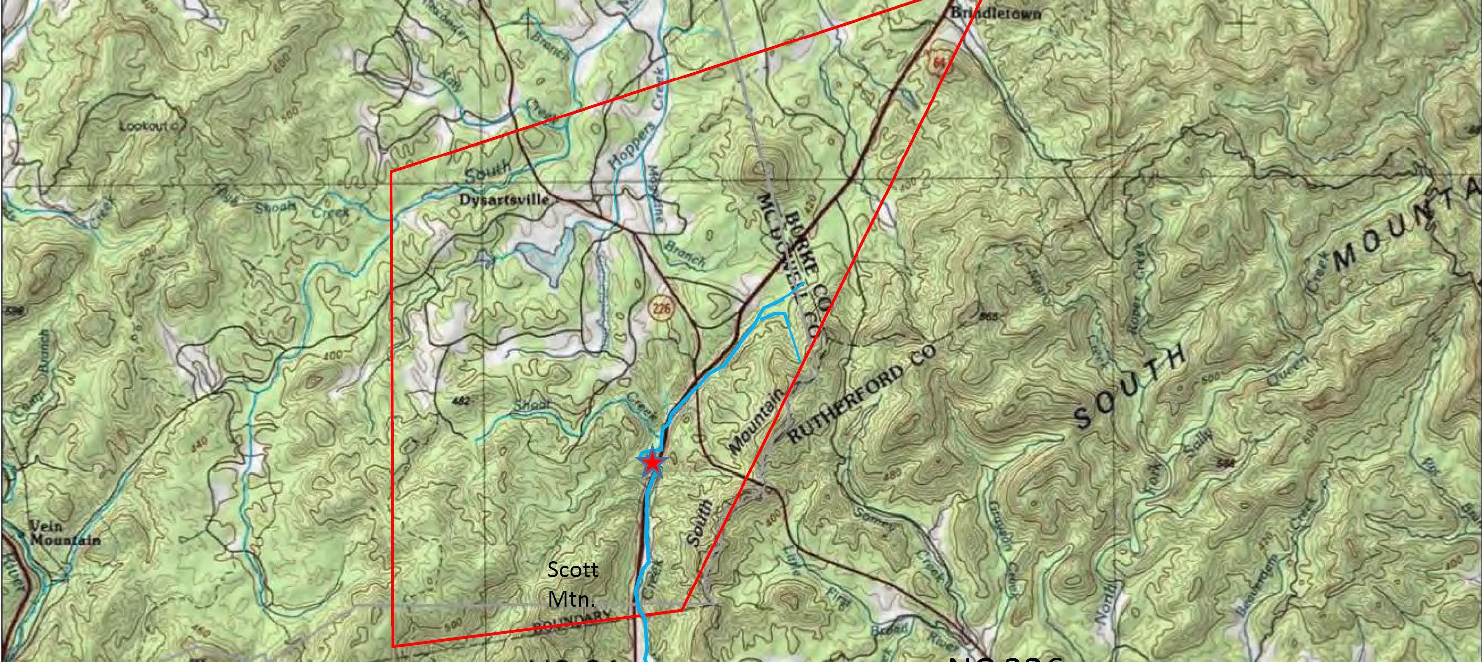
CHAPTER 4 53
QUICK FACTS: Location: McDowell County, NC Date of Skirmish: September 12, 1780 nature Feature:
EXHIBIT 7: CANE CREEK SKIRMISH
VICINITY MAP


PROPOSED TRAILS
The preferred route in Section 4 extends for 7.8 miles from Cane Creek Mountain Rd. to the Second Broad River. From Cane Creek Mountain Rd. the trail continues south, as a natural surface trail, along the Cane Creek riparian corridor through private land. As the trail approaches the Second Broad River, it turns west to join HWY 64. The trail continues south as a DOT sidepath to take advantage of the bridges that cross the Second Broad River and the railroad.
There is one alternative trail route and two spur trails in this section. The alternatve trail alignment is located near the end of the planning section. This route offers an alternative crossing of the Second Broad River. This trail alignment would require a major bridge over the river and a crossing of the railroad that parallels the river.
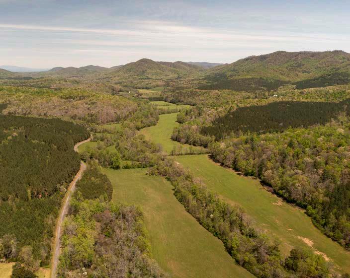


One proposed spur trail takes visitors northwest from the main alignment through private land and along Pearidge Rd. to connnect to the cemetery at Brittain Presbyterian Church. The other proposed spur trail offers a connection to Camp Bud Shiele which is managed by the Boy Scouts of America.
TRAIL FEATURES

This planning section includes two (2) major bridges and three (3) road crossings, and fourteen (14) minor bridges/culverts.
CROSSINGS
Two (2) major bridges may be required in this section to cross Cane Creek. Both may be optional if the trail is aligned on the west side of Cane Creek after passing south of Ed Thompson Rd. In fact, the three road crossings within this section offer a way to cross Cane Creek, so the inclusion of major bridge crossings may be avoidable depending on the willingness of landowners on the west side of Cane Creek.
There are 14 minor bridges/culverts identified in this section. This number may also vary depending on which side of Cane Creek the trail is aligned.
There are three (3) road crossings in this section. The first crosses Ed Thompson Rd, the second crosses Pearidge Rd, and the third crosses Mackey Freeman Rd.
54
SECTION 4 SECOND BROAD RIVER CANE CREEK MOUNTAIN RD EXISTING TRAIL: 0 MILES PROPOSED TRAIL: 7.8 MILES TRAIL TYPE: NATURAL SURFACE DO T SIDEPATH ESTIMATED COST: $1,088,200 POINTS OF INTEREST: CANE CREEK BRIT TAIN PRESBYTERIAN CHURCH & CEMETARY SECOND BROAD RIVER CAMP BUD SHIELE 01 02 PHOTOS: (1) A stretch of rural land along Cane Creek and HWY 64 provides a scenic experience for trail visitors. (2) Consecutive bridges on HWY 64 cross both the Second Broad River and the railroad that parallels it.


CHAPTER 4 55 MAP 13: PLANNING SECTION 4
BRITTAIN PRESBYTERIAN CHURCH & CEMETERY
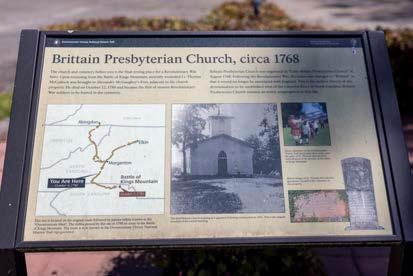

Brittain Presbyterian Church is an important historical site for the OVNHT. After the Battle of Kings Mountain, Lt. Thomas McCulloch was brought, wounded, to the adjancent fort (no longer standing) where he died of his wounds. He and several other Revolutionary War militia men are buried in the church cemetery.

56
EXHIBIT 8: BRITTAIN PRESBYTERIAN CHURCH & CEMETERY
BRITTAIN

PRESBYTERIAN
CHURCH CONNECTION
Given
trail is recommended along
this significant site.
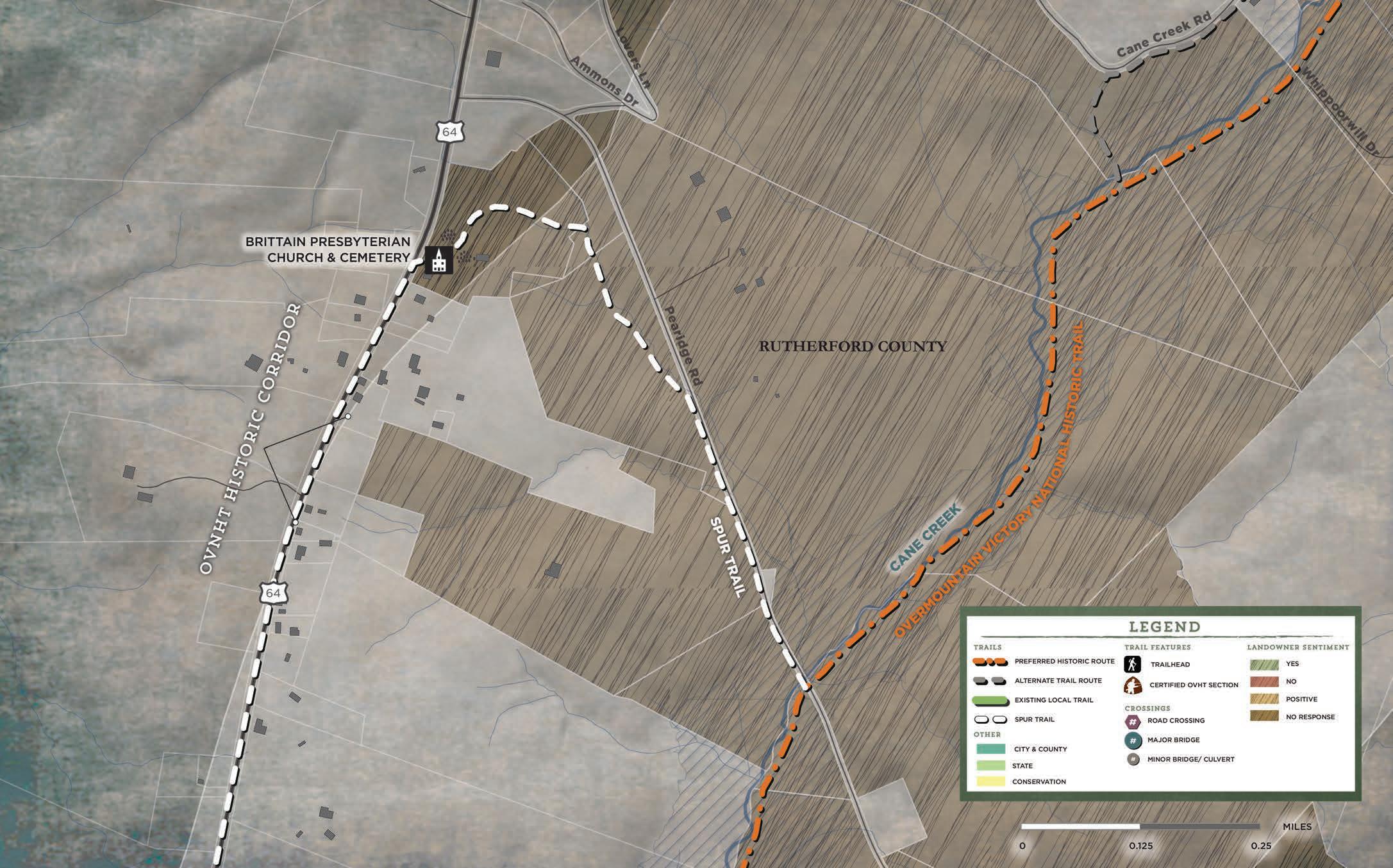
CHAPTER 4 57
the significance of the Brittain Presbyterian Church Cemetery, a spur
Pearidge Rd. to connect OVNHT visitors to
MAP 14: BRITTAIN PRESBYTERIAN CHURCH CONNECTION
VICINITY MAP


PROPOSED TRAILS
The preferred route in Section 5 extends for 6.4 miles from the Second Broad River to the Thermal Belt Rail Trail. From the Second Broad River the trail follows HWY 64 as a DOT sidepath. From HWY 64 the trail turns east to follow Jobe Lake Rd. before turning south again into private land as a typical greenway. The typical greenway continues southwest to the proposed trailhead at Mt Vernon-Ruth Elementary School and beyond until it joins HWY 64 again. The trail continues south and west as a DOT side path until turns west just south of Oscar Justince Rd. A natural surface trail continues overland until it connects to the existing Thermal Belt Rail Trail on Rock Rd. The trail then follows the existing Thermal Belt Rail Trail to the HWY 64 intersection where it will connect with the proposed alignment from the Rutherford to Chesnee Plan.
Three alternative alignments are proposed in this planning section. The first carries over from Section 4. This alternate crosses the Second Broad River and continues directly to Jobe Lake Rd. This route would bypass a challenging section of DOT sidepath along HWY 64, but would require a bridge to cross the river and a railroad crossing. The second alternate alignment starts after crossing Jobe Lake Rd, and offers another path to Mt Vernon-Ruth Elementary School trailhead through private land. The third alternate alignment crosses Cathey's Creek south of Rock Rd and provides a path through private land to the Thermal Belt Rail Trail.
TRAIL FEATURES
This planning section includes two (2) trailheads, one (1) major bridges, six (6) minor bridges/culverts, and seven (7) road crossings.
TRAILHEADS
Two (2) trailheads are proposed in this section. The first is next to Mt Vernon-Ruth Elementary School. This trailhead will provide access and educational opportunities for the school community. The second trailhead is proposed at the site of a proposed campground on Rock Rd.

CROSSINGS

One (1) major bridge is recommended to cross Catheys Creek just south of Rock Rd. to avoid aligning the trail on the narrow bridge on Rock Rd.
Six (6) minor bridges/culverts will be required to traverse the streams and drainages feeding Catheys Creek.
Seven (7) road crossings will be required in this section as the trail passes out of the rural areas surrounding Cane Creek and the Second Broad River and enters the Town of Ruth. Crossing #1 passes over Jobe Lake Rd. Crossing #2 passes over Hudlow Rd. Crossing #3 passes over HWY 64. Crossing #4 passes over Old Gilbertown Rd. Crossing #5 passes over Pineview Dr to join with the Thermal Belt Rail Trail. Crossing #6 and #7 will cross HWY 64 and Rock Rd where a new HWY interchange is proposed..
Bud Shiele Boy Scout Camp located northwest of the trail. While this connection is within section 5, the spur trail is better viewed in
PHOTOS: (1) Existing conditions at the Mt VernonRuth Elementary School proposed trailhead.

58
Another spur trail is proposed to connect the OVNHT to
THERMAL BELT RAIL TRAIL SECOND BROAD RIVER EXISTING TRAIL: 0.9 MILES PROPOSED TRAIL: 5.5 MILES TRAIL TYPE: NATURAL SURFACE DO T SIDEPATH TYPICAL GREENWAY ESTIMATED COST: $2,528,810 POINTS OF INTEREST: MT. VERNON RUTH ELEMEN TARY SCHOOL ROCK RD CAMPGROUND THERMAL BELT RAIL TRAIL CAMP BUD SHIELE 01
SECTION 5


CHAPTER 4 59 MAP 15: PLANNING SECTION 5


60 entry sign kiosk 28 Typical parking spaces 2 ada parking spaces hudlow ROAD mountvernoncemetary overmountain victory trail N 050100 1"=100' mount vernon-ruth elementary mt hebron united methodist church mt vernon baptist church EXHIBIT 9: MT VERNON-RUTH TRAILHEAD
he OVNHT provides a significant educational and cultural opportunity that is bolstered by the Overmountain Victory Association's annual programs. It is only natural that connectivity and access to schools in the corridor be promoted. MT VERNON-RUTH TRAILHEAD
T

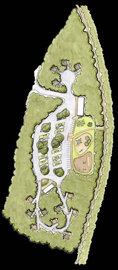
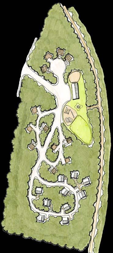

CHAPTER 4 61 A B ROCK ROAD ENHANCEMENTS
The proposed camping area and trailhead on Rock Road was designed as a part of the Thermal Belt Rail Trail Enhancements Master Plan for Rutherford County, and will anchor the OVNHT to the existing Thermal Belt Rail Trail
Rutherfordton. EXHIBIT 10: ROCK ROAD ENHANCEMENTS CAMPGROUND OPTION A: 13 Camping Pads Facilities Building Play Area with ampitheater Adventure play-scape and boccie green 12 pull-through RV camp spaces Walking path entry to OVNHT/TBRT CAMPGROUND OPTION B: 12 Camping Pads Facility building and classroom 10 luxury tree-houses Walking path entry to OVNHT/TBRT Play area adventure playscape and play lawn
and the Town of
The OVNHT will connect to the Thermal Belt Rail Trail and the Purple Martin Greenway. These greenways join Ruth, Rutherfordton, Spindale, and Forest City together. Connecting the OVNHT to these local greenway systems will bring additional visitors and greater regional awareness to the OVNHT.

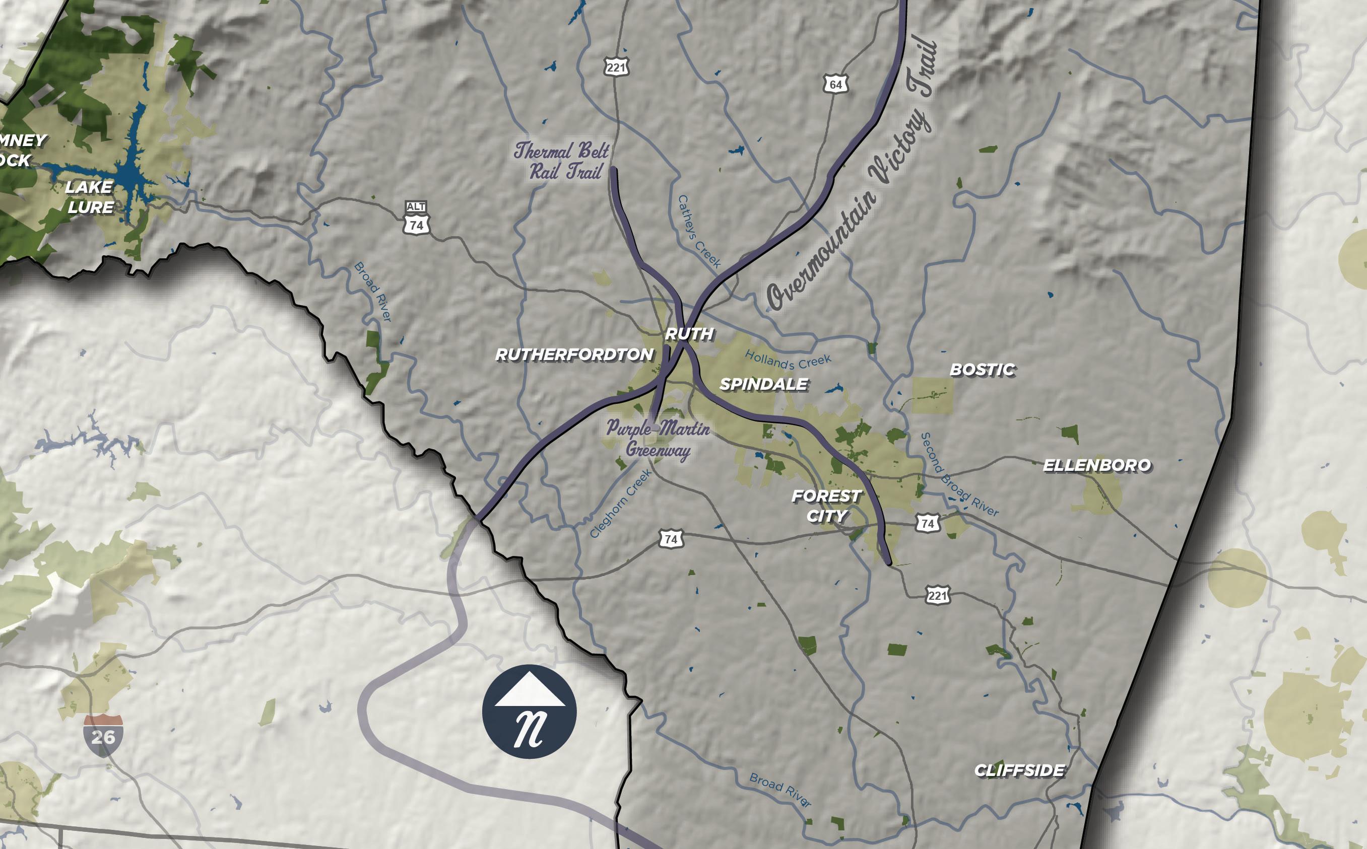
62 MAP 16: THERMAL BELT RAIL TRAIL & PURPLE MARTIN CONNECTION
THERMAL BELT RAIL TRAIL & PURPLE MARTIN CONNECTION
GILBERT TOWN CONNECTION

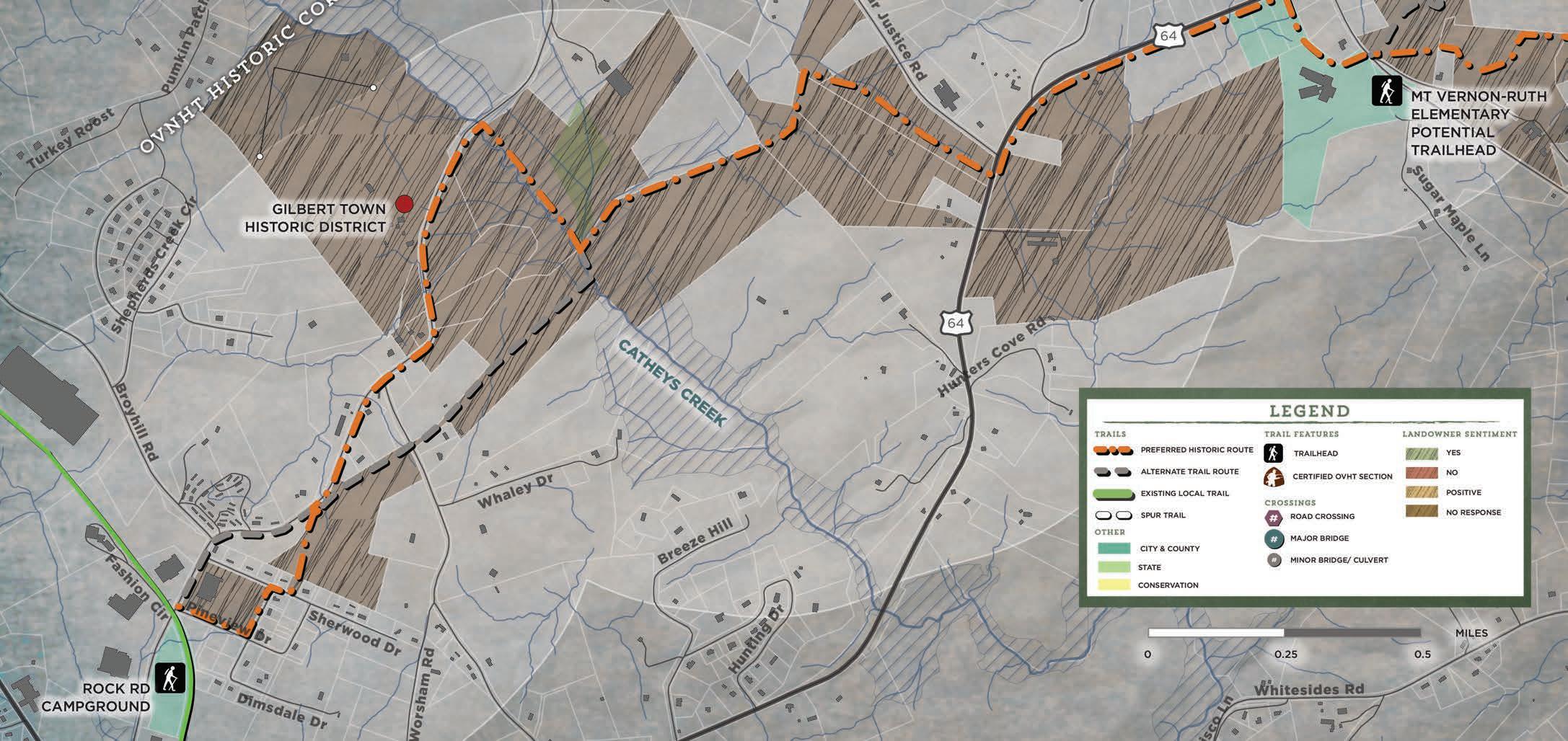
Gilbert Town was a frontier town established by Irish immigrant Willliam Gilbert who began to purchase land in the area around 1769. During the revolutionary war, Gilbert Town was used by both the British and the Patriot Militia as a camp and staging area for activity in the area. After the Battle of Kings Mountain the Town became the Rutherford County seat until a courthouse was built in Rutherfordton in 1785. Local connections to the proposed campground on Rock Rd. and the existing Mt Vernon-Ruth Elementary School provide educational opportunites for the public..
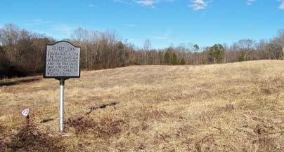
CHAPTER 4 63
MAP 17: GILBERT TOWN CONNECTION
Photo by others

64
CHAPTER 5
IMPLEMENTATION
CONSTRUCTION OF THE OVNHT FROM morganton to rutherfordton WILL BE NO SMALL TASK. BUT WITH TIME, PERSEVERANCE, AND A LITTLE LUCK, THERE IS NO DOUBT THAT A DESTINATION-QUALITY TRAIL IS WITHIN GRASP.
This chapter summarizes details regarding each Planning Section and establishes responsibilities and implementation priorities by focus area. The chapter concludes with an economic impact analysis that evaluates potential benefits of completing the OVNHT from Morganton to Rutherfordton.
IN THIS CHAPTER
A. Implementation by Section and Responsibilities

B. Implementation Priorities by Focus Area
C. Trail Support Spectrum
D. Economic Impact Analysis
IMPLEMENTATION DETAILS BY PLANNING SECTION
The table below provides an overall summary of key information associated with each planning section. Key opportunities provide valuable insight that may assist in determining priorities within each section. Key challenges include costly trail features or the need to acquire trail easements from private landowners. Most importantly, this table identifies key partners that must actively work in concert to fully implement plan recommendations.
IMPLEMENTATION DETAILS BY SECTON AND RESPONSIBILITY
SECTION
SECTION
SECTION 4 - Cane Creek Mountain Rd to Second Broad River 7.8
SECTION 5 - Second Broad River to Thermal Belt Rail Trail 6.4
Existing NC Wildlife Resource Commission Trailhead; South Mountains State Park; South Mountains Gamelands; Connection to Large Conservation Tracts in the Box Creek Wilderness; Shared WGST/OVNHT Trailhead Site on Foothills Conservancy Property; Cane Creek Skirmish Study Area Connection
Connection to Brittain Presbyterian Church & Cemetery; Large Undeveloped Parcels; Cane Creek Riparian Corridor; Connection to Second Broad River
Connection to Boy Scouts of America at Camp Bud Shiele; Connection to Mt Vernon-Ruth Elementary School; Connection to Proposed Campground on Rock Rd; Connection to Existing Thermal Belt Rail Trail.
Securing Landowner Trail Easements; Steeper Topography $1,497,360
Burke County; NC Wildlife Resource Commission; NC State Parks; Foothills Conservancy of NC; McDowell County; Rutherford County

Securing Landowner Trail Easements; Railroad and Second Broad River Crossing $1,088,200 Rutherford County

Securing Landowner Trail Easements; Difficult DOT Sidepath along Hwy 64 near Second Broad River & Parton Lumber Company $2,528,810
Rutherford County; City of Ruth; City of Rutherfordton
66
Section Distance Key Opportunities Key Challenges Estimated Budget Implementing Partners
- Catawba
Rd 8.2
US
70 Underpass; Interstate 40 Underpass; Railroad Trestle
Securing
$1,886,850 City
1
River Soccer Complex to Hayes Waters
Catawba River Soccer Complex; Catawba River Greenway Connection; Shuey Park via Spur Trail; Silver Creek and Clear Creek Riparian Corridors
Hwy
Underpass;
Landowner Easements
of Morganton; Burke County
-
Gap
7.8 South
South
$1,531,840 Burke
SECTION 2
Hayes Waters Rd to Bollinger
St
Mountains Gamelands;
Mountains State Park; Roper Hollow Rd Trailhead; Wilderness Gateway State Trail Connection and Overlap Securing Landowner Trail Easements; Steeper Topography
County; NC Wildlife Resource Commission; NC State Parks
6.2
3 - Bollinger Gap St to Cane Creek Mountain Rd
ALL SECTIONS TOTAL
*Estimated budget shown above does not include existing completed sections of
or
EXHIBIT 11: PLANNING SECTION IMPLEMENTATION MATRIX
36.4 $8,533,060
trail
proposed trailheads.
WHERE TO START: IMPLEMENTATION PRIORITIES BY FOCUS AREA

This plan recommends approximately 35.8 new trail miles, crosses five political jurisdictions, and requires participation from multiple land managers. For this reason, implementation partners must focus their limited capacity, including time and money, to begin advancing plan implementation.

The Implementation Focus Areas Map illustrates recommended trail development focus areas within the broader context of the study corridor. These focus areas prioritize trail development that connects existing trail segments or is located on lands that are already managed by a public entity. Four suggested focus areas are presented to help partners target their efforts: 1) Catawba River Soccer Complex to Interstate 40; 2) Roper Hollow Rd to Existing Trailhead; 3) Existing NCWRC Trailhead to WGST/OVNHT Trailheade; and 4) Jobe Lake Rd to Hwy 64.
Continued landowner engagement will be required for the preferred route to connect these focus areas in the future. Tight parcelization and narrow road rights-of-way present significant trail development challenges.
Each government entity must work in tandem and with partners to successfully realize the complete OVNHT. Trail implementation does not have to occur in a specific, linear order according to each planning section. In fact, the priority areas for implementation are merely suggestions and are in no way intended to limit creativity or work in "lower" priority areas. Trail implementation is an art and requires the acumen to recognize and seize opportunities, whether related to funding, landowner willingness, or politics.
CHAPTER 5 67 Focus Area 1: Catawba River Soccer Complex to Interstate 40 Units Unit Cost Total Cost Dual-Use Path 13111 $60 $ 786,660.00 $ 786,660.00 Focus Area 2: Roper Hollow Rd to Existing Trailhead Units Unit Cost Total Cost Natural Surface 21120 $10 $ 211,200.00 Roper Hollow Rd Trailhead 1 $50,000 $15,000 $ 211,200.00 Focus Area 3: Existing NCWRC Trailhead to WGST/OVNHT Trailhead Units Unit Cost Total Cost Natural Surface 13053$10 $ 130,530.00 WGST/OVNHT Trailhead 1 $50,000 $15,000 $ 130,530.00 Focus Area 4: Jobe Lake Rd to Hwy 64 Units Unit Cost Total Cost Typical Greenway 9896$90 $ 890,640.00 Mt. Vernon-Ruth Elementary School Trailhead 1 $35,000 $ 35,000.00 $ 925,640.00 Total 2,054,030.00 $ Total Section Cost Total Section Cost Total Section Cost Total Section Cost * Includes all Preferred and Historical-Preferred Routes. Does not include existing segments of OVNHT, bridges, culverts, road crossings, nor land acquisition, engineering, or design costs. Final trail type will depend on specific environmental conditions and whether trail is located within public ROW or within a private trail easement. EXHIBIT 12: FOCUS AREA IMPLEMENTATION MATRIX MAP 18: IMPLEMENTATION FOCUS AREAS
There are eleven (6)


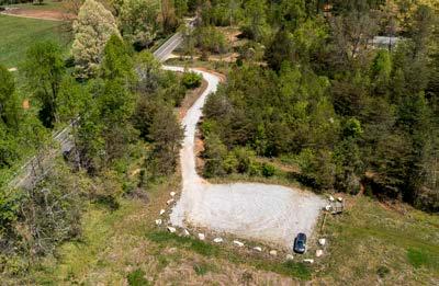


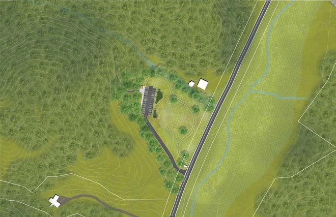

type transitions proposed along the preferred trail route, which extends approximately 36.4 miles. The Trail Type Profile identifies the transition location, along with associated length, for each trail type. Each focus area is also noted on the graphic below.

68 C:EXISTINGNCWRC TRAILHEAD
TYPE PROFILE
trail types approximate distance in miles TYPICAL GREENWAY 10 FT. PAVED ASPHALT NCDOT SIDEPATH 8 FT. PAVED ASPHALT NATURAL SURFACE TRAIL 3-6 FT. NATURAL TREAD DUAL USE PATH 8' CRUSHED GRAVEL FINES 2 MILES 4 MILES 6 MILES 8 MILES 10 MILES 12 MILES 14 MILES 16 MILES 18 MILES 20 MILES 0.7 7.5 7.8 6.2 HWY70UNDERPASS A:NORTHERN TERMINUS: CATAWBARIVERSOCCER COMPLEX TRAILTRANSITIONS I40 HAYESWATERSRD D:WGST/OVNHTTRAILHEAD B:ROPERHOLLOWRD TRAILHEAD BOLLINGERGAPST entry sign DIRECTIONAL sign 24 typical parking spaces Optional Gravel Spaces ada parking spaces pull through equestrian parking spaces parallel equestrian parking spaces connection restroom and hitches bioretention bioretention kiosk restroom kiosk us-64 roperhollowroad overmountain victory trail N 02550 =50' RESTROOM AND KIOSK floodplain entry sign 24 typical parking spots ada parking spots mowed grass loop through meadow us-64 canecreek wilderness gateway state trail wilderness gateway state trail overmountain victory trail kellybranch 03060 1"=60' A: CATAWBA RIVER SOCCER COMPLEX B: ROPER HOLLOW RD TRAILHEAD C: EXISTING NCWRC TRAILHEAD D: WGST/OVNHT TRAILHEAD FOCUS AREA 1 FOCUS AREA 2 FOCUS AREA 3 EXISTING TRAIL 10 FT. PAVED ASPHALT
TRAIL
trail

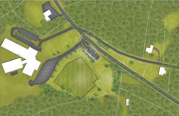

CHAPTER 5 69 Existing Trails EXISTING TRAILS ARE MARKED GREEN EXHIBIT 13: TRAIL TYPE PROFILE approximate distance in miles trail types TYPICAL GREENWAY 10 FT. PAVED ASPHALT NCDOT SIDEPATH 8 FT. PAVED ASPHALT NATURAL SURFACE TRAIL 3-6 FT. NATURAL TREAD DUAL USE PATH 8' CRUSHED GRAVEL FINES 22 MILES 24 MILES 26 MILES 28 MILES 30 MILES 32 MILES 34 MILES 36 MILES 38 MILES 20 MILES 40 MILES 7.7 2 1.87 1.76 0.9 E:MTVERNON-RUTH TRAILHEAD CANECREEK MOUNTAINRD HWY64 JOBELAKERD HWY64 THERMALBELTRAILTRAIL F:SOUTHERN TERMINUS:THERMALBELTRAILTRAIL&HWY64 entry sign kiosk 28 Typical parking spaces 2 ada parking spaces hudlow ROAD mountvernoncemetary overmountainvictorytrail N 050100 1"=100' mount vernon-ruth elementary mt hebron united methodist church mt vernon baptist church F: SOUTHERN TERMINUS: THERMAL BELT RAIL TRAIL E: MT VERNON-RUTH TRAILHEAD FOCUS AREA 4 EXISTING TRAIL 10 FT. PAVED ASPHALT
TRAIL SUPPORT SPECTRUM
Creating a destination-quality trail system requires a significant commitment from local governments, including
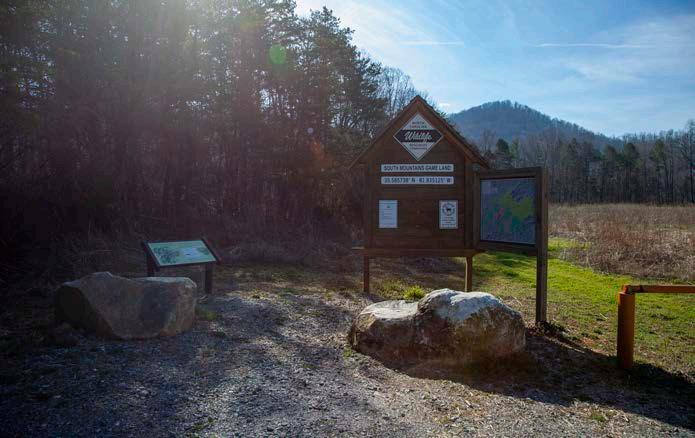
spend local funds, but instead must leverage their funds to obtain support from grant agencies sympathetic to the creation of trails and the OVNHT. This particular section of the OVNHT enjoys support from many partners. Working together, local trail organizations and governments can have a far greater influence in convincing funding agencies of the merits of the trail, than when acting alone.
The “Trail Support Spectrum” illustrates the steps local governments can take to support trail development in their jurisdictions.

TRAIL SUPPORT SPECTRUM
1 2 3 4 5
EXHIBIT 14: TRAIL SUPPORT SPECTRUM
ECONOMIC IMPACT ANALYSIS

Once completed, the OVNHT from Morganton to Rutherfordton will greatly benefit surrounding communities’ economies, health and wellbeing, and quality of life. The trail is expected to attract between 28,002 to 46,670 users each year with a projected economic annual impact of 840k to 1.4 million in visitor spending.
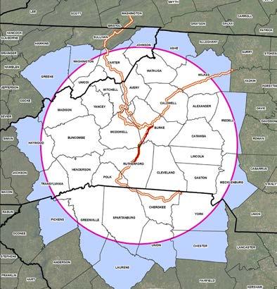
Visitor and economic impact estimates were calculated using data from trail-use and spending studies of the Blue Ridge National Heritage Area, Virginia Creeper Trail, and the State of North Carolina. A 60-mile-radius (1.5-hour driving distance) trade area and estimated 33% of North Carolinians who use trails, was used to determine a potential market population of 933,409. A 3% and 5% market penetration rate were then used to determine low and high annual user estimates. A conservative day-trip visitor spending estimate of $30 per day per visitor (Blue Ridge National Heritage Area Study) was then applied to annual user estimates to calculate the trail’s economic impact. The trail will also offer health benefits to the local population by increasing physical activity which will result in lower rates of obesity, diabetes, and premature deaths for an annual total health benefit of approximately $2.1 million (ITRE, 2019). Annual health benefits were calculated using trail studies of the American Tobacco Trail and Brevard Greenway and the World Health Organization’s Health Equity Assessment Toolkit (ITRE, 2019). Studies have also shown that amenities such as greenways and trails benefit quality of life, job retention, and attraction.
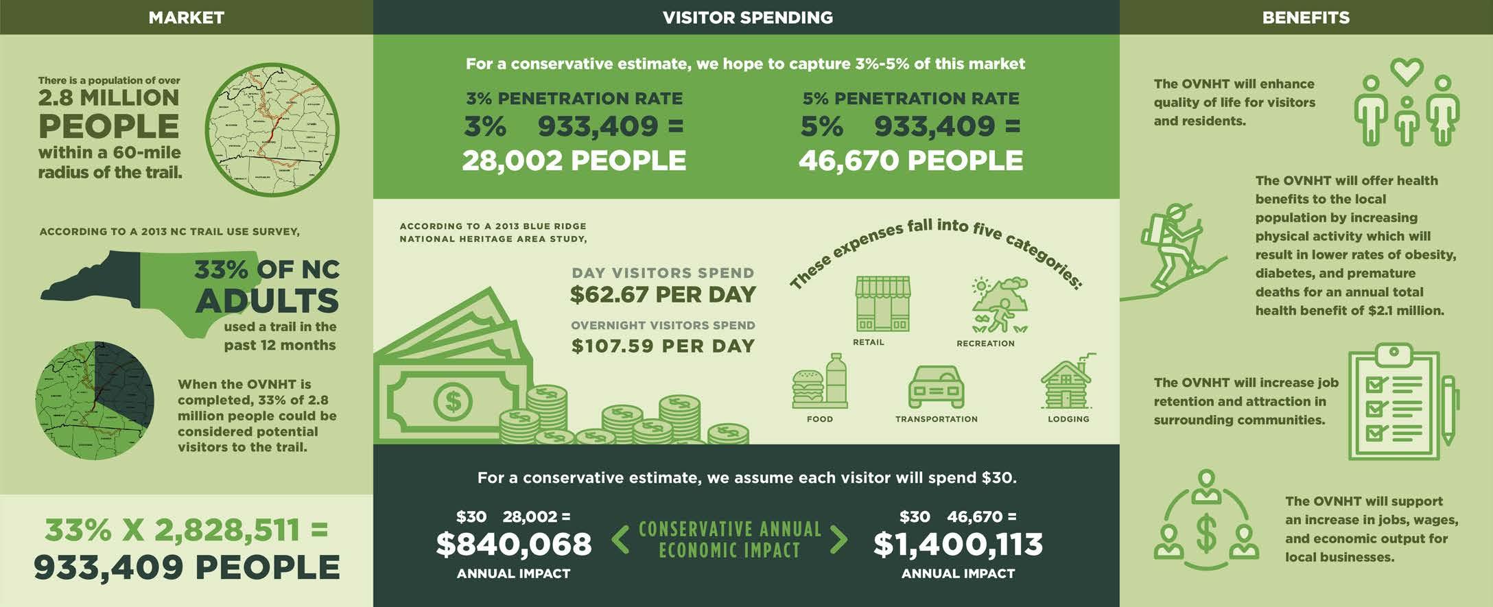
CHAPTER 5 71
MAP 19: ECONOMIC IMPACT MARKET EXHIBIT 15: ECONOMIC IMPACT ANALYSIS

72
APPENDIX

Dual

Natural
Natural
Natural
Natural
74
BUDGET
(A1)
Catawba River Soccer Complex to Hayes Waters Rd Units (LF) Unit Cost Total Cost
SECTION 1-
Use 13111 $60 $ 786,660.00
Surface 26619 $10 $ 266,190.00 Road Crossings (Surface) 3 $8,000 $ 24,000.00
Major Bridges 2 $90,000 $ 180,000.00 Minor Bridges/Culverts 21 $30,000 $ 630,000.00 $ 1,886,850.00
Hayes Waters Rd to Bollinger Gap St Units Unit Cost Total Cost
SECTION 2-
Surface 41184 $10 $ 411,840.00 Road Crossings (Surface) 5 $8,000 $ 40,000.00
Minor Bridges/Culverts 36 $30,000 $ 1,080,000.00 $ 1,531,840.00
Bollinger Gap St to Cane Creek Mountain Rd Units Unit Cost Total Cost
SECTION 3-
Surface 32736 $10 $ 327,360.00
$
Cane Creek Mountain Rd to Second Broad River Units Unit Cost Total Cost
Major Bridges 2 $90,000 $ 180,000.00 Minor Bridges/Culverts 33 $30,000 $ 990,000.00 Road Crossings (Surface) 2 $8,000 $ 16,000.00
1,497,360.00 SECTION 4-
3 $8,000 $
2 $90,000 $
14 $30,000 $
$
5- Second Broad River to Thermal Belt Rail Trail Units Unit Cost Total Cost
Surface 40708 $10 $ 407,080.00 DOT Sidepath 476 $120 $ 57,120.00 Road Crossings (Surface)
24,000.00 Major Bridges
180,000.00 Minor Bridges/Culverts
420,000.00
1,088,200.00 SECTION
9321 $10 $
10158 $120 $
Natural Surface
93,210.00 DOT Sidepath
1,218,960.00
9896 $90 $
1 $90,000
6
7
$
Total
$ * Includes all Preferred and Historical-Preferred Routes * Does not include land acquisition, engineering, or design Total Section Cost Total Section Cost Total Section Cost Total Section Cost Total Section Cost
Typical Greenway
890,640.00 Major Bridges
$ 90,000.00 Minor Bridges/Culverts
$30,000 $ 180,000.00 Road Crossings (Surface)
$8,000 $ 56,000.00
2,528,810.00
8,533,060.00
* Final trail type will depend on specific environmental conditions and whether trail is located within public ROW or within a private trail easement.
* Does not include existing segments of OVNHT

APPENDIX 75 $10 $ 407,080.00
476 $120
3
2
14
$
5- Second Broad River to Thermal Belt Rail Trail Units Unit Cost Total Cost
DOT Sidepath
$ 57,120.00 Road Crossings (Surface)
$8,000 $ 24,000.00 Major Bridges
$90,000 $ 180,000.00 Minor Bridges/Culverts
$30,000 $ 420,000.00
1,088,200.00 SECTION
9321 $10
Natural Surface
$ 93,210.00
10158 $120
DOT Sidepath
$ 1,218,960.00
9896 $90
Typical Greenway
$ 890,640.00
1 $90,000
6
7
$
Total
$
Major Bridges
$ 90,000.00 Minor Bridges/Culverts
$30,000 $ 180,000.00 Road Crossings (Surface)
$8,000 $ 56,000.00
2,528,810.00
8,533,060.00
* Includes all Preferred and Historical-Preferred Routes
* Does not include land acquisition, engineering, or design
Total Section Cost Total Section Cost
(A3) LANDOWNER INTEREST SURVEY (A2) LANDOWNER INVITATION


Dear Landowner:
The Overmountain Victory Trail Association has partnered with the National Park Service and local government leaders to explore the opportunity to create a public trail that will connect Morganton to Rutherfordton, North Carolina.
This trail will follow the route traveled by the Overmountain Men as they marched to Kings Mountain, South Carolina; where on October 7, 1780, they secured a significant victory for the patriot cause in the American Revolution. Their triumph in this battle is considered a turning point that led to the ultimate patriot victory in the American Revolutionary War. The Overmountain Victory National Historic and State Trail preserves this history.
The project planning team has been working to identify areas where establishing a public trail within the historic corridor would be feasible. The enclosed map identifies the corridor that was evaluated for suitable trail locations. Analysis of the historic route revealed that the trail corridor falls within, or very close to your property, in a location where the public trail could potentially be constructed. Please visit the project website, www.OVTplan.com, to learn more and view the project video.
Participation in establishing this trail connection is entirely voluntary, the trail will not be planned or built on private property without the consent of the owner. The trail will either be relocated or not constructed in situations where voluntary participation cannot be established.
You are invited to discuss this project with representatives from the National Park Service and trail planners during one of two special landowner meetings:
Tuesday, June 22, 2021 at 6:00 pm Thursday, June 24, 2021 at 6:00 pm Collett Street Recreation Center Woodrow Jones Building 300 Collett Street 146 North Main Street Morganton, NC 28655 Rutherfordton, NC 28139
If you plan to attend the meeting, or if you cannot attend but would like to discuss the project and your potential interest in providing for the trail on your property, please let us know by using the contact information below.
Thank you.
On behalf of,
Overmountain Victory Trail Planning Committee
RSVP Email: info@OVTplan.com Phone: 828.386.1866
76
(A4) FUNDING SOURCES
NORTH CAROLINA
Clean Water Management Trust Fund (CWMTF) (www.cwmtf.net)
Land Acquisition: Fee Simple or Easement. Must protect floodplain areas. Greenway trails are allowed. Varies Varies Early February
NC Water Resources (NCWR) (www.ncwater.org) River access areas or greenways along rivers N/A 50% Late December/June

Recreational Trails Program (RTP) All types of trails and greenways. $150,000.00 25% Early August
Parks and Recreation Trust Fund (PARTF) All types of parks, trails, and recreation facilities $500,000.00 50% Early May
People for Bikes Community Grant Trails and Greenways $10,000.00 50% Spring/Fall
NCDOT Transportation Plan For Bike and Pedestrian Projects Bike and Pedestrian Projects-both engineering and construction N/A (for major projects) Determined by Municipal Population
APPENDIX 77
Partnership Funding Agency Active Living/Built-Environment Implications Maximum Amount Matching Funds Required Deadlines
Late June
(A5) THE NATIONAL TRAILS SYSTEM ACT
THE NATIONAL TRAILS SYSTEM ACT
(P.L. 90 543, as amended through P.L. 116 -9 , Ma rch 12, 2019 ) (as found in United States Code , Vol. 16, Sections 1241 1251)
AN ACT
To establish a national trails system, and for other purposes.
Be it enacted by the Senate and House of Representatives of the United States of America in Congress assembled,
SHORT TITLE
SECTION 1. [16USC1241] This Act may be cited as the "National Trails System Act".
STATEMENT OF POLICY
SEC. 2. [16USC1241] (a) In order to provide for the ever increasing outdoor recreation needs of an expanding population and in order to promote the preservation of, public access to, travel within, and enjoyment and appreciation of the open air, outdoor areas and historic resources of the Nation, trails should be established (i) primarily, near the urban areas of the Nation, and (ii) secondarily, within scenic areas and along historic travel routes of the Nation which are often more remotely located.
(b) The purpose of this Act is to provide the means for attaining these objectives by instituting a national system of recreation, scenic and historic trails, by designating the Appalachian Trail and the Pacific Crest Trail as the initial components of that system, and by prescribing the methods by which, and standards according to which, additional components may be added to the system.
(c) The Congress recognizes the valuable contributions that volunteers and private, nonprofit trail groups have made to the development and maintenance of the Nation's trails. In recognition of these contributions, it is further the purpose of this Act to encourage and assist volunteer citizen involvement in the planning, development, maintenance, and management, where appropriate, of trails.
NATIONAL TRAILS SYSTEM
SEC. 3. [16USC1242] (a) The national system of trails shall be composed of the following:
(1) National recreation trails, established as provided in section 4 of this Act, which will provide a variety of outdoor recreation uses in or reasonably accessible to urban areas.
(2) National scenic trails, established as provided in section 5 of this Act, which will be extended trails so located as to provide for maximum outdoor recreation potential and for the conservation and enjoyment of the nationally significant scenic, historic, natural, or cultural qualities of the areas through which such trails may pass. National scenic trails may be located so as to represent desert, marsh, grassland, mountain, canyon, river, forest, and other areas, as well as landforms which exhibit significant characteristics of the physiographic regions of the Nation.
(3) National historic trails, established as provided in section 5 of this Act, which will be extended trails which follow as closely as possible and practicable the original trails or routes of travel of national historic significance. Designation of such trails or routes shall be continuous, but the established or developed trail, and the acquisition thereof, need not be continuous onsite. National historic trails shall have as their purpose the identification and protection of the historic route and its historic remnants and artifacts for public use and enjoyment. Only those selected land and water based components of a historic trail which are on federally owned lands and which meet the national historic trail criteria established in this Act are included as Federal protection components of a national historic trail. The appropriate Secretary may certify other lands as protected segments of an historic trail upon application from State or local governmental agencies or private interests involved if such segments meet the national historic trail criteria established in this Act and such criteria supplementary thereto as the appropriate Secretary may prescribe, and are administered by such agencies or interests without expense to the United States.
(4) Connecting or side trails, established as provided in section 6 of this Act, which will provide additional points of public access to national recreation, national scenic or national historic trails or which will provide connections between such trails.
The Secretary of the Interior and the Secretary of Agriculture, in consultation with appropriate governmental agencies and public and private organizations, shall establish a uniform marker for the national trails system.
(b) For purposes of this section, the term “extended trails” means trails or trail segments which total at least one hundred miles in length, except that historic trails of less than one hundred miles may be designated as extended trails. While it is desirable that extended trails be continuous, studies of such trails may conclude that it is feasible to propose one or more trail segments which, in the aggregate, constitute at least one hundred miles in length.
NATIONAL RECREATION TRAILS
SEC. 4. [16USC1243] (a) The Secretary of the Interior, or the Secretary of Agriculture where lands administered by him are involved, may establish and designate national recreation trails, with the consent of the Federal agency, State, or political subdivision having jurisdiction over the lands involved, upon finding that
(i ) such trails are reasonably accessible to urban areas, and, or
(ii) such trails meet the criteria established in this Act and such supplementary criteria as he may prescribe.

78 1
2
(b) As provided in this section, trails within park, forest, and other recreation areas administered by the Secretary of the Interior or the Secretary of Agriculture or in other federally administered areas may be established and designated as "National Recreation Trails" by the appropriate Secretary and, when no Federal land acquisition is involved
(i) trails in or reasonably accessible to urban areas may be designated as "National Recreation Trails" by the appropriate Secretary with the consent of the States, their political subdivisions, or other appropriate administering agencies;
(ii) trails within park, forest, and other recreation areas owned or administered by States may be designated as "National Recreation Trails" by the appropriate Secretary with the consent of the State; and

(iii) trails on privately owned lands may be designated “National Recreation Trails” by the appropriate Secretary with the written consent of the owner of the property involved.
NATIONAL SCENIC AND NATIONAL HISTORIC TRAILS
SEC. 5. [16USC1244] (a) National scenic and national historic trails shall be authorized and designated only by Act of Congress. There are hereby established the following National Scenic and National Historic Trails:
(1) The Appalachian National Scenic Trail, a trail of approximately two thousand miles extending generally along the Appalachian Mountains from Mount Katahdin, Maine, to Springer Mountain, Georgia. Insofar as practicable, the right of way for such trail shall comprise the trail depicted on the maps ident ified as "Nationwide System of Trails, Proposed Appalachian Trail, NST AT -101-May 1967", which shall be on file and available for public inspection in the office of the Director of the National Park Service. Where practicable, such rights-of-way shall include lands protected for it under agreements in effect as of the date of enactment of this Act, to which Federal agencies and States were parties. The Appalachian Trail shall b e administered primarily as a footpath by the Secretary of the Interior, in consultation with the Secretary of Agriculture.
(2) The Pacific Crest National Scenic Trail, a trail of approximately two thousand three hundred fifty miles, extending from the Mexican California border northward generally along the mountain ranges of the west coast States to the Canadian Washington border near Lake Ross, following the route as generally depicted on the map, identified as "Nationwide System of Trails, Proposed Pacific Crest Trail, NST PC-103-May 1967" which shall be on file and available for public inspection in the office of the Chief of the Forest Service. The Pacific Crest Trail shall be administered by the Secretary of Agriculture, in consultation with the Secretary of the Interior.
(3) The Oregon National Historic Trail, a route of approximately two thousand miles extending from near Independence, Missouri, to the vicinity of Portland, Oregon, following a route as depicted on maps identified as “Primary Route of the Oregon Trail 1841 1848”, in the Department of the Interior's Oregon Trail study report dated April 1977, and which shall be on file and available for public inspection in the office of the Director of the National Park Service. The trail shall be administered by the Secretary of the Interior. No land or interest in land outside the exterior boundaries of any federally administered
area may be acquired by the Federal Government for the trail except with the consent of the owner of the land or interest in land. The authority of the Federal Government to acquire fee title under this paragraph shall be limited to an average of not more than 1/4 mile on either side of the trail.
(4) The Mormon Pioneer National Historic Trail, a route of approximately one thousand three hundred miles extending from Nauvoo, Illinois, to Salt Lake City, Utah, following the primary historical route of the Mormon Trail as generally depicted on a map, identified as, “Mormon Trail Vicinity Map, figure 2” in the Department of the Interior Mormon Trail study report dated March 1977, and which shall be on file and available for public inspection in the office of the Director, National Park Service, Washington, D.C. The trail shall be administered by the Secretary of the Interior. No land or interest in land outside the exterior boundaries of any federally administered area may be acquired by the Federal Government for the trail except with the consent of the owner of the land or interest in land. The authority of the Federal Government to acquire fee title under this paragraph shall be limited to an average of not more than 1/4 mile on either side of the trail.
(5) The Continental Divide National Scenic Trail, a trail of approximately thirty one hundred miles, extending from t he Montana Canada border to the New Mexico Mexico border, following the approximate route depicted on the map, identified as “Proposed Continental Divide National Scenic Trail” in the Department of the Interior Continental Divide Trail study report dated March 1977 and which shall be on file and available for public inspection in the office of the Chief, Forest Service, Washington, D.C. The Continental Divide National Scenic Trail shall be administered by the Secretary of Agriculture in consultation with the Secretary of the Interior. Notwithstanding the provisions of section 7(c), the use of motorized vehicles on roads which will be designated segments of the Continental Divide National Scenic Trail shall be permitted in accordance with regulations prescribed by the appropriate Secretary. No land or interest in land outside the exterior boundaries of any federally administered area may be acquired by the Federal Government for the trail except with the consent of the owner of the land or interest in land. The authority of the Federal Government to acquire fee title under this paragraph shall be limited to an average of not more than 1/4 mile on either side of the trail.
(6) The Lewis and Clark National Historic Trail, a trail of approximately 4,900 miles, ext ending from the Ohio River in Pittsburgh, Pennsylvania, to the mouth of the Columbia River in Oregon, following the outbound and inbound routes of the Lewis and Clark Expedition depicted on the map entitled ‘Lewis and Clark National Historic Trail Aut horized Trail Including Proposed Eastern Legacy Extension’, dated April 2018, and numbered 648/143721. The map shall be on file and available for public inspection in the office of the Director, National Park Service, Washington, D.C. The trail shall be administered by the Secretary of the Interior. No land or interest in land outside the exterior boundaries of any federally administered area may be acquired by the Federal Government for the trail except with the consent of the owner of the land or interest in land. The authority of the Federal Government to acquire fee title under this paragraph shall be limited to an average of not more than 1/4 mile on either side of the trail.
(7) The Iditarod National Historic Trail, a route of approximately two thousand miles extending from Seward, Alaska, to Nome, Alaska, following the routes as depicted on maps identified as 'Seward Nome Trail', in the Department of the Interior's study report entitled 'The Iditarod Trail (Seward Nome Route) and other Alaskan Gold Rush Trails' dated September 1977. The map shall be on file and available for public inspection in the office of the Director, National Park Service, Washington, D.C. The trail shall be administered by the Secretary of the Interior. No land or interest in land outside the exterior boundaries of any federally administered area may be acquired by the Federal Government
APPENDIX 79 3
4
(A5) THE NATIONAL TRAILS SYSTEM ACT
for the trail except with the consent of the owner of the land or interest in land. The authority of the Federal Government to acquire fee title under this paragraph shall be limited to an average of not more than 1/4 mile on either side of the trail.
(8) The North Country National Scenic Trail, a trail of approximately 4,600miles, extending from the Appalachian Trail in Vermont to the vicinity of Lake Sakakawea in North Dakota, following the approximate route depicted on the map identified ‘North Country National Scenic Trail, Authorized Route’, dated February 2014, and numbered 649/116870. The map shall be on file and available for public inspection in the office of the Director, National Park Service, Washington, District of Columbia. The trail shall be administered by the Secretary of the Interior. No land or interest in land outside the exterior boundaries of any federally administer ed area may be acquired by the Federal Government for the trail except with the consent of the owner of the land or interest in land.

(9) The Overmountain Victory National Historic Trail, a system totaling approximately two hundred seventy two miles of trail with routes from the mustering point near Abingdon, Virginia, to Sycamore Shoals (near Elizabethton, Tennessee); from Sycamore Shoals to Quaker Meadows (near Morganton, North Carolina); from the mustering point in Surry County, North Carolina, to Quaker Meadows; and from Quaker Meadows to Kings Mountain, South Carolina, as depicted on the map identified as Map 3 Historic Features 1780 in the draft study report entitled 'Overmountain Victory Trail' dated December 1979. The map shall be on file and available for public inspection in the Office of the Director, National Park Service, Washington, District of Columbia. The trail shall be administered by the Secretary of the Interior.
(10) The Ice Age National Scenic Trail, a trail of approximately one thousand miles, extending from Door County, Wisconsin, to Interstate Park in Saint Croix County, Wisconsin, generally following the route described in "On the Trail of the Ice Age A Hiker's and Biker's Guide to Wisconsin's Ice Age National Scientific Res erve and Trail", by Henry S. Reuss, Member of Congress, dated 1980. The guide and maps shall be on file and available for public inspection in the Office of the Director, National Park Service, Washington, District of Columbia. Overall administration of the trail shall be the responsibility of the Secretary of the Interior pursuant to section 5(d) of this Act. The State of Wisconsin, in consultation with the Secretary of the Interior, may, subject to the approval of the Secretary, prepare a plan for the management of the trail which shall be deemed to meet the requirements of section 5(e) of this Act. Notwithstanding the provisions of section 7(c), snowmobile use may be permitted on segments of the Ice Age National Scenic Trail where deemed appropriate by the Secretary and the managing authority responsible for the segment. No land or interest in land outside the exterior boundaries of any federally administered area may be acquired by the Federal Government for the trail except with the consent of the owner of the land or interest in land.
(11) The Potomac Heritage National Scenic Trail, a corridor of approximately seven hundred and four miles following the route as generally depicted on the map identified as 'National Trails System, Proposed Potomac Heritage Trail' in 'The Potomac Heritage Trail', a report prepared by the Department of the Interior and dated December 1974, except that no designation of the trail shall be made in the State of West Virginia. The map shall be on file and available for public inspection in the office of the Director of the National Park Service, Washington, District of Columbia. The trail shall initially consist of only those segments of the corridor located within the exterior boundaries of federally administered areas. The trail shall be administered by the Secretary of the Interior. No land or interest in land outside the exterior boundaries of any federally administered area may be acquired by the Federal Government for the trail except with the consent of the owner of the land or interest in land.
(12) The Natchez Trace National Scenic Trail, a trail system of approximately six hundred and ninety-four miles extending from Nashville, Tennessee, to Natchez, Mississippi, as depicted on the map entitled “Concept Plan, Natchez Trace Trails Study” in “The Natchez Trace”, a report prepared by the Department of the Interior and dated August 1979. The map shall be on file and available for public inspection in the office of the Director of the National Park Service, Department of the Interior, Washington, District of Columbia. The trail shall be administered by the Secretary of the Interior.
(13) The Florida National Scenic Trail, a route of approximately thirteen hundred miles extending through the State of Florida as generally depicted in “The Florida Trail”, a national scenic trail study draft report prepared by the Department of the Interior and dated February 1980. The report shall be on file and available for public inspection in the office of the Chief of the Forest Service, Washington, District of Columbia. No lands or interests therein outside the exterior boundaries of any federally administered area may be acquired by the Federal Government for the Florida Trail except with the consent of the owner thereof. The Secretary of Agriculture may designate lands outside of federally administered areas as segments of the trail, only upon application from the States or local governmental agencies involved, if such segments meet the criteria established in this Act and are administered by such agencies without expense to the United States. The trail shall be administered by the Secretary of Agriculture.
(14) The Nez Perce National Historic Trail, a route of approximately eleven hundred and seventy miles extending from t he vicinity of Wallowa Lake, Oregon, to Bear Paw Mountain, Montana, as generally depicted in “Nez Perce (Nee Me Poo) Trail Study Report” prepared by the Department of Agriculture and dated March 1982. The report shall be on file and available for public inspection in the Office of the Chief of the Forest Service, Washington, District of Columbia. The trail shall be administered by the Secretary of Agriculture. So that significant route segments and sites recognized as associated with the Nez Perce Trail may be distinguished by suitable markers, the Secretary of Agriculture is authorized to accept the donation of suitable markers for placement at appropriate locations. Any such markers associated with the Nez Perce Trail which are to be located on lands administered by any other department or agency of the United States may be placed on such lands only with the concurrence of the head of such department or agency. No land or interest in land outside the exterior boundaries of any federally administered area may be acquired by the Federal Government for the trail except with the consent of the owner of the land or interest in land. The authority of the Federal Government to acquire fee title under this paragraph shall be limited to an average of not more than 1/4 mile on either side of the trail.
(15) The Santa Fe National Historic Trail, a trail of approximately 950 miles from a point near Old Franklin, Missouri, through Kansas, Oklahoma, and Colorado to Santa Fe, New Mexico, as generally depicted on a map entitled "The Santa Fe Trail" contained in the Final Report of the Secretary of the Interior pursuant to subsection (b) of this section, dated July 1976. The map shall be on file and available for public inspection in the office of the Director of the National Park Service, Washington, District of Columbia. The trail shall be administered by the Secretary of the Interior. No lands or interests therein outside the exterior boundaries of any federally administered area may be acquired by the Federal Government for the Santa Fe Trail except with the consent of the owner thereof. Before acquiring any easement or entering into any cooperative agreement with a private landowner with respect to the trail, the Secretary shall notify the landowner of the potential liability, if any, for injury to the public resulting from physical conditions which may be on the landowner's land. The United States shall not be held liable by reason of such notice or failure to provide such notice to the landowner. So that significant route segments and sites recognized as associated with the Santa Fe Trail may be distinguished by suitable
80 5
6
markers, the Secretary of the Interior is authorized to accept the donation of suitable markers for placement at appropriate locations.
(16)(A) The Trail of Tears National Historic Trail, a trail consisting of water routes and overland routes traveled by the Cherokee Nation during its removal from ancestral lands in the East to Oklahoma during 1838 and 1839, generally located within the corridor described through portions of Georgia, North Carolina, Alabama, Tennessee, Kentucky, Illinois, Missouri, Arkansas, and Oklahoma in the final report of the Secretary of the Interior prepared pursuant to subsection (b) of this section entitled "Trail of Tears" and dated June 1986. Maps depicting the corridor shall be on file and available for public inspection in the Office of the National Park Service, Department of the Interior. The trail shall be administered by the Secretary of the Interior. No lands or interests therein outside the exterior boundaries of any federally administered area may be acquired by the Federal Government for the Trail of Tears except with the consent of the owner thereof.
(B) In carrying out his responsibilities pursuant to sections 5(f) and 7(c) of this Act, the Secretary of the Interior shall give careful consideration to the establishment of appropriate interpretive sites for the Trail of Tears in the vicinity of Hopkinsville, Kentucky, Fort Smith, Arkansas, Trail of Tears State Park, Missouri, and Tahlequah, Oklahoma.
(C) In addition to the areas otherwise designated under this paragraph, the following routes and land components by which the Cherokee Nation was removed to Oklahoma are components of the Trail of Tears National Historic Trail, as generally described in the environmentally preferred alternative of the November 2007 Feasibility Study Amendment and Environmental Assessment for Trail of Tears National Historic Trail:
(i) The Benge and Bell routes.
(ii) The land components of the designated water routes in Alabama, Arkansas, Oklahoma, and Tennessee.
(iii) The routes from the collection forts in Alabama, Georgia, North Carolina, and Tennessee to the emigration depots.
(iv) The related campgrounds located along the routes and land components described in clauses (i) through (iii).

(D) The Secretary may accept donations for the Trail from private, nonprofit, or tribal organizations. No lands or interests in lands outside the exterior boundaries of any federally administered area may be acquired by the Federal Government for the Trail of Tears National Historic Trail except with the consent of the owner thereof.
(17) The Juan Bautista de Anza National Historic Trail, a trail comprising the overland route traveled by Captain Juan Bautista de Anza of Spain during the years 1775 and 1776 from Sonora, Mexico, to the vicinity of San Francisco, California, as generally described in the report of the Department of Interior prepared pursuant to the subsection (b) entitled 'Juan Bautista de Anza National Trail Study, Feasibility Study and Environmental Assessment' and dated August, 1986. A map generally depicting the trail shall be on file and available for public inspection in the Office of the Director of the National Park Service, Washington, District of Columbia. The trail shall be administered by the Secretary of Interior. No lands or interest therein outside the exterior boundaries of any federally administered area may be acquired by the Federal Government for the Juan Bautista de Anza National Historic Trail without the consent of the owner thereof. In implementing this paragraph, the Secretary shall encourage volunteer
trail groups to participate in the development and maintenance of the trail.
(18) The California National Historic Trail, a route of approximately five thousand seven hundred miles, including all routes and cutoffs, extending from Independence and Saint Joseph, Missouri, and Council Bluffs, Iowa, to various points in California and Oregon, as generally described in the report of the Department of the Interior prepared pursuant to subsection (b) of this section entitled "California and Pony Express Trails, Eligibility/Feasibility Study/Environmental Assessment" and dated September 1987. A map generally depicting the route shall be on file and available for public inspection in the Office of the National Park Service, Department of the Interior. The trail shall be administered by the Secretary of the Interior. No lands or interests therein outside the exterior boundaries of any federally administered area may be acquired by the United States for the California National Historic Trail except with the consent of the owner thereof.
(19) The Pony Express National Historic Trail, a route of approximately one thousand nine hundred miles, including the original route and subsequent route changes, extending from Saint Joseph, Missouri, to Sacramento, California, as generally described in the report of the Department of the Interior prepared pursuant to subsection (b) of this section entitled "California and Pony Express Trails, Eligibility/Feasibility Study/Environmental Assessment" and dated September 1987. A map generally depicting the route shall be on file and available for public inspection in the Office of the National Park Service, Department of the Interior. The trail shall be administered by the Secretary of the Interior. No lands or interests therein outside the exterior boundaries of any federally administered area may be acquired by the United States for the Pony Express National Historic Trail except with the consent of the owner thereof.
[Related language from P.L. 102 328, section 2: The Secretary of the Interior (hereinafter referred to as the Secretary) shall undertake a study of the land and water route used to carry mail from Sacramento to San Francisco, California, to determine the feasibility and suitability of designation of such route as a component of the Pony Express National Historic Trail designated by section 1 of this Act. Upon completion of the study, if the Secretary determines such a route is a feasible and suitable addition to the Pony Express National Historic Trail, the Secretary shall designate the route as a component of the Pony Express National Historic Trail. The Secretary shall publish notice of such designation in the Federal Register and shall submit the study along with his findings to the Committee on Interior and Insular Affairs of the United States House of Representatives and the Committee on Energy and Natural Resources of the United States Senate.]
(20) The Selma to Montgomery National Historic Trail, consisting of 54 miles of city streets and United States Highway 80 from Brown Chapel A.M.E. Church in Selma to the State Capitol Building in Montgomery, Alabama, traveled by voting rights advocates during March 1965 to dramatize the need for voting rights legislation, as generally described in the report to the Secretary of the Interior prepared pursuant to subsection (b) of this section entitled "Selma to Montgomery" and dated April, 1993. Maps depicting the route shall be on file and available for public inspection in the Office of the National Park Service, Department of the Interior. The trail shall be administered in accordance with this Act, including section 7(h). The Secretary of the Interior, acting through the National Park Service, which shall be the lead Federal agency, shall cooperate with other Federal, State and local authorities to preserve historic sites
along the route, including (but not limited to) the Edmund Pettus Bridge and the Brown Chapel A.M.E. Church.
(21) El Camino Real de tierra adentro –
APPENDIX 81 7
8
(A5) THE NATIONAL TRAILS SYSTEM ACT
(A) El Camino Real de Tierra Adentro (the Royal Road of the Interior) National Historic Trail, a 404 mile long trail from Rio Grande near El Paso, Texas to San Juan Pueblo, New Mexico, as generally depicted on the maps entitled “United States Route: El Camino Real de Tierra Adentro,” contained in the report prepared pursuant to subsection (b) entitled “National Historic Trail Feasibility Study and Environmental Assessment: El Camino Real de Tierra Adentro, Texas New Mexico,” dated March 1997.
(B) MAP - A map generally depicting the trail shall be on file and available for public inspection in the Office of the National Park Service, Department of the Interior.
(C) ADMINISTRATION - The Trail shall be administered by the Secretary of the Interior.
(D) LAND ACQUISTION - No lands or interests therein outside the exterior boundaries of any federally administered area may be acquired by the Federal Gover nment for El Camino Real de Tierra Adentro except with the consent of the owner thereof.
(E) VOLUNTEER GROUPS; CONSULTATION - The Secretary of the Interior shall (i) encourage volunteer groups to participate in the development and maintenance of the trail; and (ii) consult with other affected Federal, State, local governmental, and tribal agencies in the administration of the trail.
(F) COORDINATION OF ACTIVITIES The Secretary of the Interior may coordinate with United States and Mexican public and non governmental organizations, academic institutions, and in consultation with the Secretary of State, the government of Mexico and its political subdivisions, for the purpose of exchanging trail information and research, fostering trail preservation and education programs, providing technical assistance, and working to establish an international historic trail with complementary preservation and education programs in each nation.
(22) Ala Kahakai National Historic Trail
(A) IN GENERAL - The Ala Kahakai National Historic Trail (the Trail by the Sea), a 175 mile long trail extending from ‘Upola Point on the north tip of Hawaii Island down the west coast of the Island around Ka Lae to the east boundary of Hawaii Volcanoes National Park at the ancient shoreline temple known as “Waha’ula,” as generally depicted on the map entitled “Ala Kahakai Trail,” contained in the report prepared pursuant to subsection (b) entitled “Ala Kahakai National Trail Study and Environmental Impact Statement,” dated January, 1998.
(B) MAP - A map generally depicting the trail shall be on file and available for public inspection in the Office of the National Park Service, Department of the Interior.

(C) ADMINISTRATION - The trail shall be administered by the Secretary of the Interior.
(D) LAND ACQUISTION - No land or interest in land outside the exterior boundaries of any federally administered area may be acquired by the United States for the trail except with the consent of the owner of the land or interest in land.
(E) PUBLIC PARTICIPATION; CONSULTATION - The Secretary of the Interior shall(i) encourage communities and owners of land along the trail, native Hawaiians, and volunteer trail groups to participate in the planning, development, and maintenance of the trail; and (ii) consult with affected Federal, State, and local agencies, native Hawaiian groups, and landowners in the administration of the trail.
(23) Old Spanish National Historic Trail
(A) IN GENERAL – The Old Spanish National Historic Trail, an approximately 2,700 mile long trail extending from Santa Fe, New Mexico, to Los Angeles, California, that served as a major trade route between 1829 and 1848, as generally depicted on the maps numbered 1 through 9, as contained in the report entitled ‘Old Spanish Trail National Historic Trail Feasibility Study,’ dated July 2001, including the Armijo Route, Northern Route, North Branch, and Mojave Road.
(B) MAP – A map generally depicting the trail shall be on file and available for public inspection in the appropriate offices of the Department of the Interior.
(C ) ADMINISTRATION – The trail shall be administered by the Secretary of the Interior (referred to in this paragraph as the ‘Secretary’).
(D) LAND ACQUISITION – The United States shall not acquire for the trail any land or interest in land outside the exterior boundary of any federally managed area without the consent of the owner of the land or interest in land.
(E) CONSULTATION – The Secretary shall consult with other Federal, State, local, and tribal agencies in the administration of the trail.
(F) ADDITIONAL ROUTES – The Secretary may designate additional routes to the trail if -
(i) the additional routes were included in the Old Spanish Trail National Historic Trail Feasibility Study, but were not recommended for designation as a national historic trail; and (ii) the Secretary determines that the additional routes were used for trade and commerce between 1829 and 1848.
(24) El Camino Real De Los Tejas National Historic Trail
(A) IN GENERAL - El Camino Real de los Tejas (the Royal Road to the Tejas) National Historic Trail, a combination of historic routes (including the Old San Antonio Road) totaling approximately 2,580 miles, extending from the Rio Grande near Eagle Pass and Laredo, Texas, to Natchitoches, Louisiana, as generally depicted on the map entitled `El Camino Real de los Tejas' contained in the report entitled `National Historic Trail Feasibility Study and Environmental Assessment: El Camino Real de los Tejas, Texas Louisiana', dated July 1998.
(B) MAP - A map generally depicting the trail shall be on file and available for public inspection in the appropriate offices of the National Park Service.
82 9
10
(C) ADMINISTRATION
(i) The Secretary of the Interior (referred to in this paragraph as `the Secretary') shall administer the trail.
(ii) The Secretary shall administer those portions of the trail on non Federal land only with the consent of the owner of such land and when such trail portion qualifies for certification as an officially established component of the trail, consistent with section 3(a)(3). An owner's approval of a certification agreement shall satisfy the consent requirement. A certification agreement may be terminated at any time.
(iii) The designation of the trail does not authorize any person to enter private property without the consent of the owner.
(D) CONSULTATION - The Secretary shall consult with appropriate State and local agencies in the planning and development of the trail.
(E) COORDINATION OF ACTIVITIES - The Secretary may coordinate with United States and Mexican public and nongovernmental organizations, academic institutions, and, in consultation with the Secretary of State, the Government of Mexico and its political subdivisions, for the purpose of exchanging trail information and research, fostering trail preservation and educational programs, providing technical assistance, and working to establish an international historic trail with complementary preservation and education programs in each nation.
(F) LAND ACQUISITION- The United States shall not acquire for the trail any land or interest in land outside the exterior boundary of any federally administered area without the consent of the owner of the land or interest in land.
(25) Captain John Smith Chesapeake National Historic Trail
(A) IN GENERAL- The Captain John Smith Chesapeake National Historic Trail, a series of water routes extending approximately 3,000 miles along the Chesapeake Bay and the tributaries of the Chesapeake Bay in the States of Virginia, Maryland, and Delaware, and in the District of Columbia, that traces the 1607 1609 voyages of Captain John Smith to chart the land and waterways of the Chesapeake Bay, as generally depicted on the map entitled Captain John Smith Chesapeake National Historic Trail Map MD, VA, DE, and DC, numbered P 16/8000 (CAJO), and dated May 2006.
(B) MAP- The map referred to in subparagraph (A) shall be on file and available for public inspection in the appropriate offices of the National Park Service.
(C) ADMINISTRATION- The trail shall be administered by the Secretary of the Interior(i) in coordination with
(I) the Chesapeake Bay Gateways and Watertrails Network authorized under the Chesapeake Bay Initiative Act of 1998 (16 U.S.C. 461 note; 112 Stat. 2961); and
(II) the Chesapeake Bay Program authorized under section 117 of the Federal Water Pollution Control Act (33 U.S.C. 1267); and (ii) in consultation with
(I) other Federal, State, tribal, regional, and local agencies; and (II) the private sector.
(D) LAND ACQUISITION- The United States shall not acquire for the trail any land or interest in land outside the exterior boundary of any federally managed area without the consent of the owner of the land or interest in land.
(26) Star Spangled Banner National Historic Trail(A) IN GENERAL- The Star Spangled Banner National Historic Trail, a trail consisting of water and overland routes totaling approximately 290 miles, extending from Tangier Island, Virginia, through southern Maryland, the District of Columbia, and northern Virginia, in the Chesapeake Bay, Patuxent River, Potomac River, and north to the Patapsco River, and Baltimore, Maryland, commemorating the Chesapeake Campaign of the War of 1812 (including the British invasion of Washington, District of Columbia, and its associated feints, and the Battle of Baltimore in summer 1814), as generally depicted on the map titled `Star Spangled Banner National Historic Trail', numbered T02/80,000, and dated June 2007.
(B) MAP- The map referred to in subparagraph (A) shall be maintained on file and available for public inspection in the appropriate offices of the National Park Service.

(C) ADMINISTRATION- Subject to subparagraph (E)(ii), the trail shall be administered by the Secretary of the Interior.
(D) LAND ACQUISITION- No land or interest in land outside the exterior boundaries of any federally administered area may be acquired by the United States for the trail except with the consent of the owner of the land or interest in land.
(E) PUBLIC PARTICIPATION- The Secretary of the Interior shall (i) encourage communities, owners of land along the trail, and volunteer trail groups to participate in the planning, development, and maintenance of the trail; and (ii) consult with other affected landowners and Federal, State, and local agencies in the administration of the trail.
(F) INTERPRETATION AND ASSISTANCE- Subject to the availability of appropriations, the Secretary of the Interior may provide, to State and local governments and nonprofit organizations, interpretive programs and services and technical assistance for use in (i) carrying out preservation and development of the trail; and (ii) providing education relating to the War of 1812 along the trail.
(27) ARIZONA NATIONAL SCENIC TRAIL-
(A) IN GENERAL- The Arizona National Scenic Trail, extending approximately 807 miles across the State of Arizona from the U.S. Mexico international border to the Arizona Utah border, as generally depicted on the map entitled `Arizona National Scenic Trail' and dated December 5, 2007, to be administered by the Secretary of Agriculture, in consultation with the Secretary of the Interior and appropriate State, tribal, and local governmental agencies.
APPENDIX 83 11
12
(A5) THE NATIONAL TRAILS SYSTEM ACT
(B) AVAILABILITY OF MAP- The map shall be on file and available for public inspection in appropriate offices of the Forest Service.
(28) NEW ENGLAND NATIONAL SCENIC TRAIL- The New England National Scenic Trail, a continuous trail extending approximately 220 miles from the border of New Hampshire in the town of Royalston, Massachusetts to Long Island Sound in the town of Guilford, Connecticut, as generally depicted on the map titled `New England National Scenic Trail Proposed Route', numbered T06/80,000, and dated October 2007. The map shall be on file and available for public inspection in the appropriate offices of the National Park Service. The Secretary of the Interior, in consultation with appropriate Federal, State, tribal, regional, and local agencies, and other organizations, shall administer the trail after considering the recommendations of the report titled the `Metacomet Monadnock Mattabesset Trail System National Scenic Trail Feasibility Study and Environmental Assessment', prepared by the National Park Service, and dated Spring 2006. The United States shall not acquire for the trail any land or interest in land without the consent of the owner.
(b) Management- The Secretary of the Interior (referred to in this section as the `Secretary') shall consider the actions outlined in the Trail Management Blueprint described in the report titled the `Metacomet Monadnock Mattabesett Trail System National Scenic Trail Feasibility Study and Environmental Assessment', prepared by the National Park Service, and dated Spring 2006, as the framework for management and administration of the New England National Scenic Trail. Additional or more detailed plans for administration, management, protection, access, maintenance, or development of the trail may be developed consistent with the Trail Management Blueprint, and as approved by the Secretary.
(c) Cooperative Agreements- The Secretary is authorized to enter into cooperative agreements with the Commonwealth of Massachusetts (and its political subdivisions), the State of Connecticut (and its political subdivisions), and other regional, local, and private organizations deemed necessary and desirable to accomplish cooperative trail administrative, management, and protection objectives consistent with the Trail Management Blueprint. An agreement under this subsection may include provisions for limited financial assistance to encourage participation in the planning, acquisition, protection, operation, development, or maintenance of the trail.
(d) Additional Trail Segments- Pursuant to section 6 of the National Trails System Act (16 U.S.C. 1245), the Secretary is encouraged to work with the State of New Hampshire and appropriate local and private organizations to include that portion of the Metacomet Monadnock Trail in New Hampshire (which lies between Royalston, Massachusetts and Jaffrey, New Hampshire) as a component of the New England National Scenic Trail. Inclusion of this segment, as well as other potential side or connecting trails, is contingent upon written application to the Secretary by appropriate State and local jurisdictions and a finding by the Secretary that trail management and administration is consistent with the Trail Management Blueprint.
(29) WASHINGTON ROCHAMBEAU REVOLUTIONARY ROUTE NATIONAL HISTORIC TRAIL-
(A) IN GENERAL - The Washington Rochambeau Revolutionary Route National Historic Trail, a corridor of approximately 600 miles following the route taken by the
armies of General George Washington and Count Rochambeau between Newport, Rhode Island, and Yorktown, Virginia, in 1781 and 1782, as generally depicted on the map entitled `WASHINGTON ROCHAMBEAU REVOLUTIONARY ROUTE NATIONAL HISTORIC TRAIL', numbered T01/80,001, and dated June 2007.
(B) MAP - The map referred to in subparagraph (A) shall be on file and available for public inspection in the appropriate offices of the National Park Service.
(C) ADMINISTRATION- The trail shall be administered by the Secretary of the Interior, in consultation with (i) other Federal, State, tribal, regional, and local agencies; and (ii) the private sector.
(D) LAND ACQUISITION- The United States shall not acquire for the trail any land or int erest in land outside the exterior boundary of any federally managed area without the consent of the owner of the land or interest in land.
(30) PACIFIC NORTHWEST NATIONAL SCENIC TRAIL-
(A) IN GENERAL- The Pacific Northwest National Scenic Trail, a trail of approximately 1,200 miles, extending from the Continental Divide in Glacier National Park, Montana, to the Pacific Ocean Coast in Olympic National Park, Washington, following the route depicted on the map entitled `Pacific Northwest National Scenic Trail: Proposed Trail', numbered T12/80,000, and dated February 2008 (referred to in this paragraph as the `map').
(B) AVAILABILITY OF MAP- The map shall be on file and available for public inspection in the appropriate offices of the Forest Service.

(C) ADMINISTRATION- The Pacific Northwest National Scenic Trail shall be administered by the Secretary of Agriculture.
(D) LAND ACQUISITION- The United States shall not acquire for the Pacific Northwest National Scenic Trail any land or interest in land outside the exterior boundary of any federally managed area without the consent of the owner of the land or interest in land.
(b) The Secretary of the Interior, through the agency most likely to administer such trail, and the Secretary of Agriculture where lands administered by him are involved, shall make such additional studies as are herein or may hereafter be authorized by the Congress for the purpose of determining the feasibility and desirability of designating other trails as national scenic or national historic trails. Such studies shall be made in consultation with the heads of other Federal agencies administering lands through which such additional proposed trails would pass and in cooperation with interested interstate, State, and local governmental agencies, public and private organizations, and landowners and land users concerned. The feasibility of designating a trail shall be determined on the basis of an evaluation of whether or not it is physically possible to develop a trail along a route being studied, and whether the development of a trail would be financially feasible. The studies listed in subsection (c) of this section shall be completed and submitted to the Congress, with recommendations as to the suitability of trail designation, not later than three complete fiscal years from the date of enactment of their addition to this subsection, or from
84 13
14
the date of enactment of this sentence, whichever is later. Such studies, when submitted, shall be printed as a House or Senate document, and shall include, but not be limited to:
(1) the proposed route of such trail (including maps and illustrations);
(2) the areas adjacent to such trails, to be utilized for scenic, historic, natural, cultural, or developmental purposes;
(3) the characteristics which, in the judgment of the appropriate Secretary, make the proposed trail worthy of designation as a national scenic or national historic trail; and in the case of national historic trails the report shall include the recommendation of the Secretary of the Interior's National Park System Advisory Board as to the national historic significance based on the criteria developed under the Historic Sites Act of 1935 (49 Stat. 666; 16 U.S.C. 461);
(4) the current status of land ownership and current and potential use along the designated route;
(5) the estimated cost of acquisition of lands or interest in lands, if any;
(6) the plans for developing and maintaining the trail and the cost thereof;
(7) the proposed Federal administering agency (which, in the case of a national scenic trail wholly or substantially within a national forest, shall be the Department of Agriculture);
(8) the extent to which a State or its political subdivisions and public and private organizations might reasonably be expected to participate in acquiring the necessary lands and in the administration thereof;
(9) the relative uses of the lands involved, including: the number of anticipated visitor days for the entire length of, as well as for segments of, such trail; the number of months which such trail, or segments thereof, will be open for recreation purposes; the economic and social benefits which might accrue from alternate land uses; and the estimated man years of civilian employment and expenditures expected for the purposes of maintenance, supervision, and regulation of such trail;
(10) the anticipated impact of public outdoor recreation use on the preser vation of a proposed national historic trail and its related historic and archeological features and settings, including the measures proposed to ensure evaluation and preservation of the values that contribute to their national historic significance; and
(11) To qualify for designation as a national historic trail, a trail must meet all three of the following criteria:
(A) It must be a trail or route established by historic use and must be historically significant as a result of that use. The route need not currently exist as a discernible trail to qualify, but its location must be sufficiently known to permit evaluation of public recreation and historical interest potential. A designated trail should generally accurately follow the historic route, but may deviate somewhat on occasion of necessity to avoid difficult routing through subsequent development, or to provide some route variations offering a more pleasurable recreational experience. Such deviations shall be so noted on site. Trail segments no longer possible to travel by trail due to subsequent development
as motorized transportation routes may be designated and marked onsite as segments which link to the historic trail.
(B) It must be of national significance with respect to any of several broad facets of American history, such as trade and commerce, exploration, migration and settlement, or military campaigns. To qualify as nationally significant, historic use of the trail must have had a far reaching effect on broad patterns of American culture. Trails significant in the history of native Americans may be included.
(C) It must have significant potential for public recreational use or historical interest based on historic interpretation and appreciation. The potential for such use is generally greater along roadless segments developed as historic trails and at historic sites associated with the trail. The presence of recreation potential not related to historic appreciation is not sufficient justification for designation under this category.
(c) The following routes shall be studied in accordance with the objectives outlined in subsection (b) of this section.
(1) Continental Divide Trail, a three thousand-one-hundred mile trail extending from near the Mexican border in southwestern New Mexico northward generally along the Continental Divide to the Canadian border in Glacier National Park.
(2) Potomac Heritage Trail, an eight hundred-and-twenty-five-mile trail extending generally from the mouth of the Potomac River to its sources in Pennsylvania and West Virginia including the one-hundred- and- seventy mile Chesapeake and Ohio Canal towpath.
(3) Old Cattle Trails of the Southwest from the vicinity of San Antonio, Texas, approximately eight hundred miles through Oklahoma via Baxter Springs and Chetopa, Kansas, to Fort Scott, Kansas, including the Chisholm Trail, from the vicinity of San Antonio or Cuero, Texas, approximately eight hundred miles north through Oklahoma to Abilene, Kansas.
(4) Lewis and Clark Trail, from Wood River, Illinois, to the Pacific Ocean in Oregon, following both the outbound and inbound routes of the Lewis and Clark Expedition.
(5) Natchez Trace, from Nashville, Tennessee, approximately six hundred miles to Natchez, Mississippi.
(6) North Country Trail, from the Appalachian Trail in Vermont, approximately three thousand two hundred miles through the States of New York, Pennsylvania, Ohio, Michigan, Wisconsin, and Minnesota, to the Lewis and Clark Trail in North Dakota.
(7) Kittanning Trail from Shirleysburg in Huntingdon County to Kittanning, Armstrong County, Pennsylvania.
(8) Oregon Trail, from Independence, Miss ouri, approximately two thousand miles to near Fort Vancouver, Washington.
(9) Santa Fe Trail, from Independence, Missouri, approximately eight hundred miles to Santa Fe,

APPENDIX 85 15
16
(A5) THE NATIONAL TRAILS SYSTEM ACT
New Mexico.
(10) Long Trail extending two hundred and fifty five miles from the Massachusetts border northward through Vermont to the Canadian border.

(11) Mormon Trail, extending from Nauvoo, Illinois, to Salt Lake City, Utah, through the States of Iowa, Nebraska, and Wyoming.
(12) Gold Rush Trails in Alaska.
(13) Mormon Battalion Trail, extending two thousand miles from Mount Pisgah, Iowa, through Kansas, Colorado, New Mexico, and Arizona to Los Angeles, California.
(14) El Camino Real from St. Augustine to San Mateo, Florida, approximately 20 miles along the southern boundary of the St. Johns River from Fort Caroline National Memorial to the St. August National Park Monument.
(15) Bartram Trail, extending through the States of Georgia, North Carolina, South Carolina, Alabama, Florida, Louisiana, Mississippi, and Tennessee.
(16) Daniel Boone Trail, extending from the vicinity of Statesville, North Carolina, to Fort Boonesborough State Park, Kentucky.
(17) Desert Trail, extending from the Canadian border through parts of Idaho, Washington, Oregon, Nevada, California, and Arizona, to the Mexican border.
(18) Dominguez Escalante Trail, extending approximately two thousand miles along the route of the 1776 expedition led by Father Francisco Atanasio Dominguez and Father Silvestre Velez de Escalante, originating in Santa Fe, New Mexico; proceeding northwest along the San Juan, Dolores, Gunnison, and White Rivers in Colorado, thence westerly to Utah Lake; thence southward to Arizona and returning to Santa Fe.
(19) Florida Trail, extending north from Everglade National Park, including the Big Cypress Swamp, the Kissimmee Prairie, the Withlacoochee State Forest, Ocala National Forest, Osceola National Forest, and Black Water River State Forest, said completed trail to be approximately one thousand three hundred miles along, of which over four hundred miles of trail have already been built.
(20) Indian Nations Trail, extending from the Red River in Oklahoma approximately two hundred miles northward through the former Indian nations to the Oklahoma Kansas boundary line.
(21) Nez Perce Trail extending from the vicinity of Wallowa Lake, Oregon, to Bear Paw Mountain, Montana.
(22) Pacific Northwest Trail, extending approximately one thousand miles from the Continental Divide in Glacier National Park, Montana, to the Pacific Ocean beach of Olympic National Park, Washington, by way of
(A) Flathead National Forest and Kootenai National Forest in the State of Montana;
(B) Kaniksu National Forest in the State of Idaho; and
(C) Colville National Forest, Okanogan National Forest, Pasayten Wilderness Area, Ross Lake National Recreation Area, North Cascades National Park, Mount Baker, the Skagit River, Deception Pass, Whidbey Island, Olympic National Forest, and Olympic National Park in the State of Washington.
(23) Overmountain Victory Trail, extending from the vicinity of Elizabethton, Tennessee, to Kings Mountain National Military Park, South Carolina.
(24) Juan Bautista de Anza Trail, following the overland route taken by Juan Bautista de Anza in connection with his travels from the United Mexican States to San Francisco, California.
(25) Trail of Tears, including the associated forts and specifically, Fort Mitchell, Alabama, and historic properties, extending from the vicinity of Murphy, North Carolina, through Georgia, Alabama, Tennessee, Kentucky, Illinois, Missouri, and Arkansas, to the vicinity of Tahlequah, Oklahoma.
(26) Illinois Trail, extending from the Lewis and Clark Trail at Wood River, Illinois to the Chicago Portage National Historic Site, generally following the Illinois River and the Illinois and Michigan Canal.
(27) Jedediah Smith Trail, to include the routes of the explorations led by Jedediah Smith –
(A) during the period 1826 1827, extending from the Idaho Wyoming border, through the Great Salt Lake, Sevier, Virgin, and Colorado River Valleys, and the Mojave Desert, to the San Gabriel Mission, California; thence through the Tehachapi Mountains, San Joaquin and Stanislaus River Valleys, Ebbetts Pass, Walker River Valley, Bald Mount, Mount Grafton, and Great Salt Lake to Bear Lake, Utah; and
(B) during 1828, extending from the Sacramento and Trinity River valleys along the Pacific coastline, through the Smith and Willamette River Valleys to the Fort Vancouver National Historic Site, Washington, on the Columbia River.
(28) General Crook Trail, extending from Prescott, Arizona, across the Mogollon Rim to Fort Apache.
(29) Beale Wagon Road, within the Kaibab and Cononino National Forests in Arizona; Provided, such study may be prepared in conjunction with ongoing planning processes for these National Forests to be completed before 1990.
(30) Pony Express Trail, extending from Saint Joseph, Missouri, through Kansas, Nebraska, Colorado, Wyoming, Utah, Nevada, to Sacramento, California, as indicated on a map labeled "Potent ial Pony Express Trail", dated October 1983 and the California Trail extending from the vicinity of Omaha, Nebraska, and Saint Joseph, Missouri, to various points in California, as indicated on a map labeled "Potential California Trail" and dated August 1, 1983.
Notwithstanding subsection (b) of this section, the study under this paragraph shall be completed and submitted to the Congress no later than the end of two complete fiscal years beginning after
86 17
18
the date of the enactment of this paragraph. Such study shall be separated into two portions, one relating to the Pony Express Trail and one relating to the California Trail.
(31) De Soto Trail, the approximate route taken by the expedition of the Spanish explorer Hernado de Soto in 1539, extending through portions of the States of Florida, Georgia, South Carolina, North Carolina, Tennessee, Alabama, Mississippi, to the area of Little Rock, Arkansas, on to Texas and Louisiana, and any other States which may have been crossed by the expedition. The study under this paragraph shall be prepared in accordance with subsection (b) of this section, except that it shall be completed and submitted to the Congress with recommendations as to the trail's suitability for designation not later than one calendar year after the date of enactment of this paragraph.
(32) Coronado Trail, the approximate route taken by the expedition of the Spanish explorer Francisco Vasquez de Coronado between 1540 and 1542, extending through portions of the States of Arizona, New Mexico, Texas, Oklahoma, and Kansas. The study under this paragraph shall be prepared in accordance with subsection (b) of this section. In conducting the study under this paragraph, the Secretary shall provide for (A) the review of all original Spanish docu mentation on the Coronado Trail, (B) the continuing search for new primary documentation on the trail, and (C) the examination of all information on the archeological sites along the trail.
(33) The route from Selma to Montgomery, Alabama traveled by peop le in a march dramatizing the need for voting rights legislation, in March 1965, includes Sylvan South Street, Water Avenue, the Edmund Pettus Bridge, and Highway 80. The study under this paragraph shall be prepared in accordance with subsection (b) of this section, except that it shall be completed and submitted to the Congress with recommendations as to the trail's suitability for designation not later than 1 year after the enactment of this paragraph.
(34) American Discovery Trail, extending from Pt. Reyes, California, across the United States through Nevada, Utah, Colorado, Kansas, Nebraska, Missouri, Iowa, Indiana, Illinois, Ohio, West Virginia, Maryland, and the District of Columbia, to Cape Henlopen State Park, Delaware; to include in the central United States a northern route through Colorado, Nebraska, Iowa, Illinois, and Indiana and a southern route through Colorado, Kansas, Missouri, Illinois, and Indiana.
(35) Ala Kahakai Trail in the State of Hawaii, an ancient Hawaiian trail on the island of Hawaii extending from the northern tip of the Island of Hawaii approximately 175 miles along the western and southern coasts to the northern boundary of Hawaii Volcanoes National Park.
(36) (A) El Camino Real de Tierra Adentro, the approximately 1,800 mile route extending from Mexico City, Mexico, across the international border at El Paso, Texas, to Santa Fe, New Mexico.
(B) The study shall (i) examine changing routes within the general corridor; (ii) examine major connecting branch routes; and (iii) give due consideration to alternative name designations.
(C) The Secretary of the Interior is authorized to work in cooperation with the Government of Mexico (including, but not limited to providing technical assistance) to determine the suitability and feasibility of establishing an international historic route
along the El Camino Real de Tierra Adentro.
(37) (A) El Camino Real Para Los Texas, the approximate series of routes from Saltillo, Monclova, and Guerrero, Mexico across Texas through San Antonio and Nacogdoches, to the vicinity of Los Adaes, Louisiana, together with the evolving routes later known as the San Antonio Road.

(B) The study shall (i) examine the changing roads within the historic corridor; (ii) examine the major connecting branch routes; (iii) determine the individual or combined suitability and feasibility of routes for potential national historic trail designation; (iv) consider the preservation heritage plan developed by the Texas Department of Transportation entitled "A Texas Legacy: The Old San Antonio Road and the Caminos Reales", dated January, 1991; and (v) make recommendations concerning the suitability and feasibility of establishing an international historical park where the trail crosses the United States Mexico border at Maverick County, Texas, and Guerrero, Mexico.
(C) The Secretary of the Interior is authorized to work in cooperation with the government of Mexico (including, but not limited to providing technical assistance) to determine the suitability and feasibility of establishing an international historic trail along the El Camino Real Para Los Texas.
(D) The study shall be undertaken in consultation with the Louisiana Department of Transportation and Development and the Texas Department of Transportation.
(E) The study shall consider alternative name designations for the trail.
(F) The study shall be completed no later than two years after the date funds are made available for the study.
(38) The Old Spanish Trail, beginning in Santa Fe, New Mexico, proceeding through Colorado and Utah, and ending in Los Angeles, California, and the Northern Branch of the Old Spanish Trail, beginning near Espanola, New Mexico, proceeding through Colorado, and ending near Crescent Junction, Utah.
(39) The Great Western Scenic Trail, a system of trails to accommodate a variety of travel users in a corridor of approximately 3,100 miles in length extending from the Arizona Mexico border to the Idaho Montana Canada border, following the approximate route depicted on the map identified as 'Great Western Trail Corridor, 1988,' which shall be on file and available for public inspection in the Office of the Chief of the Forest Service, United States Department of Agriculture. The trail study shall be conducted by the Secretary of Agriculture, in consultation with the Secretary of the Interior, in accordance with subsection (b) and shall include –
(A) the current status of land ownership and current and potential use along the designatedroute;
APPENDIX 87 19
20
(A5) THE NATIONAL TRAILS SYSTEM ACT
(B) the estimated cost of acquisition of lands or interests in lands, if any; and

(C) an examination of the appropriateness of motorized trail use along the trail.
(40) Star Spangled Banner National Historic Trail
–
(A) IN GENERAL – The Star Spangled Banner National Historic Trail,tracing the War of 1812 route from the arrival of the British fleet in the Patuxent River in Calvert County and St. Mary’s County, Maryland, the landing of the British forces at Benedict, the sinking of the Chesapeake Flotilla at Pig Point, the American defeat at the Battle of Bladensburg, the siege of the Nation’s Capital, Washington, District of Columbia (including the burning of the United States Capitol and the White House), the British naval dispersions in the upper Chesapeake Bay leading to the Battle of Caulk’s Field in Kent County, Maryland, the route of the American troops from Washington through Georgetown, the Maryland counties of Montgomery, Howard, and Baltimore, and the City of Baltimore Maryland, to the Battle of North Point, and the ultimate victory of the Americans at Fort McHenry on September 14, 1814.
(B) AFFECTED AREAS – The trail crosses eight counties within the boundaries of the State of Maryland, the City of Baltimore, Maryland, and Washington, District of Columbia.
(C ) COORDINATION WITH OTHER CONGRESSIONALLY MANDATED ACTIVITIES – The study under this paragraph shall be undertaken in coordination with the study authorized under section 603 of the Omnibus Parks and Public Lands Management Act of 1996 (16 U.S.C. 1a 5 note; 110 Stat. 4172) and the Chesapeake Bay Gateways and Watertrails Network authorized under the Chesapeake Bay Initiative Act of 1998 (16 U.S.C. 461 note; 112 Stat. 2961). Such coordination shall extend to any research needed to complete the studies and any findings and implementation actions that result from the studies and shall use available resources to the greatest extent possible to avoid unnecessary duplication of effort.
(D) DEADLINE FOR STUDY – Not later than 2 years after funds are made available fore the study under this paragraph, the study shall be completed and transmitted with final recommendations to the Committee on Resources in the House of Representatives and the Committee on Energy and Natural Resources in the Senate.
(41) Metacomet-Monadnock-Mattabesett Trail – The Metacomet-Monadnock-Mattabesett Trail, a system of trails and potential trails extending southward approximately 180 miles through Massachusetts on the Metacomet Monadnock Trail, across central Connecticut on the Metacomet Trail, and ending at Long Island Sound.
(42) The Long Walk, a series of routes which the Navajo and Mescalero Apache Indian tribes were forced to walk beginning in the fall of 1863 as a result of their removal by the United States Government from their ancestral lands, generally located within a corridor extending through portions of Canyon de Chelley, Arizona, and Albuquerque, Canyon Blanco, Anton Chico, Canyon Piedra Pintado, and Fort Sumner, New Mexico.
(43) (A) The Captain John Smith Chesapeake National Historic Watertrail, a series of routes extending approximately 3,000 miles along the Chesapeake Bay and the tributaries of the Chesapeake Bay in the States of Virginia, Maryland, Pennsylvania, and Delaware and the District of Columbia that traces Captain John Smith's voyages charting the land and waterways of the Chesapeake Bay and the tributaries of the Chesapeake Bay.
(B) The study shall be conducted in consultation with Federal, State, regional, and local agencies and representatives of the private sector, including the entities responsible for administering (i) the Chesapeake Bay Gateways and Watertrails Network authorized under the Chesapeake Bay Initiative Act of 1998 (16 U.S.C. 461 note; title V of Public Law 105 312); and (ii) the Chesapeake Bay Program authorized under section 117 of the Federal Water Pollution Control Act (33 U.S.C. 1267).
(C) The study shall include an extensive analysis of the potential impacts the designation of the trail as a national historic watertrail is likely to have on land and water, including docks and piers, along the proposed route or bordering the study route that is privately owned at the time the study is conducted.
(44)
Chisholm Trail
(A) IN GENERAL- The Chisholm Trail (also known as the `Abilene Trail'), from the vicinity of San Antonio, Texas, segments from the vicinity of Cuero, Texas, to Ft. Worth, Texas, Duncan, Oklahoma, alternate segments used through Oklahoma, to Enid, Oklahoma, Caldwell, Kansas, Wichita, Kansas, Abilene, Kansas, and commonly used segments running to alternative Kansas destinations.
(B) REQUIREMENT - In conducting the study required under this paragraph, the Secretary of the Interior shall identify the point at which the trail originated south of San Antonio, Texas.
(45) Great Western Trail
(A) IN GENERAL- The Great Western Trail (also known as the `Dodge City Trail'), from the vicinity of San Antonio, Texas, north by northwest through the vicinities of Kerrville and Menard, Texas, north by northeast through the vicinities of Coleman and Albany, Texas, north through the vicinity of Vernon, Texas, to Doan's Crossing, Texas, northward through or near the vicinities of Altus, Lone Wolf, Canute, Vici, and May, Oklahoma, north through Kansas to Dodge City, and north through Nebraska to Ogallala.
(B) REQUIREMENT - In conducting the study required under this paragraph, the Secretary of the Interior shall identify the point at which the trail originated south of San Antonio, Texas.
(46) Pike National Historic Trail. – The Pike National Historic Trail, a series of routes extending approximately 3,664 miles, which follows the route taken by Lt. Zebulon Montgomery Pike during the 1806 – 1807 Pike expedition that began in Fort Bellefontaine, Missouri, extended through portions of the States of Kansas, Nebraska, Colorado, New Mexico, and Texas, and ended in Natchitoches, Louisiana
88 21
22
(d) The Secretary charged with the administration of each respective trail shall, within one year of the date of the addition of any national scenic or national historic trail to the system, and within sixty days of the enactment of this sentence for the Appalachian and Pacific Crest National Scenic Trails, establish an advisory council for each such trail, each of which councils shall expire ten years from the date of its establishment, except that the Advisory Council established for the Iditarod Historic Trail shall expire twenty years from the date of its establishment. If the appropriate Secretary is unable to establish such an advisory council because of the lack of adequate public interest, the Secretary shall so advise the appropriate committees of the Congress. The appropriate Secretary shall consult with such council from time to time with respect to matters relating to the trail, including the selection of rights of way, standards for the erection and maintenance of markers along the trail, and the administration of the trail. The members of each advisory council, which shall not exceed thirty five in number, shall serve for a term of two years and without compensation as such, but the Secretary may pay, upon vouchers signed by the chairman of the council, the expenses reasonably incurred by the council and its members in carrying out their responsibilities under this section. Members of each council shall be appointed by the appropriate Secretary as follows:
(1) the head of each Federal department or independent agency administering lands through which the trail route passes, or his designee;
(2) a member appointed to represent each State through which the trail passes, and such appointments shall be made from recommendations of the Governors of such States;
(3) one or more members appointed to represent private organizations, including corporate and individual landowners and land users, which in the opinion of the Secretary, have an established and recognized interest in the trail, and such appointments shall be made from recommendations of the heads of such organizations: Provided, That the Appalachian Trail Conference shall be represented by a sufficient number of persons to represent the various sections of the country through which the Appalachian Trail passes; and
(4) the Secretary shall designate one member to be chairman and shall fill vacancies in the same manner as the original appointment.
(e) Within two complete fiscal years of the date of enactment of legislation designating a national scenic trail, except for the Continental Divide National Scenic Trail and the North Country National Scenic Trail, as part of the system, and within two complete fiscal years of the date of enactment of this subsection for the Pacific Crest and Appalachian Trails, the responsible Secretary shall, after full consultation with affected Federal land managing agencies, the Governors of the affected States, the relevant advisory council established pursuant to section 5(d), and the Appalachian Trail Conference in the case of the Appalachian Trail, submit to the Committee on Interior and Insular Affairs of the House of Representatives and the Committee on Energy and Natural Resources of the Senate, a comprehensive plan for the acquisition, management, development, and use of the trail, including but not limited to, the following items:
(1) specific objectives and practices to be observed in the management of the trail, including the identification of all significant natural, historical, and cultural resources to be preserved (along with high potential historic sites and high potential route segments in the case of national historic
trails), details of any anticipated cooperative agreements to be consummated with other entities, and an identified carrying capacity of the trail and a plan for its implementation;
(2) an acquisition or protection plan, by fiscal year for all lands to be acquired by fee title or lesser interest, along with detailed explanation of anticipated necessary cooperative agreements for any lands not to be acquired; and

(3) general and site specific development plans including anticipated costs.
(f) Within two complete fiscal years of the date of enactment of legislation designating a national historic trail or the Continental Divide National Scenic Trail or the North Country National Scenic Trail as part of the system, the responsible Secretary shall, after full consultation with affected Federal land managing agencies, the Governors of the affected States, and the relevant Advisory Cou ncil established pursuant to section 5(d) of this Act, submit to the Committee on Interior and Insular Affairs of the House of Representatives and the Committee on Energy and Natural Resources of the Senate, a comprehensive plan for the management, and use of the trail, including but not limited to, the following items:
(1) specific objectives and practices to be observed in the management of the trail, including the identification of all significant natural, historical, and cultural resources to be preserved, details of any anticipated cooperative agreements to be consummated with State and local government agencies or private interests, and for national scenic or national historic trails an identified carrying capacity of the trail and a plan for its implementation;
(2) the process to be followed by the appropriate Secretary to implement the marking requirements established in section 7(c) of this Act;
(3) a protection plan for any high potential historic sites or high potential route segments; and
(4) general and site specific development plans, including anticipated costs.
(g) Revision of Feasibility and Suitability Studies of Existing National Historic Trails(1) DEFINITIONS- In this subsection:
(A) ROUTE- The term `route' includes a trail segment commonly known as a cutoff.
(B) SHARED ROUTE- The term `shared route' means a route that was a segment of more than 1 historic trail, including a route shared with an existing national historic trail.
(2)
REQUIREMENTS FOR REVISION-
(A) IN GENERAL- T he Secretary of the Interior shall revise the feasibility and suitability studies for certain national trails for consideration of possible additions to the trails.
(B) STUDY REQUIREMENTS AND OBJECTIVES- The study requirements and objectives specified in subsection (b) shall apply to a study required by this subsection.
APPENDIX 89 23
24
(A5) THE NATIONAL TRAILS SYSTEM ACT
(C) COMPLETION AND SUBMISSION OF STUDY- A study listed in this subsection shall be completed and submitted to Congress not later than 3 complete fiscal years from the date funds are made available for the study.
(3) OREGON NATIONAL HISTORIC TRAIL-

(A) STUDY REQUIRED- The Secretary of the Interior shall undertake a study of the routes of the Oregon Trail listed in subparagraph (B) and generally depicted on the map entitled `Western Emigrant Trails 1830/1870' and dated 1991/1993, and of such other routes of the Oregon Trail that the Secretary considers appropriate, to determine the feasibility and suitability of designation of 1 or more of the routes as components of the Oregon National Historic Trail.
(B) COVERED ROUTES- The routes to be studied under subparagraph (A) shall include the following:
(i) Whitman Mission route.
(ii) Upper Columbia River. (iii) Cowlitz River route. (iv) Meek cutoff. (v) Free Emigrant Road. (vi) North Alternate Oregon Trail. (vii) Goodale's cutoff. (viii) North Side alternate route. (ix) Cutoff to Barlow road. (x) Naches Pass Trail.
(4) PONY EXPRESS NATIONAL HISTORIC TRAIL - The Secretary of the Interior shall undertake a study of the approximately 20 mile southern alternative route of the Pony Express Trail from Wathena, Kansas, to Troy, Kansas, and such other routes of the Pony Express Trail that the Secretary considers appropriate, to determine the feasibility and suitability of designation of 1 or more of the routes as components of the Pony Express National Historic Trail.
(5) CALIFORNIA NATIONAL HISTORIC TRAIL(A) STUDY REQUIRED- The Secretary of the Interior shall undertake a study of the Missouri Valley, central, and western routes of the California Trail listed in subparagraph (B) and generally depicted on the map entitled `Western Emigrant Trails 1830/1870' and dated 1991/1993, and of such other and shared Missouri Valley, central, and western routes that the Secretary considers appropriate, to determine the feasibility and suitability of designation of 1 or more of the routes as components of the California National Historic Trail.
(B) COVERED ROUTES- The routes to be studied under subparagraph (A) shall include the following:
(i) MISSOURI VALLEY ROUTES(I) Blue Mills Independence Road.
(II) Westport Landing Road.
(III) Westport Lawrence Road.
(IV) Fort Leavenworth Blue River route. (V) Road to Amazonia. (VI) Union Ferry Route.
(VII) Old Wyoming Nebraska City cutoff. (VIII) Lower Plattsmouth Route. (IX) Lower Bellevue Route. (X) Woodbury cutoff. (XI) Blue Ridge cutoff. (XII) Westport Road. (XIII) Gum Springs Fort Leavenworth route. (XIV) Atchison/Independence Creek routes. (XV) Fort Leavenworth Kansas River route. (XVI) Nebraska City cutoff routes. (XVII) Minersville Nebraska City Road. (XVIII) Upper Plattsmouth route. (XIX) Upper Bellevue route.
(ii) CENTRAL ROUTES(I) Cherokee Trail, including splits. (II) Weber Canyon route of Hastings cutoff. (III) Bishop Creek cutoff. (IV) McAuley cutoff. (V) Diamond Springs cutoff. (VI) Secret Pass. (VII) Greenhorn cutoff. (VIII) Central Overland Trail.
(iii) WESTERN ROUTES(I) Bidwell Bartleson route. (II) Georgetown/Dagget Pass Trail. (III) Big Trees Road. (IV) Grizzly Flat cutoff. (V) Nevada City Road. (VI) Yreka Trail. (VII) Henness Pass route. (VIII) Johnson cutoff. (IX) Luther Pass Trail. (X) Volcano Road. (XI) Sacramento Coloma Wagon Road. (XII) Burnett cutoff. (XIII) Placer County Road to Auburn.
(6) MORMON PIONEER NATIONAL HISTORIC TRAIL -
(A) STUDY REQUIRED- The Secretary of the Interior shall undertake a study of the routes of the Mormon Pioneer Trail listed in subparagraph (B) and generally depicted in the map entitled `Western Emigrant Trails 1830/1870' and dated 1991/1993, and of such other routes of the Mormon Pioneer Trail that the Secretary considers appropriate, to determine the feasibility and suitability of designation of 1 or more of the routes as components of the Mormon Pioneer National Historic Trail.
(B) COVERED ROUTES- The routes to b e studied under subparagraph (A) shall include the following:
90 25
26
(i) 1846 Subsequent routes A and B (Lucas and Clarke Counties, Iowa).
(ii) 1856 57 Handcart route (Iowa City to Council Bluffs).
(iii) Keokuk route (Iowa).
(iv) 1847 Alternative Elkhorn and Loup River Crossings in Nebraska.
(v) Fort Leavenworth Road; Ox Bow route and alternates in Kansas and Missouri (Oregon and California Trail routes used by Mormon emigrants).
(vi) 1850 Golden Pass Road in Utah.
(7) SHARED CALIFORNIA AND OREGON TRAIL ROUTES-
(A) STUDY REQUIRED- The Secretary of the Interior shall undertake a study of the shared routes of the California Trail and Oregon Trail listed in subparagraph (B) and generally depicted on the map entitled `Western Emigrant Trails 1830/1870' and dated 1991/1993, and of such other shared routes that the Secretary considers appropriate, to determine the feasibility and suitability of designation of 1 or more of the routes as shared components of the California National Historic Trail and the Oregon National Historic Trail.
(B) COVERED ROUTES- The routes to be studied under subparagraph (A) shall include the following:
(i) St. Joe Road.
(ii) Council Bluffs Road.
(iii) Sublette cutoff.

(iv) Applegate route.
(v) Old Fort Kearny Road (Oxbow Trail).
(vi) Childs cutoff.
(vii) Raft River to Applegate.
CONNECTING AND SIDE TRAILS
SEC. 6. [16USC1245] Connecting or side trails within park, forest, and other recreation areas administered by the Secretary of the Interior or Secretary of Agriculture may be established, designated, and marked by the appropriate Secretary as components of a national recreation, national scenic or national historic trail. When no Federal land acquisition is involved, connecting or side trails may be located across lands administered by interstate, State, or local governmental agencies with their consent, or, where the appropriate Secretary deems necessary or desirable, on privately owned lands with the consent of the landowners. Applications for approval and designation of connecting and side trails on non-Federal lands shall be submitted to the appropriate Secretary.
ADMINISTRATION AND DEVELOPMENT
SEC. 7. [16USC1246] (a) (1) (A) The Secretary charged with the overall administration of a trail pursuant to section 5(a) shall, in administering and managing the trail, consult with the heads of all other affected State and Federal agencies. Nothing contained in this Act shall be deemed to transfer among Federal agencies any management responsibilities established under any other law for federally administered lands which are components of the National Trails System. Any transfer of management
responsibilities may be carried out between the Secretary of the Interior and the Secretary of Agriculture only as provided under subparagraph (B).
(B) The Secretary charged with the overall administration of any trail pursuant to section 5(a) may transfer management of any specified trail segment of such trail to the other appropriate Secretary pursuant to a joint memorandum of agreement containing such terms and conditions as the Secretaries consider most appropriate to accomplish the purposes of this Act. During any period in which management responsibilities for any trail segment are transferred under such an agreement, the management of any such segment shall be subject to the laws, rules, and regulations of the Secretary provided with the management authority under the agreement except to such extent as the agreement may otherwise expressly provide.
(2) Pursuant to section 5(a), the appropriate Secretary shall select the rights of way for national scenic and national historic trails and shall publish notice thereof of the availability of appropriate maps or descriptions in the Federal Register; Provided, That in selecting the rights of way full consideration shall be given to minimizing the adverse effects upon the adjacent landowner or user and his operation. Development and management of each segment of the National Trails System shall be designed to harmonize with and complement any established multiple use plans for the specific area in order to insure continued maximum benefits from the land. The location and width of such rights of way across Federal lands under the jurisdiction of another Federal agency shall be by agreement between the head of that agency and the appropriate Secretary. In selecting rights of way for trail purposes, the Secretary shall obtain the advice and assistance of the States, local governments, private organizations, and landowners and land users concerned.
(b) After publication of notice of the availability of appropriate maps or descriptions in the Federal Register, the Secretary charged with the administration of a national scenic or national historic trail may relocate segments of a national scenic or national historic trail right of way with the concurrence of the head of the Federal agency having jurisdiction over the lands involved, upon a determination that: (I) Such a relocation is necessary to preserve the purposes for which the trail was established, or (ii) the relocation is necessary to promote a sound land management program in accordance with established multiple use principles: Provided, That a substantial relocation of the rights of way for such trail shall be by Act of Congress.
(c) National scenic or national historic trails may contain campsites, shelters, and related-public-use facilities. Other uses along the trail, which will not substantially interfere with the nature and purposes of the trail, may be permitted by the Secretary charged with the administration of the trail. Reasonable efforts shall be made to provide sufficient access opportunities to such trails and, to the extent practicable, efforts shall be made to avoid activities incompatible with the purposes for which such trails were established. The use of motorized vehicles by the general public along any national scenic trail shall be prohibited and nothing in this Act shall be construed as authorizing the use of motorized vehicles within the natural and historical areas of the national park system, the national wildlife refuge system, the national wilderness preservation system where they are presently prohibited or on other Federal lands where trails are designated as being closed to such use by the appropriate Secretary: Provided, That the Secretary charged with the administration of such trail shall establish regulations which shall authorize the use of motorized vehicles when, in his judgment, such vehicles are necessary to meet emergencies or to enable adjacent landowners or land users to have reasonable access to their lands or timber rights: Provided further, That private lands included in the national recreation, national scenic, or national historic trails by cooperative agreement of a landowner shall not preclude such owner from using
APPENDIX 91 27
28
(A5) THE NATIONAL TRAILS SYSTEM ACT
motorized vehicles on or across such trails or adjacent lands from time to time in accordance with regulations to be established by the appropriate Secretary. Where a national historic trail follows existing public roads, developed rights of way or waterways, and similar features of man's nonhistorically related development, approximating the original location of a historic route, such segments may be marked to facilitate retracement of the historic route, and where a national historic trail parallels an existing public road, such road may be marked to commemorate the historic route. Other uses along the historic trails and the Continental Divide National Scenic Trail, which will not substantially interfere with the nature and purposes of the trail, and which, at the time of designation, are allowed by administrative regulations, including the use of motorized vehicles, shall be permitted by the Secretary charged with administration of the trail. The Secretary of the Interior and the Secretary of Agriculture, in consultation with appropriate governmental agencies and public and private organizations, shall establish a uniform marker, including thereon an appropriate and distinctive symbol for each national recreation, national scenic, and national historic trail. Where the trails cross lands administered by Federal agencies such markers shall be erected at appropriate points along the trails and maintained by the Federal agency administering the trail in accordance with standards established by the appropriate Secretary and where the trails cross non-Federal lands, in accordance with written cooperative agreements, the appropriate Secretary shall provide such uniform markers to cooperating agencies and shall require such agencies to erect and maintain them in accordance with the standards established. The appropriate Secretary may also provide for trail interpretation sites, which shall be located at historic sites along the route of any national scenic or national historic trail, in order to present information to the public about the trail, at the lowest possible cost, with emphasis on the portion of the trail passing through the State in which the site is located. Wherever possible, the sites shall be maintained by a State agency under a cooperative agreement between the appropriate Secretary and the State agency.
(d) Within the exterior boundaries of areas under their administration that are included in the right-of-way selected for a national recreation, national scenic, or national historic trail, the heads of Federal agencies may use lands for trail purposes and may acquire lands or interests in lands by written cooperative agreement, donation, purchase with donated or appropriated funds or exchange.
(e) Where the lands included in a national scenic or national historic trail right-of-way are outside of the exterior boundaries of federally administered areas, the Secretary charged with the administration of such trail shall encourage the States or local governments involved (1) to enter into written cooperative agreements with landowners, private organizations, and individuals to provide the necessary trail right of way, or (2) to acquire such lands or interests therein to be utilized as segments of the national scenic or national historic trail: Provided, That if the State or local governments fail to enter into such written cooperative agreements or to acquire such lands or interests therein after notice of the selection of the right of way is published, the appropriate Secretary, may (i) enter into such agreements with landowners, States, local governments, private organizations, and individuals for the use of lands for trail purposes, or (ii) acquire private lands or interests therein by donation, purchase with donated or appropriated funds or exchange in accordance with the provisions of subsection (f) of this section: Provided further, That the appropriate Secretary may acquire lands or interests therein from local governments or governmental corporations with the consent of such entities. The lands involved in such rights of way should be acquired in fee, if other methods of public control are not sufficient to assure their use for the purpose for which they are acquired: Provided, That if the Secretary charged with the administration of such trail permanently relocates the right of way and disposes of all title or interest in the land, the original owner, or his heirs or assigns, shall be offered, by notice given at the former owner's last known address, the right of first refusal at the fair market price.
(f) (1) The Secretary of the Interior, in the exercise of his exchange authority, may accept title to any

non-Federal property within the right-of-way and in exchange therefor he may convey to the grantor of such property any federally owned property under his jurisdiction which is located in the State wherein such property is located and which he classifies as suitable for exchange or other disposal. The values of the properties so exchanged either shall be approximately equal, or if they are not approximately equal the values shall be equalized by the payment of cash to the grantor or to the Secretary as the circumstances require. The Secretary of Agriculture, in the exercise of his exchange authority, may utilize authorities and procedures available to him in connection with exchanges of national forest lands.
(2) In acquiring lands or interests therein for a National Scenic or Historic Trail, the appropriate Secretary may, with consent of a landowner, acquire whole tracts notwithstanding that parts of such tracts may lie outside the area of trail acquisition. In furtherance of the purposes of this act, lands so acquired outside the area of trail acquisition may be exchanged for any non Federal lands or interests therein within the trail right of way, or disposed of in accordance with such procedures or regulations as the appropriate Secretary shall prescribe, including: (i) provisions for conveyance of such acquired lands or interests therein at not less than fair market value to the highest bidder, and (ii) provisions for allowing the last owners of record a right to purchase said acquired lands or interests therein upon payment or agreement to pay an amount equal to the highest bid price. For lands designated for exchange or disposal, the appropriate Secretary may convey these lands with any reservations or covenants deemed desirable to further the purposes of this Act. The proceeds from any disposal shall be credited to the appropriation bearing the costs of land acquisition for the affected trail.
(g) The appropriate Secretary may utilize condemnation proceedings without the consent of the owner to acquire private lands or interests, therein pursuant to this section only in cases where, in his judgment, all reasonable efforts to acquire such lands or interest therein by negotiation have failed, and in such cases he shall acquire only such title as, in his judgment, is reasonably necessary to provide passage across such lands: Provided, That condemnation proceedings may not be utilized to acquire fee title or lesser interests to more than an average of one hundred and twenty five acres per mile. Money appropriated for Federal purposes from the land and water conservation fund shall, without prejudice to appropriations from other sources, be available to Federal departments for the acquisition of lands or interests in lands for the purposes of this Act. For national historic trails, direct Federal acquisition for trail purposes shall be limited to those areas indicated by the study report or by the comprehensive plan as high potential route segments or high potential historic sites. Except for designated protected components of the trail, no land or site located along a designated national historic trail or along the Continental Divide National Scenic Trail shall be subject to the provisions of section 4(f) of the Department of Transportation Act (49 U.S.C. 1653(f)) unless such land or site is deemed to be of historical significance under appropriate historical site criteria such as those for the National Register of Historic Places.
(h) (1) The Secretary charged with the administration of a national recreation, national scenic, or national historic trail shall provide for the development and maintenance of such trails within federally administered areas, and shall cooperate with and encourage the States to operate, develop, and maintain portions of such trails which are located outside the boundaries of federally administered areas. When deemed to be in the public interest, such Secretary may enter written cooperative agreements with the States or their political subdivisions, landowners, private organizations, or individuals to operate, develop, and maintain any portion of such a trail either within or outside a federally administered area. Such agreements may include provisions for limited financial assistance to encourage participation in the acquisition, protection, operation, development, or maintenance of such trails, provisions providing volunteer in the park or
92 29
30
volunteer in the forest status (in accordance with the Volunteers in the Parks Act of 1969 and the Volunteers in the Forests Act of 1972) to individuals, private organizations, or landowners participating in such activities, or provisions of both types. The appropriate Secretary shall also initiate consultations with affected States and their political subdivisions to encourage –
(A) the development and implementation by such entities of appropriate measures to protect private landowners from trespass resulting from trail use and from unreasonable personal liability and property damage caused by trail use, and
(B) the development and implementation by such entities of provisions for land practices compatible with the purposes of this Act, for property within or adjacent to trail rights of way. After consulting with States and their political subdivisions under the preceding sentence, the Secretary may provide assistance to such entities under appropriate cooperative agreements in the manner provided by this subsection.
(2) Whenever the Secretary of the Interior makes any conveyance of land under any of the public land laws, he may reserve a right of way for trails to the extent he deems necessary to carry out the purposes of this Act.
(i) The appropriate Secretary, with the concurrence of the heads of any other Federal agencies administering lands through which a national recreation, national scenic, or national historic trail passes, and after consultation with the States, local governments, and organizations concerned, may issue regulations, which may be revised from time to time, governing the use, protection, management, development, and administration of trails of the national trails system. In order to maintain good conduct on and along the trails located within federally administered areas and to provide for the proper government and protection of such trails, the Secretary of the Interior and the Secretary of Agriculture shall prescribe and publish such uniform regulations as they deem necessary and any person who violates such regulations shall be guilty of a mis demeanor, and may be punished by a fine of not more $500 or by imprisonment not exceeding six months, or by both such fine and imprisonment. The Secretary responsible for the administration of any segment of any component of the National Trails System (as determined in a manner consistent with subsection (a)(1) of this section) may also utilize authorities related to units of the national park system or the national forest system, as the case may be, in carrying out his administrative responsibilities for such component.
(j) Potential trail uses allowed on designated components of the national trails system may include, but are not limited to, the following: bicycling, cross country skiing, day hiking, equestrian activities, jogging or similar fitness activities, trail biking, overnight and long distance backpacking, snowmobiling, and surface water and underwater activities. Vehicles which may be permitted on certain trails may include, but need not be limited to, motorcycles, bicycles, four wheel drive or all terrain off road vehicles. In addition, trail access for handicapped individuals may be provided. The provisions of this subsection shall not supersede any other provisions of this Act or other Federal laws, or any State or local laws.
(k) For the conservation purpose of preserving or enhancing the recreational, scenic, natural, or historical values of components of the national trails system, and environs thereof as determined by the appropriate Secretary, landowners are authorized to donate or otherwise convey qualified real property interests to qualified organizations consistent with section 170(h)(3) of the Internal Revenue Code of 1954, including, but not limited to, right of way, open space, scenic, or conservation easements, without regard to any limitation on the nature of the estate or interest otherwise transferable within the jurisdiction where the land is located. The conveyance of any such interest in land in accordance with this subsection shall be
deemed to further a Federal conservation policy and yield a significant public benefit for purposes of section 6 of Public Law 96-541.
STATE AND METROPOLITAN AREA TRAILS
SEC. 8. [16USC1247] (a) The Secretary of the Interior is directed to encourage States to consider, in their comprehensive statewide outdoor recreation plans and proposals for financial assistance for State and local projects submitted pursuant to the Land and Water Conservation Fund Act, needs and opportunities for establishing park, forest, and other recreation and historic trails on lands owned or administered by States, and recreation and historic trails on lands in or near urban areas The Secretary is also directed to encourage States to consider, in their comprehensive statewide historic preservation plans and proposals for financial assistance for State, local, and private projects submitted pursuant to the Act of October 15, 1966 (80 Stat. 915), as amended, needs and opportunities for establishing historic trails. He is further directed in accordance with the authority contained in the Act of May 28, 1963 (77 Stat. 49), to encourage States, political subdivisions, and private interests, including nonprofit organizations, to establish such trails.
(b) The Secretary of Housing and Urban Development is directed, in administering the program of comprehensive urban planning and assistance under section 701 of the Housing Act of 1954, to encourage the planning of recreation trails in connection with the recreation and transportation planning for metropolitan and other urban areas. He is further directed, in administering the urban open space program under title VII of the Housing Act of 1961, to encourage such recreation trails.
(c) The Secretary of Agriculture is directed, in accordance with authority vested in him, to encourage States and local agencies and private interests to establish such trails.
(d) The Secretary of Transportation, the Chairman of the Interstate Commerce Commission, and the Secretary of the Interior, in administering the Railroad Revitalization and Regulatory Reform Act of 1976, shall encourage State and local agencies and private interests to establish appropriate trails using the provisions of such programs. Consistent with the purposes of that Act, and in furtherance of the national policy to preserve established railroad rights-of-way for future reactivation of rail service, to protect rail transportation corridors, and to encourage energy efficient transportation use, in the case of interim use of any established railroad rights of way pursuant to donation, transfer, lease, sale, or otherwise in a manner consistent with the National Trails System Act, if such interim use is subject to restoration or reconstruction for railroad purposes, such interim use shall not be treated, for purposes of any law or rule of law, as an abandonment of the use of such rights-of-way for railroad purposes. If a State, political subdivision, or qualified private organization is prepared to assume full responsibility for management of such rights of way and for any legal liability arising out of such transfer or use, and for the payment of any and all taxes that may be levied or assessed against such rights-of-way, then the Commission shall impose such terms and conditions as a requirement of any transfer or conveyance for interim use in a manner consistent with this Act, and shall not permit abandonment or discontinuance inconsistent or disruptive of such use.
(e) Such trails may be designated and suitably marked as parts of the nationwide system of trails by the States, their political subdivisions, or other appropriate administering agencies with the approval of the Secretary of the Interior.

APPENDIX 93 31
32
(A5) THE NATIONAL TRAILS SYSTEM ACT
RIGHTS OF WAY AND OTHER PROPERTIES
SEC. 9. [16USC1248] (a) The Secretary of the Interior or the Secretary of Agriculture as the case may be, may grant easements and rights of way upon, over, under, across, or along any component of the national trails system in accordance with the laws applicable to the national park system and the national forest system, respectively: Provided, That any conditions contained in such easements and rights of way shall be related to the policy and purposes of this Act.
(b) The Department of Defense, the Department of Transportation, the Interstate Commerce Commission, the Federal Communications Commission, the Federal Power Commission, and other Federal agencies having jurisdiction or control over or information concerning the use, abandonment, or disposition of roadways, utility rights of way, or other properties which may be suitable for the purpose of improving or expanding the national trails system shall cooperate with the Secretary of the Interior and the Secretary of Agriculture in order to assure, to the extent practicable, that any such properties having values suitable for trail purposes may be made available for such use.
(c) Commencing upon the date of enactment of this subsection, any and all right, title, interest, and estate of the United States in all rights of way of the type described in the Act of March 8, 1922 (43 U.S.C. 912), shall remain in the United States upon the abandonment or forfeiture of such rights of way, or portions thereof, except to the extent that any such right of way, or portion thereof, is embraced within a public highway no later than one year after a determination of abandonment or forfeiture, as provided under such Act.
(d) (1) All rights-of-way, or portions thereof, retained by the United States pursuant to subsection (c) which are located within the boundaries of a conservation system unit or a National Forest shall be added to and incorporated within such unit or National Forest and managed in accordance with applicable provisions of law, including this Act.
(2) All such retained rights of way, or portions thereof, which are located outside the boundaries of a conservation system unit or a National Forest but adjacent to or contiguous with any portion of the public lands shall be managed pursuant to the Federal Land Policy and Management Act of 1976 and other applicable law, including this section.
(3) All such retained rights of way, or portions thereof, which are located outside the boundaries of a conservation system unit or National Forest which the Secretary of the Interior determines suitable for use as a public recreational trail or other recreational purposes shall be managed by the Secretary for such uses, as well as for such other uses as the Secretary determines to be appropriate pursuant to applicable laws, as long as such uses do not preclude trail use.
(e) (1) The Secretary of the Interior is authorized where appropriate to release and quitclaim to a unit of government or to another entity meeting the requirements of this subsection any and all right, title, and interest in the surface estate of any portion of any right-of-way to the extent any such right, title, and interest was retained by the United States pursuant to subsection (c), if such portion is not located within the boundaries of any conservation system unit or National Forest. Such release and quitclaim shall be made only in response to an application therefor by a unit of State or local government or another entity which the Secretary of the Interior determines to be legally and financially qualified to manage the relevant portion for public recreational purposes.
Upon receipt of such an application, the Secretary shall publish a notice concerning such application in a newspaper of general circulation in the area where the relevant portion is located. Such release and quitclaim shall be on the following conditions:
(A) If such unit or entity attempts to sell, convey, or otherwise transfer such right, title, or interest or attempts to permit the use of any part of such portion for any purpose incompatible with its use for public recreation, then any and all right, title, and interest released and quitclaimed by the Secretary pursuant to this subsection shall revert to the United States.
(B) Such unit or entity shall assume full responsibility and hold the United States harmless for any legal liability which might arise with respect to the transfer, possession, use, release, or quitclaim of such right of way.
(C) Notwithstanding any other provision of law, the United States shall be under no duty to inspect such portion prior to such release and quitclaim, and shall incur no legal liability with respect to any hazard or any unsafe condition existing on such portion at the time of such release and quitclaim.
(2) The Secretary is authorized to sell any portion of a right-of-way retained by the United States pursuant to subsection (c) located outside the boundaries of a conservation system unit or National Forest if any such portion is
(A) not adjacent to or contiguous with any portion of the public lands; or

(B) determined by the Secretary, pursuant to the disposal criteria established by section 203 of the Federal Land Policy and Management Act of 1976, to be suitable for sale.
Prior to conducting any such sale, the Secretary shall take appropriate steps to afford a unit of State or local government or any other entity an opportunity to seek to obtain such portion pursuant to paragraph (1) of this subsection.
(3) All proceeds from sales of such retained rights of way shall be deposited into the Treasury of the United States and credited to the Land and Water Conservation Fund as provided in section 2 of the Land and Water Conservation Fund Act of 1965.
(4) The Secretary of the Interior shall annually report to the Congress the total proceeds from sales under paragraph (2) during the preceding fiscal year. Such report shall be included in the President's annual budget submitted to the Congress.
(f) As used in this section
(1) The term "conservation system unit" has the same meaning given such term in the Alaska National Interest Lands Conservation Act (Public Law 96 487; 94 Stat. 2371 et seq.), except that such term shall also include units outside Alaska.
(2) The term "public lands" has the same meaning given such term in the Federal Land Policy and Management Act of 1976.
94 33
34
AUTHORIZATION OF APPROPRIATIONS
SEC. 10. [16USC1249] (a) (1) There are hereby authorized to be appropriated for the acquisition of lands or interests in lands not more than $5,000,000 for the Appalachian National Scenic Trail and not more than $500,000 for the Pacific Crest National Scenic Trail. From the appropriations authorized for fiscal year 1979 and succeeding fiscal years pursuant to the Land and Water Conservation Fund Act (78 Stat. 897), as amended, not more than the following amounts may be expended for the acquisition of lands and interests in lands authorized to be acquired pursuant to the provisions of this Act: for the Appalachian National Scenic Trail, not to exceed $30,000,000 for fiscal year 1979, $30,000,000 for fiscal year 1980, and $30,000,000 for fiscal year 1981, except that the difference between the foregoing amounts and the actual appropriations in any one fiscal year shall be available for appropriation in subsequent fiscal years.
(2) It is the express intent of the Congress that the Secretary should substantially complete the land acquisition program necessary to insure the protection of the Appalachian Trail within three complete fiscal years following the date of enactment of this sentence.
(b) For the purposes of Public Law 95 42 (91 Stat. 211), the lands and interests therein acquired pursuant to this section shall be deemed to qualify for funding under the provisions of section 1, clause 2, of said Act.
(c) Authorization of Appropriations-
(1) IN GENERAL- Except as otherwise provided in this Act, there are authorized to be appropriated such sums as are necessary to implement the provisions of this Act relating to the trails designated by section 5(a).
(2) NATCHEZ TRACE NATIONAL SCENIC TRAIL-

(A) IN GENERAL- With respect to the Natchez Trace National Scenic Trail (referred to in this paragraph as the `trail') designated by section 5(a)(12)—
(i) not more than $500,000 shall be appropriated for the acquisition of land or interests in land for the trail; and (ii) not more than $2,000,000 shall be appropriated for the development of the trail.
(B) PARTICIPATION BY VOLUNTEER TRAIL GROUPS- The administering agency for the trail shall encourage volunteer trail groups to participate in the development of the trail
VOLUNTEER TRAILS ASSISTANCE
SEC. 11. [16USC1250] (a) (1) In addition to the cooperative agreement and other authorities contained in this Act, the Secretary of the Interior, the Secretary of Agriculture, and the head of any Federal agency administering Federal lands, are authorized to encourage volunteers and volunteer organizations to plan, develop, maintain, and manage, where appropriate, trails
throughout the Nation.
(2) Wherever appropriate in furtherance of the purposes of this Act, the Secretaries are authorized and encouraged to utilize the Volunteers in the Parks Act of 1969, the Volunteers in the Forests Act of 1972, and section 6 of the Land and Water Conservation Fund Act of 1965 (relating to the development of Statewide Comprehensive Outdoor Recreation Plans).
(b) Each Secretary or the head of any Federal land managing agency, may assist volunteers and volunteers organizations in planning, developing, maintaining, and managing trails. Volunteer work may include, but need not be limited to—
(1) planning, developing, maintaining, or managing (A) trails which are components of the national trails system, or (B) trails which, if so developed and maintained, could qualify for designation as components of the national trails system; or
(2) operating programs to organize and supervise volunteer trail building efforts with respect to the trails referred to in paragraph (1), conducting trail related research projects, or providing education and training to volunteers on methods of trails planning, construction, and maintenance.
(c) The appropriate Secretary or the head of any Federal land managing agency may utilize and to make available Federal facilities, equipment, tools, and technical assistance to volunteers and volunteer organizations, subject to such limitations and restrictions as the appropriate Secretary or the head of any Federal land managing agency deems necessary or desirable.
DEFINITIONS
SEC. 12. [16USC1251] As used in this Act:
(1) The term "high potential historic sites" means those historic sites related to the route, or sites in close proximity thereto, which provide opportunity to interpret the historic significance of the trail during the period of its major use. Criteria for consideration as high potential sites include historic significance, presence of visible historic remnants, scenic quality, and relative freedom from intrusion.
(2) The term "high potential route segments" means those segments of a trail which would afford high quality recreation experience in a portion of the route having greater than average scenic values or affording an opportunity to vicariously share the experience of the original users of a historic route.
(3) The term "State" means each of the several States of the United States, the District of Columbia, the Commonwealth of Puerto Rico, the Virgin Islands, Guam, American Samoa, the Trust Territory of the Pacific Islands, the Northern Mariana Islands, and any other territory or possession of the United States.
(4) The term "without expense to the United States" means that no funds may be expended by
APPENDIX 95 35
36
(A5) THE NATIONAL TRAILS SYSTEM ACT
Federal agencies for the development of trail related facilities or for the acquisition of lands or interest in lands outside the exterior boundaries of Federal areas. For the purposes of the preceding sentence, amounts made available to any State or political subdivision under the Land and Water Conservation Fund Act of 1965 or any other provision of law shall not be treated as an expense to the United States.
END

96 37
GENERAL ASSEMBLY OF NORTH CAROLINA SESSION 2019
SESSION LAW 2019-20 HOUSE BILL 532
AN ACT TO AUTHORIZE THE OVERMOUNTAIN VICTORY STATE TRAIL; TO AUTHORIZE THE WILDERNESS GATEWAY STATE TRAIL; AND TO MAKE VARIOUS CHANGES TO THE STATE PARKS ACT AND THE NORTH CAROLINA TRAILS SYSTEM ACT.
The General Assembly of North Carolina enacts:
AUTHORIZE THE OVERMOUNTAIN VICTORY STATE TRAIL
SECTION 1.(a) The General Assembly finds that the routes used by the patriot militias of North Carolina, South Carolina, Virginia, and the areas west of the Blue Ridge Mountains that later became the State of Tennessee in the military campaigns of the Revolutionary War leading to the Battle of Kings Mountain in 1780 are a vital part of the history and heritage of the State as well as the entire United States. The General Assembly also finds that this vital role is demonstrated by the creation of the Overmountain Victory National Historic Trail in 1980 by the federal government. The General Assembly further finds that the contributions of a significant existing network of federal, State, local, and private partn ers over the last four decades in the identification, preservation, and education of the public about the Overmountain Victory National Historic Trail have provided the State with a historical and recreational resource of statewide significance for historic reenactors, hikers, bikers, and other outdoor cultural and recreational activities, and that including such a trail in the State Trails System as a State trail would be beneficial to the people of North Carolina and further the development of North Carolina as "The Great Trails State."
SECTION 1.(b) The General Assembly authorizes the Department of Natural and Cultural Resources to add the route identified by the National Park Service as the Overmountain Victory National Historic Trail in the counties of Avery, Mitchell, McDowell, Burke, Rutherford, Polk, Caldwell, Wilkes, and Surry to the State Parks System as a State trail, as provided in G.S. 143B-135.54(b). Subject to the provisions of 16 U.S.C. § 1246, the Department shall support, promote, encourage, and facilitate the establishment of trail segments on State parklands and on lands of other federal, State, local, and private landowners. On segments of the Overmountain Victory State Trail that cross property controlled by agencies or owners other than the Department's Division of Parks and Recreation, the laws, rules, and policies of those agencies or owners shall govern the use of the property. The requirement of G.S. 143B-135.54(b) that additions be accompanied by adequate appropriations for land acquisition, development, and operations shall not apply to the authorization set forth in this section; provided, however, that the State may receive donations of appropriate land and may purchase other needed lands for the Overmountain Victory State Trail with existing funds in the Clean Water Management Trust Fund, the Parks and Recreation Trust Fund, the federal Land and Water Conservation Fund, and other available sources of funding.
AUTHORIZE THE WILDERNESS GATEWAY STATE TRAIL
SECTION 2.(a) The General Assembly authorizes the Department of Natural and Cultural Resources to add the Wilderness Gateway Trail to the State Parks System as a State trail,
as provided in G.S. 143B-135.54(b). The Department shall support, promote, encourage, and facilitate the establishment of trail segments on State parklands and on lands of other federal, State, local, and private landowners. On segments of the Wilderness Gateway State Trail that cross property controlled by agencies or owners other than the Department's Divisi on of Parks and Recreation, the laws, rules, and policies of those agencies or owners shall govern the use of the property. The requirement of G.S. 143B-135.54(b) that additions be accompanied by adequate appropriations for land acquisition, development, and operations shall not apply to the authorization set forth in this section; provided, however, that the State may receive donations of appropriate land and may purchase other needed lands for the Wilderness Gateway State Trail with existing funds in the Clean Water Management Trust Fund, the Parks and Recreation Trust Fund, the federal Land and Water Conservation Fund, and other available sources of funding.
SECTION 2.(b) The Division of Parks and Recreation of the Department of Natural and Cultural Resources shall study the feasibility of connecting the Town of Valdese, the City of Hickory, the Overmountain Victory State Trail, natural areas located within Burke and Catawba counties, as well as other communities and places of interest to the Wilderness G ateway State Trail. In conducting this study, the Division shall specifically consider improving access across and from Interstate 40 to the northeastern and western portions of South Mountains State Park. The Division shall report its findings and recommendations to the Environmental Review Commission and the Joint Legislative Oversight Committee on Agriculture and Natural and Economic Resources no later than December 1, 2019.
STATE
PARKS ACT AND NORTH CAROLINA TRAILS SYSTEM ACT TECHNICAL, CLARIFYING, AND CONFORMING CHANGES

SECTION 3.(a) G.S. 143B-135.43 reads as rewritten: "§ 143B 135.43. Control of Mount Mitchell Park and other parks in the North Carolina State Parks System.
The Department shall have responsibility for: (1) the control and management of Mount Mitchell Park and of any other parks which have been or may be acquired by the State as part of the North Carolina State Parks System.System and (2) the planning and coordination of State trails, which are components of the State Parks System, authorized by the General Assembly pursuant to G.S. 143B-135.54(b)."
SECTION 3.(b) G.S. 143B-135.92 reads as rewritten: "§ 143B-135.92. Declaration of policy and purpose.
(a) In order to provide for the ever increasing outdoor recreation needs of an expanded population and in order to promote public access to, travel within, and enjoyment and appreciation of the outdoor, natural and remote areas of the State, trails should be established in natural, scenic areas of the State, and in and near urban areas.
(b) The purpose of this Part is to provide the means for attaining these objectives by instituting a State system of scenic and recreation trails, Trails System, coordinated with and complemented by existing and future local trail segments or systems, and by prescribing the methods by which, and standards according to which, components may be added to the State trails system.Trails System."
SECTION 3.(c) G.S. 143B-135.94 reads as rewritten: "§ 143B-135.94. Definitions.
(5) "State trails system" Trails System" means the trails system established in this Part or pursuant to the State Parks Act, Part 32 of this Article, and including all trails and trail segments, together with their rights-of-way, added by any of the procedures described in this Part or Part 32 of this Article.
(6) "Trail" means:
APPENDIX 97 (A6) NC S.L. 2019-20 HB
532
*H532-v-4*
Page 2 Session Law 2019 20 House Bill 532
…."
a. Park trail. A trail designated and managed as a unit of the North Carolina State Parks System under Part 32 of this Article.
b. Designated trail. A trail designated by the Secretary pursuant to this Part as a component of the State trails system and that is managed by another governmental agency or by a corporation listed with the Secretary of State.
c. A State scenic trail, State recreation trail, or State connecting trail under G.S. 143B 135.96 when the intended primary use of the trail is to serve as a park trail or designated trail.
d. Any other trail that is open to the public and that the owner, lessee, occupant, or person otherwise in control of the land on which the trail is located allows to be used as a trail without compensation, including a trail that is not designated by the Secretary as a component of the State trails system.means a linear corridor on land or water, protected from motor vehicles, providing public access for recreation or transportation.
SECTION 3.(d) G.S. 143B-135.96 reads as rewritten: "§ 143B-135.96. Composition of State trails system.Trails System.
The State trails system Trails System shall be composed of designated:
(1) State scenic trails, which are defined as extended trails so located as to provide maximum potential for the appreciation of natural areas and for the conservation and enjoyment of the significant scenic, historic, natural, ecological, geological or cultural qualities of the areas through which such trails may pass.
(2) State recreation trails, which are defined as trails planned principally for recreational value and may include trails for foot travel, horseback, nonmotorized bicycles, nonmotorized water vehicles, and two wheel- and four-wheel drive motorized vehicles. More than one of the aforesaid types of travel may be permitted on a single trail in the discretion of the Secretary.
(3) Connecting or side trails, which will provide additional points of public access to State recreation or State scenic trails or which will provide connections between such trails.
State trails, which are components of the State Parks System, authorized by the General Assembly pursuant to G.S. 143B-135.54(b), and planned and coordinated by the Department."
SECTION 3.(e) G.S. 143B-135.104 reads as rewritten: "§ 143B-135.104. Location of trails.

The process of locating routes of designated trails to be added to the system shall be as follows:
For State scenic trails, the Secretary or a designee, after consulting with the Committee, shall recommend a route. For State recreation trails and for connecting or side trails, the Secretary or a designee, after consulting with the Committee, shall select the route. The Secretary may provide technical assistance to political subdivisions or private, nonprofit organizations that develop, construct, or maintain designated trails or other public trails that complement the State trails system.When a route shall traverse land within the jurisdiction of a governmental unit or political subdivision, the Department shall consult with such unit or such subdivision prior to its final determination of the location of the route. The selected route shall be co mpatible with preservation or enhancement of the environment it traverses. Reasonable effort shall be made to minimize any adverse effects upon adjacent landowners and users. Notice of the selected route shall be published by the Department in a newspaper of general circulation in the area in which the trail is located, Department, together with appropriate maps and descriptions to be
conspicuously posted at the appropriate courthouse. online and at the proposed trail location. Such publication shall be prior to the designation of the trail by the Secretary."
SECTION 3.(f) G.S. 143B-135.108 reads as rewritten: "§ 143B 135.108. Trails within parks; conflict of laws.laws; State trails on property of others.
Any component of the System that is or shall become a part of any State park, recreation area, wildlife management area, or similar area shall be subject to the provisions of this Part as well as any other laws under which the other areas are administered, and in the case of conflict between the provisions the more restrictive provisions shall apply. On segments of any State trail that cross property controlled by agencies or owners other than the Department 's Division of Parks and Recreation, the laws, rules, and policies of those agencies or owners shall govern the use of the property."
SECTION 3.(g) G.S. 143B-135.116 reads as rewritten: "§ 143B-135.116. Incorporation in National Trails System. Nothing in this Part shall preclude a component of the State Trails System from becom ing a part of the National Trails System. System, or a component of the National Trails System from becoming a part of the State Trails System. The Secretary shall coordinate the State Trails System with the National Trails System and is directed to encour age and assist any federal studies for inclusion of North Carolina trails in the National Trails System. The Department may enter into written cooperative agreements for joint federal State administration of a North Carolina component of the National Trails System, provided such agreements for administration of land uses are not less restrictive than those set forth in this Part."
TRANSFER AUTHORITY TO ADMINISTER THE LAND AND WATER CONSERVATION FUND FROM THE DEPARTMENT OF ENVIRONMENTAL QUALITY TO THE DEPARTMENT OF NATURAL AND CULTURAL RESOURCES
SECTION 4.(a) Subsections (a) and (d) of G.S. 143-323 are recodified as subsections (b) and (c) of a new statute, G.S. 143B-50.1, to be entitled "Additional powers and duties of the Department regarding recreation."
SECTION 4.(b) G.S. 143-320(3) is repealed.
SECTION 4.(c) G.S. 143B-50.1, as recodified by subsection (a) of this section, reads as rewritten:
"
§ 143B-50.1. Additional powers and duties of the Department regarding recreation.
(a) Definition. As used in this section, "recreation" means those interests that are diversionary in character and that aid in promoting entertainment, pleasure, relaxation, instruction, and other physical, mental, and cultural developments and experiences of a leisure nature, and includes all governmental, private nonprofit, and commercial recreation forms of the recreation field and includes parks, conservation, recreation travel, the use of natural resources, wilderness, and high density recreation types and the variety of recreation interests in areas and programs which are incorporated in this range.
(b) Recreation. The Department of Environmental Quality shall have the following powers and duties with respect to recreation:
(1) To study and appraise the recreation needs of the State and to assemble and disseminate information relative to recreation.
(2) To cooperate in the promotion and organization of local recreation systems for counties, municipalities, and other political subdivisions of the State, to aid them in the administration, finance, planning, personnel, coordination and cooperation of recreation organizations and programs.
(3) To aid in recruiting, training, and placing recreation workers, and to promote recreation institutes and conferences.
(4) To establish and promote recreation standards.
98 House Bill 532 Session Law 2019 20 Page 3
Page 4 Session Law 2019 20 House Bill 532
(A6) NC S.L. 2019-20 HB 532
(5) To cooperate with appropriate State, federal, and local agencies and private membership groups and commercial recreation interests in the promotion of recreation opportunities, and to represent the State in recreation conferences, study groups, and other matters of recreation concern.
(6) To accept gifts, devises, and endowments. The funds, if given as an endowment, shall be invested in securities designated by the donor, or if there is no such designation, in securities in which the State sinking fund may be invested. All such gifts and devises and all proceeds from such invested endowments shall be used for carrying out the purposes for which they were made.
(7) To advise agencies, departments, organizations and groups in the planning, application and use of federal and State funds which are assigned or administered by the State for recreation programs and services on land and water recreation areas and on which the State renders advisory or other recreation services or upon which the State exercises control.
(8) To act jointly, when advisable, with any other State, local or federal agency, institution, private individual or group in order to better carry out the Department's objectives and responsibilities.

(c) Federal Assistance. The Department, with the approval of the Governor, may apply for and accept grants from the federal government and its agencies and from any foundation, corporation, association, or individual, and may comply with the terms, condition s, and limitations of the grant, in order to accomplish any of the purposes of the Department. Grant funds shall be expended pursuant to the Executive Budget Act.State Budget Act. The Director of the Department s Division of Parks and Recreation shall be designated as having the authority and responsibility to accept and administer funding through the federal Land and Water Conservation Fund or any successor fund established for similar purposes, and the Secretary may designate additional personnel to assist the Director in the responsibilities imposed by this subsection."
EFFECTIVE DATE
SECTION 5. This act is effective when it becomes law.
In the General Assembly read three times and ratified this the 29th day of May, 2019.
s/ Philip E. Berger President Pro Tempore of the Senate
s/ Tim Moore
Speaker of the House of Representatives
s/ Roy Cooper Governor
Approved 11:28 a.m. this 3rd day of June, 2019
APPENDIX 99 House Bill 532 Session Law 2019 20 Page 5


