“[THE TRAIL] IS AN OPPORTUNITY TO LITERALLY WALK A PIECE OF HISTORY.” ~ R. G. ABSHER, YADKIN RIVER GREENWAY COUNCIL
Overmountain Victory
National Historic Trail Master Plan
ELKIN >> W. KERR SCOTT RESERVOIR
LENOIR >> MORGANTON
US National Park Service

Yadkin River Greenway Council
Yadkin Valley Heritage Corridor
Elkin Valley Trails Association Town of Elkin Town of Jonesville Town of North Wilkesboro
PRODUCED FOR PRODUCED BY
Town of Wilkesboro Town of Ronda Surry County Wilkes County Yadkin County
Destination by Design Planning, LLC | 815 West King Street, Suite 2 | Boone, North Carolina 28607 | 828.386.1866 | www.DbDplanning.com
ACKNOWLEDGMENTS
NATIONAL PARK SERVICE
John Slaughter, Group Superintendent, Southern Campaign of the American Revolution Parks Group
YADKIN RIVER GREENWAY COUNCIL
Charlie White, President
Carolyn Frazier-Pardue, Vice President
Gary Cogdill, Treasurer
Susan Buchanan, Secretary
R.G. Absher, Executive Director
Keith Johnson, Council Member
Frank Taracido, Council Member
Freda Matthews, Council Member
Graham Wyche, Council Member
Lee Bentley, Council Member
YADKIN VALLEY HERITAGE CORRIDOR
Caldwell County
Becky Phillips, Secretary
Shelley Stevens
Surry County
Leslie Schlender, Vice Chair
Kim Bates
Bob Larson
Myra Cook
Wilkes County
Eddie Barnes
Linda Cheek, Treasurer
Andrew Carlton
RG Absher, Asst. Secretary
Yadkin County
David Moxley
Bobby Todd, Chairman
Lenna Hobson
ELKIN TDA
Joe Walker, Chair
Michael Wilson
Ben Richardson, Group Chief of Planning and Partnerships, Southern Campaign of the American Revolution Parks
ELKIN VALLEY TRAILS ASSOCIATION
Dr. Bill Blackley, Chairman
Joe Hicks, Vice Chairman
Joe Mickey, Treasurer
Denise Lyon, Secretary
Bob Larson, Board Member
Bill Clifton, Council Member
Darrell Groves, Council Member
Gary Johnson, Council Member
Carl McCann, Council Member
Chuck Smithey, Council Member
Steve Steele, Council Member
Sam Stroud, Council Member
David Wiles, Council Member
Roy Williams, Council Member
TOWN OF ELKIN
Lestine Hutchens, Mayor
Terry Kennedy, Town Commissioner
J.L. Lowe, Town Commissioner
Dr. Skip Whitman, Town Commissioner
Cicely McCulloch, Town Commissioner
Bob Norton, Town Commissioner
TOWN OF JONESVILLE
Gene Pardue, Mayor
Wayne Moore, Mayor Pro-Tem
Rob Libbert, Board Member
Richard Moore, Board Member
Bob Hillyer, Board Member
Bill Blackburn, Board Member
TOWN OF RONDA
Victor Varela, Mayor Rheajean Benge, Town Commissioner Helen Porter, Town Commissioner
SURRY COUNTY
R. F. Golding, Chairman. Board of Commissioners
Manual Wood, Town Commissioner Sandra Simmons, Town Commissioner Cody Soots, Town Commissioner
Ex Officio Members
Crystal Keener, N. Wilkesboro
Adam McComb, Elkin
Kevin Heape, W. Kerr Scott Reservoir Rep.
Jodi Tonsic, Wilkesboro TDA
Jessica Icenhour Roberts, Mt. Airy Chamber
Montie Hamby, Yadkin County
Yadkin County TDA
Bill Blackley, Surry County
Thomas Salley, Wilkes County
Andy Green, Council Member
Anita Darnell, Council Member
TOWN OF NORTH WILKESBORO
Robert L. Johnson, Mayor
Debbie Ferguson, Town Commissioner
Junior Goforth, Town Commissioner
Bert Hall, Town Commissioner
TOWN OF WILKESBORO
Mike Inscore, Mayor
Jimmy Hayes, Mayor Pro Tem
Russell F. Ferree, Town Councilman
Claude Andrew Soots, Town Councilman
J. Gary Johnson, Town Councilman
John Holcomb, Town Manager
Adam McComb, Recreation Director
Levi Shore, Recreation Program Supervisor
Leslie Schlender, Economic Development Director
Tracy Wall, Council Member
Judith W. Wolfe, Council Member
Scott Buffkin, Town Manager
Eddie Harris, Vice Chairman, Board of Commissioners
Larry Phillips, Commissioner
WILKES COUNTY
Eddie Settle, Chairman, Board of Commissioners
Greg Minton, Vice Chairman, Board of Commissioners
Gary D. Blevins, Commissioner
YADKIN COUNTY
Kevin Austin, Chairman, Board of Commissioners
David Moxley, Vice Chairman, Board of Commissioners
Van Tucker, Commissioner Larry Johnson, Commissioner Chris Knopf, County Manager
Daniel H. White, Director of Parks and Recreation
David Gambill, Commissioner
Keith Elmore, Commissioner
John Yates, County Manager
Edward Barnes, Planning Director
Frank Zachary, Commissioner Gilbert Hemric, Commissioner Marion Welborn, Commissioner
Bart Hayes, Town Commissioner
Joe Johnston, Town Commissioner
Larry South, Town Manager
Samuel G. Hinnant, Planning Director
LANDOWNER OUTREACH VIDEO INTERVIEWEES
Senator Jim Broyhill
Superintendent John Slaughter, National Park Service
Christina Walsh, Town Planner
Charlie White, President, Yadkin River Greenway Council
Caroline Noel Beverley, Landowner
R.G. Absher, Executive Director, Yadkin River Greenway Council, & Chair, Overmountain Victory Trail Association
Tom Gwyn
Ken Noland, Town Manager
Andrew Carlton, Planning Director
TABLE OF CONTENTS
INTRODUCTION 1
Background 2 Plan Goals 3 Planning Process 4 Plan Organization 5
CHAPTER
1: EXISTING CONDITIONS, ANALYSIS, AND PRELIMINARY ALIGNMENTS
Study Area Description 8 The Natural Environment 10 The Built Environment 14

Map And Photo Series: Preliminary Trail Route Alternatives 19
CHAPTER 2:
LANDOWNER ENGAGEMENT
27
Identifying the Landowners 28 Landowner Communications 29 Landowner Workshop 30 Trail Route Re-Evaluation 32
CHAPTER 3: TRAIL CHARACTER & DESIGN GUIDELINES
7
CHAPTER 4:
RECOMMENDATIONS
39
Planning Sections Overview 40 Trail Sections Recommendations 42
CHAPTER 5:
IMPLEMENTATION
63
Implementation Priorities by Planning Section 64 Implementation Priorities by Agency 65 Trail Support Spectrum 67
APPENDIX 69
(A1) Budget 70 (A2) Fact Sheet 71 (A3) Landowner Letter 71 (A4) Landowner Interest Survey 72 (A5) Funding Sources 72
33
Trail Types 34
Signage and Wayfinding 36
Social Media: The New Word of Mouth 38
CONTENTS vii
LIST OF MAPS LIST OF EXHIBITS
Map 1: Commemorative Motor Route 2
Map 2: General Study Area 8
Map 3: Study Area 1 Site Analysis 20
Map 4: Study Area 2 Site Analysis 22
Map 5: Study Area 3 Site Analysis 24
Map 6: Landowner Map Sample 28
Map 7: Landowner Sentiment 32

Map 8: Planning Sections Overview 40
Map 9: Planning Section 1 43
Map 10: Planning Section 2 47
Map 11: Planning Section 3 53
Map 12: Planning Section 4 55
Map 13: Planning Section 5 59
Exhibit 1: W. Kerr Scott Reservoir 13
Exhibit 2: Social Media: The New Word of Mouth 38
Exhibit 3: Yadkin Valley Heritage & Trail Center 44
Exhibit 4: Elkin Municipal Park: OVNHT Eastern Terminus 45
Exhibit 5: The Ronda Connection 48
Exhibit 6: Ronda Memorial Park 49
Exhibit 7: Roundabout Plantation at Horseshoe Bend 50
Exhibit 8: Roaring River Road Bridge 51
Exhibit 9: Blair Island Refuge 56
Exhibit 10: Gateway @ Smoot Park 57
Exhibit 11: Under, Over, and Onward @ Hwy. 421 60
Exhibit 12: New Browns Ford Road Crossing 61
Exhibit 13: Planning Section Implementation Matrix 64
Exhibit 14: Agency Implementation Matrix 65
Exhibit 15: Implementation Concentration Areas 66
Exhibit 16: Trail Support Spectrum 67
CONTENTS ix
INTRODUCTION

The Overmountain Victory National Historic Trail is 330 miles in length and includes portions of Virginia, Tennessee, North Carolina, and South Carolina. The Trail commemorates the significance of the patriot militia that marched from the Appalachian Mountains and their foothills to defeat the British-led loyalist army at the Battle of Kings Mountain on October 8, 1780.
This Trail Master Plan serves as a road map for establishing a section of the Overmountain Victory National Historic Trail (OVNHT) in North Carolina from the Town of Elkin, which serves as the easternmost terminus of the OVNHT, to the W. Kerr Scott Reservoir in Wilkes County.
BACKGROUND
YADKIN RIVER GREENWAY COUNCIL: STEADFAST COMMUNITY COMMITMENT

The mission of the Yadkin River Greenway Council (YRGC) is “to enhance quality of life by ensuring the creation of a riverside greenway that connects the major institutions and neighborhoods” throughout the Yadkin River Valley in Wilkes County. For more than two decades, this nonprofit organization has worked alongside Wilkes County, the Town of Wilkesboro, and the Town of North Wilkesboro to successfully develop a greenway network that now includes more than seven miles. The YRGC recognizes the importance of incorporating elements of historical significance within trail development projects; the OVNHT has been a major focus since the organization’s inception, resulting in more than three miles of certified OVNHT.
ELKIN VALLEY TRAILS ASSOCIATION: HEARTBEAT OF A TRAIL TOWN
The Elkin Valley Trails Association (EVTA), a non-profit affiliate of North Carolina Rail Trails Inc., is on a mission to “increase quality of life in the Elkin Valley by building and promoting a network of trails and greenways” with the purpose of providing educational opportunities, preserving the area’s history, promoting wellness, and stimulating the economy. The driving force behind a growing trail network, EVTA is responsible for establishing three miles of new trail throughout Elkin and surrounding areas in only five years. The EVTA continues to secure significant trail easements and additional trail miles are planned for construction in coming years. This organization continues to solidify Elkin's status as a state Trail Town as a series of local and regional trails near completion, including the OVNHT, Mountains-to-Sea Trail, E&A Rail Trail, and Yadkin River Blueway.
YADKIN VALLEY HERITAGE CORRIDOR PARTNERSHIP: PROMOTING THE VIBRANCY OF THE VALLEY
In 2005, the Yadkin Valley Heritage Corridor Partnership (YVHC) was established to promote heritage and recreational tourism of the Yadkin River Valley. Serving a key region of the Blue Ridge National Heritage Area, the YVHC is comprised of a coalition of local government and tourism leaders working to leverage the area's rich cultural and recreational opportunities to further economic development in the Yadkin River Valley. Recent successes include
MAP 1: OVNHT COMMEMORATIVE MOTOR ROUTE
W. KERR SCOTT RESERVOIR
LENOIR
LAKE JAMES
THIS PLAN'S STUDY AREA
This trail section spans from Elkin to the W. Kerr Scott Reservoir.
THE SISTER PLAN
This trail plan was developed in the same spirit as two other OVNHT Master Plans completed in summer 2015: Lenoir to Morganton and Morganton to Lake James. The NPS is working to develop similar plans for all areas included within the congressionally designated OVNHT.

the creation of a unified regional branding and wayfinding campaign and associated print collateral to expose tourists to regional assets, such wineries, historic sites, and recreation amenities. In addition to promoting the valley's cultural and natural assets, the YVHC also works to develop new cultural and recreation offerings, including the OVNHT along the Yadkin River.
THE ULTIMATE PARTNERSHIP
In 2015, the Yadkin River Greenway Council, in collaboration with EVTA, the Town of Elkin Tourism Development Authority,
YVHC, and the Town of North Wilkesboro, successfully secured grant funds from the National Park Service (NPS) to develop a comprehensive trail master plan for the OVNHT corridor from Elkin to the W. Kerr Scott Reservoir. This project is part of the NPS’ ongoing efforts to develop regional plans to strengthen multijurisdictional partnerships and engage landowners to expand the growing network of certified OVNHT throughout North Carolina, South Carolina, Virginia, and Tennessee. It is expected that any trail developed within the plan study area will be certified by the NPS as part of the Overmountain Victory National Historic Trail.
2 INTRODUCTION
ELKIN
MORGANTON
PLAN GOALS
Specific Trail Routes. Identify a specific and fea sible trail route within a ½ mile of the known histor ic Overmountain Trail as determined by NPS;

Landowner Outreach. Make a direct appeal to landowners identified during the analysis phase and record their sentiments for providing a trail easement;
3 5 2 4
Visual Plan. Create a visual plan that provides renderings and schematics to demonstrate trail character;
Support Other Community
Goals. To the extent possible, identify opportunities to leverage the trail to further other community goals, including eco nomic development, historic preservation, public health, and environmental stewardship; and
Social Media. Incorporate modern social media marketing tools within the trail and signage infra structure to promote the development of “user generated” marketing content.
INTRODUCTION 3
1
LANDOWNER OUTREACH WAS A CRITICAL COMPONENT OF THIS PLAN.
3.
Direction Setting and Project Launch | September 2015
The consultant team met with local trail and government leaders to generally discuss environmental constraints and opportunities for trail connectivity.
Research | October–December 2015

The consultant team conducted a thorough site analysis of the study area and determined feasible trail route options. With the trail routes identified, a landowner contact list was developed.
Landowner Outreach | December 2015
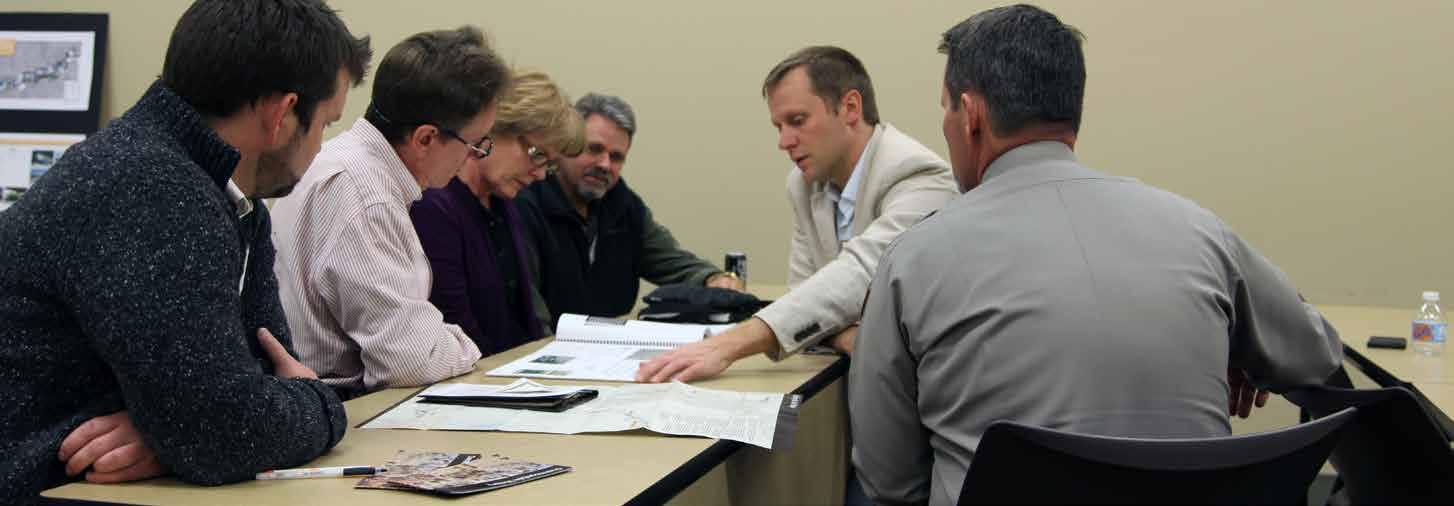
Landowners with property along an identified feasible trail route were invited to a special meeting to learn more


about the trail project. After receiving comments from landowners, the preliminary trail route was revised accord ingly.
4. 5.
Plan Development | January – September 2016

The consultant team worked in tandem with local lead ers to develop a preferred trail alignment. Renderings and schematics were provided to visually support the trail rec ommendations.
Final Plan Preparation |


October 2016
The final plan is published for review by the public, elected officials, and stakeholders.
project timeline
A Project Fact Sheet provided interested parties with background information and a project timeline.
4 INTRODUCTION JUNE-SEP T. ‘1 6 OC T. - NOV. ‘1 6 NOV. ‘16-FEB. ‘1 7 •Conduct extensive site visit of study area •Map opportunities, constraints, and draft routes •Conduct stakeholder meetings throughout the study area •Re-evaluate trail routes and priorities •Develop final alternative routes •Identify key focus areas for implementation RESEARCH & ANALYSIS PUBLIC ENGAGEMENT PLAN DEVELOPMENT PLANNING PROCESS BACKGROUND THE PLANNING PROCESS trail master planning effort underway help create section the Overmountain Victory National Historic Trail (OVNHT) to connect from Elkin to the W. Kerr Scott Reservoir! Thanks to support from the National Park Service, regional community organizations, and local governments, this plan will help establish walking and leisure biking trail that connects the region and celebrates the trail walked by the Overmountain Men who won major Revolutionary War battle Kings Mountain in 1780. The trail planning process requires an analysis the Yadkin River corridor between Elkin and W. Kerr Scott Reservoir. The trail best suited in floodplain areas where development generally cannot occur and where there are meaningful connections existing parks, civic buildings, and neighborhoods. After identifying feasible trail route options, there will major landowner outreach effort. Without the voluntary commitment from landowners, the trail will either be relocated or not constructed. An educational video will be developed to help communicate the historical significance of the OVT, which will be made available online. www.OVTplan.com 1 Direction Setting and Project Launch September 2015 The consultant team will meet with local trail and government leaders to generally discuss environmental constraints and opportunities for trail connectivity. 2 Research October December 2015 The consultant team will conduct thorough environmental assessment of the study area and determine feasible trail route options. With the trail routes identified, landowner contact list will be developed. 3 Landowner Outreach December 2015 Landowners with property along an identified feasible trail route will invited to special meeting to learn more about the trail project. After receiving comments from landowners, the preliminary trail routes will be updated. 4 Plan Development January March 2016 The consultant team will document the trail analysis and landowner comments. Recommendations will highlight alternative routes and the project’s overall feasibility for completion. draft plan will be made available for public 5 Final Plan Preparation April 2016 The consultant team will publish final plan that incorporates all public comments.
National Historic Trail Master Plan Overmountain Victory N O CONSULTANT CONTACT Eric Woolridge, AICP, Destination by Design Eric@dbdplanning.com 828.386.1866 www.DbDplanning.com
FACT SHEET
1.
FACT SHEET
2.
ORGANIZATION


This chapter provides a comprehensive overview and analysis of the opportunities and constraints found throughout the study area. The analysis begins with a brief description of the study area followed by a comprehensive discussion of the natural and built environments and their implication for trail suitability, trail design features, permitting, and costs. This chapter concludes with a map and photographic series that highlights a host of preliminary trail route alternatives.
This chapter is dedicated to visually defining the various trail types to be used throughout the corridor. Also, design concepts are provided for all types of trail user orientation signage, mile markers, historic markers, and other trail support facilities.


Significant efforts were made to reach out to landowners where the preliminary analysis (results from chapter I) indicate that the trail is most suitable. This chapter outlines the process and results of landowner outreach, including a map series illustrating landowner sentiment.
The fourth chapter breaks the study area into five (5) planning sections. Each planning section includes a map that displays a preferred alignment. Each planning section further incorporates the analysis and design elements from the previous chapters along with a host of supporting renderings and design schematics.

INTRODUCTION 5 Existing certi PROPOSED BRIDGE EXISTING FARMLAND SPUR TO OVNHT RIVER ACCESS CANOE/ KAYAK STORAGE PICNIC SHELTER W/ GRILL, TYPICAL COVERED PAVILION OPEN SPACE blair island highland proposed yadkinrivergreenway NATURALSURFACE H NG RA MUL USE GREENWAY YADKIN RIVER CHATHAM JARUSSEL ELKSPUR LEE MAIN WALL CARDINAL JOLLY BIG BEND MACEDON A CH STINLITTLE MTN AVA JANE LO X BETHEL OSBO CEDARBROOK MON EY EDW SDRA L AKEVIEW EDWARDS RIDGE NO TR H W OOD DECATUR CHATHAM LITTL E ELKIN CH HILLCRE S T HARR I S R I VER R I C B LLE ER SCH SETTLE MACEDONIA CH OAKLAND PLEA SHAMROCK THARPES M LL RIVERBOTTOM WOODY TOWNOFRONDAJURSDCTION RONDA JONESVILLE TOWN OF ELKIN JURISDICTION TOWNOFJONES ELKIN YADKIN RIVER SWAN CREEK LITTLEELKINCREEK BIG BUGABOO CR EEK K ELKIN CREEK YADKIN RIVER YADKIN COUNTY WILKES COUNTY SURRY COUNTY N 0 1/4 1/2 1 MI. SECTION 1 1 STEEP SLOPES STEEP SLOPES STEEP SLOPES PINCH POINT 2 1 1 RONDA MEMORIAL PARK 268 268 268 268 LANDOWNERS CLOSE TO RIVER LEGEND LANDOWNER SENTIMENT YES NO POSITIVE NO RESPONSE PREFERRED TRAIL ROUTE ALTERNATE TRAIL ROUTE SPUR TRAIL EXISTING LOCAL TRAIL PROPOSED LOCAL TRAIL TRAIL FEATURES TRAILS ROAD CROSSING MAJOR BRIDGE MINOR BRIDGE/ CULVERT CROSSINGS # # # TRAILHEAD CERTIFIED OVT SECTION CONSTRAINT PLAN
n { n å å " & [ [ j [ [ j [ j [ å !# ; ; [ j CCA G Y O S L A H H ND ARD R T E W YO L GE O O R G L W F E R O T DE A L X A g b k C k W S C Sw VER B e N C ELKIN JONESVILLE RONDA WILKES YADKIN WILKES SURRY SURRY YADKIN 5 7 8 9 10 10 11 12 3 2 8 10 11 7
Existing Conditions, Analysis, and Preliminary Alignments Chapter I. Trail Character and Design Guidelines Chapter iii. Landowner Engagement Chapter Ii. Recommendations Chapter iv.

6 INTRODUCTION
CHAPTER 1
EXISTING CONDITIONS, ANALYSIS, AND PRELIMINARY ALIGNMENTS

An OVERVIEW AND ANALYSIS OF THE OPPORTUNITIES AND CONSTRAINTS FOUND IN THE STUDY AREA
The analysis begins with a brief description of the study area followed by a comprehensive discussion of the natural and built environments and their implication for trail suitability, trail design features, permitting, and costs. This chapter concludes with a map and photographic series that highlights a host of preliminary trail route alternatives.
THIS CHAPTER
IN
A. Study Area Description B. Natural Environment Analysis C. Human/Built Environment Analysis D. Map and Photo Series: Preliminary Trail Route Alternatives
STUDY AREA DESCRIPTION:


8 CHAPTER 1
ROARINGRIVER MULBERRY CREE K W KERR SCOTT RESERVOIR Y A D K I N R I V E R WILKES COUNTY WILKES COUNTY 1/ ECORRIDOR YADKIN COUNTY WILKES COUNTY SURRY COUNTY RONDA ROARING RIVER N. WILKESBORO WILKESBORO ELKIN JONESVILLE 421 421 21 115 18 268 The 28 mile study area begins in the Town of Elkin at the NPS marker, identifying the OVNHT’s overall Eastern Terminus, and ends at the W. Kerr Scott Reservoir in Wilkes County.
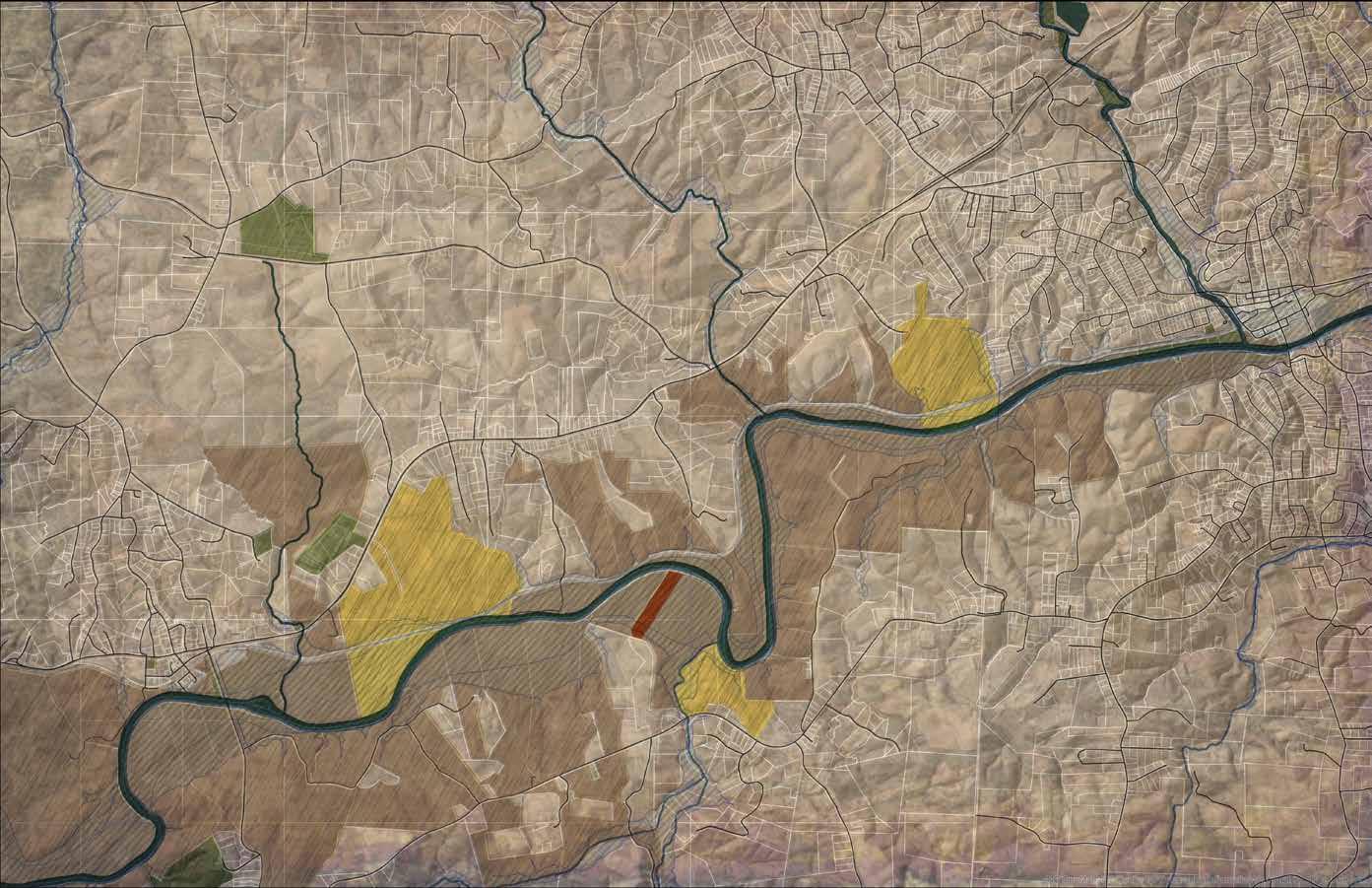
The Elkin to W. Kerr Scott Reservoir OVNHT study area is one-mile wide and extends approximately 28 miles from the Town of Elkin to an existing certified segment of OVNHT at the W. Kerr Scott Reservoir in Wilkes County. The study area begins at the eastern terminus of the OVNHT in the heart of Elkin located on the south side of NC Scenic Byway 268, adjacent to the Elkin Recreation Center. The trail route follows an existing natural surface section of the OVNHT along the Big Elkin Creek south to the Yadkin River where it then extends west through the Town of Ronda, the Roaring River community, and the Towns of North Wilkesboro and Wilkesboro before reaching its western terminus at the W. Kerr Scott Reservoir. Land uses throughout the Yadkin River corridor are typified by low-lying agricultural and undeveloped lands with very low-density residential uses. An active railroad corridor parallels the Yadkin River at various locations, which supports a Lowes Hardware warehouse and other industrial and commercial farming uses. W. Kerr Scott Reservoir and its section of certified OVNHT serves as the western terminus of the plan study area. STUDY AREA MAP 2: GENERAL STUDY AREA
ROARINGRIVER
GENERAL


EXISTING CONDITIONS, ANALYSIS, AND PRELIMINARY ALIGNMENTS 9 A N A L Y S I S
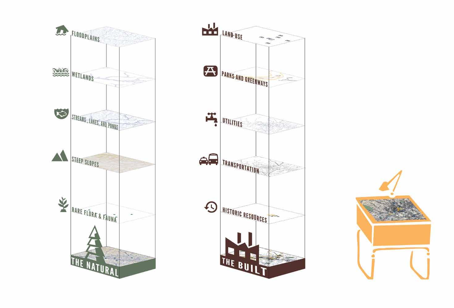
WORKFLOW ALTERNATE TRAIL ROUTES WERE DETERMINED BASED ON AN ANALYSIS OF THE NATURAL AND BUILT ENVIRONMENTS.
ANALYSIS
THE NATURAL ENVIRONMENT
The opportunities and constraints found within the natural en vironment are critical for determining suitable trail locations and feasibility, ideal user experiences, construction costs, and necessary permits.

This section explores the implications of the study area’s nat ural environment for establishing the Overmountain Victory National Historic Trail from Elkin to the W. Kerr Scott Reservoir and includes five (5) parts: 1) Floodplains; 2) Wetlands and Hy dric Soils; 3) Rivers, Streams, and Lakes; 4) Steep Slopes; and 5) Rare Flora and Fauna.
10 CHAPTER 1
FLOODPLAINS
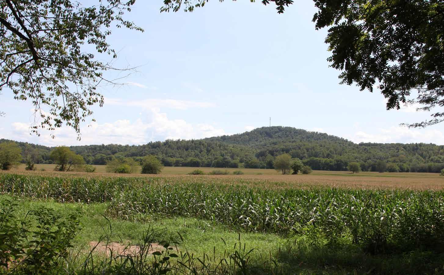
Floodplain areas provide both an opportunity and constraint for trail development. Since tra ditional development is often not suitable with in floodplain areas, private landowners are often more willing to provide access for public trails within these areas. Also, these scenic areas often attract wildlife, which creates an engaging trail experience. Within the study area, much of the floodplain areas along the Yadkin River corridor are ideal for greenway development where sig nificant sections of the Yadkin River Greenway now exist.
Although development is regulated within the floodplain, greenways and trails are allowed and can be permitted. Sound trail engineering tech niques are necessary to ensure trails can sustain flooding. To the extent possible, greenway align ments should be avoided within the floodway¹.

Avoid disturbance in the floodway. Avoid placement of structures or disturbance within the floodway. Floodways are regulated locally and by the Federal Emergency Management Agency (FEMA). Fill, structures (walls, kiosks, etc), and impervious services are discouraged. Any structures located within the floodway require a no-impact/no-rise certification through FEMA. These studies can vary on cost but can range from $2,500$15,000 depending on complexity.

WETLANDS AND HYDRIC SOILS
The study area includes several wetland areas as identified on the National Wetland Inventory (NWI). According to NWI, there are likely smaller wetland areas within the study corridor that are not indicated within their inventory that could impact final trail alignments. Hydric soils in com bination with wetland plant species and wetland hydrology are considered indicators of a wetland, which require costly permitting if impacted².
2 If wetlands are unavoidable, utilize elevated boardwalk systems. Boardwalks allow for travel over flat, poorly draining soils, standing water, and wetland features and have significantly less impact than other options. A section 404 (Clean Water Act) Permit may be required if the wetland is considered jurisdictional by the USACE. This means that the wetland is not isolated and part of a broader lake or water system. A small boardwalk for a non-isolated wetland with limited fill or dredging may qualify for a programmatic Nationwide Permit. Nationwide Permits are designed to streamline the permitting process for actions with limited disturbances. In addition to permitting, disturbances exceeding a tenth 0.1) of an acre would require mitigation which can increase project costs. Impacts under a tenth (0.1) of an acre do not trigger mitigation fees.
STREAMS, LAKES, AND PONDS
The County, State, and Federal government reg ulate the many water bodies found throughout the study area³. The Yadkin River and its tribu taries including the Reddies River, Roaring River, Mulberry Creek, and Big Elkin Creek are some of the most important waterways found within the study area; there are permitting implications for crossing and bridging these water bodies⁴.
Maintain a 50-foot buffer from all waterways, particularly those regulated under the Yadkin River Buffer Rules. The state requires a 50-foot buffer along the shorelines of Catawba River and associated lakes. Streams within the study area are identified by the State of North Carolina as having poor water quality and maintaining or improving an adequate vegetated buffer is crucial to improving the quality. Zone 1 of this buffer includes an undisturbed 30-foot buffer from top of bank in which trails are discouraged.
Zone 2 is an additional 20-foot buffer. This zone allows for managed vegetation and trails and greenways. While trails are an allowable use within Zone 2, the NC Division of Water Quality requires a permit (through DWQ or designated local government). The applicant must show that disturbance has been minimized and no other alternatives exist.
Plan for permits related to waterway Impacts. Federal 401/404 Certifications will likely be required in cases where any stream or waterway alterations occur. These alterations would be most likely in conjunction with bridge improvements or addition of structures near waterways. Triggers for the permit include disturbance to the stream bed, banks, damming of the waterway, or placement of material within the waterway (i.e. culverts/ pipes).
PRELIMINARY ALIGNMENTS 11
EXISTING CONDITIONS, ANALYSIS, AND
“Much of the floodplain areas along the Yadkin River corridor are ideal for greenway development.”
photo by others
STEEP SLOPES
Much of the study area includes gently roll ing topography and thus avoids impacting steep slopes. The most challenging slopes along the Yadkin River are steep areas of ten found opposite of large floodplains. To the extent possible, the trail should provide for grades under 5 percent. Natural surface trails can vary up to 10 percent slope. Pro posed trail alignments may require a wider trail corridor to ensure a more gradual trail grade.
RARE FLORA AND FAUNA
The State Natural Heritage Program provides data identifying the state’s most sensitive environmental areas; these areas are incorporated within the analysis map series at the end of this chapter. Also, rare flora and fauna species can also exist outside of these designated areas, which can alter final trail alignments prior to construction. Species identified by the State Natural Heritage Program within this study area as of April 2016 include:
Coordination with the U.S. Fish and Wildlife Service (USFWS) is an important aspect of the design process. Involving USF WS early on in the process can help avoid potential planning obstacles related to federally protected species. Additional ly, permits like Section 401 and 404 (described previously in Wetland and Streams sections) will initiate the review of the State Natural Heritage Program database. If species are found within the project area, State or Federal requirements may dic tate avoidance or mitigation.
A. Brook Floater (Yadkin & Roaring Rivers)
B. Roanoke Slabshell (Yadkin River between Ronda and Roaring River community)

C. Mayfly (Yadkin River near Wilkesboro)

D. Bank Swallow (Roaring River)
E. Lobed Spleenwort (rock outcroppings on Roaring River)
F. Carolina Foothills Crayfish (Yadkin River and Fishing Creek)
12 CHAPTER 1
Mayfly: photo by others

EXISTING CONDITIONS, ANALYSIS, AND PRELIMINARY ALIGNMENTS 13
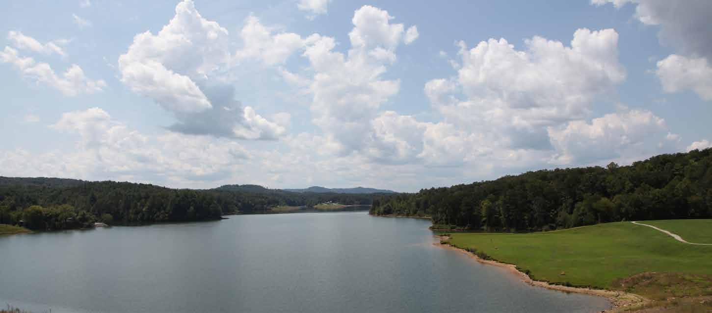
land area provides for six miles of certified
and
of recreational offerings, including
fishing,
The
both the Visitors Center and Bandits Roost
W. KERR SCOTT RESERVOIR
The W. Kerr Scott Reservoir comprises 1,475 acres in western Wilkes County and is managed by the United States Army Corp of Engineers.
This public
Overmountain Victory National Historic Trail and is renowned for its scenic beauty
abundance
boating,
hiking, and mountain biking.
Reservoir provides for OVNHT trail heads at
Campground.
QUICK FACTS W. KERR SCOTT RESERVOIR Constructed: 1962 Miles of Constructed Trail: 40 Miles of Certified OVNHT: 6 Miles of Shoreline: 56
Exhibit 1: W. KERR SCOTT RESERVOIR
THE BUILT ENVIRONMENT

The opportunities and constraints found within the built and human environment are critical for determining suitable trail locations and feasibility, ideal user experiences, construction costs, and necessary permits.
This section highlights five ( 5) built environmental features and their implications for developing the OVNHT from Elkin to the W. Kerr Scott Reservoir, including: 1) Land Use; 2) Existing Trails and Parks; 3) Utilities; 4) Transportation; and 5) Historic Resources.

14 CHAPTER 1
photo by others
LAND USE SNAPSHOT
The Town of Elkin


The eastern terminus of this plan and the entire OVNHT begins in the Town of Elkin. This historic community is situated along the banks of the Yadkin River and south of Stone Mountain State Park. The Town maintains a close partnership with the Elkin Valley Trails Association, and together, they have made significant strides to establish Elkin as a state-recognized Trail Town. The OVNHT, Mountains-to-Sea Trail, Yadkin River Blue way, and several other local trail systems converge in Elkin. Elkin’s downtown is comprised of a mix of commercial, civic, and residential uses, providing trail users with opportunities for dining, shopping, and entertainment.

Community of Roaring River
Roaring River, an unincorporated rural community, serves as the approximate middle point of the study area. The Roaring River community is characterized by low-density rural devel opment with access to Highway 268. Wide swaths of farm land and an active railroad are located in the floodplain between Highway 268 and the Yadkin River. As the study area extends west toward North Wilkesboro, the landscape is interrupted by a large heavy industrial land holding occupied by the Louisi ana-Pacific Corporation and several smaller operations. Large parcels of agricultural land still remain throughout this area, which present an opportunity to construct significant seg ments of trail with the cooperation of a single property owner.

Town of Ronda
Ronda is a small rural town situated between NC Scenic By way 268 and the Yadkin River. The town core consists of a sin gle block of commercial property that is surrounded by low density single-family homes. Just beyond the town limits are large agricultural tracts and multiple light industrial facilities. The Town of Ronda Memorial park is part of the Yadkin River
Paddle Trail and provides an opportunity for OVNHT trail con nectivity.

North
Wilkesboro & Wilkesboro
Geographically separated by the Yadkin River, the Towns of North Wilkesboro and Wilkesboro are historic communities lo cated at the foothills of the Blue Ridge Mountains. Both towns have made significant strides in the past decade to revitalize their distinct downtown cores. Annually, the towns attract tens of thousands of visitors over a single weekend for the famous music festival, MerleFest, and now attract regular weekend vis itors with their mix of vibrant local shops, restaurants, farmers markets, and recreational opportunities. Connectivity among the town now exists because of a growing network of trails, including certified sections of the OVNHT. This plan explores ways to further grow this internal trail network and extend its reach east toward the Town of Elkin.
EXISTING
AND PRELIMINARY ALIGNMENTS 15
CONDITIONS, ANALYSIS,
“Well-established trail systems in the Towns of Elkin, North Wilkesboro, and Wilkesboro provide natural anchor points for infill trail development connecting these communities, expanding recreation offerings, and creating new certified sections of the OVNHT.”
EXISTING PARKS AND GREENWAYS
SOME OF THESE MAJOR ASSETS INCLUDE:
Eastern Terminus and Certified Segments of the OVNHT
The Towns of Elkin, North Wilkesboro, Wilkesboro, and the W. Kerr Scott Reservoir have a combined total of more than 13 miles of certified OVNHT. The Town of Elkin serves as the over all eastern terminus for OVNHT.

Ronda Memorial Park
The Ronda Memorial Park is part of the Yadkin River Paddle Trail and serves as an ideal trail connectivity point. Other park amenities include a walking track, playground, and large barnstyle picnic shelter.


Yadkin River Greenway
The Yadkin River Greenway Council, Wilkesboro, and North Wilkesboro have worked together for more than two decades to successfully develop a more than seven-mile network of gre enways along the Yadkin River and its tributaries. More than 3.5 miles are certified as part of the OVNHT.
W. Kerr Scott Reservoir
Managed by the US Army Corp. of Engineers, the Reservoir is a regional recreation destination attracting mountain bikers, paddlers, hikers, campers, trail runners, fishermen, and birders. This public land holding provides for six miles of existing OVN HT. The W. Kerr Scott Reservoir serves as the western terminus of the study area and a major trailhead for the OVNHT.
16 CHAPTER 1
“Elkin, Ronda, North Wilkesboro, and Wilkesboro boast a collection of parks and greenways that are ideal for trail connections.”
EXISTING CONDITIONS, ANALYSIS, AND PRELIMINARY ALIGNMENTS
UTILITIES TRANSPORTATION


The incorporated towns located within the study area maintain water and sewer infrastructure, which in some instances have easements that can be modified to provide for trail develop ment.
The analysis of the study area includes a review of public infra structure and associated easements; these areas are shown on the Site Analysis Maps with corresponding opportunities and constraints notes.

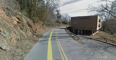
The analysis of the study area includes a review of the North Carolina Department of Transportation (NCDOT) right-of-way (ROW), NCDOT plans, existing bike and pedestrian infrastructure (crosswalks, bike lanes, etc.), railways, and existing greenways.
NCDOT’s right-of-way was analyzed to determine where there might be opportunities for developing OVNHT side paths. These areas are shown on the Site Analysis Maps with corresponding opportunities and constraints notes.

17
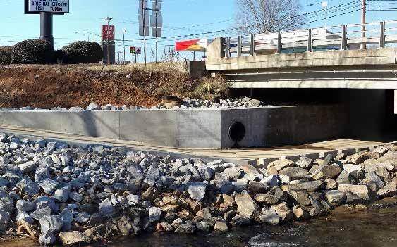
Yadkin River Greenway Underpass at Highway 268
HISTORIC RESOURCES


The Overmountain Victory National Historic Trail Route and Corridor

The Overmountain Victory National Historic Trail route was identified by a National Parks Service research team. The team relied on the 1881 account of the march, which has been amend ed by local historians, descendants of battle participants, and other sources. As part of this congressionally designated trail, any officially designated portion of the OVNHT must lie with in a one-mile corridor (half-mile on either side) of the historic route.
Sensitive Cultural Resource Areas
Culturally sensitive resource areas have been mapped in the site analysis study based on input from the NC State Histor ic Preservation Office (SHPO). These areas are shown on the Site Analysis Maps with corresponding opportunities and con straints notes. These sites should be avoided due to the possi bility of historic resources that could be destroyed with ground disturbance5
Historic Sites and Landscape
SHPO oversees a large database of historic sites and resources. All resources, including those related to the OVNHT, are includ ed within the subsequent analysis map series. These resources include information from SHPO surveys as well as a large list of sites related to the National Register of Historic Places (which the National Park Service oversees but individual States man age). The most critical sites include those listed on the Na tional Register (NR) or determined eligible (DOE) as they have further protection under Section 106 of the National Historic Preservation Act6. The National Park Service has emphasized that as part of this study and trail development, that historic/ cultural resources should be linked, preserved, and interpreted.
5 Sensitive Cultural Resources and Permitting: Any construction funded or permitted by the federal government will trigger a project review by SHPO of any resources covered under Section 106 (National Historic Preservation Act). These resources could include human remains, burial sites, archeology sites, and historic sites. If it is found that the action of trail construction could potentially adversely affect cultural resources, the SHPO will work with the related Federal Agency to eliminate or minimize the effect.
6 Historic Sites and Permitting: In general, a greenway would have no effect or a complimentary relationship to preservation of these sites, but may require SHPO coordination in circumstances like alterations to historic bridges or whole properties. If federal funds or permitting is required, the SHPO will review this database and analyze for any adverse impacts.
18 CHAPTER 1
“THE OVNHT SHOULD LINK, PRESERVE, AND INTERPRET HISTORIC AND CULTURAL SITES ALONG ITS ROUTE.”
MAP AND PHOTO SERIES: PRELIMINARY TRAIL ROUTE ALTERNATIVES
The map and photographic series, which spatially incorporates the natural and built environment analysis, highlights a host of preliminary trail route alternatives.
These routes were further refined by local leaders to identify and engage landowners. This information will serve as an ongoing reference guide as alternative routes may need to be developed due to unforeseen barriers.


EXISTING
PRELIMINARY ALIGNMENTS 19
CONDITIONS, ANALYSIS, AND
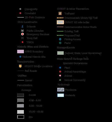
n n [ j [ [ [ [ [ !# ; ; [ CC K P N U V R G D A N R M G D W W E R W R W S C E W S V C M C G m C ELKIN JONESVILLE RONDA WILKES YADKIN WILKES SURRY SURRY YADKIN 3 4 5 8 10 10 12 4 2 10 & & n n n n " & n n " n W kesboro North W kesbo o H h S [ j R G C [ j n [ [ [ [ j j [ O RM TOW S C G E S C S E E C D RA R UMP A E A M UR E KY P R NS Y UN S S TCO M U D R W C O P R R R URNWOO CH M A N O R LW Q MA NCHW 6 O CO P M O V S D A D S BOR UNN E G E SH M NS B A WO UNCRE RCH D K E R E KWOOD CO H L A AR F H S N OR Z EA R H S O E GH R R S K W T H WN S M H E W T A P H D OWNS D E WOODRUN D E O E S SDE N R RE R O E W O U S W H ER H N A W D NEC RE A W OD ML URCH A K 1 WY G M Y ONE MOR A WE M E A K R M S R A E R CA WN WE TW D W G B W D E R MON V A H A C O D ONE N H L Y N A E N E N S T O K M A WO W S C M L T GE P K L PO WBROO A C L A Y R ORN L G S EY OX N GH G H MT D K ON A M ON M A Y D R R M O M R AR O N O MA M BO E G ROS Y S D E A H A LCO H M C O G W N E A DG S E R AC S HA V W O NEG E T K E COM HOM M SC O T C E NC Y1 R EC K S O E WY W A E S C U D O N AU N ON WOOD M N A P O B Y D R RAM W NC U L SU OO D S H C B E N D R O Y E F B N CONGO T O M S U R M E E OD GO 4 A O RK P O AR CH Y 6 L S H RV Y W T L M W E A P N W K E M WY E K R 3 OON O AMP Y T BOON O E USH R NOA P C A C Y ON P S R L C C L C d A e N M # H h S NORTH WILKESBORO WILKESBORO 3 6 10 2 ! ( ! ! ! ! ! (!(! !(!( ( ! !( (! ( ! ! ! ! ! ! ! n " H O M U T N M TN O R D E L M G Q N N S WA W R K R U N O W D U O G F A D A HSM CR E H DOW O N D K T W WE R R B R B TS G C C R A ES O HE A R U R N MP N O H T R O O D RD R N U E A N E E H S N WH P O U C C OR RO T C O OH H O C R W R O Y O A HWY Y KN h gC B R M N O NORTH WILKESBORO JURISDICTION 9 10 6 11 12 13 4 5


20 CHAPTER 1 T wn o Ro n da T wn H n { å å å å å " A & [ [ j [ j Ch a m Pa k T a a d M n e a S Swa m M mo a P Pa E k H gh Sc o E M d d e S o n e s e E me n a y Scho o [ Ron d a C n g m E me n a y S ch å Eas W ke s H gh Sch o Eas W ke s M e Sch o o # S r y C S o S d ; ; E k n P e a a n H F e De p a me n ! B o F o a e [ j OA K ST D M R VATE SUNIE O D G I LL Y B TH L C O TOLER WOODY O N P L A Z LAKE L C R E S HAL WESTBROOK SL CK CAROL NE S A R O E OD AC E S A N C E K BRDGE PARK C RCLE SPRNG HAYNES DOGWOOD P TRIPLETT COB W N ON SPENCE G O R Y AY NORTH CEDARBROOK LOOP FOSTER ANGEL HAYWOOD CAN PE TRAILER MLDRED JONESV LLE C RR R S N OA KLA ND ELM DELOS MARTN M A G N O L A N C S P R U T T HARDY V LLEY WELBORN HILLHAVEN W LL SC H O L M SW A I A M S HAYNES H W L C HOOL OSBORNE SWANCREEK E H L MA C E M E SWAN CREEK CEDARBROOK C O O BR ETH L HO CHERRY RIV CEDARBROOK CARR C OK OAK YATTKENWOOD MATHIS O O L P N E JONESVL E MONEY BAGLEY SPR NGS THARPE M WOODY B G BEND SETTLE AK C V A R Y U CO W L K E C O O K P N N X CAR D NAL MART N BETHE M O RVERRDGE LT LEE KINCH JOLLY RVERMST LAKE EDWARDS RIDGE GWYN WOLF BEA UTY BELLS HA Y P NE REDMON RMS RO G PRUTT UMM DG WA LL HOOTS J A M E S T B Y R D R OA N G R V ER N R D 6 O K R DGE VALLEYVIEW BRANDON MEL FRANCSGILLAN SECO PIEDMONT H DDE N SP R NG S M P E SP NG C SHAMROCK AV ANE D D E N A C S O POPLARSPRINGS BL V NS WAD E L M E COC ER AM R ER D T AR E G EENWOOD AUSTNTRAPHILLEDWARDS CENTER RIVERBOTTOM EDWARDS LAKEV EW OLD NW HWY ELKSPUR ELKNHWY268 MACEDON CH H RD FACTORY C N CHATHAM ELKIN HWY 268 ELKNHWY268 CL NGMAN AUSTIN ITTLE MTN BETHEL EE CHATHAM HOO T BETHEL HICKERSON BETHE LO AX MACEDONACH BETHEL A R S S L HOOTS R V E R R D G E MAIN BR I DGE CCCAMP ELK SPUR OAKLAND NC HWY 268 SOUTH IVY HARR I S RING HILL PLEASANT HILL N O R T H W O O D HIGHLAND IC SURRY RIDGE JAM HAW THORNE P I NEWOOD YOUNG LAUR GE REEVES MAS ON I C OLD MILL RIX BRAGG W SCONS N SALMON MIL WOOD FORESTHILL DECATUR W I LES WESTWOOD TEXAS AZALE C o b b C r e e k Big Bugaboo Creek LittleElkinCreek H u g h e s B r a nc h West Swan Creek EastSwanCreek SwanCreek YADKIN RIVER G ra ys C reek E R YADKIN RIVER YADK N R VER NC One M p , g p y PRNG N ELKIN JONESVILLE RONDA WILKES YADKIN WILKES SURRY SURRY YADKIN 1 1 2 4 5 6 7 8 9 10 10 12 4 3 2 8 9 10 11 5 6 7 AREA 1 SITE ANALYSIS STUDY STUDY AREA 1 Map 3: Study Area 1 Site Analysis LEGEND
OPPORTUNITIES




EXISTING CONDITIONS, ANALYSIS, AND PRELIMINARY ALIGNMENTS 21 EXISTING C ONDITIONS, A N A L Y SIS, A ND PRELI M INAR Y AL IGN M EN T S 21 f ee me ers 10 3 f eet met ers 20 7 f eet 10 STUDY AREA 1 OPPORTUNITIES & CONSTRAINTS 1 Any side path along Front St. would be difficult due to the narrow road.
the Eastern Trailhead and connect short distance to existing OVNHT trail.
site Elkin
has existing
Existing trailhead and railroad
Site of future Yadkin River Heritage and Trail Center Connection to proposed
NC
Sea Trail Connection with Town
Wide floodplain Wide floodplain
accommodate
trail
Tree
Steep
Steep
Steep
HWY
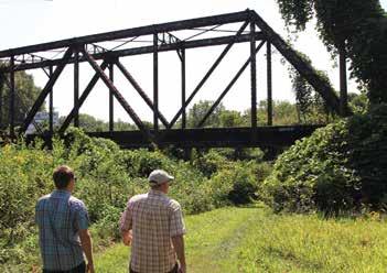
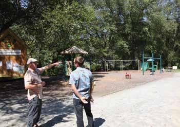
3 View of Clingman Rd. Bridge over the Yadkin River. Opportunity for the OVNHT to interact with the rail line in a creative/safe way. View of W. Main St. crossing. 11 11 4 1 Elkin Municipal Park. The Eastern Trailhead of the OVNHT exists at 1 1 2 3 4 5 6 7 8 9 10 11 12 2 3 4 5 6 7 8 9 10 11 Existing OVNHT is located through Elkin Municipal Park. 7 10 The OVNHT could connect to the Town of Jonesville Greenway. Ronda Memorial Park could serve as an OVNHT trailhead. 2 STUDY AREA 1 OPPORTUNITIES & CONSTRAINTS
Enhance
Surry County Muster Site - Historically significant OVNHT
Municipal Park
OVNHT
underpass
section of
Mountains-to-
of Jonesville Greenway system
Connection to Ronda Memorial Park Existing road underneath southern portion of Clingman Rd. bridge is large enough to
a
narrow shoulder Market St. Crossing has OVNHT markers, but could benefit from crosswalk Elkin and Jonesville trail systems are divided by Yadkin River with no pedestrian infrastructure to connect Trail close to railroad. Pinch point
farm
slopes
slopes
slopes Pinch point / steep slopes Clingman Rd. bridge has narrow shoulder
268 over Big Bugaboo Creek has narrow shoulder CONSTRAINTS


22 CHAPTER 1 ! ! ! ! n g R e e me n Sc o o Ro g R e F e D me n " A & Mo u n V e w F e De p a me n " A & Ma y y Car na Fo o h s C a sh B Sw o b ed Sp e n wo ABTCO RUTH L I NNEY COTTON MILL RURITAN PAR 3 PJ ROYAL WA D D E L L US HWY 421 MARTIN OLD60 ELLAS ELMORE BRINEGARHILL W O B L A C K B U R N DRBEALEFARM T W I N H I L L FISH NG CREEK OLDQUARRY PENNINGTON EASTWAY BREWERS NANCE P A R K S R I D G E TRIPLER TRUITT KEMP AIRPORT QUAIL LANES MILLHOLE RUBY WARD RR RURITAN CLUB MCCRARY PEACOCK RAY GILLIAM ANTHONYFARM R O C K Q U A R R Y FARMALL C R A N B E R R Y R I D G E WARD M A S T I N KNOTV I LLE MATHISMILL CREEKS DE REDWH &BLUE TAYLOR EASTON THURMOND SPARKS R O B I N H I L L B L U E B I R D SUNDOWN A N T I O C H C H SHORT GLENN RIDGE FRANKIES F R A N K J O H N S O N STONEBREWER L BERTY KNOLL ELIBREWER C O R P O R A T E A V I A T I O N L BERTY MOUNTAIN DALE KEY RIDGE DSIDE BEAVER DAM SILVER PINE MORR SF ELD B A Y SANFORD ARBORGROVEBAPTISTCH WINGS C L O V E R L E A F ROCKCREEK I T E P L A I N S SP I CER DOG FOUST P I N E H I L L LW ANDERSON SHEPHERD CAMPBELL WALTBREWER VILLAHEIGHTS BERRYS OUNTRY WALK SHEWRIDGEMISSION RIDGE COTTONTAIL WOOD WALLACE HOLLAND WOODS PUMPKIN PATCH R VER RD OVE ELKIN HW Y 2 68 ROCK CREEK CH OLD 60 MATHIS MILL AIRPORT KYV I EW OLD60 OLD 60 OLD60 OLD 60 WARD RRRURITANCLUB OLD60 DELLAPLANE R I D D L E OLD 60 ELKINHWY268 CAMPBELL JOHNSON WHITEPLAINS ROCK QUARRY OLD60 ANTIOCH CH ARBORGROVEBAPTISTCH OLD60 USHWY421 JOHNSON ARBOR GROVE BAPT ST CH WHITE PLAINS ROCKCREEK ELKIN HWY268 WALT BREWER RED WHITE & BLUE ROCK QUARRY AIRPORT OLD 60 KEY RIDGE PARK S R DGE ELKIN HWY 268 ROCKQUARRY ELKINHWY268 YADKINRIVER Rock Creek FishingCreek RoaringRiver Mulberry Creek YADKIN R VER NC One Map NORTH WILKESBORO JURISDICTION 1 1 2 3 4 5 9 8 10 6 7 11 12 13 3 2 4 5 LEGEND AREA 2 SITE ANALYSIS STUDY Map 4: Study Area 2 Site Analysis STUDY AREA 2
OPPORTuNITIES


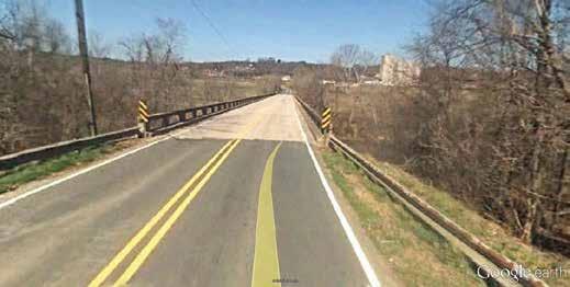
EXISTING CONDITIONS, ANALYSIS, AND PRELIMINARY ALIGNMENTS 23 EXISTING CONDITIONS, ANALYSIS, AND PRELIMINARY ALIGNMENTS 23 feet 200 feet 400 feet meters 10 5 feet meters 10 4 feet meters 20 8 STudY ArEA 2 OPPOrTuNITIES & cONSTrAINTS 1 3 Small commercial node at industrial site in Roaring River community. Numerous pinch points exist within this study area. Highway 268 bridge over Roaring River. 6 Wide floodplain on either side of Yadkin River. A spur trail could connect Roaring River Elementary School. Old 60 bridge is too narrow to accommodate a trail. The Yadkin Valley Railroad is active throughout the Roaring River Community. The Louisiana-Pacific site is a significant landholding within the corridor. 5 7 9 1 2 4
Wide floodplain Spur trail to Roaring River Elementary School Connection to Roaring River community commercial node (Snack / restaurant opportunity) Louisiana Pacific could incorporate workplace wellness trails Wilkes county landfill is a large tract within the study area.
point Steep slopes Steep slopes Steep slopes
60
is too narrow to accommodate trail users.
trail.
crossing
Pinch Point Fishing
crossing Pinch Point Pinch Point CONSTRAINTS 1 1 2 3 4 5 6 7 8 9 10 11 12 13 2 3 4 5 STUDY AREA 2 OPPORTUNITIES & CONSTRAINTS
Pinch
The Old
bridge over Brier Creek
The Highway 268 bridge over the Yadkin River has a narrow shoulder and would not be able to incorporate
Any spur trail to the Roaring River community would need to cross an active railroad. Roaring River
Louisiana Pacific is a large workplace that may not be able to accommodate a trail.
Creek


24 CHAPTER 1 Ca o a F h C a y h No h W e sb o o To wn Ha W esb o o F e De m n W kes To w No h W ke s F e De p a me n " & " A & CC W g E e me n S o o n n o h s C s a n C e g e & S em n N W ke E e me n a y S ch n We s W ke s M d d e S h o o M e s C k Ch s an Sch o o " & M e s C e ek F e De p a me n n W esb o o E e me n a y Scho o n W es Com mu n y Co e g e " A & B dwa Vo u n e e F e De p a me n n Wilke W KE RR SCOT T RESERVO R W ke Fa m YMCA We s wo od Pa L nco n He gh School L n co n He g h [ Ro ing P nes Disc Go f Course n [ j [ j H g a nd H D sc G o Cou se Ro n g P n e D G o Cou se [ j Op m Pa [ j W a m K Ne w o Me mo r a P a k [ j [ j Lo we P a R ve Ed g e F K I T E E COLON I AL CONGO GERMANTOWN ELLER MCNEIL FISHDAMCREEK L SUNCREST BYRD F O R E S T LEXI G A I T H E R PEACE N K C D TEMPLE O RANGER G R E E N H I L L HOLLY BUMPY AMELIA MOURNE ROUGE SKYLAND PARSONS CA TSUNSETCONN M COUNT RY OAK BUCK PONDV I EW HACKETT FLETCHER WILLOW CACTUS G R A C E I T H A C A D A N C Y EAGLE ZION HILL CH MONK DULA TRAPP CREEK S T AN D R EW S WESTOVER TURNWOOD Y AD K I N CALL FAIRCHILD CHARMETTE NGE DAY BEECH STEPHANIE JOLLY 3RD WATKINS FA I RP LA I N S CH MCELWEE SQUIRE MAY BUGLE NCHWY268 LOBO COX KNOLLWOOD ANDERSON EVANS STEVENS WESTD S P A R T A MAL L EDDIESOSBORNE SUNNYDALE G DOGWOOD K RBY GOVE RNOR STOKES GREEN SHEPHERD FARM SUNSET BRIAR S N Y D E R A I N S TURNERS OAKLEY CIRCLE KELLY PIERCE OAKWOODS K E L L Y H L L COTHREN GLENDALE WALNUT AARONCALL O L D 6 0 R E D D I N G FOOTHILLS BIRCH NABORS AZALEA GILREATH CHASE NORA OAK BROOKCREST KN GHT SHERRILL RAILWAY CAMP JO WILKES V A N C E LAKEVIEW 5TH BOONE TR 7TH 6TH WINDSOR MAE M A J O R OLD HAYES 8TH 9TH KEENER L I NEBERRY YSEL WALKER INDUSTRIALPARK SHADY MILLER TOWNSEND FROG R DGE TATES TW N OAK WOODRUN RUDD MILLER FRIAR RHODES MAHOGANY SCHOOL BUS STONEBRIAR L I T T L E B E R R Y RESERVOIR ELM WA T ER FR O N T RUFFIN SKYVIEW SOUTH W LKESBORO UNRD 200 SHANEREINS NORTH GRIFFIN RIDGE EASTWOOD IVY REDDIES SENECA SLEEPY AVENUE WEST CUBCREEKCH FAW P I N E B R O O K EMORY MLCHURCH PARK 51/2 11TH 13TH GWYN MCGLAMERY ASHLEY STONEHINGE MORGAN C E D A R R I D G E S H I L O H WESKIM ARMORY BELL HID WILLARD CASTLEBERRY WINKLER PINE WESTWOOD SANDWEDGE BROWNSFORD M I D D L E B R O O K MONTE VIEW MARSH I EASTOVER CEDAR CLIFFORD KRAMER FIELDSTONE SIDNEY SASSY TREE DUNCAN HOLLYGREEN HAUNTEDBRANCH G A T E W A Y CLEARWATER PENNELL SUMMIT T H U OAK KENLE GH MEADOWOOD WESTVIEW ACORN MEADOW COLLEGE RAMP BRADSHAW ANC I ENT OAKS B&M OAKDALE POPLAR RAVEN P NE MEADOWBROOK SUMM I T AVE HOLLAND BYRD RIDGE WELBORN TOLL VIRGINIAS FINLEY FOXRUN DON LAND GREENCREST BRUSHYMTN EDGEWOOD FORD MIDLAWN PILSON PARKWOOD P I N E H I L L MORRISON MORAVIAN COUNTRYSIDE ABSHER RAVEN MIST KNOLL MYERS PARK JOHNSON MAIN MILLBORNES ROSEBAY CURTISBRIDGE SPRUCE OAKHILL 10TH FRANKL I N JEFFERSON EDGEWOOD MILL BROWN RIDGE FAIRPLAINS RIDGE NEWBROWNSFORD DGE SKEES BERRYMTN GREENACRES SEDGEFIELD SHANNONVIEW ODELL BR NEGAR CRESTOAK CANTERBURY FA RVIEW DAMASCUSCH REYNOLDS NCHWY16 H U NTER GRE EN ACRE S MYERS WILKESBORO ELKINHWY268 R I D G E C R E S T WESTGATE HOLINESS CH EU 4TH STOKES W NKLER MILL K E N N E D Y C O L L E G I A T E 2ND LAUREL NORTHV EW WHITE PINE BOSTON WH TE LAURELWOOD GO L D E N N E E D L E S AGNOLIA POPLAR GROV E R VER RD L BERTY GRO OLDBRICKYAR OA KWOODS JOHNSON CHERRY RAMP NC HWY 16 US HWY 4 21 SUNSET NC HWY 268 NC HWY 16 OLD US 421 HILL SUNSET INDUSTRIAL 6TH AARON CALL F J I R VER BYRDRIDGE C PINE RAMP D PARK J R E S E R V O I R ARMORY VILLAGE F E CONGO 8TH H F FOREST MAIN C O F F E Y STATESVILLE NC HWY 268 WA L N U T BOONE RAMP HILL N C H W Y 1 6 EDGEWOOD G K S U N S E T CONGO 13TH BUCK M 7TH SUNCREST F 4TH D S T A T ESV I L L E C RAMP O L D 6 0 WEST PARK P A D S BOONE RAMP PARK NCHWY16 HOLINESS CH P I NE H I LL RIVER K L KYVIEW J CHWY268 T HILL GE RMANTOWN KITE RAMP NIAL D H WINKLER MILL 8TH US HWY 421 F ELDSTONE E KERRY J KITE 3RD BOONE CONGO ELKIN RAMP 13TH SKYV I EW 6TH BOONE N BROOK I E EDGEWOOD SC H O O L PINE USHWY421 I RAVENOAK F I NL EY RAMP CEDAR FLINTHILL NC HWY 16 K I TE BOONE K IAL GO CubCreek Millers Creek Creek Little CubCreek RIVER Redd ies River M Meadow Branch N RIVER ReddiesRiver NC One Map # En of S udy Ar ea NORTH WILKESBORO WILKESBORO 2 4 3 5 6 7 8 9 10 11 1 2 3 LEGEND STUDY AREA 3 AREA 3 SITE ANALYSIS STUDY Map 5: Study Area 3 Site Analysis


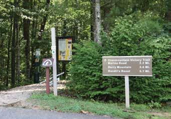
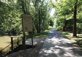
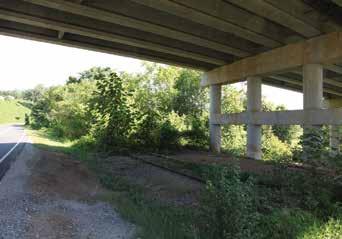


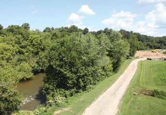

EXISTING CONDITIONS, ANALYSIS, AND PRELIMINARY ALIGNMENTS 25 EXISTING CONDITIONS, ANALYSIS, AND PRELIMINARY ALIGNMENTS 25 feet 10 STudY ArEA 3 OPPOrTuNITIES & cONSTrAINTS 1 8 1 Birds eye of Lowes site. View of Wilkes Family YMCA. Main St./ Hwy 268 in Wilkesboro. 3 Trailhead at Kerr Scott Reservoir Visitor Center. Designated OVNHT trail exists in Smoot Park. NCDOT Division office adjacent to Yadkin River. Railroad underneath Statesville Rd. bridge. Project terminus at Tailwater Access Area 11 4 3 2 10 OPPORTuNITIES Lowes may be a willing landowner Potential underpass at Statesville Road NCDOT Division Office may be able to incorporate trail on large tract of land. Historical OVNHT significance at Smoot Park with existing trailhead and certified OVNHT Trail Alignment could take advantage of large disc golf courses and their existing trail systems Wide floodplain Existing trail at Lowes Park at Rivers edge Connection to YMCA Wide floodplain Project terminus at Tailwater Access Area Kerr Scott Reservoir Visitor Center has OVNHT exhibit Ideal trail alignment narrow between Yadkin River and parking lot Pinch point Main St. alignment would be difficult due to number of curb cuts. CONSTRAINTS 1 1 2 3 2 3 4 5 6 7 8 9 10 11 STUDY AREA 3 OPPORTUNITIES & CONSTRAINTS

26 CHAPTER 1
CHAPTER 2


LANDOWNER ENGAGEMENT

LANDOWNER

The environmental analysis (Chapter 1) was critical for de termining physically feasible areas for trail development. However, significant portions of these routes impact private property and require landowner outreach to fully assess trail feasibility. This chapter highlights the good-faith effort to engage landowners throughout the planning process.

OUTREACH AND ENGAGEMENT WAS A KEY COMPONENT OF THE PLANNING PROCESS.
ENGAGEMENT
Identifying the Landowners Landowner Communications Landowner Workshop Trail Route Re-evaluation
THE
PROCESS


28 " A & " A & Moun n V ew F e Depa men " A & ne ou e ¬ 133 ¬ « 172 ¬ 180 ¬ 125 ¬ « 174 ¬ 165 ¬ 140 ¬ 134 ¬ 158 ¬ « 175 ¬ « 129 ¬ 178 ¬ 169 ¬ 177 ¬ « 171 ¬ 130 ¬ 137 ¬ 132 ¬ 164 ¬ 170 ¬ 139 ¬ 181 ¬ 144 ¬ 131 ¬ 179 ¬ 124 ¬ 126 ¬ 138 ¬ 128 ¬ 194 ¬ « 163 ¬ « 127 ¬ « 148 ¬ « 161 ¬ « 176 ¬ 187 ¬ 173 ¬ 159 ¬ 186 ¬ « 157 ¬ 160 ¬ 141 ¬ « 162 ¬ « 185 ¬ 136 ¬ 135 ¬ 143 ¬ 182 ¬ 156 ¬ « 120 ¬ 142 ¬ 150 ¬ 183 ¬ 188 ¬ 166 ¬ 145 ¬ « 146 ¬ 189 ¬ « 147 ¬ 149 ¬ 151 ¬ 155 ¬ « 190 ¬ 168 ¬ 191 ¬ 184 ¬ 153 ¬ « 154 ¬ 152 ¬ « 167 YADK N RIVER F i s h g C r e e k Creek R ock C r eek Long C eek ABTCO ROYAL CLARK C O L O N A L MARTIN OLD60 RO B N H LL F SH NG CR EK O DQUARRY SPEEDWAY PENNINGTON ELLAS PARKS RIDGE NANCE TRPLER KEMP AIRPORT LANES WOOD WARD P PER Y MILLHOLE JOHNSON E A G L E DULA P O N DV EW V S T A BILLS CEDAR CORNS I LK ROSES ROCK QUARRY SKYVIEW CALL KNOTVILLE GREEN SHEPHERD FARM DELLAPLANE POPLAR AS ON THURMOND PA KS S ONEY KNO L AARON CALL ELKIN VRGINIAS QUEEN R DGE OP A N T I O C H C H FRANKIES TOWNSEND T W N L BERTY KNO L R D D L E EASTWOOD RICHARDSON H E N R Y S C O U N T R Y EMORY L BER Y BEAUMONTPOPLAR PARK WOODSDE ROBINSON BEAVER DAM ARMORY NORTHWILKESBOROUNRD129 FL NTH L OLD US421 F A F O S T E R MORR S E D SMOKEYWOOD OHNSON VALLEY SHORT M MCCART R OLD 6 LAK V EW EASTOVER SDNEY SANFORD HIGHLAND PINECREEK CLONCH R DD E ARM KATIE C L O E R L E A DOGWOOD RANSE STALEY GRYDER R U B Y L N N FOUST PNEHILL LWANDERSON ARMORYYARD SHEPHERD RAMBLINGWOODS KELSEY ROLL I NG H LLS VILLA HEIGHTS BROOKE SHAE EAST CROOKED BOW BLUEBIRD M L ERS R DG BEAUMONT B RCH TWINOAKS BUTTERFLY BEAUMONTELM WOODHAVEN BROWN R DGE NORTHWILKESBOROUNRD161 MAPLEWOOD PEBBLE COUNTRYWALK W E S T C R O O K E D B O W O R T H W L K E S B O R O R D 2 6 5 HOLLAND WOODS SHEW R DGE M SS ON ANCES H DDEN BROO J A R S A C R E S BRADLEY COTTONTA L FE T BEAUMONTBALSAM E L M O R E DAMASCUSCH H KORY HOLLOW SUMMERF LD PUMPKINPATCH STATESV LLE ELK NHWY 68 RIVERRDLIBERTYGROVE F RST W NSTON OLD60 C L O V E R L E A E ELK N PARK ANTIOCH CH OLD 60 SHEW RIDGE MISSION F SH NG CREEK WOODHAVEN ROCK QUARRY AARONCALL STATESVLLE AARON CALL BEAUMONT POPLAR SKYVIEW OLD60 C L NT H L ELK NHWY268 ELK N HWY 2 8 ELK N HWY 268 STATESVILLE PARK ROCKQUARRY ELKINHWY268 COLONIAL F SH NG CREEK E K N HWY 268 ROCKQUARRY HEW R DGE M SS ON D E L L A P L A N E ARMORY F I SH I NG CREEK OLD US 4 1 RANSESTALEY SHORT FL NT H LL R V E R R D L B E R T Y G E R ER RD L BERTY GROVE SKYVEW WNSEND ELK NHWY 68 S K Y V E W AIRPORT PARK ELKINHWY268 A R M O Y E K N HWY 2 8 ELK NHWY268 AMB NG WOODS STATESVILLE OLD60 OLD60 ELK NHWY268 WOODHAVEN R I D D L E DAMA CUS CH ELKNHWY268 D D L E ROCKQUARRY PARK DOGWOOD ELKINHWY268 BROWN RIDGE JIMMCCARTER CLARK HILL PARK ANTIOCHCH AR M ORY PARK R DGE JOHNSON FISHNGCREEK ELKIN BEAUMONTELM ELK NHWY268 EL MORE OLD US 4 1 O L D 0 SHEW RIDGE MISSION ELK NHWY268 CEDAR COLONIAL OLD60 JOHNSON ELKINHWY268 ARK HOLLAND WOODS ARMORY FLINTHILL BEAUMON PO L R ELKNHWY268 FSHNGCREEK AIRPORT OLD 6 EAS OVER OLDUS421 S K Y V E W ANT OCH CH ARMORY AIRPORT NC O eM p Section 3: Roaring River d Rv 0 0.25 0.5 Miles OVNHT Corr dor (1/2 mi Buf er) Ou reach Parce s Conceptual; Planned Tra Ex st ng Tra l Munic pal Boundar es County Boundary 20 f Contour Tra lhead ! F No h W kesbo o Land E k n S o o IDENTIFY THE LANDOWNERS MAP 6: Landowner Map Sample Feasibility Analysis. Trail alternatives were developed based upon an environmental feasibility analysis. Landowner Database. A mailing database was created that included all property owners within the preliminary trail align ment(s). STEP 1: DETERMINE WHERE THE TRAIL IS FEASIBLE (CHAPTER 1) STEP 2: START A CONVERSATION WITH LANDOWNERS.
LANDOWNER COMMUNICATIONS

Video Production. A custom video, specifically produced for landowners, highlighted the story of the Overmountain Victory National Historic Trail and made an appeal for landowner par ticipation.


Web Portal. The project website, OVTplan.com, provides infor mation about the planning process and features the landowner outreach video.
Landowner Invitation. Formal letters were sent to all landown ers directing them to the website and requesting their atten dance at a special meeting.
LANDOWNER ENGAGEMENT 29
Destination by Design Planning 815 W. King Street, Boone, NC 28607 [Date] [Landowner name address] Re: Special Trail Planning Meeting for Landowners Dear [name] Thanks to grant support from the National Park Service, regional community organizations, and local governments, a public walking and leisure biking trail is being explored that could possibly extend 20 miles to connect the towns of Elkin Ronda, North Wilkesboro, Wilkesboro, and the W. Kerr Scott Reservoir. If completed, this trail would commemorate he walk made along the Yadkin River by the Overmountain Men who ultimately won a major Revolutionary War battle at Kings Mountain in 1780. An informational video can be found on the web at: www.OVTplan.com Also, enclosed is a project Fact Sheet that further describes the project. Since August, the planning team has been working to identify feasible route to construct the trail. As part of this analysis, we are exploring properties along the Yadkin River as a potentia location for the trail. Without the voluntary willingness of landowners, the planned trail route will either be relocated or not constructed. We would like to invite you to discuss this project during one of two special landowner meetings: December 8th at 6 pm The Elkin Center 1461 North Bridge Street Elkin, NC 28621 December 10th at pm. Wilkes Heritage Museum 100 East Main Street Wilkesboro, NC 28697 If you plan to attend the meeting, please RSVP via email or phone using the contact information below. Sincerely, Eric Woolridge Consultant Project Manager Destination by Design Planning Phone: 828.386.1866 RSVP Email: clientrelations@DbDplanning.com VIDEO PRODUCTION WEB PORTAL
INVITATION
LANDOWNER
LANDOWNER WORKSHOP


Video Showing. After signing in, the landowner workshop be gan with a viewing of the custom video.
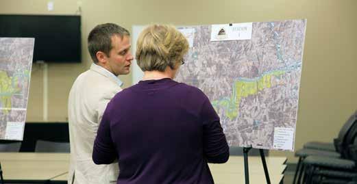
Focus Groups. Various focus groups were set up around the room in which landowners could ask questions about their
Before landown ers left, they were encouraged to fill out a landowner sentiment card describing their level of interest


DbD staff continued to follow-up with land owners throughout development of the plan document, and met with additional landowners as


30 CHAPTER 2
The planning consultant team engaged more than 20 landowners via phone, email, or during the DECEMBER 8TH AND 10TH LANDOWNER WORKSHOPS HELD AT THE ELKIN CENTER and WILKES HERITAGE MUSEUM.


LANDOWNER ENGAGEMENT 31


32 CHAPTER 2 ROARINGRIVER ROARINGRIVER MULBERRY CREE K W KERR SCOTT RESERVOIR Y A D K I N R I V E R WILKES CO OPEN SPACE WILKES CO OPEN SPACE 1/ ECORRIDOR YADKIN COUNTY SURRY COUNTY WILKES COUNTY RONDA ROARING RIVER N. WILKESBORO WILKESBORO ELKIN JONESVILLE 421 421 21 115 18 268 0 1 MI. 2 MI. 4 MI. LEGEND LANDOWNER SENTIMENT YES NO POSITIVE NO RESPONSE PREFERRED TRAIL ROUTE ALTERNATE TRAIL ROUTE EXISTING LOCAL TRAIL PROPOSED LOCAL TRAIL TRAIL ROUTE RE-EVALUATION Revise Trail Alignments. “Landowner Sentiment” was helpful in determining the preferred alignment and is included as a compo nent of the final map series (Chapter 4). Map 7: Landowner Sentiment A COMBINATION OF FACTORS INCLUDING THE NATURAL ENVIRONMENT, THE BUILT ENVIRONMENT, AND LANDOWNER SENTIMENT WERE USED TO DETERMINE THE PREFERRED TRAIL ALIGNMENT (CHAPTER 4).
CHAPTER
THIS CHAPTER
Between Elkin and the W. Kerr Scott Reservoir exist a diverse natural and built environment. Specific trail types must be ap plied throughout the corridor to ensure minimal maintenance and the best user experience.
This Chapter defines four trail types and illustrates their tran sitions along the preferred trail alignment as fully described in the subsequent chapter.

A specific theme is presented for signage, wayfinding, and trail support facilities. Previously completed OVNHT Master Plans recommend the same trail branding to provide uniformity and recognition by users.

CHAPTER
TRAIL CHARACTER AND DESIGN GUIDELINES 33
3 TRAIL CHARACTER & DESIGN GUIDELINES
OFFERS
FOR
A. Trail Types B. Trail
C. Signage
D. Social
PROVIDES DESIGN DETAILS FOR VARIOUS TRAIL TYPES and SIGNAGE, AND ALSO
INSIGHTS
INCORPORATING SOCIAL MEDIA. IN THIS
Profile
and Wayfinding
Media Marketing
TRAIL TYPES
trail types are proposed along the preferred alignment. A specific trail type is proposed according to its surrounding environment, location in a rural or urban area, and the opportunity to create a meaningful user experience.


NATURAL SURFACE
8' TO 10' WIDE EXISTING CRUSHED STONE
DUAL TREAD
8' PAVED ASPHALT & 3' NATURAL SURFACE

IN-TOWN SIDEPATH


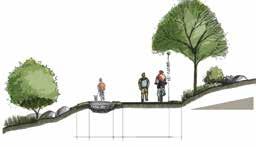
8' PAVED ASPHALT
User Group: Multi-use Material: Paved asphalt Preferred Width: 8' Preferred Easement Width: 25' Minimum Easement Width: 25' Note: Trail to be approved in accordance with municipal en croachment agreement.

CHAPTER 3 34
TRAIL IN ELKIN User Group: Multi-use Material: Natural surface of crushed gravel fines Preferred Width: 10' Preferred Easement Width: Former Rail ROW Minimum Easement Width: Former Rail ROW
F our
User Group: Multi-use Material: Paved asphalt & natural surface of crushed gravel fines Preferred Width: 8' paved & 3' natural surface Preferred Easement Width: 50' Minimum Easement Width: 25' *Note: The 3' natural surface could deviate from the paved trail, requiring a separate trail easement.
10’ NATURAL SURFACE RAIL TRAIL TOTAL RAIL BED APPROX. WIDE SHOULDER rface Multi-use surface
8' paved asphalt & 3' natural surface
Material:
asphalt & natural surface
crushed
fines
*Note:
natural surface
10' paved
30’ PREFERRED BUFFER RIVER PROTECT WATER QUALITY PAVED ASPHALT MILE MARKER FENCING TO MARK PRIVATE PROPERTY BOUNDARY dual
of crushed gravel fines Cost: $40/ln. ft. Width: Former Rail ROW Width: Former Rail ROW
User Group: Multi-use
Paved
of
gravel
Preferred Width: 8' paved & 3' natural surface Average Construction Cost: $80/ln. ft. Preferred Easement Width: 50' Minimum Easement Width: 25'
The 3'
could deviate from the paved trail, requiring a separate trail easement.
asphalt User Group: Multi-use Material: Paved Asphalt Preferred Width: 10' Average Construction Cost: $90/ln. ft. Preferred Easement Width: 50' Minimum Easement Width: 20'
tread typical greenway

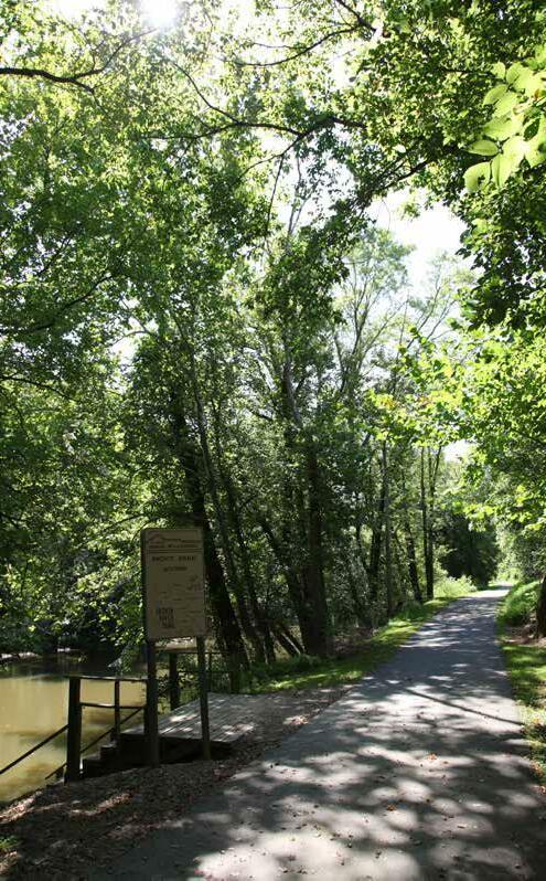
TRAIL CHARACTER AND DESIGN GUIDELINES 35 10' PAVED ASPHALT User Group: Multi-use Material: Paved Asphalt Preferred Width: 10' Preferred Easement Width: 50' Minimum Easement Width: 20' TYPICAL GREENWAY “The Yadkin River Greenway incorporates approximately 3.5 miles of certified Overmountain Victory National Historic Trail.”
SIGNAGE AND WAYFINDING
The OVNHT signage family provides for a modern rustic theme and incorporates materials consisting of metal, rock, and concrete. The signage family serves as a template and can be altered and further refined depending on local preferences and specific site needs and opportunities.


CHAPTER 3 36


TRAIL CHARACTER AND DESIGN GUIDELINES 37
SOCIAL MEDIA: THE NEW WORD OF MOUTH


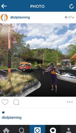


Trail users should be encouraged to utilize social media to share their experiences with their friends and “followers”. Special signage along the trail will signal users to consider posting pictures of themselves or their friend groups as they walk or ride bikes along the trail. In addition, special photo opportunities and features should be developed during the final design phase. After all, who better to market this destination-quality trail than the users themselves? Take advantage of social media – the new word of mouth.
#TRAIL2VICTORY
The proposed official hashtag for the OVNHT is #trail2victo ry. The use of this hashtag will allow local tourism leaders to curate local photography and content that can be shared on websites and re-posted through other social media plat forms.
#FINDYOURPARK
“Find your park” is the official centennial campaign of the national park service (NPS). The NPS is encouraging na tional park enthusiasts to use the hashtag #findyourpark when posting to social media. The OVNHT can help continue this campaign for years to come by en couraging the use of this hashtag at unique loca tions along the trail.
“FIND YOUR PARK” IS THE OFFICIAL CENTENNIAL CAMPAIGN OF THE NATIONAL PARK SERVICE (NPS). THE NPS IS ENCOURAGING NATIONAL PARK ENTHUSIASTS TO USE THE HASHTAG #FINDYOURPARK WHEN POSTING TO SOCIAL MEDIA.

CHAPTER 3 38
56 likes
wilkesboro, nc
beautiful trailhead celebrating the #trail2victory in @goyadkinvalley # ndyourpark #visitwilkesboro
EXHIBIT 2: SOCIAL MEDIA
TRAIL USERS SHOULD BE ENCOURAGED TO UTILIZE SOCIAL MEDIA TO SHARE THEIR EXPERIENCES WITH THEIR FRIENDS AND “FOLLOWERS”.
CHAPTER 4


RECOMMENDATIONS 39
THE
OF THE
Overview of Planning Section Maps
Planning Section Descriptions
RECOMMENDATIONS THIS CHAPTER SERVES AS
HEART
ELKIN TO W. KERR SCOTT RESERVOIR OVNHT MASTER PLAN. IN THIS CHAPTER A.
B.
SECTIONS


PLANNING SECTIONS
The 28 mile study area from Lenoir to Morganton is divid ed into five (5) planning sections. The geographic extent of each section includes a beginning and ending terminus that features a key asset or significant connectivity point for the trail. Many of the planning sections represent project areas that can be developed independently over time, providing a logical method for implementation as landowner willingness, funding, and other opportunities arise.

40 CHAPTER 4 1 5 4 2 planning sections ROARING RIVER ROARINGRIVER MULBERRY CREE K WEST KERR SCOTT RESERVOIR Y A D K I N R I V E R WILKES COUNTY YADKIN COUNTY SURRY COUNTY RONDA ROARING RIVER N. WILKESBORO WILKESBORO ELKIN JONESVILLE 421 421 21 115 18 268
STUDY
AREA SECTIONS MAP 8: PLANNING
The 28 mile study area from Elkin to the W. Kerr Scott Reservoir is divided into five (5) planning sections; this chapter is organized accordingly.
ABOUT THE PLANNING SECTION MAPS


Each planning section is anchored by a map that highlights proposed trail routes, trail features, and landowner sentiment. The proposed routes are iden tified as either preferred, alternate, or spur. These trail alignments are the result of extensive analysis, including environmental feasibility, landowner will ingness, and insights provided by local government and local trail development leaders. Noted trail features include the physical infrastruc ture and facilities that support the proposed trail. These features are highlighted along the preferred route and provide critical information for developing an estimate of probable cost for each section. These features include trailheads and crossings associat ed with either a road or water feature. Trailheads will provide for parking and trail user orientation. Road crossings indicate the need to provide for traffic calming measures and appropriate signage for both trail users and motorists. Major bridges indicate a significant stream or river crossing that requires a bridge greater than 20 feet in length. A
minor bridge/culvert demonstrates the need to cross a rela tively small stream; at this broad level of planning, it remains uncertain whether a small bridge or culvert is necessary.


WESTSWAN CREEK
QUICK FACTS
Each planning section begins with a “quick facts” exhibit. This information includes the trail distance, trail type (see Chapter 4: Design Guidelines), and key features and assets associated with each section. Also, an Estimate of Probable Cost is noted; see the appendix for fur ther details.
RECOMMENDATIONS 41 CHATHAM JARUSSEL ELKSPUR LEE MAIN IVY WALL CARDINAL JOLLY BIG BEND MACEDONIA CH AVA JANE BETHEL FFNER OSB CEDARBROOK MON EY EDW SDRA L AKEVIEW EDWARDS RIDGE RIDGE NO TR H W OOD MINERA L IRPS N G DEC CHATHAM BRIDGE LITTL E EL HILLCRE S T HARR I S R I VER R I SCH SETTLE MACEDONIA CH OAKLAND PLEA SHAMROCK RIVERBOTTOM WOODY CLINGMAN 0 1/4 1/2 MI. SECTION 1 1 STEEP SLOPES STEEP SLOPES PINCH POINT 3 1 RONDA MEMORIAL PARK 268 268 268 21 BUS 21 BUS RISDCTION JONESVILLE TOWN OF ELKIN JURISDICTION TOWNOFJONESVILLE JURISD CTION ELKIN YADKIN RIVER SWAN CREEK LITTLEELKINCREEK H UGHE S BR AN C H
ELKIN CREEK YADKIN RIVER YADKIN COUNTY WILKES COUNTY SURRY COUNTY OVNHT EASTERN TERMINUS LEGEND LANDOWNER SENTIMENT YES NO POSITIVE NO RESPONSE PREFERRED TRAIL ROUTE ALTERNATE TRAIL ROUTE SPUR TRAIL EXISTING LOCAL TRAIL PROPOSED LOCAL TRAIL TRAIL FEATURES TRAILS ROAD CROSSING MAJOR BRIDGE MINOR BRIDGE/ CULVERT CROSSINGS # # # TRAILHEAD CERTIFIED OVT SECTION CONSTRAINT
EACH PLANNING SECTION IS ANCHORED BY A MAP THAT HIGHLIGHTS PROPOSED TRAIL ROUTES, TRAIL FEATURES, AND LANDOWNER SENTIMENT. i BY THE NUMBERS 28 >> TRAIL MILES 18 >> TRAILHEADS 08 >> ROAD CROSSINGS 09 >> MAJOR BRIDGES 05 >> MINOR BRIDGES/CULVERTS $12,754,320 >> APPROXIMATE COST TOTAL LENGTH: 5.15 MI TRAIL TYPE: TYPICAL GREENWAY ESTIMATED COST: $2,003,360.00 POINTS OF INTEREST: OVNHT EASTERN TERMINUS ELKIN MUNICIPAL PARK AND RECREATION CENTER ELKIN MIDDLE & HIGH SCHOOLS ELKIN PUBLIC LIBRARY ELKIN RONDA 1 planning sections RIVER INGRIVE RESERVOIR RONDA N. WILKESBORO WILKESBORO JONESVILLE VICINITY MAP ELKIN >> W. KERR SCOTT
SECTION 1 PROPOSED TRAILS

From the east, the preferred trail route, which extends ap proximately 5.2 miles, begins at the existing Eastern Terminus of the OVNHT at Elkin Municipal Park and ends at Clingman Road before reaching the Town of Ronda. The first 1.3 miles of OVNHT, which is also designated as the Mountains-to-Sea Trail (MST), is complete and extends south to the Yadkin River.
From the Yadkin River, the complete OVNHT section extends west for approximately half of a mile before terminating at pri vate property. Note, upon reaching the Yadkin River, the MST route turns east toward Pilot Mountain.
The proposed OVNHT trail route continues west on the north side of the Yadkin and south of the existing railroad. Due to steep slopes and a railroad “pinch point,” the preferred route requires a bridge crossing to the south side of the Yadkin River. The route then crosses back to the north side to connect to the Town of Ronda and its Memorial Park.
An alternate OVNHT route utilizes the proposed MST route, which crosses the Highway 21 bridge that connects to the Town of Jonesville. The route continues west on the south side of the Yadkin River, but requires crossing to the north side to avoid steep embankments along the Yadkin River.


TRAIL FEATURES

This planning section includes two (2) trailheads, two (2) major bridges, and two (2) road crossings.
TRAILHEADS
The OVNHT eastern terminus at Elkin Municipal Park current ly provides for educational signage that highlights this histor ic muster grounds for the Surry Militia. This location does not currently provide for designated parking or access to the trail. Elkin should explore a redesign of this area along with its future plans to expand parking and further develop recreation facili ties associated with Elkin Municipal Park.
Another trailhead exists at the intersection of Memorial Drive and West Market Street. Future improvements to this trailhead should include the development of signage and a kiosk in align ment with the OVNHT facility design package (Chapter 3).


42 CHAPTER 4
TOTAL LENGTH: 5.2 MILES TRAIL TYPE: DUAL TREAD ESTIMATED COST: $2,003,360.00 POINTS OF INTEREST: OVNHT EASTERN TERMINUS ELKIN MUNICIPAL PARK AND RECREATION CENTER ELKIN MIDDLE & HIGH SCHOOLS ELKIN PUBLIC LIBRARY ELKIN RONDA 1 5 4 2 OARINGR VER ARNGRIVE MU B RY R WE KERR COTT RESE VOIR Y A D K I N R V E R WILKES C OUNTY Y ADKIN C OUNTY SUR C OUNTY RONDA ROARIN RIVER N. WILKESBORO WILKESBORO ELKIN JONESVILLE 421 421 115 268 VICINITY MAP 02 PHOTOS: (1) The first section of trail utilizes the existing certified OVNHT in Elkin Park. (2) Existing Eastern Terminus markers. 01



RECOMMENDATIONS 43 CHATHAM JARUSSEL ELKSPUR LEE MAIN IVY WALL CARDINAL JOLLY BIG BEND MACEDONIA CH STINLITTLE MTN AVA JANE LO X BETHEL FFNER OSB CEDARBROOK MON EY EDW SDRA L AKEVIEW EDWARDS RIDGE BRIDGE NO TR H W OOD MINERA L IRPS N G DECATUR CHATHAM BRIDGE LITTL E ELKIN CH HILLCRE S T HARR I S R I VER R I C B LLE ER SCH SETTLE MACEDONIA CH OAKLAND PLEA SHAMROCK THARPES MILL RIVERBOTTOM WOODY CLINGMAN N 0 1/4 1/2 1 MI. SECTION 1 1 STEEP SLOPES STEEP SLOPES STEEP SLOPES PINCH POINT 3 1 RONDA MEMORIAL PARK 268 268 268 268 21 BUS 21 BUS LANDOWNERS CLOSE TO RIVER TOWNOFRONDAJURISDICTION RONDA JONESVILLE TOWN OF ELKIN JURISDICTION TOWNOFJONESVILLE JUR SD CTION ELKIN YADKIN RIVER SWAN CREEK LITTLEELKINCREEK H U G H E S B R A N C H B I G BUGABOO CREEK WESTSWAN CREEK ELKIN CREEK YADKIN RIVER YADKIN COUNTY WILKES COUNTY SURRY COUNTY OVNHT EASTERN TERMINUS LEGEND LANDOWNER SENTIMENT YES NO POSITIVE NO RESPONSE PREFERRED TRAIL ROUTE ALTERNATE TRAIL ROUTE SPUR TRAIL EXISTING LOCAL TRAIL PROPOSED LOCAL TRAIL TRAIL FEATURES TRAILS ROAD CROSSING MAJOR BRIDGE MINOR BRIDGE/ CULVERT CROSSINGS # # # TRAILHEAD CERTIFIED OVT SECTION CONSTRAINT MAP 9: PLANNING SECTION 1
CROSSINGS
This planning section notes one (1) minor creek crossing and one (1) major bridge crossing. The first minor crossing spans Little Elkin Creek near its confluence with the Yadkin River. Ma jor Bridge #1 is located just before a large bend in the Yadkin River where the trail route is constrained by steep topography.
There is only one road crossing in this planning section, which is located at West Main Street. This crossing currently provides for OVNHT pavement markings to identify the trail route. The crossing can be further improved with additional and official OVNHT signage to not only highlight the trail, but also to alert motorists of possible trail users.
YADKIN VALLEY HERITAGE & TRAIL CENTER


The

44 CHAPTER 4
PHOTOS: (3) The trail crosses W. Main Street and continues south toward the Yadkin.
Yadkin Valley Heritage and Trail Center will be located in downtown Elkin. This facility will serve as a trail junction for the Overmountain Victory
National Historic Trail, Mountains-to-Sea State Trail, Yadkin River Heritage Corridor, E&A Rail Trail, Yadkin River Paddle Trail, and Elkin History Walk.
03
RENDERING BY OTHERS
EXHIBIT 3: YADKIN VALLEY HERITAGE & TRAIL CENTER
ELKIN MUNICIPAL PARK:OVNHT EASTERN TERMINUS
EXISTING

The Eastern Terminus of the Overmountain Victory National Historic Trail and historic Surry muster site are located adjacent to Elkin Municipal Park. This venue provides an opportunity to highlight the role of the Surry militia in the victory at Kings Mountain by hosting events during the annual re-enactment of the march. This area should be studied further to identify ways to incorporate the OVNHT into the overall site design.

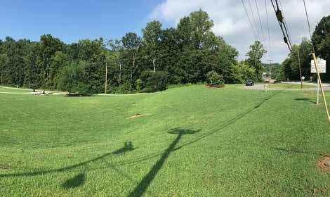
RECOMMENDATIONS 45
EXHIBIT 4: ELKIN MUNICIPAL PARK: OVNHT EASTERN TERMINUS
ROARING RIVER RONDA
PROPOSED TRAILS


For Planning Section #2, the preferred trail route is approx imately 8.7 miles in length and extends from the proposed bridge near Clingman Road, through the Town of Ronda, and approximately 1.5 miles beyond Roaring River Road in the community of Roaring River.

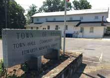
The preferred route will re quire a major bridge over the Yadkin River near Clingman Road, extend under the high way, and connect to Ronda Memorial Park (see subse quent exhibits). The OVNHT route then continues north over the railroad, through the heart of downtown Ronda, and extends south back over the railroad before once again paral leling the Yadkin River.
The route continues on the north side of the Yadkin River and traverses the “Round About” historic site (see subsequent ex hibit) before reaching a steep river bank. The trail will need to bridge the Yadkin River, and from here, will remain most feasi ble on its south side before reaching North Wilkesboro.
An alternate route is explored along the north side of the Yad kin River that would connect to the Wilkes County River Ac cess and more directly to the community of Roaring River. A spur trail into the heart of Roaring River is recommended from either the preferred or alternate route.
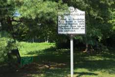


TRAILHEADS

Ronda Memorial Park serves as a natural trailhead for the OVNHT. Accessed from Clingman Road, this neigh borhood park has a small walking loop, shelter, park ing, and river access that is designated as part of the Yadkin River Blueway. The OVNHT will connect to the park from the east via the proposed trail underpass of Clingman Road and will continue west into the heart of downtown Ronda.
Another trailhead is proposed in the community of Roaring River. However, a specific location was not identified within the planning process. An extensive OVNHT outreach effort is re quired in Roaring River to encourage participation in trail de velopment efforts. A trailhead would provide a much needed parking area within this otherwise rural trail section.
CROSSINGS
Major Bridge #2 crosses the Yadkin River near Clingman Road. This major bridge will provide for an OVNHT connection to the Ronda Memorial Park and Town of Ronda downtown.

Major Bridge #3 is located on the west side of Horseshoe Bend and the Roundabout Homestead where the trail is constrained by steep slopes. There are two minor road crossings in the Town of Ronda at Second Street and Chatham Street, which both serve a low volume of residential traffic.
There are (2) road crossings identified within this section, both have sufficient clearance to go under the bridge cross ings. Crossing #2 at Clingman Road is a proposed underpass that connects to Ronda Memorial Park (See Exhibit 6: Ronda Memorial Park). Crossing #3 is an underpass of Roaring River Road on the south side of the Yadkin (Exhibit 8: Roaring River Road Bridge).
This planning section includes two (2) trailheads, two (2) major bridges, and two (2) major road crossings.
46 CHAPTER 4 05 04
TRAIL FEATURES
SECTION 2 TOTAL LENGTH: 8.7 MILES TRAIL TYPE: PAVED SIDEPATH & DUAL TREAD ESTIMATED COST: $4,533,360.00 POINTS OF INTEREST: RONDA MEMORIAL PARK BE CLEVELAND HOMESITE: ROUND ABOUT WILKES COUNTY PADDLE ACCESS 06 1 5 4 2 ROAR NGR VER ROARNGRIVER MULB RR RE WES KERR COTT RESE VOIR Y A D N R E R WILKES C OUNTY Y ADKIN OUNTY SUR R Y OUNTY RONDA ROARING RIVER N. WILKESBORO WILKESBORO ELKIN JONESVILLE 421 421 21 115 18 268
(4)
(5)
and
(6)
PHOTOS:
The trail will work its way into the heart of Ronda.
Ronda Memorial Park will serve as a trailhead for the Yadkin Blueway
OVNHT.
The park offers a pavilion, walking loop, & playground.

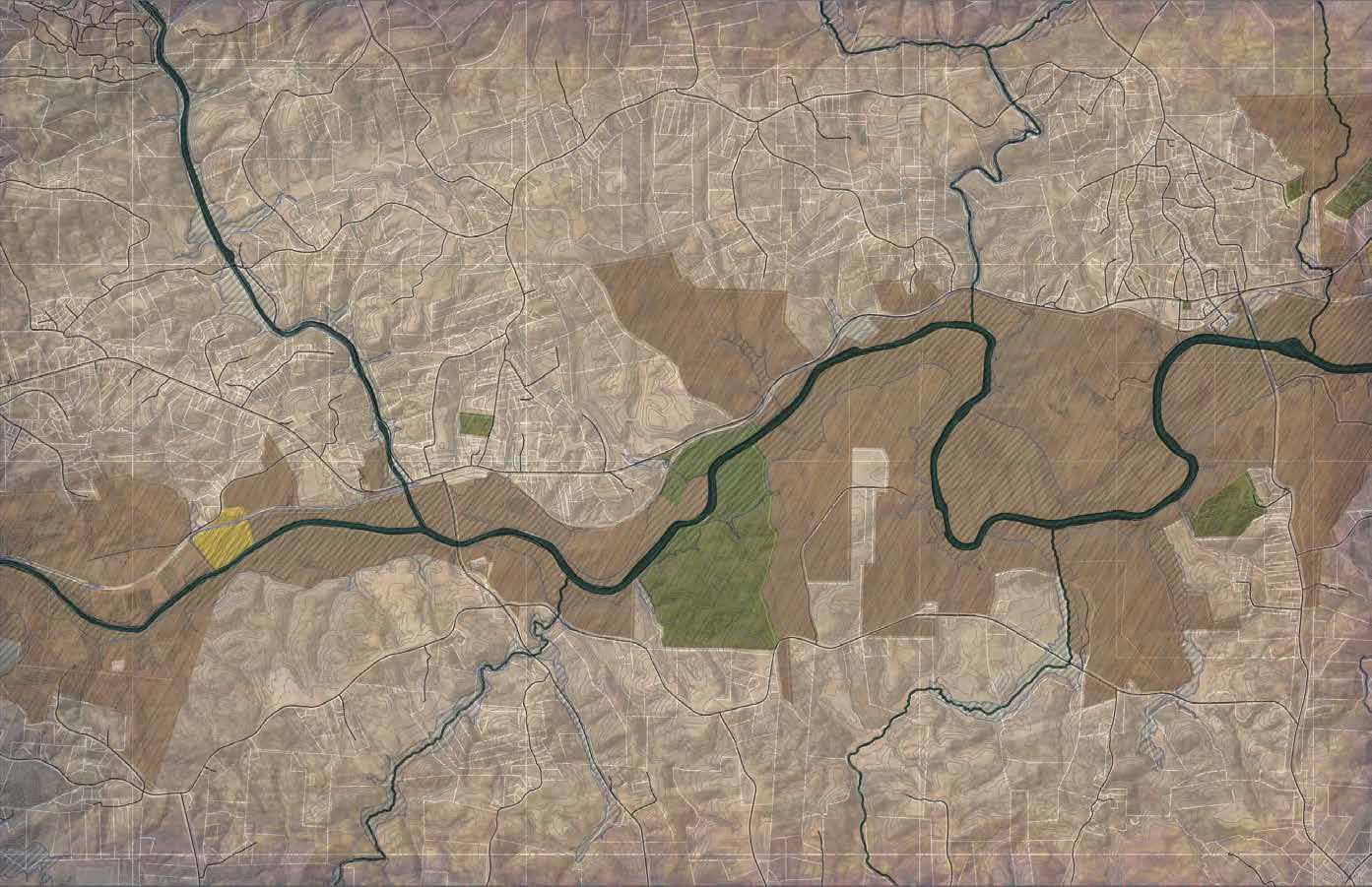


RECOMMENDATIONS 47 268 268 268 LANDOWNERS CLOSE TO RIVER YADKINRIVER BRIERCREEK OARING RIVER BIGBUGABOOCREEK LITTLE BUGABOO CREEK H U G EH S B R ANCH YADKINRIVER HORSESHOE BEND RONDA TOWNOFRONDAJURISDICTION 4 N 0 1/4 1/2 1 MI. SECTION 2 RONDA ROARING RIVER ROARING RIVER HATM I S M ILL RED WHITE & BLUE ROARINGRIVER ARBOR GROVE BAPTIST CH ARBORGROVEBAPTISTCH DRBEALEFARM CHATHAM CL I NGMAN R U HT LINNEY ABTCO LOMAX WADDELL BRINEGARHILL COTTON MILL H O O ST POPLAR SPRINGS WHITEPLAINS W O B LACKBURN SMITHRIDGECREST R I DGE PULCO L P E KCOCA OLDSTATEHWY 60 RURITAN TRUITT RRRURITANCLUB FARMALL RONDA MEMORIAL PARK 3 STEEP SLOPES STEEP SLOPES INDUSTRIAL PARK “ROUNDABOUT” HISTORIC HOMESTEAD STEEP SLOPES 2 WILKES COUNTY RIVER ACCESS LEGEND LANDOWNER SENTIMENT YES NO POSITIVE NO RESPONSE PREFERRED TRAIL ROUTE ALTERNATE TRAIL ROUTE SPUR TRAIL EXISTING LOCAL TRAIL PROPOSED LOCAL TRAIL TRAIL FEATURES TRAILS ROAD CROSSING MAJOR BRIDGE MINOR BRIDGE/ CULVERT CROSSINGS # # # TRAILHEAD CERTIFIED OVT SECTION CONSTRAINT 2 MAP 10: PLANNING SECTION 2


48 CHAPTER 4 MAPLE R VERSIDE SECOND FERRY MAIN CLIN GMAN RD HIGHWAY 268 OLD TRAPHILL THIRD SUMMIT BLAC KBURN F AC T OR Y RIDGE L AKE V IE W CHATHAM HOOTS HILLCREST CEMETERY YADKINRIVER 268 268 0 250 500 1000 FT LEGEND LANDOWNER SENTIMENT YES NO POSITIVE NO RESPONSE PREFERRED TRAIL ROUTE ALTERNATE TRAIL ROUTE EXISTING LOCAL TRAIL TRAIL FEATURES TRAILS TRAILHEAD ROUND ABOUT HISTORIC HOMESTEAD SITE TOWN HALL POST OFFICE RONDA MEMORIAL PARK N THE RONDA CONNECTION T he OVNHT strategically meanders through the heart of the Town of Ronda. Town leadership has expressed overwhelming support for the trail, citing this as an opportunity to attract visitors and new small business. In addition, Ronda is located in an otherwise rural area, which is sure to be a place of respite for trail users. EXHIBIT 5: THE RONDA CONNECTION
RONDA MEMORIAL PARK

Ronda Memorial Park provides a unique and fun opportunity to incorporate OVNHT branding and signage into the physical environment. Such design considerations will ensure that the OVNHT becomes a destinationquality trail.


RECOMMENDATIONS 49
EXHIBIT 6: RONDA MEMORIAL PARK EXISTING
ROUNDABOUT PLANTATION AT HORSESHOE BEND


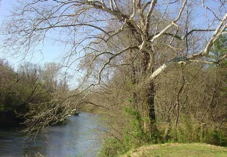

Roundabout is the historic plantation home of Colonel Benjamin Cleveland; it's located approximately one mile east of Ronda in a fertile plain along the Yadkin River known as "Horseshoe Bend." Colonel Benjamin Cleveland, along with his brother Captain Robert Cleveland, were instrumental leaders of the Surry militia. A dedicated patriot with harsh opinions of loyalists, Colonel Cleveland frequently hanged loyalist enemies from a large oak located on the plantation.

50
Imagery ©2016 Google, Map data ©2016 Google 500 ft
EXHIBIT 7: ROUNDABOUT PLANTATION AT HORSHESHOE BEND EXISTING
ROARING RIVER ROAD BRIDGE
EXISTING
The Roaring River Road Bridge underpass provides an opportunity for sculpture and art that could highlight the Overmountain Men on horseback.
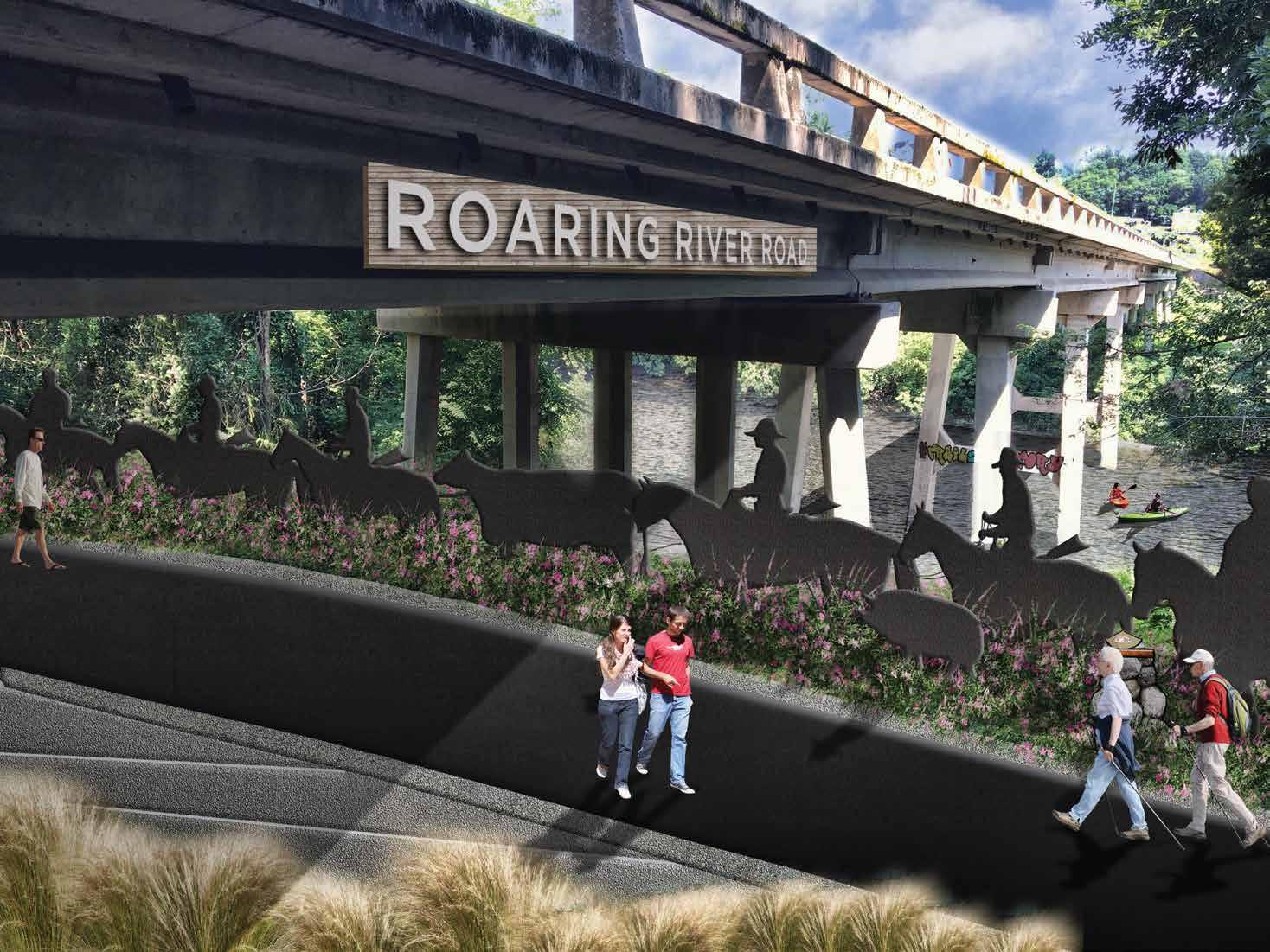 EXHIBIT 8: ROARING RIVER ROAD BRIDGE
PROPOSED TRAILS


TRAIL FEATURES
This planning section includes one (1) trailhead. The alternative route would require major bridges, but otherwise only a stream crossing is necessary within this section.
TRAILHEADS
A specific trailhead location was not identified for this planning section, but is necessary near the section’s mid-point. A loca tion near the 75 acre island and the VFW Campground should both be further explored for trailhead and parking facilities.


CROSSINGS
The preferred trail route in Section 3 continues west on the south side of the Yadkin for approximately four miles from the Roaring River area before reaching steep terrain. Without re ceiving permission from private landowners to conduct a field assessment, it’s uncertain whether a five percent grade trail can be maintained through this area. However, the preferred route remains on the south side of the river. The planning sec tion concludes at the VFW campground and park.
Two alternate routes are shown near the planning section midpoint. One alternative utilizes a 75-acre island, but will require an additional bridge. The second trail alternative does not make use of the island, but bridges the trail to the north side and requires traversing the Lowe's Distribution Center. The trail would require the use of the Lowe's shipping container storage area.

The preferred route will require one (1) minor bridge/culvert noted at Crossing #3 at Fishing Creek near the east area of the planning section. Major bridges would be required if the OVNHT were to make use of the 75-acre island or cross to the Yadkin River’s north side.

PHOTOS: (7) An active industrial campus and (8) the Lowe’s Hardware Distribution Center are located on the north side of the river, leaving the south side as the preferred trail location. (9) The VFW campground is a significant connection point for the trail, providing opportunities for both the trail and the VFW to benefit from one another.
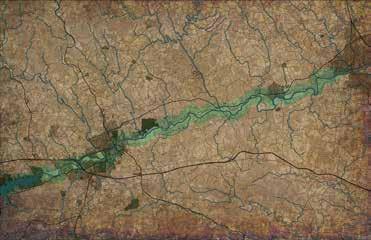
52 CHAPTER 4
NORTH WILKESBORO ROARING RIVER 1 5 4 2 OAR NGR VER ARNGRIVER MU ER Y C E WEST KERR S OTT RESER OIR Y A D K I N R E R WILKES C OUNTY Y ADKIN OUNTY SUR R Y C OUNTY RONDA OARING RIVER N. WILKESBORO WILKESBORO ELKIN JONESVILLE 421 421 21 115 VICINITY MAP
SECTION
TOTAL LENGTH: 6 MILES TRAIL TYPE: DUAL TREAD ESTIMATED COST: $2,574,400.00 POINTS OF INTEREST: VFW PARK AND CAMPGROUND
3
07 08 09

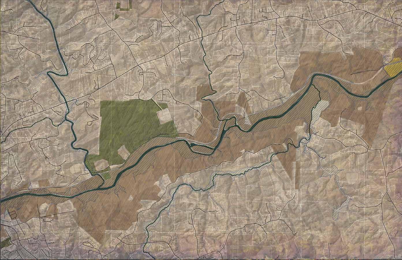


RECOMMENDATIONS 53 YADKIN R ROCK CREEK MULBERRY CREEK F I S H I N G C REEK INDUSTRIAL PARK ABTCO WOODHAV EN R I D GE ROCK Q U YRRA OLDQUARRY GREEN SHEPHERD FARM LANES FISHING CREEK PARK B WORNRIDGE STATESVILLE ARMORY PARKS RIDGE ROCKCREEK TW I N H IL L PJ MARTIN JOHNSON CAUDILL FLINTHILL DOGWOOD RIVERGROVE LIBERTYCHUCH UMONT POPLAR COTTONTAIL LIBERTY KNOLL AIRPORT KS YVIEW MILLHOLE D RIDGE TOP PUMPKINPATCH OLD STATE HWY 60 D E LLAPLANE 268 268 WILKES COUNTY INDUSTRIAL PARK PINCH POINT VFW CAMPGROUND & PARK LEGEND LANDOWNER SENTIMENT YES NO POSITIVE NO RESPONSE PREFERRED TRAIL ROUTE ALTERNATE TRAIL ROUTE SPUR TRAIL EXISTING LOCAL TRAIL PROPOSED LOCAL TRAIL TRAIL FEATURES TRAILS ROAD CROSSING MAJOR BRIDGE MINOR BRIDGE/ CULVERT CROSSINGS # # # TRAILHEAD CERTIFIED OVT SECTION CONSTRAINT N 0 1/4 1/2 1 MI. SECTION 3 ROARING RIVER NORTH WILKESBORO NORTH WILKESBORO TOWN OF N ORT H WI LKES BO R O JURISD ICTION LOWES DISTRIBUTION 3 PINCH POINT STEEP SLOPES MAP 11: PLANNING SECTION 3
VICINITY MAP
PROPOSED TRAILS

Upon entering North Wil kesboro town limits, the trail transitions from natural sur face to a typical greenway, consistent with the Yadkin River Greenway’s existing system. The preferred route in this section extends approxi mately 4 miles from the VFW campground and park to the intersection of the trail with US 421. Two of those miles take ad vantage of existing certified sections of the OVNHT construct ed by the Yadkin River Greenway Council.
West of the VFW site, the preferred route remains parallel to the Yadkin River and traverses NC Department of Transportation property. NCDOT currently uses the property near the river for materials and equipment storage, however there is adequate space to accommodate a multi-use path if an agreement can be reached with NCDOT officials. The preferred route will then cross under Business 421/Statesville Road and continue less than half a mile before a bridge crossing is necessary to con nect to Smoot Park and an existing section of the OVNHT.
In between Smoot Park and Memorial Park, a connection to a new Blair Island loop trail is proposed (See Exhibit 9: Blair Island, page 56). For more than a decade Blair Island has been an area of interest for local government and trail leaders; this unique feature presents an opportunity to create a recreation destination accessible only by greenway or the Yadkin River Blueway. Encircled by the loop trail, the ten acre island can pro vide a location for both family and primitive camp sites, fish ing piers, water access for paddlers, an outdoor exhibit space for OVNHT educational interpretation, and more. A spur trail from NCDOT continues adjacent to the river on the south side and connects to Highland Park disc golf course before bridg ing north to Blair Island, completing a loop connection to the island that utilizes both the north and south banks of the river.


The existing path currently terminates at the WRMC Wellness Center. From there, the proposed route crosses the Yadkin to the south and continues for approximately 1.5 miles where this
planning section terminates at the US 421 underpass and Mora vian Creek crossing.
TRAIL FEATURES
This planning section includes six (6) trailheads, four (4) major bridges, and two (2) road crossings.
TRAILHEADS

The 6 trailheads identified in this section are pre-existing and are located within the mile wide study area. They in clude: Smoot Park, Memorial Park, Wilkesboro Boulevard, Lowe’s, Tyson, and WRMC Wellness Center trailheads.
Smoot Park is a certified trailhead of the OVNHT. Exhibit 10: Gateway @ Smoot Park (pg. 57) demonstrates how this trail head and others might be enhanced to promote both OVNHT and Yadkin River brand elements.,

The Town of Wilkesboro is currently working to expand the existing Tyson Trailhead and extend the Yadkin River Gre enway to its Main Street (near existing Bridge #8). The Ty son trailhead is immediately adjacent to the historic home of Robert Cleveland, Cap tain in the Surry Militia and brother of Colonel Benjamin Cleveland whose statue is located outside the home. The trailhead is also in the vicinity of the legendary Tory Oak from which loyalists were hanged during the revolutionary war.

CROSSINGS
Within this section are two (2) road crossings, one of which is pre-existing, and four (4) major bridges; one of the bridges is already completed and in use.
54 CHAPTER 4
1 5 4 2 OARINGR VER R INGRIVE MUL RR C E WES KERR S OTT RESERVOIR Y A D K N R V E R WILKES C OUNTY Y ADKIN OUNTY SUR R Y OUNTY ONDA ROARING RIVER N. WILKESBORO WILKESBORO ELKIN JONESVILLE 421 421 21 115 18 268
WILKESBORO NORTH WILKESBORO
4 TOTAL LENGTH: 4.0 MILES TRAIL TYPE: TYPICAL GREENWAY ESTIMATED COST: $2,050,400.00 POINTS OF INTEREST: SMOOT PARK MEMORIAL PARK HIGHLAND PARK DISC GOLF COURSE ROLLING PINES DISC GOLF COURSE LOWE’S TRAIL HEAD ROBERT CLEVELAND HOUSE TYSON TRAILHEAD TORY OAK WELLNESS CENTER TRAIL HEAD 10 11 12
SECTION

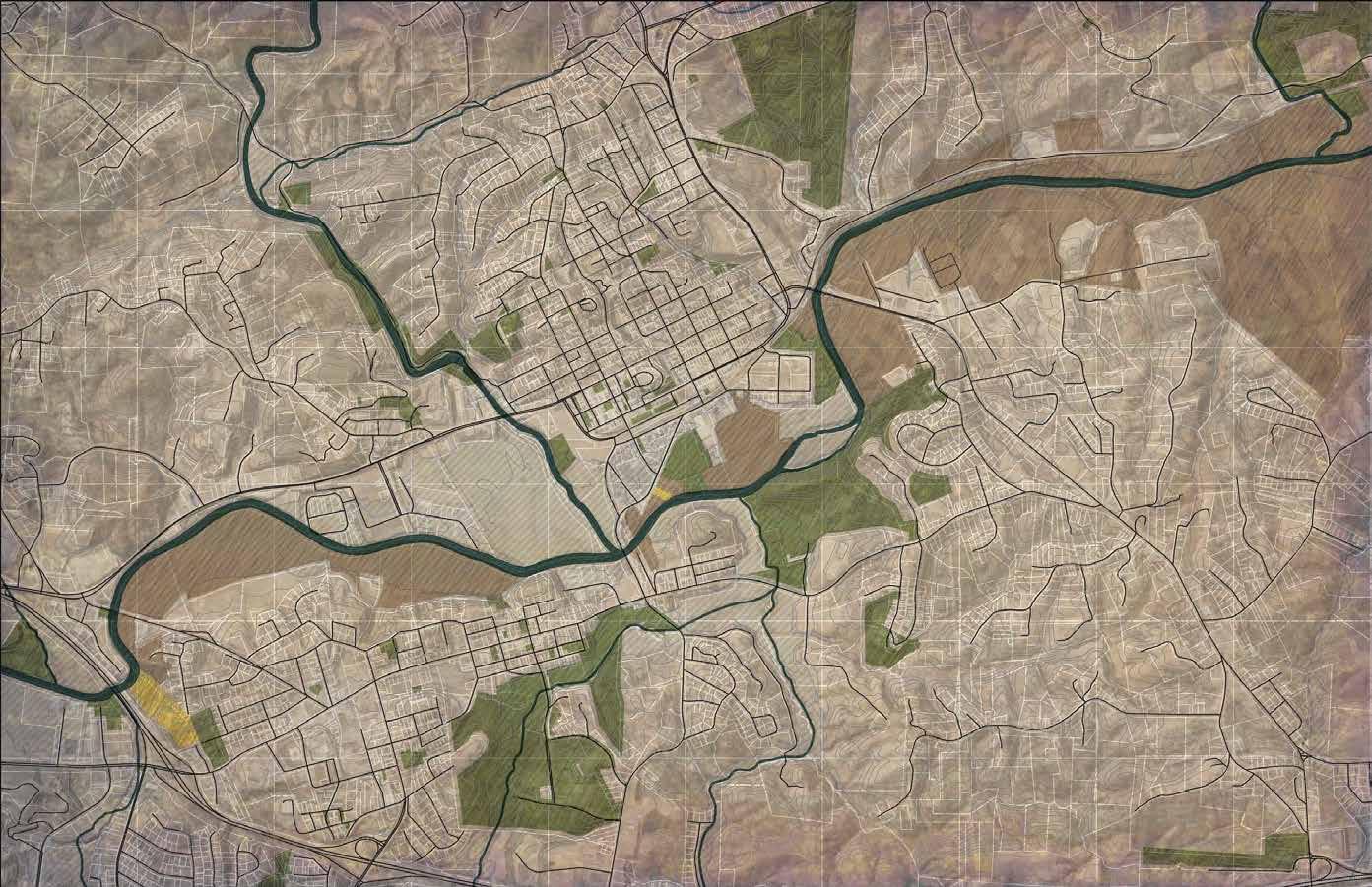


RECOMMENDATIONS 55 GREEN SHEPHERD FARM EASTOVER CEDAR BOSTON FLINT HILL PARK PARK DULA C D J K L M N O REDDIES BOONE WEST D PINE GWYN LLEGIATE OLLY DOGWOOD P ONDVIEWWALNUTGROVE VER AKWOODS OA K WO ODS BRIDGE EDGEWOOD FOREST HILL SPRUCE HILL ELM CURTIS BRIDGE CENTRAL BROO KWOOD WOODLAND RIVER LIBERTY GROVE CH OC L ONIAL COLONIAL DOGWOOD DAMASCUSCH O RY A R M O R Y H AUNTEDBRA ARMORY 9TH 8TH 3RD 2ND FINLEY WESTP D 6 0 REDD I NG R I DGE WOODLAN WELBORNE GLENDALE COFFEY TOWNSEN WOODLAND OLD 21 OLDBRICKYARD B R MAGNOL I A 268 268 268 421 BUS 421 421 BUS 421 0 1/4 1/2 1 MI. N SECTION 4 NORTH WILKESBORO WILKESBORO 7 LEGEND LANDOWNER SENTIMENT YES NO POSITIVE NO RESPONSE PREFERRED TRAIL ROUTE ALTERNATE TRAIL ROUTE SPUR TRAIL EXISTING LOCAL TRAIL PROPOSED LOCAL TRAIL TRAIL FEATURES TRAILS ROAD CROSSING MAJOR BRIDGE MINOR BRIDGE/ CULVERT CROSSINGS # # # TRAILHEAD CERTIFIED OVT SECTION CONSTRAINT NORTH WILKESBORO WILKESBORO 7 LOWES DISTRIBUTION 6 8 REDDIES RIVER CUBCREEK HOOPERSBRANCH YADKIN RIVER LITTLE CUB CREEK REBLUM RY CREEK CUB CREEK PARK AND FUTURE MOUNTAIN BIKING TRAILS REDDIES RIVER S. JEFFERSON TURNPIKE N. JEFFERSON TURNPIKE WRMC WELLNESS CENTER B. CLEVELAND STATUE, R. CLEVELAND HOUSE AND TORY OAK WILKESBORO BOULEVARD MEMORIAL PARK WILKES COMMUNITY COLLEGE SMOOT LOWES NCDOT VFW CAMPGROUND HIGHLAND PARK DISK GOLF COURSE BLAIR ISLAND 6 4 5 MAP 12: PLANNING SECTION 4
The first road crossing of this section (#4) is located at Busi ness 421/Statesville Road. The first road crossing (#4) is a proposed underpass located on NCDOT property and takes advantage of the Business 421/ Statesville Road bridge that crosses the Yadkin River. The second road crossing (#5) is also an underpass, utilizing the existing trail’s passageway beneath Highway 18/Wilkesboro Avenue.
Bridge #6 is the first bridge in this planning section and provides a river cross ing from NCDOT property to Smoot Park. The second bridge (#7) would complete a connection among two ex isting sections of certified OVNHT. Bridge #8 is an existing bridge that connects the gre enway on the north side of the river to the Tyson Trailhead and Downtown Wilkesboro. The fourth and final bridge in this section (#9) is proposed at the WRMC Wellness Center where the existing greenway trail ends. The preferred route bridges the Yadkin River to the south side where there are large tracts of agricultural land.


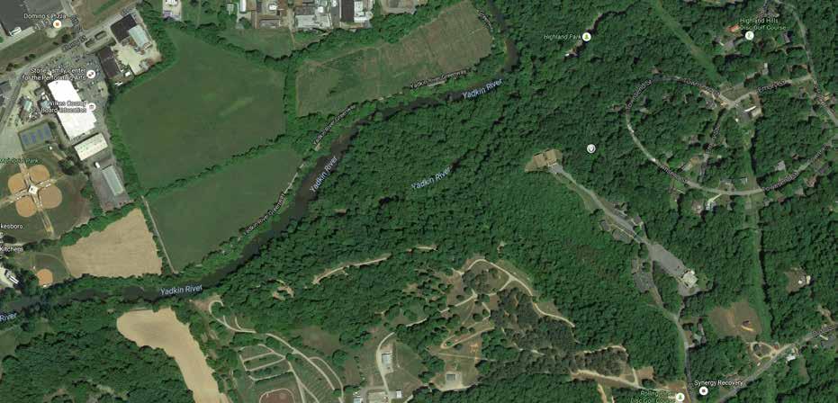


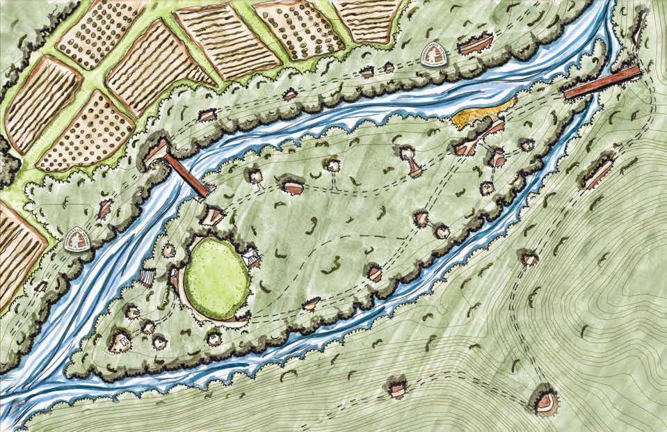
: (10) An opportunity exists to construct a loop that connects Blair Island to disc golf courses at Highland Park and Rolling Pines. (11) The Robert Cleveland House and (12) Ben Cleveland Statue is located immediately adjacent to the Tyson Trailhead. (13) An existing gravel service road used by NCDOT to access their storage yards has more than sufficient space to allow the trail to pass beneath Statesville Road.
or more than a decade Blair Island has been an area of interest for local government and trail leaders; this unique feature presents an opportunity to create a recreation destination accessible only by greenway or the Yadkin River Blueway.
56 CHAPTER 4 Existing certi PROPOSED BRIDGE EXISTING FARMLAND SPUR TO OVNHT RIVER ACCESS CANOE/ KAYAK STORAGE LARGE PICNIC SHELTER W/ GRILLS PICNIC SHELTER W/ GRILL, TYPICAL COVERED PAVILION TO ROLLING PINES DISC GOLF COURSE OPEN SPACE blair island highland proposed yadkinrivergreenway NATURAL SURFACE H K NG TRAIL MULTI USE GREENWAY YADKIN RIVER
PHOTOS:
13
F
BLAIR
EXHIBIT 9: BLAIR ISLAND REFUGE
Wilkesboro Blair Island
ISLAND REFUGE
EXISTING
GATEWAY @ SMOOT PARK


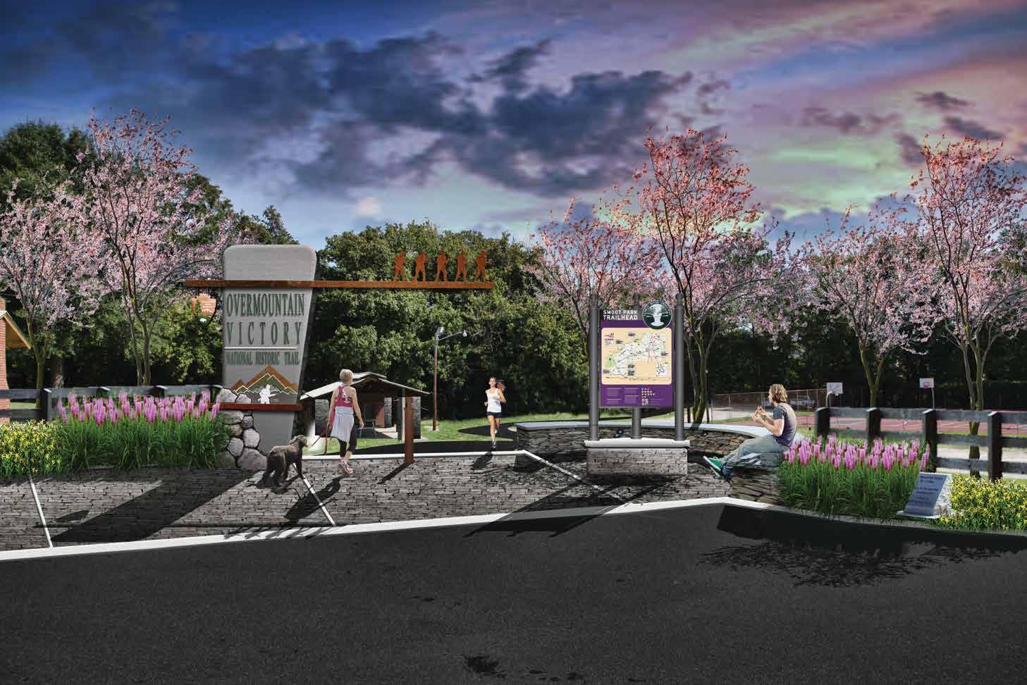
57 EXHIBIT 10: SMOOT PARK SIGNAGE
moot Park is a certified trailhead of the OVNHT; this trailhead and others should be enhanced to display both OVNHT and Yadkin River brand elements. EXISTING
S
VICINITY MAP

W. KERR SCOTT RESERVOIR WILKESBORO
PROPOSED TRAILS

This planning section ex tends approximately 3.75 miles from US Highway 421 to W. Kerr Scott Reservoir property. Only 1.5 miles with in this section require new construction. From Highway 421, the route utilizes existing greenway until it reaches a proposed bridge near the YMCA trailhead. On the north side, the proposed route follows the bends of the Yadkin River, crosses New Brown’s Ford Road, and makes a final connection to existing certified OVNHT at the W. Kerr Scott Reservoir.
TRAIL FEATURES
This planning section includes six (6) trailheads, one (1) major bridge, and two (2) road crossings.
TRAILHEADS

As in the previous planning section, the trailheads identi fied in this section are exist ing and include: Rivers Street, Moravian Creek, ECMD, Wil kes Family YMCA, Tailwater, and the W. Kerr Scott Reser voir Visitors Center. Multiple access points provide trail users with several options in this section for parking and entering the trail. The Tailwater parking area is a trailhead for the Yadkin River Blueway. The Visitors Center trailhead currently provides mountain bikers, hikers, and runners with access to six (6) miles of Overmountain Vic tory Trail, in addition to numerous other recreational water ac tivities at the Reservoir. All trailheads should be improved to incorporate the OVNHT branding and signage family.

CROSSINGS
Proposed within this section are two(2) major bridges, two (2) minor bridges/culverts, and two (2) road crossings.

The first road crossing (#6) and major bridge (#11) are locat ed where the preferred route meets with US Highway 421, just north of the NC 268 overpass. This is also the location at which Moravian Creek converges with the Yadkin River. The proposed route will pass beneath 421 and immediately cross Moravian Creek to connect to the existing greenway (See Exhibit 11: Un der, Over, and Onward, pg. 60).
The second bridge (#12) is the final bridge proposed within this plan. The bridge will connect the existing OVNHT greenway to the proposed route near the Wilkes Family YMCA. This final crossing will provide access to agricultural land on the north side of the Yadkin River and avoid road areas and a river pinch point on the south side.



The final road crossing (#7) is an at-grade crossing of New Brown’s Ford Road (See Exhibit 12: New Brown’s Ford Crossing, pg. 61v). A final design for this crossing must ensure adequate sight-distance for motorists and trail users as they approach the intersection.
The two minor bridges/culverts (#3, #4) in this planning sec tion are existing pedestrian bridges on constructed trail seg ments.
58 CHAPTER 4
1 5 4 2 OARINGR VER R INGRIVE MUL RR C E WES KERR S OTT RESERVOIR Y A D K N R V E R WILKES C OUNTY Y ADKIN OUNTY SUR R Y OUNTY ONDA ROARING RIVER N. WILKESBORO WILKESBORO ELKIN JONESVILLE 421 421 21 115 18 268
5 TOTAL LENGTH: 3.75 MILES TRAIL TYPE: TYPICAL GREENWAY ESTIMATED COST: $1,592,800.00 POINTS OF INTEREST: MORAVIAN CREEK TRAIL HEAD WILKES COMMUNITY COLLEGE ECMD TRAIL HEAD WILKES FAMILY YMCA TAILWATER BLUEWAY ACCESS W. KERR SCOTT RESERVOIR VISITOR CENTER 14 15
(14) The
will
important
the
SECTION
PHOTOS:
preferred route
cross the river north of the Wilkes Family YMCA, an
connection on
trail. (15) The W. Kerr Scott Reservoir is the western terminus of the study area.


RECOMMENDATIONS 59 W KERR SCOTT RESERVOIR MILLERS CREEK TUCKER HOLECREEK YADKINRIVER ORAVIAN CREEK GERMANTOWN BERRYMTN WILKESBORO UNRD251 OLDNCHWY268 INDUSTRIAL I T H IC A OKES CURTIS BRIDGE BROOK WOOD CURTISBRIDGE SKYLAND SCHOOL NEW BROWNSFORD H CONGO MOURNE ROUGE LITTL E YRREB TIMBERL A KE RWOOD C ED AR HOLLY HILL RIVER CENTRAL C OLLEGIATE MONTE VIEW STEVENS WESTGATE KER R Y AZALEA AM G N OLIA MEADO W V I EW WINKLER ZION H I LL CH OLD BRICKYARD RIVER AMELIA N 0 1/4 1/2 1 MI. LEGEND LANDOWNER SENTIMENT YES NO POSITIVE NO RESPONSE PREFERRED TRAIL ROUTE ALTERNATE TRAIL ROUTE SPUR TRAIL EXISTING LOCAL TRAIL PROPOSED LOCAL TRAIL TRAIL FEATURES TRAILS ROAD CROSSING MAJOR BRIDGE MINOR BRIDGE/ CULVERT CROSSINGS # # # TRAILHEAD CERTIFIED OVT SECTION CONSTRAINT SECTION 5 WILKESBORO W KERR SCOTT RESERVOIR 421 268 268 421 421 WILKESBORO TAILWATER AT KERR SCOTT W KERR SCOTT VISITORS CENTER WILKES FAMILY YMCA FOOTHILLS OUTDOOR ADVENTURES WILKES COMMUNITY COLLEGE PINCH POINT ACCESS AT ECMD 8 9 MORAVIAN CREEK RIVERS STREET 8 4 5 MAP 13: PLANNING SECTION 5


60 CHAPTER 4 EXHIBIT 11: UNDER, OVER, AND ONWARD @ HWY 421 UNDER, OVER, & ONWARD @ HWY 421
Trail users will pass under
Highway 421 and
over Moravian Creek to reach
existing
of the OVNHT.
US
cross
an
section
Afinal design for the New Browns Ford crossing must ensure adequate sight-distance for motorists and trail users as they approach the OVNHT and road intersection.


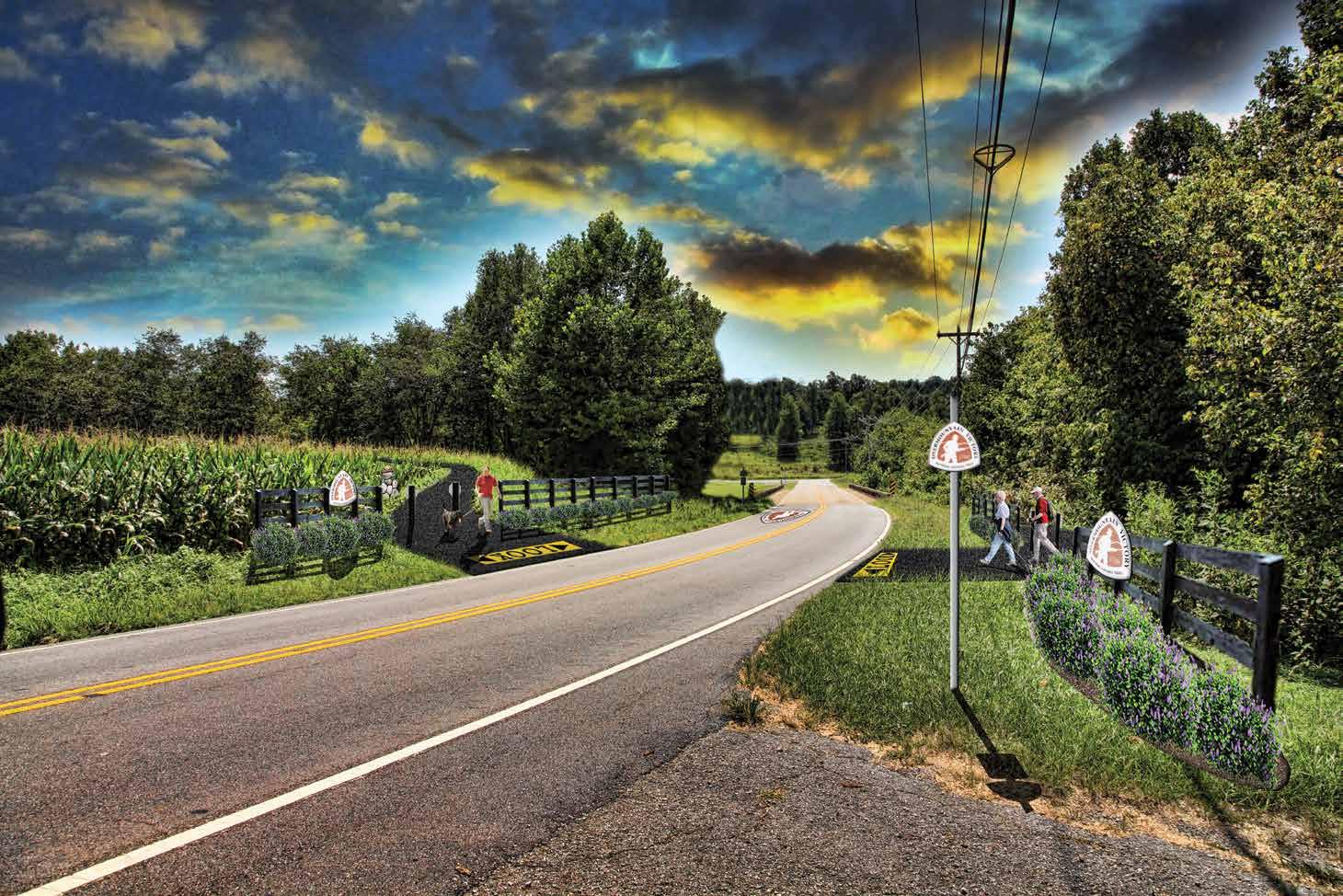
61 NEW BROWNS FORD ROAD CROSSING EXHIBIT 12: NEW BROWNS FORD ROAD CROSSING
EXISTING

62 CHAPTER 4
CHAPTER 5
IMPLEMENTATION
TO CONSTRUCT THE OVNHT FROM ELKIN TO THE W. KERR SCOTT RESERVOIR IN WILKES COUNTY WILL BE NO SMALL TASK, BUT WITH TIME, PERSEVERANCE, AND A LITTLE LUCK, THERE IS NO DOUBT THAT A DESTINATION-QUALITY TRAIL IS WITHIN GRASP.
This chapter aims to summarize details regarding each Plan ning Section and establish responsibilities and priorities for trail implementation.
IN THIS CHAPTER

A. Implementation by Section and Responsibilities B. Priority Implementation Areas and Responsibilities C. Trail Responsibility Nodes Map D. Trail Support Spectrum
IMPLEMENTATION
IMPLEMENTATION PRIORITIES BY PLANNING

SECTION

64 CHAPTER 5
implementation information
planning section.
Challenges
barriers
trail
costly
trail easements
The table below provides key
associated with each
Key
include a summary of the most difficult
for realizing each
section. Many of these barriers include
features or note the need to acquire
from private landowners. Most importantly, this table assigns an Implementing Agency to each planning section.
Section Distance Key Challenges Estimated Budget Priority Two SECTION 1 Elkin to Ronda 3.9 Bridge #1; Bridge to Ronda Memorial Park (#2); Clingman Road Underpass; Securing Landowner Trail Easements $2,003,360 Elkin Valley Trails Authority, Town of Elkin, Town of Ronda, Yadkin Valley Heritage Corridor, Wilkes County SECTION 2 Ronda to Roaring River 8.7 Bridge #3 in HorsehoeBend; Roaring River Road Underpass; Securing Landowner Trail Easements; $4,533,360 Town of Ronda, Yadkin Valley Heritage Corridor, Wilkes County SECTION 3 Roaring River to North Wilkesboro 6.0 Bridges #4 and #5; Securing Landowner Trail Easements $2,574,400 Yadkin Valley Heritage Corridor, Wilkes County SECTION 4 North Wilkesboro to Wilkesboro 2.0 Statesville Road Underpass @ NCDOT; Bridge #7 to Smoot Park; Blair Island Bridges; Bridge #8; Bridge #10 from WRMC Wellness Center; Securing Landowner Trail Easements $2,050,400 Yadkin River Greenway Council, Town of North Wilkesboro, Town of Wilkesboro SECTION 5 Wilkesboro to W. Kerr Scott Reservoir 1.5 US 421 Underpass; Moravian Creek Bridge (#11); Bridge #12 near YMCA; New Browns Ford Road Crossing; Securing Landowner Trail Easements $1,592,800 Yadkin River Greenway Council, Wilkes County ALL SECTIONS TOTAL 22.1 $12,574,320 EXHIBIT 13: PLANNING SECTION IMPLEMENTATION MATRIX • Estimated budget shown above pertains only to the completion of the preferred OVNHT route (does not include existing completed sections of greenway).
IMPLEMENTATION PRIORITIES BY AGENCY
Elkin Valley Trails Association, Yadkin Valley Heritage Corridor, the Yadkin River Greenway Council, and each local govern ment entity must work in tandem to successfully realize the complete OVNHT. Trail implementation does not have to oc cur in a specific, linear order according to each planning sec tion. In fact, the priority areas for implementation are merely suggestions and are in no way intended to hem creativity or necessary work in "lower" priority areas. Trail implementation is an art and requires the acumen to recognize and then seize opportunities, whether related to funding, landowner willing ness, or politics.
The table below supports a trail development strategy that prioritizes areas located to the east (Elkin to Surry-Wilkes

Line), central (Ronda), and west (North Wilkesboro to W. Kerr Scott Reservoir). The Implementation Concentration Areas map (next page) further illustrates the recommended trail-de velopment focus areas. This strategy promotes working both inward, from the east (Elkin) and west (Wilkesboros), and out from the center (Ronda and Roaring River). Trail nodes currently exist in the Elkin and the Wilkesboros; to construct new OVNHT within the planning section’s core (Ronda and Roaring River) would represent a major achievement and likely spawn greater community interest and propel forward the completion of the OVNHT from Elkin to the W. Kerr Scott Reservoir.

65 IMPLEMENTATION
Implementing Agency Priority One Priority Two Elkin Valley Trails Association & Town of Elkin Section 1: Improvements to Eastern Terminus Section 1: Complete extension of existing trail to county line Town of Ronda Section 2: Ronda Connectivity Loop Section 1: Bridge to Ronda Memorial Park & Clingman Road Underpass Yadkin Valley Heritage Corridor Section 2: Ronda Connectivity Loop Section 1: Surry County Line to Ronda Wilkes County Section 5: YMCA to W. Kerr Scott Reservoir Trail Section 3: Roaring River to North Wilkesboro Yadkin River Greenway Council Section 4: WRMC Wellness Center to US 421 Section 5: YMCA to W. Kerr Scott Reservoir Trail Town of North Wilkesboro Section 4: Bridge #7 across Yadkin Section 4: WRMC Wellness Center to US 421 Town of Wilkesboro Section 4: Bridge #7 across Yadkin Section 4: US 421 underpass & Moravian Creek Bridge
14: AGENCY IMPLEMENTATION MATRIX
EXHIBIT

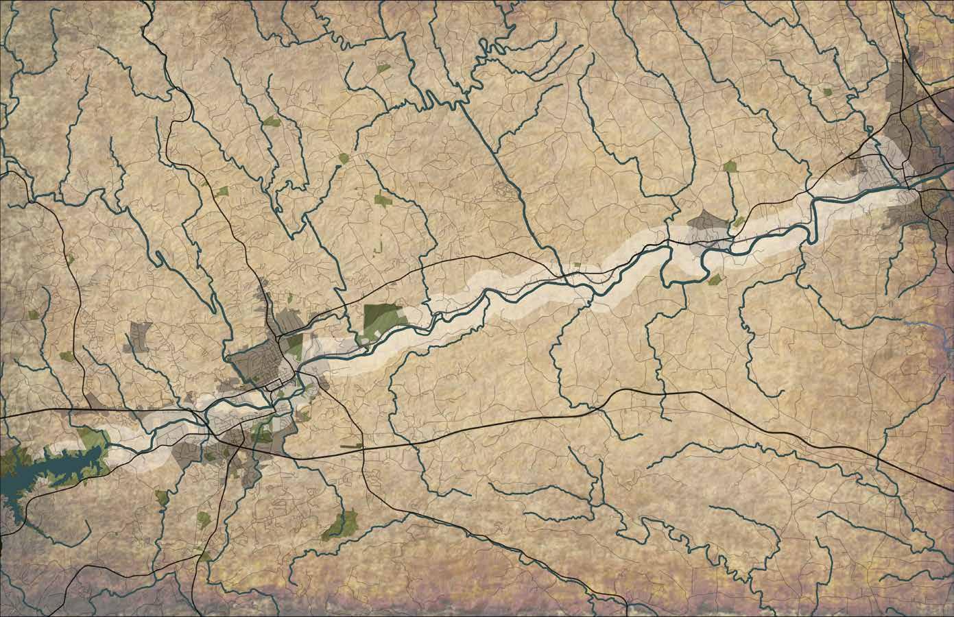


66 CHAPTER 5 ROARINGRIVER BERR W KERR SCOTT RESERVOIR Y ADKIN COUNTY WILKES COUNTY SUR R Y COUNTY 421 421 21 115 ROARING RIVER RONDA ELKIN N. WILKESBORO WILKESBORO LEAD AGENCY: elkin valley trails association LEAD AGENCY: TOWN OF RONDA AND Yadkin Valley Heritage Corridor LEAD AGENCY: Yadkin River Greenway council EXHIBIT 15: IMPLEMENTATION CONCENTRATION AREAS IMPLEMENTATION CONCENTRATION AREAS
implementation
east
center
River). Trail nodes
Elkin
to construct new
River)
Reservoir.
T he
strategy promotes working both inward, from the
(Elkin) and west (Wilkesboros), and out from the
(Ronda and Roaring
currently exist in the
and the Wilkesboros;
OVNHT within the planning section’s core (Ronda and Roaring
would represent a major achievement and likely spawn greater community interest and propel forward the completion of the OVNHT from Elkin to the W. Kerr Scott
TRAIL SUPPORT SPECTRUM
Creating a destination-quality trail system requires a signif icant commitment from local governments, including staff
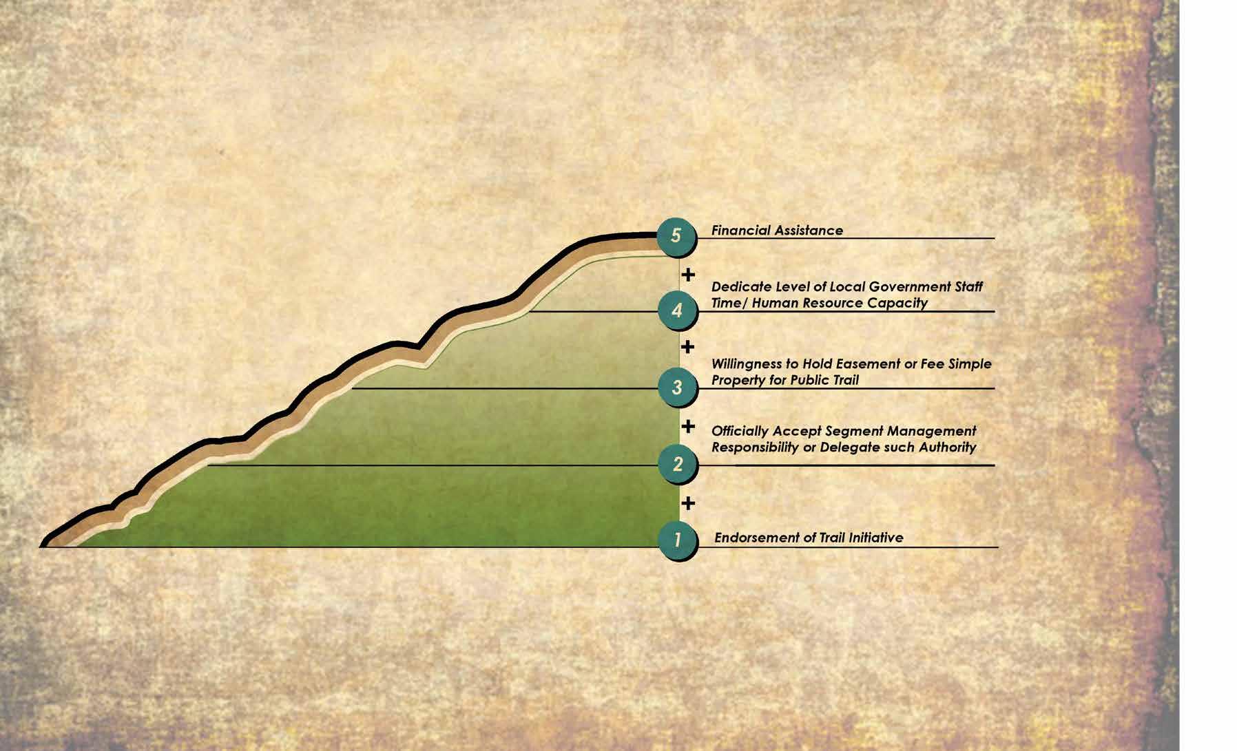
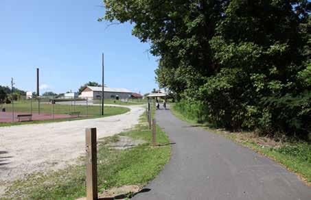
but instead must leverage their funds to obtain support from grant-making agencies sympathetic to the creation of trails and the OVNHT. This particular section of the OVNHT enjoys support from many partners. Working together, local trail or ganizations and governments can have a far greater influence in convincing funding agencies of the merits of the trail, than when acting alone.
The “Trail Support Spectrum” illustrates the steps local gov ernments can take to support trail development in their juris dictions.
TRAIL SUPPORT SPECTRUM
IMPLEMENTATION
1 2 3 4 5 EXHIBIT 16: TRAIL SUPPORT SPECTRUM

68 CHAPTER 5
APPENDIX


70 APPENDIX (A1) BUDGET SECTION 1- Elkin to Ronda Units (LF) Unit Cost Total Cost Dual Tread 20592 $ 80.00 $1,647,360.00 Major Bridges (#1) 1 $275,000.00 $275,000.00 Minor Bridge/ Culvert (#1) 1 $45,000.00 $ 45,000.00 Road Crossing: Surface (#1, #2) 2 $18,000.00 $ 36,000.00 $2,003,360.00 SECTION 2- Ronda to Roaring River Units Unit Cost Total Cost Dual Tread 44088 $ 80.00 $3,527,040.00 Town Street Sidepath 1848 $ 90.00 $166,320.00 Major Bridges (#2, #3) 2 $275,000.00 $550,000.00 Minor Bridge/ Culvert (#2) 1 $40,000.00 $ 40,000.00 Road Crossing: Underpass (#3, #4) 1 $250,000.00 $250,000.00 $4,533,360.00 SECTION 3- Roaring River to North Wilkesboro Units Unit Cost Total Cost Dual Tread 31680 $ 80.00 $2,534,400.00 Minor Bridge/ Culvert (#3) 1 $40,000.00 $ 40,000.00 $2,574,400.00 SECTION 4- North Wilkesboro to Wilkesboro Units Unit Cost Total Cost Typical Greenway (10 ft. Paved Asphalt) 10560 $90.00 $950400.00 Major Bridges (#4, #5, #7) Note: #6 is complete 3 $275000.00 $825000.00 Road Crossing: Underpass (#5) Note: #6 is complete 1 $275000.00 $275000.00 $2,050,400.00 SECTION 5- Wilkesboro to W. Kerr Scott Reservoir Units Unit Cost Total Cost Typical Greenway (10 ft. Paved Asphalt) 7920 $90.00 $712800.00 Major Bridges (#8, #9) 2 $275000.00 $550000.00 Road Crossing: Underpass (#7) 1 $275000.00 $275000.00 Road Crossing: Surface (#8) 1 $55000.00 $55000.00 $1,592,800.00 Total $12,754,320.00 • Does not include land acquisition • Final trail type will depend on specific environmental conditions and whether trail is located within NCDOT ROW or within a private trail easement. • Estimated budget shown above pertains only to the completion of the preferred OVNHT route and associated new bridges and road crossings. Total Section Cost Total Section Cost Total Section Cost Total Section Cost Total Section Cost
(A2) FACT SHEET (A3) LANDOWNER LETTER
[Date]
FACT SHEET
A trail master planning effort is underway to help create a section of the Overmountain Victory National Historic Trail (OVNHT) to connect from Elkin to the W. Kerr Scott Reservoir!
BACKGROUND
Thanks to support from the National Park Service, regional community organizations, and local governments, this plan will help establish a walking and leisure biking trail that connects the region and celebrates the trail walked by the Overmountain Men who won a major Revolutionary War battle at Kings Mountain in 1780.
The trail planning process requires an analysis of the Yadkin River corridor between Elkin and W. Kerr Scott Reservoir. The trail is best suited in floodplain areas where development generally cannot occur and where there are meaningful connections to existing parks, civic buildings, and neighborhoods.
Overmountain Victory
National Historic Trail Master Plan


[Landowner name address]
Re: Special Trail Planning Meeting for Landowners Dear [name]:
Thanks to grant support from the National Park Service, regional community organizations, and local governments, a public walking and leisure biking trail is being explored that could possibly extend 20 miles to connect the towns of Elkin, Ronda, North Wilkesboro, Wilkesboro, and the W. Kerr Scott Reservoir.

If completed, this trail would commemorate the walk made along the Yadkin River by the Overmountain Men who ultimately won a major Revolutionary War battle at Kings Mountain in 1780.
An informational video can be found on the web at: www.OVTplan.com Also, enclosed is a project Fact Sheet that further describes the project.
After identifying feasible trail route options, there will be a major landowner outreach effort. Without the voluntary commitment from landowners, the trail will either be relocated or not constructed.
An educational video will be developed to help communicate the historical significance of the OVT, which will be made available online.
THE PLANNING PROCESS
1 Direction Setting and Project Launch | September 2015
www.OVTplan.com
The consultant team will meet with local trail and government leaders to generally discuss environmental constraints and opportunities for trail connectivity.
2 Research | October – December 2015
The consultant team will conduct a thorough environmental assessment of the study area and determine feasible trail route options. With the trail routes identified, a landowner contact list will be developed.
3 Landowner Outreach | December 2015
Landowners with property along an identified feasible trail route will be invited to a special meeting to learn more about the trail project. After receiving comments from landowners, the preliminary trail routes will be updated.
4 Plan Development | January – March 2016
The consultant team will document the trail analysis and landowner comments. Recommendations will highlight alternative routes and the project’s overall feasibility for completion. A draft plan will be made available for public comment.
5 Final Plan Preparation April 2016
The consultant team will publish a final plan that incorporates all public comments.

Since August, the planning team has been working to identify a feasible route to construct the trail. As part of this analysis, we are exploring properties along the Yadkin River as a potential location for the trail. Without the voluntary willingness of landowners, the planned trail route will either be relocated or not constructed.

We would like to invite you to discuss this project during one of two special landowner meetings:
December 8th at 6 pm
The Elkin Center 1461 North Bridge Street Elkin, NC 28621
December 10th at 6 pm.
Wilkes Heritage Museum 100 East Main Street Wilkesboro, NC 28697


If you plan to attend the meeting, please RSVP via email or phone using the contact information below.

Sincerely,
Eric Woolridge

Consultant Project Manager
Destination by Design Planning Phone: 828.386.1866
RSVP Email: clientrelations@DbDplanning.com
Destination by Design Planning 815 W. King Street, Boone, NC 28607
APPENDIX 71
ELKIN
TO W KERR SCOTT RESERVOIR CONSULTANT CONTACT Eric Woolridge, AICP, Destination by Design | Eric@dbdplanning.com | 828.386.1866 | www.DbDplanning.com
SURVEY

(A5) FUNDING SOURCES
Clean Water Management Trust Fund (www.cwmff.net)
NC Water Resources (www ncwater org)

Recreation Trails Program (ncparks gov/About/grants/main php)
Parks and Recreation Trust Fund (ncparks.gov/About/grants/main.php)
Land Acquisition: Fee Simple or Easement. Must protect floodplain areas. Greenway trails and other park areas are allowed.
Based on 6/2015 discussion w/ staff, a $750K / multi year application would be welcome.
(for rural counties) May (typical)
Not specified, but 20% is competitive February 1st
River access areas or greenways along rivers N/A 50% January 1st & June 1st
All types of trails and greenways $100,000.00 25% February 1st
All types of parks, trails, and recreation facilities $500,000.00 50% February 1st
People for Bikes Community Grant Trails and Greenways $10,000.00 20% May 24th
NCDOT Transportation Plan For Bike and Pedestrian Projects
Bike and Pedestrian Projects both engineering and construction
N/A (for major projects) 20% generally N/A
72 APPENDIX
(A4) LANDOWNER INTEREST
Note: The completed Landowner Interest Surveys were provided to local government leaders.
Interest
Name Address Phone
Number Email Please
share
your
level
of
interest
for providing
for
the
public
trail.
(Check
below) o Not
interested
at
this
time o Somewhat
interested
and
welcome
further
discussions o Very
interested P a r t n e r s h i p F u n d i n g A g e n c y A c t i v e L i v i n g / B u i l t E n v i r o n m e n t I m p l i c a t i o n s M a x i m u m A m o u n t M a t c h i n g F u n d s R e q u i r e d D e a d l i n e s
N/A
$0
Landowner
Survey
TIGER Construction provided all easements are secure.
(min. $1 million)

APPENDIX 73


 EXHIBIT 8: ROARING RIVER ROAD BRIDGE


