


SUMMER 2015
LAKE JAMES MORGANTON
"The landowner is The only person ThaT can acTually give This gifT for The resT of eTerniTy."
– Judy Perry, OVnhT T r AIL en T hu SIAST
Overmountain Victory
National Historic Trail Master Plan
LENOIR >> MORGANTON
LAKE JAMES >> MORGANTON
US National Park Service
Burke County City of Morganton

Destination by Design Planning, LLC | 815 West King Street, Suite 2 | Boone, North Carolina 28607 | 828.386.1866 | www.DbDplanning.com

Pr O duced f O r P r O duced by WITH ASSISTAN ce fr OM

Acknowledgments
Natio N al Park Service
John Slaughter, Group Superintendent, Southern Campaign of the American Revolution Parks
Paul Carson, Overmountain Victory National Historic Trail
N orth caroli N a wildlife re S ource S commi SS io N
Jason Creegan, Conservation Technician II
Isaac Harrold, Program Manager
Kip Hollifield, Land Management Biologist
Ryan Jacobs, Wildlife Forester
Nick Shaver, Technician Supervisor
Gordon Warburton, Mountain Ecoregion Supervisor
Burke c ou N ty
Johnny Carswell, Chairman, Board of Commissioners
Wayne Able, Vice Chair, Board of Commissioners
Maynard Taylor, Member, Board of Commissioners
Jack Carroll, Member, Board of Commissioners
Jeff Brittain, Member, Board of Commissioners
Scott Carpenter, Deputy County Manager/Planning Director
c ity of m orga N to N
Mel L. Cohen, Mayor
John H. Cantrell, Jr., Mayor Pro-Tem
Forrest A. Fleming, Councilman
S. Sidney Simmons, Councilman
Ronnie M. Thompson, Councilman
Lee E Anderson, AICP, Director of Development & Design Services
Michael Berley, PLA, Project Designer
l a N dow N er o utreach v ideo iN terviewee S
Senator Jim Broyhill
John Slaughter, National Park Service
Ben Griffin, Landowner
Merlin and Judy Perry, Trail Enthusiasts
Table of conTenTs
INT r O duc TION 1

Background 2 Plan Goals 3 Planning Process 4 Plan Organization 5
cHAPT er 1: e x ISTIN g cON d ITIONS , A NAL y SIS , AN d Pre LIMINA ry A LI g NM e NTS 7 Study Area Description 8 The Natural Environment 10 The Built Environment 13 Map And Photo Series: Preliminary Trail Route Alternatives 19
contents vii
cHAPT er 2: LAN d OWN er e N g A ge M e NT 27 Identifying the Landowners 28 Landowner Communications 29 Landowner Workshop 30 Trail Route Re-Evaluation 32 cHAPT er 3: T r AIL c HA r A c T er & d e SI g N gu I de LIN e S 33 Trail Types 34 Trail Types Profile 36 Signage and Wayfinding 38 Social Media: The New Word of Mouth 40 c HAPT er 4: rec OMM e N d ATIONS 41 Planning Sections Overview 42 Trail Sections Recommendations 44 cHAPT er 5: IMPL e M e NTATION 59 Implementation Details by Section and Responsibility 60 Priority Implementation Areas and Responsibilities 61 Trail Support Spectrum 62 A PP e N d I x 63 (A1) Budget 64 (A2) Fact Sheet 65 (A3) Landowner Letter 65 (A4) Landowner Interest Survey 66 (A5) Funding Sources 66 (A6) Warrior Fork Greenway Easement 67 (A7) Crescent Resources / Warrior Fork Greenway Easement 68
list of maps list of Exhibits
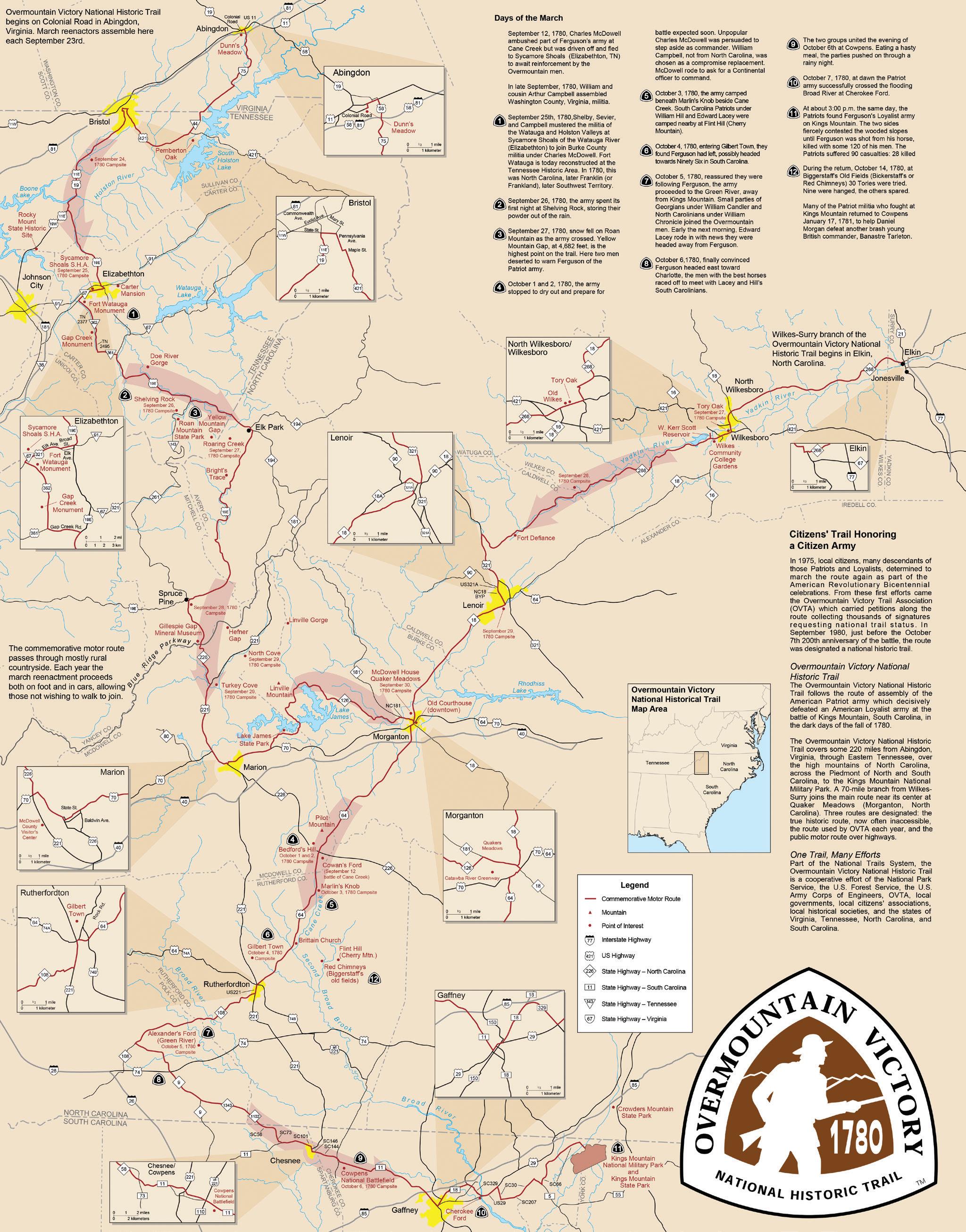
Map 1: OVNHT Commemorative Motor Route 2
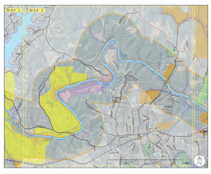
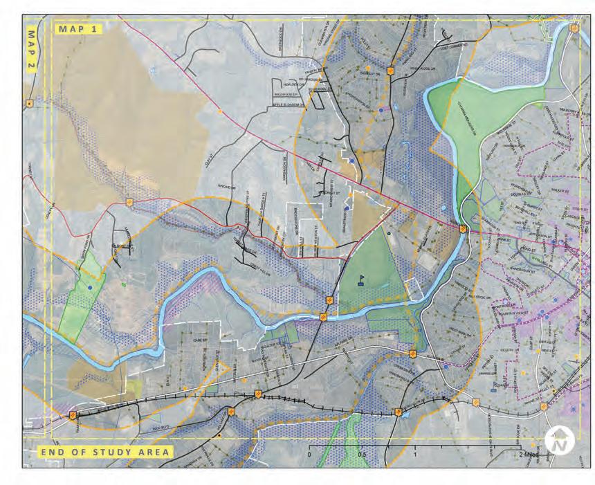
Map 2: General Study Area 8
Map 3: Study Area 1 Site Analysis 20
Map 4: Study Area 2 Site Analysis 22
Map 5: Study Area 3 Site Analysis 24
Map 6: Landowner Database 28
Map 7: Landowner Sentiment 32
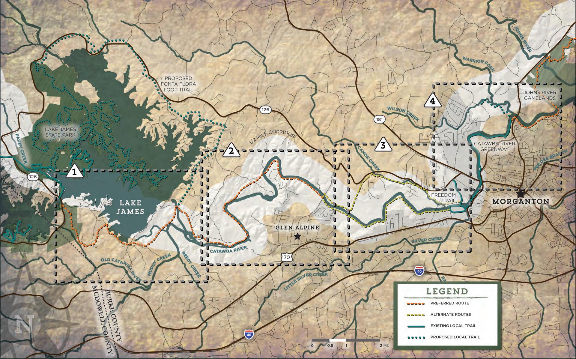
Map 8: Planning Sections Overview 42
Map 9: Planning Section 45
Map 10: Planning Section 2 49
Map 11: Planning Section 3 53
Map 12: Planning Section 4 55
Exhibit 1: McDowell House/ Quaker Meadows 18
Exhibit 2: Trail Type Profile 36
Exhibit 3: Social Media 40
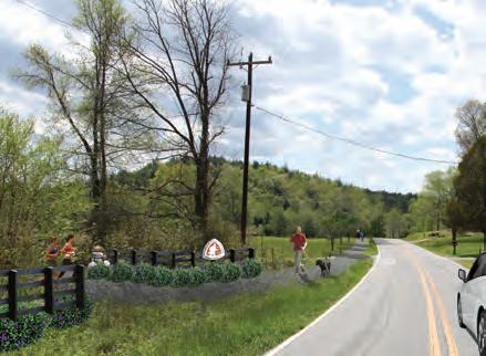
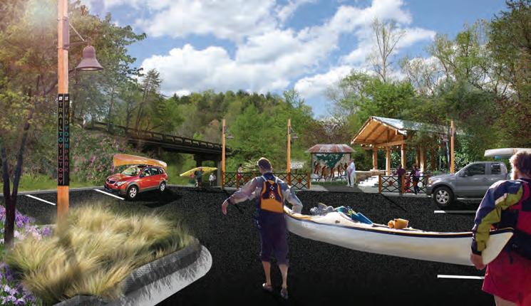
Exhibit 4: Lake James Family Campground 46
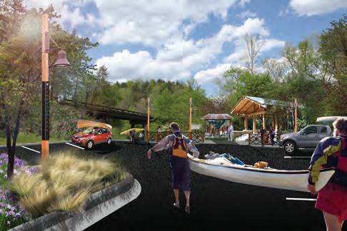
Exhibit 5: Powerhouse Bridge 47
Exhibit 6: Bridgewater Access Improvements 47
Exhibit 7: Off the Road Again @ Powerhouse 50
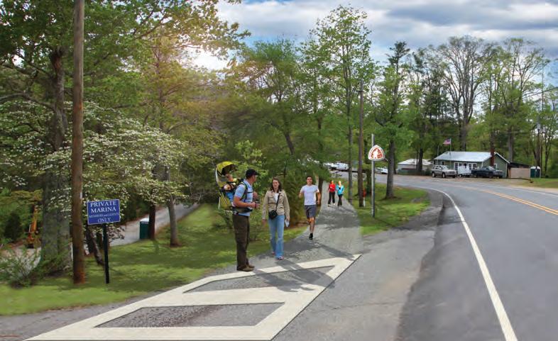
Exhibit 8: Watermill River Access Enhancements 51
Exhibit 9: Grace Ridge Trailhead 56
Exhibit 10: Highway 18/64 Trailhead 57
Exhibit 11: Implementation Details by Section and Responsibilities 60
Exhibit 12: Trail Rubicon: Finding the Point of No Return 61
Exhibit 13: Priority Implementation Areas and Responsibilities 61
Exhibit 14: Trail Support Spectrum 61
contents ix
introduction
the overmountain victory national historic trail is 330 miles in length and includes portions of virginia, tennessee, north carolina and south carolina. the trail commemorates the significance of the patriot militia that marched over the appalachian mountains to defeat the BritiSH-LEd loyalist army at the battle of kings mountain on october 8, 1780.
this trail master plan SErVES AS A roAd MAP For EStABLiSHinG A section of the overmountain victory national historic trail (ovnht) in nortH cAroLinA from Lake James to the city of morganton.

map 1: ovnht commemorative motor route background

In 2014, Burke County successfully secured partnership funds from the National Park Service (NPS) and provided additional funding to develop a comprehensive trail master plan for the Catawba River corridor from Lake James to Morganton. The NPS willingly provided funding for this trail initiative because it was along this corridor that in 1780 the “Overmountain Men” marched on their way to the Battle of Kings Mountain where they defeated a British led army to “turn the tide” of the Revolutionary War. It is expected that trail developed along this corridor with permanent protection measures in place (easements, fee simple, right of way, etc) will be certified by the NPS as part of the Overmountain Victory National Historic Trail.
To be certified as part of the Overmountain Victory National Historic Trail, the trail segment must be constructed within onehalf mile of the historic route taken by the patriots. Ongoing research, including segments of the Yellow Mountain Road, continue to be explored as additional routes possibly used by some Overmountain Men, yet are not recognized as part of the official historic route as determined by the congressionally appointed advisory committee, therefore not eligible for certification. For the purposes of this plan, the study area recognizes the current NPS designated historic route and extends one-half mile on either side of the Catawba River.
Burke County and Morganton: a History of t rail d evelop M ent
Since the creation of the Lake James State Park in 2004, the North Carolina Division of Parks and Recreation has worked to create and expands its trail network throughout the park. Burke County officials, aware of the quality of life benefits and economic impact associated with trail development, have also become immersed in the creation of a trail system – the Fonta Flora Trail – to loop the whole of Lake James. This trail is being spearheaded by Burke County leadership, but will ultimately become part of the NC park system.
The City of Morganton has worked for more than two decades to create a greenway system that parallels the Catawba River. The Catawba River Greenway now extends nearly four miles and connects many of the City’s parks, schools, and business areas.
Portions of the trail systems at both Lake James and within the City of Morganton are certified as part of the Overmountain Victory National Historic Trail. This plan strives to unify the OVNHT along the Catawba River corridor.
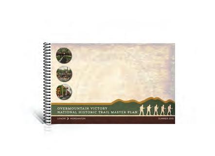
tH e s ister p lan
t his trail plan was developed in co njunction with another o vermountain v ictory n ational Historic t r ail master plan that extends along the l ower Creek Corridor from l enoir to Morganton. a lthough two separate plans were developed, the planning process was combined for the complete corridor from l ake James to Morganton to
tH is plan's study area
t his trail section spans from l ake Ja mes to Morganton.
2 introduction
lenoir
morganton
lake james
coMPonEnt oF
PLAn GoALS
s pecific trail r ou tes. Identify a specific and feasible trail route within a 1/2 mile of the known historic Overmountain Victory National Historic Trail as determined by NPS;
4
l andowner o utreach. Make a direct appeal to landowners identified during the analysis and record their sentiments for providing a trail easement;
3 5 2
v isual p lan. Create a visual plan that provides renderings and schematics to demonstrate trail character;
s upport o ther Community g oals. Identify opportunities to leverage trail development to further support other community goals, including economic development, historic preservation, public health, and environmental stewardship; and
s ocial Media. Incorporate modern social media marketing tools within the trail and signage infrastructure to promote the development of “user generated” marketing content.
introduction 3
1
A criticAL
tHiS PLAn wAS LAndownEr outrEAcH.
Direction Setting and Project Launch | September 2014


The consultant team met with local trail and government leaders to discuss general environmental constraints and opportunities for trail connectivity.
Research | October – January 2015


The consultant team conducted a thorough environmental site analysis of the study area and determined feasible trail route options. With the trail routes identified, a landowner contact list was developed.
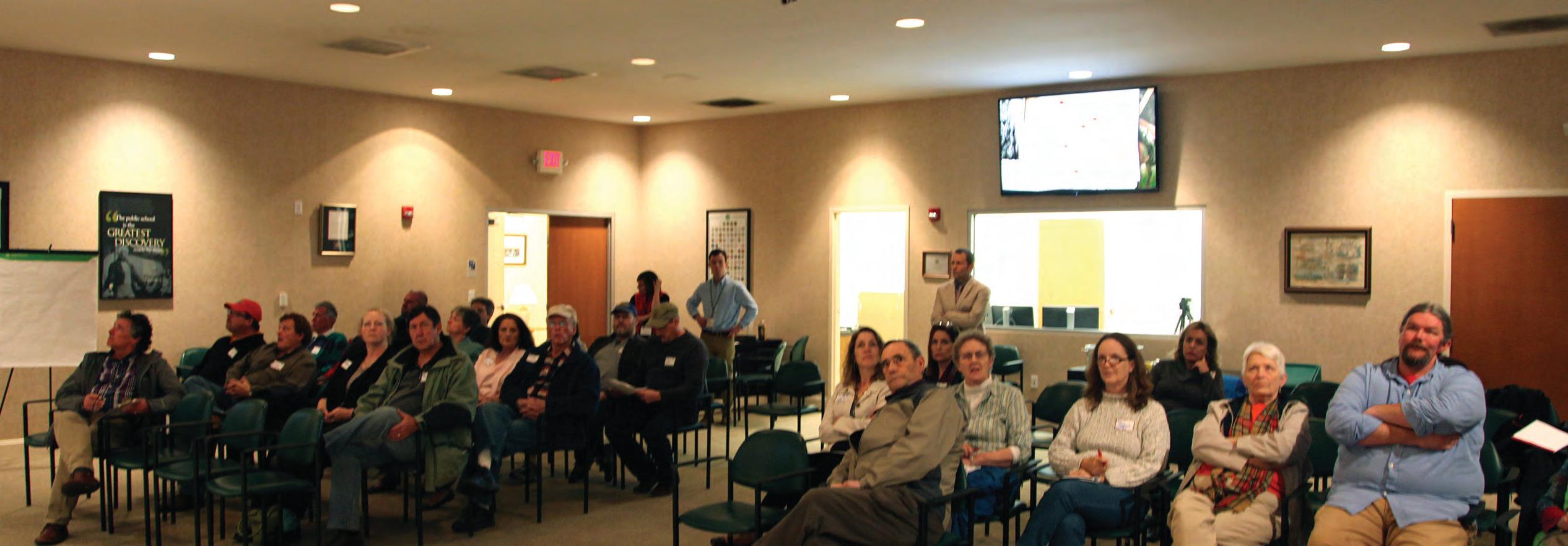
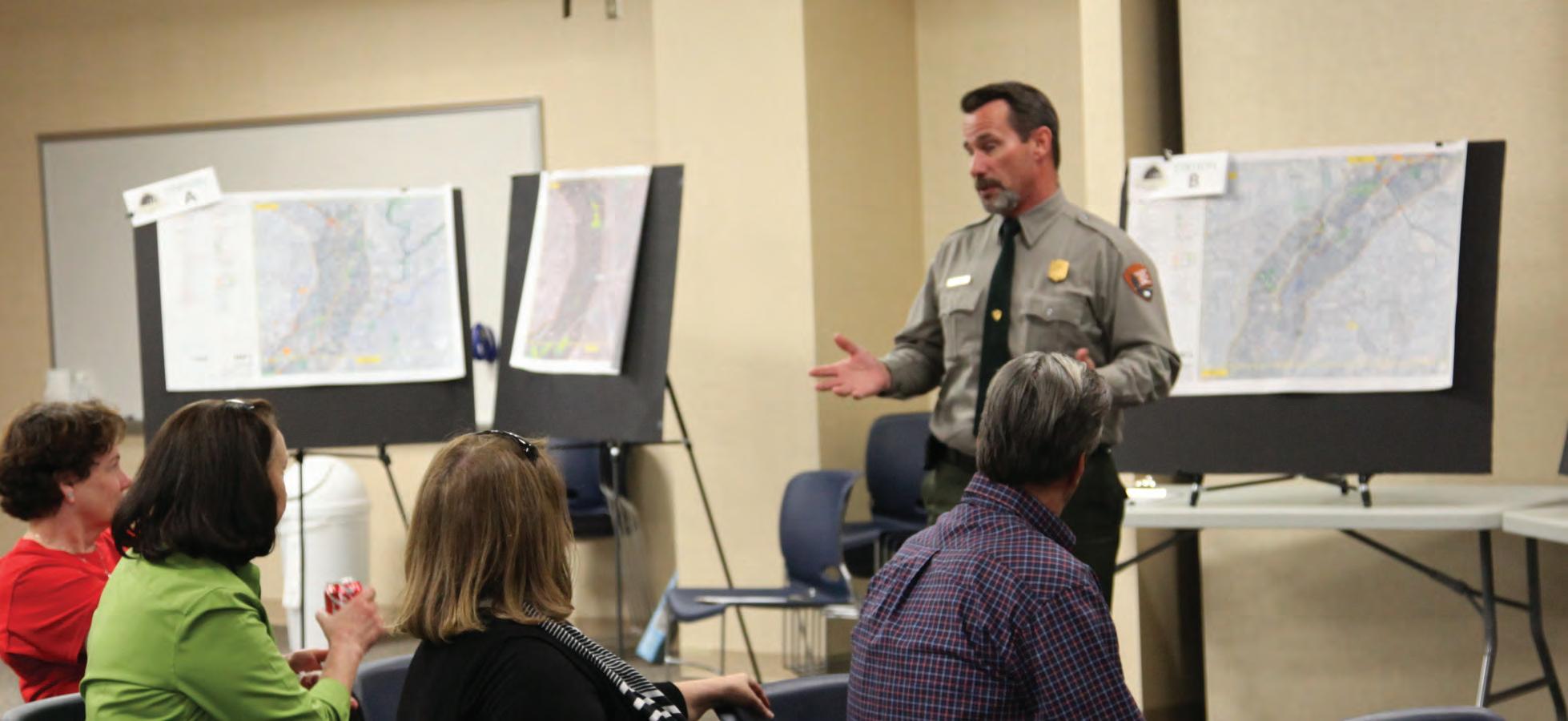
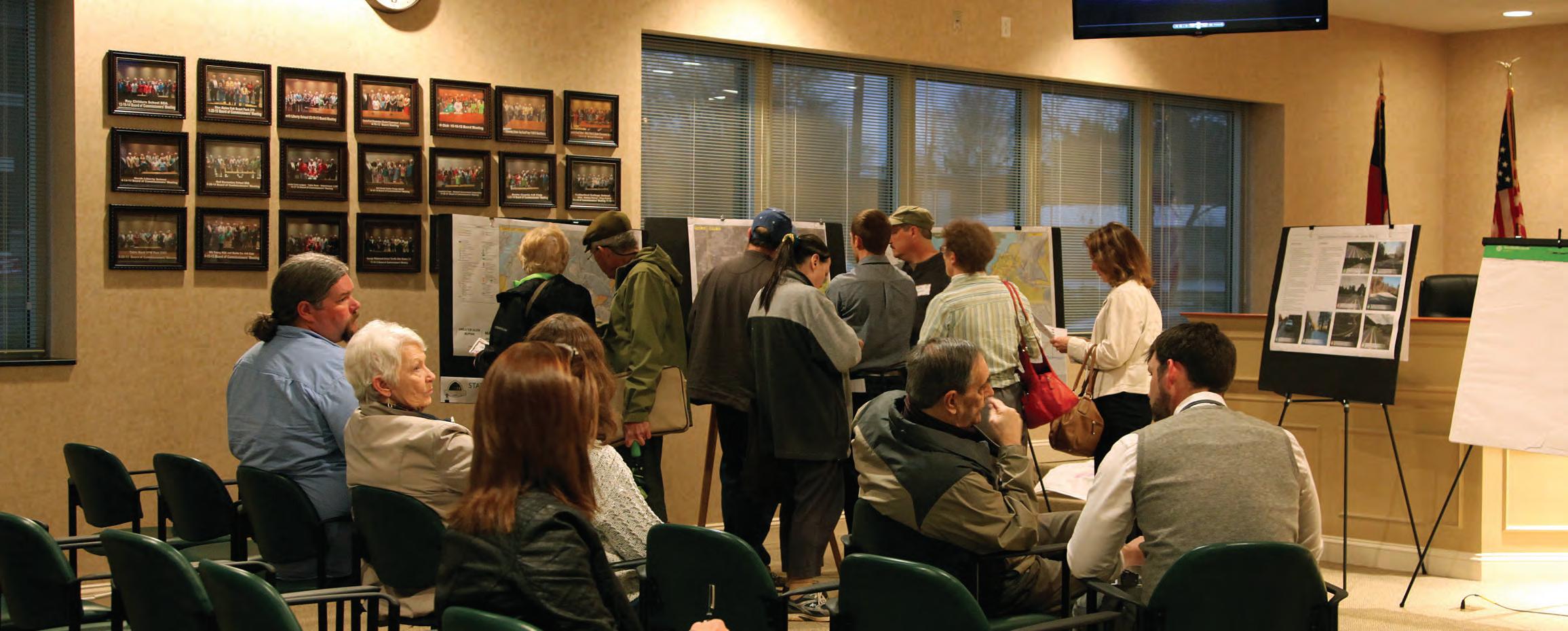
Landowner Outreach | February – March 2015

Landowners with property along an identified feasible trail route were invited to a special meeting to learn more
project timeline

about the trail project. After receiving comments from landowners, the preliminary trail routes were revised accordingly.
Plan Development

| March – May 2015
The consultant team worked in tandem with local leaders to develop a preferred trail alignment. Renderings and schematics were provided to visually support the trail recommendations.
Final Plan Preparation | May – July 2015
Publish the Final Plan for review by the public and elected officials.
A project fact sheet provided interested parties with background information and a project timeline.
4 introduction CR AFTS MAN SI GN A GE C ON CEPT PL CE Y UR VO TE HE RE 20 Miles MAP 1 MAP 2 MAP 3 3 MAP 4 MAP 4 MAP 5 MAP 5 MAP 6 6 MAP 7 MAP MAP 8 MAP Lenoir Morganton 1/2-Mile Buffer 1/2-Mile Buffer BURKE COUNTY CALDWELL COUNTY OVERMOUNTAIN VICTORY NATIONAL HISTORIC TRAIL SEP T. ‘1 4 OC T. ‘ 1 4 - JAN. ’1 5 FEB. - March ‘1 5 MA R CH - M A Y ’1 5 •K ic k O ff •F a cili tat ng Plann ng Ov er si gh t Co mmi ttee DI RE CTI ON SE TTI NG • Physica Inv ento ry • Phys iog r aph ic A na lysi s •N atural nv en t or y • Po in ts of Inte rest & St ru ct ures •En vi ronmen tal • Inf rastruc tu r e & Ut il iti es •Vi deo D ev el op m en t • Publ c M eet i ng & Engagemen t • Land o wne r Out r ea ch Worksh op s • Des i gn Al ter nat ives • W ayfinding & S t ru ct ural E le m en ts • Br and ing • Opinion of Pr obab le Cos t • Route F ea s ibi lity • Land o wne r F ol low -u p RE S EA RCH AND P REL IMI NA RY A NA LY SI S PUBL IC ENG A GE M EN T & LAN DOW NER OU TR EA CH D RAF T P LAN, DE SI GN CO N CE PT S, CO STS MA Y-JULY ’1 5 •Fundin g •Implemen t atio n FI NAL D RA FT D EVE LOP MEN T PLAnninG ProcESS BACKGROUND THE PLANNING PROCESS CONSULTANT CONTACT: Eric Woolridge, AICP Destination Design Email: Eric@dbdplanning.com Phone: (828) 386-1866 Web: www.DbDplanning.com A trail master planning effort is underway to help create section of the Overmountain Victory National Historic Trail (OVT) that would connect from Lenoir Morganton to Lake James! Thanks to grant support from the National Park Service, regional community organizations and local governments are working to establish walking and leisure biking trail that connects the region and celebrates the trail walked by the Overmountain Men who won major Revolutionary War battle Kings Mountain in 1780. The trail planning process requires an analysis of the Lower Creek corridor in Caldwell County and the Catawba River corridor Burke County. The trail best suited in floodplain areas where development generally cannot occur and where there are meaningful connections to existing parks, civic buildings, and neighborhoods. After identifying feasible trail route options, there will be major landowner outreach effort. Without the voluntary commitment from landowners, the trail will either be relocated or not constructed. An educational video will be developed to help communicate the historical significance of the OVT, which will be made available online. www.OVTplan.com Direction Setting and Project Launch September 2014 The consultant team will meet with local trail and government leaders generally discuss environmental constraints and opportunities for trail connectivity. Research October – January 2015 The consultant team will conduct thorough environmental assessment of the study area and determine feasible trail route options. With the trail routes identified, landowner contact list will be developed. Landowner Outreach February March 2015 Landowners with property along an identified feasible trail route will be invited special meeting learn more about the trail project. After receiving comments from landowners, the preliminary trail routes will be updated. Plan Development March May 2015 The consultant team will document the trail analysis and landowner comments. Recommendations will highlight alternative routes and the project’s overall feasibility for completion. draft plan will be made available for public Final Plan Preparation May June 2015 The consultant team will publish final plan that incorporates all public comments. 1
FACT SHEET
1. 2. 3.
FAct SHEEt
4. 5.
chapter i.


Existing conditions, Analysis, and Preliminary Alignments


This chapter provides a comprehensive overview and analysis of the opportunities and constraints found throughout the study area. The analysis begins with a brief description of the study area followed by a comprehensive discussion of the natural and built environments and their implications for trail suitability, trail design features, permitting, costs, etc. This chapter concludes with a map and photographic series that highlights a host of preliminary trail route alternatives.

This chapter is dedicated to visually defining the various trail types to be used throughout the corridor. Also, design concepts are provided for trail user orientation signage, mile markers, historic markers, and other trail support facilities. Social Media is explored as a mechanism for trail promotion and marketing.
Significant efforts were made to reach out to landowners where the preliminary analysis indicates that the trail is most suitable. This chapter describes the landowner outreach process and provides highlights from the landowner workshop meetings.

The final chapter is organized according to four (4) planning sections. Each planning section description includes a map that identifies a preferred alignment. Each planning section further incorporates the analysis and design elements from the previous chapters along with a host of supporting renderings and design schematics.
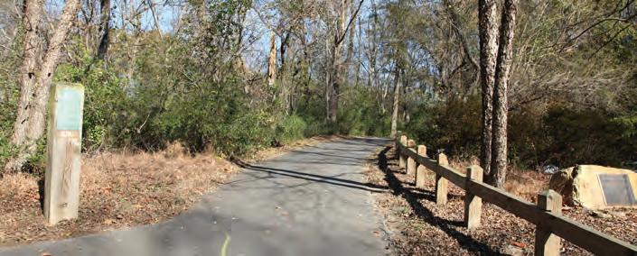
introduction BUR LAURE OVEDR LINV VYST ASHTONC WHIPPORWILL HOLLOW MCCLELLAN BRIDGEWATER LANCASTER POWERHOUSE DUCKWORTH HEMLOCK SPRINGS SLEEPY HOLLOW DEEP COVE BENFIELDS LANDING LAURELPOINTE HEMLOCK N POWERHOUSE WAY CONLEY BUMG ARNER RR WHITE CORPENINGCHAPEL LA EK KPAREWIV NDING HOLIDAY SHORE LAKEFORREST LEGEND LANDOWNER SENTIMENT TRAILHEAD ROAD CROSSING MAJOR BRIDGE MINOR BRIDGE/ CULVERT YES NO POSITIVE NO RESPONSE PREFERRED TRAIL ROUTE ALTERNATE TRAIL ROUTE SPUR TRAIL EXISTING LOCAL TRAIL PROPOSED LOCAL TRAIL TRAIL FEATURES TRAILS CROSSINGS # # # 0 1/4 1/2 1.0 MI. N OLD CATAWBA RIVER LAKE JAMES BEACH W/ VISTA CANAL BRIDGE TRAILHEAD EXISTING CANAL BRIDGE PUBLIC ACCESS CANAL BRIDGE LAKE JAMES FAMILY CAMPGROUND VISTA (POSSIBLE PRIMITIVE CAMPING) PADDYS CREEK DAM BRIDGEWATER DAM POWERHOUSE BRIDGE PROPOSED LAKE JAMES STATE PARK HIKING TRAIL EXISTING OVT BRIDGEWATER PUBLIC RIVER ACCESS PROPOSED FONTA FLORA T R A I L CATAWBARIVER 1 2 1 2 3 4 5 6 7 8 9 10 13 12 11 14 15 16 17 19 20 23 24 21 22 18 1 2 3 4 5 6 7 SECTION 1 CANAL BRIDGE POWERHOUSE RD. rGAnizAtion Site Analysis Overmountain Victory National Historic Trail Greenway Study MAP 1 Bridgewater Powerhouse NPOWERHOUSE RD BENFIELDSLANDINGRD NPOWERHOUSERD Lake James Paddy Creek Dam 70 Lake James State Park Lake James State Park ReedyCreek Catawba River OldCatawbaRiver 10 9 10 8 2 15 11 9 2 MAP 1 MAP 2 Overmountain Victory NH Trail Municipal/County Owned Properties OVNHT 1/2-Mile Buffer Existing Trails & Other Recreation Fishing Access Parks Golf Courses Managed Lands Federal & State Ownership Privat Brownfields Natural Heritage Data Inactive Hazardous Sites Active & Inactive Landfills Proposed Trails Animal Plant Animal Assemblage Natural Community Element Occurances Natural Heritage Areas Very High High Moderate General Unranked Wetlands (NWI) Hydric Soils Waterbodies Streams Floodway Flood Zones 100-Year Floodplain 500-Year Floodplain Hydrology Exceptional Opportunities Constraints Element Occurrence: Dwarf-flowered Heartleaf Element Occurrence: Dwarf-flowered Heartleaf Lake James Loop Trail LakeJamesLoopTrail
Catawba River Dam and Truss Bridge Historic Bridge Muddy Creek Historic RR Bridge BURKE COUNTY MCDOWELL COUNTY NC 126 START OF STUDY AREA Lake James State Park 7 5 4 6 10 3 5 10 13 14 1 1 12 Bridgewater Fishing Access Lake James Family Campground 16
NorfolkSouthernRR
trail character and design Guidelines chapter iii. Landowner Engagement chapter ii. recommendations chapter iv.
6 introduction
Chapter 1
Existing Conditions, An A lysis, A nd Pr E limin A ry Alignm E nts
a comprehensive overview and analysis of the opportunities and constraints found throughout the study area.

The analysis begins with a brief description of the study area followed by a comprehensive discussion of the nat ural and built environments and their implications for trail suitability, trail design features, permitting, costs, etc. This chapter concludes with a map and photograph ic series that highlights a host of preliminary trail route alternatives.
i n this C h AP t E r
Alternatives
A. Study Area Description B. Natural Environment Analysis C. Human/Built Environment Analysis D. Map, Photo, and Preliminary Trail Route
study area
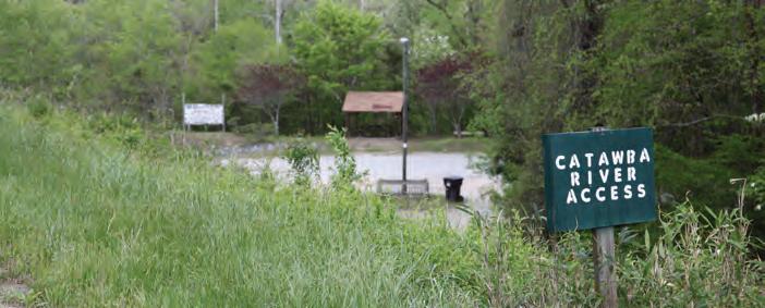
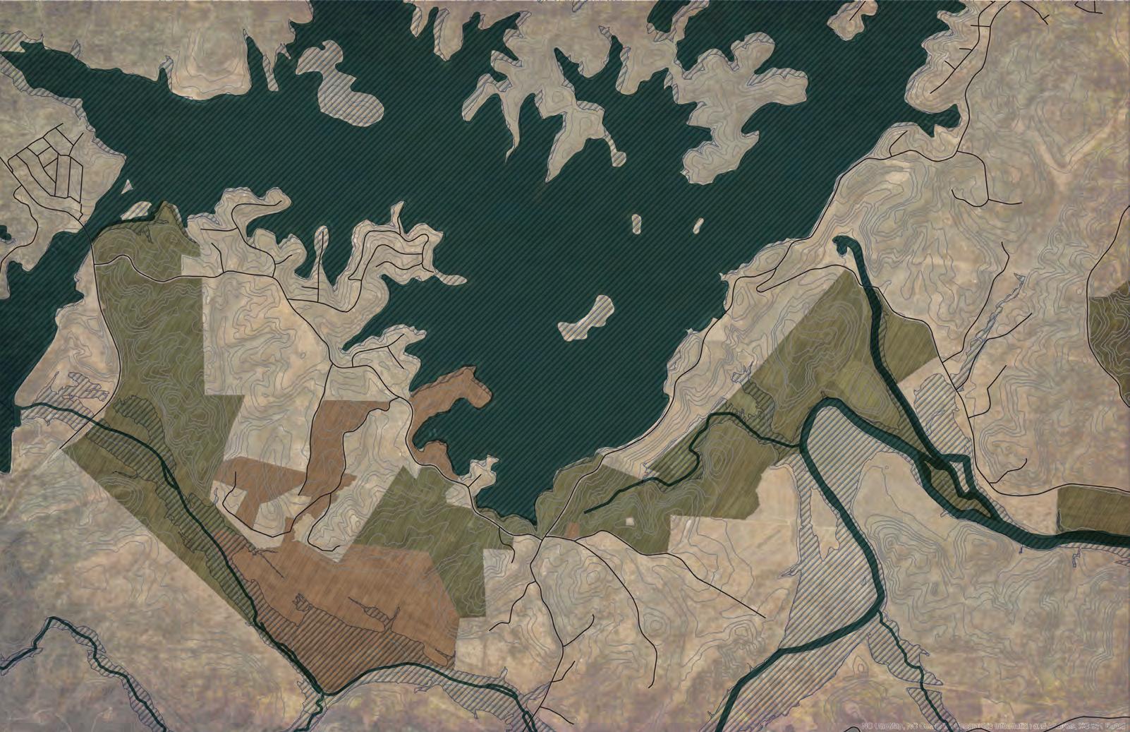
s tudy Ar EA d E s C ri P tion: the lake James to morganton oVnht study area is one-mile wide and extends approximately 20-miles long from the highway 126 Bridge at lake James to the proposed grace ridge trailhead near rocky Ford Access in the City of morganton. starting at lake James state Park, the corridor extends west through large tracts of rural agricultural land primarily owned by two landowners: duke Energy and Crescent resources, which continue to partner with Burke County to provide for trails and portions of the oVnht the planning corridor follows the Catawba river east, transitioning to a mix of large tracts of privately owned land and residential subdivisions. located on the south side of the Catawba river is glen Alpine, a small municipality whose jurisdiction intersects with portions of the study area. Along the north side of the river is the historic swan Ponds property, which is part of the Preservation north Carolina program.
the upper Catawba river trail, which provides for a series of river access areas throughout the study area, serves as a foundation for the river’s recreation offerings. land parcels become smaller as the corridor continues toward the City of morganton before reaching the 3.8-mile Catawba river greenway, which is officially designated as part of the overmountain Victory national historic trail.
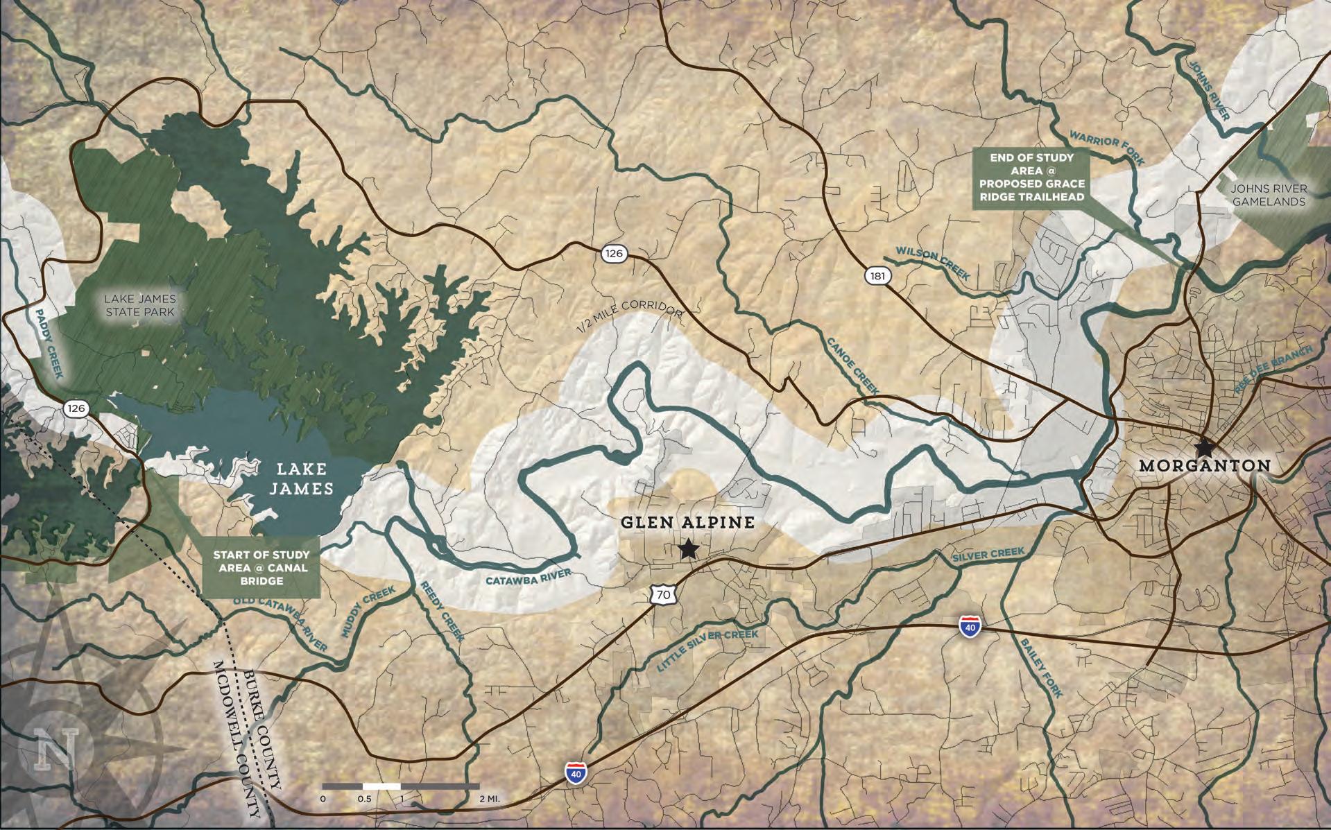
the Lake James to Morganton OVNht study area is one-mile wide and extends approximately 20-miles long from the highway 126 Bridge at Lake James (canal bridge) to the proposed grace ridge trailhead near the rocky ford access in the City of Morganton.
8 chapter 1
m AP 2: g E n E r A l study A r EA

EXISTING CONDITIONS, ANALYSIS, AND PRELIMINARY ALIGNMENTS 9 ANALYSIS
aLterNate traiL rOutes were deterMiNed Based ON aN aNaLysis Of the NaturaL aNd BuiLt eNVirONMeNts.
aNaLysis wOrkfLOw
the NaturaL eNVirONMeNt
The opportunities and constraints found within the natu ral environment are critical for determining suitable trail locations and feasibility, ideal user experiences, construction costs, and necessary permits.
This section explores the implications of the study area’s natural environment for establishing the Overmountain Victory National Historic Trail from Lake James to Mor ganton and includes five (5) parts: 1) Floodplains; 2) Wet lands and Hydric Soils; 3) Streams, Lakes, and Ponds; 4) Steep Slopes; and 5) Rare Flora and Fauna.
10 chapter 1
photo: visitnc.com
Flood P l A ins
Floodplain areas provide both an opportuni ty and constraint for trail development. Since traditional development is often not suitable within floodplain areas, private landowners are often more willing to provide access for public trails within these areas. Also, these scenic areas often attract wildlife, which cre ates an engaging trail experience. Within this study area, much of the floodplain areas along the Catawba Creek corridor are ideal for greenway development.
Although development is regulated within the floodplain, greenways and trails are al lowed and can be permitted. Sound trail en gineering techniques are necessary to ensure trails can sustain flooding. To the extent pos sible, greenway alignments should be avoid ed within the floodway2
Avoid disturbance in the floodway. Avoid placement of structures or disturbance within the floodway. Floodways are egulated locally and by the Federal Emergency Management Agency (FEMA). Fill, structures (walls, kiosks, etc), and impervious services are discouraged. Any structures located within the floodway require no-impact/no-rise certification through FEMA. These studies can vary on cost but can range from $2,500-$15,000 depending on complexity.
W E tl A nds A nd h ydri C s oils
The study area includes several wetland ar eas as identified on the National Wetland In ventory (NWI). According to NWI, there are likely smaller wetland areas within the study corridor that are not indicated within their inventory that could impact final trail align ments. Hydric soils in combination with wet land plant species and wetland hydrology are considered indicators of a wetland, which require costly permitting if impacted3
If wetlands are unavoidable, utilize elevated boardwalk systems. Boardwalks allow for travel over flat, poorly draining soils, standing water, and wetland features and have significantly less impact than other options. A section 404 (Clean Water Act) Permit may be required if the wetland is considered jurisdictional by the USACE. This means that the wetland is not isolated and part of a broader lake or water system. A small boardwalk for a non-isolated wetland with limited fill or dredging may qualify for a programmatic Nationwide Permit. Nationwide Permits are designed to streamline the permitting process for actions with limited disturbances. In addition to permitting, disturbances exceeding a tenth 0.1) of an acre would require mitigation which can increase project costs. Impacts under a tenth (0.1) of an acre do not trigger mitigation fees.
s tr EA ms, lA k E s, A nd Ponds
TThe County, State, and Federal govern ment regulate the many waterbodies found throughout the study area4. The Catawba River is the dominant waterway within this corridor. Canoe Creek, located to the west of Morganton, is a tributary of the Catawba that serves as a possible trail corridor.
Maintain a 50-foot buffer from all waterways, particularly those regulated under the Catawba River Buffer Rules. The state requires a 50-foot buffer along the shorelines of Catawba River and associated lakes. Streams within the study area are identified by the State of North Carolina as having poor water quality and maintaining or improving an adequate vegetated buffer is crucial to improving the quality. Zone of this buffer includes an undisturbed 30-foot buffer from top of bank in which trails are discouraged. Zone 2 is an additional 20-foot buffer. This zone allows for managed vegetation and trails and greenways. While trails are an allowable use within Zone 2, the NC Division of Water Quality requires a permit (through DWQ or designated local government). The applicant must show that disturbance has been minimized and no other alternatives exist.
EXISTING
ANALYSIS, AND PRELIMINARY ALIGNMENTS 11 4
CONDITIONS,
“withiN this study area, MuCh Of the fLOOdpLaiN areas aLONg the CatawBa Creek COrridOr are ideaL fOr greeNway deVeLOpMeNt.”
photo by others
s t EEP s lo PE s
Much of the corridor has gently rolling to pography. The most challenging slopes will be along the banks of the Catawba River near the Glen Alpine area and Lake James. The trail should be designed for grades under 5% slope if possible. Natural surface trails can vary up to 10% slope. In steeper areas, this will be a design challenge. Alignments pro posed in this study should be designed with these guidelines and may require a larger corridor to incorporate a more gradual trail grade.
rA r E Flor A A nd F A un A
The State Natural Heritage Program provides data identifying the state’s most sensitive environmental areas to be avoided; these areas are incorporated within the analysis map series at the end of this chapter. Also, rare flora and fauna species can also exist outside of these designated areas, which can alter final trail alignments prior to construction. Species identified by the State Natural Heritage Program within this study area as of January 2015 include5:
Coordination with the U.S. Fish and Wildlife (USFWS) is an important aspect of the design process. Involving USFWS early on in the process can help avoid potential planning obstacles related to federally protected species. Additionally, permits like Section 401 and 404 (described above in Wetland and Streams) will initiate the review of the State Natural Heritage Program database. If species are found within the project area, State or Federal require ments may dictate avoidance or mitigation.
photo by others
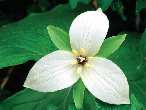
A. Dwarf-flowered Heartleaf (see Map 1, found on Duke Energy held lands)
B. White Trillium (see Map 2 recorded to be in the larger Glen Alpine area)
C. Carolina Foothills Crayfish and Eastern Creekshell (see Map 3, found along the Catawba)
12 chapter 1
the BuiLt eNVirONMeNt
The opportunities and constraints found within the built and human environment are critical for determining suit able trail locations and feasibility, ideal user experiences, construction costs, and necessary permits.
This section highlights five (5) built environmental fea tures and their implications for developing the Overmountain Victory Trail from Lake James to Morganton, including: 1) Land Use; 2) Existing Trails and Parks; 3) Utilities; 4) Transportation; and 5) Historic Resources.

13
EXISTING CONDITIONS, ANALYSIS, AND PRELIMINARY ALIGNMENTS
photo by others
Central Section
The central section of the corridor has a mixed of both large tracts and small tracts, many which serve sec ond-home owners. Many of the large landowners have owned their property for multiple generations, while smaller tracts have been purchased for retirement or per sonal retreats. Throughout the planning process, both of these groups described issues with trash and other prob lems with the general public and river users. This history serves as a barrier for obtaining trail easements.
Western Section
The western extent of the study area is typified by a rural wooded landscape with large tracts of land, many which are owned by Crescent Communities, Duke Energy, NC State Parks, and family trusts. Many of these large tracts are leased as tree and plant nurseries. The fertilization of these crops must be considered when providing for public trails.
The City of Morganton
The City of Morganton and its western edge is typified by single-family residential growth. Dense pockets of land development create a challenge for creating a public trail.
14 chapter 1
l A nd us E sn AP sho t
“the western extent of the study area is typified by a rural wooded landscape with large tracts of land.”
E xisting PA rks A nd gr EE n WA ys
“Burke COuNty aNd MOrgaNtON
haVe a COLLeCtiON Of parks aNd greeNways that serVe as ideaL
LOCatiONs fOr traiL CONNeCtiONs.”
Burke County and Morganton have a collection of parks and greenways that are ideal for trail connections. Some of these major assets include:
Bridgewater Fishing Access
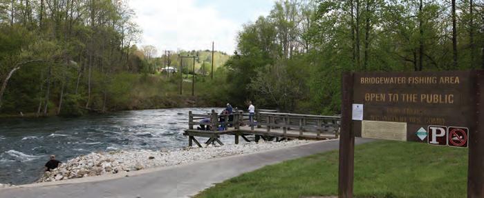
This public fishing access area and canoe launch is owned by Duke Power, which has plans to further improve the site.
Watermill River Access
This public fishing access area near Glen Alpine is owned by Burke County.
The Proposed Fonta Flora State Trail
The Fonta Flora State Trail will pro vide for a complete loop around Lake James. This trail was designated in 2015 as an official state trail by the NC General Assembly. Portions of this trail will also serve as certified sec tions of the OVNHT.
Lake James State Park
This state park is one of the most significant linkages throughout the planning corridor and serves as the western terminus of the study area.
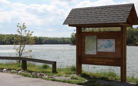
Canal Bridge Public Access
NC State Parks curently manages the Canal Bridge Public Access which is located near the western terminus of the study area. Although the access is a significant asset within the planning corridor, NC Department of Parks and Recreation Administrative Code does not allow any boating access area to serve a dual purpose such as provid ing for an OVNHT trailhead.
City of Morganton Parks and Greenways
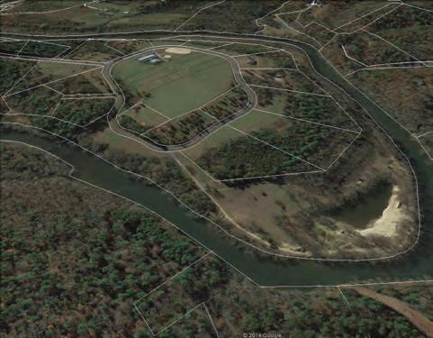
The City has many parks and greenways to connect, such as the Catawba River Greenway, Freedom Park and Gre enway, Catawba Meadows Park, Rocky Ford Access, and the Catawba River Soccer Complex.
EXISTING
AND PRELIMINARY ALIGNMENTS 15
CONDITIONS, ANALYSIS,
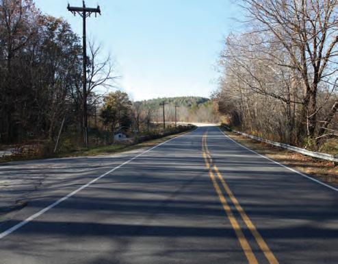
photo: visitnc.com
utiliti E s t r A ns P ort A tion
The study area has a complex matrix of utilities that in clude transmission lines, utility towers, water lines, and sewer infrastructure. Both sewer and water lines are indi cated on the subsequent map series. However, the maps do not include transmission lines.

Locations where the potential trail alignment intersects with sewer or water lines have been indicated on the map and notes (ie. Canoe Creek). Sewer lines are often com patible with trails since existing easements preclude de velopment. However, the easement will often need to be modified to provide for a public trail.
The study area analysis including an extensive review of the existing transportation network including the North Carolina Department of Transportation (NCDOT) rightof-way (ROW), NCDOT plans, existing bike and pedes trian infrastructure (crosswalks, bike lanes, etc.), railways, and existing greenways.
NCDOT’s right-of-way was analyzed for the ability to accommodate a trail alignment or accommodate a wid ened shoulder. These opportunities are shown on the Site Analysis Maps with corresponding opportunities and constraints notes.

Norfolk Southern has an operational rail on south side of the Catawba River. If this rail were to ever become aban doned, a significant opportunity would exist to establish a considerable section of trail. The right-of-way and ad jacent lands were analyzed as a potential future route, as illustrated in the maps and notes.
16 chapter 1
Historic Sites and Landscape
OVNht shOuLd

LiNk, preserVe, aNd iNterpret histOriC aNd CuLturaL sites
The Overmountain Victory National Historic Trail Route and Buffer
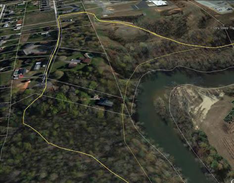
The original Overmountain Victory National Historic Trail (OVNHT) route was identified by a National Parks Ser vice research team. The team relied on the 1881 account of the march, which has been amended by local histori ans, descendent of battle participants, and other sources. As part of this congressionally designated trail, any offi cially designated portion of the OVNHT must lie within a one-mile corridor (half-mile on either side) of the historic route.
Sensitive Cultural Resource Areas
Culturally sensitive resource areas have been mapped based on input from the NC State Historic Preservation Office (SHPO). The majority of these areas are recorded along the Catawba River. These sites should be avoided due to the possibility of historic resources that could be destroyed with ground disturbance6.
SHPO oversees a large database of historic sites and resources. All resources, including those related to the OVNHT, are included within the subsequent analysis map series. These resources include information from SHPO surveys as well as a large list of sites related to the Na tional Register of Historic Places (which the National Park Service oversees but individual States manage). The most critical sites include those listed on the National Regis ter (NR) or determined eligible (DOE) as they have fur ther protection under Section 106 of the National Historic Preservation Act . The National Park Service has empha sized that as part of this study and trail development, that historic/cultural resources should be linked, preserved, and interpreted. Specific resources that directly relate to the history of the Overmountain Victory National Historic Trail are noted within the subsequent analysis maps and notes and include:
Lake James Historic Farm Houses. Several farmhouses are considered historic including, the Benfield Farmhouse, the Rust House and Perkins Store (which currently serves as a Bed and Breakfast), and the Perkins Farm house.
McDowell Hosue/ Quaker Meadows. (See exhibit on the fol lowing page.)
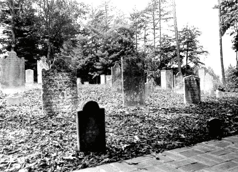
Quaker Meadows Cemetery. Quaker Meadows is iden tified as one of the earliest known sites associated with white settlement in Western North Carolina. The Quaker Meadows Cemetery served as the cemetery to the first settlers in the area, was utilized between 1767 and 1879, and includes over 61 marked grave sites.
Charles and Joseph McDowell are buried along with several other revolutionary war soldiers.
Swan Pond. Swan Pond was settled as a plantation just after the Revolutionary War by war veteran Waights ville Avery, an influential political leader and early white settler of Western North Carolina. Waightsville repre sented Burke County as a legislator for many years and is perhaps most famous for a supposed duel with President Andrew Jackson. The current house was built in 1848. Several generations of Averys lived on the property and influenced in the region. Swan Pond is still intact as a large private estate.
Sensitive Cultural Resources and Permitting: Any construction funded or permitted by the federal government will trigger a project review by SHPO of any resources covered under Section 106 (National Historic Preservation Act). These resources could include human remains, burial sites, archeology sites, and historic sites. If it is found that the action of trail construction could potentially adversely affect cultural resources, the SHPO will work with the related Federal Agency to eliminate or minimize the effect.
Historic Sites and Permitting: In general, a greenway would have no effect or a complimentary relationship to preservation of these
PRELIMINARY ALIGNMENTS 17
EXISTING CONDITIONS, ANALYSIS, AND
histor i C rE sour CE s
“the
aLONg its rOute.”
photo by others
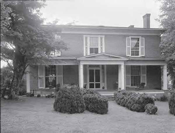
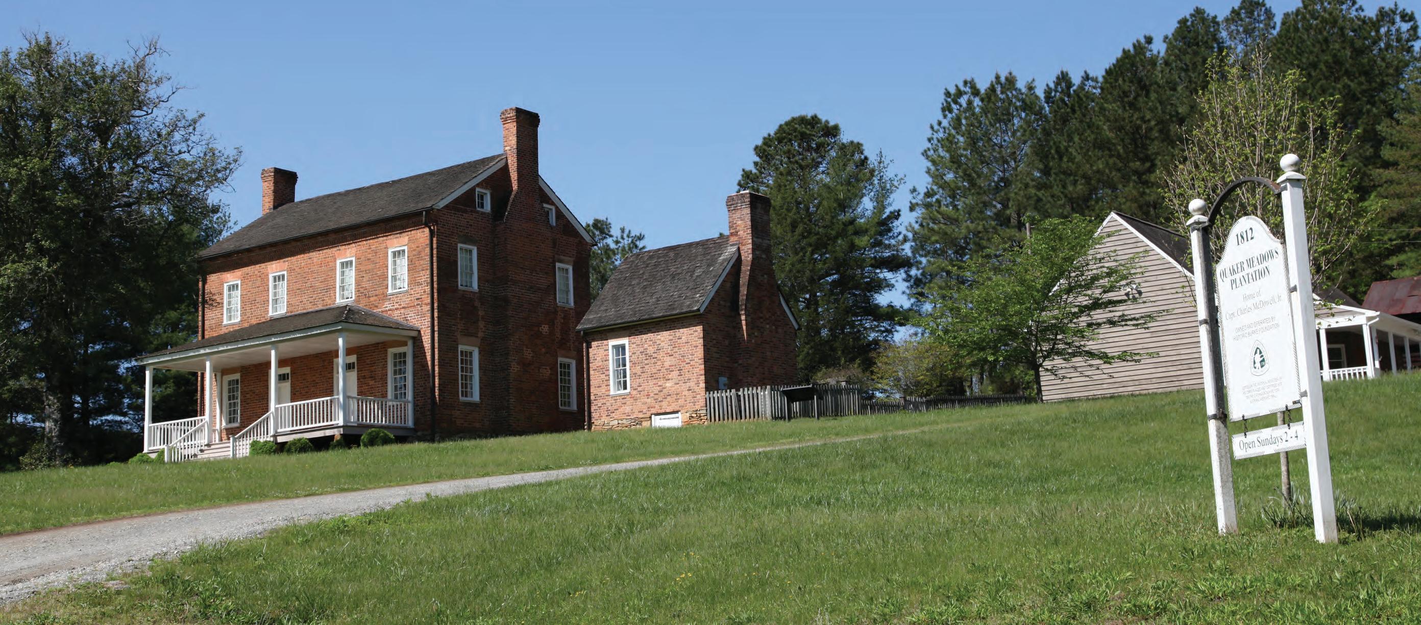
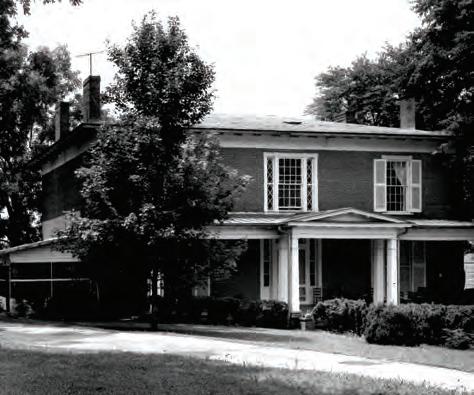
MCdOweLL hOuse/ quaker MeadOws
quaker Meadows was settled as a plantation around 1760 by Joseph McDowell and was inherited by Joseph’s son, Charles. Charles was a colonel in the Revolutionary War in 1780, in which he led the large encampment of Overmountain Men to stay on his estate (that included Quaker Mead ows). He was a critical leader that laid plans to attack the British at the Battle of Kings Mountain. The original
house no longer exists, but the house on-site today was built by Charle’s son in 1812 and is the oldest existing brick house in Burke County. The restored house currently belongs to the Historic Burke Foundation. It is the meet ing place for Overmountain Victory National Historic Trail re-enactors who commemorate the 1780 encampment every September.
The original Quaker Meadows Plantation now includes
portions of the county fairgrounds, golf course, and some commercial areas. The meadows hosted a ma jor encampment in 1780 for over 1,400 of the Over mountain troops. It is said that commanders met and planned the attack on loyalists under a large oak, now termed the Council Oak. A commemorative plaque and young oak now grows where the Council Oak once stood.
18 chapter 1
1: m c d owell h ouse /Quaker m eadows
Exhibit
The map and photographic series, which spatially incor porates the natural and built environment analysis, highlights a host of preliminary trail route alternatives. These routes were further refined by local leaders to identify and engage landowners. This information will serve as an ongoing reference guide as alternative routes may need to be developed due to unforeseen barriers.


EXISTING CONDITIONS, ANALYSIS, AND PRELIMINARY ALIGNMENTS 19 Element Occurrence: Sweet White Trillium NorfolkSouthernRR Glen Alpine Elementary School Table Rock Middle School Glen Alpine Lake James Catawba River Catawba River CanoeCreek MAP 1 MAP 2 Overmountain Victory NH Trail Municipal Boundaries Duke Energy Properties Crescent Resources Properties County Boundary 20-Foot Contours Property Lines OVNHT 1/2-Mile Buffer Existing Trails OVNHT Other Recreation Fishing Access Parks Golf Courses Managed Lands Federal & State Ownership Privat Proposed Trails Hospit blic He Pu alth Department Public Librarie Civic Landmarks LEGEND Alignment ‘A’ Opportunities Alignment ‘B’ Constraints 50 38 LakeJamesLoopTrail Connectors 70 126 19 21 22 23 24 25 26 27 20 21 19 18 18 18 18 18 18 17 16 15 14 13 12 20 22 22 POWERHOUSERD Catawba River Swan Pond (Easement: Historic Preservation Foundation) Morganton Site Analysis Overmountain Victory National Historic Trail Lenoir to Morganton Greenway Study MAP 3 WEST MORGANTON END OF STUDY AREA MAP 2 Quaker Meadows Cemetery, Circa 1767-1879 Freedom Park Greenway Element Occurrence: Carolina Foothills Crayfish, Eastern Creekshell Freedom High School Forest Hill Elementary School Catawba River Soccer Complex &Greenway Loop Quaker Meadows House Catawba Meadows Park (NC State Easement) ML King Park Cascade Park Collett St. Rec. Center & Martha Park Quaker Meadows Golf Course West Street Historic District Avery Avenue Historic District MAP 3 Catawba Greenway Catawba Greenway 126 70 64 181 126 126 END OF STUDY AREA 28 29 32 30 34 33 35 36 37 38 31 31 31 39 24 25 26 27 23 23 28 29 30 HWY 126 HWY126 DOCASTEEROAD JAMESTOWNROAD CanoeCreek CanoeCreek WilsonCreek CatawbaRiver Catawba River Silver Creek Overmountain Victory NH Trail Municipal Boundaries Duke Energy Properties Crescent Resources Properties Municipal/County Owned Properties County Boundary 20-Foot Contours Property Lines OVNHT 1/2-Mile Buffer Existing Trails OVNHT & Other Recreation Fishing Access Parks Golf Courses Managed Lands Federal & State Ownership Privat Brownfields State Natural Heritage Data Inactive Hazardous Sites Active Inactive Landfills Proposed Trails Schools Hospit blic He Pu alth Department Public Librarie College Universities Civic Landmarks National Register (NR) Historic Places Site NR and Local andmark National Register Historic District (NRHD) Study List (SL) SL and Landmar SL and Determined Eligible (DOE) SL DOE, and Landmark DOE NRHD Su eyed Surveyed in NRHD Site Gone Sensitive Cultural Resources Loc District Center Poin Historic Sites and Ditricts NRHD Boundary Utilities Waterlines Sewer ke Route Transportation Rail Roads Interstates Local Roads State and County Roads NCDOT Bridge Locations Roads/Interstates Animal Plant Animal Assemblage Natural Community Element Occurances Natural Heritage Areas Very High High Moderate General Unranked Wetlands (NWI) Hydric Soils Waterbodies Streams Floodway Flood Zones 100-Year Floodplain 500-Year Floodplain Hydrology Exceptional State Roads
Alignment ‘A’ Opportunities Alignment ‘B’ Constraints 50 38 BOST ROAD BOST ROAD SAINT MARYS CHURCH RD Connectors Site Analysis Overmountain Victory National Historic Trail Lake James to Morganton Greenway Study MAP 1 LAKE JAMES STATE PARK Bridgewater Powerhouse NPOWERHOUSE RD BENFIELDSLANDINGRD NPOWERHOUSERD Lake James Paddy Creek Dam 70 Lake James State Park Lake James State Park ReedyCreek Catawba River OldCatawbaRiver 10 10 8 3 2 15 11 MAP 1 MAP 2 Overmountain Victory NH Trail Municipal Boundaries Duke Energy Properties Crescent Resources Properties Municipal/County Owned Properties County Boundary 20-Foot Contours Property Lines OVNHT 1/2-Mile Buffer Existing Trails OVNHT & Other Recreation Fishing Access Parks Golf Courses Managed Lands Federal State Ownership Privat Brownfields State Natural Heritage Data Inactive Hazardous Sites Active Inactive Landfills Proposed Trails Schools Hospit blic He Pu alth Department Public Librarie College an Universities Civic Landmarks National Register (NR) Historic Places Site NR and Local andmark National Register Historic District (NRHD) Study List (SL) SL and Landmar SL and Determined Eligible (DOE) SL DOE, and Landmark DOE NRHD Surveyed Surveyed in NRHD Site Gone Sensitive Cultural Resources Loc District Center Poin Historic Sites and Ditricts NRHD Boundary Utilities Waterlines Sewer Bike Route Transportation Rail Roads Interstates Local Roads State and County Roads NCDOT Bridge Locations Roads/Interstates Animal Plant Animal Assemblage Natural Community Element Occurances Natural Heritage Areas Very High High Moderate General Unranked Wetlands (NWI) Hydric Soils Waterbodies Streams Floodway Flood Zones 100-Year Floodplain 500-Year Floodplain Hydrology Exceptional State Roads LEGEND Alignment ‘A’ Opportunities Alignment ‘B’ Constraints 50 38 Element Occurrence: Dwarf-flowered Heartleaf Element Occurrence: Dwarf-flowered Heartleaf Lake James Loop Trail
Connectors NorfolkSouthernRR Catawba River Dam and Truss Bridge Historic Bridge Muddy Creek Historic RR Bridge BURKE COUNTY MCDOWELL COUNTY NC 126 START OF STUDY AREA Lake James State Park 6 10 3 10 13 14 1 1 12 Bridgewater Fishing Access Lake James Family Campground 16
LEGEND
LakeJamesLoopTrail
Map aNd phOtO series: preLiMiNary traiL
aLterNatiVes
rOute


20 chapter 1 Overmountain Victory National Historic Trail Lake James to Morganton Greenway Study MAP 1 LAKE JAMES STATE PARK Bridgewater Powerhouse NPOWERHOUSE RD Lake James Lake James State Park 15 MAP 2 Overmountain Victory NH Trail Municipal Boundaries Duke Energy Properties Crescent Resources Properties County Boundary 20-Foot Contours Property Lines OVNHT 1/2-Mile Buffer Existing Trails OVNHT & Other Recreation Fishing Access Parks Golf Courses Managed Lands State Natural Heritage Data Proposed Trails Schools Hospitals blic He Pu alth Departments Public Libraries Colleges and Universities Civic Landmarks National Register (NR) of Historic Places Site NR and Local Landmark National Register Historic District (NRHD) Study List (SL) SL and Landmark SL and Determined Eligible (DOE) SL DOE, and Landmark DOE NRHD Surveyed Surveyed in NRHD Site Gone Sensitive Cultural Resources Local District Center Point Historic Sites and Ditricts NRHD Boundary Utilities Waterlines Sewer Bike Route Transportation Rail Roads Interstates Local Roads State and County Roads NCDOT Bridge Locations Roads/Interstates Hydrology State Roads LEGEND Alignment ‘A’ Opportunities Alignment ‘B’ Constraints 50 38 Lake James Loop Trail LakeJamesLoopTrail Connectors NC 126 START OF STUDY AREA Lake James State Park 1 1 area 1 site aNaLysis study Swan Pond (Easement: Historic Preservation Foundation) Morganton MAP 2 Quaker Meadows Cemetery, Circa 1767-1879 Freedom Park & Greenway Element Occurrence: Carolina Foothills Crayfish, Eastern Creekshell Freedom High School Catawba River Soccer Complex &Greenway Loop Quaker Meadows House Catawba Meadows Park (NC State Easement) ML King Park Cascade Collett St. & Martha Quaker Meadows Golf Course MAP 3 Catawba Greenway Catawba Greenway 126 64 181 126 126 END OF STUDY AREA 28 29 32 34 33 35 36 37 38 31 31 31 39 26 27 23 23 28 29 30 HWY 126 HWY126 DOCASTEE ROAD CanoeCreek CanoeCreek WilsonCreek CatawbaRiver Catawba River Overmountain Victory NH Trail Municipal Boundaries Duke Energy Properties Crescent Resources Properties Municipal/County Owned Properties County Boundary 20-Foot Contours Property Lines OVNHT 1/2-Mile Buffer Existing Trails OVNHT & Other Recreation Fishing Access Parks Golf Courses Managed Lands Federal & State Ownership Private Brownfields State Natural Heritage Data Inactive Hazardous Sites Active & Inactive Landfills Proposed Trails Schools Hospitals blic He Pu alth Departments Public Libraries Colleges and Universities Civic Landmarks National Register (NR) of Historic Places Site NR and Local Landmark National Register Historic District (NRHD) Study List (SL) SL and Landmark SL and Determined Eligible (DOE) SL DOE, and Landmark DOE NRHD Surveyed Surveyed in NRHD Site Gone Sensitive Cultural Resources Local District Center Poin Historic Sites and Ditricts NRHD Boundary Utilities Waterlines Sewer Bike Route Transportation Rail Roads Interstates Local Roads State and County Roads NCDOT Bridge Locations Roads/Interstates Animal Plant Animal Assemblage Natural Community Element Occurances Natural Heritage Areas Very High High Moderate General Unranked Wetlands (NWI) Hydric Soils Waterbodies Streams Floodway Flood Zones 100-Year Floodplain 500-Year Floodplain Hydrology Exceptional State Roads LEGEND Alignment ‘A’ Opportunities Alignment ‘B’ Constraints 50 38 BOST ROAD BOST ROAD SAINT MARYS CHURCH RD Connectors m ap 3: s tudy Area 1 s ite Analysis
OPPORTUNITIES
Potential Trailhead and improvement area
Maintained open meadow
Routes utilize private dirt roads
Connect to Lake James Family Campground and single-family residential development by paralleling Benfields Landing Road
Potential amenable landowner
Flat area with potential to use Norfolk Southern right-of-way (around 200-feet) or adjacent private lands for alignment
Bridgewater Road could be an excellent connector route or a preferred alignment if one alignment section was determined unfeasible Bridgewater Road hosts a Bed and Breakfast and may have opportunity for greenway related commercial
Area is relatively flat
Utilize Muddy Creek Historic Rail Road Bridge
Potential amendable landowner on north side— alignment could utilize or parallel Corpening Chapel Road
Potential amendable landowner on north side— alignment could utilize or parallel Rays Dairy Avenue Alignment parallels private road
Potential trailhead at Bridge Water Fishing Access Area
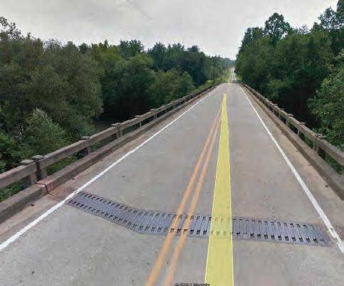
Powerhouse Road bridge has ample deck width to allow for on-grade bridge crossing
Potential connection to North Powerhouse Road and Lake James Loop Trail
Powerhouse Road has 60-feet of right-of-way and is fairly flat through the rest of this area going east
CONSTRAINTS
Steep hillside may require greenway alignment to parallel Highway 126 until the crossing of Benfields Landing Road
Hwy 126 Bridge has narrow shoulder with railing obstruction for several hundred feet—would likely require a bridge attachment
Wetland/low lying area
Area has stream crossing and significant fill slope from rail road bed and would require alignment to be in floodway or elevated on a structure
At-grade road crossing on Bridgewater Road
Bridgewater Road bridge has narrow shoulder and would need to have a bridge attachment or separate pedestrian bridge
Rail-bed is on elevated dike and significant fill slope from rail road bed and would require alignment to be in floodway or elevated on a structure
Large disturbance area (possible motor cross track) within and adjacent to Norfolk Southern right-ofway Tree farm
Sensitive cultural resource areas
PRELIMINARY
21
EXISTING CONDITIONS, ANALYSIS, AND
ALIGNMENTS
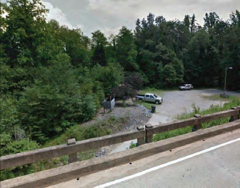
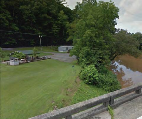
Opportunities and Constraints: Lake James (Map 1) NorfolkSouthern ROW Rail dike 3 1 2 10 4 5 6 7 8 9 1 2 3 4 5 6 7 7 8 9 10 11 13 14 15 16 12 16 10 1 14 14 View of Riverview Apartments with sewer line easement shown at the right View of Norfolk Southern rail line constrained area Approach to Bridgewater Fishing Access Area on Powerhouse Road View of decking over the Catawba River on Powerhouse Road View of Bridgewater Road and potential ongrade road and railroad crossing View of Rays Dairy Avenue and potential onroad or parallel alignment View of project terminus on Highway 26 with potential trailhead/enhancement area 5 7 7 View of Bridgewater Road flat and steeper areas study area 1 OppOrtuNities & CONstraiNts
James

22 chapter 1 Lake
Site Analysis Overmountain Victory National Historic Trail Lenoir to Morganton Greenway Study MAP 2 GREATER GLEN ALPINE CanoeCreek MAP 1 MAP 2 Overmountain Victory NH Trail Municipal Boundaries Duke Energy Properties Crescent Resources Properties Municipal/County Owned Properties County Boundary 20-Foot Contours Property Lines OVNHT 1/2-Mile Buffer Existing Trails OVNHT & Other Recreation Fishing Access Parks Golf Courses Managed Lands Federal & State Ownership Private Brownfields State Natural Heritage Data Inactive Hazardous Sites Active & Inactive Landfills Proposed Trails Schools Hospitals blic He Pu alth Departments Public Libraries Colleges and Universities Civic Landmarks National Register (NR) of Historic Places Site NR and Local Landmark National Register Historic District (NRHD) Study List (SL) SL and Landmark SL and Determined Eligible (DOE) SL DOE, and Landmark DOE NRHD Surveyed Surveyed in NRHD Site Gone Sensitive Cultural Resources Local District Center Poin Historic Sites and Ditricts NRHD Boundary Utilities Waterlines Sewer Bike Route Transportation Rail Roads Interstates Local Roads State and County Roads NCDOT Bridge Locations Roads/Interstates Animal Plant Animal Assemblage Natural Community Element Occurances Natural Heritage Areas Very High High Moderate General Unranked Wetlands (NWI) Hydric Soils Waterbodies Streams Floodway Flood Zones 100-Year Floodplain 500-Year Floodplain Hydrology Exceptional State Roads LEGEND Alignment ‘A’ Opportunities Alignment ‘B’ Constraints 50 38 LakeJamesLoopTrail Connectors 126 18 Element Occurrence: Sweet White Trillium Glen Alpine Dump Table Rock Middle School Glen Alpine Lake James Catawba River CanoeCreek MAP 1 MAP 2 Overmountain Victory NH Trail Municipal Boundaries Duke Energy Properties Crescent Resources Properties Municipal/County Owned Properties County Boundary 20-Foot Contours Property Lines OVNHT 1/2-Mile Buffer Existing Trails OVNHT & Other Recreation Fishing Access Parks Golf Courses Managed Lands Federal & State Ownership Private Brownfields State Natural Heritage Data Inactive Hazardous Sites Active & Inactive Landfills Proposed Trails Schools Hospitals blic He Pu alth Departments Public Libraries Colleges and Universities Civic Landmarks National Register (NR) of Historic Places Site NR and Local Landmark National Register Historic District (NRHD) Study List (SL) SL and Landmark SL and Determined Eligible (DOE) SL DOE, and Landmark DOE NRHD Surveyed Surveyed in NRHD Site Gone Sensitive Cultural Resources Local District Center Poin Historic Sites and Ditricts NRHD Boundary Utilities Waterlines Sewer Bike Route Transportation Rail Roads Interstates Local Roads State and County Roads NCDOT Bridge Locations Roads/Interstates Animal Plant Animal Assemblage Natural Community Element Occurances Natural Heritage Areas Very High High Moderate General Unranked Wetlands (NWI) Hydric Soils Waterbodies Streams Floodway Flood Zones 100-Year Floodplain 500-Year Floodplain Hydrology Exceptional State Roads LEGEND Alignment ‘A’ Opportunities Alignment ‘B’ Constraints 50 38 LakeJamesLoopTrail Connectors 126 19 21 22 23 24 20 21 19 18 18 18 18 17 17 16 20 22 22 Catawba River Access Area area 2 site aNaLysis study study A r EA 2 m ap 4: s tudy Area 2 s ite Analysis
study area 2 OppOrtuNities & CONstraiNts
Opportunities and Constraints: Greater Glen Alpine (Map
OPPORTUNITIES
Utilize 60-foot right-of-way (with 18-20-foot shoulder) on Powerhouse Road
Potential for bridge underpass at low-flow periods— but on-grade crossing of Powerhouse Road may be more practical
Bridge decking may accommodate a shoulder for on-grade crossing across the Catawba River
Existing trail easement may allow for greenway accommodation in gated equestrian community— land bordering the Catawba River is owned by the club/community
Potential amenable land owner

Bridge clearance across the Catawba River would allow for a greenway underpass on either sides but lacks adequate shoulder on bridge deck for crossing the river
Burke County’s Catawba River Access Area— potential trailhead location
Subdivision platted but properties bordering river appear to be undeveloped and still owned by developer
Watermill Glen Alpine Road/Turkey Tail Lane rightof-way has 60-foot right-of-way with approximately 30-feet of shoulder on the western side
Downtown Glen Alpine hosts a commercial area that could serve greenway tourism including a bike shop, winery, and bed and breakfast Linville Street has an approximately 5-foot sidewalk through the majority of downtown Glen Alpine Powerhouse Road has 60-foot of right-of-way and relatively flat terrain into Glen Alpine
CONSTRAINTS
Sensitive cultural resource area
Homesite is close to Catawba River—alignment would need to navigate around it
Bridge clearance may not be desirable for a greenway underpass and on-grade crossing may be necessary
Tree farm
Trust property

Homesite located fairly close to Catawba River
Sensitive cultural resource areas
Wetland/low lying areas
Trust property not likely to be amendable to a greenway
Trust property
Use of some private property in drainage would be needed for alignment
This alignment may be less probable due to the intersection with several small privately held parcels
23
EXISTING CONDITIONS, ANALYSIS, AND PRELIMINARY ALIGNMENTS
17 18 18 19 20 21 22 23 24 25 26 27 11 12 13 14 15 16 17 18 19 20 21 22 16 18 22 19 14 20 21
2)
Downtown
Glen Alpine (with Norfolk Southern railroad line in the foreground)
Burke County Catawba River Access area and potential trailhead
View of Watermill Glen Alpine Road right-of-way as a potential connector to Glen Alpine
View
View of
12 Club
View from Catawba River Bridge—landowner on right of picture may be amenable
View
of Bridgewater Road and potential ongrade road and railroad crossing
of home site on the Catawba River that prevents an adjacent alignment on the south end
Powerhouse Road bridge over the Catawba River
owned property
Gated
equestrian community has commonly owned property on the riverfront
24 chapter 1 Site Analysis Overmountain Victory National Historic Trail Lenoir to Morganton Greenway Study MAP 3 WEST MORGANTON MAP 2 Catawba Meadows Park (NC State Easement) MAP 3 Catawba Greenway 39 WilsonCreek Catawba River Overmountain Victory NH Trail Municipal Boundaries Duke Energy Properties Crescent Resources Properties Municipal/County Owned Properties County Boundary 20-Foot Contours Property Lines OVNHT 1/2-Mile Buffer Existing Trails OVNHT & Other Recreation Fishing Access Parks Golf Courses Managed Lands Federal & State Ownership Private Brownfields State Natural Heritage Data Inactive Hazardous Sites Active & Inactive Landfills Proposed Trails Schools Hospital blic He Pu alth Departments Public Librarie Colleges and Universities Civic Landmarks National Register (NR) of Historic Places Site NR and Local Landmark National Register Historic District (NRHD) Study List (SL) SL and Landmark SL and Determined Eligible (DOE) SL DOE, and Landmark DOE NRHD Surveyed Surveyed in NRHD Site Gone Sensitive Cultural Resources Local District Center Poin Historic Sites and Ditricts NRHD Boundary Utilities Waterlines Sewer Bike Route Transportation Rail Roads Interstates Local Roads State and County Roads NCDOT Bridge Locations Roads/Interstates Animal Plant Animal Assemblage Natural Community Element Occurances Natural Heritage Areas Very High High Wetlands (NWI) Hydric Soils Waterbodies Streams Floodway Flood Zones 100-Year Floodplain 500-Year Floodplain Hydrology Exceptional State Roads LEGEND Alignment ‘A’ Opportunities Alignment ‘B’ Constraints 50 38 BOST ROAD SAINT MARYS CHURCH RD Connectors Swan Pond (Easement: Historic Preservation Foundation) Morganton MAP 2 Quaker Meadows Cemetery, Circa 1767-1879 Freedom Park & Greenway Element Occurrence: Carolina Foothills Crayfish, Eastern Creekshell Freedom High School Catawba River Soccer Complex &Greenway Loop Quaker Meadows House Catawba Meadows Park (NC State Easement) ML King Park Cascade Collett St. & Martha Quaker Meadows Golf Course MAP 3 Catawba Greenway Catawba Greenway 126 70 64 181 126 126 END OF STUDY AREA 28 29 32 34 33 35 36 37 38 31 31 31 39 26 27 23 23 28 29 30 HWY 126 HWY126 DOCASTEE ROAD CanoeCreek CanoeCreek WilsonCreek CatawbaRiver Catawba River Overmountain Victory NH Trail Municipal Boundaries Duke Energy Properties Crescent Resources Properties Municipal/County Owned Properties County Boundary 20-Foot Contours Property Lines OVNHT 1/2-Mile Buffer Existing Trails OVNHT & Other Recreation Fishing Access Parks Golf Courses Managed Lands Federal & State Ownership Private Brownfields State Natural Heritage Data Inactive Hazardous Sites Active & Inactive Landfills Proposed Trails Schools Hospitals blic He Pu alth Departments Public Libraries Colleges and Universities Civic Landmarks National Register (NR) of Historic Places Site NR and Local Landmark National Register Historic District (NRHD) Study List (SL) SL and Landmark SL and Determined Eligible (DOE) SL, DOE, and Landmark DOE NRHD Surveyed Surveyed in NRHD Site Gone Sensitive Cultural Resources Local District Center Poin Historic Sites and Ditricts NRHD Boundary Utilities Waterlines Sewer Bike Route Transportation Rail Roads Interstates Local Roads State and County Roads NCDOT Bridge Locations Roads/Interstates Animal Plant Animal Assemblage Natural Community Element Occurances Natural Heritage Areas Very High High Moderate General Unranked Wetlands (NWI) Hydric Soils Waterbodies Streams Floodway Flood Zones 100-Year Floodplain 500-Year Floodplain Hydrology Exceptional State Roads LEGEND Alignment ‘A’ Opportunities Alignment ‘B’ Constraints 50 38 BOST ROAD BOST ROAD SAINT MARYS CHURCH RD Connectors area 3 site aNaLysis study study A r EA 3 m ap 5: s tudy Area 3 s ite Analysis
study area 3 OppOrtuNities & CONstraiNts
Opportunities and Constraints: West Morganton (Map 3)
OPPORTUNITIES
Historic farm (Swan Pond)
Alignment could parallel Docastee Road
Alignment could travel on-road on Elm Street and would need to travel through private property to access along the river
Alignment overlaps with sewer lines/easements
Canoe Creek bridge may accommodate a greenway underpass and separated pedestrian lane
Connection could use some current path alignments through Freedom Park
Intersection has planned signalization improvements
Development is planned to link in sidewalk infrastructure and will link to the north side of Hwy 181
Connection to Quaker Meadows Cemetery—a historically significant OVT site
Potential amenable landowner—property was historically a part of Quaker Meadows
Connection to Quaker Meadows House—a historically significant OVT site
Bost Road has significant 60-foot right-of-way and could serve as a connection to a neighboring subdivision
CONSTRAINTS
Alignment leaves OVT mile-buffer
Topography is steep with a bluff that drops off behind buildings—alignment could need a switchback in this location
Homesite close to the Catawba River would make an adjacent river alignment less likely Sensitive cultural resources area and trustee property
Alignment on Cresthill Drive would need to be on-road or the construction of a 5-foot sidewalk— which is less than the recommended minimum 10foot path for a greenway in suburban/urban areas
Access is restricted on the Morganton Water Plant but alignment is proposed around the perimeter and would require fencing (also a sensitive cultural resource area)
Sensitive cultural resource area and wetlands
Intersection of Saint Marys Church Road and Highway 181 is signalized but no crosswalks exist
EXISTING
AND PRELIMINARY ALIGNMENTS 25
CONDITIONS, ANALYSIS,
28 29 30 31 32 33 34 35 36 37 38 39 23 24 25 26 27 28 29 30 16 28 22 30 14 20 29
The McDowell House (Quaker Meadows)— historically significant through several eras
View from Independence Boulevard bridge over Canoe Creek
Quaker Meadows Cemetery—revolutionary War grave sites and one of the oldest historic sites in Western NC
access A
View of Cresthill Drive—a potential on-road or parallel alignment View
of Morganton Water Plant and its restricted
view of Docastee Road from Highway 126
Catawba River Section where alignment would navigate away from the river 30 24 25 24 28 25
Swan Pond (a National Historic Register site) was settled just after the American Revolution
26 chapter 1
Chapter 2 landowner engagement
The environmental analysis (Chapter 1) was critical to determine physically feasible locations for trail development. However, significant portions of these routes impact private property and require landowner outreach to fully assess trail feasibility. This chapter highlights the good-faith effort to engage landowners throughout the planning process.


t he engagement Process


Identifying the Landowners
Landowner Communications Landowner Workshop Trail Route Re-evaluation
Landowner outreach and engagement was a key component of the planning process.
identify the landowners
Feasibility Analysis
Trail alternatives were developed based upon an environ mental feasibility analysis (see Chapter 1).
Landowner Database


A mailing database was created that included all property owners impacted by the preliminary trail alignment(s).
28 chapter 2
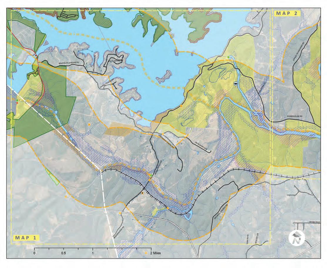
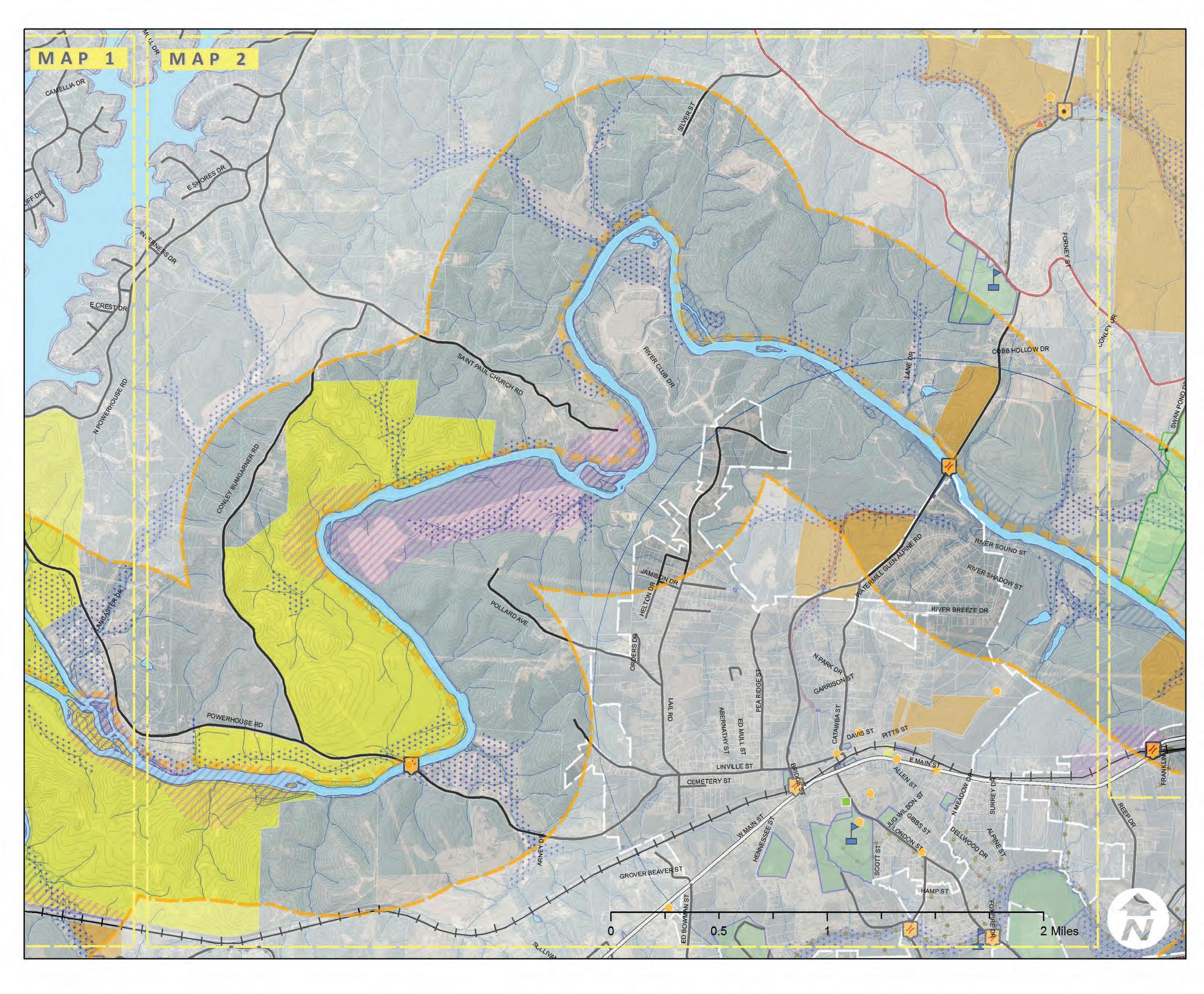
! ! ! ! REEP DR PITTSST CATAWBA ST E MAIN ST LANE DR LONDONST HENNESSEE ST KIRBYDR SILVER ST LANCASTER DR WMAINST PEA RIDGE ST ALLENST ARNEY DR RIVER CLUB DR DAVIS ST CEMETERY ST SCOTT ST FORNEY ST NPARKDR SULLIVANDR ED BOWMAN ST RIVER BREEZE DR JAMISON DR HELTON DR GIBBSST SANDY COVE DR FERNWOOD ED MULL ST N MEADOW DR SURREY DR ESHORESDR ORDERS DR BRIDGE ST COBB HOLLOW DR FRANKLIN ST GROVER BEAVER ST BEECHBLUFFDR HAMP ST DELLWOODDR CONLEY DR ABERNATHY ST F OXFIRE DR FINALEE DR WATERMILLGLENALPINERD RIVER SOUND ST SAM MULL DR CAMELLIADR JUGWILSONST GARRISONST E CREST DR INVERNESSDR LAKEBREEZEDR RIVERSHADOWST ALPINE ST POWERHOUSE RD POLLARDAVE. LINVILLE ST SAINTPAULCHURCHRD CONLEY BUMGARNER RD LAIL RD NPOWERHOUSE RD ¬ 122 ¬ 103 ¬ 121 ¬ 82 ¬ 88 ¬ 100 ¬ 87 ¬ 84 ¬ 85 ¬ 127 ¬ 81 ¬ 86 ¬ 124 ¬ 119 ¬ 120 ¬ 125 ¬ 110 ¬ 130 ¬ 111 ¬ 109 ¬ 126 ¬ 128 ¬ 105 ¬ 116 ¬ 83 ¬ 95 ¬ 104 ¬ 115 ¬ 123 ¬ 99 ¬ 112 ¬ 102 ¬ 108 ¬ 118 ¬ 117 ¬ 98 ¬ 113 ¬ 114 ¬ 94 ¬ 106 ¬ 101 ¬ 107 ¬ 129 ¬ 97 ¬ 96 ¬ 89 ¬ 93 ¬ 92 ¬ 91 ¬ 90 0 1 2 0.5 Miles I MAP 2 MAP 2 MAP 3 MAP 3 step 1: determine where the trail is feasible (CHAPTER 1). step 2: Start a CONVerSatION WIth LaNDOWNerS. ma P 6: l andowner d atabase
landowner communications
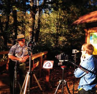
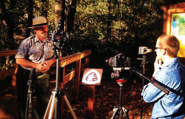
Video Production
A custom video, specifically produced for landowners, highlighted the story of the Overmountain Victory National Historic Trail and included a request for landowner participation.

Web Portal


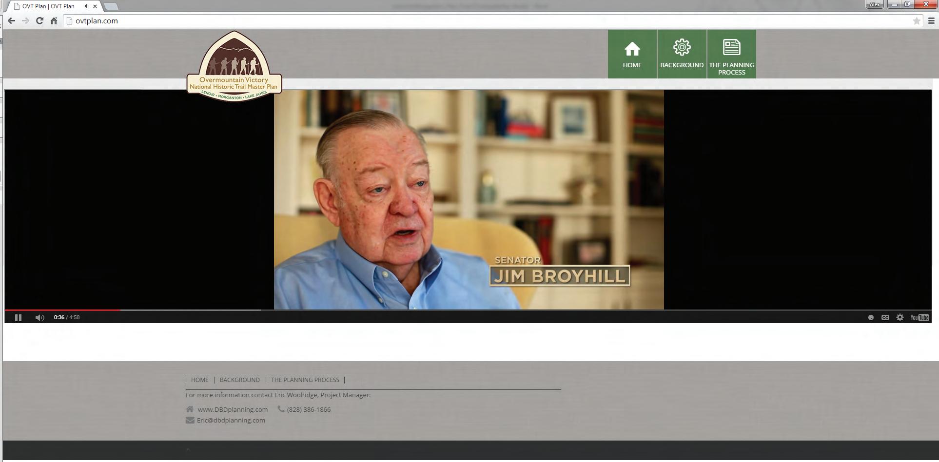
The project website, OVTplan.com, provides information about the planning process and features the landowner outreach video.
Landowner Invitation
Formal
were sent to all landowners directing them to the website and requesting their attendance at a special meeting.
landowner engagement 29
Destination by Design Planning 815 W. King Street NC 28607 Date: February 16, 2015 [Insert Landowner Name and Address Re: Trail Planning Meeting for Landowners Dear [Insert Landowner Name]: Thanks to grant support from the National Park Service, regional community organizations and local government leaders, a plan is being developed for establishing a walking and leisure biking trail o connect from Lenoir to Morganton to Lake James. This trail celebrates the walk made by the Overmountain Men who won a major Revolutionary War battle at Kings Mountain in 1780. Since November 2014, the planning team has been working to identify a feasible route to construct the trail As part of this analysis, your property has been dentified as potential location for a trail section. Without a voluntary commitment from landowners, this important rail will either be relocated or not constructed. We would like to invite you and other landowners to discuss this project during a special meeting that will take place at [insert time and location] An informational video can be found on the web at: www.OVTplan.com Also, enclosed is a project Fact Sheet that further describes the project. Please RSVP if you plan to attend the meeting by sending an email or calling using the contact information below. Thank you. Sincerely, Eric Woolridge Consultant Project Manager Destination by Design Planning Phone: 828.386.1866 Email: eric@DbDplanning.com VID e O p r OD u C t I ON W eb p O
letters
rt a L L a NDO WN er INVI t at I ON
landowner worksho P
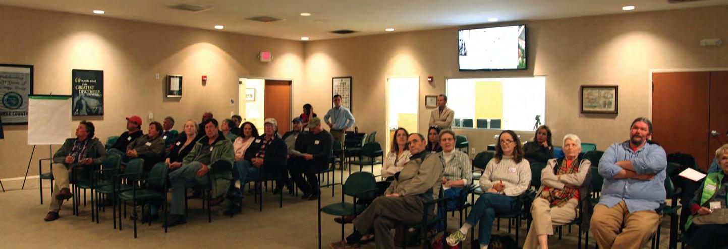
Video Showing
After signing in, the landowner workshop began with a viewing of the custom video.
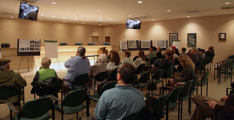


Focus Group

Focus groups were organized according to various geographic areas throughout the study area. Landowners were able to ask questions about their specific property and the associated trail alignment.
Sentiment Card
The meeting concluded with landowners noting their level of willingness to provide a trail easement via the Landowner Interest Survey.
30 chapter 2
Landowner Interest Survey Name ________________________________________ Address_______________________________________ _____________________________________________ Phone Number _________________________________ Email_________________________________________ Please share your level of interest for providing for the public trail. (check below) Ο Not interested at this time Ο Somewhat interested and welcome further discussions Ο Very interested Landowner Interest Survey Name ________________________________________ Address_______________________________________ _____________________________________________ Phone Number _________________________________ Email_________________________________________ Please share your level of interest for providing for the public trail. (check below) Ο Not interested at this time Ο Somewhat interested and welcome further discussions Ο Very interested National Historic Trail Master Plan Overmountain Victory ENO R O G N O LAKE AMES National Historic Trail Master Plan Overmountain Victory L NO MO G N ON AK AM
march
A similar landowner meeting was held for the Lenoir to Morganton sister OVNHT plan in Caldwell County on March 10, 2015. The photos seen here are from both events.

landowner engagement 31
on
5, 2015, 23 landowners attended the landowner workshop at the burke county government center.
trail route re-evalua tion


Revise Trail Alignments


“Landowner Sentiment” was helpful for determining the preferred alignment and was includ ed as a component of the final map series (Chapter 4).
a combination of factors, including the natural environment, the built environment, and landowner sentiment, were used to determine the preferred trail alignment (chapter 4).
32 chapter 2
MCDOWELL COUNTY BURKE COUNTY N 0 0.5 1 2 MI. CATAWBA RIVER CANOE CREEK REEDY CREEK PADDY CREEK SILVER CREEK BAILEY FORK JOHNS RIVER WARR OR FORK PEEDEEBRANCH LITTLESILVER CREEK MUDDYCREEK OLD CATAWBARIVER MORGANTON GLEN ALPINE LAKE JAMES JOHNS RIVER GAMELANDS LAKE JAMES STATE PARK CATAWBA RIVER GREENWAY FREEDOM TRAIL 1/2MILE CORRIDOR LEGEND LEGEND LANDOWNER SENTIMENT PREFERRED OVNHT ROUTE ALTERNATE ROUTE EXISTING TRAIL PROPOSED TRAIL YES NO POSITIVE NO RESPONSE 70 181 126 126 40 40
Map 7: l andowner Sentiment
Chapter 3 trail character & design guidelines
this chapter provides design details for various trail types and signage and offers insight for incorporating social media.
Between Lake James and Morganton exists a diverse natural and built environment. Specific trail types must be applied throughout the corridor to ensure minimal maintenance and the best user experience.
This chapter defines three trail types and illustrates their transitions along the preferred trail alignment as fully described in the subsequent chapter.
A specific theme is presented for signage, wayfinding, and trail support facilities. This chapter concludes with recommendations for using social media to market the trail and its history.
i n this chapter
A. Trail Types
B. Trail Profile
C. Signage and Wayfinding
D. Social Media Marketing
trail character and design guidelines 33
trail types
three trail types are proposed along the preferred alignment. A specific trail type is proposed according to its surrounding environment, whether it's located within a rural or urban area, and the opportunity to create a meaningful user experience.

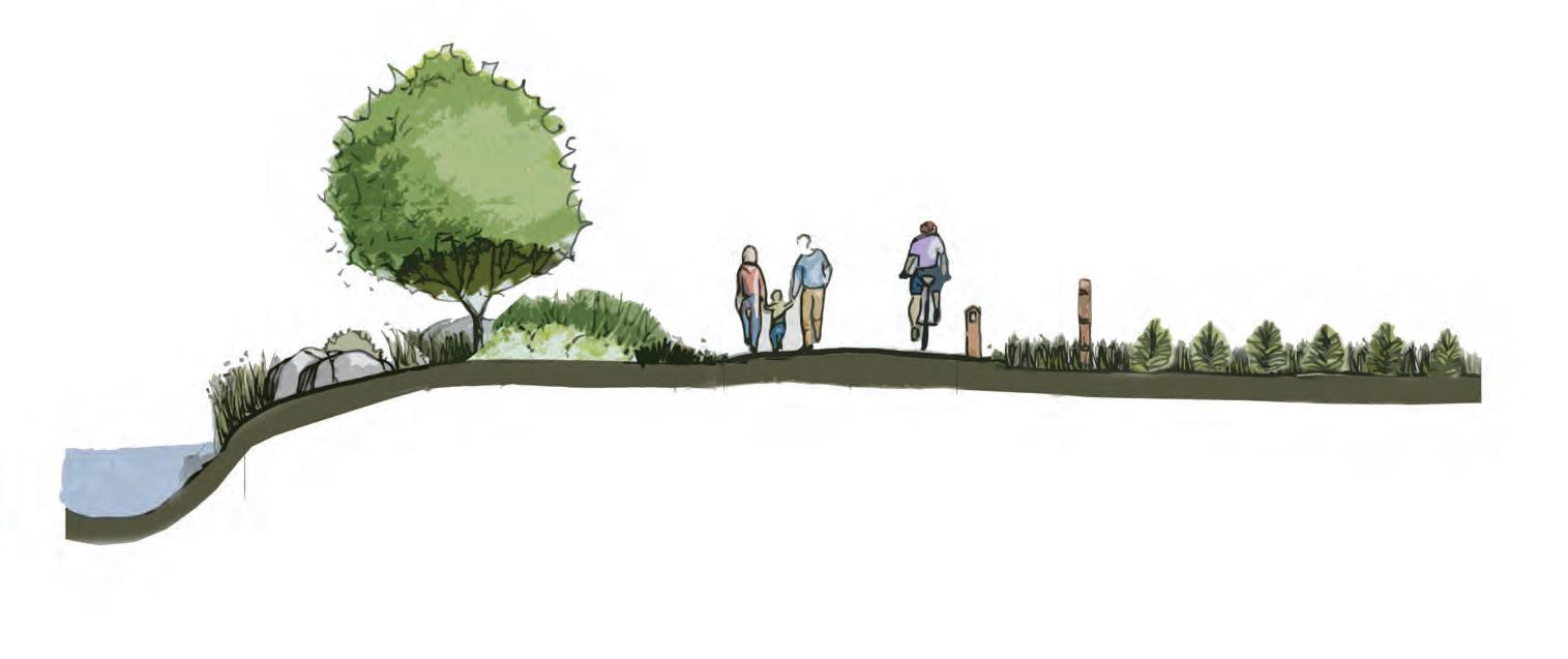
typical greenway
chapter 3 34
10' paved asphalt User Group: Multi-use Material: Paved Asphalt Preferred Width: 10' Average Construction Cost: $80/ln. ft. Preferred Easement Width: 50' Minimum Easement Width: 20'
30’ PREFERRED BUFFER TO RIVER TO PROTECT WATER QUALITY 10’ PAVED ASPHALT
MARKER FENCING TO MARK PRIVATE PROPERTY BOUNDARY
MILE
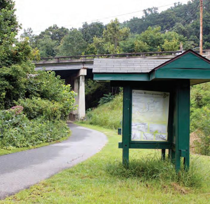
photo: the Catawba River Greenway incorporates approximately four miles of certified Overmountain victory National historic trail.
photo: discoverburkecounty.com
multi-use trail
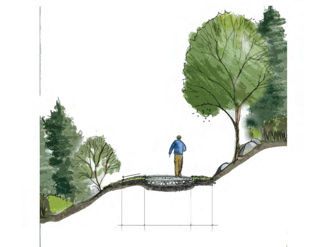
5' NAT ur AL S urfAC e
User Group: hikers and Cyclists
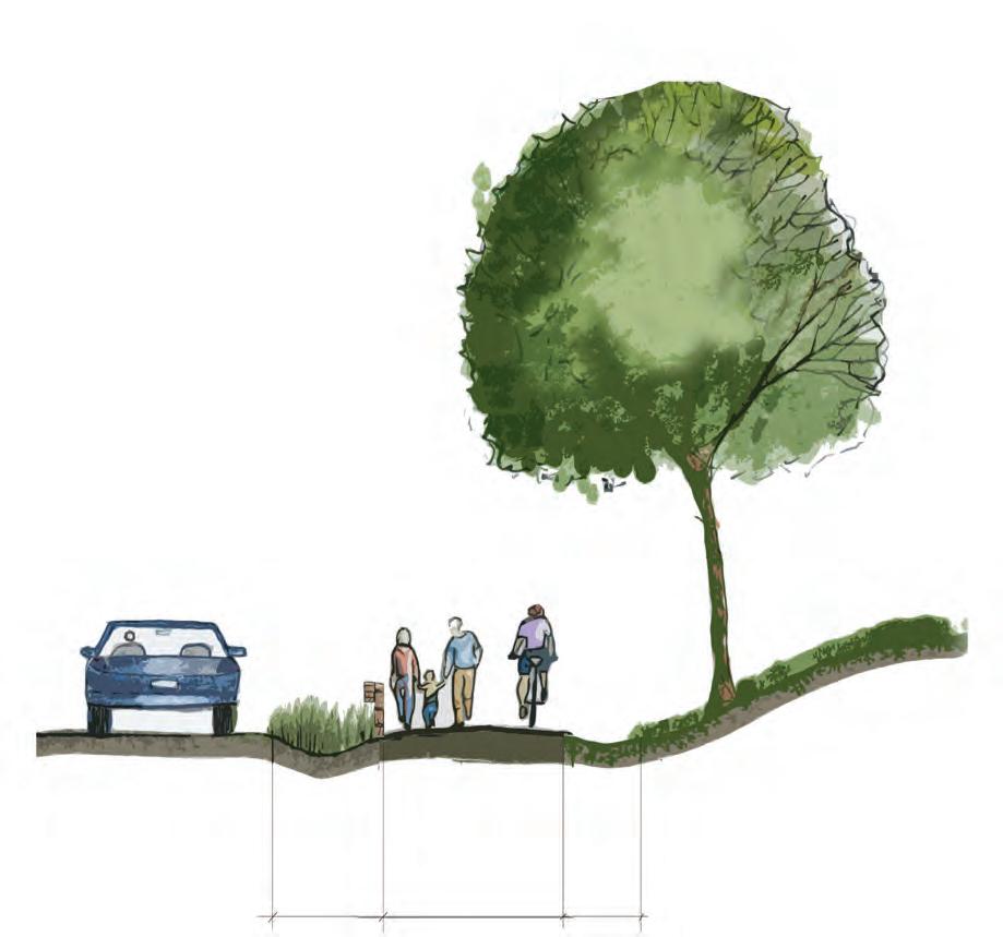
Material: Crushed gravel fines

Preferred Width: 5'
Average Construction Cost: $12/ln. ft.
Preferred Easement Width: 50'
ncdot side path
8' PAve D A SP h ALT

User Group: Multi-use
Material: Paved asphalt
Preferred Width: 8'
Average Construction Cost: $120/ln. ft.
Preferred Easement Width: 25'
Minimum Easement Width: 25'
Note: Trail to be approved in accordance with NCDOT encroachment agreement.
trail character and
guidelines 35
design
there are two (2)
type
proposed along the preferred trail route, which extends approximately 20 miles. The Trail Type Profile identifies the transition location, along with associated length, for each trail type. *Final trail type will depend on specific environmental conditions and whether trail is located within NCdOt ROW or within a private trail easement.
chapter 3 36 2.2 NCDOT SIDE PATH 8’ PAVED ASPHALT MULTI-USE PATH 5’ NATURAL SURFACE TYPICAL GREENWAY 10’ PAVED ASPHALT 1.4 HEMLOCKSPRINGS(ROADCROSSING#4)CANALBRIDGETRAILHEAD ENTERDUKEENERGYLANDOFFRAY’SDA START CANALBRIDGE 1.3 .8 5.7 EXITPOWERHOUSERD.ROW .2 EXITDUKEENERGYLAND/ENTERPOWERHOUSERD.ROW trail type profile trail types pointsofinterest mat C hli N e approx. distance in miles
*
trail
transitions
trail character and design guidelines 37 4.6 FREEDOM ROC 2.2 5.7 EXISTINGWATERMILLR .7EXISTING CATAWBA RIVER GREENWAY (4.0) END GRACER .2 mat C hli N e approx. distance in miles e X hi B it 2: trail type profile
signage and wayfinding
the OvNhT signage family provides for a modern rustic theme and incorporates materials consisting of metal, rock, and concrete. The signage family serves as a template and can be altered and further refined depending on local preferences and specific site needs and opportunities.


38
ID
Sign Break-away sign for use along NCDOT
Map Trailhead Trailhead
Trailhead
Monument
Roads


use
NCDOT
Con dence Marker Break-away sign
along
Roads Map Kiosk Spur Trail ID to Historical Site Trailhead
soCial media: the new word of moUth


trail users should be encouraged to utilize social media to share their experiences with their "friends" and "followers." Special signage along the trail will signal users to consider posting pictures of themselves or their friend group as the walk or ride bikes along the trail. In addition, special props and features should be developed during the final design phase. After all, who can market this destination-quality trail better than the trail users themselves? Let's take advantage of social media -- the new word of mouth.
# t rail2Victory
The proposed official hashtag for the OvNhT is "Trail2victory." The use of this hashtag will allow local tourism leaders to curate local photos and content that can be shared on websites and re-posted through other social media platforms.
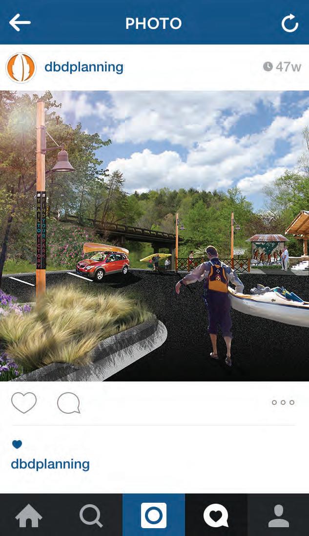

#findyourpark
find Your Park is the official centennial campaign of the National Park Service (NPS). The NPS is encouraging National Park enthusiasts to use the hashtag "findyourpark" when posting to social media. The OvNhT can help continue this campaign for years to come by encouraging the use of this hashtag at unique locations along the trail.
"find your park" is the official centennial campaign of the national park service (nps). the nps is encouraging national park enthusiasts to use the hashtag "findyourpark" when posting to social media.
chapter 3 40
burke county, nc
Busy day on the Catawba River along the
56 likes #trail2victory. # ndyourpark
e X hi B it 3: social media
trail users should be encouraged to utilize social media to share their experiences with their "friends" and "followers."
Chapter 4 recommendations
this chapter serves as the heart of the Lake james to morganton ovnht master plan.
i n this chapter
A. About the Planning Section Maps
B. Quick Facts: Learn about each Planning Section
recommendations 41
s tudy a rea sections : t he 20 mile study a rea from Lake James to m o rganton is divided into four (4) planning sections. t he g eographic extent of each section includes a beginning and ending terminus that features a key asset or significant connectivity point for the trail. m a ny of the planning sections represent project areas that can be developed independently over time, providing a logical method for implementation as landowner willingness, funding, and other opportunities arise.
42 chapter 4
IS
INtO four
SeCtIONS;
the 20 MILe StUDY area FrOM lake james tO MOrGaNtON
DIVIDeD
(4) pLaNNING
thIS Chapter IS OrGaNIZeD aCCOrDINGLY.
map 8: p L anning sections overview
StUDY area SeCtIONS
about the p L anning section maps


Each planning section is anchored by a map that highlights proposed trail routes, trail features, and landowner sentiment. The proposed routes are identified as either preferred, alternate, or spur. These trail alignments are the result of extensive analysis, including environmental feasibility, landowner willingness, and insights provided by local government and local trail development leaders.
and trail user orientation. Road crossings indicate the need to provide for traffic calming measures and appropriate signage for both trail users and motorists. Major bridges indicate a significant stream or river crossing that requires a bridge greater than 20 feet in length. A minor bridge/culvert demonstrates the need to cross a relatively small stream; at this broad level of planning, it remains uncertain whether a small bridge or culvert is necessary.

quick facts
Noted trail features include the physical infrastructure and facilities that support the proposed trail. These features are highlighted along the preferred route and provide critical information for developing an estimate of probable cost for each section. These features include trailheads and crossings associated with either a road or water feature. Trailheads will provide for parking
Each planning section begins with a “quick facts” exhibit. This information includes the trail distance, trail type (see Chapter 4: Design Guidelines), and key features and assets associated with each section. Also, an Estimate of Probable Cost is provided, which is further described within the written text for each planning section.
recommendations 43 WHIPPORWILL HOLLOW MCCLELLAN BRIDGEWATER LANCASTER POWERHOUSE DUCKWORTH HEMLOCK SPRINGS SLEEPY HOLLOW DEEP COVE BENFIELDS LANDING LAUREL POINTE HEMLOCK N POWERHOUSE CONLEY BUMG ARNER RR WHITE CORPENINGCHAPEL LA EK KARPWEIV NDING HOLIDAY SHORE LAKEFORREST LEGEND LANDOWNER SENTIMENT TRAILHEAD ROAD CROSSING MAJOR BRIDGE MINOR BRIDGE/ CULVERT YES NO POSITIVE NO RESPONSE PREFERRED TRAIL ROUTE ALTERNATE TRAIL ROUTE SPUR TRAIL EXISTING LOCAL TRAIL PROPOSED LOCAL TRAIL TRAIL FEATURES TRAILS CROSSINGS # # # 0 1/4 1/2 1.0 MI. N OLD CATAWBA RIVER LAKE JAMES BEACH W/ VISTA LAKE JAMES FAMILY CAMPGROUND VISTA (POSSIBLE PRIMITIVE CAMPING) PADDYS CREEK DAM BRIDGEWATER DAM POWERHOUSE BRIDGE EXISTING OVT BRIDGEWATER PUBLIC RIVER ACCESS PROPOSED FONTA FLORA T R A I L CATAWBARIVER 1 2 1 2 3 4 5 6 7 8 9 10 13 12 11 14 15 16 17 19 20 23 24 21 22 18 1 2 3 4 5 6 7
eaCh pLaNNING SeCtION IS aNChOreD bY a Map that hIGhLIGhtS prOpOSeD traIL rOUteS, traIL FeatUreS, aND LaNDOwNer SeNtIMeNt. i tota L ength: 5.9 miles trai L type: 5 Foot Natural Surface e stimated c ost: $ 985,372 points of interest: Lake James Canal Bridge Trailhead Bridgewater River Access Lake James Family Campground c ana L b ridge powerhouse road VICINItY Map 15 road crossings >> morganton L ake J ames: b y the numbers appro X. cost trai L he ads 9 >> 20.4 trai L mi L es >> >> >> ma J or bridges >> 7 $2.8 m 69 minor bridges/ cu L verts >>
SeCtION 1


p roposed t rai L s
t rai L f eatures
Trailheads
01
This planning section extends 5.9 miles from Canal Bridge to Powerhouse Road. Canal Bridge, which serves at the westernmost terminus of the entire planning study area, is also the terminus of an existing section of certified OVNHT that meanders through Lake James State Park. Considering there are major landowners throughout this section that are sympathetic to the mission of the OVNHT, including Duke Power and Crescent Resources, an opportunity exists to implement a significant portion of this trail section within a relatively short timeframe.
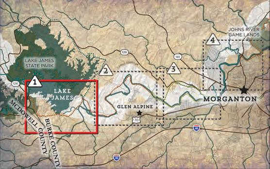
From Canal Bridge the preferred route extends south and then east before paralleling Hemlock Springs Road and connecting to Lake James Family Campground. From here, the trail will parallel Benfields Landing Road before reaching a vista and beach area on Lake James.
As the trail continues east over Paddy’s Creek Dam, another vista opportunity exists, which could accommodate a primitive camping area. The preferred route ultimately connects to the existing Bridgewater River Access, which is maintained by Duke Power and is programmed for further infrastructure improvements. Users will need to cross the Muddy Creek Bridge and continue on the east side of Muddy Creek before continuing parallel along Powerhouse Road. This planning section ends where the trail leaves Powerhouse Road and connects to established trail easements that follow the Catawba River.
Two trailheads are proposed within this planning section. The Canal Bridge Trailhead is proposed on property currently owned by Duke Power. From here, a short spur trail, approximately 1,000’ in length, will serve as a connector to the preferred trail route. The second trailhead is proposed at the Bridgewater River Access, which is a major feature to be connected via the preferred trail route. Both of these locations provide an opportunity to display information about the trail and its history must be developed. This portion of trail could take significant time and expense to implement, thus creating the need for another trailhead along Advent Road should this entire planning section not be developed within a single project.
photos: (1) Canal Bridge serves as the westernmost terminus of the entire planning area. (2) A trailhead is proposed on Duke Energy property located adjacent to the Canal Bridge Public Access. (3) Bridgewater River Access is a major feature to be connected via the preferred route.
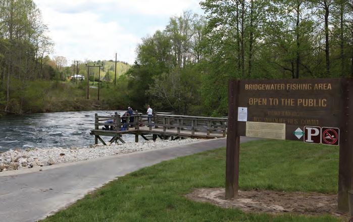
44 chapter 4
tota L L ength: 5.9 miles trai L type: NCDOT Side Path Multi-use Trail e stimated c ost: $985,372 points of interest: Lake James Canal Bridge Trailhead Canal Bridge Public Access Bridgewater River Access Lake James Family Campground c ana L b ridge p owerhouse r oad
Map
VICINItY
02 03


recommendations 45
OVEDR LINV
WHIPPORWILL HOLLOW MCCLELLAN BRIDGEWATER LANCASTER POWERHOUSE DUCKWORTH HEMLOCK SPRINGS SLEEPY HOLLOW DEEP COVE MAINGROVE BENFIELDS LANDING LAUREL POINTE HEMLOCK N POWERHOUSE WAY CONLEY BUMG ARNER RR WHITE CORPENINGCHAPEL LA EK KARPEWIV NDING HOLIDAY SHORE LAKEFORREST WATERMILL RIVER ACCESS LEGEND LANDOWNER SENTIMENT TRAILHEAD ROAD CROSSING MAJOR BRIDGE MINOR BRIDGE/ CULVERT YES NO POSITIVE NO RESPONSE PREFERRED TRAIL ROUTE ALTERNATE TRAIL ROUTE SPUR TRAIL EXISTING LOCAL TRAIL PROPOSED LOCAL TRAIL TRAIL FEATURES TRAILS CROSSINGS # # # 0 1/4 1/2 1.0 MI. N OLD CATAWBA RIVER LAKE JAMES BEACH W/ VISTA CANAL BRIDGE TRAILHEAD EXISTING CANAL BRIDGE PUBLIC ACCESS CANAL BRIDGE LAKE JAMES FAMILY CAMPGROUND VISTA (POSSIBLE PRIMITIVE CAMPING) PADDYS CREEK DAM BRIDGEWATER DAM POWERHOUSE BRIDGE PROPOSED LAKE JAMES STATE PARK HIKING TRAIL EXISTING OVNHT BRIDGEWATER PUBLIC RIVER ACCESS PROPOSED FO NTA FLORA T R A I L CATAWBARIVER 1 2 1 2 3 4 5 6 7 8 9 10 13 12 11 14 15 16 17 19 20 23 24 21 22 18 1 2 3 4 5 6 7 SECTION 1 CANAL BRIDGE POWERHOUSE RD. MAP 9: PLANNING SECTION 1
BUR LAUREL
VYST ASHTONC
Crossings
Proposed within this section are seven (7) road crossings, two (2) major bridges, and twenty-three (23) minor bridges/culverts.
The primary route crosses a combination of major roads and local roads throughout this section. Benfields Landing Road is a significant road that will need to be crossed near Canal Bridge and again near Lake James Family Campground. A significant crossing is also necessary across Bridgewater Road near its intersection with Benfields Landing Road.
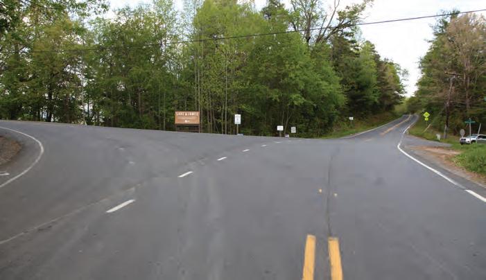
The two major bridge crossings exist at Canal Bridge and the Muddy Creek Bridge near the Bridgewater Public River Access. Both of these bridges will require appropriate treatments that signal motorists of possible trail users.
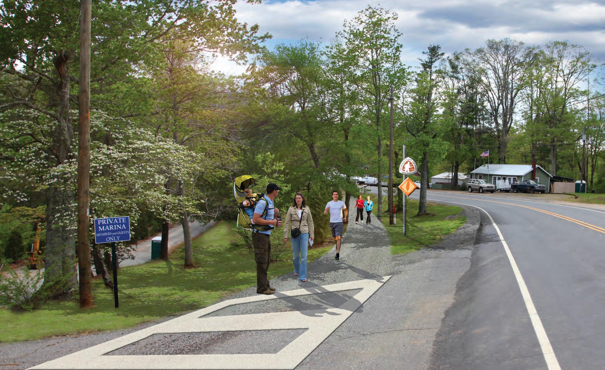
the preferred alignment extends parallel to Benfields Landing Road and provides a direct connection to the Lake James Family Campground. This trail section will be notable to passing motorist and will create interest for those visiting the campground and Lake James area.
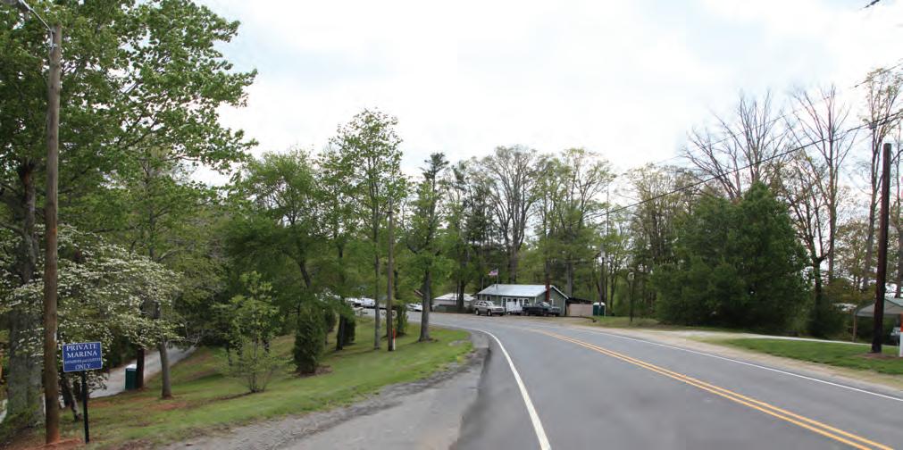
46 chapter 4
JaMeS FaMILY CaMpGrOUND e
LaKe
X isting
04 e X hibit 4: L
photos: (4) Benfields Landing Road is a significant road crossing within this planning section.
ake J ames fami L y campground
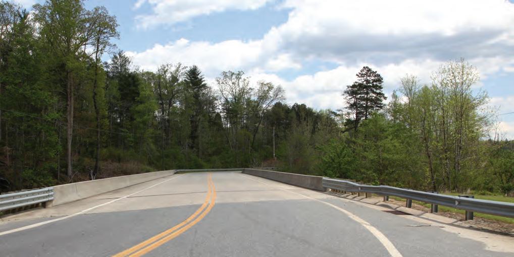
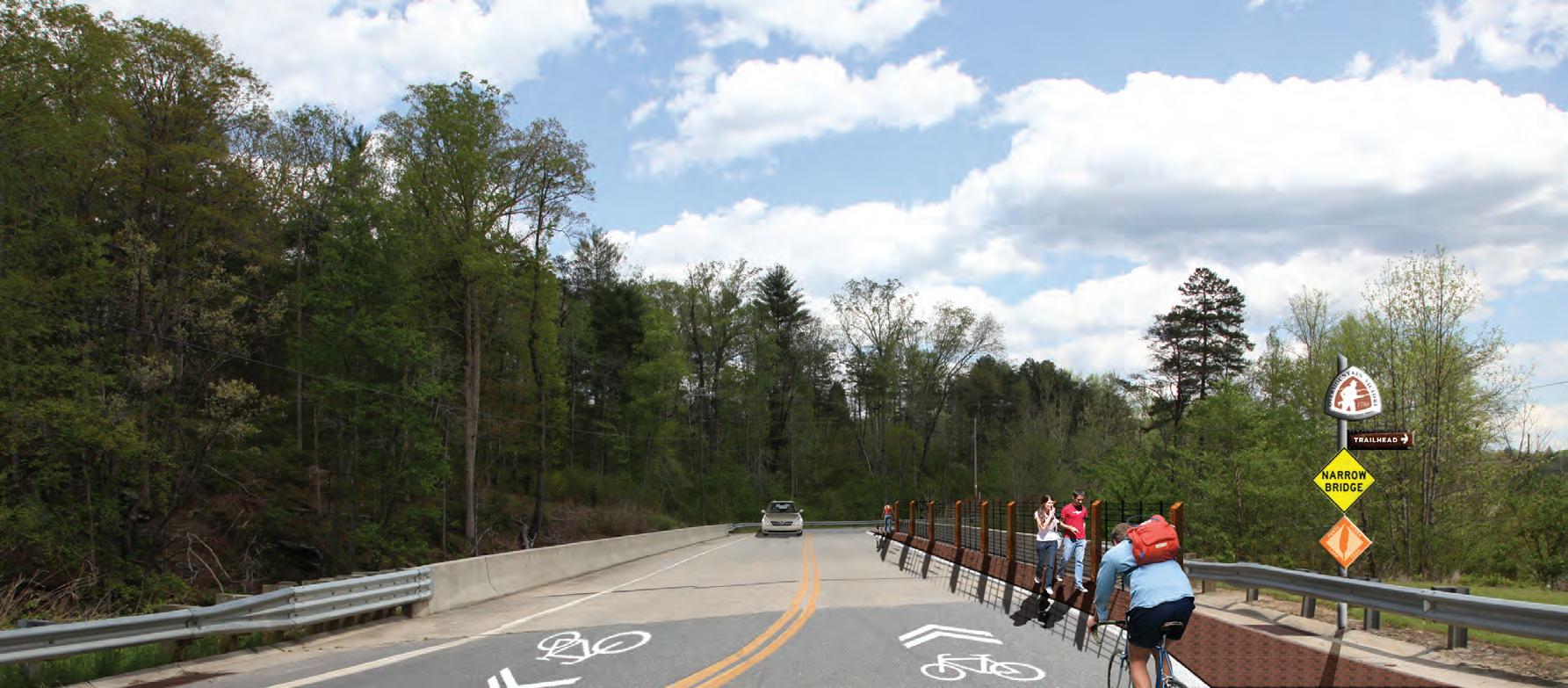
recommendations 47 t he Powerhouse Bridge will need to be modified to appropriately accommodate OVNHT users. pOwerhOUSe rD. brIDGe e X isting DUKe eNerGY brIDGewater aCCeSS IMprOVeMeNtS the Bridgewater Access is popular among fisherman and boaters. Duke Power has plans to significantly enhance the site, providing for additional parking and an enhanced boat launch area. C on C e PTU al design P ro V ided B Y d U ke energ Y e X hibit 5: powerhouse bridge e X hibit 6: bridgewater access improvements
VICINItY Map

watermi LL river access powerhouse road
p roposed t rai L s
This planning section extends 5.7 miles from Powerhouse Road to Watermill River Access.
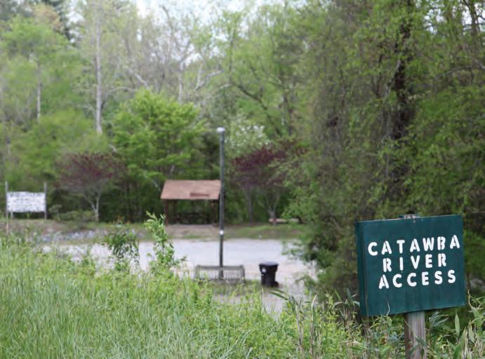
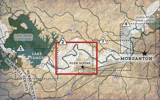
The preferred route continues along the north side of the Catawba River after crossing Powerhouse Road in the vicinity of North Bend Access: a planned NC Wildlife Resources River Access. Farther east, there are large tracts where landowners have expressed their unwillingness to provide a trail easement. With successful negotiations with other surrounding landowners, the trail will need to bridge the Catawba River and connect on its south side where there are secured existing trail easements. From here, the trail will continue on the south side and connect to the existing Watermill River Access.
t rai L f eatures
Trailheads
Two trailheads are proposed within this planning section. The first is proposed along the Catawba River at Powerhouse Road where NC Wildlife Resources will ultimately construct a river access area. This access should provide for OVNHT information and welcome its users. The second trailhead is proposed at the existing Watermill River Access. The trail will need to extend under the Watermill Bridge to connect with this access area, which can use some minor enhancements to organize parking and orient users to area recreation opportunities.
48 chapter 4
SeCtION 2 tota L L ength: 5.7 Miles trai L type: Multi-use Trail e stimated c ost: $884,652 points of interest: Planned NC Wildlife Resources River Access Watermill River Access
06
05
photos: (5 & 6) The existing Watermill River Access could serve as an important OVNHT Trailhead.


recommendations 49 ' LL LN SC ST LILLIA POLLYAN DDR ARN WATKIN BRAXTON GATE DR CALLSLODG WATERMILL KIRKSEY FORNEY PEACEFUL MCGIMPSEY CONLEY LANE SRIVERGLEN LINDA WAY DALE S LAIL N LAIL CANNONBALL STPAULSCHURCH OLDSTPAUL BUCKTHORN TAVERN HAMPSON CONLEY BUMBARNER POWERHOUSE RRWHITE LANCASTER PADDOCK RIVER CLUB RIVER BEND RIVER BLUFF JAMISON HELTON LAIL AYERS ORDERS POLLARD MALONEY GREER MCGALLIARD RIVER BREEZE OLD L WATERMILLGLEN A URKEYTAIL POWE DUCKWORTH WHIPORWILL HO OLLW 126 CATAWBA RIVER WATERMILL RIVER ACCESS LEGEND LANDOWNER SENTIMENT TRAILHEAD ROAD CROSSING MAJOR BRIDGE MINOR BRIDGE/ CULVERT YES NO POSITIVE NO RESPONSE PREFERRED TRAIL ROUTE ALTERNATE TRAIL ROUTE SPUR TRAIL EXISTING LOCAL TRAIL PROPOSED LOCAL TRAIL TRAIL FEATURES TRAILS CROSSINGS # # # PROPOSED FONTA FLORA TRAIL PROPOSED NORTH BEND ACCESS AREA ROCK FEATURE EXISTING WATERMILL RIVER ACCESS GLEN ALPINE TABLE ROCK MIDDLE 0 1/4 1/2 1.0 MI. N 3 23 23 24 25 26 27 28 29 30 31 32 33 34 35 36 37 38 39 40 41 42 43 44 45 46 47 48 49 50 51 52 8 9 10 SECTION 2 POWERHOUSE RD. WATERMILL RIVER ACCESS map 10: p L anning section 2
Crossings
Proposed within this section are three (3) road crossings, one (1) major bridge, and twenty-nine (29) minor bridges/culverts.
The first major road crossing exists at Powerhouse Road where an initial visual inspection revealed that the trail will likely need to cross the road rather utilize a trail underpass. However, during the design and engineering phase or with the development of the river access planned in this vicinity, an opportunity for a trail underpass should be further explored. The second crossing is along Saint Pauls Church Road, a rural collector road that the trail will need to cross to again reach the Catawba River. The final road crossing in this section is located at Watermill Bridge, which provides sufficient room to accommodate a trail underpass.
The only necessary major bridge crossing is centrally located within the planning section. This bridge will allow the trail to avoid landowners located on the north side of the Catawba River that are unwilling to provide trail easements, while accessing existing trail easements located on the south side of the river within the River Club
photos: (7) The trail will need to cross (crossing #8) Powerhouse Road.
fter paralleling the Powerhouse Road for approximately one mile, the preferred route leaves the roadside, extends south to the Catawba River, and takes advantage of trail easements provided by Duke Power.
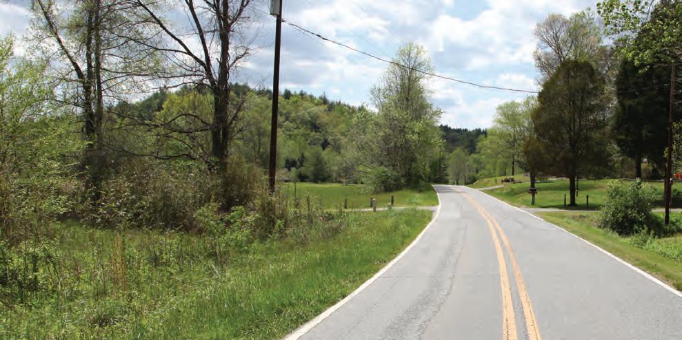
50 chapter 4
a
OFF the rOaD aGaIN @ pOwerhOUSe e X isting
e X hibit 7: off the road again @ powerhouse
07
the existing Watermill River Access serves as an ideal location to organize and orient OVNHT users. Future enhancements at this pocket park might include paved parking, a picnic shelter, and an information kiosk.

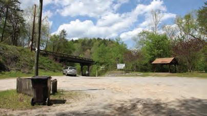
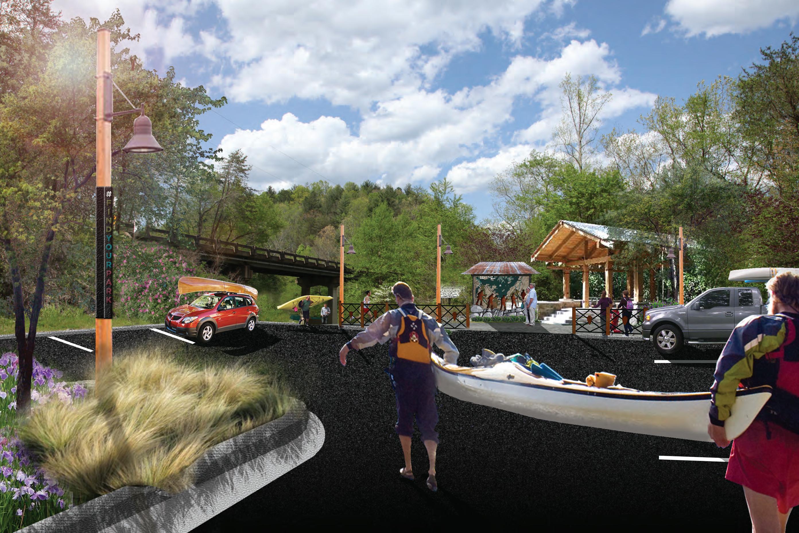
51 waterMILL rIVer aCCeSS eNhaNCeMeNtS e X isting
e X hibit 8: watermi LL river access enhancements
VICINItY Map
freedom park wa termi LL river access
p roposed t rai L s
This planning section extends 4.6 miles from Watermill River Access to Freedom Park. This section is recognized as the most challenging area within the study area in regards to feasibility for implementation. There are such significant challenges on both the north and south side of the Catawba River that a preferred route is not provided, but rather only two alternative routes.
t rai L f eatures
Trailheads
The only trailhead proposed within this planning section currently exists at Freedom Park, which provides access to a certified section of OVNHT. Enhancements at this trailhead might involve incorporating trail signage and other features noted within this plan.

Since the previous planning section (Section 2) highlighted the existing Watermill River Access as its eastern terminus, ideally the trail would continue along the south side of the Catawba River. However, development density and noted unwilling landowners represent significant challenges on the south side of the river. Along the north side of the river, Swan Pond would serve as an ideal connection since its part of the NC Preservation Program. Also, the Canoe Creek corridor serves as an environmentally suitable location for a trail, but again, landowner issues within this vicinity present a barrier.
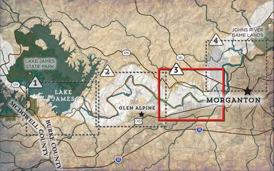

This planning section will require significant landowner outreach that is beyond the scope of this study. Furthermore, the consultant team determined that a specific preferred route could result in the further alienation of area landowners.
09
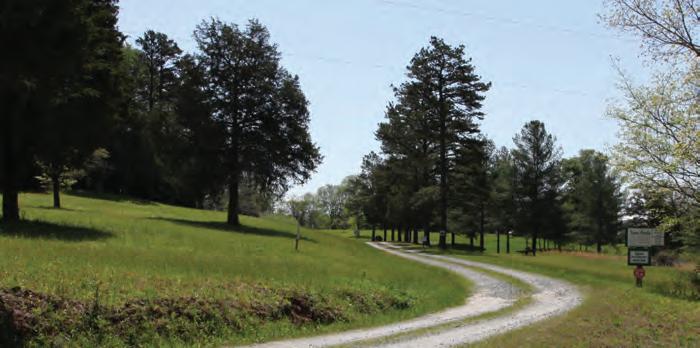
52
tota L L ength: 4.6 Miles trai L type: Multi-Use Trail e stimated c ost: $296,956 points of interest: Watermill River Access Catawba River Soccer Complex Freedom Park Freedom Park High School
SeCtION 3
photos: (8) Swan Pond would serve as an ideal connection point. (9) Freedom Park has an existing section of certified OVNHT. 08


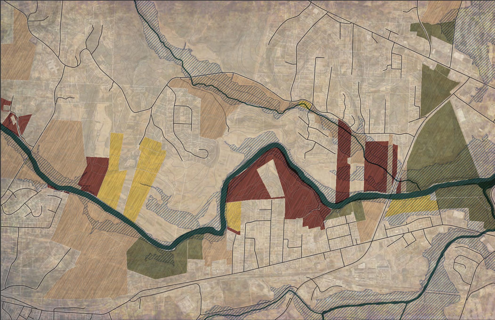


recommendations 53 CITY OF MORGANTON JURISDICTION TABLE ROCK MIDDLE 70 181 126 126 CARBON CITY GLENDALE NORMANDY SPRINGDALE WHITLEY ELM INDEPENDENCE AIR PARK POPLAR ST CALVIN HEIGHTS INDUSTRIAL BLVD OLD LUMBER YARD RIVER BREEZE OLDRIVER WATERMILL GLEN ALPINE LANE DR SWAN POND LA FORET STEPHENS CAMELLIA GARDEN JIM WALL WILBURM NEWTON SAMWALL WAMSUTTAMILL MULL BOST NGREEN HARBINSON TRUAX CLAY WHISPERING PINE B E A C H M ON T B R OTKSOO NE EM O RY W O O D S T M A RYS CHURCH MCCONNAUGHEY 0 1/8 1/4 1/2 MI. N 53 54 55 56 57 NEIGHBORHOOD WALMART FREEDOM HIGH SCHOOL CATAWBA RIVER SOCCER COMPLEX TREE FARM CATAWBARIVER CATAWBA RIVER CANOE CREEK REEK CATAW BA RIVER GREENWAY EXISTING WATERMILL RIVER ACCESS 10 12 11 13 WATERMILL RIVER ACCESS LEGEND LANDOWNER SENTIMENT TRAILHEAD ROAD CROSSING MAJOR BRIDGE MINOR BRIDGE/ CULVERT YES NO POSITIVE NO RESPONSE PREFERRED TRAIL ROUTE ALTERNATE TRAIL ROUTE SPUR TRAIL EXISTING LOCAL TRAIL PROPOSED LOCAL TRAIL TRAIL FEATURES TRAILS CROSSINGS # # # SECTION 3 MCDOWELL HOUSE/ QUAKER MEADOWS QUAKER MEADOWS CEMETERY map 11: p L anning section 3
SeCtION 4

p roposed t rai L s
This planning section extends 4.2 miles from Freedom Park to Grace Ridge Trailhead.
major bridge over the Catawba River would be necessary to reach the existing trailhead at the Rocky Ford Access. If complete, this spur trail would create an approximate 8.5 mile loop.
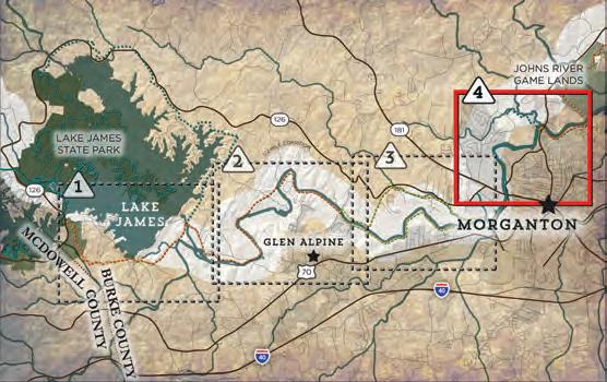
This section primarily highlights an existing and certified section of the OVNHT. However, within this area exists an opportunity for a spur trail that will link OVNHT historical assets, including the McDowell House. Furthermore, this section serves as the eastern terminus of this plan and as the southern terminus of the OVNHT sister plan than extends north to the City of Lenoir.
The Rocky Ford Access serves as the southern terminus of the OVNHT sister plan that extends north to the City of Lenoir. The preferred alignment for this planned trail segment would connect to Rock Ford Access after utilizing a trail underpass at the Highway 18/64 bridge.
* Total cost of Section 4 including spur trail and associated trail features is approximately $2,607,080. While important, the spur trail isn't critical to connect the OVNHT.
From Freedom Park a spur trail is proposed to cross Independence Boulevard and then over Highway 181 to connect to the historic McDowell House, which is further examined in Chapter 1. The spur trail alignment then extends east to Bost Road before heading north until reaching the northern intersection of Bost Road and Lost Corner Road. After heading east on Lost Corner Road, the trail can access existing trail easements along the Warrior Fork corridor (see Appendix A-6 & A-7). A
photos: (10) The McDowell House is an important historical asset worthy of connection via a spur trail. (11) Significant greenway easements are secured along Warrior Creek (see Appendix A-6 & A-7).
54
f reedom p ark
grace ridge trai L head
VICINItY Map
tota L L ength: 4..2 Miles trai L type: Existing Typical Greenway Typical Greenway e stimated c ost: $609,480* points of interest: Freedom Park McDowell House/ Quaker Meadows Quaker Meadows Cemetery Catawba Meadows Park Rocky Ford Access Grace Ridge Trailhead 10
11


recommendations 55 CITYOF MORGANTON JURISDICTION KIRKSEY NORTHRIDGE DOGWOOD KIRK VIEW SUMMIT LINVILLE NORTH POWE PINE OAK ABE WILSON YORK ALEXANDER CLARK ALPHABETBOUCHELLE ROPER SECOND COLLETTQUEEN COLLEGESKINGWCONCORDWUNION KINWOOD WAMSUTTAMILL RIVERSIDE HILLSIDE WEST PARK INDEPENDENCE SAMWALL CRESTHILL CANOE DOCASTEE KINCAID WHISPERING PINE CAMELLIA GARDEN CLAY STEPHENS TRUAX HARBINSON BEECHMONT BROOKSTONE WILBUR NEWTON BRANSTROM LOVEN FORD CAMELOT POLLY PARKLANDLOSTCORNER VFW MAPLEWOODNCOUNCILOAKS WOODSWAY SHERWOOD FAITH LATIMERCLEARWATER TIMBERLINE EDGEWOOD ST MARYS CHURCH MULL MEADOW VIEW EMORYWOOD PEARSON DAVIS FOX WALKER ERVIN KIMBERLY BOST PARK BRISTOL EAST MULL MOREHEAD EVANS CASCADE AVERY LENOIR ORA CONCORD CHURCH WHITE SGREEN EMEETING SHERWOOD TATE ROCKYFORD SHADOWLINE VALLEY VIEW VINE ARDEN AMEADOWS ROCKYFORD W E AL U R EL H GL E N WOOD N TERRACE N ANDERSON WOODBINE WAHARRIS WINDING CREEK WATER FILTERPLANT SELMAN BELV EDERE VREVIR IEW WALTERTAYLOR SPRINGLAKE WARRIOR FORK 181 181 WILSON CREEK CANOE CREEK HUNTING CREEK 0 1/4 1/2 1.0 MI. N MORGANTON CATAWBA MEADOWS PARK MCDOWELL HOUSE/ QUAKER MEADOWS QUAKER MEADOWS CEMETERY WALTER JOHNSON MIDDLE JOHNS RIVER GAMELANDS FREEDOM PARK EXISTING ROCKY FORD ACCESS PROPOSED GRACE RIDGE TRAILHEAD GRACE RIDGE RETIREMENT COMMUNITY PROPOSED GREENWAY PROPOSED GREENWAY EXISTING GREENWAY EXISTING GREENWAY FREEDOM HIGH SCHOOL CATAWBA RIVER SOCCER COMPLEX SEE LENOIR TO MORGANTON OVNHT MASTER PLAN FOR RECOMMENDATIONS EAST OF GRACE RIDGE TRAILHEAD CATAWBARIVER CATAWBARIVER 53 55 56 57 58 59 60 61 62 63 64 65 66 67 68 69 54 12 11 13 14 15 4 5 6 7 PREFERRED TRAIL ROUTE ALTERNATE TRAIL ROUTE SPUR TRAIL EXISTING LOCAL TRAIL PROPOSED LOCAL TRAIL TRAILHEAD ROAD MAJOR BRIDGE MINOR BRIDGE/ CULVERT YES NO POSITIVE CROSSINGS TRAILS TRAIL FEATURES LANDOWNER SENTIMENT # # # LEGEND SECTION 4 FREEDOM PARK GRACE RIDGE TRAILHEAD MAP 12: PLANNING SECTION 4
tRAILHEADS
Two trailheads are noted within this planning section. Rocky Ford Access serves as the existing trailhead for the northern terminus of the Catawba River Greenway and Morganton’s certified section of the OVNHT. The trailhead would benefit from improved parking and trail user orientation. A new OVNHT trailhead is proposed along Highway 18/64 adjacent to the Grace Ridge Retirement Community. A spur trail will connect the parking area to the proposed OVNHT along the Catawba River.
C R o S SI ng S
The proposed spur trail will require four (4) road crossings, two (2) new major bridges, and seventeen (17) minor bridges/culverts.
Major road crossings are required at Independence Boulevard, Highway 181, Bost Road, and Lost Corner Road. All of these crossings will require treatments appropriate to signal motorists of trail users.
As previously noted, a major bridge over the Catawba River will be necessary to reach the existing trailhead at
grace ridge trailhead
photos: (12) The design and planning team meets with local officials at the existing Rocky Ford Access to determine a preferred trail alignment.
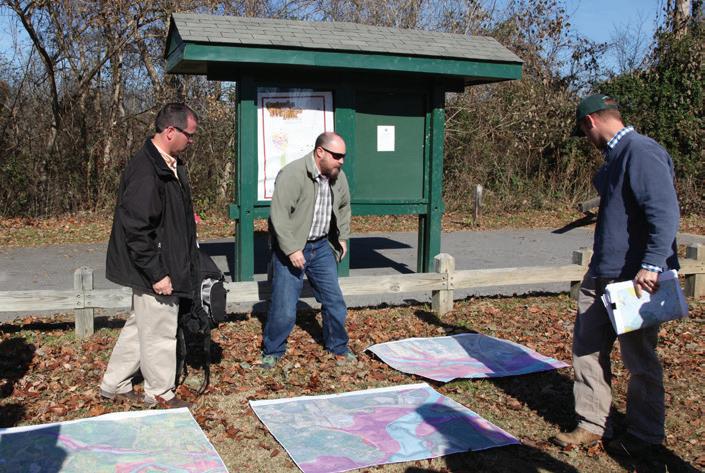
56 chapter 4
a
new OVNHT trailhead is proposed along Highway 18/64 adjacent to the Grace Ridge Retirement Community. A spur trail will connect the parking area to the proposed OVNHT along the Catawba River.
12 EX h IBI t 9: GRACE RIDGE t RAIL h EAD C on CEP t UAL DESI gn PR o VIDED B Y CI t Y o F M o R g A nton L o CAt I on o F E x IS t I ng R o C k Y F o RD ACCESS g RACE RID g E RE t IREME nt C o MMU n I t Y HIgHwAY 18/64
fork
warrior
Catawba river
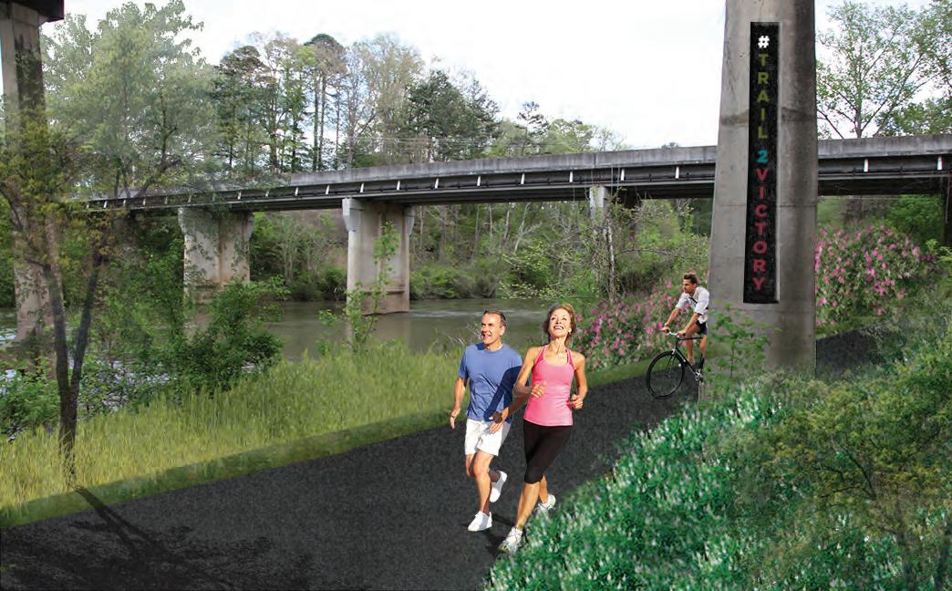
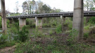
recommendations 57 hIGhwaY 18/64 UNDerpaSS e X isting e X hibit 10: highway 18/64 underpass
the 18/64 underpass in Morganton is critical for connecting the existing Rock Ford Access/Catawba River Greenway with the Johns River Game Lands.
58 chapter 4
Chapter 5 implementation
to construct the ovnht from lake james to morganton will be no small task, but with time, perseverance, and a little luck, there is no doubt that a destination-quality trail is within grasp.
This chapter aims to summarize details regarding each Planning Section and establish responsibilities and priorities for trail implementation. Furthermore, this chapter describes the “Trail Rubicon,” or the focus areas that when developed, result in a perception that the complete trail is imminent and widespread support ensues.
i n this chapter
A. Implementation by Section and Responsibilities
B. Priority Implementation Areas and Responsibilities
C. Trail Rubicon
D. Trail Support Spectrum

60 chapter 5
implementation
section.
trail
trail
implementation Section Distance Key Challenges Estimated Budget Implementing Agency SECTION 1 Canal Bridge to Powerhouse Rd. 5.9 Canal Bridge Crossing; NCDOT Side Paths along Benfields Landing Rd. and Powerhouse Rd; Benfields Landing Crossing; Muddy Creek Bridge Crossing; Securing Landowner Trail Easements $2,239,900.00 Burke County SECTION 2 Powerhouse Rd to Watermi l River Access 5.7 Securing Landowner Trail Easements; Catawba River Bridge; Watermill Glen Alpine Rd. Underpass $884,652.00 Burke County SECTION 3 Watermill River Access to Freedom Park 4.6 Securing Landowner Trail Easements $296,956.00 Burke County, City of Morganton SECTION 4 Freedom Park to Rocky Ford Access 4.2 Spur Trail to McDowell House; Highway 181 Crossing; Highway 18/64 Underpass $609,480.00* City of Morganton ALL SECTIONS TOTAL 20.4 $4,030,988.00 * Estimated budget shown above pertains only to the completion of the preferred OVNHT route. Total cost of Section 4 including spur trail loop and associated trail features is approximately $2,607,080. implementation details by seCtion and responsibility e X hi B it 11: implementation D etails BY section an D responsi B ilit Y
i mplementation BY section an D responsi B ilit Y The table below provides key
information associated with each planning
Key Challenges include a summary of the most difficult barriers for realizing each
section. Many of these barriers include costly features or note the need to acquire
easements from private landowners. Most importantly, this table assigns an Implementing Agency to each planning section.
Priority i m P lementation a reas & res P onsibilities
Burke County and Morganton must work in tandem to successfully realize the OVNHT. Trail implementation does not have to occur in a specific, linear order according to each planning section. In fact, the priority areas for implementation are merely suggestions and are in no way intended to hem creativity or necessary work in "lower" priority areas. Trail implementation is an art and requires the acumen to recognize and then seize opportunities, whether related to funding, landowner willingness, politics, etc.
The table below supports a trail development strategy that prioritizes areas west of Watermill River Access (sections 1 and 2). If these were to be fully developed, this would likely provide the formula for "Trail Rubicon," the point in which the public, elected officials, and partnership funding agencies recognize that connectivity and complete implementation is imminent. At this point significant momentum and synergy would likely propel forward the completion of the OVNHT from Lake James to Morganton.
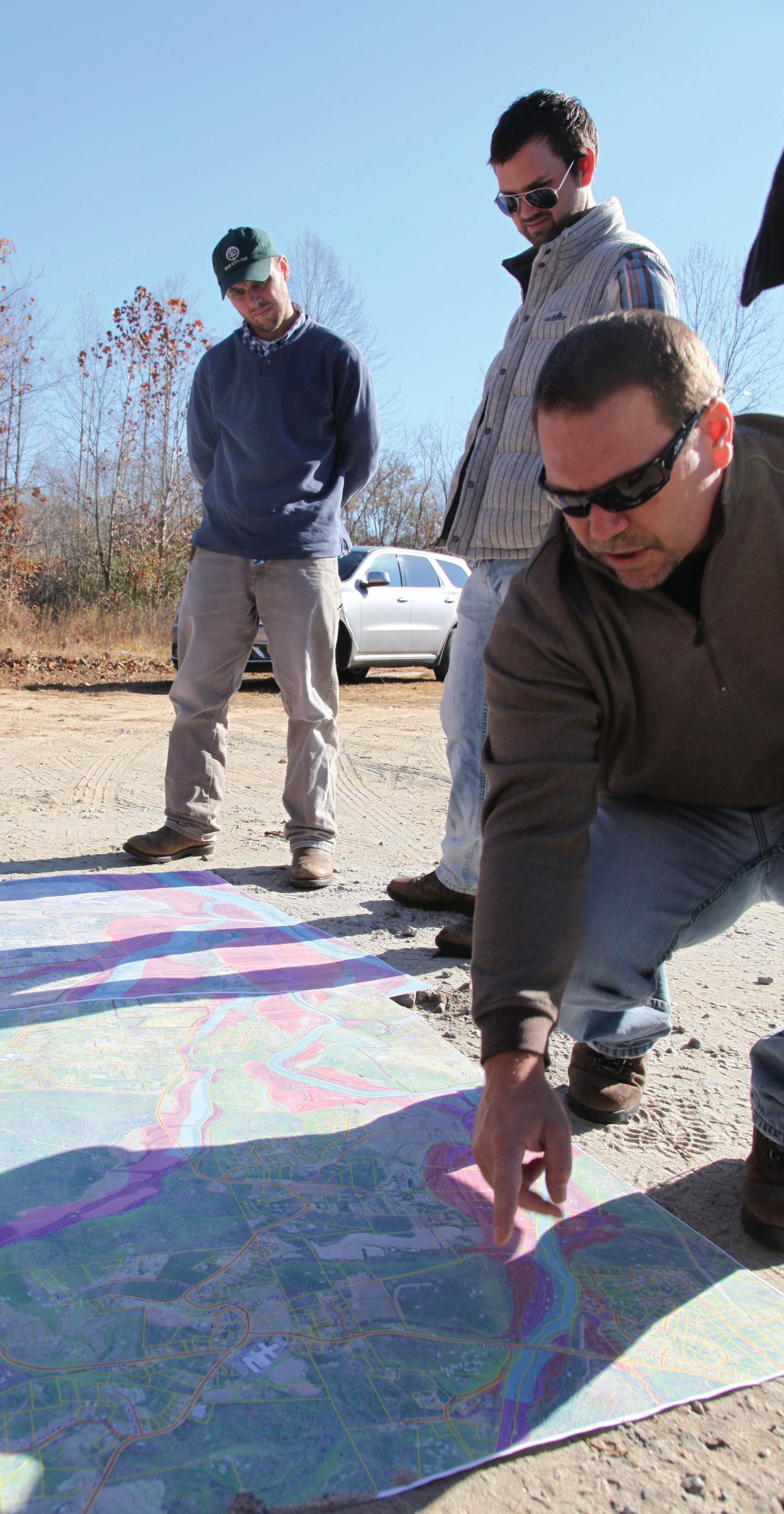
Rubicon
61 implementation
PRIORITY ImPlemenTaTIOn aReaS and ReSPOnSIbIlITIeS TRaIl RubIcOn: fIndIng The POInT Of nO ReTuRn Implementing AgencyPriority One Priority Two Burke County Section 1: Canal Bridge to Powerhouse Road Section 2: Powerhouse Road to Watermill River Access; Section 3: Watermill River Access to Freedom Park City of Morganton Section 4: Rocky Ford Access to Grace Ridge Trailhead Section 4: Spur to McDowell House e XH ibit 13: P riority im P lementation areas 1. canal bRIdge TO POweRhOuSe ROad 2. POweRhOuSe ROad TO waTeRmIll RIveR acceSS
the trail need
developed
widespread support and a col lective energy, beyond that of the community's traditional trail support base, to ensure that the OVNHT is complete? These trail section or focus areas represent the Trail Rubicon. Between Le noir and Morganton, there are three areas: e XH ibit 12: trail r U bi C on
Trail
T hink snowball effect. Which sections of
to be
before there is
trail support spectrum
Creating a destination-quality trail system requires a significant commitment from local governments, in-
spend local funds, but instead must leverage their funds to obtain support from partnership funding agencies sympathetic to the creation of trails and the OVNHT.
The “Trail Support Spectrum” illustrates the steps local governments can take to support trail development.
TRAIL SUPPORT SPECTRUM
chapter 5
1 2 3 4 5 e XH i B it 14: trail support spectrum
APPENDIX
64 APPENDIX (A1) BUDGET SECTION 1- Canal Bridge to Powerhouse road Units Unit Cost Total Cost Canal Bridge Trailhead 1$125,000.00 $125,000.00 Multi-Use Trail (5 ft. Natural Surface) 30096$12.00 $361,152.00 NCDOT Side Path (6 ft Paved Asphalt) * 1056$120.00 $126,720.00 Road Crossings 7 $5,500.00 $38,500.00 Major Bridges 2$75,000.00 $150,000.00 Minor Bridge/ Culvert 23$8,000.00 $184,000.00 $985,372.00 SECTION 2 Powerhouse Rd. to Watermill River Access Units Unit Cost Total Cost Existing Watermill River Access Improvements 1$125,000.00 $125,000.00 Multi Use Trail (5 ft Natural Surface) 30096$12.00 $361,152.00 Road Crossings 3 $5,500.00 $16,500.00 Major Bridges 1$150,000.00 $150,000.00 Minor Bridge/ Culvert 29$8,000.00 $232,000.00 $884,652.00 SECTION 3 Watermill River Access to Freedom Park Units Unit Cost Total Cost Multi Use Trail (5 ft Natural Surface) 24288$12.00 $291,456.00 Road Crossings 1 $5,500.00 $5,500.00 Major Bridges TBD Minor Bridge/ Culvert TBD $296,956.00 SECTION 4 Freedom Park to Northern Catawba River Greenway Trailhead Units Unit Cost Total Cost Grace Ridge Trailhead 1$325,000.00 $325,000.00 Typical Greenway (10 ft. Paved Asphalt) 1056 $80.00 $84,480.00 Road Crossings 0 $5,500.00 $0.00 Major Bridges 0$175,000.00 $0.00 Minor Bridge/ Culvert 0 $8,000.00 $0.00 18/64 Underpass (Road Crossing) 1$200,000.00 $200,000.00 $609,480.00 ALL SECTIONS TOTAL $2,776,460.00 * Unit cost based on NCDOT estimate provided to Burke County on 6/17/2015. Final trail type will depend on specific environmental conditions and whether trail is located within NCDOT ROW or within a private trail easement. * Estimated budget shown above pertains only to the completion of the preferred OVNHT route. Total cost of Section 4 including spur trail loop and associated trail features is approximately $2,607,080. Total Cost Total Cost Total Cost Total Cost 1 2 1 2
FACT SHEET
A trail master planning effort is underway to help create a section of the Overmountain Victory National Historic Trail (OVT) that would connect from Lenoir to Morganton to Lake James!


Thanks to grant support from the National Park Service, regional community organizations and local governments are working to establish a walking and leisure biking trail that connects the region and celebrates the trail walked by the Overmountain Men who won a major Revolutionary War battle at Kings Mountain in 1780.
The trail planning process requires an analysis of the Lower Creek corridor in Caldwell County and the Catawba River corridor in Burke County. The trail is best suited in floodplain areas where development generally cannot occur and where there are meaningful connections to existing parks, civic buildings, and neighborhoods.
After identifying feasible trail route options, there will be a major landowner outreach effort. Without the voluntary commitment from landowners, the trail will either be relocated or not constructed.
An educational video will be developed to help communicate the historical significance of the OVT, which will be made available online. www.OVTplan.com
THE PLANNING PROCESS
Direction Setting and Project Launch | September 2014
The consultant team will meet with local trail and government leaders to generally discuss environmental constraints and opportunities for trail connectivity.
Research October – January 2015
The consultant team will conduct a thorough environmental assessment of the study area and determine feasible trail route options. With the trail routes identified, a landowner contact list will be developed.
Landowner Outreach February – March 2015
Landowners with property along an identified feasible trail route will be invited to a special meeting to learn more about the trail project. After receiving comments from landowners, the preliminary trail routes will be updated.
Plan Development | March – May 2015
The consultant team will document the trail analysis and landowner comments. Recommendations will highlight alternative routes and the project’s overall feasibility for completion. A draft plan will be made available for public comment.
Final Plan Preparation | May – June 2015
The consultant team will publish a final plan that incorporates all public comments.
CONSULTANT CONTACT: Eric Woolridge, AICP
Destination by Design Email: Eric@dbdplanning.com Phone: (828) 386-1866 Web: www.DbDplanning.com
Date: February 16, 2015
[Insert Landowner Name and Address
Re:
(A2) FACT SHEET (A3) LANDOWNER LETTER BACKGROUND
Trail Planning Meeting for Landowners
Dear [Insert Landowner Name]:
Thanks to grant support from the National Park Service, regional community organizations and local government leaders, a plan is being developed for establishing a walking and leisure biking trail to connect from Lenoir to Morganton to Lake James.
This trail celebrates the walk made by the Overmountain Men who won a major Revolutionary War battle at Kings Mountain in 1780.
Since November 2014, the planning team has been working to identify a feasible route to construct the trail As part of this analysis, your property has been identified as a potential location for a trail section. Without a voluntary commitment from landowners, this important trail will either be relocated or not constructed.
We would like to invite you and other landowners to discuss this project during a special meeting that will take place at [insert time and location].
An informational video can be found on the web at: www.OVTplan.com. Also, enclosed is a project Fact Sheet that further describes the project.
Please RSVP if you plan to attend the meeting by sending an email or calling using the contact information below. Thank you.

Sincerely,
Eric Woolridge
Consultant Project Manager
Destination by Design Planning
Phone: 828.386.1866
Email: eric@DbDplanning.com
Destination by Design Planning 815 W. King Street, NC 28607
APPENDIX 65
1 2 3 4 5
Recreation
Parks
Bikes
Bike
66 APPENDIX
l A
survey
The completed Landowner Interest Surveys were provided to local government leaders.
funding sources Landowner Interest Survey Name ________________________________________ Address_______________________________________ Phone Number _________________________________ Email _________________________________________ Please share your level of interest for providing for the public trail. (check below) Ο Not interested at this time Ο Somewhat interested and welcome further discussions Ο Very interested Landowner Interest Survey Name ________________________________________ Address_______________________________________ Phone Number _________________________________ Email _________________________________________ Please share your level of interest for providing for the public trail. (check below) Ο Not interested at this time Ο Somewhat interested and welcome further discussions Ο Very interested National Historic Trail Master Plan Overmountain Victo ry LENOIR • MORGANTON • LAKE JAMES National Historic Trail Master Plan Overmountain Victo ry LENOIR • MORGANTON • LAKE JAMES Partnership Funding Agency Active Living/ Built Environment Implications Maximum Amount Matching Funds Required Deadlines TIGER Construction provided all easements are secure. N/A (min. $1 million)$0 (for rural countiesMay (typical) Clean Water Management Trust Fund (www cwmff net)
Acquisition: Fee Simple or Easement. Must protect floodplain areas. Greenway trails and other park areas are allowed.
on 6/2015 discussion w/ staff, a $750K / multi year application would be welcome. Not specified, but 20% is competitive February 1st NC Water Resources (www ncwater org) River access areas or greenways along rivers N/A 50% January 1st and June
(A4)
ndowner interest
Note:
(A5)
Land
Based
1st
Trails Program (ncparks gov/About/grants/ma n php)
trails
All types of
and greenways $100,000.00 25% February 1st
and Recreation Trust Fund
n.php)
(ncparks gov/About/grants/ma
All types of parks, trails, and recreation facilities $500,000.00 50% February 1st
Belong Foundation Trails and Greenways$10,000.00 20% May 24th
For
and
Projects
NCDOT Transportation Plan
Bike
Pedestrian
and Pedestrian Projects‐ both engineering and construction N/A (for major projects) 20% generally N/A

APPENDIX 67
(A6) WARR i OR FOR k GREENWA y E ASE m ENT
(A7) CRESCENT RESOURCES / WARR i OR FOR k G REENWA y E ASE m ENT
68 APPENDIX
APPENDIX 69


keep the story alive
