MAYO RIVER STATE PARK MASTER PLAN

GUIDE TO FUTURE

A
IMPROVEMENTS ADOPTED AUGUST 2021 PREPARED BY: PREPARED FOR:

MAYO RIVER STATE PARK MASTER PLAN B EXECUTIVE SUMMARY THIS PAGE INTENTIONALLY LEFT BLANK
PROJECT TEAM / ACKNOWLEDGEMENTS
NORTH CAROLINA HOUSE OF REPRESENTATIVES
Jerry Carter District 65
Kyle Hall District 91
NC DIVISION OF PARKS AND RECREATION

Dwayne Patterson
NORTH CAROLINA SENATE
Phil Berger District 30
Director of the state Division of Parks and Recreation
Kathy Capps Deputy Director of Operations
Brian Strong Deputy Director of Planning and Natural Resources
Dave Head Planning Program Manager
Christy Rosas Parks Planner
Katharina Deutsch Parks Planner
Smith Raynor State Trails Planner
Scott Crocker Trails Program Manager
Jon Blanchard Natural Resources Manager
John Amoroso GIS Manager
George Norris Land Protection Program Manager
Katie Hall Public Information Officer
Kristen Woodruff North District Superintendent
Jessica Phillips Mayo River State Park Superintendent
Walt Summerlin Mayo River State Park Ranger
Connie Fox Mayo River State Park Office Assistant
Russell Bennett Mayo River State Park Maintenance
Nathan James Mayo River State Park Maintenance
MAYO RIVER STATE PARK STAKEHOLDER COMMITTEE
Kevin Baughn Town of Madison
Leesa Hopper Town of Mayodan
Lisa Armstrong Town of Stoneville
Ken Bridle
Piedmont Land Conservancy
Leigh Cockram Rockingham County Tourism & Economic Development
Jesse Day Piedmont Triad Regional Council
Tiffany Haworth Dan River Basin Association
Brian Williams Dan River Basin Association
Rusty Gray Friends of Mayo River State Park / local EMS
Vince Joyce Friends of Mayo River State Park
Keith Martin Friends of Mayo River State Park
Bob Brueckner Carolina Canoe Club
Cory Oakley NC Wildlife Resources Commission
Katie Harville NC State Historic Preservation Office
Christen MIller Virginia State Parks
Adam Layman Virginia State Parks, Fairy Stone State Park Manager
DESIGN CONSULTANTS
Brian H. Starkey, PLA / ASLA Director / Landscape Architect, Timmons Group
Jon Blasco, PLA / ASLA Landscape Architect, Timmons Group
Michael Alderman, ASLA Project Planner, Timmons Group
TABLE
CONTENTS
MAYO RIVER STATE PARK MASTER PLAN 1
OF
Roy Cooper North Carolina Governor
TABLE
CONTENTS
CHAPTER ONE: INTRODUCTION


CHAPTER TWO: METHODOLOGY
Plan
CHAPTER THREE: PROGRAMMING
MAYO RIVER STATE PARK MASTER PLAN 2 ACKNOWLEDGEMENTS
OF
Project Team / Acknowledgments . . . . . . . . . . . . . . . . . . 1 Table Of Contents . . . . . . . . . . . . . . . . . . . . . . . . 2
5 Corridor Map . . . . . . . . . . . . . . . . . . . . . . . . . . 7 Mission Statement . . . . . . . . . . . . . . . . . . . . . . . . 8 Goals & Objectives . . . . . . . . . . . . . . . . . . . . . . . . 9 History . . . . . . . . . . . . . . . . . . . . . . . . . . . . . 9 Previous Plans . . . . . . . . . . . . . . . . . . . . . . . . . 10
11 Information Gathering . . . . . . . . . . . . . . . . . . . . . . 12 Master
Process . . . . . . . . . . . . . . . . . . . . . . 13 Inventory & Analysis . . . . . . . . . . . . . . . . . . . . . . 14 Stakeholder & Community Engagement . . . . . . . . . . . . . . 15 Project Website . . . . . . . . . . . . . . . . . . . . . . . . 16
17 Community Engagement . . . . . . . . . . . . . . . . . . . . 18 Survey Results . . . . . . . . . . . . . . . . . . . . . . . . . 19 Recreational Needs . . . . . . . . . . . . . . . . . . . . . . . 21 Staff Facilities . . . . . . . . . . . . . . . . . . . . . . . . . 22 Partnership Opportunities . . . . . . . . . . . . . . . . . . . . 22
TABLE OF CONTENTS
CHAPTER FOUR: SITE INVENTORY & ANALYSIS
Existing Conditions
Natural Resources / Vegetation
Natural Resources / Natural Areas

Natural Resources / Slope
Natural Resources / Hydrology
CHAPTER FIVE: RECOMMENDATIONS
Key Map
Priorities and Phasing
Concept Plans & Site Plan Vignettes
River Access
River Access Design and Permitting
Protection Plan
Considerations
APPENDIX
Stakeholder Meetings
Meetings
Feedback
Vegetation Type Definitions
Opportunities and Constraints
MAYO RIVER STATE PARK MASTER PLAN 3TABLE OF CONTENTS
23
25
34
36
40
42
45
46
48
52
78
Considerations 80 Land
84 Cost
86
X-1
4 Community
. . . . . . . . . . . . . . . . . . . . . . . 6 Community
. . . . . . . . . . . . . . . . . . . . . . . 8
. . . . . . . . . . . . . . . . . . . 10
Maps . . . . . . . . . . . . . . . . 12

MAYO RIVER STATE PARK MASTER PLAN 4 TABLE OF CONTENTS
THIS PAGE INTENTIONALLY LEFT BLANK
MAYO RIVER STATE PARK MASTER PLAN INTRODUCTION1
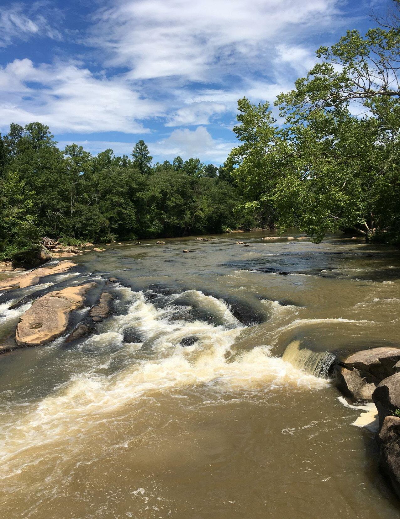
Created in 2003 by the NC Legislature, Mayo River State Park is one of the newest parks in the North Carolina State Park system. Interim facilities opened to the public in 2010. This master plan provides recommendations for future improvements to expand the park’s facilities and recreational opportunities.
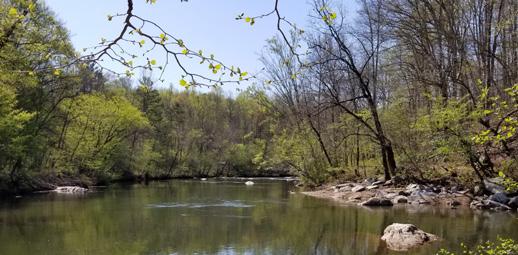
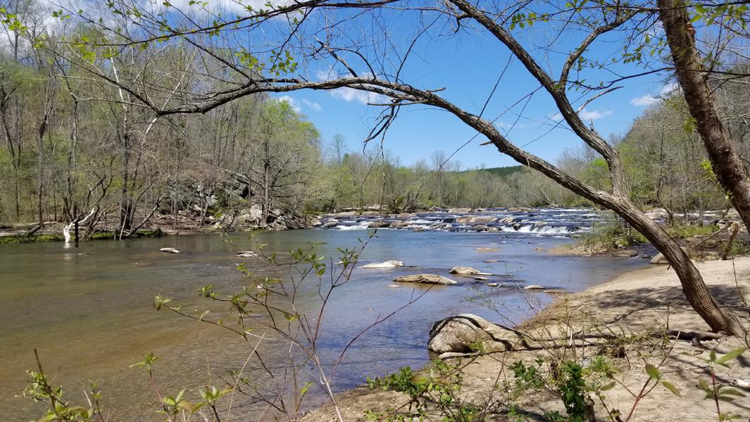

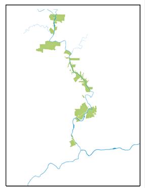
The Mayo River begins at the North Carolina/Virginia state line where the North and South Mayo Rivers converge to create the Mayo River. The river flows south for 16 miles to where it joins the Dan River just south of Madison in Rockingham County. The park covers more than 2,700 acres. Much of the park’s land is not easily accessible, nor is it all connected. The study area encompasses the river corridor and includes all state-owned land and considers other land to the east and west of the river.
The Mayo has long been a draw for paddlers. Class II and III rapids can be found in the upper section near the Anglin Road bridge. Once past the rapids, the river calms down creating a leisurely and scenic paddle until it reaches the Avalon Dam. Two hydroelectric dams prevent paddling the entire length of the river. Paddlers must exit the river before reaching the Avalon Dam.
Currently, the last opportunity to exit the river is the access at highway Business 220.
The FERC license for the hydroelectric company includes language requiring the owners to provide portage around the dams as well as signage upriver of the Avalon Dam indicating hazardous conditions ahead. The Mayo River Dam Portage Assessment conducted by N.C. State Trails Program in 2013 noted that portaging is not feasible at this time due to the terrain, river bottom conditions and length of portage that would be required. While this report will not address a specific portage option, it recommends that the North Carolina Division of Parks and Recreation (Division) continue
MAYO RIVER STATE PARK MASTER PLAN 6 CHAPTER ONE INTRODUCTION
LOWER MAYO BEACH
CONFLUENCE OF NORTH AND SOUTH FORKS OF THE MAYO RIVER
DESHAZO MILL ACCESS
BEACH
The Mayo River, flowing from the NC/ VA state line to its confluence with the Dan River, is heralded for its natural beauty and ecological importance. The master plan for the state park intends to capitalize on this resource by creating strong connections and promoting new recreational opportunities, while prioritizing conservation values.
CONFLUENCE

MAYO RIVER STATE PARK MASTER PLAN 7CHAPTER ONE INTRODUCTION
CORRIDOR MAP
WITH THE DAN RIVER
MAYO
ACCESS BUFFALO CREEK AREA HICKORY CREEK AREA MAYO MOUNTAIN ACCESS CEDAR MOUNTAIN ACCESS AVALON DAM WASHINGTON MILL DAM JOYCE FORD RD. ACCESS MADISON PROPERTY MAYO RIV E R DANRIVER NC770 VIRGINIA NORTH CAROLINA US HWY 220 MADISON MAYODAN
MISSION STATEMENT
The North Carolina Division of Parks and Recreation exists to inspire all its citizens and visitors through conservation, recreation and education.

CONSERVATION


To conserve and protect representative examples of North Carolina’s natural beauty, ecological features, recreational and cultural resources within the state parks system;
RECREATION
To provide and promote safe, healthy and enjoyable outdoor recreational opportunities throughout the state; and
discussions with the dam owners to find a mutually beneficial option that is safe and cost effective.
Once past the Washington Mills dam, the Mayo flows through the towns of Mayodan and Madison before joining with the Dan River. Access to the river through these towns is limited.
The historic roots of the park are at the Mayo Mountain Access area on the west side of the river. This area has been identified by the NC State Historic Preservation Office (NCSHPO) as a historic area and features fishing ponds, hiking trails, a picnic shelter, group camping and the park office. The picnic shelter is a prominent structure. The Deshazo Mill Access along the upper portion of the park and on the east side of the river includes a small parking lot, picnic area and a hiking trail to the Fall Creek Waterfall and Mayo River. Anglin Mill Access (also known as the Mayo Beach Access or Boiling Hole) is one of the newest property acquisitions and is a very popular spot among locals. The Anglin Mill Access, also on the east side of the river, features fishing spots, informal canoe and kayak launches and a sandy beach. This access area has no formal parking lot or any other facilities. Other access points include the Hickory Creek Access on the west side of the river, which includes an informal trailhead parking area and an improved trail to the river, and the Mayodan Access at route 135 on the east side. Paddlers can put in at the Mayodan Access for the final stretch of the Mayo before it connects with the Dan River. Park visitation has been rising steadily
EDUCATION
To provide educational opportunities that promote stewardship of the state’s natural and cultural heritage.
since the park’s inception. Through 2019 the number of visitors has never exceeded 100,000; however, the number of visitors nearly doubled in 2020. This has been attributed to people’s desire to get outside during the Covid-19 pandemic.
The Mayo River is also known for its ecological importance. The Mayo is home to several rare and endangered plant and animal species. Water quality is extremely high, which supports a variety of aquatic life. Concentrations of significant natural plants exist on the west side of the river at the northern end and in the shadow of Cedar Mountain on the east side. Native American artifacts, including fish weirs, can be found throughout the corridor. Protection of these natural and cultural features along the river is an important tenant of this master plan.
MAYO RIVER STATE PARK MASTER PLAN 8 CHAPTER ONE INTRODUCTION
FALL CREEK WATERFALL
HISTORY
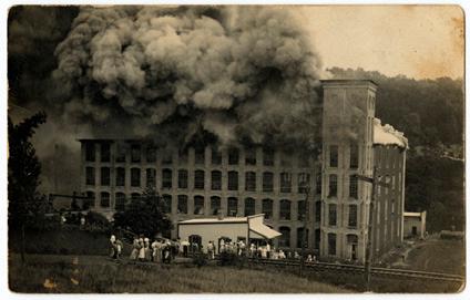
The Mayo River played a key role in textile industry in North Carolina. Two textile mills and several grist mills located along the river to harness its power. The Mayo Mill opened in 1895 and the Town of Mayodan formed around it. In 1921, the mill was consolidated with others in Virginia and took the name Washington Mills. The mill operated until it was closed permanently in 1999. The building was eventually torn down in 2012, despite being on the Historic Register of Places. Avalon Mill, two miles up river from Washington Mill, opened in 1900 and the village that developed around the mill was home to 450 residents. In 1911, a fire tore through the mill destroying it. The mill was never rebuilt and houses were moved to Mayodan. Remembering and revealing the history of these mills and villages is important to the planning process and master plan recommendations.
The history of Mayo River State Park begins with Mayo Park, which opened in 1948 and was created by the Washington Mills Company for their employees. Mayo Park was located at the current Mayo Mountain

GOALS & OBJECTIVES
The goal of this master plan is to provide a long-term vision for future improvements to Mayo River State Park. The plan identifies priorities for future improvements that will be implemented as demand and resources allow. It is not intended to be implemented in full immediately. The master plan is meant to be flexible, allowing for ongoing changes to funding and priorities of the division of Parks and Recreation and the State of North Carolina.
The goal of the master plan is to define an appropriate balance between future development and conservation. It is important that the plan compliment recreational opportunities currently offered at the park as well as address the current deficiencies and future needs. The recommendations outlined in the plan respond to demonstrated needs of stakeholders and the community while respecting the mission of the Division.
MAYO RIVER STATE PARK MASTER PLAN 9CHAPTER ONE INTRODUCTION
AVALON DAM
AVALON MILL FIRE / PHOTO COURTESY OF NC DIGITAL HERITAGE CENTER
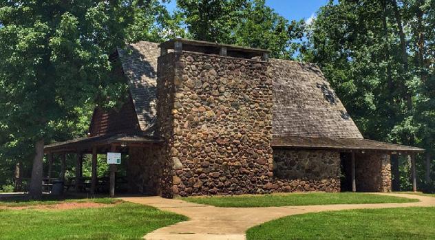
Access where the current park office is located. Washington Mills Company hired the firm of Raymond and Rado to design a bathhouse and picnic shelter for the park. Antonin Raymond, a protégé of Frank Lloyd Wright, considered the picnic shelter to be one of his better designs. Raymond worked with Landscape Architect F. Elwood Allen on the design of facilities at Mayo Park. The swimming beach closed in the mid 1960s due to water quality issues and the bathhouse and shelter fell into disrepair. In the early 2000s, the bathhouse collapsed due to deterioration and was removed; however, the shelter was renovated and remains in use. The picnic shelter can be rented for picnics and events.
PREVIOUS PLANS
Several plans for the park and surrounding area have been developed by various groups. As part of this planning process, the project team reviewed these plans. In conjunction with the goals and objectives of the Division, ideas and analysis from the previous plans informed the process as well as the recommendations of this master plan.
PREVIOUS PLANNING DOCUMENTS
• Mayo River State Park & Scenic River Study by Shawn Mck. Clotworthy (December 1986)
• Mayo River State Park Master Plan Project by William Butler and sponsored by the Dan River Basin Association (2004)
• NC STEP Economic Development Strategic Plan & Implementation Strategy for the Mayodan Board of Commissioners (November 2013)
• Mayo River Recreation Access Action Plan / Phase 1 by Western Rockingham Rivers and Trails Group for the Piedmont Land Conservancy (August 2016)
• Madison Rivers & Trails by Piedmont Triad Regional Council, Dan River Basin Assoc. and Round Rock Design for the Town of Madison (February 2018)
• Washington Mills Park Master Plan by Foothills Planning + Design and the Piedmont Triad Regional Council for the Town of Mayodan (January 2019)
• Mayo River Dam Portage Assessment by N.C. State Trails Program (June 2013)

• Repurposing a Ruin: Grant Funding for a Small Town / Washington Mills –Mayodan, NC by Jordan Thompson, NCDEQ Brownfields Manager (October 2019)
• Feasibility Study for a State Park on the Mayo Rivers in Henry County and Mayo Scenic Rivers Study by the Virginia Department of Conservation and Recreation (November 2007)
• 2007 Virginia Outdoors Plan: Charting the Course for Virginia’s Outdoors
• Parks for a new Century ( 2001)
• Rockingham County Natural Heritage Inventory – by RJ Commans and Ramona Bates- March 1999
MAYO RIVER STATE PARK MASTER PLAN 10 CHAPTER ONE INTRODUCTION
CEDAR MOUNTAIN
HISTORIC SHELTER AT MAYO MOUNTAIN ACCESS
MAYO RIVER STATE PARK MASTER PLAN METHODOLOGY2
The master plan process was conducted over a 9-month period, starting in March of 2020 and completed in December of 2020. The planning process consisted of five distinct phases from start to finish. Boots on the ground, community engagement and clear and frequent communication and coordination with Parks staff were important aspects of our approach.

INFORMATION GATHERING
Throughout the planning process, information gathering never ceased. The design team went about this process through several methods, including multiple site visits, input from a variety of stakeholders and the community. The team also poured through digital data, including national and state databases and GIS data provided by the State of North Carolina.
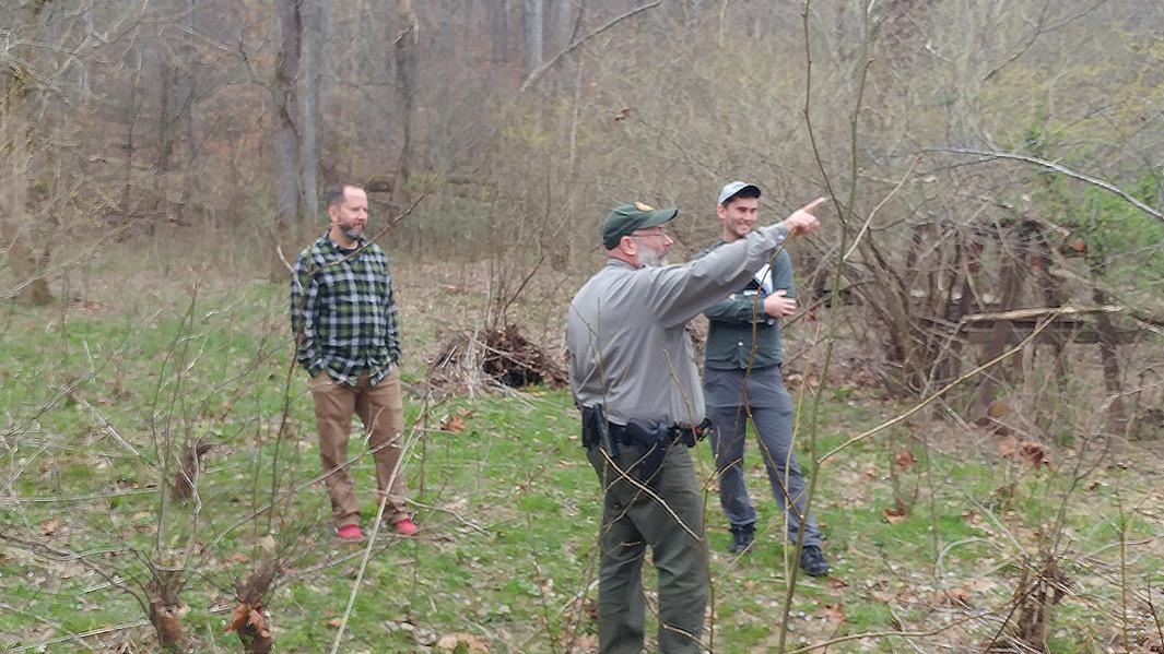
A key piece to information gathering is conducting site visits. Experiencing the site in person helps to identify opportunities and challenges. Visioning can only happen once the context of the space is understood. The project team made multiple visits to the Mayo River State Park and surrounding area. The team hiked several areas of park property with the park superintendent, including:
Confluence of the North and South Mayo where the Mayo forms
Deshazo Mills access, Fall Creek and Byrd Ledge
The Anglin Mill Road Bridge Access and Boiling Hole
Hickory Creek tract
Joyce Ford Road tract
Avalon Mill Dam
Mayo Mountain Access
Cedar Mountain
Washington Mill site
Rt. 135 Access
During these hikes, the team documented the surrounding context though photographs, mapping and discussions with the park ranger. Opportunities and challenges were marked on maps; notes from the ranger were scribbled in notebooks; photos documented the conditions.
MAYO RIVER STATE PARK MASTER PLAN 12 CHAPTER TWO METHODOLOGY
•
•
•
•
•
•
•
•
•
•
PROJECT
TEAM
EXPLORING CEDAR MOUNTAIN WITH THE FORMER PARK SUPERINTENDANT
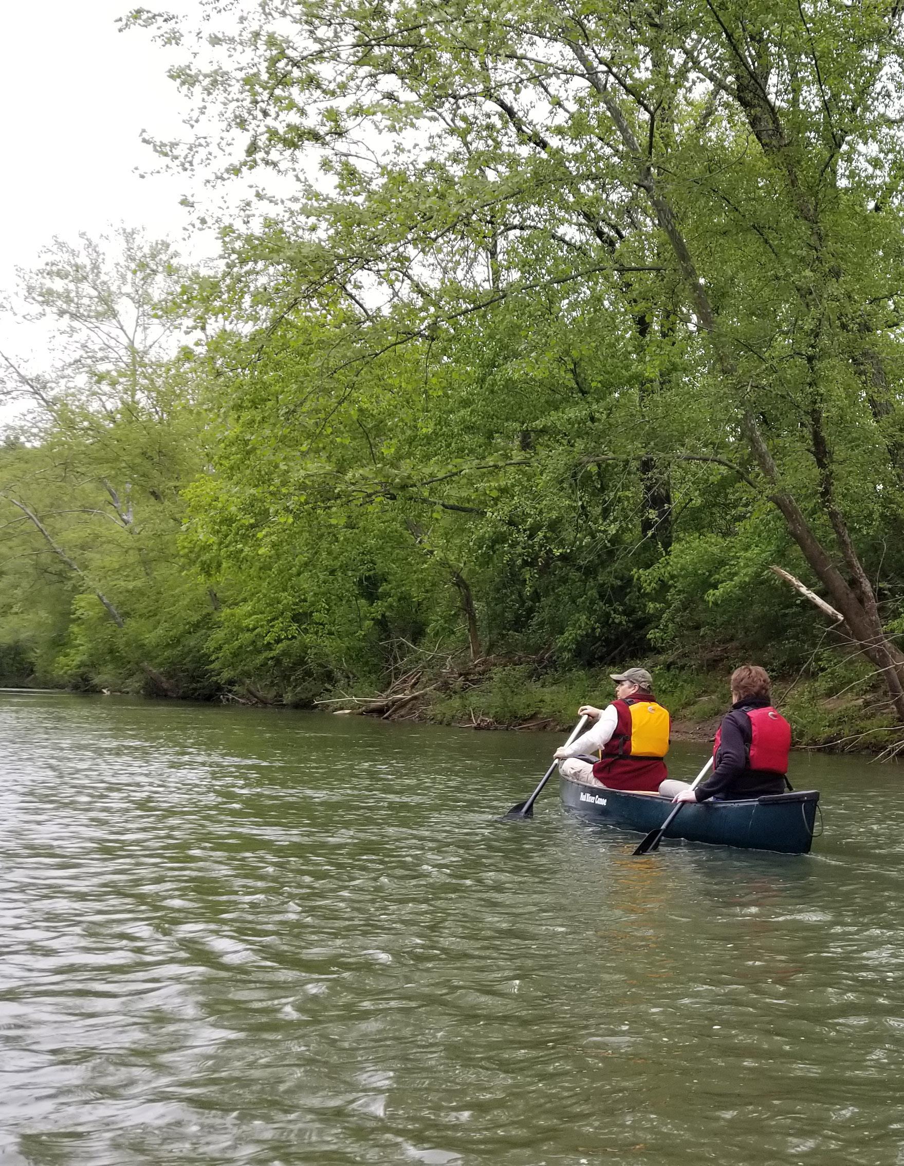
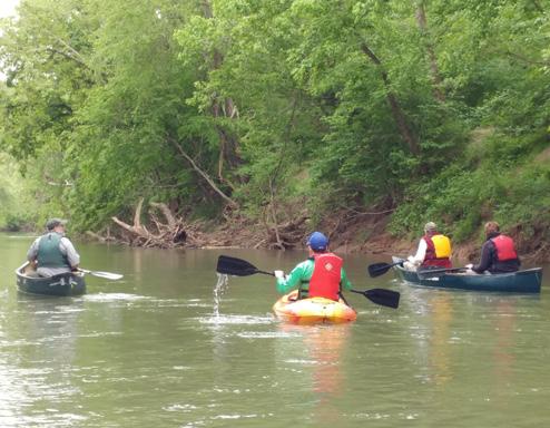
On another occasion, members of the project team, along with representatives from the NCDCR, took a paddle trip down the Mayo River. This trip began just below the Boiling Hole at the Anglin Mill Road access and concluded at the US BUS 220 takeout. The paddle trip provided a different perspective from the earlier hikes. River access and the river experience is going to be an important piece of the master plan and the future improvements. Experiencing the river from the water was critical to the visioning and understanding of the site. The paddle revealed a lot about the river , including the character of the water, access challenges, paddle times and typical conditions. The paddle also revealed a beauty that is not fully apparent from current access points.
MASTER PLAN PROCESS
Phase 1 / Information Gathering & Site Assessment
Gather information, inform and educate the community and stakeholders, define goals and objectives for the project and refine the planning process
Phase 2 / Preliminary Planning & Design
Development of park program and improvements, identification of land use alternatives for future development and the engagement of park staff, stakeholders and the community.
Phase 3 / Draft Master Plan
Finalize the park program and identify future improvements for consideration.
Park staff, the community and stakeholders were engaged for feedback on the recommendations of the draft plan.
PROJECT TEAM PADDLING ON THE MAYO RIVER
Getting people to the water, as well as in and out of the water, will be a critical component of the master plan.
Gathering information does not begin or stop with visiting the site. Input from stakeholders was also an important part of the information gathering process. A Stakeholder Committee was formed to provide local insight and perspective. Stakeholders included long-time residents, park staff, town officials, and representatives from various advocacy groups, among others. Stakeholders provided a level of knowledge and passion about the Mayo River and surrounding area that was invaluable. Through discussions with the stakeholders the team was able to tap into some of that knowledge and learn about the history of the area, existing uses and points of interest, as well as understanding the importance of the park to
Phase 4 / Final Master Plan Development of final recommendations based on feedback from Phase 3 and achieving approval of the final plan from NC Division of Parks and Recreation Natural and Cultural Resources.

Phase 5 / Final Master Plan Document
Refinement of recommendations and completion of this report
MAYO RIVER STATE PARK MASTER PLAN 13CHAPTER TWO METHODOLOGY
surrounding communities, Rockingham County and North Carolina. Stakeholders shared their passions and offered opinions on conservation, development, recreation opportunities and historical interpretation. The stakeholders helped provide a voice for the communities in which they live and work.
INVENTORY & ANALYSIS
Mapping played a key role in the development of the master plan by providing a detailed understanding of technical aspects related to the Mayo River and its corridor. Through the years the Division has collected various levels and forms of spatial data. This data was provided to the project team early in the process and analyzed with GIS software.
Analyzing the data was important to understanding what resources need to be protected and where the opportunities for improvements are possible while helping clarify opportunities and challenges. A clear and thorough understanding
LEVELS OF ANALYSIS
Hydrology (wetlands, floodplains, streams & creeks)
Cultural features (trails, dams, easements, park facilities)

Slope
Endangered species (plants and animals)
Natural resources
Vegetation types
MAYO RIVER STATE PARK MASTER PLAN 14 CHAPTER TWO METHODOLOGY
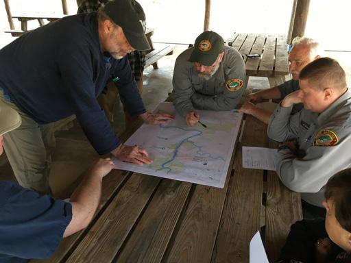
MAPPING WITH PARK STAFF
SITE VISIT AT THE NORTH AND SOUTH MAYO RIVER CONFLUENCE
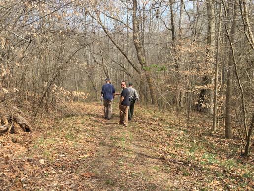
HIKING HICKORY CREEK ACCESS
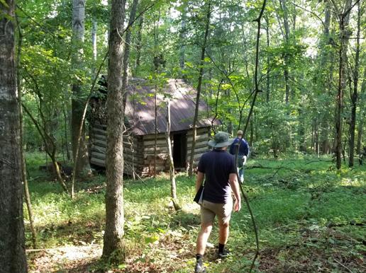
EXPLORING THE FORMER GIRL SCOUT CABIN AT MAYO MOUNTAIN ACCESS
•
•
•
•
•
•
of the data was critical to informing decisions and supporting recommendations.
STAKEHOLDER & COMMUNITY ENGAGEMENT

Typical to large master plan projects such as this, community and stakeholder engagement play an important role in the planning of future improvements. The community and stakeholders bring a wealth of local knowledge and passion to the project. Further, stakeholders, the community and park staff will live with the recommendations of the plan and subsequent improvements to the park. Consensus among the community and stakeholder groups is critical to the success of the plan. If community members do not feel a sense of ownership in the final product, then support will be difficult to come by.
Public engagement took on many forms, including surveys, interviews and community meetings. Traditionally, community engagement would have been conducted in person. However, the Covid-19 pandemic coincided with the planning effort and changed everything. All public meetings were cancelled, and public facilities were closed. A typical community engagement process was no longer possible.
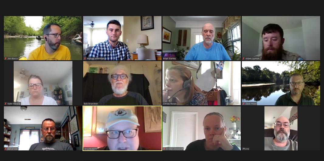
The project team found new ways to communicate and facilitate public involvement. Stakeholder meetings were held virtually using Zoom. A project website was developed that allowed respondents to view GIS data and provide input through an interactive map, online surveys and a project email address. Site visits were conducted with fewer people and more physical distancing.
On October 22nd, two virtual community meetings were conducted, one at noon and the other at 7pm. Each meeting was limited to an hour in duration. Each presentation was identical, consisting of an introduction, a 20-minute video describing the process and the plans and a 30-minute Q&A session. Questions and comments were encouraged through the chat function of the software, allowing everyone an equal opportunity to participate.
The first session had 12-15 attendees while the evening session had 3 attendees. Each session was recorded and will be included in the project archive. Discussion centered around timing of any improvements recommended by the plan, mountain bike and equestrian trails, the dams and safe portage around them, and coordination with local stakeholders.
MAYO RIVER STATE PARK MASTER PLAN 15CHAPTER TWO METHODOLOGY
VIRTUAL MEETING THE MAYO RIVER STATE PARK STAKEHOLDER GROUP
A press release was sent out and the meetings were promoted through social media outlets starting two weeks ahead of the events as well as through the stakeholder group’s networks and on the project website. The video presented during the meetings is posted on DPR’s and Timmons Group social media feeds as well as on the project website. People who were unable to attend the virtual meetings had the ability to view the presentation online and submit comments. This way, everyone received the same information, regardless if they were present for the live meeting. Users are able to provide feedback through the project email address and a form on the project website.
PROJECT WEBSITE
A project website (timmons.mayomasterplan.com) was set up at the beginning of the planning process in April of 2020. The site was intended to disseminate information about the planning process and the plan recommendations to the general public. The site included:
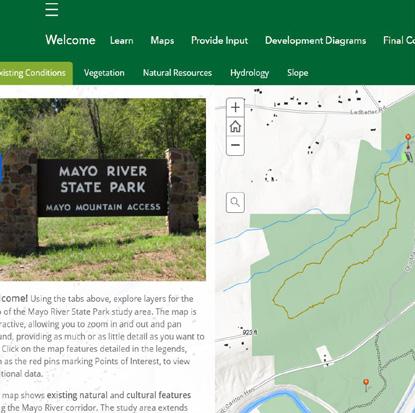
Photo map of key areas
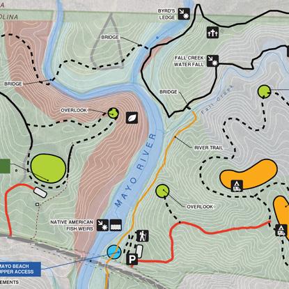
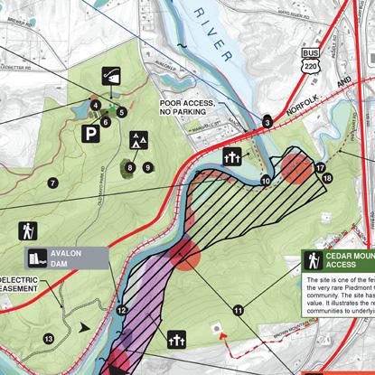
GIS-based maps of important natural and cultural resources
History of the park
Introduction to the planning process and team
Opportunities for public feedback
Development diagram maps
Final recommendation maps and site plan vignettes
Opportunities for feedback were a key component of the website. These opportunities included interactive mapping tools, links to a recreational needs survey, email links and open-response forms. The interactive mapping tools allowed users to draw on maps and make notations about important features. The planning team incorporated this information into their site analysis and plan recommendations.
Throughout the course of the project the website had more than 7,000 page views with daily spikes during community engagement periods. The initial survey had 401 respondents from across the North Carolina and Virginia. Feedback on the final master plan recommendations was minimal. However, the Division will continue to solicit feedback from the community.

MAYO RIVER STATE PARK MASTER PLAN 16 CHAPTER TWO METHODOLOGY
•
•
•
•
•
•
•
WEBSITE
MAPPING
CONCEPT PLAN
PROGRAMMING
MAYO RIVER STATE PARK MASTER PLAN
3
How many miles of mountain bike trails are needed to make it worth the e ort?
0-5 miles 11%
DESIGN TEAM EXPLORING CEDAR MOUNTAIN WITH THE PARK SUPERINTENDANT
6-10 miles 49%
10+ miles 40%
Determining priorities for recreational activities, program and improvements is an important step in the master plan process. The project team received recommendations and perspective from park staff, the stakeholder group and the community. Improved river access, including hiking trails along the river and boat put-in/take-out, and camping were continuously two of the highest priorities among the various groups. Discussions also revolved around including contact stations or a visitor center and limiting development in key areas to protect sensitive environmental and cultural features.
COMMUNITY ENGAGEMENT
How many miles of equestrian trails are needed to make it worth the e ort?
0-5 miles 5.5%
6-10 miles 44.2%
10+ miles 50.3%
To help determine the appropriate program for the master plan, local and state-wide communities were polled to help determine priorities for the park. Early in the process, a recreation needs survey was posted to the project website and stayed open for a month. The survey had a good response rate and respondents were from the Piedmont area of North Carolina as well as the Rockingham/Stokes County areas; however, the survey received responses from other parts of the state as well as Virginia.
While not reflected in our polling, parking and restroom facilities also were identified as important elements that need to be provided. In addition, equestrian and mountain biking also received support. The goal is not to fill the park with intense development, but rather to be purposeful in accommodating program elements where they are most needed while respecting the land, protecting the river and maintaining the feel of a traditional North Carolina State Park.
Where do you live?
North Carolina Piedmont 58.1%
Rockingham County 22.2%
Stokes County 4.7%
Other 4.2%
North Carolina Mountains 4%
North Carolina Coast 3.5%
Virginia 3.3%

MAYO RIVER STATE PARK MASTER PLAN 18 CHAPTER THREE PROGRAMMING
How often do you visit Mayo River State Park 150 200 200 250

MAYO RIVER STATE PARK MASTER PLAN 19CHAPTER THREE PROGRAMMING * Respondents could select multiple answers * Respondents could select multiple answers 50.6% Drive Up / Car Camping 46.9% Kayak & Canoe Put-in / Take-out 46.6% Hiking Trails Along The River 25.2% Beach / Swimming 15.5% Fishing 14.7% Tubing 10.5% Contact Station 6.7% Visitor Center 2.2% None - Keep People Away From the River 38.2% Mountain bike trails 37.1% Equestrian trails 33.6% Hiking 31.9% Camping 19.7% Kayaking - at water 13% Canoeing 12.7% Kayaking - white water 10.7% Vistor Center 10.2% Swimming 9.7% Picknicking 8.2% Community activities 6.7% Historical interpretation 3.7% Bird watching 3.7% Other 0 50 100 150 200 250 0 50 100 150 200 How many miles of mountain bike trails are needed to make it worth the e ort? 0-5 miles 11% 6-10 miles 49% 10+ miles 40% How many miles of equestrian trails are needed to make it worth the e ort? 0-5 miles 5.5% 6-10 miles 44.2% 10+ miles 50.3% * Respondents could select multiple answers 6-10 miles 49% 10+ miles 40% How many miles of equestrian trails are needed to make it worth the e ort? 0-5 miles 5.5% 6-10 miles 44.2% 10+ miles 50.3% North Carolina Piedmont Rockingham County 22.2% Stokes County 4.7% Other 4.2% North Carolina Mountains Where do you live? 50 100 150 200 MOUNTAIN BIKING
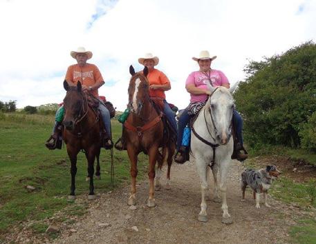
EQUESTRIAN TRAILS (PHOTO PROVIDED BY
A WEBSITE USER) SURVEY RESULTS

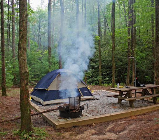
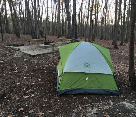
MAYO RIVER STATE PARK MASTER PLAN 20 CHAPTER THREE PROGRAMMING * Respondents could select multiple answers * Respondents could select multiple answers 50.6% Drive Up / Car Camping 28.7% Group Camping 21.5% Full Cabins 19.2% Primitive 12.2% Paddle Up 11.7% Camper Cabins 6.2% None 46.9% Kayak & Canoe Put-in / Take-out 6.7% Historical interpretation 3.7% Bird watching 3.7% Other 0 50 100 150 0 50 100 150 200 CAR / FAMILY CAMPING GROUP CAMPING AT HANGING ROCK STATE PARK
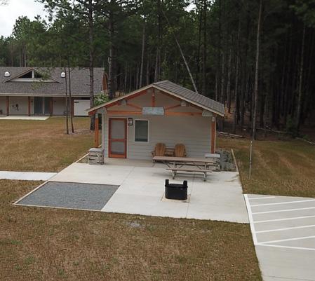
CAMPER CABINS AT RAVEN ROCK STATE PARK
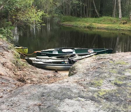
PADDLE-UP CAMPING ACCESS AT LUMBER RIVER STATE PARK
SURVEY RESULTS
RECREATIONAL NEEDS

The survey provided questions related to recreational needs at the park, as well preferences for types of river access needed and camping. The survey also contained questions related to the demographics of respondents. The demographics were used only to understand the reach of the survey and the diversity of respondents.
The survey identified camping, boat access, equestrian trails and mountain bike trails were the highest priorities for recreational needs. Car/family camping and group camping were identified as the most needed types of camping. The most needed types of river access were identified as hiking trails along the river, kayak and canoe put-in and take-out opportunities, and swimming access. Survey results confirmed reports and anecdotes from Parks staff.
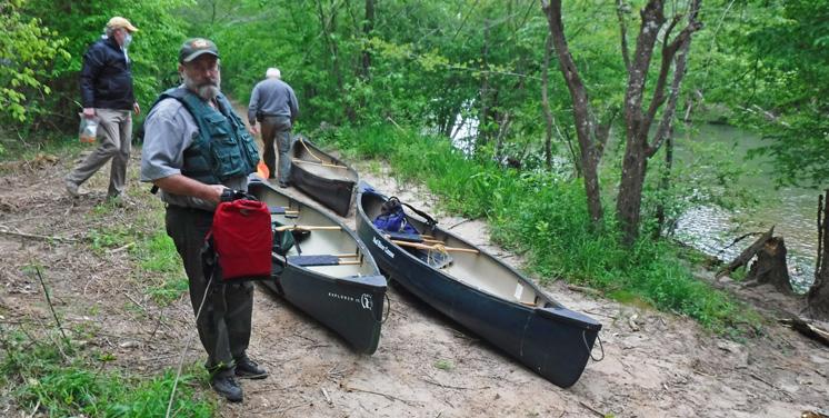
Equestrian and mountain bike trails ranked highly with the survey respondents. Trails of this nature are currently accessible or planned in other State Parks located in Rockingham County and adjacent counties. It will be important to understand the greater network of recreational activities in this region to identify recreational priorities. In order to build sustainable trails and provide adequate separation, Division guidelines suggest approximately 130 acres per mile of equestrian trails and approximately 40 acres per mile of mountain bike trails, with a minimum of 5 miles of bike trails and 10 miles of horse trails. The State currently does not own enough contiguous property to accommodate these types of trails based on the requirements stated above. The Division will re-evaluate the inclusion of bike and horse trails as they acquire additional property.

MAYO RIVER STATE PARK MASTER PLAN 21CHAPTER THREE PROGRAMMING * Respondents could select multiple answers * Respondents could select multiple answers 11.7% Camper Cabins 6.2% None 46.9% Kayak & Canoe Put-in / Take-out 46.6% Hiking Trails Along The River 25.2% Beach / Swimming 15.5% Fishing 14.7% Tubing 10.5% Contact Station 6.7% Visitor Center 2.2% None - Keep People Away From the River 0 50 100 150 200 250 0 50 100 150 200
BOAT PUT-IN/TAKE-OUT ALONG THE MAYO RIVER
HIKING AT HANGING ROCK STATE PARK
STAFF FACILITIES
Outside of the survey, there was discussion revolving around the need for a visitor center and/or contact stations. Visitor centers tend to be larger and accommodate various functions such as park offices, restrooms and community space. A contact station is smaller than a visitor center and includes a park office, public restroom and a small community space.
Staff has identified the need for an expanded maintenance facility. As the park has grown, the need for more lay down area and the ability to more safely manuever vehicles around the maintenance area within the fencing has been noted.
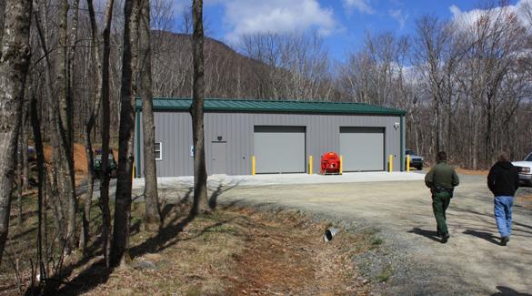
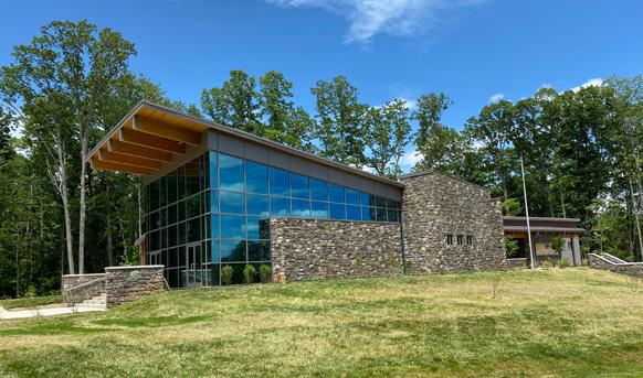
Mini-maintenance facilties, which typically consist of a single bay enclosed garage, a single bay pole barn and a small lay down area, also were identified as important to consider. These facilities often are fenced in for security and safety. In several areas, as the Park develops and visitation increases, the inclusion of these facilities will need to be further evaluated.
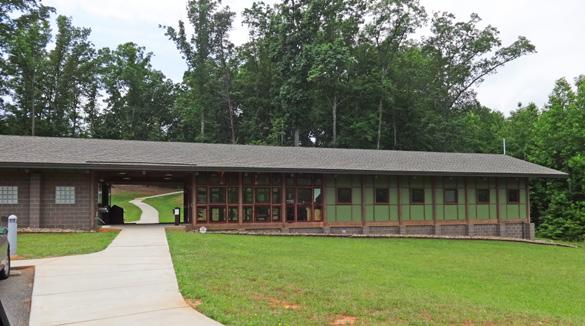
PARTNERSHIPS
Partnership and collaboration opportunities also were identified through this process. Land owned by the Virginia State Parks system connects to the Mayo River State Park at the confluence of the North and South forks of the Mayo. The area between the North and South Mayo presents an excellent opportunity for a number of recreational opportunities including camping, boat access and a possible visitor center or contact station.

The former Washington Mills site also was identified as a strong candidate for partnership and collaboration with the Town of Mayodan. River access (boat access and trails) and historical interpretation are potential activities that can be accommodated at this site.
There is park land is in Madison, though it is disconnected from the rest of the recreational areas. A partnership would strengthen the continuity between the Park and the Town.
As partnership opportunities are explored, further planning efforts will need to be undertaken.
MAYO RIVER STATE PARK MASTER PLAN 22 CHAPTER THREE PROGRAMMING
VISITOR CENTER AT PILOT MOUNTAIN STATE PARK
CONTACT STATION AT CROWDER MOUNTAIN STATE PARK AT BOULDERS ACCESS
MAINTENANCE FACILTIIES AT ELK KNOB STATE PARK
! ! ! ! ! ! ! ! ! ! ! US220BUS LEDBETTER RD TWINSPRINGSRD MAYO RIVER RD BREWERRD OLD M AYO PARK RD TAINRD PE DDLE RD BROWN MOUNTAIN RD PHEASANT RD AVALONLP NB NC 135 OFF RAMP OYCESCHOOLRD P FRONTAGE RD MARSHALL ST SB US 220 BUS O D R MOUNTAINRD SANDPITRD U S 2 2 0 MAYO RIVER STATE PARK MASTER PLAN SITE INVENTORY & ANALYSIS4
Themapping of conditions along the Mayo River corridor was an important part of the master plan process. Spatial mapping allowed the team to better understand the existing ecological and cultural resources along with the existing natural features.
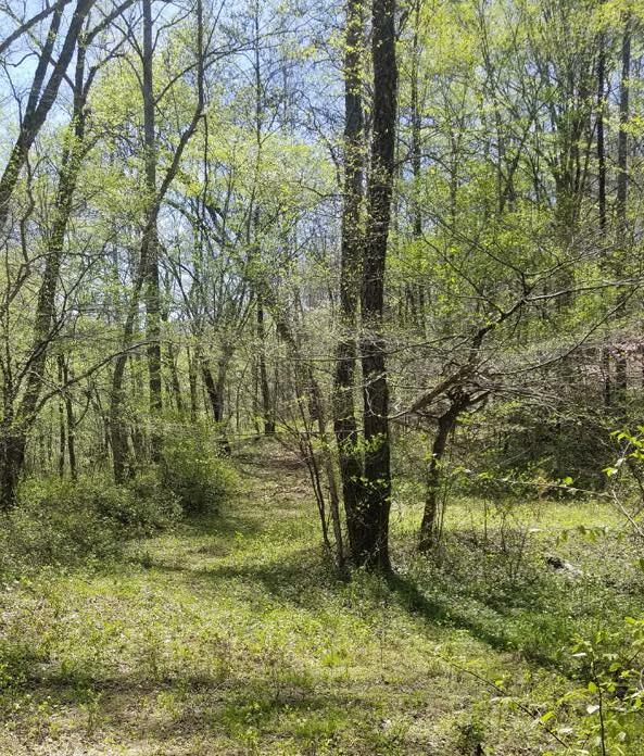
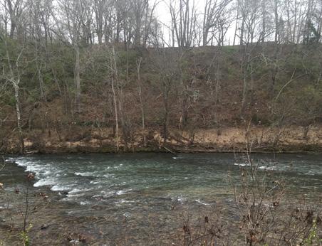
Through the years the Division has collected various levels and forms of spatial data through field research and desktop review. This data was provided to the team early in the process and was analyzed using ArcGIS software. The data includes, but is not limited to:
Hydrology (wetlands, floodplains, streams & creeks)
Cultural features (trails, dams, easements, park facilities)
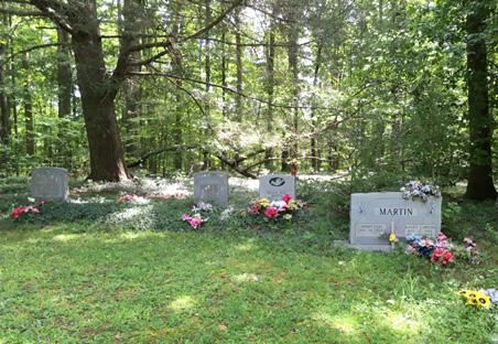

Typography
Endangered species (plants and animals)
Natural resources
Vegetation types
A thorough analysis of the data through spatial layering allowed for a deeper understanding of the river corridor. Analyzing the various layers of data and their relationships was important to understanding what resources need to be protected as well as where the opportunities for improvements were possible. By layering the data on spatial maps, the team was able to identify opportunities and challenges for future development and improvements. For example, areas that were lacking endangered species, were near a road and were on relatively flat ground might provide an opportunity for development. Conversely, areas along the river with steep banks, sensitive ecology and floodplains were thought of to be poor choices for new river access points.
A clear and thorough understanding of the data was critical to informing decisions and supporting recommendations.
MAYO RIVER STATE PARK MASTER PLAN 24 CHAPTER FOUR SITE INVENTORY & ANALYSIS
•
•
•
•
•
•
A
FAMILY CEMETARY
STEEP BANKS ALONG THE RIVER
FLOODPLAIN AT HICKORY CREEK ACCESS

MAYO RIVER STATE PARK MASTER PLAN 25CHAPTER FOUR SITE INVENTORY & ANALYSIS A bus USGS NGA NASA CG AR NCEAS NLS OS NMA Geoda as y e sen GSA GS and he G S Use Commun y A b USGS NGA NASA CG AR NCEAS NLS OS NMA G d y GSA GSI d h G S U C ty [0 5,000 10,0002,500 Feet MAYODAN STONEVILLE MADISON VIRGINIA NORTH CAROLINA ROCKINGHAM COUNTY STOKESCOUNTY HENRY COUNTY M A Y O RIVER HICK O R Y CREEK PAWPAW CREEKBUFFALOCREEK DANRIVER 770 704 135 220 FALL CREEK WATERFALL CEDAR MOUNTAIN NORFOLK AND WESTERN RAILROAD FARRIS MEMORIAL PARK PIEDMONT LAND CONSERVANCY EASEMENT MAYO MOUNTAIN LOOP TRAIL WASHINGTON MILLS SITE TO MARTINSVILLE, VA TO GREENSBORO, NC 0 1 2 3 4 5 6 7 8 9 10 11 12 13 14 15 WASHINGTON MILLS DAM AVALON DAM MAYO BEACH UPPER ACCESS MAYO BEACH LOWER ACCESS S.R. 704 ACCESS (NOT STATE OWNED) HWY 135 ACCESS BUS 220 ACCESS (NOT STATE OWNED) DESHAZO MILL ACCESS MAYO MOUNTAIN ACCESS A bus USGS NGA NASA CG AR NCEAS NLS OS NMA Geoda as y e sen GSA GS and he G S U e Commun y [0 5,000 10,0002,500 Feet A b USGS NGA NASA CG AR NCEAS NLS OS NMA G d y GSA GS d h G S U C [0 5,000 10,0002,500 Feet MAYODAN STONEVILLE MADISON VIRGINIA NORTH CAROLINA ROCKINGHAM COUNTY STOKESCOUNTY HENRY COUNTY M A Y O RIVER HICK O R Y CREEK PAWPAW CREEKBUFFALOCREEK DANRIVER 770 704 135 220 FALL CREEK WATERFALL CEDAR MOUNTAIN NORFOLK AND WESTERN RAILROAD FARRIS MEMORIAL PARK PIEDMONT LAND CONSERVANCY EASEMENT MAYO MOUNTAIN LOOP TRAIL WASHINGTON MILLS SITE TO MARTINSVILLE, VA TO GREENSBORO, NC 0 1 2 3 4 5 6 7 8 9 10 11 12 13 14 15 WASHINGTON MILLS DAM AVALON DAM MAYO BEACH UPPER ACCESS MAYO BEACH LOWER ACCESS S.R. 704 ACCESS (NOT STATE OWNED) HWY 135 ACCESS BUS 220 ACCESS (NOT STATE OWNED) DESHAZO MILL ACCESS MAYO MOUNTAIN ACCESS OVERALL CORRIDOR MAP / EXISTING CONDITIONS MAYO RIVER STATE PARK ROADS RAILWAY CITY LIMITS WATERWAYS RIVER MILE MARKER EXISTING LAUNCH EXISTING PARK ACCESS CONSTRAINT LEGEND 14
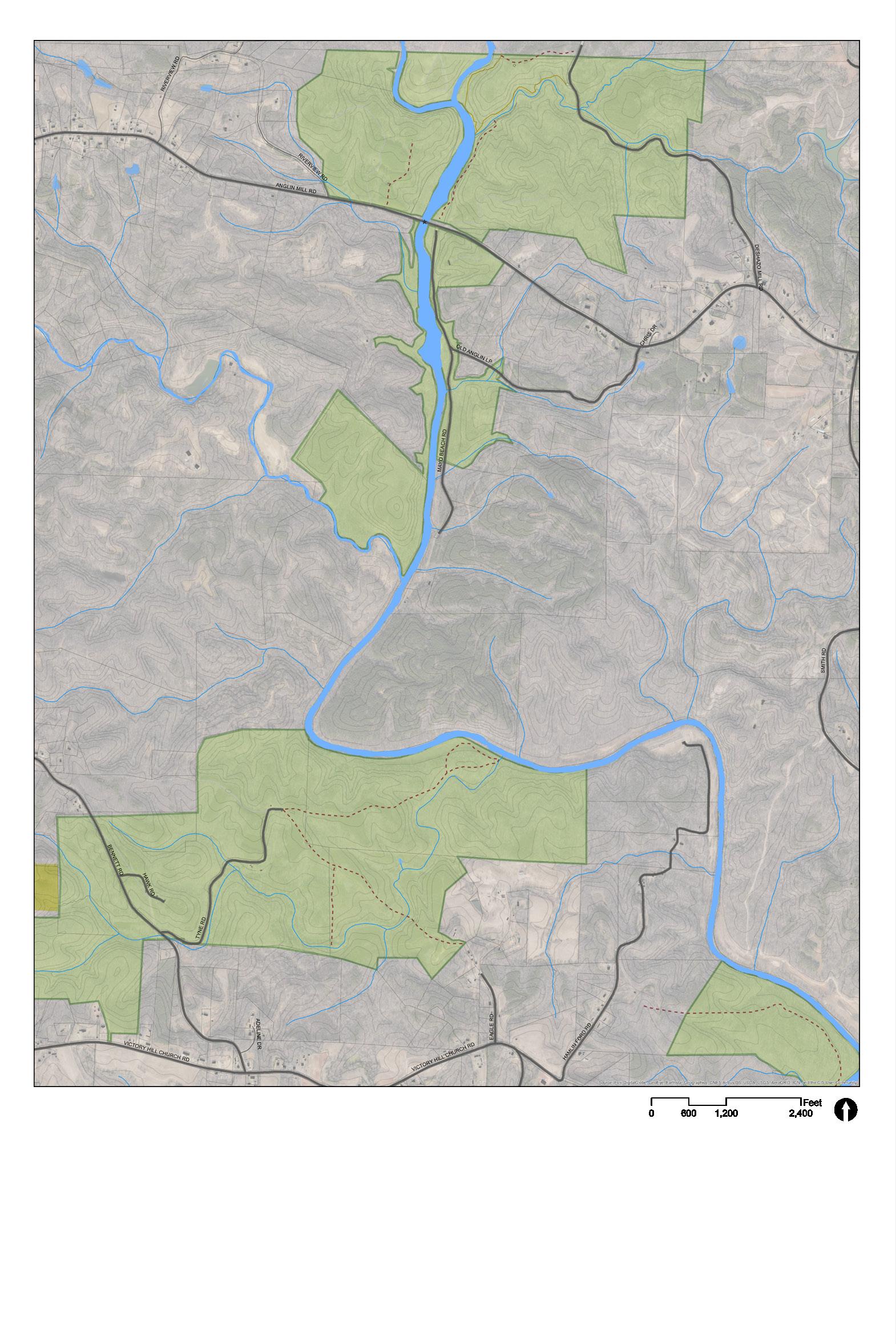
VIRGINIA NORTH CAROLINA ROCKINGHAM COUNTY B U F F A LO CREEK FALLCREEK F O R K N O R T H S O U T H FORK 1 1 2 FALL CREEK WATERFALL DESHAZO MILL ACCESS MAYO BEACH UPPER ACCESS MAYO BEACH LOWER ACCESS EXISTING CONDITIONS MAYO R I V E R 12 3 4 5 6 7 8 LEGEND MAYO RIVER STATE PARK SOCIAL TRAILSTRAILSROADSBUILDINGS RIVER MILESRAILWAY 3-5 h 8 mi
DESHAZO MILL ACCESS TRAILHEAD
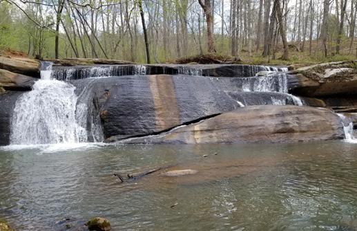
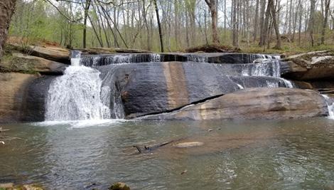
This site is the trailhead for Fall Creek Falls and the Mayo River Trail, a 1.3-mile out and back trail that features a waterfall and is good for all skill levels. There are currently no restroom facilities. There is however, a small parking lot access, with several picnic tables and grills.
FALL CREEK WATERFALL
The trail from Deshazo Mill Access follows along Fall Creek to the 1520-foot waterfall. Remnants of the mill structure’s foundation remain.
BYRD’S LEDGE
The North Mayo slowly winds from Virginia into North Carolina until it joins with the South Mayo to form the Mayo River. Bryd’s Ledge sits along the North Mayo and is a rock outcropping that was a landmark when the state line was surveyed and named for Mr Byrd. An abandoned roadbed follows the river allowing for easy pedestrian access to Byrd’s Ledge and to Virginia State Park land.
FISH TRAPS
Several well-preserved fish weirs (fish traps) built by American Indians can be spotted while paddling the Mayo. They were built by some of the earliest humans to live along the Mayo, the Dan River culture, believed to be ancestors of the Saura Indians who left the basin after 1700. Woodland village sites existed near the weirs. Fragments of tobacco pipes, arrowheads and pottery have been found along the riverbanks and feeder streams.
BOILING HOLE
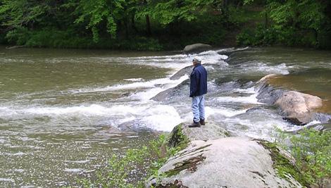
This is the only Class III rapid along the Mayo River. This is also a popular spot among local residents to spend time on the river and fish. There are currently no restroom facilities or formal parking at this location.
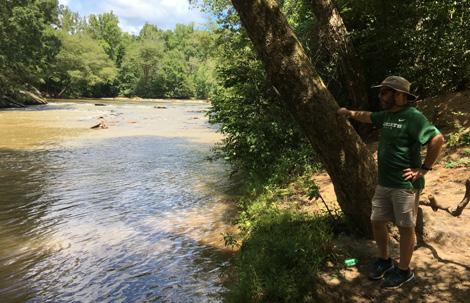
MAYO BEACH
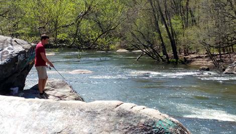
Mayo Beach, also referred to as “Anglin Mill Beach”, is a popular spot for those preferring to swim, fish and tube. It is not uncommon to see a large crowds of people using the beach on weekends. No restrooms or formal parking are currently provided in this area.
MAYO BEACH UPPER RIVER ACCESS
This access is directly below Anglin Mill Bridge. The access includes a concrete boat ramp. The next takeout is 1.5 miles downstream at the Mayo Beach Lower Access.
MAYO BEACH LOWER RIVER ACCESS
This river access is accessible via Anglin Mill Loop Road. This river access is unimproved and there is no formal parking. The next available take out for paddlers in located adjacent to the BUS 220 Bridge, which is not on State Park property.

MAYO RIVER STATE PARK MASTER PLAN 27
CHAPTER FOUR SITE INVENTORY & ANALYSIS
FALL CREEK WATERFALL
ROCK OUTCROPPINGS IN THE MAYO RIVER AT BYRD’S LEDGE
FISHING IS POPULAR AT THE MAYO BEACH ACCESS AREA
MAYO BEACH LOWER RIVER ACCESS
3 1 4 2 5 6 7 8
HICKORY CREEK INFORMAL TRAILHEAD
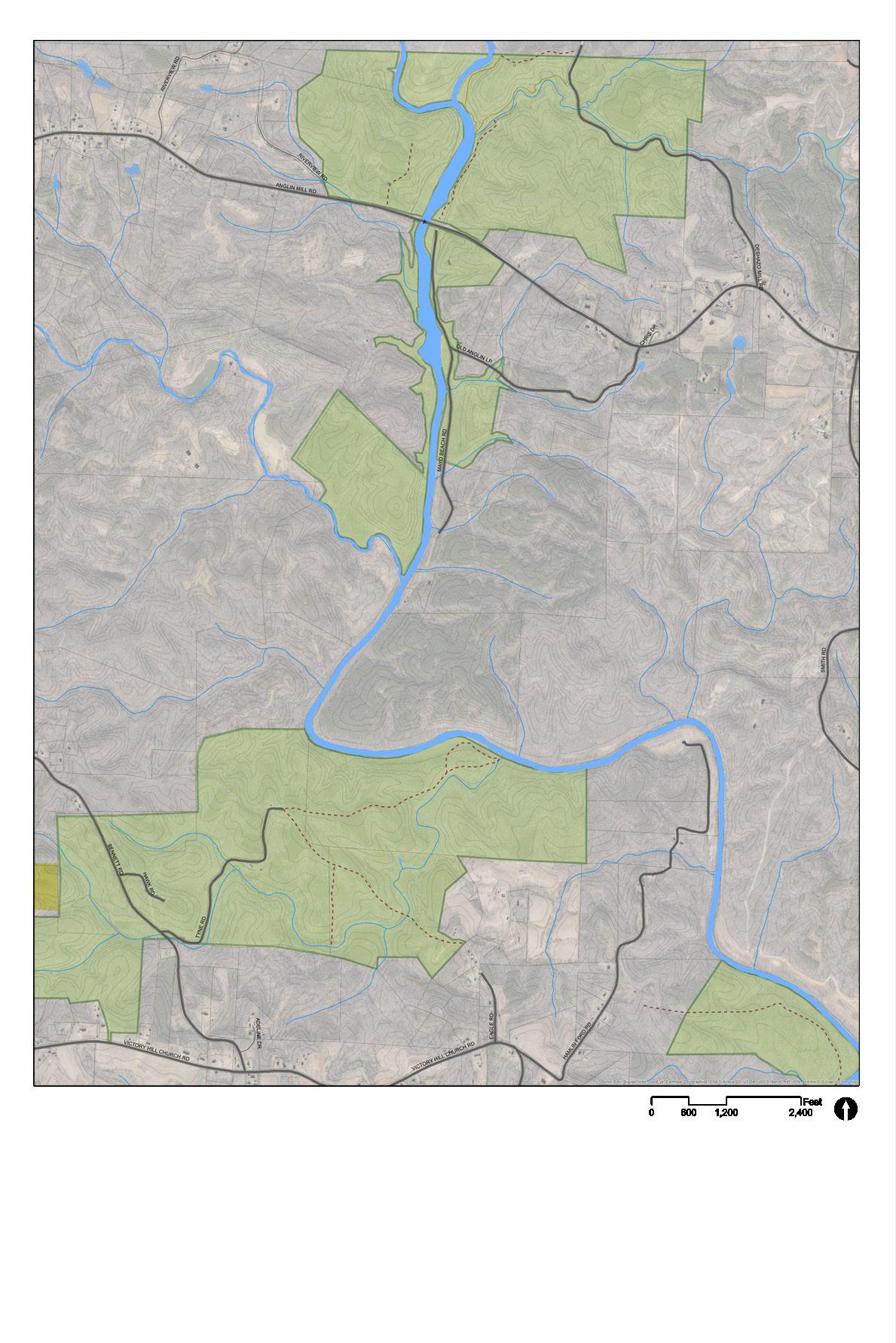
Hickory Creek trailhead is an unimproved trailhead at the end of Tyne Road. From here, hikers can walk down a .75 mile abandoned roadbed to the banks of the Mayo. The small gravel parking area can accommodate about 6 cars. No other facilities are available here.

HICKORY CREEK & MAYO RIVER CONFLUENCE

Hickory Creek flows through park property until it joins the Mayo. The banks of the Mayo River and Hickory Creek are protected by an Ecosystem Enhancement Program (EEP) Easement within the boundaries of this Park parcel. The easement restricts any and all development, with the exception of buffer maintenance activities, within 300 feet of the water bodies in perpetuity. Formal river access or access to the creek is prohibited due to the EEP easement.

MAYO RIVER STATE PARK MASTER PLAN 28 CHAPTER FOUR SITE INVENTORY & ANALYSIS
HICKORY CREEK FLOWS INTO THE MAYO 2 HICKORY C R E E K EXISTING CONDITIONS MAYORIVER 9 10 9 10 8MAYO RIVER STATE PARK SOCIAL TRAILSROADSBUILDINGS RAILWAY LEGEND
JOYCE FORD ROAD ENTRY ACCESS
Joyce Ford Road, south of US 770, dead ends onto park property where a homestead once stood. The land here is relatively flat and open. A former roadbed leads from Joyce Ford Road to the river.
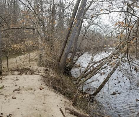
JOYCE FORD ROAD RIVER ACCESS
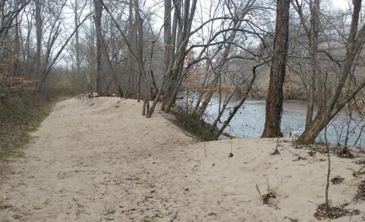
It’s a steep decent from Joyce Ford Road to the river, but once at the river a wide swath of land along the water’s edge is flat. White sand has washed onto the banks creating a unique landscape.
SOCIAL TRAILS
Social trails exist throughout the river corridor; however, they are more plentiful in this section. Many trails are wide enough to accommodate utility vehicles and could be converted to formal trails with little effort. Trails will be evaluated to determine suitability for long-term sustainable trail alignment.


MAYO RIVER STATE PARK MASTER PLAN 29CHAPTER FOUR SITE INVENTORY & ANALYSIS C I N N A M EVANS RD CHANEYLP JOYCEFORDRD MOSSDALERDRIDGETOPLN So urce: Esri, Dig italGlo be, Geo Eye, Ea rth sta r Ge og rap hics, CNES/Airbu s DS, USDA, USGS, AeroGRI D, IGN , an 0 1,200 2,40600 F
THE MAYO AT THE JOYCE FORD ROAD ACCESS 8 M AYO RIVER 11 12 11 12 13 13 8MAYO RIVER STATE PARK SOCIAL TRAILSROADSBUILDINGS RAILWAY LEGEND
MAYO MOUNTAIN ACCESS AND PICNIC AREA


The Mayo River State Park’s current central facility, Mayo Mountain Access, opened to the public on April 1, 2010. Located at the site are a park office/visitor contact station, picnic shelter with grills, three individual picnic pads each with table and grill, restrooms, 0.5-mile loop hiking trail, 1.8-mile loop hiking trail and ponds for fishing. Group camping is also available. There is an NC State Historical Preservation Office historic designation for the area.
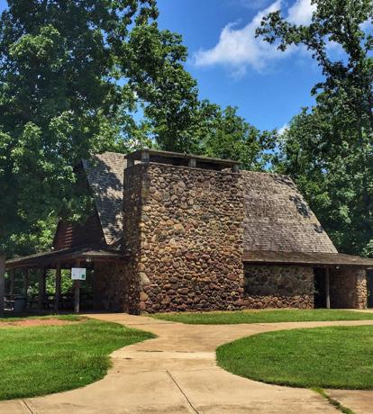
HISTORIC SHELTER
The original park owner, Washington Mills Company, commissioned renowned architect Antonin Raymond to design the park buildings. Raymond’s architectural design was intended to blend with the densely wooded surroundings. The park’s picnic shelter has been renovated to ensure visitors can enjoy Raymond’s Japanese-style architectural influence for years to come. The column and rafters consist of hickory, the main roof is covered with cedar shingles, and the fireplace is made from local stones. The picnic shelter accommodates up to 100 people and may be reserved.
MAYO RIVER STATE PARK MASTER PLAN 30 CHAPTER FOUR SITE INVENTORY & ANALYSIS U S 2 2 0 US220BUS NC 135 LEDBETTER RD 2 N D A V E F R Y E R D TWINSPRINGSRD 3RD AVE MAYO RIVER RD 4TH AVE BREWER RD O L D M A Y O P A R K R D PEXTILE PLANT RD CEDARMOUNTAINRD P E D D L E R D BROWNMOUNTAINRD AVALON HEIGHTS TR 1ST AVE 5TH AVE UTILITYST P H L P O T T P H E A S A N T R D AVALONLP NB NC 135 OFF RAMP CESCHOOLRD SB NC 135 ON RAMP FRONTAGE RD MARSHALLST MADISON ST SHAKEY RD SB US 220 BUS ON RAMP C O M M E R C E D R MAYOMOUNTAINRD WILDLIFEDR NB US 220 BUS ON RAMP VANBUREN ST ROACHST PEACH ORCHARD RD JACKSON ST B US O FF RAM P MOUNTAINRD SANDPITRD 1ST AVE LP U S 2 2 0 JACKSONST N a d he G S Use Co u y [400 Feet
HISTORIC SHELTER AT MAYO MOUNTAIN ACCESS 11 12 13 EXISTING CONDITIONS MAYO R I V E R MAYODAN CEDAR MOUNTAIN MAYO MOUNTAIN LOOP TRAIL AVALON DAM BUS 220 ACCESS (NOT STATE OWNED) MAYO MOUNTAIN ACCESS NORFOLK&WESTERN RAILROAD 14 15 16 17 18 19 20 22 21 14 15 MAYO RIVER STATE PARK SOCIAL TRAILSTRAILSROADSBUILDINGS RAILWAY LEGEND EXISTING LAUNCH EXISTING PARK ACCESS CONSTRAINT
AVALON MILL SITE
This is where Avalon Mill stood around the turn of the 20th century. The Avalon village was located to the west of the railroad. A fire destroyed the mill in 1911 and the village was eventually abandoned. Mill village structures were relocated to Mayodan.
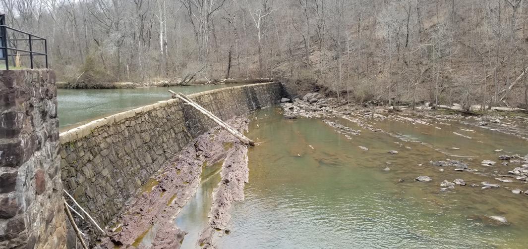
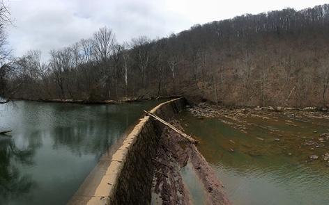
AVALON DAM
Avalon Dam is one of two hydroelectric dams located south of Highway 220 Business bridge. The Avalon Dam was built 2 miles east of Mayodan in 1899 to power operations at the Avalon Mill. The dams are still in operation today, managed by Piedmont Hydro Technologies, LLC, and are a source of renewable electricity generation. There is currently no safe portage around the dam for paddlers.
BUSINESS 220 RIVER ACCESS
River access in located on private property and is maintained by a partnership including Rockingham County and Dan River Basin Authority. Located beside and to the west of the U.S. 220 Business bridge, this access provides a takeout for paddlers. Paddlers need to exit the river at the bridge because passage is blocked by dams further down river. The approach to the takeout is challenging and existing stairs are prone to sedimentation. A gravel parking area for the river access is located on Town of Stoneville property. There is approximately 6 parking spaces and currently no restroom facilities available. The Division is interested in providing more opportunities for river access on state property in this general location.
SANDY BEACH
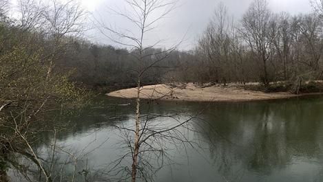
The broad sandy beach area is located on the southwest side of the Mayo River, just downstream from US 220 Business crossing and railroad bridge. Currently there is no public access to this area.

CEDAR MOUNTAIN
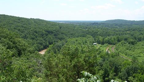
Cedar Mountain is a hogback mountain along the Mayo River’s east bank opposite the town of Mayodan. The natural area occupies steep NW-facing slopes that overlook the river south of Avalon Dam. The site is one of the few occurrences of the very rare Piedmont Calcareous Cliff community and should be protected. The site has high educational value. It illustrates the relationship of plant communities to underlying soils and geology.
CEDAR MOUNTAIN (NORTH SIDE)
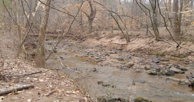
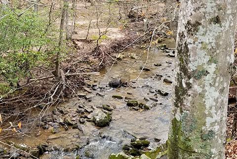
An unnamed creek flows along the northern side of Cedar Mountain. Easy access from US 220 and an old roadbed that follows the creek create development opportunities for this picturesque creek in the woods.
NORFOLK & WESTERN RAILROAD
The Norfolk & Western Railroad was formed in 1881. The railroad is currently still in use transporting freight. The railway creates a barrier for accessing the river in several locations along the Mayo River corridor.
MAYO RIVER STATE PARK MASTER PLAN 31
CHAPTER FOUR SITE INVENTORY & ANALYSIS
AVALON DAM
SANDY BEACH SOUTH THE BUS 220 ACCESS
CREEK ON THE NORTH SIDE OF CEDAR MOUNTAIN
CEDAR MOUNTAIN
18 16 19 17 20 21 22


MAYO RIVER STATE PARK MASTER PLAN 32 CHAPTER FOUR SITE INVENTORY & ANALYSIS 2ND AVE RIVERRD H AVE ACADEMY ST 3RD AVE 4TH AVE DECATUR ST MAIN ST HUNTER ST H I G H W A Y S T M A R K E T S T MURPH Y ST 1ST AVE F R A N K L N S T WALLRD WATER ST W L S O N S T IDOL ST D A H L S T LAUTEN LP RIDGEST CEDARMOUNTAINRD AYERSVILLERD C U R E D R CARDWELL RD ALE NICH OLS ST D A L T O N S T P E N N S T CARDWELL ST TAFT ST GENE HAIRSTON ST FERN ST ADAMS ST W A L L S T L DAVIE LN E ST SHORT AVE CARTER ST R I D G E R D WRAYST N R D CHIEF MARTIN ST BURTON ST WHITERD G A L L O W A Y S T W E S T E N D B L V D WOOTEN ST H W C I R 12TH AVE POOLE RD HORSESHOE RD V A U G H N ROOSEVELTST TIDBALL AVE LUOLA ST L O N E S O M E R D PEMBRO ST SUNSET AVE EDMUND ST PINE ST COBB ST BE SHAFFER DR VALLEY V I EW DR LA S H A L E R D PUZAK LN COLLINS ST AWRD WILDLIFEDR WHITBECKDR CEMETERY ST MCGEEHEE ST JACKSON ST HAIRSTONE RD R A N D S T ROCKINGHAM SQUARE PARKER ST B Y R D A V E MTCARMELST MOUNT BOSWELL ST MEBANE ST MAYORD PRATT ST PINEWOOD DR GARFIELD ST OAK GROVE AVE BLACKBURNST BLOSSOM LN WASHINGTON MILLS RD LESUEURDR K U Y K E N D A L L S T F I R S T S T MADISON ST HUNTER ST W A L L S T ERSON ST JACKSON ST T 14 15 EXISTING CONDITIONS M A Y O R I V E R D AN RIVER WASHINGTON MILLS DAM MAYODAN MADISON 135 704 HWY 135 ACCESS 23 24 25 26 27 MAYO RIVER STATE PARK SOCIAL TRAILSROADSBUILDINGS RAILWAY LEGEND
WASHINGTON MILLS DAM
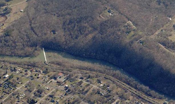
The Mayo Mills company dammed the Mayo River to generate electricity for its textile mill around the turn of the 20th Century. While the mill structure has since been demolished, the dam still exists and produces hydro-electic power. The dam creates a barrier for boating on the river and portage around the dam is unsafe.
WASHINGTON MILLS SITE

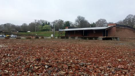
The site of the former Washington Mill is nearly 18 acres in size. A private site developer purchased the property in 2012 and demolished approximately 95% of the buildings. The debris from demolition is still located on site and the extent of environmental contamination is unknown. The Town of Mayodan acquired the property in late 2016. Currently, the Town is working with the Piedmont Triad and NC Brownfields program to identify strategies to clean up the site.
HWY 135 RIVER ACCESS
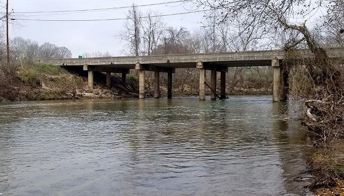
River access is located to the south of NC 135 in Mayodan. There is an existing gravel parking lot that can accommodate several vehicles; however, it is not ADA compliant. It is a short walk from the parking area to the river allowing for easy canoe or kayak launch. Paddlers putting in at the Route 135 Access can continue their journey to the Dan River confluence and beyond. The 704 access is located less than a mile upstream of the confluence. The Settlers Bridge Access is the next available access downstream on the Dan river and is a much longer 8-mile journey. An interim access may provide opportunity for tubers looking for a shorter trip.

SALEM-PETERSBURG ROAD SITE
Remnants of the old Salem-Petersburg wagon road can be seen in this area of the park. There is an existing tunnel under the railroad.
DAN VALLEY ROAD BRIDGE
This is the last bridge to cross the Mayo River before it joins with the Dan River. Piers from the previous stone bridge still remain on the banks of the river.
MAYO RIVER STATE PARK MASTER PLAN 33
CHAPTER FOUR SITE INVENTORY & ANALYSIS
AERIAL VIEW OF WASHINGTON MILLS DAM
HISTORIC PHOTO OF WASHINGTON MILL
FORMER WASHINGTON MILL SITE
HWY 135 BRIDGE
25 23 26 27 24
VEGETATION
NATURAL RESOURCES
The Mayo River is home to a diverse ecology, including vegetation and animals, and protection of the river should be an important part of the master plan. The water is noted for it’s lack of contaminants and is home to rare and endangered species. The vegetation along the corridor and in the areas surrounding the park have been documented and analyzed by Natural Resources staff.
The forest types surrounding the park, while mostly common to the area, are important to note as they may lend clues to the health of the ecosystem and the presence of habitat for rare and endangered species. Notably, the river is home to the basic mesic forest, which is often rare and are home to endangered species. Ten rare plant species as well as ten or more species on the NC Natural Heritage Program Watch List occur in Basic Mesic Forests throughout the Piedmont.
Protection and conservation of the various forest types is critical to protecting the health of the river corridor. Ensuring the health of the forest types will reduce erosion and sedimentation, filter stormwater runoff and maintain the habitat for sensitive species.
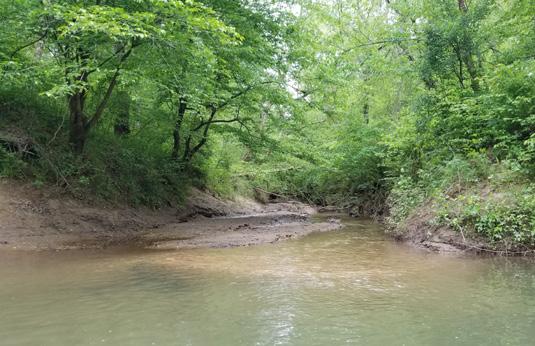
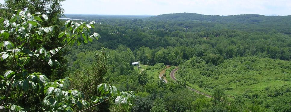
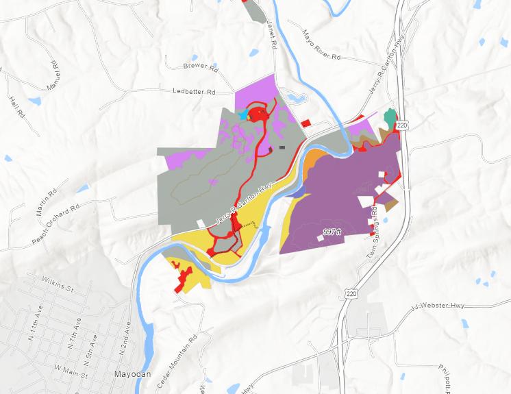
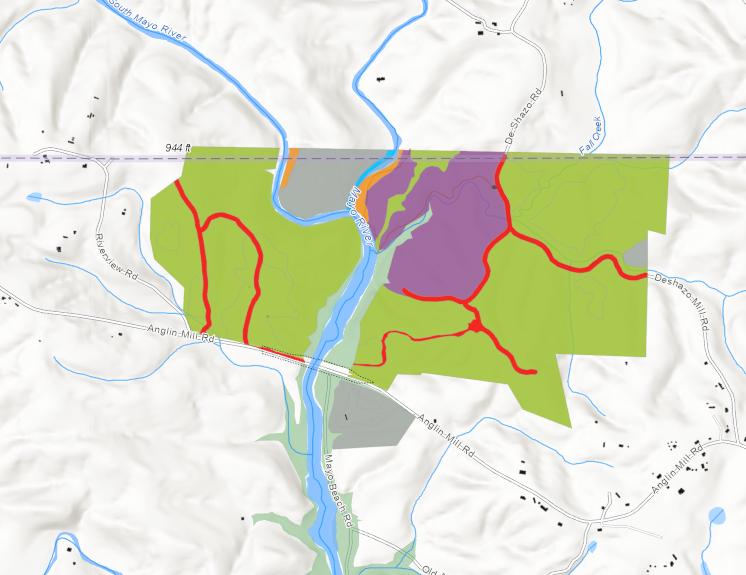
The following maps illustrate existing vegetation and natural communities within Mayo River State Park and detailed forest type definitions can be found in the Appendix.

MAYO RIVER STATE PARK MASTER PLAN 34 CHAPTER FOUR SITE INVENTORY & ANALYSIS
VIEW FROM CEDAR MOUNTAIN
SMALL CREEK JOINING THE MAYO RIVER
/
-Mesic Oakory Forest (Piedmont Subtype) ermanently Disturbed
Mesic Forest (Piedmont Subtype)
Mayo River State Park Vegetation Vegetation
Mixed Hardwood Forest (Piedmont Subtype)
Piedmont Levee (Typic ype)
Basic Oak ory Forest Water
Piedmont Alluvial
-Mesic Oak ory Forest (Piedmont Subtype) Piedmont Basic (Typic ype)

LEGEND VIRGINIA
Dry-Mesic OakHickory Forest (Piedmont Subtype)
Previously Disturbed
Dry-Mesic OakHickory Forest (Piedmont Subtype) Permanently Disturbed
NORTH CAROLINA
DESHAZO MILL ACCESS
Basic Mesic Forest (Piedmont Subtype)
Basic Mesic Forest (Piedmont Subtype)
Mesic Mixed Hardwood Forest (Piedmont Subtype)
Mesic Mixed Hardwood Forest (Piedmont Subtype)
Piedmont Levee Forest (Typic Subtype)
Piedmont Levee Forest (Typic Subtype)
Dry Basic Oak Hickory Forest Open Water
Dry Basic OakHickory Forest Open Water
Piedmont Alluvial Forest
Piedmont Alluvial Forest
Dry-Mesic Oak Hickory Forest (Piedmont Subtype)
Piedmont Basic Glade (TypicVegetation
Dry-Mesic OakHickory Forest (Piedmont Subtype)
Piedmont Basic Glade (Typic Subtype)
Other
MAYO MOUNTAIN ACCESS
MAYO MOUNTAIN AND CEDAR MOUNTAIN ACCESS VEGETATION
MAP
CEDAR MOUNTAIN ACCESS
OTTER
NATURAL AREAS
NATURAL RESOURCES
DATABASES REVIEW
Timmons Group completed a database review of protected and rare species for the Mayo River project site utilizing the site boundary and a 1-mile radius.
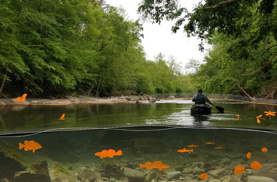
Databases reviewed included:
US Fish & Wildlife Service Information Planning and Conservation (IPaC) database (Raleigh, Asheville, Virginia)
• NC Department of Natural and Cultural Resources, Natural Heritage Program (NCNHP) database

BIGEYE JUMPROCK
RARE & ENDANGERED SPECIES
The results of this review indicated known occurrences of numerous rare, threatened and endangered species within the project area:
Aquatic federally endangered species:
James spinymussel (Pleurobema collina)
Roanoke logperch (Percina rex)
Terrestrial federally endangered species:
Smooth coneflower (Echinacea laevigata)
Terrestrial threatened & endangered species (NC):
Glade Bluecurls (Trichostema brachiatum)
Jacob’s Ladder (Polemonium reptans var. reptans)
Terrestrial special concern species (NC):
Four-toed Salamander (Hemidactylium scutatum)
Mole Salamander (Ambystoma talpoideum)
MAYO RIVER STATE PARK MASTER PLAN 36 CHAPTER FOUR SITE INVENTORY & ANALYSIS
•
•
•
•
•
•
•
•
RIVER
MAY FLY
EDMUND’S SNAKETAIL
JAMES SPINYMUSSEL
GREEN FLOATER
RIVERWEED DARTER
NOTCHED RAINBOWROANOKE BASS
RARE, THREATENED AND ENDANGERED SPECIES ALONG THE MAYO RIVER CORRIDOR
/
LEGEND
Mayo Mountain State Park
Natural Areas
Natural Areas from the NC Natural Heritage Program that are of special biodiversity significance, due to the presence of rare species, exemplary natural communities, or important animal assemblages.
Endangered Plants
Endangered Animals
Natural Communities
E = Endangered
T = Threatened
SR = Significantly Rare
ST = Significantly Threatened
SC = Special Concern
SR-P = Significantly RarePeripheral
SC-V = Special ConcernVulnerable
Endangered Plants:
Jacob’s Ladder (T)
Southern Loosestrife (SR-P)
Virginia Cup-plant (SC-V)
Endangered Animals:
Edmund’s Snaketail (SR)
Mayfly (SR)
Natural Communities:
Basic Mesic Forest (Piedmont Subtype)
(Vulnerable to extinction)
Endangered Animals:
Riverweed Darter (SR)
Bigeye Jumprock (T)
Green Floater (E)
James Spinymussel (E)
Notched Rainbow (T)
Mountain River Cruiser (SR)
* Extends to Avalon Dam
1
DESHAZO MILL ACCESS
CAROLINA
NATURAL AREAS
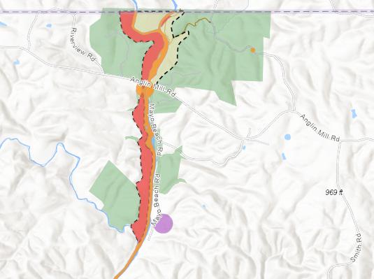
Five (5) significant natural communities/natural areas were identified within the project site:
• Mayo River Anglin Mill Bluffs
• Cedar Mountain
• Mayodan Bluffs
• Mayo River Aquatic Habitat
• Dan River Aquatic Habitat
Natural areas are defined by the NC Natural Heritage Program to be of special biodiversity significance, due to the presence of rare species, exemplary natural communities, or important animal assemblages.

It appears that the majority of these areas are already located within managed conservation areas (including the existing boundaries of Mayo River State Park) but there are some areas which appear outside of these conservation limits.

1
Natural Communities:
Piedmont/Coastal Plain Heath Bluff (Vulnerable to extinction)
Mayo River Anglin Mill Bluffs
Site includes the floodplain and adjacent slopes along the Mayo River near Anglin Mill Road (SR 1358). It extends upstream along both the east and west bank of the river to Virginia and downstream along the west bank to Buffalo Creek. Generally, steep slopes (60-100 ft.) border the Mayo River. The more mesic slopes on the west bank of the Mayo (and South Mayo north of the confluence) support Mesic Mixed Hardwood Forest.
On the steeper slopes where undisturbed by recent logging, the forest is mature with a mixed, unevenaged canopy. Tulip tree (Liriodendron tulipifera) is normally present and is often the dominant canopy tree. Some areas are dominated by Beech (Fagus grandifolia), and various Oaks (Quercus spp.) occur throughout including red oak, white oak and swamp red oak. The largest trees are 30-35” Diameter Breast Height (DBH); many are 10-20”DBH. The understory is open with few shrubs or vines.
FOUR SITE INVENTORY &
MAYO RIVER STATE PARK MASTER PLAN 37CHAPTER
ANALYSIS
DESHAZO MILL ACCESS VEGETATION MAP
VIRGINIA NORTH
NATURAL AREAS
LEGEND
Mayo Mountain State Park
Natural Areas
Natural Areas from the NC Natural Heritage Program that are of special biodiversity significance, due to the presence of rare species, exemplary natural communities, or important animal assemblages.


Endangered Plants
Endangered Animals
Natural Communities
Endangered
Threatened
Significantly Rare
Significantly Threatened
Special Concern
= Significantly Rare -
= Significantly Rare -
= Special ConcernVulnerable
Endangered Animals:
Carolina Ladle Crayfish (SR)
Elm-leaf Goldenrod (SR-D)
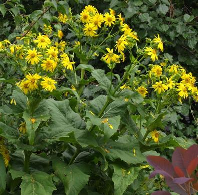
Virginia Stickseed (SR-P)
Other sensitive species
Endangered Animals:
Roanoke Logperch (E)
Bigeye Jumprock (T)
Riverweed Darter (SR)
Roanoke Bass (SR)
Green Floater (E)
Endangered Plants:
Virginia Cup-plant (SC-V)
Natural Communities:
Piedmont Levee Forest (Typic Subtype) (Vulnerable to extinction)
2
CEDAR MOUNTAIN ACCESS
3
Endangered Plants:
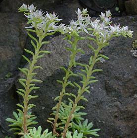
Cliff Stonecrop (SR-P),
Natural Communities:
Piedmont Levee Forest (Typic Subtype) (Vulnerable to extinction)
Dry Basic Oak-Hickory Forest (Imperiled/ Vulnerable to extinction)
Piedmont Basic Glade (Typic Subtype) (Imperiled)
Endangered Plants:
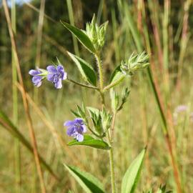
Glade Bluecurls (E)
Natural Communities:
Piedmont Basic Glade (Typic Subtype) (Imperiled)
MAYO RIVER STATE PARK MASTER PLAN 38 CHAPTER FOUR SITE INVENTORY & ANALYSIS
MAYO MOUNTAIN AND CEDAR MOUNTAIN ACCESS NATURAL RESOURCES
MAP GLADE BLUECURLS (E) TRICHOSTEMA BRACHIATUM CLIFF STONECROP (SR-P) SEDUM GLAUCOPHYLLUM VIRGINIA CUP-PLANT (SC-V) SILPHIUM CONNATUMNATURAL RESOURCES /
E =
T =
SR =
ST =
SC =
SR-D
Disjunct SR-P
Peripheral SC-V
MAYO MOUNTAIN ACCESS
Cedar Mountain Natural Area


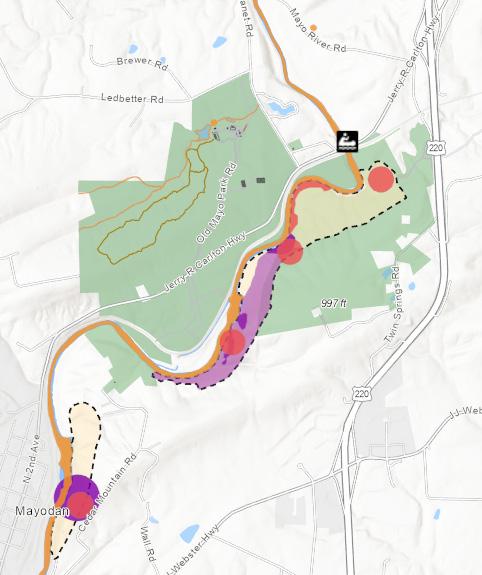
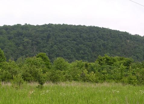
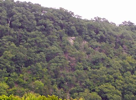
The site is on a northwest-facing bluff of a hogback mountain in the Dan River Triassic Basin. It is the only known natural exposure of steeply dipping sandstone and siltstone in the state. This unusual geology produces soils that support an unusual combination of basophilic and acidophilic species. A good quality Piedmont Calcareous cliff, one of the rarest natural communities in the state, overlooks the Mayo River.
Mayodan Bluffs Natural Area
Located along the east side of the Mayo River, just north of NC 135 and west of SR 2168, overlooking the town of Mayodan. The site includes the southwest edge of a hogback mountain. A steep slope runs from the ridge 200 feet down to the Mayo River. In several places, large exposed rocks form the cliff face. Elsewhere the soil is largely composed of a crumbly shale. The site is one of a few known examples of Piedmont Calcareous Cliff in the state. Slope varies but is primarily 35 degrees or more making the cliff difficult to traverse and susceptible to damage from foot-traffic.
MAYO RIVER STATE PARK MASTER PLAN 39
CHAPTER FOUR SITE INVENTORY & ANALYSIS
JACOB’S LADDER (T) POLEMONIUM CAERULEUM
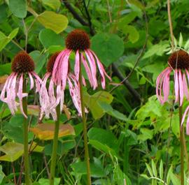
SMOOTH CONEFLOWER (E) ECHINACEA LAEVIGATA
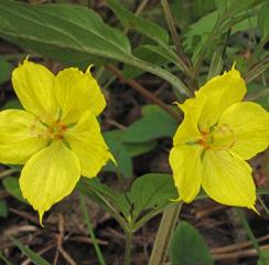
SOUTHERN LOOSESTRIFE (SR-P)
LYSIMACHIA TONSA
VIEW OF CEDAR MOUNTAIN
ROCK OVERLOOK AT CEDAR MOUNTAIN
3 2
SLOPES (DEGREES)
Homepage map for the Mayo River State Park Master Plan.

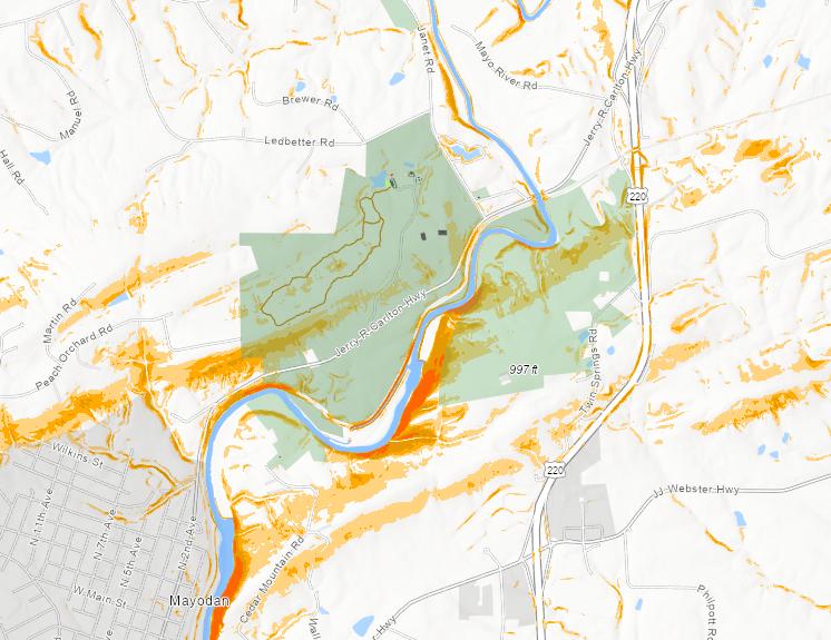
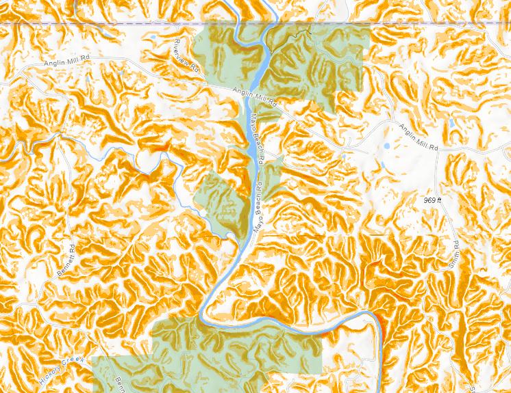
Slope is how planners measure the terrain or topography of an area, which helps us determine areas that might be able to be developed. Flatter areas, between 0 to 5 degrees, are more conducive to improvements, such as campsites, day use areas, structures, parking areas and trails. Improvements can happen on slightly steeper slopes (5-10 degrees), but more care is required during the planning and development process. Slopes above 10 degrees tend to be more sensitive areas that are vulnerable to erosion and should be protected.
CEDAR MOUNTAIN
Cedar Mountain is a large hogback ridge with steep west facing slopes running down to the river. This sheer face makes it almost impossible to hike on this side of the river along this edge. Flat areas adjacent to the river within the Mayo River State Park property boundaries are prone to inundation. These low lying flat areas are often located within the flood plain and present limited opportunities for development.
0.4mi
Esri, NASA, NGA, USGS, FEMA | Esri Community Maps Contributors, State of North Carolina DOT, Esri, HERE, Garmin, SafeGraph, INCREMENT P, USGS, EPA, NPS, US Census Bureau, USDA | Esri Community Maps Contributors, State of North Carolina DOT, Esri, HERE, Garmin, SafeGraph, INCREMENT P, METI/NASA, USGS, EPA, NPS, US Census Bureau, USDA | Airbus,USGS,NGA,NASA,CGIAR,NCEAS,NLS,OS,NMA,Geodatastyrelsen,GSA,GSI and the GIS User Community

MAYO RIVER
OPEN GRASSLAND, FLATTER AREAS
MAYO RIVER STATE PARK MASTER PLAN 40 CHAPTER FOUR SITE INVENTORY & ANALYSIS
River State Park Slope Analysis
Slopes (Degrees) 90 30 20 15
(0-5 DEGREES)
FLOODPLAIN NORFOLK & WESTERN RAILWAY MODERATE SLOPE (5-10 DEGREES) STEEP SLOPE (10+ DEGREES) CEDAR MOUNTAIN - CROSS SECTION A CEDAR MOUNTAIN (SECTION A) NATURAL RESOURCES / SLOPE 0-10 10-15 15-20 20-30 SECTION A 30-90
MAYO
MOUNTAIN ACCESS
CEDAR
MOUNTAIN ACCESS
DESHAZO MILL ACCESS
The topography becomes more undulating towards the north end of the Mayo River corridor. Steep areas can be seen throughout most of the Deshazo Mill property. Drainage Lines running into Fall Creek, Pawpaw Creek and Hickory Creek have carved out steep embankments along the river.


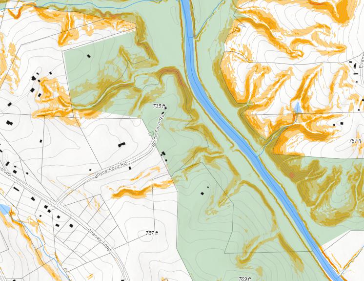
River State Park Slope
JOYCE FORD ROAD AREA
The Joyce Ford Road access drive is located at the top of a steep slope. Closer towards the river, a flat shoulder meets a steep drop off at the river bank. Social trails occupy these flat areas along both sides of the river for much of this section of the corridor.
INVENTORY
MAYO RIVER STATE PARK MASTER PLAN 41SITE
& ANALYSIS
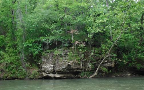
STEEP TERRAIN ADJACENT TO THE RIVER CORRIDOR
FLAT BENCH ALONG THE STEEP BANKS AT JOYCE FORD RD.
Esri, NASA, NGA, USGS, FEMA | Esri Community Maps Contributors, Rockingham County, State of North Carolina DOT, BuildingFootprintUS Garmin, SafeGraph, INCREMENT P, METI/NASA, USGS, EPA, NPS, US Census Bureau, USDA | Esri Community Maps Contributors, Rockingham State of North Carolina DOT, BuildingFootprintUSA, Esri, HERE, Garmin, SafeGraph, INCREMENT P, METI/NASA, USGS, EPA, NPS, US Census | Airbus,USGS,NGA,NASA,CGIAR,NCEAS,NLS,OS,NMA,Geodatastyrelsen,GSA,GSI and the GIS User Mayo
Analysis This is the Homepage map for the Mayo River State Park Master Plan. Steep Slopes (Degrees) 30 to 90 20 to 30 15 to 20 10 to 15 0 to 10 MAP SHOWING SLOPES OF DESHAZO MILL AREA MAP SHOWING SLOPES OF JOYCE FORD ROAD AREA VIRGINIA NORTH CAROLINA JOYCE FORD ROAD DESHAZO MILL ACCESS
HYDROLOGY
NATURAL RESOURCES

Hydrology maps identify the creeks and streams that feed the Mayo, as well as the floodplains and known wetland areas along the corridor. In big rain events, the Mayo will overtop its banks in several areas, flooding the surrounding land and depositing sediment. Flood prone areas are typically unsuitable for development, but can provide habitat for fragile plant and animal species.

The Mayo River is broad and winding with shallow riffles and deep pools. Because of limited development along the corridor from Business 220 to the Virginia State line, wide wooded buffers extend along most of the stream reach. The forested buffers, rock out crops and woody vegetation establishment on the banks contribute
to overall bank stability. Active erosion was primarily observed in high stress areas such as the outside of bends in the river.
The overall form of the river is stable with minimal lateral migration. The river’s capacity to carry flood flows during storm events and access to its broad floodplain was evident in the sandy soil deposits found along the reach. The river supports many aquatic and terrestrial species. The tree lined riverbanks aid in providing shade for fish and amphibians. Tree roots and rock outcrops are a source of habitat for aquatic life along the river’s edge.
MAYO RIVER STATE PARK MASTER PLAN 42 CHAPTER FOUR SITE INVENTORY & ANALYSIS
/
STOKESCOUNTY FALLCREEK BUFFALOCREEK HICKORY CREEK FLOODWAY 100 YR FLOOD ZONE 500 YR FLOOD ZONE RIVER ACCESS POINTS RIVER MILE MARKER LEGEND VIRGINIA NORTH CAROLINA 0 1 2 3 4 5 DESHAZO MILL ACCESS HICKORY CREEK ACCESS
FEMA REGULATIONS

The Mayo River is a Federal Emergency Management Access (FEMA) regulated stream that is defined as a detailed study, Mayo River Upper, with mapped floodplain and floodway limits above US 770; a limited detailed study, Mayo River Limited Detail, with a mapped floodplain and modeled non-encroachment area to the Avalon Dam; and a detailed study, Mayo River Lower below the Avalon Dam within the study corridor.
The Deshazo Mill access and the Mayo Beach day use area are both located in the Mayo River Upper portion of the river with regulated floodplain and floodway limits. Accesses to the river that includes Joyce Ford Road, Mayo Mountain, Cedar Mountain, and the Avalon day use are all located in the Mayo River Limited Detail area with a regulated floodplain and non-encroachment area.
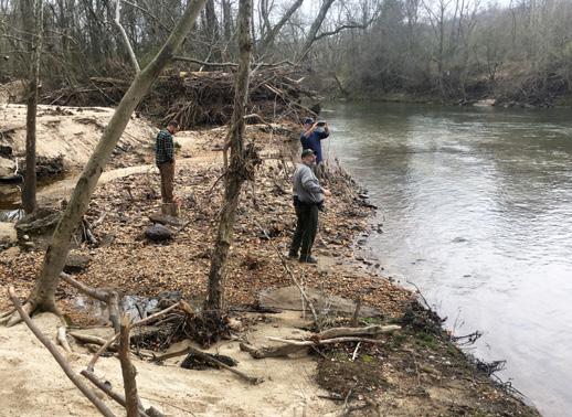
Access sites below the Washington Mills Dam on the Mayo River Lower portion of the river with regulated floodplain and floodway limits include Washington Mills, Madison Town, Highway 135, and N. Water Street. Many of the tributaries that connect with the Mayo River are also regulated by FEMA. The Deshazo Mill access includes FEMA regulated Fall Creek and an Unnamed Tributary (UT) to Fall Creek. Mayo River Tributary 26 is located in the Mayo River Day Use and Lower Beach access area. The Cedar Mountain access area is additionally crossed by FEMA regulated Mayo River Tributary 3.
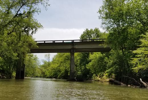
MAYO RIVER STATE PARK MASTER PLAN 43
CHAPTER FOUR SITE INVENTORY & ANALYSIS
US 770 BRIDGE
FLOOD LEVEL WATERS DEPOSIT DEBRIS AT THE HIGHWAY 135 ACCESS
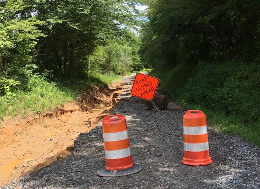
ROAD WASHOUT AT MAYO BEACH DUE TO FLOODING
DEFINITIONS
Flood zones are geographic areas that the Federal Emergency Management Agency (FEMA) has defined according to varying levels of flood risk. Each zone reflects the severity or type of flooding in the area.
Floodway: The channel of a river or other watercourse and the adjacent land areas that must be reserved in order to discharge the base flood without cumulatively increasing the water surface elevation more than a designated height. Communities must regulate development in these floodways to ensure that there are no increases in upstream flood elevations.
Non-Encroachment Area: The portion of a floodplain where construction, placement of fill, or similar alteration of topography may be prohibited by a community due to the effects such development would have on the conveyance of discharge.
100 Year Flood Zone (Zone AE): An area inundated by 1% annual chance flooding. Also referred to as the base flood or 100year flood.

500 Year Flood Zone (Zone X-500): Area of moderate flood hazard or 0.2% annual chance of flooding, usually the area between the limits of the 100-year and 500-year flood plains.

MAYO RIVER STATE PARK MASTER PLAN 44 CHAPTER FOUR SITE INVENTORY & ANALYSIS
770 MAYODAN 220 135 7 8 9 10 11 12 13 14 15 MAYO MOUNTAIN ACCESS JOYCE FORD ROAD CEDAR MOUNTAIN ACCESS NATURAL RESOURCES / HYDROLOGY
RECOMMENDATIONS
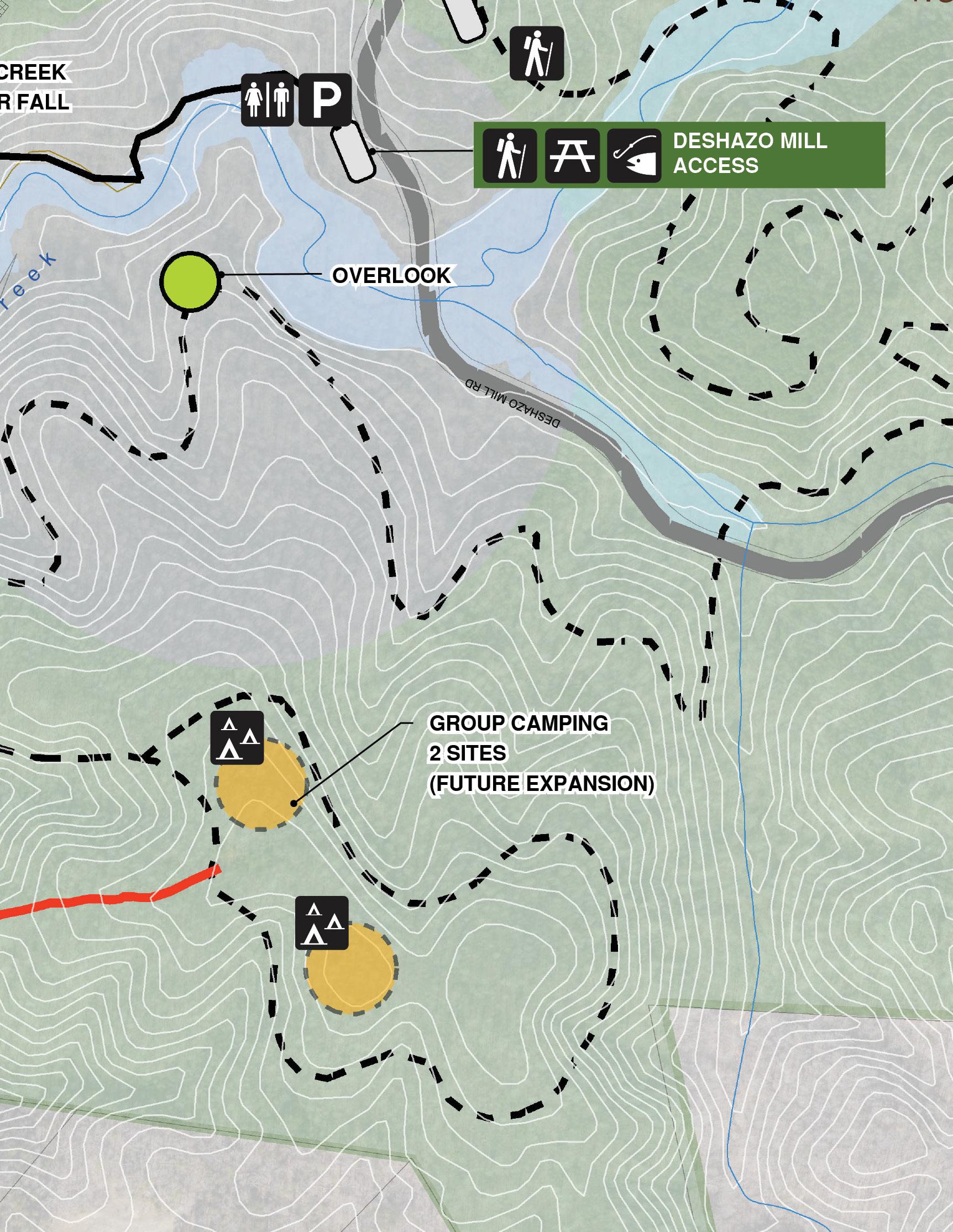
MAYO RIVER STATE PARK MASTER PLAN
5
PLANS
Recommendations
for the future development of Mayo River State Park as defined by the Final Master Plan are intended to enhance the visitor experience and further protect natural and cultural resources along the river corridor. Also included are recommendations for improved parks facilities that address the park’s operations. Master plan recommendations are based on a thorough analysis of the project study area, reflect engagement of the community, stakeholders and NC Parks and Recreation Division staff throughout the planning process and define priorities and phases for implementation that recognize and address immediate needs and illustrate long term improvements consistent with an aspirational vision for the park.
Enhancement of the visitor experience include improvements to areas of the park that are currently experiencing heavy use, increase access to the river, support current programs, connect visitors to natural areas that are currently unreachable and reveal the history of the river and community through interpretation at various sites within the park. The plan also identifies opportunities for providing overnight accommodations enabling visitors to extend their stay.
Protection of natural and cultural resources along the corridor are critical and recommendations include future land acquisition as well as defining the location of access points, trails and the placement and design of other park facilities. Prior to any specific construction projects, an archeological review by the State Historic
Preservation Office should be conducted to determine whether further investigations are needed. In addition, all known cemeteries on State Park’s property should be identified and inventoried so that they can be protected.
Recommendations central to park operations include the locations of future park facilities, a new maintenance facility, space for additional park staff and the identification of emergency access points along the river.
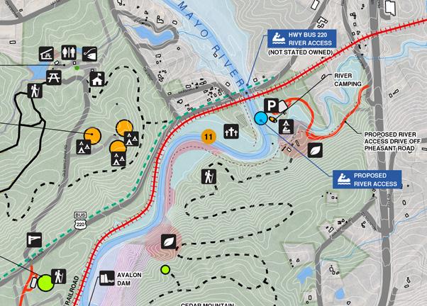
Important to the future of the park are maintaining ongoing partnerships with local municipalities and other stakeholder organizations that are committed to the protection of the river corridor. Continued protection of the corridor and the expansion of the park and it’s offerings to North Carolina residents and visitors will have a positive impact on the local economy and enhance the visitor experience.

The recommendations of the master plan for Mayo River State Park seek to balance the protection of this river corridor and its cultural and natural attributes with inevitable increases in visitation to the park in the foreseeable future. The plan’s recommendations provide a guideline for managing this balance.
Recommendations are illustrated through concept maps, which show a greater context of the proposed improvements. Vignettes portray an enlarged plan of the concept maps to illustrate these recommendations in greater detail.
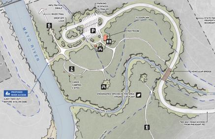
MAYO RIVER STATE PARK MASTER PLAN 46 CHAPTER FIVE RECOMMENDATIONS
CONCEPT
ENLARGEMENT
The Mayo River corridor was divided into four focus areas, each offering unique opportunities for protection, access and development. The development opportunities and constraints maps that informed the final recommendations can be found in the Appendix.
DESHAZO MILL ACCESS AREA
This area includes Deshazo Mill Access and Mayo Beach Access. These two areas are two of the most popular parts of the park and improvements are needed to accommodate increases in visitorship. Aside from these areas, this is a largely undeveloped section of the corridor and presents numerous opportunities for recreation as well as environmental protection.
HWY 770 AREA
This section includes the Joyce Ford Road access, which has extensive river frontage, as well as several smaller park parcels. Continuous state-owned river frontage connects the parcels on both sides of the river, allowing for opportunities to formalize river access along the this section of the corridor. However, access to the park parcels is limited in many cases with some accessed via easements on private property or through established neighborhoods. Private family cemeteries can be found throughout this section.
MAYO MOUNTAIN ACCESS AREA
This area is the current central access for the park. It includes Mayo Mountain Access and Cedar Mountain. It is also the historic center of the park with strong ties to the community.

MAYODAN-MADISON ACCESS AREA
This area runs from Washington Dam to the confluence of the Dan River. There is currently only river access at Highway 135.
MAYO RIVER STATE PARK MASTER PLAN 47CHAPTER FIVE RECOMMENDATIONS
MAYO RIV E R DANRIVER NC770 VIRGINIA NORTH CAROLINA US HWY 220 MADISON MAYODAN KEY MAP
PRIORITIES AND PHASING
Implementation of the master plan will happen in manageable phases over time. Through conversations with Park Staff and the Stakeholder committee, priorities for immediate and future projects were identified. Park Staff are uniquely positioned to understand how the Park is currently being used as well as identifying yearly trends. Areas of the park that are already gaining large quantities of visitors are of the highest priority for initial improvements. Larger recreation experiences, such as camping, will require upgrades to staff facilities to handle the expected increased attendance.
Priorities for park improvements have been divided into four phases:

1.
Improving existing access at popular areas, Mayo Beach and Deshazo Mill.
2.
Adding a new contact station at Mayo Mountain Access, additional staffing and improved support facilities. Trails and river access improvements across the entire corridor.
3.
Creating a central camping hub with access to the river.

4.
Additional camping and support facilities at the northern section of the corridor.
MAYO RIVER STATE PARK MASTER PLAN 48 CHAPTER FIVE RECOMMENDATIONS
DESHAZO MILL ACCESS
DESHAZO
MAYO BEACH ACCESS
HICKORY CREEK ACCESS
TOWN

MAYO RIVER STATE PARK MASTER PLAN 49CHAPTER FIVE RECOMMENDATIONS
AREA
MILL CAMPING & BRIDGE
AREA
AREA WASHINGTON MILLS MADISON
ACCESS AREA JOYCE FORD RD ACCESS AREA JOYCE FORD RD FAMILY CAMPING MAYO MOUNTAIN ACCESS AREA CEDAR MOUNTAIN ACCESS AREA AVALON DAY USE AREA DAN VALLEY RD RIVER ACCESS MAYO RIV E R DANRIVER NC770 VIRGINIA NORTH CAROLINA US HWY 220 MADISON MAYODAN 1 1 4 3 2 2 2 2 4 4 2 4 1
Ongoing improvements:
THE RIVER TRAIL

In addition to these distinct phases, the development of a river trail stretching from the Virginia border to the Dan River Confluence will be implemented as land is acquired along the river corridor, funding becomes available and protection of the environmental resources can be assured. The connectivity of parcels along the corridor will also be critical to the protection of sensitive natural areas which provide habit to several endangered species identified in the master plan report.
HISTORICAL INTERPRETATION
The Mayo Mountain access is recognized as a historically significant area by NCSHPO and proposed improvements aim to preserve and celebrate the story of the park and the Mayodan community that it belongs to. The Avalon property holds a special place in the history of Mayodan and the community. The proposed day use area at the site of the old Avalon village will include interpretive signage of the Village and Mill.
ECOLOGICAL PRESERVATION
The master plan has identified several recreation hubs along the river corridor for development. The remaining park property is to be managed and protected. The Landscape Protection Plan will continue to identify high priority property along the river corridor.
OPPORTUNITIES FOR PARTNERSHIP
The plan has identified multiple opportunities for the Division to partner and collaborate with local municipalities to provide improved recreation facilities. The Mayo River is integral to the towns of Mayodan and Madison and the Division is committed to providing safe and accessible opportunities to engage the local community with the river and the proposed trail network.
STAFFING
The Division will need to increase its park staffing as park programming and access grows in order to ensure the new features can be maintained and managed in a safe and efficient manner with various access areas along a linear park.

MAYO RIVER STATE PARK MASTER PLAN 50 CHAPTER FIVE RECOMMENDATIONS
NEAR TERM (0-5)
1. IMPROVING EXISTING ACCESS
There is an immediate need to improve parking access, sanitary facilities and signage at existing popular areas, namely the Deshazo Mill Trailhead and the Mayo Beach Access. Providing vault toilets and improving the existing trail network in these areas are manageable first steps in improving park facilities and will have a positive impact on the visitor experience. A proposed pedestrian bridge over Fall Creek along with trail connections between Deshazo Falls and Mayo Beach will connect these areas and create a rich experience.
SITE
PROJECTED TIMELINE (YEARS)
MID TERM (5-10)
LONG TERM (10 -15)
KEY FEATURES
Deshazo Mill Access Trails, Parking, Signage, Footbridge Connection (Fall Creek)
Mayo Beach Access Restroom, Parking, River Access Hickory Creek Trails, Parking
2. CONTACT STATION, STAFFING, FACILITIES & TRAILS

Before further improvements and expansion of the park’s current facilities can occur, operational upgrades will need to be made. It is expected that in order to meet the recommendations of the plan additional staff and office space will be required. The plan proposes a new contact station located at the Mayo Mountain Access. The contact station would provide a location for visitors to get park information, and meeting areas and office space for staff. In addition, upgraded maintenance facilities are a high priority as park access and visitation grows.
SITE KEY FEATURES
Mayo Mountain Access Contact Station, Landscape Improvements
Joyce Ford Rd River Access, Trails, Parking, River Camping, Day Use
Nickel Plate Rd Staff Residence
Cedar Mountain Trails, River Access, Parking Avalon Day Use Area Picnic, Trails, Parking, Educational Signage, Maintenance Dan Valley Rd River Access, Parking
3. CAMPING, RIVER ACCESS: PART 1
Camping is strongly desired by both the community and the stakeholder group. A camping hub at the Joyce Ford Road property is located centrally on the river corridor and offers river access. Plans for this area show the final build out of the campground, which includes river camping, family camping and RV camping. Camp sites may be implemented in phases as the park gains popularity. Camping with river access will be an economic draw for the area.
SITE KEY FEATURES
Joyce Ford Rd Family Camping
4. ADDITIONAL CAMPING, TRAILS, RIVER ACCESS: PART 2
As the Park gains more visibility through steady infrastructure improvements, larger gestures such as camping in Deshazo Mill and larger river access projects at Washington Mills & Cedar Mountain can occur.
SITE
Deshazo Mill Access
KEY FEATURES
Camping, Bridge (Mayo River North Fork Crossing)
Washington Mills River Access, Parking, Historical Interpretation
Madison Town Access Accessible Trails, Parking
FIVE RECOMMENDATIONS
MAYO RIVER STATE PARK MASTER PLAN 51CHAPTER
15+
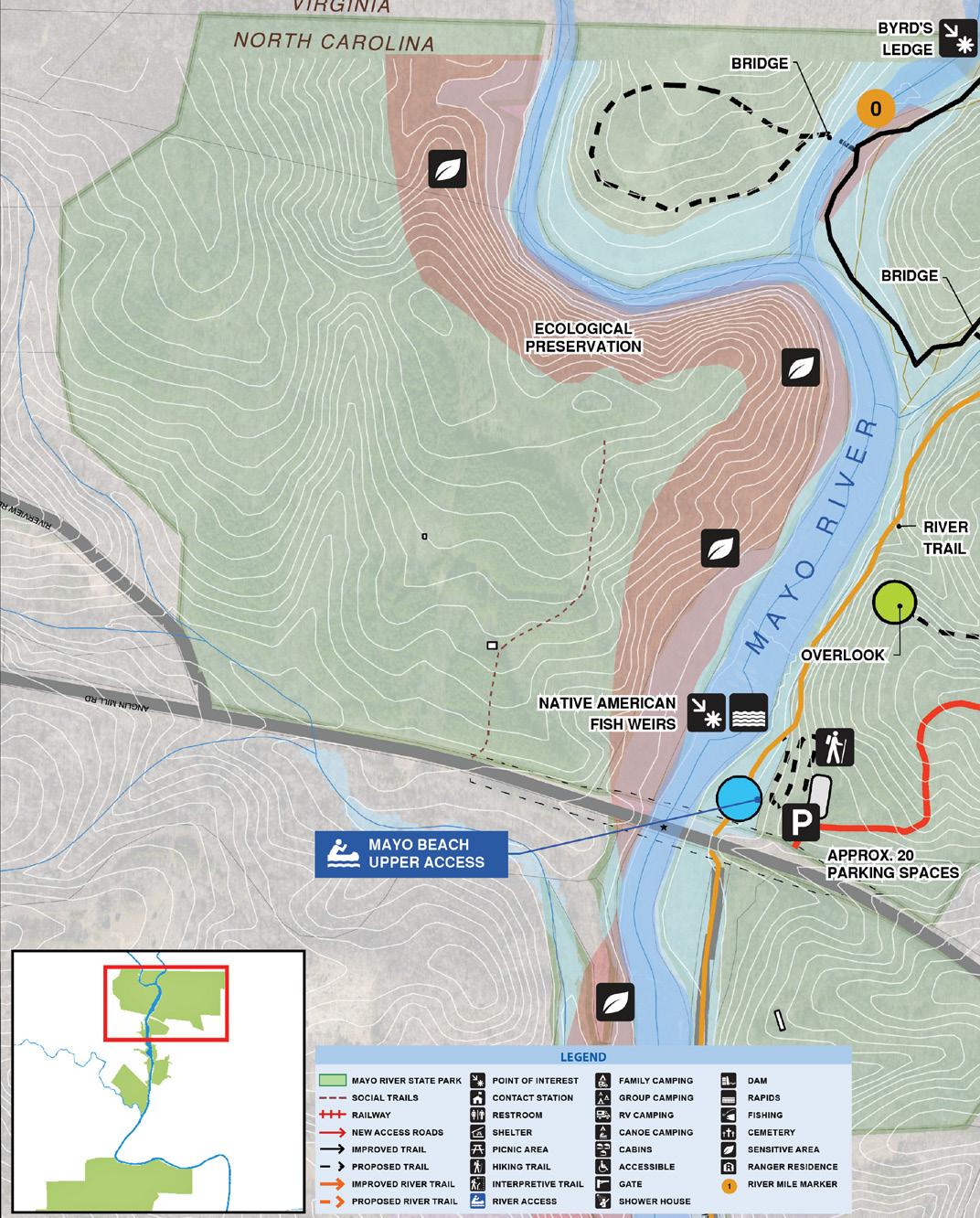
MAYO RIVER STATE PARK MASTER PLAN 52 CHAPTER FIVE RECOMMENDATIONS CONTEXT MAPDESHAZO MILL ACCESS AREA
CONNECTIVITY is the focus with these properties in addition to the introduction of some expanded facilities and additional uses. Plan features:
Expanded parking at trailhead and two new areas
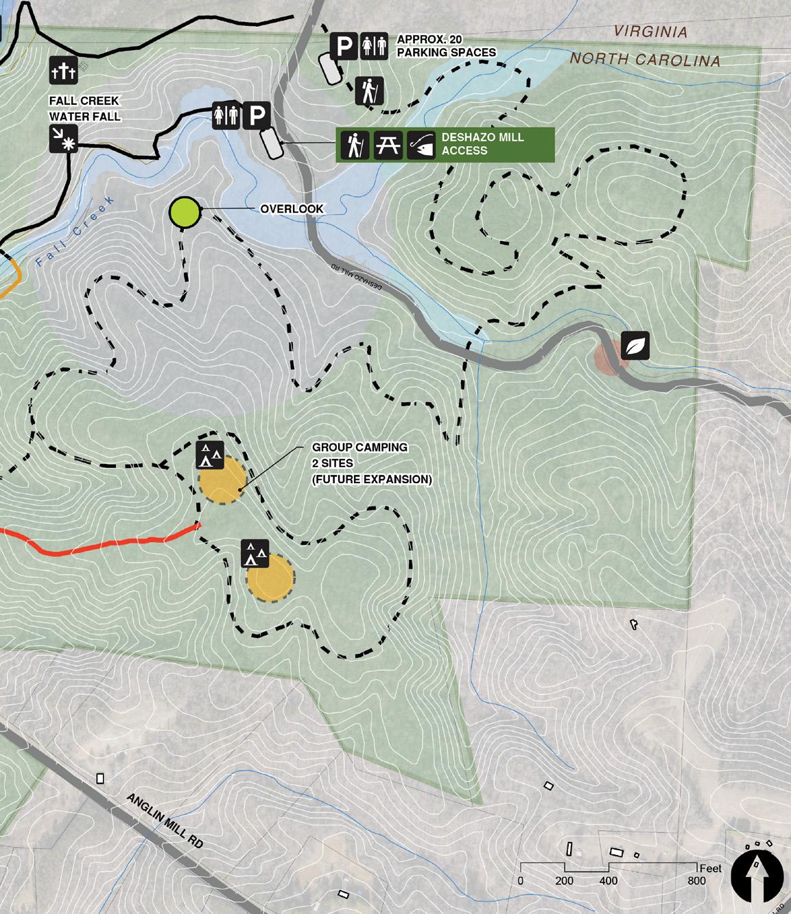

Trail Improvements and expansion including a river crossing to connect area between the two forks of the river
3 miles of new trail on the east side of the river
Preservation of the west side of the river
Beginning of River Trail
Restroom facility at trailhead
Education signage – natural resources
Group Camping area (long term vision)
53
•
•
•
•
•
•
•
•
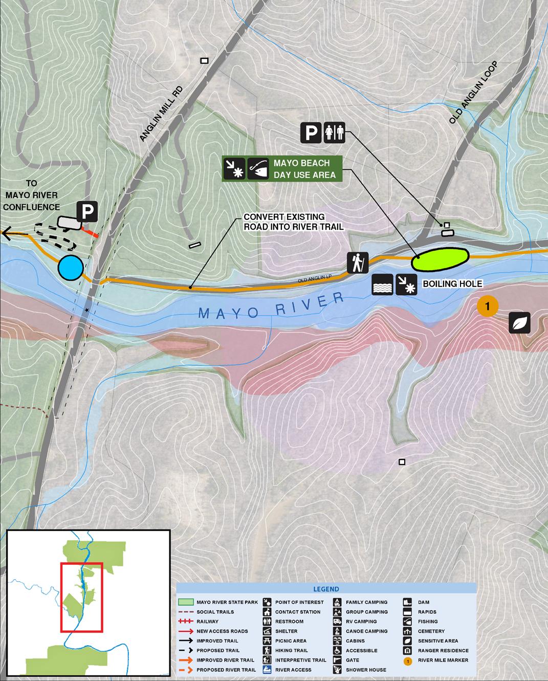
MAYO RIVER STATE PARK MASTER PLAN 54 CHAPTER FIVE RECOMMENDATIONS SEE ENLARGEMENT CONTEXT MAPMAYO BEACH ACCESS
SUPPORTING the intensity of day use with support facilities is the focus of recommendations along this stretch of the river corridor. Plan features:
• Conversion of existing road to River Trail north of Old Anglin Loop
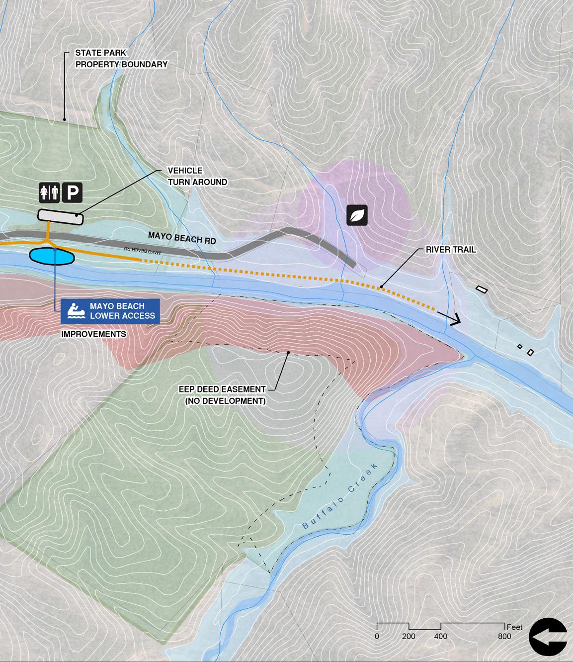

• Continuation of River Trail south ( 1 mile total of river trail )
• Small parking area near the beach with restroom
• Larger parking area closer to the river access with restroom
• Improvements to river access
55
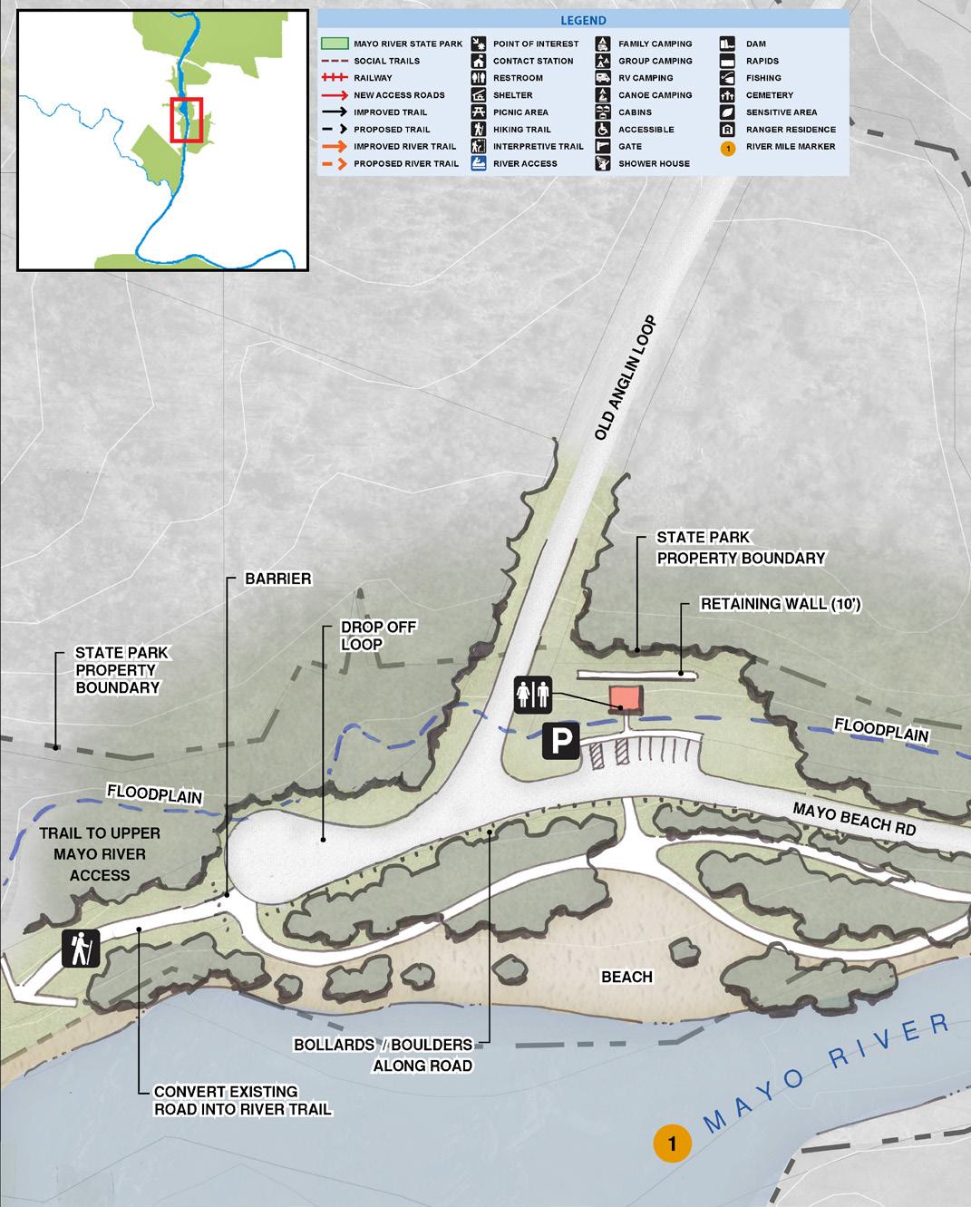
MAYO RIVER STATE PARK MASTER PLAN 56 CHAPTER FIVE RECOMMENDATIONS CONTEXT MAP MAYO BEACH ACCESS / ENLARGEMENT

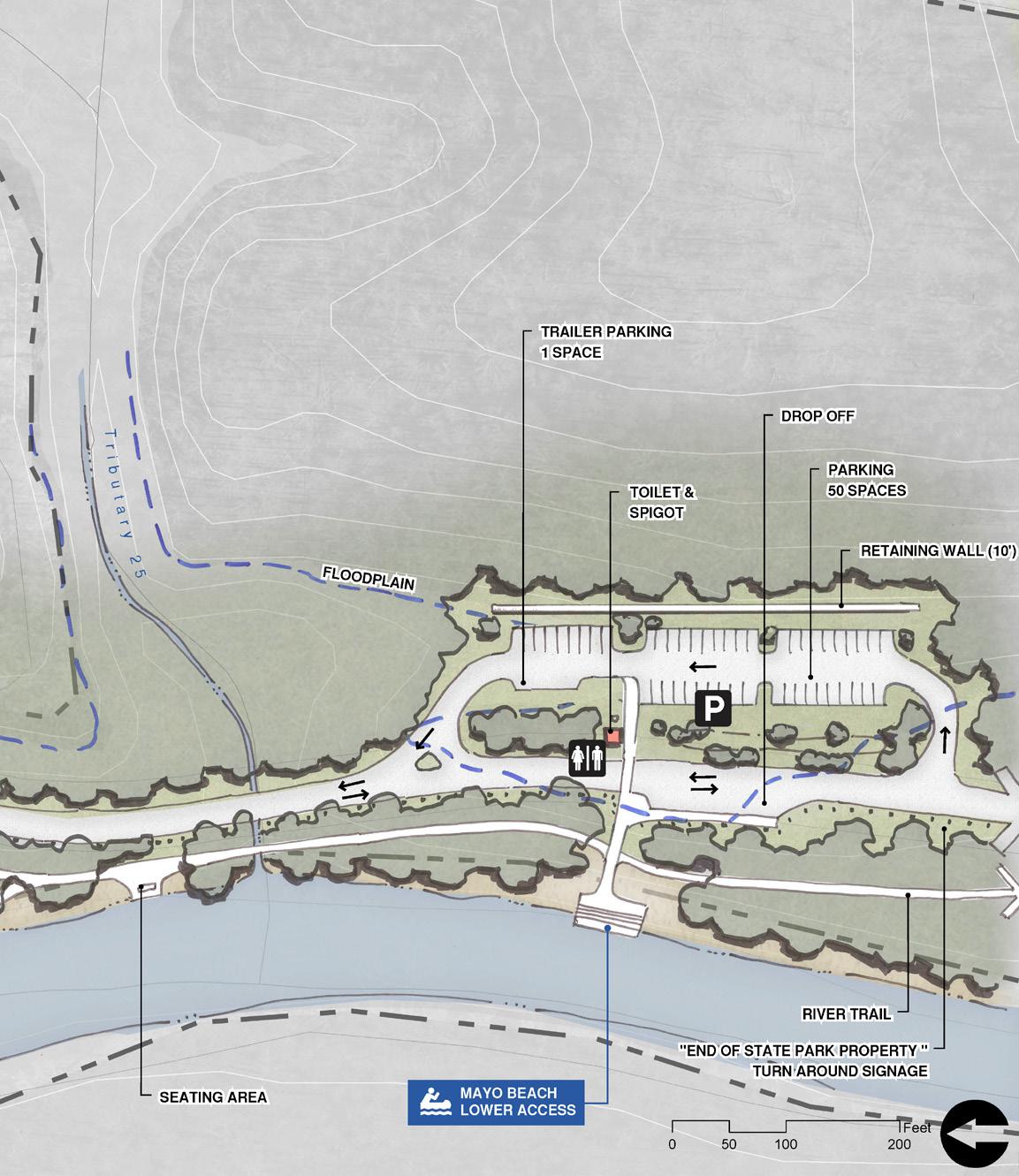
57
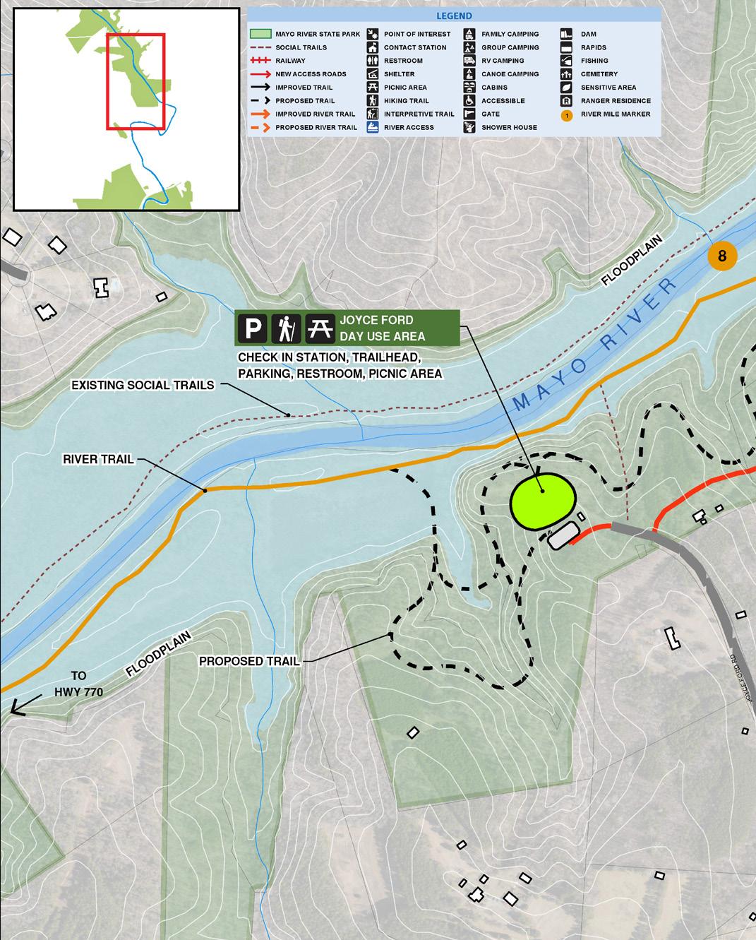
MAYO RIVER STATE PARK MASTER PLAN 58 CHAPTER FIVE RECOMMENDATIONS CONTEXT MAP JOYCE FORD RD ACCESS
SEEENLARGEMENT
COMBINATION of these properties offer significant potential for a variety of uses. Properties are a 3-hour paddle from the access at Mayo Beach. Plan features:
River access
River camping
Continuation of River Trail ( .7 miles )
2-acre day use area ( check in station, trailhead parking, restroom, picnic tables )
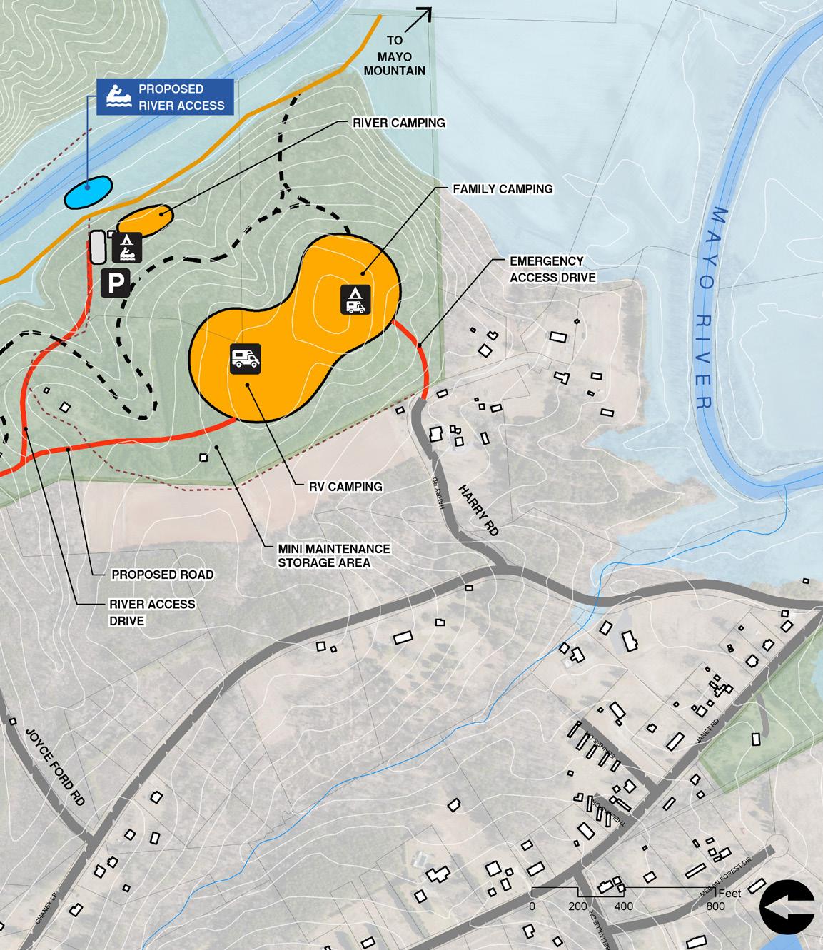
Upland trail( 1.5 miles )
13-acre family camping site ( 30 tent sites

Camping - full hook-up ( 10 sites
Mini-maintenance facility
59
•
•
•
•
•
•
) • RV
) •
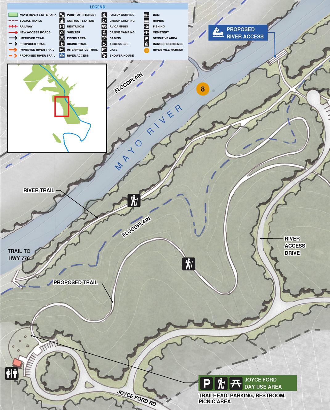
MAYO RIVER STATE PARK MASTER PLAN 60 CHAPTER FIVE RECOMMENDATIONS CONTEXT MAP JOYCE FORD RD ACCESS / ENLARGEMENT

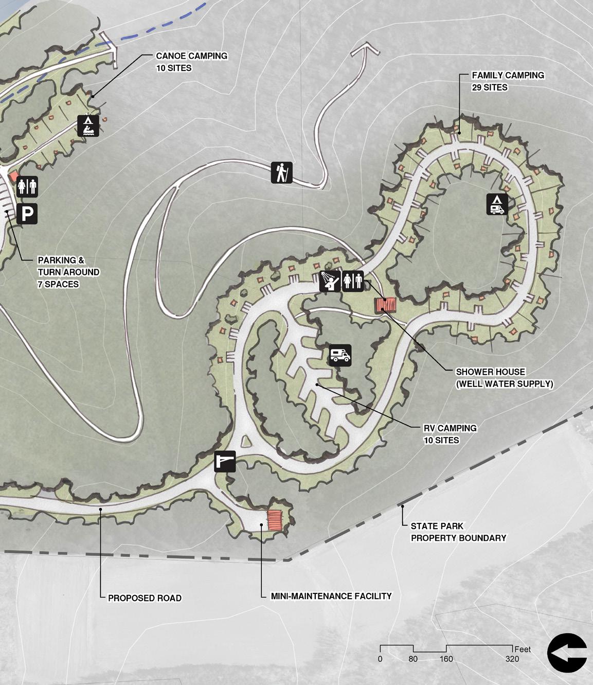
61
CONTEXT MAP
WHILE these three areas are adjacent, they are not connected. The road, railroad, river and private property are all obstacles and present a challenge to connecting Avalon and Mayo Mountain to Cedar Mountain. Recommendations recognize the historical context of the sites and provide a variety of facilities in response to expressed needs. Full connectivity along BUS 220 and across bridge are dependent of future land acquisition and regional trail plans. The property ( base of Cedar Mountain ) is a 4-hour paddle from Mayo Beach.
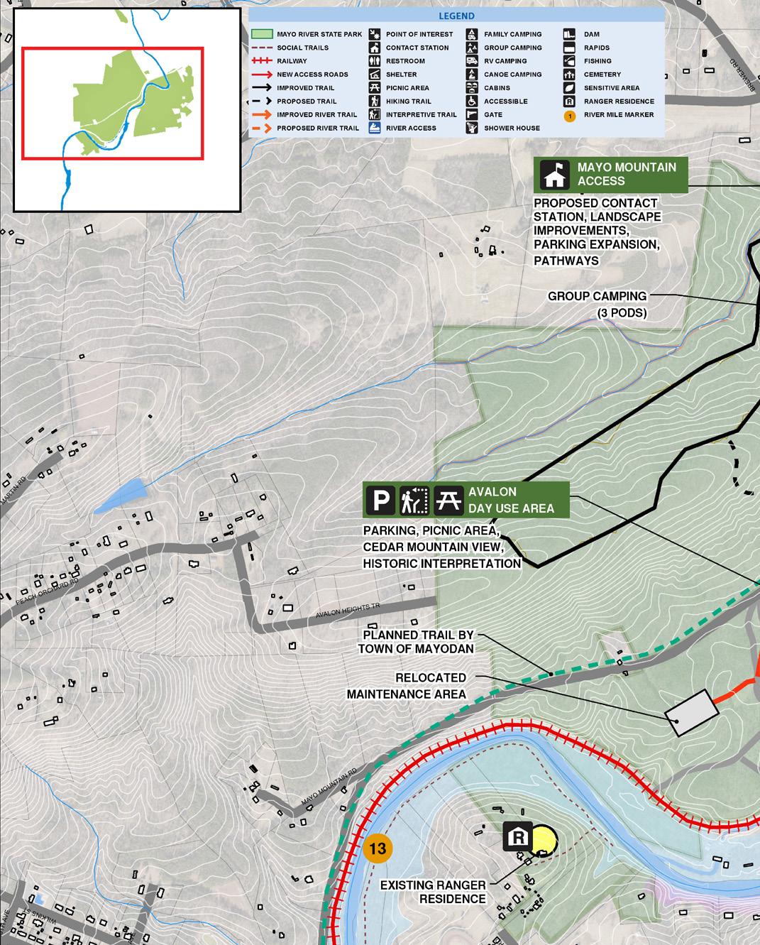
Mayo Mountain Access Area
• Day use area improvements
• Group camping (3 sites)
Additional trails
Trail connection across BUS 220
Avalon Day Use
• Realign driveway with Old Mayo Park Road
Day use area (parking, picnic shelter, walking trail)
Educational signage (mill and mill village)
Relocated maintenance facility
Cedar Mountain
• River access / take out (not removing BUS 220 access)
River camping
Trailhead parking
Restroom
Cedar mountain trail (3 miles with overlooks / trail to Avalon Dam)
Education signage (natural resources)
Picnic areas
MAYO RIVER STATE PARK MASTER PLAN 62 CHAPTER FIVE RECOMMENDATIONS
•
•
•
•
•
•
•
•
•
•
•
SEE ENLARGEMENTS
MAYO MOUNTAIN ACCESS

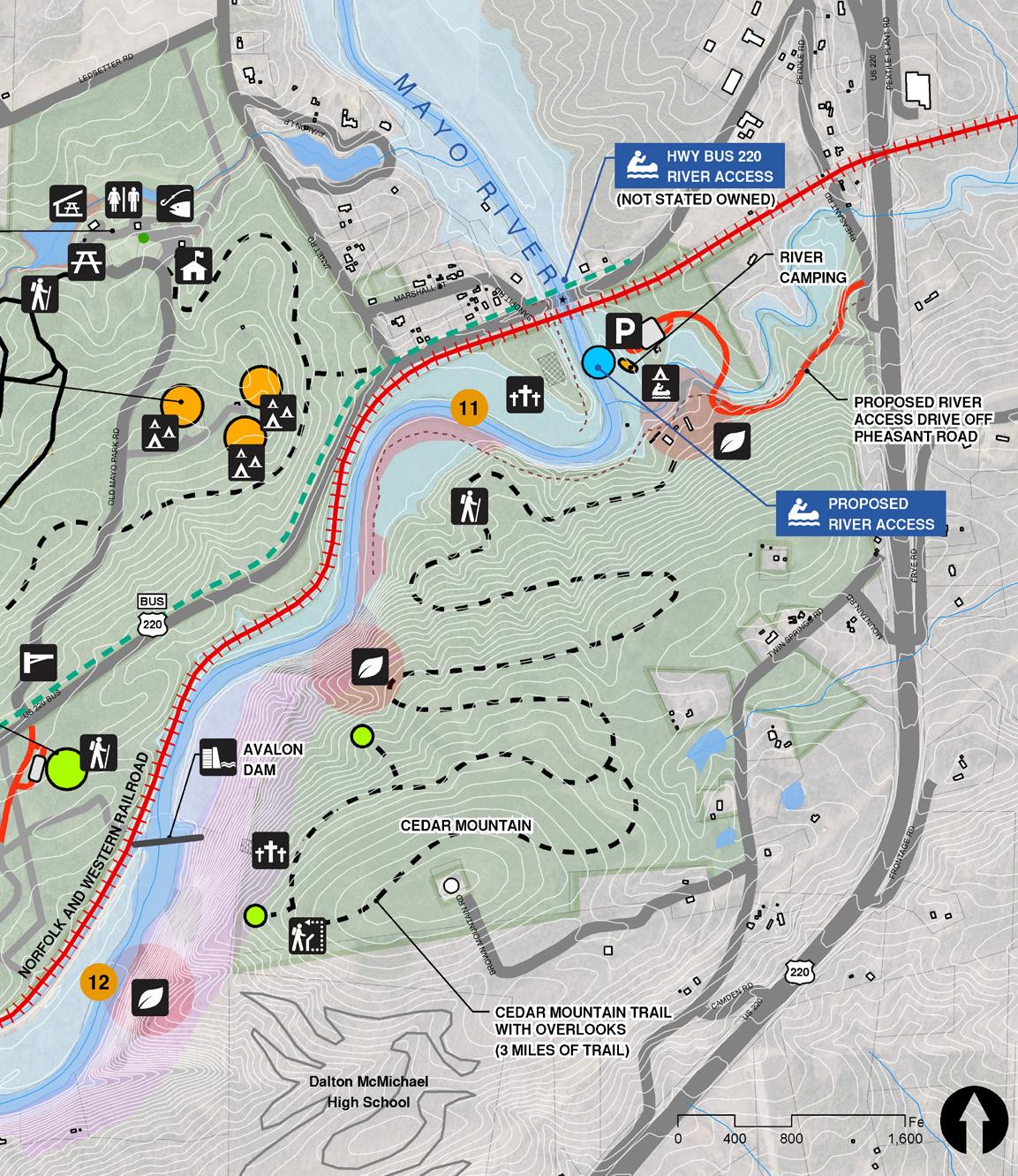
63 ENLARGEMENTS SEE ENLARGEMENTS SEE ENLARGEMENTS SEE ENLARGEMENTS
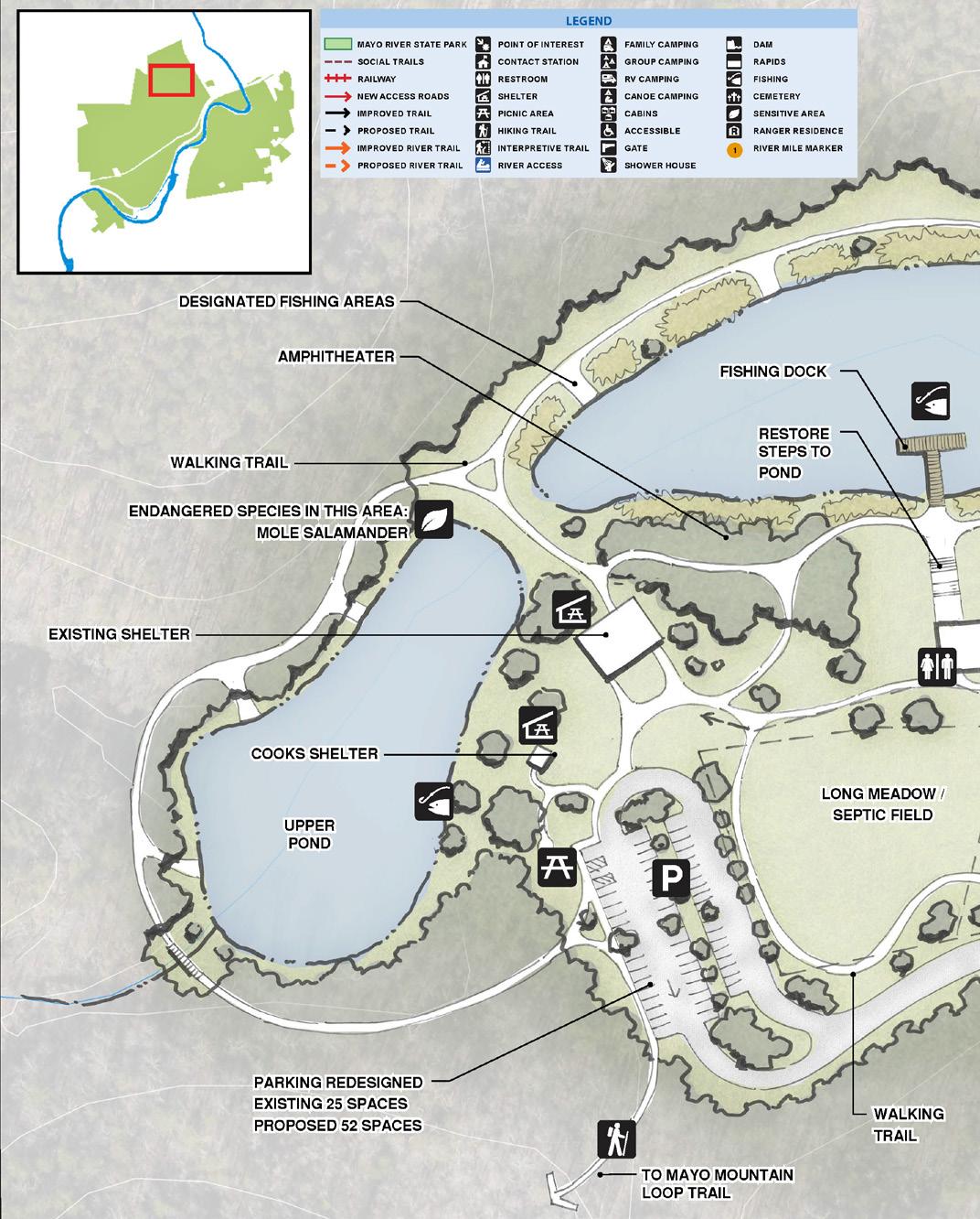
MAYO RIVER STATE PARK MASTER PLAN 64 CHAPTER FIVE RECOMMENDATIONS CONTEXT MAP MAYO MOUNTAIN ACCESS / CONTACT STATION

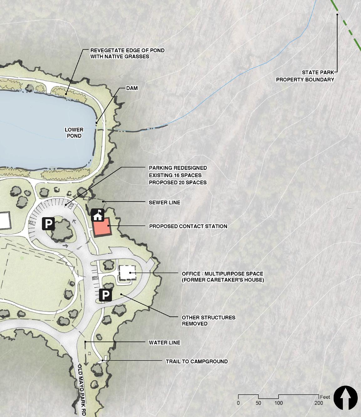
65
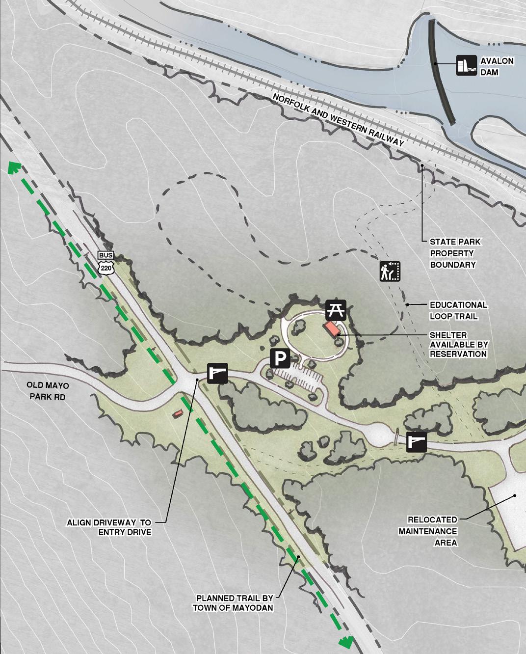
MAYO RIVER STATE PARK MASTER PLAN 66 CHAPTER FIVE RECOMMENDATIONS AVALON SITE / DAY USE AREA & MAINTENANCE

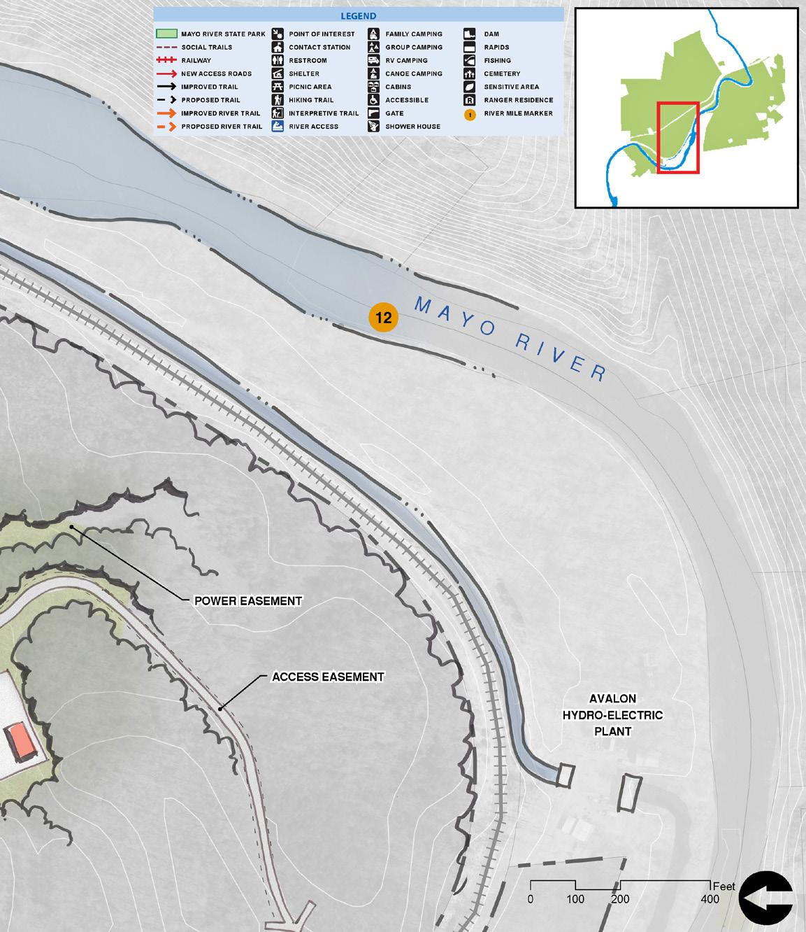
67 CONTEXT MAP
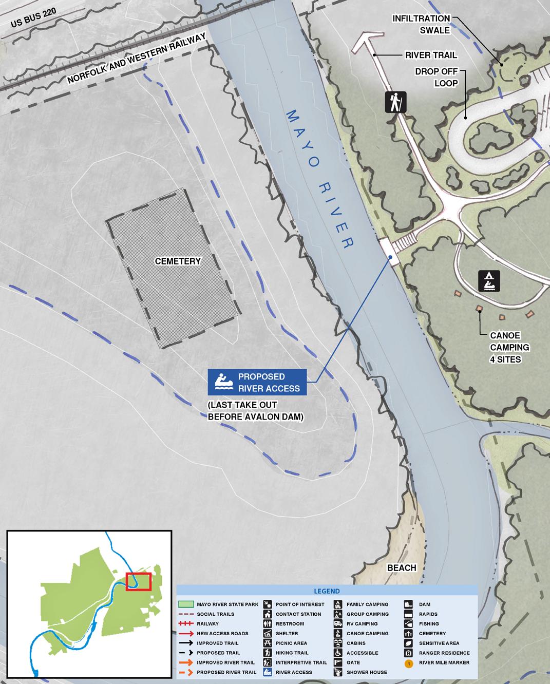
MAYO RIVER STATE PARK MASTER PLAN 68 CHAPTER FIVE RECOMMENDATIONS CONTEXT MAPCEDAR MOUNTAIN ACCESS / RIVER ACCESS

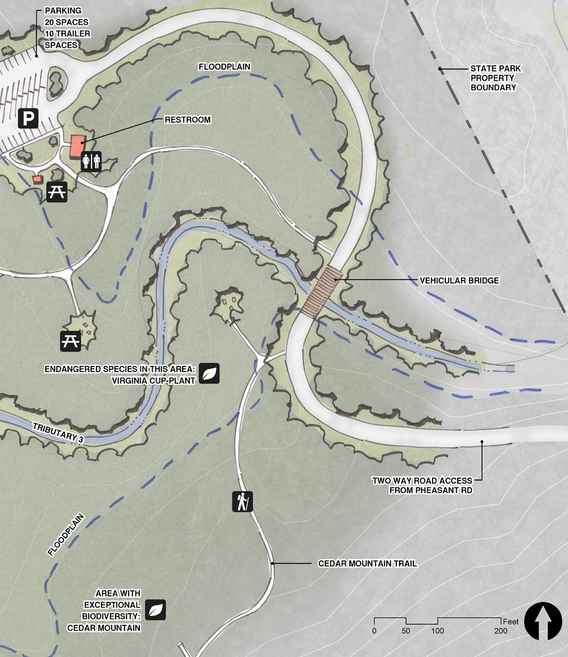
69
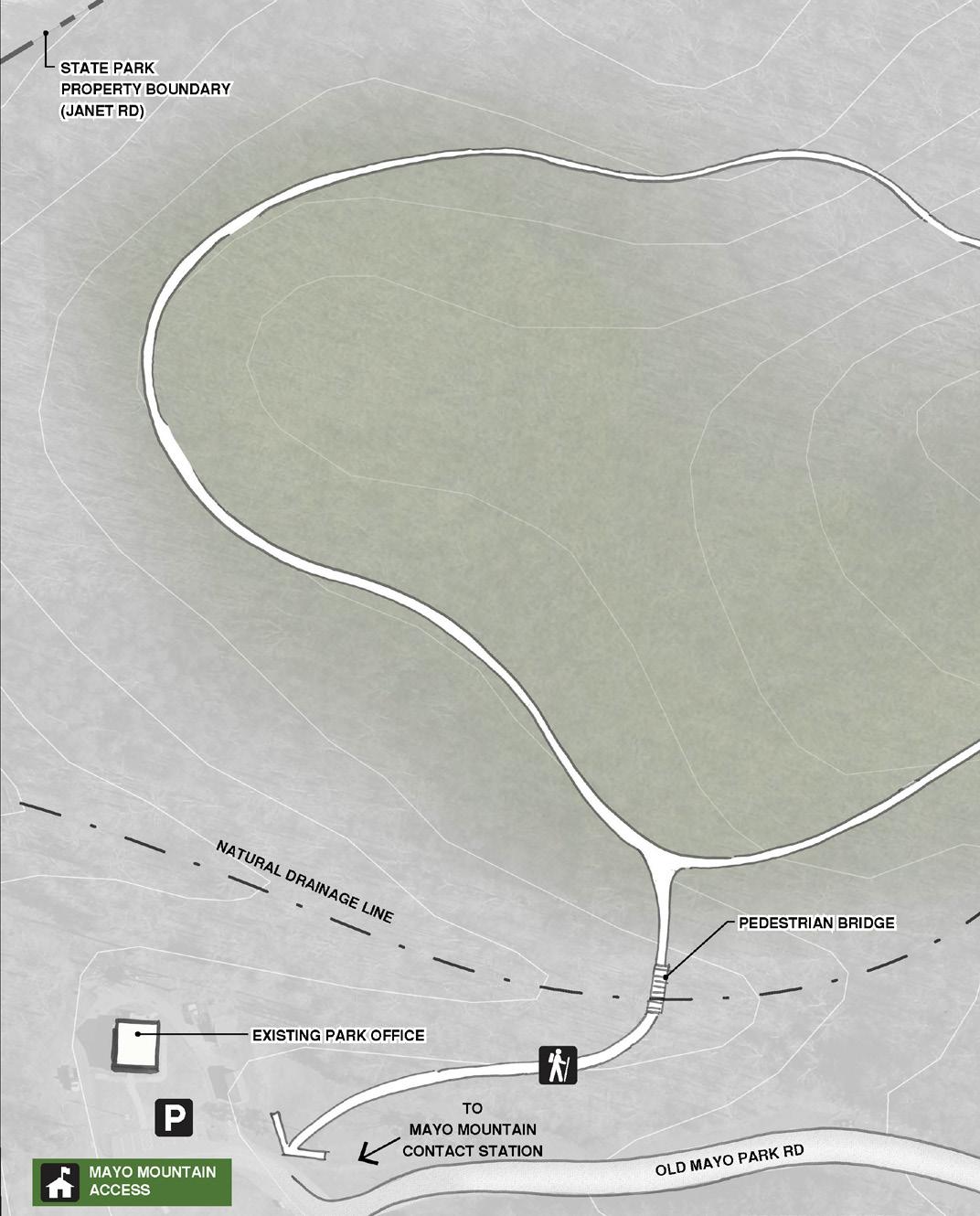
MAYO RIVER STATE PARK MASTER PLAN 70 CHAPTER FIVE RECOMMENDATIONS MAYO MOUNTAIN ACCESS / GROUP CAMPING

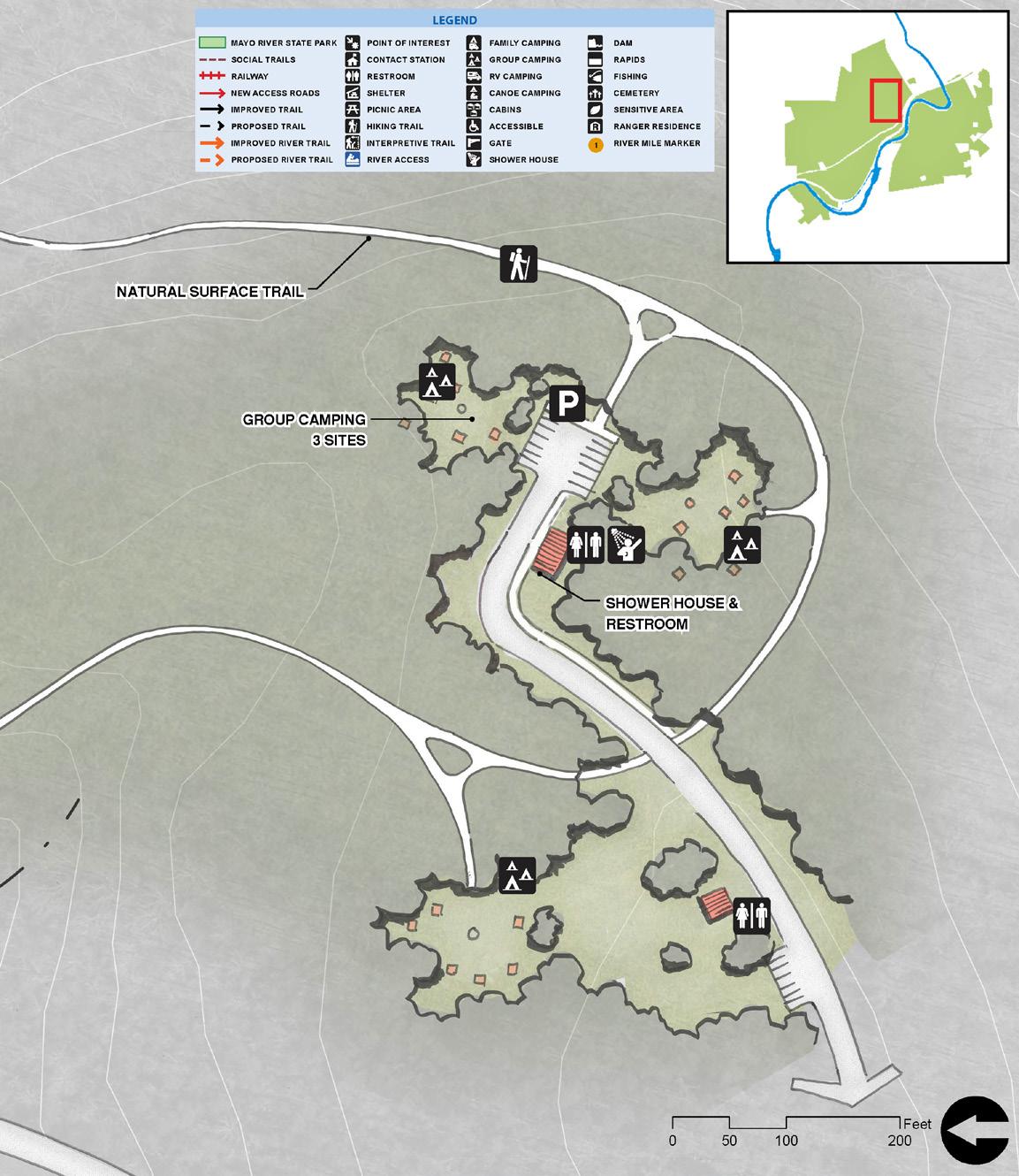
71 CONTEXT MAP
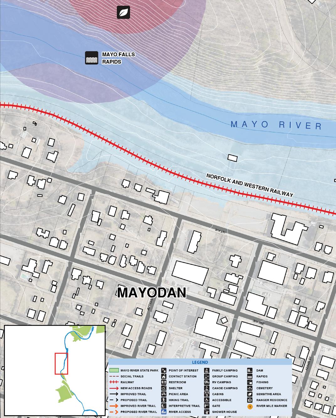
MAYO RIVER STATE PARK MASTER PLAN 72 CHAPTER FIVE RECOMMENDATIONS CONTEXT MAPWASHINGTON MILLS ACCESS
WASHINGTON MILLS property offers an opportunity to partner with Mayodan on development of this former mill site into a public open space. Partnership is limited to development of a river access for paddlers and supporting parking. Existing building could offer some partnership opportunities as well, but Division of Parks would not be in a position to staff this facility.
• River access (compliments or replaces current Hwy 135 river access)
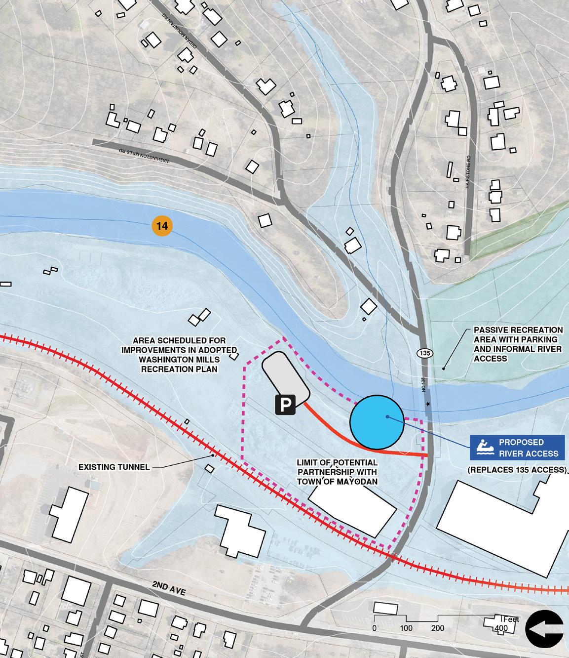

• Parking
• Educational signage (mill)
73
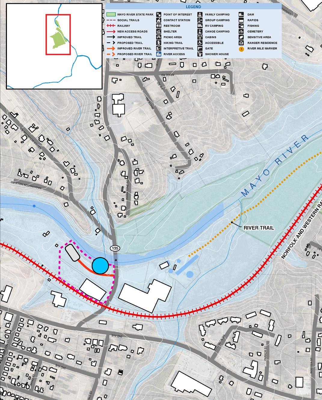
MAYO RIVER STATE PARK MASTER PLAN 74 CHAPTER FIVE RECOMMENDATIONS PROPERTY offers an opportunity to partner with Madison. Primarily it is seen as an opportunity to protect the river and provide connectivity to Madison. • Trailhead parking • Accessible trails • Picnic areas • Educational signage (Petersburg Highway)MADISON ACCESS CONTEXT MAP

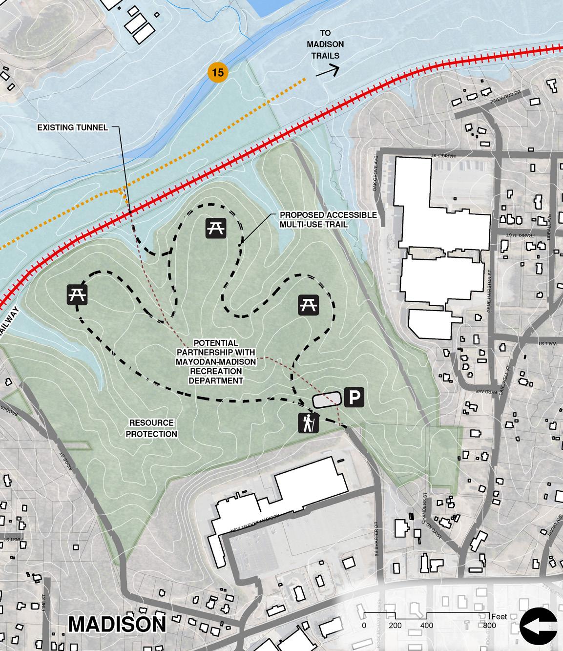
75
SECTION of the Mayo offers the final chance to take out before reaching the Dan River confluence. A proposed river access at the Dan Valley Rd bridge would require a potential partnership with NCDOT.
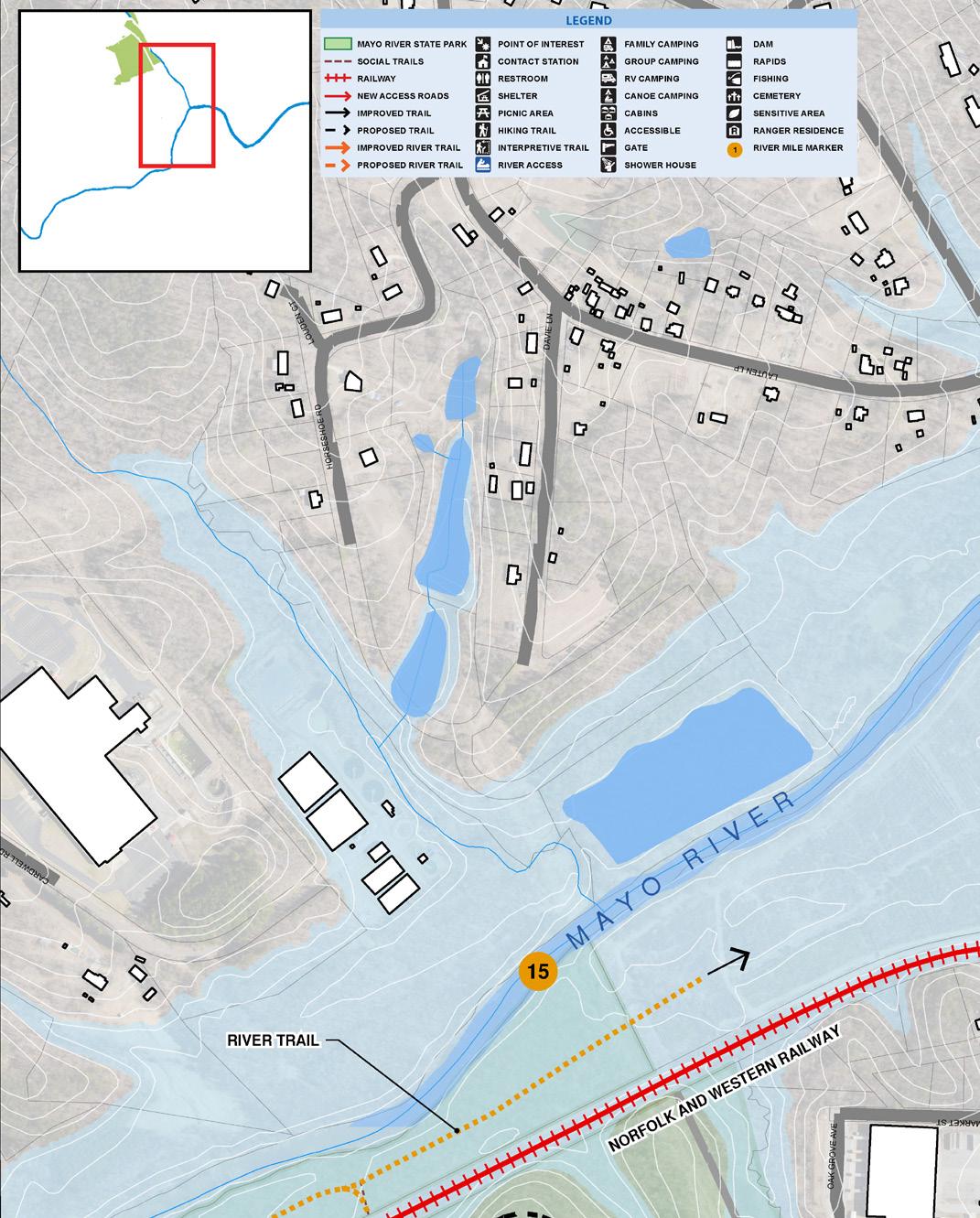
improvements required include:
Parking
Access Drive
MAYO RIVER STATE PARK MASTER PLAN 76 CHAPTER FIVE RECOMMENDATIONS THIS
Other
•
•
DAN VALLEY RD BRIDGE / RIVER ACCESS CONTEXT MAP

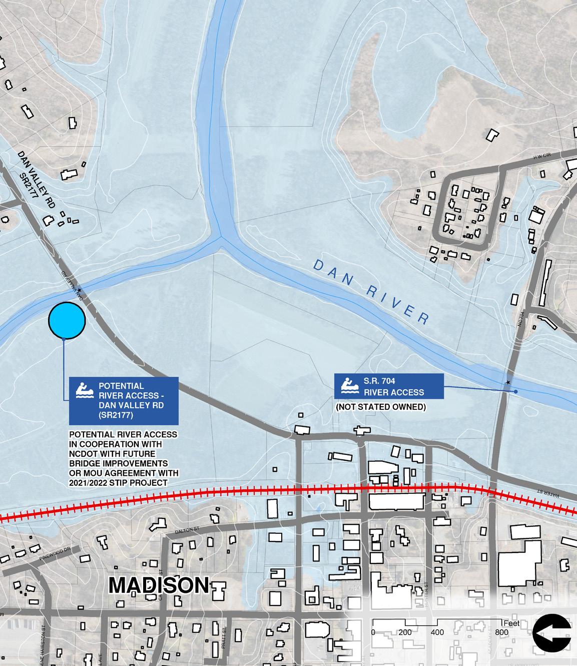
77
MAYO RIVER STATE PARK MASTER PLAN 78 CHAPTER FIVE RECOMMENDATIONS [0 5,000 10,0002,500 Feet A b USGS NGA NASA CG AR NCEAS NLS OS NMA G d y GSA GS d h G S U C ty [0 5,000 10,0002,500 Feet MAYODAN STONEVILLE MADISON VIRGINIA NORTH CAROLINA ROCKINGHAM COUNTY STOKESCOUNTY HENRY COUNTY M A Y O RIVER HICK O R Y CREEK PAWPAW CREEK FALL CREEK BUFFALOC R E E K SOUTHFORK N O R T H F O R K DANRIVER 770 704 135 220 NORFOLK AND WESTERN RAILROAD TO MARTINSVILLE, VA TO GREENSBORO, NC TO SETTLERS BRIDGE ACCESS 0 1 2 3 4 5 6 7 8 9 10 11 12 13 14 15 AVALON DAM WASHINGTON MILLS DAM A bus USGS NGA NASA CG AR NCEAS NLS OS NMA Geoda as y e sen GSA GS and the G S Use Commun y [0 5 000 10 0002 500 Feet A bus USGS NGA NASA CG AR NCEAS NLS OS NMA Geoda a t re sen GSA GS and he G S User Commun y [0 5 000 10 0002 500 Feet MAYODAN STONEVILLE MADISON VIRGINIA NORTH CAROLINA ROCKINGHAM COUNTY STOKESCOUNTY HENRY COUNTY M A Y O RIVER HICK O R Y CREEK PAWPAW CREEKBUFFALOCREEK DANRIVER 770 704 135 220 FALL CREEK WATERFALL CEDAR MOUNTAIN NORFOLK AND WESTERN RAILROAD FARRIS MEMORIAL PARK PIEDMONT LAND CONSERVANCY EASEMENT MAYO MOUNTAIN LOOP TRAIL WASHINGTON MILLS SITE TO MARTINSVILLE, VA TO GREENSBORO, NC 0 1 2 3 4 5 6 7 8 9 10 11 12 13 14 15 WASHINGTON MILLS DAM AVALON DAM MAYO BEACH UPPER ACCESS MAYO BEACH LOWER ACCESS S.R. 704 ACCESS (NOT STATE OWNED) HWY 135 ACCESS BUS 220 ACCESS (NOT STATE OWNED) DESHAZO MILL ACCESS MAYO MOUNTAIN ACCESS OVERALL CORRIDOR MAP / RIVER ACCESS 9 6 7B 5 3 1 2 4 8 10 11 12 7A MAYO RIVER STATE PARK ROADS RAILWAY CITY LIMITS RIVERS AND STREAMS RIVER MILE MARKER BRIDGE CAUTION DAM OR HAZARD CLASS II OR III RAPIDS POINT OF INTEREST PARK OFFICE PARKING AREA NO PARKING MAYO RIVER STATE PARK LAUNCH SITE FORMAL LAUNCH POINT INFORMAL LAUNCH POINT POTENTIAL FUTURE LAUNCH POINT LEGEND 14 3-5 h 8 mi 3 h 4.2 mi <1 h 1.5 mi 1 h 2.5 mi <1 h 1.3 mi DESHAZO MILL ACCESS HICKORY CREEK CEDAR MOUNTAIN JOYCE FORD ROAD ACCESS MAYO MOUNTAIN ACCESS MADISON ACCESS
SUMMARY
MAYO RIVER (Virginia)
George Taylor Road
Moores Mill
MAYO RIVER (North Carolina)

Mayo Beach Upper Access
Mayo Beach Lower Access
Beach
Mid way point.
Joyce Ford Rd Access
US-220 BUS Bridge Access
Dam)
Cedar Mountain Access
135 Access
Water Street,
Valley
Lindsey Bridge Road Access
Access
Plate
Camping
Day use area
around
79 Access # River Mile Location Difficulty to Next Access Distance to Next Access Time to Next Access Amenities (Ex. / Prop.) Comments
at South Fork (To Anglin Mill Road Bridge) Class I & II Intermediate 4.2 miles 3 hours Includes the Stairsteps Rapids
Road at North Fork (To Anglin Mill Road Bridge) Class I & II Intermediate 2.5 miles 1 hour Includes Byrd’s Ledge & the Stairsteps Rapids
(Anglin Mill Road Bridge) Class II & III Advanced 1.5 miles <1 hour Currently inaccessible due to road wash out
(Mayo
Road) Class I Beginner 4 miles 8 miles 2 hours 3-5 hours
Location TBD. Beginner 2 miles 1 hour Emergency
within close proximity to Nickel
Road
Beginner 2.5 miles 1 hour Proposed
and
(to Avalon
Beginner Exit Here Challenging take out
Beginner Exit Here No portage
Avalon Dam NC
Beginner 0.6 miles 1.3 miles <1 hour <1 hour Paddle up Dan River to 704 Access N
Dan
Rd SR 2177 (Stone Pier from old covered bridge, 1892) Beginner 0.6 miles 8 miles <1 hour 3-5 hours Last Opportunity to take out before Dan River DAN RIVER
Class I Beginner 2.5 miles 1-2 hours Highway 704 Access Class I Beginner 8 miles 3-5 hours Settlers Bridge Access (not shown) Class I to II Intermediate 10 miles 4-6 hours *Paddle time calculated assuming 2 mile per hour rate of speed. PADDLE ACCESS DATA 3 5 5 9 6 6 7B 9 7A 7 7 3 3 11 11 12 8 10 11 12 1 2 4 4 RIVER ACCESS
Improvements are primarily recommended for the Mayo Beach Lower Access. This will continue to be a popular put in location for locals and visitors to the Park. Three additional points of access are intended to allow paddlers the option for shorter trips and access to amenities such as camping and hiking as well as allowing emergency access for first responders. Each location has its own unique permitting considerations detailed in this section. 1 5 8 11 11 14 15
RIVER ACCESS DESIGN & PERMITTING CONSIDERATIONS
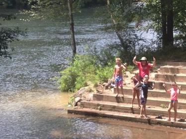

As with any improvement undertaken by the Division all proper permitting will be undertaken and protection of the resource is of the utmost importance. This section will discuss some potential permitting items that may be required for the proposed river accesses along the river corridor.
Deshazo Mill Access:
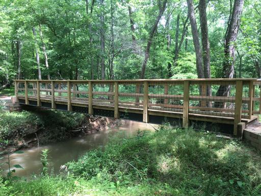
Considerations for the Deshazo Mill Access are primarily for the planned crossings of three FEMA regulated streams: the Mayo River, Fall Creek and an Unnamed Tributary (UT) to Fall Creek. The Mayo River in this area has a regulated floodway of approximately 300 feet and a river width of approximately 80 feet. A single bridge spanning the Mayo (up to 150ft) may be possible if a Conditional Letter of Map Revision (CLOMR) is obtained. Upstream impacts extending into Virginia are possible from the construction of the bridge. The other planned crossings are on streams with a regulated floodplain and a non-encroachment area. It may be possible to obtain approval for bridge construction if the non-encroachment area is not a regulated floodway and a cumulative impact of not more than one foot of rise is obtained. Impacts within the floodway of the Mayo River should be avoided at the Mayo Beach Upper Access. Contraction of flow on the upstream side of bridges can also create increased velocities and backwater eddies that need to be considered with improvements in this area.
Lower Mayo River Access:
Access to the river needs to be sited in an area with a stable bank and outside of the river bend, which is exposed to higher stresses and velocities. The river access will need to be designed to withstand debris impacts during high flows and maintenance will be necessary as sandy materials deposit as waters recede. A no-rise or CLOMR will be required for this access as it encroaches into the river and into the FEMA regulated Floodway. A no-rise is defined as a change in the water surface elevation from the existing to proposed conditions that does not exceed +0.00-foot and is not lower than -0.10-foot and can be approved by the Local Floodplain Administrator. If these limits are exceeded by the proposed work, a CLOMR would need to be applied for through FEMA. As long as the impacts are not excessive, do not adversely impact existing structures, and meet all other federal permits they are usually
MAYO RIVER STATE PARK MASTER PLAN 80 CHAPTER FIVE RECOMMENDATIONS
BRIDGE CROSSING A STREAM AT ENO RIVER STATE PARK, NC
RIVER ACCESS AT SALUDA SHOALS PARK IN COLUMBIA, SC
permittable. CLOMRs once granted are then followed by a Letter of Map Revision (LOMR) once construction has been completed. A constructed boat access may require a USA Army Corps of Engineers 404 permit and State Water Quality 401 Certification if impacts occur to the river below its the mean high-water level. USA Corps of Engineers 404 permits can fall under general permits or an individual permit can be obtained.
Emergency Access
Access to the Mayo River for emergency response becomes more important as the number of paddlers increases. An emergency access point approximately halfway between the Mayo Beach access and the current BUS 220 / proposed Cedar Mountain access is ideal. An emergency access point is intended only for Park staff and first responders as a place to launch a boat or set up a command post in the event of a water rescue.
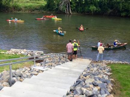
The access should be located in an area that is in a straight segment of the stream and where the transition to the stream can be achieved without excessive cutting. The access should be oriented in a down stream direction and in an area that can be tied into an area with a mature tree that has a substantial root system providing stabilization for the transition to the stream.
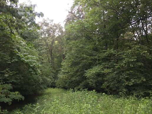
Impacts within the floodway to construct the access will require a FEMA no-rise or CLOMR approval along with potential US Army Corps of Engineers 404 and NC State Water Quality 401 certification.
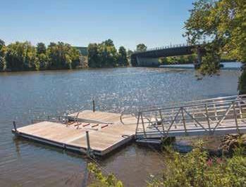

Joyce Ford Rd:
The majority of the planned improvements are to be outside of the FEMA floodplain. Crossings of draws by roadways and trails would need to be designed to freely convey stormwater, avoiding downstream erosion issues caused by concentrated discharges. Boardwalks used to span draws are a good alternative to pipes allowing the natural condition of the channel to remain. Boardwalk sections can be made of wood or concrete. The proposed river access is planned to be angled to the river so that the resistance energy of flow passing over the access during storm events is reduced. As with all river access the planned amenity will need to be designed for varying river heights, be able to withstand variable velocities, and withstand erosional
FIVE
MAYO RIVER STATE PARK MASTER PLAN 81CHAPTER
RECOMMENDATIONS
EXISTING VEGETATION AT NICKEL PLATE RD
KAYAK LAUNCH ON THE ROANOKE RIVER IN ROANOKE, VA
RIVER ACCESS AT THE FREEMANS BRIDGE BOAT LAUNCH ALONG THE MOHAWK RIVER IN SCHENECTADY, NY
forces and debris impacts. USA Corps of Engineers 404 permits and State of NC Water Quality 401 certifications may be required along with a FEMA no-rise or CLOMR for improvements within the floodway of the Dan River.

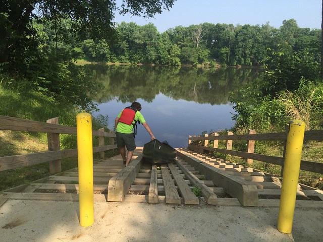
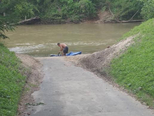

Cedar Mountain (US BUS 220):
The Cedar Mountain site will have impacts within the floodplain and non-encroachment areas of the Mayo River and Mayo River Tributary 3. The trail/roadway crossing of the tributary and proposed river access will require either a no-rise or CLOMR. The placement of the river access above the meander bend and confluence with Tributary 3 is required for long term stability of the access. The velocities of the restricted flow exiting the bridges will also be reduced at this location. The design of the access will need to include the variable forces and permits will be required to be obtained from the USA Army Corps of Engineers and NC State Water Quality agencies.
Washington Mills (Hwy 135):
The access point for Washington Mills site is located in the Lower Mayo River with regulated floodways and floodplain. Existing structures currently impacted by floodwaters which cannot be impacted further through additional increases in peak water surface elevations are located adjacent to and upstream of this site. Land use changes and improvements will have to be carefully evaluated in the FEMA modeling analysis. Existing structures or other obstructions planned to be removed may provide reductions in water surface elevations. A no-rise will be required to be obtained for improvements at this river access location or a LOMR obtained upon completion of construction if the reduction in water surface elevation is greater than -0.1-foot.
Dan Valley Road Bridge:
The Dan Valley Road Bridge access area on the Mayo River is just above the confluence with the Dan River. Due to the proximity of the roadway, Dan Valley Rd may also be within the floodplain of the Dan River. The proposed improvements may be required to satisfy a no-rise condition in both the Dan River as well as the Mayo River. If the access is completed with the roadway improvements the resulting combined impacts may satisfy a no rise condition. Existing structures are located within the floodplain adjacent to this location and therefore no increase in water surface elevations would be permitted.
MAYO RIVER STATE PARK MASTER PLAN 82 CHAPTER FIVE RECOMMENDATIONS
ACCESSIBLE RIVER ACCESS AT HANGING ROCK STATE PARK, NC
RIVER ACCESS ON THE JAMES RIVER AT POWHATAN STATE PARK, VA
KAYAK LAUNCH AT GRAHAM CREEK NATURE PRESERVE IN FOLEY, AL
The River Trail:
The River Trail is important to connect isolated park property. It is envisioned to stretch from the Virginia border to the Dan River Confluence, the trail will be implemented as land is acquired along the river corridor. The trail should be designed and constructed by a trail specialist, implementing sustainable trail design practices that are appropriate for a river corridor.
Trails and bridge crossings that are perpendicular to the Mayo River are also potential impacts and will have to be modeled for flood impacts. They are subject to the same no-rise and CLOMR/ LOMR requirements. The removal of trees for trails can be an impact because of land use and potential maintenance corridors. If fill is required to elevate asphalt or concrete trails that is also a potential impact as well as stairs and handrails. If there are buildings that are already impacted upstream of any area that is being improved within a FEMA floodplain, the only permittable solutions are either for a no-rise or to have the modeling show a drop in excess of -0.1-foot which is followed by a LOMR upon completion of construction.
Future River Trail on Park Property
Potential River Trail on Private Property
M A Y O R I V ER
OTHER PLANNED TRAILS
This map also shows planned trails in the area that may link up to Mayo River trail.
Stoneville Connector
Mayodan/NCDOT Trails
Madison Trails

CHAPTER FIVE RECOMMENDATIONS
MAYO RIVER STATE PARK MASTER PLAN 83
DANRIVER
NC770 VIRGINIA NORTH CAROLINA US HWY 220 MADISON MAYODAN

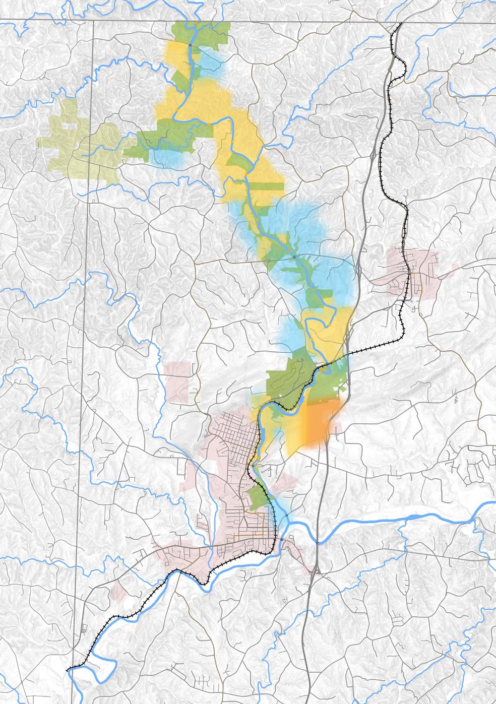
MAYO RIVER STATE PARK MASTER PLAN 84 CHAPTER FIVE RECOMMENDATIONS A b USGS NGA NASA CG AR NCEAS NLS OS NMA G d y GSA GSI d h G S U C ty [0 5,000 10,0002,500 Feet MAYODAN STONEVILLE MADISON VIRGINIA NORTH CAROLINA ROCKINGHAM COUNTY STOKESCOUNTY HENRY COUNTY M A Y O RIVER HICK O R Y CREEK PAWPAW CREEKBUFFALOCREEK DANRIVER 770 704 135 220 FALL CREEK WATERFALL CEDAR MOUNTAIN NORFOLK AND WESTERN RAILROAD FARRIS MEMORIAL PARK PIEDMONT LAND CONSERVANCY EASEMENT MAYO MOUNTAIN LOOP TRAIL WASHINGTON MILLS SITE TO MARTINSVILLE, VA TO GREENSBORO, NC 0 1 2 3 4 5 6 7 8 9 10 11 12 13 14 15 WASHINGTON MILLS DAM AVALON DAM MAYO BEACH UPPER ACCESS MAYO BEACH LOWER ACCESS S.R. 704 ACCESS (NOT STATE OWNED) HWY 135 ACCESS BUS 220 ACCESS (NOT STATE OWNED) DESHAZO MILL ACCESS MAYO MOUNTAIN ACCESS A bus USGS NGA NASA CG AR NCEAS NLS OS NMA Geoda as y e sen GSA GS and he G S U e Commun y [0 5,000 10,0002,500 Feet A b USGS NGA NASA CG AR NCEAS NLS OS NMA G d y GSA GS d h G S U C [0 5,000 10,0002,500 Feet MAYODAN STONEVILLE MADISON VIRGINIA NORTH CAROLINA ROCKINGHAM COUNTY STOKESCOUNTY HENRY COUNTY M A Y O RIVER HICK O R Y CREEK PAWPAW CREEKBUFFALOCREEK DANRIVER 770 704 135 220 FALL CREEK WATERFALL CEDAR MOUNTAIN NORFOLK AND WESTERN RAILROAD FARRIS MEMORIAL PARK PIEDMONT LAND CONSERVANCY EASEMENT MAYO MOUNTAIN LOOP TRAIL WASHINGTON MILLS SITE TO MARTINSVILLE, VA TO GREENSBORO, NC 0 1 2 3 4 5 6 7 8 9 10 11 12 13 14 15 WASHINGTON MILLS DAM AVALON DAM MAYO BEACH UPPER ACCESS MAYO BEACH LOWER ACCESS S.R. 704 ACCESS (NOT STATE OWNED) HWY 135 ACCESS BUS 220 ACCESS (NOT STATE OWNED) DESHAZO MILL ACCESS MAYO MOUNTAIN ACCESS LAND PROTECTION PLAN MAYO RIVER STATE PARK ROADS RAILWAY PRIMARY RESOURCE WATER QUALITY SCENIC VALUE PRIMARY OBJECTIVE CITY LIMITS WATERWAYS RIVER MILE MARKER LEGEND 14
ACQUISITION
This map is based on the general priorities and objectives of NC State Parks to further expand the boundaries of Mayo River State Park. Any park expansion would only be acquired through voluntary means. In no way is this map meant to display specific properties or property owners, or to indicate progress on the voluntary acquisition process.

THE STRATEGY
Acquisition of High Priority Conservation Areas
Natural landscapes surrounding the river corridor are home to rare and endangered species as well as provide a important role in protecting the water quality of the Mayo. Priorities are based on preservation of habitat for rare and threatened flora and fauna as well as limiting development along the banks.
Protection of Viewsheds and Recreational Access
Recreational access and views of the river are high priorities of this plan. Surrounding land use, impact to views and lack of access to the river can have a detrimental impact on park user experience.
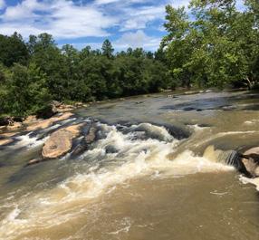
Acquisition for Park Connectivity
Acquisition to create a continuous park boundary can help maintain park experience, allow connectivity of wildlife corridors and simplify park boundary monitoring and maintenance.
FIVE RECOMMENDATIONS
MAYO RIVER STATE PARK MASTER PLAN 85CHAPTER
COST CONSIDERATIONS
Probable construction costs have been formulated for implementation of each phase identified by the master plan.
Construction costs presented are based on current (2020) costs incurred for similar facilities in other state parks and not adjusted over time to account for inflation. More accurate estimates and costs will be determined as part of the design process based on site specific and detailed existing conditions information.
PHASE 1: IMPROVING EXISTING ACCESS
Deshazo Mill Access
Costs not covered by these estimates include the following:
personnel
$5,230,000 (TOTAL)
Sitework $526,000
Hiking Trails $225,000
River Trail System (multi-use) $2,250,000 Bridge (Stream Crossing) $84,000
Parking $242,000
Vault toilet (single) $78,000
Sub Total $3,405,000
Mayo Beach Access
Sitework & Mobilization $300,000
Vault toilet (single) $90,000 Vault toilet (double) $165,000 Parking $195,000
River Access $115,000
River Trail System (multi-use) $850,000
Sub Total 1,715,000
Hickory Creek
Sitework, Trails, Parking $110,000

PHASE 2: CONTACT STATION, STAFFING, FACILITIES & TRAILS
Mayo Mountain Access
$8,306,250 (TOTAL)
Sitework & Mobilization $700,000
Contact Station $1,300,000
Parking $380,000
Fishing Dock $180,000
Hiking Trails $168,000
Landscape Improvements $65,000
Sub Total $2,793,000
Emergency River Access
Sitework, River Access, Road - Paved $175,000
RECOMMENDATIONS
MAYO RIVER STATE PARK MASTER PLAN 86 CHAPTER FIVE
• Land Acquisition • Geotechnical / soils investigation • Contaminated soil remediation • Rock removal • Surveying • Permitting (environmental, building and erosion control) • Archaeological investigations • Percolation tests • Removal or abandonment of existing septic fields • Cost adjustments for inflation • Staffing
and equipment
Joyce Ford Rd
Sitework, River Access $1,550,500 Day Use, Parking, Restroom $534,000 Mini Maintenance Facility $125,000 Trails $688,000

Sub Total $2,897,500
Cedar Mountain
Sitework & Mobilization $336,000 Trails $164,000 River Access, Parking $144,000
Sub Total $644,000
Avalon Day Use Area
Sitework $357,000 Trails $135,000 Parking $135,000 Educational Signage $30,000 Maintenance Facility $780,000
Sub Total $1,437,000
Dan Valley Rd River Access Sitework, Parking, River Access $261,000
PHASE 3: CAMPING, RIVER ACCESS: PART 1
Joyce Ford Rd
$3,093,500 (TOTAL)
Sitework & Mobilization $960,000 Camping (Shower House, Septic) $2,110,000 Parking $23,500
PHASE 4: CAMPING, RIVER ACCESS: PART 2 $1,043,500 (TOTAL)
Deshazo Mill Access - Camping
Sitework & Mobilization $100,000 Camping $40,500 Bridge (River Crossing) $111,000
Sub Total $251,500
Washington Mills
Sitework, River Access, Parking $228,000
Historical Interpretation $24,000
Sub Total $252,000
Madison Town Access
Accessible Trails & Parking $540,000
CHAPTER FIVE RECOMMENDATIONS
MAYO RIVER STATE PARK MASTER PLAN 87
MAYO RIVER STATE PARK MASTER PLAN


APPENDIX A GUIDE TO FUTURE IMPROVEMENTS ADOPTED AUGUST 2021 PREPARED BY: PREPARED FOR:

MAYO RIVER STATE PARK MASTER PLAN 2 APPENDIX
THIS PAGE INTENTIONALLY LEFT BLANK
TABLE OF CONTENTS

MAYO RIVER STATE PARK MASTER PLAN 3APPENDIX
State Historic Preservation Office Memorandum . . . . . . . . . . . . 4 Stakeholder / Community Meetings . . . . . . . . . . . . . . . . . 6 Community Feedback . . . . . . . . . . . . . . . . . . . . . . 36 Vegetation Type Definitions . . . . . . . . . . . . . . . . . . . 38 Opportunities and Constraints Maps . . . . . . . . . . . . . . . . 40
North Carolina Department of Natural and Cultural Resources

 State Historic Preservation Office Ramona M. Bartos, Administrator Governor Roy Cooper Secretary D. Reid Wilson
2021
TO: Dave Head Division of Parks and Recreation Department of Natural and Cultural Resources

FROM: Ramona Bartos
SUBJECT: Mayo River State Park Master Plan, Rockingham County, GS 21 1223
Thank you for your email of May 7, 2021, concerning the above project. We apologize for the delay and any inconvenience it may have caused.
We have determined that there are no properties listed in the National Register of historic Places (NRHP) which will be affected by the work proposed in the Mayo River State Park Master Plan. We note that improvements planned within the Mayo Mountain Access/Contact Station area are appropriate and will not adversely impact the historic picnic shelter or Mayo Park (RK1580) complex, which was placed on the State Study List in 2007.
The plan does not specify material types for proposed walkway enhancements within the complex. We recommend that when constructing paths around the lake, park staff or contractors use methods that allow the new surfaces to blend visually with the surrounding landscape. Potential methods include, but are not limited to, the use of a pebble dash finish to mimic gravel, soil cement, pigmented concrete with a broom finish, or natural materials mixed with a soil stabilizer, such as Enviroseal’s M10+50 (http://www.ncaonline.org/products directory/categories/surfaces/soil stabilization products/index.shtml).
As the Master Plan notes, the Mayo River State Park includes a substantial portion of the Mayo River. Based on our records, there are a multitude of archaeological resources within this area, some of which have been determined eligible, potentially eligible, or are listed on the NRHP However, most of the known sites have not had their National Register eligibility assessed. While we are aware of numerous archaeologically sensitive areas within the county, much of the park area has not been systematically surveyed. We expect additional archaeological sites could be present.
Without knowing precisely where proposed projects will be located, we cannot offer specific guidance regarding archaeological resources and historic properties. We ask that as specific Mayo River State Park projects are developed and prior to the initiation of any ground disturbing activities within the project area, they be submitted to us for review on a case by case basis. Depending on the project location, we may recommend an archaeological survey within the proposed area of disturbance to evaluate known resources
MAYO RIVER STATE PARK MASTER PLAN 4 APPENDIX
Location: 109 East Jones Street, Raleigh NC 27601 Mailing Address: 4617 Mail Service Center, Raleigh NC 27699 4617 Telephone/Fax: (919) 814 6570/814 6898 August 10,
MEMORANDUM
any additional
be adversely affected
ground
Pursuant to Chapter 70, Article 21 of the North Carolina General Statutes, Cemeteries on State Lands, all known cemeteries on State Parks’ property should be identified and inventoried, and the inventory furnished to the State Property Office and the Office of State Archaeology. Any cemeteries encountered would require development of an avoidance plan, especially for those that are near existing or proposed trails and can be impacted by foot traffic. Please contact Historic Cemetery Specialist, Melissa Timo (Melissa.Timo@ncdcr.gov) to discuss the cemetery avoidance plans and for more information on inventorying the cemeteries.
These comments are made in accord with G.S. 121 12(a) and Executive Order XVI. If you have questions regarding them, please contact Renee Gledhill Earley, environmental review coordinator, at 919 814 6579. In all future communication concerning this project, please cite the above referenced tracking number.
cc: Christine Farrell, NC Parks
christine.farrell@ncparks.gov Brian Strong, NC Parks brian.strong@ncparks.gov

MAYO RIVER STATE PARK MASTER PLAN 5APPENDIX GS 21 1223, August 10, Page 2 of 2 Location: 109 East Jones Street, Raleigh NC 27601 Mailing Address: 4617 Mail Service Center, Raleigh NC 27699 4617 Telephone/Fax: (919) 814 6570/814 6898 and to identify
archaeological sites requiring evaluation that may
by
disturbing activities.
MAYO RIVER STATE PARK / Master Plan
Kick Off Meeting Minutes 2.18.2020
NCDNCR Parks Office / Raleigh

Study Area
Study area will be from Virginia state line to the Dan River. East and West the corridor is not limited or defined. Include all properties noted as Land Protection and Critical need at a minimum. TG to look beyond properties identified as Land Protection based on needs, programming and site features. Land protection properties not as important as critical further define properties and why inclusion would be important to vision of the park
Master Plan Goals and Objectives
Highlighting the river and protecting the resource
What is critical to the vision for the park
Protect natural resource / Water and Scenic Quality
Defining development potential / sites suitable for building, boat access, parking, campgrounds etc.
Branding / better signage
Access / Connectivity
Define future recreational opportunities / improvements
Land acquisition considerations…prefer to own land on both sides of river
Community / staff / stakeholder engagement
Phased document development and review ( provide outline ½ way thru each phase / draft at end of each phase )
Paddle map / access points, time, character ( beginner vs intermediate )
Develop nodes along river
Resilience / sustainability
Project Influences
Madison water intake
Mayodan multi use trail to Mayo Mountain access
Community will likely push for off road biking ( 10-15 miles needed to be a destination )
Stoneville Greenway
Branding of area as outdoor recreation
Flood zones ( show 110 and 500 year )
Large fluctuations in water depth
Steep banks
Identification and attention to nodes ( Boiling Hole )
ROMA property 300 acres ( no appraisal )
MAYO RIVER STATE PARK MASTER PLAN 6 APPENDIX
Location:
•
•
•
•
•
•
•
•
•
•
•
•
•
•
•
•
•
•
•
•
•
•
•
land
/ relative to new facilities
of river between dams
conscious
not navigable
easements limit what can happen
park boundary from staff
Dan River access / Wildlife Commission
with Virginia
Schedule
staffing needs
individual
Duke Energy has funded access property
functional
as presented was acceptable. Schedule defined as follows:
Phase 1
Phase 2
Phase 3
Phase 4
Phase 5
2.18
4.30
7.30
7.30
9.30
9.30-11.30
11.30
12.18
Gathering
Master Plan
Master Plan
Plan
Schedule will include reoccurring meetings with staff
Assessment
Design
meetings with project managers / Raleigh beginning 3.13
Monthly meetings with parks staff / Raleigh ( not scheduled )

Other meetings
Meetings / coordination with towns / others ( NCDOT, NCSHPO, NC Railroad, Ec Dev ) Christy and/or Dave to lead meetings with SHPO
Meeting with Mayo parks staff / stakeholders ( 2 in one day )
Site Visits / Fieldwork ( river cruise )
Four public meetings at end of each phase
Phase 1 / meeting with park staff at Mayo
Phase 2 / Planning Charette Mayo staff / stakeholder groups ( 2 day event )
Phase 3 / Meeting with Mayo parks staff / stakeholders ( 2 in one day )
Phase 3 / Present plans to Friends Group / Steering Committee
Phase 4 / Meeting with Mayo parks staff / stakeholders ( 2 in one day )
show critical and land protection
meetings
MAYO RIVER STATE PARK MASTER PLAN 7APPENDIX • PLC
/ easements • Operations
be
of
and
requirements • Stretch
is
and dangerous • Some
on
properties • New
•
• Connectivity
(
acquisitions )
Schedule
•
/
-4.30 Information
/
•
/
–
Preliminary Planning and
•
/
–
Draft
•
/
Final
•
/
–
Master
Document
• Bi-weekly
•
•
•
•
•
•
•
•
•
•
Do not
designations at public
Other Items
Meeting Attendees / NCDNCR Parks staff

Brian Strong
Dave Head
Christy Rosas
John Fullwood
Jay Greenwood John Amoroso
Scott Crocker
Ben Rippe
Jon Blanchard
Sean Gough Katie Hall
MAYO RIVER STATE PARK MASTER PLAN 8 APPENDIX
• Outreach…Carolina Paddling / REI / Equestrians, Great Outdoor Provision Co., Bass Pro Shop ( coordinate through Katie ) • Meetings with Sen Berger’s office to be coordinated by Brian Strong and Carol Tingley • Website ( Katie Hall ) Keep it simple • Press releases to go out 2 weeks prior to public meeting • Steering Committee will be Friends of Mayo River State Park • Possible venues for public meetings…park picnic shelter, Madison / Mayodan Library, Stoneville ( RCC was considered too far from community ) • Area up-river was visited by CDC due to high infestation of Ticks
MAYO RIVER STATE PARK / Master Plan
Stakeholder Committee / Meeting Minutes 5.21.2020
Location: Virtual
Attendees
Dave Head / NCDNCR Parks / Raleigh
Keith Martin / NCDNCR Parks / Mayo River State Park
Christy Rosas / NCDNCR Parks / Raleigh

Kristen Woodruff / NCDNCR Parks / North District Superintendent
Ken Bridle / Piedmont Land Conservancy
Tiffany Hayworth / Dan River Basin Association
Jesse Day / Piedmont Triad Regional Council
Vince Joyce / Friends of Mayo River, Vice President
Rusty Gray / Friends of Mayo River, President
Corey Oakley / Wildlife Resource Commission
Adam Layman / Virginia State Parks
Leigh Cockram / Rockingham County, Tourism and Economic Development
Lessa Hopper / Town of Mayodan, Town Manager
Kevin Baughn / Town of Madison, Town Manager
Brian Starkey / Timmons Group
Jon Blasco / Timmons Group
Michael Alderman / Timmons Group
Absent
Lori Armstrong / Town of Stoneville
Quint Haley / Local Recreation
Katie Harville / NCDCR
Introductions
Each member introduced themselves and provided information on their perspective, organization and initial thoughts. Items heard:
• Protection of cemeteries on and adjacent to park land
There are a number of old cemeteries along the river / Joyce Ford Road Parks has GPS located these and provided Timmons the GIS data on 5/26/2020 Data for internal use and not to be publicized
2004 Master Plan for Mayo by Frank Butler and DRBA
PTRC Corridor Plan
Desire for Washington Mills site to become part of Mayo. Previous master plan. some brownfield work associated with plan. Sense of loss to community
Review recreation access plan 2016
There is NCDOT funding for a side path from Mayodan to the Mayo Mountain Access entrance
Needs a local match
On STIP for 2023, unclear how current DOT situation affects timeline and funding
MAYO RIVER STATE PARK MASTER PLAN 9APPENDIX
•
•
•
•
•
o
o
to see Avalon Dam and Avalon Village
Book on Avalon
Resource Protection is critical … protect the wetlands and floodplains
Find opportunities for enhancement of natural communities
with Virginia State Parks will be important for developing the northern section at the confluence
Virginia State Parks plans to start their own master plan process at the end of the year

like to see recommendations for
to the adjacent towns of Mayodan, Madison and Stoneville through greenways
Joyce Historic Group recognized
that VA is anticipating master plan for Mayo VA side later this year
were identified as a major consideration
Greenway connections
Project Overview
Group gave a presentation on master plan including:
Master plan study area orientation
Work completed to date
Project objectives
Community engagement
Presentation provided to stakeholder committee members
Timmons recorded the presentation and will shared it with Parks
Community Engagement / Communications
Stakeholders agreed to promote the website and project through their social media feeds and other connections
Timmons to supply text for a social media post, the Get Involved flier and the website URL to towns and organizations for distribution
Reach out to Stokes County Tourism Coordinator, Tory Mabe
Mike Moore Media ( Eden ) is a possible resource for promoting the website and project – big reach across Rockingham County
Downtown Associations could be good resources for promotion
Recognized challenges of outreach to rural towns
Notification of project through town water bills not an option
Opportunity with Future reopening event…dependent on state’s Phase 3 of reopen plan
Towns can promote on Facebook page
NW Rockingham County Ruritans / covers unincorporated areas
DRBA Newsletter and Lunchtime webinars / Timmons will present at June 3 webinar
Next Steps
Meeting: mid-late June
MAYO RIVER STATE PARK MASTER PLAN 10 APPENDIX • Desire
historical interpretation o
•
o
• Collaboration
o
• Would
connections
(Keith) •
• Noted
• Wetlands
•
desired
Timmons
•
•
•
•
•
•
•
o
•
•
•
•
•
•
•
•
•
• Next
MAYO RIVER STATE PARK / Master Plan
Stakeholder
Location: Virtual
Attendees
Dave Head / NCDNCR Parks / Raleigh
Christy Rosas / NCDNCR Parks / Raleigh

Kristen Woodruff / NCDNCR Parks / North District Superintendent
Katie Harville / NCDCR / SHPO
Keith Martin / Friends of Mayo River
Ken Bridle / Piedmont Land Conservancy
Tiffany Hayworth / Dan River Basin Association
Jesse Day / Piedmont Triad Regional Council
Vince Joyce / Friends of Mayo River, Vice President
Bob Brueckner / Carolina Canoe Club
Brian Starkey / Timmons Group
Jon Blasco / Timmons Group
Michael Alderman / Timmons Group
Absent
Lori Armstrong / Town of Stoneville
Corey Oakley / Wildlife Resource Commission
Adam Layman / Virginia State Parks
Quint Haley / Local Recreation
Rusty Gray / Friends of Mayo River, President
Leigh Cockram / Rockingham County, Tourism and Economic Development
Lessa Hopper / Town of Mayodan, Town Manager
Kevin Baughn / Town of Madison, Town Manager
Introductions
Bob Breuckner was
Keith Martin
Project Overview
MAYO RIVER STATE PARK MASTER PLAN 11APPENDIX
Committee / Meeting Minutes 6.25.2020
introduced as a new member. Katie Harville was also welcomed to the committee.
recognized as now representing Friends of Mayo River
Timmons Group provided an update including: • Work Completed to Date • Phase 1 Information Gathering / Site Assessment complete (survey closed 6.12) • DRBA Webinar was done 6.3 Thank you to Tiffany for making that happen • Phase 2 / Preliminary Planning underway (park program / land use alternatives) • Podcast with Mike Moore Media scheduled for 6.26 • Recording of the meeting available at URL: https://timmons.zoom.us/rec/share/78pkaIjt7FpLTtbzuQLaR4gf ENvLeaa8g3Qa-6IKyh2QXBjgeE-heMzL4hQklmBk Password: 4H+412?5
Website Update
Timmons Group presented summary of website survey results
Questions comments included:
• Could survey results be made available? Results will be posted on website. Timmons to make PDFs available to committee
• Vince heard that 5 or 6 community members reported that they could not access website. Those that could not access the site were not stakeholders. No other details were provided
Development Diagrams
Virginia to Means Creek ( just north )
• 300 acre Shaffer property is likely to be sold. Currently has conservation protection easement on it
• EEP Easements concern that trails not permitted. Timmons will review easements and report on restrictions
• It was noted that river access is possible at Hwy. 695 Moore’s Mt. Rd in Virginia as well as Pratt Rd also in Virginia on state owned land
Means Creek to Joyce Ford Road
• Question of what impact future I73 and connection to 770 should have on our planning
• Is Nickel Plate Rd a NCDOT road? Timmons to confirm

• Need to get photos of structures at Opportunity Site F
• Future submittals to SHPO should go through Parks office and need to include photos / documentation of structures that might be impacted.
• Cemeteries on park property require recordation
• Cemeteries on north side of 770 west of rive. Cemeteries include gravesites belonging to Vince’s family. He plans to sell property eventually to state parks
• Could improvements be made to ex. bridge or accommodations for pedestrians / bikes with a new 770 bridge. Possible access at this crossing but steep. It was mentioned that bridge might be built as part of I73 improvements.
MAYO RIVER STATE PARK MASTER PLAN 12 APPENDIX
Joyce Ford Road to Washington Mills Dam
provide original portage trail plans around Avalon Dam. Noted that with 600 cfs the river can be
Area
safe
of native American
Washington Mills Dam to Dan River
Historic District
River Culture”
there
releases
river bend across from Roma
the dam
special
Next Steps
Nickel Road
cemeteries
development of Preliminary Plans

meeting
22 Timmons to
MAYO RIVER STATE PARK MASTER PLAN 13APPENDIX
• Bob to
paddled.
is
and appropriate for fishing. Could
be
at
on
days? • Site
“ Dan
on
property
• 1 National
in Mayodan • Washington mills site no longer an eligible property • Possible access to river at Dan Valley Rd.
• Website / project promotion • Upload survey results to website • Document
site buildings and other features • Document
adjacent to 770 • Continued
/ Diagrams • Next
July
send invite
MAYO RIVER STATE PARK / Master Plan
Location: Virtual Attendees
Dave Head / NCDNCR Parks / Raleigh
Christy Rosas / NCDNCR Parks / Raleigh

Kristen Woodruff / NCDNCR Parks / North District Superintendent
Katie Harville / NCDCR / SHPO
Keith Martin / Friends of Mayo River
Ken Bridle / Piedmont Land Conservancy
Tiffany Hayworth / Dan River Basin Association
Vince Joyce / Friends of Mayo River, Vice President
Bob Brueckner / Carolina Canoe Club
Corey Oakley / Wildlife Resource Commission
Adam Layman / Virginia State Parks
Brian Starkey / Timmons Group
Jon Blasco / Timmons Group
Michael Alderman / Timmons Group
Absent
Lori Armstrong / Town of Stoneville
Quint Haley / Local Recreation
Rusty Gray / Friends of Mayo River, President
Leigh Cockram / Rockingham County, Tourism and Economic Development
Lessa Hopper / Town of Mayodan, Town Manager
Kevin Baughn / Town of Madison, Town Manager
Introductions
Project Overview / Schedule
MAYO RIVER STATE PARK MASTER PLAN 14 APPENDIX
Stakeholder Committee / Meeting Minutes 7.23.2020
• Minutes from meeting #2 were approved with no revisions • Timmons reviewed objectives of meeting
Timmons Group reviewed project status and provided an update including following schedule : • Current Status / Schedule o Revisit site next week o Refine program and prepare site plans for opportunity areas o Present to Stakeholder Committee 8.13 o Revise and review with Internal Committee 8.28 o Present to Stakeholder Committee 9.10 o Make available to public ( website / virtual town hall / on site ) late September
Development Diagrams
Questions from review of development diagrams at meeting #2 were addressed including:
Comments from community survey regarding need for a visitor’s center were linked to respondents geographically showing many from the county had identified the need for a visitor ’s center.
EEP easements will allow for continuance of existing roads but does not allow new trails of other improvements not required for maintenance, management and stewardship.
Nickle Plate Road is not an NCDOT road.
It is probable that when new bridge is built on 770 that bike ped accommodations could likely be incorporated
Bathhouse was taken down just before Mayo Park became part of state park system
Program Confirmation / Opportunity Sites
Potential program activities and elements at each opportunity site were reviewed resulting in the following:
• Opportunity Site A (Confluence / DeShazo Mill)
o Incorporation of land in between the north and south fork of river is dependent of cooperation with VA Parks. Master Plan for Virginia side could be initiated in about 1 year

o Paddle camping desirable at confluence. ~3 miles from Moore’s access.
o Parking expansion at DeShazo Mill
o Restroom
o Hiking trails ( 2 loops )
o Beginning of River Trail ( bridge crossing of Fall Creek )
o Leave land on west side / future collaboration with VA Parks
• Opportunity site B ( Anglin Mill Road North side )
o Parking
o Hiking ( loop back to Deshazo parking area )
o Access to river trail
• Opportunity site C ( Anglin Mill Road South side / Boiling Hole / Beach )
o No contact station ( could be in the future if more land is required )
o Parking
o Restrooms critical
o Waste receptacles needed
o Convert Old Anglin Mill Loop to river trail
o River access / launch site
o Day use
• Opportunity site D ( Hickory Creek )
• Conservation
• Camping considered but would not be connected to anything else in the park
• River Access prevented by EEP
• Corey to follow up on possibility of allowing trail in EEP easement
MAYO RIVER STATE PARK MASTER PLAN 15APPENDIX
•
•
Opportunity site E ( North of Means Creek )
Conservation
Opportunity site F. (Wilson Property, Nickel Plate Rd).
o No contact station ( land needed )
Trailhead parking
o River access / launch site / emergency access potential
Access to river trail
Day Use ( picnic )
o Ranger residence ( existing structure currently being evaluated )
PLC potentially acquiring additional land connecting to Claybrook Rd
Ideal location for paddle camping (6 mile)
• Opportunity site G. (Hwy 770).
o Conservation on NW corner
o River trail crossing at bridge from East side to West side
o North of Hwy 770 on East side currently used as river access with parking on south side and under bridge. Launch under bridge. Engineering drawings have been developed. Corey to send drawings. Plans were shelved as it was to difficult to get vehicles back p to 770 safely. Timmons to contact NCDOT to discuss
• Opportunity site H. (Joyce Ford Rd).
Trailhead to river trail
Restroom
Hiking
Potential paddle camping
Conservation
Keep paddle access / day use and camping separate. Visibility / noise.
• Opportunity site I (Harry Rd)
Conservation
River access
River trail
Ranger residence
• Opportunity site J (220 Access)
o Abandon existing access
o Potential pedestrian access under 220 bridge on west side. Timmons to coordinate with NCDOT.
• Opportunity site K/L (Mayo Mountain Access)
Camping (group, car, cabins) was discouraged
o Concern over noise in the area north side of pond relative to placing camping or cabins there

Hiking
o Connections to Avalon and Cedar Mountain
o Investigate existing access to utilities
o City Water access. No sewer.
MAYO RIVER STATE PARK MASTER PLAN 16 APPENDIX
o
o
o
o
o
o
o
o
o
o
o
o
o
o
o
o
o
o
•
o Noted that family campground should have access to river
Need separation between camping and day use
Discussion around continuing / expanding existing maintenance area in leu of relocation.
Historical reference to group camping at this location ( Shady Grove Cabin ) was noted
Opportunity site M. (Avalon Mill Village)
Historical interpretation
Day use ( picnic)
Maintenance facilities
o Beginning of “Mill Trail” along 220 to Washington Mill site
Connections to Mayo Mountain and Cedar Mountain
• Opportunity site N ( Cedar Mountain)
o Access from Pheasant Road
River Access / take out site (across from sandy beach)
Trailhead
Hiking
Mountain biking mentioned but not recommended due to sensitive natural areas

Consider river camping at this location
• Opportunity site O. (Washington Mills site)
Partnership with Mayodan
Contact station
River access / launch site (potential to replace Mayodan River access)
Historic Interpretation
Open space
Mill Trail connection to Avalon Site
• Opportunity site P. (Behind K Mart site)
Conservation
o Trail connection (using passage under railroad)
o Connections to future Madison trails
Utilities present
o Property fairly secluded / consider who will be occupying Kmart space
It was noted that sites O and P will require collaboration with Towns of Mayodan and Madison
• River and Mill Trails
River and Mill trails were described. Time intervals for paddling / floating identified as follows:
1.5 miles for tubing
5 miles for paddling
Tubing ride access.
o Canoe travelling 3mph. Dictated by water flow.
MAYO RIVER STATE PARK MASTER PLAN 17APPENDIX
o
o
o
o
o
o
o
o
o
o
o
o
o
o
o
o
o
o
o
o
o
o
Next Steps

MAYO RIVER STATE PARK MASTER PLAN 18 APPENDIX • Mountain Biking and Equestrian Accommodation Noted that existing property holdings do not offer much potential for these activities
• Timmons to send development diagrams to DRBA following revisions • Website / post diagrams and push out Website www.mayomasterplan.com • Continued development of site plans • Next meeting / August 13
MAYO RIVER STATE PARK / Master Plan
Stakeholder Committee / Meeting Minutes 8.20.2020
Location: Virtual Attendees
Dave Head / NCDNCR Parks / Raleigh
Christy Rosas / NCDNCR Parks / Raleigh

Kat Deutsh / NCDNCR Parks / Raleigh
Brian Strong / NCDNCR Parks / Raleigh
Kristen Woodruff / NCDNCR Parks / North District Superintendent
Sean McElhone / NCDNCR Parks / District Superintendent
Katie Harville / NCDCR / SHPO
Keith Martin / Friends of Mayo River
Ken Bridle / Piedmont Land Conservancy
Vince Joyce / Friends of Mayo River, Vice President
Bob Brueckner / Carolina Canoe Club
Adam Layman / Virginia State Parks
Jesse Day / Piedmont Triad Regional Council
Brian Williams / Dan River Basin Association
Brian Starkey / Timmons Group
Jon Blasco / Timmons Group
Michael Alderman / Timmons Group
Absent
Corey Oakley / Wildlife Resource Commission
Tiffany Hayworth / Dan River Basin Association
Lori Armstrong / Town of Stoneville
Leigh Cockram / Rockingham County, Tourism and Economic Development
Lessa Hopper / Town of Mayodan, Town Manager
Kevin Baughn / Town of Madison, Town Manager
Quint Haley / Local Recreation
Rusty Gray / Friends of Mayo River, President
DRBA Comments
• Most comments received reference river access and the BUS 220 access primarily
Site Visit 7.31
• On 7.31 Timmons Group staff visited several sites along the corridor including: 770 cemeteries / Nickel Plate Road site / Kmart site / bridges at 770 and 220 business / Avalon site / Group camping area at Mayo Mountain Access.
MAYO RIVER STATE PARK MASTER PLAN 19APPENDIX
Connection to Stoneville
• Rockingham County Pathways - figure 15, pg. 24 (print), pg. 30 (pdf online) shows the connection between Mayo and Stoneville Park III https://www.ptrc.org/Home/ShowDocument?id=3909
Draft Concept Plan Review
• DeShazo Mill Area
o Vehicle access to camping area to be reviewed. Walk in camping would reduce potential issues and ranger’s time to police activities

o Need more information about Bridge Connections – No bridge piers in water for safety purposes (See Eno River)
o Loop connection back to parking via Anglin Rd Bridge?
o Restroom facilities: Vault toilet around Deshazo Mill Access, shower house at family camping area
o Move overlook on west side away from sensitive species
o Road alignment to family camping area to be considered
o Mayo Beach upper access concrete ramp has been popular
o Mica Mine located in south east corner of property – move trail away
• Mayo Beach Area
o Remove road north from Old Anglin Road and Mayo Beach Road. Replace with River Trail which should allow vehicles for bridge maintenance
o Change road name to Old Anglin “Loop”
o Continued land acquisition in this area
o Improvements to Mayo Beach lower access; bank stabilization, ramp, ADA accessible launch
o Parking, boat trailer accommodations (turn around)
o Parking, head in fit on State Park land. Near intersection (12+ spaces)
o Vault Toilet at beach parking review flood elevation. Toilet to be 2’ above finished grade
o Private access to adjacent neighbors important
• Nickel Plate Road Site
o Plans were not presented for this site. However, it was noted that this site is a 2 hour paddle form the beach and could offer emergency and river access as well as river camping and continuation of River Trail
• Joyce Ford Road / Harry Road Area
o Crossing at Hwy 770 requires safety improvements
o Ranger residence indication intended to recognize that with the proposed level of activity a ranger residence nearby will be needed nearby
o Potential opportunity for combining family camping, RV camping and cabins
o Mini maintenance facility needed
o Deeded cemetery on Joyce Ford area
o Potential conflict with adjacent landowners / neighbors on Harry Rd
o Day use area parking size to be determined
MAYO RIVER STATE PARK MASTER PLAN 20 APPENDIX
o River access distance from Hwy 770. No parking at 770. Noted bridge replacement.
Trail on other side of river could connect to Stoneville.
• Mayo Mountain / Avalon / Cedar Mountain Areas
Mayo Mountain
o Consider variety of camping experiences in family camping area
Group camping area and relocation of maintenance idea embraced
Avalon
o Day Use area – Potential issues of active railway / hydroelectric plant / crossing road safety issues
Historical interpretation desired by local residents
Ranger led hikes to Avalon
Potential connection along B 220 to Mayodan
What improvements can be made at Avalon for day use
Annotate realignment of road at Avalon
Cedar Mountain
Picnicking at Pheasant Road access.
Land between Cedar mountain property and river owned by power plant company …
to allow access or future land donation / acquisition
Steep topography presents challenges
Potential for partnership on trails with high school possible MOU
Other
o Hwy BUS 220 access – Show as not operated by State Parks

Marshal Rd / Janet Rd – label Ranger Residence
River portage around dams is still being reviewed
• Washington Mills Site
o Recognition that river bank at mill site is steep
135 access good for fishing
135 also good emergency access
Access easement to island provides trails
Potential for connectivity
Consider existing 135 parking area overflow if launch is constructed at Washington Mill site
• K Mart Site
o Potential shared parking agreement
Potential for river takeout before confluence with Dan River at end of Mayo River ( N. Waters Street )
o Acknowledged that this stretch of the river is pretty
Settles bridge ~9.5 miles from 135 (3.5 paddling hours)
DRBA planning river access at Planners Rd on Dan River
Dan Valley Rd bridge – potential for NCDOT deal
o Short run from 135 access (1.5 mile) shallow and safer than Dan River
MAYO RIVER STATE PARK MASTER PLAN 21APPENDIX
o
o
o
o
o
o
willingness
o
o
o
o
o
o
o
o
o
o
o
o
Process
Next Steps
Engagement

MAYO RIVER STATE PARK MASTER PLAN 22 APPENDIX Long term land dependent Tubing potential Show river access at road. • General Comments o Master Plan to review Land Protection Plan o Identify camping priorities Joyce Ford Rd river access Deshazo potentially a second phase as park develops o 130,000 annual visitors
/
• Revise and review with Internal Committee / date TBD • Present to Stakeholder Committee around 9.10 • Make available to public ( website / virtual town hall / on site ) late September Community
• Put Opportunity Diagrams on website and push out • Decide on in-person meeting or some virtual presentation

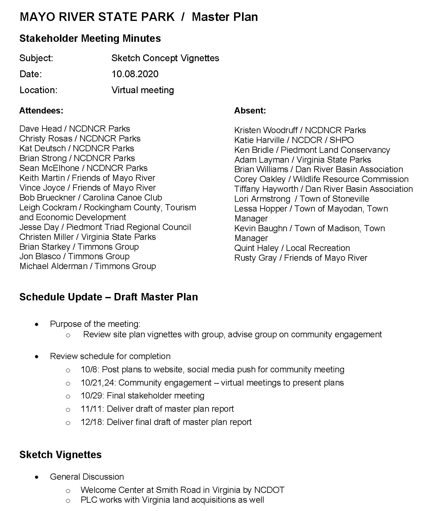
MAYO RIVER STATE PARK MASTER PLAN 23APPENDIX

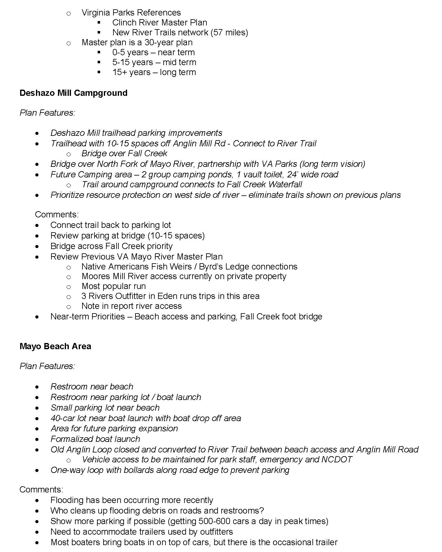
MAYO RIVER STATE PARK MASTER PLAN 24 APPENDIX

MAYO RIVER STATE PARK MASTER PLAN 25APPENDIX

MAYO RIVER STATE PARK MASTER PLAN 26 APPENDIX

MAYO RIVER STATE PARK MASTER PLAN 27APPENDIX
MAYO RIVER STATE PARK / Master Plan
Attendees
Dave Head / NCDNCR Parks
Christy Rosas / NCDNCR Parks
Kat Deutsch / NCDNCR Parks
Katie Hall / NCDNCR Parks
Kristen Woodruff / North District Superintendent NCDNCR Parks
Jessica Phillips / Superintendent, Mayo River State Park
Connie Fox / Admin Assistant, Mayo River State Park

Brian Starkey / Design Consultant
Jon Blasco / Timmons Group
Michael Alderman / Timmons Group
Bob Brueckner / Carolina Canoe Club
Jim Mead / Apex, NC Member of the Carolina Canoe Club. Retired from NC Division of Water Resources
Mark Bishopric /Three Rivers Outfitters; Dan River Basin Association Board Member
Sarah Wray Reynolds / Homestead Patrick County, Virginia (Urban & Regional planning student)
Justin Terrell
Janice Wilkinson
Eliot Vincent
Linda Hickok
Vencint Joyce / Stakeholder
Kitty Williams / Resident of Madison, NC
Meeting
the Video
20-minute Video
30-minutes
overview
concept plans
shared
also available
names
See link below: https://timmons.
and
listed
MAYO RIVER STATE PARK MASTER PLAN 28 APPENDIX
Public Engagement Presentation Meeting Notes Subject: Draft Concept Maps and Vignettes Date: 10.22.2020 Location: Virtual meeting Video: https://vimeo.com/471040194
• Timmons introduced members of the design team and invited attendees to add their
and locations to
Platform chat function. • Timmons gave a brief
of the project • A
Presentation was
with attendees o Draft
are
on the project website.
mayomasterplan.com/pages/final-concept • A
question-and-answer session was conducted. Questions
responses are
below.
Questions and responses
• Q. Is there a link to the presentation video that I can share with others?
o Please see our project website: https://timmons.mayomasterplan.com/pages/final-concept
• Q. How do I provide feedback?
o Attendees and other interested members of the community are invited to send any further questions or comment through email at info@mayomasterplan.com . There is also a function on the project website that allows for written comments to be posted.
• Q. What are the first steps of implementing the plans?
o The initial priorities of the plan include improvements to the Deshazo Mill access trails, including parking expansion and a footbridge crossing Fall Creek, which would extend the trail to the Mayo Beach Access. Parking improvements at the Mayo beach area has also been designated as a priority, especially given the recent surge in attendance to this area. Elements of the plan will be implemented as funding and priorities allow. There is no guarantee that all or any of this will be implemented.
• Q. Does the plan accommodate equestrian trails? Is that a possibility? The Survey showed an interest.
o Equestrian trails are not currently envisioned in the Master Plan. The state does not currently own enough contiguous property to make equestrian trails viable. The State conducted a Bike and Equestrian Trails Task Force study in 2012 and determined that the narrow river corridor does not allow for new equestrian trails without user conflicts or impacts to natural resources. 10 miles is the recommended minimum distance for bike and equestrian trails as outlined in DPR’s Trails Guidelines and the state recommends 140 acres per mile of trail.. Mayo River was deemed unsuitable for equestrian trails due to its limited land bases and the proximity to sensitive aquatic resources.
• Q. Does the plan accommodate mountain bike trails? This also had support in the Survey.
o The state does not currently own enough contiguous property to make mountain bike trails viable. The state recommends 50 acres per mile of trail. In order to build sustainable trails that do not promote erosion issues, the state would need a larger continuous tract of land. State Parks also looks at the whole park system and notes that Mountain biking trails are planned for Hanging Rock State Park, which is close by.

• Q. Does the state park own the property on the east side of the river at and below Avalon Dam?
o No. The Master Plan and the Division’s Land Protection Plan will designate this area as a High priority for future park expansion due to the presence of high-quality natural areas.
• Q. Are portages planned around the existing dams?
o No portage around the two Hydroelectric Dams are proposed in the master plan. (See response below)
MAYO RIVER STATE PARK MASTER PLAN 29APPENDIX
• Q. Have the owners of the dams been contacted to see if they would be open to allowing portage on the west bank - take out upstream of the race and cross the race via a small bridge. They are required to provide portage by their FERC licenses
o Conversation are ongoing with Dam owners, who have been included in the master plan process. Potential access could include an access easement on private land for portage or nominating special one-off events for paddling past the dams on high water days. The main challenge for portage is the concern for public safety. The railroad adjacent to the dam race and the close proximity of Highway Business 220 mean that there is little room to provide access on the west side of the river. To the east, steep slopes of Cedar mountain also prevent safe portage. The other challenge of portage is the low level of the water after the dam. State Parks does not want to encourage amateur paddlers to attempt to traverse the slippery and dangerous rocks of this section of the river. The Division has recently conducted a Dam portage study and determined it is not a high priority at this time. Dam portage will continue to be evaluated after the completion of the master plan.
• Q. Does NCDOT or State Park plan to widen the unpaved section of road to Mayo beach.

o It is unknown if NCDOT plans to widen the road. Old Anglin Loop Rd would require improvements to be a 2-lane road. The plan suggests closing the section of road adjacent to the Anglin Road bridge due to erosion issues.
• Q. Is there room for camping expansion?
o Yes. The master plan has recommendations for camping at Joyce Ford Road, Mayo Mountain Access and future group camping at Deshazo Mill Access. As the Park grows and the state adds more land, opportunities for camping will continue to be evaluated. The areas designated for camping in the current plan could be expanded if deemed appropriate.
• Q. Have you reached out to Madison, Mayodan Town Managers to view? And any other government officials especially in the county tourism department?
o Yes. Through the master plan process, the design team has conducted monthly meetings with the stakeholder group. Town staff in Mayodan, Madison and Stoneville have all been invited to participate in the process. Partnerships at the proposed Washington Mills Access and Madison Town access have been recommended in the Master Plan report. Staff from Virginia State Parks have also attended stakeholder meetings, and a partnership at the Virginia-North Carolina border has been recommended for the future development of Mayo River State Park as visitorship increases.
• Q. Is that list of stakeholders on your website?
o Not yet. The Stakeholder List will be provided.
• Q. What are the next steps in the process with this plan?
o State Parks will evaluate the General Management Plan for the park. This will include projects defined in the master plan, as well as smaller maintenance projects already identified by park staff. Priorities for park improvements will be identified in the master plan report and evaluated on a scale from near term needs to mid- and long-term needs. The Division will use this information to help develop priorities for funding future projects across the whole NC Parks system.
• Q. Has State Parks looked at private funding?
o State Parks is open to potential partnerships.
MAYO RIVER STATE PARK MASTER PLAN 30 APPENDIX
• Q. Who would be responsible for monitoring the Boiling Point area? Has sheriff department been in on the stakeholder meeting?
o The sheriff has not been directly involved with the master plan process, but park staff have helped the design team understand operational challenges throughout the process. Park Staff works closely with local law enforcement to coordinate all operational issues throughout the park. Park staff has made steady improvements to the overall culture of this section of the river to encourage a family-friendly experience.

• Q. Many residents in Rockingham County have limited access to internet or are unfamiliar with Zoom. Is there another way for them to review plans and provide feedback?
o Paper copies of the maps will be available at the current contact station at Mayo Mountain Access in Mayodan. Stakeholders have also been instructed to reach out to their various contacts and associated organizations to spread the word.
Other Comments
A Madison resident informed the design team of the historical presence of “Freetown”, a section of Madison where many African-Americans had homes, businesses, schools, churches and a library from the late 19th century until the 1970’s. This area is near the property close to downtown Madison (the site of the former Salem - St. Petersburg road) and is significant in the history of Madison. The master plan proposes day-use hiking and picnicking for this area, which presents an opportunity for a partnership between the State and the Town of Madison.
MAYO RIVER STATE PARK MASTER PLAN 31APPENDIX
MAYO RIVER STATE PARK / Master Plan

Stakeholder Meeting Agenda
Subject: Sketch Concept Vignettes
11.05.2020
Virtual meeting
Community Engagement Update
website
Video
input
input
word
Final Master Plan Updates
Deshazo Mill Campground
Updates:
Group camping longer term priority
Mayo Beach Area
Plan Updates:
Expand large parking
multi-use trails
gate to separate private property
property
formalized
parking
south
park property;
include
public turn around
MAYO RIVER STATE PARK MASTER PLAN 32 APPENDIX
Date:
Location:
• Project
updated with concept plans and vignettes •
created / shared / posted to web site • Community
sessions on 10/22 o Lunch meeting o Evening meeting • Community
summary o Equestrian / mountain bikes o Dam portages? o Funding options? o Coordination with law enforcement at Boiling Hole / Mayo Beach o Getting the
out to those with limited Internet access o Freetown – near Madison site
Plan
•
•
lot as space will allow • Incorporate
(accommodate mobility-challenged) • No
to the
from
rather
a
before
line • No
staff
area at Anglin Mill Road
Hickory Creek Access
Plan Updates:
Nickel Plate Road property
Plan Updates
Ranger residence
river access
Joyce Ford Road / Harry Road Area
Plan Updates:
cabins
Mayo Mountain Access (current park area)

Plan Updates:
3,000sf contact station
New location
contact station
house
staff,
current office
Mayo Mountain Group Camping
Plan Updates:
camping
Avalon Day Use Area
Plan Updates:
camping expansion
pedestrian crossing
MAYO RIVER STATE PARK MASTER PLAN 33APPENDIX
• None
/ confirmation: •
• Emergency
• Camper
removed, replaced with family camp sites
• 2,500sf –
o
o No
at pond o Accommodate
gift shop, education • Caretaker
/
remains • Parking adjusted to not impact septic field
• RV
/
removed
• No
of BUS 220 • Area reservable • Historical interpretation
Cedar Mountain
Plan Updates:
Mills Site
Madison site
Updates:
N Water Street River Access (Mayo & Dan River Confluence)
Updates:

Next Steps
MAYO RIVER STATE PARK MASTER PLAN 34 APPENDIX
• None Washington
Plan Updates: • Rt. 135 access remains for passive recreation area
Plan
• Day use with multi-use trails (Accommodate strollers, bikes, mobility-challenged)
Plan
• None
• Continue to receive community input • Priorities and phasing • Budgetary estimates of probable construction cost • Complete Master Plan Report draft (next week) • Final Report submitted (December/January) Thank You!

MAYO RIVER STATE PARK MASTER PLAN 35APPENDIX
SURVEY RESULTS
QUESTION:
Please provide any additional feedback that you feel is important for us to know.
Mountain Bike Trails
• Mountain biking would be worth the trip and attract people from all over, like at Kerr Dam
• The mountain biking community in central to western North Carolina has never been stronger . It would be great to add as many MTB trails as possible to keep this trend going
• Please work with the local mountain bike clubs- we are chapters of SORBA and be a strong volunteer network to help maintain and build mountain biking trails and promote the park - President of the Tri angle chapter (Triangle Off-Road cyclists, TORC)
Equestrian Trails
• Would live to have water crossings in equestrian trails . Rockingham county has a large number of eques trians and very few places to ride
• Would love to see day use Equestrian Trails, camping if possible we have so FEW in the NC State Parks I often travel 4 hours to SC and VA to camp overnight with my horse to the State Parks there as they have such great horse trails and facilities

• What a wonderful setting & destination for a horse trail . Horse back riders are under-represented in this area and creating an opportunity here would be a welcome draw
• Would love to see 10 to 20 plus miles of equestrian trails with camping and a central shower house
• We need more horse trails and camping areas for equestrians .
• We need horse trails that are safe from mountain bikes That way it is family friendly
• Providing a place to ride is a big draw . It can be difficult to integrate horses into the plan because of special requirements and need for space
Hiking and Other Recreation
• Would love to see as many hiking trails as possible, along various points along the Mayo River
• Would love to see a playground! Camping areas for tents and campers .
• Hiking trails and bicycle trails and trails with interpretive programming
River Access
• Wish there was access to the river at the Main campus of the park Having to drive to access areas all over the place but can not get in the river at the main campus to me does not make sense .
• We always need to rent tubes/canoe/kayak
• Would love any other area to tube and camp!
• River access areas are needed every three to five miles along the river Paddlers also need public ac cess areas on the Virginia side . (The Moore’s Mill Road access for the North Fork is on private property . Changes in land ownership could preclude launching boats here ) It would also be great to have public access on Virginia highways 629 on the North Fork and 695 on the South Fork This would allow groups to spread out on different sections . An access should be built on the Mayo as close to confluence as pos sible When the Dan is high, it’s difficult to paddle upstream to reach the 704 access at Madison -- Bob Brueckner, Conservation Chair, Carolina Canoe Club
• The swim area could be a little larger but keep it as primitive and natural as possible I would like to see a designated fishing area away from the swimming area And a paddle and kayak launch would be nice
• More park security is needed . The place they call the bowling hole is a zoo!!! Graffiti, alcohol, people swimming in dangerous areas
• River access is needed above the Boiling Hole at Mayo River Beach Access
MAYO RIVER STATE PARK MASTER PLAN 36 APPENDIX
Dam Portage
• The FERC licenses for these small hydroelectric projects require the establishment of portage, but this has never been implemented . The steep terrain on the east bank makes portage on that side problem atic at both dams A better solution would be to establish a take-out upstream of the diversion channel intake at each dam, combined with a small footbridge across the diversion channel and a path down to the river near the base of the dam
• We also need formal canoe portages around the Avalon and Mayo dams if the river is to become a paddle trail . Currently, paddlers must scramble across steep rock banks to get downstream .
Connections
• I would like to see trail connections between Mayo River State Park and the towns of Stoneville, Madison and Mayodan
Interpret History
• It is important to incorporate the old Avalon and dam sites into the trails even if that means construction of underpasses of the RR The portages on the river left should be improved and reopened
• Setup something at the Avalon site, perhaps move an Avalon house back there from Mayodan and re store to the time period, have displays, history about the mill burning, etc . Also display about the settle ment along the river, early bridges & fords
Facilities
• A larger visitors center with rooms with displays and a gathering room to teach in and can be rented . More picnic areas in the shade or small shelters to rent Walking Bridge(like Eno River State Pack) across the river at Avalon and put hiking trails on the other side

• Restroom access at primary access points
• Parking, driveway improvements, trash cans, signage
Camping
• Would like to see RV camping options; campsites with at least electric and water, but preferably with sewer also .
• Camping is greatly needed Shower and restroom facilities
Considerations
• Private property rights of local landowners must be protected . Any plan affirmatively must provide for this
• Use to play at the old Park years ago enjoyed it then and love it even more now… thank you all for your hard work and dedication .
MAYO RIVER STATE PARK MASTER PLAN 37APPENDIX
NATURAL RESOURCES / VEGETATION
Basic Mesic Forest
These communities are rare and often support populations of rare or uncommon species Ten rare plant species as well as ten or more species on the NCNHP Watch List occur in Basic Mesic Forests throughout the Piedmont Their presence on steep slopes has allowed many of these forests to escape logging in the past They are still vulnerable to the invasion of weedy species, and should be a focus for protection and conservation efforts
Dry-Mesic Oak-Hickory Forest
Typically found on upland slopes and somewhat sheltered ridges in the Piedmont Though this was once one of the most prevalent Piedmont communities, large, high quality examples are not that common In many cases the canopy is even-aged and lacks maturity Pines, sweet gum, tulip tree and red maple often dominate as a result of past disturbance
Piedmont Alluvial Forest
Covers forests with a substantial component of alluvial species, on narrow floodplains of small streams or on large rivers where the floodplain is narrowed by bedrock Occurs commonly, but large sites of high quality are much less frequent Most sites suffer from invasion of weedy species due to development on adjacent lands This is especially true of forests along smaller streams that tend to have narrow floodplains bounded by short slopes .
Piedmont Basic Glade (Typic Subtype)
Covers open woodlands on irregular rock outcrops and they are more vegetated than cliff communities Vegetation is generally patchy and open, but contains substantial tree cover as well as having limited open rock and extensive herb-dominated areas
Dry Basic Oak-Hickory Forest
Covers dry Piedmont forests with less acidic and more fertile soils than typical Distinguished by a canopy containing substantial amounts of post oak or southern red oak, along with abundant white oak


Piedmont Levee Forest (Typic Subtype)
Covers communities on natural levee deposits or river front riparian zones . Subtypes cover the common examples where characteristic levee species such as sycamore, river birch, sugarberry, and boxelder maple are a significant component in combination with widespread species such as sweetgum, tulip poplar and red maple
Mesic Mixed Hardwood Forest
Good quality relatively frequent in the Piedmont, though many occurrences are small Typically found on steep slopes
MAYO RIVER STATE PARK MASTER PLAN 38 APPENDIX
VIEW FROM CEDAR MOUNTAIN
The Mayo River corridor has a diverse ecology including a variety of forest types These maps illustrate existing vegetation communities within Mayo River State Park
-Mesic Oakory Forest (Piedmont Subtype) ermanently Disturbed
Mesic Forest (Piedmont Subtype)
Mayo River State Park Vegetation Vegetation
Mixed Hardwood Forest (Piedmont Subtype)
Piedmont Levee (Typic ype)
Basic Oak ory Forest Water
Piedmont Alluvial

-Mesic Oak ory Forest (Piedmont Subtype) Piedmont Basic (Typic ype)


LEGEND VIRGINIA
Dry-Mesic OakHickory Forest (Piedmont Subtype)
Previously Disturbed
Dry-Mesic OakHickory Forest (Piedmont Subtype) Permanently Disturbed
NORTH CAROLINA
DESHAZO MILL ACCESS
Basic Mesic Forest (Piedmont Subtype)
Basic Mesic Forest (Piedmont Subtype)
Mesic Mixed Hardwood Forest (Piedmont Subtype)
Mesic Mixed Hardwood Forest (Piedmont Subtype)
Piedmont Levee Forest (Typic Subtype)
Piedmont Levee Forest (Typic Subtype)

Dry Basic Oak Hickory Forest Open Water
Dry Basic OakHickory Forest Open Water
Piedmont Alluvial Forest
Piedmont Alluvial Forest
Dry-Mesic Oak Hickory Forest (Piedmont Subtype)
Piedmont Basic Glade (TypicVegetation
Dry-Mesic OakHickory Forest (Piedmont Subtype)
Piedmont Basic Glade (Typic Subtype)
Other
MAYO MOUNTAIN ACCESS
MAYO MOUNTAIN AND CEDAR MOUNTAIN ACCESS VEGETATION
MAP
CEDAR MOUNTAIN ACCESS
Site inventory maps and data was synthesized into four comprehensive analysis maps along the Mayo River corridor . These maps highlight development opportunities and constraints
(See Appendix)
DESHAZO MILL ACCESS AREA
This area includes Deshazo Mill Access and Mayo Beach Access This is a largely undeveloped section of the corridor and presents numerous opportunities for recreation
HWY 770 AREA
This section includes several smaller park parcels with limited river access along the Mayo River corridor The Joyce Ford Road access is the exception, though access is somewhat limited This section, however, does provide continuous river frontage that connects many of the parcels, allowing for river access along the Mayo
MAYO MOUNTAIN ACCESS AREA
This area is the the current central access for the park It includes Mayo Mountain Access and Cedar Mountain

MAYODAN-MADISON ACCESS AREA
This area runs from Washington Dam to the confluence of the Dan River There is currently only river access at Highway 135
MAYO RIVER STATE PARK MASTER PLAN 40 APPENDIX OPPORTUNITIES & CONSTRAINTS MAYO RIV E R DANRIVER NC770 VIRGINIA NORTH CAROLINA US HWY 220 MADISON MAYODAN
.
B C

MAYO RIVER STATE PARK MASTER PLAN 41APPENDIX ! !! ! ! ! ! ! ! ! ! ! ! ! ANGLIN MILL RD BENNETT RD HAMLINFORDRD TYNE RD D E S H A Z O M L L R D OLDANGLINLP S M T H R D M A Y O B EA C H R D VICTORYHILLCHURCH RD RIVERVIEW RD E A G L E R D HAWK RD A D E L I N E D R CHRISDR VICTORYHILLCHURCHRD RIVERVIEWRD A bus USGS NGA NASA CG AR NCEAS NLS OS NMA Geoda as y e sen GSA GS and he G S Use Commun y LEGEND ! Points of Interest Town of Madison Proposed Tra ls Recreat on Access Plan Proposed Tra ls Existing Social and Outlaw Trai s Railroads ^ Bridge R ver Crossings Roads [0 1,200 62,400 00 Feet Wetlands Rivers Ponds Flowl nes P edmont Land Conservancy Mayo River State Park Slope Gently s op ng Gently steep Moderate y Steep Steep Strongly s op ng Very steep ! !! ! ! ! ! ! ! ! ! ! ! ! ANGL N M LL RD BENNETT RD HAMLINFORDRD TYNE RD D E S H A Z O M L L R D OLDANGLINLP S M T H R D M A Y O B EA C H R D VICTORYHILLCHURCH RD RIVERVIEW RD E A G L E R D HAWK RD A D E L I N E D R CHRISDR VICTORYHILLCHURCHRD RIVERVIEWRD A bus USGS NGA NASA CG AR NCEAS NLS OS NMA Geoda as y e sen GSA GS and he G S Use Commun y LEGEND ! Points of Interest Town of Madison Proposed Trai s Recreation Access Plan Proposed Tra s Ex sting Social and Outlaw Trails Railroads ^ Bridge R ver Crossings Roads Parcels [0 1,200 62,400 00 Feet Wetlands Rivers Ponds F owl nes Piedmont Land Conservancy Mayo River State Park Slope Gently sloping Gently steep Moderately Steep Steep Strongly s op ng Very steep MAYORIVER Hi ckoryCreek Buffal oCreek FallCreek MAYO RIVER STATE PARK SOCIAL TRAILS RAILWAY KEY ACCESS ROADS SENSITIVE SPECIES NHP: NATURAL AREA POTENTIAL TRAIL WETLANDS WATERBODIES FLOWLINES FLOODWAY FLOODPLAIN (100YR) FLOODPLAIN (500YR) SENSITIVE NATURAL RAPIDS BLUFFS SLOPE CEMETERY LEGEND BYRD’S LEDGE NORTH & SOUTH MAYO CONFLUENCE FALL CREEK, MAYO CONFLUENCE FALL CREEK FALL CREEK WATER FALL DESHAZO MILL ACCESS ANGLIN MILL RACE SITE NATIVE AMERICAN FISH TRAPS CLASS II & III RAPIDS BOILING HOLE BOILING HOLE BEACH MAYO BEACH LOWER ACCESS ANGLIN GRISTMILL SITE HICKORY CREEK TRAILHEAD HICKORY CREEK ACCESS HAMBY FORD BASIC MESIC FOREST (RARE VEGETATION COMMUNITY) MATCH LINE 5 1 2 3 4 6 7 8 9 10 11 12 13 16 15 14 17 18 1 10 8 17 2 11 3 12 4 13 5 14 6 15 7 16 DEEDED ROW FROM HAMLIN FORD ROAD. EEP DEED EASEMENT (NO DEVELOPMENT) EEP DEED EASEMENT (NO DEVELOPMENT) BRIDGE AREA BETWEEN THE NORTH & SOUTH FORKS OF MAYO RIVER Ecological preservation and education Hiking trails Future bridge over North fork of the Mayo River Partnership with VA Parks needed for further expansion opportunities DESHAZO MILLS AREA Parking expansion Vault toilet Hiking loop trails Beginning of River Trail Camping Partnership with VA Parks needed for further expansion opportunities ANGLIN MILL ROAD / BOILING HOLE / MAYO BEACH Parking expansion Vault toilet Canoe / kayak launch River Trail Day use Limited opportunity for expansion within current Park land due to steep terrain and floodplain. HICKORY CREEK Hiking Conservation EEP Deed limits improved access to river OPPORTUNITY SITE A OPPORTUNITY SITE B OPPORTUNITY SITE C OPPORTUNITY SITE D A
D Ecological preservation OPPORTUNITIES / DESHAZO MILL ACCESS MAYO RIVER STATE PARK SOCIAL TRAILS RAILWAY KEY ACCESS ROADS SENSITIVE SPECIES NHP: NATURAL AREA POTENTIAL TRAIL VIEWS FLOWLINES FLOODWAY FLOODPLAIN (100YR) FLOODPLAIN (500YR) WETLANDS WATERBODIES RAPIDS BLUFFS LEGEND

MAYO RIVER STATE PARK MASTER PLAN 42 APPENDIX ! ! NC 770 SMITH RD JANET RD ROCKVIEWRD CLAYBROOKRD P R U T T R D VAN BUREN RD C N N A M O N R D EVANS RD HENRD BRUSHY MOUNTA N RD REDDIE RD NOVA RD CHANEYLP SHORT RD NICKEL PLATE RD JOYCEFORDRD R&JTR R I V E R E D G E D R MOSSDALERD QUARTER RD BURROUGHS DR RIDGETOPLN C A S E Y L N H LLSIDE CT A rbus USGS NGA NASA CG AR NCEAS NLS OS NMA Geoda as y e sen GSA GS and he G S Use Commun y LEGEND ! Po nts of Interest Town of Madison Proposed Trails Recreation Access P an Proposed Trails Existing Soc a and Outlaw Tra ls Railroads ^ Bridge River Crossings Roads [0 1,200 62,400 00 Feet Wet ands R vers Ponds F owlines Piedmont Land Conservancy Mayo R ver State Park Slope Gently s op ng Gently steep Moderate y Steep Steep Strongly s op ng Very steep ! !! ! ! ! ! ! ! ! ! ! ! ! ANGLIN MILL RD BENNETT RD HAMLINFORDRD TYNE RD D E S H A Z O M L L R D OLDANGLINLP S M I T H R D M A Y O B EA C H R D VICTORYHILLCHURCH RD RIVERVIEW RD E A G L E R D HAWK RD A D E L N E D R CHRISDR VICTORYHILLCHURCHRD RIVERVIEWRD A bus USGS NGA NASA CG AR NCEAS NLS OS NMA Geoda as y e sen GSA GS and he G S Use Commun y LEGEND ! Points of Interest Town of Madison Proposed Tra ls Recreat on Access P an Proposed Trails Ex sting Social and Outlaw Trai s Railroads ^ Bridge R ver Crossings Roads Parce s [0 1,200 62,400 00 Feet Wetlands Rivers Ponds Flow ines Piedmont Land Conservancy Mayo R ver State Park Slope Gently sloping Gently steep Moderately Steep Steep Strongly s op ng Very steep MAYO RIVE R 770 PawpawCreek MeansCreek MAYO RIVER STATE PARK SOCIAL TRAILS RAILWAY KEY ACCESS ROADS SENSITIVE SPECIES NHP: NATURAL AREA POTENTIAL TRAIL WETLANDS WATERBODIES FLOWLINES FLOODWAY FLOODPLAIN (100YR) FLOODPLAIN (500YR) SENSITIVE NATURAL RAPIDS BLUFFS SLOPE CEMETERY LEGEND MATCH LINE MATCH LINE 4 5 1 2 3 HISTORIC CHURCH SITE SMITH PLANTATION ELLINGTON MINERAL SPRINGS JOYCE FORD RD ACCESS JOYCE FORD RD RIVER ACCESS 1 2 3 4 5 DISJOINTED TRAILS Ecological preservation Improved pedestrian access on 770 bridge for the river trail River Trail crosses from east side to west side of Mayo River Poor sight lines on NC 770 make parking dangerous Ecological preservation JOYCE FORD ROAD ACCESS Trailhead for River Trail / Hiking with parking Vault toilet Camping OPPORTUNITY SITE F E FOPPORTUNITIES / HWY 770 AREA MAYO RIVER STATE PARK SOCIAL TRAILS RAILWAY KEY ACCESS ROADS SENSITIVE SPECIES NHP: NATURAL AREA POTENTIAL TRAIL VIEWS FLOWLINES FLOODWAY FLOODPLAIN (100YR) FLOODPLAIN (500YR) WETLANDS WATERBODIES RAPIDS BLUFFS LEGEND
AND

MAYO RIVER STATE PARK MASTER PLAN 43APPENDIX ! ! ! ! ! ! ! ! ! ! ! ! ! U S 2 2 0 US220BUS JANET RD NC 135 LEDBETTER RD CHANEYLP 2 N D A V E F R Y E R D TWINSPRINGSRD 3RD AVE MAYO RIVER RD 4TH AVE BREWERRD REDDIE RD O L D M A Y O P A R K R D C H AP E L R D ROYSDR PEXTILE PLANT RD BELLVILLE DR ORCHARD RD CEDARMOUNTAINRD P E D D L E R D FULCHERDR BROWNMOUNTAINRD AVALON HEIGHTS TR 1ST AVE 5TH AVE UTILITYST HARRYRD P H L P O T T R D P H E A S A N T R D JOYCEFORDRD AVALONLP NB NC 135 OFF RAMP JOYCESCHOOLRD SB NC 135 ON RAMP FRONTAGE RD MARSHALLST MADISON ST ETHELRD SHAKEY RD SB US 220 BUS ON RAMP C O M M E R C E D R MAYOMOUNTAINRD WILDLIFEDR WHITNEY LN NB US 220 BUS ON RAMP VANBUREN ST ROACHST MEGANFORESTDR PEACH ORCHARD RD JACKSON ST ELAINESDR NB US 2 2 0 B US O FF RAM P MOUNTAINRD SANDPITRD 1ST AVE LP THELMASDR U S 2 2 0 JACKSONST A bus USGS NGA NASA CG AR NCEAS NLS OS NMA Geoda as y e sen GSA GS and he G S Use Commun y LEGEND ! Points of Interest Existing Social and Outlaw Trai s Railroads ^ Bridge R ver Crossings Roads [0 1,200 62,400 00 Feet Wetlands Rivers Ponds Flowl nes P edmont Land Conservancy Mayo River State Park Slope Gently s op ng Gently steep Moderate y Steep Steep Strongly s op ng Very steep ! !! ! ! ! ! ! ! ! ! ! ! ! ANGL N M LL RD BENNETT RD HAMLINFORDRD TYNE RD D E S H A Z O M L L R D OLDANGLINLP S M T H R D M A Y O B EA C H R D VICTORYHILLCHURCH RD RIVERVIEW RD E A G L E R D HAWK RD A D E L I N E D R CHRISDR VICTORYHILLCHURCHRD RIVERVIEWRD A bus USGS NGA NASA CG AR NCEAS NLS OS NMA Geoda as y e sen GSA GS and he G S Use Commun y LEGEND ! Points of Interest Town of Madison Proposed Trai s Recreation Access Plan Proposed Tra s Ex sting Social and Outlaw Trails Railroads ^ Bridge R ver Crossings Roads Parcels [0 1,200 62,400 00 Feet Wetlands Rivers Ponds F owl nes Piedmont Land Conservancy Mayo River State Park Slope Gently sloping Gently steep Moderately Steep Steep Strongly s op ng Very steep 220 311 220 M A Y O R I V E R MAYODAN 135 BUS MAYO RIVER STATE PARK SOCIAL TRAILS RAILWAY KEY ACCESS ROADS SENSITIVE SPECIES NHP: NATURAL AREA POTENTIAL TRAIL WETLANDS WATERBODIES FLOWLINES FLOODWAY FLOODPLAIN (100YR) FLOODPLAIN (500YR) SENSITIVE NATURAL RAPIDS BLUFFS SLOPE CEMETERY LEGEND MATCH LINE MATCH LINE JOYCE'S FORD SCALES GALLINER PRICE HOUSE BUSINESS 220 ACCESS HISTORIC SHELTER MAYO MOUNTAIN ACCESS / PICNIC TRAILHEAD MAYO MOUNTAIN LOOP TRAIL SANDY BEACH CEDAR MOUNTAIN AVALON DAM AVALON MILL & VILLAGE SITE AVALON / MAYO HYDROPOWER PLANT WASHINGTON MILLS DAM MAYODAN BLUFFS NORTH CEDAR MOUNTAIN 1 10 2 11 3 12 4 13 5 14 6 15 7 16 1 8 2 9 3 4 5 6 7 10 11 17 18 12 13 14 15 16 WASHINGTON MILLS DAM AVALON DAM TRAIL TO FISHING ACCESS TRAIL TO FISHING ACCESS OLD ROAD BED WESTERN OLD ROAD BED OLD GRAVEL DRIVE / ABANDONED FARMSTEAD LOCATION OF FORMER OLD MAYO IRON BRIDGE POOR ACCESS, NO PARKING HYDROELECTRIC ACCESS EASEMENT NORFOLK
HARRY ROAD ACCESS Camping Conservation Potential Ranger Residence No current public sewer service AVALON MILL VILLAGE Historical interpretation Day use (trail, picnic shelter) New maintenance facility Beginning of Mill Trail to Washington Mill site No access to river MAYO MOUNTAIN ACCESS Camping (group, family/car, camper cabins) Hiking Day use (picnic, fishing) Larger maintenance facility No current public sewer service CEDAR MOUNTAIN Canoe / kayak river access Hiking Trailhead with parking Ecological recreation (Bird watching, wildflower prairie, controlled burns) Access from Pheasant Road OPPORTUNITY SITE G OPPORTUNITY SITE I OPPORTUNITY SITE H OPPORTUNITY SITE J Existing river access not owned by State. Needs improvement. Pedestrian access under BUS 220 bridge (coordinate with NCDOT) Poor access to river (steep slopes, rapids) I H H J J G OPPORTUNITIES / MAYO MOUNTAIN ACCESS MAYO RIVER STATE PARK SOCIAL TRAILS RAILWAY KEY ACCESS ROADS SENSITIVE SPECIES NHP: NATURAL AREA POTENTIAL TRAIL VIEWS FLOWLINES FLOODWAY FLOODPLAIN (100YR) FLOODPLAIN (500YR) WETLANDS WATERBODIES RAPIDS BLUFFS LEGEND
LEGEND

MAYO RIVER STATE PARK MASTER PLAN 44 APPENDIX ! ! ! ! ! US 220 NC135 NC 704 2ND AVE D A N V A L L E Y R D RIVERRD 5TH AVE ACADEMY ST 6TH AVE 3RD AVE 4TH AVE DECATUR ST MAIN ST HUNTER ST H G H W A Y S T M A R K E T S T MURPHY ST 7TH AVE MINERAL SPRINGS RD 1ST AVE F R A N K L N S T WALLRD WATER ST W L S O N S T DOL ST D A H L S T LAUTEN LP RIDGEST CEDARMOUNTAINRD AYERSVILLERD C U R E D R NELLRD 8TH AVE CARDWELL RD ALENE LP NICHOLS ST D A L T O N S T P E N N S T CARDWELL ST TAFT ST 9TH AVE GENE HA RSTON ST FERN ST ADAMSST TOURISTRDDOLLY RD W A L L S T LONGST DAV E LN MONROEST SHORT AVE CARTER ST WASHINGTONST R D G E R D BOLES ST MADISON ST 10TH AVE WRAYST BALDHILLLP B E N J A M N R D OLDCOVEREDBRIDGERD WILDLIFE TR CH EF MARTIN ST BURTON ST S U M M T S T WHITERD WILBERTDR CASSANDRARD WILLRD Q U A K E R D R 11TH AVE G A L L O W A Y S T JEFFERSON ST W E S T E N D B L V D WOOTEN ST M & M LN H W C I R 12TH AVE POOLE RD H A Y D E N R D HORSESHOE RD V A U G H N R D ROOSEVELTST TIDBALL AVE NB NC 704 OFF RAMP LUOLA ST SB NC 704 ON RAMP L O N E S O M E R D PEMBRO ST SUNSET AVE EDMUND ST WOODLANDDR TODDCT P NE ST COBB ST BE SHAFFER DR TERN LN VALLEY V I EW DR LAYMON LN NB NC 135 ON RAMP PINELANDAVE S H A L E R D CAH LL ST PUZAK LN JONES TR COLLINS ST AWRD WILDLIFEDR WHITBECKDR CEMETERYST MCGEEHEE ST JACKSON ST WENDYDR HA RSTONE RD R A N D S T ROCK NGHAM SQUARE PAPADR PARKER ST B Y R D A V E MTCARMELST MOUNTAINST BOSWELLST MEBANE ST MAYORD PRATT ST WASHINGTONSTEXT P NEWOOD DR GARFIELD ST OAK GROVE AVE BLACKBURNST BLOSSOM LN WASHINGTON MILLS RD WALTERSST LESUEURDR K U Y K E N D A L L S T VERS E LN F R S T S T U S 2 2 0 MADISON ST HUNTER ST W A L L S T JEFFERSON ST JACKSONST RAND ST A rbus USGS NGA NASA CG AR NCEAS NLS OS NMA Geoda as y e sen GSA GS and he G S Use Commun y LEGEND ! Po nts of Interest Existing Soc a and Outlaw Tra ls Railroads ^ Bridge River Crossings Roads [0 1,200 62,400 00 Feet Wet ands R vers Ponds F owlines Piedmont Land Conservancy Mayo R ver State Park Slope Gently s op ng Gently steep Moderate y Steep Steep Strongly s op ng Very steep ! !! ! ! ! ! ! ! ! ! ! ! ! ANGLIN MILL RD BENNETT RD HAMLINFORDRD TYNE RD D E S H A Z O M L L R D OLDANGLINLP S M I T H R D M A Y O B EA C H R D VICTORYHILLCHURCH RD RIVERVIEW RD E A G L E R D HAWK RD A D E L N E D R CHRISDR VICTORYHILLCHURCHRD RIVERVIEWRD A bus USGS NGA NASA CG AR NCEAS NLS OS NMA Geoda as y e sen GSA GS and he G S Use Commun y LEGEND ! Points of Interest Town of Madison Proposed Tra ls Recreat on Access P an Proposed Trails Ex sting Social and Outlaw Trai s Railroads ^ Bridge R ver Crossings Roads Parce s [0 1,200 62,400 00 Feet Wetlands Rivers Ponds Flow ines Piedmont Land Conservancy Mayo R ver State Park Slope Gently sloping Gently steep Moderately Steep Steep Strongly s op ng Very steep M A Y O R I V E R MADISON DAN RIVER MAYODAN 704 704 135 220 BUS 220 311 MAYO RIVER STATE PARK SOCIAL TRAILS RAILWAY KEY ACCESS ROADS SENSITIVE SPECIES NHP: NATURAL AREA POTENTIAL TRAIL WETLANDS WATERBODIES FLOWLINES FLOODWAY FLOODPLAIN (100YR) FLOODPLAIN (500YR) SENSITIVE NATURAL RAPIDS BLUFFS SLOPE CEMETERY LEGEND TO GREENSBORO, NC MATCH LINE BURTON GRISTMILL SITE MAYO FALLS WASHINGTON MILLS SITE MAYODAN ACCESS SALEM PETERSBURG COMMERCE ROUTE LOADING SITE MCLELLAN GRISTMILL SITE SALEM PETERSBURG ROAD S.R. 704 ACCESS1 1 8 2 2 9 9 3 3 4 4 5 5 6 6 7 S.R. 704 ACCESS TUNNEL UNDER RAILROAD (NOT STATE OWNED) WASHINGTON MILLS SITE Potential partnership with Mayodan Contact station Canoe / kayak launch Open space Historical interpretation Mill Trail connection River trail access OPPORTUNITY SITE K FORMER K-MART SITE Potential partnership with Madison Trail connection (passage under railroad) Conservation Limited access OPPORTUNITY SITE L K L OPPORTUNITIES / MAYODAN-MADISON ACCESS MAYO RIVER STATE PARK SOCIAL TRAILS RAILWAY KEY ACCESS ROADS SENSITIVE SPECIES NHP: NATURAL AREA POTENTIAL TRAIL VIEWS FLOWLINES FLOODWAY FLOODPLAIN (100YR) FLOODPLAIN (500YR) WETLANDS WATERBODIES RAPIDS BLUFFS


