LAKE JAMES STATE PARK MASTER PLAN

2006 NORTH CAROLINA DIVISION OF PARKS AND RECREATION

...to protect North Carolina’s natural diversity ...to provide and promote outdoor recreation opportunities throughout North Carolina ...to exemplify and encourage good stewardship of North Carolina’s natural resources for all citizens and visitors in North Carolina
Mission Statement North Carolina Division of Parks and Recreation
LAKE JAMES STATE PARK MASTER PLAN
2006 NORTH CAROLINA DIVISION OF PARKS AND RECREATION

LETTER FROM THE DIRECTOR
1.0
EXECUTIVE SUMMARY
ANALYSIS
MASTER PLAN
CIRCULATION
CREEK PENINSULA
CENTER PARCEL
ARM PENINSULA
CONCLUSION

CONTENTS
INTRODUCTION 11 2.0
19 3.0
21 4.0 PROGRAM 35 5.0
39
41 PADDY
45
57 LONG
59 6.0
63 ACKNOWLEDGEMENTS 64 APPENDIX 67
8
THE EXPANSION OF LAKE JAMES STATE PARK TO INCLUDE over 2,900 acres of newly acquired land was the culmination of two years of intensive planning discussions and a focused grass roots effort. The State, officials from Burke County and McDowell County, Crescent Resources, the local business and development communities, the Foothills Conservancy, the Citizens to Save Lake James, the Lake James Task Force, the Southern Environmental Law Center, Trout Unlimited and other conservation groups were all involved in creating this opportunity. One of the many goals of the park expansion effort was to increase the opportunity for the general public to access Lake James. With this acquisition, the communities surrounding Lake James have gained over 24 miles of shoreline with public access that will be preserved and protected for generations to come. The park expansion and its potential for increased access created the need for new initiatives in park planning and design.

This master plan has been prepared in order to evaluate the opportunities presented within the acreage that has been acquired and to identify the most appropriate direction for the development of new park facilities. In discussions with State officials, site meetings with park staff and through public workshops, it was made clear that the demand for amenities has far outstripped the level of service that can be provided by the existing park facilities. Over time, all centralized park functions and management will be transferred to the new park site. This plan offers a new vision of how Lake James State Park will look and function. This vision will incorporate the wisdom of park staff and lessons learned at the existing park, as well as at numerous other state park areas. This vision considers the unique qualities of the park land, the land’s relationship with the lake, the surrounding mountains, and the community of people who will visit and use the park.
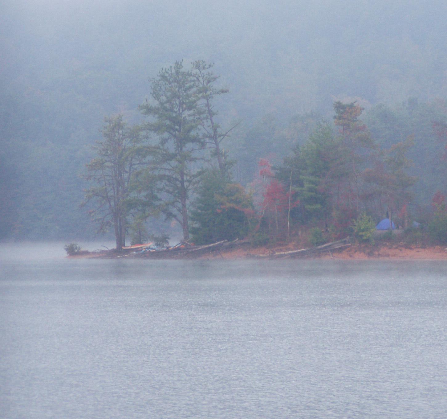
This master plan represents a promise kept. While preserving and protecting the environmental asset that the park land represents, the new park will provide expanded opportunities for public access and outdoor activity. The master plan outlines the development of a place where the community can carry on traditions associated with the land and the lake. There will be a place for people to walk along the bank and fish quietly from the shoreline. There will be a place to swim and splash and picnic with friends and family. There will be a place under the hemlocks to camp and relax by a campfire. There will always be a path where one can hike through the woods, catch a glimpse of the surrounding mountains and feel the beauty of the place that is Lake James.
11
INTRODUCTION 1.0
12
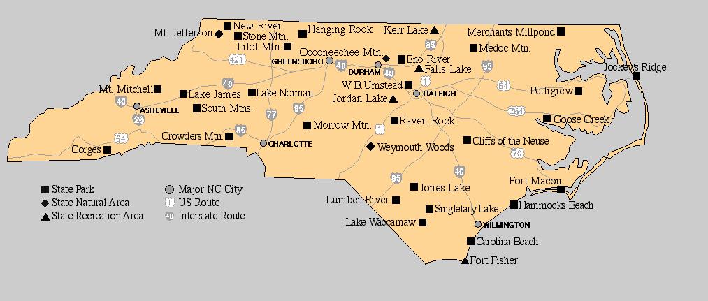
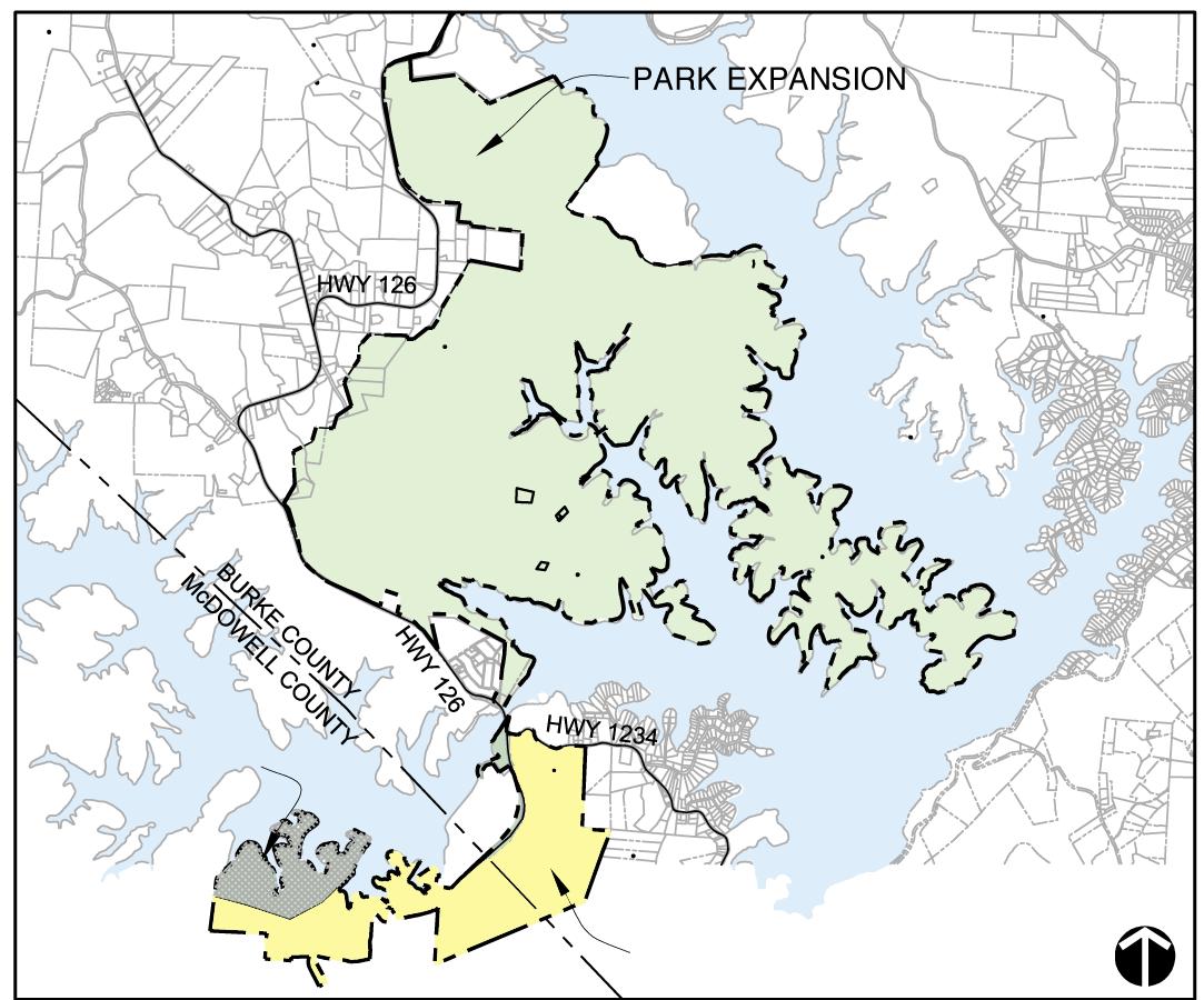
The park land is consolidated with the exception of several inholdings. The park is surrounded by forested lands with some residences and small farms along NC Highway 126. The north end of the new park land is within a few hundred yards of the mouth of the Linville River Aquatic Habitat. The Linville Gorge National Wilderness Area, located within the Pisgah National Forest, is located approximately three miles northnorthwest of the park. The Blue Ridge Parkway passes 13 miles to the northwest. South Mountains State Park lies approximately 18 miles to the southeast (see map on page 12).
LOWER TRIBUTARY
UPPER TRIBUTARY
PADDY CREEK
MILL’S CREEK

INTERIOR COVE
LAKE JAMES
Park Expansion Land
13
- Rivers and Streams Exhibit
INTRODUCTION 1.0

PaddyCreek LowerTributary UpperTributary LinvilleRiver MIDDLEMILL’SCREEKTRIBUTARY
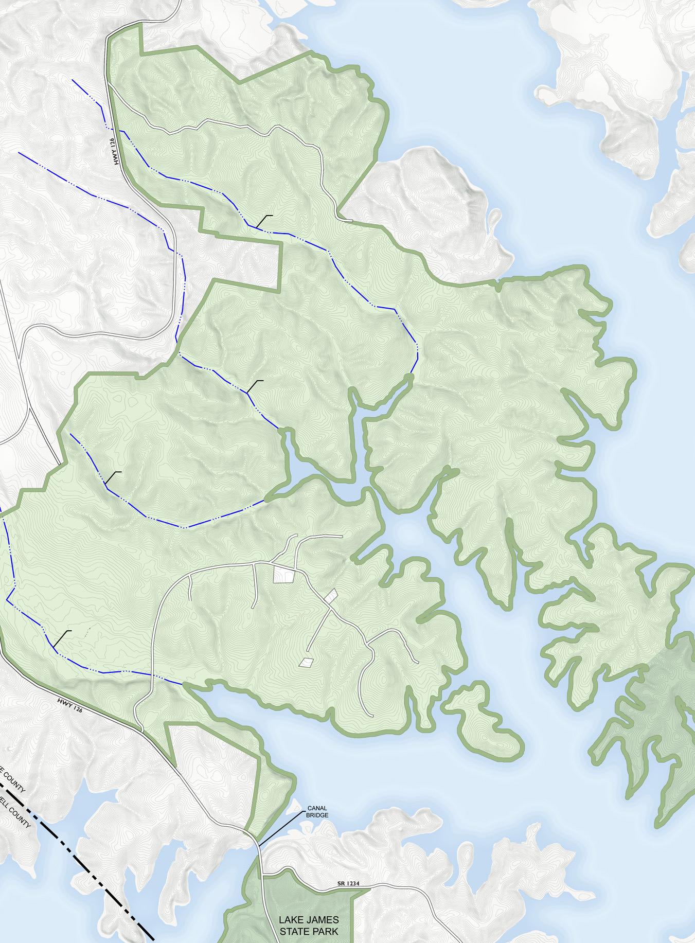
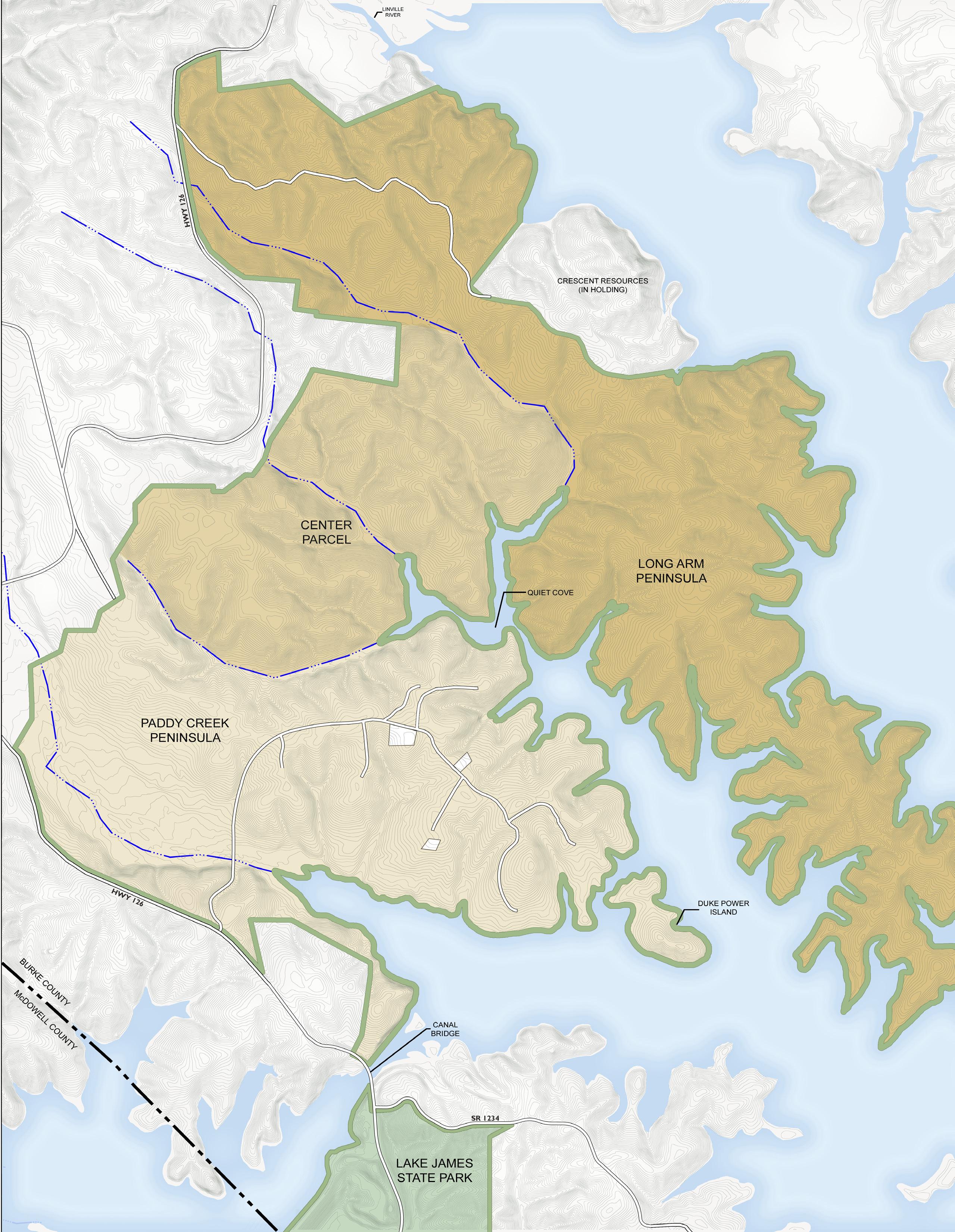
Three specific land areas have been identified within the new park:
Paddy Creek Peninsula
This the southernmost area of the park land and covers approximately 1,000 acres and is a broad peninsula with extensive areas of gentle slopes. Paddy Creek bisects this area.
The Center Parcel
This central section is the smallest of the three areas with 585 acres. The Upper Tributary Creek and the Lower Tributary Creek mark it’s north and south limits respectively. The Center Parcel is dominated by pine thickets and early succession forests.
Long Arm Peninsula

The Long Arm Peninsula is the northern-most section of the park and covers just over 1,300 acres of land. The lower extent of this peninsula becomes very narrow with steep slopes falling off to the many small coves that open to Lake James.
These three areas are indicated in the exhibit to the left on page 14. In the graphic, the limits of each area are delineated, the relative size of the three areas is demonstrated and the strong relationship between the park land and the lake is revealed. The existing Lake James State Park is located south of the new park land, just below the Canal Bridge.
15
INTRODUCTION 1.0


CANAL BRIDGE PLAN IS ILLUSTRATIVE IN NATURE AND SUBJECT TO CHANGE.
THE MASTER PLAN FOR THE EXPANSION OF LAKE JAMES STATE PARK provides a clear development plan for the more than 2,900 acre parcel that has been acquired by the State. The planning process began in early 2005 and has involved the State Division of Parks and Recreation, the design team, park staff, the Lake James State Park Advisory Committee, the community and the broader region through pub lic workshops and the project web site.
The new park site is located along the northeastern shore of Lake James. As the current park property is not contiguous and is severely limited in development potential, the plan calls for the relocation of the main park office to the expanded park site. The facilities at the existing park site will be retained. The master plan addresses the full development of the park site which will be constructed in phases over several years.
The new park land consists of two major peninsulas, Paddy Creek Peninsula and Long Arm Peninsula, that flank a central lake cove and an upland area to the west, designated the Center Parcel. The Center Parcel is separated from the two major pen insulas by streams, the Upper Tributary and the Lower Tributary. A third stream, the Mill’s Creek, bisects the Center Parcel. Intensive park uses are concentrated within the Paddy Creek Peninsula and the northern reaches of Long Arm Peninsula. These areas offer the largest expanses of developable land. The most developable areas on Paddy Creek Peninsula are also some of the areas most recently disturbed by logging activity.
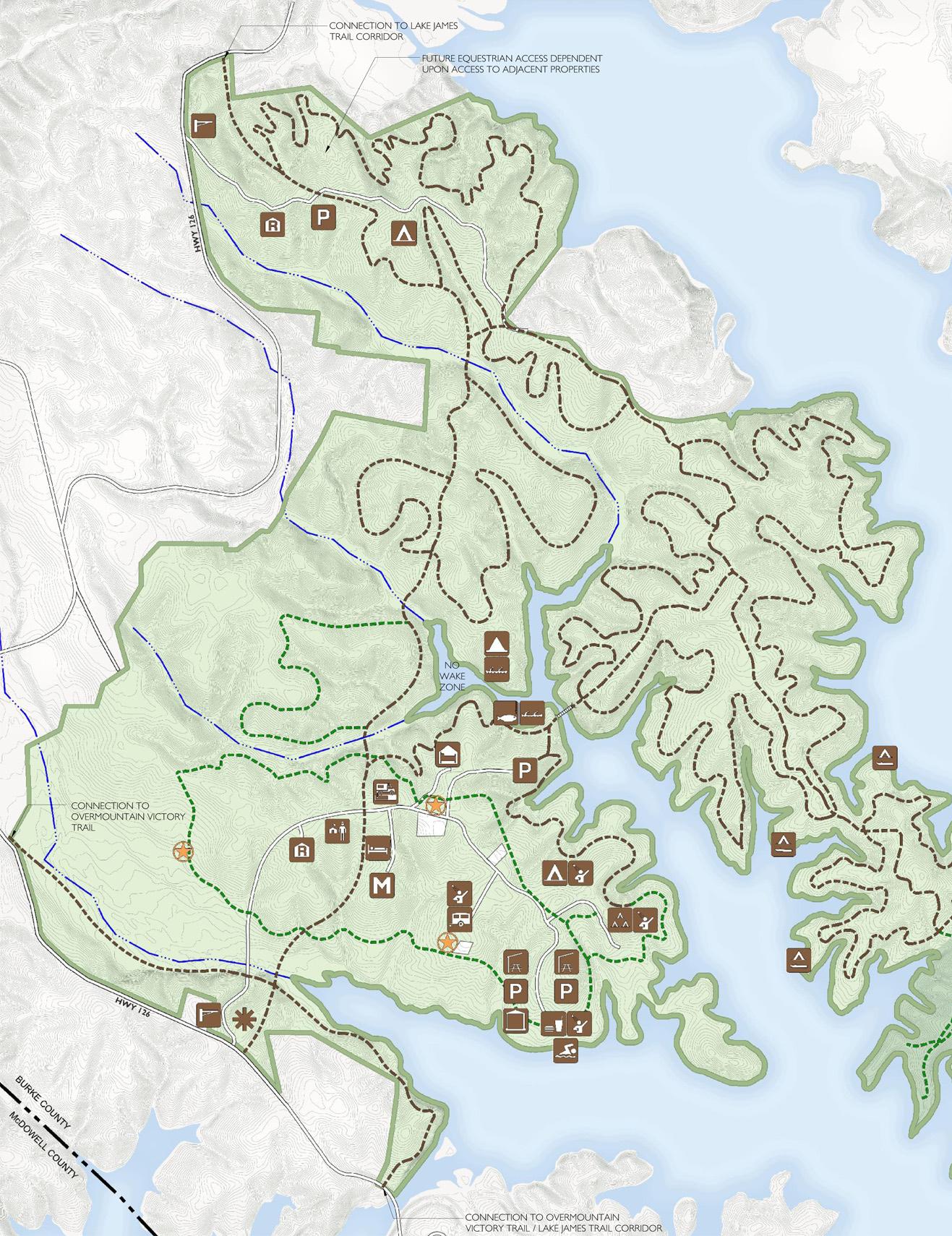
Access to the park and circulation within the park has been carefully considered. The main vehicular entrance is located on Highway 126, about one half mile west of the Canal Bridge. A second entrance serving the Long Arm Peninsula is located on Highway 126, a similar distance south of the Linville River bridge. Roadway access will be retained for all private ownership parcels within the park. Due to the topography and numerous streams, there will not be a vehicular connection between the two large peninsulas. Service and emergency connections will be provided throughout the park and are designed to accommodate all terrain vehicles used by park staff. The main entry drive at Paddy Creek Peninsula will link the entrance overlook area, a ranger residence, the visitors center, the maintenance facility, various camping areas and the new swim beach and picnic area.
1.0 17 17 2.0 EXECUTIVE SUMMARY
Multi-use trails for hiking and bicycling will link all sites within the park and will be the dom inant use in the more mature woodlands. A central loop trail on Paddy Creek Peninsula will connect the major uses in that area. This trail also provides access to several existing grave sites and small cemeteries that are scattered across the peninsula. Trails within the park will be established to link with the Over Mountain Victory Trail as well as the Lake James Trail proposed by Burke County. Trails on Long Arm Peninsula will be organized with larger central spines that will also provide service and emergency access within the park. Multi-use trails will loop off of these main trails. The smaller trails will be routed and designed to provide varying levels of technical challenge while allowing hikers and cyclists deeper access into the more scenic and environmentally sensitive areas of the park, especially on Long Arm. Access to environmentally sensitive areas will require careful design solutions.
The existing swim beach has been extremely popular. The demand for swimming has been demonstrated each summer as rangers are needed for directing traffic. Parking lots overflow and at peak demand periods, visitors are often turned away. To meet the local community and state needs, a much larger swim beach is planned along the southern shore of Paddy Creek Peninsula. This new facility will triple the visitor capacity of the existing beach at the previously developed site south of Canal Bridge. The new swim beach facility will include parking, a convenience drop-off, bath facilities, staff offices and concessions. The main picnic area will be nearby as well as the community building, group shelters and an activities lawn.
Overnight facilities on Paddy Creek Peninsula will provide for tent camping, group camping, recreational vehicle camping and rustic rental cabins. Primitive camping is planned at the western head of the interior cove and at the southern most reaches of Long Arm Peninsula. A pedestrian and service bridge is proposed across the upper reaches of the interior cove. This bridge will provide an alternate route to Long Arm Peninsula for hikers and cyclists. The bridge will increase the number of trail routes available within the park and may be designed to accommodate fishing. Trail locations indicated on the master plan are general as specific sitings will be determined in the field by the division trails specialists.

18
A trailhead parking area will be located near the bridge to service hikers, campers and visitors accessing the lake at the interior cove. Access for kayak and canoe will be from a fully accessible launch area near the swim beach on Paddy Creek Peninsula. These boaters will be able to cross between Paddy Creek point and the large island during high water. At low water conditions, a short portage will be necessary. Shoreline fishing trails will be provided on the south side of the cove. Upstream of the pedestrian bridge, a no-wake zone should be implemented. This zone would create a safe haven for non-motorized watercraft, lessen noise levels within the park and minimize shoreline disturbance while allowing access for all boaters. The no-wake zone would allow continued access into the cove for fishermen and pleasure boaters on the lake without conflicting with non-motorized boats.
A second park entrance will be located on Highway 126, about one half mile south of the Linville bridge. This entrance will provide access to a second ranger residence, tent camping and a parking area as well as the proposed trail system located at the northern extent of the Long Arm Peninsula. This northern entrance will also provide access to the large internal parcel retained by Crescent Resources which is planned for development as a lodge retreat facility. Private parties interested in equestrian trail riding plan to open a dialogue with the federal government with the goal of obtaining an equestrian trail link into the Pisgah National Forest through the federal gamelands across Highway 126 from Long Arm Peninsula. If this access is granted, trail head facilities with horse trailer parking could be added at the second park entrance.
In response to a historic and cultural use associated with Lake James, water access camping will be permitted in designated areas on Long Arm Peninsula. These camp sites will be clustered at areas with appropriate shoreline access. Water and restroom facilities will be provided for each cluster and individual campsite facilities will be provided as well.

Management of boat camping will be accomplished via staff boat or small, balloon-tired, all terrain service vehicles. At the southern tip of Long Arm Peninsula is an area of approximately 280 acres that is reserved for the exclusive use of hikers and campers at primitive sites.
Following is a more detailed summary of the planning process and the resulting master plan. To be useful, a master plan must be a fluid document able to meet conditions of certain changes that will come over time. It is the team’s intention that this plan be considered an evolving document with the potential for constant revision, while maintaining the underlying organizational structure for creating a memorable state park on Lake James.
19 EXECUTIVE SUMMARY
2.0

Lake James State Park (1) and the Park Expansion Property (2) IMAGE COURTESY OF BURKE COUNTY 1 2
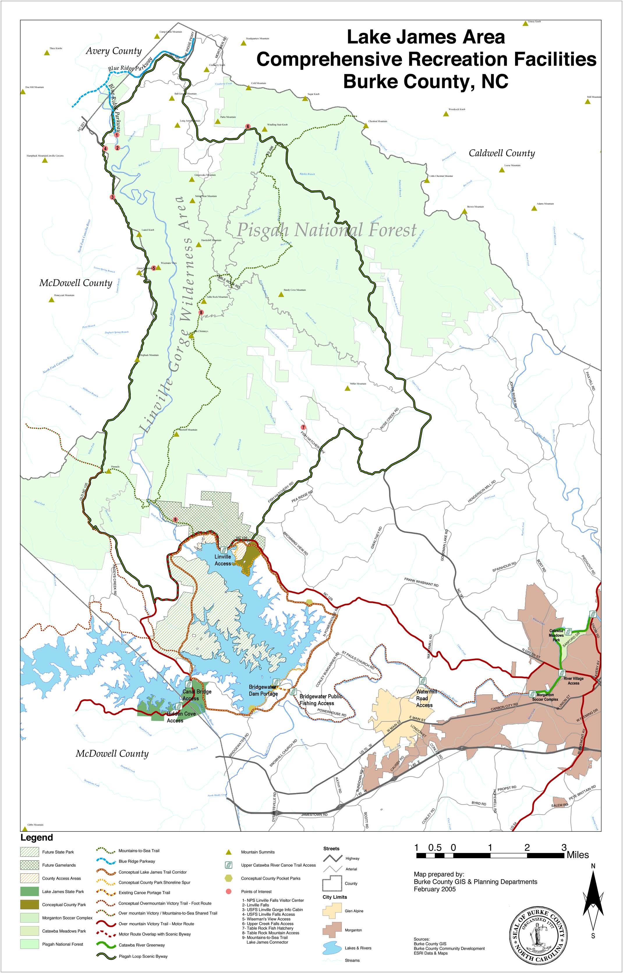
LAKE JAMES WAS CREATED BETWEEN 1916 AND 1923 WITH THE construction of three dams across the Catawba River and two tributaries, Paddy Creek and the Linville River. The canal at NC Highway 126 connects the two major impoundments forming a 6,500-acre lake. The lake has been used for generating hydroelectric power since it’s creation. Lake James State Park was established in 1987. Much of the existing 565-acre Lake James State Park is not suitable for facility development, and facilities are concentrated within about 60 acres on the far western extent of the park land. The 2,900-acre site for the park expansion is located about three miles northeast of the existing park facilities.
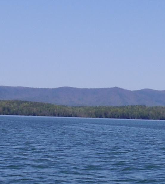
The new park parcel is located off Highway 126 on the northwestern shore of Lake James. The site extends from a narrow strip of land that is contiguous with the Canal Bridge, then north across Paddy Creek ending just short of the Linville River. The newly acquired property is over 2,900-acres with major land divisions identified as the Paddy Creek Peninsula, the Long Arm Peninsula and the Center Parcel.
Prior to purchase by the state, the property was managed as a general timber resource. Over the years, access privileges had been granted to various hunting clubs and private parties. Access to cemeteries that existed prior to 1916 has been guaranteed. The extensive logging road and trail network has provided easy access for vehicles, horse riders and individuals on foot. The accessible areas along the shoreline have provided camp sites for generations of boaters on Lake James. Campsites and ad-hoc hunt camp structures dot the landscape. Old campfire remains and litter are evidence of decades of recreational use enjoyed by those privileged to use the property as well as those who needed no invitation.
21
ANALYSIS 3.0
Areas that have been harvested for wood products are dominated by pine forests of varying states of maturity. These areas are found on the less steep slopes and on the upland portions of the site.

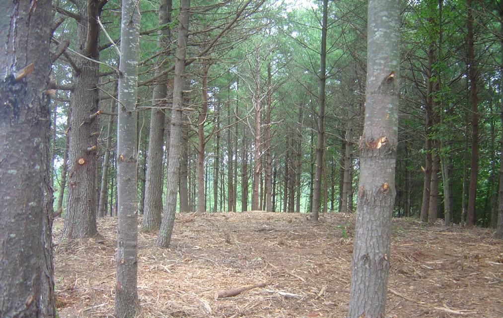

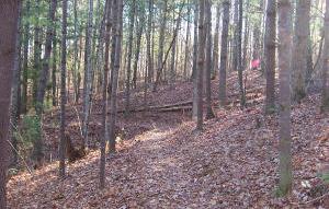
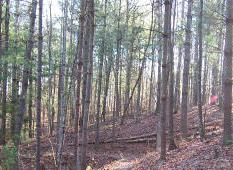
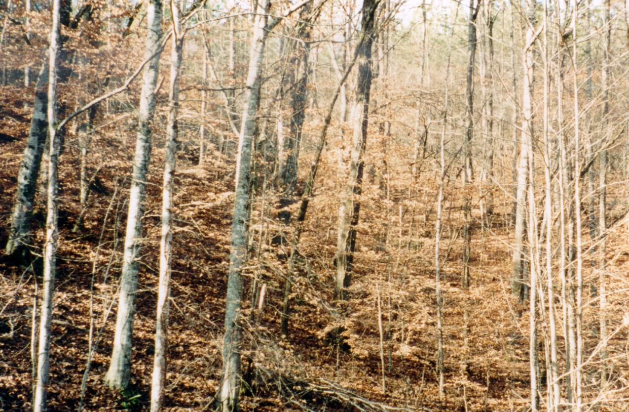
Mixed and hardwood forests are found on the steeper slopes, along the shoreline and in the stream drainages. Above, a typical trail through the woodland moves parallel with the topography.
22
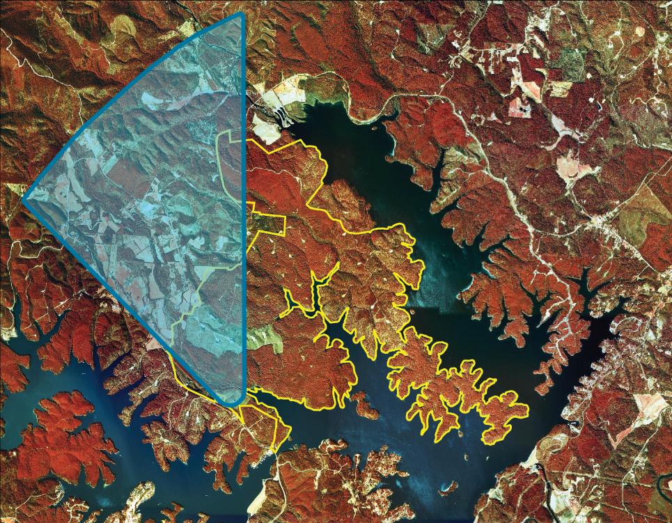
Aerial infra-red photograph from around 2000. The new park land is outlined in yellow. In the photograph, evergreen forest reads as darker red masses, mixed and hardwood forest are the tan/red masses and open areas read as light green. The extensive logging road network is evident with turn out cul-de-sacs where the roads end.
The park site is located along Lake James and is situated on the eastern escarpment of the Blue Ridge. The site consists of hilly land with generally gentle to moderate slopes and some steeply sloped areas.
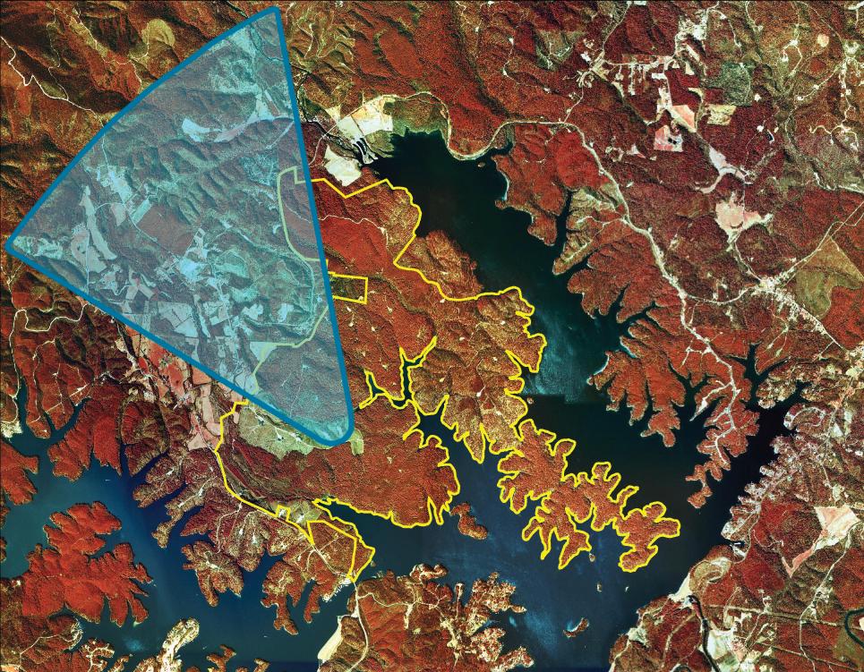
The impact of successive tree harvesting is clearly revealed through the vegetation on the site. Logging roads, which can be seen on aerial photograph on page 22, have been cleared and roughly maintained. Cleared processing areas, also quite evident on the aerial, are dotted with large brush piles where grasses, broom sedge, briars and pine seedlings have emerged. Areas more recently harvested in 1998 are now covered with pine thicket. These thickets dominate the upper areas of the western portion of Paddy Creek Peninsula and large parts within the Center Parcel. More mature stands of pine mixed with early succession hardwoods are characteristic of areas of more aged growth. The most mature woodlands are generally located across the steeper slopes, along the lake shore and across the bottom lands of the streams on site. In these areas, significantly larger trees are found. Oak forests are predominant along the dry slopes. The greatest concentration of mature woodland is on the Long Arm Peninsula.
No rare, endangered or threatened plant species have been identified within the new park land. Areas of standing dead timber are evidence of pine beetle infestations. More detailed biological information is available in the “State Site Survey Report” prepared by Marshall Ellis, Brian Strong and John Taggart for the Resource Management Program, Division of Parks and Recreation, in June 2005.
There are many locations within the park site that provide significant vistas to the Black Mountains to the west and north. From higher points and along ridges, Table Rock and the exposed rock face of Shortoff Mountain are easily identified. The vistas are often enhanced due to the reduced tree height across the areas of pine thicket.
23
ANALYSIS
Viewshed from a high point along Highway 126 near the Canal Bridge
Viewshed from the central ridge off Paddy Creek Peninsula captures views of Table Rock and Shortoff Mountain
3.0

24
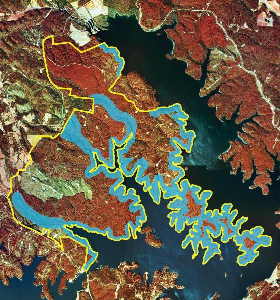
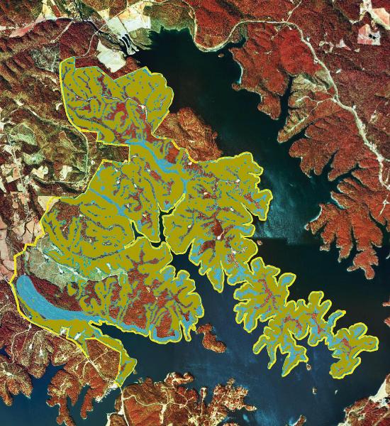
Above is an aerial infra-red photograph with an overlay of the 300’ riparian buffer indicated in light blue. This buffer applies to the entire lake shoreline and to both sides of all streams within the park property. The new park property boundary is delineated by the yellow line.
The shoreline of Lake James presents two faces that vary with the seasons. In summer, water levels are maintained near full pond, which is 1,200 feet above sea level, in order to enhance recreational opportunities. At this time, the lake is drawn down as needed to manage storm water flows. Periods of extended drought may also lower the water elevation as well. With high water conditions, the forested slopes extend down to the lake edge. Fallen timber along the shoreline, then submerged, provides aquatic wildlife habitat. Each winter, the lake is drawn down in anticipation of increased runoff in the spring. With the lake level lowered, the undercut banks and rocky shoreline are exposed. Areas with sandy beaches are revealed and a land bridge is created linking the large island east of Paddy Creek Peninsula with the park land.
The new property at Lake James State Park was acquired with the assistance of the Clean Water Management Trust Fund (CWMTF). The CWMTF requires the state to maintain a riparian buffer in a manner that protects the water quality of Lake James. A buffer of 300 feet in width is required along each side of every stream in the new park land and along the shoreline of the lake. In addition, the state committed to several additional conditions for park development. All facilities must be located and designed in ways that will protect water quality. With the exception of trails, possible road crossings and water access facilities, all facilities must be located outside of the 300-foot buffer of the streams and the lakeshore. Road crossings of streams must be kept to a minimum.
There are approximately 24 miles of lake shoreline and four streams within the park site that will require riparian buffers. The required buffers are illustrated in the aerial photograph on page 24. Approximately 1,300 acres of park land will be committed to meet the buffer requirements. This is roughly 45 percent of the total park land. The impact of the buffers is particularly noted along Long Arm Peninsula. Where the land mass narrows, the buffer areas overlap leaving only a few isolated pockets with any potential for future facility development. Only primitive facilities are proposed at these areas with hike-in or boat-in access.

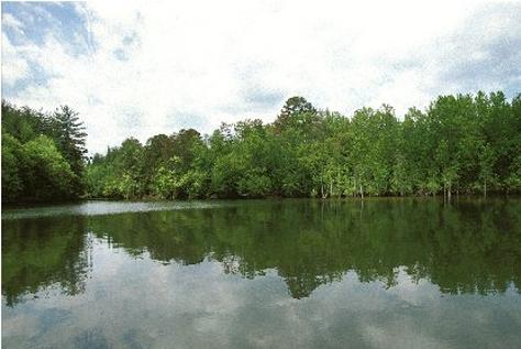
The new park land shoreline at high water. In summer, the woodland typically extends to the high water mark. During low water conditions, the lake level can drop up to 9 feet exposing the rocky slopes and undercut banks.
Paddy Creek and three smaller streams bisect the 2,900 acre park land. The 300’ buffer is applied to each side of all streams. The riparian buffer is indicated in blue on the aerial photograph on page 24.
25 ANALYSIS
3.0

26
The composite Image above shows the 300’ Riparian Buffer in blue overlaid with areas of steep slopes indicated in green.
Areas
outside of the Riparian Buffer and without steep slopes could be considered for facilities development.
Another limitation for the siting and development of park facilities is the topography of the land. Areas of steeper slopes are generally located along the lake shoreline and along the streams. Slopes that exceed 15 percent are generally more difficult and more expensive to develop. These more steeply sloped areas also present the greatest risk for soil erosion and runoff. Due to the historic logging practices associated with the park site, the more steeply sloped areas where timber harvesting was not practical are where the more mature woodlands are found. These areas represent a valuable visual resource and present a more mature forest image typical of state parks in the mountain region.
The aerial photograph on page 26 indicates areas with a slope greater than 15 percent in green. These areas have been overlaid on the 300-foot riparian buffers, shown in blue, that are required along the streams and shoreline. From the resulting image, it is clear that the opportunities for development will be limited to a relatively small land area within the park. To extend the constraint, many of the more gently sloped areas are small and isolated from one another. The geometry of these areas is often long and narrow, a reflection of the general shape of the peninsulas that make up the majority of the park land.
The southern half of Paddy Creek Peninsula contains the greatest concentration of areas with gentle slopes. Many of these areas are of considerable size and may be able to accommodate the development of facilities. Developable areas are also located on the upper elevations of the Center Parcel and along the ridgeline of Long Arm Peninsula.
27 A NALYSIS
Hardwood forest, typical of stream drainage areas, steeper slopes and bottom lands
Maturing pine forest, typical of more gently sloped areas
3.0
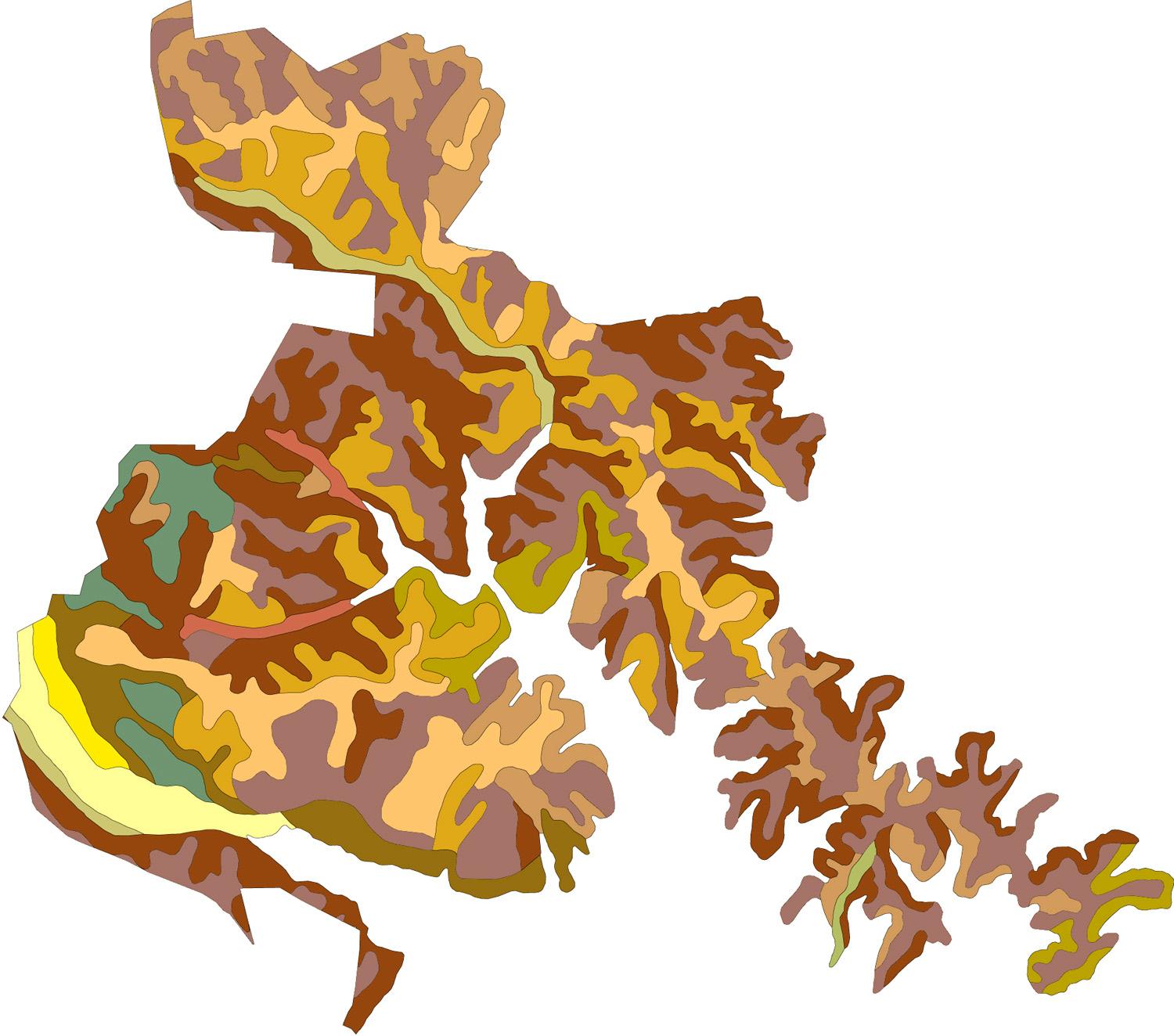
The graphic above indicates the general location of various soil types within the new park land. A summary of the soil types and their suitability for development is located in the Appendix.


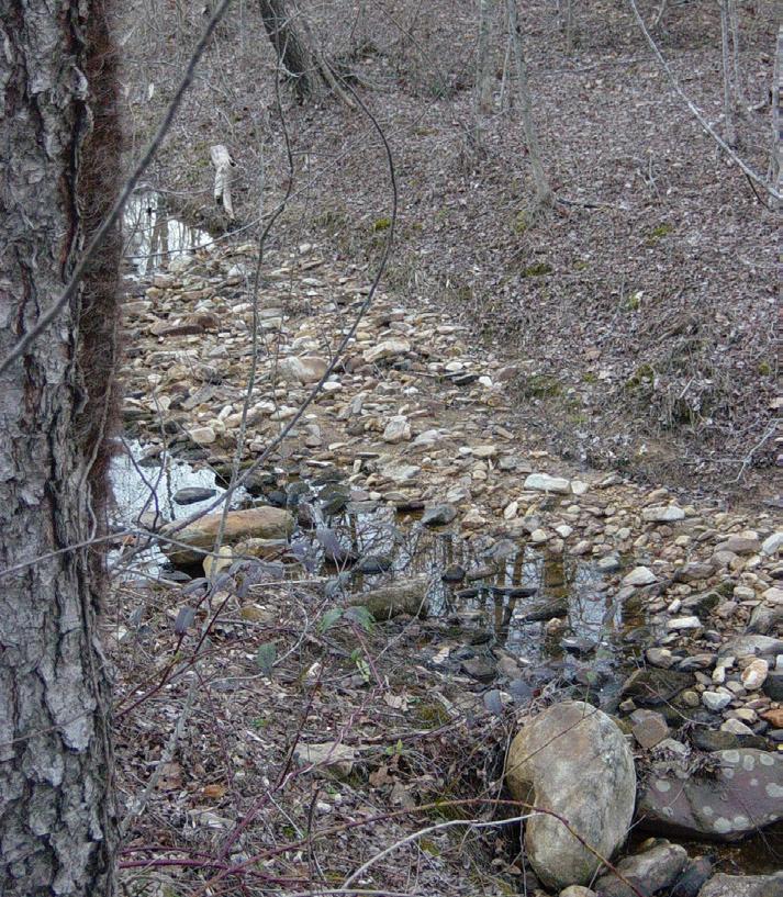
Poor soils on the new park site are generally associated with the bottoms of stream drainage areas and flood plain along Paddy Creek.
28
Soils within the park land are generally favorable to the development of facilities. The exceptions are silty or plastic soils found along the lower reaches of the creek basins and in the flood plain areas associated with Paddy Creek. Soil types and their associated development suitability are listed in the Appendix.
Flood plain pools were observed at the mouth of Paddy Creek where past storms, especially the hurricanes of fall 2004, created overflow corridors parallel to the main channel. These channels range from 30 to 150 feet in length and two to six feet in width. Their depth may be as little as an inch and up to three feet where scouring had been the greatest.
Only a few endangered or rare animals have been documented near the new park site. Due to sightings of Bald Eagles, a nesting platform was constructed near the eastern extent of Paddy Creek Peninsula. This area is documented and access is restricted. No evidence exists of eagles using the nesting platform. One rare plant, Northern Oconee Bells, has been recorded near the new park land. Two rare freshwater mussels, Brook Floater and Eastern Creekshell, have also been recorded in close proximity to the new park area.


More typical wildlife appears to be flourishing within the property. The site provides multiple sources of food and water. The various environments of open meadows, thickets, pine forests, mixed forests and hardwood forests provide a great variety of habitat. Deer forage along the meadow and woodland edges and birds populations are healthy. Black bear have been rumored to visit the site but no evidence was found to support these claims. Detailed information on wildlife can be found in the Site Survey Report prepared by Marshall Ellis, Brian Strong and John Taggart in June 2005.
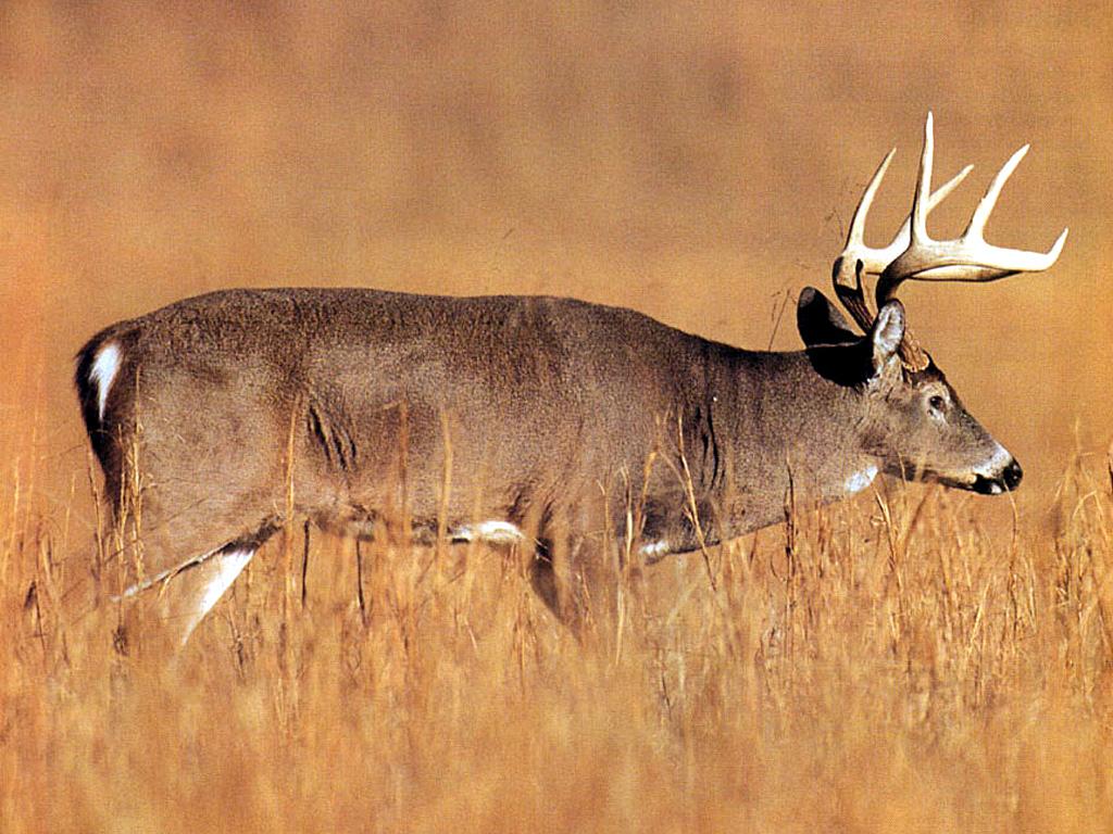
The rocky character and landform of some shoreline areas is suitable for small-mouth bass spawning beds. Fish and birds are attracted to the structure and cover of the fallen trees that edge some areas of the shoreline. Generally, the shoreline of Lake James does not present a rich habitat for wildlife.

29 ANALYSIS
Bald Eagle
Virginia White-Tail Deer
Black Rat Snake
Raccoon
3.0
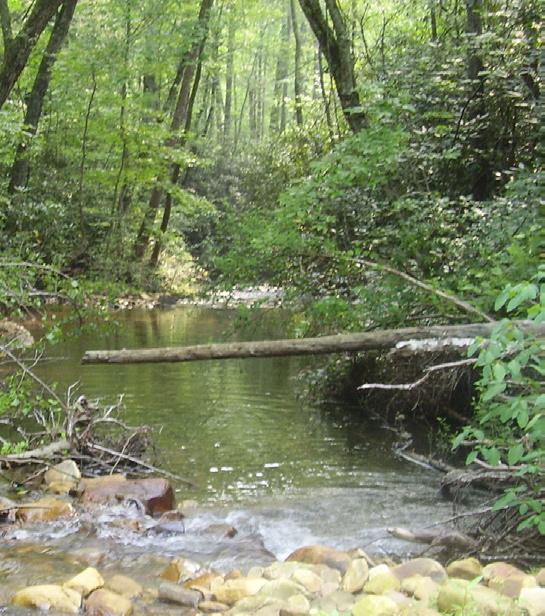
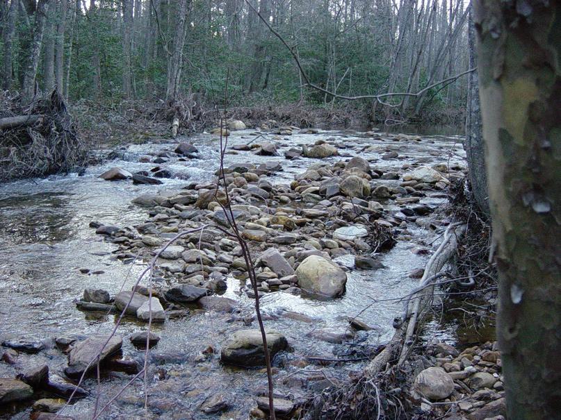
All of the streams located on the new park property have been characterized as clear with cobbles and sand in deeper sections and with boulders and exposed bedrock present. There are local areas of mud. The streams are generally stable with little undercutting. The streams are typically bordered by an understory of rosebay, rhododendron, mountain laurel and ferns under hemlock, poplar and white pine. The floodplain areas are covered with grasses and broadleaf herbs with river birch, sycamore and ironwood the dominant tree species.
Paddy Creek is the largest stream in the park with a width of 5 to 20 feet and large pool depths approaching five feet. The other perennial and intermittent streams on site are much smaller with widths between one and five feet. There are numerous small water cascades where the streams cross exposed bedrock.
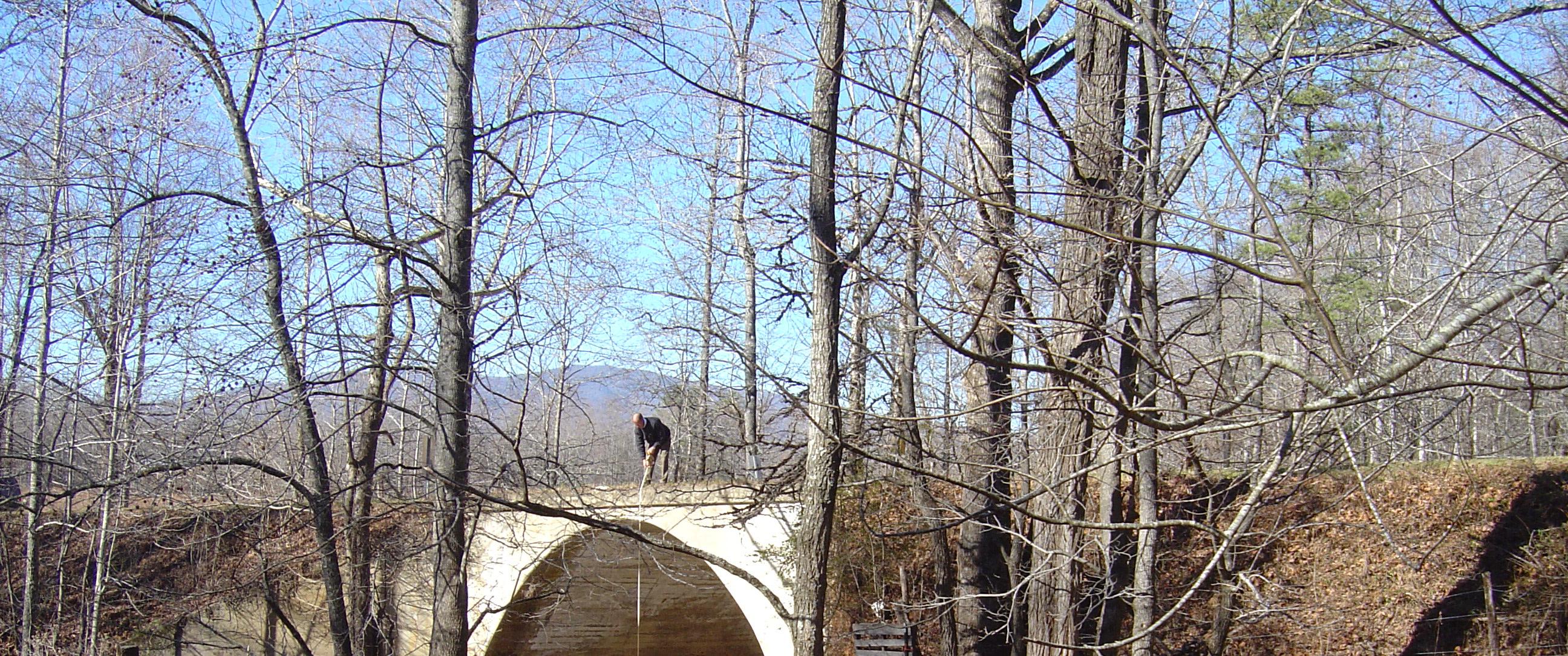
The shallow depth and gentle nature of Paddy Creek does not reflect the broader character of this stream. Significant volumes of flood water can be conveyed through Paddy Creek. The image below of the arched culvert at Highway 126 begins to communicate the potential magnitude of water flow through the creek during storm events.
There are several inholding parcels located within the park site. These parcels are isolated tracts of privately owned land, each under 5 acres in size. The park roadway system has been designed to continue to provide access to the parcels. Several of the inholdings are cemeteries.
The grave sites contained within give testament to the history of the families that occupied this land in generations past. If opportunities to acquire these parcels should arise, the state should purchase them.
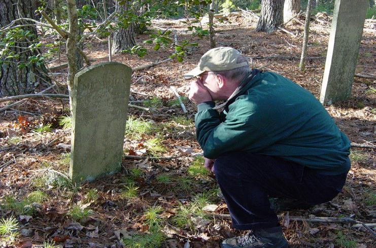
Several additional graveyards have been discovered on the property that are not located within private parcels. Most of these sites are located on Long Arm Peninsula. These sites have not been maintained and can be difficult to identify as the forest has g rown up around and within them. Dates on the markers indicate occupation back through the 1700s. None of the cem eteries have known historical interest.
30
The culvert where Paddy Creek passes beneath NC Highway
126
INHOLDING PARCEL, TYPICAL PADDY CREEK PENINSULA
31 ANALYSIS
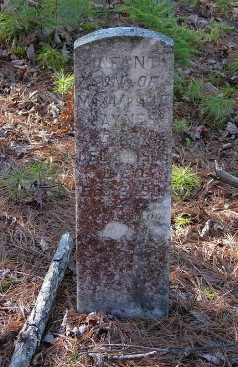
Grave marker from the 1700s
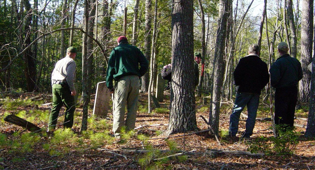
Undocumented cemetery discovered during site reconnaissance
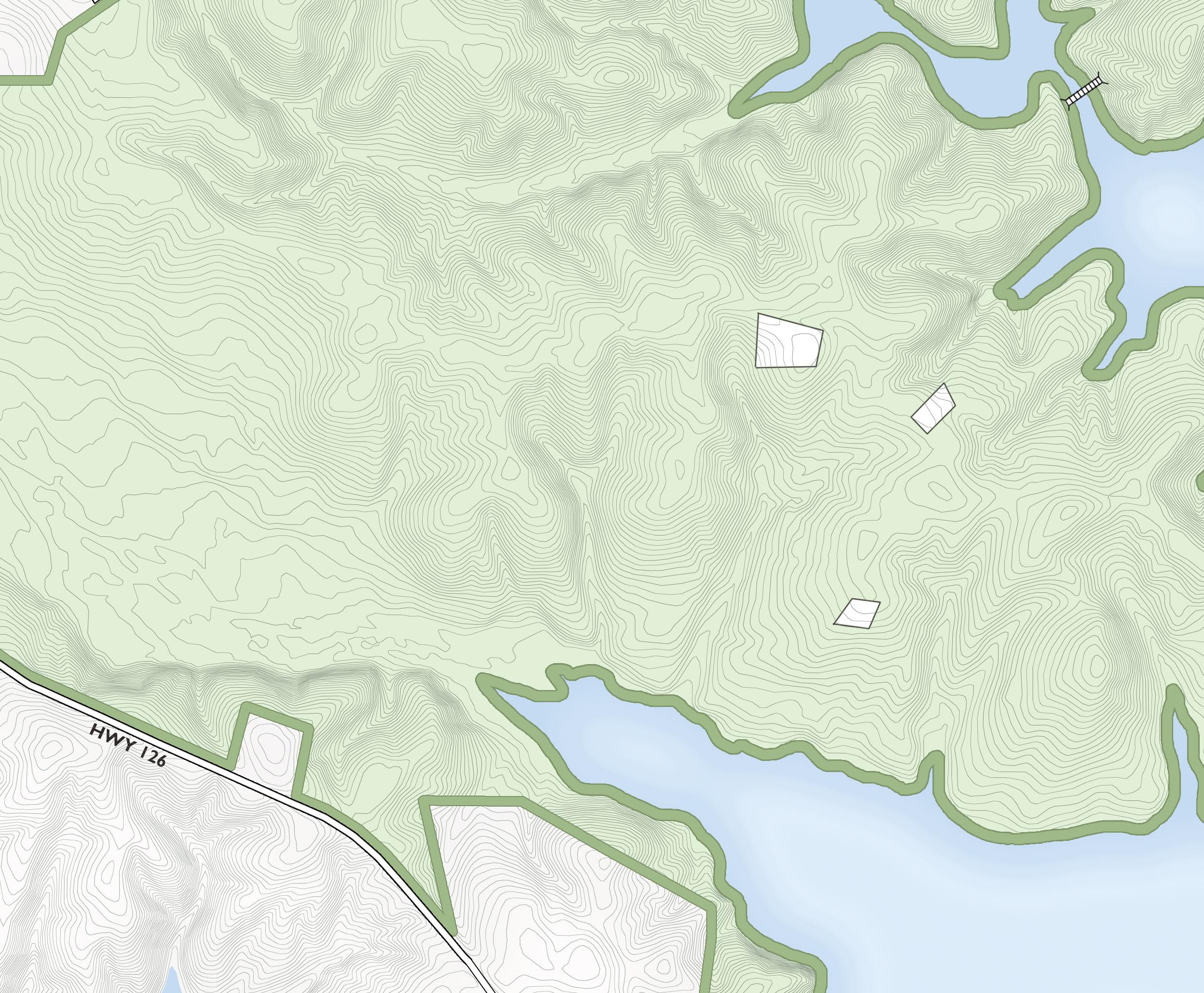
Inholding parcels on the Paddy Creek Peninsula. See the map on page 14 for the overall park site.
3.0
James State Park Expansion

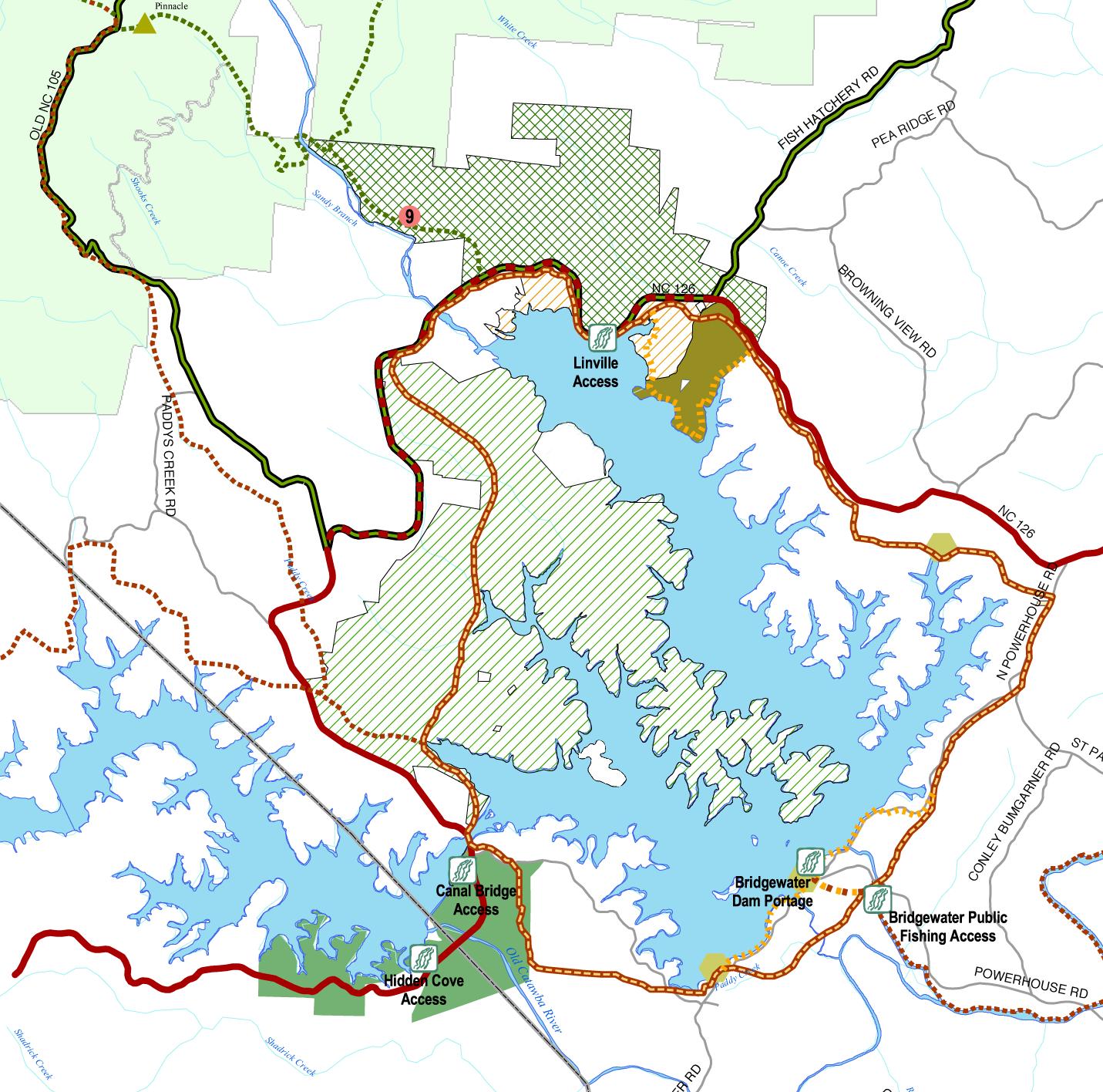
28 Pisgah National Forest Future Gamelands Lake
Existing
Lake James State Park
Canal Bridge
County Park & Access Area (future)
McDowellCountyBurkeCounty VictoryOverMtn.
Trail
Linville
Gorge
Wilderness Linville
River
While farming and timber lands dominate the greater region around Lake James, the communities immediately surrounding the lake are experiencing tremendous change. Development of properties with lake frontage and lake access has dramatically increased over the past five years and continues at an accelerating pace. Recent residential developments have begun taking a more environmentally thoughtful approach regarding the lake, shoreline buffers, flood plains, wetlands and areas with steep slopes. The extent of lake associated development has drawn increased attention to water quality, shoreline aesthetics and levels of boating activity. People living near Lake James, but outside of lakeside developments, see their opportunities for lake access to be diminished. Fortunately, along with the new Lake James State Park, there are several initiatives under way that will improve public access and recreational activities on and around the lake.
Burke County plans to develop several new facilities. A new waterfront park adjacent to the Linville boat access area has been proposed. The park may include a new boat access ramp and RV and tent camping. Conceptual plans for the Lake James Trail corridor, a hike and bike trail that would encircle Lake James, have been developed. These plans call for county-managed pocket parks to be developed along the trail. A section of this trail linking Canal Bridge and the Linville River runs through the state park property and would be constructed as part of Lake James State Park. Development of this trail would link Lake James State Park with the future county parks as well as the future gamelands planned north of the Linville River. An extension of the Mountains-to-Sea Trail is planned to extend through the gamelands area that would provide trail access into the Linville Gorge Wilderness Area.
The Over Mountain Victory National Historic Trail commemorates the campaign leading to the battle of Kings Mountain by following the Revolutionary War route of patriot militia men from Virginia, today’s eastern Tennessee, North Carolina, and South Carolina to the battle site at Kings Mountain National Militar y Park in South Carolina. The trail corridor is 330 miles long with approximately 57 miles already constructed. A section of the Over Mountain Victory Trail, parallel to Paddy Creek, will run through Lake James State Park. The future extension of this trail will connect the State Park to nearby residential developments and the Linville Gorge Wilderness Area.
Duke Energy has announced several recreation improvements around Lake James as part of the Catawba River Recreation Plan. A canoe and kayak access area is planned at the Linville River. Water flow will be increased at controlled intervals to improve paddling opportunities on the Catawba River immediately downstream from Lake James. Duke is helping to acquire over 500 acres of property near the Bridgewater Powerhouse. Duke is also working to help acquire 434 acres along the Catawba River for recreation and conservation.
33
ANALYSIS 3.0
r e s e r v
What does the Park mean to you?
What is Special about the Park? What Opportunities do you see?
e r i t a g e B e a
t
t h e L
U n q u
S e t i
w S h e d P r s i n
a t e r B e a u t f
M o u n t a n
r a s s r o o
e f o
b i t y t o r e a c h m o r e r e m o t e a r e a s o f t h e p a r k C o n n e c t o r s f r o m M o u n t a n s o L a k e t o T r a l
Participants in the Marion and Morganton Community Workshops completed surveys and questionnaires as part of the Public Input Process for the park master plan. The graphs above are a sample of the results from one survey group. The vertical scale indicates the number of people responding.
Comments from the workshops, recommendations from the Lake James State Park Advisory Committee, input from the division’s Lake James Master Plan Committee and findings of the Statewide Comprehensive Outdoor Recreation Plan (SCORP) were used to guide development of the program for the expansion of Lake James State Park.
34 In the chart to the left, survey results from the Marion Community Workshop 29% of the respondents were interested residents from nearby communities 31% of the respondents were residents that camp at Lake James State Park 40% of the respondents were residents that hike at Lake James State Park What does the Park mean to you? 11 1 1 6 1 1 11 1 1 3 1 7 2 3 1 3 0 2 4 6 8 10 12 A r e a o f n a t u r a l b e a u t y S e c o n d H o m e o m e f d o n e r g h t c o u d m e a n a g r e a t d e a R e c r e a t o n S w i m m i n g F i s h n g C a m p i n g B o a i n g P c n i c k n g P u b i c A c e s s E c o n o m i c T r a i s B k e T r a i s C a n o e i n g B a n k F s h n g W l d l f e O b s e r v a t o n What are your Concerns? 1 4 4 1 1 2 6 1 1 1 1 1 3 1 0 1 2 3 4 5 6 7 T r a f f i c O v e r c r o w d i n g O v e r D e v e l o p m e n t F u t u r e a c c e s s a n d a f f o r d a b l t y R o u d y B e h a v o r P o o r M a n a g e m m e n t E M S T r a f f c I n f r a s t r u c t u r e S u p p o r t R e c r e a t i o n M a n p o w e r & M o n e y C o n n e c t i v t y & A c c e s s S a f e y P o l u t i o n S h o r e n e S e n o r C i t z e n A c c e s s What is your relationship to Lake James State Park? 29% 40% 31% Resident: Hiker: Camper:
10 1 3 2 2 1 1 1 1 1 1 0 2 4 6 8 10 12 P
e H
u
y o f
a n d
e
n g P o p u l a t e d A r e a E c o n o m c I m p a c t o n a r e a P r e s e r v a t o n o f S h o r e l n e a n d W o o d e d A r e a A c c e s s A c t v i t e s w i h N a t u r e E v e n t s e r a c e s , f a m i y r e u n o n s , p a r i e s V i e
e W
u
s G
t s
r t s A
11 1 1 6 1 1 11 1 1 3 1 7 2 3 1 3 0 2 4 6 8 10 12 A r e a o f n a t u r a b e a u t y S e c o n d H o m e t o m e I f d o n e r i g h t c o u l d m e a n a g r e a t d e a R e c r e a t i o n S w i m m i n g F s h i n g C a m p i n g B o a t i n g P i c n i c k i n g P u b i c A c e s s E c o n o m i c T r a i s B i k e T r a i l s C a n o e n g B a n k F i s h i n g W l d l f e O b s e r v a t o n What are your Concerns? 1 4 4 1 1 2 6 1 1 1 1 1 3 1 0 1 2 3 4 5 6 7 T r a f f i c O v e r c r o w d n g O v e r D e v e o p m e n t F u t u r e a c c e s s a n d a f f o r d a b i l t y R o u d y B e h a v i o r P o o r M a n a g e m m e n t E M S T r a f f i c I n f r a s t r u c t u r e S u p p o r t R e c r e a t i o n M a n p o w e r & M o n e y C o n n e c t v i t y & A c c e s s S a f e t y P o l u t i o n S h o r e i n e S e n i o r C i t z e n A c c e s s What is your relationship to Lake James State Park? 29% 40% 31% Resident: Hiker: Camper: What is Special about the Park? What Opportunities do you see? 10 1 3 2 2 1 1 1 1 1 1 0 2 4 6 8 10 12 P r e s e r v e H e r i t a g e B e a u t y o f t h e L a n d U n i q u e S e t t i n g P o p u l a t e d A r e a E c o n o m i c I m p a c t o n a r e a P r e s e r v a t i o n o f S h o r e i n e a n d W o o d e d A r e a A c c e s s A c t v i t e s w i t h N a t u r e E v e n t s e r a c e s , f a m i l y r e u n i o n s , p a r t i e s V i e w S h e d P r i s t i n e W a t e r B e a u t i f u l M o u n t a n s G r a s s r o o t s e f f o r t s A b i l t y t o r e a c h m o r e r e m o t e a r e a s o f t h e p a r k C o n n e c t o r s f r o m M o u n t a i n s t o L a k e t o T r a l
DURING THE COURSE OF ANALYSIS AND EVALUATION OF THE NEW PARK SITE, THE DIVISION of State Parks and Recreation identified the need to expand the facilities that are currently provided in the existing Lake James State Park. These include facilities for camping, picniking, swimming, hiking, environmental education and boating. The state also explored other options regarding the future role and use of the current park site. With this decision, the minimum development program for the new park was immediately established. In subsequent meetings with the division, the park staff and the park advisory committee (PAC), several additional program elements were identified, discussed and evaluated.

The division provided several opportunities for the public to provide input on the park master plan. Two public workshops were held, one in Marion and another in Morganton. In these meetings, the design team presented an overview of the park expansion project and the initial analysis information. The attendees were able to ask questions and discuss the opportunities and challenges presented by the park expansion. Questionnaires were made available asking attendees to comment on various aspects of Lake James State Park. Information was provided to allow individuals to contact the design team and state park officials via mail, e-mail and telephone. Public opinions gathered from the Statewide Comprehensive Outdoor Recreation Plan (SCORP) were also used to access demand for and appropriateness of facility development. The SCORP survey results outline the demand for park facilities and guide the appropriateness for the spending of public funds by the State.
Based on this information, the park program was further discussed and refined as alternative development plans were prepared by the design team. The alternative plans were reviewed by the division’s park staff and by the PAC. The plans were then posted on the division’s Lake James State Park Website for viewing and comment by the public. The final master plan program was determined through evaluation of all of the options presented in the alternative plans.
The recreation program for Lake James State Park addresses the need to expand current services to accommodate increasing use by the public. The program includes new uses such as primitive camping and bike/hike trails that were identified as beneficial and feasible on the new park property. The program also explores ways to allow the managed use of the park while providing uses that reflect the tradition of recreation that people have long enjoyed on Lake James, such as bank fishing and boat camping
Programming for the park included Community Workshops in Marion and Morganton
35
PROGRAM
4.0
Long Arm Peninsula and Center Parcel Development
Secondary Entrance off of NC Hwy 126, near the Linville River (shared access with Crescent Resources proposed lodge facilities)
Ranger Residence
Trail Head Parking area with restrooms (potential expansion to provide equestrian trail head parking)
Tent Camping, 35 sites with tent pad, picnic table, lantern hook, fire ring, clustered water service each 4 to 6 sites, washhouse
Multi-Use Trails including a section of the Lake James Trail corridor and the Reserve Area with hike only trails
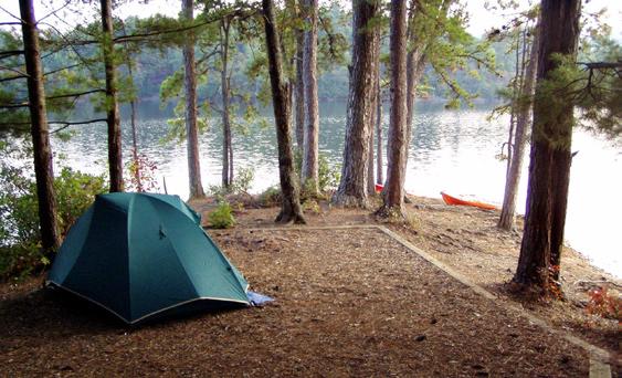
Primitive Camping, 25 sites with tent pad, lantern hook and fire ring
Boat Camping, clusters of 5 to 10 sites with tent pad, picnic table, lantern hook, fire ring, central water service and washhouse
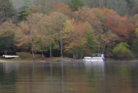
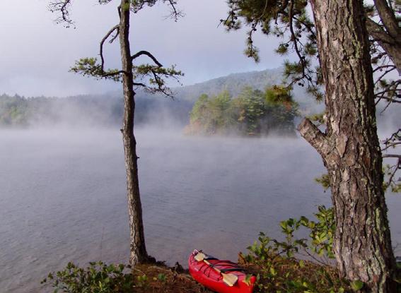
Center Parcel Development
Primitive Camping, 25 sites with tent pad, lantern hook and fire ring
Multi-Use Trails including a section of the Lake James Trail corridor and a loop hike only trail

36
Paddy Creek Peninsula Development
Main Entrance off of NC Hwy 126
Scenic Overlook at entrance
Entry Drive (app. 2 miles)
Paddy Creek Bridge
Ranger Residence
Visitors Center with classroom, auditorium and offices
Barracks for seasonal staff
Maintenance Facility with warehouse, garage, workshop and lumber shop
Cabins, 14 units with water, electric service and washhouse
Trailhead Parking with group picnic area and restrooms
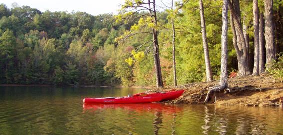
Canoe/Kayak Launch
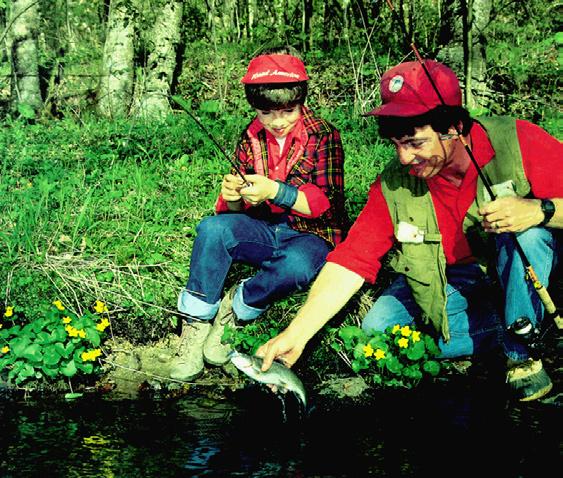
Bank Fishing trail
Pedestrian Bridge
RV and Trailer Camping, 22 sites with water, sewer, electric, washhouse and dump station
Tent Camping, 35 sites with tent pad, picnic table, lantern hook, fire ring, clustered water service each 4 to 6 sites, washhouse


Group Camp, 5 sites, 20 to 30 campers per site, remote parking lot, picnic table, fire ring, lantern hook, water service, washhouse and community area
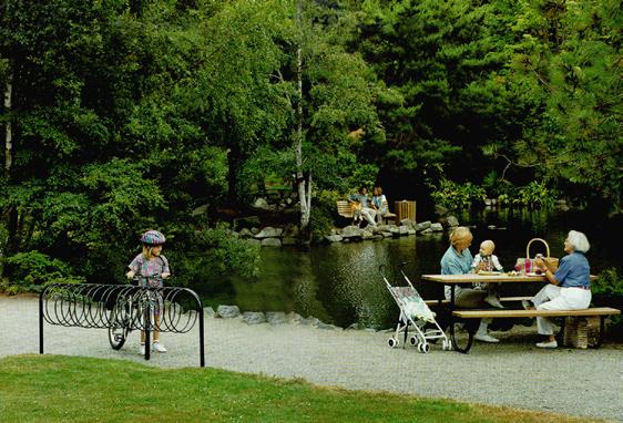
Family Picnic area, large shelter with restrooms, small shelters, 25 to 35 picnic tables
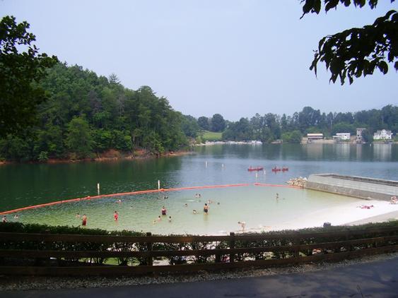
Swim Area, bathhouse/concessions building, swim beach with grass beach and observation areas,
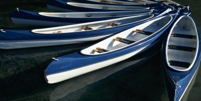
Boat access dock with staff boat launch, boat rental and storage
Parking Area, shared between swim area and picnic area
Community Building, large picnic shelter with restrooms, events lawn, small amphitheater and parking area
Fishing Pier and bank fishing trail
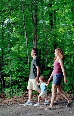
Cemetery Loop hiking trail, Multi-Use Trails including Canal Bridge trail, Cove Side trail, a section of the Over Mountain Victory Trail, an accessible interpretive trail, and a section of the Lake James Trail Corridor

37
PROGRAM 4.0
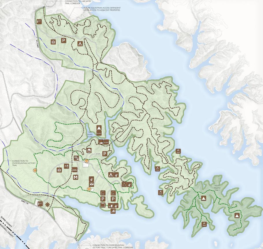
Detail p.42 Detail p.44 Detail p.47 Detail p.48 Detail p.50-51 p.54 p.52 CRESCENT RESOURCES INHOLDING


39 M ASTER PLAN 5.0 EXISTING PARK EXISTING PARK FACILITIES
THE MASTER PLAN FOR LAKE JAMES STATE PARK IS DESIGNED
to balance the need for expanded outdoor recreation with the demands of environmental stewardship. Early in the planning process, it became evident that appropriate locations for recreational facilities would be severely limited by the site topography and the required riparian buffers. Working with this condition in mind, the design team assembled the various components of the park program while addressing the following questions:
What size do the various uses or facilities need to be?
Where is the ideal location on this site for theses uses?
Can these uses fit on the ideal location?
Is the circulation and connectivity to these uses appropriate?
What other uses should be near these uses?
Are there natural clusters of uses that can be isolated from other activities?
Are there special places on this site that inspire a use that is not typical?
Are there uses that would allow visitors to experience the park in a new way?
The elements of the master plan reflect this process of question and answer, call and response. But as practical decisions were made and the plan began to take shape, it became apparent that ultimately the park had to be more than a good solution. It has to be memorable. It must respect the place wherein it lies. It must speak of the people and the communities that surround it, their spirit and their traditions.
40
One of the first questions to be answered was where to locate the main entrance to the park. NC Highway 126 functions as an external loop road for the park site. It was agreed that most visitor traffic would arrive from south of the park and would travel across Canal Bridge. Placing the main entrance close to the bridge would provide a close point of connection with the existing park facilities, especially the boat ramps. This western entry point would also minimize the number of visitors that would have to navigate the one lane bridge that crosses the Linville River.
A second entrance to the park is planned near the Linville Bridge to provide access to facilities located on Long Arm Peninsula. This entrance eliminates the need for a costly internal loop road that would have to cross three internal streams and be routed through areas of very steep terrain. The Linville Bridge entrance will also provide access to the large in-holding parcel on Long Arm. This access point was a commitment made by the state as part of the land purchase from Crescent Resources.

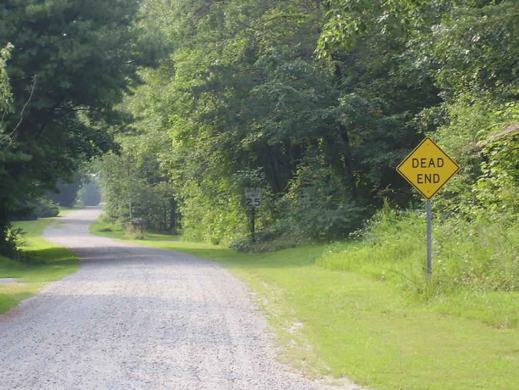
The existing access provided through the public rightof-way along SR Old Hwy 105 will be maintained to provide service and emergency access only. This entrance may also be used to provide construction access to Paddy Creek Peninsula while the entrance roadway and bridge are under construction.
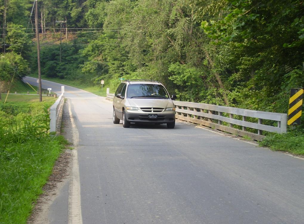
41 41
MASTER PLANCirculation
View east toward the park from Canal Bridge on NC Highway 126
The one lane bridge over the Linville River on NC Highway 126 just north of the park.
SR Old NC 105, a gravel public road currently provides access to the Center Parcel and the Paddy Creek Peninsula
5.0


42 MAIN ENTRANCENCHighway126
Illustrative
site plan for the Main Entrance to
the park (inset from overall map on pages 38-39).
The bridge across Paddy Creek will be wide enough to accommodate
vehicles and the access trail
for a single crossing point of the creek. EntryDrive AccessTrail Over VictoryMountain Trail PaddyCreek Main Entrance and Gate
The image on the opposite page is a detail of the park plan that illustrates the State Park Main Entrance on Highway 126. The major park signage would be located along the highway. A small parking area will allow people to stop and take a short walk to the scenic overlook area. From there, visitors can look to the north and west viewing the Black Mountains in the distance. The access trail will continue downhill toward Paddy Creek and intersect with a major trail that runs south to the Canal Bridge. This trail will function as a section of the Over Mountain Victory Trail as well as provide a portion of the Lake James Trail proposed by Burke County that will encircle the entire lake. The access trail continues and will cross Paddy Creek along the widened bridge section of the entry drive.
Vehicular traffic entering the park will travel along the entry drive and will cross a new bridge spanning Paddy Creek. The creek crossing is planned at a location where the creek bed and flood plain narrows. The bridge span may approach 200 feet in length. A central bearing point in the bridge span may be used to reduce construction costs. As the trail will cross the creek via the bridge, the trail approaches will be designed to safely accommodate this movement for hikers and cyclists.
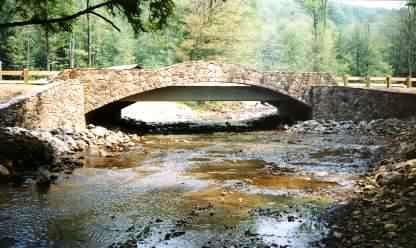
The Paddy Creek Bridge presents an early opportunity to set the visual character and detail for the rest of the park. Great attention will be given to the materials and massing of the bridge. It is likely that the bridge will be a precast span or bottomless arch culvert in order to make the span as economical as possible. Using native stone to face the bridge would be an appropriate way to blend the bridge with its surroundings. Massed plantings may be located at the bridge abutments to further blend the bridge structure into the creek bank.
43
MASTER PLANCirculation
The bridge crossing for Paddy Creek is planned at a location where the creek bed and flood plain are narrow
Using native stone to face the bridge will help blend the bridge with the existing creek bank
5.0
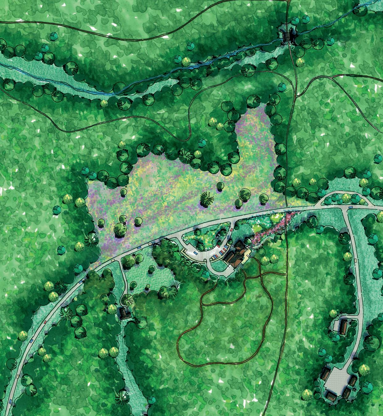

Illustrative detail for the Ranger’s Residence, Visitors Center and Seasonal Barracks. Overall map is on pages 38-39. Meadow EntryDrive Ranger Residence Visitors Center Dump Station Seasonal Barracks Maintenance Yard Accessible Interpretive Trail LowerTributary Lake James Trail
After crossing Paddy Creek, the entry drive will climb in elevation and make a gentle curve along the ridgeline of the peninsula. At this point, a ranger’s residence is located just off to the right with the home pulled back from the road to provide privacy while still allowing for the observation of the roadway. This positioning of the ranger residence provides a low key but effective way to monitor the park.
Just beyond the ranger’s residence, the visitors center will be sited to take advantage of the broad vista west toward the Black Mountains. The Black Mountains extend along the horizon and the rock face of Shortoff Mountain is a prominent feature to the north. To enhance and preserve this dramatic view, a meadow is proposed on the slope opposite of the visitors center. Constructing and maintaining a meadow has been approved for several reasons. The viewshed across the proposed meadow location is outstanding. The area of Paddy Creek Peninsula around the planned visitors center is one of the areas most recently logged for timber. As the site is currently covered with early succession growth, no mature trees would have to be removed to create the meadow. The meadow would provide a location for wildlife viewing. This would enhance the visitor experience and expand the opportunities for wildlife interpretation near the visitors center. On a most functional level, the meadow would allow for the on site placement of strippings, excess topsoil and cut materials generated during construction, and may also provide a feasible location for the drainage field of the visitors center septic system. Without the creation of the meadow vista, most views on Paddy Creek Peninsula to the surrounding mountains will be obscured by the maturing tree canopy.
The new park land does not have access to public water or sewer service. The distance from the existing utilities makes extending water and sewer to the site cost prohibitive. Therefore, each facility, or cluster of facilities, will have to be serviced by a well and sanitary sewer provided through the construction of septic systems. Further study will be required to determine the optimum sewerage system for each facility and location. The RV dump station may be able to utilize the same system that will serve the visitors center. Areas with primitive camping and boat camping may be best served by composting toilets or other systems that do not require the construction of large drainage fields and the associated destruction of existing woodlands.
45
MASTER PLANPaddy Creek Visitors Center
The
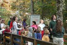
visitors center will provide opportunities for nature interpretation and other environmentally focused programs for the public
The Accessible/Interpretive Trail loops around the visitors center. The trail connects with hike-only trails that provide access to the cemeteries on Paddy Creek Peninsula.
Location of detail on page 44. See pages 38-39 for overall map. 5.0
Multi-use trails will be designed to pro vide a range of technical levels so that casual riders and experienced riders will enjoy the park.

Trails near the fishing pier and along the central cove shoreline provide access for bank fishing.
A short road off of the entry drive will lead south to the seasonal staff barracks and the maintenance area. These facilities are somewhat remote in order to reduce the impact on park visitors. Placing these uses closer to the main entrance and the highway minimizes the trip distance required for the delivery of supplies and materials and minimizes service vehicle routes through the park.
The next road to the north will be a short loop that runs through the cluster of rental cabins. This is one of the new ideas for the park. Such cabins have a long and treasured history in Appalachian parks. The simple cabins are planned to provide an alternative camping experience, especially for those visitors not inclined to camp in tents or not owning campers. Although finished with solid and timeless materials, such as stone and wooden shingles, the cabin construction will be simple and straightforward and will blend with the natural setting. Public input recommended that the rental rates for these cabins would be set at a very modest level in order to make them available to a broad range of park visitors.
Just past the cabin loop road, the main road will pass between a private in-holding parcel and one of the three cemeteries located on the peninsula. Alternative alignments for the road will need to be evaluated to identify the best way to minimize the exposure of the private parcel from the road without disturbing the cemeteries.
Beyond the cemetery, the cove access road turns off to the north. This road leads to the parking area above the cove at the Center Parcel. Washhouse facilities will be provided as this parking area which will serve as the trail head for a variety of daytime and overnight users. A trail will provide an accessible route for visitors to enjoy the lakeside trails and shoreline fishing trails along the shoreline of the cove.

46
Materials used in the park should blend with the natural setting.
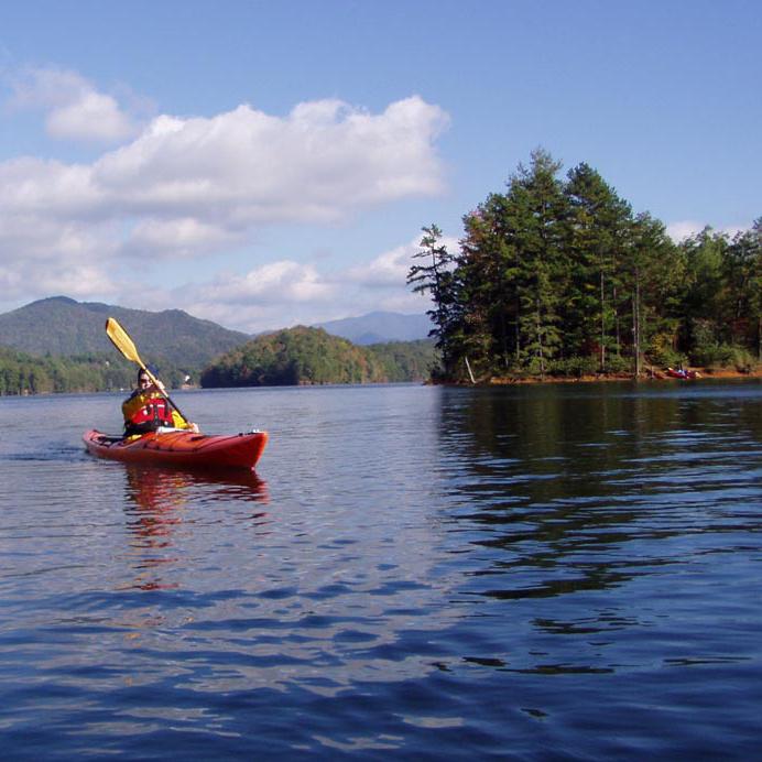
The park will provide access for kayak and canoe.

47 MASTER PLANPaddy Creek Cove Access
Illustrative
site plan of the
rental cabin area and the cove trailhead
(inset area highlighted at overall map to
the right).
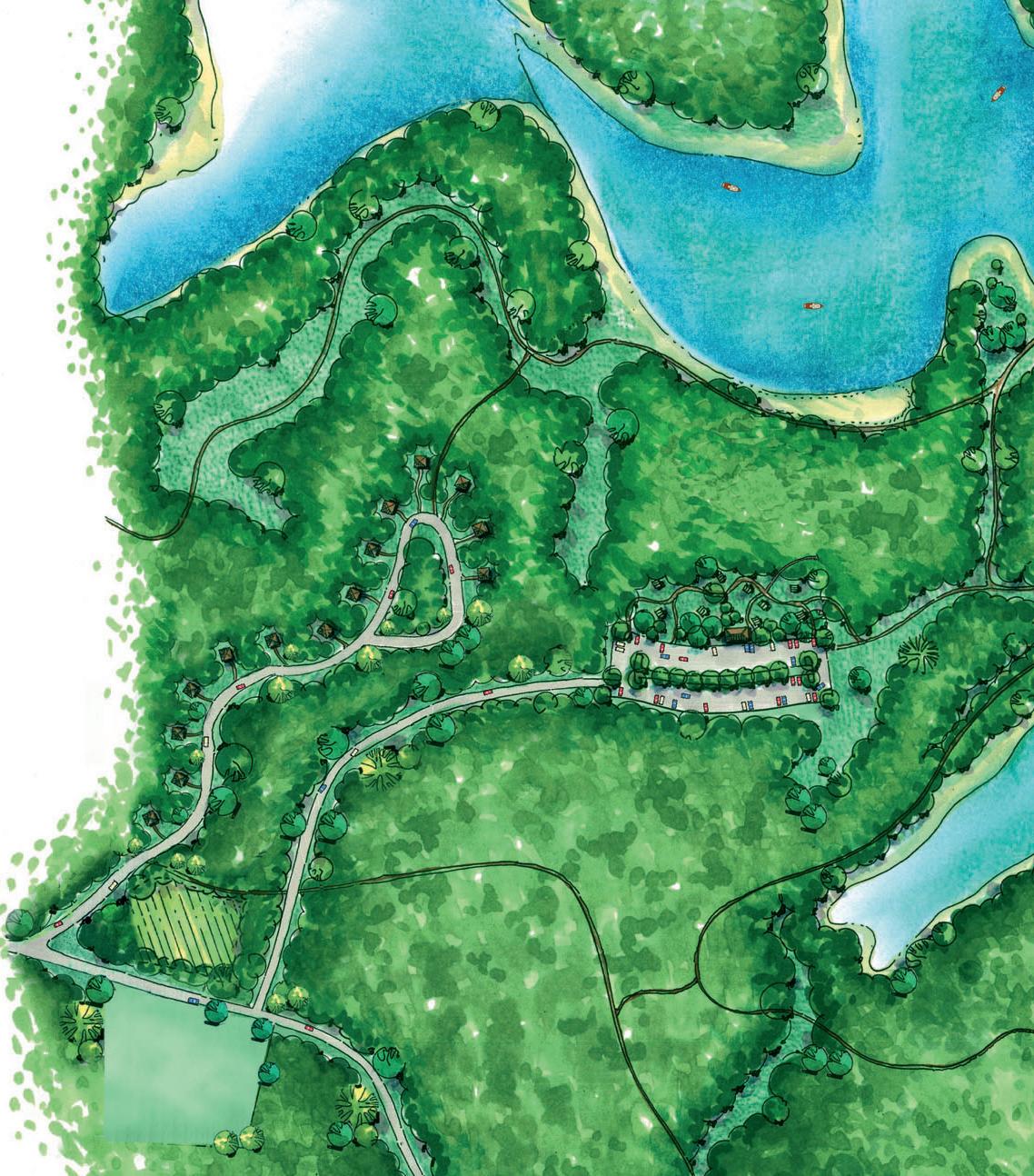
interior cove BankFishingTrail Rental Cabins Cove Area Trailhead Parking Cemetery Inholding (Private Parcel) Trail to Camping Entry Drive 5.0
Entry Drive
Inholding

Illustrative plan of overnight camping facilities on Paddy Creek Peninsula. These areas include RV camping, tent camping and group camping areas.
Tent Camping Area
Group Camping Area
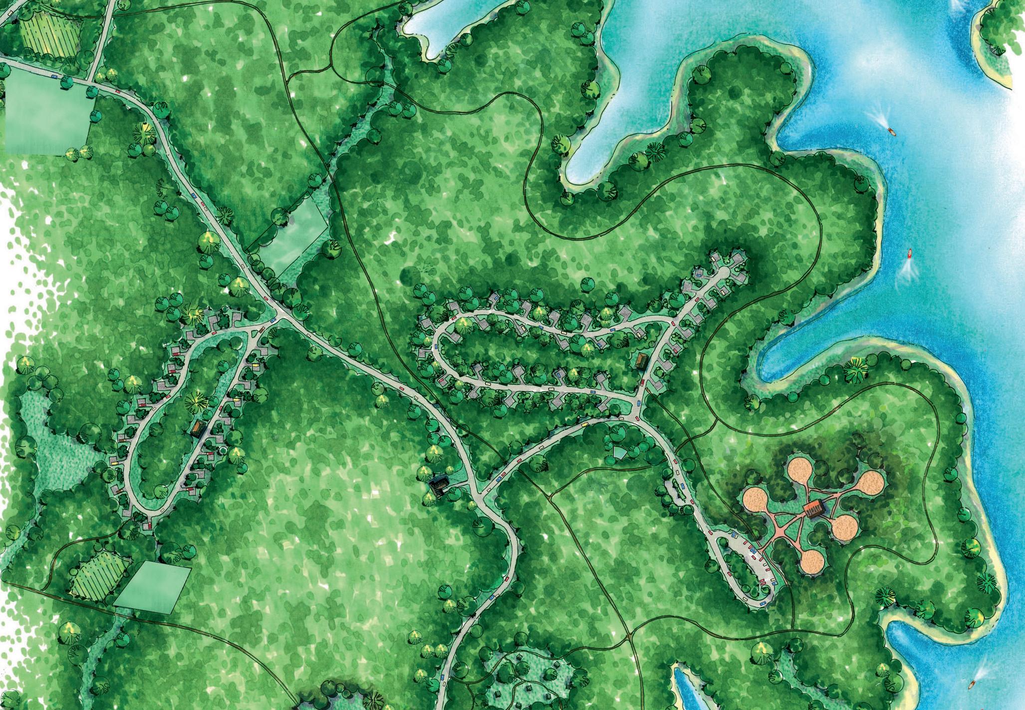
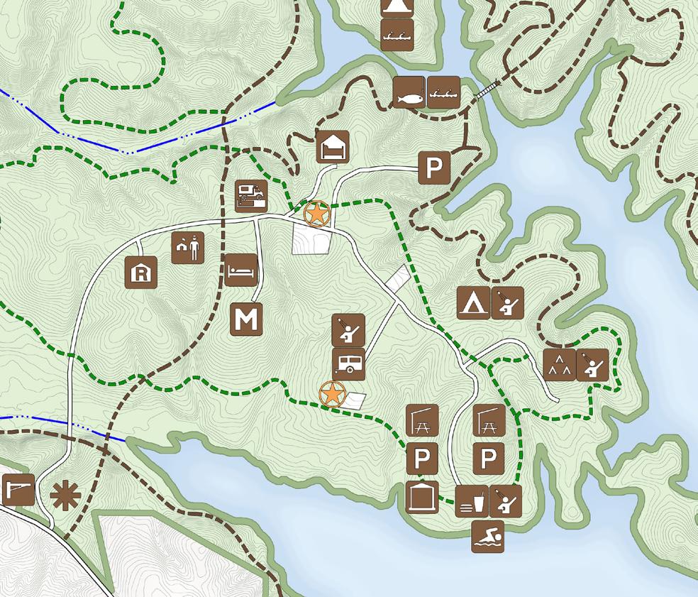
The graphic at left shows to location of the overnight facilities in the illustrative site plan above.
The relatively intense development on Paddy Creek Peninsula has a direct relationship with the location of developable areas and the need for certain uses to be located in close proximity to one another
Cemetery
Cemetery Inholding
RV Camping Area
interior cove
Paddy Creek will provide three distinct camping alternatives. Recreational vehicle (RV) and trailer camping will be located on the south side of the main road after the visitors center. Placing RV facilities closest to the entrance will eliminate the need for large campers and trailers to be hauled through the rest of the park. The RV area will provide sites for 22 campers with water, electric and sanitary sewer hook-ups. A central washhouse will be provided with toilet and shower facilities. The campsites will be arranged along a single loop one-way road with all camp sites located to the outside of the roadway. This will provide campers an increased sense of privacy. A dump station will be located off of the main road for use as RV campers depart from the park.
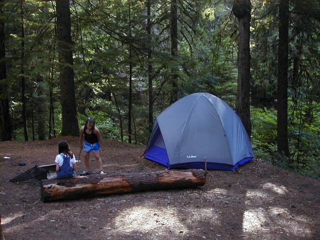
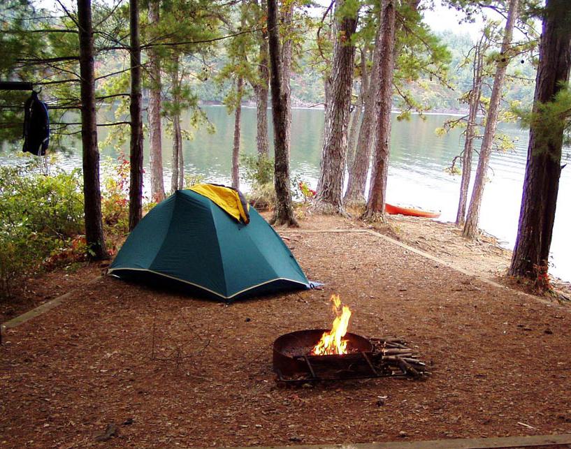
Tent camping is located north of the main road on the cove side of the peninsula. The tent camping area shares an access drive with the group camping area. 35 campsites are planned along a loop and spur road system. The camping area is placed on the more level portion of the site in order to simplify access and minimize grading and site disruption. Each campsite will have a tent pad, picnic table, lantern hook and a fire ring. Clustered water service will be provided for each 4 to 6 sites. A central bathhouse will provide sinks, toilets and hot water showers.
Group camping will be clustered near the very end of the Paddy Creek Peninsula near the beginning of the central cove. Cars not destined for the group camp area are provided a turn out just before entering the group camp parking area. The group camp area will provide five campsites that accommodate 20 to 30 campers at each site. Parking will be concentrated in a remote parking lot that is integrated into the access drive end loop. Each campsite will have tent pads, a picnic table, fire ring and lantern hook. Water service will be provided at each group campsite. A central washhouse will provide sinks, toilets and hot water showers. The group camp area will also have a community area where all the campers can assemble for common meals, participate in educational programs or gather for a bonfire and story telling.
Hiking trails will link all camping areas to one another as well as to the swim beach area and the visitors center. A multi-use trail will run from the group camp area west to the tent camp area and then on to the center cove. This trail, routed along side the cove, will provide views of the lake.

49 MASTER PLANPaddy Creek Camping
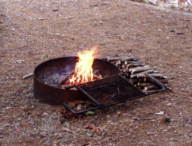
Campfires will be allowed in designated fire ring locations
Tent camping will provide an intimate setting in the forest
Group camping will accommodate between 100 and 150 campers
A multi-use trail will parallel the cove shoreline and join tent and group camping areas and the swim beach facilities
5.0
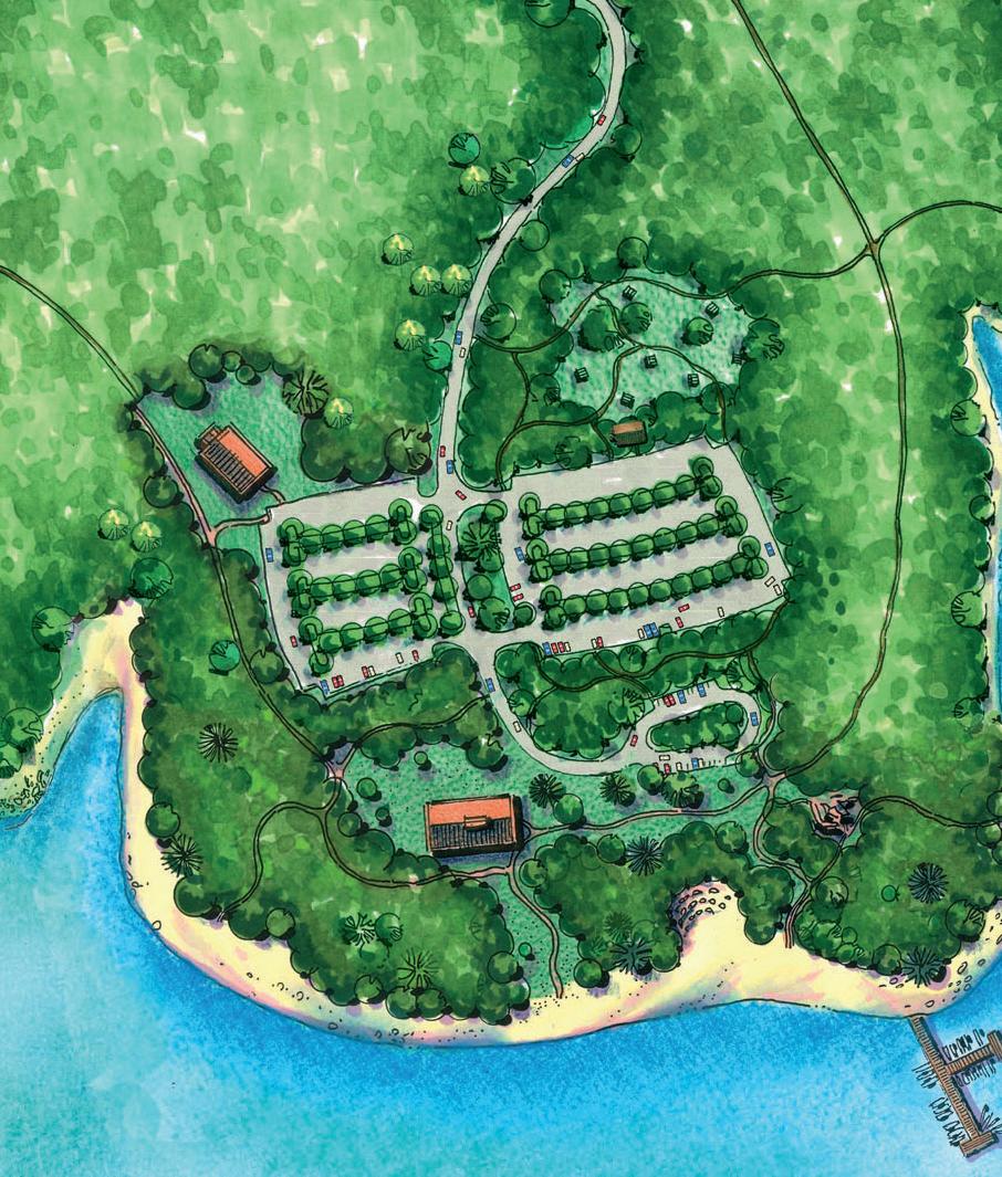
Community Building Parking Parking Drive Entry DropOff Swim Beach Bathhouse Picnic Area Boat Dock
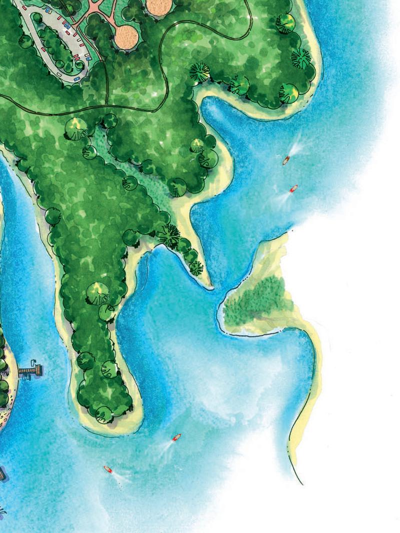


51 MASTER PLANSwim
Beach and Picnic Area
Fishing Pier
Group Camping Area
5.0
Drop Off Trail to Picnic Area

Events Lawn Fishing Pier
Bathhouse
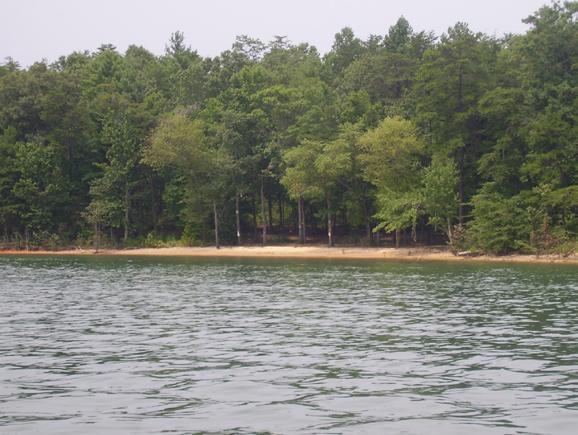
A natural beach is present at the proposed swim beach site
Beyond the water, the sand beach and the grass beach provide opportunities for lounging and observation.
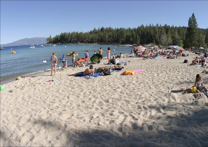
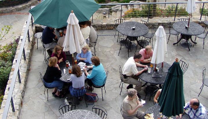
Additional viewing areas will be provided in the shade.

The new swim beach will accommodate three times the number of guests that can be accommodated at the existing facility
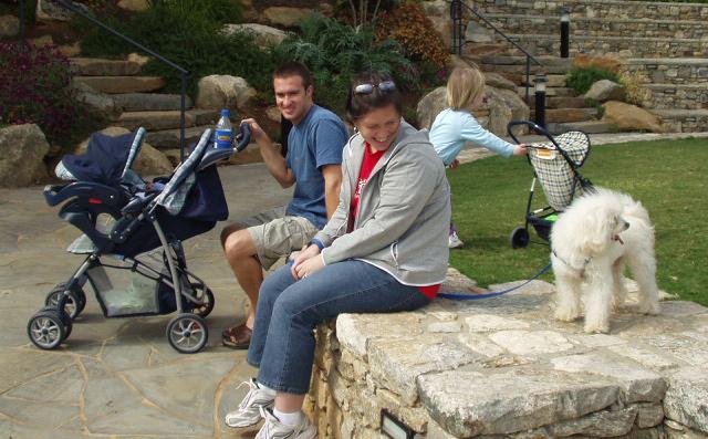
The bathhouse building will include concessions for visitors’ convenience and provide a seasonal revenue source


52
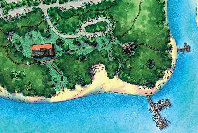
The park will provide public access to Lake James. The illustrative site plan above shows the relationship between the drop off area, the bathhouse and the swim beach.
Swim Beach
Boat Dock
In summer, Lake James State Park provides a place to come and enjoy lake swimming. The current swim beach and picnic facilities are consistently overwhelmed and staff must focus on traffic control and crowd management. The demand for lake access is expected to continue to rise. The master plan provides a swim beach facility that will triple the current user capacity. This increased capacity brings with it the need for expanded ancillary services and significantly larger parking areas. The new swim beach site takes advantage of a broad finger of land that slopes gently from the main road to a natural beach along the lake edge. Early in the analysis phase of the master plan, this site was field identified as the prime candidate for beach construction.
The beach will be located near the tip of Paddy Creek Peninsula facing south toward the lake. As visitors make their approach, the entry drive will be directed toward the lake providing glimpses of the water through the trees. The bathhouse and concessions building will be sited off to the side to allow guests a broad view across the activities lawn and down to the swim beach. At the end of the road is a turn around loop that will provide a place to drop off passengers and gear. Accessible parking will be provided directly adjacent to the building to minimize the trip for visitors with limited mobility. General parking will be located uphill from the facility with a natural buffer of trees retained between parking and the building. The large parking lot will be broken down into smaller areas through the use of wide planted medians. Median widths will approach 30’ or more in width, and significant areas of existing trees will be able to be preserved. These medians will provide opportunities to replace lost shade trees and provide new screening.
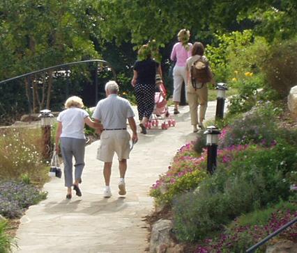
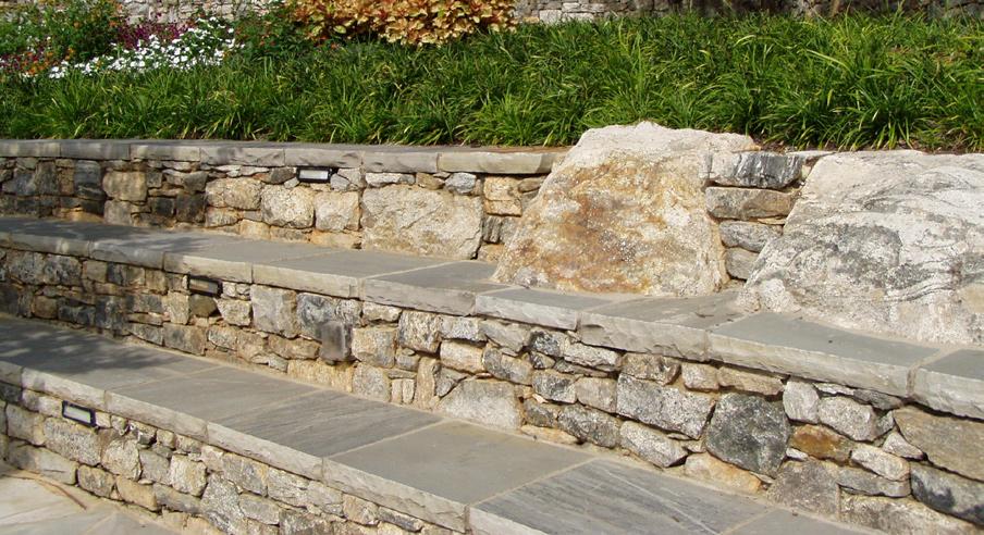
The existing grade from the bathhouse/concessions building to the lake shore is very moderate slope. This allows the development of strong connections with the swim beach. Between the building and the beach, there are opportunities for many layers of activity. A small dining terrace could be located near the concessions to offer a social atmosphere for quick snacks and drinks. Picnic tables sited among the trees allow small groups a more private place for lunch. Seat walls along the path provide a comfortable place to wait for a companion or enjoy the woodland shade. Paths to the beach will be accessible and broad. Starting near the treeline, the grass beach stretches out providing a lawn for sun bathing and lounging. Great effort should be directed to the grading of the lawn area to minimize the need for retaining walls. The sand beach and swim area is broad and expansive extending approximately 700’ across the shoreline. The gentle slope of the land extends into the water providing a good basis for the swim area construction.
The beach offers a strong invitation to boaters passing by and puts a very public face on the park To enhance this image and to provide clear definition of the swim area for boat traffic, the master plan calls for the fishing pier and the boat dock pier. Further study is recommended to ensure that water flow through the swim area out to and beyond the boat pier would be sufficient to move and disperse any spot pollutants away from the swim area.
53
MASTER PLANSwim Beach
Accessible paths will link the parking areas, bathhouse and swim beach areas
Walls along paths will provide casual seating in shaded areas
A terrace near the concessions area will provide a social setting for refreshments
5.0
community building,
Parking

locations,
lawn
open area
events


to play with easy supervision.

be framed with stone terracing.
54 1 The
adjacent
area and parking are detailed in the illustrative site plan above. 2 The lawn will provide an
for children
3 Programmed activities create community events. 4 At appropriate
the
lawn may
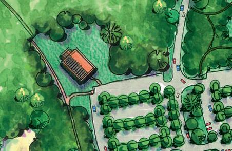
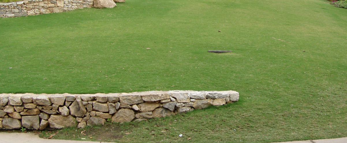
5 A small amphitheater or performance circle would expand the activities program. 6 Group shelters at the picnic area and the community building will accommodate larger gatherings. 7 Individual tables will be sited along the path linking the picnic area and the swim beach. 8 Tables will be sited to provide sunny and shaded environments for visitors. 1 2 3 4 5 Community Building Lawn
Entry Drive Trailto Swim Beach
Key map for the illustrative site plan detail opposite, on page 54

Located near the bathhouse and concessions building, the community building will provide a place for larger groups to gather and meet. Inside, it will have a small kitchen and storage for chairs and tables. The community building will have bathrooms with internal and external access. A separate parking area will be located close to the community building. This parking area will allow for easier access and can serve as overflow parking when the number of swim beach visitors increases. A large picnic shelter is also nearby located just north of the parking area.
A lawn area will be located near the bathhouse building and near the community building. The lawn areas will be large and open with a gentle slope that will allow for a variety of uses. Given the topography, a small amphitheater may be integrated along the edge of the lawn. Some special events will be programmed. Other uses will occur as visitors plan their own activities. All structures and walls should use native materials that reinforce the park image and the environment of Lake James.
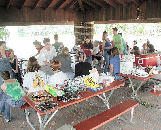
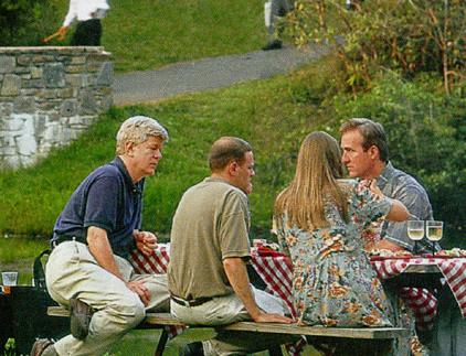
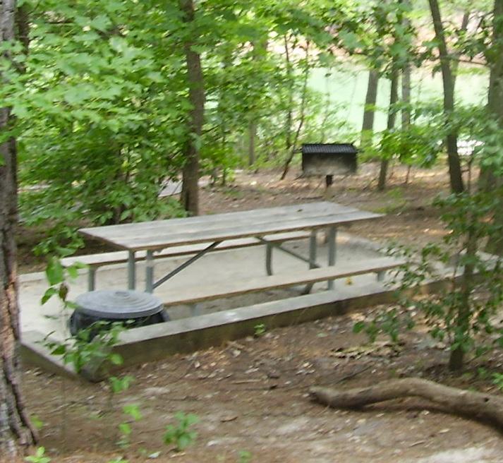
The picnic area, located north of the swim facility parking area, will provide 25 to 35 tables on pads. One group shelter is provided to accommodate larger gatherings and to provide a protected area during inclement weather. Additional picnic tables will be sited along the trail between the parking area and the washhouse building. These tables will offer shaded dining areas closer to the swim beach. Canoes may be rented at the concessions window of the bathhouse building.
Creek Events Lawn
55
MASTER PLANPaddy
6 7 8
5.0
A portion of the Lake James Trail will run north-south through the Center Parcel crossing three small streams. The key box indicates the area of detail in the illustrative plan to the right.

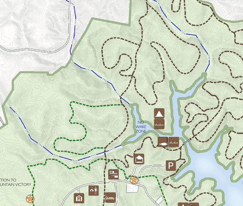
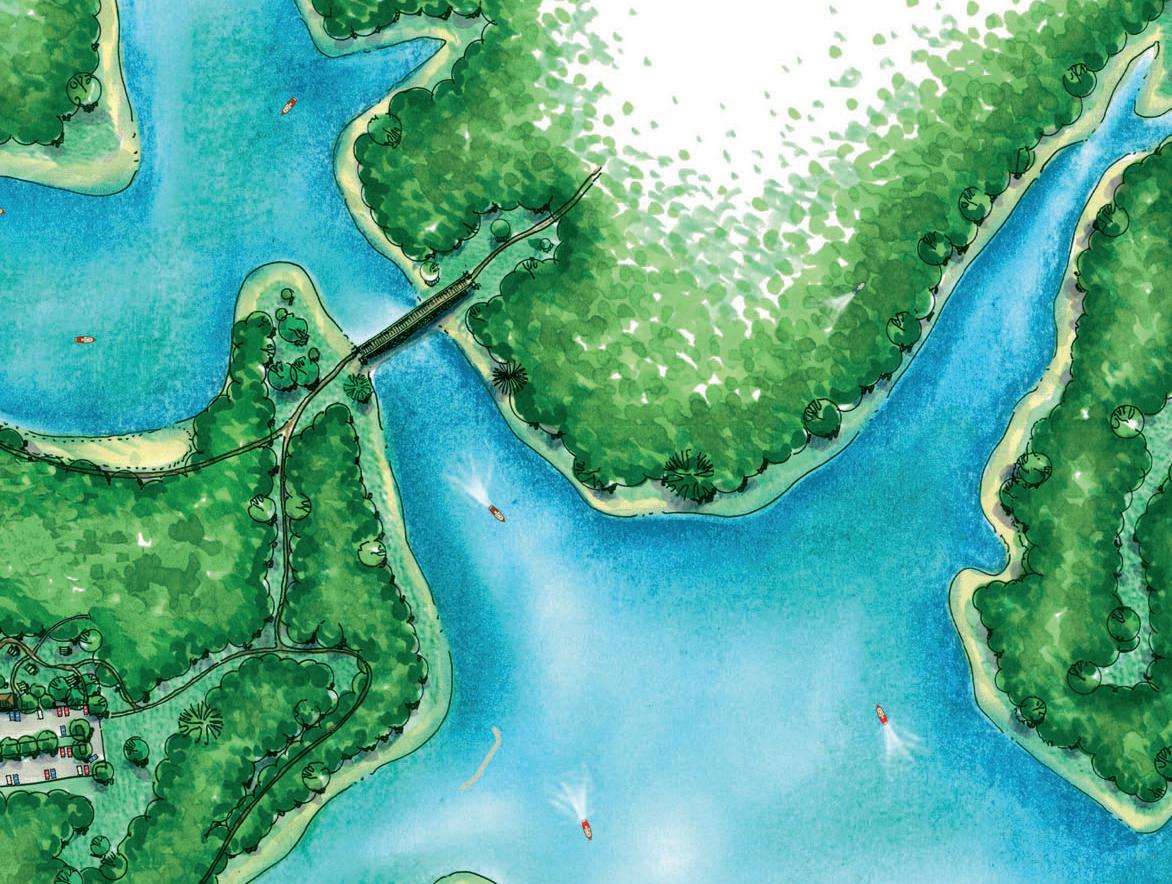
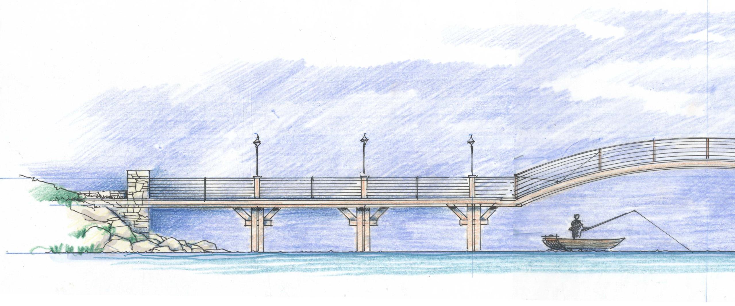
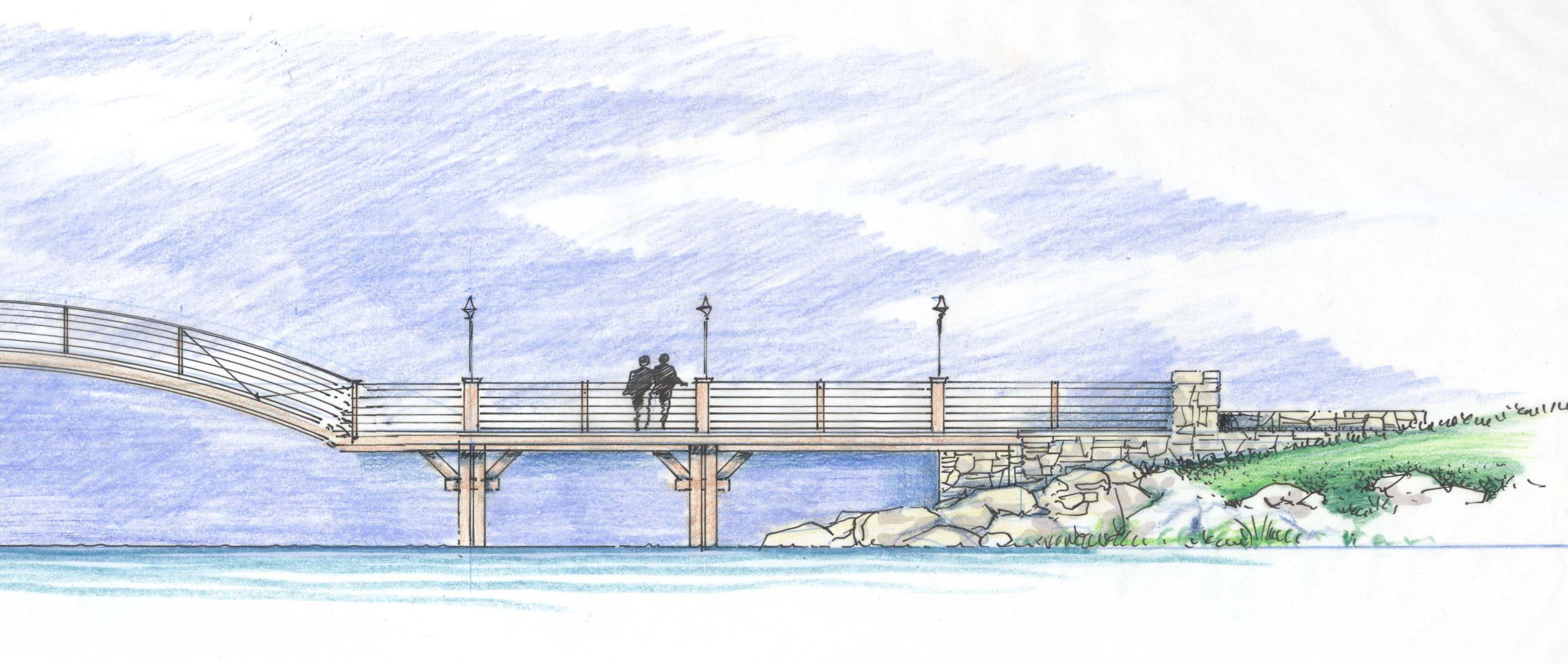
The Cove Bridge, proposed to link Paddy Creek Peninsula and Long Arm Peninsula, will provide a major trail connection across the middle of the park. An illustrative image of the proposed bridge is located at the bottom of this page. A location key is indicated on the map to the left.
overall width estimated between 150’ and 200’


This image is an illustrative elevation sketch of the proposed Cove Bridge that would link Paddy Creek Peninsula and Long Arm Peninsula
56
Primitive camping will be located on the eastern point of the Center Parcel adjacent to Lake James
interior cove Trailhead Parking
Cove Bridge
Long Arm Peninsula
Paddy Creek Peninsula
NTS
Cove Bridge
abutment
piling construction with post-mounted reflectors
The Center Parcel area of the park will not be densely developed. A significant portion will be left undisturbed to provide a buffer along the western edge between the park land and private property east of Highway 126. The major trail through the Center Parcel will be a section of the proposed Lake James Trail that will run north-south connecting Paddy Creek Peninsula and Long Arm Peninsula. Two secondary trails will loop off this trail to the west. One trail will be hike-only and the other trail will be multi-use. Another trail loop to the east leads to the primitive camping area. The campsites are located on the point of land that splits the two fingers of the cove. These campsites are also accessible by canoe and kayak.
Across the cove from the primitive camping a bridge is proposed that will link Paddy Creek Peninsula and Long Arm Peninsula near the middle of the park. Located at the narrowest point between the two peninsulas, the Cove Bridge will need to span between 175 and 200 feet. The Cove Bridge will include a large open span across it’s middle section. This will be necessary due to the water depth at the center of the channel, but more importantly, the middle section span will direct boat traffic for safe passage without the need to navigate between closely spaced pilings. The bridge will be one of the more memorable constructed features within the park.
It is recommended that in the cove west of the bridge a “No Wake” zone be established. Without restricting access to motorized boats, the no wake zone will create a safe environment for paddlers. The reduced boat speed will make passage beneath the bridge safer and will provide a quieter atmosphere within the cove. Approval of such a zone will have to be coordinated with appropriate regulatory agencies.

The connection the bridge provides will have a significant and positive impact on circulation within the park. The bridge would accommodate pedestrian and bicycle traffic as well as small service vehicles used by park staff. The bridge would provide the shortest route from the visitors center to the extensive trails on Long Arm. Service and emergency access to Long Arm Peninsula would be significantly improved with the bridge crossing.
57
MASTER PLANCenter
Parcel and Cove Bridge
center span abutment 5.0
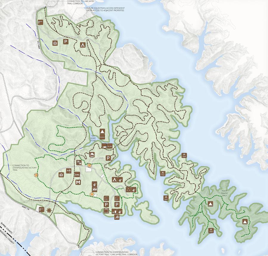
The park master plan map above shows the extent of Long Arm Peninsula. Limits of the peninsula are indicated on the key map opposite, on page 59.

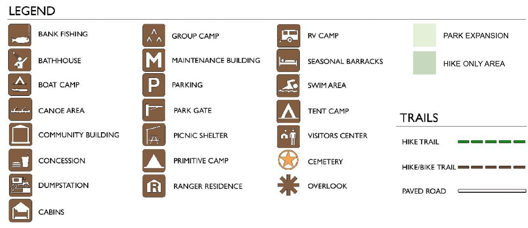
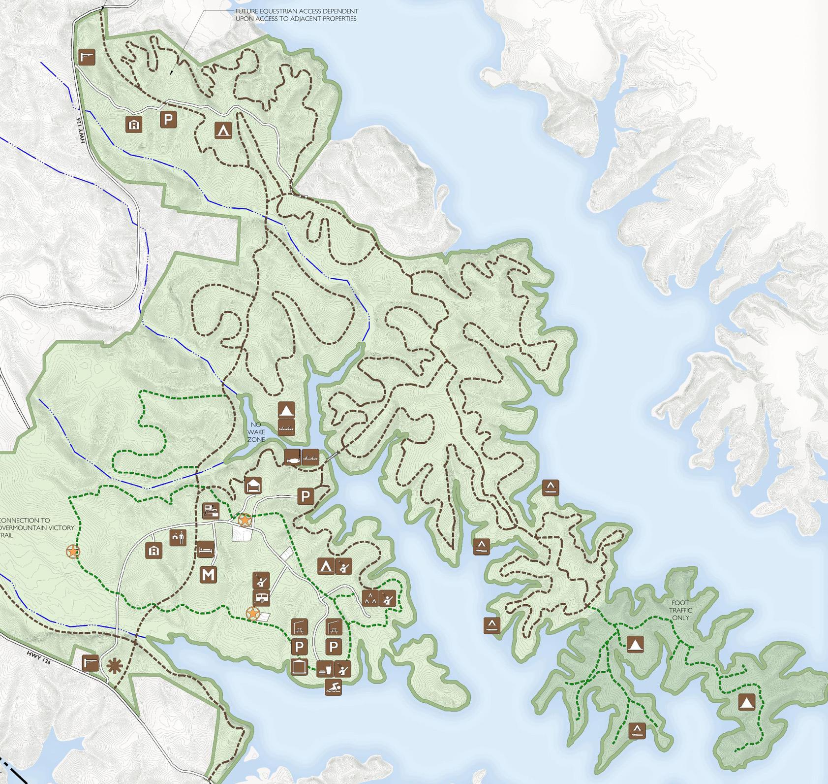
On Long Arm Peninsula, the development of facilities takes a back seat to trail development. As noted in the Analysis section of this report, the extensive areas of steep terrain combined with the 300’ riparian buffer leaves very few developable sites. These development restrictions are particularly evident in the lower half of the peninsula where the land mass narrows significantly.
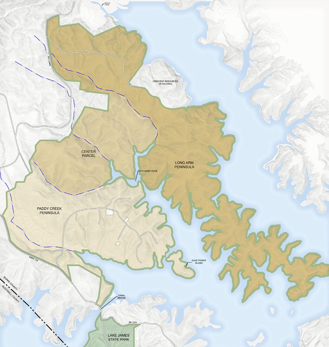
The vehicular entrance to Long Arm Peninsula will be located just west of the Linville River Bridge along Highway 126. The entry road will also provide the access required for the large lake front parcel retained by Crescent Resources. Current plans for the Crescent inholding call for development of a lodge and conference center. Beyond the entrance, a second ranger residence will be located along the entry road. The road quickly reaches a parking area that is close to the crossing point of the Lake James Trail. This parking area may be expanded in the future to provide trailhead parking for horse trail riders. The development of trailhead facilities for equestrians will only be provided if provisions are made to allow horses to use the future Gamelands area for access into the Pisgah National Forest.
The feasibility of providing horse trails within Lake James State Park was evaluated as part of the master planning process. Trail standards call for a minimum of 10 miles of trails for a satisfactory equestrian experience. This criteria was supported by local riders. To minimize erosion and preserve water quality, it would be necessary to limit equestrian trails to areas well upland of the Lake James shore line. The western reaches of the Center Parcel and Paddy Creek Peninsula provide the most appropriate locations. Within those areas, an out and back trail could provide only about seven miles of trail for riders. It was agreed that the best course of action is to plan for possible future trail head facilities within the park from which riders could then access extensive trails located in the Pisgah Forest west of the park land.
Along the secondary entrance drive, a tent camping area will be located about a quarter mile along the road, about the mid point to the Crescent inholding parcel. This camping area will provide 25 camp sites, all with tent pad, fire ring and lantern hook. Water service will be provided for each cluster of six to eight camp sites. A bathhouse will be provided outfitted with sinks, toilets and hot shower facilities.
59
MASTER PLANLong Arm Peninsula
Long Arm Peninsula
5.0
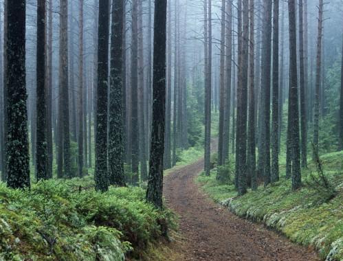 Expanses of mature forests are more typical on the Long Arm Peninsula
The extended, narrow character of the land form and the steeper slopes along the shore line have limited tree harvesting on the middle and southernmost portion of Long Arm Peninsula. These woodland areas provide great visual interest and there are extensive areas of high tree canopy and dense shade. Old logging roads are still prominent. The main logging road running along the ridgeline of the peninsula has been maintained and has a gentle gradient. Smaller roads out onto the secondary ridgelines have become more closed in as vegetation has begun to re-establish.
Trails on Long Arm will take advantage of these existing conditions where the road alignments can be appropriately redeveloped into trails. A central spine trail will run the full extent of the peninsula providing a gently graded trail that hikers and cyclists of all abilities can enjoy. Side trails running up and along the steeper slopes toward the water will provide a variety of levels of technical difficulty for riders and will allow hikers to take advantage of the great vistas from Long Arm back to the Black Mountains and across Lake James. Final trail alignments will be evaluated in the field.

Approaching the end of the peninsula, bike travel is restricted as you enter an 80-acre hike-only area . This area was created to provide a slower paced environment along the last fingers of land on Long Arm. Two primitive camping clusters are located in this area. The camping areas are sited outside of the 300’ riparian buffer where sanitary sewer services could be located.
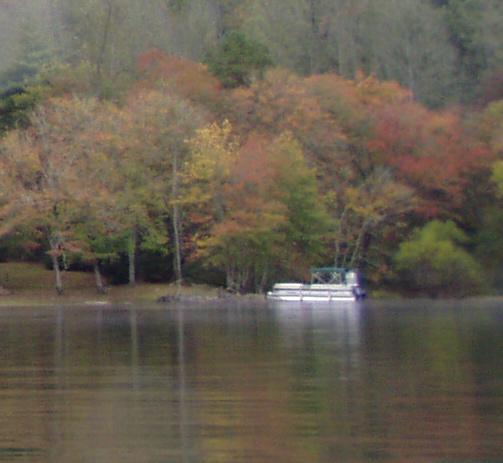
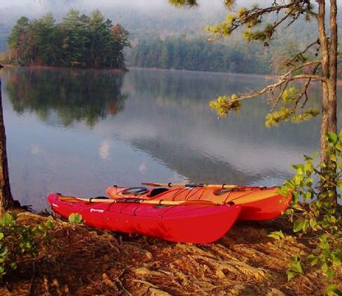
As a commitment to continuation of the traditions and heritage of generations of boaters on Lake James, boat camping areas will be established along the shores of Long Arm Peninsula. These camp sites will allow boaters to come to shore, moor their boat and camp on shore. Amenities present at typical primitive tent camping sites will be provided. The boat camp sites will be clustered at suitable sites and appropriately spaced to provide more private settings. Preliminary areas suitable for the development of boat camping have been identified through field evaluation and will be further refined by park staff. Four clusters of boat camping sites are proposed on Long Arm Peninsula, one of which will be located in the hike-only area. Motorized and non-motorized craft will be allowed to use these campsites. Park staff will service and monitor the boat camping sites from the water and from land trails.
Arm Peninsula
61
MASTER PLANLong
Hiking trails will extend to the very tip of the Long Arm Peninsula
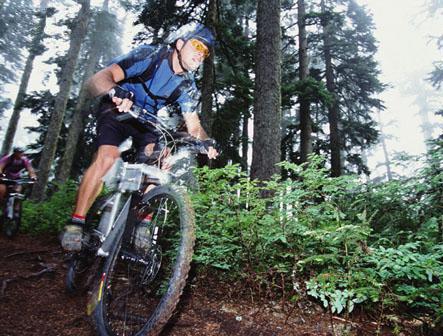
Multi-use trails will be designed to provide challenges for bike riders of all abilities
Boat access campsites are proposed for the park
Primitive campsites will be accessed by hike-only trails or by water
5.0
 Aerial view above the Linville Gorge looking southeast to Lake James and Long Arm Peninsula. The exposed rock face of Shortoff Mountain is in the left foreground.
THE EXPANSION OF LAKE JAMES SATE PARK BRINGS MANY LAYERS OF BENEFIT TO THE communities in and around Marion, Morganton, Nebo and Lake James. Acquisition of the park land allows preservation of a significant area of open space that has extensive lake frontage. The state and others worked diligently and with great vision to obtain the property. Lake James State Park will stand in strong contrast to the residential development that typically occupies the lake shoreline. Visitors will have outstanding vistas of the Black Mountains located to the north and west. The park will preserve a significant portion of the viewshed from the Linville Gorge in Pisgah National Forest.
Lake James State Park greatly expands the opportunities for public access to the lake and its shoreline. With increased private development, public access to the lake may be largely limited to state and county facilities. The park makes waterfront experiences available to all. Facilities within the park are designed to provide visitors outdoor day use activities and overnight camping.
In development of the park, great care will be taken to build facilities in an environmentally responsible manner. Water quality will be protected through responsible construction techniques. Extensive buffers around the lake and streams place development away from the most sensitive areas and provide visual buffering along the shoreline. Roads into and through the park will be limited and will often be sited on areas previously disturbed by timber harvesting. Road and trail alignments will respond to the lay of the land and be routed to take advantage of high ridges that will provide scenic vistas. Stream crossings will be kept to a minimum. Where appropriate, trails will be designed to take advantage of the existing network of logging roads.
Unlike many parks, the impact of man-made improvements is one of the aspects that make Lake James State Park land special. While generating energy, the waters of Lake James have transformed typical upland forests into a place of special beauty poised between the water and the mountains beyond. Moving forward from master plan into park construction, designers, engineers and division staff are charged to take the park beyond check list execution and asked to find and reveal the beauty of the land of Lake James State Park. The great beauty of the lake and the mountains beyond are straightforward and more easily framed. The small beauties must be searched out and brought to light. If noted, gentle falls in the creeks can be preserved and viewed from the roadway or trail. Significant trees, rock outcroppings and groves can be preserved with a responsive design process that looks beyond “point A to point B” efficiency. Materials selected for construction should reflect the native palette of stone, plank, shake and timber. The park should capture the time when the lake was first dammed and the water brought up to the wooded edge of the hills. In all aspects, Lake James State Park should be an expression of quiet beauty.
63
CONCLUSION 6.0
STATE PARKS & RECREATION PLANNING REVIEW TEAM
Lewis Ledford- Parks & Recreation Division Director
Don Reuter- Assistant Director
Adrienne McCoig- Executive Assistant
Susan Tillotson- Chief Parks Operations
Walt Gravley- West District Superintendent (retired)
Tom Jackson- West District Superintendent
Judd Burns- South District Superintendent
Bruce Garner- Chief, Design and Development
Lance White- Facility Engineering Technician
Alan Jeffreys- Facility Engineering Technician
Elizabeth Chesnut- Parks Design Manager
Kim Huband- State Parks Planner
Alan Eakes- State Parks Planner
John Amoroso- Design and GIS Consultant
Carol Tingley- Chief, Natural Resources and Regional Planning Bayard Alcorn- Head, Grants and Regional Planning
Brian Strong- Lead, Natural Resources Program
John Taggart- Regional Environmental Biologist Marshal Ellis- Regional Environmental Biologist
Carrie Paige- Personal Assistant Dwayne Stutzman- Regional Trails Specialist
OFFICER OF CONSERVATION AND COMMUNITY AFFAIRS, NATURAL HERITAGE PROGRAM- PLANNING/ REVIEW MEMBERS
Mike Schafale- Community Ecologist
Harry LeGrand- Vertebrate Zoologist
Shawn Oakley- County Inventory Biologist
LAKE JAMES STATE PARK PARK ADVISORY COMMITTEE
Rod Birdsong
Ken Harris Donna Stevens Roger Sprinkle Stan Braswell Ashley Wooten Debbe Perry Paul Braun Eric Jenkins Steve Lian
Former members: Judy Francis Carl Mead Rev. John Fitzgerald Troy Messer
EX OFFICIO
Rep. Walter Church Rep. Mitch Gillespie Gary Laws Chuck Abernathy
LAKE JAMES STATE PARK STAFF
Tim Benton- Park Superintendent
Wanda Fox- Office Assistant
Susan Ashley- Park Ranger
Earl Weaver, III- Park Ranger
Lynn Alexander- Maintenance Mechanic
LANDDESIGN PLANNING TEAM
Bradley W. Davis, ASLA, AICP
Tedd A. Duncan, ASLA
D. Ashlie Hood, ASLA, LEED AP
Joseph M. Bates, Landscape Designer
Marie Sheetz, Landscape Designer
65 ACKNOWLEDGEMENTS
PaddyCreek

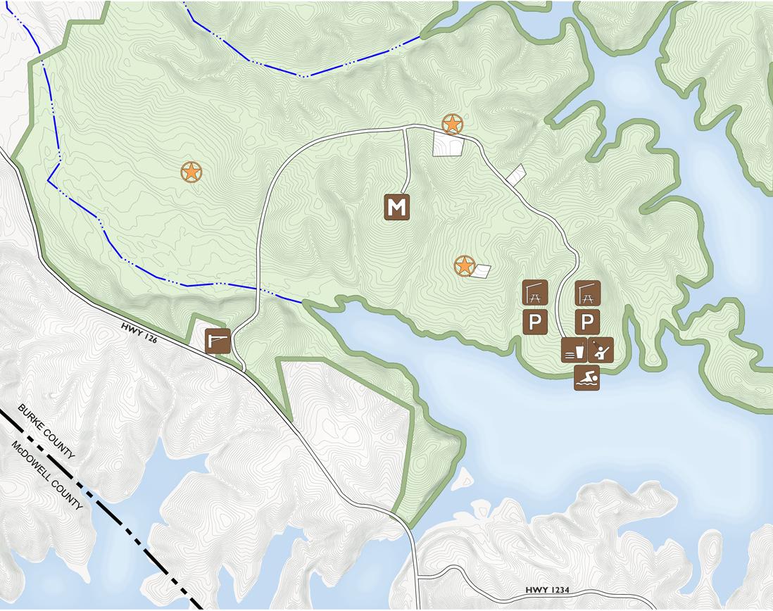
The plan above indicates the extent of Phase I Development for Lake James State Park. An Estimate of Costs and detailed summary are outlined on page 67, opposite.
Lake James State Park Cost Estimate
2006
Phase I
Element Quantity Unit Cost Total
Canal Bridge Entrance Road 10,800 LF 125 / LF $1,350,000.00
Vehicular Bridge at Paddy Creek 1 900,000 LS $900,000.00
Maintenance Road 1,000 LF 125 / LF $125,000.00
Maintenance Storage Area 43,560 SF .77 / SF $33,541.20
Parking Area - Picnic Shelter 225 spaces 1,500 / space $337,500.00
Parking Area - Picnic Shelter 365 spaces 1,500 / space $547,500.00
Parking Area - Bathhouuse 30 spaces 1,500 / space $45,000.00
UG Phone, Electric, Water Extensions 11,000 LF 30 / LF $330,000.00
Maintenance UG electric & water 1,200 LF 20 / LF $24,000.00
Entrance Gate & Sign 1 12,000 LS $12,000.00
Interim Contact Station w/water & sewer 1 150,000 $150,000.00
Information Kiosk at Contact Station 1 6,000 each $6,000.00
Maintenance Building w/shop & restrooms2,000 SF 100 / SF $200,000.00
Maintenance Bldg. Septic 1 CY 12,000 / CY $12,000.00
Maintenance Security Fencing 1,200 LF 30 / LF $36,000.00 Vehicle/Boat Storage Shed w/6 bays 1,800 SF 100 / SF $180,000.00
Bathhouse/Concessions Building 2,000 SF 220 / SF $440,000.00
Bathhouse & Shelter Septic 1 300,000 LS $300,000.00
Toilet Bldg w/PV assisted electric service 1 Information Kiosk at Swim Parking Lot 1 6,000 each $6,000.00
Swim Beach Development 700 LF 1,500 / LF $1,050,000.00 Boat Docks & Patrol Boat Station 1 100,000 LS $100,000.00
Accessible Canoe/Kayak Launch & path 1 60,000 LS
Toilet Bldg w/PV assisted electric service 2 220,000 each $440,000.00
Picnic Shelter, 12 table 2400 SF 2 240,000 each $480,000.00
Grills 10 240 each $2,400.00 Picnic Tables 50 450 each $22,500.00
GRAND TOTAL $7,129,441.20
Construction
Note:
Cost of Construction Estimates do not include design and project management fees, retaining walls, seat walls, connecting paths, site lighting or hiking and biking trails.
67 APPENDIXPhase One Cost of
Estimate
James State Park Cost Estimate
Phase II
Element Quantity Unit Cost Total
Visitors Center 5,000 SF 225 / SF $1,125,000.00
Parking Area - Visitors Center 30 spaces 1,500 / space $45,000.00
Visitors Center Septic System 1 100,000 LS $100,000.00
Ranger Residence, 1,600 SF 3,200 SF 150 / SF $480,000.00
Ranger Res. Septic, 1 CY 2CY 12,000 / CY $24,000.00
Cabin Loop Road
1,800 LF 125 / LF $225,000.00
Cabins, 200 SF 3,000 SF 150/SF $450,000.00
UG Electric, Water Extensions 2,500 LF 20 / LF $50,000.00
Toilet Bldg w/PV assisted electric service 1 220,000 each $220,000.00
Trailhead Loop Road 1,300 LF 125 / LF $162,500.00
UG Electric, Water Extensions 1,500 LF 20 / LF $30,000.00
Trailhead Parking Area 185 spaces 1,500 / space $277,500.00
Toilet Bldg w/PV assisted electric service 2 220,000 each $440,000.00
Accessible Canoe/Kayak Launch & path 1 70,000 LS $70,000.00
Picnic Area w/15 tables 1 25,000 LS $25,000.00
Picnic Shelter, 12 table 2400 SF 2 240,000 each $480,000.00 Information Kiosk at Parking Lot 1 6,000 each $6,000.00
Pedestrian Bridge at Cove, 12' x 220' 2,640 SF 125 / SF $330,000.00
Pedestrian Bridge Abutments 2 15,000 each $30,000.00
Primitive Camping Areas, 25 sites 50 sites 1,200 each $60,000.00
Primitive Camping Septic 2 systems 18,000 each $36,000.00
RV Camping Road Loop 1,800 LF 125 / LF $225,000.00
RV Camping Area, 35 sites 35 sites 2,500 each $87,500.00
Toilet Bldg w/PV assisted electric service 1 220,000 each $220,000.00
Toilet Bldg. Septic Septic 1 100,000 each $100,000.00
Extend UG electric & water 1,800 LF 20 / LF $36,000.00
Dump Station and Septic 1 130,000 LS $130,000.00
Tent Camping Road Loop 2,600 LF 125 / LF $325,000.00
Tent Camping Area, 35 sites 35 sites 2,000 each $70,000.00
Toilet Bldg w/PV assisted electric service 1 220,000 each $220,000.00
Toilet Bldg. Septic Septic 1 100,000 each $100,000.00
Extend UG electric & water 2,600 LF 20 / LF $52,000.00
Group Camping Road Loop 2,200 LF 125 / LF $275,000.00
Tent Camping Area, 10 sites 10 sites 4,000 each $40,000.00
Community Area 1 8,000 LS $8,000.00
Toilet Bldg w/PV assisted electric service 1 220,000 each $220,000.00
Toilet Bldg. Septic Septic 1 100,000 each $100,000.00
Extend UG electric & water 2,600 LF 20 / LF $52,000.00
GRAND TOTAL $6,926,500.00
Lake
2006
Lake James State Park Cost Estimate
2006 Phase III
Element Quantity
Unit Cost Total
Entrance Gate & Sign 1 12,000 $12,000.00
Linville Bridge Entrance Road 2,200 125 $275,000.00
Ranger Residence 1,600 150 $240,000.00
Ranger Res. Septic 1 12,000 $12,000.00
Parking Area - Trailhead 60 1,500 $90,000.00
UG Phone, Electric, Water Extensions 2,500 30 $75,000.00
Information Kiosk at Parking Lot 1 6,000 $6,000.00
Tent Camping Road Loop 1,200 125 $150,000.00
Tent Camping Area, 35 sites 35 2,000 $70,000.00
Toilet Bldg w/PV assisted electric service 1 220,000 $220,000.00
Toilet Bldg. Septic Septic 1 100,000 $100,000.00
Extend UG electric & water 1,200 20 $24,000.00
Boat Camping Areas, 30 sites 30 3,000 $90,000.00
Boat Camping Septic 5 25,000 $125,000.00
Primitive Camping Areas, 25 sites 50 1,200 $60,000.00
Primitive Camping Septic 2 18,000 $36,000.00
GRAND TOTAL $1,585,000.00
Note:
Phase II includes the balance of development on Paddy Creek Peninsula not included in Phase I as well as the development on the Cove Parcel.
Phase III includes all development on the Long Arm Peninsula.
Cost of Construction Estimates do not include design and project management fees, retaining walls, seat walls, connecting paths, site lighting or hiking and biking trails.
69 APPENDIXPhase Two and Phase Three Cost of Construction Estimate
70
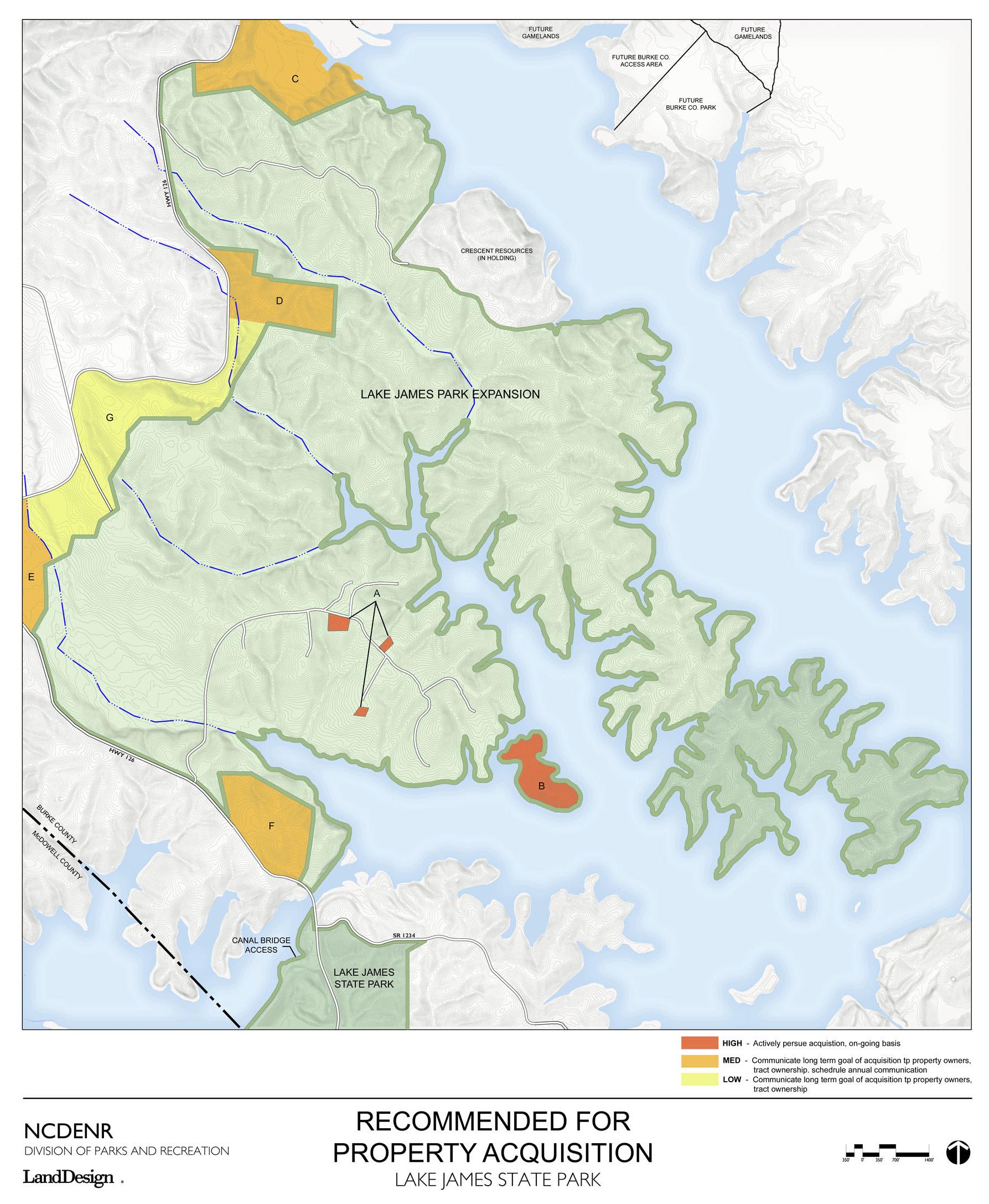
71 APPENDIXProperty for Acquisition
72
Name
Arkaqua loam, 0 to 2 percent slopes, occasionally flooded
Brevard fine sandy loam, 1 to 6 percent slopes, rarely flooded
Description
Poorly drained, moderately permeable soils on nearly level flood plains along creeks and rivers
Deep, well drained soils on gently sloping to steep high stream terraces
Colvard sandy loam, 0 to 3 percent slopes, occasionally flooded
Fairview sandy clay loam, 2 to 8 percent slopes, moderately eroded
Fairview sandy clay loam, 8 to 15 percent slopes, moderately eroded
Fairview sandy clay loam, 15 to 25 percent slopes, moderately eroded
Fontaflora-Ostin complex, 0 to 5 percent slopes, flooded Meadowfield-Woolwine complex, 8 to 15 percent slopes
Deep, well drained soils that formed in loamy alluvium on flood plains in the southern Appalachian Mountains
Deep, well drained, low to high runoff, moderate permeability, found on hills and ridges
Similar to above with slightly steeper slope
Similar to above with even steeper slope.
Deep, well drained soils with moderately rapid or rapid permeability in the upper part and rapid permeability in the lower part. On flood plains of streams which occasionally or frequently flood. Mostly wooded.
Moderately deep to bedrock, well drained, Runoff: Medium to high, moderate permeability
RhD
Rhodhiss sandy loam, 15 to 25 percent slopes
Rhodhiss sandy loam, 25 to 45 percent slopes
Very deep, well drained, low to high surface runoff, Moderate Permeability, located on hills and ridges
Similar to above but with steeper slope
Rhodhiss-Bannertown complex, 25 to 50 percent slopes
Unison fine sandy loam, 2 to 8 percent slopes
Very deep, somewhat excessively drained, low to medium surface runoff
Very deep and well drained, medium or rapid runoff. On mountain footslopes, alluvial fans, or stream terraces. Moderate permeability.
Unison fine sandy loam, 8 to 15 percent slopes
Similar to above but with steeper slope
73 APPENDIXSoil Classifications SOIL CLASSIFICATIONS (see page 28 for Soils Map) Abbreviation AaA BvB CvA FaB2 FaC2 FaD2 FoB MwC
RhE RoE UnB UnC


 Expanses of mature forests are more typical on the Long Arm Peninsula


 Aerial view above the Linville Gorge looking southeast to Lake James and Long Arm Peninsula. The exposed rock face of Shortoff Mountain is in the left foreground.


