HANGING ROCK STATE PARK EXPANSION Master Plan


July 2018
This page was intentionally left blank
LETTER III
This page was intentionally left blank
Project Team / Acknowledgments
Roy Cooper
North Carolina Governor
North Carolina House of Representatives
Kyle Hall District 91
North Carolina Senate
Shirley B. Randleman
District 30
NC Division of Parks and Recreation Natural and Cultural Resources
Mike Murphy Director
Carol Tingley
Adrian O’Neal
Brian Strong
Deputy Director
Chief of Operations
Chief of Planning and Natural Resources
David Head Planning Program Manager Christy Rosas Parks Planner Scott Crocker Trails Program Manager Smith Raynor Trails Planner
Jon Blanchard
Natural Resources Manager Justin Williamson Environmental Review Coordinator John Amoroso
GIS Pete Colwell Land Protection Specialist Sean McElhone Regional Superintendent Robin Riddlebarger Hanging Rock State Park Superintendent Sam Koch Hanging Rock State Park Ranger Jason Anthony Hanging Rock State Park Ranger Austin Paul Hanging Rock State Park Ranger Mary Gri n Hanging Rock State Park Ranger Ray Brundege Hanging Rock State Park Ranger Gary Pippin Hanging Rock State Park Ranger Josh Hemric Hanging Rock State Park Ranger Sean Wiseman Hanging Rock State Park Maintenance Mechanic Sandra Patterson Hanging Rock State Park O ce Assistant
Hanging Rock State Park Advisory Committee
Luann Bridle
Skip Staples Ashley Johnson
Community Groups
Friends of Sauratown Mountains
Piedmont Land Conservancy
obs landscape architects - Design Consultants
Bill Garrity Louis Wood
Brian H. Starkey, PLA Principal / Landscape Architect
Lauren E. Dickson, PLAProject Landscape Architect
Jon Blasco Project Planner
Michael Alderman Project Planner
ACKNOWLEDGEMENTS V
This page was intentionally left blank
Contents
Letter. . . . . . . . . . . . . . . . . . . . . . . . . . . . . . . iii
Project Team / Acknowledgments. . . . . . . . . . . . . . . . . . . v
Table Of Contents. . . . . . . . . . . . . . . . . . . . . . . . . .vii
Map Index . . . . . . . . . . . . . . . . . . . . . . . . . . . . . x
Chapter One: Process & Site Analysis 1
Introduction . . . . . . . . . . . . . . . . . . . . . . . . . . . .1
Park Needs . . . . . . . . . . . . . . . . . . . . . . . . . . . .5
Planning Process. . . . . . . . . . . . . . . . . . . . . . . . . . 5
Summary of Phases . . . . . . . . . . . . . . . . . . . . . . . . . . .6
Phase One - Information Gathering . . . . . . . . . . . . . . . . . . .6
Phase Two - Preliminary Planning & Design. . . . . . . . . . . . . . . .6
Phase Three - Draft Master Plan . . . . . . . . . . . . . . . . . . . .6
Phase Four - Final Master Plan . . . . . . . . . . . . . . . . . . . . .6
General History. . . . . . . . . . . . . . . . . . . . . . . . . . . 7
Vade Mecum . . . . . . . . . . . . . . . . . . . . . . . . . . . . . .7
Moores Springs . . . . . . . . . . . . . . . . . . . . . . . . . . . . .8
Existing Building and Structure Inventory. . . . . . . . . . . . . . . . 8
Introduction. . . . . . . . . . . . . . . . . . . . . . . . . . . . . . .8
Existing Buildings and Structures - Vade Mecum . . . . . . . . . . . . . . .9
Existing Buildings and Structures - Moores Springs . . . . . . . . . . . . . 16
Natural Features . . . . . . . . . . . . . . . . . . . . . . . . .19
Vegetation . . . . . . . . . . . . . . . . . . . . . . . . . . . . . .19
Endangered Species . . . . . . . . . . . . . . . . . . . . . . . . . .20
Topography . . . . . . . . . . . . . . . . . . . . . . . . . . . . . . 20
Hydrologic Patterns . . . . . . . . . . . . . . . . . . . . . . . . . .20
Cultural Features. . . . . . . . . . . . . . . . . . . . . . . . . 21
Buildings and Structures . . . . . . . . . . . . . . . . . . . . . . . . 21
Cemeteries. . . . . . . . . . . . . . . . . . . . . . . . . . . . . . 22
Outdoor Spaces . . . . . . . . . . . . . . . . . . . . . . . . . . . .22
Surrounding Land Use . . . . . . . . . . . . . . . . . . . . . . . . .22
Roads . . . . . . . . . . . . . . . . . . . . . . . . . . . . . . . .23
Utilities. . . . . . . . . . . . . . . . . . . . . . . . . . . . . . . . 23
Regulatory Requirements / Designated Nature Preserve. . . . . . . . . . . 23 Development Opportunities and Constraints . . . . . . . . . . . . . . . .23
Table Of
TABLE OFCONTENTS VII
Chapter Two: Community Engagement 24
Phase One Community Engagement Summary . . . . . . . . . . . . 24
Soup In a Bowl. . . . . . . . . . . . . . . . . . . . . . . . . . . . . 24
Vade Mecum Open House. . . . . . . . . . . . . . . . . . . . . . . . 24
Public Meeting #1 . . . . . . . . . . . . . . . . . . . . . . . . . . .25
Meetings with Stakeholders. . . . . . . . . . . . . . . . . . . . . . . 26
Survey and Meeting Results. . . . . . . . . . . . . . . . . . . . . . . 26
Phase Two Community Engagement Summary . . . . . . . . . . . . 27
Public Meeting #2 . . . . . . . . . . . . . . . . . . . . . . . . . . . 27
Press Release. . . . . . . . . . . . . . . . . . . . . . . . . . . . . 27
Concept Master Plans Survey . . . . . . . . . . . . . . . . . . . . . . 27
Phase Three Community Engagement Summary . . . . . . . . . . . 28
Public Meeting #3 . . . . . . . . . . . . . . . . . . . . . . . . . . .29
Draft Master Plan Survey . . . . . . . . . . . . . . . . . . . . . . . .29
Chapter Three: Final Master Plan 31
Introduction . . . . . . . . . . . . . . . . . . . . . . . . . . . 31
Property Distinctions. . . . . . . . . . . . . . . . . . . . . . . . . . 31
Recommendations . . . . . . . . . . . . . . . . . . . . . . . . 31
Overall Plan. . . . . . . . . . . . . . . . . . . . . . . . . . . . . . 32
Existing Buildings/Structures on the Moores Springs Property. . . . . . . 34
Existing Buildings/Structures on the Vade Mecum Property. . . . . . . . 35
Moores Springs Property . . . . . . . . . . . . . . . . . . . . . . . .39
Moores Springs - Ed Booth Road Area . . . . . . . . . . . . . . . . .40
Moores Springs - Former Campground. . . . . . . . . . . . . . . . . 42
Vade Mecum Property . . . . . . . . . . . . . . . . . . . . . . . . .44
Vade Mecum - East. . . . . . . . . . . . . . . . . . . . . . . . . 46
Vade Mecum - West. . . . . . . . . . . . . . . . . . . . . . . . . 48
Vade Mecum - North . . . . . . . . . . . . . . . . . . . . . . . .50
Vade Mecum - Central Campus. . . . . . . . . . . . . . . . . . . . 52
Phased Implementation. . . . . . . . . . . . . . . . . . . . . . 54
Phase One . . . . . . . . . . . . . . . . . . . . . . . . . . . . . . 54
Phase Two . . . . . . . . . . . . . . . . . . . . . . . . . . . . . . 54
Phase Three. . . . . . . . . . . . . . . . . . . . . . . . . . . . . . 54
Phase 1/Moore Springs . . . . . . . . . . . . . . . . . . . . . . . .55
TABLE OFCONTENTS VIII
Phase 1 / Vade Mecum. . . . . . . . . . . . . . . . . . . . . . . . . 56
Phase 2 / Moores Springs . . . . . . . . . . . . . . . . . . . . . . . 61
Phase 2 / Vade Mecum. . . . . . . . . . . . . . . . . . . . . . . . . 62
Phase 3 / Moores Springs. . . . . . . . . . . . . . . . . . . . . . . . 65
Phase 3 / Vade Mecum. . . . . . . . . . . . . . . . . . . . . . . . . 66
Estimates of Probable Cost. . . . . . . . . . . . . . . . . . . . . 69
Estimates of probable construction costs per phase . . . . . . . . . . . 69
TABLE OFCONTENTS IX
Map
Overall Site Context Map . . . . . . . . . . . . . . . . . . . . . . . 3
Overall Master Plan. . . . . . . . . . . . . . . . . . . . . . . . 37
Moores Springs - Ed Booth Road Area . . . . . . . . . . . . . . . . 41
Moores Springs - Former Campground. . . . . . . . . . . . . . . . 43
Vade Mecum - East . . . . . . . . . . . . . . . . . . . . . . . . 47
Vade Mecum - West. . . . . . . . . . . . . . . . . . . . . . . . 49
Vade Mecum - North. . . . . . . . . . . . . . . . . . . . . . . . 51
Vade Mecum - Central Campus . . . . . . . . . . . . . . . . . . .53
Overall Phase One Plan. . . . . . . . . . . . . . . . . . . . . . 59
Overall Phase Two Plan . . . . . . . . . . . . . . . . . . . . . .63
Overall Phase Three Plan . . . . . . . . . . . . . . . . . . . . .67
Index
TABLE OFCONTENTS X
CHAPTERONE


ANALYSIS
Introduction
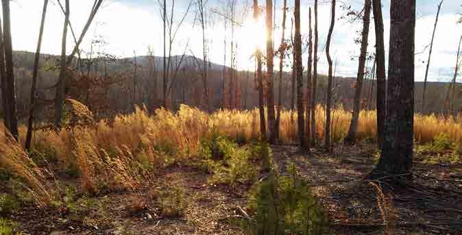
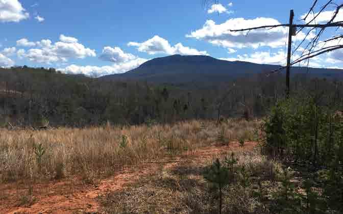
In 2014, North Carolina State University transferred two tracts of land to Hanging Rock State Park in Stokes County. e newly added properties, historically known as Vade Mecum and Moores Springs, add approximately 750 acres to the state park. e property is north of the current park boundary and a small portion touches the Dan River. Historic use of the property included resorts, camps, and the home of a traveling circus.

e overarching goal of the master plan is to de ne an appropriate level of future development on the property to accommodate demonstrated needs in response to stakeholder input and the mission of the NC Parks and Recreation Division. It also is important that the proposed development compliment the recreational opportunities currently o ered at Hanging Rock State Park and address de ciencies in order to better accommodate visitors and lengthen their stay in Stokes County.
Mission Statement of the North Carolina Division of Parks and Recreation:
e North Carolina Division of Parks and Recreation exists to inspire all its citizens and visitors through conservation, recreation and education.
Conservation: To conserve and protect representative examples of North Carolina’s natural beauty, ecological features, recreational and cultural resources within the state parks system;
Recreation: To provide and promote safe, healthy and enjoyable outdoor recreational opportunities throughout the state; and
Education: To provide educational opportunities that promote stewardship of the state’s natural and cultural heritage.


Hanging Rock State Park is approximately 7,900 acres and provides a variety of recreational activities to visitors:
•Education and Events: Rangers hold regularly scheduled educational and interpretive programs about Hanging Rock State Park.
•Camping: 73 tent, trailer & 5 group primitive campsites.
•Cabins: 10 family vacation cabins accommodating up to six people each. Two cabins are handicapped accessible.
•Hiking: More than 20 miles of wooded passageways form a network of trails.
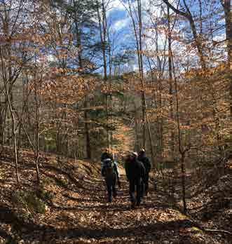
•Existing Mountain Bike Trails on the Moores Springs Property: Four trails o er 8.4 miles of intermediate riding—Land of the Lost, Major
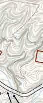
1000 0 1000 2000 3000 4000 ft NGING RO ST TE P R E ME M PROPERTY MOORES SPRINGS PROPERTY Aerial image of Hanging Rock State Park and two newly acquired properties CHAPTER ONE: INTRODUCTION 1
PROCESS & SITE
Tom, Original Loop, and North Side trails. Hiking is also allowed on mountain biking trails.
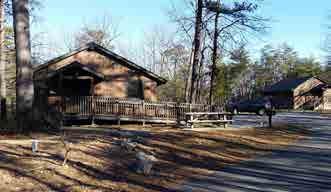
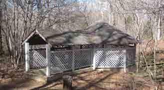
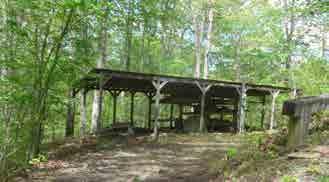
•Picnicking: Two picnic areas o er 15 grills each and 60 picnic sites in total. ree existing picnic shelters (one is accessible).
•Rock Climbing: Cook’s Wall and Moore’s Wall, a series of cli s up to 400 feet high and extending almost two miles, provide opportunities for experienced climbers. Climbing within the park requires a permit.
•Swimming: Tucked into the hills is an inviting 12-acre lake, formed by the damming of Cascade Creek. (Summer months only).
•Boating and Fishing: Fishing is permitted year round on the lake for bass, sun sh and cat sh. Anyone over 16 years old must have a NC shing license. Visitors can sh from the shore, the wheelchair accessible pier or from a rental boat.
•Paddling: access on the Dan River.
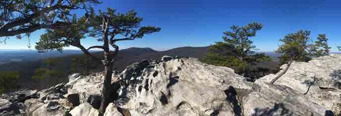
 View from the top of Hanging Rock
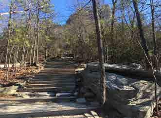
Hiking trail to the top of Hanging Rock
Existing family vacation cabins
View from the top of Hanging Rock
Hiking trail to the top of Hanging Rock
Existing family vacation cabins
HANGING ROCK STATE PARK EXPANSION MASTER PLAN 2017 CHAPTER ONE: INTRODUCTION 2
LEGEND
VADE MECUM
MOORES SPRINGS PROPERTY
HANGING ROCK STATE PARK
FALLS
PARK MAIN ENTRANCE
MOORES SPRINGS & VADE MECUM BOUNDARIES


HANGING ROCK STATE PARK BOUNDARY
HANGING ROCK STATE PARK PROPERTY
POINT OF INTEREST DAN RIVER
TORY’S

MOORE’S KNOB


CENTER
ROCK


100001000200030004000ft DAN RIVER
PROPERTY
HANGING
VISTOR
DEN CASCADE
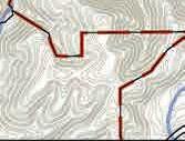
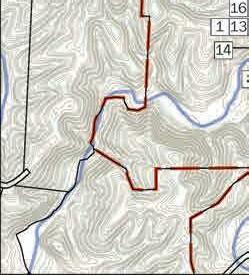
HANGING ROCK STATE PARK | MOORES SPRINGS & VADE MECUM MASTER PLAN OVERALL SITE CONTEXT APRIL 2017 Overall Site Context MapCHAPTER ONE: INTRODUCTION 3
This page was intentionally left blank
Park Needs
Hanging Rock State Park is one of the most visited State Parks in the North Carolina Parks system with over 650,000 visitors due to proximity to triad area, in 2016, a 9% increase from 2015. Ever increasing demand has put stress on existing facilities and because of the high demand for camp sites and cabins, the park turns away visitors looking for accommodations, particularly from spring thru fall.
While one of the goals of the master plan is to identify opportunities to compliment recreational opportunities at Hanging Rock State Park, there is also a need to increase the capacity of the park to accommodate overnight visitors.
Planning Process
e master planning process was conducted over a twelve month period. It was structured to allow stakeholder input throughout all phases of the project. Community engagement was conducted by hosting public meetings where information was presented for consideration and input was sought from the community and other stakeholders. e community also had the opportunity to provide feedback through a project website, online and written surveys.
Stakeholders consulted during the process include:
•NC Division of Parks and Recreation sta
•Hanging Rock State Park Advisory Committee
•Park Rangers
•Stokes County o cials
•Stokes County Planning Sta
•Friends of Sauratown Mountains
•Piedmont Land Conservancy
•Citizens of North Carolina (local and statewide)
•Piedmont Land Conservancy
•NC State Legislature Representation
•Stokes County Arts Council
•Mountain Bike Groups
•Equestrian Groups
Initial Meetings
- Community, Stakeholders, Park Staff - Needs & Preferences - Initial Observations - Gather background data
Phase 1- Information Gathering & Assessment - Site Observations
- Research & Data Gathering - Basemap Development - Define Opportunities & Constraints - Site Analysis Mapping - Document Regulatory Requirements - Define Goals and Objectives - Program Development
Community Meeting #1 - Review Site Analysis Mapping - Summarize Historical Documents - Summarize Regulatory Requirements - Review Opportunities & Constraints
Phase 2 - Preliminary Planning & Design
Found in the Appendices
- Preliminary Concept Design Options - Meetings with staff & stakeholders - Review Community Meeting #1 input
Community Meeting #2 - Review Concept Design Alternatives - Summarize each alternative plan - Gather feedback from community
Phase 3 - Draft Master Plan - Client Meetings
- Summarize Community input - Finalize park program - Draft Master Plan Document - Design Charrette
Community Meeting #3 - Review Draft Master Plan - Summarize feedback - Gather feedback from community
Phase 4 - Final Master Plan - Engage staff, stakeholders & community - Achieve approval from owner - Develop Final Master Plan Document - PAC Presentation
HANGING ROCK STATE PARK EXPANSION MASTER PLAN 2017 CHAPTER ONE: INTRODUCTION 5
Summary of Phases
Phase One - Information Gathering
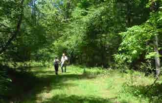
e rst step in preparing the master plan was to gather information about the Moores Springs and Vade Mecum properties. e project team researched the natural features and cultural history of the properties and conducted numerous on-site investigations. e team also surveyed the community at several public events and through a project website; interviewed park sta , rangers and other stakeholders, including county o cials and local representation in the State Legislature.
Phase Two - Preliminary Planning & Design
Phase Two focused on the identi cation of potential program elements and recreational opportunities as well as the preparation of alternative concepts for future improvements. ese concepts accommodated the program and illustrated options for their placement on the land.
With the site analysis information and initial stakeholder feedback from Phase One, three potential development options were de ned. Relevant to the overall property were variations on the trail network and supporting infrastructure. In all three options, the trail system was developed to keep equestrian and mountain biking separate and limit the crossing of these two types of trails. All trails within Hanging Rock State Park allow hikers and both the proposed mountain biking trails and equestrian trails would allow hiking.
Phase Three - Draft Master Plan
With the results from Public Meetings and online surveys, the design team began the process of preparing one overall concept option and a single option for each vignette area. e team then conducted a day long charrette at the Hanging Rock Visitor’s Center meeting separately with park rangers and sta , representatives from the Friends of Sauaratown Mountains and members of the Park Advisory Committee.
Phase Four - Final Master Plan
Following the design charette, the design team prepared the nal master plan based on comments from Stakeholders, the Community, and the NC State Parks Sta . Minor editorial revisions were made to the draft master plan to create the nal master plan.
HANGING ROCK STATE PARK EXPANSION MASTER PLAN 2017 CHAPTER ONE: INTRODUCTION 6
General History
e Moores Springs and Vade Mecum properties have a varied and rich history. e properties are an integral part of the character, history and story in Stokes County. Drawing from the popularity of mineral springs at the turn of the century, both properties were home to several resort hotels drawing visitors from across the state well into the 1930s. After life as a popular resort, the Vade Mecum property was home to several camps including camps to serve the needs of disadvantaged and impaired children, an Episcopal camp and Camp Sertoma. e Moores Springs property was home to the Moores Springs campground providing campers recreational experiences and fond memories for more than 40 years.
Vade Mecum
Vade Mecum (which means “come with me” in Latin) opened in 1901. Before opening as a resort, the property was a winter home to a traveling circus in the 1890s. It was then owned by John Sparks, who, along with Cicero Tise and CA Jenkins, later became involved with the development of the property as a resort. According to local folklore, circus animals, including tigers, stayed on the property during those winter months.
During the early 1900s Vade Mecum was a famous mineral springs resort where people came to spend their summers and enjoy the curative powers of the mineral water from the springs. e water from the mineral springs was sold throughout America and the Vade Mecum water even took the highest honors at the Louisiana Purchase Exposition in New Orleans in 1904.
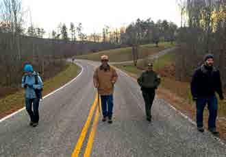
Open house hosted by the Friends of Sauratown Mountains
Sunset Point - cleared area along P East Road
HANGING ROCK STATE PARK EXPANSION MASTER PLAN 2017 CHAPTER ONE: INTRODUCTION 7
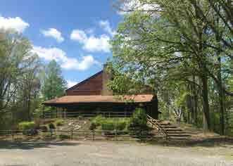
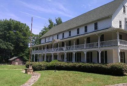
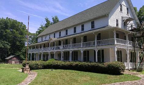
e property is home to the former Camp Sertoma which includes Cheshire Hall, a hotel that dates to 1902; a chapel from the 1940s; Tise Hall, a gymnasium; an outdoor swimming pool; the Vade Mecum spring house; and several cabins. Between 1900 and 1930 the property was home to three di erent hotels. Two of the hotels burned down, the rst in 1908 and the second in 1920. Cheshire Hall, which was considered the south wing of the rst hotel and the second hotel built, still remains, although it is in need of repair. e rst hotel once stood where Tise Hall currently stands and the third hotel building once stood where the chapel currently resides.
Following its use as a resort, the property was used for several camps for various groups, as well as for numerous community events. e property became the home of Camp Cheshire, which was operated by the Episcopal Diocese and Easter Seals from the early 1930s until 1971. e property was purchased in 1981 by North Carolina State University for its 4-H program with involvement from Sertoma clubs, which operated on this site until 2013.
During its time as a resort Diamond Lake was built by damming Vade Mecum Creek. e dam has since been breached and the lake drained, however, the dam and remnants of a water wheel remain. e original spring house remains on the property as well as evidence of a dance oor that spanned across the creek, using the cooling e ects of the owing stream to cool dancers in the summer.
Moores Springs
e Moores Springs property was home to the former Moores Springs campground. Prior to becoming a campground, the property included a hotel and the Moore Family Residence. Moores Springs Resort was in operation by 1870 and the hotel was built around 1900. e hotel later burned in 1926. Several cottages, that survived the re were later adapted into the long one-story building that became the Moores Springs Dining Room, this structure no longer remains on site. e original octagonal spring house remains on the property.
In 2013 NC State University closed the Camp Sertoma and Moore Springs properties. e Stokes County Board of County Commissioners attempted to identify a local group that could continue operations for an interim period but that attempt was unsuccessful. Prior to its closing North Carolina State University also timbered a majority of the northern portion of the Vade Mecum property.
Existing Building and Structure Inventory Introduction
Information for the buildings and structures is based on interviews with North Carolina Department of Natural and Cultural Resources (NCDNCR) sta as well as the “Hanging Rock State Park Feasibility Study of VadeMecum Concessionaire Operations” performed by the University of North Carolina Greensboro for the North Carolina Division of Parks and Recreation.
Prior to implementation of any master plan recommendations, a more detailed inventory and analysis should be completed of buildings to be repurposed to determine the necessary renovations and feasibility of the suggested use.
All of these structures were in existence prior to the Division acquiring the property.
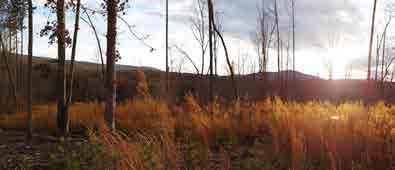
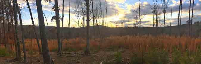
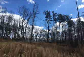
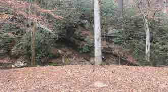
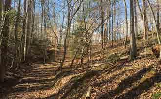
Successional forest on the Vade Mecum Property
HANGING ROCK STATE PARK EXPANSION MASTER PLAN 2017 CHAPTER ONE: INTRODUCTION 8
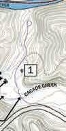
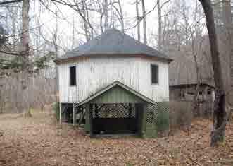
1. Spring house
Located on the Vade Mecum Property, this spring house was used to house and access the mineral springs.
Good


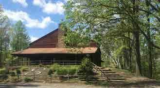
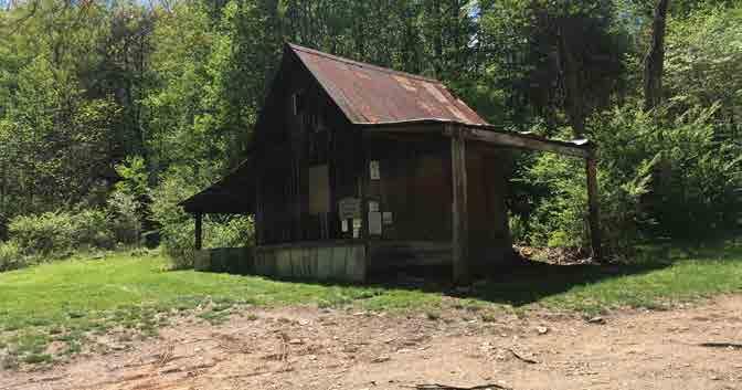
Gym (Tise Hall)
Located on the Vade Mecum Property in the area


used as Camp Sertoma. is gym was used for events, performances, and as a gym.

Existing Buildings and Structures - Vade Mecum
Condition:
2.
formerly
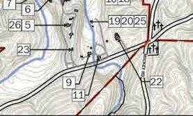
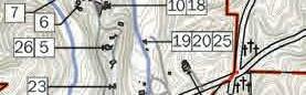
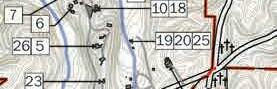
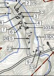
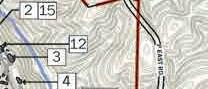
Condition: Poor 7500750150022503000ft MOORESSPRINGSRD. HALLRD. HANGING ROCK STATE PARK | MOORES SPRINGS & VADE MECUM MASTER PLAN VADE APRIL 2017 8 1 2 HANGING ROCK STATE PARK EXPANSION MASTER PLAN 2017 CHAPTER ONE: INTRODUCTION 9
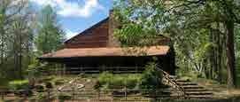
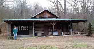
3. Hotel (Cheshire Hall)
Located in the former Camp Sertoma, this hotel was originally used to house people who came to vacation in Stokes County for the mineral water. It was also used to house people attending Camp Sertoma and the kitchen and dining room were used as the dining hall for camps.
Condition: Poor
4. Chapel
Located in the former Camp Sertoma, this chapel was used as a community space, as chapel during the Episcopal church camps, and rented as a venue for weddings.
Condition: Good
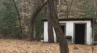
5. Caretaker’s Residence (old post o ce)
Located up the hill from Camp Sertoma, this building was used as the residence for the camp caretaker and prior to that as a post o ce.
Condition: Poor
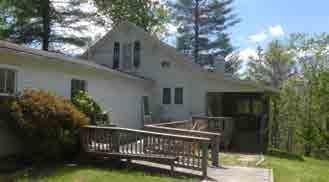
6. Cabins - Group one
Located along the entry drive. e rst set of cabins that you come upon when entering the site. Total of three. Named: Wilmington, Tarheel, and Yadkinville. Condition: Good.
3 4 5 6 HANGING ROCK STATE PARK EXPANSION MASTER PLAN 2017 CHAPTER ONE: INTRODUCTION 10
7. Cabins - Group two
Located along the gravel entry drive. Named: Dogwood, Challenger, White Oak, Raleigh, Old Salem
Condition: Poor
8. Cabins - Group three
Located along the gravel entry drive.
Condition: Poor
9. Horse Motel
Located along Moores Springs Road on the Vade Mecum Property. is building was used to house horses.
Condition: Poor
10. Activity Houses
Located along the gravel drive just before you come to the chapel adjacent to the current small parking area.
Condition: unknown
7 8 9 10 HANGING ROCK STATE PARK EXPANSION MASTER PLAN 2017 CHAPTER ONE: INTRODUCTION 11
11. Nature Center
Located along Moores Springs Road adjacent to the Horse Motel. is building was used to house classes by the local community college, as a craft building, and as a nature center.
Condition: Good
12. Pavilion Store Room
Located adjacent to the gym and hotel. Was used as a concessions stand and craft room during Camp Sertoma.
Condition: Poor
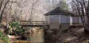
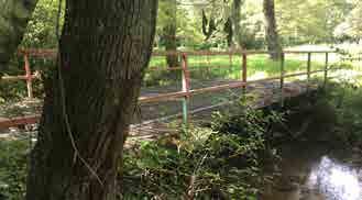
13. Spring house bridge
Located adjacent to the spring house. Used to cross the creek and access the spring house.
Condition: Good
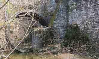
14. Diamond Lake Dam
Located adjacent to the spring house.
Condition: Has been breached
11 12 13 14 HANGING ROCK STATE PARK EXPANSION MASTER PLAN 2017 CHAPTER ONE: INTRODUCTION 12
15. Pool
Located behind the Gym on the Vade Mecum Property.
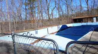
Condition: Poor
16. Amphitheater A
Located adjacent to the spring house.
Condition: Good
17. Outdoor Chapel / Amphitheater B
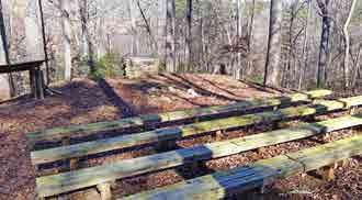
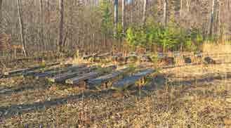
Located behind the Gym (Tise Hall).
Condition: Good
18. Amphitheater C
Located behind the meeting cabins.
Condition: Poor, covered in poison ivy
15 16 17 18 HANGING ROCK STATE PARK EXPANSION MASTER PLAN 2017 CHAPTER ONE: INTRODUCTION 13
19. Ropes Course
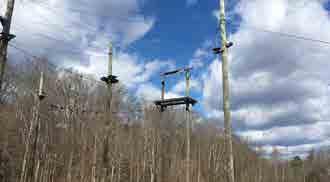
Located on Vade Mecum adjacent to the Nature Center.
Condition: Poor
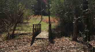
20. Pedestrian Bridge
Located adjacent to the ropes course.
Condition: Good
21. Metal Bridge
Located behind the Gym and down the hill. is bridge is adjacent to Amphitheater A.
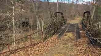
Condition: Unknown, Needs to be evaluated structurally
22. Maintenance building
Located along Moores Springs Road adjacent to the Nature Center and Ropes course area.
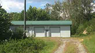
Condition: Good
19 20 21 22 HANGING ROCK STATE PARK EXPANSION MASTER PLAN 2017 CHAPTER ONE: INTRODUCTION 14
23. Water Tower
Located near Moores Springs road north of the Horse Motel.
Condition: Unknown
24. Military Outpost
Located on the northern portion of the Vade Mecum property.
Condition: Poor
25. Ropes Course Storage Shed
Located adjacent to the high ropes course
Condition: unknown
26. Caretakers Residence Shed
Located adjacent to the caretakers residence. Currently storing tools and lumber.
Condition: Poor
23 24 25 26 HANGING ROCK STATE PARK EXPANSION MASTER PLAN 2017 CHAPTER ONE: INTRODUCTION 15
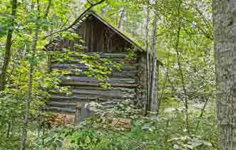
Moores Springs Spring House
Located near the former Moores Springs campground. Originally used to house and access the mineral spring.


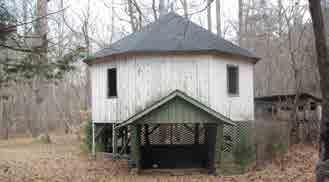
Good, further structural


Pedestrian Crossing of Cascade Creek
on the Moores Springs Property adjacent to
Moores Springs campground store.
building
1.
Condition:
evaluation needed 2.
Located
the old
Condition: Does not meet current
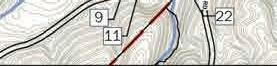
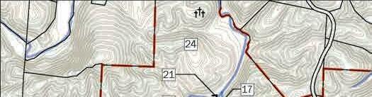
code. Existing Buildings and Structures - Moores Springs 250 0 250 500 750 250 500 750 1,000 ft MOORESSPRINGS RD. P EASTRD. DANGORGE RD. EDBOOTH RD. DANRIVER HA NG IN G ROCKSTATEP AR K | MO O RE S SPR IN GS &VADE MECU M M AS TER PL AN 5 7 EXISTING DAM EXISTING TRAILS 8 2 4 3 6 1 2 HANGING ROCK STATE PARK EXPANSION MASTER PLAN 2017 CHAPTER ONE: INTRODUCTION 16
3. Camp Store
Located on the Moores Springs Property adjacent to the creek and concrete dance oor.
Condition: Good.
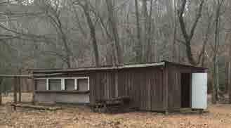
4. Old Toilet Building
Located near the old Camp Store. Used as a toilet when the old campground was in operation.
Condition: Poor. Does not meet current building code and requirements.
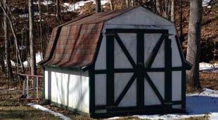
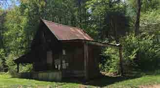
5. Bike Shack
Located on the Moores Springs Property South of Moores Springs Road where the current mountain bike trailhead is located.
Condition: unstable
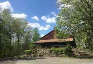
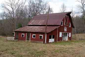
6. Tobacco Barn
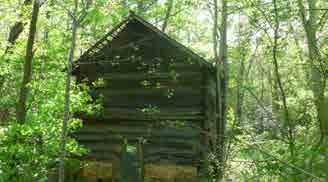
Located near the Bike Shack and current mountain bike trailhead parking. Was used as a tobacco barn. Condition: Unknown
3 4 5 6 HANGING ROCK STATE PARK EXPANSION MASTER PLAN 2017 CHAPTER ONE: INTRODUCTION 17
7. Campground Bridge
Located along the entry drive into the old Moores Springs campground. Was used to access the campground.
Condition: Poor
8. Concrete dance oor
Located adjacent to the stream and near the old camp store. is is a concrete pad that was poured right along the stream bank and used to host dances.
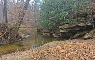
Condition: Concrete is in good condition but is located within the oodplain. Current construction practices limit impervious surface within the oodplain because it inhibits the regions natural ability to manage excess water and increases ooding. Pavement within a oodplain also decreases the quality of the water and increases contaminants within our streams and rivers.
7 8 HANGING ROCK STATE PARK EXPANSION MASTER PLAN 2017 CHAPTER ONE: INTRODUCTION 18
Natural Features
Natural features, including vegetation, topography, hydrologic patterns and viewsheds, were inventoried through GIS mapping and site observations.
Vegetation
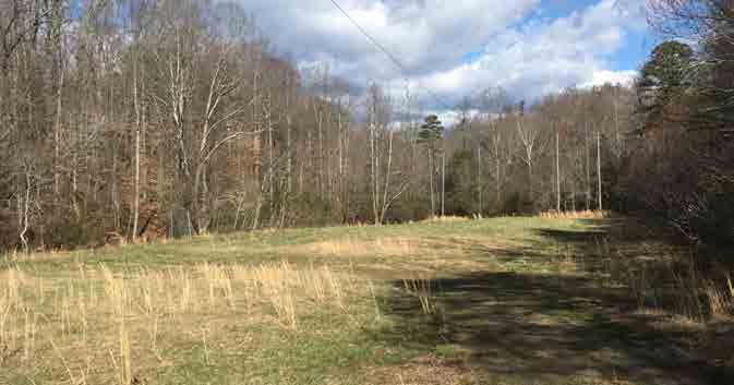
While most of the woodland and vegetative cover is typical to this region of North Carolina there are plant communities that are signi cant because of their composition and / or because they are not typical to the region.

ese include the Rich Cove Forest and locations of endangered species identi ed by the heritage program. ere are two pockets of the Rich Cove Forest on the Moores Springs property. One is in the southwest corner of the property near the intersection of Moores Springs Road and P East Road. e other is on the eastern side of the property, north of Moores Springs Road. e Rich Cove Forest is a common plant community in North Carolina, however, it is not normally found this far east of the Blue Ridge escarpment. (See the analysis maps in Appendix A)
ere is also a pocket of Piedmont Bottomland Forest located on the Vade Mecum Property that is signi cant. Some of the best examples of this type of forest are located along the Dan River and this is the only pocket of this type of forest located within Hanging Rock State Park. (See the analysis maps in Appendix A)
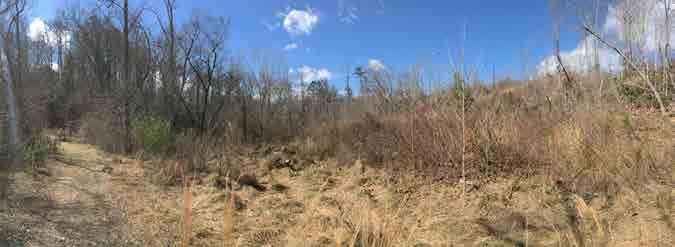
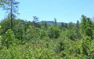
Image of successional forest on the Vade Mecum Property
Image of a Wehrle’s Salamander - photo by Todd Pierson / Amphibians and Reptiles of North Carolina
HANGING ROCK STATE PARK EXPANSION MASTER PLAN 2017 CHAPTER ONE: INTRODUCTION 19
Other plant communities of interest are small areas of Carolina Hemlock Forest located on the Vade Mecum property along a tributary of Vade Mecum Creek on an east facing slope, as well as in several pockets on the Moores Springs property, particularly along the edge of the Dan River.
Endangered/rare species of Fauna and Flora include:
•Wherle’s Salamander(E)
•James Spineymussel (E)
•Roanoke Hogsucker (R)
•Alabama Grape Fern(R)
•Mountain Cammelia(R)
•Ringed Witch Grass(R)
•Plum Moss (R)
•A Liverwort (R)
Topography
A wide range of topographic conditions are characteristic of the area. Onsite slopes are steep in some areas, exceeding 40%, and gentle in others. Gentle slopes are particularly found in the low lying areas along creeks as well as along ridge lines. A general topography plan indicates high points and areas where slopes are gentle (See Appendix A). A slope analysis plan was also developed to show where these various slopes occur on the site. (See the analysis maps in Appendix A)
Hydrologic Patterns
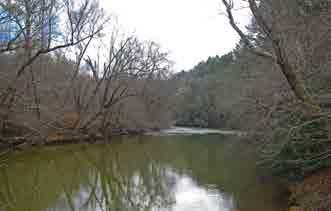
Cascade Creek owing out of Hanging Rock State Park proper ows under Moores Springs Road and traverses the Moores Springs property, ending at its con uence with the Dan River. e low lying former campground area is prone to some ooding but the creek does not carry any 100-year oodplain with it into the site. e Dan River, however, does have a oodplain associated with it. (these hydrological patterns can be seen on the hydrology maps in Appendix A)
While there are several small areas on the Moores Springs property designated as successional forest, large areas on the Vade Mecum property are also designated as successional following a timbering operation conducted in 2014.
Endangered Species
Areas of endangered / rare species habitat are associated with rock outcroppings along the river’s edge on the Moores Springs property and a second area is associated with outcroppings in the meadow near Cascade Creek.
e Vade Mecum property includes Vade Mecum Creek and two other tributaries that ow north across the property. Vade Mecum creek and contributing tributary were previously damned to create Diamond Lake. e dam has been breached and the lake drained but the form of this 20 acre former lake is recognizable based on vegetation and landform. e 100-year oodplain runs through the site along Vade Mecum Creek to a point along the western property boundary. (See the analysis maps in Appendix A)
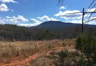
View from high point on Vade Mecum
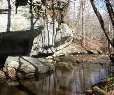
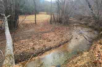
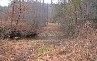
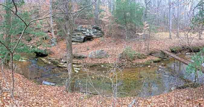
Vade Mecum creek
HANGING ROCK STATE PARK EXPANSION MASTER PLAN 2017 CHAPTER ONE: INTRODUCTION 20
Cultural Features
e history and cultural features of these properties and their importance to the community is deep and varied. Cultural features relating to the former resorts and camps include buildings and other structures, which include dams and bridges, as well as remnants of former structures and spaces. Cultural features also include previous land use and surrounding land use, outdoor spaces, cemeteries, utilities and roads.
Buildings and Structures
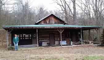
On both properties there are Spring Houses dating from the early 1900s. e Spring Houses appear to be in good condition. In addition, there are several buildings on the Vade Mecum property and additional buildings at Moores Springs. (See maps on pages 9 and 16)
Sacred buildings include Cheshire Hall (Hotel), the Chapel and Tise Hall (Gymnasium). Other buildings on the Vade Mecum property that could be potentially repurposed include several cabins, meeting cabin / nature center and the horse barn (Horse Motel)
At Vade Mecum, several of the existing buildings are considered sacred by the community, and some are potentially eligible for historic designation. For purposes of this report a sacred building is de ned as a building that should be preserved for its historical value, as similar as possible to its historic appearance and use. A building identi ed for re-purposing is a building that has some value and should be retained; however, it does not have to serve its traditional function. e building could be used for some other purpose.
On the Moores Springs property, in addition to the spring house, a campstore and a toilet building are located at the former campground. e toilet building is in poor condition and should be removed. Across Moores Springs Road from the campground is an old tobacco barn and the “Bike Shack”. e adjacent area is currently being used as a parking area for mountain bike trails.
A hotel, built in 1898, once stood in the meadow on the Moores Springs property before burning in 1925. Also located at Moores Springs was the Moores
 Spring House at Moores Springs
Cheshire Hall (Hotel) at Vade Mecum
Tise Hall (Gym) at Vade Mecum
Spring House at Moores Springs
Cheshire Hall (Hotel) at Vade Mecum
Tise Hall (Gym) at Vade Mecum
HANGING ROCK STATE PARK EXPANSION MASTER PLAN 2017 CHAPTER ONE: INTRODUCTION 21
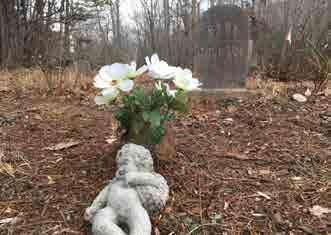
Cemetery at the intersection of P East Rd and Moores Springs Rd
Springs Dining Room, which was demolished in 2015. Other built structures that are valuable to the history of the properties are the dams at both Moores Springs and Vade Mecum, and several existing amphitheater spaces at Vade Mecum.
Cemeteries
Other signi cant cultural features include cemeteries at the intersection of Moores Springs Road and P East Road. On the Northeast and Southeast corners of the intersection are small cemeteries with gravesites. A small cemetery also resides on a ridge in the northern section of Vade Mecum.
Outdoor Spaces
Outdoor spaces which are important to the history of these properties include:
• e outdoor chapel at Vade Mecum
•Former campground at Moore Springs
•Areas around the dams on both properties
•Former location of the Moores Springs Hotel
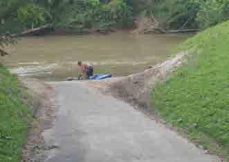
Existing River Access
Surrounding Land Use
Generally, land surrounding the property is held by private land owners and largely is undeveloped, with the exception of limited residential uses. Private land holdings separate Vade Mecum and Moores Springs from the main part of Hanging Rock State Park. e Piedmont Land Conservancy owns two parcels north of Moores Springs and along the western edge of the Dan River. is property has access to Dan George Road.
HANGING ROCK STATE PARK EXPANSION MASTER PLAN 2017 CHAPTER ONE: INTRODUCTION 22
Other signi cant aspects include access to the river and a potential connection to the Mountains to Sea Trail. River access is possible at the Moores Springs property. While Hanging Rock State Park has current access to the river o Flinchum Road, access at Moores Springs could provide a river trip experience that puts in and takes out on State Park property.
e Mountains to Sea Trail passes through Hanging Rock State Park but is disconnected from the subject property using roads west of the park. ere are opportunities to connect the trail through the Vade Mecum property. Various Mountains to Sea trail connections were explored.
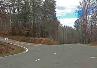
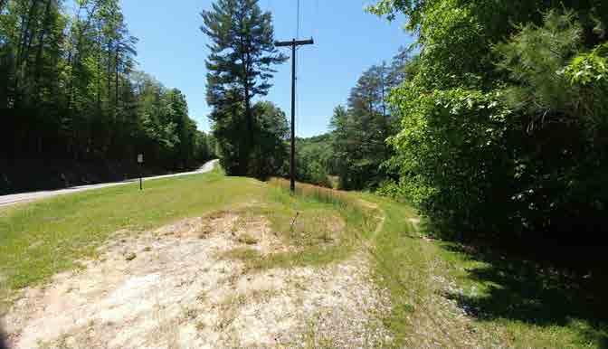
Roads
e property is divided by three state owned roads. P East Road and Dan George Road run north to south and Moores Springs Road, generally running east to west, bisect the property. ese roads provide multiple opportunities for access, but also require clear designation for places where trails might cross them. It is also noted that sight distances, particularly at the intersection of P East Road and Moores Springs Road, are limited.
Other roads that provide access to the property are Ed Booth Road on the eastern edge of the Moores Springs property.
Utilities
On the Vade Mecum property the cabins are served by individual septic systems. e gym, hotel, and chapel are all served by a single septic system. e system includes a pump and lift station behind the hotel and the eld is located across the creek and on top of the hill on the north side of the property. Water service is provided from a well and water tank located on the property.
At Moores Springs the restroom was served by a septic system between Cascade Creek and Moores Springs Road. e condition of the septic system and well is unknown.
Regulatory Requirements / Designated Nature Preserve
e most signi cant requirements applicable to the property are those placed on it by a North Carolina Nature Preserve designation created in 2000 known as Moores Springs Nature Preserve, which covers most of the Moore Springs property. e only areas not covered by this designation are the low lying former campground area along Cascade Creek from Moores Springs Road to the Dan River and 2 other small areas. One area is east and adjacent to the campground area on the west facing slope. e other is on the eastern side of the property near Ed Booth Road. (See the analysis maps in Appendix A)
In total the designation includes 114 acres of primary nature preserve and 248 acres of bu er. e primary area quali es as an outstanding natural area under statutory criteria for nature preserve dedication. e bu er area, which contributes to the management and protection of the primary area, consists of lower quality, less continuous mostly forested habitat for more wide ranging species. While there are no local regulatory requirements that are applicable inside the boundaries of the park, the land is still subject to riparian bu er and state requirements regarding development within ood prone areas as well as state building codes.
Currently there are no o cial federal, state or local historic designations associated with any of the structures or buildings present on the property.
Development Opportunities and Constraints
Based on the site analysis that was conducted, development opportunities and constraints became clear. Steep slopes and areas with endangered species or unique vegetation types presented serious constraints to development, allowing only the potential for trails. Gentle slopes and successional forest types o er the best opportunity for development. A large majority of Moores Springs property is located within the DNP, which also extremely limits development potential, allowing for trails only. e following maps represent development opportunities and constraints. (See the analysis maps in Appendix A)
HANGING ROCK STATE PARK EXPANSION MASTER PLAN 2017 CHAPTER ONE: INTRODUCTION 23
CHAPTER TWO
Phase One Community Engagement Summary
Soup In a Bowl
During phase one of the process, two community events were held that were attended by the planning team. e rst was the Soup in a Bowl event on November 19, 2016 hosted by the Stokes Arts Council and held at the boathouse in Hanging Rock State Park. At this event members of the team made attendees aware of the upcoming master plan process and solicited initial ideas. Written surveys, asking about recreational preferences and potential activities at Vade Mecum and Moores Springs, were provided to and lled out by attendees. Additional trails, more accommodations (cabins and tent camping) and river access were the top choices. irty-three completed surveys were collected.
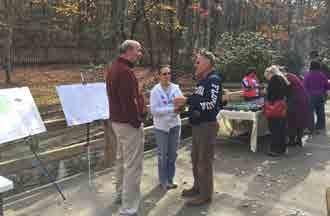
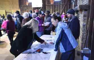
Vade Mecum Open House
e second event was a Vade Mecum open house sponsored by the Friends of Sauratown Mountains held on January 28, 2017. e event attracted an estimated 1,200 visitors. is event opened the Vade Mecum property to the public for the rst time in several years and attendance far exceeded expectations. At this event members of the team received input from attendees and further investigated the property. e design team manned a table at the event where there was a constant stream of community members. Many stories and requests were heard during this event from the community. Some community members even brought photo albums to show past images of the property.
e same written surveys provided at the Soup In a Bowl event were provided to and lled out by attendees at the Vade Mecum open house. Forty-four surveys were completed. e results of this survey were very similar to the initial survey, with the addition of strong support for community and event space.
See Appendix A for a charts and a summary of the surveys received from these two events.
Soup in a Bowl Community Event
Open House at Vade Mecum
HANGING ROCK STATE PARK EXPANSION MASTER PLAN 2017 CHAPTER T WO: COMMUNITY ENGAGEMENT 24
COMMUNITY ENGAGEMENT
Public Meeting
Public Meeting #1
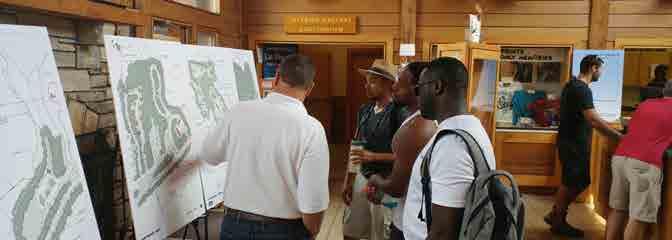
On April 26, 2017, the rst public meeting was held at the Arts Place of Stokes in Danbury. While lightly attended, valuable feedback was received from attendees. Eleven community members attended the open house. At this meeting the planning team presented information about the property’s character, natural resources and historic signi cance. Analysis maps of the properties were hung on the wall, allowing attendees to view the information at their leisure. e design team was on hand to answer questions, guide the visitors through the process and listen to concerns or other feedback.
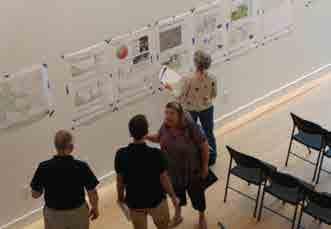
As part of the meeting, the community was asked to participate in evaluations of the existing structures throughout the property as well as provide initial ideas about appropriate land uses, based on development opportunities and constraints gleaned from the site analysis mapping. For the building evaluation exercise, each attendee was given a sheet of orange sticky dots and they were asked to vote on a total of 24 buildings and other structures. For each building, attendees were given the following choices:
Sacred: Building should be preserved for its historical value, as similar as possible to its historic use and appearance.
Valuable / Re-purpose: Building has some value and should be retained, however, it does not have to serve its traditional function. e building could be used for some other purpose.
Don’t Care: You don’t feel strongly one way or the other about the building or feature.
After the attendees completed the building evaluations, they were asked to comment on options for land use for the two properties. Vade Mecum and Moores Springs were broken up into ve areas each, with the areas based on distinct features, such as creeks, roads and topography. Each attendee was given 25 colored dots, ve of which were red. Green dots were to be used for Moores Springs while blue and yellow dots were to be used for Vade Mecum. ese dots represented “Yes” votes, while the red dots represented “No” votes. Participants were asked to place their dots on a matrix that correlated to the land use maps. Categories in the matrix included:
•Hiking-only trails
•Mountain bike / hiking trails
•Equestrian / hiking trails
•Preserve forest (no trails)
•Tent camping
•Group Camping
•Community Event Space
•Picnicking Area
•Playground
•River Access Area (Moores Springs only)
•Equestrian Facilities & Accommodations (Vade Mecum only)
•Overlook with Parking (Vade Mecum only)
#1 HANGING ROCK STATE PARK EXPANSION MASTER PLAN 2017 CHAPTER T WO: COMMUNITY ENGAGEMENT 25
Fewer dots than boxes in the matrix were intentionally given to participants. is was intended to make the participants think through the options and prioritize their decision making.
e same information and exercises presented at the public meeting were made available on the project website, which will be discussed further later in this section. Due to limitations of the survey software, online participants were not given the same voting restrictions, nor were they give any “No” votes. Due to the low turnout at the public meeting and the limitations of the polling software, the “No” votes were thrown out and only viewed as anecdotal information. Everyone was given the opportunity to provide additional comments. e online survey ran for three weeks and the combined results are tallied in the following graphics.
Between the public meeting and the online survey, 127 survey responses were collected. e building evaluation followed the team’s conventional thinking with most respondents indicating that the hotel, chapel, spring houses and the Diamond Lake Dam are “sacred”. Most other buildings, including the cabins, horse barn and gym, were designated as “Valuable / Re-purpose”, while the amphitheaters and pool were identi ed as “Don’t Care”.
Not surprising in the land use exercise, trails and accommodations (camping and cabins) topped the voting for all areas. Preserve forest, picnicking and community space were other popular choices.
Meetings with Stakeholders
During phase one, meetings with various stakeholders also were conducted. ese included:
•Park rangers, current and former park sta
•Hanging Rock State Park Advisory Committee
•County Commissioners
•County Manager
•State Legislature Representatives
•Stokes County Planning
Survey and Meeting Results
e community input and discussions with various stakeholders provided valuable input. e hotel, gym, chapel and spring houses were deemed “sacred”. It was clear that the community wanted to keep these buildings above all else. e community also indicated they saw an opportunity to re-purpose many of the buildings on the property, which was no surprise. e biggest surprise from the results of this phase was the overall lack of attachment to the pool behind the gym. Despite some support, the pool received very few “sacred” votes, with the majority suggesting they did not care what happened to it.
e community’s preferred land uses included hiking and camping as the most requested uses and these remained strong themes throughout the entire process.
ere was a moderate response towards preservation of the land. Similarly, equestrian trails received moderate support.
Public Meeting #1 HANGING ROCK STATE PARK EXPANSION MASTER PLAN 2017 CHAPTER T WO: COMMUNITY ENGAGEMENT 26
Phase Two Community Engagement Summary
Public Meeting #2
During Phase Two of the process, one public community meeting was held at the public library in Walnut Cove. Meeting attendance far surpassed attendance at the rst public meeting. e community was invited to review plans and express their preferences through an evaluation survey. Written surveys were provided and lled out by attendees. Community members and stakeholders were also able to review, select preferred options and complete surveys on the project website from June 30, 2017 to July 16, 2017.
During Phase Two, periodic meetings were held with various stakeholders. ese included:
•Park rangers and sta
•Friends of Sauratown Mountains
•Park Advisory Committee
Also critical to capturing community feedback was the utilization of social media.
Press Release
While social media was the main avenue for marketing the Phase 2 community meeting, plans and drawings, and the survey, the design team also wrote a press release prior to the second public meeting. e press release was distributed to various news outlets by the NC Department of Parks and Recreation. Prior to the community meeting, the project and meeting were promoted on two TV newscasts: Fox 8 in High Point, NC, and WFMY News 2 in Greensboro, NC. ree TV newscasts prepared stories following the public meeting: WFMY News 2 in Greensboro, NC, Spectrum News of Winston-Salem, and WXII News 2 of Winston-Salem. All three news outlets posted a link to the project website with their online stories, as well as showing the website URL on the screen during the broadcast.
See Appendix B for more information about the Social Media outreach and press releases. e press release also was published in several publications serving communities near Hanging Rock State Park.
Concept Master Plans Survey
At the second community meeting, feedback on the plans and drawings was solicited from the community through a survey. Attendees had the opportunity to vote on their favorite ideas and provide additional written feedback. In an e ort to reach the wider Hanging Rock community who could not attend the meeting, an online survey closely matching the survey at the meeting was created and posted to the project website. e surveys asked viewers to vote on their preferred overall option:
•A – Emphasis on day use activities with equestrian facilities and tent camping
•B – Emphasis on mountain biking, major event space, and a variety of accommodations
•C – Emphasis on hiking-only trails with limited accommodations
Following the overall options, viewers were asked to vote on a series of vignettes. ree vignettes were developed for each of 7 areas. Each vignette was linked to either option A, B, or C through the prescribed programmatic elements of the respective overall option. While community members had the opportunity to speak with design team members and park sta at the public open house, those participating in the online survey were given the opportunity to provide additional feedback on each option and each series of vignettes. e survey was open for 17 days and received 499 responses. 31 responses were received from the community meeting. See Appendix B for graphics that combine the results from the second community meeting and the online survey.
e community did not show much support for Option C – a hiking-only focus with very limited development - in any situation. Where results becomes less clear is in the division between Options A and B, whether looking at the overall options or the vignettes. While Option B – an emphasis on mountain biking, event space and accommodations - took the most votes in nearly every category, the di erence between A and B was minimal, represented by a 32% di erence on the high end and a 5% di erence on the low end.
HANGING ROCK STATE PARK EXPANSION MASTER PLAN 2017 CHAPTER T WO: COMMUNITY ENGAGEMENT 27
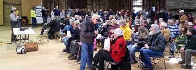
Phase ree Community Engagement Summary
With the results from Public Meeting #2 and the online surveys tabulated, the design team began the process of preparing one overall concept option and a single option for each vignette area for consideration by the stakeholders and the community. (As a rst step in that process, a presentation of the phase two draft concepts was made to the Friends of Sauaratown Mountains and the Park Advisory Committee.)
Following that the team conducted a day long charrette at the Hanging Rock Visitor’s Center meeting separately with park rangers and sta , representatives from the Friends of Sauaratown Mountains and members of the Park Advisory Committee.
For a full list of comments per meeting, see Appendix C. An overview of comments received from these three sessions are as follows:
•At the Moores Springs campground there was interest in walk-in camp family camp sites.
•Important to separate the river access from the campground. River access needs a road in order to meet the expectations of the community
• e campground will need a bridge and a 10’ wide path in order to allow for emergency access and maintenance
•Moores Springs would be gated
•Prefer the gym as event space, community space, recreation hall and the chapel as event space for weddings.
•Important to keep group camping away from the river. Potential to attract a rowdy crowd
•Prefer not to have group camping in Vade Mecum West adjacent to Moore Springs Road.
•Prefer not to have mountain bike trails on Vade Mecum
•Liked the idea of making Vade Mecum for hiker and horse trails
•Locate and do not disturb cemeteries on Vade Mecum
•Concern was expressed about potential noise from events, and safety issues associated with more tra c on P East given the limited sight distance at the intersection with Moore Springs Road
•Camping on Moores Springs would satisfy the community’s immediate needs
•Put cabins in areas that are already developed, don’t disturb areas to build cabins
Following the charette, plans were revised and the draft master plan was made available for further community input at an Open House held at the Hanging Rock State Park Visitor’s Center on Saturday September 16, 2017 from 10:00AM -2:00 PM. Plans were placed on the project website providing continued opportunity for community input from September 16, 2017 though October 2, 2017.
 Design Charrette
 with Park Staff
Design Charrette
Design Charrette with Park Staff
CHAPTER T WO: COMMUNITY ENGAGEMENT 28
Public Meeting #3
e third and nal public meeting was held at the Hanging Rock State Park Visitor’s Center on a Saturday September 16, 2017 in an attempt to gain a broader response to the plans. e previous public meetings had been held during weeknights in nearby towns, which drew mostly local residents. One of the goals of the third meeting was to gather feedback from a wider range of park users.
e design team displayed the draft master plan in the lobby of the visitor’s center on the morning of September 16, 2017, and was available to answer questions and provide additional information. Tra c through the visitor’s center was steady for the four hours the team was stationed there. However, not many people stopped to review the draft master plan. Most of those that did stop to see the plans were visiting the park for the sole purpose of the community meeting. As a result, the comments from the average park visitor were few with only 6 total surveys collected. It is unknown how many visitors might have provided comment through the website.
As with the other phases, social media was used to promote the Saturday morning community event and the online survey. See Appendix C for further details on Social Media outreach and Community Involvement for this phase.
Draft Master Plan Survey
As with the previous phases, a survey to gauge the public’s acceptance of the draft master plan was posted online. Over the course of the two weeks the survey was available, 86 responses were collected. e overall plan, as well as the individual vignettes, received support from the community. e comment we heard the most was a desire for more bike trails, which was due to an organized and vocal mountain bike community.
e draft master plan received support from the community, Park rangers and sta . Only minor changes were made for the nal recommendation.
Public Meeting #3 Public Meeting #3 HANGING ROCK STATE PARK EXPANSION MASTER PLAN 2017 CHAPTER T WO: COMMUNITY ENGAGEMENT 29
This page was intentionally left blank
CHAPTERTHREE
Introduction
e nal master plan identi es recommendations for improvements and proposed facilities that re ect community and stakeholder input, are compatible with the operational and management requirements of a state park, and compliment current recreation opportunities at Hanging Rock State Park. e master plan illustrates a balance between providing access and recreational opportunities while protecting and interpreting the property’s natural and cultural history to the greatest extent possible.
While this land has many stories and has hosted many owners and uses, the addition of the property and its buildings to Hanging Rock State Park comes with speci c requirements to operate within the mission of the North Carolina Parks and Recreation Division including conservation, education and recreation. While it is critical to tell these stories and preserve the resources found on this property, it is also necessary to develop the property in a manner that is in keeping with the next chapter of its life as a state park.
Minor revisions to the draft master plan prepared in Phase 3 were required for the nal Master Plan
PLAN
Property Distinctions
While both the Vade Mecum property and Moores Springs property are considered a single addition to Hanging Rock State Park, share similar histories, and are equally cherished by the community they also are distinct.
e primary di erences between the two properties are
• e number and signi cance of buildings and facilities at Vade Mecum
• e impact of recent timbering operations at Vade Mecum.
• e rich cultural history at Vade Mecum and the property’s various uses over the years
• e river access and history of camping at the Moores Springs property
Similarities in topography, vegetation and similar water courses along with the history of the mineral springs and associated resorts, naturally unites these two properties.
Recommendations
Recommendations for improvements and proposed facilities are illustrated by the Overall Master Plan and Vignettes for critical areas within the property. e following describes the overall approach to the properties and highlights speci c facilities or recommendations for improvements.
Hotel at Vade Mecum
Gym at Vade Mecum
CHAPTER THREE: FINAL MASTER PLAN 31
FINAL MASTER
e existing structures on Vade Mecum present challenges in preservation, future use and operations. e most challenging are the hotel and gymnasium. While the master plan cites potential restoration costs and identi es future uses for these buildings it is recommended that a further evaluation of these two buildings as well as the three cabins identi ed for restoration be completed in order to better understand the speci c costs associated with various levels of stabilizing, restoring and using the buildings as a integral part of the park program.
e timbering operations have left a sizable portion of Vade Mecum denuded, eroded and in need of environmental restoration and reforestation. In addition it is recommended that streams running through both properties would bene t from some stabilization and restoration.
Overall Plan
e overall plan addresses the further development of the trails network, supporting access, and parking. ree types of trails are proposed by the overall plan. ese include mountain bike trails, which are available for use by hikers, equestrian trails, also available to hikers and hiking only trails.
e continuation and further development of the existing mountain biking trail network suggests an additional 7.5 miles of trail, bringing the total to nearly 16 miles. Two miles of this network is on Vade Mecum but stays east of the creek. It is important that this type of trail not extend west of the creek, where a di erent experience is promoted by the master plan. Sixteen miles makes this property a regional destination for mountain bikers. It is recommended that various skill levels of bikers be accommodated in the nal design of the trail.
Access and parking facilities are distributed across the property with a total of 305 parking spaces at six separate locations. At each of these parking areas restroom accommodations are recommended.
Parking areas shown on the overall plan serve bikers/ hikers, campground areas, horse trailers, day use visitors to the park as well as parking for events.
Successional Forest at Vade Mecum
Existing Trails on Moores Springs
Stream at Moores Springs
HANGING ROCK STATE PARK EXPANSION MASTER PLAN 2017 CHAPTER THREE: FINAL MASTER PLAN 32
In addition to mountain bike trails, the overall plan accommodates equestrians with seven miles of trail on the Vade Mecum property. is trail system could be integrated and connected to the Mountains to Sea Trail / Sauratown trail west of Vade Mecum. Equestrian trails do not share access with or come in close proximity to Mountain Bike trails.
A hiking only experience is also provided in the overall plan (see pg 37). In addition to trails immediately serving existing and proposed buildings, a 5.5 mile long hiking only trail is located and identi ed by the overall plan as the Spring House Trail. is trail connects the spring house at Moores Springs to the spring house at Vade Mecum. In addition, the trail extends to the Moores Springs Dam Area and provides access to the primitive campsites at Moores Springs. Hiking only trails total 7.8 miles but hiking is also permitted on mountain bike and equestrian trails.
Continuity of trails requires designated crossings of public roads at seven di erent locations (see pg 37):
•For hikers, on Moores Springs Rd. near the new drive for the Moores Springs area
•Mountain bikers currently cross Moores Springs Road under the existing bridge
•Another crossing links mountain bike trails north of Moores Springs Road to those south of Moores Springs Road
•An equestrian crossing on Moores Springs Road across from the existing barn
•A crossing on Dan George Road and P East Road for both hikers and mountain bikers
•A future crossing west of the property may be needed for full connectivity to the Mountains to Sea and Sauratown trails
Prior to each road trails come together to de ne a single crossing point.
Future hiking trail connections to existing Hanging Rock State Park property and the Mountains to Sea / Sauratown trails are also identi ed by the overall master plan.
P East Road
Intersection of P East Road and Moores Springs Road
HANGING ROCK STATE PARK EXPANSION MASTER PLAN 2017 CHAPTER THREE: FINAL MASTER PLAN 33
Toilet


Shack


Barn
Building/Structure Recommendation 1Moores Springs Spring House Repair and interpret 2Pedestrian Crossing of Cascade CreekRemove, does not meet current building code 3Camp Store Remove 4Old
Building Remove 5Bike
Requires further evaluation but unstable 6Tobacco
Repurpose / Interpret 7Campground Bridge Remove & Replace 8Concrete Dance Floor Remove 250 0 250 500 750 0 250 500 750 1,000 ft MOORESSPRINGS RD. P EASTRD. DANGORGE RD. EDBOOTH RD. DANRIVER HA NG IN G ROCKSTATEP AR K | MO O RE S SPR IN GS &VADE MECU M M AS TER PL AN April 2017 5 7 EXISTING DAM EXISTING TRAILS 8 2 4 3 6 Existing Buildings/Structures on the Moores Springs Property HANGING ROCK STATE PARK EXPANSION MASTER PLAN 2017 CHAPTER THREE: FINAL MASTER PLAN 34
Building/Structure

Mecum
MOORESSPRINGSRD.

Mecum Property
HALLRD.
/ Structure Recommendation


Course


Bridge
HANGING ROCK STATE PARK | MOORES SPRINGS & VADE MECUM MASTER PLAN


Tower
Outpost
Course Storage ShedFurther
Residence
Recommendation 1Vade
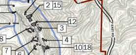
Spring HouseRepair & interpret 2Gym (Tise Hall) Repurpose 3Hotel (Cheshire Hall)Repurpose 4Chapel Repurpose 5 Caretaker’s Residence (old post o ce) Remove 6Cabins - Group OneRemodel & reuse 7Cabins - Group TwoRemove 8Cabins - Group reeRemove 9Horse Motel (Barn)Repurpose 10Activity Houses Remove 11Nature Center Repurpose 12Pavilion Store RoomRemove 13Spring House BridgeFurther evaluation 14Diamond Lake DamInterpret 15Pool Remove 16Amphitheater A Repurpose 17 Amphitheater B (Outdoor Chapel) Repurpose 18Amphitheater C Remove 7500750150022503000ft
VADE APRIL 2017 8 Existing Buildings/Structures on the Vade
Building
19Ropes
Remove 20Pedestrian BridgeFurther evaluation 21Metal
Further evaluation 22Maintenance BuildingGood condition 23Water
Further evaluation 24Military
Remove 25Ropes
evaluation 26Caretaker’s
ShedRemove HANGING ROCK STATE PARK EXPANSION MASTER PLAN 2017 CHAPTER THREE: FINAL MASTER PLAN 35
Trail Totals
•Mountain biking trails / 16 miles total
•Equestrian trails / 7 miles
•Hiking only trails / 8 total miles
Parking
•305 car spaces
•100 spaces at Moores Springs Dam / Ed Booth Road Area
•76 spaces at Moores Springs Campground
•22 spaces at Vade Mecum East
•40 spaces at Vade Mecum West (doesn’t include event over ow parking)
•15 spaces reserved for cabins at Vade Mecum Central Campus
•52 spaces for day use and hotel at Vade Mecum Central Campus
•5 horse trailer spaces at Vade Mecum East
•10 horse trailer spaces at Vade Mecum West
Legend
New Hiking-Only Trails
New Mountain Biking & Hiking
Existing Mountain Biking & Hiking Trails
New Equestrian & Hiking Trails
Existing Equestrian & Hiking Trails
Vignette areas
Parking Crossing
Signi cant Building
HANGING ROCK STATE PARK EXPANSION MASTER PLAN 2017 CHAPTER THREE: FINAL MASTER PLAN 36
MECUM
POTENTIAL

POTENTIAL

LEGEND


MECUM


OVERALL PLAN


OVERALL MASTER PLAN SEPTEMBER, 2017 HANGING ROCK STATE PARK EXPANSION PHASE THREE Moores Springs & Vade Mecum Master Plan SOUTH DOUBLE CREEK ED BOOTH ROAD TRAIL TOTALS TOTAL HIKING-ONLY TRAILS: ~7.8 miles TOTAL MOUNTAIN BIKING TRAILS ~15.7 miles TOTAL EQUESTRIAN TRAILS ~7.2 miles TOTAL PUBLIC PARKING: Approx. 305 spaces MOORESSPRINGROAD PIEDMONT LAND CONSERVANCY PROPERTY P EAST ROAD DAN GEORGE ROAD DAN RIVER CASCADE CREEK ED ROAD MECUM CREEK VADE KEATON ROAD POTENTIAL MOUNTAINS TO SEA TRAIL CONNECTION 40 SPACES 10 TRAILER RANGER RESIDENCE 67 SPACES OVERFLOW PARKING EQUESTRIAN LOOP 6.4 miles 22 SPACES 40 SPACES 60 SPACES 76 SPACES SPRING HOUSE TRAIL 2.8 miles one-way EXISTING SAURATOWN TRAIL
HIKING TRAIL CONNECTION 2000200400600800ft
NEW HIKING-ONLY TRAILS NEW MOUNTAIN BIKING & HIKING EXISTING MOUNTAIN BIKING & HIKING NEW EQUESTRIAN & HIKING EXISTING EQUESTRIAN & HIKING LEGEND VIGNETTE AREAS PARKING CROSSING VADE MECUM WEST MOORES SPRINGS DAM AREA / ED BOOTH RD TRAILHEAD MOORES SPRINGS CAMPGROUND VADE
EAST MOORES SPRINGS RIDGE VADE MECUM CENTRAL CAMPUS VADE MECUM NORTH SEPTEMBER, 2017 HANGING ROCK STATE PARK EXPANSION PHASE THREE Moores Springs & Vade Mecum Master Plan SOUTH DOUBLE CREEK ED BOOTH ROAD TRAIL TOTALS TOTAL HIKING-ONLY TRAILS ~7.8 miles TOTAL MOUNTAIN BIKING TRAILS ~15.7 miles TOTAL EQUESTRIAN TRAILS ~7.2 miles TOTAL PUBLIC PARKING: Approx. 305 spaces MOORESSPRINGROAD PIEDMONT LAND CONSERVANCY PROPERTY P EAST ROAD DAN GEORGE ROAD DAN RIVER CASCADE CREEK ED BOOTH ROAD MECUM CREEK VADE KEATON ROAD POTENTIAL MOUNTAINS TO SEA TRAIL CONNECTION 40 SPACES 10 TRAILER RANGER RESIDENCE 67 SPACES OVERFLOW PARKING EQUESTRIAN LOOP 6.4 miles 22 SPACES 40 SPACES 60 SPACES 76 SPACES SPRING HOUSE TRAIL 2.8 miles one-way EXISTING SAURATOWN TRAIL
HIKING TRAIL CONNECTION 2000200400600800ftOVERALL PLAN NEW HIKING-ONLY TRAILS NEW MOUNTAIN BIKING & HIKING EXISTING MOUNTAIN BIKING & HIKING NEW EQUESTRIAN & HIKING EXISTING EQUESTRIAN & HIKING
VIGNETTE AREAS PARKING CROSSING VADE MECUM MOORES SPRINGS DAM AREA / ED BOOTH RD TRAILHEAD MOORES SPRINGS CAMPGROUND VADE MECUM EAST MOORES SPRINGS RIDGE VADE
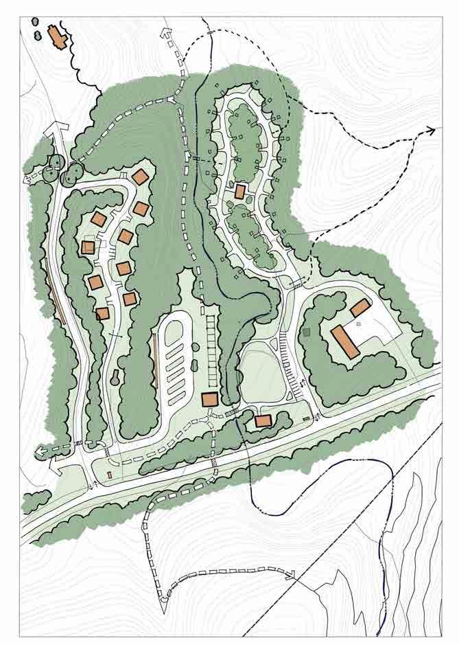
CENTRAL CAMPUS VADE MECUM NORTH Overall Master PlanCHAPTER THREE: FINAL MASTER PLAN 37
This page was intentionally left blank
Moores Springs Property
Future use of the Moores Springs property centers around mountain biking, river access and camping as well as day use.
Existing trails for mountain biking are rede ned and extended including connections with trails south of Moores Springs Road. Other trails are proposed for hikers to access the Spring House, nature play area, picnic areas as well as camping areas.
Access into this area will require that the drive be relocated, due to inadequate site distance. A new vehicle bridge will also have to be installed to cross Cascade Creek.
River access is provided at one location east of Cascade Creek as it ows into the Dan River. is access point will be served by a drive and turn around where paddlers can drop their kayak or canoe and easily portage to the access point near the con uence of the creek and the river.
Camping at Moores Springs includes family walk in tent sites and primitive camp sites. e family campground is close enough to parking for campers to carry their gear and also includes a shower house. Primitive camp sites are located on the ridge east of the creek. Also recommended is the closing of the vehicle pull o area on Moores Springs Road near the dam. Proposed trails from the newly de ned parking area will provide visitors access to the dam and other walking trails.
Dan River
Existing trails at Moores Springs
Creek crossing
HANGING ROCK STATE PARK EXPANSION MASTER PLAN 2017 CHAPTER THREE: FINAL MASTER PLAN 39
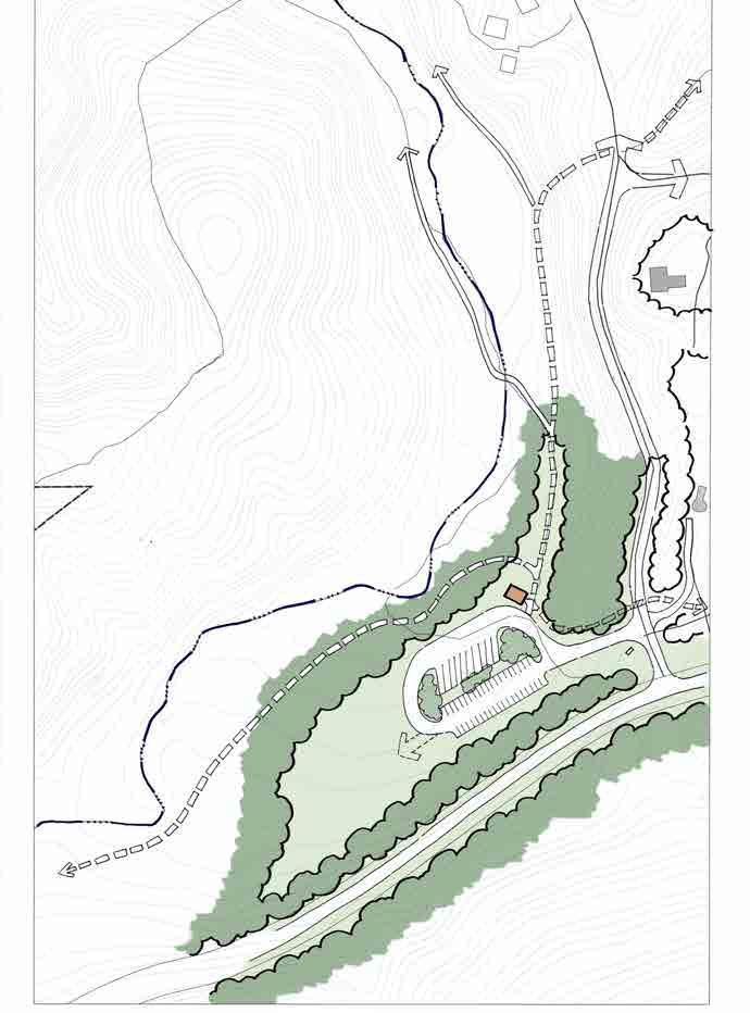
Moores Springs - Ed Booth Road Area
master plan illustrates the following improvements in this area:
parking
facilities (2)
total parking spaces
area
trails
existing pull o on Moore Springs Road
e
•Trailhead
•Restroom
•100
•Picnic
•Hiking
•Discontinue
Existing
Tobacco Barn
Existing Bike Shack HANGING ROCK STATE PARK EXPANSION MASTER PLAN 2017 CHAPTER THREE: FINAL MASTER PLAN 40


MOORESSPRINGROAD ED BOOTH ROAD EX. DAM CASCADE CREEK TRAIL CROSSING UNDER BRIDGE CLOSE EXISTING PULLOVER PARKING (60) RESTROOM MOUNTAIN BIKING TRAIL RELOCATED ENTRANCE PICNIC AREA PARKING (40) RESTROOM POTENTIAL HIKING TRAIL TO HANGING ROCK PROPER HIKING TRAIL TO CAMPGROUND MOORES SPRINGS - ED BOOTH ROAD AREA SCALE: 1” = 60’-0” LIMITS OF DESIGNATED NATURE PRESERVE ENTRANCE SIGN ENTRANCE SIGN Moores Springs - Ed Booth Road Area HANGING ROCK STATE PARK EXPANSION MASTER PLAN 2017 CHAPTER THREE: FINAL MASTER PLAN 41
Moores Springs - Former Campground
e master plan illustrates the following improvements in this area:
•78 total parking spaces
•Restroom
•Renovation of Spring House
•River access drive / drop o
•Family walk in camping / shower house / 14 sites
•Primitive camping (on ridge / not shown in vignette) / 10 sites
•New vehicle bridge across Cascade Creek
•Hiking trails
•Picnic areas
•Picnic Shelter
•Pedestrian Bridges (3)
•Maintenance Building
Rock Outcropping at river access
Stream crossing at Cascade Creek
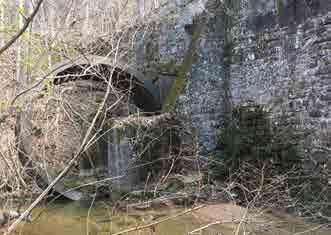
Existing vehicular bridge
HANGING ROCK STATE PARK EXPANSION MASTER PLAN 2017 CHAPTER THREE: FINAL MASTER PLAN 42


SHOWER HOUSE PARKING (48) PICNIC AREA MAINTENANCE BUILDING RESTROOM SHELTER CASCADE CREEK FAMILY WALK IN CAMP SITES (14 SITES) MOORESSPRINGROAD DAN RIVER SPRING HOUSE TRAIL (HIKING ONLY) MOUNTAIN BIKE TRAILS EX. SPRING HOUSE TRAIL TO PRIMITIVE CAMPING (16 SITES) RIVER ACCESS / DROP-OFF DAY USE TRAIL PARKING (28) MOORES SPRINGS - FORMER CAMPGROUND SCALE: 1” = 60’-0” GATE GATES Moores Springs - Former Campground HANGING ROCK STATE PARK EXPANSION MASTER PLAN 2017 CHAPTER THREE: FINAL MASTER PLAN 43
Hotel
Vade Mecum Property
Future Use of the Vade Mecum property centers around events, day use, a variety of overnight accommodations and trails with numerous educational interpretive opportunities.
Opportunities for events are accommodated by the adaptive reuse of the chapel, gymnasium and hotel as well as outdoor amphitheaters on the central campus. Parking accommodations for events are provided primarily by the lot and meadow at Vade Mecum West as well as other parking areas.
Day use visitors to this area are accommodated by a network of trails that link various points of interest including buildings as well as other historic areas and features throughout Vade Mecum. Parking for day use visitors is located in several areas and include the designation of accessible parking near buildings. In addition access to central campus includes road improvements to the existing Camp Sertoma Drive to permit two way vehicular tra c.
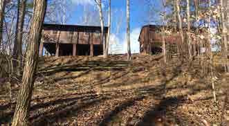
Existing cabins
Overnight accommodations include the potential for overnight stay at the hotel, family camping, primitive camping and cabins including the restoration of three cabins and the introduction of additional cabins on the ridge between Vade Mecum West and East. e family campground includes a shower house.
 Spring House
Existing dam and water wheel
Spring House
Existing dam and water wheel
HANGING ROCK STATE PARK EXPANSION MASTER PLAN 2017 CHAPTER THREE: FINAL MASTER PLAN 44
Trails on Vade Mecum include hiking, equestrian and mountain bike trails.
Interpretive educational opportunities include both natural resources and historic features. Among those opportunities are endangered species near Palisades rock and the cultural history of various existing features including the central campus buildings, spring house and former dance oor, former Diamond Lake and dam, cemetery and other points of interest. It is recommended that structures and the dam be preserved. ese features can be reached by both hiking and equestrian trails and should include a place for interpretive signage.
Other recommendations for the Vade Mecum property include accommodations for equestrians both at Vade Mecum West with trail head parking and around the existing horse barn with overnight horse trailer parking and horse paddocks.
In addition, allowance is made for the expansion of the existing maintenance area including the relocation of the access drive to the area and the conversion of the nature building to a camp store.
Much of the area associated with Vade Mecum North and east to P East Road requires reforestation. e exception to that is the area where the existing septic eld is located.
 Palisades Rock
Cleared area along P East Road
Palisades Rock
Cleared area along P East Road
HANGING ROCK STATE PARK EXPANSION MASTER PLAN 2017 CHAPTER THREE: FINAL MASTER PLAN 45
Vade Mecum - East
e master plan illustrates the following improvements in this area:
•Cabins (9)
•Family camping / Showerhouse / 20 sites
•Equestrian facilities / reuse old barn
•Day use / trailhead parking
•Horse trailer parking (5)
•Adaptive reuse of the Nature Center building as a camp store / restroom
•Consolidated entries / removal of existing maintenance area drive
•Expansion of maintenance area
Existing
Existing horse barn
ropes course area / Family Campground Site
Existing Nature Center building
HANGING ROCK STATE PARK EXPANSION MASTER PLAN 2017 CHAPTER THREE: FINAL MASTER PLAN 46


FAMILY CABINS (9) EX. WATER TOWER EQUESTRIAN TRAILS TO CENTRAL CAMPUS FAMILY DRIVE IN CAMP SITES (20) SHOWER HOUSE MOUNTAIN BIKE TRAILS FLEXIBLE OPEN SPACE CAMP STORE PARKING (22) EXPANDED MAINTENANCE FACILITY OVERNIGHT HORSE TRAILER (5) MOORES SPRING ROAD VADE MECUM - EAST SCALE: 1” = 60’-0” EX. HORSE BARN HORSE PADDOCKS (11) SAURATOWN TRAIL AND MOUNTAINS TO SEA TRAIL CONNECTION CHAPEL GATE GATES Vade Mecum - East HANGING ROCK STATE PARK EXPANSION MASTER PLAN 2017 CHAPTER THREE: FINAL MASTER PLAN 47
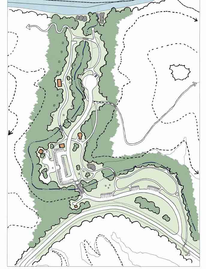
Vade Mecum - West
master plan illustrates the following improvements in this area:
parking (40 spaces)
trailer parking (10 spaces)
ow parking in the meadow
access into
e
•Trailhead
•Horse
•Over
•Restroom Existing trail Existing
meadow from Camp Sertoma Road HANGING ROCK STATE PARK EXPANSION MASTER PLAN 2017 CHAPTER THREE: FINAL MASTER PLAN 48

VADE MECUM CREEK EQUESTRIAN TRAIL RESTROOM CAR PARKING (40) OVERFLOW PARKING DIAMOND LAKE BOTTOMS TRAIL (HIKING ONLY) CAMP SERTOMA ROAD VADE MECUM - WEST SCALE: 1” = 60’-0” HORSE TRAILER PARKING (10) Vade Mecum - West HANGING ROCK STATE PARK EXPANSION MASTER PLAN 2017 CHAPTER THREE: FINAL MASTER PLAN 49
Vade Mecum - North
master plan illustrates the following improvements in this area:
camping / 15 sites
camping / 4 sites
campsite expansion
preservation
e
•Primitive
•Group
•Potential
•Cemetery
•Reforestation Cleared area at Vade Mecum North HANGING ROCK STATE PARK EXPANSION MASTER PLAN 2017 CHAPTER THREE: FINAL MASTER PLAN 50
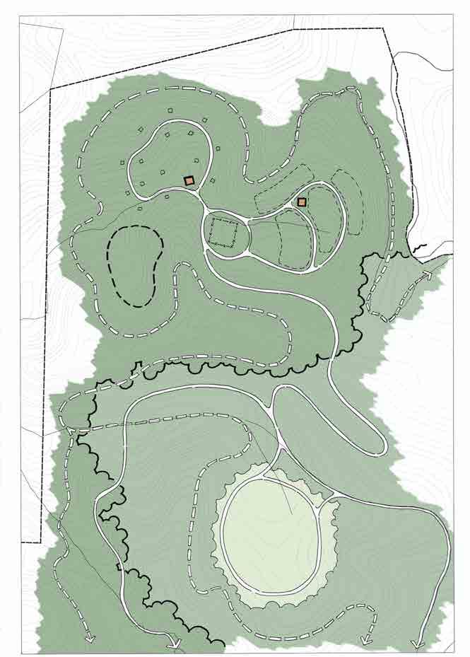


PRIMITIVE GROUP CAMPING SITES (4) EX. CEMETERY CEMETERY TRAIL (HIKING ONLY) RESTROOM RESTROOM EQUESTRIAN TRAILS POTENTIAL CAMPSITE EXPANSION MEADOW (SEPTIC FIELD) VADE MECUM - NORTH SCALE: 1” = 60’-0” PRIMITIVE TENT SITES (15) REFORESTATION Vade Mecum - North HANGING ROCK STATE PARK EXPANSION MASTER PLAN 2017 CHAPTER THREE: FINAL MASTER PLAN 51
Vade Mecum - Central Campus
e master plan illustrates the following improvements in this area:
•Repurposing of Gymnasium and Chapel as event space
•Restoration of the existing hotel
‐Short term: history museum, cafe, gift shop, artist/maker spaces and meeting space withing the hotel
‐Long term: Hostel accommodations within the upper two oors of the hotel
‐Accessibility Improvements
•Restoration of three cabins
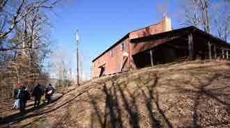
•Additional three cabins (new construction)
event space
(69 spaces)
building
•Interpretive elements & spaces
improvements to Camp Sertoma Road
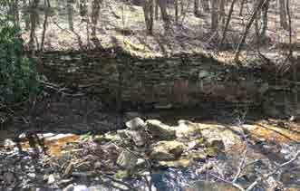
Existing hotel
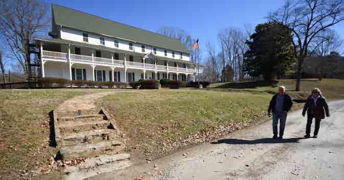
•Outdoor
•Parking
•Restroom
•Road
•Shelter
Existing stone wall adjacent to creek and spring house
Existing Gym
HANGING ROCK STATE PARK EXPANSION MASTER PLAN 2017 CHAPTER THREE: FINAL MASTER PLAN 52
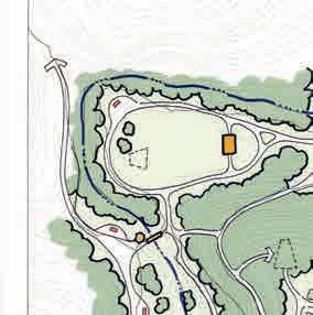
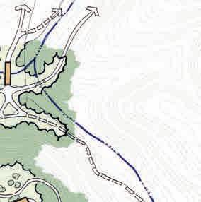
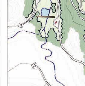
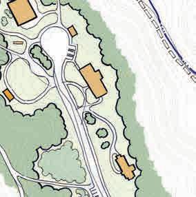
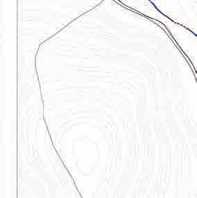
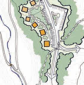


VADE MECUM CREEK 3 EX. CABINS (RENOVATED) STAGE / AMPHITHEATER REFOREST EX. DIAMOND LAKE DAM INTERPRETIVE SPACE (TYPICAL) EX. SPRING HOUSE 3 NEW FAMILY CABINS DIAMOND LAKE BOTTOMS TRAIL (HIKING ONLY TRAIL) CHAPEL: EVENT SPACE HOTEL: (SHORT TERM) HISTORY MUSEUM, GIFT SHOP, CAFE, WELCOME CENTER (LONG TERM) HOSTEL PARKING (34) TO HORSE BARN TO CABINS GYMNASIUM: EVENT SPACE RESTROOM PARKING (3 H/C) OUTDOOR EVENT SPACE EX. STEEL BRIDGE SPRING HOUSE TRAIL (HIKING ONLY) VADE MECUM - CENTRAL CAMPUS SCALE: 1” = 60’-0” SHELTER OUTDOOR CHAPEL EX. AMPHITHEATER PARKING (30) RETAINING WALL Vade Mecum - Central Campus HANGING ROCK STATE PARK EXPANSION MASTER PLAN 2017 CHAPTER THREE: FINAL MASTER PLAN 53
Phased Implementation
e long term and full vision illustrated by the master plan will require many years to implement. Recommendations for improvements are identi ed and illustrated by the master plan have been prioritized into three phases.
e implementation of recommendations found in this master plan will take more than 10 years and will be dependent on available funding form the state as well as possible grants and the work of volunteers.
For purposes of this master plan, the implementation of facilities and recommendations is identi ed under three phases. Each phase includes facilities and improvements on both the Moores Springs property and the Vade Mecum property under overarching objectives.
Following is a brief description of each phase with associated priorities:
Phase One
e primary objective of the rst phase is to stabilize select and signi cant buildings and structures, make the property accessible to visitors for day use and improve the ability of the property to support events. e time period associated with Phase One improvements is 0-5 years.
Phase Two
Phase Two is focused on the continued implementation of trails and the introduction of camping facilities. e time period associated with Phase Two is 5-10 years.
Phase Three Phase ree includes additional accommodations including the restoration of the hotel, cabins and camping along with supporting infrastructure. e time period associated with Phase ree is 10 years and beyond.
HANGING ROCK STATE PARK EXPANSION MASTER PLAN 2017 CHAPTER THREE: FINAL MASTER PLAN 54
MOORESSPRINGROAD
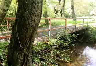
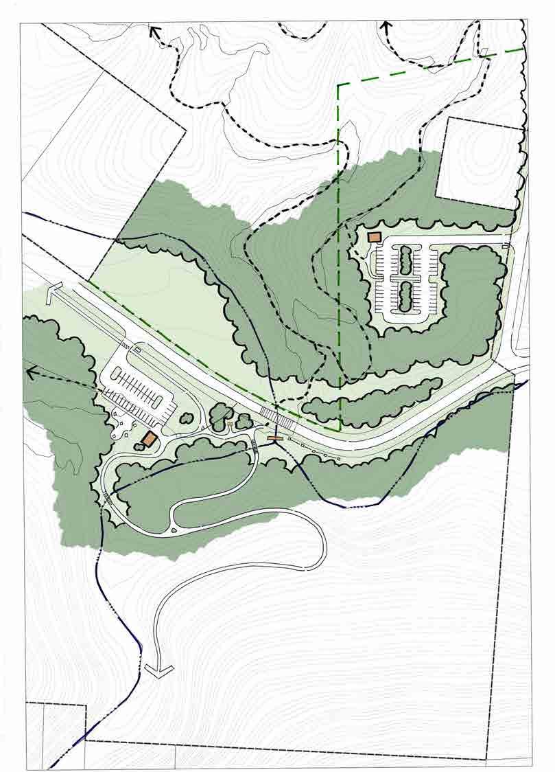 ED BOOTH ROAD
EX. DAM CASCADE CREEK TRAIL CROSSING UNDER BRIDGE CLOSE EXISTING PULLOVER PARKING (60) MOUNTAIN BIKING TRAIL RELOCATED ENTRANCE PICNIC AREA PARKING (40) RESTROOM POTENTIAL HIKING TRAIL TO HANGING ROCK PROPER HIKING TRAIL TO CAMPGROUND LIMITS OF DESIGNATED NATURE PRESERVE ENTRANCE SIGN Trailhead parking and associated facilities at Moores Springs Dam area included in Phase 1A. Existing vehicle bridge at Former Moores Springs Campground HANGING ROCK STATE PARK EXPANSION MASTER PLAN 2017 CHAPTER THREE: FINAL MASTER PLAN 55
Phase 1 / Vade Mecum
•Stabilize, hotel, gym, horse barn and 3 cabins
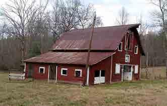
•Restore Spring House
•Evaluate/construct pedestrian bridge at Spring House
•Renovate rst oor of hotel (welcome, history and gift shop)
•Renovate gym
•Site accessibility improvements to Gym and Chapel
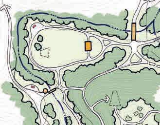
•Restroom facility
/ parking improvements
•Hiking Trails
metal bridge
signage for the spring house, dam, natural features, gym, and hotel
military shack
pool
cabins not remaining and reforest
Caretaker’s Residence
stage
•Drive
•Repair
•Interpretive
•Remove
•Remove
•Remove
•Remove
•Outdoor
Existing horse barn
Hotel
stabilization & renovation
Existing
cabins to remain Trails and features at Vade Mecum are included in Phase 1. For full vignette, see page 53. EX.METAL BRIDGE SPRING HOUSE & BRIDGE POOL REMOVED HANGING ROCK STATE PARK EXPANSION MASTER PLAN 2017 CHAPTER THREE: FINAL MASTER PLAN 56
Entry drive improvements and parking at Vade Mecum are included in Phase 1 For full vignette, see page 53.
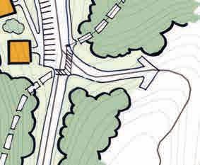
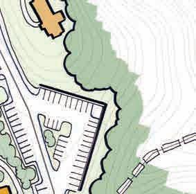
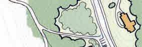
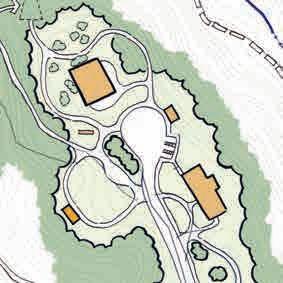
Event spaces at Vade Mecum are included in Phase 1. For full vignette, see page 53.

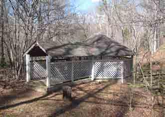
IMPROVED PARKING EXISTINGCHAPEL
Restore the Spring House at Vade Mecum
CABINSREMOVED, AREA REFORESTED
PROPOSED OUTDOORSTAGE
HANGING ROCK STATE PARK EXPANSION MASTER PLAN 2017 CHAPTER THREE: FINAL MASTER PLAN 57
This page was intentionally left blank
PHASE 1:
–STABILIZE HOTEL, GYM, CABINS TO REMAIN, AND BARN –RESTORE SPRING HOUSE
–RENOVATE GYM –RENOVATE FIRST FLOOR HOTEL –INTERPRETIVE SIGNAGE: SPRING HOUSE, HOTEL, GYM, DAM & NATURAL FEATURES


–REMOVE POOL –EVALUATE SPRING HOUSE BRIDGE –REPAIR METAL BRIDGE –PARKING –REMOVE CABINS NOT REMAINING –OUTDOOR STAGE
PHASE 1: –DRIVE IMPROVEMENTS
PHASE 1: –STABILIZE BARN
PHASE 1:
–DEMO CARETAKERS RESIDENCE


MOORESSPRINGROAD
EXISTING SAURATOWN TRAIL
HANGING ROCK STATE PARK EXPANSION
Springs &
Mecum Master Plan
–RESTORE SPRING HOUSE


–MOUNTAIN BIKE TRAIL CONNECTION
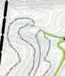


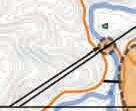
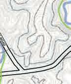
–TRAIL CONNECTION FROM PARKING TO SPRING HOUSE
–REPLACE VEHICLE BRIDGE –RELOCATE DRIVE


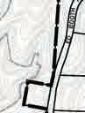


CASCADE
PHASE 1:
–PARKING –RESTROOM –HIKING ONLY TRAILS –INTERPRETIVE SIGNAGE FOR TOBACCO BARN & DAM


–IMPROVED TRAIL CONNECTION UNDER BRIDGE

MARCH 2018
Moores
Vade
PIEDMONT
LAND CONSERVANCY PROPERTY P EAST ROAD DAN GEORGE ROAD
DAN
RIVER SOUTH DOUBLE CREEK
CREEK ROAD MECUM CREEK VADE
2000200400600800ftPHASE ONE PHASE ONE HIKINGONLY TRAILS PHASE ONE MOUNTAIN BIKING & HIKING TRAILS EXISTING MOUNTAIN BIKING & HIKING TRAILS LEGEND PHASE ONE AREAS PARKING Overall Phase One PlanCHAPTER THREE: FINAL MASTER PLAN 59
This page was intentionally left blank
Phase 2 / Moores Springs
•Parking •River access • ree pedestrian bridges •Trails •Picnic area •Restroom •Campground / Shower house •Primitive camping •Interpretive signage for natural features and endangered species •Maintenance Building River access at Moores Springs and the campground is in Phase 2. DANRIVER Driveway relocation and parking improvements are included in Phase 2. For full vignette, see page 119. PARKING IMPROVEMENTS DRIVEWAY RELOCATION PEDESTRIAN BRIDGE RIVER ACCESS HANGING ROCK STATE PARK EXPANSION MASTER PLAN 2017 CHAPTER THREE: FINAL MASTER PLAN 61
Phase 2 / Vade Mecum
•Horse and Hiking Trails •Primitive camping •Meadow parking area •Interpretive signage for natural features and cemetery •Maintenance area expansion •Restroom •Pit Toilets (2) Primitive camping at Vade Mecum is included in Phase 2. For full vignette, see page 51. PRIMITIVECAMP SITES Maintenance area expansion at Vade Mecum is included in Phase 2. For full vignette, see page 47. EXPANDED MAINTENANCE AREA MOORESSPRINGSRD Parking at Vade Mecum is included in Phase 2. For full vignette, see page 49. MEADOW PARKING AREA MOORESSPRINGSRD HANGING ROCK STATE PARK EXPANSION MASTER PLAN 2017 CHAPTER THREE: FINAL MASTER PLAN 62
PHASE
HANGING


PHASE


CAMPING

MARCH 2018
ROCK STATE PARK EXPANSION Moores Springs & Vade Mecum Master Plan
2: –PRIMITIVE CAMPING –HORSE TRAILS
2: –CAMPGROUND –PARKING –PICNIC AREA –INTERPRETIVE SIGNAGE: NATURAL FEATURES, ENDANGERED SPECIES –MAINTENANCE BUILDING –RIVER ACCESS PHASE 2: –PRIMITIVE
PHASE 2: –PARKING MOORESSPRINGROAD P EAST ROAD DAN GEORGE ROAD ROAD DAN RIVER CASCADE CREEK MECUM CREEK VADE PHASE 2: –MAINTENANCE AREA EXPANSION PHASE 2: –PARKING –RESTROOM PHASE 2: –HORSE TRAILS 2000200400600800PHASE TWO PHASE TWO HIKINGONLY TRAILS PHASE TWO HORSE & HIKING TRAILS EXISTING MOUNTAIN BIKING & HIKING TRAILS LEGEND PHASE TWO AREAS PARKINGHIKING-ONLY TRAILS BUILT IN AN EARLIER PHASE Overall Phase Two PlanCHAPTER THREE: FINAL MASTER PLAN 63
This page was intentionally left blank
MOORESSPRINGROAD
ED BOOTH ROAD
EX. DAM CASCADE CREEK TRAIL CROSSING UNDER BRIDGE CLOSE EXISTING PULLOVER PARKING (60) RESTROOM LIMITS OF DESIGNATED NATURE PRESERVE ENTRANCE SIGN ENTRANCE SIGN Trailhead parking and a restroom at Moores Springs is included in Phase 3. For full vignette, see page 41. HANGING ROCK STATE PARK EXPANSION MASTER PLAN 2017 CHAPTER THREE: FINAL MASTER PLAN 65
Phase 3 / Vade Mecum

•Renovate three cabins •12 proposed cabins •Renovate remainder of hotel •Renovate Nature Building •Campground / Shower house •Renovate horse barn / horse trailer area •Ranger residence •Interpretive signage for old post o ce, horse barn, natural features, and hotel Cabins, camping and other facilities at Vade Mecum are included in Phase 3. For full vignette, see page 47. PROPOSED CAMPGROUND & SHOWERHOUSE PROPOSED CABINS (9) HORSETRAILER AREA RENOVATED HORSE BARN RENOVATED NATURE BUILDING New and renovated cabins at Vade Mecum are included in Phase 3. For full vignette, see page 47. PROPOSED CABINS (3) RENOVATED CABINS (3) Complete renovations of the hotel HANGING ROCK STATE PARK EXPANSION MASTER PLAN 2017 CHAPTER THREE: FINAL MASTER PLAN 66
–CAMPGROUND


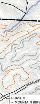


HOUSE
HORSE BARN
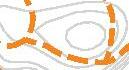
CAMPING WITH RV HOOKUPS

NATURE BUILDING
HANGING

LEGEND
PHASE


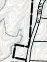


MARCH 2018
ROCK STATE PARK EXPANSION Moores Springs & Vade Mecum Master Plan MOORESSPRINGROAD P EAST ROAD DAN GEORGE ROAD ROAD DAN RIVER CASCADE CREEK MECUM CREEK VADE PHASE 3: –PARKING –RESTROOM PHASE 3: –PARKING
–SHOWER
–RENOVATE
–TRAILER
–RENOVATE
PHASE 3: –NINE NEW CABINS PHASE 3: –RENOVATE THREE CABINS –THREE NEW CABINS PHASE 3: –RENOVATE REMAINDER OF HOTEL –MOUNTAIN BIKE TRAILS PHASE 3: –RANGER RESIDENCE 2000200400600800ft
THREE
PHASE THREE HIKINGONLY TRAILS HORSE & HIKING TRAILS BUILT IN AN EARLIER PHASE PHASE THREE MOUNTAIN BIKING & HIKING TRAILS PHASE THREE AREAS PARKING HIKING-ONLY TRAILS BUILT IN AN EARLIER PHASE EXISTING MOUNTAIN BIKING & HIKING TRAILS Overall Phase Three PlanCHAPTER THREE: FINAL MASTER PLAN 67
This page was intentionally left blank
Estimates of Probable Cost
Probable construction costs have been formulated for implementation of each phase identi ed by the master plan. Implementation will also require additional sta ng. e cost of personnel as well as equipment to perform maintenance and establish supporting programs is not included in the estimates.
Construction costs presented are based on current (2017) costs incurred for similar facilities in other state parks and not adjusted over time to account for in ation. It is noted that while costs are included for all identi ed improvements, some of these improvements could be carried out by volunteer e orts or current sta . Speci cally these include trail building and portions of camping facilities particularly the primitive camping opportunities.
e estimates are considered to be conservative and include a 25% contingency. More accurate estimates and costs will be determined as part of the design process based on site speci c and detailed existing conditions information.
Additionally, the costs associated with stabilizing and restoring existing structures are being further investigated by a team of architects and engineers.
ese estimates will include the hotel, gymnasium and existing cabins to remain.
Other costs typically associated with construction projects that are not covered by these estimates include the following:
•Geotechnical / soils investigation
•Contaminated soil remediation
•Rock removal
•Surveying
•Mobilization
•Permitting ( environmental, building and erosion control )
•Archaeological investigations
•Percolation tests
•Removal or abandonment of existing septic elds
•Cost adjustments for in ation
Estimates of probable construction costs per phase
PhasePropertyProbable Cost
Phase 1Moores Springs$2,200,000
Phase 1Vade Mecum$5,960,500
Phase 2Moores Springs$3,100,000
Phase 2Vade Mecum$3,600,000
Phase 3Moores Springs$860,000
Phase 3Vade Mecum$9,400,000
Total$25,120,500
HANGING ROCK STATE PARK EXPANSION MASTER PLAN 2017 CHAPTER THREE: FINAL MASTER PLAN 69
HANGING ROCK STATE PARK EXPANSION MASTER PLAN Appendices
July 2018
This page was intentionally left blank
Table Of Contents. . . . . . . . . . . . . . . . . . . . . . . . . . iii
Appendix A: Phase One 1
Site Analysis Maps . . . . . . . . . . . . . . . . . . . . . . . . .1
Natural Features . . . . . . . . . . . . . . . . . . . . . . . . . .1
Cultural Features. . . . . . . . . . . . . . . . . . . . . . . . . . 1
Moores Springs Vegetation Map . . . . . . . . . . . . . . . . . . . . . .3
Vade MecumVegetation Map. . . . . . . . . . . . . . . . . . . . . . . .5
Moores Springs Natural Features Map. . . . . . . . . . . . . . . . . . . .7
Vade Mecum Natural Features Map. . . . . . . . . . . . . . . . . . . . .9
Moores Springs Topography Map. . . . . . . . . . . . . . . . . . . . . 11
Vade MecumTopography Map . . . . . . . . . . . . . . . . . . . . . .13
Moores Springs Slope Analysis Map. . . . . . . . . . . . . . . . . . . . 15
Vade Mecum Slope Analysis Map. . . . . . . . . . . . . . . . . . . . . 17
Moores Springs Hydrology Map. . . . . . . . . . . . . . . . . . . . . . 19
Vade Mecum Hydrology Map. . . . . . . . . . . . . . . . . . . . . . . 21
Moores Springs Cultural Features Map . . . . . . . . . . . . . . . . . .23
Vade Mecum Cultural Features Map. . . . . . . . . . . . . . . . . . . . 25
Moores Springs Dedicated Nature Preserve Map . . . . . . . . . . . . . . 27
Community Engagement. . . . . . . . . . . . . . . . . . . . . . 29
Park Program Survey. . . . . . . . . . . . . . . . . . . . . . . . . . 29
Building Evaluations Exercise . . . . . . . . . . . . . . . . . . . . . . 34
Building Evaluations . . . . . . . . . . . . . . . . . . . . . . . . . .35
Land Use Options . . . . . . . . . . . . . . . . . . . . . . . . . . .39
Land Use. . . . . . . . . . . . . . . . . . . . . . . . . . . . . . . 40
Moores Springs Land Use Options Map . . . . . . . . . . . . . . . . . . 41
Vade Mecum Land Use Options Map . . . . . . . . . . . . . . . . . . .45
Website . . . . . . . . . . . . . . . . . . . . . . . . . . . . . . . 47
Moores Springs and Vade Mecum Vignette Areas. . . . . . . . . . . . . . 49
Appendix B: Phase Two 49
Introduction . . . . . . . . . . . . . . . . . . . . . . . . . . .49
Overall Plan Options . . . . . . . . . . . . . . . . . . . . . . . . . .49
Option A: Overall Plan. . . . . . . . . . . . . . . . . . . . . . . 50
Proposed Program Features. . . . . . . . . . . . . . . . . . . . . . . 50
Table Of Contents
TABLE OF CONTENTS III
Community Survey Results . . . . . . . . . . . . . . . . . . . . . . .50
Land Use Option A. . . . . . . . . . . . . . . . . . . . . . . . . . . 51
Option A Vignettes - Moores Springs. . . . . . . . . . . . . . . . . 53
Moores Springs - Ed Booth Rd Area. . . . . . . . . . . . . . . . . . . . 53
Moores Springs - Former Campground. . . . . . . . . . . . . . . . . . . 53
Moores Springs - Ed Booth Rd Area. . . . . . . . . . . . . . . . . . . . 54
Moores Springs - Former Campground. . . . . . . . . . . . . . . . . . . 55
Vade Mecum - Sunset Point . . . . . . . . . . . . . . . . . . . . . . .55
Vade Mecum - West . . . . . . . . . . . . . . . . . . . . . . . . . .56
Vade Mecum - Central Campus. . . . . . . . . . . . . . . . . . . . . . 57
Option B: Overall Plan. . . . . . . . . . . . . . . . . . . . . . . 58
Proposed Program Features. . . . . . . . . . . . . . . . . . . . . . . 58
Community Survey Results . . . . . . . . . . . . . . . . . . . . . . .58
Land Use Option B . . . . . . . . . . . . . . . . . . . . . . . . . . . 59
Option B Vignettes - Moores Springs. . . . . . . . . . . . . . . . . 61
Moores Springs - Ed Booth Rd Area. . . . . . . . . . . . . . . . . . . . 61
Moores Springs - Former Campground. . . . . . . . . . . . . . . . . . . 61
Vade Mecum - Sunset Point . . . . . . . . . . . . . . . . . . . . . . .62
Vade Mecum - West . . . . . . . . . . . . . . . . . . . . . . . . . .63
Vade Mecum - East. . . . . . . . . . . . . . . . . . . . . . . . . . . 63
Vade Mecum - North . . . . . . . . . . . . . . . . . . . . . . . . . .64
Vade Mecum - Central Campus. . . . . . . . . . . . . . . . . . . . . . 65
Proposed Program Features. . . . . . . . . . . . . . . . . . . . . . . 66
Community Survey Results . . . . . . . . . . . . . . . . . . . . . . .66
Option C: Overall Plan. . . . . . . . . . . . . . . . . . . . . . . 66
Land Use Option C. . . . . . . . . . . . . . . . . . . . . . . . . . . 67
Option C Vignettes - Moores Springs. . . . . . . . . . . . . . . . . 69
Moores Springs - Ed Booth Rd Area. . . . . . . . . . . . . . . . . . . . 69
Moores Springs - Former Campground. . . . . . . . . . . . . . . . . . . 69
Option C Vignettes - Vade Mecum. . . . . . . . . . . . . . . . . . 70
Vade Mecum - Sunset Point . . . . . . . . . . . . . . . . . . . . . . .70
Vade Mecum - West . . . . . . . . . . . . . . . . . . . . . . . . . .70
Vade Mecum - East. . . . . . . . . . . . . . . . . . . . . . . . . . . 71
Vade Mecum - North . . . . . . . . . . . . . . . . . . . . . . . . . . 71
Vade Mecum - Central Campus. . . . . . . . . . . . . . . . . . . . . . 72
TABLE OF CONTENTS IV
Vignettes - Consistent In All Options . . . . . . . . . . . . . . . . .73
Moores Springs - Primitive Camping. . . . . . . . . . . . . . . . . . . . 73
Moores Springs - Dam Area . . . . . . . . . . . . . . . . . . . . . . .73
Phase Two Community Engagement. . . . . . . . . . . . . . . . . .74
Survey. . . . . . . . . . . . . . . . . . . . . . . . . . . . . . . . 76
Appendix C: Phase Three 79
Introduction . . . . . . . . . . . . . . . . . . . . . . . . . . .79
Design Charette with Park Rangers / Staff. . . . . . . . . . . . . . . . . 79
HARO Park Advisory Committee (PAC) . . . . . . . . . . . . . . . . . . 79
Friends of Sauratown Mountains . . . . . . . . . . . . . . . . . . . . . 80
Social Media . . . . . . . . . . . . . . . . . . . . . . . . . . . . . 81
TABLE OF CONTENTS V
Map Index
Moores Springs Vegetation Map. . . . . . . . . . . . . . . . . . . . 3
Vade MecumVegetation Map. . . . . . . . . . . . . . . . . . . . . 5
Moores Springs Natural Features Map . . . . . . . . . . . . . . . . .7
Vade Mecum Natural Features Map . . . . . . . . . . . . . . . . . .9
Moores Springs Topography Map . . . . . . . . . . . . . . . . . .11
Vade MecumTopography Map. . . . . . . . . . . . . . . . . . . . 13
Moores Springs Slope Analysis Map. . . . . . . . . . . . . . . . . 15
Vade Mecum Slope Analysis Map . . . . . . . . . . . . . . . . . . 17
Moores Springs Hydrology Map. . . . . . . . . . . . . . . . . . . 19
Vade Mecum Hydrology Map . . . . . . . . . . . . . . . . . . . . 21
Moores Springs Cultural Features Map. . . . . . . . . . . . . . . . 23
Vade Mecum Cultural Features Map. . . . . . . . . . . . . . . . . 25
Moores Springs Dedicated Nature Preserve Map. . . . . . . . . . . . 27
Moores Springs Land Use Options Map. . . . . . . . . . . . . . . . 41
Vade Mecum Land Use Options Map. . . . . . . . . . . . . . . . . 45
Moores Springs and Vade Mecum Vignette Areas . . . . . . . . . . . 49
Land Use Option A . . . . . . . . . . . . . . . . . . . . . . . . 51
Land Use Option B . . . . . . . . . . . . . . . . . . . . . . . . 59
Land Use Option C . . . . . . . . . . . . . . . . . . . . . . . . 67
TABLE OF CONTENTS VI
APPENDIX A
Site Analysis Maps
e maps on the following pages support Phase one of the master plan and were completed and presented to the community as a part of that phase.
Natural Features
e following are analysis maps of the natural features for both the Vade Mecum and Moores Springs properties. ese maps support the information presented in the master plan report in Phase One.
Cultural Features
e following are analysis maps of the cultural features for both the Vade Mecum and Moores Springs properties. ese maps support the information presented in the master plan report in Phase One.
PHASE ONE
APPENDIX A: PHASE ONE 1
This page was intentionally left blank
OAK-HICKORY


CAROLINA HEMLOCK


OAK HEATH
PIEDMONT/COASTAL


5000500100015002000ft 1000100200300400ft 0 500 1,000 1,500 2,000 ft200 100300 400 ED BOOTH RD. DAN RIVER P EAST RD. MICKEY RD. DAN GEORGE RD. MOORES SPRINGS RD. CASCADE CREEK SOUTH DOUBLE CREEK HANGING ROCK STATE PARK | MOORES SPRINGS & VADE MECUM MASTER PLAN APRIL 2017 MOORES SPRINGS PROPERTY VEGETATION MONTANE OAK-HICKORY FOREST (BASIC SUBTYPE) BASIC MESIC FOREST (PIEDMONT SUBTYPE) LEGEND RICH COVE FOREST MONTANE
FOREST (ACIDIC SUBTYPE) SUCCESSIONAL
FOREST MANAGED HERBACEOUS MESIC MIXED HARDWOOD FOREST PERMANENTLY DISTURBED PIEDMONT LEVEE FOREST (TYPIC SUBTYPE) PINE
MONTANE ALLUVIAL FOREST LOW ELEVATION SEEP
PIEDMONT
LEVEE FOREST (BEECH SUBTYPE) ACIDIC COVE FOREST DRY MESIC BASIC OAKHICKORY FOREST DRY MESIC OAK-HICKORY
PLAIN HEATH CHESTNUT OAK FOREST (DRY HEATH SUBTYPE) CHESTNUT OAK FOREST (MESIC SUBTYPE) LOW ELEVATION SEEP (FLOODPLAIN) APPENDIX A: PHASE ONE 3
This page was intentionally left blank
VADE MECUM PROPERTY


VEGETATION


MESIC FOREST (PIEDMONT SUBTYPE)
MONTANE OAK-HICKORY FOREST (BASIC SUBTYPE)
COVE FOREST
MONTANE OAK-HICKORY FOREST (ACIDIC SUBTYPE)
SUCCESSIONAL

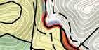


CAROLINA HEMLOCK FOREST

MESIC MIXED HARDWOOD FOREST
PERMANENTLY DISTURBED

PIEDMONT LEVEE FOREST (TYPIC SUBTYPE)


MONTANE ALLUVIAL FOREST

ELEVATION SEEP


DRY MESIC OAK-HICKORY

CHESTNUT OAK FOREST (DRY HEATH SUBTYPE)
ACIDIC COVE FOREST
DRY MESIC BASIC OAKHICKORY FOREST


OAK-HICKORY FOREST
PIEDMONT BOTTOMLAND FOREST

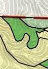


CLEARCUT


750075015002250 100200300400 ft 0 750 1500 2250 3000 ft0100 P EAST RD. MOORESSPRINGSRD. MICKEY RD. MOORESSPRINGSRD. HALLRD. HANGING ROCK STATE PARK BOUNDARY P MOORESSPRINGSRD. RD. MOORESSPRINGSRD. HANGING ROCK STATE PARK | MOORES SPRINGS & VADE MECUM MASTER PLAN
APRIL 2017
BASIC
LEGEND RICH
LOW
DRY
APPENDIX A: PHASE ONE 5
This page was intentionally left blank
MOORES SPRINGS PROPERTY NATURAL FEATURES
LEGEND
MAJOR ROCK OUTCROPPING
APPROXIMATE LOCATION OF ENDANGERED / RARE SPECIES
- Wehrle’s salamander (E)
- James Spinymussel (E)
- Roanoke Hogsucker (R)
- Alabama grape fern (R)
- Mountain Camelia (R)
- Ringed Witch Grass (R)
- Plume Moss (R)
- A Liverwort (R)
RICH COVE FOREST
- A common plant community type, but one nearly absent this far east of the Blue Ridge Escarpment
CAROLINA HEMLOCK FOREST
SUCCESSIONAL FOREST
MOORES SPRINGS & VADE MECUM BOUNDARIES STREAMS
100’ STREAM BUFFER (EACH SIDE)


5000500100015002000ft 1000100200300400ft 0 500 1,000 1,500 2,000 ft200 100300 400 ED BOOTH RD. DAN RIVER P EAST RD. MICKEY RD. DAN GEORGE RD. MOORES SPRINGS RD. CASCADE CREEK SOUTH DOUBLE CREEK HANGING ROCK STATE PARK | MOORES SPRINGS & VADE MECUM MASTER PLAN APRIL 2017
APPENDIX A: PHASE ONE 7
This page was intentionally left blank
VADE MECUM


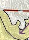


FEATURES


750075015002250 MAJOR ROCK OUTCROPPING 100200300400 ft 0 750 1500 2250 3000 ft0100 P EAST RD. MOORESSPRINGSRD. MICKEY RD. MOORESSPRINGSRD. HALLRD. HANGING ROCK STATE PARK BOUNDARY EAST RD. MOORESSPRINGSRD. MICKEY MOORESSPRINGSRD. HANGING ROCK STATE PARK | MOORES SPRINGS & VADE MECUM MASTER PLAN
PROPERTY APRIL 2017 NATURAL
LEGEND VIEWS 100’ STREAM BUFFER (EACH SIDE) MOORES SPRINGS & VADE MECUM BOUNDARIES STREAMS SUCCESSIONAL FOREST
CAROLINA HEMLOCK FOREST
PIEDMONT BOTTOMLAND
FOREST
VADE MECUM CREEK APPENDIX A: PHASE ONE 9
This page was intentionally left blank
MOORES SPRINGS PROPERTY
TOPOGRAPHY

LEGEND
HIGH POINT
HIGH GROUND Gentle - moderate slopes associated with ridge lines and higher elevations
LOW LYING AREAS Gentle - moderate slopes along creek corridors
SPRINGS & VADE MECUM BOUNDARIES


5000500100015002000ft 1000100200300400ft 0 500 1,000 1,500 2,000 ft200 100300 400 ED BOOTH RD. DAN RIVER P EAST RD. MICKEY RD. DAN GEORGE RD. MOORES SPRINGS RD. CASCADE CREEK SOUTH DOUBLE CREEK HANGING ROCK STATE PARK | MOORES SPRINGS & VADE MECUM MASTER PLAN APRIL 2017
MOORES
STREAMS APPENDIX A: PHASE ONE 11
This page was intentionally left blank
VADE MECUM PROPERTY


TOPOGRAPHY LEGEND


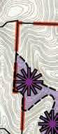


HIGH
LOW LYING

500050010001500 1000100200300400ft 100200300400 ft 0 750 1500 2250 3000 ft0100 P EAST RD. MOORESSPRINGSRD. MICKEY RD. MOORESSPRINGSRD. HALLRD. HANGING ROCK STATE PARK BOUNDARY HANGING ROCK STATE PARK | MOORES SPRINGS & VADE MECUM MASTER PLAN
APRIL 2017
POINT HIGH GROUND Gentle - moderate slopes associated with ridge lines and higher elevations
AREAS Gentle - moderate slopes along creek corridors MOORES SPRINGS & VADE MECUM BOUNDARIES STREAMS VADE MECUM CREEK Vade MecumTopography MapAPPENDIX A: PHASE ONE 13
This page was intentionally left blank


1000100200300400ft 0 500 1,000 1,500 2,000 ft200 100300 400 SLOPE ANALYSIS HANGING ROCK STATE PARK | MOORES SPRINGS & VADE MECUM MASTER PLAN APRIL 2017 MOORES SPRINGS PROPERTY 11% 20% SLOPE 0% - 10% SLOPE LEGEND 21% - 30% SLOPE 31% - 40% SLOPE 41% - 50% SLOPE Moores Springs Slope Analysis MapAPPENDIX A: PHASE ONE 15
This page was intentionally left blank


MOORESSPRINGSRD. HANGING ROCK STATE PARK BOUNDARY HANGING ROCK STATE PARK | MOORES SPRINGS & VADE MECUM MASTER PLAN VADE MECUM PROPERTY APRIL 2017 1000100200300400ft SLOPE ANALYSIS 11% - 20% SLOPE 0% - 10% SLOPE LEGEND 21% - 30% SLOPE 31% - 40% SLOPE 41% - 50% SLOPE Vade Mecum Slope Analysis MapAPPENDIX A: PHASE ONE 17
This page was intentionally left blank

5000500100015002000ft 1000100200300400ft 0 500 1,000 1,500 2,000 ft200 100300 400 ED BOOTH RD. DAN RIVER P EAST RD. MICKEY RD. DAN GEORGE RD. MOORES SPRINGS RD. CASCADE CREEK SOUTH DOUBLE CREEK HANGING ROCK STATE PARK | MOORES SPRINGS & VADE MECUM MASTER PLAN APRIL 2017 MOORES SPRINGS PROPERTY HYDROLOGY DRAINAGE PATTERNS / CONCENTRATIONS 100’ STREAM BUFFER (EACH SIDE) 100 YEAR FLOODPLAIN LEGEND MOORES SPRINGS & VADE MECUM BOUNDARIES STREAMS Moores Springs Hydrology MapAPPENDIX A: PHASE ONE 19
This page was intentionally left blank


750075015002250 100200300400 ft 0 750 1500 2250 3000 ft0100 P EAST RD. MOORESSPRINGSRD. MICKEY RD. MOORESSPRINGSRD. HALLRD. HANGING ROCK STATE PARK BOUNDARY HANGING ROCK STATE PARK | MOORES SPRINGS & VADE MECUM MASTER PLAN VADE MECUM PROPERTY APRIL 2017 HYDROLOGY LEGEND DRAINAGE PATTERNS / CONCENTRATIONS 100’ STREAM BUFFER (EACH SIDE) 100 YEAR FLOODPLAIN MOORES SPRINGS & VADE MECUM BOUNDARIES STREAMS VADE MECUM CREEK VADE MECUM CREEK Vade Mecum Hydrology MapAPPENDIX A: PHASE ONE 21
This page was intentionally left blank
SOUTH DOUBLE

CAMP STORE
DANCE FLOOR
MOORES SPRINGS
HOTEL LOCATION
OF MOORE
MOORES SPRINGS PROPERTY CULTURAL FEATURES

LEGEND
CEMETERY
FORMER CAMPGROUND AREA
FORMER CAMPGROUND ROAD
MOORES SPRINGS & VADE MECUM BOUNDARIES

STREAMS

0 500 1,000 1,500 2,000 ft200 100300 400 ED BOOTH RD. DAN RIVER P EAST RD. MICKEY RD. DAN
GEORGE
RD.
RD. CASCADE CREEK
CREEK OLD
(SITE
FAMILY RESIDENCE TOBACCO BARN DAM CONCRETE
OLD
SPRING HOUSE HANGING ROCK STATE PARK | MOORES SPRINGS & VADE MECUM MASTER PLAN APRIL 2017
Moores Springs Cultural Features MapAPPENDIX A: PHASE ONE 23
This page was intentionally left blank
VADE MECUM PROPERTY


FEATURES


750075015002250 100200300400 ft 0 750 1500 2250 3000 ft0100 P EAST RD. MOORESSPRINGSRD. MICKEY RD. MOORESSPRINGSRD. HALLRD. HANGING ROCK STATE PARK BOUNDARY HANGING ROCK STATE PARK | MOORES SPRINGS & VADE MECUM MASTER PLAN
APRIL 2017 CULTURAL
APPROXIMATE LOCATION OF FORMER DIAMOND LAKE CEMETERY LEGEND MOORES SPRINGS & VADE MECUM BOUNDARIES STREAMSSPRING HOUSE, BRIDGE, DANCE HALL LOCATION AMPHITHEATER METAL BRIDGE / SHOOTING RANGE GYM / POOL CHAPEL HOTEL OLD DAM AND WATER WHEEL HIGH ROPES COURSE VADE MECUM CREEK Vade Mecum Cultural Features MapAPPENDIX A: PHASE ONE 25
This page was intentionally left blank
MOORES SPRINGS PROPERTY
DEDICATED NATURE PRESERVE
LEGEND
MOORES SPRINGS & VADE MECUM BOUNDARIES

STREAMS
DEDICATED NATURE PRESERVE - PRIMARY AREA - 114 acres - Notable site for rare and endangered species as well as high quality natural communities - Trails within the primary area - principal visitor activities shall be nature education, walking, research, & observation - no res
DEDICATED NATURE PRESERVE - BUFFER AREA - 248 acres - minimal disturbance allowed - principal visitor activities shall be nature education, walking, research, & observation - no res

5000500100015002000ft 1000100200300400ft 0 500 1,000 1,500 2,000 ft200 100300 400 ED BOOTH RD. DAN RIVER P EAST RD. MICKEY RD. DAN GEORGE RD. MOORES SPRINGS RD. CASCADE CREEK SOUTH DOUBLE CREEK HANGING ROCK STATE PARK | MOORES SPRINGS & VADE MECUM MASTER PLAN APRIL 2017
Moores Springs Dedicated Nature Preserve MapAPPENDIX A: PHASE ONE 27
This page was intentionally left blank
Community Engagement
e following graphs and charts summarize the information gathered during the community engagement portion of Phase One: Information Gathering.
Park Program Survey
e following summarizes the responses to the program surveys received at both the Soup in A Bowl event and the Vade Mecum Open House event.
HANGING ROCK STATE PARK EXPANSION MASTER PLAN 2017 APPENDIX A: PHASE ONE 29
Inside Stokes County,
King
Walnut Cove
Danbury
Stokes County
Quaker Gap
Lawsonville


Pinnacle


Tobaccoville
Germanton


Outside Stokes County, NC
Winston-Salem
West eld

Clemmons
High Point
Greensboro
Sandy Ridge 2 East Bend 1 Stuart
Brevard 1 Oak Ridge 1 Lexington 1 Kernersville 1 Belews Creek 1 Apex 1 Yadkin County 1 Davidson County 1 Summer eld 1 Francis 1
48, 63% 28, 37% Where do you live? TOTAL PEOPLE: 76 19, 43% 25, 57% Where do you live?
NC 48
18
7
7
6
4
2
2
1
1
28
5
3
2
2
2
1
“Over 1/3 of those surveyed were from outside Stokes County.” “63% of people surveyed said that they visit Hanging Rock State Park more than 5 times a year.” 28 24 3 5 16 0-5 6-10 11-15 16-20 20+ 0 5 10 15 20 25 30 AMOUNT OF VISITS PER YEAR PEOPLE (76 TOTAL) How many visits to Hanging Rock State Park do you make per year? HANGING ROCK STATE PARK EXPANSION MASTER PLAN 2017 APPENDIX A: PHASE ONE 30
What kind of recreational activities
Other

of the comment responses were for Hiking.”


Walking Cabins Plant / animal identi cation Beach Water Activities Back-packing H2 Camping Camp for Special Needs Farmers Market Playground Gol ng


Community Events Art eatre
Easy Hiking
Motor Cycle Riding History of Community Paddling Dancing Gardening Sports Tubing
Overnight hotel accommodation Photography Listening to Music Cleaning Trails Church Event Farmers Market Trail Running Eating Out

67 25 19 15 12 87443333 41 0 10 20 30 40 50 60 70 80 COMMENT RESPONSES (214 TOTAL) RECREATIONAL ACTIVITY
do you participate in?
“31%
HANGING ROCK STATE PARK EXPANSION MASTER PLAN 2017 APPENDIX A: PHASE ONE 31
“Community, Activity and Events
Accommodation
RESPONSE SUMMARY
Historical, Restoration (15%); Trails (11%);
most


COMMUNITY, ACTIVITY & EVENTS
Arts, Music & Entertainment, Event Rental, Community, Family accessible, Community Centre, Gym for Dancing, Year round Programs, Zip Lines, Education (Natural Healthcare, Conservancy, Recycling)
HISTORICAL, PRESERVATION
Historical Presevation (Interactive, maintain historic charm) Refurbish cabins (with kitchenettes, rent while doing hotel / B+B. ‘sponsor a room’ Restore Hotel (open and working), Chapel / Hotel (Weddings), Restore Lake, Bridge at Booth Loop (To Tory’s Den Trail), Historical education, Bath House
TRAILS
Hiking, Mountain bike expansion, Horseback riding, Walking, Connections
ACCOMODATION

Cabins, Overnight Accommodation, Hotel (Small boutique hotels), Hotel, Hostel, Bed and Breakfast, Cabins (connected to Hanging Rock State Park)
OUTDOOR CAMPING
Camping (more camping areas, larger), R/V or Camper Sites, (Vade Mecum - Needs bridge so it can be accessed, Moore Springs Campground Access, water and electric hookups)
ENVIRONMENTAL
Environmental Sustainability Centre, Educational, Conservation, Environmental stewardship, Recycling Gardens, Waterways
OTHER
Aesthetic (Rural / agricultrual nature of county, rustic), Housing, Volunteering, Family Retreats with Meals (Hotel kitchen), menit , eddin s, dditional sta , oilets, tter medicinal ardens, nner cit ids meet nat re, i in it do s
FOOD AND DRINK
Stores and Restaurants, Fresh Local food
ACCESS & PARKING
Park Access for Public, Easy access, Parking
SWIMMING POOL
Public Swimming Pool (restoring the pool)
RIVER ACTIVITIES
River Related Activities (Kayaking, Canoing, Tubing, Swimming), River Access,


CAMP PROGRAM
Camps, Art & Painting retreats, Summer arts program
18 29 18 15 11 3 5 3 24 13 8 12 0 5 10 15 20 25 30 35 COMMENT RESPONSES (159 TOTAL) MOST IMPORTANT ASPECTS OF THE AREA THAT NEED TO BE CONSIDERED What are the top 3 5 most important aspects of the Vade Mecum / Moore Springs area that need to be considered during the planning process?
(18%);
and
(11%) were the
popular comment responses.”
HANGING ROCK STATE PARK EXPANSION MASTER PLAN 2017 APPENDIX A: PHASE ONE 32
(25%); Community, Activity and Events (23%); Outdoor Camping (14%); and Accommodation (11%)were the most popular comment responses.”
RESPONSE SUMMARY
TRAILS
Greenway trails, Hiking, Mountain bike, Horseback riding, Motor cycle / ATV, ADA Accessible trails, Walking
COMMUNITY, ACTIVITY & EVENTS
Community Centre (Gathering Place), Arts, Music & Entertainment, Event Rental (music, theatre, festival), Education, Events, Zip Lines, Fitness, Golf Course, Outreach, Picnic areas, Disc Golf, Public Parks, Stable - Horses to lease, Amphitheater, Rock Climbing
OUTDOOR CAMPING
Camping (more camping areas, larger), R/V or Camper Sites, Primitive, Tents

ACCOMMODATION

Cabins, Lodging (close to park), Affordable Overnight Accommodation, Hotel (Small boutique hotels), Resort (Eco Resort with Farm to table Restaurant), Retreats, Conference Centre
RIVER ACTIVITIES
Kayaking, River Related Activities, River Access, Canoeing, Tubing, Swimming
FOOD AND DRINK
Restaurants, General store
SWIMMING POOL
Public Swimming Pool (keeping the pool)
CAMP PROGRAM
Camps that groups can rent weekly, Special Needs Camps, Daycamps for adults
HISTORICAL
Historical Preservation (Vade Mecum Property), Hotel Restoration


OTHER

Shopping (Crafts), Guidance/direction, Signage, More farms, Bike Rack, Dog friendly

“Trails
51 46 28 22 17 15 7 3 2 9 0 10 20 30 40 50 60 COMMENT RESPONSES (200 TOTAL) RECREATIONAL OPPORTUNITIES OR FACILITIES NEEDED What are the top 3 5 most important recreational opportunities or facilities needed in Stokes County or at Hanging Rock State Park? HANGING ROCK STATE PARK EXPANSION MASTER PLAN 2017 APPENDIX A: PHASE ONE 33
Building Evaluations Exercise
For each building, attendees were given the following choices:
Sacred: Building should be preserved for its historical value, as similar as possible to its historic use and appearance.
Valuable / Re-purpose: Building has some value and should be retained, however, it does not have to serve its traditional function. e building could be used for some other purpose.
Don’t Care: You don’t feel strongly one way or the other about the building or feature.
HANGING ROCK STATE PARK EXPANSION MASTER PLAN 2017 APPENDIX A: PHASE ONE 34
Evaluation De nitions
Sacred: Building should be preserved for its historical value, as similar as possible to its historic appearance.
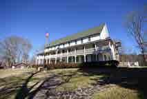
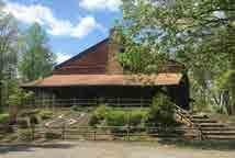
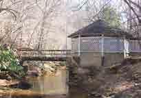
Valuable / Re-purpose: Building has some value and should be retained, however, it does not have to serve its traditional function. The building could be used for some other purpose.
Don’t Care: You don’t feel strongly one way or the other about the building
structure.
Building Evaluations
or
* Includes online responses and responses from the public meeting. 127 RESPONSES 78 ADDITIONAL COMMENTS Community members were asked to rate the existing buildings and other features on the site based on their preferences. Only one vote was allowed per building or feature. This is how the community voted. 0 10 20 30 40 50 0 10 20 30 40 50 0 10 20 30 40 50 60 70 80 0 10 20 30 40 50 60 70 80 50 60 50 60 50 60 50 60 Spring House 49 39 49 4 1 61 30 66 27 15 59 54 57 Gym Hotel Chapel VADE MECUM SPRING HOUSE GYMNASIUM HOTEL 1 2 3 HANGING ROCK STATE PARK EXPANSION MASTER PLAN 2017 APPENDIX A: PHASE ONE 35
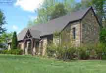
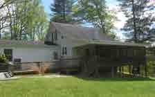
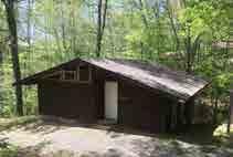
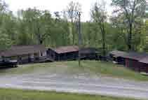
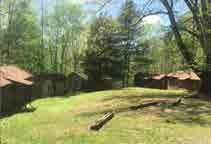
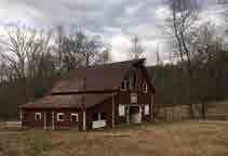
0 10 20 30 40 50 60 70 80 0 10 20 30 40 50 60 60 60 0 10 20 30 40 50 0 10 20 30 40 50 1 2 66 22 22 9 60 24 60 6 43 10 38 45 6 41 Chapel Caretaker bridge Pool Amp A 40 50 60 70 80 41 61 CHAPEL CARETAKER’S RESIDENCE 4 5 0 10 20 30 40 50 0 10 20 30 40 50 0 10 20 30 40 50 60 0 10 20 30 40 50 60 0 10 20 30 40 50 0 10 20 30 40 50 60 49 39 10 11 57 22 10 48 Gym Cabins-1 Cabins Store 0 10 20 30 40 50 0 10 20 30 40 50 60 Amp B Amp 40 50 40 50 45 9 2 37 44 CABINS - GROUP ONE WILMINGTON, TARHEEL, YADKINVILLE 6 40 50 70 80 0 10 20 30 40 50 60 70 80 0 10 20 30 40 50 60 0 10 20 30 40 50 60 0 10 20 30 40 50 60 0 10 20 30 40 50 60 0 10 20 30 40 50 60 50 60 50 60 50 50 49 915 11 59 21 2411 54 1715 60 5 22 52 52 43 Gym Chapel Caretaker Cabins 2 Cabins 3 Horse Barn Activity CABINS - GROUP TWO DOGWOOD, CHALLENGER, WHITE OAK, RALEIGH, OLD SALEM CABINS - GROUP THREE WEST WINSTON-SALEM, NORFOLK, CEDAR TRIANGLE, WINSTON-SALEM HORSE MOTEL / HAY BARN 7 8 9 HANGING ROCK STATE PARK EXPANSION MASTER PLAN 2017 APPENDIX A: PHASE ONE 36
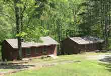
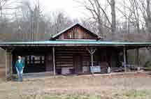
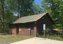
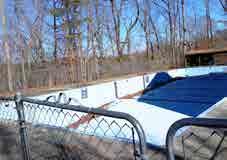
50 60 0 10 20 30 40 50 60 0 2 60 17 35 5 51 43 Activity House Amp A 0 10 20 30 40 50 60 70 80 Dam 47 14 6 61 24 ACTIVITY HOUSE OLS / CRAFTS 10 0 10 0 10 0 10 50 60 50 60 0 10 20 30 40 50 60 0 10 20 30 40 50 0 10 20 30 40 50 60 0 10 20 30 40 50 60 Spring House 4 59 11 57 15 10 29 52 52 48 27 Gym Hotel Cabins Meeting Cabin Store room Spring 0 0 10 20 30 40 50 60 0 10 20 30 40 50 Amp B Amp C High 0 10 20 30 40 50 0 10 20 30 40 50 0 5 10 15 20 25 30 35 Spring House Bike Shack Tobacco 45 22 50 28 32 27 19 7 Sacred / Historical Valuable / MEETING CABIN + NATURE CENTER PAVILION STORE ROOM 11 12 0 10 20 30 40 50 60 70 80 0 10 20 30 40 50 60 70 80 0 10 20 30 40 50 60 50 60 60 50 60 0 10 20 30 40 50 60 0 10 20 30 40 50 0 10 20 30 40 50 4 1 61 30 2 66 22 22 9 60 21 54 60 51 52 6 52 30 43 10 38 45 6 41 Hotel Chapel Caretaker Spring House bridge Pool Amp A 20 30 40 50 20 30 40 50 30 40 50 60 70 80 59 35 49 41 35 61 POOLBRIDGE NEAR SPRING HOUSE AMPHITHEATER A NEAR SPRING HOUSE BRIDGE B CA HANGING ROCK STATE PARK EXPANSION MASTER PLAN 2017 APPENDIX A: PHASE ONE 37
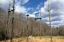
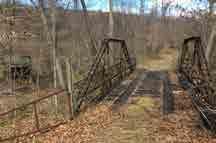
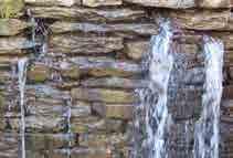
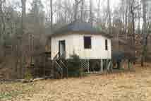
0 10 20 0 10 20 0 10 20 0 10 20 50 50 60 50 60 0 10 20 30 40 50 10 11 21 2411 15 22 52 10 48 Cabins-1 Cabins 2 Cabins 3 Horse Pool 0 10 20 30 40 50 0 10 20 30 40 50 60 0 10 20 30 40 50 0 10 20 30 40 50 Amp B Amp C High Ropes Iron 0 10 0 10 0 5 10 15 20 25 30 35 0 10 20 30 40 50 Spring House Bike Shack Tobacco Barn Dance 11 9 2 30 59 35 7 49 41 37 44 Sacred / Historical Appearance Valuable / Repurpose Don’t Care AMPHITHEATER B NEAR GYM / POOL AMPHITHEATER C NEAR ACTIVITY HOUSES HIGH ROPES COURSE POLES E F 0 10 20 30 40 50 60 70 80 0 10 20 30 40 50 60 60 60 0 10 20 30 40 50 0 10 20 30 40 50 1 2 66 22 22 9 60 24 60 6 43 10 38 45 6 41 Chapel Caretaker Activity House bridge Pool Amp A 20 30 40 50 30 40 50 60 70 80 35 41 35 61 BRIDGE NEAR SHOOTING RANGE DAM H 0 10 20 30 40 50 60 0 10 20 30 40 50 60 0 10 20 30 40 50 0 10 20 30 40 50 60 Spring House 10 11 57 22 15 10 48 27 Gym Cabins-1 Cabins Meeting Cabin Store 50 0 10 20 30 40 50 60 Amp 0 10 20 30 40 50 0 10 20 30 40 50 Spring House Bike 45 22 27 19 2 Sacred / Historical Appearance MOORES SPRINGS SPRING HOUSE 1 HANGING ROCK STATE PARK EXPANSION MASTER PLAN 2017 APPENDIX A: PHASE ONE 38
Land Use Options
Sacred / Historical Appearance Valuable / Repurpose
Don’t Care
Attendees to Community Meeting #1 were asked to comment on options for land use for the two properties. Vade Mecum and Moores Springs were broken up into ve areas each, with the areas based on distinct features, such as creeks, roads and topography. Each attendee was given 25 colored dots, ve of which were red. Green dots were to be used for Moores Springs while blue and yellow dots were to be used for Vade Mecum. ese dots represented “Yes” votes, while the red dots represented “No” votes.
Participants were asked to place their dots on a matrix that correlated to the land use maps. Categories in the matrix included:
•Hiking-only trails
•Mountain bike / hiking trails
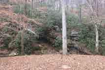
•Equestrian / hiking trails
•Preserve forest (no trails)
•Tent camping
•Group Camping
•Community Event Space
•Picnicking Area
•Playground
•River Access Area (Moores Springs only)
•Equestrian Facilities & Accommodations (Vade Mecum only)
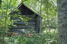
•Overlook with Parking (Vade Mecum only)
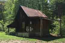
0 10 20 0 10 20 0 10 20 0 10 20 10 29 6 30 10 6 Store room Spring House bridge Pool Amp A 60 50 0 10 20 30 40 50 70 80 Dam 0 10 20 30 40 50 0 5 10 15 20 25 30 35 0 10 20 30 40 50 Bike Shack Tobacco Barn Dance Floor 22 50 28 26 32 32 47 11 32 19 59 49 61 44
BIKE TRAILS SHACK TOBACCO BARN CONCRETE DANCE FLOOR 2 3 A
HANGING ROCK STATE PARK EXPANSION MASTER PLAN 2017 APPENDIX A: PHASE ONE 39
Hiking Only Mountain Biking / Hiking Equestrian / Hiking Preserve Forest Tent Camping Group Camping Community Event PicnickingPlayground River Access A 1993 9 236032 26 40 2357 B 2011116 293712 7 11 326 C 2111514 2636 9 6 10 314 D 2210718 2636 6 5 9 112 E 2210714 273711 7 12 322 MOORES SPRINGS 37 12 3 26 36 3 14 36 1 12 37 11 3 22 Land Use e following tables illustrate the preferences of participants regarding appropriate land uses and recreation opportunities in ve distinct areas within the property. LEGEND Not appropriate for this area 90+ Responses 40-89 Responses 20-39 Responses 1-19 Responses HANGING ROCK STATE PARK EXPANSION MASTER PLAN 2017 APPENDIX A: PHASE ONE 40
MOORES
LAND USE OPTIONS
LEGEND
A


ACRES: 19 ac
ACRES IN PRIMARY DNP: 0 ac
TOTAL ACRES: 390
FEATURES: RIVER FRONTAGE, SPRING HOUSE, ENDANGERED SPECIES HABITAT, CASCADE CREEK

Low lying flat area bisected by Cascade Creek with gentle access to Dan River. Site of former campground. Existing driveway off Moores Springs Rd.
ACRES: 93 ac


ACRES IN PRIMARY DNP: 30 ac
FEATURES: RIVER FRONTAGE, SPRING HOUSE, ENDANGERED SPECIES HABITAT, CASCADE CREEK, EXISTING MNT. BIKE TRAILS Approximately 1/3 of area designated as Dedicated Nature Preserve Primary Area. Includes 1 Potential Dev. Area.
ACRES: 144 ac

C
B D
ACRES IN PRIMARY DNP: 0 ac

FEATURES: DAM, BIKE SHACK, TOBACCO BARN, CASCADE CREEK, EXISTING MNT. BIKE TRAILS Area south of Moores Springs Rd. Entire area within Dedicated Nature Preserve Buffer Area. Primarily Oak-Hickory Forest.

ACRES: 84 ac
ACRES IN PRIMARY DNP: 50 ac
FEATURES: CEMETERY, SIGNIFICANT TREES ALONG RIDGES, COVE FOREST, MNT. BIKE TRAILS CURRENTLY PLANNED Area features two major ridges running SW to NE. Two primary drainage patterns run to South Double Creek which runs to Dan River.
ACRES: 50 ac
ACRES IN PRIMARY DNP: 39 ac

FEATURES: ADJACENT TO PIEDMONT LAND CONSERVANCY PROPERTY, ENDANGERED SPECIES HABITAT, SIGNIFICANT ROCK OUTCROPPINGS, MNT. BIKE TRAILS CURRENTLY PLANNED
Predominately designated as Primary Dedicated Nature Preserve.
NATURE PRESERVE PRIMARY AREA
DEDICATED NATURE PRESERVE BUFFER AREA
OUTISDE DNP
ROAD BIKE TRAILS

250 0 250 500 750 1000m 0 250 500 750 1,000 ft D E A B C MOORESSPRINGS R P EASTRD. DANGORGE RD. EDBOOTH RD. DANRIVER HA NG IN G ROCKSTATEP AR K | MO O RE S SPR IN GS &VADE MECU M M AS TER PL AN April 2017 Moore’s SpingsTopography Base Map4’Contours SITE ANALYSIS MOORES SPRINGSE A S T R D DAN GORGERD DE OBO HT DR DAN RIVER 0 500 1,000 1,500 2,000 ft200 100300 400 PULL OFF AREA AND DAM RIVER ACCESS ENDANGERED SPECIES HABITAT PIEDMONT LAND CONSERVANCY PROPERTY SOUTH DOUBLE CREEK ED BOOTH RD. P EAST RD. DAN GEORGE RD. MOORES SPRINGS RD. CASCADE CREEK DAN RIVER
SPRINGS PROPERTY HANGING ROCK STATE PARK | MOORES SPRINGS & VADE MECUM MASTER PLAN APRIL 2017
EXISTING OFF
SPRING HOUSE AREA
DEDICATED
CONNECTIONS BETWEEN AREAS MOORES SPRINGS & VADE MECUM BOUNDARIES STREAMS
E RICH COVE FOREST 100’ STREAM BUFFER (EACH SIDE) SUCCESSIONAL FOREST POTENTIAL DEVELOPMENT AREA - SUITABLE FOR BUILDINGS, PARKING & OTHER FEATURES APPENDIX A: PHASE ONE 41
This page was intentionally left blank
Hiking Only Mountain Biking / Hiking Equestrian / Hiking Preserve Forest Tent Camping Group Camping Community Event PicnickingPlaygroundCabinsEquestrian Facilities Overlook with parking A 993 16 206134 43 52 2933 8 12 B 1698 18 295221 9 26 7 7 6 7 C 11100 29 294517 11 26 8 4 23 12 D 14102 24 244316 8 22 2 5 5 5 E 998 39 293611 6 13 1 4 16 4 VADE MECUM 93 20 LEGEND Not appropriate for this area 90+ Responses 40-89 Responses 20-39 Responses 1-19 Responses HANGING ROCK STATE PARK EXPANSION MASTER PLAN 2017 APPENDIX A: PHASE ONE 43
This page was intentionally left blank
LEGEND
A


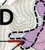


ACRES: 48 ac

FEATURES: BUILDINGS, DAM, CAMP FACILITIES, AMPHITHEATERS


Former Camp Sertoma site, along ridge parallelled by tributaries of Vade Mecum Creek. Driveway access off Moores Springs Rd.
ACRES: 110 ac

FEATURES: SPRING HOUSE, PALISADES ROCK, VIEW

Area north of Vade Mecum Creek. Includes 3 designated potential development areas. Some areas are recently timbered. Includes former shooting range and outpost. Expansive views from high point. Large areas of successional forest.
C
ACRES: 73 ac
FEATURES: HORSE BARN, VIEW POINT, OLD ROPES COURSE, SEVERAL BUILDINGS, ‘LOST CABIN’ Area west of P East Rd. Includes several buildings and major view point. Some area in DNP Buffer Area. Large areas of successional forest.
ACRES: 71 ac


FEATURES: FORMER LAKE
Area south west of Vade Mecum Creek and west of Main Campus. Site of former Diamond Lake.
ACRES: 53 ac
FEATURES: EQUESTRIAN TRAILS


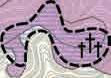
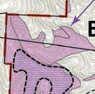

Area south of Moores Springs Rd.
Existing trail connects the Mountains to Sea trail to Hanging Rock State Par.
5000500100015002000ft 1000100200300400ft E A B C VADE MECUM PROPERTY 100200300400 ft 0 750 1500 2250 3000 ft0100 LAND USE OPTIONS P EAST RD. MOORESSPRINGSRD. MICKEY RD. MOORESSPRINGSRD. HALLRD. HANGING ROCK STATE PARK BOUNDARY FLAT TOP CEMETERY PALISADES ROCK VADE MECUM CREEK WILDERNESS CABIN / OUTPOST GRACE
EXISTING MOUNTIANS TO SEA TRAIL EXISTING MOUNTIAN BIKE TRAILS SPRING HOUSE CONNECTIONS BETWEEN AREAS MOORES SPRINGS & VADE MECUM BOUNDARIES STREAMS
B D E 100’ STREAM BUFFER (EACH SIDE) VIEWS CEMETERY POTENTIAL DEVELOPMENT AREA - SUITABLE FOR BUILDINGS, PARKING & OTHER FEATURES SUCCESSIONAL FOREST FOREST AREAS IN VARIOUS STAGES OF SUCCESSION TOTAL ACRES: 355 HANGING ROCK STATE PARK | MOORES SPRINGS & VADE MECUM MASTER PLAN APRIL 2017 APPENDIX A: PHASE ONE 45
This page was intentionally left blank
32 Followers May 15 REI Promotion begins
Saturday, May 6 (peak)
170 Visitors / 611 Page Views


Friends of Saurtown Mountains
Vade Mecum Tour and Hiking
Website Statistics as of May 31, 2017
Website

As part of the public engagement component of the project, a project website (www. hangingrockexpansionmasterplan.com) was set up to disseminate information to a large audience and to provide an opportunity for the community to give feedback and ask questions. e website, built in Wordpress, was set up with a blog-type home page and static supporting pages. e home page was used to provide updates on the project as well as promote public meetings. e static pages contained a history of the site, a project description and scope, inventory and analysis maps, conceptual and draft plans, and survey results. As new material was developed, it was posted to the website, typically in conjunction with public meetings.
1,274
UNIQUE VISITORS 5,468 PAGE VIEWS
* As of 10am, Wednesday, May 31, 2017
e website went live the day following the rst public meeting. At that point, the analysis maps were posted along with a link to an online version of the exercises that were available at the meeting. Following the second public meeting, the initial concepts with accompanying graphics and a link to an online survey were posted to the website. e same process was followed following the third public meeting where the draft master plan was presented.
Visitors to the website were given the opportunity to view and comment on all of the meeting materials as well as all other content on the site. An email address speci c to the project was setup through Gmail (info@ hangingrockexpansionmasterplan.com), letting visitors reach out to the design team. Visitors also had the option of following the site, allowing them to receive updates whenever new content was added to the site, which occurred on a regular basis.
HANGING ROCK STATE PARK EXPANSION MASTER PLAN 2017 APPENDIX A: PHASE ONE 47
Visitation to the website uctuated, with the biggest days immediately following community meetings. e further away from community meetings, the more the viewership dwindled. As content was added, an immediate increase in visitors was noted, quickly followed by a decline. To help drive people to the website, the site was promoted at every public meeting as well as through social media. obs regularly promoted the website through their own Facebook page. e design team also promoted the website on the Facebook pages of relevant groups, such as the Friends of Saurtown Mountains, Hanging Rock – Stokes County, NC Tourism and Carolina Climbers Coalition, among others. e Division also promoted the project website on their own social media feeds as well as the State Parks website. Finally, the design team reached out to REI and Bass Pro Shops to promote the website and the project through their community outreach programs to gather an audience from outside Stokes County.
ROCK STATE PARK

THE PROJECT


HANGING
PARK EXPANSION MASTER PLAN www.HangingRockExpansionMasterPlan.com PROJECT SCHEDULE PHASE ONE / INFORMATION GATHERING & ASSESSMENT Complete: May 2017 •Site analysis documentation and mapping, development opportunities and constraints PHASE TWO / PRELIMINARY PLANNING & DESIGN Complete: June 2017 •Preliminary Plans, program identification & development of preliminary and alternative diagrams •Public meeting - June 29, Walnut Cove Library PHASE THREE / DRAFT MASTER PLAN Complete: July 2017 •Draft master plan / report, public meeting PHASE FOUR / FINAL MASTER PLAN Complete August 2017 Prepare final master plan, present to community PHASE FIVE / FINAL MASTER PLAN DOCUMENT Complete: September • Final master plan & report EMAIL Send the Design Team any additional thoughts, comments, or questions to: info@HangingRockExpansionMasterPlan.com WEBSITE Visit the project website for more information, including maps, history, site photos, additional resources, opportunities to comment, and updates. ABOUT
Community input is being sought for the expansion of Hanging Rock State Park. A master plan, which will create a vision for the nearly 750 acres of land added to the park in 2014, is being prepared by obs landscape architects. The new property includes the former Camp Sertoma site and surrounding land known as Vade Mecum, as well as the former Moores Springs campground site and surrounding land. The recommendations of the master plan will guide development over the next several decades. HANGING ROCK CENTER LEGEND & VADE MECUM PARK BOUNDARY PARK PROPERTY HANGING ROCK STATE PARK | MOORES SPRINGS & VADE MECUM MASTER PLAN OVERALL SITE CONTEXTVIEW OF MOORE’S KNOB FROM MOORES SPRINGS CHESHIRE HALL AT VADE MECUM AREA MAP PALISADES ROCK AT VADE MECUM REI Flyer HANGING ROCK STATE PARK EXPANSION MASTER PLAN 2017 APPENDIX A: PHASE ONE 48
APPENDIX B
Introduction
Phase Two focused on the identi cation of potential program elements and recreational opportunities as well as the preparation of alternative concepts for future improvements. ese concepts accommodated the program and illustrated options for their placement on the land.
With the site analysis information and initial stakeholder feedback from Phase One, three potential development options were de ned. Relevant to the overall property were variations on the trail network and supporting infrastructure. In all three options, the trail system was developed to keep equestrian and mountain biking separate and limit the crossing of these two types of trails. All trails within Hanging Rock State Park allow hikers and both the proposed mountain biking trails and equestrian trails would allow hiking.
As options were developed, site speci c areas that were able to accommodate the program began to emerge. obs developed speci c vignettes for each of these areas.
ese areas included:
•Moore Springs Dam and Ed Booth Road area
•Moore Springs former Campground and Ridge
•Vade Mecum Sunset Point
•Vade Mecum West
•Vade Mecum East
•Vade Mecum North
•Vade Mecum Central Campus
Overall Plan Options
e entire property was examined for the potential for trails including mountain bike, equestrian and hiking trails. Potential trail connections to link the subject property with Hanging Rock State Park proper were also identi ed. Each option provided trails in various con gurations and length with some existing trail networks being assumed. e existing mountain bike trails south of Moore’s Springs Road and those to the north on the eastern side of the Moore Springs property were designated to remain in each of the three options. Also consistent within each option was the notion of a hiking only trail that linked the Moores Springs spring house to the Vade Mecum spring house, primitive camping on the ridge at Moores Springs, and development of the Moores Springs dam area. Following is a summary of each option for the overall site:
PHASE TWO
Moores Springs and Vade Mecum Vignette Areas
APPENDIX B: PHASE T WO 49
Option A Overall Plan
Option A emphazised day use activities with equestrian facilities and tent camping on the Vade Mecum property. No camping is proposed on Moores Springs in this option.
Proposed Program Features
Trails:
•Mountain biking trails: existing and proposed at Moore Springs only. ~ 20.7 total miles
•Hiking only trails ~ 5.9 total miles
•Equestrian trails ~ 5.2 miles on Vade Mecum and connection to the Mountains to Sea Trail
Accommodations at Vade Mecum:
•30 Family Tent Sites
•83 Primitive Tent Sites
•Restore 3 existing cabins, 6 proposed cabins associated with equestrian facilities
•One ranger residence (renovate or replace existing structure)
PublicParking
•350 spaces
Recreation Facilities
•Equestrian Facilities: Proposed horse barn on Vade Mecum
•Repurpose existing horse barn for an equestrian vendor
•Maintain existing pool
•Ropes course relocated
•Community Event Space on both Properties
•Dan River Access at Moores Springs
Community Survey Results
Option A was the preferred option of 31% of people who took the survey.
Legend
Point of Interest
Hiking-Only Trail
Mountain Biking & Hiking Trail Cabin/ Accommodation Primitive Camping
Equestrian & Hiking Trail
Family Camping Community Event Space Playground
Picnicking Equestrian Parking Stables
Swimming Pool Access Parking Ranger Residence
River Access Amphitheater
Camping Area Day Use Area
Service Road Road
Equestrian Facilities
Cabins Parking
Rich Cove Forest Piedmont Bottom Land Forest
Signi cant Building
Crossings
HANGING ROCK STATE PARK EXPANSION MASTER PLAN 2017 APPENDIX B: PHASE T WO 50
MOUNTAINS
PIEDMONT LAND


CASCADE
COVE
POTENTIAL HIKING
POTENTIAL HIKING
COVE
COVE
PIEDMONT
PIEDMONT


OPTION A
USE
OPTION A

USE


OPTION A OVERALL PLAN


POTENTIAL
TRAIL CONNECTION
TRAIL


Public Meeting June, 2017 HANGING ROCK STATE PARK EXPANSION PHASE TWO Moores Springs & Vade Mecum Master Plan 2000200400600800ft RICH
FOREST RICH COVE FOREST
BOTTOMLAND FOREST MOORESSPRINGSROAD PIEDMONT LAND CONSERVANCY PROPERTY PROPOSED ROPES COURSE DAN GEORGE ROAD DAN RIVER SOUTH DOUBLE CREEK CASCADE CREEK ED BOOTH ROADMECUM CREEK VADE KEATON ROAD MOUNTAINS TO SEA TRAIL CONNECTION EXISTING EQUESTRIAN TRAIL CONNECTION
TRAIL CONNECTION POTENTIAL HIKING
EMPHASIS ON DAY
ACTIVITIES WITH EQUESTRIAN FACILITIES AND TENT CAMPING A Public Meeting June, 2017 HANGING ROCK STATE PARK EXPANSION PHASE TWO Moores Springs & Vade Mecum Master Plan 2000200400600800 RICH
FOREST RICH
FOREST
BOTTOMLAND FOREST MOORESSPRINGSROAD
CONSERVANCY PROPERTY PROPOSED ROPES COURSE DAN GEORGE ROAD DAN RIVER SOUTH DOUBLE CREEK
BOOTH ROADMECUM CREEK VADE KEATON ROAD
TO SEA TRAIL CONNECTION EXISTING EQUESTRIAN TRAIL CONNECTION
TRAIL CONNECTION
HIKING
CONNECTION
EMPHASIS ON DAY
ACTIVITIES WITH EQUESTRIAN FACILITIES AND TENT CAMPING 31% A APPENDIX B: PHASE T WO 51
This page was intentionally left blank
Moores Springs

RESTROOM FACILITY MOUNTAIN BIKE TRAIL MOORESSPRINGSRD. DNP BOUNDARY ED BOOTH ROAD DAY USE AREA PICNIC RESTROOM SHELTER PLAYGROUND SPRING HOUSE RIVER ACCESS PARKING SPRING HOUSE HIKING TRAIL DAN RIVER MOORES SPRINGSRD. N N Program Features: •Parking - 58 spaces •Proposed Restroom Facility •River Access with Parking •Playground •Picnic area •Loop trail along creek & Meadow Program Features: •Parking - 31 Spaces •Proposed Restroom Facility Moores Springs - Ed Booth Rd Area Parking & Trailhead Option A Vignettes -
Moores Springs - Former Campground Day Use & No Camping HANGING ROCK STATE PARK EXPANSION MASTER PLAN 2017 APPENDIX B: PHASE T WO 53
Option A Vignettes - Vade Mecum

OVERLOOK OVERLOOK HIKING-ONLY TRAIL MOUNTAIN BIKE TRAIL P EAST ROAD N Program Features: •Trailhead Parking - 48 Spaces •Overlooks •Picnic Area •Mountain Bike and Hiking Trails Moores Springs - Ed Booth Rd Area Parking & Trailhead HANGING ROCK STATE PARK EXPANSION MASTER PLAN 2017 APPENDIX B: PHASE T WO 54
Option A Vignettes - Vade Mecum
Moores Springs - Former Campground
Use & No Camping
Program Features:
•Proposed horse barn - Equestrian Facilities connected to the Mountains to Sea Trail
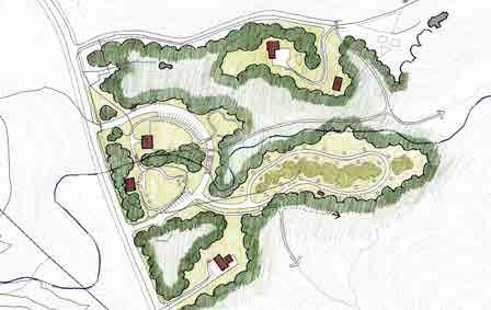
- 20 spaces
Trailer Parking - 10 spaces
- 6 new cabins associated with Horse Barn
N
Vade Mecum - Sunset Point
Use & No Camping
Program Features:
•Horse barn - vendor runs horse rides around Vade Mecum
Camping - 30 sites
- 36 spaces
Area
Vehicular Bridge
Store and Restroom
N
FAMILY CAMPING HORSE BARN & PADDOCK PICNIC RANGER RESIDENCE REFOREST MOUNTAIN BIKE TRAIL MOORES SPRINGS RD EQUESTRIAN TRAIL HIKING-ONLY TRAIL RESTROOMS / CAMP STORE EXISTING MAINTENANCE FACILITY PROPOSED EQUESTRIAN FACILITY CABINS EQUESTRIAN TRAIL HORSE PASTURE EQUESTRIAN TRAIL CONNECT TO MST MOORESSPRINGSRD CAMP SERTOMA RD. HIKING-ONLY TRAIL
•Family
•Parking
•Picnic
•1
•Camp
•Parking
•Horse
•Cabins
Day
Day
HANGING ROCK STATE PARK EXPANSION MASTER PLAN 2017 APPENDIX B: PHASE T WO 55
N

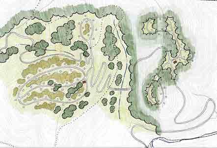
Program Features: •Primitive Camping - 83 sites •2 Restroom Facilities •Reforestation of cleared grassland •Equestrian trails Option A Vignettes - Vade Mecum PRIMITIVE CAMPING HIKING-ONLY TRAIL PRIMITIVE CAMPING REFOREST EQUESTRIAN TRAIL PRIMITIVE CAMPING
Vade Mecum - West Equestrian Facility with Cabins HANGING ROCK STATE PARK EXPANSION MASTER PLAN 2017 APPENDIX B: PHASE T WO 56
Option A Vignettes - Vade Mecum
Vade Mecum - Central Campus
N
Program Features:
•Pool - renovated with pool house
•Parking - 125 spaces
•Cabins - Group 3 repurposed as nature education buildings
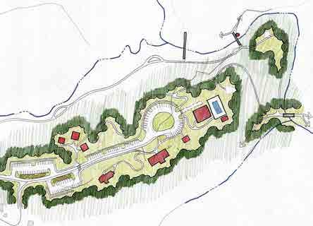
•Hotel - preserved, new cafe, art spaces
•Chapel - gift shop and museum
•Gym - recreational facility

Day Use, Pool Open, & Limited Events
POOL SPRING HOUSE AMPHITHEATER HOTEL OPERATED AS CAFE, ART SPACES RESTROOM FACILITY GYM OPERATED AS RECREATION FACILITY CHAPEL OPERATED AS GIFT SHOP, MUSEUM DIAMOND LAKE DAM RETAINING WALL HIKING-ONLY TRAIL VADE MECUM CREEK CABINS (GROUP 3) RETAINING WALL
HANGING ROCK STATE PARK EXPANSION MASTER PLAN 2017 APPENDIX B: PHASE T WO 57
Option B Overall Plan
e emphasis in Option B included an emphasis on mountain biking trails and a variety of accommodations on both properties. No new equestrian trails are proposed in this option.
Proposed Program Features
Trails:
•Mountain biking trails on Vade Mecum ~ 7.2 miles
•Mountain biking trails: existing and proposed ~ 27.9 total miles
•Hiking only trails ~ 4.5 total miles
•Equestrian trail connection on property south of Moores Springs Road
Accommodations:
•30 Family Tent Sites on Moores Springs
•4 Group Tent Sites on Moores Springs
•8 Family Tent Sites on Vade Mecum
•Restore 3 cabins on Vade Mecum
•20 proposed cabins on Vade Mecum
•Hotel restored for Hostel accommodations
•Two proposed ranger residences
PublicParking
•380 spaces
Recreation Facilities
•Pool removed
•Ropes course removed
•Access Road to north side of Vade Mecum
•Community Event Space at Vade Mecum
•Dan River Access at Moores Springs
Community Survey Results
Option B was the preferred option of 60% of people who took the survey.
Legend
Point of Interest
Hiking-Only Trail
Mountain Biking & Hiking Trail
Cabin/ Accommodation
Hostel
Primitive Camping
Group Camping
Picnicking
Family Camping Community Event Space Playground
Parking Ranger Residence
River Access
Amphitheater
Camping Area Day Use Area
Service Road Road
Cabins Parking
Rich Cove Forest Piedmont Bottom Land Forest
Signi cant Building
Crossings
HANGING ROCK STATE PARK EXPANSION MASTER PLAN 2017 APPENDIX B: PHASE T WO 58
POTENTIAL HIKING

OPTION B
MOUNTAIN


EVENT

POTENTIAL
POTENTIAL
TRAIL


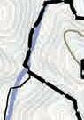

OPTION


OPTION B


OVERALL PLAN
MOUNTAIN BIKING, MAJOR EVENT


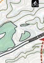


B
Public Meeting June, 2017 HANGING ROCK STATE PARK EXPANSION PHASE TWO Moores Springs & Vade Mecum Master Plan 2000200400600800ft PIEDMONT BOTTOMLAND FOREST RICH COVE FOREST RICH COVE FOREST MOORESSPRINGSROAD DAN GEORGE ROAD DAN RIVER SOUTH DOUBLE CREEK CASCADE CREEK ED MECUM CREEK VADE KEATON ROAD PIEDMONT LAND CONSERVANCY PROPERTY KEATON ROAD ACCESS EXISTING EQUESTRIAN TRAIL POTENTIAL HIKING TRAIL CONNECTION
HIKING TRAIL CONNECTION
EMPHASIS ON
BIKING, MAJOR
SPACE, VARIETY OF ACCOMMODATIONS B Public Meeting June, 2017 HANGING ROCK STATE PARK EXPANSION PHASE TWO Moores Springs & Vade Mecum Master Plan 60% 2000200400600800 PIEDMONT BOTTOMLAND FOREST RICH COVE FOREST RICH COVE FOREST MOORESSPRINGSROAD DAN GEORGE ROAD DAN RIVER SOUTH DOUBLE CREEK CASCADE CREEK ED BOOTH MECUM CREEK VADE KEATON ROAD PIEDMONT LAND CONSERVANCY PROPERTY KEATON ROAD ACCESS EXISTING EQUESTRIAN TRAIL
TRAIL CONNECTION
HIKING
CONNECTION
EMPHASIS ON
SPACE, VARIETY OF ACCOMMODATIONS B APPENDIX B: PHASE T WO 59
This page was intentionally left blank
- Moores Springs
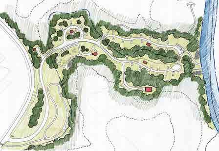
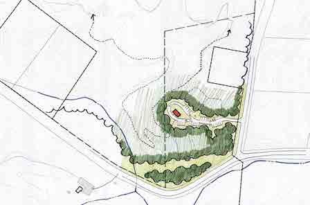
Features:


Option B Vignettes
Program
•Group Camping - 4 sites •Showerhouse Program Features: •Family Camping - 30 sites •3 Showerhouse Facilities •Parking - 20 spaces •River Access with Parking •Ranger Residence •Picnic area •Loop trails along creek SHOWERHOUSE GROUP CAMPINGMOUNTAIN BIKE TRAIL MOORESSPRINGSRD. ED BOOTH ROAD DNP BOUNDARY FAMILY CAMPING SPRING HOUSE HIKING TRAIL RIVER ACCESS WITH PARKING FAMILY CAMPING SPRING HOUSE RANGER RESIDENCE SHOWERHOUSE DAN RIVER SHOWERHOUSE FAMILY CAMPING MAINTENANCE FACILITY MOORES SPRINGSRD. PICNIC AREA N N Moores Springs - Ed Booth Rd Area Group Camping Moores Springs - Former Campground Family Camping HANGING ROCK STATE PARK EXPANSION MASTER PLAN 2017 APPENDIX B: PHASE T WO 61
N
Program Features: •Trailhead Parking - 48 Spaces •Overlooks •Picnic Area •Mountain Bike and Hiking Trails Option B Vignettes - Vade Mecum HIKING-ONLY TRAIL MOUNTAIN BIKE TRAIL P EAST ROAD OVERLOOK OVERLOOK
Vade Mecum - Sunset Point Day Use & No Camping HANGING ROCK STATE PARK EXPANSION MASTER PLAN 2017 APPENDIX B: PHASE T WO 62
Option B Vignettes - Vade Mecum
Program Features:
- 40 spaces
ow parking for large events
biking / Hiking
Restroom
Program Features:

barn preserved as ornamental
- 56 spaces


ow parking for events
- 13 new cabins
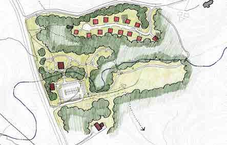
Biking/ Hiking Trailhead
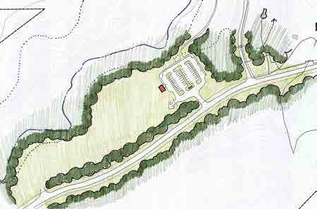
Area, Day Use
Store & Restroom
•Parking
•Over
•Mountain
Trailhead •1
•Horse
•Parking
•Over
•Cabins
•Mountain
•Picnic
•Camp
Facility OVERFLOW PARKING HORSE BARN PICNIC CABINS MOORES SPRINGS RD MOUNTAIN BIKE TRAIL RESTROOMS / CAMP STORE EXISTING MAINTENANCE FACILITY MAJOR TRAILHEAD RESTROOM FACILITY OVERFLOW PARKING MOUNTAIN BIKE TRAIL EXISTING EQUESTRIAN TRAIL HIKING-ONLY TRAIL MOORESSPRINGSRD CAMP SERTOMA RD. N N Vade Mecum - West Trailhead & Over ow Parking Vade Mecum - East Cabins, Day Use, & Trailhead HANGING ROCK STATE PARK EXPANSION MASTER PLAN 2017 APPENDIX B: PHASE T WO 63
N
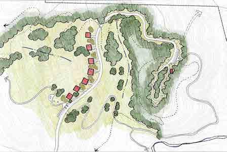
Program Features: •Cabins - 7 new cabins with panoramic views •Family Camping - 8 sites •Restroom Facility •Small Trailhead •New Road Access •Overlook •Mountain bike trails Option B Vignettes - Vade Mecum CABINS FAMILY CAMPING RESTROOM FACILITY PROPOSED ROAD ACCESS HIKING-ONLY TRAIL OVERLOOK MOUNTAIN BIKE TRAIL
Vade Mecum - North Cabins, Road Access,and Family Camping HANGING ROCK STATE PARK EXPANSION MASTER PLAN 2017 APPENDIX B: PHASE T WO 64
Option B Vignettes - Vade Mecum

Program Features:
•Pool - removed, lled in
•Parking - 100 spaces
•Hotel - operated as a hostel, new cafe
- event space
- event space
- Group 3 remains as support facilities for events
amphitheaters - 2 new/2 existing
(Nature Play, Discovery Zone)
N
•Chapel
•Gym
•Cabins
•4
•Playground
VADE MECUM CREEK CABINS (GROUP 3) AMPHITHEATER EXISTING SPRING HOUSE EXISTING DIAMOND LAKE DAM PLAYGROUND HOTEL OPERATED AS HOSTEL GYM OPERATED AS EVENT SPACE AMPHITHEATER CHAPEL OPERATED AS EVENT SPACE RETAINING WALL RETAINING WALL
Vade Mecum - Central Campus Day Use, Event Space, & Hostel HANGING ROCK STATE PARK EXPANSION MASTER PLAN 2017 APPENDIX B: PHASE T WO 65
Option C Overall Plan
Option C included a combination of mountain biking and hiking trails as well as limited accommodations on both properties. No new equestrian trails are proposed in this option.
Proposed Program Features
Trails:
•Mountain biking trails: existing and proposed at Moore Springs only. ~ 14 total miles
•Hiking only trails ~ 11.2 total miles
•Equestrian trails on property south of Moores Springs Road and connection to the Mountains to Sea Trail
Accommodations:
•14 Family Tent Sites on Moores Springs
•16 Primitive Tent Sites on Moores Springs
•Ranger Residence on Moores Springs
•6 Group Tent Sites on Vade Mecum
•Restore 6 cabins on Vade Mecum
•11 new cabins on Vade Mecum
PublicParking
•320 spaces
Recreation Facilities
•Ropes course removed
•Pool removed
•Playground at Moores Springs
•Community Event Space on both Properties
•Dan River Access at Moores Springs
Community Survey Results
is scheme was the preferred option of 8% of people who took the survey.
Legend
Point of Interest
Hiking-Only Trail
Mountain Biking & Hiking Trail
Cabin/ Accommodation
Primitive Camping
Picnicking
Family Camping Community Event Space Playground
Parking Ranger Residence
River Access Amphitheater
Camping Area Day Use Area
Service Road Road
Rich Cove Forest
Piedmont Bottom Land Forest
Signi cant Building
Cabins Parking Crossings
HANGING ROCK STATE PARK EXPANSION MASTER PLAN 2017 APPENDIX B: PHASE T WO 66
POTENTIAL
TRAIL


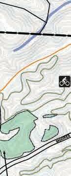


PIEDMONT


MOUNTAINS


OPTION C


OPTION
OPTION C


OVERALL PLAN

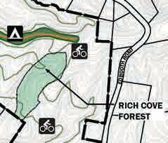


C
Public Meeting June, 2017 HANGING ROCK STATE PARK EXPANSION PHASE TWO Moores Springs & Vade Mecum Master Plan 8% 2000200400600800ft PIEDMONT BOTTOMLAND FOREST RICH COVE FOREST MOORESSPRINGSROAD P EAST ROAD DAN GEORGE ROAD DAN RIVER SOUTH DOUBLE CREEK CASCADE CREEK MECUM CREEK VADE KEATON ROAD PIEDMONT LAND CONSERVANCY PROPERTY MOUNTAINS TO SEA TRAIL CONNECTION EXISTING EQUESTRIAN TRAIL CONNECTION POTENTIAL HIKING TRAIL CONNECTION POTENTIAL HIKING TRAIL CONNECTION
EMPHASIS ON HIKING-ONLY TRAILS WITH LIMITED ACCOMMODATIONS Public Meeting June, 2017 HANGING ROCK STATE PARK EXPANSION PHASE TWO Moores Springs & Vade Mecum Master Plan 2000200400600800
BOTTOMLAND FOREST RICH COVE FOREST RICH COVE FOREST MOORESSPRINGSROAD P EAST ROAD DAN GEORGE ROAD DAN RIVER SOUTH DOUBLE CREEK CASCADE CREEK MECUM CREEK VADE KEATON ROAD PIEDMONT LAND CONSERVANCY PROPERTY
TO SEA TRAIL CONNECTION EXISTING EQUESTRIAN TRAIL CONNECTION POTENTIAL HIKING TRAIL CONNECTION
HIKING
CONNECTION
EMPHASIS ON HIKING-ONLY TRAILS WITH LIMITED ACCOMMODATIONS C APPENDIX B: PHASE T WO 67
This page was intentionally left blank
- Moores Springs


Option C Vignettes
Program Features: •No Public Trailhead Program Features: •Family Camping - 12 sites •2 Restroom Facilities •Parking - 58 spaces •River Access with Parking •Nature Playground •Picnic area •Proposed Shelter and Restroom RANGER RESIDENCE MOORESSPRINGSRD. ED BOOTH ROAD DNP BOUNDARY DAY USE AREA PICNIC RESTROOM SHELTER NATURE PLAYGROUND SPRING HOUSE RIVER ACCESS SPRING HOUSE HIKING TRAIL FAMILY CAMPING RESTROOM FACILITY DAN RIVER MOORES SPRINGSRD. MOUNTAIN BIKE TRAIL N N Moores Springs - Ed Booth Rd Area Ranger Residence Moores Springs - Former Campground Day Use & Family Camping HANGING ROCK STATE PARK EXPANSION MASTER PLAN 2017 APPENDIX B: PHASE T WO 69
Option C Vignettes - Vade Mecum Program Features: •Group Camping - 4 sites •Parking - 40 Spaces •2 Showerhouses GROUP CAMPING MOORESSPRINGSRD EXISTING EQUESTRIAN TRAIL CAMP SERTOMA RD. SHOWERHOUSE Program Features: •Mountain bike and hiking trails •Overlooks •Picnic area OVERLOOK OVERLOOK OVERLOOK MOUNTAIN BIKE TRAIL HIKING-ONLY TRAIL P EAST ROAD N N Vade Mecum - Sunset Point Hike in, Hike out only Overlook Vade Mecum - West Group Camping & Trailhead HANGING ROCK STATE PARK EXPANSION MASTER PLAN 2017 APPENDIX B: PHASE T WO 70
Option C Vignettes - Vade Mecum

Program Features:
barn
-
Store
Biking
Program Features:
•Horse
- preserved as ornamental •Cabins
11 New Cabins •Parking - 56 spaces •Camp
& Restroom Facility •Mountain
/ Hiking Trailhead •Old Caretakers residence converted to Ranger Residence (restored or new) CABINS HORSE BARN RANGER RESIDENCE REFOREST RESTROOMS / CAMP STORE MOORES SPRINGS RD HIKING-ONLY TRAIL MOUNTAIN BIKE TRAIL EX. MAINTENANCE FACILITY
•Hiking only trails •Overlook HIKING-ONLY TRAIL OVERLOOK N N Vade Mecum - East Cabins & Trailhead Vade Mecum - North Trails Only HANGING ROCK STATE PARK EXPANSION MASTER PLAN 2017 APPENDIX B: PHASE T WO 71
Option
-
Mecum
Program Features:
•Pool - removed, lled in
•Parking - 85 spaces
•Hotel - operated as a hostel, new cafe
•Chapel - gift shop & museum
•Gym - event space
•Cabins - 6 existing remain / renovated as accommodations
N
C Vignettes
Vade
VADE MECUM CREEK CABINS (GROUP 2) CABINS (GROUP 3) SPRING HOUSEDIAMOND LAKE DAM HOTEL OPERATED AS HOSTEL GYM OPERATED AS EVENT SPACE CHAPEL OPERATED AS MUSEUM, GIFT SHOP RESTROOM FACILITY RETAINING WALL RETAINING WALL
Vade Mecum - Central Campus Day Use, Event Space, Hostel, & Cabins HANGING ROCK STATE PARK EXPANSION MASTER PLAN 2017 APPENDIX B: PHASE T WO 72
Vignettes - Consistent In All Options
Moores Springs - Primitive Camping
Program Features:
•Proposed Primitive Camping - 10 sites
•Pit Toilet
N
Moores Springs - Dam Area
Mountain Biking Trailhead
Program Features:
- 48 spaces

Shed
Facility
Trails
Trail Connection to Hanging Rock State Park Proper
•Parking
•Bike
•Restroom
•Hiking
•Hiking
PIT TOILET PRIMITIVE CAMPING MOUNTAIN BIKE TRAIL HIKING-ONLY TRAIL PARKING OLD DAM CASCADE CREEK FARMHOUSE / BIKE SHED TRAIL CONNECTION TO HANGING ROCK STATE PARK PROPER MOORESSPRINGSRD ACCESS TO MOORES SPRINGS CAMPGROUND
N
HANGING ROCK STATE PARK EXPANSION MASTER PLAN 2017 APPENDIX B: PHASE T WO 73
Friday, July 14
281 Visitors / 567 Page Views


Tuesday, July 11
280 Visitors / 524 Page Views
* As of 10am, Wednesday, August 9, 2017Website Statistics as of August 9, 2017
Phase Two Community Engagement
Social Media
Social media was an important marketing tool for the promotion of community engagement opportunities throughout the second phase of the project. Facebook was used extensively to promote public meetings, the project website and the online survey that was a major component of the process.
Leading up to the second public meeting, the design team promoted the meeting through its own Facebook account, which had gained many followers interested in the project, and through other groups’ Facebook pages, including:
•Friends of Sauratown Mountains
•Hanging Rock NC (not a liated with the State)
•Hanging Rock State Park (not a liated with the State)
•Hanging Rock – Stokes County, NC Tourism
•Carolina Climbers Coalition

e goal of the marketing was three-fold. e rst goal was to encourage people to attend the community meeting. e second goal was to get people to explore the website and learn more about the project. e third goal was to increase our reach beyond the residents of Stokes County.
Following the public meeting on June 29, 2017, plans and drawings that were presented, along with an online survey to gain additional feedback were posted on the project website. Facebook was used to promote the new material and the survey, using the same methods to promote the meeting. e social media promotions drove large numbers of visitors to the site immediately following the public meeting. Visitorship to the website peaked at 325 visitors the day following the meeting.
64 Followers July 28 Survey Results Posted
4,206 UNIQUE VISITORS 17,302 PAGE VIEWS 499 ONLINE SURVEYS
HANGING ROCK STATE PARK EXPANSION MASTER PLAN 2017 APPENDIX B: PHASE T WO 74
With the plans and drawings posted on the website, the marketing was targeted to soliciting feedback from the community through the online survey. Visitors to the website also were able to leave feedback on the plans through the website, independent of the survey. e survey was open for two weeks and social media was used throughout that time to promote the survey.
Survey results and visits to the website were minimal for the rst week after the public meeting. Trying to boost the number of completed surveys, Facebook blasts were made to various groups toward the end of that week. By the end of the weekend, visits to the website and the number of completed surveys had drastically increased. e number of completed surveys had jumped by nearly 150 through the weekend and the number of visitors to the website more than doubled from the weekend prior.
As the survey was coming to a close, the design team did another Facebook blast, attempting to boost the number of completed surveys. We reached out to the same groups as in previous blasts, but we also reached out to other user groups, including the Fat Tire Society of Greensboro (a mountain bike group) and the NC Horse Council. When the survey closed on July 16, 2017, 499 responses had been logged online and an additional 31 responses were collected from the public meeting, totaling 530 responses during the 17 day period.
Visits to the website peaked for a single day at 281 unique visitors with 567 page views. As to be expected, visits to the website were strongest between July 8, 2017 and July 15, 2017, while the survey was active. Once the survey closed, tra c to the website fell o , but picked up slightly when survey results were posted at the end of July.
STOKESCOUNTY
PIEDMONTNC-MOUNTAINS
COASTOUTSIDENC N/A
NC
NC
Responses 78 (15%) 409 (77%) 16 (3%) 10 (2%) 11 (2%) 6 (1%) 0 100 200 300 400 500 Breakdown of survey participant’s county of residence HANGING ROCK STATE PARK EXPANSION MASTER PLAN 2017 APPENDIX B: PHASE T WO 75
A: EMPHASIS ON


B: EMPHASIS ON MOUNTAIN
EMPHASIS
Survey e following graphics combine the results from the second community meeting and the online survey.
DAY USE ACTIVITIES WITH EQUESTRIAN FACILITIES AND TENT CAMPING - 31%
BIKING, MAJOR EVENT SPACE, VARIETY OF ACCOMMODATIONS - 60% C:
ON HIKING-ONLY TRAILS WITH LIMITED ACCOMMODATIONS WITH LIMITED ACCOMMODATIONS - 8% OVERALL OPTIONS N/A A 163 (31%) B 316 (60%) 41 (8%) 10 (2%) BA C C Survey results of the overall options HANGING ROCK STATE PARK EXPANSION MASTER PLAN 2017 APPENDIX B: PHASE T WO 76


A: DAY USE, POOL OPEN, LIMITED EVENTS - 31% B: DAY USE, EVENT SPACE, HOSTEL - 36% C: DAY USE, EVENT SPACE, HOSTEL, CABINS - 27% 31 Additional Comments A: EQUESTRIAN FACILITY WITH CABINS - 28% B: TRAILHEAD, OVERFLOW PARKING - 60% C: GROUP CAMPING, TRAILHEAD - 8% 26 Additional Comments BB N/A VADE MECUM - WEST Responses 150 (28%) 316 (60%) 21 (4%) 43 (8%) 0 50 100 150 200 250 300 350 ABC A / B: PARKING, TRAILHEAD, OVERLOOK - 70% C: HIKE IN & OUT ONLY, OVERLOOK - 24% 11 Additional Comments BA A: DAY USE, NO CAMPING - 15% B: FAMILY CAMPING - 46% C: DAY USE & FAMILY CAMPING - 34% 14 Additional Comments B N/A Responses 79 (15%) 246 (46%) 180 (34%) 25 (5%) 0 50 100 150 200 250 MOORES SPRINGS - FORMER CAMPGROUND ABC A / N/A Responses 143 372 (70%) 128 (24%) 30 (6%) 0 50 100 150 200 250 300 350 400 VADE MECUM - SUNSET POINT BC VADE MECUM - CENTRAL CAMPUS Responses 165 (31%) 189 (36%) 144 (27%) 32 (5%) 0 50 100 150 200 N/AABC HANGING ROCK STATE PARK EXPANSION MASTER PLAN 2017 APPENDIX B: PHASE T WO 77
FAMILY CAMPING,

A: PRIMITIVE CAMPING - 30% B: CABINS, ROAD ACCESS, FAMILY CAMPING - 57% C: TRAILS ONLY - 10% 16 Additional Comments B N/A 16 (3%) VADE MECUM - NORTH Responses 158 (30%) 301 (57%) 55 (10%) 0 50 100 150 200 250 300 350 ABC A: PARKING, TRAILHEAD - 36% B: GROUP CAMPING - 39% C: RANGER RESIDENCE - 19% 14 Additional Comments BMOORES SPRINGS - ED BOOTH RD AREA N/A Responses 190 (36%) 206 (39%) 103 (19%) 31 (6%) 0 50 100 150 200 250 ABC A:
EQUESTRIAN, DAY USE - 31% B: CABINS, DAY USE, TRAILHEAD - 50% C: CABINS, TRAILHEAD - 15% 14 Additional Comments B N/A Responses 162 (31%) 264 (50%) 80 (15%) 24 (5%) 0 50 100 150 200 250 300 VADE MECUM - EAST ABC HANGING ROCK STATE PARK EXPANSION MASTER PLAN 2017 APPENDIX B: PHASE T WO 78
APPENDIX C
Introduction
With the results from Public Meeting #2 and the online surveys tabulated, the design team began the process of preparing one overall concept option and a single option for each vignette area for consideration by the stakeholders and the community. As a rst step in that process, a presentation of the phase two draft concepts was made to the Friends of Sauaratown Mountains and the Park Advisory Committee. Following that the team conducted a day long charrette at the Hanging Rock Visitor’s Center meeting separately with park rangers and sta , representatives from the Friends of Sauaratown Mountains and members of the Park Advisory Committee. Comments received from these three sessions included the following:
Design Charette with Park Rangers / Staff
•At the Moores Springs campground there was interest in walk-in camp family camp sites.
•Important to separate the river access from the campground. e west side of Cascade Creek seems to favor walk in camping. e east side is more suitable for river access and day use.
•River access needs a road in order to meet the expectations of the community.
• e campground will need a bridge and a 10’ wide path in order to allow for emergency access and maintenance. is path is preferably not paved.
•Moores Springs would be gated. Further clari cation required regarding location of gate.
•Prefer having the hotel be a history museum, possibly for all of Stokes County, and a gift shop and café.
•Turn the cabins into camper cabins rather than the hotel into a hostel.
•Prefer the gym as event space, community space, recreation hall and the chapel as event space for weddings.
•Prefer removal of the pool and to turn that area into a playground or some other use.
•Important to keep group camping away from the river. Potential to attract a rowdy crowd
•Prefer not to have group camping in Vade Mecum West adjacent to Moore Springs Road.
•Prefer not to have mountain bikers on Vade Mecum. De nitely do not want to see single track mountain bike trails on Vade Mecum, could possibly have a connecting multi-use trail.
•Liked the idea of making Vade Mecum for hiker and horse trails.
•State Parks would typically let an area that was logged naturally succeed. e area that was cleared on Vade Mecum may require additional help to stabilize erosion issues prior to letting it succeed.
•Diamond Lake was a 20 acre lake. If it was brought back as a shing lake some of the rangers believe it would be wildly popular.
•Locate and do not disturb cemeteries on Vade Mecum northern ridge, primitive cemetery on western edge of Vade Mecum property.
HARO Park Advisory Committee (PAC)
•Concern was expressed about potential noise from events, and safety issues associated with more tra c on P East given the limited sight distance at the intersection with Moore Springs Road. Modifying that intersection is di cult due to the two cemeteries located on the adjacent corners. e concerns of noise and safety were also relevant to road illustrated in Option B which provided access to northern portion of the Vade Mecum property. Access road was opposed.
•It was expressed that the logged area should be allowed to naturally succeed and remain natural. e state park service doesn’t traditionally cut down trees to maintain a view shed. e parking lot and overlook proposed o P. East Road would disturb the silent, spiritual nature of the place.
•Concern about the impact of trying to add more mountain bike trails on the property to get to 25 mile “magic number”. It was expressed that there should not be mountain bike trails on Vade Mecum
•Concern was also expressed about horses on Vade Mecum from an environmental perspective including erosion and invasive species
•Camping on Moores Springs would satisfy the community’s immediate needs.
•It was noted that Vade Mecum was not built primarily for Stokes County residents and the open house was the rst time some Stokes County residents were able to see it
•Few hikers are comfortable sharing a trail with bikers or horses
APPENDIX B: PHASE T WO 79
PHASE THREE
•Hiking becomes more attractive on this property with more services and amenities
•Hiking trails have the least environmental impact
•Put cabins in areas that are already developed, don’t disturb areas to build cabins

•Possibly have an equestrian vendor that teaches people how to ride. Question about whether this activity would be attractive to people?
•Potential opportunity for parking and trail connection at PLC land located north of the Moores Springs property.
Friends of Sauratown Mountains
•Preserve as much of the history as possible. Belief that coupled with the history and story this property tells, this property would be a draw to visitors because of how busy HARO is.
•It would be nice if the Sauratown Mountain Trail / Mountains to Sea Trail extended through Vade Mecum in order to get more of that trail o the road for safety purposes.
•Endorse the idea of a horse vendor on Vade Mecum


•Endorse the idea of Vade Mecum being a stop-over for the Mountains to Sea Trail
•Noted that Moore Springs Manor ( privately held ) on Hall Road will be providing overnight equestrian facilities
•Use the existing infrastructure as best you can to save money
•Proposed hiking trails would allow for a hiking experience that wasn’t as busy as Hanging Rock proper.
Following the charette, plans were revised and the draft master plan was made available for further community input at an Open House held at the Hanging Rock State Park Visitor’s Center on Saturday September 16th from 10:00AM -2:00 PM. Plans were placed on the project website providing continued opportunity for community input from September 16th thru October 2nd.
YES
OVERALL OPTIONS
EMPHASIS ON MOUNTAIN BIKING, MAJOR EVENT SPACE, VARIETY OF ACCOMMODATIONS
Public Meeting #3
e third and nal public meeting was held at the Hanging Rock State Park Visitor’s Center on a Saturday September 16, 2017 in an attempt to gain a broader response to the plans.
A handout explaining the project and the purpose of the meeting was provided to attendees. Also available was a description of each vignette area and a simple evaluation sheet asking the participants whether or not they supported the concept presented. e evaluation sheet also provided opportunities to submit written comments. e handout included the project website URL.
47 (51%) 45 (49%)
NO HANGING ROCK STATE PARK EXPANSION MASTER PLAN 2017 APPENDIX B: PHASE T WO 80
Social Media


Sauratown
Rock


As with the other phases, social media was used to promote the Saturday morning community event and the online survey. Leading up to the third public meeting, the design team promoted the meeting through its own Facebook account and through other groups’ Facebook pages, including: •Friends of
Mountains •Hanging Rock NC (not a liated with the State) •Hanging
State Park (not a liated with the State) •Hanging Rock – Stokes County, NC Tourism •Carolina Climbers Coalition •NC Horse Council •Piedmont Fat Tire Society •Moores Springs Trails As with the previous phases, the draft master plan, along with an online survey to gain additional feedback, was posted on the project website following the public Responses 0 10 20 30 40 50 60 70 80 STOKESCOUNTYNC-PIEDMONTNC-MOUNTAINSNC-COASTOUTSIDENC 20 (22%) 69 (75%) 1 (1%) 1 (1%) 1 (1%) Breakdown of survey participants’ county of residence October 30, 2017 ROCK STATE PARK EXPANSION & Vade Mecum Properties PUBLIC MEETING #3 SURVEY RESULTS MECUM - CENTRAL CAMPUS SPACE, CABINS, TRAILHEAD Additional Comments MECUM - NORTH PRIMITIVE CAMPING, TRAILS Additional Comments VADE MECUM - WEST OVERFLOW PARKING 6 Additional Comments VADE MECUM - EAST EQUESTRIAN FACILITIES, FAMILY CAMPING, CABINS 21 Additional Comments MOORES SPRINGS - CAMPGROUND DAY USE, FAMILY CAMPING 24 Additional Comments MOORES SPRINGSED BOOTH RD / DAM TRAILHEAD PARKING 23 Additional Comments (75%) 20 (25%) 60 (67%) 30 (33%) 67 (74%) 23 (26%) 67 (74%) 23 (26%) 78 (89%) 10 (11%) YES YES YES 66 (74%) 23 (26%) YES YES HANGING ROCK STATE PARK EXPANSION Moores Springs & Vade Mecum Properties VADE MECUM - CENTRAL CAMPUS EVENT SPACE, CABINS, TRAILHEAD 17 Additional Comments VADE MECUM - NORTH PRIMITIVE CAMPING, TRAILS 16 Additional Comments VADE MECUM - WEST OVERFLOW PARKING 6 Additional Comments VADE MECUM - EAST EQUESTRIAN FACILITIES, FAMILY CAMPING, CABINS 21 Additional Comments MOORES SPRINGS - CAMPGROUND DAY USE, FAMILY CAMPING 24 Additional Comments MOORES SPRINGSED BOOTH RD / DAM TRAILHEAD PARKING 23 Additional Comments 69 (75%) 60 (67%) 67 (74%) 23 (26%) 67 (74%) 23 (26%) 78 (89%)YES YES 66 (74%) 23 (26%) YES YESYES Raleigh Team presentation | October 30, 2017 HANGING ROCK STATE PARK EXPANSION Moores Springs & Vade Mecum Properties PUBLIC MEETING VADE MECUM - CENTRAL CAMPUS EVENT SPACE, CABINS, TRAILHEAD 17 Additional Comments VADE MECUM - NORTH PRIMITIVE CAMPING, TRAILS 16 Additional Comments VADE MECUM - WEST OVERFLOW PARKING 6 Additional Comments VADE MECUM - EAST EQUESTRIAN FACILITIES, FAMILY CAMPING, CABINS 21 Additional Comments 69 (75%) 20 (25%) 67 (74%) 23 (26%) 67 (74%) 23 (26%) 78 10 (11%) YES YES YESYES Raleigh Team presentation | October 30, 2017 HANGING ROCK STATE PARK EXPANSION Moores Springs & Vade Mecum Properties PUBLIC MEETING #3 VADE MECUM - CENTRAL CAMPUS EVENT SPACE, CABINS, TRAILHEAD 17 Additional Comments VADE MECUM - NORTH PRIMITIVE CAMPING, TRAILS 16 Additional Comments VADE MECUM - WEST OVERFLOW PARKING 6 Additional Comments VADE MECUM - EAST EQUESTRIAN FACILITIES, FAMILY CAMPING, CABINS 21 Additional Comments 69 (75%) 20 (25%) 67 (74%) 23 (26%) 67 (74%) 23 (26%) 78 (89%) 10 (11%) YES YES YESYES Combined results of the survey (online and in-person) HANGING ROCK STATE PARK EXPANSION MASTER PLAN 2017 APPENDIX B: PHASE T WO 81
HANGING ROCK STATE PARK EXPANSION MASTER PLAN 2017 APPENDIX B: PHASE T WO 82
