fonta flora state trail master plan lake james to morganton


FONTA FLORA STATE TRAIL LAKE JAMES TO MORGANTON MASTER PLAN DESTINATION BY DESIGN PLANNING, LLC 815 W. KING STREET, SUITE 2 BOONE, NORTH CAROLINA 28607 828.386.1866 WWW.DBDPLANNING.COM PRODUCED FOR: PRODUCED BY:

ACKNOWLEDGMENTS
BURKE COUNTY
Jeffrey C. Brittain, PE, Chairman
Johnnie Carswell, Vice Chairman
Maynard M. Taylor, Commissioner
Wayne F. Abele, Commissioner
Scott Mulwee, Commissioner
Bryan Steen, County Manager
Scott Carpenter, AICP, Deputy County Manager & Community Development Director
Shane Prisby, Community Development Operations Manager
NATIONAL PARK SERVICE
John Slaughter, Group
Superintendent,
Southern Campaign of the American Revolution Parks Group
Benjamin Richardson, Chief of Planning and Partnerships, Southern Campaign of the American Revolution Parks Group
CITY OF MORGANTON DEVELOPMENT AND DESIGN SERVICES
Phillip Lookadoo, AICP, Director
Mark Young, PE, City Engineer
Michael Berley, Project Designer
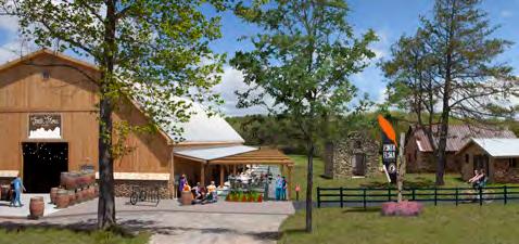
FONTA FLORA BREWERY
Todd Boera, Co-Owner and Head
Brewer
Mark Bennett, Co-Owner
David Bennett, Co-Owner
TABLE OF CONTENTS INTRODUCTION & BACKGROUND 1 Purpose and Background ……………………………………………………… 2 Previous Planning Efforts ……………………………………………………… 3 Vision Statement ……………………………………………………………………… 4 Trail Benefits …………………………………………………………………………… 5 Plan Organization …………………………………………………………………… 6 CHAPTER 1: EXISTING CONDITIONS, ANALYSIS, 7 & PRELIMINARY ALIGNMENTS Study Area Description …………………………………………………………… 8 Study Area Major Features ……………………………………………………… 9 Natural Environment …………………………………………………………… 10 Cultural Resources ………………………………………………………………… 12 Built Environment ………………………………………………………………… 13 Preliminary Route Alternatives: Map & Photo Series ………… 17 CHAPTER 2: LANDOWNER OUTREACH 25 Identifying the Landowners ………………………………………………… 26 Landowner Workshop ………………………………………………………… 27 Trail Route Re-evaluation……………………………………………………… 28 CHAPTER 3: TRAIL CHARACTER & 29 DESIGN GUIDELINES Sustainable Trail Design ……………………………………………………… 30 Trail Construction ………………………………………………………………… 32 Trail Types ……………………………………………………………………………… 33 Trail Profile …………………………………………………………………………… 36 Trail Support Facilities ………………………………………………………… 38 Social Media Marketing ………………………………………………………… 41 CHAPTER 4: RECOMMENDATIONS 43 Planning Sections Overview ………………………………………………… 44 Trail Section Recommendations ………………………………………… 46 CHAPTER 5: IMPLEMENTATION 69 Implementation Details by Section and Responsibility ……… 70 Priority Implementation Areas and Responsibilities ………… 71 Trail Rubicon ………………………………………………………………………… 71 Trail Support Spectrum ………………………………………………………… 73 Trail Management ………………………………………………………………… 74 APPENDIX I (A-1) Implementation Budget ………………………………………………… II (A2) Funding Sources …………………………………………………………… III
LIST OF MAPS Map 1: General Study Area ……………………………………………………… 8 Map 2: Study Area 1 Site Analysis ………………………………………… 18 Map 3: Study Area 2 Site Analysis ……………………………………… 20 Map 4: Study Area 3 Site Analysis ……………………………………… 22 Map 5: Landowner Parcels …………………………………………………… 26 Map 6: Trail Route Re-Evaluation ………………………………………… 28 Map 7: Planning Sections …………………………………………………… 44 Map 8: Planning Section 1 …………………………………………………… 47 Map 9: Planning Section 2 …………………………………………………… 59 Map 10: Planning Section 3 ………………………………………………… 63 Map 11: Planning Section 4 …………………………………………………… 65
LIST OF EXHIBITS EXHIBIT 1: Brewing Up Adventure ……………………………………… 49 EXHIBIT 2: Canal Bridge ……………………………………………………… 50 EXHIBIT 3: Canal Bridge Trailhead ……………………………………… 52 EXHIBIT 5: Lake James Family Campground ……………………… 54 EXHIBIT 5: N. Powerhouse Crossing …………………………………… 55 EXHIBIT 6: Bridgewater ……………………………………………………… 56 EXHIBIT 7: Off the Road Again @ Powerhouse ………………… 60 EXHIBIT 8: Watermill River Access Enhancements …………… 62 EXHIBIT 9: Get Down with the Trail Town …………………………… 66
INTRODUCTION AND BACKGROUND


THE EASTERN-MOST SEGMENT OF THE FONTA FLORA STATE TRAIL EXTENDS FROM LAKE JAMES TO MORGANTON.
This trail master plan serves as a road map for establishing the Fonta Flora State Trail from Lake James, in Burke County, to the City of Morganton. This chapter provides an overview of previous planning efforts and their goals.
IN THIS CHAPTER:
AND BACKGROUND
PLANNING EFFORTS

1
A| PURPOSE
B| PREVIOUS
C| VISION STATEMENT D| TRAIL BENEFITS E| PLAN ORGANIZATION
PURPOSE & BACKGROUND

The Fonta Flora State Trail finds its origins in the desires of Burke County citizens to increase quality of life for residents, provide a recreational amenity for visitors and the region’s diverse population, and provide public access to the area’s cultural and nat ural resources.
In 2015, the North Carolina General Assembly ap proved legislation to establish the Fonta Flora State Trail. Upon completion, the proposed trail will extend from Asheville to Mor ganton connecting Mar ion, Old Fort, and Black Mountain.
Burke County is a leading agency in the establish ment of the Fonta Flora State Trail. Following the adoption of a master plan in 2016, the County part nered with the NC Division of State Parks and Duke Energy to complete 10 miles of trail in 2017. The County is now beginning construction on another 10 miles that will eventually encircle Lake James to
LEGISLATION WAS SIGNED INTO LAW BY GOVERNOR MCCRORY IN SUMMER 2015 THAT MAKES THE FONTA FLORA STATE TRAIL THE LATEST ADDITION TO NORTH CAROLINA’S STATE PARK SYSTEM.
complete Section 2 of the state trail. Also in 2017, Burke County opened a new trailhead featuring custom trail facilities and artistic signage. Addition ally, a master plan is currently in development for Section 3 from Lake James to Marion.
Financial support from Duke Energy continues to advance the project with $1.1 million in grants com mitted to the development of the Fonta Flora State Trail and Overmountain Victory National Historic
Trail (OVNHT). Financial resources will be released from Duke Energy now that the Federal Energy Regulatory Commission has approved the compa ny’s re-licensing to operate its hydroelectric power plants along the Catawba River.
This plan addresses Section 1 of the Fonta Flora State Trail from Lake James to Morganton. This sec tion is unique in that it coincides with a segment of the OVNHT.
FONTA FLORA STATE TRAIL: LAKE JAMES TO MORGANTON MASTER PLAN2
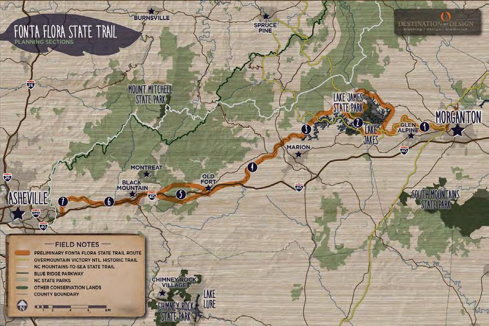
1 5 6 7 2 3 4 MORGANTON >> LAKE JAMES LAKE JAMES LAKE JAMES >>MARION MARION >> OLD FORT DEPOT OLD FORT DEPOT >> BLACK MOUNTAIN DEPOT BLACK MOUNTAIN DEPOT >> WARREN WILSON COLLEGE WARREN WILSON COLLEGE >> ASHEVILLE PLANNING SECTIONS
PREVIOUS PLANNING EFFORTS

Overmountain Victory National Historic Trail Master Plan (OVNHT): Lake James to Morganton


In 2015, Burke County developed a comprehensive trail master plan for the OVNHT along the Catawba River corridor from Lake James to Morgan ton. The National Park Service provided financial assistance for plan development. The OVNHT over laps with the southern portion of the FFST at Lake James and as the trail extends to Morganton. Por tions of the trail systems at both Lake James and the Catawba River Greenway in Morganton are cer tified as part of the Overmountain Victory National Historic Trail. The OVNHT Lake James to Morganton Master Plan serves as the foundation of the Fonta Flora State Trail Lake James to Morganton Master Plan.
Fonta Flora State Trail Master Plan: Lake James Section


The Fonta Flora State Trail Master Plan: Lake James Section was com pleted in 2016. The plan provided a major update to the Lake James Loop Trail Master Plan published by Burke County in 2014. This sec tion of the Fonta Flora State Trail will ultimately en circle Lake James with a continuous 30-mile stateof-the-art hiking and biking nature trail. As a state trail, the loop is now under the purview of the NC Division of Parks and Recreation as an official unit of the State Parks system.
Lake James Loop Trail Master Plan

Since 2005, the Burke County Plan ning Department has led efforts to plan for and es tablish a loop trail around Lake James that would provide for a family and lei sure trail experience while protecting the natural environment.
In early 2013, the Burke County Community Devel opment Director began a new planning effort to jumpstart the Loop Trail initiative and promoted the project to the top of the department’s priority list. In September 2013, a diverse stakeholder work group met to begin creating the Lake James Loop Trail Master Plan to serve as a guide for the devel opment, management, and implementation of the trail.
The Lake James Loop Trail Master Plan, published in 2014, outlined an easy to moderate 30 mile multiuse hiking and biking trail with a natural mineral soil surface. The plan recommended an average trail width of five feet wide and overall average grade of 5% or less.
3INTRODUCTION AND BACKGROUND
LAKE JAMES LOOP TRA L MASTER PLAN 2014 LAKE JAMES MORGANTON keep the story alive SUMMER 2015 fonta flora state trail master plan lake james section BURKE COUNTY, NC UPDATED SPRING, 2016
VISION STATEMENT

The Fonta Flora State Trail will provide pedestrians and bicyclists of all abilities a safe and legal route that will eventually extend from Morganton to Asheville. The trail will allow users to experience the natural diversity of the area, incorporate multiple access points and support facilities, create a community and region al asset that will provide for recreation opportunities for local residents and visitors, and promote tourism and low-cost economic development for Burke County and the surrounding region.
PLAN GOALS
Refined and Specific Trail Routes. Using the 2015 OVNHT Lake James to Morganton Master Plan as its foundation, this plan further re fines the trail route to reflect new opportunities and re-engages land owners.
Landowner Outreach. Make a direct appeal to landowners identified during the analysis and record their sentiment for providing a trail ease ment.
Trail Character. Develop designs and trail support facilities that incor porate both the OVNHT and FFST brands.
Visual Plan. Create a visual plan that utilizes renderings and schemat ics to demonstrate trail character.,

WHAT IS A STATE TRAIL?
STATE TRAILS
The State Parks Act (GS 113-44.9) defines the types of units in the NC State Parks System to include State Parks, State Natural Areas, State Recreation Areas, State Trails, State Rivers and State Lakes. Fonta Flora is a State Trail.
The difference between a State Park and a State Trail is that a State Park is operated and managed by the Division of Parks and Recreation, but a State Trail represents a partnership among multiple agencies, landowners and local governments, working together to implement a shared vision. Working together on a connected State Trail is a way for communities to leverage their investments in trails to maximize the value for their citizens. Sections of a State Trail on state park property may be managed by the Division of Parks and Recreation, but sections of the trail that cross property controlled by others will continue to be built, maintained and managed by those other landowners.
A State Trail is comprised of multiple connected sections, and each section of the trail is sponsored by a state or federal agency, local government, or landowner. Overall trail corridor planning and coordination are the responsibility of the Division of Parks and Recreation, but each section of the trail will be planned, built and managed in accordance with the needs and wishes of each local section sponsor. DPR will provide guidance, coordination and assistance for the multiple section sponsors whose individual and diverse sections link together to form the State Trail.
SECTION – A portion of the trail within the jurisdictional boundaries of a single agency or organization, who serves as the sponsor of that section.
SECTION SPONSOR – Any agency or organization that owns the land the trail uti lizes and that enters into an agreement with the Division of Parks and Recreation to maintain their section of trail as a part of the State Trail. The section sponsor, in coordination with adjoining section sponsors, is responsible for the design, con struction, maintenance and management of the trail within their section, including its location, appearance, surface, uses, and amenities. Section sponsors retain authority on lands under their jurisdiction. Section sponsors are encouraged to showcase places of natural, scenic, historic, and cultural significance; to feature the diversity of natural communities and landscapes in the state; and to consider the needs of both long and short distance trail users.
FONTA FLORA STATE TRAIL: LAKE JAMES TO MORGANTON MASTER PLAN4
1 2 3 4
TRAIL BENEFITS
ECONOMIC

There is no question that countless communities across America have ex perienced significant economic growth from a result of trail and greenway infrastructure. Be low are a few examples of such impacts: Pedestrian and Bicycle Infrastructure: A National Study of Employment Impacts (2011)
• Evaluated 58 separate projects in 11 cities
• Multi-use trails (e.g., greenways) create 9.6 jobs per $1 million invested East Central Florida Regional Planning Council; Economic impact of Orange County trails (2013)
• Little Econ Greenway (7.4 miles); West Orange (20 miles); and Cady Way Trails (7.2 miles) in Orange County, Florida
• Supported 516 jobs and had an estimated pos itive economic impact of $42.6 million on the area

• Nearby Downtown Winter Garden (pop. 37k) = $14.6M Revenues


Year 3 Economic Impact of Swamp Rabbit Trail (2014)

• Swamp Rabbit = 20 miles (Greenville, NC to Travelers Rest)
• $6.7 Million Virginia Creeper Trail, Damascus, VA
• 34 mile rail-trail
• Direct economic impact approximately $3 mil lion a year
HEALTH
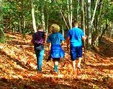
Trails and greenways provide an attractive, safe, and accessible low- or nocost place to walk, hike, jog, or bicycle. More parks and green spaces lead directly to more physical activity by citizens. This gives people of all ages an opportunity to incorporate exercise into their daily routines.
ENVIRONMENTAL
Trails and greenways protect important habitat, improve water quality, and pro vide corridors for wildlife. By protecting land along rivers and streams, greenways help filter pollution caused by agricultural and road runoff. These areas can often serve as natural floodplains. Also, trails and greenways can serve as hands-on environmental classrooms.
EDUCATIONAL
The Fonta Flora State Trail will provide for a variety of educational opportu nities. A significant portion of the trail will pass through Lake James State Park, which will pro vide an educational experience about natural habitats and native flora and fauna from throughout the region. Since this trail coincides with portions of the Over mountain Victory National Historic Trail, users have the opportunity to learn about the Overmountain Men and their impact on the Revolutionary War. Other opportunities exist to learn about hydroelectric dams, bicycle safety, wilderness medicine, and search and rescue.
RECREATIONAL

The recreational benefits offered by the Fonta Flora State Trail will complement existing opportunities found in the area at Lake James State Park, NCWRC Game Lands, Linville Gorge, Ca tawba River, and adjoining US Forest Service lands.
The Fonta Flora State Trail will anchor a host of recreation offerings. Foremost, this trail offers the unique opportunity to separate automobiles from cyclists to circumnavigate the Lake, thereby creating a safe and scenic destination for cycling enthusiasts. This plan also calls for a new boat launch, camping and cabin facilities, fishing access areas, and over 25 miles of trails, boardwalks, and bridges. All of these additional rec reational opportunities will be beneficial for personal, community, and business development.
TRANSPORTATION
Trails and greenways serve as a crucial element within a regional multi-modal transportation system. These facilities provide efficient and safe connectors among civic, commercial, and res idential land uses. The Fonta Flora State Trail will help create these connections and play a central role in establishing a regional trail network that will ultimately include the NC Mountains-to-Sea Trail, Overmountain Victory National Historic Trail, Upper Catawba River Trail, and other local connecting trails.
5INTRODUCTION AND BACKGROUND 5
PLAN ORGANIZATION

EXISTING CONDITIONS, ANALYSIS, AND PRELIMINARY ALIGNMENTS
This chapter provides a comprehensive overview and anal ysis of the opportunities and constraints found throughout the study area. The analysis begins with a brief description of the study area followed by a comprehensive discussion of the natural and built environments and their implica tions for trail suitability, trail design features, permitting, and costs. This chapter concludes with a map and pho tographic series that highlights a host of preliminary trail route alternatives.

LANDOWNER OUTREACH
Significant efforts were made to reach out to landowners where the preliminary analysis indicates that the trail is most suitable. This chapter describes the landowner outreach process and provides highlights from the landowner workshop meetings.

TRAIL CHARACTER AND DESIGN GUIDELINES
This chapter is dedicated to visually defining the various trail types to be used throughout the corridor. Design con cepts are provided for trail user orientation signage, mile markers, and other support facilities. Social Media is ex plored as a mechanism for trail promotion and marketing.

IMPLEMENTATION


Additionally, this chapter identifies focus ar eas for development that will serve as catalyst projects for completing the trail.

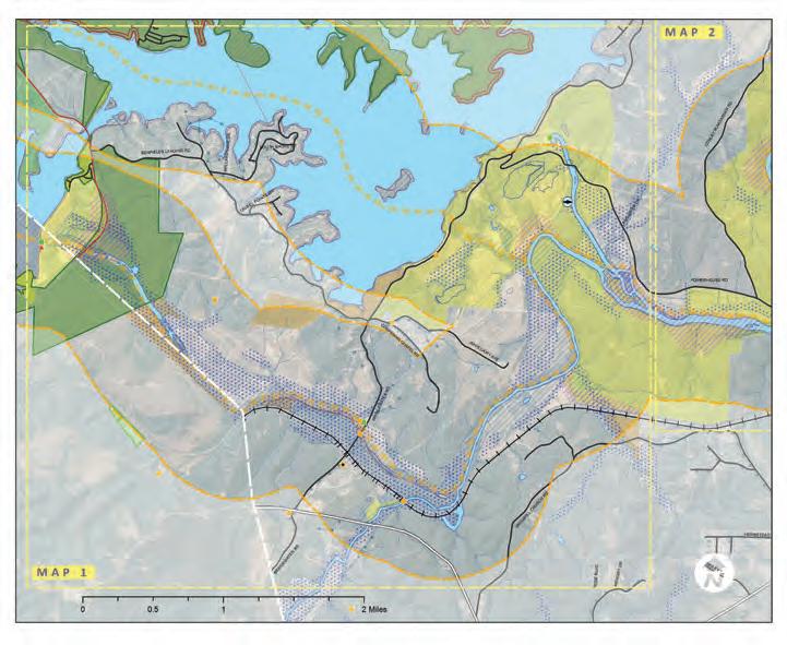
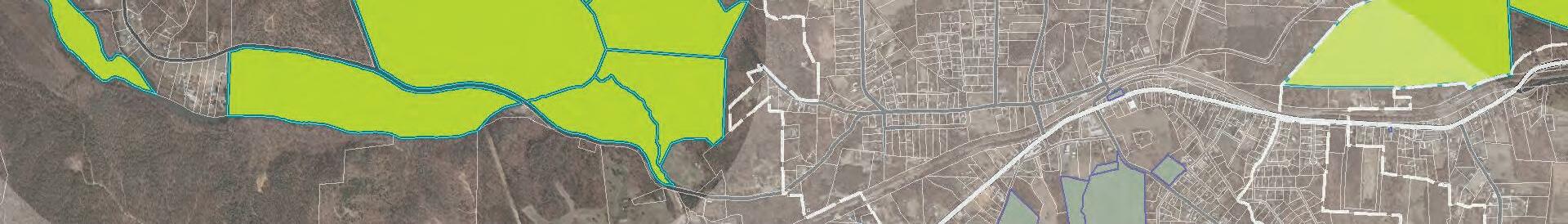
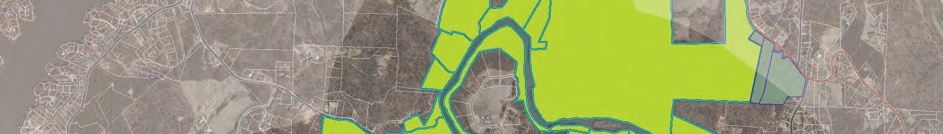
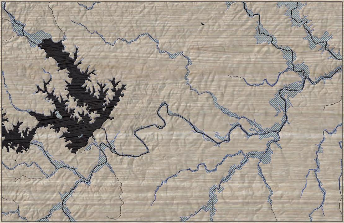
FONTA FLORA STATE TRAIL: LAKE JAMES TO MORGANTON MASTER PLAN6 CHAPTER 5. TRAIL FEATURES FIELD NOTES LANDOWNER SENTIMENT ROAD CROSSING PUBLIC LAND NO NO RESPONSE COMPLETED FFST PROPOSED FFST ON EXISTING LOCAL TRAIL ALTERNATE TRAIL ROUTE TRAILS # # N0 1/8 1/4 1/2 MI. 3 2 AT HISTORIC WHIPPOORWILL DAIRY BRIDGE EXISTING CANAL BRIDGE PUBLIC ACCESS AND TRAILHEAD OLDCATAWBARIVER CATAWBARIVER LAKE JAMES FAMILY CAMPGROUND PRIMITIVE CAMPING AT VISTA EXISTING CANOE PORTAGE TRAIL EXISTING OVNHT 126 LAKE JAMES 1 2 126 FONTA FLORA STATE TRAILFUTURE COVE BRIDGE LAKEJAMESSTATEPARK BRIDGEWATER RIVER ACCESS EXISTING HOLLY DISCOVERY TRAILHEAD LINVILLE DAM TRAILHEAD FONTA FLORA LAKEJAMESLOOP LAK EFORREST HOLIDA H RE LAURELPOINTEHEMLOCK COTT ARK POWERHOUSE N POWERHOUSE WATERFORD SLEEPY HOLLOW WH PPORW LL HO L W LANCASTER DUCKWORTH LONC GA NER BE F EL SLANDING FUTURE BENFIELDS POCKET PARK RAY’S DAIRY TRAILHEAD FONTA FLORA BREWERY POWERHOUSE RD. CHAPTER 4. RECOMMENDATIONS This chapter is organized according to four (4) planning sections. Each planning section description includes a map that identifies a preferred alignment. Each planning section further incorporates the analysis and design elements from the previous chapters along with a host of supporting ren derings and design schematics.
This chapter summarizes details for each planning section and establishes responsibilities and priorities for trail im plementation.
Bridgewater Powerhouse NPOWERHOUSE RD BENFIELDSLANDINGRD NPOWERHOUSERD Lake James Paddy Creek Dam 70 Lake James State Park Lake James State Park ReedyCreek OldCatawbaRiver 10 9 10 8 3 15 11 9 8 MAP 2 Element Occurrence: Element Occurrence: Lake James Loop TrailLakeJamesLoopTrail NorfolkSouthernRR Catawba River Dam and Truss Bridge Historic Bridge Muddy Creek Historic RR Bridge BURKE COUNTYMCDOWELL COUNTY NC 126 Lake James State Park 7 5 6 6 10 10 13 14 1 12 Bridgewater Fishing Access Lake James Family Campground 16 START OF STUDY AREA @WHIPPOORWILL CHAPTER I. CHAPTER 2. CHAPTER 3.
EXISTING CONDITIONS, ANALYSIS, AND PRELIMINARY ALIGNMENTS
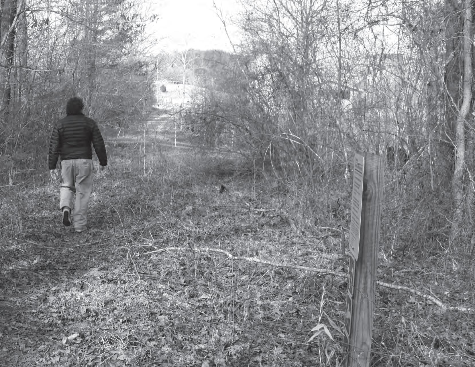
THIS SECTION OF THE FONTA FLORA STATE TRAIL HAS A SIGNIFICANT NATURAL AND CULTURAL HISTORY INCLUDING A SHARED ALIGNMENT WITH THE OVERMOUNTAIN VICTORY NATIONAL HISTORIC TRAIL.
The analysis begins with a brief description of the study area followed by a comprehensive discussion of the natural and built environments and cultural resources and their implications for trail suitability, design features, permitting, and costs. This chapter concludes with a map and photographic series that highlights a host of preliminary trail route alternatives.
IN THIS CHAPTER:
AREA DESCRIPTION
AREA MAJOR FEATURES
ENVIRONMENT
RESOURCES
ROUTE
7
A| STUDY
B| STUDY
C| NATURAL
D| CULTURAL
E| BUILT ENVIRONMENT F| PRELIMINARY
ALTERNATIVES: MAP & PHOTO SERIES 1
STUDY AREA DESCRIPTION
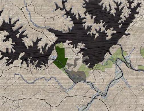
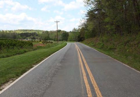
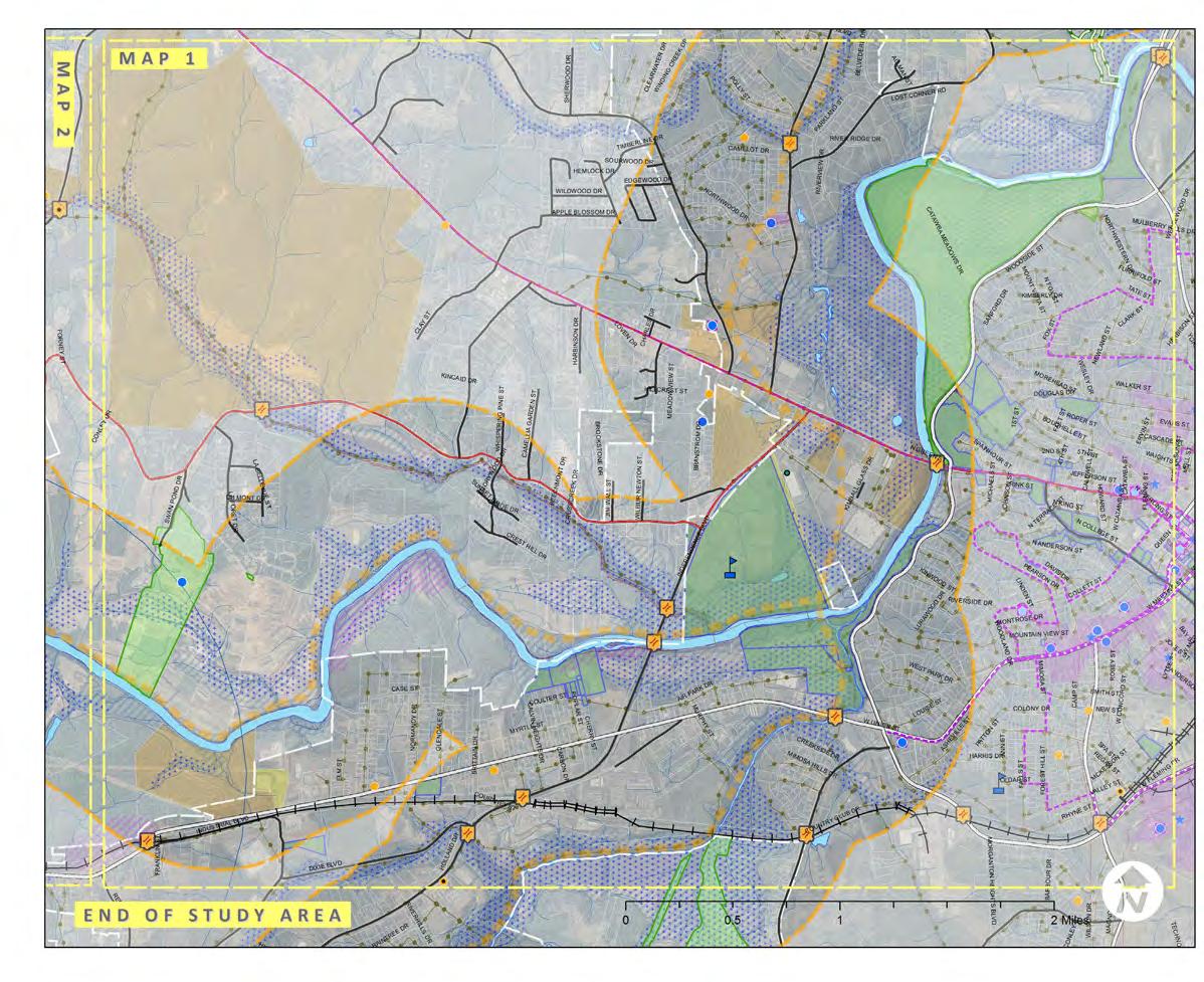
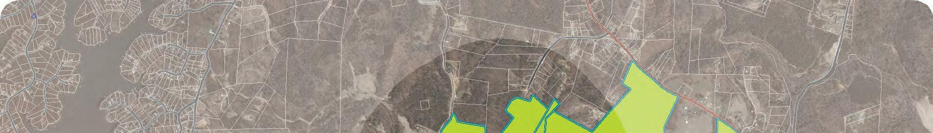
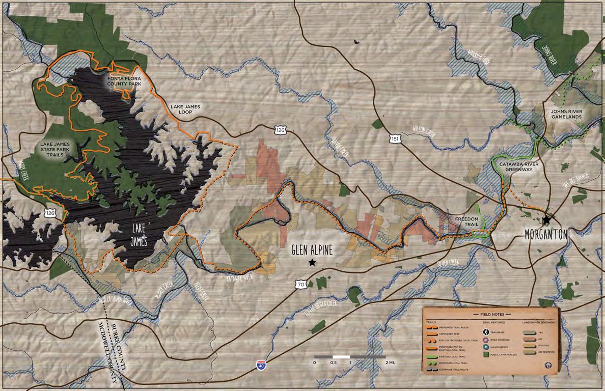
THE LAKE JAMES TO MORGANTON FFST STUDY AREA IS ONE MILE WIDE AND EXTENDS APPROXIMATELY 20 MILES FROM THE FONTA FLORA BREWERY AT WHIPPOORWILL FARM TO DOWNTOWN MORGANTON.
The Lake James to Morganton FFST study area is one mile wide and extends approximately 20 miles from the Fonta Flora Brewery at Whippoorwill Farm on Highway 126 to Downtown Morganton.
Starting at the Fonta Flora Brewery at Whippoorwill Farm adjacent to Lake James State Park, the corridor extends east through large tracts of rural agricultural land primarily owned by two landowners: Duke Ener gy and Crescent Resources, which continue to partner with Burke County to provide easements and fi nancial support for the FFST and OVNHT.
The planning corridor follows the Catawba River east, transitioning to a mix of large tracts of privately owned land and residential subdivisions. Located on


the south side of the Catawba River is Glen Alpine, a small municipality whose jurisdiction intersects with portions of the study area.
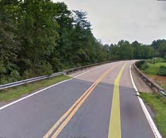
The Upper Catawba River Trail, which provides for a series of river access areas throughout the study area, serves as a foundation for the river’s recreation offerings. Land parcels become smaller as the corri dor continues toward the City of Morganton before reaching the 3.8-mile Catawba River Greenway, which is officially designated as part of the Overmountain Victory National Historic Trail.
The FFST extends from the Catawba River Greenway to downtown Morganton via a future greenway con nector planned by the City of Morganton.
FONTA FLORA STATE TRAIL: LAKE JAMES TO MORGANTON MASTER PLAN8 MCDOWELL COUNTY BURKE COUNTY 0 0.5 1 2 MI. CANOECREEK REEDYCREEK PADDY CREEK SILVER CREEK BAILEY FORK JOHNSRIVERWA IORFORK PEEDEBRANCH LI LESILVER CREEK MUDDYCREEKOLD CATAWBA RIVER WILSONCREEK CATAWBA RIVER MORGANTON GLEN ALPINE LAKE JAMES JOHNS RIVER GAMELANDS LAKE JAMES STATE PARK TRAILS EXISTING OVNHT FONTA FLORA COUNTY PARK CATAWBA RIVER GREENWAY FONTA FLORA STATE TRAIL FREEDOM TRAIL 70 126 126 181 40 UDY AREA
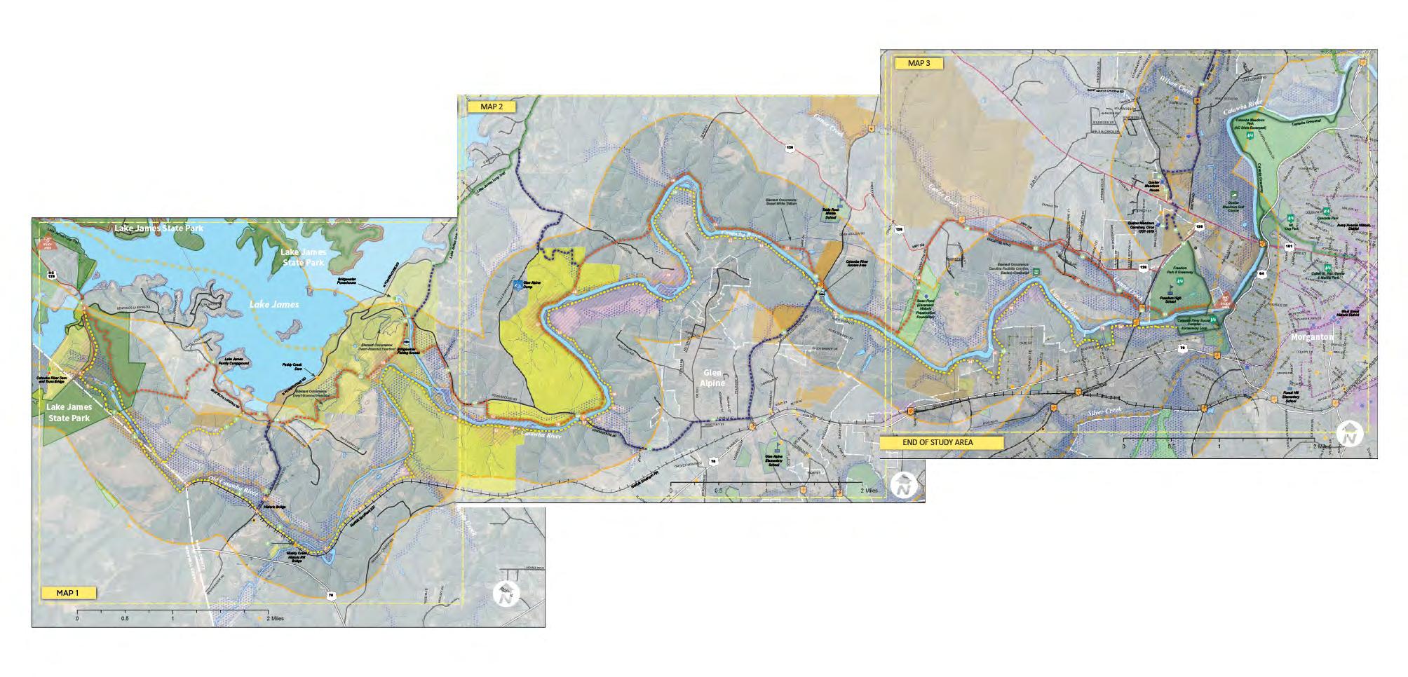
MAP 1: GENERAL STUDY AREA
STUDY AREA MAJOR FEATURES
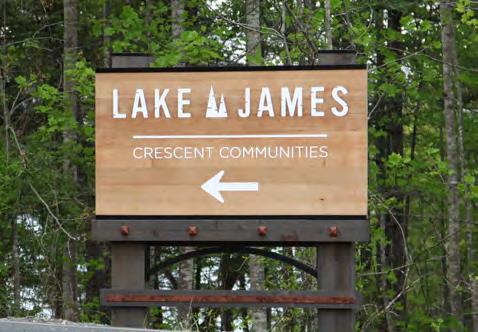
LAKE JAMES
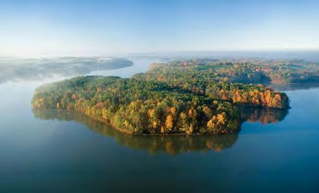
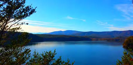
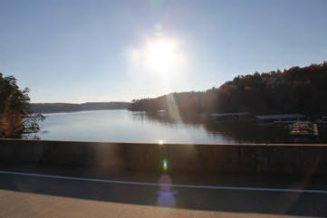
Lake James is a large reservoir located in the foothills of Western North Carolina which straddles the border be tween Burke and McDowell Counties. This 6,812 acre im poundment was created between 1916 and 1923 to pro duce hydroelectric power for the small towns of Marion and Morganton. Low density zoning requirements help to ensure that areas around the lake will be carefully man aged and developed. Lake James offers residents and vis itors opportunities to boat, fish, swim, and participate in other water-based activities.
Lake James contains 10.2 square miles of surface area and more than 150 miles of shoreline. The average depth of the Lake is 65 feet with a maximum recorded depth of 120 feet. At an elevation of approximately 1,200 feet, Lake James is located within the Catawba River basin.
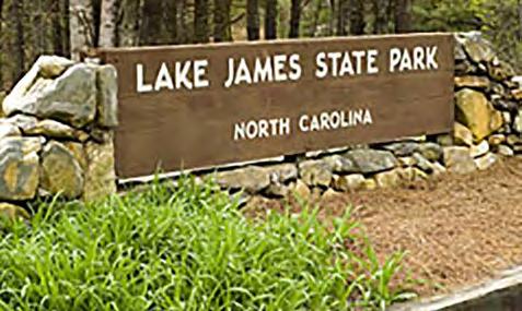
LAKE JAMES STATE PARK
Lake James State Park is one of the most recent addi tions to the North Carolina State Parks system. It was es tablished in 1987 by the North Carolina General Assembly when funds were appropriated for the purchase of 565 acres of land and the initial phase of facility development in McDowell County. In 2004, Lake James State Park ac quired an additional 2,915 acre tract from Crescent Re sources Inc. in Burke County. This purchase expanded the state park to six times its former size and protected more than 30 miles of shoreline. The state park offers opportu nities for hiking, mountain biking, picnicking, nature obser vation, swimming, and canoeing. A section of the Fonta Flora State Trail that is currently under construction will meander through the park and provide trail users the op portunity to take advantage of traditional state park facil ities and services.
OVERMOUNTAIN VICTORY NATIONAL HISTORIC TRAIL
The Overmountain Victory National Historic Trail (OVN HT) is part of the National Park Service’s National Trails System. It recognizes the patriot militia from Virginia, Ten neessee, North Carolina, and South Carolina who crossed the Appalachian Mountains to fight and win at the Battle of Kings Mountain during the Revolutionary War in pres ent-day South Carolina.
The trail network consists of a 272-mile corridor, including a 70-mile branch from Elkin, North Carolina, that joins the main route at Morganton, North Carolina. Sixty-five miles of OVNHT are officially developed for public use, and de velopment continues on the remaining sections. The offi cial sections of the trail were established through agree ments with landowners and land managers and often have overlapping designations. All officially certified segments are identified by signs displaying the trail logo (an Over mountain man in profile on a brown and white triangle) or a white triangular blaze.
This master plan proposes a shared alignment of the FFST and OVNHT from Lake James to the Catawba River Gre enway in Morganton, a certified segment of the OVNHT. Currently, 5.5 miles of OVNHT are certified in Burke Coun ty. Based on this master plan and the OVNHT companion plan for the same study area, approximately 20 new miles along the Catawba River could be completed.
The OVNHT is a cooperative effort of the National Park Service, U.S. Forest Service, U.S. Army Corps of Engineers, Overmountain Victory Trail Association, local govern ments, local citizens’ associations, local historical societ ies, and the states of Virginia, Tennessee, North Carolina, and South Carolina.
9CHAPTER 1: Existing Conditions, Analysis, and Preliminary Alignments
NATURAL ENVIRONMENT
STEEP SLOPES
Much of the corridor has gently rolling topography. The most challenging slopes are along the banks of the Catawba River near the Glen Alpine area and Lake James. The trail should be designed for grades under 5% slope when possible. Natural sur face trails can vary up to 10% slope while maintain ing sustainable design. Alignments proposed in this plan should be designed with these guidelines and may require a larger corridor to incorporate a more gradual trail grade.
FLOODPLAINS
Floodplain areas provide both an opportunity and constraint for trail development. Since traditional development is often not suitable within floodplain areas, private landowners may be more willing to provide access for public trails within these areas. Also, these scenic areas attract wildlife, which cre ates an engaging trail experience. Within this study area, much of the floodplain areas along the Cataw ba River corridor are ideal for greenway develop ment.
Although development is regulated within the floodplain, greenways and trails are allowed and can be permitted. Sound trail engineering techniques are necessary to ensure trails can sustain flooding.
To the extent possible, greenway alignments should be avoided within the floodway1
WETLANDS AND HYDRIC SOILS
The study area includes several wetland areas as identified on the National Wetland Inventory (NWI).
According to NWI, there are likely smaller wetland areas within the study corridor that are not indicat ed within their inventory that could impact final trail alignments. Hydric soils in combination with wet land plant species and wetland hydrology are con sidered indicators of a wetland, which require costly permitting if impacted2
STREAMS, LAKES, AND PONDS
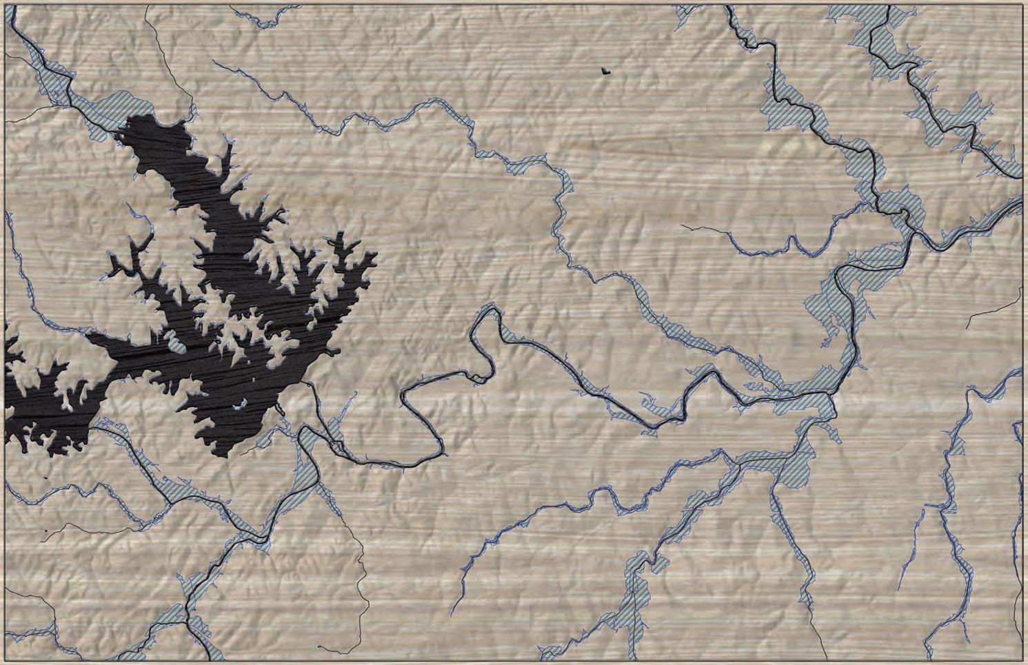
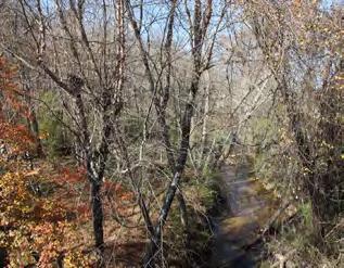
The County, State, and Federal government regu late the many waterbodies found throughout the study area3. The Catawba River is the dominant wa terway within this corridor. Canoe Creek, located to the west of Morganton, is a tributary of the Cataw ba that serves as a possible trail corridor.
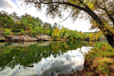
CATAWBA RIVER
The Catawba River (named after the Native Amer ican tribe that first settled on its banks) is a trib utary of the Wateree River in the states of North and South Carolina. The river is approximately 220 miles long and is considered one of “America’s Most Endangered Rivers” by the American Rivers orga nization. The river includes a series of reservoirs for flood control and hydroelectricity and provides drinking water to millions of residents.
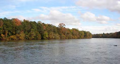
The headwaters of the Catawba River begin in the Blue Ridge Mountains in western McDowell Coun ty approximately 20 miles east of Asheville. The Catawba joins the Linville River and forms Lake James. The river then extends east and south, flow ing through other impoundments near Morganton, Hickory, and Mooresville on its way to Lake Norman. From Lake Norman it flows south, passing west of Charlotte, before entering Lake Wylie, where it forms approximately ten miles of the border be tween North and South Carolina. The Catawba River continues through South Carolina before joining the Wateree River, which spills into the Atlantic Ocean.
2
may be required if the wetland is considered jurisdictional by the USACE. This means that the wetland is not isolated and part of a broader lake or water system. A small boardwalk for a non-isolated wetland with limited fill or dredging may qualify for a programmatic Nationwide Permit. Nationwide Permits are designed to streamline the permitting process for actions with limited disturbances. In addition to permitting, disturbances exceeding a tenth ( 0.1) of an acre would require mitigation which can increase project costs. Impacts under a tenth (0.1) of an acre do not trigger mitigation fees.
Maintain a 50-foot buffer from all waterways, particularly those regulated under the Catawba River Buffer Rules. The state requires a 50-foot buffer along the shorelines of Catawba River and associated lakes. Streams within the study area are identified by the State of North Carolina as having poor water quality and maintaining or improving an adequate vegetated buffer is crucial to improving the quality. Zone of this buffer includes an undisturbed 30-foot buffer from top of bank in which trails are discouraged. Zone 2 is an additional 20-foot buffer. This zone allows for managed vegetation and trails and greenways. While trails are an allowable use within Zone 2, the NC Division of Water Quality requires a permit (through DWQ or designated local government). The applicant must show that disturbance has been minimized and no other alternatives exist.
FONTA FLORA STATE TRAIL: LAKE JAMES TO MORGANTON MASTER PLAN10
Avoid disturbance in the floodway. Avoid placement of structures or disturbance within the floodway. Floodways are regulated locally and by the Federal Emergency Management Agency (FEMA). Fill, structures (walls, kiosks, etc), and impervious services are discouraged. Any structures located within the floodway require a no-impact/no-rise certification through FEMA. These studies can vary on cost but can range from $2,500-$15,000 depending on complexity.
If wetlands are unavoidable, utilize elevated boardwalk systems. Boardwalks allow for travel over flat, poorly draining soils, standing water, and wetland features and have significantly less impact than other options. A section 404 (Clean Water Act) Permit
RARE FLORA AND FAUNA
The State Natural Heritage Program provides data identifying the state’s most sensitive environmental areas to be avoided; these areas are incorporated with in the analysis map series at the end of this chapter. Rare flora and fauna species can also exist outside of these designated areas, which can alter final trail align ments prior to construction.
Coordination with the U.S. Fish and Wildlife Service (USFWS) is an important aspect of the design process. Involving USFWS early on in the process can help avoid potential planning obstacles related to federally protected species. Ad ditionally, permits2 like Section 401 and 404 will initiate the review of the State Natural Heritage Program database. If species are found within the project area, State or Federal requirements may dictate avoidance or mitigation.
Species identified by the State Natural Heritage Program within this study area include:
A| Dwarf-flowered Heartleaf (see Map 1, found on Duke Energy held lands)
B| White Trillium (see Map 2, found in the larger Glen Alpine area)
C| Carolina Foothills Crayfish and Eastern Creekshell (see Map 3, found along the Catawba)
D| Mountain Golden Heather plant (Lake James area)
E| Peregrine Falcon (Lake James area)
F| Bald Eagle (Lake James area)

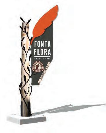
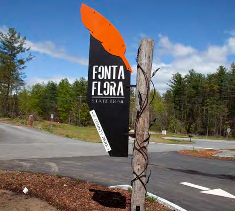
THE NORTH AMERICAN BALD EAGLE
FEATHER PROVIDES THE INSPIRATION FOR THE FONTA FLORA LOGO.
11CHAPTER 1: Existing Conditions, Analysis, and Preliminary Alignments
CULTURAL RESOURCES
NATIVE AMERICANS
The Catawba River has served as a his toric transportation route, cultural con nector, and wildlife corridor throughout the area’s history. Early Native Americans in the area identified themselves as the Kawahcatawbas, “the people of the river”. The Catawba and Wateree Tribes used the river for transportation and traded with Spanish explorers at river outposts. The ruins of one of these outposts, Fort San Juan, have been located and excavated in close proximity to the Catawba River in Morganton. Based on Spanish records and archaeological findings, it appears that Fort San Juan was occupied in 1567 and 1568.
OVERMOUNTAIN MEN
The Catawba River and its tributaries were also followed by Revolutionary War soldiers on their way to the Battle of Kings Moun tain, SC in 1780. The Overmountain Victory National Historic Trail preserves and commemorates the route.
The original Overmountain Victory National Historic Trail (OVNHT) route was identified by a National Parks Service research team. The team relied on the 1881 account of the march, which has been amended by local historians, descendants of battle participants, and other sources. As part of this congressionally designated trail, any officially certified portion of the OVNHT must lie within a one-mile corridor (half-mile on either side) of the historic route.
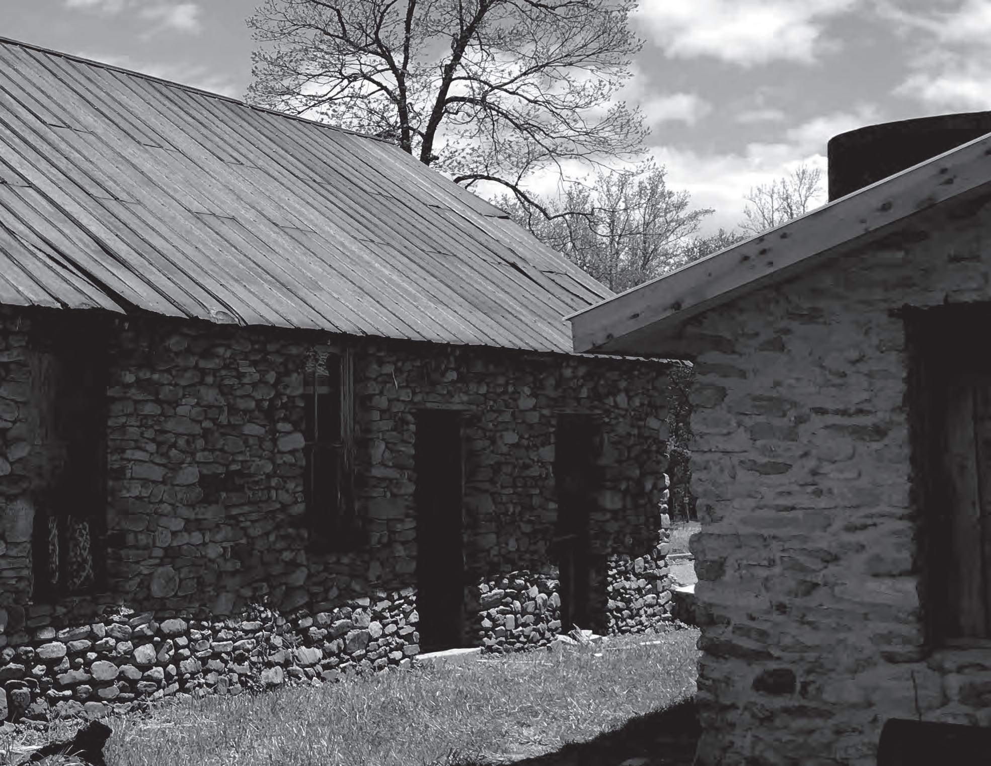
FONTA FLORA VILLAGE
The impoundment of the Catawba River to form Lake James also marks another important moment in history. The local settle ment of Fonta Flora, an African American sharecropping village, was flooded in 1916 by the Southern Pow er Company (predecessor to Duke Energy) to develop Lake James. This community included approximately 100 full-time residents; there are no known photo graphs or painted pictures of Fonta Flora before it was slowly covered by the rising waters of Lake James.
FONTA FLORA STATE TRAIL: LAKE JAMES TO MORGANTON MASTER PLAN12
THE BUILT ENVIRONMENT
The opportunities and constraints found within the built and human environment are critical for determining suitable trail locations and feasibility, ideal user expe riences, construction costs, and necessary permits.
This section highlights four (4) built environmental features and their implications for developing the Fonta Flora State Trail from Lake James to Morganton, includ ing: 1) Land Use; 2) Existing Trails and Parks; 3) Utilities; and 4) Transportation.
LAND USE SNAPSHOT
Western Section
The western extent of the study area is typified by a rural wooded landscape with large tracts of land, many which are owned by Crescent Communities, Duke Energy, NC State Parks, and family trusts. Many of these large tracts are leased as tree and plant nurseries. The fertilization of these crops must be considered when providing for public trails.
Central Section
The central section of the corridor exhibits a mix of large tracts and small tracts, many which serve second-home owners. Many of the large landown ers have owned their property for multiple genera tions, while smaller tracts have been purchased for retirement or personal retreats. Through the course of landowner outreach, both of these groups de scribed issues with trash and other problems with the general public and river users. This history serves as a barrier for obtaining trail easements.
The City of Morganton
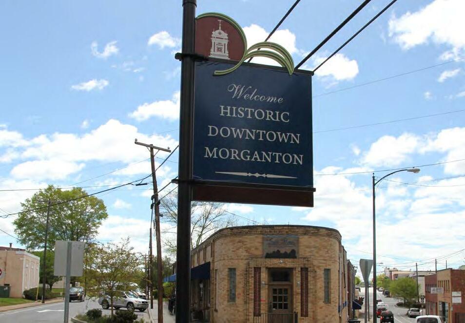
The City of Morganton’s western edge is typified by single-family residential growth. Pockets of dense land development create a challenge for creating a public trail. The City has successfully acquired property for a greenway connector that will link the Catawba River Greenway to the central business district.
CHAPTER 1: Existing Conditions, Analysis, and Preliminary Alignments 13
THE BUILT ENVIRONMENT
EXISTING PARKS AND GREENWAYS
Ten miles of the Fonta Flora State Trail were com pleted in 2017, and an additonal 10 miles are cur rently under construction. When complete, the trail will provide for a complete loop around Lake James.
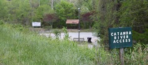
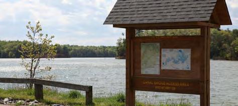
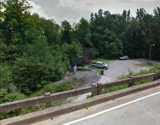
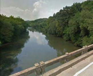
Canal Bridge Public Access
NC Wildlife Resources Commission currently man ages the Canal Bridge Public Access which is lo cated near the western terminus of the study area. NCWRC also plans to establish the North Bend public river access at Powerhouse Rd., west of Glen Alpine. Both access areas will be important for trail connectivity.
Watermill River Access
Burke County and Morganton have a collection of parks and greenways that are ideal for trail connections. Some of these major assets include: Fonta Flora State Trail: Lake James Loop
This public fishing access area near Glen Alpine is owned by Burke County.
OVNHT at Lake James State Park
This state park is one of the most significant link ages in the planning corridor and western section of the study area. Two miles of certified OVNHT are located along Paddy Creek in the state park.
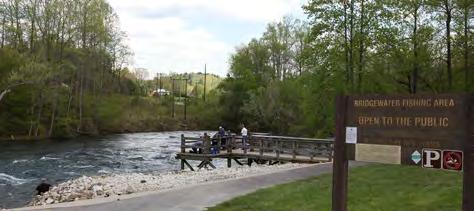
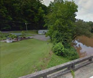
Bridgewater Fishing Access
This public fishing access area and canoe launch is owned by Duke Power, which has plans to further improve the site.
City of Morganton Parks and Greenways
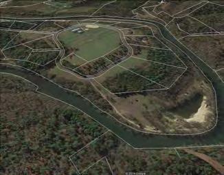
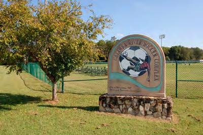
The City has many parks and greenways to connect, such as the Catawba River Greenway, Freedom Park and Greenway, Catawba Meadows Park, Rocky Ford Access, and the Catawba River Soccer Complex.
FONTA FLORA STATE TRAIL: LAKE JAMES TO MORGANTON MASTER PLAN14
UTILITIES
The study area has a complex matrix of utilities that include transmission lines, utility towers, water lines, and sewer infrastructure. Both sewer and water lines are indicated on the subsequent map series. However, the maps do not include transmission lines.
Locations where the potential trail alignment inter sects with sewer or water lines have been indicated on the map and notes (i.e. Canoe Creek). Sewer lines are often compatible with trails since existing easements preclude development. However, the easement will often need to be modified to provide for a public trail.
to accommodate a trail alignment or accommodate a widened shoulder. These opportunities are shown on the Site Analysis Maps with corresponding op portunities and constraints notes.
Norfolk Southern has an operational rail on the south side of the Catawba River. If this rail were to ever become abandoned, a significant opportunity would exist to establish a considerable section of trail. The right-of-way and adjacent lands were ana lyzed as a potential future route, as illustrated in the maps and notes.
TRANSPORTATION
The study area analysis includes an extensive review of the existing transportation network including the North Carolina Department of Transportation (NC DOT) right-of-way (ROW), NCDOT plans, existing bike and pedestrian infrastructure (crosswalks, bike lanes, etc.), railways, and existing greenways. NCDOT’s right-of-way was analyzed for the ability
15CHAPTER 1: Existing Conditions, Analysis, and Preliminary Alignments
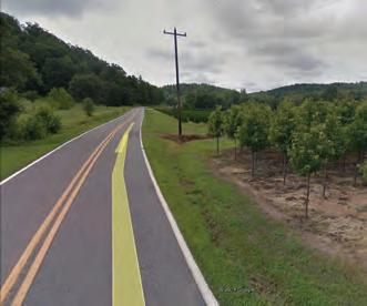
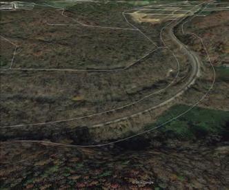
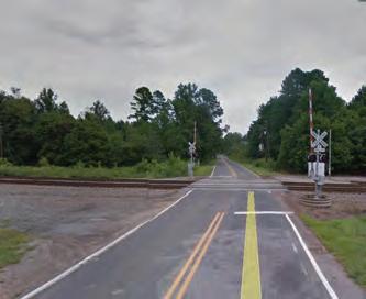
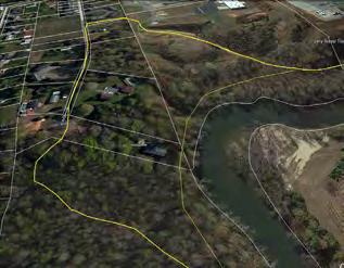
MAP AND PHOTO SERIES: PRELIMINARY TRAIL ROUTE ALTERNATIVES
The map and photographic series, which spatially incorporates the natural and built environment analysis, highlights a host of preliminary trail route alternatives. These routes were further refined by local leaders to identify and engage landowners. This information will serve as an ongoing reference guide as alternative routes may need to be developed due to unforeseen barriers.
17CHAPTER 1: Existing Conditions, Analysis, and Preliminary Alignments
STUDY


ANALYSIS
FONTA FLORA STATE TRAIL: LAKE JAMES TO MORGANTON MASTER PLAN18
AREA 1: SITE
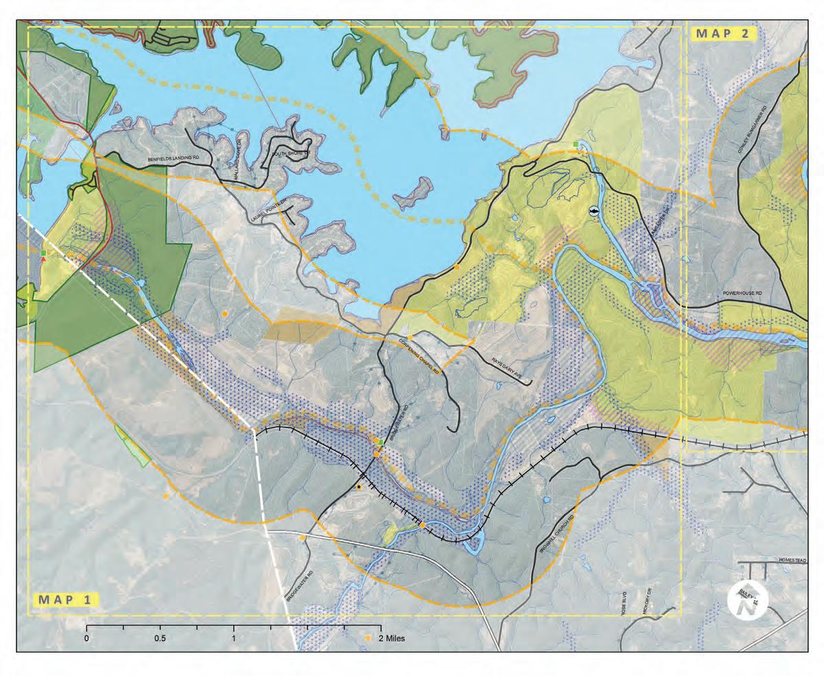
70 2530 Overmountain Victory NH Trail Municipal Boundaries Duke Energy Properties Crescent Resources Properties Municipal/County Owned Properties County Boundary 20-Foot Contours Property Lines OVNHT 1/2-Mile Buffer Existing Trails OVNHT & Other Recreation Fishing Access Parks Golf Courses Managed Lands Federal & State Ownership Private Brownfields State Natural Heritage Data Inactive Hazardous Sites Active & Inactive Landfills Proposed Trails Schools Hospitals blic HePu alth Departments Public Libraries Colleges and Universities Civic Landmarks National Register (NR) of Historic Places Site NR and Local Landmark National Register Historic District (NRHD) Study List (SL) SL and Landmark SL and Determined Eligible (DOE) SL, DOE, and Landmark DOE NRHD Surveyed Surveyed in NRHD Site Gone Sensitive Cultural Resources Local District Center Poin Historic Sites and Ditricts NRHD Boundary Utilities Waterlines Sewer Bike Route Transportation Rail Roads Interstates Local Roads State and County Roads NCDOT Bridge Locations Roads/Interstates Animal Plant Animal Assemblage Natural Community Element Occurances Natural Heritage Areas Very High High Moderate General Unranked Wetlands (NWI) Hydric Soils Waterbodies Streams Floodway Flood Zones 100-Year Floodplain 500-Year Floodplain Hydrology Exceptional State Roads LEGEND Alignment ‘A’ Opportunities Alignment ‘B’ Constraints 50 38 Connectors Site Analysis Overmountain Victory National Historic Trail Lake James to Morganton Greenway Study MAP 1LAKE JAMES STATE PARK Bridgewater Powerhouse NPOWERHOUSE RD BENFIELDSLANDINGRD NPOWERHOUSERD Lake James Paddy Creek Dam 70 Lake James State Park Lake James State Park ReedyCreek Catawba OldCatawbaRiver 10 9 10 8 7 3 2 15 11 9 8 2 5 MAP 2 Overmoun ain Vic ory NH Trai Municipal Boundaries Duke Energy Properties Crescen Resources Properties Municipal/County Owned Properties County Boundary 20-Foo Con ours Property Lines OVNHT 1/2-Mile Buffer Exis ing Trails OVNHT & Other Recreation Fishing Access Parks Gol Courses Managed Lands Federal & State Ownership ivatPre Brown ields State Natural Her tage Data nactive Hazardous Sites Active & nactive Land ills Proposed Trails Schools Hospitals blicHePu alth Departments Public Libraries Colleges and Universities Civic Landmarks National Register (NR) o His oric Places Site NR and Local Landmark National Register Historic District (NRHD) Study List (SL) SL and Landmark SL and De ermined Eligible (DOE SL DOE, and Landmark DOE NRHD Surveyed Surveyed in NRHD Site Gone Sensitive Cul ural Resources Local District Center Point Historic Sites and Ditr cts NRHD Boundary Utilities Waterlines Sewe Bike Route Transportation Rail Roads Interstates Local Roads State and County Roads NCDOT Bridge Locations Roads/Interstates Anima Plant Animal Assemblage Na ural Community Element Occurances Natural Her tage Areas Very High High Moderate Genera Unranked Wetlands (NWI) Hydric Soils Waterbodies Streams Floodway Flood Zones 100-Year Floodplain 500-Year Floodplain Hydrology Excep iona State Roads LEGEND Alignment ‘A’ Opportunities Alignment ‘B’ Constraints 50 38 Element Occurrence: Element Occurrence: Lake James Loop TrailLakeJamesLoopTrail Connectors NorfolkSouthernRR Catawba River Dam and Truss Bridge Historic Bridge Muddy Creek Historic RR Bridge BURKE COUNTYMCDOWELL COUNTY NC 126 Lake James State Park 7 5 6 4 6 4 10 3 3 5 5 10 13 14 1 1 12 Bridgewater Fishing Access Lake James Family Campground 16 START OF STUDY AREA @WHIPPOORWILL FARM MAP 2: STUDY AREA 1 SITE ANALYSIS STUDY AREA 1
STUDY AREA 1: OPPORTUNITIES AND CONSTRAINTS
Opportunities and Constraints:
OPPORTUNITIES
Potential Trailhead and improvement area
Maintained open meadow
Routes utilize private dirt roads

Connect to Lake James Family Campground and single-family residential development by paralleling Benfields Landing Road
Potential amenable landowner
Flat area with potential to use Norfolk Southern right-of-way (around 200-feet) or adjacent private lands for alignment Bridgewater Road could be an excellent connector route or a preferred alignment if one alignment section was determined unfeasible Bridgewater Road hosts a Bed and Breakfast and may have opportunity for greenway related commercial Area is relatively flat
Utilize Muddy Creek Historic Rail Road Bridge
Potential amenable landowner on north side— alignment could utilize or parallel Corpening Chapel Road
Potential amenable landowner on north side— alignment could utilize or parallel Rays Dairy Avenue
Alignment parallels private road
Potential trailhead at Bridge Water Fishing Access Area
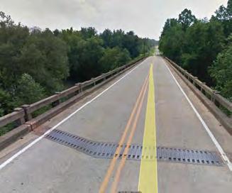
Powerhouse Road bridge has ample deck width to allow for on-grade bridge crossing
Potential connection to North Powerhouse Road and Lake James Loop Trail Powerhouse Road has 60-feet of right-of-way and is fairly flat through the rest of this area going east
CONSTRAINTS
Steep hillside may require greenway alignment to parallel Highway 126 until the crossing of Benfields Landing Road
Hwy 126 Bridge has narrow shoulder with railing obstruction for several hundred feet—would likely require a bridge attachment Wetland/low lying area
Area has stream crossing and significant fill slope from rail road bed and would require alignment to be in floodway or elevated on a structure
At-grade road crossing on Bridgewater Road Bridgewater Road bridge has narrow shoulder and would need to have a bridge attachment or separate pedestrian bridge Rail-bed is on elevated dike and significant fill slope from rail road bed and would require alignment to be in floodway or elevated on a structure Large disturbance area (possible motor cross track) within and adjacent to Norfolk Southern right-ofway Tree farm
Sensitive cultural resource areas
19CHAPTER 1: Existing Conditions, Analysis, and Preliminary Alignments
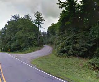
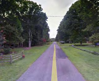
Lake James (Map 1) NorfolkSouthern ROW Rail dike 3 1 2 10 4 5 6 7 8 9 1 2 3 4 5 6 7 7 8 9 10 11 13 14 15 16 12 16101 14 14
View
of Riverview
Apartments
with sewer line easement shown at the right
View
of Norfolk Southern rail line constrained area
Approach to Bridgewater Fishing Access Area on Powerhouse Road
View of decking over the Catawba River on Powerhouse Road
View
of Bridgewater
Road
and
potential
on-
grade road and railroad crossing
View of Rays Dairy Avenue and potential onroad or parallel alignment View of project terminus on Highway 26 with potential trailhead/enhancement area 5 7 7 View of Bridgewater Road flat and steeper areas
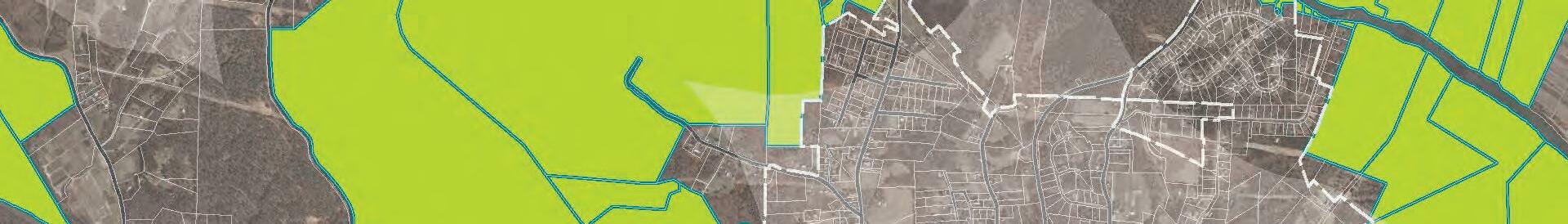
STUDY AREA 2: SITE ANALYSIS


LEGEND
Catawba River

FONTA FLORA STATE TRAIL20
Municipal Boundaries Duke Energy Properties Crescent Resources Properties County Boundary 20-Foot Contours Property Lines OVNHT & Other Recreation Managed Lands State Natural Heritage Data Schools Hospitals blic HePu alth Departments Public Libraries Colleges and Universities Civic Landmarks National Register (NR) of Historic Places Site NR and Local Landmark National Register Historic District (NRHD) Study List (SL) SL and Landmark SL and Determined Eligible (DOE) SL DOE, and Landmark DOE NRHD Surveyed Surveyed in NRHD Site Gone Sensitive Cultural Resources Local District Center Point Historic Sites and Ditricts NRHD Boundary Utilities Waterlines Sewer Bike Route Transportation Rail Roads Interstates Local Roads State and County Roads NCDOT Bridge Locations Roads/Interstates Hydrology State Roads
Alignment ‘A’ Alignment ‘B’ Connectors 16 Element Occurrence: Sweet White Trillium Glen Alpine Dump NorfolkSouthernRR Glen Alpine Elementary School Table Rock Middle School Glen Alpine Lake James Site Analysis Overmountain Victory National Historic Trail Lenoir to Morganton Greenway Study MAP 2 GREATER GLEN ALPINE Swan Pond (Easement: Historic Preservation Foundation) Catawba River ReedyCreek
Catawba
River CanoeCreek MAP 1 MAP 2 Overmountain Victory NH Trail Municipal Boundaries Duke Energy Properties Crescent Resources Properties Municipal/County Owned Properties County Boundary 20-Foot Contours Property Lines OVNHT 1/2-Mile Buffer Existing Trails OVNHT & Other Recreation Fishing Access Parks Golf Courses Managed Lands Federal & State Ownership Private Brownfields State Natural Heritage Data Inactive Hazardous Sites Active & Inactive Landfills Proposed Trails Schools Hospitals blic HePu alth Departments Public Libraries Colleges and Universities Civic Landmarks National Register (NR) of Historic Places Site NR and Local Landmark National Register Historic District (NRHD) Study List (SL) SL and Landmark SL and Determined Eligible (DOE) SL DOE, and Landmark DOE NRHD Surveyed Surveyed in NRHD Site Gone Sensitive Cultural Resources Local District Center Poin Historic Sites and Ditricts NRHD Boundary Utilities Waterlines Sewer Bike Route Transportation Rail Roads Interstates Local Roads State and County Roads NCDOT Bridge Locations Roads/Interstates Animal Plant Animal Assemblage Natural Community Element Occurances Natural Heritage Areas Very High High Moderate General Unranked Wetlands (NWI) Hydric Soils Waterbodies Streams Floodway Flood Zones 100-Year Floodplain 500-Year Floodplain Hydrology Exceptional State Roads LEGEND Alignment ‘A’ Opportunities Alignment ‘B’ Constraints 50 38 LakeJamesLoopTrail Connectors 70 126 19 21 22 23 24 2625 27 20 21 19 17 1118 11 18 18 18 18 18 18 17 17 16 15 14 13 12 20 22 22 POWERHOUSE RD Catawba River Access Area MAP 3: STUDY AREA 2 SITE ANALYSISSTUDY AREA 2
STUDY AREA 2: OPPORTUNITIES AND CONSTRAINTS
Opportunities and Constraints:
OPPORTUNITIES
Utilize 60-foot right-of-way (with 18-20-foot shoulder) on Powerhouse Road
Potential for bridge underpass at low-flow periods— but on-grade crossing of Powerhouse Road may be more practical Bridge decking may accommodate a shoulder for on-grade crossing across the Catawba River
Existing trail easement may allow for greenway accommodation in gated equestrian community— land bordering the Catawba River is owned by the club/community
Potential amenable land owner Bridge clearance across the Catawba River would allow for a greenway underpass on either sides but lacks adequate shoulder on bridge deck for crossing the river
Burke County’s Catawba River Access Area— potential trailhead location
Subdivision platted but properties bordering river appear to be undeveloped and still owned by developer
Watermill Glen Alpine Road/Turkey Tail Lane rightof-way has 60-foot right-of-way with approximately 30-feet of shoulder on the western side Downtown Glen Alpine hosts a commercial area that could serve greenway tourism including a bike shop, winery, and bed and breakfast Linville Street has an approximately 5-foot sidewalk through the majority of downtown Glen Alpine Powerhouse Road has 60-foot of right-of-way and relatively flat terrain into Glen Alpine
CONSTRAINTS
Sensitive cultural resource area
Homesite is close to Catawba River—alignment would need to navigate around it Bridge clearance may not be desirable for a greenway underpass and on-grade crossing may be necessary
Tree farm
Trust property
Homesite located fairly close to Catawba River
Sensitive cultural resource areas
Wetland/low lying areas
Trust property not likely to be amendable to a greenway
Trust property
Use of some private property in drainage would be needed for alignment
This alignment may be less probable due to the intersection with several small privately held parcels
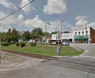
Glen Alpine
21CHAPTER 1: Existing Conditions, Analysis, and Preliminary Alignments
Greater
(Map 2) 17 18 18 19 20 21 22 23 24 25 26 27 11 12 13 14 15 16 17 18 19 20 21 22 1816 1922 2014 21
Downtown Glen Alpine (with Norfolk Southern railroad line in the foreground)
Burke County Catawba River Access area and potential trailhead
View of Watermill Glen Alpine Road right-of-way as a potential connector to Glen Alpine
View from Catawba River Bridge—landowner on right of picture may be amenable
View of Bridgewater Road and potential ongrade road and railroad crossing
View
of home
site
on the
Catawba River
that
prevents an adjacent alignment on the
south end
View
of Powerhouse Road
bridge
over the
Catawba River
12
Club owned property
Gated equestrian community has commonly owned property on the riverfront
3:


ANALYSIS
FONTA FLORA STATE TRAIL: LAKE JAMES TO MORGANTON MASTER PLAN22 STUDY AREA
SITE
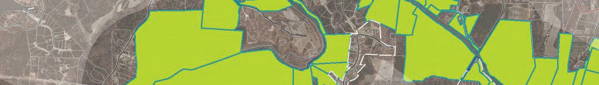
70 2530 Overmountain Victory NH Trail Municipal Boundaries Duke Energy Properties Crescent Resources Properties Municipal/County Owned Properties County Boundary 20-Foot Contours Property Lines OVNHT 1/2-Mile Buffer Existing Trails OVNHT & Other Recreation Fishing Access Parks Golf Courses Managed Lands Federal & State Ownership Private Brownfields State Natural Heritage Data Inactive Hazardous Sites Active & Inactive Landfills Proposed Trails Schools Hospitals blic HePu alth Departments Public Libraries Colleges and Universities Civic Landmarks National Register (NR) of Historic Places Site NR and Local Landmark National Register Historic District (NRHD) Study List (SL) SL and Landmark SL and Determined Eligible (DOE) SL, DOE, and Landmark DOE NRHD Surveyed Surveyed in NRHD Site Gone Sensitive Cultural Resources Local District Center Poin Historic Sites and Ditricts NRHD Boundary Utilities Waterlines Sewer Bike Route Transportation Rail Roads Interstates Local Roads State and County Roads NCDOT Bridge Locations Roads/Interstates Animal Plant Animal Assemblage Natural Community Element Occurances Natural Heritage Areas Very High High Moderate General Unranked Wetlands (NWI) Hydric Soils Waterbodies Streams Floodway Flood Zones 100-Year Floodplain 500-Year Floodplain Hydrology Exceptional State Roads LEGEND Alignment ‘A’ Opportunities Alignment ‘B’ Constraints 50 38 Connectors Swan Pond (Easement: Historic Preservation Foundation) Morganton Site Analysis Overmountain Victory National Historic Trail Lenoir to Morganton Greenway Study MAP 3WEST MORGANTON END OF STUDY AREA MAP 2 Quaker Meadows Cemetery, Circa 1767-1879 Freedom Park & Greenway Element Occurrence: Carolina Foothills Crayfish, Eastern Creekshell Freedom High School Forest Hill Elementary School Catawba River Soccer Complex &Greenway Loop Quaker Meadows House Catawba Meadows Park (NC State Easement) ML King Park Cascade Park Collett St. Rec. Center & Martha Park Quaker Meadows Golf Course West Street Historic District Avery Avenue District MAP 3 Catawba Greenway Catawba Greenway 126 70 64 181 126 126 END OF STUDY AREA 28 29 32 30 34 33 35 36 37 38 31 31 31 39 24 25 26 27 23 23 28 29 30 HWY 126 HWY126 DOCASTEEROAD JAMESTOWNROAD CanoeCreek CanoeCreek WilsonCreek CatawbaRiver Catawba River Silver Creek Overmountain Victory NH Trail Municipal Boundaries Duke Energy Properties Crescent Resources Properties Municipal/County Owned Properties County Boundary 20-Foot Contours Property Lines OVNHT 1/2-Mile Buffer Existing Trails OVNHT & Other Recreation Fishing Access Parks Golf Courses Managed Lands Federal & State Ownership Private Brownfields State Natural Heritage Data Inactive Hazardous Sites Active & Inactive Landfills Proposed Trails Schools Hospitals blic HePu alth Departments Public Libraries Colleges and Universities Civic Landmarks National Register (NR) of Historic Places Site NR and Local Landmark National Register Historic District (NRHD) Study List (SL) SL and Landmark SL and Determined Eligible (DOE) SL DOE, and Landmark DOE NRHD Surveyed Surveyed in NRHD Site Gone Sensitive Cultural Resources Local District Center Point Historic Sites and Ditricts NRHD Boundary Utilities Waterlines Sewer Bike Route Transportation Rail Roads Interstates Local Roads State and County Roads NCDOT Bridge Locations Roads/Interstates Animal Plant Animal Assemblage Natural Community Element Occurances Natural Heritage Areas Very High High Moderate General Unranked Wetlands (NWI) Hydric Soils Waterbodies Streams Floodway Flood Zones 100-Year Floodplain 500-Year Floodplain Hydrology Exceptional State Roads LEGEND Alignment ‘A’ Opportunities Alignment ‘B’ Constraints 50 38 BOST ROAD BOST ROAD SAINT MARYS CHURCH RDConnectors MAP 4: STUDY AREA 3 SITE ANALYSISSTUDY AREA 3
STUDY AREA 3: OPPORTUNITIES AND CONSTRAINTS
Opportunities and Constraints: West
OPPORTUNITIES
Historic farm (Swan Pond)

Alignment could parallel Docastee Road Alignment could travel on-road on Elm Street and would need to travel through private property to access along the river Alignment overlaps with sewer lines/easements Canoe Creek bridge may accommodate a greenway underpass and separated pedestrian lane Connection could use some current path alignments through Freedom Park Intersection has planned signalization improvements Development is planned to link in sidewalk infrastructure and will link to the north side of Hwy 181
Connection to Quaker Meadows Cemetery—a historically significant OVT site Potential amenable landowner—property was historically a part of Quaker Meadows Connection to Quaker Meadows House—a historically significant OVT site Bost Road has significant 60-foot right-of-way and could serve as a connection to a neighboring subdivision
CONSTRAINTS
Alignment leaves OVT mile-buffer
Topography is steep with a bluff that drops off behind buildings—alignment could need a switchback in this location
Homesite close to the Catawba River would make an adjacent river alignment less likely Sensitive cultural resources area and trustee property
Alignment on Cresthill Drive would need to be on-road or the construction of a 5-foot sidewalk— which is less than the recommended minimum 10foot path for a greenway in suburban/urban areas Access is restricted on the Morganton Water Plant but alignment is proposed around the perimeter and would require fencing (also a sensitive cultural resource area)
Sensitive cultural resource area and wetlands Intersection of Saint Marys Church Road and Highway 181 is signalized but no crosswalks exist
23CHAPTER 1: Existing Conditions, Analysis, and Preliminary Alignments
Morganton (Map 3) 28 29 30 31 32 33 34 35 36 37 38 39 23 24 25 26 27 28 29 30 2816 3022 2014 29
The McDowell
House
(Quaker Meadows)—
historically
significant
through several eras
View from Independence Boulevard bridge over Canoe Creek
Quaker Meadows Cemetery—revolutionary War grave sites and one of the oldest historic sites in Western NC
View of Cresthill Drive—a potential on-road or parallel alignment
View
of Morganton Water Plant and its restricted accessA view of Docastee Road from Highway 126Swan Pond (a National Historic Register site) was settled just after the American Revolution Catawba River Section where alignment would navigate away from the river 30 24 25 24 28 25
LANDOWNER OUTREACH AND ENGAGEMENT
A KEY COMPONENT OF THE PLANNING PROCESS.
LANDOWNER OUTREACH
The environmental analysis (Chapter 1) was critical to determine physically feasible locations for trail development. However, significant portions of these routes impact private property and require landowner outreach to fully assess trail feasibility. This chapter highlights the good-faith effort to engage landowners throughout the planning process.
THE ENGAGEMENT PROCESS
25
WAS
A| IDENTIFYING THE LANDOWNERS B| LANDOWNER WORKSHOP C| TRAIL ROUTE RE-EVALUATION
2
FEASIBILITY ANALYSIS
Trail alternatives were developed based upon an en vironmental feasibility analysis (see Chapter 1).
LANDOWNER DATABASE
This effort builds upon previous landowner out reach efforts conducted in 2015 for the OVNHT Master Plan and incorporates additional preliminary alignments for landowner contact.
A mailing database was created that included all property owners impacted by the preliminary trail alignment(s).
26 FONTA FLORA STATE TRAIL: LAKE JAMES TO MORGANTON MASTER PLAN26
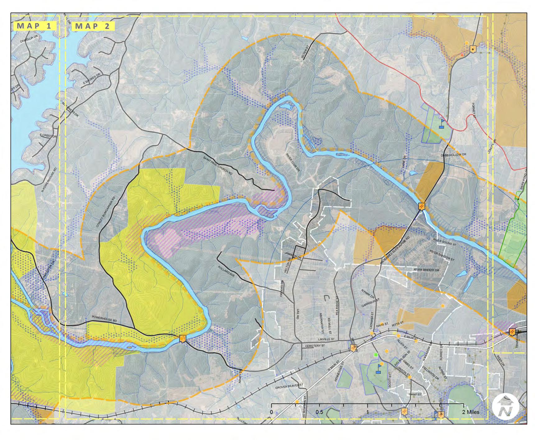
IDENTIFY THE LANDOWNERS ! ! ! ! ! ! ! ! PITTSSTCATAWBA ST E MAIN ST LANE DR LONDONSTHENNESSEE ST KIRBYDR SILVER ST LANCASTER DR WMAINST PEA RIDGE ST ALLENST ARNEY DR RIVER CLUB DR DAVIS ST CEMETERY ST SCOTT ST FORNEY ST NPARKDR SULLIVANDR ED BOWMAN S T RIVER BREEZE DR JAMISON DR HELTON DR GIBBSST SANDY COVE DR FERNWO ED MULL ST N MEADOW DR SURREY DR ESHORESDR ORDERS DR BRIDGE ST COBB HOLLOW DR GROVER BEAVER ST BEECHBLUFFDR HAMP ST DELLWOODDR CONLEY ABERNATHY ST FOXFIRE DR FINALEE D WATERMILLGLENALPINERD RIVER SOUND ST SAM MULL DR CAMELLIADR JUGWILSONST GARRISONST E CREST DR INVERNESSDR LAKEBREEZEDR RIVERSHADOWST ALPINE ST POWERHOUSE RD POLLARDAVE. LINVILLE ST SAINTPAULCHURCHRD CONLEY BUMGARNER RD LAIL RD NPOWERHOUSE RD ¬ 122 ¬ 103 ¬ 121 ¬ 82 ¬ 88¬ 100 ¬ 87 ¬ 84 ¬ 85 ¬ 127 ¬ 86 ¬ 124 ¬ 119 ¬ 120 ¬ 125 ¬ 110 ¬ 130 ¬ 111 ¬ 109 ¬ 126 ¬ 128 ¬ 105 ¬ 116 ¬ 95 ¬ 104 ¬ 123 ¬ 99 ¬ 112 ¬ 102 ¬ 108 ¬ 118 ¬ 117 ¬ 98 ¬ 113 ¬ 114 ¬ 94 ¬ 106 ¬ 101 ¬ 107 ¬ 129 ¬ 97 ¬ 96 ¬ 89¬ 93 ¬ 92 ¬ 91 ¬ 90 0 1 20.5 Miles MAP 2MAP 2MAP 3MAP 3 ¬ 115 STEP 1: DETERMINE WHERE THE TRAIL IS FEASIBLE (CHAPTER 1). STEP 2: START A CONVERSATION WITH LANDOWNERS. MAP 5: LANDOWNER PARCELS
LANDOWNER WORKSHOP
LANDOWNER INVITATION AND POSTCARD
Formal invitations were sent to all landowners re questing their attendance at a special meeting. Landowners who were unable to attend could re spond with a pre-stamped postcard indicating their level of interest in providing for the trail.
PRESENTATION
After signing in, the landowner workshop began with a presentation by Burke County staff that highlighted origins of the Fonta Flora Trail project, previous planning efforts, and trail progress and ac complishments.
MAP REVIEW
Landowners were able to review preliminary maps and ask questions about their specific property and the associated trail alignment with Burke County planning staff and consultants.
SENTIMENT CARD
The meeting concluded with landowners noting their level of willingness to provide a trail easement via the Landowner Interest Survey printed on the back of their invitation post card.
LANDOWNER WORKSHOP
Morganton to Lake Section of the Fonta Flora State Trail & Overmountain Victory National Historic Trail!
In partnership with the North Carolina Division of State Parks, Burke County is beginning to identify properties and routes for establishing the Lake James to Morganton section of the Fonta Flora State Trail (FFST). Designated as a State Trail in 2015, Fonta Flora is a public walking and biking trail that with eventually connect Morganton, Lake James, Marion, Old Fort, Black Mountain, and Asheville.
The Fonta Flora State Trail finds its origins in the desires of Burke County citizens to increase the quality of life enjoyed by residents, provide a destination-quality recreational amenity for visitors and the region’s diverse population, and provide public access to the area’s outstanding cultural and natural resources.
The Lake James to Morganton section of the FFST is unique in that it shares a corridor with the Overmountain Victory National Historic Trail (OVNHT). It is the vision of the partner organizations, including the National Park Service, that a single trail can be developed that serves as both the FFST and OVNHT.
• I am Familiar with the FFST
Yes No Maybe
• I am familiar with the Overmountain Victory National Historic Trail
Yes No Maybe
• I plan on attending the landowner workshop on February 27, 2018
• I am interested in donating a corridor to accommodate the trail
Yes No Maybe Yes No Maybe
• I am interested in selling a corridor to accommodate the trail
• I am interested in donating property to Burke County to accommodate the trail
Yes No Maybe Yes No Maybe
• I am interested in selling an entire property at full market value to Burke County
Yes No Maybe
Your participation in this surveyisincrediblyimportant to the success of the trail! Thank you!!!
Burke County Community Development PO Box 219 Morganton, NC 28680
LANDOWNER ID:________________
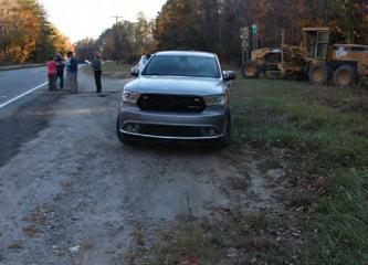
ON FEBRUARY 27, 2018, 20 LANDOWNERS
ATTENDED THE LANDOWNER WORKSHOP AT THE BURKE COUNTY GOVERNMENT CENTER.
27CHAPTER 2: LANDOWNER OUTREACH
27
TRAIL ROUTE RE-EVALUATION
REVISE TRAIL ALIGNMENTS
“Landowner Sentiment” was helpful for determining the preferred alignment and was included as a component of the final map series (Chapter 4).
A COMBINATION OF FACTORS, INCLUDING THE NATURAL ENVIRONMENT, THE BUILT ENVIRONMENT, AND LANDOWNER SENTIMENT, WERE USED TO DETERMINE THE PREFERRED TRAIL ALIGNMENT (CHAPTER 4).
28 FONTA FLORA STATE TRAIL: LAKE JAMES TO MORGANTON MASTER PLAN
MAP 6:
TRAIL ROUTE
RE-EVALUATION
CHARACTER AND DESIGN GUIDELINES
THIS CHAPTER PROVIDES DESIGN DETAILS
FOR VARIOUS TRAIL TYPES AND TRAIL SUPPORT FACILITIES AND OFFERS INSIGHT
INCORPORATING SOCIAL MEDIA.
This chapter describes specific trail construction standards and trail types to ensure minimal maintenance and the best user experience.
Additionally, this chapter defines three trail types and illustrates their transitions along the preferred trail alignment.
A unique architectural and branding theme is presented for signage, wayfinding, and other trail support facilities. This chapter concludes with recommendations for using social media to market the trail.
IN THIS CHAPTER:
SUSTAINABLE TRAIL DESIGN & CONSTRUCTION
TRAIL TYPES
TRAIL PROFILE
SUPPORT FACILITIES
MEDIA MARKETING
29
FOR
A|
B|
C|
D| TRAIL
E| SOCIAL
TRAIL
3
TRAIL CHARACTER
SUSTAINABLE TRAIL DESIGN
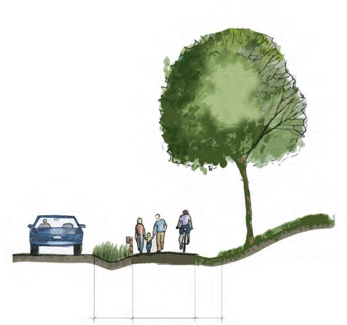
The trail must be designed and constructed to min imize erosion and ongoing maintenance, while pro viding for a leisure, family-oriented experience. The trail width will be approximately five-feet wide and allow for multiple users and emergency access from off-road vehicles. The overall average trail grade or steepness will be 5% or less. The trail will be slightly rolling with a gentle grade that follows the terrain contours. The trail will be slightly out-sloped, and meanders and undulates frequently to remove wa ter from the trail surface and create interest. The trail corridor will remain as narrow as possible while still maintaining the required tread width.
The trail design will utilize the five essential ele ments of sustainable trails as outlined in the Inter national Mountain Bicycling Association’s (IMBA) publication “Trail Solutions.”
1. THE HALF RULE
A trail’s grade shouldn’t exceed half the grade of the hillside or sideslope that the trail traverses. If the grade does exceed half the sideslope, its considered a fall-line trail. Water will flow down a fall-line trail rather than run across it.
2. THE TEN PERCENT AVERAGE GUIDELINE
An average trail grade of 10 percent or less is con sidered sustainable. This doesn’t mean that all trails should be kept under 10 percent, but the trail builder will need to limit the length of sections that exceed 10 percent.

30 FONTA FLORA STATE TRAIL: LAKE JAMES TO MORGANTON MASTER PLAN
30
THE FIVE ESSENTIAL ELEMENTS OF SUSTAINABLE TRAILS
3. MAXIMUM SUSTAINABLE TRAIL GRADES
more than
be prior to beginning
factors
be considered when determining the maximum

4. GRADE REVERSALS
5. OUTSLOPE

down
31CHAPTER 3: Trail Character and Design Guidelines 31
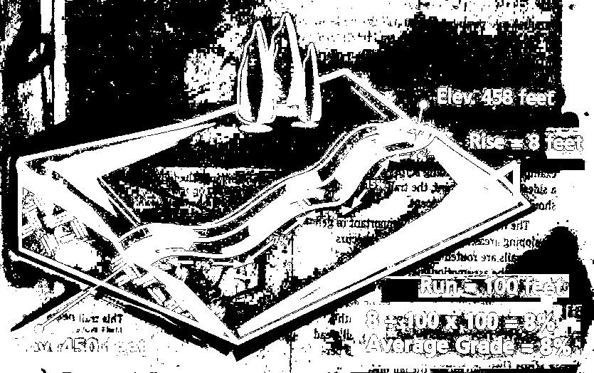
Maximum grade is the steepest portion of a trail that is
approximately 10 feet in length. It’s critical to determine what the maximum allowable trail grade will
construction. Several
should
sustainable trail grade which include: • Half Rule • Soil Types • Rock • Annual Rainfall Amount • Grade Reversals • Type of Users • Number of Users • Difficulty Level
A grade reversal is a point where an ascending trail changes direction subtly for 10 to 50 linear feet before ascending again. This change in grade allows for water to exit the trail.
Outslopes allow water to sheet flow off the trail instead of channeling
its center.
MAX
TRAIL CONSTRUCTION
TRAIL CHARACTER FULL BENCH CUT
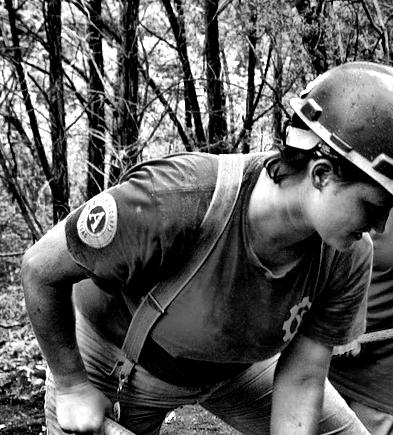
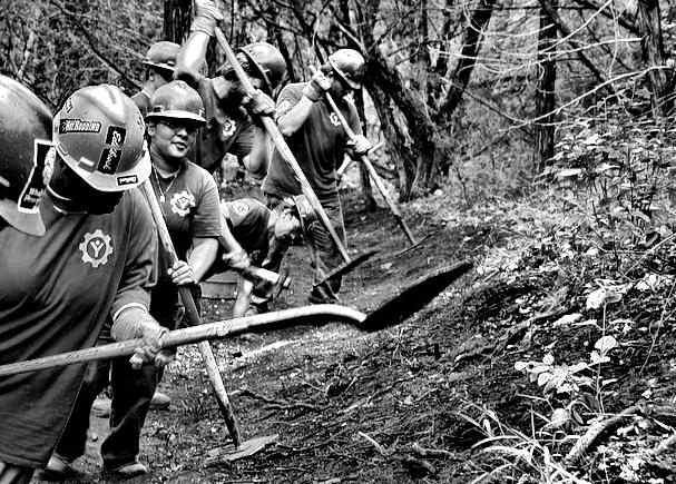
Members and associates of the Professional Trailbuilders Association (PTBA) should be preferred contractors for constructing the trail with mechanized equipment. These contractors have a thorough understanding of sustainable trail design and construction.

Volunteers may also work with PTBA contractors in a “hybrid” manner. When utilizing this method, the contractor is responsible for the rough cut of the trail tread and volunteers complete the finish work. Burke County will be responsible for secur ing any required local, state, or federal permits for construction.
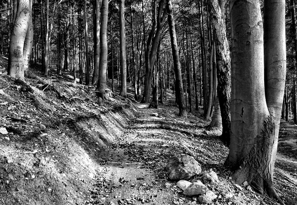
The trail will be constructed using a “full bench cut” in which the entire trail tread is built on solid ground. A “partial bench cut” which is similar to “cut and fill” will only be utilized if a full bench cut is not feasible due to rock outcrops, slabs, or other natural fea tures. A partial bench cut uses loose fill dirt to con struct a portion of the trail treads. The fill dirt has a tendency to loosen over time and can then wash and erode. This issue is minimized when construct ing a full bench cut. The trail bed will be shaped to leave an even, compacted, uniform surface free of indentations or protruding roots and stumps. The grading of the trail tread, back slope, and drainage
features will be finished to a smooth, stable surface. Any excess or disturbed soil outside the trail tread is evenly distributed and covered with leaves, organic debris, and other natural materials to aid in aesthet ics and sedimentation and erosion control.
SOLID GROUND


The trail will be constructed using a “full bench cut” in which the entire trail tread is built on solid ground.
32 FONTA FLORA STATE TRAIL: LAKE JAMES TO MORGANTON MASTER PLAN
Details from IMBA
TRAIL
TYPICAL GREENWAY
33CHAPTER 3: Trail Character and Design Guidelines
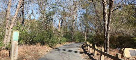
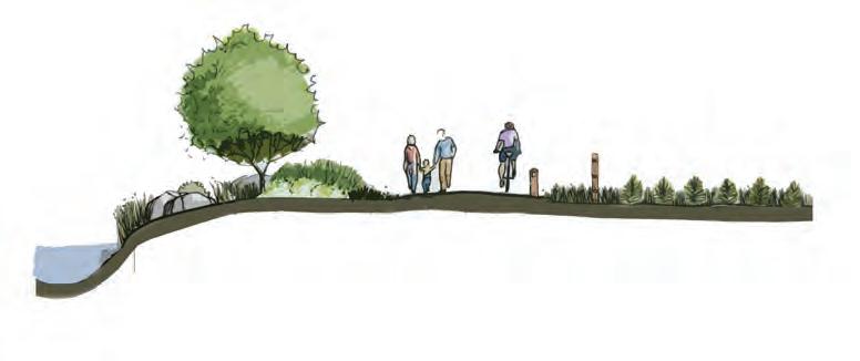
10’ PAVED ASPHALT
TYPES Five trail types are proposed along the preferred alignment. A specific trail type is proposed according to its surrounding environment, whether it is for safety along roadways or to enhance user experience. 30’ PREFERRED BUFFER TO RIVER TO PROTECT WATER QUALITY 10’ PAVED ASPHALT MILE MARKER FENCING TO MARK PRIVATE PROPERTY BOUNDARY User Group: Multi-Use Material: Paved Asphalt Preferred Width: 10’ Average Construction Cost: $80/ln. ft. Preferred Easement Width: 50’ Minimum Easement Width: 20’ THE CATAWBA RIVER GREENWAY INCORPORATES APPROXIMATELY FOUR MILES OF CERTIFIED OVERMOUNTAIN VICTORY NATIONAL HISTORIC TRAIL. photo: discoverburkecounty.com

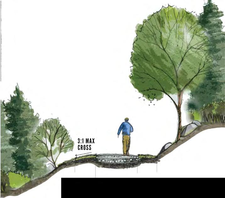

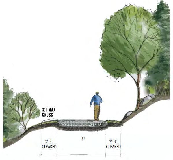
34 FONTA FLORA STATE TRAIL: LAKE JAMES TO MORGANTON MASTER PLAN SHARED PATH 20’ PAINTED ASPHALT DUAL-USE TRAIL 5’ NATURAL SURFACE Material: Native Soils Preferred Width: 5’ Preferred Easement Width: 50’ Minimum Easement Width: 10’ User Group: Hikers, Cyclists, and Vehicles Material: Painted Asphalt Preferred Width: 20’ Avg. Construction Cost: $15/ln. ft. Preferred Easement Width: Existing road width 2' -3' CLEARED 5' NATURAL SURFACE 2' -3' CLEARED TRAIL TYPES TRAIL CHARACTER
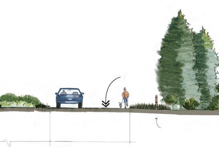
NCDOT SIDE
MULTI-USE TRAIL
User
Preferred
Average
Preferred
Minimum
User
Material:
Preferred
Average
Preferred
Minimum

35CHAPTER 3: Trail Character and Design Guidelines
Group: Multi-Use Material: Paved asphalt
Width: 8’
Construction Cost: $120/ln. ft.
Easement Width: 25’
Easement Width: 25’ Note: Trail to be approved in accordance with NCDOT encroachment agreement.
PATH 8’ PAVED ASPHALT
8’ CRUSHED GRAVEL FINES
Group: Hikers, Cyclists, Equestrians
Crushed Gravel Fines
Width: 8’
Construction Cost: $25/ln. ft.
Easement Width: 25’
Easement Width: 15’
TRAIL CHARACTER
36 FONTA FLORA STATE TRAIL: LAKE JAMES TO MORGANTON MASTER PLAN 2.22.0 NCDOT SIDE PATH 8’ PAVED ASPHALT MULTI-USE TRAIL 8’ CRUSHED GRAVEL DUAL USE TRAIL 5’ NATURAL SURFACE TYPICAL GREENWAY 10’ PAVED ASPHALT 2.7 .8 3.45 1.25 1.0 .2 .1 CANALBRIDGECANALBRIDGETRAILHEADOVNHTINLAKEJAMESSTATEPARK ENTERDUKEENERGYLANDOFFRAY’SDAIRYRD. EXITDUKEENERYLAND/ENTERPOWERHOUSERD.ROW ENTERCATAWBA RIVERCLUB EXITCATAWBA RIVERCLUBEXITPOWERHOUSERD.ROWFONTAFLORABREWERY START There are two (2) primary trail type transitions proposed along the preferred trail route, which extends approximately 20 miles. The Trail Type Profile identifies the transition location, along with associated length, for each trail type. TRAIL TYPES POINTSOFINTEREST MATCHLINE APPROX. DISTANCE IN MILES TRAIL TYPE PROFILE

37CHAPTER 3: Trail Character and Design Guidelines 4.61.25 1.0 CATAWBA RIVER GREENWAY & DOWNTOWN CONNECTOR (3.0) ENTERCATAWBA RIVERCLUB EXISTINGWATERMILLRIVERACCESS CATAWBARIVERSOCCERCOMPLEX DOWNTOWNMORGANTONEXITCATAWBA RIVERCLUB END MATCHLINE *Final trail type will depend on specific environmental conditions and whether trail is located within NCDOT ROW or within a private trail easement. APPROX. DISTANCE IN MILES
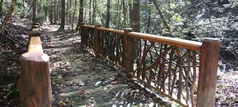
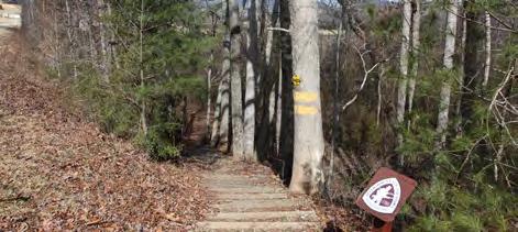
TRAIL SUPPORT FACILITIES
OVERVIEW
A unique architectural and branding theme is presented for trail support facilities presented on the following pages.
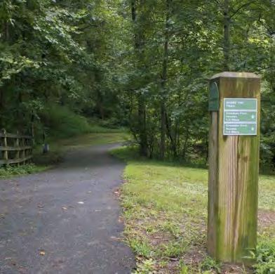
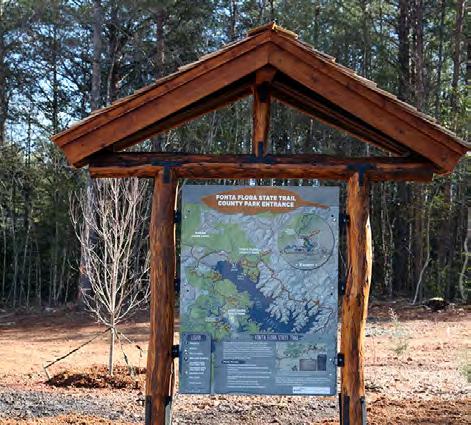
TRAILHEAD KIOSK

The kiosk will provide a trail map and other import ant information for trail users. This facility will be located at trailheads and pocket parks along the FFST.
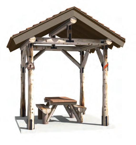
PICNIC SHELTER
The shelter design includes a timber frame struc ture. This architectural style, along with a cedar shingle roof, provides for a natural character con ducive to the Lake James environment.
TRAILHEAD MONUMENT
Large monuments will be located at major trail heads or pocket park facilities that provide access to the FFST. This monument should also provide for the name of the specific trailhead or pocket park.
38 FONTA FLORA STATE TRAIL: LAKE JAMES TO MORGANTON MASTER PLAN
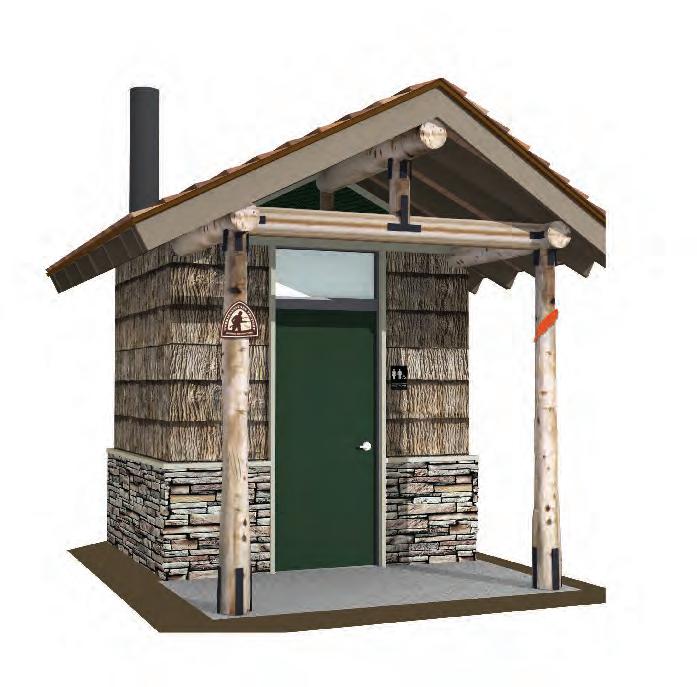
VAULT TOILET
The vault toilet does not require a septic system, but must be pumped regularly. This facility will be provided for at the Fonta Flora County Park
BREAKAWAY SIGN
The FFST shares a route with the Overmountain Victory National Historic Trail. The directional sig nage post will provide users with important trail in formation and is compliant with NCDOT standards.
MILEAGE POSTS
Mileage posts not only provide distance informa tion, but also serve as confidence markers that cre ate a feeling of safety.


39CHAPTER 3: Trail Character and Design Guidelines
SUPPORT FACILITIES
TRAIL FEATURES & SITE FURNITURE
Burke County is working in partnership with Oak Hill Iron and other local artisans to develop custom site furniture and other support facilities. These unique and custom elements will be provided for at Fonta Flora County Park, trailheads, pocket parks, and other locations where trail users can be served.
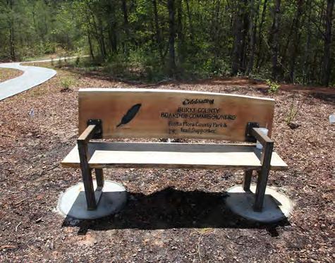

40 FONTA FLORA STATE TRAIL: LAKE JAMES TO MORGANTON MASTER PLAN
BICYCLE RACK
NCDOT BRIDGE DETAIL
TRAILHEAD KIOSK
BENCHES
TRAILHEAD MONUMENT
SOCIAL MEDIA: THE NEW WORD OF MOUTH


be
their
utilize
and
media
share their
signage along the trail
signal users
consider posting pictures of themselves or their group of friends as they walk or ride bikes along the trail. In addition, special props and features should be devel oped during the final design phase. After all, who can market this destination-quality trail better than trail users themselves?
take advantage of social media - the new word of mouth.
#FONTAFLORA
CROSS PROMOTE WITH OTHER NOTABLE HASHTAGS

continue
for years
come by encouraging the
of this
locations
the
41CHAPTER 3: Trail Character and Design Guidelines
Trail users should
encouraged to
social
to
experiences with
“friends”
“followers.” Special
will
to
Lets
The proposed official hashtag for the Fonta Flora State Trail is #fontaflora. The use of this hashtag will allow local tourism leaders to curate local photos and content that can be shared on website and re-posted through other social media platforms.
#trail2victory @NCParks #LakeJames #findyourpark #FINDYOURPARK Find Your Park is the official centennial campaign of the National Park Service (NPS). The NPS is encouraging National Park enthusiasts to use the hashtag “findyourpark” when posting to social media. The OVNHT can help
this campaign
to
use
hashtag at unique
along
trail.
SERVES AS THE HEART OF
MASTER PLAN, PROVIDING SPECIFIC
ALIGNMENTS

RECOMMENDATIONS
Specific trail alignments and recommendations are provided for the FFST within four (4) planning sections.
Trail recommendations are supported with renderings that demonstrate trail character at specific locations.
43 THIS CHAPTER
THE TRAIL
TRAIL
AND RECOMMENDATIONS.
IN THIS CHAPTER: A| PLANNING SECTIONS OVERVIEW B| TRAIL SECTION RECOMMENDATIONS
4
PLANNING SECTIONS

The 20 mile study area from Lake James to Morganton is divided into four (4) planning sections. The geo graphic extent of each section in cludes a beginning and ending ter minus that features a key asset or significant connectivity point for the trail. Many of the planning sections represent project areas that can be developed independently over time, providing a logical method for imple mentation as landowner willingness, funding, and other opportunities arise.
PLANNING SECTIONS
44 FONTA FLORA STATE TRAIL LAKE JAMES TO MORGANTON MASTER PLAN
MCDOWELL COUNTY BURKE COUNTY 0 0.5 1 2 MI. CANOECREEK REEDYCREEK PADDY CREEK JOHNSRIVERWARRIORFORK PEEDEBRANCH LITTLESILVER CREEK MUDDYCREEKOLD CATAWBA RIVER WILSONCREEK CATAWBA RIVER MORGANTON GLEN ALPINE LAKE JAMES JOHNS RIVER GAMELANDS LAKE JAMES STATE PARK TRAILS FONTA FLORA COUNTY PARK CATAWBA RIVER GREENWAY FREEDOM TRAIL LAKE JAMES LOOP 3 4 1 2 FIELD NOTES EXISTING LOCAL TRAIL PROPOSED LOCAL TRAIL ALTERNATE TRAIL ROUTE PUBLIC LANDS PREFERRED TRAIL ROUTE COMPLETED FFST FFST ON PROPOSED LOCAL TRAIL PROPOSED FFST ON EXISTING LOCAL TRAIL TRAILS N 70 126 126 181 40
THE 20 MILE STUDY AREA FROM LAKE JAMES TO MORGANTON IS DIVIDED I NTO FOUR (4) PLANNING SECTIONS; THIS CHAPTER IS ORGANIZED ACCORDINGLY.
The planning sections include: FONTA FLORA BREWERY >> POWERHOUSE ROAD POWERHOUSE ROAD >> WATERMILL RIVER ACCESS WATERMILL RIVER ACCESS >> CATAWBA RIVER GREENWAY CATAWBA RIVER GREENWAY >> DOWNTOWN MORGANTON 1 2 3 4 MAP 7: PLANNING SECTIONS
EACH PLANNING SECTION IS ANCHORED BY A MAP THAT HIGHLIGHTS PROPOSED TRAIL ROUTES AND FEATURES.


LAKE JAMES >> MORGANTON:
THE NUMBERS
MILES
BRIDGES
COST

planning section begins

exhibit. This

45CHAPTER 4: Recommendations
BY
TRAIL
SHARED OVNHT MILES TRAILHEADS AD CROSSINGS MAJOR
APPROX.
Each
with a “quick facts”
informa tion includes the trail distance, trail type (see Chapter 3: Design Guidelines), and key features and assets associated with each TRAIL FEATURES FIELD NOTES LANDOWNER SENTIMENT TRAILHEAD ROAD CROSSING MAJOR BRIDGE PUBLIC LAND YES NO POSITIVE NO RESPONSE # # N0 1/8 1/4 1/2 MI. 3 2BRIDGE EXISTING CANAL BRIDGE PUBLIC ACCESS AND TRAILHEAD OLDCATAWBARIVER CATAWBARIVER LAKE JAMES FAMILY CAMPGROUND PRIMITIVE CAMPING AT VISTA EXISTING CANOE PORTAGE TRAIL EXISTING OVNHT 126 LAKE JAMES 1 2 BRIDGE LAKEJAMESSTATEPARK BRIDGEWATER RIVER ACCESS EXISTING HOLLY DISCOVERY TRAILHEAD LINVILLE DAM TRAILHEAD FONTA FLORA LAKEJAMESLOOP LAK EFORREST HOLIDAY SHORE B E N LAUREL POINTEHEMLOCK COTTA G E P ARK POWERHOUSE N POWERHOUSE WATERFORD W A Y SLEEPY HOLLOW ORWILL HO OLLW LANCASTER DUCKWORTH ELONC Y B U MGARNERBENFIELDSLANDING FUTURE BENFIELDS POCKET PARK RAY’S DAIRY TRAILHEAD POWERHOUSE RD.
PROPOSED TRAILS


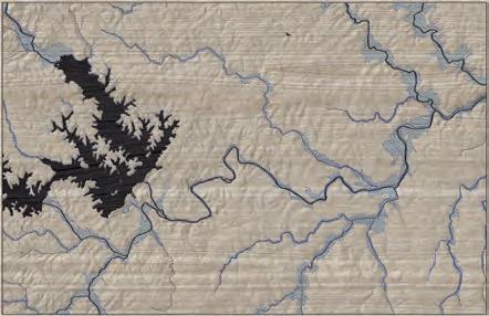

This planning sec tion extends 7.0 miles from the Fonta Flora Brew ery at Whippoor will Farm to Pow erhouse Road. The Fonta Flora Farmhouse Brew ery property provides a significant opportunity for a destination-quality trailhead. A short, paved spur trail, approximately 400 ft. long, will connect the brewery and trailhead to an existing segment of the OVNHT within Lake James State Park. This connection will require cooperation with a private landowner to cross an existing gravel driveway.
The OVNHT is not currently designed for dual-use and must be reconstructed and routed to provide for bicycles. This will require close cooperation with the NC Division of State Parks. Similarly, the OVN HT crossing at Hwy. 126 will require redesign to al low bicycles to achieve road grade and cross where sight lines are best. This can be achieved by utilizing an existing abandoned road bed with two to three moderate switchbacks. Currently, the OVNHT utiliz es a set of stairs to achieve grade before continuing west through the 1780 Community.

The trail will utilize the OVNHT for two miles be fore reaching Canal Bridge. The transition from the OVNHT to road grade at Canal Bridge presents a challenge and will likely require a boardwalk or bridge system. At Canal Bridge, the FFST utiliz

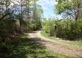
es NCDOT right-of-way until it reaches additional state-owned land south of Benfields Landing Road; approximately 1,050 feet of NCDOT Side Path trail type will be required along Canal Bridge and Hwy. 126 before reaching additional state property. The FFST will meander through the state’s property for approximately 1.2 miles before reaching private property. The trail will extend along the south side of Hemlock Springs Rd. where county officials continue to work with landown ers to secure trail easements. The trail then connects to Lake James Family Campground. From there, the trail will parallel the north side of Benfields Landing Road before reaching a scenic vista and beach at the future site of a pocket park.
From the pocket park, the natural surface trail con tinues east for a short distance before crossing N. Powerhouse Road to connect to the proposed trailhead on Rays Dairy Road. From there, The trail continues east to another vista that provides an op portunity for primitive camping.
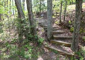
46 FONTA FLORA STATE TRAIL LAKE JAMES TO MORGANTON MASTER PLAN
SECTION 1 FONTA FLORA BREWERY >> POWERHOUSE ROAD PHOTOS: (1) THE TRAIL CONNECTOR TO FONTA FLORA BREWERY WILL CROSS A PRIVATE DRIVEWAY. (2) EXISTING OVNHT WILL REQUIRE REDESIGN FOR BICYCLES. FONTA FLORA BREWERY >> POWERHOUSE ROAD MCDOWELL COUNTY BURKE COUNTY 0 0.5 2 MI. CANOECREEK REEDYCREEK PADDY CREEK JOHNSRIVERWA IORFORK PEEDEBRANCH LI LESLV MUDDYC EK O RVER WILSO CREEK RIV R MOR GA NTO N GLEN AL P IN LAKE JAMES JOHNS RIVER GAMELANDS LAKE JAMES STATE PARK TRAILS FONTA FLORA FREEDOM TRAIL 1 FIELD NOTES PROPOSED FFST ON N 70 126 126 181 PLANNING SECTIONS VICINITY MAP TOTAL LENGTH: 7.0 MILES TRAIL TYPE: NCDOT SIDE PATH DUAL-USE TRAIL ESTIMATED COST: $515,476 POINTS OF INTEREST: FONTA FLORA BREWERY CANAL BRIDGE TRAILHEAD RAYS DAIRY TRAILHEAD BRIDGEWATER RIVER ACCESS LAKE JAMES FAMILY CAMPGROUND 1 2

47CHAPTER 4: Recommendations TRAIL FEATURES FIELD NOTES LANDOWNER SENTIMENT TRAILHEAD ROAD CROSSING MAJOR BRIDGE PUBLIC LAND YES NO POSITIVE NO RESPONSE PREFERRED TRAIL ROUTE COMPLETED FFST FFST ON PROPOSED LOCAL TRAIL PROPOSED FFST ON EXISTING LOCAL TRAIL EXISTING LOCAL TRAIL PROPOSED LOCAL TRAIL ALTERNATE TRAIL ROUTE TRAILS # # N0 1/8 1/4 1/2 MI. 3 2 FONTA FLORA BREWERY AT HISTORIC WHIPPOORWILL DAIRY BRIDGE EXISTING CANAL BRIDGE PUBLIC ACCESS AND TRAILHEAD OLDCATAWBARIVER CATAWBARIVER LAKE JAMES FAMILY CAMPGROUND PRIMITIVE CAMPING AT VISTA EXISTING CANOE PORTAGE TRAIL EXISTING OVNHT 126 LAKE JAMES 1 2 126 FONTA FLORA STATE TRAILFUTURE COVE BRIDGE LAKEJAMESSTATEPARK BRIDGEWATER RIVER ACCESS EXISTING HOLLY DISCOVERY TRAILHEAD LINVILLE DAM TRAILHEAD FONTA FLORA LAKEJAMESLOOP LAK EFORREST HOLIDAY SHORE B E N LAURELPOINTEHEMLOCK COTTA G E P ARK POWERHOUSE N POWERHOUSE WATERFORD W A Y SLEEPY HOLLOW WHIPPORWILL HO OLLW LANCASTER DUCKWORTH ELONC Y BU MGARNERBENFIELDSLANDING FUTURE BENFIELDS POCKET PARK RAY’S DAIRY TRAILHEAD SECTION 1 FONTA FLORA BREWERY >> POWERHOUSE RD. MAP 8: PLANNING SECTION 1
SECTION 1 FONTA FLORA BREWERY >> POWERHOUSE ROAD
The trail will utilize the existing Muddy Creek Bridge before connecting to the existing Bridgewater Riv er Access, which is maintained by Duke Power and is programmed for further infrastructure improve ments. At Bridgewater, the FFST: Lake James Loop branches east on the canoe portage trail to the Lin ville Dam Trailhead while the OVNHT and FFST con tinue east toward Morganton. This planning section ends where the trail leaves Powerhouse Road and connects to established trail easements that follow the Catawba River.
TRAIL FEATURES Trailheads
This planning section includes five trailheads. The proposed trailhead located at Fonta Flora Brew ery at Whippoorwill Farm serves as the western
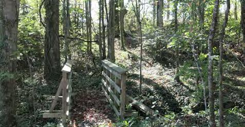
terminus of the study area. The brewery occupies eight acres of the historic dairy farm property. The remaining 40 acres have been conserved in perpe tuity through a partnership between Foothills Land Conservancy and the NC Division of State Parks who incorporated the property into Lake James State Park.
The Holly Discovery Trailhead currently provides ac cess to the Holly Discovery Trail and OVNHT within the State Park.
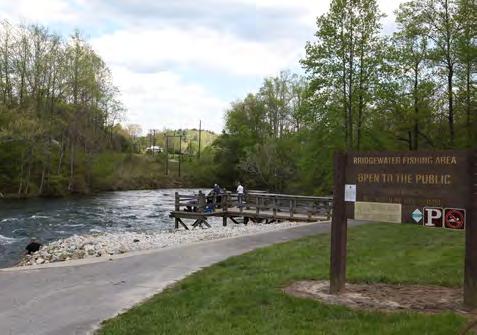
Canal Bridge and Bridgewater Trailheads utilize ex isting public water access facilities owned by Duke Energy. Duke has plans to significantly enhance the Bridgewater site, providing for additional parking and an enhanced boat launch area. The fifth trail head in this section is proposed on Rays Dairy Road.
Crossings
Proposed within this section are three (3) road crossings and three (3) major bridges.
The primary route crosses Benfields Landing Road twice in this section. The first crossing occurs south of Canal Bridge where Benfields Landing intersects Hwy. 126. At the second crossing, the trail crosses to the north side of Benfields Landing Road at Lake James Family Campground. Crossing #3, is located a short distance east of the pocket park where the trail crosses N. Powerhouse Road near its intersec tion with Benfields Landing Road. These crossings should include design measures to slow vehicular traffic and notify motorists of the trail crossing.
The three major bridge crossings utilize existing
bridges. Major Bridge #1 crosses Paddy Creek to connect the Holly Discovery Trail to the OVNHT in Lake James State Park. Major Bridges #2 and #3, utilize NCDOT bridges at Canal Bridge and the Pow erhouse Road bridge located near the Bridgewater public river access. Both vehicular bridges will re quire appropriate treatments that alert motorists to possible trail users and distinguish the trail from the vehicular travel lane.
48 FONTA FLORA STATE TRAIL LAKE JAMES TO MORGANTON MASTER PLAN
PHOTO: (3) THE TRANSITION FROM EXISTING OVNHT TO ROAD GRADE AT CANAL BRIDGE MAY REQUIRE ADDITIONAL BRIDGES. (4) BRIDGEWATER RIVER ACCESS IS A SIGNIFICANT CONNECTION POINT. 3
4
BREWING UP ADVENTUREEXHIBIT 1:
The Fonta Flora Brewery at Whippoorwill Farm provides an opportunity for a destination-qual ity trailhead. A short connector path will link the brewery to the FFST/OVNHT in Lake James State Park near Paddy’s Creek.
EXISTING
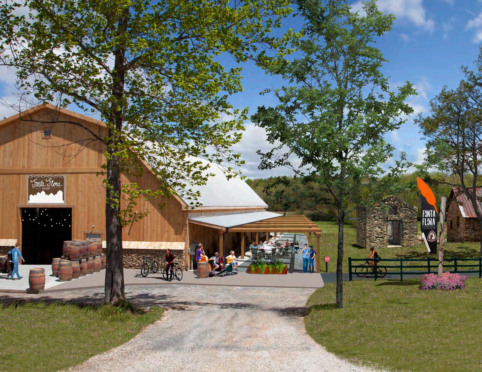
49CHAPTER 4: Recommendations
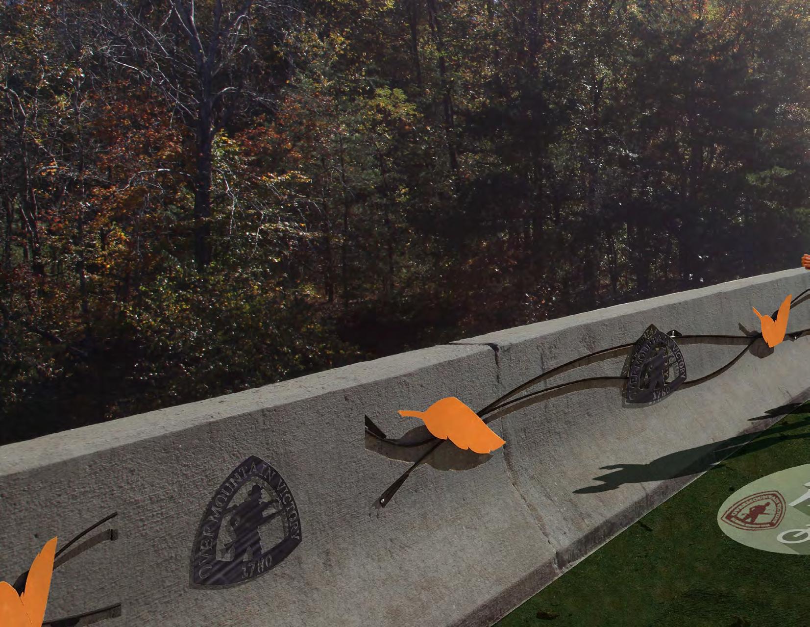
50 FONTA FLORA STATE TRAIL LAKE JAMES TO MORGANTON MASTER PLAN
CANAL BRIDGE
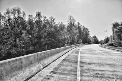
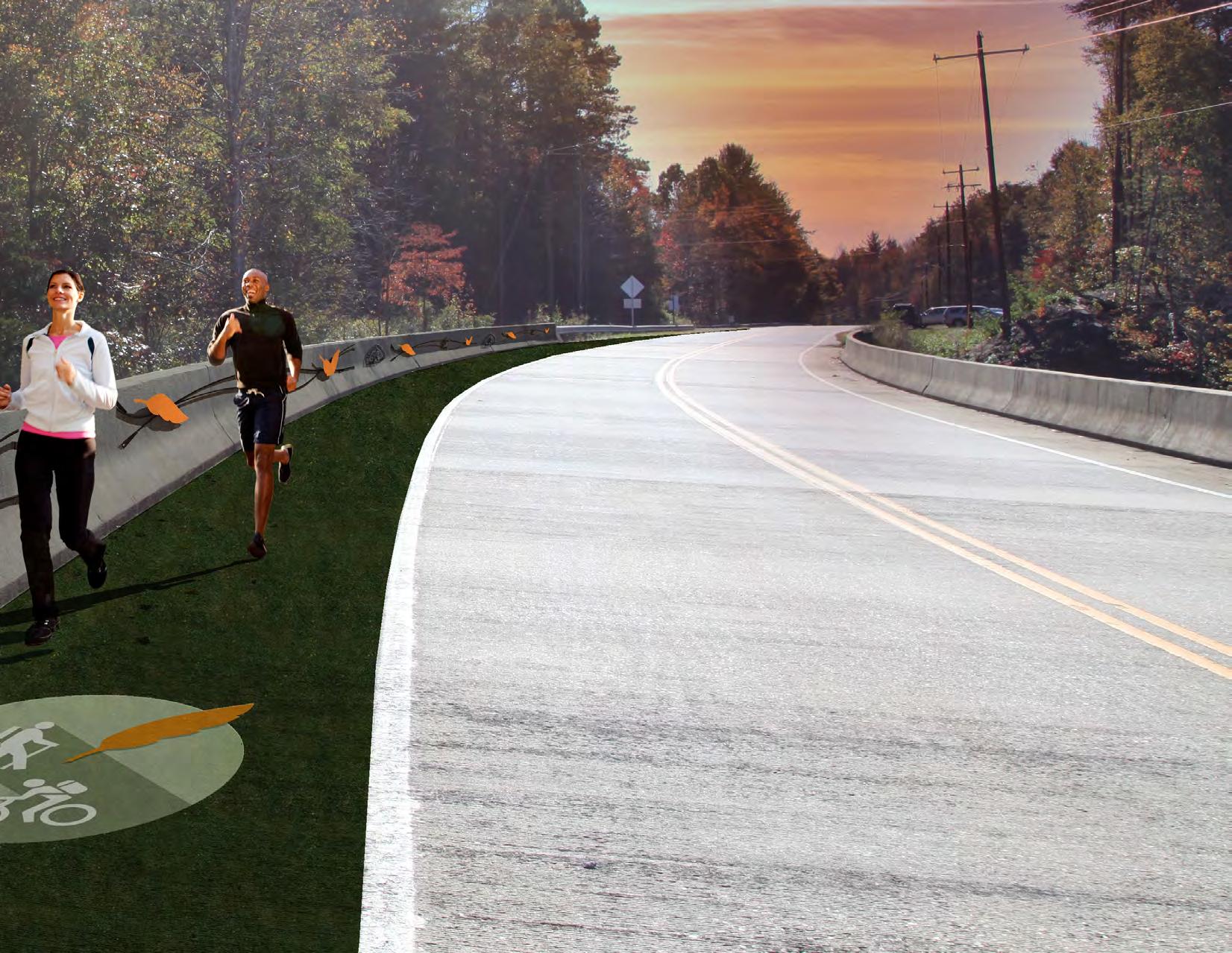
with the
51CHAPTER 4: Recommendations
EXHIBIT 2: Enhancements to the Canal Bridge could include green pavement markings along
FFST land OVNHT logos. A short railing should be attached to the bridge’s wall to ensure trail user safety. EXISTING
CANAL BRIDGE TRAILHEAD
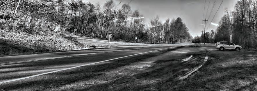
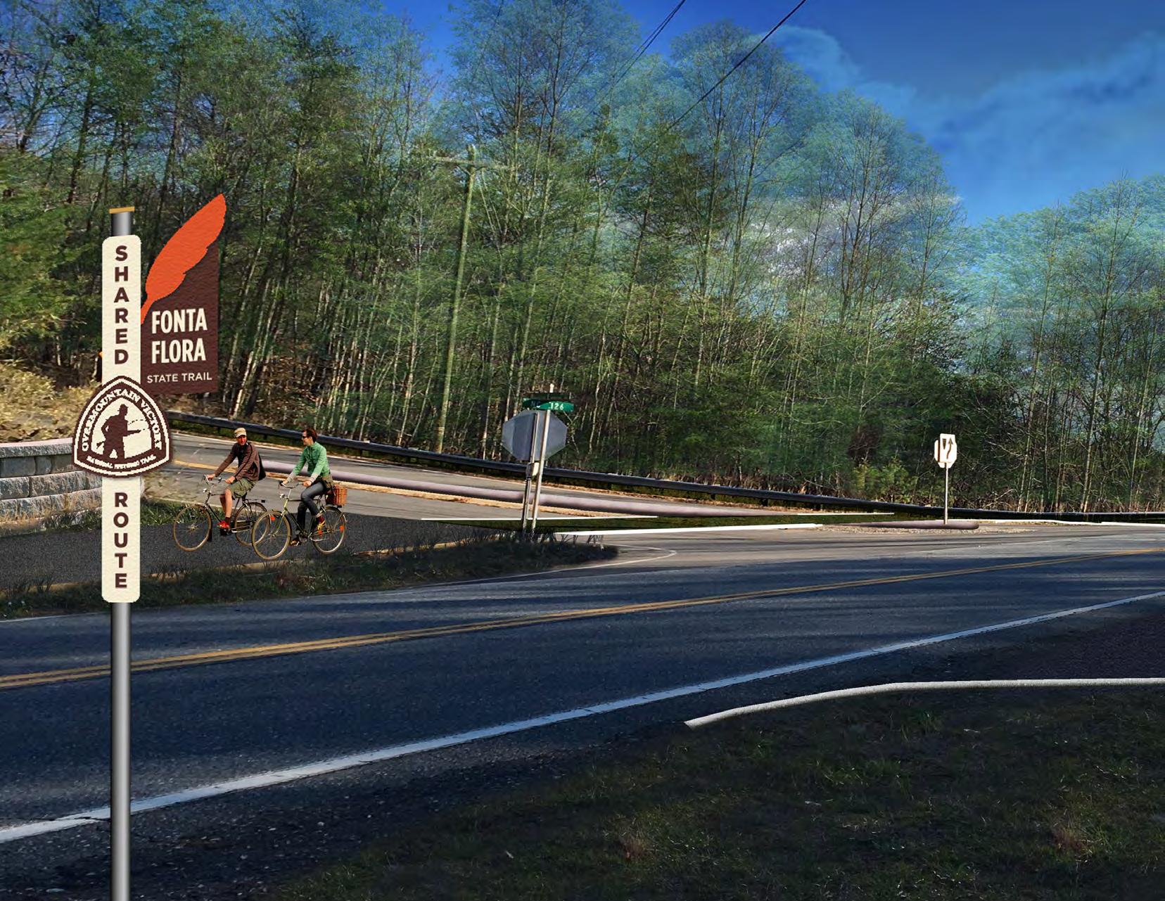
52 FONTA FLORA STATE TRAIL LAKE JAMES TO MORGANTON MASTER PLAN
Canal Bridge Trailhead is located just south of the bridge at the intersection of Highway 126 and Benfields Landing Road. A crossing at Highway 126 will provide connectivity to a trailhead with FFST and OVNHT information and a shelter. EXISTING
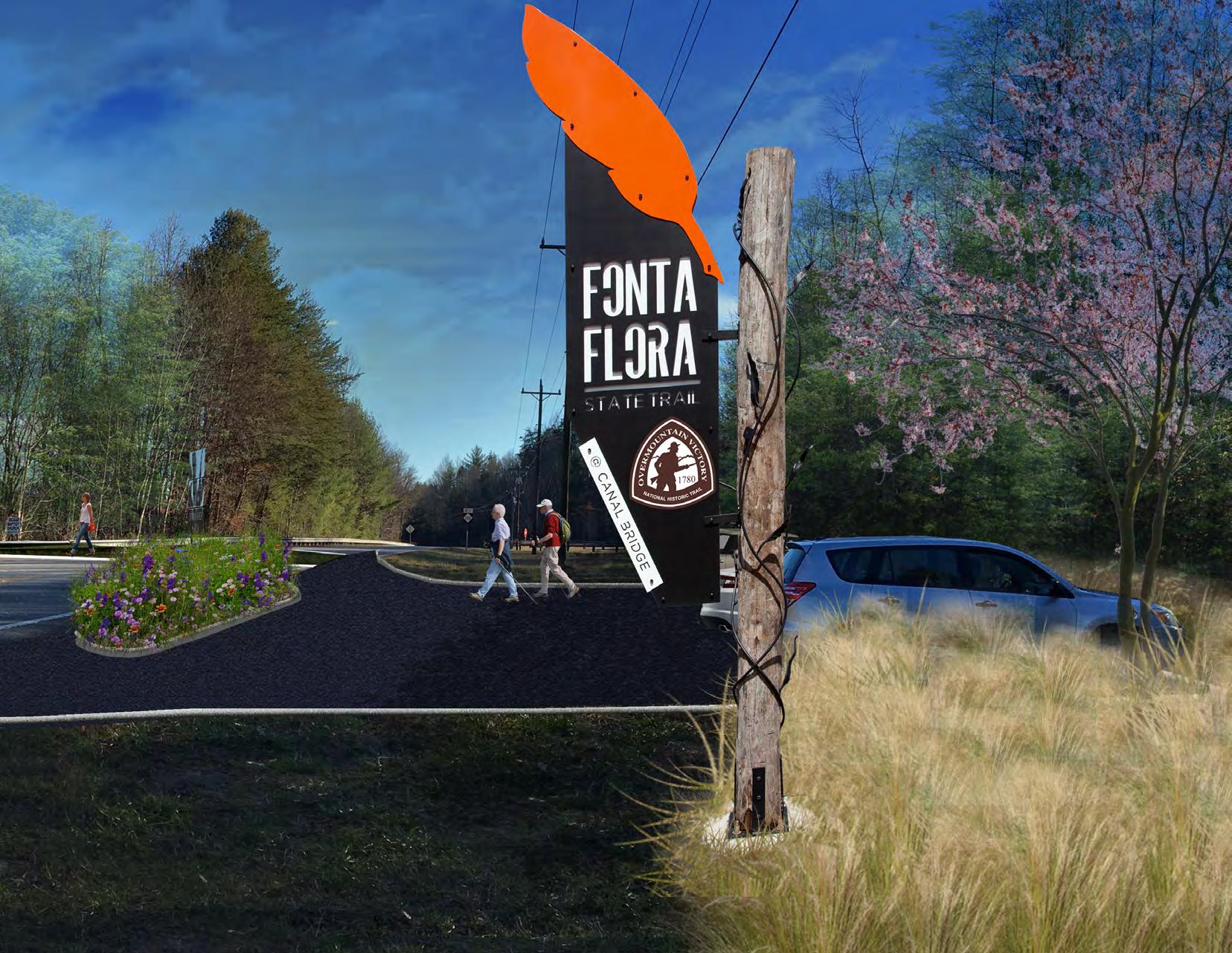
53CHAPTER 4: Recommendations
4:
LAKE JAMES FAMILY CAMPGROUND
The preferred alignment extends parallel to Benfields Landing Road and provides a direct connection to the Lake James Family Campground. This trail section will be notable to passing motorist and will create interest for those visiting the campground and Lake James area.
EXISTING
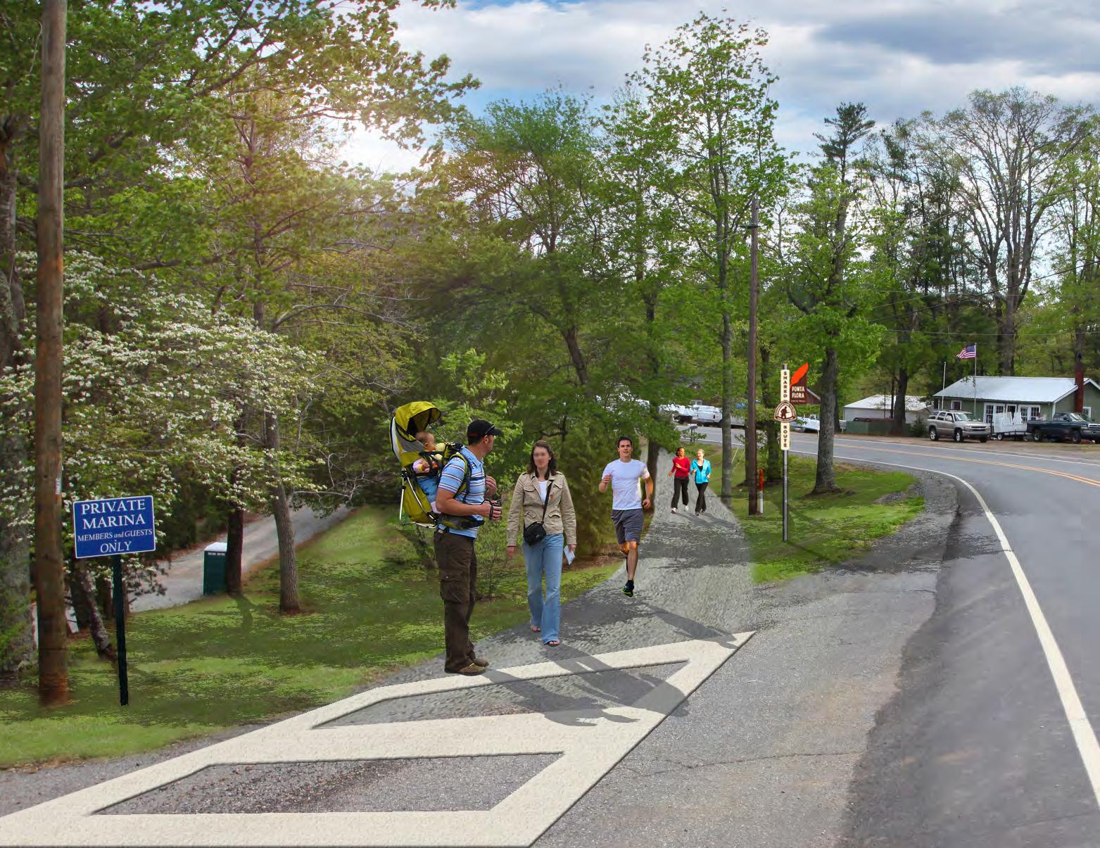
54 FONTA FLORA STATE TRAIL LAKE JAMES TO MORGANTON MASTER PLAN
EXHIBIT
N. POWERHOUSE CROSSINGEXHIBIT 5:
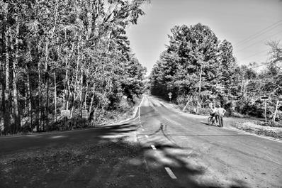
East from Benfields Pocket Park the FFST will cross North Powerhouse Road. A traffic-calm ing study is suggested for this intersection. Potential improvements include green pavement treatment, FFST sign, and pedestrian-activated rapid flash beacons will signal motorists to reduce speeds and watch for trail users.
EXISTING
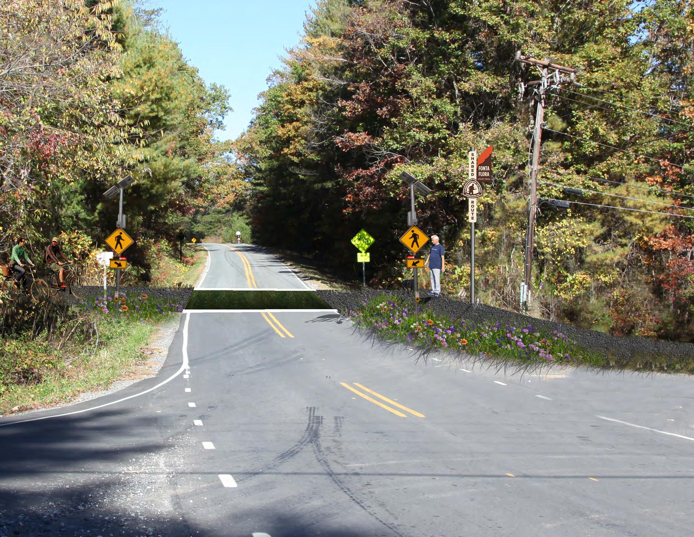
55CHAPTER 4: Recommendations
BRIDGEWATER
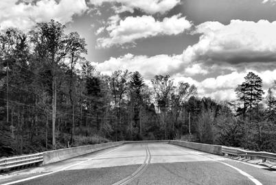
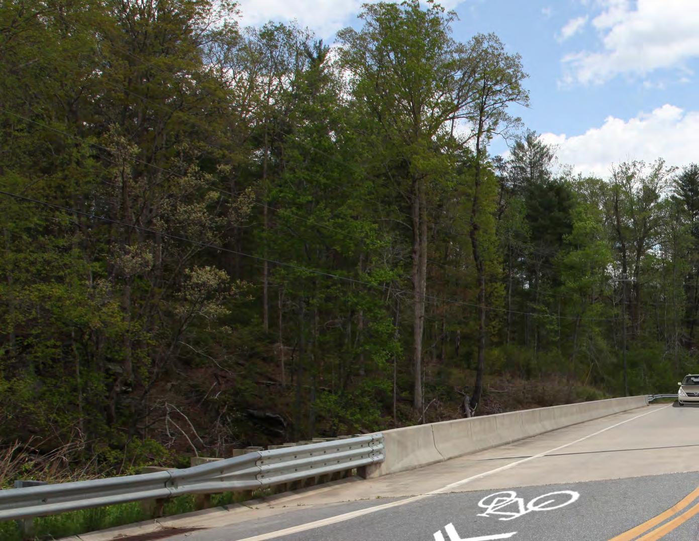
56 FONTA FLORA STATE TRAIL LAKE JAMES TO MORGANTON MASTER PLAN
EXHIBIT 6: The bridge near Duke Energy’s Bridgewater River Access will serve as the third and final major NCDOT bridge crossing. A short railing should be attached to the bridge’s wall to ensure trail user safety. This section is also part of the OVNHT. EXISTING
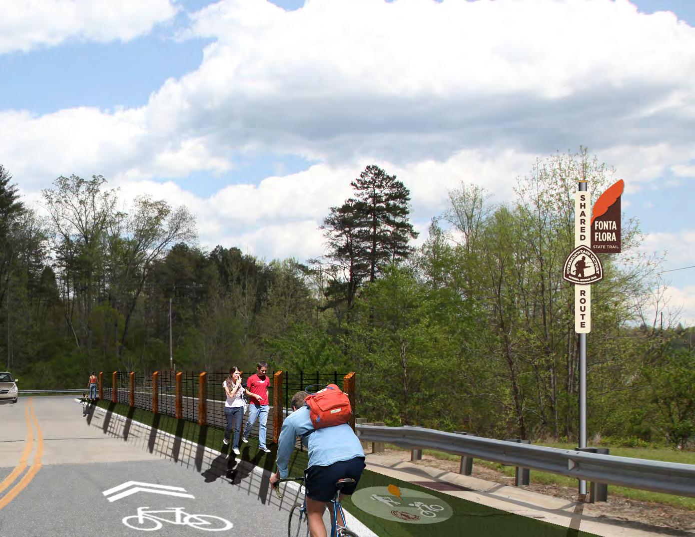
RIVER ACCESS
PROPOSED TRAILS
This planning section extends 5.7 miles from Power house Road to Watermill River Access.
The preferred route continues along the north side of the Catawba River after crossing Powerhouse Road near the North Bend Access: a planned NC Wildlife Resources River Access. From North Bend, the trail continues along the river utilizing Duke En ergy property. The trail crosses St. Paul’s Church Road and will need to bridge the Catawba River to connect to secured trail easements within an equestrian community on the river’s south side. From there, the trail will continue along the south side and connect to the existing Watermill River Access. Trail type within the Catawba River Club should expand to a multi-use tread that can accom modate existing equestrian use.
TRAIL FEATURES Trailheads
Two trailheads are proposed within this planning section. The first is proposed along the Catawba River at Powerhouse Road where NC Wildlife Re sources will ultimately construct a river access area. This access should provide for an FFST and OVNHT informational map kiosk to welcome users. The sec ond trailhead is proposed at the existing Watermill River Access. The trail will need to extend under the Watermill Bridge to connect with this access area, which could benefit from minor enhancements to organize parking and orient users to area recreation opportunities.
Crossings
There are three (3) road crossings and one (1) major bridge within this planning section.
The first major road crossing exists at Powerhouse Road where an initial visual inspection revealed that the trail will likely require a surface crossing of the road rather than an underpass. However, during the design and engineering phase or with the devel opment of the river access planned in this vicinity, an opportunity for a trail underpass should be fur ther explored. The second crossing is at Saint Paul’s Church Road, a rural collector road that the trail will need to cross to reach the Catawba River. The final road crossing in this section is located at Watermill Bridge, which provides sufficient room to accom modate a trail underpass.
The only necessary major bridge (#4) is centrally located within the planning section. This bridge will allow the trail to avoid landowners located on the north side of the Catawba River that are unwilling to provide trail easements, while accessing existing trail easements located on the south side of the riv er within the Catawba River Club residential subdi vision.
58 FONTA FLORA STATE TRAIL LAKE JAMES TO MORGANTON MASTER PLAN
SECTION 2 POWERHOUSE ROAD >> WATERMILL
POWERHOUSE ROAD >> WATERMILL RIVER ACCESS VICINITY MAP TOTAL LENGTH: 5.7 MILES TRAIL TYPE: DUAL-USE TRAIL MULTI-USE TRAIL ESTIMATED COST: $1,047,396.00 POINTS OF INTEREST: FUTURE NORTH BEND RIVER ACCESS WATERMILL RIVER ACCESS MCDOWELL COUNTY BURKE COUNTY 0 0.5 MI. CANOECREEK REEDYCREEK PADDY CREEK JOHNSRIVERWA IO FORK PEEDEBRANCH LI LESLV MUDDYC EK O RVER WILSO CREEK RIVER MOR GA NTO N GLEN AL IN E LAKE JAMES JOHNS RIVER GAMELANDS LAKE JAMES STATE PARK TRAILS FONTA FLORA FREEDOM TRAIL 2 FIELD NOTES PROPOSED FFST ON N 70 126 126 181 40 PLANNING SECTIONS
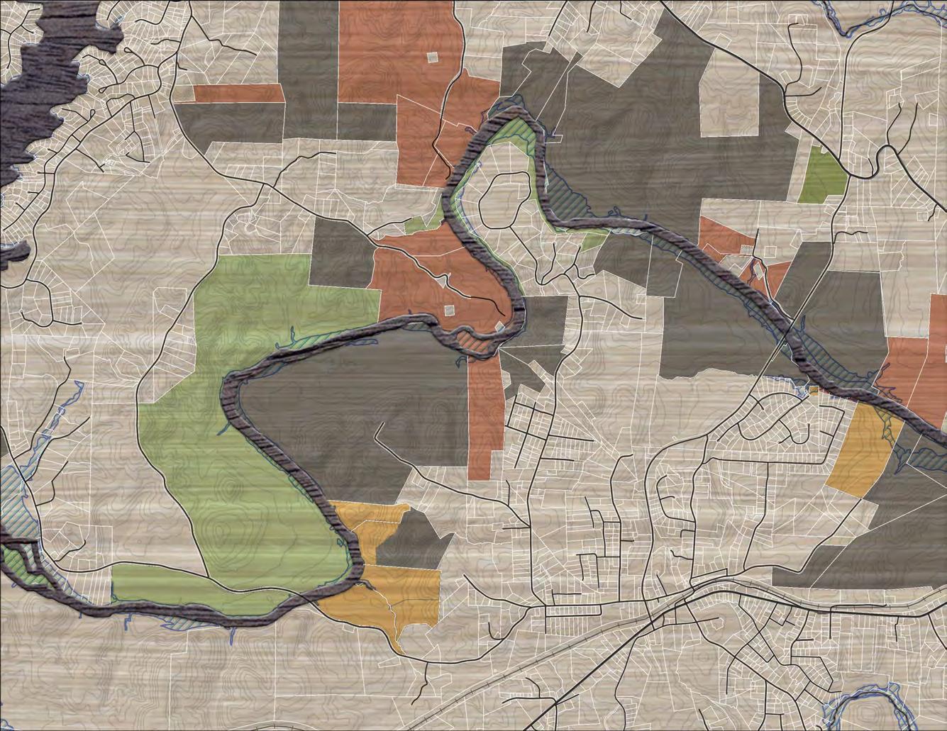


59Recommendations TRAIL FEATURES FIELD NOTES LANDOWNER SENTIMENT TRAILHEAD ROAD CROSSING MAJOR BRIDGE PUBLIC LAND YES NO POSITIVE NO RESPONSE PREFERRED TRAIL ROUTE COMPLETED FFST FFST ON PROPOSED LOCAL TRAIL PROPOSED FFST ON EXISTING LOCAL TRAIL EXISTING LOCAL TRAIL PROPOSED LOCAL TRAIL ALTERNATE TRAIL ROUTE TRAILS # # 0 1/8 1/4 1/2 MI. SECTION 2 POWERHOUSE RD. >> WATERMILL RIVER ACCESS 4 5 6 4 WATERMILL RIVER ACCESS FUTURE NORTH BEND ACCESS AREA 126 WATERMILL FORNEYKIRKSEY PEACEFUL MCGIMPSEY CONLEY WHIPORWILL HO L LO W LANCASTER DUCKWORTH RRWHITE CONLEY BUMBARNER POWERHOUSE HAMPSON OLDSTPAUL BUCKTHORN TAVERN PADDOCK RIVER CLUB S LAIL N LAIL CANNONBALL JAMISON HELTON LAIL AYERS ORDERSPOLLARD MALONEY MCGALLIARD GLEN ALPINE TURKEYTAIL SRIVERGLEN LINDA WAY RIVER BREEZE WATERMILLG TABLE ROCK MIDDLE SCHOOL RIVER DNEB RIVER BLUFFST . PAUL’SCHURCH MAP 9: PLANNING SECTION 2
THE ROAD AGAIN
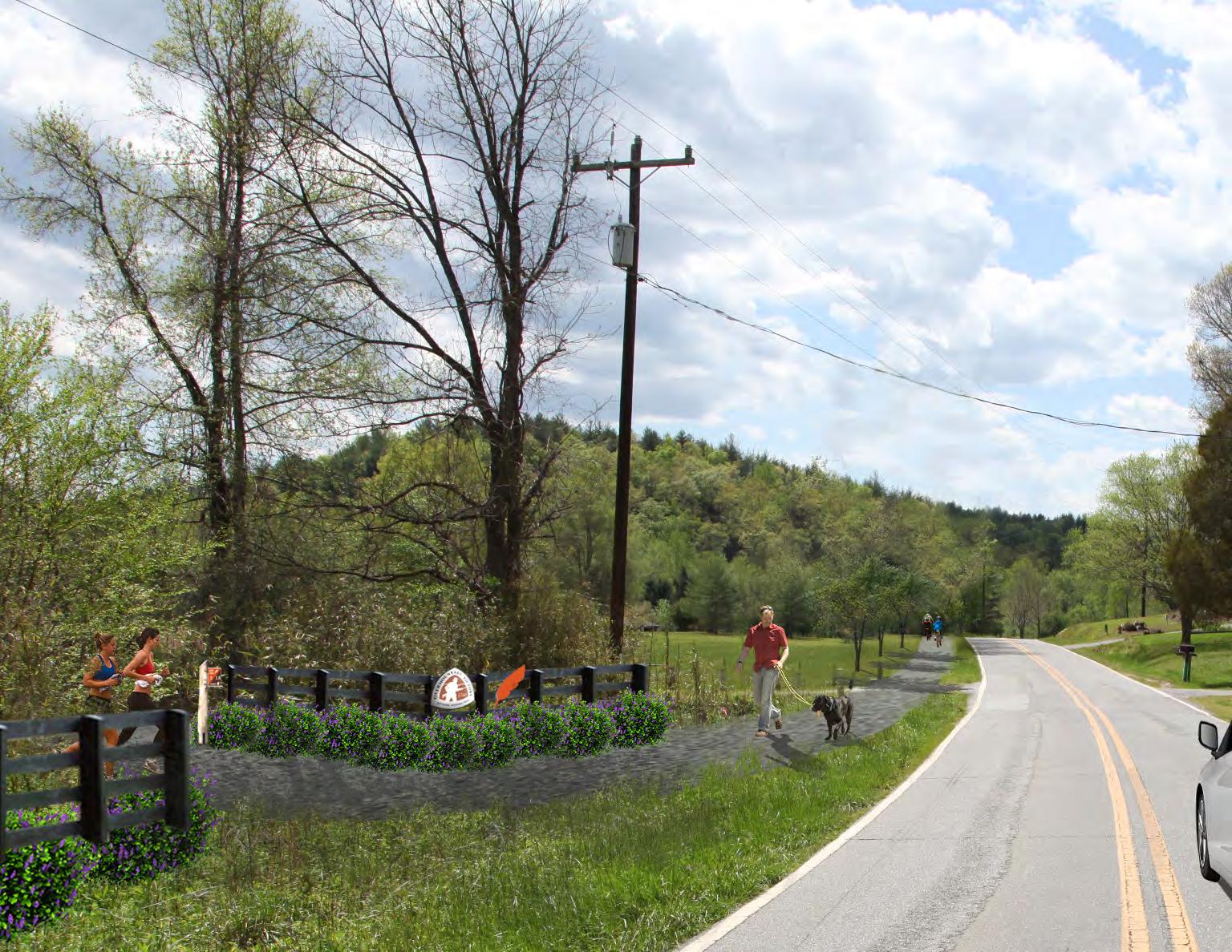
POWERHOUSE
60 FONTA FLORA STATE TRAIL LAKE JAMES TO MORGANTON MASTER PLAN OFF
@
EXHIBIT 7: After paralleling Powerhouse Road for approximately one mile, the preferred route laves the roadside, extends south to the Catawba River, and takes advantage of trail easements provided by Duke Power. EXISTING
WATERMILL RIVER ACCESS ENHANCEMENTSEXHIBIT
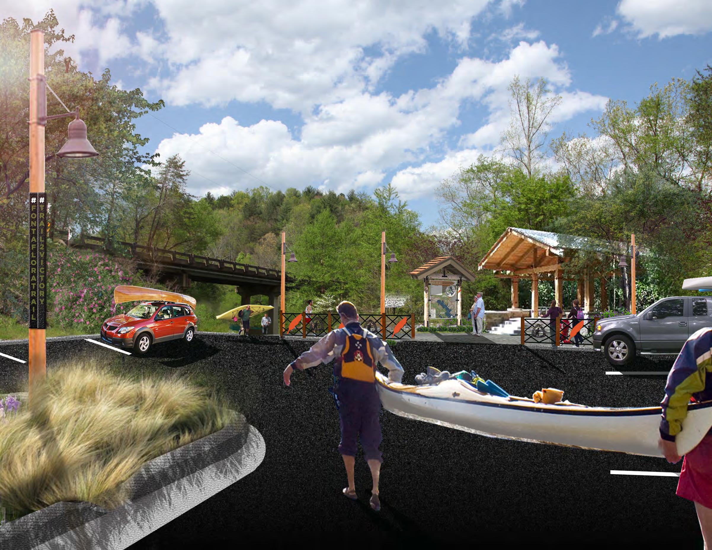
The existing Watermill River Access serves as an ideal location to organize and orient trail users. Future
at this pocket park could include paved parking, a picnic shelter, and
kiosk.
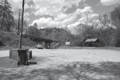
61
8:
enhancements
an information
EXISTING CHAPTER 4 Recommendations
PROPOSED TRAILS
This planning section extends 4.6 miles from Water mill River Access to the Catawba River Greenway and Soccer Complex. This section is recognized as the most challenging area within the study area in regards to feasibility for implementation and will require additional landowner outreach. There are significant landowner challenges on both the north and south side of the Catawba River. Therefore, a preferred route is not provided; only alternative routes are identified in order to avoid alienation of area landowners. Ideally, the trail would continue along the south side of the river from the Watermill River Access, cross ing under Independence Boulevard, to the Catawba River Greenway and Soccer Complex, also located on the south side. However, development density and noted uninterested landowners represent sig nificant challenges on the south side of the river. Along the north side of the river, the historic Swan Pond property would serve as a meaningful con
nection as part of the NC Preservation Program. The Canoe Creek corridor also serves as an envi ronmentally suitable location for a trail, but again, landowner challenges present a barrier.
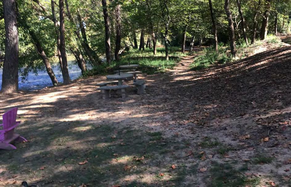
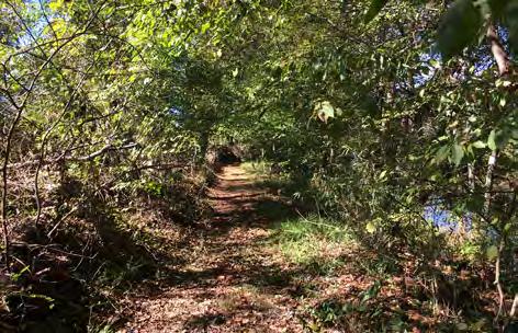
TRAIL FEATURES
Trailheads
The trailheads proposed within this planning sec tion currently exist at the Catawba River Soccer Complex and Freedom Park, which provides access to a certified section of OVNHT. Enhancements at these trailheads might involve incorporating trail signage and other trail features noted in Chapter 3.
62 FONTA FLORA STATE TRAIL LAKE JAMES TO MORGANTON MASTER PLAN
SECTION 3 WATERMILL RIVER ACCESS >> CATAWBA RIVER GREENWAY PHOTOS: (5) AN INFORMAL TRAIL EXISTS ALONG THE CATAWBA RIVER .AT THE RIVERSIDE GOLF AND RV PARK. (6) A FOOTPATH LINKS THE CATAWBA RIVER GREENWAY TO JUDGE’S RIVERSIDE RESTAURANT.5 6 WATERMILL RIVER ACCESS >> CATAWBA RIVER GREENWAY VICINITY MAP TOTAL LENGTH: 4.6 MILES TRAIL TYPE: DUAL-USE TRAIL ESTIMATED COST: $145,728 POINTS OF INTEREST: WATERMILL RIVER ACCESS CATAWBA RIVER SOCCER COMPLEX FREEDOM PARK MCDOWELL COUNTY BURKE COUNTY 0 0.5 MI. CANOECREEK REEDYCREEK PADDY CREEK JOHNSRIVERWA IO FORK PEEDEBRANCH LI LESLV MUDDYC EK O RVER WILSO CREEK RIVER MOR GA NTO N GLEN AL IN E LAKE JAMES JOHNS RIVER GAMELANDS LAKE JAMES STATE PARK TRAILS FONTA FLORA FREEDOM TRAIL 3 FIELD NOTES PROPOSED FFST ON N 70 126 126 181 40 PLANNING SECTIONS
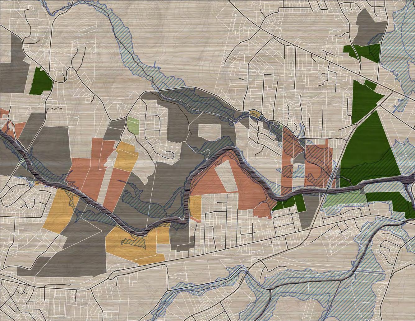


63Recommendations CITY OF MORGANTON JURISDICTION 126 181 WATERMILLGL OLDRIVER OLDLU M B E R YA RD RIVER BREEZE PITTS INDUSTRIAL BLVD CARBON CITY ELM WHITLEY SPRINGDALE NORMANDY GLENDALE GREENLEE FORD INDEPENDENCE SAMWALL BRANSTROM WILBURM NEWTON JIM WALLB R O O ENOTSK B E AC H M TNOCAMELLIA GARDENWHISPERING PINE STEPHENS CLAY TRUAX HARBINSON MULL NGREEN ST M A RCH BOST EM O R Y W O OD LA FORET MCCONNAUGHEYSWAN POND 70 6 WATERMILL RIVER ACCESS CATAWBARIVER CATAWBA RIVER TREE FARM CANOE CREEK MCDOWELL HOUSE/ QUAKER MEADOWS FREEDOM HIGH SCHOOL FREEDOM PARK TABLE ROCK MIDDLE SCHOOL CATAWBA RIVER GREENWAY TRAIL FEATURES FIELD NOTES LANDOWNER SENTIMENT TRAILHEAD ROAD CROSSING MAJOR BRIDGE PUBLIC LAND YES NO POSITIVE NO RESPONSE PREFERRED TRAIL ROUTE COMPLETED FFST FFST ON PROPOSED LOCAL TRAIL PROPOSED FFST ON EXISTING LOCAL TRAIL EXISTING LOCAL TRAIL PROPOSED LOCAL TRAIL ALTERNATE TRAIL ROUTE TRAILS # # 0 1/8 1/4 1/2 MI. SECTION 3 WATERMILL RIVER ACCESS >> CATAWBA RIVER GREENWAY 5 MAP 10: PLANNING SECTION 3
PROPOSED TRAILS
This planning section extends 4.0 miles from the Catawba River Greenway and Soccer Complex to Downtown Morganton.

The FFST will utilize the Catawba River Greenway north for 1.5 miles. The greenway is a certified seg ment of the OVNHT. At the southern end of Cataw ba Meadows Park, the FFST and OVNHT will split.
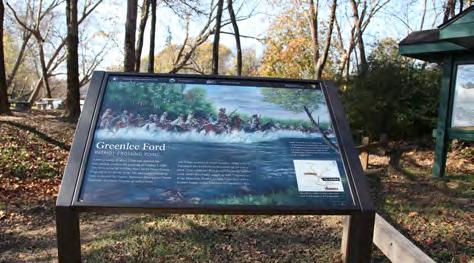
The OVNHT continues north along the river while the FFST extends east on a future greenway con nector planned by the City of Morganton. The City has acquired the necessary parcels for the connec tor. Once complete, it will link the Catawba River Greenway to an existing greenway segment adja cent to North Green Street. The FFST terminates as the greenway transitions into a typical sidewalk in front of the Fonta Flora Brewery in downtown Morganton.
TRAIL FEATURES Trailheads
Two existing trailheads are noted within this plan ning section. The River Village commercial center provides centrally-located greenway access. Trail users accessing the greenway from Catawba Mead ows Park will travel south to the FFST.
Crossings
This planning section features one (1) major road crossing and one (1) major bridge.
A surface crossing will be necessary at Sanford Drive just south of Bouchelle Street. There, Mor
ganton’s future greenway connector will cross from Catawba Meadows Park to the new Mountain View Elementary School and Morganton recreation and aquatic center. The Sanford Drive crossing will re quire treatment appropriate to signal motorists of trail users.
The only major bridge in this section is an existing greenway bridge over Silver Creek.
64 FONTA FLORA STATE TRAIL LAKE JAMES TO MORGANTON MASTER PLAN
SECTION 4 CATAWBA RIVER GREENWAY >> DOWNTOWN MORGANTON 7 CATAWBA RIVER GREENWAY >> DOWNTOWN MORGANTON VICINITY MAP TOTAL LENGTH: 4.0 MILES TRAIL TYPE: TYPICAL GREENWAY ESTIMATED COST: $623,260 POINTS OF INTEREST: CATAWBA RIVER SOCCER COMPLEX CATAWBA MEADOWS PARK DOWNTOWN MORGANTON FONTA FLORA BREWERY PHOTOS: (7) THE CATAWBA RIVER GREENWAY IS A CERTIFIED SEGMENT OF THE OVNHT. (8) DOWNTOWN MORGANTON IS THE EASTERN TERMINUS OF THE FFST. 8 MCDOWELL COUNTY BURKE COUNTY 0 0.5 MI. CANOECREEK REEDYCREEK PADDY CREEK JOHNSRIVERWA IO FORK PEEDEBRANCH LI LESLV MUDDYC EK O RVER WILSO CREEK RIVER MOR GA NTO N GLEN AL IN E LAKE JAMES JOHNS RIVER GAMELANDS LAKE JAMES STATE PARK TRAILS FONTA FLORA FREEDOM TRAIL 4 FIELD NOTES PROPOSED FFST ON N 70 126 126 181 40 PLANNING SECTIONS
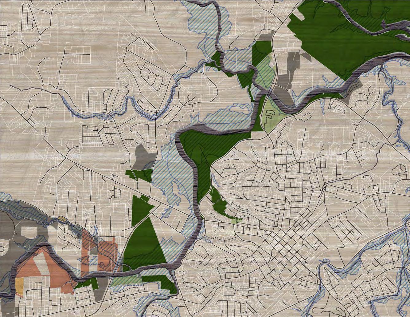


65CHAPTER 4: Recommendations 0 1/4 1/2 1 MI. CITYOF MORGANTON JURISDICTION 126 181 126 181 HUNTING CREEK SPRINGLAKEWALTERTAYLOR FAITH WAHARRIS DINGC KEER TIMBERLINE EDGEWOOD FORD FOX ERVIN SHERWOOD CLARK GL E N WOOD DOCASTEE EM O R Y W O OD CLAY STEPHENS KINCAID WHISPERING PINE CAMELLIA GARDEN BEAC OMH N T B R O O ENOTSK JIM WALL WILBURM NEWTON SAMWALL BRANSTROM MCDOWELL HOUSE/ QUAKER MEADOWS CATAWBA MEADOWS PARK ROCKY FORD ACCESS PROPOSED OVNHT JOHNS RIVER GAMELANDS CATAWBA RIVER GREENWAY AND SOCCER COMPLEX CATAWBARIVER CATAWBARIVER CATAWBA RIVER GREENWAY & EXISTING OVNHT PROPOSED WILSON CREEK WARRIOR FORK CANOE CREEK MORGANTON 126 64 7 FREEDOM PARK CHARLES BOST ST MARYS CHURCH WOODSWAYCAMELOT VERVRI IEW PARKLANDLOSTCORNER SELMANBELVE DERE POLLY VFW MAPLEWOODNCOUNCILOAKSREDBUDSHUFFLER WATERFILTERPLANT VALLEY VIEW SHADOWLINE WHITLEY SPRINGDALE NORMANDY GREENLEE FORD MULLHARBINSONTRUAX LOVEN INDEPENDENCE WAMSUTTAMILL WEST PARK RIVERSIDEKINWOOD HILLSIDE DAVIS RINK N KINGCOLLETT WCONCORD YORK EVANS MOREHEADWALKER AL U R E L HILL VINE ARDEN RIVER VILLAGE COMMERCIAL CENTER FFST EASTERN TERMINUS MORGANTON WTP 5 PREFERRED TRAIL ROUTE FFST ON PROPOSED LOCAL TRAIL COMPLETED FFST EXISTING LOCAL TRAIL PROPOSED LOCAL TRAIL ALTERNATE TRAIL ROUTE PROPOSED FFST ON EXISTING LOCAL TRAIL TRAILHEAD ROAD CROSSING MAJOR BRIDGE PUBLIC LAND TRAILS TRAIL FEATURES # # FIELD NOTES N LANDOWNER SENTIMENT YES NO POSITIVE NO RESPONSE SECTION 4 CATAWBA RIVER GREENWAY >> DOWNTOWN MORGANTON MAP 11: PLANNING SECTION 4
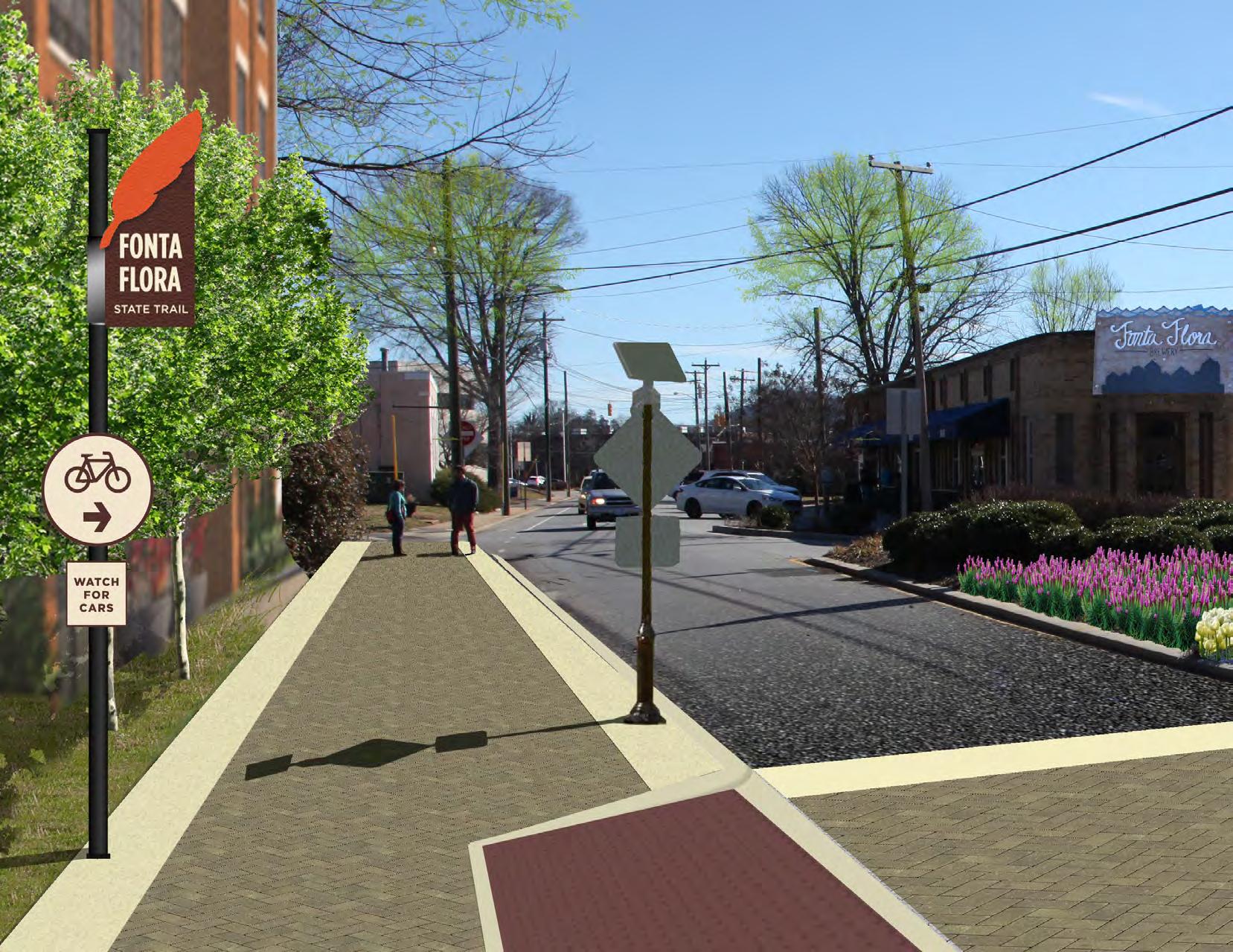
66 FONTA FLORA STATE TRAIL LAKE JAMES TO MORGANTON MASTER PLAN
GET DOWN WITH THE TRAIL TOWNEXHIBIT 9:
Downtown Morganton is the eastern terminus of the Fonta Flora State Trail. The trail utilizes an existing greenway segment that enters the northwest end of downtown where N. Green Street and N. Sterling Street diverge. In the near future, the City of Morganton will update this section of greenway in conjunction with new development. Cyclists must cross to merge with the flow of traffic.
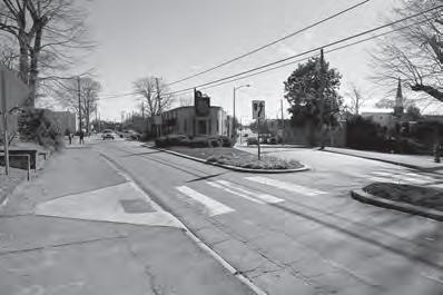
EXISTING
67CHAPTER 4: Recommendations
THE CORE PURPOSE OF THIS CHAPTER IS TO HIGHLIGHT THE FOUR (4) IMPLEMENTATION SECTIONS, INCLUDING THE MAJOR STEPS NECESSARY FOR COMPLETING THE TRAIL. THIS CHAPTER POSITIONS FFST AND OVNHT STAKEHOLDERS FOR ACTION.
IMPLEMENTATION
Burke County will initially serve as the lead agency to manage the development of the FFST, but will work in partnership with NC Division of State Parks, the National Park Service and OVNHT leaders, the City of Morganton, community stakeholders, volunteers, land managers, and landowners as it pertains to planning, construction, management, and maintenance of the trail.
IN THIS CHAPTER:
IMPLEMENTATION BY SECTION AND RESPONSIBILITIES
IMPLEMENTATION AREAS AND RESPONSIBILITIES
SUPPORT SPECTRUM
69
A|
B| PRIORITY
C| TRAIL RUBICON D| TRAIL
E| TRAIL MANAGEMENT
5
TRAIL IMPLEMENTATION
below provides key implementation information
each
section. Key
include a summary of the most difficult barriers for realizing each trail section. Many of these barriers include costly features or note the need to acquire trail easements from private landowners. Most importantly, this table assigns an Implementing Agency to each
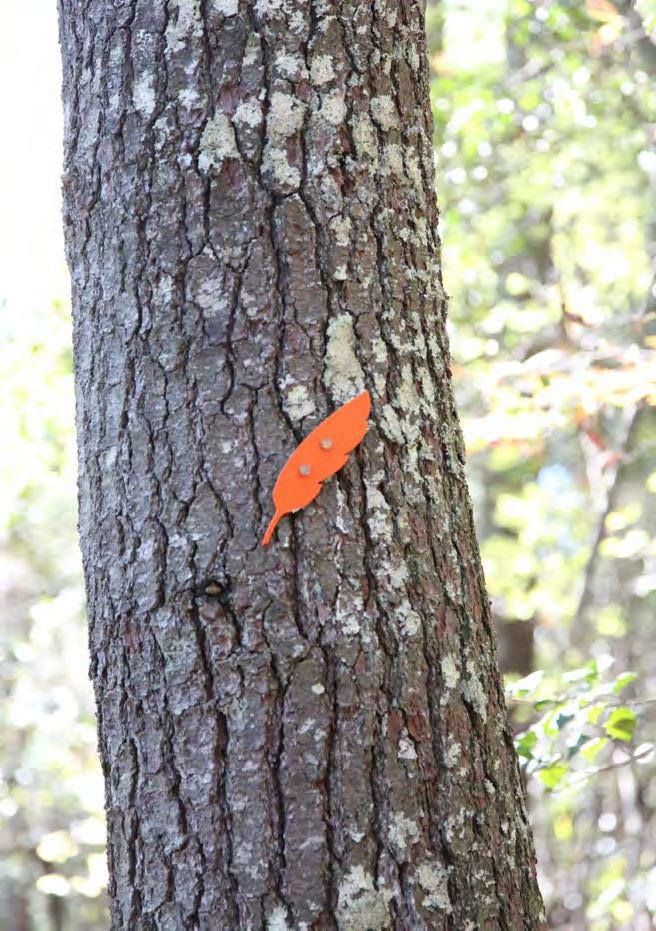
70 FONTA FLORA STATE TRAIL: LAKE JAMES TO MORGANTON MASTER PLAN The table
associated with
planning
Challenges
planning section. Canal Bridge Crossing; NCDOT Side Paths along Benfields Landing Rd. and Powerhouse Rd; Benfields Landing Crossing; Muddy Creek Bridge Crossing; Securing Landowner Trail Easements SECTION ALL SECTIONS TOTAL DISTANCE KEY CHALLENGES ESTIMATED BUDGET IMPLEMENTING AGENCY Securing Landowner Trail Easements; Catawba River Bridge; Watermill Glen Alpine Rd. Underpass Securing Landowner Trail Easements Sanford Drive Crossing SECTION 1 Fonta Flora Brewery to Powerhouse Rd. SECTION 2 Powerhouse Rd. to Watermill River Access SECTION 3 Watermill River Access to Catawba River Greenway SECTION 4 Catawba River Greenway to Downtown Morganton * Estimated budget shown above pertains only to the completion of the preferred FFST route and does not include existing, constructed trail segments. 7 0 $ 515,476 .00 Burke County Burke County Burke County, City of Morganton City of Morganton $ 1,047,396 .00 $ 145,728 .00 $ 623,623 .00 $ 2,331 , 860 .00 5.7 4.6 4. 0 2 1 3
IMPLEMENTATION DETAILS BY SECTION AND RESPONSIBILITY
PRIORITY IMPLEMENTATION AREAS & RESPONSIBILITIES
Burke County and Morganton must work in tandem to successfully realize the FFST. Trail implementa tion does not have to occur in a specific, linear or der according to each planning section. In fact, the priority areas for implementation are merely sug gestions and are in no way intended to hem creativ ity or necessary work in “lower” priority areas. Trail implementation is an art and requires the acumen to recognize and then seize opportunities, whether related to funding, landowner willingness, or poli tics.
The table below supports a trail development strat egy that prioritizes areas west of Watermill River Access (sections 1 and 2). If these were to be ful ly developed, this would likely provide the formu la for “Trail Rubicon,” the point in which the public, elected officials, and partnership funding agencies recognize that connectivity and complete imple mentation is imminent. At this point significant momentum and synergy would propel forward the completion of the FFST and OVNHT from Lake James to Morganton.
TRAIL RUBICON: FINDING THE POINT OF NO RETURN
Think snowball effect. Development of these trail sections will result in widespread support and a collective energy, beyond that of the community’s tra ditional trail support base. These sections represent the Trail Rubicon: the point at which completion of the FFST from Lake James to Morganton becomes imminent.
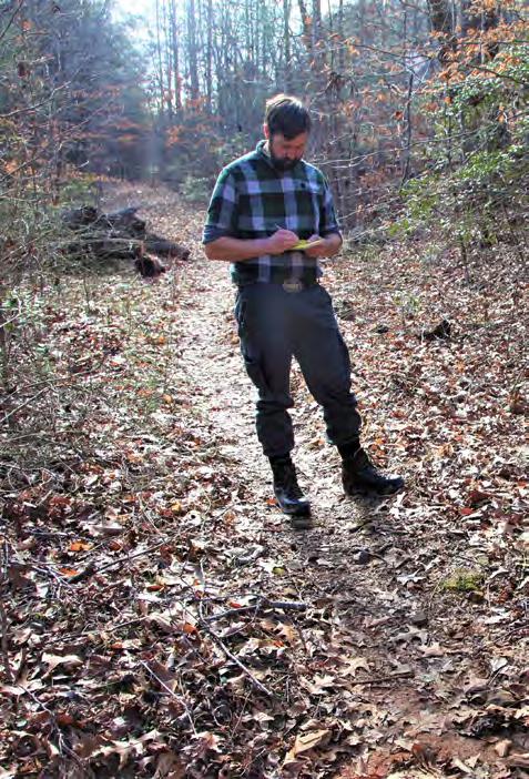
1. FONTA FLORA BREWERY TO POWERHOUSE ROAD
2. POWERHOUSE ROAD TO WATERMILL RIVER ACCESS TRAIL RUBICON
PRIORITY IMPLEMENTATION AREAS AND RESPONSIBILITIES
IMPLEMENTING AGENCY
Burke County
of Morganton
ONE
TWO
71CHAPTER 5: IMPLEMENTATION
Section 1: Fonta Flora Brewery to Powerhouse Road Section 2: Powerhouse Road to Watermill River Access
PRIORITY
PRIORITY
Section 4: Greenway connector to Downtown Section 4: Enhancements to Eastern Terminus
City
TRAIL IMPLEMENTATION
Creating a destination-quality trail system requires a significant commitment from local governments, including staff time, the holding of land and trail easements, and the dedication of local funding.
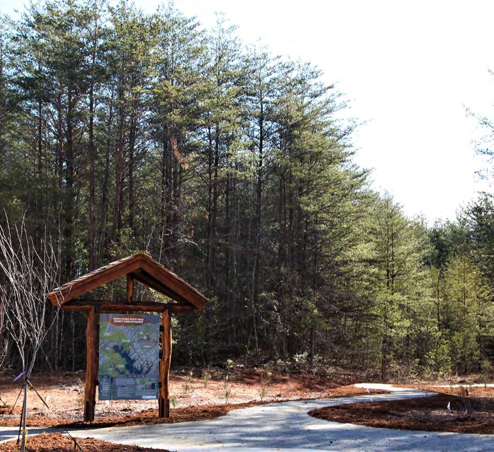
Local governments must evaluate the FFST in rela tionship to other priorities. However, a trail of this magnitude should be recognized as an economic development initiative that will provide a return on investment. Furthermore, each jurisdiction must not merely spend local funds, but instead must lever age their funds to obtain support from partnership funding agencies sympathetic to the creation of trails and the FFST.
The “Trail Support Spectrum” illustrates the steps local governments can take to support trail devel opment.
72 FONTA FLORA STATE TRAIL: LAKE JAMES TO MORGANTON MASTER PLAN
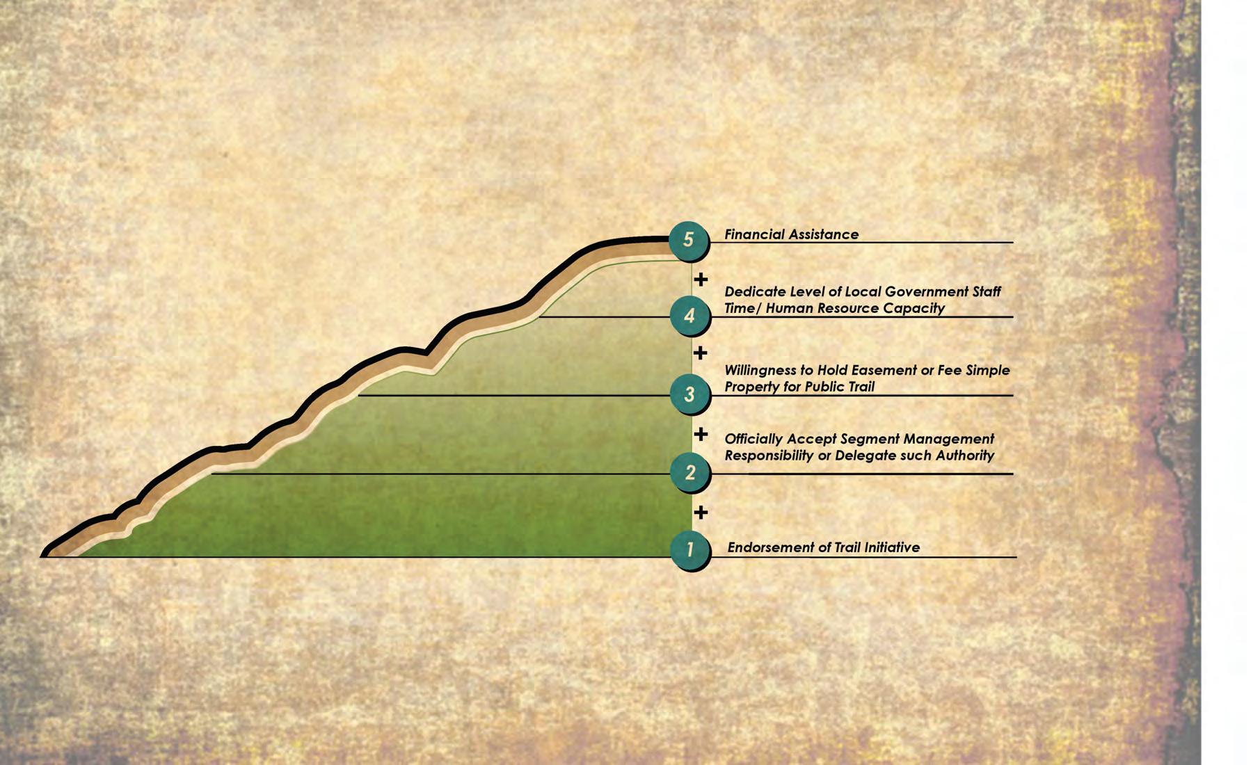
1 2 3 4 5
TRAIL MANAGEMENT
MAINTENANCE
Trail maintenance is critical to provide for and sus tain the trail users’ experience. Trail maintenance will primarily consist of ensuring that the trail cor ridor is trimmed of brush and vegetation and that the natural surface trail is de-bermed and clear of fallen debris.
Volunteer training and participation is an import ant aspect of user group involvement. Burke Coun ty will explore trail building volunteer training with members of the Professional Trail Builders Asso ciation. Federal Recreational Trails Program (RTP) funding is often available for educational courses and may require matching funds. Burke County or a non-profit “Friends” group could sponsor these courses and provide the matching funds for inter ested volunteers. By training volunteers in this man ner, it demonstrates a significant commitment by the participant and “Friends” group at great ben efit to the landowners, land managers, and Burke County.
An adequate level of law enforcement should be provided to help maintain a safe and secure trail en vironment. Trail users should also be educated and encouraged to understand and obey trail rules, re spect other users, and respect adjoining properties.

TRAIL RULES WILL BE POSTED AT EACH TRAILHEAD.
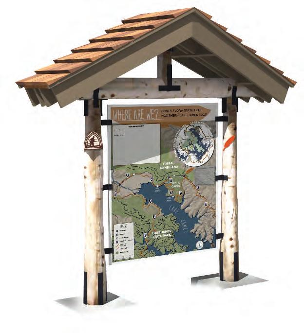
74 FONTA FLORA STATE TRAIL: LAKE JAMES TO MORGANTON MASTER PLAN
TRAIL FUNDING
FERC RELICENSING

Constructing and maintaining the various sections of the FFST will require le veraging funds from both public and private entities. At this time, the largest funding contribution comes directly from Duke Energy, as a result of the Com prehensive Relicensing Agreements (CRA) for the Catawba-Wateree Project.
Trail development funds are included in CRA 10.27.2.3 in the amount of $500,000 for construction of the FFST. Another $600,000 is included in CRA 10.27.4.3 for the OVNHT.
EVERYONE WORKING TOGETHER
In addition to the contributions from Duke Energy, it will be necessary for Lake James State Park, NC Wildlife Resources Commission, NCDOT, NPS, Burke County, and others to contribute financial resources to this project. A conser vative estimate to construct the entire FFST and its associated trailheads from Lake James to Morganton is approximately 1.75 million dollars.
LOCAL LEADERSHIP
Implementing the recommendations of this plan will require a strong level of local support and commitment through a variety of local funding mecha nisms. Perhaps most important is the addition of bicycle and greenway infra structure as an item within the Burke County annual budget. These improve ments should become a high priority and be supported through portions of the funding currently used for public safety, streets, parks and recreation, planning, community development, travel and tourism, and local bonds.
LEVERAGING FUNDS RELATED TO OTHER COMMUNITY GOALS
Burke County and its municipalities should also seek a combination of funding sources that include local, state, federal, and private money. Fortunately, the benefits of protected greenways are many and varied. This allows programs in Burke County to access money earmarked for a variety of purposes includ ing water quality, hazard mitigation, recreation, alternate transportation, wildlife protection, community health, and economic development.
Availability of funds targeted directly for trail use has decreased in recent years, so it is imperative that local governments work together to create multi-juris dictional partnerships and to develop their own local sources of funding. These sources can then be used to leverage outside assistance.
For the past two decades, a variety of funding has been used throughout North Carolina to support the planning, design, and construction of urban and rural bicycle and greenway projects. The largest single source of funding for these projects has come from the Surface Transportation Act; the North Carolina De partment of Transportation manages and distributes the majority of federal funds that are derived from the Act to support the development of bicycle/trail development.
75CHAPTER 5: IMPLEMENTATION
APPENDIX A
I
SECTION
FONTA FLORA BREWERY TO POWERHOUSE ROAD
SECTION
POWERHOUSE ROAD TO WATERMILL RIVER ACCESS
WATERMILL RIVER ACCESS TO CATAWBA RIVER GREENWAY
CATAWBA RIVER
DOWNTOWN MORGANTON
II FONTA FLORA STATE TRAIL: LAKE JAMES TO MORGANTON MASTER PLAN SECTION 1-
UNITS (LF)UNIT COST TOTAL COST Dual Use Trail (5ft. Natural Surface) 35376 $6 $212,256.00 NCDOT Sidepath (8ft. Paved Path) 1056 $120 $126,720.00 Typical Greenway - Brewery Trailhead Spur (10ft. Paved Path) 400 $25 $10,000.00 Road Crossings 3 $5,500 $16,500.00 Major Bridges 2 $75,000 $150,000.00 $515,476.00
2-
UNITSUNIT COST TOTAL COST Dual Use Trail (5ft. Natural Surface) 24816 $6 $148,896.00 Multi-Use Path (8ft. Crushed Gravel Fines) 5280 $25 $132,000.00 Road Crossings 3 $5,500 $16,500.00 Major Bridges 1 $750,000 $ 750,000.00 $ 1,047,396.00
3-
UNITSUNIT COST TOTAL COST Dual Use Trail (5ft. Natural Surface) 24288 $6 $145,728.00 Road Crossings 0 N/A N/A Major Bridges 0 N/A N/A $145,728.00 SECTION 4-
GREENWAY TO
UNITSUNIT COST TOTAL COST Typical Greenway Connector (10ft. Paved Path) 6864 $90 $617,760.00 Road Crossings 1 $5,500 $5,500.00 Major Bridges 0 N/A N/A $623,260.00 TOTAL $ 2,331,860.00 * Does not include land acquisition, engineering, or design. * Does not include existing segments of trail or bridges on existing trails. Total Section Cost Total Section Cost Total Section Cost Total Section Cost (A-1) IMPLEMENTATION BUDGET
FUNDING SOURCES
BUILD
Clean Water Management Trust Fund (www.cwmtf.net)
Construction, provided easements are secured
Land acquisition: fee simple or easement. Must protect floodplain areas. Greenway trails and other park areas are allowed.
May (typical)
Not specified, but
is competitive February 1st
NC Water Resources (www.ncwater.org)
River access areas or greenways along rivers
50% January 1st and June 1st Recreation Trails Program (ncparks.gov/About/grants/main.php)
Parks and Recreation Trust Fund (ncparks.gov/About/grants/main.php)
All types of trails and greenways
All types of parks, trails, and recreation facilities
Bikes Belong Foundation Trails and Greenways
NCDOT Transportation Plan For Bike and Pedestrian Projects
$100,000.00 25% February 1st
$500,000.00 50% February 1st
May 24th
Bike and Pedestrian Projectsboth engineering and construction N/A (for major projects) 20% generally N/A
IIICHAPTER A: APPENDIX Partnership Funding Agency Active Living/ BuiltEnvironment Implications Maximum Amount Matching Funds Required Deadline
N/A (min. $1 million)$0 (for rural counties)
N/A
20%
N/A
$10,000.00 20%
(A2)
