fonta flora state trail master plan lake james to marion


FONTA FLORA STATE TRAIL LAKE JAMES TO MARION MASTER PLAN DESTINATION BY DESIGN PLANNING, LLC 136 FURMAN RD., SUITE 6 BOONE, NORTH CAROLINA 28607 828.386.1866 WWW.DBDPLANNING.COM PRODUCED FOR: PRODUCED BY:

ACKNOWLEDGMENTS
BURKE COUNTY
Johnnie Carswell, Chairman
Scott Mulwee, Vice Chairman
Maynard M. Taylor, Commissioner
Wayne F. Abele, Commissioner
Scott Mulwee, Commissioner
Bryan Steen, County Manager
Scott Carpenter, AICP, Deputy County Manager & Community Development Director
Shane Prisby, Community Development Operations Manager
NATIONAL PARK SERVICE
John Slaughter, Group Superintendent,
Southern Campaign of the American Revolution Parks Group
Benjamin Richardson, Chief of Planning and Partnerships, Southern Campaign of the American Revolution Parks Group
CITY OF MARION
Steve Little, Mayor
Billy Martin, Mayor Pro Tem
Woody Ayes, Council Member
Juanita Doggett, Council Mebmer
Ann Harkey, Council Member
Don Ramsey, Council Member
Bob Boyette, City Manager
Heather Cotton, AICP, Planning Director
MCDOWELL COUNTY
David N. Walker, Commissioner
Tony G. Brown, Commissioner
Barry McPeters, Commissioner
Lynn Greene, Commissioner
Brenda M. Vaughn, Commissioner
DUKE ENERGY CAROLINAS
Christy L. Churchill, RLA, LEED GA
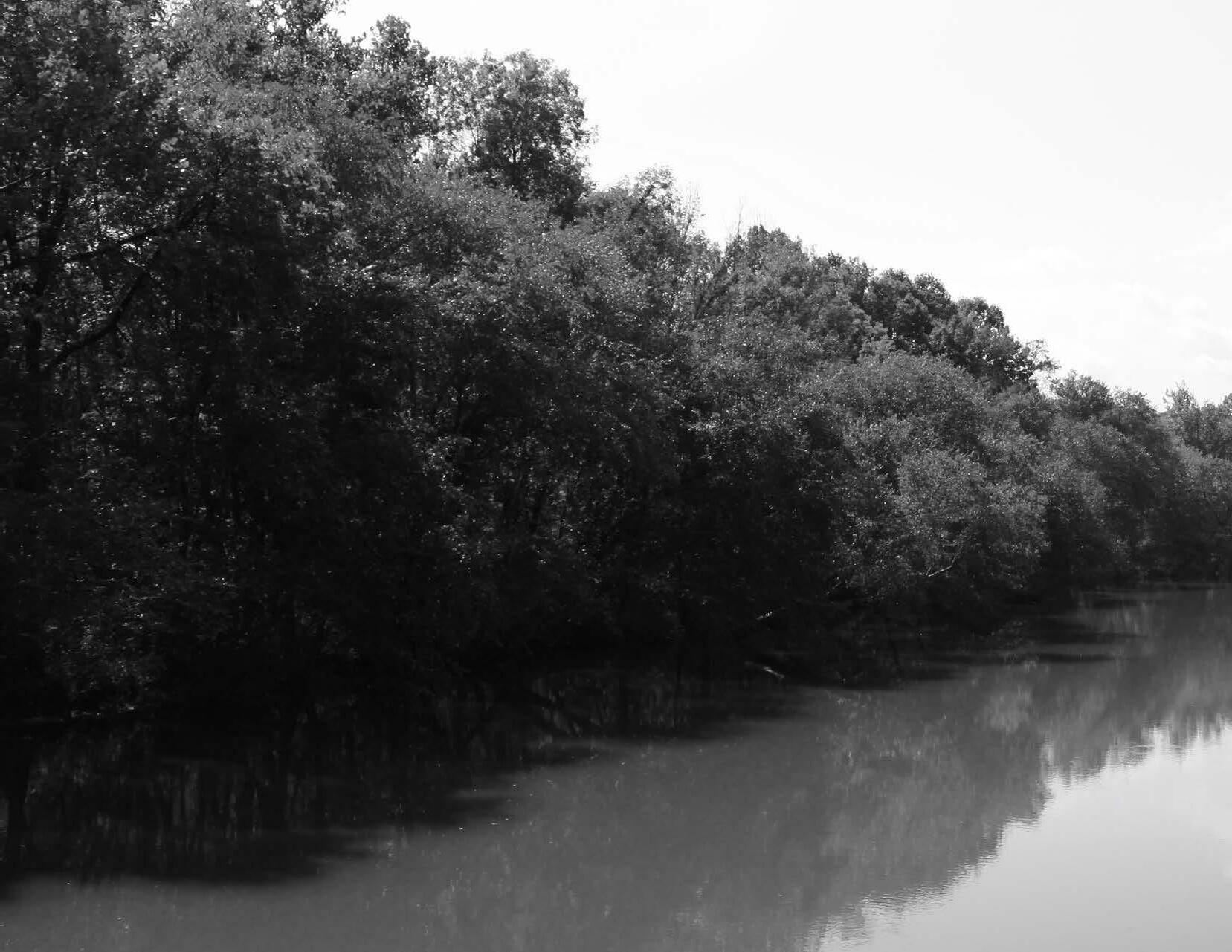
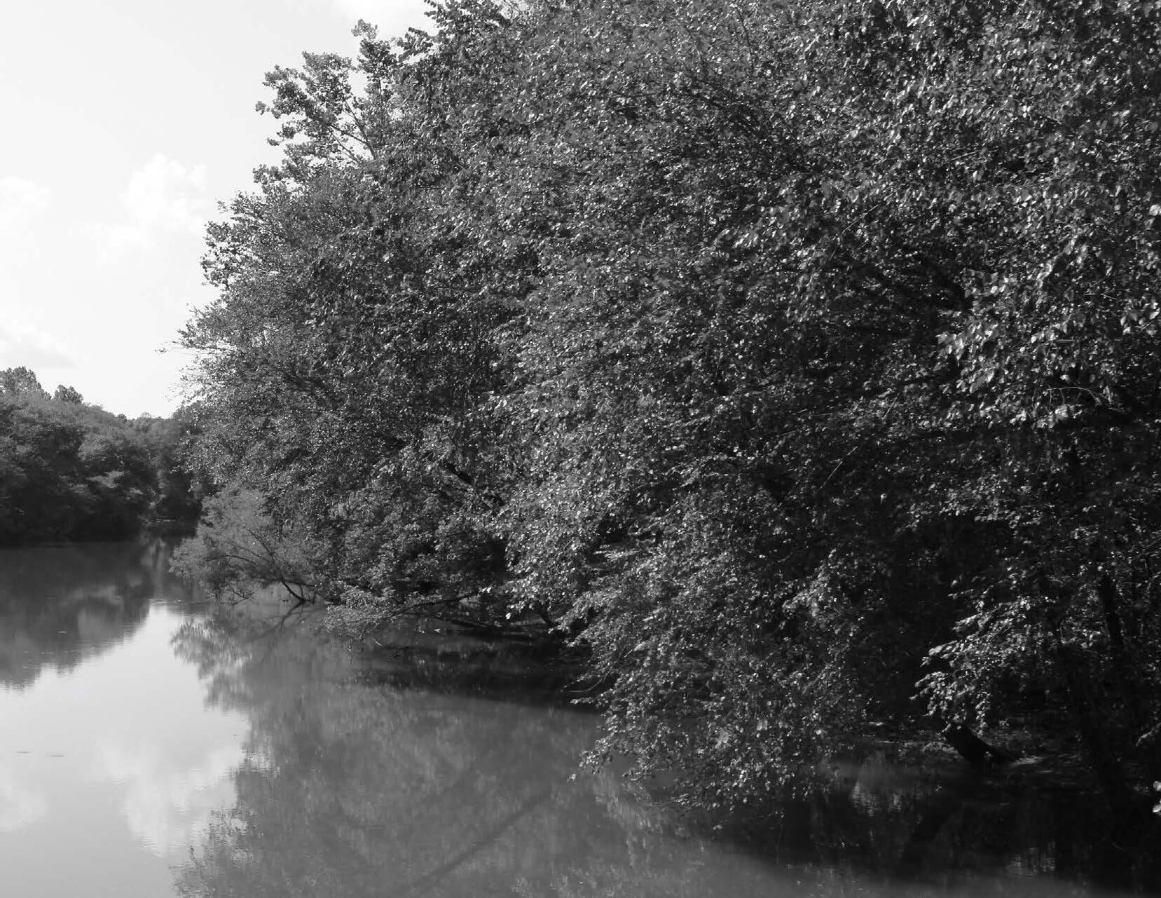
TABLE OF CONTENTS INTRODUCTION & BACKGROUND 1 Purpose and Background ……………………………………………………… 2 Previous Planning Efforts ……………………………………………………… 3 Vision Statement ……………………………………………………………………… 4 Trail Benefits …………………………………………………………………………… 5 Plan Organization …………………………………………………………………… 6 CHAPTER 1: EXISTING CONDITIONS, ANALYSIS, 7 & PRELIMINARY ALIGNMENTS Study Area Description …………………………………………………………… 8 Study Area Major Features ……………………………………………………… 9 Natural Environment …………………………………………………………… 10 Cultural Resources ………………………………………………………………… 12 Built Environment ………………………………………………………………… 13 Preliminary Route Alternatives: Map & Photo Series ………… 17 CHAPTER 2: TRAIL CHARACTER & 25 DESIGN GUIDELINES Sustainable Trail Design ……………………………………………………… 26 Trail Construction ………………………………………………………………… 28 Trail Types ……………………………………………………………………………… 29 Trail Profile …………………………………………………………………………… 32 Trail Support Facilities ………………………………………………………… 34 Social Media Marketing ………………………………………………………… 37 CHAPTER 3: RECOMMENDATIONS 39 Planning Sections Overview ………………………………………………… 40 Trail Section Recommendations ………………………………………… 42 CHAPTER 4: IMPLEMENTATION 55 Implementation Details by Section and Responsibility ……… 56 Priority Implementation Areas and Responsibilities ………… 57 Trail Rubicon ………………………………………………………………………… 57 Trail Support Spectrum ………………………………………………………… 59 Trail Management ………………………………………………………………… 60 APPENDIX I (A-1) Implementation Budget ………………………………………………… II (A-2) Funding Sources ………………………………………………………… III
LIST OF MAPS Map 1: General Study Area ……………………………………………………… 8 Map 2: Study Area 1 Site Analysis ………………………………………… 18 Map 3: Study Area 2 Site Analysis ……………………………………… 20 Map 4: Study Area 3 Site Analysis ……………………………………… 22 Map 5: Planning Sections …………………………………………………… 40 Map 6: Planning Section 1 …………………………………………………… 44 Map 7: Planning Section 2 …………………………………………………… 47 Map 8: Planning Section 3 …………………………………………………… 51
LIST OF EXHIBITS EXHIBIT 1: Brewing Up Adventure ……………………………………… 45 EXHIBIT 2: Black Bear and Beyond ……………………………………… 48 EXHIBIT 3: FFST Trailhead @ Black Bear …………………………… 49 EXHIBIT 4: Bringing the Fonta Flora to Fleming ………………… 53 EXHIBIT 5: Isothermal Regional Bicycle Plan............................ 54
INTRODUCTION AND BACKGROUND


PLAN SERVES AS A ROAD MAP FOR ESTABLISHING A SECTION OF THE FONTA FLORA

STATE TRAIL FROM LAKE JAMES TO MARION.
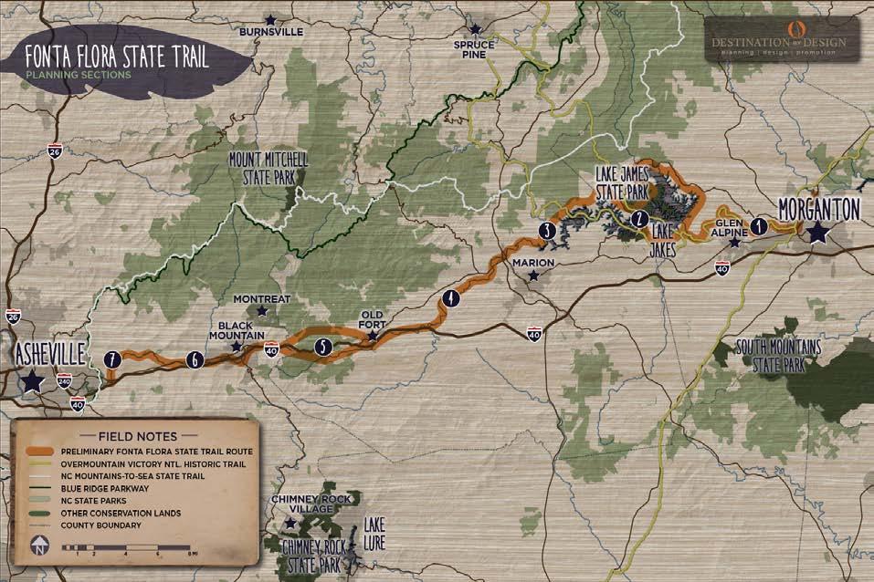
The Fonta Flora State Trail (FFST) will extend from Morganton to Asheville when completed. This trail master plan serves as a road map for establishing the Fonta Flora State Trail from Lake James, in Burke County, to the City of Marion, in McDowell County. This chapter provides an overview of previous planning efforts and their goals.
IN THIS CHAPTER:
PURPOSE AND BACKGROUND
PREVIOUS PLANNING EFFORTS
STATEMENT
BENEFITS
1
THIS
A|
B|
C| VISION
D| TRAIL
E| PLAN ORGANIZATION
PURPOSE &
The Fonta Flora State Trail finds its origins in the desires of Burke County citizens to increase quality of life for residents, provide a recreational amenity for visitors and the region’s diverse population, and provide public access to the area’s cultural and natural resources.

In 2015, the North Carolina General Assembly approved legislation to establish the Fonta Flora State Trail. Upon completion, the proposed trail will extend from Asheville to Morganton connecting Marion, Old Fort, and Black Mountain.
Burke County is a leading agency in the establish ment of the Fonta Flora State Trail. Following the adoption of a master plan in 2016, the County partnered with the NC Division of State Parks and Duke Energy to complete 10 miles of trail in 2017. The County is now in the midst of constructing another 10 miles that will eventually encircle Lake James to complete Section 2 of the FFST.

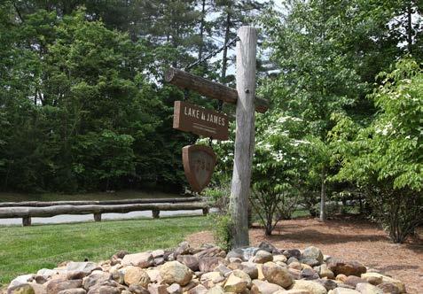
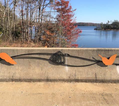
Also in 2017, Burke County opened a new trailhead featuring custom trail facilities and artistic signage. In 2018, the County spearheaded the development of a trail master plan for Section 1 from Lake James to Morganton
Financial support from Duke Energy continues to advance the project with $1.1 million in grants committed to the development of the Fonta Flora State Trail and Overmountain Victory National
Historic Trail (OVNHT). Financial resources will be released from Duke Energy now that the Federal Energy Regulatory Commission has approved the company’s re-licensing to operate its hydroelectric power plants along the Catawba River.
This plan addresses Section 3 of the Fonta Flora State Trail from Lake James to Marion. This section is unique in that portions of the FFST coincide with the OVNHT.
FONTA FLORA STATE TRAIL: LAKE JAMES TO MARION MASTER PLAN2
BACKGROUND LEGISLATION WAS SIGNED INTO LAW BY GOVERNOR MCCRORY IN SUMMER 2015 THAT MAKES THE FONTA FLORA STATE TRAIL THE LATEST ADDITION TO NORTH CAROLINA’S STATE PARK SYSTEM. 1 5 6 7 2 3 4 MORGANTON >> LAKE JAMES LAKE JAMES LAKE JAMES >>MARION MARION >> OLD FORT DEPOT OLD FORT DEPOT >> BLACK MOUNTAIN DEPOT BLACK MOUNTAIN DEPOT >> WARREN WILSON COLLEGE WARREN WILSON COLLEGE >> ASHEVILLE PLANNING SECTIONS
PREVIOUS PLANNING EFFORTS
Fonta Flora State Trail: Lake James to Morganton

In 2018, Burke County developed a comprehensive trail master plan for the Section 1 of the FFST from Lake James to Morganton. This section of the FFST overlaps with the OVNHT on the south side of Lake James as the trail extends from the Fonta Flora Whippoorwill Brewery along the Catawba River to Morganton. Portions of the trail systems at both Lake James and the Catawba River Greenway in Morganton are certified as part of the Overmountain Victory National Historic Trail. The OVNHT Lake James to Morganton Master Plan serves as the foundation of the Fonta Flora State Trail Lake James to Morganton Master Plan.


Fonta Flora State Trail Master Plan: Lake James Section


The Fonta Flora State Trail Master Plan: Lake James Section was completed in 2016. The plan provided a major update to the Lake James Loop Trail Master Plan published by Burke County in 2014. This section of the Fonta Flora State Trail will ultimately encircle Lake James with a continuous 30-mile state-of-the-art hiking and biking nature trail. As a state trail, the loop is now under the purview of the NC Division of Parks and Recreation as an official unit of the State Parks system.
Lake James Loop Trail Master Plan

In early 2013, the Burke County Community Development Director began a new planning effort to jumpstart the Lake James Loop Trail initiative and pro moted the project to the top of the department’s priority list.
The Lake James Loop Trail Master Plan, published in 2014, outlined an easy to moderate 30-mile multi-use hiking and biking trail with a natural mineral soil surface. The plan recommended an average trail width of five feet wide and overall average grade of 5% or less.
Isothermal Regional Bicycle Plan


The Isothermal Re gional Bike Plan, published in 2018, includes detailed recommendations for connecting Downtown Marion to the Catawba River Greenway and McDowell House.
3
M
M LAKE JAMES LOOP TRAIL MASTER MPLAN ASTER PLAN fonta flora state trail master plan lake james to morganton fonta flora state trail master plan lake james section BURKE COUNTY, NC UPDATED SPRING, 2016 2018 IsothermalBikePlan.com PREPARED FOR PLANNING DEVELOPMENT PREPARED PLANNING DESIGN Photo by Richard Kennedy INTRODUCTION AND BACKGROUND
VISION STATEMENT

The Fonta Flora State Trail will provide pedestrians and bicyclists of all abilities a safe and legal route that will eventually extend from Morganton to Asheville. The trail will allow users to experience the natural diversity of the area, incorporate multiple access points and support facilities, create a community and regional asset that will provide for recreation opportunities for local residents and visitors, and promote tourism and low-cost economic development for Burke County, Marion and the surrounding region.
PLAN GOALS
Specific Trail Routes. Identify a specific and feasibile trail route from Lake James to Marion.
Trail Character. Develop designs and trail support facilities that incorporate both the OVNHT and FFST brands.

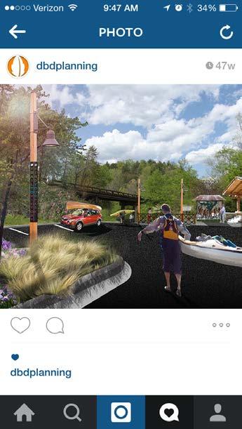
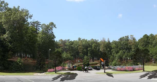
Visual Plan. Create a visual plan that utilizes renderings and schematics to demonstrate trail character.
WHAT IS A STATE TRAIL?
STATE TRAILS
The State Parks Act (GS 113-44.9) defines the types of units in the NC State Parks System to include State Parks, State Natural Areas, State Recreation Areas, State Trails, State Rivers and State Lakes. Fonta Flora is a State Trail.
The difference between a State Park and a State Trail is that a State Park is operated and managed by the Division of Parks and Recreation, but a State Trail represents a partnership among multiple agencies, landowners and local governments, working together to implement a shared vision. Working together on a connected State Trail is a way for communities to leverage their investments in trails to maximize the value for their citizens. Sections of a State Trail on state park property may be managed by the Division of Parks and Recreation, but sections of the trail that cross property controlled by others will continue to be built, maintained and managed by those other landowners.
A State Trail is comprised of multiple connected sections, and each section of the trail is sponsored by a state or federal agency, local government, or landowner. Overall trail corridor planning and coordination are the responsibility of the Division of Parks and Recreation, but each section of the trail will be planned, built and managed in accordance with the needs and wishes of each local section sponsor. DPR will provide guidance, coordination and assistance for the multiple section sponsors whose individual and diverse sections link together to form the State Trail.
SECTION – A portion of the trail within the jurisdictional boundaries of a single agency or organization, who serves as the sponsor of that section.
SECTION SPONSOR – Any agency or organization that owns the land the trail utilizes and that enters into an agreement with the Division of Parks and Recreation to maintain their section of trail as a part of the State Trail. The section sponsor, in coordination with adjoining section sponsors, is responsible for the design, construction, maintenance and management of the trail within their section, including its loca tion, appearance, surface, uses, and amenities. Section sponsors retain authority on lands under their jurisdiction. Section sponsors are encouraged to showcase places of natural, scenic, historic, and cultural significance; to feature the diversity of natural communities and landscapes in the state; and to consider the needs of both long and short distance trail users.
FONTA FLORA STATE TRAIL: LAKE JAMES TO MARION MASTER PLAN4
1 2 3
TRAIL BENEFITS
ECONOMIC

There is no question that countless communities across America have experienced significant economic growth from a result of trail and greenway infrastructure. Below are a few examples of such impacts: Pedestrian and Bicycle Infrastructure: A National Study of Employment Impacts (2011)
• Evaluated 58 separate projects in 11 cities
• Multi-use trails (e.g., greenways) create 9.6 jobs per $1 million invested East Central Florida Regional Planning Council; Economic impact of Orange County trails (2013)
• Little Econ Greenway (7.4 miles); West Orange (20 miles); and Cady Way Trails (7.2 miles) in Orange County, Florida
• Supported 516 jobs and had an estimated pos itive economic impact of $42.6 million on the area

• Nearby Downtown Winter Garden (pop. 37k) = $14.6M Revenues


Year 3 Economic Impact of Swamp Rabbit Trail (2014)

• Swamp Rabbit = 20 miles (Greenville, NC to Travelers Rest)
• $6.7 Million Virginia Creeper Trail, Damascus, VA
• 34 mile rail-trail
• Direct economic impact approximately $3 mil lion a year
HEALTH
Trails and greenways provide an attractive, safe, and accessible low- or nocost place to walk, hike, jog, or bicycle. More parks and green spaces lead directly to more physical activity by citizens. This gives people of all ages an opportunity to incorporate exercise into their daily routines.
ENVIRONMENTAL
Trails and greenways protect important habitat, improve water quality, and provide corridors for wildlife. By protecting land along rivers and streams, greenways help filter pollution caused by agricultural and road runoff. These areas can often serve as natural floodplains. Also, trails and greenways can serve as hands-on environmental classrooms.
EDUCATIONAL
The Fonta Flora State Trail will provide for a variety of educational opportunities. A significant portion of the trail will pass through Lake James State Park, which will provide an educational experience about natural habitats and native flora and fauna from throughout the region. Since this trail coincides with portions of the Overmountain Victory National Historic Trail, users have the opportunity to learn about the Overmountain Men and their impact on the Revolutionary War. Other opportunities exist to learn about hydroelectric dams, bicycle safety, wilderness medicine, and search and rescue.
RECREATIONAL
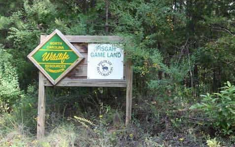
The recreational benefits offered by the Fonta Flora State Trail will complement existing opportunities found in the area at Lake James State Park, NCWRC Game Lands, Linville Gorge, Catawba River, and adjoining US Forest Service lands.
The Fonta Flora State Trail will anchor a host of recreation offerings. Foremost, this trail offers the unique opportunity to separate automobiles from cyclists to circumnavigate the Lake, thereby creating a safe and scenic destination for cycling enthusiasts. This plan also calls for a new boat launch, camping and cabin facilities, fishing access areas, and over 25 miles of trails, boardwalks, and bridges. All of these additional recreational opportunities will be beneficial for personal, community, and business development.
TRANSPORTATION
Trails and greenways serve as a crucial element within a regional multi-modal transportation system. These facilities provide efficient and safe connectors among civic, commercial, and residential land uses. The Fonta Flora State Trail will help create these connections and play a central role in establishing a regional trail network that will ultimately include the NC Mountains-to-Sea Trail, Overmountain Victory National Historic Trail, Upper Catawba River Trail, and other local connecting trails.
5
INTRODUCTION AND BACKGROUND
PLAN ORGANIZATION


EXISTING CONDITIONS, ANALYSIS, AND PRELIMINARY ALIGNMENTS
This chapter provides a comprehensive overview and analysis of the opportunities and constraints found throughout the study area. The analysis begins with a brief description of the study area followed by a discussion of the natural and built environments and their implications for trail suitability, trail design, permitting, and costs. This chapter concludes with a map and photographic series that highlights preliminary trail route alternatives.
TRAIL CHARACTER AND DESIGN GUIDELINES


This chapter is dedicated to visually defining the various trail types to be used throughout the corridor. Design concepts are provided for trail user orientation signage, mile markers, and other support facilities. Social Media is explored as a mechanism for trail promotion and marketing.
FONTA FLORA STATE TRAIL: LAKE JAMES TO MARION MASTER PLAN6 LAKE JAMES 1501 YANCEY LENTZ HANKINS CANNON 1 5 8 7 AM E L IA LAKEVIEW IDLEWOOD LOST C O V E GRAYSTONE SYCAMORE HIGHCAMPS CAMP BALD MOUNTAIN CLIFF MOUNTAIN IVY LAKE CREST FORK RIVER H GHRIDGE BARTLET BELVIDERE CEDAR RIDGE CHARIOT EDELWEISS BLACK FOREST CABERET SA LVIEW SETTLEMENT RIDGE NATUREWALK RIVERVIEW FOREST CHEYENNE DEACON GREAT HILL CABIN BL U F F MOUNTAIN POINT LAKEHAVEN LAKE RIDGE BEAR CLIFF PISGAH NATIONAL FORE NC WILDLIFE COMMISSION GAME LANDS LAKE JAMES LANDING BIG LEAGUE CAMP DUKE PROPERTY LAKE JAMES CATAWBARIVER NORTH FORK CATAWBA RIVER BLACK BEAR CAMPGROUND PARKING AND TRAILHEAD FOR OVNHT BLACK BEAR BOAT ACCESS/ FONTA FLORA AND OVNHT SHARED TRAILHEAD HI ORIC OVN HI ORIC OVNHT BEAR CREEK EX I I NGOVNHT PLANNED BRIDGE CROSSING PLANNED BRIDGE CROSSING YANCEY B A L E Y C R E E K TRAIL FEATURES FIELD NOTES PLANNED TRAILHEAD FEDERAL LAND DUKE ENERGY PROPERTY STATE LAND PARCELS OF INTEREST FLOOD PLAIN PREFERRED TRAIL ROUTE COMPLETED FFST FFST ON PROPOSED LOCAL TRAIL PROPOSED FFST ON EXISTING LOCAL TRAIL EXISTING LOCAL TRAIL HISTORIC OVNHT ROUTE ALTERNATE TRAIL ROUTE TRAILS 1/16 1/8 1/4 MI. SECTION 2 BLACK BEAR BOAT ACCESS >> BIG LEAGUE CAMP RECOMMENDATIONS This chapter is organized according to three (3) planning sections. Each planning section description includes a map that identifies a preferred alignment. Each planning section further incorporates the analysis and design elements from the previous chapters along with a host of supporting renderings and design schematics. IMPLEMENTATION This chapter summarizes details for each planning section and establishes responsibilities and priorities for trail implementation. Additionally, this chapter identifies focus areas for development that will serve as catalyst projects for completing the trail. NC Wildlife Commission Pisgah Game Land Designated Nature Preserve Big League Camp CANNON RESOURCES LLC POOL C RANDY 1/2 UND. INTEREST LAIL TERESA POOL 1/2 UND. INT. EQUITY TRUST CO.,CUSTODIAN F/B/O DAVID R. MAJKA Lake James Landing Black Bear Campground Bear Creek Bailey Creek North Fork Catawba River McGegers Branch CatawbaRiver Dales Creek McDowell County 1552 Lake James 1553 1588 1550 Lentz Ha Cannon 15 8 7 Marina A m e a ForestLakeHeghts Lakev BeaconRidge I dlewood Wat e r sed ge Gaystone Sycamore HighCamps Captains Dockside Camp Cappezion Bald Mountain Mountain Ivy Fo k R e High Rdge Bartlett Bea C Be videre Cedar Ridge Edewe ss HighLake Black Forest Sa v ew Settlement Ridge NatureWalk Riverview Forest Cheyenne Deacon Great Hill Summertime CabinBluf f Mountain Point Josie LakeHaven Pier Bear Cliff Lake James 1780 Development Trails Existing OVNHT OVT Commuter Motor Route OVT Historic Route Rail Roads Parcels Pisgah National Forest Pisgah National Forest Municipal Foothills Conservancy State/Public Duke Power Big League Camp Large Undeveloped Slope 0 30 > 30 0 0.50.25 Miles 5 6 4 3 8 9 10 2 3 2 10 8 7 9 5 6 1 CHAPTER I.
CHAPTER 2. CHAPTER 3. CHAPTER 4.
EXISTING CONDITIONS, ANALYSIS, AND PRELIMINARY ALIGNMENTS
THIS SECTION OF THE FONTA FLORA STATE TRAIL HAS A SIGNIFICANT NATURAL AND CULTURAL HISTORY.
The analysis begins with a brief description of the study area followed by a comprehensive discussion of the natural and built environments and cultural resources and their implications for trail suitability, design features, permitting, and costs. This chapter concludes with a map and photographic series that highlights a host of preliminary trail route alternatives.
IN THIS CHAPTER:
AREA DESCRIPTION
AREA MAJOR FEATURES
ENVIRONMENT
7
A| STUDY
B| STUDY
C| NATURAL
D| CULTURAL RESOURCES E| BUILT ENVIRONMENT F| PRELIMINARY ROUTE ALTERNATIVES: MAP & PHOTO SERIES 1
STUDY AREA DESCRIPTION
THE LAKE JAMES TO MARION FFST STUDY AREA EXTENDS APPROXIMATELY 20 MILES FROM THE FONTA FLORA BREWERY AT WHIPPOORWILL FARM TO THE JOSEPH MCDOWELL CATAWBA RIVER GREENWAY.
The Lake James to Marion FFST study area ex tends approximately 20 miles from the Fonta Flora Brewery at Whippoorwill Farm on Highway 126 to the Catawba River Greenway in Marion.
Starting at the Fonta Flora Brewery at Whippoorwill Farm adjacent to Lake James State Park, the corridor extends west on the north side of Lake James through the 1780 Community and continues into McDowell County through large wooded tracts.
The corridor includes Pisgah National Forest and NC Wildlife Resources Commission public lands as well as property held by Duke Energy which con tinues to partner with Burke County to provide easements and financial support for the FFST and OVNHT.


The planning corridor continues southwest through rural, wooded privately-owned land to the mouth of the Catawba River at Lake James. Land parcels become smaller as the corridor continues toward the City of Marion before extending north to reach the 1.6-mile Joseph McDowell Catawba Riv er Greenway.
FONTA FLORA STATE TRAIL: LAKE JAMES TO MARION MASTER PLAN8 UDY AREA NC WILDLIFE COMMISSION GAME LANDS PISGAH NATIONAL FORE MARION LAKE JAMES STATE PARK FONTA FLORA BREWERY JOSEPH MCDOWELL HOUSE BURKE COUNTYMCDOWELL COUNTY LAKE JAMES 221 70 70 70 40 BLACK BEAR CAMPGROUND LAKE JAMES LANDING BLACK BEAR BOAT ACCESS BIG LEAGUE CAMP CATAWBARIVER
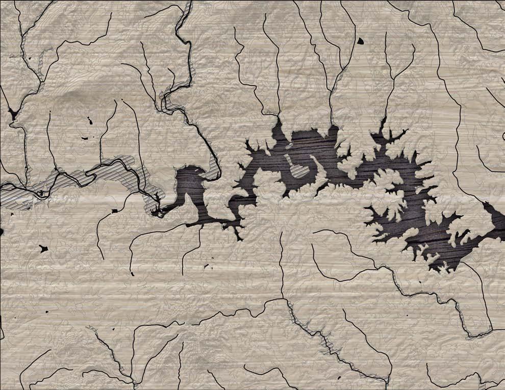
MAP 1: GENERAL STUDY AREA
STUDY AREA MAJOR FEATURES
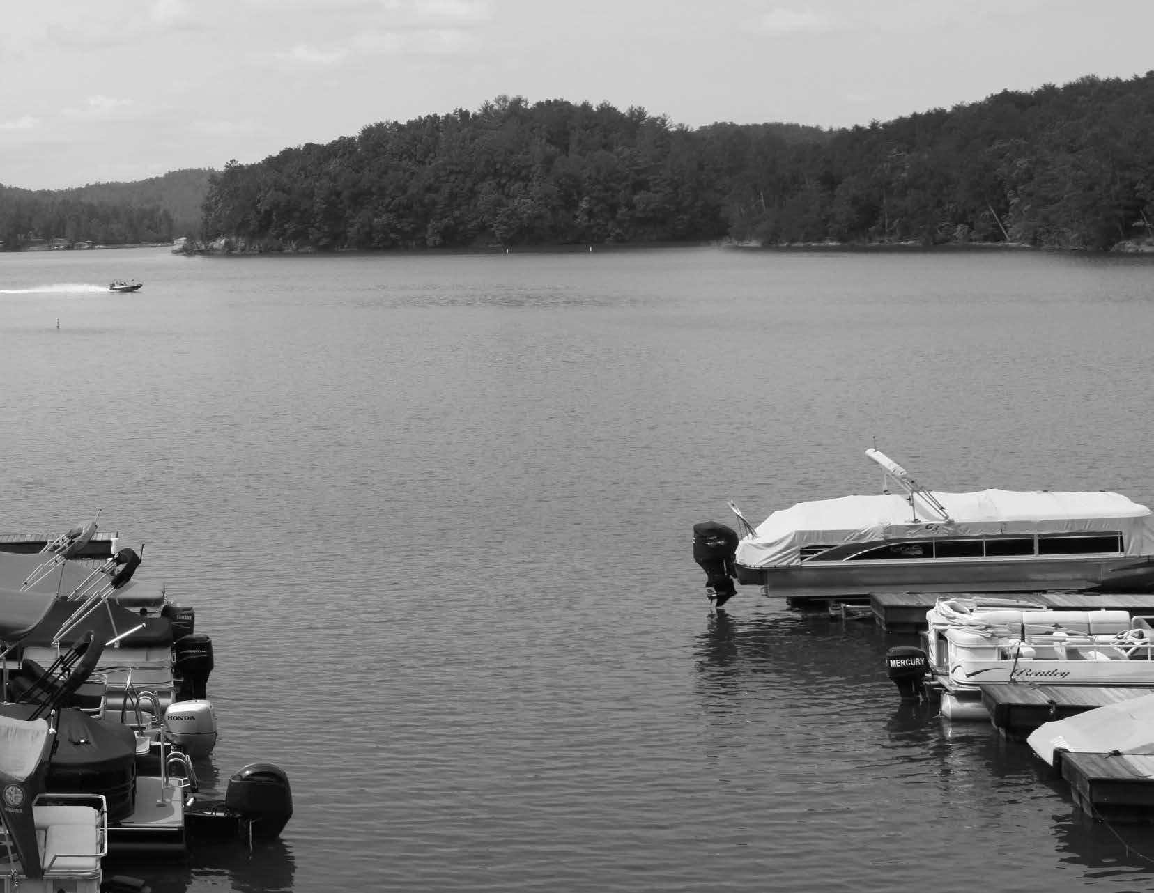
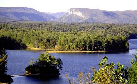
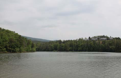
LAKE JAMES
Lake James is a large reservoir located in the foothills of Western North Carolina which straddles the border between Burke and McDowell Counties. This 6,812acre impoundment was created between 1916 and 1923 to produce hydroelectric power for the small towns of Marion and Morganton. Low density zoning requirements help to ensure that areas around the lake will be carefully managed and developed. Lake James offers residents and visitors opportunities to boat, fish, swim, and participate in other water-based activities.
Lake James contains 10.2 square miles of surface area and more than 150 miles of shoreline. The average depth of the Lake is 65 feet with a maximum recorded depth of 120 feet. At an elevation of approximately 1,200 feet, Lake James is located within the Catawba River basin.
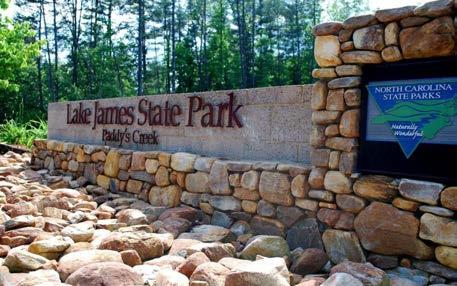
LAKE JAMES STATE PARK
Lake James State Park is one of the most recent additions to the North Carolina State Parks system. It was established in 1987 by the North Carolina General Assembly when funds were appropriated for the purchase of 565 acres of land and the initial phase of facility development in McDowell County. In 2004, Lake James State Park acquired an additional 2,915 acre tract from Crescent Resources Inc. in Burke County. This purchase expanded the state park to six times its former size and protected more than 30 miles of shoreline. The state park offers opportunities for hiking, mountain biking, picnicking, nature observation, swimming, and canoeing. A section of the Fonta Flora State Trail that is currently under construction will meander through the park and provide trail users the opportunity to take advantage of traditional state park facilities and services.
OVERMOUNTAIN VICTORY NATIONAL HISTORIC TRAIL
The Overmountain Victory National Historic Trail (OVNHT) is part of the National Park Service’s National Trails System. It recognizes the patriot militia from Virginia, Tenneessee, North Carolina, and South Carolina who crossed the Appalachian Mountains to fight and win at the Battle of Kings Mountain during the Revolutionary War in presentday South Carolina.
The OVNHT is a cooperative effort of the National Park Service, U.S. Forest Service, U.S. Army Corps of Engineers, Overmountain Victory Trail Association, local governments, local citizens’ associations, local historical societies, and the states of Virginia, Tennessee, North Carolina, and South Carolina.
The trail network consists of a 272-mile corridor, including a 70-mile branch from Elkin, North Carolina, that joins the main route at Morganton, North Carolina. Sixty-five miles of OVNHT are officially developed for public use, and development continues on the remaining sections. The official sections of the trail were established through agreements with landowners and land managers and often have overlapping designations. All officially certified segments are identified by signs displaying the trail logo (an Overmountain man in profile on a brown and white triangle) or a white triangular blaze.
Portions of the FFST route proposed in this master plan share an alignment with the OVNHT. Currently, ~5.5 miles of OVNHT are certified in Burke and McDowell Counties; This includes an ~1.7-mile segment in the 1780 Community and an ~1-mile segment near Black Bear Creek on NC Wildlife Resources land.
9
CHAPTER 1: Existing Conditions, Analysis, and Preliminary Alignments
NATURAL ENVIRONMENT
STEEP SLOPES
Much of the corridor has gently rolling topography. The most challenging slopes are along the banks of the Catawba River, North Fork Catawba River, and shoreline of Lake James. The trail should be designed for grades under 5% slope when possible. Natural surface trails can vary up to 10% slope while maintaining sustainable design. Alignments pro posed in this plan should be designed with these guidelines and may require a larger corridor to incorporate a more gradual trail grade.
FLOODPLAINS
Floodplain areas provide both an opportunity and constraint for trail development. Since traditional development is often not suitable within floodplain areas, private landowners may be more willing to provide access for public trails within these areas. Also, these scenic areas attract wildlife, which creates an engaging trail experience. Within this study area, much of the floodplain areas along the Catawba River corridor are ideal for trail development. Although development is regulated within the floodplain, greenways and trails are allowed and can be permitted. Sound trail engineering techniques are necessary to ensure trails can sustain flooding. To the extent possible, greenway alignments should be avoided within the floodway1
WETLANDS AND HYDRIC SOILS
The study area includes several wetland areas as identified on the National Wetland Inventory (NWI). According to NWI, there are likely smaller wetland areas within the study corridor that are not indicated within their inventory that could impact final trail alignments. Hydric soils in combination with wetland plant species and wetland hydrology are considered indicators of a wetland, which require costly permitting if impacted2.
STREAMS, LAKES, AND PONDS
The County, State, and Federal government regu late the many waterbodies found throughout the study area3. Lake James and the Catawba River are the dominant waterways within this corridor. .
CATAWBA RIVER
The Catawba River (named after the Native American tribe that first settled on its banks) is a tributary of the Wateree River in the states of North and South Carolina. The river is approximately 220 miles long and is considered one of “America’s Most Endangered Rivers” by the American Rivers organization. The river includes a series of reservoirs for flood control and hydroelectricity and provides drinking water to millions of residents. The headwaters of the Catawba River begin in the Blue Ridge Mountains in western McDowell County approximately 20 miles east of Asheville. The Catawba joins the Linville River and forms Lake James. The river then extends east and south, flowing through other impoundments near Morganton, Hickory, and Mooresville on its way to Lake Norman. From Lake Norman it flows south, passing west of Charlotte, before entering Lake Wylie, where it forms approximately ten miles of the border between North and South Carolina. The Catawba River continues through South Carolina before joining the Wateree River, which spills into the Atlantic Ocean.
Avoid
If wetlands are unavoidable, utilize elevated
standing
and
Boardwalks allow for travel over flat, poorly
and
other
a no-impact/no-rise
through
These studies can vary on cost but can range from $2,500-$15,000 depending on complexity.
Permit may be required if the
is considered
by the
This means that the wetland is not isolated and part of a broader lake or water system. A small boardwalk for a non-isolated wetland with limited fill or dredging may qualify for a programmatic Nationwide Permit. Nationwide Permits are designed to streamline the permitting process for actions with limited disturbances. In addition to permitting, disturbances exceeding a tenth ( 0.1) of an acre would require mitigation which can increase project costs. Impacts under a tenth (0.1) of an acre do not trigger mitigation fees.
3 Maintain a 50-foot buffer from all waterways, particularly those regulated under the Catawba River Buffer Rules. The state requires a 50-foot buffer along the shorelines of Catawba River and associated lakes. Streams within the study area are identified by the State of North Carolina as having poor water quality and maintaining or improving an adequate vegetated buffer is crucial to improving the quality. Zone 1 of this buffer includes an undisturbed 30-foot buffer from top of bank in which trails are discouraged. Zone 2 is an additional 20-foot buffer. This zone allows for managed vegetation and trails and greenways. While trails are an allowable use within Zone 2, the NC Division of Water Quality requires a permit (through DWQ or designated local government). The applicant must show that disturbance has been minimized and no other alternatives exist.
FONTA FLORA STATE TRAIL: LAKE JAMES TO MARION MASTER PLAN10
disturbance in the floodway. Avoid placement of structures or disturbance within the floodway. Floodways are regulated locally and by the Federal Emergency Management Agency (FEMA). Fill, structures (walls, kiosks, etc), and impervious services are discouraged. Any structures located within the floodway require
certification
FEMA.
boardwalk systems.
draining soils,
water,
wetland features
have significantly less impact than
options. A section 404 (Clean Water Act)
wetland
jurisdictional
USACE.
RARE FLORA AND FAUNA
The State Natural Heritage Program provides data identifying the state’s most sensitive environmental areas to be avoided; these areas are incorporated within the analysis map series at the end of this chapter. Rare flora and fauna species can also exist outside of these designated areas, which can alter final trail alignments prior to construction. Coordination with the U.S. Fish and Wildlife Service (USFWS) is an important aspect of the design process. Involving USFWS early on in the process can help avoid potential planning obstacles related to federally protected species. Additionally, permits2 like Section 401 and 404 will initiate the review of the State Natural Heritage Program database. If species are found within the project area, State or Federal requirements may dictate avoidance or mitigation.
Species identified by the State Natural Heritage Program within this study area include:
A| Northern Long-eared Bat
B| Carolina Northern Flying Squirrel
C| Brook Floater (Catawba River, McDowell County)
D| Mountain Golden Heather plant (Lake James area)
E| Peregrine Falcon (Lake James area)
F| Bald Eagle (Lake James area)
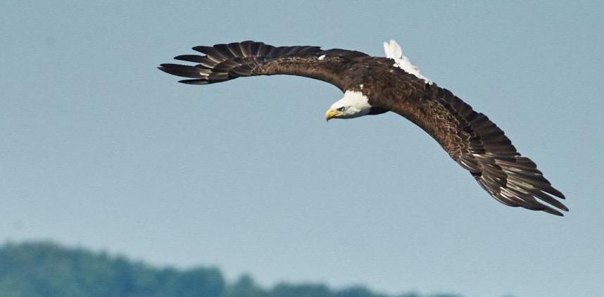
THE NORTH AMERICAN BALD EAGLE
FEATHER PROVIDES THE INSPIRATION FOR THE FONTA FLORA LOGO.
11
CHAPTER 1: Existing Conditions, Analysis, and Preliminary Alignments
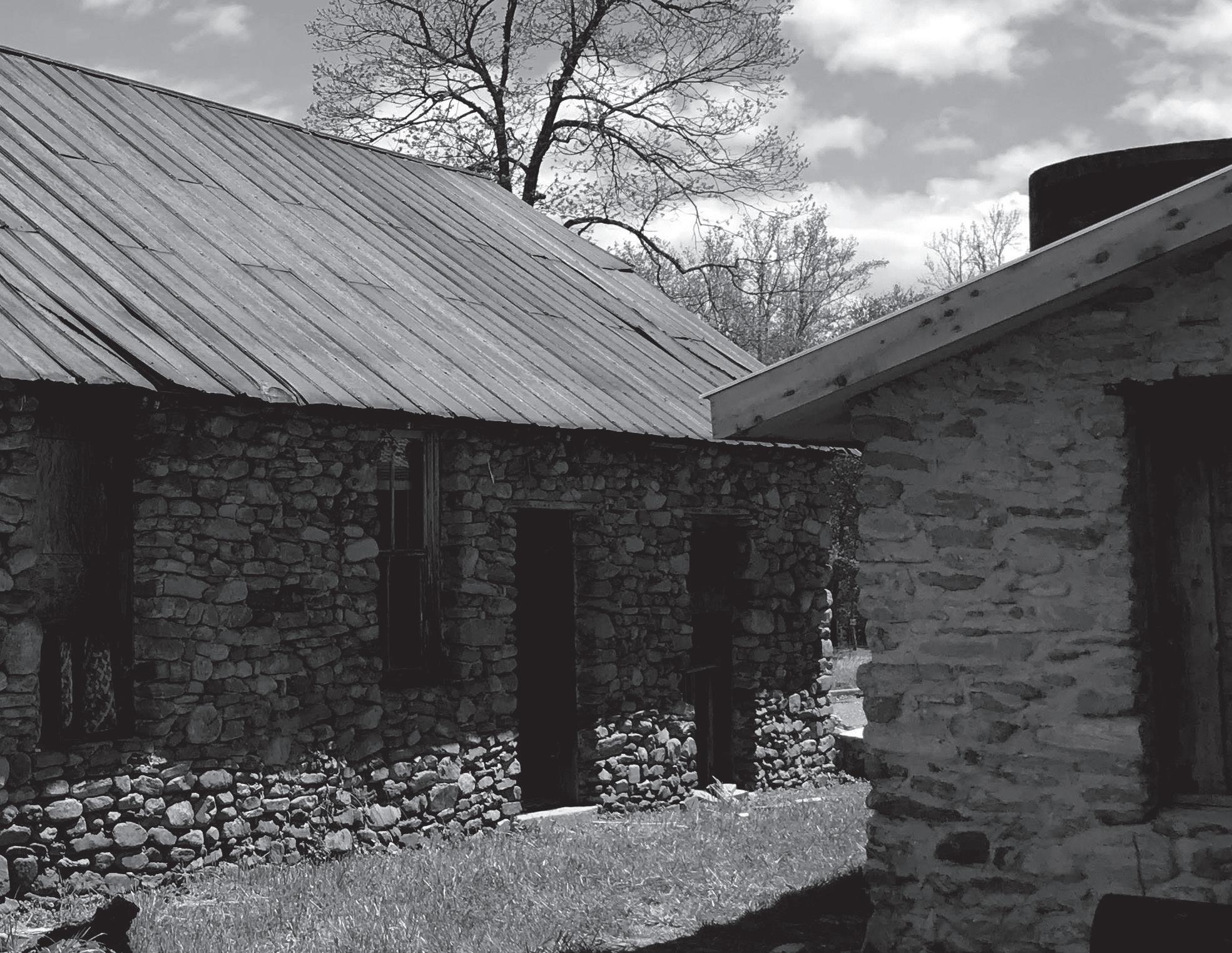
CULTURAL RESOURCES NATIVE AMERICANS
The Catawba River has served as a historic transportation route, cultural connector, and wildlife corridor throughout the area’s history. Early Native Americans in the area identified themselves as the Kawahcatawbas, “the people of the river.” The Catawba and Wateree Tribes used the river for transportation and traded with Spanish explorers at river outposts.
OVERMOUNTAIN MEN
The Catawba River and its tributaries were also followed by Revolutionary War soldiers on their way to the Battle of Kings Mountain, SC in 1780. The Overmountain Victory National Historic Trail preserves and commemorates the route. The original Overmountain Victory National Historic Trail (OVNHT) route was identified by a National Parks Service research team. The team relied on the 1881 account of the march, which has been amended by local historians, descendants of battle participants, and oth er sources. As part of this congressionally designated trail, any officially certified portion of the OVNHT must lie within a one-mile corridor (half-mile on either side) of the historic route.
: LAKE JAMES TO MARION MASTER PLAN
THE BUILT ENVIRONMENT
The opportunities and constraints found within the built and human environment are critical for determining suitable trail locations and feasibility, ideal user experiences, construction costs, and necessary permits.
This section highlights four (4) built environmental features and their implications for developing the Fonta Flora State Trail from Lake James to Marion, including: 1) Land Use; 2) Existing Trails and Parks; 3) Utilities; and 4) Transportation.
LAND USE SNAPSHOT
Eastern Section
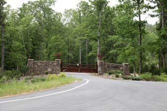
The eastern extent of the study area is anchored by a large private residential development that has provided easements for the FFST and OVNHT. Beyond this private development, the study area is typified by a rural wooded landscape with large tracts of land that includes Pisgah National Forest land
Central Section
The central section of the corridor exhibits a mix of large tracts and small tracts. Several of the larger tracts are dedicated to public and private recre ational uses including: NC Wildlife Resources Game Lands; Black Bear Campground; Black Bear boat access, provided by Duke Energy; and Big League Camp, a baseball training facility.
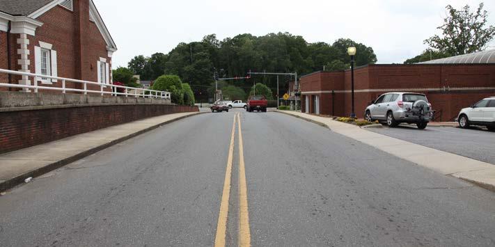
The City of Marion
The City of Marion’s northeastern edge is typified by single-family residential growth. Private residential development and areas of steep terrain create a challenge for establishing a public trail connecting Lake James to the City. Marion and the McDowell Trails Association have successfully constructed 1.6 miles of the Joseph McDowell Catawba River Greenway which serves as the western terminus of the study area.
13CHAPTER 1: Existing Conditions, Analysis, and Preliminary Alignments
THE BUILT ENVIRONMENT
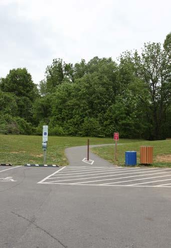
EXISTING PARKS AND GREENWAYS
Burke County, McDowell county and Marion have a collection of parks and greenways that are ideal for trail connections. Some of these major assets include:
Fonta Flora State Trail: Lake James Loop
Ten miles of the Fonta Flora State Trail were com pleted in 2017, and an additional 10 miles are currently under construction. When complete, the trail will provide for a complete loop around Lake James.
OVNHT at the 1780 Community
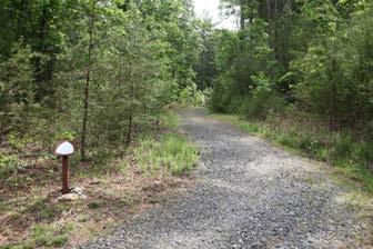
The western terminus of the study area begins with a one-mile certified segment of the OVNHT that ex tends through the 1780 Community. The trail segment is an extension of the OVNHT in Lake James State Park. Previous FFST planning efforts provide rec ommendations for connectivity to a new trailhead at the nearby Fonta Flora Whippoorwill Brewery.
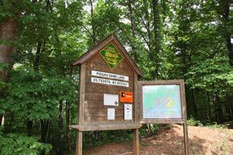
OVNHT at NC WRC Game Lands
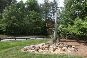
Approximately 2 miles of the OVNHT extends through NC Wildlife Resources Commission Game Lands near Black Bear Creek. Trail parking and access is located at a gravel lot on Lake James Road.
OVNHT at Lake James State Park
This state park is a significant linkage connecting FFST Sections 1, 2, and 3. Two miles of certified OVNHT are located along Paddy Creek in the state park.
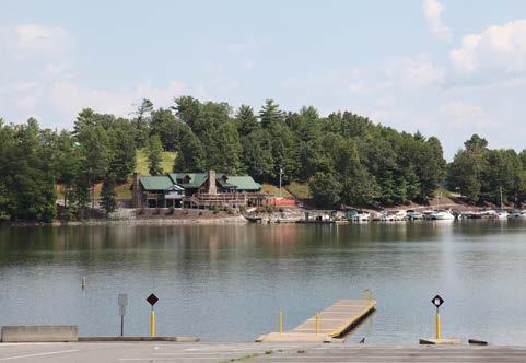
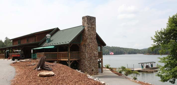
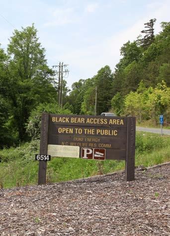
Black Bear Boat Access
This public boating access area is owned by Duke Energy, which has plans to further improve the site with camp sites and day-use amenities in partner ship with McDowell County.
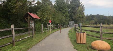
Joseph McDowell Catawba River Greenway
Named for local Revolutionary War hero and member of the Overmountain Men, Marion’s greenway extends for almost 2 miles along the Catawba River. The historic McDowell House serves as a trailhead for the greenway.
FONTA FLORA STATE TRAIL: LAKE JAMES TO MARION MASTER PLAN14
UTILITIES
The study area has a complex matrix of utilities that include transmission lines, utility towers, water lines, and sewer infrastructure. Sewer lines are often compatible with trails since existing easements preclude development. However, the easement will often need to be modified to provide for a public trail.
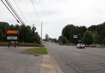
TRANSPORTATION
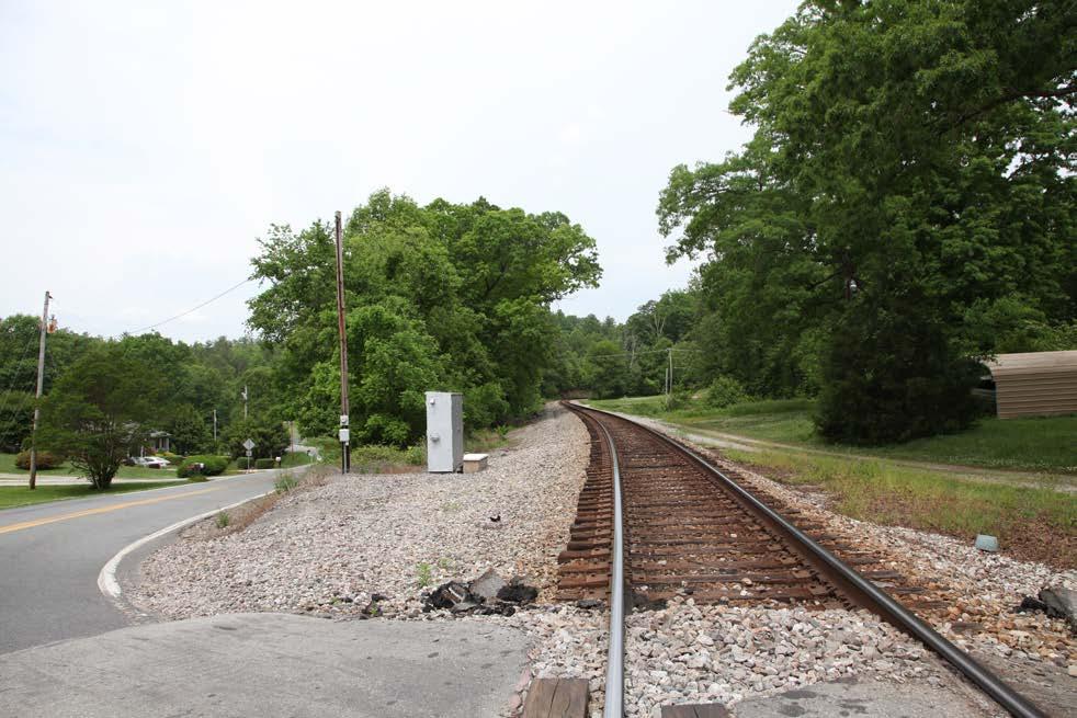
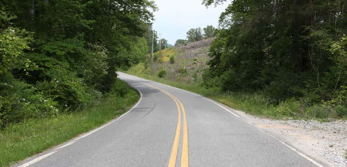
The study area analysis includes an extensive review of the existing transportation network including the North Carolina Department of Transportation (NC DOT) right-of-way (ROW), NCDOT plans, existing bike and pedestrian infrastructure (crosswalks, bike lanes, etc.), railways, and existing greenways. NCDOT’s right-of-way was analyzed for the ability to accommodate a trail alignment or accommodate a widened shoulder. These opportunities are shown on the Site Analysis Maps with corresponding opportunities and constraints notes.
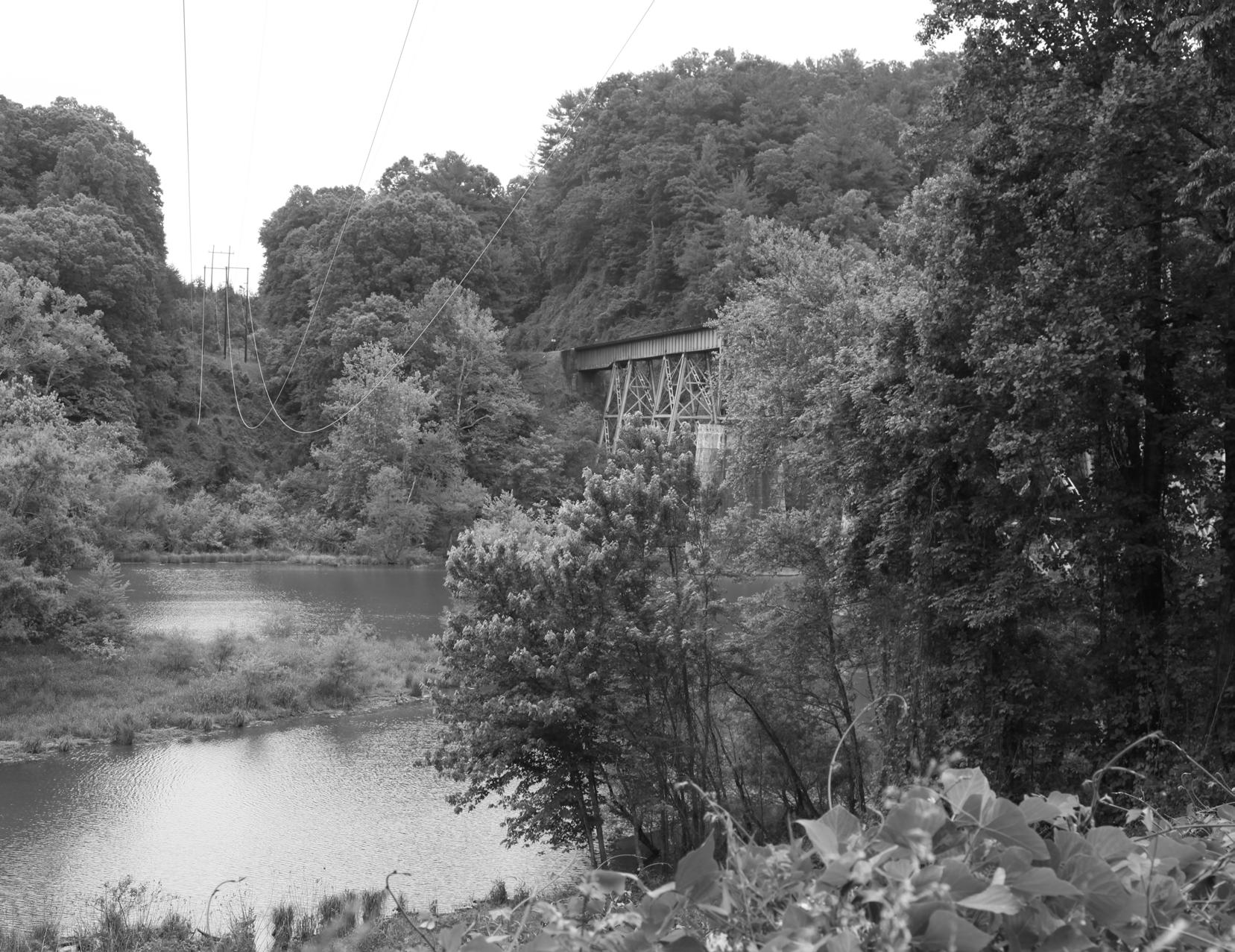
CSX operates the former Clinchfield rail line on the west side of the North Fork Catawba River. If this rail were to ever become abandoned, a significant opportunity would exist to establish a considerable section of trail. The right-of-way and adjacent lands were analyzed as a potential future route, as illustrated in the maps and notes.
15
CHAPTER 1: Existing Conditions, Analysis, and Preliminary Alignments
MAP AND PHOTO SERIES: PRELIMINARY TRAIL ROUTE ALTERNATIVES


The map and photographic series, which spatially incorporates the natural and built environment analysis, highlights a host of preliminary trail route alternatives. These routes were further refined by local leaders to identify and engage landowners. This information will serve as an ongoing reference guide as alternative routes may need
be developed


barriers.

17CHAPTER 1: Existing Conditions, Analysis, and Preliminary Alignments
to
due to unforeseen
Joseph McDowell Historic Greenway Big League Camp Lake James Landing Riverbreeze Campground & RV Joseph McDowell House CatawbaRiver Toms Creek Nix Creek Johns Creek CatawbaRiver McDowell County 70 221 226 221 1500 Court Main Yancey Hankins 1197 Airport 1214 1550 1432 Lentz 10 506 Greenlee RobyConl e y 1302 1538 1554 Holly1510 Park 1209 1553 1 58 7 Resevo Fort Garden 1700 Val l e y Logan Lake J m s Maple Par Jackson D eep Woods New 1703 Pantation Matilda1198 Virginia C os s C ee k School Fern Ga d en Creek Lakeview Cannon Robert 1212 1743 T J Highland 1229 Shortoff 1220 F h Hatchery Montevista Justice Mounan Grove Duke Dogwood Lonon Madison Knolwood Moore D d E n d Clay Green Crescent Pheasant Riverbend Victory McDowe H gh S hoo Lena O chard 1728 Summit Byrd Hi l l H s McDowellMorgan Leo Bernice Peach Fo k Rver Bradley Hurst BueHeron CarsonEllott Somerset Vine Clark Cha Overlook Goldfinch Bobcat JohnGikey Turne Deer Run Bridgewater Ap e ree View Robinson Carson Chevy Ridge Cardinal Wayne V age Camp R v e r v e YanceyRidge Laurelwood Jp Mills Farm Flynn Otter Riverview Forest Pu iam Sherri B own Hemlock Wisteria Bream Primrose M achineShop RidgewoodWinterhill Richard Goldenrod u ch CoveForest PonderosaPark Academy Palmer BarefootPark S maha D ee Lake Blue Lane Scotty Howard Sowers Hawksview Valle 1700 YanceyFinley McDowell Lake James Marion 1780 Development Trails Existing OVNHT OVT Commuter Motor Route OVT Historic Route Rail Roads Parcels Pisgah National Forest Municipal Foothills Conservancy State/Public Duke Power Big League Camp Large Undeveloped Slope 30 30 0 0.50.25 Miles 3 2 4 1 2 3 4 5 1 Marion McDowell 70 221 Court Main Park Fort Logan MapleNew Oak Fern y Robert Highland Hillcrest Montev a Fo est Clay C e c n Airport Mo gan McDowell State Ginger Vine Turner Martin Robinson Ellis 1700 Bakersville 1209 Azalea BurginPulliam Wisteria Richard AcademyHowell Cardinal McDowell 5 7 8 9 10 11 13 14 SEE INSET MAP INSET MAP NC Wildlife Commission Pisgah Game Land Designated Nature Preserve Big League Camp CANNON RESOURCES LLC POOL C RANDY 1/2 UND. INTEREST LAIL TERESA POOL 1/2 UND. INT. EQUITY TRUST CO.,CUSTODIAN F/B/O DAVID R. MAJKA Lake James Landing Black Bear Campground Bear Creek Bailey Creek North Fork Catawba River McGegers Branch CatawbaRiver Dales Creek McDowell County 1552 James 1553 1588 1550 Lentz Ha Cannon 15 8 7 Marina A m e ForestLakeHeghts Lakev BeaconRdge dlewood Wat e sed ge Graystone Sycamoe HighCamps Captains Docksde Camp Cappezion Bald Mountain Mountain Ivy Fork R v Hgh Rdge Bartlett C Be videe Cedar Ridge Edelwe s HighLake Black Forest Sa ew Settlement Ridge NatureWalk Riverview Forest Cheyenne Deacon Great Hill Summertime CabnBluf f Mountain Point Josie LakeHaven Pier Bear Cliff Lake James 1780 Development Trails Existing OVNHT OVT Commuter Motor Route OVT Historic Route Rail Roads Parcels Pisgah National Forest Pisgah National Forest Municipal Foothills Conservancy State/Public Duke Power Big League Camp Large Undeveloped Slope 0 30 > 30 0 0.50.25 Miles 1 5 6 4 3 8 9 10 2 3 2 10 8 7 9 5 6 NC Wildlife Commission Pisgah Game Land Designated Nature Preserve LINVILLE VIEW LLC GOODMAN MICHAEL ALVIN GRAY JAMES H 1/3int &JOSHUA GRAY 1/3int & MELISSA B GRAY Black Bear Campground FFBrew Paddy CreekDales CreekBaileyCreek McDowell County Burke County 1552 126 1238 1236 C 105 1551 LakeJames Linville 1237 1281 1588 Mountai n Institute C a Rock Hil l Paddy s Creek Obeth Pi s gahP reserve BigTree Sycamo e SunsetPoint Graystone NeboBridge Lake and Hully Gully C a ptai ns HuntCamp Claras TenWhigs Ridge Dockside Game Land LakeForest LongRifleRidge Myrtle Nadias Ridge Wildlife Club Bear Cliff Donahue ShortoffView BBShort Bud David LakeviewHill s Rocky Deep Forest Bowen Ravenwood Lk James1780 Development Trails Existing OVNHT OVT Commuter Motor Route OVT Historic Route Rail Roads Parcels Pisgah National Forest Pisgah National Forest Municipal Foothills Conservancy State/Public Duke Power Big League Camp Large Undeveloped Slope 0 30 > 30 0 0.50.25 Miles 4 2 3 5 6 8 2 3 4 5 6 78 9 10
FONTA FLORA STATE TRAIL: LAKE JAMES TO MARION MASTER PLAN18 STUDY AREA 1: SITE ANALYSIS Commission Preserve LINVILLE VIEW LLC GOODMAN MICHAEL ALVIN GRAY JAMES H 1/3int &JOSHUA E GRAY 1/3int & MELISSA B GRAY Black Bear Campground FFBrew Paddy CreekDales CreekBaileyCreek McDowell County Burke County 1552 126 1238 1236 C 105 1551 LakeJames Linville 1237 1281 1588 Mountai n Institute C a Rock Hil l Paddy s Creek Obeth Pi s gahP reserve BigTree Sycamore SunsetPoint Graystone NeboBridge Lakeland Hully Gully C a ptai ns HuntCamp Claras TenWhigs Ridge Dockside Game Land LakeForest LongRifleRidge Myrtle Nadias Ridge Wildlife Club Bear Cliff Donahue ShortoffView BBShort Bud David LakeviewHill s Rocky Deep Forest Bowen Ravenwood Lk James1780 Development Trails Existing OVNHT OVT Commuter Motor Route OVT Historic Route Rail Roads Parcels Pisgah National Forest Pisgah National Forest Municipal Foothills Conservancy State/Public Duke Power Big League Camp Large Undeveloped Slope 0 - 30 > 30 0 0.50.25 Miles 4 2 3 5 6 8 2 1 3 4 5 6 78 9 10 MAP 2: STUDY AREA 1 SITE ANALYSIS STUDY AREA 1

19 STUDY AREA 1: OPPORTUNITIES AND CONSTRAINTS Connect existing OVNHT Connect to Fonta Flora Brewery Trailhead Positive landowner at Campbell’s Trace Subdivision potentially willing to allow trail Potential for lakeside trail Potentially willing landowners Large undeveloped tracts of land Connection to Pisgah National Forest Game Lands Connect to Black Bear Campground Connect to Black Bear Boat Access Existing OVNHT requires improvements Narrow road shoulder Possible road crossing at Lake James Road Parcelization at lakeside private developments Private residential subdivisions Narrow bridge over Bailey Creek Lack of bicycle/pedestrian infrastructure at Bear Creek Marina & Campground Narrow bridge over Bear Creek The Fonta Flora Brewery at Whippoorwill Farm is a significant destination on the FFST Opportunities Constraints Positive landowner at Campbell’s Trace The Black Bear Marina & Campground is an asset that could be linked to the FFST Private residential development presents a significant barrier to a trail alignment along the lake shore Existing OVNHT at Campbell’s Trace requires improvements 1 2 3 10 2 3 4 5 6 7 8 9 10 1 2 3 4 5 6 7 8 5 1 CHAPTER 1: Existing Conditions, Analysis, and Preliminary Alignments
FONTA FLORA STATE TRAIL: LAKE JAMES TO MARION MASTER PLAN20 STUDY AREA 2: SITE ANALYSIS NC Wildlife Commission Pisgah Game Land Designated Nature Preserve Big League Camp CANNON RESOURCES LLC POOL C RANDY 1/2 UND. INTEREST LAIL TERESA POOL 1/2 UND. INT. EQUITY TRUST CO.,CUSTODIAN F/B/O DAVID R. MAJKA Lake James Landing Black Bear Campground Bear Creek Bailey Creek North Fork Catawba River McGegers Branch CatawbaRiver Dales Creek McDowell County 1552 Lake James 1553 1588 1550 Lentz Ha Cannon 15 8 7 Marina A m el i a ForestLakeHeights Lakev BeaconRidge I dlewood Wat e r sed ge Graystone Sycamore HighCamps Captains Dockside Camp Cappezion Bald Mountain Mountain Ivy Fork River High Ridge Bartlett BearCliff Belvidere Cedar Ridge Edelweiss HighLake Black Forest Sailview Settlement Ridge NatureWalk Riverview Forest Cheyenne Deacon Great Hill Summertime CabinBluf f Mountain Point Josie LakeHaven Pier Bear Cliff Lake James 1780 Development Trails Existing OVNHT OVT Commuter Motor Route OVT Historic Route Rail Roads Parcels Pisgah National Forest Pisgah National Forest Municipal Foothills Conservancy State/Public Duke Power Big League Camp Large Undeveloped Slope 0 - 30 > 30 0 0.50.25 Miles 1 5 6 4 3 8 9 10 2 3 2 10 8 7 9 5 6 1MAP 3: STUDY AREA 2 SITE ANALYSIS STUDY AREA 2
STUDY
Existing
21
AREA 2: OPPORTUNITIES AND CONSTRAINTS Connect to Black Bear Boat Access Future site improvements could include trailhead Duke Energy property
OVNHT at Pisgah Gameland Opportunity for trail head at existing trail parking Flat floodplain may be suitable for trailhead Connect to Lake James Landing & RV Park Connect to Cannon-Big League Camp at Hankins Rd. Potential rail-with-trail Opportunity for increased trail visibility at Big League Camp entrance Steep terrain North Fork Catawba River bridge crossing Secluded private development Parcelization at lakeside private development Narrow/steep shoulder would require elevated trail infrastructure Small parcels with no easements Rail-with-trail requires coordination with CSX Elevated bridge would require significant fill to match grade Narrow road shoulder around blind curve Narrow shoulders on bridge Opportunity to connect Black Bear Boat Access to nearby Bear Creek Marina Existing OVNHT and trail parking at Pisgah Game Land Control Point: Connection to Pisgah National Forest Gamelands Parking Area Connect to Cannon Big League Camp at Hankins Road
Pinch
point at CSX railroad overpass on Lake James Road Narrow bridge 8 1 2 3 4 5 6 7 8 9 10 1 10 4 8 1 1 2 3 4 5 6 7 8 9 10 Opportunities Constraints CHAPTER 1: Existing Conditions, Analysis, and Preliminary Alignments
FONTA FLORA STATE TRAIL: LAKE JAMES TO MARION MASTER PLAN22 STUDY AREA 3: SITE ANALYSIS Joseph McDowell Historic Greenway Big League Camp Lake James Landing Riverbreeze Campground & RV Joseph McDowell House CatawbaRiver Toms Creek Nix Creek Johns Creek CatawbaRiver McDowell County 70 221 226 221 1500 Court Main Yancey Hankins 1197 Airport 1214 1550 1432 Lentz 10 506 1552 Greenlee RobyConl e y 1302 1538 1554 Holly1510 Park 1209 1553 1 58 7 Reservoir Fort Garden 1700 Val l e y Logan Lake James Maple Par Jackson D eep Woods New 1703 Plantation Matilda1198 Virginia C r os s Creek School Fern Gard en Creek Lakeview Cannon Robert 1212 1743 T J Highland 1229 Shortoff 1220 F i sh Hatchery Montevista Justice Mountain Grove Duke Dogwood Lonon Madison Knollwood Moore D e a d E n d Clay Green Crescent Pheasant Riverbend Victory McDowell High School Lena Orchard 1728 Summit Byrd Hi l l Hills McDowellMorgan Leo Bernice Peach Fork River Bradley Bartlett Hurst BlueHeron C arsonElliott Somerset Vine Clark Chariot Overlook Goldfinch Bobcat John Gilkey Turner Deer Run Bridgewater Appletree View Robinson Carson Chevy Ridge Cardinal Wayne Caberet Village Camp R i v e r v i e w YanceyRidge Laurelwood Jp Mills Farm Flynn Otter Riverview Forest Pu l l iam Sherri Brown Hemlock Wisteria Bream Primrose M achineShop RidgewoodWinterhill Richard Goldenrod urch CoveForest PonderosaPark Academy Palmer BarefootPark Samaha D ee Lake Blue Lane Scotty Howard Sowers Hawksview Valley 1700 YanceyFinley McDowell Lake James Marion 1780 Development Trails Existing OVNHT OVT Commuter Motor Route OVT Historic Route Rail Roads Parcels Pisgah National Forest Municipal Foothills Conservancy State/Public Duke Power Big League Camp Large Undeveloped Slope 0 - 30 > 30 0 0.50.25 Miles 3 2 4 1 1 2 3 4 5 1 Marion McDowell 70 221 Court Main Park Fort Logan MapleNew Oak Fern y Robert Highland Hillcrest Montevista Forest d Clay Crescent Airport Morgan McDowell State Ginger Vine Turner Martin Robinson Ellis 1700 Bakersville 1209 Azalea BurginPulliam Wisteria Richard AcademyHowell Cardinal McDowell 5 7 8 9 10 11 13 14 SEE INSET MAP INSET MAP MAP 4: STUDY AREA 3 SITE ANALYSIS STUDY AREA 3
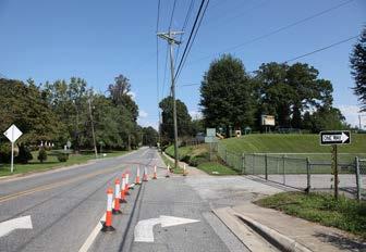
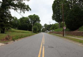
23 STUDY AREA 3: OPPORTUNITIES AND CONSTRAINTS Control Point: Connection to Yancey Rd. Large undeveloped parcels provide connectivity to Justice Road Catawba River corridor is ideal trail setting Utilize Catawba River floodplain corridor Large parcels on south side of Catawba River Connect to Catawba River Greenway Existing sidewalk begins at Oakwood Drive Retrofit existing sidewalk into multi-use path Existing sidewalk begins at Monte Vista Avenue Wide right-of-way on Fleming Avenue Connect to Marion Community Building Connect to Marion Town Hall Double-loaded sidewalks on New Street Existing sidewalk on south side of N. Garden St. Existing parking on Fort Street could provide trail parking Catawba River crossing will require bridge Narrow shoulders on Holly Street Narrow shoulders on Airport Road Narrow shoulders & high traffic volume on US 70 School turn lane utilizes Fleming St. right-of way Steep slope along North Madison Street On street parking along Fort St. utilizes available right of way Steep slope along Court St. 4 5 1 2 3 4 5 6 7 8 1 5 1 2 3 4 5 6 7 8 9 10 11 12 13 14 12 9 Connect to Joseph McDowell Catawba River Greenway Wide right of way on Fleming Street provides opportunity for a sidepath
Narrow
shoulders & high traffic volume on US 70 School turn lane utilizes Fleming St right of way Double loaded sidewalks on New Street near Town Hall Opportunities Constraints CHAPTER 1: Existing Conditions, Analysis, and Preliminary Alignments
CHARACTER AND DESIGN GUIDELINES
THIS CHAPTER PROVIDES DESIGN DETAILS
FOR VARIOUS TRAIL TYPES AND TRAIL
SUPPORT FACILITIES AND OFFERS INSIGHT
INCORPORATING SOCIAL MEDIA.
This chapter describes specific trail construction standards and trail types to ensure minimal maintenance and the best user experience.
Additionally, this chapter defines three trail types and illustrates their transitions along the preferred trail alignment.
A unique architectural and branding theme is presented for signage, wayfinding, and other trail support facilities. This chapter concludes with recommendations for using social media to market the trail.
IN THIS CHAPTER:
SUSTAINABLE TRAIL DESIGN & CONSTRUCTION
TRAIL TYPES
TRAIL PROFILE
SUPPORT FACILITIES
MEDIA MARKETING
25
FOR
A|
B|
C|
D| TRAIL
E| SOCIAL
TRAIL
2
TRAIL CHARACTER
SUSTAINABLE TRAIL DESIGN
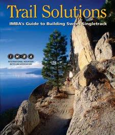
The trail must be designed and constructed to minimize erosion and ongoing maintenance, while providing for a leisure, family-oriented experience. The trail width will be approximately five-feet wide and allow for multiple users and emergency access from off-road vehicles. The overall average trail grade or steepness will be 5% or less. The trail will be slightly rolling with a gentle grade that follows the terrain contours. The trail will be slightly out-sloped, and meanders and undulates frequently to remove water from the trail surface and create interest. The trail corridor will remain as narrow as possible while still maintaining the required tread width. The trail design will utilize the five essential elements of sustainable trails as outlined in the International Mountain Bicycling Association’s (IMBA) publication “Trail Solutions.”
1. THE HALF RULE
A trail’s grade shouldn’t exceed half the grade of the hillside or sideslope that the trail traverses. If the grade does exceed half the sideslope, its considered a fall-line trail. Water will flow down a fall-line trail rather than run across it.
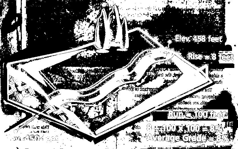
2. THE TEN PERCENT AVERAGE GUIDELINE

An average trail grade of 10 percent or less is considered sustainable. This doesn’t mean that all trails should be kept under 10 percent, but the trail builder will need to limit the length of sections that exceed 10 percent.
FONTA FLORA STATE TRAIL: LAKE JAMES TO MARION MASTER PLAN26 26
THE FIVE ESSENTIAL ELEMENTS OF SUSTAINABLE TRAILS
3. MAXIMUM SUSTAINABLE TRAIL GRADES
more than
maximum
be prior to beginning
factors
be considered when determining the maximum sustainable
4. GRADE REVERSALS
5. OUTSLOPE

down

27CHAPTER 2: Trail Character and Design Guidelines
Maximum grade is the steepest portion of a trail that is
approximately 10 feet in length. It’s critical to determine what the
allowable trail grade will
construction. Several
should
trail grade which include: • Half Rule • Soil Types • Rock • Annual Rainfall Amount • Grade Reversals • Type of Users • Number of Users • Difficulty Level
A grade reversal is a point where an ascending trail changes direction subtly for 10 to 50 linear feet before ascending again. This change in grade allows for water to exit the trail.
Outslopes allow water to sheet flow off the trail instead of channeling
its center.
MAX
TRAIL CHARACTER
TRAIL CONSTRUCTION
Members and associates of the Professional Trailbuilders Association (PTBA) should be preferred contractors for constructing the trail with mechanized equipment. These contractors have a thorough understanding of sustainable trail design and construction.

Volunteers may also work with PTBA contractors in a “hybrid” manner. When utilizing this method, the contractor is responsible for the rough cut of the trail tread and volunteers complete the finish work. Burke County will be responsible for securing any required local, state, or federal permits for construction.
The trail will be constructed using a “full bench cut” in which the entire trail tread is built on solid ground. A “partial bench cut” which is similar to “cut and fill” will only be utilized if a full bench cut is not feasible due to rock outcrops, slabs, or other natural features. A partial bench cut uses loose fill dirt to construct a portion of the trail treads. The fill dirt has a tendency to loosen over time and can then wash and erode. This issue is minimized when constructing a full bench cut. The trail bed will be shaped to leave an even, compacted, uniform surface free of indentations or protruding roots and stumps. The grading of the trail tread, back slope, and drainage features will be finished to a smooth, stable surface.
Any excess or disturbed soil outside the trail tread is evenly distributed and covered with leaves, organic debris, and other natural materials to aid in aesthetics and sedimentation and erosion control.
FULL BENCH CUT
SOLID GROUND
The trail will be constructed using a “full bench cut” in which the entire trail tread is built on solid ground.
Details from IMBA


FONTA FLORA STATE TRAIL: LAKE JAMES TO MARION MASTER PLAN28
TRAIL
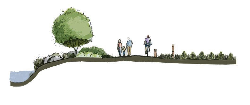
TYPICAL GREENWAY
29
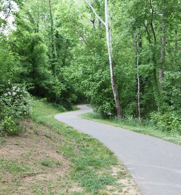
TYPES Four trail types are proposed along the preferred alignment. A specific trail type is proposed according to its surrounding environment, whether it is for safety along roadways or to enhance user experience. 30’ PREFERRED BUFFER TO RIVER TO PROTECT WATER QUALITY 10’ PAVED ASPHALT MILE MARKER FENCING TO MARK PRIVATE PROPERTY BOUNDARY User Group: Multi-Use Material: Paved Asphalt Preferred Width: 10’ Average Construction Cost: $90/ln. ft. Preferred Easement Width: 50’ Minimum Easement Width: 20’ THE JOSEPH MCDOWELL CATAWBA RIVER GREENWAY EXTENDS FOR 2 MILES ALONG THE CATAWBA RIVER IN MARION.
10’ PAVED ASPHALT CHAPTER 2: Trail Character and Design Guidelines
TRAIL


DUAL-USE
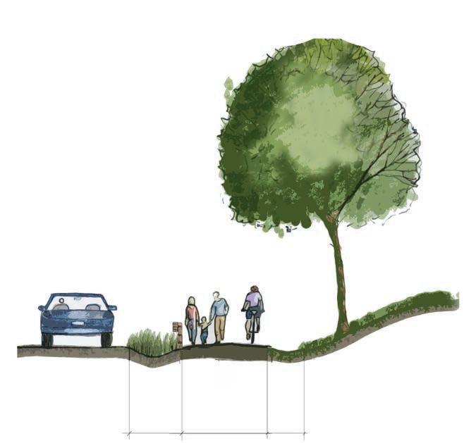
FONTA FLORA STATE TRAIL: LAKE JAMES TO MARION MASTER PLAN30 NCDOT SIDEPATH 8’ PAVED ASPHALT
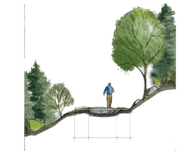
TRAIL 5’ NATURAL SURFACE User Group: Hikers and Cyclists Material: Native Soils Preferred Width: 5’ Average Construction Cost: $6/ln. ft. Preferred Easement Width: 50’ Minimum Easement Width: 10’ TRAIL TYPES
CHARACTER User Group: Multi-Use Material: Paved asphalt Preferred Width: 8’ Average Construction Cost: $120/ln. ft. Preferred Easement Width: 25’ Minimum Easement Width: 25’ Note: Trail to be approved in accordance with NCDOT encroachment agreement.
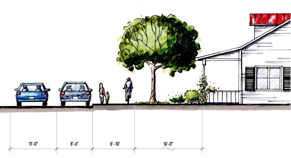
31 TOWN SIDE PATH 8’ CONCRETE User Group: Multi-Use Material: Concrete Preferred Width: 8’ Average Construction Cost: $90/ln. ft. Preferred Easement Width: 25’ or in ROW Minimum Easement Width: 25’ or in ROW CHAPTER 2: Trail Character and Design Guidelines
TRAIL CHARACTER
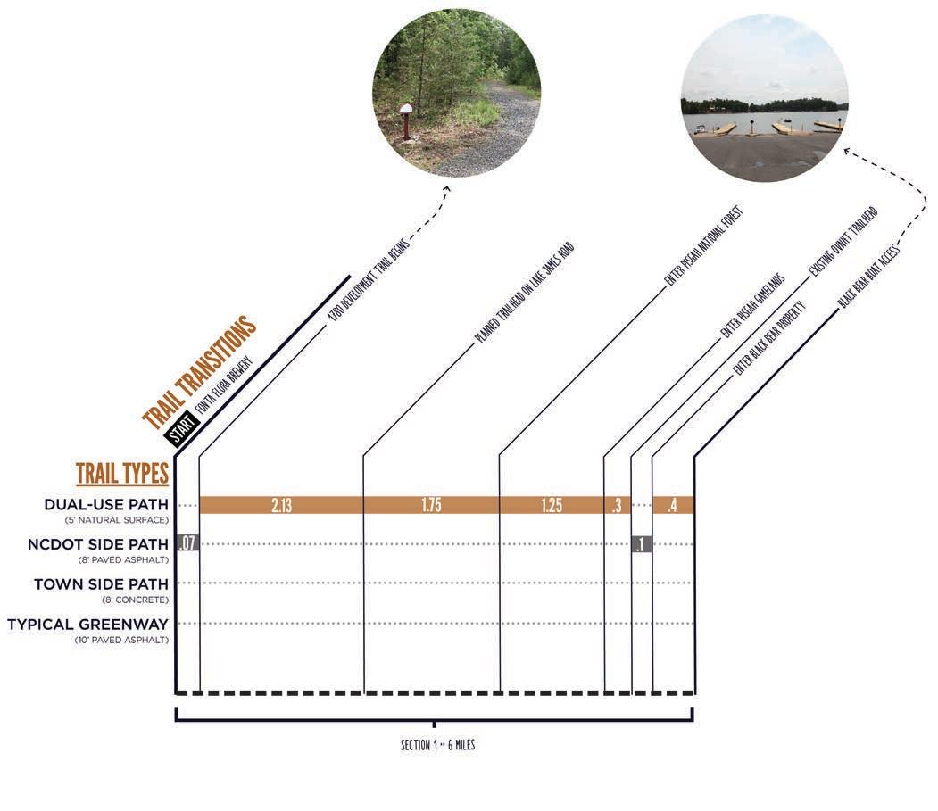
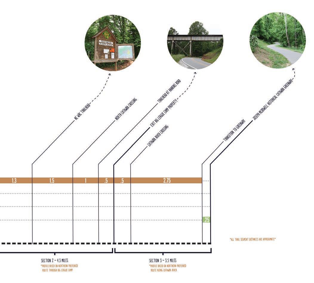
TYPE
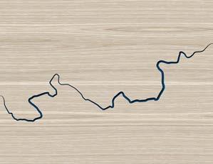
There are two (2) primary trail type transitions proposed along the preferred trail route, which extends approximately 20 miles. The Trail Type Profile identifies the transition location, along with associated length, for each trail type.
*Profile depicts one of three preferred route options*
FONTA FLORA STATE TRAIL: LAKE JAMES TO MARION MASTER PLAN32
MATCHLINE APPROX. DISTANCE IN MILES TRAIL
PROFILE
*Final trail type will depend on specific environmental conditions and whether trail is located within NCDOT ROW or within a private trail easement.
33 MATCHLINE
APPROX. DISTANCE IN MILES CHAPTER 2: Trail Character and Design Guidelines
TRAIL SUPPORT FACILITIES
OVERVIEW
A unique architectural and branding theme is presented for trail support facilities on the following pages.
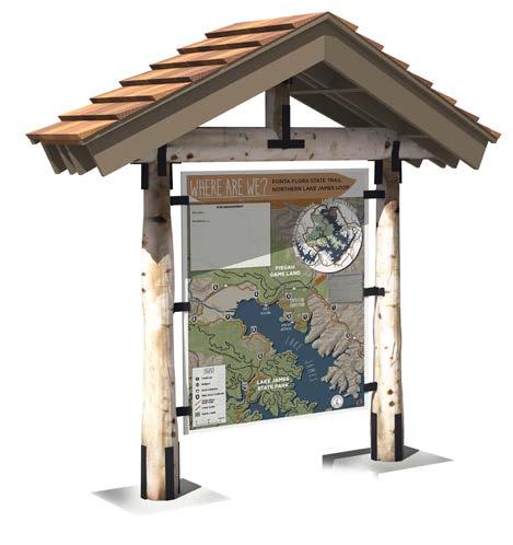
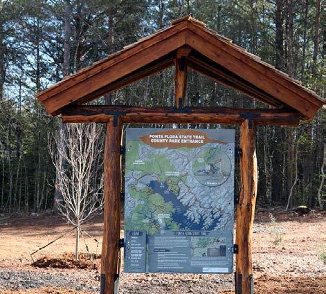
TRAILHEAD KIOSK
The kiosk will provide a trail map and other important information for trail users. This facility will be located at trailheads and pocket parks along the FFST.
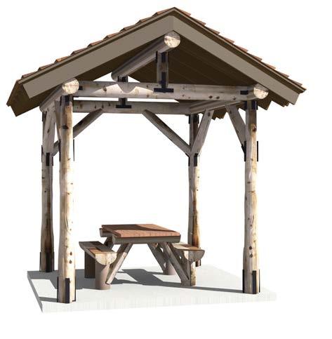
PICNIC SHELTER
The shelter design includes a timber frame structure. This architectural style, along with a cedar shingle roof, provides for a natural character conducive to the Lake James environment.
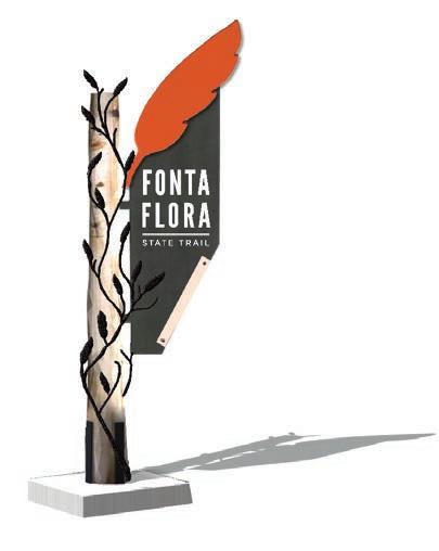
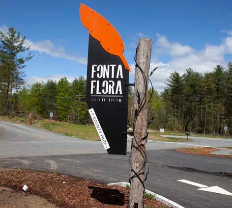
TRAILHEAD MONUMENT
Large monuments will be located at major trailheads or pocket park facilities that provide access to the FFST. This monument should also provide for the name of the specific trailhead or pocket park.
FONTA FLORA STATE TRAIL: LAKE JAMES TO MARION MASTER PLAN34
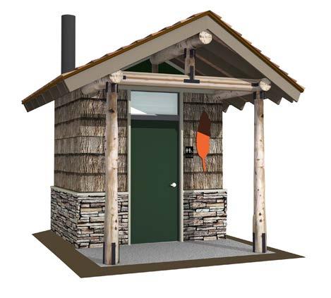
VAULT TOILET
The vault toilet does not require a septic system, but must be pumped regularly. This facility will be provided for at the Fonta Flora County Park
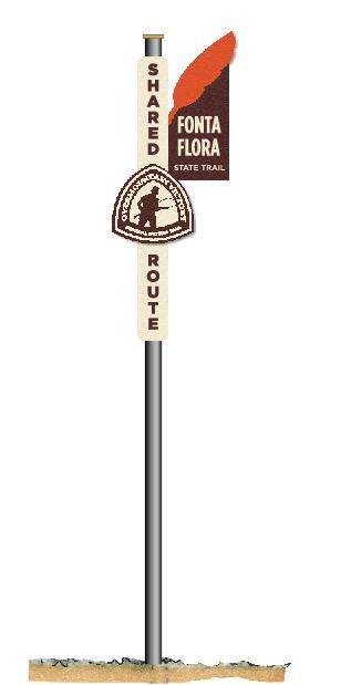
BREAKAWAY SIGN: SHARED ROUTE
The FFST shares a route with the Overmountain Victory National Historic Trail. The directional signage post will provide users with important trail information and is compliant with NCDOT standards.
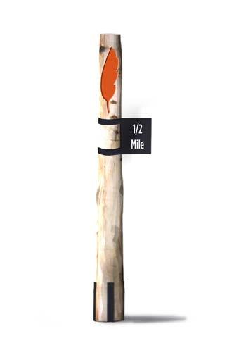
MILEAGE POST
Mileage posts not only provide distance information, but also serve as confidence markers that create a feeling of safety.
35
CHAPTER 2: Trail Character and Design Guidelines
SUPPORT FACILITIES
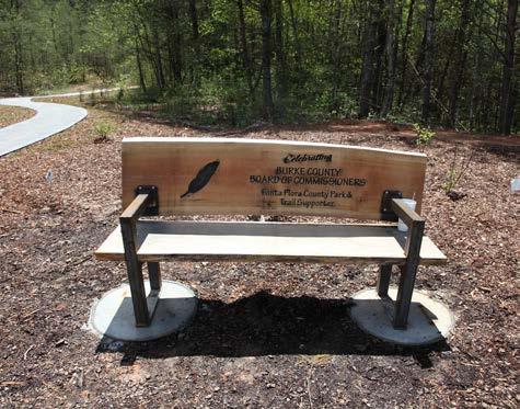
TRAIL FEATURES & SITE FURNITURE
Burke County is working in partnership with Oak Hill Iron and other local artisans to develop custom site furniture and other support facilities. These unique and custom elements will be provided for at Fonta Flora County Park, trailheads, pocket parks, and other locations where trail users can be served.

FONTA FLORA STATE TRAIL: LAKE JAMES TO MARION MASTER PLAN36
BICYCLE RACK
NCDOT BRIDGE DETAILTRAILHEAD KIOSK
BENCHES
TRAILHEAD MONUMENT
SOCIAL MEDIA: THE NEW WORD OF MOUTH


#FONTAFLORA
37
Trail users should be encouraged to utilize social media to share their experiences with their “friends” and “followers.” Special signage along the trail will signal users to consider posting pictures of themselves or their group of friends as they walk or ride bikes along the trail. In addition, special props and features should be developed during the final design phase. After all, who can market this destination-quality trail better than trail users themselves? Lets take advantage of social media - the new word of mouth.
The proposed official hashtag for the Fonta Flora State Trail is #fontaflora. The use of this hashtag will allow local tourism leaders to curate local photos and content that can be shared on website and re-posted through other social media platforms. CROSS PROMOTE WITH OTHER NOTABLE HASHTAGS @NCParks #LakeJames #findyourpark #trail2victory Black Bear Trailhead, Lake James 112 likes dbdplanning Great day for a ride on #fontaflora state trail! #lakejames #ncstatetrails CHAPTER 2: Trail Character and Design Guidelines
CHAPTER SERVES AS THE HEART OF THE TRAIL MASTER PLAN, PROVIDING
SPECIFIC TRAIL ALIGNMENTS AND

RECOMMENDATIONS
Specific trail alignments and recommendations are provided for the FFST within three (3) planning sections.
Trail recommendations are supported with renderings that demonstrate trail character at specific locations.
CHAPTER:
39 THIS
RECOMMENDATIONS.
IN THIS
A| PLANNING SECTIONS OVERVIEW B| TRAIL SECTION RECOMMENDATIONS
3
PLANNING SECTIONS


The 20-mile study area from Lake James to Marion is divided into three (3) planning sections. The geographic extent of each section includes a beginning and ending terminus that features a key asset or significant connectivity point for the trail. Many of the planning sections represent project areas that can be developed independently over time, providing a logical method for implementation as landowner willingness, funding,
other opportunities arise.
THE 20-MILE STUDY AREA FROM LAKE JAMES TO MARION IS DIVIDED INTO THREE (3) PLANNING SECTIONS;
FONTA FLORA STATE TRAIL: LAKE JAMES TO MARION MASTER PLAN40
and
PLANNING SECTIONS NC WILDLIFE COMMISSION GAME LANDS PISGAH NATIONAL FORE MARION 1 2 3 LAKE JAMES STATE PARK FONTA FLORA BREWERY JOSEPH MCDOWELL HOUSE BURKE COUNTYMCDOWELL COUNTY LAKE JAMESHI OVNHT 221 70 70 70 40 BLACK BEAR CAMPGROUND LAKE JAMES LANDING BLACK BEAR BOAT ACCESS BIG LEAGUE CAMP CATAWBARIVER
THIS CHAPTER IS ORGANIZED ACCORDINGLY. The planning sections include: FONTA FLORA BREWERY >> BLACK BEAR BOAT ACCESS BLACK BEAR BOAT ACCESS >> BIG LEAGUE CAMP BIG LEAGUE CAMP >> MCDOWELL HOUSE 1 2 3 MAP 5: PLANNING SECTIONS
ABOUT THE PLANNING SECTION MAPS
Each planning section is anchored by a map that highlights proposed trail routes, trail features, and landowner sentiment. The proposed routes are identified as either preferred, alternate, or spur. These trail alignments are the result of extensive analysis, including environmental feasibility, landowner willingness, and insights provided by local government and local trail development leaders.
Noted trail features include the physical infrastructure and facilities that support the proposed trail. These features are highlighted along the preferred route and provide critical information for developing an


of probable cost for each section. These features include trailheads and crossings associated with either a road or water feature. Trailheads will provide for parking and trail user orientation. Road crossings indicate the need to provide for traffic calming measures and appropriate signage for both trail users and motorists. Major bridges indicate a significant stream or river crossing that requires a bridge greater than 20 feet in length.
PLANNING SECTION IS ANCHORED BY


MAP THAT HIGHLIGHTS PROPOSED TRAIL ROUTES AND FEATURES.
QUICK FACTS
Each planning section begins with a “quick facts” exhibit. This information includes the trail distance, trail type (see Chapter 2: Design Guidelines), and key features and assets associated with each section.
41CHAPTER 3: Recommendations
estimate
LAKE JAMES >> MARION: BY THE NUMBERS 23.5 >> TRAIL MILES 3 >> SHARED OVNHT MILES 9 >> TRAILHEADS 16 >> ROAD CROSSINGS 5 >> MAJOR BRIDGES $6.25M >> APPROX. COST
LAKE JAMES 1281 MOUNTAININSTITUTE HIL L OBETH BIGTREE NEBO BRIDGE LAKELAND HULLYGULLY HUNTCAMP TENWHIGSRIDGE GAME LAND LAKE FOREST LONGRIFLERIDGE RIDGELINE WILDLIFE CLUB DONAHUE B B SHORT BUD DAVID LAKEVIEW HIL L S BOWEN 126 CAMPBELL’STR A C E AC PBELL’S TRA C E NSETPOINT 1780 TRAILS LAKE JAMES ATE PARK FONTA FLORA BREWERY/ SHARED TRAILHEAD WITH OVNHT POCKET PARK HI ORIC OVHT H I O R IC O V TH EACH
A
BOAT ACCESS
PROPOSED TRAILS
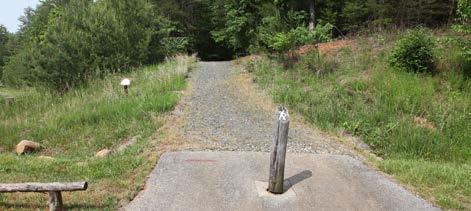
This planning section extends approximately six (6) miles from the Fonta Flora Brewery at Whip poorwill Farm to Black Bear Boat Access on Lake James Road. The Fonta Flora Farmhouse Brewery property provides a significant opportunity for a destination-quality trailhead. A short spur trail, ap proximately 400 ft. long, will connect the brewery and trailhead to an existing segment of the OVNHT within Lake James State Park. The connector will re quire cooperation with a private landowner to cross an existing gravel driveway.
The OVNHT crosses Hwy. 126 just south of the Fonta Flora Brewery. After crossing Hwy. 126, a short NC DOT sidepath will connect to the one mile segment of certified OVNHT that extends through the 1780 Community at Campbell’s Trace. This segment of existing OVNHT may require reconstruction and resurfacing to a native-soil tread that provides an ideal experience for bicyclists and hikers.
The trail segment extends through the 1780 Com munity to a pocket park near the lake shore. From the 1780 Community, easements secured by Burke County will allow the dual-use trail to continue north for approximately one mile to a planned trailhead on Lake James Road.

From the trailhead, the route extends south into McDowell County turning west across Lake James Road. The trail continues west through large, undeveloped rural tracts for 1.25 miles, crossing Linville Road and Dales Creek. After crossing Dales Creek, the trail enters Pisgah National Forest Land and extends for another 1.25 miles to Bailey Creek before turning south into the Pisgah Game Lands. The route connects to an existing trailhead for the OVNHT then crosses to the east side of Lake James Road, transitioning to an NCDOT sidepath that extends for approximately 375 ft. to the existing vehicular bridge over Bear Creek. The trail will use the bridge shoulder then continue as a paved side path for approximately 170 ft. before exiting NC DOT right-of-way to enter Black Bear Boat Access property and transitioning back to a natural surface dual-use trail. An alternate route south of Lake James Road extends through unde veloped tracts to connect to the Black Bear Campground.
PHOTOS:


FONTA FLORA STATE TRAIL: LAKE JAMES TO MARION MASTER PLAN42
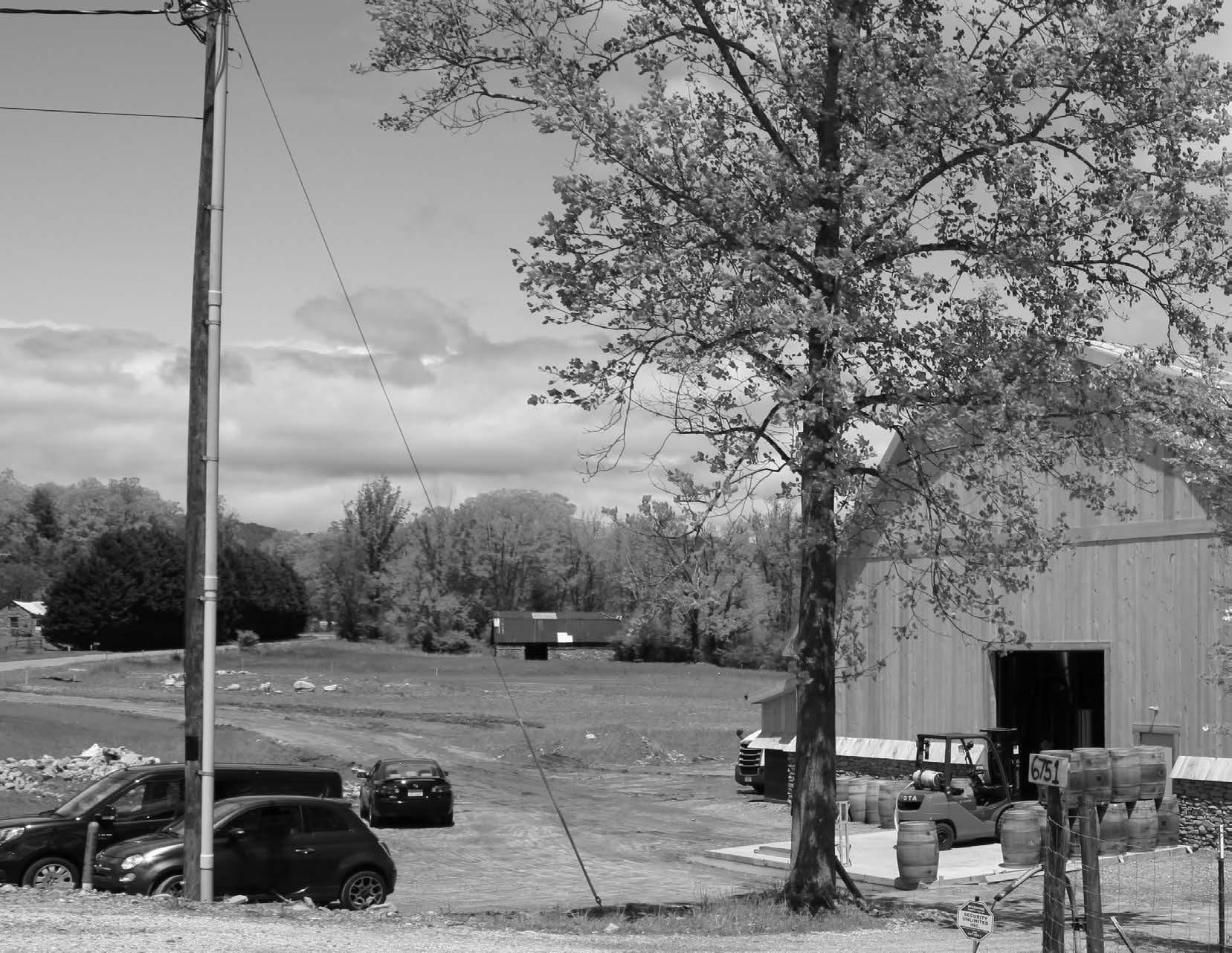
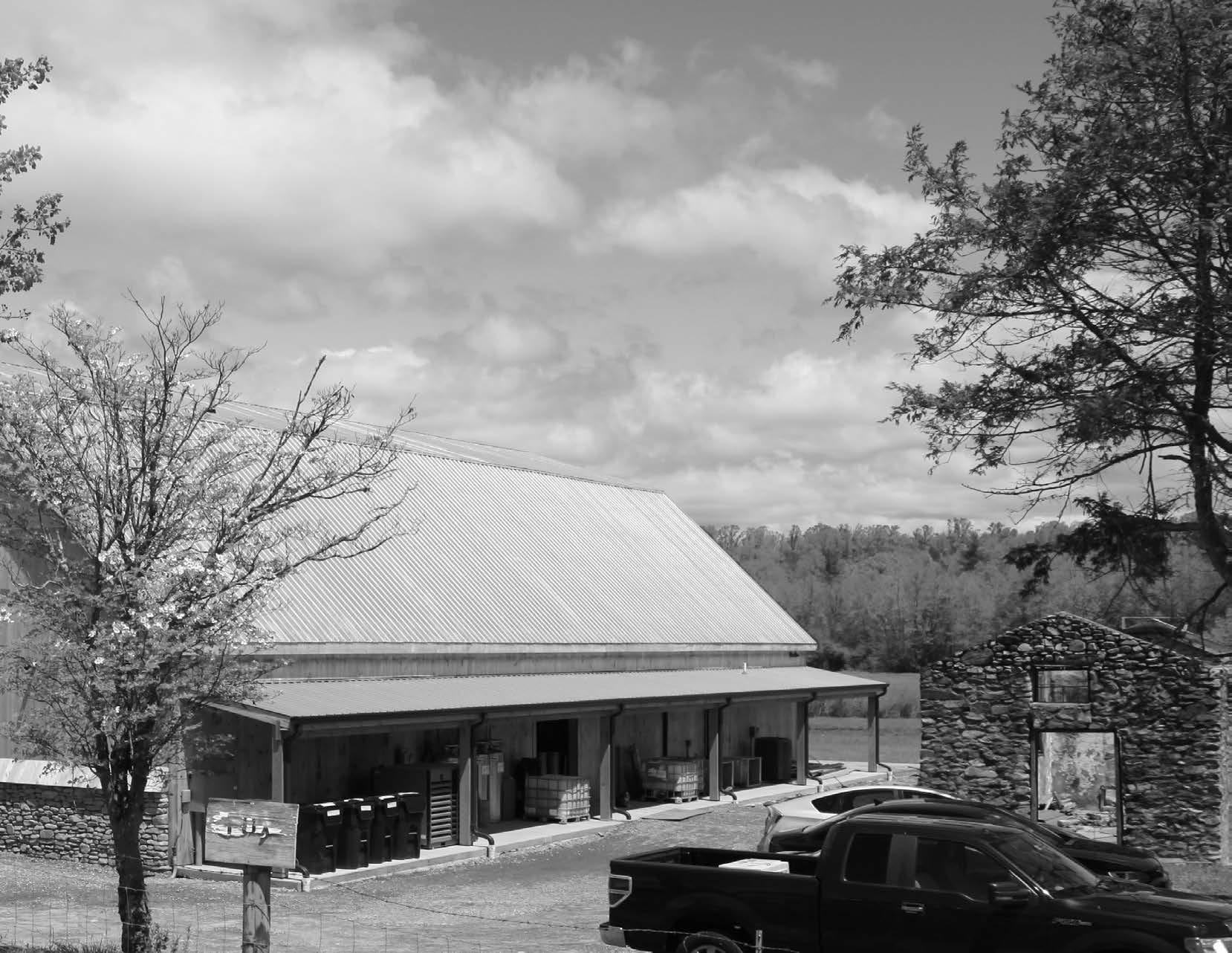
SECTION 1 FONTA FLORA BREWERY >> BLACK BEAR
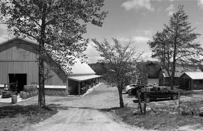
(1) THE FONTA FLORA BREWERY AT WHIPOORWILL PROVIDES A UNIQUE TRAILHEAD OPPORTUNITY. (2) EXISTING OVNHT CROSSING AT HWY. 126 WILL REQUIRE REDESIGN FOR BICYCLES. FONTA FLORA BREWERY >> BLACK BEAR BOAT ACCESS PLANNING SECTIONS NC WILDLIFE COMMISSION GAME LANDS PISGAH NATIONAL FORE MARION 1 2 3 LAKE JAMES STATE PARK FONTA FLORA BREWERY JOSEPH MCDOWELL HOUSE BURKE COUNTYMCDOWELL COUNTY LAKE JAMESH OVNHT 221 70 70 70 40 BLACK BEAR CAMPGROUND LAKE JAMES LANDING BLACK BEAR BOAT ACCESS BIG LEAGUE CAMP CATAWBARIVER VICINITY MAP TOTAL LENGTH: 6.0 MILES TRAIL TYPE NCDOT SIDEPATH DUAL-USE TRAIL ESTIMATED COST: $362,530 POINTS OF INTEREST: FONTA FLORA BREWERY POCKET PARK OVNHT TRAILHEAD BLACK BEAR CAMPGROUND 1 2
1: FONTA FLORA BREWERY >> BLACK BEAR BOAT ACCESS

TRAIL FEATURES Trailheads
This planning section includes three (3) trailheads. The proposed trailhead located at Fonta Flora Brewery at Whippoorwill Farm serves as the eastern terminus of the study area. The brewery occupies eight acres of the historic dairy farm property while the remaining 40 acres have been conserved in perpetuity through a partnership between Foothills Land Conservancy and the NC Division of State Parks.
Burke County has secured an easement for a trailhead on the east side of Lake James Road located north of the Burke-McDowell County line. The trail connects to an existing NC Wildlife
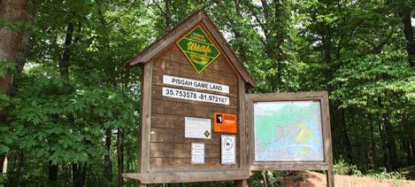
Resources trailhead for the OVNHT located on Lake James Road across from the entrance to Black Bear Boating Access. The trailhead provides a small gravel parking area adjacent to Bear Creek that will require driveway improvements and signage to provide visibility from Lake James Road.
Crossings

Within this section there are four (4) significant road crossings and one (1) major bridge over Bailey Creek.
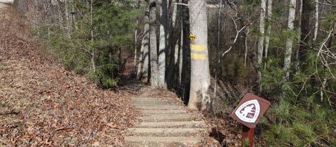
The FFST crosses NC Highway 126 south of the Fonta Flora Brewery. This is an existing crossing for the OVNHT that will require redesign to allow
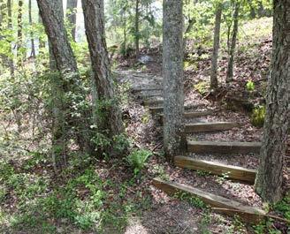
bicycles to achieve road grade and cross the road where both trail users and vehicle drivers have a clear line of sight. This can be achieved by utilizing an existing abandoned road bed with two to three moderate switchbacks. Currently, the OVNHT utilizes a set of stairs to achieve grade before continuing west through the 1780 Community.
The trail crosses Lake James Road twice in this planning section. The first crossing is located south of the planned trailhead. The second Lake James Road crossing occurs as the trail leaves the OVNHT trailhead to connect to Black Bear Boat Access. The route also crosses Linville Road between the Lake James Road Trailhead and the OVNHT Trailhead. These crossings should include design measures to slow vehicular traffic and notify motorists of the trail crossing.
The trail crossing over Bailey Creek will require a significant bridge. A bridge will also be necessary to cross Dales Creek west of Linville Road.
43CHAPTER 3: Recommendations
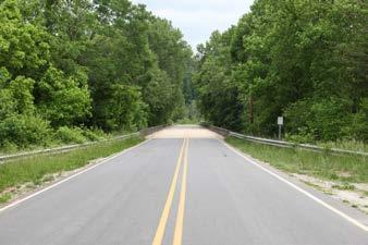
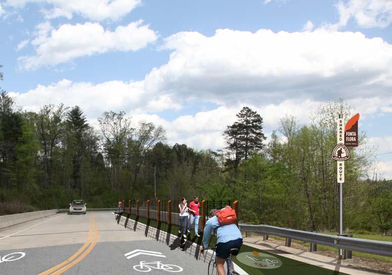
PHOTOS: (3) EXISTING NC WILDLIFE RESOURCES TRAILHEAD FOR THE OVNHT LOCATED ON LAKE JAMES ROAD. (4) ENHANCEMENTS CONSISTENT WITH OTHER NCDOT BRIDGES UTILIZED BY THE FFST, SUCH AS BRIDGEWATER, SHOULD BE APPLIED TO THE BEAR CREEK BRIDGE. THESE INCLUDE: CHANGE IN PAVEMENT COLOR, RAILING, AND USE OFTHE FFST LOGO 3 4 SECTION


1238 LAKE JAMES LAKE JAMES LE 1281 MOUNTAININSTITUTE HIL L PADDYS C REEK OBETH PISGAH PRESERVE BIGTREE GRAYSTONE NEBO BRIDGE LAKELAND HULLYGULLY HUNTCAMP CLARAS TENWHIGSRIDGE GAME LAND LAKE FOREST LONGRIFLERIDGE LAKE CREST MYRTLE RIDGELINENADIAS RIDGE WILDLIFE CLUB BEARCLIFF CEDAR RIDGE BEARCLIFF DONAHUE SHORTOFF V I EW B B SHORT BUD DAVID LAKEVIEW HIL L S ROCKY DEEP FOREST BOWEN RAVENWOOD 126 CAMPBELL’STR A C E AC PBELL’S TRA C E SUNSETPOINT PISGAH NATIONAL FORE 1780 TRAILS LAKE JAMES ATE PARK BURKE COUNTYMCDOWELL COUNTY EXI ING OVNHT FONTA FLORA BREWERY/ SHARED TRAILHEAD WITH OVNHT BLACK BEAR CAMPGROUND PLANNED BRIDGE CROSSING POCKET PARK BEAR CREEK B A I L E Y C R E E K PADDYCREEK DAL E S C R E E K HI ORIC OVHT H I O R IC O V THPARKING AND TRAILHEAD FOR OVNHT SECTION 1 FONTA FLORA BREWERY >> BLACK BEAR BOAT ACCESS TRAIL FEATURES FIELD NOTES PLANNED TRAILHEAD FEDERAL LAND DUKE ENERGY PROPERTY STATE LAND PARCELS OF INTEREST FLOOD PLAIN PREFERRED TRAIL ROUTE COMPLETED FFST FFST ON PROPOSED LOCAL TRAIL PROPOSED FFST ON EXISTING LOCAL TRAIL EXISTING LOCAL TRAIL HISTORIC OVNHT ROUTE ALTERNATE TRAIL ROUTE TRAILS 0 1/16 1/8 1/4 MI. MAP 6: PLANNING SECTION 1
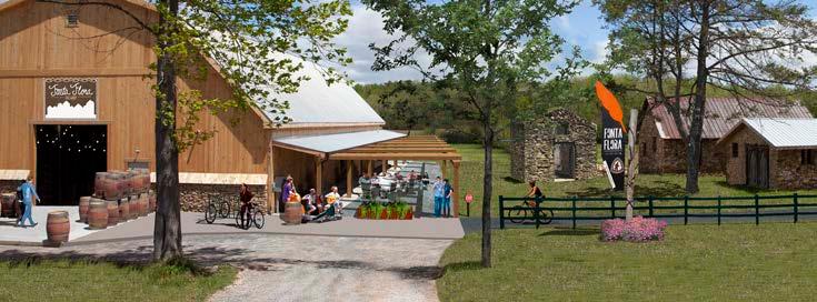
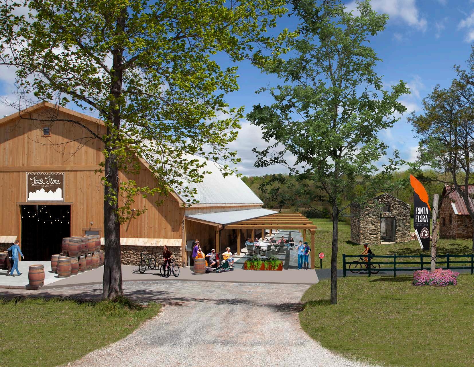
BREWING UP ADVENTUREEXHIBIT 1:
The Fonta Flora Brewery at Whippoorwill Farm provides an opportunity for a destination-quality trailhead. A short connector path will link the brewery to the FFST/OVNHT in Lake James State Park near Paddy’s Creek.
EXISTING

45CHAPTER 3: Recommendations
SECTION 2 BLACK BEAR BOAT ACCESS >> BIG LEAGUE CAMP
PROPOSED TRAILS
This planning section extends six (6) miles from Black Bear Boat Access to Big League Camp.
The preferred route extends through Duke Energy’s Black Bear Boat Access property. The route will connect to a planned internal trail system and new amenities to be designed and developed by McDow ell County and Duke in the near future.
The trail enters the Pisgah Game Lands and crosses Lake James Road to connect to an NC WRC trail head on the north side of the road. The route then utilizes a former access road that extends northwest through the game lands for approximately one mile.
TRAIL FEATURES Trailheads
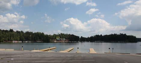
Three (3) trailheads are proposed within this planning section. The first trailhead is proposed at Black Bear Boat Access adjacent to the existing upper boat-trailer parking lot. See Exhibits 2 and 3 for details on the proposed and planned improvements to this site. The second trailhead is located at an existing NC WRC trailhead that provides access to Pisgah Game Lands on the north side of Lake James Road. The western-most trailhead is proposed on Hankins Road at the northern end of the Big League Camp property near the Hankins Northfork Volunteer Fire Department.
BEAR BOAT ACCESS
LEAGUE
INTEREST
The route exits the game lands and continues west across the North Fork of the Catawba River. After crossing the river, the trail turns south and extends through large, forested tracts to Hankins Road at the north end of Big League Camp, a baseball and softball training facility that includes log cabin lodging. Two preferred routes are suggested through Big League Camp to allow for a direct connection to the camp’s main facilities or a more secluded route through the upper section of the property. Both preferred routes will cross an active section of the former Clinchfield rail line that is operated by CSX. The trail then extends west through the floodplain to the Catawba River and Yancey Road Bridge.
An alternate route extends from the OVNHT trailhead and utilizes the existing OVNHT before turning southwest to a NC WRC trailhead. The CSX rail-line provides an alternative if the opportunity for a rail-trail or rail-with-trail becomes available in the future.
Crossings
The preferred trail route will require three (3) road crossings, one (1) rail crossing, and one (1) major bridge.
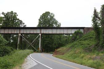
The first road crossing is located at Lake James Road as the trail connects to an existing Pisgah Game Lands trailhead. The second road crossing is at Hankins Road. The northern preferred location for crossing the CSX rail line could allow for a trail bridge spanning from ridge to ridge over the railroad corridor. The southern preferred crossing location should be evaluated for the feasibility of a tunnel underpass for the trail. After crossing the rail line, the western preferred route crosses Lentz Rd while the eastern route crosses Yancey Rd. A bridge is planned for the trail crossing over the North Fork of the Catawba River.
FONTA FLORA STATE TRAIL: LAKE JAMES TO MARION MASTER PLAN46
BLACK
>> BIG
CAMP TOTAL LENGTH: 6.0 MILES TRAIL TYPE: DUAL-USE TRAIL ESTIMATED COST: $2,456,580 POINTS OF
BLACK BEAR BOAT ACCESS PISGAH GAME LAND BIG LEAGUE CAMP PLANNING SECTIONS NC WILDLIFE COMMISSION GAME LANDS PISGAH NATIONAL FORE MARION 1 2 3 LAKE JAMES STATE PARK FONTA FLORA BREWERY JOSEPH MCDOWELL HOUSE BURKE COUNTYMCDOWELL COUNTY LAKE JAMESH OVNHT 221 70 70 70 40 BLACK BEAR CAMPGROUND LAKE JAMES LANDING BLACK BEAR BOAT ACCESS BIG LEAGUE CAMP CATAWBARIVER VICINITY MAP
LAKE JAMES 1501 YANCEY LENTZ HANKINS CANNON 1 5 8 7 AM E L IA LAKEVIEW IDLEWOOD LOST C O V E GRAYSTONE SYCAMORE HIGHCAMPS CAMP BALD MOUNTAIN CLIFF MOUNTAIN IVY LAKE CREST FORK RIVER HIGHRIDGE BARTLET BELVIDERE CEDAR RIDGE CHARIOT EDELWEISS BLACK FOREST CABERET SAILVIEW SETTLEMENT RIDGE NATUREWALK RIVERVIEW FOREST CHEYENNE DEACON GREAT HILL CABIN BL U F F MOUNTAIN POINT LAKEHAVEN LAKE RIDGE BEAR CLIFF PISGAH NATIONAL FORE NC WILDLIFE COMMISSION GAME LANDS LAKE JAMES LANDING BIG LEAGUE CAMP DUKE PROPERTY LAKE JAMES CATAWBARIVER NORTH FORK CATAWBA RIVER BLACK BEAR CAMPGROUND PARKING AND TRAILHEAD FOR OVNHT BLACK BEAR BOAT ACCESS/ FONTA FLORA AND OVNHT SHARED TRAILHEAD HI ORIC OVN HI ORIC OVNHT BEAR CREEK EX I I NGOVNHT PLANNED BRIDGE CROSSING PLANNED BRIDGE CROSSING YANCEY B A I L E Y C R E E K TRAIL FEATURES FIELD NOTES PLANNED TRAILHEAD FEDERAL LAND DUKE ENERGY PROPERTY STATE LAND PARCELS OF INTEREST FLOOD PLAIN PREFERRED TRAIL ROUTE COMPLETED FFST FFST ON PROPOSED LOCAL TRAIL PROPOSED FFST ON EXISTING LOCAL TRAIL EXISTING LOCAL TRAIL HISTORIC OVNHT ROUTE ALTERNATE TRAIL ROUTE TRAILS 0 1/16 1/8 1/4 MI. SECTION 2 BLACK BEAR BOAT ACCESS >> BIG LEAGUE CAMP MAP 7: PLANNING SECTION 2
CONNECTION TO PLANNED TRAIL
PROGRAMVICINITY
CONNECTION TO OVNHT
FFST TRAILHEAD FFST TRAILHEAD
BLACK BEAR AND BEYONDEXHIBIT 2:
Duke Energy has several new site amenities planned for completion in the next three years at the Black Bear Boat Access property. Planned improvements include a day-use area with picnic sites overlooking Lake James, ADA-accessible fishing pier, and 37 campsites with fire rings, and bathhouse. McDowell County will partner with Duke in the design and development of these amenities and assume operation of the site once the enhancements are complete. The FFST will utilize a planned internal trail system that links these amenities.
CONNECTION TO PLANNED TRAIL
Design Standard Notes:
Roads designed in accordance with Secondary and Subdivision Roads (Minimum Standards), 2010.
Accessibility designed in accordance Accessible Design in accordance with Disabilities Act (ADA), 1990.
If there is a discrepancy with the quantities consult Landscape Architect for clarification.
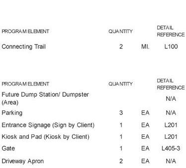
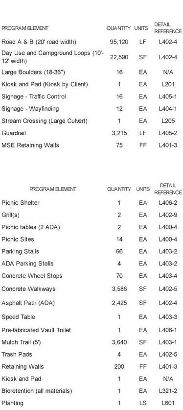
Notes for the General
is not permitted.
of Water at Time of Survey shown elevation may vary.
Contractor shall be responsible for building permits, labor, materials, and to perform the specified work.

All aspects of work shall be performed applicable local, state, and federal regulations worker safety.
All paving materials and workmanship with the latest edition of the State's Specifications for Roads and Structures."
Ground surface shall be shaped to provide
Contractor shall coordinate all site Energy's Project Manager or designated Contractor shall be responsible for storage and handling of all materials
All disturbed areas shall be stabilized following completion of land disturbing more stringent soil stabilization guidelines local, county, state or federal agencies permit requirements then the more control and govern on the Project.
x 2 3 4 5 6 9 10 11 12 13 14 15 16 17 33 32 31 34 36 35 30 29 28 27 18 26 25 20 22 23 24 37 4 5 7 9 10 11 12 13 14 3 DAY USE AREA LAKEJAMESROAD EXISTING BLACK BEAR ACCESS AREA ROAD 1 ENTRANCE ROADAROADB CAMPGROUND AREA GROUP CAMPSITE FUTURE MAINTENANCE YARD/ STORAGE AREA STREAM CROSSING BATH HOUSE VAULT TOILET ADA PARKING (4) DAY USE PICNIC SITE , TYP. NATURAL PATH PICNIC SHELTER ADA CAMPSITES VAULT TOILET, ADA PARKING, AND TRASH PAD EXISTING BOAT LAUNCH ADA TRAIL FISHING PIER (BY OTHERS) IMPROVE EXISTING TRAIL, TYP PARKING & TRAILHEAD DISTURBANCE BOUNDARY (11.3 ACRES) CONCRETE PATH STORMWATER TREATMENT PICNIC SHELTER POTENTIAL WELL LOCATION FUTURE CABIN LOCATION, TYP. FUTURE RANGER / WELCOME OR INTERPRETATION STATION ENTRANCE INFORMATION AREA PLANTING ENHANCEMENT CAMPGROUND ROAD LOOP B ENTRANCE GATE CAMPGROUND ROAD LOOP A STORMWATER TREATMENT POTENTIAL DRAIN FIELD AREA DISTURBANCE BOUNDARY (11.3 ACRES) EXISTING PARKING (ASPHALT) SUBJECT PROPERTY LAKEVIEWDRN LAKEJAMESROAD NPEAKDR TO HWY-221 TOSR-126 LAKE JAMES
MAP
1.
2.
3.
whichever quantity is greater. LEGEND PROPOSED ROAD CAMP SITES PICNIC SITES FUTURE CABIN LOCATION EXISTING TRAIL ROADBED FUTURE TRAIL CONNECTION EXISTING CONTOURS (5' INT.) EXISTING TREE STREAM CENTERLINE LAKE / WATER EDGE Construction
Contractor 1.Burning
2. Edge
3.
4.
5.
6.
7.
8.
48 FONTA FLORA STATE TRAIL LAKE JAMES TO MARION MASTER PLAN
FFST TRAILHEAD @ BLACK BEAREXHIBIT 3:
A trailhead with new parking spaces designated for the FFST is proposed adjacent to the existing upper boat-trailer parking lot. The FFST trailhead and route through the property are subject to approval by the Federal Energy Regulatory Commission which oversees site improvements and programming for Duke Energy property. Duke has expressed support for the FFST and trailhead at Black Bear.
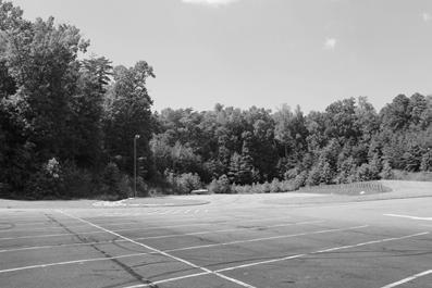
EXISTING
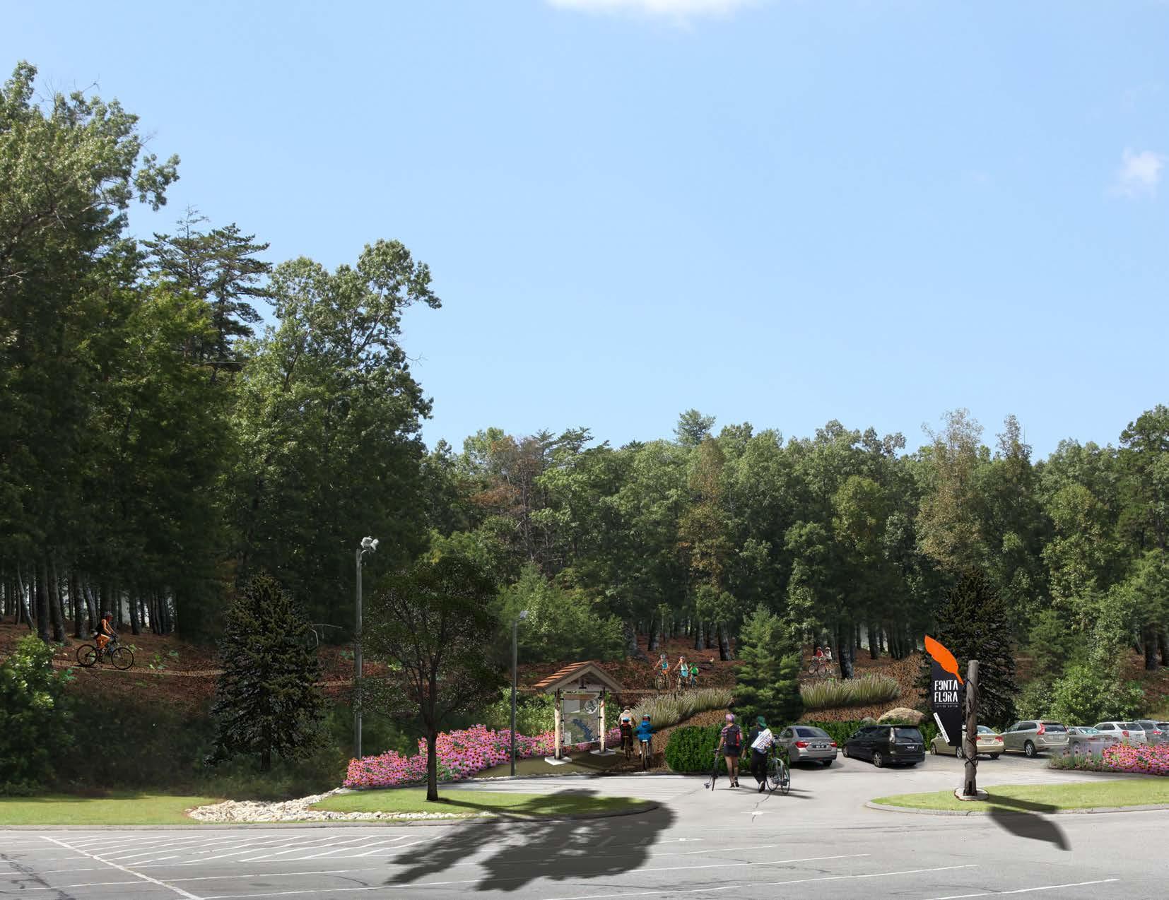
49
CHAPTER 3 Recommendations
SECTION 3
LEAGUE CAMP >> MCDOWELL HOUSE
LEAGUE CAMP
HOUSE
PROPOSED TRAILS
This planning section presents three options for preferred routes that extend from Big League Camp to the McDowell House at the Catawba River Greenway.
The northern preferred route extends north as a dual-use path on the east side of the Catawba River for a half mile before turning west to cross the river. The trail continues west on the south side of the river for approximately 2.75 miles through agricultural land then transitions to a typical greenway before crossing a Catawba River tributary. The route then crosses Hwy. 70 and extends 700 feet to connect to the Joseph McDowell Catawba River Greenway.
The central preferred route crosses the Catawba River and extends as a sidepath along Yancey Road for approximately 2.2 miles to existing sidewalk in Marion. The existing sidewalk can be converted to a town sidepath that can accommodate both pedestrians and cyclists.
the Fonta Flora to Fleming. Additionally, the City of Marion should partner with McDowell County Schools and Marion Elementary stakeholders to develop a circulation plan for the school that will provide for the FFST while also facilitating a safe and efficient flow of traffic in and around the site.
The preferred route will cross Garden Street and continue on the west side of the road, taking advantage of the wide, flat shoulder. The trail will then cross to the south side of New Street and continue west for one block to N. Main Street; The existing sidewalk on the south side of New Street should be expanded to an 8ft.-town sidepath to accommodate the trail.
The preferred route crosses to the west side of N. Main Street and connects to the Marion Community Building and park. The trail continues north on Main Street. The existing sidewalk and grass verge can be expanded to a multi-use town sidepath that extends for approximately 450 feet.
POINTS OF INTEREST DOWNTOWN MARION
The eastern preferred route crosses the Catawba River and extends south and west as a dual-use trail for three miles through forested tracts of land, including property owned by the City of Marion. The trail transitions to a town sidepath on the south side of Robert Street, adjacent to Marion Elementary School, then turns west to Fleming Avenue. At Fleming, the preferred route will continue south on the east side of the road to Garden Street. Applying a “road diet” to Fleming Ave. narrows the vehicle travel lanes to provide for the trail as a concrete town sidepath. See Exhibit 4: Bringing
At the end of the existing sidewalk, the trail transitions to an NCDOT multi-use sidepath that continues for two miles on the west side of N. Main St. to the Catawba River. The Isothermal Bicycle Plan, completed in 2018, recommends a road diet for this section of N. Main Street. According to the plan, approximately 12ft. of the 64-66ft. wide roadway can be converted to provide for a multi-use sidepath with at least a 3ft. wide physical buffer from vehicle lanes. At the Catawba River, the trail turns east and transitions to a greenway to connect to Marion’s existing greenway.
FONTA FLORA STATE TRAIL: LAKE JAMES TO MARION MASTER PLAN50
BIG
BIG
>> MCDOWELL
TOTAL LENGTH: 11.5 MILES TRAIL TYPE: NCDOT SIDEPATH DUAL-USE TRAIL TOWN SIDEPATH TYPICAL GREENWAY ESTIMATED COST: $3,435,580
MCDOWELL HOUSE CATAWBA RIVER GREENWAY PLANNING SECTIONS NC WILDLIFE COMMISSION GAME LANDS PISGAH NATIONAL FORE MARION 1 2 3 LAKE JAMES STATE PARK FONTA FLORA BREWERY JOSEPH MCDOWELL HOUSE BURKE COUNTYMCDOWELL COUNTY LAKE JAMESH OVNHT 221 70 70 70 40 BLACK BEAR CAMPGROUND LAKE JAMES LANDING BLACK BEAR BOAT ACCESS BIG LEAGUE CAMP CATAWBARIVER VICINITY MAP
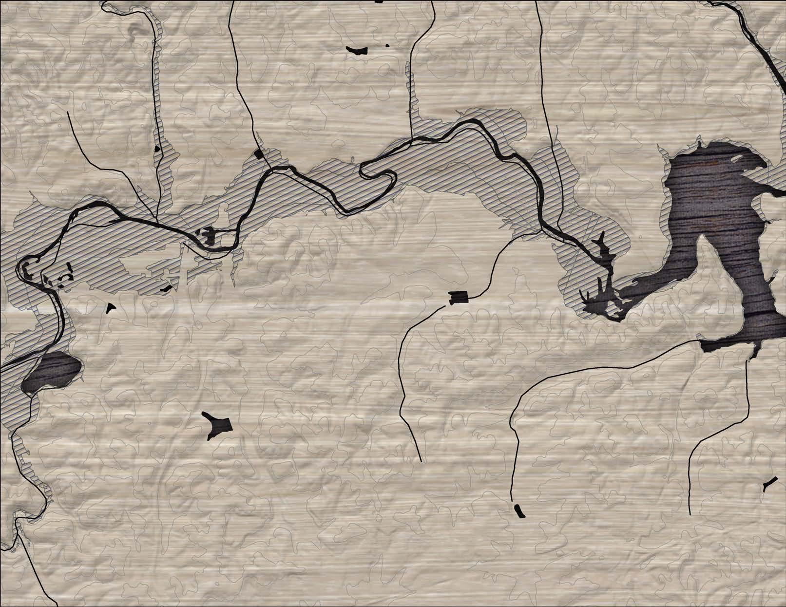


70 226 1501 COURT YANCEY YANCEY HANKINS AIRPORT 1536 1432 LENTZ 1 506 LAKE SEAGLE 1302 HOLLY HILL OAK 7TH 1726 STATE LAKE MOUNTAINRIDGE FORT GARDEN 1700 1724 VALL E Y CHURCH LAKE JAMES MAJOR C O N L E Y MEMORIALPARK JACKSON CAROLINA DEEPWOODS NEW 1703 1582 PLANTATION MATILDA FLEMING VIRGINIA C R O S S CREEK SCHOOL FERN GARDE N CREEK 5THC DAVIS 1537 CANNON ROBERT 1743 T J HIGHLAND 1229 SHORTOFF 1220 FORS Y T H E ZION BAMBI MORGANTONMONTEVISTA JUSTICE MOUNTAIN DUKE DOGWOOD LONON MADISONGARDEN KNOLLWOOD MOORE VE D E A D END PINECREST CRESCENT V RIDGEVIEW BRANCH MCDOWELLHIGH ORCHARD ELLIS 1728 VICTORIA BYRDHI L L HILLS MCDOWELLMORGAN LEOBUNGALOW BERNICE PEACH BARTLET HURST BLUE HER LAMAR SOMERSET CLARK CHARIO OVERLOOK DEER RUN BRIDGEWATER APPLETREE VIEW ROBINSON CHEVY RIDGE CARDINAL WAYNE CABERET VILLAGE CAMP GREENWOOD PORTCREST VERVIEW YANCEY RIDGE LAURELWOOD JP MILLS FARM FLYNN HANKINS OTTER RIVERVIEW FOREST PULLIAM SHERRI RAILROAD BROWN HEMLOCK WISTERIA BREAM NORTON PRIMROSE M A CHINESHOP RIDGEWOOD RICHARD KATYDID CHRIS HABITAT GOLDENROD FAITH BAPTIST CHURCH NEWTON COVE FOREST PALMER SAMAHA SCOTTY BUNNY MAIN MCDOWELL HIGH 1700 FINLEY HILLMCDOWELL VIRGINIA YANCEY MARION LAKE JAMESBIG LEAGUE CAMP MCDOWELL HOUSE JOSEPH MCDOWELL HISTORICAL CATAWBA GREENWAY COMMUNITY BUILDING RIVER BREEZE CAMPGROUND CATAWBARIVER T O M S C R E E K FORSYTHCREEK NORTHFORKCATAWBARIVER J O H N S C R E E K 70 70 DUKE PROPERTY MARION PROPERTY SECTION 3 BIG LEAGUE CAMP >> MCDOWELL HOUSE TRAIL FEATURES FIELD NOTES PLANNED TRAILHEAD FEDERAL LAND DUKE ENERGY PROPERTY STATE LAND PARCELS OF INTEREST FLOOD PLAIN PREFERRED TRAIL ROUTE COMPLETED FFST FFST ON PROPOSED LOCAL TRAIL PROPOSED FFST ON EXISTING LOCAL TRAIL EXISTING LOCAL TRAIL HISTORIC OVNHT ROUTE ALTERNATE TRAIL ROUTE TRAILS 0 1/16 1/8 1/4 MI. MAP 8: PLANNING SECTION 3
TRAIL

Trailheads
This planning section includes three (3) trailheads. The eastern-most trailhead is proposed adjacent to Yancey Road near the Catawba River bridge. The trailhead could be constructed on either the southeast or northwest side of the Catawba River and Yancey Road, depending on the preferred route that is ultimately to be constructed. The Marion Community Building and existing parking lot is pro posed as a centrally-located trailhead in downtown Marion. The existing Catawba River Greenway trail head at the historic McDowell House serves as the western trailhead and terminus of this study area.
As the route extends north from downtown Marion towards the Catawba River, it will cross U.S. Highway 70. This crossing is located at a busy three-way intersection. A signalized crossing will be necessary to facilitate safe passage for trail users.
The northern preferred route along the Catawba River will cross U.S. Highway 221 Business to connect to Marion’s existing greenway. Upon initial visual inspection, steep slopes along the river and lack of adequate vertical clearance do not allow for a trail under pass at the Catawba River bridge. Stop signs for trail-users and pedestrian-activated beacons and should be considered to provide for a surfacecrossing south of the Catawba River bridge. Other road crossings include Robert St., Fleming Avenue, Garden St., New St., Logan St., McDowell High School Road, and Peachtree St. as well as several driveway crossings on the west side of North Main Street. Installation of a stop sign for southbound traffic on Garden Street is recommended north of the Fleming Ave. intersection and trail crossing.
The northern preferred route will require two major bridges. A major bridge will be required to cross the Catawba River as the trail continues west. A second bridge will be necessary to cross a tributary of the Catawba River located approximately 250ft. east of Highway 221 Business.
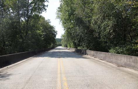
The southern preferred routes will both cross the Catawba River near Yancey Road. The existing Yancey Road bridge deck does not have sufficient width to provide for the trail and would have to be widened to safely accommodate a sidepath. Currently, NCDOT does not have plans to replace this bridge. Alternately, a separate bridge for the trail could be constructed across the river.
Crossings
There are three (3) significant road crossings and three (3) major bridges in this planning section. The trail will cross N. Main Street at an existing crosswalk that extends from the south side of New Street in downtown Marion.
PHOTOS:
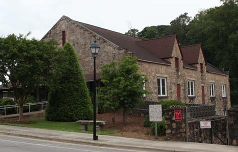
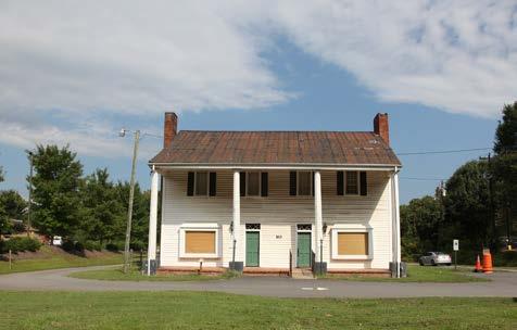
FONTA FLORA STATE TRAIL: LAKE JAMES TO MARION MASTER PLAN52
(5) MARION COMMUNITY BUILDING AND PARK PROVIDES OPPORTUNITY FOR DOWNTOWN TRAILHEAD. (6) THE HISTORIC MCDOWELL HOUSE SERVES AS A TRAIL HEAD FOR MARION’S EXISTING GREENWAY. (7) NARROW DECK ON THE YANCEY ROAD BRIDGE LIMITS ABILITY TO DEVELOP A TRAIL SIDEPATH. 5 6 7
FEATURES
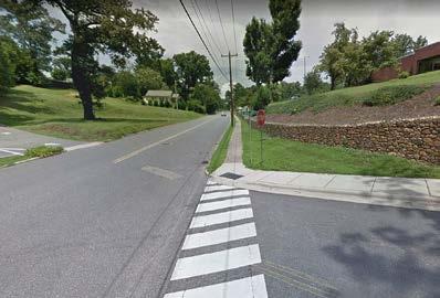

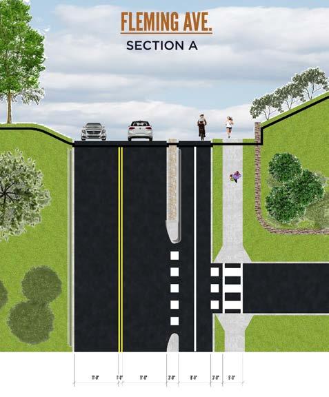
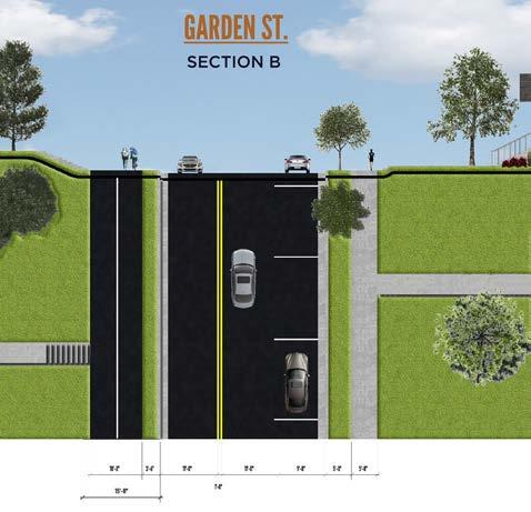
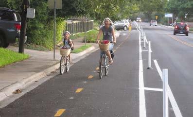
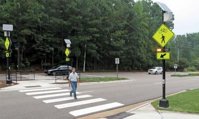
53CHAPTER 3: Recommendations BRINGING THE FONTA FLORA TO FLEMINGEXHIBIT 4: A “road diet” on the east side of Fleming Avenue provides for the FFST as a concrete multi-use town sidepath. Fleming Avenue has sufficient pavement width to expand the existing sidewalk to an 8-10ft. wide path while maintaining 11 ft. wide lanes for vehicles. EXISTING PROPOSED ROAD DIET PRECEDENT PRECEDENT
EXHIBIT 5: ISOTHERMAL REGIONAL BICYCLE PLAN
The Isothermal Regional Bicycle Plan, prepared for the Isothermal Planning & Development Commission, oultines the need for alternative transportation infrastructure to connect the downtown area to existing and proposed greenways near the McDowell House. This existing regional plan and the FFST provide unique connectivity opportunites that may bolster additional regional support.
DESIGN OPTIONS
Physically Separated (Two-
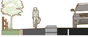
Example (used for
For design options and further detail, please see the Separated Bike Lane Planning and Design Guide at - https://www.fhwa.dot. gov/environment/bicycle_pedestrian/ publications/separated_bikelane_pdg/page07. cfm#chapter5_dir.
Physically Separated Example
These options should be explored during the design phase. See example graphics to the left from the Small Town and Rural Multimodal Network Design Guide. Further detail can be found at - http://ruraldesignguide.com/ physically-separated/separated-bike-lane.
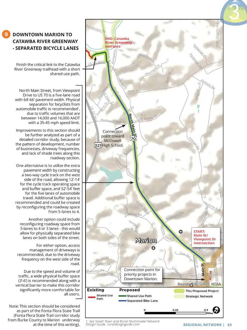
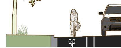
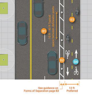
Visually Separated Example
While less ideal, construction of a bicycle lane
bicycle and motorist safety and comfort, while still reserving space for constructing a physical visually separated bike lanes can be found in the Small Town and Rural Multimodal Network Design Guide at http://ruraldesignguide.com/ visually-separated/bike-lane.
FONTA FLORA STATE TRAIL: LAKE JAMES TO MARION MASTER PLAN54 62 | REGIONAL NETWORK 3 DOWNTOWN MARION TO CATAWBA RIVER GREENWAY - SEPARATED BICYCLE LANES Length: 2 miles Jurisdictions: City of Marion, McDowell County Trip Generators: • Downtown Marion • Peavine Trail • Catawba River Greenway • McDowell High School • Businesses in north Marion • Fonta Flora State Trail Support in Other Plans: • Marion Bicycle Plan (2016) • Isothermal Planning & Development Commission Trails Map (2014) • Fonta Flora State Trail Master Plan (Ongoing) Potential ROW Needs: • None Potential Partnerships: • City of Marion • McDowell County • NCDOT • Downtown businesses • McDowell Trails Association • Businesses in north Marion • North Carolina State Parks • Duke Energy Estimated Construction Costs: • $ 560,000 9
& CONSIDERATIONS
THE CORE PURPOSE OF THIS CHAPTER IS TO HIGHLIGHT THE THREE (3) IMPLEMENTATION SECTIONS, INCLUDING THE MAJOR STEPS NECESSARY FOR COMPLETING THE TRAIL. THIS CHAPTER POSITIONS FFST AND OVNHT STAKEHOLDERS FOR ACTION.
IMPLEMENTATION
Burke County and the City of Marion will initially serve as lead agencies to manage the development of the FFST, but must work in partnership with McDowell County, the NC Division of State Parks, the National Park Service, Duke Energy, community stakeholders, and landowners to plan, construct, and maintain the trail across jurisdictional boundaries.
IN THIS CHAPTER:
BY SECTION AND RESPONSIBILITIES
IMPLEMENTATION AREAS AND RESPONSIBILITIES
55
A| IMPLEMENTATION
B| PRIORITY
C| TRAIL RUBICON D| TRAIL SUPPORT SPECTRUM E| TRAIL MANAGEMENT
4
TRAIL
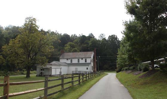
FONTA FLORA STATE TRAIL: LAKE JAMES TO MARION MASTER PLAN56 The table below provides key implementation information associated with each planning section. Key Challenges include a summary of the most difficult barriers for realizing each trail section. Many of these barriers include costly features or note the need to acquire trail easements from private landowners. Most importantly, this table assigns an Implementing Agency to each planning section. Securing Landowner Trail Easements; Bailey Creek Bridge; Lake James Road Crossing and NCDOT sidepath to Bear Creek Bridge. SECTION ALL SECTIONS TOTAL DISTANCE KEY CHALLENGES ESTIMATED BUDGET IMPLEMENTING AGENCY Securing Landowner Trail Easements; North Fork Catawba River Bridge; CSX Railroad crossing Catawba River Bridge; Hwy. 70 Crossing; Securing Landowner Trail Easements SECTION 1 Fonta Flora Brewery to Black Bear Boat Access SECTION 2 Black Bear Boat Access to Big League Camp SECTION 3 Big League Camp to Joseph McDowell House * Estimated budget shown above pertains only to the completion of the preferred FFST route and does not include existing, constructed trail segments. 6 0 $ 362,530.00 Burke County , McDowell County, NPS McDowell County City of Marion; McDowell County $ 2,456,580 .00 $ 3,435,380 .00 $6 , 2 5 4 , 4 9 0 0 0 6.0 11. 5 2 3 5
IMPLEMENTATION IMPLEMENTATION DETAILS BY SECTION AND RESPONSIBILITY
PRIORITY IMPLEMENTATION AREAS & RESPONSIBILITIES
Burke County, Marion, McDowell County, and their partners must work in tandem to successfully realize the FFST. Trail implementation does not have to occur in a specific, linear order according to each planning section. In fact, the priority areas for implementation are merely suggestions and are in no way intended to hem creativity or necessary work in “lower” priority areas. Trail implementation is an art and requires the acumen to recognize and then seize opportunities, whether related to funding, landowner willingness, or politics. The table below supports a trail development strategy that prioritizes areas in Planning Sections 1 and 3. If these were to be fully developed, this would likely provide the formula for “Trail Rubicon,” the point in which the public, elected officials, and partnership funding agencies recognize that connectivity and complete implementation are imminent. At this point significant momentum and synergy would propel forward the completion of the FFST from Lake James to Marion.
TRAIL RUBICON: FINDING THE
POINT OF NO RETURN
Think snowball effect. Development of these trail sections will result in widespread support and a collective energy, beyond that of the community’s traditional trail support base. These sections represent the Trail Rubicon: the point at which completion of the FFST from Lake James to Marion becomes imminent.
1. FONTA FLORA BREWERY TO BLACK BEAR
2. DOWNTOWN MARION TO MCDOWELL HOUSE TRAIL RUBICON
PRIORITY IMPLEMENTATION AREAS AND RESPONSIBILITIES
IMPLEMENTING AGENCY PRIORITY ONE PRIORITY TWO
Section
57
1: Re-design of OVNHT at Hwy. 126 and Hwy. 126 crossing Section :1 Pocket Park to Lake James Road Trailhead
Section 3: N. Main Street road diet and multi-use side path from downtown to existing greenway Section 3: Fleming Ave. road diet and multi-use town sidepath Burke County City of Marion Section 2: OVNHT Trailhead to Black Bear Boat AccessMcDowell County Section 1: Lake James Road Trailhead in Burke to OVNHT Trailhead at Pisgah Game Lands
CHAPTER 4: IMPLEMENTATION
TRAIL IMPLEMENTATION
Creating a destination-quality trail system requires a significant commitment from local governments, including staff time, the holding of land and trail easements, and the dedication of local funding.
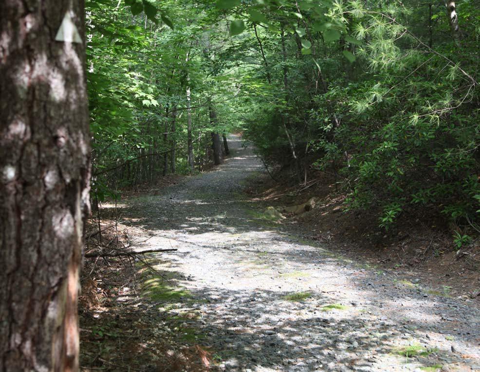
Local governments must evaluate the FFST in relationship to other priorities. However, a trail of this magnitude should be recognized as an economic development initiative that will provide a return on investment. Furthermore, each jurisdiction must not merely spend local funds, but instead must leverage their funds to obtain support from partnership funding agencies sympathetic to the creation of trails and the FFST.
The “Trail Support Spectrum” illustrates the steps local governments can take to support trail development.
FONTA FLORA STATE TRAIL: LAKE JAMES TO MARION MASTER PLAN58

1 2 3 4 5 CHAPTER 4: IMPLEMENTATION
TRAIL MANAGEMENT
MAINTENANCE
Trail maintenance is critical to provide for and sustain the trail users’ experience. Trail maintenance will primarily consist of ensuring that the trail corridor is trimmed of brush and vegetation and that the natural surface trail is de-bermed and clear of fallen debris.
Volunteer training and participation is an important aspect of user group involvement. Burke County and Marion should explore trail-building volunteer training with members of the Professional Trail Builders Association. Federal Recreational Trails Program (RTP) funding is often available for educational courses and may require matching funds.
Local government partners or a non-profit “Friends” group could sponsor these courses and provide the matching funds for interested volunteers. By training volunteers in this manner, it demonstrates a significant commitment by the participant and “Friends” group at great benefit to the landowners, land managers, and FFST lead agencies.
An adequate level of law enforcement should be provided to help maintain a safe and secure trail environment. Trail users should also be educated and encouraged to understand and obey trail rules, respect other users, and respect adjoining properties.
TRAIL RULES WILL BE POSTED AT EACH TRAILHEAD.

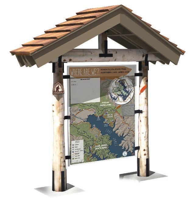
FONTA FLORA STATE TRAIL: LAKE JAMES TO MARION MASTER PLAN60 60 FONTA STATE TRAIL: LAKE TO MARION MASTER PLAN
TRAIL FUNDING
FERC RELICENSING
Constructing and maintaining the various sections of the FFST will require lever aging funds from both public and private entities. At this time, the largest funding contribution to the FFST comes directly from Duke Energy, as a result of the Comprehensive Relicensing Agreements (CRA) for the Catawba-Wateree Project.
Trail development funds are included in CRA 10.27.2.3 in the amount of $500,000 for construction of the FFST. Another $600,000 is included in CRA 10.27.4.3 for the OVNHT. These funds will implement trail segments within the Lake James Planning Section of the FFST.
EVERYONE WORKING TOGETHER
In addition to the contributions from Duke Energy, it will be necessary for Lake James State Park, NC Wildlife Resources Commission, NCDOT, NPS, Burke County, the City of Marion, McDowell County, and others to contribute financial resources to this project. A conservative estimate to construct the entire FFST and its associated trailheads from NC 126 in Burke County (Fonta Flora Brew ery) to Marion is approximately $6.25 million dollars.
LOCAL LEADERSHIP
Implementing the recommendations of this plan will require a strong level of local support and commitment through a variety of local funding mechanisms. Perhaps most important is the addition of bicycle and greenway infrastructure as an item within the annual budgets of Burke County, Marion, and McDowell County. These improvements should become a high priority and be supported through portions of the funding currently used for public safety, streets, parks and recreation, planning, community development, travel and tourism, and local bonds.

LEVERAGING FUNDS RELATED TO OTHER COMMUNITY GOALS
Lead trail agencies should also seek a combination of funding sources that include local, state, federal, and private money. Fortunately, the benefits of protected greenways are many and varied. This allows programs in Burke County, Marion, and McDowell County to access money earmarked for a variety of purposes including water quality, hazard mitigation, recreation, alternate transportation, wildlife protection, community health, and economic development.
Availability of funds targeted directly for trail use has decreased in recent years, so it is imperative that local governments work together to create multi-jurisdictional partnerships and to develop their own local sources of funding. These sources can then be used to leverage outside assistance.
For the past two decades, a variety of funding has been used throughout Carolina to support the planning, design, and construction of urban and rural bicycle and greenway projects. The largest single source of funding for these projects has come from the Surface Transportation Assistance Act; the North Carolina Department of Transportation manages and distributes the majority of federal funds that are derived from the Act to support the development of bicycle/trail development.
6161CHAPTER 4: IMPLEMENTATION
APPENDIX A
I
BEAR
LEAGUE
JOSEPH MCDOWELL
FONTA FLORA STATE TRAIL: LAKE JAMES TO MARION MASTER PLANII SECTION 1- FONTA FLORA BREWERY TO BLACK
BOAT ACCESS UNITS (LF)UNIT COST TOTAL COST Dual Use Trail (5ft. Natural Surface) 25,855 $6 $ 155,130.00 NCDOT Sidepath (8ft. Paved Path) 545 $120 $ 65,400.00 4 $ 22,000.00Major Road Crossings 1 $5,500 $ 90,000.00 1 $90,000 $ 30,000.00 $ 362,530.00 SECTION 2- BLACK BEAR BOAT ACCESS TO BIG LEAGUE CAMP UNITSUNIT COST TOTAL COST Dual Use Trail (5ft. Natural Surface) 31,680 $6 $ 190,080.00 3 $ 16,500.00Major Road Crossings 1 $500,000 $ 500,000.00Major Bridge (North Fork Catawba River 1 $750,000 $ 750,000.00 $ 2,456,580.00 SECTION 3- BIG
CAMP TO
HOUSE UNITS UNIT COST TOTAL COST Dual Use Trail (5ft. Natural Surface) 34,980 $6 $ 209,880.00 11,616 560,000 3900 $90 Typical Greenway (10ft. Paved Path) 712 $ 64,080.00 Major Road Crossings 2 $ 90,000.00 Major Bridges (Catawba River) $ 3,435,380.00 TOTAL $ 6,254,490.00 *Does not include land acquisition, engineering, or design. *Does not include existing segments of trail or bridges on existing trails. * Includes all preferred routes. Total Section Cost Total Section Cost Total Section Cost Major Bridge (Bailey Creek) Rail Crossing (Bridge/Overpass Option) NCDOT Sidepath (12ft. Paved Path w/3ft. physical buffer on N. Main St.) Town Sidepath (8-10ft. Concrete on Yancey, Fleming, Garden, New, N. Main) $120 3 $ 750,000.00 $90 $5,500 $750,000 $5,500 Bear Creek Bridge Enhancements $30,000 Major Bridge (Catawba River Tributary) 1 $90,000 $ 16,500.00 NCDOT Sidepath (8ft. paved path on Yancey Rd.) 10,560 $ 1,393,920.00 $$53 351,000$ Rail Crossing (Tunnel Option) 1 $1,000,000 $ 1,000,000.00 (A-1) IMPLEMENTATION BUDGET
BUILD
Clean Water Management Trust Fund (www.cwmtf.net)
Construction, provided easements are secured
Land acquisition: fee simple or easement. Must protect floodplain areas. Greenway trails and other park areas are allowed.
(typical)
Not specified, but
is competitive February 1st
NC Water Resources (www.ncwater.org)
River access areas or greenways along rivers
January 1st and June 1st Recreation Trails Program (ncparks.gov/About/grants/main.php)
Parks and Recreation Trust Fund (ncparks.gov/About/grants/main.php)
All types of trails and greenways
All types of parks, trails, and recreation facilities
Bikes Belong Foundation Trails and Greenways
NCDOT Transportation Plan For Bike and Pedestrian Projects
Bike and Pedestrian Projectsboth engineering and construction
(for major projects)
February 1st
February 1st
May 24th
generally N/A
III Partnership Funding Agency Active Living/ BuiltEnvironment Implications Maximum Amount Matching Funds Required Deadline
N/A (min. $1 million)$0 (for rural counties) May
N/A
20%
N/A 50%
$100,000.00 25%
$500,000.00 50%
$10,000.00 20%
N/A
20%
(A-2) FUNDING SOURCES CHAPTER A: APPENDIX