Carvers Creek State Park


Executive Summary
Acknowledgements
Letter from the Director
Summary of Master Planning Process
1 SITE CONTEXT AND HISTORY 1
Introduction
Systemwide Plan for State Parks and New Parks for the New Century Study Area Description
Cultural Resources/History of the Region
Historic Transportation Connections of the Region Long Valley Farm Sustainability
Sandhills Section History Park Land Acquisition History Analysis of Site Context and History
2 REGIONAL CONTEXT AND PLANNING 11
Introduction Population and Demographics Land Use Planning Environmental Resources
Fort Bragg/Pope Air Force Base Noise Impacts Regional Transportation Public Transportation Regional Bicycle, Pedestrian Trails, and Greenways Parks and Recreation Recreational Needs Analysis of the Region Regional Land Use Analysis of Regional Context and Planning
3 EXISTING FACILITIES AND INFRASTRUCTURE 23
Carvers Creek State Park Study Area Long Valley Farm Sandhills Section Analysis of Existing Facilities and Infrastructure
4 NATURAL RESOURCES 31
Introduction
Climate Aerial Map Topography Geology Soils
Elevation Slope Aspect Hydrology
Landcover - Flora and Fauna
Development Opportunities and Constraints
7 PARK MASTER PLAN PROGRAM
Introduction Park Buildings Park Access Roads Parking Trailheads and Trails Trail Guidelines and Accessibility Planting Site Amenities
Fishing Piers and Platforms Day-Use Areas Camping Utilities Storm Drainage Ecologically Sensitive Areas
8 PARK MASTER PLAN CONCEPTS
Public Process Park Master Plan Concepts Concept One Concept Two Concept Three Summary of the Public Responses
9 PARK MASTER PLAN
Introduction Land Acquisition Overall Plan
Long Valley Farm McCormick Bridge Road Trailhead Sandhills Section Cape Fear River Section Trail Network Utilities Summary of Development Costs
Three Master Plan Concepts
Appendix A: North Carolina General Statutes, State Parks Act
Appendix B: Structures and Buildings at Long Valley Farm, Carvers Creek State Park, Assessment of Existing Structures at Long Valley Farm Appendix C: Soil Types and Descriptions
Appendix D: Public Input Results
Appendix E: FCAP Report for Long Valley Farm Appendix F: Resources and References
The mission of the state parks system is:
“to conserve and protect representative examples of the natural beauty, ecological features and recreational resources of statewide significance; to provide outdoor recreational opportunities in a safe and healthy environment; and to provide environmental education opportunities that promote stewardship of the state’s natural heritage.”
Carvers Creek State Park is a beautiful treasure in the Sandhills region of North Carolina. Not only does the park highlight the special ecology of this part of the state, it also represents a place rich with regional and national historical significance. The park is located in both Harnett and Cumberland Counties, adjacent to Fort Bragg, the Town of Spring Lake and the City of Fay etteville. The park study area is approximately 8,500 acres, and spans from the boundary of Fort Bragg on the west to the Cape Fear River to the east.
Carvers Creek State Park is located in a rapidly developing area. Not only does the park study area protect the significant ecological areas from fragmenta tion and development, it is also expected to be heavily used by local citi zens for leisure and recreation. The United States Military Base Realignment and Closure (or BRAC) will bring many people into the immediate area in the near future. The park will be similar to other state parks in urban areas, such as William B. Umstead State Park in the Triangle region of North Carolina, where park users tend to use these facilities for daily activities such as fitness and dogwalking. For an underserved region in the state park system, Carvers Creek State Park is expected to be heavily utilized for recreation, as well as environmental and cultural interpretive opportunities.

After a thorough site inventory and analysis was performed by Geographic Information System (GIS) mapping and extensive field work, the consultant and staff from N.C. Division of Parks and Recreation were able to evaluate opportunities and constraints for park development. A public input meeting in August, 2010 and an online survey offered additional public feedback on three conceptual park master plan options. This Master Plan was prepared based on the preferences of the public and park staff.
The focus of the Master Plan is the development of park facilities and recre ational opportunities that work within the project goals of natural resource protection and restoration, historical preservation and nature-based recre ation opportunities. The primary interpretive themes of the park are ecologi cal restoration on various properties and the cultural history of Long Valley Farm. The ecologically sensitive and fire dependent habitats found within the park are highly significant and will be protected and restored for the en joyment and study of future generations. Many of the nationally significant historic structures found on Long Valley Farm will remain in order to offer opportunities for interpretation and education. The plan also addresses the recreational needs of local and regional citizens by providing hiking, biking, picnicking, fishing and camping among other activities.
Lewis Ledford, Director
Carol Tingley, Deputy Director
Don Reuter, Assistant Director
Mike Lambert, Chief of Operations
Bruce Garner, Chief of Design and Development
Brian Strong, Chief of Planning and Natural Resources
Darrell McBane, State Trails Program Manager
Sue Regier, Land Protection Program Head
Pete Colwell, Land Acquisition Specialist
Sean Higgins, Interpretive Education Program Manager
Max Rogers, AICP, State Parks Planner
Angelia Allcox, South District Superintendent
Janet Pearson, Superintendent of Carvers Creek State Park
Pete Mitchell, South District Maintenance Mechanic
Jerry Howerton, Facility Maintenance Manager
Glenn Sheppard, Facility Engineering Specialist
Emily Hill, Piedmont Region Biologist
John Amoroso, Regional Planning & GIS
Luke Hutchinson, Regional Planning & GIS
Brittany Whitaker, South District Interpretation and Education Specialist
Siobhan O’Neal, Exhibits Curator
Erin Lawrence, Construction and Engineering Program Head
William D. Brisson, District Number 22
Marvin W. Lucas, District Number 42
Elmer Floyd, District Number 43
Diane Parfitt, District Number 44
Rick Glazier, District Number 45
Mike C. Stone, District Number 51
David R. Lewis, District Number 53
Eric Mansfield, District Number 21
Harris Blake, District Number 22
The Nature Conservancy
Fort Bragg
Fort Bragg Morale, Welfare, and Recreation
Fort Bragg Cultural Resources
North Carolina Wildlife Resources Commission
North Carolina Office of Conservation, Planning, and Community Affairs

North Carolina State Historic Preservation Office
North Carolina Ecosystem Enhancement Program
The Rockefeller Family
Cumberland County Planning Department
Harnett County Planning Department
Spring Lake Planning Department
Sustainable Sandhills
North Carolina Sandhills Conservation Partnership
Sandhills Area Land Trust

Sandhills Ecological Institute
Susan Hatchell Landscape Architecture, PLLC
Susan M. Hatchell, FASLA, PLA, LEED AP BD+C
Jennifer Steed, ASLA
Matt Tobolski, Assoc. ASLA David Owens, LEED AP
Ellen Cassilly Architect, Inc.
Ellen Cassilly, AIA, LEED AP Corley Redfoot Zack, Inc. Michael Hammersley, PE

The Carvers Creek State Park Master Plan is a long-term approach to natural resource protection, development of recreational opportunities, and park fa cilities. The plan is based on a thorough study of existing natural, cultural and historic resources, a recreational needs assessment, actual site conditions and development constraints. Input and guidance from the public and the N.C. Division of Parks and Recreation was incorporated into the Master Plan in order to identify the appropriate facilities for the park. This long term mas ter plan will continue to evolve over time, as new land is acquired and more information is collected about the available natural and man made resources in the study area.

Susan Hatchell Landscape Architecture, PLLC led a team of consultants to prepare the master plan for Carvers Creek State Park. Ellen Cassilly Architect, Inc. provided architectural services, and Corley Redfoot Zack, Inc. provided engineering services for the project. The team performed an extensive site investigation and inventory to determine opportunities and constraints for park development. The team also gathered information about existing plan ning and recreation efforts already in place locally and regionally to deter mine the potential for improved connectivity. An architectural assessment of historic buildings located on Long Valley Farm was performed to determine the feasibility of building preservation and reuse for historical interpretation and park buildings. The team then worked with the N.C. Division of Parks and Recreation staff to develop a program.
A public input meeting was held in August 2010 to present the project back ground and three park Master Plan concepts. The concepts represented po tential intensity levels of park development, from low intensity to high inten sity. Meeting attendees and members of the public were invited to respond to a online survey that helped the consultants and N.C. Division of Parks and Recreation staff to create the Draft Park Master Plan.
The Carvers Creek Master Plan is based on an extensive review of available information and field work to determine the appropriate level of park devel opment and natural resource protection. Detailed geotechnical, topographic, soil, architectural, ecological and hydrologic studies will be needed as park development progresses in order to ensure accurate and feasible park con struction. Cost estimates and phasing opportunities for park development will also evolve over time based on economic conditions, available funds, and economy of scale. Due to these factors, the actual park facility priorities may change over time to reflect on-site limitations and cost constraints.
Summary of the Master Planning Process
The Carvers Creek State Park study area is located in the Sandhills region of the state. The Sandhills region is known for its rich cultural history as well as an biologically diverse ecosystem. The North Carolina State Parks system has identified three specific properties within the study area for Carvers Creek State Park, and more land is under negotiation or investigation for purchase.
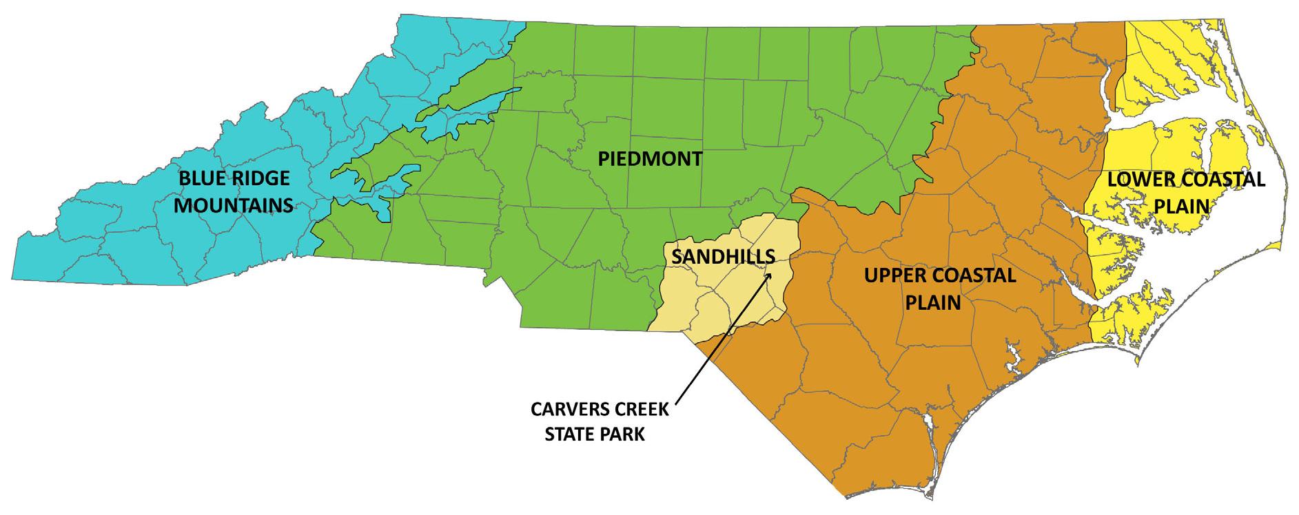
The Systemwide Plan for North Carolina State Parks, which established a framework and plan for improvement of the system, was updated in 2009. Based on the 1987 State Parks Act, the Systemwide Plan evaluated the cur rent resources of the system, identified duplications and deficiencies, pro vided recommendations, and explained the trends in visitor use and impacts. The State Parks Act mandates that the N.C. Division of Parks and Recreation conserve representative examples of the diversity of North Carolina’s natural resources and make those natural areas available to the public for recreation and environmental education. See Appendix A for the 1987 State Parks Act. As North Carolina’s population continues to grow, the demand for outdoor recreation continues to increase as well. See Figure 1.1 for the park’s location in the state.
Some areas of the state, such as the Sandhills, are under-served with recre ational and environmental educational opportunities. In addition, pressures of development continue to threaten sites that should be protected, such as land that contains wetlands, habitats of rare species, and other special features. It is increasingly important to identify such sites to ensure that fu ture generations will be able to enjoy and learn from North Carolina’s natural heritage.
The N.C. Division of Parks and Recreation has identified some of the most threatened natural resources in the state through the New Parks for the New Century initiative. Sites are chosen because of high conservation values, di versity, and suitability for recreation. Of the 47 sites under consideration for protection in the initiative, three were identified as potential state parks, in cluding Carvers Creek State Park.


The study area for Carvers Creek State Park was selected as a potential state park for several reasons. The recreational need in this part of the state sug gests that a state park here would be well-used. Cumberland and Harnett counties are home to some of the most biologically diverse ecosystems in the state with a very high conservation value. Several large parcels of land are still available for protection and inclusion in the state park. Many conservation partners including Sandhills Area Land Trust, The Nature Conservancy and others also maintain property in the area for protection.
The study area for Carvers Creek State Park, shown in Figure 1.2, is located north of Fayetteville in the Sandhills region of North Carolina. It covers ap proximately 8,500 acres and is comprised of primarily agricultural and rural land. The study area is bordered to the west by Fort Bragg and to the east by the Cape Fear River. Approximately 70 miles south of Raleigh, 150 miles east of Charlotte, and 130 miles west of Wilmington; the park study area is cen trally located in relation to several large North Carolina cities.


The Sandhills region is characterized by longleaf pine forests, rolling topogra phy and sandy soil. The longleaf pine ecosystem is an important habitat for

Overhills logo, courtesy of “An Oral History of Overhills,” Fort Bragg Cultural Resources Management Program

several endangered and protected plant and animal species, most notably the Red-cockaded Woodpecker. Two properties are being studied in depth in this master plan process, including Long Valley Farm in the northwest region of the study area, and the Sandhills Section, located in the central region of the study area. Each property has distinct qualities and has been identified as appropriate for conservation and/or restoration. See Figure 1.3 for Study Area Parcels.
The Long Valley Farm property is approximately 1,400 acres and straddles Cumberland and Harnett counties. Bordered to the west and the south by Fort Bragg, the site includes a combination of farmland, pasture, and wood land.
The 2,900-acre Sandhills Section is located just north of the city of Fayette ville. The site includes several mature longleaf pine stands and numerous wetlands and creeks, including the headwaters of Carvers Creek.
The Paleo-Indian Period dated from circa 10000 and 8000 B.C. The earliest inhabitants of the southeastern United States were highly mobile and relied on plants and small game for sustenance. There are very few archaeological sites found today with Paleo-Indian artifacts. Population densities may have been higher in the Piedmont areas of North Carolina, rather than the Coastal Plain. However, a few artifacts from this time period have been found on Fort Bragg property.
The Archaic Period, between 8000 and 1000 B.C., brought a new reliance on a variety of food sources, such as fish, birds, wild plant resources and game animals. Settlements were still very mobile, with groups relocating to take ad vantages of seasonally available resources. This period is also seen as a period of adjustment to changing warmer climates.
The Woodland Period, between ca. 1000 B.C. and A.D. 1650, is characterized by pottery making, horticulture and reliance on seed crops. Settlements be came more permanent due to the domestication of various seed-producing indigenous weeds. Because many more artifacts of this period are found in the Piedmont or Coastal Plain, archaeologists have had to reconstruct the American Indian pattern of settlement in the Sandhills. It is assumed that this area would have been influenced by the Siouan-speaking inhabitants of the Coastal Plain and groups who settled in the eastern Piedmont.
Percy Rockefeller, courtesy of “An Oral History of Overhills,” Fort Bragg Cultural Resources Management Program

European settlement in the interior of North Carolina generally did not occur until the early 1700s. The area was originally settled by an influx of Scottish Highlander settlers that migrated to the Upper Cape Fear region. At that time, the Cape Fear River was the only direct water route into North Carolina from the coast, and it was a major transportation corridor for trade and commerce.
Around 1720, the land grant office for the Cape Fear opened, and settlement began along the river. The first settlements were about 100 miles north of Wilmington in the Rockfish and Cross Creek areas. This area became the cen
ter of Scottish Highlander settlement in North Carolina. By the mid-1750s, highlanders were settling along the upper and lower Little River, and most were farmers.
The longleaf pine forests of the Sandhills proved to be the most essential eco nomic generator of the region. The longleaf pine produces the highest qual ity pine rosin/crude gum of any species of pine in eastern North America. Pine tar, pitch, resin, and turpentine were made from the gum, and the trees themselves provided excellent masts and timber for ship building. In addi tion to the naval uses for the lumber, the longleaf pine was also timbered for home building, shingles, and barrels. The majority of the tar, turpentine, and pitch was shipped to England and the rest of the colonies. Water-powered grist and saw mills, tanneries, small iron forges and tar kilns were prominent in the region during the colonial period. The native longleaf pine forests were severely degraded by these industries and have never fully recovered.
Agricultural production generally focused on the harvest of corn, peas, beans, sweet potatoes, white potatoes, peaches, and grapes for local subsistence needs as well as local trade. Crops of rye, wheat, oats, cotton, flax, and to bacco were also raised in the region.
“Camp Bragg” was established as an Army base in 1918 on 120,200 acres, and was located in the Sandhills partly to take advantage of the year-round training climate. In 1922, Camp Bragg was redesignated Fort Bragg, after Con gress decided that all artillery sites east of the Mississippi would become per manent Army posts. A longleaf reforestation program began shortly after in 1923, an early start to Fort Bragg’s commitment to restoring and protecting significant cultural and natural resources as well as providing a buffer to their properties.
The Cape Fear River was a vital link for trade and commerce and the primary mode of travel to get goods and products to the coastal port at Wilmington. The Cape Fear is the only river in North Carolina that flows directly to the At lantic Ocean, therefore shipping linked Fayetteville to the rest of the country as well as the world. Fertile lands surrounding the river allowed for agricul ture to flourish and settlements to grow into viable cities and towns, and the river allowed products to get to larger markets.
Fayetteville and the surrounding region thrived as waterways were the fa vored method of transportation; however, railroads built in the 1830s soon became the preferred alternative for transporting goods in the state. Unfor tunately, the railroad network bypassed Fayetteville. A few of the area’s major roads were upgraded with a planked surface. Plank roads, also known as the “Farmer’s Railroad,” were built during the 1840s and 1850s to allow farmers to transport their crops and other goods to market. All of the state’s major plank roads converged in Fayetteville because of its importance as a market place. Eventually plank roads became obsolete, as costs for upkeep and ex tensive damage during the Civil War took their toll.

Much of the regional railroad infrastructure was also destroyed at the end of the Civil War. It was not until 1879 that Western Railroad became a part of the Cape Fear & Yadkin Valley Railroad, providing Fayetteville a way to connect to the larger statewide railroad system.
A comprehensive railroad network rapidly developed in the period between 1870–1900, and formerly remote communities were soon directly linked with regional urban centers such as Raleigh and Wilmington. In an effort to seek out and develop new markets, railroad companies sent agricultural and in dustrial specialists into the Sandhills to evaluate the social, economic, and environmental conditions. Entrepreneurs soon followed to construct health spas, sanitariums, and resorts in the Sandhills.
With the advent of the automobile, the region became known as a half-way point for travelers along the major north/south route between the northern states and Florida.
Long Valley Farm offers a rare glimpse into the unique land-use history of Cumberland and Harnett counties during the early to mid-twentieth century. The land was part of “Ardnave,” a 13,000-acre turpentine plantation owned by the McDiarmid family. The plantation produced turpentine and lumber for the naval stores industry. The McDiarmid Millpond was likely constructed to process timber.
After Daniel McDiarmid’s death, the land changed hands several times and was cleared for timber. Old logging roads and cleared land offered a perfect opportunity for gaming and hunting. In 1906, the land was sold and became the Croatan Club of Manchester, a private hunt club.

In 1912, 363 acres of the Croatan Club lands, including a portion of the pres ent day millpond, was sold to Dr. Joseph P. Ewing. This tract became the core of the present day Long Valley Farm property. He later sold the land to his brother-in-law, Robert Wall Christian.
It was Christian who named the property Long Valley Farm. Robert Wall Chris tian was known as “one of the most successful and scientific farmers in this section of the state” (News and Observer Obituary March 14, 1927). After purchasing the land in January 1914, he enlarged his property within a year to a total of nearly 967 acres. The original 1915 acreage is the south-central section of the present Long Valley Farm. His experiments in scientific farm ing were documented in the Soil Survey of Cumberland County issued by the USDA in 1925. He explored techniques of crop rotation, artificial fertilization, and artificial drainage.
Christian was elected to the North Carolina Legislature in 1924 and introduced legislation to provide a farm agent in every North Carolina county. He was the president of the state Farmer’s Association and the chairman of the Cumber land County Board of Commissioners and the County Board of Agriculture.
After his death, the land was sold to Percy Avery Rockefeller (nephew of John D. Rockefeller) and Windsor T. White. The present day Long Valley Farm was once part of Overhills, Percy Rockefeller’s private winter estate.
During the interwar period of the 20th century (1919-1939) wealthy northern industrialists began constructing southern estates for use as winter and vaca tion residences and hunting and gaming lodges. Several examples of these “gentleman’s estates” in North Carolina include the Biltmore Estate in Ashe ville, The Whalehead Club in Corolla, Overhills in Fort Bragg, and Long Valley Farm in Cumberland County.
James Stillman Rockefeller, a New York City banker and Percy’s nephew, ac quired both Rockefeller’s and White’s interest in the property in 1937. He graduated from Yale University in 1924, and that same year he won a gold medal in rowing at the Summer Olympics in France. He appeared on the cover of Time magazine on July 7, 1924.

The Rockefellers built their residence on the site of Christian’s home, adjacent to the millpond. Christian’s house was moved to another part of the prop erty. Rockefeller lived there year-round while he was serving in the Airborne Command during World War II. Rockefeller also bought the additional acres of woodlands located north of the original 1914-1915 farm to bring the total acreage to the present day 1,420 acres.
Mr. Rockefeller was involved in the day-to-day operations of the farm. He en joyed learning and experimenting with new farming methods. He also liked to oversee the cattle and crops being raised by his farm managers. His family visited the property several times a year and on most holidays. They enjoyed swimming and fishing in the pond as well as hunting and walking the trails around the property. James Stillman Rockefeller passed away in 2004 at age 102. He wished to see the farm permanently protected from development, so he left the property to The Nature Conservancy, who transferred the property to North Carolina State Parks.
Sustainable practices have been used throughout the history of Long Valley Farm. Water was used to generate electricity and run the mill. Farm buildings were sited to take advantage of passive heating and cooling. Trees were plant ed strategically to cool the buildings in summer while allowing in the sun’s heat in cooler months. Crop rotation methods increased farm production and reduced stress on the soil. Farm fields were sited to take advantage of exist ing woodlands as wind breaks, shielding crops from damaging winds. Building materials from older structures were often re-purposed in new structures as they were built on the site.
While the Sandhills Section does not contain any historic buildings or struc tures, it was frequented by American Indian groups, and later used in the production of naval stores and timber industries.

The Long Valley Farm property transferred from The Nature Conservancy to the N.C. Division of Parks and Recreation in 2010. After acquiring the property in 2004, The Nature Conservancy restored much of the land into longleaf pine habitat during its years of ownership.
The first portion of the Sandhills Section was transferred from The Nature Conservancy to the state in 2006, and the second portion was transferred in 2010. The property was previously owned by the Clark family. In 1996, it was deemed a “safe harbor” property under the Safe Harbor Agreement, which is a voluntary agreement involving private landowners and the U.S. Fish and Wildlife Service that allows for endangered species to prosper on homeown er’s land.
The Nature Conservancy acquired the first portion of the Sandhills Section in 2001 and began restoration of the longleaf pine habitat. In addition, The Nature Conservancy pioneered a conservation program with Fort Bragg to preserve, protect and restore Red-cockaded Woodpecker habitat while also providing a buffer to sensitive military operations. In addition to the increased security, the green space, or Greenbelt, is an added recreational benefit to soldiers, their families, and the entire region. This conservation partnership has been in place for over a decade and provides more than 14,000 acres of buffer around the base. The Long Valley Farm property is included in this con servation partnership, providing a much needed buffer to Fort Bragg’s north ern training zones. Long Valley Farm also lies along the runway approach to Pope Air Force Base, so the conservation of this area ensures that encroach ing development will not conflict with continued training flights.
Other conservation groups work in the Sandhills region to preserve the fragile ecosystem and restore habitat to the endangered species found there. Local conservation partners include the Sandhills Area Land Trust, the North Carolina Sandhills Conservation Partnership, and others.

The first inhabitants of the region populated the area because of it’s location along the Cape Fear River, which eventually brought more people, trade and commerce to the region. As the area grew and became prosperous, railroads brought even more opportunities for connections to the state and the rest of the country. It was these connections that eventually enticed wealthy northern industrialists to visit the area and begin building gentlemen’s estates for recreation. Long Valley Farm is one of the last remaining estates from this era.
The creation of Long Valley Farm as an agricultural estate by Christian and its subsequent expansion as a winter agricultural estate by the Rockefellers in the late 1930s and 1940s was a reflection of what was happening in the
Sandhills region. The development of scientific farming and agriculture co incided with the influx of wealthy land owners seeking land for gaming and recreation, and it occurred on lands that were portions of former plantations.
As Fayetteville and Fort Bragg continue to expand, large tracts of agricultural land will disappear to make way for urban and suburban development. The rich rural history and sense of place should be preserved for future genera tions.
In addition to the rich cultural history, the Sandhills region enjoys an incred ibly diverse ecosystem and represents an incredibly important ecological ad dition to the state park system.
The following section gives an overview of the regional and local planning efforts. Also included is information related to population and demographics, environmental resources, transportation, bicycle and pedestrian links, and recreation.
The City of Fayetteville, with a population of approximately 174,000, is the largest city in the region and the fifth largest metro area in the state. The Town of Spring Lake has a population of approximately 8,200. On September 1, 2008, the Town of Spring Lake annexed Pope Air Force Base and portions of the Fort Bragg Range and Training Area.
The Base Realignment and Closure (BRAC) and the Global Defense Posture Realignment initiatives are impacting Fort Bragg and the surrounding region with a large surge of population growth. The Preliminary Impact Assessment for the region prepared by the BRAC task force in 2008 projected population growth for the 11 counties in the region. According to the 2008 census, the region was home to just under 950,000 people. The BRAC assessment pre dicted that the region would grow to a total population of over one million people by 2013 as a result of the base realignment and other growth initia tives.
Within the study area, several municipalities have planning jurisdiction, in cluding Cumberland County, Harnett County, Town of Spring Lake and the City of Fayetteville. Cumberland County has jurisdiction over much of the study area and provides land use and transportation planning as well as zoning and subdivision administration. A small portion of Long Valley Farm is within Har nett County, and a small portion of the study area is within the City of Fay etteville.
The Cumberland County 2030 Joint Growth Vision Plan was developed to as sist local governments in creating policies and growth strategies for economic development and land use within the region.
The Long Range Component of Fort Bragg’s Real Property Master Plan (2008) assesses existing facilities and infrastructure and develops a long range land use plan for Fort Bragg. This document refers to several partners in planning such as BRAC Regional Task Force, Sustainable Sandhills, the N.C. Conserva tion Partnership, the Fort Bragg/Pope Air Force Base Regional Land Use Advi sory Commission, Inc., Sandhills Conservation Partnership, the U.S. Fish and Wildlife Service, and others.
The Fort Bragg/Pope Air Force Base Regional Land Use Advisory Commission is a regional planning organization that serves as a forum to encourage better planning and communication between local governments, municipalities and Fort Bragg. One of its initiatives included the purchase of the Overhills Estate in 1997 to expand training areas and protect Fort Bragg and Pope Air Force

Base from urban encroachment. The purchase also provided additional land for conservation and restoration.
The Sustainable Sandhills initiative includes stakeholders from six counties in the region, Fort Bragg, as well as the Department of Environment and Natural Resources. The steering committee’s main goals include awareness and edu cation, eco-tourism and supporting local agriculture, creating cultural con nections, green business and design, land planning, and recycling.

The Sandhills region is home to many endangered or threatened plant and animal species, most notably the Red-cockaded Woodpecker. A variety of public lands are located in the area including Weymouth Woods Sandhills Na ture Preserve and the Sandhills Game Lands.
The Fort Bragg Greenbelt is primarily located to the south of Fort Bragg. It includes 6,500 acres of perimeter land set aside for buffer and conservation.


Fort Bragg intends to extend the Greenbelt around the northern portion of the base in the future. The Long Valley Farm property lies within the proposed northern Greenbelt area.
On any given day of the week, approximately 200 takeoffs and landings occur at Pope Air Force Base, with noise impacts on the Long Valley Farm property. On a busy day, 216 flights are possible. On average, a takeoff or landing is occurring 11 to 13 times an hour. Long Valley Farm is also impacted by the Potential Accident Zone II which is shown on Figure 2.1. It is not expected that development at Long Valley Farm will be incompatible with this zone, how ever, noise impacts should be taken into consideration.

The Fayetteville Area Metropolitan Planning Organization (FAMPO) released a 2035 Long Range Transportation Plan for Cumberland County, a small sec tion of southern Harnett County, as well as part of Hoke County in April 2009. The cities and towns included in the area are Fayetteville, Spring Lake, Hope

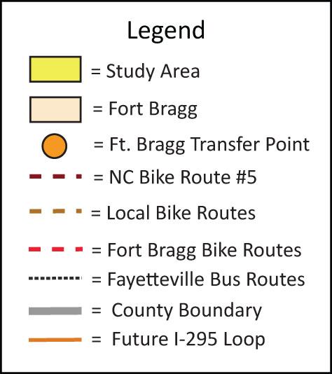

Mills, as well as the Fort Bragg Military Reservation and Pope Air Force Base. In anticipation of continued development and increased population, the plan includes infrastructure, bicycle and pedestrian, transit and rail improvements in the region. See Figure 2.2 for Regional Map of Transportation.
The regional plan highlights several proposed new roads and road widening projects. Within the study area, FAMPO has identified McCloskey Road, An drews Road, portions of McArthur Road, Elliot Farm Road, Elliot Bridge Road, and Ramsey Street (Highway 401) as roads in need of widening to accommo date future capacity. Each of these roads have the possibility of affecting the transportation circulation throughout the study area.
The future I-295 outer loop will serve as a critical transportation link for the region. The extension will improve access to I-95, offering a direct route for those in the Fort Bragg and Spring Lake area. Although located to the south of the study area, the outer loop will improve connectivity in the region.
Fayetteville’s transit system, Fayetteville Area System of Transit (FAST), links the city with a series of bus routes and shuttles. Fort Bragg has a shuttle bus system and provides a transfer point at Murchison Road, allowing connection to the FAST system.
Currently, no bike lanes are provided on roads in the park study area. Several road projects under the NC DOT Transportation Improvement Program were approved to include bike lanes. Ramsey Street (Highway 401) has been identi fied as a proposed bicycle corridor, and could eventually provide a connection to state park property.
Two mountain bike trails are located on Fort Bragg, both average seven to eight miles in length. Several “unofficial” on-road bike routes are used by local citizens for group rides.
Fort Bragg has identified proposed bicycle paths in order to create connec tions to surrounding municipalities. These paths have the potential to be come part of a greater alternative transportation network, and perhaps link to the state park.
Recreational trails at Fort Bragg include the Coscom Trail (0.64 miles), the En gineer Trail (1.55 miles), the Son Tay Trail (2.45 miles), and the Smith Lake Trail (6.10 miles). See Figure 2.3 for Regional Map of Trails, Greenways and Parks.
Presently, no greenways are provided in the study area, however, FAMPO is working on a planning document that will investigate possible pedestrian and bicycle connections in the region, linking routes with those that already ex ist in Fayetteville. Several of these routes may be identified in the park study area.

Figure 2.3 Regional Map - Trails, Greenways and Parks - Not to Scale


The Cape Fear River Trail is a multi-use trail that is designated as a part of the East Coast Greenway. The East Coast Greenway is designed to be the nation’s first long distance, multi modal transportation corridor for cyclists, hikers and non-motorized users and will eventually connect from Maine to Florida. The local section of the East Coast Greenway is comprised of a 4.2-mile series of urban trails in Fayetteville. The existing portion of the trail along the Cape Fear River will provide a future link to the park.
The Cape Fear Run/N.C. Bike Route is a 160-mile bike route that roughly paral lels the course of the Cape Fear River through the southeast coastal plain to the Atlantic Ocean. Points of interest along the route include Jones Lake State Park, Moore’s Creek National Military Park, the USS North Carolina Battleship Memorial, Brunswick Town State Historic Site, Carolina Beach State Park, and Fort Fisher State Recreation Area. Although this route is located to the east of the Cape Fear River and is not currently within the study area, linkages could be made in the future.
The North Carolina Coastal Paddle Trail begins at the J. Bayard Clark Park in Fayetteville and stretches through the coastal plain of North Carolina to Southport. Paddlers can enjoy birding, fishing, exploring historic sites and vis iting small communities along the river.
The North Carolina Birding Trail is a virtual trail that links existing bird watch ing sites across the state, connecting birders with local communities, busi nesses and other cultural and educational attractions. Four sites in Cumber land County are represented on the Piedmont section of the Trail; J. Bayard Clark Park, the Cape Fear River Trail, Cape Fear Botanical Garden, and Carvers Creek State Park.
Some of the existing parks in the region include Lake Rim Park, Arnette Park, Mazarick Park, J. Bayard Clark Park, the Cape Fear Botanical Gardens and Mendoza Park. Refer to Figure 2.3 for Regional Map of Trails, Greenways and Parks.
Lake Rim Park is a 30-acre community park located on Tar Kiln Drive in Fay etteville. The park offers picnicking, walking trails, and ranger-guided envi ronmental tours emphasizing wetlands, the historic naval stores industry, animal adaptation, and water quality.
Arnette Park is a 100-acre regional park located on Old Wilmington Road in Fayetteville. Arnette Park consists of baseball fields, sand volleyball courts, a concession stand, horseshoe pits, disc golf, picnic pavilions, a playground, tennis courts, nature trails, restrooms, and natural woodlands.
Milton E. Mazarick Park is an 80-acre regional park located on Belvedere Av enue in Fayetteville. Mazarick Park is mainly a recreational venue, offering a softball field, concession stand, fishing pier, rowboat rental, trails, play ground, tennis courts, and disc golf.
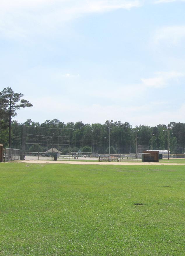
J. Bayard Clark Park is a 76-acre regional park located on Sherman Drive in Fayetteville. The primary focus of Clark Park is to preserve the environment and educate the public about native plants and wildlife. Clark Park is staffed by park rangers who lead frequent school visits and educational workshops. The park consists of a Nature Center, walking trails, a trail head for the Cape Fear River Trail, primitive camping and a canoe launch. The park also has a 35-foot waterfall, which some say is the tallest waterfall in North Carolina’s Coastal Plain.
The Cape Fear Botanical Garden is located at 536 N. Eastern Boulevard in Fayetteville. The garden is maintained by staff and volunteers, and serves as a prime location for community events.
Mendoza Park is located in the Town of Spring Lake on Hwy. 87 just south of the Cumberland/Harnett county line and adjacent to Long Valley Farm. Men doza Park offers baseball/softball fields, picnic areas, a playground, a large open space area, walking trails, seating areas, and concessions.
Fort Bragg’s Family and Morale, Welfare, and Recreation Directorate operates several recreational amenities including Smith Lake Recreation Park, Wilson Park, two golf courses, 11 gyms and several trails. Smith Lake Recreation Park is located one mile outside of Fort Bragg on Hwy 210 (Murchison Road) near Simmons Army Airfield, and is open to the public. The park includes camping
(RV and cabins), mountain bike trails, paint ball facilities, riding stables, vol leyball, shelters, swimming area, beach, and playground.
Wilson Park is located off Butner Road in Fort Bragg and is open to the public. Facilities include picnic shelters, playgrounds, restrooms as well as a fishing dock on McFayden Pond.
The National Survey of Recreation and the Environment (NSRE) interviewed approximately 90,000 Americans in random-digit-dialing telephone sam plings between 2002 and 2007. Of those 90,000 surveyed, approximately 3,000 were North Carolina residents. The primary purpose of the NSRE is to learn about approximately 85 specific outdoor recreation activities of people aged 16 and over in the United States. In general, North Carolina residents have fairly high participation rates in most outdoor recreation activities. This is due in part to a combination of abundant recreation resources and a rea sonable climate which allows for a wide range of outdoor experiences.
According to the 2002-2007 NSRE, the five most popular outdoor recreational activities in North Carolina are walking for pleasure, attending family gather ing outdoors, visiting nature centers, sightseeing, and picnicking.
Walking is the single most popular activity, with over five million participants statewide. The second most popular activity is attending outdoor family gatherings (also with over five million participants). Other activities with over three million participants include picnicking, gardening, driving for pleasure, viewing or photographing natural scenery, visiting nature centers, attending outdoor sports events, and sightseeing.
Activities with roughly 1.5 to 3.0 million participants include attending out door concerts, playing yard games, day hiking, running or jogging, visiting a wilderness area or historic site, viewing or photographing wildflowers and trees, visiting a beach, swimming in lakes and streams, motor boating, swim ming in outdoor pools, boating and fishing. Those activities with roughly 500,000 to 1 million participants include primitive camping, hunting, back packing, cold water fishing, tennis, and golf.
Outdoor recreation in a developed area is by far the most popular form of rec reation in North Carolina. More residents participate in walking for pleasure (82 percent) and attending outdoor family gatherings (74.6 percent) than any other overall activity. Other activities, such as gardening or landscaping (65.4 percent), or driving for pleasure (58.2 percent) are also favorites with North Carolina residents.
Visiting wilderness areas is the most popular nature-based land activity (29.8 percent) in the state of North Carolina. Hiking is also a popular activity (29.7 percent) and visiting a farm or agricultural setting continues to be a popular activity with roughly a third of residents participating. Just over 20 percent of state residents also indicate an interest in driving off-road and participating in developed camping. The somewhat specialized, technical outdoor pursuits usually requiring special gear like rock climbing and mountain climbing are
Jogging and walking are popular activities in North Carolina

among the least popular nature-based land activities with only 5 percent or less participating.
Statewide, the largest percentage of residents participating in viewing or learning activities are viewing or photographing natural scenery (57 percent), followed by visiting outdoor nature centers and zoos (52.9 percent). Over half of state residents have gone sightseeing within the last year, while just under half visited historic sites or viewed wildlife or wildflowers.
Close to half of North Carolina’s residents visit beaches and nearly 40 percent go swimming in pools, lakes or streams. In addition, between 20 percent to 30 percent of residents have participated in some type of boating or fishing.
Individual outdoor sports continue to be popular, with over a quarter of North Carolina residents running and jogging (28.3 percent). Tennis (14.8 percent) and golf (13.9 percent) were also somewhat popular with North Carolina resi dents. It is worth noting that almost 10 percent of residents also enjoy inline skating.
Team sports have seen a decline in participation in recent years. Less than 10 percent of North Carolina’s residents indicate participation in an outdoor team sports activity within the last year.
In 2005, a survey of residents from portions of Cumberland County (not in cluding Fort Bragg, Pope Air Force Base and the Town of Spring Lake) was conducted to determine current and future park and recreation needs as well as to determine how these services could be funded. 403 random telephone interviews were conducted using a questionnaire.
Over 70 percent of respondents currently use a public park in Cumberland County, and residents older than 55 were least likely to have used park fa cilities. Most park users visit parks quite often; 50 percent indicate that they visited between six and 50 times per year.
Most respondents indicated that they use parks most often for walking or jog ging. Picnicking, visiting playgrounds, and visiting museums or historic prop erties are also popular activities. Interest in activities such as swimming (30 percent), fishing (29 percent), and camping or hiking (28 percent) were also noted.
The four leading activities were walking/jogging (88 percent), picnicking (87 percent), visiting museums or historic properties (87 percent), and attending concerts and performing arts events (80 percent). Nature or environmental programs were also popular (71 percent). Based on the percentage of those interested in walking, jogging, and picnicking, there is a further indication that visiting museums or historic properties would be quite popular. The establish ment of greenways and senior centers also appears to have strong support.
The study area falls under the zoning jurisdictions of Cumberland County, Har nett County, the city of Fayetteville and the town of Spring Lake. See Figure 2.4 for the Zoning Map on the following page.
Long Valley Farm is zoned Rural Residential in both Cumberland County and Harnett County. According to the Cumberland County zoning codes, the Rural Residential district is traditionally for rural use with lots of 20,000 square feet or more. The principal use of the land in this district is for low-density resi dential, including manufactured housing units, and agricultural purposes. This district is intended to ensure that residential development not having access to public water supplies and dependent upon septic tanks for sewage disposal will occur at a sufficiently low density to provide for a healthy environment. Long Valley Farm borders the town of Spring Lake, but is under county juris diction. The tract is bounded by Rural Residential to the north (in Harnett County), Residential to the east (in Cumberland County), military use to the south, and Residential to the west.
The Sandhills Section is zoned Planned Neighborhood Development. Accord ing to the Cumberland County zoning code, a Planned Neighborhood District is a conditional use district designed for the planned development of various residential densities concurrent with neighborhood-oriented uses in a single project. The Sandhills Section is bounded by Planned Neighborhood Develop ment, Residential and Agricultural to the north, Planned Neighborhood De velopment to the east, Residential and Planned Neighborhood Development to the south, and military use to the west.
North Carolina has rapidly lost farmland over the past decade. Cumberland, Harnett, Hoke, Lee and Moore counties are all experiencing a very high rate of farmland and forest conversion to residential development. The rapid de velopment of these areas is fragmenting the Sandhills’ ecosystem, as well as changing the rural character, sense of place and quality of life of the region.
The area is rapidly urbanizing. The base realignment at Fort Bragg will result in a large population increase, and the rural character of the study area will likely change. Connectivity between these large population areas and points of interest will be increasingly important for recreational opportunities in the region.
Several planning organizations coordinate with local municipalities to ensure that all stakeholders are part of the long-range planning, making sure that im portant cultural and natural resources are preserved for future generations. The conservation partners in the area and the N.C. Division of Parks and Rec reation will mutually benefit from these relationships.
Many regional opportunities exist for connections to transportation routes, bicycle and greenway connections, and parks and recreation resources. As the region continues to grow, these connections will become more important to the Sandhills.
According to recreation surveys and need assessments for both the state of North Carolina and Cumberland County, the most popular outdoor activities could be easily accommodated within the study area. These include walk ing, attending a family gathering, visiting nature centers and participating in environmental programs, picnicking, attending concerts and performing arts events, and visiting museums or historic properties.
The Zoning Map, Figure 2.4, shows that the study area is mostly zoned Resi dential, with small areas of Conservation and Commercial.


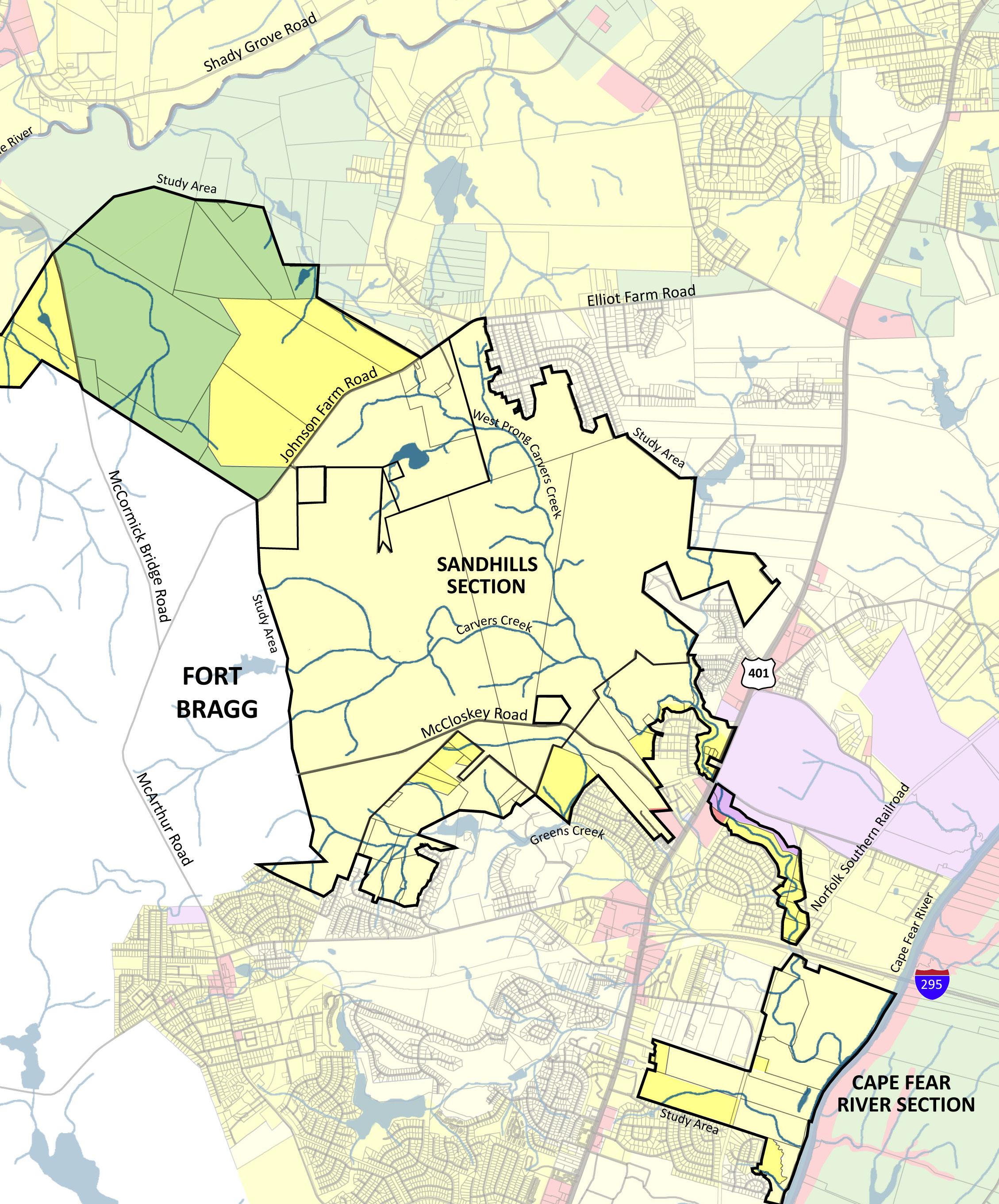


The study area for the state park is within one of the fastest growing regions in the state. This area is rapidly urbanizing and the once rural agricultural character of the region is quickly changing. New subdivisions, commercial and industrial areas are fragmenting wildlife corridors and natural areas. Existing infrastructure such as road and utility networks are also expanding, allowing for greater access for specific properties, but often limiting pedestrian and wildlife connections. The study area is bisected by several major highways in cluding U.S. 401, N.C. 210, N.C. 24/87, and I-295 as well as McCormick Bridge Road (SR 1600), Johnson Farm Road (SR 1605) and Andrews Road (SR 1611). The Norfolk Southern Railroad also bisects the study area, further limiting connectivity with the Cape Fear River.
Long Valley Farm is located approximately two miles north of the town of Spring Lake on Manchester Road (S.R. 1451) between N.C. 210 and N.C. 24/87. The site includes areas of cultivated fields (many of which have been planted in longleaf pine for conservation), fenced pasture, woodlands, wetlands and small farm ponds, the McDiarmid Millpond, several farm roads and paths, and various historic buildings and structures.


Long Valley Farm has approximately 1.80 miles of road frontage on Manchester Road (S.R. 1451). Two unpaved roads about three-quarters of a mile apart serve as entrances to the site, and both are gated. These entrances bisect the North Carolina Ecosystem Enhancement Program (NCEEP) restoration project on the site. The entrances are within two 60-foot easements granted by NCEEP, and another easement follows an existing overhead powerline. The three easements are the only three access easements to Manchester Road. The road to the west extends to the farm seat complex in the center of the property. The road to the east leads to the main agricultural complex, and according to the National Register of Historic Places, was used mostly by family and staff. This road loops around and intersects with the first entrance road just south of the farm seat. This road continues west through the woods to the Overhills property. Another farm lane intersects with the main road east of the farm seat and extends to the north end of the property. Other farm roads cross the site to allow access to most parts of the property. Arrowhead Road in Deerfield, the adjacent residential neighborhood to the west of the parcel, dead-ends at the property line. This road will not be considered for future vehicular park access, but could be considered for pedestrian access into the park.

The existing structures at Long Valley Farm are a nationally significant collection of buildings. The National Register of Historic Places inventory of buildings and structures at Long Valley Farm grouped the existing buildings into the following three categories: Farm Seat Complex, the main Agricultural Complex, and other farm structures. Thirty contributing resources including
Long Valley Farm road Road along millpond at Long Valley Farm Long Valley Farm roadbuildings, sites, and structures are listed on the National Register of Historic Places. Twenty-nine structures were classified as noncontributing resources. The three areas of historic significance at Long Valley Farm include agriculture, architecture, and social history. The period of significance is 1914-1943. See Figure 3.1 for contributing and non-contributing structures. See Appendix B for an assessment of the structures at Long Valley Farm.


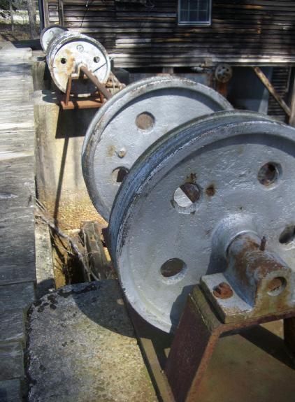
Located at the end of the western most farm road off Manchester Road, the Farm Seat complex includes the Rockefeller House, associated outbuildings, and the lawn area south of the McDiarmid Millpond. The outbuildings associated with the farm seat complex include the Garage, the Spring House, the Kennel, the Boathouse, the Woodshed and the Gazebo. Two of the most important existing buildings in the Farm Seat complex besides the Rockefeller House are the Mill House and Dam Gates and the Mill Pavilion. Both buildings
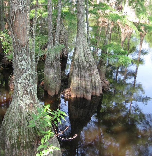 Figure 3.1 Long Valley Farm - Contributing and Non-contributing Structures - Not to Scale
Cypress trees
are located on the southern edge of the millpond, northeast of the Rockefeller House. A boardwalk, constructed by the Rockefellers, meanders through the cypress grove across the millpond.

The Rockefeller House was built by James Stillman Rockefeller, soon after he acquired the property in 1937. Rockefeller moved Robert Wall Christian’s house from its location south of the millpond and relocated it elsewhere on the property. The outbuildings were constructed between 1914 and 1985. The Mill Pavilion pre-dated Rockefeller and Christian, and was built between 1850 and 1860 and reworked in the 1920s. The dam and Pavilion Gates were built around the same time, but reworked in 1938. The Mill House and gates were constructed in 1938-1940, and ground corn meal until 1947 under the Long Valley name.
The main Agricultural Complex, consisting of approximately twenty buildings and structures, including the Farm Manager’s Residence, the Pump House, the Granary, the Great Barn, the Silo, and several other structures. The complex is visible from Manchester Road and is located at the end of the eastern most road. This portion of the farm is the area of the original 1914 Christian farm complex. The buildings and structures in the complex were built between 1914 and 1980.
Other farm structures include tobacco barns, worker’s houses, and other buildings. Several of these buildings are located near the Farm Seat and the Agricultural Complex. Others buildings are located throughout the property.


Progress Energy is the local electric provider at Long Valley Farm. No residential water or sanitary sewer facilities currently exist on-site. A municipal waterline bisects the property at the county line, runs south along a utility easement and then runs southwest along an existing transmission line easement. This waterline was developed in order to accommodate growth in southern Harnett County as well as at Fort Bragg. A water tank was recently constructed by Harnett County north of the property as part of the utility master plan.
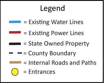
Farm Seat, Rockefeller House Mill House North Field Tobacco Barn Agricultural Complex Carvers Creek State Park Master PlanAn existing overhead electric line with a 100-foot wide easement extends at this location to the east. Harnett County is serviced by the Harnett County Department of Public Utilities, Central Electric Membership, South River Electric Membership Cooporation, and Piedmont Natural Gas Company. See Figure 3.2 for a map of the existing infrastructure and utilities around Long Valley Farm.


Water, electric and sewer connections are feasible at many points along the property lines at the locations of the existing residential subdivisions in Spring Lake. Septic may be an option as an alternative to sewer connections; further study will be needed to determine the suitability of soils at specific Long Valley Farm site locations.

 Figure


The Sandhills Section is located approximately six miles north of the City of Fayetteville on the eastern edge of Fort Bragg, between Highway 401 at McCloskey Road (S.R. 1610) and Johnson Farm Road (S.R. 1606). The Sandhills Section is located at the approximate midpoint between Long Valley Farm to the west and the Cape Fear River to the east and it shares a 2.5-mile border with Fort Bragg. The Sandhills Section includes areas of restored longleaf pine habitat as well as wetlands and ponds.
 Figure 3.3 Sandhills Section - Existing Roads and Utilities - Not to Scale
Carvers
The Sandhills Section has 1.6 miles of road frontage along McCloskey Road, and 1.05 miles along Johnson Farm Road. There are two vehicular entrances into the Sandhills Section, one on Johnson Farm Road and one on McCloskey Road. There are over eight miles of unpaved roads within the property. These roads are used mainly for forest access and management. The N.C. Department of Transportation has expressed interest in abandoning the 0.57mile unpaved right-of-way for McCloskey Road.


Several subdivisions and residential parcels border the Sandhills Section and several roads dead-end into the property. Expo Street, Spurge Drive, Workman Street, Clear Branch Road and McFrench Drive within the Pine Valley subdivision terminate on the northern boundary of the Sandhills Section. Lake View Street and Eclipse Drive terminate on the eastern boundary, and Wake Forest Road and De Paul Drive terminate into the southwestern boundary of the Sandhills Section. These will not be considered for major park vehicular entrances but could be considered as potential pedestrian access points.
The Sandhills Section has several existing structures including two houses, maintenance buildings, and a barn. A small house is located near the northern entrance along the main gravel drive. The rustic barn is located in the open meadow in the northern portion of the property along the main drive. The main house and shelter overlooks the pond. A maintenance building is located across the gravel road to the south.
The Sandhills Section borders the city of Fayetteville to the south and Fort Bragg to the west. The Cumberland County Public Works Commission is the local electric, water and sanitary sewer utility provider for the city of Fayetteville. See Figure 3.3 for a map of the existing infrastructure and utilities around the Sandhills Section.
The Sandhills Section is bounded to the south and the east by residential subdivisions serviced by both water and sewer lines. Water, electric and sewer connections appear to be feasible at many points along the property lines at the locations of the existing residential subdivisions in addition to the area along Johnson Farm Road and McCloskey Road to US 401. Septic systems are also an option, but further study will be needed to determine the suitability of soils at specific sites.

The Carvers Creek State Park study area is within a rapidly growing region of the state and existing traffic circulation routes will continue to evolve and develop. Several highways and railroads bisect the study area, limiting connectivity.
Johnson Farm Road Overhead powerline Overhead powerlineBased on the existing facilities and infrastructure, several opportunities and constraints will influence the development that can occur in Carvers Creek State Park. The historic buildings and structures are significant at Long Valley Farm and would be a wonderful resource for education and interpretation.
Both Long Valley Farm and the Sandhills Section are in close proximity to existing utilities including electricity, sanitary sewer, and water. The potential and cost to connect to these utilities and potential natural resource impacts will influence the placement and development of recreational facilities.
The Carvers Creek State Park study area contains rich natural resources unique to the Sandhills region. This area has been recognized by conservationists for containing one of the most distinctive and endangered ecosystems in North Carolina and the country. This ecosystem is home to numerous rare plants and animals rarely found outside of the Sandhills region. The Cape Fear River Section on the eastern edge of the study area has not been fully inventoried for this master plan, however the property is a wonderful natural resource.
The Sandhills region is characterized by rolling topography and deep, sandy soils. Abundant creeks and dry sandy ridges have resulted in a large diversity of natural community types, with longleaf pine communities dominating the ridges and pocosin swamp and seepage communities found along the creeks. The study area contains diverse ecosystems: longleaf pine forests, mature mesic hardwood forests, blackwater streams, swamp forests, steep bluffs, and small waterfalls - a rare geomorphic feature for the region.
Geologists believe the advance and retreat of ancient oceans deposited sandy soils, and together with the clays deposited by erosion from the piedmont soils, the soils of the Sandhills region were formed. The present day rolling and sandy landscape was created by wind and water erosion.
The Cape Fear River flows along the southern edge of the Carvers Creek State Park study area. The area along the Cape Fear River contains two distinct regions: slopes and bluffs and the flat inner Coastal Plain. The slopes and bluffs region is located on the western side of the Cape Fear River. This area is characterized by entrenched creeks and banks reaching 100 feet high along the Cape Fear River and support communities which contain species more typically found in the mountains and piedmont. Waterfalls also occur in this area, especially along tributary creeks of the Cape Fear River.
The biodiversity of the Sandhills region depends on a combination of rela tively high rainfall, sandy soils and an active cycle of wildfires. Longleaf pine forests are plant communities that adapted long ago to periodic burning, and their survival depends upon fire. The original forests were maintained by nat ural fires caused by lightning. As settlement and land development increased, the longleaf pine forests became increasingly fragmented. This fragmentation prohibited natural fires from running their course. Fire suppression by settlers in the area, continuing into the 20th century, also resulted in the decline of longleaf pine and biodiversity in this ecosystem. As a result, competing plant species thrived and inhibited the longleaf pine regeneration.
Controlled burns are fundamental to the ecological restoration and mainte nance of longleaf pine ecosystems. Burning reduces the thickness of leaf litter, which allows for the establishment and germination of native species. Fire also returns beneficial nutrients to the soils, increasing soil fertility. Burning also controls invasive hardwood species.
The study area lies within the transition zone between the Coastal Plain and the Piedmont Plateau region of North Carolina. The subtropical climate of this region is known for high humidity and the absence of extreme winter temperatures. Average daily humidity varies from 85 percent at sunrise to 45 percent by early afternoon. The prevailing winds are southerly, except during periods of lower precipitation in October and November when winds shift to the north. Even during the driest months, the study area typically receives an average of more than 2.5 inches of precipitation per month (47.14 inches per year). Droughts typically occur in the region every three to five years. The average daily minimum temperature in January is 30 degrees Fahrenheit (F), while the average daily maximum temperature in July is 90 degrees F. The annual average maximum temperature is 73.4 degrees F and the annual average minimum temperature is 48.8 degrees F. Precipitation is decidedly greater during the summer and early fall. Thunderstorms are especially frequent in summer. Tropical storms and hurricanes that strike southeast coastal areas typically bring heavy rain. Winter storms can bring snow to the region with an average annual snowfall of 2.8 inches.
Aerial data for Cumberland and Harnett counties was provided by The Nature Conservancy using Light Detection And Ranging (LIDAR) remote sensing data acquired in 2008. The aerial photography shows the study area, existing park parcels and how they relate to the current open space and development patterns occurring within the area. See Figure 4.1.


Residential and commercial development within the study area can be seen primarily in the northern and southern portions, with the majority of the study area remaining as undeveloped woodlands and farm fields. Residential and commercial development in the northern area is adjacent to Long Valley Farm, in the Town of Spring Lake and in southern Harnett County. Development in the southern portion, adjacent to the Sandhills Section, is located to the northeast and south where it borders the munici pal boundary of Fayetteville.
The study area includes more change in elevation than what is typically found in the Sandhills region of North Carolina, with a wide range of elevation change between the Long Valley Farm and the Cape Fear River Section. Long Valley Farm includes large areas of gentle slopes that have been used primarily for agricultural purposes. The Sandhills Section and Cape Fear River Section include steeper slopes. Figure 4.2 illustrates four-foot topographic contours for the study area. Contour data is based on 2007 LIDAR elevation data from the N.C. Department of Transportation.


The Carvers Creek State Park study area consists of two major geologic formations; the Cape Fear Formation (Lower to Middle Cretaceous) and the Middendorf Formation (Upper Cretaceous). The Cape Fear Formation is characterized by sandstone and sandy mudstone which consists of interbedded clays and sands exposed along deeply entrenched rivers, such as the Cape Fear and Lower Little Rivers. Middendorf Formation includes fluvial-sands and clays commonly exposed on valley slopes and uplands in the Sandhills. Figure 4.3 illustrates the geology of the study area.

Bedrock in this area is composed of volcanic slate and is generally at depths of 200 to 400 feet below the surface. Overlying this bedrock are Cretaceous period sands and gravel attributed to the Lower Cape Fear and Upper Middendorf formations. Above the Cretaceous sands and gravels are Tertiary period sands on the eastern edge of the Sandhills. While sand is predominate throughout the Sandhills and rock outcrops are extremely rare, several sandstone outcrops occur on top of Middendorf beds, which are typically characterized by little soil development and sandstone occurring along narrow hilltops.


Carvers Creek State Park study area contains over 58 soil classifications. Soil type has a major influence on the suitability of development. The construc tion of roads, buildings, campsites, trails, and recreational facilities each re quire different levels of soil suitability.
The limiting characteristics of the soil types include erodibility, poor drainage, shallow water table depth, ponding, and flooding. Long Valley Farm contains some soils that are classified as potentially hydric and are unsuitable for de velopment of structures, trails, camp areas, and picnic areas.

The Sandhills Section contains significant areas of hydric soils. These areas are located in the lower elevations and are associated with the existing wa terbodies and floodplain. The location of these soils is significant for develop ment in that they bisect the site from east to west, essentially dividing the Sandhills Section into two areas of potential development.
The limiting factors in the development of facilities and a recreational net work in the Cape Fear River Section are due to the topography, slope, and potential high level of soil erodibility. Most of these erodible soils are located along the banks of Carvers Creek and its tributaries.
See Figure 4.4 for Soil Mapping of the study area. See Appendix C for more detailed soil descriptions. Soil data was provided by North Carolina Geograph ic Information Coordinating Council as well as the Natural Resource Conserva tion Service. More detailed soil investigations will be required during design and construction phases.


Figure 4.5 illustrates the elevation levels within the Carvers Creek State Park study area. Elevation values range from a high point north of Long Valley Farm of approximately 280 feet above sea level, to a low point of 36 feet above sea level at the Cape Fear River. The elevations at Long Valley Farm range from 276 to 144 feet above sea level. The elevations at the Sandhills Section range from 256 to 124 feet above sea level. The elevations in the Cape Fear River Section range from 112 to 36 feet above sea level.


The topography in the Carvers Creek State Park study area is varied from gently sloping agricultural land to rolling hills and steep bluffs. While most of the study area contains gentle slopes of less than 6 percent, there are areas, specifically along the Cape Fear River, where the slope exceeds 50 percent. Long Valley Farm, the Sandhills Section, and the Carvers Falls Section each exhibit different topography and visual character.
The majority of the land within Long Valley Farm is sloped at less than 4 percent. The majority of the land in the Sandhills Section is sloped less than 10 percent. Both the Sandhills and Cape Fear River Sections contain areas where slope exceeds 20 percent, specifically along creek banks.

Gentle slopes (between 0 to 6 percent) are shown on Figure 4.6, the slope analysis map, as varying shades of green. These slopes are typically found on former and current agricultural areas and are most suitable for development. Grading in these areas can occur without a high risk of erosion. Moderate slopes (6 to 10 percent) are represented on Figure 4.6 as shades of yellow. These slopes present somewhat limited development opportunities due to the potential erosion of sandy soils. Steep slopes (greater than 10 percent) are shown on Figure 4.6 as varying shades of red. These slopes are found primarily along creeks and drainage ways, and development in these areas should be very limited. The data for the slope analysis is based on LIDAR (Light Detection and Ranging) and does not represent survey quality data. Topographic surveys should be obtained during the site specific design of the properties.


The direction that land faces, or its aspect, has a large influence on ecological makeup, land management techniques, and potential for development. South and southwest facing slopes are generally drier, hotter, and have different biological communities than slopes that are facing north and northeast. This difference in microclimate also affects the land management techniques used. Prescribed burning plays a vital role in the health of the longleaf pine forest ecosystem. Prevailing winds, moisture levels, and vegetative communities influence the frequency and intensity of fire.

Aspect influences the type and site location of development. Designing public spaces and buildings in order to maximize year-round use and physical comfort is desirable. Development within the study area should include proper solar orientation of buildings for passive heating and cooling, natural daylighting, and ventilation. See Figure 4.7 for Aspect Analysis Map.


The Carvers Creek State Park study area is located within the Cape Fear River Basin, see Figure 4.9. This watershed is the largest in the state, covering over 9,000 square miles. The study area is located within subbasin number 15. This subbasin measures 600 square miles and contains the city of Fayetteville as well as the majority of the Fort Bragg Military Reservation. The population of the Cape Fear River Basin is estimated to be 1,825,321 people, according to the 2000 census.


The Cape Fear River flows through the eastern portion of the subbasin, but most of the subbasin is made up of the Rock Creek and Little Rockfish Creek watersheds. The study area is located in the eastern central part of the subbasin. See Figure 4.8 for a map of the hydrology of the study area.
The Cape Fear River and its tributaries are an invaluable natural resource of North Carolina. It is the largest and most industrialized river basin in the state and has tributaries in 29 of the state’s 100 counties. The Cape Fear River Basin extends from its headwaters north of Greensboro to the river’s mouth in Southport and is about 200 miles in length. Twenty-seven percent of the state’s population resides within the basin. The Cape Fear River provides freshwater for consumptive uses, routes for water transportation, various recreational opportunities, as well as critical wildlife and fisheries habitat.


The creeks and rivers within the study area are classified as Class C and Water Supply-IV by the North Carolina Division of Water Quality. Class C includes waters that are protected for uses, such as secondary recreation, fishing, wildlife, fish consumption, aquatic life including propagation, survival and maintenance of biological integrity, and agriculture. Water Supply-IV are waters protected as sources of water supply for drinking, culinary, or food processing and are generally in moderately to highly developed watersheds or protected areas. One impaired waterbody lies within the study area: the Lower Little River, from the Fort Bragg lower water intake to the Cape Fear River.

The study area is bisected by several creeks, streams, and rivers of various siz es which eventually drain into the Cape Fear River. The Little River bisects the northern region of the study area. Water bodies within Long Valley Farm drain into the Little River. The Little River eventually meets with the Cape Fear River along the Harnett and Cumberland county line to the east of the study area.

Creeks in the Long Valley Farm property drain primarily from northwest to southeast. One main creek, several smaller creeks, one impounded pond, and several small farming ponds are located on Long Valley Farm. Jumping Run Creek is a black water creek that flows through the property. It flows from Harnett County into McDiarmid Millpond in the northwestern portion of the property and exits along the eastern edge of the parcel in Cumberland County. Numerous unnamed creeks join Jumping Run Creek as it flows into the Little River.
The North Carolina Ecosystem Enhancement Program (EEP) completed a stream restoration of an unnamed tributary in the southern portion of Long Valley Farm in 2010. This project restored 7,057 linear feet and 96 acres of riparian and non-riparian wetlands and enhanced 1,935 linear feet of stream
Figure 4.9 North Carolina River Basin Mapand 3.4 acres of riparian wetlands, which is a Coastal Plain Small Stream Swamp system. Wetland restoration of the agricultural fields involved raising the local water table and restoring the natural flooding patterns. The existing stream channel was restored to a stable condition and wetland functions were restored on the adjacent hydric soils.
Four creeks are located within the Sandhills Section: Carvers Creek, West Prong of Carvers Creek, North Prong of Carvers Creek and Greens Creek. The flow of these creeks are primarily to the south/southeast. Numerous un named creeks are located within this property. The creeks flow to the south east corner of the property where they are impounded by an earthen dam. The damming of these creeks results in large areas of backwater swamps. The confluence of Carvers Creek, North Prong, and West Prong Carvers Creek occurs outside of the Sandhills Section before they meet with the Cape Fear River.
The study area includes a significant amount of land within the 100-year floodplain. The 100-year floodplain is defined as an area of land that has a 1 percent probability of experiencing a flood any given year. These areas are mapped on Flood Insurance Rate Maps by the Federal Emergency Manage ment Agency. Floodplains are defined as low lands that adjoin surface water. The 100-year floodplain in Long Valley Farm surrounds Jumping Run Creek and McDiarmid Millpond. The 100-year floodplain in the Sandhills Section surrounds Carvers Creek, North Fork Carvers Creek and West Prong Carvers Creek. The 100-year floodplain in the Cape Fear River Section surrounds Carv ers Creek and its tributaries.
There are two main creeks in the Carvers Falls Section, Carvers Creek and McPherson Creek. The confluence of these two creeks occurs in the central portion near Carvers Falls. Carvers Creek then flows to the south and east to its confluence with the Cape Fear River.
Mapping of the wetlands is based on the National Wetlands Inventory. Wet lands provide many ecological, economic, and social benefits. They provide habitat for fish, wildlife and plants, hold and slowly release flood water, re charge groundwater, act as filters to clean runoff, recycle nutrients, and pro vide recreation and wildlife viewing opportunities. Numerous wetlands are located in the study area, mapped by the National Wetlands Inventory. There may also be wetlands present that are not mapped. Wetland delineation and survey for specific areas is recommended for the property at the time of site design.
Any surface water, including wetlands, found in the state park fall under the jurisdiction of the U.S. Army Corps of Engineers and the N.C. Division of Water Quality. Development within floodplain and wetlands will be avoided or will require permitting. Appropriate buffers will be determined to minimize im pact, and wetlands and buffers will be avoided as much as possible.
The Sandhills region is among the most diverse botanical regions anywhere on the planet. There are several high quality natural communities throughout the study area as well as within Long Valley Farm, Sandhills Section, and the Cape Fear River Section. See figure 4.10 for a land cover map of the study area.


There are seven high quality natural communities within Long Valley Farm including Pine/Scrub Oak Sandhill, Xeric Sandhill Scrub, Sandhill Seep, Streamhead Pocosin, Coastal Plain Small Stream Swamp and Coastal Plain Semi Impoundment. The following birds are typically found in the longleaf pine forests here: Red-shouldered Hawk, American Kestrel, Red-cockaded Woodpecker, Red-headed and Red-bellied Woodpeckers, Brown-headed Nuthatch, Pine Warbler, and Chipping Sparrow. Eastern box turtle, northern spring peeper, eastern tiger swallowtail, northern black racer, and eastern fox squirrel can also be found here.
In addition to agricultural and pasture land, there are some specific plants and trees that are worth noting. Native species such as yellow pitcherplant, pinebarren sandreed, and Loomis’s loosestrife are located on the property. At the Rockefeller House, there are several magnolias, camellias, azaleas, dogwoods, and hollies of possible historic significance. The old pear tree and wisteria are rumored to have been planted by Robert Wall Christian. There are two live oaks that were brought to the property by Mrs. Rockefeller from her family home in Cumberland County, Georgia.


The North Carolina Ecosystem Enhancement Program (EEP) restoration project will restore a Coastal Plain Small Stream Swamp system at Long Valley Farm, which will rejuvenate native flora and fauna.

The Sandhills Section also contains high quality natural communities including Xeric Sandhill Scrub, Pine/Scrub Oak Sandhill, Dry Oak-Hickory Forest, Mesic/ Wet Pine Flatwoods, Streamhead Pocosin, Cypress-Gum Swamp Sandhills Seep and Coastal Plain Small Stream Swamp (blackwater subtype) and Coastal Plain Semi-Permanent Impoundment. The park contains 15 special status species including Red-cockaded Woodpecker, Sandhills pyxie-moss, Canby’s bulrush, bog oatgrass, and eastern fox squirrel. Common birds of this property include Brown-headed Nuthatch, Summer Tanager, Pine Warbler, Carolina Wren, Eastern Towhee, Mourning Dove, and Bachman’s Sparrow. Other animals of interest include pine barrens treefrog, dwarf waterdog, sawcheek darter, yucca giant-skipper, confused cloudywing, elfin skimmer, southeastern spinyleg, southern flying squirrel, eastern red bat, northern scarlet snake, and eastern cottonmouth. See Figure 4.12 for Carvers Creek State Park study area special status plant and animal species.


Bog Oatgrass
Bog Spicebush
Danthonia epilis SR-T FSC
Lindera subcoriacea T FSC
Schoenoplectus etuberculatus SR-P Cuthbert's Turtlehead Chelone cuthbertii SR-L FSC
Canby's Bullrush
Lady Lupine Lupinus villosus SR-P Sandhills Pyxie-moss
Pyxidanthera brevifolia E FSC
Sarvis Holly Ilex amelanchier SR-P
Bachman's Sparrow
Aimophila aestivalis SC FSC
Eastern Fox Squirrel Sciurus niger SR-G
Edward's Hairstreak
Satyrium edwardsii SR
Frosted Elfin Callophrys irus SR
Hessel's Hairstreak Callophrys hesseli SR
Pine Barrens Treefrog
Red-cockaded Woodpecker
Hyla andersonii SR
Picoides borealis E E
Reversed Roadside-skipper Amblyscirtes reversa SR
HIGH QUALITY NATURAL COMMUNITIES
Coastal Plain Semi-permanent Impoundment
Coastal Plain Small Stream Swamp (Blackwater Subtype)
Cypress-Gum Swamp (Blackwater Subtype)
Dry Oak-Hickory Forest
Mesic Pine Flatwoods (Coastal Plain Subtype)
Mesic Pine Flatwoods (Coastal Plain Variant)
Pine/Scrub Oak Sandhill Sandhill Seep Streamhead Pocosin
Xeric Sandhill Scrub (Sand Barren Variant)
Figure 4.12 Carvers Creek State Park Plant and Animal Species
Notes:
State Status: E - Endangered; T - Threatened; SC - Special Concern; SRSignificantly Rare
SR Designations: G - Game Animal; L - Limited (endemic or nearly so); PPeripherally; T - Throughout its range
Federal Status: E - Endangered; FSC - Federal Species of Concern
Several Significant Natural Heritage Areas containing ecologically significant natural communities or rare species are documented in the region. The six Significant Natural Heritage Areas identified in the study area are: Long Valley Farm, Carvers Falls, Methodist College Hardwood Slopes, Manchester Sandhills, Carvers Creek Sandhills, and the Fort Bragg Overhills Sandhills. See Figure 4.11 for Significant Natural Heritage Areas.
Only 3 percent of the historic longleaf pine wiregrass ecosystem remains to day within the United States. Fort Bragg and surrounding areas contain over 160,000 acres of the longleaf pine ecosystem.
The longleaf pine wiregrass ecosystem is dependent on natural disturbance in order to maintain its biodiversity and habitat health. Fire is the primary dis turbance agent. Part of the management plan to maintain the health of this
ecosystem is to incorporate controlled burning. This burning allows for the thinning of the understory to accommodate the regeneration of the longleaf pine and other plants in this community. This prescribed burning mimics the natural disturbance process.
Non-native and invasive species also pose a risk to the health of the longleaf pine ecosystem, and invasive species control programs will be implemented in the park to address these issues. The spread of non-native and invasive plants, both naturally and by humans, can cause a loss of biodiversity, soil erosion, and sensitive species habitat loss, resulting in degradation of the en tire ecosystem.
The North Carolina State Parks System exists for the enjoyment, education, health and inspiration of all North Carolina citizens and visitors. The mission of the state parks system is “to conserve and protect representative examples of the natural beauty, ecological features and recreational resources of statewide significance; to provide outdoor recreational opportunities in a safe and healthy environment; and to provide environmental education opportunities that promote stewardship of the state’s natural heritage.”
Carvers Creek was selected as a state park site for many reasons, including multiple opportunities for education, natural resource protection and recreation. The conservation value of the park is highly significant. Sensitive environmental resources may be seen as opportunities for environmental education and park development, as well as protection and conservation. One of the primary purposes of the master plan process is to determine which areas are most suitable for site development, and which areas must be avoided and protected.
Previous chapters have covered site context and history, regional context and planning issues, existing facilities and infrastructure, and natural resources. Many parameters have been mapped as Geographic Information System (GIS) layers which provide valuable data to be used to prepare the site analysis. This research and mapping, along with field visits, have been compiled into a listing of opportunities and constraints which will be used to guide the programming and master planning for Carvers Creek State Park.
The Sandhills region attracts many visitors due to the proximity to the city of Fayetteville, Fort Bragg and Pope Air Force Base. Located in the central portion of the state, with easy access from I-295, and just 8.5 miles from I-95, the park may grow to have a very high visitation rate. As the expansion of Fort Bragg and the population grows in this area, development demands create competition for land that may be desirable for acquisition by state parks. Figure 5.1 shows the study area and includes parcels, roads, existing hydrology, Significant Natural Heritage Areas, hydric soils, steep slopes, and access points.
In the roughly six miles between Long Valley Farm and the Sandhills Section, there are several large parcels of land in private ownership. The N.C. Division of Parks and Recreation looks forward to working with willing landowners in order to establish a corridor linking the parks through easements or property acquisition as it becomes available. The lack of continuity of the park properties will be confusing for visitors and problematic for operations and maintenance staff. Numerous individual properties require buffers around each property boundary that will diminish the amount of land that is suitable for development within the individual parcels. Individual parcels also increase management issues for operations and management staff due to distance, multiple access points and the extensive number of adjacent neighbors.
Although it would be ideal for the land acquisition to continue southeast from the Sandhills Section to the Cape Fear River Section, major roads, a rail line, and other development has fragmented the available land so fewer larger
 Ferns in the Sandhills Section
parcels are available for purchase. Land acquisition in this area would not be deemed to be quite as important as the connection needed between Long Valley Farm and Sandhills due to fragmentation from development. The availability of large parcels, the Significant Natural Heritage Areas, and Redcockaded Woodpecker colonies between the two properties make the area between Long Valley Farm and the Sandhills Section the highest priority for acquisition. Other conservation partners are working in the southeast portion of the study area on the Cape Fear Greenway. It is possible that important properties in this area will be protected and preserved by others so that easements or acquisitions along the stream corridors in this area could potentially provide connectivity to the Cape Fear River.
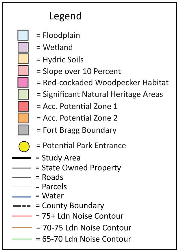

As Carvers Creek is a new park in the state park system, there are no existing park activities or functions existing within the study area with the exception of Mendoza Park, owned by the Town of Spring Lake. This facility is adjacent to Long Valley Farm on the southwestern property line. It is an athleticallyoriented park with ball fields, playgrounds, and several picnic shelters.
Most of the study area is either forested or farmed. More development is found at the far western edge at Spring Lake, along N.C. 210, and at the southeastern portion along U.S. 401 and I-295 where the land is already subdivided and developed. Long Valley Farm has been recently mowed and farmed, and it has numerous buildings associated with previous uses. It also has active longleaf pine restoration areas. Several acres of the property are part of a stream restoration project by the North Carolina Ecosystem Enhancement Program. Hardwood species are found along drainage ways in the millpond and the blackwater streams. Areas that were previously cleared


for farming at Long Valley Farm have been reforested with longleaf pine, but they might provide possible areas for future development that will not require additional clearing of mature trees. The Sandhills Section is mostly wooded with larger areas of mature longleaf pine. Due to the maturity of the trees in this area and the presence of rare species, it is not recommended that large areas be cleared at the Sandhills Section for park development.
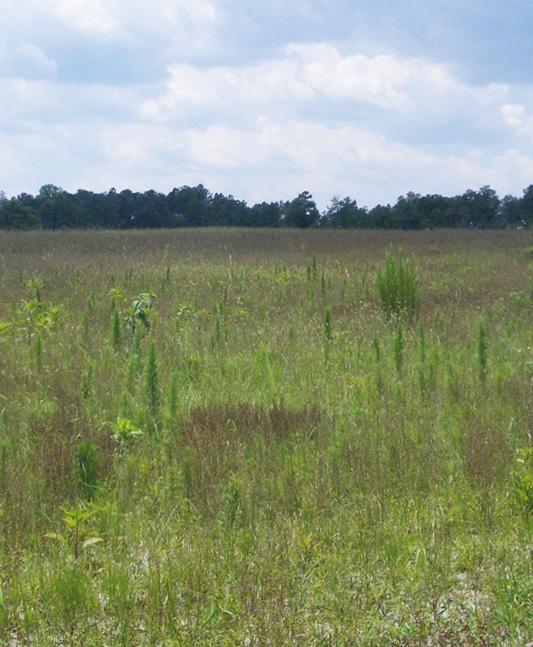

Long Valley Farm, Sandhills Section and the Cape Fear River Section have limited opportunities for vehicular access. At Long Valley Farm, the North Carolina Ecosystem Enhancement Program’s stream restoration work has left three easements available into the park property. From Manchester Road, there are two 60-foot wide vehicular access easements into the park property, with one 30-foot easement owned by Progress Energy that may be available for pedestrian access only. No other park frontage along any major roads exists to provide another location for a vehicular park access.
Vehicular access is available at the Sandhills Section from either Johnson Farm Road to the north and McCloskey Road to the south. Park frontages do not exist along any other major roads to provide a vehicular park access. The NCDOT would like to abandon the right of way on McCloskey Road, which would provide more usable land for park development and prevent the property from being bisected by the road.
Vehicular access is available at the Cape Fear River Section from Carvers Falls Road. Access road will cross a Norfolk Southern Railroad line prior to entering the property.
Several streets dead-end into the various park properties, which may provide desirable pedestrian access points for neighborhood access. Too many pedestrian access points may become a management problem and dead end streets may become parking areas for park visitors that are disruptive to the adjacent neighbors.
The largest adjacent neighbor is Fort Bragg/Pope Air Force Base. Active training exercises include tanks and artillery practice on the adjacent property, so it is a concern that park visitors are kept safe and the military base be kept secure. Another concern is the proximity of Pope Air Force runway to Long Valley Farm. Figure 5.1 shows military airport operations impacting the Long Valley Farm property with approach zones and noise contours of 65 to 79 Ldn.; 80 Ldn is the noise level of a gas lawn mower at a distance of 100 feet. On average, 11 flights take off and land per hour, and at peak times, it can be as high as 13 per hour. Being in the direct flight pattern of the runway creates an interesting opportunity to view low flying military aircraft, but it can also be dangerous location in the event of a mishap. Noise also disturbs the expected peacefulness of the property.
While the ecological diversity and beauty of the study area offers significant opportunities for park development, it also mandates protection and preservation of sensitive resources. The Long Valley Farm property offers significant historical and cultural resources in addition to environmental assets. The largest environmental constraints for development in the study area will be areas of sensitive habitat, hydrology and soils.
 Cattle at Long Valley Farm
Pasture planted with longleaf pines
Longleaf pines at Long Valley Farm
Ecologically sensitive areas create the largest constraint to park development in the study area. Several special status species are found on the properties that require habitat protection. Thirteen rare plant and animal species as well as one endangered species exist within the Carvers Creek study area. The one federally endangered species is the Sandhills Pyxie-moss, and the one state endangered species is the Red-cockaded Woodpecker. A large portion of the study area is located within several Significant Natural Heritage Areas. The natural diversity of plants and animals in these areas are so rare or significant that they merit special consideration when land-use decisions are made. The gum cypress pond, seeps, pocosins, swamps, wetlands, and blackwater streams are major environmental factors in the study area which take up vast amounts of acreage at Long Valley Farm, Sandhills Section, and the Cape Fear River Section.


Soils will be another ecological constraint to development, as hydric soils associated with wetlands are prominent along the extensive stream systems in the study area. Hydric soils include Deloss loam, Johnston loam and Roanoke and Wahee loams. Other sandy soils, such as Gilead and Blaney loamy sand soils, will create problems for development due to the potential for erosion. Although the study area is generally not steeply sloped except along steam banks and at the Cape Fear River, the sandy soils in this region are considered severely limiting for development when steeper slopes are encountered.
Because of the historical significance of Long Valley Farm and its National Register of Historic Places status, it is recommended that the original Farm Seat complex, the main Agricultural Complex and its viewshed be preserved for public enjoyment. Individual buildings within these areas have been evaluated for historical significance and possible adaptive reuse in the master plan development.
Extensive interpretative and educational opportunities exist for the public at Long Valley Farm, such as discussions on gentleman farming and agricultural estates, the history of timber and naval stores, agricultural history, land and agricultural sustainability, and ecological and fire restoration.
Scenic beauty is a more subjective topic, but it is clear that the study area offers opportunities for expansive views that merit consideration for preservation where possible. Significant views within Long Valley Farm include areas of historic and agricultural significance as well as high quality natural areas. It is recommended that these views be preserved as part of the ecological, historic and cultural heritage of the property. The Sandhills Section is limited in significant vistas since it is densely wooded, but there are several areas that offer stunning views of high quality natural areas. The Cape Fear River Section offers scenic views of the Cape Fear River as well as Carvers Falls. The topography of the this section makes this a very unique and special place.
Integrating prescribed fire management into future park development will be important. Close coordination with N.C. Division of Parks and Recreation will be necessary to ensure that park facilities are sited appropriately for proper management of the longleaf pine ecosystem. Opportunities for interpretation of fire management will offer another level of education for park visitors.
 Swamp at Sandhills Section
Existing trail at Sandhills Section
Wet area at Sandhills Section
When all limiting factors are overlaid as shown in Figure 5.2, the resulting map shows pockets of land that could be considered for large areas of extensive new development. Although it is of utmost importance that highly sensitive land be purchased for preservation, it is also desirable for some state park land to be acquired that is not of highly significant historic and ecological value for the construction of park facilities.


Carvers Creek State Park is the first state park in the Sandhills region of North Carolina, and is a highly valued resource that is being protected for its ecologi cal, cultural and historic significance. Education and interpretation of these resources will encourage the value of stewardship, land conservation, and exploration in those who visit. The park also provides a regional destination for nature-based, passive recreation, which is much needed in this part of North Carolina. The following goals and objectives for the long term success of Carvers Creek State Park are outlined below:
Protect natural resources
• With this ecologically diverse ecosystem, significant natural resources are still being discovered and a long-term plan is needed. Continue to map habitats and species as they are located
• Pursue the creation of a long-term fire management plan and restoration plan

• Prevent erosion, secure and protect special places, and create an interim plan

• Survey results confirm that additional trails are needed in the area
• Serve many types of park users – those from Fort Bragg, daily users, se niors, travellers, equestrians and school children all have different needs
• Attract visitors from a wide regional area
• Sustainable design/green design with reference to the Leadership in En ergy and Environmental Design (LEED®) and Sustainable Sites Initiative design criteria will be pursued
Protect cultural/historic resources
• Nationally significant historic buildings and views should be protected
• Tell the story of how Long Valley Farm came to be - from Ardnave to the Rockefellers, to the creation of a state park
• Create an interpretive plan and program for visitors
• Prepare an interim plan that maintains buildings until funding is available for renovation
• Pursuing partnerships with national, state and local stakeholders will be important. An partial list of potential partners is listed below:
Fort Bragg/Pope Air Force Base
North Carolina Division of Water Quality
North Carolina Department of Cultural Resources
Ferns and pines in the Sandhills Section

North Carolina State Historic Preservation Office
North Carolina Department of Agriculture
North Carolina Ecosystem Enhancement Program (EEP)
Historic American Landscapes Survey (HALS)
Historic American Buildings Survey (HABS)
Harnett County North Carolina Cooperative Extension Agency
Cumberland County North Carolina Cooperative Extension Agency
Harnett County Historic Society
Cumberland County Historic Society
• Encourage opportunities for revenue, such as classes, rentals, reunions, weddings, community garden plots, and artists-in residence, where local artists can rent structures to use as studios.
• Many people will come to visit historic resources; the gift shop could sell books, art, handmade crafts, and other items that relate to the history of Long Valley Farm.
• Books and photographs relating to the Sandhills could also be offered.
Acquire land to provide a contiguous park property
• Allow for a pedestrian connector trail to span the length of the study area
• A contiguous park property will offer additional recreation opportunities and a larger area for natural resource protection
The previous chapters have outlined the existing conditions of the natural and man-made environment, the recreational needs of the region, as well as the opportunities and constraints for Carvers Creek State Park. Developing a park program is the next step in creating guidelines for future development. The park program is a “toolbox” that is used when deciding the appropriate location for built park elements, such as the Visitor Center, historic proper ties, roads, trails, campgrounds, and picnic areas. It is important to note that the program for the park must serve the entire community – plants, animals and people. A balance must be found between the protection of natural re sources and opportunities offered for recreation. Some ecologically sensitive areas of the park will be preserved for conservation management with lim ited public access, while previously developed areas are well suited for uses such as parking lots, roads, and campgrounds.
The three core elements of Carvers Creek State Park are natural resource protection, cultural and historic resource protection, and nature-based recre ation. The park elements listed below address these in more detail.
Several important historic buildings exist within the state park and are inte gral in maintaining the “sense of place” of Long Valley Farm. Many buildings are listed on the National Register of Historic Places, and the entire farm is listed as well. These buildings serve the purpose of telling the story of the farm, the people who lived and worked there, including Robert Wall Chris tian, his role in scientific agriculture, and the Rockefeller family. Due to their cultural significance, the buildings should be preserved and utilized for cul tural and historic educational interpretation, storage, picnic shelters, and art ists-in-residence. School groups will enjoy learning about the history of the region. Any new construction in relation to these historic properties should be inspired by the vernacular architecture and craftsmanship. New buildings should blend in seamlessly with the historic structures, reflecting the details and mimicking the integrity of the surrounding buildings.
The Visitor Center will be the starting point for educational and environ mental programs that will focus on the entire state park. The building will be sited to reduce clearing and grading, as well as to provide natural daylight ing, ventilation, and views. The building will feature environmentally sensi tive or “green” architecture that will reinforce the environmental education programs at the park. Achieving Leadership in Energy & Environmental De sign (LEED) certification is a goal of the North Carolina Division of Parks and Recreation.
The architecture of the building should be inspired by existing and typical Cumberland County farm buildings. Indoor spaces may include an exhibit hall, park offices, classrooms, educational exhibit areas, conference room, gift shop, concession, reception area, storage, and public restrooms. Proxim
ity to parking, activities and connections to trails and sidewalks is essential. There will be a drop off area for visitors. Outdoor pedestrian areas associated with the building include plazas and outdoor classrooms. Secure bicycle park ing shall be provided near the building. Parking for vans and several buses will be needed. A variety of parking lot sizes can be used – smaller lots will have less impact on the sensitive site. Shade will also be provided.
The opportunity for a community building in addition to the Visitor Center is a real possibility with the number of existing buildings found on the park properties. A community building would include community meeting space, rental space, and restrooms. The building would be a good place for travelling exhibits and events such as wildlife photography, guest speakers and acoustic music.
Visitor Contact Stations will be located where staff is needed to greet park visitors when a Visitor Center is not appropriate. Visitor Contact Stations in clude space for offices and restrooms for park staff. Parking will be located here for two to five vehicles.
Ranger residences for park staff will be needed in the park, especially in loca tions where overnight camping will be provided. Ranger residences include all the conveniences of a typical family home, with bedrooms, kitchen and living areas, and restrooms. For privacy reasons, these homes should be lo cated off a main park road, but not so far away that it is difficult for park staff to monitor park activities.

The preferred location of a boat rental facility is near a day-use area. The close proximity to the boat house will allow supervision by park staff. The facility will have as small of a footprint as possible. It is not anticipated that it will be used for long-term boat storage, as other buildings that exist on site might be used for that purpose. The materials used for the construction of the boat rental could even be reclaimed from buildings found on site that are not determined as repairable. Electricity and room for park staff to operate the rental operation is necessary. Only non-motorized boats will be allowed in the lake, such as kayaks and canoes. No vehicular access will be provided for visitors to launch their own boats; however, park users could launch ca noes or kayaks from the shore if they carry their craft from their vehicle.
Due to the large size of the existing park properties and the lack of connectiv ity, more than one maintenance facility will be needed for park operations. Opportunities to reuse existing buildings on site should be explored where possible. Maintenance facilities will be screened from public view and blend
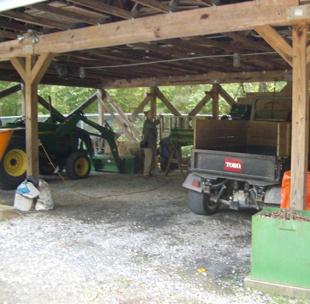
with their surroundings as much as possible. Interior spaces include staff of fices, a workshop, supply storage, shower, private restroom and break room. A maintenance yard is required for large equipment, deliveries, and storage of equipment and supplies. Parking will be provided for several park vehicles needed by the park staff.
Where feasible, park access locations will be located at existing driveways in order to reduce clearing, grading and impacting environmentally sensitive ar eas. Internal park roads will be aligned with existing roads whenever possible. New roads will be designed with gentle curves to prevent excessive speed or the need for traffic calming measures. Roads will follow a pleasant progres sion through the park, with glimpses and views of the park facilities and natu ral features. The park layout must be easy to understand for first time visitors. The park design will not create crossing hazards for bicycles, equestrians, or pedestrians.

Parking will accommodate the necessary number of cars and buses in a vari ety of lots in close proximity to activity areas. Overflow parking in grass areas will be available for use during special events. Parking may be provided along roadways or in a series of smaller lots to prevent large expanses of asphalt. Parking lots will also need to accommodate the radius required for busses. Gravel parking is a cost-effective option, and can be planned for areas used less frequently. Parking lots will be sited sensitively in order to reduce poten tial environmental impacts caused by excessive clearing and grading. Parking lots will also be designed to promote shaded parking, and provide accessible spaces as required by code. The design of the parking lot will utilize effective stormwater management techniques such as rain gardens. Parking for eques trians will require longer parking stalls that can accommodate horse trailers.
The most important goals when approaching the design of trails are safety, accessibility, connectivity, adaptability, sustainability, and innovation. Where feasible, trails and sidewalks should be designed so they can be enjoyed by people of all ages and mobility levels using universal design methods. The maximum levels of connectivity to state, regional, and local trail systems will be offered where available.
The trail system should be flexible enough that users can experience the trail in many ways. For example, some users might not be able to walk the length of the trail, but smaller loops can be provided that begin and end at conve nient access points. A loop reduces the need for backtracking and seeing the same scenery twice, and actually reduces wear and tear on the trail because people walk or bike around a loop once and not back and forth on a linear trail. Specific and easy to spot entry and exit points help users orient them selves in the trail system and are easier for staff to maintain.

The trail design should have a minimal impact on the environment and should avoid sensitive areas. Trail materials should be easy to install and maintain, easy to obtain locally, and appropriate to use in different environmental con ditions. The innovative use of sustainable paving materials and the integra tion of stormwater and drainage elements reduce the development impact of the trail and also provide opportunities for educational interpretation. At tention to providing an enjoyable and aesthetically pleasing experience is also important. A meandering trail draws users through the park, offering periodic views of different park features.
There are several authorities who have guidelines that relate to trail design and construction. The American Association of State Highway and Transporta tion Officials (AASHTO) sets standards and guidelines used in highway design and construction, as well as air, rail, water, public and pedestrian transporta tion. AASHTO has produced publications, such as the Guide for the Develop ment of Bicycle Facilities and the Guide for the Planning, Design, and Opera tion of Pedestrian Facilities, which contains guidelines for bike transportation facilities and shared-use paths, sidewalks and street crossings, and pedestrian trails. The Manual of Uniform Traffic Control Devices (MUTCD) is a document which specifies the design standards of traffic signs, road surface markings, and traffic signals which is issued by the Federal Highway Administration (FHWA) of the United States Department of Transportation (USDOT). State and local agencies utilize the MUTCD to ensure shapes, colors, and fonts of all traffic control devices meet national standards.
To ensure access to trails for all people, including those with disabilities, Americans with Disabilities Association Accessibility Guidelines (ADAAG) exist to ensure safe travel and access for those with mobility impairments. The U.S. Forest Service has also developed accessibility guidelines which maximizes accessibility while protecting natural resources.
Planting design is a very important aspect that can greatly enhance the over all park experience. Plants can be used to screen unsightly views, buffer adja cent uses and environmentally sensitive areas, frame beautiful views, control sound, wind and erosion, attract wildlife and provide habitat, add seasonal color and texture, add visual interest, serve as wayfinding devices, and create “nodes” along trails that create natural gathering spaces or resting areas.
As much as possible, plant selection should utilize a mix of canopy, under story, shrubs, and grasses that are suitable for the location. Plants which are toxic for either people or animals should be avoided. A good resource for toxic plants for horses is the Ten Most Poisonous Plants for Horses (EQUUS June 2004). Native plants are recommended, and invasive species should al ways be avoided. In order to minimize maintenance, plants should be chosen that are adaptable to the local climate and soils to minimize pruning and the use of synthetic fertilizers and inorganic pest control. The design should also include drought tolerant plants in order to eliminate the need for irrigation.
Planting zones can be established that celebrate and highlight local native plant communities. These areas are great places for educational interpreta tion. Where plant communities already exist, additional planting should work within those types of communities and non-native or invasive species should be removed if possible.
Site amenities will be the state park standard amenities, and placed appropri ately at key rest areas and viewpoints. Site amenities should be vandal resis tant and be easily accessible for all potential park users.

Benches, trash/recycling, dog waste stations, drinking fountains, bike racks, gates, and bollards should be placed appropriately where needed. Amenities should be chosen that are durable and practical, and represent a classic and timeless style so they can be used for an extended period of time. Benches should be placed in a variety of areas including sun, shade and under shelters. Bike racks should be located in visible areas at key destination points. “Farm” fencing could be considered to enhance the sense of place.
Site lighting should be installed at a pedestrian scale and with safety in mind. Low voltage or solar powered lighting should be utilized when possible.
Signs and other wayfinding devices should function as a system and be de signed for the first time user. All signage should be accessible to all park users, whether viewable, audible, or tactile. The signage should be designed with recognizable graphics and colors, with the information presented consistently and with a hierarchy. Signs should also take advantage of unique landmarks that make the park easier to navigate. Typical park signs should include direc tional signs, regulatory signs, stop signs, and crossing signs. All park signage will use the uniform state wide font. Several other signage types include:
• Rules and regulation signs including hours of operation, permitted uses, prohibited uses, wildlife protection policies, no trespassing, private prop erty, pet policies, and no littering.
• Recreational signs such as distance markers and safety/informational signs.
• Multi-use trails should have signage directing trail usage such as bicycle speed, sight distances, horse startling, overtaking rules, and trail eti quette.
• ADA requires that signs need to be provided at trailheads and on newly constructed trails.
Interpretive signs can also serve to make the overall park experience more enjoyable. These types of signs contribute to and enhance the sense of place, and provide valuable site history and cultural context in an environmental and sustainable way. Interpretive signage can be provided through signs, art, pav ing, site amenities, Global Positioning Systems (GPS), downloadable podcasts and other technology.

Boardwalk and

In order to prevent bank erosion, fishing will be accommodated on piers and platforms. These structures should be located in places that are already known as good fishing opportunities. A fixed pier system is preferred and a recycled/composite wood lumber is the preferred surface. At least one fish ing area must be close to accessible parking and accessible routes to allow those with mobility impairments equal use. Care must be taken to site these elements sensitively within the park to reduce the impact on the natural en vironment.
Day-Use Areas include shelters, picnic areas, restrooms, and are often the lo cation of trail heads. Grills, tables, water, and a septic system will be provided. The picnic shelters can be utilized as amphitheaters or outdoor classrooms as well. School groups can use these areas during organized visits. An open play area sited near the day-use facility will allow visitors the opportunity for picnicking, flying kites, or playing catch or frisbee.
Camping facilities will include tent and trailer, equestrian, and primitive camping. Tent and trailer camping will be configured in gated loops, with each loop accommodating at least 30 campsites. Campsites will be sited in order to provide the maximum amount of privacy while offering scenic views when possible. Equestrian camping will be configured in a single gated loop and will accommodate 15 campsites. Minimizing grading and preserving vegeta tion will also need to be evaluated when actual campsites are being planned. Electrical and water hookups at the campsites will be needed for some camp ers. Shower houses, sewage dumping stations, and waste/recycling areas will need to be placed for easy access while also considering noise and odor concerns. The location of septic fields will also need to be considered. Primi tive camping will be located in secluded parts of the park with composting or pump and haul toilets. Group camping will include a small parking lot, rest room, and an open area for camping.
Water, electrical, and phone utilities exist currently in the park where resi dential homes and other buildings are located. All new utilities will be located underground. Septic fields will need to be located in appropriate areas for park facilities. Utility corridors will be coordinated with trails when possible to reduce the amount of clearing needed.
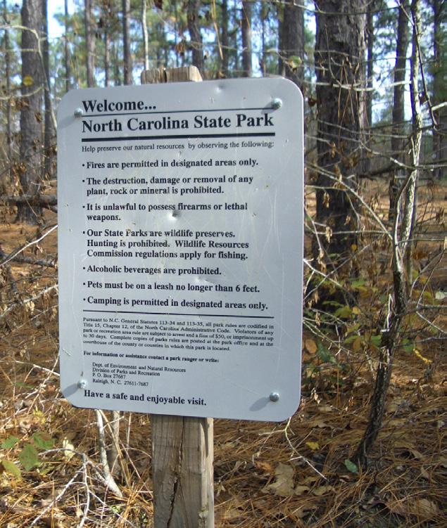
Storm drainage will include the design of permanent Best Management Prac tices (BMPs). Examples of BMPs include rain gardens, bioretention ponds, permeable pavement, and infiltration swales. Highlighting environmentally responsible stormwater management could be an educational opportunity for visitors to the park.
The ecologically sensitive areas in Carvers Creek State Park should be pre served and protected. Public access will be limited in these areas in order to protect important plant and animal species. Buffers will be provided around trees that are known Red-cockaded Woodpecker nesting cavities. In addition, other important plant and animal species have been documented with field work and Geographic Information Systems (GIS) as a tool for park planning in order to determine the best locations for conservation. Where possible, contiguous parcels of land should be sought to reduce fragmentation of the natural habitat. Trails and boardwalks may be carefully planned and built in these areas for environmental interpretation.

The Public Input Meeting was held on the evening of August 30, 2010 at Pine Forest High School in Fayetteville, N.C. The main goal of the Public Input Meeting process was to introduce the State Park project to the community. The public input process provides valuable insight into the citizens wants and desires for the proposed park, and also pinpoints the facilities and activities they would enjoy. Over 40 citizens attended the presentation and the view ing of Park Master Plan Concepts on display. Attendees were invited to write their comments on the concept maps and fill out surveys which were handed out during the meeting. An online survey was launched the next day and was open until September 27, 2010. A total of 415 people responded to the paper and online survey. The presentation was available digitally on the N.C. Divi sion of Parks and Recreation website for review and a link on the site directed visitors to the survey. A project e-mail address was established to gain further input, and several emails were received. News articles and blogs also covered the project. See Appendix D for public input information.

The most important points from the public input survey are as follows:
1. In terms of preferred activities, the public has a strong preference for visiting overlooks on the Cape Fear River, visiting historic buildings, hiking on trails, accessing multi-use trails, and viewing wildlife.
2. The facilities that the public would utilize the most include multi-use trails, the Visitor Center, boardwalks, and historic buildings.
3. Natural and scenic beauty ranked as the most important item that made for an enjoyable visit. Also important was the ability to take self-guided tours, a variety of recreational amenities offered, and opportunities to learn about history.
4. Some respondents had fond memories of relatives working on Long Val ley Farm or visiting there as a child.
Three Master Plan concepts were presented to the public during the pub lic input meeting. The three concepts all included plans for natural resource protection, cultural and historic preservation and interpretation, and naturebased recreation opportunities.
The main park development issues that factor heavily in the three concepts are the level of land acquisition, the amount of development, and the level of historic preservation. The level of land acquisition is important because it will dictate the level of connectivity throughout the park. A low level of land acquisition will be cost efficient, but it also means less preservation of natu ral and historic resources and a lower level of recreational opportunities and connectivity.

The three concepts ranged from the least to most intensive park develop ment:
Concept One: Low Intensity Development
Concept Two: Medium Intensity Development
Concept Three: High Intensity Development
Concept One, shown in Figure 8.1, has the lowest intensity of development of the three concepts. It features two separate properties with no addition al land acquisition to provide connectivity between them. Concept One has the least amount of land acquisition and is the most cost efficient concept. It also has the lowest intensity of recreational facilities and a limited amount of historic preservation. This concept focuses on retaining four historic build ings and structures at Long Valley Farm, and provides opportunities for hik ing, walking on interpretive trails, bringing your own canoe or kayak, viewing historic buildings from the exterior, and picnicking. The Sandhills Section pro vides opportunities for hiking, walking on interpretive trails, fishing, primitive camping, utilizing the Visitor Center, and picnicking.


Concept Two, shown in Figure 8.2, offers a medium intensity of development. It features an increased amount of land acquisition as well as an increased level of development and associated cost. This concept acquires a narrow corridor of land to link Long Valley Farm to the Cape Fear River. More historic preservation is provided at Long Valley Farm, and a multi-use trail ties the State Park properties together which allows an increased level of recreational connectivity. This concept focuses on retaining seventeen historic buildings and structures at Long Valley Farm, and provides opportunities for utilizing the multi-use trail, hiking, walking on interpretive trails, walking on a board walk through the Cypress-gum swamp, launching your own canoe or kayak, fishing, group camping, viewing historic buildings from the exterior, going on a guided tour of the Rockefeller House, and picnicking. The Sandhills Section provides opportunities for utilizing the multi-use trail, hiking, walking on in terpretive trails, fishing, primitive camping, tent/trailer camping, utilizing the Visitor Center, and picnicking. The multi-use trail extends to the Cape Fear River where park users will have opportunities for hiking, viewing the water falls and river, picnicking, and accessing the future Cape Fear River Greenway.

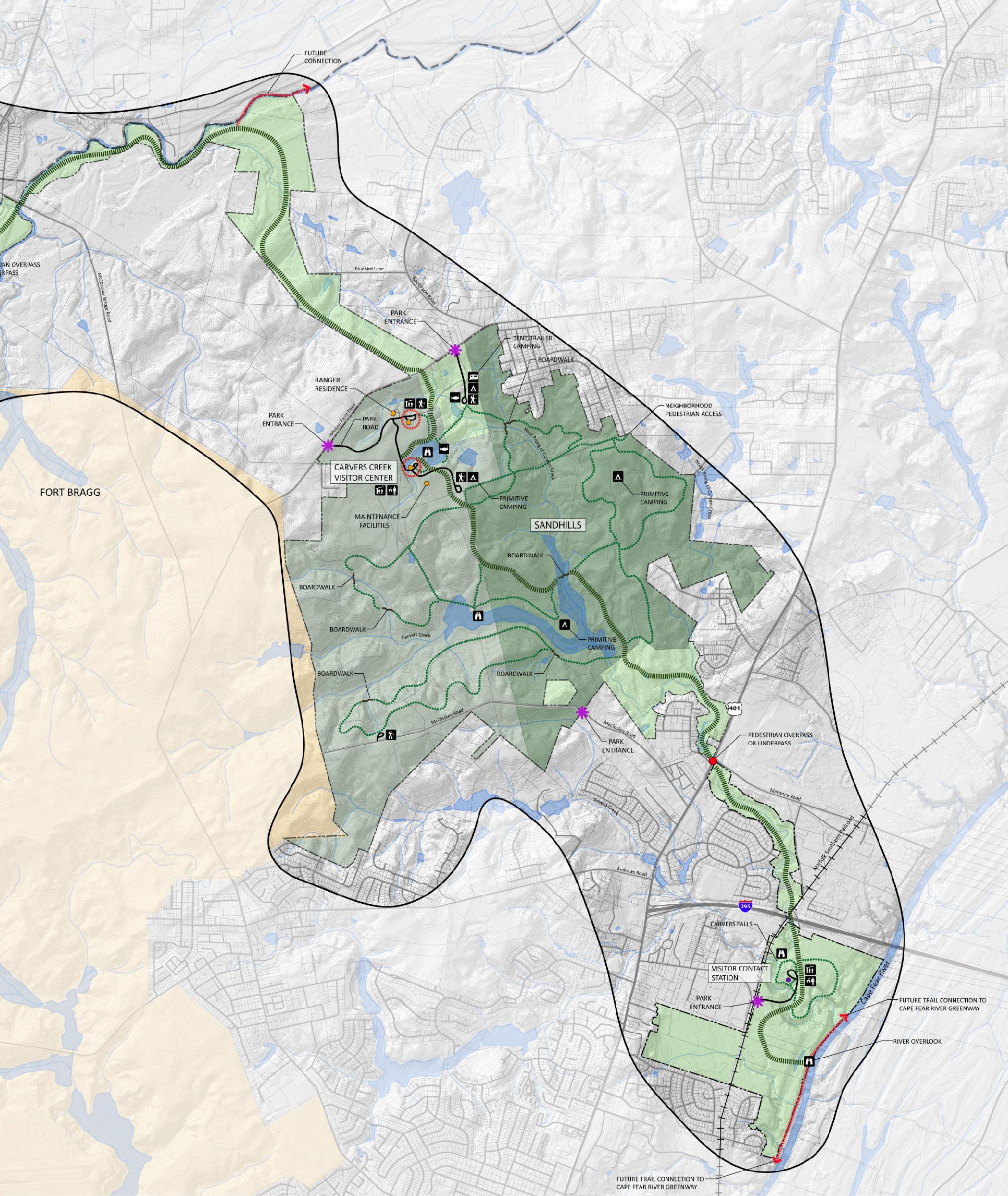


Concept Three, shown in Figure 8.3, has the highest intensity of development of the three concepts. It also features the highest amount of land acquisition, level of development and the highest associated cost. In Concept Three, sig nificant land would be acquired, with a multi-use trail linking the state park properties together. This concept offers the highest level of historic preserva tion at Long Valley Farm, the highest level of recreational facilities, and also a high level of ecological and habitat preservation. This concept focuses on re taining 21 historic buildings and structures at Long Valley Farm, and provides opportunities for utilizing the multi-use trail, visiting historic buildings, view ing historic exhibits and artifacts, attending farm/heritage days, viewing a re stored historic grist mill in operation, and viewing live demonstrations, such as farming, basket weaving and blacksmithing. This concept also provides op portunities for renting the Rockefeller House or Mill Pavilion, hiking, walk ing on interpretive trails, walking on a boardwalk through the Cypress-gum swamp, launching your own canoe or kayak, renting a canoe or kayak, group camping, fishing, and picnicking. The Sandhills Section provides opportunities for utilizing the multi-use trail, hiking, walking on interpretive trails, fishing, primitive camping, tent/trailer camping, utilizing the Visitor Center, and pic nicking. The multi-use trail extends to the Cape Fear River where park us ers will have opportunities for hiking, viewing the waterfalls and river, group camping, picnicking, and accessing the future Cape Fear River Greenway.
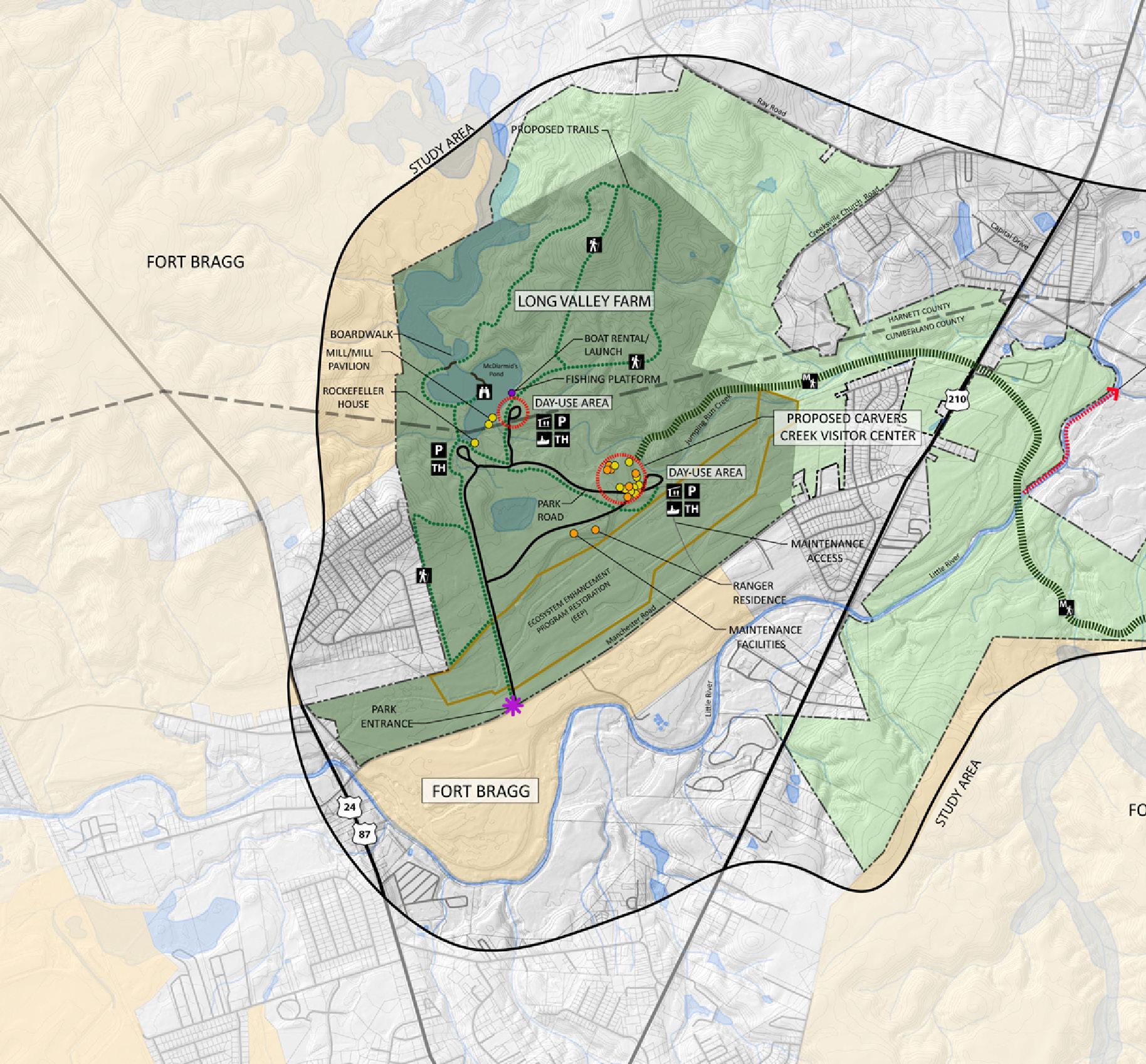


The public preferred a combination of Concepts Two and Three. Of those who preferred Concept Two, most appreciated the amount and the type of camping provided. They also liked the variety of recreational activities, the access to buildings for rentals, and the amount of educational opportunities. Concept Three was the most popular with the public, with over half the re spondents preferring the concept. Most preferred this concept because of the amount of habitat preserved, the amount of trail connectivity and land acquisition provided, the amount of hiking and trailheads, and the number of historic structures preserved. The chart below illustrates the preferences of the respondents. The percentages illustrate the number of respondents interested in high intensity park development.
The input received from the public was evaluated and tabulated in order to formulate an idea of what facilities and activities would be most popular at the park, and what level of development intensity was desired by the public. With this input, along with direction from the N.C. Division of Parks and Rec reation, a proposed Park Master Plan was prepared and is explored in more detail as outlined in later chapters. See Appendix D for full Public Input Re sults.

The Carvers Creek State Park Master Plan is a culmination of the existing con ditions analysis, field work, public input, identification of park program and goals, and collaboration with N.C. Division of Parks and Recreation staff. The Carvers Creek State Park study area consists of 8,500 acres, bounded to the north, south and west by Fort Bragg and residential areas and to the east by the Cape Fear River. Long Valley Farm, the Sandhills Section, and the Cape Fear River Section form the three anchors of the park, where most of the park facilities will be developed. A trail network will create a high level of connec tivity throughout the park, linking the park facilities from the west to the Cape Fear River in the southeast. The following chapter includes recommendations for the Park Master Plan, including land acquisition, natural resource protec tion, trail network, park themes and interpretive opportunities, park facilities, and recreational activities. The proposed Draft Park Master Plan is shown in Figure 9.1.
In order to achieve the highest level of connectivity between the park proper ties already owned by the state of North Carolina, further acquisition of land is expected to take place within the next 25 years. Additional land will ensure the maximum protection of plant and animal species. Since the state has pur chased portions of the park property in 2006 and 2010, future acquisition has been explored to create a larger park property. Priorities for land acquisitions include areas such as large undeveloped parcels, areas of significant hydrol ogy or geology, Red-cockaded Woodpecker habitat, examples of biological communities and natural resource areas, land within North Carolina Signifi cant Natural Heritage Areas, and land suitable for facility development.
Carvers Creek State Park will continue to grow in the next 25 years in order to support the mission of the N.C. Division of Parks and Recreation. These goals include conservation management, education, stewardship, and recreation.
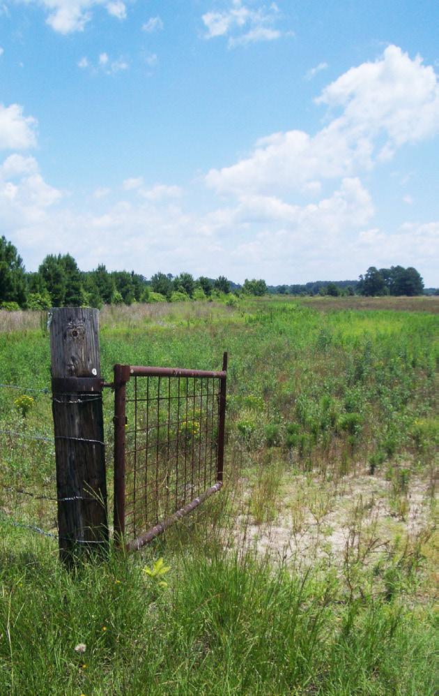
The Master Plan for Carvers Creek State Park shown in Figure 9.1 includes three main areas of development for park visitors; Long Valley Farm, the Sandhills Section, and the Cape Fear River Section. The park will be linked with a multi-use trail that connects the major facilities such as the Farm Seat and Agricultural Complex at Long Valley Farm and the Visitor Center at Sand hills. A bicycle/pedestrian trail will extend from Sandhills to the overlooks on the Cape Fear River. Approximately 22 miles of multi-use trails, four miles of bicycle and pedestrian trails, and eight miles of single-use trails are proposed throughout this park system. Trails are shown in approximate locations and the actual alignment of the trails will be determined during later phases of design. Trails will be carefully designed and maintained. Equestrians and bicy clists will not be allowed to ride off the trail.
Other facilities will include fishing piers, a boat rental, camping areas, dayuse areas, and historic buildings. Recreational opportunities include hiking, bicycling, horseback riding, picnicking, fishing, boating, camping, wildlife ob servation, visiting historic buildings, and experiencing life on an early 20th century scientific farm.

The Long Valley Farm property will be used mainly for educational and histor ic interpretation of the agricultural and cultural significance of the site. Two main nodes of activity include the Farm Seat and the Agricultural Complex. The historic structures date from different time periods within the history of the farm, ranging from 1850 when the Mill Pavilion was constructed, the mid 1910s when Robert Wall Christian operated his scientific farm, to the late

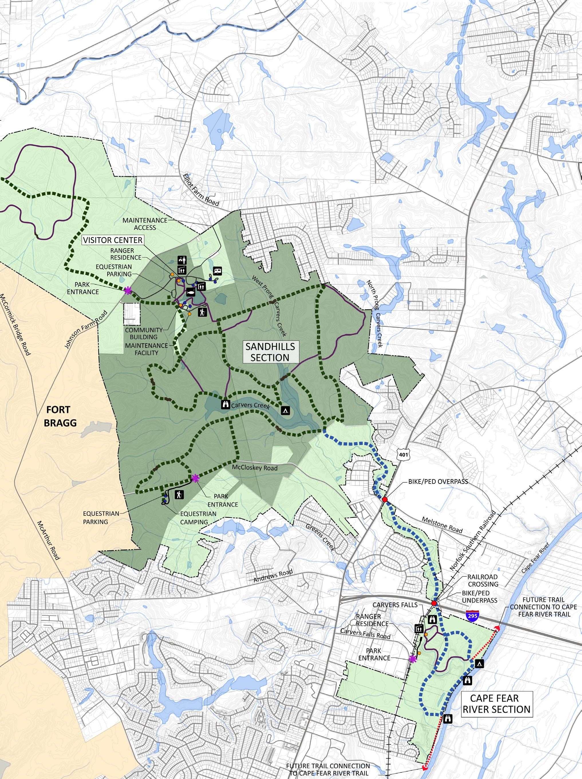


1930s when James Stillman Rockefeller purchased the property for his winter residence. The internal circulation of roads and trails will link these facilities with the recreational activities that will share the space. Recreational activi ties include boating, fishing, bicycling, equestrian trails, hiking, picnicking, and group camping. Also important is the rich ecological diversity of this area, including the cypress-gum pond, swamps, creeks, and stands of longleaf pine undergoing restoration and fire management. See Figure 9.2 for the overall plan for Long Valley Farm, and Appendix B for an assessment of structures at Long Valley Farm.


The park entrance is located off of Manchester Road and is aligned with the existing farm road. The park visitor will see glimpses of the original farm and silo in the distance as they approach the Farm Seat. According to the previ ous farm manager, this was one of James Stillman Rockefeller’s favorite plac es on the farm. Farm fences, hedgerows, and warm season grasses will be maintained to stay as accurate as possible to the farm’s nationally significant history. The layout of the farm roads around the fields date to Robert Wall Christian’s ownership of Long Valley Farm, and will be maintained as much as possible to keep the integrity of the farm intact. A gated maintenance road will be located south of the Agricultural Complex that leads to the Ranger’s Residence, maintenance complex, and a maintenance-only access road.

At the terminus of the entry drive, visitors will turn left to begin the approach to the Farm Seat. A 40-space parking lot and drop off area, a trailhead, and re strooms will be located at the Farm Seat to remain as unobtrusive as possible as well as minimize construction and clearing of the existing vegetation. From here, visitors can visit the Farm Seat and embark on a tour of the millpond, boardwalks and trails north of the parking area, or continue along a trail at the southern edge of the millpond to the Mill Pavilion and Pump House and the Mill House and gates.
Just east of the Farm Seat, a road will extend north, crossing Jumping Run Creek and connecting to a day-use area adjacent to the millpond. An 80-space parking lot will be located in an existing open field east of the millpond. See Figure 9.3. This day-use area includes a boat rental and launch, an accessible fishing pier, a restroom, a grass play area, two shelters, and a small open play area.
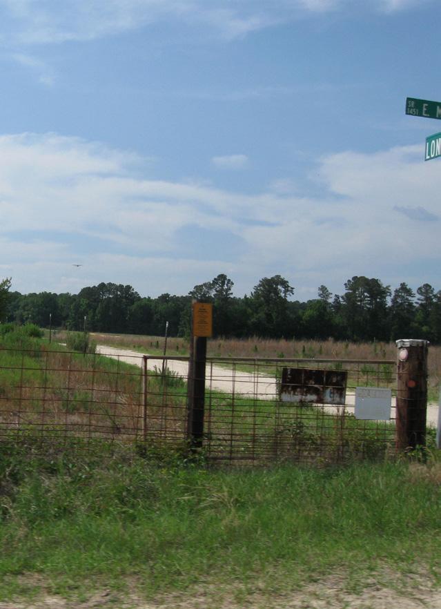


Permanent camping facilities at Long Valley Farm will include group camping located in the northern pasture, past the day-use area at the millpond, as seen in Figure 9.4. A gated natural surface road will extend from the park ing at the millpond for access, and terminate with a small parking area for 45 vehicles. The north pasture tobacco barns could serve as the location for restroom and shower facilities. From this location, a trail will take park visitors north to longleaf pine restoration areas.
The historic buildings at the Farm Seat include the Farm Seat or “Rockefeller House,” the Spring House, a Granary, the Mill Pavilion and Pump House, and the Mill House and gates. A complete list of structures and buildings at Long Valley Farm to remain can be found in Appendix B. A brief synopsis of the structures and their expected interpretive function is listed below:

• Farm Seat – This will be the site of a Visitor Contact Station, and the Rock efeller House will be restored to include office space, storage, a working kitchen, rental/meeting space, as well as restrooms on the main level. The existing floor plan of the house should be maintained as much as pos sible to keep the integrity of the building intact. The two largest spaces on the main floor, the former dining room and living room of the house, will serve as meeting/rental spaces. The courtyard between the two wings can serve as an outdoor space for parties or gatherings. The kitchen area will be restored as well. Exhibits and artifacts about Robert Wall Christian, James Stillman Rockefeller, Overhills, World War Two connections to the property, and Fort Bragg will be on display in the halls and in the two rental/meeting spaces. An office space and public restrooms will also be located on the main floor. Park staff will be able to see approaching visi tors through windows in the office. The second story can be utilized for storage and additional office space. Visitors can relax on the shady front porch overlooking the millpond or under the shade of the historic oaks and magnolias surrounding the house.
• Spring House – The Spring House will be preserved for its scenic quality and visitors will also learn about ways food was stored prior to electricity.

• Mill Pavilion, Dam Gates and Pump House – These structures are the oldest structures on the farm, although they were modified by the Rock efellers after they purchased the property. The Mill Pavilion would be re stored to be used for rentals, as a stage, as an outdoor classroom, and for scenic interpretation. The Pump House would be used for storage. Large groups of people can be accommodated in the Mill Pavilion, and it will be a popular rental spot for those who appreciate the views across the millpond and the sounds of rushing water. This is an ideal location for special events such as weddings, folk music festivals, and reunions. The McDiarmid family history and the history of Ardnave Plantation will be interpreted at this structure.
• Mill House and gates – The Mill House and gates will receive a historical quality renovation, but will not be restored to a functioning level. School groups and other visitors will enjoy learning about mill technology and seeing examples of milled products. Interpretive displays about the im portance of a mill in rural society will be located inside the building.

• Worker’s House #1 – This building will house exhibits and displays about daily life of the community of workers on the farm. Exhibits will be view able from the exterior through windows and doorways only.

• Worker’s House #4 – This building will serve as either a ranger residence or an artist-in-residence.

Interpretive trails at the Farm Seat should be fully ADA accessible with areas for resting and include a combination of signs, displays, and actual objects that can be touched and explored. Boardwalks and overlooks will be located to take advantage of the incredibly scenic and ecologically significant cypress pond. The trails will focus on historical as well as ecological topics, such as mill technologies, reuse of building materials, sustainability in early farm opera tions, the longleaf pine ecosystem, woodland edge and meadow wildlife habi tat, Ardnave Plantation, historic vegetation, the importance of naval stores, and the history of recreation at Long Valley Farm.


At the terminus of the main park entrance drive, the visitor will turn right to continue to the Agricultural Complex, a collection of structures that highlight the rich agricultural history of the property. Views of the silo, farm buildings and farm fences across warm season grasses will visually lead the visitor to the parking area located near the Great Barn. From this point, the visitor will approach the farm and encounter an informational kiosk displaying maps of the Agricultural Complex as well as interpretive information. Interpretive trails circle the Agricultural Complex and connect to the rest of the park trail sys tem. There will be a 80-space parking lot that will also allow for a bus drop-off.

Overflow parking will be accommodated in a turf area to the south of the park road for special events. A ten-space equestrian parking lot and restroom for equestrian us ers is located past the Agricultural Complex, and the trail head for the main multi-use trail that connects the entire park is sited here.


The Agricultural Complex (see Figure 9.5) is comprised of 14 historic and non-historic farm buildings, interpretive trails, a restroom, meadows, and a garden. The entire Ag ricultural Complex will be used to tell the story of Long Valley Farm, and how it evolved from Ardnave Plantation into the gentleman’s farming enterprise as it exists today. Visitors will learn about daily life on a farm, the people who lived and worked here, and about farming practices then and now. Figure 9.6 shows equestrian parking near the Agricultural Complex. A complete list of structures and buildings at Long Valley Farm to remain can be found in Appendix B. A brief synopsis of the structures within the complex and their expected interpretive function is listed below:
• The Great Barn – The Great Barn is the focal point of the Agricultural Complex and is the first building that visitors will experience when arriving to this area by

car or bus. The open air barn will accommodate large groups of school children and other visitors who will learn from educational exhibits and panels inside. Exhibits include vintage farm implements which will be placed in the rafters and along the walls, and display panels about farm animals and crops.
• Forge and Commissary – During special events, school groups and other visitors can view blacksmithing demonstrations at the Forge. The Com missary will be restored and stocked with supplies that would have been common when the farm was in operation. Visitors will learn about farm family relationships and community. External viewing only.
• Silo, Silo Shed, and Grain Bin – These iconic structures of the farm provide a strong scenic value to the farm. The Silo Shed will become a shelter for educational groups and an outdoor classroom while they learn about silage and grain. Stories from the local community could be remembered here and displayed on panels. Internal and External viewing.

• Hay Barn and Equipment Barn – An indoor primitive classroom area will be located in the Equipment Barn. Both buildings offer a scenic and pas toral quality where they are sited in the open meadow, and can be used for storage for large events. Internal and External viewing.
• Granary and Pack House – The Granary will have internal exhibits and displays about grain storage. The Pack House will have internal exhibits about tobacco storage. Both interpretive displays will be seen through the doorway and windows only. The shed roofs on both buildings will serve as small shade shelters for individual picnic sites or benches.
• Tractor Shed and Fertilizer House – The Tractor Shed will house antique farm equipment, vehicles, and other machinery for interpretation. Dur ing special events, the farm equipment, vehicles, and machinery can be brought into the adjacent field for interactive learning sessions. The Fer tilizer House will offer scenic value along the entry road as an important member of the collection of farm buildings. External viewing only.
• Feeder Shed and Equipment Shed – The Feeder Shed has a 50 to 150-per son capacity, which works well for school groups or reunions. Learning stations can be set up in the shelters that school groups use for organized activities. The Equipment Shed will be renovated to become a restroom.
• Garden – A small garden tended by volunteers will allow children to see, smell, touch and taste actual farm products that were once cultivated here. Another opportunity would be to rent some garden plots out to local citizens. Exhibits about scientific farming will explore Robert Wall Christian’s influence on the farm.
• Meadow – The open meadow in the center of the Agricultural Complex includes some areas that are mown regularly and some areas that are mown once or twice a year to maintain the scenic quality of the farm. The meadow will be a wonderful place for open play, family picnics, and large group activities.

The State Historic Preservation Office has identified the following structures as having contributing historic resources to Long Valley Farm: Farm Seat Ga rage, Garage/Shop, Water Tower Pump House, Overseer’s House, Worker’s House #2, Worker’s House #2 Garage, and Main Path Tobacco Barn #2. These resources will be considered for retention and restoration on a case-by-case basis as the park is developed.
Interpretive trails at the Farm Seat should be fully ADA accessible using univer sal design concepts with areas for resting and include a combination of way sides, signs, displays, and actual objects that can be touched and explored. Interpretive trails will include information about historic structures, meadow insects, woodland edge habitat, the North Carolina Ecosystem Enhancement Program project and stream restoration, sustainable farming practices, sci entific agriculture as well as many other topics. A spur trail into the NCEEP restoration area will offer several interpretive opportunities to the public.

A trailhead off of McCormick Bridge Road will be the location of parking for 30 vehicles and eight equestrian trailer parking spaces, as shown in Figure 9.7. The trailhead would serve the multi-use trail that is the mid-point between Long Valley Farm and the Sandhills Section. The development of this area is land dependent.
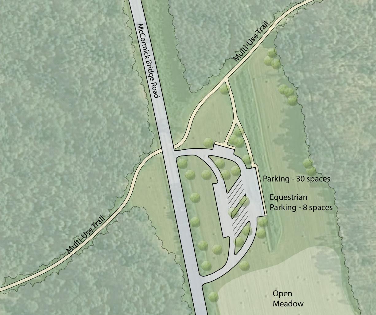
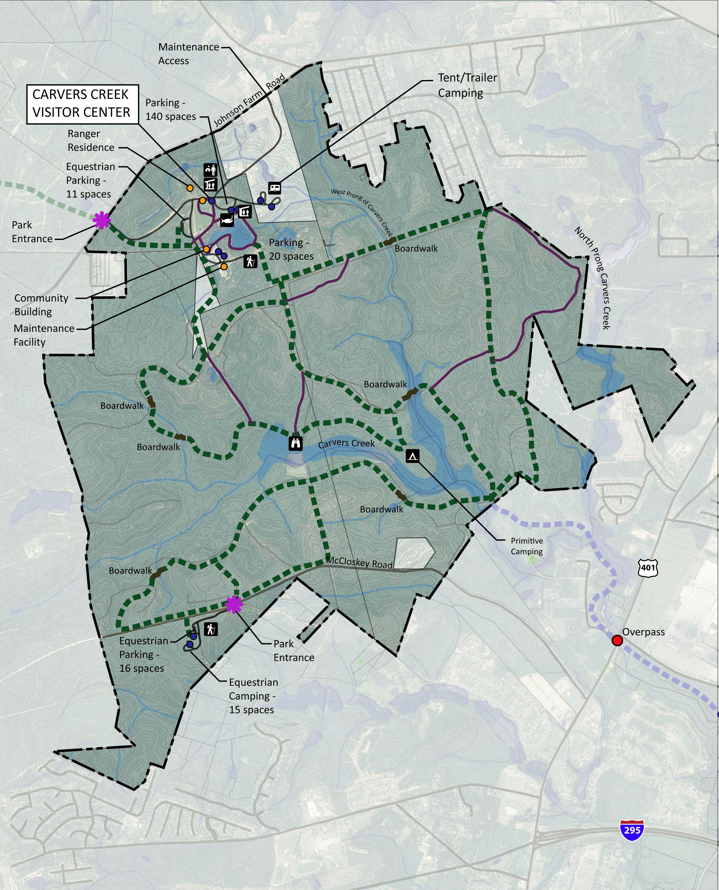

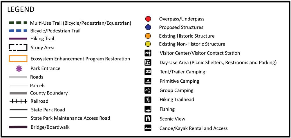
The Sandhills Section is centrally located within Carvers Creek State Park and is the location of the Visitor Center and an existing house that will become the Community Building. The park entrance is on Johnson Farm Road, and the in ternal circulation of roads and trails will link new park facilities and recreation al activities. A secondary park entrance is located off of McCloskey Road to the south, where a second equestrian parking lot is located with a long term plan to include equestrian camping facilities. The main entrance utilizes the existing driveway corridor to reduce the need for clearing and grading. The road winds through existing trees and as the park visitor rounds a curve, the existing large rustic barn and the new Visitor Center comes into view across an open meadow. This main drive continues to the Visitor Center, the accessible fishing pier at the pond edge, shelters and restroom, and the camping areas. Another park road turns south before the meadow to the equestrian trailer parking lot, the Community Building, the trailhead parking lot, and primitive camping access points.


Recreational activities, such as primitive and tent/trailer camping, fishing, equestrian and pedestrian trail access, picnicking, hiking, and open play, are included at the Sandhills Section. Interpretation of the Sandhills ecosystem will be the key focus of the site. See Figure 9.8 for the overall plan for the Sandhills Section.
The architecture of the new Visitor Center will be inspired by existing and typ ical Cumberland County farm buildings. The building will be designed using green building strategies with Leadership in Energy and Environmental Design (LEED®) certification as a goal. Green building techniques, such as daylighting, ventilation, solar power, and stormwater reuse, will offer additional interpre tive opportunities for visitors. The Visitor Center can be a teaching facility for citizens in the community about ways to implement environmentally friendly features in their homes and neighborhoods. Exterior spaces around the build ing will allow for staging of school groups and outdoor classrooms. Interior spaces will include exhibit spaces, auditorium, concession, gift shop, small meeting room and classroom, restrooms, reception area and offices, as well as storage and mechanical areas. A drop off and 70 parking spaces are located adjacent to the Visitor Center. Overflow parking and parking for the accessible fishing pier, restroom, and two shelters totals another 70 spaces. Figures 9.9 and 9.10 show the Visitor Center and camping facilities at Sandhills.
Because the park will include both the Visitor Center and the Community Building, the building footprint of the Visitor Center can be smaller. Some functions that ordinarily would be located in the Visitor Center, such as large meeting spaces and storage, will be located at the Community Building in stead. The following is a list of the existing buildings and structures that will remain at the park:
• Community Building - The existing house will be renovated to become
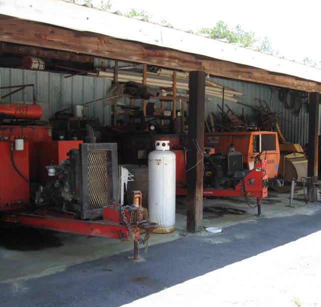


a community building that will include meet ing space, exhibit space, storage, and restrooms. Parking can accommodate 58 spaces. Scenic views across the pond will make this a popular rental space as well. Murals and artwork representing the Sandhills can be shown inside. The public could enjoy traveling exhibits and events such as wildlife photography, and acoustic music and guest speak ers. An interpretive boardwalk, the pond shelter, and two picnic shelters will surround the Commu nity Building.
• Maintenance Facility - The existing maintenance buildings will remain to form the basis for a large maintenance facility for Carvers Creek State Park. Additional fencing and screening will be needed to keep the area secure and obscured from view.


• Barn - The existing barn will be restored to serve as a rental space for large family gatherings, com munity classes, nature and art exhibits, school groups, and storage. The Barn and the Visitor Cen ter will relate to one another architecturally and the open space between the two structures will be used by school groups and other visitors.

Camping facilities at Sandhills include tent and trailer camping and primitive camping. Two loops of tent and trailer camping offer 61 campsites, complete with two restrooms, two pump stations, and parking areas. Campsites will be sited to take advantage of scenic views of existing vegetation, the small pond, and meadows. See Figure 9.10. Primitive camping facilities are located in a more secluded area, in a peninsula of land surrounded by Carvers Creek.
• Interpretive trails at the Sandhills Section should be accessible and have areas for resting. Boardwalks and overlooks take advantage of the lake and creek ecosystem. The ecological focus of the Sandhills will be ex pressed by the interpretive displays and exhibits. The longleaf pine eco system, fire ecology, forest restoration and management, plantation pine restoration, land stewardship, and water quality studies are all appropri ate interpretive opportunities for the Sandhills Section.
• Equestrian parking and equestrian camping facilities are planned off of McCloskey Road. The facility will include 16 campsites, a restroom, dump station, and parking area. See figure 9.11.

The Cape Fear River Section is located at the eastern edge of the park, ad jacent to the Cape Fear River. The park entrance is located on Carvers Falls Road and the internal road circulation follows existing roads. A ranger resi


dence will be located in one of the existing houses on the property. The park entrance drive will extend past the ranger residence to a day-use parking area for 20 vehicles. The day-use area includes a restroom, picnic shelter, and trail head. Carvers Falls and the Cape Fear River will be accessible by trails. The main trail will extend through the site and end in a long loop at the Cape Fear River. Two river overlooks will be located along the river, as well as a primitive canoe/kayak camping area. See Figure 9.12 for the overall plan for the Cape Fear River Section.
Activities that will be offered at the Cape Fear River Section include enjoying scenic views of Carvers Falls and the Cape Fear River, fishing, bicycling, canoe/ kayak access and camping, hiking, open play, interpretive trails, and picnick ing. Figure 9.13 shows the plan in more detail.


Natural resource protection, sustainability, accessibility, and connectivity are the primary goals of trail development within the park. Because the park is located in a rapidly developing area, connectivity to other parks and trail sys tems on a state, regional and local level is crucial for the success of this state park. In this master plan, a conceptual network of trails with different levels of intensity is shown. Maps and text represent an approximation of trail layout and design. On-site field verification and sustainable planning practices will be used to determine actual trail system design and construction.
A multi-use trail for equestrians, bicyclists, and pedestrians spans the length of the park. A portion of this trail from the Sandhills Section southeastern boundary to the Cape Fear River is not acceptable for equestrian use. With two on-grade road crossings on busy roads, such as US 401 and the Norfolk Southern Railroad, the consultant and the N.C. Division of Parks and Recre ation staff determined that equestrian road crossings were not appropriate. Nonetheless, this main trail will connect the major facilities in the park for bicyclists and pedestrians from Long Valley Farm to the Cape Fear River.

Other trails will include pedestrian and bicycle trails, interpretive trails, and natural surface trails in less developed areas. Whenever possible, existing trails, farm roads, and fire maintenance access roads will be used for trail alignments in order to reduce the need for clearing. The trail network will include trails that are accessible for visitors that have mobility and other im pairments to allow for use by a broad range of park visitors. Trail signs and in terpretive waysides along trails will be placed in areas with educational infor mation about the natural environment as well as historical interpretation. In highly sensitive areas, such as wetlands and stream corridors, boardwalks and overlooks will be built to allow park users another way to experience the site.
With a network of a variety of trails, users will be able to design their park experience to utilize trails that suit their level of accessibility, agility, and time availability. See Figure 9.14 for the trail network planned for Carvers Creek State Park.
• Approximately 22 miles of multi-use trails (equestrian/bicycle/pedestri an)
• Approximately four miles of bicycle/pedestrian trails
• Approximately eight miles of hiking trails
• Pedestrian underpass at NC 210 and I-295

• Road crossing at McCormick Bridge Road and Johnson Farm Road
• Pedestrian overpass at US 401
Multi-use trails will be developed in corridors that are capable of supporting a broader range of users and will be designed to accommodate pedestrians, cyclists, and equestrians. On-site field verification will provide information to determine width, surface and proper sight lines to ensure user safety and reduce conflict.
This type of trail will be developed in corridors that are capable of supporting bicycle and pedestrian uses. On-site field verification will provide information to determine width, surface and proper sight lines to ensure user safety and reduce conflict between types of users.
The water supply for Long Valley Farm will be provided by a six-inch water ex tension off an existing 24-inch line owned by Harnett County. The six-inch wa ter line would provide a loop for fire suppression and potable water through the farm area and reconnect on the east side of the millpond to an existing line running to Fort Bragg.
The sanitary sewer for this portion of the park will be provided by septic sys tems which will need to be approved by Cumberland County. If construction of the water line extension were delayed, then the existing five wells on the site could be used as a water supply.
The water supply for the Sandhills Section will require an extension of the existing Harnett County water line for approximately one mile to the park en trance drive. An additional 1.5 miles of water line would be required through the park for fire suppression and potable water use. No sewer is available at this time, so and septic systems would be utilized.
Power will be supplied by Progress Energy, utilizing the lines that are already serving the existing buildings within the park.
• Day-Use Development – Phase I $1,103,000
• Day-Use Development – Phase II $2,488,000
• Farm Seat Renovation $2,358,505
• Group Camp $473,250
• Agricultural Complex Renovation $1,284,000
• Multiuse Trailhead and Trail Improvements $640,000
• Maintenance Area Improvements $85,400
Total for Long Valley Farm $8,432,155
• Multiuse Trailhead and Trail Improvements $1,190,000
• Equestrian Campground $1,340,500
• McCormick Trailhead – land dependent $183,750
• Visitor Center and initial site development $6,083,000
• Maintenance Area Improvements $1,161,500
• Community Building and Day-Use – land dependent $1,087,500
• Tent and Trailer Campground – Loop 1 – land dependent $1,857,500
• Tent and Trailer Campground – Loop 2 – land dependent $1,461,500
• Ranger Residence $240,000
Total for Sandhills Section $14,605,250
• Cape Fear River Section Trail Connection – land dependent $2,135,000
• Cape Fear River Section Development – land dependent $2,698,000
Total for Cape Fear River Section $4,833,000
Total for entire park development: $27,870,405
The N.C. Department of Environment and Natural Resources’ Green Building Policy, drafted by the N.C. Department of Environment and Natural Resources Sustainability Team and signed by Secretary Bill Ross, directs the department and its divisions “to take real and permanent steps to integrate sustainable and green building practices for projects in capital construction, facility reno vations, facility leasing, land development, landscaping and facility purchas es.”
All components of the master plan have been evaluated and designed based on principles of sustainable design/green design with reference to the Lead ership in Energy and Environmental Design (LEED®) design criteria. LEED® is a rating system for green design first developed in 1999 by the US Green Build ing Council (USGBC). According to the USGBC, “Green design not only makes a positive impact on public health and the environment, it also reduces op erating costs, enhances building and organizational marketability, potentially increases occupant productivity, and helps create a sustainable community” (USGBC, 2005).
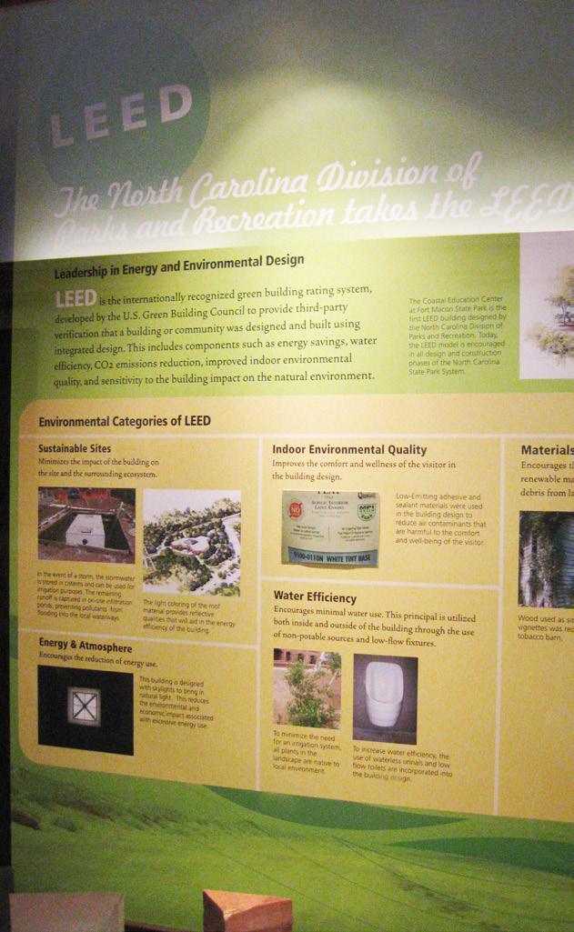
Though a project does not have to be rated through the LEED® system to be considered ‘green,’ the system provides a well-defined baseline from which to begin conversations in design regarding how to develop any new construc tion project or major renovation in a manner that will be sustainable. The N.C. Division of Parks and Recreation staff directive states, “The Division is to pursue LEED® certification through the US Green Building Council’s LEED® Green Building Rating System for all new, or significantly renovated, buildings having 5,000 square feet or more. For buildings less than 5,000 square feet, project team members are to be familiar with the use of LEED® as a tool to help guide the project.”
Much of the LEED® system is focused on structures and will be addressed more thoroughly at later design and development phases for buildings.
LEED® accreditation is based on six areas of sustainability. These include sus tainable site, water efficiency, energy and atmosphere, materials and resourc es, indoor environmental quality, and innovation and design process. They are:
For this master plan, specific attention has been focused on selection of sus tainable sites for future development. Site selection for buildings and parking areas has been based on areas with the following qualities:
• Slopes less than 10 percent
• Areas more than 50 feet from a water body (construction should not take place within a 100 feet buffer from perennial streams whenever practi cable)
• Areas more than 100 feet from a wetland as defined by the National Wet lands Inventory *
* Further design and development will re quire evaluation for wetlands based on 40 CFR Parts 230-233 and Part 22.
Chapter 10: Sustainable Design in State Park Master Planning
Other focus areas for sustainable sites, elaborated on below, include:
a) Reduce imperviousness
b) Conserve natural resources and ecosystems
c) Maintain natural drainage courses
d) Reduce use of pipes for stormwater management
e) Minimize clearing and grading
2) Minimize soil erosion, waterway sedimentation, and airborne particu late/dust generation during construction
3) Disperse stormwater management facilities/structures uniformly across a site

4) Mimic natural systems for stormwater quality control
5) Minimize heat island effects
6) Minimize light pollution
During the design and construction phases of any project in the park, spe cial attention will be focused on protecting the site from sedimentation, soil erosion, as well as airborne particulate/dust generation during the construc tion process. Use of best available technology for sedimentation and erosion control is critical. Devices and structures used for sedimentation and erosion control will be maintained in good working condition at all times during con struction.
Appropriate design for stormwater is important in maintaining a sustainable site. Not only should stormwater design meet state and local codes, it should go beyond these regulations to ensure stormwater quality as the water reenters the surface and subsurface water cycles. Water quantity controls will minimize the potential for downstream flooding and erosion from site devel opment in the future. Water quality controls, performed by structures such as bioretention areas, will help to maximize sequestration of pollutants to the site of creation as well as protect areas downstream from these pollutants. All stormwater should flow through a vegetated upland prior to entering a stream or wetland (N.C. Wildlife Resources Commission, 2002).
During construction, all equipment will be kept out of streams as much as practicable. Also, utility lines and infrastructure will be installed outside of stream buffers.
The heat island effect is defined by USGBC as “thermal gradient differenc es between developed and undeveloped areas” (USGBC, 2005). This effect can have negative impact on microclimates as well as human, animal, and plant habitats. Heat islands are most often caused by large areas of unshaded pavement and large roof areas. The master plan begins to address this issue through identification of overflow parking areas that use pervious and plant able materials. Additional attention can be focused on this issue in design and construction phases of a development project through, for example, provi
sion of ample shade in parking areas, use of high reflectance materials for paving (selected with attention to potential glare issues for those with visual disabilities), minimization of structure footprints and therefore roof areas, use of roofing materials with a high reflectance, and/or use of a vegetated roof.
Efficient use of water will be considered in every phase of a project for both the site and the buildings. Use of innovative wastewater technologies when possible and water use reduction, through the use of low-flow toilets, show ers and other means, also are considered sustainable design practices.
Use of cisterns to harvest rainwater from roof structures can provide water for uses including, but not limited to, landscape irrigation and toilet flushing.
During the design phase of any project at the park, sustainable design prin ciples will dictate design of water efficient landscaping, with an ideal focus toward landscaping requiring no potable water use and no irrigation beyond plant establishment.
Green building practices cost less to operate and maintain. They also provide an opportunity to use natural resources efficiently and responsibly and to re duce the site and building’s overall impact on the environment.
Buildings should be optimized for energy-efficiency, including siting buildings with an east-west axis, where practicable, to optimize for passive solar design and the use of broad roof overhangs to block mid-day summer sun. Use of on-site renewable energy sources where possible, including opportunities for solar energy, hydropower, and/or wind power, will make the development more self-sufficient and reduce economic and environmental impacts from fossil fuel use.
Energy-efficient heating and cooling systems, such as geothermal/ground source wells, use the constant earth temperature to heat and cool the work place.
It is recommended that passive solar design of the environmental education building and solar hot water design for wash houses be studied where prac ticable.
Another means of ensuring energy-efficiency as defined by LEED® includes increasing energy performance and commissioning of buildings to ensure that systems are designed and perform in an energy-efficient manner.
Sustainable design and construction ensures waste reduction through the de sign of the building and the construction process. When waste is produced, recycling should be a priority. Reuse of existing building material also should be prioritized. In the past, many of the buildings at Long Valley Farm were built of recycled materials from other buildings at the farm. This reuse of building products should continue as the park is developed.
Design for use of new building materials in the construction process should focus on those materials utilizing recycled content. When recycled content is not possible, products made from rapidly renewable products are desirable and resource friendly. Wood certified using the Forest Stewardship Council’s Principles and Criteria will promote sustainable forestry practices.
Ideally, materials will be sourced from producers and manufacturers in the surrounding region. A focus on indigenous materials can replicate a ‘local ver nacular’, minimize environmental impacts from transportation, and add to local economic prosperity.
A focus on indoor air quality enhances the health and experience of build ing occupants. There are many aspects of sustainable indoor air quality per formance that can be addressed by a qualified designer, such as adequate ventilation and use of low-emitting material selection (e.g. paints, sealants, adhesives, etc.). Indoor environmental quality also addresses issues related to lighting controls, thermal comfort, daylighting, and views.
Sustainable design practitioners can be precedent setters for new, innovative practices in design and construction of sites and buildings. The N.C. Division of Parks and Recreation can set guidelines for all new construction at Carvers Creek State Park based on successes displayed and monitored in other proj ects. The environmental education building proposed in this master plan will provide opportunities for educating the general public about the ecological, cultural, and economic benefits of green design and construction.
The N.C. Division of Parks and Recreation staff directive on sustainable and green building practices indicates a particular interest in sustainable and green building technologies that address the following:
• Ecological site design; on-site erosion control, water purification/pollu tion reduction, and stormwater management.
• Transportation; promoting bicycle, pedestrian, and transit use where pos sible.
• Waste reduction; building reuse, job site recycling, and efficient use of materials.
• On-site management of sewage and organic wastes, such as graywater systems and biological wastewater treatment. It is recommended that when the existing wastewater treatment facility at the park reaches the end of its useful life, that a more innovative system, potentially utilizing small constructed wetland systems be considered. This could provide a significant addition to the environmental education program as well.
• Energy efficiency; efficient thermal envelopes, efficient space and water heating, lighting, controls and monitoring, and appliances.
• Renewable energy; photovoltaics, geothermal pumps, and wind turbines.
• Water efficiency, both domestic and irrigation, including rainwater har vesting for irrigation and toilet flushing. Consider waterless urinals in all applications.
• Materials and resources; durable building envelopes and long-lived mate rials or assemblies, recycled-content materials, safer, less toxic materials, such as alternatives to CCA-treated wood, innovative application of nat ural materials (characterized by low embodied energy, local availability, good performance, biodegradable, safe, aesthetic), such as straw, earth, and other composites.
• Indoor environmental quality; pollution reduction, worker and occupant safety, air cleaning, humidity control, and thermal comfort.
• Operations and maintenance; monitoring energy, water, waste, air qual ity, and transportation use along with resource-efficient operation prac tices.
The Sustainable Sites Initiative is a new set of guidelines and benchmarks to be used exclusively for site development. SITES® is a joint venture of the Ameri can Society of Landscape Architects, the Ladybird Johnson Wildflower Center and the US Botanic Garden along with numerous diverse stakeholders. In the pilot program at this time, the new rating system will measure nine areas of site development for up to 250 points for site related sustainability measures. The nine areas of review include Pre-Design Assessment and Planning, Site Design – Water, Site Design – Soil and Vegetation, Site Design – Materials Selection, Site Design – Human Health and Well Being, Construction, Opera tions and Maintenance, and Monitoring and Innovation. The nine areas focus on the following twelve ecosystem services: global climate regulation, local climate regulation, air and water cleansing, water supply and regulation, ero sion and sediment control, hazard mitigation, pollination, habitat functions, waste decomposition and treatment, human health and well being benefits, food and renewable non-food products, and cultural benefits.
It is recommended that the N.C. Division of State Parks follow the Sustainable Sites Initiative guidelines, as well as seek certification for Carvers Creek State Park as further site development occurs.
Chapter 10: Sustainable Design in State Park Master
An important consideration in building design and renovation is to accommo date life safety and security needs. This becomes more complex when dealing with historic structures. Since most historic structures were built before the existence of building, electrical, HVAC, and accessibility codes, they often do not provide adequate life safety and security measures based on today’s stan dards. Extra efforts must be taken to preserve the historic nature of the struc ture while still providing appropriate, safe facilities. Since historic structures are all unique, careful planning and coordination between many disciplines must take place to ensure that life safety and security needs are met, while still maintaining the historical integrity of the structure.
Building, life safety and security codes provide security and protection for the structure and its occupants. They are intended to protect the health, safety and welfare of all human occupants while additionally protecting the integrity of the historic structure. These codes set minimum requirements for struc tural, physical, environmental and safety items related to the structure. Com mon issues that must be addressed include:
• Building egress
• Fire and smoke detection and separation
• Fire suppression
• Emergency exits
• Accessible ramps, handrails and other items to provide equal access for those with disabilities.
The protection of building occupants is always the top priority, but when deal ing with historic structures, the protection of historically significant structures and assets must also be considered.
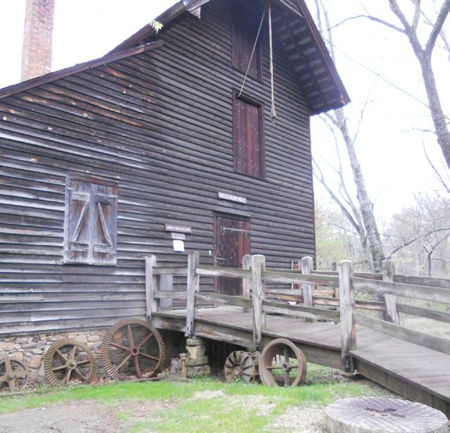
The Americans with Disabilities Act (ADA) is a civil rights legislation that pro hibits discrimination against those with disabilities. Since most historic struc tures were not designed to be accessible, extensive retrofitting is often re quired in the form of ramps, wider doorways, accessible restroom stalls and handrails. Buildings meant to be viewed externally will also need accessible paths to windows and doors if indoor exhibits are to be installed for viewing.
A change of building use typically means the entire structure must be up graded to meet current code requirements. The goal is to blend all retrofits into the style of the building in order to keep the additions as unnoticeable as possible, or to make them appear as if they have always been a part of the structure. Due to the uniqueness of each historic structure, each case should be looked at separately in order to mimic the style and building techniques used during the original construction.
Each structure should be looked at holistically with the knowledge that all structures will require a unique plan of action. Careful planning and coordi nation between many disciplines including park staff/facility managers, the North Carolina State Historic Preservation Office (SHPO), designers and code officials is necessary to address the issues successfully. During building retro
fits, it may be necessary for the plans to accommodate important life safety and security issues, such as locating egress ramps or installing fire/security equipment in concealed locations.
The architectural assessment by Ellen Cassilly (Appendix B) and the FCAP (Ap pendix E) prepared by the State Construction Office found many related is sues after review of the historic structures at Long Valley Farm. These issues include replacement of obsolete electrical, mechanical, plumbing, and HVAC Components, asbestos abatement, and lack of accessible entrances.
§ 113-44.7. Short title.
This Article shall be known as the State Parks Act. (1987, c. 243.)
§ 113-44.8. Declaration of policy and purpose.
(a) The State of North Carolina offers unique archaeologic, geologic, biological, scenic, and recreational resources. These resources are part of the heritage of the people of this State. The heritage of a people should be preserved and managed by those people for their use and for the use of their visitors and descen dants.
(b) The General Assembly finds it appropriate to establish the State Parks System. This system shall consist of parks which include representative examples of the resources sought to be preserved by this Article, together with such surrounding lands as may be appropriate. Park lands are to be used by the people of this State and their visitors in order to promote understanding of and pride in the natural heritage of this State. (c) The tax dollars of the people of the State should be expended in an efficient and effective manner for the purpose of assuring that the State Parks System is adequate to accomplish the goals as defined in this Article. (d) The purpose of this Article is to establish methods and principles for the planned acquisition, development, and operation of State parks. (1987, c. 243.)
§ 113-44.9. Definitions.
As used in this Article, unless the context requires otherwise:
(1) “Department” means the Department of Environment and Natural Resources. (2) “Park” means any tract of land or body of water comprising part of the State Parks System under this Article, including existing State parks, State natural areas, State recreation areas, State trails, State rivers, and State lakes.
(3) “Plan” means State Parks System Plan.
(4) “Secretary” means the Secretary of Environment and Natural Resources. (5) “State Parks System” or “system” mean all those lands and waters which comprise the parks system of the State as established under this Article. (1987, c.243, s. 1; 1989, c. 727, s. 218(50); 1989 (Reg. Sess., 1990), c. 1004, s. 19(b); 1997-443, s.
11A.119(a).)§ 113-44.10. Powers of the Secretary.
The Secretary shall implement the provisions of this Article and shall be responsible for the administration of the State Parks System. (1987, c. 243.)
§ 113-44.11. Preparation of a System Plan.
(a) The Secretary shall prepare and adopt a State Parks System Plan by December 31,1988. The Plan, at a minimum, shall:
(1) Outline a method whereby the mission and purposes of the State Parks System as defined in G.S. 113-44.8 can be achieved in a reasonable, timely, and cost-effective manner;
(2) Evaluate existing parks against these standards to determine their statewide significance; (3) Identify duplications and deficiencies in the current State Parks System and make recommendations for correction;
(4) Describe the resources of the existing State Parks System and their current uses, identify conflicts created by those uses, and propose solutions to them; and (5) Describe anticipated trends in usage of the State Parks System, detail what impacts these trends may have on the State Parks System, and recommend means and methods to accommodate those trends successfully.
(b) The Plan shall be developed with full public participation, including a series ofpublic meetings held on adequate notice under rules which shall be adopted by the Secretary. The purpose of the public meetings and other public participation shall be to obtain from the public:
(1) Views and information on the needs of the public for recreational resources in the State Parks System;
(2) Views and information on the manner in which these needs should be addressed;
(3) Review of the draft plan prepared by the Secretary before he adopts the Plan.
(c) The Secretary shall revise the Plan at intervals not exceeding five years. Revisions to the Plan shall be made consistent with and under the rules providing public participation in adoption of the Plan. (1987, c. 243.)
§ 113-44.12. Classification of parks resources.
After adopting the Plan, the Secretary shall identify and classify the major resources of each of the parks in the State Parks System, in order to establish the major purpose or purposes of each of the parks, consistent with the Plan and the purposes of this Article. (1987, c. 243.)
§ 113-44.13. General management plans.
Every park classified pursuant to G.S. 113-44.12 shall have a general management plan. The plan shall include a statement of purpose for the park based upon its relationship to the System Plan and its classification. An analysis of the major resourcesand facilities on hand to achieve those purposes shall be completed along with a statement of management direction. The general management plan shall be revised as necessary to comply with the System Plan and to achieve the purposes of this Article. (1987, c. 243.)
§ 113-44.14. Additions to and deletions from the State Parks System.
(a) if, in the course of implementing G.S. 113-44.12 the Secretary determines that the major purposes of a park are not consistent with the purposes of this Article and the Plan, the Secretary may propose to the General Assembly the deletion of that park from the State Parks System. On a majority vote of each house of the General Assembly, the General Assembly may remove the park from the State Parks System. No other agency or governmental body of the State shall have the power to remove a park or any part from the State Parks System.
(b) New parks shall be added to the State Parks System by the Department after authorization by the General Assembly. Each additional park shall be authorized only by an act of the General Assembly. Ad ditions shall be consistent with and shall address the needs of the State Parks System as described in the Plan. All additions shall be accompanied by adequate authorization and appropriations for land acquisition, development, and operations. (1987, c. 243.)
Appendix A: State Parks Act
* denotes National Register of Historic Places contributing buildings/structures
** denotes buildings/structures built during Robert Wall Christian’s occupancy
+ The State Historic Preservation Office has identified the following structures as having contributing historic resources to Long Valley Farm: Farm Seat Garage (#3), Garage/Shop (#20), Water Tower Pump House (#35), Overseer’s House (#39), Worker’s House #2 (#42), Worker’s House #2, Garage (#45), and Main Path Tobacco Barn #2 (#50). These resources will be considered for retention and restoration on a case-by case basis as the park is developed.
Structures and Buildings at Long Valley Farm to Remain (31 total)
* (1) Farm Seat (1937-1938) restored to include exhibit space, visitor contact station, office space, meeting room, rental, storage, working kitchen and restroom. Exhibits about Robert Wall Christian, James Still- man Rockefeller, Overhills and Fort Bragg will be displayed. Existing historic vegetation and fences to re- main.
**(2) Spring House (1914) maintained for scenic quality and interpretation. Exhibits about food storage prior to electricity.
*(8 &9) Mill Pavilion and Dam Gates (1850-1860, 1920) restored for rental use, stage, outdoor classroom, sce- nic interpretation, 200 person occupancy.
*(10) Pump House (1938) external viewing only, scenic, storage.
*(12) Mill House and Gates (1938-1940) historical quality renovation, but non functioning equipment, controlled tours only. Displays and exhibits about mill technology and the importance of mills in rural society. McDiarmid millstones are located within the building.
**(41) Worker’s House #1 (1914) Open for controlled views only the interior will house exhibits that will show the day to day life of a farm manager’s family and daily life on a farm.
(46) Granary (1944) external viewing only, scenic value Sally Henry Life estate
*(51) Worker’s House #4 (1925; 1962-64) Ranger Residence or artist-in-residence
*(52) Workers House #4 Garage (1930s) Storage for Ranger Residence or artist-in-residence Agricultural Complex
*(15) Granary (1940) internal exhibits and displays about grain storage, viewed from doorway and windows, informal picnic area under shed roof, storage.
(16) Tractor Shed (1950) noteworthy door hardware mechanism. Storage of antique farm equipment and other machinery for exterior viewing only.
*(17) Pack House (1940) internal exhibits about tobacco, viewed from doorway and windows, informal picnic
Appendix B: Structures and Buildings At Long Valley Farm Assessment of Existing Structures at Long Valley Farm
area under shed roof. Building materials from the Christian House were reused when this building was constructed.
**(18) Forge (1914) internal exhibits, visitors may walk through.
**(19) Commissary (1914) internal exhibits relating to farm communities and farm stores, viewed from door way and windows.
*(21) Fertilizer House (1942) scenic, exterior viewing only
(25) Equipment Shed (1955) renovated to become a restroom.
*(26) Great Barn (1940) Open air rental pavilion with concrete slab. Approximately 250 person capacity. En try point for all visitors to the Agricultural Complex, indoor and outdoor educational exhibits about farm animals, crops and farm implements.
(27) Feeder Shed (1952) Picnic Shelter. Approximately 50-150 person capacity for school groups or re unions.
*(28) Equipment Barn (1940) scenic value, storage, indoor primitive classroom.
*(29) Hay Barn (1940) agricultural interpretation, scenic, storage for events.
(30) Silo (1966) iconic structure of the farm, agricultural interpretation, exterior viewing, exhibits, scenic
(31) Silo shed (1966) Agricultural interpretation relating to cattle and silage exhibits, scenic, shelter. Ap- proximately 125 person capacity.
(32) Grain Bin (1976) scenic, exterior viewing, controlled viewing of inside only.
(33) New Farm Manager’s House Park Ranger Residence (currently occupied)
*(34) Water Tower (1940) Scenic value only
(38) Storage Shed (1945) Maintenance Complex, storage.
*(47) Pack House (1940) scenic value, event storage
**(49) Main Path Tobacco Barn #1 (1925) scenic value, exterior viewing only.
*(57, 58) North Pasture Tobacco Barns 1 and 2 (1939-1940) scenic value and interpretation, renovated to become a restroom and shower facility for group camping area.
*+(3) Farm Seat Garage (1939) Investigate if materials can be reused or recycled
(4) Woodshed (1976) Demolish
(5) Kennel (1980) Demolish
Appendix B: Structures and Buildings At Long Valley Farm Assessment of Existing Structures at Long Valley Farm
Carvers Creek State Park Master Plan
(6) Boathouse built with materials from old mule barn. Could be used as boat storage, other storage, sce- nic, material reclamation. Use materials for construction of new boathouse Recycle
(7) Gazebo (1985) Exact replica of gazebo built by Christian, rebuilt to match existing by Miles Williams. This structure could be documented by pictures, etc for exhibit, etc. prior to demolition.
Boardwalks replace with safe boardwalk, recycle materials from original boardwalk
(13) Farm Manager’s Residence (1970) Williams’s life estate Surplus
(14) Pump House (1970) (investigate if pump house can be utilized prior to demolition)
*+(20) Garage/Shop (1942) Investigate if materials can be reused or recycled
(22) Playhouse (1972) Demolish
(23) Cooler (1980) Demolish
(24) Cooking Pit (1980) Demolish
*+(35) Water Tower Pump House (1940) (investigate if pump house can be utilized prior to demolition)
(36) Hog Shelter/Feeding House (1966) Demolish
(37) Machine Shed (1969) Demolish
**+(39) Overseer’s House (1914) Investigate if materials can be reused or recycled
(40) Overseer’s House Garage (1970) Demolish
**+(42) Worker’s House #2 (1914) Sally Henry Life estate, investigate if materials can be reused or recycled
*(43) Worker’s House #3 Fragment (1925) Demolish
(44) Worker’s House #2 Pump House (1964) (investigate if pump house can be utilized prior to demolition)
*+(45) Worker’s House #2 Garage (1939) Investigate if materials can be reused or recycled
(48) Bulk Tobacco Barn (1970) external viewing only, scenic
**+(50) Main Path Tobacco Barn #2 (1925)
(53) Worker’s House #4 Pump House (investigate if pump house can be utilized prior to demolition)
(54) Worker’s House #5 (1947) Investigate if materials can be reused or recycled
(55) Worker’s House #5 Pack House (1968) Investigate if materials can be reused or recycled
(56) Worker’s House #5 Garage (1974 or 1975) Investigate if materials can be reused or recycled
Appendix B: Structures and Buildings At Long Valley Farm Assessment of Existing Structures at Long Valley Farm
Appendix
and
Valley Farm

Our method for creating this document was as follows:
1. We reviewed the documents given to us by the park service which included but is not limited to: - Development Options Checklist for Existing Structures Document # 59 (06.11.08) - National Register of Historic Places Document # 16 (12.20.93) - FCAP Plan Document #24 (3.9.09)
2. We met with Susan Hatchell and two park officials on site and discussed each building quickly to determine whether we would assess that structure specifically. A number of buildings were culled during this process for a number of reasons (see page 3: List of Structures Not Assessed for more information)
3. We went to each building took notes, assessing the physical condition, connection to utilities (water, power, etc.), its ADA accessibility, its possible uses and general relationship to the surroundings.
4. We compiled site photographs, notes, and information given to us from the park service and made an assessment of logical actions and repair costs necessary to allow new uses.
5. All building numbers reference back to the National Park Services original numbering system.
6. There are 29 contributing structures (see map on page 4) and 29 non-contributing structures (see map on page 5).
7. The maps on pages 6 & 7 show enlarged areas of the farm seat and agricultural complexes, respectively
As a general conclusion, given its location and existing historic structures (most notably the Long Valley Farm Seat (#1), the Mill Pavilion (#8,9), the Mill House and Gates (#12), the Great Barn (#26) and the Agricultural Complex) we feel there is significant potential for the site to become a unique addition to the park system which engages a broad spectrum of user groups from school children to families to military personnel.
Our analysis is a first step in that assessment of overall programming and thus we have given multiple suggestions for potential new uses whenever possible and appropriate. We do not preference one suggestion over another because each suggestion is equally possible and often requires the same cost. Therefore, this assessment should be utilized as a tool in a more specific and directed attempt to program the entire park. For instance, we made a map of the Farm Seat and Agricultural Complex which shows the occupancy limits of each building. This map can test possible scenarios and uses for that complex to begin organizing the arrangement of those uses most effectively. In other words, we have attempted to provide a thorough, clear, and concise summary of the buildings so that the park can do a rigorous cost-benefit analysis for its planning.
There could be a number of open-air educational, rental or camping shelters or depending on the eventual layout and maintenance plan, the facility might require one or multiple maintenance structures. Likewise, depending on the organizational/ staffing plan one or multiple staff offices might be required.
At this time the general direction we are headed is to have the agricultural complex be used as a collection of buildings for visiting school groups. The main Rockefeller house at the farm seat would have a more cultural/historical/museum emphasis. It could also be used as a rental locations for events such as weddings and family reunions.
1. Many of the structures have dirt floors and depending on the new use may require a poured in place concrete slab. A rough estimate of cost for providing this base concrete floor is $5.00 a square foot.
2. Occupancy numbers have been calculated for the structures within the Farm Seat and the Agricultural Complex and are denoted on the maps on page 6 and 7. Occupancy numbers deemed important for other structures are noted in the text.
3. The following are excepts from an email dated May 27, 2010 from Ted Hazen.
The records of the Campbell Water Wheel Company (1920-1960) are at the Hagley Museum and Library in the Soda House building in Greenville, Delaware. Mailing address: Hagley Museum and Library, PO Box 3630, Wilmington, DE 19807-0630 Phone: (302) 658-2400.
“The starting point to determine if a mill can be restored is an onsite inspection of the mill. I normally charge 40 dollars an hour or 350 a day, plus expenses (from Central Pennsylvania). Then I can put together as part of that charge a document to suit your needs.
There are only about 6 to 8 mills in the US that have been restored to look like they did in any part of there history. A number of mills have been restored incorrectly because of lack of proper knowledge or technical information. This has even happened as far back as the 1930’s when mill restoration began. The problem is you have this mindset of “replace in-kind” rather than rip it out and begin again.
My web site: Pond Lily Mill Restorations. I have supplied extensive, illustrated information on the history and technology of flour milling in America, and the restoration of watermills, with bibliography. There is over 78MB of information on such topics as: Old Mills & Mill Restoration; The History of Flour Milling in Early America; Oliver Evans & the Automation of Flour Mills in America; Millstone Dressing Tools; The Technology of Mills; Artifacts Found in Early American Mills; A History of the Fitz Water Wheel Company; A Miller’s Tale & Folklore of the Mill; Interpretation for Old Mills and Historical Places; The Millwright & His Trade; Historically: How to Site a Mill; Readings from the Miller’s Bookshelf & Additional Sources; The Reconstruction of Esom Slone’s Mill in Virginia’s Explore Park (now closed); A Guide to Old Mills and Mill Restoration; How to Construct a Traditional Wooden Water Wheel, and Water Wheel Albums; plus other additional useful information.”
Pond Lily Mill Restorations http://www.angelfire.com/journal/pondlilymill/index.html http://www.angelfire.com/journal/pondlilymill/menu.html
4.. Possible granting institutions, also from Mr. Hazen.
“I would try the Kellogg Foundation, all of the big flour mill companies foundations, like General Mills, Pillsbury, down to the Martha White and that flour milling company in Statesville, North Carolina. And don’t forget the Rockerfeller Foundation.
Basically you need a non-profit foundation 501(c), and have the site on the State and Federal Register of historic places. So in today’s world you might be better off to have some one form a “friends of the mill group” (with a non-profit status & cooperating agreement with the state), and have them apply for money rather than the state park system ask for money. “
Contributing: An integral part of a historic complex of buildings. While not all contributing structures are historically significant by themselves, each played an integral role in the daily functioning of the farm seat or agricultural complex.
Non-Contributing: A non-integral or latter addition to a historic complex of buildings which if removed would not detract from the historical significance of the site.
Pull-Out: Horizontal or vertical wood siding which has begun to come loose from the supporting structure and no longer fully protects the structure or sub-layers from weather.
Rot: Moisture damage to wood which causes it to break down and become structurally unsound and also no longer weather tight.
Rental Facility: Fully enclosed, conditioned space suitable for all season gatherings.
Scenographic: Contributes aesthetically to the surrounding complex of buildings and unless otherwise indicated would not be entered.
Scenographic - Educational: Contributes aesthetically to the surrounding buildings and also serves as a historical artifact of particular interest which can be used for teaching purposes.
Storage: Storing materials that need to be locked when not in use or are not used on a regular basis such as chairs, table coverings, lights, maintenance equipment and materials.
Visitor Contact Station: An ancillary park building that may serve a number of smaller or singular purposes such as: visitor information packets, bathroom facilities, water fountains, and staff offices and parking.
Artisan Studio: Rental studio used by a local artisan working in an appropriate medium and opened to the public during designated hours for educational purposes.
Educational: Has significant educational value that requires entering the structure, although portions of the inside can be cordoned off for controlled viewing and safety reasons.
Camping Shelter: Open-air shelter suitable for small groups of 2 -5 people camping overnight who have brought all necessary equipment other then a tent or other shelter
Maintenance: Structure for the storage of tools and equipment necessary to maintain the park grounds.
Material Reclamation: Removing materials from a structure before demolition to re-use on another building.
Park Offices: Office space for park employees.
Park Residence: Permanent residence for park employees.
Pavilion: Open-air shelter for free public daily or seasonal use. This refers specifically to Building 8, the Mill Pavilion.
Rental Shelter: Open-air shelter suitable for family picnics, school field-trips, business or organizational outings, weddings and other large parties depending on size of shelter.
Visitor Center: The main park building which could provide information, rental space, bathroom and water facilities, exhibit space, meeting rooms, kitchen, staff offices and parking.
NOTE REGARDING PHASING OF WORK. Please keep in mind that project work should be grouped whenever possible to save on transportation costs and benefit from scales of economy in terms of materials and demolition material removal costs.
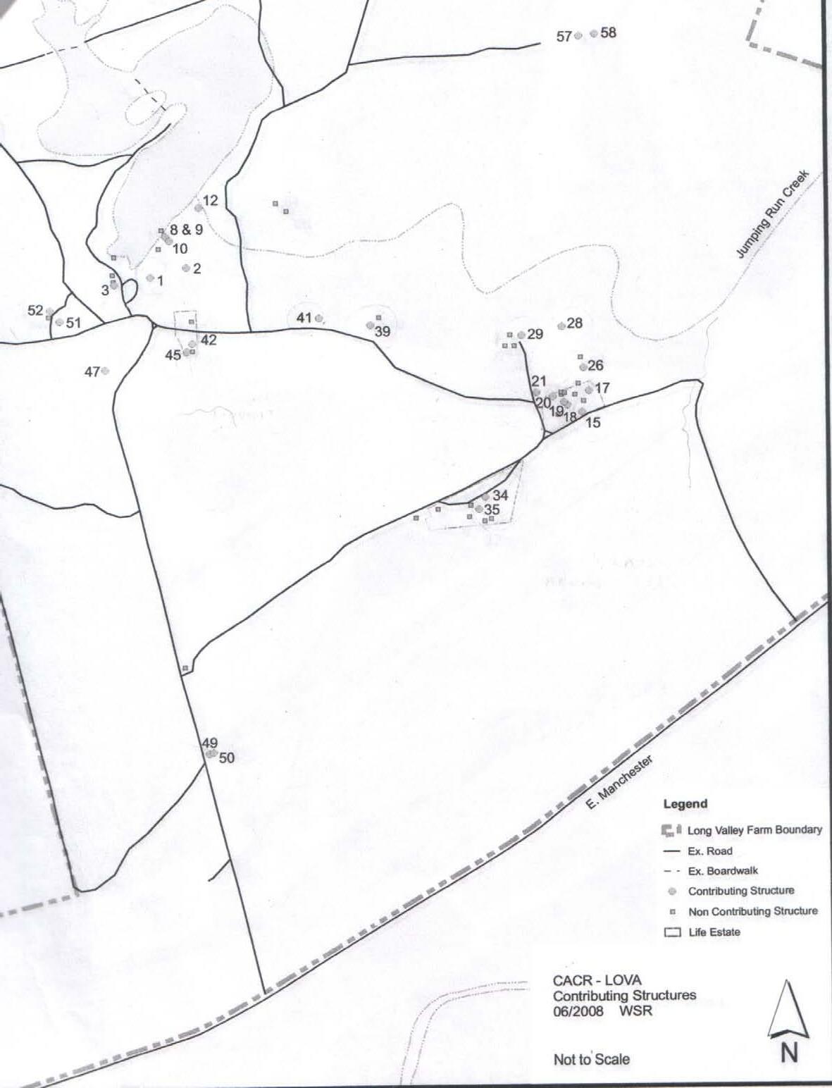


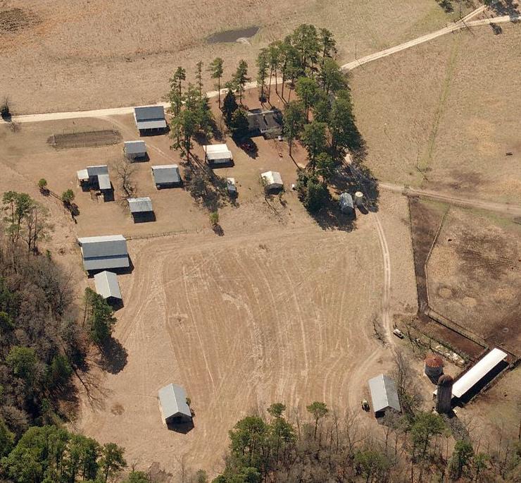


Reason for not assessing structure (as discussed on site with Department of Natural Resources representative):
A. Currently owned or utilized by a private resident
B. Non-Contributing
C. Beyond repair or unuseable
D. Decision had already been made by the Deparment of Natural Resources on structure’s renovation or use
4. WOODSHED (NON-CONTRIBUTING 1976) - B
13. FARM MANAGER’S RESIDENCE - A,B
14. PUMP HOUSE - B, C
22. PLAYHOUSE (NON-CONTRIBUTING 1972) - A,B
23. COOLER (NON-CONTRIBUTING 1980) - B
24. COOKING PIT (NON-CONTRIBUTING 1980) - B
25. EQUIPMENT SHED (NON-CONTRIBUTING 1955) - B
Structures near exisitng Maintenance/Storage Shed #38
33. NEW FARM MANAGER’S HOUSE (NON-CONTRIBUTING 1992) - B
34. WATER TOWER (CONTRIBUTING 1940) - C
35. WATER TOWER PUMP HOUSE (CONTRIBUTING 1940) - C
36. HOG SHELTER / FEEDING HOUSE (NON-CONTRIBUTING 1966) - A,B
37. MACHINE SHED (NON-CONTRIBUTING 1969) - A,B
39. OVERSEER’S HOUSE (NON-CONTRIBUTING 1914) CHRISTIAN’S HOUSE - A,B,
40. OVERSEER’S HOUSE GARAGE (NON-CONTRIBUTING 1970) - A,B,D
41. WORKER’S HOUSE #1 (CONTRIBUTING 1914, MOVED & EXPANDED 1938) - A
42. WORKER’S HOUSE #2 (CONTRIBUTING 1914) - A
43. WORKER’S HOUSE #3 FRAGMENT (NON-CONTRIBUTING 1925, PARTIALLY DISMANTLED) - A,B
44. WORKER’S HOUSE #2 PUMP HOUSE (NON-CONTRIBUTING 1964) - A,B
45. WORKER’S HOUSE #2 GARAGE (CONTRIBUTING 1939) - A
46. GRANARY (NON-CONTRIBUTING 1944) Isolated from farm. - B
49. MAIN PATH TOBACCO BARN #1 (CONTRIBUTING 1925) - C
50. MAIN PATH TOBACCO BARN #2 (CONTRIBUTING 1925) - C
53. WORKER’S HOUSE #4 PUMP HOUSE (NON-CONTRIBUTING 1960) - B
54. WORKER’S HOUSE #5 (NON-CONTRIBUTING 1947) - B
55. WORKER’S HOUSE #5 PACK HOUSE (NON-CONTRIBUTING 1968) - B
56. WORKER’S HOUSE #5 GARAGE (NON-CONTRIBUTING 1974 OR 1975) - B
Foundation System:
Brick and concrete block, concrete slab floor Condition: fair
Notes: standing water in basement, potential water issue on north-east brick terrace at wall connection (trapped leaves and moisture between brick terrace and house)
Structural System: wood frame
Condition: fair Notes: areas of rot
Cladding System: Horizontal masonite board (painted)
Condition: good Notes: possible asbestos
Roof System: wood frame and asphalt shingles
Condition: fair to poor Notes: moss growth in areas
Check for asbestos in siding, plumbing, HVAC systems, and flooring (kitchen especially)
Plumbing: functioning, upgrades likely in areas
Electrical: functioning, needs further upgrades
HVAC: radiators (untested), no AC
Accessibility: Entries and bathrooms on ground floor are not ADA compliant but could easily be made compliant. Stair raillng encroaches into stair path and would require new handrail (treads are compliant).
Historical Value: As the preferred vacation home of James Rockefeller and its prior use on a farmstead utilizing scientific methods the house has signifigant value. See “National Register of Historic Places Form” 12-20-93 #16 for additonal information.


We had a preliminary conversation with Jeff Adolphsen, Restoration Specialist, from the State Historic Preservation Office. From our conversation it appears that they would be in favor of restoring as many buildings as possible. He would appreciate a meeting at our earliest convenience to discuss the entire project with both he and Renee Gledhill-Earley, Environmental Review Coordinator for SHPO.
Possible Use: - Park offices - Educational / Museum - Meeting Room - Rental facility - Park Visitor Center
Other notes: - 3 large and 1 small chimney, fair condition with plant growth - Some fire detection and alarm system - No exit lights or signs - Fence in disrepair with areas of collapse
G-1. FCAP Recommendation: renovate and restore to

period architecture; full asbestos abatement if necessary; full replacement of all electrical, mechanical, plumbing HVAC components.
FCAP Cost: $650,000
FCAP: Priority: 5 Years
M-1. FCAP Recommendation: replace fuel oil fired burner and electric hot water heater and check underground fuel oil tank for leaks
FCAP Cost: $300,000
FCAP: Priority: Immediate
ECA Recommendation & Opinion of Project Cost:
1. overgrowth and deterioration to chimneys


2. moss growth on roof

3. overgrowth and siding deterioration
1. Renovate exterior and interior (including plumbing, electrical, mechanical, and HVAC), add offices and rental facilities w/ public restrooms: $670,000 - $900,000
2. Upfit for catering kitchen: $90,000 - $150,000
3. Upfit for museum: requires museum specialist for costing. Could be upward of $200,000 depending on the level of interpretive displays
4. Structural review only if used for assembly: $2,000
5. Review with State Historic Preservation Office.
4. stair and main hallway

5. basement door at stairs with moss, standing water and vine growth

6. large kitchen

Foundation System: concrete footing, masonry apron Condition: fair Notes: overgrowth on both inside and outside
Structural System: 2x4 wood frame Condition: fair Notes: none
Cladding System: 2x6 horizontal wood lap board Condition: poor Notes: signifigant siding pull-out and rot, corner boards need replacing
Roof System: pyramidal hip roof with asphalt shingles Condition: fair Notes: none
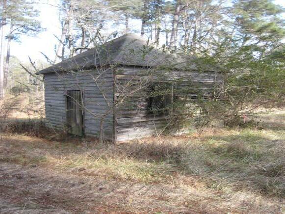
Plumbing: none (unknown whether this is an active spring or if water is simply standing water)
Electrical: none
HVAC: none
Accessibility: none, door threshold is raised, door opening may be too narrow as well
Historical Value: As an original part of homestead and what appears to be a working natural spring, this building has signifigant historical value.
Possible New Use: - Scenographic - Educational: opportunity to teach about water conservation, springs, aquafers, and water degregation
FCAP Recommendation: drain water from concrete box, install cover; reattach and replace siding; trim back vegetation outside and inside
FCAP Cost: $6,000
FCAP: Priority: Immediate
ECA Recommendation & Opinion of Project Cost: 1. Restore exterior, verify water tightness, make secure: $6,000

Foundation System: concrete apron perimeter footing with a dirt floor Condition: fair Notes: cracks and plant growth
Structural System: 2x4 wood frame Condition: good Notes: one leak, but no major flaws
Cladding System: horizontal wood lap board Condition: fair Notes: some pull out
Roof System: joists and rafters with metal roofing Condition: fair Notes: one visible leak

Plumbing: none
Electrical: none seen
HVAC: none
Accessibility: yes
Historical Value: As a contributing building to the original homestead it has signifigance and its rustic aesthetic adds general character to the site.
Possible New Use: - Scenographic - General Storage - Boat Storage - Boat Rental Office
Footprint: 18’ x 14’
Other notes: Doors on garage are attached on hinges but no longer structurally rigid. To maintain aesthetic coherence we suggest reusing current boards to make new doors, adding wheels to non-hinge end of doors and adding a concrete slab just outside the building
FCAP Recommendation: renovate and restore to historical quality FCAP Cost: $12,000
FCAP: Priority: 3 years
1. Repair exterior siding, reinforce roof and patch, fix door: $12,000
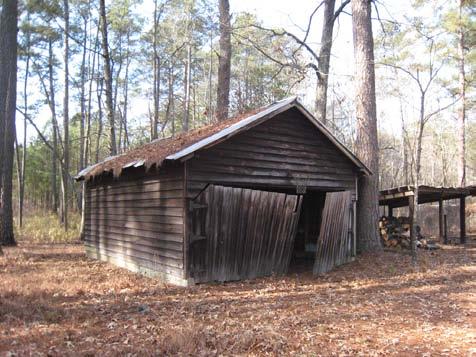

Foundation System: concrete slab Condition: fair Notes: some cracking
Structural System: 2x4 wood frame Condition: fair Notes: none
Cladding System: vertical wood board and batten Condition: fair Notes: areas of rot and pull out
Roof System: exposed wood joists with metal roofing Condition: fair Notes: hole in north end
Plumbing: yes, (working pump outside)
Electrical: yes
HVAC: none
Accessibility: none, door thresholds are very close to ground and could easily be made ADA compliant
Historical Value: As a non-contributing building it doesn’t have any historical value.
Possible New Use: - Park offices - Bathroom shelter - Material reclamation - Storage
FCAP Recommendation: demolish structure and grade site to safe condition FCAP Cost: $3,000
FCAP: Priority: Immediate
ECA Recommendation & Opinion of Project Cost:
1. Demolish and reclaim siding for use on new building. Add new restroom building in same location to re use existing water lines, use reclaimed siding (200 SF): $40,000 2. Demolish and build new restroom and office building in same location, use reclaimed siding (400 SF): $70,000

Foundation System: cinder block on ground Condition: poor Notes: some blocks falling off (see image above)

Structural System: 2x4 wood frame Condition: fair Notes: none
Cladding System: vertical wood board and batten Condition: fair Notes: none
Roof System: joists with asphalt shingles Condition: fair Notes: none
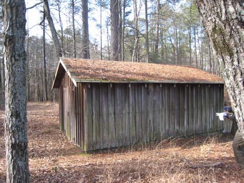
Plumbing: none Electrical: none
HVAC: none
Historical Value: As a non-contributing building it has minimal intrinsic historic value, though it does fit in visually with the farm seat garage and thus appears to be an integral part of the farmstead.
Possible New Use: - General storage - Boat storage with rolling boat trailer - Material Reclamation
Footprint: 18’ x 12’
FCAP Recommendation: demolish structure and grade site to safe condition FCAP Cost: $3,000 FCAP: Priority: Immediate
ECA Recommendation & Opinion of Project Cost: 1. Demolish and reclaim siding: $4,000 2. Repair foundation, mold damage, and shingles for use as boat or general storage: $3,000

Foundation System: none
Structural System: 4x4 wood posts


Condition: fair Notes: none
Cladding System: 2x4 gap board
Condition: poor
Notes: some boards falling in, plant growth
Roof System: 2x4 pyramidal roof and gap board
Condition: poor Notes: some boards falling in, plant growth
Plumbing: none Electrical: none
HVAC: none
Accessibility: yes
Historical Value: none
Possible New Use: Its use would remain a shade shelter but with ample tree coverage and the mill pavilion close by it is unncessary
FCAP Recommendation: none FCAP Cost: none FCAP: Priority: none
ECA Recommendation & Opinion of Project Cost:
1. Demolish: $250
Foundation System: board form concrete piles
Condition: good Notes: none
Structural System: timber frame

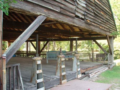
Condition: fair Notes: uprights are 14” square, cross beams are 12”x14”
Cladding System: horizontal wood lap board Condition: poor Notes: signifigant holes and pullout
Roof System: joists and rafters with asphalt shingles Condition: poor Notes: signifigant bows in roof and flitch splicing on inside
Floor System: overspanned wood boards on joists
Condition: fair Notes: though structurally intact, the floor is unsafe for high occupancy
Plumbing: none
Electrical: electrical box in southeast corner (untested)
HVAC: none
Accessibility: none, easily made ADA accessible
Historical Value: As a contributing structure over 150 years old which shows historic dam technology, this pavilion has signifigant historical value aesthetically and educationally
Possible New Use:
- Rental Pavilion (200 person occupancy)

- Public Pavilion - Educational Programs - Scenographic
FCAP Recommendation: trim vegetation back; repair or replace deteriorated siding, flooring, railing, and structural members; re-grade perimeter to prevent erosion; upgrade and rewire electrical systems
FCAP Cost: $87,000
FCAP: Priority: Immediate
ECA Recommendation & Opinion of Project Cost:
1. Structural analysis for safety: $2,000
2. Repair siding and roof, rebuild floor, trim vegetation, regrade perimeter, upgrade electrical, make ADA accessible: $110,000


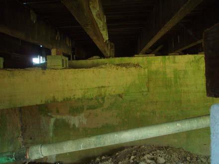

Foundation System: poured concete
Condition: fair Notes: none
Structural System: 2x6 wood frame
Condition: fair Notes: none
Cladding System: horizontal wood lap board Condition: fair Notes: none
Roof System: rafters and apshalt shingles
Condition: fair Notes: some debris and stains on roof
Plumbing: none
Electrical: yes
HVAC: none
Accessibility: none, ADA accessibility is possible but may require a structure large enough that it significantly diminishes the rustic aesthetic.
Historical Value: As a contributing member of the homestead and an interesting piece of historic technology the building and attached water-wheel have signifigant historical value.

Possible New Use: - Scenographic - Storage - Education
FCAP Recommendation: trim back vegetation; reattach or replace deteriorated siding and door; sandblast waterwheel and finish both wheel and housing

FCAP Cost: $15,000
FCAP: Priority: Immediate
ECA Recommendation & Opinion of Project Cost: 1. Trim vegetation, repair exterior, remove screen door, make secure, sandblast and refinish water-wheel (non-operational) $15,000


Foundation System: none Condition: none Notes:
Structural System: wood timber Condition: fair Notes: though stable, the timbers are immersed in water
Cladding System: none Condition: none Notes: none
Roof System: none Condition: none Notes: none
Plumbing: none Electrical: none
HVAC: none
Accessibility: none
Historical Value: As a non-contributing structure built in the 1960’s its historic value is tied mostly to the story of Rockefeller using it every morning to swim across the lake.
Possible New Use: - None: not appropriate for use and making it scenographic would require so much railing it would ruin its scenic quality
FCAP Recommendation: none
FCAP Cost: none
FCAP: Priority: none
ECA Recommendation & Opinion of Project Cost: 1. Document and demolish.
Foundation System: poured concrete slab
Condition: fair Notes: some cracking, chipping, moss growth on inside
Structural System: 2x6 wood frame
Condition: fair Notes: none
Cladding System: horizontal wood lap board
Condition: very poor Notes: holes, pull out, and moisture damage
Roof System: joists and rafters with metal roofing Condition: good Notes: new roof (unknown date), minor repairs needed


Plumbing: none seen
Electrical: cut off (see lower left image above)
HVAC: none
Accessibility: none, could be made ADA accessible with signifigant effort
Historical Value: As a contributing structure and still possibly functioning mill this building has both aesthetic and technological historical signifigance.
Possible New Use: - Scenographic
- Educational: some work required to get mill working again
FCAP Recommendation: renovate structure to historical quality, fence area to prevent unauthorized entry
FCAP Cost: $600,000
FCAP: Priority: 5 years
ECA Recommendation & Opinion of Project Cost:
1. Repair exterior for exterior viewing only, non-functioning mill machinery, with ropes/fences to cordon off: $100,000

2. Same as FCAP: Minimum of $600,000 for historical quality renovation, still non functioning machinery.
3. Structural and historical review needed whether restored for exterior viewing only or for interior tours and operations: $5,000. Please see note number 3 on page 2.


Foundation System: concrete piers
Condition: good Notes: none
Structural System: 2x4 wood frame
Condition: good Notes: none
Cladding System: horizontal wood lap board Condition: poor Notes: paint peeling, corner boards missing, openings without glass
Roof System: joists and rafters with metal roofing Condition: good Notes: none
Plumbing: unknown Electrical: none
HVAC: none
Accessibility: none, though could easily be made ADA compliant
Historical Value: A contributing structure to the original, working farmstead.


Possible New Use: - Scenographic - Storage - Park offices - Educational - Visitor Contact Station with ADA accessible bathrooms: $70,000
FCAP Recommendation: replace front entry platform, reattach or replace deteriorated siding; scrape, sand, clean, and paint siding; reattach and seal metal roof
FCAP Cost: $15,000
FCAP: Priority: Immediate
ECA Recommendation & Opinion of Project Cost:
1. Same as FCAP: $15,000
2. Structural analysis for inhabiting: $1,000
3. Visitor contact station with ADA accessible bathrooms: $80,000
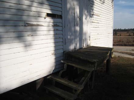


Foundation System: concrete block skirt
Condition: fair Notes: some cracking
Structural System: 2x4 wood frame Condition: good Notes: none
Cladding System: metal siding Condition: fair Notes: small holes, window with missing pane
Roof System: wood truss and metal roofing Condition: good Notes: none

Plumbing: none
Electrical: none seen
HVAC: none
Accessibility: yes
Historical Value: Non-contributing member of farmstead, however, noteworthy door hardware mechanism.
Possible New Use: - Scenographic - Rental Shelter - Educational Shelter (capacity approx. 25 people)
FCAP Recommendation: no repairs or renovations recommended due to good condition
FCAP Cost: $0
FCAP: Priority: none
ECA Recommendation & Opinion of Project Cost:
1. Repair siding as needed: $1,000
2. Cracked existing concrete slab could be replaced: $2,000.
3.Additional electrical service and fans so that building could be rented or used for environmental education classes: $6,000
Foundation System: masonry skirt and masonry pier

Condition: fair to poor Notes: caving in at portions (upper right photo)
Structural System: 2x4 wood frame
Condition: fair Notes: none
Cladding System: corrugated metal (vertical)
Condition: fair to poor Notes: windows in poor condition, missing panes
Roof System: joists and rafters with metal roofing
Condition: fair to poor Notes: east roof is giving way at corner
Plumbing: unknown
Electrical: none seen
HVAC: none
Accessibility: none, could easily be made ADA accessible
Historical Value: Has value both as a contributing member of original farmstead and as a rustic looking building.

Possible New Use: - Storage - Artisan Studio - Scenographic - Education/Interpretation shelter area (capacity approximately 30)
Footprint: 20’ x 24’
FCAP Recommendation: restore or replace entire structure
FCAP Cost: $30,000
FCAP: Priority: 5 years
ECA Recommendation & Opinion of Project Cost:
1. Repair exterior: $15,000
2. Renovate interior, replace windows and doors:$15,000
3. Add power, lighting, plumbing and HVAC if used for people: $80,000
Foundation System: none Condition: none Notes: none
Structural System: 2x8 wood frame directly into ground Condition: fair Notes: building is leaning over, though appears stable

Cladding System: horizontal wood gap board Condition: fair Notes: the gap boarding allows wind to blow through the structure and has likely kept it from being blown over in high winds.
Roof System: joists and rafters with metal roofing Condition: fair Notes: none

Plumbing: none Electrical: none
HVAC: none
Accessibility: yes
Historical Value: As a rustic, contributing member of original farmstead the building has signifigant historical value.


Possible New Use: - Rental Pavilion - Public Pavilion
Capacity is approximately 100 people but they would possibly be in four different sections of the building depending on how many structural adjustments were made.
Footprint: approx. 40’ x 50’
FCAP Recommendation: reattach or replace deteriorated siding and supports, scrape, sand, and refinish siding; install bracing between structural members to secure building.
FCAP Cost: $6,000
FCAP: Priority: Immediate
1. Structural assessment: $1,000
2. Repair exterior siding, make structurally secure: $10,000
3. Electrical and lighting upgrades: $4,000
4. If desired, new slab with slope to grade for ADA accessibility: $10,000
Foundation System: concrete piers and wood skirt Condition: fair Notes: none
Structural System: 2x4 wood frame Condition: fair Notes: none
Cladding System: vertical wood board and batten Condition: fair Notes: none
Roof System: rafters with metal roofing Condition: fair Notes: entry awning falling apart, shed rafters over spanned
Plumbing: none seen Electrical: none, cut off
HVAC: none
Accessibility: no, could be made ADA accessible with some effort but could be visually distracting
Historical Value: Has historical value as a contributing structure to original farmstead.
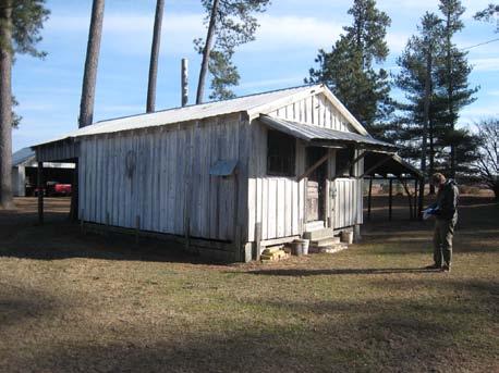
Possible New Use: - Scenographic
- Public Shelter (under canopy only) - Education Shelter (under canopy only) (Capacity approx. 20 people) Footprint: 20’ x 16’
FCAP Recommendation: none given FCAP Cost: none FCAP: Priority: none
ECA Recommendation & Opinion of Project Cost:
1. Repair and repaint exterior, brace overhang, make secure: $7,000
2. Repair interior and add fans (no HVAC) additional: $3,000

Foundation System: cement block skirt on three sides, slab on grade Condition: fair Notes: none
Structural System: 2x4 wood frame Condition: fair Notes: 4’ O.C. framing
Cladding System: corrugated metal (vertical) Condition: fair Notes: none
Roof System: wood truss and metal roofing Condition: fair Notes: 4’ O.C. framing
Plumbing: none seen

Electrical: wired (untested)
HVAC: none
Accessibility: yes
Historical Value: As a contributing structure to farmstead the building has historical value. It is not particularly rustic looking however and does not contribute to the scenographic quality of the farmstead.


Possible New Use: - Rental Shelter - Public Shelter - Education
Capacity approx. 80 people
Footprint: approx. 40’ x 30’
FCAP Recommendation: replace wood frame windows; scrape, sand, clean, and repaint siding; reattach and seal metal roof FCAP Cost: $5,000
FCAP: Priority: Immediate
1. Repair exterior, clean, remove tools, add lighting (assuming wiring works) and ceiling fans (no HVAC): $10,000 This would still be a very rustic pavilion.
2. Demolish: $2,000
Foundation System: brick and sprayed concrete piers
Condition: fair Notes: slab on grade adjacent to building approx. 10’x20’
Structural System: 2x4 wood frame walls and trusses Condition: fair Notes: wall and roof at 36” O.C., floor is 2x10 at 15” O.C.
Cladding System: horizontal wood lap board Condition: poor Notes: many pieces missing or rotten
Roof System: wood truss with metal roofing Condition: good Notes: none

Plumbing: unknown
Electrical: unknown
HVAC: none
Accessibility: none, could be made ADA accessible at great difficulty and woould reduce the charming appearance.
Historical Value: Has value only as a contributing part of the farmstead group.


Possible New Use: - Scenographic - Education - for exterior only. If made accessible it could only hold 15 people. ADA ramp not recommended by Architect. Footprint: 30’ x 12’
FCAP Recommendation: replace front entry steps; reattach or replace siding and doors; replace and seal metal roof where necessary; scrape, sand, clean, and repaint siding
FCAP Cost: $10,000
FCAP: Priority: Immediate
ECA Recommendation & Opinion of Project Cost: 1. Repair exterior, add siding, make secure: $10,000

Foundation System: poured concrete base (barn) and pyramidal concrete piers (sheds)
Condition: fair Notes: cracking (see photo #4), needs french drain along shed drip line (see photo #3)
Structural System: 2x4 wood frame Condition: fair Notes: none
Cladding System: horizontal wood lap board Condition: poor Notes: some boards missing or pulling out
Roof System: 2x8 joists and rafters (16” O.C.) with metal skip sheathing
Condition: fair to poor Notes: portions have signifigant damage (see photo #2)
Plumbing: none
Electrical: none, wires cut
HVAC: none
Accessibility: yes
Historical Value: Has significant value not only as part of original farmstead, but as one of the larger and more iconic buildings on the site.

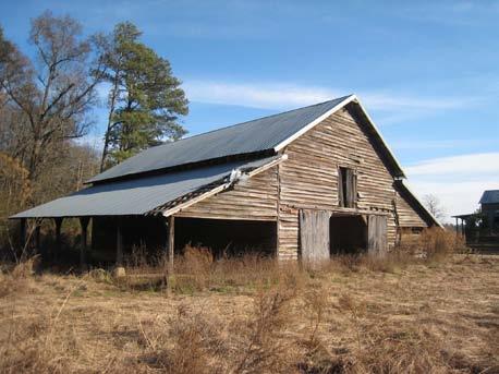
Possible New Use: - Rental Shelter - Public Shelter (under flanking sheds only) - Park Visitor Center
Approximate Dimensions: 60’ x 30’ main barn 60’ x 15’ flanking sheds (2)
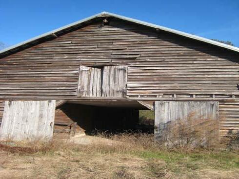
Capacity:
Approximately 150 people in the main central space and additional 50 people in each wing, for a total of 250 people. This is not taking into consideration any sort of support or office facilities.
FCAP Recommendation: rebuild structure, reuse current materials if possible; fence off structure to prevent unathorized entry
FCAP Cost: $250,000
FCAP: Priority: 5 years


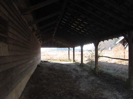

Foundation System: concrete slab
Condtion: fair, some cracks, structurally good Notes:
Structural System: poles
Condition: fair, structurally good Notes: one pole has come unattached but doesn’t appear to effect stability at this date
Cladding System: none (open air) Notes:
Roof System: wood rafters and joist, metal roofing
Condition: very good Notes:
Plumbing: none
Electrical: none seen
HVAC: none
Accessibility: yes (access will need to be provided)
Historical Value: Though not part of original farmstead, the shed is visually integrated and adds general character to the site.

Possible New Use: - Rental Shelter - Public Shelter accomodating 50 -150 people - Educational Shelter
Approximate capacity: 50-150 people Note that the capacity varies so much because of the odd proportions of the building which would limit certain types of activities. Approximate dimensions: 25’ x 50’
FCAP Recommendation: replace or renovate entire structure
FCAP Cost: $10,000
FCAP: Priority: 5 years
ECA Recommendation & Opinion of Project Cost:
1. Repair concrete slab and poles: $6,000
2. Electrical and lighting updgrades: $10,000
Foundation System: concrete block skirt and dirt floor Condition: fair Notes: none
Structural System: 2x4 wood frame Condition: good Notes: none
Cladding System: metal siding Condition: good Notes: a few small holes in metal siding, rear doors in major disrepair
Roof System: wood trusses with metal roofing Condition: good Notes: none
Plumbing: none Electrical: none seen
HVAC: none
Accessibility: yes
Historical Value: Has value as a contributing structure to the farmstead. In and of itself it is not functionally nor aesthetically noteworthy but it is in good condition.
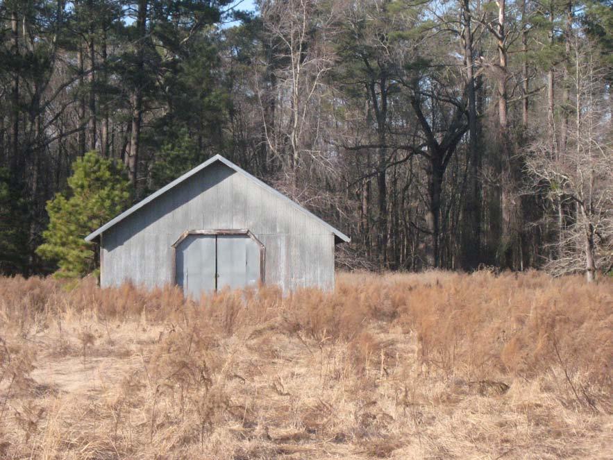
Possible New Use: - Scenographic - Rental Shelter - Storage - Restroom
Approximate capacity: 100 people
FCAP Recommendation: replace damaged metal siding and roof panels; repair or replace rear doors; trim back foliage adjacent to structure
FCAP Cost: $3,000
FCAP: Priority: Immediate
ECA Recommendation & Opinion of Project Cost:
1. Repair exterior and rear door: $3,000
2. If a rental shelter were desired , utility services will be required. Over $250,000 for a conditioned space, with restrooms lighting and finishes including concrete floor.
Foundation System: poured concrete and dirt floor Condition: fair Notes: none
Structural System: 2x4 wood frame Condition: fair to good Notes: appears structurally sound, old repairs apparent
Cladding System: metal siding Condition: fair Notes: doors were untested but likely require some repairs to work properly

Roof System: trusses with metal roofing Condition: good Notes: small hole on west side of roof
Plumbing: none
Electrical: none
HVAC: none
Accessibility: yes
Historical Value: Important piece of the silo complex in the Northwest corner of the farmstead.

Possible New Use: - Scenographic - Rental Shelter - Storage - Educational Shelter
Approximate dimensions: 54’ x 30’
Approximate capacity: 100 people
FCAP Recommendation: reattach or replace damaged metal siding and roof panels; repair livestock doors and gates; trim back foliage adjacent to structure FCAP Cost: $3,000
FCAP: Priority: Immediate
ECA Recommendation & Opinion of Project Cost:
1. Same as FCAP: $3,000
2. Electrical upfit (lighting and fans only, no AC, no plumbing): $10,000
3. Slab: $8,000
Foundation System: boardformed concrete Condition: fair Notes: none
Structural System: pre-cast concrete panels, metal tension rings Condition: fair to good Notes: none

Cladding System: (see structural system)
Roof System: metal dome Condition: poor Notes: rust covering entire roof
Plumbing: none
Electrical: none, wires cut
HVAC: none
Accessibility: none
Historical Value: Although not a contributing structure to the original farmstead, it is an integral part of the farm and has a strong iconic value as a recognizable farming structure.
Possible New Use: - Scenographic - Educational - Educational: allow controlled viewing inside silo


Approximate dimensions: 24’ diameter, 50’ high
FCAP Recommendation: replace roof
FCAP Cost: $5,000
FCAP: Priority: 5 years
ECA Recommendation & Opinion of Project Cost: 1. Repair metal roof, restore concrete panels, and create secured viewing: $12,000
Foundation System: concrete slab and piers Condition: fair Notes: none

Structural System: 4x6 square poles on feed roof 2x4 wood frame on shed Condition: fair Notes: none
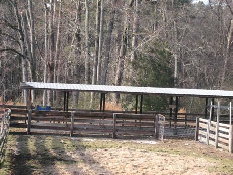
Cladding System: metal siding Condition: poor Notes: rusted, some pieces torn or falling off
Roof System: rafters with metal roofing Condition: fair Notes: some joists falling off on feed roof
Plumbing: none Electrical: none
HVAC: none
Accessibility: none, could be made ADA accessible.
Historical Value: While not a contributing member of original farmstead, it is visually integrated into the group of silo buildings in the Northwest corner of the farm.
Possible New Use: - Scenographic - Educational - Rental Shelter - Public Shelter - Educational Shelter
Approximate capacity: 125 people
FCAP Recommendation: repair or replace floor, trim, and wood framing; reattach and seal metal siding and roofing
FCAP Cost: $3,500
FCAP: Priority: Immediate
ECA Recommendation & Opinion of Project Cost: 1. Same as FCAP: $3,500
2. For assembly spaces leave open air, no AC, no plumbing. Add only fans and electric: $8,000
Foundation System: slab on grade Condition: fair Notes: none
Structural System: self supporting corrugated metal, tension ring at top Condition: fair Notes: none

Cladding System: corrugated metal Condition: poor Notes: rusting
Roof System: metal Condition: fair Notes: rusting
Plumbing: none
Electrical: untested
HVAC: none
Accessibility: none, could be made ADA accessible with difficulty
Historical Value: While not a contributing structure to the original farmstead, it is an integral part of the farm and has a strong iconic value as a recognizable farming structure.
Possible New Use: - Scenopgrahic - Educational: controlled viewing of inside
Approximate dimensions: 24’ diameter, 20’ high
FCAP Recommendation: replace metal walls and roof FCAP Cost: $20,000 FCAP: Priority: 5 years Note: FCAP report says “grain bin is in good condition”, then recommends replacing the walls and roof which would mean rebuilding the entire grain bin
ECA Recommendation & Opinion of Project Cost: 1. Repair exterior, trim foliage, create secured viewing: $6,000

Foundation System: slab on grade Condition: good Notes: none
Structural System: steel rigid frame Condition: good Notes: none
Cladding System: metal siding Condition: good Notes: none

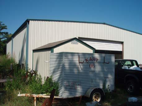
Roof System: steel rigid frame, roofing system not visible (probably membrane) Condition: good Notes: low slope on roof


Plumbing: unknown Electrical: yes
New Use:
Foundation System: concrete block piers, concrete apron with crawl space. Wood floor over joists. Condition: fair Notes: holes in apron on north side
Structural System: 2x8 wood frame
Condition: fair Notes: 2 stories (bowed 2nd story floor)
Cladding System: vertical metal 5V siding

Condition: fair Notes: none
Roof System: joists and rafters with metal 5V roofing Condition: fair Notes: none


Plumbing: none
Electrical: none, cut off (see bottom left photo)
HVAC: none
Accessibility: none, West side could easily be made ADA accessible, East side could be made ADA accessible with difficulty.
Historical Value: Has value as a contributing member of the agricultural complex but is rather remote.
Possible New Use: - Scenographic - Storage
Approximate dimensions: 24’ x 30’
FCAP Recommendation: replace roof, wood door, and windows; repair metal siding

FCAP Cost: $45,000
FCAP: Priority: 5 years
ECA Recommendation & Opinion of Project Cost:
1. Clean debris out of inside, cut back over grown trees in drip line, repair exterior only, and secure: $30,000
2. Demolish: $5,000
Foundation System: concrete block, dirt floor Condition: fair Notes: cracking
Structural System: 2x4 wood frame inside, 2x8 doubled porch posts Condition: good
Cladding System: vertical metal siding Condition: fair Notes: overgrowth of plants may be hiding damage and causing wear on siding
Roof System: joists and rafters with metal roofing Condition: fair Notes: none
Plumbing: none Electrical: none
HVAC: none
Accessibility: yes (under shed), there is a raised threshold between shed and barn which could be made ADA accessible but could be unsightly if only a ramp were used.
We’d prefer to either view the interior from the shed at the threshold or raise the grade.
Historical Value: While not a contributing member of the localized farmstead its aesthetic fits in well with other historic buildings and visually anchors the intersection, and helps to tell the story of the larger farmstead.
Possible New Use: - Scenographic - Visitor Contact Station - Educational - for approximately 40 students
Approximate dimensions: barn 24’ x 16’, shed 16’ x 16’, concrete pad 24’ x 16’
FCAP Recommendation: clear debris from around barn; reattach and seal metal roof panels; repaint swinging plywood doors; repair side eaves

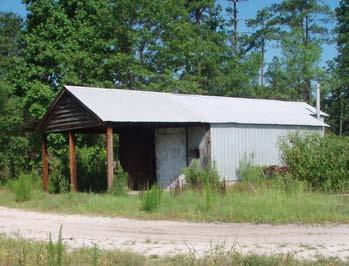
FCAP Cost: $3,000
FCAP: Priority: Immediate
ECA Recommendation & Opinion of Project Cost:
1. Remove overgrowth, repair exterior, repair doors: $4,000 2. Unstaffed, unconditioned visitor contact station (orientation and educational signage, benches, gravel path only): $5,000. 3. Add slab on grade: $3,000



Foundation System: concrete block Condition: fair Notes: cracks
Structural System: 2x4 wood frame Condition: fair Notes: none
Cladding System: horizontal wood board (painted) Condition: fair Notes: chipping, areas of rot
Roof System: joists and rafters with 5V metal roofing Condition: fair Notes: chimney is in fair condition
Interior Finishes: carpet and painted gypsum board Condition: fair to poor Notes: carpets need replacing and walls need new paint
Plumbing: yes
Electrical: yes
HVAC: air conditioner (heat-pump) tucked under crawl space
Accessibility: none, could be made ADA accessible
Historical Value: Although it’s designated as a contributing building, given its location and building date it does not add any signifigant functional or scenic quality to the homestead.

Possible New Use: - Park Offices - Ranger Residence - Artisan Residence
FCAP Recommendation: replace deteriorated porch flooring, exterior siding and trim; repaint siding and trim; scrape, sand, clean, seal, and repaint metal roof; install insulation at the floor system crawl space
FCAP Cost: $55,000
FCAP: Priority: Immediate
FCAP Recommendation: replace all plumbing and HVAC equipment; check carbon monoxide levels before reoccuping building FCAP Cost: $25,000
FCAP: Priority: 1 year
ECA Recommendation & Opinion of Project Cost:
1. Exterior repairs only: $55,000
2. Interior repairs (ready for ranger residence): additional $25,000
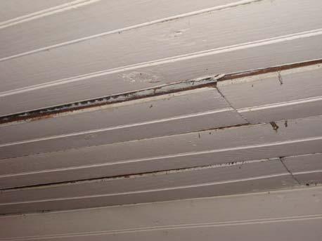


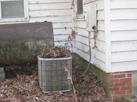
Foundation System: concrete block and masonry
Condition: poor Notes: cracking, some bricks dislodged causing structural damage to wood structure
Structural System: 2x4 wood frame Condition: poor Notes: South wall has come off foundation
Cladding System: horizontal wood boards (painted) Condition: fair Notes: chipping
Roof System: joists and rafters with metal roofing Condition: fair Notes: none
Plumbing: none Electrical: none
HVAC: none
Accessibility:
Historical Value: Although it’s designated as a contributing building, given its location and building date it does not add any signifigant functional or scenic quality to the homestead.
Possible New Use: - Scenographic - Storage - Demolition - Ranger Residence Storage
FCAP Recommendation: unclear FCAP Cost: unknown FCAP: Priority: unknown
ECA Recommendation & Opinion of Project Cost:
1. Demolition: $1,000 2. Reseat on foundation, repair exterior, make secure: $3,000


Foundation System: dirt
Condition: fair Notes: none
Structural System: CMU block
Condition: fair Notes: none
Cladding System: raw block Condition: fair Notes: tree growing on North side may cause deterioration over time
Roof System: 2x4 rafters with metal roofing Condition: poor Notes: rotten rafters and large holes in roof (see photos
Plumbing: none
Electrical: none
HVAC: none
Accessibility: yes
Historical Value: As a contributing member of the farmstead with a specific function as a tobacco drying barn with some of the drying structure still in place the building has significant historic value.


Possible New Use: - Scenographic - exterior only - Education - Camping Covering - Restroom and shower house for campers
Approximate dimensions: 16’ x 16’, 16.5’ high
FCAP Recommendation: replace roof; install doors on openings; restore tier poles and tobacco barn to period architecture
FCAP Cost: $10,000
FCAP: Priority: Immediate
1. Repair roof, clear brush away, add pathway: $6,000
2. Add restrooms and showers: $40,000-$90,000 (depending on access to water, sewer, septic) (Alternative means are possible such as compositing toilets and solar hot water and could reduce costs as well as add to the environmental educational aspects of the campground)


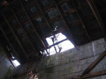
Foundation System: dirt Condition: fair Notes: none
Structural System: CMU block
Condition: good Notes: none
Cladding System: raw block
Condition: good Notes: tree growing on North side may cause deterioration over time
Roof System: 2x4 rafters, metal roofing with opening along ridge Condition: good Notes: roof must be patched soon or it will quickly fall into disrepair
Plumbing: none
Electrical: none
HVAC: none
Accessibility: yes
Historical Value: As a contributing member of the farmstead with a specific function as a tobacco drying barn with some of the drying structure still in place the building has significant historic value.
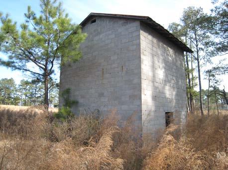
Possible New Use: - Scenographic - exterior only - Education - Camping Shelter - Camping showers + bathrooms
Approximate dimensions: 16’ x 16’, 16.5’ high
FCAP Recommendation: replace roof; install doors in openings; restore tier poles and tobacco barn to period architecture
FCAP Cost: $10,000
FCAP: Priority: Immediate
1. Repair roof, clear brush away, add pathway: $5,000
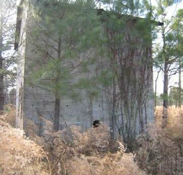


2. Add restrooms and showers: $40,000-$90,000 (depending on access to water, sewer and septic)
Alternative means are possible such as solar hot water which may add to the environmental educational aspects of the campground but will not reduce the renovation costs.
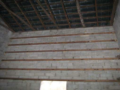

(AaA) Altavista fine sandy loam (0-3 percent slope) is found on terraces along the Cape Fear River and Lower Little River. It is moderately well drained with moderate permeability and medium water capacity. The seasonal high water table is 1.5 to 2.5 feet and is subject to rare flooding.
(BaB) Blaney loamy sand (2-8 percent slope) is found on side slopes and narrow ridges of the uplands. It is a welldrained soil with moderate permeability and a low water capacity. There is a moderate erosion hazard.
(BaD) Blaney loamy sand (8-15 percent slope) is found on the sides of the uplands. It is a well-drained soil with moderate permeability and a low water capacity. There is a severe erosion hazard if soils are exposed.
(CaB) Candor sand (0-8 percent slope) is found on broad areas and to some extent on rounded side slopes of up lands. It is somewhat excessively drained with moderate permeability and very low water capacity.
(Co) Coxville loam is nearly level and is found on broad, smooth flats and in shallow depressions on uplands. It is poorly drained with moderate permeability. The seasonal high water table is at or near the surface during the winter and early spring. Depression areas of the soil may be ponded after heavy rains. This soil is poorly suited to most recreational uses.
(De) Deloss loam is nearly level and is found on terraces in the Cape Fear River and Lower Little River and their tributaries in Cumberland County. It is very poorly drained with moderate permeability. The seasonal high water table is at or near the surface during winter and early spring and is subject to rare flooding. It is poorly suited to recreational use.
(GdB) Gilead loamy sand (2-8 percent slope) is found on side slopes along streams in uplands. It is moderately well drained with a moderately slow to slow permeability and a medium to high water capacity. It is susceptible to erosion.
(GdD) Gilead loamy sand (8-15 percent slope) is found on upland side slopes. It is moderately well drained with moderately slow to slow permeability. There is a severe hazard of erosion where soil is exposed. The water table is perched and is located 1.5 to 2.5 feet below the surface.
(GoA) Goldsboro loamy sand (0-2 percent slope) is found on broad, smooth flats of uplands. It is moderately well drained with moderate permeability and medium water capacity. The seasonal high water table is at a depth of two to three feet during winter and early spring.
(JT) Johnston loam is close to level. It is found along major drainage ways. It is very poorly drained with moderately rapid permeability in the upper part of the soil and rapid in the lower part. It has a seasonal high water table that is at or above the soil surface most of the year and is subject to frequent flooding.
(Pa) Pactolus loamy sand is nearly level and is found on broad, smooth flats of uplands and on terraces of small streams. It is moderately well drained with rapid permeability and low water capacity. The seasonal high water ta ble is one and one half to three feet below the surface during winter and early spring. It is subject to rare flooding.
(Ra) Rains sandy loam is nearly level and is found on broad, smooth flats and in shallow depressions of uplands. It is poorly drained with moderate permeability. Its seasonal high water table is near the surface during winter and early spring. It is poorly suited to recreational use.
(Ro) Roanoke and Wahee loams are nearly level and are found on low flats and in depressions or along drainage ways of terraces. They are poorly drained soils with slow permeability. The seasonal high water table is at or near the surface during winter and early spring. Surface runoff is slow which results in ponding during wet periods. Some areas of these soils are subject to flooding. They are poorly suited for recreational purposes.
(TaB) Tarboro loamy sand (0-6 percent slope) is found on terraces of the Cape Fear River, Rockfish Creek, and Lower Little River in Cumberland County. It is somewhat excessively drained with rapid permeability and low water capac ity. It is subject to rare flooding.
(VgE) Vaucluse-Gilead loamy sands (15-25 percent slope) is found on long, narrow side slopes of uplands. It has moderately slow to slow permeability with a low to medium water capacity.
(W) Water.
(WaB) Wagram loamy sand (0-6 percent slope) is found on broad, smooth flats and side slopes of uplands. It is well drained with moderately rapid per meability. It has a low to medium water capacity.
(Wh) Wehadkee loam is frequently flooded
(WmB) Wickham fine sandy loam (1-6 percent slope) is found on slightly con vex ridges of stream terraces along the Cape Fear River, Lower Little River, and Rockfish Creek in Cumberland County. It is well drained with moderate permeability and medium water capacity. There is moderate erosion hazard and the soil is subject to rare flooding.
(BbB) Blaney loamy sand (2-8 percent slope) is found on side slopes and nar row ridges of the uplands. It is a well-drained soil with moderately slow per meability with a low water capacity. There is a moderate erosion hazard.
(BbD) Blaney loamy sand (8-15 percent slope) is found on the sides of the uplands. It is a well-drained soil with moderate permeability and a low water capacity. There is a severe erosion hazard if soils are exposed.
(CaB) Candor sand (1-8 percent slope) is found on broad areas and to some extent on rounded side slopes of uplands. It is somewhat excessively drained with moderate permeability and very low water capacity.
(DhA) Dothan loamy sand (0-2 percent slope) is found on broad, smooth flats of uplands. It is well drained with moderate permeability in the upper part of the subsoil while moderately slow in the lower part. The water capacity is me dium. There is a seasonal water table of three to five feet below the surface.
(FuB) Fuquay sand (0-4 percent slope) is found on broad flats of uplands. It is well drained with moderate permeability in the upper part of the subsoil and slow in the lower part. It has a low water capacity.
(GdB) Gilead loamy sand (2-8 percent slope) is found on side slopes along streams in uplands. It is moderately well drained with a moderately slow to slow permeability and a medium to high water capacity. It is susceptible to erosion.
(GdD) Gilead loamy sand (8-15 percent slope) is found on upland side slopes. It is moderately well drained with moderately slow to slow permeability. There is a severe hazard of erosion where soil is exposed. The water table is perched and is located one and 1.5 to 2.5 feet below the surface.
(JT) Johnston loam is close to level. It is found along major drainage ways. It is very poorly drained with moderately rapid permeability in the upper part of the soil and rapid in the lower part. It has a seasonal high water table that is at or above the soil surface most of the year and is subject to frequent flooding.
(LaB) Lakeland sand (1-8 percent slope) is found on broad ridges of uplands and rims of bays. It is excessively drained with very rapid permeability and a low water capacity.
(Ra) Rains sandy loam is nearly level and is found on broad, smooth flats and in shallow depressions of uplands. It is poorly drained with moderate perme ability. It’s seasonal high water table is near the surface during winter and early spring. It is poorly suited to recreational use.
(TR) Torhunta and Lynn Haven soils are nearly level and are found on low flats and in slight depressions of the uplands. They are very poorly drained with moderate to moderately rapid permeability. The seasonal high water table sits at or near the surface for low periods during the winter and early spring. Ponding can occur in some areas and they are subject to rare flooding. They are poorly suited to recreational use.
(VaB) Vaucluse loamy sand (2-8 percent slope) is found on side slopes and narrow ridges of uplands. It is well drained with a moderately slow perme ability in the upper part of the subsoil and slow in the lower part. It has a low water capacity.
(VaD) Vaucluse loamy sand (8-15 percent slope) is found on side slopes of uplands. It is well drained with moderately slow permeability in the upper part of the subsoil and slow in the lower part. There is a severe erosion hazard where the soil is exposed.
(VgE) Vaucluse-Gilead loamy sands (15-25 percent slope) is found long, nar row side slopes of uplands. It has moderately slow to slow permeability with a low to medium water capacity.
(BaB) Blaney loamy sand (2-8 percent slope) is found on side slopes and nar row ridges of the uplands. It is a well-drained soil with moderately slow per meability with a low water capacity. There is a moderate erosion hazard.
(BaD) Blaney loamy sand (8-15 percent slope) is found on the sides of the uplands. It is a well-drained soil with moderate permeability and a low water capacity. There is a severe erosion hazard if soils are exposed.
(DgA) Dogue fine sandy loam (0-2 percent slope) is found on terraces along the Cape Fear River and Lower Little River in Cumberland County. This soil has moderately slow permeability and medium water capacity. The soil is subject to rare flooding with a seasonal high water table of two to three feet below.
(DpA) Duplin sandy loam (0-3 percent slope) is found on broad flats of up lands. This soil is moderately well drained with moderately slow permeability and medium to high water capacity. It has a seasonal high water table of two to three feet below the surface. It has moderate shrink-swell potential.
(GdB) Gilead loamy sand (2-8 percent slope) is found on side slopes along streams in uplands. It is moderately well drained with a moderately slow to slow permeability and a medium to high water capacity. It is susceptible to erosion.
(GdD) Gilead loamy sand (8-15 percent slope) is found on upland side slopes. It is moderately well drained with moderately slow to slow permeability. There is a severe hazard of erosion where soil is exposed. The water table is perched and is located 1.5 to 2.5 feet below the surface.
(VgE) Vaucluse-Gilead loamy sands (15-25 percent slope) is found long, nar row side slopes of uplands. It has moderately slow to slow permeability with a low to medium water capacity.
The following Appendix includes public comments received during the planning process.
The following comments were written on maps displayed at the Public Meeting on August 30,2010. The comments are reproduced here exactly as they were written.
Concept One: Sandhills:
1. Prefer no parking here (2nd trail entrance on Johnson Farm Rd.)
2. No park
3. Buffer (area around Pine Valley Neighborhood)
4. Public entrance, closer to fishing on McCloskey Rd.
5. Horse Trails
6. No parking area on Johnson Farm Rd. Dangerous road area and too close to Pine Valley Homes
7. Parking closer to water access to fishing and away from community.
8. Entrance should be here (McCloskey)
9. C amping/hiking should be on this side by water (peninsula)
10. What is the buffer to subdivision? (Pine Valley)
11. Buffer around Pine Valley
12. No – to entrance on Johnson Farm Rd.
13. Happy but cautious – Pine Valley Farm resident
14. Horse trails!
15. No parking area on Johnson Farm Rd. Dangerous road area and too close to Pine Valley
16. Parking closer to water – access to fishing and away from community
17. Deer population control. Agriculture – Pick your own berries
No specific Long Valley Farm comments.
Concept Two:
Sandhills:
1. This entrance is too close to Pine Valley neighborhood and the road is on a dangerous curve.
2. Educational Connection to schools and groups (boy scouts, girl scouts)
3. Recreation activities geared to community groups
4. Walkways going over eco-sensitive areas for protection.
5. Horse trails!!
6. C amping – fires
7. Property access from McCloskey
8. Horse trails at Sandhills
9. No access on Johnson Farm Road next to Pine Valley community
10. Provide another access in an area not close to a community/house
11. No to park entrance on Johnson Farm near Pine Valley Farm
12. No tent/trailer camping or fishing access off of Johnson Farm Rd.
13. There is a private paddle access near 210 on the Little River
14. Horse trails!
Concept Three:
Long Valley Farm:
1. Add bicycle/bicycle rental to Long Valley Farm
2. There is a redevelopment project LEED/LID south of the Little River
3. There is a future town park at the Mutzberg property south of Little River
4. a WWTP owned by Town of Spring Lake south of Little River that can provide graywater reuse service to park – use for irrigation and flush for toilets
5. Helicopter landing (?)
6. L and navigation, foot traffic (?)
Sandhills:
1. No to entrance by Pine Valley
2. One PVF resident “Thrilled!”
3. Primitive camping at Sandhills in west is great for scouts
4. entrance on McClosky Rd. desired
5. Add bicycle to things to do at Sandhills
6. Entrance and camping close to homes
7. Best concept!
8. People are already riding horses on this property.
9. Maintain land as natural as possible. No paved roads – multi use trails for horseback/biking/hiking good for insect, snake, etc. collecting.
Results
10. Public horse trails!
11. This entrance is too close to the Pine Valley neighborhood and the road is on a dangerous curve.
12. Sanitary sewer easement N to S from Eliot Farm Rd. to the South. Please regard in your plan. It is on the public record – Don Broadwell.
13. Horse trails!
14. Historic preservation provides diverse opportunities for education and environmental protection and sustain ment. While not typically thought of in discussions of “environment,” historic properties are a significant piece of our built environment, our cultural environment, and our human environment.
15. Well planned, self-guided trails and outdoor environmental education can go a long way versus an expensive visitor center
16. Boat rentals – check plus
17. Group camping – check plus
18. Multi-use trail
19. C ape Fear access would be great.

The Carvers Creek State Park Survey was available online, as well as in hard copy format. Survey was out for public input from August 31, 2010 to September 27, 2010. A total of 415 responses were collected.
Question one: Which activities would you and your family participate in at Carvers Creek State Park if these activities were offered?
Question Two: What facilities would you and your family utilize at Carvers Creek State Park?

Question Three: When thinking about the planning for Carvers Creek State Park, which of these three individual concepts best matches your preference for activities, facilities, connectivity and land acqui sition?
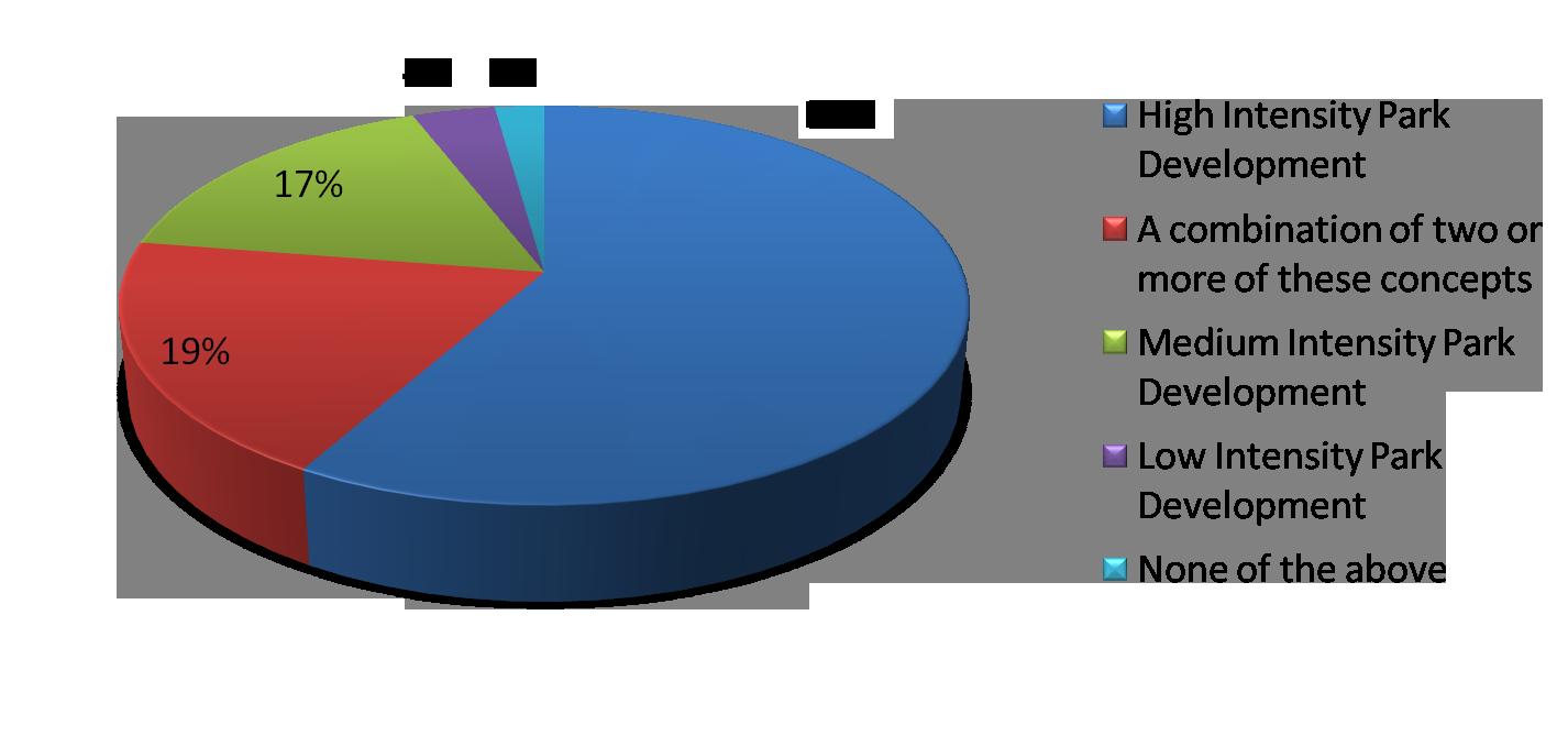

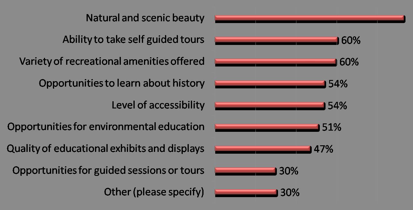
Question Six: Would you be interested in camping at Carvers Creek State Park?

Question Seven: If you are interested in camping, please tell us more about your preferences. What are the most important features for a quality camping experience?

Question Eight:

Creek State Park?
Question Nine: If yes, what type of trails
you

Question Ten: Which local, state or national parks do you and your family visit frequently now?
57%
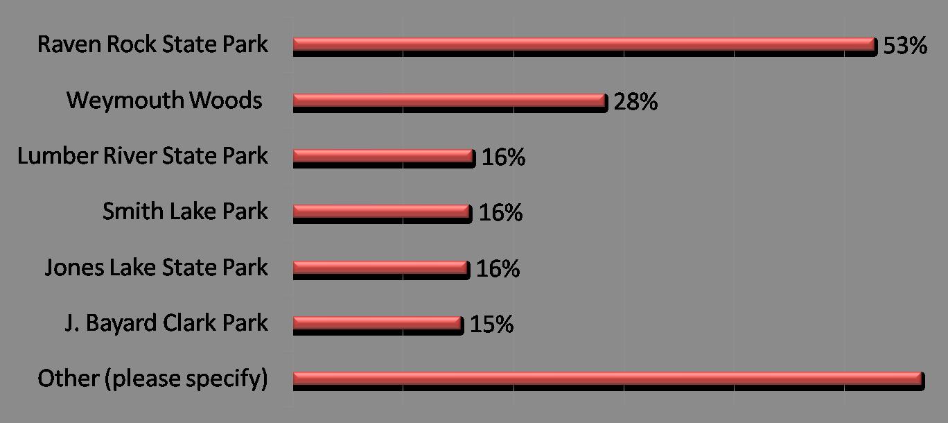
Question Eleven: So we will have an idea of how far you live from the study area, please supply your zip code:

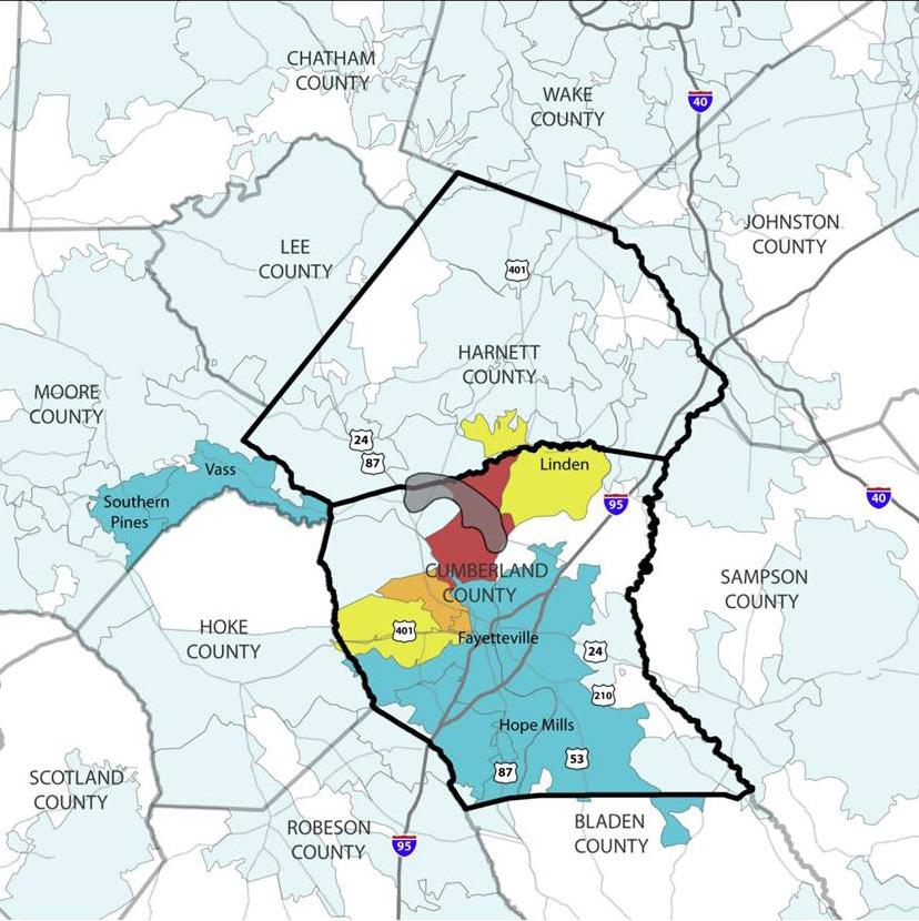
If yes, do you have any photos, memories or stories you would like to share?

“My grandfather, Luther Jackson, worked for Percy Rockefeller at the Long Valley Farm location. . . I have artifacts that I would love to have displayed at the State Park. These artifacts belonged to and were used by my grandpar ents when they lived and worked for the Rockefeller’s. It would be a wonderful way to share with others a little bit of history.”
“My father grew up on Long Valley Farm. I played and rode my bicycle there as a boy. I am looking forward to enjoying spending more time there with my kids and grandkids.”
“I used to take Girls Scouts camping at Carvers Creek back in the mid seventies and it was a great place.”
On site surveys were completed on 1-07-08 and 1-08-08.
This is a potential property purchase/transfer to the State of North Carolina. The following is a list of major deficiencies for the buildings observed at the time of inspection. This list does not contain telecommunication deficiencies.
Note: Should the buildings be considered for public use, ADA accessibility issues would apply (i.e. designated, accessible parking location, suitable ramp and access to and through structure, along with an accessible restroom).
The farm seat complex is located at the south end of the mill pond. It is a wood framed structure with masonry foundation in the form of brick. The building has an asbestos (assumed) shingled gable roof with horizontal asbestos (assumed) wood grained siding. The structure has wood doors and wood framed, single pane windows. The interior is, for the most part, composed of wood paneled walls, wood flooring and wood panel doors. The structure was noted as being constructed in 1937 and 1938.
G-1. Renovation and Restoration of Farm Seat Complex
Estimated Cost: $650,000
Priority: 5 Years
The main farmhouse was built in 1936 and is the centerpiece of Long Valley Farm. The structure is in poor condition. It is a two story wood framed structure that appears to have been without any major renovation since construction. The trim and exterior envelope are showing signs of deterioration. It is recommended that the structure be renovated and restored to period architecture. The renovation and restoration should include full replacement of all electrical, mechanical, plumbing, HVAC and similar components. Asbestos abatement may also be necessary.
Key features of the complex are:
seven fireplaces with five chimneys
exterior siding, including a very early version of masonite
original bathrooms and fixtures
original plumbing
‘glassed in’ second floor porch with louver windows (no longer operable)
original wood doors and windows
plank flooring, ceilings, walls
some plaster walls and ceilings
mostly original electrical wiring
wood shingle roof (near end of useful life)
wood fence around property
M-1. Complete Mechanical and Plumbing Renovation
Estimated Cost: $300,000
Priority: Immediate
The main farmhouse has steam heat with no air conditioning. All mechanical systems are badly aged and corroded. The fuel oil fired boiler, producing 15 psig steam, is obsolete. Fuel oil and steam piping under and within the house is questionable in terms of safety and reliability. Loss of the heating system in freezing weather could result in ruptures in the potable water piping system, as well as flooding. The electric hot water heater in the basement is beyond its normal service life. There is also an underground fuel oil tank in the yard.
It is recommended that the fuel oil fired boiler and electric hot water heater be replaced. It is also recommended that the underground fuel oil tank be checked for oil leakage.
The tractor shed is located adjacent to the new farm manager’s house. It is a typical pole barn structure, with manufactured wood trusses and a metal panel roof. The eaves are also metal paneled. The structure was noted as being constructed in 1992.
The structure is generally in very good condition. No repairs or renovations are recommended at this time.
The springhouse is located at the main farm seat. It is a wood framed and wood sheathed structure with masonry foundation and has a pyramidal hip roof with asphalt shingles. The structure also has a wood door and a poured concrete box extending across back.
G-2. Repair and Restoration of Springhouse
Estimated Cost: $6,000
Priority: Immediate
The springhouse is in fair to poor condition. Vegetation has grown in and around the building. There is an interior concrete box with standing water. The wood siding is in fair condition, but loosely attached in some areas. There is a wood door that does not seal properly. The asphalt shingle roof is in good condition.
It is recommended that water be drained from the interior concrete box and a suitable cover be installed. The deteriorated siding and door be should be reattached and replaced to properly protect the structure. It is also recommended that the vegetation be trimmed back at the interior and exterior of building.
The mill pavilion is located adjacent to the main farm seat on the back edge of the mill pond’s earthen dam. The original, but reworked, concrete spillway for the mill pond is under the pavilion, which rests on a combination of poured in place concrete and heavy timbers. The structure is a heavy, wood timber framed and wood sheathed (1 x 6) roof. The structure has a gabled roof composed of asphalt shingle.
The ends of the roof are covered with wood weatherboard. The open air pavilion has wood flooring, with seating and wooden rails at three sides. The structure was noted as being originally constructed around 1850-1860, then reworked in the 1920’s.
G-3. Repair and Restoration of Mill Pavilion
Estimated Cost: $85,000
Priority: Immediate
The mill pavilion is in fair to poor condition. Major structural members, such as heavy timber, appear to be in good condition, although deterioration of exposed wood flooring and siding at gable ends was noted. One side of the asphalt shingle roof appears to be in good condition. The opposite side is in questionable condition. Erosion was noted at the pavilion and appeared to earthen dam intersection and perimeter of structure. As a result, large timbers appear to have been placed to deter runoff from undermining structure.
It is recommended that vegetation be trimmed back at exterior of building. It is also recommended that deteriorated flooring, railing and structural members be repaired or replaced. There is also damaged and deteriorated siding that should be reattached or replaced to properly protect the structure. The perimeter of mill should undergo re-grading to prevent erosion and damage to structure.
E-1 Upgrade of Electrical System
Estimated Cost: $2,000
Priority: Immediate
This structure needs to have its electrical systems upgraded. In order to meet existing codes, it is recommended that this building be rewired.
The pump house is located adjacent to the mill pavilion, near the main farm seat. It is a wood framed and wood sheathed structure with a concrete foundation made of stone infill. The structure has a gabled roof with asphalt shingles. The structure has non-functional steel and water wheel adjoining foundation. The structure was noted as being constructed in 1938.
G-4. Repair and Restoration of Pump House
Estimated Cost: $15,000
Priority: Immediate
The pump house is in fair to poor condition. Vegetation has grown in and around the structure. The wood siding is in fair condition, but is loosely attached in some areas. The asphalt shingle roof is in good condition.
It is recommended that vegetation be trimmed back at the exterior of the structure. It is also recommended that damaged and deteriorated siding and door be reattached and replaced, as required, to properly protect structure. There is a non-functional steel water wheel in need of sanding or sandblasting. In order to prevent further deterioration, a finish should be prepared and applied to the wheel and housing.
The granary is located adjacent to the farm manager’s house. It is a wood framed and wood sided structure with masonry foundation in the form of concrete piers. The building has a main gabled roof with wood strip sheeting and a side lean-to roof. Both roofs are covered in metal paneling. Located at the front of the first level are wood double doors. The structure also contains an entry loading platform, steps, and single pane windows made of wood. The structure has two levels and was noted as being constructed in 1940.
G-5. Repair and Restoration of Granary
Estimated Cost: $15,000
Priority: Immediate
The granary is in fair to good condition. The wood siding and trim is in fair to poor condition. It is also loosely attached in some areas. There are wood doors that do not seal properly. There is also a front entry loading platform and steps that are in a state of disrepair. There are wood framed windows, which are in very poor condition. The exterior finish, which is painted white, is also showing signs of deterioration. The metal roof is in good condition, although unsecured metal panels were noted.
It is recommended that the front entry platform, steps and wood framed windows be replaced. It is also recommended that the damaged and deteriorated siding and doors be reattached or replaced, as required, to properly protect the structure. The exterior should be scraped, sanded, cleaned, prepared and repainted. The metal panel roof should also be reattached and sealed.
The forge is located adjacent to the new farm manager’s house. It is a heavy wood framed structure. The original structure, more than likely, consisted of a smaller rectangular structure supported on heavy wood sills, which rested on masonry supports. The structure was possibly enlarged on each side with wood creosote support posts and wood sheathing. There are wood rafters that contain strip sheeting. There is also a corrugated metal panel roof with eaves made of wood siding. The structure was noted as being constructed in 1914.
G-6. Repair and Restoration of Forge Estimated Cost: $6,000
Priority: Immediate
The forge is generally in fair to good condition. The wood siding is in fair condition, but loosely attached in some areas. The wood siding of the exterior finish is showing signs of deterioration. The corrugated metal roof appears to be in good condition.
It is recommended that the damaged and deteriorated siding and supports be reattached and replaced, as required, to properly protect structure. It is also recommended that bracing be installed to further protect the structure. The exterior wood siding should be scraped, sanded, cleaned, and prepared. Once complete, a new finish should be applied.
The garage/shop is located adjacent to the new farm manager’s house. It is wood framed structure, supported by concrete block foundation. The floor is composed of concrete slab. The structure has metal panel covered sides and a gabled roof. It also has “home built” wood trusses with wood strip
sheeting. The structure has wood framed windows on two sides and is open at one end. The structure was noted as being constructed in 1942.
G-7. Repair and Restoration of Garage/Shop
Estimated Cost: $5,000
Priority: Immediate
The garage/shop is generally in fair to good condition. The metal siding and trim is in fair condition, but is showing signs of deterioration in some areas. There are wood framed windows, which are in very poor condition. The metal roof is in good condition, but some unsecured metal panels were noted.
It is recommended that the wood framed windows be replaced. It is also recommended that the exterior of the structure be scraped, sanded, cleaned, prepared and repainted. The metal panel roof should be reattached and sealed.
The fertilizer house is located adjacent to the new farm manager’s house. It is a wood framed and wood sided structure with masonry foundation, including concrete piers. It also has a main gabled roof covered in metal paneling and wood strip sheeting. The front of the structure has wood double doors, along with an entry loading platform. Located directly adjacent to the structure is a metal storage tank, which rests on concrete slab. The building is littered with debris, such as cardboard boxes and plastic agricultural pesticide containers. The structure has one level and was noted as being constructed in 1942.
G-8. Repair and Restoration of Fertilizer House
Estimated Cost: $10,000
Priority: Immediate
The fertilizer house is in fair condition, with the exception of the wood siding and trim. Most of the wood siding and trim is in very poor condition and is loosely attached and deteriorated in some areas. There are wood doors that do not seal properly. There is also a front entry loading platform and steps that are in a state of disrepair. The exterior finish, made up of white paint, is also showing major signs of deterioration. The corrugated metal roof is in good condition, but some unsecured metal panels were noted.
It is recommended that the front entry platform and steps be replaced. The damaged and deteriorated siding and doors should be reattached and replaced, as required, to properly protect structure. The metal panel roof should be sealed and replaced. The exterior of the structure should be scraped, sanded, cleaned, prepared and repainted.
The pole barn/equipment shed is located adjacent to the new farm manager’s house and is typical pole barn construction. The structure has wood creosote support posts, wood beam rafter supports, “home built” wood trusses, wood stripped sheeting, and a metal panel roof. The eaves are also composed of metal paneling. The structure was noted as being constructed in 1955.
G-9. Repair and Restoration of Equipment Shed
Estimated Cost: $3,000
Priority: Immediate
The equipment shed is in fair to good condition, but has a noticeable lean/shift in one corner and a sag at the center of the lower truss cords. The metal roof appears to be in good condition.
It is recommended that the shed be rebuilt to remedy lean. The lower “home built truss” cords should be reworked to more effectively support the roof. Bracing should also be installed to further protect structure.
The equipment barn is located in a pasture adjacent to the main barn. It is a wood framed and metal sided structure, containing masonry in the form of a concrete block foundation. The structure has one level with dirt flooring. The structure has a main gabled roof, which is covered in metal paneling. It also has “home built” trusses and wood strip sheeting. Located at the front of the structure is a metal covered door with wood framing. Located at the rear of the structure are wood double doors. The structure was noted as being constructed in 1940.
G-10. Repair and Restoration of Equipment Barn
Estimated Cost: $3,000
Priority: Immediate
The equipment barn is in fair to very good condition. The corrugated paneled metal roof is in good condition. The roof and sides of the structure were noted as having unsecured metal panels.
It is recommended that the damaged and deteriorated siding and roof panels be replaced, as required, to properly protect structure. There are doors located in the rear of the building, which are also in need of repair. There is also foliage adjacent to the structure in need of trimming.
The hay barn is located adjacent to the farm silo. It is a wood framed and metal sided structure with masonry in the form of a poured-in-place concrete foundation. The structure has one level with dirt flooring. The building has main gabled roof with metal paneling, trusses and wood strip sheeting. Located at the front and rear of the structure are sliding wood framed doors, along with the remnants of a livestock gate. The structure was noted as being constructed in 1940.
G-11. Repair and Restoration of Hay Barn
Estimated Cost: $3,000
Priority: Immediate
The hay barn is in fair to good condition, although a slight “hump” was noted on the east side of the structure. The “hump” is located along the lower bottom plate line, atop concrete foundation, and does not appear to be affecting the integrity of the structure at the present time. The corrugated paneled metal roof is in good condition. The metal paneling on the roof and sides of the structure are unsecure.
There is also a small hole located on the west side of the roof, possibly caused by previous storm damage.
It is recommended that the damaged and deteriorated siding and roof panels be reattached and replaced, as required, to properly protect structure. There are doors and livestock gates in need of repair in order to operate properly. There is also foliage adjacent to the structure in need of trimming.
The silo shed is located adjacent to the silo. It is composed of masonry in the form of concrete piers, a foundation and wood floor. The structure also has a roof covered in metal paneling with wood strip sheeting. The structure has one level. The structure was noted as being constructed in 1966.
G-12. Repair and Restoration of Silo Shed
Estimated Cost: $3,500
Priority: Immediate
The silo shed is in fair to poor condition. The wood framing, floor and trim is in fair to poor condition. There is a wood door that does not seal properly. There are also steps that are in a state of disrepair. The metal roof and siding is in fair condition, but some unsecured metal panels and general disrepair were noted.
It is recommended that the floor, trim and wood framing be repaired and replaced. The metal paneled roof and siding should also be reattached and sealed.
E-2 Upgrade of Electrical System
Estimated Cost: $2,000
Priority: Immediate
This structure needs to have its electrical systems upgraded. In order to meet existing codes, it is recommended that this building be rewired.
The pump house is located adjacent to the new farm manager’s house. It is a small, wood framed structure with a shed roof, wood strip sheeting and remnants of a metal paneled roof. The wood sheathing is diagonal with asphalt shingle exterior. The structure includes masonry foundation in the form of concrete block and a dirt floor. The interior of the structure has a wood door and remnants of pump housing. The structure was noted as being constructed in 1940.
G-13. Repair and Restoration of Pump House
Estimated Cost: $5,000
Priority: Immediate
The pump house is in very poor condition. Vegetation has grown in and around the structure. Located at the rear of the structure is wood sheathing that has fallen or been torn off. The majority of metal roof panels are missing, which means the structure is open to weather. The exterior asphalt shingles are in very poor condition and offer very little protection from the elements.
It is recommended that damaged and deteriorated asphalt shingles be removed, or abated, as required. It is also recommended that damaged diagonal wood sheathing be removed and replaced. Damaged metal roof panels should also be replaced. New strip sheeting and metal roofing should also be installed. There is a wood door in need of repair and/or rebuilding. New asphalt shingles should be installed to match existing shingles. There are also exposed rafter tails and wood trim that should be repainted.
The water tower is located adjacent to the new farm manager’s house. It consists solely of an iron water tower frame resting on concrete pads. There is also a rusty and unstable supply pipe and ladder rising vertically within the framework. Vegetation has grown up within the framework.
G-14. Repair of Water Tower
Estimated Cost: $1,000
Priority: Immediate
The water tower is generally in fair condition.
It is recommended that the rusty and unstable supply pipe riser and ladder be removed. Vegetation should be cleared and barriers installed to prevent access to tower.
Worker’s house #1 is an L-shaped, wood framed and wood sided structure. It contains masonry foundation in the form of brick piers with concrete block infill at main portion. There is a rear addition to the structure, which is supported by concrete piers with concrete block infill. There is also a shed roofed bathroom addition, supported by creosote posts. The structure has a main gabled roof covered with metal paneling. It also contains wood strip sheeting with a back lean-to and shed roof, both of which are also metal paneling. The structure has wood doors and wood framed, single pane windows. The interior has bead-board wall paneling and 5-panel wood doors. There is also a bathroom that was, more than likely, added during the mid to late sixties. The structure was noted as being constructed in 1914, then moved and expanded in 1938.
G-15. Renovation and Restoration of Worker’s House #1
Estimated Cost: $125,000
Priority: Immediate
Worker’s house #1 is generally in fair to poor condition. The majority of wood siding and trim is also in fair to poor condition. It is also deteriorated and loosely attached in some areas. The wood framed windows are in very poor condition. The exterior finish, which is painted white, is also showing major signs of deterioration. The metal roof is in fair condition, although unsecured metal panels were noted.
It is recommended that the bathroom addition be demolished and removed from main portion of structure. The non-period front porch railing and other accompaniments should also be removed. The structure should be renovated and restored to 1938 period architecture.
Estimated Cost: $500
Priority: Immediate
The installation of smoke detectors is recommended. This is for the protection of sleeping areas, as required by code.
E-4 Upgrade of Electrical System
Estimated Cost: $2,000
Priority: Immediate
This structure needs to have its electrical systems upgraded. In order to meet existing codes, it is recommended that this building be rewired.
Worker’s house #2 is also an L-shaped, wood framed and wood sided structure with masonry foundation and chimneys. The masonry is in the form of brick piers with brick infill. The structure has a main gabled roof covered with metal paneling. It also contains wood strip sheeting with a back lean-to and shed roof (bathroom addition), both of which are also metal paneling. The structure has wood doors and wood framed, single pane windows. The original porches at the front and rear of the structure have been enclosed. The structure was noted as being constructed in 1914.
Note: Access to interior of the structure was not available at time of survey.
E-5 Recommend Installation of Fire Alarm System
Estimated Cost: $500
Priority: Immediate
The installation of smoke detectors is recommended. This is for the protection of sleeping areas, as required by code.
M-2 Complete Mechanical and Plumbing Renovation
Estimated Cost: $40,000
Priority: Immediate
Worker’s house #2 is heated by several portable kerosene wick heaters, causing the risk of fire to be extremely high. The method of heating, along with very high fuel loads inside the building and the old electrical system in this structure are all contributing factors to the (fire risk?). This should be addressed as soon as possible. The structure has a new hot water heater, is cooled by window air conditioners, and has water provided by a shallow (15 foot deep) well.
G-16. Renovation and Restoration of Worker’s House #2
Estimated Cost: $150,000
Priority: Immediate
Worker’s house #2 is generally in fair to poor condition. The majority of wood siding and trim is also in fair to poor condition, but is deteriorated and loosely attached in some areas. The exterior finish, which is painted white, is also showing signs of deterioration. The metal roof is in fair condition, although some unsecured metal panels were noted. There are also wood framed windows, which are in poor condition.
It is recommended that the non-period porch enclosures and other accompaniments be removed. The structure should also be renovated and restored to period architecture.
Worker’s house #3 is a wood framed structure with partial wood siding. The structure contains masonry foundation, including brick piers. The main gabled roof is covered in metal paneling and contains wood strip sheeting. The structure was noted as having been altered and moved from a previous location. As a result, portions of the structure have exposed interior sheathing, as well as an incomplete building envelope. The structure has one level. The structure was noted as being constructed in 1925 and partially dismantled in 1992.
Estimated Cost: $6,000
Priority: Immediate
The remaining structure is in very poor condition. The site is also littered with debris. There are major signs of deterioration on wood trim, windows, framing, and a door. The remaining architectural, mechanical and electrical systems are beyond repair.
It is recommended that hazardous materials associated with this building demolition be abated. It is also recommended that the structure be demolished. Once the demolition is complete, the site should be cleaned, graded and reseeded.
The bulk tobacco barn sits adjacent to a manufactured bulk barn and is located at the edge of the open pasture, near the east side of the main path to Manchester Road. The structure is wood framed and supported by a concrete block foundation. The building has a gabled roof covered in metal paneling. It also contains wood strip sheeting and large plywood swinging doors. The structure was noted as being constructed in 1970.
G-18. Repair and Restoration of Tobacco Barn
Estimated Cost: $3,000
Priority: Immediate
The tobacco barn is in fair to good condition. Although the metal siding and trim are in fair condition, some areas are showing signs of deterioration. The metal roof is in good condition.
It is recommended that debris be cleared from around the barn. It is also recommended that loose panels at the metal paneled roof be reattached and sealed. There are also wood sided eaves in need of repair and swinging plywood doors that should be repainted.
Worker’s house #4 is a one-story wood framed structure. It contains an attic and front gable with side wings. The house has a wood weatherboard exterior with exposed rafter tails and a sheet metal roof on wood strip sheeting. The structure has front and rear porches and includes brick pier and concrete block foundation. The structure was noted as being constructed in 1925 and altered around 1962-1964.
G-19. Repair and Refurbishing of Worker’s House
Estimated Cost: $ 55,000
Priority: Immediate
Worker’s house #4 is in fair to good condition. Although the wood siding and trim is in fair condition, the finish at the exterior weatherboard is showing signs of deterioration. This is mainly evident at the rear of the weatherboard. The vinyl framed and aluminum storm windows are in good condition. The exterior trim finish, which is painted white, is showing signs of deterioration. The metal roof is in fair to poor condition with noticeable rust and deterioration. There are major signs of age and deterioration on the flooring of the front porch. There was no insulation noted at crawl space flooring.
It is recommended that the deteriorated front porch flooring, exterior siding and associated trim be replaced. The remaining side and trim, as well as new materials, should be prepared and painted. It is also recommended that the metal roof be scraped, sanded, cleaned, sealed, and repainted. Insulation should also be installed at the floor system crawl space.
M-3 Complete Mechanical and Plumbing Renovation
Estimated Cost: $25,000
Priority: 1 Year
This structure has a DX air conditioning system and a fuel oil furnace. The electric hot water heater is functioning and appears to be serviceable. Soot above the floor registers indicates that the furnace heat exchanger may be leaking carbon monoxide into the house. Water from the adjacent pump house has high iron content, causing discoloration in the bathroom sink.
It is recommended that all plumbing and HVAC system components be replaced. It is also recommended that carbon monoxide levels be checked before the house is reoccupied.
Worker’s house #5 is a one-story concrete block structure with a sheet metal roof, attic and front gable. The front porch has a concrete block foundation, poured concrete floor and metal posts. The structure was noted as being constructed in 1947.
G-20. Demolition of Block House
Estimated Cost: $25,000
Priority: Immediate
Worker’s house #5 is in very poor condition. The site is littered with debris. There are major signs of deterioration evident in the wood trim, windows and front porch framing. The architectural, mechanical and electrical systems are beyond repair.
It is recommended that hazardous materials associated with this building demolition be abated. It is also recommended that the structure be demolished. Once the demolition is complete, the site should be cleaned, graded and reseeded.
North pasture tobacco barn #1 is located in a large open field at the far northeast reach of the property. The structure is made of concrete block masonry with the remnants of a wood framed, metal covered roof. There are two door openings without doors. The tier poles have been removed. The structure was noted as being constructed between 1939 and 1940.
G-21. Repair and Restoration of Tobacco Barn
Estimated Cost: $10,000
Priority: Immediate
North pasture tobacco barn #1 is in fair to good condition. This assessment does include the walls.
It is recommended that the remnants of the roof be torn off. It is also recommended that a new roof structure and covering be installed. Vacant openings should have doors installed. The tier poles and tobacco barn should be restored to period architecture.
North pasture tobacco barn #2 is located in a large open field at the far northeast reach of the property. This structure is in better condition than the previous tobacco barn and is composed entirely of concrete block masonry. There are remnants of a wood framed, metal covered roof. There is one door opening with without a door. The tier poles have been removed. The structure was noted as being constructed between 1939 and 1940.
G-22. Repair and Restoration of Tobacco Barn
Estimated Cost: $10,000
Priority: Immediate
North pasture tobacco barn #2 is in fair to good condition. This assessment does include the walls.
It is recommended that remnants of the roof be torn off. It is also recommended that a new roof structure and covering be installed. The vacant door opening should have a door installed. The tier poles and tobacco barn should be restored to period architecture.
G-23 Roof Replacement
Estimated Cost: $1,000
Priority: 3 Years
The woodshed is in very poor condition. It is an open woodshed with a metal roof.
It is recommended that the structure be renovated. This includes replacement of the roof.
G-24 Full Renovation
Estimated Cost: $12,000
Priority: 3 Years
The farm seat garage is in poor condition. It is a wood framed structure with lapboard sidings and a metal roof.
It is recommended that the structure be renovated or restored to historical quality.
G-25 Demolition of Site
Estimated Cost: $3,000
Priority: Immediate
This structure was originally used as a shop for dog kennels with attached cages/pens. It has wood siding with storm windows and a metal roof. It is currently used for offices and storage. This building is not purported to have historical significance.
It is recommended that this structure be demolished and the site graded to a safe condition.
G-26 Demolition of Site
Estimated Cost: $3,000
Priority: Immediate
The boathouse is in extremely poor condition. All components including wood siding, doors and framing are in poor to dangerous condition. Renovation of this structure does not appear to be practical or feasible.
It is recommended that this structure be demolished and the site graded to a safe condition.
Note: If the structure is deemed significant to the park, it should be examined, photographed and archived for information to use for a replicate building.
G-27 Historical Quality Renovation/Restoration
Estimated Cost: $600,000
Priority: 5 Years
The mill house, dam gates and spillway are in extremely poor condition and present a safety hazard.
All components of the structure are in very poor condition. This includes framing, floors, ceilings, doors, windows and the roof. The equipment in the structure is rusted and non-functional. The structure will continue to weather and deteriorate unless restored.
It is recommended that the structure be renovated or restored to historical quality. It is also recommended that the area be fenced immediately to prevent unauthorized entry.
Estimated Cost: $45,000
Priority: 5 Year
Worker’s house #4 is in very poor condition and is leaning. It contains a dirt floor and metal roof, which is rusted and no longer useful. The pump house is made of cinderblock. These structures will continue to deteriorate unless they are renovated or restored.
It is recommended that worker’s house #4 receive an extensive renovation to restore the structure to historical quality. The pump house is also in need of a less extensive renovation.
G-29 Roof Replacement
Estimated Cost: $45,000
Priority: 5 Year
The pack house is in poor condition. It is a wood framed structure with wood windows and metal siding. It also contains a metal roof, which is in poor condition.
It is recommended that the roof, wood doors and windows be replaced. It is also recommended that the metal siding be repaired.
G-30 Demolition
Estimated Cost: $5,000
Priority: Immediate
Tobacco barn #2 has completely fallen in and is a pile of debris.
Tobacco barn #1 is in very poor condition and presents a safety hazard. All wood is rotten and the structure is unstable and unsound.
The remains of the partly standing tobacco barn should be demolished. Both barns and debris should be removed and the site restored to a safe condition.
The storage shed is in very good condition. It consists of metal walls, a garage, doors and a concrete floor.
Estimated Cost: $1875
Priority: Immediate
This structure needs to have its electrical systems upgraded. In order to meet existing codes, it is recommended that this building be rewired.
G-31 Demolition and Site Restoration
Estimated Cost: $3,000
Priority: Immediate
The hog shelter/feeding house is in poor condition and is currently being used as a dog pen. It has no real value and presents a safety hazard. It is recommended that the structure be demolished and the site restored to a safe condition.
G-32 Demolition and Site Restoration
Estimated Cost: $3,000
Priority: Immediate
The machine shed is in very poor condition and presents a safety hazard. It is recommended that this structure be demolished and the site restored to a safe condition.
G-33 Demolition and Site Restoration
Estimated Cost: $250,000
Priority: 5 Years
The overseer’s house is in extremely poor condition and is beyond restoration. It contains a rusted metal roof, as well as rotted and deteriorated wood. Renovation of this structure does not appear to be practical or feasible.
It is recommended that this structure be demolished and the site restored to a safe condition. It is also recommended that the structure be fenced to prevent unauthorized entry.
G-34 Wall and Roof Replacement
Estimated Cost: $20,000
Priority: 5 Years
The grain bin is in good condition. The structure has metal siding, which is beginning to rust and should be maintained.
It is recommended that the metal walls and roof be replaced.
G-35 Roof Replacement
Estimated Cost: $5,000
Priority: 5 Years
This structure is a concrete silo with a metal roof.
It is recommended that the roof be replaced.
G-36 Renovation/Rebuilding
Estimated Cost: $20,000
Priority: 5 Years
The feeder shed is in fair condition. This structure is a creosote treated pole barn with light wood roof framing and a metal roof.
It is recommended that the entire structure be renovated or replaced in approximately five years.
G-37 Rebuilding and Fencing
Estimated Cost: $250,000
Priority: 5 Years
The great barn is in very poor condition and is a safety hazard. Almost all of the wood used for this structure is deteriorated.
It is recommended that the structure be rebuilt. Some of the wood on the current structure could possibly be used in rebuilding. It is also recommended that the structure be fenced off to prevent unauthorized entry.
G-38 Historical Quality Renovation/Restoration
Estimated Cost: $30,000
Priority: 5 Years
The pack house is in fair condition. The structure includes a brick foundation with metal walls. The original wood doors and windows are rotten and have deteriorated. The wood floors and metal roof are in fair to good condition. The building appears to be structurally sound, but could be restored. The structure will continue to weather and deteriorate unless restored.
It is recommended that the entire structure be restored or replaced.
G-39 Roof and Wall Repairs
Estimated Cost: $15,000
Priority: 3 Years
The tractor shed is in fair to good condition. It contains three metal siding walls, a roof and one window.
It is recommended that the walls and roof be repaired.
G-40 Exterior/Interior Painting and Minor Repairs
Estimated Cost: $25,000
Priority: 3 Years
The farm manager’s residence is a brick ranch style house. It is currently occupied and is very well maintained. Almost all components are original, including carpeting, flooring, windows and doors. A new roof was installed in 1990. The structure was noted as being constructed in 1970.
It is recommended that the exterior wood trim, windows, doors, interior gypsum board walls and interior trim be painted. It is also recommended that there be minor repairs made to some of the deteriorating wood window frames. The carpet should also be replaced.
E-7 Installation of Fire Alarm System
Estimated Cost: $500
Priority: Immediate
The installation of smoke detectors is recommended. This is for the protection of sleeping areas, as required by code.
G-41 Demolition and Restoration of Site
Estimated Cost: $1,000
Priority: Immediate
Worker’s house # 2 garage is located behind a currently occupied retired worker’s house. It is a small and extremely deteriorated shed that can not be restored. If the structure is determined to have historical significance, it would need a historical replacement.
It is recommended that the site be demolished and restored to a safe condition.
G-42 Exterior/Interior Painting
Estimated Cost: $10,000
Priority: 3 Years
The new farm manager’s house is a ranch style house. It is currently occupied and is in very good condition. The structure was noted as being constructed in 1988.
It is recommended that the windows, doors, interior walls, and trim (interior and exterior) be painted. It is also recommended that the carpet be replaced.
E-8 Installation of Fire Alarm System
Estimated Cost: $500
Priority: Immediate
The installation of smoke detectors is recommended. This is for the protection of sleeping areas, as required by code.
G-1
M-1 $300,000
G-2 $6,000
G-3 $85,000
E-1 $2,000
G-4 $15,000
G-5 $15,000
G-6 $6,000
G-7 $5,000
G-8 $10,000
G-9 $3,000
G-10 $3,000
G-11 $3,000
G-12 $3,500
E-2 $2,000
G-13 $5,000
G-14 $1,000
G-15 $125,000
E-3 $500
E-4 $2,000
E-5 $500
M-2 $40,000
G-16 $150,000
G-17 $6,000
G-18 $3,000
G-19 $55,000
M-3
G-20 $25,000
G-21 $10,000
G-22 $10,000
G-23
$650,000
$25,000
$1,000
G-24 $12,000
G-25 $3,000
G-26 $3,000
G-27 $600,000
G-28 $45,000
G-29 $45,000
G-30 $5,000
E-6 $2,000
G-31 $3,000
G-32 $3,000
G-33 $250,000
G-34 $20,000
G-35 $5,000
G-36 $20,000
G-37 $250,000
G-38 $30,000
G-39 $15,000 G-40 $25,000
E-7 $500
G-41 $1,000
G-42 $1,000 E-8 $500 TOTAL $912,500
$1,915,000
TOTAL COST OF ALL OF THE ABOVE: $2,906,500
Note: The costs shown do not include necessary amounts for contingencies, design fees, and escalation.
New Parks for a New Century: Proposed Addi ons to the North Carolina State Parks System, April 2002, h p:// www.ncparks.gov/About/plans/new/main.php
N.C. River Basin Map, h p://www.eenorthcarolina.org/public/ecoaddress/riverbasins/riverbasinmap/interacve.htm
N.C. Geology Map, h p://www.geology.enr.state.nc.us/usgs.geomap.htm
N.C. State Physiographic Map, NC Geological Survey Division of Land Resources, h p://www.geology.enr.state. nc.us
U.S. Forest Service, Equestrian Design Guidebook for Trails, Trailheads, and Camping, h p://www.fs.fed.us/t-d/ pubs/htmlpubs/htm07322816/pqge 12.htm
N.C. Division of Parks and Recrea on, NC Outdoor Recrea on Plan 2009-2013 (SCORP), h p://www.ncparks.gov/ About/plans/scorp/main.php
N.C. Division of Parks and Recrea on, Environmental Sustainability Ini a ves, h p://www.p2pays.org/ ref/07/06568/2001/nframe.asp?type=AGY&page=AGY-parks.htm
USFS Na onal Survey on Recrea on and the Environment (NSRE) for North Carolina and the North Carolina Market Region, h p://www.srs.fs.usda.gov/trends/Nsre/nsremod.html
N.C. Department of Water Quality, h p://portal.ncdenr.org/web/wq
Cumberland County Parks and Recrea on Plan, h p://www.fcpr.us/
Cumberland County Planning, h p://www.co.cumberland.nc.us/planning.aspx
Hagley Museum and Library, Manuscripts and Archives Department, J.B. Campbell Water Wheel Company, h p://www.hagley.lib.de.us/
Fire Ra ngs of Archaic Materials and Assemblies, h p://www.huduser.org/publica ons/destech/fire.html
914 Code for Fire Protec on in Historic Structures, Na onal Fire Protec on Associa on (NFPA), h p://nfpa.org
Secretary of the Interior’s Standards for the Treatment of Historic Proper es, h p://www.nps.gov/history/hps/ tps/standards_guidelines.htm
N.C. EEP Conserva on Easement, State of North Carolina Conserva on Easement, September 2007
Faye eville Area Metropolitan Planning Organiza on, 2035 Long Range Transporta on Plans, April 2009
FAMPO Mul -Modal Conges on Management Plan, Town of Spring Lake, December 2009
Na onal Register of Historic Places, United States Department of the Interior, Na onal Park Service, March 1994
N.C. DENR - Division of Water Quality, Water Quality Planning Sec on
N.C. DENR - Basinwide Assessment Report - Cape Fear River Basin, August 2004
FCAP DOI Report, Report: Property at SR 1451 (Manchester Road), Long Valley Farms, Spring Lake N.C.
FIRM Maps, NC Flood Insurance Rate Map Panel 0503, January 2007
TNC Site Survey Reports - Carvers Falls, Sandhills, Long Valley Farm
Archaeological Survey of a Proposed Water Line - Harne County, NC, October 2007
An Inventory of the Significant Natural Areas of Harne County, NC - North Carolina Natural Heritage Program, February 2007
Natural Area Inventory of Cumberland County, North Carolina, 2002
UT to Jumping Run Creek Stream and Wetland Restora on Plan, Cumberland County, North Carolina. Prepared for NCDENR – EEP, July 2008
Overhills, North Carolina; Historic American Landscape Survey Level One Recorda on, The Jaeger Company, January 2006
Rural Industries of the Sand Hills; Georgia, South Carolina and North Carolina, A Historic Context, New South Associates, 2009
Stewardship Management Plan - Long Valley Farm, The Nature Conservancy, 2005
Overhills, North Carolina Interac ve Museum, DVD, Fort Bragg Cultural Resources
Overhills (Images of America: N.C.) - Jeffrey D. Irwin and Kaitlin O’Shea, 2008
Real Property Master Plan, Long Range Component - Fort Bragg, North Carolina, October 2008
Phase II Tes ng of Eight Sites (31CD1356, 31CD1396, 31CD1411, 31HK2022, 31HK2026, 31HK2444, 31HK2485, and 31HT804), Cumberland, Hoke and Harne Coun es, Fort Bragg, North Carolina - Jay W. Gray, 2009
Phase II Archaeological Tes ng and Evalua on of Five Prehistoric Sites in Harne and Cumberland Coun es, Fort Bragg, North Carolina - John S. Cable, 2010
Orthophotography Data cumb_naip08
Cumberland County parcels cumberland_parcels
National Agriculture Imagery Program 2008
Cumberland County Planning Dept. 2008
Harnett County Parcels harnett_parcels Harnett County Planning Dept. 2008
Hydrology Streams/Rivers hydro24k_arc
N.C. Division of Water Quality 2006
Hydrology Lakes hydro24k_poly N.C. Division of Water Quality 2006
Landcover lc96 N.C. Center for Geographic Information and Analysis 1998
Municipal Boundaries Municipalboundaries_polys N.C. Department of Transportation 2008 Roads LRCS_Arcs N.C. Department of Transportation 2008
Forsyth County Elevation LIDAR elevation N.C. Department of Transportation 2007
Davie County Elevation LIDAR elevation N.C. Department of Transportation 2007 Railroad rr N.C. One Map 2007
Soil Cumberland County soil_nc051
U.S. Department of Agriculture, Natural Resources Conservation Service 2009
Soil Harnett County soil_nc086 U.S. Department of Agriculture, Natural Resources Conservation Service 2007 Utilities utilities Cumberland County Planning Dept. 2000
Forsyth County 100 year Flood eflood N.C. Division of Emergency Management 2007
Davie County 100 year Flood eflood N.C. Division of Emergency Management 2007
Study Area Study_Area_approx N.C. Department of Parks and Recreation 2010 Ecosystem Enhancement Progam EEP_Restoration N.C. Department of Parks and Recreation 2009 Red cockaded Woodpecker Colonies fa_rcwtrees N.C. Department of Parks and Recreation 2009 Natural Element Occurrences nheo N.C. Department of Parks and Recreation 2009
CACR State Park Boundaries CACR_stprk_boundaries N.C. Department of Parks and Recreation 2009 Significant Natural Heritage Areas snha N.C. Department of Parks and Recreation 2009
Long Valley Farm Long_valley_Farm N.C. Department of Parks and Recreation 2009
Long Valley Farm Roads LVF_Roads N.C. Department of Parks and Recreation 2009
Long Valley Farm Life Estates LVF_life_estates N.C. Department of Parks and Recreation 2009 Revised CACR Study Area CACR_ncprk N.C. Department of Parks and Recreation 2009
CACR Sandhills Roads CACR_sandhills N.C. Department of Parks and Recreation 2009 CACR Wetland Crews cumb_crews N.C. Department of Parks and Recreation 2010
geol N.C. DENR Division of Land Resources, N.C.
Geological Survey 1998
Hillshade Cumberland County hillshade N.C. Department of Transportation 2007 Hillshade Harnett County hillshade N.C. Department of Transportation 2007
Wetland nwi U.S. Fish & Wildlife Service, National Wetlands Inventory 1999
Cumberland County Topography LIDAR Contour_02
N.C. Department of Transportation 2007
Cumberland County Topography LIDAR Contour_04 N.C. Department of Transportation 2007
Cumberland County Topography LIDAR Contour_20
N.C. Department of Transportation 2007
Harnett County Topography LIDAR Contour_02 N.C. Department of Transportation 2007 Harnett County Topography LIDAR Contour_04 N.C. Department of Transportation 2007
Harnett County Topography LIDAR Contour_20 N.C. Department of Transportation 2007 Bike Routes BikeRoutes N.C. Department of Transportation 2005 County Boundaries cb100poly N.C. Department of Transportation 2006