Planning Handbook

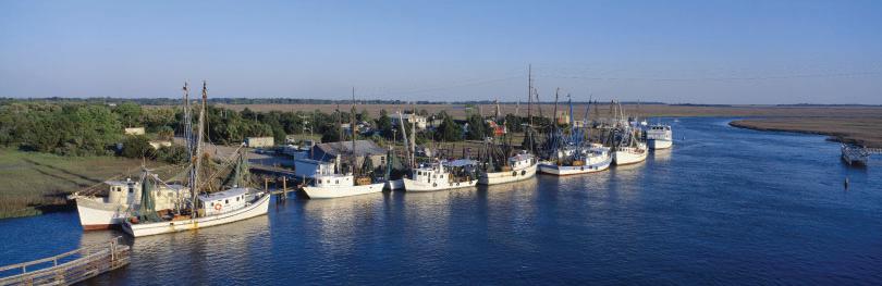
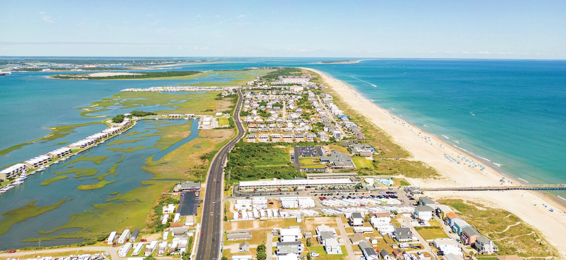
Resilient Coastal Communi es Program Contents Planning Handbook AUGUST 2023 FRONT COVER IMAGE: Topsail Island, NC 3 List of Acronyms 4 How to Use this Handbook 4 PURPOSE 4 AUDIENCE 4 PROGRAM CONTACTS 5 Introduction 8 PROGRAM OBJECTIVES 8 PROGRAM SCOPE 9 PHASES & OBJECTIVES 9 DELIVERABLES 9 PROGRAM CONTEXT 10 BEFORE GETTING STARTED 11 PHASE 1: COMMUNITY ENGAGEMENT & RISK/ VULNERABILITY ASSESSMENT PHASE 1: COMMUNITY ENGAGEMENT & RISK/VULNERABILITY ASSESSMENT 12 Step 1: Develop a Community Action Team 14 Step 2: Review Existing Plans & Efforts 16 BUILDING UPON HAZARD MITIGATION PLANS 16 IDENTIFY & FILL DATA GAPS 19 Step 3: Set Vision and Goals 21 Step 4: Develop a Community Engagement Strategy


Planning Handbook written and funded in collaboration by: North Carolina 28 Step 5: Identify and Map Critical Assets, Natural Infrastructure, and Socially Vulnerable Populations 30 REQUIRED CRITICAL ASSETS TO MAP 31 SOCIAL VULNERABILITY 31 Step 6: Conduct Risk & Vulnerability Assessment 31 DIFFERENCE BETWEEN HAZARD MITIGATION PLANS & RESILIENCE PLANNING 32 IDENTIFY AND MAP THE HAZARDS 33 IDENTIFYING POTENTIAL HAZARDS & NON-CLIMATE STRESSORS 34 ASSESS VULNERABILITY 34 DETERMINE CUMULATIVE VULNERABILITY 36 ESTIMATE RISK 38 PHASE 2: PL ANNING, PROJECT IDENTIFICATION, PHASE 2: PLANNING, PROJECT AND PRIORITIZATION 39 Step 1: Identifying a Suite of Potential Solutions 41 DRILLING DOWN BY TOPIC 42 FLOODPLAIN/STORMWATER MANAGEMENT 44 PRE- AND POST-DISASTER RECOVERY AND REDEVELOPMENT 45 Step 2: Consolidate and Prioritize Projects 46 EVALUATE STRATEGIES AND THEIR FEASIBILITY 49 Resilience Strategy 50 Next Steps 51 Technical Appendix 51 PHASE 1: COMMUNITY ENGAGEMENT & VULNERABILITY ASSESSMENT 68 PHASE 2: PLANNING, PROJECT IDENTIFICATION, AND PRIORITIZATION 24 KEY COMMUNITY ENGAGEMENT CONSIDERATIONS 24 EXAMPLES FROM EFFECTIVE ENGAGEMENT STRATEGIES 27 ADDITIONAL INFORMATION
Resilient Coastal Communi es Program
List of Acronyms
CAMA Coastal Area Management Act
CAT Community Action Team
CHPP Coastal Habitat Protection Plan

DCM Division of Coastal Management
DEQ Department of Environmental Quality
EESI Environmental and Energy Study Institute
EO80 Executive Order 80
FEMA Federal Emergency Management Act
MOU Memorandum of Understanding
NCEM North Carolina Emergency Management
NCORR North Carolina Office of Recovery and Resiliency
NGOs Non-Governmental Organizations
NIST National Institute of Standards and Technology
NOAA National Oceanic and Atmospheric Administration
RCCP Resilient Coastal Communities Program
RENA Resilience Evaluation Needs and Assessment
RISE Regions Innovating for Strong Economies
N.C. Resilient Coastal Communities Program PLANNING HANDBOOK List of Acronyms 3
How to Use this Handbook
Purpose
The purpose of the NC Resilient Coastal Communities (RCCP) Handbook is to guide contractors and local governments in completing Phases 1 and 2 of the RCCP. Important existing data, tools, and resources are incorporated within the handbook to assist with the process. Additionally, specific program requirements are identified throughout.
Audience
There are several intended audiences for this handbook, including:
1. Contractors offering technical assistance to participating communities
2. Localities selected to receive direct technical assistance services through the RCCP or wishing to complete the requirements of the RCCP by their own means
3. Community Action Team participants
Some sections of this handbook may not be applicable to each audience but are intended to assist with completing program requirements. Local governments wishing to receive credit for previous efforts and/or to complete the requirements of the RCCP by their own means must contact program coordinators to discuss this process.
Program Contacts
Please direct questions related to the Resilient Coastal Communities Program and this handbook to any of the Division of Coastal Management (DCM) contacts below:
Mackenzie Todd
Coastal Resilience Specialist
Mackenzie.Todd@deq.nc.gov
Kasen Wally
Coastal Resilience Specialist
Kasen.Wally@deq.nc.gov
Tancred Miller
Policy & Planning Section Chief Tancred.Miller@deq.nc.gov
Program Email RCCP@deq.nc.gov
N.C. Resilient Coastal Communities Program PLANNING HANDBOOK How to Use this Handbook 4
The Resilient Coastal Communities’ Program (RCCP) is the culmination of coastal resilience effor ts in North Carolina over the last several years. Beginning after Hurricane Matthew in 2016, the Division of Coastal Management (DCM) piloted the Resilience Evaluation and Needs Assessment (RENA). Five coastal communities, including Duck , Edenton, Hatteras Village, Oriental, and Pine Knoll Shores, participated in the pilot program and began assessing their physical and social vulnerabilities to coastal hazards. Through the RENA process, DCM and its partners worked with local governments to map community assets, engage with, and educate the public, identify communities’ social and physical vulnerabilities, and explore potential projects to mitigate future impacts from flooding, sea level rise, and other extreme weather events. This process led to several positive outcomes, including a more localized understanding of the impacts of hazards on essential community assets, increased public engagement in the resilience planning process, and the development of additional resources to include in grant applications for proposed resilience projects.
After Hurricane Florence made landfall in 2018, DCM began developing resources for local governments to address the negative impacts of coastal hazards, including the Coastal Adaptation and Resiliency Website and the NC Coastal Community Resiliency Guide. In addition, Governor Cooper issued Executive Order 80, which called for the development of the 2020 Climate Risk Assessment and Resilience Plan, which catalyzed the development of a larger umbrella program, the Resilient Communities Program. This program now houses the RCCP and RISE (Regions Innovating for Strong Economies and Environment Program). While
N.C. Resilient Coastal Communities Program PLANNING HANDBOOK Introduction 5
Introduction
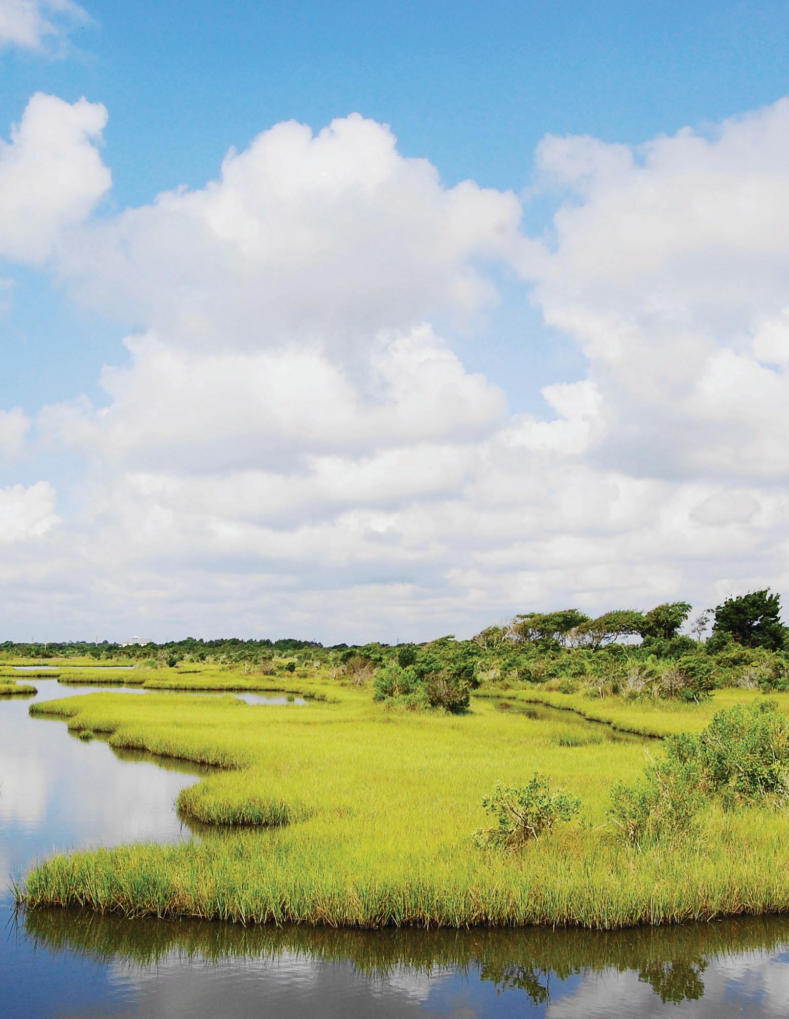
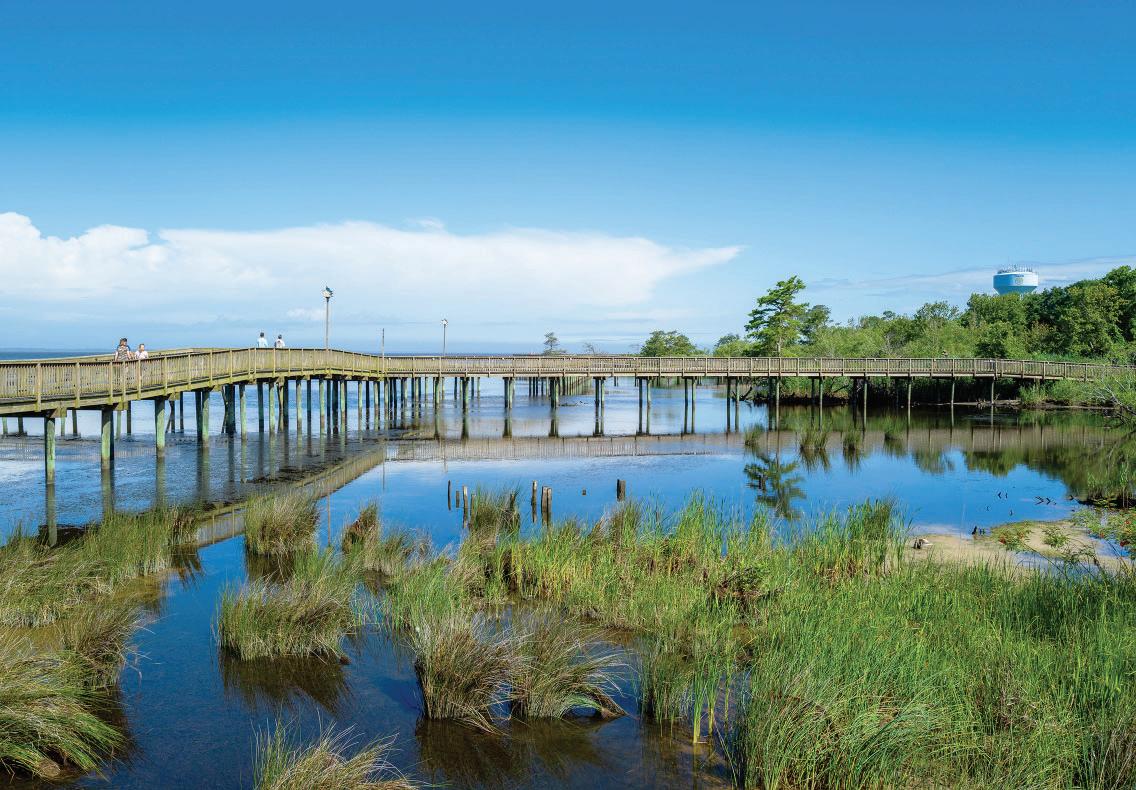
Boardwalk crossing over the Currituck Sound in Duck, NC
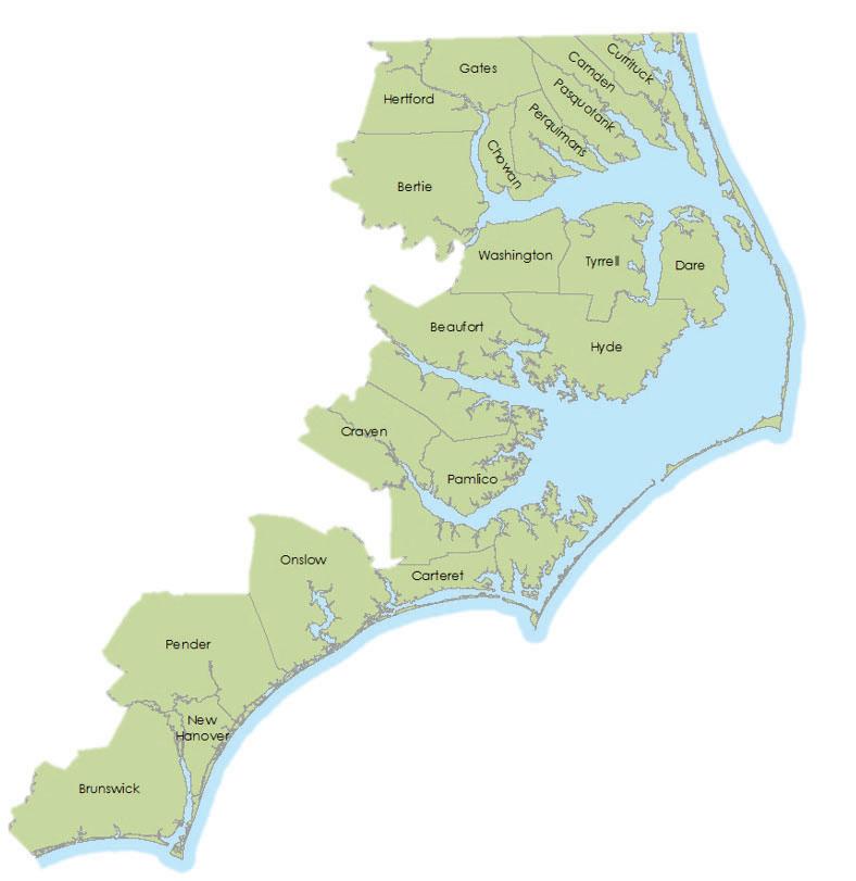
the RCCP focuses locally on the 20 coastal counties designated under the Coastal Area Management Act (CAMA), RISE is administered by the North Carolina Office of Recovery and Resiliency (NCORR) and approaches resiliency at a larger regional scale.

Executive Order 80 also called for regional resilience workshops to gather feedback from local governments in developing the NC Climate Risk Assessment and Resilience Plan, two of which DCM organized and hosted in 2019. These workshops provided critical feedback directly from communities about their needs and how North Carolina can support them. A key takeaway was that impacts on communities are being seen and felt more so than ever before, and there is a need for a holistic, forward-looking approach to building resilience in NC. Through this adaptive process, the Division of Coastal Management realized that, as a state, North Carolina had yet to identify shovel-ready projects (i.e., projects that can be expedited via sufficient funding, research, and technical assistance) to compete for federal funding opportunities. Therefore, by developing a formalized planning process, such as the RCCP, the State can better prepare communities to be awarded grant opportunities that otherwise might be inaccessible or difficult to obtain.
Building coastal resilience in a community means ensuring all members and systems within it can better withstand significant environmental disturbances, such as hurricanes and long-term stressors, in ways that help meet community-established goals. Resilience can be defined as increasing a “community’s ability to rebound, positively adapt to, or thrive amidst changing conditions or challenges—including disasters and climate change—and maintain quality of life, healthy growth, durable systems, and conservation of resources for present and future generations (Colorado’s Resiliency Framework).” However, because every community is unique, there is no one-size-fits-all approach to building resilience. This definition highlights the importance of a community-involved process that identifies the individual needs of a community and develops customized projects which can address them.
N.C. Resilient Coastal Communities Program PLANNING HANDBOOK Introduction 6
Figure 1 | Community members participating in RENA process, 2016
To make North Carolina more resilient to both climate and non-climate-related stressors, such as economic and social threats to human health, Governor Cooper signed Executive Order 80 on October 29, 2018, calling for the integration of climate adaptation and resilience planning into cabinet agency policies, programs, and operations. The order directed the Department of Environmental Quality (DEQ), with the support of other agencies and stakeholders, to prepare the North Carolina Climate Risk Assessment and Resilience Plan to be submitted to the Governor by the Climate Change Interagency Council in March 2020. Executive Order 80 called for state agencies to develop resilience strategies that support communities and sectors of the economy most vulnerable to the effects of climate change. It also aimed to enhance the state government’s ability to protect human life, health, property, natural and built infrastructure, cultural resources, and other public and private assets of value to North Carolinians (North Carolina Climate Risk Assessment and Resilience Plan, 2020).

To begin developing and implementing the RCCP, the Division of Coastal Management received approximately $830,000 in funding from the North Carolina General Assembly and $1.1 million from the National Fish and Wildlife Foundation’s Emergency Coastal Resilience Fund. The Resilient Coastal Communities Program, which is the first of its kind in the State of North Carolina, is modeled after successful programs in other coastal states, such as Massachusetts’ Municipal Vulnerability Preparedness Program, Rhode Island’s Municipal Resilience Program, and Florida’s Resilient Coastlines Program.
Building more resilient communities requires access to resilience expertise, support for analysis planning, and funding to implement measures that advance long-term resilience. The RCCP aims to address these needs through technical and financial assistance to advance coastal resilience efforts throughout North Carolina’s 20 coastal counties. This handbook guides communities, contractors, and program partners through the completion of Phases 1 and 2 of the RCCP.
Figure 2 | Governor Cooper signing Executive Order 80, 2018
N.C. Resilient Coastal Communities Program PLANNING HANDBOOK Introduction 7
The first round of Phases 1 and 2 of the RCCP occurred from 2021-2022, with 26 communities and 10 contractors participating. If you would like to review the deliverables from the first round, they can be found on the RCCP website
Program Objectives
Address barriers to coastal resilience at the local level
Assist communities with risk & vulnerability assessments
Program Scope
All counties and municipalities within the CAMA jurisdiction are eligible to apply for the RCCP.
Help communities develop a portfolio of well-planned and prioritized projects
Advance priority projects to “shovel-ready” status
Link communities to funding streams for project implementation
Federal and state-recognized tribes are also eligible to apply.
Phase 1:Community Engagement & Risk/Vulnerability Assessment
Phase 1 of the Resilient Coastal Communities Program includes performing a risk and vulnerability assessment, developing a community action team, and engaging with the public.
Phase 2: Planning, Project Identification, & Prioritization
Phase 2 of the program involves a community- and data-driven process to identify priority actions that can be taken to adapt to short- and long-term hazards.
N.C. Resilient Coastal Communities Program PLANNING HANDBOOK Introduction 8
Figure 3 | 20 Coastal CAMA Counties
Phase 3: Engineering & Design
Phase 3 is the engineering, design, and permitting of the prioritized projects. Competitive grants will be available for communities that successfully completed Phases 1 and 2 to develop projects that are shovelready.
Phase 4: Project Implementation
Phase 4 competitive grants will be available for communities that successfully completed Phases 1, 2, and 3 for the implementation of shovel-ready projects.
Phase 1 & 2 Objectives
Participating communities will accomplish the following objectives in Phases 1 and 2:
• Perform a data- and community-driven risk and vulnerability assessment.
• Develop a portfolio of well-planned and prioritized solutions to address risks.
Once communities complete Phases 1 and 2, they become eligible to apply for additional funding via Phase 3 (Engineering & Design) and Phase 4 (Project Implementation). Communities may receive credit towards completing Phases 1 and 2 of the RCCP for previous or ongoing work that aligns with program requirements. Localities wishing to complete the requirements outside of the grant program must work with coordinators to illustrate how their efforts fulfill the requirements outlined in this handbook.
Deliverables
The main deliverable of this effort is called The Resilience Strategy, which includes two major components:
1. Vulnerability Assessment Report: Details the quantitative and qualitative assessment(s) performed, which will evaluate the vulnerability of critical assets, natural infrastructure, and vulnerable populations to several hazards, including flooding (rainfall, tidal and riverine), storm surge, sea level rise, and other locally relevant hazards such as wind and erosion.
2. Project Portfolio: Outlines a series of options to reduce exposure, reduce sensitivity, and increase adaptive capacity to flooding and other hazards. A combination of structural (i.e., infrastructure) and nonstructural (i.e., policy) approaches should be considered. At least one project should include a natural or nature-based component.
To view examples of final deliverables from the first round of the RCCP, click here
Additional Context
While the RCCP’s priorities primarily address environmental threats to human health and well-being, many of these priorities call for the protection of natural resources which provide ecosystem services that are fundamental to the security of coastal communities. Throughout the development of the RCCP, the Division of Coastal Management has incorporated the guiding principles of the NC Coastal Habitat Protection Plan (CHPP) to ensure the continued protection of coastal resources. As the RCCP continues to grow, we are committed to supporting the priorities of the Department of Environmental Quality and the Coastal Resources Commission.
N.C. Resilient Coastal Communities Program PLANNING HANDBOOK Introduction 9
In many ways, the RCCP is a novel pioneer project, helping to pave the way for similar initiatives at the local and state levels. However, the RCCP also operates alongside another program working diligently to address the negative impacts of climate change and improve the resilience of habitats and communities in North Carolina. Following Hurricane Florence in 2018, the newly formed North Carolina Office of Recovery and Resilience (NCORR) established the Regions Innovating for Strong Economies and Environment Program (RISE).
RISE aims to support North Carolinians by:
1. Providing coaching and technical assistance to identify priority resilience actions;
2. Developing the North Carolina Resilient Communities Guide, a statewide toolbox of resilience resources; and
3. Hosting regional leadership-training workshops emphasizing the importance of resiliency as a tool for community development.
RISE focuses on many of the same regions targeted by the RCCP and has many overlapping objectives. Thus far, RISE has focused heavily on resource development and technical assistance at a regional scale. However, both programs consistently coordinate to provide the best possible support for North Carolinians.
Before Getting Started
Before you begin Phase 1, it’s important that the lead community member and lead contractor meet to discuss expectations, program timeline, and process/scope of work. This will help ensure both parties are on the same page. DCM recommends the community and contractor execute a Memorandum of Understanding (MOU) for Phases 1 and 2.
The following resources should be reviewed before Phase 1:
The ResilientCoastal Communities Program website houses the final deliverables from the first round of phases 1 and 2 of the RCCP, which can be viewed as examples.
The Coastal Adaptation and Resiliency website provides information on building coastal resilience through hazard forecasting, adaptation examples, and existing data and tools.

The North Carolina Coastal Community Resiliency Guide provides interactive web applications, mapping tools, explanatory graphics, and PDF documents to help complete the different steps of resiliency planning and implementation.
Climate Risk and Resiliency Plan describes DEQ’s understanding of climate vulnerabilities and risks in NC. It also outlines the Agency’s current and planned actions to increase resilience.
N.C. Resilient Coastal Communities Program PLANNING HANDBOOK Introduction 10
PHASE 1
Community Engagement & Risk/Vulnerability Assessment
Phase 1 of the Resilient Coastal Communities Program includes performing a risk and vulnerability assessment, developing a community action team, and engaging with the public.
N.C. Resilient Coastal Communities Program PLANNING HANDBOOK Phase 1 11
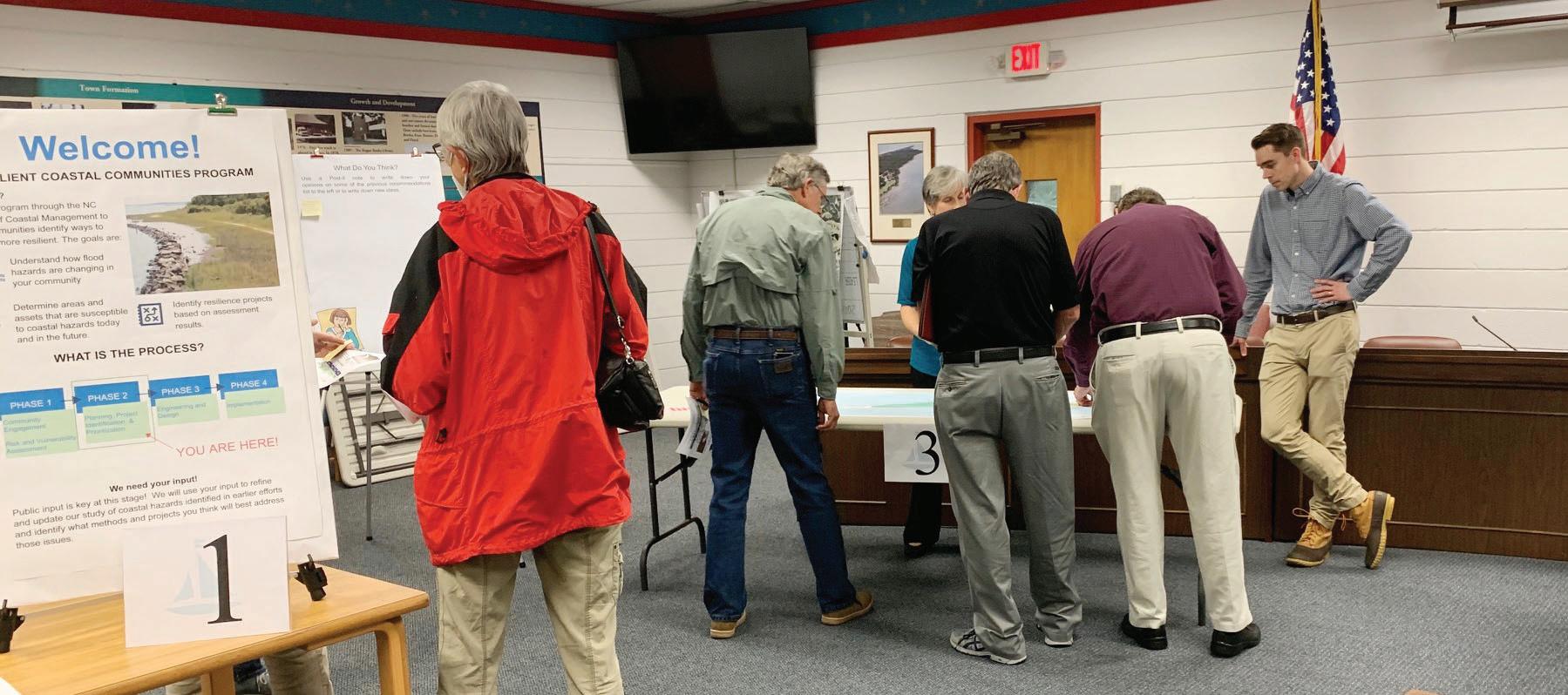
The first step in the RCCP process is for each community to create a “Community Action Team” (CAT). This step is critical to ensure success in the program. The CAT for each community will consist of key stakeholders to provide targeted input and champion the effort. As you begin working through this first step of the program, you may find it helpful to also refer to Step 1 in the National Institute of Standards and Technology’s (NIST) Community Resilience Planning Guide Playbook 1 Here you can find guidance for building a collaborative planning team, establishing leadership, and ensuring community buy-in.

Why is a CAT needed for each community?
Building a multi-disciplinary CAT with expertise in planning and community development, natural resource management, climate resilience, hazard mitigation, utility management, engineering, the community’s economy, engaging with vulnerable and underrepresented populations, and nature-based solutions will ensure a more holistic process. Building relationships, trust, and shared understanding among key stakeholders and the community is a foundation for implementing resilience actions.
How will the CAT members be chosen?
The contractor and community will select the CAT members through a review of key stakeholders and priorities in the jurisdiction. It is helpful to consider the members of your community that already have existing knowledge of coastal resiliency and consider what gaps may exist
N.C. Resilient Coastal Communities Program PLANNING HANDBOOK Phase 1 | Step 1 12
1 Additional resources related to the NIST playbook, including companion volumes I and II, can be found here
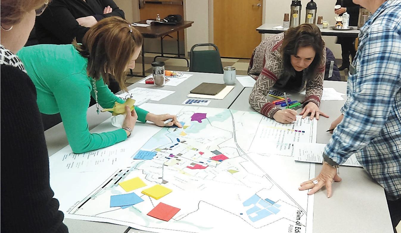
Figure 4 | Town of Pine Knoll Shores CAT Meeting, 2022
within that group. You should then consider how to fill those gaps so that when making decisions, the entire community is represented to the best of your ability. Some critical questions to ask when selecting members include:
• Who holds community trust or is seen as a leader?
• Who is especially impacted by relevant coastal hazards?
• Who is often underrepresented in decision-making?

• What industries have the greatest ability to help build resilience?
• Who has time and interest to participate?
• Who has knowledge of natural resource management and/or climate change?
• Who has been (or currently is) responsible for community planning and/or policy?
Hopefully, these questions will help to get you started in identifying representative stakeholders to invite to join the CAT. However, it is important to conduct a thorough review of all potential stakeholder groups to ensure that you are not inadvertently missing someone who could be a critical asset to the team. To do this, we suggest using NOAA’s Participant Checklist for Risk and Vulnerability Assessment Discussions. This document provides an overview of the stakeholder groups commonly found within a community and provides a template to help you consider what representatives best fits each category.
Step 1 Minimum Requirements
• Develop an inclusive and diverse Community Action Team with at least five members representative of the community and its diverse perspectives.
• Work with the contractor to identify additional community members if there are gaps in the expertise on the CAT (for example, the team lacks someone with natural resource management expertise).
• Appoint one of the CAT members as a “CAT Champion” to lead the CAT team; someone who has the knowledge, expertise, and passion to act as a point person with DCM, the contracting team, and the rest of the CAT team.
• Summarize the process for developing your Community Action Team, including the members chosen and what expertise they bring to the team.
N.C. Resilient Coastal Communities Program PLANNING HANDBOOK Phase 1 | Step 1 13
Building upon past local, regional, and state efforts through the RCCP is a crucial step toward ensuring an integrated approach to resilience that is tailored to the community. After forming your Community Action Team, conduct a review of existing plans, ordinances, policies, and programs to identify what the community has already done that can be incorporated into this process. Begin with an inventory of relevant plans and efforts, then compile information in the following key areas that will be used to inform later steps of this program:
• Vision statements, goals, or objectives related to resilience
• Critical built and natural infrastructure
• Social, economic, and/or environmental vulnerability
• Risk assessments

• Future trends or projections, e.g., climate, land use and development, etc.
• Resilience-related projects or strategies
N.C. Resilient Coastal Communities Program PLANNING HANDBOOK Phase 1 | Step 1 13 2 14
Surf City Public Meeting, 2021
OTHER EXISTING EFFORTS TO DRAW UPON Ordinances
Ordinances which overlap with the community’s vision and goals, include:
• Unified Development Ordinances
• Zoning or Subdivision Ordinances
• Flood Damage Prevention Ordinances
• Conservation and Hazard Overlays
Regional and Local Plans
Other regional and local plans should also be reviewed to identify overlaps with this initiative, such as:
• CAMA Land Use Plans
• Local and Regional Disaster Preparedness and Recovery Plans
• Capital Improvement Plans
• Economic Development Plans
• Stormwater Management or Watershed Restoration Plans
• Open Space Plans
• Asset Management Plans
Non-regulatory Programs
Non-regulatory programs involving support or services that governments
offer to residents, businesses, or others in the community, which may include:
• The FEMA Community Rating System
• Hazard Disclosures
• Land Trusts
Other Local Investments or Policies
Be sure to review any other relevant local investments or policies that are guided by plans and leadership priorities that should also be considered.
N.C. Resilient Coastal Communities Program PLANNING HANDBOOK Phase 1 | Step 2 15
Building Upon Hazard Mitigation Plans
Your community’s most recent hazard mitigation plan should contain a baseline vulnerability and risk assessment, which can serve as the first reference point for conducting an enhanced assessment that considers additional factors, future conditions, and the local context. Review the local or regional hazard mitigation plan applicable to your community for overlap in the key areas listed above.
• 2020 Albemarle Regional Hazard Mitigation Plan: Chowan, Camden, Perquimans, Pasquotank, Gates, and Hertford Counties
• 2020 Outer Banks Regional Hazard Mitigation Plan: Currituck and Dare Counties
• 2020 Pamlico Sound Regional Hazard Mitigation Plan: Carteret, Craven, Pamlico, and Beaufort Counties
• 2021 Southeastern North Carolina Regional Hazard Mitigation Plan: Brunswick, New Hanover, Onslow and Pender Counties
• 2021 Northeastern NC Regional Hazard Mitigation Plan: Bertie, Hyde, Tyrrell, and Washington Counties
Identify & Fill Data Gaps
Once a review of existing data and information is complete, identify and document the additional data and resources necessary to complete the community’s vulnerability and risk assessment, including:
• An inventory of critical assets and natural infrastructure
• Any social vulnerability data
• The best available economic data
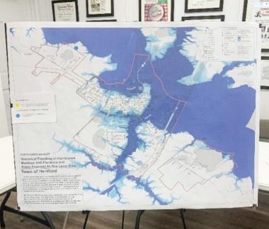
Be specific about the information contained within each piece of material that you review. It may be helpful to tabularize the information or present it visually to help identify which documents contain necessary or beneficial information. For example, Figure 5 showcases an overview of documents reviewed for the Town of Hertford in 2021.
N.C. Resilient Coastal Communities Program PLANNING HANDBOOK Phase 1 | Step 1 13 2 16
Pender
New Hanover Brunswick
Onslow
Pamlico
Carteret
Beaufort Hyde
Tyrell Dare
Currituck
Washington
Craven
Chowan PasquotankCamden
Hertford
Gates
Bertie Perquimans
Town of Hertford Resilience Strategy
REVIEW OF EXISTING LOCAL AND REGIONAL EFFORTS
SWCA reviewed existing local and regional plans, ordinances, policies, and programs to identify resilience strategies already in place, previously identified assets, previously identified coastal hazards, and potential resilience projects to inform the RCCP process. Results of this review are summarized below in Table 2.
Table
Document Name (Year)
Hertford Riverfront and Community Plan (2021)
Albemarle Region Hazard Mitigation Plan Update (2020)
NC State Resilience Plan (2020)
Town Council Brief (5/13/2019)
Town Capital Improvement Plan (2019)
State of North Carolina Hazard Mitigation Plan (2018)
Hurricane Matthew Resilient Redevelopment Plan - Perquimans County (2017)
Albemarle Region Hazard Mitigation Plan (2016)
CAMA Land Use Plan - Perquimans County (2005-2006); amended 2017
Information Gleaned
Asset Locations Hazard Information
Potential Resilience Projects
Resilience Strategies Already in Place
In the above example, the information included in each document, or the lack thereof, is easily accessible and can be used to identify information that may be useful when conducting current and future vulnerability assessments. The objective should be to provide a comprehensive list of previous efforts and existing plans, and to review and compare each to identify knowledge-gaps. Another reason why these assessments are helpful is to compile a record of what has already been done, so that work isn’t needlessly repeated.
N.C. Resilient Coastal Communities Program PLANNING HANDBOOK Phase 1 | Step 2 17
Figure 5 | A tabularized view of existing local and regional efforts in the Town of Hertford, as presented in the Town of Hertford Resilience Strategy, which can be found here.
2. Existing Documents Reviewed for the Town of Hertford
Step 2 Minimum Requirements
• Review existing local and regional resources, focusing on the following areas of overlap:

Inventory of critical assets
Sea level rise projections
Risk assessments
Resilience-related projects
• Identify and fill data and information gaps for vulnerability assessment inputs
• Identity and list (or visually represent) any data/knowledge-gaps that exist
N.C. Resilient Coastal Communities Program PLANNING HANDBOOK Phase 1 | Step 1 13 2 18
Enhancing community resilience should be driven by local values and priorities. Your team and the stakeholders involved need to develop a community-specific vision and set of goals based on your review of existing plans and efforts. This process will help to establish the local context for this program and guide subsequent steps. In addition to the information gathered and reviews in Step 2, your community vision and goals may draw from existing sources of information such as:
• Previously identified goals or vision statements developed by the community as part of other planning or budget processes.


• Natural hazard events such as hurricanes, or trends such as increased flooding frequency.
• Community demographics such as particularly vulnerable or disadvantaged populations.

Vision
The vision is an aspirational statement for where the community wants to be in the future (e.g., in the next 10 or more years), particularly in relation to coastal hazards.2 For example:
Goals
Specific, measurable goals will help the community identify steps that can be taken to achieve the vision. Resilience goals can relate to preparedness, recovery, community engagement, construction, restoration, etc. If a community resilience vision and goals do not already exist, the Community Action Team should prepare a draft for leadership and public review.
N.C. Resilient Coastal Communities Program PLANNING HANDBOOK Phase 1 | Step 3 19
To plan for a community ready to actively prepare for increasing coastal hazards while promoting accessibility, economic welfare, and high quality of life for residents.
To nts.
2 For additional information, the Justice Institute of British Columbia has developed a guided resource for creating a vision statement
The community goals should reflect the triple-bottom-line approach to resilience, which goes beyond traditional hazard mitigation and disaster recovery to emphasize a holistic strategy considering social, environmental, and economic factors. Ideally, considering these factors equally will increase resilience, cost savings, and benefits for all stakeholders involved.
For example, consider these goals, adapted from a resilience strategy developed by SWCA, a contractor that participated during Round 1 of the RCCP in 2021:
1. Update the community Land Use Plan and include resilience recommendations
2. Address recurring flooding issues in roadways
3. Address recurring agricultural drainage and town flooding issues
4. Protect and restore wetlands and headwaters, including via local/county ordinances
Step 3 Minimum Requirements
• Develop a community resilience vision statement
• Develop a list of locally driven goals for this effort

N.C. Resilient Coastal Communities Program PLANNING HANDBOOK Phase 1 | Step 1 13 3 20
Getting from resilience planning to implementation requires jointly created ideas, buy-in, and commitment from a diverse group of stakeholders. A stakeholder can be any person or group of people whom a project, policy, organization, or institution impacts. Often, identifying and engaging with stakeholders allows natural resource, land-use, and policy planners to tailor-fit their initiatives or programs to the specific needs of a community. When developing a plan to address stakeholder engagement, several categories of stakeholders should be considered:
Stakeholder Category Description Examples
People who live, work, play, or worship at or near a resource
Those whose everyday lives and well-being are directly connected to a resource or issue. These stakeholders should be invited to participate because their lives may be substantially impacted.
Residents, resource users, businesses, community/civic organizations, interest groups, nongovernmental organizations (NGOs), government, Native American tribes, and the media

People interested in the resource, its users, its use, or its non-use
Those who assign values to a resource and are concerned about the way that resources are used. This group includes those who extract value from resources, as well as those more interested in conserving or protecting resources. This group should be invited to participate because of their sheer interest in the resource or issue.
Businesses, resource users, interest groups and NGOs, community/civic organizations, government, and Native American tribes
People interested in the decision-making process
Those deeply interested in the legal and procedural aspects of an issue. This group includes those who want to ensure that all relevant policies and procedures are observed in reaching a decision. They should be involved because of their attention to procedural detail and their ability to derail a process or litigate final decisions.
Interest groups and NGOs, government, the media, residents, and Native American tribes
People who are financially invested in the resource
Those whose money is directly or indirectly used to fund resource management through taxes, fees, and other means. This group wants to ensure that money is spent wisely and should be invited to participate because the government is accountable for how it spends public dollars.
Residents, resource users, businesses, and government Representatives or those who are legally responsible for managing public resources
Those who have the legal authority and obligation to manage natural resources. Members of this group want to ensure the best final decision is reached and should be invited to participate because it is their duty.
N.C. Resilient Coastal Communities Program PLANNING HANDBOOK Phase 1 | Step 1 12 4 21
Government
Table 1. Categories of Stakeholders Adapted from NOAA’s Introduction to Stakeholder Participation
Additionally, inclusivity in the planning process, particularly by involving members of vulnerable and historically underrepresented communities, is crucial to account for a diverse range of perspectives. Vulnerable communities include people who are considered socially vulnerable to climate impacts, such as communities of color, children and seniors, low-income communities, people with disabilities, pregnant people, people with Limited English Proficiency (LEP), people impacted by the social determinants of health, and other historically disadvantaged populations identified by the American Public Health Association
Vulnerable populations often fare the worse in the face of climate hazards and may be especially susceptible to natural disasters and civil emergencies. These populations may have limited means to cope with climate stressors or coastal hazards and thus may also be disproportionately impacted by storm damage, coastal flooding, and other dangers, such as unequal access to resources or critical infrastructure in times of need.
The following characteristics can help to identify vulnerable populations in your community:
• Economically disadvantaged
• Racial and ethnic minorities
• Elderly or limited mobility
• Chronically ill or having high sensitivity to heat, air quality, or vector-borne pathogens
• Substandard or subsidized housing
• Historically underrepresented in community decision-making
• Socially marginalized
• Environmentally vulnerable
• Lacking access to technology or standard means of communications
• Geographically isolated
• Non-English speaking
To ensure participation from a diverse array of public stakeholders, a community engagement strategy must be developed to outline a plan for engaging with your community while incorporating the
N.C. Resilient Coastal Communities Program PLANNING HANDBOOK Step 2 16 22
Hertford County Commissioners Meeting, 2021
principles of justice, equity, diversity, and inclusion in their climate adaptation planning. Your community engagement strategy will ensure the following:
• Equitable representation and outcomes for marginalized communities and vulnerable populations.
• Building trust, relationships, and diverse partnerships within communities.
• Providing feedback and validation of the Vulnerability Assessment (Phase 1, Step 6) developed by the Community Action Team.
• Assisting with prioritizing projects for Phases 3 and 4 of the RCCP.
These outcomes will benefit you as you conduct your Risk and Vulnerability Assessments (Phase 1, Step 6) and move into Phase 2.
The public engagement process is as valuable as the deliverable(s) produced. Engaging stakeholders can foster new or enhanced relationships, learning, and connections. Raising awareness about the vulnerabilities specific to a community often spurs interest in supporting efforts to reduce those risks and vulnerabilities. Thus, your team may need to adapt your community engagement strategy throughout the process as you collect and synthesize information or receive feedback about different activities.
N.C. Resilient Coastal Communities Program PLANNING HANDBOOK Step 2 17 23
Cape Carteret Community Outreach, 2021
While there is no single way to create and employ a community engagement strategy, there are some considerations that can help guide you through the process. Depending on the specifics of your community, it will be necessary to tailor your strategy to fit your specific needs. Listed below are some preliminary considerations that can be used to get the ball rolling. However, be sure to also navigate the additional examples and resources provided.
Key Community Engagement Considerations:
1.Ensure activities are accessible and inclusive of all demographics within your community.
• Involve vulnerable populations and historically underrepresented members of the community.
• Identify and incorporate trusted, neighborhood-level leaders, to help organize and design additional outreach.
• Dedicate specific space and time to discussing what strategies will contribute to equitable outcomes for all residents, regardless of their socio-demographics.
• Consider going to different groups in the community, rather than relying on those members of the community to approach you or engage with the process on their own.
• Consider time restraints, such as work, school, or childcare that might interfere with the community’s ability to attend meetings or participate in the process.
• Explain how their participation will help contribute to the larger community’s vision for success and resilience.
2.Consider State and local restrictions that may be in effect.
• E.g., ensure virtual participation for stakeholders who may not have access due to assembly restrictions related to COVID-19.
3.Host an open house or workshop to present your team’s initial set of potential adaptation strategies and ask for input, comments, and additional ideas using different forms of media.
4.Brainstorm activities that go beyond simply informing or consulting with the community about resilience.
5. Involve stakeholders directly in mapping activities that identify vulnerable populations, infrastructure, or natural resources.
• Invite community members to participate in field trips to discuss or address areas of concern.
• Consider live polling, surveys, interactive websites, news media, leveraging social media interaction, etc.
6.Highlight costs of inaction or potential risks with continuing to conduct “business as usual.
• What potential opportunity costs are associated with taking one approach over another?
Examples Of Effective Engagement Strategies:
Below are examples of elements from previous community engagement strategies that may be worth considering as you build your own. There are many scientific tools, models, and assessments, such as the Federal Emergency Management Agency’s (FEMA) Resilience Analysis & Planning Tool (RAPT) or the
N.C. Resilient Coastal Communities Program PLANNING HANDBOOK Phase 1 | Step 4 24
Council on Environmental Quality’s (CEQ) Climate and Economic Justice Screening Tool that you may want to use when engaging with the community. However, it is advisable to think about new ways in which you can creatively engage with the community to supplement these tools and help to uncover nuances that might otherwise be overlooked.
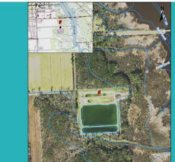
For example, when conducting community meetings in Hertford, North Carolina, SWCA Environmental Consultants asked community members to help map important infrastructure that was critical for disaster response. This information was overlayed on a map of flood risk and exposure (Examples 1 & 2). This participatory process helped to create detailed maps that incorporated both quantitative scientific modeling and qualitative community input to map vulnerability and identify potential resilience projects.
Another example, implemented by many previous participants, but typified by RK&K Civil Engineering, was story mapping (Example 3). Story maps allow for different types of information, like GIS maps, statistics, instructions, quotes, or even anecdotes, to be displayed in an interactive format that allows for ease of access among stakeholders, contractors, planners, and resource managers alike.
Example 1. This community mapping activity initiated by SWCA identified critical assets and areas in need of assistance or additional consideration. Example 2. Community representatives were asked to identify areas that held personal significance or that may have been overlooked by hazard/vulnerability modeling. Example 3. A screenshot from RK&K’s Story Map showcasing a potential project site in the town of Aurora, North Carolina.
 Example 1
Example 3 3
Example 2
Wetland Restoration at Wastewater Treatment Plant
Example 1
Example 3 3
Example 2
Wetland Restoration at Wastewater Treatment Plant
3 Help identify important places Help identify places that flood or experience other coastal hazards What locations are important to you - for disaster response and recovery or to make your community feel like home? Where have you observed flooding that you don’t see marked on this map? N.C. Resilient Coastal Communities Program PLANNING HANDBOOK Step 2 17 25
This unique WWTP uses the natural functions of a wetland in its process to desanitize and purify wastewater. This project will restore wetland function by removing sludge, relining ponds, and elevating side of the WWTP for storm surge protection. This project will also help ensure clean water re-renters the river for many years to come.
While it will be up to you how you decide to move forward with your community engagement strategy, the goal is to create a robust, deep-rooted plan that will not only fulfill the program requirements but greatly benefit the community in need. In addition to these examples, below are listed some additional possibilities for your consideration.
Method Description
Charrette
An intense, multi-day effort to design something or solve a problem. There are multiple versions of the charrette, most of which include a design team that attempts to translate public input into a form that could be implemented, for example, a new policy, zoning regulations, or building design.
Field trip
Trips to specific locations are organized so that participants can match their mental images to real, on-the-ground conditions. Participants may be asked to express their reactions verbally or in writing.
Focus group
Small discussion group led by a facilitator who draws out in-depth stakeholder input on specific questions. Normally, several focus groups are held, and participants can be chosen randomly or to approximate a subset of the community.
Hotline Widely advertised telephone number that directs callers to someone in an agency who can answer caller questions and collect input.
Internet Dialogue between agencies and stakeholders using Internet technology such as chatrooms, online bulletin boards, e-mail, and web conferencing.
Interview
Poll or survey
Face-to-face or telephone interaction with stakeholders conducted by the agency or by a third-party representative.
Written or oral lists of questions to solicit community impressions about issues at a specific moment in time. Polls and surveys can be administered in person or via the telephone or the Internet.
Public hearing
Public meeting
A formal, single meeting where stakeholders present official statements and positions, and those ideas are recorded into a formal record for delivery to the agency.
A large public comment meeting where the participants stay together throughout the meeting and make comments to the entire audience. Public meetings are less formal than public hearings.
Retreat
A concentrated yet informal meeting away from the typical work setting that emphasizes social interaction as well as discussion of issues.
Workshop Small stakeholder gatherings, typically fewer than 25 people, designed to complete a specific assignment in a short time.
N.C. Resilient Coastal Communities Program PLANNING HANDBOOK Phase 1 | Step 4 2613
Table 2. Engagement Opportunities Adapted from NOAA’s Common Stakeholder Participation Techniques
Additional Information
Having provided an overview of some of the most important things to consider when developing a diverse and inclusive community engagement strategy, there are some additional resources that you may find beneficial. We recommend reviewing the following documents in detail:
• https://www.communityresiliencebuilding.com/crbworkshopguide
• https://coast.noaa.gov/data/digitalcoast/pdf/stakeholder-participation.pdf
Be sure to closely review the essential elements of identifying and analyzing stakeholders, improving stakeholder participation, and evaluating stakeholder participation in practice. With these tools in hand, your stakeholder engagement strategy will be sure to meet all the needs of your community, as well as the Resilient Coastal Communities Program.
Step 4 Minimum Requirements
• Develop a stakeholder engagement strategy for involving community members during the following steps in this program:
Risk and Vulnerability Assessment (Phase 1 Step 6)
Project Development (Phase 2)
• Develop an approach for targeted outreach to vulnerable and historically underrepresented members of the community

N.C. Resilient Coastal Communities Program PLANNING HANDBOOK Phase 1 | Step 4 27
For this step, the contractor will map the required minimum critical assets and relevant natural infrastructure within the community. This process requires close cooperation with the Community Action Team (CAT) to identify locally specific critical assets, such as hospitals and government buildings, and natural infrastructure, such as wetlands and dunes, to include in the risk and vulnerability assessment. Mapping of critical assets and natural infrastructure should be completed using ArcGIS online.
Natural infrastructure, such as wetlands, forests, beaches, dunes, rivers, and floodplains, are existing natural assets that provide ecosystem services, such as helping to buffer, retain, and absorb flood waters. Identifying these resources and discussing their value to the community or their interactions (i.e., overlap) with identified hazards provides a valuable opportunity to discuss resiliency strategies that protect, restore, and enhance these areas.
To begin this process, you must locate and map all the required critical assets and natural infrastructure (Figure 6, Page 29), then work with the CAT to identify any additional locally significant assets or infrastructure with cultural, ecological, public health, social, and/or economic value to the community. It is important to remember that many local assets and infrastructure may not be listed on traditional maps but can be identified as essential by community members.
Your team should use the FEMA Community Lifelines Framework to identify assets that provide fundamental services for the community. FEMA defines a community lifeline as an asset that “enables the continuous operation of critical government and business functions and is essential to human health and safety or economic security.” This framework is a good starting point for considering which critical assets to include in your Risk and Vulnerability Assessment.”
Additionally, the NC Natural Heritage Program’s Biodiversity and Wildlife Habitat Assessment and the Wildlife Resources Commission’s Green Growth Toolbox are helpful resources for identifying and mapping natural infrastructure and discussing resiliency actions related to natural infrastructure.
Whom to involve in this step: Staff or community stakeholders with knowledge of major infrastructure assets; non-profit or government entities that manage natural resources or communityidentified significant places.

Some questions to consider when identifying assets:
1.Are the assets:
- critical for the continuity of daily operations?
- central to economic functioning and vitality?
- integral to social services?
- critical for life and safety?
- irreplaceable if damaged or destroyed?
2.Do the assets have a history of damage from natural hazards?
3.What places and natural areas are important to the community’s heritage?
4.How do the community’s vision and goals from Step 3 relate to these built and natural assets?
5.How much information is available on each asset to guide your assessment? Which assets lack enough data to do a meaningful assessment?
N.C. Resilient Coastal Communities Program PLANNING HANDBOOK Phase 1 | Step 4 13 28
CRITICAL ASSETS THAT YOU MUST IDENTIFY AND MAP
Gather and organize data for each asset chosen using the following template:
N.C. Resilient Coastal Communities Program PLANNING HANDBOOK Phase 1 | Step 4 12 29 Roads/ Evacuation Routes Water/sewer lines (if the community has sewer) 1 2 3 4 5 6 7 Community Government Service Offices (e.g., City/ Town Hall) Public Safety or Emergency Services (e.g., Police,Fire) Schools Health Services Natural Assets (e.g., Natural areas, open space and parks) Asset IDAsset Type Asset Name LocationOwnership Estimated Value Exposure (Ex. Previously Flooded or Precipitation*) Exposure (Ex. Current Floodplain) NumberE.g., government facilities, roadway, natural infrastructure, schools, etc. Town Hall X, YPrivate or public If available (Y/N) *edit based upon flood hazards relevant to the community (Y/N)
Figure 6 | Required Critical Assets to Map
Social Vulnerability
Assessing the vulnerability of populations and social systems is a key component to building holistic resilience in a community. People who are considered socially vulnerable to climate impacts include communities of color, children and seniors, low-income communities, people with disabilities, pregnant people, people with Limited English Proficiency (LEP), people impacted by the social determinants of health, populations identified by the American Public Health Association, and other historically disadvantaged peoples. Contractors should utilize the CDC’s Social Vulnerability Index (SVI) and FEMA’s Resilience Analysis and Planning Tool (RAPT) to access important community data and analysis tools. You can also use any other relevant data sources to identify socially vulnerable populations for consideration throughout this planning process.
The CDC’s SVI uses U.S. Census Data to rank census tracts based on 15 social factors. It groups them into four related themes:
1. Socioeconomic status
2. Household composition
3. Race/ethnicity/language
4. Housing/transportation
Contractors should engage with the CAT to ground truth data related to the index and supplement it with local knowledge and information. Social vulnerability data gathered and mapped in this step should inform the community engagement strategy, vulnerability assessment, and project identification, selection, and prioritization. For further guidance on how to use this resource, check out these FAQs.
Step 5 Minimum Requirements
• Map critical assets, areas of social vulnerability, and natural infrastructure identified by the Community Action Team using ArcGIS.

N.C. Resilient Coastal Communities Program PLANNING HANDBOOK Phase 1 | Step 6 13 30
To build long-term resilience to current and future impacts of coastal hazards and a changing climate, communities need to know who and what is vulnerable to maximize resources and minimize future risks. A key component of this effort is the risk and vulnerability assessment, which evaluates risks to a community’s people, critical assets, natural infrastructure, and ecosystems from coastal and climate hazards such as flooding, storm surge, and sea level rise. This assessment serves as the foundation for determining what actions to take and where they should be targeted in the next steps of this process.
As discussed in Step 2, local or regional hazard mitigation plans will serve as the basis for this program’s risk and vulnerability assessment. Each community’s natural hazards and event histories are typically documented in its hazard mitigation plans. However, they often need more information about the climate and non-climate stressors affecting them. Program participants will build upon the risk assessments in these plans by incorporating climatic risk factors to create an enhanced, more localized assessment with actionable data. If communities have already gone beyond the assessment performed in their hazard mitigation plan, those resources may also be utilized in this process.
Difference Between Hazard Mitigation Plans & Resilience Planning

Hazard mitigation planning plays an important role in building resilience by helping communities prepare for and minimize impacts on people and the built environment from the hazards they may experience. However, these efforts typically base their understanding of risk on sources that rely on data and information from past climate and historical events. The RCCP risk and vulnerability assessment will build upon this foundation to consider how a changing climate is expected to affect the future frequency, intensity, and duration of hazards and stressors that increase risk. The RCCP will also assess how hazards impact communities beyond the built environment, including socioeconomically vulnerable populations, ecosystems, and other natural and cultural resources. Establishing this robust foundation of factual data is critical to supporting planning and decision-making moving forward.

N.C. Resilient Coastal Communities Program PLANNING HANDBOOK Phase 1 | Step 6 31
6a
Storm damaged fishing pier, Hatteras Island, Outer Banks
Risk & Vulnerability Assessment Process:
1. Identify and Map the Hazards Assess Vulnerability
2. Estimate Risk
Identify and Map the Hazards
Coastal communities face varying levels of risk from coastal hazards and non-climate stressors that can exacerbate short- and long-term impacts. In this step, your team will identify and map potential hazards and stressors from past experiences, current trends, and future changes to understand how community assets may be threatened. Start by reviewing the baseline risk assessment in your community’s most recent local or regional hazard mitigation plan to extract hazard types, event histories, and other relevant data and information. Then, identify any gaps necessary to complete the risk and vulnerability assessment. Gaps could include both quantitative data from trusted sources and qualitative information from community knowledge and experience.
Following a review of the hazard mitigation risk assessment, the contractor will then identify and, where feasible, map the geographic extent of current and future hazards and stressors relevant to the planning area. To accomplish this, teams should reference existing studies, reports, and plans, including local and regional hazard mitigation plans, the 2020 NC Climate Risk Assessment and Resilience Plan, and data referenced in this Handbook’s appendices. Other potentially relevant resources include event-based records such as NOAA’s post-event imagery for Hurricane Matthew, Florence, and Dorian or satellitederived flood data from Hurricanes Matthew and Florence. Input from the CAT and other local and regional stakeholders should also be utilized to identify any additional locally relevant hazards to include in the risk and vulnerability assessment.
At this stage of the process, the risk and vulnerability assessment should consider the following:
• Additional locally relevant hazards that present immediate and long-term concerns (look at Table 1 below for the minimum requirements for evaluating hazards)
N.C. Resilient Coastal Communities Program PLANNING HANDBOOK Phase 1 | Step 6 13 32
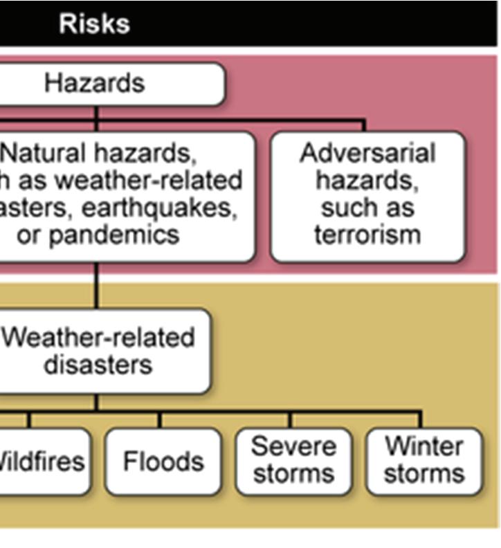
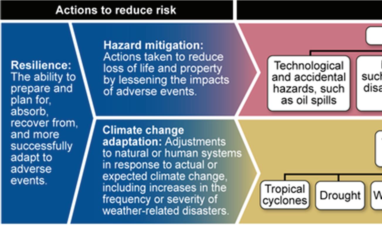
Figure 7 | Source: GAO analysis of Presidential Policy Directive 8, previous GAO work, and National Oceanic and Atmospheric Administration data. | GAO-16-454
• Non-climate stressors that can affect natural hazard events and impact the community. For communities where sea level rise isn’t a large future flood risk factor, contractors and communities can indicate previously flooded areas or low-lying areas to characterize future flood risk exposure. For example, consider how SWCA Consultants used data from low-lying areas to capture future precipitation risk in the Technical Appendix.
• Hazard maps to be overlaid with critical assets and natural infrastructure (as identified in Step 5)
POTENTIAL HAZARDSNON-CLIMATE STRESSORS
Sea level rise
Flooding (rainfall, tidal, and riverine)
Damaging storms, tornadoes, and winds
Storm surge
Shoreline erosion
Drought, Heat Waves, and Wildfire
Aging or potentially undersized infrastructure
Population dynamics
Economic shifts
Increased subsidence
Altered drainage patterns
Land cover change (i.e., increased development and impervious surface area)
Identifying Potential Hazards & Non-climate Stressors
• 2020 North Carolina Climate Science Report
• NC Flood Inundation Mapping and Alert Network (NC Floodplain Mapping Program)
• USGS Coastal Vulnerability Index

Step 6a Minimum Requirements
• Review local or regional hazard mitigation plans, extract data and information, and identify any gaps to fill
• Identify hazards and stressors to include in the risk and vulnerability assessment. At a minimum, they must include flooding (rainfall, tidal, and riverine), storm surge, and 30-year sea level rise projection. NCEM’s plus one-foot Water Surface Elevation can serve as a proxy for 30 years of sea level rise.
• Map the geographic extent of the hazards and overlay with community assets identified in Step 5.
N.C. Resilient Coastal Communities Program PLANNING HANDBOOK Phase 1 | Step 6 33
Table 3: Potential Hazards and Non-Climate Stressors
Assess Vulnerability
At this part of the process, the assessment will evaluate the extent to which a community’s assets are vulnerable to current and future impacts, as identified in step 6A. This assessment serves as the foundation for selecting and prioritizing projects in Phase 2 of this process. The vulnerability of critical assets, natural infrastructure, or populations to a hazard is a function of exposure, sensitivity, and adaptive capacity.
VULNERABILITY EQUATION
EXPOSURE refers to the presence of people, assets, and ecosystems in places where they could be adversely impacted by hazards
SENSITIVITY
is the degree to which an asset is potentially affected when exposed to an impact
Vulnerability= (Exposure + Sensitivity) - Adaptive Capacity
ADAPTIVE CAPACITY
is the ability of the asset and/or population to adjust to potential impacts from hazards with minimal disruption or cost
Determine Cumulative Vulnerability
With help from the CAT, the contractor will define thresholds and criteria that will be used to score assets as low, medium, or high for each vulnerability metric. The contractor will then develop a vulnerability index that uses thresholds to assess vulnerability. The CAT will provide input on these thresholds and then help with some of the scoring of each asset’s exposure, sensitivity, and adaptive capacity to combined hazards, to determine the cumulative vulnerability of critical assets and natural infrastructure. Within the vulnerability equation, exposure and sensitivity are objective factors, and adaptive capacity is a subjective factor that should be evaluated using both objective criteria and CAT input.
N.C. Resilient Coastal Communities Program PLANNING HANDBOOK Phase 1 | Step 6 13 34
6b
Figure 8 | The vulnerability equation used to derive community vulnerability to climate and non-climate related hazards.
• Exposure: Use the asset and hazard maps to determine the overlap between asset locations and hazard impact areas and assign thresholds to categorize overall hazard exposure as low, medium, or high. Rank from 0-3.
• Sensitivity: Evaluate the degree to which an asset is cumulatively impacted by hazards by assigning a percent threshold and/or indicating a low, medium, or high need for that asset within the community. Rank from 0-3.
• Adaptive Capacity: Utilize objective criteria and CAT input to assess an asset’s ability to adapt to all hazards cumulatively. Factors to evaluate could include social vulnerability, the feasibility of relocation, the ability to retrofit, possible alternatives, and other considerations relevant to the community. Rank from 0-3.
After assigning scores within each of the three-vulnerability metrics, calculate the cumulative vulnerability score using the vulnerability equation and organize in the template below:
Vulnerability Score = (Exposure Score + Sensitivity Score) - Adaptive Capacity Score
HELPFUL TOOLS
1. Assess Vulnerability & Risk - U.S. Climate Resilience Toolkit: https://toolkit.climate.gov/steps-to-resilience/assess-vulnerability-risk
2. Sea–Level Rise Vulnerability Assessment Tools and Resources: https://floridadep.gov/sites/default/files/SLR-VA-tools-extended_1.pdf
3. Guide to Community Climate Vulnerability Assessments: https://www.nrdc.org/sites/default/files/guide-community-climatevulnerability-assessments-report.pdf
4. How to conduct a climate change risk assessment: https://coastadapt.com.au/how-to-pages/how-to-conduct-a-climate-changerisk-assessment
N.C. Resilient Coastal Communities Program PLANNING HANDBOOK Phase 1 | Step 6 35
Asset ID Exposure Score 0-3 Sensitivity Score 0-3 Adaptive Capacity Score 0-3 Vulnerability Score 0-6 Asset name 0= no exposure 1= Low 2= Medium 3= High 0= no sensitivity 1= Low 2= Medium 3= High 0= no adaptive capacity 1= Low 2= Medium 3= High 0-2= Low 3-4= Medium 5-6= High
Step 6b Minimum Requirements
• Define thresholds and criteria that will be used to classify vulnerability of critical assets as low, medium, or high for each vulnerability metric.
• Estimate cumulative vulnerability of critical assets and natural infrastructure using vulnerability index.
Estimate Risk
Understanding the financial loss communities experience when hazards occur is critical in determining what level(s) of risk call for immediate action. Use the risk assessment from your community’s hazard mitigation plan to extract building values and other data on critical facilities necessary to estimate the risk to the community assets identified through this process. Where feasible, the contractor and CAT should consider supplementing or updating this information with more recent and locally relevant data. Table 4 below provides a template for quantitatively estimating risk, including characterizing assets by sector, identifying the number of vulnerable critical assets within that sector, and estimating the cost of damages.
Outcomes of the vulnerability assessment and risk estimates will be used to engage with the CAT in determining where there is an acceptable level of risk and where strategies should be considered to reduce that risk and improve resilience. You should not only consider built environment assets, such as vulnerable infrastructure, but also locations of vulnerable populations, resources, and ecosystems that may inform focus areas and neighborhood-scale strategies in Phase 2.
N.C. Resilient Coastal Communities Program PLANNING HANDBOOK Phase 1 | Step 6 1336
Sector Number of Critical Assets, People or Areas at Risk Asset Value E.g., Government facilities, Utilities, Roads19$X,000,000 E.g., Low-Income Community/150 people$X,000,000 E.g., Natural Infrastructure, Parks1,000 acres$X,000,000
6c
Table 4: A quantitative tool for asset risk-estimation
Step 6c Minimum Requirements
• Gather supplemental data as needed past what the hazard mitigation plan provides
• Estimate risk of the critical assets identified by using the sample table provided, or a similar table
N.C. Resilient Coastal Communities Program PLANNING HANDBOOK Phase 1 | Step 6 12 37
Planning, Project Identification, and Prioritization
In Phase 2, the contractor will work with the Community Action Team and community members to identify, plan, and prioritize a combination of policy, nonstructural, structural, and hybrid actions, including natural and nature-based solutions (NNBS). These potential resilience projects will then be organized within a project portfolio. This portfolio should be based on the vulnerability assessment conducted in Phase 1, Step 6. For example, the most critical asset identified within the community should, ideally, be associated with a project included in the portfolio.
PHASE 2 INCLUDES THE FOLLOWING KEY STEPS:
1 2 3
REVIEW YOUR RISK AND VULNERABILITY ASSESSMENT
IDENTIFY A SUITE OF POTENTIAL SOLUTIONS THAT ALIGN WITH THE RESULTS OF YOUR ASSESSMENT
As you work through this step of the program, we suggest referring to the Community Resilience Building Workshop Guide (Section D). Here you can find a detailed guide for identifying and prioritizing community projects in three categories (infrastructural, societal, and environmental), as well as analyzing these projects using their provided Risk Matrix.
N.C. Resilient Coastal Communities Program PLANNING HANDBOOK Phase 2 | Step 1 39
PHASE 2
DEVELOP, CONSOLIDATE, AND PRIORITIZE PROJECTS Phase 2 38
There is no “silver bullet” for building coastal resilience. Instead, each community must find the right mix of structural (infrastructure) and nonstructural (policy-related) approaches, including naturebased solutions, to proactively address vulnerabilities. In doing so, you can help improve the health and well-being of communities while better preparing them for natural disasters and other climate-related impacts. As you develop this suite of potential solutions, your team will compile these options into a resilience project portfolio.
Projects that aim to increase a community’s resilience must build the capacity of that community to prepare for and respond to coastal hazards. The Federal Emergency Management Agency (FEMA) notes that there are several principles that capacity-building projects can use to help align their objectives with the needs of resilient communities. These principles are widely applicable and generally serve as a guiding mantra during project identification.
• [Projects] should support essential community functions that are critical for absorbing, rebounding from, and adapting to hazards:
• They should facilitate hazard-focused community preparedness, risk management, and mitigation actions that reduce long-term vulnerabilities; and
• They should enable post-disaster community recovery and redevelopment that integrates specific community-based resilience objectives.
In line with these foundational principles, the Environmental and Energy Study Institute (EESI) suggests several ways that programs aimed at building resilience in coastal communities can ensure the capacity to absorb, rebound, and adapt to coastal hazards. Projects that improve capacity in the following areas will be likely to increase community resilience effectively:
Implement nature-based solutions:

Restoring or emulating nature to increase human, ecosystem, and infrastructure resilience to climate impacts. These solutions often result in environmental, economic, and social co-benefits, including carbon sequestration—a key tool in mitigating greenhouse gas emissions. Nature-based solutions include both green and natural infrastructure. Green infrastructure projects combine structural infrastructure with nature-based solutions to create hybrid systems that improve resilience to climate impacts (i.e., permeable pavement or bioswales). Natural infrastructure projects use existing or rebuilt natural landscapes (e.g., forests, floodplains, and wetlands) to increase resilience to climate impacts.
Provide co-benefits:
Adaptation and resilience programs and projects that also reduce greenhouse gas emissions. For example, restoring and conserving wetlands protects inland development from storm surge while sequestering carbon.
N.C. Resilient Coastal Communities Program PLANNING HANDBOOK Phase 2 | Step 1 39
Build Capacity:
Share Knowledge:
Projects that invest in building the skills, leadership, processes, and resources at the local/community level to empower communities to make informed decisions on adaptation and resilience. For example, funding a program that trains community members to be leaders in climate adaptation planning in their region.
The exchange of information, research, and expertise within and between communities, governments, and other entities. Knowledge includes multiple knowledge systems, such as traditional ecological knowledge. For example, knowledge sharing might involve building up information around managed retreat.
Provide Training:
Programs to enhance an individual or group’s knowledge, skills, or accreditation on a particular topic. For example, ensuring local engineers have specific training on using nature-based solutions.
* Adapted from the 2020 EESI Coastal Resilience Report
The projects you pick for your portfolio should include options targeting traditional ‘hard’ infrastructure, incorporate ‘soft’ nature-based solutions, and develop ‘hybrid’ solutions that include both hard and soft components and policy solutions. Each portfolio should include at least one nature-based solution. Remember to adjust your potential projects to fit the specifics of the community and the potential budget. Some nature-based solutions can be extensive and thus may need to be scaled down to serve the community’s needs. In addition to nature-based solutions, other projects might include investment in additional research, focused resource planning, or restructuring existing ordinances or policy frameworks.
As you identify potential projects, strive to capture a suite of innovative solutions that can be used for applying for other funding programs or to be self-funded as high-priority actions critical to the integrity of the community.
N.C. Resilient Coastal Communities Program PLANNING HANDBOOK Phase 2 | Step 1 3940
As you consider various strategies and interventions, refer to the areas you identified as most vulnerable or most at risk during your Phase 1 Risk and Vulnerability Assessment. Grounding your project portfolio in your work will be essential in addressing your community’s particular needs.
As you identify potential projects, strive to capture a suite of innovative solutions that can be used for applying for other funding programs or to be self-funded as high-priority actions critical to the integrity of the community.
In addition to the above information and the Community Resilience Building Workshop Guide, it may be beneficial to review the National Institute of Standards and Technology’s (NIST) Community Resilience Planning Guide, which suggests a broad range of structural (infrastructure-related) and non-structural (policy-related) solutions, The guide also emphasizes the importance of using community-based ideas and information to explore a wide range of solutions and potential strategies.
Additional resources that can assist you with the development process can be found in the Technical Appendix.
Drilling Down by Topic
After your team broadly identifies potential adaptation strategies, communities may need to dig deeper into specific topics like those below for additional project development guidance.
Natural/Nature-based and Hybrid Solutions
Natural/nature-based solutions (NNBS) incorporate sustainable planning, design, engineering, and natural resource management into the built environment to improve adaptation and resilience. NNBS identify ecosystem services, like the improvements to water quality provided by wetlands, and weaves them into infrastructure projects that address resilience, like incorporating bioswales into urban landscapes. These types of projects offer monetary benefits (e.g., increased property value, protection against storm damage, and green jobs) and non-monetary benefits (e.g., improved recreational spaces, cleaner water, improved coastlines, and carbon sequestration).
Additionally, projects that use natural or nature-based concepts have more flexibility in grant funding. By incorporating nature-based solutions, your projects may qualify for funding that emphasizes the importance of resilience and of incorporating nature-based solutions. For example, grant funding from the National Fish and Wildlife Foundation (NFWF) made North Carolina’s RCCP program possible.
For more information on the implementation and funding of nature-based solutions, please review FEMA’s 2023 guide to Building Community Resilience with Nature-Based Solutions
Floodplain/Stormwater Management
Flooding is North Carolina’s most common (and costly) natural hazard threat. Consider both nonstructural (policy-related) and structural flood mitigation and stormwater management measures during project development. Consider the following possibilities, highlighting the different types of projects that can address policy or infrastructure-related solutions to coastal flooding.
N.C. Resilient Coastal Communities Program PLANNING HANDBOOK Phase 2 | Step 1 41
FLOOD/STORMWATER MANAGEMENT PROJECT EXAMPLES
Flood Damage Prevention Ordinance
• Description: Designed to minimize public and private losses due to flood conditions within flood-prone areas by restricting or prohibiting uses, controlling alteration of the floodplain, channels, or natural barriers, controlling filing, grading, dredging, or other development that may increase erosion or flood damage
• Resilience Connection: Can account for future floodplain conditions affected by climate change impacts and increased development. Higher regulatory standards, such as higher “freeboard” requirements, can ensure structures are safely built above water levels common during flooding events.
Open Space and Recreation Plan
• Description: Open recreational spaces, such as parks, that have been developed to protect and enhance community access and use of resources while incorporating green infrastructure.
• Resilience Connection: Can absorb and store water with coastal open spaces (such as wetlands and marsh) and act as erosion and buffers for wave energy. Equitable access to open spaces/ recreation can lead to better public health outcomes thereby reducing vulnerability. May tie into flood buyout or future transfer of development rights.
Elevating Critical Components
• Description: Unlike entire buildings or structures, elevating critical components like HVAC, electrical panels, and backup generators can ensure key assets (e.g., pump station or other) aren’t completely compromised during a flood. A higher design flood elevation standard may be appropriate for critical facilities rather than for single-family homes.
• Resilience Connection: If lost or damaged, critical components of infrastructure may limit access to healthcare facilities, endanger basic functional needs, and make recovery more difficult. Protecting these resources is important to ensuring community resilience.
For a complete list of examples including floodplain management and more, please download the Resilience Strategies Poster located in the Technical Appendix (Phase 2, Step 1).
N.C. Resilient Coastal Communities Program PLANNING HANDBOOK Phase 2 | Step 1 3942
National Flood Insurance Program Community Rating System
Another aspect you may wish to consider is the National Flood Insurance Program Community Rating System (CRS). This is a voluntary incentive program that recognizes and encourages community floodplain management practices that exceed the minimum requirements of the National Flood Insurance Program. Identifying potential projects within Phase 2 which overlap with the CRS will have an added benefit for the community.
In communities that participate in the CRS, flood insurance premium rates are discounted to reflect the reduced flood risk resulting from the community’s efforts that address the three goals of the program:
1.Reduce and avoid flood damage to insurable property;
2.Foster comprehensive floodplain management; and
3.Strengthen and support the insurance aspects of the National Flood Insurance Program
4.If your community is (or becomes) a CRS program participant, the following resources can help to maximize CRS points:
• Digital Coast Partner Tools for the Community Rating System
• CRS Green Guide (to be used in conjunction with the CRS Coordinator’s Manual)
N.C. Resilient Coastal Communities Program PLANNING HANDBOOK Phase 2 | Step 1 43
TIP
Connect to a network of participating CRS communities, including the Outer Banks CRS Users Group and Southeast CRS Users Group.
NC Marine Patrol assists with flooding following Hurricane Florence
Pre- and Post-Disaster Recovery and Redevelopment
The value of planning for a disaster beforehand is improving communication, response time, and utilization of funding and other disaster recovery resources. The disaster recovery period also offers an opportunity to invest recovery funds into long-term resilience.
Explore the following resources to learn more about how to integrate resilience into recovery and redevelopment (additional resources available in the Technical Appendix):
• Pre-Disaster Recovery Planning Guide for Local Governments
• National Disaster Recovery Framework
• Post-Disaster Recovery Guide for Planners
Phase 2, Step 1 Minimum Requirements
• Develop a portfolio of resilience projects aimed at reducing exposure and sensitivity to hazards as well as strengthening the adaptive capacity of community assets and vulnerable populations.
• Ensure that each portfolio includes at least one nature-based solution.

N.C. Resilient Coastal Communities Program PLANNING HANDBOOK Phase 2 | Step 1 3944
After brainstorming potential adaptation strategies with the community, it’s time for the team to evaluate and prioritize actions. To do so, complete the following steps:
• Evaluate strategies and their feasibility (including cost-benefit estimation)
• Consolidate and prioritize strategies

As outlined in the community engagement strategy from Phase 1 Step 4, communities should host an Open House or other public forum to allow for feedback during this step to ensure transparency and continue to build community support around resilience planning.
As you work through this step of the program, we suggest referring to the Community Resilience Building Workshop Guide (Section E). Here you will find information about finalizing which projects you want to submit. This decision will be based on any vulnerability assessments conducted thus far as well as any cost-benefit estimations that help to sort projects based on their urgency and feasibility.
Additionally, at this stage, it is advisable to return to the previous steps and use all relevant information to inform your decision-making. Some key questions to focus on are :
• Are the projects identified meeting your community’s vision and goals (identified in Phase 1, Step 3)?
• Do the identified projects correlate with community feedback (received throughout Phase 1?)
• Do the identified projects relate to your risk and vulnerability assessment (i.e., does the project reduce the vulnerability or increase the adaptive capacity of a critical asset or vulnerable population)?
N.C. Resilient Coastal Communities Program PLANNING HANDBOOK Phase 2 | Step 2 45
Evaluate Strategies and Their Feasibility
Comprehensively evaluating strategies for their feasibility is key to developing strong resilience solutions. When evaluating whether or not a strategy is feasible, the STAPLEE method may be helpful. This tool assesses each potential project’s social, environmental, economic, legal, political, administrative, and technical aspects to assist with prioritization. Alternatively, NOAA has provided a succinct template for assessing feasibility
The cost or the economic case for different projects or action items must be considered when developing resilience strategies. An informal cost-benefit analysis should be used to review proposed adaptation actions. Based on general criteria that are established by the community, ratings of high, medium, or low can be assigned to the anticipated costs and the benefits associated with each action. Make sure to explore and identify potential funding mechanisms for project implementation. As you do, consider mechanisms that can help ensure the longevity of the project(s) you select.
Benefit/cost analyses could include criteria such as: Bene
High Action would have a significant impact on risk reduction
Medium Action would have an impact on risk reduction
Low Long-term benefits are difficult to quantify in the short term
Cost
High Existing funding is not adequate
Medium Requires budget reapportionment or amendment
Low Funding available under the existing budget
In addition to these considerations, you should follow a formalized process for selecting adaptation strategies, monetizing them, and calculating their feasibility. In this case, refer to NOAA’s guide, What Will Adaptation Planning Cost? An Economic Framework for Coastal Community Infrastructure, which will help you to navigate the process in greater detail. For additional details on cost-benefit estimation and additional funding sources, please see the corresponding section of the Technical Appendix (page 78).
N.C. Resilient Coastal Communities Program PLANNING HANDBOOK Phase 2 | Step 2 46
fit
As you complete your feasibility and cost-benefit assessments, organize information for each project in the portfolio using the following template:
Project Name Provide a brief, descriptive title for the project.
Project Description Describe the project, including information gathered during project development and expectations for the project moving forward.
(Please note that these descriptions will be used for future grant applications. Therefore, they should be as detailed as possible, including specific quantitative and qualitative information. For example, “The living shoreline will directly address coastal erosion by installing 2,500 linear feet of oyster shells and native plantings. In addition, this nature-based solution addresses social vulnerability by reducing flooding and protecting housing in a historically disadvantaged community.)
Location Where will the proposed project take place?
Source Where was this project recommended? CAT meeting, public meeting input, existing report?
Scoping Questions Include any important questions that still need to be addressed (i.e., would elevation be a more effective strategy than relocation?)
Hazard(s) Addressed List the hazards that your team identified that impact the project location.
Supporting Function3
What essential part of the community does this project support (e.g., communications, transportation, etc.)?
Type of Solution Infrastructure, plans and policies, ordinances, non-regulatory programs, and others (describe).
Estimated Timeline Estimate the time the project will take to complete and any anticipated delays in the timeline.
Responsible Entity Describe who will primarily be expected to be responsible for project implementation (e.g., County Planning Department with a consultant).
Potential Partners List potential partners (i.e., individuals, organizations, agencies, etc.).
Existing Funding List any current source of funding associated with the project.
Potential Funding Sources Identify potential sources of funding for project implementation. Include any upcoming application deadlines.
Estimated Cost Estimate the total cost of the project by conducting a cost-benefit analysis.
Anticipated Benefit What are the project’s primary benefits, and how much benefit will the project have (high, medium, low)?
Priority Rating How urgent is the project (high, medium, low)?
Project Map(s) Provide any relevant maps of the project site. 3 Suggested Toolkit:
N.C. Resilient Coastal Communities Program PLANNING HANDBOOK Phase 1 | Step 6 12 2 | Step 2 47
FEMA Community Lifelines
Phase 2, Step 2 Minimum Requirements
• Solicit public input on projects and evaluate projects with the CAT
• Develop a Project Portfolio
Identify at least 5 priority projects, with at least one being a nature-based solution, organized using the template above

N.C. Resilient Coastal Communities Program PLANNING HANDBOOK Phase 1 | Step 6 13 2 | Step 2 48
Resilience Strategy
The main deliverable for Phases 1 and 2 of the Resilient Coastal Communities Program is a Resilience Strategy. This document should be a detailed overview of the deliverables developed throughout this process. While this is not meant to be a comprehensive resilience plan, the information in this Resilience Strategy may later be used to develop a comprehensive Resilience Plan, integrated into existing local plans and ordinances, or leveraged to secure additional grant funding for project development and implementation. Having a planning document like this helps to provide clarity of purpose, attract funding, and provide a more direct path to implementation.
Document Organization
The Resilience Strategy deliverable will include the following sections and deliverables:
Vision & Goals
List of community vision and set of goals
Description of process for developing vision and goals
Review of Existing Local & Regional Efforts
Inventory of relevant plans, ordinances, policies, and programs
Community Action Team Report
Meeting agendas, minutes, and list of participants
Description of process for developing Community Action Team
Stakeholder Engagement Strategy
Plan for engagement with the community during the risk assessment and project development processes
Risk and Vulnerability Assessment Report
Report documenting process and products for the following steps:
Mapping assets, natural infrastructure, and vulnerable populations
Assessing vulnerability
Estimating risk
Project Portfolio
Portfolio detailing a minimum of five shovel-ready priority projects and action items.
Additional Files
Provide mapping products and excel spreadsheets generated from the risk and vulnerability assessment in a zipped folder or using a file-sharing link.
N.C. Resilient Coastal Communities Program PLANNING HANDBOOK Phase 2 | Step 2 49
–––
Next Steps
While you are prioritizing your projects, it is important to think about how your community will continue this effort after Phase 2 concludes. There may be additional steps that need to be taken, such as:
Continue CAT team meetings. Maintaining this network will build community capacity and may help address future resilience concerns.
Consider integrating your Resilience Strategy into your CAMA Land Use Plan and other resilience-related policy documents.
Complete additional feasibility studies to assess the applicability, feasibility, and cost of existing or future resilience projects.
Leverage your new Resilience Strategy and project portfolio to guide you toward additional grant opportunities.
Provide DCM with feedback on the RCCP process to help improve our efforts to improve coastal resilience in North Carolina.
N.C. Resilient Coastal Communities Program PLANNING HANDBOOK Phase 2 | Step 2 50
Technical Appendix
The technical appendix summarizes the materials referenced in the Handbook and a supplemental resource. This appendix links to additional information, such as helpful templates, maps, and formatting suggestions for deliverables. Additionally, this appendix provides examples from previous rounds of the RCCP (where applicable). While the handbook can be used independently, exploring what other similar resources are available and included here may be helpful. Doing so will strengthen the final deliverables and potential projects for each community.
Phase 1: Community Engagement & Vulnerability Assessment
Step 1: Developing A Community Action Team
RESOURCES TO BE CONSIDERED WHEN DEVELOPING A COMMUNITY ACTION TEAM:
National Institute of Standards and Technology (NIST)
Resource: Template 1-1: Forming a Collaborative Planning Team
Description: This template provides a checklist to use when considering various community leaders and representatives. It also provides multiple examples.
Additional information about forming a Community Action Team can be found in the Community Resilience Planning Guide for Buildings and Infrastructure Systems Playbook (Step 1; Pgs. 8-13)4
National Oceanic and Atmospheric Administration (NOAA)
Resource: Participants Checklist for Risk and Vulnerability Assessment
Description: This alternate checklist is designed to help leaders consider a wide variety of local stakeholders and representatives that may be beneficial to include in a vulnerability assessment or on a Community Action Team.
N.C. Resilient Coastal Communities Program PLANNING HANDBOOK Technical Appendix 51
4 The Playbook is based on the full Community Resilience Planning Guide (Volumes I & II), which can be found here
Example (RCCP, Round 1): Community Action Team Meeting Agenda, Town of Cape Carteret, NC
Prepared by Dewberry Inc.
DATE: September 28, 2021
TIME: 4:00 p.m.
CAPE CARTERET CAT MEETING #1 DISCUSSION
LOCATION: Virtual (GoToMeeting)
PURPOSE: Cape Carteret Community Action Team Meeting Discussion Notes
Discussion Topics
1. Community Vision and Goals
Existing Vision Statements? N/A
Vision:
- Developing environmentally friendly stormwater infrastructure improvements to protect both life and property within the Town of Cape Carteret. (goal vs. vision?)
Goals:
- Get shovel-ready plans together to address stormwater infrastructure needs

- Plan not just for current events, but for future storms (increasing intensity and frequency)
- Plan for increased population and related infrastructure capacity
- Communication with the community on likelihood of events and community vulnerability
- Ensuring improvements or other development has minimal impact to the natural/coastal environment (pre-treatment of stormwater, etc.)
Other feedback: Primary hazards are storm surge, flooding inundation
2. Threats/Challenges to Community Resilience: Identified during initial meeting (June 2021): The Town has many low elevation areas which it would like to address for resiliency. The houses off of Arden Oaks Drive are of particular concern because of the flooding that occurred during Florence which required the road to be pumped by the National Guard. The streets ending south of Edgewater Court, facing the Sound, were all flooded during Florence. Bogue Lane also floods due to storm surge. Rain events lead to flooding on Anita Forte Drive, Gemini Drive, Starlight Drive, Quailwood Court, and Dolphin Street. Storms also lead to overtopping at a stretch of Star Hill Drive between the ponds and Pettiford Creek. A thunderstorm in June washed out Bogue Sound Drive from Park Avenue to the Sound
What should be added to this list?
- Sutton Drive
- Loss of trees following storms (Florence) and through development, exacerbating flooding
- Town egress from all sides due to flooding around town; getting fuel, etc.
What costs have been associated with these threats? (Includes damage costs from specific weather events, costs of prior improvements to increase resilience, etc.)
- Tree removal, clearing debris
CAPE CARTERET CAT MEETING #1
1 OF 3
N.C. Resilient Coastal Communities Program PLANNING HANDBOOK Technical Appendix 52
- Florence is benchmark for worst-case scenario, especially in terms of debris/tree removal
- 5” rain event in 2020, including flooding and property damage; resulting addition of impervious surfaces limits ability to absorb rainfall
- Street debris impacts ability of emergency services to respond to 911 calls, events
Of these challenges, which are the most important (or have the most impact) to the overall community?
- Flooding events, storm surge inundation
- Wind damage, tree destruction (loss of tree canopy)
- Impassible roads following events, impacts to public safety
- Following storm events, impacts to water quality, including runoff, septic tank damage; impacts within coastal marsh (throughout the county)
- No dedicated shelter in this part of the county; anticipate this being addressed by county- new elementary school gym intended to address.
Other feedback:
3. Community Engagement Strategy:
What techniques (in-person meetings, virtual options) have been the most effective at getting feedback?
- Fall Festival on November 6, likely several thousand to attend; use a tent
- Christmas in the Cape in December
- Work with businesses in town to provide maps/surveys
If in-person, are drop-in events or formal presentations preferred?
- Outdoor events provide good engagement
- Can also use town’s email listserv
- Monthly video update (announced through listserv and social media)
- Have held stand-alone events, weren’t well attended
- Typically receive comments following storm events re: damage severity, etc.
What strategy do you recommend for this effort? Are there upcoming efforts/events that we can partner with on community outreach?
Other feedback:
- If using virtual option, provide information as soon as possible; have used paper surveys, QR codes, email notices, etc.
Action Items
N.C. Resilient Coastal Communities Program PLANNING HANDBOOK Technical Appendix 53
ACTION ITEM ASSIGNED TO DATE DUE STATUS Schedule Public Engagement event/prepare online survey #1 Dewberry 10/15/21 Provide feedback on Meeting #1 discussion CAT 10/8/21 CAPE CARTERET CAT MEETING #1 3 OF 3
Step 2: Reviewing Existing Plans and Efforts
HOW TO BUILD UPON AND INCORPORATE HAZARD MITIGATION PLANS:
American Planning Association (APA)
Resource: Planning Advisory Service (PAS) Memo - Building Resilience Through Plan Integration
Description: This 2021 edition of the PAS Memo identifies where and how different types of resilience plans, policies, and models interact. This allows for areas of overlap or inconsistency to be identified to minimize conflicts and improve outcomes.
The method (i.e., Plan Integration for Resilience Scorecard Guidebook) identified in the PAS Memo has also been utilized and promoted by the National Institute of Standards and Technology. It acts as a comprehensive tool to evaluate and compare existing plans and efforts in coastal communities.
National Institute of Standards and Technology (NIST)
Resource: Community Resilience Planning Guide for Buildings and Infrastructure Systems: A Playbook (Step 2; Pgs. 15-23)
Description: This step in the NIST playbook gives a detailed overview of how to use and incorporate the Plan Integration for Resilience Scorecard (PIRS) method. While extensive, this method builds a comprehensive understanding of community characteristics and vulnerabilities.
Table 5: Examples of community plans from the Plan Integration for Resilience Scorecard Guidebook
Comprehensive/General Plan Main community planning document Policies can guide future development into or away from hazard zones.
Hazard Mitigation Plan
Disaster Recovery Plan
Area Plans: Downtown (Redevelopment)
Small Area/Neighborhood/District
Waterfront
Corridor Plan
Functional or Sector Specific Plans: Transportation (or Transit)
Parks/Open Space
Economic Development
Environmental Management
Climate Adaptation/Mitigation
Housing (Consolidated/Strategic)
Wildlife Management
Wildlife Protection
Reduce long-term risk to human life and infrastructure
Address disaster recovery related needs to be activated during recovery
Address planning issues pertaining to a portion of the community Focus on individual or related functions or sectors in need of specialized planning
Advocates vulnerability reduction and resiliency building, often via general policies or specific "action items"
Advocates vulnerability reduction and resiliency building postdisaster. Coordinates agencies to assist people post-disaster.
Targeted policies may increase or decrease vulnerability, depending on purpose and location. Area plans may also contribute to policy district delineation.
Individual plan policies (or objectives, action items, etc.) may increase or decrease vulnerability and are often distinct from those found in compensation or hazard mitigation plans. Applicability to individual policy districts may be aided by additional function/sector maps.
N.C. Resilient Coastal Communities Program PLANNING HANDBOOK Technical Appendix 54
Plan TypePurposeContribution (+/-) to Vulnerability
Examples of comprehensive Community Resilience Plans in North Carolina:
• 2020 Pamlico Sound Regional Hazard Mitigation Plan: Carteret, Craven, Pamlico, and Beaufort Counties
• 2021 Southeastern North Carolina Regional Hazard Mitigation Plan: Brunswick, New Hanover, Onslow, and Pender Counties
• 2021 Northeastern NC Regional Hazard Mitigation Plan: Bertie, Hyde, Tyrrell, and Washington Counties
• 2020 Albemarle Regional Hazard Mitigation Plan: Chowan, Camden, Perquimans, Pasquotank, Gates, and Hertford Counties
• 2020 Outer Banks Regional Hazard Mitigation Plan: Currituck and Dare Counties
Step 3: Setting Vision and Goals
HOW TO ACHIEVE GOAL/OBJECTIVE SETTING USING STRUCTURED DECISIONMAKING PROCESSES:
National Institute of Standards and Technology (NIST)
Resource: Community Resilience Planning Guide for Buildings and Infrastructure Systems: A Playbook (Step 3; Pgs. 24-36)
Description: This step in the NIST playbook walks through the process of creating short and long-term goals for your community and proposes a method to evaluate the expected performance of each goal to help choose the best options.
N.C. Resilient Coastal Communities Program PLANNING HANDBOOK Technical Appendix 55
Example (RCCP, Round 1): Vision and Goals for the Town of Ocracoke, NC.


 Prepared by Kimley Horn
B. Vision and Goals


The vision and goals for the project were developed with the Community Action Team (CAT) as described in Step 2 of Phase 1 [4]. The vision focuses on where the community wants to be in the next 10 years in relation to coastal hazards. The goal statements identify the steps the community wants to take to reach the vision. The vision and goals were designed to consider the triple bottom line approach to resilience by considering people, the planet, and profit. Vision and Goals statements developed by the CAT are shown in Figure 4.
To plan for a community ready to actively prepare for increasing coastal hazards while promoting accessibility, economic welfare, and high quality of life for residents.
Goals
Prepare village infrastructure and community for the effects of longterm rising sea levels and to respond to more frequent flooding. Promote community welfare by reducing road and ferry downtime, business impacts, and disruptions to daily life caused by coastal hazards.
The vision and goals were developed at the first CAT meeting. The CAT was presented with examples and definitions of vision and goal statements. Additionally, the consulting team explained the triple bottom line approach. The CAT reviewed the example statements and highlighted any pieces that they thought were applicable to their community. Following the review of the examples, the project consultants lead a brainstorming discussion. The CAT was presented with a series of questions and discussion points related to the vision and goals statements. Examples included discussions on coastal hazards faced by the community and ranking of community priorities. The consulting team then presented the CAT with draft statements which the CAT revised for their community as appropriate. Following the meeting, the consulting team sent out a shared document for the CAT to continue revising the goal statements. After feedback was provided, the statements were selected.
N.C. Resilient Coastal Communities Program PLANNING HANDBOOK Technical Appendix 56
June 2022
Figure 4: Ocracoke Resilient Coastal Communities Program Vision and Goals
Example (RCCP, Round 1): Vision and Goals for the Town of Leland, NC.
Prepared by Moffatt & Nichol
GENERAL NOTES:
The goal statements drafted below can be re-ordered to better reflect community priorities/emphasis
The goal statements listed below can be removed or combined with other goal statements Goal statements should be appropriately high-level in terms of their wording etailed suggestions and examples received through the cardstorming exercise can be added later as specific projects/activities
Leland Vision Statement
To promote the health, safety, and overall well-being of the residents, visitors, and patrons of Leland by creating a more resilient community, particularly with regard to floodplain and stormwater management, sheltering and evacuation, data and research, transportation and infrastructure, community planning, communication, economy, and the environment.
Goal Statements
1.Theme: Floodplain and Stormwater Management
Statement: Evaluate and identify specific risks and vulnerabilities, particularly with regard to FEMA flood zones and stormwater problem areas, and establish projects and activities to evaluate, communicate, and provide solutions to reduce those risks
2.Theme: Sheltering and Evacuation
Statement: Identify, establish, and provide information on facilities for use as shelters and staging areas, and identify key roadways within the community for emergency evacuations and mobility during disaster events
3.Theme: Data and Research
Statement: Update and use the most recent data and innovative research to inform and support resilience activities within the community
4.Theme: Transportation and Infrastructure
Statement: Create solutions for critical building and transportation infrastructure with regard to flood hazards within the community
5.Theme: Plans, Policies and Ordinances
Statement: Review, revise, and implement/enforce plans, policies, and ordinances, including land use, zoning, and inspections, and incorporate incentives for strong resilience practices within the community
N.C. Resilient Coastal Communities Program PLANNING HANDBOOK Technical Appendix 57
6. Theme: Communication
Statement: Enhance education, communication, and collaboration within the community, particularly with regard to vulnerable populations in flood-prone areas, as well as outside the community with neighboring jurisdictions, County departments, State agencies, and regional and Federal resources
7. Theme: Economics
Statement: Work with appropriate stakeholders and partners to enhance the economic viability and resiliency of the local economy
8. Theme: Environmental
Statement: Identify nature-based solutions that restore the natural beneficial functions of floodplains and wetlands to help alleviate flooding, reduce health and safety risks, and enhance the environmental appeal of the community
N.C. Resilient Coastal Communities Program PLANNING HANDBOOK Technical Appendix 58
Step 4: Develop a Community Engagement Strategy
COMMUNITY ENGAGEMENT AND OUTREACH TOOLS THAT ASSIST WITH DEVELOPING INCLUSIVE AND DIVERSE ENGAGEMENT STRATEGIES:
Council on Environmental Quality (CEQ)
Resource: Climate and Economic Justice Screening Tool
Description: This tool showcases census-tract data that includes information about the social and economic burdens communities experience. The datasets leveraged by this tool identify indicators of social vulnerability and may help you identify areas needing special consideration.
Georgetown Climate Center
Resource: Equitable Adaptation Legal & Policy Toolkit
Description: This toolkit highlights examples of communities that are addressing the disproportionate impacts of climate change on vulnerable populations. The toolkit is intended to help governments and community-based organizations improve their climate adaptation initiatives.
San Francisco Adapting to Rising Tides (ART)
Resource: ART Supply: Good Planning Guide - Stakeholder Engagement
Description: This short document covers the basics of stakeholder engagement and emphasizes core concepts such as building long-term relationships, building trust, and guidelines for ensuring effective meetings.
Additional Resource(s): ART Supplies
Description: A wealth of how-to guides, example process agendas, planning guides, engagement exercises, and supporting information.
Urban Sustainability Directors Network (USDN)
Resource: Equitable, Community-Driven Climate Preparedness Planning Guide
Description: USDN offers a framework that incorporates specific equitable adaptation solutions and tactics into a community-driven planning process. The framework provides plenty of background, an overview of social inequalities and their relation to climate preparedness, and a step-by-step approach to finding solutions.
N.C. Resilient Coastal Communities Program PLANNING HANDBOOK Technical Appendix 59
National Oceanic and Atmospheric Administration (NOAA)
Resource: Introduction to Stakeholder Participation
Description: This resource is specifically designed as a social science resource for coastal management programs. It covers every step in the process, from identifying stakeholders to evaluating their participation.
Example (RCCP, Round 1): Community Engagement Strategy for the Town of Beaufort, NC.
Prepared by Stewart Inc.
Beaufort Resilient Coastal Community Program Community Engagement Strategy
This document will evolve as the project progresses. Items in blue italic font denotes sections that will be updated to document the input of the CAT members and actions of Town staff.
Community Engagement Schedule
This Community Engagement Schedule outlines overall project engagement goals and specific actions of the Town of Beaufort and Stewart, the consultant, together known as the “project team,” in their joint effort to collect insightful, accurate public sentiment to information the creation of the Resilient Coastal Community Program grant. The table in the following pages documents the public engagement strategy for the project.
Public Participation Goals
Robust community engagement is essential to creating a plan that reflects and serves the community. The project created a public engagement plan that goes beyond just informing about the process and to engage the community and empower them. With this in mind, the following goals guided the creation of the community engagement strategy for the Beaufort RCCP.
Demographic representation: Engagement demographics are representative of Town demographics according to latest Census data. Engagement choices: Community engagement opportunities are varied and equitable so community members can choose the option that works best for them. Meaningful Dialogue: Community engagement opportunities ask meaningful questions, provide open platforms for discussion, and feature accessible activities within each meeting so community members feel heard and empowered.
Public Participation Methods
To support the Engagement Choices goal, the project team offered diverse engagement methods at all stages of the project. These included:
Project website
Stakeholder focus group meetings
Community Workshops
Public Surveys
Vulnerable Groups
The project team was aware of the need to make engagement inclusive by targeting that typically are underrepresented, vulnerable, or both. These groups are typically underrepresented in civic processes due to many barriers such as language, lack of free time, or access to internet. Public engagement for the Beaufort RCCP grant was designed to help overcome typical obstacles to civic engagement in order to properly capture the complexity of the Town’s population. The project website, contact information, and online and mobile phone-compatible survey link were mailed to people’s homes with their water bill, so that even community members with limited internet access could participate. Events were held at different times of day to accommodate people with different work schedules.
Page 1 of 4
N.C. Resilient Coastal Communities Program PLANNING HANDBOOK Technical Appendix 60
All communications and community meeting materials were posted online so people could review them at their convenience. Community groups such as ____ were involved.
Media
The following media was used to promote the project. Facebook posts Instagram
Town Website
Community Action Team
Community Action Team members represented a diverse community cross-section through their representatives. Representatives were chosen for their knowledge, town experience, and diversity of interests. CAT members represented: Rachel Carson Reserve and more
Community Engagement Timeline
Activity Description Date Purpose
Beaufort’s CAMA and Comprehensive Plan Project kicked off in December 2020 and provided an opportunity for the community to discuss their future goals, including resiliency. Outreach for this project is described below as it was also used to inform the RCCP Grant document.
Stakeholder interviews; Community tour
Project website launch
Series of 1-hour meetings with small groups of stakeholders; determine issues of general and specific community concern
Establish online presence; begin online outreach and information dissemination
Virtual Town Hall Meeting Public meeting; project start-up meeting
December 8, 2020
December 1, 2020
December 9, 2020
Conversations with groups that share similar focus or concerns; Explore the community to examine areas of community concern
Set up and populate the project website with information relevant to the process
Introduce land use planning process, project schedule, and public engagement strategy. Introduced community discussion around collective goals for resiliency.
Steering Committee meeting #1
Working group meeting to review findings and analysis, and receive direction
December 9, 2020
Discussion of the observations from stakeholders, preliminary existing conditions analysis, and values and priorities of the Committee
N.C. Resilient Coastal Communities Program PLANNING HANDBOOK Technical Appendix 61
Page 2 of 4
Steering Committee meeting #2
Working group meeting to review findings and analysis, and receive direction
February 18, 2021
Discussion of plan assessments, inclusion into the plan, preliminary mapping efforts, and community profile, review prelim. goals and vision
Community survey #1
Online survey and outreach effort 2/10/203/10/20
Gather input from the community on values, priorities, and concerns. Advertised in water bill insert to reach those who are not engaged online.
Public open house / community workshop #2
Interactive input from the community on values, preference, and direction
March 23, 2021
Large community event with breakout groups for public to review existing conditions, survey 1 results, and draft resiliency and environmental goals for the town
Steering Committee meeting #3
Working group meeting to review findings and analysis, and receive direction
May 6, 2021
Finalize input on issues, opportunities, vision, and goals of the plan; Review public open house findings, preliminary future land use and mitigation strategies
Steering Committee meeting #4
Steering Committee meeting #5
Public open house / community workshop #3
Working group meeting to review findings and analysis, and receive direction
Working group meeting to review findings and analysis, and receive direction
Interactive input from the community on the draft plan, including resiliency and environmental goals and future land use strategies for mitigation
June 22, 2021
July 27, 2021
October 14, 2021
RCCP-Specific Engagement
Review draft Future Land Use Map and character areas
Review draft Land Use Plan and refine Future Land Use Map, and provide comment
Introduce draft plan, goals, recommendations, and strategy to the public.
This section documents the engagement that specifically supported the RRCP Grant project. This section will be filled out with additional tasks, including the Town’s work with vulnerable communities and online engagement.
CAT Meeting #1
Meeting of designated community representatives
November 3, 2021
Discuss additional potential members; develop communityspecific vision/goals; discuss review of existing plans and efforts; data gaps; Review Community Engagement Strategy;
N.C. Resilient Coastal Communities Program PLANNING HANDBOOK Technical Appendix 62
Page 3 of 4
CAT Meeting #2
CAT Meeting #3
CAT Meeting #4
CAT Meeting #5
Meeting of designated community representatives
Meeting of designated community representatives
Meeting of designated community representatives
Meeting of designated community representatives
December 5, 2021
January 2022
February 2022
March 2022
Finalize critical assets and natural infrastructure to include in assessment
Present risk and vulnerability assessment, gather additional feedback to incorporate
Brainstorm solutions to vulnerability assessment
Consolidate and prioritize projects/actions for final document
Ongoing Community Engagement Tasks
Project notices
Project press releases
Website, social media
Distribute notices via Town staff and website prior to events
Distribute notices & project updates
Website updates and information sharing through staff
Prior to major events
Prior to major public events
At milestones and after CAT meetings
Advertise input events, community meetings, hearings, etc.
Inform public about project status, upcoming events, and accomplishments
Inform public about project status, upcoming events, and accomplishments
Page 4 of 4
N.C. Resilient Coastal Communities Program PLANNING HANDBOOK Technical Appendix 63
Step 5: Map Critical Assets & Natural Infrastructure
RESOURCES FOR IDENTIFYING AND MAPPING CRITICAL ASSETS AND NATURAL INFRASTRUCTURE:
North Carolina Natural Heritage Program
Resource: North Carolina Conservation Planning Tool
Description: The North Carolina Conservation Planning Tool (CPT) provides maps that integrate information from multiple sources, including biodiversity and wildlife habitat, open spaces and conservation lands, agricultural lands, and forestry lands.
North Carolina Wildlife Resources Commission
Resource: Green Growth Toolbox
Description: This resource offers guides, recommendations, and extensive GIS data which can be used to map and conserve natural habitats and wildlife in your community. Layers include wetlands, natural heritage sites, outstanding resource waters, and other natural features that will be critical in mapping natural infrastructure.
Justice Institute of British Columbia
Resource: Community Disaster Resilience Planning Process (CDRP)
Description: This is an interactive, user-friendly online tool that walks a community planning team through the process of identifying hazards, assessing community resilience, and developing a community resilience plan.
Step 6: Conduct Vulnerability Assessment
THE FOLLOWING TOOLS ARE USEFUL FOR IDENTIFYING AND MAPPING LOCALLY RELEVANT HAZARDS:
The City of Asheville, North Carolina
Resource: Final Assessment Report (2018) (Pgs. 7-9; 25-30)
Description: This report is an excellent example of how to perform a risk and vulnerability assessment. Within, you will find summaries, examples that describe the assessment process, and the relevance of the Vulnerability Equation listed in Step 6. We recommend reviewing this document in its entirety.
N.C. Resilient Coastal Communities Program PLANNING HANDBOOK Technical Appendix 64
National Oceanic and Atmospheric Administration (NOAA)
1. Resource: Storm Events Database
Description: This tool shows every type of storm event that has affected a specific area. The user can sort by area, date range, event type, and storm quality.
2.Resource: The Climate Explorer
Description: This tool provides an overview of a specific area’s past, present, and future climate conditions. It provides climate maps, climate graphs, high-tide flooding, and records of extreme events.
3. Resource: Carolinas Precipitation Patterns and Probabilities (CP3)
Description: This tool displays information on precipitation patterns in the Carolinas over the past 120 years.
North Carolina State Government
1. Resource: NC Emergency Management Digital Elevation Models (DEMs) NC Emergency Management Digital Elevation Models (DEMs)
Description: This tool from NC Emergency Management shows flood zone maps, provides base data (QL1/Ql2 LiDAR, elevation, and legacy LiDAR), and built environment data layers.
*Please note: this tool requires a free NCID username/password*
2.Resource: 2020 North Carolina Climate Science Report
Description: This is a scientific assessment of historical trends and the potential for future climatic change in North Carolina. It marks statewide changes, regional changes, sea level rise, compound events, and engineering challenges.
3.Resource: 2015 Sea Level Rise Impact Study
Description: This impact study looks at the 2015 update to the 2010 report on sea level rise across North Carolina. It provides recent information and future predictions for the State of NC.
4.Resource: Flood Inundation Mapping and Alert Network (FIMAN)
Description: This tool from NC Emergency Management shows fine-grain flooding data and potential risks to specific coastal and riverine areas.
5. Resource: Locally Relevant Sea-Level Rise Projections
Description: This tool allows users to access sea-level rise projections for their communities at a local level, including counties and municipalities.
N.C. Resilient Coastal Communities Program PLANNING HANDBOOK Technical Appendix 65
Federal Emergency Management Agency (FEMA)

Resource: Checklist for Vulnerability of Flood-Prone Sites and Buildings (Ch. 2, Pgs. 91-99)
Description: This tool can be used to assess site-specific flood hazards and structural vulnerability.


United States Geological Survey (USGS)
Resource: Coastal Vulnerability Index (CVI)
This tool provides an overview, at the National Scale, of the susceptibility of coastal areas to sea-level rise. The CVI considers variables like tidal range, regional coastal slope, wave height, and shoreline erosion rates.
Example (RCCP, Round 1):
Sensitivity Scores for Critical Assets and Natural Infrastructure for the Town of Aurora, NC.
Prepared by RK&K and the Mid-East Commission.
N.C. Resilient Coastal Communities Program PLANNING HANDBOOK Technical Appendix 66 Asset Exposure Score 0-3 Sensitivity Score 0-3 Adaptive Capacity 0-3 Vulnerability Score 0-6 Asset name 0 = no exposure 1 = low 2 = medium 3 = high 0 = no sensitivity 1 = low 2 = medium 3 = high 0 = no adaptive capacity 1 = low 2 = medium 3 = high 0-2= low 3-4= medium 5-6= high Emergency Fire and EMS Stations 2 3 1 Med Government Services Aurora Town Hall 3 2 1 Med Aurora/Richland Chamber of Commerce 2 2 1 Med Former Town of Aurora Police Dept. Building 2 2 1 Med Town of Aurora Public Works Dept. 2 3 1 Med US Post Office 2 3 1 Med Community Aurora Community Center 1 2 1 Low Aurora Fossil Museum 2 2 1 Med Aurora History Museum 3 2 1 Med Churches Aurora First Baptist Church 1 1 2 Low Aurora United Methodist Church 1 1 2 Low Campbell's Creek United Methodist Church 1 1 2 Low Dublin Grove Original Free Will Baptist Church 3 1 2 Low Fresh Anointing Worship Center 1 1 2 Low Jone's Chapel Baptist Church 1 1 2 Low Mary's Chapel Christian Church 3 1 2 Low South Creek Church 2 1 2 Low Food Family Dollar (Aurora) 2 3 1 Med
Description:
This assessment explores the vulnerability of critical assets, natural infrastructure, and social systems. Use your team’s judgement and any available data to estimate each asset’s vulnerability to combined hazards.
Critical Asset & Natural Infrastructure Vulnerability
Vulnerability of critical assets and natural infrastructure to a hazard is a function of the exposure, sensitivity, and adaptive capacity: Exposure refers to the probability of physical contact between an asset and a hazard.
Sensitivity is the degree to which an asset is impacted by a hazard.
Adaptive Capacity is the ability of an asset to change its characteristics or behavior in response to a hazard.
Vulnerability = Exposure + Sensitivity - Adaptive Capacity
N.C. Resilient Coastal Communities Program PLANNING HANDBOOK Technical Appendix 67 y
Asset Exposure Score 0-3 Sensitivity Score 0-3 Adaptive Capacity 0-3 Vulnerability Score 0-6 St. John's Missionary Baptist Church Food Pantry 2 3 1 Med Fuel Aurora Mini Mart 2 3 2 Med Potter Oil 3 3 1 High Education SW Snowden Elementary School 2 3 1 Med Medical Vidant Family Medical Center 2 3 1 Med Water/Wastewater Town of Aurora system well (Well #1) 3 3 0 High Town of Aurora system well (Well #2) 2 3 0 High Town of Aurora Wastewater Treatment Plant 3 3 1 High Library Aurora BHM Regional Library 2 3 1 Med Public Land and Parks Aurora Boat Ramp and Fishing Pier 3 2 1 Med Smith's Creek Boat Ramp 3 2 1 Med Public Dock 3 2 1 Med Transportation Roads (Exposure: 2.66: Sensitivity: 71%) 3 3 1 High Bridges (Exposure: 2.02: Sensitivity: 48%) 3 2 1 Med Aurora Ferry Terminal 3 3 0 High Bay City Rd. Agricultural Airfield 2 1 0 Med Natural Resources Wetlands (Exposure: 2.67; Sensitivity: 71%) 3 3 1 High Streams (Exposure: 2.98; Sensitivity: 97%) 3 3 1 High Natural Areas (Exposure: 2; Sensitivity: 71%) 2 3 1 Med Managed Areas (Exposure: 1.7; Sensitivity: 58%) 2 3 1 Med Hazards Underground Storage Tanks (Exposure: 2; Sensitivity: 55%) 2 3 1 Med
Phase 2: Planning, Project Identification, and Prioritization
Step 1: Identifying A Suite of Potential Solutions
THE FOLLOWING TOOLS CAN ASSIST WITH THE PROJECT DEVELOPMENT PROCESS: US
EPA
Resource: Smart Growth Fixes for Climate Adaptation and Resilience (Chapter 3; Pgs. 11-28)
Description: The policy options described in this publication provide multiple short- and longterm environmental, economic, health, and societal benefits that can not only prepare a community and its residents and businesses for the impacts of climate change but also improve everyday life.
N.C. Division of Coastal Management (DCM)
Resource: Resiliency Strategy Posters
Description: The Division of Coastal Management has created this resource to help define and understand various types of projects and resiliency strategies. These may aid in conversations with various stakeholder groups and community partners, or during Community Action Team meetings.
N.C. Division of Coastal Management (DCM)
Resource: NC Coastal Community Resiliency Guide (Case Studies and Examples)
Description: This interactive Story Map is designed to walk users through the key steps and questions required for effective community-level resiliency planning. It provides case studies and example projects that could be used in a resiliency plan.
National Fish and Wildlife Foundation (NFWF)
Resource: Coastal Resilience Evaluation and Siting Tool (CREST)
Description: CREST is used to make informed decisions about the siting of coastal restoration and resilience projects. This tool can help you analyze project sites, determine where a site should go, and provide you with a basic regional assessment.
N.C. Resilient Coastal Communities Program PLANNING HANDBOOK Technical Appendix 68
United States Global Change Research Program
Resource: US Climate Resilience Toolkit (Case Studies Section – Southeast Region)
Description: The US Climate Resilience Toolkit explores different case studies from across the nation that tackle building resilience in their communities. This is a good resource for project examples, especially those that pertain to North Carolina’s communities and resources.
EXPLORE THE FOLLOWING RESOURCES FOR GUIDANCE ON DEVELOPING NATURAL/NATURE - BASED AND HYBRID SOLUTIONS:
FEMA
Resource: Building Community Resilience with Nature-Based Solutions (Pgs. 4-8)
Description: This guide helps communities identify and leverage resources to implement nature-based solutions. It also offers a working definition of nature-based solutions and provides case studies.
Naturally Resilient Communities
Resource: Using Nature to Address Flooding
Description: This guide shows what nature-based solutions may work best for specific hazards and provides additional case studies of successful projects.
N.C. Division of Coastal Management (DCM)
Resource: NC Coastal Community Resiliency Guide (Case Studies and Examples)
Description: This interactive Story Map is designed to walk users through the key steps and questions required for effective community-level resiliency planning. It provides case studies and example projects that could be used in a resiliency plan.
NOAA
Resource: Green Infrastructure Practices & Benefits Matrix
Description: CREST is used to make informed decisions about the siting of coastal restoration and resilience projects. This tool can help you analyze project sites, determine where a site should go, and provide you with a basic regional assessment.
N.C. Resilient Coastal Communities Program PLANNING HANDBOOK Technical Appendix 69
ADDITIONAL NNBS RESOURCE ( S ):
Georgetown Climate Center
Resource: Green Infrastructure Toolkit
Description: The Green Infrastructure Toolkit can help communities identify and deploy green infrastructure approaches.
U.S. EPA
Resource: Climate Ready Estuaries Synthesis of Adaptation
Options
Description: This guide briefly introduces key physical impacts of climate change on estuaries and reviews on-the-ground adaptation options available to coastal managers to reduce their vulnerability to climate change impacts. The on-the-ground adaptation options provide an indepth look at climate stressors and the benefits of potential solutions.
World Bank Group
Resource: Integrating Green and Gray: Creating Next Generation Infrastructure (Pgs. 19-25, Figure 1.6, Table 1.1)
Description: This report discusses how to integrate nature into mainstream infrastructure systems. It reviews approaches and examples of integrating green infrastructure into mainstream project appraisal processes and investments.
NC Wildlife Resources Commission
Resource: Coastal Plain - NC Model Natural Resources Conservation Ordinance and Incentives Guide (Pgs. 14-21)
Description: This guide provides model language to assist local governments, especially those in coastal North Carolina, to amend their land development regulations through incentives instead of requirements.
N.C. Resilient Coastal Communities Program PLANNING HANDBOOK Technical Appendix 70
THE FOLLOWING RESOURCES MAY ASSIST WITH FLOODPLAIN/STORMWATER MANAGEMENT:
City of Charlotte, NC
Resource: Flood Risk Assessment and Reduction Community Guidebook
Description: This guidebook offers a data-driven framework to assess flood hazards and risks in North Carolina, prioritize actions to mitigate those risks, and track successes over time. There is broad applicability to the RCCP process throughout.
NOAA
Resource: Adapting Stormwater Management for Coastal Floods
Description: This resource is a guide to understanding the benefits of stormwater management. It discusses risk management approaches, adaptive management techniques, and the framework of federal, state, and local policies and regulations that must be considered, as well as possible funding sources and case studies.
NOAA
Resource: Peer-to-Peer Case Study: Sharing Stories and Improving Discussions About Floodplain Buyouts
Description: A case study on why talking about flood risk and mitigation processes is important.
NC Coastal Federation
Resource: Watershed Restoration Planning (Ch. 7, Pgs. 110- 120)
Description: The Watershed Management Planning Guidebook provides a framework for developing watershed management plants that maintain, restore, and protect surface water quality. It discusses Best Management Practices (BMPs) and Low-Impact Development (LID) techniques.
NC Coastal Federation
Resource: Low-Impact Development for the North Carolina Coast Fact Sheet
Description: This factsheet explains what low-impact development is and why it is useful while also providing concrete examples of LID strategies.
N.C. Resilient Coastal Communities Program PLANNING HANDBOOK Technical Appendix 71
NATIONAL FLOOD INSURANCE PROGRAM COMMUNITY RATING SYSTEM
IF YOUR COMMUNITY IS A CRS PROGRAM PARTICIPANT, THE FOLLOWING RESOURCES CAN HELP TO MAXIMIZE CRS POINTS:
NOAA
Resource: Digital Coast Partner Tools for the Community Rating System
Description: When communities reduce flood risk, the Federal Emergency Management Agency (FEMA) can offer discounts on flood insurance premiums for policyholders. Participant communities in FEMA’s Community Rating System receive credits to determine the amount. One way to earn credits is by preserving floodplains. This “how-to” provides a step-by-step approach for earning this credit (CRS Activity 420) in areas that are already protected. It also identifies places where additional credit could be achieved through future preservation efforts.
The Nature Conservancy
Resource: Coastal Resilience Application
Description: The Nature Conservancy’s coastal resilience application provides an online decision support tool to help address the effects of climate change and natural disasters. It provides a mapping portal that looks at case studies of resiliency across the nation and internationally.
Association of State Floodplain Managers
Resource: CRS Green Guide
Description: The purpose of the CRS Green Guide is to highlight 25 of the 94 elements in the 2017 CRS Coordinator’s Manual, which have beneficial impacts beyond flood risk reduction and can help reduce your community’s flood insurance premiums. A “profile” of each “Green” CRS element was written to share local insights, best practices, useful tools and resources, and challenges associated with implementing that element.
N.C. Resilient Coastal Communities Program PLANNING HANDBOOK Technical Appendix 72
PRE AND POST DISASTER RECOVERY AND REDEVELOPMENT
EXPLORE THE FOLLOWING TO LEARN MORE ABOUT HOW TO INTEGRATE RESILIENCE INTO RECOVERY AND REDEVELOPMENT:
FEMA
Resource: Pre-Disaster Recovery Planning Guide for Local Governments (PGS. 11-20)
Description: This guide is designed to help local governments work with community stakeholders to develop a recovery plan that includes recovery roles and capabilities, organizational frameworks, and specific policies and procedures. It follows the strategy in FEMA’s Comprehensive Preparedness Guide.
Florida Department of Economic Opportunity
Resource: Post-Disaster Redevelopment Planning Guide and Addressing Adaptation Addendum (Ch. 2, Pgs. 7-20; Ch. 4, Pgs. 50-56)
Description: This resource is an updated addition to the Post-Disaster Redevelopment Planning: A Guide for Florida Communities guidebook. This resource is helpful for communities to see how a wide range of adaptation strategies can be used in the face of post-disaster redevelopment.
American Planning Association
Resource: Post-Disaster Recovery Briefing Papers (See: Public Engagement in Recovery Planning, Planning Resilient Infrastructure, Green Infrastructure, and Post-Disaster Recovery)
Description: This resource provides a deeper dive into the APA’s post-disaster recovery research with briefing papers that are more succinct and digestible for the general public.
American Planning Association
Resource: Planning for Post-Disaster Recovery: Next Generation
Description: The American Planning Association published a recent report with the latest policies and procedures for planners confronting all types of natural disasters (floods, earthquakes, hurricanes, etc.). This updated report explains the benefits and limitations of planning for unpredictable events with case studies from big cities and smaller towns.
*Please note: this tool requires a free account to access*
N.C. Resilient Coastal Communities Program PLANNING HANDBOOK Technical Appendix 73
ADDITIONAL RESOURCE ( S ):
Georgia Department of Natural Resources
Resource: Post-Disaster Recovery & Redevelopment Planning Guide
Description: The Georgia Coastal Management Program (GCMP) completed a document to guide the coast in community redevelopment after a significant natural disaster. This guide addresses issues related to coastal storms, sea-level rise, and marine debris hazards. This document can be used as a model for communities trying to engage in similar work.
American Planning Association
Resource: Model Pre-Event Recovery Ordinance
Description: This is model language for a recovery ordinance that towns may use.
Environmental Law Institute and UNC Institute for the Environment
Resource: Floodplain Buyouts: An Action Guide for Local Governments on How to Maximize Community Benefits, Habitat Connectivity, and Resilience
Description: This is a guide for thinking through various available management options that maximize the benefits of floodplain acquisition programs and for considering challenges before they arise to promote successful project completion.
N.C. Resilient Coastal Communities Program PLANNING HANDBOOK Technical Appendix 74
Example (RCCP, Round 1): Draft Resilience Strategies for Beaufort County, NC.

Prepared by RK&K and the Mid-East Commission.
prohibitingnewdevelopmentorinfrastructureinareasthatareparticularlyvulnerable.
20. Allowcoastalwetlandstomigratelandwardtoprovidehabitatandnaturalbuffertocoastal storms.
21. Setupprocessesfortransferofdevelopmentrights,conservationeasements,and/orsetback requirements.
22. EncourageelevationofhabitablestructuresabovethebasefloodelevationplusSLRand/or encourageflood-proofingofvulnerablestructures. General x x
23. Incorporate development standardsandregulations thataremore stringentthancurrent regulations and thatallow forSLR, such asadditional freeboardrequirementsfornew constructionand/orredevelopment.
General x x
24. Createredundancyforatriskinfrastructureandemergencyservices. General x x
25. Evaluatetherelocationorbuyoutpotentialofstructuresandinfrastructureinvulnerableareas. x x
26. Allow for natural shoreline migration through land conservation and removal of structures that prevent shoreline movement. x x
27. Evaluate
for training/ certification of volunteer staff for shelter management, traffic control, first aid, etc., to improve volunteer response capability during and following disaster events, including coordination with American Red Cross personnel on an annual basis
Complete an annual evaluation of each designated emergency shelter, including structural inspection, resource inventory, staffing plan, and vulnerability assessment, including coordination with American Red Cross personnel. B6 Provide citizens and visitors with maps of evacuation routes which will facilitate the evacuation of the county in case of a hazardous event. This effort will involve the production of hard copy maps for distribution.
B7 Continue to monitor and establish programs to maintain continuity of government operations through annual review and update of the Continuity of Operations Plan (COOP).
B8 Continue to support and participate in the directives of the County Emergency Operations Plan (EOP). The EOP includes evacuation procedures and response to hazards not addressed in this plan such as hazardous materials, petroleum products, hazardous waste, nuclear threat/attack, and civil disorder. The County will review and update the EOP annually to ensure that it coordinates with the most recent NCEM and NCOEMS directives.
N.C. Resilient Coastal Communities Program PLANNING HANDBOOK Technical Appendix 74
Draft Strategy Related Asset Strategy Area StrategyApproach # Strategy Description Related Community Asset Policy / Regulatory Staffing, Funding & Resources Education & Public Information Emergency Services Infrastructure Nature-Based Hybrid Avoid Accommodate Protect Retreat Build Adaptive Capacity 1. Develop a maintenance plan to cleanout drainage ditchesand tributaries. General x x x 2. Develop easements to maintain drainage ditches and tributaries. General x x x 3. Develop anopen space/recreation plan for flood mitigation projects. General x x x 4. Install backflow valveson stormwater drains. General x x 5. Implement a floodplain ordinance. General x x 6. Implement a pervious surface policy. General x x 7. Implement a bioswalepolicy. General x x 8. Improve building codes (higher electrical outlets, stilts). General x x 9. Restore wetlands at the confluence of the Pamlico and Pungo Rivers. Wetlands x x x 10. Restore mudflat wetlands throughout Beaufort County. Wetlands x x x 11. Restore T.G Ponds(at Pamlico River and South Creek)to wetlands. Wetlands x x x 12. Restore shoreline along Butt Road to protect WWTP and Public Works Facilities. Roadways / WWTP / Public Works x x 13. Remove culverts from bridges to increase water capacity. Streams x x 14. Restore Pungo River headwaters to increase storm surge capacity. Streams x x 15. Move critical assets out of the floodplain. General x 16. Coordinate with the Coastal Federation to determine funding availability for living shorelines. General x x 17. Raise US 264 in certain locations in collaboration with NCDOT. Roadways x x x 18. Increase frequency of powerline and ROW vegetation maintenance and establish a regular schedule for maintenance. General / Utilities x x x
CreateelevatedCountyreviewproceduresforfutureprojectsinvulnerableareas,limitingor
General x
19.
Wetlands x x
General x x
the feasibility of land acquisition by government, communities, businesses, or non-profit organizations of vulnerable parcels for permanent protection and management. x x 28. Consider cost-sharing projects with state and federal agencies that are mutually beneficial in increasing resiliency for resources with common interests. x x 29. Develop a framework for decision making regarding land protection and restoration strategies based on wetland and habitat vulnerability that would include restoration, protection, and retreat strategies. x x 30. Develop a comprehensive outreach strategy to educate stakeholders about SLR and coastal vulnerability and provide continuing education to affected communities and citizens. x x 31. Identify data gaps and collect necessary data to plan for infrastructure investments that are part of implementation plan for adaptation. x # Pamlico Hazard Mitigation Plan Strategies Status Update –In Progress/Complete B1 Continue to coordinate all development/planning decisions with review of appropriate CAMA LUP’s including stated redevelopment policies and actions. B2 Maintain reciprocal mutual aid agreements with surrounding communities for fire protection and emergency response. B3 Annually evaluate adequacy of existing local early warning and emergency response communications equipment and prepare annual capital improvements plans to improve early warning and communication effectiveness before, during, and following disaster events. B4 Develop standard protocols
B5
75
B9 Continue to apply for grant funds, allocate local funding, and work with local electric to procure and maintain back-up generators/transfer switches for all critical public facilities, with an emphasis on emergency services facilities, critical water/sewer facilities, and shelter facilities. Evaluate the equipment on a regular basis to assure it continues to meet the needs of the operations occurring at each facility. Backup generators are still needed at the following facilities: Southside High School, S.W. Snowden Elementary School, and John Cotten Tayloe Elementary School.
B10 Hold an annual public hazard mitigation meeting, attended by the HMPC and participating jurisdictions, to educate the public and elected officials and receive comments about the location of high-risk facilities/development, the jurisdictions’ overall vulnerability to natural and manmade hazards, and the jurisdictions’ hazards mitigation efforts.
B11 Maintain the Hazard Mitigation Planning Committee (HMPC) and hold annual HMPC meetings to continue relationship-building and communicate about mitigation measures taking place throughout the community.
B12 Maintain continual contact/working relationship with electric in the county to address the following:
1) Disaster preparedness techniques (e.g., tree trimming, vegetation planting requirements, pole replacement); 2) Identification of critical electrical facilities needing retrofit or upgrade and map with elevation reference marks;
3) Identification of problem areas and potential solutions; and
4) Communication with county officials during and immediately after a natural hazard event that results in loss of electrical power
B13 Monitor trees and vegetation on publicly owned property to assure that no property or utility damage will occur as a result of diseased or dying trees or other vegetation. This strategy only applies to the municipal jurisdictions.
B14 Continue to maintain all property acquired with public mitigation funds within the Special Flood Hazard Area (SFHA) as undisturbed open space in perpetuity. Continue to pro-actively establish open space within the floodplain and floodway as grant funds become available to carry out this initiative.
B15 Integrate new greenway and public park improvements into comprehensive planning and capital improvement efforts (including coordination with all local certified CAMA Land Use Plans).
B16 Annually review local floodplain ordinances to provide improved flood protection standards and require freeboard for retrofitting and new construction as required by NC State Building Code. The County will consider establishing a freeboard requirement.
B17 Maintain current listings of Severe Repetitive Loss properties and conduct annual outreach activities to encourage homeowners to participate in FEMA sponsored residential acquisition and elevation programs; continue to apply for HMGP/HMA funding for residential acquisition and elevation.
B18 Encourage County Commissioners and elected officials of non-CRS communities to participate in the Community Rating System
B19 Continue to work with local real estate agencies and manufactured home vendors to ensure that agents are informing clients when property for sale is located within an SFHA. The county will provide these agencies with brochures documenting the concerns relating to development located within the flood prone areas and ways that homeowners may make their home more disaster resistant to strong winds, lightning, and heavy rains.
B20 Make information regarding hazards and development regulations within floodplains available through the following:
1) Ensure that local libraries maintain information relating to flooding and flood protection,
2) Provide a link on the municipal website to FEMA resources addressing flooding and flood protection, evacuation procedures, disaster preparedness, and post-disaster recovery, and
3) Provide website links to relevant hazard mitigation measures.
B21 Promote national “awareness” weeks (i.e., hurricane preparedness, severe weather preparedness, etc.) through local media. (“Awareness” weeks are listed on the National Weather Service website at http://www.nws.noaa.gov/os/severeweather/severewx cal.shtml)
B22 Educate the general public to the importance of weather alert radios and systems that can operate on alternative power and can provide up-to-the-moment information regarding locations of severe storms and possible tornadoes
B23 Maintain a Hazardous Material Action Plan that addresses the proper containment of spills, etc. This effort will be coordinated with the county LEPC.
B24 Monitor natural and man-made drainage structures to ensure they are clear and functioning properly; prioritize needed drainage projects and review funding alternatives annually.
B25 Continue to coordinate annually with the NC Forestry Division to address the threat of wildfire throughout the County. These efforts will involve posting of the daily fire risk present within the County on the County website daily. Additionally, the County will distribute and make information available regarding County methods for mitigating fire hazards.
B26 Maintain Debris Removal and Monitoring Services Contracts for post-disaster response. These services should focus on preparing documentation necessary to ensure full reimbursement of cost associated with community cleanup and immediate infrastructure restoration.
B27 Work to implement all strategies outlined within the Hurricane Matthew Resilient Redevelopment Plan.
# Community Ideas and Strategies
N.C. Resilient Coastal Communities Program PLANNING HANDBOOK Technical Appendix 5376 Draft Strategy Related Asset Strategy Area Strategy Approach # Strategy Description Related Community Asset Policy / Regulatory Staffing, Funding & Resources Education & Public Information Emergency Services Infrastructure Nature-Based Hybrid Avoid Accommodate Protect Retreat Build Adaptive Capacity
N.C. Resilient Coastal Communities Program PLANNING HANDBOOK Technical Appendix 77 CAT Meeting #4 Resiliency Strategies 5 Draft Strategy Related Asset Strategy Area Strategy Approach # Strategy Description Related Community Asset Policy / Regulatory Staffing, Funding & Resources Education & Public Information Emergency Services Infrastructure Nature-Based Hybrid Avoid Accommodate Protect Retreat Build Adaptive Capacity Beaufort County Courthouse and Jail Beaufort County Social Services Macedonia Church of Christ Mobile Food Pantry Pantego Washington Area Shelter and Soup Kitchen Pungo Christian Academy Beaufort County Richland Water Treatment Plant Beaufort County Water Dept. - Public Works Dept. New Hope Church of Christ Wastewater Treatment Plant BJ's Convenience Store Well (Well #1) Dowry Creek Marina Well (Well #1) Town of Chocowinity System Well (Well #2A) Town of Chocowinity System Well (Well #3) Whitley's Mobile Home Park Well (Well #2) Whitley's Mobile Home Park Well (Well #1) Bridges Rail Line Steams Natural Areas Underground Storage Tanks Hazard Waste Sites
Step 2: Consolidate and Prioritize Projects
EXPLORE THE FOLLOWING TOOLS AND RESOURCES TO INCLUDE:
Colorado
Resiliency Office
Resource: Colorado Resiliency Playbook (Ch 4, Pgs. 24-26 & Attachment 6)
Description: This playbook is Colorado’s’ guide to resiliency planning. Chapter 4 and Attachment 6 detail how to develop a project that integrates resilience and presents questions to help guide communities through project prioritization.
NOAA
Resource: What Will Adaptation Planning Cost? An Economic Framework for Coastal Community Infrastructure (Pgs. 21-44)
Description: This framework guides communities in evaluating options for adapting infrastructure to make it more resilient while also considering the importance of making economically informed decisions. It leads communities through a scenario-based approach to understanding the full range of costs and benefits.
NOAA
Resource: A Guide to Assessing Green Infrastructure Costs and Benefits for Flood Reduction
Description: This guide aims to provide a process that communities can use to assess the costs and benefits of green infrastructure to reduce flooding.
NC Department of Environmental Quality
Resource: Funding & Assistance for Coastal Resilience
Description: Thinking in terms of adaptation and resilience can help communities connect the dots to achieve multiple goals simultaneously by leveraging multiple funding sources and types of assistance. This resource will help communities understand the need for variety in their funding sources.
NOAA
Resource: Assessing the Feasibility of Adaptation Options
Description: The purpose of this aid is to provide guidance and suggestions to help facilitate the decision-making process on adaptation options.
N.C. Resilient Coastal Communities Program PLANNING HANDBOOK Technical Appendix 5378
Planning Handbook
