DESIGN FOR A RESIDENTIAL CAMPUS OF A PRIVATE UNIVERSITY
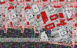
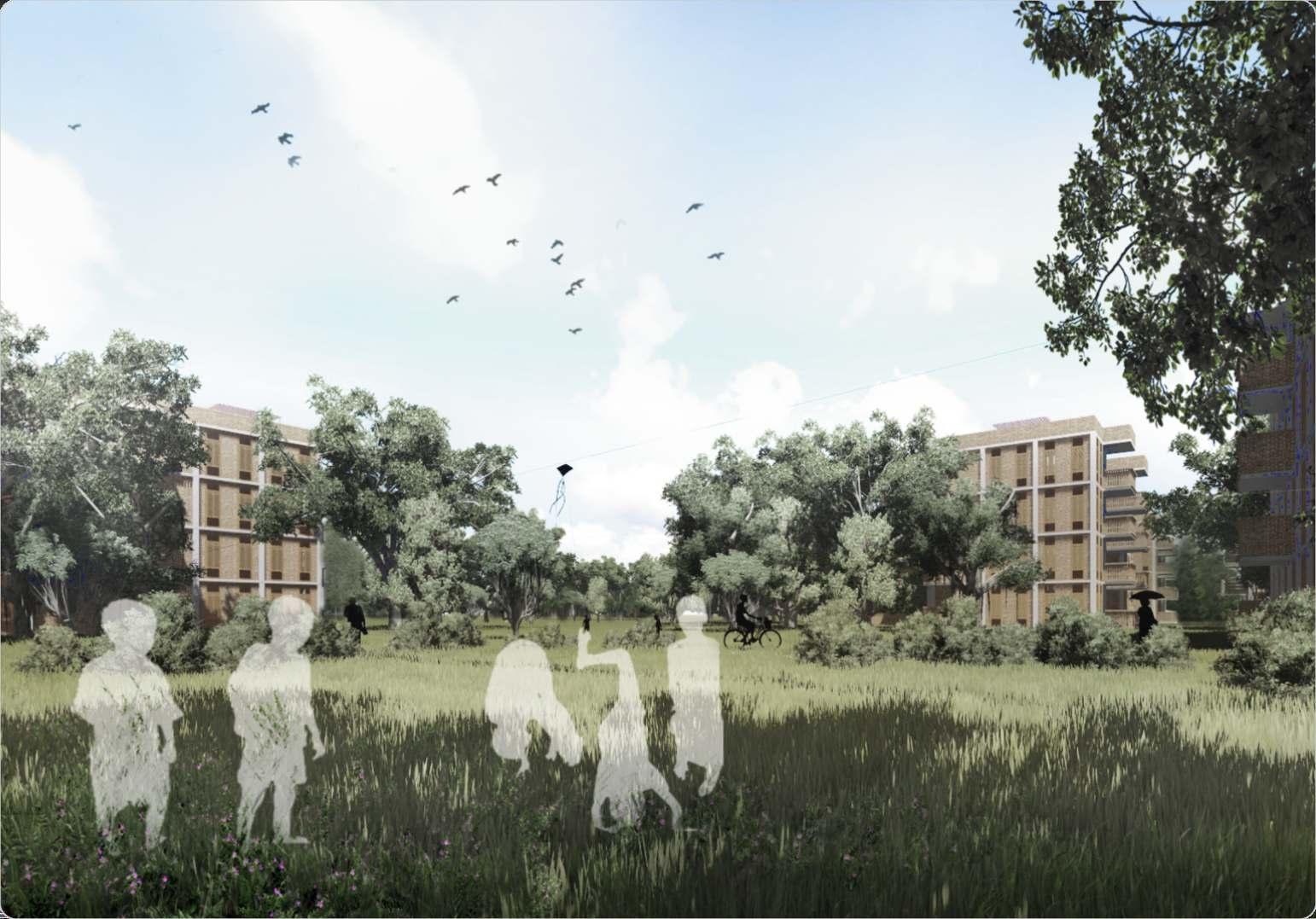
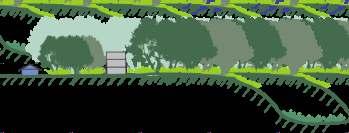
This residential campus is one of its kind, dedicated to experiential learning and promotes a broad range of diverse skills and qualities, to complement the theoretical development that students undergo. Located within a close proximity from the capital city of Dhaka, the place is surrounded by residential and several other educational infrastructures With the continuum of time the surrounding environment condition has been deteriorating day by day. Once highly enriched with ecological and environmental diversity, the site is now losing its spirit and the harmony among space, landscape and people are being lost due to gradual expansions. Hence, the main challenges is to bring back the faded essence and the memory connected to that precinct
The existing plan of the residential campus lacks a balance between human and natural environment.There is at least 15% area in this campus which is unused or underused. According to current statistics the campus is mostly used by the regular students for about 9 months and for the rest of the time this is occupied by the trainees of some extended training programs. As time is passing by, the number of occupants is increasing day by day and is expected that the number of students will be doubled within next couple of years. As a result, the additional expenses regarding utilities and other services are rising as well In this situation it is a pressing need to re model the campus integrating natural balance and the increasing number of learners In the new landscape design, priority has given to native plant species and cultural aspects with the memory of the place to blend the built environment with surrounding context
My responsibilities : Directly working as an apprentice of Landscape Architect and Co-ordinating with other consultants as a project architect
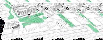
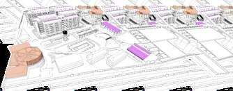
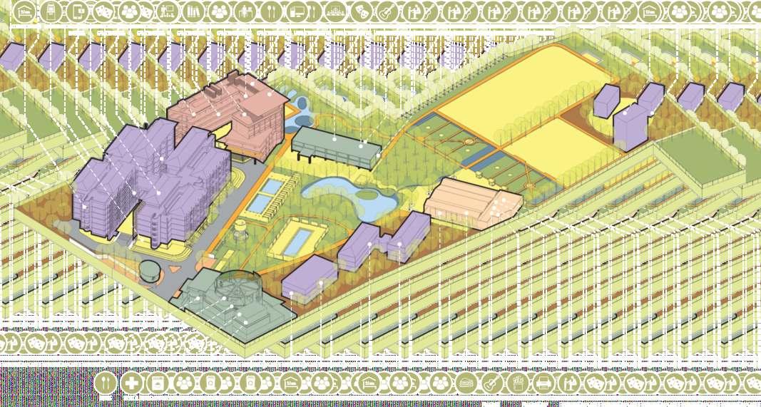
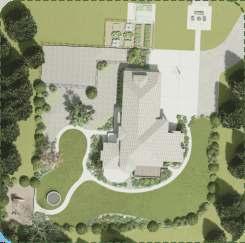
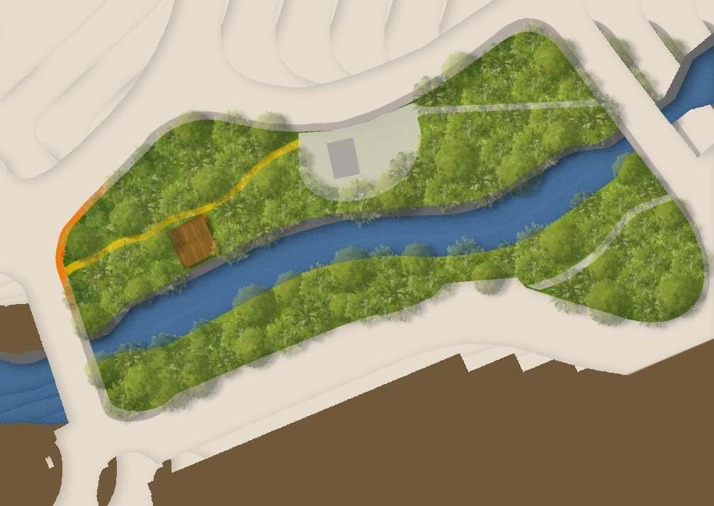
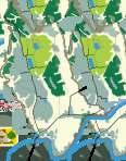
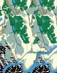
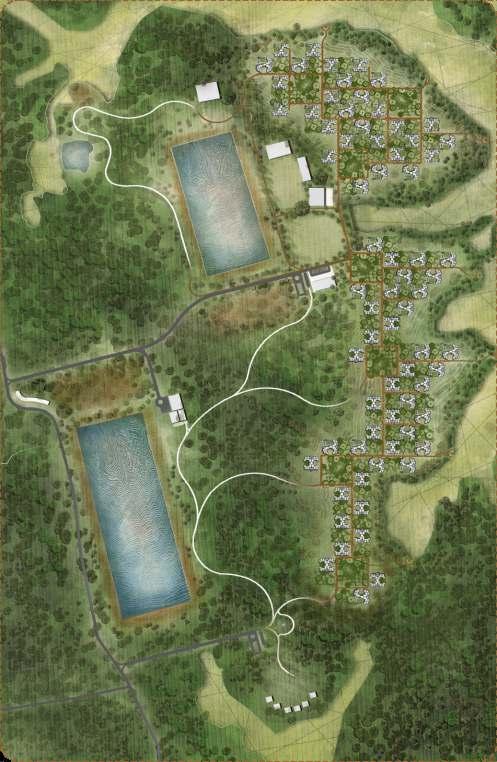
Project Brief : BRAC Learning Centre (TARC) is a community living and learning space for BRAC University students. Students of every batch have to live therefor one trimester of their university life. It’s a place from where students can learn community living, lateral learning, learning by co-operat ng with each other. Th s campus is situatedabout20kmawayfromDhakacity Away fromcitylifeitiskindofaretreatforstudentswith an experience of living together in same place undersameroof. Some of the old buildings of the site has been demolished So There is a big empty land in the middle of the site.That will be the main space for landscape design. Beside that there is a large amount of unused negative spaces in the site By planting those area it will he p to create a biologicalconnectionbetweeninsideandoutside ofthesite
Project Goal : The goal is to Create a Diverse Ecoscape which will be Eco friendly safe Habitat for an mals ae
l and experientially pleasant and soothing The choice of plants w create a wonderful var ety of experience throughout the year. Students will learn the system of bio community from the differentgardensofthecampus.
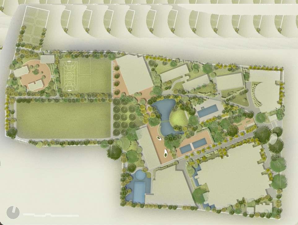
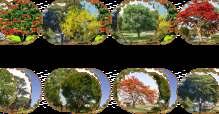
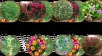
Various types of gardens are introduced in the design to give the experience of different environment. Different gardens and water bodies are designed to keep the memory of the old buildings which will help to teach the students about the history of this place. Natural gardens like Dense forest garden, Natural Pond garden and Orchard garden will create the space for local bio-diversity
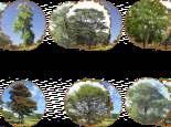
About the site : The campus is situated on Savar Upazilla. The land of the upazila is composed of alluvium soil of the Pleistocene period. The main tree of this area is‘Shaal (Shorea Robusta)’ A biodiversitysurveywasheldtoknowandanalyzethe Plant and animal diversity of the site The study revealed that 220 species of vascular plants, 51 speciesofbirds,11speciesofmammals,6species ofreptiles,5speciesofamphibiansand18species ofbutter�iesweredistributedinthecampusarea. Among the total plant species diversity, there were64trees 88herbs,52shrubs,9climbersand 7palms. Plant
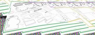
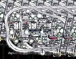
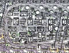
Nursery Area
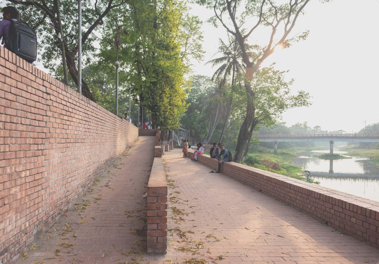
Plaza walkway s a pedestrian path that connects two open plaza space Oval shaped sittings are ntroduced here encircl ng the trees
memory.
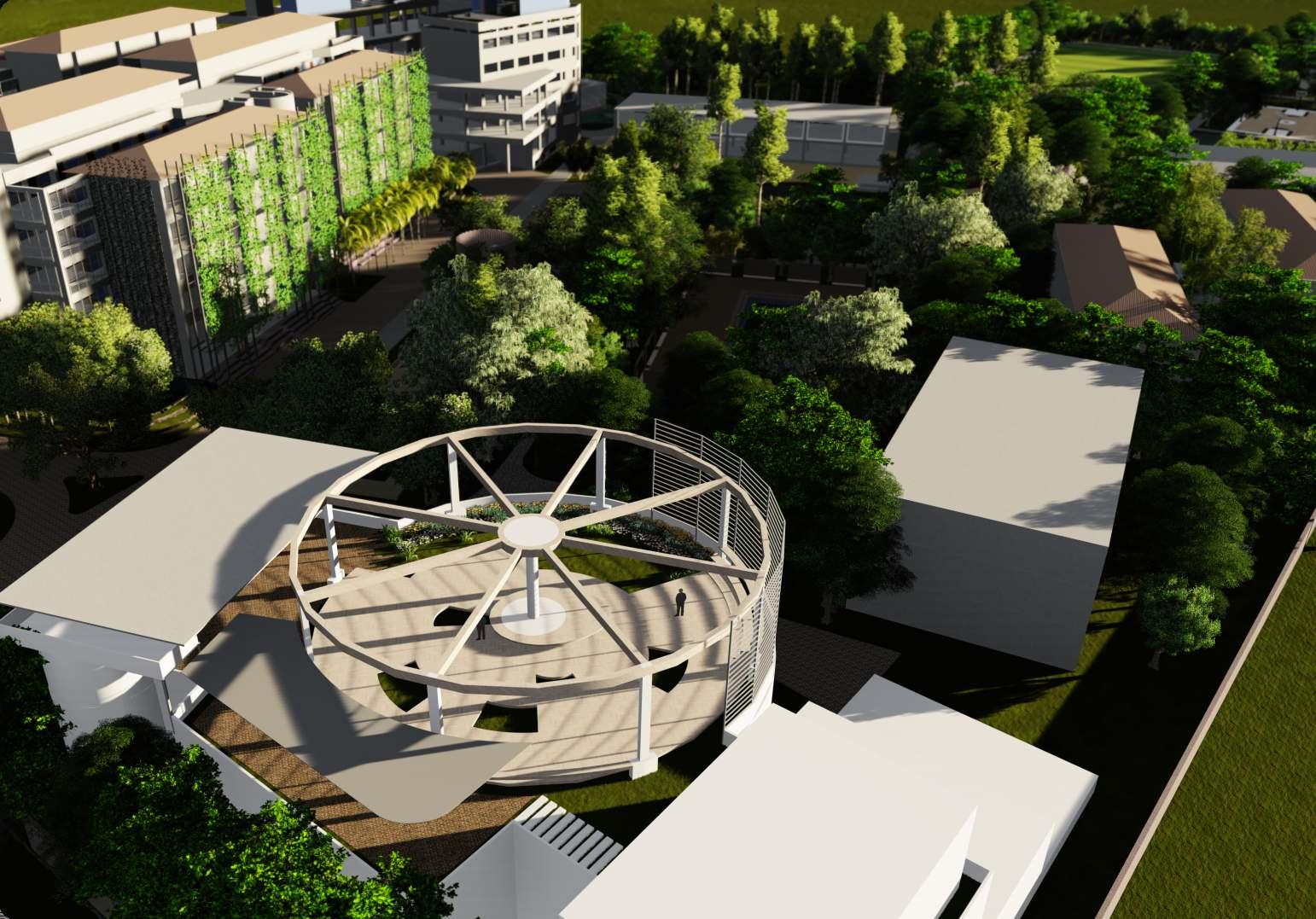
Bangla Roof Pavilion
Demolished buildings
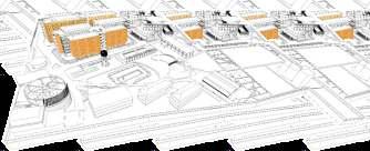
GROUND LEVEL GARDENS
Creating different landscape experiences throughout the site and differentiating the activity patternwithlandscapedesign.Itisthemainfocusofthewholelandscapedesign.
BOUNDARYWALL GARDENS
Totalperipheralboundarywallisdividedintofoursectionstointroducefourdifferenttypesof garden. The non visible and less accessible part of the boundary wall is designed as dense forest type One of the visible portion is designed as productive vegetable garden and other part is as ornamental garden. And the wall that surrounded the nursery area is designed as experimentalgarden.
VERTICAL GARDEN
The main function of vertical garden is to experimenting with different vertical gardening options and to create a new type of building fenestration system which will not only beautify thefacadebutalsohelpstoprotectthedustandheat
INITIAL IDEAS FOR LANDSCAPE
ROOF GARDENS
Roof gardens are designed mostly for leisure and recreational purpose with the target of decreasingtheheatandincreasingoverallgreenfootprint
LANDSCAPE AS LONG DUREE & ENVIRONMENTAL ETHICS
Develop a landscape scheme for the site which is consistent with the philosophy of the residential semester of the BRAC un versity where an understanding of the layered history of the site and the environmental ethics and justice of the territory arethefundamentalprincipleofthedesign.
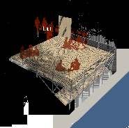
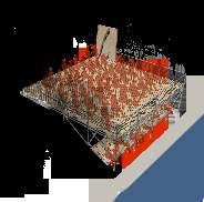
PROGRAMMATIC DIAGRAMWITH ACTIVITY
LANDSCAPE AS LEARNING LAB
Create a living laboratory that works with the seasons and processes of nature and allows students to actively engage n the continual culturaltransformationlandscape
LANDSCAPE AS PRODUCTIVE TERRITORY
des gn a number of orchard and vegetable gardens that can simultaneously add functions and beautytothelandscape
LANDSCAPE AS SYSTEM OFWATER MANAGEMENT
Combinewatermanagementofgray waterandrainwaterharvestingwith re�ective, recreational water use and irr gation for productive andscapes to create ntegrated landscapesystem.
LANDSCAPE AS REGIONAL IDENTITY
Accentuate the local topography nat ve vegetat on, and andscape traditions
eption zone tial zone tion structures tures t and others tures
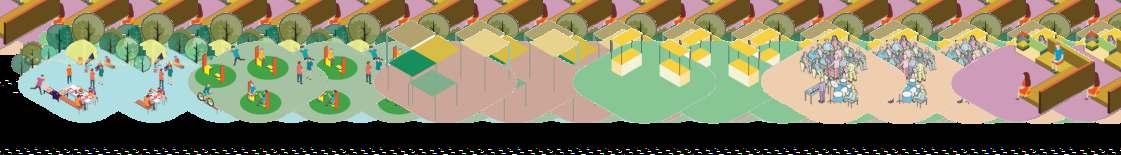
ACTIVITYTYPOLOGY IN LANDSCAPE
Celebrations Sitting Spaces RethinkingVegetation
Open Fairs
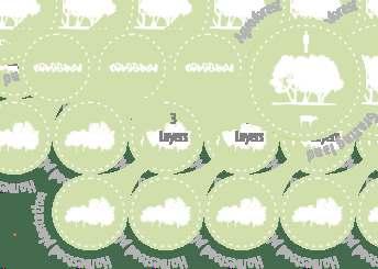
Layers OfVegetations
LANDSCAPE PROPOSAL FOR A CONVENTIONAL PLOTTED HOUSING. PROJECT EVERGREEN
Purbachal American City’ is a plotted housing project developedbyUS-Banglagroup.Thewholehousingisdesigned in a very conventional manner The whole area is divided into many blocks in a grid pattern by connecting roads and streets. An arti�cial canal is running through the project Various types of local and foreign plants are planted through the whole area without any proper planning Roads are mostly designed in a vehiclefriendlywayandthereisnotenoughpublicspace
Design concepts were developed by following these four principle.
The landscape proposal is a primary idea to show the owner of the project how to transform the whole scenario without changing the existing masterplan. How to make the whole project more human friendly by designing better streets and landscape Managementandredesigningtheconceptofroads inthelightofthegatedcommunity,wherehumans comes �rst and cars comes second. Intelligent road design could provide extra play space, jogging area andwellwaterpermeability
Integrated Bio swale will enhance water drainage and add as an attractive part during the monsoon . Intelligent bio swa e will enhance landscape quality.
Shaded place of the whole complex needs special attention. Careful selection of tropical plants will ensurelivelinessofthemostshadowedplaceofthe masterplan.
Reimag ning the Landscape masterplan in the context of the site. Prior tiz ng Seasonal Color variation, Rainwater Management, Ecology and above all long term sustainability of the project. Thus we prioritize local plants for hardiness and easeofmaintenance
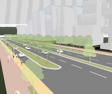
Thorough road vehicle speed: 60mph - 80mph
Access road vehicle speed: 30mph - 40mph
• 12feetwidefootpathforcomfortablepedestrian�ow
• Plantation of canopy layer tree on footpath ensures shade for the pedestrians.
• Vehicularroaddividedintotwodifferentsections.
• Oneis24feetdoublelanecentralthroughsection.
• Otheris16feetAccessroadwithseparatebicyclelane.
• One 8 feetcentral median and two 14 feetGreen median is provided for properplantation,shadeandpublicaccess
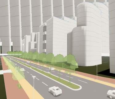
• 12 feet wide footpath for comfortable pedestrian �ow
• Plantation of Canopy layer tree ensures shade for the pedestrians
• 24 feet double lane vehicular road with 8 feet bicycle lane.
• 12 feet central green median for proper plantation, shade and public access.
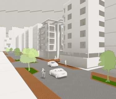
Vehicle speed: 15mph - 20mph
Following the‘ ’Concept Woonerf
• Footpath and vehicular road is in the same layer but separated by material color.
• Paver material used for both vehicular and pedestrian access. Which will force the drivers to commute slowly.
• Green plantation patches are provided for blocking drivers clear vision thus to prevent high speed
• Bio - swale is proposed for drainage
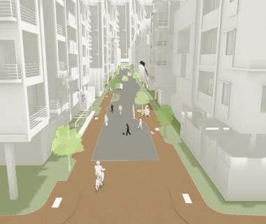
Vehicle speed: 10mph - 15mph
Following the‘ ’Concept Woonerf
• Footpath and vehicular road is in the same layer but separated by material color
• Paver material used for both vehicular and pedestrian access.
• Green plantation patches are provided.
• 6 inch of level change from the peripheral road.
• Bio - swale proposed for drainage system.
1
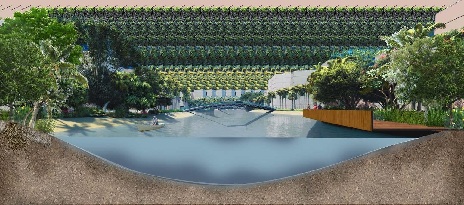
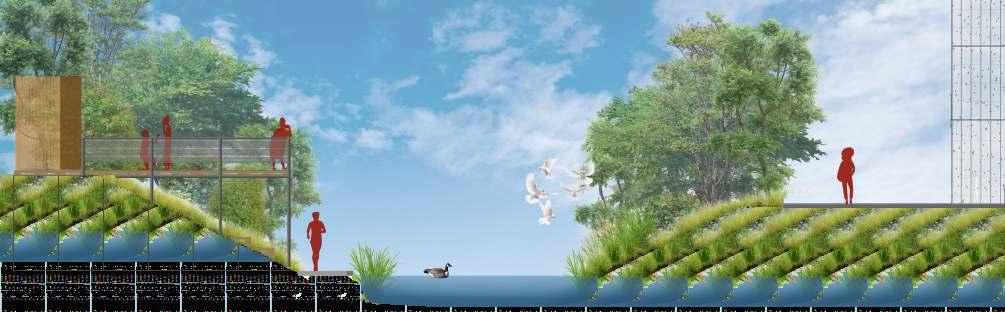
• Pocket of plants were created for generating dense garden and public space.
• Paver material used for both vehicular and pedestrian access.
• Wooden �oating decks are provided for view.
• Pedestrian bridges are incorporated for public access.
• Forest like layered plantation is proposed for creating bio-diversity.
FREELANCE LANDSCAPE DESIGN
FOR AN ONLINE LANDSCAPE CONSULTANT FIRM
Yardzen is a California based online landscape design platform that has a group of freelance landscape designer fromdifferentcountriesoftheworld.Theydevelopedaweb basedsystemwhereclientsanddesignersbothcollaborate throughtheonline.
Intheyear2020,whilethewholeworldwasaffectedbythe pandemic, like many other companies Yardzen started to operate their work online They try to provide Budget friendly, climate sens tive, contextual, modern design according to their clients tastes and wishes For this they created a detailed work process. For which they developed a network of local botanist, vendors and international designersandotherspecialist.
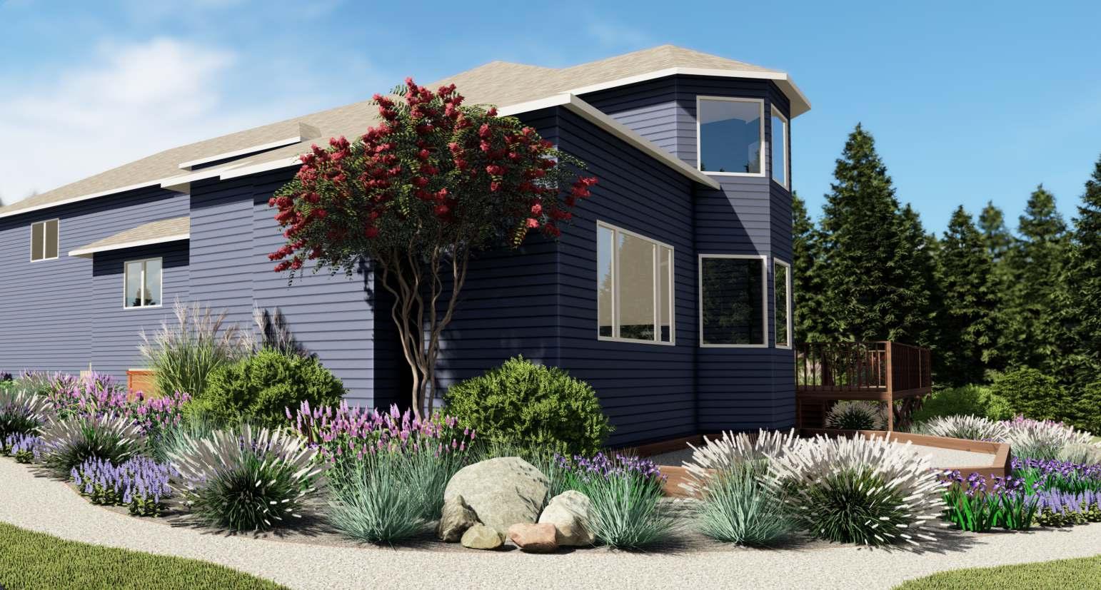
I had the opportunity to work with them as a freelance landscape designer from August 2020 to September 2021. This is one of the projects that I designed As a designer I had to select project from their server website and go through all the available information before starting the design. We had project managers assigned to us to communicate with us. As a designer I not only designed those project but also prepared necessary drawings, visualizations,andbudgettoservetheclient.
In this project client wanted a vibrant color pallette with a cost effective solution Client also wanted pollinator friendlyplantstoattractbirdsandinsects.
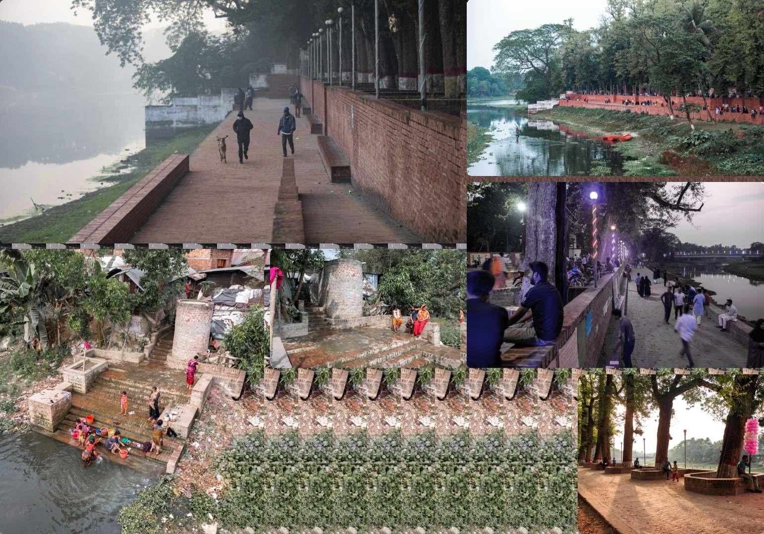
Jhenaidah,asecondarycitywithapopulationofapproximately 2,56,000, is situated in the southwest of Bangladesh. A river named'Noboganga �owsthroughthecitycentreofJhenaidah. LikemanyothersecondarycitiesofBangladesh,Jhenaidahalso lacked public spaces, whether in city-scale or in neighborhood scale, where men, women, children or elderly people could go anddoactivitiesfortheirphysicalandmentalwell-being.
Jhenaidah municipality has around three hundred ponds. People used to face their house towards ponds and used these for bathing, swimming �shing and gathering around Now thesehavebecomethebackyardsfullofgarbageasifthereisno alternative better waste management system. A recent research shows that about 70% of children in the city do not know how to swim due to polluted water.This is alarming in a riverinecountrylikeBangladesh.
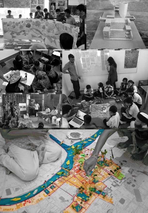
Since 2014, around 20 different groups got together and started to think about the possibilities of merging urban open spaces with the river, ponds, roads and pockets of lands The objective is double-folded; to �nd people-friendly urban open spaces and to protect the water-bodies from private encroachment and pollution. Together the city people have developed a design strategy to improve the city's relationship withtheriver,bycreatingpublicspacesandinteractiveactions. When the collective dreams are visualized by all, the city authorities eventually realize the proposed design step-bystep
Contribution :
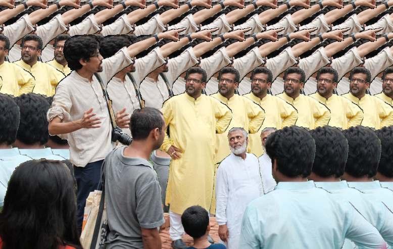
One of the volunteer Architects. Part of 4 different community workshop.
1. Planning, 2. Documentation, 3. Designing, 4.Visualization, 5. Preparing presentation Time line : 2017 - 2019
The long term vision is to protect 5 kilometers of riverside from encroachment and pollution through connecting the riverside communities and developing required public open spaces for the communities or the whole city This 'required' public spacewillvaryfromcommunitytocommunity Itcan be a communal bathing space, a collective garden or a water garden dedicated forbiological treatment of wastewater etc. Incorporat ng public open space protects the public water bod es from illegal privatization through communal surveillance . In addition,thewastewatertreatmentbeforereleasing city's runoff and household wastewater to surface water bodies can be more controlled and effective Beside this, protecting and re-designing the small waterbodies to make them accessible and developing people friendly streets throughout the city are other long time goals.When people become aware of their rights and have right information in theirhand,anythingcouldbepossible.
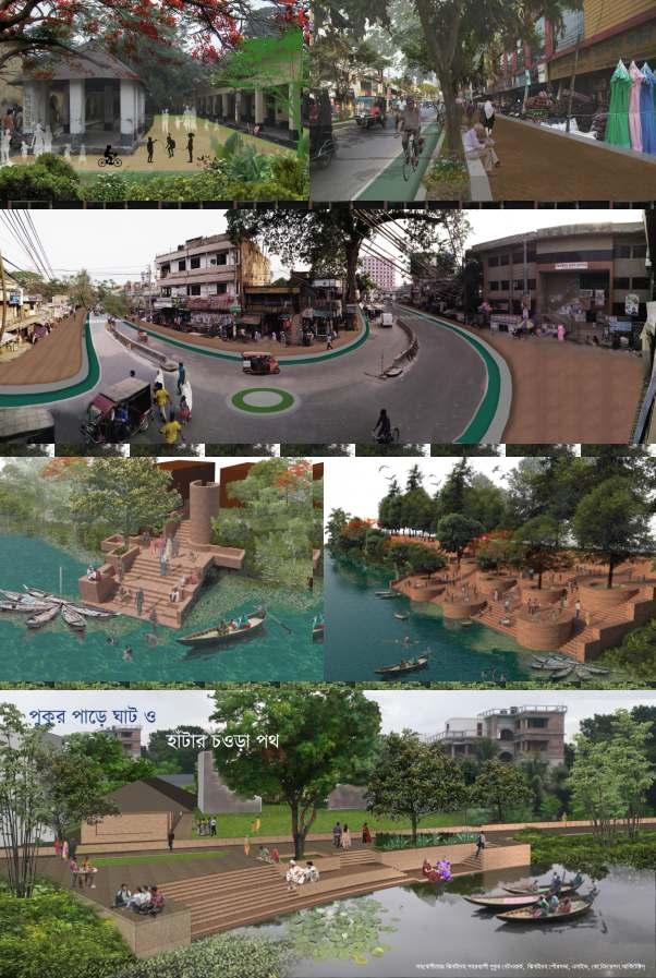
After gathering peoples insights and ideas from workshops a group of architects designed and prepared visualizations of different spaces for presenting the outcome of the workshops to the local authorities.Then ordinary citizens presented these �ndings and demanded their needs to the municipality mayor. Here we can see some of the design outcomes of the different workshops
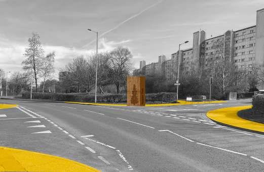
Old jail and courthouse Hussain Shahid Suhrawardy Road
Post office Node
Nabaganga River Ghat
Shatbaria Community Ghat
Aarappur C&B Pond Ghat
IMPACT
Nabaganga River Ghat is partially and Shatbaria Community Ghat is fully constructed.This 115-metre-long“Nabaganga RiverGhat”hastwoplateauslinkedbyvariousstairwaysandarampforthedisabled,thelowerplateauremainingatleast 3.7metresabovethewater.Peopleofallagesandbackgrounds includingsomefromnearbytownsandvillages,regularly come here to walk, sit, meet, or engage in sport, cultural or recreational activities.The upper retaining wall serves on the lowerplateauasaverticalsurfaceforpublicexhibitions,andontheupperonejoinswithaparapetthatmeandersaround thepre-existingtrees–someoveracenturyold–tocreatesemi-enclosed,shadedareaswherepeoplecansitfacingeach other This ghat can also serve as a two-level auditorium for theatrical performances given on a �oating deck or on the oppositeriverbank
The “Shatbaria Community Ghat” is directly connected to the water’s edge via a few steps Intended for and used extensively by one of the city’s largest low-income communities, where the majority are Hindu, it caters speci�cally to theirneedsintermsofbathing,washingandpracticingreligiousrituals,withachangingroomandbenchesprovided. Mobilised by the community’s enthusiasm, Jhenaidah Municipality employed local craftspeople to execute the project, the architects providing pro-bono consultancy services.The mayor reports that representatives of over 50 municipalities havevisitedtolearnfromthesecommunityengagementprogrammes.
Winner of the‘Aga Khan Award for Architecture 2022’ and‘UIA 2030 Award.
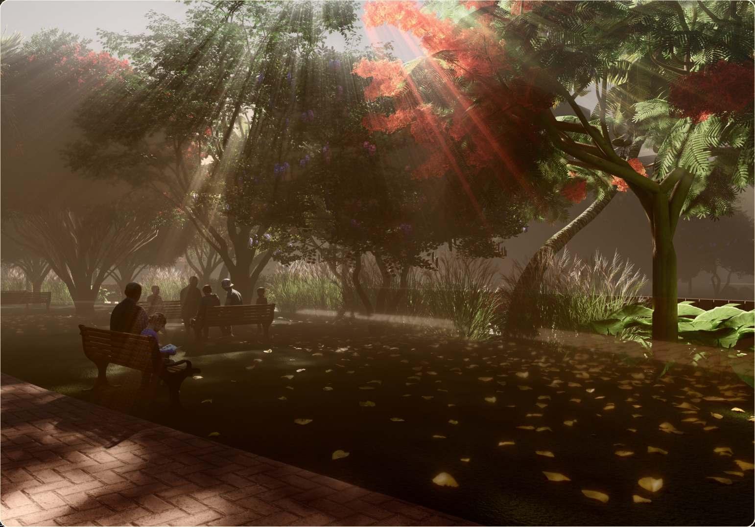
PEOPLE, PLACE, & NATURE
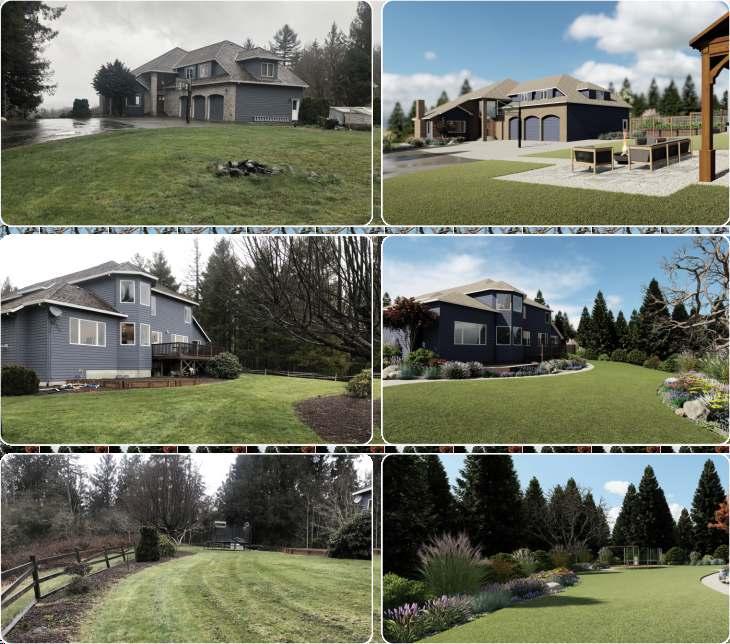
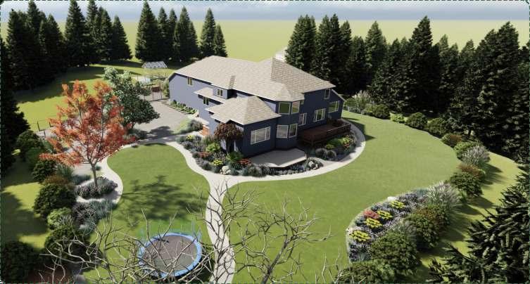
Landscape Design for Health and Well-being:
Reason for Choosing the site
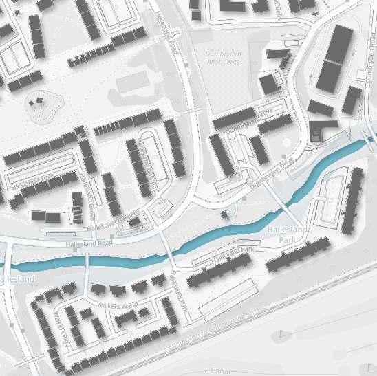
This site is a point of distinct . Although there is a neighbourhood culmination three neighbourhood park, community garden, and some play spaces, but there is near the to enjoy no public space canal the canal view or spend leisure time This part of the neighbourhood is also and the most deprived most of the people . And almost 100% of the allotment is The site has good live alone socially rented accessibility with �ve bus stops and public car park.
This part of the canal is from the these three well connected neighbourhood with internal accessibility path.This part is very and connected clearly visible through a common node.
While Edinburgh has many green spaces it is rather lacking in blue spaces so this project aims to consider the current quality and suitability of the Union Canal within the city in relation to health and well-being and after an assessment, to suggest what design and management interventions might be added to improve the potentials for physical, mental and social health and well-being.
The primary task was to prepare a detail assessment of the given 1km length and surrounding area of the Union Canal usingThe BlueHealth Environmental Assessment Tool (BEAT)’ in a group of four Task 01
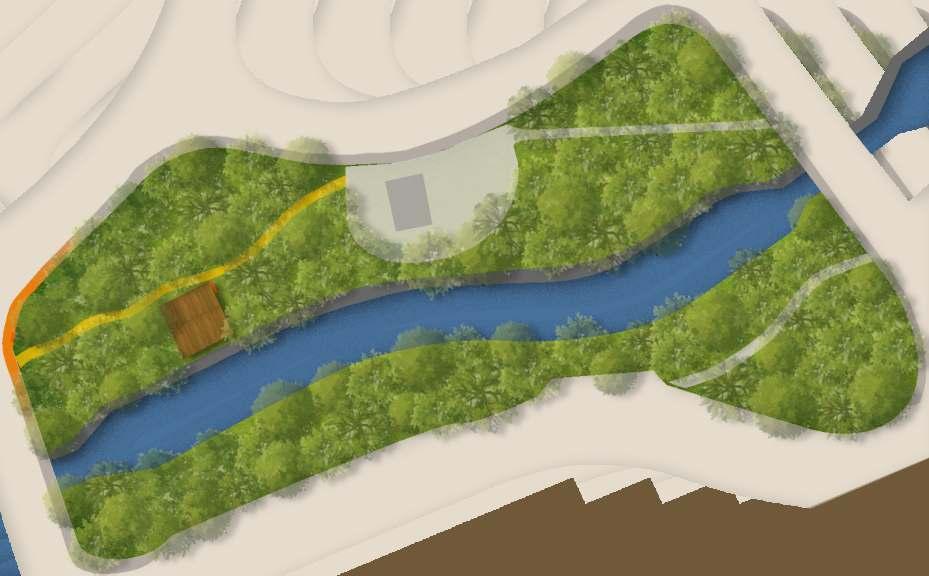
the �nal task is on the basis of the site assessment to choose a particular site or area from assigned 1km length and design or propose any micro intervention to improve the present condition.The budget of the intervention is £20,000. Task 02
Phases of Development:
Phase 01
Primary Findings:
Sociological Deprivation
Ecological Deprivation
Unattractiveness
Lack of Public Space
Lack
Communities will be engaged in place-making process through different activities Focus towards the space will be created using creative and signboards pathway paintings This will help to generate interest and activity among the neighbourhood
Phase 02
On this phase will be built This platform will create the space for the neighbourhood the platform meeting and other different activities Throughout this phase the soil of the area will be prepared for the Miyawaki plantation using compost prepared by community and commercial compost. Plantation will be followed next which will be done by the community people with the help of professionals
Signboards and colors will be used For creating focus and attraction.This will help to generate attention to the community people and beyond
Creating Attraction and Visibility
Phase 03
Ensuring diverse activity by designing a multifunctional space.Which will make the place vibrant throughout the day and in the long run will make the space safe for everyone
Designing Multi-functional Public Space
Community people will be engaged throughout the implementation process through numerous workshops and activities Which will create a sense of belonging for the space among the community people.
Generating Community Activities
Mini forest environment will be created by using ‘Miyawaki Forest’method Which will create a self sustaining diverse forest environment. In the long run people will have a secluded peaceful environment.
Developing Diverse Ecology
On the last phase this forest will be maintained for next 3 years by the neighbourhood community. After that the forest will be and full of .This will help self sustaining biodiversity to create a inclusive space
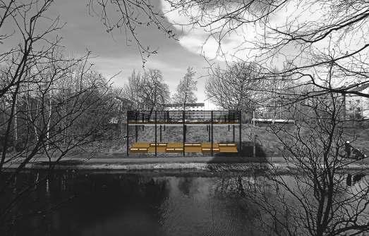
Design of the Platform
Design and dimension:
The design of the platform is quite simple. A �at 10 m X 10 m platform will be made from the upper level of the slope.The height of the platform from the canal towpath is 2.5 m There will be railing all around the platform for providing security. Some sitting arrangement will be constructed under the platform.
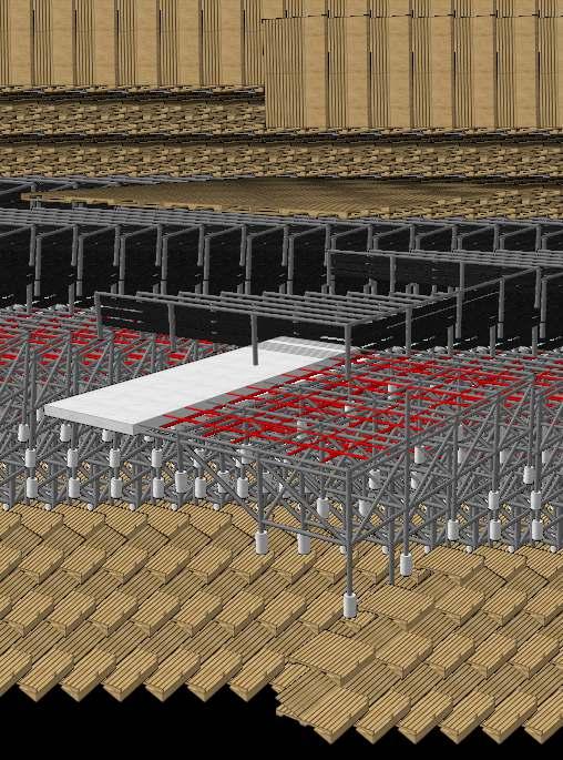
Materials:
The signboard, the surface of the platform, and the under sitting will be made using recycled wooden pallets These pallets will be heat treated and proper weather coating will be applied to them.
The structure will be entirely made by using GI scaffolding pipes. Concrete footing and base will be used to give strength to the whole structure Railing top and post will be constructed by GI pipe and the mid �llers will be made by using Steel cable.
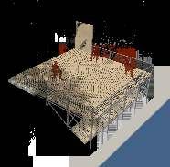
Individual & Leisure Activity
Wooden Pallet
Signboard Wooden Pallet
Platform Gi Pipe Railing Steel Cable Railing Concrete Base Support for Platform GI Scaffolding Pipe Structure Concrete Footing Wooden Pallet sitting
Picnic
Friends gathering
Details of the Miyawaki Forest Method:
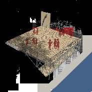
& Friends Activity
Family Picnic
Resting
Friends gathering
Chatting
Plant Selection:The selection of the plants need to be based on native plants which are locally available or nearly extinct The mix of different layers of plants should be selected to create a mixed forest like environment Once a list of plants are �nalized quantities need to be worked out. Species should be sorted into major, supporting, and minor species
• Major species:The �ve most common species naturally found in the local area.These will be 50% of the total plants
• Supporting species:The other prevalent species of the area. these will cover 25%.
• Minor species:These will cover the rest
Species should also be categorised based on their height The �nal order list should balance the various canopy layers and ensure the best mix of major, supporting, and minor species A Miyawaki forest needs 3-5 plants per square meter.
Soil Preparation: Firstly, all the debris and weeds should be removed
Secondly, the entire plot need to be dug to a minimum depth of 1 meter, and the soil should be turned and replaced in-situ to increase the aeration. If the soil quality is not good then a mixture of mychorrhizal fungi, organic matter or mulch can be added whilst the soil is being turned
Plantation: The trees and shrubs should be planted so as to mimic a multi-layered, natural woodland, positioning the different species as randomly as possible, and trying not to place two trees of the same kind next to each other The high density and wide diversity aims to create competition between species and encourage the social relations that develop between plant species in a healthy natural woodland
Adding Biological Enhancement and Mulch: After the trees are planted, but before the mulch is laid, organic fertilizers and biological enhancements can be added to provide additional nourishment to the soil and plants When applying, ensure that all plants receive equal amounts
Maintenance: The woodland will need to be looked after for the �rst 2-3 years whist it gets established. After that the whole forest will be self-sustaining and grow like a mini forest ecology
VISIONING SUSTAINABLE VILLAGE (R)EVOLUTION
LAND, FOREST, ARCHEOLOGY
Aim: An exploration of the jon-jomi-jol (people-landwater)relationshipinanemergingurbaninBangladesh.
Objective: Design Research for visioning sustainable village for living and livelihoods by preserving land amidst populationincreasein
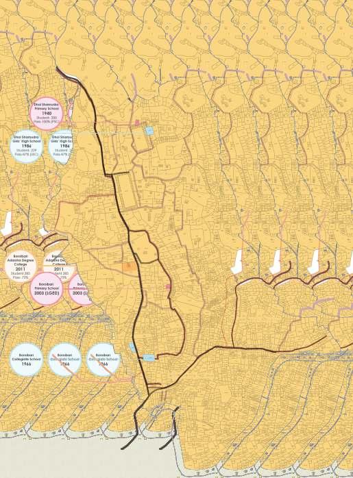
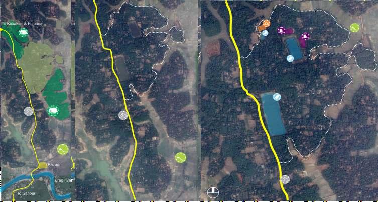
This project explores the interrelationship among space, context, and profession.The site was a suburban area, not very far from the capital, Dhaka, which has experienced tremendous waves of change due to rapid urbanization, environmental degradation, and issues of socio-cultural discrimination.The primary focus group of the study was a disappearing �rming community living in the highland of Borobari Mouza in Kaliakair Upazilla. Those �rm ng community has been witnessing change of the traditional occupationmorethaneverbefore Tointerpretthefutureof the settlement in this changed scenario, the traditional settlement patterns was minutely studied, analyzed and eventuallyreinterpretedincorporatingtheideaofcompact township. The proposed master plan tries to infuse Agroforestry based programs in a modernized version as wellasexploringscopesofnon�rmingprofessions.Ittried to re ncorporate the former concepts of intimate neighbourhood within the modern morphology , simultaneously infusing the potential of tourism based neo-economicalprospects
Project type : Group project, Level 4,Term 2
Studio teachers : Prof. Dr, Shayer
ProjectYear : 2015
KaliakoirUpazilla.
Gafur
Shamia Sharmin
Labib hussain Nusrat Jahan Mim
Historical Background : The formation and functioning of villages had been instrumental in guiding civilization in South Asia since the ancient time Villages consisted of homesteads, adjoining agricultural and grazing lands and common forests and wetlands Villages were dispersed, linear or nuclear depending on the agglomeration nature of the constituting homesteads. They were sites of cultivation and habitation based on a rigid caste-system as well as sources of revenue extraction by the ruling elite living in the urban areas. A panchayat (group of �ve elders) system looked after the day-to-day village affairs As back as in 3rd century B.C.E. Kautilya's Arthashastra- an ancient Indian book on statecraft economic and military strategy-outlined the rulers'relation to and dealing of the village.The concept of self 'sufficiency' and 'isolation' had tied the village(r)s in an unequal relationship with the ruling elite Central rulers' appointed of local Jaigirdars for governing and collecting taxes from villages. However until the Mughal Empire, many villages remained more or less unchanged This brief narrative is but an oversimpli�cation of the historiography of the South Asian villages considering their differences in geography climate, language and culture The fate of the village(r)s in the undivided Bengal, however, had changed drastically by the East India Company's introduction of the Zamindary system for revenue extraction through the Permanent Settlement Act in 1793. Villagers were exploited through forced taxation and cash-crop cultivation. The scares of this exploitation run deep in the Bengali psyche, even today. Yet villagers held a central position in the nationalist imagination set against the colonial hegemony Tagore had not only romanticized villages within Sonar Bangla but also searched for its freedombypragmaticmeans.GandhilocatedtheauthenticityofIndiainvillages,"ThesoulofIndialives n its v llages" While Nehru and Ambedkar thought of villages differently, as sites of (India's) backwardnessandoppressionrespectively.
PresentContext:ThelegacyofthenationalistimaginationcontinuedinBangladeshthroughthesuccessivepost-colonialgovernments.Anapparentruralbias had preferred modernization of agriculture health, education, utilities and communications for people living in villages Comilla Model had been a notable experiment during the 1960s despite the corruption by the large land-owning farmers. Investments in rural infrastructure, setting up of rural growth centers by the post-independence governments, aided by overseas �nancial and technical assistance, ever-expanding coverage of mobile communication and cashtransactionhavealleffectivelyreducedtheage-oldisolationofvillagestoagreatextent.Today'svillagesarefeaturedbyagreaterpresenceofoff-farmactivities, increased connectivity and mobility Self-sufficiency of food production, remittance sent by unskilled emigrant workers and supply of RMG sector workers have helped villages in removing the post-independence stigma of basket-case of Bangladesh. In short villages' isolation is replaced by its linkage with cities and urbanareas
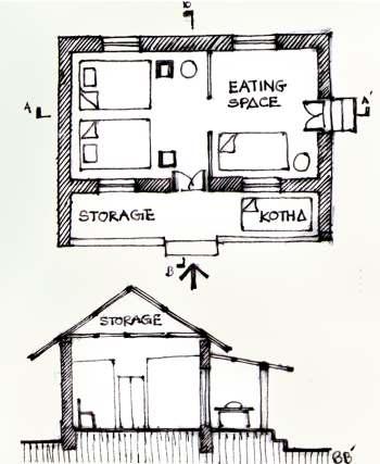
Existing school and primary school
Existing highway passing through the village
Existing forest ministry land Main tree is sal .
Baid is a low land area where rice are cultivated.
Two ancient water source from pal dynasty
Archeological site ( pal dynasty)
MAP OF BARABARI AND DAKURAIL MAUZA
gr y Beginning Current situation Agroforestry developed Agroforestry Begin DEVELOPMENT OF AN ALTERNATIVE APPROACH
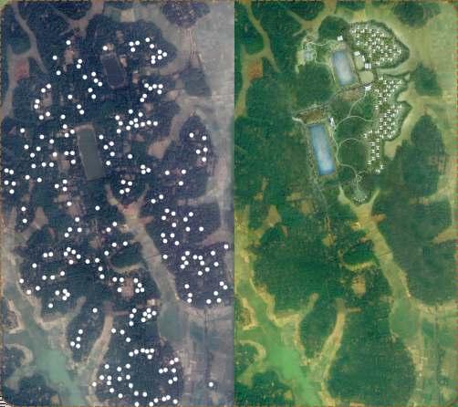
Agroforestry based rural housing is a gradual process and it will take more than 20 to 25 years to build the system. The �rst thing to do is to build awareness among the people. Then slowly people willbetakenunderthesystem Theoldhomestead places people leaving for the new housing system will be used for growing agroforest further The �rstimageoftheLeftsideiscurrentscenarioofthe village Thesecondimageiswhatwillhappenafter 25 years when the agroforest system is fully developed After 25 years we will get more continuous green belt which will both serve as ecologicalcorridorandashighelasticcropcultivate area.Soitcanbesaidthatthenewsystemcanbring more economic , land and env ronmental sustainab ty n the village than the current system.
Bangladeshisnowinapositiontothinkofherfuturenot from scarcity but opportunity perspective But the question s - how would a growth-dr ven economy accommodate and fed an ( ncreased) 250 m on population by the end of this century while losing 1 per cent arable land due to urbanization and river-erosion each year. Dominant development d scourse is susceptibly silent on this issue The concept of 'Compact Township (CT), arguably offers an alternative from an economist's point of view CTs are the agglomeration of houses hospital schools, market, rural industries and local government units with all basic services for almost 20000 people CT argues to be a means to an end of achievinga“magical10percent“growthinBangladesh. Having accepted Ct's basic assumption, we pose the problem a bit differently for our design research: what is the des red alternat ve to the persisting engineered 'second nature', beyond phys cal, economic and environmenta determinism. Our design research objective is a challenge to envision an alternative within theideaonofCT,integratinganensembleofhumanand non-humanentities
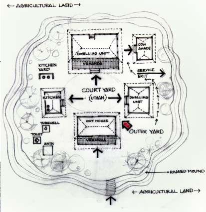
The idea is to maximum the land use ( chala ) in a sustainable manner
Agroforesrty is a new farming way to develop land fertility, bio- diversity and as well as alternative income source. On the final stage of the development eco tourism will be introduced to generate more income from the area and to preservethebiodiversity.
Total1000unitisprovidedforthehousing
54 building blocks contain 3 units with a nursery and cow shade provision. 22 building blocks contain 4 unit ( formigrant)
Museumarea-1acre
restaurant-0.05acre
touristcottage&facility-2acre
medicalcenter-0.2acre
mosque-0.25acre
existingschool&primaryschool-1.1acre
The type of agroforestry system we will develop in the site is known as homestead agroforestry system .It will requirethreelayersofplantation. Health facility