LANDSCAPE ARCHITECTURE


Hello, my name is Nayon. My passion for landscape architecture derived from my love of art, plants, and the environment. During my pursuit in this multifaceted discipline, I’ve appreciated the interconnective lines of nature, built worlds, and people. As designers, we maintain a balance between urban and nature that ultimately evokes the human senses, emotions, and imagination. I strive to continue my learning in understanding these qualities of the landscape.
“When one tugs at a single thing in nature, he finds it attached to the rest of the world.”
 – John Muir
Education
Bachelors of Science, Landscape Architecture
California State Polytechnic University, Pomona
Associates of Arts, Social Sciences
Fullerton College
Work Experience
Landscape Designer| BGB Design Group, INC
Landscape Architecture Office
- Preparing packages from preliminary phase to construction phase
- Residential & City Projects
Landscape Design Intern | Landstudio360
Landscape Architecture Office
- Assist in preparing package for schematic & conceptual design
- Create planting plan documents
Project Intern | American Landscape
Landscape Construction Company
- Project Assistant to the Senior Project Manager in Operation Department
- Estimator in Estimating Department
Skills
Autocad, Landfx, Rhino3D, GIS
Adobe Creative Suite | Photoshop, Illustrator, Indesign, Premiere pro
Bluebeam, OnScreen Takeoff
Microsoft | Word, Excel, Powerpoint
Model Making | Laser Cut, 3D Modeling, CNC Milling
Honor Awards
ASLA Merit Award Recipient - 2019
Chapman Forestry Foundation Scholarship Recipient - 2018
Amici di ENV Italian Studies Scholarship Recipient - 2018
Involvement
ASLA Student Chapter President, 2018 -2019
ENV Representative, 2017 -2018
Space Activator ASLA & ASPA
Student Outreach
Interests
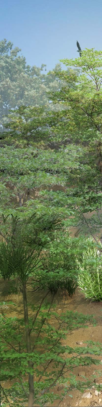
- art | photography
- reading
- plants
- outdoor activites
- traveling
Nayon Kim
C Hawthorne, CA
E nayonestherkim@gmail.com
P 562.245.2119


001 professional experience
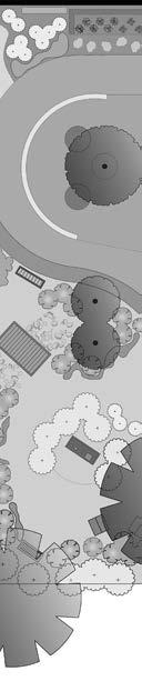
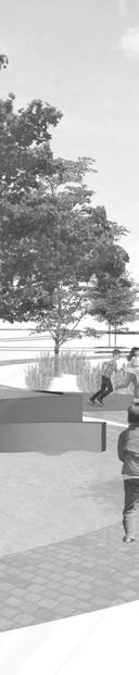
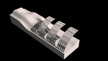
conceptual rendering
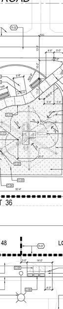
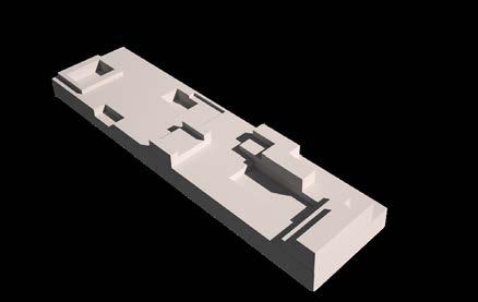
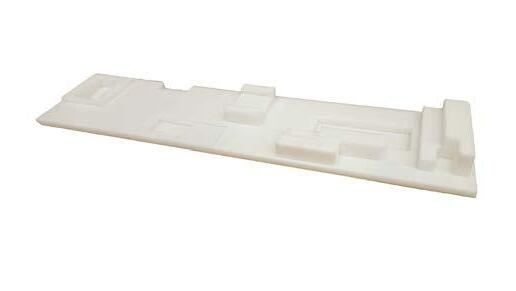
construction plan


irrigation plan
planting plan


 construction plan of pocket park


 irrigation plan of basin (HOA maintained)
irrigation plan of entry way & main road (city maintained)
irrigation plan of basin (HOA maintained)
irrigation plan of entry way & main road (city maintained)
planting plan of entry way & main road


NOTE: FOR CONSTRUCTION DETAILS, SEE SHEET 16.
[sample project 02]

Los Angeles is widely recognized for its automobile culture, however, it poses a threat on the environment. Although the reduction of automobile use is ideal, landscape architects are now considering how parking lots impose a negative effect to the environment and the overall use of space. Accomodation for masses of automobiles requires large spaces that ultimately lays barren throughout majority of the year. Breaking Lots rethinks parking lot design by incorporating sustainable design and multi-functionality to create dynamic spaces.


Exposition Park has been central for entertainment since 1872. Museums, sports arenas, and parks make up majority of this area. Throughout its history, several parking lots have been deconstructed to pave the way for recreational spaces, proving that parking lots are no longer a priority.
Parking lots are designed with impermeable paving, little to no plant material, and collects toxins emitted from cars. Temperature are found to be much higher in these spaces.
The design incoporates spaces that can be utilized by the museusms and sport arenas that are adjacent to the site. The park is roughly 700 sq. ft. The main wooden deck pathway connects the adjacent Jesse Brewer Jr. Park. The design mimics the “X” like pathways in an organic matter of curves. Located on the left are surface parking and ADA parking. To the right is the Nature Garden. This area serves the Natural History Museum across the street. Native trees and plant materials are planted in this area to promote birds and insects for study. In the center is the children’s playground. As you continue to walk south, you will be opened to a large open lawn area for any and all activities. Tailgating during sport events, farmers market, food truck events, and any philanthropy walks can be hosted in this space. The underground lot only spans about 1/4th of the total site while 3/4th of the surface will be permeable. The smart technology will be installed in the underground parking garage for safety and easy wayfinding.

[diagram}
Agrigrid allows filtering and percolation of polluted water from cars.

The two-level underground parking lot allows us to utilize 100% of the surface space for recreational activites. The underground lot only spans 1/4th of the total site while 3/4th of the surface will be permeable for water percolation. The Nature Garden consist of native trees and plants to promote wildlife The bioswale located on the right serves as a barrier between the street and pedestrian pathways. It will also collect any rainwater which will eventually flow into a large catch basin. The surface parking on the left will have Agrigrid pavers, a permeable surface that allows growth of small plant materials that will clean and filter any polluted water during the rain season. Near the open lawn will be a tree installation accompanied with solar panals that will generate electricity for the park.


003 fat urbanism
spring 2019 [senior capstone] bunker hill

downtown los angeles
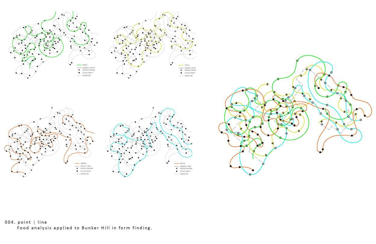
The comparison of the unlikely pair is landscape and food. My chosen pair is Bunker Hill in Los Angeles and the traditional Korean soybean stew that my mom would make growing up. The site is a two-block radius in proximity to Union Bank Tower and the Westin Bonaventure Hotel in Los Angeles. This dish has many variations of ingredients; however, this design will focus on the key consistent ingredients (water, soybean paste, and tofu) that makes this stew. The exploration began using verbs from the action of making this dish. The set of verbs stemmed from the ingredients, “to pour”, “to boil”, and “to slice”. This dictated how the different level of tiers will interact with one another, ultimately forming its final shape. The functional goal is water management and mitigation of urban heat island by creating a green oasis in downtown. Filling the voids between tall structures which acts as a green corridor for people to experience the city in different planes.
How does one compare food and landscape design? By starting with the exploration of formal diagrams that conveys expression of all kinds. Whether its a recipe of food or programs for a landscape, we play with the idea that they are both interchangeable.

Food possesses layers of complexity emanating from how the consumer experiences the variety of flavor, texture, consistency and temperature. Another set of layers can be attributed to the making of the food. A series of choreographies, heavily dependent on timing, sequence, and form, yield a product that is consumable.
We reference Lawerence Halprin’s “Choreographing Urban Experience” of scores to describe two different purposes; a generator of form to guide performances and a structure of process. Halprin’s forms and methods are never meant to be static. Omurice is an example of a carefully choreographed dish, however, root beer has formative changes without manipulation. These contrasts are labeled as ‘active’ and ‘passive’. The stew takes on a different kind of choreography; the continuous change of ingredients by the user. This contrast is labeled as ‘variety’ and ‘uniform’.

[DIAGRAM]
Three foods chosen by each member of the group is expressed in a diagram by the layer of ‘active’ vs ‘passive’ and ‘variety’ vs ‘uniform’. This type of diagram will also be explored on Bunker Hill by the use of points and lines. The points act as scores, a “temporal-situational guidelines that invites participation and applied for revealing alternatives.” It also serves as a guide to performance. Without the lift of the pencil, the points are then connected to one linear, continuous line. This linear narrative describes the progress of one step to another.


fall 2018 [senior]
val di chio
castiglion fiorentino, italy
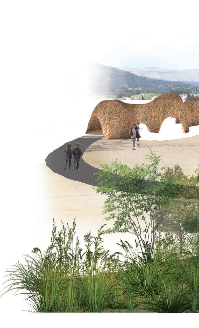
Castiglion Fiorentino is a walled town that sits between the hills of Tuscany, Italy. Below in the valley is the Val Di Chio where locals grow much of their olives and grapes that enhances the agritourism. However, the disconnection between the historic town and the agritourism of the Val Di Chio is prominent. Through the process of research and bottom-up design method, students were to create a sustainable design that connects the spaces and the people together.

The overall goal is to preserve the existing nature and enhance the positive attributes of the site. The Olive Grove has the least intervention to conserved the viewpoint from the town above. This site provides a 360 0 view of the hills and the town. Locals can take an afternoon stroll through the mounds and the existing olive groves. The Children’s Garden is located near residential areas and the public recreational center. The park consist of a natural playground, open grass field, and seating areas. Hills View was designed to have a change in elevation, bringing the best view in the house. It also consist of a large open area to host events and concerts. Historic sites are located throught the Val Di Chio. Through the sidewalk intervention, it serves as a connection to the town, the recreational spaces and historic sites.


 Children’s Garden
Olive Grove
Children’s Garden
Olive Grove
[analysis}
Lack of safe pedestrian pathways poses an issue in promoting the flow of people down into the Val Di Chio. There is a lack in recreational spaces. Existing natural beauty of the hills and valley. No connection to the Historic locations and sites.

[diagram]
This sidewalk intervention is a boardwalk decking style over existing large drainage trenches. Lighting will illuminate the pathway for safety at night.


Landlocked between the redeveloment of the eastern side and the Los Angeles River, the Pacific Railroad’s Taylor Yard is the largest parcel of vacant brownfield land that lies fallow since 2009. The city of los angeles purchased the G2 parcel as the “crown jewel” of the LA River Revitalization. Students were required to investigate both the past and present conditions of the land and explore the potential possibilities. Examining the current ecological, cultural, educational, and communal establishments, students designed and created programs appropriate for the site.

The design process was an exploration by layering information and creating study models to approach the final design. The initial investigation started by studying Taylor Yard’s context. By observing the landscape, the wildlife, and mapping potential opportunities and beneficiaries, programs were then created for the site. Students were required to create a set of rules with the use of spatial types. These rules were applied into the landscape, alongside the programs developed from the previous investigation to create the final concept.


Tree Garden (forest rule)
LA River Bridge
Tiered
Resting Area
Taylor Yard Plan

Mounds (platform rule)
Shade Structure (canopy rule)
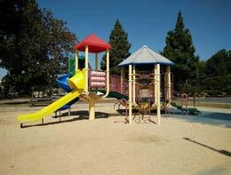
Maryvale has cared for orphaned, abused, and neglected children since 1856. The site is 6,400 sq ft located in Rosemead. Healing through plants, play, and sense of security is an essential part of the design of this site. The process began with analyzing the behavior of children and understanding the process of healing. It was key to include the five senses; sight, touch, smell, taste, and sound, as a mean to promote healing, play, and learning.
006 Maryvale fall 2018 [senior] rosemead, ca plant designNature Area
- vibrant colors, adds scents, attracts butterflies/ladybugs/birds
- inspire art/painting, learn about wildlife
Reading / Gathering Area
- soft texture bissually / sense of touch, tall grasses and plants

- create a sense of enclosure
Edible Vegetable and Herb Garden
- vegetables / herbs grown by the children
- educate about planting and harvesting, healthier food options


 Photography