LANDSCAPES IN PAPER AND PLACE:
Rethinking geo-spaces through Malta’s
and Country Maps
Cabrei

National Library of Malta
Public Lectures Series 2025–2026
Coordinated
by
Mevrick Spiteri, Daniel Borg and André DeBattista
The 8th edition of the National Library of Malta’s Public Lectures Series focuses on Malta’s historic landscapes as recorded in cabrei and country maps from the 17th to 20th centuries. Special attention is given to the archival record – the cabreo and accompanying administrative registers – which encapsulate important elements crucial for the valorisation of Malta’s landscapes. The series discusses cabrei (legally binding land registers or property books), manuscript maps, survey sheets on a national scale, and descriptive land registers. It adopts a multidisciplinary approach, emphasising links between land and people. Rethinking Malta’s geo-spaces through diachronic perspectives, as captured ‘in paper and place’, offers a firmer contextualised approach of territorial administration, land management practices, and environmental changes; bridging archival research, historical geography, and GIS. Overall, the series is intended to take stock of the current state of research, introduce innovative approaches to Malta’s modern historic landscapes, and open new avenues for collaborative research.
All lectures start at 18:30hrs. Free entrance. No booking required. For more information: events.library@gov.mt
In collaboration with
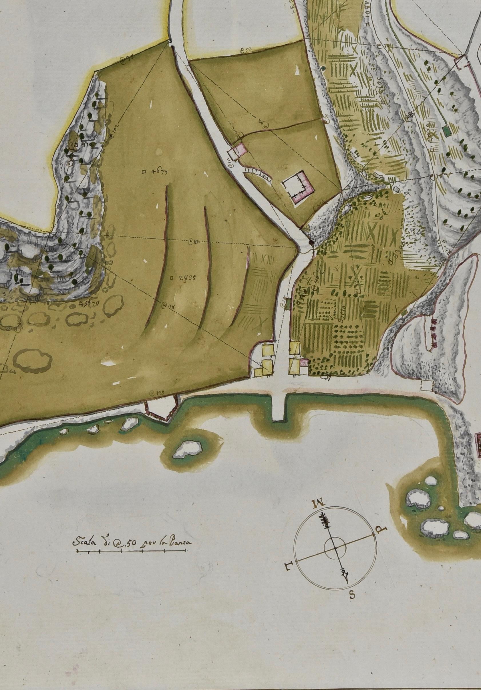
Cover image: Survey of “Il Fego della madia” in Mġarr, Gozo from B290 Cabreo del Magistero, vol. I, 18th century. (National Library of Malta)
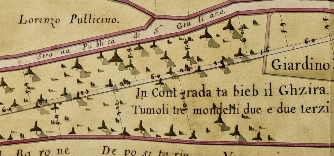
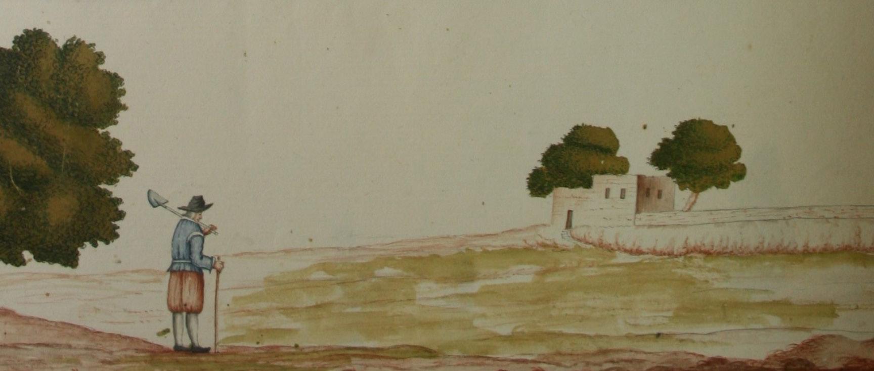
An example from Cabreo del Magistero showing drawings of field enclosures commonly found in cabrei. Unique to this cabreo are the countryside drawings at the bottom of the plates, which enrich further the 18th-century agrimensura practices. (National Library of Malta)
Revisiting Malta’s Cabrei: Property books from the Knights’ period at the National Library of Malta – Mevrick Spiteri
This lecture explores Malta’s cabrei, or property books. These cabrei are landmark compilations of property surveys and descriptions of territorial holdings in the Maltese Islands, drawn up under the rule of the Order of St John. The National Library of Malta holds a group of 26 surviving cabrei in the Treasury Series B, which offer detailed snapshots of the islands’ historic landscapes during the early modern period, shedding light on patterns of land use as well as the political, social, and economic structures of the 17th and 18th centuries. The lecture will trace the archival history of these records, examine the context in which they were produced, and delve into their composition, highlighting several noteworthy land surveys of the Maltese countryside. Moreover, it will offer insights into Malta’s heritage and cultural landscapes, revealing why the cabrei remain such valuable visual and historical resources today.
28 NOVEMBER 2025
Historical Cartography in the Digital Age: Applications of GIS and WebGIS – Daniel Fenech, Christopher Gauci, Martha Piscopo, George Buhagiar and Emanuele Colica
The Policy Research Directorate within the Public Works Department has recently launched a digital map that allows a comparative viewing of old maps of Malta with the current survey sheets of the islands. This lecture will delve into the process of creating such an important research tool. The process of producing the map is known as georeferencing, which lined up the old maps, known as the Joint Ordnance Survey Sheets (1896–1927), so they match their real world location in a Geographic Information Systems (GIS) Program. This involved referencing the Joint Ordnance Survey Sheets against modern aerial photography (2018) as provided by the Planning Authority. The source material were 152 paper based surveys from the Public Works Department’s archives, which were digitised. These sheets were ‘trimmed to remove anything other than the survey drawing itself and then assembled into a single digital map encompassing the island of Malta. The end result is a free, online map of the Joint Ordnance Survey of Malta (1896–1927) that is accessible by anyone through a web browser.
17 DECEMBER 2025
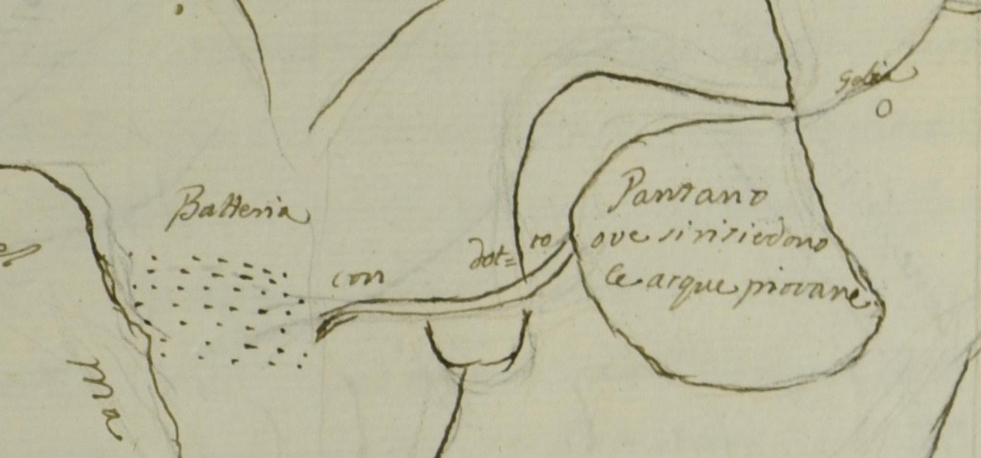
Malta’s Hidden Springs and other water sources: Unearthing Late Medieval and Early Modern Water Technology via Cabreo documentation – Keith Buhagiar
This lecture examines hydrology-related documentation found in cabrei from the Knights’ period in Malta and Gozo. Cabrei, which are collections of maps and descriptive texts detailing specific land parcels, are crucial for understanding historical agricultural and hydrological landscapes. The data for this lecture is drawn primarily from 17th and 18th century Treasury Series B cabrei, specifically Cabreo del Magistero volumes 289, 290, and 291. These documents, compiled by periti agrimensori, offer scaled plans and descriptions of features such as cisterns, wells, and springs, often differentiating between irrigated and non-irrigated land. The analysis, supported by modern survey sheets and field investigations, illuminates water management practices and land use during the Knights’ period, highlighting the impact of qanat-type water systems on agricultural properties in north and northwest Malta.
28 JANUARY 2026
Contrasting the 1957 Aerial Survey and the 1896–1927 Joint Ordnance Survey: Shoreline Change Appraisal as a Catalyst for Historical Research – Christopher Gauci and Daniel Fenech
This lecture explores historical 1:2500 maps of Malta produced by the Public Works Department (PWD) in collaboration with the British Ordnance Survey in the period between 1896–1927 and a separate series dated to 1957. Early research by the PWD examined the two series to understand their value in understanding shoreline changes. To compare them, the two series (1896–1927 and 1957) had to be digitised and aligned, within a Geographic Information Systems (GIS) environment. The study found several limitations, including drawing inaccuracies, missing shoreline indicators, and no known geographic reference system. Despite this, the two-map series matched overall, with most differences being attributed to developments in infrastructure, likely through aerial revisions of the existing Joint Ordnance Survey (1896–1927) series. Only a few changes appear to relate to the natural landscape, which merit further study.
27 MARCH 2026
A Diachronic Evaluation of the Selmun Landscape: Using the Cabreo del Monte della Redenzione and Other Sources for Historical Landscape Analysis –
Daniel Borg
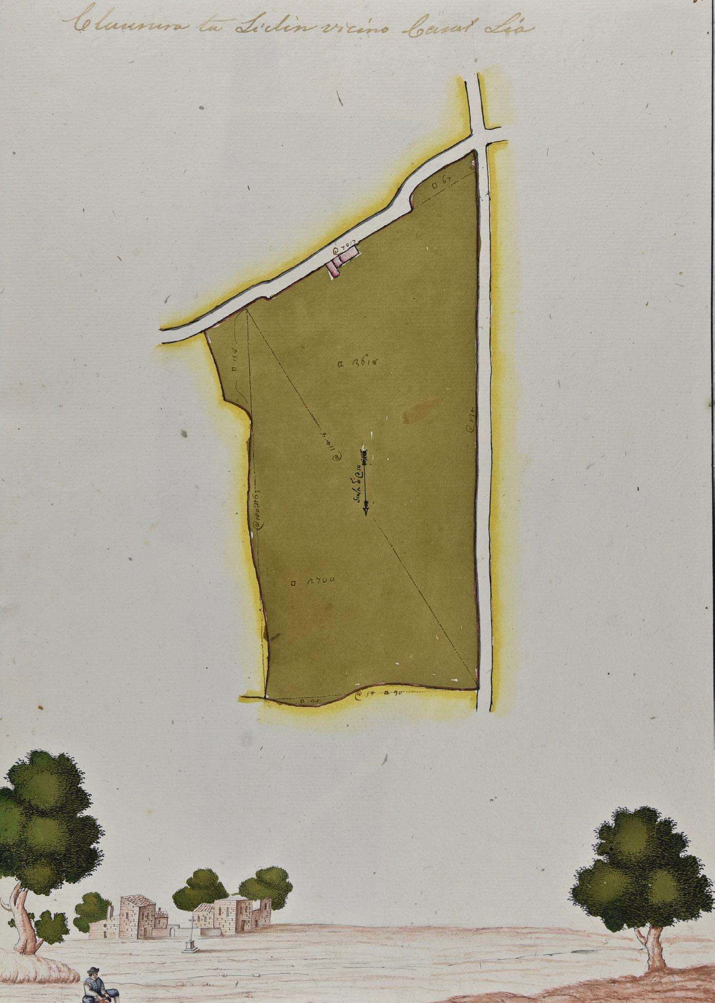
This lecture explores the early modern landscape of Selmun as recorded in the cabreo of the Fondazione del Monte della Redenzione degli Schiavi, which contains detailed property surveys and land inventories from the 18th century. Selmun, located in the north of Malta, was a renowned rural estate administered by this foundation, which was established in 1607 to finance the redemption of Christian slaves through the management of its properties. Drawing on this cabreo, alongside maps and notarial sources, the study examines how these documentary records contribute to a better understanding of Selmun’s diachronic landscape. The morphological changes observed are best understood through multidisciplinary analysis. Such sources are crucial for reconstructing past landscapes and revealing how estate management shaped territorial organisation and layered transformation over time.
29 APRIL 2026
Anthropomorphic features in Maltese landscapes: addressing issues of food security, soil protection, and rainwater harvesting – Avertano Rolé
Despite the fact that the Maltese countryside is not particularly favourable to arable cultivation, the archipelago has a long history of human occupation. Over centuries, its inhabitants have been forced to drastically modify the terrain rendering it one of the most anthropomorphic landscapes on the planet. The process of agricultural intensification accelerated during the 17th to the 19th centuries during which time more marginal land was brought under arable cultivation. This was realised through careful, labour intensive management of marginal landholdings which addressed issues of perennial water scarcity, occasional intense rainfall, shallow infertile soils, and the constant threat of soil erosion. The result of this labour can still be seen as distinct features in the Maltese rural landscape with terraced fields, armoured by dry rubble walls, being the most evident.
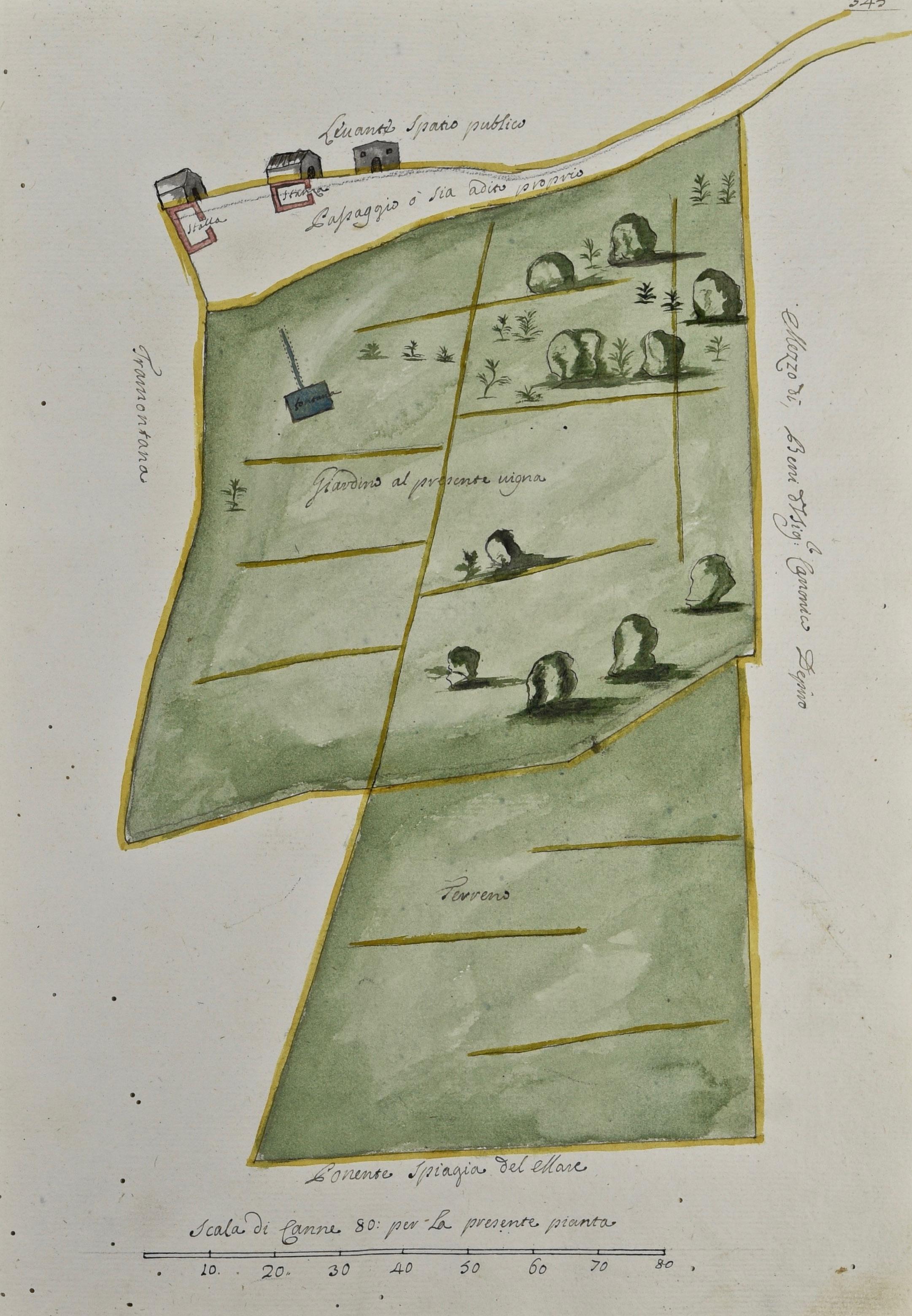
Survey of “Ridume Meiesa” in Ħad-Dingli, Malta showing terraced terrain and water features (“fontana”) from B300 Cabreo Cottoner, 1732–7. (National Library of Malta)
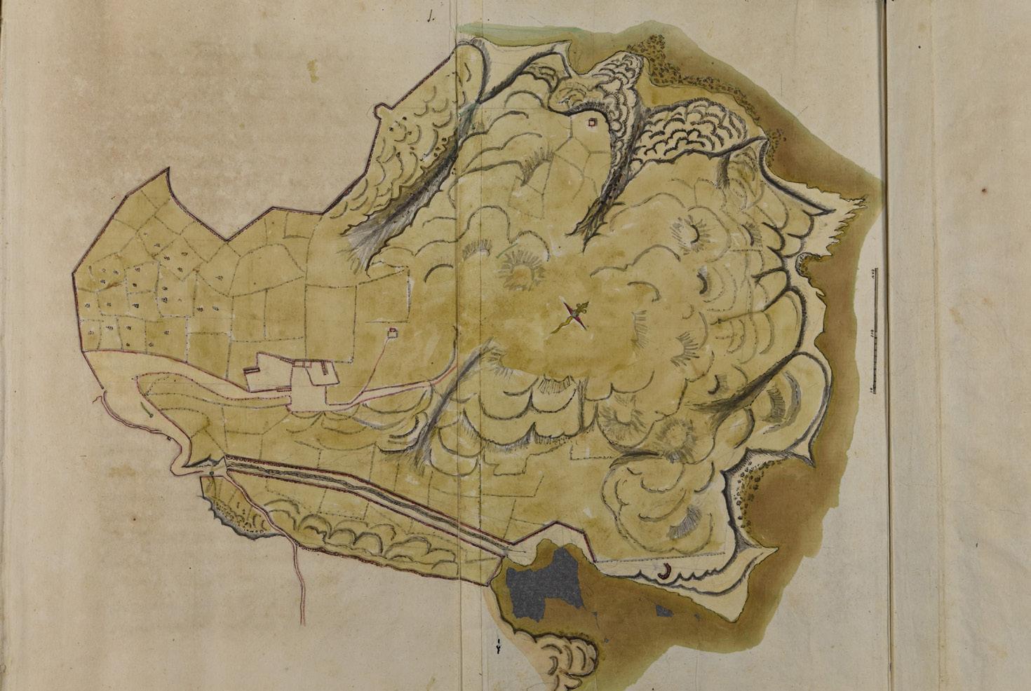
18th century plan of Selmun estate – “Fego di Salamone”, property of the “Fondazione Monte della Redenzione de Schiavi” in B309, 1735. (National Library of Malta)
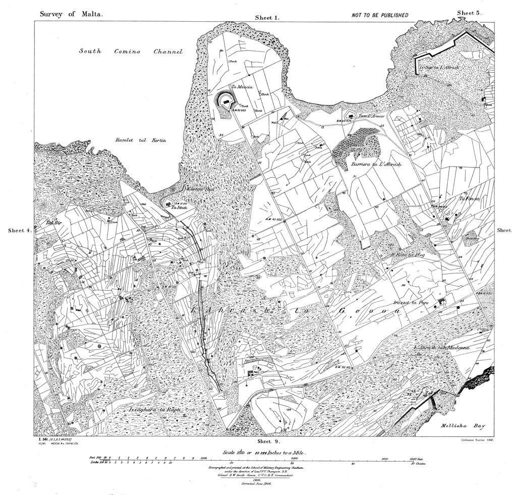
century Ordnance Survey maps of Malta at 1:2500 scale. (Public Works Department)
20th
PARTICIPANTS
Daniel Borg graduated in Archaeology from the University of Malta in 2003 and obtained a Master’s degree with distinction in Geography of Cities in 2011. With over 22 years of experience, he has participated in numerous excavations, surveys, and environmental assessments. His main interests lie in historical landscape studies, supported by extensive archival research. He has co-authored several papers on the subject and is currently a curator with Heritage Malta, responsible for prehistoric sites in the southern region.
George Buhagiar is the director of the Policy Research Directorate in the Public Works Department and is an architect and planner by profession. He graduated as an architect and civil engineer in 1989 (University of Malta), obtained a Master’s distinction in Regional and Resource Planning in 1995 (University of Otago, NZ) and completed a Doctorate by 2004 (University of Lincoln, NZ), on institutional capacity for integrated environmental management in small-scale political systems.
Keith Buhagiar holds a PhD in archaeology specialising in landscape research in Malta and Sicily, hydrology, cave-settlements, and churches, with a focus on the medieval and early modern period. He lectures in Paleochristian and medieval archaeology at the Department of Classics and Archaeology, University of Malta. His research interests include geology, water systems in the central Mediterranean, North Africa, and the Near East, as well as human-induced landscape transformation, and Mediterranean settlement patterns. He has published widely, including Malta and Water (AD 900 to 1900): Irrigating a semi-arid landscape (BAR/Hadrian, 2016).
Emanuele Colica is a geologist with a strong focus on geophysics and geomatics. He holds a Ph.D. in Geosciences from the University of Malta, with doctoral research on the application of advanced techniques for monitoring coastal erosion and evaluating geohazards. In addition to academic responsibilities, he has been involved in various national and international research projects. As a lecturer, Dr Colica is dedicated to teaching, mentoring students, and promoting interdisciplinary approaches to solving complex environmental challenges in the field of geosciences.
Daniel Fenech holds a B.Sc. (Hons.) in Earth Systems and a M.Sc. Physical Oceanography, with dissertations on the statistical verification of numerical weather models and spatial prioritisation of Martine Protect Area (MPA105) respectively. He is the current systems administrator for the Public Works Department’s GIS platforms. At the Policy Research Directorate, Daniel Fenech is the lead on the GIS component of the digitalisation of the Records and Archives and the Joint Ordnance Survey 1896–1927 project.
Christopher Gauci has been employed as a geologist with the Policy Research Directorate, within the Public Works Department for the past six years. He graduated in 2015 with a B.Sc. (Hons.) in Earth Systems from the University of Malta, and a year afterwards graduated with a M.Sc. in Exploration Field Geology from the University College Cork, Ireland.
Martha Piscopo started her journey with the Research and Planning Directorate, within the Public Works Department as a GIS trainee in 2019. After two years working as a trainee whilst focusing on her undergraduate studies. When she obtained her B.Sc. (Hons.) in Earth Systems with the University of Malta, she was employed full-time within the RPD. She aids in project administration, namely the organization of events and stakeholder engagement. Furthermore, she assists with GIS tasks required for various jobs assigned to the RPD, including the Joint Ordnance Survey 1896–1927 project.
Avertano Rolé is a visiting academic at the University of Malta after retiring from a long career lecturing at the institution. He currently lectures within the Faculty for the Built Environment. He has had extensive educational and training experience in international universities and institutions regarding environmental management. Avertano Role has played key roles in Maltese planning starting from Malta’s first Structure Plan and its subsequent reviews, Environmental Impact Assessment (EIA); and the Coastal Area Management Program (UNEP’s MAP CAMP-Malta). Avertano Role’s primary field of interest is geomorphology focusing on soil erosion and land degradation.
Mevrick Spiteri holds a B.A. in History and Archaeology and an M.A. in Baroque Studies from the University of Malta. His research focuses on historic properties, landscape studies, and their links to social and economic histories, especially relating to land use and spatial transformation. He also specialises in the archival development of property-related and land management archives. His latest book is The Houses of Baroque Valletta 1650–1750. Property redevelopment from records of the Officio delle Case: socio-economic reflections on civil buildings.
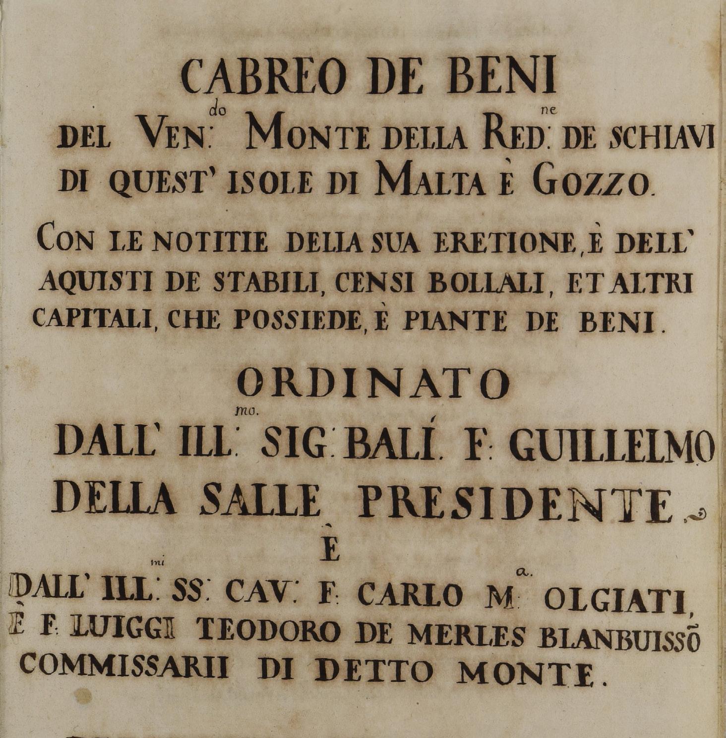
Title page of the cabreo of the “Fondazione Monte della Redenzione de Schiavi” in B309, 1735 (National Library of Malta)
EXHIBITION
Archival drawings of geo-spaces: Exploring Maltese cabrei and periti-agrimensori during the Knights’ period // Curated by Mevrick Spiteri
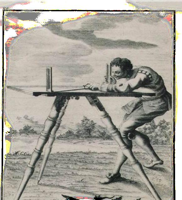
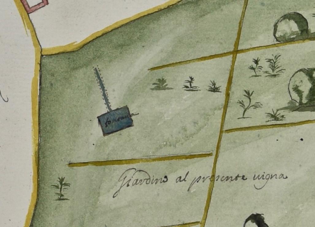
Step into the world of Malta’s cabrei, beautifully illustrated property books compiled during the Knights’ period. Today, a group of these manuscript volumes are preserved at the National Library of Malta. These cabrei form part of the Treasury Series, the second most important archival collection held by the National Library. Far more than simple record books, and often fine book-bindings, these cabrei served as key legal (possessions) of institutions across the Maltese Islands. Surveys and their accompanying descriptions, frequently alongside property contracts, constitute the main components (land surveyors) of the Knights’ period oversaw the entire surveying process – from land measurement to draughtsmanship, and finally, the integration of the final surveyed drawings into the cabreo. These carefully prepared details of fields, rural buildings, rubble walls, and many other features – bringing to life