Dignifying Spaces: Checkpoint 300 as a Multi-layered Hybrid Building for the People Nadine Sbeih Fares Sayed Mariam Ghaben Prepared By: Supervised By: Arch. Aya Motan 1180247 1180312 1181364
aims to design a hybrid building on the site where Checkpoint 300 is located. The building will create a digni ed experience that opposes the inhumane current spatial experience that Palestinians undergo in that checkpoint, and serve the area surrounding the site in Bethlehem, taking into consideration the changes in the fabric of the city in a post-colonial alternative reality. The building will stand as a statement for independence, re ecting the Palestinian identity. The project is a long-term innovative vision, that deals with issues on an urban and architectural scale, and provides solutions in an architectural building or complex of buildings.
The project mainly questions: how would the site where checkpoint 300 is located be adapted and implemented within Bethlehem city fabric in a post colonial context?
Accordingly, some sub-questions must be answered:
1. How did the site interact with the surrounding area before it was turned into a checkpoint?
2. How does the checkpoint affect the surrounding area now?
3. What is the nature of the spatial experience people go through passing from checkpoint 300?
4. What are the surrounding area needs, and what are the services that could be implemented in the post colonial reality?
5. What are the design strategies that could be implemented to design the spatial experience?
a series of politics, amongst other ways of repression such as prison or torture, where Israeli occupation does not intend to alter Palestinian conduct, but rather to eliminate "recalcitrant" individuals (Minca, 2018), in order to satisfy the demographic objectives of the Zionist project, (Foucault, 2008, p. 137). Belief in the divine right of the Jewish Nation to the Holy Land sustains the privileging of Zionist settlers' lives at the expense of Palestinians and their homes and livelihoods in Israel's method of settler colonialism (Piterberg, 2008; Veracini, 2013; Wolfe, 2006).
Checkpoints are one of the key quotidian security apparatuses that function to manage the population in accordance with Israel's demographic anxieties about the size and mobility of the Palestinian population, which are seen as threatening the survival of the Israeli population (Hayamel, Hammoudeh, & Welchmann, 2017; Pappé, 2007; Parsons & Salter, 2008, p. 708). In this sense, biopolitics is at work not merely at Israeli checkpoints, but also at the heart of the occupation itself.
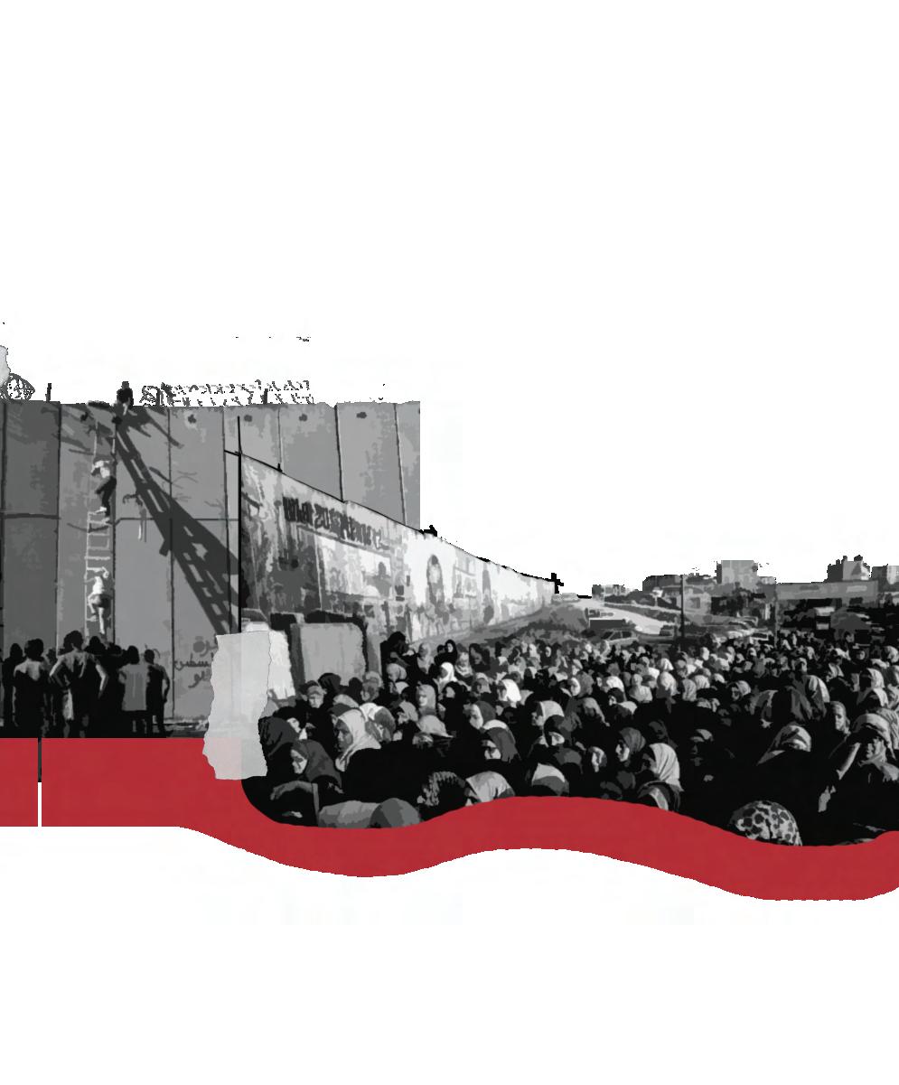
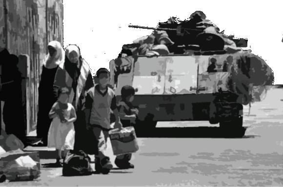
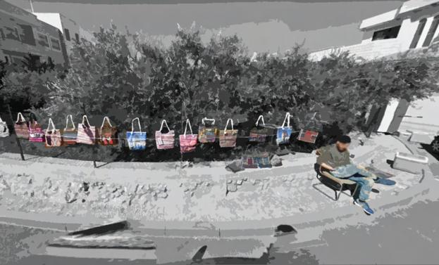
For Palestinians, crossing borders is possibly the most de ning experience in their life. The barrier, whether it's the checkpoint, 'the wall,' the dug trench, or even the knowledge of potential humiliation at crossing points, modi es and de nes Palestinian mobility and speed of movement, and therefore becomes fundamental to people's experiences of space and time (Abourahme, 2011). Thus, the area surrounding the checkpoint has become a space, an entire ‘ecology’, of frenetic and heterogeneous activity, containing a macroeconomy shop, a transport hub, a site of civic action, an advertising device and a place to just loiter and observe. They have also been a source of tension, con ict, and a site of violence.
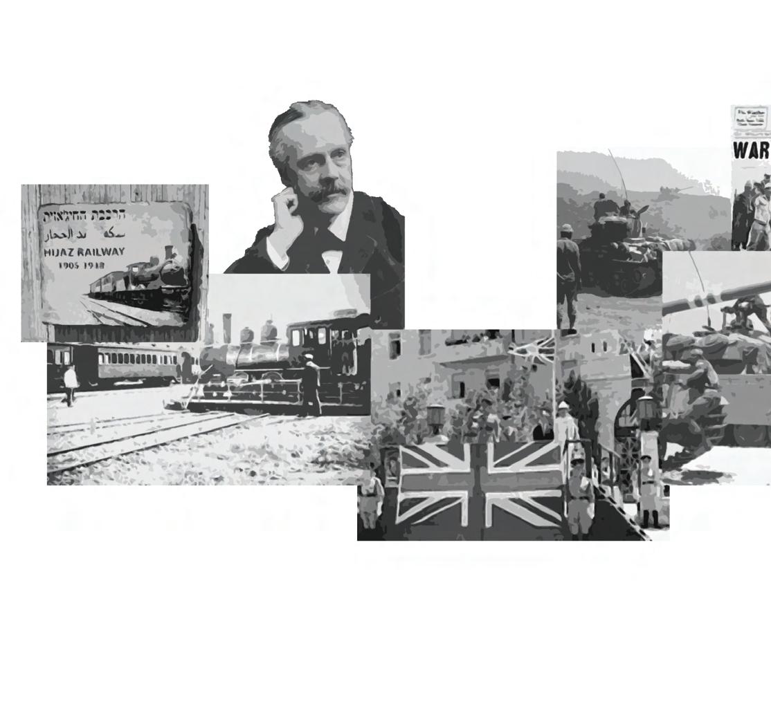
Before the British occupation, Palestine was part of Ottoman Syria. The British army ruled Palestine until a civil administration was established in 1920, which is the same year Britain was granted a Mandate for Palestine (Abu Sitta,2006), and though it was under mandate, Palestine constituted an integrated political, social, economic, and cultural unit, with freedom of movement between its various parts (Bashi,2015).
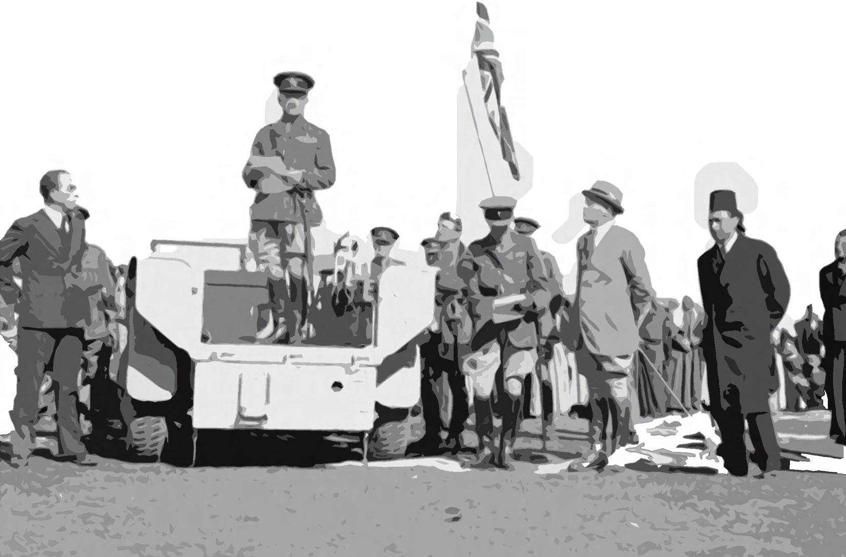
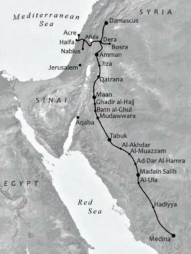
Figure (1): Al Hijaz railway which was opened in 1908, and the figure shows the line connecting Acre, Haifa & other Palestinian cities to the wider network
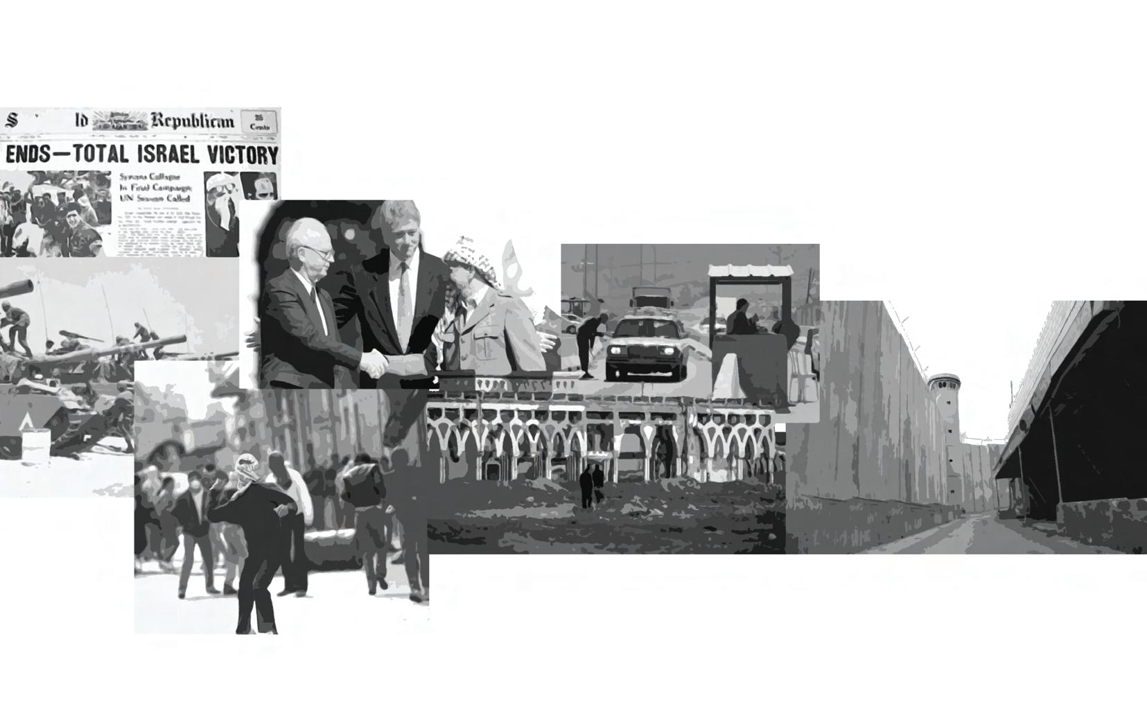
The control over Palestinian movement began following the 1948 war, after which Israel took over Palestinian lands, leaving only Gaza under Egyptian military rule, and the West Bank under Jordanian annexation (Makan, 1918).
In 1967 the Israeli occupation captured Gaza and the West Bank and annexed east Jerusalem, In the following years, it settled on a policy of open borders, giving Palestinians a general permit to travel between Israel, Gaza and the West Bank (Bashi, 2015).
and after that the occupied Palestinian territories were declared closed military areas by the Israeli military, and the freedom of movement became severely restricted (Makan, 2018).
In 1972 the Israeli military issued a general exit order which allowed Palestinians to enter Israel from the West Bank and Gaza during daylight hours with few limitations. During this period, Palestinians could also travel with relative freedom between the West Bank and Gaza (Makan, 2018).
In 1991 the general exit permit was revoked and a general closure was declared over the Palestinian territories. This was when Israel started requiring that all Palestinians acquire military-issued permits if they wanted to enter Israel or move between the West Bank, East Jerusalem and the Gaza Strip (Makan, 2018).
Figure(2): The land Israeli occupation took over in 1948.
Figure(3): The land Israeli occupation took over in 1967.
The Oslo Accords resulted in new limitations on movement within the Palestinian territories themselves, and not only between the Palestinian territories and Israel. Under the Oslo Accords, the West Bank was divided into three administrative areas (A, B and C). Area A makes up 17% of the West Bank and is under full Palestinian control, Area B, which comprises 22% of the West Bank, is under the full administrative control of the Palestinian Authority (PA) but under the military control of Israel, and Area C, which comprises 61% of the West Bank, is under the full control of Israel through the Civil (Military) Administration in the West Bank (Bashi,2015).
Even before the start of the Second Intifada in September 2000, this division resulted in the imposition of movement restrictions between communities and between administrative areas inside the West Bank which were enforced through the use of mobile checkpoints (Makan,2018).
After the start of the Second Intifada in 2000, Israel intensified the general closure in place over the Palestinian territories, more closely regulating travel by Palestinians and formalizing a system of restrictions on Palestinian freedom of movement through permanent checkpoints, roadblocks, gates, closed roads, barriers and the Wall, that are maintained till this day (Makan,2018).
Ramallah
Jericho Bethlehem Hebron
Figure(4): The three demonstrative areas that resulted from the Oslo accords in 1995
Figure(5): The separation Barrier that started being built in 2003
Green Line Separation wall (Built) Separation wall (Planned)
Tulkarm Nablus Qalqilya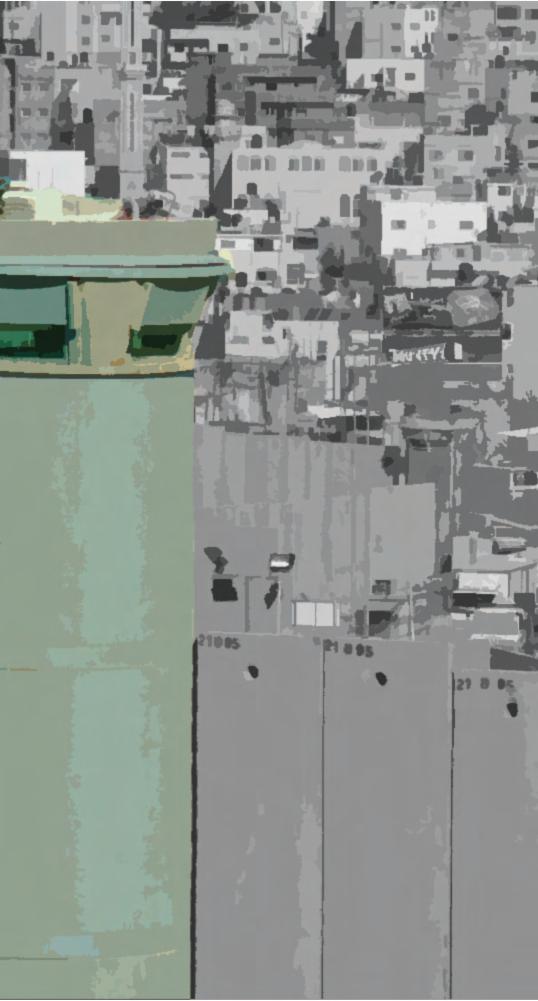
the West Bank, East Jerusalem, and Gaza Strip has resulted in movement restrictions in Palestine. Construction of checkpoints, roadblocks, and the separation barrier are among the limitations, as are travel limits and permission systems. These regulations have signi cantly restricted Palestinians' freedom of movement and have had a negative impact on the Palestinian economy and society. The limitations have also made it impossible for humanitarian supplies to reach people in need, as well as for Palestinians to have access to medical treatment, education, and other essential services.
1The system of checkpoints and roadblocks that has been constructed throughout the West Bank is one of the primary methods of mobility restriction. The Israeli military has created these physical obstacles to limit Palestinian travel between different sections of the West Bank, as well as to and from Jerusalem. Many Palestinians are forced to travel through these checkpoints on a regular basis, causing long delays and dif culties (Mansbach, 2009; Makan; 2018
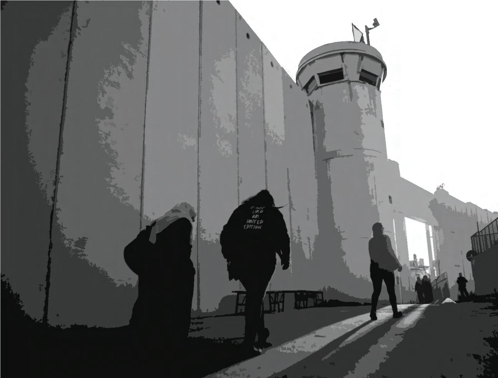
The separation wall was constructed in 2003. The Israelis claim that it was built on the “green line”, but the actual wall as it cuts through Palestinian communities. The barrier has had a profound impact on the daily life of West Bank Palestinians. It has made it more dif cult for them to access basic amenities like health care, education, and work. It also separates them from their farmland, separates family members, and makes them dependent on the Israeli economy. Furthermore, due to limited access to markets and resources, it has caused severe economic damage to the Palestinian economy (Abdallah, 2020; Makan, 2018; MOFA, 2019)
Bypass roads in Palestine refer to roads that have been built to connect the Israeli settlements in the West Bank barrier, These roads are intended to allow Israeli settlers to bypass Palestinian towns and villages while traveling between Jerusalem and the major settlements in the West Bank. These roads are often fenced or guarded by the Israeli military, and can’t be used by Palestinians. (Al-Bazz, 2022; Makan, 2018).
The permit system was gradually implemented sin ce 1991. Palestinians from The West Bank or Gaza are required to obtain a militaryiissued permit to enter occupied Palestinian Territories or “48 land”. Entrance To Jerusalem is also restricted and requires a permit. These permits are often hard to obtain and are sometimes rejected for arbitrary reasons (Abdallah, 2020; Makan, 2018).
These curfews typically involve the closure of roads, checkpoints, and the sealing off of entire towns and villages, effectively trapping residents inside their homes and preventing them from moving freely. These curfews are sometimes imposed in times of “con ict”, and can last for days or even weeks at a time. This method of restriction was mostly used in the rst and second intifadas, where military tanks and snipers would roam the streets. (Makan, 2018).
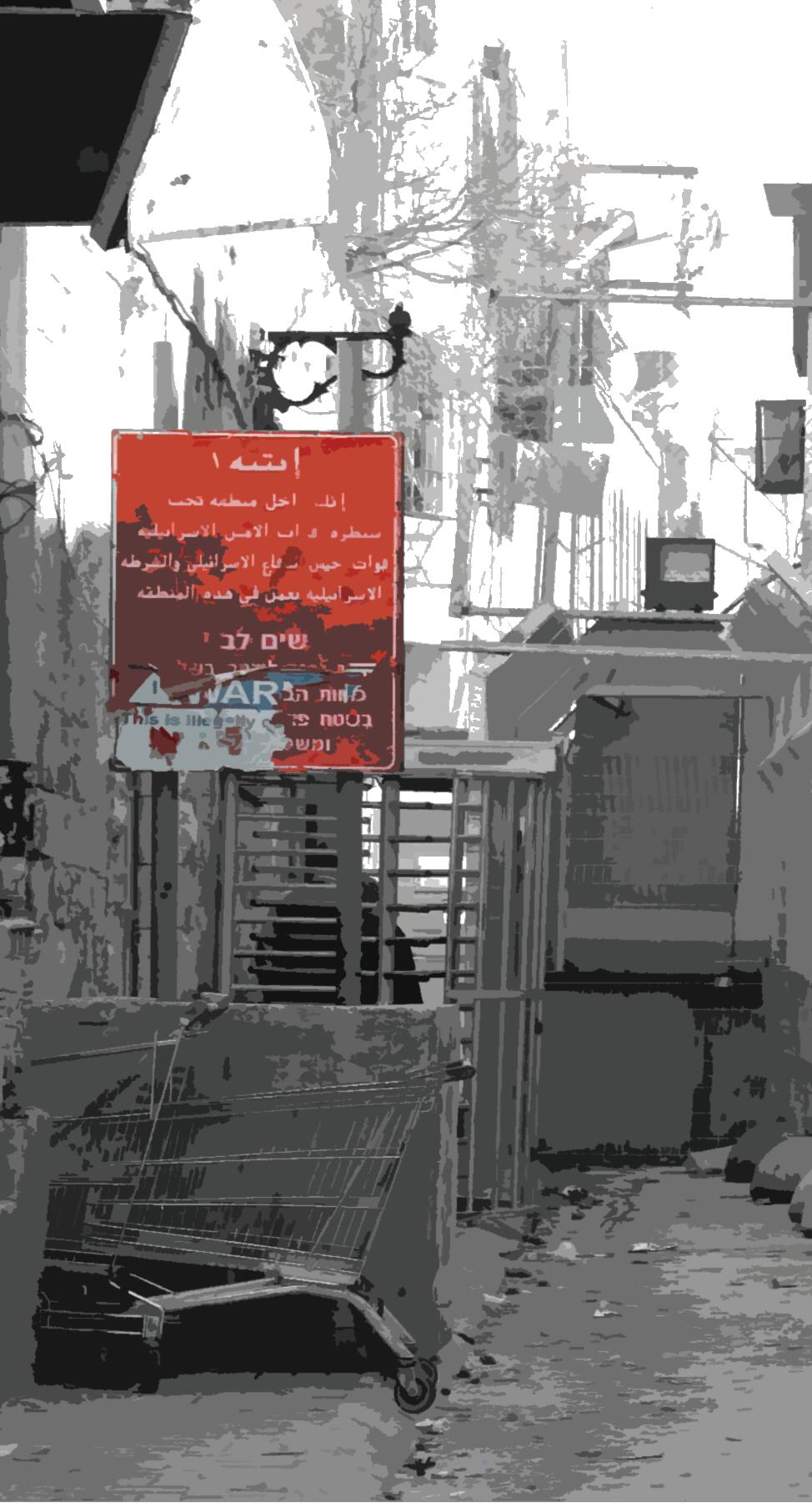
following the Aqsa Intifada in 2000, Israeli authorities formed new geographical, military, and institutional control mechanisms Within the Occupied Palestinian Territories, regardless of the illusory territorial boundary produced by the ongoing Wall buildinvg between the West Bank and Israel. One of the main mechanisms are territorial devices that have been deployed on the other side of the Wall, de ned as checkpoints whether it's xed or ying (Stéphanie,2020), containing different types of obstacles (watchtowers, earth mounds, trenches, concrete blocks etc.). Checkpoints also de ned as are state-created zones in which military concepts and tactics replace civil law, resulting in a legal order based on military mandates (Mansbach, 2009).
Checkpoints are a relatively new phenomena in the history of the occupation and rule of the Palestinian people, as Between the 80s and 90s, There was little oversight of Palestinian entry into Israel, which led to the Palestinian economy’s dependence on the Israeli economy as 39% of Palestinian population was employed in Israel (Swirski, 2005). It wasn't until the early 1990s that things started to alter. Blanket authorization to enter was revoked in January 1991, and this ban became effective in March 1993, with the declaration of the full closure of the Occupied Territories, leading to an unlimited state of siege ( Farsakh, 2005). And by 1995, the Israeli government made the decision to separate the Israeli and Palestinian populations. Thus, dozens of crossing stations were built in the "seam zone" (the buffer zone) to manage and keep an eye on the movement of people, commodities, and vehicles between Israel and the West Bank or Gaza. and in 2005, a program named "Another Life" was
launched, the IDF had originally planned to establish a set of freshly conceived checkpoints, the terminal checkpoints, placed on the "boundary" between Israel and the West Bank, (Minca, 2021). By 2009 a 500 km of the Wall has been completed, and border checkpoints became an integral part of this unilateral separation device turned to be a crossings utilized by an Israeli Governmental institution after al-Aqsa intifada , being the only authorized entry and exit points for people and goods into and out of the Occupied Territories. These linkages between Palestinian and Israeli society and economies are not just sites of encounters, but also of increased tensions. However, over the six years of the al-Aqsa intifada even moving from one city to another and from one village to another within the same area or region was incredibly tough for Palestinians. There were over 50 permanent and manned checkpoints, as well as over 600 remote obstacles (Zeedani, 2007).
Israeli Checkpoints
The wall
Green Line
Mediterranean Sea
Jenin Tulkarm Nablus Qalqilia
Ramallah Jerico
Bethlehem Gaza
Hebron
Figure (6): Palestine map with checkpoints locations
Therefore, Israeli checkpoints are now divided into two types according to their locations: Terminal checkpoints (Border checkpoints), such as Qalandiya checkpoint, 300 checkpoint and Qalqilya Checkpoints. And Internal checkpoints, which restrict the movement inside the West Bank specially between cities, such as Zaatara checkpoint and Huwwara Checkpoint.
Terminal checkpoints -usually called Crossings- are the checkpoints that exist along the Wall path whether it's structured or not, and those checkpoints either have a complete infrastructure on the land, or built in gates that open on curtain times to allow speci c people to walk through the Wall (Mahmoud, 2013). These checkpoints control entry by persons with speci c licenses to these regions or to employment in Israel, while preventing the great majority of the Palestinian population from entering the "Seam Zone" and East Jerusalem, and isolates people from basic services in many of these locations, along with the loss of land and resources, which equals the inability for communicative ties to sustain themselves appropriately and with dignity (UNRoD 2019).
Jenin Tulkarm
BethlehemBethlehem Gaza
Nablus Qalqilia Ramallah Jerico Hebron
Figure (7): Internal Checkpoints locations
Bethlehem Gaza
Jenin Tulkarm Nablus Qalqilia Ramallah Jerico Hebron
Figure (8): Terminal (Border) Checkpoints locations
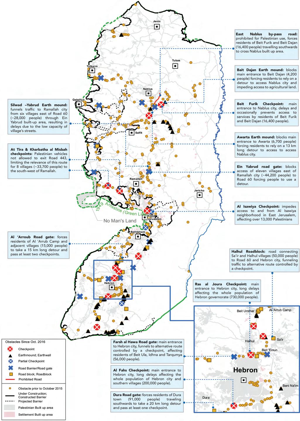
The OCHA in 2018 identi ed 705 permanent obstructions that limit or regulate Palestinian vehicular and, in certain cases, pedestrian movement throughout the West Bank. The obstacles include 140 checkpoints 64 of them are permanently staffed with security forces, with 32 placed along the Barrier or on roads leading to Israel, 20 in the Israeli-controlled sector of Hebron city (H2), and the remaining 12 located elsewhere in the West Bank. A further 76 (partial) checkpoints are also staffed on occasion or have security of cials stationed in a tower rather than on the ground. These barriers direct Palestinian traf c into a small number of intersections, which are typically guarded by checkpoints manned by Israeli forces. The latter stop Palestinian vehicles, and occasionally pedestrians as well, depending on the level of tension in a speci c area, to conduct inspections and searches. In Addition, the OCHA survey recorded 4,924 ad hoc " ying" checkpoints between January 2017 and the end of July 2018, or about 60 a week. For the aim of halting and inspecting Palestinian drivers and cars, these require the deployment of Israeli forces for a number of hours on a certain road, although there is no long-term physical infrastructure present.
Farsh al Hawa Road gate
Main entrance to Hebron city, funnels to alternative route controlled by a checkpoint, affecting residents of Beit Ula, ldhna and Tarqumya (56,000 people).
A1 Fahs Checkpoint
Main entrance to Hebron city, long delays affecting the whole population Of Hebron city and southern villages (200,000 people).
Dura Road gate
Forces residents of Dura town (91 ,OOO people) traveling southwards to take a 20 km long detour and pass at least one checkpoint.
A1 'Arroub Road gate
Forces residents of A1 'Arrub Camp and adjacent villages (1 5,000 people) to take a 15 km long detour and pass at least two checkpoints.
Beit Furik Checkpoint
main entrance to Nablus city, delays and occasionally prevents access to services by residents of Beit Furik and Beit Dajan (16,400 people).
Ein Yabrud road gate
blocks access of eleven villages east of Ramallah city (-44,200 people) to Road 60 forcing people to use a detour.
A1 Isawiya Checkpoint
Impedes access to and from A1 Isawiya neighborhood in East Jerusalem, affecting over 13,000 Palestinians
Ras al Joura Checkpoint
Main entrance to Hebron city, long delays affecting the whole population of Hebron governorate (730,000 people).
Partial Checkpoint
Road Barrier/ Gate Obstacle Roadblock
Figure (9): Israeli Obstacles in the West Bank
because we were interested in the growth of terminals and their growing relevance in regulating the Palestinian population. Checkpoint 300, along with Qalandia, is the largest of the terminals that govern Palestinian movement from the West Bank to East Jerusalem, the Jerusalem metropolitan region, and greater Israel. Qalandia and Checkpoint 300 handle tens of thousands of Palestinians who are compelled to incorporate the hours-long journey into their daily lives in order to get to work. While there is scholarly work on Qalandia, Checkpoint 300 has not received the same level of attention, despite a signi cant amount of investigative journalism in the quality press and reports by non-governmental organizations.

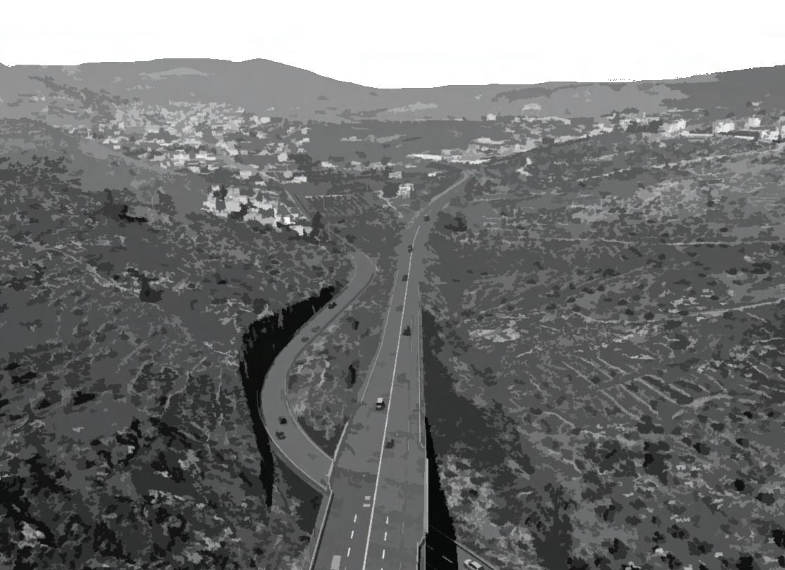
The Flow around the site varies according to the Wall path, as it narrows or completely blocks some roads around the site including the main road from the city center of Bethlehem to the checkpoint itself to Jerusalem. The alternate route for cars is typically a circuitous and winding road. Additionally, there are several roadblocks and barriers in place that make it dif cult for cars to pass through. The restriction on cars makes it difcult for residents to visit family and friends, and to participate in social and cultural activities such as Anastas House.
Figure (11): Flow of roads surrounding Checkpoint 300
The Wall

High Flow St. Medium Flow St. Low Flow St. Two Ways One Way
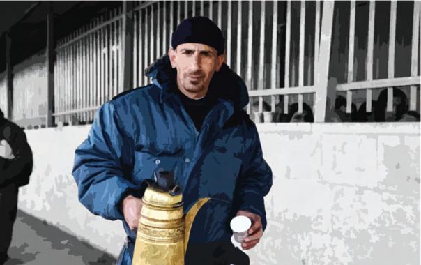
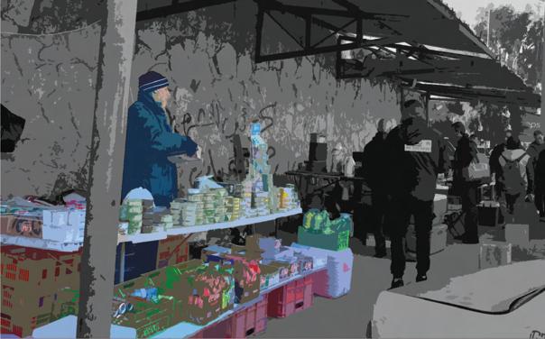
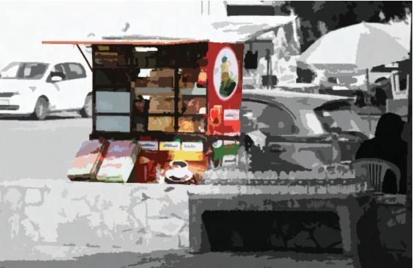
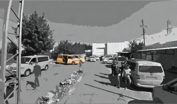
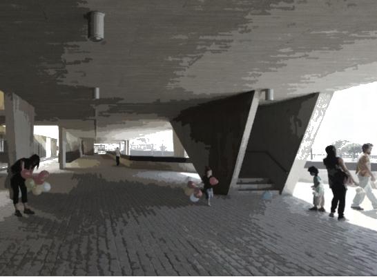
The checkpoint is located in a heavily populated area, and many Palestinians live in close proximity to it. At the checkpoint, people's behavior displays a mix of widespread passivity and the occasional transgression and subversion that characterizes their daily relationship with the occupation regime. At the same time, checkpoints frequently produce something that goes beyond the logic of a sovereign-disciplinary instrument. In many cases, they also serve as meeting places, exchange areas, and sites of differentiated engagement for society. All of the movement between the two cities has transformed into a space, an entire "ecology," of lively and diverse activity: a transport hub, a site of civic action (as traf c and chaos are mediated and organized), a site of confrontation (as a visible presence of the occupation), and a representational device (as advertising of all kinds attempts to capitalize on the mass volumes of movement)
 Al-’Aza Camp
‘Ayda Camp
Al-’Aza Camp
‘Ayda Camp


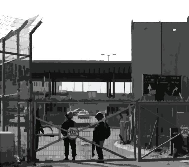
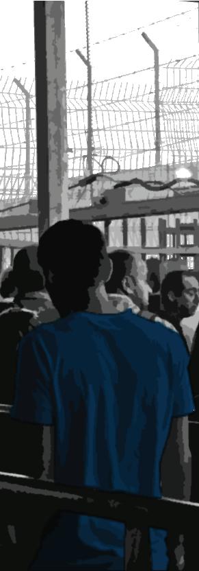
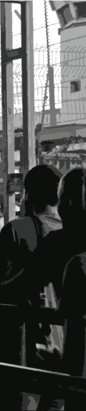
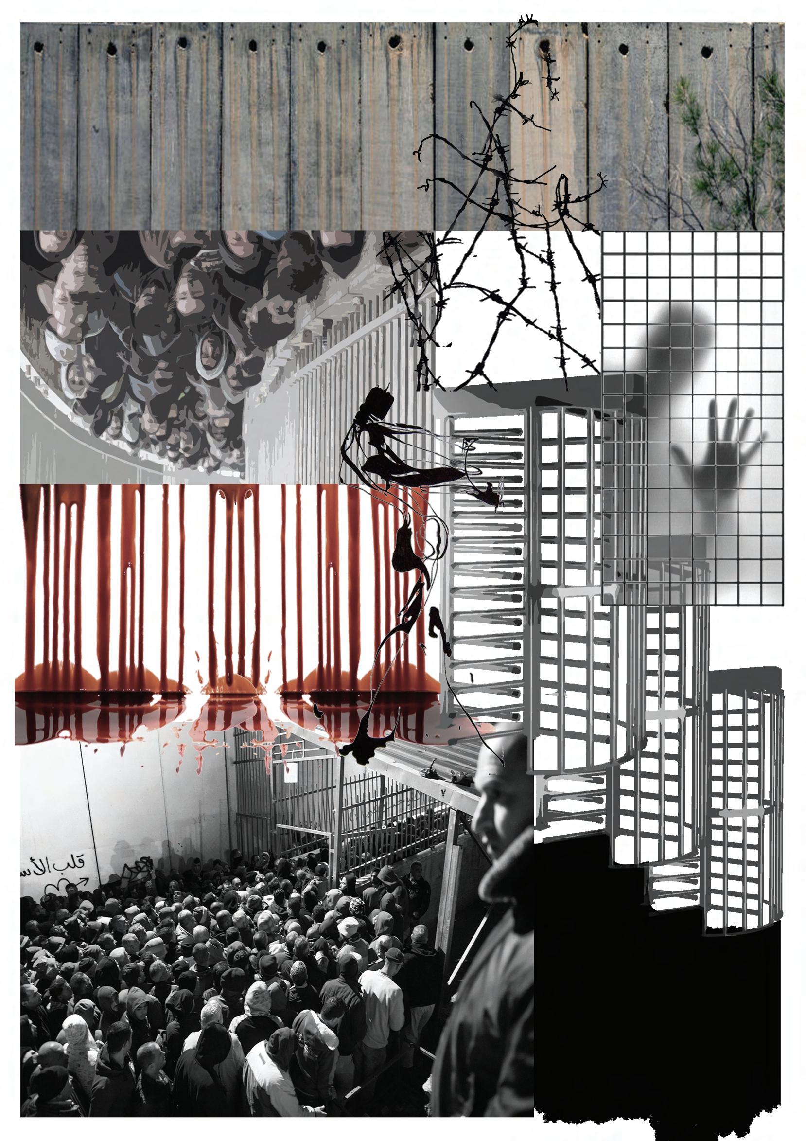
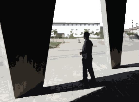
Checkpoint 300 is one of the busiest checkpoints in the West Bank, with thousands of people passing through it every day. Accessibility to the checkpoint is heavily restricted for Palestinians. Vehicles are subject to inspections and searches, and entry is often denied to Palestinians without the necessary permits (Eldar, 2016; Grif ths & Repo, 2018; Makan, 2018).
Usergroup
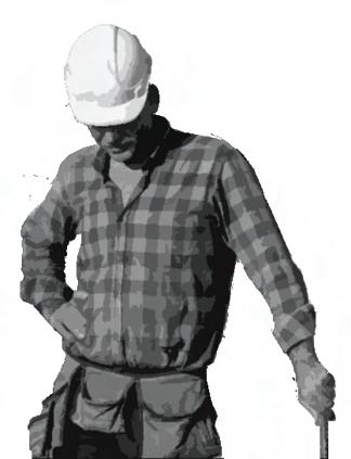
Laborers/Workers 30-60
Usergroup Ages Tourists Varies Ages
Checkpoint 300 serves a high number of Palestinian laborers traveling to work in East Jerusalem and occupied Palestine. Around 15000 male workers cross the checkpoint between 5 a.m and 8 a.m., while some workers arrive at the checkpoint by 2 a.m. to avoid being cramped by the growing numbers of arriving laborers (Eldar, 2016).
The checkpoint accommodates big tourist bus groups and pilgrims traveling down the Hebron route to visit the Muslim, Jewish, and Christian sites in Bethlehem (Grif ths & Repo, 2018).
Usergroup
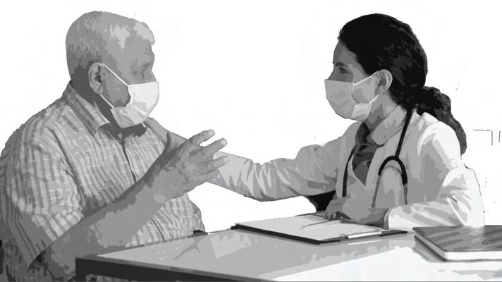
Patients from Bethlehem and the surrounding areas who require medical care in Jerusalem or elsewhere in occupied Palestine must pass through the checkpoint (OCHA, 2010).
Usergroup
17-25 Ages
Students from Bethlehem and the surrounding areas who attend colleges and universities in Jerusalem and other parts of occupied Palestine cross through the checkpoint to get to their schools/universities (Eldar, 2016).
might involve a purposely relaxed presentation of domestic civic life in contrast to the military formations' power projection tactics of restricting, excluding, closing, shrinking, and distancing (Repo, 2018).
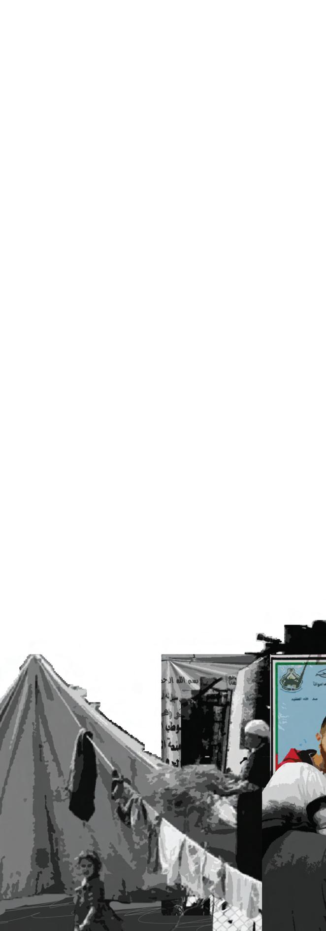
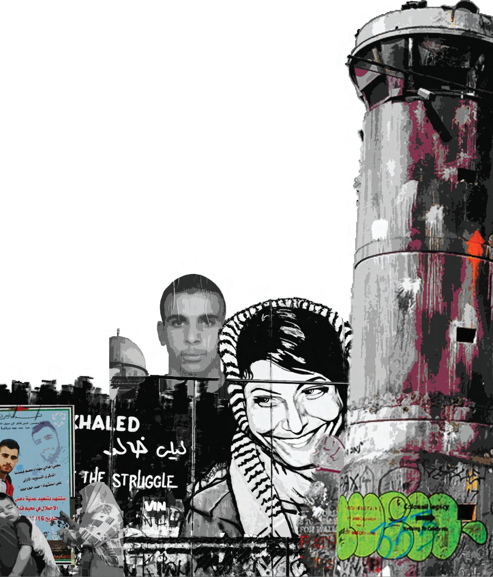
Visitors are invited to talk about their daily lives along the Wall at the Sumud Story House. The House contains a tent-like storytelling space, which exempli es the ancient Arab tradition of integrating space, meeting, hospitality, and storytelling (Teeffelen,2021) .
In the 'Ayda camp, claims of cultural identity and heritage are also asserted, not only in opposition to the Wall but also generally in opposition to a cloistered, unattractive, and dehumanizing environment - an opposition known as "beautiful resistance." ( Repo, 2018; Teeffelen,2021)
Despite living in a drastically reduced and imprisoned environment, residents of the 'Ayda camp continue to make a wider human protest against the disappearance of the history of the Palestinian refugees. The display of national symbols of identi cation, such as the Palestinian ag, map, or image of Al-Aqsa, as well as historical references to struggle, such as names of prisoners and martyrs written on camp walls and houses, are examples of cultural resistance (village names and symbols, including the symbol of the key metonymically standing for the former home). The Noor Women's Empowerment Group hosts visitors to share meals and assist in cooking them so they can learn Palestinian cuisine; the proceeds are used to fund the education of children with disabilities.(Teeffelen,2021)
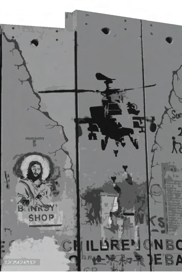
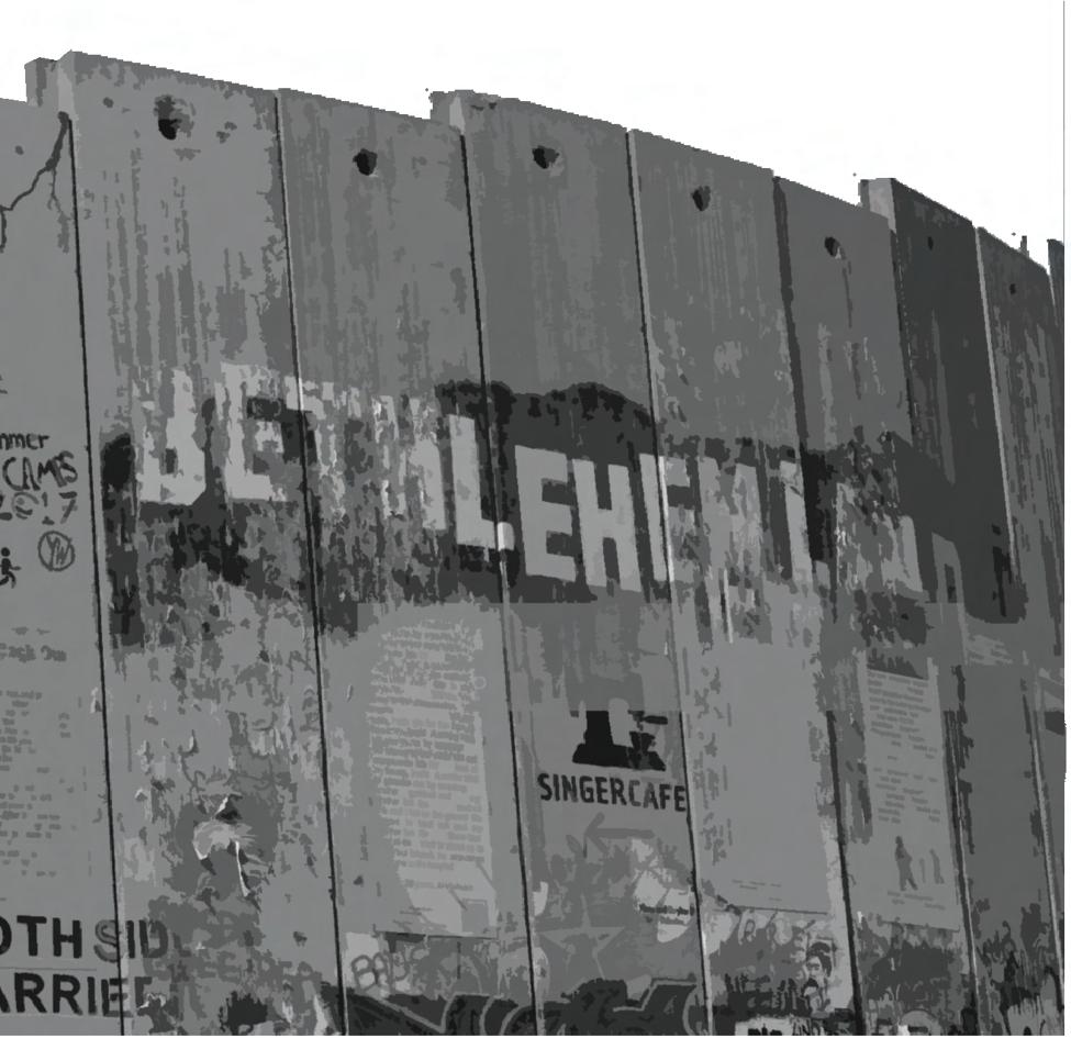
culturally opposing Statments are performed or shown on or near the Wall, which can also serve as a stage, a backdrop for pictures and movies, a spot for graf ti, or, when painted white, a lm screen. Some graf ti uses language other than that of oppression, tenacity, struggle, and resiliency; other graf ti is more apolitical and uses visuals to express human freedom and the need for connection, such as graf ti depicting people symbolically walking over, ying over, or peering through the Wall (Teeffelen,2021).
used by palestinian cars
Jerusalem Bethlehem
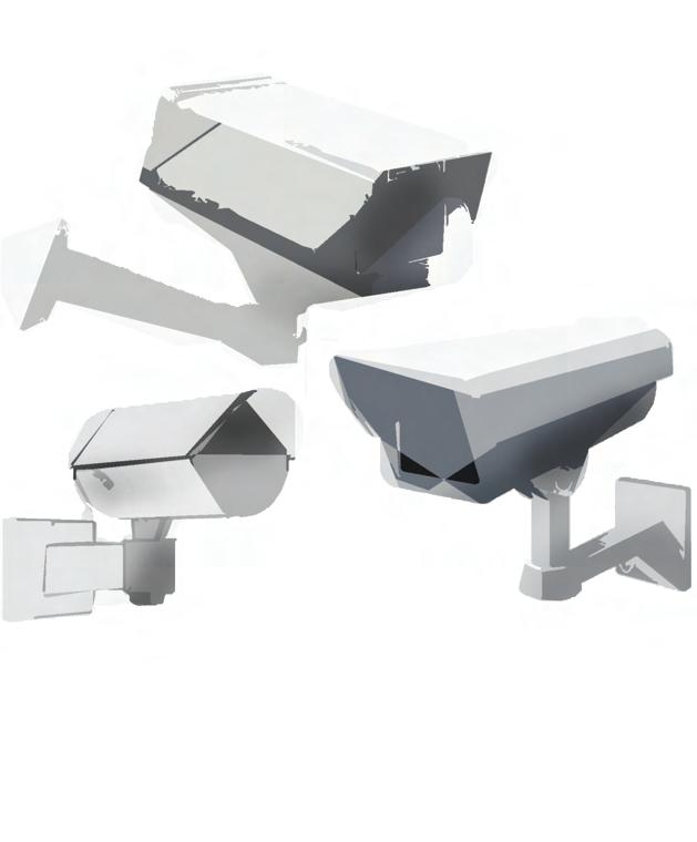
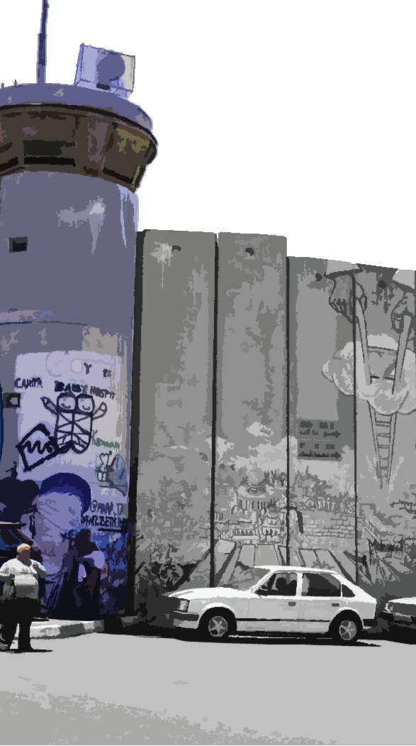
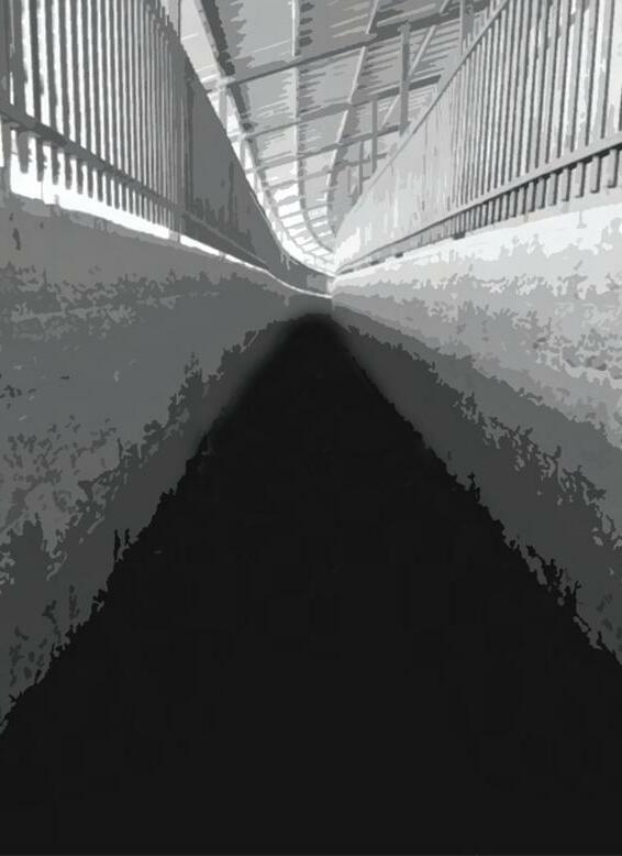
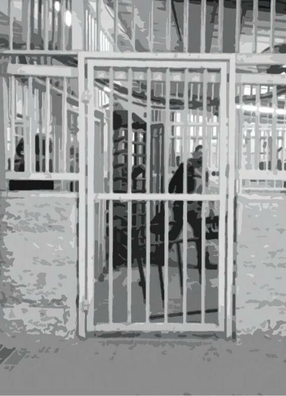
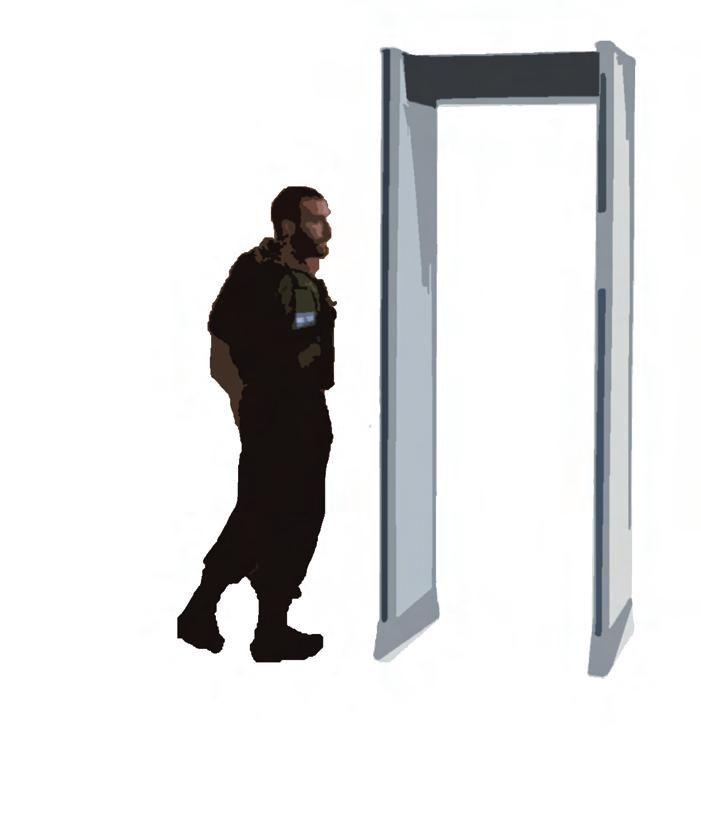
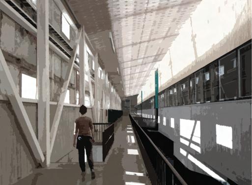
The Checkpoint is built into the Israeli West Bank barrier and can be entered through three lanes, one lane for the few people who have 24-h permits, a lane for labourers with 8-h permits and a ‘humanitarian lane’ intended for women, children and elderly Palestinians. The bottom half of the corridor walls are built of forti ed concrete while the top half is composed of galvanised bars. On the Palestinian side a walkway slopes and curves for 50 m before doubling back and opening into a small enclosure where two IDF soldiers sit behind tinted glass monitoring CCTV screens and regulating the ow of people with a button that starts and stops the adjacent turnstile. Beyond this turnstile is a large expanse of concreted land over which Palestinians walk to enter what Israel considers the Israeli side of the Checkpoint, in this part there is another caged corridor of around 40 m that doubles back on itself and a shorter section anked by tinted glass where soldiers observe and give instructions through a loud speaker system. At this point one must place all belongings on an X-ray conveyor belt and pass through a body scanner and a further turnstile into a large open space with four booths stationing soldiers behind reinforced glass who check documents.
Behind the booths, other soldiers patrol, while some others are positioned with their weapons trained on the queue. Palestinians are able to pass this point once they scan an ID card and corresponding ngerprints. There remains just one more
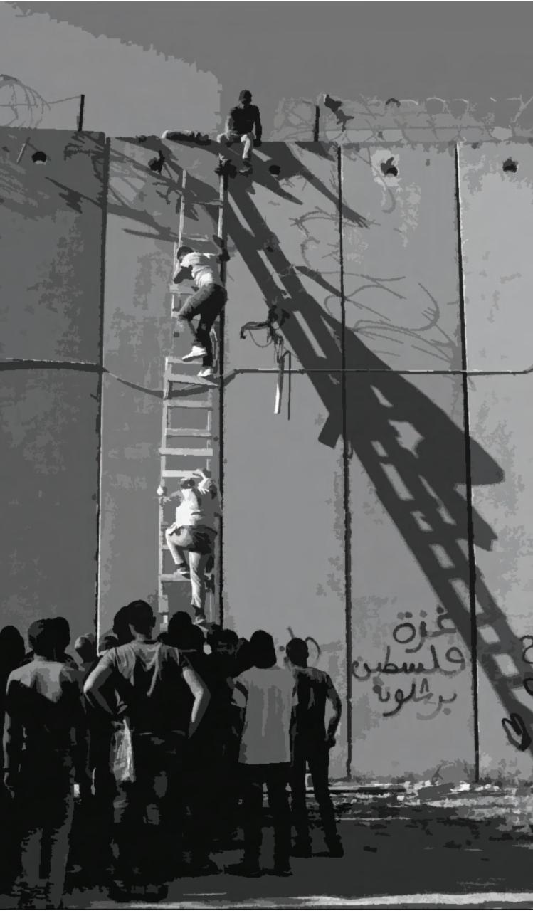
Helga Tawil-Souri claims checkpoints and terminals are ‘the new Palestinian icon (2011, 23), Rashid Khalidi labels them ‘the quintessential Palestinian experience (2010, 1; also: El-Haddad, 2009); and Nasser Abourahme asserts: crossing barriers is perhaps the single most de nitive experience in contemporary Palestinian life (2011, 453). These, and many other re ections (for example: Barghouti, 2008; Habibi, 1986; Pappé, 2007; Said, 1979; 1995), attest to the prominence of checkpoints in the making of Palestinian subjectivity under the Israeli occupation. Those are people who their bodies and souls clash every day with the cold bars of the narrow paths they pass by, it’s not their time and freedom that is just taken from them it’s their dignity and their basic human rights*.
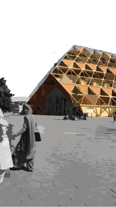
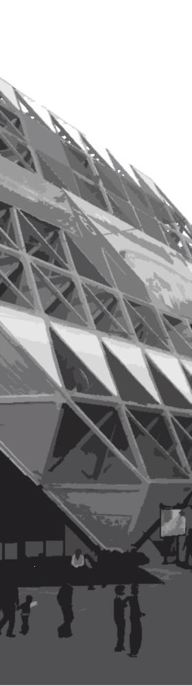
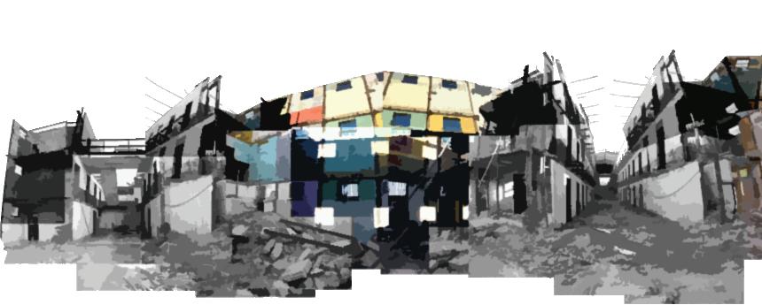
is intended to be the focal point of Raj Rewal's 130-acre Exhibition Ground in New Delhi. The design evolved to suit time restrictions, material and labor availability, but most importantly, to symbolically and technologically depict India's intermediate technology in its 25th year of independence (Carmen, 1986). It was meant to represent the country's newfound freedom and growth. The design of the structure, which was inspired by Indian architectural traditions, was meant to symbolize both the country's cultural past and its new, modern character. The Hall of Nations was a major cultural and economic center in the city of New Delhi, which was then the capital of independent India, so it also stood as a symbol of the country's growing global in uence and status. (Raj, 1972)
These pavilions have a square plan with chamfered corners and eight anchoring posts. The corners were inspired by Moghul Emperor Humayun's mausoleum and the Taj Mahal (Chatterjee, 1985). The front of the building was inspired by traditional Indian stepwells, which are popular in Gujarat and Rajasthan and consist of a series of terraced steps going down to a pool of water. The structure of the building also combines features of traditional Indian architecture, such as courtyards and open areas. (Raj, 1972).
Rewal also included modern architectural aspects into the building's design. The Hall of Nations was one of the largest unsupported spaces in the world at the time of its completion (Rinaldi, 1989). The steel and concrete structure of the building was designed to showcase India's expanding industrial might and technological capabilities. The structure was also built to be energy ef cient, with features such as a double-skin facade and a solar heat gain shading system (Raj, 1972).
According to Rewal, the Hall of Nations was designed to be "a building of the future, but rooted in the past." The structure was both a powerful statement of India's independence and a re ection of the country's rich cultural heritage.
Mahendra Raj describes the increasingly engaged in a conscious struggle to build the physical infrastructure of a modern society with limited technical means, Indian architects were more directly and emphatically in uenced by the opposite paradigm-saving tendencies of 'late-modernism' manifested internationally in the techno-rationalist architecture of the 1970s. This was particularly visible in the overt structural exhibitionism that characterized the work of numerous renowned Indian modernists during this period (Raj, 1972).
Beginning in this period, Rewal's particularly muscular brand of brutalism was to make some of the most conspicuous and de ning marks on the architecture of the national capital, focusing on major public buildings and urban complexes associated with the central government's swelling ambitions and bureaucracy, as well as its
growing portfolio of new state-owned corporations.
The Hall of Nations was a bold statement of India's independence and its new, modern identity. It was a symbol of the country's con dence and progress, and an expression of its desire to be recognized as a major player on the global stage. By combining traditional Indian architectural elements with modern design and construction techniques, the building was intended to re ect India's rich cultural heritage, while also showcasing its growing industrial and technological capabilities.
In a way, the Hall of Nations was not just a building, but a representation of India's aspirations and ambition as a newly independent nation, eager to assert its place in the world and to present itself as a modern, forward-looking nation.
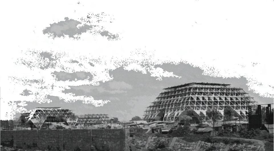
Figure (1) : Construction of the Hall Of Nations, New Delhi, Source: Mahendra Raj ArchiveThe Hall of Nations was designed to be a venue for international trade fairs and exhibitions. It was intended to be used as a space for businesses and organizations to showcase their products and services, and to promote trade and economic cooperation between India and other countries. The building was also intended to be used as a cultural center, with spaces for performances, conferences, and other events.
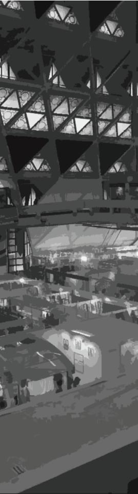
The Hall of Nations was one of the largest exhibition halls in India and had a total area of about 40,000 square metres. It had several exhibition halls, conference rooms, and a large auditorium that could seat about 2,500 people. The building also had administrative of ces and facilities for exhibitors and visitors, such as restrooms and food courts. The building also had a strong connection to the architecture and design community in India. In general, the Hall of Nations was more than just a building, it was a cultural and emotional symbol for many people in India, and its demolition was seen as a loss not only of an architectural landmark but also of a part of India's history and cultural heritage.
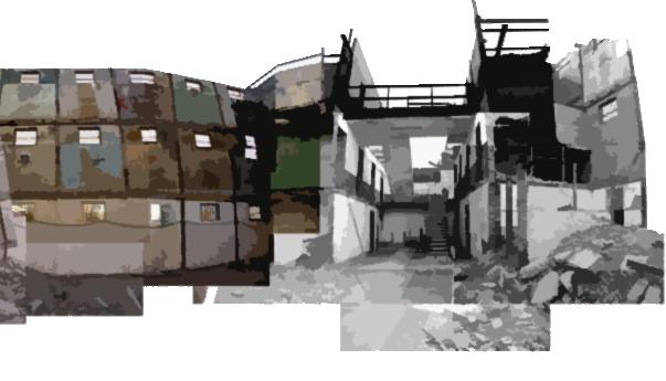
is a cultural and historical park in Valparaiso, Chile. The park is built on a former jail complex constructed by the Chilean government in 1872. The jail was used until the late twentieth century, when it fell into ruin. The Chilean government chose to renovate the jail and turn it into a cultural park in the early 2000s. The restoration work was nished in 2010, and the Valparaiso Cultural Park was formally launched as a place dedicated to preserving and promoting Valparaiso's cultural legacy. There are exhibitions, museums, and cultural centers in the park, as well as a theater, library, and cinema. Many of the original architectural characteristics of the jail, such as the strong walls, iron bars, and underground cells, were kept during the renovation, although contemporary conveniences like as air conditioning and upgraded lighting systems were also included (Archdaily).
The architectural elements from the original prison were preserved to provide visitors with an understanding of the prison's history and the severe conditions that convicts would have had to undergo. The architects also maintainded the original layout of the prison, including the cell blocks, guard towers, and central courtyard.
The park now has air conditioning, improved lighting systems, and an elevator, making it more accessible to those with disabilities and more comfortable for tourists. This also enabled the park to accommodate a diverse range of cultural activities and exhibitions, including concerts, theatrical performances, and workshops.
The park also has a number of outdoor places, such as gardens, plazas, and terraces with views of the city and the surrounding hills. These outdoor areas are intended to be welcoming and accessible, and they host a range of cultural events such as concerts, art exhibitions, and festivals. The outdoor spaces represent an inverted experience to the severe conditions of the prison.
Preservation of the prison's original architecture
Incorporation of modern amenities
The research is going to follow a qualitative research method, depending highly on reviewing literature, analyzing case studies, and holding interviews to collect the required data, in addition to analyzing photographs (including videos) and maps to get better understanding of the site and useres.
The project will build on scholarly studies in order to understand the checkpoints as a subjugated method against Palestinians, whether physically by restricting mobility and the access to basic services, or mentally by dehumanizing and humiliating them. Research like “From moments to durations: the impact of Israeli checkpoints on Palestinian everyday life in Jerusalem” by Maha Samman which examines how Israeli checkpoints constructed in the Occupied Palestinian Territory impact the daily lives of Palestinians. As elements of urban segregation and control, and constructed through the implementation of Israeli planning regulations and procedures, she said that these checkpoints signify the dynamics of spatialisation of the West Bank including East Jerusalem. In addition to articles for scholars like Daniela Mansbach and Stéphanie Latte Abdallah explains how some military checkpoints inside the Occupied Territories were converted into "terminals" through architectural and administrative changes. It has been claimed that the new "terminals" will replace the military checkpoints that operate in a "state of exception" with a "normalized" judicial system and "modernized" modes of power. On the
other hand, books like “The Hollow Land: Israel's Architecture of Occupation” by Eyal Weizman that examines the ways in which architecture and urban planning have been used as a tool of control and domination in the Israeli-occupied territories of the West Bank and Gaza Strip. The book focuses on the ways in which the Israeli military and government have used physical infrastructure, such as roads, settlements, and barriers, to exert control over the Palestinian population and shape the territorial landscape of the occupied territories. The other part of the studies is focused around the analysis and spatial experience of checkpoint 300 in speci c. scholars like Alexandra Rijke as they Examine the interactions between Israeli security personnel, Israeli soldiers, and the machinery running at Checkpoint 300. It suggests as a conclusion that Checkpoint 300 is a permeable barrier whose regime is created, replicated, but also challenged by such interactions and that, despite the new "neutral design," Checkpoint 300 is still a place of tension and violence, frequently fueled by the machines and their "decisions". Also, Nasser Abourahme talks about How do people reproduce their lives, fashion routines, etch out some meaning when the political is evacuated, when their time is on hold by the Checkpoint. That literature would help in countering the spatial experience of the users. Once the Israeli occupation is gone, their memories will remain engraved in the place.
The project also depends on many case studies, to enhance its gained theory. Cases like the Hall of Nations in New Delhi, India show how a building can represent the country's newfound freedom and growth, and be a bold statement of independence and new modern identity, while also re ecting the country's rich cultural heritage. While other cases like Valparaiso Cultural Park which is a cultural and historical park in Valparaiso, Chile. The park is built on a former jail complex constructed by the Chilean government in 1872. This case is going to provide some ideas on the process of how to deal with remaining colonial buildings and equip some strategies for the project to engage the community with it.
Since the project focuses on the spatial experience of checkpoint 300 users, interviews will be held to give insights about the checkpoint affecting the surrounding area as part of the city fabric now and site interactions with Bethlehem city fabric before it was turned into a checkpoint. The interviews will target the main users with different backgrounds, who use the checkpoint as their method of mobility, while the questions will focus on the experience they face on a daily basis and how the Israeli occupation deals with them as daily users.
Site interaction with the surrounding area before it was a checkpoint?
How does the checkpoint affect the surrounding area now?
hybrid building oppses the inhuman spatial experince
What is the nature of the spatial experience people go through passing from checkpoint 300?
Building serves the surrounding area
What are the surrounding area needs in the post colonial reality ?
Re ecting the independent palestinian identy and culture
site interaction with the surrounding area before it was a checkpoint?
What are the design strategies to design the spatial experience, and make the building stand as a statment?
Based on our readings and research we have reached the conclusion that checkpoint 300 is a very rich space symbolically, where it has a lot of oppression layers that need to be unbacked, like for instance how much humiliating and dehumanizing it could be for the people passing through it every day, and in order to achieve that, we are going to design a building that speaks to all these components, and the most suitable way to merge all these complex layers is via a hybrid design strategy, which seeks to create a greater building through the mixing of its function, constituting, unexpected, unpredictable, and intimate relations between its functions and spaces.
Abourhame, N. (2011). Spatial collisions and discordant temporalities: Everyday life between Camp and Checkpoint. International Journal of Urban and Regional Research [Preprint]. Abu Sitta, S. (2006). The survey of Palestine under the British Mandate, 1920-1948. Institute for Palestine Studies, 35, 101–102.
Adina Renner, A.K. (2020). Israeli-palestinian con ict: How the political maps have changed, Neue Zürcher Zeitung. Available at: https://www.nzz.ch/english/israeli-palestinian-conict-how-the-political-maps-have-changed-ld.1664125 (Accessed: January 19, 2023).
Anonym. (2019). Apartheid wall as a network and the repression of popular resistance. MOFAE. Available at: http://www.mofa.pna.ps/en-us/mediaof ce/apartheid-wall-as-a-network-and-the-repression-of-popular-resistance (Accessed: January 19, 2023).
Barghouti, M. (2008). I saw Ramallah. London: Bloomsbury Press. Belfast Telegraph (2009). Gilo checkpoint: What the Pope won't see…. Available at: http://www.belfasttelegraph.co.uk/news/world-news/gilo-checkpoint-what-thepope-wont-see-28478030.html.
B'TSELEM. (2007). Denial of Palestinians’ Freedom of Movement in the West Bank. B’Tselem [Preprint].
EAPPI (2014). Bethlehem checkpoint 300 humanitarian situation deteriorates. Available at: https://www.scribd.com/document/223491540/Bethlehem-Checkpoint-300- Humanitarian-Situation-Deteriorates.
El-Haddad, L. (2009). The quintessential Palestinian experience. Available at: https:// electronicintifada.net/content/quintessential-palestinian-experience/8183.
Freedom of movement - makan. (n.d.). Retrieved January 15, 2023, from https://www.makan.org.uk/wp-content/uploads/2018/02/FreedomOfMovement.pdf
Gisha. (2021, January 11). Separating land, separating people. Gisha. Retrieved January 19, 2023, from https://gisha.org/en/separating-land-separating-people/ Grif ths, M., & Repo, J. (2018). Biopolitics and Checkpoint 300 in occupied Palestine: Bodies, affect, discipline. Political Geography, 65, 17–25. https://doi.org/10.1016/j.polgeo.2018.04.004
Habibi, E. (1986). Your Holocaust, our catastrophe. Politica, 8, 26–27 Iraqi, A. (2020). How Israel's road projects are ensuring apartheid is here to stay, +972 Magazine. Available at: https://www.972mag.com/israel-settler-roads-apartheid/ (Accessed: January 19, 2023).
Israel inaugurates Gilo '300' terminal in Bethlehem. (no date). POICA. Available at: http://poica.org/2005/11/israel-inaugurates-gilo-300-terminal-in-bethlehem/ (Accessed: January 19, 2023).
Latte Abdallah, S. (2019). Endless borders: Detaining Palestinians and managing their movements in the Occupied Territories. Mediterranean Politics, 25(3), pp. 372–393.
Mansbach, D. (2009). Normalizing violence: From military checkpoints to ‘terminals’ in the Occupied Territories. Journal of Power, 2(2), pp. 255–273.
Movement restrictions on West Bank roads tightened (no date) United Nations Of ce for the Coordination of Humanitarian Affairs - occupied Palestinian territory. Available at: https://www.ochaopt.org/content/movement-restrictions-west-bank-roads-tightened (Accessed: January 19, 2023).
Over 700 road obstacles control Palestinian movement within the West Bank (no date) United Nations Of ce for the Coordination of Humanitarian Affairs - occupied Palestinian territory. Available at: https://www.ochaopt.org/content/over-700-road-obstacles-control-palestinian-movement-within-west-bank (Accessed: January 19, 2023).
Özyüksel Murat. (2014). The Hejaz Railway and the Ottoman Empire: Modernity, industrialisation and Ottoman decline. I.B. Tauris.
Pappé, I. (2007). The ethnic cleansing of Palestine. London: One World Publications
Rijke, A. (2021) “Present checkpoint futures: The relaunch of Checkpoint 300 in Bethlehem in the Occupied Palestinian Territories,” Geogra ska Annaler: Series B, Human Geography, 103(4), pp. 337–351.
Rijke, A., & Minca, C. (2018). Checkpoint 300: Precarious checkpoint geographies and rights/rites of passage in the Occupied Palestinian Territories. Political Geography, 65, 35–45. https://doi.org/10.1016/j.polgeo.2018.04.008
Rijke, Alexandra & Minca, Claudio. (2019). Inside Checkpoint 300: Checkpoint Regimes as Spatial Political Technologies in the Occupied Palestinian Territories. Said, E. (1979). The question of Palestine. London: Vintage Said, E. (1995). Peace and its discontents. London: Vintage Samman, M. (2020) “From moments to durations: The impact of Israeli checkpoints on Palestinian everyday life in Jerusalem,” International Journal of Urban Sciences, 25(1), pp. 124–148. Samman, M. (2020). From moments to durations: The impact of Israeli checkpoints on Palestinian everyday life in Jerusalem. International Journal of Urban Sciences, 25(1), 124–148. Selwyn, T. (2022). Chapter 13 tears on the border the case of Rachel’s Tomb, Bethlehem, Palestine. Contested Mediterranean Spaces, 276–296. https://doi.org/10.1515/9780857451330-018
Stierli, M., Pieris, A. and Anderson, S. (2022) The project of Independence: Architectures of Decolonization in South Asia, 1947-1985. New York: The Museum of Modern Art. Weizman, E. (2017) Hollow land: Israel's architecture of Occupation. London: Verso. Zeedani, S. A Palestinian perspective on checkpoints. (no date) PIJ.ORG. Available at: https://pij.org/articles/980/a-palestinian-perspective-on-checkpoints (Accessed: January 19, 2023).