2 1 3
4
5
6
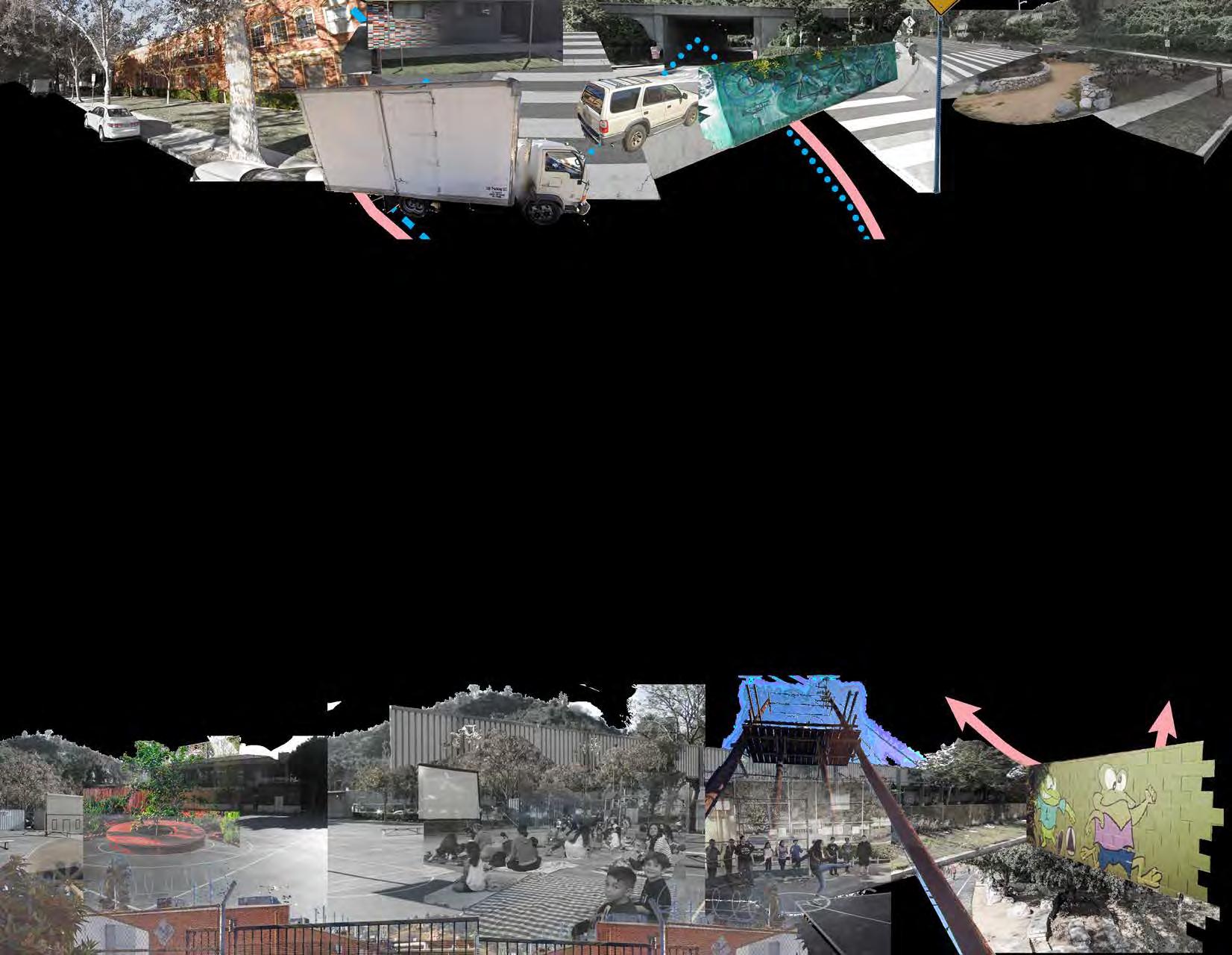
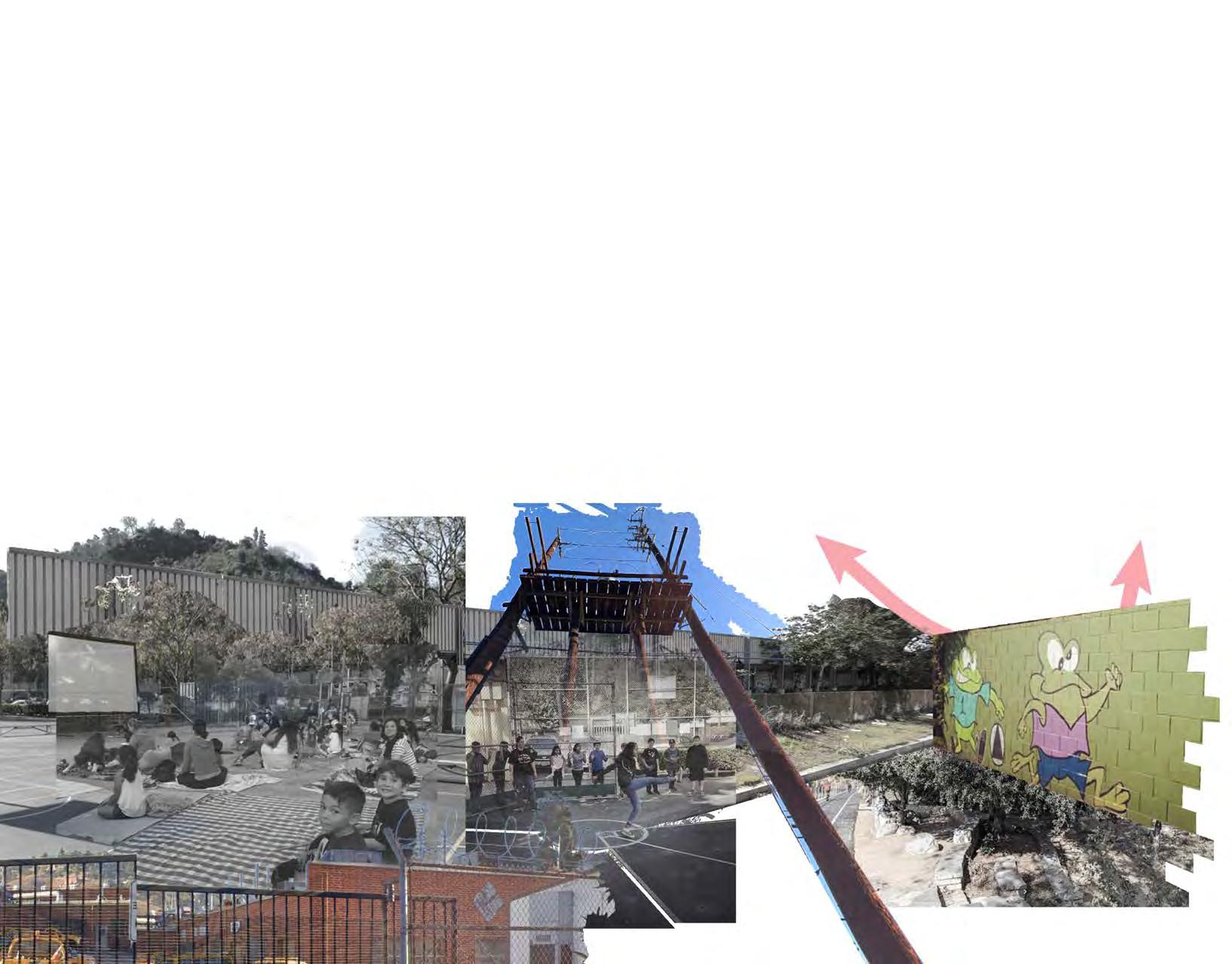
Funnel Park in Pacoima
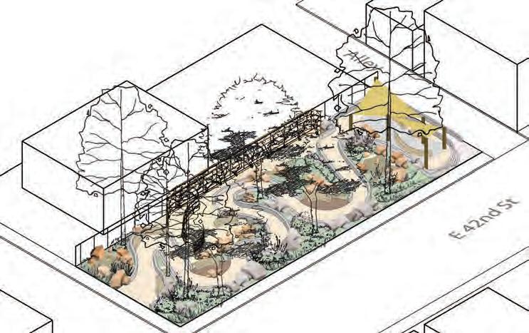
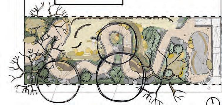
Shortcut Park
South central healing garden elySian Valley SoundScaPe
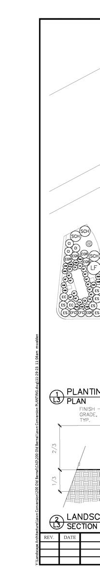
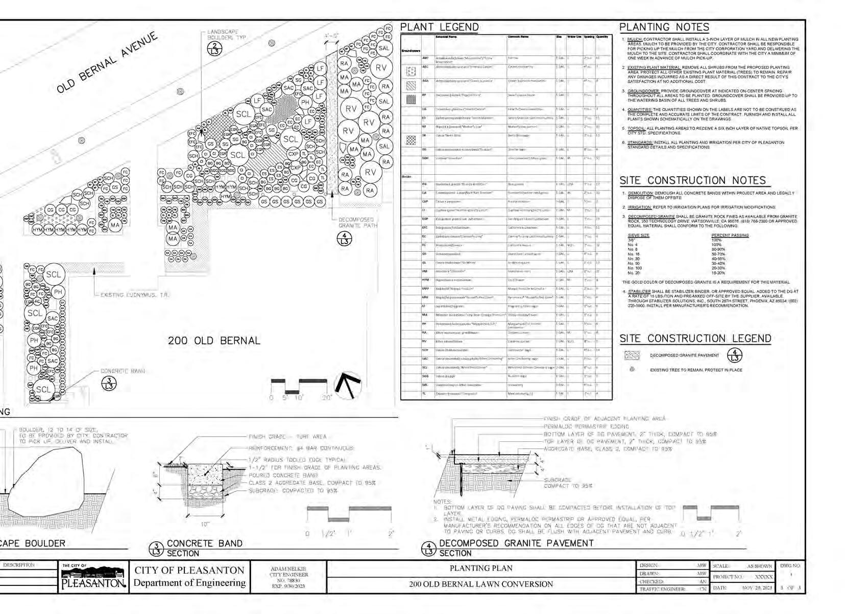
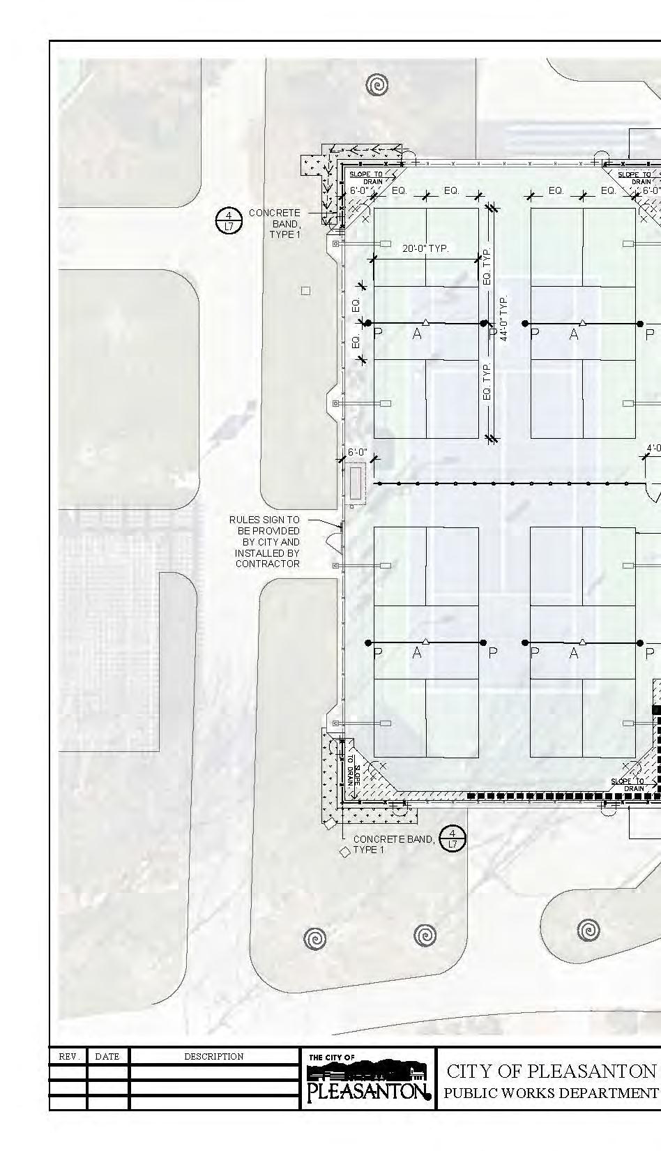
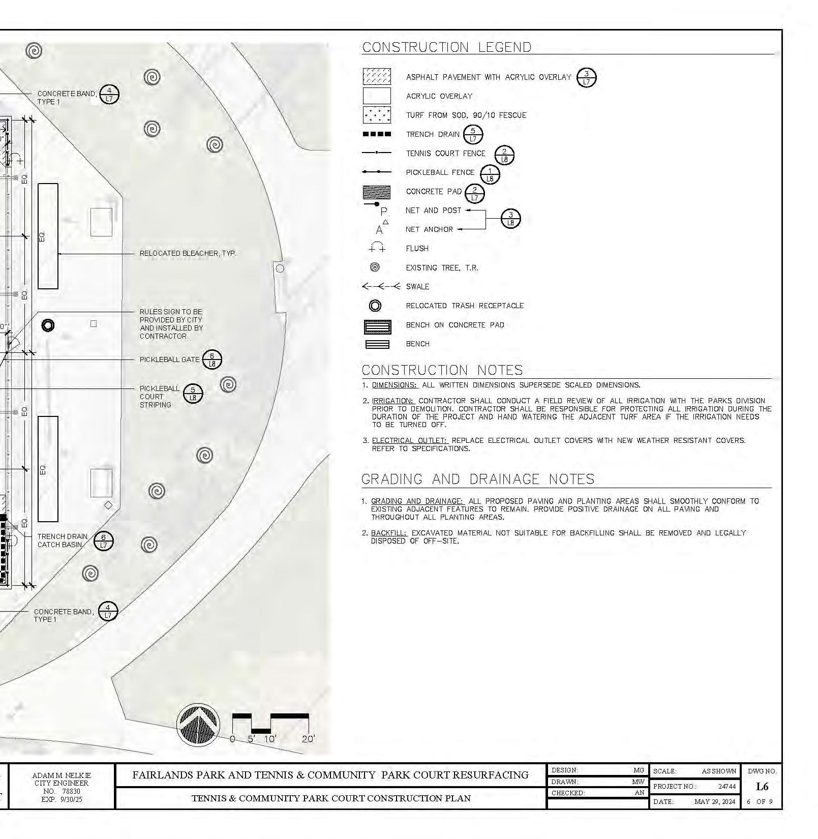
200 old Bernal aVenue conStruction document SamPleS
2 1 3
4
5
6
Funnel Park in Pacoima
Shortcut Park
South central healing garden elySian Valley SoundScaPe
200 old Bernal aVenue conStruction document SamPleS
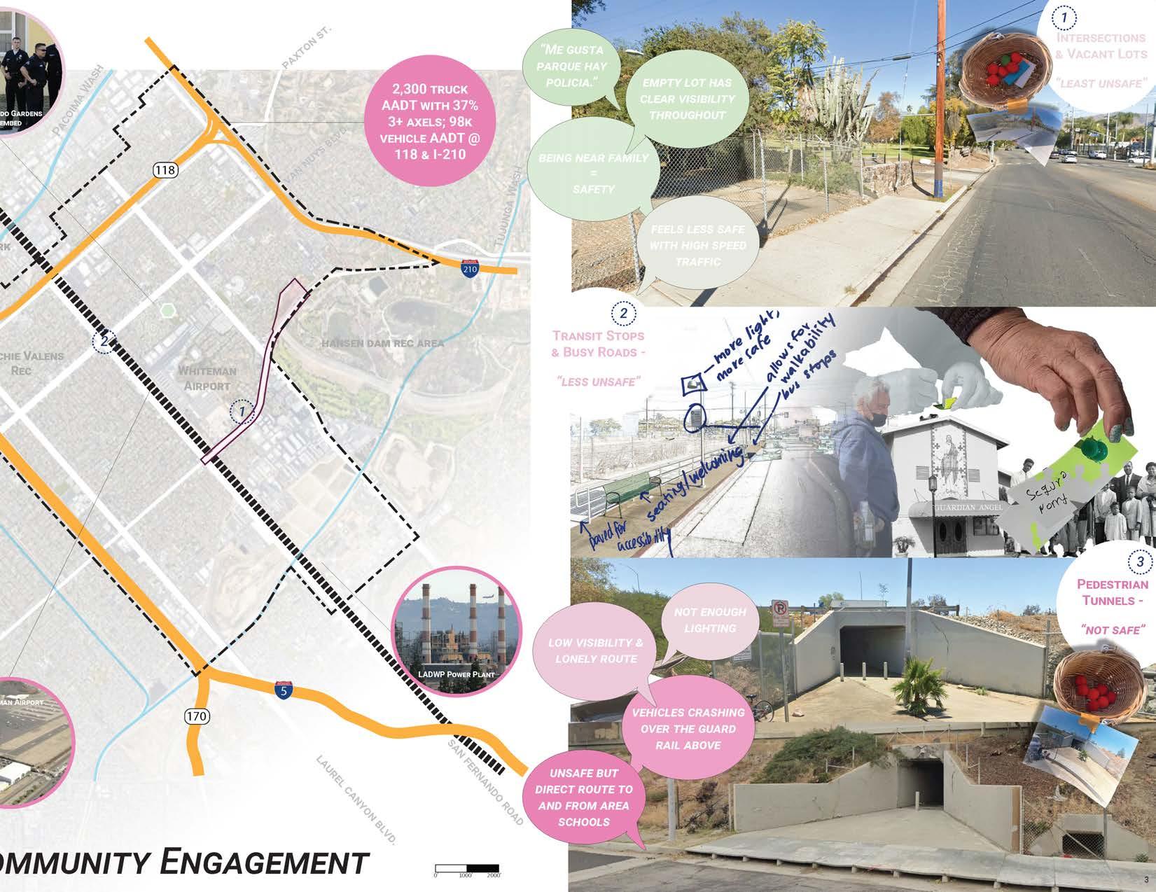
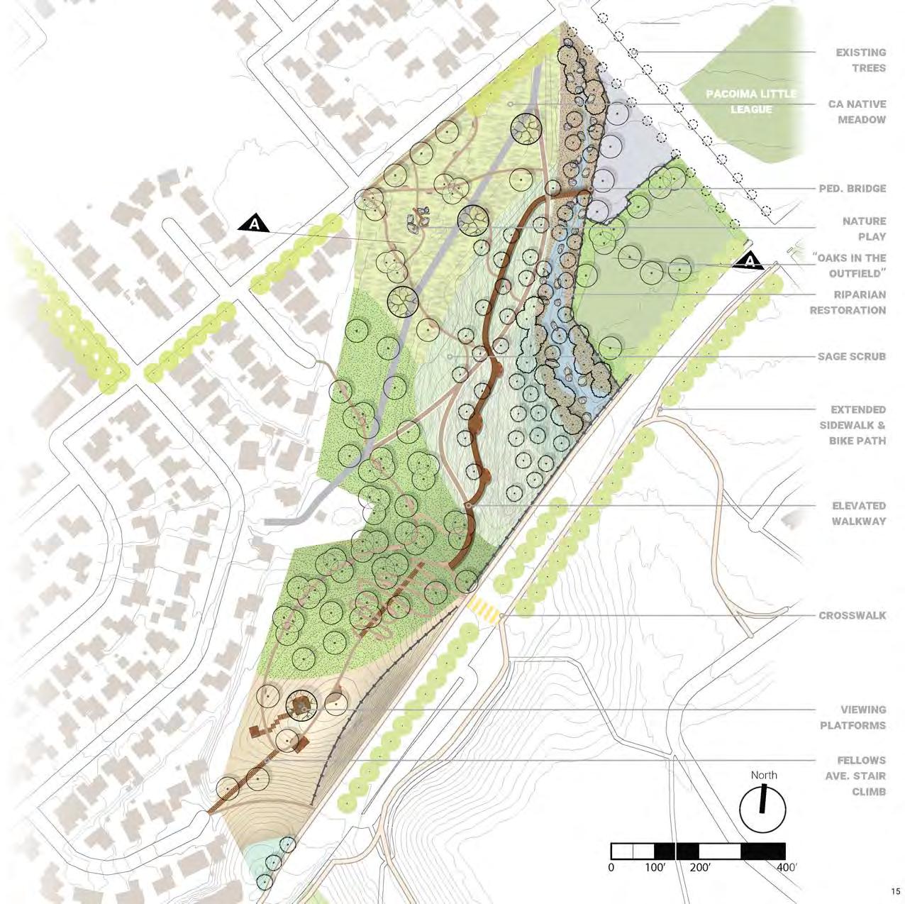
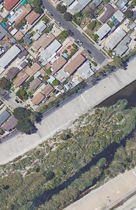
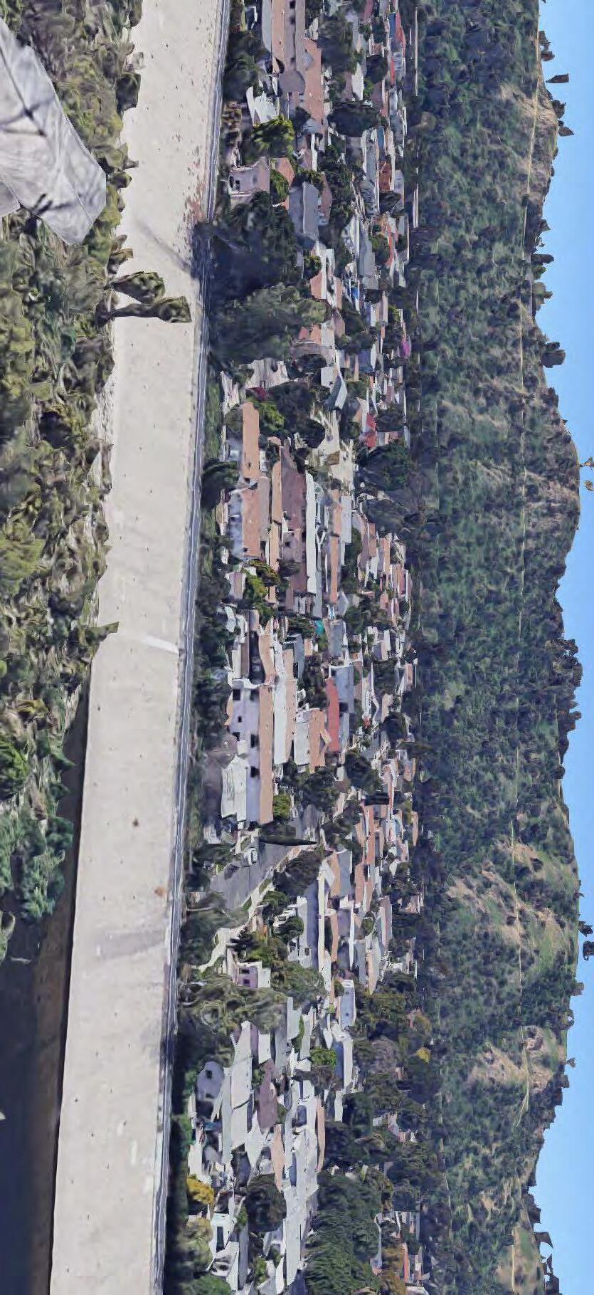
Many of Pacoima’s open space amenities are tied up in Hansen Dam, which, for most residents, is inaccessible by any means other than a vehicle. Locals who benefit from living nearby are burdened by less noise and air pollution from diesel particulate matter. The majority of Pacoima residents face numerous environmental justices due to a lack of buffer zones between residential and industrial, fragmentation by infrastructure, and leaded fuel from the local airport.
Wide streets like Van Nuys Boulevard and Osborne Street offer the potential to connect residents in park poor areas of the city to larger green spaces. These corridors can serve as threads that will unfurl the “yarn ball” of open space that Hansen Dam is currently.
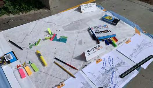
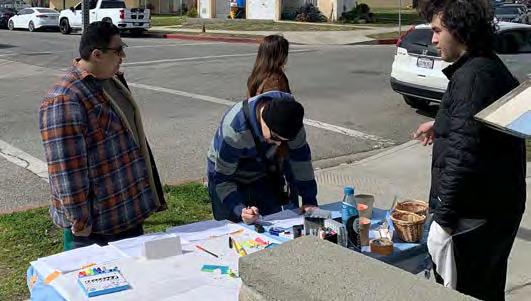
Overall and site-specific goals were informed by multiple community engagement sessions planned and carried out by our design team. Site strategies were further developed individually.
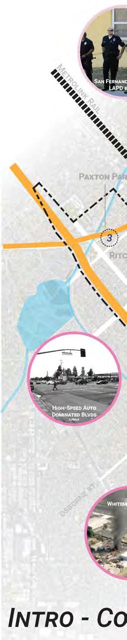
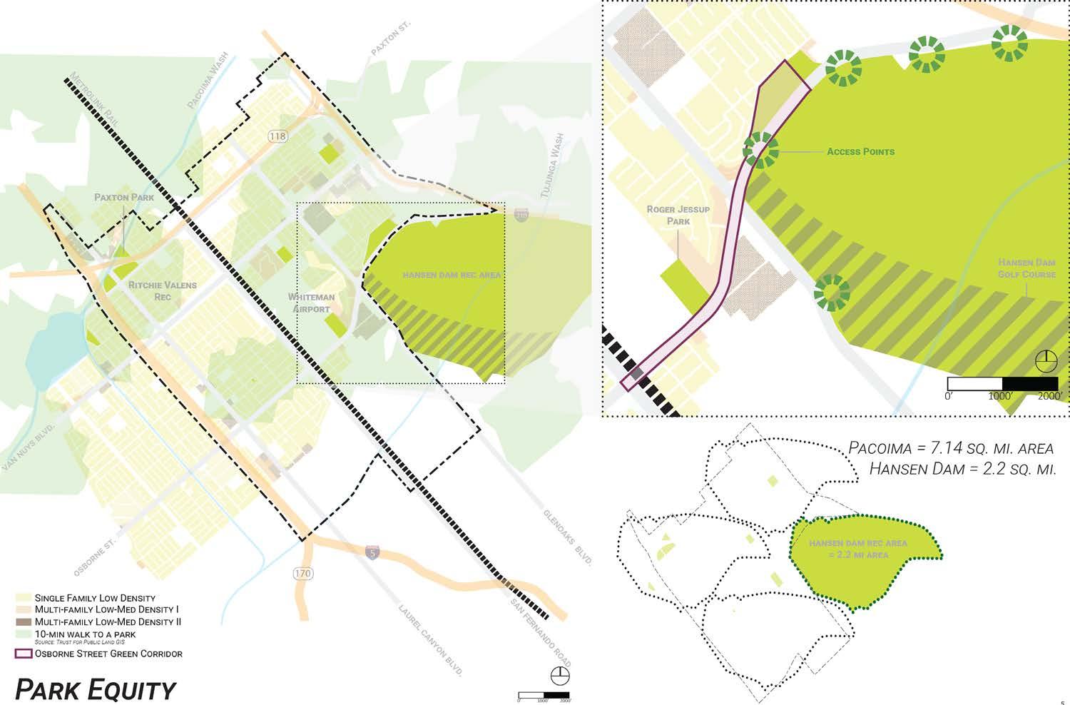
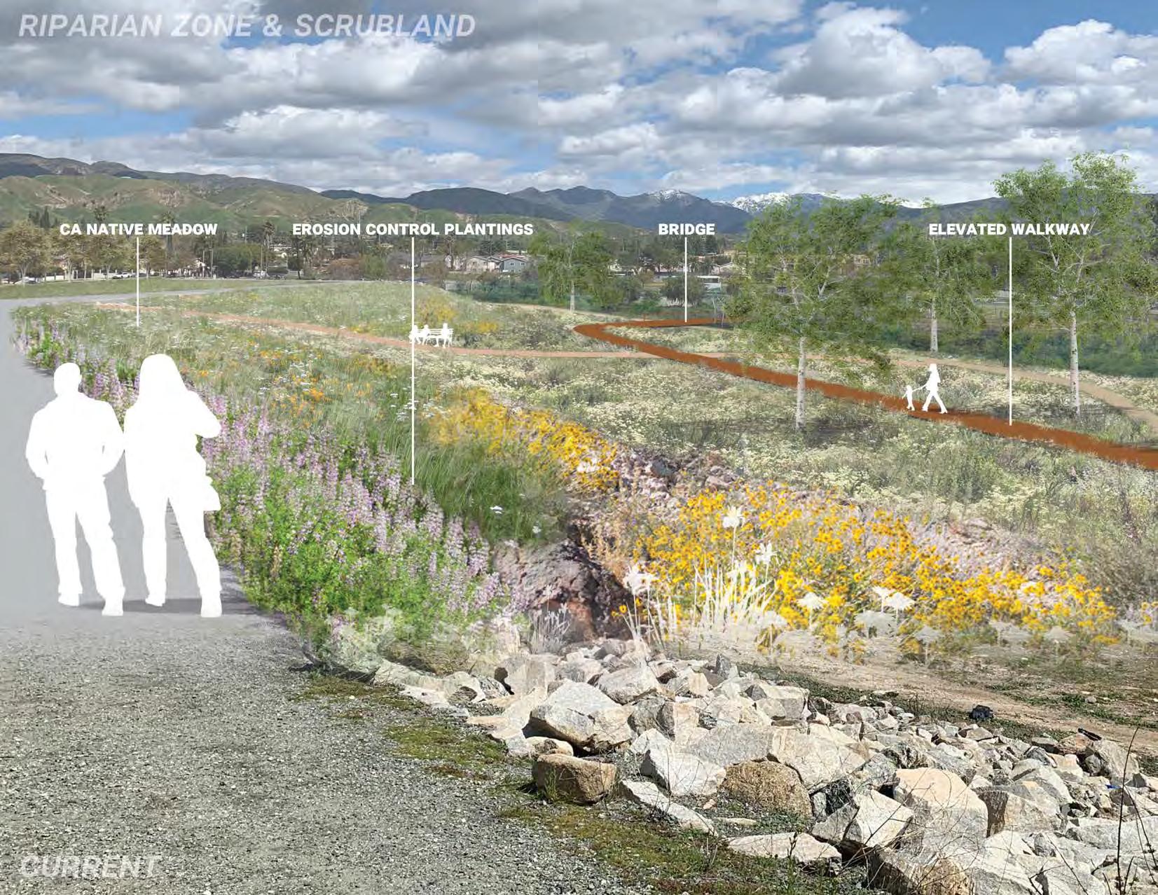
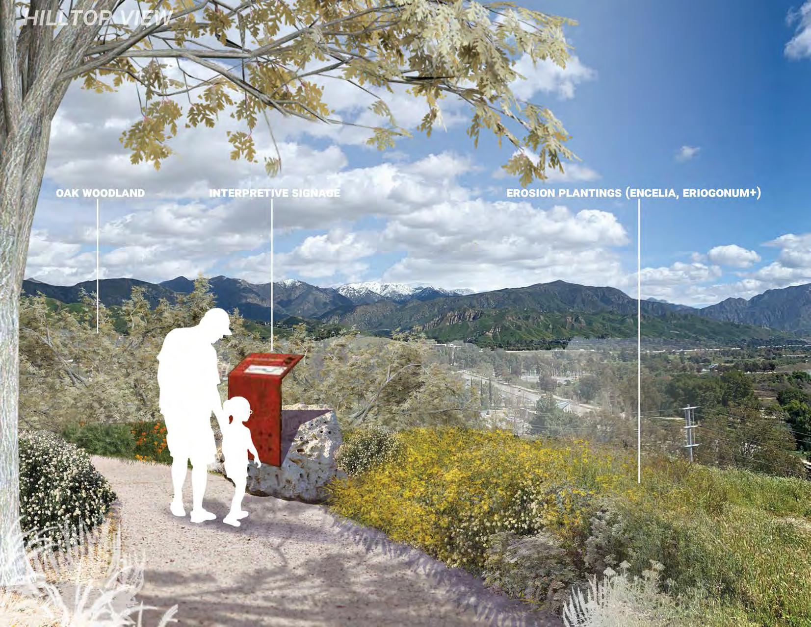
Open space is concentrated within Hansen Dam Rec Area. Osborne Street has the potential to become a green connection to neighborhoods facing the most park inequity.
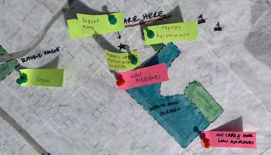
Park Inequity Mapping
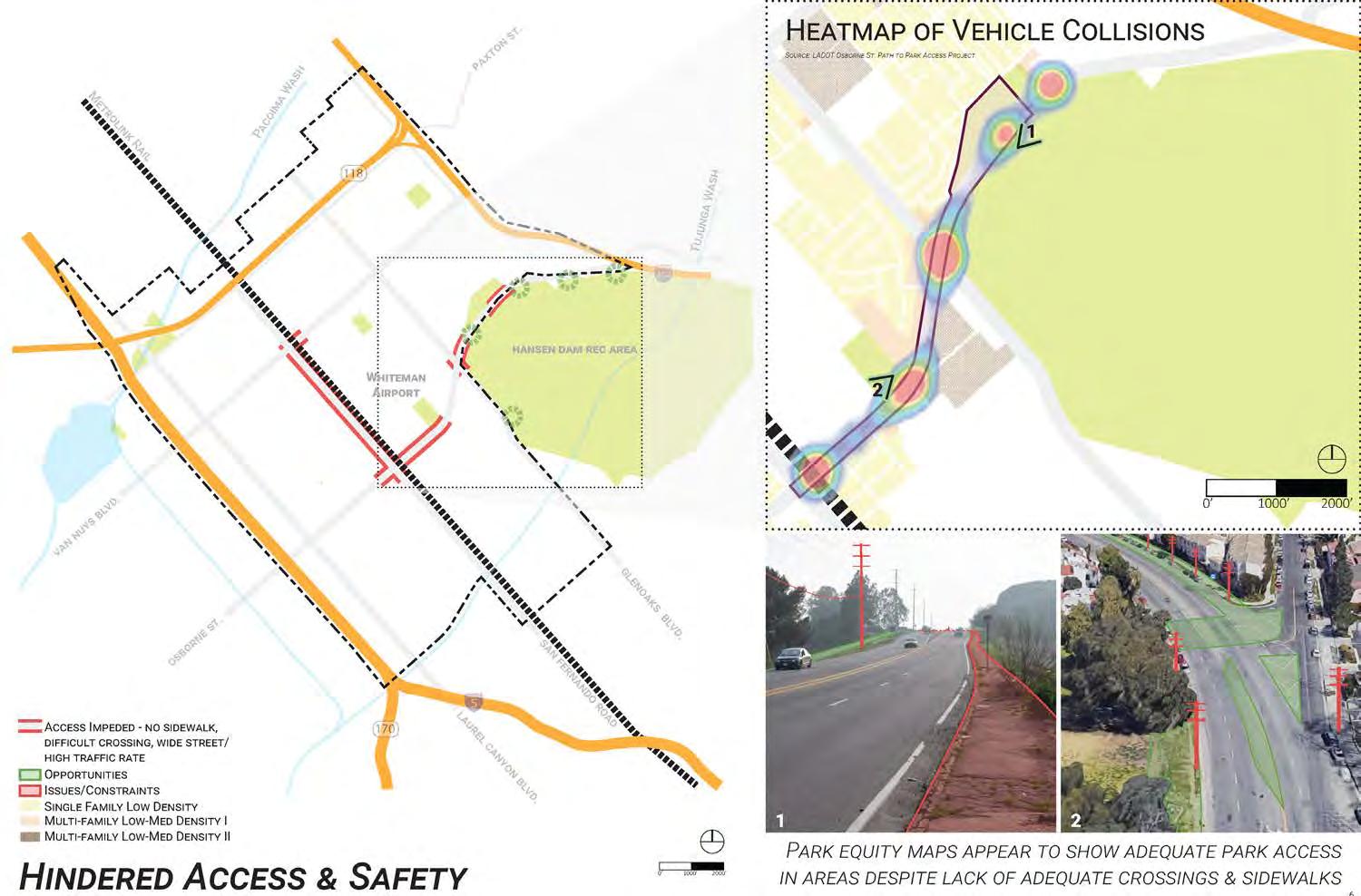
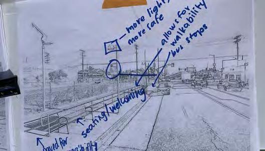
Connecting streets are impacted by major safety issues
Hindered Access & Safety Concerns
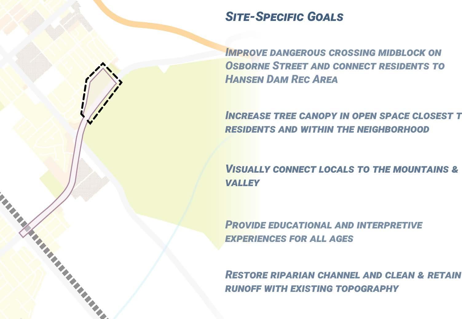
Park Site Plan
year 3 undergrad Studio
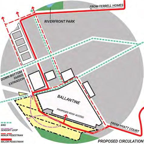
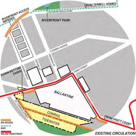
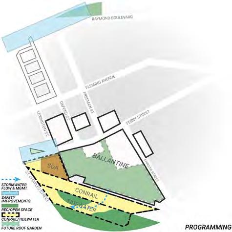
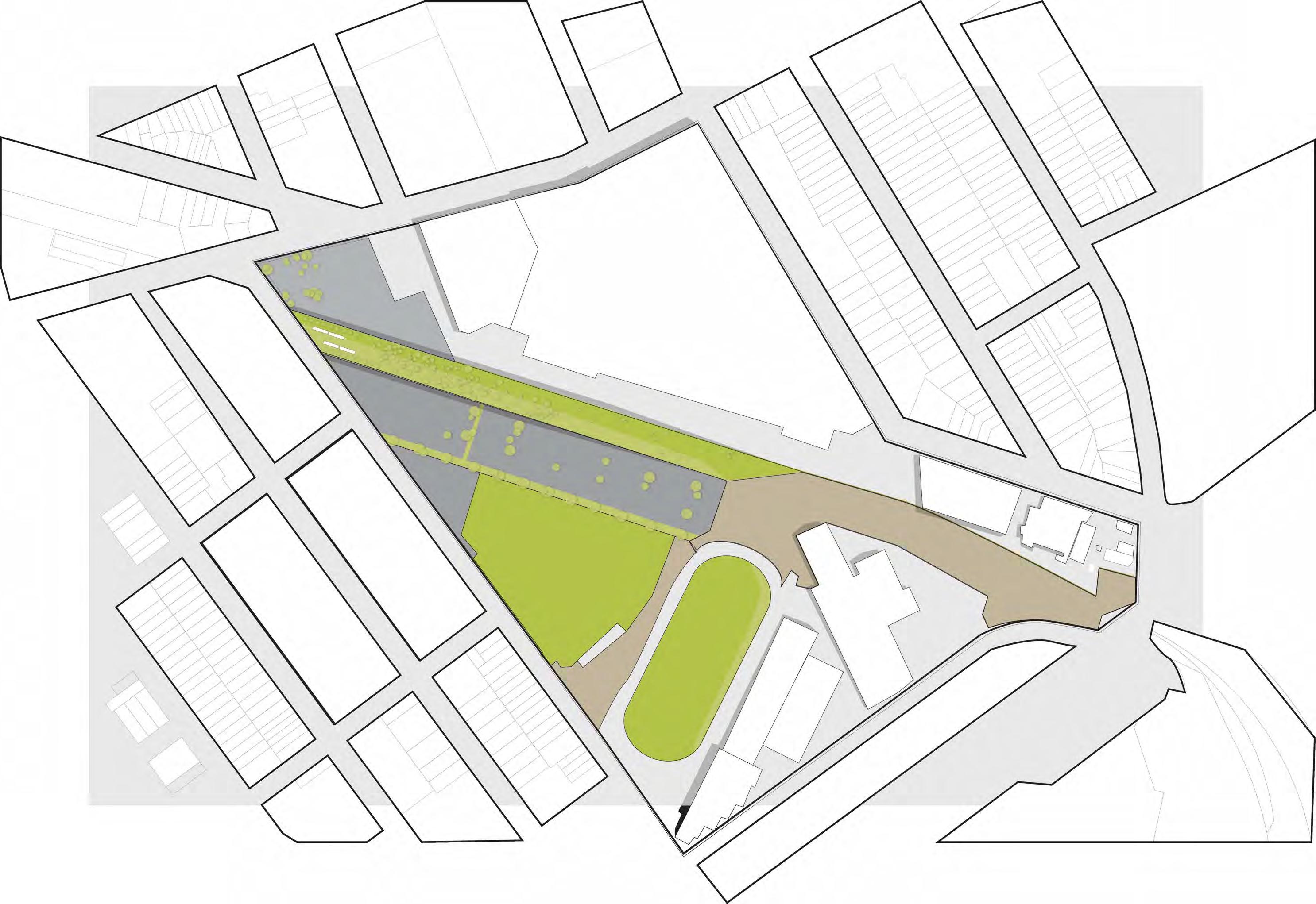
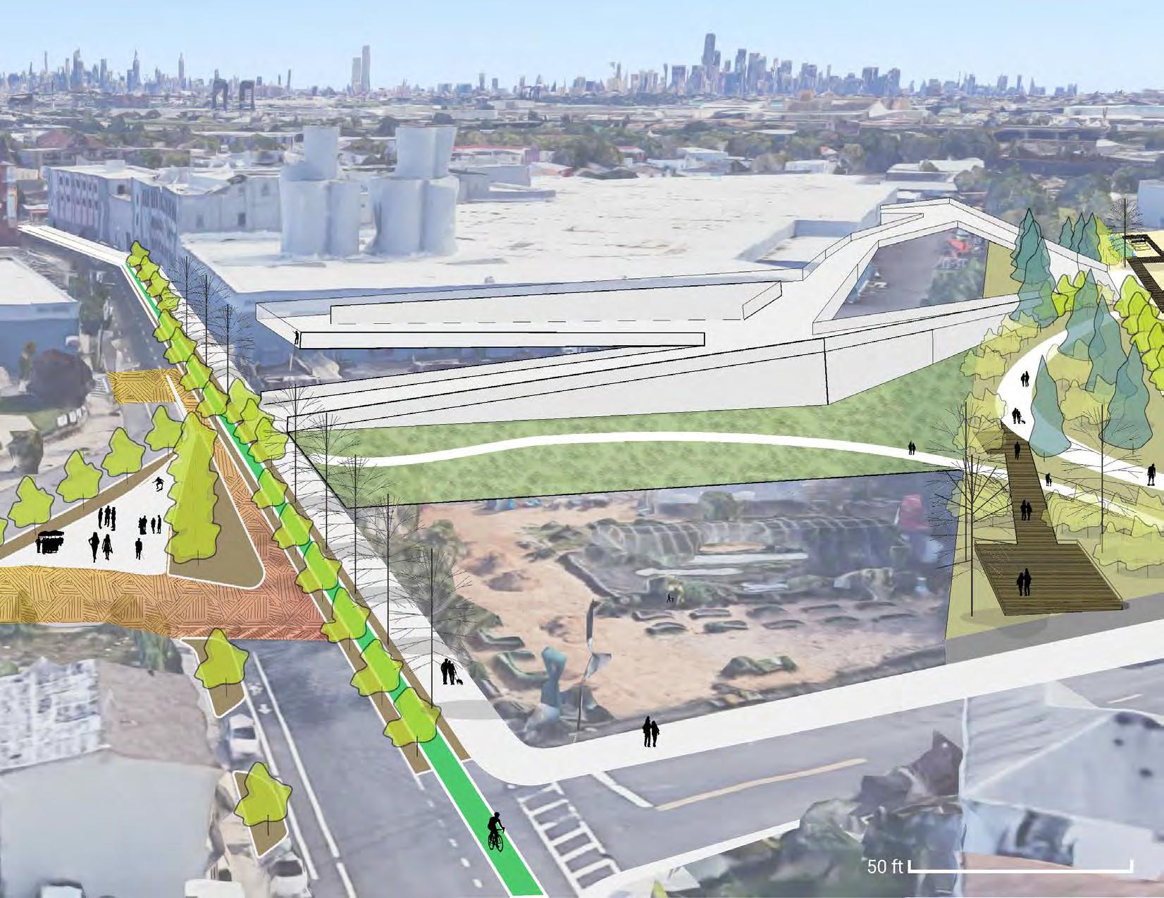
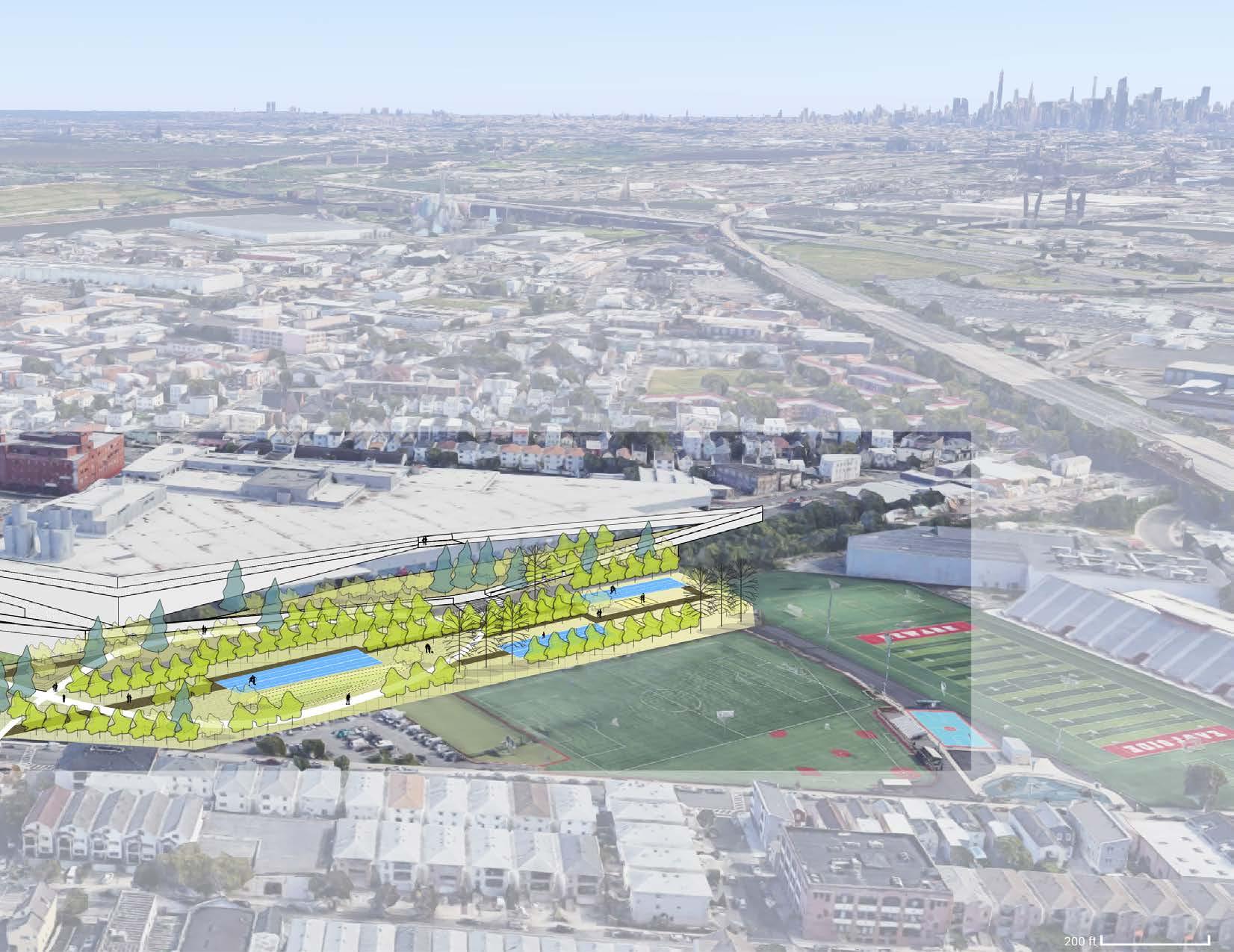
With the input of Ironbound Community Corporation members and information from community engagement efforts previously conducted, this approach to the revitalization of the Conrail and Tidewater brownfield sites and expansion of Down Bottom Farms aims to achieve several goals.
In recognition of the East Ironbound Community Plan, this project will increase connectivity to the waterfront through multi-sensory wayfinding, create safe & sustainable pedestrian corridors and intersections, and balance new housing at Ballantine with public open space in the form of a green roof providing views across the Passaic and into downtown.
Greenways, expanded recreation, and a lighted pedestrian ramp connecting the Conrail site and Ballantine roof will allow users of different abilities to access all sites. This proposal offers an alternate plan for the Ballantine superblock and surrounding sites, where the community has the opportunity to make use of as much currently under-utilized space, addressing social, ecological, and economic community goals. ea S t iron B


healing garden & Farm, loS angeleS, ca
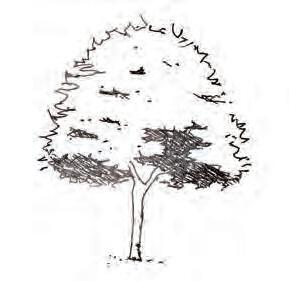
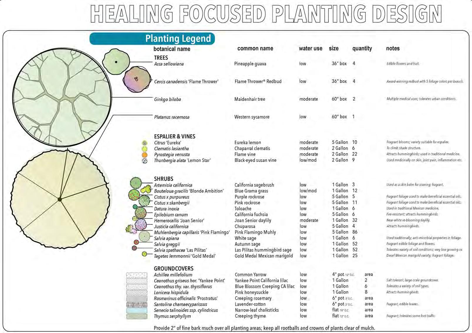
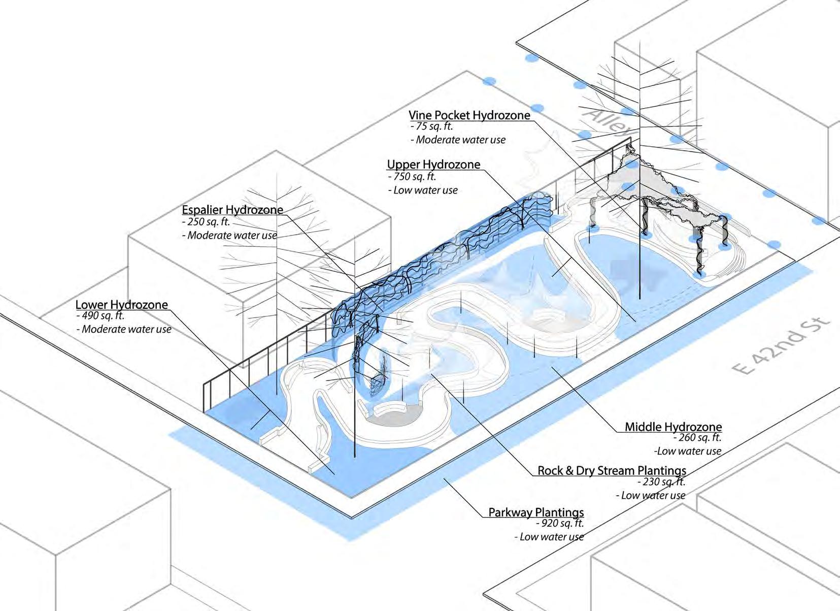
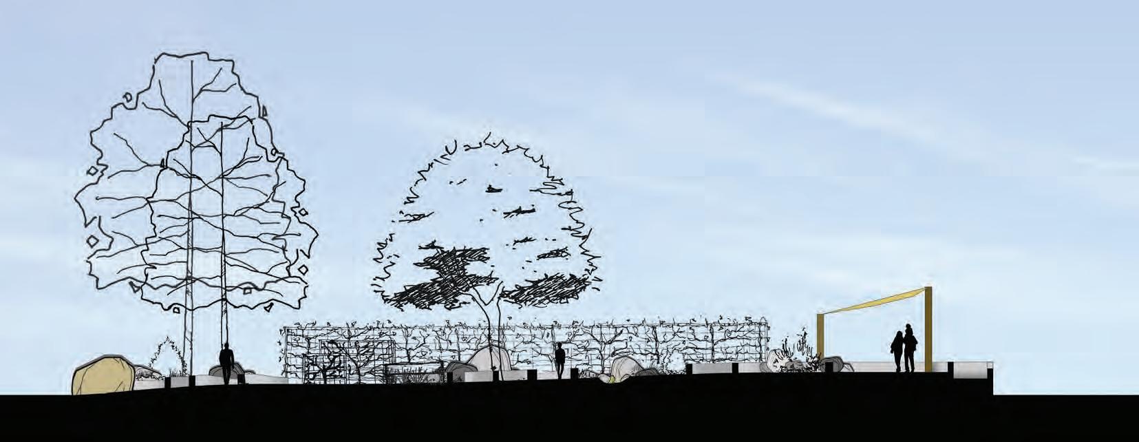
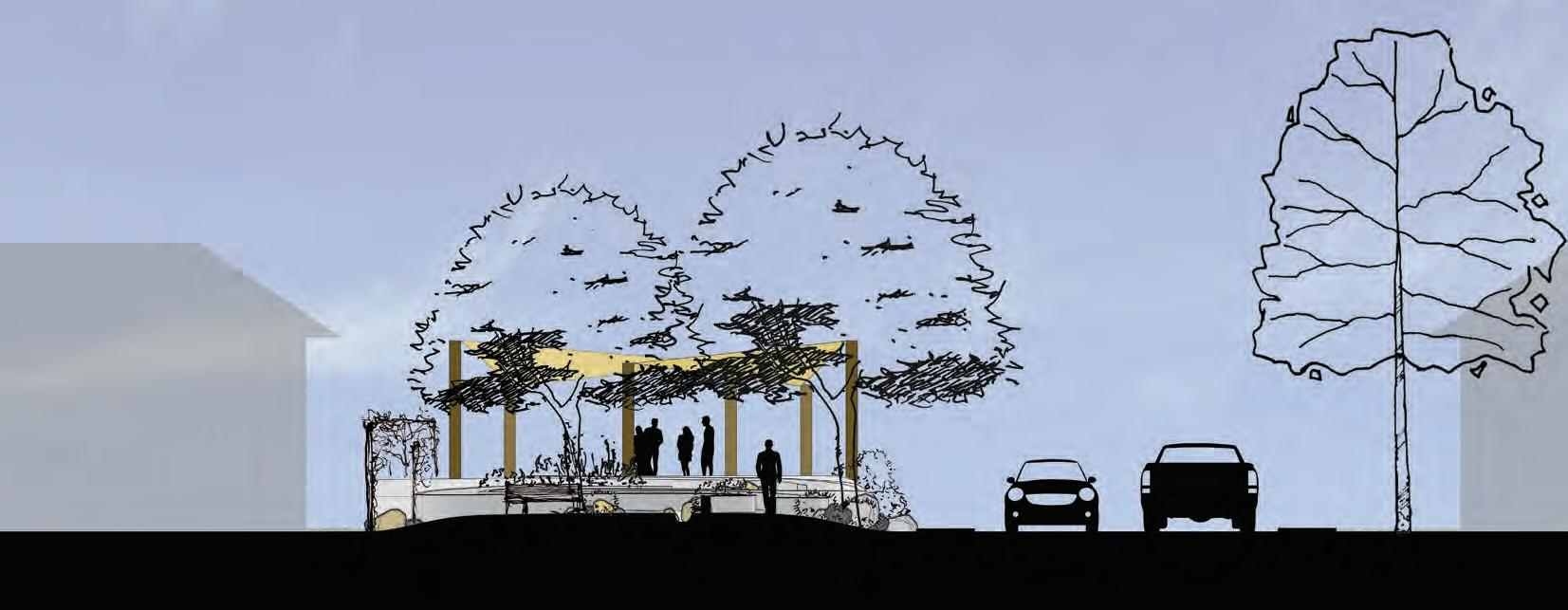
The South Central Healing Garden serves as a calming, restorative community space with plenty of shade and seating to escape the heat and stress of the city. Fruit trees espaliered along curving trellises, a dry stream to collect rainwater, large boulders and fragrant plants along the path stimulate the senses and quiet the mind.
With the addition of small, community serving green spaces and integrated urban farms, places like convenience stores and the like could begin to provide items grown by the community out of their current locations. Through this, the community gains self-sufficiency and independence.
Freedom from outside assistance that otherwise may not result in true improvement for residents can be achieved. People can go into these spaces and feel safe from the threat of the police and other violence they may be vulnerable to hanging out on a street corner or at a liquor store. A sense of ownership, pride, and be-longing comes with the addition of these small spaces, no matter the size.
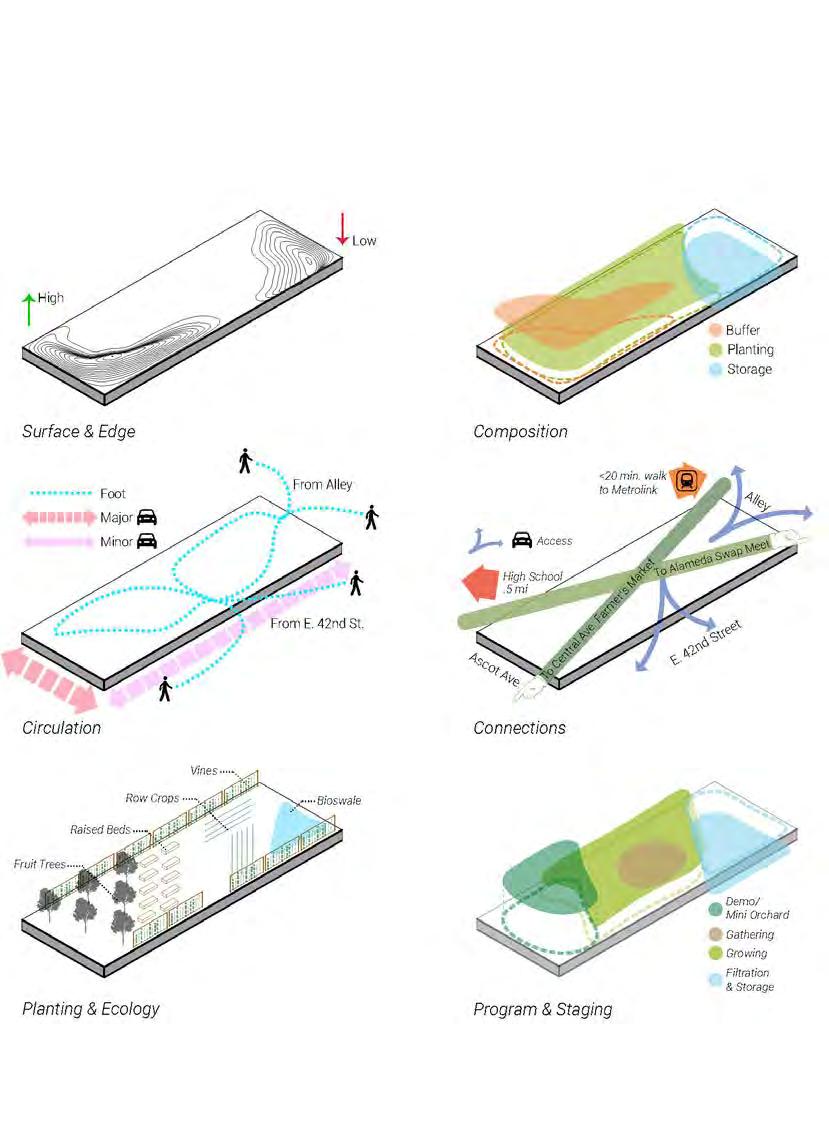
P rogramming & A nalysis D iagrams
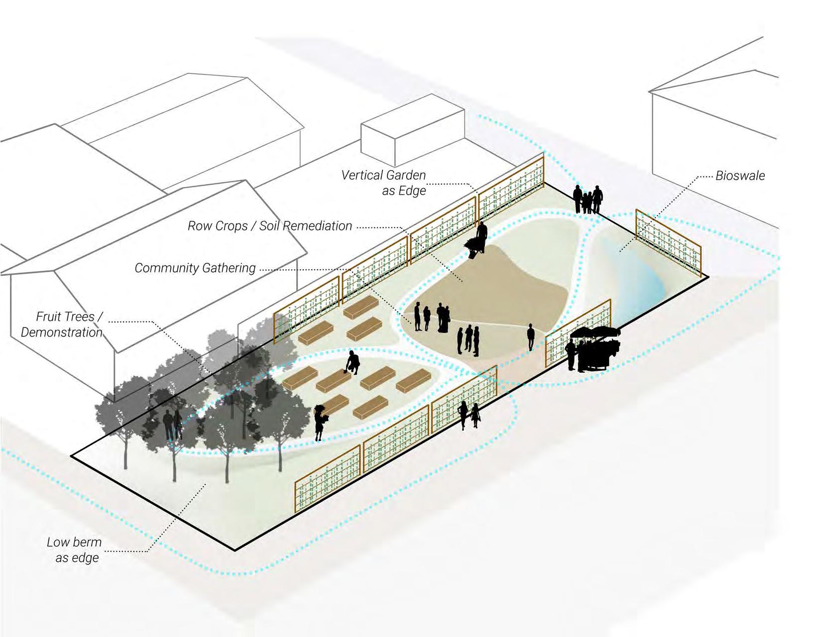
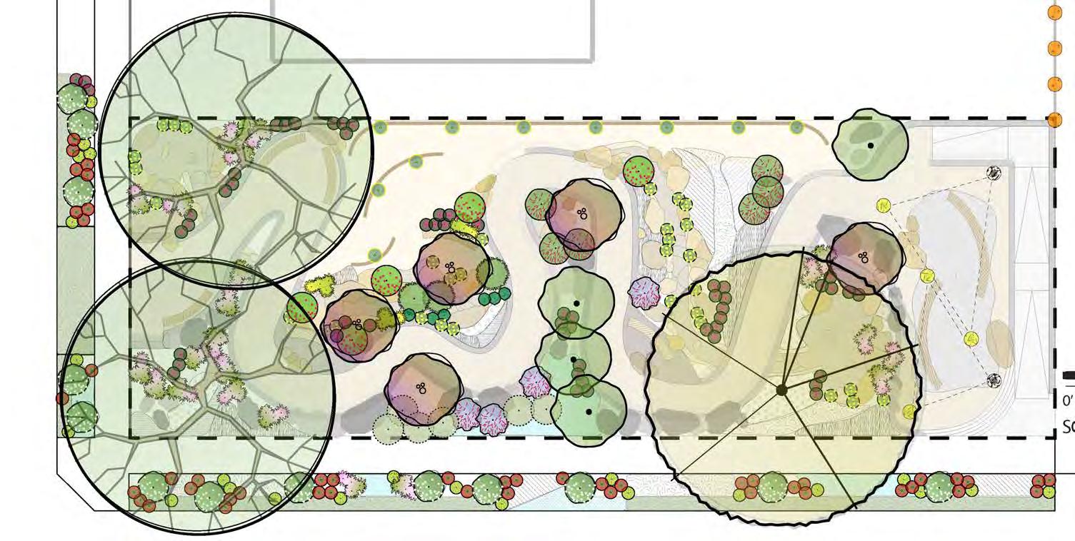
Site analysis, research and design to create educational, multisensory soundscapes & address noise and air pollution affecting families and young kids living near Dorris Place Elementary in Elysian Valley, Los Angeles, CA.
land S ca P e reno V ation
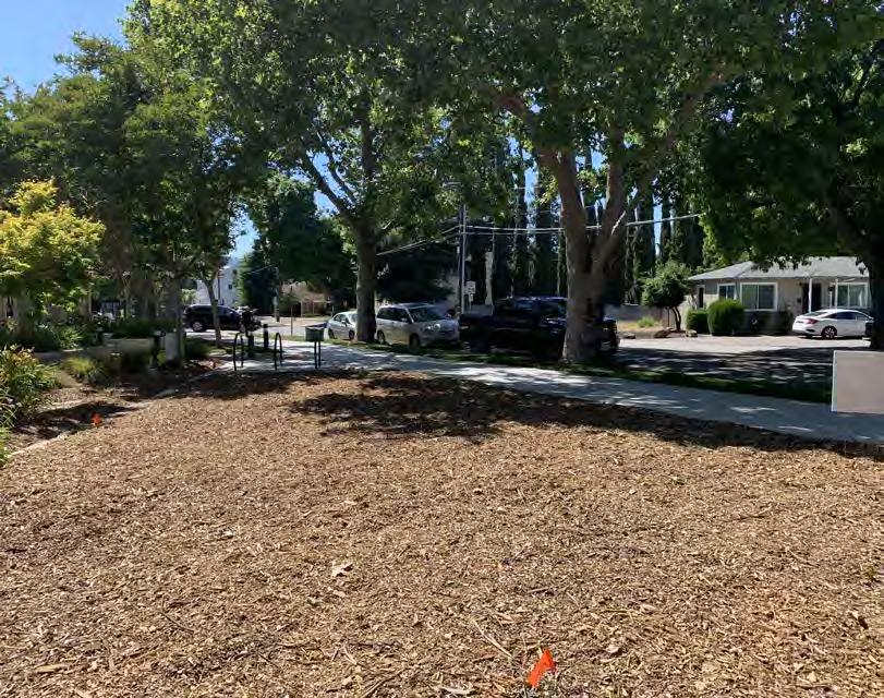
city oF PleaSanton
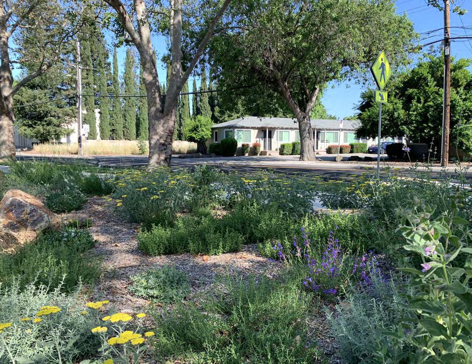
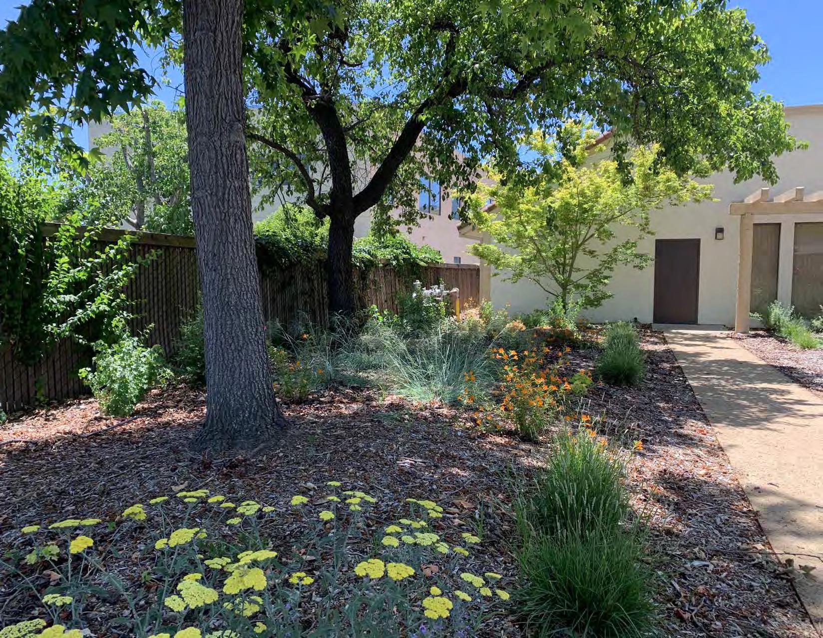
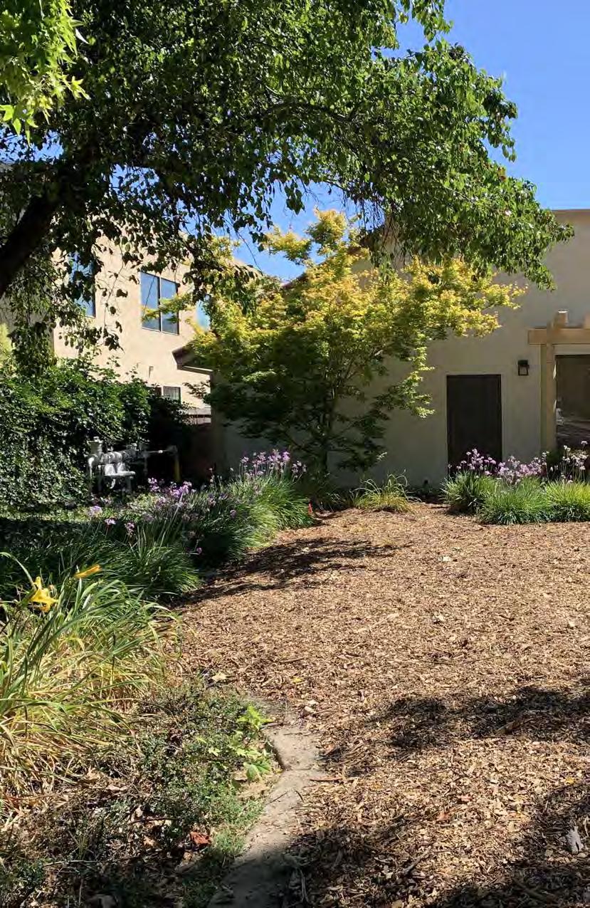
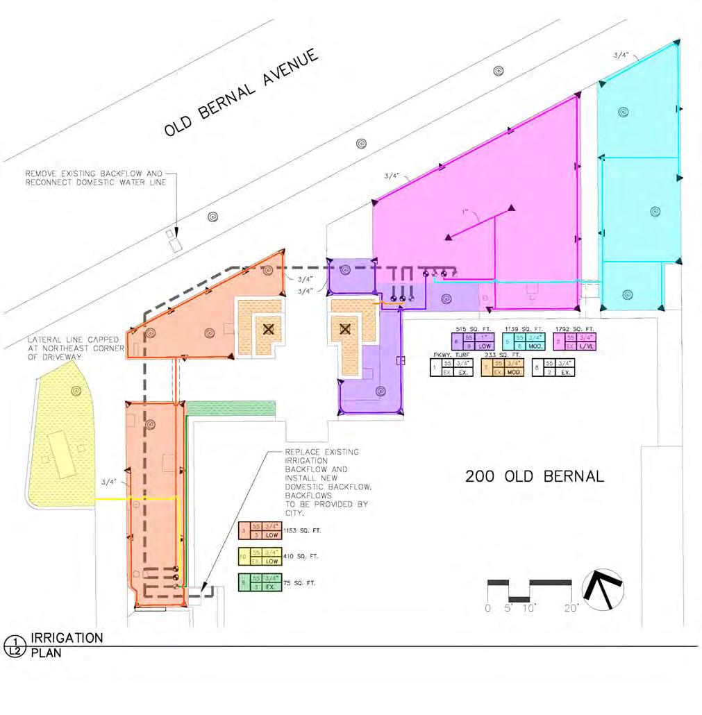
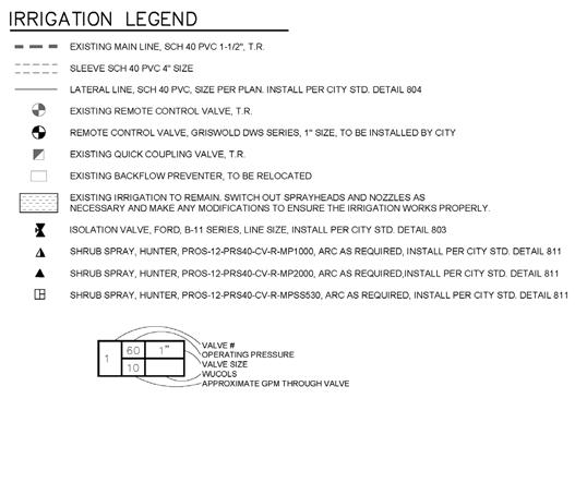
Design of a drought-tolerant lawn conversion at Pleasanton’s Civic Center and City Hall involving the use of mostly California native plants. This project serves as inspiration and demonstration for residents and visitors considering alternatives for traditional suburban landscape design. Work involved the creation of a demolition, irrigation, and planting plan. Drawings were accompanied by a detailed maintenance guide and irrigation controller map with maintenance tips.
December 2023
July 2023
Color-Coded Irrigation Controller Map
Front: Zones and associated valves highlighted for quick field reference
A two-sided controller map includes a quick reference guide for Parks maintenance staff to refer to in the field. Below each plant photo is the valve number shown in a colored circle and corresponds to the colors on the controller map.
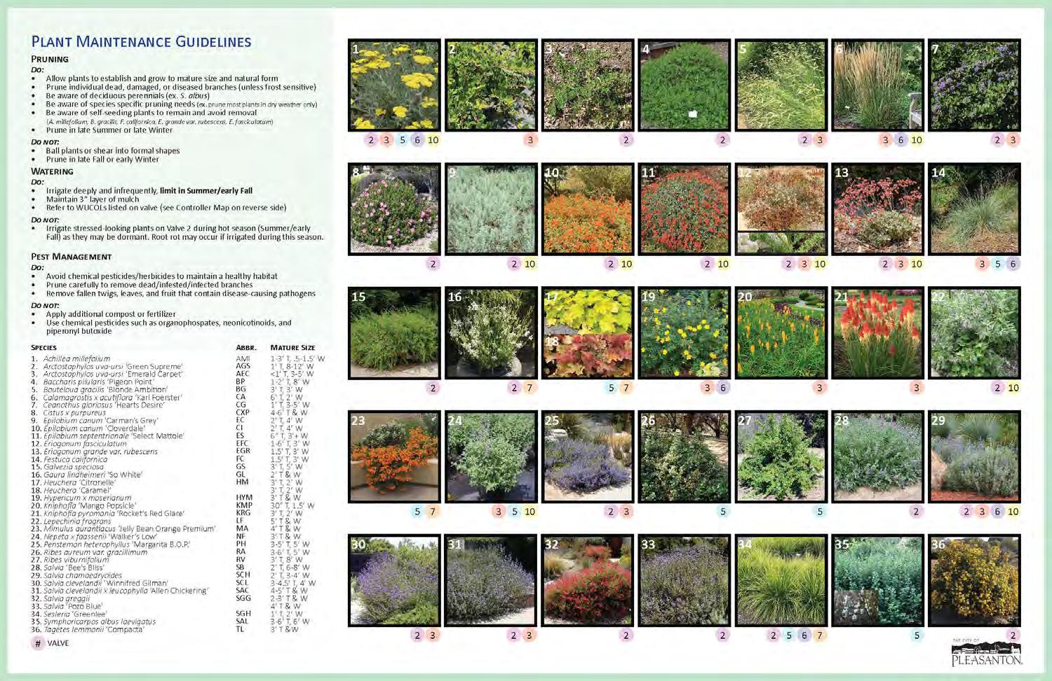
Irrigation Controller Maintenance Cheat Sheet
Back: includes color-coded valve numbers corresponding to the controller map
city oF PleaSanton
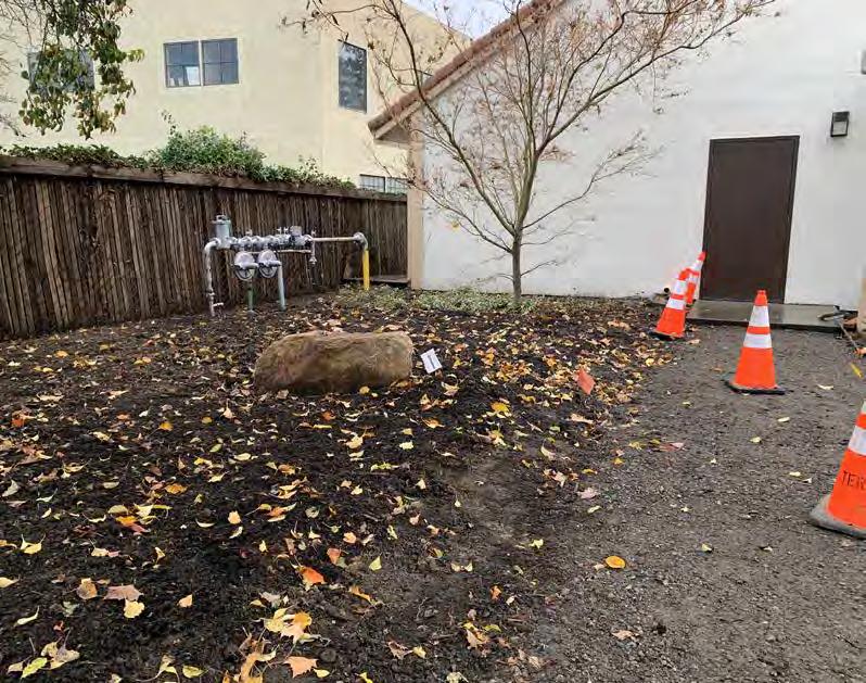
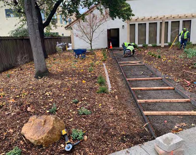
Construction document samples from projects with the City of Pleasanton, including 200 Old Bernal and annual tennis court resurfacing.
City of Pleasanton
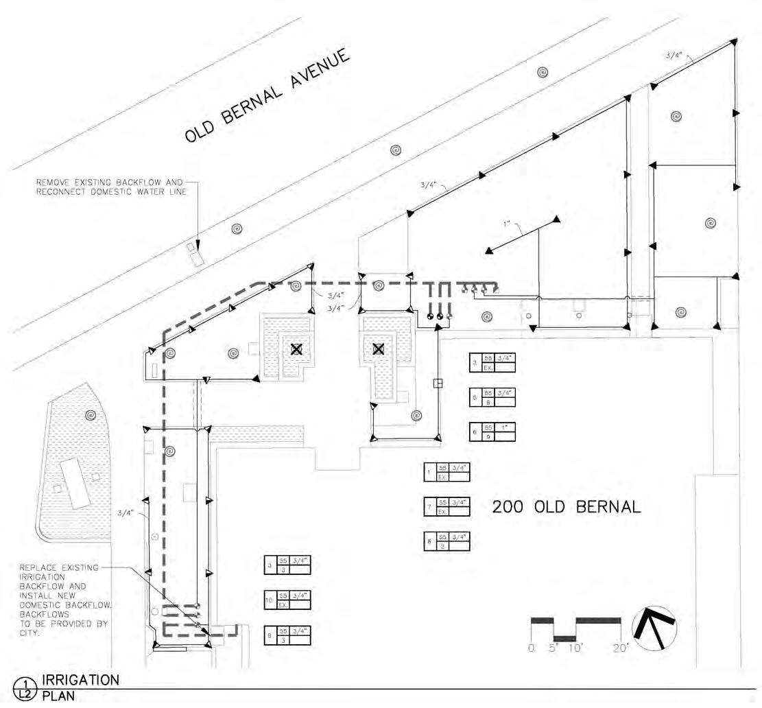
of Pleasanton - 200 Old Bernal Landscape renovation