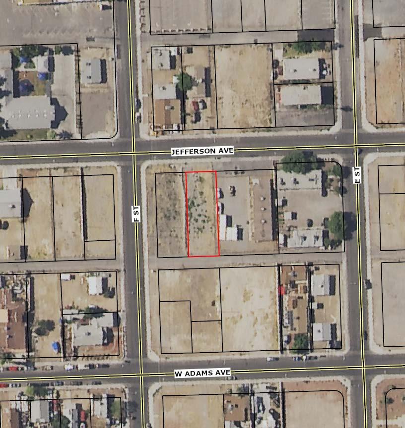
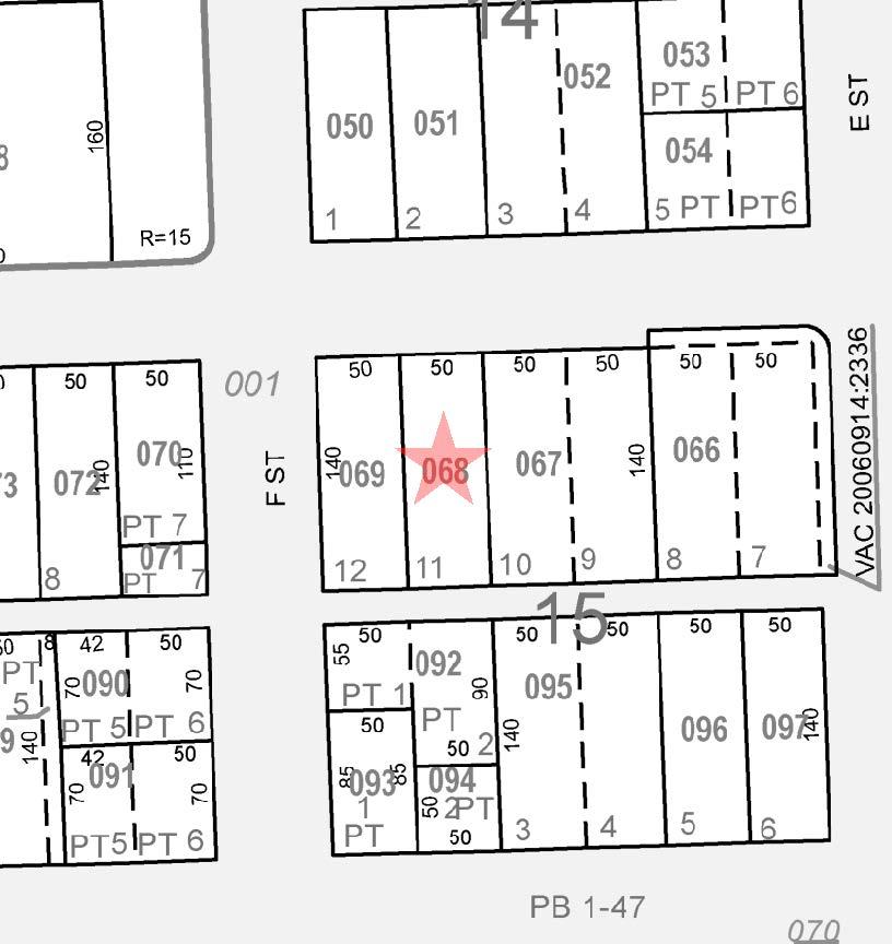
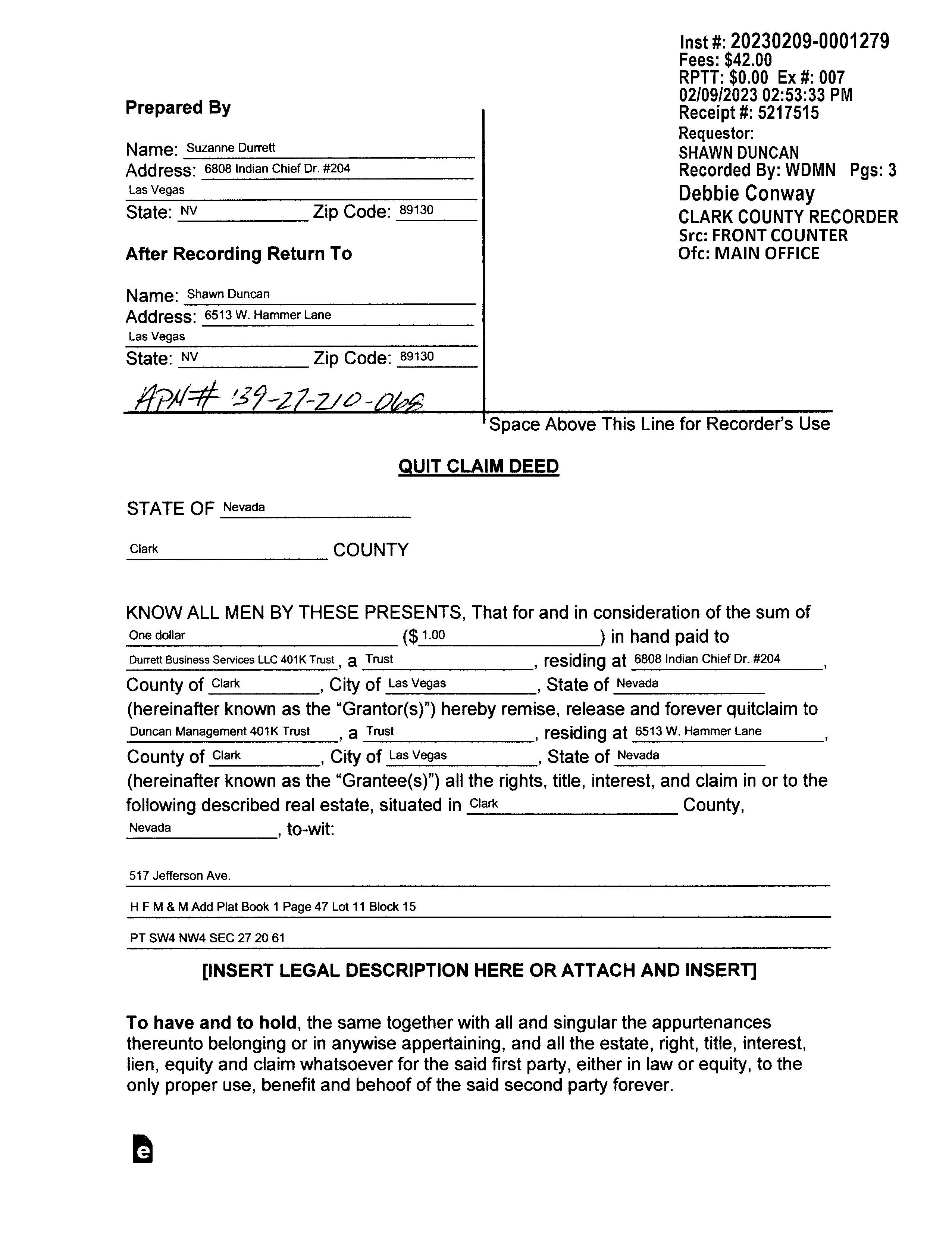
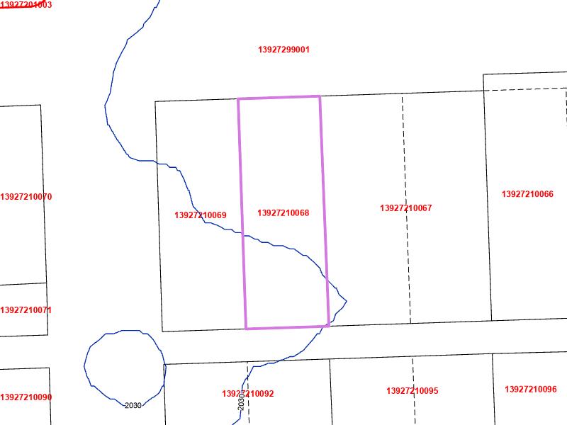
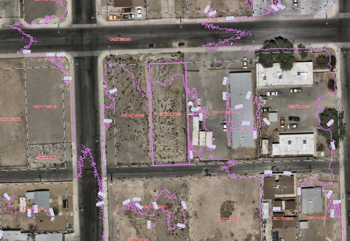
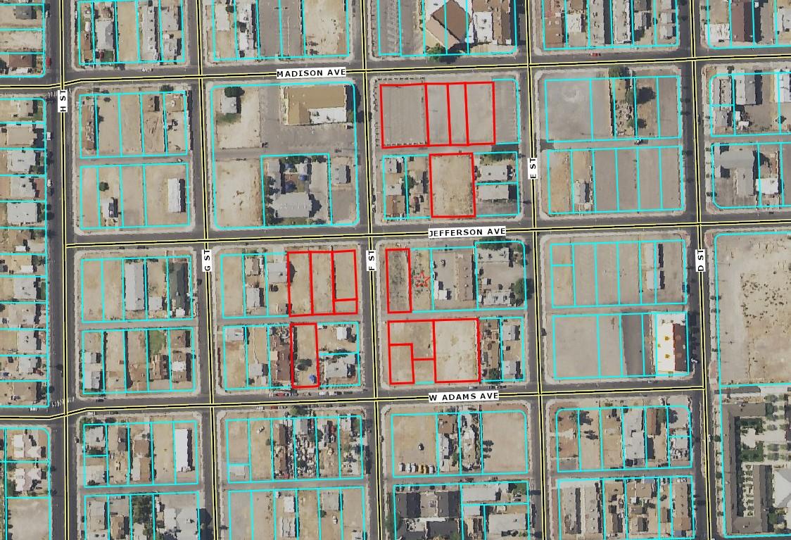
Legal Description: H F M & MADD PLAT BOOK 1 PAGE 47 LOT 11 BLOCK 15
APN: 13927210068
Tax Lot:
Twn-Rng-Sec: 20S / 61E / 27 / NW
Neighborhood:
Subdivision: H F M & MAdd
Legal Lot/Block: 11 / 15
CensusTract/Block: 000301 / 3044
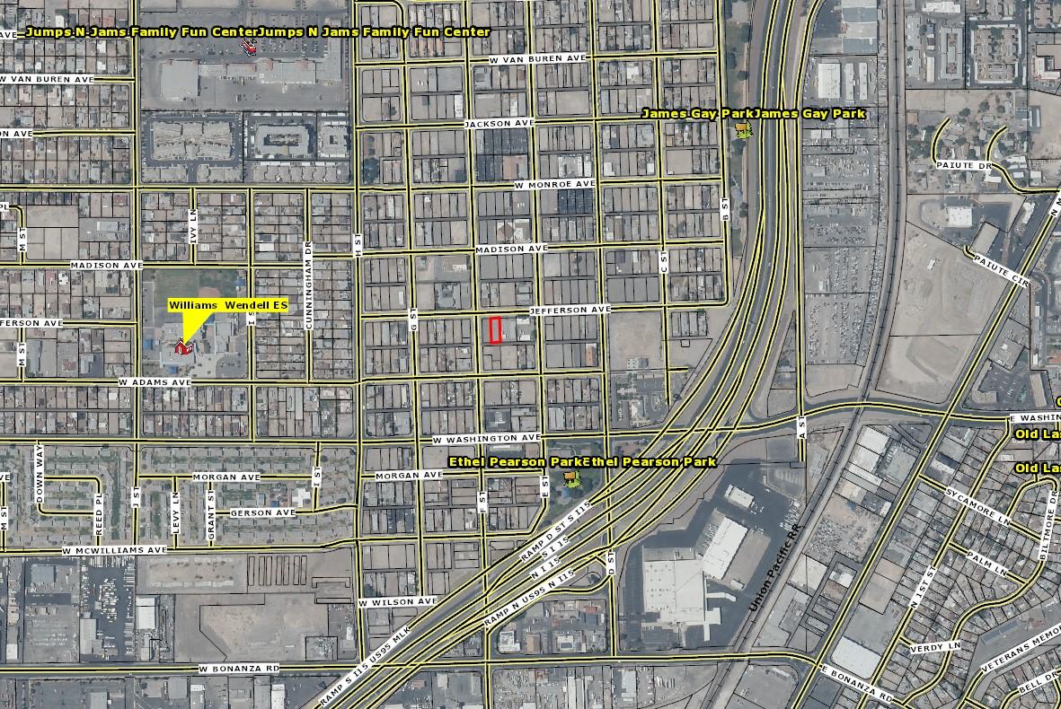
Elementary School: Williams Wendell Es
Middle School: West Preparatory Institute J-Shs
Property Characteristics
Total LivingArea:
Bedrooms:
Lot SqFt: 6,970
LotAcres: 0.16
Land Use: 12.000 - Vacant - Single Family Residential
Land Use STD: Residential (nec)
County Bldg Use: 100
# Dwellings:
Map Page/Grid:
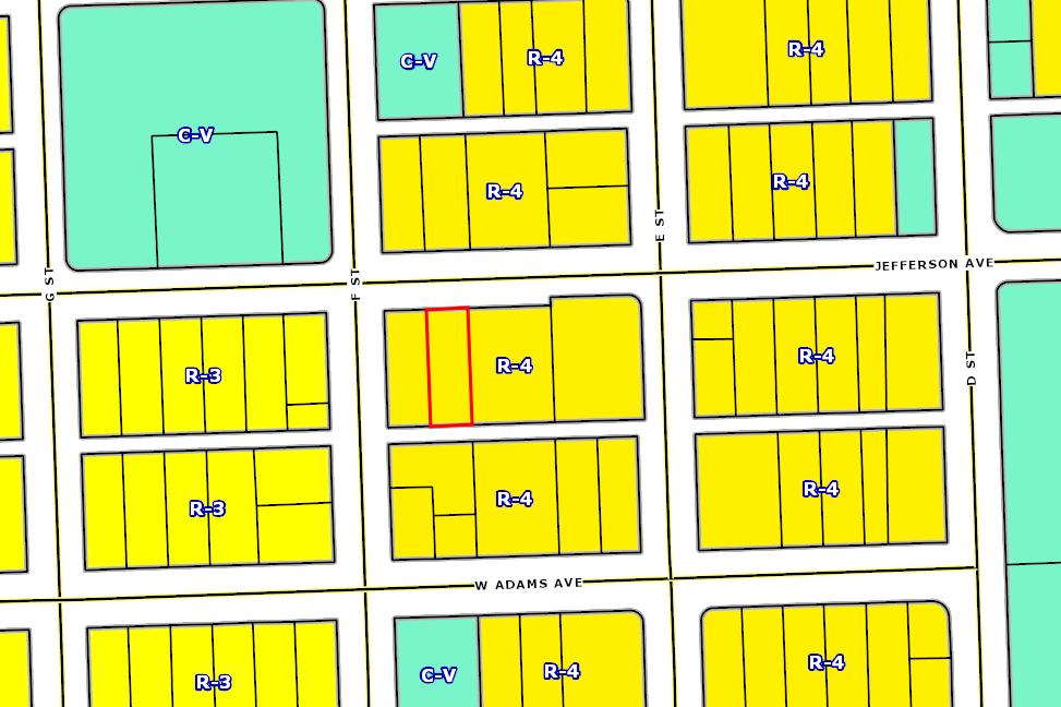
Zoning: R-4
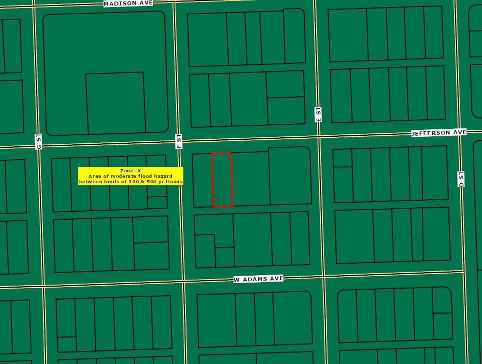
Watershed: Vegas Creek-Las Vegas Wash
High School: Canyon Springs Hs
School District: Clark County
Year Built/Eff: 1955
First Floor SqFt: BathroomsTotal: Heating:
Second Floor SqFt:
Bathrooms Full/Half:
Cooling:
Basement Fin/Unfin: Stories: Fireplace:
Attic Fin/Unfin: Foundation:
Garage SqFt:
Assessment and Tax Information
Roof Material:
Pool:
Kitchen:
Sale and Loan Information
Sale Date: 02/25/2021
SaleAmount: $47,500.00
Document #: 210225004168
DeedType: Deed
Title Co: CHICAGO TITLE/NEVADA
Lender:
LoanAmount: $0.00
LoanType:
Price/SqFt: $0.00
Seller Name: EBERHART LAWRENCE
Prepared By: WFG NationalTitle Customer Service Department 12909 SW 68th Pkwy, Suite 350, Portland, OR 97223 P: 503 603 1700 | 360 891 5474 E: cs@wfgnationaltitle.com | cccs@wfgtitle.com
Sentry Dynamics, Inc. and its customers make no representation, warranties or conditions, express or implied, as to the accuracy or completeness of information contained in this report.
Sentry Dynamics, Inc. and its customers make no representations, warranties or conditions, express or implied, as to the accuracy or completeness of information contained in this report.
Parcel ID: 13927210068
Parcel ID: 13927210068
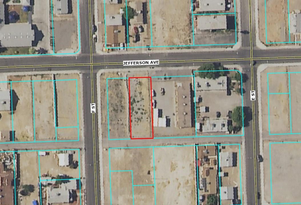
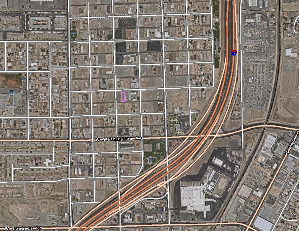
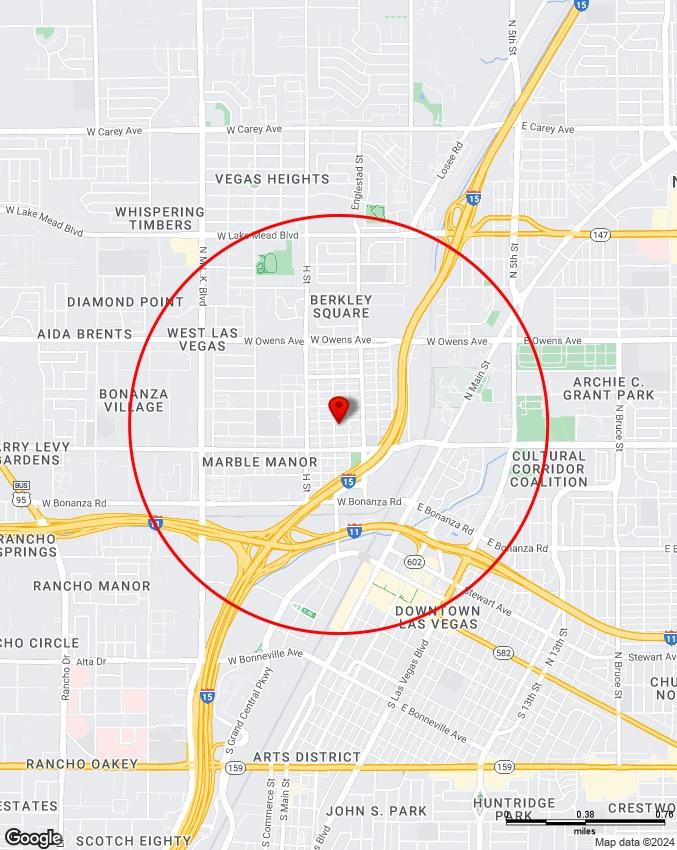
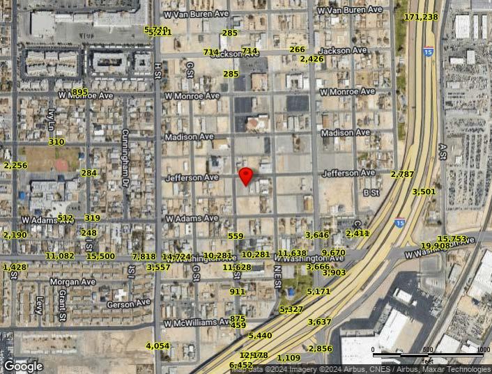
SiteAddress: 517 JeffersonAve
Sentry Dynamics, Inc. and its customers make no representations, warranties or conditions, express or implied, as to the accuracy or completeness of information contained in this report.
ASSESSOR'SCOPY
ASSESSOR'SCOPY
ASSESSOR'SCOPY
ZONING
Detailed Zoning Information
Zoning Map
Community Jurisdiction
The information contained is provided by WFG’s Customer Service Department to our customers, and while deemed reliable, is not guaranteed.
19.06.120 R-4 High Density Residential District
The R-4 District is intended to allow for the development of high density multi-family units within the downtown urban core and in other high intensity areas suitable for high density residential development. The R-4 District is consistent with the policies of the High Density Residential category of the General Plan.
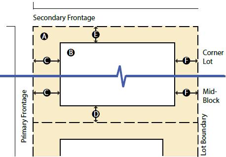
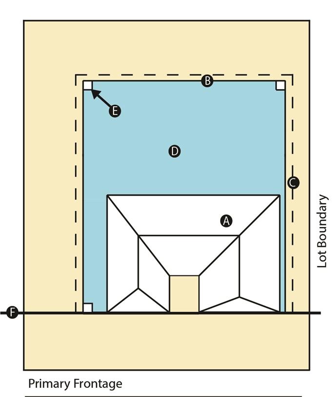
Table 1 - BUILDING PLACEMENT
Figure 1) Figure 1 - Building Placement
A.
B.
C.
D.
E.
F. Minimum Rear Yard Setback 20 feet 3
G. Minimum Distance Between Buildings
Footnotes:
1.The maximum density is unlimited. However, application of standards set forth in LVMC 19.06.040(I) and any height limit on development may impose a de facto limitation on density in all areas.
2.Maximum dwelling units per acre (DUA) is determined by the underlying General Plan Designation and may not exceed the density permitted under said designation.
3.Where the rear twenty feet of the lot has direct access to an alley and is used for the on-site parking, the rear yard setback area may be covered by a roof provided it is otherwise open on three sides.
4.Corrects a publishing error in Table 1 which indicated Units per Lot. (4/16/2020)
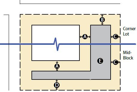
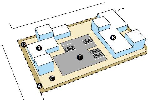
Table 2 - ACCESSORY STRUCTURES
Figure
2) Figure 2 - Accessory Structures
C.
D.
E. Size and Coverage
Footnotes:
Not to exceed 50% of the floor area of the principal dwelling unit 1
1.The aggregate total of the ground floor areas of all accessory buildings shall not cover more than 50 percent of the rear yard area.
Table 3 - BUILDING HEIGHT (see Figure 3)
A. Stories
B. Floors
C. Flat Roof - Max. Height
D. Pitched Roof - Max. Height
1,2
E. Accessory Bldg. - Stories
Not to exceed 2 stories, 35 feet in height or the height of the principal dwelling unit, whichever is less
Figure 3 - Building Height
Footnotes:
1.Building heights may be affected by the residential adjacency standards set forth in LVMC 19.06.040(I).
2.Except for parcels located within the revitalization area described in this Footnote 2, the maximum building height for mixed-use development is ten stories, or one hundred fifty feet, whichever is less. For purposes of this Footnote 2, the revitalization area encompasses locations that are included within the following Areas of the City, as described in Chapter 2 of the Master Plan, Sections IIA through IIF: Downtown Las Vegas, East Las Vegas, West Las Vegas, Downtown South, Charleston, and Twin Lakes.
Table 4 - Patio Cover (see Figure 4)
A. Principal Dwelling Unit
B. Patio Cover Setback to Post
C. Patio Cover Overhang
5 feet - Rear 5 feet - Side 5 feet - Corner Side
May overhang 2 feet beyond the patio cover setback to post requirement
D. Patio Cover Buildable Envelope
E. Patio Cover Support Columns
F. Front Yard Setback
Must be located within the required Setbacks
Patio Cover may not extend into the required front yard setback area for the principal dwelling unit, with the exception of an overhang not to exceed 2 feet
Figure 4 - Patio Cover
(Ord. 6652 §10, 11/07/18)
Table 5 - Landscape Buffers and Turf Limitations (see Figure 5)
1.Nonresidential development shall have a minimum landscape buffer width of 15 feet adjacent to a right-of-way and eight feet along interior lot lines.
2.When adjacent to or across the street from an existing single-family residential use or zoning district, the buffer shall be increased to 15 feet.
3.When building setbacks are less restrictive, the setbacks shall prevail.
Table 6 – Parking (see Figure 5)
1.On-site parking requirements for the applicable use shall be governed by LVMC 19.12.060.
2.For any multi-family, mixed-use or non-residential development, the parking area design standards of LVMC 19.08.110 shall apply.
3.Handicapped parking for multi-family residential units shall be provided at the rate of one space for each dwelling unit that is designed for occupancy by the handicapped, or as otherwise required by the Building Code.
4.Guest parking, where required, shall be evenly spread throughout the development, and is subject to the requirements of LVMC 19.08.110 and 19.18.030 with regard to the design of the spaces and the number of spaces required, including handicap accessible spaces.
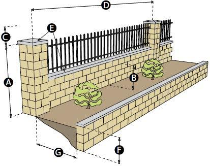
Table 7 - Fences And Walls
Front Yard Wall/Fence (see Figure 6)
A. Maximum primary wall height 5 feet
B. Maximum solid wall base height 2 feet
C. Maximum Ornament height above wall 18 inches
D. Maximum on-center distance between Pilasters 24 feet
E. Decorative Cap feature 5 inches
Front Yard Wall/Fence with Standard Stepback 1
F.
G.
Footnotes:
Figure
6 - Front Yard Wall/Fence with Standard Stepback
1. Retaining walls along the front property line may not exceed two feet in height. Where the grade of the front yard slopes at a ratio greater than 2:1, multiple retaining walls may be constructed, provided there is a minimum distance of five feet between retaining walls for landscaping. (See Figure 6).
Table 8
- Perimeter and Retaining Walls
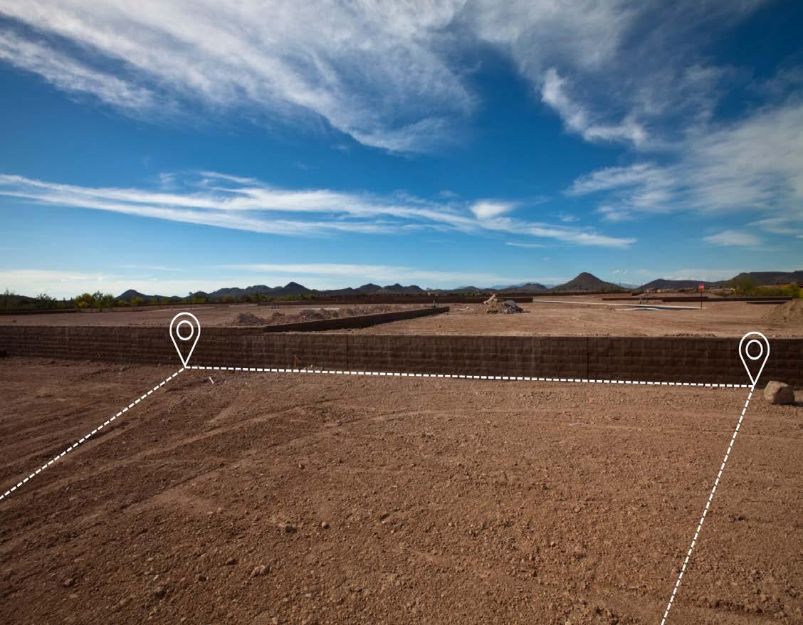
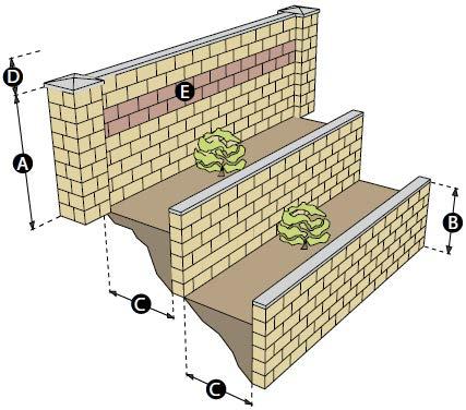
(see Figure 7) Figure 7 - Retaining and Perimeter Wall
D.
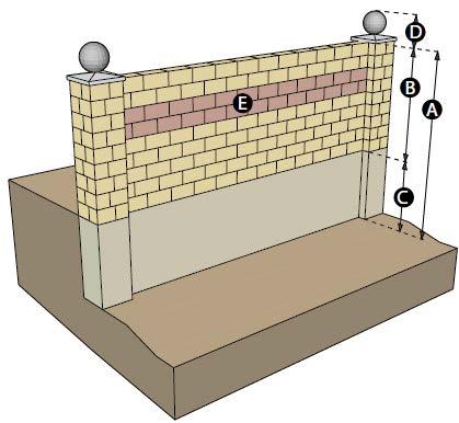
Table 9 - Perimeter and Retaining Walls Standard Stepback (see Figure 8)
A. Maximum Primary wall Height 6 - 8 feet
B. Maximum Secondary wall Height 4 feet
C. Minimum spacing between wall sections 5 feet
D. Maximum Ornament Height 18 inches
E. Contrasting Material 20%
Figure 8 - Retaining and Perimeter Wall Standard Stepback
(Ord. 6652 §10, 11/07/18)
(Ord. 6788 §10, 21/07/21)
(Ord. 6833 §13 & 14, 03/15/23)
ZONING MAP
This map is a copy of public record and is provided solely for informational purposes.
WFG National Title assumes no liability for variations, if any, in dimensions, area or location of the premises or the location of improvements.
The MAPS and DATA are provided without warranty of any kind, expressed or implied. Date Created: 07/28/2024