DEVELOPER PACKET

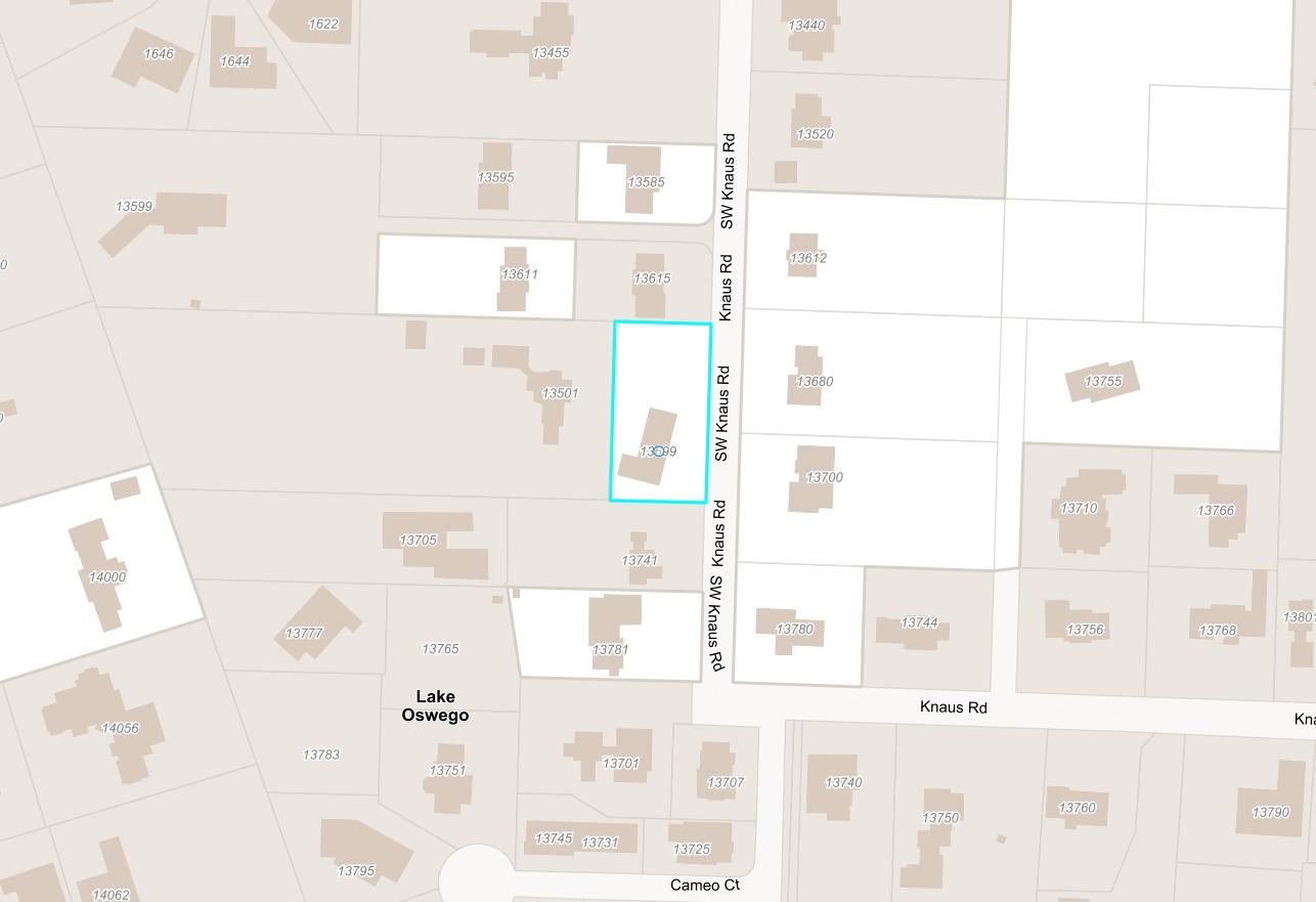
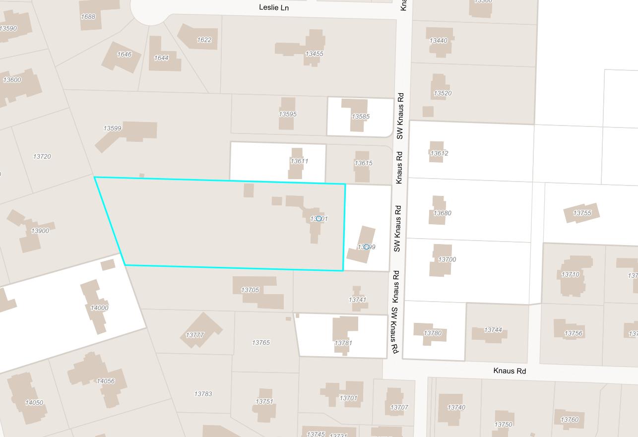
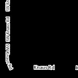
13501 & 13699 SW KNAUS RD
LAKE OSWEGO, OR 97034
Compliments of WFG National Title Insurance Company Customer Service Department

Property Details
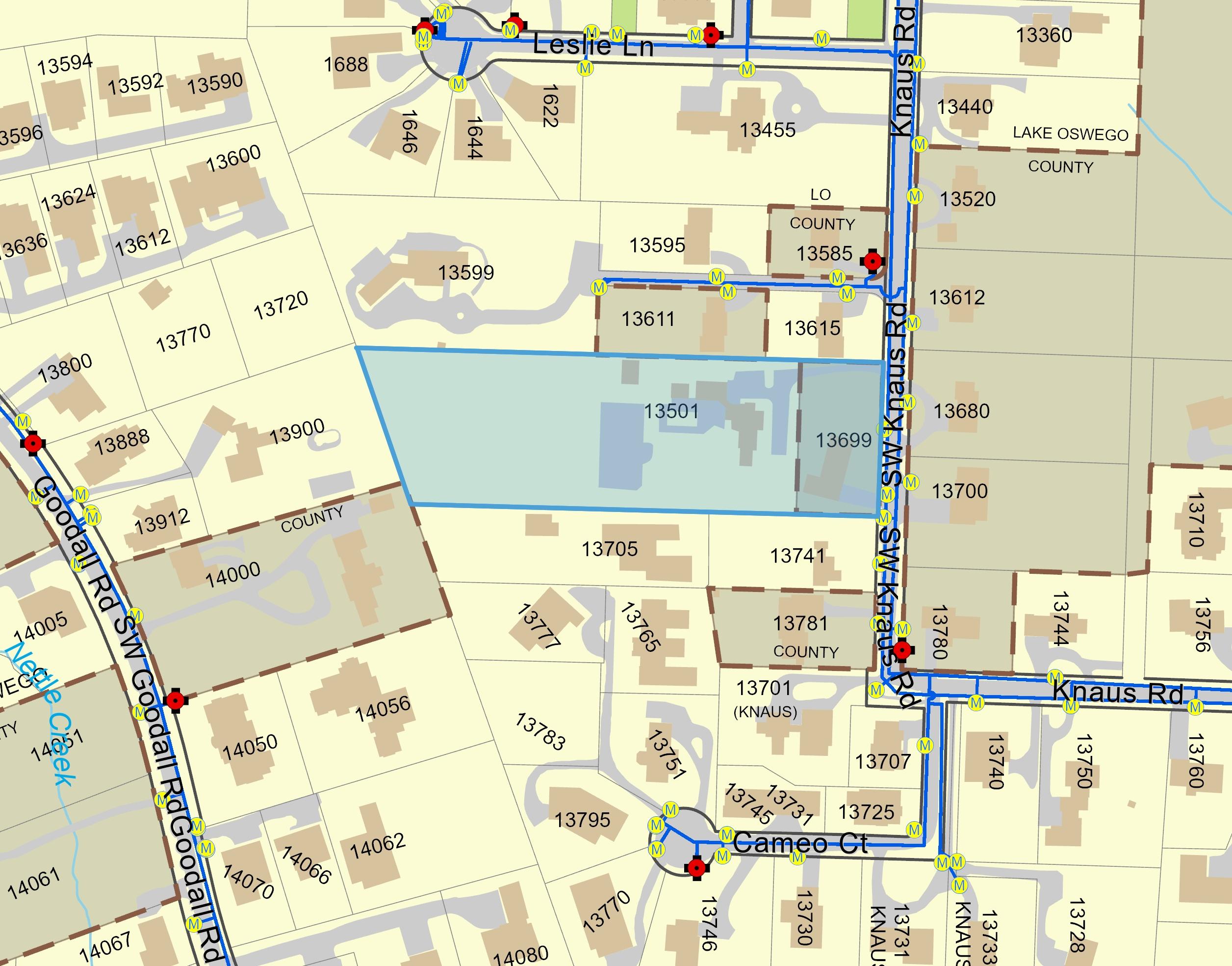
Utility As-Builts (Water & Sewer)
Zoning Information
Custom Maps
Community Information

-Demographics
-Traffic Counts
The information contained is provided by WFG’s Customer Service Department to our customers, and while deemed reliable, is not guaranteed.
Owner:ChrisEddy&DeniseBober
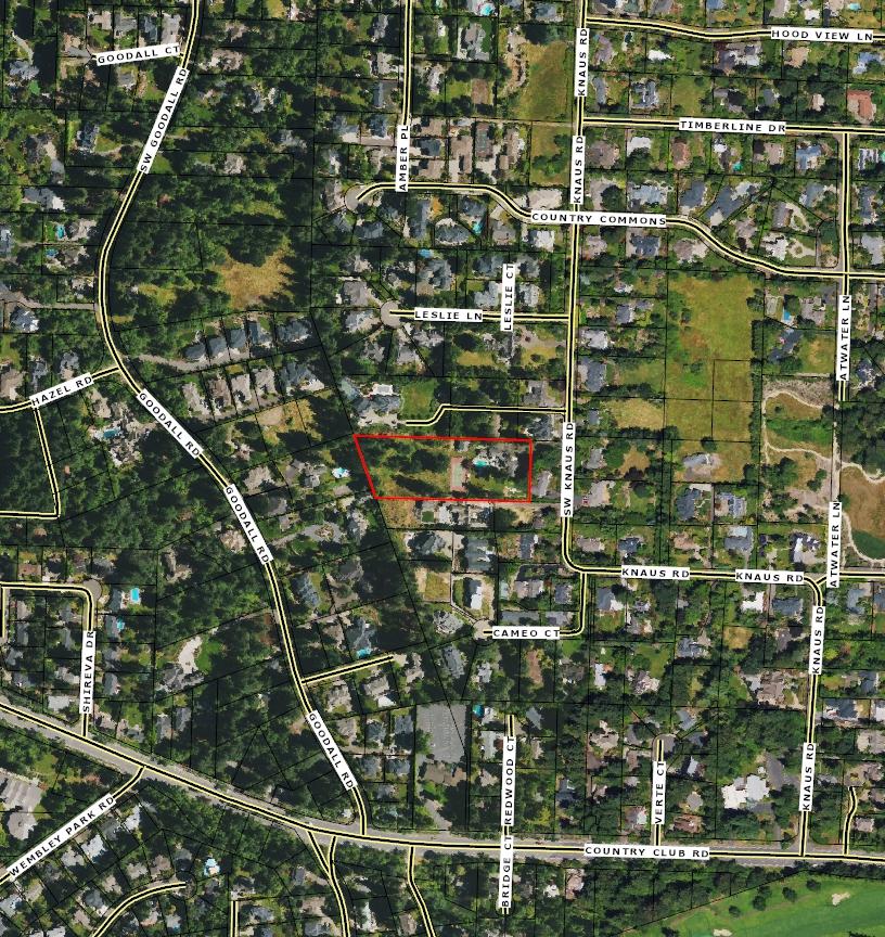
Site:13699SWKnausRdLakeOswegoOR97034
Mail:13699SWKnausRdLakeOswegoOR97034
LocationandSiteInformation
County: Clackamas
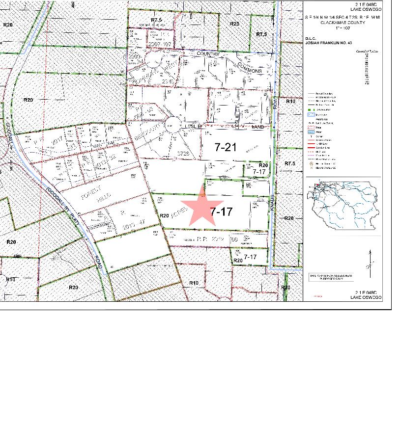
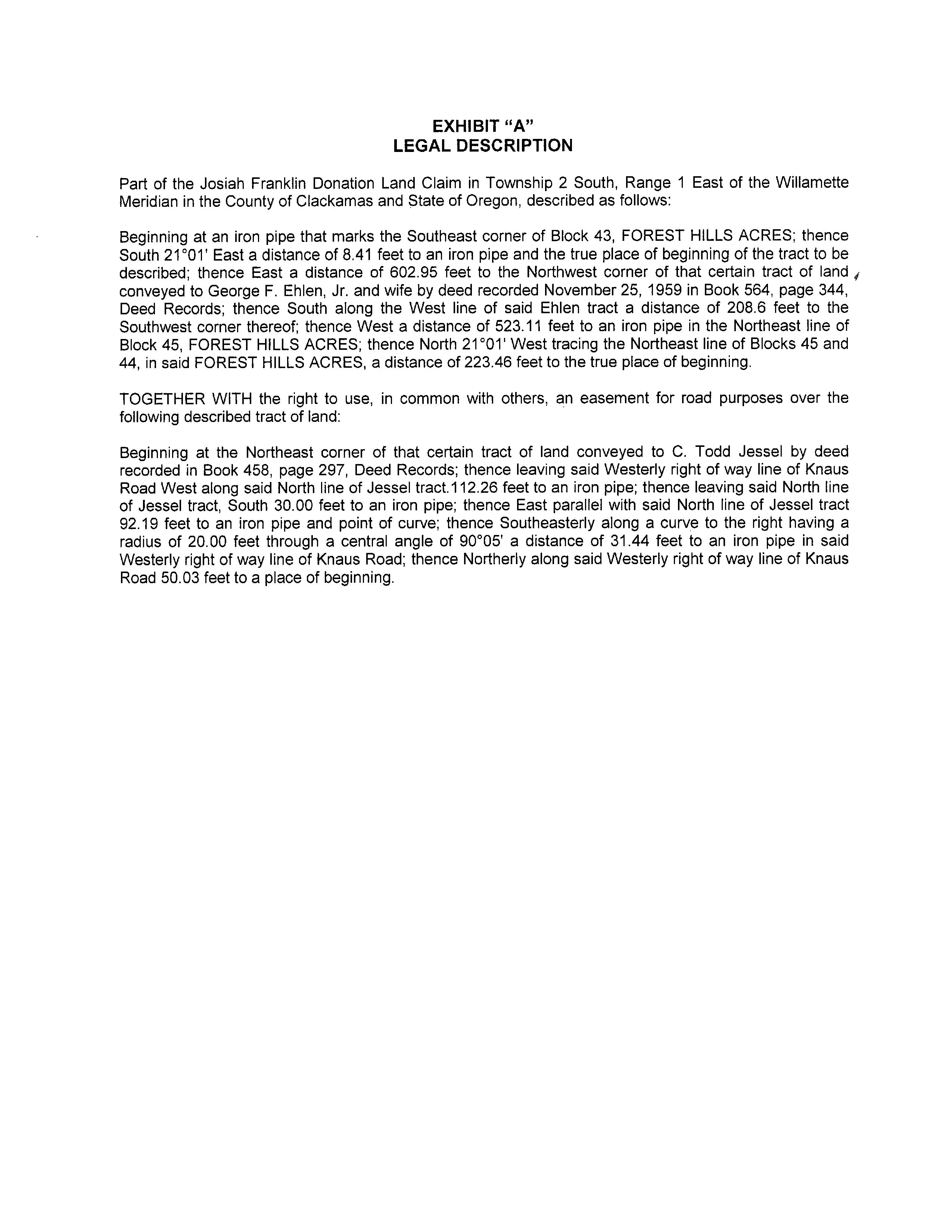
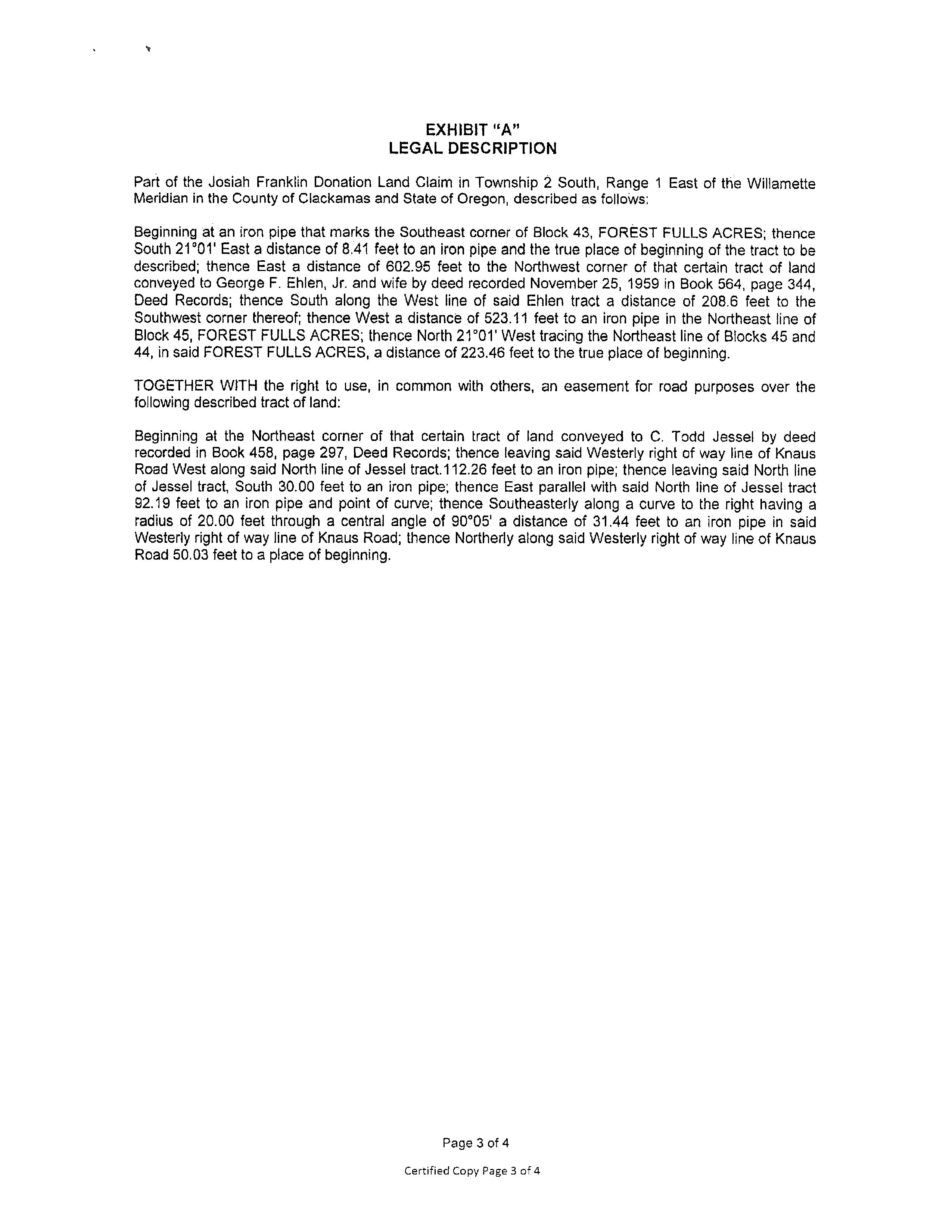
LegalDescription: Section04Township2SRange1E
QuarterBDTAXLOT01100|Y|185,523
APN: 00202202
TaxLot: 21E04BD01100
Twn-Rng-Sec: 02S/01E/04/NW
Neighborhood: ForestHighlands
Subdivision:
LegalLot/Block: 1100
CensusTract/Block: 020100/1086
LotSqFt: 23,522
LotAcres: 054
LandUse: 101-Residentiallandimproved
LandUseSTD: SingleFamilyResidence
CountyBldgUse: RSFR-SingleFamily
#Dwellings:
MapPage/Grid: 656-D5
Zoning: ClackamasCo-R20
Watershed: JohnsonCreek-WillametteRiver
ElementarySchool: ForestHillsElementarySchool HighSchool: LakeOswegoSeniorHighSchool
MiddleSchool: LakeOswegoMiddleSchool SchoolDistrict: LakeOswego
PropertyCharacteristics
TotalLivingArea: 2,406 Bedrooms: 3 YearBuilt/Eff: 1960
FirstFloorSqFt: BathroomsTotal: 25
SecondFloorSqFt: BathroomsFull/Half: 2/1
BasementFin/Unfin: Stories: 1
Heating: ForcedAirGas
Cooling:
Fireplace:
AtticFin/Unfin: Foundation: Concrete Pool: GarageSqFt: RoofMaterial: Composition Kitchen: AssessmentandTaxInformation
SaleandLoanInformation
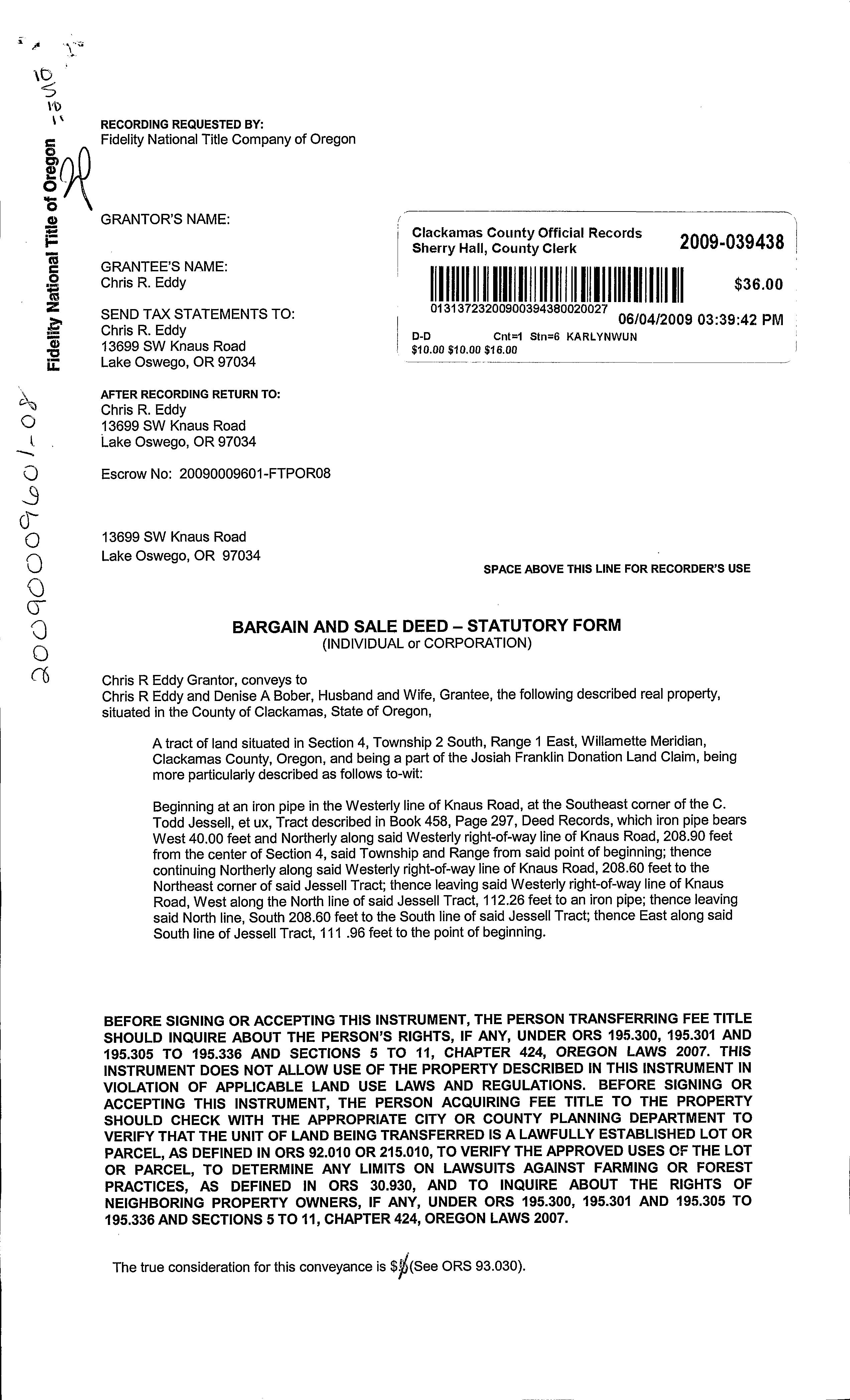
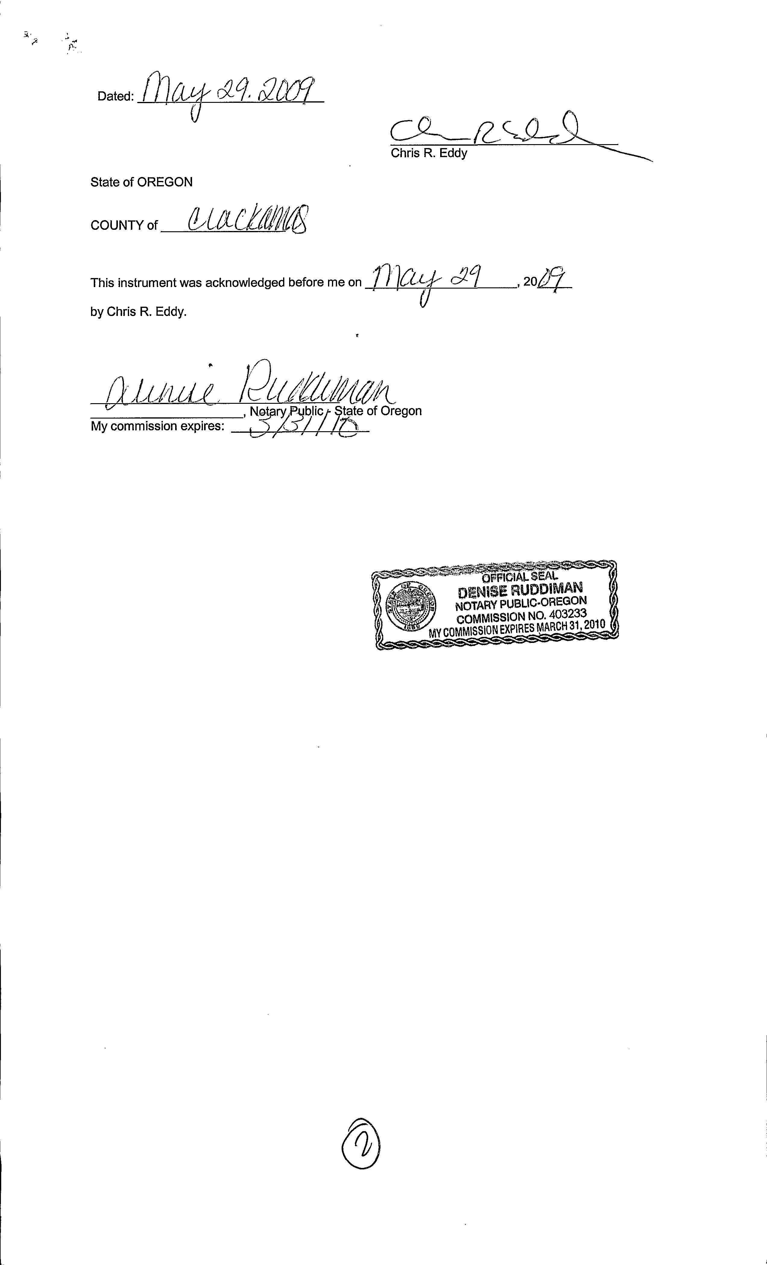
SaleDate: 06/04/2009
SaleAmount:
Document#: 2009-039438
DeedType: Deed
Lender: WELLSFARGOBKNA
LoanAmount: $397,500.00
LoanType: Conventional
Price/SqFt: $000
TitleCo: FIDELITYNATIONALTITLECO/OR SellerName: EDDYCHRISR

PreparedBy:WFGNationalTitleCustomerServiceDepartment 12909SW68thPkwy,Suite350,Portland,OR97223
P:5036031700|3608915474E:cs@wfgnationaltitlecom|cccs@wfgtitlecom
SentryDynamics,Inc anditscustomersmakenorepresentation,warrantiesorconditions,expressorimplied, astotheaccuracyorcompletenessofinformationcontainedinthisreport
ParcelID:00202202
SiteAddress:13699SWKnausRd
SentryDynamics,Inc anditscustomersmakenorepresentations, warrantiesorconditions,expressorimplied,astotheaccuracyor completenessofinformationcontainedinthisreport
ParcelID:00202202
SentryDynamics,Inc anditscustomersmakenorepresentations, warrantiesorconditions,expressorimplied,astotheaccuracyor completenessofinformationcontainedinthisreport
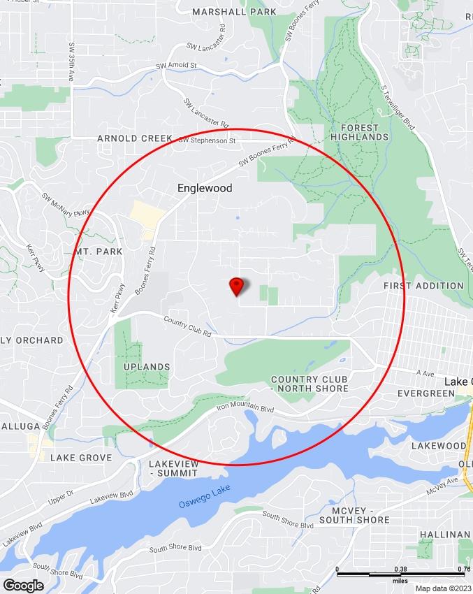
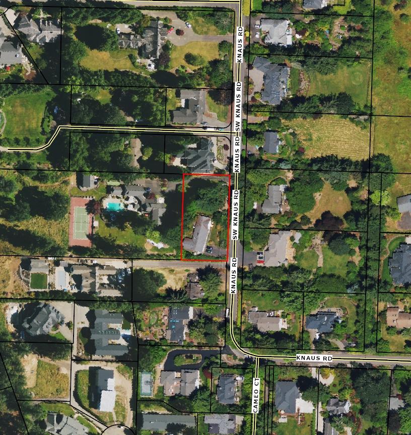 AerialMap
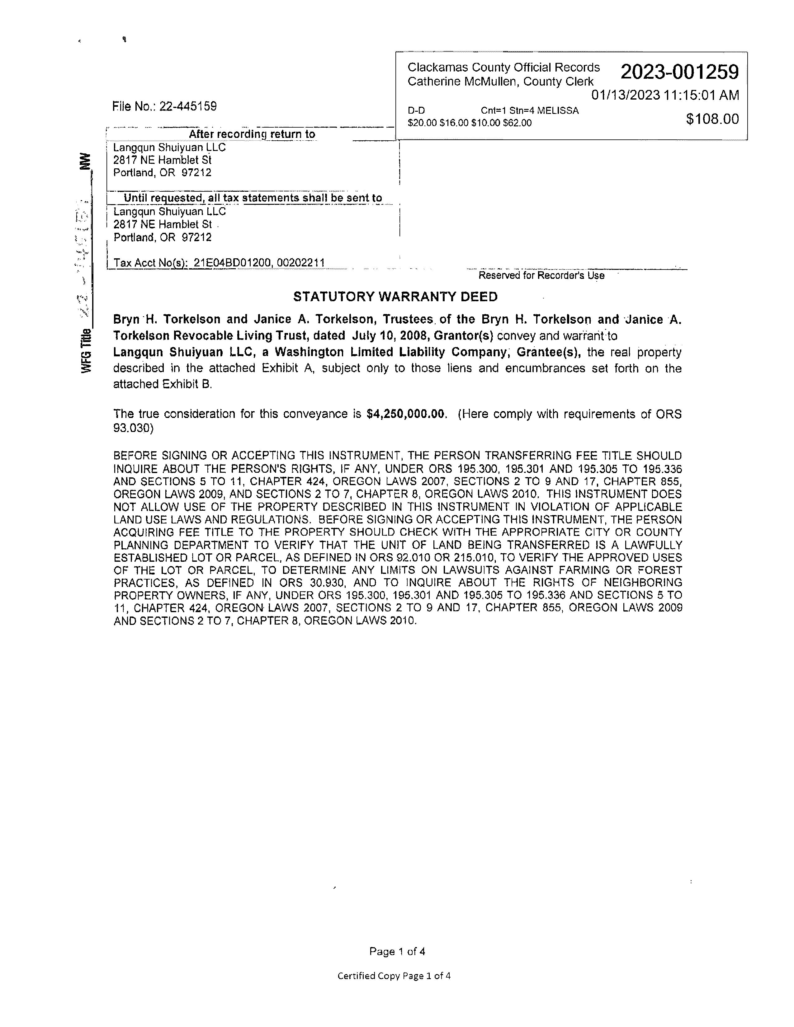
Owner:LangqunShuiyuanLLC
Site:13501SWKnausRdLakeOswegoOR97034
Mail:2817NEHambletStPortlandOR97212
LocationandSiteInformation
County: Clackamas
LegalDescription: Section04Township2SRange1E QuarterBDTAXLOT01200|Y|185,523
APN: 00202211
TaxLot: 21E04BD01200
Twn-Rng-Sec: 02S/01E/04/NW
Neighborhood: ForestHighlands
LotSqFt: 117,612
LotAcres: 270
LandUse: 101-Residentiallandimproved
LandUseSTD: SingleFamilyResidence
CountyBldgUse: RSFR-SingleFamily
#Dwellings:
Subdivision: MapPage/Grid: 656-D5
LegalLot/Block: 1200 Zoning: LakeOswego-R-15
CensusTract/Block: 020100/1086
Watershed: JohnsonCreek-WillametteRiver
ElementarySchool: ForestHillsElementarySchool HighSchool: LakeOswegoSeniorHighSchool
MiddleSchool: LakeOswegoMiddleSchool SchoolDistrict: LakeOswego
PropertyCharacteristics
TotalLivingArea: 4,675
FirstFloorSqFt:
3 Heating: HeatPump
SecondFloorSqFt: BathroomsFull/Half: 3/0 Cooling:
BasementFin/Unfin: Stories: 1
Fireplace:
AtticFin/Unfin: Foundation: Concrete Pool: GarageSqFt: RoofMaterial: Composition Kitchen:
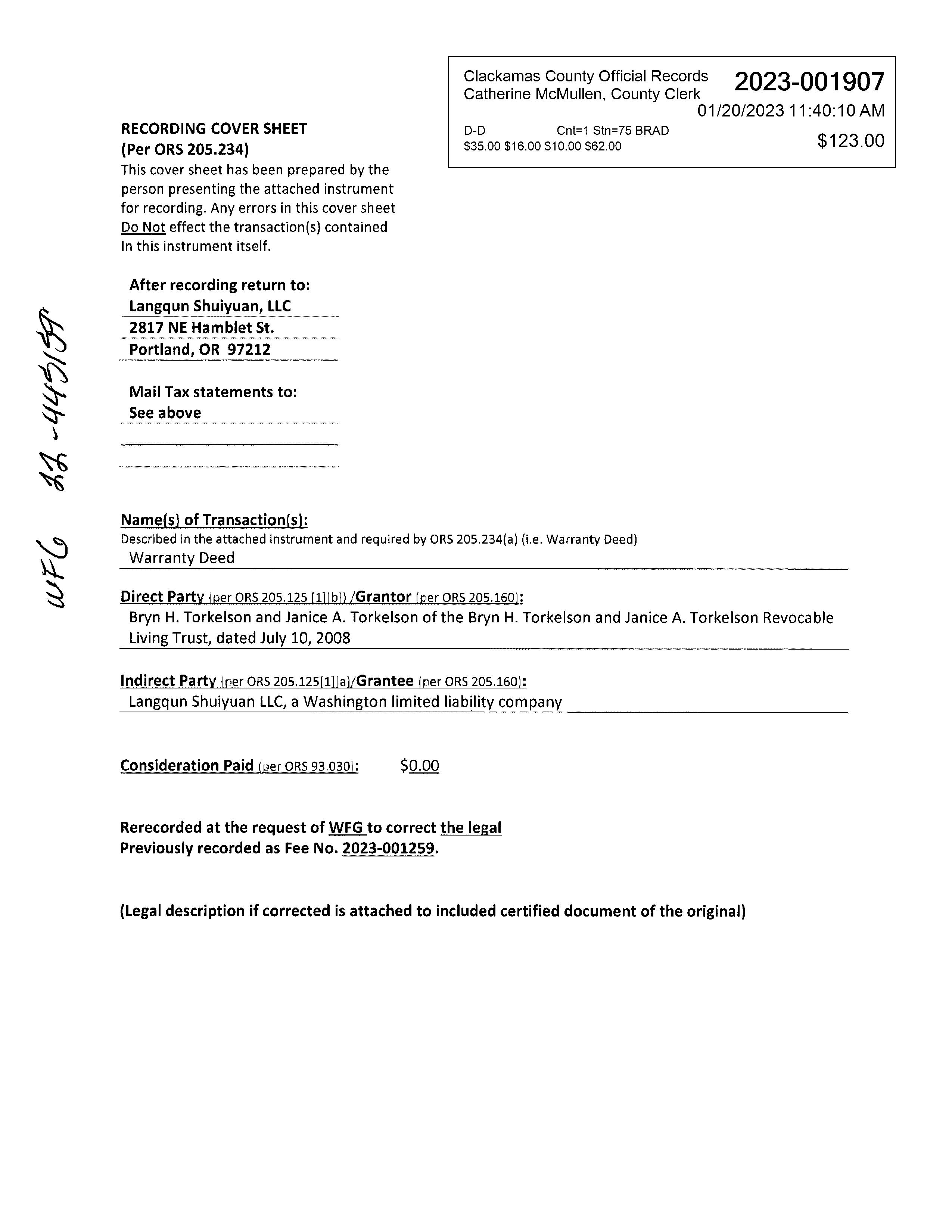
SaleandLoanInformation SaleDate: 01/20/2023
SaleAmount: $4,250,000.00 LoanAmount: $0.00
Document#: 2023-001907 LoanType: DeedType: Deed Price/SqFt: $90909 TitleCo: WFGTITLE SellerName: TORKELSONBH&JAL/TR
PreparedBy:WFGNationalTitleCustomerServiceDepartment 12909SW68thPkwy,Suite350,Portland,OR97223
P:5036031700|3608915474E:cs@wfgnationaltitlecom|cccs@wfgtitlecom
SentryDynamics,Inc anditscustomersmakenorepresentation,warrantiesorconditions,expressorimplied, astotheaccuracyorcompletenessofinformationcontainedinthisreport
ParcelID:00202211
SiteAddress:13501SWKnausRd
SentryDynamics,Inc anditscustomersmakenorepresentations, warrantiesorconditions,expressorimplied,astotheaccuracyor completenessofinformationcontainedinthisreport
ParcelID:00202211
SentryDynamics,Inc anditscustomersmakenorepresentations, warrantiesorconditions,expressorimplied,astotheaccuracyor completenessofinformationcontainedinthisreport
AerialMap
AS -
Water As-Built Maps City of Lake Oswego
Sewer As-Built Maps City of Lake Oswego
The information contained is provided by WFG’s Customer Service Department to our customers, and while deemed reliable, is not guaranteed.
Planned Developments
Water Meters Hydrants
Fire Hydrant
Fire Hydrant (Foreign)
Service Lines
Water Mains
Mainline

Abandoned Foreign
This product is for informational purposes only and may not have been prepared for or be suitable for legal, engineering, or surveying purposes. Users of this information should review, or consult, the primary data and information sources to ascertain the usability of the information. This map represents the best data available at the time of publication. While reasonable effort has been made to insure the accuracy of the information shown on this page, the City of Lake Oswego assumes no responsibility, or liability, for any errors, omissions or use of this information.
Sewer Manholes and Cleanouts
MANHOLE
MANHOLE - PRIVATE CLEANOUT
CLEANOUT - PRIVATE
ABANDONED
Sewer Laterals
Sewer Mainlines
Abandoned
Force Main
Gravity Main
Gravity Lined
Gravity Low Pressure
Private
Pending
Wastewater Zone of Benefit
Wastewater Extension Area
Not Connected
Connected
Properties with Septic System
Planned Sanitary Lines
<all other values>
Future Gravity Line
Future Pressure Line
This product is for informational purposes only and may not have been prepared for or be suitable for legal, engineering, or surveying purposes. Users of this information should review, or consult, the primary data and information sources to ascertain the usability of the information. This map represents the best data available at the time of publication. While reasonable effort has been made to insure the accuracy of the information shown on this page, the City of Lake Oswego assumes no responsibility, or liability, for any errors, omissions or use of this information.
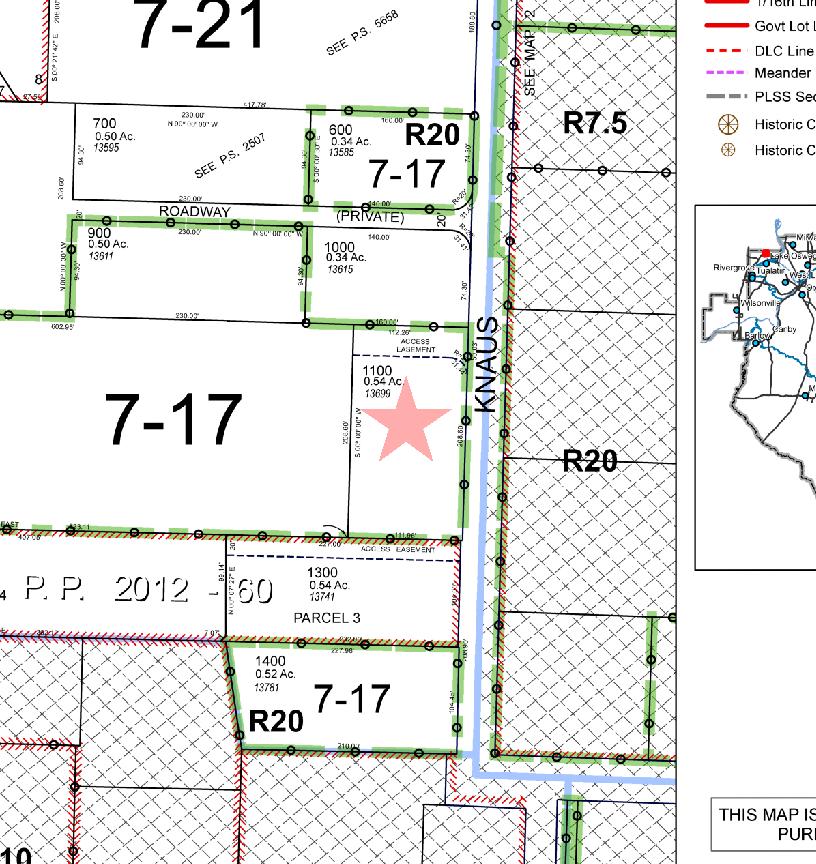
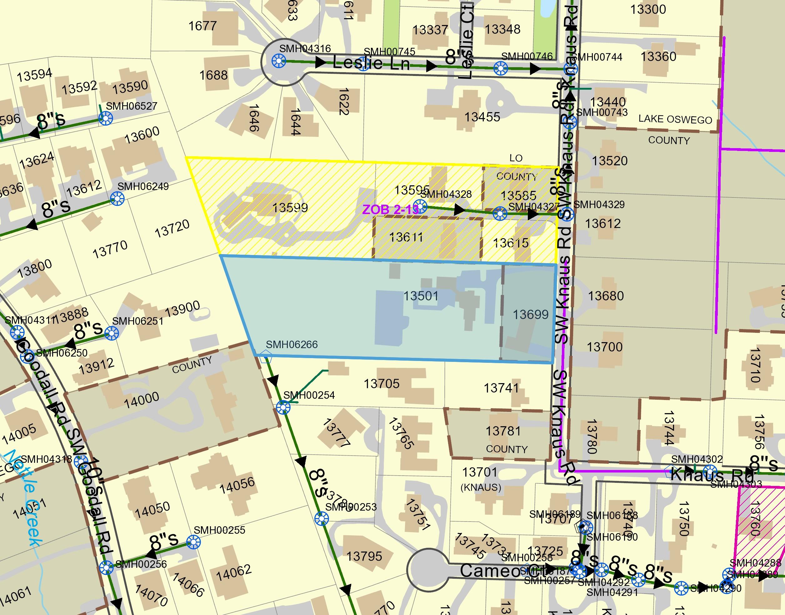
Detailed Zoning Information
13501 SW Knaus Rd
R15 (Residential Multi-Dwelling 3)
13699 SW Knaus Rd
R20 (Residential Multi-Dwelling 3)
Zoning Map
Community Jurisdiction
The information contained is provided by WFG’s Customer Service Department to our customers, and while deemed reliable, is not guaranteed.
315 URBAN LOW DENSITY RESIDENTIAL (R-2.5, R-5, R-7, R-8.5, R-10, R-15, R-20, AND R-30), VILLAGE STANDARD LOT RESIDENTIAL (VR-5/7), VILLAGE SMALL LOT RESIDENTIAL (VR-4/5), VILLAGE TOWNHOUSE (VTH), PLANNED MEDIUM DENSITY RESIDENTIAL (PMD), MEDIUM DENSITY RESIDENTIAL (MR-1), MEDIUM HIGH DENSITY RESIDENTIAL (MR-2), HIGH DENSITY RESIDENTIAL (HDR), VILLAGE APARTMENT (VA), SPECIAL HIGH DENSITY RESIDENTIAL (SHD), AND REGIONAL CENTER HIGH DENSITY RESIDENTIAL (RCHDR) DISTRICTS
315.01 PURPOSE
Section 315 is adopted to implement the policies of the Comprehensive Plan for Low Density Residential, Village Standard Lot Residential, Village Small Lot Residential, Village Townhouse, Medium Density Residential, Medium High Density Residential, High Density Residential, Special High Density Residential, Village Apartment, and Regional Center High Density Residential areas.
315.02 APPLICABILITY
Section 315 applies to land in the Urban Low Density Residential (R-2.5, R-5, R-7, R-8.5, R-10, R-15, R-20, and R-30), Village Standard Lot Residential (VR-5/7), Village Small Lot Residential (VR-4/5), Village Townhouse (VTH), Planned Medium Density Residential (PMD), Medium Density Residential (MR-1), Medium High Density Residential (MR-2), High Density Residential (HDR), Village Apartment (VA), Special High Density Residential (SHD), and Regional Center High Density Residential (RCHDR) Districts, hereinafter collectively referred to as the urban residential zoning districts.
A. Uses permitted in each urban residential zoning district are listed in Table 315-1, Permitted Uses in the Urban Residential Zoning Districts. Uses not listed are prohibited, except:
1. In the PMD District, uses similar to one or more of the listed uses for the PMD District may be authorized pursuant to Section 106, Authorizations of Similar Uses; and
2. In the HDR, SHD, and RCHDR Districts, uses similar to one or more of the listed limited uses for the applicable zoning district may be authorized pursuant to Section 106.
B. As used in Table 315-1:
1. “P” means the use is a primary use.
2. “A” means the use is an accessory use.
Last Amended 9/5/23
315-1
3. “L” means the use is a limited use and shall be developed concurrently with or after a primary use is developed on the same site.
4. “C” means the use is a conditional use, approval of which is subject to Section 1203, Conditional Uses
5. “CPUD” means the use is allowed as a conditional use in a planned unit development.
6. “X” means the use is prohibited.
7. Numbers in superscript correspond to the notes that follow Table 315-1.
C. Permitted uses are subject to the applicable provisions of Subsection 315.04, Dimensional and Building Design Standards; Section 1000, Development Standards; and Section 1100, Development Review Process
A. General: Dimensional and building design standards applicable in the urban residential zoning districts are listed in Tables 315-2, Dimensional and Building Design Standards in the Urban Low Density Residential Zoning Districts; 315-3, Dimensional and Building Design Standards in the VR-4/5, VR-5/7, and VTH Districts; and 315-4, Dimensional Standards in the PMD, MR-1, MR-2, HDR, VA, SHD, and RCHDR Districts. As used in Tables 315-2 through 315-4, numbers in superscript correspond to the notes that follow each table.
Modifications: Modifications to the standards in Tables 315-2 through 315-4 are established by Sections 800, Special Use Requirements; 904, Height Exceptions; 1012, Lot Size and Density; 1107, Property Line Adjustments; and 1205, Variances Except in the HDR, SHD, and RCHDR Districts, modifications to the standards in these tables also are established by Section 903, Setback Exceptions.
Last Amended 9/5/23
315-2
Accessory Buildings and Uses, Customarily Permitted, such as amateur (Ham) radio antennas and towers, arbors, bicycle racks, carports, citizen band transmitters and antennas, cogeneration facilities, courtyards, decks, decorative ponds, driveways, electric vehicle charging stations, family child care homes, fountains, garages, garden sheds, gazebos, greenhouses, HVAC units, meeting facilities, outdoor kitchens, parking areas, patios, pergolas, pet enclosures, plazas, property maintenance and property management offices, recreational facilities (such as bicycle trails, children’s play structures, dance studios, exercise studios, playgrounds, putting greens, recreation and activity rooms, saunas, spas, sport courts, swimming pools, and walking trails), rainwater collection systems, satellite dishes, self-service laundry facilities, shops, solar energy systems, storage buildings/rooms, television antennas and receivers, transit amenities, trellises, and utility service equipment
Last Amended 9/5/23
315-3
Uses, unless such a use is specifically listed as a primary, accessory, limited, conditional, or prohibited use in the applicable zoning
Offices, including accounting services, administrative, business, corporate, and professional offices, but not including offices for governmental uses. Examples include offices for the following: architectural services, business management services, call centers, employment agencies, engineering services, income tax services, insurance services, legal services, manufacturer’s representatives, office management services, property management services, real estate agencies, and travel agencies.
Offices and Outpatient Clinics
both of which may include associated pharmacies and laboratories for healthcare services, such as acupuncture, chiropractic, counseling, dental, massage therapy, medical, naturopathic, optometric, physical therapy, psychiatric, occupational therapy, and speech therapy
Last Amended 9/5/23
Recreational Uses, GovernmentOwned, including parks, amphitheaters; arboreta; arbors, decorative ponds, fountains, gazebos, pergolas, and trellises; ball fields; bicycle and walking trails; bicycle parks and skate parks; boat moorages and ramps; community buildings and grounds; community and ornamental gardens; courtyards and plazas; equine facilities; fitness and recreational facilities, such as exercise equipment, gymnasiums, and swimming pools; miniature golf, putting greens, and sports courts; picnic areas and structures; play equipment and playgrounds; nature preserves and wildlife sanctuaries; tables and seating; and similar recreational uses18
Recreational Uses, including boat moorages, country clubs, equine facilities, gymnastics facilities, golf courses, parks, and swimming pools18
Recyclable Drop-Off Sites, subject to Section 819
315-9
Last Amended 9/5/23
Retailing whether by sale, lease, or rent of any of the following new or used products: apparel, appliances, art, art supplies, beverages, bicycle supplies, bicycles, books, cameras, computers, computer supplies, cookware, cosmetics, dry goods, electrical supplies, electronic equipment, firewood, flowers, food, furniture, garden supplies, gun supplies, guns, hardware, hides, interior decorating materials, jewelry, leather, linens, medications, music (whether recorded or printed), musical instruments, nutritional supplements, office supplies, optical goods, paper goods, periodicals, pet supplies, pets, plumbing supplies, photographic supplies, signs, small power equipment, sporting goods, stationery, tableware, tobacco, toiletries, tools, toys, vehicle supplies, and videos
Last Amended 9/5/23
Services, Commercial— Maintenance and Repair of any of the following: appliances, bicycles, electronic equipment, guns, housewares, musical instruments, optical goods, signs, small power equipment, sporting goods,
Services, Commercial Maintenance and Repair of any of the following: all-terrain vehicles, automobiles, light trucks, motorcycles,
Services, Commercial Miscellaneous, including food lockers, interior decorating, locksmith, upholstering, and veterinary
Services, Commercial Personal and Convenience, including barbershops, beauty salons, dry cleaners, laundries, photo processing, seamstresses, shoe repair, tailors, and tanning salons. Also permitted are incidental retail sales of products related to the service provided.
Temporary Buildings for Uses
to Construction Work Such buildings shall be removed upon completion or abandonment of the construction work.
Last Amended 9/5/23
1 An accessory kitchen is permitted only in a townhouse, a detached single-family dwelling, or a manufactured home, to the extent that these dwelling types are permitted in the applicable zoning district. Only one accessory kitchen is permitted in each townhouse, detached single-family dwelling, or manufactured home.
2 The limited use is permitted subject to the following criteria:
a. The use shall be allowed only in a development meeting the minimum residential density for the entire site area.
b. The building floor area occupied by all limited uses shall not exceed 15 percent of the building floor area occupied by primary uses.
c. No outdoor storage of materials associated with the use shall be allowed.
d. The use shall not be of a type or intensity which produces odor, smoke, fumes, noise, glare, heat, or vibration which are detectable outside of the premises and are incompatible with primary uses.
3 The use shall be developed in conjunction with a primary use on the same site, which is developed at the maximum allowed density for the site area.
4 The limited use is permitted subject to the following criteria:
a. The use shall be allowed only in a development meeting the minimum residential density for the entire site area.
b. No outdoor storage of materials or display of merchandise associated with the use shall be allowed.
5 The limited use is permitted subject to the following criteria:
a. The use shall be part of a development within a Design Plan area.
b. The use shall be allowed only in a development meeting the minimum residential density for the entire site area.
c. The building floor area occupied by all limited uses shall not exceed 10 percent of the building floor area occupied by primary uses. No single limited commercial use shall occupy more than 1,500 square feet of building floor area.
d. Allowing the use will not adversely impact the livability, value, and appropriate development of the site and abutting properties considering the location, size, design, and operating characteristics of the use.
e. No outdoor storage of materials associated with the use shall be allowed.
f. The use shall not be of a type or intensity which produces odor, smoke, fumes, noise, glare, heat, or vibration which are detectable outside of the premises and are incompatible with primary uses.
6 The use shall be developed in conjunction with a primary use on the same site, which is developed at the maximum allowed density for the site area. The building floor area occupied by all limited uses, and by all conditional uses that are subject to Note 6, shall not exceed 10 percent of the building floor area occupied by primary uses.
7 Except as allowed by Section 839, Accessory Dwelling Units, or Section 1204, Temporary Permits, each lot of record may be developed with only one of the following: detached single-family dwelling, manufactured home, duplex, triplex, quadplex, townhouse, or cottage cluster development.
8 The development of a triplex, quadplex, townhouse, or cottage cluster is subject to Section 845, Triplexes, Quadplexes, Townhouses, and Cottage Clusters.
315-14
Last Amended 9/5/23
9 A manufactured dwelling park that also qualifies as a cottage cluster development pursuant to Section 845, Triplexes, Quadplexes, Townhouses, and Cottage Clusters, is a primary use. All other manufactured dwelling parks are conditional uses.
10 A manufactured dwelling park that also qualifies as a cottage cluster development pursuant to Section 845, Triplexes, Quadplexes, Townhouses, and Cottage Clusters, is a primary use. All other manufactured dwelling parks are prohibited.
11 For a townhouse, the minimum lot size is 3,630 square feet in the MR-1 District and 2,420 square feet in the MR-2 District unless, as part of an application filed pursuant to Section 1105, Subdivisions, Partitions, Replats, Condominium Plats, and Vacations of Recorded Plats, new lots or parcels are proposed for townhouses. In that case, there is no minimum lot size provided that the density of the entire development complies with the maximum density standards of Subsection 1012.05.
12 Only indoor facilities are permitted.
13 Uses similar to this use may be authorized pursuant to Section 106, Authorizations of Similar Uses.
14 A use may be permitted as a home occupation, subject to Section 822, Home Occupations, even if such use is also identified in another use listing in Table 315-1.
15 Hotels in the SHD District are limited to a maximum of 80 units per gross acre.
16 Public utility facilities shall not include shops, garages, or general administrative offices.
17 The base of such towers shall not be closer to the property line than a distance equal to the height of the tower.
18 This use may include concessions, restrooms, maintenance facilities, and similar support uses.
19 Any principal building, swimming pool, or use shall be located a minimum of 45 feet from any other lot in a residential zoning district.
20 Any principal building or swimming pool shall be located a minimum of 30 feet from any other lot in a residential zoning district.
21 Recyclable drop-off sites are permitted only if accessory to an institutional use.
22 The use is subject to the following standards and criteria:
a. The use shall be located in a planned unit development (PUD) with a minimum of 100 dwelling units. No building permit for the use shall be issued until a minimum of 100 dwelling units are constructed within the PUD.
315-15
Last Amended 9/5/23
b. The area occupied by all uses subject to Note 22 and located in a single PUD, including their parking, loading, and maneuvering areas, shall not exceed a ratio of one-half acre per 100 dwelling units in the PUD.
c. The use shall be an integral part of the general plan of development for the PUD and provide facilities related to the needs of residents of the PUD.
d. The use shall be located, designed, and operated to efficiently serve frequent trade and service needs of residents of the PUD and not persons residing elsewhere.
e. The use shall not, by reason of its location, construction, manner or hours of operation, signs, lighting, parking arrangements, or other characteristics, have adverse effects on residential uses within or adjoining the PUD.
23 Only commercial schools are permitted, and such schools are not subject to Section 805, Schools.
24 Temporary signs regulated under Subsection 1010.13(A) are a primary use.
25 Utility carrier cabinets are a conditional use if the combined volume of all cabinets located on a single lot exceeds the applicable maximum established pursuant to Subsection 830.01(A).
315-16
Last Amended 9/5/23
Accessory building larger than 500 square feet and accessory to a primary dwelling: 20 feet or the height of the primary dwelling, whichever is greater
35 feet
Equal to the ground floor area of the primary dwelling and the ground floor area of any non-residential space that shares a common wall with the primary dwelling (e.g., an attached garage)
Standard R-2.5 R-5 R-7 R-8.5 R-10 R-15 R-20 R-30
Building Design Standards for Detached SingleFamily Dwellings, Duplexes, and Manufactured Homes12
A minimum of three of the following features are required: a covered porch at least two feet deep; an entry area recessed at least two feet from the exterior wall to the door; a bay or bow window (not flush with the siding); an offset on the building face of at least 16 inches from one exterior wall surface to the other; a dormer; a gable; roof eaves with a minimum projection of 12 inches from the intersection of the roof and the exterior walls; a roofline offset of at least 16 inches from the top surface of one roof to the top surface of the other; an attached garage; orientation of the long axis and front door to a street; a cupola; a tile, shake, or composition roof; and horizontal lap siding. The required features must be on the same facade as a front door unless the feature is unrelated to a facade (e.g., roofing material).
Building Design Standards for Buildings
Accessory to a Dwelling
Freight shipping containers shall be located behind the building line of the dwelling, and the exterior shall be painted similar in color to that of the dwelling.
Metal buildings greater than 500 square feet in area shall include roof overhangs, gutters, and downspouts, and the exterior shall be painted similar in color to that of the dwelling.
1 The minimum lot size standards apply as established by Sections 1012 and 1107. Notwithstanding the minimum lot size standard, a lot of record may be developed subject to other applicable standards of this Ordinance, except minimum lot size standards of Section 800 apply.
2 In a planned unit development, there is no minimum lot size. However, the DLA standard applies pursuant to Section 1012, Lot Size and Density.
3 For townhouses developed pursuant to Section 845, Triplexes, Quadplexes, Townhouses, and Cottage Clusters, there is no minimum lot size and the DLA shall be one-third of the DLA.
4 For townhouses developed pursuant to Section 845, Triplexes, Quadplexes, Townhouses, and Cottage Clusters, there is no minimum lot size and the DLA shall be one-quarter of the DLA in the applicable zoning district.
5 Maximum lot coverage in a planned unit development is 65 percent.
315-18
Last Amended 9/5/23
6 For development on a middle housing lot, the lot coverage is calculated on the entire parent lot that was divided through a middle housing land division.
7 For a swimming pool that is accessory to a dwelling, the minimum front setback is 10 feet, and the minimum side and rear setbacks are three feet.
8 In a planned unit development, there are no minimum rear and side setbacks except from rear and side lot lines on the perimeter of the final plat. In a zero-lot-line development, approved pursuant to Subsection 1105.03(B), there are no minimum rear and side setbacks for detached single-family dwellings, manufactured homes, and structures accessory to such dwellings, except from rear and side lot lines on the perimeter of the final plat. Where either of these standards applies, it supersedes any other rear or side setback standard in Table 315-2.
9 On a middle housing lot, there are no minimum setbacks, except from lot lines on the perimeter of the final plat or lot lines abutting a road or access drive.
10 The following exceptions apply to a lot of record that is 6,000 square feet or less in area and was created prior to the application of an Urban Low Density Residential District to the subject lot of record:
a. The minimum rear setback for a detached single-family dwelling, a manufactured home, or a duplex is 10 feet.
b. The minimum side setback for a detached single-family dwelling, a manufactured home, or a duplex is a total of five feet (e.g., five feet from one side lot line and zero from the other, three feet from one side lot line and two feet from the other) except that if the subject lot of record has more than two side lot lines, the minimum side setback from each of the additional side lot lines is five feet.
315-19
Last Amended 9/5/23
11
If an accessory building is located behind the building line of the main building, the applicable minimum rear and side setback standards for that accessory building are based on the accessory building area and accessory building height, as follows:
12 These building design standards do not apply to temporary dwellings approved pursuant to Section 1204, Temporary Permits, or to manufactured homes in manufactured dwelling parks.
315-20
Last Amended 9/5/23
Table 315-3: Dimensional and Building Design Standards in the VR-5/7, VR-4/5, and VTH Districts
6 feet at or behind the building line of the dwelling closest to front lot line(s) or, in the case of non-residential development, of the main building or 4 feet forward of the building line of the dwelling closest to front lot line(s) or, in the case of nonresidential development, of the main building. Maximum Driveway Width
16 feet at the front lot line, unless the subject property is developed with a garage that has at least three side-by-side (as opposed to tandem) garage bays, in which case the maximum driveway width shall be 24 feet at the front lot line9
See Subsection 1005.11(B)(4).
Minimum Percentage of Lots in a Subdivision that Shall have Alley Motor Vehicle Access Only
Garage/Carport Design for Primary Dwellings
50 percent of lots with frontage on an alley Not Applicable
A minimum of 50 percent of the primary dwellings in a development shall have a recessed garage/carport or no garage/carport. The remaining 50 percent may have a nonrecessed garage/carport.9,10,11
All garages and carports shall be recessed.10
See Subsection 1005.11(B).
Last Amended 9/5/23
Building Design Standards9,23
Front facades shall be designed with balconies and/or bays. Facades facing a street shall not consist of a blank wall.
Window trim shall not be flush with exterior wall treatment. Windows shall be provided with an architectural surround at the jamb, head, and sill.
Hipped, gambrel, or gabled roofs are required. Flat roofs are prohibited.
If the lot on which the dwelling is located has street frontage on a local or connector street, or a private street that meets local or connector street design standards, then the primary entry to the dwelling shall be accessed directly from and be visible from one of those streets.
A minimum of 50 percent of the dwellings in a subdivision shall have a porch or patio. The porch or patio shall be covered, placed immediately adjacent to the primary entry to the dwelling, have a minimum unobstructed depth of six feet, and have a minimum unobstructed width of 10 feet.
See Subsections 1005.03(F) and 1005.11(A).
Last Amended 9/5/23
315-23
Maximum Building Area Only one accessory building may exceed 100 square feet, and it shall have a maximum ground floor area of 600 square feet, or the square footage of the ground floor of the primary dwelling, whichever is less.
Only one accessory building may exceed 100 square feet, and it shall have a maximum ground floor area of 500 square feet, or the square footage of the ground floor of the primary dwelling, whichever is less.
Minimum Front Setback Greater than or equal to the front setback of the facade of the primary dwelling (not including porches, patios, bays, garages, and architectural features)9,25
Exterior Building Materials Buildings greater than 100 square feet in area shall be constructed with similar exterior building materials to those of the primary dwelling.9
Minimum Rear and Side Setback Standards for Buildings Accessory to a Primary Dwelling in the VR-5/7, VR-4/5, and VTH Districts10,20
> 100 square
if rear lot line does not abut an alley, 6 feet rear if rear lot line does abut an alley26
No minimum on one side, 3 feet on all other sides; 3 feet rear if rear lot line does not abut an alley, 6 feet rear if rear lot line does abut an alley26
No minimum on one side, 5 feet on all other sides; 5 feet rear if rear lot line does not abut an alley, 6 feet rear if rear lot line does abut an alley26
No minimum on one side, 5 feet on all other sides; 5 feet rear if rear lot line does not abut an alley, 6 feet rear if rear lot line does abut an alley26,27
Last Amended 9/5/23
315-24
1 The minimum and maximum lot size standards apply as established by Sections 1012 and 1107. Notwithstanding the minimum and maximum lot size standards, a lot of record may be developed subject to other applicable standards of this Ordinance, except minimum lot size standards of Section 800 apply.
2 For townhouses developed pursuant to Section 845, Triplexes, Quadplexes, Townhouses, and Cottage Clusters, there is no minimum lot size and the DLA shall be one-third of the DLA.
3 The minimum and maximum lot size standards apply only to lots or parcels for townhouses.
4 The maximum lot size standard applies only to lots or parcels for detached single-family dwellings, manufactured homes, or middle housing, except the maximum lot size standard does not apply to a middle housing land division.
5 Alternatively, the average size of all lots in a subdivision, partition, or replat shall not exceed 6,500 square feet.
6 Alternatively, the average size of all lots in a subdivision, partition, or replat shall not exceed 5,000 square feet.
7 Alternatively, the average size of all lots in a subdivision, partition, or replat shall not exceed 2,500 square feet.
8 For development on a middle housing lot, the lot coverage is calculated on the entire parent lot that was divided through a middle housing land division.
9 Except for middle housing developed pursuant to Section 845, Triplexes, Quadplexes, Townhouses, and Cottage Clusters, development on lots in the plat of Sieben Creek Estates (plat no. 3039) is not required to comply with this standard.
10 A recessed garage or carport is a garage or carport with a front setback to the garage door or carport motor vehicle entry that is a minimum of five feet greater (i.e., farther from the front lot line) than the front setback to the facade of the primary dwelling living area (not including porches, patios, bays, and architectural features).
11 A non-recessed garage or carport shall have a front setback to the garage door or carport motor vehicle entry that is a maximum of five feet less (i.e., closer to the front lot line) than the front setback to the facade of the primary dwelling living area (not including porches, patios, bays, and architectural features).
12 The minimum and maximum setback standards do not apply in a Resource Protection Area shown on Comprehensive Plan Map X-SV-1, Sunnyside Village Plan Land Use Plan Map. The maximum setback standards do not apply to cottage clusters developed pursuant to Section 845, Triplexes, Quadplexes, Townhouses, and Cottage Clusters.
13 On a middle housing lot, there are no minimum setbacks, except from lot lines on the perimeter of the final plat or lot lines abutting a road or access drive.
14 A porch or patio, whether covered or not, may extend a maximum of four feet into the minimum front yard depth.
15 Frontage on an accessway shall be considered a front lot line.
315-25
Last Amended 9/5/23
16 On a corner lot, the minimum setback from one front lot line is eight feet, provided that the lot line abuts a road with a functional classification of local or connector.
17 Awnings, porches, bays, and overhangs may extend a maximum of four feet into the minimum front setback
18 If a public utility easement precludes compliance with the maximum front setback standard, the maximum shall be as close to the front lot line as possible.
19 Dwellings located on lots with less than 35 feet of street frontage shall be exempt from the maximum front setback standard.
20 If a lot has more than one front lot line, compliance with the maximum front setback standard is required from only two intersecting front lot lines.
21 In a planned unit development, there are no minimum rear and side setbacks except from rear and side lot lines on the perimeter of the final plat. Where this standard applies, it supersedes any other rear or side setback standard in Table 315-3.
22 Frontage on a pedestrian connection shall be considered a side lot line.
23 For triplexes, quadplexes, and townhouses developed pursuant to Section 845, Triplexes, Quadplexes, Townhouses, and Cottage Clusters, design standards in Section 845 shall apply in addition to standards in Table 315-3.
24 The maximum building height standard applies only to accessory buildings larger than 100 square feet.
25 A garage may be required to be recessed, as defined by Note 11, in order to comply with the standard for garage/carport design for primary dwellings
26 Frontage on a pedestrian connection shall be considered a side lot line, and the minimum setback is five feet.
27 If the rear lot line abuts an alley, a second-story accessory dwelling unit may cantilever a maximum of four feet into the minimum rear setback
Last Amended 9/5/23
315-26
Standard PMD MR-1 MR-2 HDR VA SHD RCHDR
See Subsection 1005.02(L)16
Building Height None None None None 45
None See Subsection 1005.02(L) Minimum
None None
Building Separation 10 feet None None See Subsection 1005.02(L) 20 feet between multifamily dwellings See Subsection 1005.02(L) See Subsection 1005.02(L)
4 On a corner lot developed with a townhouse, the minimum front setback from one front lot line is 10 feet, except that the minimum shall be 20 feet to garage and carport motor vehicle entries.
5 The minimum setback standards of Table 315-2, Dimensional and Building Design Standards in the Urban Low Density Residential Districts, apply to detached single-family dwellings that are nonconforming uses, as well as to structures that are accessory to such dwellings.
315-28
Last Amended 9/5/23
6 If the front or rear lot line abuts Sunnyside Road, the minimum setback shall be 65 feet from the centerline of Sunnyside Road, and the maximum setback shall be 75 feet from the centerline of Sunnyside Road.
7 Awnings, porches, and bays may extend a maximum of six feet into the minimum setback.
8 For dwellings and structures accessory to dwellings, the minimum front setback shall be 15 feet, and there shall be no maximum setback. However, Note 8 does not apply to mixed-use buildings that include dwellings or to structures accessory to such mixeduse buildings.
9 The maximum setback may be exceeded to accommodate plazas identified on Comprehensive Plan Map X-CRC-3, Clackamas Regional Center Area Design Plan Urban Design Elements.
10 In a planned unit development, there are no minimum rear and side setbacks except from rear and side lot lines on the perimeter of the final plat. Where this standard applies, it supersedes any other rear or side setback standard in Table 315-4.
11 For a swimming pool that is accessory to a dwelling, the minimum side and rear setbacks are five feet, unless the side or rear lot line abuts an Urban Low Density Residential, VR-4/5, or VR-5/7 District, in which case the minimum setback shall be 15 feet from the abutting lot line.
315-29
Last Amended 9/5/23
12 The minimum rear and side setback standards for an accessory building are based on the building area and height, as follows:
Building Height
Building Area ≤ 8 feet > 8 feet and ≤ 10 feet > 10 feet ≤ 100 square feet None, if the accessory building is located behind the building line of the main building; otherwise, 3 feet side and rear
3 feet side and rear
Same as primary building minimum setbacks
> 100 square feet and ≤ 200 square feet 3 feet side and rear 3 feet side and rear
> 200 square feet Same as primary building minimum setbacks
Same as primary building minimum setbacks
Same as primary building minimum setbacks
Same as primary building minimum setbacks
13 If the rear lot line abuts a residential zoning district other than HDR, SHD, or RCHDR, the minimum rear setback is 20 feet.
14 If the side lot line abuts an Urban Low Density Residential, VR-5/7, or VR-4/5 District, the minimum side setback for a two-story building is 10 feet.
15 The minimum side setback for a townhouse is five feet from any side lot line where two townhouses do not share a common wall.
16 If the side lot line abuts a residential zoning district other than HDR, SHD, or RCHDR, the minimum side setback is 15 feet.
[Added by Ord. ZDO-249, 10/13/14; Amended by Ord. ZDO-250, 10/13/14; Amended by Ord. ZDO-252, 6/1/15; Amended by Ord. ZDO-253, 6/1/15; Amended by Ord. ZDO-254, 1/4/16; Amended by Ord. ZDO-266, 5/23/18; Amended by Ord. ZDO-268, 10/2/18; Amended by Ord. ZDO280, 10/23/21; Amended by Ord. ZDO-282, 7/1/22; Amended by Ord. ZDO-273, on remand, 5/30/23; Amended by Ord. ZDO-287, 8/3/23; Amended by Ord. ZDO-283, 9/5/23]
315-30
Last Amended 9/5/23

Objectid: 63131
PrimaryAddress: 13699 SW Knaus Rd, Lake Oswego, 97034
Jurisdiction: Clackamas County (http://www.clackamas.us/)
Map Number: 21E04BD
Taxlot Number: 21E04BD01100
Parcel Number: 00202202
Document Number: 2009-039438
Census Tract: 020100
Landclass: 101
Assessment
EstimatedAcres: 0.54
CurrentYearAssessed Value: $383,093.00
Market Building Value: $299,640.00
Market Land Value: $451,993.00
Market Total Value: $751,633.00
Sq Ft: 2406
Bedrooms: 3
Baths: 2
Year Built: 1960
Sale Price: $0.00
Doc Date: 05/29/2009
Doc Type: S
Taxcode: 007017
Schools
Elementary School
Forest Hills Elementary (https://www.losdschools.org/fh)
Lake Oswego
1133Andrews Rd, Lake Oswego, 97034
503-534-2350
Middle School
Lake Oswego Junior High (https://www.losdschools.org/loj)
Lake Oswego
2500 Country Club Rd, Lake Oswego, 97034
503-534-2335
High School
Lake Oswego High (https://www.losdschools.org/lohs)
Lake Oswego
2501 Country Club Rd, Lake Oswego, 97034 503-534-2313
Public Safety
Nearest Fire Station
Lake Oswego Station #214
300 BAve, Lake Oswego 97034
Lake Oswego Fire Dept
Nearest Police Station
Clackamas County Sheriff
Zoning & Development
Designation: R20
Urban Growth Boundary: METRO UGB
Voting Precincts: 283
State House District: 38
State Senate District: 19
Congressional District: 5
Utilities & Districts
Community Planning Organization
Forest Highlands
Sanitary Hauler
Republic Services (https://clackamas.us/recycling/garbage/company.html)
Urban Fee Zone
Park District
Lake Grove Park District
School District
Lake Oswego (http://www.edline.net/pages/Lake_Oswego_School_District)
Environmental & Hazards
Flood
Likely not in a flood zone.
Wildfire
You may be at low to moderate risk.
Earthquake Hazard
You may be at a lower risk.
Soils
48C - Kinton Silt Loam, 8 To 15 Percent Slopes
Approximate Elevation
435.00
North Folk Dam Failure
Most likely not at risk of flooding due to dam failure
River Mill Dam Failure
Most likely not at risk of flooding due to dam failure
Timothy Dam Failure
Most likely not at risk of flooding due to dam failure
Parks
Nearby
Hide-A-Way Park (https://www.ci.oswego.or.us/parksrec/hide-way-park)
1287 Hide-A-Way Ln, Lake Oswego
0.85 miles
Pine Cone Park (http://www.ci.oswego.or.us/parksrec/pine-cone-park)
787Timberline Dr, Lake Oswego
0.52 miles
South Shore NaturalArea (https://www.ci.oswego.or.us/parksrec/south-shore-natural-area)
1201 South Shore Blvd, Lake Oswego
1.26 miles
Springbrook Park (https://www.ci.oswego.or.us/parksrec/springbrook-park)
2899 Diane Dr, Lake Oswego
0.76 miles
Tryon Creek State NaturalArea (http://oregonstateparks.org/index.cfm? do=parkPage.dsp_parkPage&parkId=103)
Terwilliger Blvd, Lake Oswego
1.17 miles
Documents
Assessor Documents
Taxmap - 2S1E04BD (https://cmap.clackamas.us/taxmap/03_2s1e04bd.pdf)
District Maps
State House District Disclaimer
The information and maps accessed through this web site provide a visual display for your convenience using data from Clackamas County's Geographic Information System. Every reasonable effort has been made to assure the accuracy of the maps and associated data from several sources. Clackamas County makes no warranty, representation or guarantee as to the content, sequence, accuracy, timeliness or completeness of any of the data provided herein. Clackamas County explicitly disclaims any representations and warranties, including, without limitation, the implied warranties of merchantability and fitness for a particular purpose. Clackamas County shall assume no liability for any errors, omissions, or inaccuracies in the information provided regardless of how caused. Clackamas County assumes no liability for any decisions made or actions taken or not taken by the user of this information or data furnished hereunder. Users are strongly advised to verify from authoritative sources any information displayed in this application before making decisions. Liability Statement (http://www.clackamas.us/liability.html)
Objectid: 134764
PrimaryAddress: 13501 SW Knaus Rd, Lake Oswego, 97034
Jurisdiction: Lake Oswego (https://www.ci.oswego.or.us)
Map Number: 21E04BD
Taxlot Number: 21E04BD01200
Parcel Number: 00202211
Document Number: 2023-001907
Census Tract: 020100
Landclass: 101
Assessment
EstimatedAcres: 2.70
CurrentYearAssessed Value: $994,528.00
Market Building Value: $770,110.00
Market Land Value: $1,155,369.00
Market Total Value: $1,925,479.00
Sq Ft: 4675
Bedrooms: 4
Baths: 3
Year Built: 1940
Sale Price: $4,250,000.00
Doc Date: 01/04/2023
Doc Type: S
Taxcode: 007017
Schools
Elementary School
Forest Hills Elementary (https://www.losdschools.org/fh)
Lake Oswego
1133Andrews Rd, Lake Oswego, 97034 503-534-2350
Middle School
Lake Oswego Junior High (https://www.losdschools.org/loj)
Lake Oswego
2500 Country Club Rd, Lake Oswego, 97034
503-534-2335
High School
Lake Oswego High (https://www.losdschools.org/lohs)
Lake Oswego
2501 Country Club Rd, Lake Oswego, 97034 503-534-2313
Public Safety
Nearest Fire Station
Lake Oswego Station #214
300 BAve, Lake Oswego 97034
Lake Oswego Fire Dept
Nearest Police Station
Clackamas County Sheriff
Zoning & Development
Designation: Contact City
Urban Growth Boundary: METRO UGB
Voting Precincts: 283
State House District: 38
State Senate District: 19
Congressional District: 5
Utilities & Districts
Community Planning Organization
City (https://www.ci.oswego.or.us)
Sanitary Hauler
Republic Services (https://clackamas.us/recycling/garbage/company.html)
Urban Fee Zone
Park District
Lake Grove Park District
School District
Lake Oswego (http://www.edline.net/pages/Lake_Oswego_School_District)
Environmental & Hazards
Flood
Likely not in a flood zone.
Wildfire
You may be at moderate risk.
Earthquake Hazard
You may be at a lower risk.
Soils
13C - Cascade Silt Loam, 8 To 15 Percent Slopes
13D - Cascade Silt Loam, 15 To 30 Percent Slopes
48C - Kinton Silt Loam, 8 To 15 Percent Slopes
Approximate Elevation
North Folk Dam Failure
Most likely not at risk of flooding due to dam failure
River Mill Dam Failure
Most likely not at risk of flooding due to dam failure
Timothy Dam Failure
Most likely not at risk of flooding due to dam failure
Parks
Nearby
Hide-A-Way Park (https://www.ci.oswego.or.us/parksrec/hide-way-park)
1287 Hide-A-Way Ln, Lake Oswego
0.90 miles
Pine Cone Park (http://www.ci.oswego.or.us/parksrec/pine-cone-park)
787Timberline Dr, Lake Oswego
0.57 miles
South Shore NaturalArea (https://www.ci.oswego.or.us/parksrec/south-shore-natural-area)
1201 South Shore Blvd, Lake Oswego
1.27 miles
Springbrook Park (https://www.ci.oswego.or.us/parksrec/springbrook-park)
2899 Diane Dr, Lake Oswego
0.70 miles
Tryon Creek State NaturalArea (http://oregonstateparks.org/index.cfm? do=parkPage.dsp_parkPage&parkId=103)
Terwilliger Blvd, Lake Oswego
1.23 miles
Documents
Assessor Documents
Taxmap - 2S1E04BD (https://cmap.clackamas.us/taxmap/03_2s1e04bd.pdf)
District Maps
State House District
The information and maps accessed through this web site provide a visual display for your convenience using data from Clackamas County's Geographic Information System. Every reasonable effort has been made to assure the accuracy of the maps and associated data from several sources. Clackamas County makes no warranty, representation or guarantee as to the content, sequence, accuracy, timeliness or completeness of any of the data provided herein. Clackamas County explicitly disclaims any representations and warranties, including, without limitation, the implied warranties of merchantability and fitness for a particular purpose. Clackamas County shall assume no liability for any errors, omissions, or inaccuracies in the information provided regardless of how caused. Clackamas County assumes no liability for any decisions made or actions taken or not taken by the user of this information or data furnished hereunder. Users are strongly advised to verify from authoritative sources any information displayed in this application before making decisions. Liability Statement (http://www.clackamas.us/liability.html)
Clackamas County
T2S R1E S04
Latitude: 45.426501, Longitude: -122.


TAXLOT INFORMATION
Sub-Watershed Oswego Creek-Willamette River
Basin Willamette
Sub-Basin Lower Willamette
Flood Plain Outside
Wetland Not in a wetland
Urban Growth Boundary Inside
SERVICE
600 Northeast Grand Avenue, Portland, OR 97232
503-797-1742
drc@oregonmetro.gov
© Oregon Metro www.oregonmetro.gov/rlis
This Web site is offered as a public service, integrating various government records into a region-wide mapping system The property assessment records are a multi-county integration of Clackamas, Multnomah and Washington County records MetroMap blends each county's records into a common database on a quarterly basis Therefore, to view each county's of�cial records, go to their respective web sites or of�ces The other MetroMap data are derived from city, county, state, federal and Metro sources. The metadata (data about the data) are included on this site, including the sources to be consulted for veri�cation of the information contained herein. It describes some cases where Metro blends city and county records by generalizing the disparities Metro assumes no legal responsibility for the compilation of multi-source government information displayed by Metro Map Users of this information are cautioned to verify all information

T2S R1E S04
Latitude: 45.42667


600 Northeast Grand Avenue, Portland, OR 97232
503-797-1742
drc@oregonmetro.gov
© Oregon Metro www.oregonmetro.gov/rlis
This Web site is offered as a public service, integrating various government records into a region-wide mapping system The property assessment records are a multi-county integration of Clackamas, Multnomah and Washington County records MetroMap blends each county's records into a common database on a quarterly basis Therefore, to view each county's of�cial records, go to their respective web sites or of�ces The other MetroMap data are derived from city, county, state, federal and Metro sources. The metadata (data about the data) are included on this site, including the sources to be consulted for veri�cation of the information contained herein. It describes some cases where Metro blends city and county records by generalizing the disparities Metro assumes no legal responsibility for the compilation of multi-source government information displayed by Metro Map Users of this information are cautioned to verify all information
Topography
Water Features
Aerial
Aerial Environmental
Community
Transit
Vacant Land
The information contained is provided by WFG’s Customer Service Department to our customers, and while deemed reliable, is not guaranteed.
INFORMATION
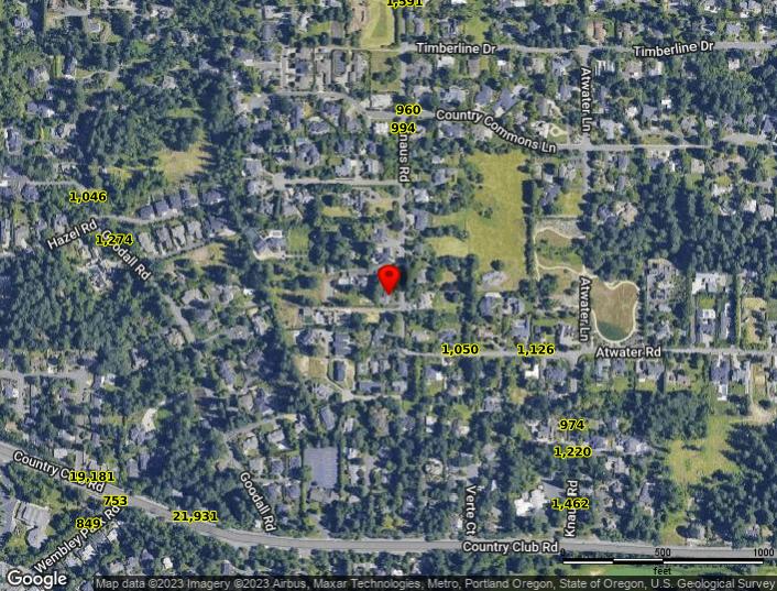
Traffic Counts
The information contained is provided by WFG’s Customer Service Department to our customers, and while deemed reliable, is not guaranteed.

Pop-Facts:
13699 & 13501 SW Knaus Rd, Lake Oswego, OR 97034 Sitewise Online
Pop-Facts: Demographic Snapshot (Part 2)
Pop-Facts: Demographic Snapshot (Part 2)
Copyright © Claritas, LLC 2022. All rights reserved.
* This row intentionally left blank. No Total Category.
**1939 will appear when at least half of the Housing Units in this reports area were built in 1939 or earlier.
13699 & 13501 SW Knaus Rd, Lake Oswego, OR 97034
* GAFO (General merchandise, Apparel, Furniture and Other) represents sales at stores that sell merchandise normally sold in department stores. This category is not included in Total Retail Sales Including Eating and Drinking Places.
Retail Market Power data is derived from two major sources of information. The demand data is derived from the Consumer Expenditure Survey (CE Survey or CEX), which is fielded by the U.S. Bureau of Labor Statistics (BLS). The supply data is derived from the Census of Retail Trade (CRT), which is made available by the U.S. Census. Additional data sources are incorporated to create both supply and demand estimates. The difference between demand and supply represents the opportunity gap or surplus available for each merchandise line in the specified reporting geography. When this difference is positive (demand is greater than the supply), there is an opportunity gap for that merchandise line; when the difference is negative (supply is greater than demand), there is a surplus.
Copyright © 2022 Environics Analytics. All rights reserved.