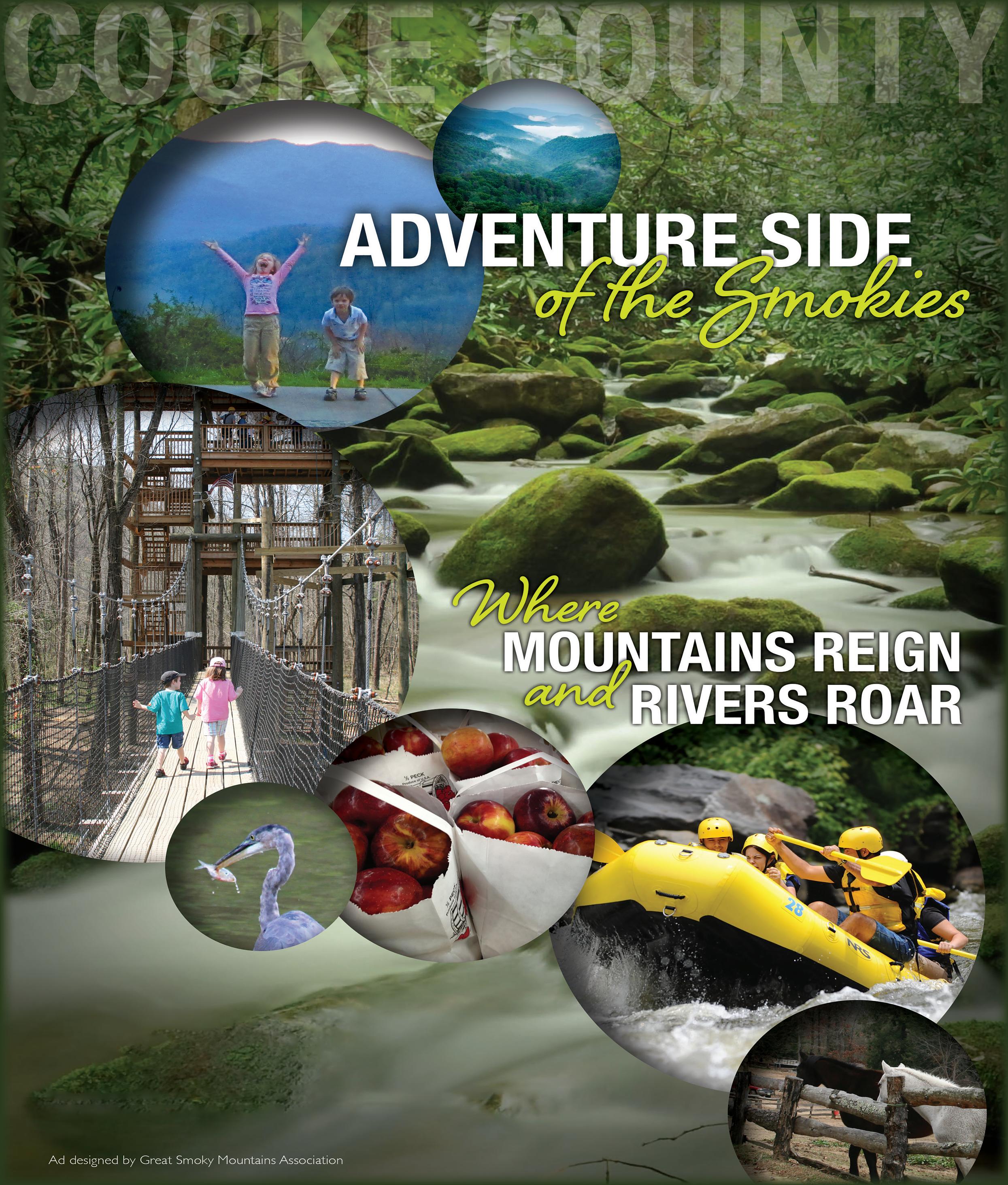
VISITING THE SMOKIES


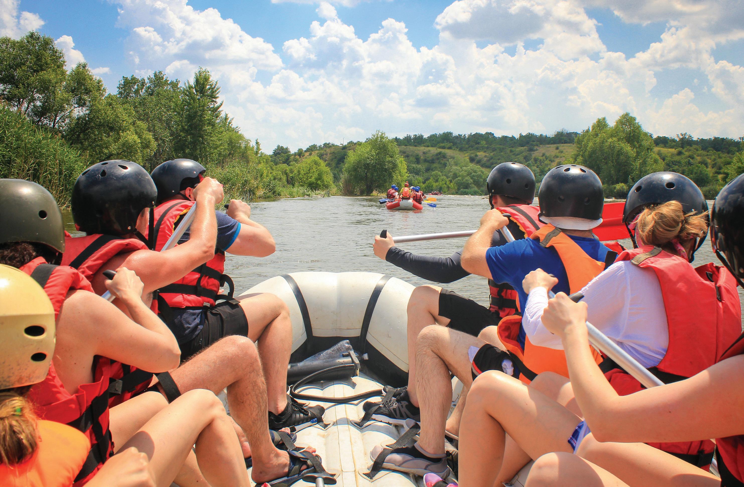
Despite damages suffered from the flooding from the remnants of Hurricane Helene last September, the rafting business has worked hard to rebuild and the rafting season is underway in full force.
The Cocke County rafting seasonopener celebration was held on Friday, May 30. Rafting is Cocke County’s top source of tourist revenue.
Special guests for the rafting
season-opener celebration included Tennessee State Commissioner Department of Tourism Development
Mark Ezell, Tennessee State Commissioner of the Department of Finance and Administration
Jim Bryson, Tennessee Emergency Management Agency (TEMA) State Director Patrick Sheehan and Brian Clifford of the Tennessee Department of Outdoor Recreation.
Cocke County Mayor Rob Mathis said he went down the Pigeon River
with the visitors.
“It was great,” he said. “The river is great. It is super clean. It is even more beautiful than it was before.”
He said that the riverbanks have been cleaned off, and rafting is underway and ready to go.
“I think we will have a very good rafting season,” Mathis said. “The State Department of Tourism thinks we will have a good season as well.”
“They are ready to go, and now is a good time to head down the Pigeon
River,” he added.
Cocke County Clerk Shaleé McClure, who serves as the county rafting agent, said the rafting community has worked diligently to be able to get this year’s rafting season underway.
“They are open for business, and I believe they can have a great season,” she said.
The Pigeon River has been named the most rafted river in the U.S. on more than one occasion.


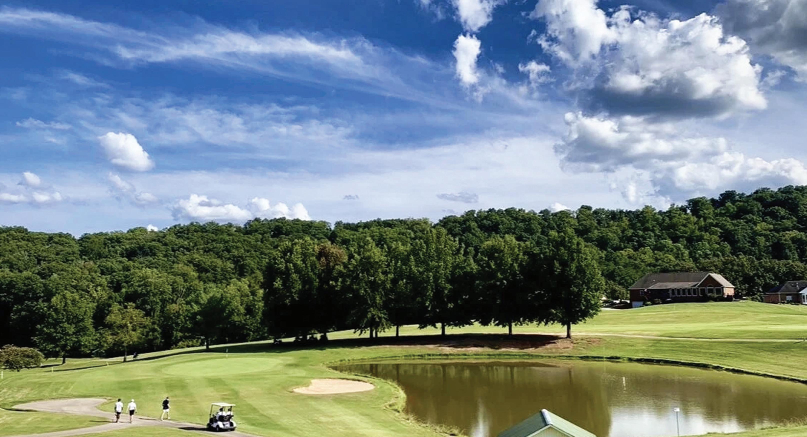

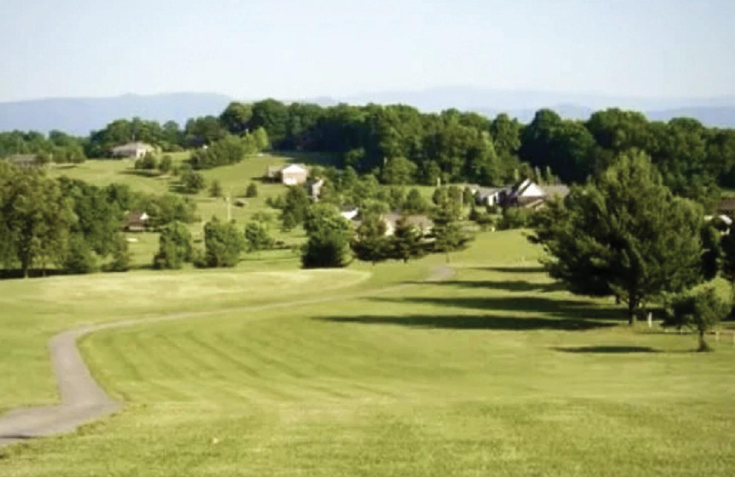
olfers visiting the Smokies and wanting to swing the sticks can make a relatively short trek to tee it up at Dandridge Golf and Country Club or Patriot Hills in Jefferson City.
At 25 minutes from Newport and 35 minutes from the Gatlinburg area, the Dandridge Golf and Country Club was one of the first golf courses built in the area in 1980.
In the years since, it has developed a reputation as a valuable course for a beginner or a seasoned professional.
The original 18 holes, designed by Dan Maples, meander through valleys, hills, and woodlands. In 1991, nine more holes were added with the same characteristics or the original design, bringing the area’s first 27-

With a nod to the local high school in Jefferson County, Dandridge’s three courses are separated by colors: red, white and blue. All three courses were built on rolling terrain, so you can expect many uneven lies and dog legs. At least two water hazards come into play on each course, but the red course is considered the most challenging.
And if the course itself doesn’t offer enough scenic beauty, you may find yourself pausing to admire the views of the Great Smoky Mountains and Douglas Lake. Dandridge offers the same lush Bermuda fairways and bent grass green as its sister course, Patriot Hills, which opened in 1997.
All combinations are par-72 and measure approximately 6,100 yards from the back tees, 5,800 yards from the regular tees, and 4,900 yards from the forward tees.
Th course offers a pro shop with everything from equipment to hats to yardage books so that you can plan out your stay. There is also a small restaurant adjacent to the pro shop, and there are lessons available for any golfer needing to brush up on his or her
game.
This public course is open from 7 a.m. to 8 p.m. every day, and it is located at 1247 Stonewall Jackson Drive in Dandridge. For tee times call (865) 397-2655.
Six miles away in Jefferson City, Patriot Hills opened its doors to rave reviews, with one person calling it “the best new course in East Tennessee” shortly after the opening.
It has since lived up to that moniker, becoming known as the “crown jewel” of the area by offering the same lush Bermuda fairways and bent grass greens as its sister course in Dandridge.
With a similar design as well, the 18-hole course has proven to be as tough as a golfer chooses. The par 72
course measures 6,710 yards from the back tees, 6,068 yards from the regular tees, 5,609 yards from the senior tees, and 4,974 yards from the forward tees.
The most challenging hole at Patriot Hills is generally considered to be the 14th hole, a 568-yard par-5 with an elevated tee box, a tight fairway, and a green separated from the fairway by a hazard.
Beyond the challenges on the course, the scenery is also impressive, affording scenic views of English Mountain and the Great Smoky Mountains.
To get there, take I-40 to exit 417, travel approximately two miles, and Patriot Hills is on the left.
Patriot Hills is open to the public, so for tee


times call (865) 4754466. It offers the same off-course amenities as Dandridge. A restaurant and pro shop are visible upon walking through their doors. Visitors are welcomed, but advance booking — which is available for both courses online — is essential.


Newport Speedway roared back to life this summer, bringing plenty of acclaim and notoriety as visitors and racers from all over the country have sought it out.
Before its official reopening this summer, the track had not hosted a race since 2017. But since new owner Chuck Ward purchased the track in April of 2024, the venue has seen a complete overhaul.
New paint glitters under the
lights each weekend, as its return has generated comments from local racers and visitors and even NASCAR legends such as Dale Earnhardt Jr.
The speedway’s official reopening came on May 24, hosting the Ted Caldwell Memorial Race to great acclaim.
More recently, the venue has hosted the Food Country USA 300 — bringing the best late-model drivers from across the country — and the
country music band “Sawyer Brown” in the speedway’s first ever concert during the first weekend in June.
Each event has generated plenty of buzz, as concertgoers even sat through torrential rain the night of the concert.
A packed racing schedule is set to unfold this summer at the 4/10 mile, high-banked paved oval track with grandstanding seating of 4,000.
The South Atlantic Pro Series on June 21 will be sandwiched between
a couple of East10 Drift events on the 13th and 27th, along with a “Test and Tune” event on the 20th.
After that, local racing will precede the Drew Ramsey Memorial — named for the speedway’s previous owner — on July 4.
More racing and drifting will finish out the month of July (11-12, 25-26), then the action will continue into


August, September and even November with more weekly racing, a fireworks night and the 2025 ARA OverMountain Rally event
Altogether, the jampacked schedule offers a promising form of entertainment. For more information, visit the Newport Speedway’s Facebook page at www.facebook.com/ thenewportspeedway.


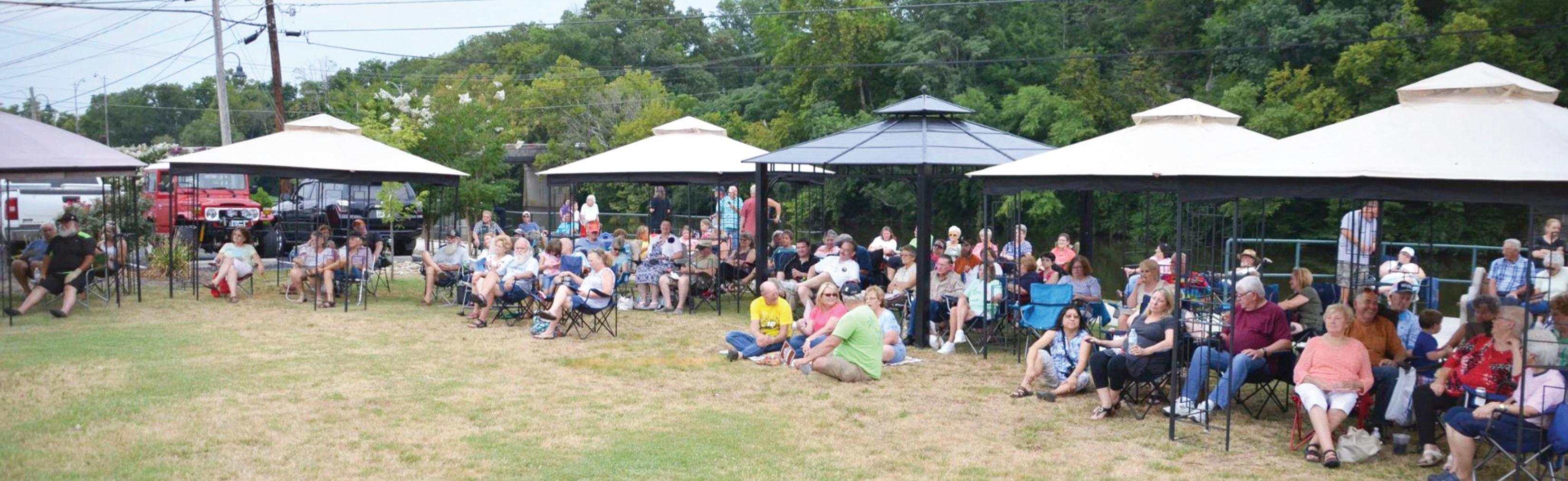
Rhythm on the River has become an anticipated annual summer family oriented music festival in Newport.
Now in its 11th season, the music series from the Cocke County Partnership’s Chamber of Commerce draws people from across the Smoky Mountains to the scenic Riverwalk along the famous Pigeon River in downtown Newport behind Newport City Hall.
The 2025 edition of Rhythm on the River remains a free event and features band performances, games and food vendors.
“All concerts are free to the public, and we’re proud to provide a fun, welcoming space for the community to enjoy,” Director of the Cocke County Chamber of Commerce Lynn


A local favorite bringing authentic bluegrass sure to get your topes tapping and faces smiling

Country fans are in for a treat. Jeff Jopling, who also plays guitar with Chris Jensen, leads this dynamic group blending contemporary and country classics.


Closes out the series with an electrifying mix of country and rock.

Ramsey. “It’s a tradition we look forward to every summer.”
This year’s festival opened on May 29, and summer visitors to the Smokies can still catch plenty of music through the end of July. The bi-weekly concert series is presented every other Thursday. The remaining band lineup represents a cross-section of musical variety.


Step from your car, walk a few yards down a leaf-covered path.
Suddenly the noise of the traffic, even the warmth of the sun, is gone.
In their place — quiet, cool.
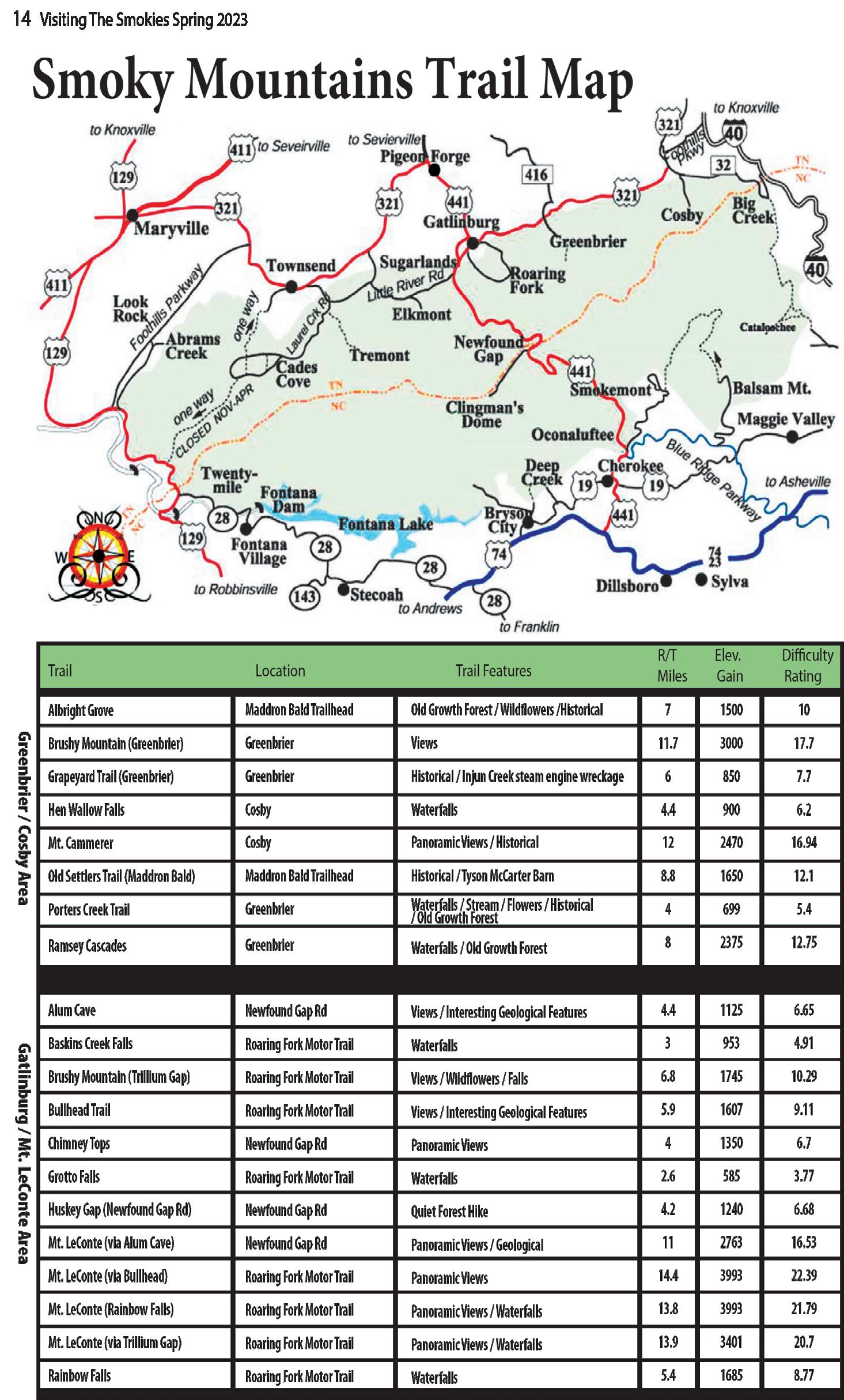
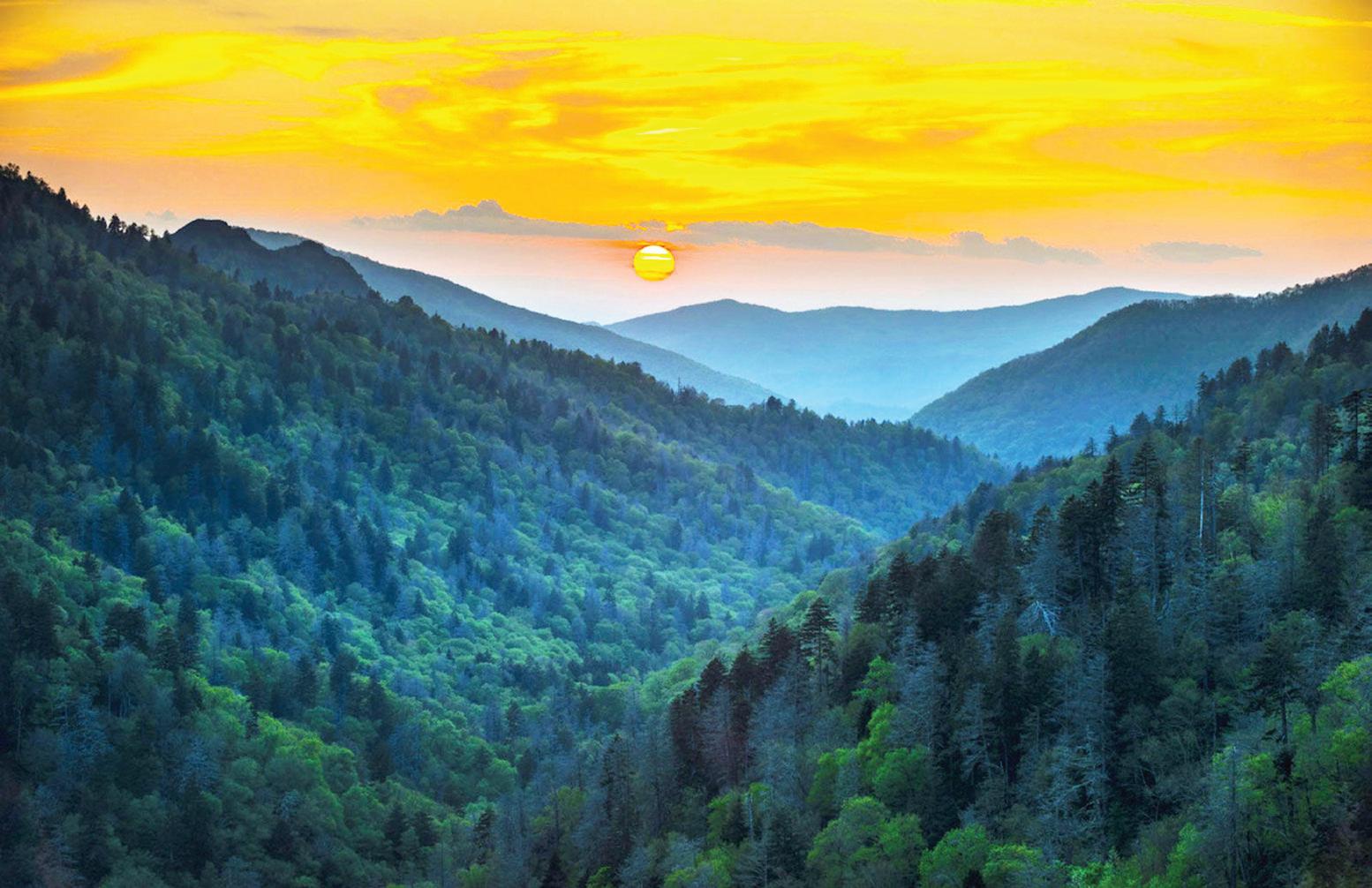
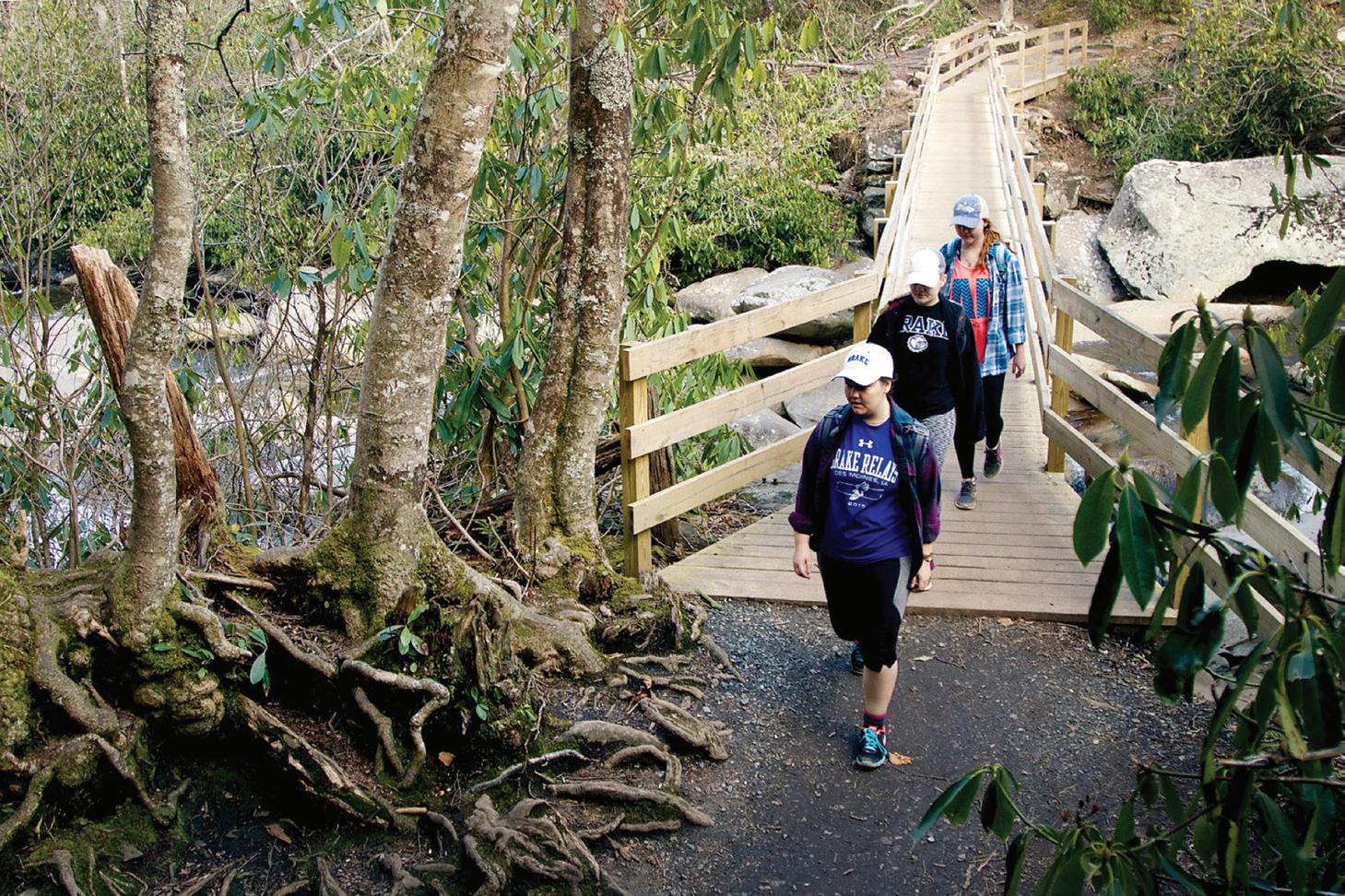
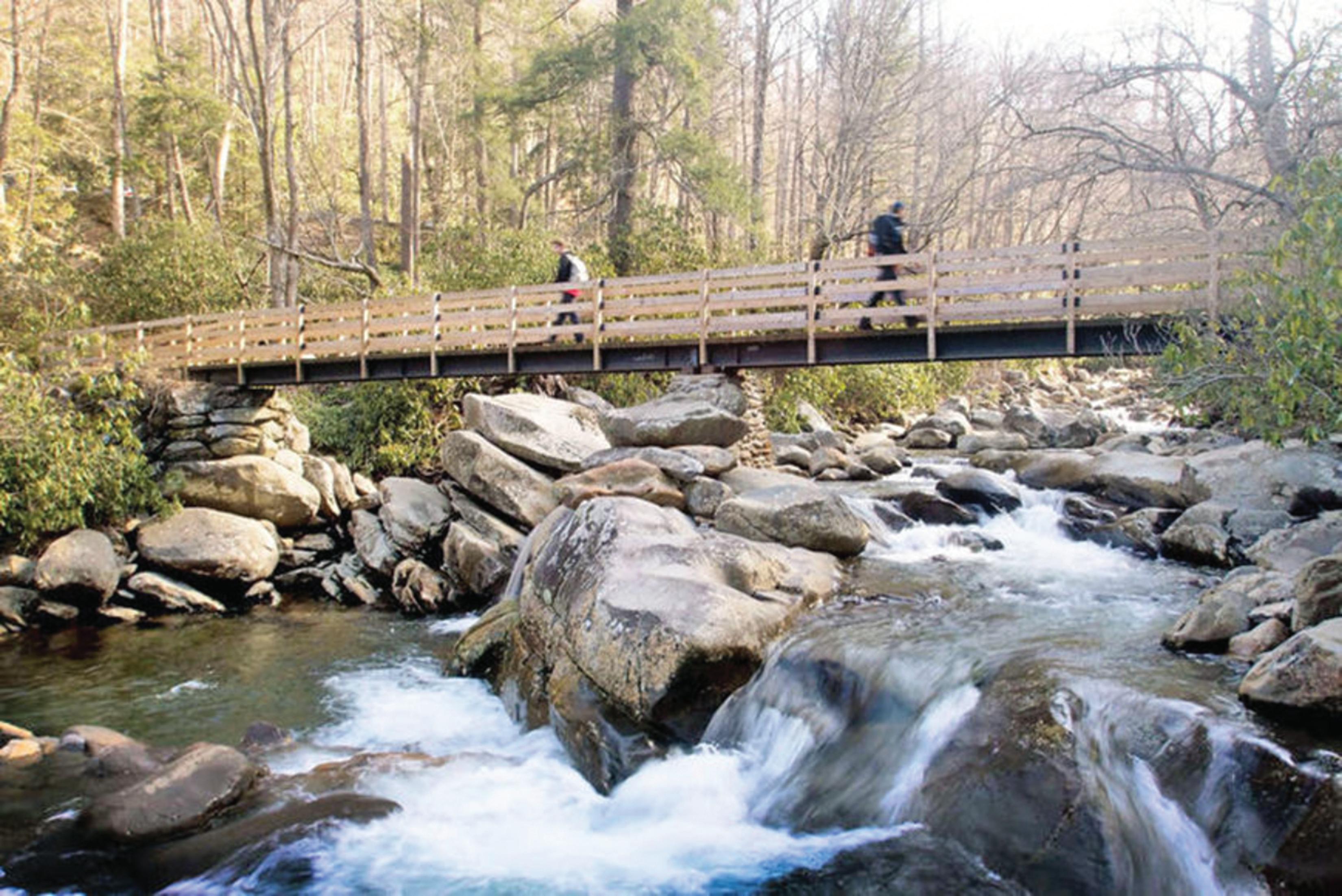
You’re on a trail in Great Smoky Mountains National Park.
In the nation’s most-visited park, there is solitude, even isolation. For those not accustomed to the wilderness offered by following some trails, there are easy walks that offer glimpses of the primeval forest. For other more adventurous, or experienced, hikers, there are challenging trails that lead to some of the most dramatic views the Park has to offer.
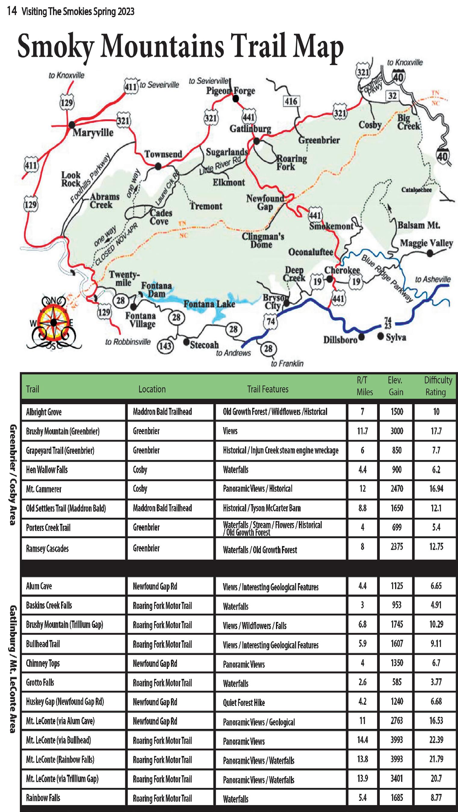
The Smokies’ 800 miles of trails range from wide pathways, which served as the thoroughfares for the mountain dwellers of pre-1930, to steep, well-trodden portions of the Appalachian Trail. There has been much public and private investment in trail maintenance in recent years.
In 2012, Friends of the Smokies established the Trails Forever endowment thanks to a matching gift from the Aslan Foundation in Knoxville. Today, the $5 million endowment funds a full-time trail crew in Great Smoky Mountains National Park to reconstruct and rehabilitate some of the Park’s most impacted trails.
Since 2008, our $5 million Trails Forever endowment has helped fund
rehabilitation projects on Jakes Creek, Forney Ridge, Ramsey Cascades, Chimney Tops and now Alum Cave trails. The hard work this crew does and the fact that these improvements will last 75-plus years is truly incredible. These are some of the Park’s most heavily traveled trails so it just made sense to give back and take care of the hiking trails.
The three-year effort to rehabilitate the Chimney Tops Trail ended in 2014. In 2015, Great Smoky Mountains National Park celebrated the recent completion of the Chimney Tops Trail restoration project. More than 1,000 volunteers provided more than 14,000 hours of labor on the project.
The popular Alum Cave Trail in Great Smoky Mountains National Park is now undergoing full-scale restoration. The Trails Forever crew will focus restoration efforts on several targeted locations along the 5-mile trail to improve visitor safety and stabilize eroding trail sections. The restoration work will require temporary trail closures throughout the two-year process.
For the beginning hiker, shorter, less-strenuous day hikes are plentiful throughout the Park. These, like the longer trails that work their way through the backcountry, offer many miles of nature walks and self-
guiding trails to Park visitors. These trails are usually no longer than 1 mile (round-trip) and many serve as educational guides to the Park and surrounding area. Along the way are scattered resting places, usually with a spectacular view for extra measure.
The Sugarlands Trail, which begins behind the Sugarlands Visitors Center (2 miles south of Gatlinburg on U.S. 441), gives an introduction to the natural history of the area, as well as history about its human inhabitants.
Elkmont, Smokemont and Cosby are some, but not all, of the self-guiding nature trails that give visitors a chance to see and learn more about the mountains than they would just riding through them in a car. One at the Chimneys Picnic Area is a favorite for wildflower enthusiasts in the spring.
Several spots along Laurel Creek Road from the Townsend entrance to Cades Cove serve as entrances to trails and nature walks that offer strolls or workouts. In one spot, at the beginning of the Bote Mountain Trail, those with
a bit more physical conditioning can walk up the road bed (it’s to the left) while others can simply wander up Schoolhouse Gap Road beside a quiet mountain stream (across the bridge and to the right where the larger parking area is located).
Farther up Laurel Creek Road, just down from Crib Gap, is the beginning of several trails, some easy, others more vertical. One of the trails offers a 2-mile “short-cut” to the higher reaches of Bote Mountain Trail, which offers a workout without exhaustion.
Andrews Bald, Abrams Falls and Laurel Falls get you into the wilderness, but not too far. These fairly easy trails range in length from 2 to 6 miles and do have some spots where more-thanaverage energy will be expended.
Some hikes — Deep Creek, Shuckstack and Snake Den Trail, to name just a few — challenge all but the most adventurous hiker. These climb up (or down depending on your direction) 4,000 feet or more.
The more difficult trails have their own rewards — walking through virgin forests, passing into the clouds, being enveloped in the mists swirling around the highest of the Smokies ’ peaks, walking on new-fallen snow or through blooming blackberry bushes still dripping with morning dew.
Area residents have their own favorites among difficult trails. There is the 5-mile hike to Spence Field, one of the Smokies ’ famous and mysterious balds. Those still able to breathe normally after that last push to the top may continue on to Rocky Top, which lent its name to the song popular with the Tennessee Volunteers.
From there you can continue on to the other two peaks of Thunderhead, the dominant mountain on the skyline in the distance when approaching Maryville by U.S. 129 from Knoxville.

There is Mount LeConte, available by several trails. Entrances to trails leading to LeConte (which is topped with a lodge and shelter) are on transmountain U.S. 441 (the Alum Cave Trail) which leads to Cherokee, N.C., and off the Roaring Fork motor trail off Airport Road in Gatlinburg at Cherokee Orchard (Rainbow Falls and the Bullhead).
Rainbow Falls is worth a hike itself with its views from the log bridges approaching the high spill. The Bullhead features quick altitude and good views of Gatlinburg.
If you wish to go to the high country without having to climb there, try Andrews Bald trail, which starts at the Clingmans Dome parking lot. Or turn the other way, paralleling the
paved trail to the dome’s tower and walk along the crest of the Smokies, through high-altitude forests as though you were in Canada.
On parts of the trail you can gaze
from both sides into the mountains and valleys as far as the eye can see.
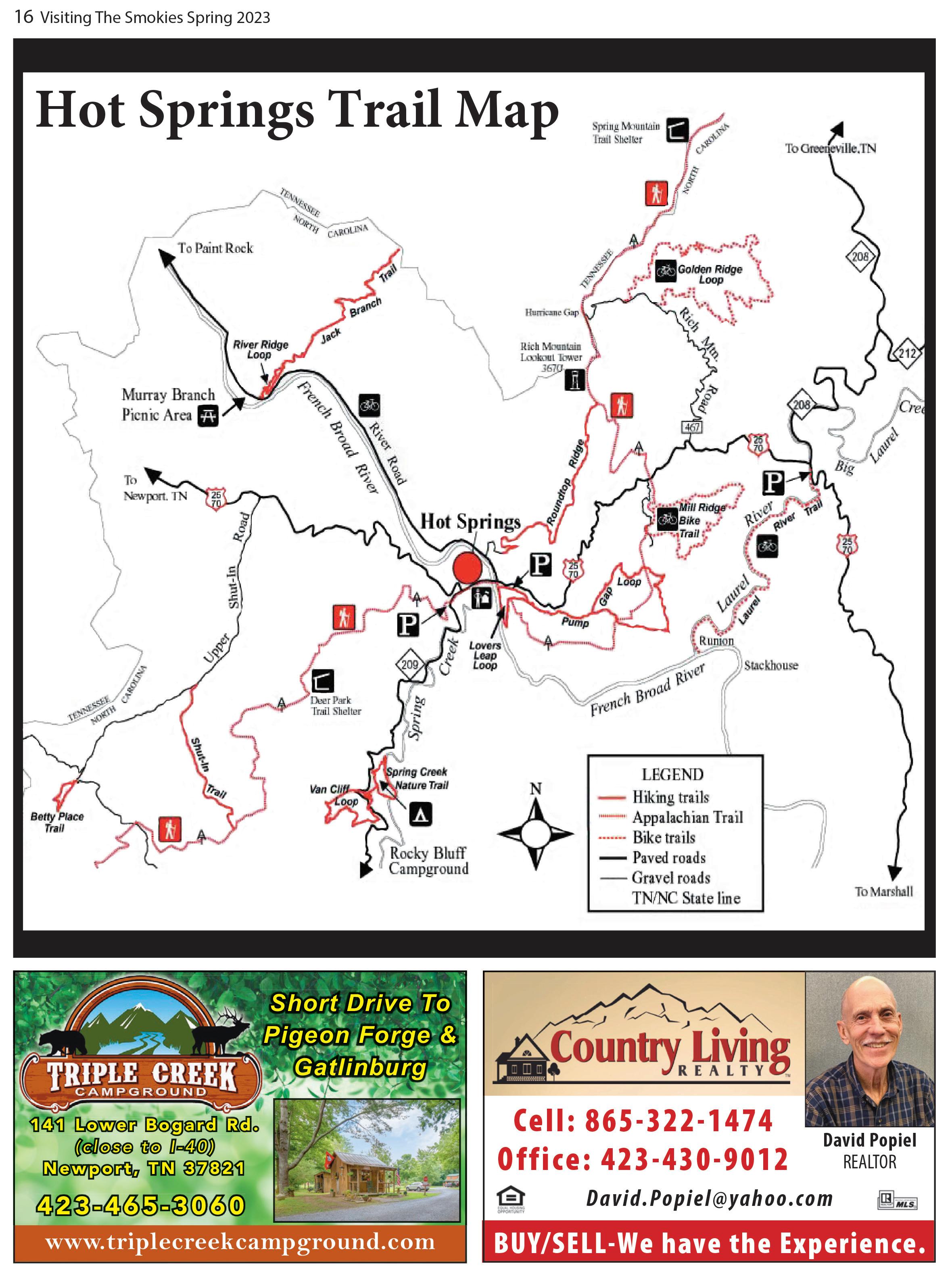
If a step into history is more your cup of tea, try some walks just out of Townsend. There is the popular hike


to the Walker Sisters cabin where five sisters lived — first with their father, then alone — and became almost totally self-sufficient.
Reaching the trailhead is probably the hardest part of this walk. From Townsend, go into the Park, turn left at the “Y” toward Elkmont and Gatlinburg. At Metcalf Bottoms go straight through the picnic area, across the ridge and onto the gravel road.
Turn right at the Little Greenbrier School road and park at the schoolhouse. The trail is the road with the gate. About a mile from that gate stands the homestead. The house where the sisters lived and worked is still there with its charred stone fireplaces.
Just inside Cades Cove, on the right past the parking area and scenic overlook with display, is one of the paths to Rich Mountain. Once again, a brief walk on a well-worn trail can lead you up beside a mountain stream, complete with cascade, if there is enough water.
This trail is steep in places but well, if not heavily, traveled.
One switchback has a spectacular view of Cades Cove below, well worth the exertion once you get there.
At the top, the trail joins the road to a spot where one of the Smokies ’ fire towers used to sit. The National Park Service sold most of the towers and the Rich Mountain tower is no longer.
The trail follows the ridgeline a ways and then heads back down to the Cove. The trail comes out by Elijah Oliver’s cabin, one of the cove’s many scenic spots, and then returns to the parking lot through the gently rolling forest floor.
If you have only a few hours, not the whole day, try the Chestnut Top Trail just inside the Park boundary near Townsend. The trail begins just at the “Y” intersection. Don’t be dismayed by the steepness of the trail at the very beginning; this is the only really hard climbing you will have to do.
During the spring and summer, slowpokes climbing will have an added bonus. The mountainside is filled with wildflowers, many just at eye level. You don’t even have to stoop over to see
Once you reach the top of the hill, you walk through pine forest, across bright green mosses, into deciduous forests. Listen to Laurel Creek far below. There is wildlife along this trail, particularly birds. You can walk as far as you desire, then turn around and return to your car.
At about 4 miles, the trail intersects with the Schoolhouse Gap Trail.
For a day-trip into the wilderness where you are never far from “civilization” but probably will see few people, take the Foothills Parkway to Abrams Creek ranger station.
Go to Walland on Lamar Alexander Parkway (U.S. 321) and turn right onto the parkway. At the end of the finished section, Chilhowee Lake will be in front of you. Turn left and then take another immediate left. Travel through Happy Valley, one of the most picturesque residential communities in Blount County. Watch for the sign to the ranger station. Park just beyond the ranger station — a little shed nearby can provide you with brochures, which will explain much about the Park.

Park was established. This is a nice stroll and can take those with stamina all the way to Cades Cove (about 11 miles). But take a side trip, which will take a bit of scrambling, if you’re even the least bit adventuresome.
You have two directions you can now take. Go through the campground and up Cooper Road, one of the major roadways into Cades Cove before the

At Campsite No. 1, turn right and go up and over the mountain to Abrams Creek. This man way (it


and down beside one of the Smokies ’ most scenic rivers. There is a campsite about 2 miles along this walkway that provides a swimming hole just a few feet away.
Another interesting walk begins across from the ranger station. You will cross Abrams Creek on a log bridge and enter a meadow where houses once stood.
If you have a full day, try traveling by car along the Foothills Parkway to Chilhowee Lake and then turn left onto Calderwood Highway (U.S. 129).
This very crooked road will eventually lead you to the TwentyMile Creek ranger station and, a bit farther on, Fontana Lake.
From the ranger station there are several hiking trails and some of the most picturesque streams. You’ll cross a lot of them on most of the trails here.
What is locally known as the North Shore can be reached across Fontana Lake by strolling across the dam or by renting a boat.
Here, too, there is a possibility of seeing some of the Park’s wildest wildlife. Otters have been
Many of the trails in this area are really old roads that settlers on the North Shore trail used. There is also a new shore trail that winds alongside Fontana Lake, a welcome walk during hot days.
Few of the trails, even on the traditionally crowded Fourth of July and Labor Day, are really crowded. There will still be (with the possible exception of Alum Cave Trail) long moments of strolling alone in the


suddenly dart from the forest across the trail. that will let you experience the real Smokies.

There are three parking tag durations available for purchase. A daily pass is $5, a weekly pass can be purchased for $15, and an annual parking tag is $40. The prices are the same for all vehicle types and sizes.
Parking tag guidelines
Physical parking tags must be displayed in the vehicle, and digital tags will not be accepted.
Each tag is only valid for a single vehicle and it must include the license plate number of the vehicle it is displayed in.
Parking tags may be purchased online and onsite at locations within the park.
Parking tags will be required anywhere within the boundaries of the Great Smoky Mountains National Park for vehicles parked for more than 15 minutes.
• Annual parking tags must be displayed in the front, lower passenger side windshield.
• Daily and weekly tags must be placed face-up on the lower side of the passenger side dashboard.
How to purchase a parking tag
There will be a variety of options for those who are looking to purchase their parking tags, including:
• Purchasing an annual parking tag through Great Smoky Mountains Association and having it shipped straight to your door.
• Purchasing both daily and weekly parking tags through recreation.gov and printing them off at home. Note that the


park will not be able to print your parking tag for you.
• Purchasing all variations of parking tags onsite at welcome and visitor centers across the national park. The locations where you can purchase your parking tag in person include the Gatlinburg Welcome Center, Sugarlands Visitor Center, Townsend Visitor Center, Cades Cove Visitor Center, Great Smoky Mountains Institute at Tremont Store, Clingmans Dome Visitor Center, Oconaluftee Visitor Center, Swain County Visitor Center, and Visit NC Smokies Visitor Center.
• Daily and weekly parking tags are available for purchase by credit card from automated machines available throughout the park. Guests will be able to access machines year-round, 24 hours a day.
Do parking tags guarantee a parking spot?
No, parking tags will not guarantee a parking spot at a specific location or for a specific time.
What are the consequences of failing to purchase a parking tag?
Failure to comply with the parking tag


guidelines may result in a warning, citation, or your vehicle being towed at your expense.
When do daily and weekly tags expire?
Daily and weekly parking tags will expire at 11:59 pm ET on the date that is listed on the tag.
Are vehicles with disabled parking placards exempt?
Yes, visitors with valid, state-issued disabled tags are exempt from having to purchase a parking tag.
How are proceeds from the parking tags being used?
All revenue generated from the parking tags is being directly put back into the operational costs for managing and improving services for guests, including trail maintenance, trash removal, and staffing increases.
Will there be a limit on the number of parking tags sold?
No, the park does not limit the number of parking tags sold on any given day or week.
Information from smokymountainnationalpark.com