NESE ERSOY GENC LANDSCAPE ARCHITECTURE & URBAN DESIGN PORTFOLIO


2

3
4


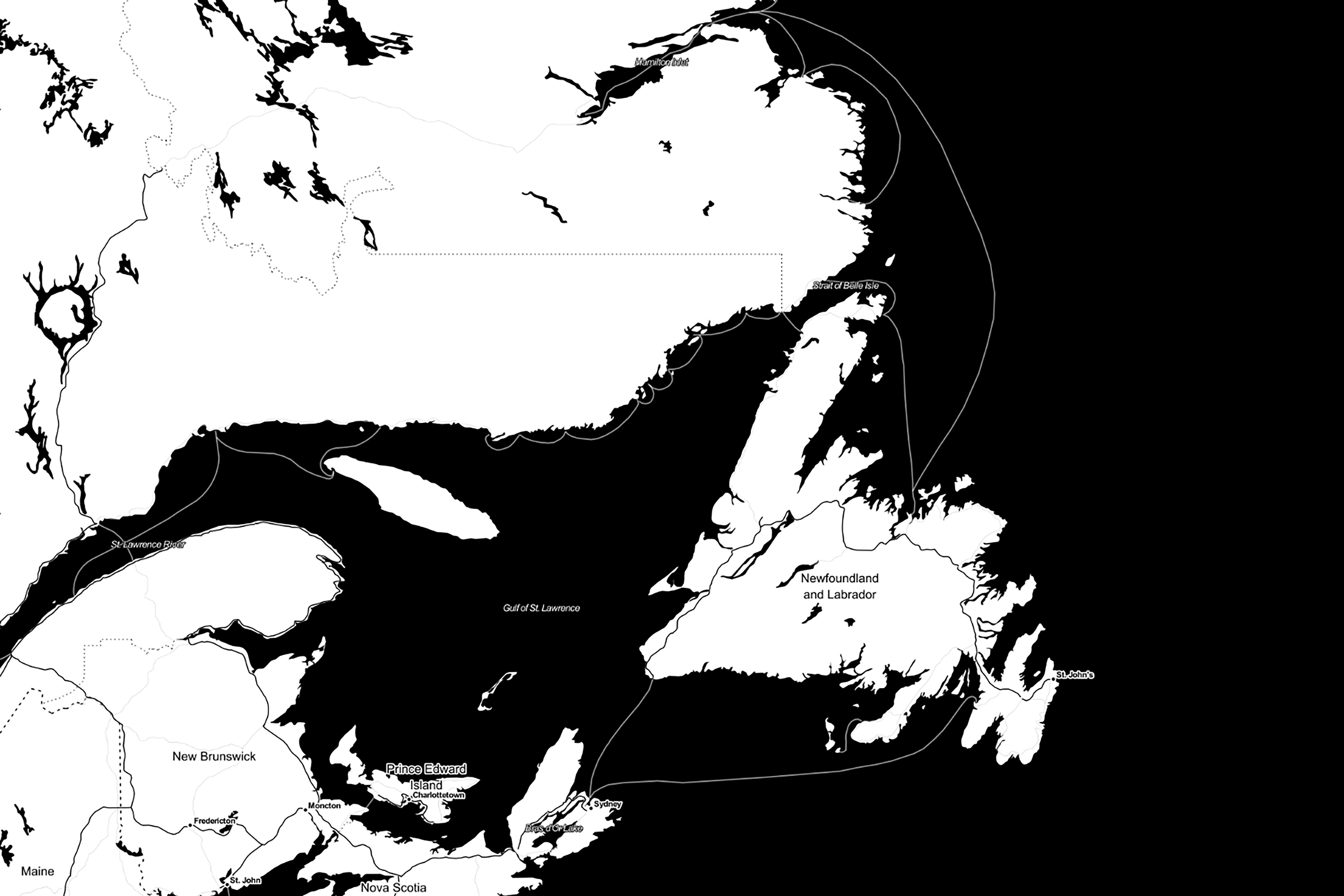
Botwood, situated in north-central Newfoundland, lies on the western shore of the Bay of Exploits, boasting a natural deep-water harbor with historical use by cargo ships and seaplanes. The town’s earliest settlers, the Beothuks, now believed to be extinct, hold profound historical importance. Notably, Botwood seeks to commemorate Demasduit, captured in 1819 near Botwood Lake, who tragically witnessed her child’s father’s murder.
To illuminate these pivotal historical events, Botwood envisions landscape design as a means of creating a prominent destination, thereby generating revenue. With amplified amenities and expanded marina capacity, the town aims to establish itself as a significant port in North America, even catering to sailors. This transformative vision extends to converting the flying boat into a state-of-the-art flight simulator.
This downtown revitalization initiative draws inspiration from Botwood’s rich history, natural beauty, and collective memory. The primary objective is to enhance the daily lives of its residents while fostering Botwood’s emergence as a vibrant tourist destination.
Landmark (Existing) / Heritage Building
Landmark (1961* - does not exist anymore)
Moorings 1944
RCAF : Royal Canadian Air Force
BOAC: British Overseas Airways Corporation
PAA: Pan American World Airways
Spur Line
Mural locations
Street Network (has not change since 1961.)
* locations based on:
Botwood, Newfoundland
Newfoundland Department of Municipal Affairs.
Hunting Survey Corporation.
St. John's, Nfld. : Dept. of Municipal Affairs, Provincial Planning Division 1967.
Date of photography: May 1961.


Demasduit. Captured on March 5, 1819 at Red Indian Lake, Died at Botwood Harbour on Jan 8, 1820.
Shanawdithit. Beothucks Captured 1829.
It refers particularly to Buchan’s expedition up the lake in 1820 with the body of poor Demasduit.*

Half of Red Indian Lake, including the NE. arm, where the principal encampment of the Beothuks was situated.*


Winter and Summer wigwams (mamateeks).
Different kinds of animal food.*

Shanawdithit. Last survivor of Beothucks so far as is known . Captured in 1823, died in St John’s,

The taking of Demasduit on the North side of the lake. *

Ash-mud-yim, the blackman, or Red Indian Devil, seen at the Great Lake. / Deer and Seal Spears Store house / Dancing woman / Birch bark vessels.*

The house in St John’s, in which Shanawdithit lived.
Emblems of Red Indian Mythology. *


1860s
Botwood, NL, was incorporated as a town in 1960, with a population of 3,008 (2011 Exploits, a long arm of Notre Dame Bay on the north coast of Newfoundland. Historically, Exploits River, and it was on board John Buchan’s ship that Demasduwit tragically Lake. Originally named Ship Cove, it evolved into a sawmilling center during the 1870s and later shortened to Botwood, in honor of Reverend Edward Botwood (1828-1901).
 Reverend Edward Botwood (1828-1901). Exploits River Lumber and
and Pulp Company, Botwoodville, circa 1880. (2011 census). The Town of Botwood is situated in the Bay of Historically, it served as an anchorage for explorers of the passed away in 1820 while awaiting a return to Red Indian 1870s and 1880s, subsequently being renamed Botwoodville, (1828-1901).


In 1910, Botwood became a pivotal shipping port for paper transported by rail from Grand Falls (now Grand FallsWindsor) and Bishop’s Falls, and later, for ore from Buchans after 1928.


 botwood for the A.N.D.
Logging Camp Botwoodville 1906.
botwood for the A.N.D.
Logging Camp Botwoodville 1906.
During the 1920s and 1930s, it functioned as a seaplane base for local aviation and served as a stopover point for numerous transatlantic flights until the opening of Gander airport. Presently, Botwood plays a significant role as a regional service center and a year-round transshipment base for various commodities.


During World War II, the quiet port of Botwood was transformed into a crucial Canadian coastal defence base due to its strategic location in the North Atlantic. Serving as a hub for transatlantic flights, it hosted soldiers, dignitaries like Winston Churchill, and celebrities like Bob Hope. Remarkably, even before its military transformation, an enemy ship, the German freighter Christoph V. Doornum, was captured in its harbor after war was declared in 1939. The ship's crew was taken as prisoners, and the freighter was moved to Halifax, marking one of North America's first acts of war in World War II. As months passed, Botwood saw increased military activity, with Canadian soldiers building gun batteries, bunkers, and other essential facilities to defend the air base.

Botwood Heritage Center
Botwood Flying Boat Museum
PBY Catalina Flying Boat
Existing Events Area
Events Expansion Area
Historic Air Base
Info Kiosk and Map for Art Walk
Public Parking
Art Walk
Historic Spur Line Walk
Historic Killick Island Walk
Existing Slipway

Art+ Interpretation Locations
Potential Marina Development Areas

Legend
Residential (Medium Density)
Recreation / Open Space
Recreation
Rural
Industrial (General)
Industrial (Marine)
Comprehensive Development Area
Community / Social Services
Commercial (General)


Legend
Walking Trail (Spur Line + Killick Island)

Art Walk
Main Vehicular Circulation
Parking Boat Storage / Parking
Event Area Museum Restaurant Used Car Shop
Comfort Station (Accessible Washrooms + Laundry)
Information Centre
Memorial Gallery
Brew Pub
Lookout

HERITAGE MUSEUM
FLYING BOAT MUSEUM
Proposed connection with the new Multi-Functional Building
PROPOSED MULTI-FUNCTIONAL BUILDING
Community Centre
Office Space
Comfort Station (Accessible Washrooms / Showers / Laundry)
Canteen
Information Kiosk
BACK GARDEN OVERLOOKING THE EVENT SPACE
Can be fenced and converted to beer garden for small size events
PARKING AND BOAT STORAGE
PROPOSED STAGE & LOOKOUT

Located carefully to block prevailing winds.
The roof could function as a lookout.
OPEN MULTI-FUNCTIONAL SPACE
Can be converted to a beer garden for bigger events (with temporary fence).
Picnic / Play and Outdoor Art Space
BEOTHUK MEMORIAL GARDEN / OUTDOOR ART GALLERY
Demasduit died here in Botwood.
FUTURE MARINA BUILDING
FUELING DOCK
SLIPWAY
WOOD SEATING
FLIGHT SIMULATOR INSIDE THE PLANE
MARINA PLAZA
Asphalt surface with planting strips and line paintings. (Design influenced by the rich history)
Plants to be local low grasses/wild flowers not to interfere with the vista)
FUTURE BOAT STORAGE BUILDING
PARKING AND BOAT STORAGE
EXISTING RESTAURANT
GRAVEL PATH TO THE KILLICK ISLAND
(Service & emergency vehicular access only)
EXCALIBUR MEMORIAL SITE
Former Weather Station, current Viewfinder
Enhance site with lighting and landscape elements
BUNKER #1
Exhibits / installations / murals dedicated to Beothuk
BUNKER #2
Memory Room
BUNKER #3
Rotating Gallery
BUNKER #4
Extension and Lookout
Brew Pub / Marina Association Clubhouse
KILLICK ISLAND TRAIL
BREAKWATERS
FLOATING DOCKS (144 BERTHS IN TOTAL)
SHORT TERM TIE-UP PBY CANSO MEMORIAL
Topsoil and Sod
Wood Deck / Boardwalk Beach


Public art and landmarks play a crucial role in revealing the identity of the community and fostering a strong sense of place. Botwood is already adorned with numerous murals, celebrating important sites and historical events while creating new public spaces and attractions. The concept plan aims to showcase existing murals and provide opportunities for new ones. Many plan components, such as the event stage, lookout points, the Beothuk Memorial, and the Killick Island lookout, will naturally become community destinations. Competitions for new public art will invigorate a vibrant and evolving art scene.
Thoughtful connections guide people through their experience of a place. This plan proposes a green connection between Killick Island and the marina, offering more green spaces for the town and establishing a strong visual link. Additionally, a dramatic painted art walk is suggested to direct visitors to the museums while adding vibrancy to the landscape. The idea of painted walks can be further explored and extended to highlight murals, historical sites, and other points of interest.
The design prioritizes preserving, enhancing, and creating new access points and views to the water. Wood seating and a breakwater facilitate residents and visitors in enjoying leisure time by the water's edge. The event stage is strategically configured to block prevailing winds while framing scenic views of the ocean. The roof can be designed as a lookout, providing panoramic vistas. Concrete stepping stones lead people to the Beothuk Memorial garden, located along the ocean shore where Demasduit once lived. PARKING The proposed plan allows for a parking capacity of approximately 60 vehicles. However, this number can be easily adjusted during the detailed design stage to accommodate a need for more parking spots, if necessary.
Signage will consistently carry a clear and welcoming message, featuring the 'Botwood En Avant' brand, inviting all to experience the festive, historic, and vibrant community.
The town's rich history significantly influenced the design of the concept plan. Drawing inspiration from the Beothuk history, the military layout of the site, and the network of streets, the plan pays homage to the town's cultural and historical heritage.
In addition to creating a destination for visitors, Botwood Marina and Heritage Park will serve as a welcoming gathering spot for locals. The Flying Boat Plaza will have limited vehicle access (reserved for Marina use and emergencies), while other areas will be designated as pedestrian-only zones.
Botwood Marina and Heritage Park will foster a thriving environment for diverse activities, encouraging economic and cultural growth. The large plaza, thoughtfully integrated with landscape elements and street furniture, will serve as an ideal event space, featuring a stage, lookout points, ample seating, and picnic tables. The space can be utilized for various purposes, such as farmers' markets, art festivals, and exhibitions.
The design proposes two possible sites (one small and the other larger) for temporary fencing when needed, instead of permanent fencing for the event space. This adaptive approach avoids unnecessary visual and physical barriers that would only be required on rare occasions. Furthermore, the Flying Boat Plaza preserves its flexibility by not having permanent vertical structures like trees or light poles, ensuring unobstructed views and providing versatile space.


Museum Area
Event Space & Beothuk Memorial

Flying Boat Plaza
Killick Island
Marina
Heritage Museum
Future Boat Storage


Tract was commissioned by the Town of Carbonear to develop a Downtown Revitalization Strategy for Water Street. This involved a comprehensive assessment of current assets, consultations with local stakeholders and NGOs, and the crafting of visitor themes rooted in the area’s rich history. Innovative storytelling methods, including signage and visual aids, were proposed.

Tract’s planners also outlined strategies within the Municipal Plan and Development Regulations for effective development management, addressing absentee land ownership, and improving property aesthetics. Strong community, political, and funding support reflected their commitment to the revitalization vision.
Our vision aimed to establish an inviting and distinctive Heritage Waterfront District, fostering resident and business connections, providing appealing spaces for social interaction, and promoting economic, artistic, and cultural growth in Carbonear.
Gateway To Downtown Carbonear
From Highway
Hospital
Community Center (Town Hall/Theatre/Library/ Potential Expansion for Civic Center)
Recreation Facility
School or College
Highway (Route 70)
Main Road (Powell-Water St Connection)
Road into Downtown Streets
Connection)
Open/Recreational Space
Highway Commercial Area
T'railway Spur Line (Hiking/Biking/Atv)


Stone Jug


Plaza and Memorial to commemorate the Royal St. John's Regatta Hall of Fame.
For this project, all landscape architects at the firm were assigned to create quick concept designs and generate 3D models, as the client requested three different concepts. Although my project was not ultimately selected due to its urban characteristics, certain elements, such as the wide boardwalk, were incorporated into the winning concept.


The Placentia Historical Society's vision for the park, which aims to commemorate Argentia's military history and honor the Americans who served here, is multi-faceted with several goals. The park's purpose is to enrich the lives of the local community, Newfoundlanders, and tourists alike, offering a diverse range of experiences and events. These experiences will span from reflective contemplation and relaxation to educational opportunities, invigorating nature activities, and thrilling play options.

The Park will serve as:
• A memorial and testimonial of respect for the Americans who occupied and served here.
• An attractive park and tourist site, enticing visitors with its appearance and various activities.
• An enhancement and highlight of a registered heritage site, preserving the history of the Argentia military base.
• Supported by a system of revenue generation to assist with operation and maintenance.

• Promoted through various promotional materials and an online presence.
• The site of a plaque honoring the Americans who served here.


