MOMO CHEN
Phone 614-619-7895
E-mail moyan09@outlook.com
Education
University of California, Berkeley [Aug. 2018 – May. 2020]
Master of Landscape Architecture with certificate in Geographic Information Science and Technology
The Ohio State University [ Aug. 2014 – May. 2018]
Bachelor of Science in Landscape architecture
Skills
SOFTWARE
Basic Design & Construction AutoCAD, Rhinoceros Geospatial Analysis ArcGIS, Faro Scene, ENVI
Visualization Adobe Illustrator, Adobe Photoshop, Adobe InDesign, Adobe Premiere 3D Modeling Rhinoceros, Rhino Grasshopper, RhinoCam, SketchUp, Lumion
FABRICATION
Digital Fabrication, 3D Printing, Laser Cutting, CNC Cutting
PROJECT MANAGEMENT
Experience with LEED accreditations
Work Experience
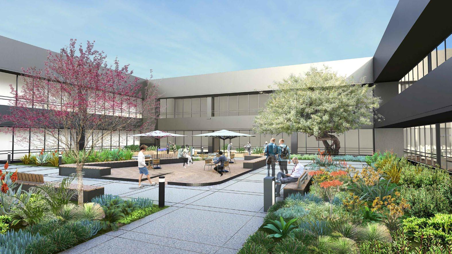
Landscape Architectural designer, RHAA, CA, United States [2021 - Current]
- Involve in public and commercial projects locally and nationally including Facebook Dumbarton Campus, San Bruno Tanforan Memorial, BART Lake Merritt Plaza Redesign, Oyster Point Phase IIC Redesign...
- Assist project manager to develop design concept, deliver drawings and manage projects
- Research project background via varies 3d modeling and mapping techniques
- Constantly involve in construction development
Freelance Landscape Designer, China [Winter 2020]
- Collaborate with CA-based architectural studio and develop conceptual landscape design for a Minsu (privateowned resort) project in Szechuan, China.
- Produce 3d model, graphics and planting recommendation
Internship, RHAA, CA, United States [Autumn + Spring 2020]
- Assist project managers on tech company campus project. San Francisco Market Street rooftop renovation, Sunnyvale Google Campus, San Anselmo Creek restoration and planning project
- Research detail site furnishings, render perspective drawings for presentation, 3D modeling design iterations using Photoshop, SketchUp and AutoCAD
- Document construction drawings
Internship, Ballistic Architecture Machine, Beijing, China [Summer 2019]
- Assist senior landscape architects on Beijing CED redevelopment project. MAHA residential planning and Shanghai Baoshan waste treatment plant park
- Prepare planning, urban design and landscape master plan drawings and presentation, using photoshop, illustrator and Indesign
- Develop preliminary diagrams, plans and sections using Hand sketch, AutoCAD and Photoshop
Internship, ORIENT Landscape, Beijing, China [Summer 2017]
- Assist senior landscape architects on city plaza project
- Compile and analyze data on site conditions using ArcGIS and Illustrator
- Develop preliminary diagrams, plans and sections using Hand sketch, AutoCAD and Photoshop
- Rendering models using Sketchup and Lumion
Garden Maintenance Assistant, Blake Garden, UC Berkeley, US [Autumn 2018]
- Assist garden managers to plan and implement landscape design plans
- Perform weeding, cultivation, mulching, leaf and debris pick-up and basic grounds-keeping maintenance
Graduate Student Instructor, College of Environmental Design, UC Berkeley, US [Spring + Summer 2020]
- Assist studio instructor with developing course structure
- Provide individual desk critiques
- Provide technical support to students
Professional Experience
Student Assistant in River Restoration Annual Workshops, Berkeley,CA [Spring 2020]
Student Volunteer in ASLA Annual Meeting & EXPO, San Diego CA [ Winter 2019 ]
Student assistant in Olentangy River Corridor Charrette, Columbus OH [ Autumn 2017 ]
Study Abroad in Santiago, Chile [Spring 2017]
Participant in THIS IS A TEST: Landscape as Site for Research, The Ohio State University [ 2016 ]
Awards & Honors
Dean’s list, Ohio State University [ 2014-2018 ]
Knowlton School of Architecture Honor Program, Ohio State University [ 2015 - 2018 ]
Visual Innovation in Landscape Architecture, Undergraduate, Ohio State University [2018]
Leadership
Active member in Justice, Equity, Diversity and Inclusion group, RHAA [2021 - Current]
Section head of Performance Department of Chinese Students & Scholars Society, The Ohio State University [2014 - 2016]
Active member in SUSTAINS Learning Community, The Ohio State University [2014]
Languages
Fluent in English and Chinese
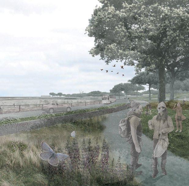
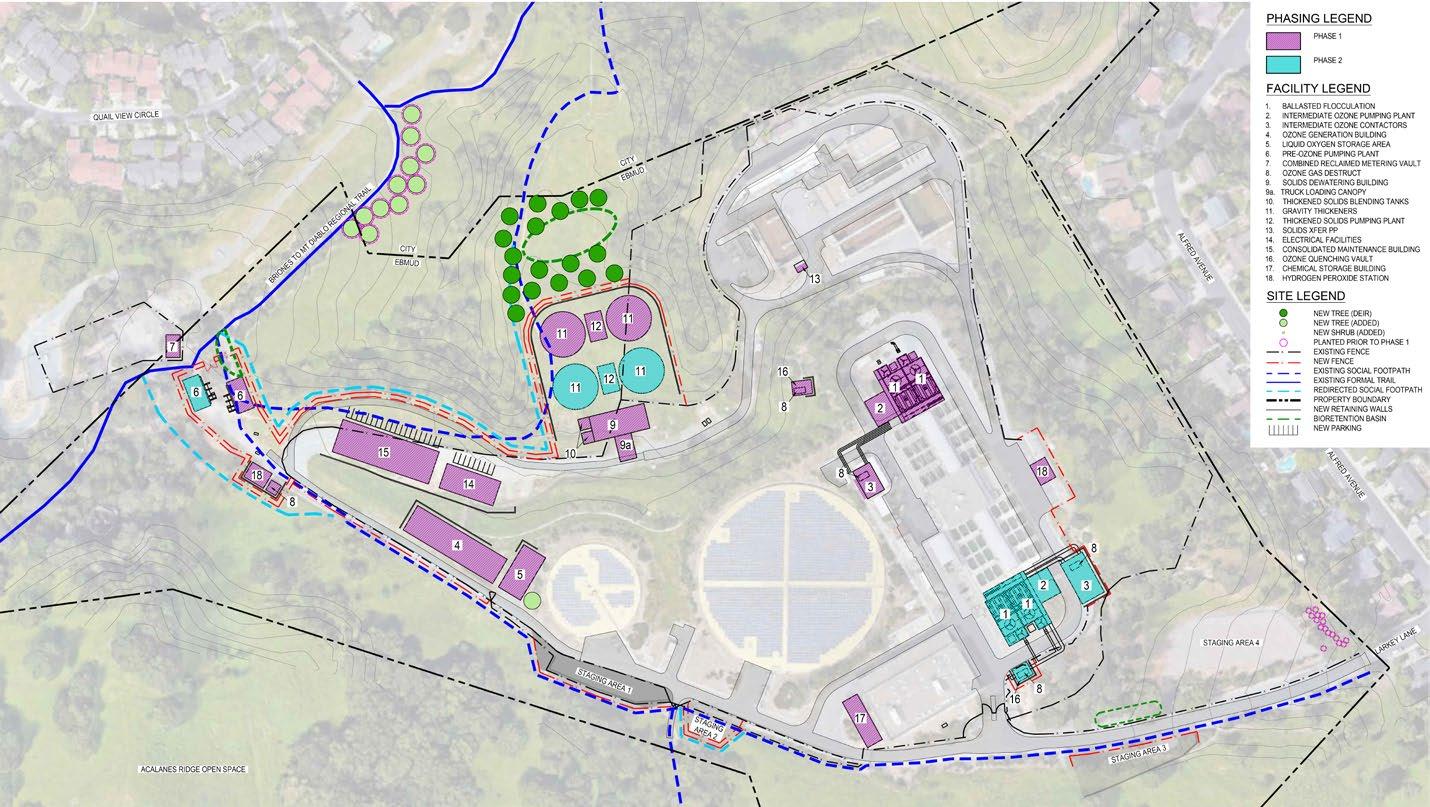
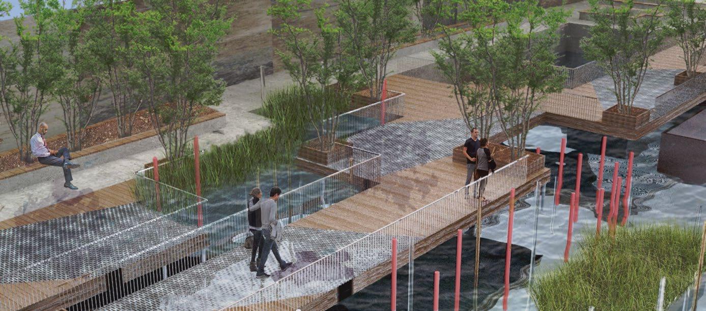
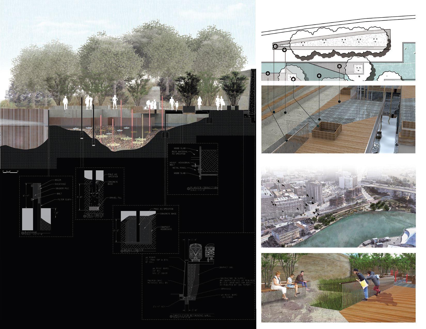
URBAN HABITAT - DESIGN FOR THE SENSORY
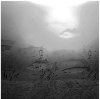
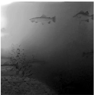
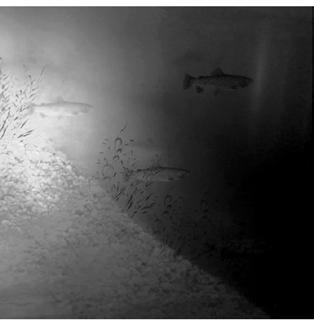
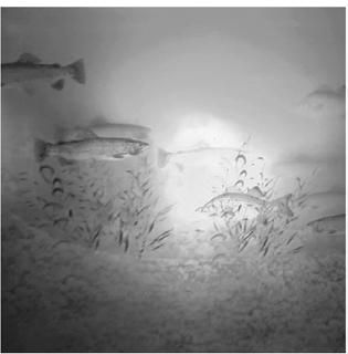
The site was designed to provide a comfortable habitat for Channel catfish, White bass, and Rainbow trout, while also enhancing their sensory experience through material exploration. The proximity of the Cuyahoga River in Cleveland, Ohio was carefully studied to ensure the habitat was established in an environment suited for the fish. Additionally, the design sought to create a space that would invite people to engage with the site, fostering a connection between the aquatic life and the public.
INITIAL DESIGN & ANALYSIS
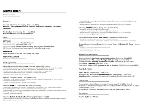
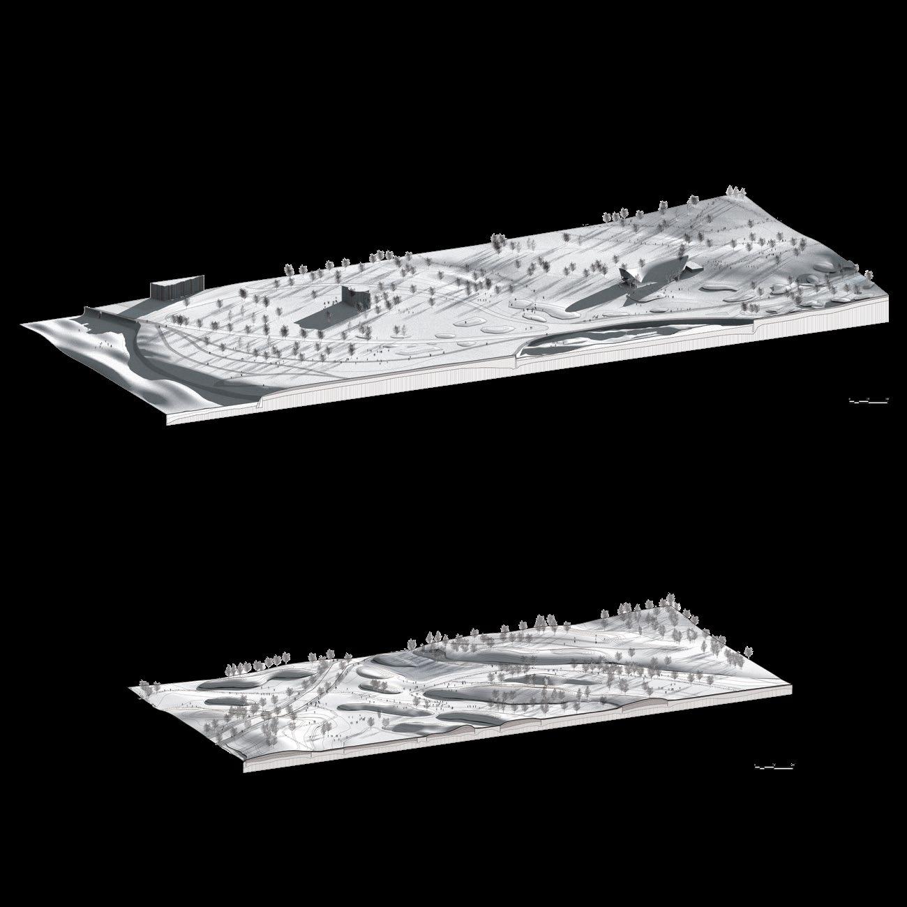
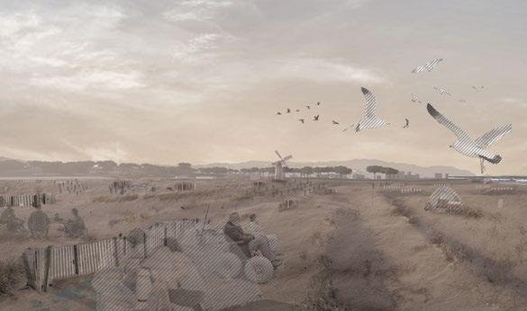
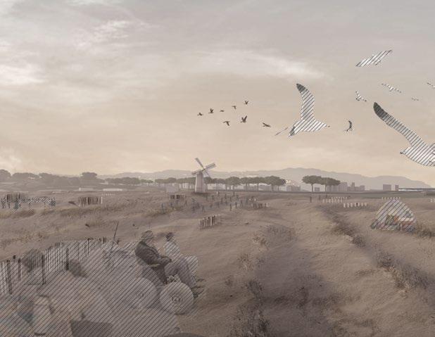
Prior to picking a site in Cleveland, a fish habitat was developed to meet the needs of three different fish at variable times in their life. To achieve this habitat, the fish were studied in depth and a habitat was created to fit these specific needs. The previous habitat focused on the senses of fish and how they perceive their environments. A series of poles made of glass, metal, and wood were incorporated into the environment to further stir the electroreception in the Channel Catfish and the lateral line sense in all three types of fish. The site aimed to house these fish in a comfortable environment while also focusing on enhancing the fish sense through material exploration. The City of Cleveland was studied in order to establish the habitat in an appropriate environment for the fish and the introduce people into the site.
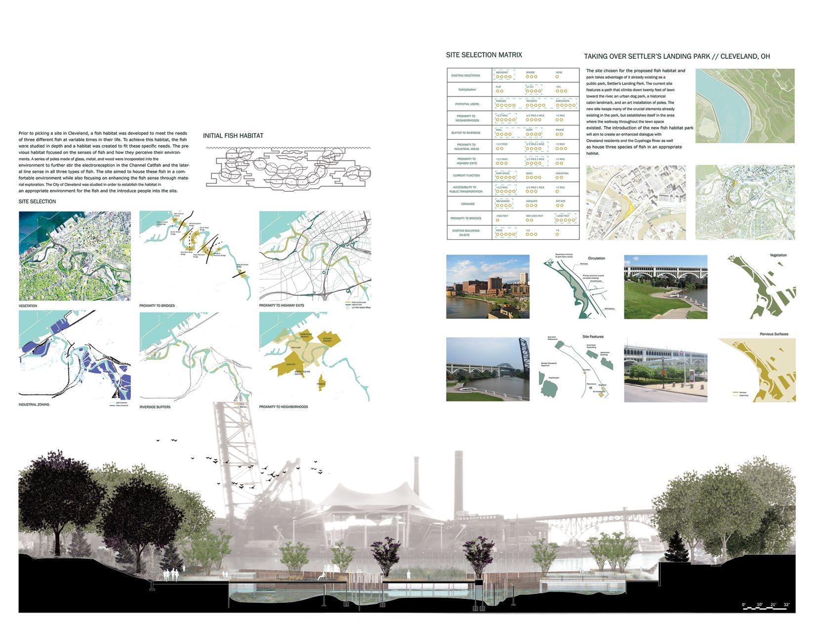
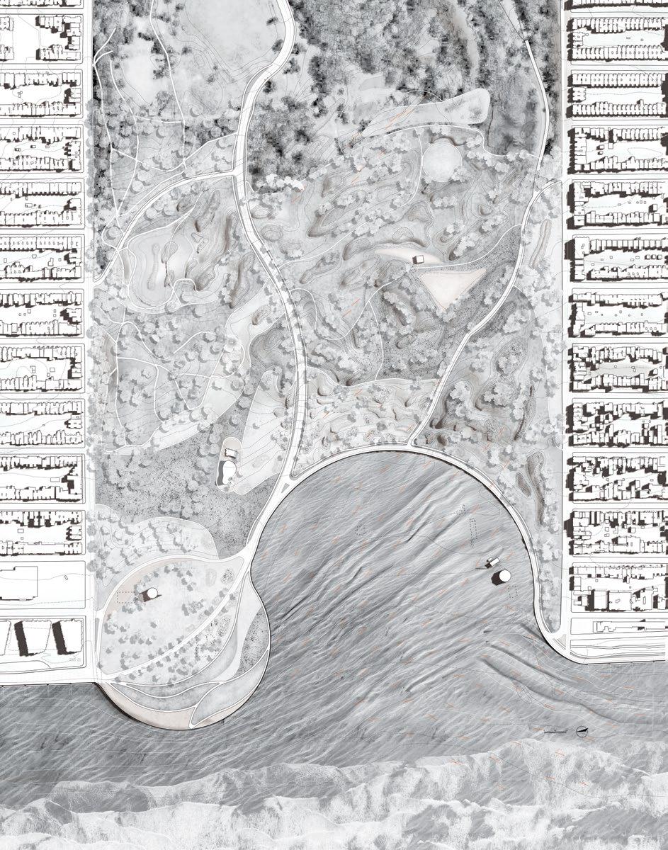
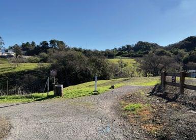
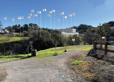
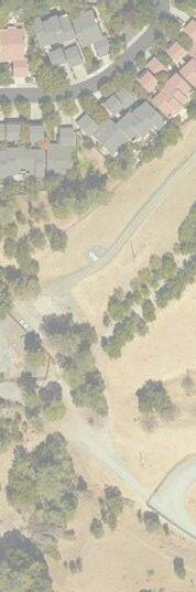
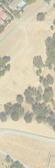
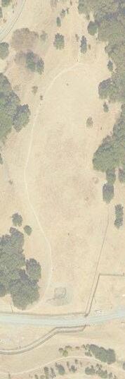
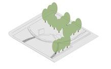
The site chosen for the proposed fish habitat and park takes advantage of it already existing as a public park, Settler’s Landing Park. The current site features a path that climbs down twenty feet of lawn toward the river, an urban dog park, a historical cabin landmark, and an art installation of poles. The new site keeps many of the crucial elements already existing in the park, but establishes itself in the area where the walkway throughout the lawn space existed. The introduction of the new fish habitat park will aim to create an enhanced dialogue with Cleveland residents and the Cuyahoga River as well as house three species of fish in an appropriate habitat.
SITE SELECTION MATRIX
TAKING OVER SETTLER’S LANDING PARK// CLEVELAND, OH
Site Features
Pervious Surfaces
FLOW THROUGH THE WALL
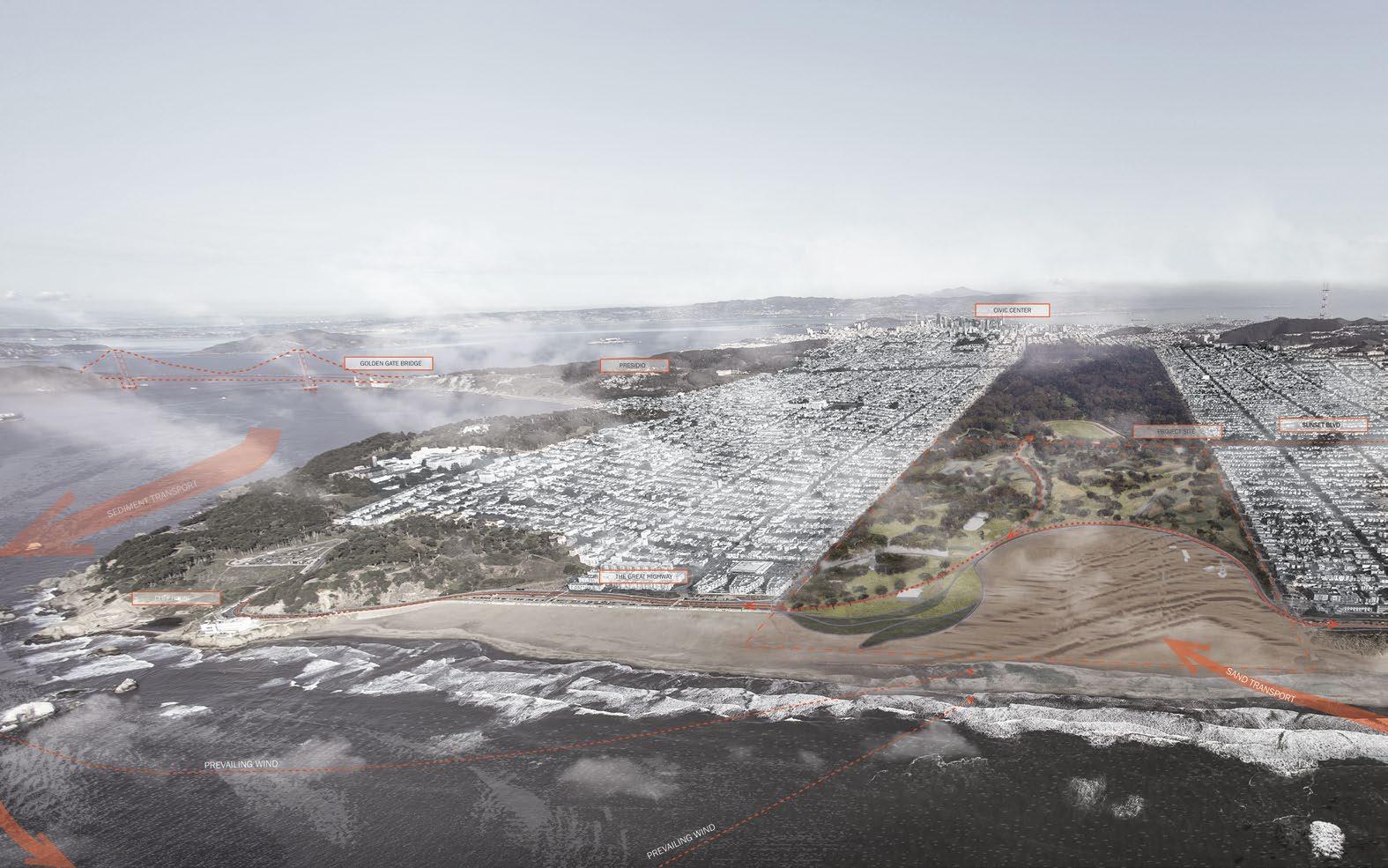
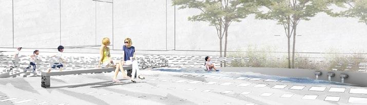
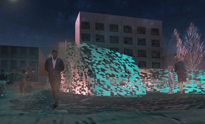
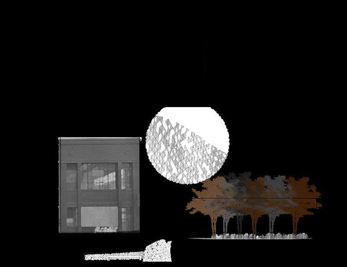
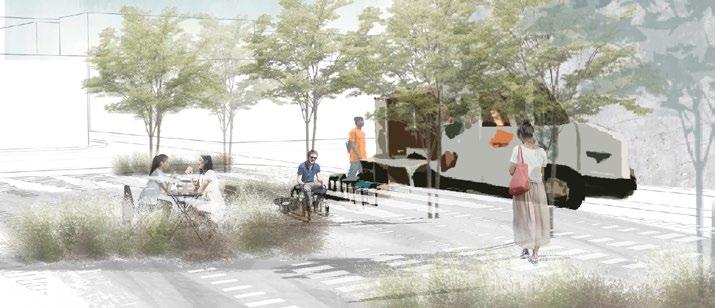
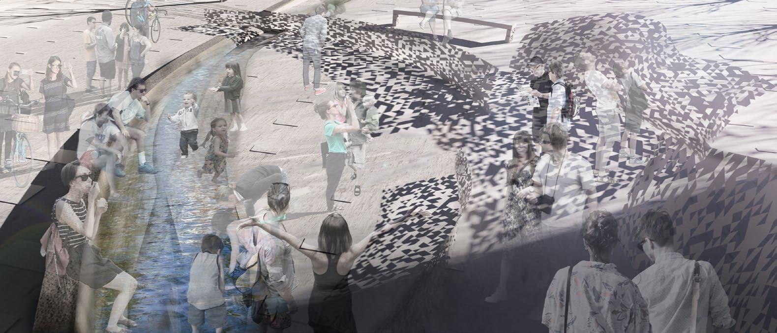
2020 UC Berkeley Thomas Church Design Competition Entry
The wall serves as a timeless device to measure human scale. Despite changes in time and technology, people continue to rely on walls to create a sense of space and enclosure. By studying 19th-century building layouts and contemporary conditions, we decode the secrets of walls and reinterpret them as artistic sculptural elements, becoming mediums of flow.
Here, sunlight and moonlight cast rhythmic shadows, establishing a dialogue between the past and future.
Inspired by the geological context of the SOMA district, we propose a series of water features, offering endless opportunities for imagination. These surfaces reflect and distort the shadows, creating dynamic, ever-changing interactions. Let us gather here and celebrate the presence of time.
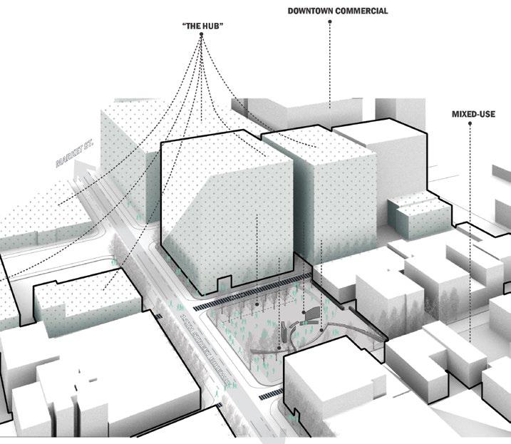
The designated open space will serve people who live and work in the area, as well as provide amenities for adjacent neighborhoods. At the conjunction of downtown commercial, “the hub” and mixed-use districts and as the only open space in adjacency. With the developement of surrounding tech industries, the park will be providing ample capacity for diverse range of community gathering.
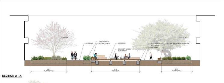
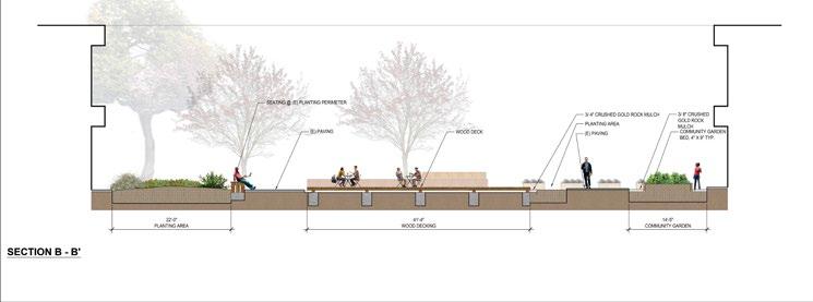
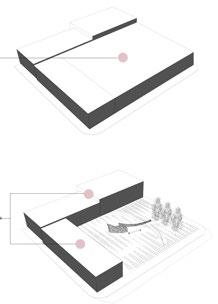
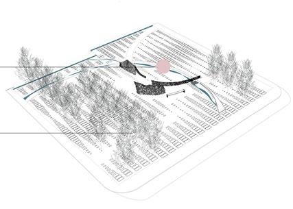
PARAMETRIC WALL DEVELOPEMENT
Parametric method was applied to make a new definition of the geometer of the structure, helping us to explore possible dimensions and directions of shadows in the space.
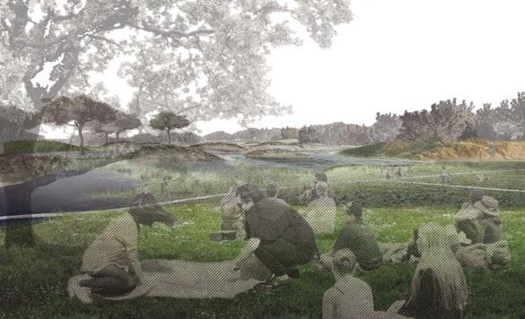
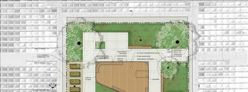
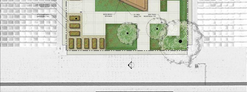
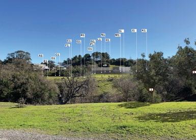
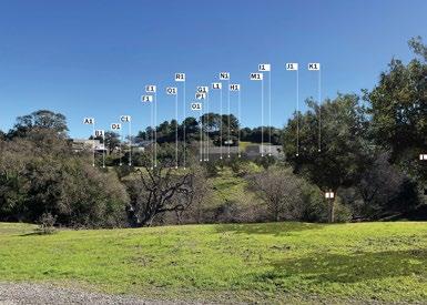
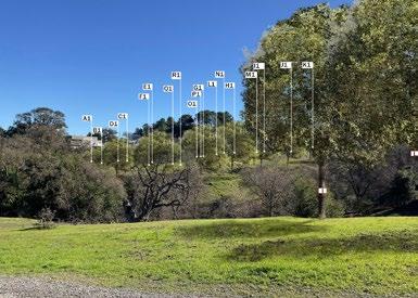
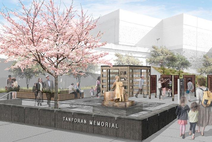
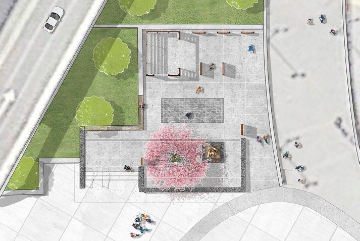
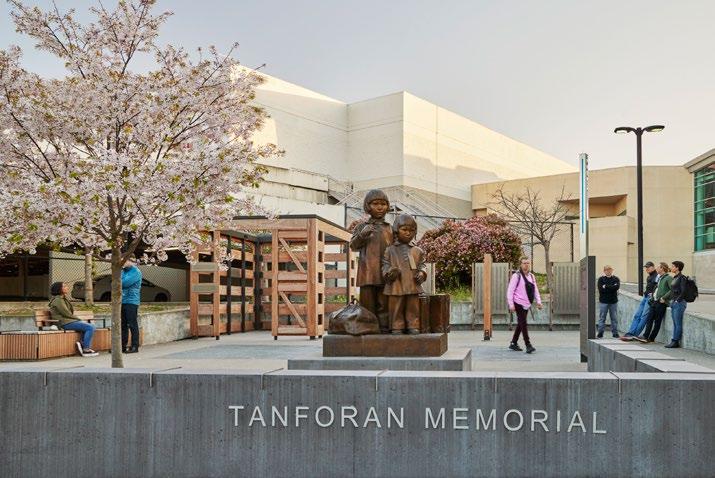
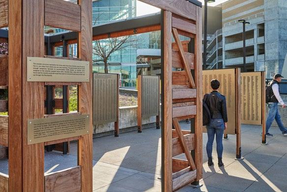
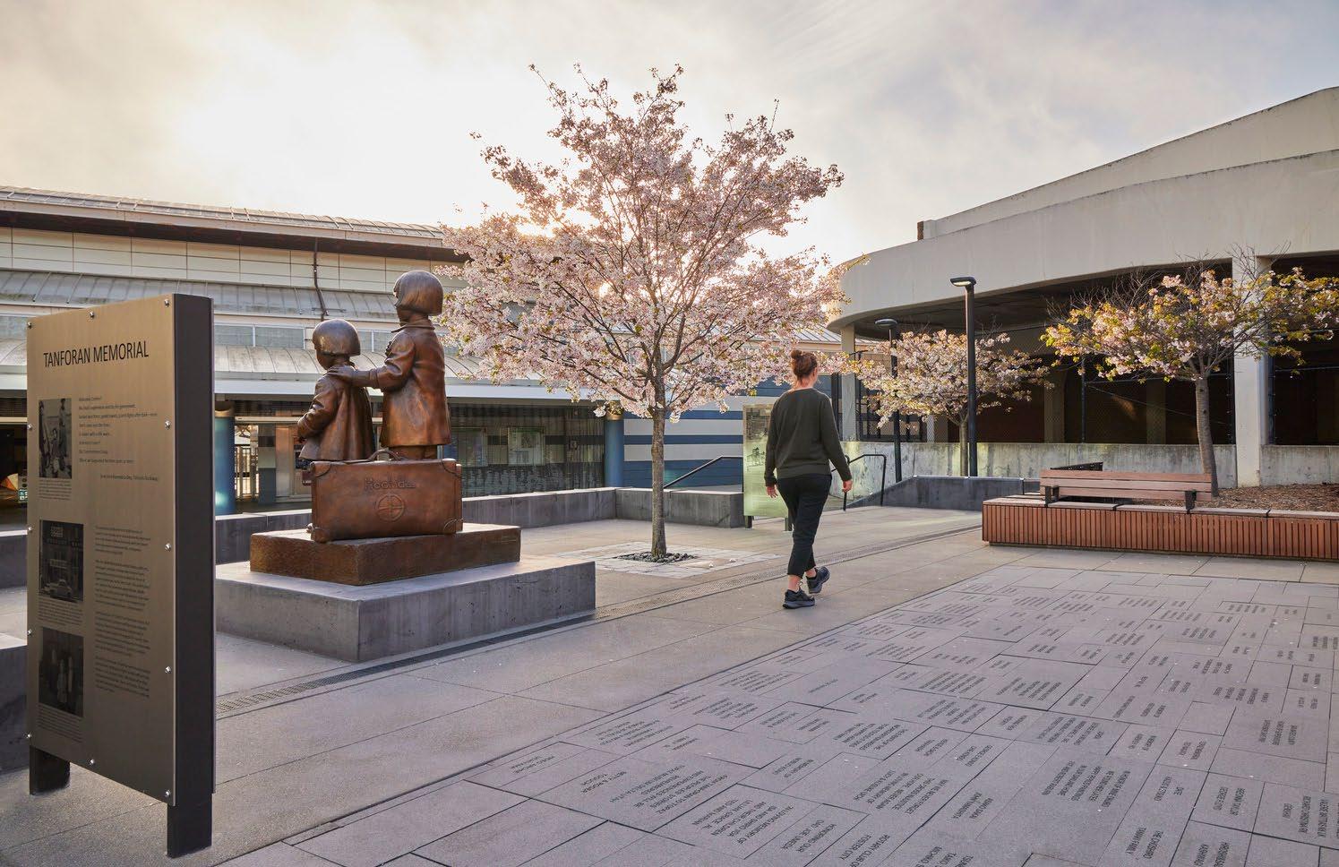
SAN BRUNO TANFORAN MEMORIAL
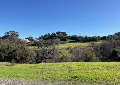
In 1942, the Tanforan racetrack in San Bruno, California, was repurposed into the Tanforan Assembly Center—a Japanese internment camp that confined nearly 8,000 people. The camp converted existing horse stalls into makeshift barracks to house the thousands of Japanese Americans detained in the aftermath of Pearl Harbor during World War II.
The memorial re-creates these barrack horse stalls, with interpretive signage that offers insights into the daily life of internees. The names of all those interned are etched on the stall doors, serving as a poignant reminder of their experiences. A sculpture of interned children, inspired by historical photographs, stands prominently beside a single Japanese cherry tree, symbolizing remembrance and resilience.