UUN:s2211328 EMAIL:15611327851@163.com TEL:+86 15611327560 CONTENTS 01 1.FREE "FIY"——Urban Open Sports Park An urban open green space focused on providing extreme sports venues. 2.MOBILE CEMETERY——Ecological Burial A floating island that continues life. 3.‘OUR DAY’——KOALA SANCTUARY A story-based shelter that connects people and koalas. 03 02 PORTFOLIO MINGJUN LIU
For MLA Landscape Architecture,University
4.CHANGING SEA LEVEL TO STITCH COMMUNITIES A design that solves the problem of rising sea levels due to global warming and causing cities to be flooded. 04 5.OTHER WORK AND ARTS Drawing,design representations,architecture design,planting design 05
Applying
of Edinburgh. B. E in Landscape Architecture Beijing University of Civil Engineering and Architecture, Beijing, China
CV PERSONAL STATEMENT
EDUCATION
Beijing Forestry University 09/2016-07/2019
Department: College of Landscape Architecture
Major: Landscape Architecture GPA: 85.64/100
Beijing University of Civil Engineering and Architecture 09/2019-06/2021
Department: School of Architecture and Urban Planning
Major: Landscape Architecture GPA: 86.41/100
HONORS & AWARDS
The 2nd Class Excellent Student Scholarship of Beijing Forestry University, 2017
The 3rd Class Excellent Student Scholarship of Beijing Forestry University, 2016
The Honorable Title of Excellent Student Leader 2016
The Excellent Award of “Beijing 798 Art Zone Photographic Contest” 2016
INTERNSHIP EXPERIENCE
People’ Daily of China 10/2017-03/2018 Post: Intern
Assisted to promote the newspaper subscription among college students Helped fulfill the newspapers’ ordering process
Beijing Yijingdao Landscape Design Engineering Co., Ltd. 09/2020-10/2020
Post:Intern Landscape Architect
Understand the daily work and working methods of basic landscape architects. Understand the importance of field trips.
Beijing Yijingdao Landscape Design Engineering Co., Ltd. 08/2021-11/2021
Post:Intern Landscape Architect
Further familiarize yourself with the daily work and working methods of basic landscape architects.
ADDITIONAL INFORMATION
Computer Skills:Proficient in PS, AI, ID, SU, CAD
Physical Modeling:Laser Cutter,3D Print,CNC router,Rhino
The professional field I am interested in is the space designed by the combination of urban design and landscape architecture, which can not only focus on solving practical problems in the city, but also make full use of the current situation of the site and the characteristics of the city to form a unique landscape, so that the landscape will not be the same.
Make full use of library and school related activities, strengthen the guidance of previous students' works and professors, and accumulate a comprehensive learning experience during the school.
After graduation, I hope to accumulate experience in a British design company to lay a solid foundation for my future work and design. And in the work to find shortcomings, planning to continue to study or continue to work.
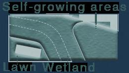
FREE "FIY"——Urban Open Sports PARK


An urban park that mainly provides extreme sports venues and takes into account the needs of surrounding users.
01Location:Beijing,China
Type:Individual Work Area:10.50ha
Time:11/2020-12/2020
The venue is located in a school, commercial and residential area in Beijing. The surrounding people have greater demands for various traditional sports and extreme sports. Based on this, an urban open space with sports as the theme is designed.
At the same time, it solves a series of basic problems in the site due to poor traffic, subway elevated, and people gathering.


Crowd type & proportion Pupils from surrounding elementary schools Child 13% The elderly in the surrounding communities Elderly 25% Students from surrounding universities and whitecollar workers in the company Youth 62% SURROUNDING DATA Exercise time 3.5 3.0 2.5 2.0 1.5 1.0 0.5 0 Hour/Week Type Child Youth Elderly Actual exercise time Outdoor exercise Advantages Disa dvantages 1.Fresh air 2.Ample sun 3.Free access 6.make friends 5.Beautiful views 4.Diverse activity 1.Travel danger 2.Vulnerable to weather 3.Outdoor more vulnerable to accidents College students love sports LARGE-SCALE DATA ANALYSIS Students: Schools: Indoor gym around the venue: Metro station around the site: College Students: Universities: 955,000 27 40 10 765,000 16 Number of students Number of schools Number of gyms Number of subawys Marginal Data Gym location School School entrance Subway Subway station Sidewalk Roadway Service area FREE "FIY" ——Urban Open Sports Park ——An urban open green space focused on providing extreme sports venues Need exercise time 0 300 600 900 1200m N 1.6miles 3.2miles Other sports Core movement 33.86% 17.19% By analyzing the proportion of college students like sports types, the type of sport venue design. Stretching exercise 20.68% Running sports 89.84% Jumping sports 12.17%
Complicated And Unclear Traffic Route
Function & distribution of 3 issues Problems
According to the field survey and survey of the residents, students and white-collar workers around the site, the three most serious problems in the site were drawn, and analyzed based on the model and on-site photos.


A.Large flow of people
According to the field survey and survey of the residents, students and white-collar workers around the site, the four most serious problems in the site were drawn, and analyzed based on the model and on-site photos.

Personnel concentration: Subway station Commercial land Office land Residential area


B.Traffic jams & poor accessibility


The subway station and bus station in the site echo the surrounding large office buildings and commercial centers, increasing the requirements for site traffic. The east side sidewalk site high-voltage lines cut, compression of the original width. And the current east-west traffic route within the production area is basically zero.

Problem A occurs Problem B occurs Problem C occurs

Status photo site


Surrounding roads Affected sidewalk
C.High overhead noise & low site availability
The noise from the subway station and viaduct on the west side of the site has a serious impact on the site, and the utilization rate of the gray space under the viaduct is relatively low.


Subway station

Educational land Residential land Commercial land Office land


SITE
ANALYSIS
Tsinghua East Road Metro Station ① Wudaokou Cinema ② Chengfu Road ③ High-Voltage Wire ④ Space under the viaduct ⑧ Wudaokou Subway Station ⑦ Wangzhuang Road ⑥ Tsinghua East Road ⑤
Large-scale

ISSUE SOLUTIONS
Lack of sportsfield for adults
Lack of playground for children
Lack of plaza for the elderly Heavy traffic Poor accessibility Viaduct impact
Insufficient urban public sports fields
Insufficient area of school sports ground
Inconvenient gym
Many business districts
School intensive Office area
Subway station High-voltage station Unauthorized occupation of road
Narrow sidewalk loud noise
Low space utilization under the bridge
Extreme sports (personalized) Core movement (popularization)

PLANE DERIVATION


multi-functional rest area
Improve site circulation Use plants and terrain for sound isolation


data analysis
Small-scale data analysis
FRAMEWORK
CORE MOVEMENT (POPULARIZATION) CORE MOVEMENT (POPULARIZATION) EXTREME SPORTS (PERSONALIZED) THE ELDERLY WHITE COLLAR USE PLANTS AND TERRAIN FOR SOUND ISOLATION AROMATIC GARDEN WATERSCAPE OUTDOOR THEATER WATERSCAPE SPORTS EXHIBITION DRY SPRAY IMPROVE SITE CIRCULATION SCATTERED MULTIFUNCTIONAL RESTING AREA SCATTERED MULTIFUNCTIONAL RESTING AREA JOGGING VIADUCT SKATEBOARD ROCK CLIMBING ROLLER SKATING PARKOUR BADMINTON TAI CHI EXERCISE SQUARE DANCE BADMINTON TRAMPOLINE PING PONG BASKETBALL DRY SPRAY OPEN SQUARE
STRATEGY PARTITION MAP
Axis According to the foundation of the axis Link, contact the Shapes and functions, solving the problem of the status of the site. Mainroad Circle Field loop Venue shape Streamline EXTREME BIKE CHILDREN YOUTH CHILDREN YOUTH
DESIGN ANALYSIS


Station A
Tongfang
Station B
Entrance Plaza
road 11.Sunken square 12.Lawn outdoor theater


activity area
Skatepark
activity area
Entrance Plaza
Terrain & vegetation analysis


MASTER PLAN 0 20 40 60 80m 1
10.Plank
13.Elderly
14.Climbing wall 15.Fun
16.Children's
17.South
18.Anti-noise terrain
Use population
Road system & streamline analysis Youth Plank road 0 meters Elderly Child White collar Runway loop Secondary road First-level road 0~1meters 1~2 meters 2~3 meters 3~4 meters
Analyze
2 5 7 6 8 9 10 12 11 13 14 16 15 18 17 3 4 1.Subway
2.Tsinghua
3.Cinema 4.Subway
5.North
6.Vibrant
7.Aroma
8.Fun
9.Trampoline
N
analysis
Analysis of the site in the respective regions in accordance with the population and the type of land space surrounding type populations. According to the design of the site and road conditions for classification and classification.
the topography and vegetation distribution of the site.
timing fountain
rest area
basketball court
area


SECTIONAL PERSPECTIVE 1-1:SKATEBOARD AND ROCK CLIMBING VENUE SECTIONAL PERSPECTIVE 2-2:SUNKEN PLAZA AND LAWN THEATER L1 1L L 2 L 2 A B D C A.SKATEBOARD AREA B.PLANK ROAD OVERLOOKING


PLANT SPECIES AND ACTIVITY TYPES C.Elderly activity area D.Fun basketball court Arbor Herb Shrub Cerasussp. Weigelaflorida cv.Red Prince Iris tectorum Maxim. Irispseudacorus L. Coreopsisdrummondii Torr.etGray Diospyros Pinus tabuliformis Carrière Pinusbungeana Zucc. Prunus cerasifera Ehrhar f. Salix matsudana f.pendula Fraxinus pennsylvanica Rosa xanthina Lindl Ligustrum× vicaryiHort Lonicera maackii (Rupr.)Maxim. Rosasp. Acer truncatum Bunge Amygdalus triloba Malus micromalus Butomus umbellatus Cosmos bipinnatusCav. Physostegia virginiana Platycodon grandiflorus Types of plants in the Fun basketball court Types of plants in the elderly activity area Arbor Herb Shrub Sophora japonicaLinn. Berberisthunbergii var. atropurpurea Chenault Bellisperennis L. Koelreuteria elegans Amygdalus persicaL. Tagetespatula L. Prunus davidiana Cercis chinensis Bunge Arundo donax 'Versicolor' Cotinuscoggygria Scop. Prunuspersica 'Atropurpurea' Ginkgobiloba L. Swida alba Opiz Prunus cerasifera Ehrhar f. Syringareticulata (Blume)H. Ulmuspumila L. Verbena bonariensis Pennisetum alopecuroides (L.)Spreng. Type of activity in the Fun basketball court Play in the water Walk the dog Fountain Play cricket Play badminton Running Kids playing Photograph Type of activity in the elderly activity area Tai Chi Trampoline Relax Play basketeball Play ping pong Running Square dance Skipping rope fly a kite
Skateboard area &Children's activity area &Climbing area


Children's activity area &Skateboard area
Children's activity area &Skateboard area

HANDMADE MODEL ——EXTREME SPORTS AREA
MODEL PANORAMA


F.Sunken square C.Plank road B.Elderly activity area E.Fun basketball court G.Aroma rest area D.Sunken square A.Fun skatepark HANDMADE MODEL——OVERALL MODEL E A B F G HANDMADE MODEL ——MODEL PART D C
MOBILE CEMETERY——ECOLOGICAL BURIAL

A floating island for tombs on the sea on the premise of ecology and environmental protection.

Location:Zhoushan, China
Type:Individual Work Area:5.65ha
Time:09/2020-10/2020
This site is located in the coastal archipelago of China, and its characteristic funeral pattern is unique in Chinese history.
According to the existing information of the site and the historical state of the site, the floating island of the marine ecological cemetery is designed to mainly solve the problem of insufficient funeral area in the archipelago and the destruction of the environment by primitive funeral methods.
02
MOBILE CEMETERY
Ant Island is the smallest of the Zhoushan islands in the East China Sea.
From the top, it's very small. The terrain is mainly mountainous, like an ant crawling in the east sea,so called ant Island.It is adjacent to "Taohua Blossom Island under the pen of Jin Yong". Dapinggang, the highest point on the island, is 157.3 meters above sea level, with a coastline of 7.82 kilometers.
WIDE RANGE OF SURROUNDING INFORMATION


DASHUANG MOUNTAIN

——A floating island that continues life
Funeral from and analysis
Permanent resident population
consuming
funeral
There are a large number of resident residents on all the small islands of Zhoushan
and the consumption of funeral resources is also increasing.Therefore, new funeral forms are needed. Number of people Island area HUNI TOWNSHIP DASHUANG MOUNTAIN DONGBAILIAN MOUNTAIN XIAOSHUANG VILLAGE TAOHUA ISLAND ANT ISLAND DENGBU ISLAND XUANZHEGUTOU ISLAND XIFENG ISLAND HUJIAJIAN ISLAND LUJIASHI XIAOQIAN ISLAND ZHOUSHAN ISLAND Peripheral route Docks on each island Island proportion Marine proportion 57% Land proportion 43% SITE The influence of traditional burial Occupy land Unable to degradation Plant death Waste of resources ISLAN BURIAL CULTURE Worship Go to sea Release souls from purgatory Death Usage rate Eco-friendliness Tombs/area Number of people Area/hectare Ant island Taohua island Zhujiajian island Dengbu island Changshi island Lujiashi island Xiaoqian island Huni township 100,000 90,000 80,000 70,000 60,000 50,000 40,000 30,000 20,000 10,000 0 8000 7200 6400 5600 4800 4000 3200 2400 1600 800 0 N 0 40 80 120 160m
The traditional funeral mode is fast
resources, and Ant Island needs a new
mode.
Archipelago,
ANT ISLAND


INFORMATION ABOUT LITTLE
The topography of Little Ant Island and the location of the graveyard can be seen here. The burial areas on the island are basically divided into three areas and they are all located in the south of the island mountain, which is also known as the "sunny slope". These burials are denser and require new burial space.
Reason for creating burial at sea Height of the mountain Issue1:Sea level rise Issue2:Marine ecological environment destruction Sea level rise Land area reduction Cemetery prices rise Ecological environment destruction Floating island Death of plants Heap artificial island The process of burial Choose burial site In a creamy-coloured Died Sew clothes Mortuary Chant sutras Encoffination Condolenc Burn the seven Buried and sailed across the sea Burial 30m 20m 10m 0m Existing burial location Original burial area
Ant Island has had a unique funeral system since the 1960s. Born on Big Ant Island and buried on small Ant Island. Formed a unique Yin and Yang islands across the sea opposite.
FRAMEWORK
Scarce available resources
Keep the status quo
Concentrated buried
Develop new space

Funeral form of pollution
Development of "Ecological burial"


Use ecological buried ways to reduce the funeral of the environmental pollution, but also largely reduce the cost of the residents on the funeral this item.


Worship in a single
The site forms a characteristic story line (Sadness, peace, joy


Special commemorative installation
Innovate ashes souvenirs
FUNERAL AND EMOTIONAL
Sound
There are many sounds in the funeral process, which can be roughly divided into human voice and organ voice (object voice and organ voice).

Small ants tombs huge number on the islandand the resources are saturated.
The surrounding islands need a lot of burial resources.


The establishment of floating island burial groups.


Put the ashes and biodegradable urn in the prepared place.
Plant trees on the ashes.
After 1-5 years of decomposition, the ashes and urns decompose into nourishment for trees.
Put the ashes and biodegradable urn in the prepared place. The remains were processed by cremation and other processes.

Ashes planted with flowers.
After 1-10 years of decomposition, the ashes and urns are decomposed into nutrients for plants such as flowers.

Form the ashes into the cinerary box.


Put the ashes in the wall, and people can worship at any time.
Using the high temperature of the ashes of the deceased to make crystal souvenirs, etc.
Extracting sounds from traditional funeral sounds can represent emotions.


Sounds of grief A neutral tone Sounds of joy


Mood
Choose the record you like and combine the ashes with the record to form a new form of souvenir.


Problem seeking Sadness peace joy


Usually these sounds are divided into joy, peace, and sadness. They are distributed according to a certain pattern in the five steps of the funeral.
 Protect the current cemetery
form Tree burial Underground drain Waterscape Waterfall Flower burial The soul light Stainless steel echo valley Variable temperature sits stool Wall burial Artificial diamond The record
Funerals gather on the surrounding islands Artificial island at sea
Regencration and utillization of islands
Return Return Buried Buried Funeral Funeral Embalming Embalming Finality Finality
VISION
Strategy
Sadness


Peace
Master plan units are categorized by emotion.
Based on the triangle graphics combined to form a new pattern.


The designed unit modules are distributed in the new pattern.

PLANE ELAMENT
Joy
Wall
Tree
Aggregation Encircling Open
Wall burial Ⅰ
burial Ⅱ
burial Ⅰ Meditation space Flower burial Ⅰ Flower burial Ⅱ Art studio Rest space Mounurmental waterscape Worship space Tree burial Ⅱ
MASTER
Floating island expansion mode

According to the passage of time, the entire piece floating island to the south-east of the small island of ant expansion of large ants away from the island, with the small island of ants form a new funeral Islands. Increase by about 50 units each time..


Ten years later
According to the situation of the island, the "Aggregation" and "Encircling" infrastructure and burial land should be built.
Twenty years later
It will continue to extend main roads, increase the number of "Open" groups, and enrich various types of land for funerals.
Fifty years later
Improve the whole area, reasonable distribution of "Aggregation", "Encircling" and "Open" group.
PLAN
N
1.Funeral
2.Infrastructure aggregation 3.Wall burial
4.Tree burial
5.Flower burial
6.Flower burial aggregation 7.Wall burial
8.Meditation space 9.Tree burial aggregation 10.Infrastructure open 11.Flower burial open 12.Tree burial open 11 1 2 9 6 3 4 5 8 12 7 10 0 20 40 60 80m
culture exhibition center
aggregation
encircling
encircling
encircling
PEACE
The site is basically designed with a hidden ditch under the burial wall of the whirling wall, so that the site only hears the sound of water, but does not see the water source, filling the site with more sadness.


SADNESS
Use tree burials as an environmentally friendly form of worship and remembrance of loved ones. A tree a person.
A separate worship space provides a relatively independent place to remember the past for the family of the deceased.
WORSHIP SPACE
JOY
A large area of open space provides a space for people to communicate.


JOY
A fountain device with a certain height forms the embellishment of the entire site. The intense sound of water also gives peoplea cheerful feeling.

REST AND REFLECTION SPACE
steel plates and


PERSPECTIVE
Flower burial Soundscape Tree burial
‘OUR DAY’——KOALA SANCTUARY
A story-based shelter that connects people and koalas. Location:East coast of Australia
Type:Team Work(Zhiyun Zhang&Mingjun Liu) Contribution: Rhino 50% Concept 50% Drawing 50% *Unlabeled drawings, cretto Zhiyun Zhang draw. Area:2.13ha Time:11/2020-12/2022
The site is located in eastern Australia, at the junction of New South Wales and Queensland. It is the hardest hit by wildfires and koalas in Australia.

In order to commemorate the damage caused by wild fires to koalas and to strengthen the relationship between people and koalas, with the theme of "people and koalas", we designed a simple treatment and recuperation site for koalas affected by disasters, and promoted people's understanding of koalas.

03
‘OUR DAY’
——A space where people and koalas help each other
The minimum burning area of wildfires in Australia is 3.6 million hectares. The highest estimate is 10.3 millionhectares.According to media reports, Australia's forest fires killed 5 billion animals.


Based on the distance between the site and the surrounding koala rest area and the comparison between the number of koalas and the number of eucalyptus trees in the surrounding green space, a small memorial theme park with the theme of koala protection was designed.
Tamborine National Park
TreeTop Challenge -Adrenaline Park Mt Tamborine Mountain
Tamborine Recreation Reserve
Tamborine Mountain Botanic Gardens Tamborine Rainfores Skywalk
Glow Worm Gave Rosser Park
Guanaba Park
Mystery Road Reserve
Tamborine Recreation Reserve
The Pines Golf Course
Willow Vale Mountain Resort Hope Island Resort Golf Course
Caballo Road Reserve
Coomera River
King Parrot Reserve Tamborine Mountian Golf Course
Nerang Forest Reserve
Coombabah Lake
Lower Beechmont Conservation Area
Nerang Conservation Park
Sanctuary Cove Gold Coast
Canungra Land Warfare Centre Training Area Canungra Conservation Park
Freeman Famliy Park Advancetown Lake
MARGINAL DATA


Eucalyptus Density


Koala Density Site&The First Level Area The Second Level Area The Third Level Area Area Coverage Water System
by Mingjun Liu

160m 150m
Koala Population Queensland New South Wales
Drawn
Careel Reserve N 0 0.8 1.6 2.4 3.2km
SITE


BETWEEN KOALA AND HUMAN Koala types of activities
types of activities Active time (Hours) Height range (Meters) Plantation density (Plant/M²) Disance from eucalaptus (Meters) 00:00 02:00 04:00 06:00 08:00 10:00 12:00 14:00 16:00 18:00 20:00 24:00 22:00 0.00 2.00 4.00 6.00 8 00 10.00 12 00 14 00 16 00 18.00 20 00 24 00 22 00 26.00 28 00 30 00 32 00 36.00 40 00 Compare from four aspects Human Koala Drawn by Mingjun Liu Koala Open/Loud/Last/Day Eucalyptusrobusta Toona sinensis Grevillea robusta Spathodeacampanulata 0:00 12:00 6:00 18:00 Melia azedarach Melaleuca alternifolia Vanillafragrans Acacia farnesiana Gaura'SparkleWhite' BellisperennisL. Pennisetumalopecuroidescv. Xanthostemonchrysanthus JatrophapodagricaHook Cleomespinosa Jacq. Night Day Koala' speed of action Survive Eating Habits Treatment Activity Koala Conservation Knowledge Dissemination Koala Treatmen Propaganda Observing koalas Human Dense/Quiet/Slow/Night
speed of action
CONTARST
Human
Human'


RESEARCH AREA SURVEY FORM GENERATION:BASED ON THE RELATIONSHIP BETWEEN HUMANS AND KOALAS According to the current situation around the site, distance from other
resting areas, service stations, topography, traffic, water
buildings, and vegetation. 1.Mark the ouline 5.Reset tree arrays 2.Shape original terrain 6.Delimit the plantation range 3.Mold general trend 7.Manage plantation density 4.Create active space 8.Refine the platation further Drawn
THE POTENTIAL DANGER OF FIRE extract Cineole C10H18O Huge water and Poinsonousness Low ignition Forest fire Dry sandy soil High temperature Wild fire Water-storage trees Shady tress Fire-proof trees FRAMEWORK Terrain Wind Plant species Vegetation coverage Temperature Rainfall Facilities Reasons Solution Strategy Reasons Issue 1 Issue 2 Forest fire Adjust the terrain Improve the vegetation Design Landscape node Seperation between human and koalas Intentional arson Accidents by cigarettes and bonfire Self-ignition due to high temperature and dry air Lack a suitable site Not accustomed to etting alone with each other Requisition of opportunity to coexist Foehn winds Flammable trees Dry environment + + + 39℃ Vegetation Coverage Catchment Analysis Terrain Analysis Target Population Analysis Landscape View Diagram Serice Facility Traffic System Building Type
koala
system,
by Mingjun Liu
STRATEGIES
MASTER PLAN
The building mainly provides relevant knowledge ab-out koala rescue and forest fire prevention.
The use of fire-resistant material as the outer surface of the timber design the site of the service-oriented architecture.


Use eucalyptus to design the rest area in the koala activity area.
The plank road is designed in the koala activity area to increase the interaction between people and koala.
The flower border is designed with steps and murals abZout koalas and fire prevention are drawn on the step walls.

DERIVATION SITE GRAPHICS
Flower bed multi-functional space division site entrance to provide the necessary space to rest.
Drawn by Mingjun Liu
1.Entrance
2.Waterscape space

3.Waterfront pavellion
4.Flower border
5.Eucalyptus plaza
6.Ecological pond


8.Propoganda building

7.Koala mural


8.Flower border


9.Koala activity area
10.Forest path 11.Entrance
Drawn by Mingjun Liu
7 1 2 3 5 4 6 8 9 10 11 N 0 3 9 18m
Drawn by Mingjun Liu
ELEMENT LAYERS PLANT CINFIGURATION ANALYSIS
Concept space
Human activity area
Koala activity area
Funtional space
Entrance
Human resting area
Flower border
Human resting area Building
Koala activity area
Border protected area
Eucalyptusrobusta
Melia azedarach
Toona sinensis Grevillea robusta Spathodeacampanulata Macadamia ternifolia
Melaleuca alternifolia
Helicia formosana Hemsl. Vanillafragrans
Xanthostemonchrysanthus JatrophapodagricaHook
Banksiaintegrifolia
Tree
Shrubs
Perennials
Marble pavement Boardwalk
Pool Memorial Hall
Structure Road system


Main road Plank road Path
Plants
Acacia farnesiana Craspediaglobosa StylidiumuliginosumSwartz
BellisperennisL. CleomespinosaJacq. Gaura'SparkleWhite'
Panicumvirgatum 'HeavyMetal' Pennisetumalopecuroidescv. Hosta'UndulataAlbomarqinata'
Celebrations and Weddings
Gardening Flowers Gardening Watering
*Flammable herbaceous plants such as Gramineae are uniformly trimmed to 5-10 cm above the ground before autumn.
SPACE TYPE
The human resting space is connected with the highly enclosed space of plants.
Use multi-level terraces and flower border plants to create rich mid-tolow height landscapes.


Green space
The water surface is connected with the activity venue, and the vase is dotted with dried trees around the venue.
A plank road is set up in the eucalyptus forest for people to watch koalas.
 Drawn by Mingjun Liu
Drawn by Mingjun Liu
Drawn by Mingjun Liu
Drawn by Mingjun Liu
Drawn by Mingjun Liu
Florescence Florescence Florescence Florescence Florescence Florescence Florescence Florescence Florescence Florescence Florescence Florescence Florescence Florescence Florescence Florescence Florescence Florescence Florescence Florescence Florescence


activity area Aquatic plant Sketching Admire the flower border See mural Forest tour Koala activity area Photograph
activity area Rest area Aquatic animal Take a walk Observe the koala Waterscape Koala activity area
SECTION VIEW A-A:KOALA MURAL&HUMAN RESTING AREA SECTION VIEW B-B:KOALA ACTIVITY AREA&MIRRORED WATERSCAPEAREA Human
Human
Drawn by Mingjun Liu
Drawn by Mingjun Liu
MONUMENTAL BUILDING&HUMAN
RESTING AREA
Effect picture location
The combination of hard pavement and forest: the symbiosis of nature and artificial landscape.


Effect picture location

Two places where people from lower places interact with koalas : the walkway and the building.
KOALA VIEWING & BOARDWALK
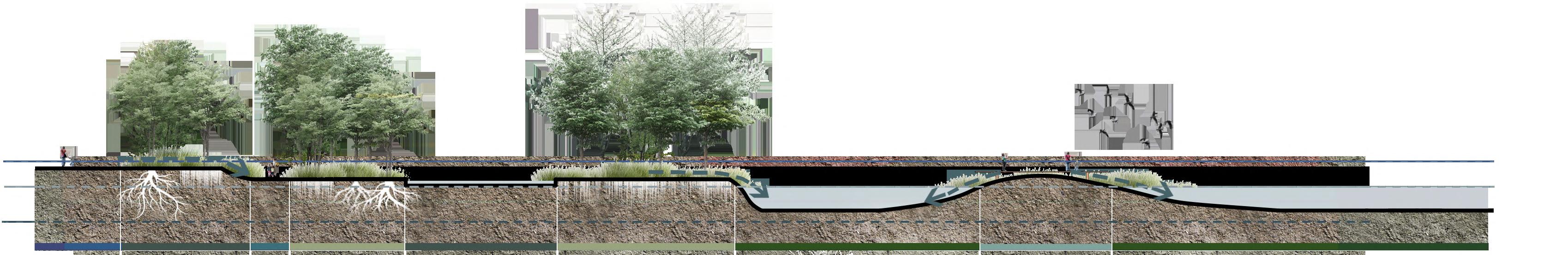
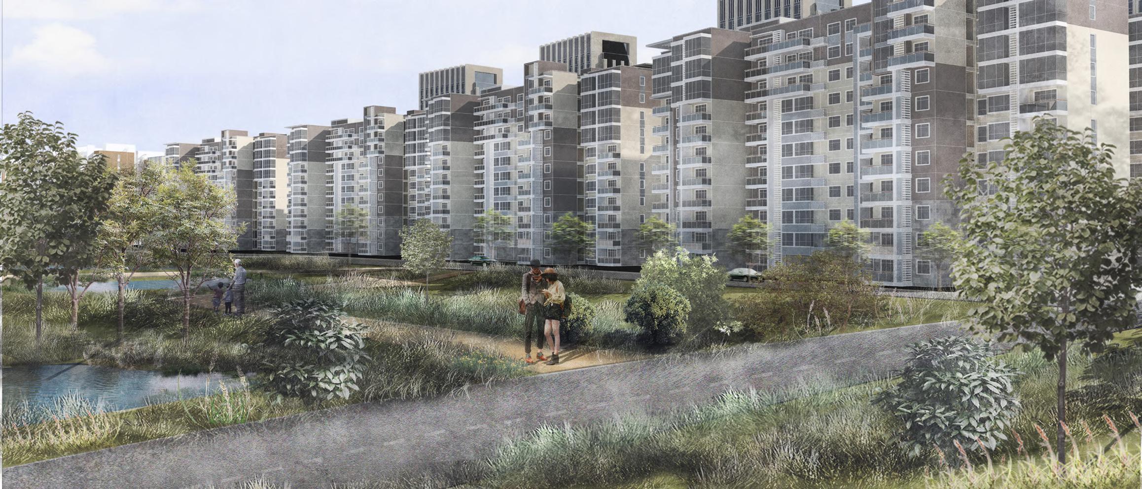
CHANGING SEA LEVEL TO STITCH COMMUNITIES

A design that solves the problem of rising sea levels due to global warming and causing cities to be flooded.

Contribution: Rhino 34% Concept 34% Drawing 34%
Location:Tianjing, China
Type:Team Work (Wenbo Yu,Yingxue Guo&Mingjun Liu) Area:334.50ha Time:07/2020-09/2020
The project is located near the Haihe River in Tianjin.
Due to the rising sea level caused by climate warming and the flood control problems in the Shanghai River Basin, the Haihe River has always been the hardest hit area of urban waterlogging.
From the perspective of ecology and landscape, the project combines the current topography of the site to increase the water retention capacity of the green space on both sides of the river bank, design and increase the wedge-shaped green space; according to the community practice, design and plan the waterproof form of the surrounding buildings to improve the flood control capacity; the green space and the community are formed Flood prevention network to reduce waterlogging hazards.
04
TianJing, is the national central city of the People's Republic of China and the largest open coastal city in northern China. It locates in western BoHai sea,and also the estuary of the Haihe river. Because of the abundant water resource, the city rose of water transport to facilitate economy. Nevertheless, with the global warming, the rainfall increases in summer. the rising water level brings many potential problem, especially the floodhazard.
Loction

Topography and isobath


Eventhough the speed of typhoon in TianJing is limited, the average speed hardly surpasses 3 grade.However, the form of BoHai bay looks like a trumpet to shape a hurricane. Besides, the depth is so shallow that causing the problem more remarkable.
Change
SITE
The chart shows that both the peak rainfall and the peak storm surge occurred in August and September, reaching a peak of 590 milliliters.
The chart shows the trend of sea level rise in Tianjin from year to year, reaching a peak of 95mm by 2015.


of storm surge Sea level changes Shorline utilization degree
SEA LEVEL TO STITCH COMMUNITIES *In six cities from left to right order:Liaoning,Hebei1,Shandong,Bohai,Hebei2,Tianjin THE PROPORTION OF DIFFERENT PARTS OF THE COATLINE OF TYPE PERENNIAL MEAN SEA LEVEL COASTLINE LENGTH N Typhoon Track The area flooded when warming 4℃ The area flooded when warming 2℃ The area with many hard ground Industrial Pollution Area 600 550 500 450 425 470 480 500 480 480 480 540 550 590 530 570 570 5 Days (water level value ≥ 470during 1950-2010 % 100 90 80 70 60 50 40 30 20 10 0 1986 1996 2006 2016/YEAR Shoreline utilization degree: Liaoning Hebe1 Shandong Bohai Hebe2 Tianjin Artificial coastine: Natural coastine: /km 300 150 50 200 100 250 0 ml 120 80 40 0 -40 Jan Feb Mar Apr May Jun Jul Aug Sep Oct Nov Dec 2003 2005 2007 2009 2011 2013 2015 0 5 10 20KM
CHANGING
Unutilized natural revetment area

The large area has certain resistance to floods, but people hardly use it.
Overlarge hard revetment area
There are many ports with hard revetment,which are impermeable and have poor resistance to flood.
Low connected community area

There are less connecting passages between communities, with no systermatic green network.

More traffic accessory area
There are a variety of elevation differences , which are useful to rebuild site terrain to control flood.
green space Unacessible green walking belt Limited flood storage capacity Hard revtent Residential Area Grey infrastructure Nature revetent Residential Area Residential Area Grey infrastructure Residential Area Residential Area 1917 1939 1963 1978 1998 2020
OF FOUR TYPICAL SPACES
OF FLOODING Maximum water level: 3 meters Disaster victims: 100,000 Affected areas: 80 percent Damaged homes: 100,000 Displaced people: 650,000 Destruction of land:4.4 million Number of people affected: 22 million people Economic loss: 6 billion yuan. The largest flood occurred
years since the construction of the Reservoir in Tianjin Yuqiao Reservoir.
entire
It affected 29
(cities
districts) .
to the flood
on duty
day
Broken
PROBLEM
CURENT SITUATION HISTORY
in the 48
One of the worst in the
basin for 150 years.
provinces
and
Adhere
control
24 hours a
and lead a shift system.
RIVERSIDE&URBAN LANDSCAPE PATTERN


The green roof
Update drainage system
Drainage channel
Rain garden
Wet pond
Underground reservoir Inland wetlands
Headland
Inland bay
The detention main lawn
Pocket park
Enhance river bank accessibility
Create participatory design

Decorate elevated facilities
Increase soil seepage rate
Set grading road system
Elevated bike lane
The wall enclosure
Waterproof building material
Building base enhancement

Open trench
Building reinforcement Add support columns 1.Increase the utilization of flood water 2.Improvement of flood control capacity Build resilient infrastructure 1.Reshape the public space network 2.Improve the renewal cycle frequency of water system


Community
Alleviate flooding problems Improving resilient river ecosystems Form a complete gree space system
FLOOD CONTROL CONSTRUCTION
way Transit facilities Architecture


Use the wall to hold back the flood water. Use waterproof building materials to strengthen the architecture.
Community surrounding the establishment of the ditch. To speed up the drainage
Issues Strategies Outcome FRAMEWORK
Rain seepage Drainage system Water storage system River landscape node
green
Permeable pavement The detention main lawn Underground reservoir Enhance river bank accessibility Inland wetlands Decorate elevated facilities Low elevation greenbelt Drainage channel Wet pond Enhance river bank accessibility Headland Set grading road system The green roof Update drainage system Rain garden Enhance river bank accessibility Inland bay Elevated bike
Poor flood control capacity & poor water storage capacity Insufficient and unaccessiblegreen community space Unevenly and broken green belt
Building reinforcement. Avoid using lower floors. Riverside
Add support columns. Raise the building. For building the dam. Urban
lane Flood Flood
system Flood
landscape strategies
Landscape Strategies Rain seepage Drainage system Water storage system River landscape node Community green way Transit facilities Architecture
Low elevation greenbelt
Permeable pavement


MASTER PLAN SACTIONAL COMPARISON CHART 1-1 2-2 3-3 4-4 1’-1’ 2’-2’ 3’-3’ 4’-4’ Rain seepage Drainage system Water storage system River landscape node Community green way Transit facilities Architecture Low elevation greenbelt Permeable pavement The green roof Update drainage system Drainage channel The detention main lawn Rain garden Wet pond Underground reservoir Inland wetlands Headland Inland bay Pocket park Enhance river bank accessibility Create participatory design Increase soil seepage rate Set grading road system Elevated bike lane The wall enclosure Waterproof building material Building base enhancement Open trench Building reinforcement Add support columns L 4 L 4 L 3 L 3 L 2 L 2 L 1 L 1 N 1 1 2 1 2 1 2 1 1 1 1 2 3 1 1 1 3 2 2 1 1 2 6 3 5 3 1 1 1 2 1 3 2 1 2 1 2 2 1 2 3 2 2 2 3 3 6 3 3 5 0 150 300 450m 1 3 5 4 1 3 5 5 3 1 2 1 3 1 1 1 2 3 3 1 1 2 1 3 3 3 3 3 3 3 1 2 2 1 1 3 1 1 2 3 4 5 3 5 4 2 3 5 1 2 6 2 4 2 4 2 3 2 1 2 2 3 3 1 1 1 1 2 2 1 1 2 1 4 1 1 4 1 2 2 2 1 3 2 1 1 1 2 1 3 3
Headlands
Inland wetlands
Inland river Bicycle system

Rain garden
Grading road system


DETAILED ANALYSIS OF SITE DESIGN


A.Small island eases the impact of currents.

B.Green space and activity space cascade distribution.
C.Stones and wooden fences hinder the flow of water.
D.Stones and wooden fences hinder the flow of water.
A.Use small terrain and steps to form a stepped water-proof structure. B.Combination of wet pond and wetland. C.Inland river and wet pond are combined to form double flood control. D.Inland water flow line


Path and Main Park Road
paving


storage ditch and rest space

open green space
planting ponds and wetlands.

main road
According to the design situation, draw a cross-sectional perspective view that best represents the design terrain in the site. At the same time, draw the axis diagram of the small area in the main area and its corresponding specific strategy analysis diagram.

SECTIONAL PERSPECTIVE VIEW
A.Bicycle
B.Water
C.Autonomous
A.Permeable
B.Sinking
C.Longitudinal


> 6.25ha > 2.63ha > 435m² Total site area Expansion of nature wetland Rigid pavement field area 100 year flood line 50 year flood line 0m Water mark position 100 year flood line 50 year flood line 0m Water mark position DISTRIBUTION OF PLANT SPECIES AND ACTIVITY TYPES Scenario1 natural reventment GRASS SLOPE WETLAND ROAD STAIR RIDGE UNDERGROUND RESERVOIR BANK BARRIER ISLAND LAWN LAWN INLAND RIVER STAIR RAIN GARDEN WETLAND WET POND A-A' B-B' PLAZA GREENBELT 0m 100m 200m Active zone:macrophanerophytes&ornamental plant Buffer zone:macrophanerophytes&emergent aquatic plant Conservation zone:submerged plant&floating plant Mergus squamatus Elanus caeruleus Egretta eulophotes Larus ridibundus Coilia ectenes Jordan et Seale Konosirus punctatus Ginkgobiloba Sabina chinensis Sophora japonicaLinn. Koelreuteria paniculata Salixbabylonica Pyrusbetulifolia Bunge Ailanthus altissima Robinia pseudoacaciaL. Metasequoia glyptostroboides Salix matsudana Koidz Magnolia denudata Desr. Melia azedarach L. Syringa microphyllaDiels Wisteria sinensis Hibiscus syriacusLinn. Forsythia suspensa Kerriajaponica Leucanthemum vulgateLam. Ophiopogon japonicus Miscanthus sinensis 'Variegatus' Canna indica L. Tamarix chinensis Lour. Phragmites australis TyphaLinn. Phyllostachys heteroclada Oliver. NymphaeaL. Eichhornia crassipes Nelumbo nucifera Hemerocallis fulva Lythrum salicaria L. Irispseudacorus L. A/B A'/B'


C-C D-D 100 year flood line 50 year flood line 0m Water mark position 100 year flood line 50 year flood line 0m Water mark position ROAD DISTRIBUTION OF PLANT SPECIES AND ACTIVITY TYPES Scenario2 hard reventment > 5.47ha > 1.88ha > 3.25ha Total site area Wetland and other green space system area Rigid pavement field area > 10.55ha > 6.35ha > 3.68ha Total site area Wetland and other green space system area Rigid pavement field area C-C' D-D' 1 2 3 4 1 2 3 4 5 0m 240m 480m 720m 960m 980m 0m 240m 480m 720m 960m 980m 1.Space for communities 2.Building for activities 3.Access to water 4.Chance to sport 5.Close to nature 5 1.Access to water 2.Close to wetland 3.Chance to recreation 4.Footpath for watercourse 5.Refugee for flood WETLAND LAWN WET POND LAWN ROAD RIVER PLAZA RIVER LAWN RIVER ROAD PLAZA LAWN ROAD LAWN WETLAND C C’ E E’ D D’ C-C' D-D'
ARCHITECTURAL SECTION D-D'
ARCHITECTURAL SECTION E-E'

ARCHITECTURAL SECTION C-C'
Roof garden construction Low elevation greenbelt Add support column construction Pocket park Low elevation greenbelt Roof garden construction
Roof garden construction Strong waterproof construction Add support column construction Low elevation greenbelt Roof garden construction Strong waterproof construction Community enclosed by walls
The scene after the hard site renovation
Effect picture location
Change the original hard site of the river bank, adding design elements such as rainwater gardens, floating islands, and flood control lawns, so that the site can more effectively collect, store and use rainwater and enhance its ability to respond to changes in water levels


Effect picture location
The bicycle lane is raised. When the water level rises in the rainy season and floods the hard site, the lane can still be used. While enhancing traffic accessibility, it also has the effect of coping with the rising water level. In addition, inland river wetlands store and regulate water and create a good habitat.
&
Bicycle lane
layered road system
TWO PERSPECTIVES OF HARD REVETMENT WATERFRONT
The scene after the hard site renovation
Effect picture location
The river's massive boulders and wooden palisades are holding back much of the flood, and rising steps and slopes along the river bank could decrease the flood's velocity.
Effect picture location
The buildings are rised, When the water level rises in the rainy season and floods the hard site, the logs can still be used.The wetland and inland river also has the effect of coping with the rising water level, additionally, theses wetland could help city improve its‘ micro-climate.

lane &
Bicycle
layered road system
TWO PERSPECTIVES OF NATURE REVETMENT WATERFRONT
05


OTHER WORK AND ARTS
Architectural design Painting Plant landscape planning
Drawing,design representations,architecture design,planting design


Axonometric map Actual model USE RECYCLABLE MATERIALS TO CONSTRUCT WATERSIDE DOCKS Sections Section2-2'
layer plane
plane plane Elevation Master Plan Section1-1' 84000.0 6813.0 29138.4 22545.0 5687.0 14729.0 80000.0 1151.0 2000.0 2000.0 43490.8 609.9 5374.9 9858.0 8131.4 14141.8 35359.4 5374.8
One
Total
Sketch


PAINTING Watercolors
Watercolors
Watercolors Watercolors
HAND-PAINTED CHAOYANG PARK LOCAL PLANT LANDSCAPE PLANNING
Detailed planting design:
Beijing Chaoyang Park is the largest within the Fourth Ring Road of Beijing

City park. It is about 2.8 kilometers long from north to south and 1.5 kilometers wide from east to west. The total planning area is 288.7 hectares, of which the water surface area is 68.2 hectares and the green space occupies 87%.
The number of ever green trees / the number of deciduous trees=1:4.3, the area of evergreen trees / the area of deciduous trees= 1:3.4.


Distribution of vegetation types
Corresponding Latin Name
Evergreen tree Evergreen shrub Deciduous tree Flowering shrub Site Position
List of plants


N 0 10 20 30 40 50m


Evergreen tree Evergreen shrub Deciduous tree
Flowering shrubs & deciduous shrubs
Herb ground cover Aquatic plants Bamboo Water
N
100m
0 20 40 60 80
