
Architectural Design Strategy
MArch1 (2023/24)
Valle Imperina Outline Brief
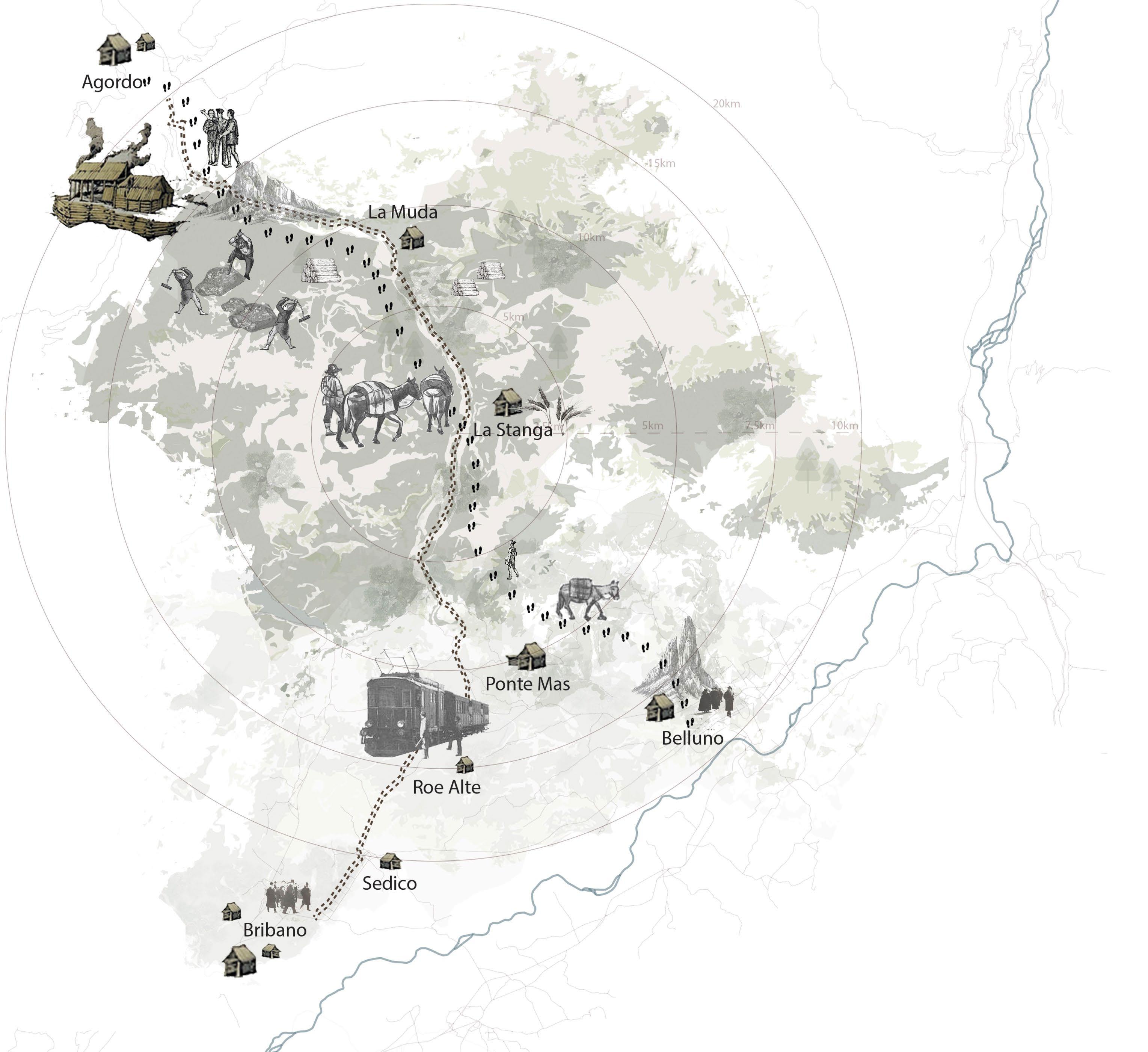
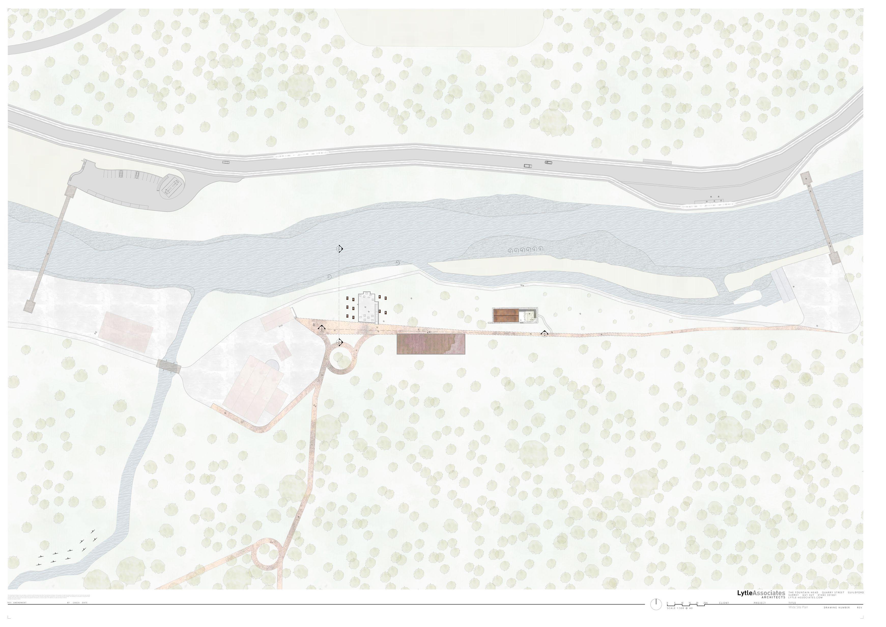
Valle Imperina, situated along the Valsugana fault line, below the town of Agordo and on the northern boundary of the Dolomiti Bellunesi National Park, holds both unutilised tangible and intangible values, capable of enhancing regional cultural heritage assets and economic potential.
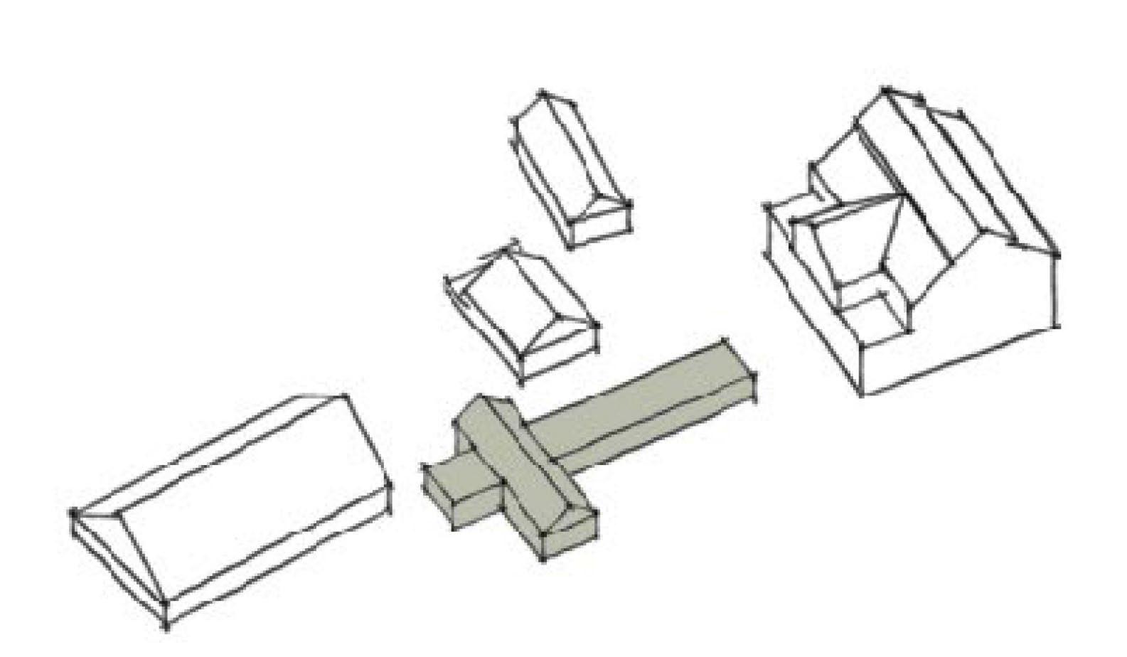
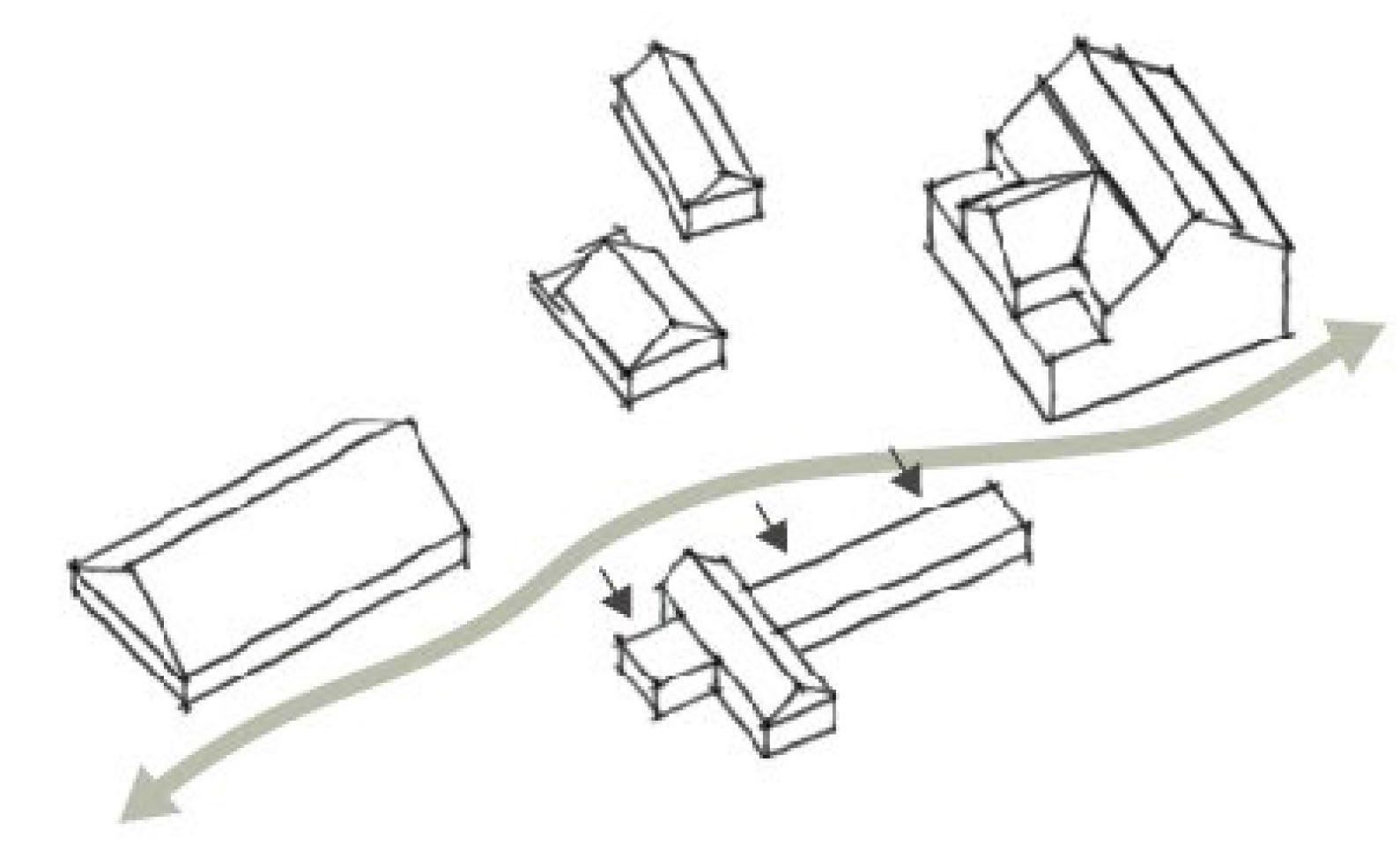
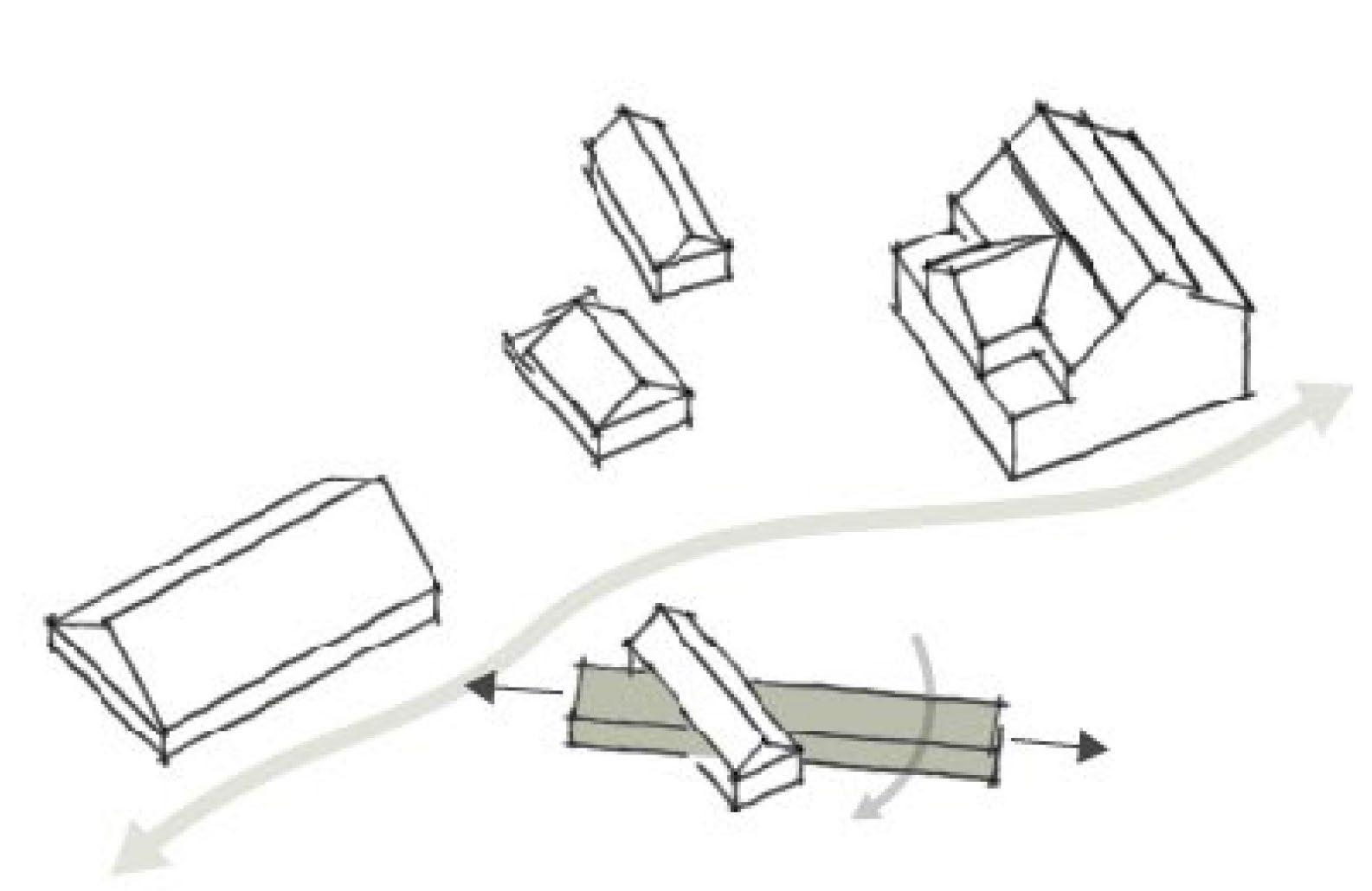
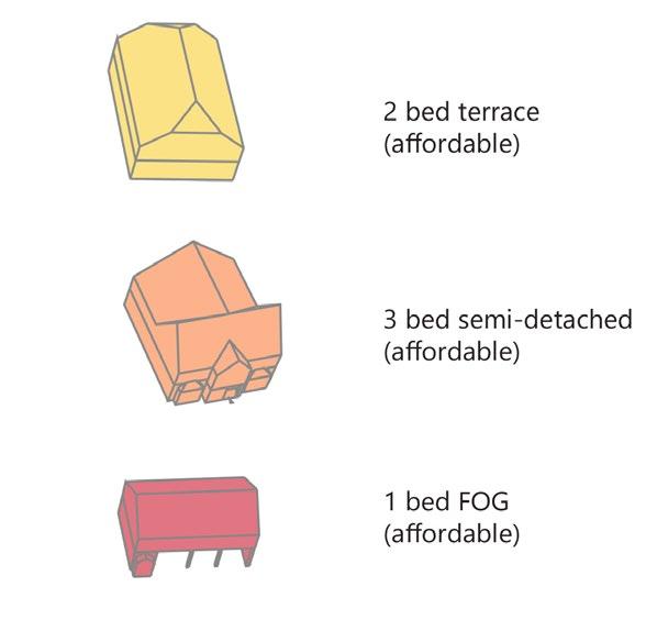
The site consists of thirteen structures (some of ruin,) various thematic trails and is surrounded by outstanding natural beauty. To date, four structures within Valle Imperina are inaccessible to tourists, due to damage caused by the Vaja storm in 2018.
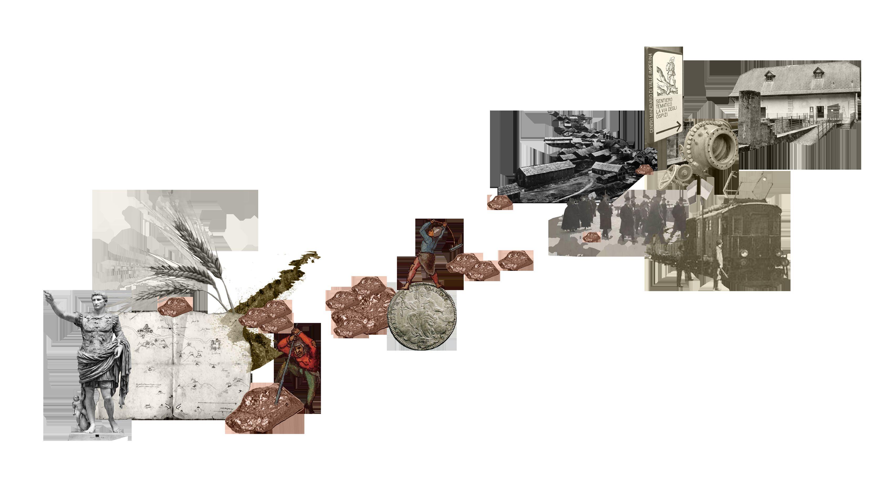
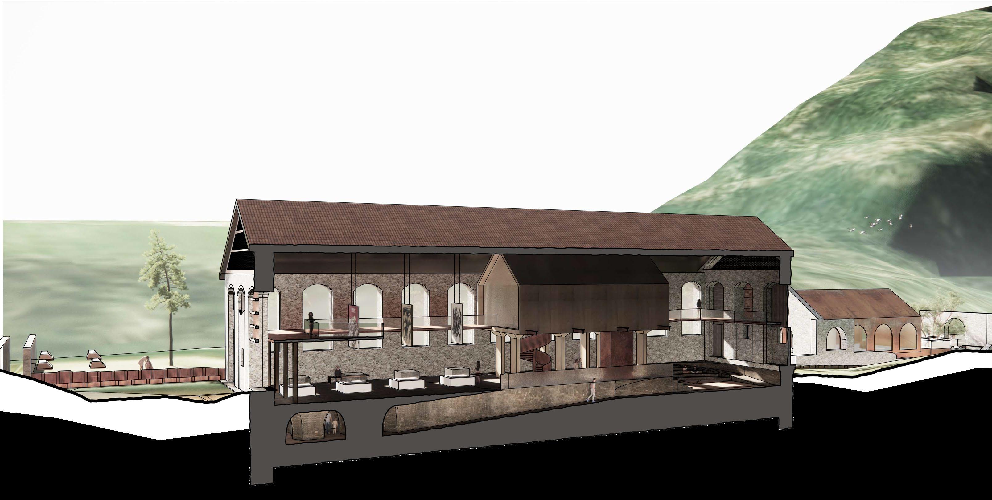
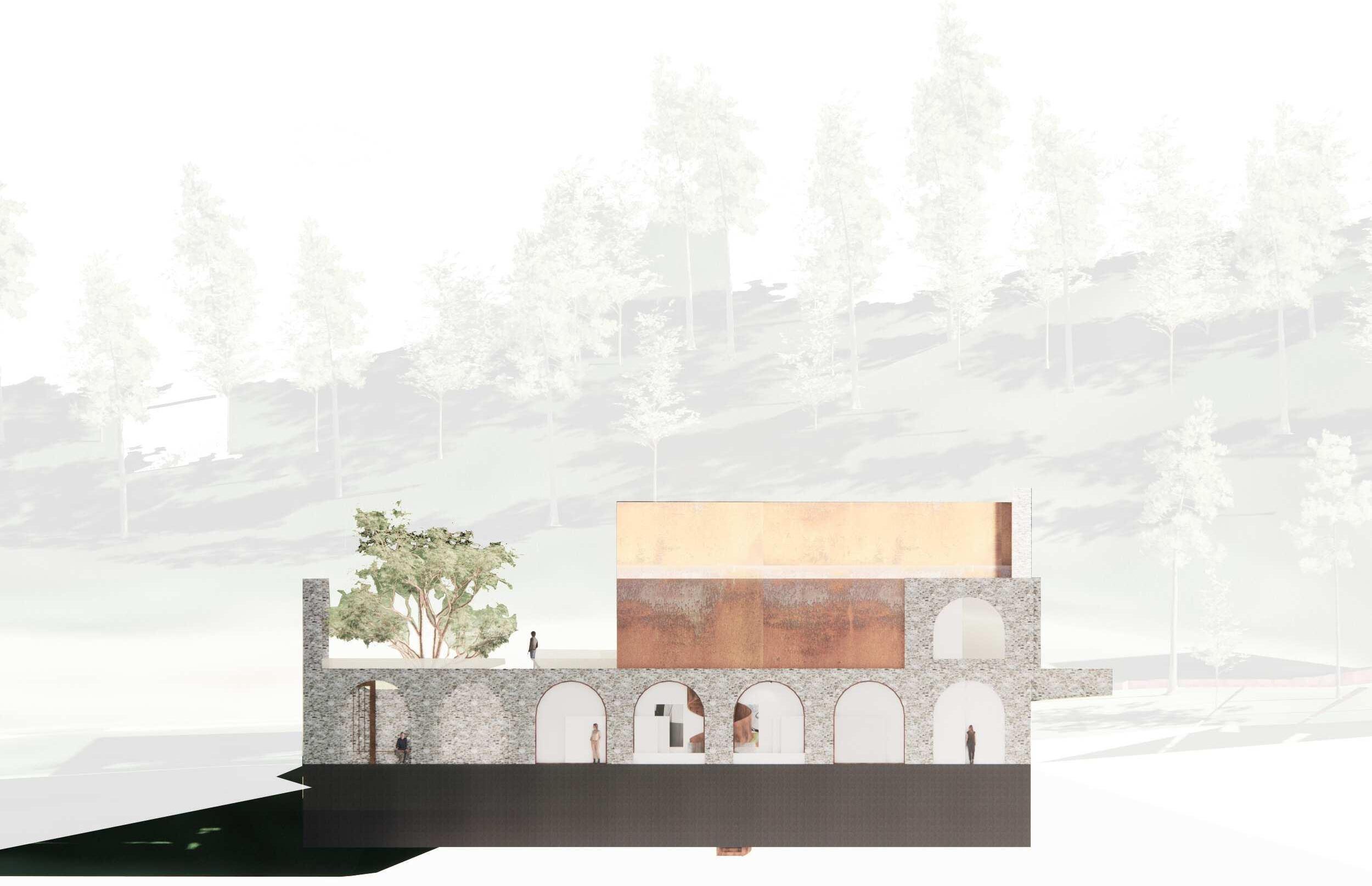
The proposal contextualises the significant history of the Valle Imperina mine, attempting to mend the tear of past tragedy, using the art of Augusto Murer and literature of Sergio Tazzer as a medium to do so. The permanent installation of their works within the site will allow local communities to build a more untroubled relationship with their history.
Similarly, engagement and participation of the various communities of the Conca Agordina and the valley throughout this process, will increase employment opportunity, and through the enabling of a social intergenerational gateway, will reinforce the local sense of place for younger generations.
Durable and sustainable infrastructure is necessary to withstand the extreme weather, and reduce the likelihood of tourist attraction closures in the future, allowing flourishing economy to generate sustainable recurring regeneration elsewhere in the region.
Architectural Design Strategy
MArch1 (2023/24)
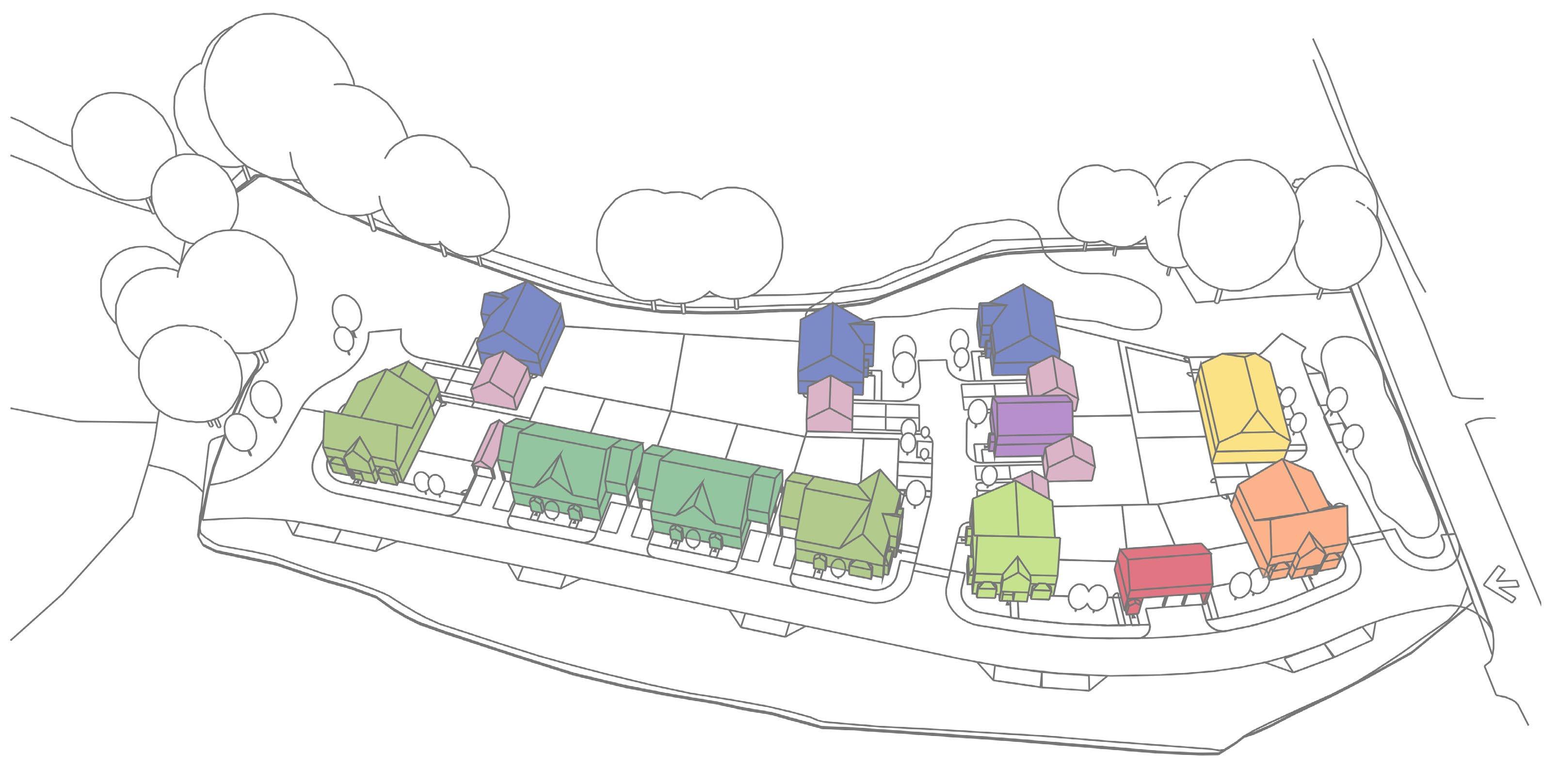
Masterplan Strategy
Within the Dolomiti Bellunesi National Park, there is very limited tourist accommodation, with availability for 263 people to stay surrounding the park, of which only 94 can stay within the park itself. As a result, accommodation prices are exceptionally high with limited availability, meaning to stay in the park is a novelty for a select few. This encourages many locals of neighbouring territories to access the park by car, producing an unsustainably high carbon footprint. Within the park’s action strategy report 2020-2024, intermodality has been highlighted as requiring attention.
Improvement to the interconnection with neighbouring territories, and providing connection between the proposed accommodation, is necessary to provide a more sustainable method of transporation through two main park corridors, of which already currently exists with solely vehicular access.
Similarly, durable and sustainable infrastructure is necessary to withstand the extreme weather, and reduce the likelihood of tourist attraction closures in the future, allowing flourishing economy to generate sustainable recurring regeneration elsewhere in the region.
Architectural Design Strategy
MArch1 (2023/24)
Masterplan Strategy
In the first instance, an e-bike route is proposed to facilitate this change. Charging points are placed along the past miners transportation network, to encourage exploration of these areas, celebrating cultural heritage of place. The charging points are also placed on the two south most railway stations below the path, encouraging a sustainable method of transport to the park after arriving by train.
This will increase the number of tourists travelling to and through the park sustainably, reducing carbon footprint and damage to the environment.
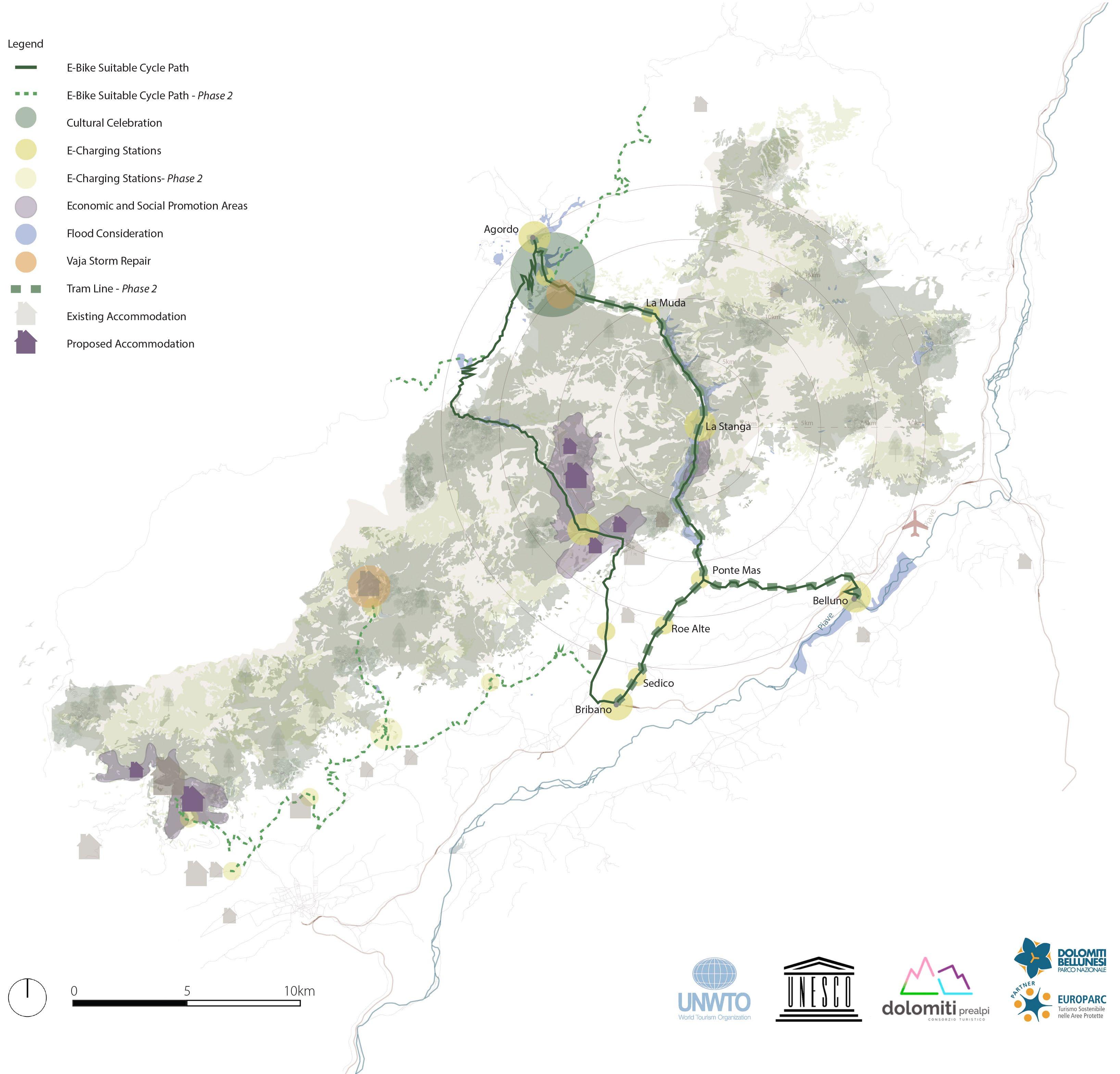

A tram line is then proposed across part of the area developed with electricity in phase 1, allowing more accessible access across the parks for those with reduced accessibility, such as the elderly, ill or families with small children.
Materials such as stone and brick will be reused within the scheme to minimise material waste and lower the proposals carbon footprint. Sheet piling, used in construction projects elsewhere in the region, will be rehoused after use within the site, to retain banks of earth and aid in the underpinning of the former stables and ruin buildings.
Catering facilities and shared group spaces have been positioned away from the sensitive buildings of significant heritage value and grouped together, all to minimise impact.
This sustainable design aims to be completely off-grid, taking advantage of the sites aspect, topography and location to propose a sensitive scheme, responsive of the natural environmental and the site’s heritage.
How can architecture engage with a postpostmodern future beyond the governance of ocularcentrism?
Limitations of Ocularcentric Architecture
The post-modern values of individual subjectivism, relativism and general suspicion of reason, embolden the ‘historical privileging of site,’ (Pallasmaa, 2005, p. 15), finding ocularcentrism present in Western culture today. As argued by Martin Heidegger in the 20th century, ocularcentrism has led to a distorted understanding of the world, reducing everything to objects to be observed and manipulated. The hegemony of site first brought about ‘glorious visions’ (Pallasmaa, 2005, p.22) in Heidegger’s view, however dominance of the ocular realm has more recently become largely nihilistic. By emphasising sight as the primary mode of access to truth, ocularcentrism obscures the possibility of other ways of knowing and gaining insight, such as intuition, bodily sensations, and lived experiences. Heidegger also suggested that vision has influenced our perception of space by encouraging a fixed and distance-oriented perspective. This perspective reduces space to a geometric grid, overlooking the more dynamic and embodied nature of our existence.
Furthermore, Heidegger’s critique of Descartes’ Cartesian gaze associates it with a scientific methodology, emphasising the restrictions of using solely observation and experimentation to gain knowledge. In this sense, the Cartesian gaze involves looking at the world in a detached, objective way, as if from a distance, in order to gain a deeper understanding of it. The Cartesian subject ‘turns everything into an object standing over against him and representing a reserve of things at his disposal’ (Heidegger, 1938, p. 61), thus exposing man’s tendency to objectify the world, reducing it to a set of isolated, measurable phenomena. Similarly, Maurice Merleau-Ponty argues that this approach overlooks the subjective, experiential nature of human existence, and that it fails to consider the interconnectedness and interdependence of all things, ‘the subject is a being in the world, a subject among objects, and his lived experience is inseparable from the perceptual engagement with the world,’ (Merleau-Ponty & Landes, 2012, p.263). Heidegger and Ponty’s analysis of the Cartesian gaze not only exposes the neglection of the rich embodied and experiential aspects of our being, but deduces the limitations of understanding the world through what can only be visually apprehended.

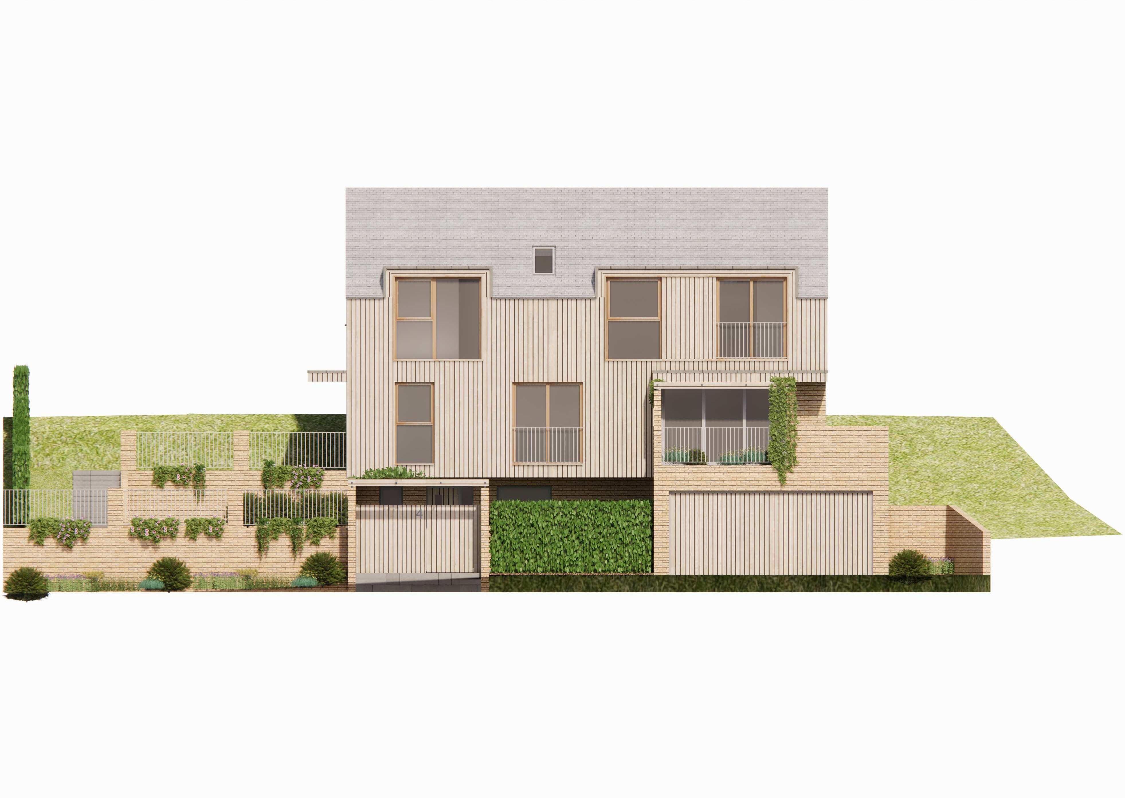
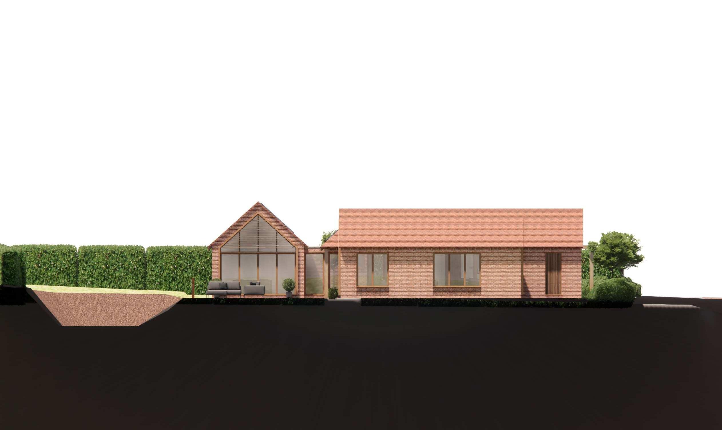
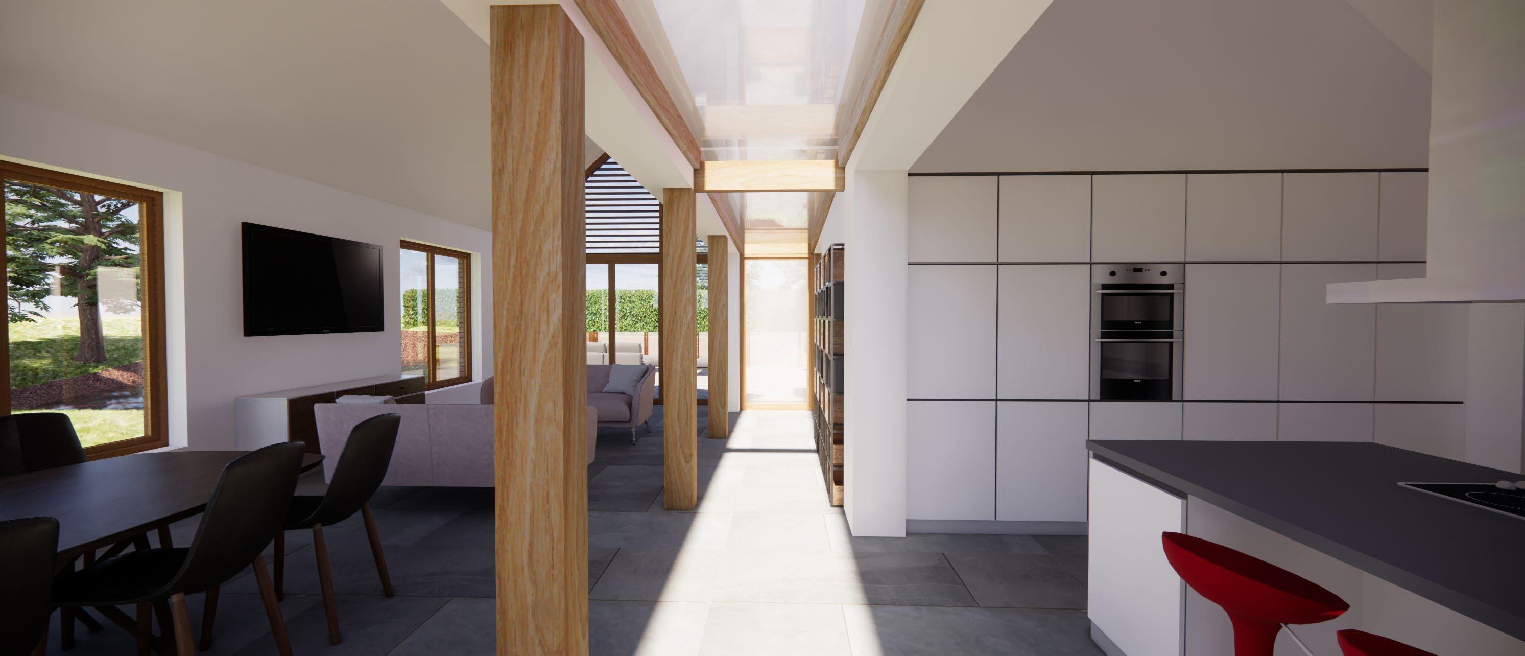
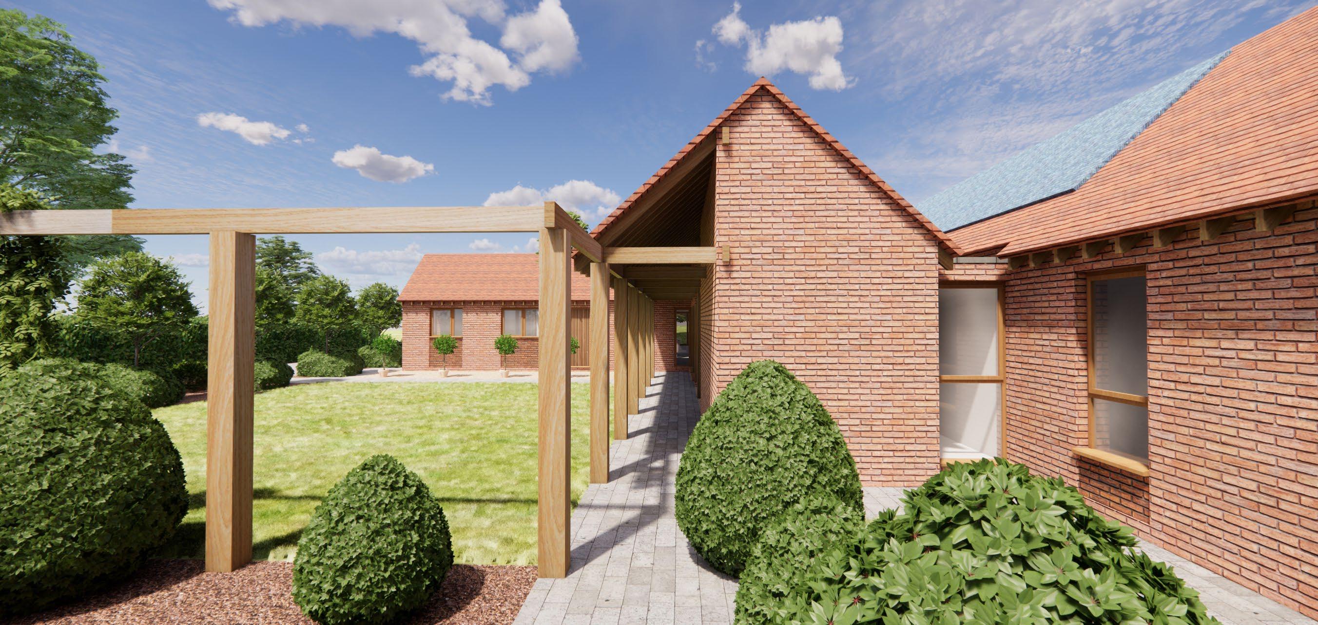
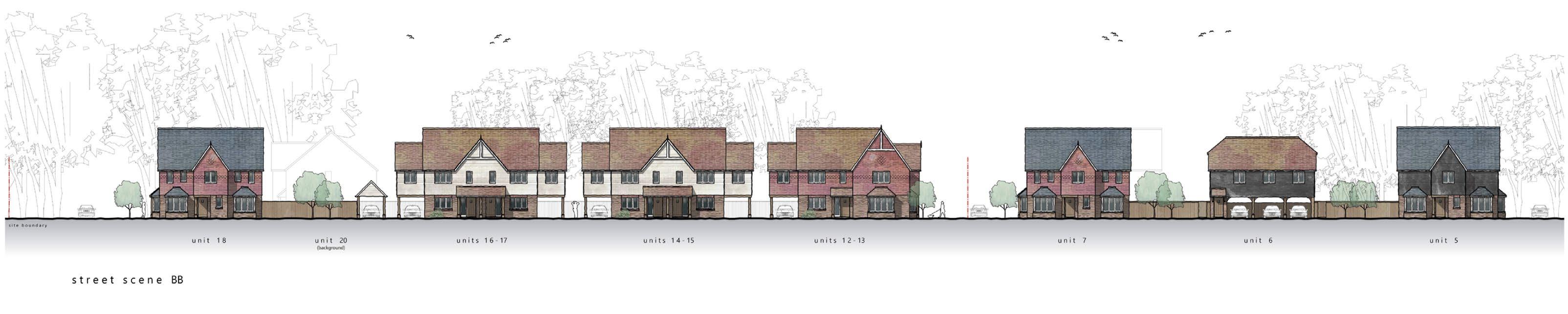
Adaptation in Place


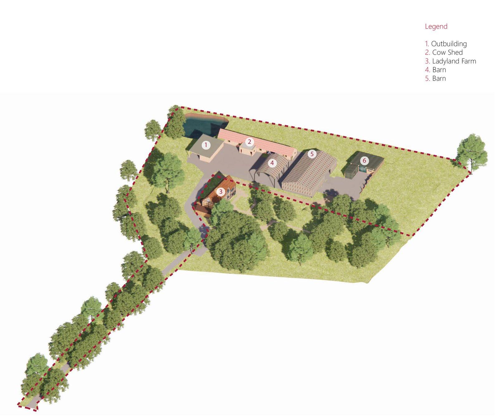
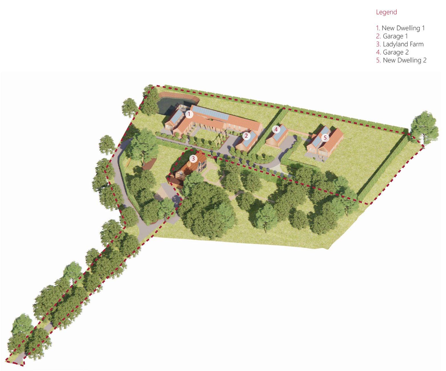
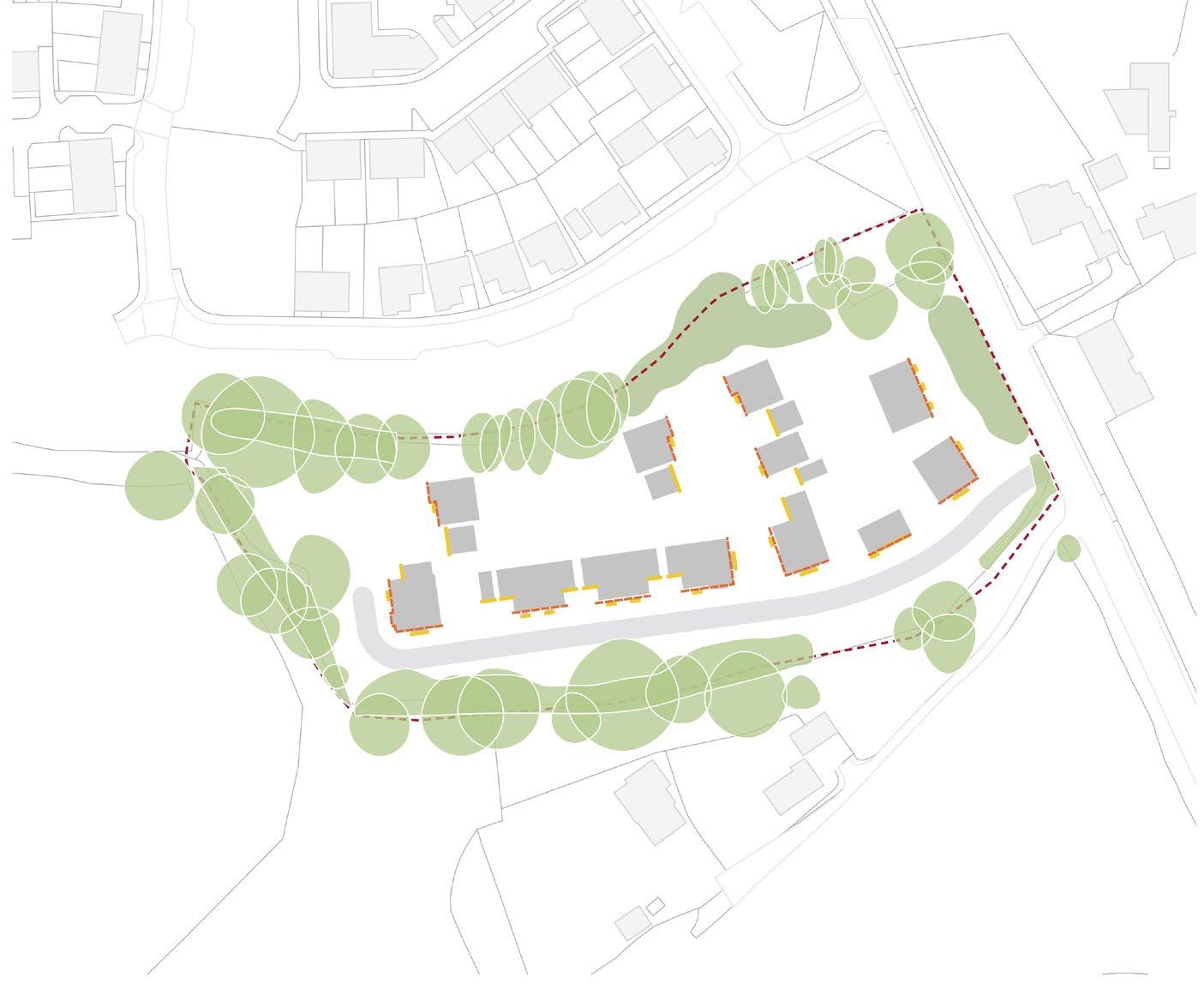
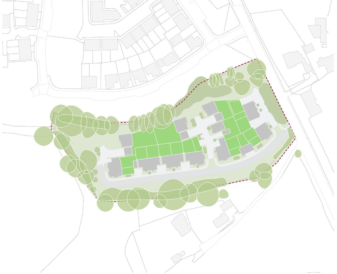
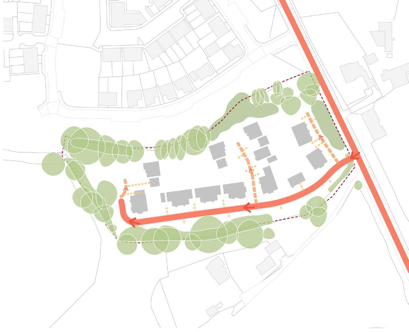
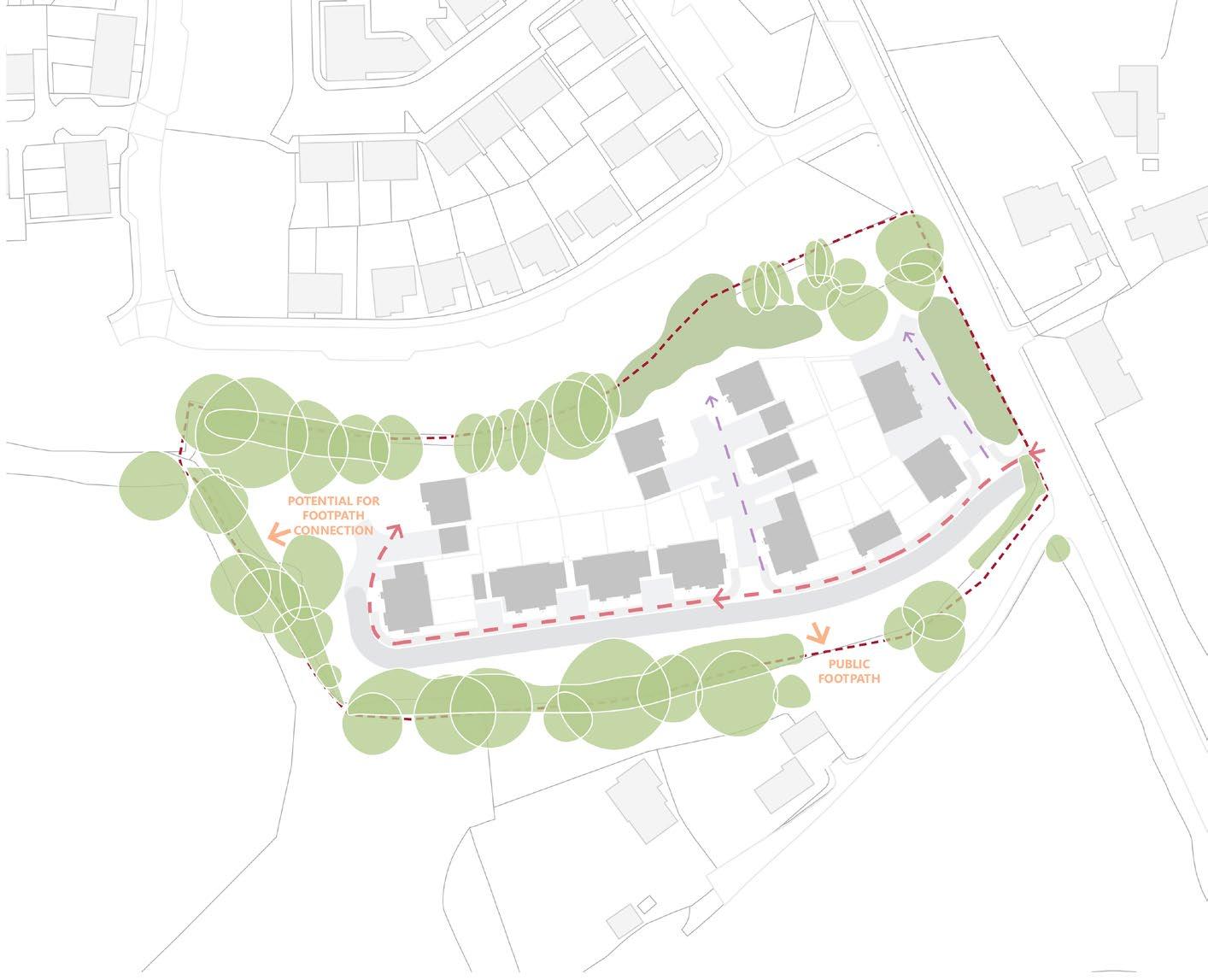
STURT ROAD DEVELOPEMENT (WA/2018/0275)
EXISTING BOUNDARYTREES
APPROVED OUTLINE APPLICATION (WA/2023/00589)
STURT ROAD (A287)
SEPARATION DISTANCE
FARM (LISTED BUILDING)
STURTFARMROAD