
INDIANA INDIANA MICHIGAN ILLINOIS 94 94 80 65 Lake Michigan Hammond Gateway East Chicago Gary Metro Center Miller Portage/ Ogden Dunes 11th Street South Bend Dune Park Beverly Shores Ridge Road Main Street Main Street Station (Munster & Dyer) 2023 NORTHWEST INDIANA TDD TOD Strategic Implementation Plan
Acknowledgments
This project was completed with Federal Transit Administration TOD Pilot Planning Funds applied for and with a grant match from the Northwest Indiana Regional Development Authority and the Northern Indiana Commuter Transit District.
Throughout this process, the team worked closely with the Town of Munster and the Town of Dyer to identify and collaboratively advance planning for the community to be proactive about future TOD.
Project Leadership
Northwest Indiana Regional Development Authority


Sherri Ziller, President and CEO
Northern Indiana Commuter Transit District
Michael Noland, President
i
Munster/Dyer • Main Street Station
ii Table of Contents 01 02 03 Introduction TOD Strategy Appendix Introduction 1 Transit-Oriented Development 3 Northwest Indiana TOD Strategy 5 Overview 12 Land Use Planning 21 Development Planning 28 Infrastructure 37 Zoning 55 Implementation 59 Northwest Indiana TDD • TOD Strategic Implementation Plan
01
Introduction 01
Overview
The Northwest Indiana Regional Development Authority (Northwest Indiana RDA) and Northern Indiana Commuter Transit District (NICTD) collaborated in 2020 to pursue a Federal Transit Administration Pilot Grant to provide planning assistance to Northwest Indiana communities impacted by the modernization and double tracking of the NICTD South Shore Line and the construction of the NICTD West Lake Line. With support from the State of Indiana and Northwest Indiana cities and towns, the two organizations successfully obtained this grant and, through a competitive RFP process, selected MKSK as the lead planning consultant to prepare this Northwest Indiana Transit-Oriented Development Strategic Implementation Plan. MKSK brought a team of experts to supplement their planning expertise including: Shrewsberry Associates, focused on Civil, Utility, and Transportation Engineering; Metric Environmental, focused on Environmental Conditions and Brownfields; and Town Planning and Urban Design Collaborative (TPUDC), focused on Zoning.
Project Background
Prior to this planning process, the Northwest Indiana RDA was authorized by the Indiana State Legislature to create economic development boundaries, called Transit Development Districts (TDDs), which function similarly to a Tax-Increment Financing District, with the purpose of enabling Transit-Oriented Development (TOD) in Northwest Indiana. TOD in Northwest Indiana will leverage these rail capital investments to provide the opportunity for additional economic development as part of the TDDs established under HEA 1144-2017. As part of this legislation, the RDA is tasked with “incentivizing, guiding and promoting economic development around the stations along the South Shore commuter line and future West Lake Corridor line.” These boundaries are no more than 320 acres (1/2 square mile) in area; capture the incremental growth in local income and property tax revenue for
use in public investment related to the station area; and are calibrated specifically for each community based on analysis, areas of opportunity, and the goals and visions of the community. The first group of eight TDDs was established in September of 2022.
This planning process harnessed the momentum generated by the capital improvements to the NICTD commuter rail system and the creation of TDDs. The team, in close collaboration with the RDA and NICTD, then commenced a process focused on how each community impacted with the rail projects and TDDs can be proactive in attracting economic development in accordance with its own growth path. This planning process commenced in September 2021 and was finalized in March 2023.
The communities along the NICTD South Shore and West Lake Lines are diverse and unique. The history, people, natural environment, and built character of each community differentiates it from another; those qualities create an unmistakable identity. In each city and town, there is a deep pride and a sense of individual spirit. Because of this, it is of the highest importance that the growth of these communities be carefully considered against what makes them special today and what their aspirations may be for tomorrow.
The planning process is built upon a deep knowledge of work and a close collaborative relationship with local cities and towns and the RDA’s long-standing commitment to supporting capital investments and economic development in Northwest Indiana. This process also built upon work completed as part of the West Lake Transit-Oriented Development Plan for Hammond, Munster, and Dyer in 2017, completed by the Northwest Indiana Regional Plan Commission (NIRPC), and recent plans completed by local cities and towns.
2 Northwest Indiana TDD • TOD Strategic Implementation Plan
01 Introduction
Transit-Oriented Development
Transit-Oriented Development Primer
Transit-Oriented Development will look different in each Northwest Indiana community, tied to each community’s individual growth path.
The Federal Transit Administration defines Transit-Oriented Development (TOD) as a dense, walkable, mixed-use area centered around or located near a transit station. This concentration of development fosters a vibrant, connected community because of increased access to jobs, amenities, businesses, and housing. TOD also emphasizes non-motorized infrastructure with less reliance on automobiles, resulting in improved safety, congestion mitigation, environmental resiliency, and better quality of life for all.
Benefits of TOD:
• Provides transportation choices and reduces dependence on driving
• Reduces vehicular travel times, congestion, and emissions
• Encourages more walkable cities and towns
• Reduces land consumption for development
• Reduces parking and increases the opportunity for higher/better uses of land
• Provides residents with choices to live, work, and play in the same area
• Expands equitable access to jobs and housing
• Links urban and suburban areas to people and jobs
• Increases housing choices by including a variety of housing types (such as homes on smaller lots, condominiums, townhomes, apartments, etc.)
• Fosters lively community nodes with co-located mix of uses (including all housing types, retail/ shops, restaurants, office, institutional, and commercial)
• Stimulates the revitalization of economically challenged areas
• Increases the potential for community growth and economic activity, stimulates the local economy
• Results in higher state and local tax revenues from increased development opportunity and activity
• Increases a community’s resiliency through a more dynamic mix of uses that makes it less subject to economic volatility
Why is TOD Important for Northwest Indiana?
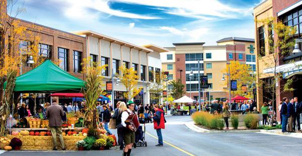
The historical investment in the NICTD South Shore and West Lake Lines, paired with the ability for TDDs to catalyze development in Northwest Indiana, will be transformative in the communities along the lines. This is a once-in-a-generation opportunity to build upon the public investments (including the $646 million in the Double Track and $852 million in the West Lake capital improvements) to attract economic development to the region through TOD tethered to the country’s third-largest city, Chicago.
TOD will boost the economy of Northwest Indiana and offer new, healthier lifestyle choices for residents of the region’s cities and towns. The modernization of the NICTD commuter rail line will allow for enhanced rail competition with vehicular commuters into the Chicago Loop, bringing the rail commute time equal to, if not faster than, vehicular drive times, and much cheaper than driving and parking in Chicago.
Introduction 3
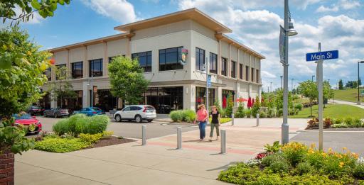
The RDA’s Comprehensive Strategic Plan estimates $2.7 billion in projected TOD investments in Northwest Indiana due to these rail projects. Many communities are receiving upgraded stations as part of the rail capital improvements. New stations are being constructed in Hammond, Miller (Gary), Michigan City, and Munster; existing stations are being upgraded in Portage/Ogden Dunes and Dune Park. Due to these improvements, TOD projects are already occurring in Michigan City and Hammond, with others to follow. This type of investment has also been happening in the Chicagoland suburbs for decades.
Orland Park Metra Station - SWS Line (2007)
+17% 1.2M +37%
Square Feet of New Construction
Elmhurst Metra Station - UP-W Line (2006)
+11% 640k +40%
Square Feet of New Construction
Highland Park Metra Station - UP-N Line (2009)
0% 640k +43%
Square Feet of New Construction
Romeoville Metra Station - HC Line (2018) 0% 316k +3%
Square Feet of New Construction
Example metrics illustrating the levels and types of investment and impacts occurring in TOD areas in Chicagoland suburbs.
$2.7 Billion in Projected TOD Investments Due to Rail Projects
4 Northwest Indiana TDD • TOD Strategic Implementation Plan 2022 Billions $0.0 $1.0 $2.0 $3.0 2023 2024 2025 2026 2027 2028 2029 2030 2031 2032 2033 2034 2035 2036 2037 2038 2039 2040 2041 South Bend East Chicago Michigan City Munster Dyer Gary Miller Hammond South Gary Metro Hammond Gateway Portage Ogden Dunes Munster Ridge Road
Population Growth Population Growth Population Growth Population Growth Change in Real Estate Value Change in Real Estate Value Change in Real Estate Value Change in Real Estate Value
Northwest Indiana TOD Strategy
Planning Process
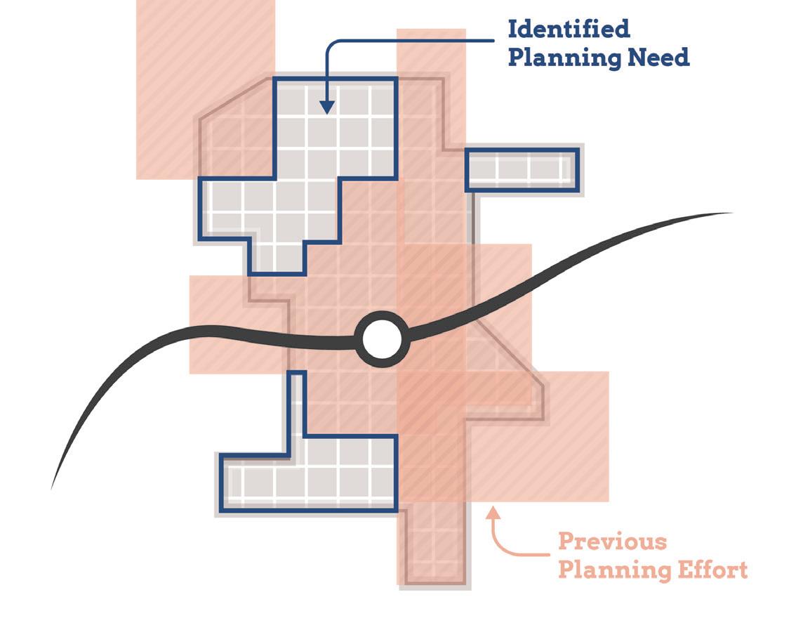
This process commenced by bringing the same level of planning assistance to each community impacted by the NICTD South Shore and West Lake Lines, focusing on communities with a TDD boundary in place or with significant economic development opportunities tied to the station area. To accomplish this, a three-step process planning process was employed. This process began with work sessions with each city or town to understand the level of interest and goals for TOD in each community in alignment with their individual growth path.
Through the previous TDD boundary process, the consultant team understood that various factors, such as local political and staff changes, potential catalytic private development, and ongoing planning or infrastructure projects, would impact project work and schedules on a community-by-community basis. To account for these variables, we employed a schedule that begins with a first step of identifying planning needs for each station area.
Based on planning needs and community readiness, we proposed to group station areas to accommodate varying situations and stagger planning activities.
Generally, each community process took approximately 12 months. All of this work was completed between October 2021 and March 2023. During this time, Northwest Indiana RDA and the consultant team met directly with local staff, stakeholders, elected and appointed officials, and the public to solicit feedback and direction for each TOD-focused plan. As a result, individualized community plans have been developed for each study area with supporting appendix materials from technical sub-consultants.
Step 1
Present Previous Findings, Confirm Direction & Establish Priorities
Timeframe: 6-8 weeks
Step 2
Conduct In-Depth Analysis, Advance Development/ Infrastructure Planning & Evaluate Regulating Resources
Timeframe: varies
Step 3
Conduct Individualized Planning Activities & Provide Recommendations and Documentation
Timeframe: varies
CONCURRENT: Public Engagement, Client, Local Officials & Team Meetings
Planning Process Introduction 5
West Lake Line & South Shore Double Track Projects
West Lake Line Project
9 MILES South Shore Line Double Track Project
25 MILES
16 MILES
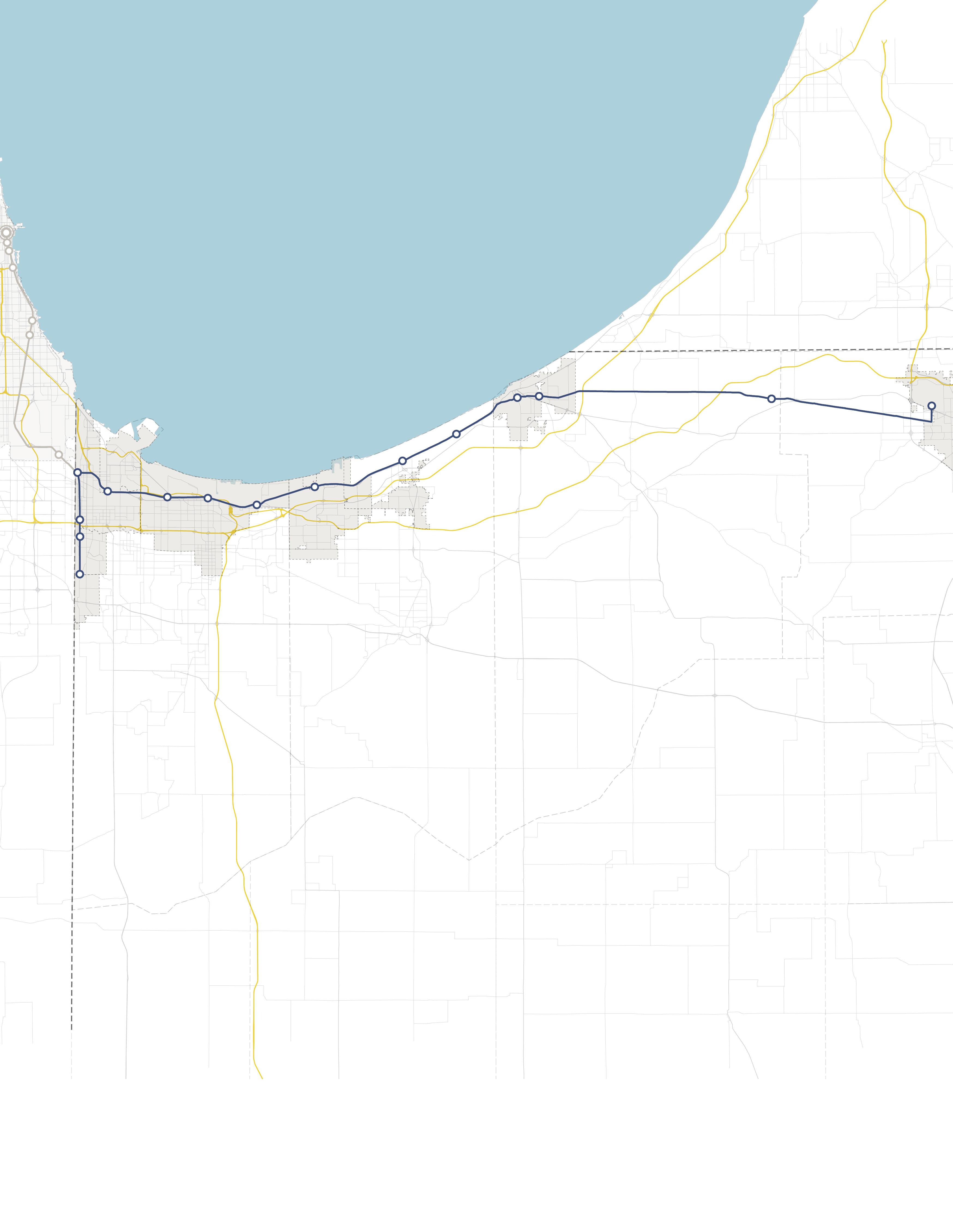
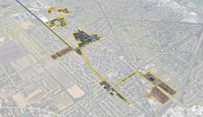
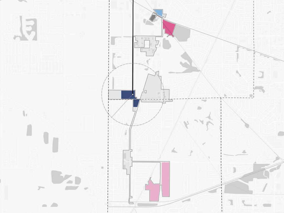
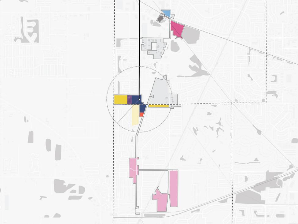
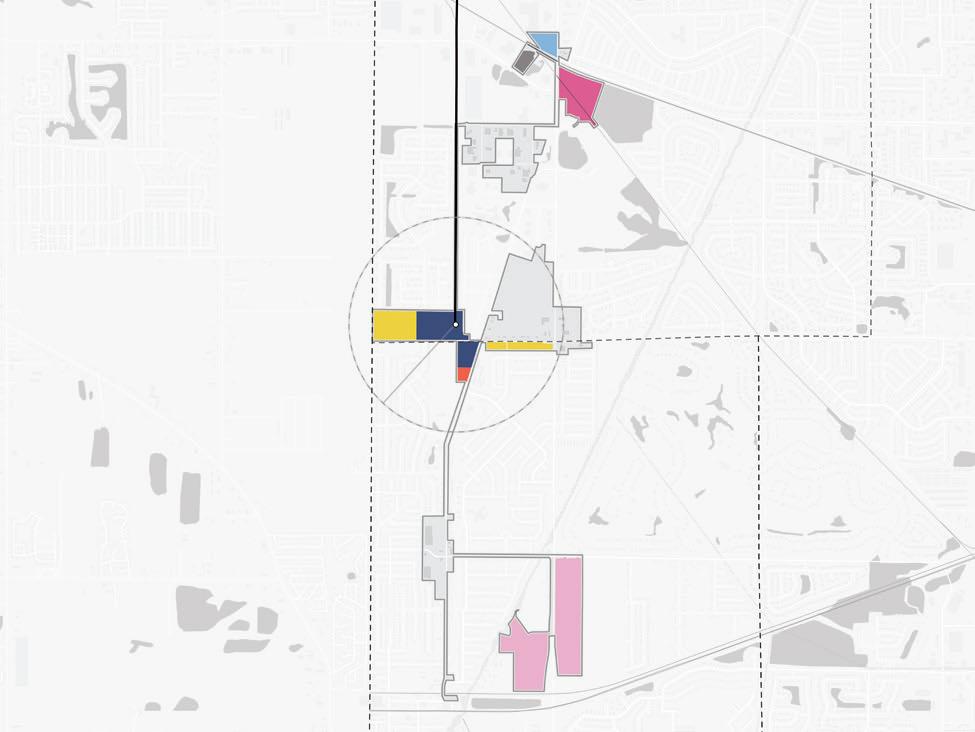
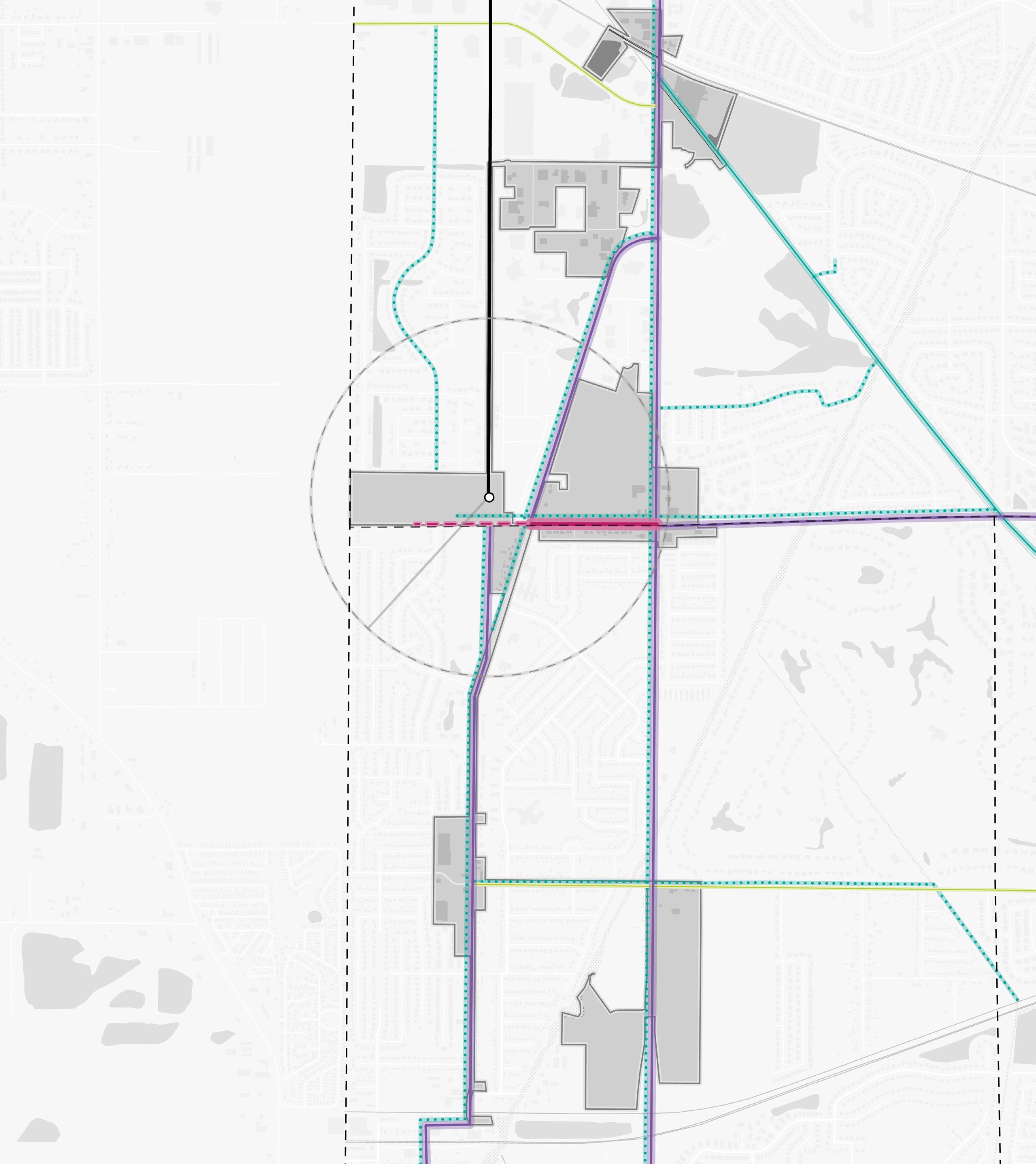
Communities Studied
The project focused primarily on communities with an established TDD boundary or with a TOD study area. However, high-level assessments were also conducted for communities with stations along the South Shore Line who are eligible for future TDD boundaries. Several stations along the lines were not studied at the request of local leadership in consultation with the Northwest Indiana RDA and NICTD.
South Shore Line
• East Chicago (TDD Boundary)
• Metro Center, Gary (TOD Study Area)
• Miller, Gary (TDD Boundary)
• Portage/Ogden Dunes (Two-Community TDD Boundary)
• Dune Park (High-Level Study)
• Beverly Shores (High-Level Study)
• Michigan City (TDD Boundary)
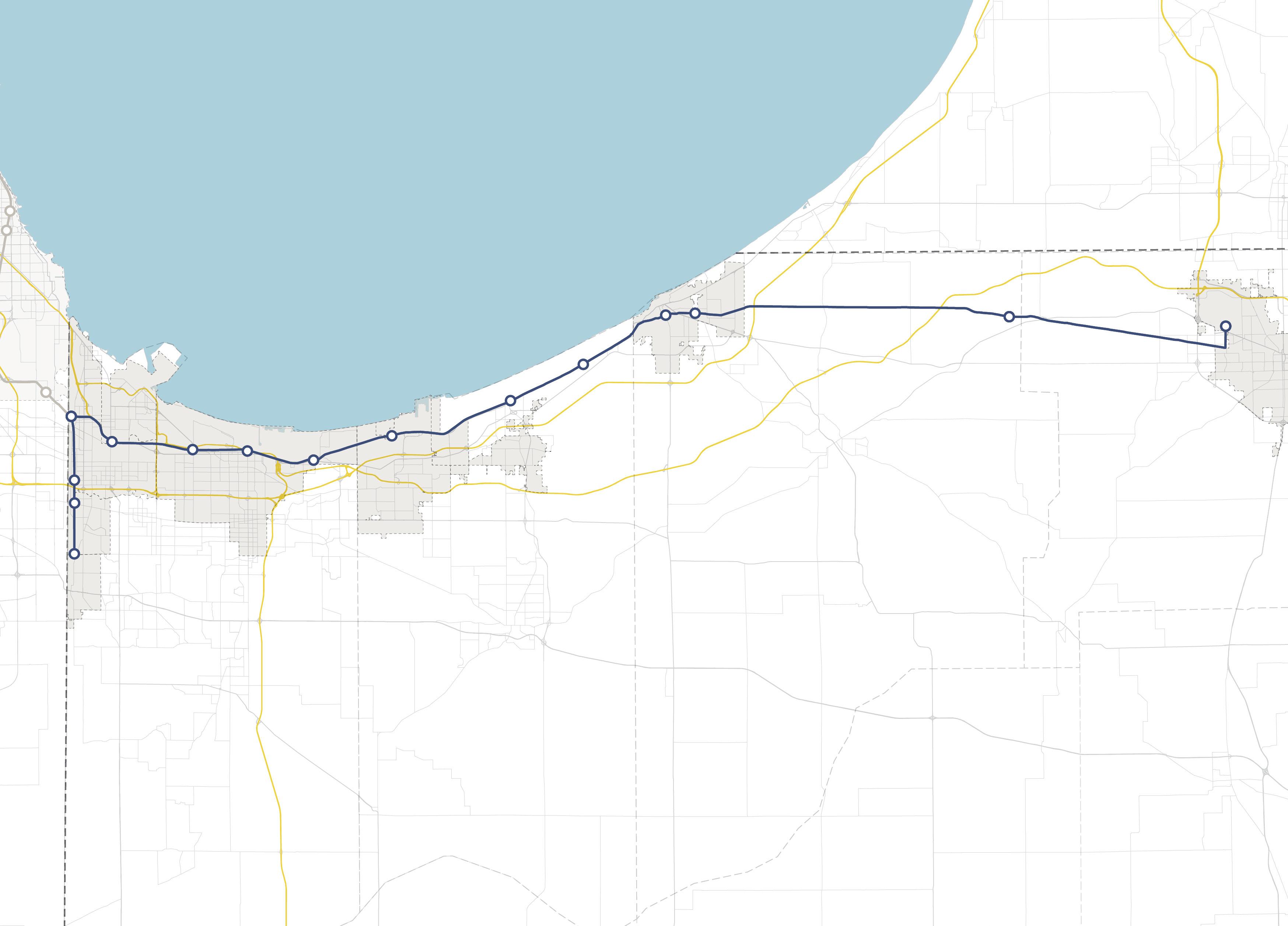
• South Bend (High-Level Study)
West Lake Line
• Hammond Gateway/Downtown, Hammond (TDD Boundary)
• Ridge Road, Munster (TDD Boundary)
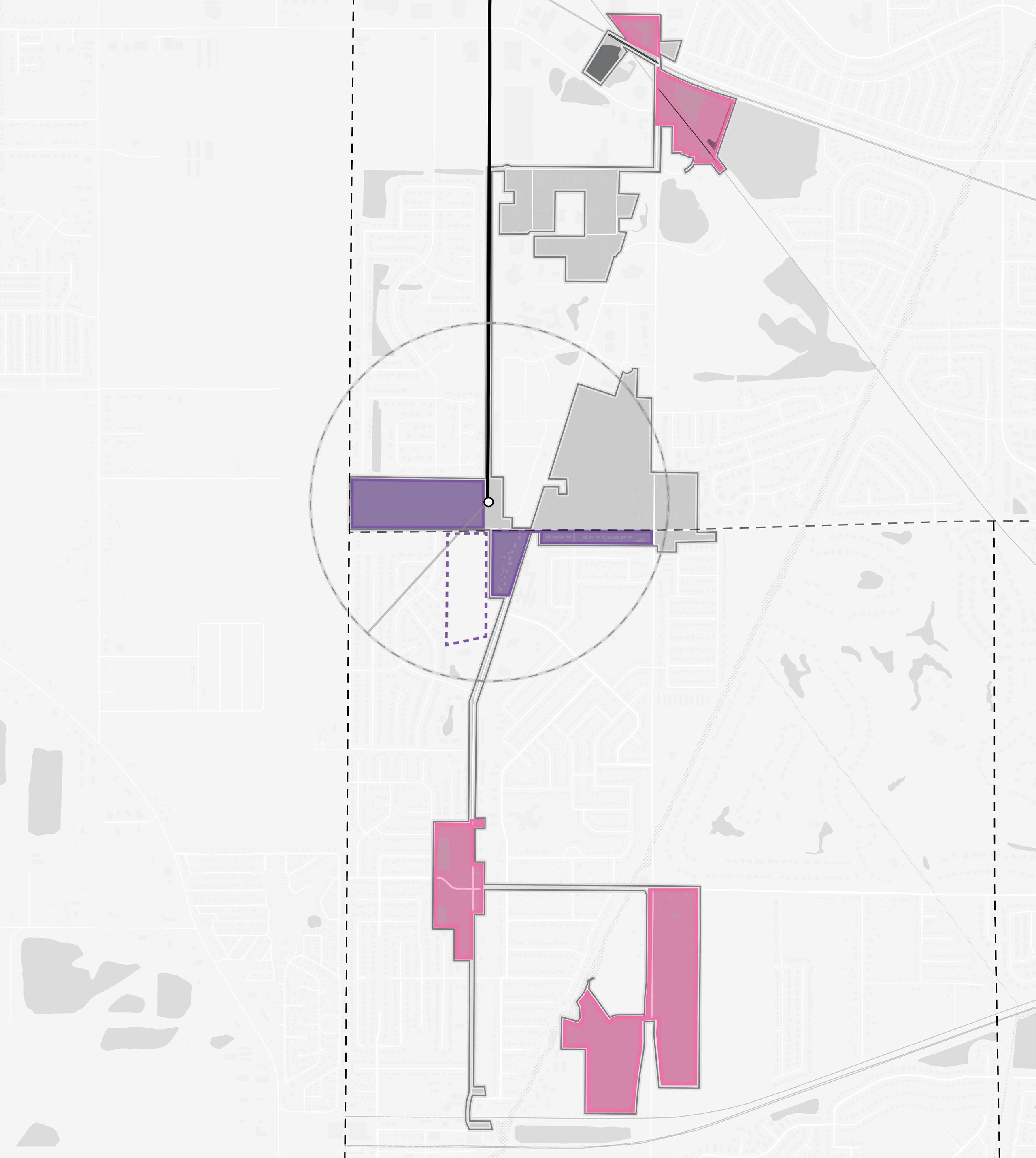
• Main Street, Munster & Dyer (Two-Community TDD Boundary)
NORTH INDIANA INDIANA MICHIGAN ILLINOIS 94 94 80 65 Lake Michigan Lake County Porter County LaPorte County St. Joseph County GARY PORTAGE BURNS HARBOR PORTER CHESTERTON MICHIGAN CITY EAST CHICAGO HAMMOND MUNSTER DYER SOUTH BEND Hammond Gateway East Chicago Gary Metro Center Miller Portage/ Ogden Dunes 11th Street South Bend Dune Park Beverly Shores Ridge Road Main Street 6 Northwest Indiana TDD • TOD Strategic Implementation Plan
Rail Extension
Project Area New Second Track
Scope of Work
To further develop an individualized approach for each community, work plans were created, incorporating specific information desired by the FTA to be included in the planning process and other planning processes at the request of the communities, if any. The Scope of Work Breakdown on the following pages detail the work plan and planning activities in this process.
The following task list organized the work plans:
• Individualized engagement approach
• TOD readiness evaluation
• Previous planning gaps and opportunities
• TOD types and community priorities
• Potential areas of impact (TOD areas and other areas of anticipated significant change)
• Future land use projections (5-, 10- , 20-year time horizons)
• Development feasibility testing and potential community impacts
• Development character renderings
• Thoroughfare typology assignments
• Conceptual corridor designs
• Brownfield assessments
• Infrastructure assessments
• Zoning code/ordinance analysis and recommendations
• Order of magnitude infrastructure and corridor cost estimates
• Additional tasks as requested by individual communities, which may consist of corridor/ connectivity planning, neighborhood/subarea planning, additional engagement activities, additional site concept designs and/or renderings, development pitch kits, open space and trail planning, case study research, additional conceptual street design, capacity building, action planning, and one-year follow-up summaries
Scope Items
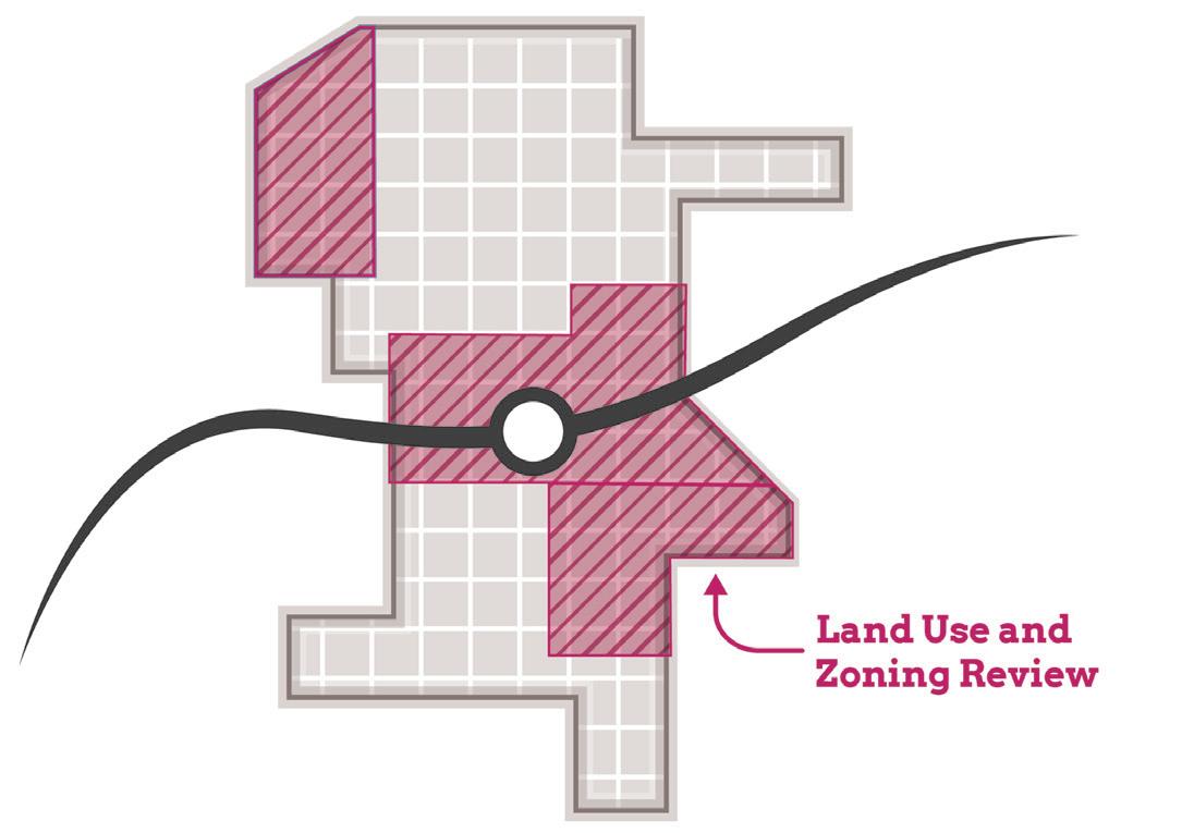
Planning Needs and Gaps Analysis
Land Use & Zoning Review and Recommendations
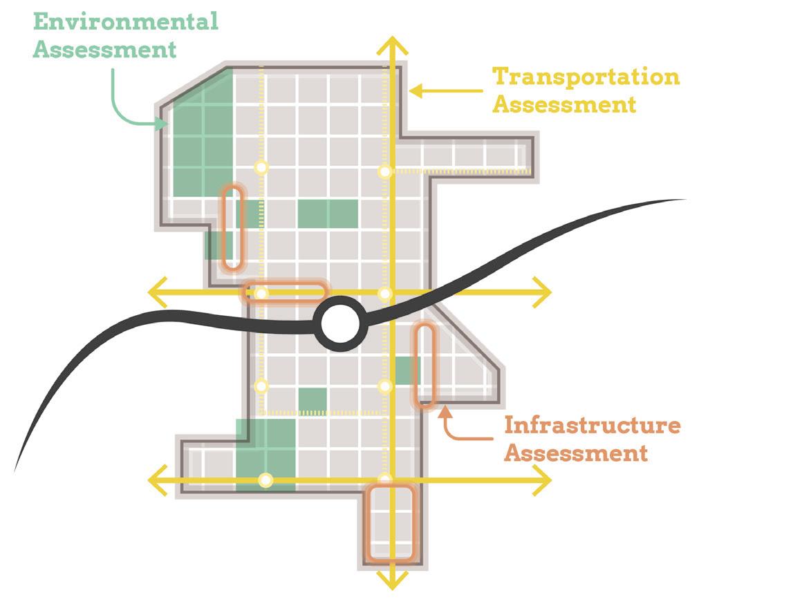
Environmental Assessment and Recommendations
Transportation Assessment and Recommendations
Infrastructure Assessment and Recommendations
Development Testing
Capital Improvements Plan
On-Going Efforts
Coordination with NICTD
Stakeholder and Public Engagement
Introduction 7
Planning Needs and Gaps Analysis
• Confirm framework plan direction by correlating objectives from previously completed plans with the community’s current future vision
• Identify gaps and opportunities not addressed in local planning based on previously completed plans
• Determine and prioritize planning needs for future development and recommendations
Land Use & Zoning Review and Recommendations
• Record and analyze current land use and zoning ordinances
• Identify potential changes in land use and zoning ordinances to achieve desired future development
• Coordinate zoning with planning concepts and planned land uses
• Draft zoning code revisions and/or design guidelines to promote future TOD
• Draft regulating plan/zoning map
• RDA consultants will take zoning through process for adoption by local entities
Environmental Assessment and Recommendations
• Limited assessment of sites with potential or known environmental/brownfield concerns
Transportation Assessment and Recommendations
• Corridor and connectivity planning that improves access and walkability to the station area
Infrastructure Assessment and Recommendations
• Evaluating stormwater, utility, road, and pedestrian facilities at site and district scales
Scope of Work Breakdown
8 Northwest Indiana TDD • TOD Strategic Implementation Plan
Development Testing
• Identify up to eight priority development sites per station area (each “site” up to 10 acres)
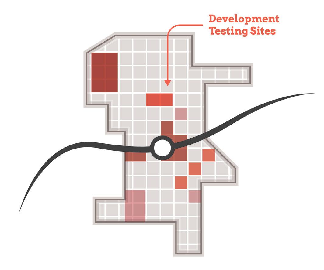
• Test development scenarios for priority sites
• Assess potential site uses based on land use projections and market understanding
• Develop conceptual site plans and three dimensional massing illustrations showing potential infill and redevelopment
Capital Improvements Plan
• Order of magnitude cost estimates for infrastructure improvements and projects to effectuate development (with close collaboration with local units)
Scope of Work Breakdown
Introduction 9
TOD Readiness
At the onset of the process, the team acknowledged that each community differed in its potential for TOD as a result of existing policies and infrastructure in place that are necessary to enable TOD, referred to as TOD readiness. To diagnose each community’s TOD readiness, a matrix was developed to evaluate factors of TOD readiness and was completed in collaboration with local officials. In addition, NICTD completed TOD assessments, which were consulted as these evaluations were completed.
TOD Readiness Criteria
• NICTD Station currently operational or under construction
• TDD Boundary is adopted or the community is eligible for a TDD Boundary
• Adopted policy documents that address or plan for TOD (i.e. comprehensive plan, neighborhood plan)
• Adopted zoning ordinances (or overlays) that address or plan for TOD
• Existing walkable grid as part of a downtown or mixed-use neighborhood that connects or can connect to the station
• Currently operational/planned trail or multi-modal infrastructure
• Existing urban amenities that are walkable and/ or within 1/2 mile of the station (i.e. restaurants, grocery, drug stores, office, parks/plazas)
• Existing dense and quality housing stock (more than eight dwelling units/acre), including rowhouses/townhomes, apartments, condos, and ADUs
• Vacant developable sites within TDD Boundary
• Local unit has demonstrated additional initiatives to support TOD
• Current infrastructure has the capacity to support additional development or TOD
Anticipated Results
At the conclusion of this process, control of local land use and zoning remains with the cities and towns. This process aims to provide proactive guidance and recommendations that the local units can use to advance their planning processes, resulting in updated comprehensive plans, area plans, and zoning ordinances complete with locally-controlled public input. In addition, components of this study are designed in a highly-graphic format to inform development discussions, potential RFP’s, and grant applications.
Each community-specific section will function as a standalone plan that is meant to be pulled out of the overall regional plan and referenced by officials of local cities and towns, public members, and the development community. This information is supplemented by more technical information in the respective appendices.
10 Northwest Indiana TDD • TOD Strategic Implementation Plan
02 TOD Strategy 02

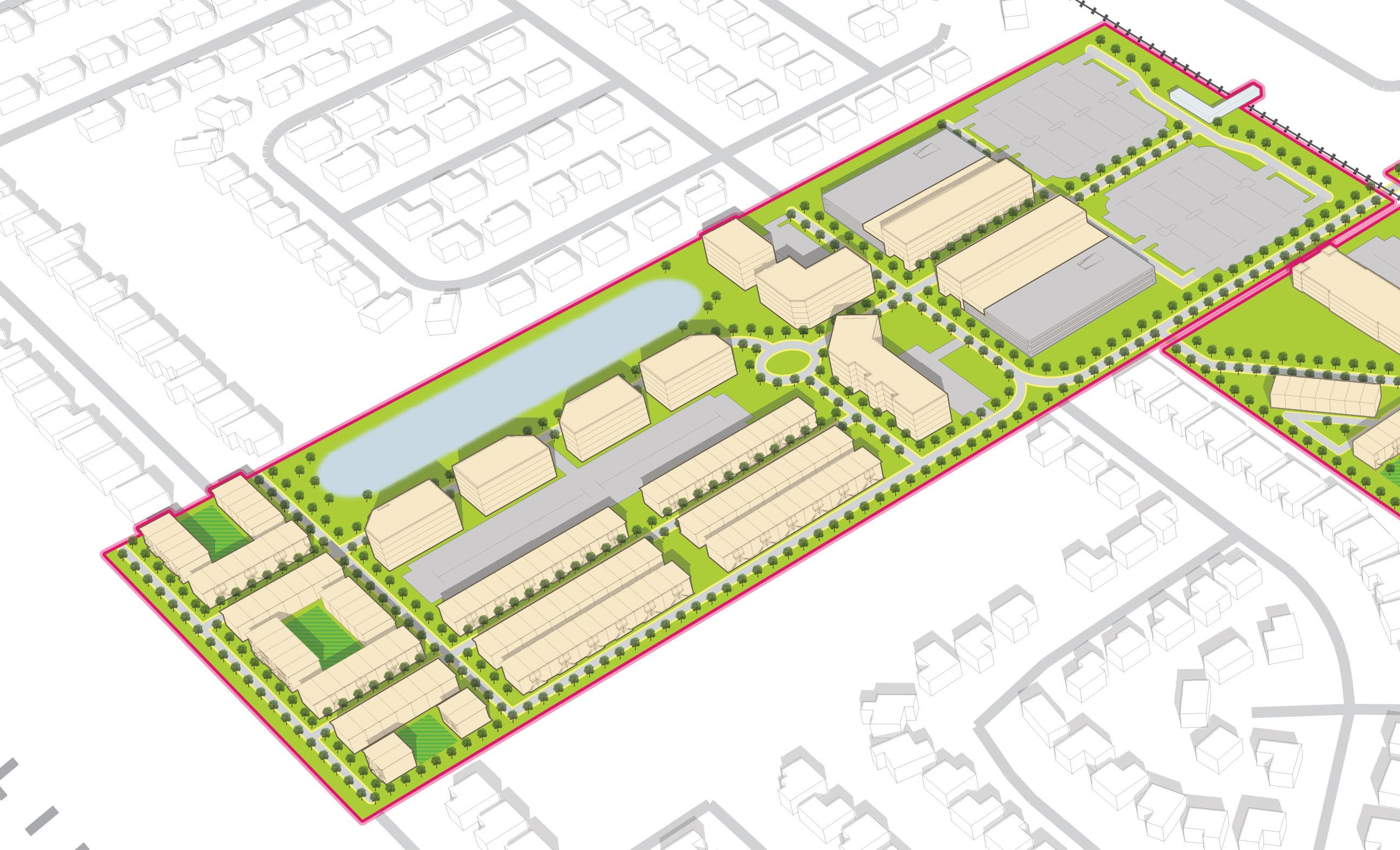
Munster / Dyer Main Street
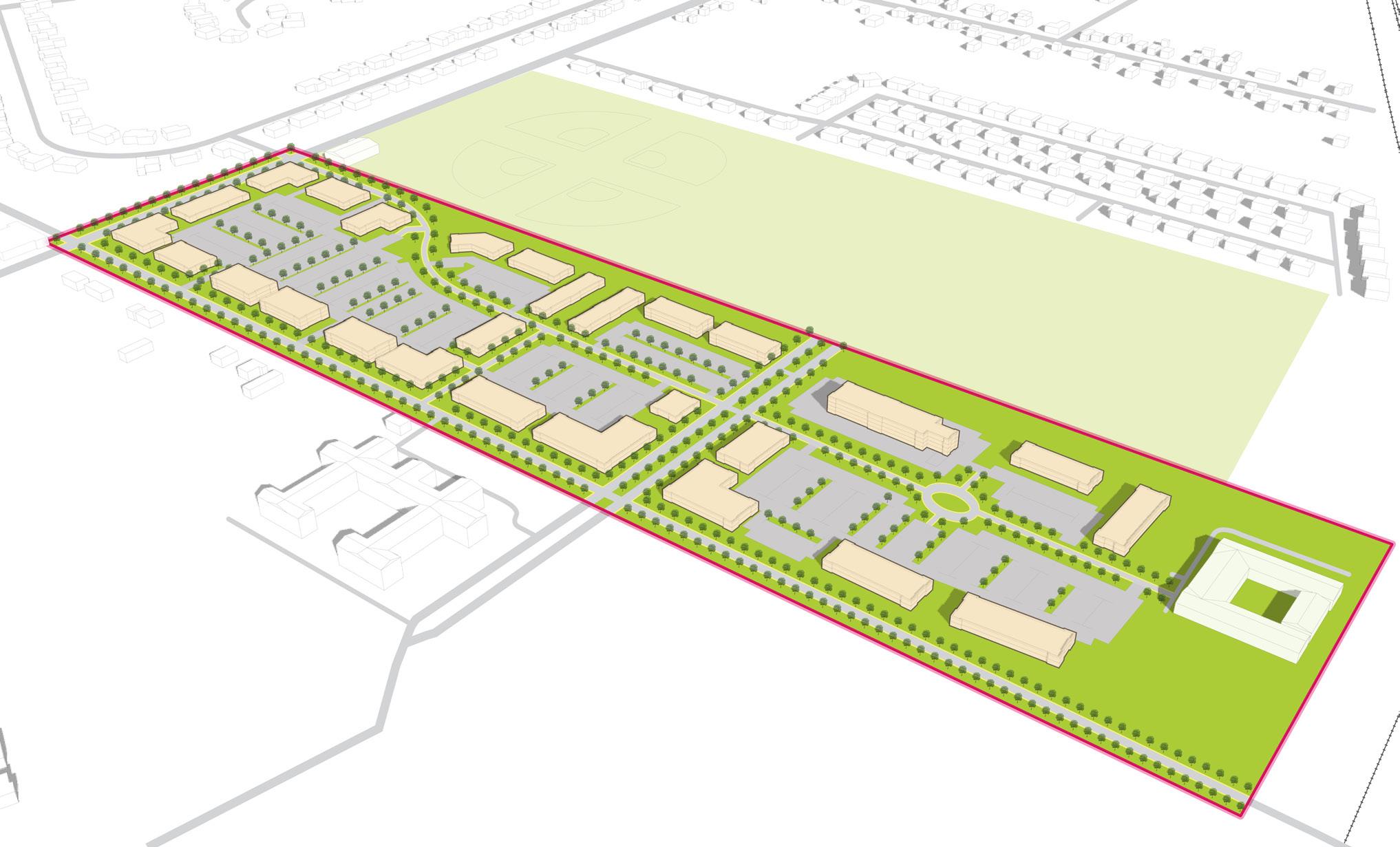
Overview
The Munster/Dyer TDD boundary and Main Street Station TOD area is unique to the West Lake Line because it is located within two municipalities and is separated by Main Street. This area demonstrates considerable greenfield development opportunities, both directly around the station and on the Columbia Avenue and Sheffield Avenue corridors. The new station and parking area could transition to joint development over time. Much of the remaining developable sites in Munster and Dyer in this TDD and are largely consolidated amongst a few non-residential owners. Both towns have been proactive in preparing for this station and anticipated investment in the vicinity, and they are working to determine the next steps to extend Main Street to the NICTD Station. These next steps include funded engineering through a NIRPC Transportation Improvement Program (TIP) Grant. The Town of Munster recently updated its zoning code (2021) and zoned some properties at the station to accommodate long-term joint development as recommended in Munster’s 2010 Comprehensive Plan and the 2017 West Lake TOD Plan. The Town of Munster is going through a comprehensive plan
update that will further define the direction for TOD aligned with the Town’s economic growth path. The Town of Dyer recently updated its comprehensive plan in 2021 and its zoning code in 2022.
In both communities, there are significant built singlefamily neighborhoods near the station and TOD area with residents who are sensitive to the potential for mixed-use development in close proximity to their homes. This approach towards TOD concentrates development potential in Munster on an undeveloped site directly west of the new Main Street Station; in Dyer development is targeted on undeveloped property directly south of the station, owned by the Mid-American Reformed Seminary, and considerable infill opportunities along Main Street, Sheffield Avenue and Calumet Avenue. The TOD strategy emphasizes that development is being considered on undeveloped sites, not in existing established neighborhoods, and development should be highly-sensitive to potential impacts on developed areas of these towns.
Northwest Indiana TDD • TOD Strategic Implementation Plan 12 02
TOD Readiness
Both Towns of Munster and Dyer understand the potential for transit-oriented development around the Main Street Station and seeks to make improvements to Main Street in order to facilitate a better front door to the community for residents and commuters alike. Both communities have been proactive in preparing for development with ongoing or recently completed updates to their comprehensive plans and zoning ordinances. The Town of Munster has worked with NIRPC to fund design and engineering improvements to extend and transform Main Street into a Complete Street with multi-modal connections to the Main Street Station. The Town of Dyer is in support of building multi-use paths or trails leading connecting existing neighborhoods and potential development sites to the station.
Both towns continue to invest in enabling steps to allow them to fully realize the potential economic development opportunities around TOD balanced with maintaining their existing small-town appeal. Both Munster and Dyer are similarly prepared in terms of TOD Readiness.
This document serves as a roadmap for TOD implementation by providing recommendations for land use, development, zoning, and infrastructure investments.
Evaluation Criteria
NICTD Station currently operational or under construction
TDD Boundary is adopted or the community is eligible for a TDD Boundary
Adopted zoning ordinances (or overlays) that address or plan for TOD
Adopted policy documents that address or plan for TOD (i.e. comprehensive plan, neighborhood plan)
Existing walkable grid as part of a downtown or mixed-use neighborhood that connects or can connect to the station
Currently operational/planned trail or multi-modal infrastructure
Existing urban amenities that are walkable/within 1/2 mile of the station (i.e. restaurants, grocery, drug stores, office, parks/plazas)
Existing dense and quality housing stock (more than 8 dwelling units/acre), including rowhouses/ townhomes, apartments, condos, and ADUs
Vacant developable sites within TDD Boundary
Local unit has demonstrated additional initiatives to support TOD
Current infrastructure has the capacity to support TOD/additional development
13 Munster/Dyer • Main Street Station
Community Priorities
Community priorities were developed by working closely with Town officials to confirm economic development goals, identify key sites of interest, and understand recent and ongoing municipal and development projects. These priorities form a future vision for the TDD Boundary area specific to the Main Street Station, which include the following:
• Improve Main Street as a Complete Street with sidewalks, multi-use paths, landscaping and crosswalks that will connect residential areas, Sheffield and Columbia Avenues, and Calumet Avenue to the station
• Preserve existing single-family neighborhoods surrounding the station
• Use the station investment as a catalyst for targeted redevelopment and greenfield development in both communities
• Long-term evaluation the potential of mixed-use joint development replacing a portion of the NICTD surface lot
Big Moves
“Big Moves” are defined as enabling steps to signal to the market that conditions are right for transit-oriented development to occur. The Towns of Munster and Dyer aim to transform several greenfield sites into mixed-use transit-oriented development walkable to the station, increase connectivity and mobility by improving and extending Main Street to the station, and strengthening existing residential neighborhoods with a variety housing types near the station.
14 Northwest Indiana TDD • TOD Strategic Implementation Plan
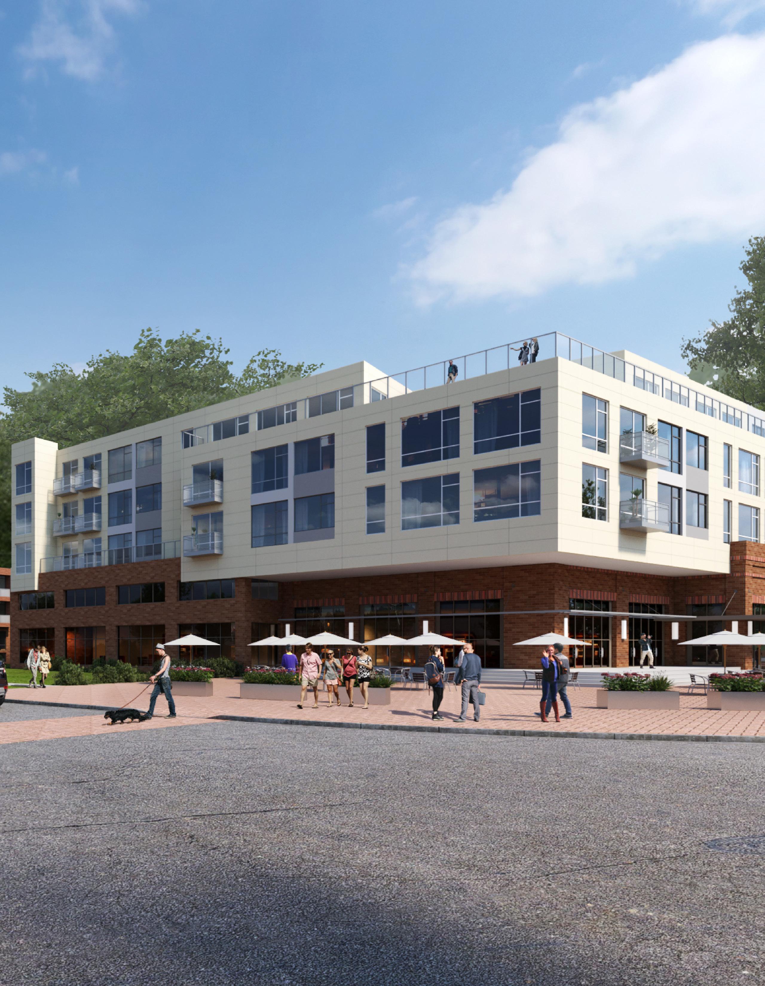
Mixed-Use Town Centers Main Street
A transit-oriented development opportunity exists to the west of the future West Lake Line. Development could include medium-density mixed-use with a mix of housing types. A future employment center is supported by existing planned medical office development east of the station. Other development opportunities within the TDD boundary are already being considered for mixed-use town centers for the community.
The planned extension of Main Street to the station area provides crucial access to the station and commuter parking as well as an opportunity for streetscape and mobility improvements to the corridor that can serve both communities.
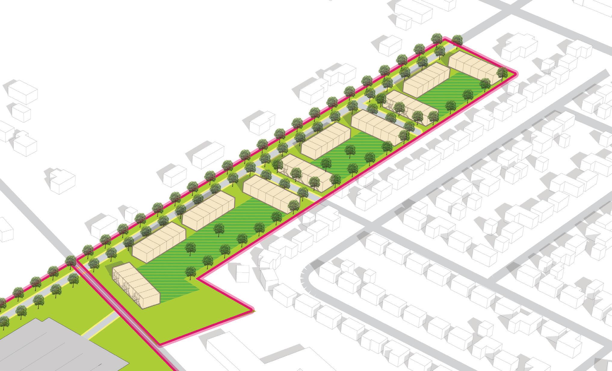
NORTH 15 Munster/Dyer • Main Street Station Columbia Ave Main St Sheffield Ave Calumet Ave Columbia Ave Main St Sheffield Ave Calumet Ave West Lake Line West Lake Line
Big Moves
This station area has the ability attract multiple housing types near the station in both Munster and Dyer communities. Key sites in the immediate station area have potential for strong walkable residential neighborhoods.
NORTH 16 Northwest Indiana TDD • TOD Strategic Implementation Plan
Columbia Ave Main St Sheffield Ave Calumet Ave West Lake Line Residential Neighborhoods
Big Moves
TOD Opportunity
An overall TOD Opportunity vision was developed with the Towns of Munster and Dyer outlining the development and investment potential within the TDD boundary area. Opportunity sites were identified as Areas of Impact within each TDD boundary that have the greatest development potential. Characteristics such as cleared sites, underutilized land or surface parking lots, buildings suitable for adaptive reuse, or consolidated or municipal land ownership were important factors determining certain sites’ development potential.
Areas of Impact
Areas of Impact were established to distinguish between major (re)development areas, both TOD and non-TOD, and areas to be maintained, preserved, and enhanced. These designations begin to direct development activity and other targeted investments based on proximity and relationship to the station area.
For purposes of this study, individual sites may have been grouped to demonstrate synergy among sites for development potential.
TOD Opportunity Sites
These areas are prime sites for transit-oriented development due to their proximity and connectivity to the station area. Development of these sites should be dense and urban in form, promote walkability and multi-modal access, and emphasize a quality public realm and sense of place. Access to the station area is crucial in these areas. Development should be mixed-use, integrating a variety of active ground-floor commercial uses and upper-floor uses within a building and integrating a variety of uses in a collection of buildings on a site.
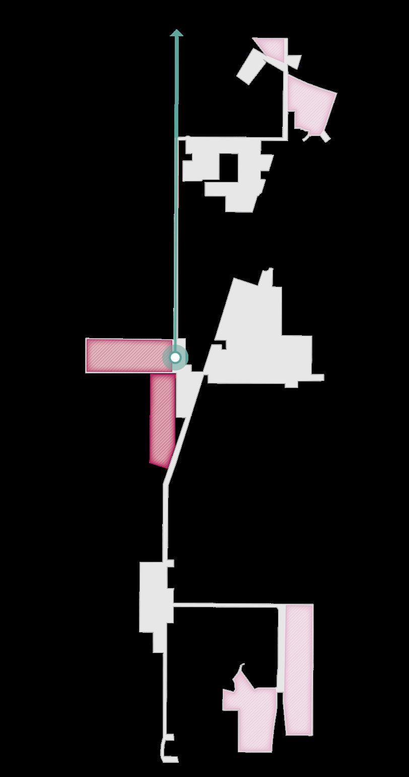
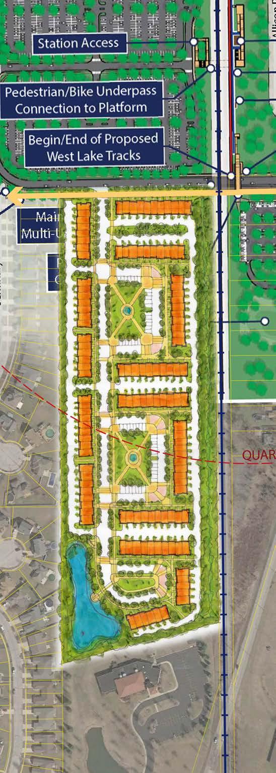
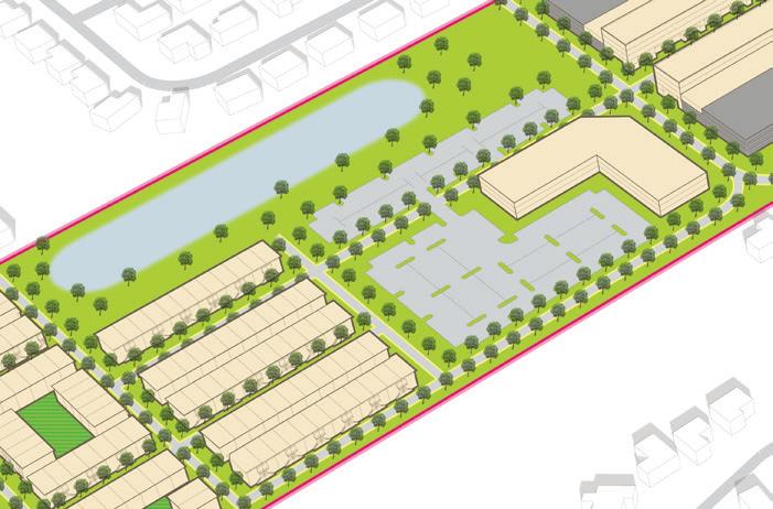
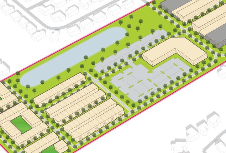
Site F
Site F is a 35.4-acre greenfield to the west of the future Main Street Station and West Lake Line in the Town of Munster. The site is owned partiall by NICTD for the immediate purpose of commuter parking serving the future station, and partially by a developer. Initially, a portion of this site will serve as commuter surface parking and retention drainage, but in the long term, this site has the potential to redevelop as mixed-use joint development with structured parking that serves the development and continues to serve rail commuters.
Site G
Although not included in the TDD boundary, Site G is an additional site proximate to the station in the Town of Dyer with significant development potential. This site is 21.7 acres of cleared vacant land under single ownership (the Mid-American Reformed Seminary Association). This site currently does not have roadway access, but connections are possible from the Main Street extension to the north and Seminary Drive to the south.
Site H
Site H, also within Dyer, is located at the intersection of the Main Street extension and the future West Lake Line. The site is 13 acres, and it includes privately-owned single-family homes and publiclyowned vacant land (owned by NICTD and the Town of Dyer Park and Recreation Department).This site is accessible by two major corridors, Main Street and Sheffield Avenue. There is potential for development of the remainder of the site to the south with frontage on Sheffield Avenue.
Site I
Site I totals 7.9 acres, including privately-owned single-family homes and a commercial property along the Main Street corridor in the Town of Dyer. The site’s frontage along Main Street and proximity to the future station creates high potential for redevelopment.
Areas of Significant Change (Non-TOD)
These areas have been identified for their potential for redevelopment and a major change in use and/ or form. These areas are outside the walkable area surrounding the station – therefore not TOD – but high-quality development of these sites is possible and will significantly impact the community. These areas may be identified for several reasons: they have been included in development planning in this plan but are not proximate to the station; they may have development planning efforts ongoing outside of this plan; or there may be a high potential for future development in the long-term that has not been studied yet. Development of these sites may require changes in land use, updates to zoning designation and/or regulations, infrastructure upgrades, or environmental review.
17 Munster/Dyer • Main Street Station
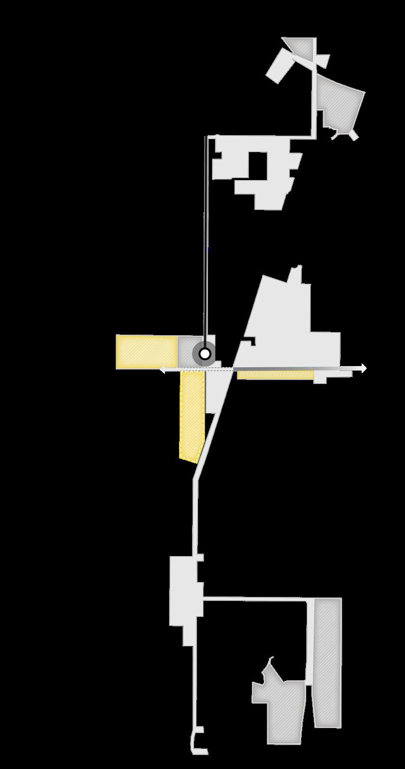
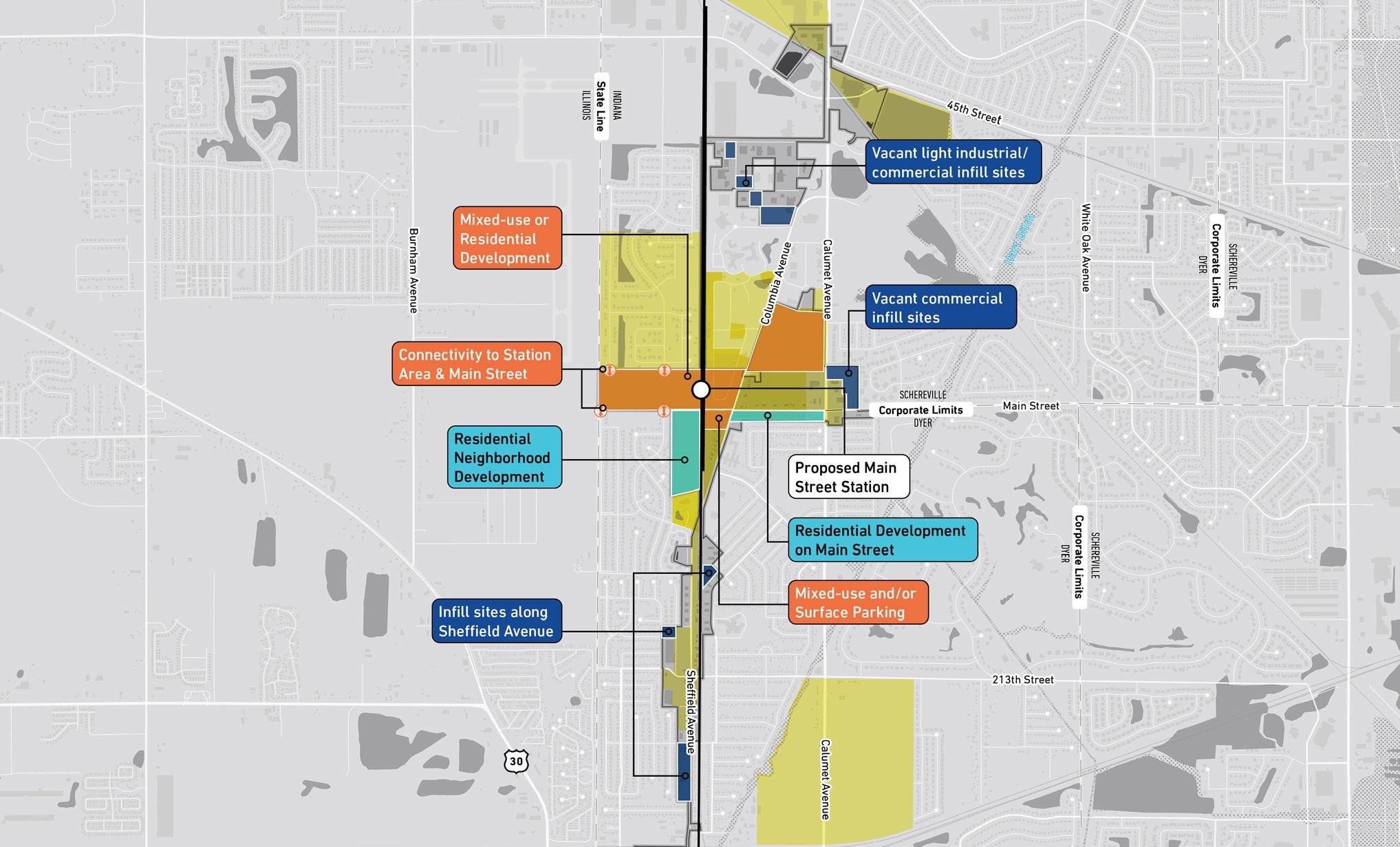
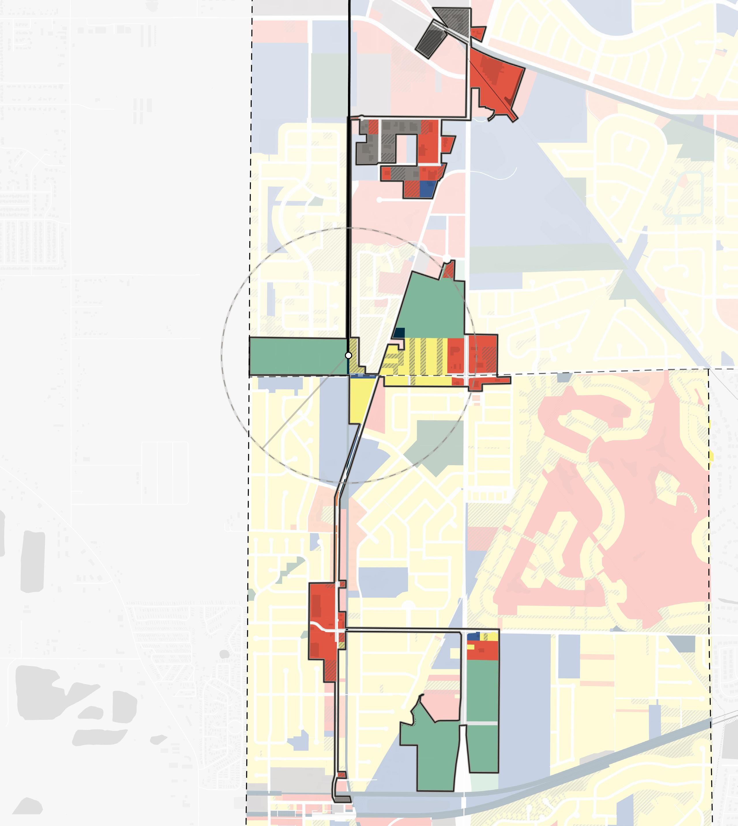
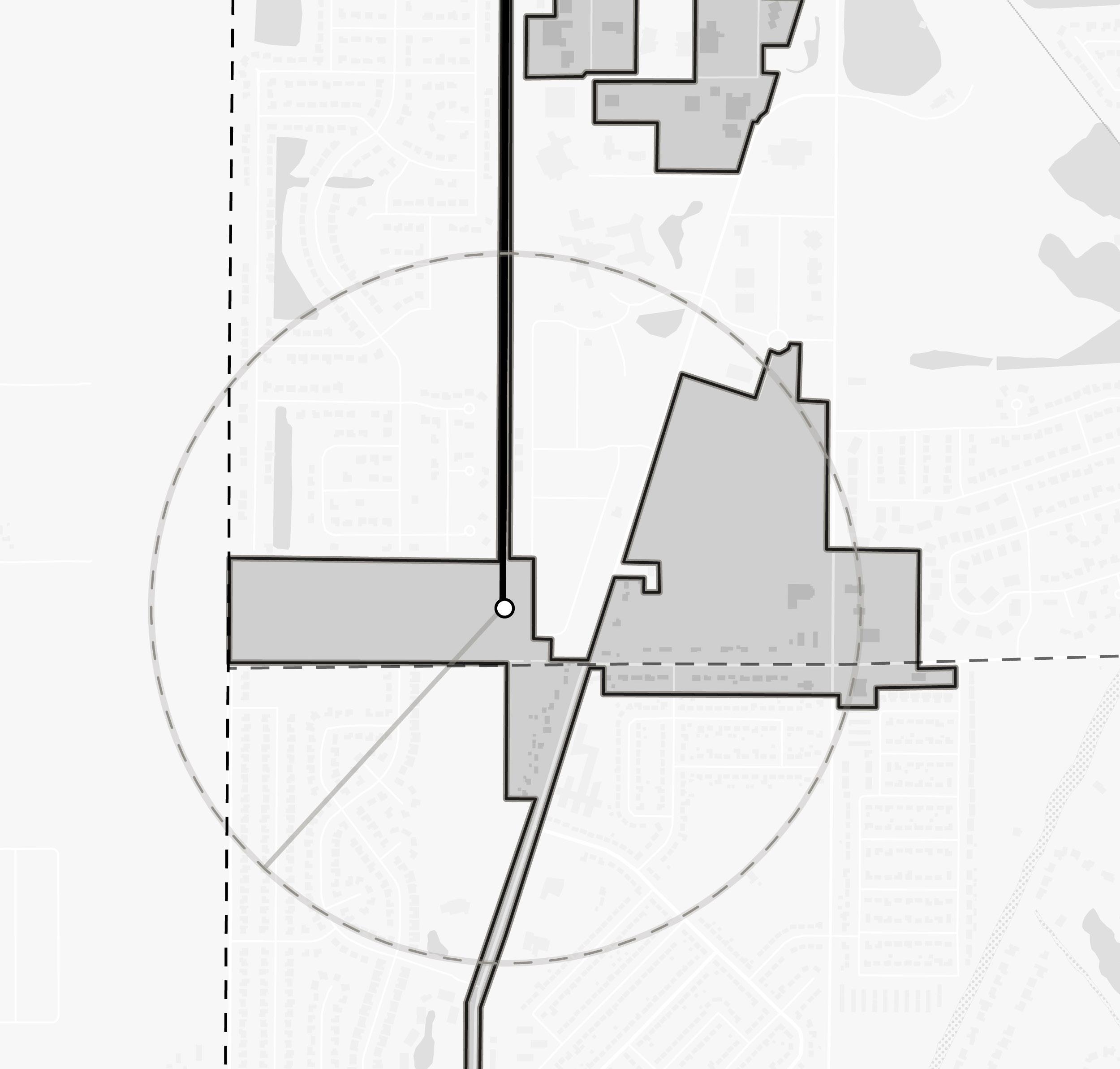
Areas of Impact
The direction of development for this plan identifies the greenfield to the west of the station in Munster and several sites concentrated along the major corridors in Dyer.
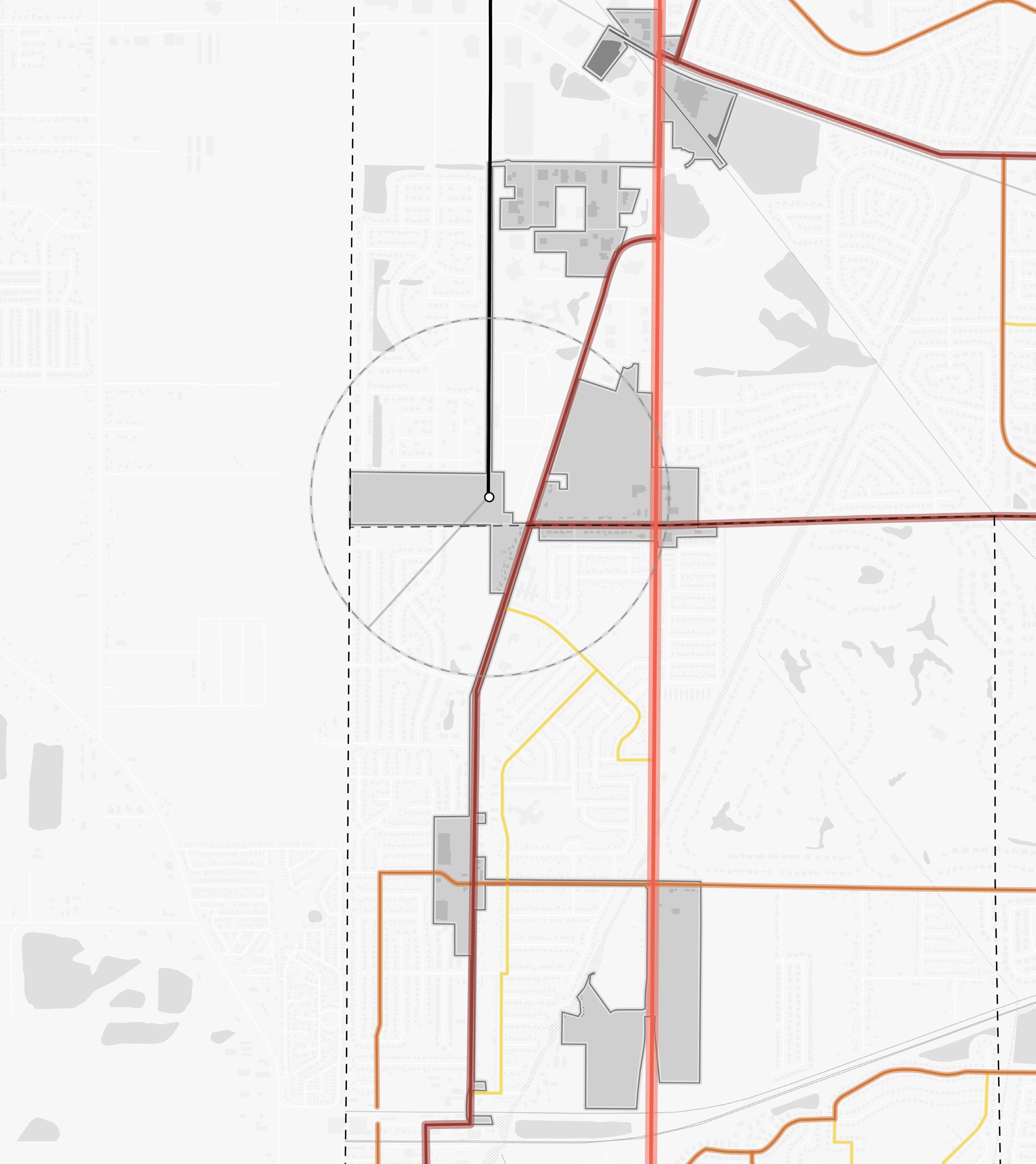
TOD Opportunity Site Area of Significant Change NORTH 18 Northwest Indiana TDD • TOD Strategic Implementation Plan Hart Ditch Calumet Ave White Oak Ave Columbia Ave 45th Ave Sheffield Ave Calumet Ave Main St SCHEREVILLE DYER Corporate Limits 1/2Mile INDIANA ILLINOIS State Line MUNSTER DYER Corporate Limits West Lake Line Dyer Amtrak Station Franciscan Health Munster Centennial Park Golf Course Dyer Central Park 213th St Future Main Street Station Site B 21.1 Total Acres Site C 6.1 Total Acres C B Site F 35.8 Total Acres F Site H 9.6 Total Acres Site G 21.7 Total Acres Site I 7.9 Total Acres G H I D E Site D 40.7 Total Acres Site E 24.5 Total Acres Site J 34.4 Total Acres J
Site B
Formerly the Munster Steel site, Site B is a 21.1 acres site at the southeast corner of the intersection of Calumet Avenue and 45th Avenue. This is the site of the Centennial Village mixed-use development that is currently under construction and is a model for future development in the community. The development includes luxury condos, hospitality, shopping and dining, and park amenities that will take advantage of its proximity to Centennial Park and Pennsy Greenway.
Site C
Site C is a 6.1-acre site designated for the planned Maple Leaf Crossing mixed-use development in Munster. Maple Leaf Crossing will consist of professional office space, retail, and hospitality. This future development also has the advantage of being in proximity to Centennial Park and the Pennsy Greenway as it is also located along Calumet Avenue, north of 45th Avenue.
Site D
Site D is 40.7 acres of undeveloped vacant land along Calumet Avenue in the Town of Dyer, owned by the Lake County Trust. This site is accessible via Central Park Boulevard. This site has the potential for impactful development due to its size and adjacency to Dyer Central Park.
Site E
Side E is 24.5 acres along Sheffield Avenue at the intersection with 213th Street/Monticello Drive in Dyer. The site consists primarily of active large footprint commercial buildings and large parking areas, but several parcels in this site are undeveloped vacant land with immediate redevelopment opportunity. There is also a former gas station on this site that, while vacant, would likely require environmental investigation prior to redevelopment. There are multiple private owners of this site, and the Lake County Trust owns the majority of this site.
Site J
Site J is a 34.4-acre site of undeveloped vacant land along Calumet Avenue in Dyer and is owned by the Lake County Trust. The Symphony Dyer senior living facility is located just north of this site, and the Dyer Sewage Treatment Plant is located to the south of this site. The site is accessible from Central Park Boulevard that transitions into an access road for the treatment plant.
Areas to Maintain and Invest
All other areas within the TDD boundary not identified for future development investment opportunities should be targeted for enhancement and preservation efforts that protect the existing character and build upon the strengths or existing assets. These areas may look like stable and established neighborhoods or active commercial nodes. Opportunities for small infill development or rehabilitation of structures may be present in these areas but should occur with a focus on compatibility with the surrounding context and land uses.
TOD Types
Transit-Oriented Development (TOD) Types are not prescriptive of future land use or zoning but instead describe the vision for creating a vibrant, ecosystem with walkability, transit access, and a diverse range of businesses, destinations, and housing. These descriptions have an overarching intent statement and describe typical uses and goals for how development or redevelopment could occur in each of these areas. Short statements are paired with character imagery from other similar places to help visualize these places.
Future TOD in Munster and Dyer’s Main Street Station Area is envisioned as a Village TOD. The following description explains the key considerations of this TOD Type.
19 Munster/Dyer • Main Street Station
Village TOD
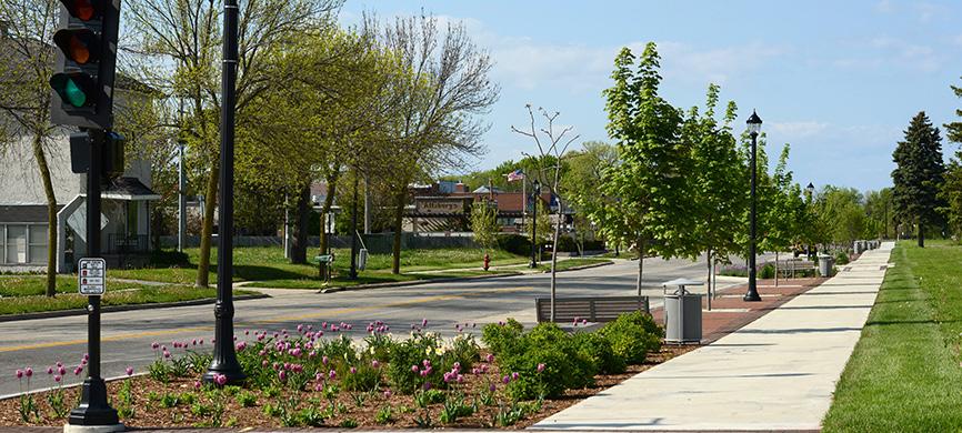
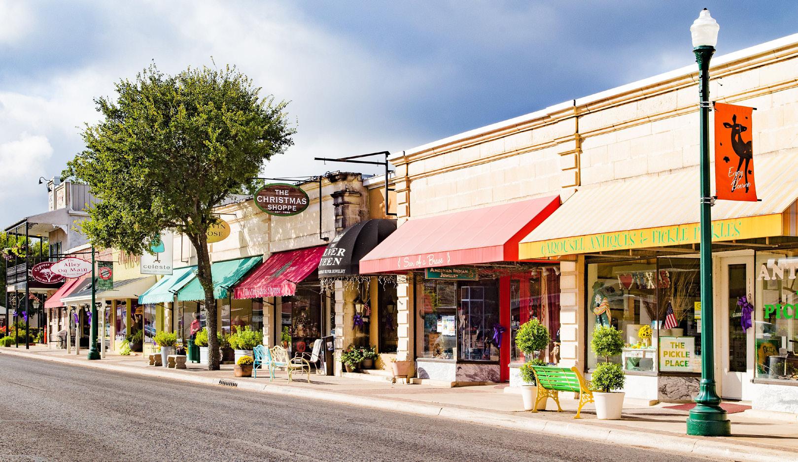
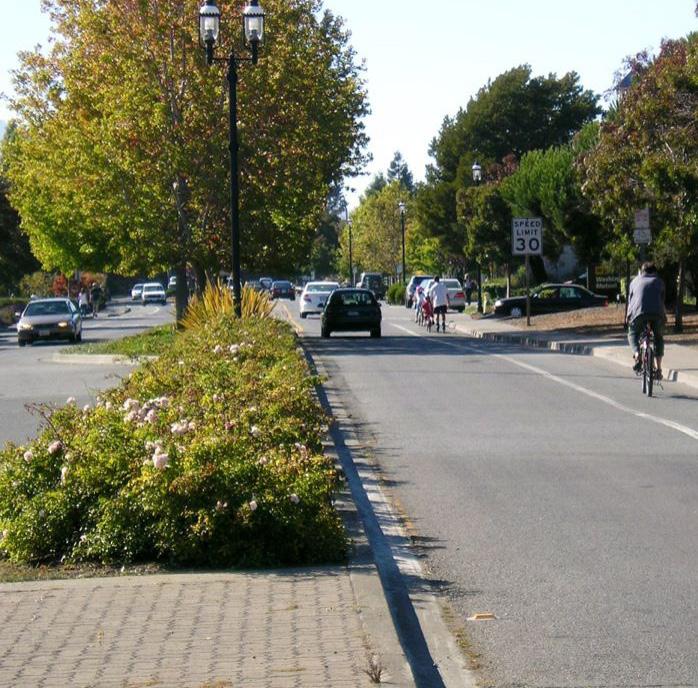
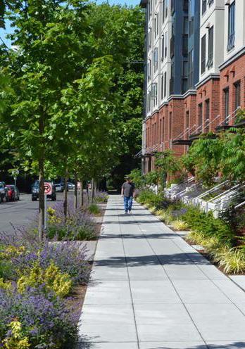
Compact, walkable areas with scaled mixed-use buildings that engage and support an active public realm serving the entire community

TOD Types
Typical Land Uses
Multi-Family Housing; Supportive Housing; Attached Housing; Retail/Offices/Services; Flex Office/Employment; Medical Offices/Services; Government/Public Facilities; Hospitality; Entertainment; Mixed-Use (vertically and horizontally integrated); Surface and Structured
Secondary Land Uses
Pocket Parks/Plazas; Greenways/Trails; Recreation Facilities; Cultural/Civic; Religious, Education, and Assembly Facilities; Floodplain/ Floodway; Preservation/Conservation Area
Parking
On-street parking with limited clustered off-street parking; shared public parking lots and structures with short- and long-term bike parking
Transportation
Typical Building Heights/ Density
Interconnected street grid with wide sidewalks, bike facilities, and frequent bus/transit connections
Infill / Redevelopment
Medium density of 10-25 dwelling units per acre; 2 stories minimum; anticipated average height of 3-4+ stories
Infill should continue the existing visual pattern, rhythm or orientation of surrounding context along the street while adding appropriate height and density. Historically significant or contributing buildings should preserved or adaptively reused when possible.
Other Considerations
Any redevelopment should occur in a sustainable manner that minimizes impacts on natural areas, incorporates proper stormwater management, and mitigates potential hazards to air or water quality.
20 Northwest Indiana TDD • TOD Strategic Implementation Plan
Land Use Planning
Documentation and Analysis
Previous Planning
Relevant recommendations from Munster’s 2019 Zoning Code (updated 2021), and 2023 Comprehensive Planning Existing Conditions Report, Dyer’s 2021 Zoning Code and 2020 Comprehensive Plan, and the 2017 West Lake TOD Plan were integrated into this study. Since Munster is currently in the process of updating its Comprehensive Plan, it is the intent that this planning can be integrated into that ongoing process. Once that new plan is completed, the Town of Munster should have a good roadmap for TOD aligned with the community’s economic growth path. Dyer’s Comprehensive Plan is fully supportive of TOD, but acknowledges the critical mass is around the Main Street Station, which is located in Munster.
Gaps and Opportunities
A review of previous land use planning from relevant completed plans for each community was conducted to understand where common themes lie across years of land planning and where ideas of land use have evolved over time or may conflict with each other. The review resulted in identifying opportunities that were consistent across many plans and in line with current community goals. Gaps were identified as areas within the TDD boundaries that have not been studied in great detail in the past but may have future development potential and should be considered to be studied. Gaps and Opportunities were reviewed by each community to determine which land planning thoughts should be carried forward into this land use planning process.
Land Use Planning in Munster and Dyer has evolved around the location of the future train station, with most development concentrated immediately surrounding the station. The Main Street Station is adjacent to a large amount of empty land that has been presented as transit-oriented, mixed-use development opportunity in most later plans. All residential development in these plans included a variety of densities and scales
Gaps and Opportunities Analysis of previous plans affecting the TDD boundary
NORTH
21 Munster/Dyer • Main Street Station Sites Studied Areas with Similar Future Uses in 2+ Plans Areas with Varied Future Uses in 2+ Plans Opportunity Sites Not Previously Studied in Detail
and are centered around common green spaces, creating small neighborhoods. Denser residential housing types are consistently envisioned south of Main Street. All previous plans include the westward expansion of Main Street, which will provide access to the future Main Street Station Area. Some scattered undeveloped sites outside of the immediate station area could be considered for infill development.
West Lake TOD Plan (2017)
This TOD plan recommends long-term joint development in coordination with NICTD on its property adjacent to the Main Street Station. Future development of this site is recommended as a mixed-use and diverse residential district. This study also calls out development east of the station,
Munster Comprehensive Planning Existing Conditions Report (2023)
While the comprehensive plan is underway, the existing conditions report recommends prioritizing the ability for development that leverages the West Lake Line, diversifies housing within the community, enhances walkability with trails and multi-use paths on key corridors, and continues to invest in medical office/employment uses.
Dyer Zoning Code (2021)
The Town of Dyer’s character-based zoning code also supports TOD in the community. This zoning code includes the Sheffield and Main District and future Calumet Avenue District focused on developing activated, walkable, mixed-use districts with diverse community amenities and housing types.
The Sheffield and Main District is described as a medium-density neighborhood-scaled district with a mix of uses and building types in a walkable pedestrian-friendly environment. Primary uses are residential, retail, personal service, and office. Primary building types are townhomes and rowhouses, low-rise multi-family, small-footprint commercial, and mixed-use buildings with retail and commercial on the ground floor and offices or residences above. Commercial and mixed-use buildings in this district are encouraged to locate close to the sidewalk with parking to the rear of the buildings.
Munster Zoning Code (2019, updated 2021)
The Town’s character-based zoning code supports TOD density in support of long-term joint development on the Main Street Station parking lot with the Town’s urban center zoning and then stepping down to general urban zoning further east on Main Street. Remaining areas are designated to remain as single-family development and are in platted or built-out residential neighborhoods.
22 Northwest Indiana TDD • TOD Strategic Implementation Plan
Imagery from the 2017 West Lake TOD Plan
2020 Comprehensive Plan (Town of Dyer)
The Town of Dyer’s Comprehensive Plan recommends redevelopment along the Main Street, Sheffield Avenue, and Calumet Avenue corridors. Opportunities are further defined below:
• Main Street Opportunities - Existing single-family lots along the south side of the street and the vacant church parcel west of the tracks are the primary development opportunities. The general recommendation is to encourage multi-family development on these parcels to bring more residents within walking distance of the proposed new station.
• East Side of Sheffield Avenue - Parcels are shallow in depth, typically 140 feet, making it difficult to accommodate enough parking for commercial uses. The general recommendation is to encourage new multi-family development to bring more residents who can live along the corridor and walk to commercial uses.
• West Side of Sheffield Avenue - Existing commercial anchors have deeper parcels with large parking lots that are underutilized. The general recommendation is to attract smaller commercial uses along the street on new outlots.
• Calumet Avenue – Maximize opportunities to attract economic revenue, employment, diverse residential types, and development oriented to Central Park. Continue to capitalize on medical and health-related uses.
Existing Land Use
Existing land uses near the Main Street Station primarily consist of suburban Single-Family Residential neighborhoods immediately surrounding the station in both Munster and Dyer. The Main Street corridor in both communities is mostly Single-Family Residential, except for the intersection with Calumet Avenue, where uses transition into Commercial. Preservation of single-family neighborhoods is a priority of both communities. Several vacant sites within the TDD boundary are categorized as Mineral and Agriculture uses, including the greenfield site immediately to the west of the future Main Street Station in Munster and shovel-ready sites along Calumet Avenue in Dyer. In Munster, Commercial and Industrial uses are clustered around Calumet Avenue near 45th Avenue. Large Public uses near this intersection include Centennial Park and Golf Course and Clayhole Lake. Sheffield Avenue in Dyer primarily consists of Commercial land uses, as well as Public uses closer to the station area.
STATION
An opportunity a walkable neighborhood distance of
SITE: APPROX.
USE: VACANT
OWNER: CHRIST OUR
Illustrative concept of the site with approx. are have front doors access to the rear spaces, landscaped create a green and
Major Plan Elements
1. 60’ feet landscaped with potential
2. Private green enjoy
3. 25’ rear landscaped to existing west
4. 66’ public street street trees
5. 22’ private
6. Potential detention area as a buffer to the west
7. Pedestrian train station
8. Bike trail along Street
MAIN STREET
ILLUSTRATIVE
1 1 1 2 2 2 5 5 4 4 4 4 5 5 6 7 8 8 3 3
MAIN STREET
MID-AMERICA REFORMED SEMINARY
23 Munster/Dyer • Main Street Station
Potential commercial, multifamily
NORTH 24 Northwest Indiana TDD • TOD Strategic Implementation Plan Hart Ditch Calumet Ave White Oak Ave Columbia Ave 45th Ave Sheffield Ave Calumet Ave 213th St Main St SCHEREVILLE DYER Corporate Limits 1/2Mile INDIANA ILLINOIS State Line MUNSTER DYER Corporate Limits West Lake Line Dyer Amtrak Station Franciscan Health Munster Centennial Park Golf Course Dyer Central Park Single-Family Residential Multi-Family Residential Commercial Public Utility and ROW Park District Mineral and Agriculture Industrial Vacant Residential Vacant Commercial Vacant Industrial Future Main Street Station Existing Land Use
Future Land Use
The approach to future land use planning in this plan focuses on areas that are anticipated to change. Future land use is shown in general categories of land use to guide future land use and development decisions while allowing for flexibility in densities and building types. These land use descriptions also illustrate a general character and scale of the built environment recommended as most appropriate.
Other areas within the TDD boundaries that are not anticipated to change are not included in future land use planning. More detailed projections over 5-, 10-, and 20-year time horizons are mapped out for specific development sites included in this plan to represent a phased approach to development and land use.
Land immediately adjacent to the future Main Street Station is intended to be Station Area uses that consist of surface parking lots for rail commuters. A portion of this Station Area has the potential to transition to Mixed-Use Joint Development over time that includes mixed-use and parking for commuters. Future land use around the Station Area focuses on Mixed Residential that complements existing residential neighborhoods. In Dyer to the south, areas along the Sheffield Avenue and Calumet Avenue corridors have potential for redevelopment as Mixed-Use Nodes. In Munster to the north, future development is anticipated as Mixed-Use Neighborhood and Employment uses.
Station Area
The Station Area use applies to the immediate land surrounding the NICTD Rail Station. This area includes the station platform, transit centers or amenities, parking lots or structures for transit riders, and maintenance yards. In the long term, some station areas may have the ability for Mixed-Use Joint Development to occur.
Mixed-Use Neighborhood
Mixed-Use Neighborhood land uses are medium-scale mixed-use areas that are often called town or village centers. They typically have compact development emphasizing connectivity and walkability with an accommodating public realm and storefronts that engage the street/pedestrians. The development pattern should be of appropriate scale in relation to the street and may include vertically integrated uses and horizontally integrated uses. Plazas, pocket parks, sidewalks, or activated alleys should serve as public spaces for residents, employees, and visitors. This typology provides retail and services to surrounding neighborhoods in a pedestrian-friendly environment, making it possible to accomplish several errands in a single trip.
Mixed-Use Node
Low-density mixed-use creates small activity nodes with a wide range of small businesses, housing types, and public facilities. These places are typically lower in building density, with larger lots that may accommodate off-street parking more than other land use types. Buildings can range from one to four stories in height as they relate to adjacent contexts and typically step down between areas with higher density to lower density. Businesses in this typology typically serve adjacent neighborhoods and commuters. Uses may be mixed vertically in the same building in denser patterns or single-use standalone buildings integrating uses horizontally along a corridor in less dense patterns. These areas should promote walkability with pedestrian-scale amenities where possible, but these areas may also transition to more auto-oriented design because of its low density.
Mixed Residential
Mixed Residential areas are primarily residential in uses of varying densities and housing types and can be adjacent to complementary commercial or public uses that support residential life. Housing types can range from single-family homes to townhomes and duplexes to multi-family buildings. Streets should be well-connected and be designed with sidewalks or paths and street trees. These areas can be served by neighborhood-scale parks and/or communityscale parks or recreation amenities that are easily accessible by residents, and residential developments can include small open spaces serving residents immediately adjacent to the building. Residential areas may be supported by a variety of nearby neighborhood-serving businesses.
25 Munster/Dyer • Main Street Station
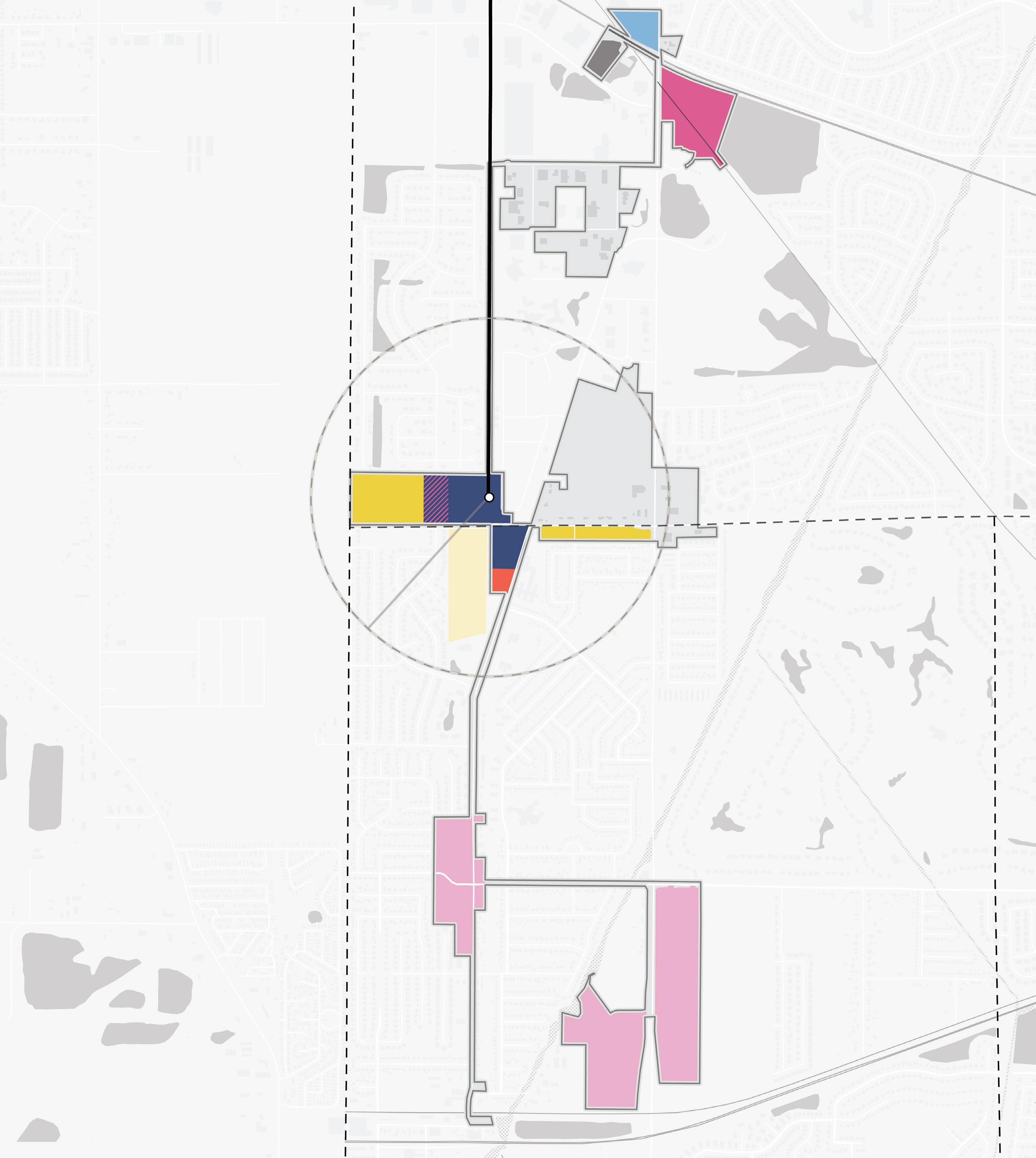
Station Area Mixed-Use Neighborhood Mixed-Use Node Mixed Residential Employment/Office Neighborhood Commercial Mixed-Use Joint Development Potential 26 Northwest Indiana TDD • TOD Strategic Implementation Plan Hart Ditch Calumet Ave White Oak Ave Columbia Ave 45th Ave Sheffield Ave Calumet Ave 213th St Main St SCHEREVILLE DYER Corporate Limits 1/2Mile INDIANA ILLINOIS State Line MUNSTER DYER Corporate Limits West Lake Line Dyer Amtrak Station Franciscan Health Munster Centennial Park Golf Course Dyer Central Park Future Main Street Station NORTH Future Land Use
Neighborhood Commercial
Contains primarily single-story commercial, retail, and service businesses that are either in freestanding buildings or small, integrated centers. Development patterns tend to be more auto-oriented than mixed-use districts and are characterized by large parking areas, usually in front of or to the side of buildings, that may or may not be shared by adjacent uses. Along a corridor, there is typically a lack of adequate pedestrian facilities, bike facilities, and green space.
Employment/Office
Employment/Office uses are areas that are dedicated to commercial office spaces, light industrial, and flex spaces, typically as standalone campus-like or office park-like development or destination. This use exists for a specific purpose or serves a particular population and is a major trip generator for a single site (i.e. business parks, flex manufacturing, etc.) Concentrated employment areas may be supported by a variety of nearby businesses targeted toward serving the daytime population.
Mixed-Use Joint Development Potential
Some Station Areas in these communities have the potential to redevelop over time and transform from surface parking lots into mixed-use joint development. This type of development would add vibrancy to the Station Area with a mix of uses, added residential units, and active groundfloor commercial spaces, while also continuing to provide parking for commuters through structured parking. This joint development should be considered and executed through collaboration among local units, NICTD, and developers. If federalized NICTD property is included, development will need to adhere to the FTA’s Joint Development process.
27 Munster/Dyer • Main Street Station
Development Planning
Development Concepts
Within this TOD study area, two distinct strategies informed development opportunities that were tested more thoroughly. The primary strategy employed was to focus on sites with catalytic development potential that could spur investment by the private market in the short term. A secondary strategy was employed for long-term opportunities for which development potential is anticipated to increase with continued public and private investments as well as enabling infrastructure improvements. Specific development concepts were envisioned and analyzed by a range of development impacts that define an arc of development that supports Munster and Dyer’s economic development paths.
Five development opportunities were studied in this planning process and selected to illustrate the potential of TOD in more detail with scenario planning and renderings.
West LakeLine
28 Northwest Indiana TDD • TOD Strategic Implementation Plan Site F Site G 213thSt Site H Site I Site D Columbia Ave MainSt CalumetAve SheffieldAve NORTH
Development Character
• Site F is owned by NICTD and a developer in the Town of Munster. There is an opportunity for long-term mixed-use joint development to occur on this site.
• The stormwater pond required for the surface parking lots on site was relocated to the north of the site to accommodate future development west of the station
• Additional opportunities on the western portion of the site include the potential to attract corporate office headquarters and for a townhome neighborhood on the developer-owned property

• Main Street will connect to this site, but Town of Munster officials do not want the road connecting further west to Illinois or north to neighborhoods. Main Street will also not connect to the existing neighborhood in Dyer to the south.
29 Munster/Dyer • Main Street Station
MainSt Veterans Park MargoLn SeminaryDr NORTH Development Program 35.8Acres Townhomes 57 Units Multi-Family Residential 347 Units Mixed-Use 146 Residential Units 16,000 SF Commercial
Site F
Alternative Office Concept
The Alternative Office Concept replaces some of the Multi-Family and Townhomes uses with 112,500 SF of Office
7.9Acres
Townhomes 60 Units
Development Character
• Site I is envisioned for long-term transformation into corridor redevelopment focused on townhomes, or small-scale multi-family development with tuck under parking
• This site will benefit from investments in Main Street as a Complete Street with sidewalks, multi-use path, curbs, and streetscape landscaping
• This site has the potential to attract market-rate development not typically found within the community
30 Northwest Indiana TDD • TOD Strategic Implementation Plan
Development Program
Site I
SheffieldAve
ColumbiaAve
MainSt FillmoreAve
NORTH
Sheffield Manor Assisted Living
Development Character
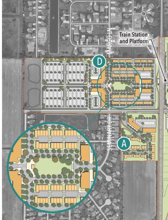
• Site H (right) along Sheffield Avenue is NICTD-owned property of which a portion will function as commuter parking and stormwater needs. The southern portion of this site has the potential for a community-focused commercial use.

• Site G (left) is a large undeveloped property with potential for a critical mass of additional housing adjacent to the future Main Street Station. Development of this site would require establishing access via new roadways potentially connecting through the Mid-America Reformed Seminary facility to the south and to the Main Street extension to the north.
• Development could also potentially accommodate the Seminary’s plans to expand its campus immediately adjacent to this site
31 Munster/Dyer • Main Street Station Development Program 30.3Acres Townhomes 119 Units Multi-Family Residential 40 Units Commercial 7,350 SF
H Sheffield
Sites G &
Ave SeminaryDr MainSt
St. Maria Goretti Church
Mid-America Reformed Seminary
NORTH
Sheffield Manor Assisted Living
Development Character
• Site D is envisioned as a secondary office node along Calumet Avenue with a mix of employment uses that includes medical-related office and a diverse mix of retail and housing types

• Because this site is not walkable to the station, future development of this site could still capitalize on the West Lake Line if future office development warrants a shuttle service to and from the Main Street Station
• The Town of Dyer plans to invest in multi-use trails linking to the new and improved Main Street pedestrian facilities and to other trails in town
32 Northwest Indiana TDD • TOD Strategic Implementation Plan
Site D 213thSt CentralParkBlvd CalumetAve Cedarhurst BriarCrossingDr
Development Program 40Acres Condominium 244 Units Commercial/Retail 82,600 SF Office/Medical Office 2,096,000 SF Hotel 125 rooms Mixed-Use 746,000 SF Office 431,000 SF Retail NORTH
Dyer Central Park
Dyer Symphony Senior Living
33 Munster/Dyer • Main Street Station
34 Northwest Indiana TDD • TOD Strategic Implementation Plan
Arc of Development
At this level of study, it is difficult to assign exact timeframes to development, but this plan demonstrates a range of development and illustrates a potential arc of development over time that could be possible with the right set of incentives and conditions supported by the market.
To understand the full range of potential of these sites, high-level capacity tests were conducted using various densities and types of development possible for each community. Estimations of several metrics of community impacts, including population changes, jobs created, and generated vehicle trips, were calculated based on future potential development. These impacts were informed by market analysis conducted by KPMG and Policy Analytics, ownership status, local guidance and interest, and quantitative and qualitative planning analysis.
The arc of development for each community was defined collectively for selected development opportunities within the TDD boundary that projects future development potential over 5-, 10-, and 20-year time horizons. Quantitative and qualitative factors such as local/public property control, developer engagement or interest, site conditions, current regulations or future regulatory changes, among others were considered in determining the arc of development over time. This study is confident, however, that investments outlined herein can change the outlook and perception of this area and thus induce the private development market over time.
Projected Land Use & Development: 5-Year Horizon
Projected Land Use & Development: 10-Year Horizon
Projected Land Use & Development: 20-Year Horizon
Station Area
Mixed-Use Neighborhood
Mixed-Use Node
Mixed Residential Neighborhood Commercial
Employment/Office
Mixed-Use Joint Development Potential
West Lake Line Sheffield Ave Calumet Ave Columbia Ave Main St West Lake Line Sheffield Ave Calumet Ave Columbia Ave Main St West Lake Line Sheffield Ave Calumet Ave Columbia Ave Main St
35 Munster/Dyer • Main Street Station
Impact Projections
* Vehicle trips generated include projected commuters in 2022 and in 2040 at full build out
** Source: NICTD
Land Use Total Development in Acres ±5.48 Acres Total Development in Sq. Ft. ±238,600 SF Mixed-Use Development ±61,500 SF Residential Development ±177,100 SF Residential Housing Units Total Housing Units ±255 Projected Impacts Residential Population Increase ±530 Households with School-Aged Children ±100 Employees ±105 Vehicle Trips Generated* ±5,220 (2022)** ±5,930 (2040)**
36 Northwest Indiana TDD • TOD Strategic Implementation Plan
Infrastructure
Documentation and Analysis
Functional Classifications
Determined by INDOT, functional classifications were documented and used in analysis to understand the hierarchy of corridors in each community. These classifications also helped inform street design and public realm character typologies.
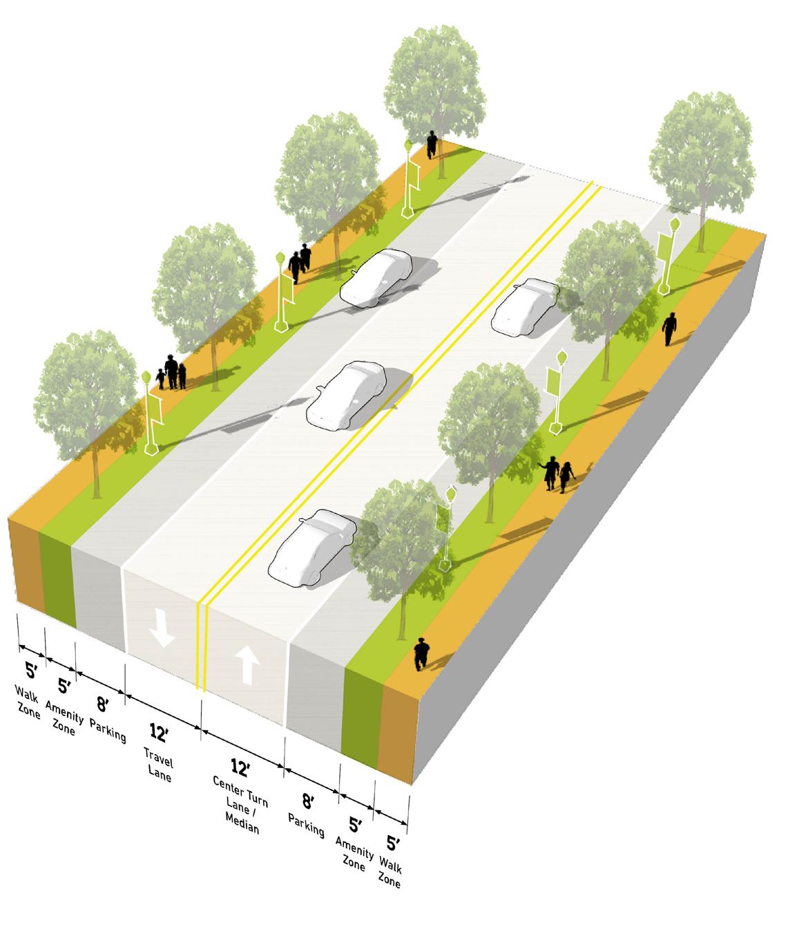
Calumet Avenue is the Principal Arterial through this TDD boundary. However, the Minor Arterials of Columbia Avenue (Munster), Sheffield Avenue (Dyer), and Main Street mainly service this TOD area. Major and Minor Collectors serve to connect residential neighborhoods to each other and to arterials.
37 Munster/Dyer • Main Street Station
HarrisonAve 213th St Lake St DeerCreekDr White Oak Ave 45th Ave Columbia Ave Main St Sheffield Ave Calumet Ave Calumet Ave NORTH 38 Northwest Indiana TDD • TOD Strategic Implementation Plan Hart Ditch INDIANA ILLINOIS State Line SCHEREVILLE DYER Corporate Limits 1/2Mile Principal Arterial Minor Arterial Major Collector Minor Collector West Lake Line Dyer Amtrak Station MUNSTER DYER Corporate Limits Franciscan Health Munster Centennial Park Golf Course Dyer Central Park Future Main Street Station Functional Classifications
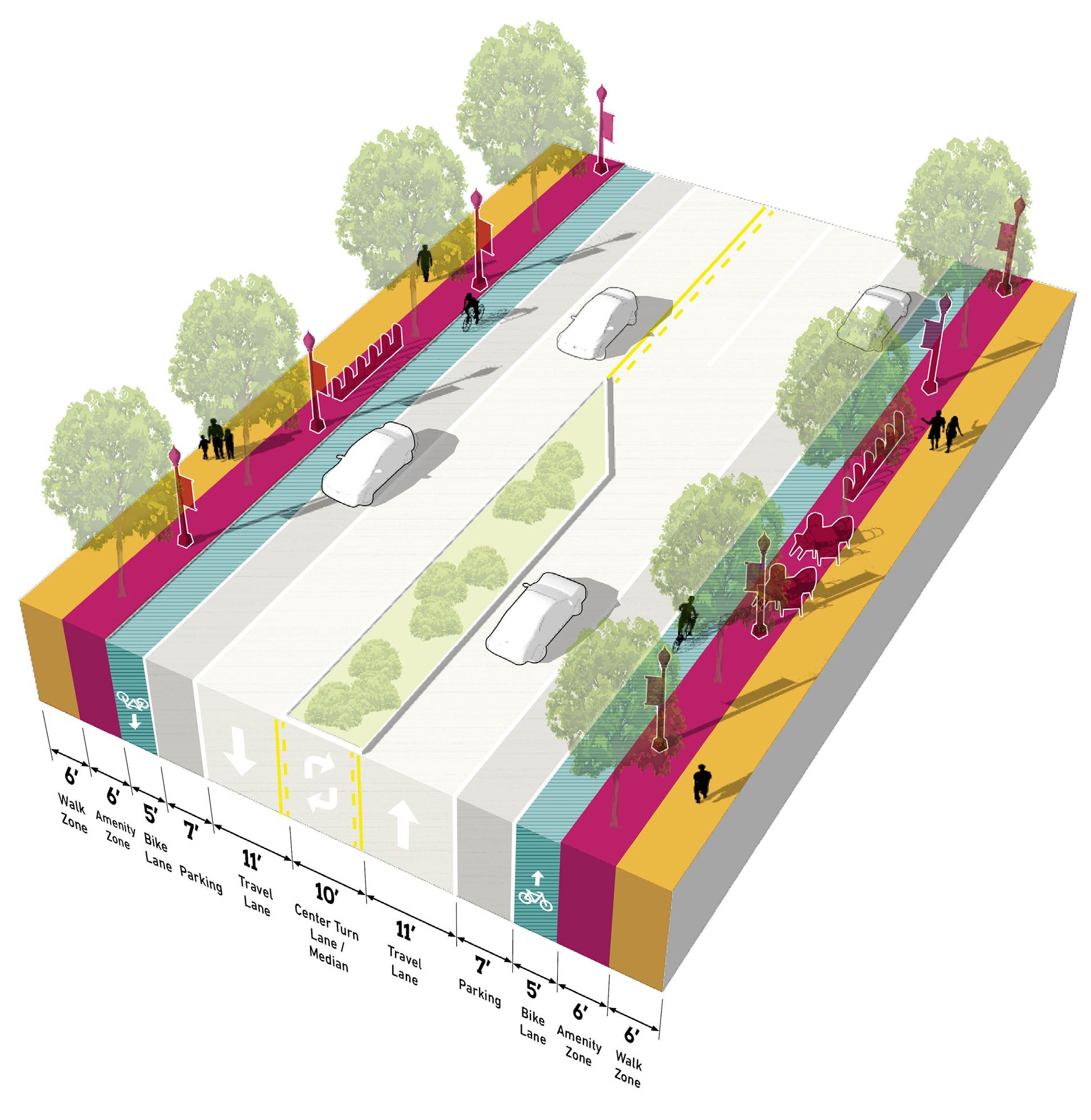
Thoroughfare Typologies
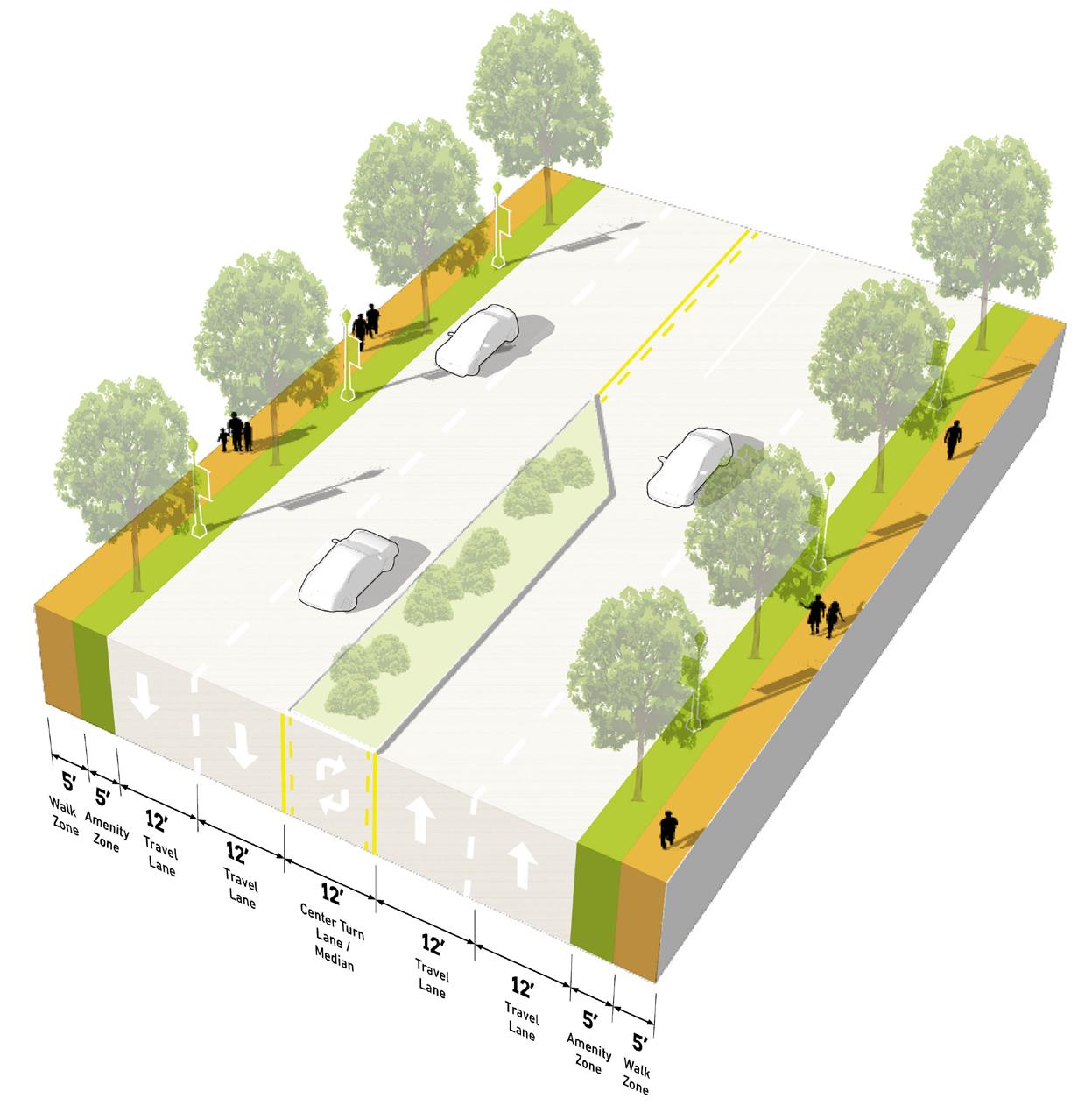
Thoroughfare Typologies were developed to analyze existing corridor conditions and create aspirational goals for future street design and streetscape. Typologies focused on important corridor segments within and connecting to the TDD boundary to guide the design and character of roadways, sidewalks, and amenities within the public right-of-way. These typologies depict typical elements of corridors, including the number of travel lanes, landscaping, lighting, bicycle infrastructure, and sidewalks and paths.
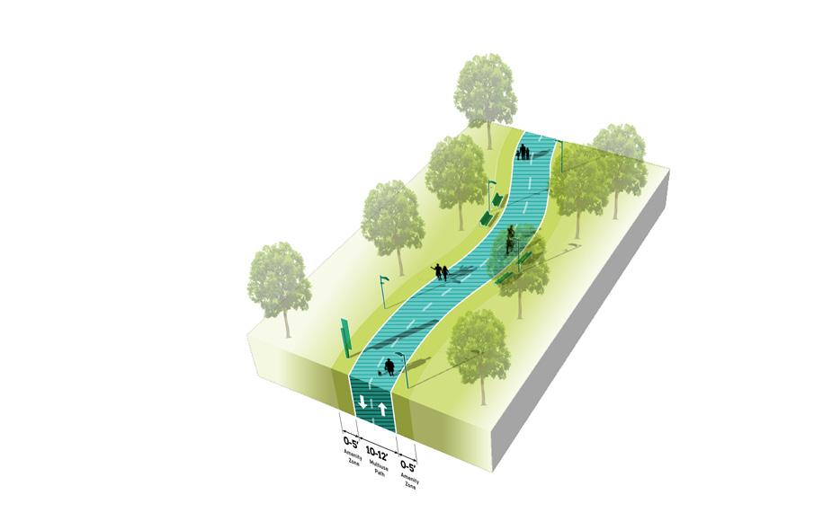
A portion of Main Street and the future extension of Main Street are designated as a TOD Priority Thoroughfare as it is the only road that leads to the station area. Calumet Avenue, Columbia Avenue, Sheffield Avenue, and other portions of Main Street are TOD Connectors that connect to Main Street and the station area. 45th Street and 213th Street are Key Vehicular Routes that carry traffic from the community to the TDD boundary, connecting to important thoroughfares. Key Pedestrian Routes are crucial to connect potential new development and the station area with the Pennsy Greenway.
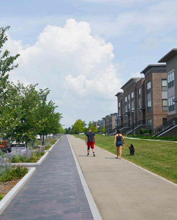
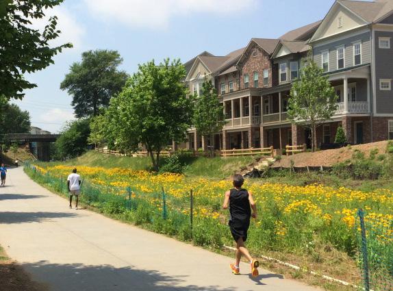
The extension and proposed redesign of Main Street near the station area has the potential to increase the area’s walkability and regional connectivity. With the opportunity for multi-use paths along Main Street, Munster and Dyer can enhance the pedestrian and trail network in their communities by linking to the existing Pennsy Greenway.
Pedestrian Route 39 Munster/Dyer • Main Street Station TOD Priority Thoroughfare
Connector
Vehicular Route Trail/Greenway
Key
TOD
Key
TOD Priority Thoroughfare TOD Connector Key Vehicular Route Proposed New TOD Priority Thoroughfare Existing Trail/Greenway Key Pedestrian Route 213th St Columbia Ave Sheffield Ave Calumet Ave Calumet Ave NORTH 40 Northwest Indiana TDD • TOD Strategic Implementation Plan Hart Ditch White Oak Ave 45th Ave SCHEREVILLE DYER Corporate Limits 1/2Mile INDIANA ILLINOIS State Line MUNSTER DYER Corporate Limits West Lake Line Dyer Amtrak Station Franciscan Health Munster Centennial Park Golf Course Dyer Central Park Main St Pennsy Greenway Main St Future Main Street Station Thoroughfare
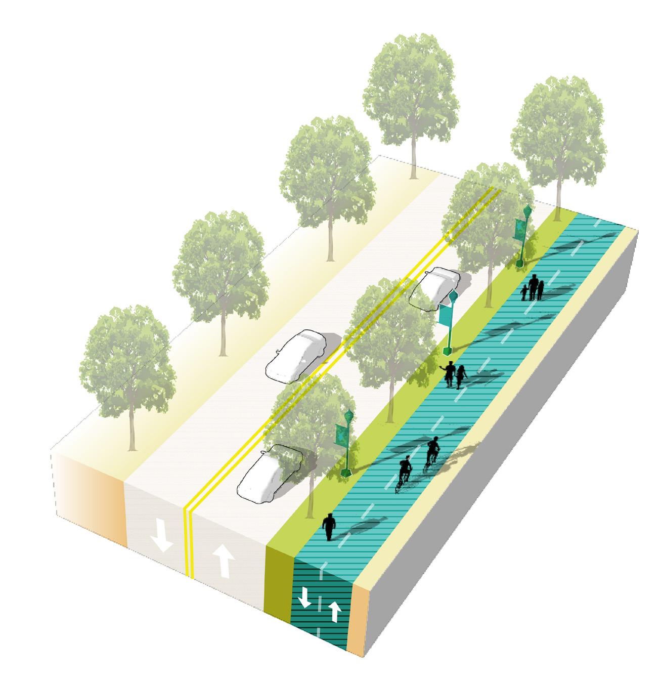
Typologies
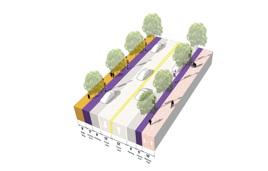
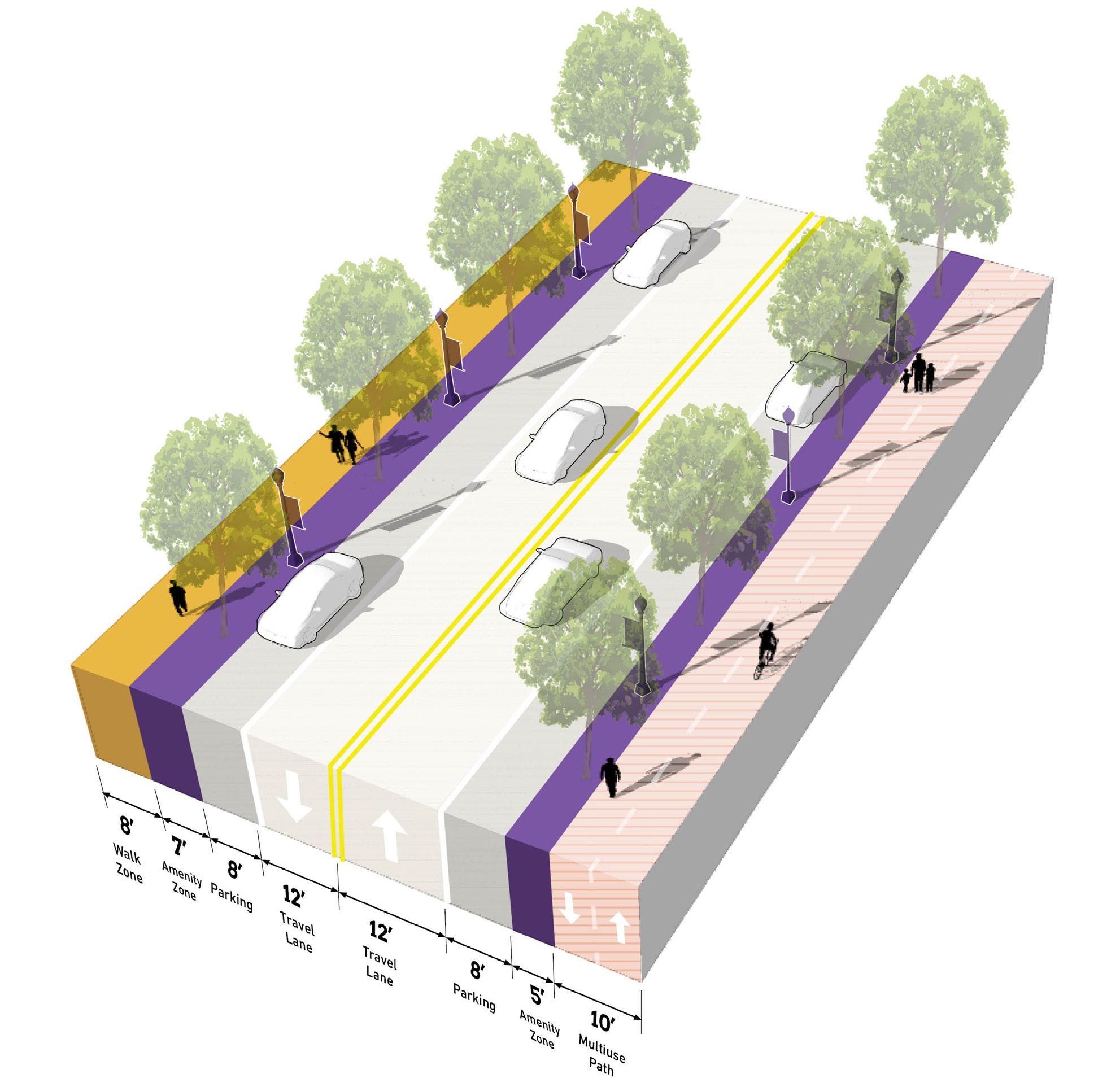
TOD Priority Thoroughfare
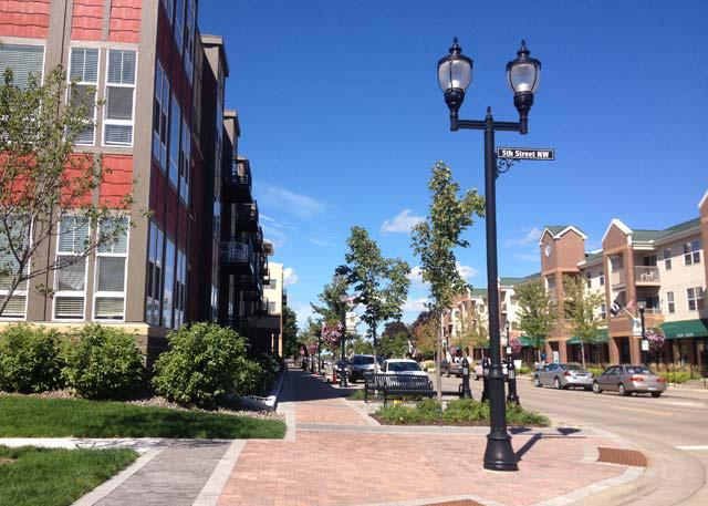
Designed as a Complete Street, accommodating all modes of transportation with high-quality facilities, amenities, and public realm


TOD Priority Thoroughfares support the highest intensity of activity, at local and regional scales. The function of these corridors is primarily to provide multi-modal access to the Station Area and to generate street-level activity for a mix of uses. These corridors will likely carry a high volume of traffic, but at lower vehicle speeds to also accommodate safe, highly-walkable conditions for pedestrians and bicyclists. An attractive, high-quality public realm provides abundant amenities for pedestrians and bicyclists, creating a safe and comfortable environment and establishing an identity/ sense of place. Buildings are typically oriented toward the sidewalk with active ground floor uses. Sidewalks should be wide enough to accommodate a clear walking path along with amenities such as street trees, planters, landscaping, outdoor dining, and gathering areas. Transit is also highly accessible along TOD Priority Thoroughfares, and transit stops should be enhanced and designed as part of the public realm. Parking is typically provided on-street, and access to development blocks or off-street parking should not occur directly from the corridor.
41 Munster/Dyer • Main Street Station
Number of Lanes/ Target Speed
Non-motorized Facilities
Bus/transit Facilities
Parking
Access Management
Public Realm Design/Amenities
2-4 lanes / 25-35 mph
Dedicated facilities (dedicated/separated bike lanes, sharrows, multi-use paths) wide sidewalks; frequent crossings that are well-designed and enhanced for safety and access, including mid-block crossings where necessary
Well-served by bus/transit; enhanced transit stops including shelters and other amenities; Station Area as a hub for transit facilities; bus pull-off or drop-off zones encouraged
On-street parking; any off-street parking, either structured garages or surface lots, should be to the rear of buildings, interior to blocks, and/or properly screened and well-designed with landscaping
Very limited to no driveways in the TOD Station Area; shared parking among buildings and uses is highly encouraged to reduce the number of driveways; driveways, if present, should be adequately spaced and offset to prevent conflicts; consolidation of existing driveways should be studied
High quality and active public realm design with abundant amenities for pedestrians and bicyclists; design should be reflective of the community character and identity; sidewalks should provide adequate clear space for pedestrian circulation
TOD Priority Thoroughfare 42 Northwest Indiana TDD • TOD Strategic Implementation Plan
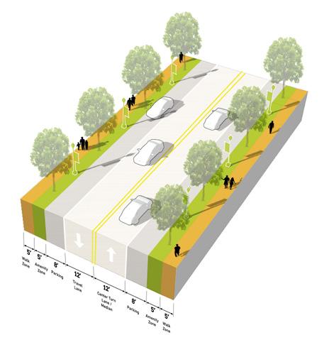
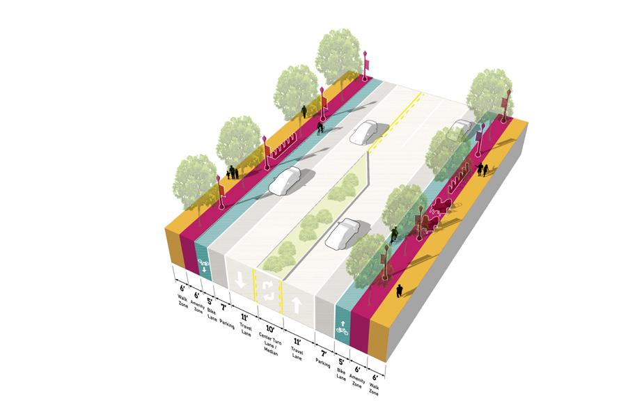
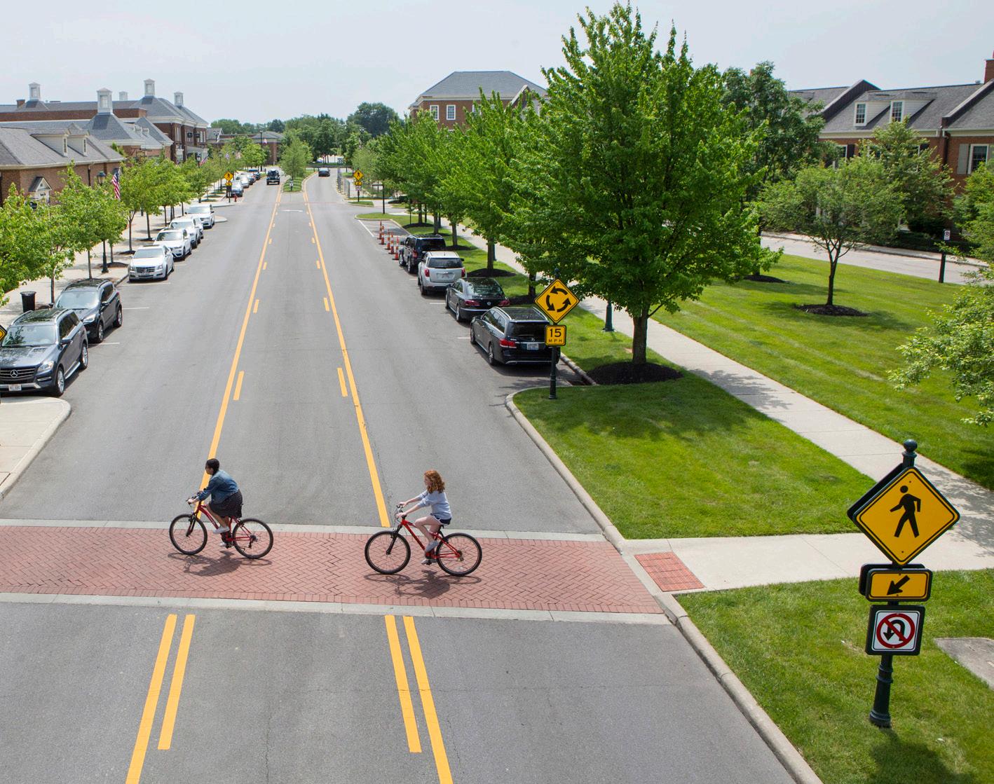
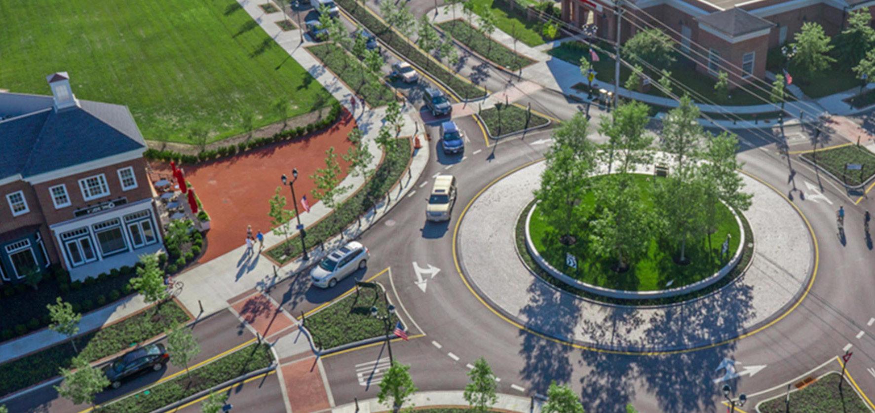
TOD Connector
Multi-modal street that balances modes of transportation to connect to other major facilities, with high-quality public realm and frequent amenities
TOD Connector Thoroughfares may vary more in density of development and intensity of uses, depending on the context. These corridors serve to provide access to TOD Priority Corridors, transit-oriented development and the Station Area for the broader community and connect to other key destinations. TOD Connectors are multi-modal in design with lower vehicular speeds, connected pedestrian and bicycle networks, and transit stops. Bicycle infrastructure may vary from dedicated facilities to shared streets, depending on available right-of-way. A high-quality public realm should continue along these corridors, but may be less intense or frequent in amenities depending on right-of-way and context. Buildings are typically oriented toward the sidewalk with active ground floor uses, but setbacks may increase with a decrease in density. Driveways, both residential and commercial, may be present along the corridor, but infrequent; access management should ensure safe entry/exit along the corridor. Parking is typically provided on-street, and access to development blocks or off-street parking should not occur directly from the corridor.
43 Munster/Dyer • Main Street Station
Number of Lanes/ Target Speed
Non-motorized Facilities
Bus/transit Facilities
Parking
Access Management
Public Realm Design/Amenities
2-4 lanes / 25-35 mph
Connecting gaps of existing facilities (dedicated/separated bike lanes, sharrows, multi-use paths, sidewalks, well-designed and enhanced crossings); enhancing existing facilities to improve safety and accessibility
Well-served by bus/transit; enhanced transit stops including shelters and other amenities; bus pull-off or drop-off zones encouraged
On-street parking; any off-street parking, either structured garages or surface lots, should be to the rear of buildings, interior to blocks, and/or properly screened and well-designed with landscaping
Limited driveways along corridor; shared parking among buildings and uses is highly encouraged to reduce the number of driveways; driveways, if present, should be adequately spaced and offset to prevent conflicts; consolidation of existing driveways should be studied
High quality and active public realm design with many amenities for pedestrians and bicyclists; design should be reflective of the community character and identity; sidewalks should provide adequate clear space for pedestrian circulation
TOD Connector 44 Northwest Indiana TDD • TOD Strategic Implementation Plan
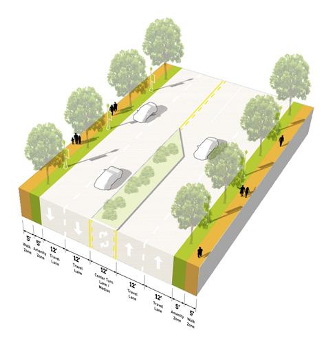
Key Vehicular Route
Primarily functions for vehicular travel but ensures adequate access and safety for all other modes along the corridor, connects to other facilities in the community
Key Vehicular Routes serve areas of moderate density and transition areas to more residential or neighborhood scale areas of the community. These corridors are more auto-oriented, linking residents to major community destinations, services, and amenities, but should still contribute to the network of safe and comfortable pedestrian and bicycle facilities. Transit service may be less frequent on these thoroughfares, but should still be accessible to important transit routes. Vehicular speeds are low along these thoroughfares, and the public realm may be less formal in design, especially in residential areas. However, quality design should still contribute to a sense of place along these corridors. On-street parking may exist in denser areas, and residential and commercial driveways are more frequent along Key Vehicular Routes, especially in more suburban-style development areas. New development should establish a high level of public realm and prevent or mitigate any vehicular conflicts through access management interventions. Parking is typically provided on-street, and access to development blocks or off-street parking should not occur directly from the thoroughfare.
45 Munster/Dyer • Main Street Station
Number of Lanes/Target Speed
2 lanes / 20-25 mph
Non-motorized Facilities
Connecting gaps of existing facilities and access to enhanced facilities (sharrows, multi-use paths, sidewalks, well-designed and enhanced crossings); focus on balancing of modes
Bus/transit Facilities
Some bus/transit facilities, less frequent but enhanced transit stops; stops should be located at key destinations
Parking
On-street parking; any off-street parking, either structured garages or surface lots, should be to the rear of buildings, interior to blocks, and/or properly screened and well-designed with landscaping (if visible from corridor)
Access Management
Public realm design with basic amenities for pedestrians and bicyclists; design should be reflective of the community character and identity; sidewalks should provide adequate clear space for pedestrian circulation
Public Realm Design/ Amenities
High quality and active public realm design with many amenities for pedestrians and bicyclists; design should be reflective of the community character and identity; sidewalks should provide adequate clear space for pedestrian circulation
Key Vehicular Route 46 Northwest Indiana TDD • TOD Strategic Implementation Plan
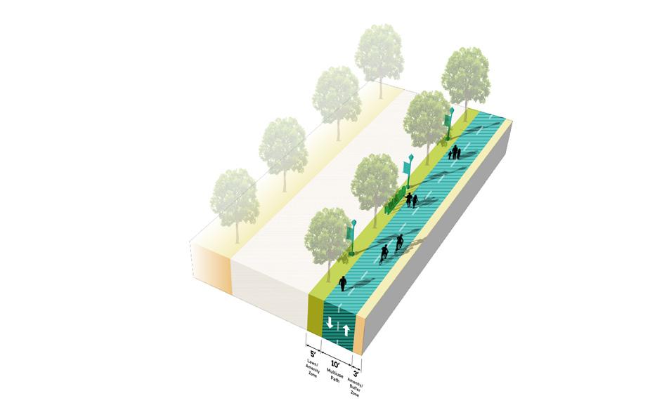
Key Pedestrian Route
Functions primarily for pedestrians, typically as a highly-designed pathway or as a trail or greenway, and may also accommodate bicyclists

Key Pedestrian Routes primarily serve pedestrians to connect to key destinations, transit access, and the Station Area. These routes may exist alongside vehicular corridors or they may exist in the form of a pedestrian pathway or trail. In the case of a trail, bicycles may also be accommodated. Amenities and landscaping should be designed at pedestrian-scale and either contribute to the surrounding character or to particular brand if part of a larger trail network. Wayfinding and signage is particularly important to highlight access points and destinations across the community. New Key Pedestrian Routes should be planned to avoid vehicular conflicts such as driveways, and these conflicts should be reduced to the extent possible along existing Key Pedestrian Routes.

47 Munster/Dyer • Main Street Station
Number of Lanes/Target Speed
N/A or Varies
Non-motorized Facilities
Completing gaps of existing facilities and access to enhanced facilities (sidewalks, multi-use paths, and well-design and enhanced crossings where intersecting with roadways); may exist along roadways or as a separated facilities like a path or trail

Bus/transit Facilities
Some bus/transit facilities, less frequent but enhanced transit stops; stops should be well-connected by a complete network of pedestrian facilities
Parking
Parking areas, on-street or off-street, should be located near trailheads. Pedestrian routes may connect parking areas to other destinations in the community.
Access Management
Limited driveways intersecting with pedestrian routes to reduce conflicts with vehicle entries/exits and maximize pedestrian safety. New pedestrian routes should be planned along corridors with minimal driveway conflicts, or access management interventions may be implemented.
Public Realm Design/ Amenities
Amenities along pedestrian routes should be tailored to pedestrians (or bicyclists if a multi-use path or trail); design should be reflective of the community character and identity;local or regional trails may be designed with individual branding
48 Northwest Indiana TDD • TOD Strategic Implementation Plan
Key Pedestrian Route
Thoroughfare & Streetscape Design
Further studies were conducted on TOD Priority Thoroughfares at the request of the local units. These studies and the corresponding order of magnitude cost estimates are included in determining possibilities for infrastructure improvements that could catalyze TOD close to the station. These studies provide concept-level plans that communities could use to have conversations with stakeholders/funders, such as NIRPC and INDOT, and with local elected, appointed, and staff-level officials about the importance of high-quality infrastructure in the creation of TOD. Currently, the Town of Munster, in collaboration with the Town of Dyer and NIRPC, have hired an engineering consultant to design a Main Street Complete Street to connect to NICTD’s planned extension of Main Street.
Fillmore Avenue West Lake Line Future Main Street Station Columbia Ave Sheffield Ave Calumet Ave Fillmore Ave Main St MUNSTER DYER Corporate Limits Hart Ditch West of Calumet Avenue Columbia Avenue/ Sheffield Avenue 49 Munster/Dyer • Main Street Station
NORTH
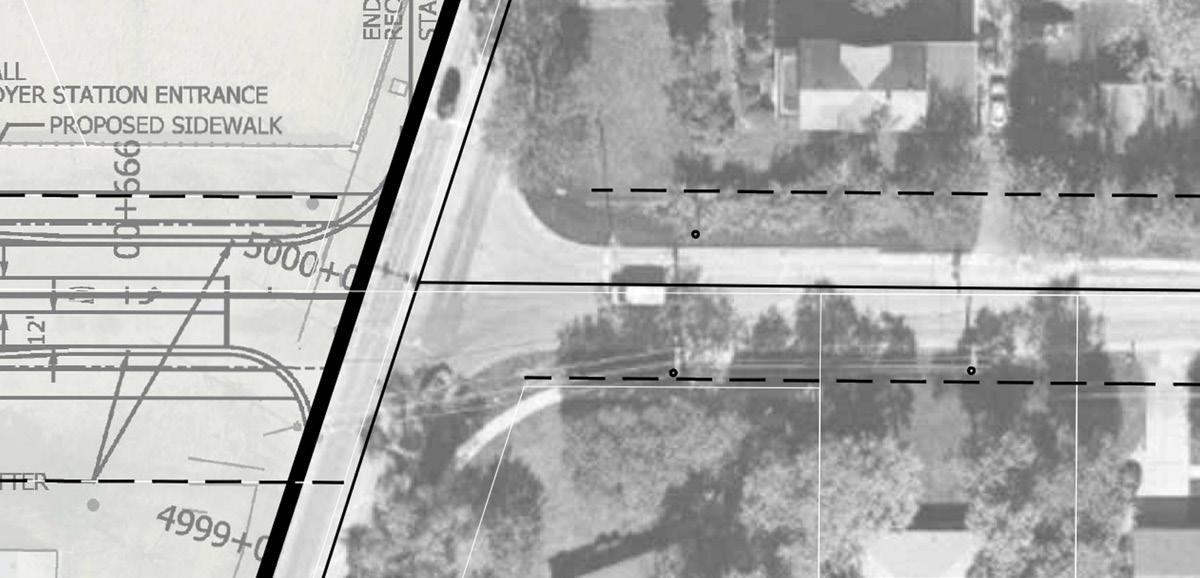
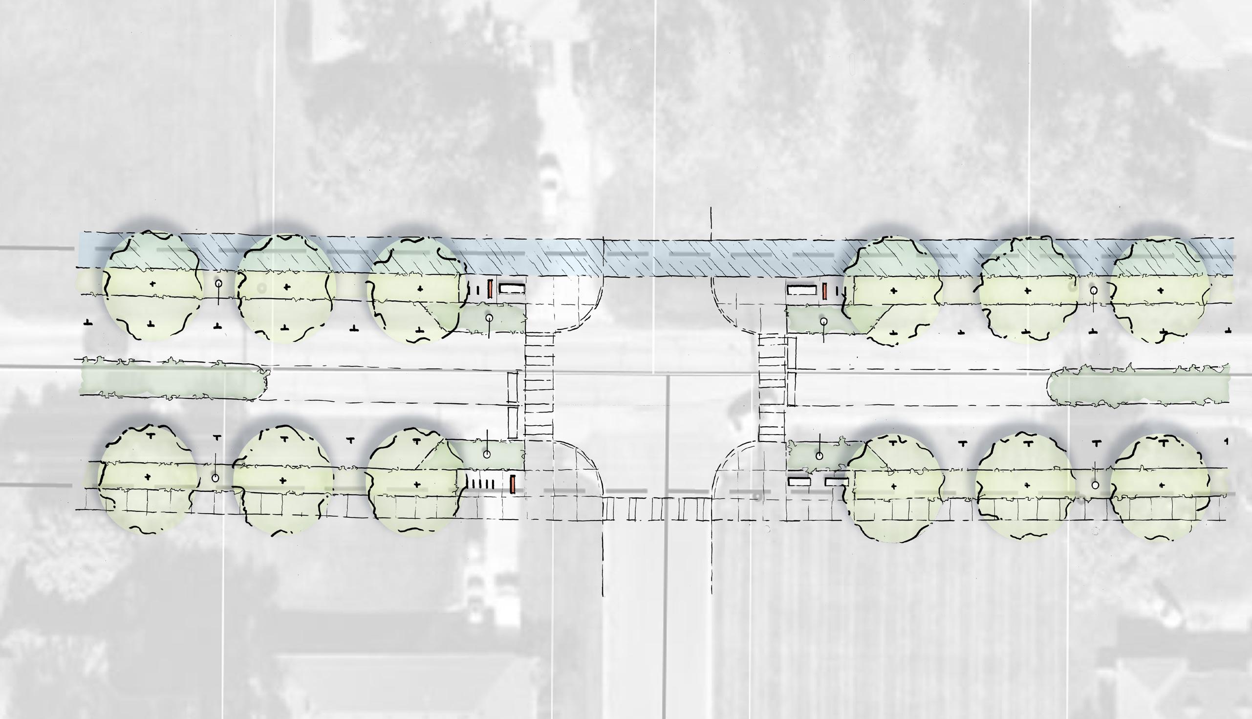
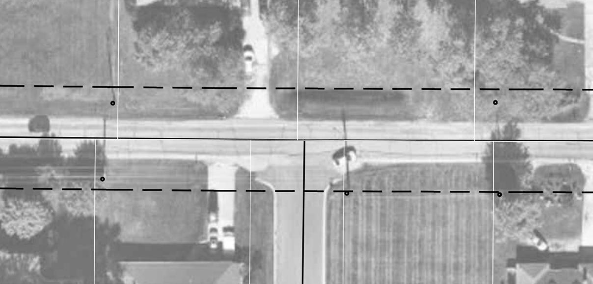
Main Street at Columbia Avenue/ Sheffield Avenue
The vision for Main Street enhancements is to establish a consistent 80’ right-of-way and a continuous curb condition with planting, lighting, and pedestrian space characteristic of a typical “main street”. The existing roadway has no dedicated right-of-way, no curbs or stormwater infrastructure, and no sidewalks from Sheffield Avenue/Columbia Avenue to Calumet Avenue.
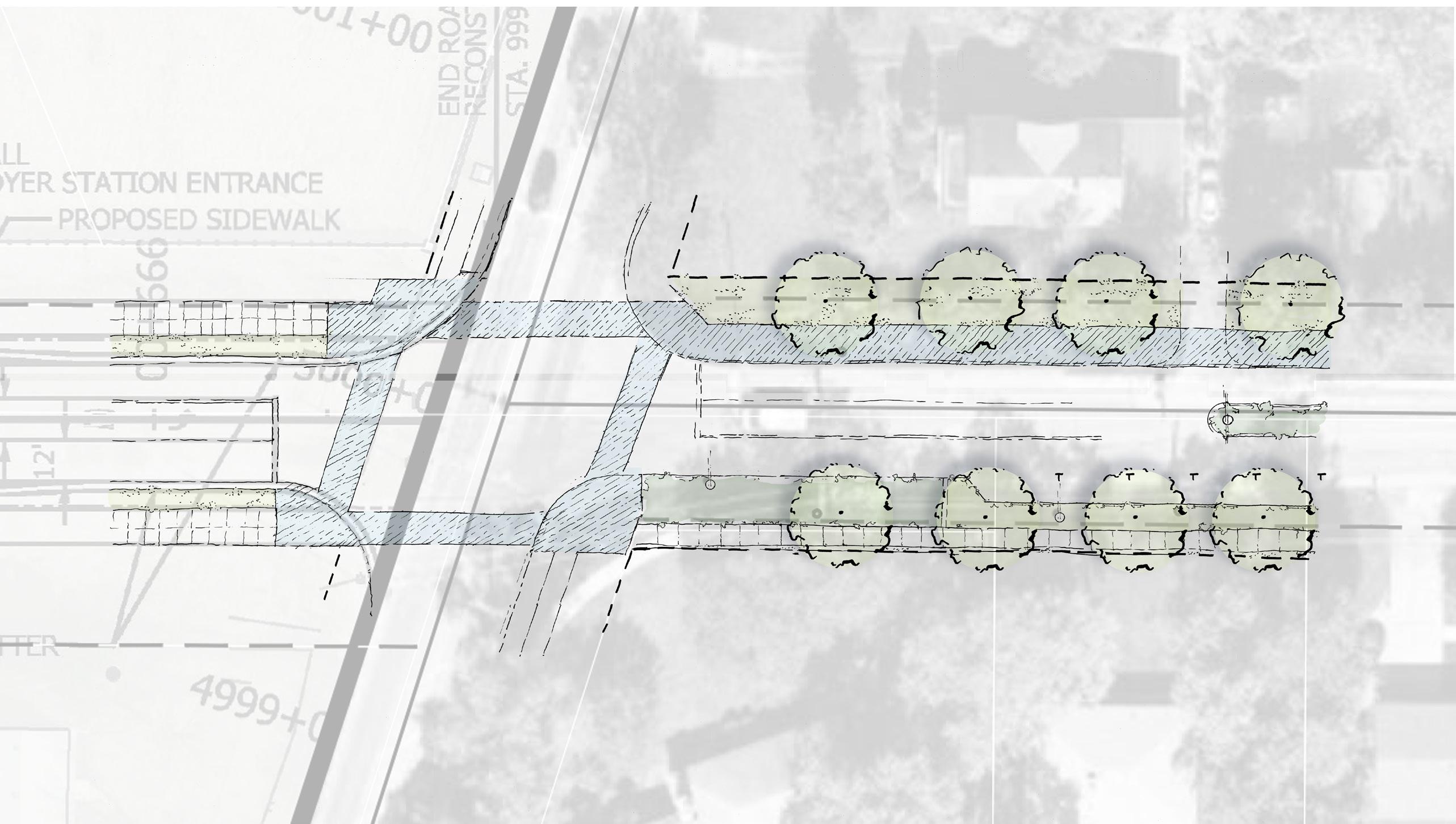
The north side of Main Street, in the Town of Munster, has few occupied residences remaining and would therefore likely be the best location for a multi-use trail in the future, should redevelopment occur in this area. The utility poles on the north side which service these remaining residences can be removed creating available space on this side of the corridor for improvements.
50 Northwest Indiana TDD • TOD Strategic Implementation Plan Existing Residential Existing Residential Columbia Ave Sheffield Ave Possible Centerline Offset Main Street NICTD PLANS NORTH 10’ Multi-use path 10’ Multi-use path 16’ Lawn with Street Trees to Buffer Residences 10’ Multi-use path Trail position shifts approaching intersection 16’ Planting Area 6’ Walk Planted Median 8’ Lawn with Street Trees, Utilities & Lighting Existing Drive Possible Centerline Offset Main Street Columbia Ave Sheffield Ave 80’ ROW PROPOSED Potential Development No dedicated right-of-way currently exists NICTD PLANS Property lines extend to the center of the street. No dedicated right-of-way currently exists
Conditions
Existing
Main Street at Fillmore Avenue
Improvements along the Main Street corridor are planned to occur in phases so that existing driveways and turn lanes are maintained until no longer necessary. If Main Street redevelops to transition from single-family uses and curbs cuts are to reduce to a few controlled access points, planted medians, on-street parking, and curb bump outs will be possible within the right-of-way. To simplify the streetscape experience of future Main Street, future developments should be via Fillmore Avenue and a potential future access on-street parking and narrower lanes calm traffic along the corridor and create a continuous, safe environment for street-level access of future development.
51 Munster/Dyer • Main Street Station Existing Residential Existing Residential Existing Residential Fillmore Ave NORTH Main Street Property lines extend to the center of the street. No dedicated right-of-way currently exists Fillmore Ave Property lines extend to the center of the street. No dedicated right-of-way currently exists Potential Signalized Intersection Main Street 80’ ROW PROPOSED Potential Development 8’ Lawn with Street Trees, Utilities & Lighting 8’ Lawn with Street Trees, Utilities & Lighting Seating, Bike Rack & Wayfinding Signage 6’ Walk 6’ Walk Planted Median Lighting Seating Planted Median 8’ Bump-out Planting Area 8’ Bump-out Planting Area 8’ Lawn with Street Trees On-Street Parallel Parking 10’ Multi-use path Potential Future Road Cut Existing Conditions
Main Street West of Calumet Avenue
Continuing east toward commercial properties near Calumet Avenue, the existing right-of-way is generous at 100 feet. On-street parking will give way to right turn lanes at the signalized intersection with Calumet Avenue. A planted center median will also convert to a left-turn lane at the intersection. The multi-use path continues on the north side of the street with ample space for planting areas to buffer from the roadway, particularly at the existing driveway to the fueling station, which can serve to calm traffic.
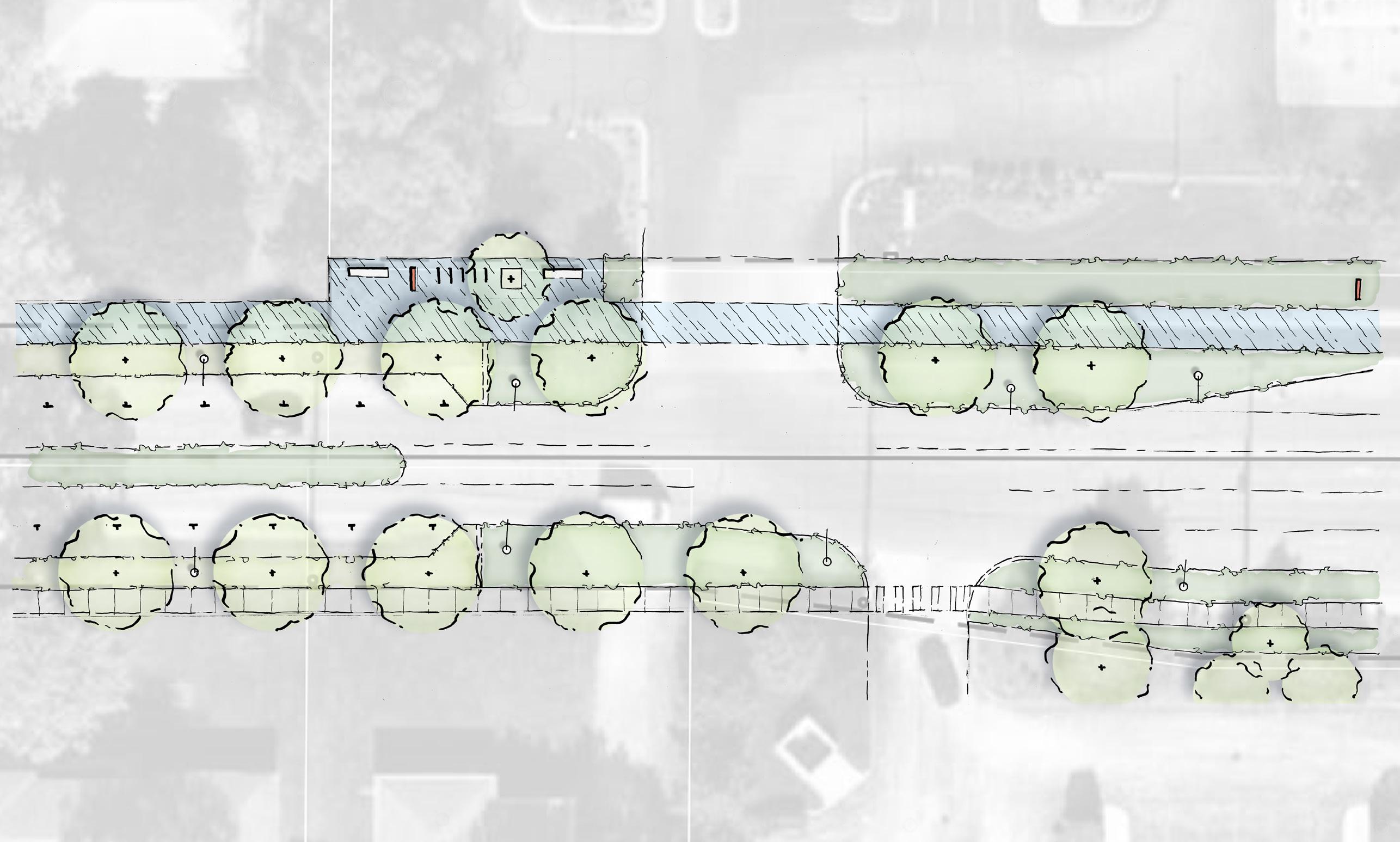
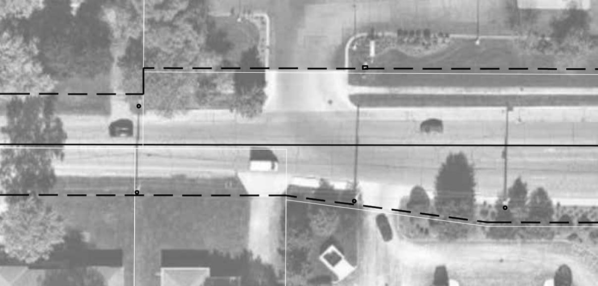
52 Northwest Indiana TDD • TOD Strategic Implementation Plan Existing Residential Existing Residential Existing Commercial Existing Commercial Property lines extend to the center of the street. No dedicated right-of-way currently exists Main Street NORTH Near Calumet Ave 100’ ROW Near Calumet Ave 100’ ROW EXISTING 80’ ROW PROPOSED Existing Bank Entry Existing Fueling Station Entry Existing ROW/ Property Lines Main Street Build-to line of potential development Build-to line of potential development Potential Future Road Cut Existing Trees 6’ Walk 8’ Planting Area 16’ Bump-out Planting Area 10’ Planting Area 10’ Multi-use path Seating, Bike Rack & Wayfinding Signage 8’ Planted Median 8’ Lawn with Street Trees 6’ Walk On-street parking 16’ Bump-out Planting Area Lighting 8’ Lawn with Street Trees Existing Conditions
Engineering and NICTD Coordination


Throughout this process, the team collaborated closely with the Town of Munster, Town of Dyer, and NICTD to understand the Main Street Station design parameters, stormwater negotiations, and conditions for the trail alignment. Several development scenarios around the station area (Site F) were evaluated to determine that some utility upgrades would be necessary to enable this type of development.
In one scenario, existing sanitary sewer, storm sewer, and water are utilized and tied into north of the station along Margot Street. In a second scenario, the existing sanitary sewer would need to be upgraded from an 8-inch pipe to a 12-inch pipe to increase capacity for development and potentially tie into the Seminaryowned property in Dyer. Due to proximity of existing residential development, all other utilities could be connected into this development area. Other areas in the TDD boundary have been determined to have sufficient utility infrastructure in place to accommodate new development or redevelopment. This analysis includes an order of magnitude cost for each of these items, and further detailed information is included in the Appendix.
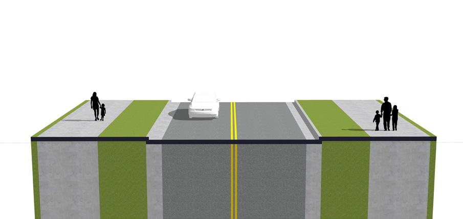
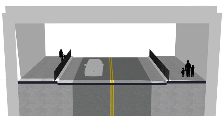
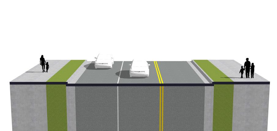
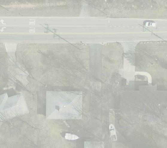
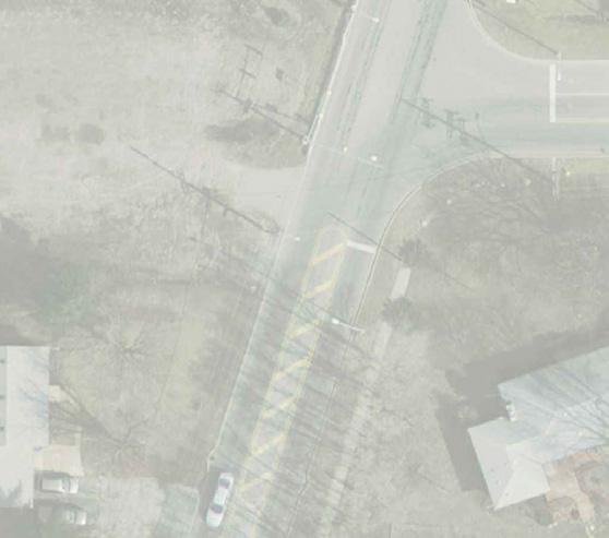


Main Street Extension
As part of the West Lake Line and Main Street Station construction, NICTD is extending Main Street to the west beyond the Columbia/Sheffield Avenue intersection, where Main Street currently dead-ends. This road extension is primarily designed to serve commuters driving to and parking at the station, but it will connect to future TOD that occurs adjacent to the station area in Munster. This road is not envisioned to connect across the State Line into Illinois or to existing residential neighborhoods to the north or south of Main Street.
NICTD Main Street Extension (Sheffield/Columbia Avenue intersection, looking west)
NICTD Main Street Extension (Future West Lake underpass, looking west)
Engineering Drawings of the Main Street Extension (West Lake Corridor Final Environmental Impact Statement) 53 Munster/Dyer • Main Street Station 28 PROPOSED CONDITIONS Main Street NICTD Plans - Looking West Calumet Ave. Columbia Ave. Sheffield Ave. Main St. Gutter Gutter Turf Turf Multi-Use Multi-Use Drive Lane Drive Lane Turn Lane 12’ 12’ 12’ 2’ 2’ 6’ 6’ 10’ 10’ 72’ Minimum Right of Way Required 29 PROPOSED CONDITIONS Main Street NICTD Plans - Looking West Calumet Ave. Main St. Shoulder Shoulder Wall Wall Multi-Use Multi-Use Drive Lane 12’ 4’ 4’ 2’ 2’ 10.5’ 10.5’ 62’ Minimum Right of Way Required Drive Lane 12’ Columbia Ave. Sheffield Ave. 30 PROPOSED CONDITIONS Main Street NICTD Plans - Looking West Calumet Ave. Main St. Turf Turf Multi-Use Multi-Use 8’ 8’ 10’ 10’ 66’ Minimum Right of Way Required Columbia Ave. Sheffield Ave. Drive Lane Gutter Gutter Drive Lane 12’ 2’ 2’ 12’
NICTD Main Street Extension (Station Entrance, west of the rail, looking west)
Zoning
Coding Objectives
The team worked with both towns to determine zoning needs. The Town of Munster felt its recent characterbased code is sufficient to promote the type of development it envisions around the Main Street Station Area. The Town of Dyer felt that there were certain aspects of their new zoning code that needed review and further recommendations. For Dyer only, the team has prepared an evaluation of the current code and a new coding template. Due to the detail and length of the coding template, detailed zoning recommendations are in the Appendix.
Existing Zoning Districts: Town of Munster
The table below lists the existing Zoning Districts within the boundary of the TDD area, along with their description.
District Description
CD-5 Urban Center
CD-4.B General UrbanB District
Higher density mixed use areas; has a tight network of thoroughfares with side sidewalks, street lights and regular tree spacing, defining medium-sized blocks; buildings are set close to the sidewalks
Medium density area that has a mix of building types and primarily residential, retail, personal service, office, and light industrial uses; setbacks vary as compared to CD-4.A; it has variable private and public open spaces and landscaping; thoroughfares typically have curbs, sidewalks and trees; blocks may vary in size to accommodate a variety of uses
CD-4.A General UrbanA District
CD-4.R4 Mulitfamily Residence District
CD-3.R2 Neighborhood - 60’ Lot One
Family Residence District
CD-3.R3 Neighborhood - 60’ Lot One
Family and Two
Family Residence District
Medium density area that has a mix of building types and primarily residential, retail, personal service, and office uses; there are medium, shallow or no front setbacks and narrow to medium side setbacks; it has variable private landscaping; and has thoroughfares with curbs, sidewalks and trees that define medium-sized blocks
Primarily a medium density attached residential area in which apartment houses are the predominant building type; has medium to deep front setbacks and medium to wide side setbacks; most thoroughfares have sidewalks, street trees and curbs; medium to large blocks
Primarily a low density single-family detached residential area in which houses are the predominant building type; has some medium to deep front setbacks and medium to wide side setbacks; some thoroughfares have sidewalks and curbs, and form medium to large blocks
Primarily a low density single-family detached residential area in which houses and two-family dwellings are the predominant buliding types; has medium to deep front setbacks and medium to wide side setbacks; most thoroughfares have sidewalks, street trees and curbs, and form medium to large blocks
SD-PUD Planned Unit Development For areas in which diverse uses may be brought together with innovative planning and design as a compatible and unified plan of development that is in the interest of the general welfare of the public
CZ Civic Zone Areas designated for civic purposes; may be open space of one or more civic space types allowed within or adjacent to any specific character district or special district, as well as sites dedicated to significant buildings to be used for civic purposes, such as town halls, post offices, libraries, places of assembly, places of worship, and community centers
SD-M Manufacturing For light industrial development compatible with a limited residential community; intended to encourage development with suitable uses, space, landscaping, and parking areas
55 Munster/Dyer • Main Street Station
Existing Zoning Districts
Town of Munster
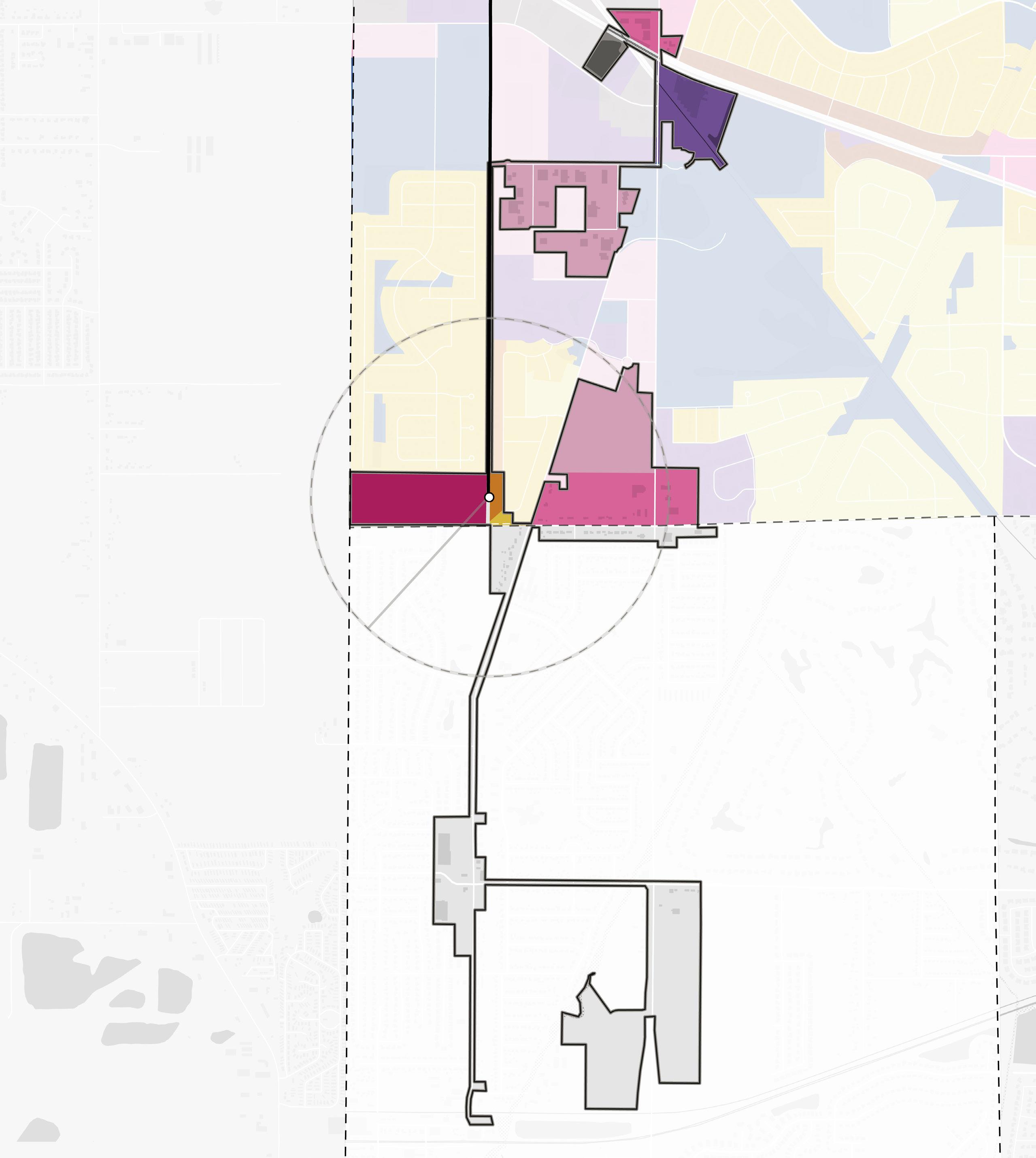
CD-4.A CD-4.A SD-M CD-5 CD-4.B CD-3.R3 CD-3.R2 CD-4.B SD-PUD NORTH CD-3.R1 CD-3.R2 CD-3.R3 CD-3.R4 CD-4.A CD-4.B CD-5 SD-M CZ SD-PUD 56 Northwest Indiana TDD • TOD Strategic Implementation Plan Hart Ditch Calumet Ave White Oak Ave Columbia Ave 45th Ave Sheffield Ave Calumet Ave 213th St Main St SCHEREVILLE DYER Corporate Limits 1/2Mile INDIANA ILLINOIS State Line MUNSTER DYER Corporate Limits West Lake Line Dyer Amtrak Station Centennial Park Golf Course Dyer Central Park Future Main Street Station Franciscan Health Munster
Existing Zoning Districts: Town of Dyer
The table below is a continuation of the existing Zoning Districts within the boundary of the TDD area, along with their description.
District Description
R-3 Residential Multi-Family District
SUD 3 Sheffield & Main District (Mixed-Use)
Consists of medium density development including townhomes and row houses and also allows for areas for higher-density, multi-family low rise developments, exclusive of areas developed as PUDs.
This neighborhood scaled district is a medium-density area and has a mix of uses and building types in a walkable pedestrian friendly environment; primary uses are residential, retail, personal service, and office; primary building types are townhomes and row houses, multi-family low rise developments, smaller footprint commercial and mixed-use buildings with retail and commercial on the ground floor and offices or residences above; commercial and mixed-use buildings in this district are encouraged to be close to the sidewalk with parking to the rear.
DT Downtown District
This district is a medium-density area and has a mix of uses and building types in a walkable pedestrian friendly environment. Primary uses are retail, personal service, and office with multi-family residential as a supplemental use. Primary building types are smaller footprint commercial, and Mixed-Use buildings with retail and commercial on the ground floor and offices or residences above. Commercial and Mixed-Use buildings in this district are encouraged to be close to the sidewalk with parking to the rear.
O Open Space
SD-PUD Planned Unit Development
The OS Open Space Zoning District is intended for the designation and protection of parks and public recreational facilities, both outdoor and indoor and include both active and passive recreation areas, and certain ancillary uses, such as field houses, cultural facilities, and performance areas.
This district provides for flexibility in future community needs, in keeping abreast of new building methods, to provide for the planning of groups of dwellings, to secure the benefit of solar orientation, climate control, and additional privacy, and to provide for variety in dwelling types to meet changing needs of future residences; for commercial buildings to secure greater convenience to the public through improved methods of merchandising, transportation, office management, and distribution of services necessary to the public welfare; for industrial buildings to secure greater efficiency in production through improved methods of manufacturing, transportation, office management, and distribution of products necessary to the public welfare. The PUD may necessitate the variation in the use and area requirements of this ordinance which are designed primarily to apply to the traditional pattern of lot development and building arrangement generally prevailing within the Town.
57 Munster/Dyer • Main Street Station
Existing Zoning Districts
Town of Dyer

O
Unit Development) NORTH SUD 3 SUD 3 SUD 3 SUD 2 SUD 2 R-3 R-2 R-2 Downtown SUD 3 Franciscan Health Munster
R-2 (Medium Density) R-3 (Multi-Family) SUD 2 (Calumet Ave) SUD 3 (Sheffield & Main) Downtown
(Open Space) SD-PUD (Planned
58 Northwest Indiana TDD • TOD Strategic Implementation Plan Hart Ditch Calumet Ave White Oak Ave Columbia Ave 45th Ave Sheffield Ave Calumet Ave 213th St Main St SCHEREVILLE DYER Corporate Limits 1/2Mile INDIANA ILLINOIS State Line MUNSTER DYER Corporate Limits West Lake Line Dyer Amtrak Station Centennial Park Golf Course Dyer Central Park Future Main Street Station
Implementation
Implementation Strategies
While planning efforts are inherently long-range in scope, there is a benefit to identifying early projects – catalyst projects – that are necessary to improve market conditions and spark changes. This is where a development plan becomes more tangible with near-term goals that can be brought into sharper focus for the community and achieved relatively quickly to create momentum into the future.
Critical components of an implementable development plan include site capacity, economic viability, and political support. The implementation strategy summarizes project recommendations contained within this plan and an explanation of associated infrastructure project costs that can be used to develop a capital projects plan that supports TOD. This process is aimed at providing implementable steps and technical resources for the community to advance and adopt in preparation for TOD in accordance with its growth path.
Implementation strategies are outlined in three timeframes and are defined below: Immediate Next Steps, Short-Term Strategies, and Long-Term Strategies
Immediate Next Steps
Actions to take quickly to get recommendations set up for implementation
Short-Term Strategies
Tasks and projects that can be executed in a 1-5 year timeframe
Long-Term Strategies
Tasks and projects that require additional work to execute and can be completed in 5 or more years
Enabling Actions
• Host an educational session “road show” with the Northwest Indiana RDA inviting elected and appointed officials and residents to share the purpose of this effort; the positive community impacts that can occur within the TDD boundary; and the potential to create walkable, vibrant TOD that will attract new investment, population, businesses, and employment opportunities
• Meet with Town of Munster staff and consultants to review recommendations provided in this Main Street TOD Implementation Strategy as the community proceeds in its Comprehensive Plan update
• Meet with Town of Dyer staff to review the recommendations provided in this Main Street TOD Implementation Strategy. Develop a responsibility matrix.
• Use recommendations and illustrations within this plan for funding requests/applications for NIRPC, READI, Next Level Trails, and other state, federal, and philanthropic grant opportunities that highlight the comprehensive thought and partnerships behind this effort
• Collaborate with the RDA to understand how projects could be funded through TDD increment dollars as revenue begins to flow into the TDD fund in 2024
Recommendations Land Use & Zoning
Immediate Next Steps
• Create a working group of Munster staff and Plan Commission members to review and integrate relevant land use recommendations from this TOD strategy to guide land use and development in this area as part of the Town’s ongoing comprehensive planning process
• Create a working group of Dyer staff and Plan Commission members to review and integrate relevant land use recommendations from this TOD strategy to guide land use and development decisions and update its Comprehensive Plan
59 Munster/Dyer • Main Street Station
Short-Term Strategies
• Use development concepts and zoning review included in this TOD strategy to determine if minor edits to the new zoning codes in Munster and Dyer are needed to enable the type of development envisioned for opportunity sites
(Re)development
Immediate Next Steps
• Share this TOD and TDD vision with landowners; interested parties; developers; investors; and local, state, and regional economic and housing agencies. Build excitement and support to attract the desired investment to the Main Street TDD boundary.
Short-Term Strategies
• Convene a meeting with Munster staff, NICTD, and adjacent property owners adjacent to the Main Street Station Area to a phased approach that allows for future joint development on the NICTD site as development to the west builds out
• Convene a meeting with Dyer staff and Mid-America Reformed Seminary to discuss developing its property south of the station. Discuss the potential to take the site to developer RFP in parallel to reserving property further south for future expansion of the Seminary.
• Engage the Munster and Dyer Redevelopment Commissions and the development community to target opportunity sites for acquisition and assemblage either by the Town or private developers
• Assemble remaining residential properties along the north and south sides of Main Street for redevelopment as they become available
Long-Term Strategies
• Secure a developer to conduct joint development with NICTD at the Main Street Station. This could occur parallel to or closely coordinated with development west of the station. Engage Munster’s Redevelopment Commission and the development community to assemble additional sites as needed. Use Centennial Village as an example of this development type.
• Once Munster completes its Comprehensive Plan update and the West Lake Line is operational, consider other sites recommended within this plan in support of TOD as interest occurs in the community
• Develop sites in both communities in accordance with their respective zoning ordinances with an emphasis on walkability and mixed-use development concentrated within a ¼ mile of the station
Thoroughfare Improvements
Immediate Next Steps
• Convene a meeting with both Munster staff, Dyer staff, and the engineering consultant to review this report and the conceptual road recommendations for Main Street. Reference conceptual designs and cost estimates for the corridor included in this TOD strategy.
• Coordinate with NICTD on improvements to the signalized intersection at Columbia Avenue and Main Street to integrate a pedestrian cycle as streetscape improvements are implemented further east on Main Street
• Coordinate with NICTD to ensure appropriate landscaped buffering is maintained between Main Street and adjacent residential development
Short-Term Strategies
• Design and build pedestrian facilities along Main Street connecting the station to Columbia Avenue, planned trails, future development sites, and the planned Calumet Avenue/Ridge Road improvements. Connectivity should include 10’ multi-use paths on one side of the road and sidewalks on the other side. Pedestrian signals and crosswalks should be added to signalized intersections.
Long-Term Strategies
• Continue implementing streetscape improvements Columbia and Calumet Avenues to enhance this portion of Munster and continue similar improvements to Sheffield and Calumet Avenues in Dyer
• Manage access from Main Street by encouraging access to future development via Filmore Avenue and/or new north/south roads to the rear of development and by restricting new curb cuts on Main Street
• Acquire additional right-of-way on the north side of Main Street for utility relocation and streetscape enhancement in support of future medical/office development and TOD
60 Northwest Indiana TDD • TOD Strategic Implementation Plan
Capital Improvements
Short-Term Strategies
• Amend both Munster and Dyer’s Capital Improvements Plans to include road and infrastructure costs needed to improve walkability to the station from development sites and neighborhoods, enhance key gateways, and enable development on opportunity sites
Transportation & Mobility
Short-Term Strategies
• Conduct a sidewalk and trail conditions assessment to determine where improvements are needed to connect the community to the Main Street Station
• Support first- and last-mile connections to the station, such as upgraded sidewalks, ADA ramps, and bike/scooter share programs
Community Building & Identity
Immediate Next Steps
• Brand the Main Street TOD as streetscape improvements are implemented
• Employ an Equitable Development Toolkit to model impactful and inclusive growth on catalytic sites. Prioritize support for projects which:
› Support residential development
› Establish a framework for preventing displacement
› Create pathways to community wealth-building
› Invest in the public realm and promote the development of an authentic identity
› Support the growth of a thriving locally-owned business community and startups
61 Munster/Dyer • Main Street Station
Capital Improvements Plan
Capital project planning is integrated into preparing plans, conducting planning activities, and advancing development planning at TOD Opportunity sites. Required upgrades to utilities, streets, and public realm streetscapes were studied as part of this project as they are necessary to support TOD in these communities. As these infrastructure needs were identified, capital improvement plans were created and tailored to each station area. These charts include an estimated cost range for conceptual designs to guide decision-making, funding allocation, and eventual implementation.
Main Street Improvements Cost Estimate
Segment Calculated Cost Estimated Cost Range Columbia St. Intersection $603,200 $542,800 - $663,500 Columbia St. to Fillmore St. Corridor $1,204,600 $1,084,100 - $1,325,000 Fillmore St. Intersection $41,400 $37,200 - $45,500 Fillmore St. to Calumet St. Corridor $2,265,000 $2,038,400 - $2,491,400 Calumet St. Intersection $748,200 $673,400 - $823,000 Calumet St. to Hart Ditch Bridge Corridor $209,000 $188,100 - $229,900 Hart Ditch Bridge to Fox Run Corridor $152,400 $137,200 - $167,600 Fox Run Intersection $15,120 $13,600 - $16,600 Total Costs $5,238,800 $4,715,000 - $5,762,700 62 Northwest Indiana TDD • TOD Strategic Implementation Plan
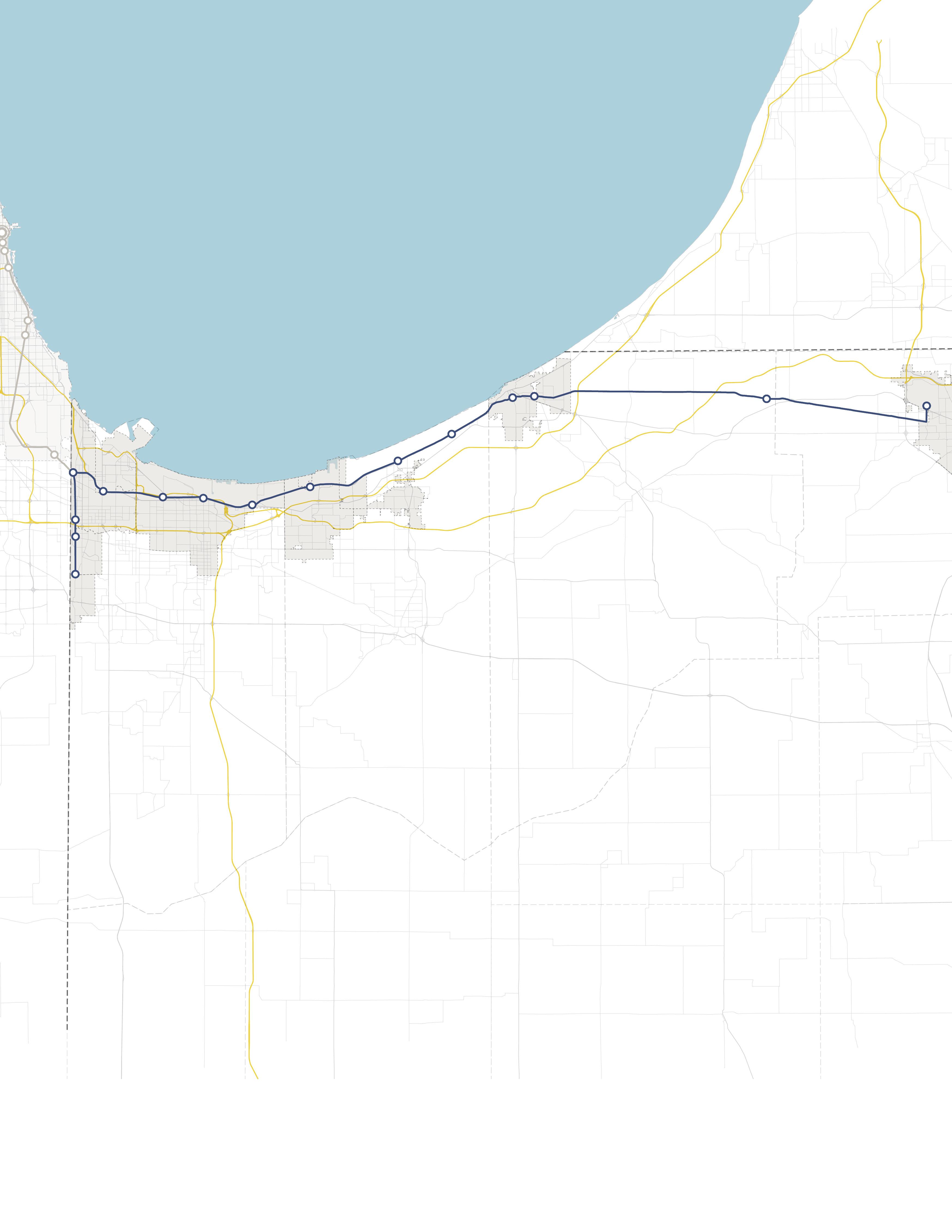

INDIANA INDIANA MICHIGAN ILLINOIS 94 94 80 65 Lake Michigan Hammond Gateway East Chicago Gary Metro Center Miller Portage/ Ogden Dunes 11th Street South Bend Dune Park Beverly Shores Ridge Road Main Street
