1 minute read
Inequity in Urban Flooding


analyzing spatial relationships in Chicago, IL, 2010 to 2020
Software used: ArcGIS
Advertisement
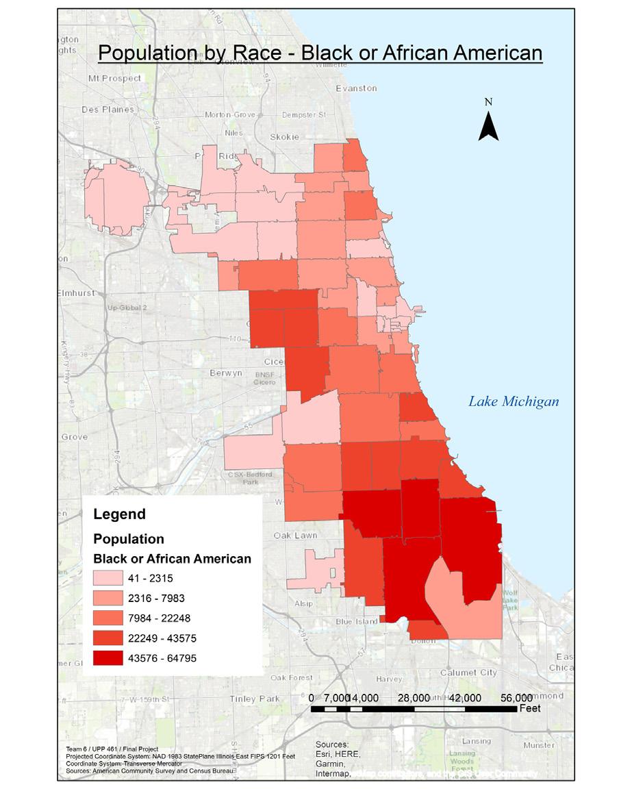
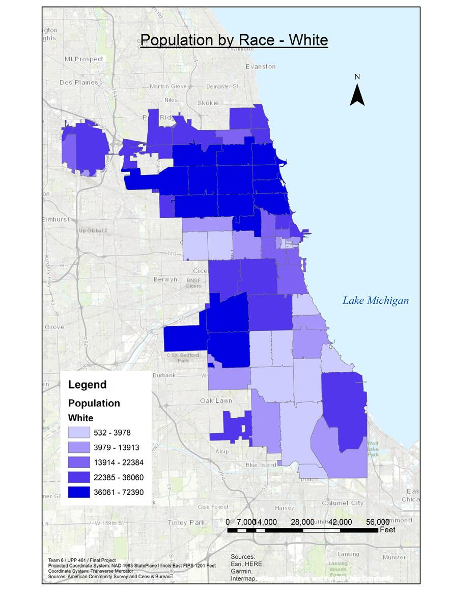
For this project, I was involved in researching and finding data on population by race (by zip code) and discerning which communities are impacted the most by urban flooding.
The maps indicate that Black/ African American residents are most impacted by urban flooding. They are a valuable tool for targeting vulnerable areas lacking the resources to address flooding. Future efforts should focus on identifying neighborhoods that would benefit from green and grey infrastructure improvements in an equitable manner.
To improve stormwater management and control urban flooding, open spaces should be expanded and protected. The maps provide insight into where such infrastructure improvements would be most effective in addressing the issue and benefiting affected residents.