1 minute read
Ridgeland: Connect


identification of urban issues and spatial analysis of Berwyn, IL
Advertisement
Software used: SketchUp, Photoshop
We were tasked with analyzing Berwyn’s socioeconomic and environmental conditions, identifying pressing issues, and implementing pragmatic and sustainable solutions. Initially, I focused on collecting transportation data.
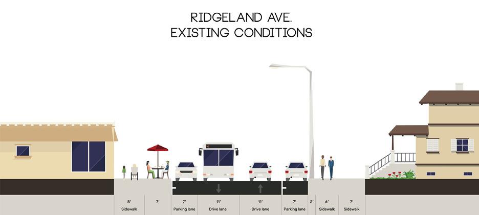
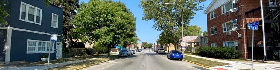
Berwyn’s location provides excellent access to the Chicago area via rail and road, with CTA, PACE, and Metra transit options available to residents. As a result, Berwyn’s transportation availability index is rated “High,” surpassing even that of Chicago. The city’s grid layout includes sidewalks that facilitate pedestrianfriendly environments in residential and commercial areas, although safety concerns arise due to street widths, traffic speed, and a lack of bike lanes, which could discourage walking and biking. The accompanying images illustrate missing key streetscape elements such as street medians, sporadic landscaping, and bike lanes.
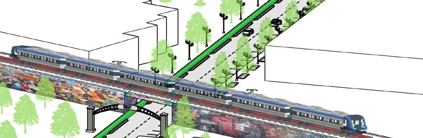
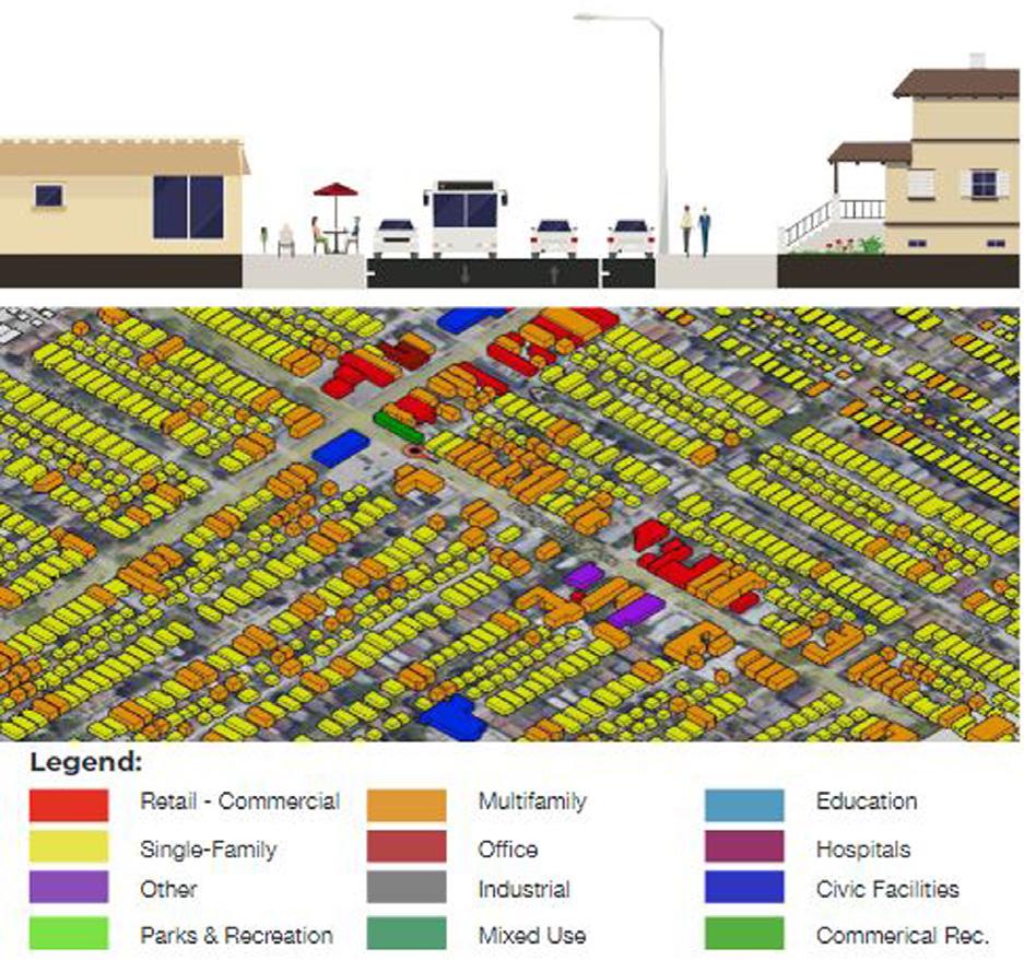
To better understand the spatial conditions of Berwyn, we created transects of four commercial corridors (16th St., Cermak Rd, Depot District and Ridgeland Ave). For various reasons, we felt each of these corridors, which are located throughout the city, presented an interesting opportunity for redevelopment. By exploring these corridors on a detail level through aerial and street view photos, a street section, as well as 3D massing models. The four transects are presented in these spreads. I was heavily involved in the 3D massing for these transect areas starting with Land Use to better understand the context of the corridors and then decide accordingly which one is to be finalized by considering numerous factors.
Ave
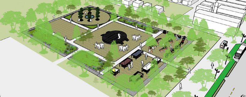
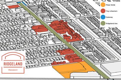
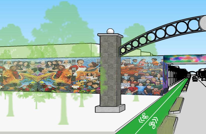
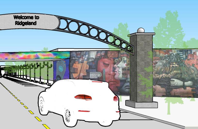
We focused on Ridgeland Ave. for strategic interventions to revive the economy, community, and environment. Three potential alternatives were created: Plaza Verde, the Cultural Corridor, and Tiny Urbanism. The Plaza will serve as the anchoring point for civic unity and environmental resiliency, adapting to community needs and merging Latinx heritage with natural flooding mitigation and green infrastructure. Community-led development and design will allow for greater involvement.