Issue
8 Fall 2024

8 Fall 2024
A publication of the Michigan Geological Survey at Western Michigan University

by Sara Pearson, CPG, Director
As we near the end of 2024, the Michigan Geological Survey (MGS) is thrilled to share key accomplishments and exciting advancements in geologic research, data preservation, community outreach, and education. Our work continues to drive significant strides in understanding Michigan’s geology and supporting sustainable resource management.
One of our most significant achievements was securing $3 million in annual base funding for the third year in a row, a testament to the value MGS brings to Michigan’s environmental and economic landscape. This funding supports the diverse projects and outreach efforts that have positioned MGS as a central resource for geological data, research, and education.
In collaboration with Western Michigan University’s Design Center, we are enhancing our brand identity, starting with a new logo featured in this newsletter along with new branding materials, merchandise, and a social media presence. These efforts aim to strengthen MGS’s recognition across Michigan and build community trust through outreach and unbiased geological information.
Outreach is a core component of MGS’s mission. This year, MGS’s K-12 program, “Core Kids,” reached over 15,000 students, sparking interest in geology at a young age. Our participation in career fairs, the Science Olympiad, and teacher-led field trips, including to the Porcupine Mountains, illustrates our commitment to educational engagement. We are also developing 3D printed maps and models for hands-on learning experiences, helping to
foster a new generation of geoscientists.
In partnership with industry and academia, MGS is actively involved in Carbon Capture, Utilization, and Storage (CCUS) initiatives. Our team has testified before the Michigan Senate on the potential of CCUS to effect safe carbon storage and worked with media outlets like WoodTV8 and Crain’s Detroit News to educate the public on these technologies. We’re advancing CCUS by focusing on detailed

Major Milestones and Progress in 2024
Introducing New Staff
MGS Cuttings Collection Supports CCUS
Unlocking Michigan’s Subsurface Vault –
Annual Core Workshop
Cass County Surficial Geology Report
Dark Data Brought to Light
MGS Research Supports Food Security
Core Stories – Updated Wayne County Bedrock Map


reservoir mapping, wellbore integrity, and brine disposal solutions to support safe and effective carbon storage across Michigan.
Through collaborative projects like *CarbonSAFE* and the Earth Mapping Resource Initiative (MRI), we’re also assessing Michigan’s potential for storing carbon in geological formations and evaluating its critical mineral resources, especially in the Upper Peninsula.
Mapping the state with 21st Century tools is a game changer for Michigan. Michigan’s existing maps were completed more than a century ago with minor updates since then. Small mapping projects were completed over the past 30-40 years, but nothing as robust as the survey geoscientists are doing today. County mapping of the glacial geology with these new tools is leading to new interpretations of our state’s geologic history and allowing us to interpret the complex geology at depth. The survey’s staff are collecting cores and samples from borings conducted from the surface to the bedrock to improve our understanding of the geology and also identify the groundwater resources vital to providing drinking water for our residents, irrigation water for agriculture, and a supply to spur economic development.
Additionally, MGS staff are working to identify critical minerals and resources with mapping projects in the Up-
per Peninsula that are vital resources for American made products and national security.
MGS is dedicated to preserving and making accessible Michigan’s extensive geological data. Through the USGS National Geological and Geophysical Data Preservation Program, our team reboxed, reinventoried, and scanned thousands of legacy core samples. This year, we scanned over 12,200 core boxes, creating high-resolution photographs, and are actively working on digitizing historical data to ensure researchers have access to essential geological information for years to come. https://scholarworks. wmich.edu/mgrre/

High-resolution 3-dimensional scans of rock and mineral specimens in the MGRRE collection are also available online at https://sketchfab.com/MGRRE. Be sure to check the website frequently as more scanned samples are uploaded regularly.
MGS provides numerous opportunities for student involvement, allowing them to gain hands-on experience in data collection, preservation, analysis, and research. These projects not only enhance students’ skills but also position them as strong candidates for the workforce upon graduation.
We invite you to stay engaged with the Michigan Geological Survey. Join our mailing list for updates, subscribe to our YouTube channel for educational videos, and follow us on social media to learn about our ongoing work in geology, research, and education.
Thank you for your continued support and interest in the Michigan Geological Survey. Together, we are building a more resilient and informed future for Michigan’s geological landscape!
Matt’s background is focused on glacial and environmental geology and using geographic information systems (GIS) to better understand the spatial world around us. Originally joining MGS in 2020, Matt has used his knowledge of GIS to accurately locate water wells across the state of Michigan, as well as being able to accurately create maps and figures of regional groundwater.
Matt has also conducted research looking at the regional groundwater system in Gladwin County, Michigan in response to the dam failure in Edenville. This study was used to understand the effects of the dam failure on the system after the groundwater level suddenly lowered in response to the failure. This provided guidance to the community about how to move forward and plan accordingly.

He also wants to use his knowledge to improve everyday life for all people alike. He uses his knowledge to teach others how to better understand our world and apply it to their lives in a multitude of different ways. Matt teaches physical geology and geography courses at Kalamazoo Valley Community College and shares his experience with the next generation of students to inspire them to learn more about our world and how to preserve it. Matt also contributes to the Education and Outreach team by attending outreach events across the state, interacting with educators, and providing insight about Michigan geology resources for classrooms
MGRRE curates and manages a collection of cuttings from more than 30,000 wells across Michigan. However, this extensive resource has not been utilized to its full potential. As part of our CCUS research, the project team is improving formation correlations, identifying key facies changes, and assigning classifications across the State. This is challenging, especially for Michigan’s older and deeper formations, due to lack of whole core and data. The cuttings can help fill in critical gaps and improve regional correlations.
To assess correlation potential, a set of well cuttings was selected for evaluation. Led by Jennifer Trout, students

Microscope and DinoEye set up (left) and examples of photographs produced (right)

Jennifer Trout (right) teaching students about cuttings and identifying major lithology changes
carefully photographed the cuttings from each major interval and facies change, and correlated back to whole core.
The team used a trinocular micscrope with a DinoEye camera along with the Dino Capture 2.0 software to produce the close-up photographs.
Interested in using cuttings in your research? Contact us to learn more!
by Linda K. Harrison
Twelve speakers addressed our October 3rd core workshop. They included four geologists from the United States Geological Survey (USGS), three of our MGRRE researchers, four speakers from Michigan industry, and our State Geologist, Adam Wygant. They focused on geological energy storage, carbon caption, utilization and storage (CCUS), and geological waste disposal. The common element to all these presentations was how to use and manage our subsurface resources.
The USGS speakers, Marc Buursink, Matthew Jones, Ashton Wiens, and Joao Gallotti, gave an overview of geologic energy storage capabilities and methods. They described the types of energy that can be stored, including natural gas and hydrogen, and the geological settings that are suitable for energy storage. They presented research about energy storage in depleted natural gas reservoirs in Michigan and discussed statistical models used to estimate uncertainties associated with gas capacity and storage pressure. They also discussed their research about biogeochemical modeling of microbial reactions related to underground hydrogen storage (UHS).
Our MGRRE researchers, Autumn Haagsma, Amber Conner, and Bill Harrison, discussed their current research on formations that can act as seals for CCUS. They addressed the complexity of deploying regional CCUS and talked about identifying potential host rocks for critical minerals. Seven cores were available for hands-on examination.

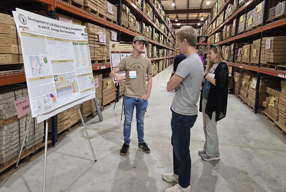
Several WMU students presented posters about their research.
Wygant discussed future uses of Michigan’s deep geological resources for energy, storage, and mineral production. Michigan industry members talked about subsurface waste disposal challenges and how they were overcome, as well

2024 workshop speakers.
as shared business insights on CCUS projects from developers’ perspectives.
Ninety-nine people came to hear these presentations, to network, and examine core. At MGRRE, we always look forward to this annual event—to reconnect with other researchers, our Michigan industry and regulatory friends. We all bring something different to share and come away with new ideas and fresh perspectives. Thanks to everyone, including our twenty sponsors, who made this happen!
by Dr. Autumn Haagsma
Team members participated in a core workshop hosted by the Eastern Section of the American Association of Petroleum Geologists (ESAAPG) October 27th-28th, 2024. Our team presented the Consumers Power BD 1-7 core which is being extensively characterized as part of the Carbon Capture, Utilization, and Storage (CCUS) research, led by Dr. Autumn Haagsma. Dr. William Harrison gave a presentation overviewing the characteristics of the core and how they are important for CCUS. Additionally, the team discussed CCUS and geology with others across the region. Team attendees included Dr. Autumn Haagsma, Dr. William Harrison, Amber Conner, Jennifer Trout, Gabe Fox (student), and Max Copus (student).

As part of our ongoing county mapping efforts, MGS published a new surficial geology map of Cass County, compiling existing data sets. The series of maps includes an updated surficial geology, elevation, major glacial landforms, hydric soils, land cover, aggregate resources, bedrock geology, bedrock topography, glacial drift thickness, water table surface, water well locations, and interpreted glacial advance and retreat. Additionally, the report includes a cross section of the county and 3D representations.
The MGS open data portal features this map with supplemental maps along with other maps and data products. Be sure to check back for new content in the future as the survey staff continue to add more data for public use.
https://michigan-geological-survey-hub-wmugeography.hub.arcgis.com/documents/5e02afb817d84261b747951809155a51


by Linda K. Harrison and Thomas R. Valachovics

Tom Valachovics, MGS geologist, searches Bill Monaghan’s maps to find sites that match his field notes.
Stored in a cabinet for decades, field notebooks with hundreds of associated Michigan maps have come to light again. Donated to MGS last December by the Indiana Geological and Water Survey, these notebooks contain first-hand observations of geologic deposits that may have since been eroded and subsurface details that are no longer accessible.
G. William (Bill) Monaghan recorded his geological observations and sketched subsurface sections seen in trenches throughout the Upper and Lower Peninsula, starting in the 1980’s. Usually working alone, sometimes miles away from a highway, he must have been a curious sight. He was focused on mapping glacial deposits as well as the direction of water flow.
He filled eight field notebooks with his detailed observa-
tions and linked those to his notes on hundreds of associated topographic maps.
He could see much more of the land surface at that time than we can now. Increased residential and commercial development has obscured the natural terrain in many of the areas where he mapped. We can’t even drill wells to find out information for some of these areas, because they are covered with concrete.
Some of the information that Monaghan recorded on the maps related to water resources. Monaghan also recorded data about sand and gravel deposits in addition to potential groundwater resources that have not been tapped. Those are exactly the resources the MGS is currently mapping in Kent, Muskegon, and Montcalm counties. Monaghan’s maps may provide additional data points that we might not otherwise be able to access.
However, to use that data, we first need to correlate the pages in his field books with the maps he notated, and then digitally scan them all. We will then work with the digital forms to protect the original fragile paper records from deterioration.
Bill Monaghan completed his master’s and PhD work at MSU, creating some of these maps to support that work. He went on to publish more than 25 professional papers, many about Michigan geology. We are honored to preserve this legacy collection of field notebooks and maps at the Survey. We have always known that data has many lives. We will use this original data to answer pressing questions about our geological resources, as they arise today and tomorrow.

Monaghan’s field notebook about Empire Bluffs and Point Betsie.
by Linda K. Harrison
A treasure trove of geological specimens acquired by Western Michigan University scientists 18 years ago proved to be the key to revealing a Michigan resource that can both reduce grocery prices and increase the nation’s food security.
The geologic specimens are rock cores—cylindrical sections from thousands of feet of subsurface rocks from wells drilled in northern Michigan. Researchers at MGRRE, part of the Michigan Geological Survey at WMU, led by Dr. William B. Harrison, analyzed these cores and hundreds of well records.
Harrison says, “This large collection of potash rock core samples and geophysical well records preserved at MGRRE is an exceptional resource to study this geologically unusual and economically valuable rock formation. We sent samples from these cores to be assayed by the Geoanalytical Laboratories of the Saskatchewan Research Council. The results showed that Michigan’s deposit is the richest potash deposit known worldwide. It can be estimated that potash deposits occur in 17 Michigan counties, and commercial production could likely be developed in 9 counties, representing 2.9 million acres.”
Using analytical data derived from this research at WMU and his own experience as a geologist, Ted Pagano, founder and chief executive officer of Michigan Potash & Salt Company, set out to secure funding to construct a facility in Evart, Michigan using geothermal processes to tap this $65 billion-dollar rare deposit more than a mile below the Earth’s surface.
On Jan. 17, the company was awarded a $1.26 billion conditional commitment loan from the U.S. Department of Energy to construct that facility to produce a U.S.-sourced supply of potash, a critical fertilizer ingredient for which there is no substitute.
“The United States would not have known this deposit existed without the Michigan Geological Survey and MGRRE, at Western Michigan University” says Ted Pagano. “As a result, we have this opportunity to help people for over 100 years, while strengthening and providing for our country’s food security long into the future.”
Potash is in demand worldwide to fertilize crops. It is the nutrient responsible for water uptake by plants, and during droughts, it allows higher crop yields with less water. Historically potash has been used as leverage during political
disputes and has been weaponized during war, leading to mass starvation.
The U.S. imports more than 90 percent of its potash needs, mostly from Canada. About 40 percent of the world’s potash is controlled by Russia and Belarus. The new Michigan facility is expected to produce about 800,000 tons of high-quality potash annually, putting the needed nutrient in easy shipping reach of the nation’s Corn Belt. According to the U. S. Department of Energy’s Loan Program announcement, “The project is expected to create, at its peak, 1,400 full-time equivalent union construction jobs and 200 ongoing operations jobs.”
“Our mission to rescue and preserve geological samples and data was pivotal to revealing this amazing subsurface resource,” says Sara Pearson, who directs the Michigan Geological Survey at WMU. “If Dr. Harrison hadn’t taken responsibility for preserving and researching truckloads of potash cores, someone would have had to invest hundreds of millions of dollars to drill wells and collect samples for analysis to prove the quality and extent of this deposit.”

Dr. William Harrison showing layers of potash deposited between layers of halite (salt).
by Dr. William Harrison and Linda K. Harrison
The Michigan Geological Survey (MGS), through the US Geological Survey Statemap Program, updated the bedrock map of Wayne County, Michigan in 2018. The map and report are routinely accessed online because the data continues to serve the needs of land-use planners, developers, policy makers, regulators, legislators, and citizen scientists.
Previous Wayne County subsurface maps were produced in 19131 and 19692. Those maps were based on much less available subsurface data. Only one natural bedrock outcrop has been recorded in Wayne County (Martin and Straight, 19553).
MGS geologists William B. Harrison, Peter Voice, Katharine Rose, and Jennifer Trout relied on subsurface samples
and data preserved at the Michigan Geological Repository for Research and Education (MGRRE), part of the MGS, as the primary source of information for updating the distribution of subsurface units.
They compiled data from more than 2500 drilling sites, including historical and recent activity. Subsurface samples were acquired at these sites through oil, gas, and mineral exploration, drilling for water wells, environmental remediation, engineering projects, and highway construction. Many samples had associated datasets such as drillers’ reports, wireline logs, and geochemical analyses.
Large collections of cores drilled by the Michigan Department of Transportation (MDOT) in preparation for road work together with cores drilled for Detroit’s abandoned seven-mile-long Upper Rouge Combined Sewer Outflow (CSO) project were particularly useful.

The CSO project alone cored nearly 90 wells through the shallow bedrock, providing more than 15,000 feet of core, largely from the Antrim, Birdsong Bay (previously known as Squaw Bay), and Dundee formations, as well as the Detroit River and Traverse Groups. All these geological cores are now archived at MGRRE.
This updated bedrock map is particularly useful in Wayne County because it is so densely populated, with more than 1.7 million people. This high level of surface land use makes it hard to find and access local sources of geological resources like sand, gravel, gypsum, and crushed stone, that are necessary to support the population. Those resources are all essential to building roads and bridges, and making concrete, glass and wallboard for new developments. When local natural resources cannot be found, they must be brought in from other areas, resulting in high transportation costs for all projects.
The updated bedrock map now provides data about these local resources that are still available in the area, although production levels are relatively lower today. Unplanned and

Updated bedrock geologic map, Wayne County, Michigan
uncoordinated urban development may threaten access to these few remaining natural resources.
This map also provides vital data about subsurface stability, reflecting load-bearing capacity and presence or absence of fractures. That’s particularly important to site and build roads, bridges, and other infrastructure projects. For example, MDOT drilled bedrock wells to acquire cores from the site of the Gordie Howe International Bridge to make sure that the land surface would not subside beneath the bridge after construction. MGRRE archives those cores as well.
Providing comprehensive data about these geological factors builds a fact-based foundation for better policy decisions that promote sustained, balanced development to support our economy and quality of life.
For detailed geologic information please see the full final technical report and the map with additional text at
https://www.researchgate.net/publication/328318554_ Bedrock_Geology_of_Wayne_County_Michigan.
Harrison, W. B., III, Voice, P., Rose, K., and Trout, J., Bedrock Geologic Map, Wayne County, Michigan, Michigan Geological Survey, Bedrock Geologic Map BGM 2018-01, 1:100,000 scale.
References:
1Sherzer, W. H., 1913, Geological Report on Wayne County, Michigan Geological and Biological Survey, Publication 22, Geological Series 9, 388 p.
2Mozola, A. J., 1969, Geology for Land and Ground-water Development in Wayne County, Michigan, Michigan Geological Survey Report of Investigation, v. 3, 25 p.
3Martin, H. M., and Straight, M. T., 1955, An Index of the Geology of Michigan: 1823-1955, Michigan Geological Survey Publication, v. 50, 461 p.

Sara Pearson
MGS Director CPG Geologist (269) 387-8611
Sara.Pearson@wmich.edu

Jennifer Trout Research Associate Geologist (269) 387-8633
Jennifer.L.Trout@wmich.edu

Peter Voice Research Associate Teaching Faculty Specialist (269) 387-5486
Peter.Voice@wmich.edu

Trent Adams Research Associate Aggregates (269) 387-8689
Trent.Adams@wmich.edu

Autumn Haagsma MGRRE Director
MGS Assistant Director Geologist (269) 387-8696
Autumn.Haagsma@wmich.edu

John Esch
Senior Research Associate Geologist (269) 387-8626
John.M.Esch@wmich.edu

Ashley Quigley
Senior Research Associate Precambrian Geologist (269) 387-8634
Ashley.Quigley@wmich.edu

Gregory Anderson Research Associate GIS Specialist (269) 567-8742
Gregory.Anderson@wmich.edu

William B. Harrison, III
MGRRE Research Director Geologist (269) 387-8691
William.Harrison_III@wmich.edu

Nathan Erber
Senior Research Associate Geomorphologist (269) 387-8604
Nathan.R.Erber@wmich.edu

Robb Gillespie
Senior Research Associate Dinosaur Park Manager (269) 387-5364
Robb.Gillespie@wmich.edu

Libby Ives Research Associate Aggregates (269) 387-8633
Elizabeth.Ives@wmich.edu

Linda Harrison Administrator Geologist (269) 387-8642
Linda.Harrison@wmich.edu

Amber Conner
Senior Research Associate Paleozoic Geologist (269) 387-8641
Amber.Conner@wmich.edu

Thomas Valachovics
Senior Research Associate Aggregates (231) 670-1634
Thomas.R.Valachovics@wmich.edu

Garrett Ringle Geoscience Specialist Geologist Lower Peninsula (269) 387-8633
Garrett.Ringle@wmich.edu

Nolan Gamet
Geosciece Specialist Geologist Upper Peninsula (269) 387-8649
Nolan.Gamet@wmich.edu

Richard Haagsma Geotechnician
3D Scanning Specialist (269) 387-8689
Richard.Haagsma@wmich.edu

Lauren Clippinger Office Coordinator (269) 387-2000
Lauren.R. Clippinger@wmich.edu

Sam Zink
Geoscience Specialist Aggregates (269) 387-5486
Samantha.Zink@wmich.edu

Matthew Bell
Geoscience Specialist Aggregates (269) 387-8633
Matthew.E.Bell@wmich.edu

Joanie Barnard Budget Analyst (269) 387-8633
Joanie.A.Barnard@wmich.edu

Augustine Lodise Geoscience Specialist Aggregates (269) 387-8633
Augustine.Lodise@wmich.edu

Eric Schuemann Geoscience Specialist Aggregates (269) 387-8633
Eric.Schuemann@wmich.edu

Linda Zabik Geoscience Specialist Aggregates (269) 387-5486
Linda.Zabik@wmich.edu

Sophia White Triage Project Manager Geologist (269) 387-5486
Sophia.F.White@wmich.edu

Western Michigan University Department of Geological and Environmental Sciences 1903 W. Michigan Avenue Kalamazoo, MI 49008
Michigan Geological Repository for Research and Education 5272 W. Michigan Avenue Kalamazoo, MI 49006 (269) 387-8633
email: geos-mgsmaps@wmich.edu
https://mgs.wmich.edu/ https://wmich.edu/michigangeologicalrepository


Find us on multiple platforms!

MGRRE high resolution core photograph from the 21011428580000 STATE SIMS 2-7 well. Find information about this well at https://scholarworks.wmich.edu/core_photos/5620/. The geologic cores, samples, and data preserved and archived at MGRRE contain valuable insights into Michigan’s natural resources—answers that were crucial when they were collected and remain just as vital for addressing today’s questions and those yet to emerge.