SCIENCE MEETS SPACE-MAKING MLA Student Portfolio Michael Riccio Spring 2024


(508)

My mission as a landscape architect is to create environments and spaces that practically improve people’s daily lives, while piquing curiosity and generating new excitement towards sustainability and environmental stewardship at large.
As a life-long nature enthusiast, and having spent the initial stages of my career focused on environmental policy and planning, I’ve learned that garnering emotional support for ecologically functional projects is as important to their success as the objective merits driving them. I’ve chosen to pursue a career in landscape architecture to design projects that are as cherished as they are functional.
I am also excited to continue advancing landscape architecture as a STEM discipline. By fully incorporating science into space-making, landscape architects can reshape how humans experience the environments they inhabit, and simultaneously leave the world a healthier, happier place. Contact

Project Management ArcGIS Pro Adobe Suite AutoCAD
Environmental Permitting Rhino 3D Modeling Leadership Development Public Engagement
2022 - Present University of Massachusetts Amherst Amherst, MA
- Assist the University Landscape Architect in developing, drafting and rendering landscape improvement projects
- Delineate and inspect campus-wide stormwater infrastructure via GIS and in-situ assessments
- Evaluate current stormwater data management practices to improve information-sharing across user groups
Summer 2022
R.P. Marzilli & Company Medway, MA
- Prepared detailed cost estimates for residential landscape construction bids
- Reviewed residential landscape construction documents for completeness and biddability
2013 - 2021
U.S. Army Corps of Engineers (USACE) Concord, MA
- Led and managed interdisciplinary feasibility studies for coastal storm risk management and ecosystem restoration projects
- Negotiated cost-sharing agreements and Memorandums of Understanding between USACE and non-federal sponsors
- Successfully authorized a Section 111 Civil Works project to mitigate the ongoing shoreline damages caused by the Cape Cod Canal at Town Neck Beach in Sandwich, Massachusetts
- Justified a change to the Federal Base Plan for maintenance dredging of the Cape Cod Canal; ensuring all future dredging efforts beneficially reuse the material at Town Neck Beach
2009 - 2013
U.S. Army Corps of Engineers Concord, MA
- Produced Environmental Assessments and Statements of Findings in accordance with NEPA and the Clean Water Act
- Issued and enforced permits for work and/or fill in Waters of the United States
- Served on multiple habitat restoration teams including the Connecticut Tidal Wetlands Habitat Restoration Team and the Connecticut Riverine Migratory Corridor Restoration Team
- Awarded the Thomas B. and Loraine K. LeNoir Scholarship for pursuing a masters project in environmental site restoration
- Awarded the Civilian Service Commendation Medal for service to the USACE New England District
- Served as Director of the USACE New England District Leadership Development Program
- Recognized by both Rhode Island Congressional interests (Senator Reed) and the USACE Executive Command for contributions towards the Pawtuxet Falls Dam Removal fish restoration project


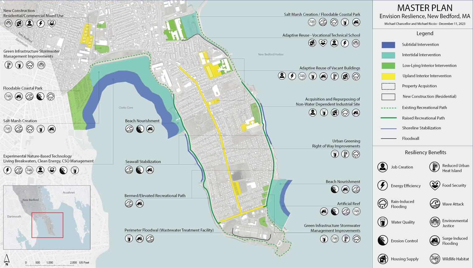
ENVISION RESILIENCE :
New Bedford, Massachusetts
Coastal Resiliency Studio
Fall Semester 2023
Pg. 1 - 8
U.S. Army Corps of Engineers 1.
GREEN, EQUITABLE, LIVABLE : Springfield, Massachusetts
Urban Design Studio
Spring Semester 2023
Pg. 9 - 14
THE GLADES :
Haigis Mall at UMass Amherst
Park Interventions Studio
Spring Semester 2022
Pg. 15 - 20
LANDSCAPE DESIGNER :
University of Massachusetts Amherst
Graduate Assistantship
Fall 2022 - Present
Pg. 21 - 26
PROJECT MANAGER:
Cape Cod Canal / Town Neck Beach
Nantasket Beach
Pg. 27 - 32


AQUARIUM HOBBYIST :
Experimental Builds
Betta Bowl Paludarium
In-Home Aquaponic Garden
Pg. 33 - 38
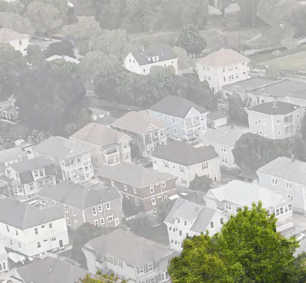
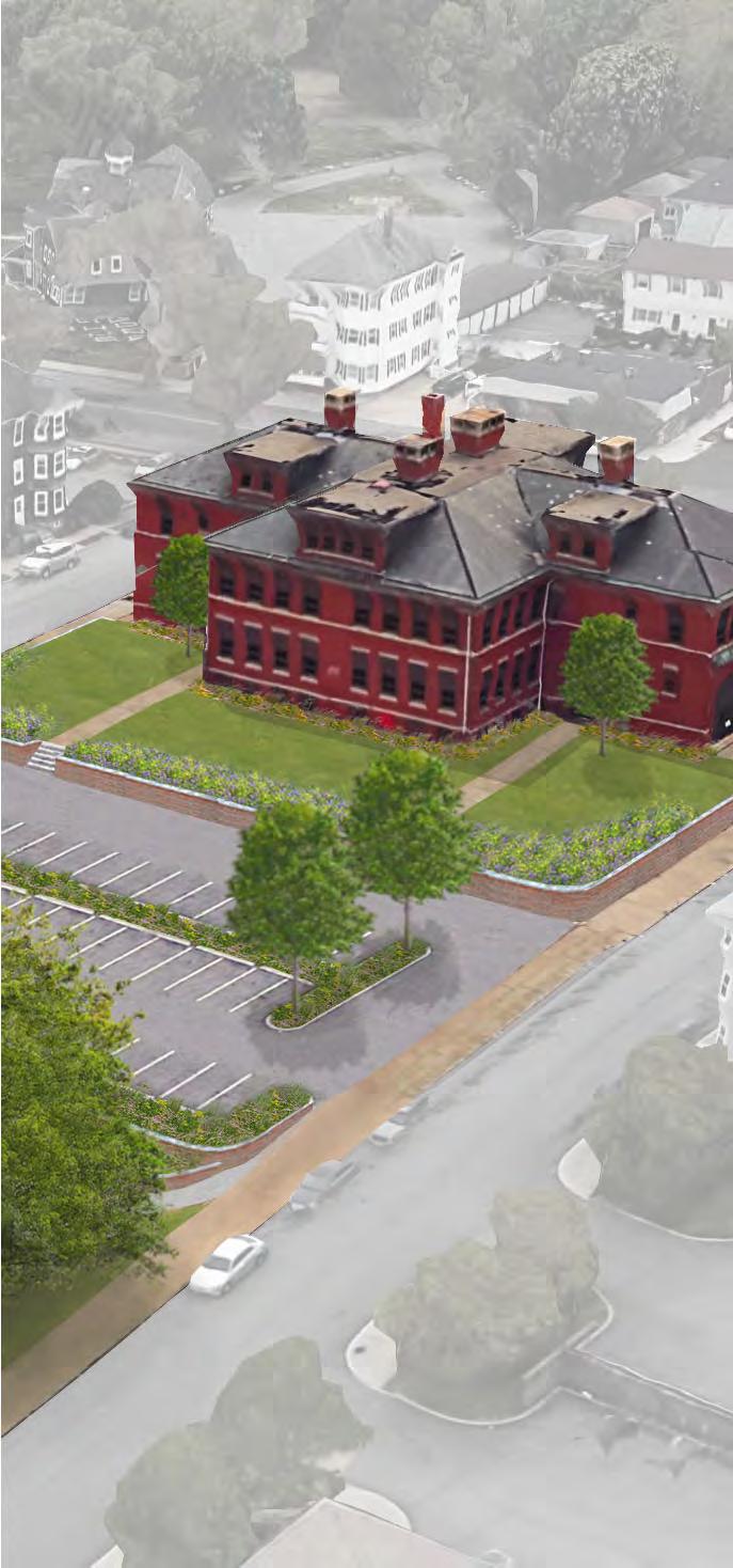
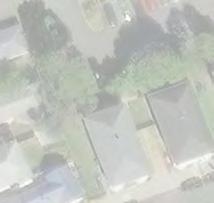
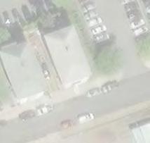
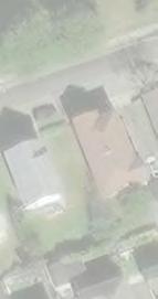
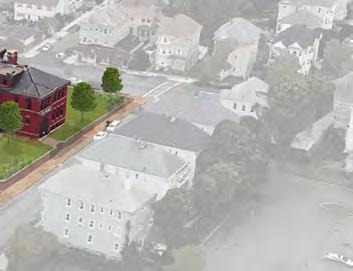
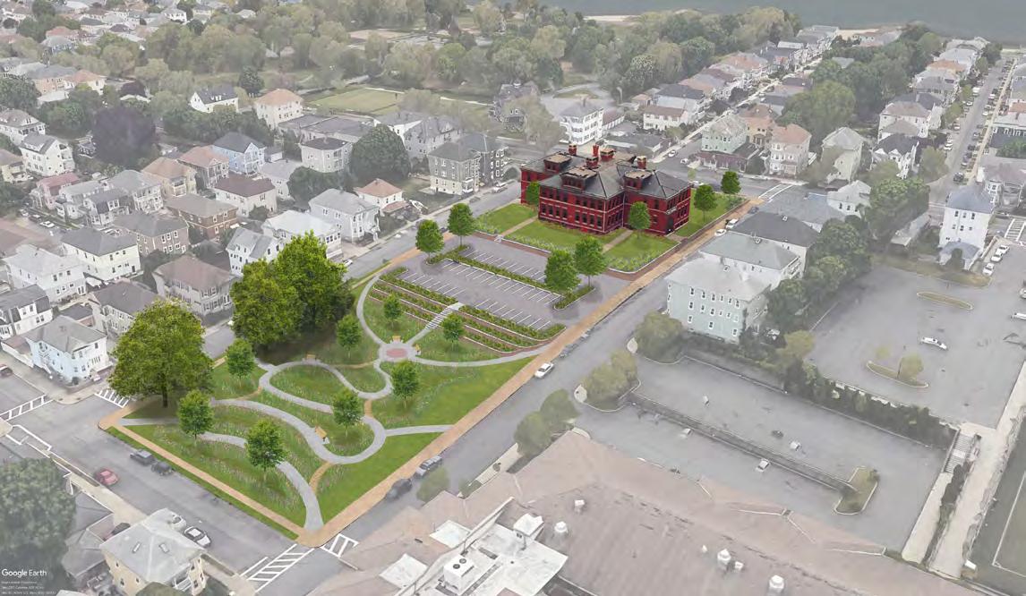
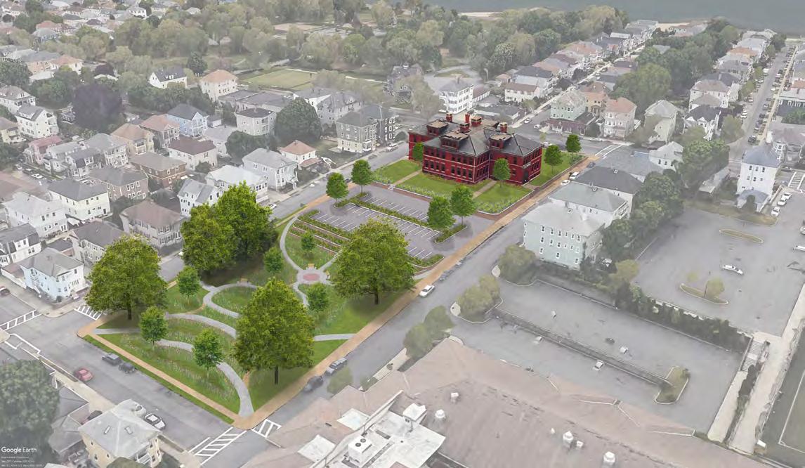
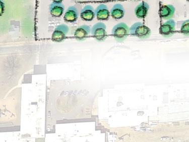
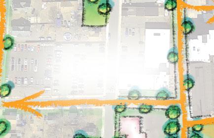
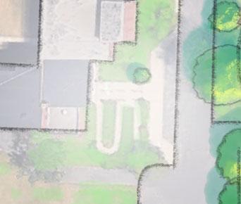
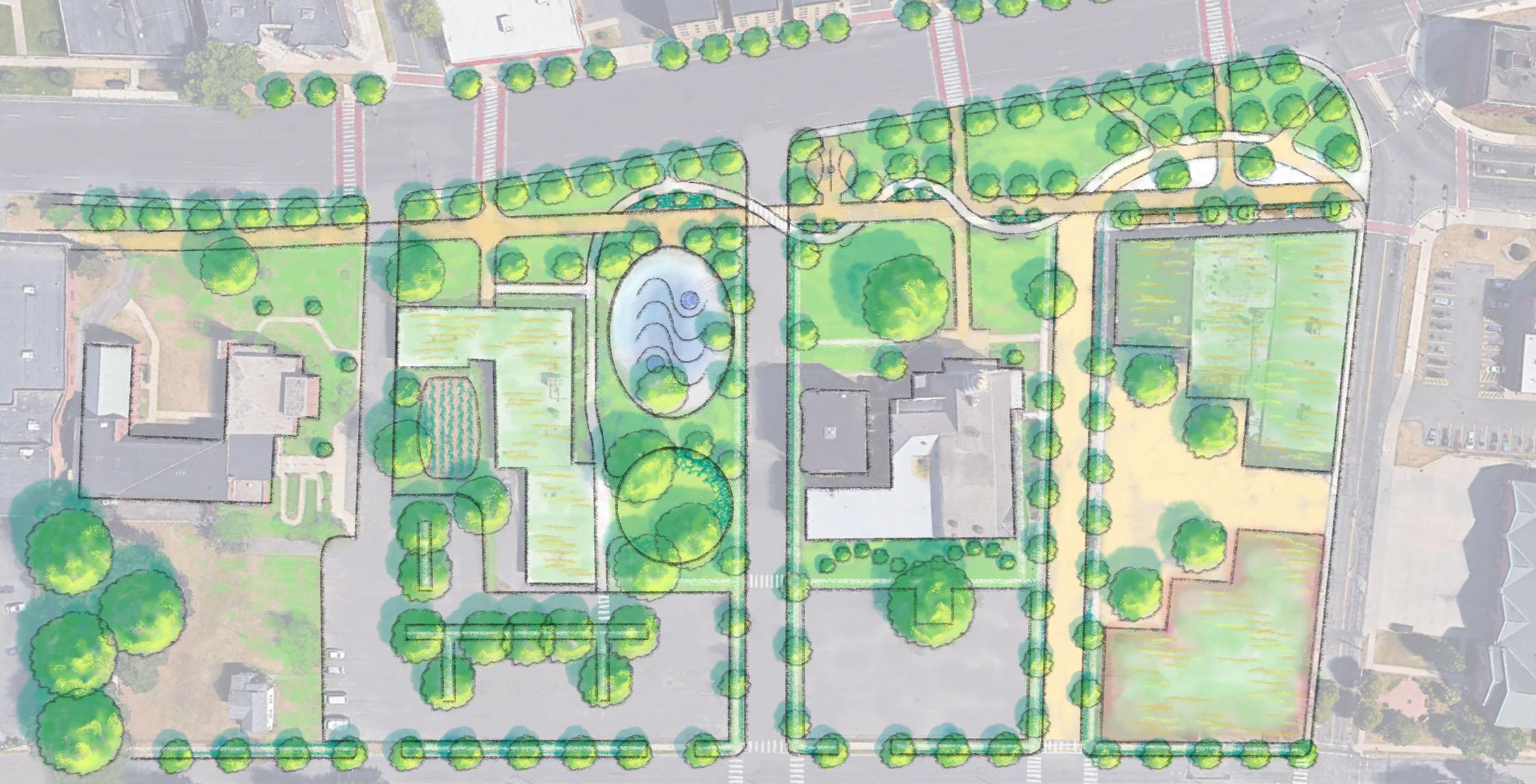
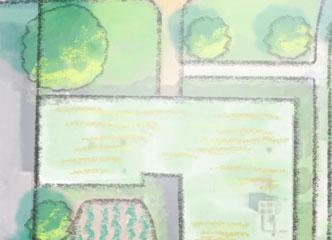
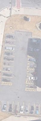
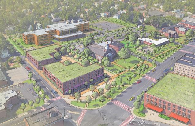
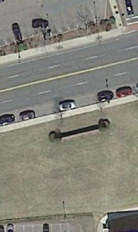
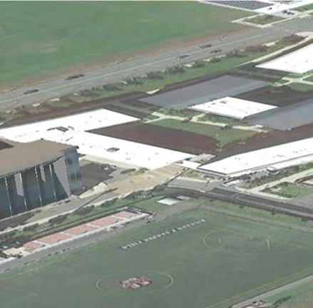
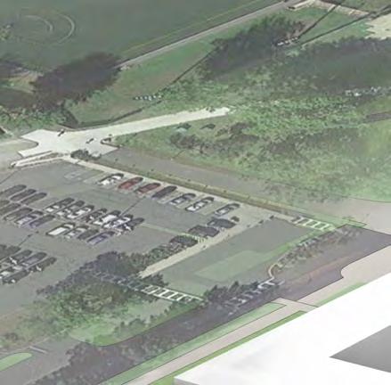
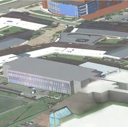
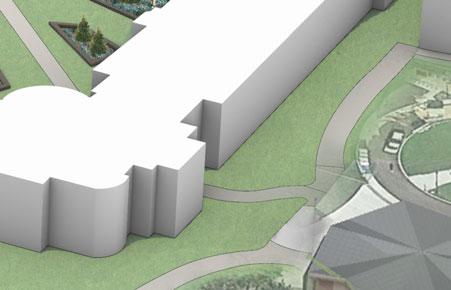
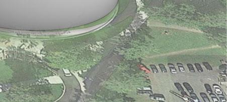
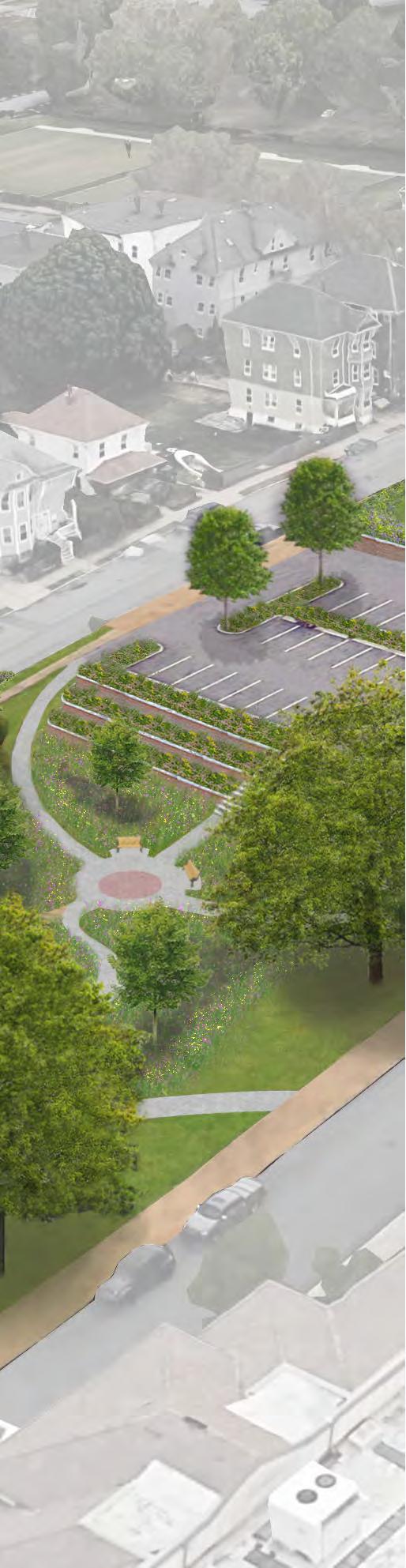 Proposed Changes at William H. Taylor School
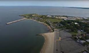
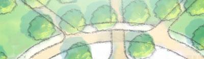
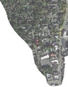
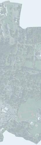
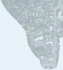
The Envision Resilience Challenge is a coastal resilience initiative that connects academia, local leadership and community members towards developing strategies that will help New Bedford adapt to the broad suite of challenges posed by climate change.
Date:
Fall Semester 2023
Location:
South End of New Bedford, Massachusetts
Studio/Team Goals:
- Analyze the climate change threats to the region and related needs of the local community
- Identify site-specific opportunities to compound multiple resiliency benefits
- Develop master strategy with readily implementable solutions


Professional Development Goals:
- Integrate GIS modeling into site analysis and graphic representation
- Improve Photoshop rendering skills
- Incorporate more diagrams into presentation graphics
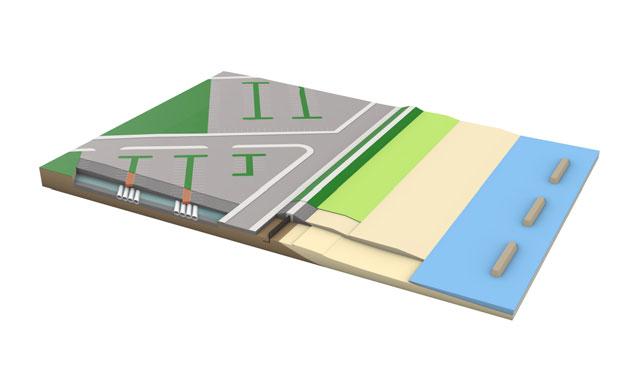
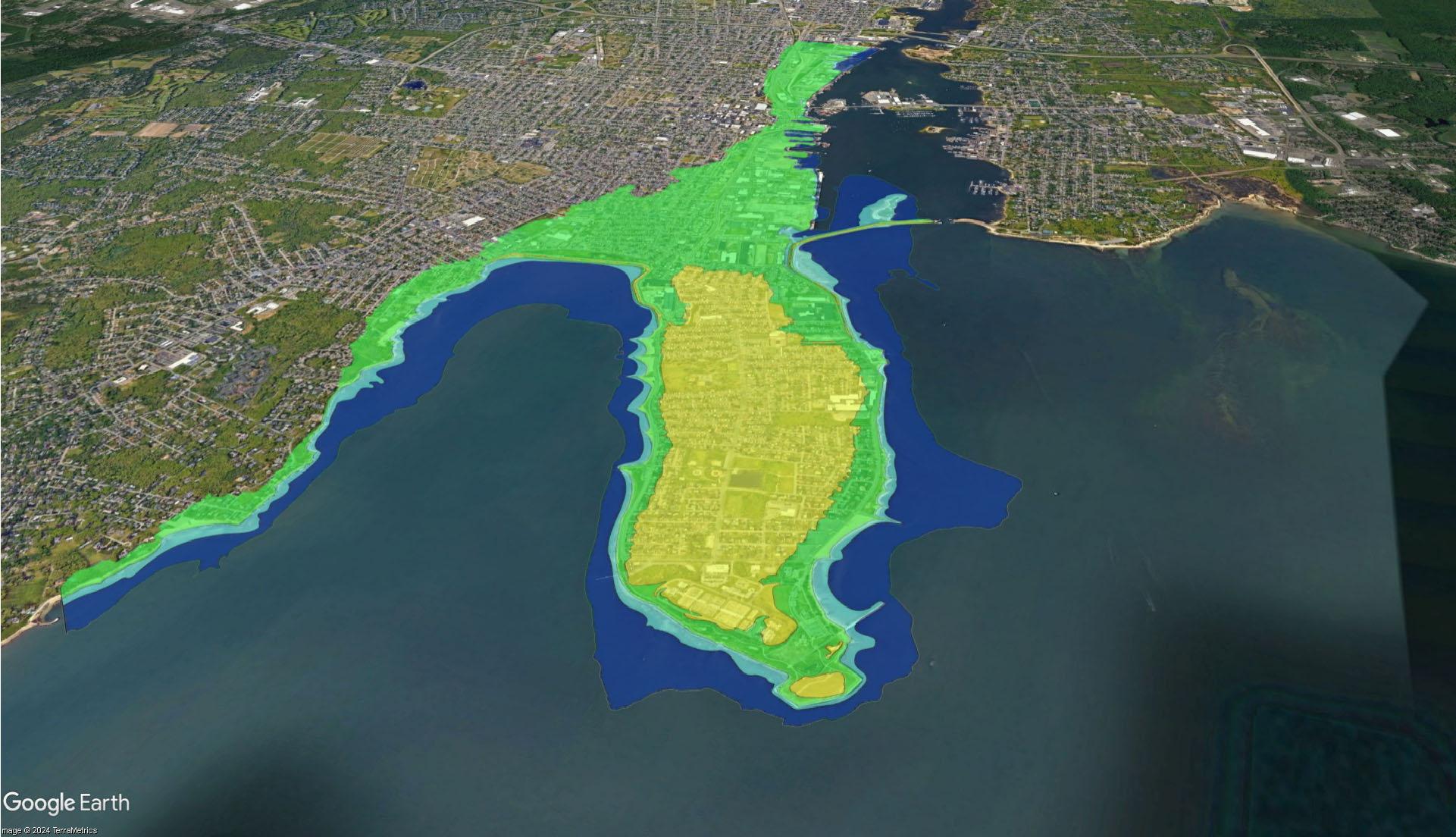
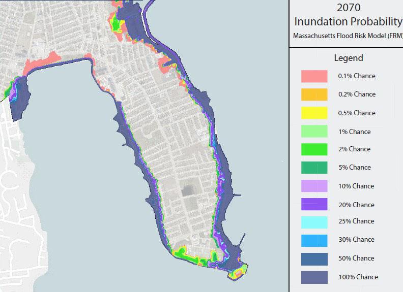
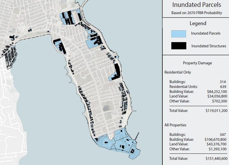
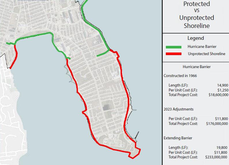
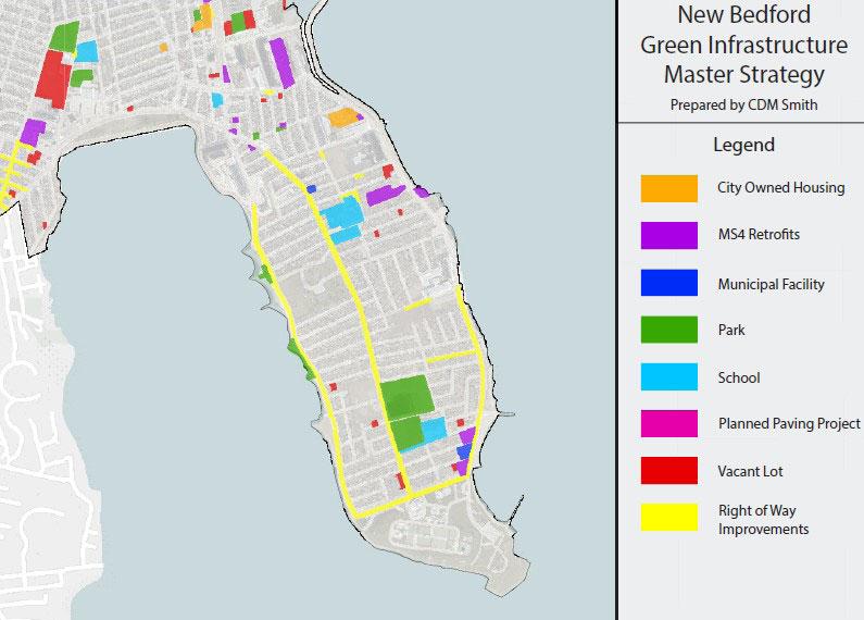
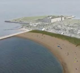
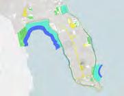
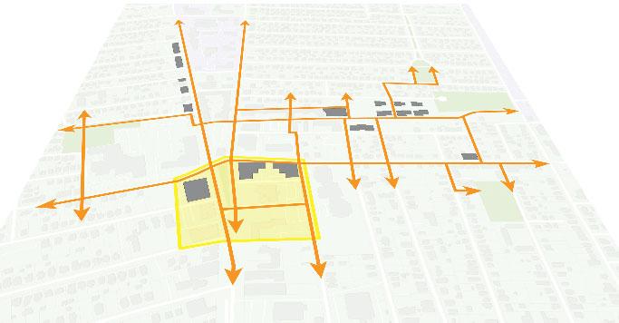
The south end of New Bedford is a relatively low-lying coastal peninsula that is highly exposed to Buzzard’s Bay. Accordingly, the team conducted a cursory cost-benefit analysis for both a maximum-protection strategy (extending the hurricane barrier around the peninsula), and a do-nothing scenario. This helped us understand that sea level rise and coastal storm risk are limited to the immediate shoreline, and are one-dimmensional problems with respect to the broader suite of climate change impacts. The subsequent planning strategy involved stratifiying the landscape and design thinking into four topographic zones; Sub-Tidal, Intertidal, Low-lying Interior and Upland Interior. This allowed us to identify opportunities that would better address not only coastal hazards, but housing needs, precipitation-based flooding, economic stimulation and ecological impacts.
 Separate Stormwater Fom CSOs
Exaggerated Topographic Profile of New Bedford’s South End
Hurricane Barrier
Breakwaters/Artificial Reefs
Wave Attenuation
Fish Habitat
Kelp Forrests/Longlines
Water Quality (CSOs)
Economic Opportunity
Fish Habitat
Water Quality 0 ft
Oyster Reefs
Water Quality
Fish Habitat
Wave Attenuation
Beach Nourishment
Wave Attenuation Recreation
Wetland Restoration/Creation
Water Quality
Habitat
Permeable Asphalt Runoff/Flood Reduction
Urban Greening Urban Cooling Runoff/Flood Reduction
Water Quality
T-Walls/Bermed Walkway
Storm Surge Mitigation Recreation
Mixed Use Development Housing
Job Training
Permeable Asphalt Runoff/Flood Reduction
Urban Greening
Urban Cooling Runoff/Flood Reduction
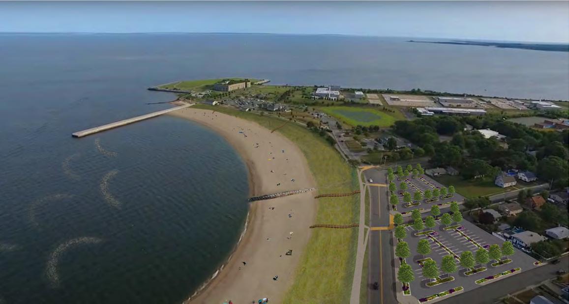
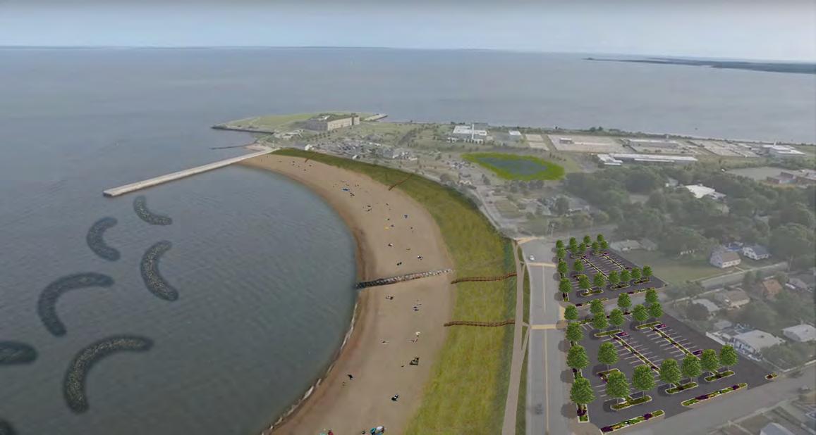
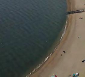
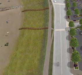
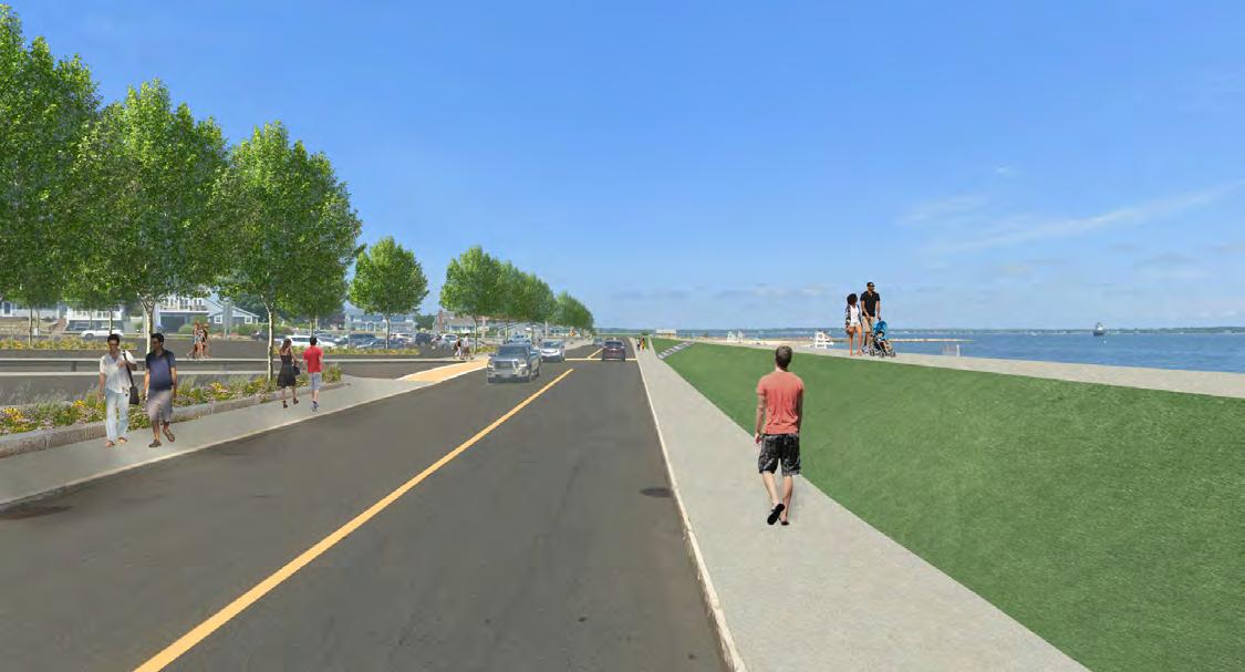
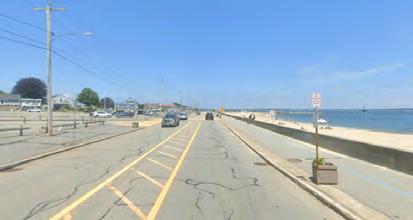
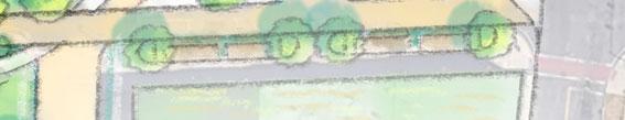
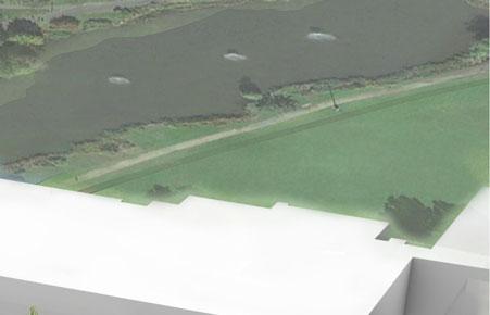
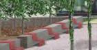
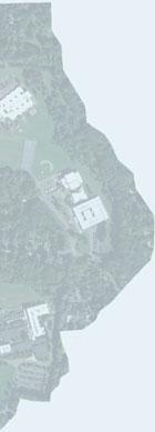
Design interventions at Fort Taber and East Beach focus on layering elements of friction across all four topographic zones to reduce coastal storm risk, increase recreational opportunities and create new wildlife habitat. Artificial reefs, beach nourishment and a bermed walking path would reduce erosion and wave overtopping while creating wildlife habitat. Permeable/vegetated parking lots would increase stormwater infiltration and storage while reducing urban heat island effects and creating a more comfortable walking environment along the shoreline. The design would also include a floodwall around the wastewater treatment facility in order to reduce the threat of catastrophic failure during coastal storm events.


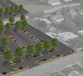


Vegetated Medians Within Parking Lots


Permeable Surface And Base Aggregate

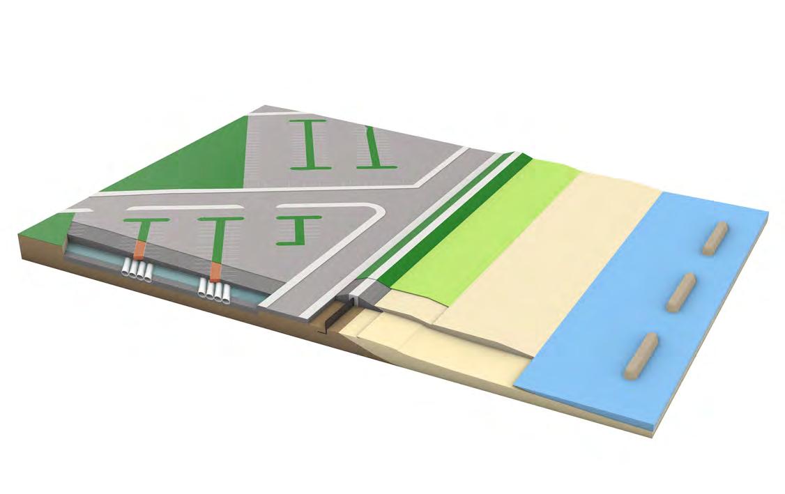
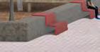
Concrete Cap and Rip Rap Revetment Over Existing L-Wall


Underground Detention/ Infiltration Tanks
4’-6’ Bermed Walking Path Beach Nourishment With Dune Restoration
Artificial Reef/ Oyster Reef


Existing High Tide Line
 Proposed High Tide Line
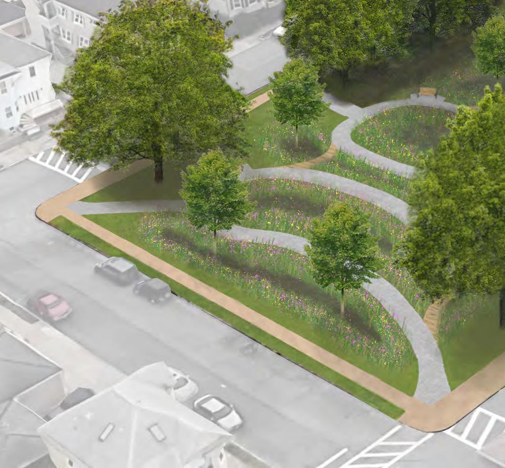
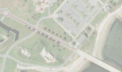
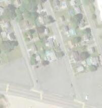
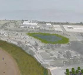
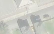
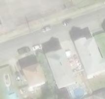
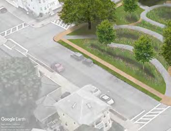
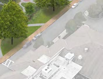
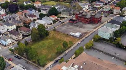
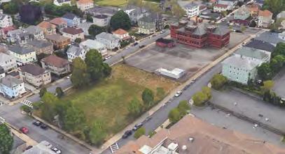
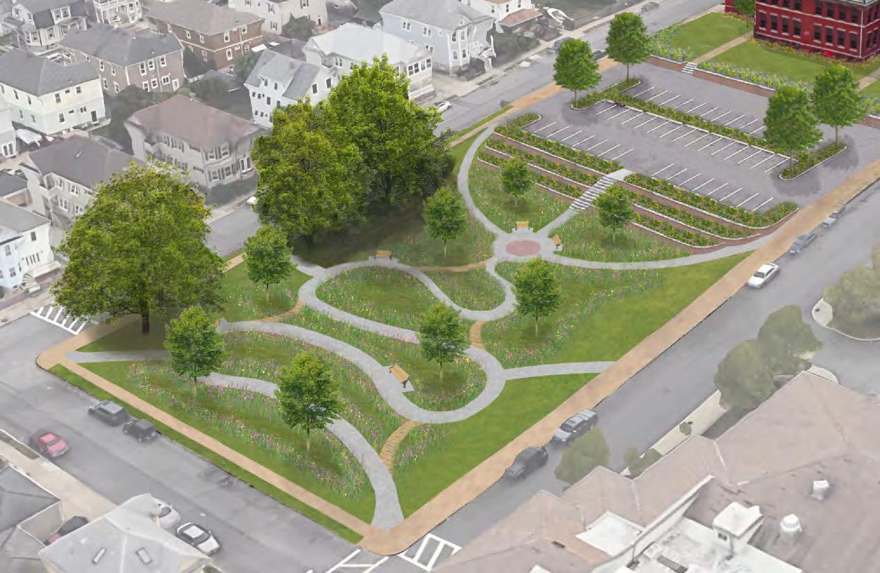
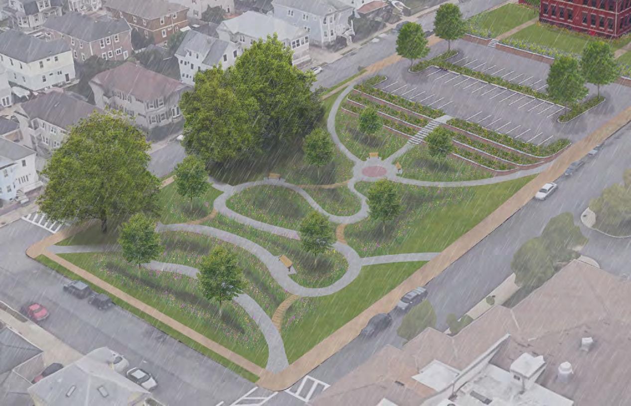
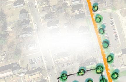
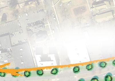
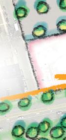
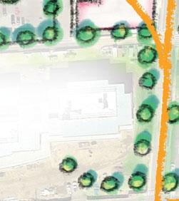
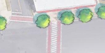
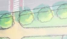
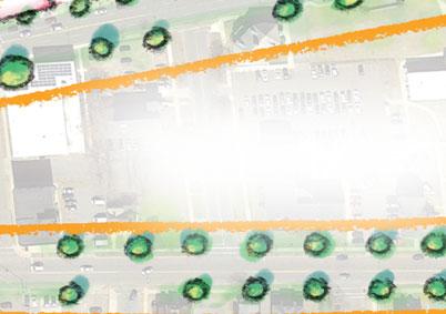
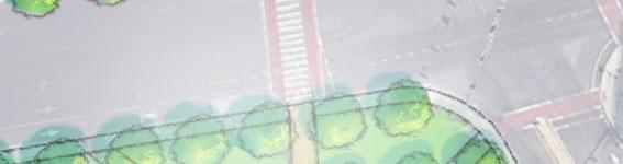
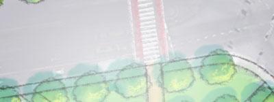
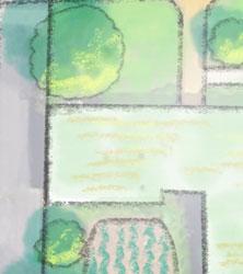
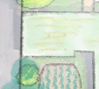
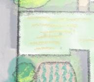
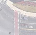
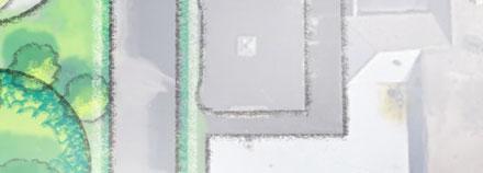
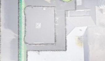
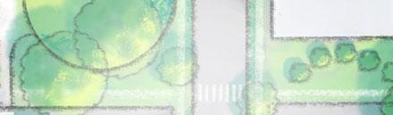
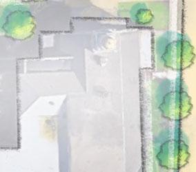
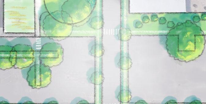
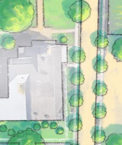
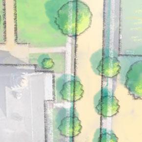
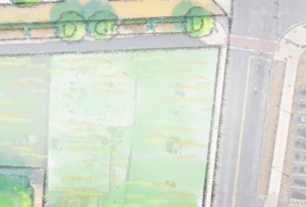
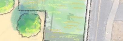
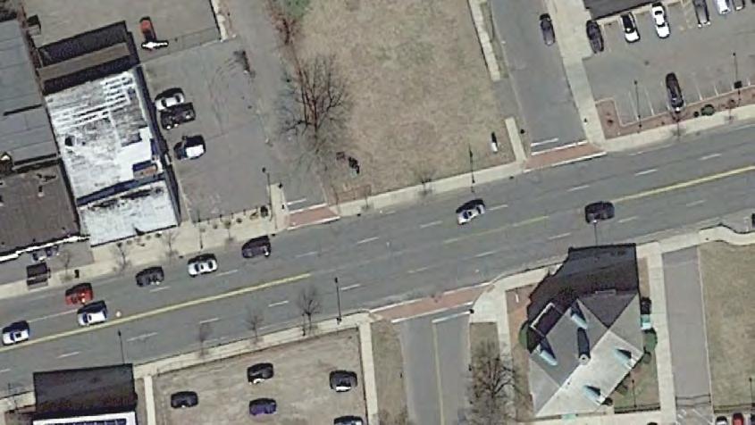
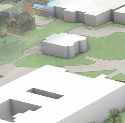
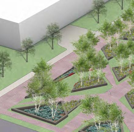
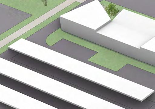
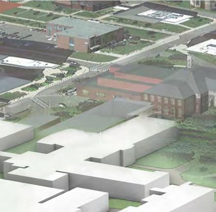
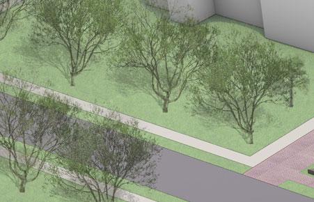
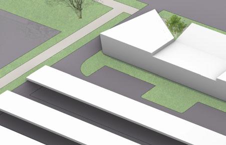
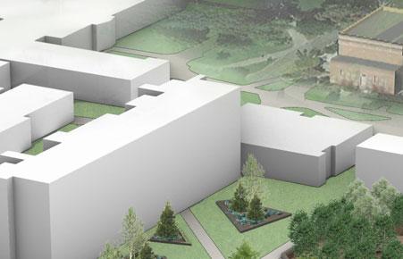
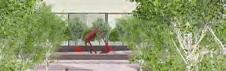
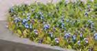
The William H. Taylor School is currently vacant and is surrounded by a large expanse of impermeable asphalt, which is pitched away from the building, shedding any stormwater into the neighboring streets. Stormwater is also conveyed directly into the abutting parklette, which is defined by a perimeter chain-link fence and open turf field. The school could be renovated and converted into housing units to help combat the ongoing housing crisis, and the turfed parklette could be developed into a stormwater park that serves as an activated space for residents, a detention area for stormwater runoff and an outdoor classroom for the Roosevelt Middle School located across the street.


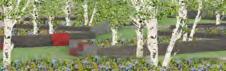
PARK INTERIOR DURING FAIR
PARK INTERIOR DURING
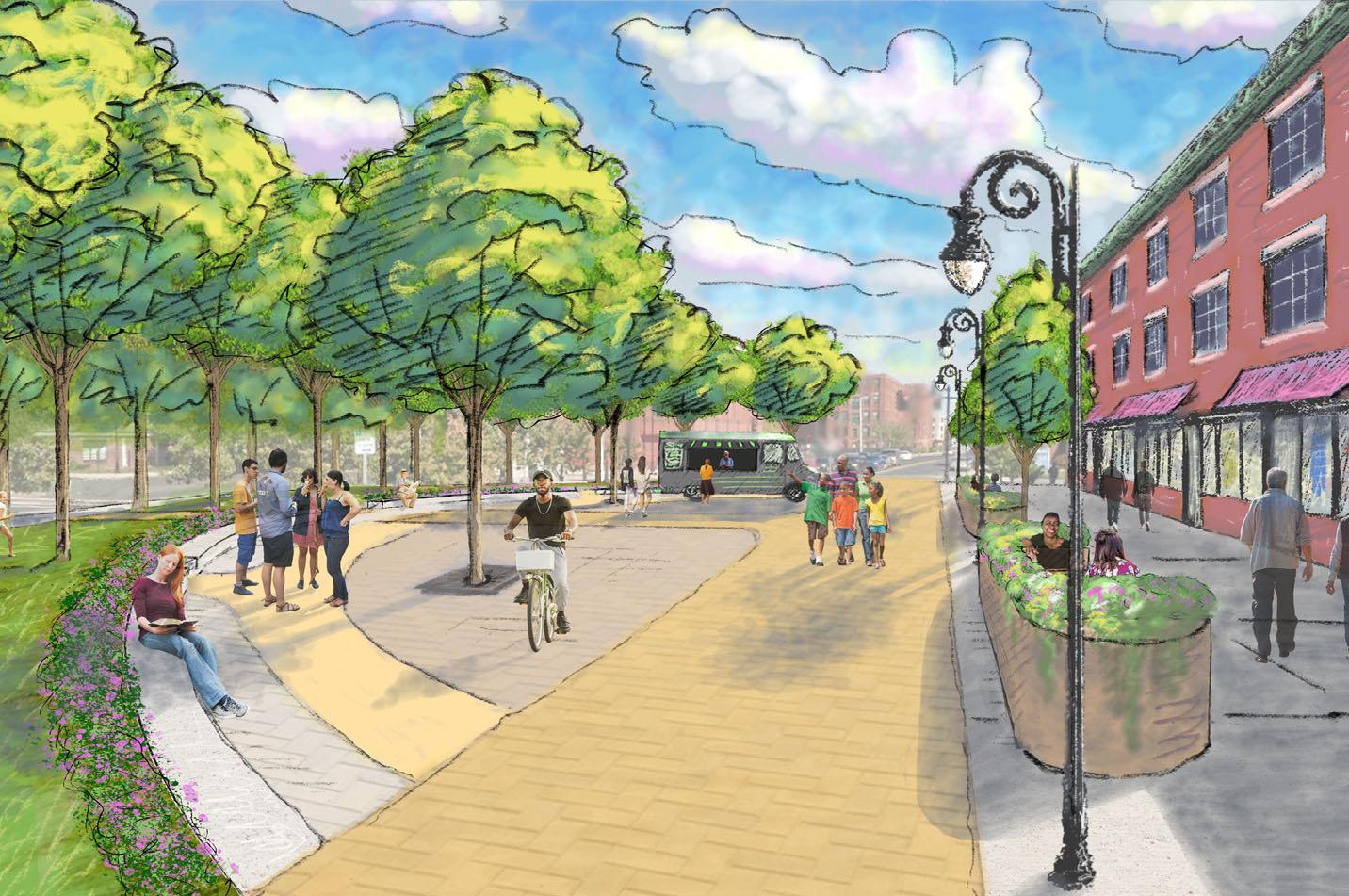
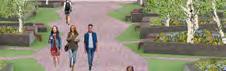
 Revitalized Neighborhood Core at Ben Swan Way (Illustration by Jeffrey Taylor)
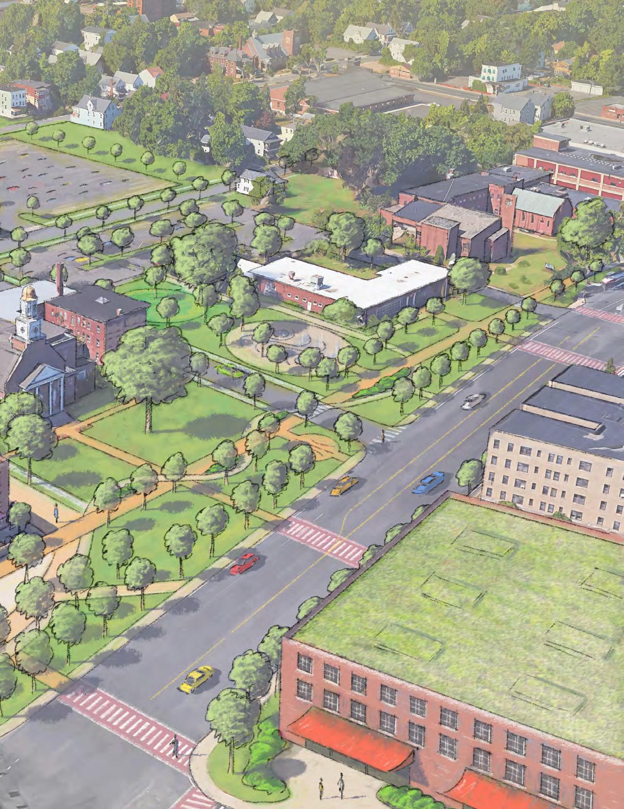

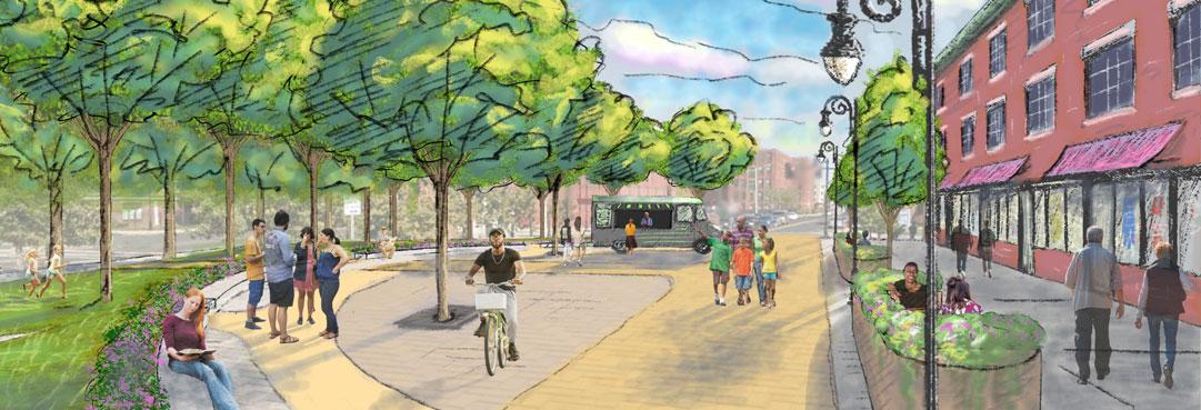
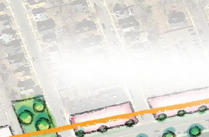
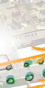
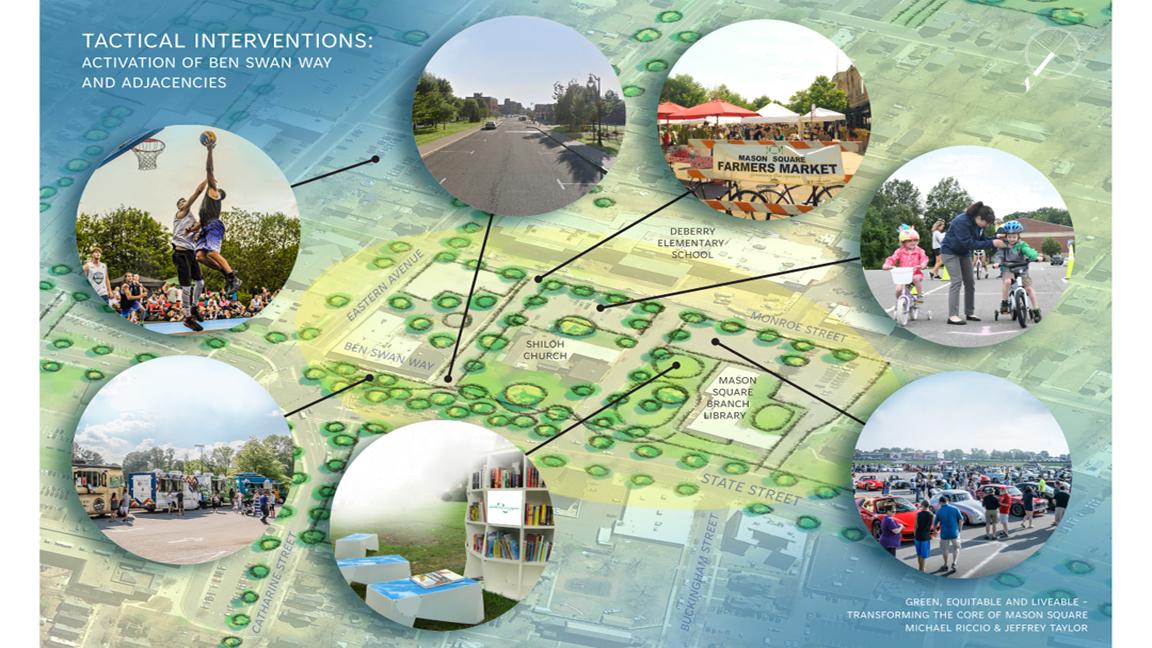
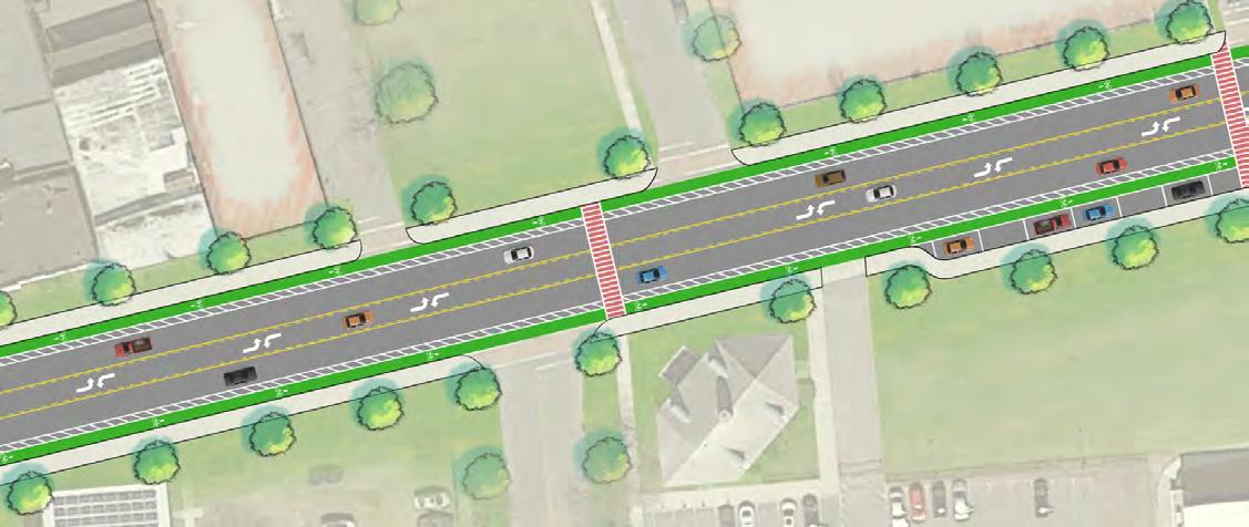
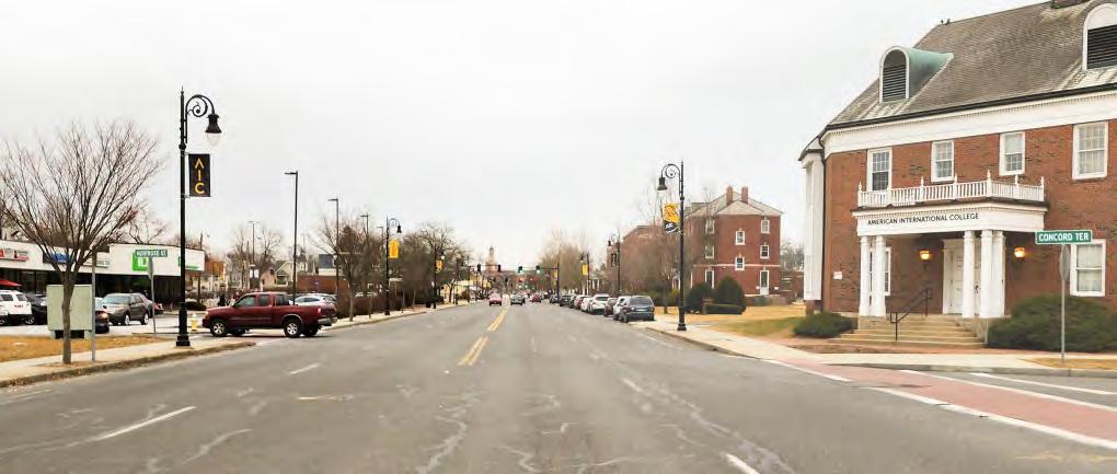
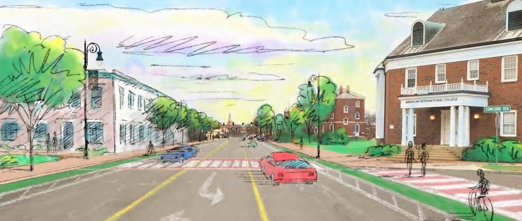
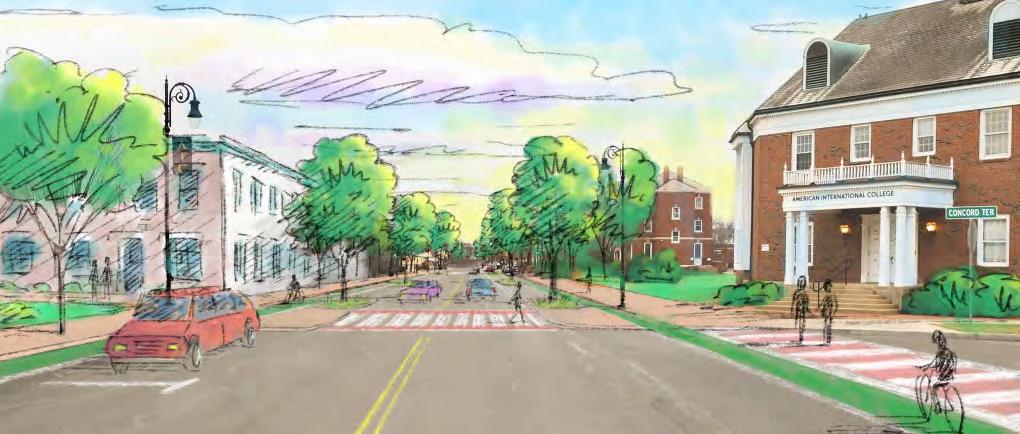
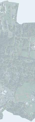
The goal of this studio was to reconceive and revitalize the Mason Square District in Springfield, Massachusetts. Vehicle-centric roadways and economic hardships have negatively affected the community, but there remain ample opportunities to reinvest in the neighborhoods and bolster a strong sense of culture, pride and place.
Date: Spring Semester 2022

Location: Mason Square District - Springfield, Massachusetts
Design Goals:
- Re-establish an activated core area within the Mason Square District that is highly used by all four neighborhoods
- Increase pedestrian safety and opportunities for multi-modal transportation
- Eliminate physical barriers and restore seamless connectivity across all four neighborhoods
Professional Development Goals:
- Investigate multi-modal transportation benefits and implementation strategies
- Experiment with digital drawing tablet to prepare hand-drawn final presentation graphics
(Illustrations by Jeffrey Taylor and Michael Riccio)
Mason Square in Springfield, Massachusetts is a nexus between the four culturally rich neighborhoods of McKnight, Bay, Old Hill and Upper Hill. Vehicle-centric roadways and high rates of speed however, have created physical barriers and reduced safety for pedestrians throughout the four neighborhoods. This has reduced the legibility of place and inadequately reflects the strong sense of pride and cultural diversity that defines the community.
The proposed Master Strategy aims to eliminate physical barriers and increase permeability across all four neighborhoods; create a legible and activated neighborhood core that better serves local residents; and rebalance the roadways to create a more pedestrian-centric streetscape that provides safer multi-modal transportation. A multi-year phased implementation strategy for road rebalancing would be proposed to increase the likelihood of project success.
ENHANCED CONNECTIVITY


RE-IMAGINING MASON SQUARE PARK

RAIL TRAIL CORRIDOR

MIXED-USE STRUCTURES

FRONTING STREETSCAPE

REDEVELOPED RETAIL SPACES
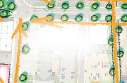
DEVELOPED MASON SQUARE COMMUNITY CORE
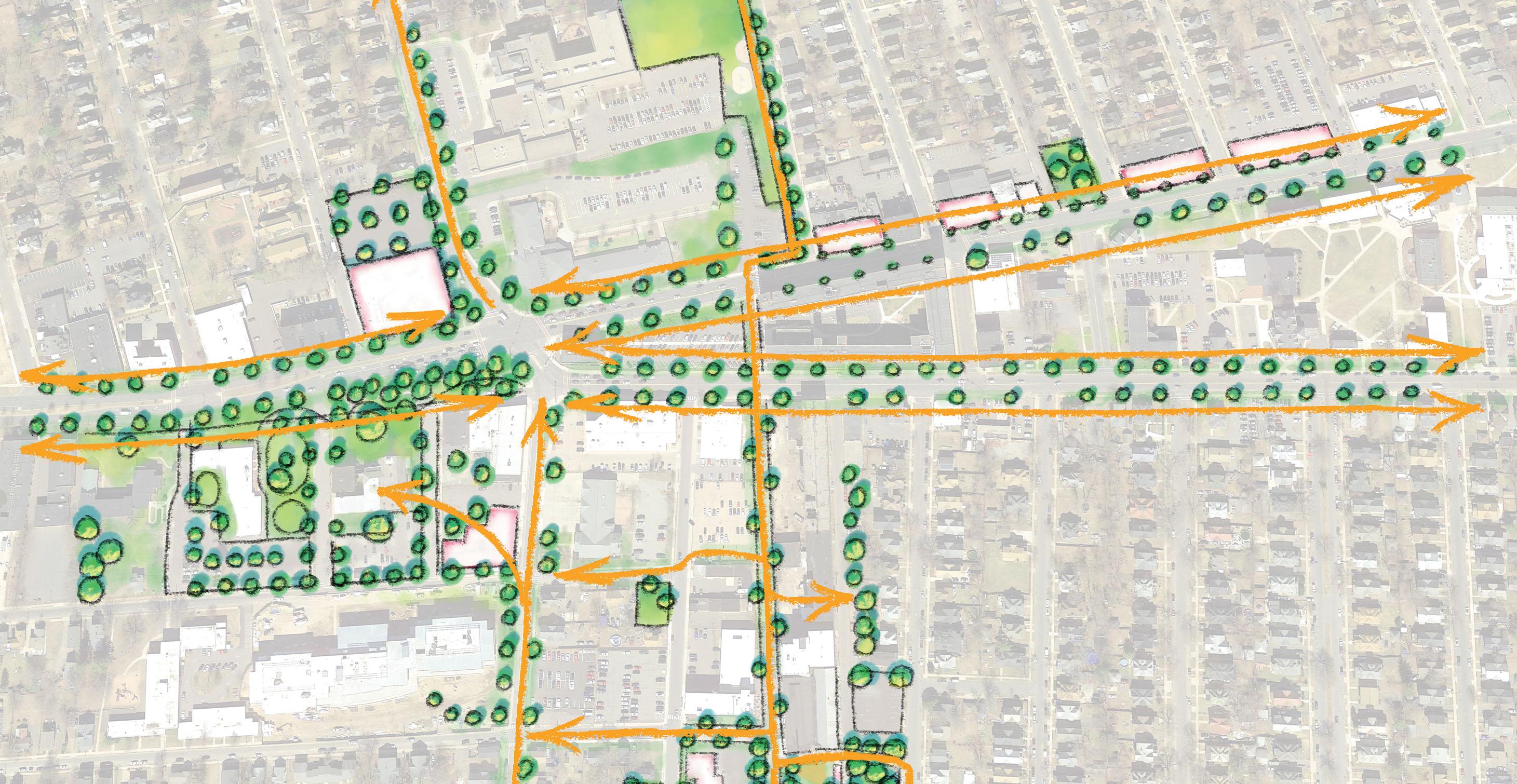
CONNECTIONS
VIA RAIL TRAIL
WESLEY CHURCH
SPLASH
STREET REBALANCING ENHANCEMENTS

WILBRAHAM ROAD
BASKETBALL

BEN SWAN
PLAZA PARK


MIXED-USE COMMERCIAL AND

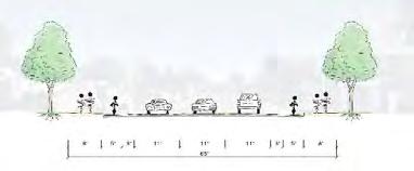
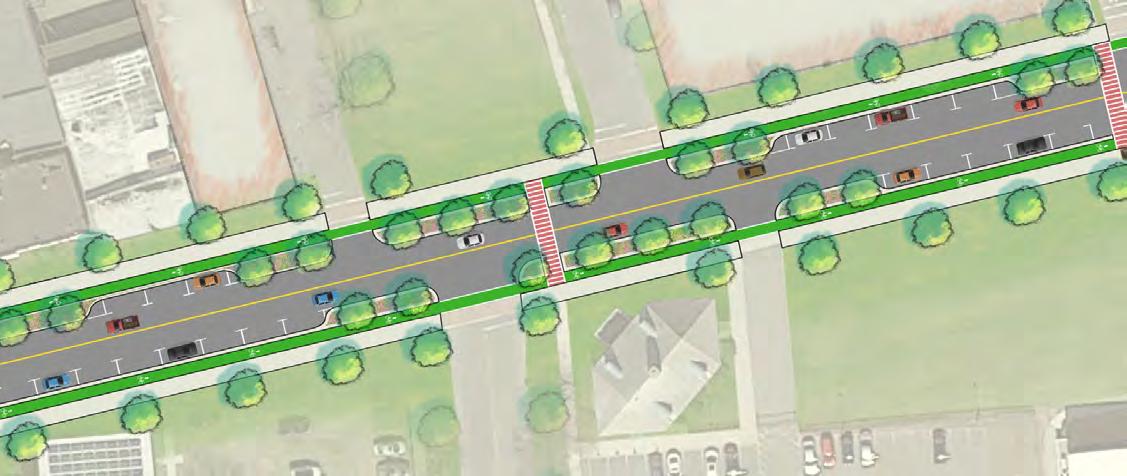
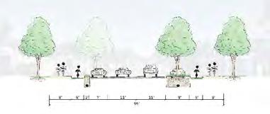
ROAD REBALANCING : EXISTING CONDITIONS - FOUR (4) TRAFFIC LANES
ROAD REBALANCING : PHASE 1 - THREE (3) TRAFFIC LANES
ROAD REBALANCING : PHASE 2 - TWO (2) TRAFFIC LANES


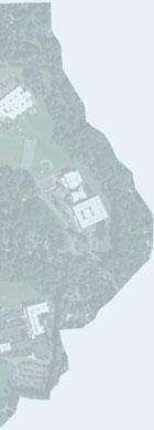
The Park Interventions studio was focused on identifying and designing landscape interventions that could bring new life to, or otherwise enhance an underused public space.
Date: Spring Semester 2022
Location:
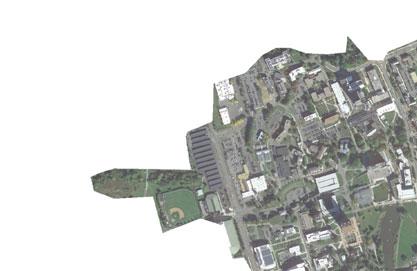
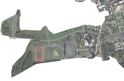
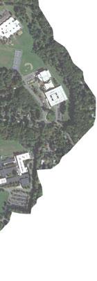
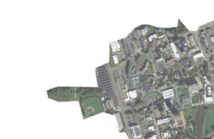
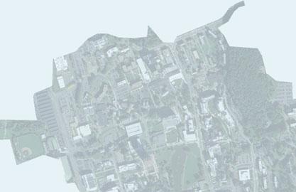
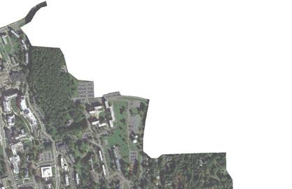
UMass Campus - Amherst, Massachusetts
Design Goals:


- Bring site down to human scale
- Create prominent ‘gateway’ to the campus
- Activate space with intentional programming
- Pedestrianize existing roadway

- Incorporate existing art sculptures into design features
- Incorporate nature-based stormwater management features
Professional Development Goals:
- Design a ‘bold’ and ‘fun’ space (i.e. don’t let practical constraints limit creativity
- Explore 3D modeling with Rhino

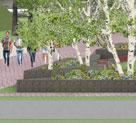
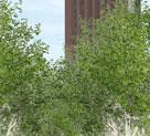
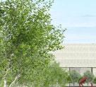
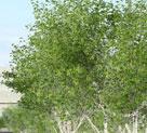
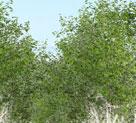
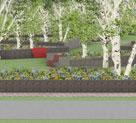
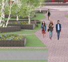
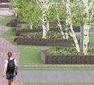
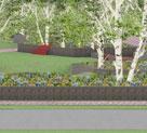
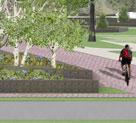
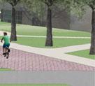
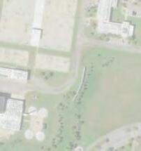
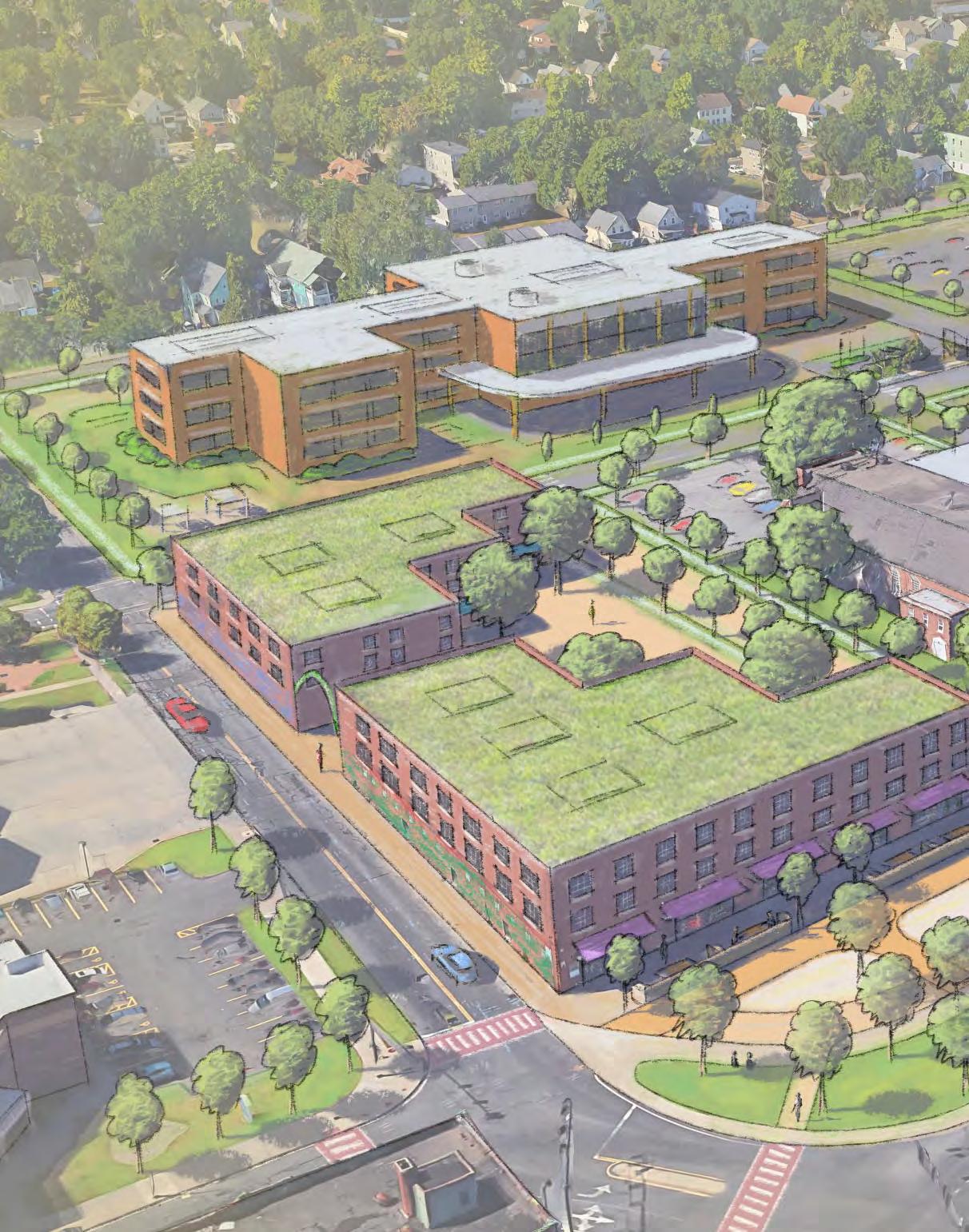
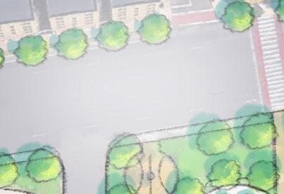
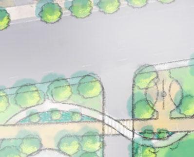
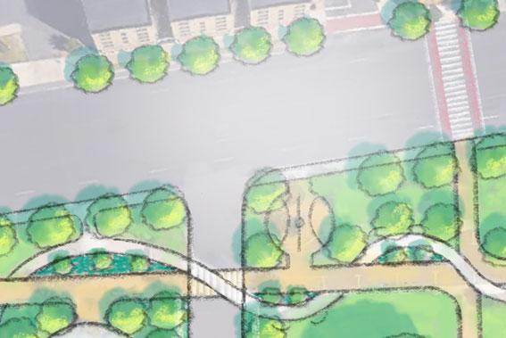
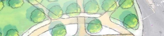
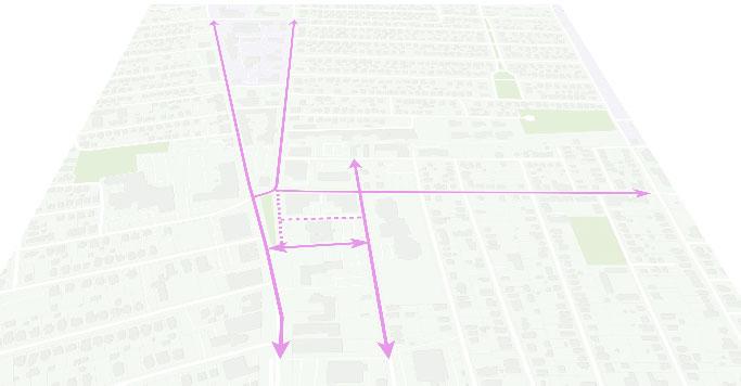
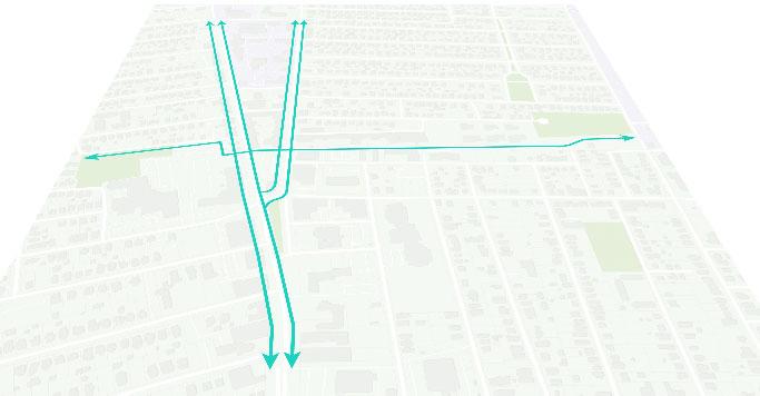
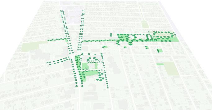
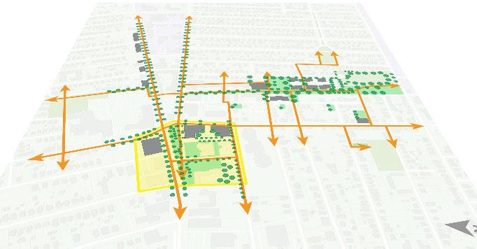
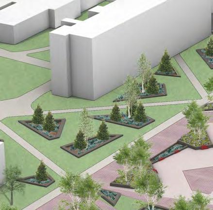
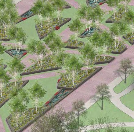
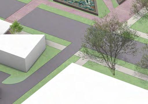
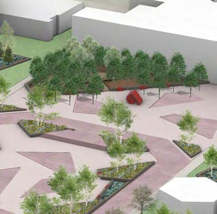
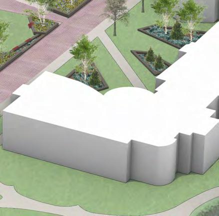
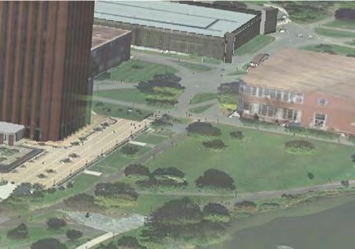
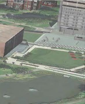
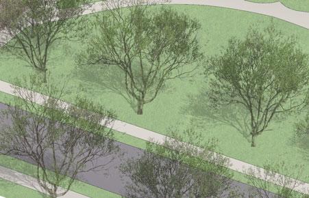
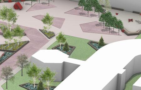
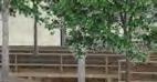
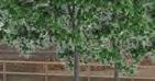
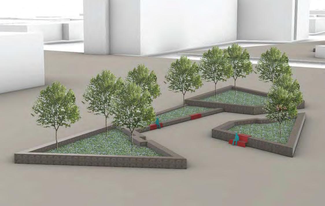
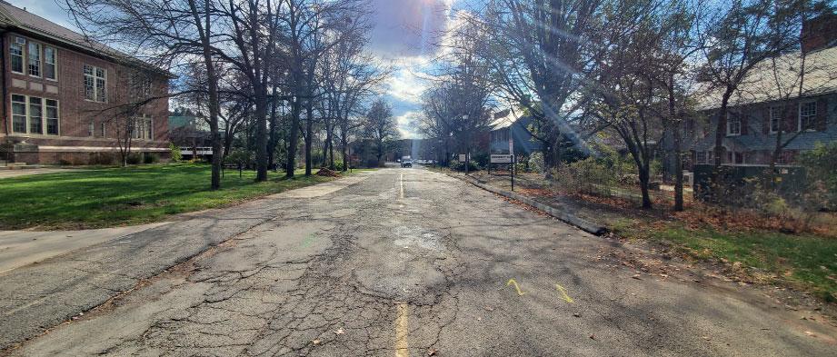
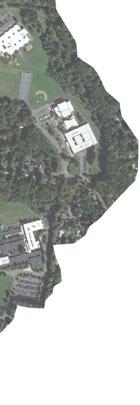
The Glades at Haigis Mall aims to create a more active and prominent gateway to the UMass campus. In its current state, Haigis Mall is defined by an open turf field that sits between a heavily trafficked road used by buses and vehicles dropping off and picking up students. The space effectively serves pedestrians as a median strip to be crossed en route from Point A to Point B, and a large empty concrete plaza abutting the Fine Arts Center further reinforces that feeling.
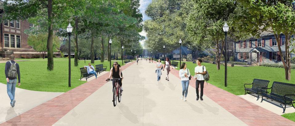
The proposed design would transform the mall into a pedestrian-centric space that includes an axial brick walkway from the visitors center at the south, to the Fine Arts Center at the north; enclosed seating areas nested in a series of stormwater gardens that mimic New England alpine glades; and an open, informal event space. Lastly, a skate park abutting the Fine Arts Center would cater to the one non-commuter user group who regularly and actively uses the plaza in its current condition.
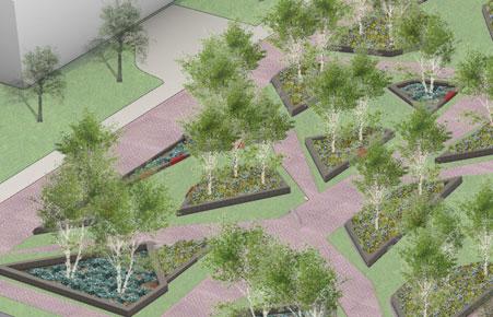
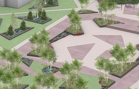
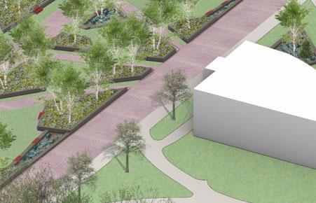
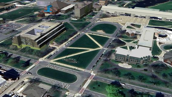
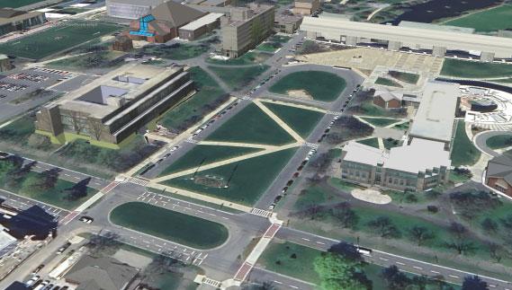
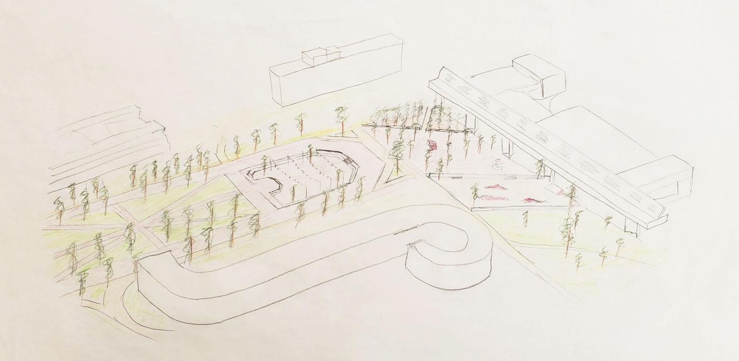
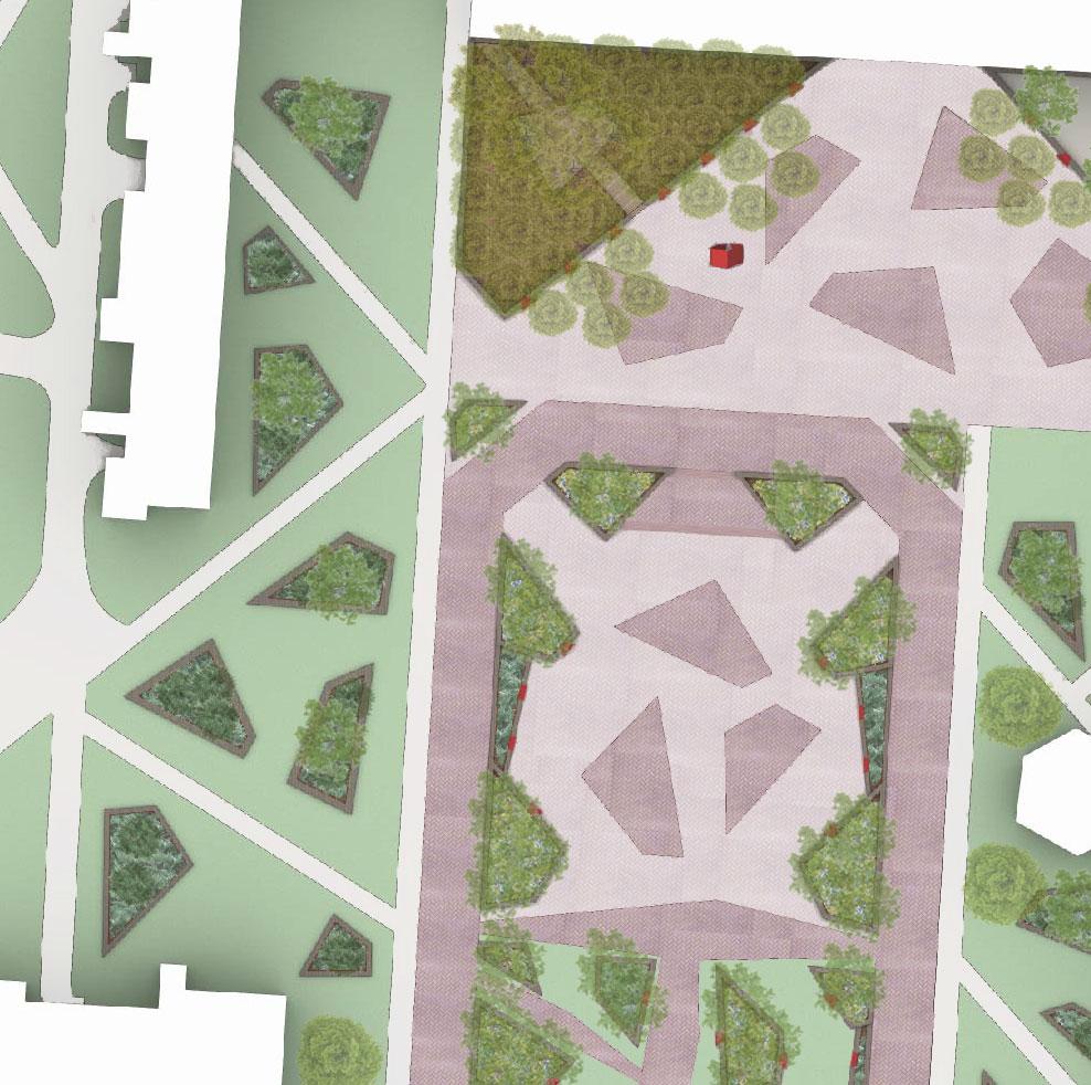
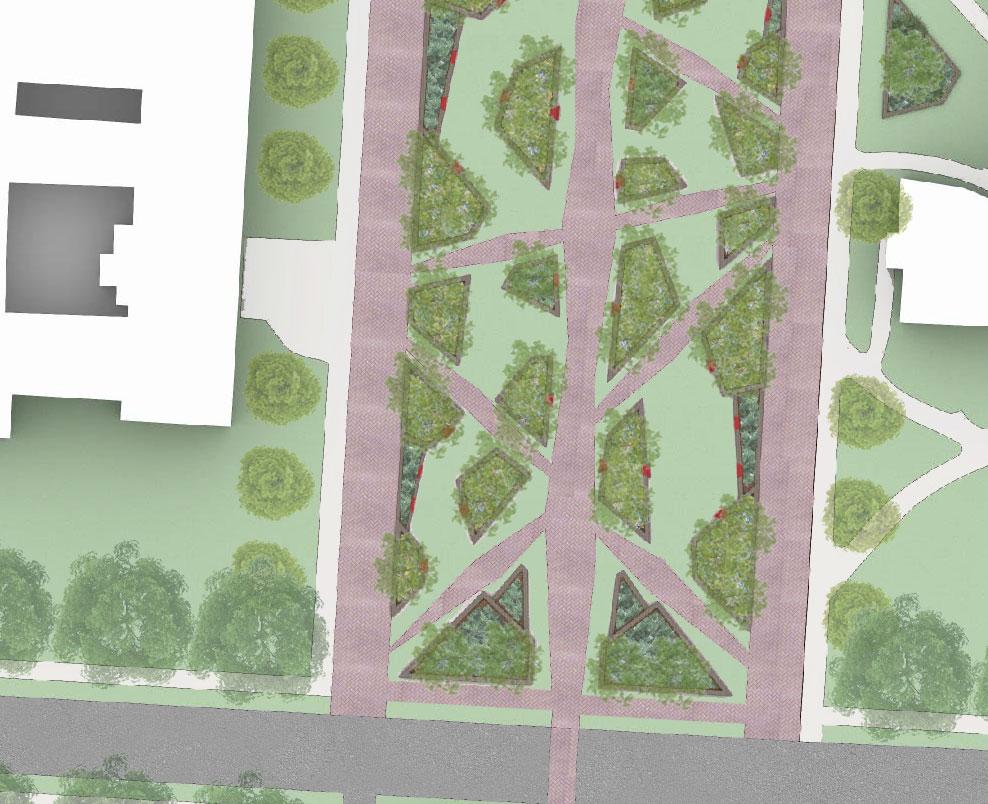
LandArch Studio 504
Project Features
1. Pedestrianization of Presidents Way
2. Formal Entry Sequence/ University Gateway
3. Central Corridor And Alpine Glades
4. Cellular Seating Spaces Within Alpine Glades
5. Edible Stormwater Management Gardens
6. Multi-functional Space w/ Informal Event Stage
7. Tree-Covered Seating Spaces Within Plaza
8. Skate Park
9. Rain Gardens Erode Into Surrounding Landscape

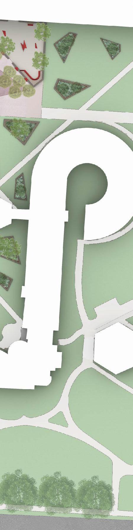


 Haigis Mall, UMass Amherst Master


GROVE EXTENDING INTO THE FINE ARTS CENTER PLAZA


CELLULAR SEATING AREAS WITH EDIBLE RAIN GARDEN BEDS
FINE ARTS CENTER INSPIRED BENCHES
SKATEABLE ART
TRADITIONAL SKATE PARK FEATURES

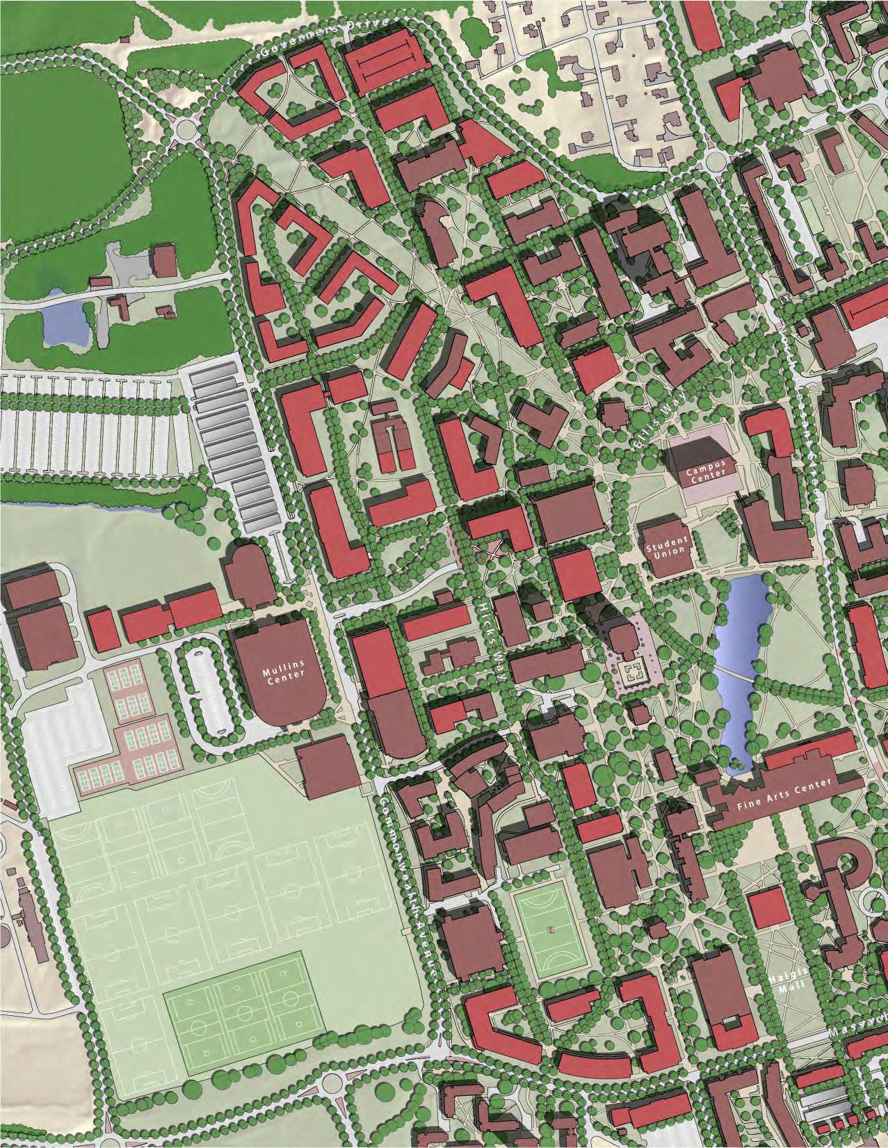
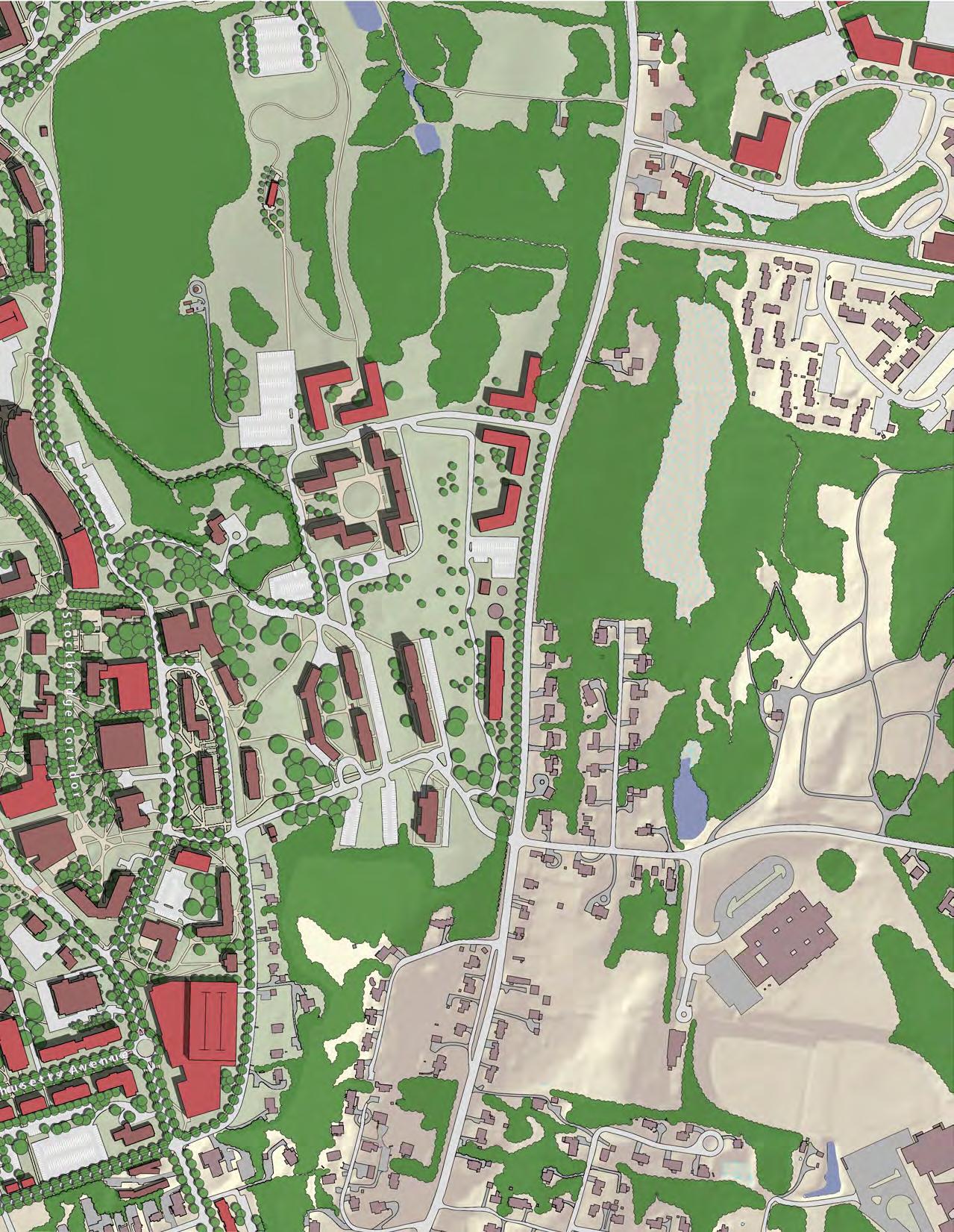

As a Landscape Designer/Graduate Assistant with the Campus Planning Department, I work under the direct supervision of the University Landscape Architect and the Senior Physical Planner, aiding in the development of various landscape and capital improvement projects, and assessing the university’s stormwater management infrastructure.
Date: September 2022 - Present

Key Projects:
Campus Master Plan Updates
- Update CAD line work and re-render the Master Plan overview map to account for all changes since the original was drafted in 2012
- Prepare conceptual renderings of priority areas on campus slated for updates in the near future
Stormwater Management Infrastructure

- Ground truth existing stormwater management infrastructure against existing CAD base files
- Delineate catchment areas for each catch basin on campus in furtherance of the university’s NPDES compliance efforts

- Assess current stormwater data management practices and develop a strategy for improving data sharing across its different user groups

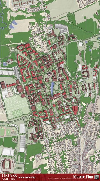
In 2012 the University of Massachusetts updated its Master Plan to provide a framework for future campus development. Since that time, the campus has seen extensive development as well as new site-specific visions that the University wanted reflected in its Master Plan overview map. This required redrafting all of the relevant line work in AutoCAD and subsequently re-rendering the graphics to mirror the original map.
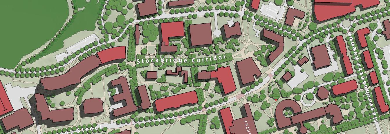
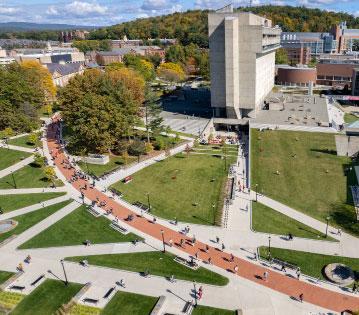
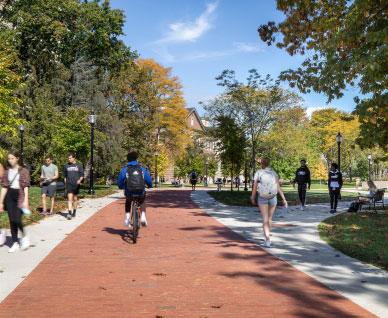
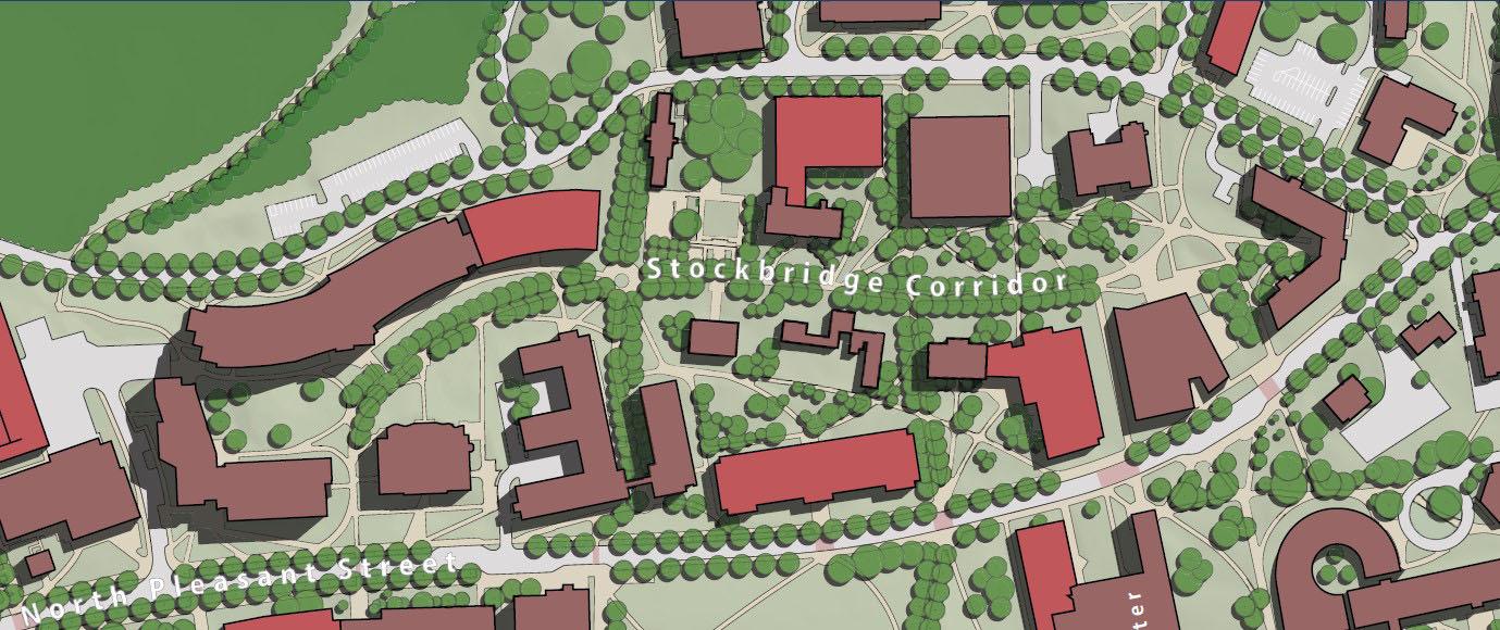
Increasing pedestrian-only corridors and developing more legible design standards for new development are key components of ongoing landscape improvement efforts. In 2020, the central corridor through the campus core, Ellis Way, was reconstructed with brick and concrete walkways replacing asphalt driveways. The university aims to similarly replace the current asphalt roadway through the Stockbridge Road corridor with a brick and concrete pedestrian-only path.

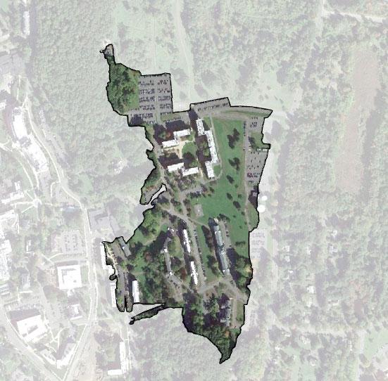
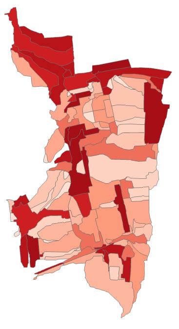
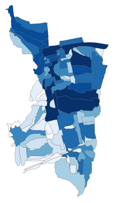
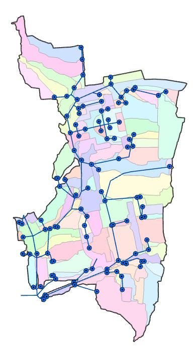
The University of Massachusetts Amherst is considered a ‘small municipality’ under the National Pollutant Discharge Elimination System (NPDES), and is thereby subject to explicit stormwater management regulations. In order to remain in compliance with its NPDES permit, the university is tasked with delineating its existing stormwater management infrastructure and identifying opportunities to reduce pollutant loading of the Tan Brook, which runs directly through campus.
The existing infrastructure maps first need to be updated to more accurately reflect current conditions. Secondly, the Environmental Health and Safety Department aims to delineate catchment areas for each of the 9,000 catch basins on campus in order to better identify problem areas and develop mitigation strategies. A small sub-watershed is being used a pilot area to test GIS-based watershed modeling and its viability for campus-wide application.
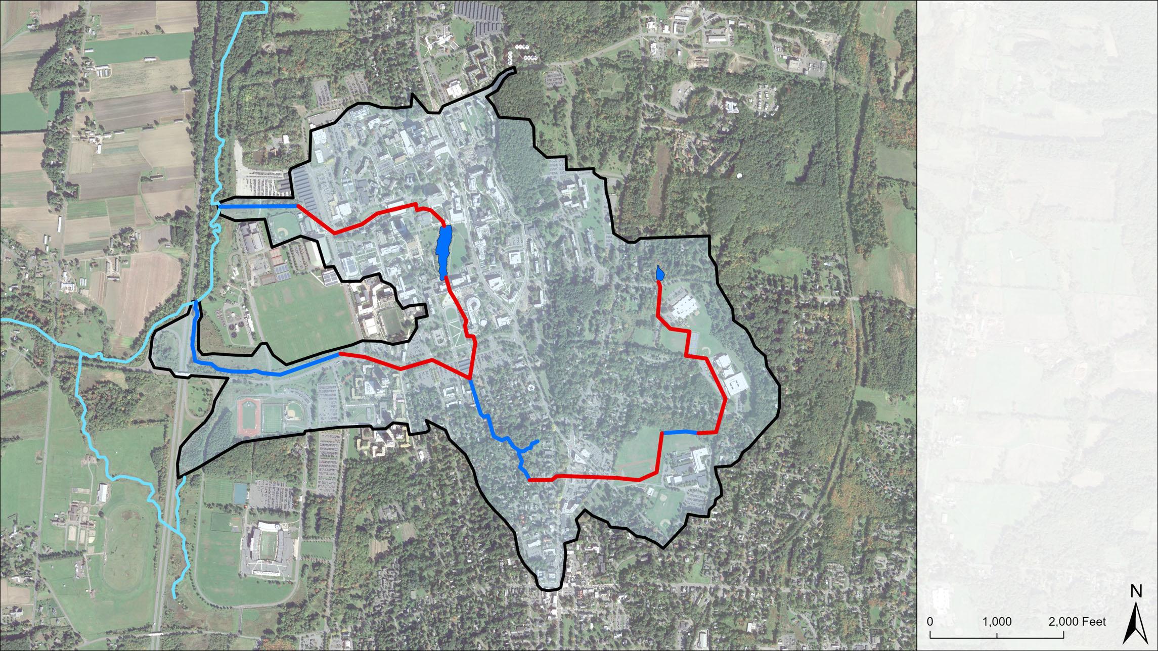
Site Map
Tan Brook Watershed
Tan Brook (aboveground)
Tan Brook (underground)
Mill River Campus Pond
Wildwood Cemetery
Sub-Watershed


As a Project Manager for the U.S. Army Corps of Engineers, I was responsible for conducting feasibility studies for potential environmental restoration and coastal storm risk management projects. I was also responsible for managing these projects through construction if and when they were approved. Often times, the solutions were readily understood, but garnering public support and navigating policy constraints were the critical challenges.
Dates:
July 2009 - August 2021
Key Projects Included Here:
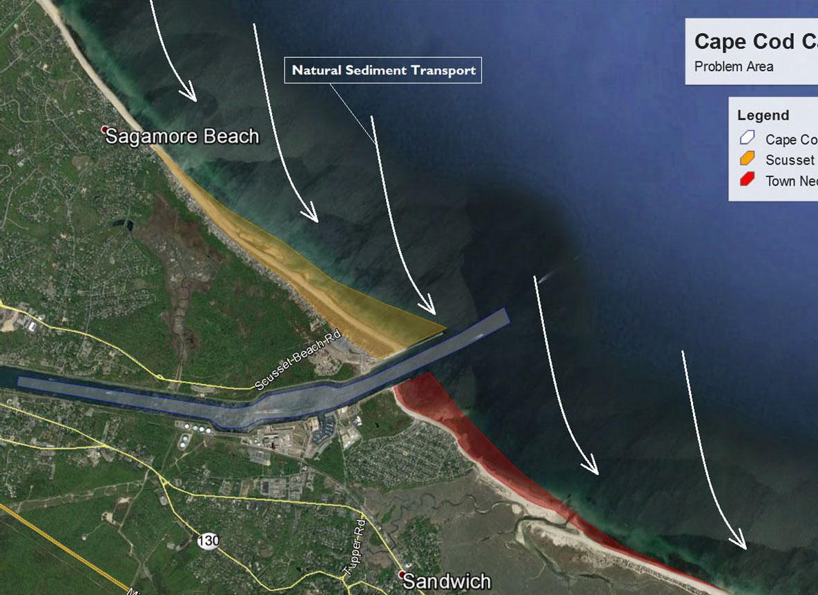
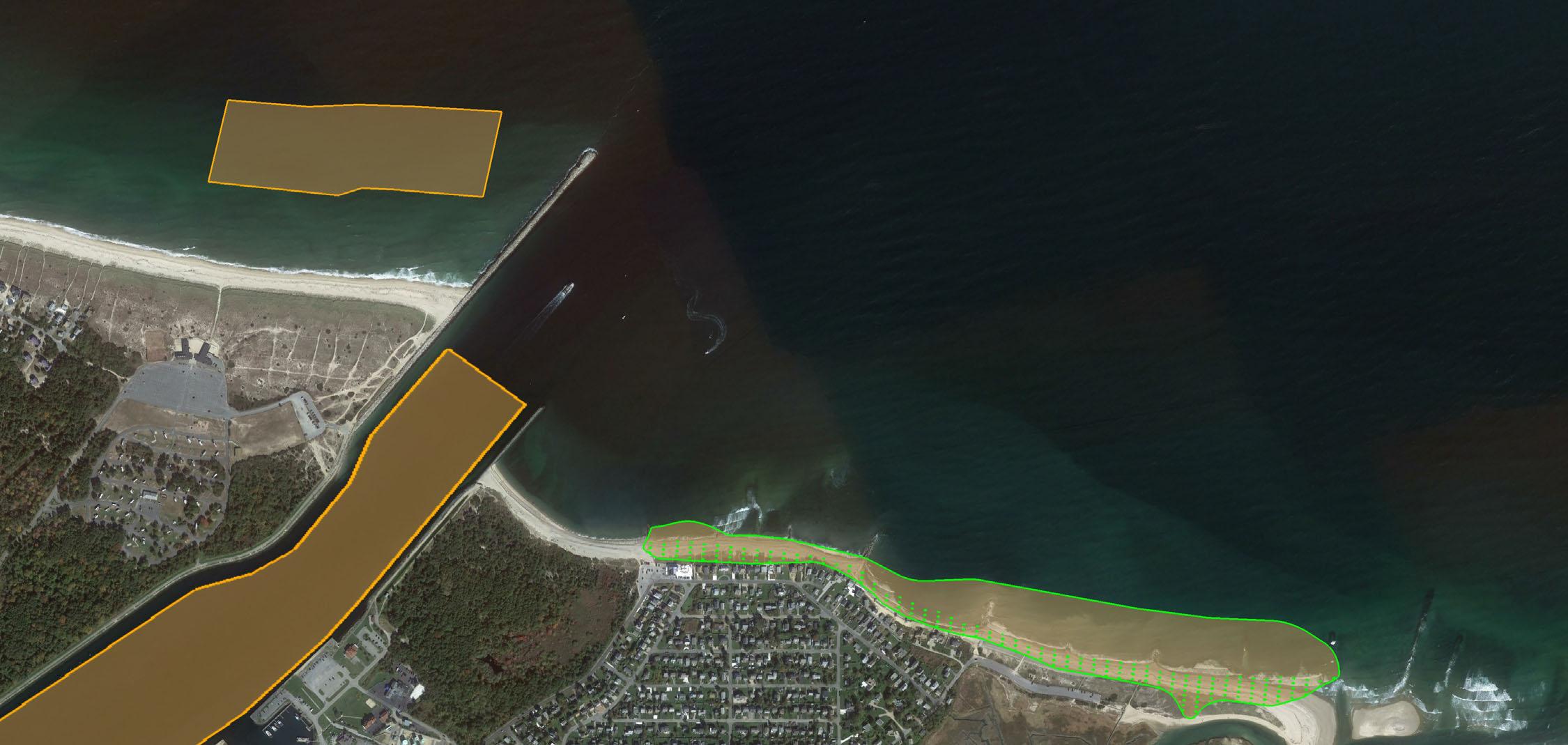
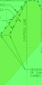
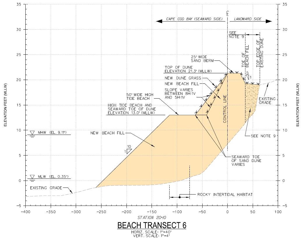
Cape Cod Canal/ Town Neck Beach
- Conducted feasibility study under Section 111 of the River and Harbor Act of 1968 (Mitigation of Damages Caused by a Federal Navigation Project
- Recommended one-time placement of 388,000 cubic yards of sand on Town Neck Beach
- Justified change to Cape Cod Canal maintenance dredging Federal Base Plan to require beneficial reuse of material instead of offshore disposal
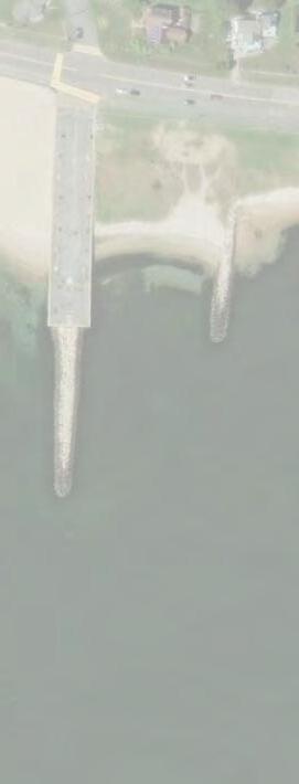
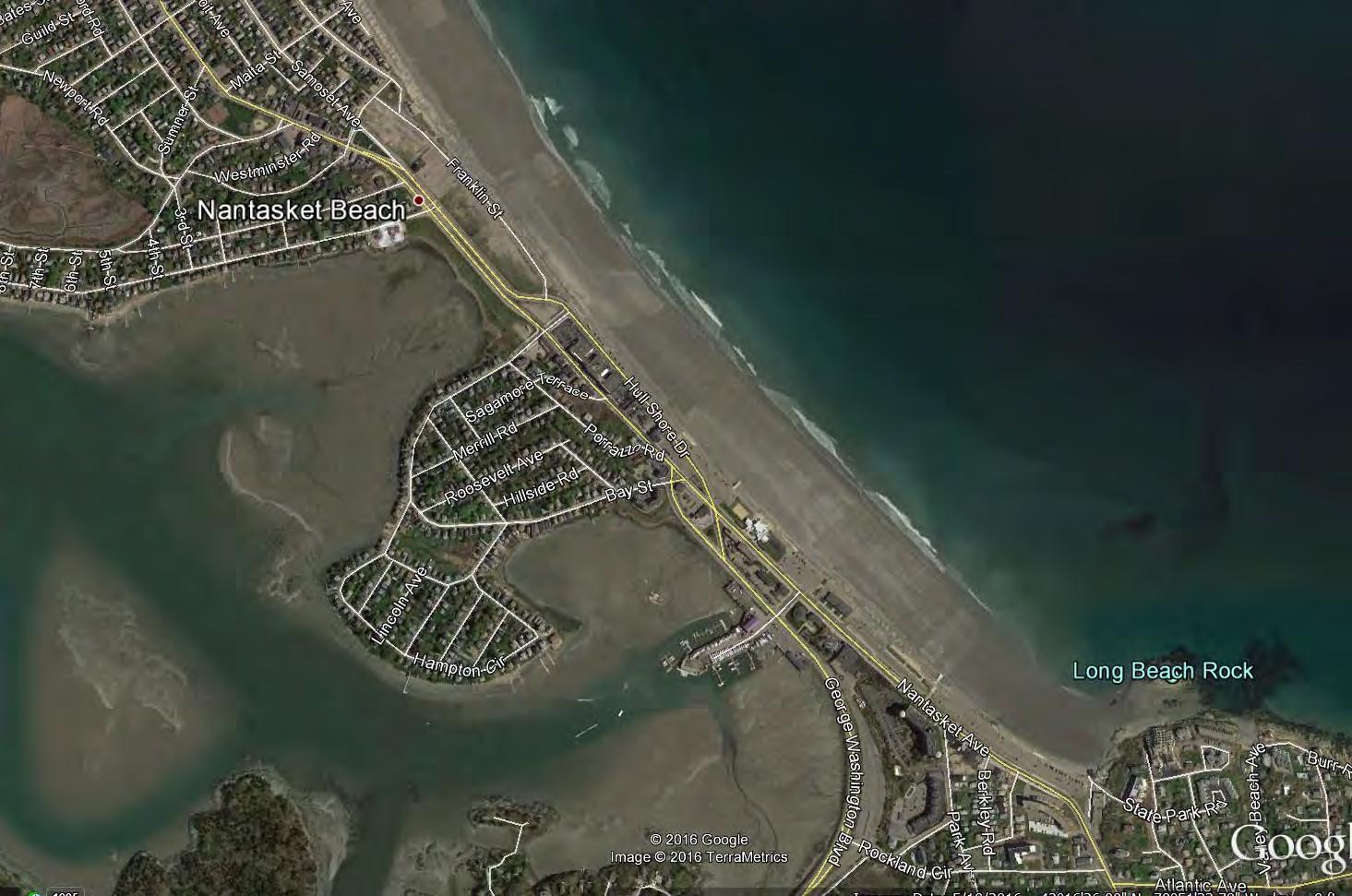
Nantasket Beach Shore Protection Project
- Obtained final approval and permits from federal, state and local agencies for a toe-stone revetment needed to protect the seawall against underminin
- Managed project through construction
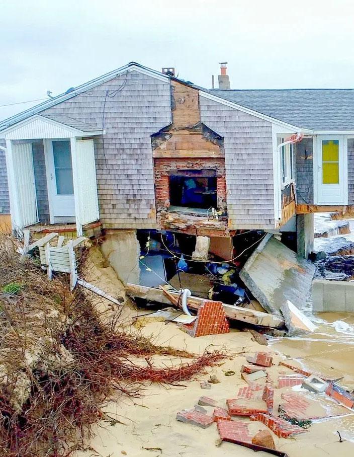
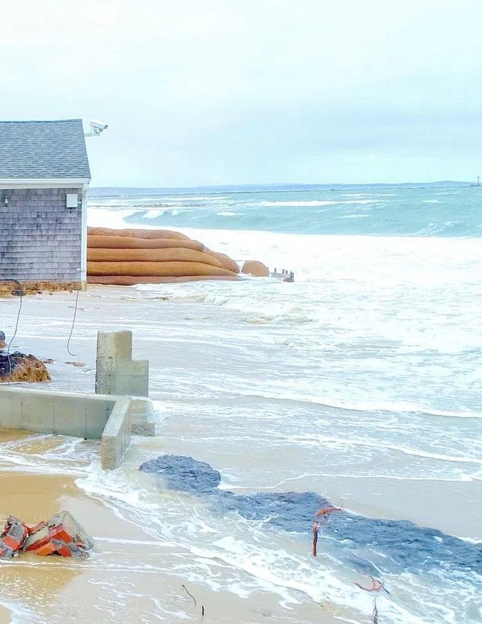
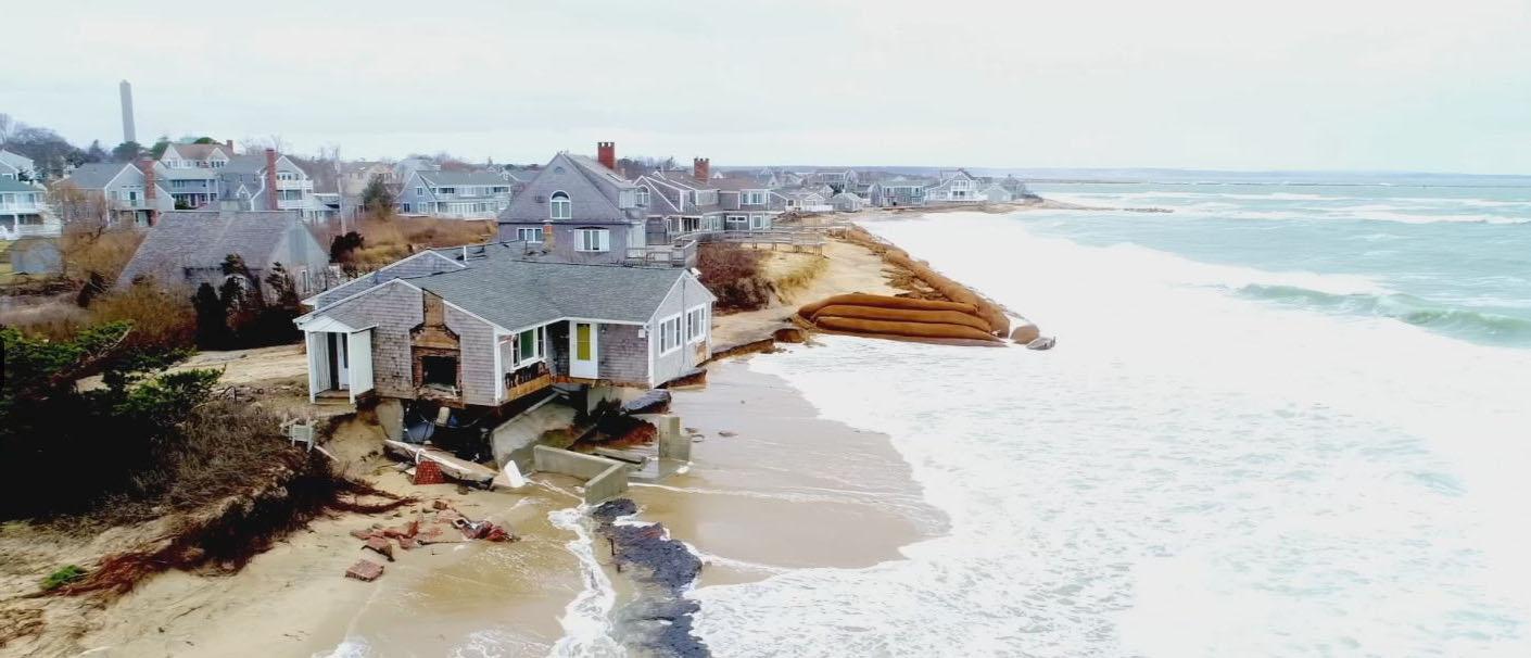
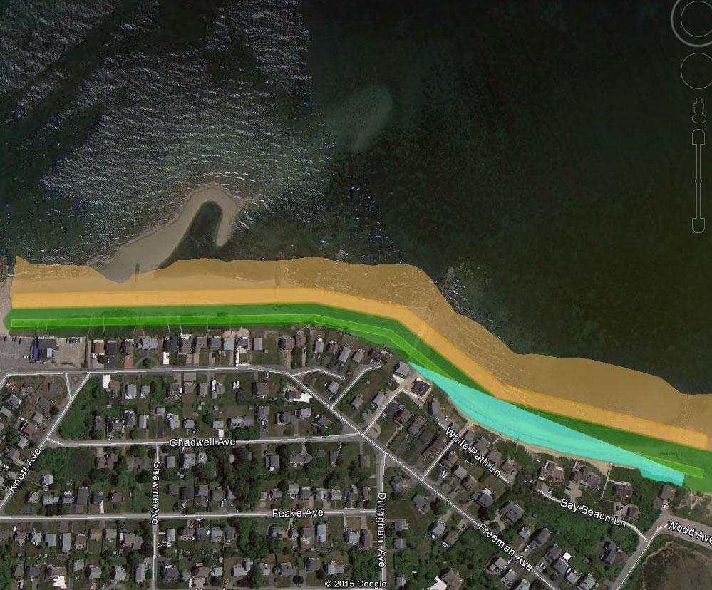
The Cape Cod Canal was completed in 1933 and since that time, the east end jetties have interrupted natural alongshore sediment transport from Scusset Beach (updrift) to Town Neck Beach (downdrift) in Sandwich, Massachusetts. This has starved the nearshore of sand needed to naturally maintain the beach, resulting in a perpetually severe erosion problem that threatens not only the beach and shorefront properties, but also critical infrastructure and the downtown historic district.
USACE is authorized to mitigate damages caused by a Federal Navigation Project, but the perpetual nature of this problem far exceeds the expenditure limits of said authority. This, combined with environmental concerns of mining sand from Essential Fish Habitat, and onerous easement requirements of those properties directly impacted by the problem made an otherwise straightforward beach nourishment project a very lengthy and complex policy challenge. Ultimately a project was authorized that will enable the one-time placement of 388,000 cubic yards of material on Town Neck Beach and all future maintenance dredging of the Canal will similarly require beneficial reuse of the clean sand.


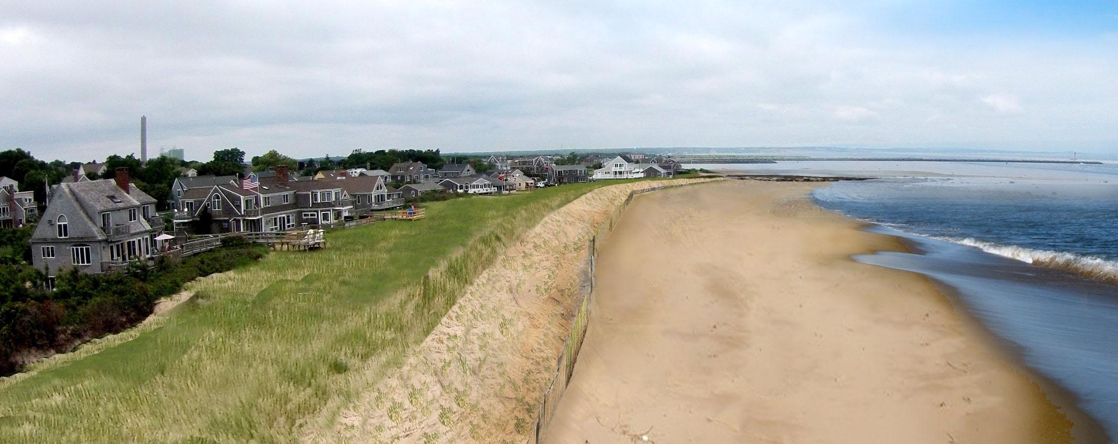
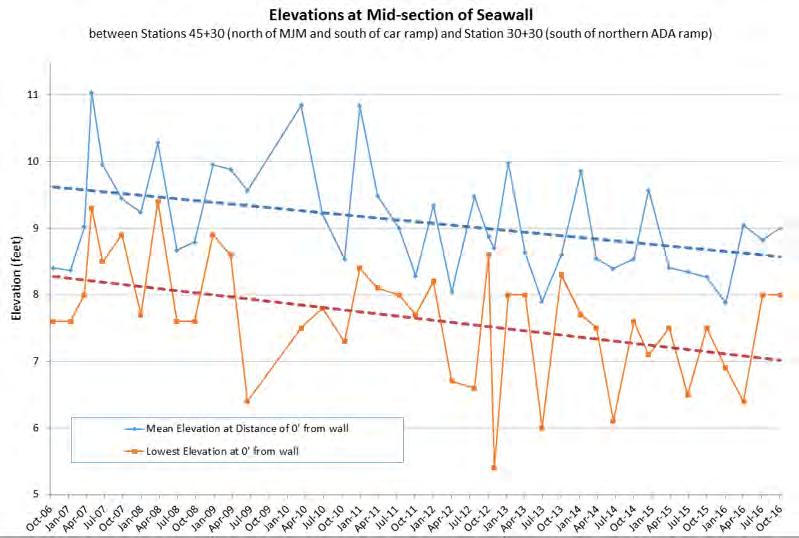
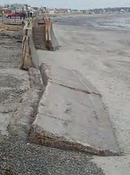
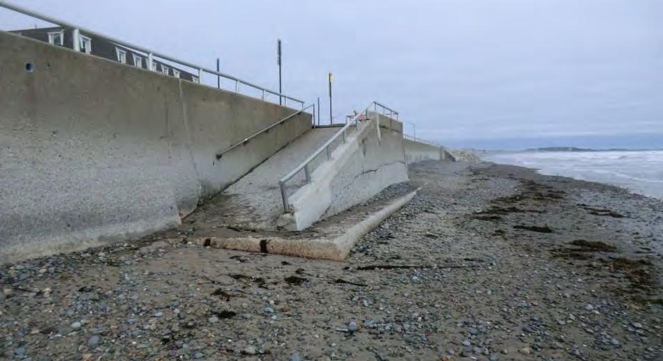
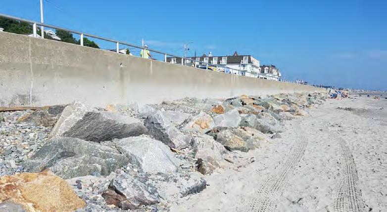
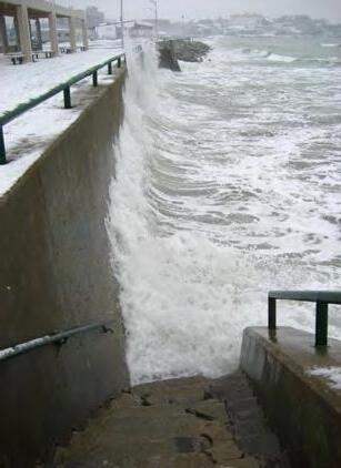
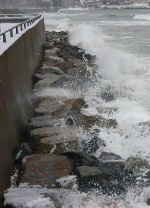
In 1994 and again in 2006, partial collapses of its seawall led to stone revetments being constructed at the northern and southern ends of Nantasket Beach in Hull, Massachusetts. Continued erosion of the unprotected middle section left the seawall increasingly vulnerable though, and a similar revetment project was proposed to prevent catastrophic failure. Because there is limited high tide beach available to beachgoers, residents pushed back against constructing a revetment in hopes of a beach nourishment project being constructed instead, but due high costs of beach nourishment and limited supply of sand, a revetment became the only immediately feasible option. The local community ultimately agreed to move forward with construction of a revetment, but their sights are still set on eventually renourishing the beach. The USACE understood this and has since opened a new investigation to find additional sand that could be placed on top of the revetment and restore the impacted square footage back to high tide beach.
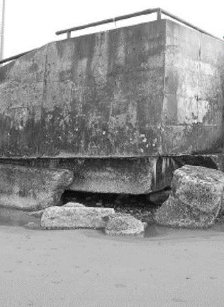
NorthernRevetment (2006)
TemporarySeawallFortification (2004)
ExposedSeawall
2,200LinearFeet (Project Area)


PRE-CONSTRUCTION (DEC. 2017)
POST-CONSTRUCTION (JUL. 2018)

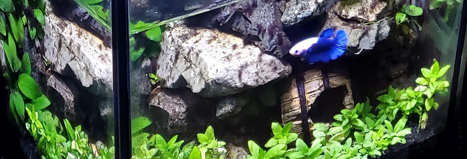
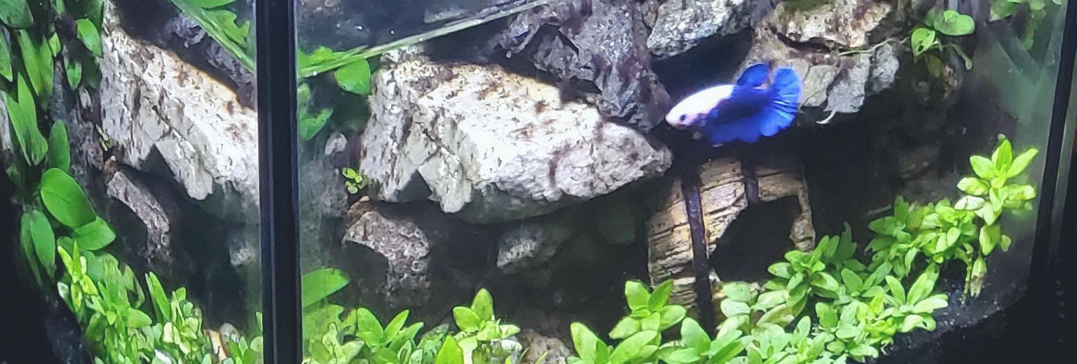
Building and maintaining aquariums has been a hobby of mine since I was a teenager, serving as both a creative outlet and ecological learning tool. It offers an opportunity to better understand the science that underpins natural systems as well as a canvas for artistic expression. As I have grown within the field of environmental science, the hobby has evolved into a means of experimenting with aquatic ecosystems as they pertain to environmental restoration.
Projects Included Here:
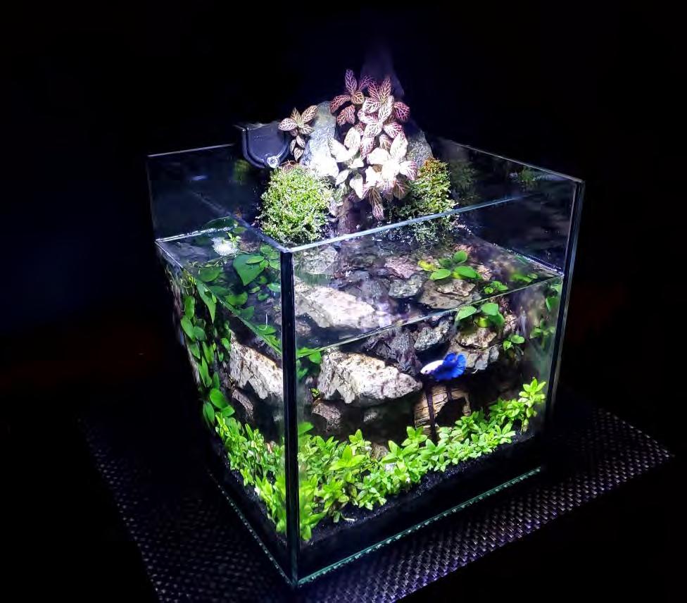
Betta Bowl Paludarium : Build and Rebuild

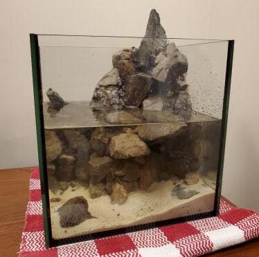
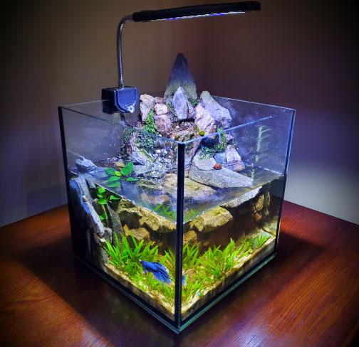
- 3-gallon paludarium with an experimental waterfall and lava rock bio-filtration system
- Design oversight led to catastrophic failure shortly after initial construction
- Tank had to be deconstructed and reconstructed to fix the critical design flaws
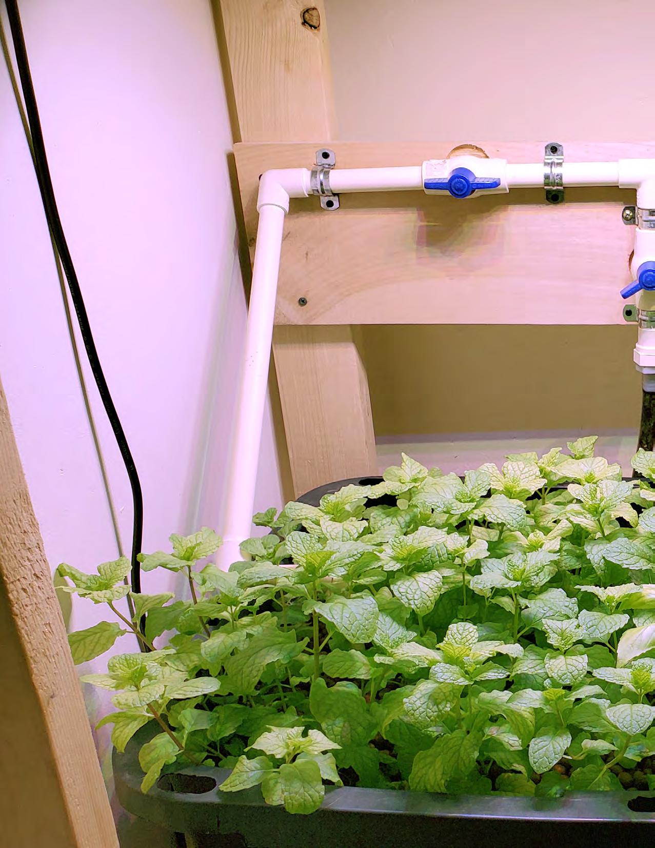
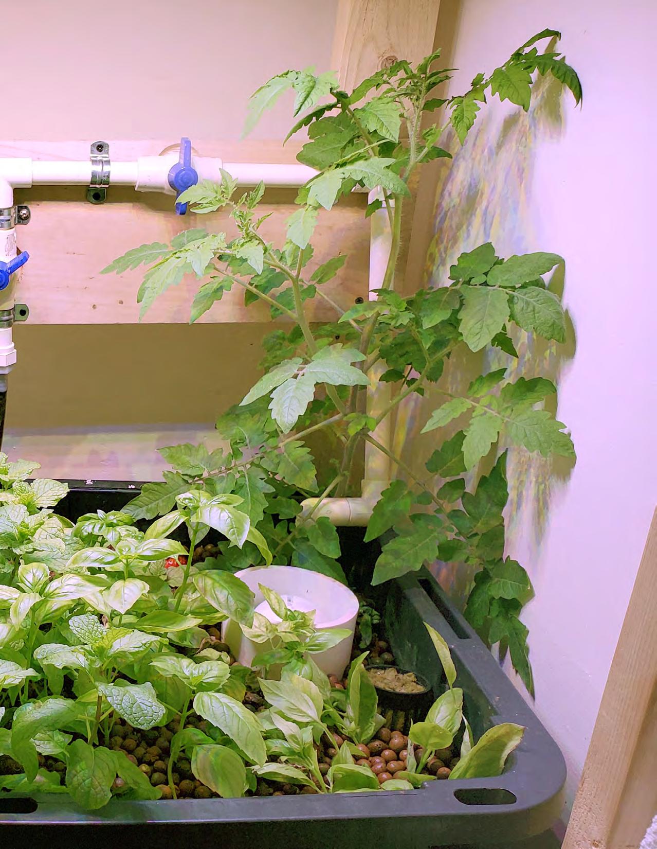
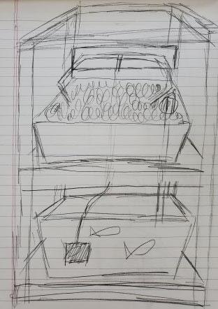
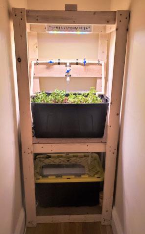
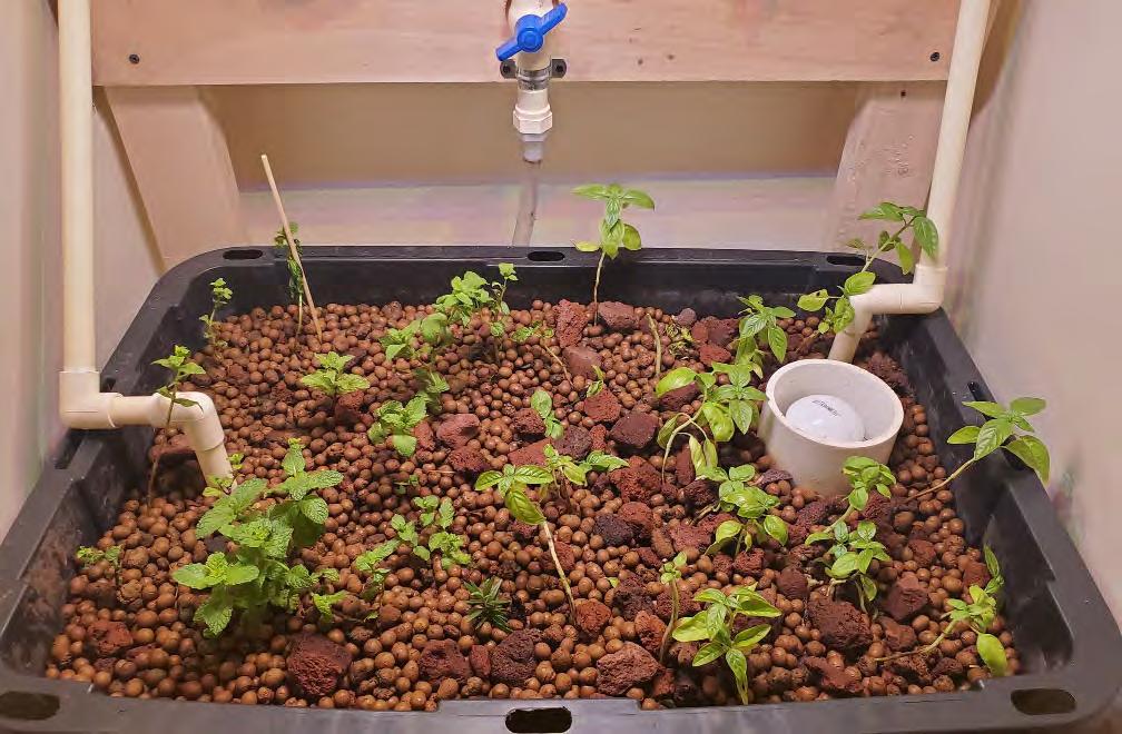
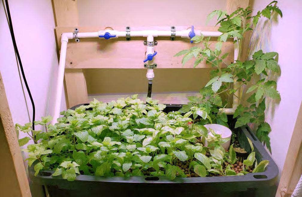
In-Home Aquaponics : First Build and Lessons Learned
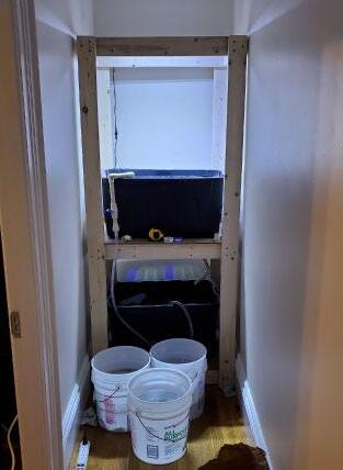
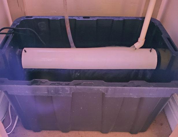
- 60-gallon aquaponic system (30 gallon goldfish tank and 30 gallon herb garden)
- First time aquaponics build; Fully functional system but plenty of limitations and lessons learned
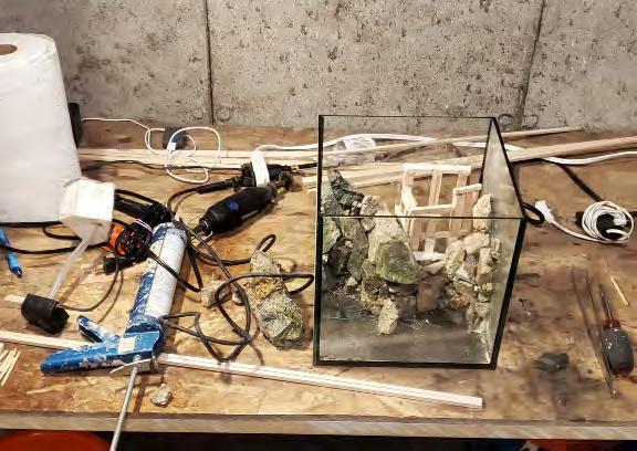
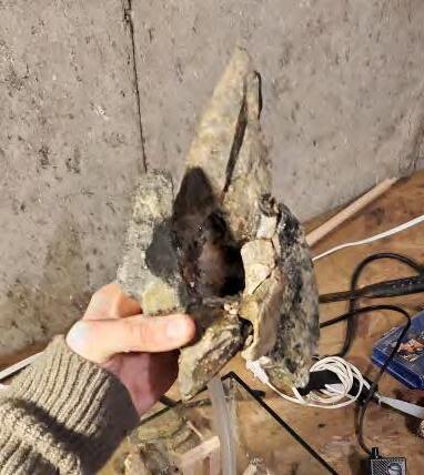
This project was a first attempt at designing a paludarium (a vivarium that includes both aquatic and terrestrial elements) and an opportunity to further experiment with bio-filtration. A 3-gallon tank and hardy fish species was used for this pilot scale system, from which lessons could be learned and later applied to a more complex, full-scale system. Unfortunately, within 48 hours of being introduced to the system, the fish managed to knife his way through a small gap in the rockscape and into the filter housing. Worse, because of a critical design oversight, the filter housing could not be accessed quickly and easily enough, and the fish perished. The system then had to be reconstructed.
During reconstruction, all voids were plugged and the plastic filter housing was replaced with a wood frame that could support the weight of a freestanding, monolithic waterfall cap designed to be seamlessly removed and reinserted as needed. This has made routine maintenance much easier and the system is now thriving. The bio-filtration has also worked extremely well. In an unplanted aquarium this size, water changes would typically be required once a month in order to maintain ideal water quality parameters, but this system only requires quarterly water changes to accomplish the same.
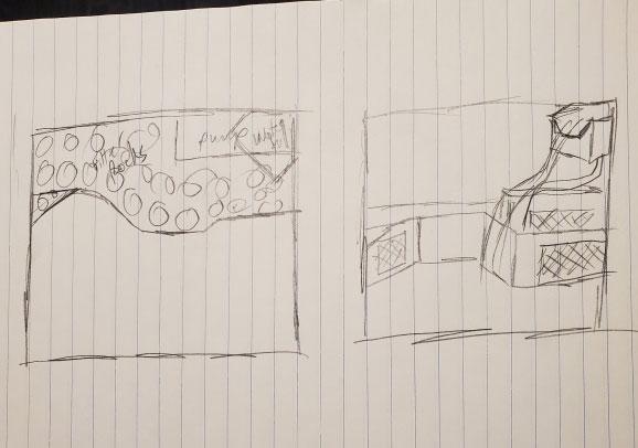
EXPERIMENTAL DESIGN : WATERFALL AND LAVA ROCK BIO-FILTER ROCKSCAPE COMPLETE INITIAL
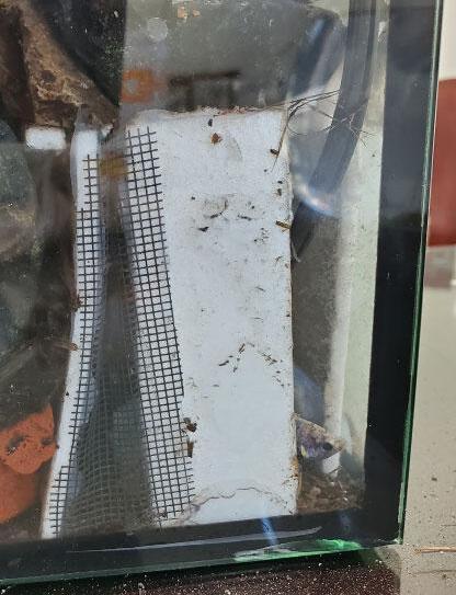 Inflow Mesh
CATASTROPHIC FAILURE - FISH CAN’T BE SAVED
Waterfall
Inflow Mesh
CATASTROPHIC FAILURE - FISH CAN’T BE SAVED
Waterfall
DECONSTRUCT AND REBUILD WITH
TWO (2) YEARS POST-RECONSTRUCTION
REMOVABLE WATERFALL CAP
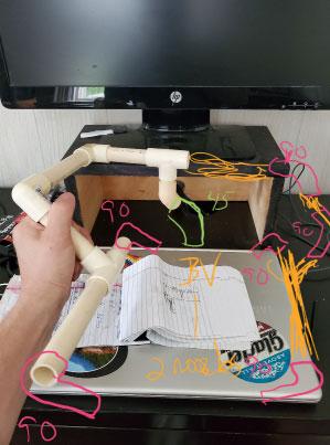
This project was a first attempt at designing and building an in-home aquaponic garden. Aquaponics is a symbiotic process by which fish waste fuels plant growth, while plant growth filters and recycles the water, creating a quasi-closed-loop nitrogen cycle. The only direct inputs are fish food and sunlight. Although the concept is relatively simple, the space limitations of an in-home setup required that the water circulation system be quite precise in order to reduce the risk of flooding. Consequently, the system was designed with multiple ball valves to allow for more precise control of water flow.
The system wound up being fully functional and had no major problems post-construction. There were however, notable limitations. The system is incredibly loud and required a sound dampening design modification. Secondly, because the grow bed had to be roughly the same size as the fish tank, fast growing plants were critical in creating an environment where nutrient uptake was keeping pace with nutrient production. Lastly, the small scale of the system limited the garden to herb production. Vegetables were successfully started but eventually had to be transplanted outdoors.
 INITIAL DESIGN
PARTS INVENTORY / MOCK-UP SYSTEMS CHECK
INITIAL DESIGN
PARTS INVENTORY / MOCK-UP SYSTEMS CHECK
 Pre-Construction (Dec. 2017)
Mint
Tomato Starter (Outgrew the System within Two Months)
Pre-Construction (Dec. 2017)
Mint
Tomato Starter (Outgrew the System within Two Months)


“It will take more than ecologically regenerative designs for culture to be sustainable. What is needed are designed landscapes that provoke those who experience them to become more aware of how their actions affect the environment, and to care enough to make changes.”- Elizabeth K. Meyer Sustaining Beauty. The Performance of Appearance