2020 1995–2019
25 YEARS OF PLANNING—A RETROSPECTIVE
SMART P LANNING MAKES SMART P LAC E S.
Metroplan is the federally designated metropolitan planning organization (MPO) for Central Arkansas and as such is required to prepare a long-range metropolitan transportation plan with a 20-year horizon. METRO 2020, adopted in 1995, was that plan. It was the first such plan for the newly expanded four county metropolitan region
with intermodal and expanded public
the ISTEA legislation. Horizon 2020 was prepared by Metroplan staff and reflects their assessment and
that others may form
Metroplan encourages you to read and formulate your own opinions regarding the success of METRO 2020.
METRO 2020 can be found at metroplan.org/sites/default/files/media/transportationplanning/METRO2020.pdf
This report was funded in part through grant(s) from the Federal Highway Administration and Federal Transit Administration, U.S. Department of Transportation. The views and opinions of the authors expressed herein do not necessarily state or reflect those of the U.S. Department of Transportation.
Prepared by Metroplan staff.
Photographs by Metroplan staff except where noted.
Notice of Nondiscrimination
Metroplan complies with all civil rights provisions of federal statutes and related authorities that prohibit discrimination in programs and activities receiving federal financial assistance. Therefore, Metroplan does not discriminate on the basis of race, sex, color, age, national origin, religion, disability, or income status, in admission or access to and treatment in Metroplan’s programs and activities, as well as Metroplan’s hiring or employment practices. Complaints of alleged discrimination and inquiries regarding Metroplan’s nondiscrimination
may be directed to Susan Markman,
(Hearing
or
M e TR o 2020 I n R ev I ew
THE FOUNDATION
“METRO 2020 is intended to be the beginning of a new vision for Central Arkansas. That vision is of an economically vibrant region with a high quality of life that includes an efficient transportation system, environmentally sensitive development and reasonable mobility for all.” —METRO 2020 (1995)
Two factors inspired METRO 2020. The first was the federal government’s landmark ISTEA legislation of 1991, which upended traditional transportation planning and funding. ISTEA emphasized a balanced approach that included land use and livability. The second was equally important: regional leadership.
By the end of the planning process Metroplan leaders established a vision statement that pointed to a change of direction for the new four-county Metropolitan Region (Lonoke, Faulkner, Pulaski, Saline counties):
METRO 2020 Vision: The Metropolitan Transportation Plan will contribute to a more livable and efficient environment in Central Arkansas. This plan should significantly change how we are presently allowing our transportation system and our communities to develop by defining an intermodal transportation system that:
• Maximizes the mobility of people and goods;
• Minimizes transportation related fuel consumption and air pollution; and,
• Establishes a strong link between the provision of transportation facilities and how we use our land.
The METRO 2020 plan, adopted in 1995, became the foundational transportation and land use plan for the region. Now, approaching the 25-year mark is a good time to evaluate the resilience of the plan and the effectiveness of its implementation.
TOWARDS A HORIZON
HORIZON 2020 takes a clear-eyed look at the results of this ambitious planning effort.1 This review centers on the promise of the vision and examines how that vision has advanced in the twenty-five years since its adoption. We explore questions, like “What did METRO 2020 get right? Where did it fall short? What effect did METRO 2020 have on the region? What lessons have we learned in two decades of oversight and implementation?
This report is more than a retrospective. It strives to make a clear judgment on past efforts and encourage fresh thinking as the region sets out on the post-2020 future.
1
Strong leadership from the Board led to a drastically new direction in regional planning. This leadership became instrumental in its implementation.
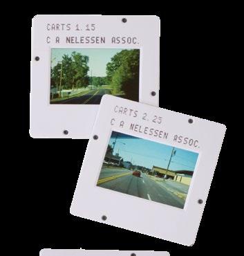
ISTEA required Metropolitan Transportation Plans to include “early and meaningful” public engagement. Metroplan pioneered a Visual Preference Survey (VPS), in which participants developed their vision for the region through a series of slide images.
Public input was also enhanced by the creation of a new citizen based Transportation Advisory Council (TAC) tasked with developing the plan. The former policy committee was reformed as the Technical Coordinating Committee (TCC) and given the responsibility of plan implementation. The Metroplan Board remained ultimately responsible for the plan.
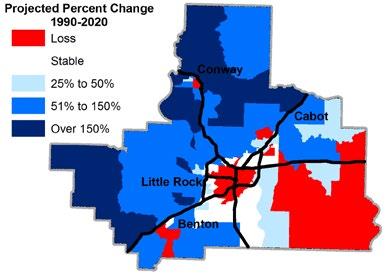
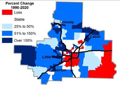
METRO 2020 forecast a regional population of 723,096 in 2020. In 2019, regional (four-county) population was about 716,000. That’s an error factor of one percent. It could be luck, but the forecast turned out pretty well in practical terms. Metroplan revises its long-term projections every five years, and the latest ones account for the slowdown evident since 2010.
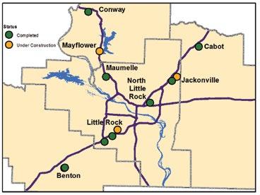
o u R R eg I on 1995
Perspective
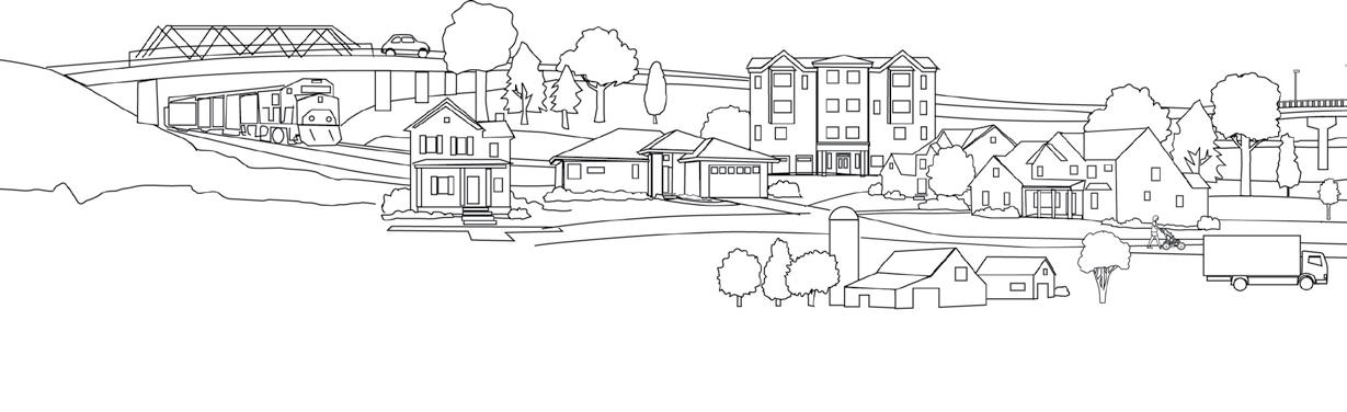
In 1995, the Central Arkansas region was beginning to grow again, in population and economic terms, following a sharp slowdown that had affected the region during the 1980s. Concerns about crime in Little Rock and school districts in Pulaski County were driving out-migration to suburban communities. Conway was growing at a nearincredible 5.6 percent annual rate, and Cabot and Bryant were close behind at 4.6 and 3.9 percent respectively.1 Population had declined relentlessly in downtown and neardowntown areas of Little Rock and North Little Rock. There was no Arkansas River Trail system, although a few trails existed along the river, mainly in downtown areas and in Murray Park in Little Rock.
While people were moving from Little Rock and North Little Rock, the region’s core remained a strong job center with people commuting to Pulaski County. Retail markets had not developed fully in suburban communities and thousands came to shop in Little Rock’s University and Park Plaza malls and North Little Rock’s McCain Mall. Entertainment options were primarily available in the central cities. The Internet was in its infancy and had yet to impact shopping patterns. Big-box retail was being developed in a big way with major stores just opened or under construction, and these, not the Internet, looked like the biggest future threat to the older malls.
o u R R eg I on 2020
2020 At a Glance
Perspective
The Great Recession of 2008–2009 represented a significant change for Central Arkansas. While the recession is long over, several regional trends shifted due to the economic downturn and thus provide part of the 2020 perspective. Multi-family housing has risen to be the leader in new housing. At the same time the pace of city annexation has slowed markedly. Partially the result of slower overall population growth, it has also been represented by increased development within existing city boundaries. The out-migration of people in Pulaski County has slowed and is now keeping pace with in-migration.
Following twenty-five years of growth, both the Benton-Bryant area and Conway have surpassed the 50,000 mark and as a result are developing retail and entertainment markets of their own, with less emphasis on the need to travel into Little Rock and North Little Rock. Smaller cities, led by Cabot and Maumelle, have grown into mid sized cities and now face challenges from that rapid growth. Yet all remain dependent on Little Rock and North Little Rock for jobs, with Saline and Lonoke Counties sending over 50 percent and Faulkner County 24 percent of their workers to jobs in Pulaski County.
METRO 2020 Projections
METRO 2020 included demographic forecasts to the year 2020. At the regional and county levels, these forecasts were accurate. Even at the small-geography local level, they were reasonably good. The forecasts made in 1995 failed to predict the small but discernible return of growth to some central-city locations, first in Little Rock and later in North Little Rock and Conway. They came out best in slow-growing Pulaski County, while the greatest small-area errors were in Faulkner and Lonoke Counties. Yet they provided a reasonable forecast of the region’s future.
Actual Population Change
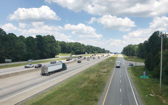
f R eeways
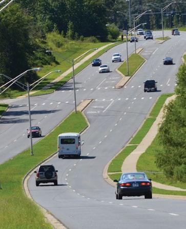
A Balanced Approach to Mobility
METRO 2020 sought a balanced transportation system. As part of a regional implementation strategy, METRO 2025 included the following policy “Build the urban freeway system to six through-lanes and accommodate demand over that with transit and the regional arterial network.”
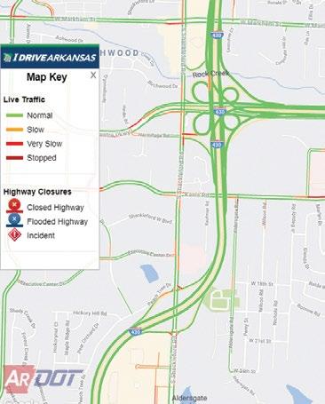
I Drive Arkansas allows drivers to spot roadway issues before making the trip.
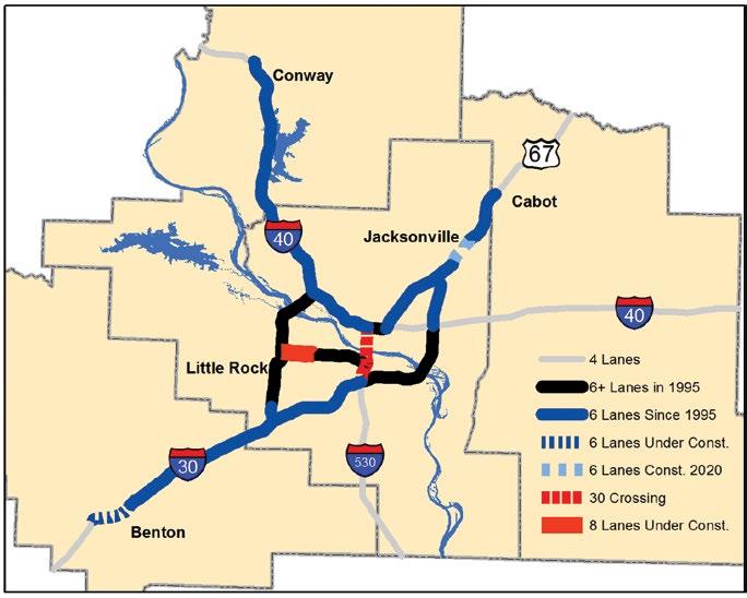
In 1995, the regional freeway system was primarily four lanes with limited stretches of six lanes in Little Rock and North Little Rock. Cross sections included in METRO 2020 showed expansion of freeways to six main travel lanes. As part of a regional strategy, subsequent plans called for expanding freeways to six lanes and accommodating additional demand through transit and regional arterials.
Progress Made
Today, most area freeways have been widened to six lanes—a noteworthy accomplishment. Freeway interchanges along I-430 at I-30, I-630, and I-40 have all been reconstructed. The I-Drive Arkansas Website and traffic cameras have enhanced user information and improved incident management on the freeway system.
METRO 2020 recognized the need for prioritizing investments on the existing highway network. Freeways have remained in acceptable shape due to the passage of the Interstate Rehabilitation Program (IRP) in 1999 and 2011. The Arkansas Department of Transportation (ArDOT) continues to increase the percentage of its budget dedicated to system preservation and maintenance.
Missing the Mark
No policy with its origin in METRO 2020 has been as controversial or debated as its strategy on freeway widening. Fully spelled out in METRO 2025 and METRO 2030, the policy called for widening freeways to six lanes to serve growing suburban areas, but strongly discouraged further widening in the urban core until the arterial and transit networks could be built out. Many members of the public saw this as a strict ban on widening freeways beyond six lanes. This “six lane cap” became a central debate point for I-630 and 30 Crossing projects.
Unfortunately, the policy largely guarded the hope of the vision alone (See following pages). To work, the freeway element depended upon changes in regional land development practices and concurrent expansion of arterial capacity and transit networks. Absent those elements, as pressure to widen freeways increased, exceptions were granted for I-630 and I-30. Partners questioned how to account for the policy in required planning studies, while pointing to a lack of needed guidelines. Although still a policy on paper, the “six lane cap” has little of its former authority.
Interestingly, one section of planned freeway was eventually abandoned. Plans for the Northbelt Freeway to connect I-430 and Hwy 67 through northern Pulaski County were dropped due to soaring cost estimates, disagreements over location, and perceived lack of benefit. However, a study is in the works to explore the viability of pursuing this route as a major arterial, rather than a freeway.
Freeway System Improvements
Under MPO Policy regional freeways were expanded to six lanes to improve safety, assist freight movement, and address existing traffic congestion. Additional demand was to be accommodated via improvements to arterials and transit (articulated in METRO 2025). This policy aimed to be an impetus for the expansion of arterials and transit networks and ultimately leading to a balanced transportation system
To facilitate interstate commerce and freight movement ArDOT must maintain interstates in a state of good repair. This is no easy task given the high number of trucks that traverse freeways in central Arkansas. ArDOT has devoted an increasing percentage of its budget to maintenance, a priority of METRO 2020.
KEY TAKEAWAY
Freeway size cannot be determined by Metroplan policy alone. Solutions require the buy-in of all partners and supporting infrastructure throughout the regional transportation system. The question is: Should the region continue to add lanes alone, or instead invest in alternatives that improve the efficiency of the entire system?
30 Crossing presented the most controversial and politically charged project in the years since METRO 2020’s adoption. Supporters of the project saw it as necessary for commuters and retaining downtown business and referenced the design’s safety, operational, pedestrian and aesthetic improvements.
Opponents voiced strong concerns about perceived negative impact on an emerging urban quality of life, downtown streets and adjacent freeway segments, and project cost.
For planners, the lesson learned is that freeway projects must be evaluated in context of the system in which they operate, not as individual projects, or with a one-size-fits-all approach.
30 Crossing
Arterials are a cost-effective method for moving traffic. They can also connect into the local street network in a way that enhances community interconnection.
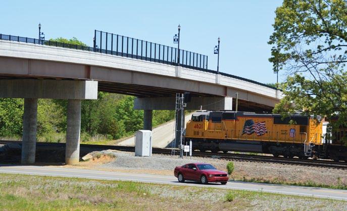
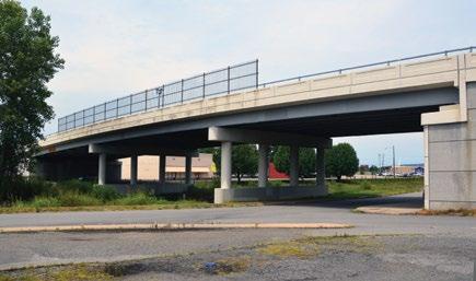
Regional Railgrade Separations
Construction of 11 new railroad overpasses were the direct result of METRO 2020’s public input.
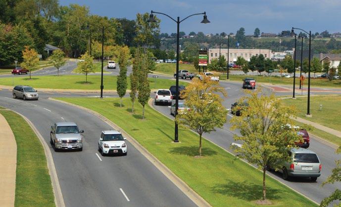
a RT e RI als
Developing a high-quality arterial street network was central to the METRO 2020 vision. Efficient, well-managed arterials promote intra-regional travel by serving areas not immediately accessible to freeways and as an alternative to congested freeways. Arterials provide important links for regional transit, bicycle, and pedestrian networks. They also serve as the point of convergence between regional and local travel.
Progress Made
Regional Arterial Network
METRO 2020 identified ten arterial corridors for improvement or reconstruction and an additional three corridors for study. Since 1995, nine of these corridors have been improved and two corridor studies completed.
In 1999, the Metroplan Board adopted the Regional Arterial Network (RAN), a strategic system of arterial routes on which to focus its limited funding. Since then, this network has been upgraded in places through widening, intersection improvements, technology upgrades, and interchange improvements.
System Management
Access management preserves a roadway’s traffic–moving capacity, makes arterials safer, and encourages high-quality land development. Metroplan has emphasized access management techniques as a relatively low-cost alternative to roadway widening. Through the use of driveway spacing, joint access agreements, median type, and intersection design, METRO 2020 has been the impetus behind several highly successful arterial projects in the region.
Railroad Overpasses: A Promise Kept
Early in METRO 2020’s public outreach, residents expressed concern for safety and travel delays caused by at-grade railroad crossings. In response, the Metroplan Board prioritized construction of new railroad overpasses. Eight new overpasses have been completed by mid-2019, and three more will be completed or under construction by 2020.
Missing the Mark
RAN Incomplete
Much of the arterial network remains incomplete, preventing the network from functioning to its full potential. Those segments that have been improved largely function to move traffic to and from freeways, not as an alternative to them.
Specifically, METRO 2020 identified three new parkways to aid commuting and promote new economic opportunities. Today, the Saline County Parkway is little more than an afterthought. Only short segments of the Conway Loop and Little Rock’s South Loop have been constructed, with no timeframe identified for their completion.
Cross Sections
METRO 2020 established street cross section standards to promote intermobility and consistent designs, encouraging local governments and ArDOT to follow similar practices. The standards also supported development of pedestrian and bicycle facilities, and promoted access management principles on the regional arterial network. Unfortunately, these cross-sections became a bone of contention. In the end, Metroplan conceded its ability to limit design cross-sections.
grade separations, like
KEY TAKEAWAY
Investments in arterials have improved regional mobility; however, the arterial network (RAN) remains largely incomplete. For arterials to function as a viable alternative to freeways, additional RAN capacity investments are needed.
Brockington Road in
using Access Management techniques that improve safety and preserve roadway capacity to efficiently move traffic.
to
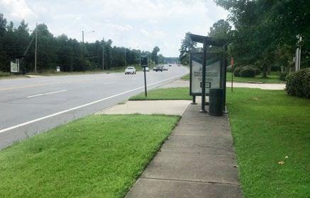
When Hwy 5 was widened in Little Rock, regional cross sections called for the inclusion of sidewalks and bike lanes. Rock Region METRO also added a bus shelter at this location.
Rail
the one on McCain Blvd., allowed major roads
safely span busy railroads, easing traffic flow and enhancing safety.
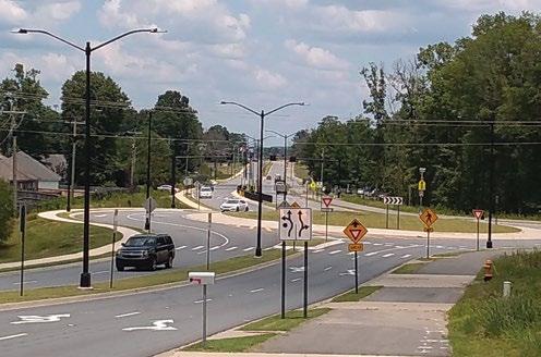
Two roundabouts were added to Highway 365 near Hendrix College and have improved traffic flow and safety at these intersections. This design has seen success throughout the region.
Sherwood was designed
South Central Arkansas Transit provides limited transit service within Saline and Lonoke Counties, but does not participate in Metroplan.
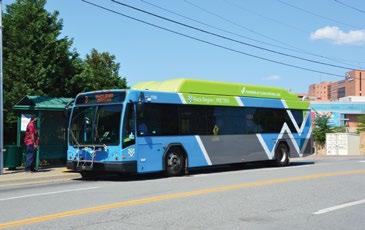
In 2015 Rock Region METRO began an ambitious program to convert its fleet to Compressed Natural Gas.
Rock Region METRO will begin providing Van Pool services in Central Arkansas in 2019.
T R ans IT
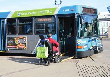
In 1995, the Central Arkansas Transit Authority (now Rock Region METRO) was a struggling agency operating one of the oldest bus fleets in the country. To assist with modernizing the fleet, Metroplan designated its entire first year budget (STP Attributable funds) to purchasing new buses for the agency.
In the 25 years since, Rock Region METRO has taken on the formidable task of modernizing its facilities and operations, and transformed itself into a modern public asset.
Progress Made
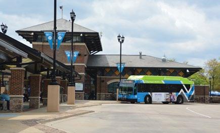
Preserving and maintaining existing bus service was central to the METRO 2020 transit plan. Rock Region has strived to maintain its service area, making critical route adjustments to increase efficiency. River Cities Travel Center, a transfer center in downtown Little Rock, was completed in 2000. A transit oriented development is in the works. Its bus fleet is being converted to compressed natural gas, and technology now allows riders real time bus location and scheduling information. In 2015, the agency rebranded itself as Rock Region METRO to reflect this transformation.
The Metro Streetcar was built to connect the Little Rock and North Little Rock downtowns. The streetcar has proven to be a catalyst for downtown development.
Missing the Mark
Despite these improvements, transit has been unable to fulfill the transportation role envisioned in the plan.
Successful transit depends on political support for funding and supportive land development patterns. Political attempts to secure dedicated regional funding so far have failed, preventing the implementation of higher-end transit service. Second, the bulk of population growth has occurred in lower-density and unconnected land developmement patterns which have trouble generating enough ridership to support increased transit service.
The METRO 2020 goals of more frequent daytime service as well as regional commuter service were not realized. However, with a dedicated funding source and supportive land development, a robust transit system is still a possibility for Central Arkansas.
Rock Region METRO’s Annual Ridership
500,000 1,000,000 1,500,000 2,000,000 2,500,000 3,000,000 3,500,000 4,000,000
Source: The National Transit Database (NTD)
Rock Region METRO’s ridership has fluctuated the last 20 years, but currently carries 2.2 million riders annually. Ridership declined massively in 2003 because of decreased local funding and service reductions. METRO 2020’s goal of frequent 30 minute daytime transit service remains unmet. 1997 3,795,976
Rock Region METRO’s Service Area
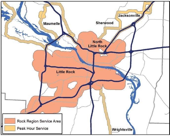
Rock Region METRO serves a limited area of the region with regular and peak hour service; however, local transit remains confined to Pulaski County. Transit for regional commuting, envisioned in Metro 2020, remains elusive.
KEY TAKEAWAY
Rock Region METRO has modernized its bus fleet and facilities, but has yet to obtain consistent, dedicated funding to increase bus frequency and expand into the greater region.
Rock Region METRO has actively promoted transit oriented development along key routes and in the vicinity of the River Cities Travel Center.
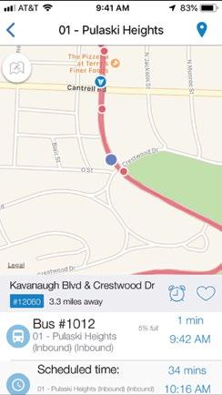
Rock Region’s METROtrack app provides realtime arrival information for the public transit system buses and streetcars.
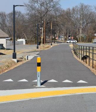
w alk I ng and b I k I ng
Although it’s difficult to fathom today, prior to 25 years ago Central Arkansas showed little interest in developing pedestrian or bikeway networks.

In 2012, with Metroplan’s assistance, 11 entities signed a Memorandum of Understanding to improve and support the Arkansas RiverTrail.
The Arkansas River Trail and the Southwest Trail are central pieces of the regional bicycle plan. Metroplan now routinely produces a regional report on pedestrian and bicycle crashes. This report is seen as the standard for the state.
Some Useful Financial Terms
STP - Surface Transportation Program. Funds given by the Federal government for surface transportation.
TAP - Transportation Alternatives Program. Federal funds which are specifically designated for non-highway uses—generally trails, sidewalks, pedestrian bridges, noise barriers and other miscellaneous uses.
METRO 2020 recognized the potential of pedestrian and bicycle networks for economic development and quality of life. Since 1995, there has been a groundswell of public interest which has helped spur construction of pedestrian and bicycle infrastructure. This transformation cannot be attributed solely to METRO 2020, but it is hard to imagine how the changes would have happened without the plan’s influence.
Progress Made
METRO 2020 did not identify individual projects, but instead set aside $1 million annually for enhancement projects. This has been accomplished by Metroplan with the Transportation Alternatives Program (TAP) and the Surface Transportation Program (STP). TAP funds distributed by ArDOT to local communities contributed to the expansion of the Central Arkansas non-motorized transportation network.
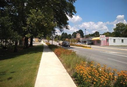
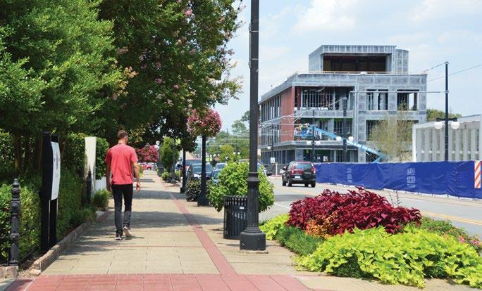
Additionally, the regional cross sections called for including pedestrian and bike facilities as part of roadway improvement projects and their incorporation into city Master Street Plans. Sidewalk construction is now routinely included in roadway projects. Neighborhoods have been re-invigorated and made safer with sidewalks to enhance “soft” quality-of-life measures like wellness and social connectivity.
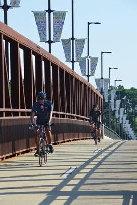
After METRO 2020 was adopted, Central Arkansas quickly went from just one adopted bike plan (Conway) to six; thereafter, cities began to build multi-use trails and bicycle lanes. Today the region boasts 70 miles of bike lanes and over 90 miles of multi-use trails, most added since 1995. Conway, Little Rock, and North Little Rock are recognized by the League of American Bicyclists as bicycle-friendly cities. Additionally, the region has received national accolades for the Big Dam Bridge and the proposed Southwest Trail. Yet those projects represent only a small portion of the active transportation infrastructure made available since 1995.
Missing the Mark
Despite their popularity, pedestrian facilities have shown only limited measurable impact on land use and travel patterns. While trails and sidewalks are useful, their impact would be greater in a more comprehensive system that makes local- and regional-level connections.
Another obstacle was the retrofitting of prior infrastructure. Whereas new neighborhoods are being build with adequate pedestrian facilities, often the adjacent infrastructure lacks the connection to nearby activity centers to make walking and cycling a viable option.

Although great for recreation, many trails are accessed only by car because of limited connections to neighborhoods. This hinders our trails from becoming an avenue for alternative transportation.
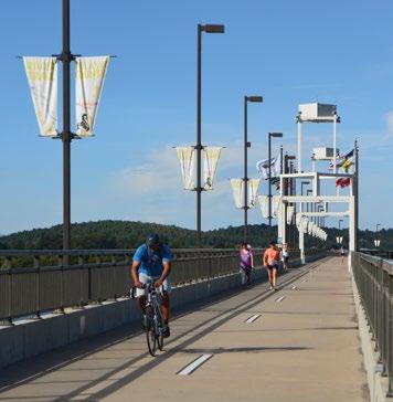
The Two Rivers Park Bridge is one of the most popular bike ped bridges in Central Arkansas. Then-US Secretary of Transportation Ray LaHood participated in the grand opening in 2011.
DRAFT
Stone Dam Creek trail, in Conway, now connects residents across busy Dave Ward Drive to commercial areas and UCA. Federal TAP funding from Metroplan and ArDOT contributed to the project’s construction.
KEY TAKEAWAY
Cycling and walking opportunities have greatly expanded through the creation of local trails and sidewalks. While many areas are now benefiting from their inclusion, regional connectivity remains inadequate for an interurban network.
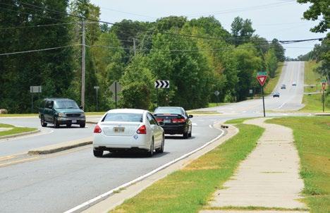
Efforts toward complete streets have manifested in projects such as Reynolds Road enhancements in Bryant.
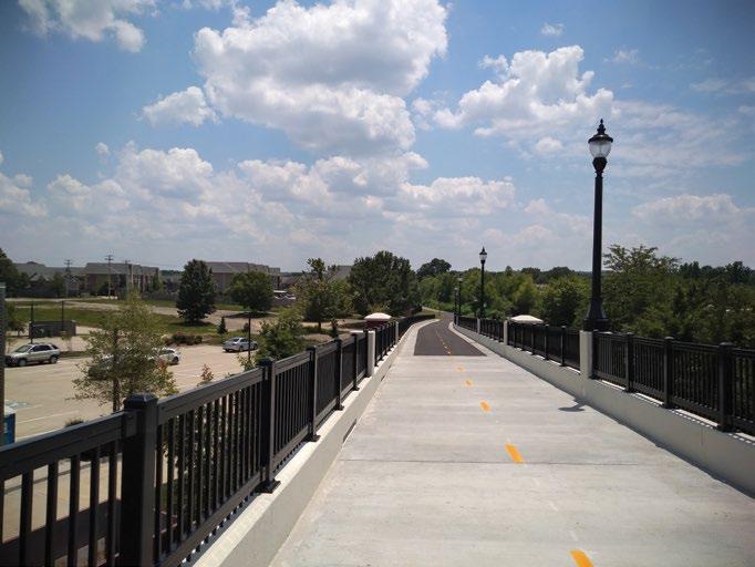
New neighborhoods are fitted with sidewalks in much of our region. However, more connectivity between these areas and activity centers must be achieved. The Magness Creek Bridge in Cabot connects the neighborhood to the school.
T R anspo RTaTI on + l and u se and d evelopM en T
METRO 2020 recognized the close link between land use and transportation. It aimed to provide more transportation choices, including increased transit and enhanced pedestrian and bike connections. The plan aspired to nudge land use priorities toward better interconnection with multiple transportation options.
1. Develop region-wide growth policy.
2. Preserve undeveloped land, open spaces, agri-land, and steep slopes.
3. Focus growth where facilities are in place.
4. Develop urban core and nodes linked by transportation.
5. Region-wide mixed-use transit-ready development.
6. Develop parkways and commuter transit with plentiful bikeways, sidewalks.
METRO 2020 included land-use recommendations for developing mixed-use urban nodes with higher development densities. It recommended linking land development with public infrastructure planning, preserving the urban core, and conserving rural land. Local buy-in was crucial because cities are the primary regulators of land development.
Progress Made
Diversified transportation options—Communities have adopted policies to incorporate bike and pedestrian transportation features into new developments. The majority of cities now require sidewalks for new projects, while several have constructed sidewalks in older places around the region. Rock Region METRO provides a reliable and technologically advanced alternative for commuters within Pulaski County.
Innovative land use and development practices—In some locations, codes have evolved to allow a mix of land uses and building styles that had been legally forbidden for decades. Neighborhoods such as Conway’s Hendrix Village and Park Avenue in Little Rock have developed in coordination with these zoning changes. The Arkansas River Trail, with its 18-mile loop, helped generate the private Rockwater Village project just west of downtown Argenta in North Little Rock. These and other nodal trail and mixed-use developments are beginning to offer an alternative land use model. Summarized
Prior to 2008, cities were continuously annexing far from their core areas. With expansions, population density falls, stretching expensive city infrastructure and creating a reliance on vehicles with few other options for regional commuting.

Several downtown neighborhoods in our larger cities have burst with activity since METRO 2020. Argenta, in North Little Rock, has come a long way since the 1990s and continues to shine with several new developments.
Conway set the stage for New Urban development with Hendrix Village. This development has inspired similar projects around the region.
Missing the Mark
Despite best practices, model developments, and revitalization efforts, METRO 2020 failed to comprehensively change the region’s transportation and land use practices. The previous broad trends in land development have continued and spread across the region to accommodate new population growth.
Autos are still a must. More miles are driven, commutes are longer, and non-auto modes have not gained traction. Residents are even more reliant on their vehicles than they were in 1995. Cities are still developing with low densities and poorly-connected street patterns. The increasing distance virtually dictates car use. Developments typically provide limited street options that discourage bicyclists and walkers from using the few routes that do offer through connections. As traffic is forced onto major roadways, a cycle is created, in which cities devote increasingly large chunks of their budgets to widening streets, and the state invests more dollars into widening highways and freeways.
Simple Truths: METRO 2020
METRO 2020 outlined a livable and efficient region by maximizing mobility and minimizing adverse transportation effects while linking transportation with land use and development. Select communities have employed fragments of METRO 2020’s land use recommendations, but these local successes have been insufficient to show tangible region-wide impacts. The pace of annexation and outward development has slowed somewhat in response to economic and demographic shifts since the Great Recession of 2008–2009. Yet without major change in land use policy, the march of the region’s prior low-density and poorly-connected development will continue.

KEY TAKEAWAY
Local land development practices continue to perpetuate a growth pattern that hinders alternative transportation modes, and doubles down on expensive roadway widenings.
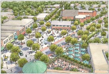
Jump Start projects, like the Levy Neighborhood above, attempt to meld land use and transportation best practices suggested in Metro 2020. Metroplan selected five neighborhoods to be fitted with new zoning and a catalyst infrastructure project.
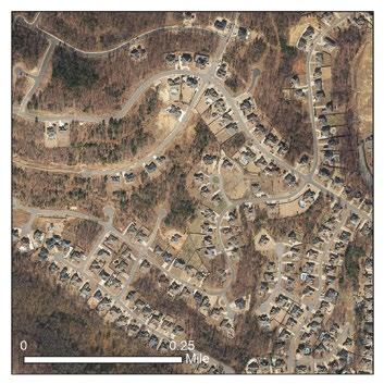
Older Central Arkansas neighborhoods (like Hillcrest, pictured at left) were built before design was auto-centric, and are closer to Metro 2020’s land use recommendations. New development (such as Maumelle, pictured at right) typically features circuitous street patterns and cul-de-sacs which serve pedestrian, bike and transit options poorly, leaving far less connected sprawling communities.
METRO 2020’s successes can be illustrated by projects Metroplan either directly funded or participated in, including the following:
• New railgrade separations
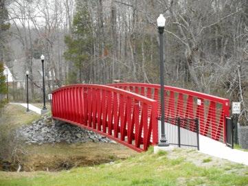
• Big Dam Bridge
• Two Rivers Park Bridge
• Arkansas River Trail System
• White Oak Bayou Bridge
• River Rail Streetcar
• Jimmerson Creek Bridge
• Enhanced River Market
• Enhanced sidewalk coverage
• Downtown pedestrian bridges
• Bike trails/bike lanes
• Bike racks on buses
• New Rock Region METRO bus fleet
• Short- and long-term Transit Plan
• Median divided roadways
• Roundabouts
• Enhanced residential development
• Argenta Arts District
• Access managed roadways
• Jump Start
• Downtown Benton and Conway
a C h I eve M en T s
The metropolitan landscape now includes visible evidence of METRO 2020’s numerous success stories. Its adoption clearly influenced the design and selection of regional transportation projects.
Efforts made toward bicycle, pedestrian and transit network development will have lasting impacts on Central Arkansas. METRO 2020 championed the expansion of sidewalks and their inclusion in roadway projects and a constantly evolving regional bicycle network—both critical pieces of multi-modal transportation. Rock Region METRO has modernized its fleet, enhanced it bus stops and transfer center, and provided users an experience that is attractive to a new generation. It is now possible to live in areas of Central Arkansas that provide abundant travel options envisioned in the plan.
The Regional Arterial Network has proven effective in prioritizing federal funding and enhancing economic development. Through the use of modern technology, innovative intersection design, and strategic investments, this network is being operated more efficiently every year. New railroad overpasses resulting from early and meaningful public involvement may be METRO 2020’s crowning achievement. Neither should freeway expansion and interchange improvements be overlooked as important elements of METRO 2020. ArDOT has been an important funding partner on the Regional Arterial Network, the railroad overpasses, and interchanges.
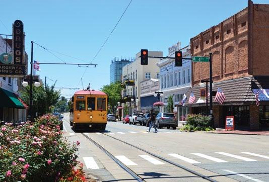
The past 25 years have also proven that “New Urbanist” style developments, touted in the plan, can succeed in Central Arkansas. Launched in 1995, Little Rock’s River Market redeveloped by leveraging public and private interest and investment. By 2019, the trend was flourishing in neighborhoods throughout the region, most visibly the Argenta Historic District in downtown North Little Rock and Hendrix Village in Conway. Jump Start projects from Metroplan emphasize this design. Other developments are at least partially embracing New Urbanism by incorporating some of its techniques. Metroplan has assisted with the transformation of these areas by leveraging projects that support land use reform. As an example, Hendrix Village benefited from roundabouts, a landscaped median, and new sidewalks on Harkrider Street funded in part by Metroplan. Such a design configuration did not exist in the region prior to METRO 2020.
METRO 2020 demonstrated a willingness to rethink transportation and development priorities. This had definable results, which included numerous roadway and intersection redesigns, access management provisions, burgeoning mixed-use, pedestrianfriendly neighborhoods, and the demand for new trails, sidewalks, and bike-ways. These trends continue; it is hard to imagine reverting to pre-METRO 2020 practices.
I M ped IM en T s To I M ple M en TaTI on
There were also disappointments with METRO 2020. These stemmed from the context in which it was developed: (1) new federal transportation authority and (2) willingness of the Metroplan Board to innovate its planning process.
Like any legislation, ISTEA could not be fully understood until it was put into practice. In theory, ISTEA put more power behind local authorities to use federal transportation funding as they saw fit. When METRO 2020 was being launched in 1992–1995, it seemed possible that state, metro-level and local needs could be worked out within the Metroplan framework.
In practice, transportation spending for Central Arkansas was driven primarily via the project selection process for the state. Recommendations from the Metropolitan Transportation Plan are provided for consideration, but some projects emerge from outside it. Rock Region METRO looked on the transit vision for fixed guideway as an unrealistic dream, while the agency struggled just to maintain current service. In practice, Metroplan retained control of only a fraction of transportation expenditures in the region with limited ability to influence other funding decisions.
Arkansas Federal Transportation Spending
Central Arkansas Federal Transportation Spending
ArDOT
Metroplan
ArDOT Metroplan Rock Region METRO/Conway
Local governments faced their own challenges. Suburban cities like Conway, Bryant, Cabot, Benton and several smaller cities were growing at very fast rates, and political pressure was strong for wider, better roads. Cities and counties tapped the limited federal funds for widenings and capacity improvements to address congestion in these communities. Transportation investments in older areas of towns desiring redevelopment were limited.
The transportation plan includes both funded and unfunded projects. Projects for the 25 year timeframe came from existing revenue sources and were primarily road projects. Visionary elements, such as a major transit expansion, depended on new funding sources that never came or had a longer implementation timeframe. The public’s misunderstanding of this difference added to confusion when projects were selected for the TIP.
Implementing the vision depended upon a radical re-thinking of land use practices at the local level. While some practices recommended in Metro2020 are now common in communities across the country, in 1995 they required considerable effort and political expenditure to implement. Communities’ unwillingness to embrace other suggestions was in part due to entrenched development practices that allow developers to achieve a predictable return on investment through auto-centric neighborhoods. The perceived success of the existing land development model, combined with the relative lack of regional examples of walkable mixed-use development, meant that there was little public awareness of or demand for alternative development practices.
Rock Regin METRO/Conway Transit
Source: Central Arkansas 2050 Fundmarks
Source: Central Arkansas 2050 Fundmarks
While the plan covers all federal transportation spending, Metroplan directly controls only 11% of the estimated federal transportation spending in the region.
In 2019, a typical year, Metroplan received $11.4 million in sub-allocated STP funds. It also received $731,000 in TAP funds, money often used for pedestrian projects.
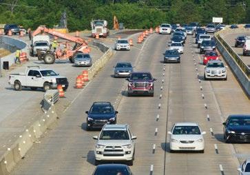
The Big Rock Interchange and widening of I-630 become reality while Rock Region METRO has yet to secure new funds to improve and expand service.
l essons l ea R ned
KEY TAKEAWAYS
1. Engage the public earlier, more often, and meaningfully –not only during development, but especially after plan adoption.
2. Awareness of regional goals must extend to local councils and commissions.
3. Cities must commit to local policies that support regional goals.
4. Funded projects should closely align with the long-term vision, even if driven by immediate need.
5. Metroplan cannot mandate. All regional partners must embrace a genuinely collaborative spirit to achieve any vision.
METRO 2020 acted as the first step toward a future that would take much longer than 25 years to achieve.
The success of METRO 2020 is in the eye of the beholder. You can point to specific failures as evidence that the region fell short of a bar set high. Or you can see foundational changes that are beginning to impact the region and point to the many projects shaped by the plan. The key is to learn from both successes and failures and apply those lessons to future endeavors.
Public involvement in METRO 2020 had immediate impacts on Central Arkansas. Widespread support for METRO 2020 was as influential as the plan itself on transportation projects and land development. Obtaining public support and building diverse coalitions remains critical to the implementation of any planning effort.
What METRO 2020 advocated was nothing less than a paradigm shift in the way we think about land use. It will take time to overcome the decades of momentum of current auto-centric land development and turn the region toward more sustainable and efficient practices. Transformative change must start with city councils and planning commissions, who are responsible for local land use decision making. Future planning efforts must include and educate local officials to make these critical changes.
Where METRO 2020 focused on long term, the short-term drove project implementation. Needed short-term projects were to be constructed by design standards aimed at fulfilling the vision. While general project design currently retains many standards, Metroplan ultimately abandoned others. Combined with the lack of transformation mentioned above, progress toward the vision slowed. For all the careful attention given to METRO 2020 development, an even more vigorous effort is required to implement it.
Although Metroplan is responsible for regional planning, it directly controls only a small percentage of the metro’s transportation expenditures. For the metropolitan planning process to be effective it must be cooperative and reflect goals agreed upon by Metroplan member cities, counties, ArDOT, and Rock Region METRO. Metroplan must recognize concerns raised by partners and address them quickly; equally, the role of the MPO and the long-range plan should be fully recognized in others’ planning efforts. The Long-Range Metropolitan Transportation Plan must receive the support of all stakeholders and a commitment to jointly work toward its implementation.
A New Horizon
As the sun sets on METRO 2020, a new horizon emerges. We express gratitude to visionary leadership which carried METRO 2020 forward, and recognize its positive impact.
We encourage you to envision the future of Central Arkansas. Be part of that process and help shape our future by sharing your ideas and hopes as we plan for a better tomorrow.
Railroad overpass in Jacksonville
A small sample is shown here.
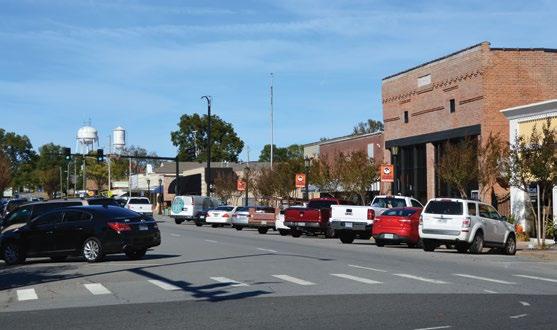
Streetscape in Benton
Alcoa Road in Benton
River Rail Streetcar in North Little Rock and Little Rock
Levy Trail in North Little Rock
Big Dam Bridge
Main and Harris roundabout in Jacksonville