


This plan fulfills Resolution 20-05 of the Metroplan Board of Directors dated February 26, 2020.
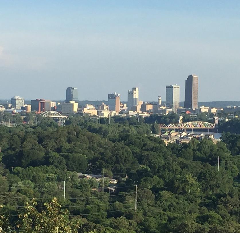
In February 2020, Metroplan, the Metropolitan Planning Organization for Central Arkansas, set a strategic target of $55 million to plan, design, and build a network of regional multi-use bicycle and pedestrian greenways throughout its four-county jurisdiction. The vote was unanimous, indicating that community leaders in Pulaski, Faulkner, Saline, and Lonoke counties understand the economic, social, and physical impact that an investment in active transportation will make on the Central Arkansas region.
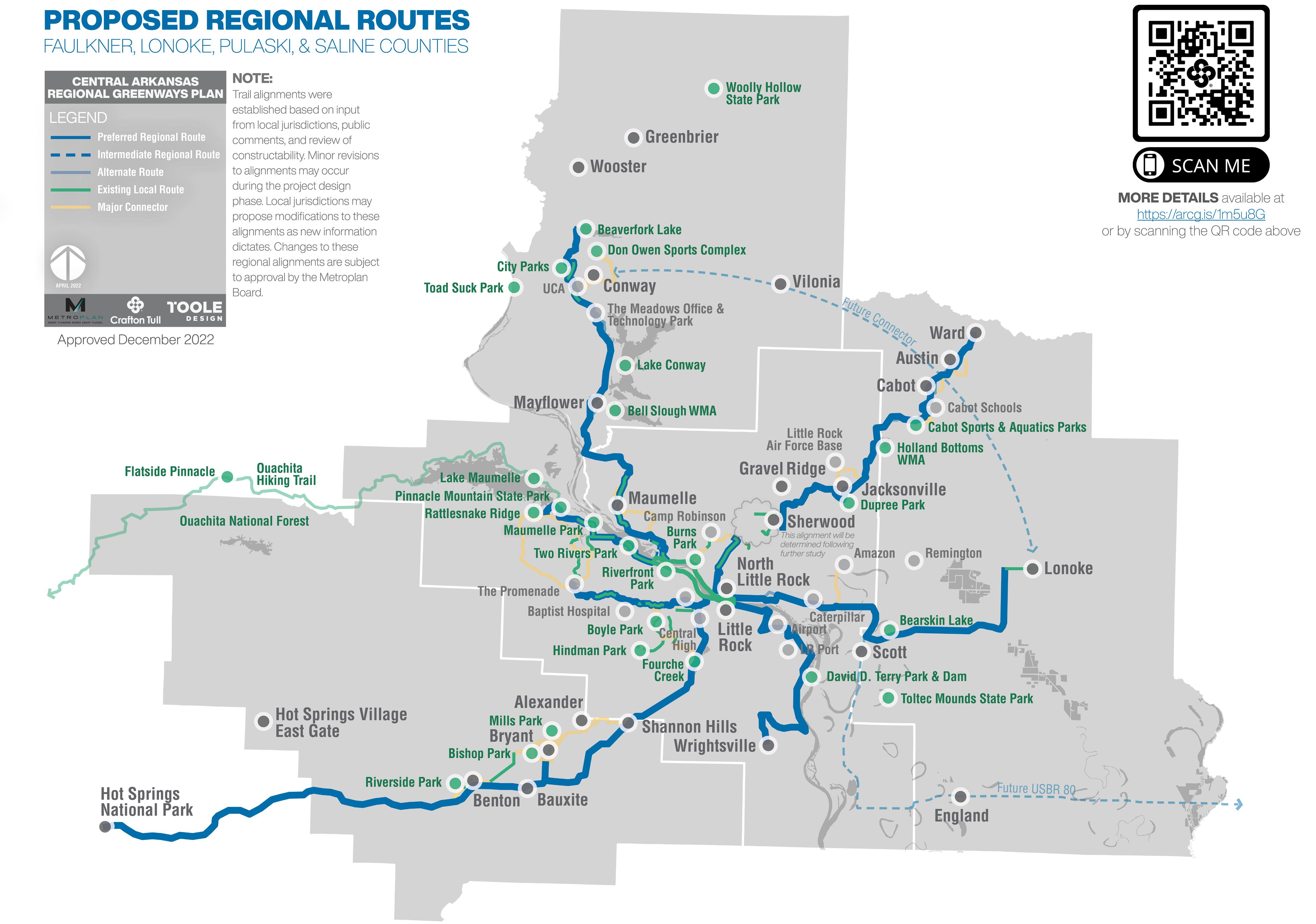
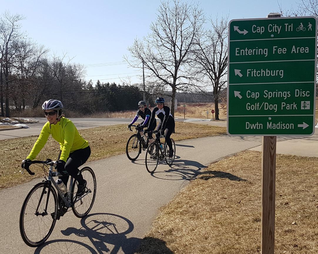
The result of extensive collaboration with nearly every community within the Central Arkansas Regional Transportation Study (CARTS) area, the Central Arkansas Regional Greenways Plan establishes active transportation, bicycling and walking, as a viable means of alternate transportation for all residents, along six corridors:
» Central Beltway Corridor: connecting east and west Little Rock
» East Corridor: from North Little Rock to Lonoke
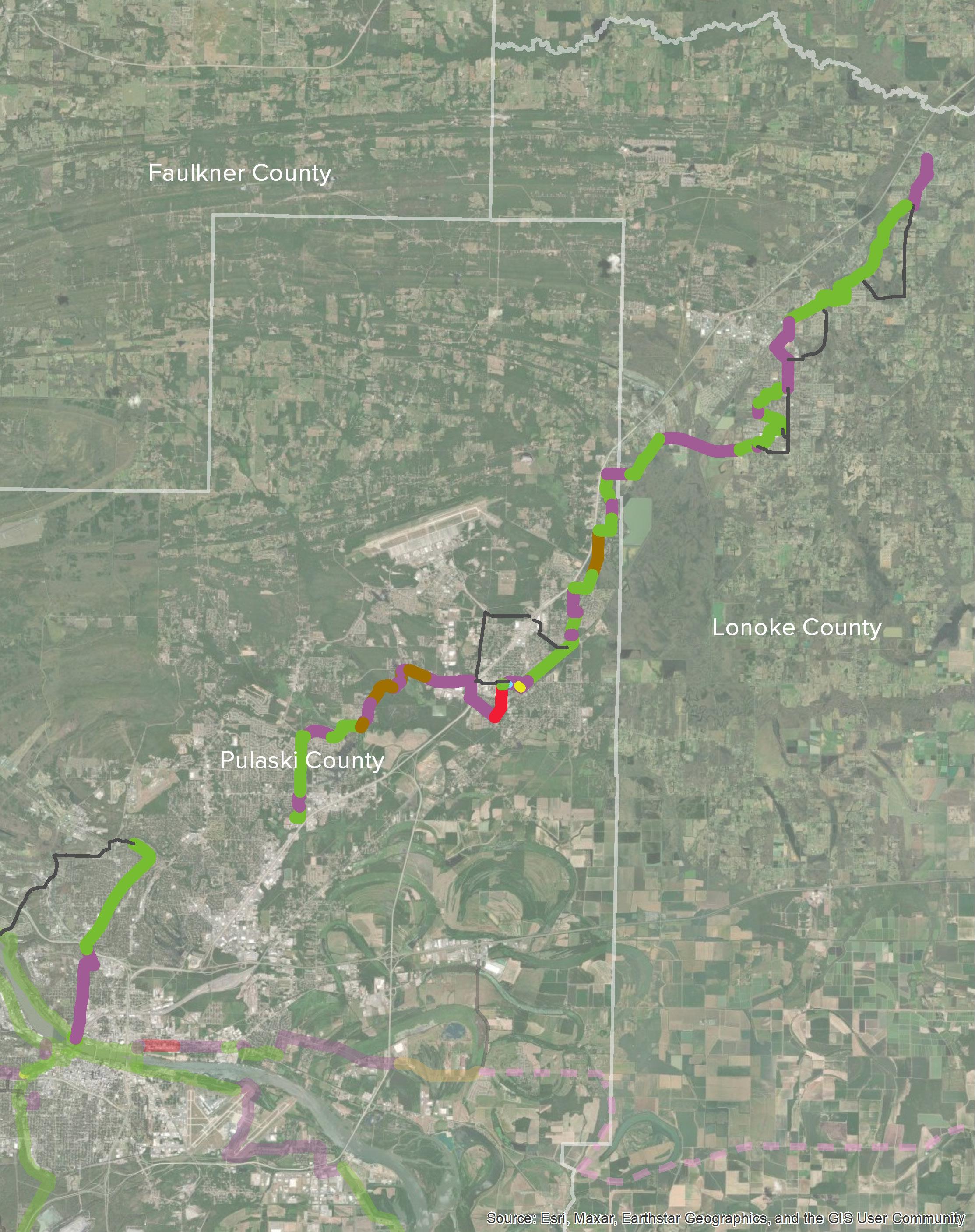
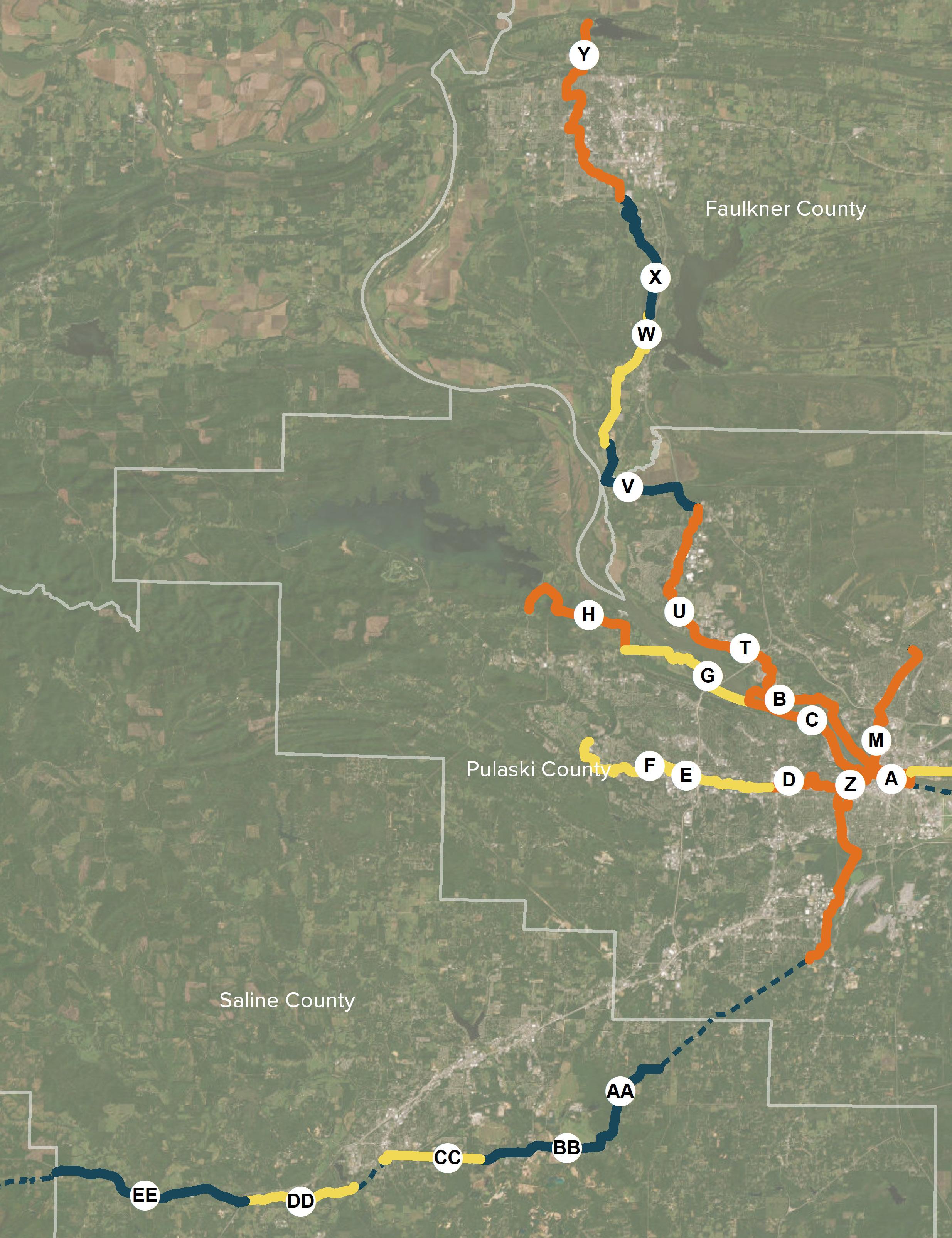
» Northeast Corridor: from North Little Rock to Ward
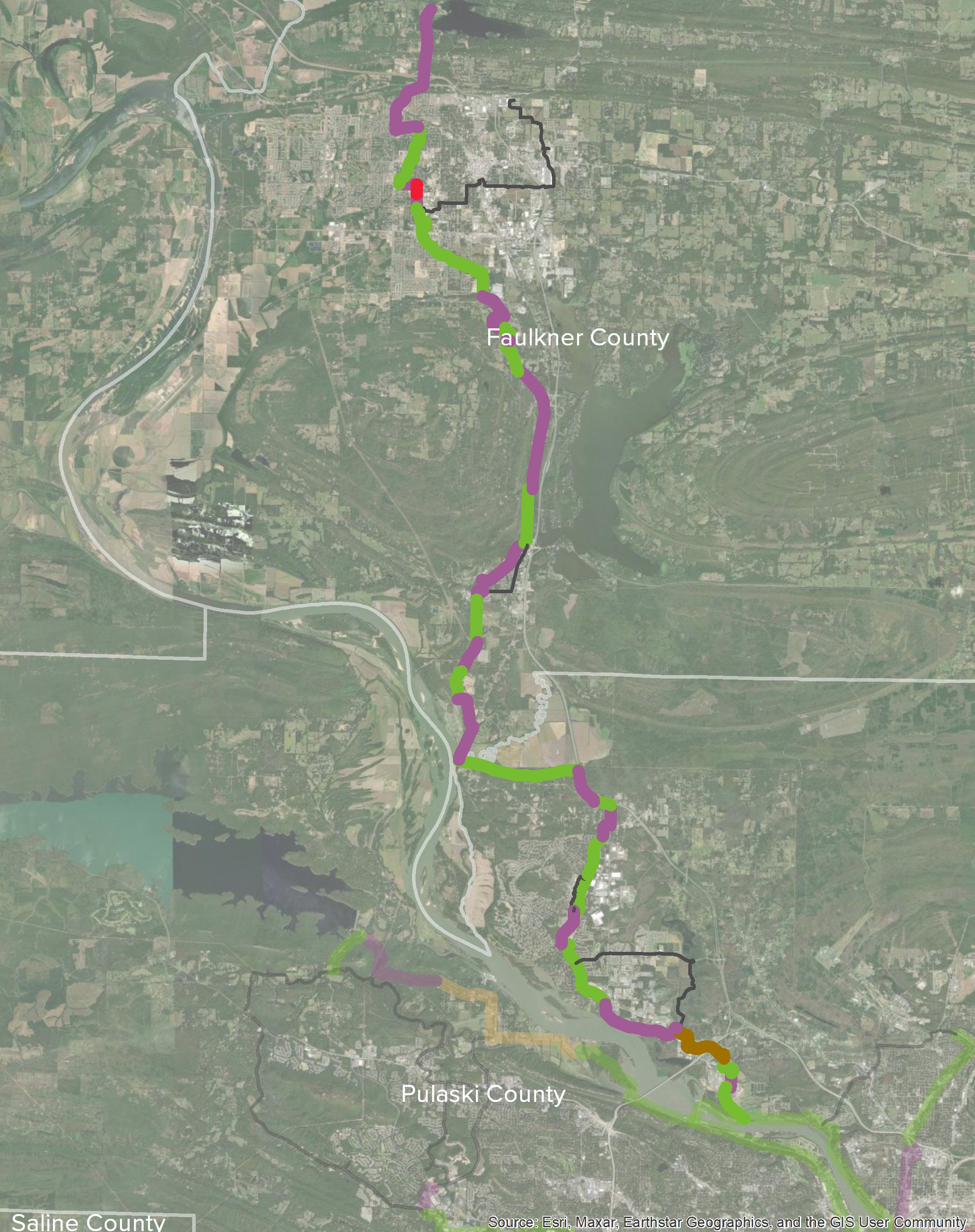
» Northwest Corridor: from North Little Rock to Conway
» Southwest Corridor: from Little Rock to Hot Springs (incorporated from previous planning)
» Southeast Corridor: from Little Rock to Wrightsville
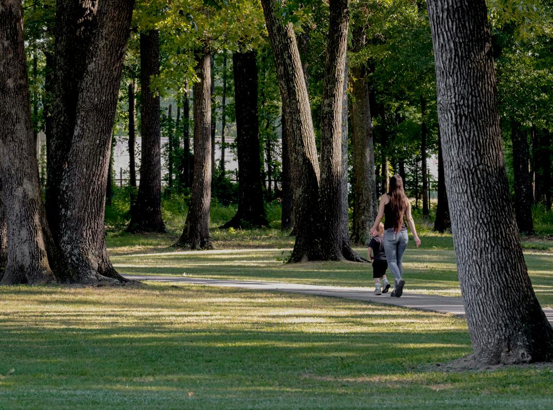
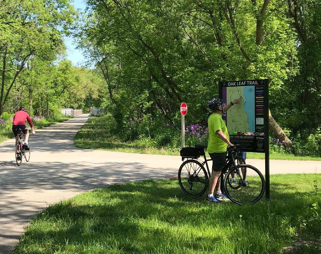
Active transportation is low-cost, sustainable, and has been proven to enhance quality of life, economic vitality, health, and equity in many cities in the U.S.
To make consistent routing decisions, eight desired guiding principles were defined. These principles reflect the location, purpose, physical characteristics, design intent, context, and social benefits that each route should provide to the user. In turn, each route and the network as a whole abide by these principles to create a cohesive experience throughout.
TRANSPORTATION-FOCUSED
Central Arkansas greenway routes will be viable alternate transportation options.

PHYSICALLY SEPARATED
Central Arkansas greenway routes will be physically separated from vehicular traffic to the greatest extent possible in order to accommodate a variety of users and maintain bicycle and pedestrian comfort.

Central Arkansas greenway routes will prioritize user safety by minimizing conflicts with automobiles, increasing user visibility in areas of uncertainty, and providing appropriate accommodations for emergency situations.

Central Arkansas greenway route facility types will adjust according to the challenges of the built and natural environment.

Central Arkansas greenway routes will be inclusive and equitable for a diverse range of users.

Central Arkansas greenway routes will be consistent in routing approach, priorities, assumptions, and design, creating a clear distinction from local bicycle and pedestrian paths.

Central Arkansas greenway routes will be planned, designed, and constructed according to best practices considering national standards and regional influences in order to deliver a high-quality system.

WELL-CONNECTED
Central Arkansas greenway routes will be well-connected to centers of population and relevant destinations, including public and private amenities and services.
Route selection is a repeated process of navigating tradeoffs, some measurable, some intuitive. Measurable tradeoffs are quantified by geography, estimated construction cost, number of destinations, or population served by the trail. For each of these factors, there are intuitive tradeoffs more qualitative in nature, including user comfort, experience, character, and access. These relationships are complex, and achieving a balance between these quantitative and qualitative tradeoffs is vital to achieving routes that are both practical as well as enjoyable.
Directness: Routes should be reasonably direct between jurisdictions or destinations.
Destinations: Routes should be relevant, connecting people to where they need or want to travel.
Population: Routes should serve centers of population to maximize proximity to route users.
Feasibility: Routes will vary in ease of implementation, dependent on ownership or jurisdiction, opportunity, constructability, and environment.
Experience: Routes should provide an enjoyable user experience, sometimes the less direct alignment between two points. Topography, views, and ease of navigation should be considered.
Access: Routes should have visible access via trailhead locations, wayfinding, and user orientation.
Character: Routes should highlight unique landscapes or cultural assets and integrate public art.
Comfort: Routes should provide high levels of comfort (appropriate widths and space designation), and amenities such as lighting, shade, benches, water, and restrooms.
Source: Crafton Tull
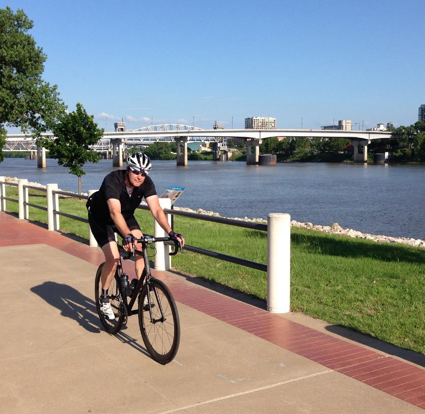
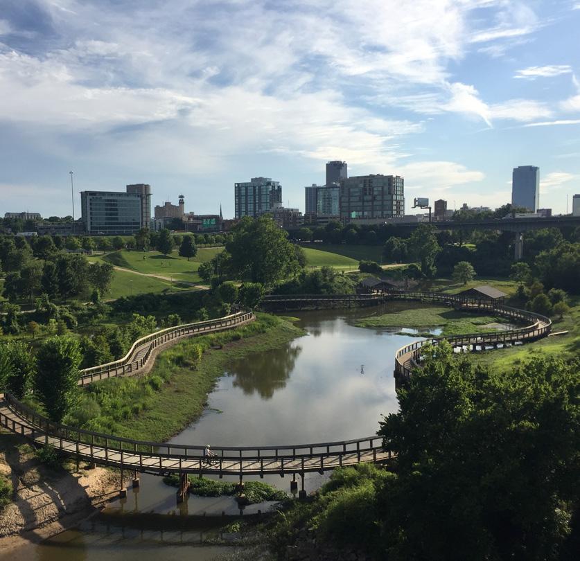
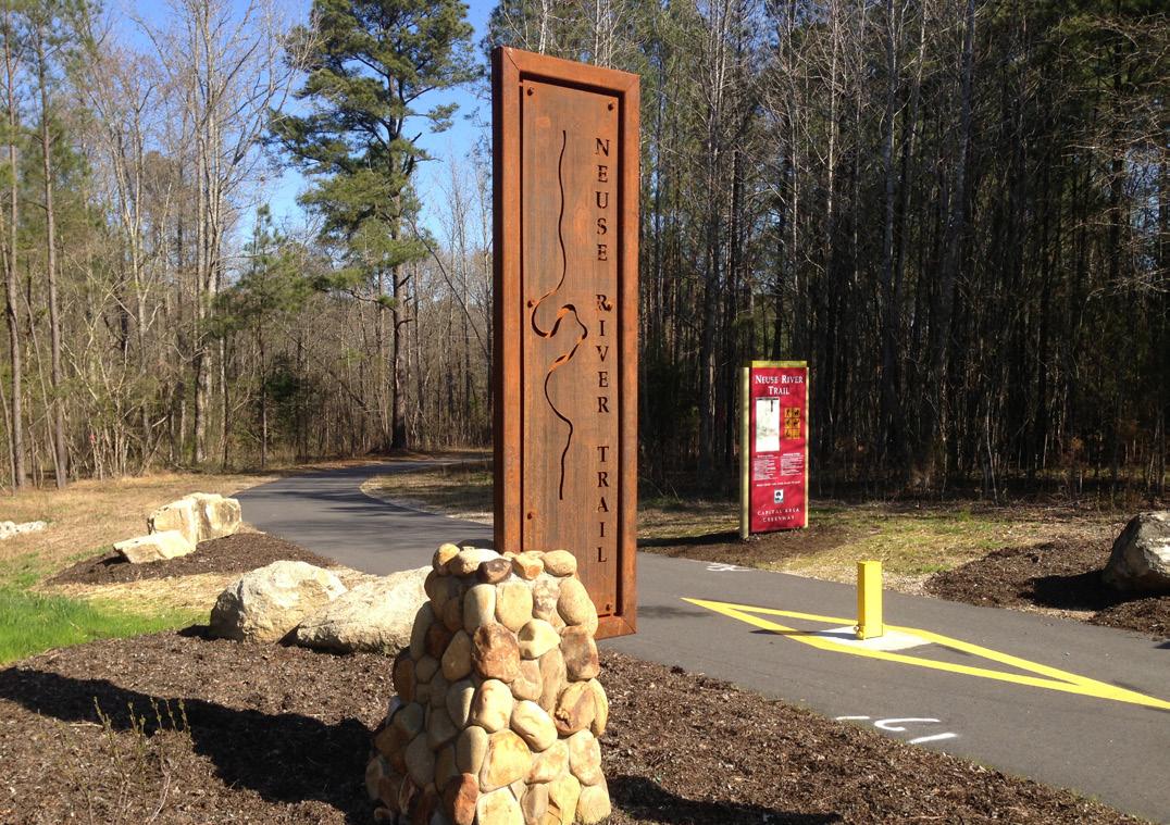
The establishment and implementation of regional routes is the focus of the Central Arkansas Regional Greenways Plan and Metroplan. These routes will safely connect communities in Central Arkansas with scenic and direct sidepaths and trails, while adhering to the guiding principles for route selection.
These routes are the primary connections between communities throughout Central Arkansas; the spine from which local bicycle and pedestrian infrastructure should connect. They should be physically separated from other modes of transportation and abide by the Guiding Principles, meaning that to the greatest extent possible, the system will be comprised entirely of either trails or sidepaths. Physically separated simply means that the proposed bike-ped facility is not one that places users in the same travel-way as vehicles. Within the entire regional network, approximately 83% is physically separated from roadway, 2% are a combination of protected bicycle facilities and sidewalks, and the remaining 15% are on-road shared bicycle facilities.
Multi-use trails are the preferred facility type, a 14’ wide paved path accommodating bicyclists and pedestrians usually following a stream or other natural easement. A sidepath retains the exact same physical design as a Multi-Use Trail, but rather follows the alignment of a roadway with a 3-10’ buffer located between the two.
A cycle track , also known as a Two-Directional Buffered Bicycle Lane, resembles an on-street version of a sidepath but only accommodates bicyclists. Paint provides horizontal separation between users and motorists, and bollards, curbs, or other physical delineators provide vertical separation within the painted area. Since Cycle Tracks are intended for use by bicyclists, pedestrians are accommodated by an adjacent sidewalk. Less than two miles of this configuration are proposed in the network.
Refer to the full report document, or pages 29-35 of this document, for more information about facility types.
In some cases, notable secondary connections exist within the network. These connections, referred to as Major Connector Routes, recognize important local initiatives that can further extend the reach of Regional Routes to local populations. While not the focus of this plan, such connections are included for context. Each jurisdiction will determine final routes and facility types for their internal connections to the regional network. While some of these connections may be separated from vehicular traffic, Major Connectors may include additional facility types that are not suitable for Regional Routes, such as the following facility types.
Protected on-street facilities like buffered bicycle lanes function like standard bicycle lanes, with
one lane in each direction of vehicular flow, but feature vertical or horizontal separators, and in some cases, both. These increased safety measures allow buffered bike lanes to provide a higher degree of user comfort on busy roads.
Standard bike lanes are designated by striping and bicycle symbols to indicate to motorists their intended use and are best situated on roads with lower traffic volumes and slower speeds.
Shared-street facilities, such as “sharrows” may be utilized along quiet residential streets, or signed routes, rural recreation routes often located on appropriately-sized shoulders along state or county roads, may also be designated as Major Connectors but are not appropriate as Regional Routes.
This page intentionally left blank
The Central Arkansas Regional Greenways network measures approximately 222 miles in total length, connecting the Capital of Arkansas to communities in the four-county area and providing active transportation opportunities for all ages and abilities. The Southwest Trail is the longest route at just over 60 miles*, followed by the Northeast Corridor. The greenways traverse the vast, unique and beautiful landscapes of the region, with views of the highest peaks and the soothing sounds of rushing water present along every corridor.
Each corridor has further unique features. The Southwest Corridor, running from Little Rock to Hot Springs, is characterized by its long stretches of forest, making the most of its solitary location and offering cyclists and long-distance runners a peaceful, scenic experience. The Central Beltway Corridor, on the other hand, is constantly navigating among the oldest blocks of the City of Little Rock to newer developments in West Little Rock. It travels along Rock Creek for the majority of its second half, and will prove to be a popular route for those running errands as well as those seeking recreation.
The Northwest Corridor features some segments as beautiful, scenic and peaceful as the Southwest Trail, and areas as dense as Little Rock when the greenway enters Conway, having traversed rural and suburban communities from North Little Rock to its south. The Northeast Corridor, planned specifically to connect as many communities and destinations as possible between North Little Rock to Cabot and Ward, will become used by many children and young people to walk to school, and in some areas, people will even be able to walk to eat with friends at restaurants.
Finally, the East and Southeast Corridors function in a similar fashion in that a notable portion of their corridors are signed routes with critical separated facilities proposed in areas of dense population. Wrightsville has a sidepath proposed on Highway 365 to connect homes to important destinations along the Southeast Corridor, similar to the proposed sidepath on Washington Avenue on the East Corridor.
* The Southwest Trail from Central High School to Hot Springs measures 58.3 miles. Extending the trail to from Central High School north to meet the Arkansas River Trail results in 60.4 miles of length. The Southwest Corridor (as defined for this study) runs from the Arkansas River Trail to the Saline/Garland County Line measures 41.2 miles.


The Central Beltway Corridor connects east and west Little Rock, as its title suggests, primarily through its geographic center. In the east, the trail corridor terminates at Winston Faulkner Road near Highway 10 and the Arkansas River Trail, and terminates in the west at the Promenade on Chenal Parkway.
This route includes the extension of the Rose Creek Trail and utilizes existing trails along Rock Creek and I-630, both of which require upgrades to become a regional trail suitable for bicycle and pedestrian use. In addition, the Central Beltway includes the completion of the route from the Big Dam Bridge through Two Rivers Park to Pinnacle Mountain State Park.
Total Length
» 25 Miles
Existing Facilities
» Trail: 6.8 Miles
» Bike Lanes: 3.7 Miles
Proposed Facility Types
» Trail: 8.4 Miles
» Sidepath: 5.1 Miles
» Bike Lanes or Sharrow: 1 Mile
» Alley Conversion: 324 Feet
Notable Crossings
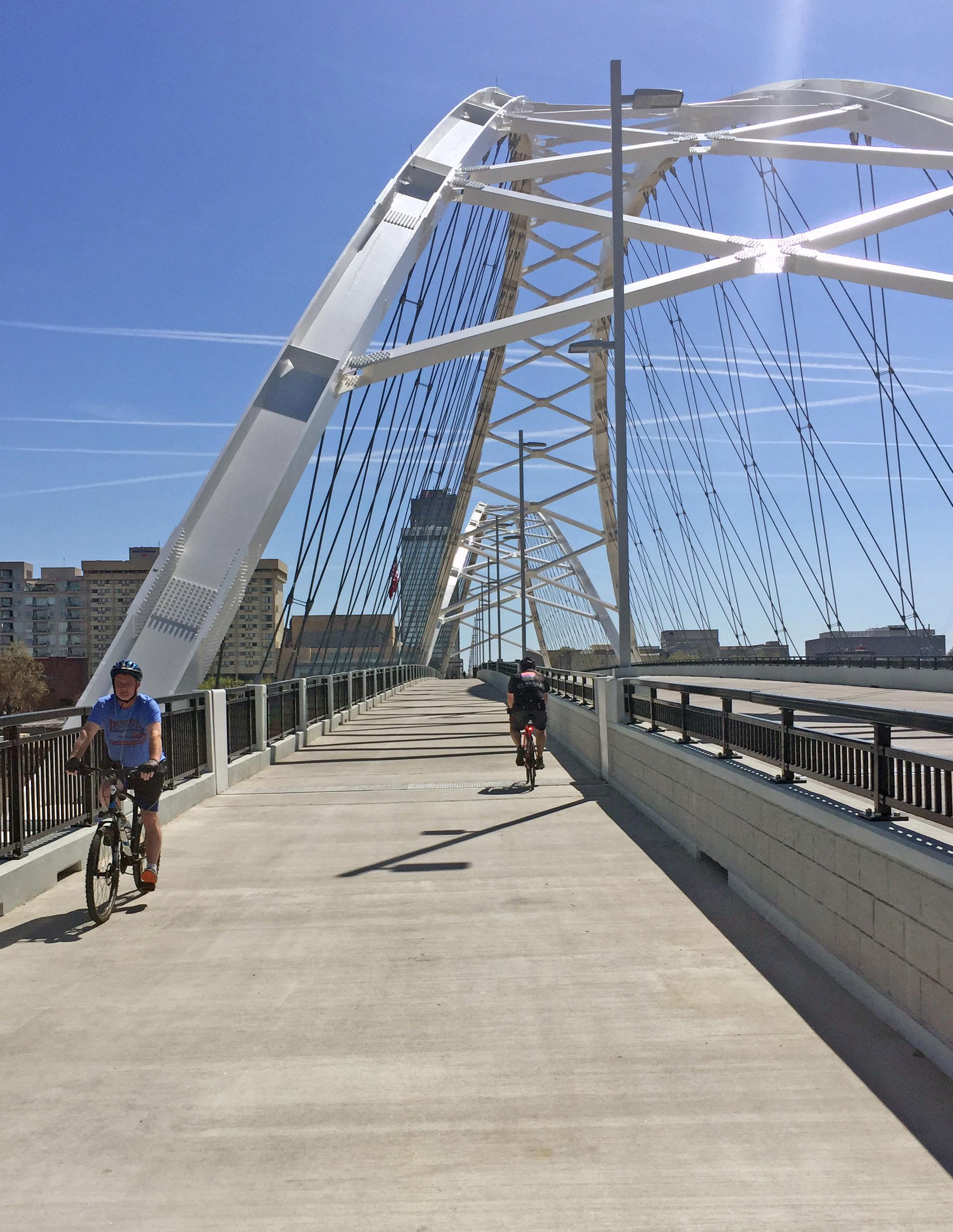
» University Ave: Bike-Ped Bridge
» I-430: Box Culvert Underpass
» Shackleford Rd: Box Culvert Underpass
» Bowman Rd: Box Culvert Underpass
» Existing Bridges (New Trail Underpasses): Cantrell, Markham, Pride Valley, Chenal, Kanis
Full report includes detailed segment information per corridor. “On-Road” refers to separated infrastructure (such as a sidepath) within a road right of way. “Off-Road refers to infrastructure located outside of a road right of way.
Preliminary Estimate of Probable Cost
»
» Crossings $6,551,500.00
» TOTAL $24,954,220.81
Facility Type
Trail
Trail - Boardwalk
Sidepath
Cycle Track
Bicycle Lanes
Sharrow
Alley Conversion
Signed Route
Major Connector

Beginning at the Arkansas River Trail south of the Northshore Business Park, the Northwest Corridor connects North Little Rock, Maumelle, Mayflower, and Conway. The second-longest route behind the Southwest Trail, the Northwest Corridor has the highest mileage of existing trail (7 miles), located in Maumelle and Conway.
A notable physical barrier on the Northwest Corridor is the convergence of Highway 365, Union Pacific Rail Line, and Palarm Creek at the Pulaski - Faulkner County border. Special attention will be required to cross Palarm Creek and underneath Highway 365 and the Union Pacific rail line as well as thorough collaboration.
Total Length
» 36 Miles
Existing Facility Types
» Trail: 6.8 Miles
Proposed Facility Types
» Trail: 9.9 Miles
» Boardwalk: 1.6 Miles
» Sidepath: 17.5 Miles
» Cycle Track: 0.22 Miles
» Salem Road (Conway): Bike-Ped Bridge
» Palarm Creek (Pulaski/Faulkner Co): Bike-Ped Bridge
» Existing Bridges (New Trail Underpasses): Crystal Hill Rd, I-430 at White Oak Bayou, Hwy 365 at Palarm Creek, Baker Wills Pkwy at Sturgis
Full report includes detailed segment information per corridor. “On-Road” refers to separated infrastructure (such as a sidepath) within a road right of way. “Off-Road refers to infrastructure located outside of a road right of way.
Preliminary Estimate of Probable Cost
Route alignment subject to further study
Exactalignment underfurtherstudy
Sidepath
Cycle Track
Bicycle Lanes Sharrow Alley Conversion
Major Connector
Moving north from the Arkansas River Trail at Pike Avenue, the Northeast Corridor connects North Little Rock, Sherwood, Jacksonville, Cabot, Austin, and Ward. Existing facilities include the sidepath along Pike Avenue and the Levy Trail, both of which are located in North Little Rock. This corridor traverses predominately urbanized areas and will provide alternative transportation opportunities through the heart of several communities. The route from Kierre Drive to Lantrip Road in Sherwood (Northeast Package 2) has been omitted, subject to further study.
Total Length
» 34.6 Miles
Existing Facility Types
» Trail: 2.9 Miles (Levy Trail)
Proposed Facility Types
» Trail: 14.7 Miles
» Boardwalk: 2.4 Miles
» Sidepath: 13.6 Miles
» Cycle Track: 0.8 Miles
» Sharrow: 353 Feet
» Alley Conversion: 611 Feet
» Hwy 321 over rail (Cabot): Bike-Ped Bridge
» Existing Bridges (New Trail Underpasses): Pershing rail at Pershing, 67/167 at Redmond Rd, Main St at S First St (Jacksonville), Hwy 38 (Cabot)
* Package 2 has been omitted until a final alignment is determined Package 3 has been funded and therefore not scored, prioritized, or placed into a tier
Full report includes detailed segment information per corridor. “On-Road” refers to separated infrastructure (such as a sidepath) within a road right of way. “Off-Road refers to infrastructure located outside of a road right of way.
Preliminary Estimate of Probable Cost
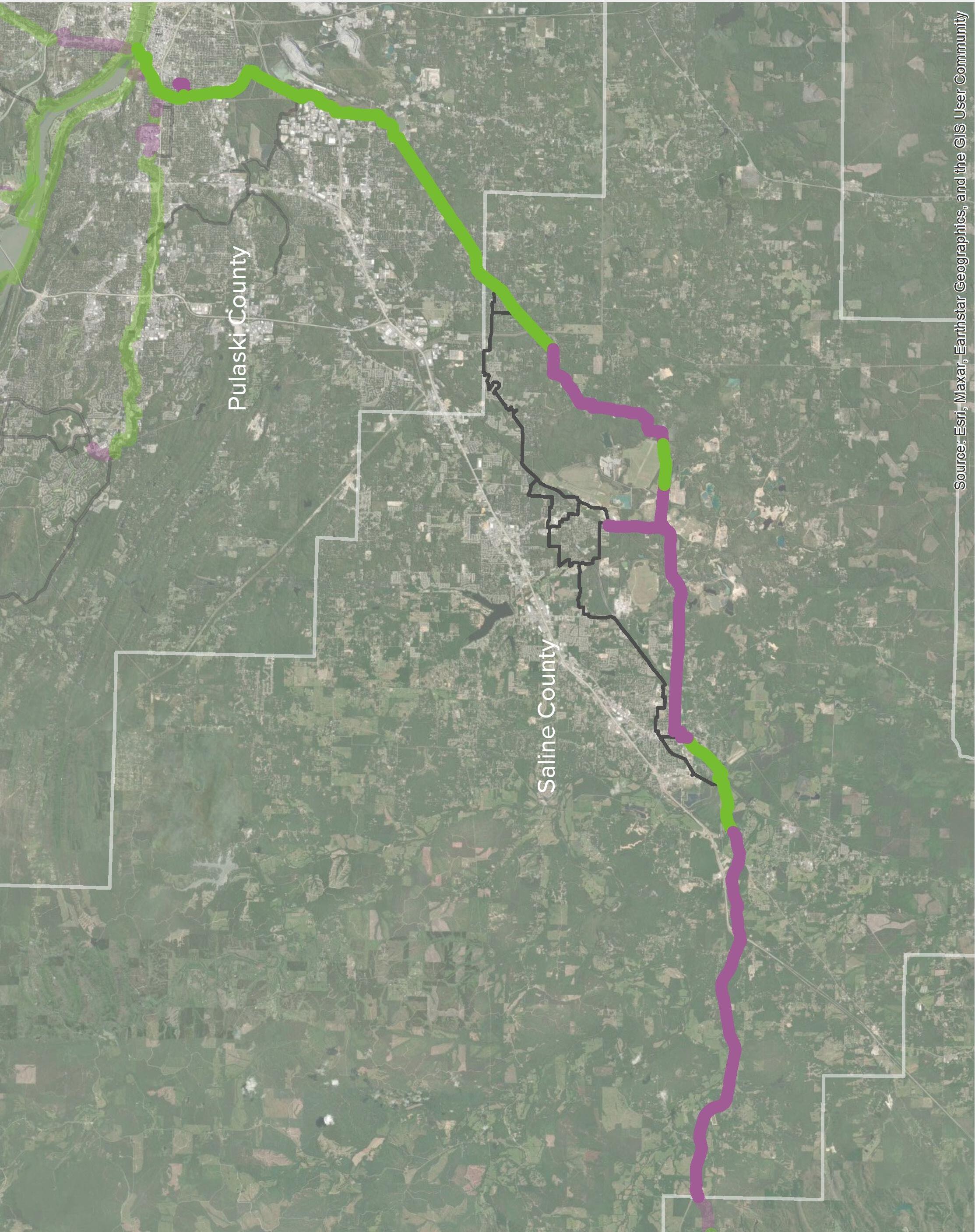
The Southwest Trail was the first long-distance trail effort in Central Arkansas. The official route begins at Central High School and terminates at Hot Springs National Park, measuring 58.3 miles in length and connecting Little Rock, Shannon Hills, Alexander, Bryant, Benton, Haskell, Hot Springs, and parts of Saline and Garland counties. For purposes of this study, the Southwest Corridor begins at the Arkansas River Trail and terminates at the Saline/Garland county line, measuring 41.2 miles. Approximately 10.4 miles of trail have been funded for construction. Two large gaps in the route indicate segments that have already been funded.
Total Length (Arkansas River Trail to the Saline/ Garland county line)
» 41.2 Miles
Existing Facility Types (Arkansas River Trail to the Saline/Garland county line)
» 41.2 Miles
Proposed Facility Types (Arkansas River Trail to the Saline/Garland county line)
» Sidepath: 22 Miles
» Trail: 19.2 Miles
» Determined by others; not included in the scope of this study
Full report includes detailed segment information per corridor. “On-Road” refers to separated infrastructure (such as a sidepath) within a road right of way. “Off-Road refers to infrastructure located outside of a road right of way.
Preliminary Estimate of Probable Cost
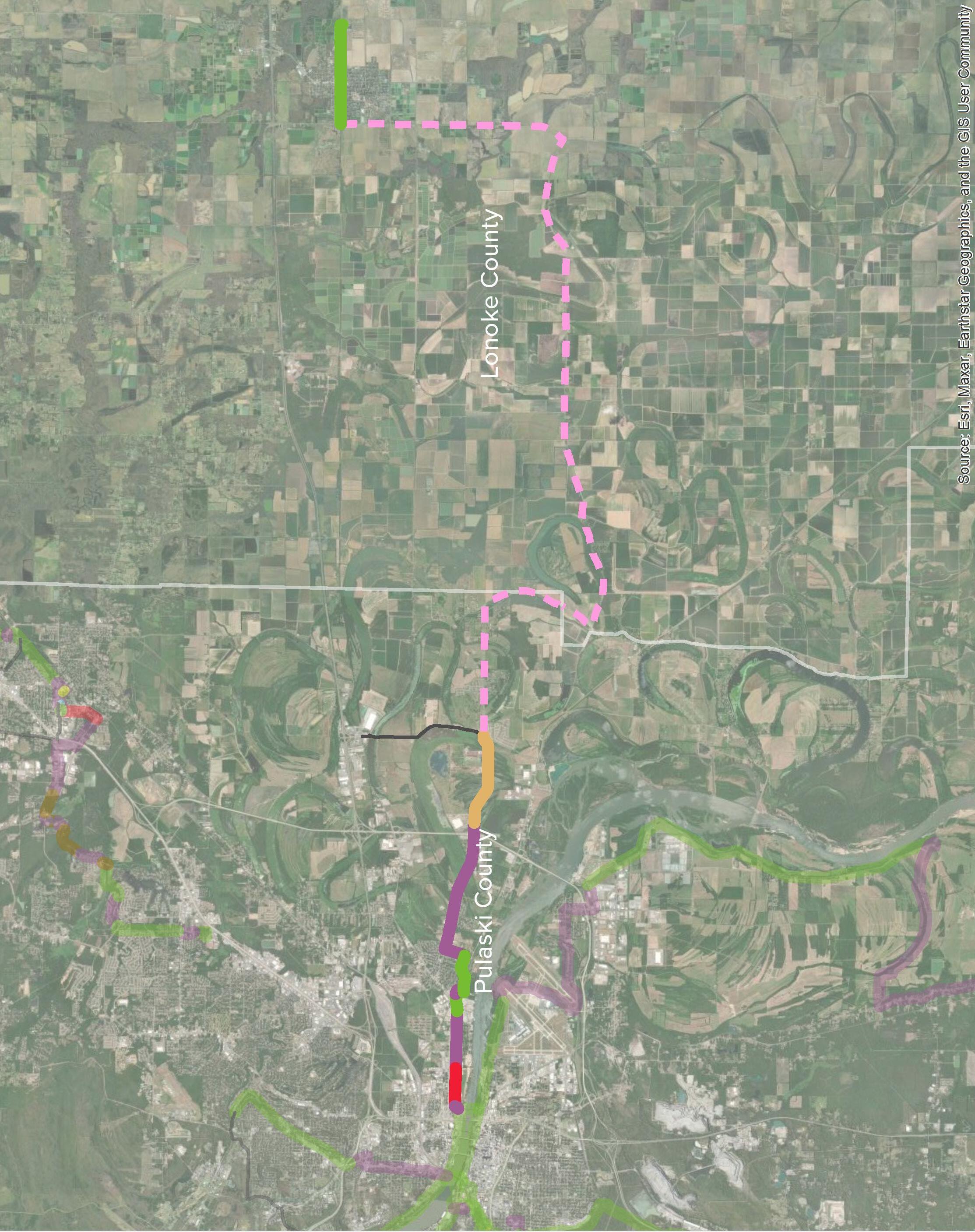
Beginning in the east part of North Little Rock, the East Corridor traverses Pulaski and Lonoke counties to the City of Lonoke. The corridor is comprised primarily of on-street bicycle facilities, such as bike lanes and signed routes, rather than protected facilities such as trails or sidepaths. From the River Trail to the underpass at Interstate 440 along Faulkner Lake Road, the corridor is cycle track, sidepath, and trail, and east of I-440, the route specifically accommodates bicyclists. The signed route terminates in Lonoke at the city’s existing rail trail, which connects many residences to their downtown, ball fields, and a new career training center and health clinic.
Total Length
» 29.8 Miles
Existing Facility Types
» Trail: 2 Miles (Lonoke)
Proposed Facility Types
» Trail: 1.1 Miles
CORRIDOR PACKAGE NUMBER BEGIN
» Sidepath: 4.3 Miles
» Cycle Track: 0.8 Miles
» Bicycle Lanes: 2 Miles
» Signed Route: 19.6 Miles
Notable Crossings
» Existing Bridges (New Trail Underpasses): I-440 at Faulkner Lake Rd
Full report includes detailed segment information per corridor. “On-Road” refers to separated infrastructure (such as a sidepath) within a road right of way. “Off-Road refers to infrastructure located outside of a road right of way.
» Trail $9,147,812.82
» Crossings $520,000.00
» TOTAL $9,667,812.82
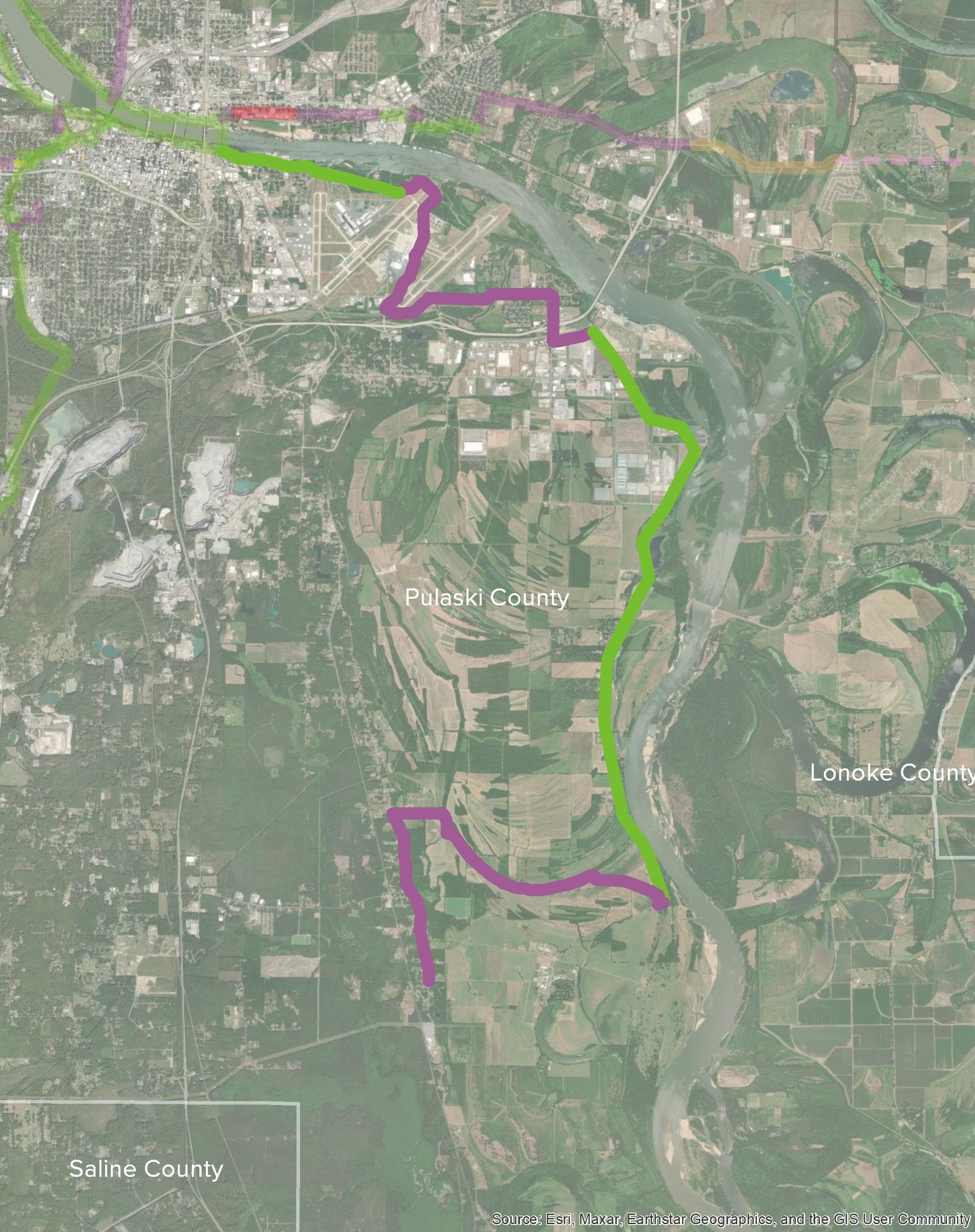
The Southeast Trail is comprised of off-street trails and sidepaths, with significant portions paralleling the Arkansas River. Extending from the Arkansas River Trail in Little Rock, the southern terminus of the Southeast Trail is Wrightsville, and other significant destinations include the Port of Little Rock and the Little Rock National Airport.
Total Length
» 21.5 Miles
Proposed Facility Types
» Trail: 10.1 Miles
» Sidepath: 11.4 Miles
This corridor was not packaged or prioritized.
» Fourche Creek (Parallel to Fourche Dam Pike): Bike Ped Bridge
Preliminary Estimate of Probable Cost
» Trail $31,664,245.00
» Crossings $1,458,000.00
» TOTAL $33,122,245.00
Planning-level cost estimates for bike and pedestrian facilities were calculated on a linear-foot basis using unit pricing and do not include right of way acquisition, substantial grading and drainage, permitting, utility relocations, amenities, or design costs. Proposed grade separated treatments were calculated according to an order of magnitude cost. While outside the scope of determining full engineering designs for each trail crossing, unit prices for crosswalks, Rectangular Rapid Flashing Beacons, and HAWK Signals were assessed. Cost estimates for the Southwest Trail were completed as part of a separate design effort and included for reference herein.
As more time passes between the development of this plan and the implementation of the recommended pathways, these cost estimates will inevitably fluctuate in both predictable and unpredictable ways.
* Estimates for these corridors do not include land or right of way acquisition, substantial grading and drainage, permitting, utility relocations, lighting, amenities, or engineering fees.
Tables on the following pages further break down these costs by the overall network as well as by each corridor, within the following subcategories:
Trail Typologies
» Trail
» Boardwalk
» Sidepath
» Cycle Track
» Alley Conversion
» Bicycle Lanes
» Sharrow
» Signed Route
» Existing Trail or Sidepath
» Existing Bike Lanes
» High Visibility Crosswalk
» Rectangular Rapid Flashing Beacon (RRFB) Signal
» HAWK Signal
» Rail Crossing (at grade)
» Box Culvert Tunnel Under Road
» Grade Separated Underpass (Road or Rail Bridge)
» Bike-Ped Bridge Over Road
» Water Crossing: Trail over Culvert
» Water Crossing: Trail over Box Culverts
» Water Crossing: Trail over Precast Span Bridge
» Water Crossing: Trail over Pre-Engineered Bridge
The proposed Regional Greenways System is over 222 miles and includes both proposed and existing trail facilities. The 27 segment packages were scored using the criteria described on page 26 and further in the full report document. Based on prioritization scores, segment packages were placed into three tiers. While not every project can be in the highest tier, each project is a critical piece of the regional greenway network. Projects in packages that rank lower may be considered in conjunction with adjacent projects as surrounding development or other transportation investments come online. Additionally, while tiers have been established, these designations are for planning purposes and it is understood that there will be “projects of opportunity”; therefore, projects should be implemented when opportunities present themselves.
A map of the corridors and the tiers are displayed on pages 24-25. The ten highest scoring project packages are included in Tier 1, the next ten project packages are in Tier 2, and the remaining seven project packages are in Tier 3.
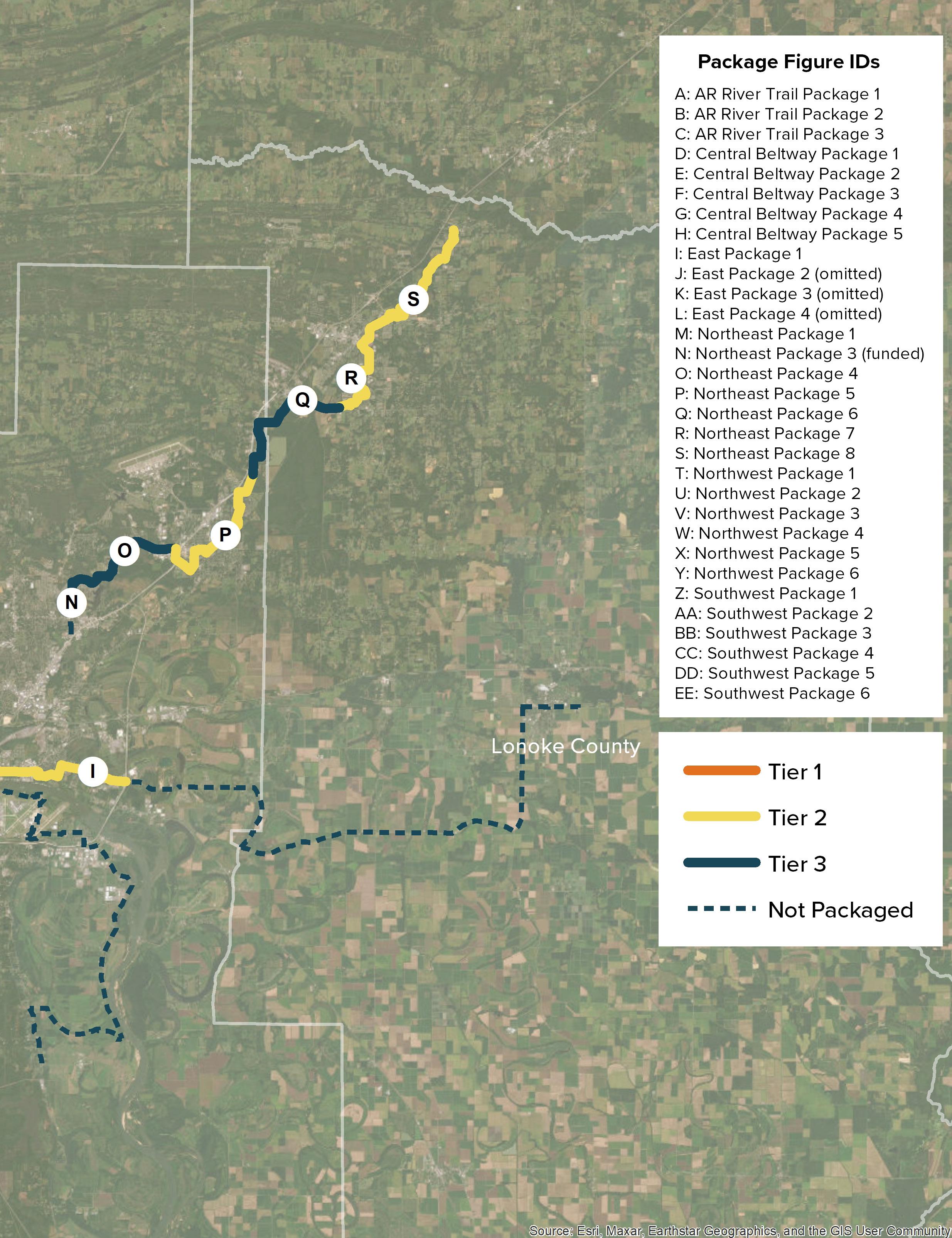
To guide phasing, the network segments were classified as projects and then combined with adjacent projects to create corridor segment packages throughout the proposed system. Segment packages were scored using criteria that address the following categories:
Destinations
Destination Density
Number of destinations per mile within a 1/2 mile of proposed trail
Trails with a high number of existing destinations will have increased attraction to people walking and people on bicycles
Links to Other Existing Trails/Greenways
Density of existing bicycle/trail facilities
Connectivity
Transit
Links to existing transit routes
Links to Significant Trails/Greenways
Density of existing bicycle/trail facilities
Construction and Maintenance Constructability and Ongoing Maintenance
Population Density
Population density within 1/2 mile of proposed trail
Trail Access
Equity
Access for vulnerable users (Low Income, People of Color, Persons with Disabilities)
0.25 to 0.5-mile buffer to reach Census block groups
Existing bicycle and pedestrian facilities attract users.
Active transportation and transit functionality go hand-in-hand; it is important that active transportation around transit stops and routes is safe and connected for users
Significant trails/greenways represent major regional assets. Connecting to this marquee trails is important to building a regional active transportation network
Ability to simplify construction and maintenance access
Ability to reduce overall cost
Enhancing infrastructure in densely populated areas impacts the most users per given area
Will this project address the priorities for underserved populations?
Prioritization and resulting tiers in this plan should be used to guide planning and funding efforts and not strictly dictate phasing for the regional system. Metroplan will continue to have a consistent process for evaluating applications for funding; however, it will be important that the results of this Plan inform those decisions for greenway projects. Metroplan should develop a methodology within their scoring system that weighs Plan recommendations to allow for nuance based on a project’s designation within the tiers.
POINTS
» Direct connection to two or more destinations = 20 points
» Direct connection to 1 destination = 15 points
» Indirect connection within 0.5 miles to 2 or more = 10 points
» Indirect connection within 0.5 miles to 1 destination = 5 points
» Indirect connection over 0.5 miles to 1 destinations = 0 points
» Direct connection to two or more trails = 20 points
» Direct connection to 1 trail = 15 points
» Indirect connection within 0.5 miles to 2 or more trails = 10 points
» Indirect connection within 0.5 miles to 1 trail = 5 points
» 1 or more transit route crossings = 10 points
» 0 transit route crossings = 0 points
» Direct connection to two or more significant trails = 20 points
» Direct connection to 1 significant trail = 15 points
» Indirect connection within 0.5 miles to 2 or more significant trails = 10 points
» Indirect connection within 0.5 miles to 1 significant trail = 5 points
Professional Discretion to create:
» High Ease of Construction/Maintenance = 20 points
» Medium Ease of Construction/Maintenance = 10 points
» Low Ease of Construction/Maintenance = 5 points
» High = 25 points
» Medium-high = 20 points
» Medium = 15 points
» Medium-low = 10 points
» Low = 5 points
» High = 25 points
»
»
»
»
= 20 points
= 15 points
= 10 points
= 5 points
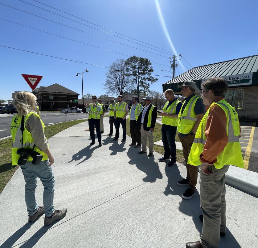
Implementing the Central Arkansas Regional Greenways Master Plan and its recommended trail network will not occur as a single project but rather over many years and in various stages. It will be a significant and sustained effort by local governments and agency partners within the region. While the project Steering Committee has been involved in this planning process, implementation will require working with a larger number of local and regional partners, as well as building public support for priority projects.
Key implementation strategies that should be considered moving forward include:
» Use the Plan to Inform Project Selection
» Regularly Recalibrate the Plan
» Continue to Lead
» Continue to Engage the Region
» Establish Design Guidance
» Benchmark & Survey
» Improve Critical Intersections & Interchanges
» Integrate with Other Capital Projects
» Refine Alignments
» Multi-use trails
Wide paved trail through a non-roadway, natural corridor
» Sidepaths
Paved trail adjacent to a higher volume roadway
» Two-way separated bike lanes (aka cycle tracks)
On-street facility for bi-directional travel with separation on one side of the street
» Directional separated bike lanes*
On-street facility for directional travel with separation on both sides of the street
» Conventional bike lanes*
Painted, designated space for cyclists on roads with low to moderate volumes
» Local facilities*
Signs, pavement markings, and traffic calming on quiet, lower-volume streets
* Included in the Bicycle Facility Design Details of the Multimodal Infrastructure Guide.
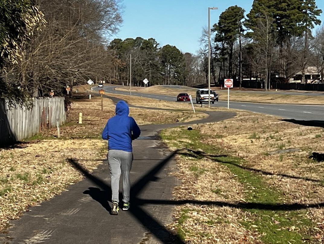
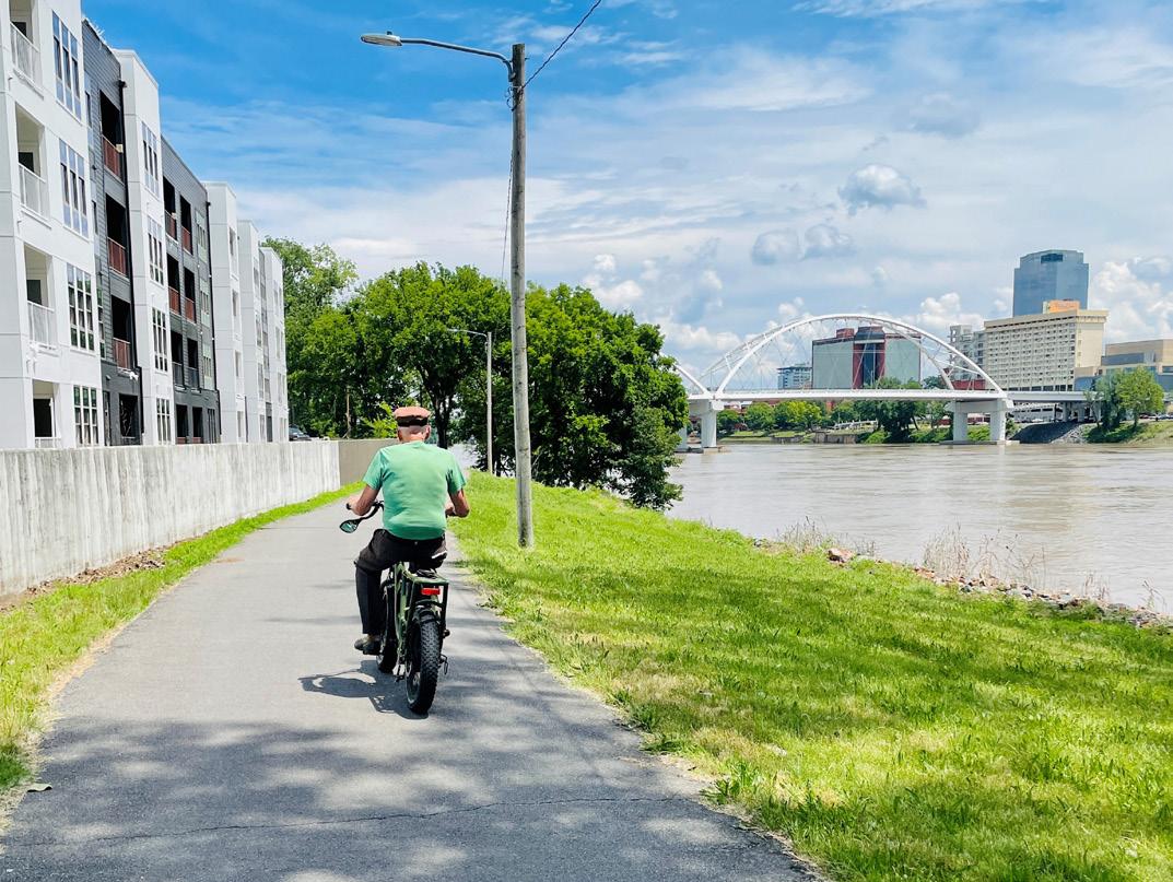
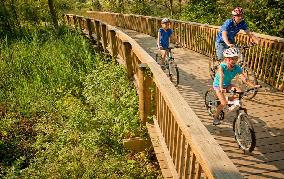
Multi-use trails represent the premier typology for the regional system. They offer a natural experience, removed from the risks and distractions of traffic and are often the most enjoyable facility for many users. Multi-use trails provide two-way travel for people walking, biking, and wheeling with ample space for traveling side by side and passing others. In a regional system, shared use paths provide the long connections between towns, regional parks, and natural areas.
Alignments for shared use paths typically follow natural, non-roadway corridors, and may vary based on more urban or rural contexts. Shared use paths often follow existing easements along corridors already set aside for utilities, waterway buffers, or former railroad lines.
URBAN MULTI-USE TRAILS
» Provide transportation and recreational connections to community destinations, and natural features.
» Alignment should take advantage of adjacencies to urban parks and open space.
RURAL MULTI-USE TRAILS
» Provide regional connections rather than access to specific attractions.
» Alignments are guided by natural corridors along utility easements, waterways, and former rail lines.
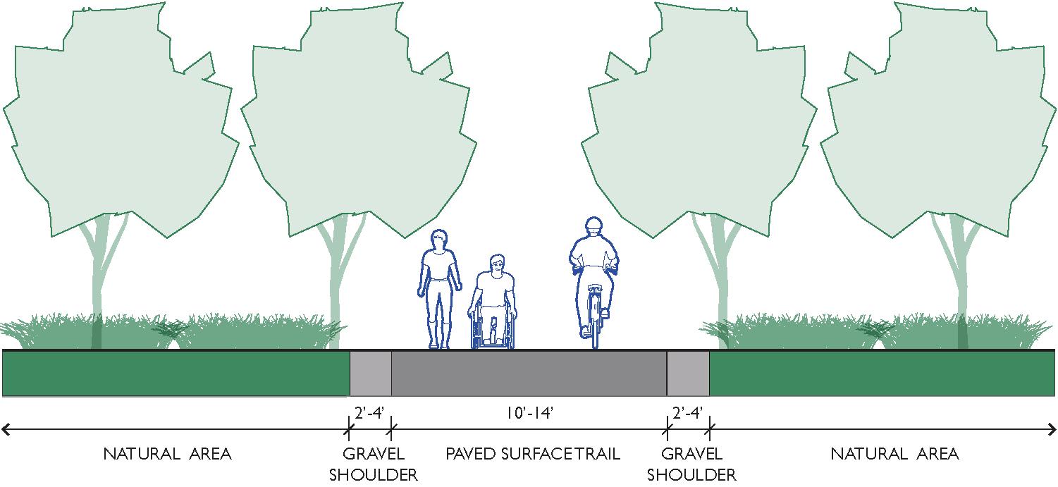
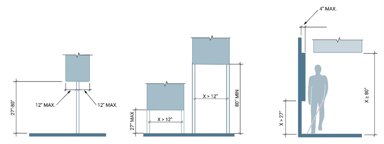
Multi-use trail widths will vary depending on context but should at minimum provide space for two cyclists to ride side by side and comfortably pass another user approaching from the opposite direction. The diagrams on page 10 highlight the space required to accommodate different users.
» Regional paths and trails should be a 14’ paved path with 2’ of gravel shoulder on either side. Local paths and trails may be 10’-14’ wide.
» Heavily used trails may require wider widths than 14’.
» Connectors or trail spurs should be a minimum of 8’ wide.
» Bridges should be a minimum of 10’ wide.
Multi-use trails require a firm, stable, slip-resistant surface typically constructed from asphalt or concrete. Long-term durability, safety, costs, and maintenance should all be considered when determining surface type.
» Gravel
» May only be used on Regional Trails to temporarily connect route segments before final buildout
» Commonly used for rural trails
» Natural aesthetic
» Softer surface for runners
» Affordable initial investment compared to asphalt and concrete
» Requires frequent maintenance especially to prevent erosion
» Difficult to maintain consistent quality and meet ADA surface standards
» Asphalt
» Smoother and sturdier than gravel while less expensive than concrete
» Prone to cracking and vegetation creep on the edges
» Require significance maintenance to fill and seal cracks
» Require complete overlay every 8-10 years
» Concrete
» Long lifespan with minimal maintenance
» Most expensive initial installation
» Joints should be designed to maximize comfort for cyclists
Sidepaths run parallel to existing roadways but extend the shared use path experience by maintaining separation from vehicle traffic. Despite being immediately adjacent to the roadway, sidepaths provide a highquality experience for users of all ages and abilities.
Sidepaths form key connections in the regional system. They provide a comfortable experience for bicyclists and pedestrians while capitalizing on a roadway alignment that is often already the most popular, or most direct route between destinations. Sidepaths are well suited for rural areas, especially along a two-lane road where adding an on-street facility would require widening the road, possibly impacting the area’s rural character. To avoid conflicts, sidepaths should only be constructed in areas with few roadway and driveway crossings. The landscaped buffer for sidepaths is also contingent on a wide roadside environment, which can require additional right-of-way.
While roadway corridors bring additional design considerations, sidepaths should satisfy the same design criteria as shared use paths through a natural corridor.
Like shared use paths, sidepaths must be wide enough to accommodate two-way travel for a variety of modes. Additional width may be required as the volume and mix of users increases.
» Local or connector sidepaths should be 10’-14’. Regional sidepaths should be 14’ wide.
» Short sections in constrained areas can be a minimum 8’ wide for local or connector sidepaths.
Separation should be provided between a sidepath and the adjacent roadway to demonstrate to both the bicyclist and the motorist that the path functions as an independent facility for bicyclists and other users.
» The minimum distance between sidepath and roadway is 5’.
» Where 5’ of separation is not possible a physical barrier or railing should be provided.
» Sidepaths along high-speed highways may require additional separation.
Two-way travel on sidepaths create a number of potential conflicts at driveways and road crossings:
» Motorists entering or crossing the roadway will often not notice bicyclists approaching from the right because they do not expect traffic from this direction.
» The speed of a bicyclist crossing the street may be unexpected for a driver who is anticipating a pedestrian crossing from a standard sidewalk.
» Motorists waiting to enter the roadway from a driveway or side street may block the sidepath crossing, as drivers pull forward to get an unobstructed view of traffic.
» At the beginning and end of the sidepath, bicyclists traveling in the opposite direction of traffic may continue on the wrong side of the road.
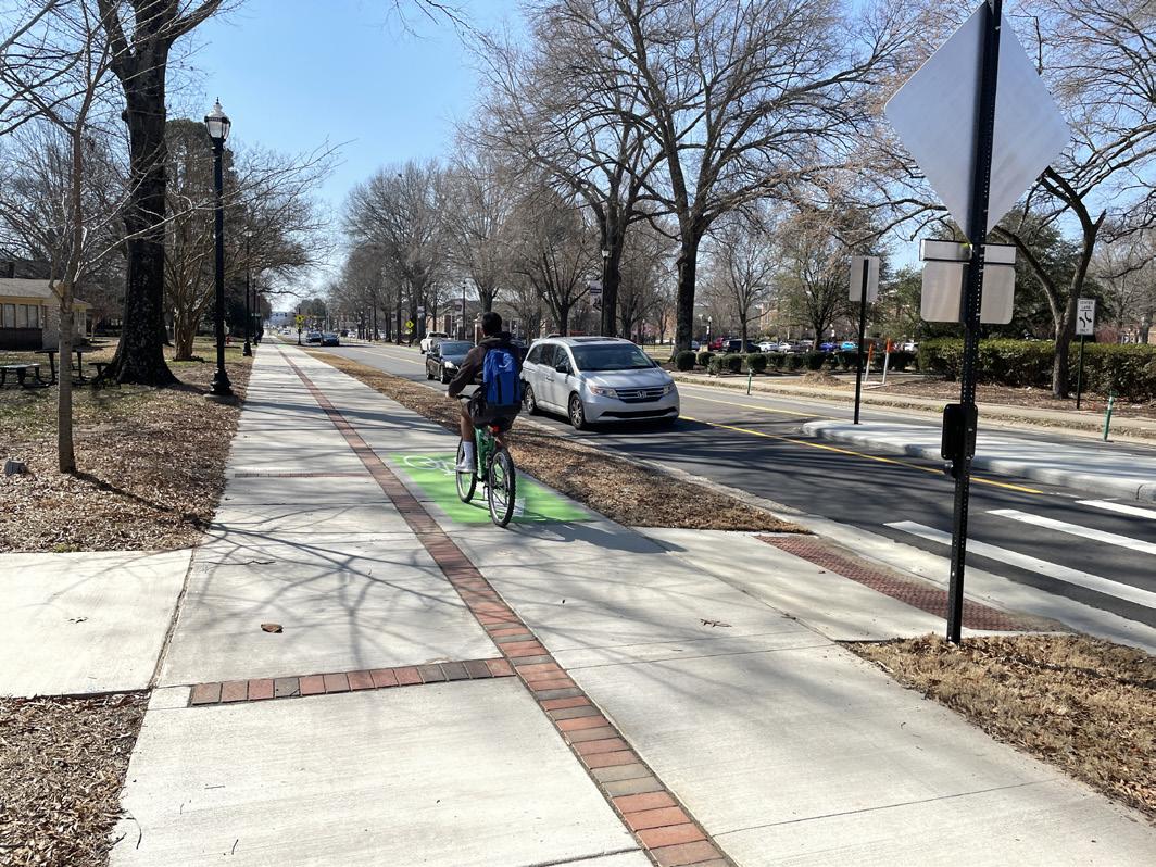
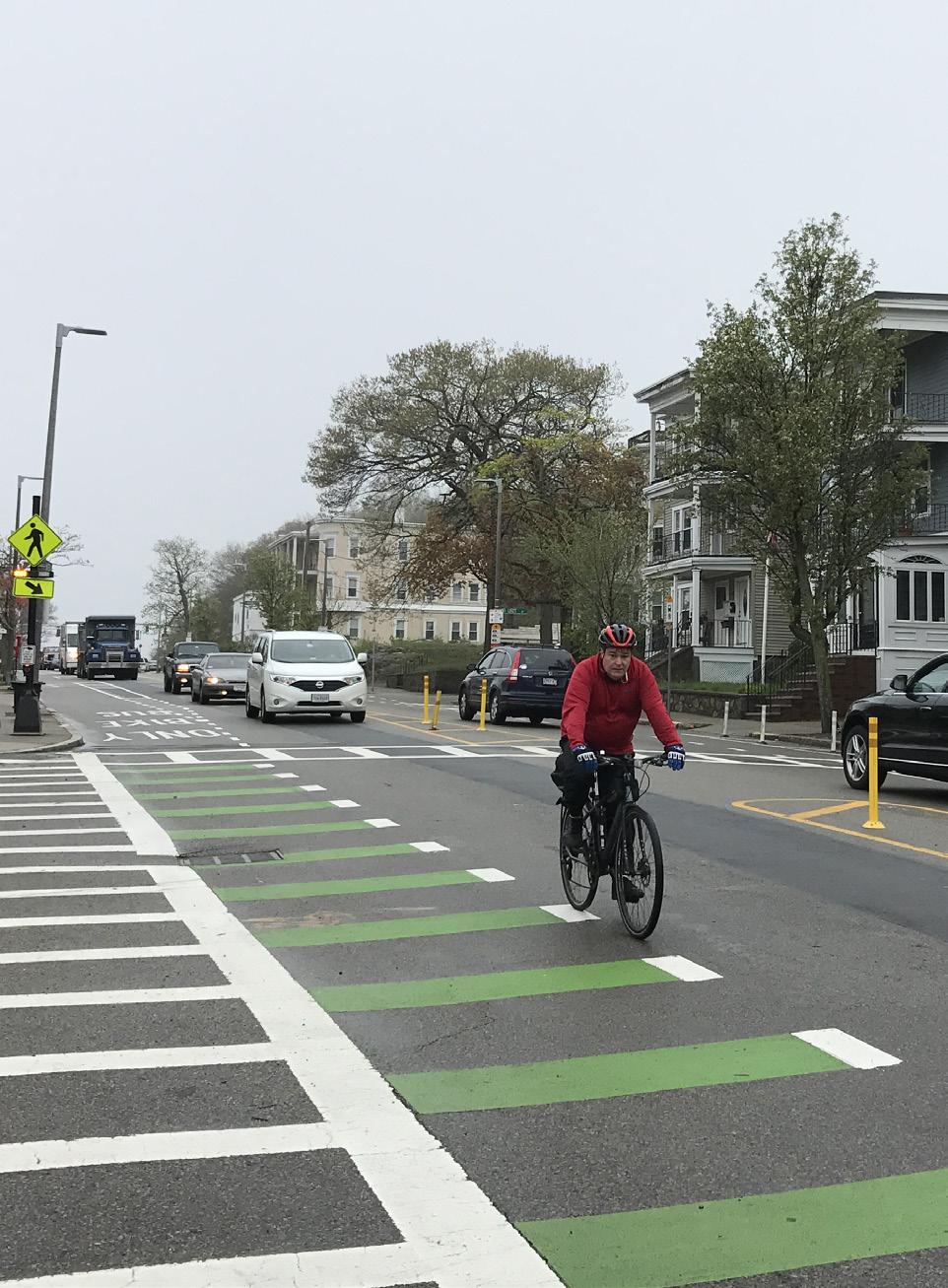
Like sidepaths, two-way separated bike lanes (aka cycle tracks) also run parallel to high volume streets and provide dedicated space for bicycle movement in both directions on one side of the street. However, unlike sidepaths, these facilities also provide separation between bicyclists and pedestrians.
Separated bikeways capitalize on the connectivity provided by an existing street network but are more comfortable to a wider range of bicyclists than conventional bike lanes. They eliminate the risk of a bicyclist being hit by an opening car door and prevent motor vehicles from driving, stopping, or waiting in the bikeway. Compared to shared use paths and sidepaths, they also provide greater comfort to pedestrians by separating pedestrians from bicyclists who are operating at higher speeds. This makes two-way separated bike lanes best suited for high-speed roadway corridors where high volumes of cyclists AND pedestrians are expected.
Two-way separated bike lanes can be at the street level using parking or another barrier as a buffer or can be raised to sidewalk level which adds additional vertical separation from traffic.
Like sidepaths, two-way separated bike lanes require special attention for bicyclists traveling the opposite direction of traffic. This includes clear markings at driveways and intersections as well as at transitions to existing bicycle facilities or shared use paths.
» Two-way separated bike lanes should be a minimum of 12’ or 8’ in constrained areas. The diagrams on page 83 highlight the space required for bicyclists and pedestrians.
» The buffer between the bike lanes and travel lane should be a minimum of 3’.
» Buffer materials can range from paint and flexible vertical elements to concrete or landscaping.
» The buffer between the bikeway and the sidewalk can be a standard curb or a landscaped strip. Sidewalk level bike lanes must have at least a tactile strip to designate the edge of the sidewalk.
» A yellow dashed line should be used in the center of the bikeway to delineate travel directions.
» On-street parking should be prohibited near intersections and driveways to maintain visibility for turning vehicles.
» Used sparingly within the Regional System
Individual corridors may have different types of trail materials used for construction due to the unique soil types, terrain, and amount of expected water runoff. The matrix below aids decision-making during engineering and design, addressing varying contexts for seven different environment types and four specific material types. * May use gravel initially or during interim phases of buildout
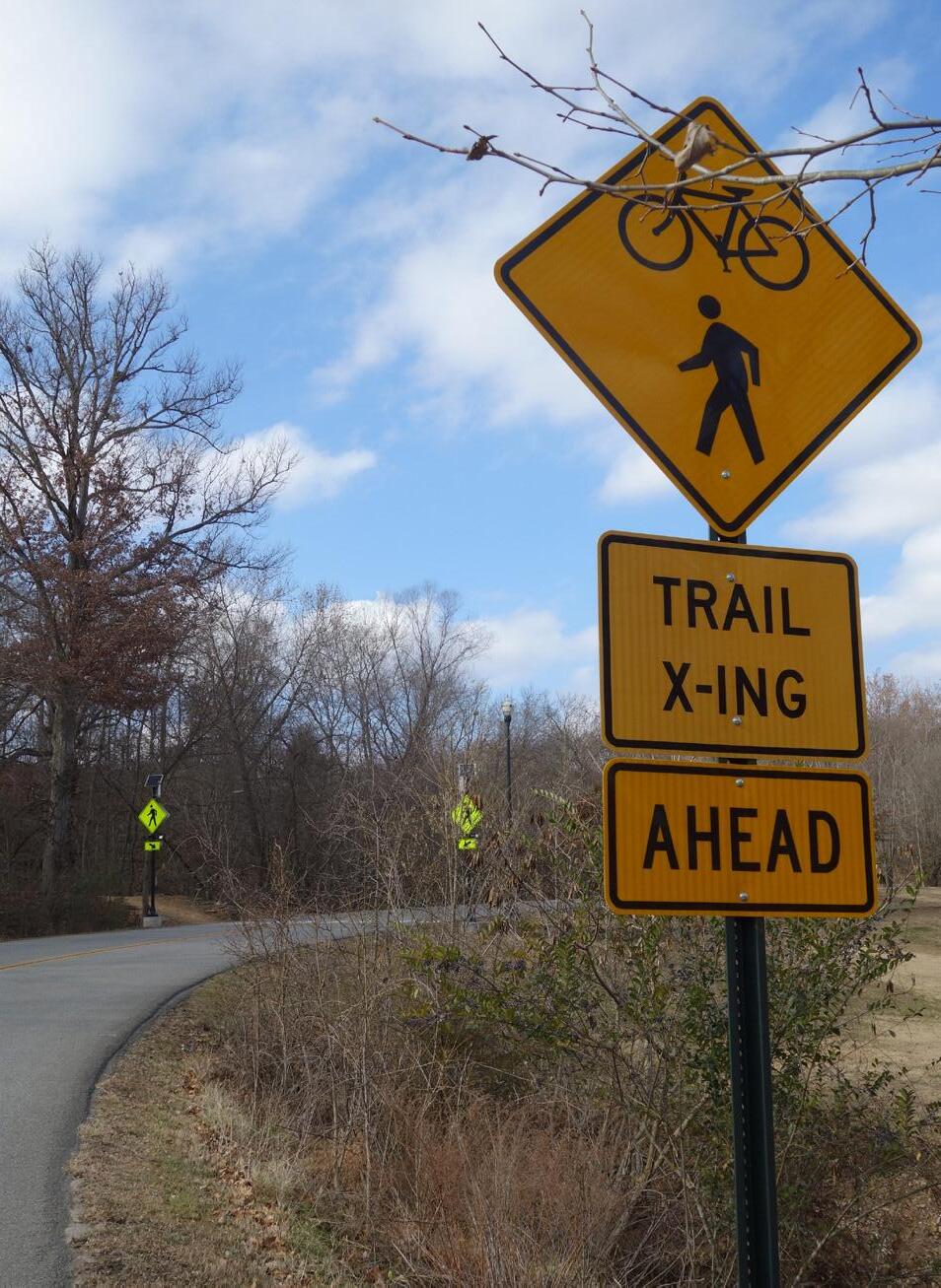
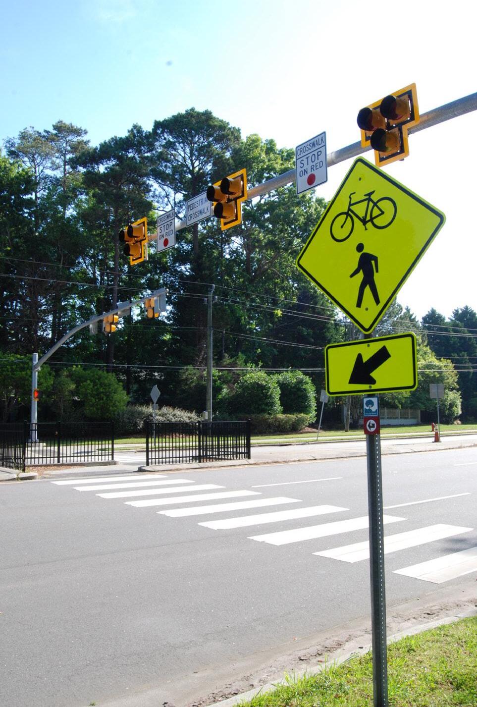
These elements include high visibility crosswalks, advanced STOP and YIELD markings, and warnings signs and are intended to make crossings and trail users within crossings more visible.
USE
» Should be included with all other trail crossing countermeasures.
» Pavement markings should be placed between 20’ and 50’ in advance of an uncontrolled crossing. Placement distance will also depend on roadway speed and other geographic features such as blind turns and hills.
» Where possible, signage should be placed on both sides of the street.
GUIDANCE AND CONSIDERATIONS
» MUTCD trail crossing sign includes both bicyclist and pedestrian.
» Colored conflict striping indicates to drivers that the crossing is different than a standard crosswalk.
» Too much signage can lead to clutter and lack of overall emphasis.
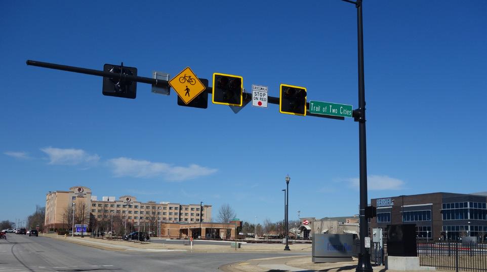
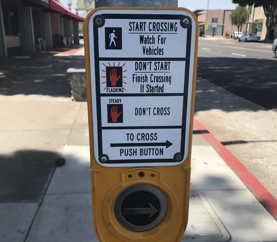
HAWK signals are user-activated via push buttons and use a sequence of flashing and solid lights to indicate when it is safe to cross and when vehicles can proceed.
USE
» Best suited for multi-lane midblock crossings or uncontrolled intersections where vehicle speeds and volumes are high.
» Help reduce delay for trail users waiting to cross.
GUIDANCE AND CONSIDERATIONS
» Phases for vehicles include a “dark” phase if no one is there to cross, a flashing yellow phase warning that a person has activated the push button, and a solid red phase to stop and allow the trail users to cross.
» Should be paired with high visibility crosswalks and stop bars.
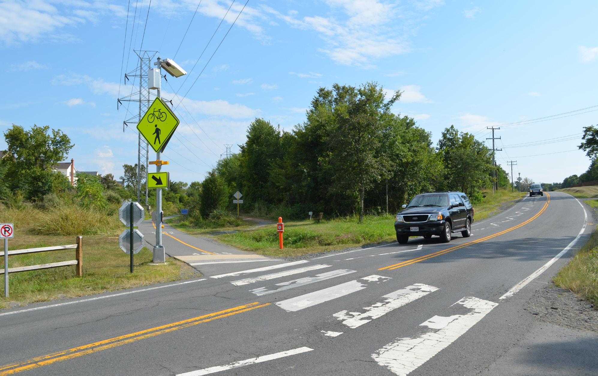
RRFBs combine a standard trail crossing sign with user-activated flashing lights. They increase visibility at crossings and lead to high vehicle yield rates.
USE
» Best for high volume midblock crossings with low to moderate vehicle speeds.
» Should be placed on both sides of the crosswalk.
» RRFBs are also commonly used for school or standard pedestrian crossings.
» Can increase the effectiveness of other crossing treatments such as Advance Yield Markings and YIELD HERE signs.
GUIDANCE AND CONSIDERATIONS
» RRFBs are typically powered by a stand alone solar power unit but can also be wired to a traditional power source.
» Consider a HAWK signal for roadways with multiple lanes or higher speeds.
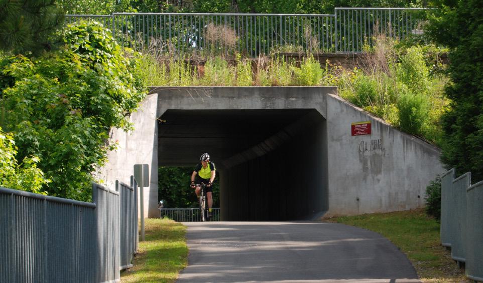
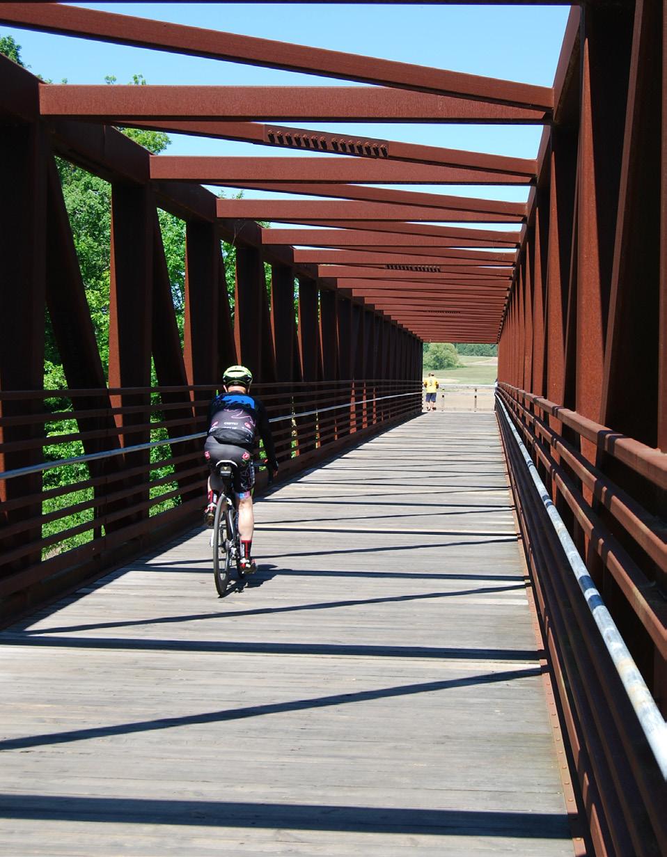
Grade separation offers an uninterrupted trail experience over or under a large barrier. However, it is the most expensive crossing treatment and should be reserved for cases where at-grade crossing options do not meet safety goals.
USE
» Best for crossing highways, major roadways, and natural barriers such as rivers or ravines.
» Choice of bridge versus tunnel is primarily influenced by adjacent topography.
» Bridges offer security advantages as tunnels require significant lighting even during the day. Bridges also present fewer drainage problems.
» Providing accessible trail access may require significant ramping, which is costly and often a deterrent to compliant use.
» Grade separated crossings should incorporate lighting, wayfinding, and other amenities.
» Well-designed, visually appealing bridges provide an opportunity to draw attention to the trail network and become destinations unto themselves.
Sign systems in the United States are guided by best practices, standards, and regulations. Typically, communities must follow regulatory guidance when implementing information systems on streets or in the public right-of-way. Customized signage solutions may be used off-street on sidewalks and trails, however, a solid understanding of local, state and federal guidelines and requirements is important for the integration, legibility and safety of the traveling public. The key national documents that refer to pedestrian and bicycling wayfinding are summarized below. These documents, along with state and local guidance and regulations, should also be consulted when implementing the wayfinding system provided in this section.
The Federal Highway Administration’s MUTCD (2009 edition) holds jurisdiction over all signs on any road or bikeway open to public travel. This includes all shared use paths and separated or conventional bike lanes. The MUTCD covers:
» Sign design for bicycle guide (wayfinding) signs, bicycle routes, and auxiliary plaques, based on a smaller size of the D-series guide signs for motorists.
» Pictographs and appropriate abbreviations for destination names.
» Placement, mounting height requirements, sign size, and layout.
» Priority MUTCD sections for bicycle wayfinding are Chapter 2D and Part 9. These sections should be consulted before undertaking any wayfinding development project.
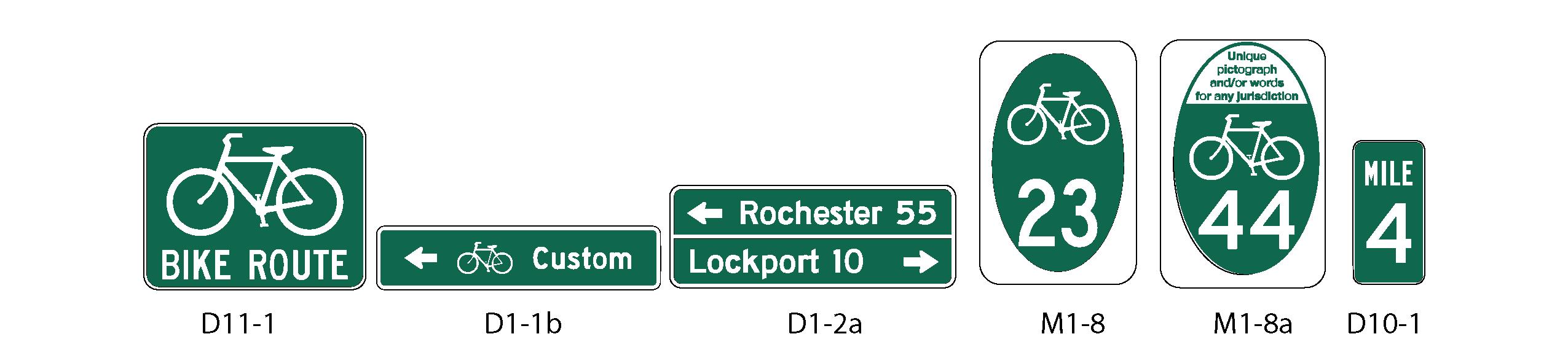
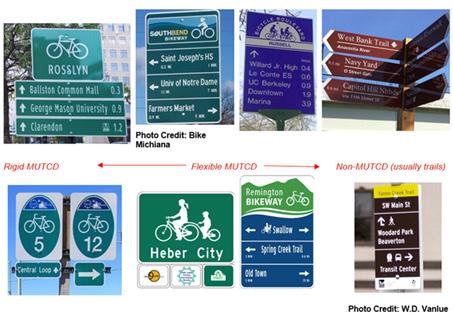
MUTCD Section 2D.50 Community Wayfinding Signs allows for customized wayfinding signs that vary from standard MUTCD D-series signs. Community wayfinding guide signs may employ unique colors, logos, and fonts as part of a coordinated and continuous system of wayfinding signs for an area.
Currently, Community Wayfinding only applies to on-street bicycle routes, but in June 2014 the National Committee on Uniform Traffic Control Devices recommended that shared use paths be incorporated under Community Wayfinding in the next update of the MUTCD. For the purposes of this project, we have interpreted Community Wayfinding as applying to both on-street bicycle routes and shared use paths.
The AASHTO Bike Guide is consistent with and provides supplemental information to the MUTCD. A forthcoming update will contain a full chapter on wayfinding, expanding on the current 2012 guide. The current guide discusses the MUTCD D Series and MUTCD national and state route (M1) signage. The update will expand on the nuances of these signs while covering the MUTCD Community Wayfinding Series. The forthcoming guide will also discuss applications, sign types, and supplemental signs such as mile markers.
The ADA currently does not guide exterior wayfinding systems. It does provide guidance on protruding objects and clear width on accessible routes, with the guidance aimed toward pedestrians. Guidelines for shared use paths are under development and will address post mounted objects and sign legibility.
A strong wayfinding system must provide people with the tools to determine their route and learn, retrace, or reverse it. Finding one’s way in any environment is essential for daily travel and requires a wide range of cognitive abilities. Most important among these is the ability to make use of spatial cues to navigate one’s surroundings. The more intentional the wayfinding signage is along the Central Arkansas Regional Greenway, the better it will meet the needs of people walking and biking along its routes. The elements of design psychology presented below and described on the following pages are critical in developing a human-scale and effective wayfinding strategy and can be applied to all aspects of sign design and placement.
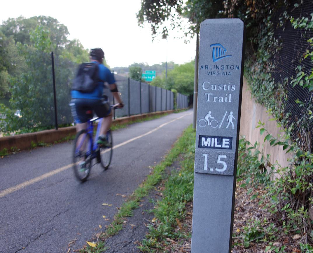
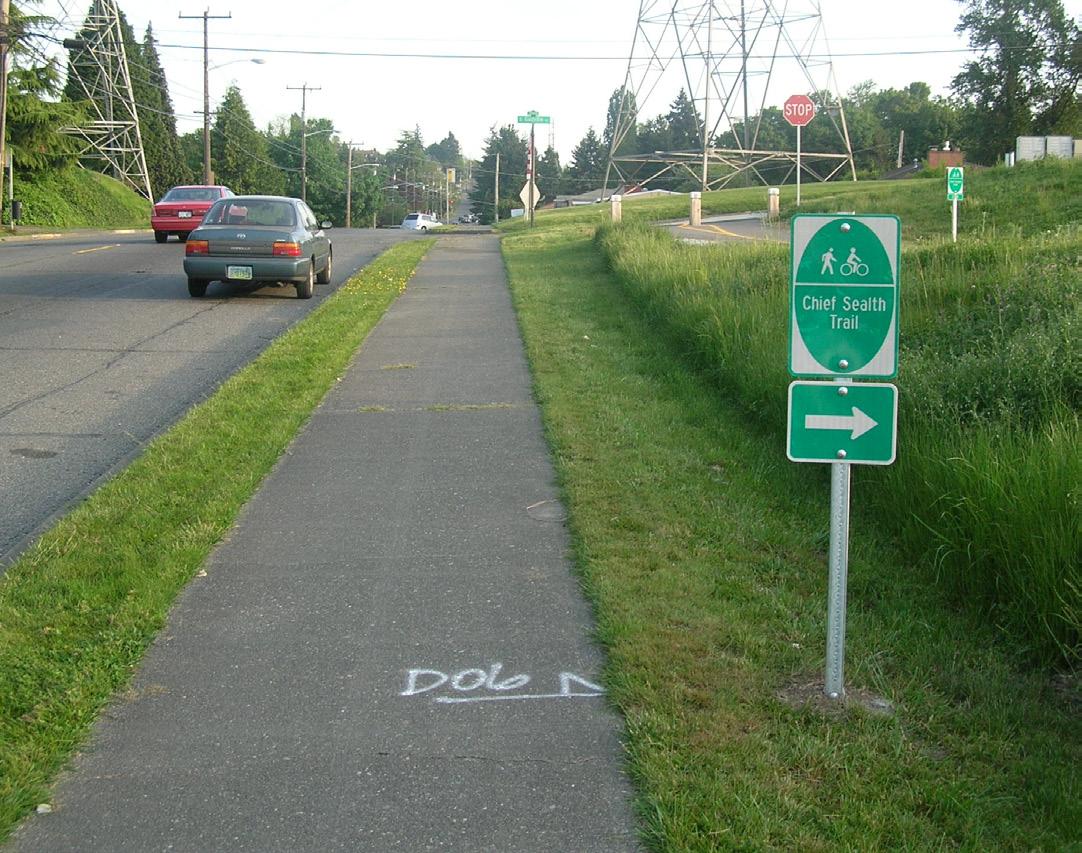
There are four sign types recommended for the Central Arkansas Regional Greenway: Turn, Decision, Confirmation, and Awareness. Each sign has a different function to aid people as they navigate a route by foot or on wheels. The following sections provide details about these functions and each sign’s specifications and considerations when developing content and determining sign placement.
» Mark the junction of two or more routes
» Inform users of designated routes to access key destinations
CONFIRMATION SIGNS
» Spaced periodically along a route to indicate that users are still traveling along the same route
» Do not indicate a change in direction
» Direction to turn when a route transitions from one roadway or trail to another
» Highlight accessible routes that are direct, wellcommunicated, and minimally sloped
AWARENESS SIGNS
» Build awareness of the low-stress priority network
» Provide direction, distance, and routes to destinations
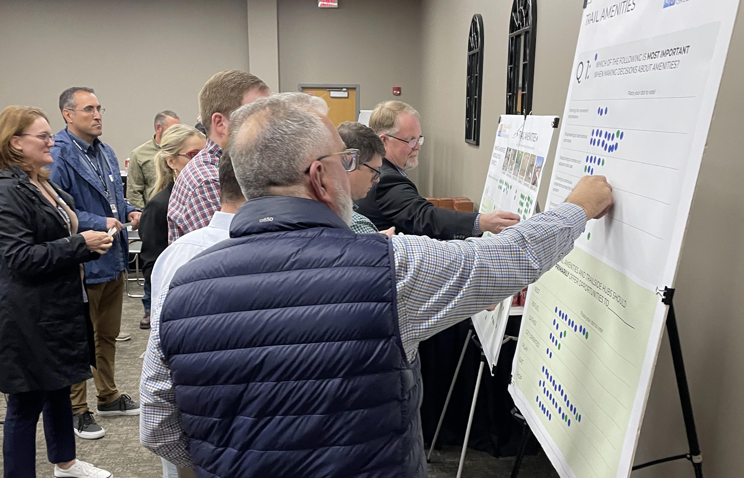
Trail amenities provide a comfortable and fun experience for people traveling throughout the trail system. At some point, regardless of the type of trip, most trail users will desire or depend on a place to sit, drink, use the restroom, or learn about the surrounding area. Trail amenities include:
» Wayfinding
» Restrooms and drinking fountains
» Bicycle repair stations and parking
» Seating
» Trash receptacles
» Public art
Trail amenities should respond to user behavior and be placed in a way that allows for convenient maintenance in the future. Ultimately, amenities should be placed in areas where people already naturally want to pause, rest, play, eat, or plan their route.
1. SET AT A DISTANCE INTERVAL
2. GROUP AT DESTINATIONS OR OTHER NATURAL RESTING AREAS
3. ADJUST SPACING BASED ON DISTANCE FROM ACCESS POINTS
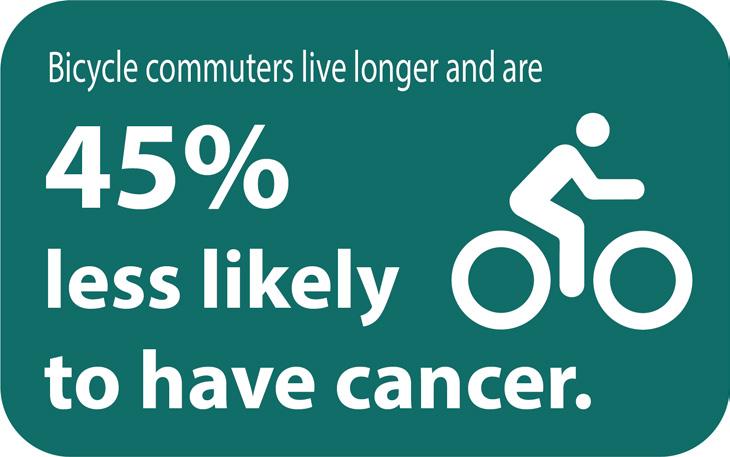
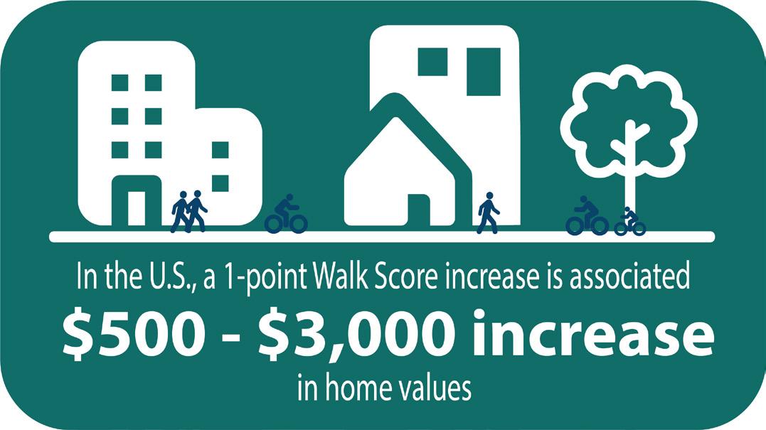
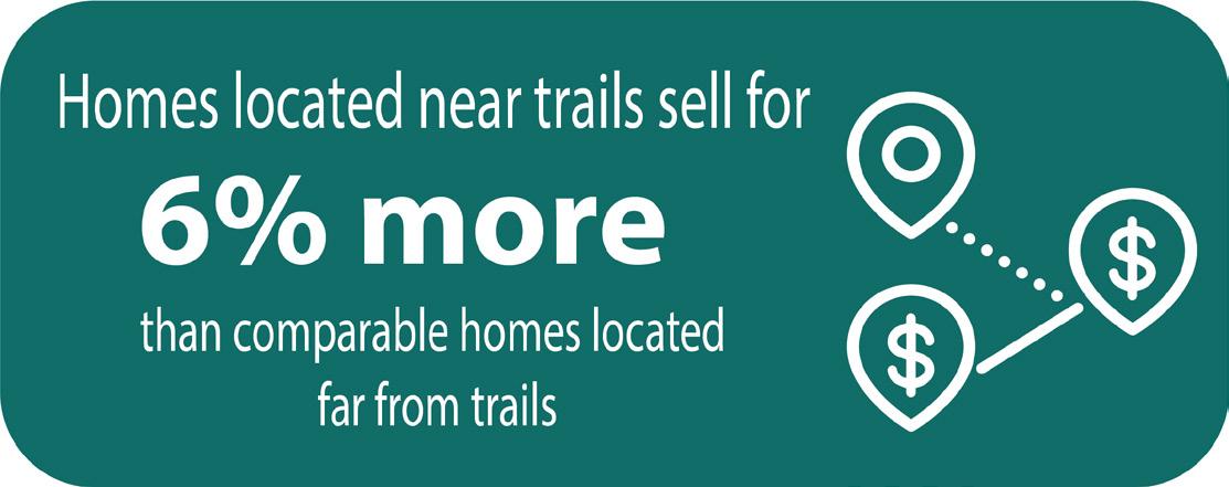
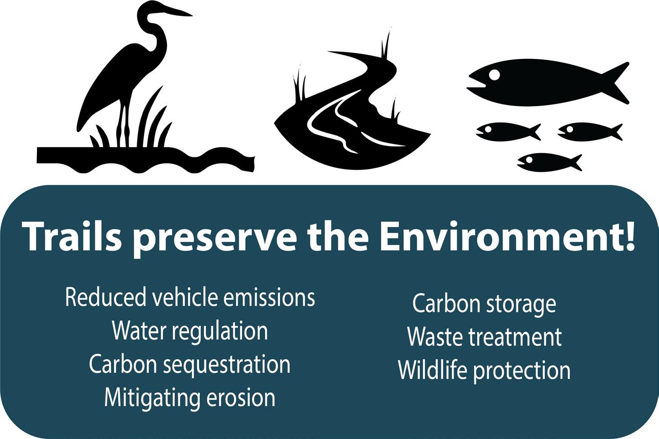
Regional greenway provide numerous benefits to people who live, work, and play in Central Arkansas. While return on investment often refers primarily to economic growth, trails provide a wide range of holistic benefits for businesses, people, and the environment. Trails provide places for physical activity, contribute to a multimodal transportation network, connect people with nature, and spur economic development. Open space corridors preserve the region’s natural environment and provide dedicated space for wildlife and vegetation. EQUITY

ECONOMIC DEVELOPMENT / CONNECTIVITY HEALTH


ENVIRONMENT / OPEN SPACE PRESERVATION
Milwaukee, Wisconsin’s Beerline Trail broke ground in 2002 along a former railroad right-of-way that routes through the Harambee, a historically disinvested and predominantly Black neighborhood, and Riverwest, an economically thriving neighborhood adjacent to the University of Wisconsin-Milwaukee. The trail has since become a unifying hub for arts and culture between the two neighborhoods, as well as a space for people to safely be outside, commute to work, and stay active.
Benefits
» Strengthening of neighborhood people power
» Bridging of communities
» Improved community safety and wellbeing along the trail and in adjacent neighborhoods
» Increased use of the trail, programming, and art activation
» New businesses and jobs near the trail
» Additional housing and development that benefits nearby residents


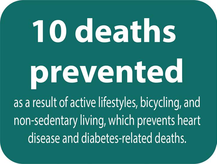
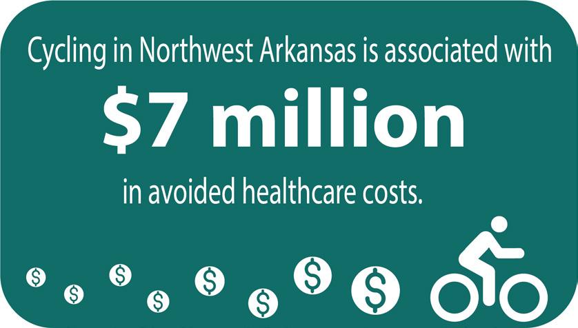
The Razorback Regional Greenway connects communities through 37.5 miles of shared use trails. In the 2018 BBC Report about the health benefits of bicycling in Northwest Arkansas, they found that the rate of bicycling participation is 11% higher (27%) than the national average (16%). With these high rates of bicycling along the greenways, the region is preventing about 10 deaths per year by protecting against deaths from heart disease and diabetes.
» $85 million in health benefits
» $79 million reduced mortality benefits
» $7 million estimated avoided health care costs

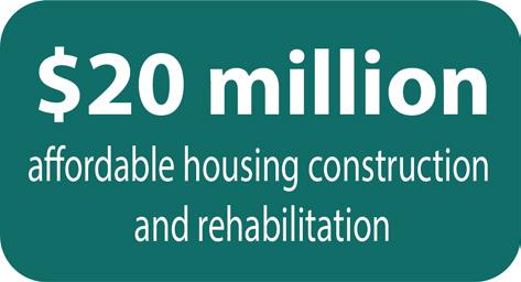
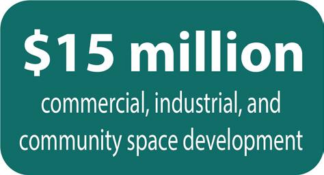
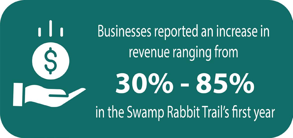
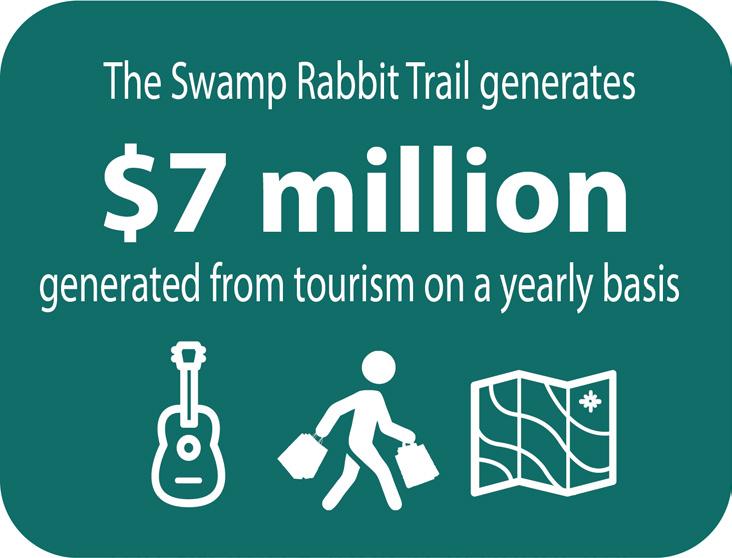
The Swamp Rabbit Trail is a 22-mile rail-to-trail system that connects the cities of Greenville and Travelers Rest as well as Furman University. The trail routes people walking, bicycling, and rolling past local downtown business, art galleries, restaurants, and idyllic community parks. Since 2009, over 500,000 people have enjoyed the trail each year, generating about $7 million from tourism within Greenville County on a yearly basis. Within the first year of opening, nearby businesses reported increases in sales and revenue ranging from 30% to 85%.
» Increase in revenue ranging from 30-85% for local businesses
» 5 new businesses opened in the 2nd year because of the trail
» Expect an increase in property values of $1.5 billion

Since 1991, the East Coast Greenway has connected 3,000 miles of walking and bicycling routes from Maine to Florida. The East Coast Greenway is integrated through the region’s parks and trail systems. By offering alternative active routes throughout the region, people have reduced emissions by walking and bicycling, resulting in 1.1 million pounds of emissions removed from the Triangle Region’s atmosphere each year.
Benefits
» Protected wildlife corridors
» rails adopted and preserved by state parks
» Increased access to nature and opportunities for people to experience the outdoors and become stewards of the environment
Prepared for Metroplan
by Crafton Tull and Toole Design Group