

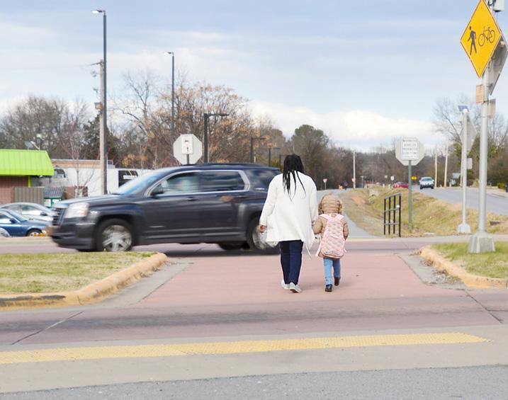
No matter how many miles we drive in our cars, sooner or later all of us must walk across a street or down a sidewalk. Keeping pedestrians safe makes sense. It is a sad statistical fact that Central Arkansas has higher-than-average rates of traffic accidents and fatalities involving pedestrians and bicyclists.1 We can do better.
This edition of Metroplan’s Best Practices newsletter provides tips for citizens and local governments that want to improve ped/bike safety. In some cases, pedestrian safety must be addressed through traffic enforcement, but this newsletter leaves that issue alone. You do not have to build a pedestrian bridge
“Streets don’t just connect us, they are our most active and visible public spaces.”
—Metroplan’s Multimodal Infrastructure Guidelines
to make it safe to cross a street. Minor changes to lane widths, striping, and visual cues can do wonders to encourage drivers to pay attention, and sometimes to slow down traffic where walkers and bikers are around.
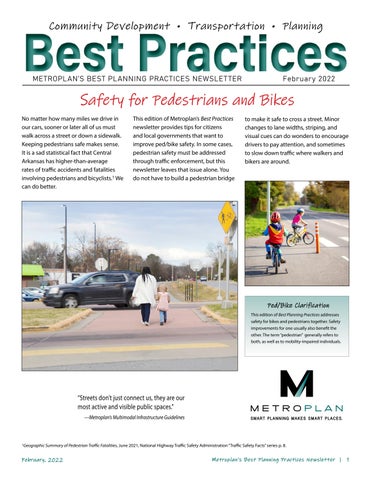
It’s rarely hard to cross a small street inside a neighborhood. Most parking lots can be traversed safely if you look carefully. But anyone who has ever tried walking in most U.S. metro areas knows arterial streets are hard to cross. It is just sixty feet across, maybe thirty steps, but there are torrents of fast-moving traffic. You hike down half a long block to wait for a walk signal at a traffic light, and when the light says “walk” a car or truck comes careening by, making a quick—sometimes illegal—left or right turn. It feels like you cannot win, and the street might as well be a fence topped
with barbed wire. The rules favor the pedestrian, but speed and inattention by drivers make it dangerous and difficult.
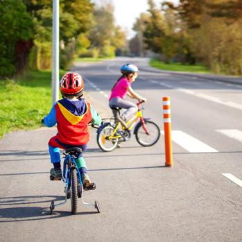
The image below comes from a Metroplan study of pedestrian accidents. It shows stretches of major streets in Little Rock and North Little Rock with higher-than-average accident rates. You can see how almost all accidents occur on fast-moving and busy streets. You will also notice pedestrian accidents are more frequent in areas with higher shares of minority population, persons in poverty, and households that lack access
to cars and rely on transit. Sometimes a pedestrian’s destination is a grocery store or bus stop on the opposite side of a busy street.
It becomes easy to blame the pedestrian for accidents, as in “they should cross where the signals are,” or “nobody should try to cross a street like that one” but closer analysis rarely confirms this kind of bias. Fortunately, a few design tweaks can go a long way toward improving safety.
Source: CARTS Pedestrian/Bicyclist Crash Analysis 2015
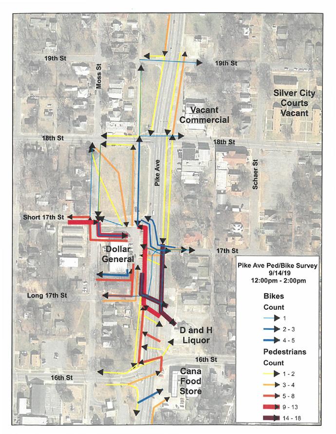
While plenty of data is kept on motorized vehicular flows, less is typically done for pedestrian flows. As the diagram below right shows, however, it can be done and the results can be striking. This diagram comes from observations made of pedestrians and bikes along Pike Avenue in North Little Rock. The corridor is known to have a lot of pedestrian accidents and even fatalities. Metroplan can do this kind of study for its member cities.
As you can see, ped and bike activity is heavily oriented to a few local stores. In practice crosswalks are slightly, but only slightly safer. The stretch of Pike Avenue here has five lanes—four of flowing traffic, plus a center turning lane.
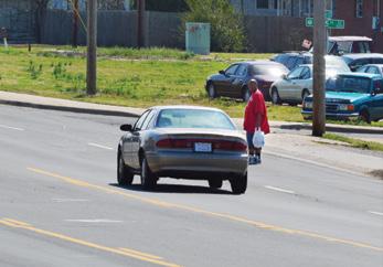
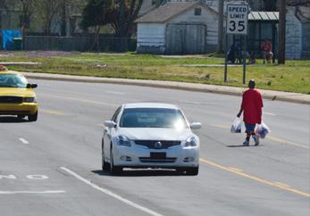

Compared with a simple four-lane road, a segment like this is safer for vehicles, but poor for pedestrian safety. The entire street is over 60 feet wide—something like 25 steps for the average pedestrian. Even at crosswalks pedestrians lack any shelter points on their way across, and vehicles can make rapid turns that endanger pedestrian safety.
Solutions might include measures to reduce traffic speed via traffic calming techniques or reconfiguring the road to
Even a few raised “pedestrian islands” at known crossing-points could improve safety markedly, at low cost.
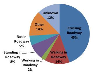
Action or Location of Pedestrian Fatalities in Central Arkansas 2009–2018
The next four pages illustrate some of the tools and methods cities can use to make streets safer for pedestrians.
Traffic calming is a form of road and street design that discourages fast driving and draws drivers’ attention to the nearby environment, increasing their awareness of walkers and bicyclists. Nothing influences driver speed more than lane width. Drivers go faster when lane width and speed limits are hard to enforce. When the roadway narrows, drivers dial down their speed.
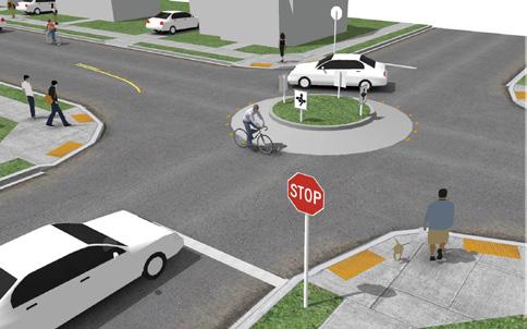
Neighborhood traffic circles and center islands can be used to reduce travel speed and improve pedestrian safety. https://nacto.org/
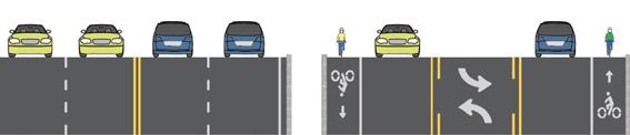
diets
the
often from four to three, to encourage slower driving, to allow room for bike lanes and (sometimes) additional space for pedestrians. https://www.mass.gov/info-details/whatare-road-diets
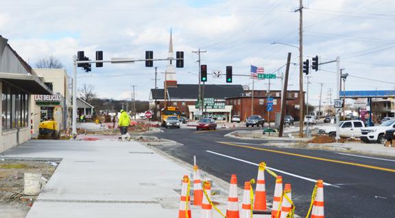
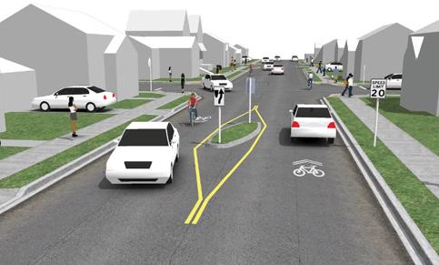
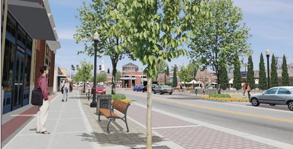
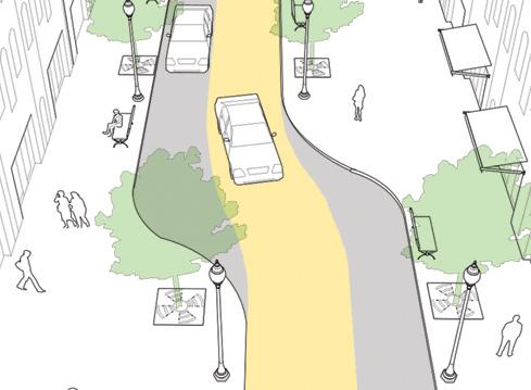
In North Little Rock’s Levy neighborhood, Camp Robinson Road is being converted from a four-lane roadway to two lanes with parking. The image above shows the project under construction; the image below depicts how it may look in the future.
According to the National Highway Traffic Safety Administration (NHTSA), 2018 saw the most pedestrian fatalities since 1990. 74% of those fatalities occurred away from intersections and 25% occurred at intersections.
Speed humps and raised crosswalks (also called speed tables) can slow traffic in selected locations. Source: nacto.org
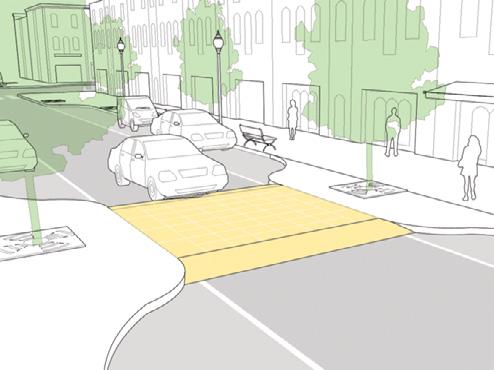
Pedestrian crossings can be made safer with bulb-out curbs that encourage slower driving and lower turning speeds. Chicanes compel drivers to pay attention and drive slowly. Source: nacto.org
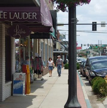
• Shorter distances between buildings and the street, street trees, and nearby building heights are all visual cues that gently remind drivers to slow down.
• Ten-foot lanes discourage drivers from going much above 45 mph.
• Where possible, driveways should be consolidated and width narrowed to the minimum needed for design vehicle entry and egress.
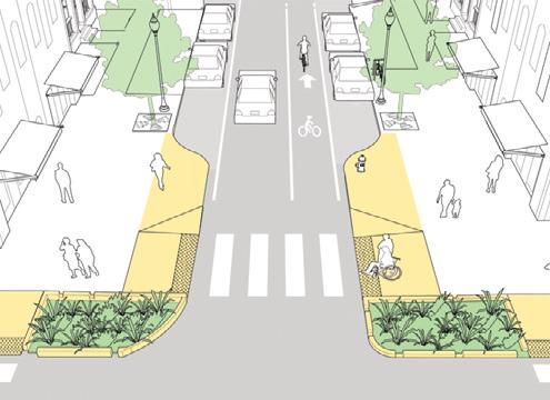
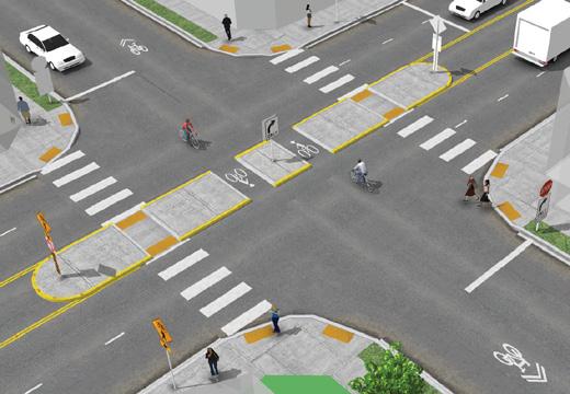
• Crosswalks should be located at all signalized intersections and clearly marked. Crosswalks should always connect to a sidewalk with an ADA curb ramp.
• Traffic light timing can be adjusted to give pedestrians a head start.
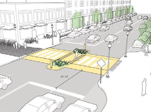
• Pedestrian islands are typically applied in locations where vehicle speeds or volume make pedestrian crossing difficult, or where there are three or more lanes of traffic in one direction.
• Visibility enhancements like lighting and enhanced signing and marking help drivers detect pedestrians, particularly at night.
• Stop signs can be set at frequent intervals to slow drivers down.
Crossing a busy street can be challenging for a pedestrian. Here are several measures that local jurisdictions can take to improve safety.
Male pedestrians are more likely than females to be seriously injured or killed while walking, especially pedestrians ages 18 and over.
—Metroplan’s Bicycle/Pedestrian Crash Analysis 2015
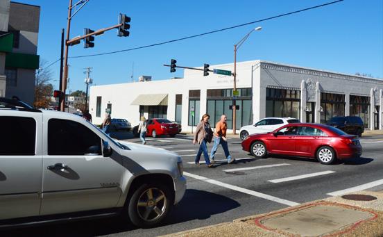
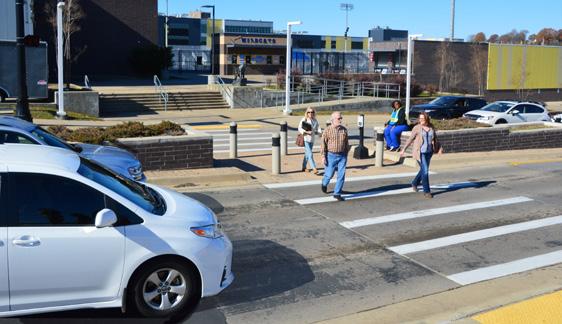
Leading Pedestrian Intervals (LPIs) at signalized intersections allow pedestrians to walk, usually 3 to 4 seconds, before vehicles get a green signal to turn left or right. The LPI increases visibility, reduces conflicts and improves yielding to pedestrians.
The LPIs at Broadway and 2nd Street in downtown Little Rock give pedestrians a head start.
Pedestrian refuge islands allow pedestrians a safe place to stop at midpoint before crossing the remaining distance—particularly helpful for older pedestrians or others with limited mobility. https://nacto.org/publication/urban-bikeway-design-guide/
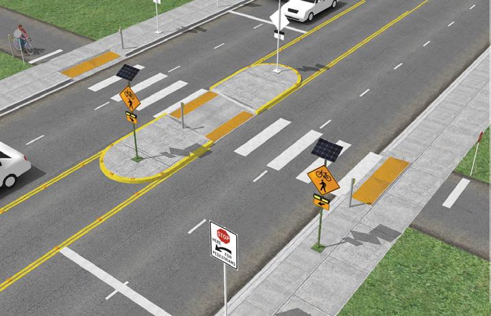
Rectangular Rapid Flashing Beacons (RRFB) are active (user-actuated) or passive (automated detection) amber LEDs that use an irregular flash pattern at uncontrolled-crossing locations, often at mid-block. They significantly increase driver yielding behavior. https://nacto.org/ publication/urban-bikeway-design-guide
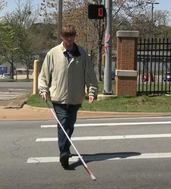
Audible signals help visually impaired persons cross the street.
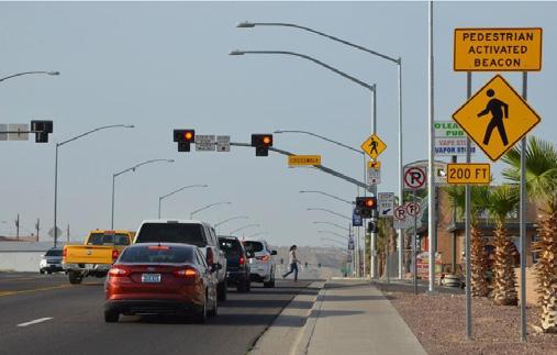
Pedestrian hybrid beacons (PHBs) provide positive stop control in areas where pedestrian traffic volume is too low to warrant full signal installation. In the photo on the right, PHB gets students and visitors safely across Main Street at North Little Rock High School. Left photo: https://safety.fhwa.dot.gov/provencountermeasures/ped_hybrid_beacon.cfm
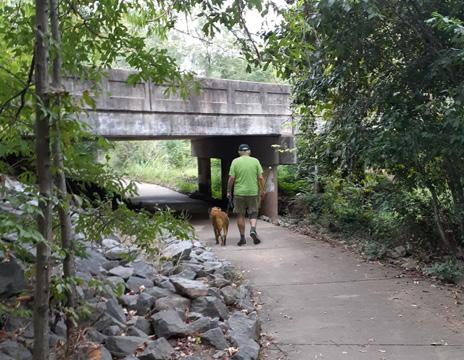
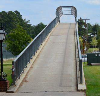
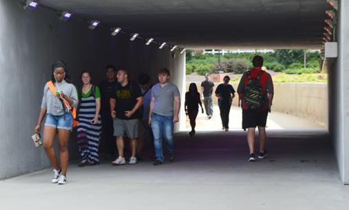
The ideal solution for pedestrians and bikes, of course, is an entirely separated right-of-way that sluices over and under traffic. The problem is cost. However, expense can be minimized by using existing bridges, as shown below where Little Rock’s Rock Creek Trail slips under where Chenal Parkway crosses the creek. Cities can plan ahead by building roadways with oversized drainage culverts (box culverts) that allow for future trail development underneath.
In cases where a full pedestrian overpass or underpass is warranted, it is important to remember critical safety features, such as good lighting and visibility for pedestrians and bikes.

This edition of Best Planning Practices introduces localized solutions to make pedestrian, bike, and transit activity safer.
For more insight and additional details, check out Metroplan’s new Multimodal Infrastructure Guidelines at https://tinyurl. com/4622ctps.
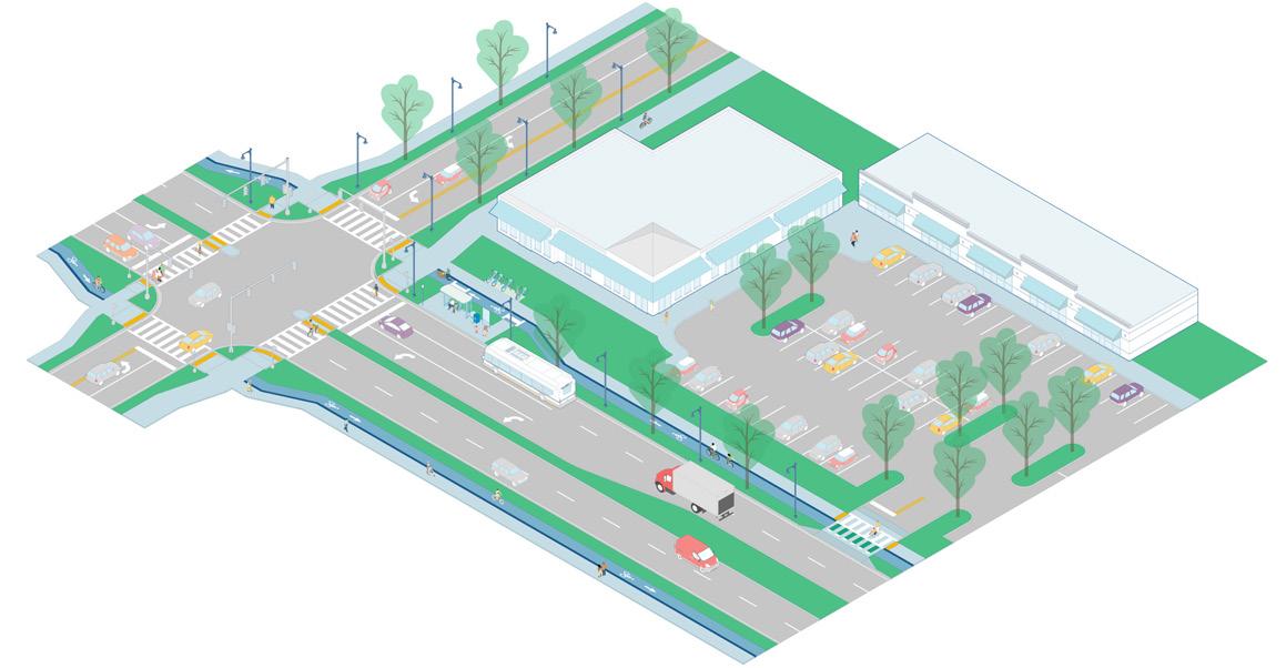
The document provides options that help governments and private developers design high-quality streets for a better future, and they are encouraged to incorporate the standards into their own planning documents. The actual choices remain, of course, with each local government.
The guidelines identify seven major corridor types and provide detailed recommendations and tips for developing high-quality streets that prioritize all users. The document gives tips on improving safety and convenience for mobility-impaired persons, pedestrians, transit users, and bikes, and for managing interfaces to transit and vehicles via curbside management.
If you have questions about items like transit access, pedestrian buffers, landscaping, raised crosswalks, EV charging, food trucks, and much more, give the guidelines a look at metroplan.org
Excerpt from Metroplan’s Multimodal Infrastructure Guidelines
Suburban Commercial corridors are larger, multi-lane streets having a variety of land use types that are rarely mixed with one another. Throughout the CARTS region, these corridors are prominent routes for not only motorized travel but for transit, walking, and bicycling too.
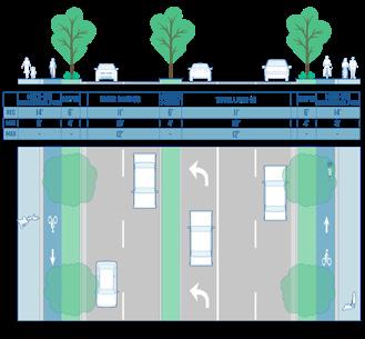
Example Streets
» Dave Ward Drive, Conway
» Chenal Parkway, Little Rock
» Brockington Road, Sherwood
» E. McCain Blvd., North Little Rock
» Reynolds Road, Bryant
» Military Road, Benton