Best Practices Planning v
Community Development • Transportation • Planning
Community Development • Transportation • Planning
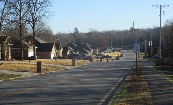
You don’t think much about how, or when your neighborhood was designed, but it affects you intimately, every day. If it was laid out before World War II, chances are it has a gridded pattern of streets and lots of sidewalks. The “city block” is standard in most cases. Areas laid out after the war, particularly in the most recent three or four decades, have very long blocks, or no blocks at all. There are few sidewalks, particularly in districts designed in the 1980s and 1990s (more sidewalks are being built now and in the past decade or two). Since about the 1980s cul de sacs have become common in many new neighborhoods. Ever noticed how hard it is to get anywhere on foot in an area rich in cul de sacs?
Connectivity is about a lot of things, including street design, trails, sidewalks and overall neighborhood design. It has a lot to do with how well roads function, how easy (or hard) it is to get out and walk somewhere, and city government (and the related tax burdens that affect us all).
The most common problem occurs when developers plan subdivisions. Developers typically lay out suburban neighborhoods that maximize the number of lots they can fit within their property. Homeowners like to be away from busy streets, so long curving streets and cul de sacs are popular. Traffic is not
Continued on page 2
yet
• Making Connections
• North Little Rock Trails
• Circulating in Sherwood
• The Connectivity Index
• Regional Trails Initiative
• The Tri-Creek Greenway In This Issue
There is no single definition of “best practices” in regional planning. Instead, in a democratic culture like ours in Central Arkansas, we have a continuing dialogue about planning. This newsletter aims to inform local governments, developers, planners, engineers and interested citizens about how the planning process works, and how it can work better. The goal is more great places in Central Arkansas that are affordable and pleasant to live, where somebody worked out problems in advance. This newsletter aims to share ideas and practices that help with planning the region’s future.
Continued on page 8
Continued from page 1
a problem— it’s a new subdivision, right? Traffic is a hassle for everybody else who lives closer in, that’s the beauty of it.
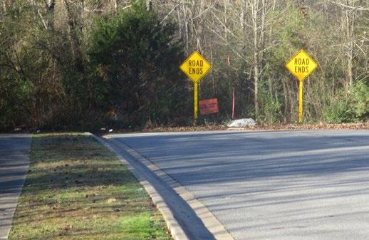
The trouble sets in a few years later, when other curving subdivisions—also loaded with cul de sacs—go in nearby. Most modern subdivisions have winding, deliberately indirect street patterns that empty out through one or at most two outlets. Distances are long, connections are few, meaning walking or biking are rarely viable. Traffic dumps out onto arterial streets, which become congested because arterial streets – streets that actually connect places – are rare amidst all the separated little subdivisions. By the time these problems become evident
the street network is already built. It’s too late to change.
Improving connectivity is about laying out new housing and businesses in such a way that streets connect. There are many options. Sometimes you can keep the curvilinear streets, and even the cul de sacs, but use trail connections to give pedestrians more choices. More street connections, and plentiful sidewalks, almost always help in the long run. This edition of Metroplan’s Best Planning Practices newsletter provides some alternatives to make neighborhoods function well and thrive far into the future, long after developers have moved on to something else.
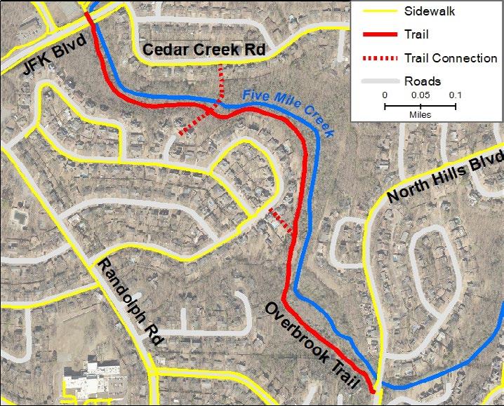
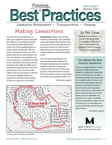
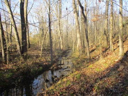
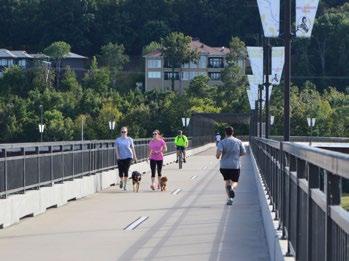
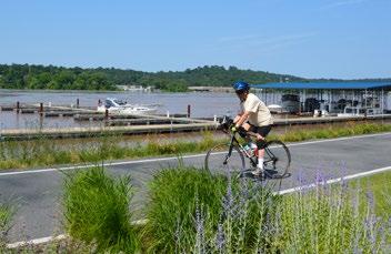
If you live in central-north North Little Rock, you may be familiar with the Overbrook Trail, a ¾ -mile stretch of bike / ped trail that stretches from JFK Boulevard to North Hills Boulevard along the path of Five-Mile Creek. Short trails connect the Overbrook Trail into the street grid of nearby neighborhoods.
In the late 1970s and early 1980s, the Matthews family developed the Overbrook Subdivision, and donated the land along the creek for a trail by deeding it to the Overbrook Property Owners’ Association (OPOA). The access paths which join the trail to city streets were platted in the original subdivision plan and paved a few years later. North Little Rock city council member Charlie Hight (who provided helpful background to this account) has never heard of any complaints from adjacent property owners about public access to the trail.
Hight envisions a future in which the trail becomes part of a hub-and-spoke system of trails looping around North Little Rock, with the Overbrook Trail as “the top of the wheel, with spokes that connect to downtown.” The trail remains the property of the OPOA but is open to the general public, and the city of North Little Rock assists with major maintenance. In short, a little long-term thinking forty years ago gave the Overbrook neighborhood a special feature that enhances connectivity, and livability, at minimal cost.
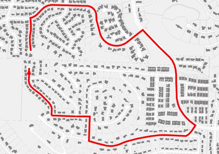
A connectivity index measures the connectivity of a subdivision or neighborhood. Each street segment counts as 1.0. Each intersection or endpoint also counts as 1.0. Endpoints include intersections, cul de sacs or dead ends. Divide the sum of segments by the sum of intersections/endpoints. The higher the figure, the better the connectivity.
The “Two Examples” image below shows two neighborhoods with different connectivity profiles. The one at left is a typical modern subdivision, with few outside access points, and lots of streets ending in cul de sacs. Its measure of 1.31 is low. The image at right is wellconnected, scoring 1.98.
The connectivity index is just one tool in the toolbox. It doesn’t fully measure pedestrian connectivity, although bikers and walkers can get around more easily in neighborhoods with higher scores, often accompanying a more gridded street pattern.
with dpoints
4 Segments with Segment endpoints
4 Segments with 4 Segment endpoints
4 Segments with 4 Segment Endpoints
4 Segments with 3 Segment endpoints
4 Segments with 3 Segment endpoints
4 Segments with 3 Segment Endpoints
4 Segments with 2 Segment endpoints
4 Segments with 2 Segment endpoints
4 Segments with 3 Segment endpoints 4 Segments with 2 Segment endpoints
4 Segments with 2 Segment Endpoints
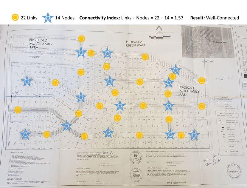

22 Segments 14 Segment Endpoints Connectivity Index: Segments÷Segment Endpoints= 22÷14=1.57 Result: Moderately Well-Connected
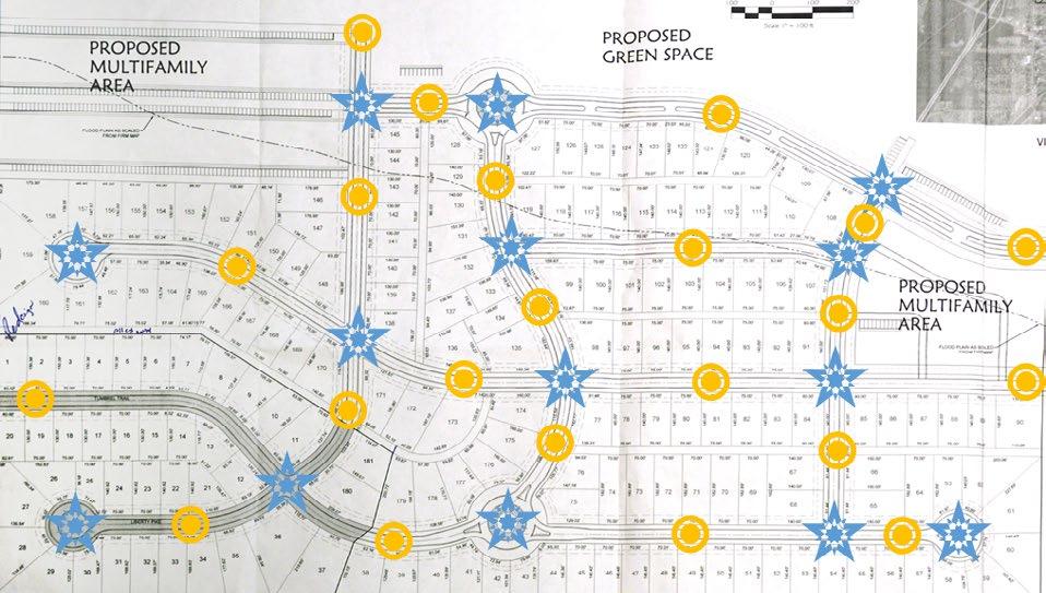
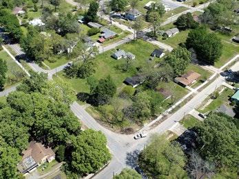
This proposed subdivision in Ward is moderately pedestrian-friendly. Some of the housing units have alleys to allow garages in back.
Sherwood started out as a little, rural place. Its first census count, in 1950, was 717 residents. In 1970 it had about 2,754 residents, smaller than today’s fast-growing Central Arkansas towns like Greenbrier, Vilonia, Austin, and Ward. Fifty years on, Sherwood has over 30,000, fifth largest among Central Arkansas cities by population. It has some major traffic problems, and connectivity is a core issue.
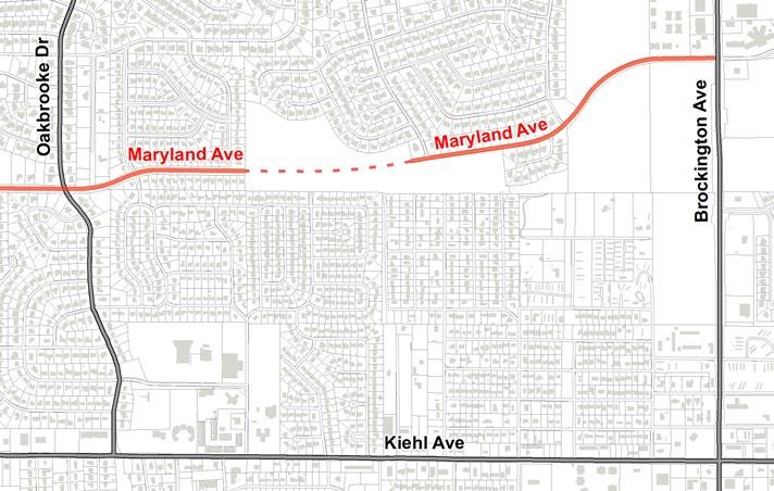
Subdivisions were built one at a time, typically tying onto an arterial road. The arterials have been improved and widened in places to deal with a rising traffic load, but there are major gaps in the city’s street fabric. An example is in central-eastern Sherwood, where a lack of connections is adding to traffic woes along Brockington Road, Kiehl Avenue, and elsewhere. The city hopes to remedy this local problem by adding connections between existing segments of Maryland Avenue to provide an alternate east-west connection. This will relieve traffic on portions of Brockington and Kiehl, as well as making access at least a little easier for transit riders, bikers and walkers.
Sherwood Population 1950-2020
Source: U.S. Decennial census 1950-2010. Metroplan estimate for 2020.
Source: U.S. Decennial census 1950-2010. Metroplan estimate for 2020.

There are lessons in this experience. Cities must enforce what gets built upfront, to avoid more expensive remedies later. Developers do not build a city’s master street system; they build only the street segments they need. It is up
to the city government to make sure developers’ investments are built toward a workable street system in the future, so the city does not find itself stepping in and finishing the system long after the developer is gone. Once streets are in,
they will probably endure for centuries. Sherwood is not alone: most of the region’s cities are dealing with similar problems in their suburban portions –areas that once felt small and remote but now face big-city challenges.
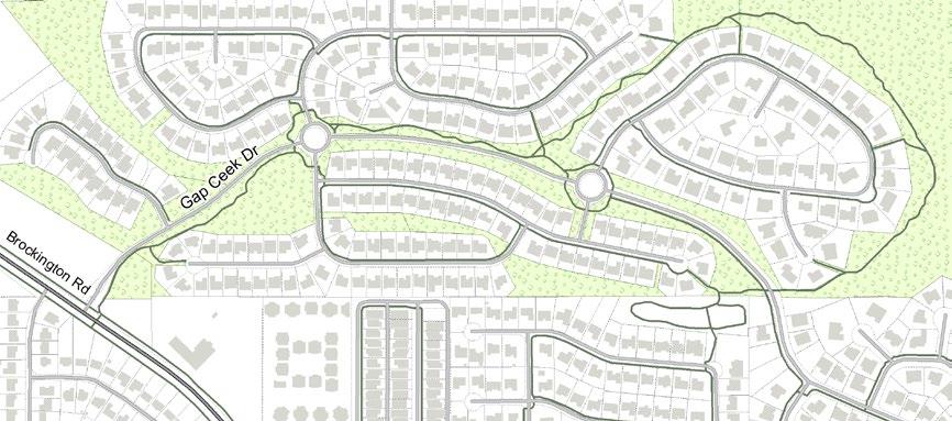
The Gap Creek subdivision in Sherwood, started in the late 1990s, is a case study in how modern neighborhoods can encourage biking and walking. With four street outlets and ample cul de sacs, its street connectivity index is not especially high, at 1.42. However, Gap
Creek has good internal pedestrian circulation because trails connect places where streets do not go. This makes Gap Creek better than average for biking and walking. Most homes are within a short walk of natural areas and parks.
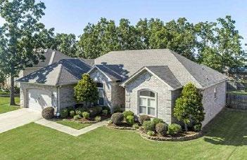
https://www.redfin.com/AR/Sherwood/2209-GapCreek-Dr-72120/home/95356364
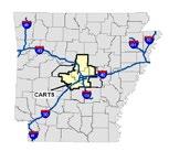
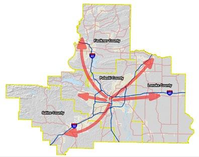
Few who lived through 2020 will remember it fondly, yet Central Arkansas marked a milestone. On February 26, 2020, the Metroplan Board announced the Regional Trails Initiative (RTI), a commitment to put $55 million—roughly half of Metroplan’s anticipated revenues over the next ten years— into building a regional trails system.
Connectivity is a key theme of the RTI. It builds on existing trails, including its world-class trail system stretching 88 miles along and near the Arkansas River. The RTI aims to weave existing standalone trails into a hub-and-spoke system from the region’s center to its fringes. The map at right shows five possible vectors the proposed RTI may follow,
although alignments are still being determined.
The Covid-19 crisis descended shortly after the Regional Trails Initiative was announced, diverting public attention from this trend-setting proposal. Ironically, the pandemic only increased demand for better outdoor recreation, making pedestrian connections more important the world over. The RTI gives ped/bike connectivity equal funding priority with motorized transportation. Expect more trails soon in a neighborhood near you.

“This trail initiative is innovative, it is trend-setting, and it will succeed because we are committed to it over the long term.”
—North Little Rock Mayor Joe Smith, Metroplan Board President
Guest writer: John Landosky, Ph.D.
City of Little Rock Bicycle and Pedestrian Coordinator
The City’s commitment to #UniteLR and Metroplan’s commitment to a regional trail network are paying off in the TriCreek Greenway. The Tri-Creek Greenway will be a shared use trail in southwest Little Rock connecting neighborhoods and making transportation less cardependent (Fig. 1, at right).
Transportation choice is important throughout Central Arkansas, but is particularly important within the Tri-Creek Greenway catchment. Low incomes and a high proportion of zero car households make a car-dependent transportation system particularly unfair in this area. This inequity can perpetuate cycles of unemployment, truancy, and poverty. The Tri-Creek Greenway will not only increase viability of walking and biking for transportation but will also increase access to several Rock Region Metro routes, better connecting this area into the rest of Central Arkansas (Fig. 2, page 8).
This project also addresses inequalities in transportation safety. Nearby residents are predominately African-American; a population three times more likely to be hit by a car while biking and also three times more likely to be struck and killed by a car while walking vs. white residents in our metro area. The TriCreek Greenway creates a safe crossing of a particularly dangerous corridor of Colonel Glenn, as well as Kanis, 36th St., Mississippi, University, and two Rock Creek crossings.
Figure 1. Map of the Tri-Creek Greenway Phase Three scope of work, see also: https://www.littlerock.gov/ for-residents/bikeped-little-rock/projects/trails-sidepaths/tri-creek-greenway/tri-creek-phase-3/
The Tri-Creek Greenway creates six Safe Routes to Schools, increasing opportunities for upward mobility. It also yields seven Safe Routes to Parks, each with unique programming, increasing access to physical and mental recreation. It improves access to two grocery stores and the Colonel Glenn business district. It improves connections between
UALR and the community. It links with existing on-street and off-street bicycle and pedestrian infrastructure in several places, binding piecemeal facilities into a functional transportation network.
The City is grateful to partner with Metroplan in an exciting reinvestment into southwest Little Rock and active transportation.
Additional Tri-Creek Greenway Map on page 8
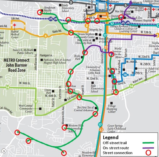
Figure 2. The Tri-Creek Greenway improves transit access and addresses the “last mile problem,” connecting with Rock Region METRO routes 3, 5, 8, 14, 16, 17 and 22. Street connections are shown with red circles.
Connectivity requirements must be written into subdivision and zoning ordinances to guarantee street connectivity for future developments. Below are a few basic rules for creating neighborhoods that are conducive to walking, bicycling, and transit use.
• Sidewalks in all subdivisions, preferably on both sides of street.
• Maximum block length: 1,320’ (preferred: 400’-660’).
• Cul-de-sacs either prohibited or limited to 400’ in length (660’ if bike-ped path provided from end of cul-de-sac to another street)
• Long blocks require mid-block bike-ped paths. The distance from one cross street to another cross street or mid-block path may not exceed 660’. More than one mid-block path may be necessary to meet this requirement.
• Minimum connectivity index of 1.4 for all new residential development with bike-ped paths contributing to meeting the standard.
• Stub-outs abutting unplatted land to provide for future street and bike-ped path connections.
• No gated street entryways into residential developments.
• Joint access and shared driveways between parking lots.
References:
America Walks. Add Street-Connectivity Minimums into Subdivision Ordinances. https://americawalks.org/add-street-connectivity-minimums-into-subdivision-ordinances/ Kentucky Transportation Cabinet. Street Connectivity Zoning and Subdivision Model Ordinance. https://www.apaky.org/uploads/6/8/4/3/68439377/kentucky_connectivity_model_ordinance_final.pdf
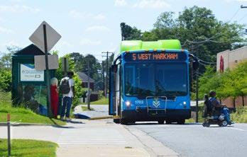
The Tri-Creek Greenway will connect to multiple Rock Region METRO bus routes, increasing safe access to transit and addressing the last mile problem, for example the trek from bus stop to front door.
Continued from page 1
Metroplan is not a regulating body. It is a council of governments, run by a board of mayors and county judges from its city and county members in the Central Arkansas region. This newsletter will avoid dictating planning practices as simple rightversus-wrong, but rather as a set of choices within a participatory process. Each edition will focus on a theme; this edition’s theme is connectivity.
Metroplan staff want this newsletter to be open to its readers. If you have something to add to what we have said, or if you disagree, we welcome your input and may, if you are willing, publish your commentary in future issues. You can reach us online at comments@metroplan.org. Tell us what you think.
Metroplan 501 West Markham St., Suite B 501-372-3300
http://metroplan.org comments@metroplan.org