P O R T F O L I O M E N M A O K E R E K E
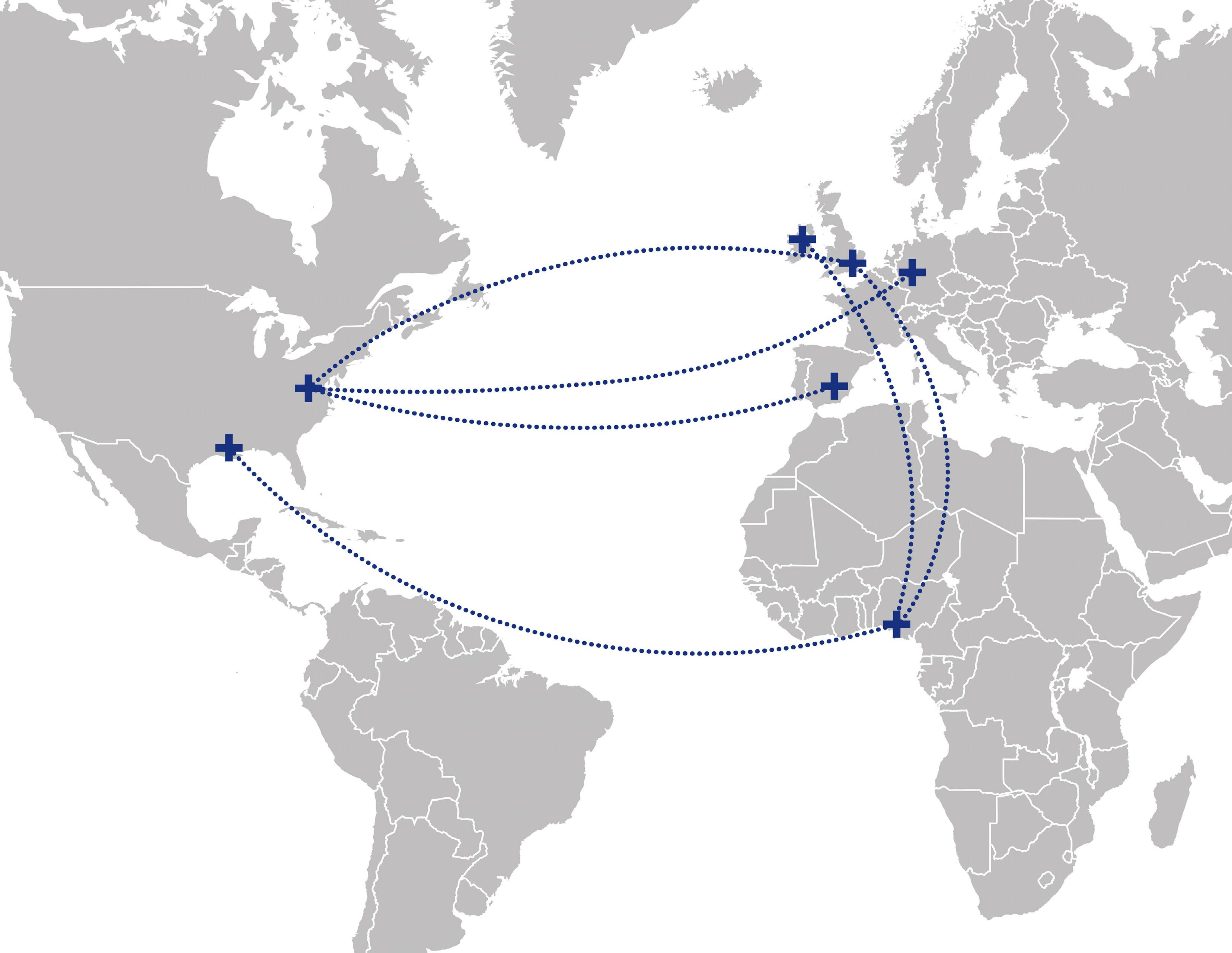
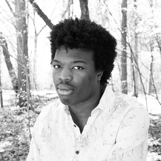
Menma is a 5th-year Landscape Architecture student at the Pennsylvania State University. He brings an advanced understanding of the built environment, along with strong visualization, 3D and physical modeling, and hand drawing skills. Having lived and schooled in 5 different countries Menma is a true global citizen. His international experience has taught him to look for opportunities in all cultures and contexts.
Recognizing sustainable cities as a significant aspect of humanity’s future, Menma is interested in the intersections between ecology, culture, and urbanscapes. His work aims to create habitable environments for human and non-human stakeholders that encourage public engagement, cultural education, and beauty while preserving our environment.
In his spare time, Menma can be found on the soccer field, at the cinema, on an airplane, or in his room reading. His relationships with his friends and family are also integral to him as he believes the people he has met along the way have had the greatest impact on him.
EDUCATION
Pennsylvania State University
Bachelors of Landscape Architecture
Barcelona (Spain) Study Abroad
Bonn (Germany) Study Abroad
Harvard GSD Design Discovery
Design Futures
Cooper Union Intro to Architecture
TASIS England
Surrey, UK
High School/IB Diploma
EXPERIENCE AND AWARDS
Honor Award BLA Category ASLA Student Awards Program
Teacher Assistant for Landscape Architecture Studio
TASIS England Diversity, Equity and Inclusion Committee
Penn State Landscape Architecture Department Excellence Award
Penn State Landscape Architecture Student Society Member
SKILLS
Physical Model Making
3D Modeling: Rhino, Sketchup
Adobe Suite: Photoshop, Illustrator and InDesign
Real Time Rendering: Lumion, Twinmotion
Drafting: Hand-Drawing, AutoCad
INTRODUCTION RESUME 2019-2024
2023 - 2024
2023
2021
2023
2022
2022
2021
- 2019 2024
2020 -
2021-2022
Summer
Fall 2022 Summer
Summer
Summer
2016
URBAN OASIS BARCELONA STUDY ABROAD 2023
THROUGH MAKING HARVARD DESIGN DISCOVERY 2022 MSC PLEASURE GARDENS LARCH 335 2021 CONSTRUCTION DRAWINGS LARCH 235|LARCH 335 2021 AROCHUKWU CHAPEL BUILDNER COMPETITION 2023 07 15 21 27 33
CIUTADELLA
LEARNING
PROJECTS LIST
CIUTADELLA URBAN OASIS
Barcelona Architecture Center Summer Program LARCH 414
Summer Semester 2023
Individual Academic Project
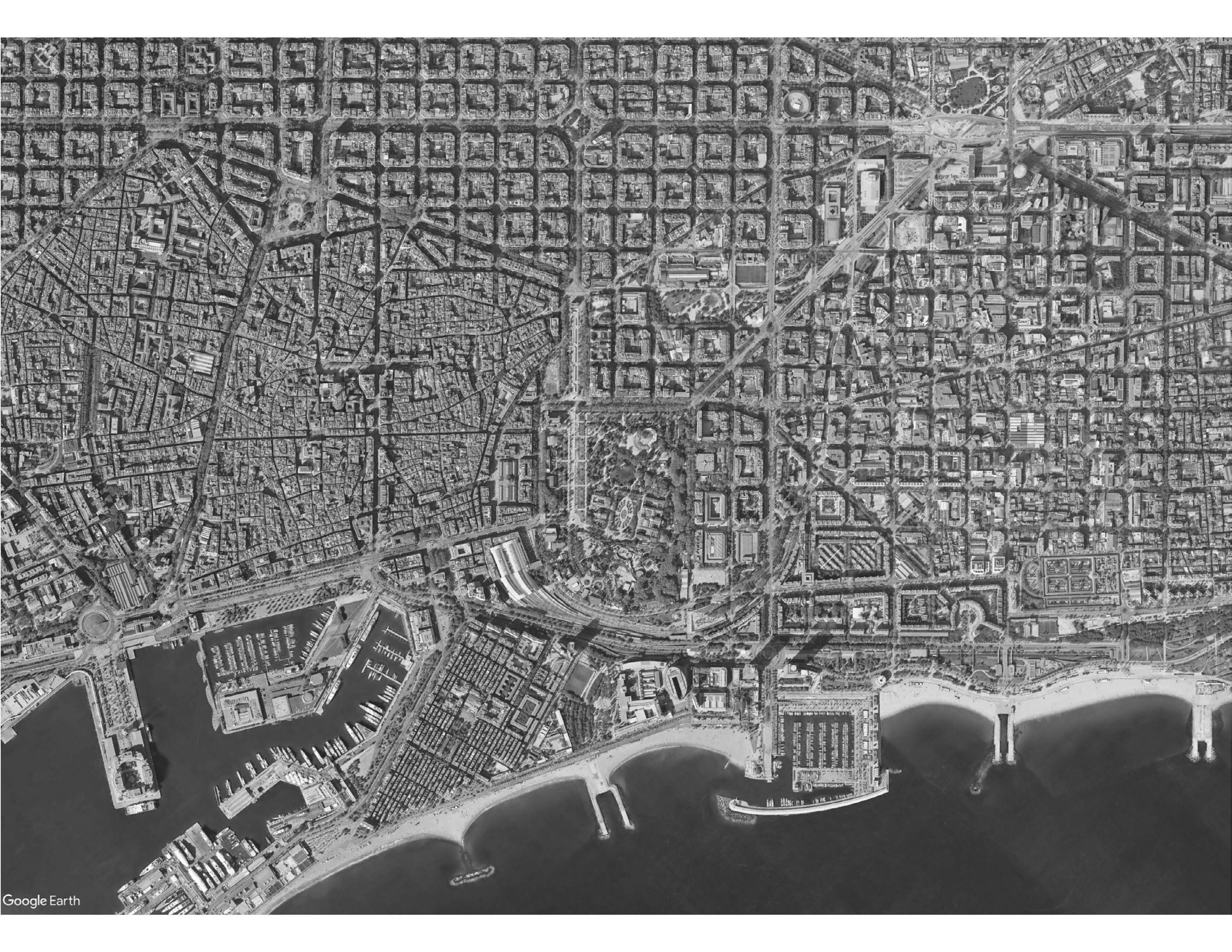
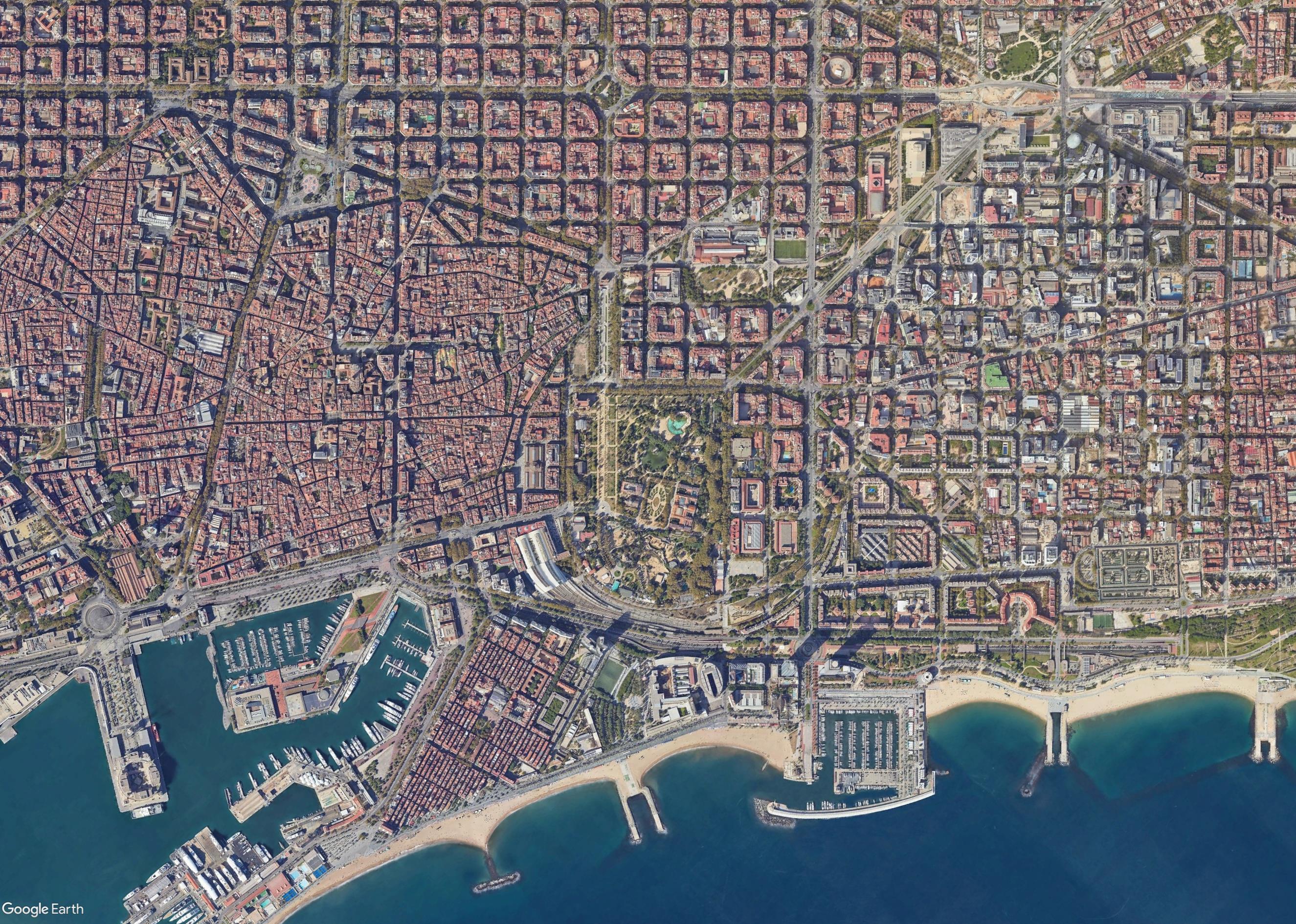
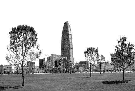
KEY ROADS AND LANDMARKS

CIUTADELLAPARK
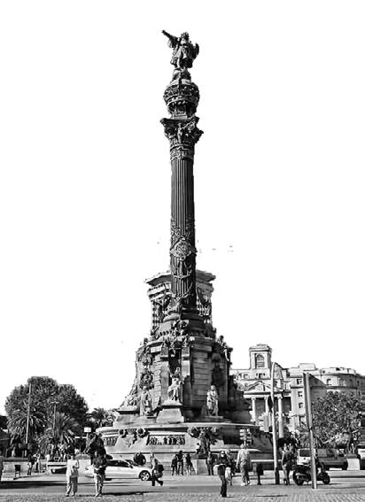
MONUMENTO COLUMBO

AVINGUDAMERIDIANA


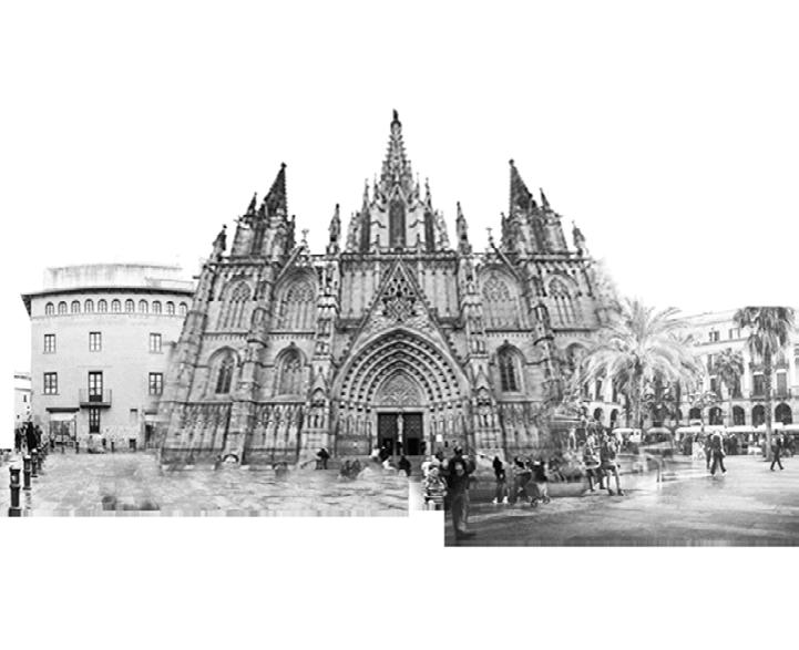
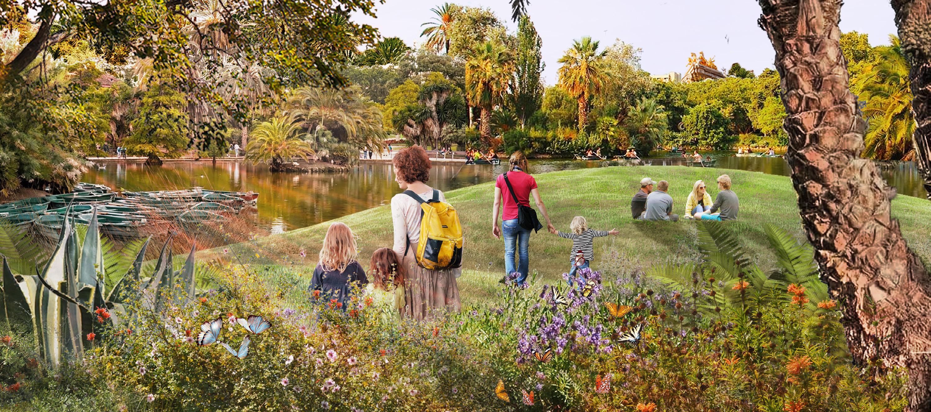
Barcelona’s metropolitan condition and ongoing drought threaten to create an Urban Desert. From this scenario I envision the new Ciutadella Park as an Urban Oasis. A place of respite that serves Barcelonans and their native ecology alike.
Barcelona Architecture Center|LARCH 414|Summer 2023 8 © 2024 Menma Okereke
GOTHIC QUARTERS
BARCELONA BEACH
ARC DE TRIOMF GAUDIFOUNTAIN CATALAN PARLIAMENT
D’ISABEL
PLACA DE JOAN FIVELLER PARC DE LES GLORIES PASSEIG
II
BARCELONA ZOO
Existing Conditions

The Avinguda Meridiana is a major avenue in Barcelona. Although Ciutadella Park is connected to it, there is no entrance at where the park and road meet. Adding an entrance here would link Placa de Glories (another major park) and Ciutadella Park adding Ciutadella to Barcelona’s ogreen network that is under costruction.

The main entrances are key to the site as they serve as connections to two major landmarks in Barcelona, Monument a Colom (Colombus Statue) and the Arc de Triomf.

Zone 1
Pond

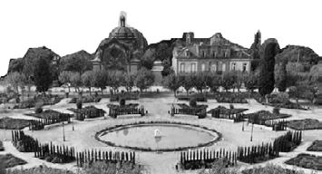
The Placa de Joan Felliver garden is the center of the park and marks the entry to the parliament. However its placement obstructs the circulation and its formalistic style does not flow with the rest of the park.
The adjacent Barcelona beach currently has no access to the park . The park would benefit from such a connection by linking one of Barcelona’s major landmarks to its green network.


Zone 2
The founrain designed by Antoni Gaudi is the most iconic part of the Park. However the absence of a cohesive layout downplays its importance. New circulation should be designed to intentionally integrate the founatin into the site.
Universitat Pompeu Fabra
The Universitat Pompeu Fabra is a major neighbouring facilitiy. The walls, zoo and tram line cutoff circulation through the park. The park needs to be opened up to be welcoming to the students.
Proposed Concept
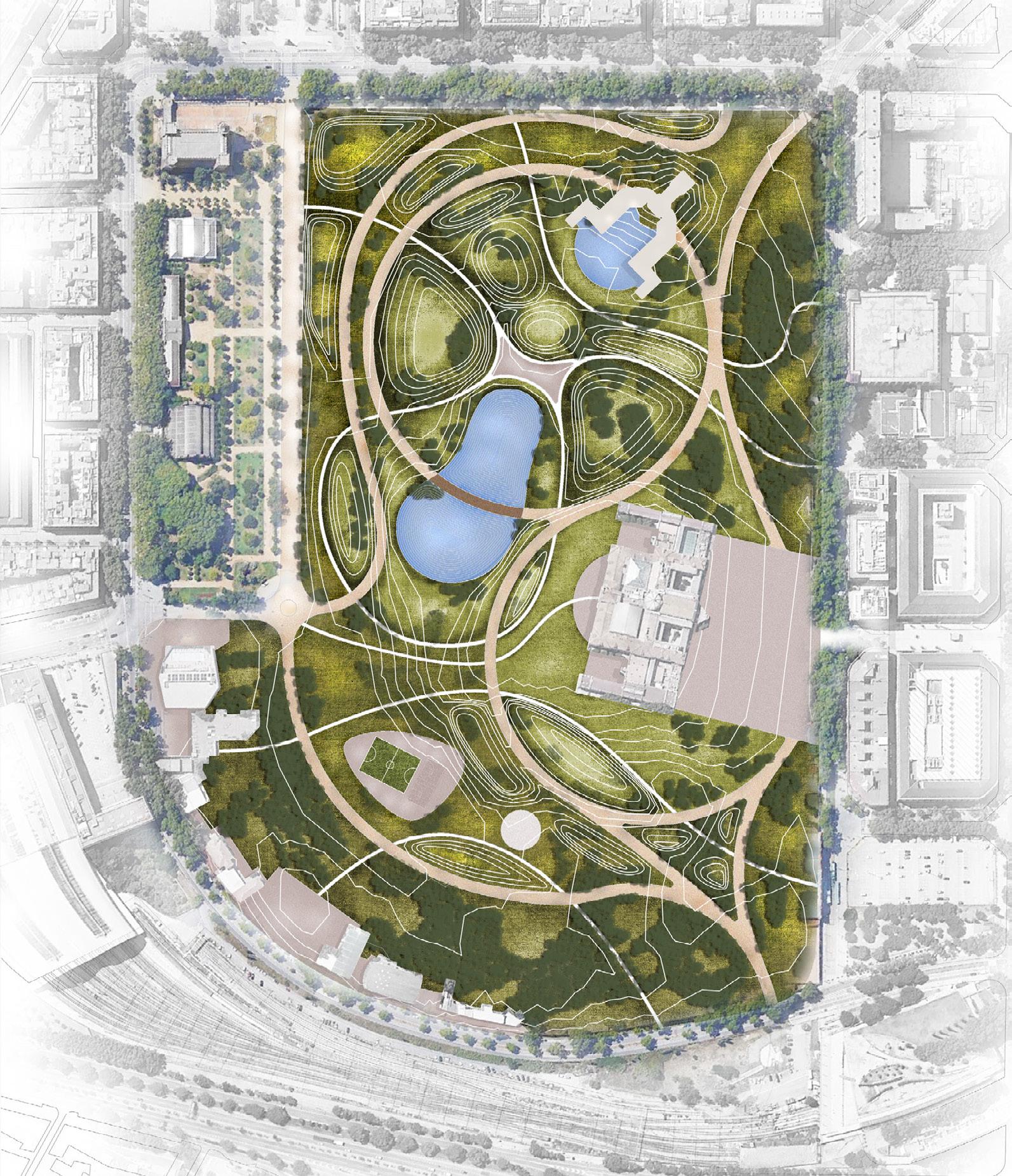
My concept proposes a new layout which cohesively integrates the park’s facilities and connects external landmarks and adjacent sites. The layout is formed around two main zones, the Gaudi fountain and the parliament.
Although the zoo is to be removed, the existing trees which host a variety of bird species are to be kept. This creates an urban forest and a transition zone from adjacent sites into the park along the right edge.
Lastly moving the Placa de Jao Felix garden to the other side of the parliament reorients the Parliament building, creates access to the park from the University and creates a more formal entry to the Parliament building.


The Barcelona zoo although not part of the park’s original plan is the most dominant aspect of the site. It heavily blocks the sites circulation by blocking off most of the site from the adjacent neighborhoods. Additionally its containment of non-native Barcelona animal species brings its contemporary relevance into question. Because of these factors I propose the shutting down of the zoo and the relocation of the present animals.


Zone 2


Barcelona Architecture Center|LARCH 414|Summer 2023 9 © 2024 Menma Okereke
Zone 1 Pond
Universitat Pompeu Fabra
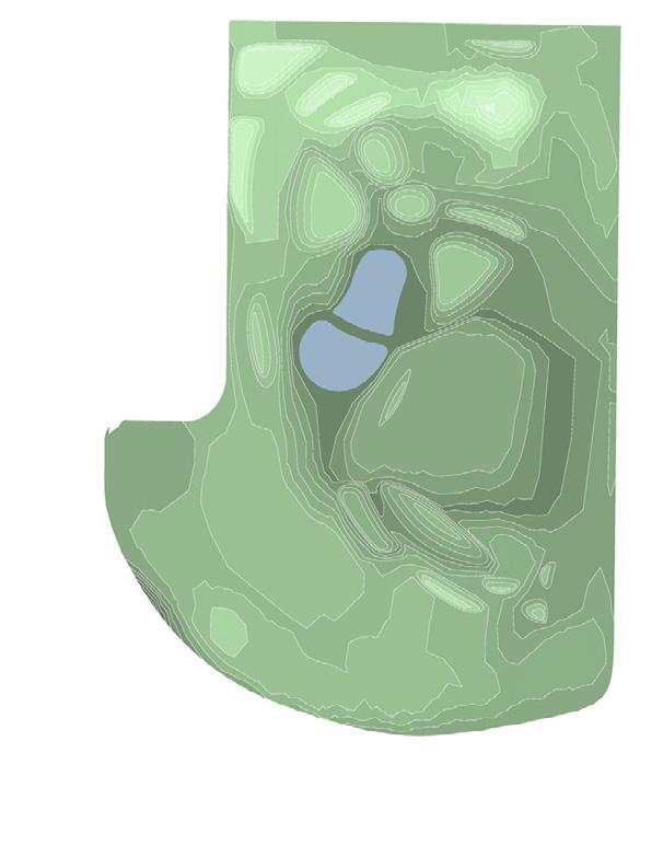
Working With Topography
Proposed Topography Map
Topography is a key player in transforming the site to a naturalistic landscape. The site is graded to create an immersive experience as well as aiding in stormwater retention.
Oasis Concept Section
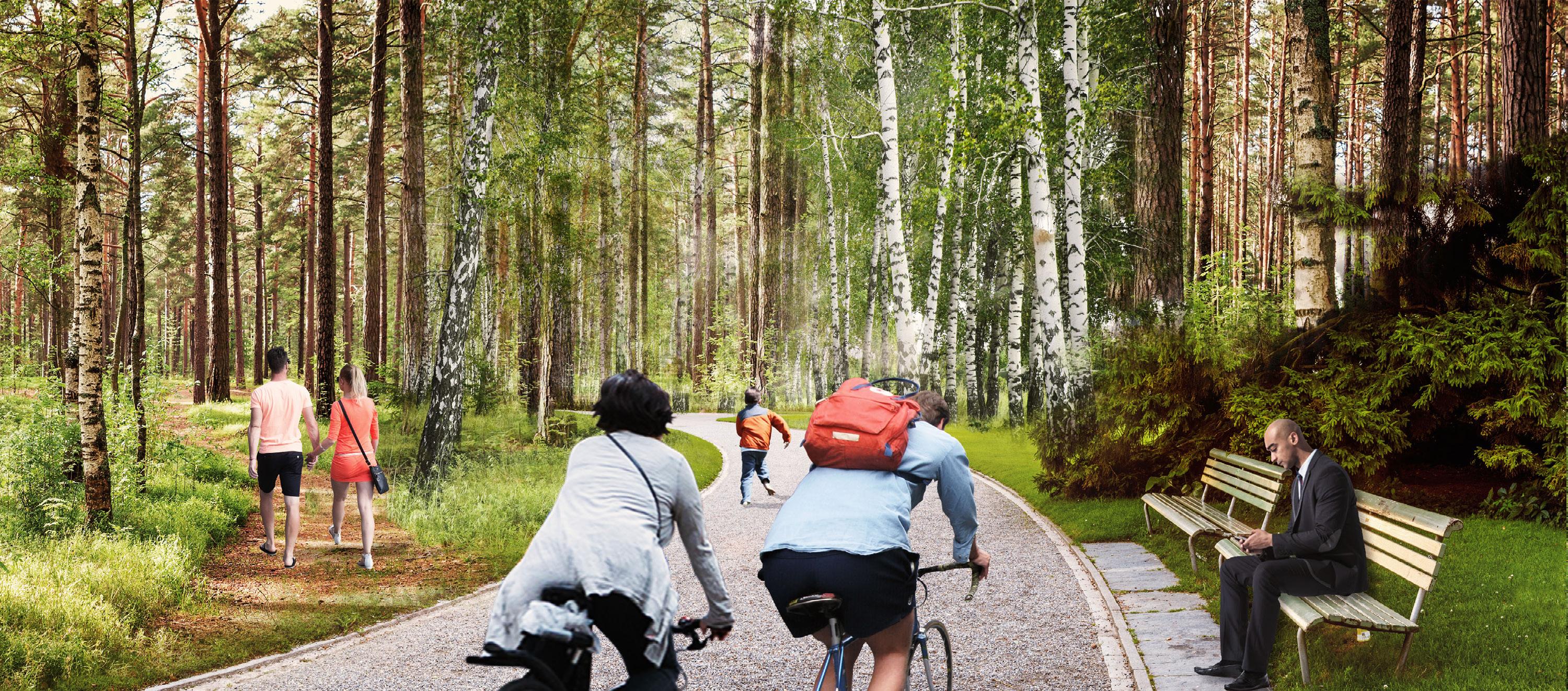
Topography is used as a tool to create seamless transitions between land and water. The edge of the pond is to be transformed from its currently hard edge to an area of native vegetation which supports Barcelona’s native birds and organisms.
Hydrologic Functions of the Site
Topography helps to collect and filter stormwater runoff. The water is then retained or dispersed for the sites hydraulic needs or to adjacent properties.
Concept Masterplan

Barcelona Architecture Center|LARCH 414|Summer 2023 10 © 2024 Menma Okereke FILTER COLLECT DISPERSE HOLD
2 3 1 4 5 6 7 8 1 2 3 4
1. Gaudi Fountain 2. Central Plaza 3. Oasis Pond 4. Catalan Parliament 5. Placa de Joan Felix Garden 6. Sports Fields and Courts 7. Children’s Playground 8. Sports Complex 9. Urban Forest
9 Highest Point Lowest Point
Barcelona Architecture Center|LARCH 414|Summer 2023 11 © 2024 Menma Okereke
View of Oasis Pond
Barcelona Architecture Center|LARCH 414|Summer 2023 12 © 2024 Menma Okereke
Ride Through Urban Forest
DESIGN DISCOVERY: LEARNING THROUGH MAKING
Harvard Design Discovery Be My Neighbor Summer 2022
Individual Personal Project
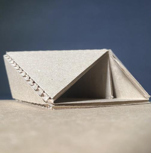
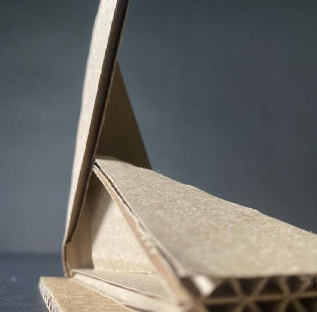
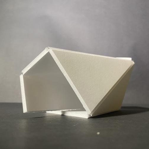
WORKING WITH THE FOLD
What is a roof? What is a floor?
What is a wall? All architecture on a fundamental level consists of these 3 components. Each of these elements has a common definition.
Definitions that are treated as objective truths. This project does away with architectural premonitions, showing that theoretically, architecture has no objective meaning. Rather, even the most basic architectural elements are subject to context and program. Once architecture can be sited within a certain place, a certain time, and for certain use then can it be defined.
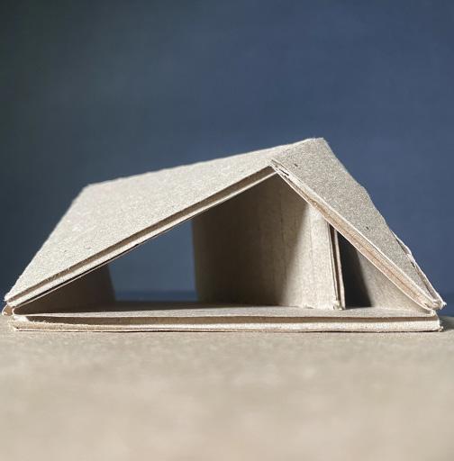
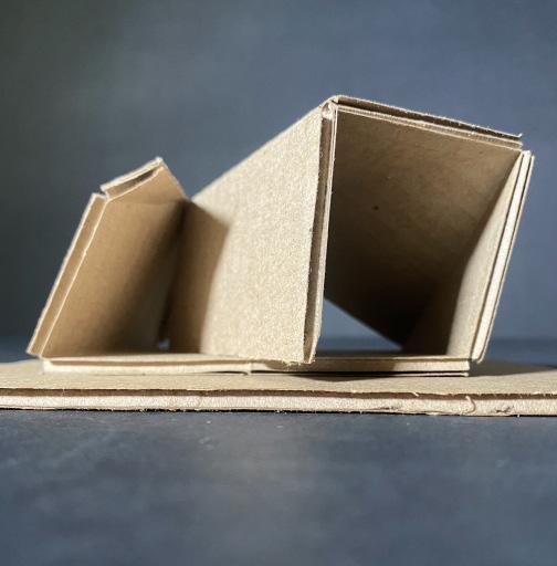
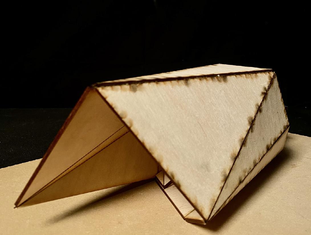
Working with the fold allowed for a breakaway from pre-conceived definitions of shelter. The qualities of the fold leave undefined what wall, floor, and roof are in the virtual/abstract world. The fold simply manipulates space.
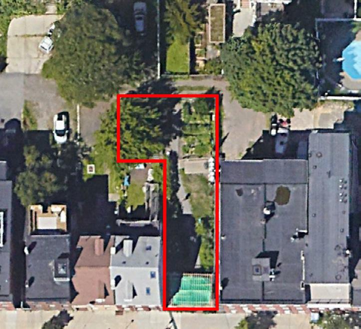
Our site on Sumner Street serves as a communal space for the local neighborhood. Present was a community garden and open space for events. All the site lacked was formal shelter to protect from the elements.




Harvard Design Discovery|Be My Neighbor|Summer 2022 16
© 2024 Menma Okereke
Testing the Fold
296 Sumner Street
Photo from Google Earth
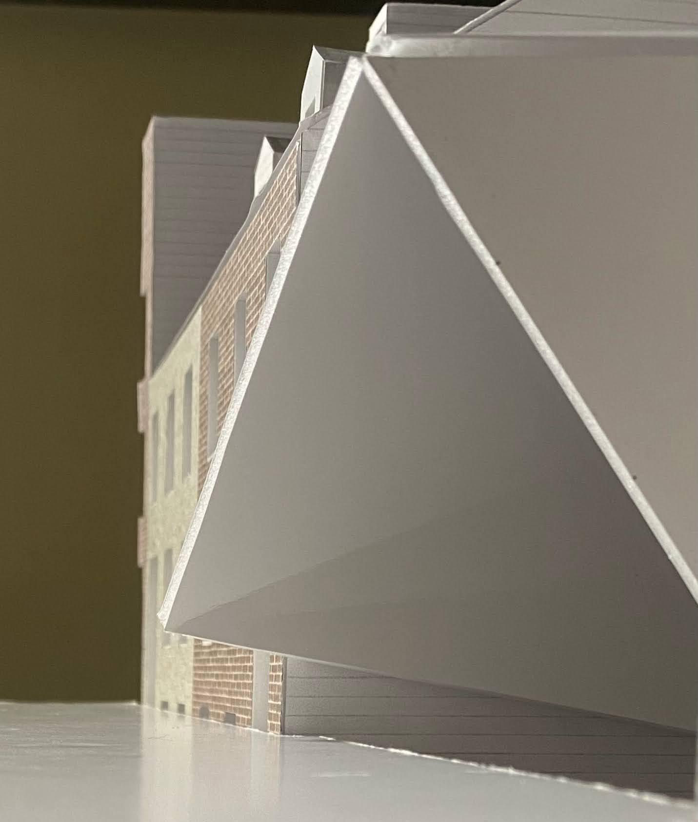
As the created object is planted in the physical world, it encounters scale, program, and context. It is through this introduction that wall, floor, and roof gain material definition.
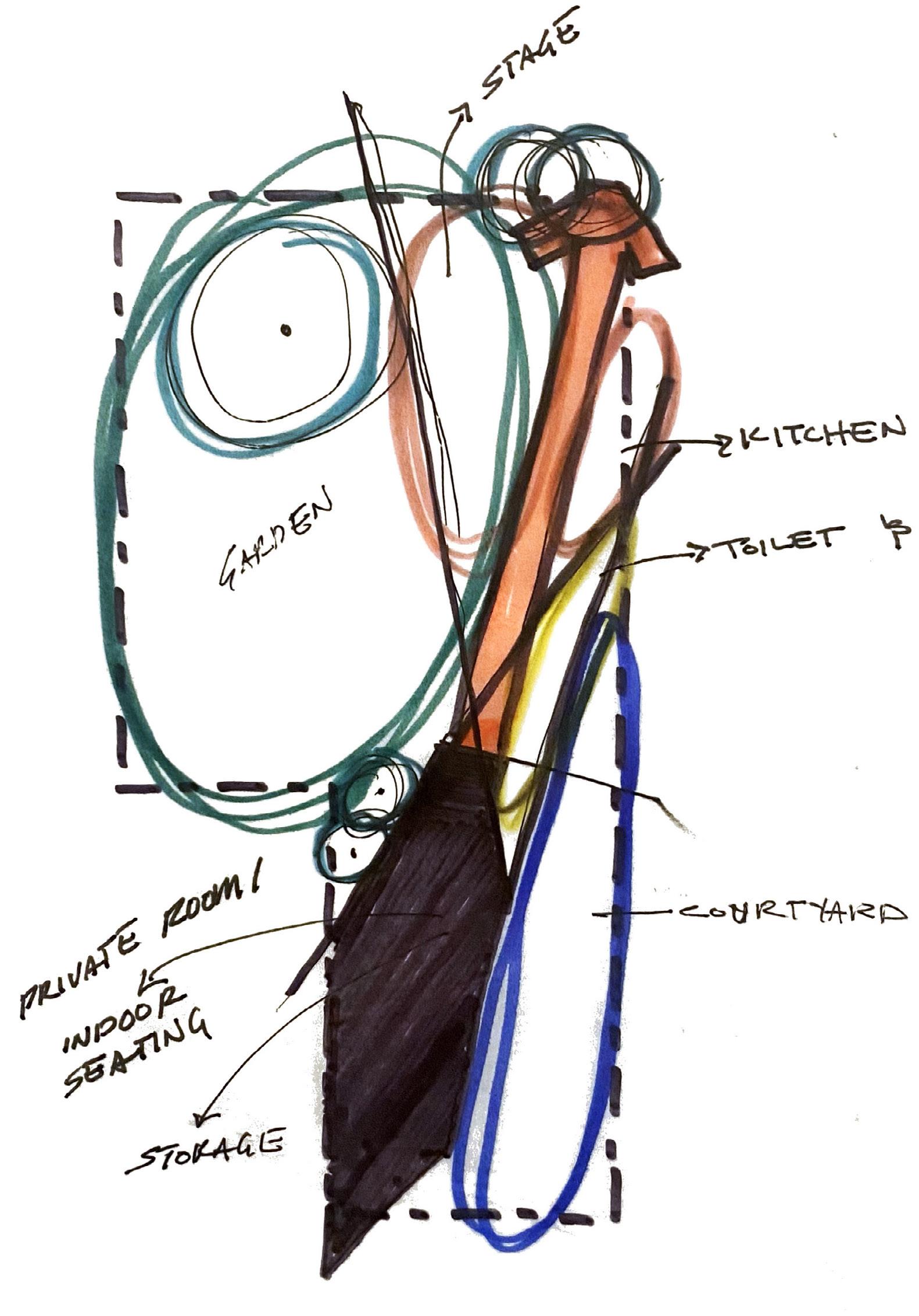

Harvard Design Discovery|Be My Neighbor|Summer 2022 17 © 2024 Menma Okereke 7 6 5 4 3 2 1 7 5 4 3 6 2 1 Community Vegetable Garden Community Flower Garden Amphitheater Kitchen and Grill Storage and Bathrooms Courtyard 1 Courtyard 2 PROGRAM 8 8 Upcoming Pavilion Space Site Plan
Selected Concept Model

Harvard Design Discovery|Be My Neighbor|Summer 2022 18 © 2024
Menma Okereke
Final Massing Model
Site Section With Pavilion

Harvard Design Discovery|Be My Neighbor|Summer 2022 19 © 2024 Menma Okereke
View from Sumner Street Pavilion Exit Pavilion Entrance
MILLENIUM SCIENCE COMPLEX PLEASURE GARDENS
Pennsylvania State University
LARCH 236
Fall Semester 2021
Individual Academic Project
FORMAL GARDENS NATURALISTIC GARDENS
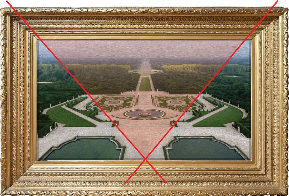

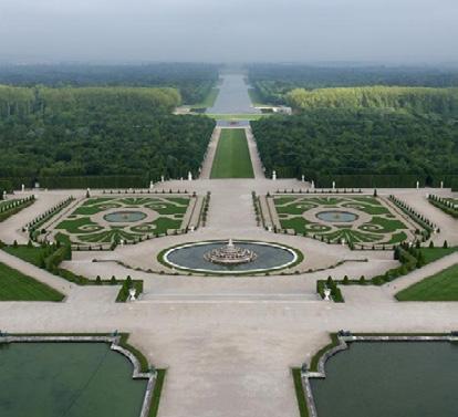
THE GARDEN OF VERSAILLES WAS OWNED BY THE FRENCH KING LOUIS XIV. DESIGNED BY ANDRE LE NOTRE, ITS DEVELOPMENT BEGAN IN THE YEAR 1661 AND TOOK ABOUT 40 YEARS TO BE COMPLETED.
Formal Gardens were commonly found in the chateaus of French monarchs and aristocrats, serving as a symbol of their power and control. The fact that these landscapes required an excessive amount of maintenance and care frequently at the cost of the subjects, only emphasized the owner’s status.

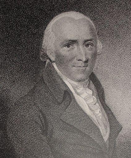
HENRY REPTON IS ONE OF THE KEY PROPAGATORS OF THE ENGLISH GARDEN. HE WAS WELL KNOWN FOR HIS ‘RED BOOKS’ WHICH CONSITED OF DRAWINGS WHICH CAPTURED THE SPIRIT OF HIS DESIGNS.
English landscape (naturalistic) gardens aim to present nature in its ideal state. They generally included a combination of rolling hills and lakes amidst tree groves. Artificial ruins were also commonly included as a means of enhancing this ideal. English gardens were a rejection of French Gardens which were viewed as too rigid and falsified the image of nature.
SYNTHESIZING THE FRENCH AND NATURALISTIC TYPOLOGIES
Formal Gardens through order and symmetry suggest intentional design. However, they require heavy maintenance and symbolically represent colonial ideas of landscape. Natural gardens have strong biodiversity, require little maintenance, and are typically democratic symbols. However, these landscapes are sometimes disorderly. Synthesizing both typologies creates a refined version of each template and allows for a new garden experience.


Design Concept
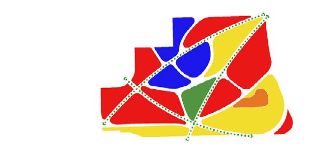
The 3 circulation paths fragment the existing site
Similar to formal gardens the planting beds form a strong geometric pattern across the site
Deviating from the monocultural nature of formal gardens, the meadow has strong biodiversity allowing for spontaneity and wonder.
Pennsylvania State University|LARCH 236|Fall 2021 22 © 2024
Okereke
Menma
Andre le Notre
Henry Repton
FORMAL NATURALISTIC HYBRID + =
into 6 zones.
Photo from Wikipedia
Photo from Wikipedia
Photo from ChateauVersailles.fr
Photo from Wikipedia
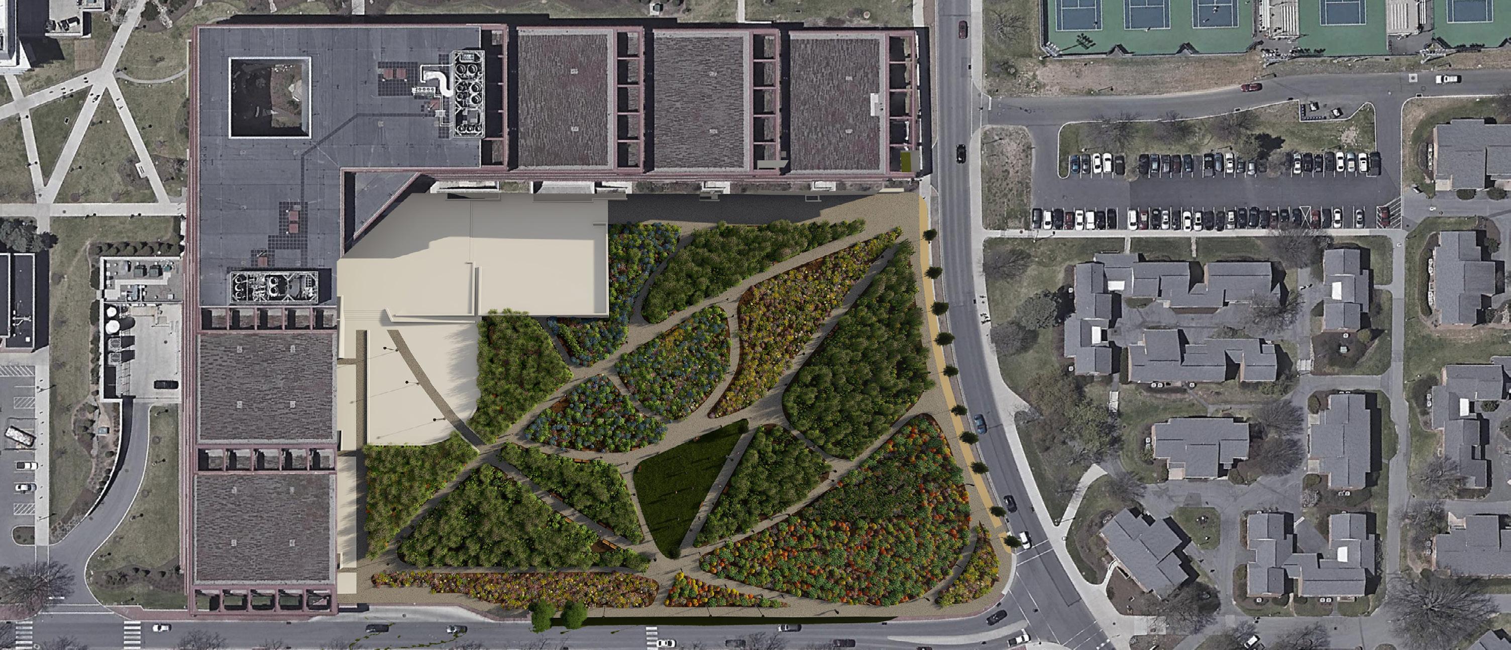

The Millennium Science Complex Pleasure Gardens consist of a pollinator garden, prairie meadow, and tree plaza intended for use by students and visitors of the college. The lawn outside the Millennium Science Complex (MSC) lacks visual and programmatic design. My design for the MSC Pleasure Garden seeks to resolve this issue by synthesizing the ordered geometries of French gardens with the spontaneous spirit of the prairie meadow. In this design, independently defined spaces fit together to depict a single form; aligning my central path with the center of the MSC building creates order and symmetry. To emphasize order, the central space of the site’s eco-lawn contains no herbaceous vegetation, ensuring it stands out. The use of curved paths and the selection of native vegetation retains the spontaneous nature of the meadow while vibrant plants with height variations allow for active interaction and create an immersive experience within the meadow.


Pennsylvania State University|LARCH 236|Fall 2021 23 © 2024 Menma Okereke
Section Cut
PRAIRIE MEADOW MESIC MEADOW 2 MESIC MEADOW 1 ECO-LAWN RAIN MEADOW Legend Plan View
Prairie Meadow Phenology Chart


Asclepias syriaca
Asclepias tuberosa
Baptisia australis
Eutrochium fistulosum
Echinacea paradoxa
Gaura biennis
Helianthus angustifolius
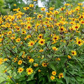
Heliopsis helianthoides
Helianthus tuberosus
Liatris spicata
Monarda didyma
Primula meadia
Ratibida columnifera
Solidago speciosa



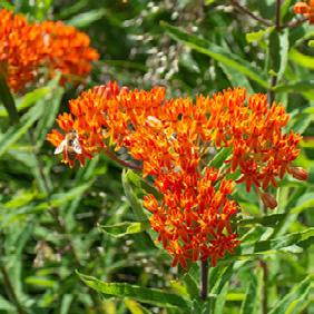
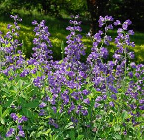
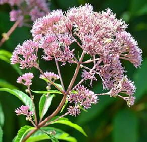
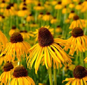
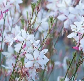
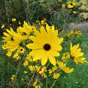
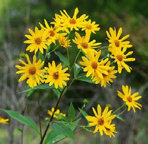
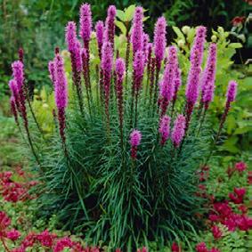
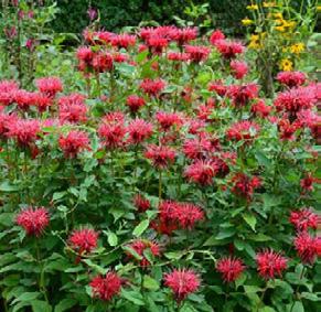
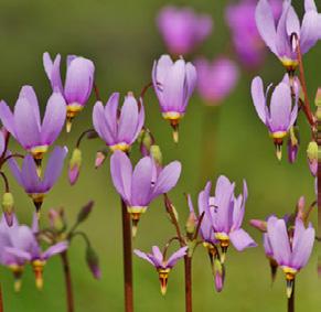
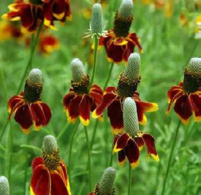
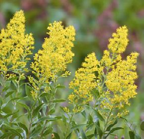
Pennsylvania State University|LARCH 236|Fall 2021 24 © 2024 Menma Okereke JANFEB MAR APR MAY JUNJULAUG SEP OCTNOV DEC
Asclepias syriaca Asclepias tuberosa Baptisia australis
Echinacea paradoxa Eutrochium fistulosum
Gaura biennis Helianthus angustifolius
Helianthus tuberosus
Heliopsis helianthoides
Liatris spicata Monarda didyma Primula meadia Ratibida columnifera Solidago speciosa

Pennsylvania State University|LARCH 236|Fall 2021 25 © 2024 Menma Okereke
Walk through Mesic Garden
CONSTRUCTION DRAWINGS
Pennsylvania State University
Individual Academic Projects
Planting Methods Class: Meadow Technical Planting Plan
Pennsylvania State University|Construction Documents 28 © 2024 Menma Okereke
SEE PLAN FOR PATTERN
GEOTEXTILE AS PER SPECIFICATIONS, PLACE BELOW
AGGREGATE BASE COURSE
2" COARSE AGGREGATE SUBBASE
SILVA CELL 2X (DECK, BASE AND POSTS SPACE 1" APART AT TOP DECK
Pennsylvania State University|Construction Documents 29 © 2024 Menma Okereke 8 6'-113 8 " 1' 4'-1" 2' 3 8" CUSTOM STEEL COLLAR PAVER BED 12" x 12" x 3" CUSTOM CONCRETE PAVERS SEE PLAN FOR PATTERN. CUT TO FIT WHEN OVERLAP WITH TREE HOLE AND COLLAR OCCURS. 1 4" MAX SAND FILLED JOINTS 3" TREE TRUNK CALIPER. TRUNK CALIPER SHALL MEET ANSI Z60 CURRENT EDITION STANDARDS FOR ROOTBALL SIZE. SEE PLANT SCHEDULE. ROOT BALL SHALL MEET ANSI Z60 CURRENT EDITION STANDARDS FOR TREE CALIPER. SEE PLANT SCHEDULE. 2" DUCKBILL ANCHOR CABLE FILL TREE HOLE SURROUNDING ROOTBALL WITH PLANTING SOIL. COVER WITH 2.88" MULCH. KEEP MULCH CLEAR OF TRUNK FLARE. SILVA CELL 2X (DECK, BASE AND POSTS). 1" APART AT TOP DECK. 12'-25 8 " 2' 31 2 " 4'-1" 3" 2' 3" CUSTOM CONCRETE COLLAR. PLACE 1 2" FROM EDGE OF CONCRETE PAVERS AND TREE GRATE. 24" x 24" x 3" CUSTOM CONCRETE PAVERS SEE PLAN FOR PATTERN. CUT TO FIT WHEN OVERLAP WITH TREE HOLE AND COLLAR OCCURS. 1 4" MAX SAND FILLED JOINTS 3" TREE TRUNK CALIPER. TRUNK CALIPER SHALL MEET ANSI Z60 CURRENT EDITION STANDARDS FOR ROOTBALL SIZE. SEE PLANT SCHEDULE. ROOT BALL SHALL MEET ANSI Z60 CURRENT EDITION STANDARDS FOR TREE CALIPER. SEE PLANT SCHEDULE. 1 2" DUCKBILL ANCHOR CABLE FILL TREE HOLE SURROUNDING ROOTBALL WITH PLANTING SOIL. COVER WITH 2" MULCH. KEEP MULCH CLEAR OF TRUNK FLARE. 36" OF HEICOM AMSTERDAM TREE SAND - COMPACT TO 85% SPD. IRONSMITH IRON CAST GRATE (48"x 48") ASSEMBLE IN TWO SECTIONS. DO NOT PRIM OR TRIM CANOPY UNLESS INSTRUCTED BY LANDSCAPE ARCHITECT TRUNK CALLIPER SHALL MEET ANSI Z60 CURRENT EDITION FOR FOOTBALL SIZE INSTALL TRIM PLUMB AND TRUE PLACE ROOT FLARE 11" BELOW GRADE 2.88" MULCH - KEEP MULCH CLEAR OF ROOT FLARE PLACE ROOT FLARE 11" BELOW GRADE CUSTOM 17.31" x 17.31" x 3" PAVERS PAVER COLOR TO BE SELECTED BY LANDSCAPE ARCHITECT.
LEAVE 3" AIR GAP BENEATH SILVA CELL TO ALLOW GAS EXCHANGE 36" OF TOP SOIL AS PER SPECIFICATIONS - COMPACT TO APPROX 95% SPD IN 6" LIFTS. DUCKBILL ANCHORED TO W. " CABLE GEOTEXTILE AS PER SPECIFICATIONS, PLACE BELOW AGGREGATE SUBBASE DO NOT PRIM OR TRIM CANOPY UNLESS INSTRUCTED BY LANDSCAPE ARCHITECT TRUNK CALLIPER SHALL MEET ANSI Z60 CURRENT EDITION FOR FOOTBALL SIZE INSTALL TRIM PLUMB AND TRUE PLACE ROOT FLARE 6" BELOW GRADE 2" x 1" WHITE RIVER STONE KEEP STONES CLEAR OF TRUNK FLARE 36" of BOURNE AMENITY TREE SAND COMPACT TO 80% SPD in 12% LIFTS CUSTOM 24" x 24" x 3" PAVERS PAVER COLOR TO BE SELECTED BY LANDSCAPE ARCHITECT. SEE PLAN FOR PATTERN UNDISTURBED SOIL COMPACTED TO 95% SPD DUCKBILL ANCHORED TO W. 1 2 CABLE IRON CAST ORNAMENTAL GRATE
Millennium Science Complex University Park,
MENMA OKEREKE L - 101 1" = 20'
Tree Planting in CU Engineered Soil Plan Tree Planting in Silva Cell Plan Tree Planting in Silva Cell Plan Tree Planting in Engineered Silva Cell With Tree in Grade Section
PA
Planting Methods Class: Tree Plaza Details
Grading Class: Project 2
Pennsylvania State University|Construction Documents 30 © 2024 Menma Okereke NORTH Project Title Exercise Scale Date File Name Sheet Number Class Code 12/1/2021 120_Project 2_Fin. 120 Project 2 1" = 30'-0" 1 Project 2 Final
AROCHUKWU CHAPEL
Buildner Architecture Competitions
Rammed Earth Pavilion
Spring 2023
Individual Personal Project
Competition Brief

The competition
The Rammed Earth Pavilion competition is part of a series exploring the unique benefits of different building materials. Participants are tasked with designing a pavilion to be constructed of rammed earth in a location of their choosing. The pavilion will host an exhibition on the material, the contents of which should be included in submitted designs.
The Rammed Earth Pavilion can be designed as either a temporary or permanent structure but should be no more than 50 m2. What is important is for the design to be as creative as possible in its use and exploration of this ancient and sustainable building material.
Participants are allowed to select a site and location of their choosing.
Buildner Architecture Competitions|Rammed Earth Pavilion|Spring 2023 34 © 2024 Menma Okereke 4 Textures
a rammed earth wall,natural earth-tone colors.
P-fotography
of
©
Page Excerpt from Buildner Competitions website
AROCHUKWU CHAPEL
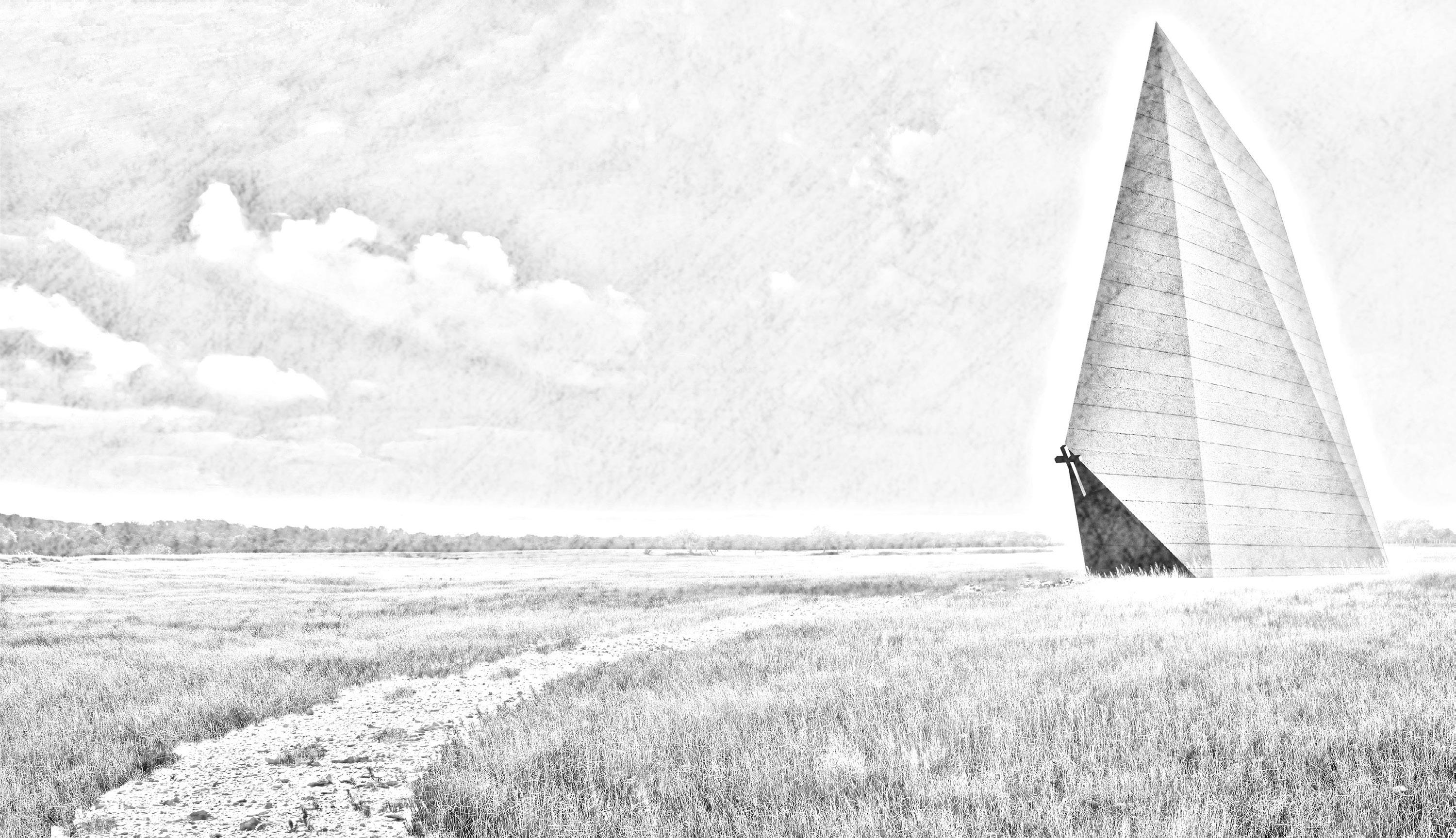 WRITTEN BY MENMA OKEREKE ILLUSTRATED WITH MIDJOURNEY AI VISUALIZER
Buildner Architecture Competitions|Rammed Earth Pavilion|Spring 2023 35 © 2024 Menma Okereke
AROCHUKWU
Arochukwu is an Igbo town located in Abia State. The town holds significant historical and cultural importance in the Nestledregion. in the lush landscapes southeasternof Nigeria, Arochukwu is known for its traditional institutions, and vibrant community.
Due to the intense nature of earthen construction, community members join to build each persons home.
Earth as a material is important to Arochukwu due its utilitarian, communal and spiritual significance.
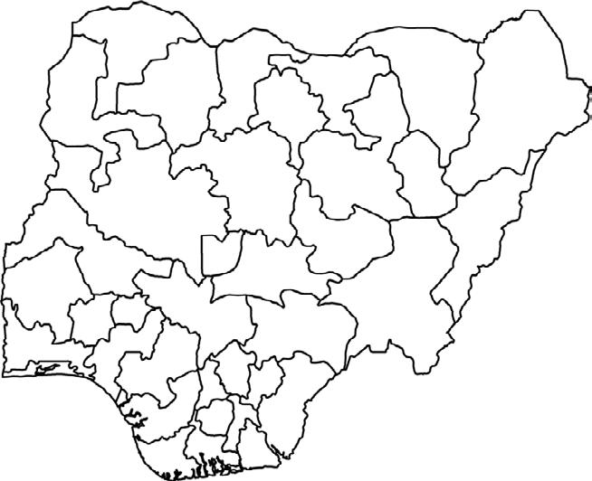
UTILITARIAN COMMUNAL SPIRITUAL AROCHUKWU MAP OF NIGERIA


Lastly, due to the belief that mankind was created from the earth, the material is treated with reverence and has strong spiritual significance.

Earth’s utilitarian significance comes from being the dominant building material in Arochukwu. Due to the strong presence of sand stone in the region majority of homes and structures were made out of earth mortar.
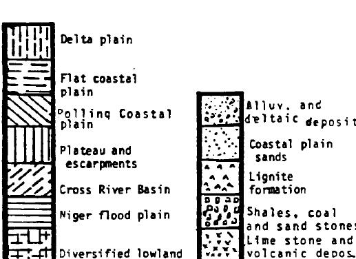
GEOLOGIC MAP OF IGBOLAND


Women help out by carrying lighter materials and mixing the earth to make mortar.


WHY A CHAPEL

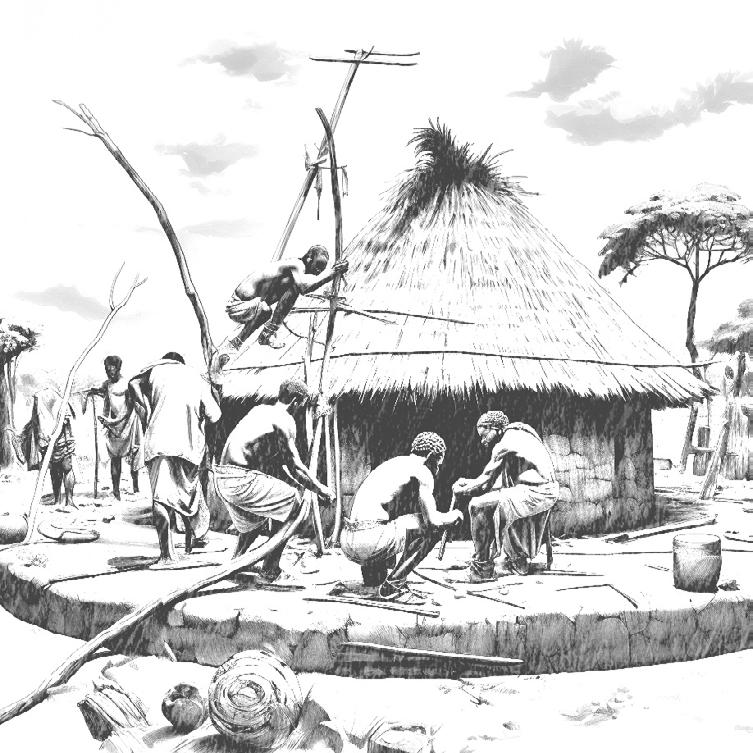
Men handle the heavier lifting and the construction of the homes

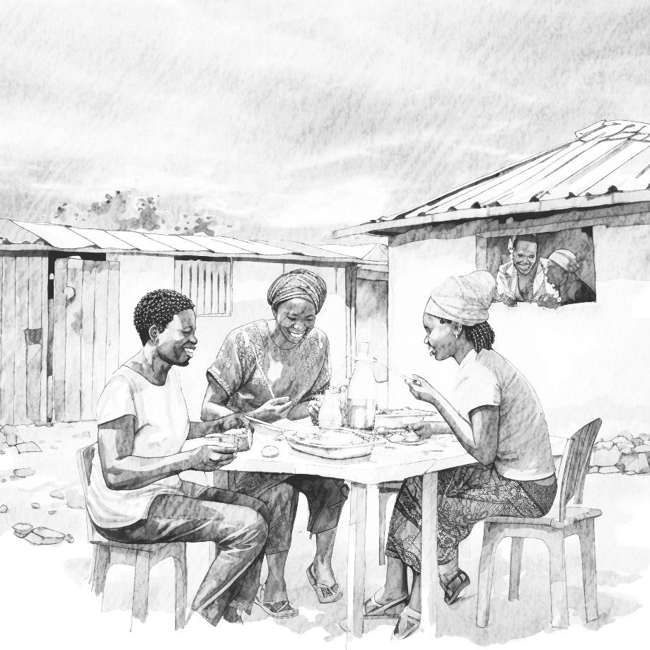
Most importantly the process is a ceremonial affair. During construction, workers sing, dance and laugh with one another. Additionally, a meal is shared betweeen everyone at the end of each work day.

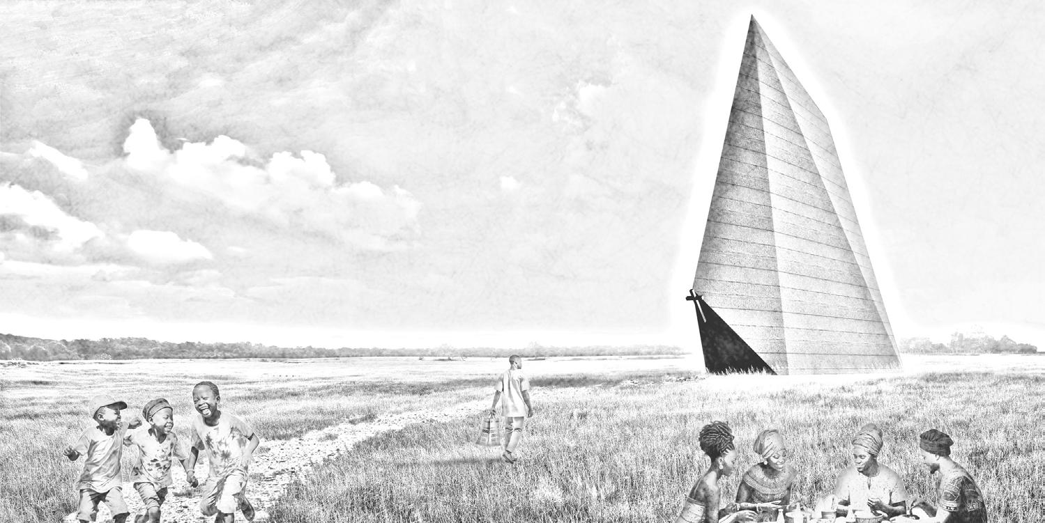
I decided on a chapel as I see it as the programmatic equivalent of earth. Like earth, chapels symbolize utility, community, and spirituality in Arochukwu. The Chapel’s design is influenced by Christian Numerology, combining 3 points (symbolizing perfection) with 5 points (symbolizing God’s grace). This represents the communion between humans, a perfect God and His grace. The monolithic form serves as a symbolic landmark in the community. and works within the rigid tectonics of rammed earth.
Buildner Architecture Competitions|Rammed Earth Pavilion|Spring 2023 36 © 2024 Menma Okereke
Map gotten from Godwin Chukwudi Nwude’s Thesis
THANK YOU!!
U C C C C S
Map gotten from Vemaps



Buildner Architecture Competitions|Rammed Earth Pavilion|Spring 2023 37 © 2024 Menma Okereke
Chapel Birds-eye View
Light Well
Chapel Back View

Buildner Architecture Competitions|Rammed Earth Pavilion|Spring 2023 38
2024
6
©
Menma Okereke
Landscape photo and path sourced from Adobe Stock
MENMA OKEREKE menmaoks@icloud.com 202-258-6329 All works, unless stated otherwise, are protected by copyright © 2024 Menma Okereke


 WRITTEN BY MENMA OKEREKE ILLUSTRATED WITH MIDJOURNEY AI VISUALIZER


