F O L I
RODRIGUEZ MARTINPlanner
O M MELISSA
Architect | Urban
RODRIGUEZ
Architecture and urban planning are disciplines that merge time, space, aesthetics, and society. Are a way to provide a connection between the design and the surroundings, understanding the perception of the inhabitants and the preservation of the natural and built environment.

+39 32 7572 5592 melissa.rodriguez.martin@gmail.com www.linkedin.com/in/melrm/ MELISSA
MARTIN 08/05/1993 Mexican. Milan, Italy. SOFTWARE SKILLS
GRASSHOPPER 3DS MAX RHINOCEROS SKETCHUP AUTOCAD REVIT 2D & 3D MODELLIN G OFFICE (excel, word, pp) PROJECT MANAGER TERMOLOGOTHERS QGIS ILLUSTRATOR AFTER EFFECTS PHOTOSHOP INDESIGNADOB E MENTAL RAYRENDERIN G LUMION Learning UNREAL ENGINE VRAY
EDUCATION AND TRAINNING
2019-21
2021 2019 2012-17
2015
MSC IN URBAN PLANNING AND POLICY DESIGN
Politecnico di Milano, Campus Leonardo. Milan, Italy.
INTERNATIONAL MOBILITY AND RESEARCH COOPERATION TU Berlin, Berlin Institute of Technology. Berlin, Germany.
RESPONSIVE CITIES CERTIFICATION
ETH Zurich, Online course with edX.
ARCHITECTURE
Monterrey Institute of Technology & Higher Education, Mexico City.
CERTIFICATE IN URBANISM
Istituto Lorenzo di Medici. Florence campus, Italy.
WORK EXPERIENCE
2021-C. 2020-21
2019 2018-19 2016-18
2016
Architect in CO.GE.IM. SRLS, Milano, Italy.
Architect in Bertagni Consulting SRL, Italy.
Freelance Architect.
Junior Architect in GREENBERGFARROW Mexico City.
Architect in SKYSENSE, Mexico City.
Architecture Fellow in TAAX Architects, Mexico City.
ACHIEVEMENTS AND AWARDS
2021 2021 2019-21
2016-17
2017 2015 2014
Winner of DAAD German Academic Exchange Service’s Schoolaship.
Speaker at EUGEO 2021 Congress on the Geography of Europe.
Winner of the Invest Your Talent in Italy Scholarship.
Schoolarship by Monterrey Institute of Technology and Higher Education.
Department Chair of Quiero Casa; “Regeneration of a public space”.
Award by ITESM CSF: Premio a la Vinculación, 2015.
Course at the Mexican Institute of Concrete and Cement.
ASSOCIATIONS AND VOLUNTARY
2016-17
2014-16
2016 2014
Volunteer at TECHO PARA MI PAIS. AIESEC Vicepresident at Santa Fe Committee.
Member of SAARQ (Architecture student society).
Social Service at the INBA, Mexico.
LANGUAGES
SPANISH
Mother tongue
ENGLISH
C1 - IELTS 7.0
ITALIAN
B2 - ESL
FRENCH
A2
CASA TANAAH | Architectural project in construction
Architectural concept
Visualization
ARCHITECTURAL PROJECTS
ECO - VILLAGE | University architecture project
Architectural concept
Functionality
URBAN PROJECTS
URBAN CORNER | Team contest project
Urban concept
Architectural concept
22
SHAPING ADRIANO | Team univesitWy project
Urban analysis
Local analysis
Urban proposal
26 28 30
INDEX 6 8 10 12 14 16 18 20
24
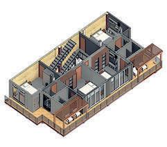
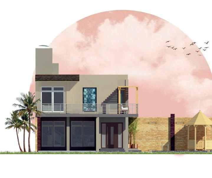
CASA TAANAH
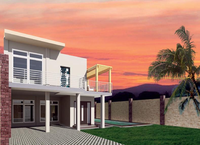
This project consisted of a country-house located in Oaxtepec, in the state of Morelos, Mexico. Considering the climate characteristics of the zone was an important factor to provide maximum comfort for the users. The house counts with four rooms connected through a balcony, five bathrooms, a family room, and a swimming pool.
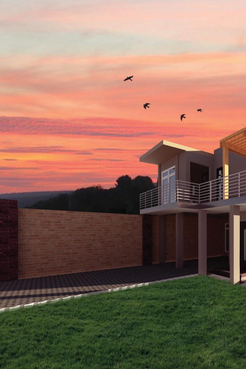
Project: Country house. Information: Project for a client.
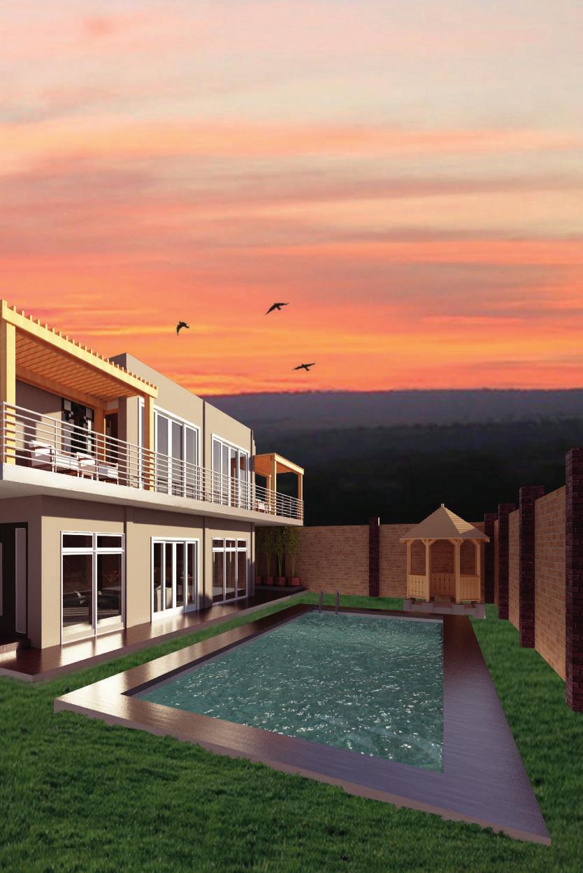
Location: Morelos. Mexico.
Date: August, 2019.
ARCHITECTURAL CONCEPT


Casa Taanah is a country house inspired by rural architecture translated in a contemporary form. It is the summer home of a family composed by the couple clients with three sons who are already married, meaning that this country house would deal with four family cores.
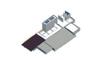
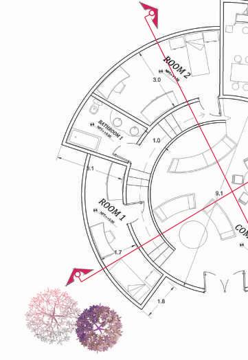
GROUND FLOOR PLAN
One of the first requirements of the clients was to have four equal rooms with private bathrooms, each married couple can have their own space. The second requirement was to have a blind wall on the southeast side, which was challenging due to the lighting. This was solved by studying the sun path and adding skylights to allow access to natural light. Also, a external corridor was required to connect the four bedrooms.
FIRST FLOOR PLAN
Blind wall Access to the rooft Skylights Balcony to connect the 4 bedrooms Swimming pool0.00 m +0.35 SWIMMING GARDEN BEDROOM 1

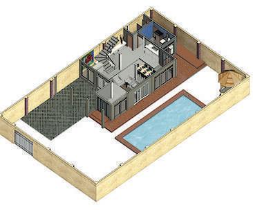
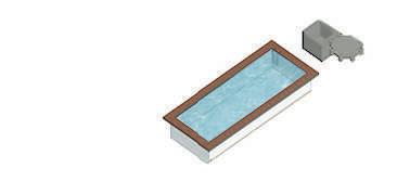
-1.65 m +0.35 m +0.35 m +0.18 m +0.35 m +0.18 m SWIMMING POOL KITCHEN FAMILY ROOM BATHROOM KIOSKO +3.30 m +3.30 m BEDROOM 4 BEDROOM 2B EDROOM 3 +0.18 m +3.30 m
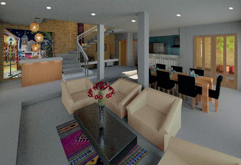
VISUALIZATION
 KitchenGarage Family Room
Bedroom 1 Bedroom 2 Bedroom 3 Bedroom 4
KitchenGarage Family Room
Bedroom 1 Bedroom 2 Bedroom 3 Bedroom 4
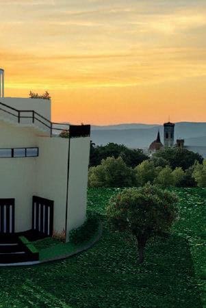
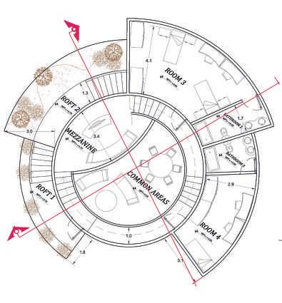
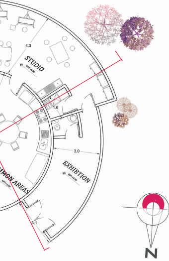
ECO-VILLAGE
These are ecological villages for art students in Florence, Italy. The objective was to design residences using renewable energy combined with bioclimatic techniques considering the climate characteristics of the zone. The project should contain common areas for the students and spaces where they can work and share time.
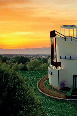
Project: Student residence. Information: University project. Location: Florence, Italy.
Date: December, 2015.
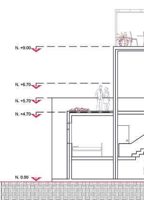
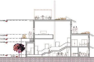
GROUND FLOOR PLAN SECTION A-A’ Flower’s shape Floor plan’s shape Elevation’s shape Circulation diagram ARCHITECTURAL CONCEPT
+0.20 m

FIRST FLOOR PLAN
+4.70 m
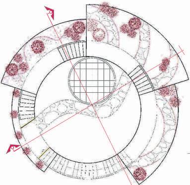
ROOFTOP FLOOR PLAN +4.70 m
B-B’
SECTION
PROJECT FUNCTIONALITY
SUMMER SECTIONSUMMER DESIGN
During summer, the temperature can achieve 40°C, with an average of 26°C. For this reason, it was important to apply ways of cooling down the building using ventilation and insulation. Vegetation was also a way for achieving a comfortable temperature in the building. The solar panels were proposed thinking on the number of hours of sunlight to produce clean energy. The collection of rainwater intended to service the building and to irrigate the roof and ground gardens.
LEGEND - SUMMER SECTION
1. External wall insulation
2. Photovoltaic panels
3. Shaders
4. Green Roofs


5. Vents in skylight
6. Rain water collection
7. Cross ventilation
8. Direct Ventilation
9. Rain water storage
10. Hot water storage
11. Watering
12. Ground garden
13. Radiant floor
1 2 4 5 8 10 12 13
1 2 4 5 8 10 12 13
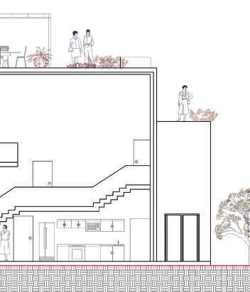
WINTER DESIGN
In winter, the temperature can go down to 0°C (or even lower), having an average of 6.5°C. For this, the proposal of wall insolation and floor radiation to help the building maintain the warmth. The shaders helped the building prevent the excess amount of solar heat during summer, while in winter, these allow gaining temperature. The vegetation of the gardens is less dense in winter and helps the entrance of direct sunlight.
WINTER SECTION
LEGEND - WINTER SECTION
1. External wall insulation
2. Photovoltaic panels
3. Shaders
Green Roofs
Skylight
Rain water collection
Solar heat
Circulate heat
Rain water storage
Hot water storage
Watering
Ground garden
Radiant floor
3 3 4 7 8 9 11 3 3 4 6 7 7 9 11
4.
5.
6.
7.
8.
9.
10.
11.
12.
13.
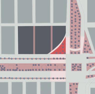
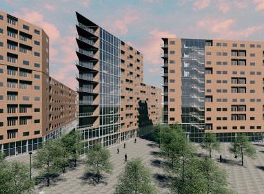
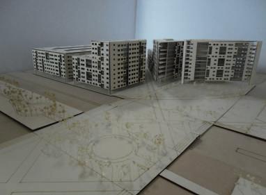
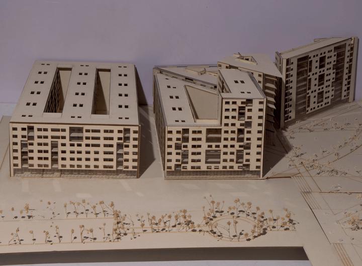
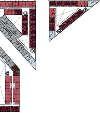
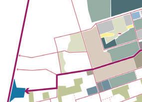
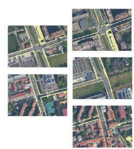
URBAN CORNER
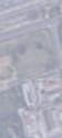
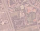
This urban complex was designed from an extensive analysis to improve the zone by creating apartments of social interest with commercial premises on the ground floor. The location was near the International Airport of Mexico City. The objective was to take advantage of the zone’s problems and create a solution to improve the pedestrian connection and liveability of the place.
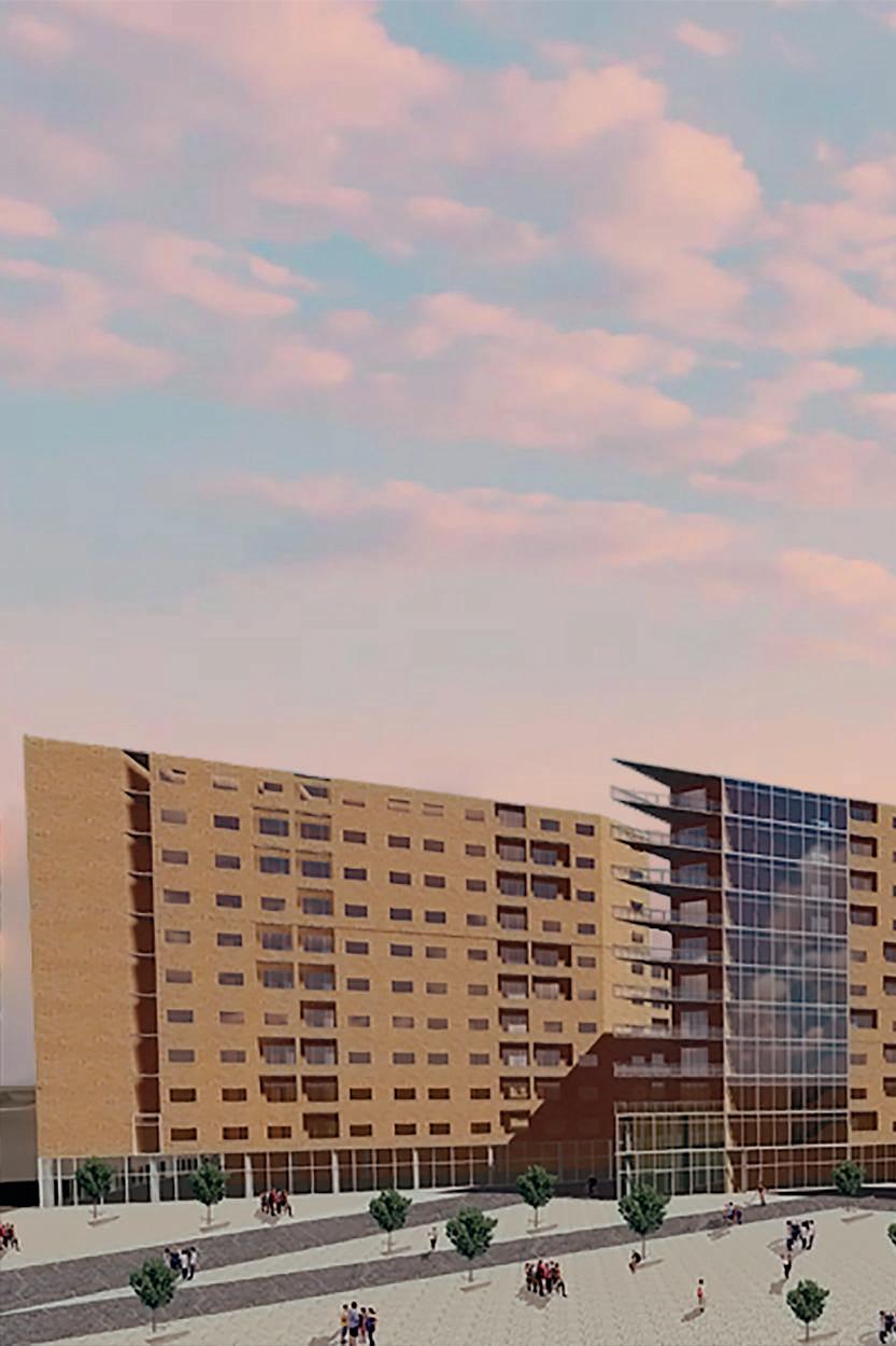
Project: Mixed use building.
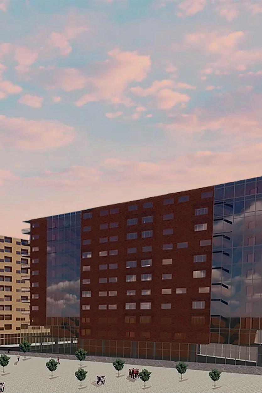
Information: Student project contest in collaboration with Paola Landa and Tania Dominguez.
Location: Mexico City, Mexico.
Date: May, 2017.
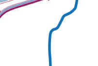
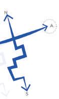
URBAN ANALYSIS
ISOMETRIC
Area for the new building
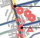
URBAN PROPOSAL Landmarks Pedestrian paths Connection with landmarks LANDMARKSLEGEND URBAN CONNECTIONS
Creation of an integrated public space
1. Aviación Civil market 2. Primary school 3. Caputz kindergarden 4. Chedraui 5. Puebla markest 6. High school 7. Primary school
LEGEND Commerce nodes Subwsay station Desires lines Streets 71.3 m 303.4 m 150.5 m 198.8 m 354.8 m 68.8 m 227.0 m 1 2 3 4 5 6 7 8 SITE’S LANDMARKS Zaragoza Rio del a Piedad Chur u busco
Pedestrian Area Potential commerce Crosswalks Metro stations Desire lines Discontinuity Commerce nodes LEGEND
VIEW
Isolated areas to be integrated
Implementation of a Green Corridor
URBAN MASTERPLAN
Site
Types of corners
Mobility continuity
Connective corners
Urban connector
connection
Pedestrian areas
Streets
Pedestrian fords
space
ISOMETRIC
Corner
LEGEND
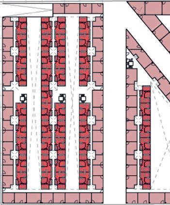
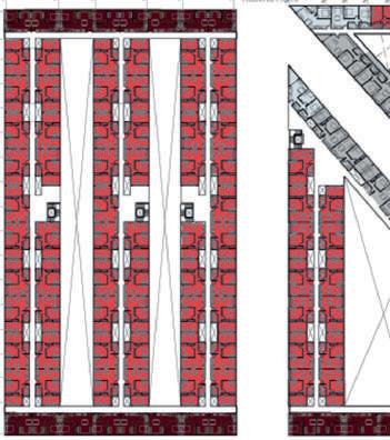
ARCHITECTURAL CONCEPT Continuity in streets Pedestrian continuity Urban connection Volumetry FLOOR TYPE GROUND LEVEL 101 Retail spaces for lease 266 Apartments (33 m2) 1 Bedroom 752 Apartments (50 m2) 2 Bedrooms 52 Apartments (51 m2) 2 Bedrooms 10 Apartments (59 m2) 2 Bedrooms ZONNING
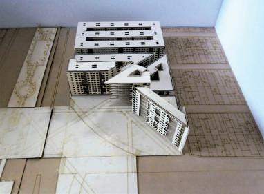
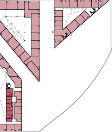
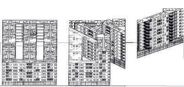
ISOMETRIC
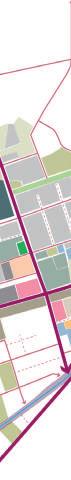
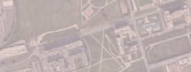
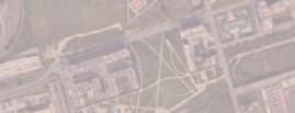
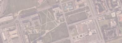
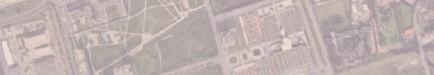
SHAPING ADRIANO
This project aims to unify the neighborhoods and isolated areas of Adriano, a zone characterized by visible fragmentation. The main objective was to understand the weakness of these areas and transform them into opportunities to give Adriano a new identity to boost aspects like local economy, security, and sustainability.
Project: Urban project.
Information: University project in collaboration with Daniele Giora, Fahime Seyedhosseini, Farnaz Sabagh, and Giulia Carnevalini.
Location: Milan, Italy.
Date: May, 2020.
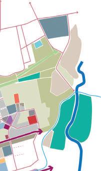
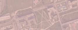
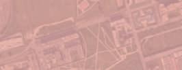
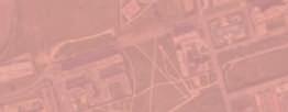
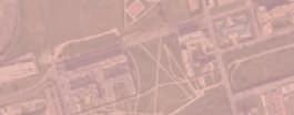
URBAN ANALYSIS

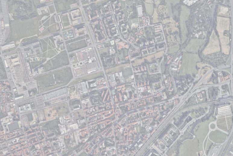
TERRITORIAL FRAMEWORK METROPOLITAN
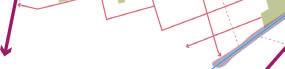
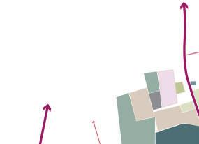
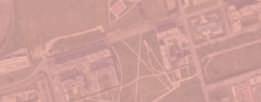
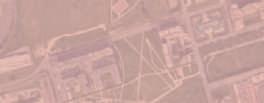
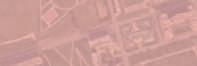
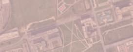
Located in the north part of Milano, Adriano is close to the Martesana Canal and Lambro river, characterized by a visible fragmentation due to its position at the order of the Comune di Milano boundaries. Surrounded by stronger areas bordering the neighborhood, left out with different typologies and mixed areas. This neighborhood is composed of a mosaic of patterns recognizable by their different shapes and characteristics.
Parco Nord Milano
Falck
CentraleFS

Tram line 7
Metro
LEGEND
Biccoca Area Parco Lambro
Metro Line M1
Highways
Metro Line M2

C -128
Lines
Tram Line


rale


T.Est Tangienziale Nord
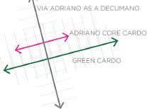
adriano core
THE NEW TRAMLINE: SUPER ACCESSIBLE ADRIANO THE MARTESANA: connecting the
CITY CENTRE: Piazzale Lagosta BICOCCA M5
SCALO GRECO
PRECOTTO M1
BIG TRANSFORMATION AREAS ALONG VIA ADRIANO
CITY CENTRE: re-opening Villa Finzi Park
martiri della liber
adriano core
CROSSING MARTESANA CASCINA GOBBA
bridge on martesana connection with
The analysis helped to understand its morphology, the relationship between built and open space, the relationships between services and transport infrastructures, and the landmarks and centralities for each of these patterns. Understanding the relationship with the city helped to propuse better ways to integrate the fragmented areas of this neighborhood.
Arterial Street
Street
Rivers transformation area: tertiary.
bridge on martesana: with green areas
Nodes


TRANSFORMATION AREA NEAR GOBBA NODE AND S.RAFFAELE
Train ransformation area: n ew s c hool, strategic area d ue t o the h igh connectivity with the adriano core


linear connectionwith bridge on martesana connection with metropolitan par delle cave
tramline,


Areas adriano
Via cerch ia interna: re-opening project
metro lines
milan canals: a new 2 speeds city centre
Collector
Important
7
1
3
1 2 3 4 1)
2) t
utu Tram e 7 roLine M2 e L e M2 ngienziale Thoma a Ge ra Ca 6 D R N O
THE MAIN AXIS

a blue backbone the city centre
franca rame park
A NEW AGRI-NATURAL PARK AROUND THE LAMBRO
città della salute
SESTO S.GIOVANNI
adriano core
crescenzago


VIA ADRIANO TODAY
CITY CENTRE re-opening of Navigli
crossing on the Lambro
libertà irach eni park
re-opening of Navigli connectionwith adriano core
tesana: crescenzago
METROPOLITAN BACKBONES RE LAMBRO project area
Via Adriano is a car traffic oriented road, especially in the upper part, creating a vertical barrier between the different part of the adriano neighborhood . today
SEST O S. G.
tesana: Via Padova park - parco est
tesana: connection areas near the lambro
adriano core
peri urban parks p
canals: speeds backbone
proposed areas for a new agri-natural park:
proposed area for a new lambro park
VIA ADRIANO TOMORROW
tomorrow green cardo crossing on the Lambro
agricoltural land spontaneus vegetable gardens
natural green land underused/abandoned mixed area
Via Adriano can be a multi functional axis with a combine structure made of different connections such as the new tramline, the green orizontal spine of the power line and a more neighborhood vocation in its lower part.
SEST O S. G.
LOCAL ANALYSIS
FROM METROPOLITAN TO LOCAL ADRIANO’S
The relationship of Adriano with the rest of Milan impacts in the way the neighborhood is constituted. Improving the connections was a main goal for the proposal. The “core” of Adriano was the area identified in between the upper power line and the old crescenzago, on the south, separated from the newest part of Adriano and from the vial e monza. This area is characterized by plenty vacant or unfinished projects. The next step after identifying the urban backbones was to defined the local figures and the constitution of Adriano’s Core.
Metropolitan area
city
LOCAL FIGURES Adriano Core
PATTERNS AND DISCONNECTION
FIGURES AND ELEMENTS
MARTESANA
THE LAMBRO SYSTEM
TRAMLINE
VIA ADRIANO
MAIN INFRASTRUCTURAL AXIS.le Monza - via Plamanova
CORE OF ADRIANO
6 PATTERNS 2 main patterns: New and Old Adriano and their connection with the close territory
ADRIANO’S CORE
JOINING THE FIGURES
The next step was to create a proposal trying to intagrate Adriano’s core with the figures and the metropolitan backbones. For doing that, the main two characteristics were to make them interconnected but independent to each other. In the next page the main actions are introduce to complete the vision for Adriano for tomorrow. Pointing to the connections would allow the benefit of the metropolitan network working on nodes and accessibility of the local reality.
INTERCONNECTED
and
INDEPENDENT
METROPOLITAN
LOCAL
FIGURES ADRIANO’S AXIS AND DYNAMICS


THE IN BETWEEN: GATEWAYS AND CONNECTIONS
Sport
Art, culture, and entertainment
ices
Social cohesion, assistance, Playgrounds
Territorial promotion
+ * + + * * * + * Community and volunteering Sc hools
Relevant road junctions Transformation areas Buildings in close relationship with Via Adriano Roads Future tram line Bus Lines serv
URBAN PROPOSAL
ADRIANO’S VISION FOR TOMORROW ACTIONS FOR A NEW

The vision for Adriano is mixing three main ideas giving priority to Connectivity, Sustainability, and Liveability. The first vision: “Adriano as a single interconnected neighborhood” has as its objective the interconnection of the two Adriano: Old and New, promoting permeability and the creation of a unique identity. Then “Join the local with the Metropolitan” aims to develop an internal and external connection to the neighborhood, combining the local dimension with the metropolitan dimension, exploiting the spaces in between. Finally, “From a food desert to a food oasis” wants to underline the idea of a place where food is a central theme in the dynamics of the neighborhood.
FROM


DESERT


JOIN THE
WITH


ADRIANO
Milano 2030: la milano dei quar tieri
Milano phase 2: the post pandemic scenario
circular economy; thinking local


the 15 minutes walk
These three main visions pointed to a specific need of the neighborhood, which will help to have accessibility, efficient services, and a strong connection to the neighborhood. The residents should be involved in all stages of the project, stablishing a program of education where they people can interact with the agriculture of the area.
A SINGLE INTERCONNECTED NEIGHBORHOOD

JOIN THE WITH METROPOLITAN
Extension
Transformation into a cultural place.
Green connection between Franca Rame park and the core cardo.
Redesign of Via Roberto.


Redisgn of Via Adriano.
Removing the fences of Esselunga to create a vibrant public space.
New pedestrian bridge to connect the old Adriano.
New school and cultural center.
New pedestrian path.
Redesign of Via Pietro.

Interconnection of school, church, and Via Giuseppe through public spaces.
Tramline


Burying of powerlines Green Cardo.
Improving the park
Opening and enhancing Building cycle paths ways along Green
Creation of ecological playground in the
Transformation of New public swimming
Enhancing the Martesana

Improving the accessibility.
New recreational
a b c d e f g h i j
of
1 2 3 4 5 6 7 8 9 10 11
neighborhood
A FOOD
TO A FOOD OASIS
LOCAL
THE METROPOLITAN
AS A SINGLE INTERCONNECTED NEIGHBOURHOOD Km 0Health In between Cohesion Exchange GreenOpportunities Identity Identity Safe OpenSlow Services at hand Local food Education Circular economy
THE LOCAL METROPOLITAN
FROM A “FOOD DESERT” TO A “FOOD OASIS”


Tramline 7. powerlines and realizing park near school. enhancing sport fields. paths and pedestrian Green Cardo. ecological corridor and Green Cardo. vacant areas. swimming pool. Martesana Canal. accessibility. spaces.


MAIN STRATEGIES
The main strategy was to see the urban environment as a jigsaw puzzle made of interconnected local hubs. Inside it should be self-sufficient and autonomous, but its also has to be connected to the other terriorial elements and realities of the rest of the city, just like in a jigsaw puzzle. Increasing the connections that allow Adriano to benefit of the metropolitan network by working on nodes and accesibility was the principal strategy and then, unifying the 6 patterns allowing the area to be connected and work as one respecting the natural enviorenment that surrounds it.
STRATEGIC MAP
Transformation of disused green area into local markets.
Transformation of vacant area into educational agricultural garden.
Creation of covered food markets, restaurants.
Merging and converting disused and underused green areas to Agricultural.
Creation of Mixed-use agricultural area between Lambro River and Martesana by defining it in 3 parts:
• A place for cultivating crops and greenhouse plants.


• Reclamation of Martesana Canal.
• A place for raising livestock.
Creation of pedestrian and cycle paths crossing agricultural park and connect Lambro and Martesana to Adriano and Green Card.
1 - NORTHERN GREEN CORRIDOR
2 - JOINING CASSINA DE’ GATTI


3 - GREEN CARDO


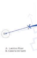
4 - REACHING THE LAMBRO RIVER
5 - REACHING THE MARTESANA
6 - COSTANTINO SQUARE
7 - CASCINA GOBBA NODE


NEW NEIGHBOTHOOD
1 37 2 4 5 6 i ii iii iv v vi adriano core gateways connections Adriano core
MELISSA RODRIGUEZ MARTIN
ARCHITECT | URBAN PLANNER
CONTACT INFORMATION +39 32 7572 5592 Milan, Italy melissa.rodriguez.martin@gmail.com