2 0 2 0
4 ARCHITECTURAL PORTFOLIO SIRAPAT AJKARN Sirapat.Ajkarn@gmail.com SELECTED
2 0 2
WORKS 2020 - 2024
This portfolio is a collection of my projects, research, design and knowledge during my master’s degree and career from 2020 to 2024.
The projects are a representation of my work on various scales and demonstrate my ability to utilise landscape architecture and architectural design to tackle a wide range of issues on different sites.
These projects aim to not only provide a functional space and memorable experience for the users but also focus on the area’s aesthetic and sustainability.
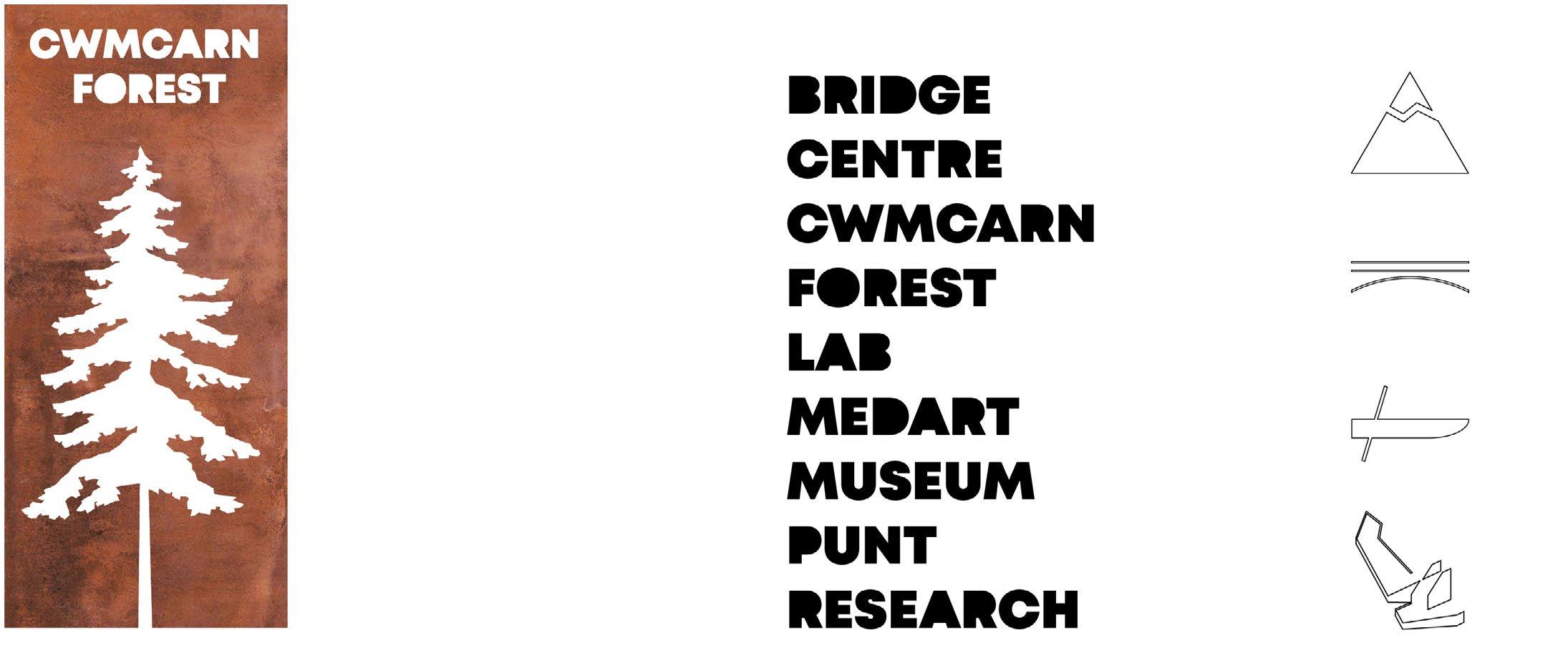
CONTENTS CWMCARN FOREST RENEWAL
Year 2
Project
Architectural
Projects GRAND SASSO FOR ALL MLA Year 1 Design Project 3 29 APPENDIX
44
MLA
Design
Landscape
Design
Sketches and Technical Drawings
CWMCARN FOREST RENEWAL
2nd Year Landscape Design Project
Project Year 2021-2022
Advisor: Tim Waterman & Emma Colthrust
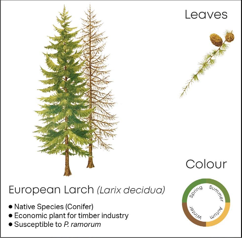
Cwmcarn forest area in Wales, known as a recreational destination for families and hikers as well as a source for the timber industry in the UK, had suffered the Larch disease caused by microorganism called Phytophthora ramorum which damaged and killed more than 150,000 larch trees in 2013. This is one of many unique examples of the loss of forests that does not relate to global warming and human activities.
As a result of the unpredictable infection, all the larch trees must be felled to stop the spreading of the disease, according to the Welsh nationwide strategy, and the area has to be reforested. It is also a great opportunity to introduce new species which are less susceptible to the disease to increase the biodiversity of the area. This studio design project will focus on the root cause of the massive forest renewal project.
The interventions consist of the prevention of the forest-wide spread of the pathogen by introducing water canals to evacuate the infected run-off water out of the site. Moreover, the planting areas are divided into sectors to support selective logging and further control the disease. Lastly, the pathways are redesigned to enhance the visiting experience as well as the introduction of scientists and logging routes to reduce cross circulation between three disciplines of the site.
CWMCARN FOREST RENEWAL - 3
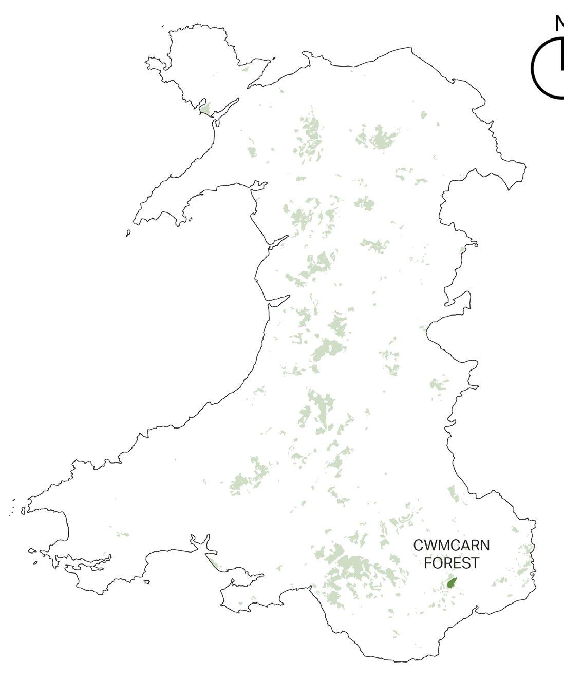
CWMCARN FOREST IN
THE UK
Cwmcarn forest is located on the northwestern side of Newport, Wales, a country located on the west end of Great Britain island. The country is famous for its rugged coastline and many mountainous national parks. This country also plays a key role in the UK’s timber industry.
This forest is famous for its recreational activities for families. The map also shows the location of the Cwmcarn forest in relation to other Welsh woodlands.
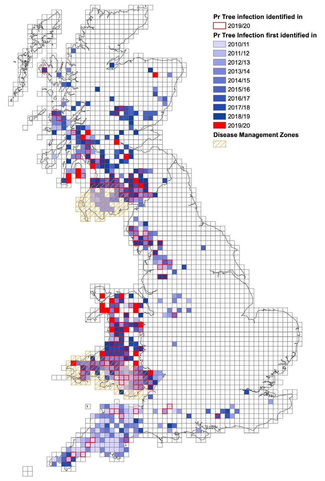
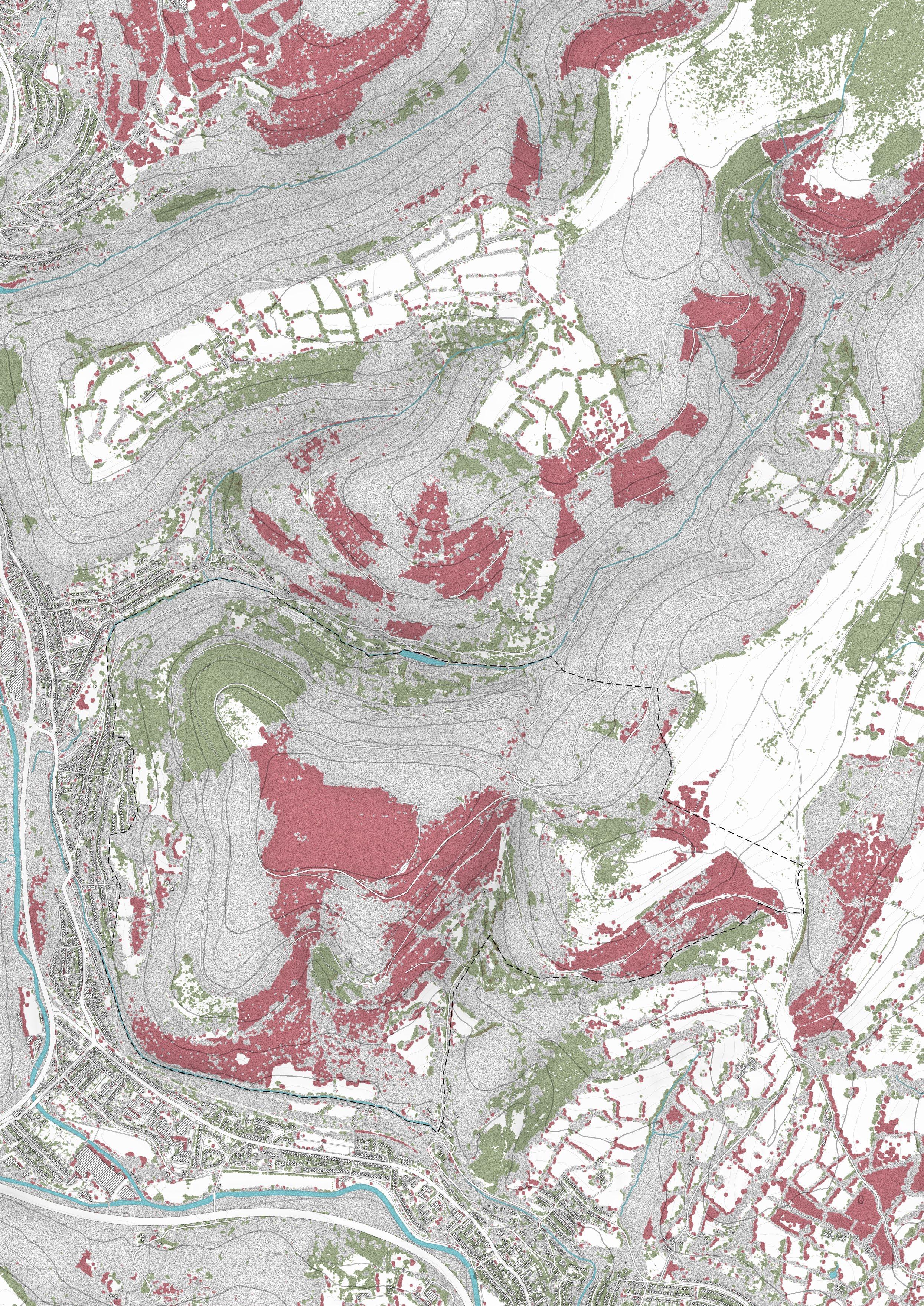
THE UK’s Phytophthora ramorum OUTBREAK MAP
The outbreak map shows the area where P. ramorum has been identified in the UK from 20102020, indicated in different colours.
(Each square represents a 10km2 area)
The pathogen was first identified in the UK in 2002 and affected a small number of other trees. However, in 2009, it was first identified its massive impact on Japanese larch trees located in the southwest counties of England, namely Somerset, Devon, and Cornwall.
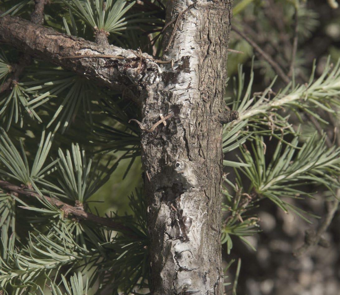
INFECTED LARCH TREE
A close-up photo of an infected larch tree with its bleeding trunk caused by Larch Disease. (National Resources Wales, 2019)
The indications should be reported to the forest authority when spotted on Larch trees. This can significantly reduce the spread of the disease.
4 - CWMCARN FOREST RENEWAL
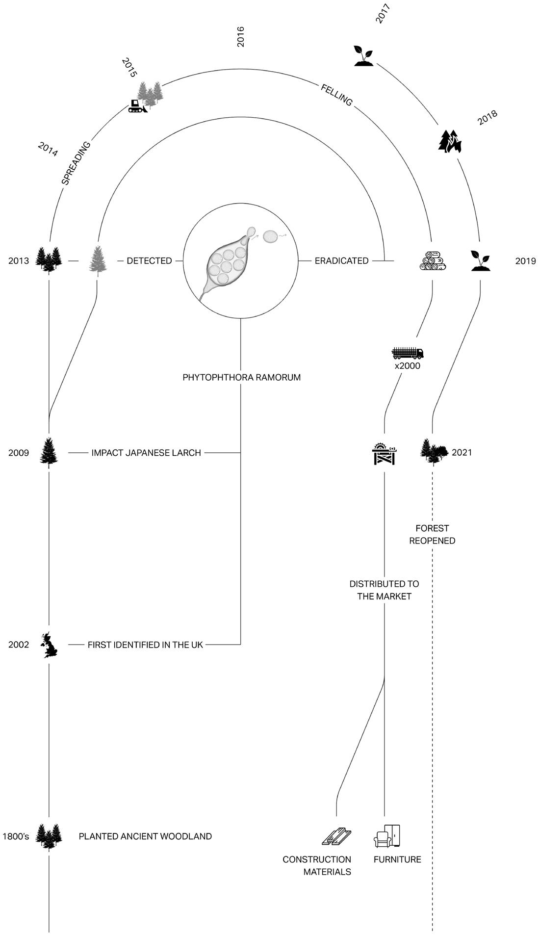
TIMELINE AND ISSUES OF THE AREA
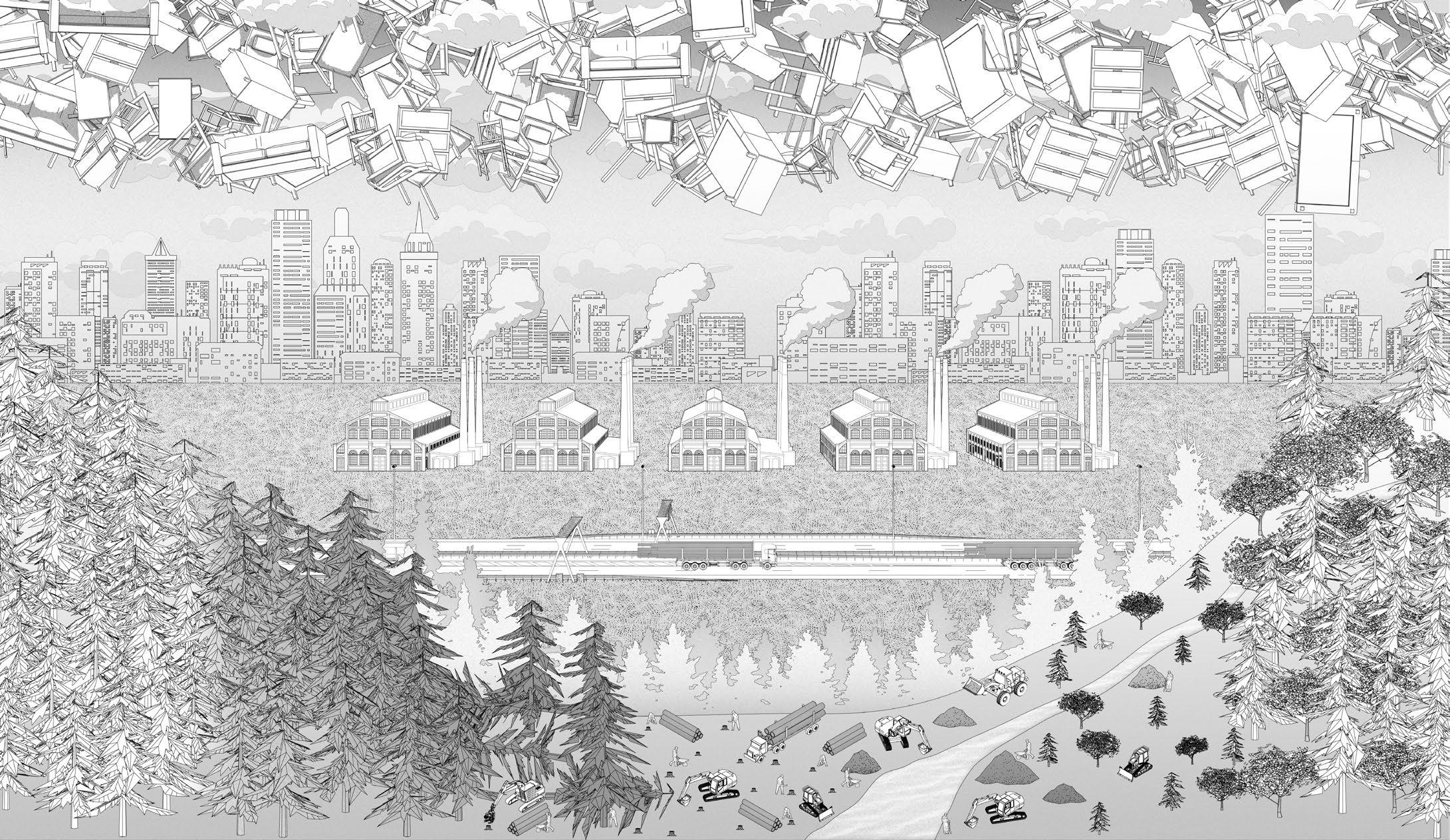
The forest has served the UK’s timber industry since the 1800s. In 2013, The larch disease is identified on the site via periodical aerial imagery. The felling project has begun in 2015. All of the felled trees are delicately transported from the site to a sawmill to process them into wood products. It is noted that these products should not be taken back to the area since it likely has a chance that P. ramorum is still present in the materials.
The planting project has started in 2017 but an intentional wildfire occurred in 2018 delaying the renewal process. The forest is reopened to the public in 2021, however, the renewal process is still occurring in some areas of the forest.
DIAGRAM OF FOREST RENEWAL
The diagram below on the left can be read into two axes.
From left to right, it shows the renewal stage of the forest from before the infection to the reopening stage where broadleaves are introduced to reduce the infection risk.
From front to back, it shows how the felled trees are transported to the nearby sawmill and processed into furniture and construction materials which are then distributed to the consumer in the city.
CWMCARN FOREST RENEWAL - 5
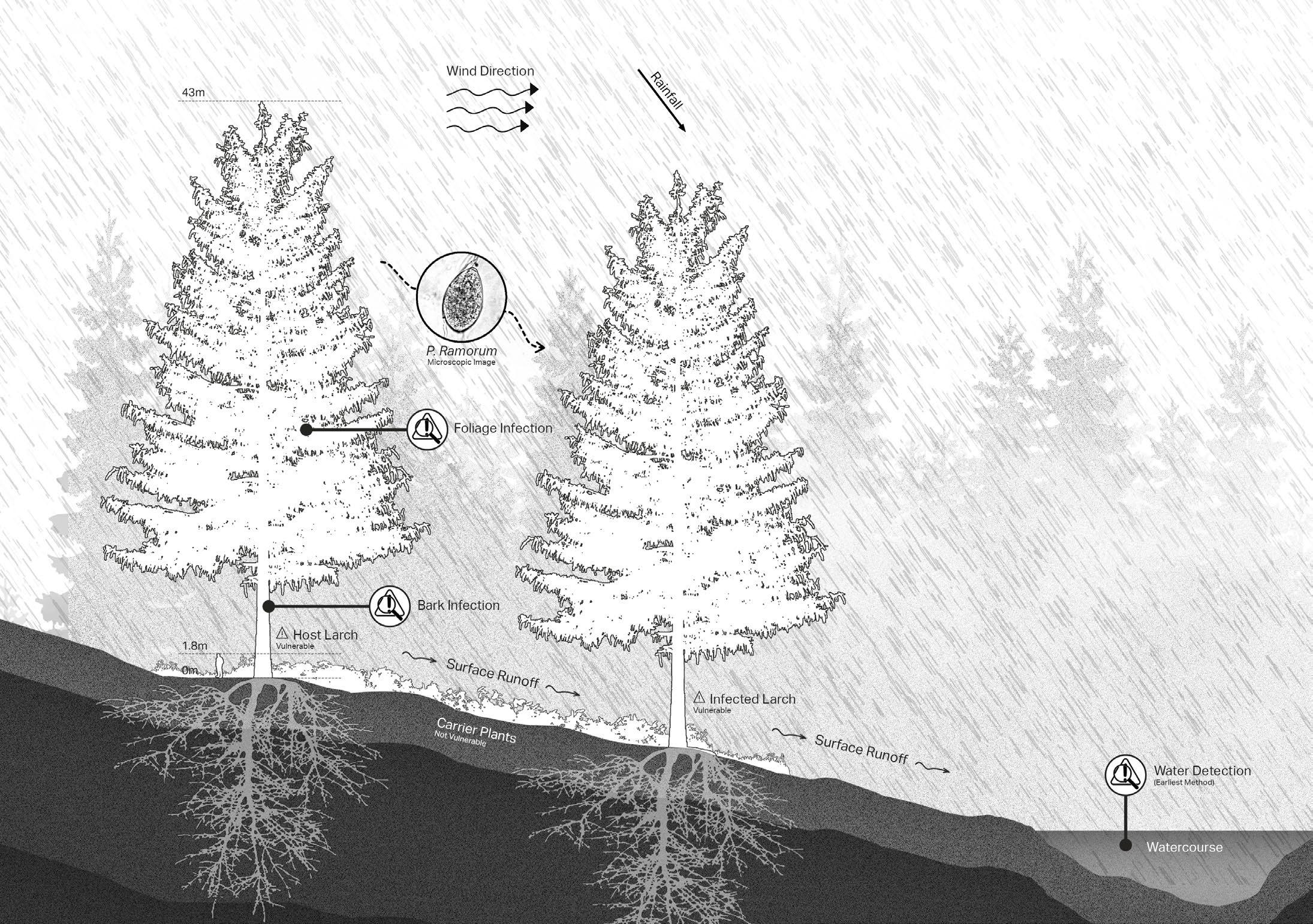
TRANSMISSION FACTORS
The infection relies on factors that help carry the spores from one tree to another. Water droplets are the key factor in the transmission since it carries the spores of P. ramorum from one tree to another. This makes the rainy season the most effective season for the spread of the disease.
The transmission also involves wind direction, air temperature, humidity, precipitation, terrain slopes, surface runoff, ground covers, and human and animal activities.
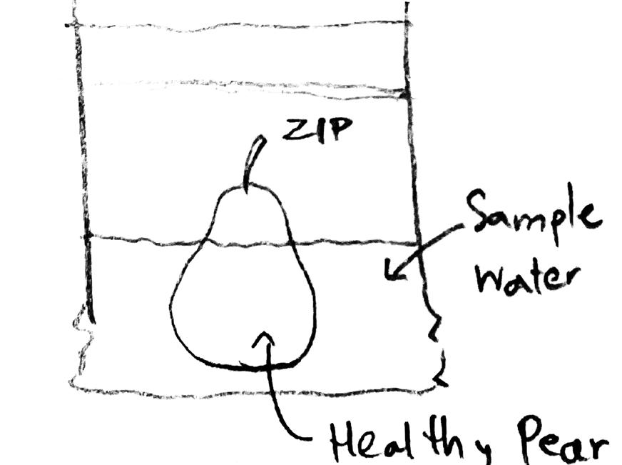
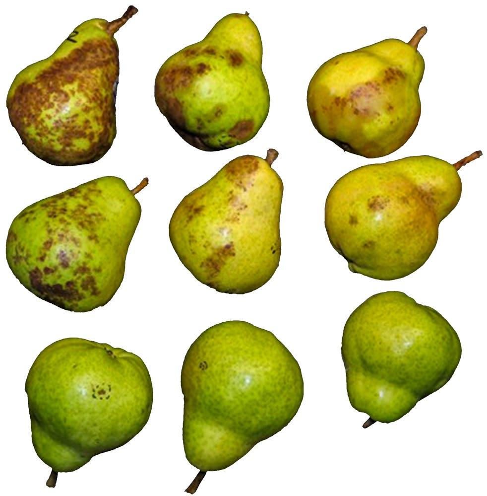
DETECTION METHOD
The pear submerged in the sample water collected from the suspicious area can indicate the presence of Phytophthora oomycota. If the pear shows lesions (as shown above), the pear will be carried to the lab to identify the presence of P. ramorum.
6 - CWMCARN FOREST RENEWAL
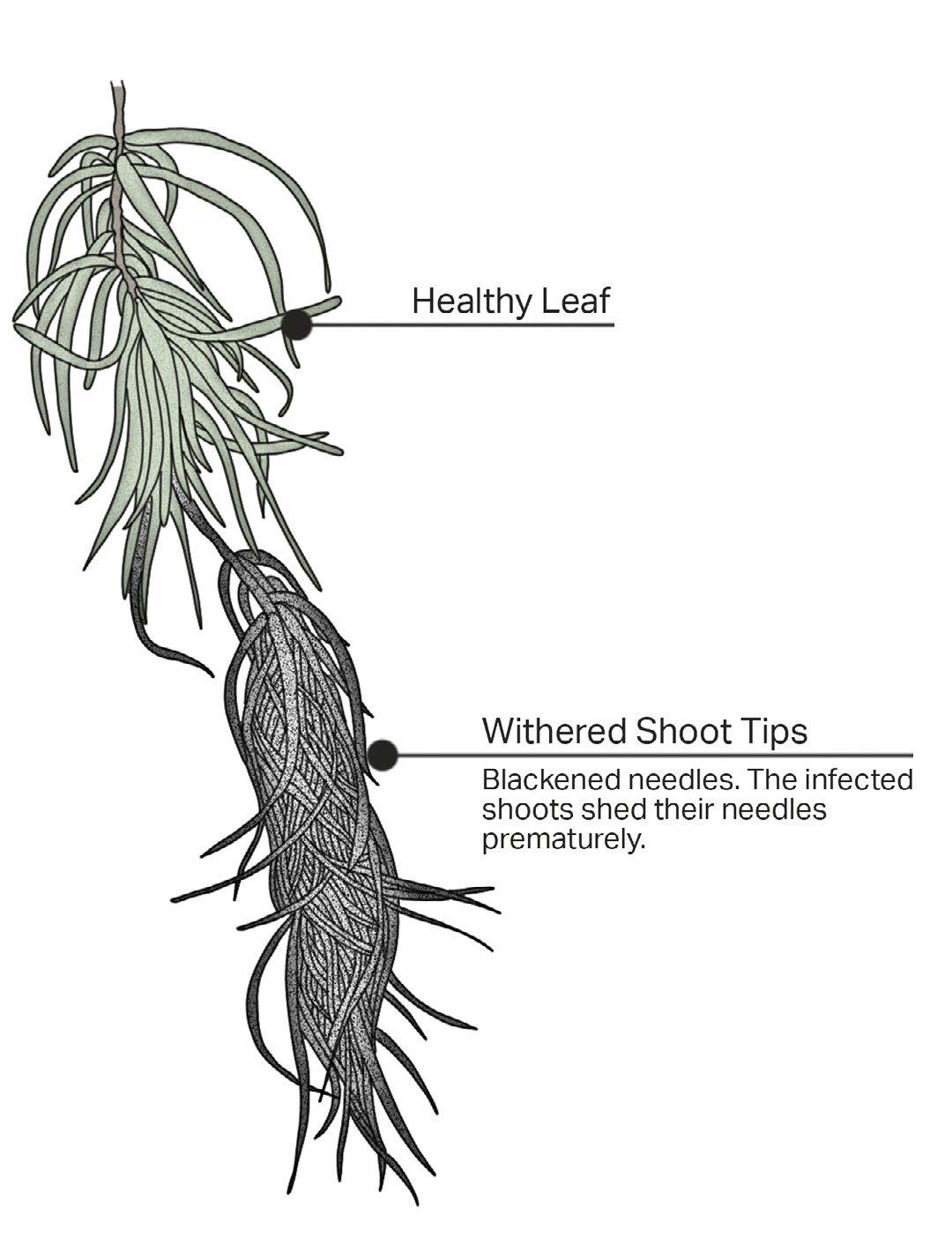
SHOOTS INFECTION
On the shoots and foliage, the tips are withered with blackened needles. These dried, infected shoots are prematurely shed. The pathogen also produces its spore here before spreading to the other susceptible trees.
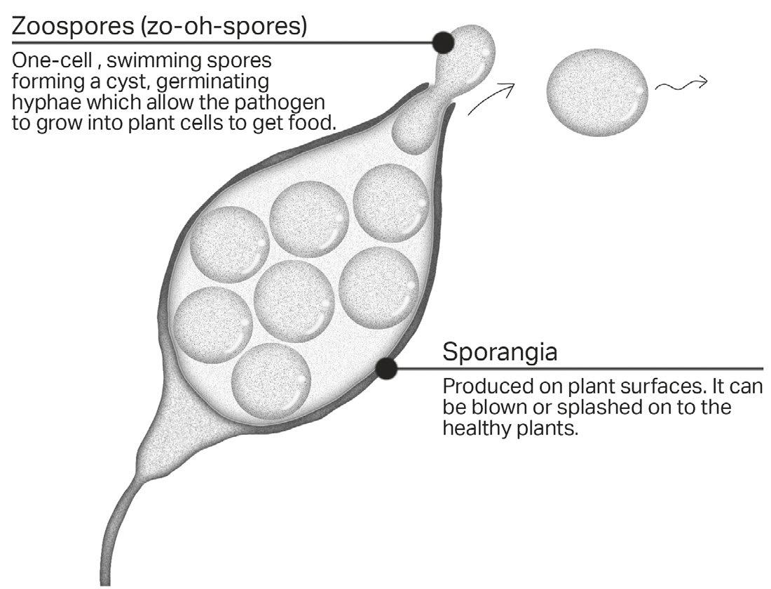
Phytophthora ramorum MICROSCOPIC SECTION
The sporangia produced on the host’s leaves, and shoots contain Zoospores. They are released to the target’s surface by air and water droplets and form a cyst. This allows the pathogen to grow into plants cell and steal food from the target causing an infection on the target plant.
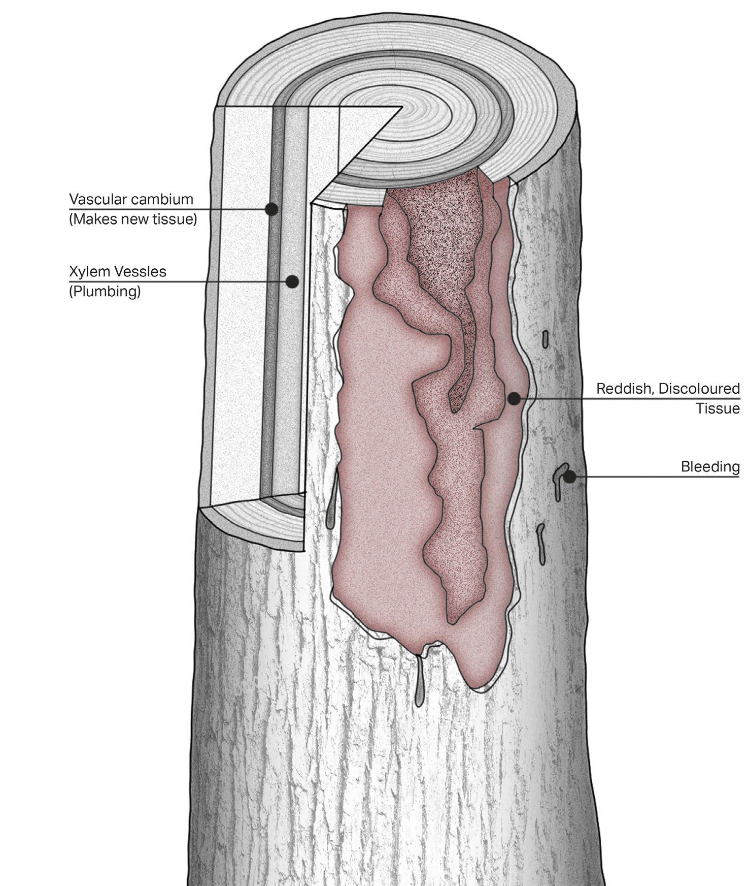
TRUNK INFECTION
Larch tree that is infected with this disease will be visually identifiable by looking at the trunk and the foliage. On the trunk, there is some bleeding through the bark, some parts of the bark are disintegrated and show a reddish, discoloured tissue. The colour comes from the Vascular cambium and the Xylem Vessels layers which are the site of attack of this pathogen. The tree is killed when the main trunk is infected to an extensive amount.
CWMCARN FOREST RENEWAL - 7
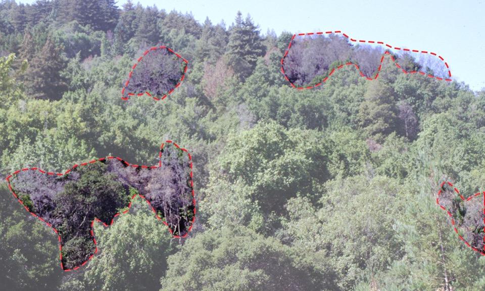
Ramorum disease does not strike larch trees only in the UK. A massive number of oaks in California had also suffered the infection of P. ramorum. In fact, there are four known variants of the pathogen. In North America, two of the variants can be found, namely NA1 and. The other two variants, EU1 and EU2, are found in Europe.
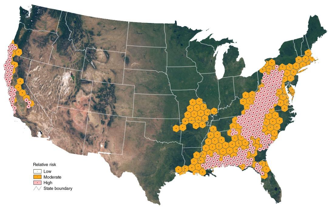
The different genetic lineages of the pathogen also behave differently on the different native oak species. On one hand, the North American lineages have a tremendous impact on North American native oak and tanoak species. On the other hand, the European lineages found in the UK slightly affect the two native oak species. The distribution of P. ramorum in the United States can be found on the both east and west coast of the country, however, the most severe states that are hit by the disease are California and some parts of Oregon. The Sudden Oak Death caused by P. ramorum has approximately killed more than one million trees in fifteen coastal counties of California and one county in Oregon. The dried dead oaks also increase the risk of wildfire.
Symptoms of the infected oak are identical to the symptoms found on infected larch trees which show bleeding, cankers, and a reddish trunk. On the leaves, discolouration with some marks and lesions can be found.
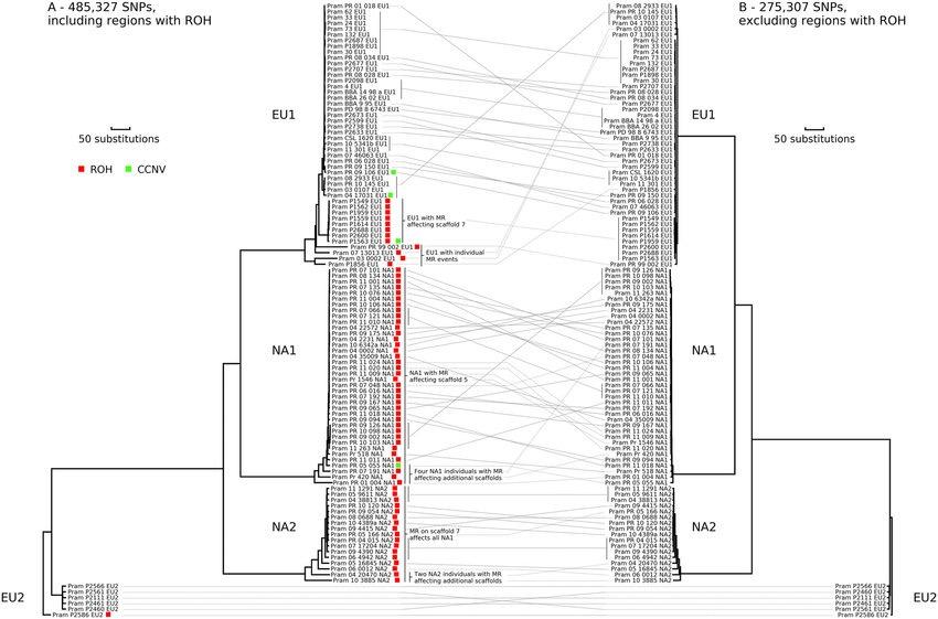
 Evolutionary relationships in Phytophthora ramorum.
Source: Mitotic Recombination and Rapid Genome Evolution in the Invasive Forest Pathogen Phytophthora ramorum
Evolutionary relationships in Phytophthora ramorum.
Source: Mitotic Recombination and Rapid Genome Evolution in the Invasive Forest Pathogen Phytophthora ramorum
8 - CWMCARN FOREST RENEWAL
Map of the United States with Sudden Oak Death risk indicator by area. Source: Author’s own diagram (overlay data from USDA Forest Service)
Phytophthora ramorum’s DISEASE MANAGEMENT
NON-OAK HOST REMOVAL
Research shows that P. ramorum produces more spores on California Bay laurel compared to other hosts. It is suggested that the removal of bay laurel within 5 meters radius of the susceptible oak can significantly reduce the risk of infection.
However, the removal and disposal process should be done carefully to prevent the unintentional transportation of the pathogen to the other area. Rapid disposal such as burning the removed tree is recommended to be done on the site.
CHEMICAL TREATMENT
Although there is no cure for the infected trees, there is a chemical compound that can be applied to the tree to prevent or at least minimise the infection. The systemic fungicide called phosphonate (H3PO3), marketed as “Agri-Fos”, is a very effective compound to protect trees like tanoak and true oak in California. When it is absorbed into the tree’s transport system, it will stimulate the tree’s defence system. It should be noted that this chemical must be applied by authorised people only.
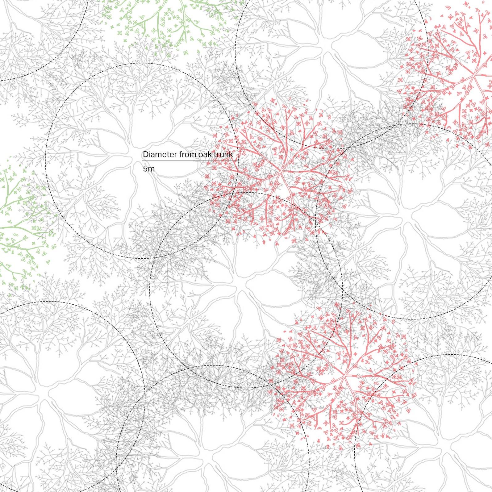
BAY LAUREL REMOVAL DIAGRAM
Bay laurels highlighted in red are to be removed since it is within 5 metres radius of the oak tree. Bay laurels highlighted in green are optional to be removed although they can potentially carry the pathogen to oak even if the distance is more than 5 metres.
CWMCARN FOREST RENEWAL - 9
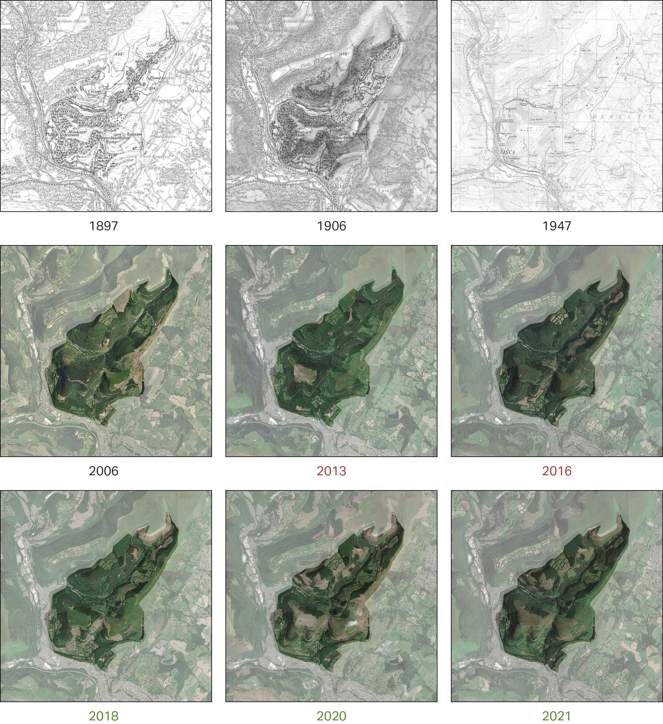
CWMCARN FOREST THROUGH HISTORY
The area has been wooded since the 1800s as a source for the British timber industry. There are changes in the forest area throughout time. However, in 2013, a disease infected more than 150,000 larch trees in the area.
As a result, all of the infected Larch trees have to be felled to stop the spreading of the disease. The felling project took place from 2015-2019.
10 - CWMCARN FOREST RENEWAL
EXISTING CONDITION
The forest has been wooded for UK’s timber industry since the 1800s. In 2013, The larch disease is identified on the site via periodical aerial imagery. The felling project has begun in 2015.
The loss of forest area is the result of the forestry industry and the felling project caused by the disease. The gain in forest area comes from the planned forestation for the UK’s timber industry and the forest renewal project began in 2017.

CWMCARN FOREST RENEWAL - 11
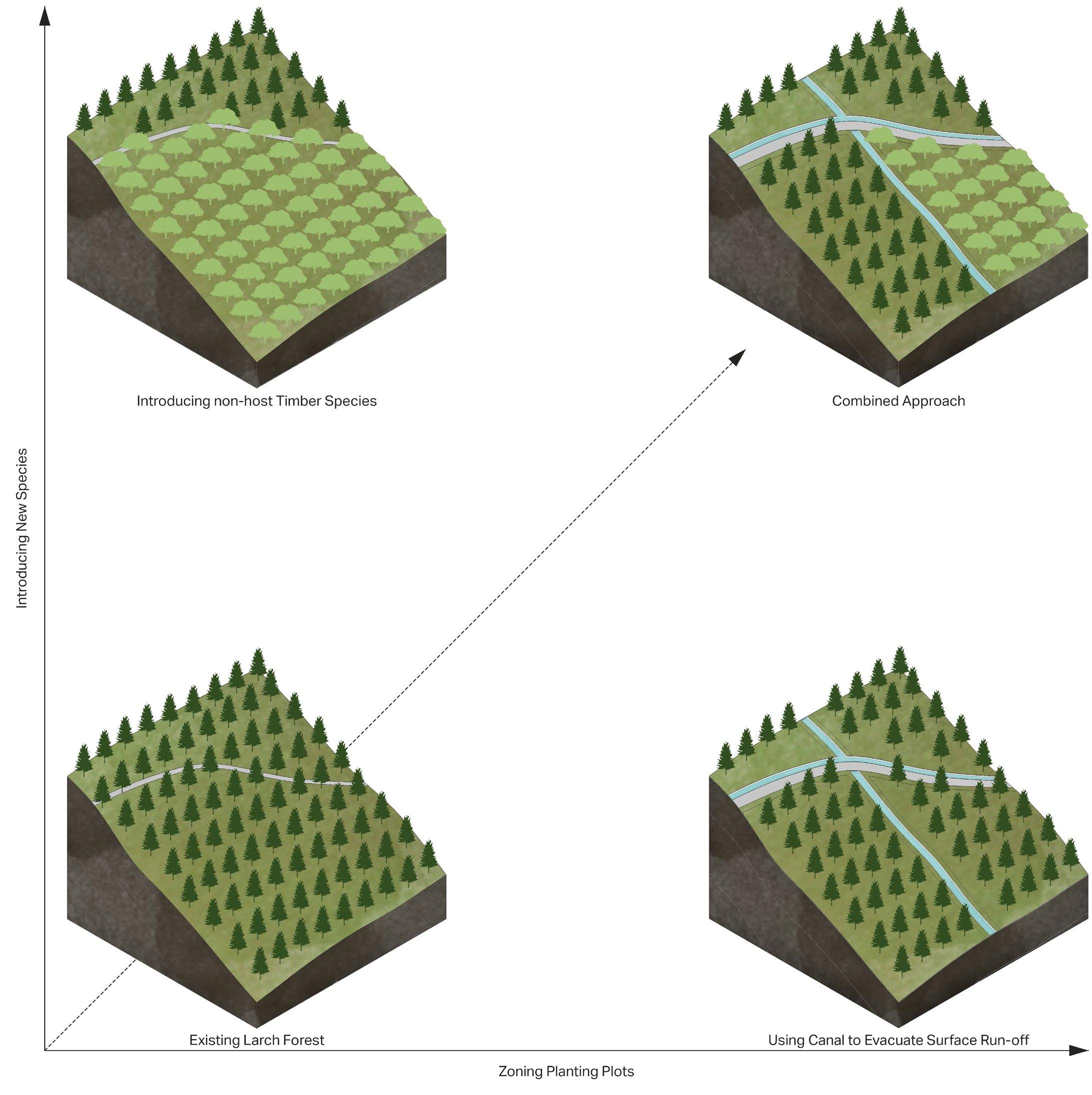
APPROACH OF INTERVENTION
The intervention can be done by lowering the larch density and introducing non-host trees. The other approach is to divide the planting area into sectors with a space between each plot. The water canal is introduced to collect the infected runoff water to control the possible spreading. The two approaches are combined to increase controlling efficiency.
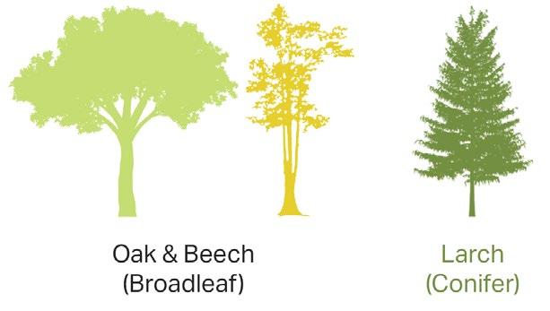
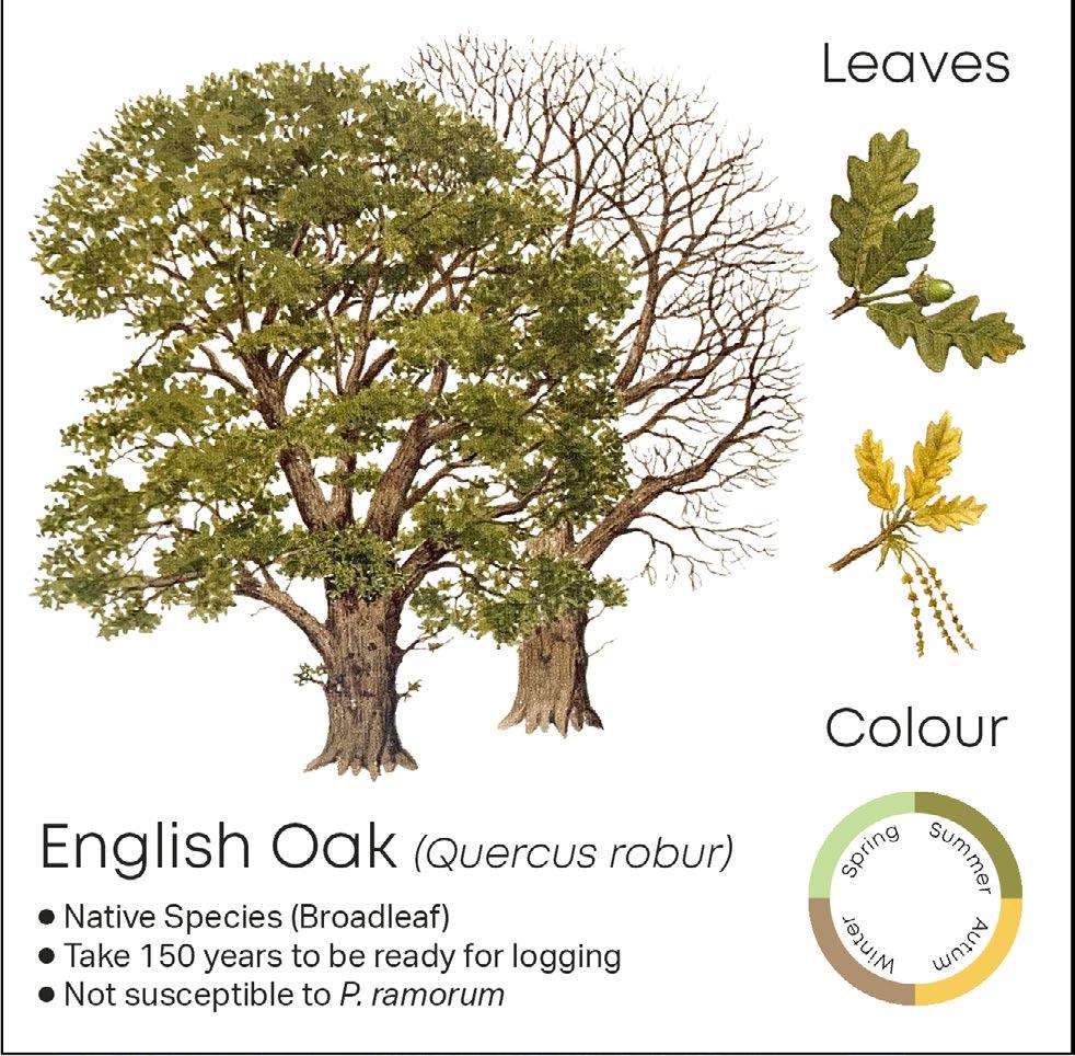
The planting design aims to reduce the coverage of Larch trees and introduce broadleaves such as English Oak and European Beech to the site. These tree species can be used as a source of hardwood for the UK’s timber industry and they are immune to the Larch Disease.
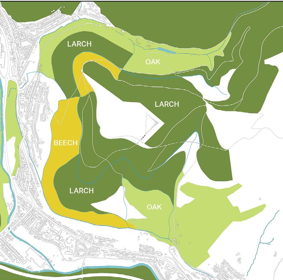
TREE SPECIES PLANTING AREAS 12 - CWMCARN FOREST RENEWAL
SYSTEMATIC FUTURE LOGGING
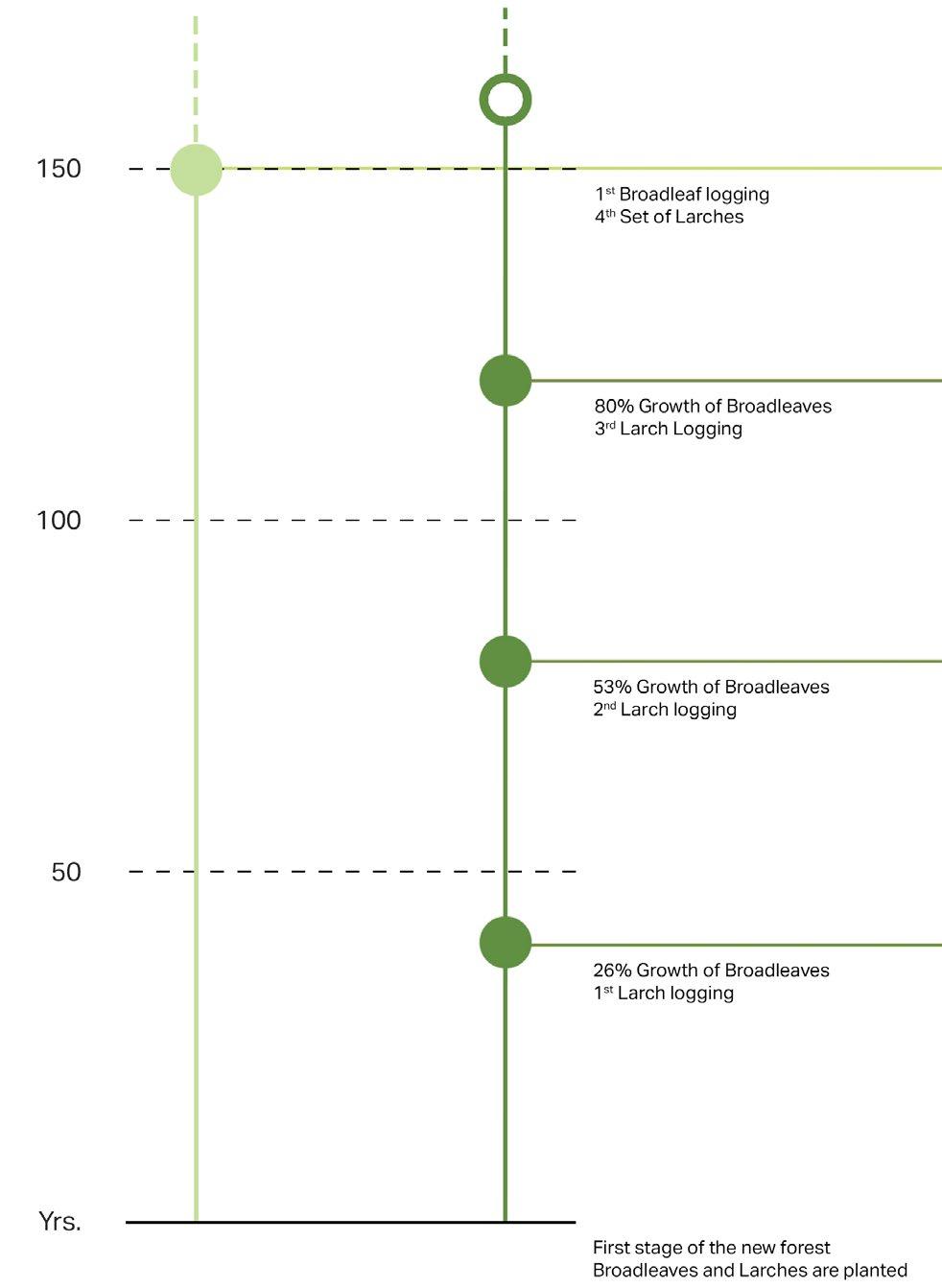
Larches and broadleaves have a significant difference in the time before they are ready to be logged. Larches take around 40 years and broadleaves such as Oaks and Beeches take 150 years. This leads to strategic logging in the Cwmcarn forest. The strategy involves selective logging to maintain the character and abundance of the forest. The diagram below shows the projected years when each type of tree is ready to be logged and re-planted.
ECONOMICAL TIMBER OF CWMCARN FOREST
The forest is previously dominated by Larch trees which are susceptible to Phytophthora ramorum The intervention aims to reduce the coverage of Larch trees and introduce broadleaves such as English Oak and European Beech to the site. These tree species can be used as a source of hardwood for the UK’s timber industry as well. Broadleaves planting areas need to be less steep compared to Larch planting areas due to their nature of growth requirements.

CWMCARN FOREST RENEWAL - 7
SOFTWOOD
CWMCARN FOREST RENEWAL - 13
HARDWOOD
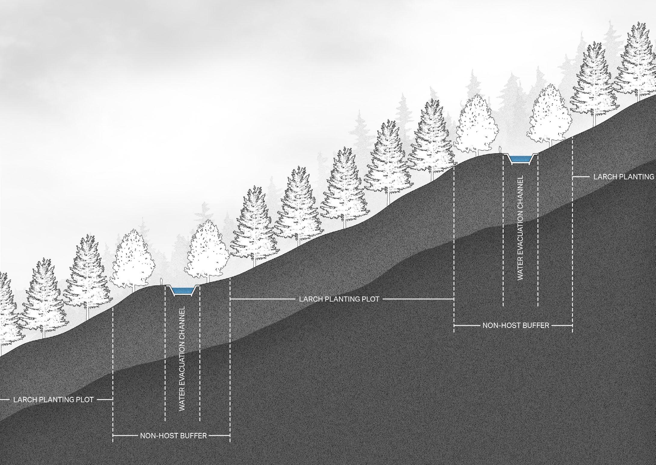
COUNTERING RUNOFF INFECTION
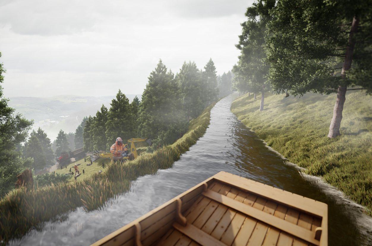
From the terrain drainage analysis, the water flowing down the terrain can possibly carry the disease from the infected tree in the higher area and transmit it to the susceptible tree in the lower area. The canal system is proposed to collect the surface run-off along the terrain height and evacuate the water out of the site securely.
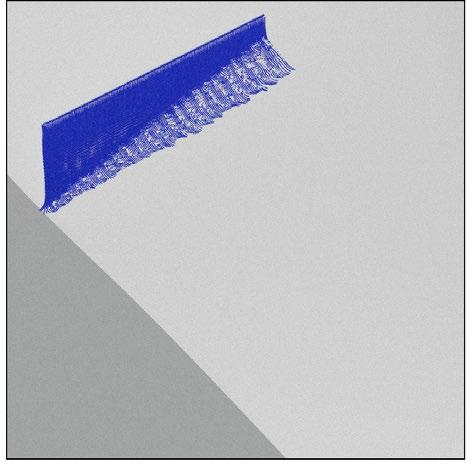
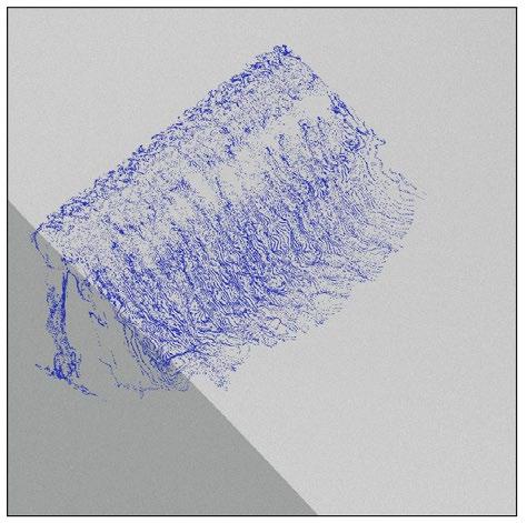
FLOWING SIMULATION OF CANAL SYSTEM
The flowing simulation has been done in Blender’s “Mantaflow” fluid simulation, as a proof of concept, to verify the functionality of intervention compared to the original surface. The run-off water (blue particles) is trapped by the water evacuation channel. The possibly contaminated water is then carried out of the site to the main waterways via the canal network introduced all over the forest area.
1. The water is dropped onto the surface to simulate the run-off caused by rainfalls.
2. The water that may contain P.ramorum flows down the surface and can infect larch trees in the lower area.
3. The channel prevents the infected water to affect the lower planting area which can significantly reduce the risk of spreading of P.ramorum.
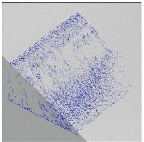
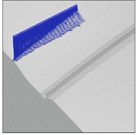
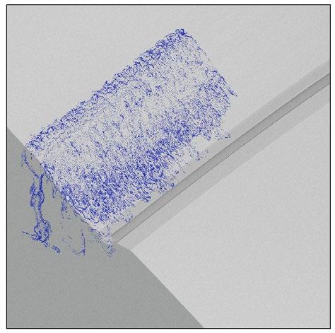
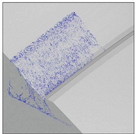
Surface with Intervention Original surface
1 3 2 14 - CWMCARN FOREST RENEWAL
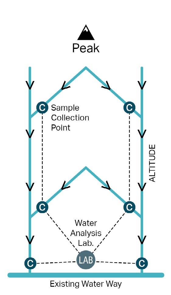
WATER CANAL & DETECTION SYSTEM
The canal system is the network of canals designed to evacuate the possibly infected runoff water from the higher area of the forest. These canals prevent cross-plot infection which leads to the spreading of P. ramorum over the forest area.
The sample collection points allow scientists to keep track of the presence of the disease in the area. The lab is built to analyse the collected sample baits.

DETECTION SYSTEM DIAGRAM CWMCARN FOREST RENEWAL - 15
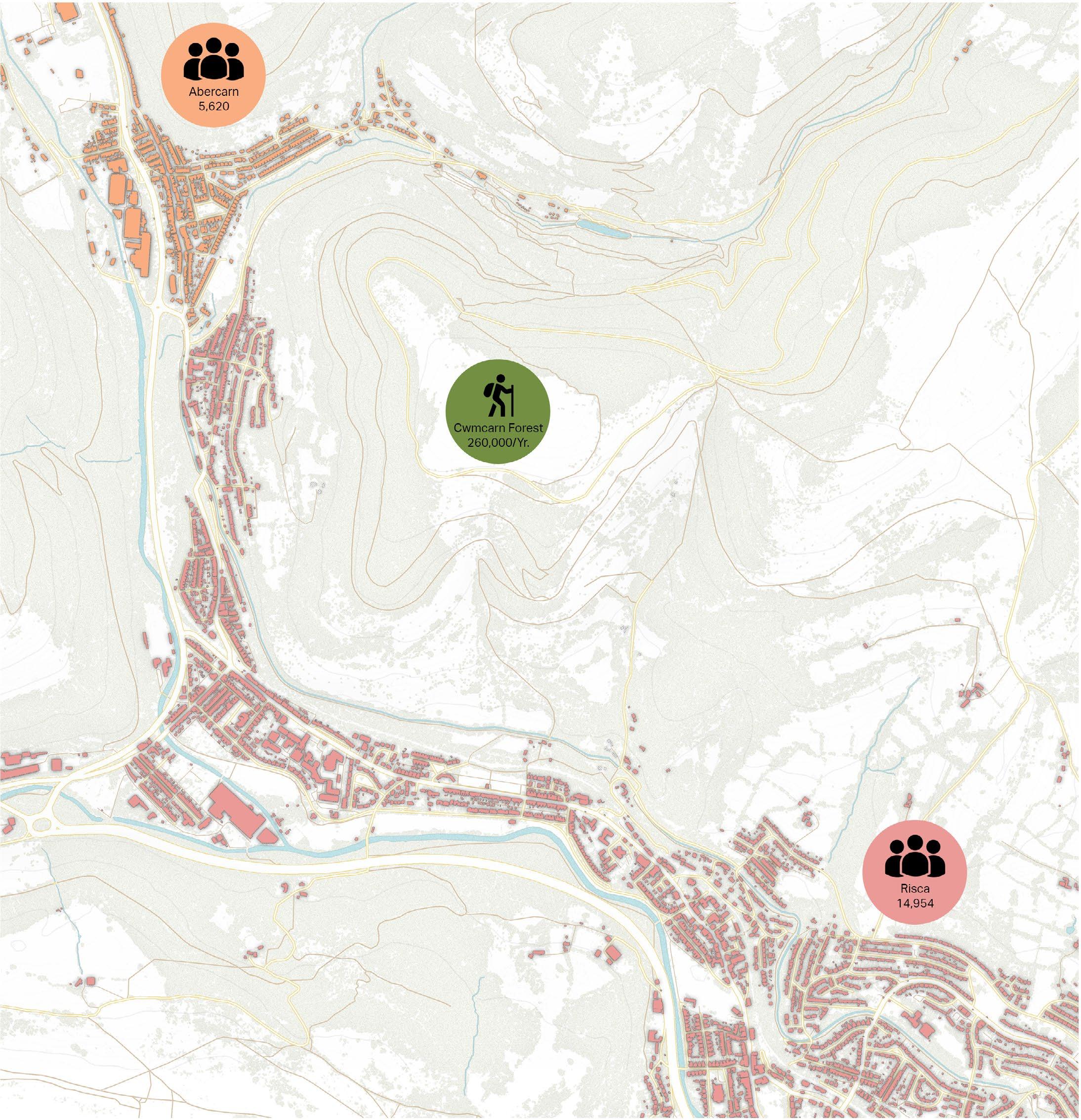
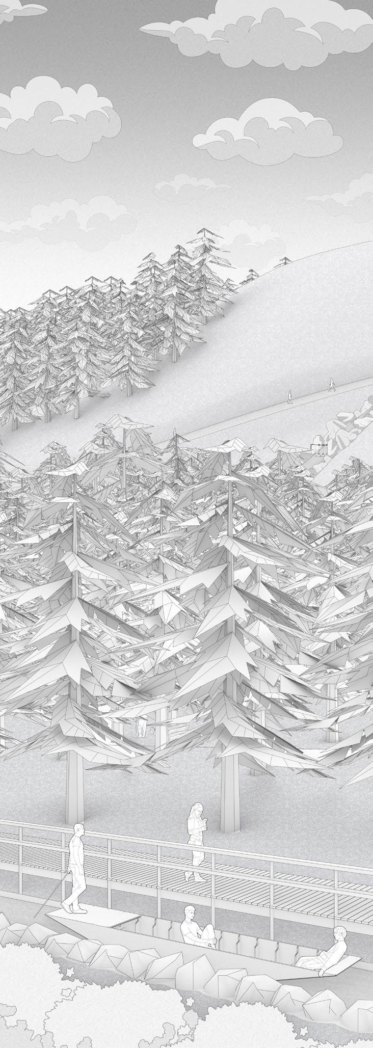
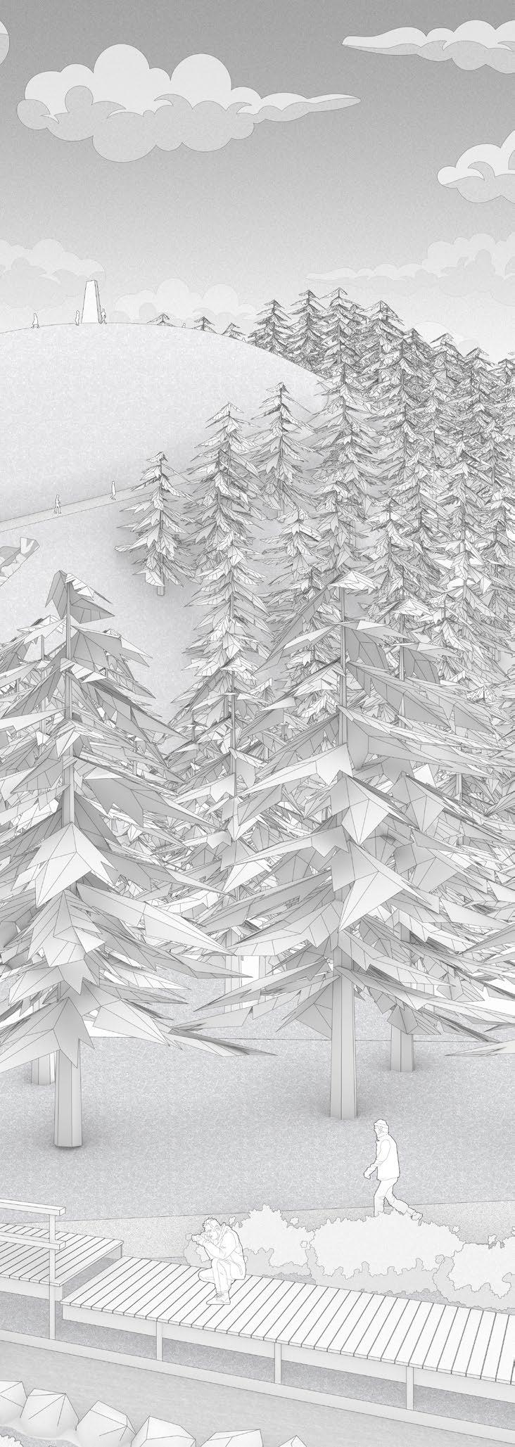
USERS AND VISITORS OF CWMCARN FOREST
The forest is adjacent to two major settlements on the west and south. On the west, Cwmcarn, part of Abercarn town, has an estimated population of 5,620 as of 2020. In the south, Risca town has an estimated population of 14,954 as of 2020.
The forest is the destination for families, hikers and mountain bikers. Cwmcarn Forest Drive which opens on weekends has around 260,000 visitors per year as of 2014 record. The renewal project aims to make the forest a destination for local inhabitants as well as a destination in southeastern Wales.
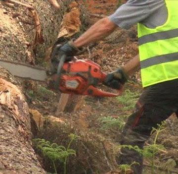
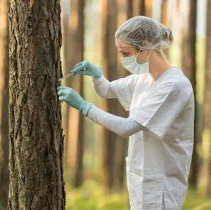
THE HIDDEN USERS OF THE FOREST
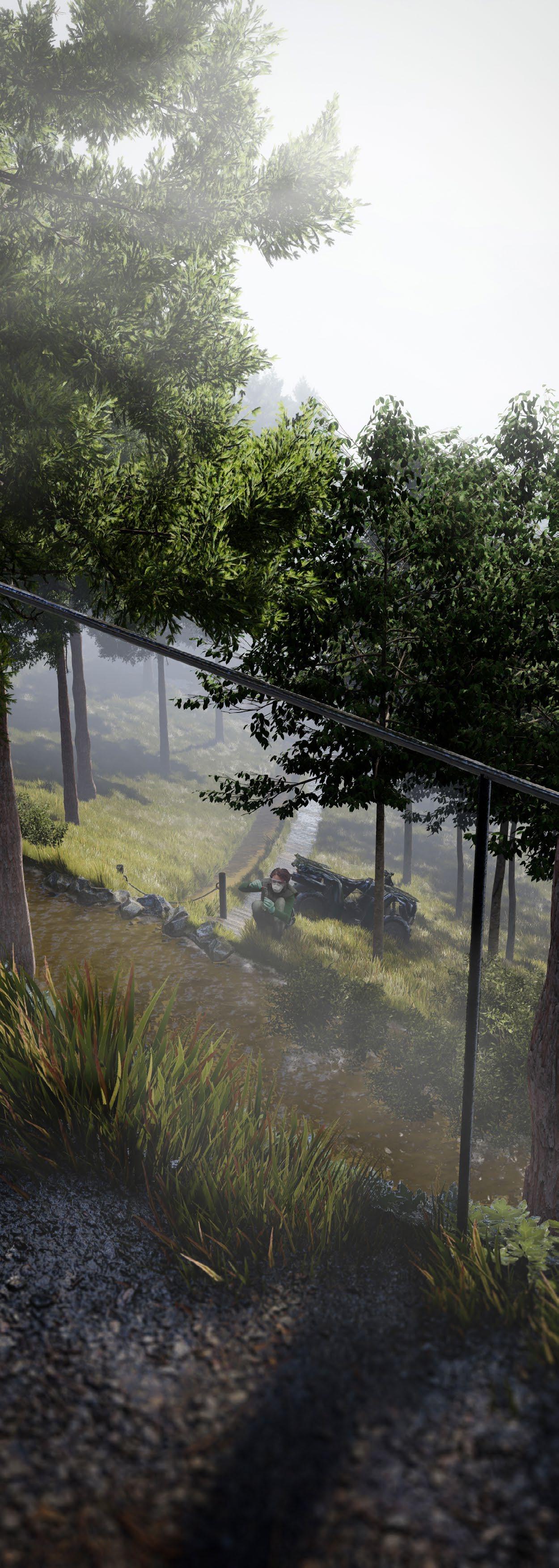
As this forest is the source of the UK’s timber industry, the workers who fell trees and transported them to the nearby sawmill are considered the hidden users of the forest. Moreover, the pathogen monitoring system, which will be introduced as an intervention to the site, involves scientists collecting water samples and analysing them in the lab periodically.
16 - CWMCARN FOREST RENEWAL
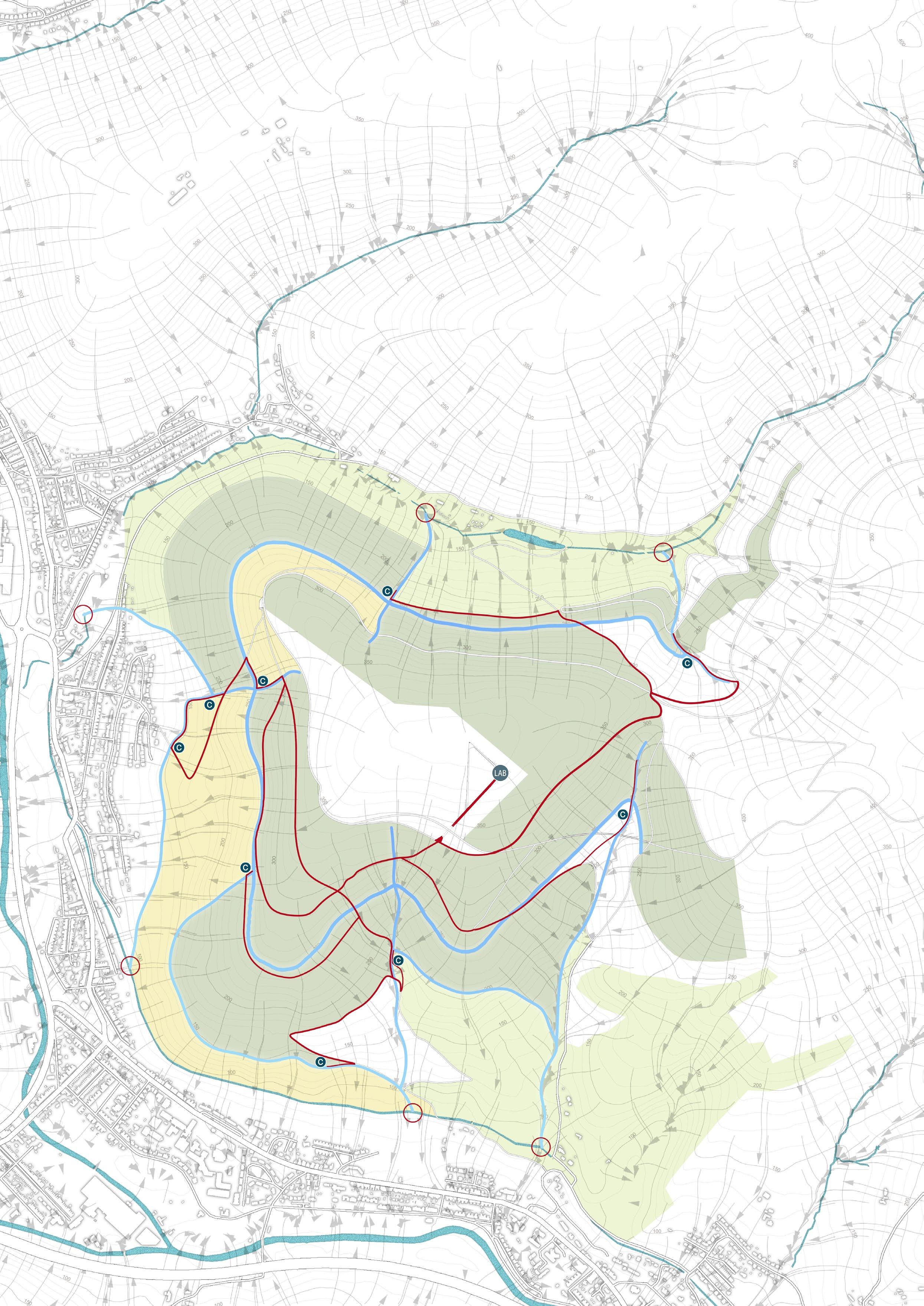
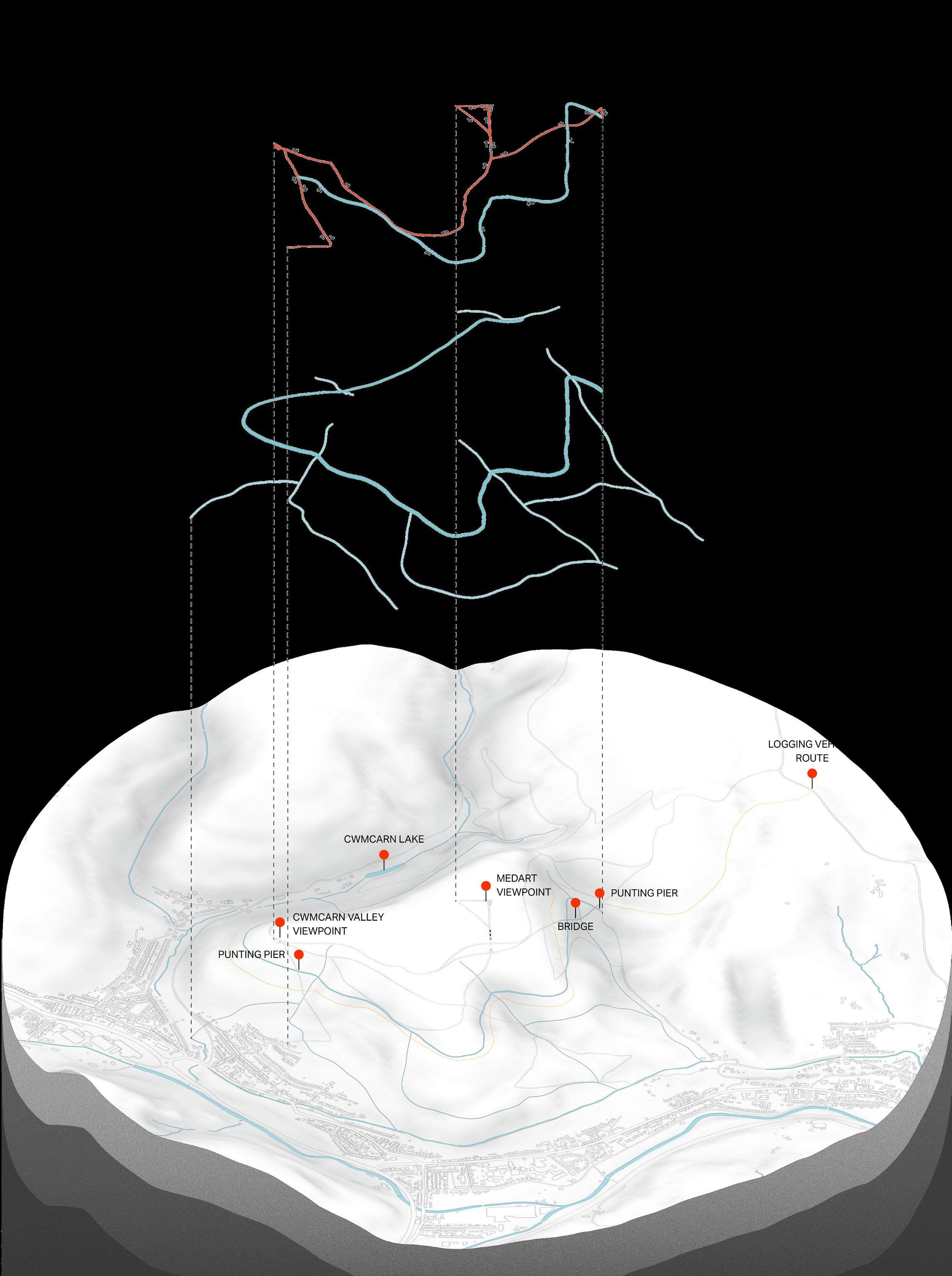
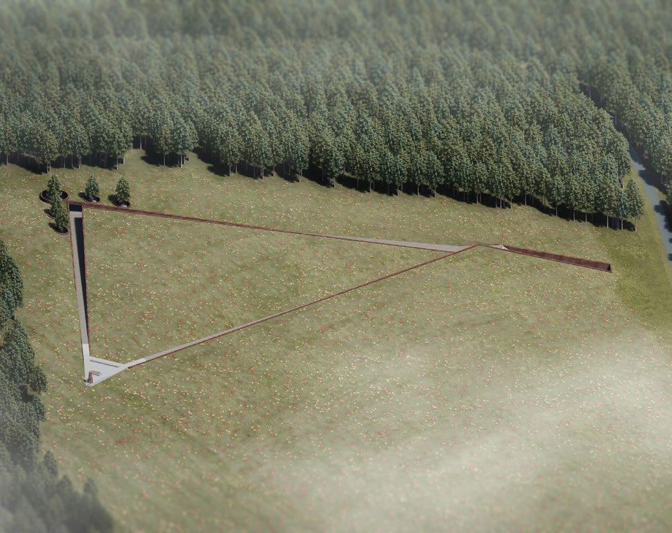
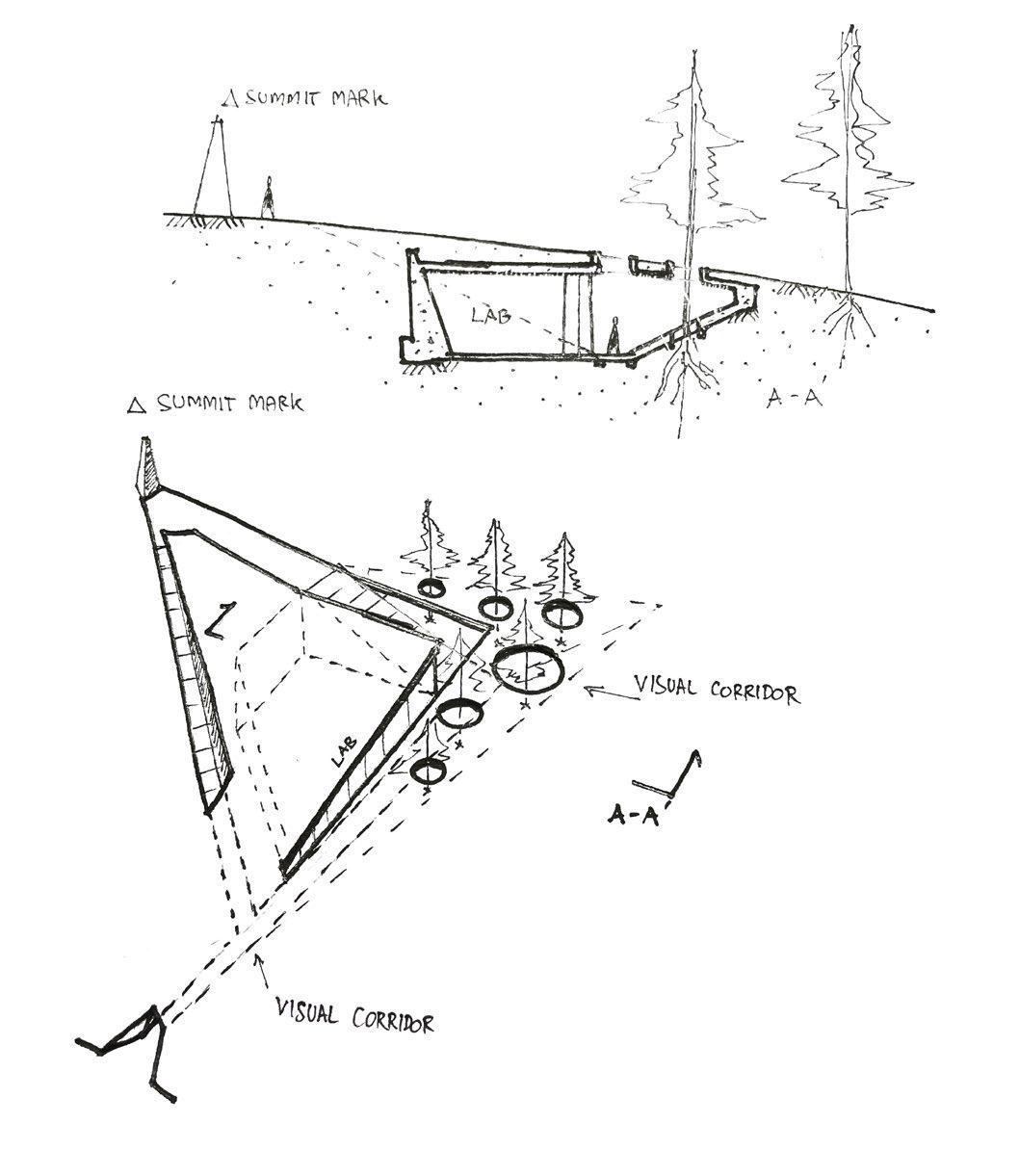
PROPOSED EXPLODED DIAGRAM
The proposed layout of Cwmcarn Forest consists of three circulation layers and two canal types.
The top layer of the exploded diagram shows the suggested and casual route for the visitor to experience the forest.
The middle layer shows the canal system introduced to counter the surface run-off infection between tree planting plots.
The base terrain shows the location of point-of-interest of the site as well as the “Logging route” highlighted in yellow.

CWMCARN FOREST RENEWAL - 17
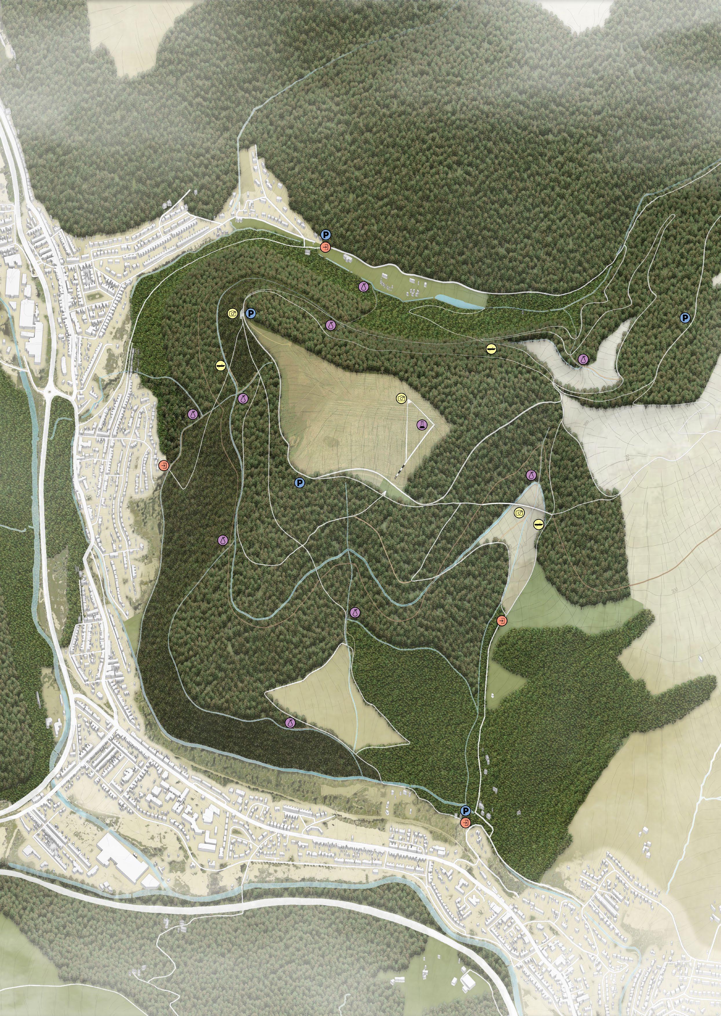
PROPOSED SITE PLAN
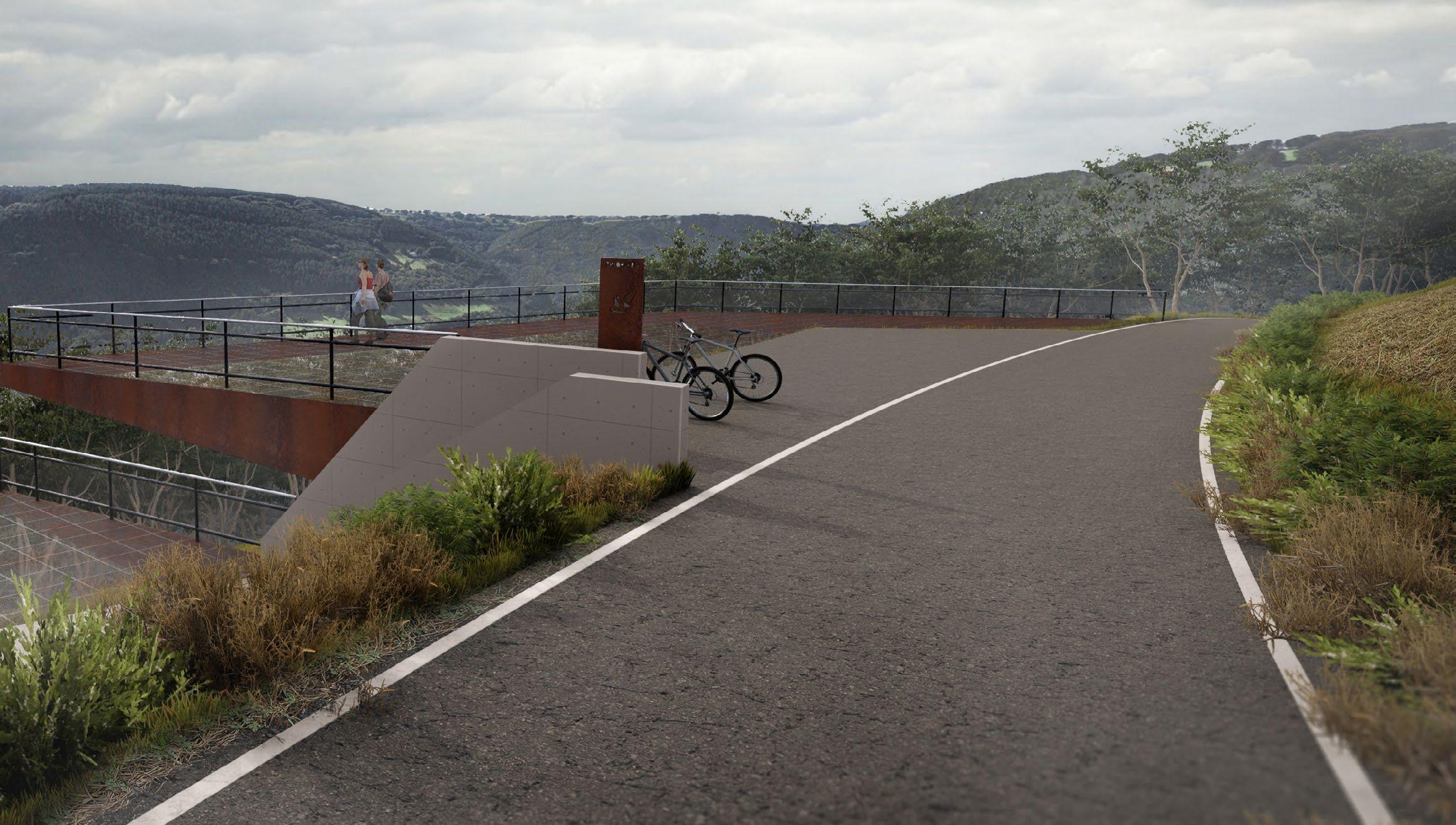
The site plan includes the development of pathways to be more stable to serve more users. Some difficult paths are created for a more challenging experience. The hidden routes for scientific research and logging are also created to reduce crosscirculation between different routines.
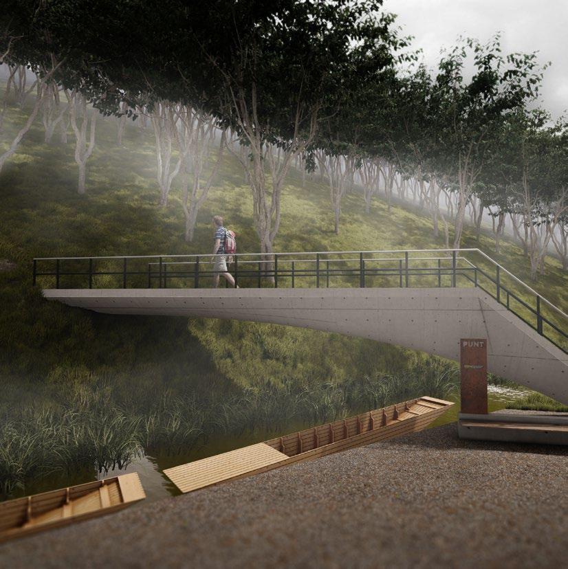
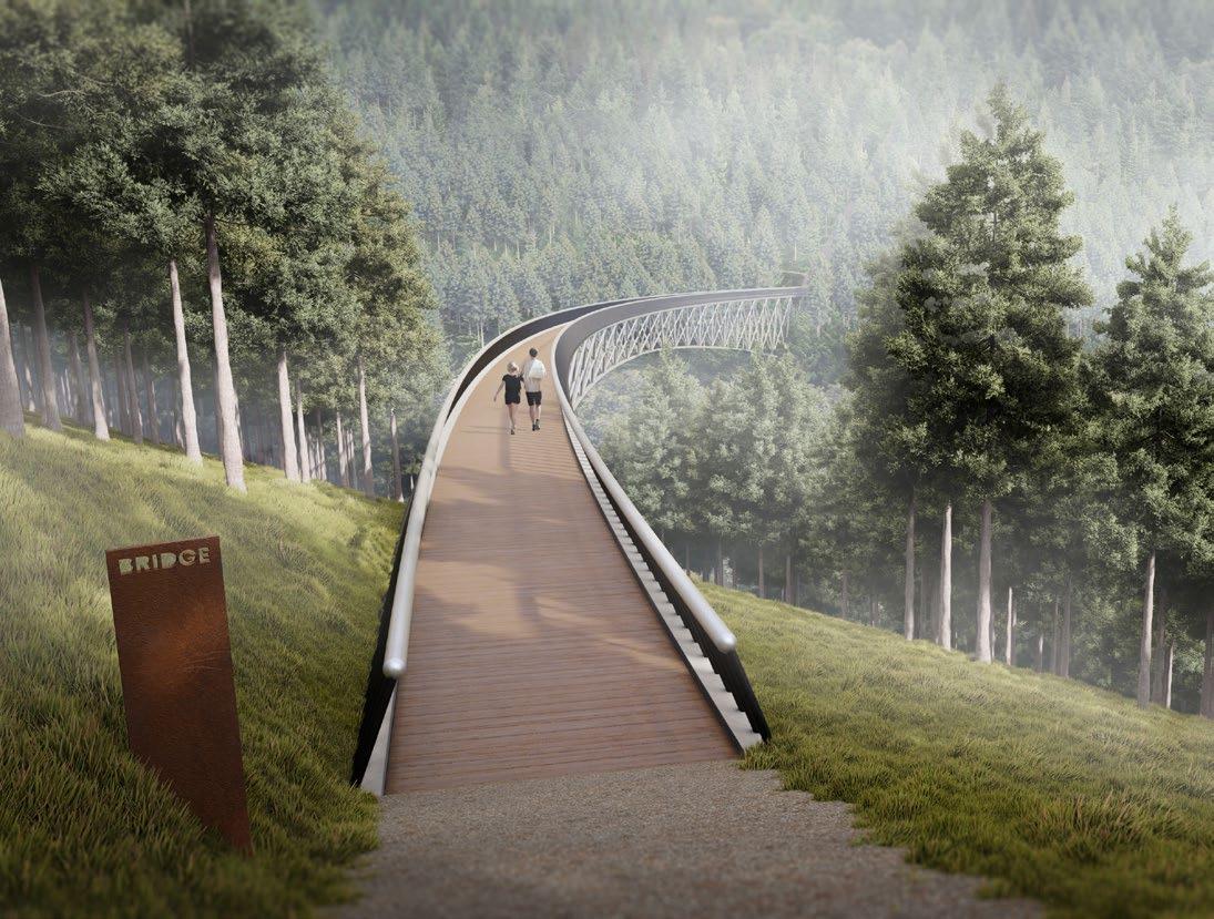
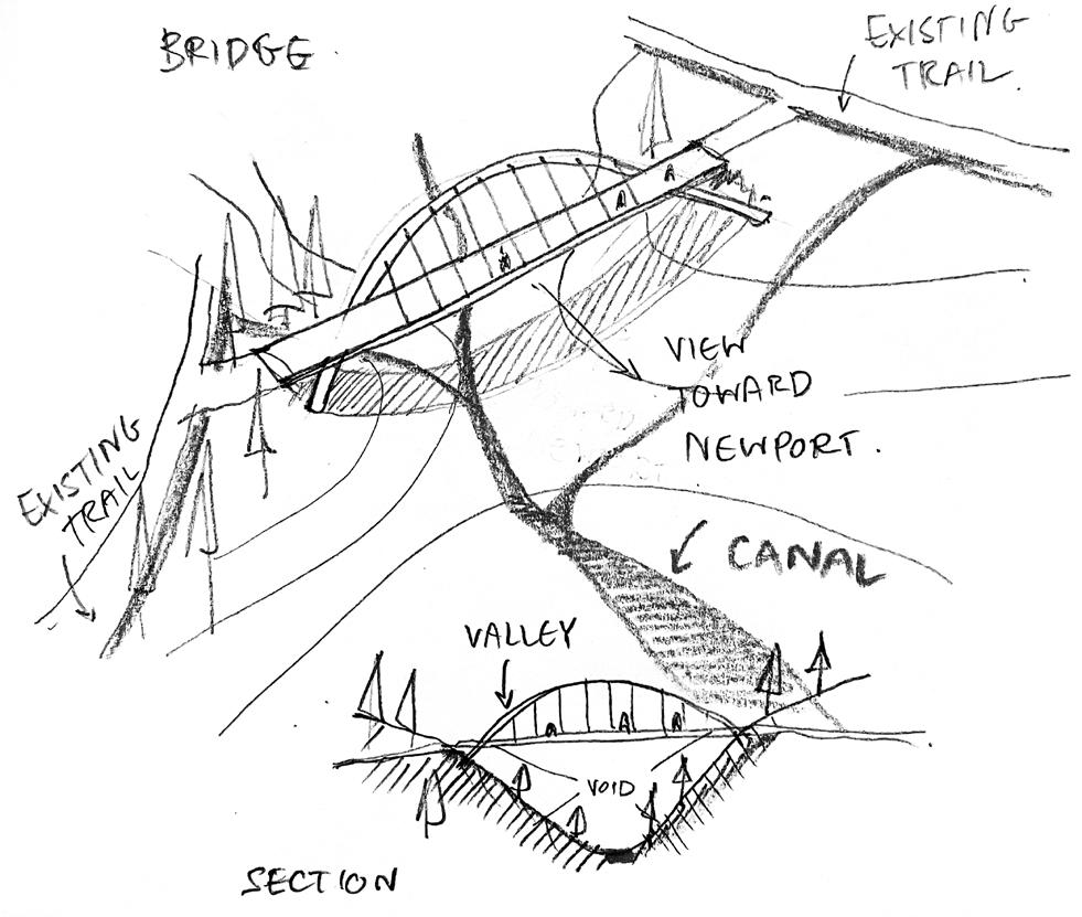
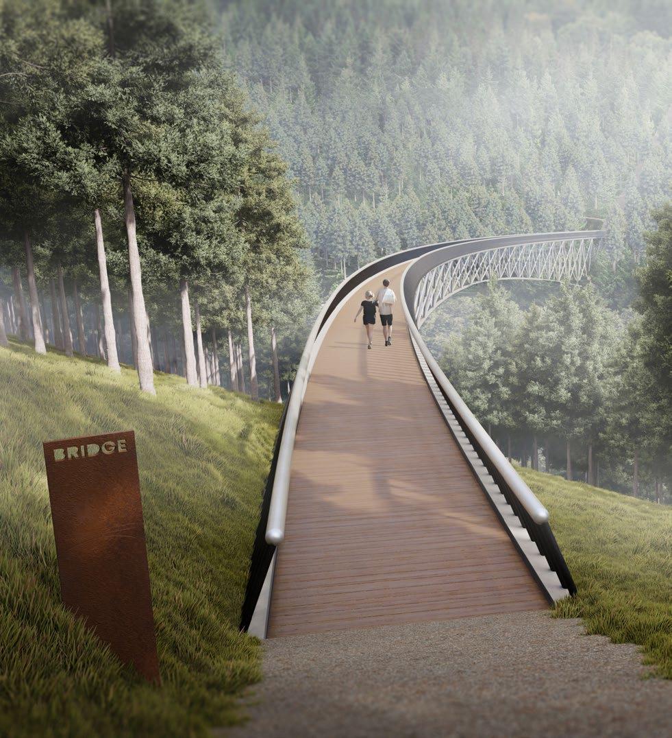
3 proposed entrances provide access to the visitors from the local bus stops. The new pathogen learning centre and laboratory is located on the summit as a destination for visitors. The proposed bridge gives users a new stunning experience and adds more dynamics to the forest area.

18 - CWMCARN FOREST RENEWAL
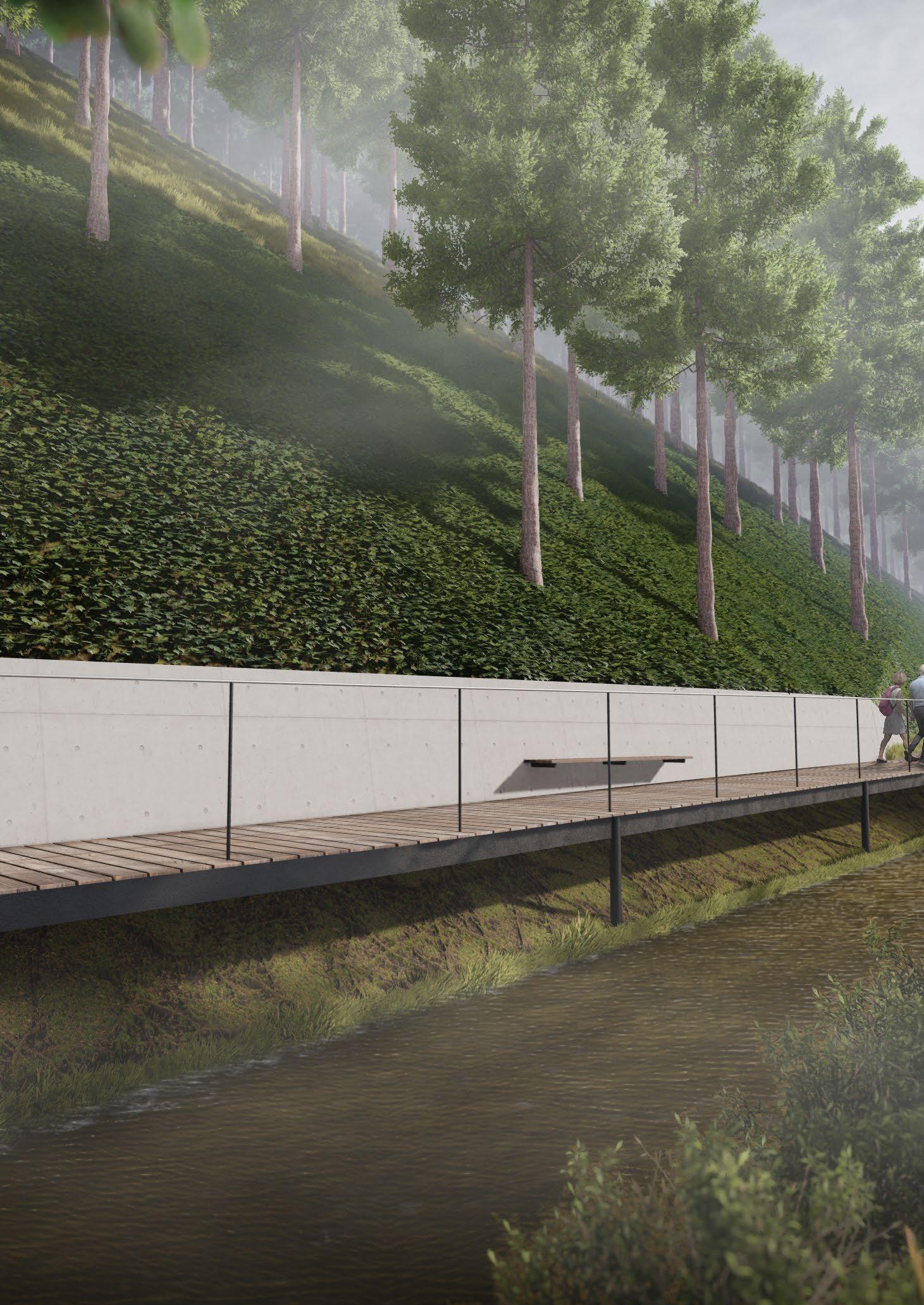
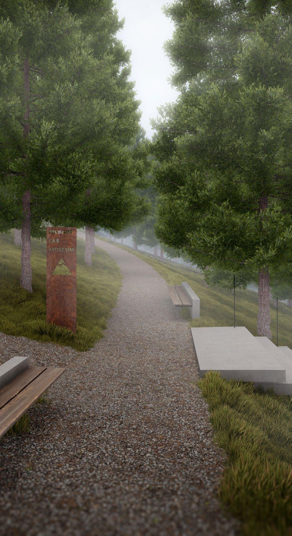
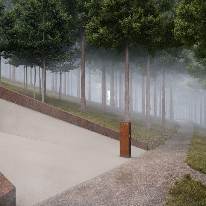
ELEVATED RAILINGS
The railings are made of brushed stainless steel for durability. These railings reflect the sky which creates an illusion of glowing lines to lead visitors in the desired direction. The black poles supporting the rail create an illusion of levitating handrails.

CONCRETE SLAB
The stairs are located on the steeper areas of the pathways. They are made of concrete slabs, partly buried into the terrain to emphasise the contrast of man-made elements in the forest.
SIGNS
The sign is the most universal and basic way of providing direction to the visitors. The signs in Cwmcarn Forest are made of a plate of Corten steel. The texts and symbols of the destination are made of the negative space on these steel plates.
THE LANGUAGE OF WAYSHOWING
To guide the visitors to the destinations in Cwmcarn Forest, the visual languages are designed. The signs are made of plates of Corten steel cut out the texts and symbols with a CNC machine.
Concrete is used to highlight man-made interventions which contrast the surrounding forest environment, this helps visitors spot them easily. The railings are made of brushed stainless steel placed on the black poles to create the levitating effect and draw the line of sight to a certain destination.
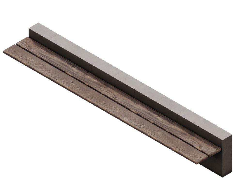
BENCH
The benches use wooden planks for more comfort when sitting. The cantilever design from the concrete half wall is in line with other interventions. They are placed over the forest to allow visitors to rest during their walk.
FONT
SYMBOLS
CWMCARN FOREST RENEWAL - 19
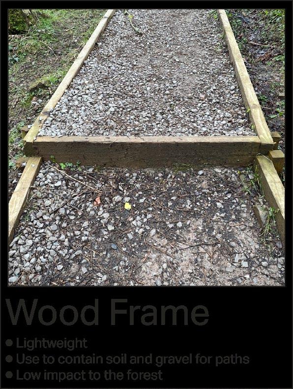
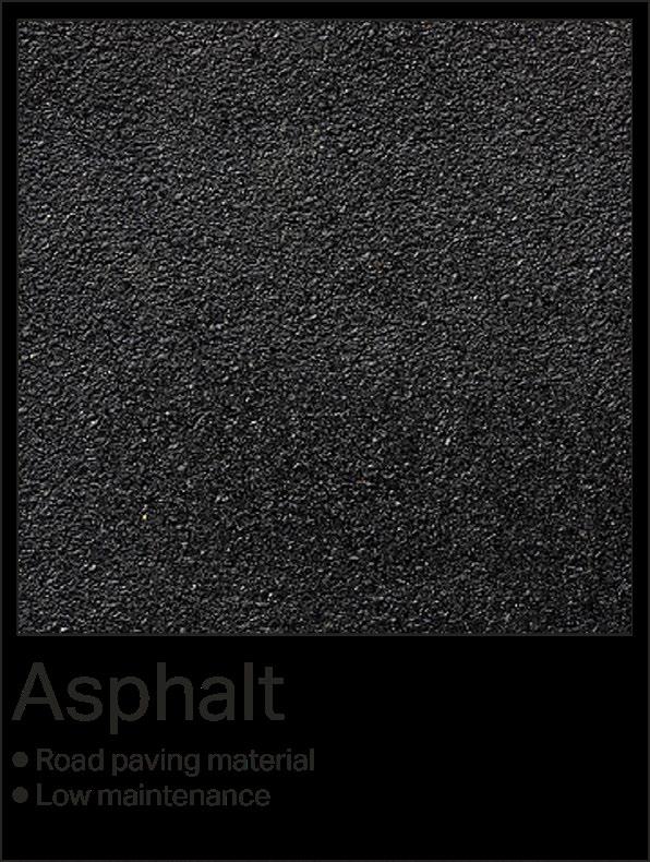
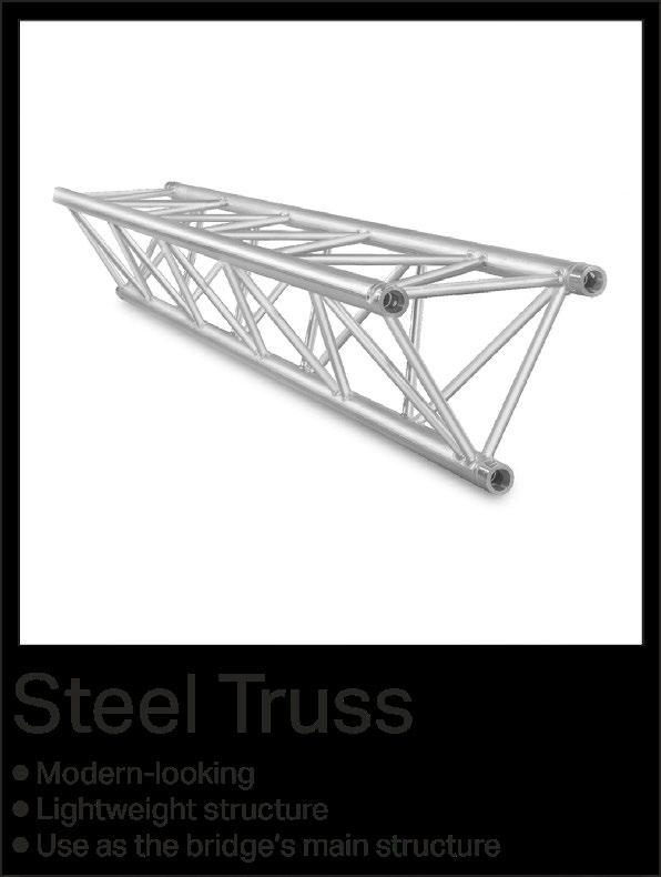
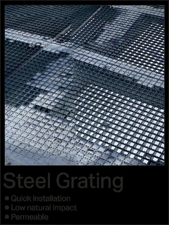
MATERIAL PALETTE
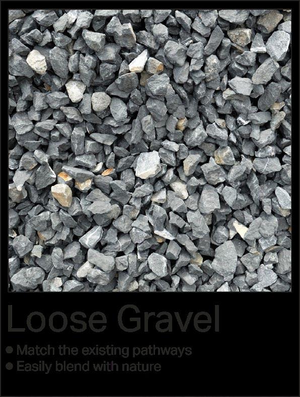
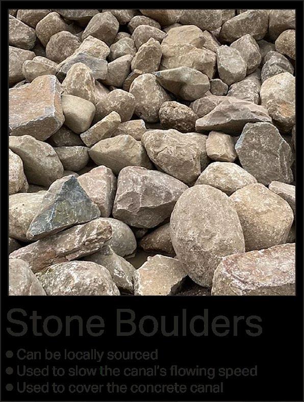
The materials chosen for the project are focused mainly on the way these materials are sourced. Most of them are recycled materials from the terrain manipulation processes. This is to reduce the need for materials to be transported to the site. All of the materials chosen are low impact and low maintenance to increase the self-sustainability of the forest.


20 - CWMCARN FOREST RENEWAL
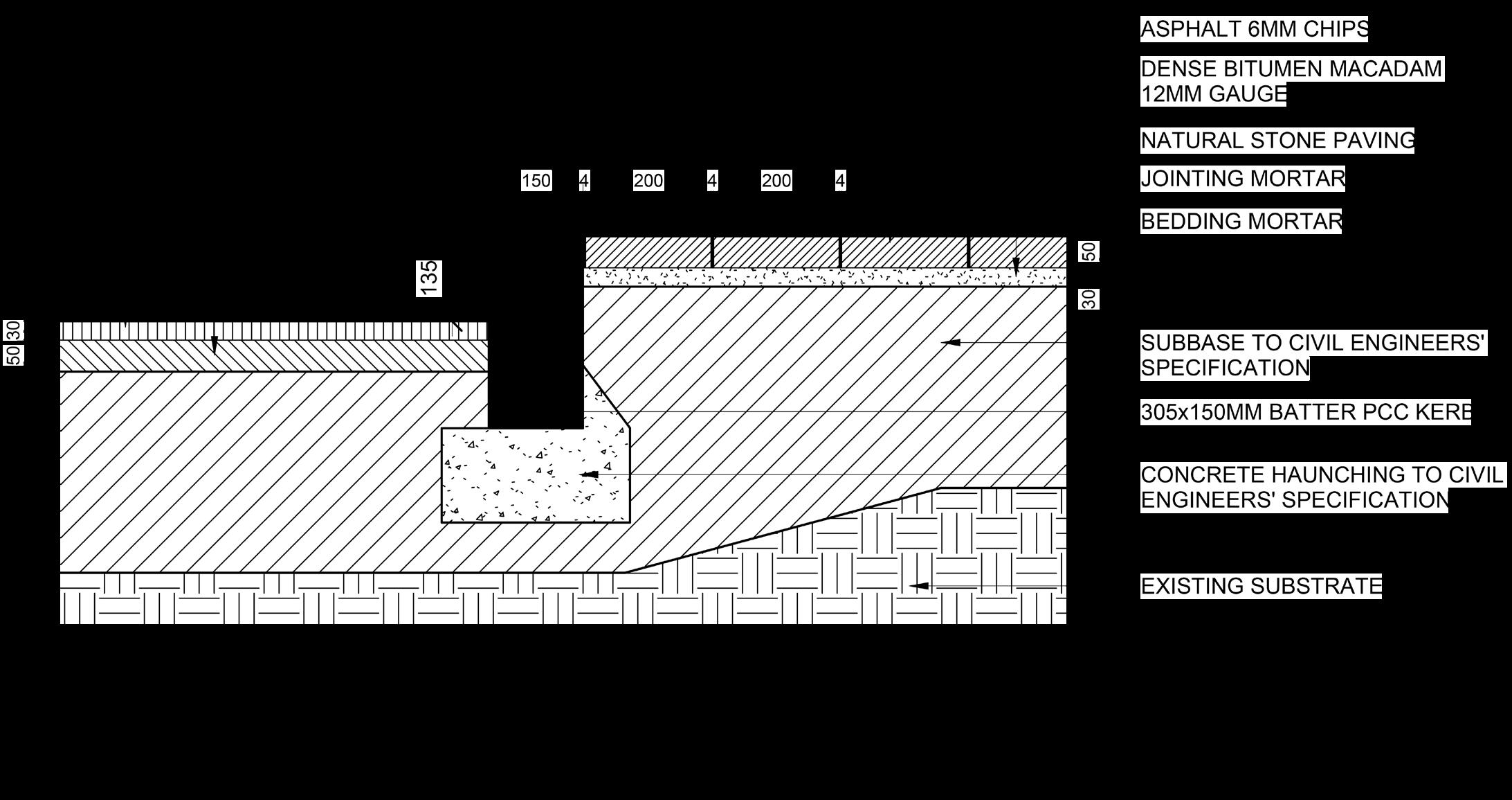
DETAILED SECTIONS
The detailed sections of the canal, pathway and Cwmcarn Drive show the dimensions and construction details of each area. These details are to be used all over the forest area.
The main goal of this development is to minimise the impact on the overall forest area while providing a new experience and management system for the forest to be more sustainable in the coming future.
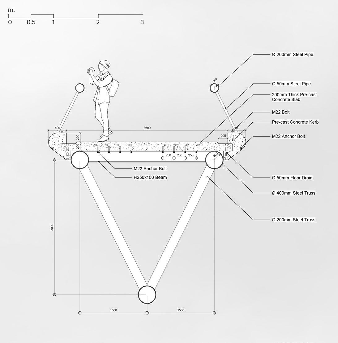
BRIDGE SECTION
The detailed drawing of the bridge showing the structure of the bridge as well as construction methods and materials.
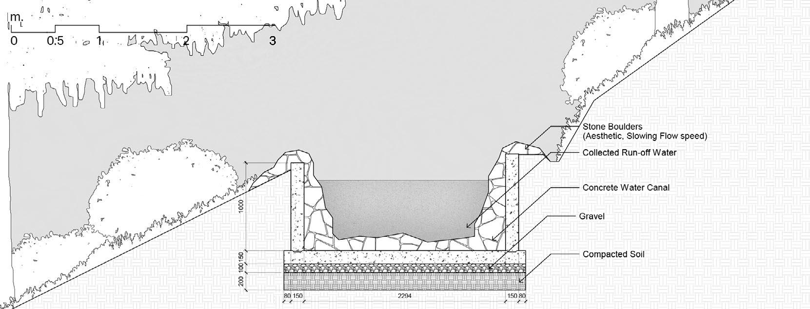
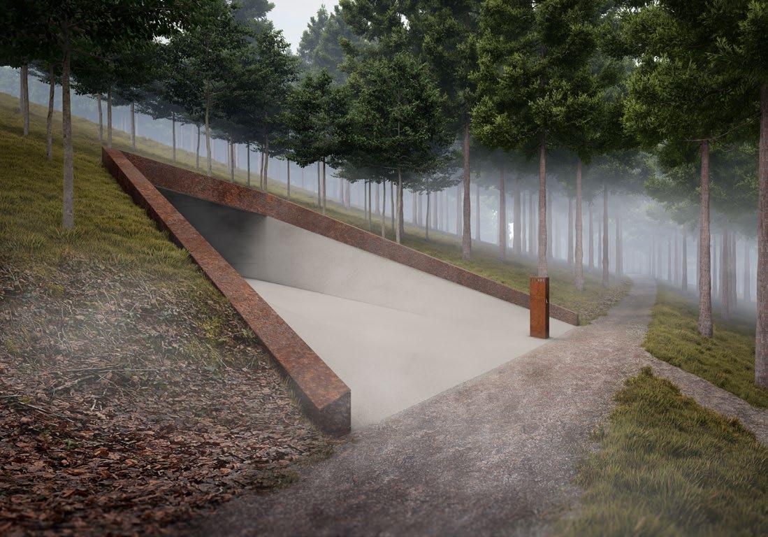
CANAL SECTION
Section of the canal that is used to evacuate run-off water from the site. The structure is made of concrete with stone boulders on top to slow the flowing speed.
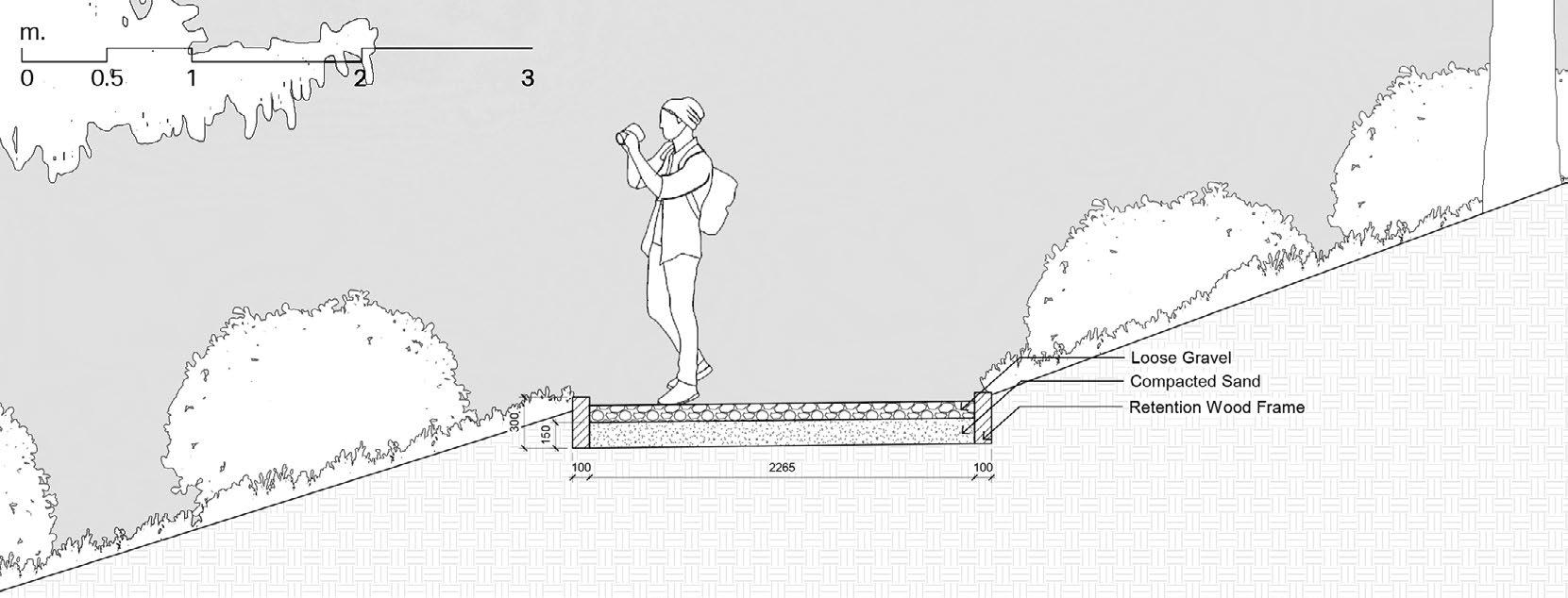
TRAIL SECTION
Section of pathways that are laid over the forest area which has a stable surface for all visitors.
ROAD SECTION
Section of Cwmcarn Drive which is existing and to be well maintained with the same details in the future.

CWMCARN FOREST RENEWAL - 21
THE SCIENTISTS
This illustrates the method of detecting the pathogen that takes place in the forest to closely monitor the presence of the disease in the area. This procedure helps control the spread of the disease.
THE TOURISTS
This illustrates visitors’ experiences hiking and punting. The marker on hike where the viewing
22 - CWMCARN FOREST RENEWAL
experiences occurring in the forest, mainly on the hilltop marks the goal of the viewing platform is located.
CWMCARN FOREST TRIPTYCH
Triptych is a work of art that originated from early Christianity, divided into three sections to illustrate different aspects of the story. Beyond its association with art, the term is sometimes used more generally to connote anything with three parts. The triptych below sums up the intervention proposed to Cwmcarn Forest.
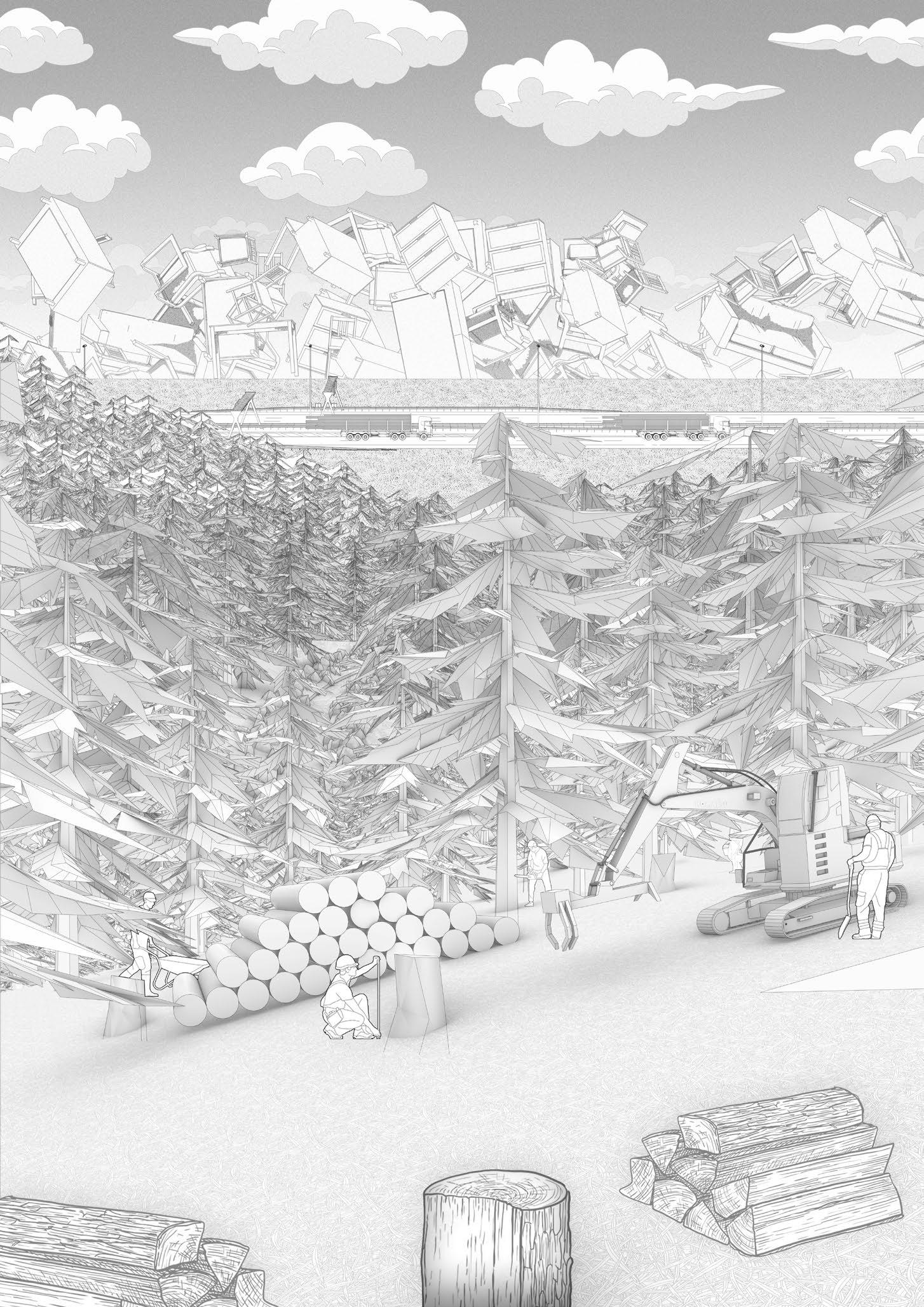
THE INDUSTRY
This illustrates the processes of logging and transferring the timber out of the site to be processed into furniture and construction materials.
TOURISTS
CWMCARN FOREST RENEWAL - 23
24 - CWMCARN FOREST RENEWAL
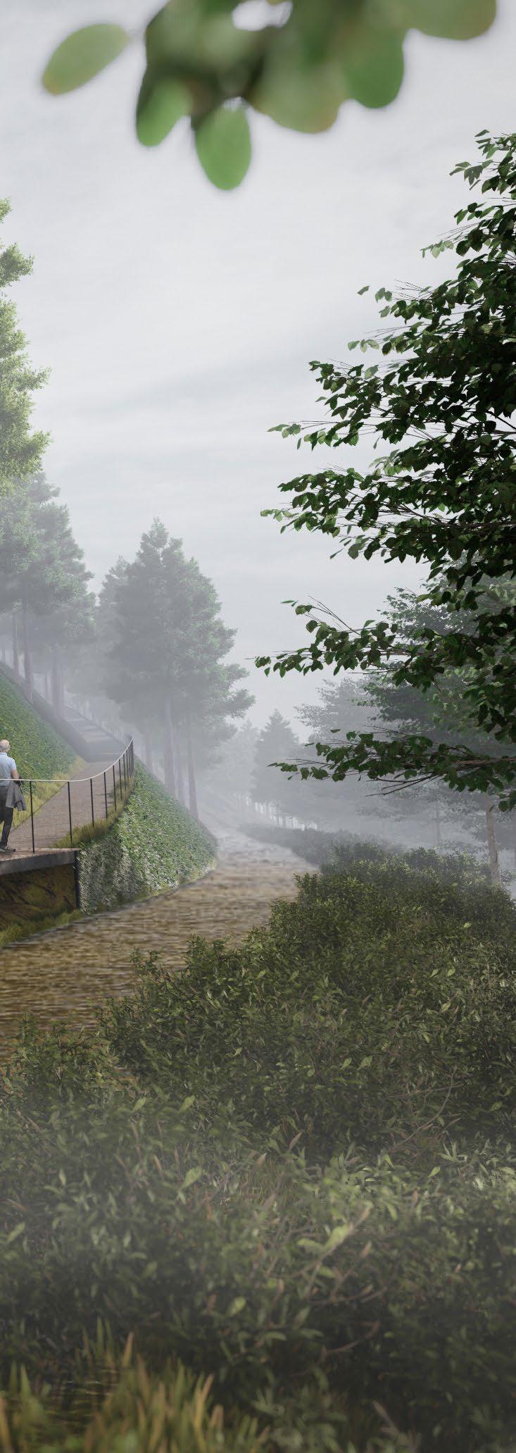
VISITING EXPERIENCE
The series of pathways and roads laid throughout the forest are connected, this allows the visitors to always choose the alternate paths to the summit.
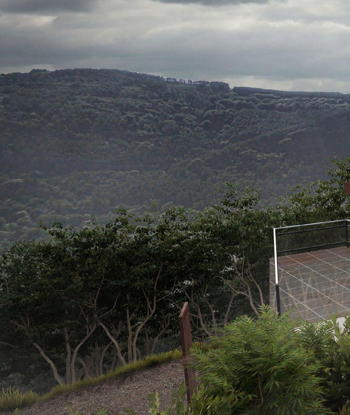
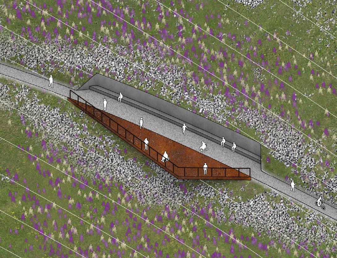
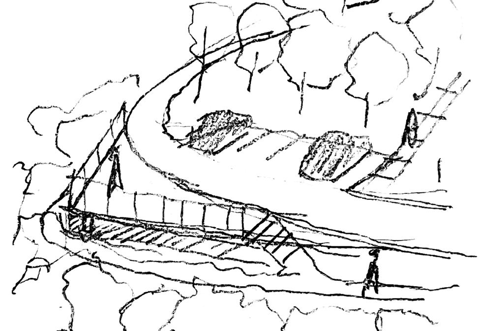
The long-span bridge linking two mountains together uses a lightweight design to reduce the overall aesthetic impact on the nature area. It also overlooks the Bristol Channel.
During the walk, some pathways merge with the main canal where hikers might see the process of sample collection as well as the logging practice. This is designed specifically for the educational aspect of the visit.
CWMCARN FOREST RENEWAL - 25
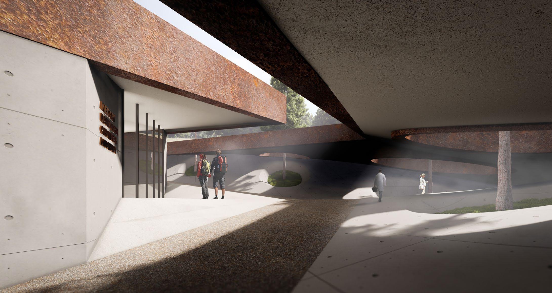
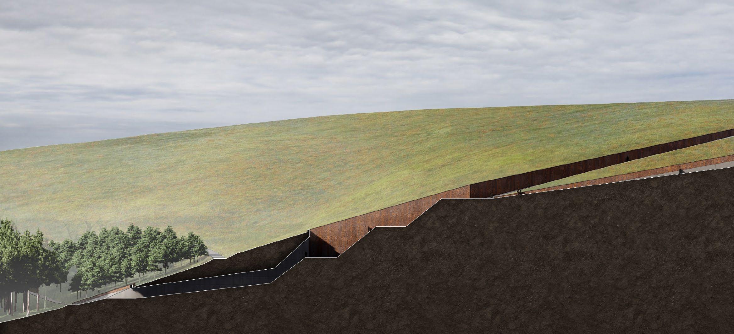
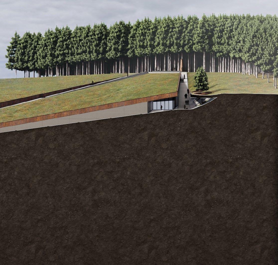
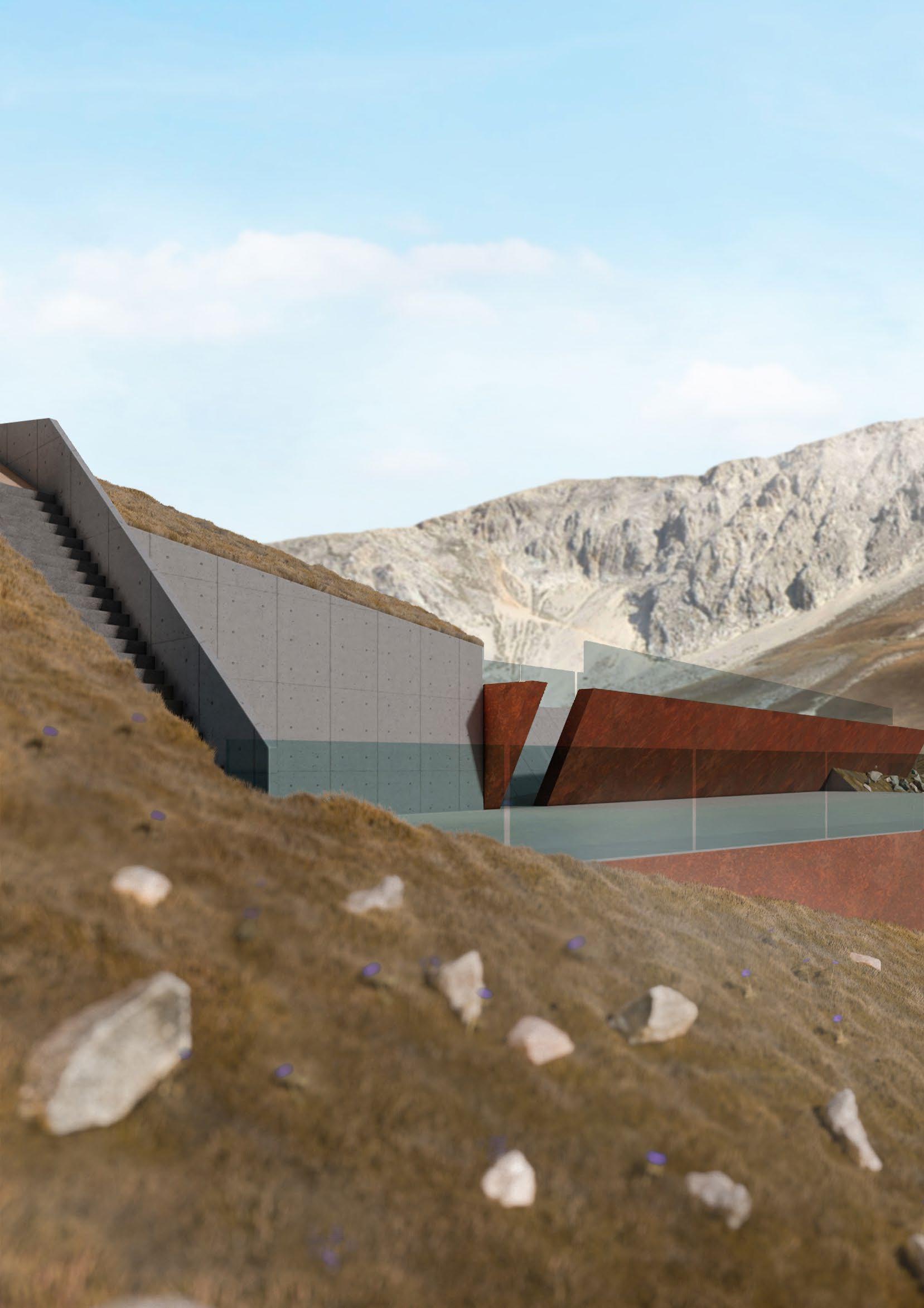
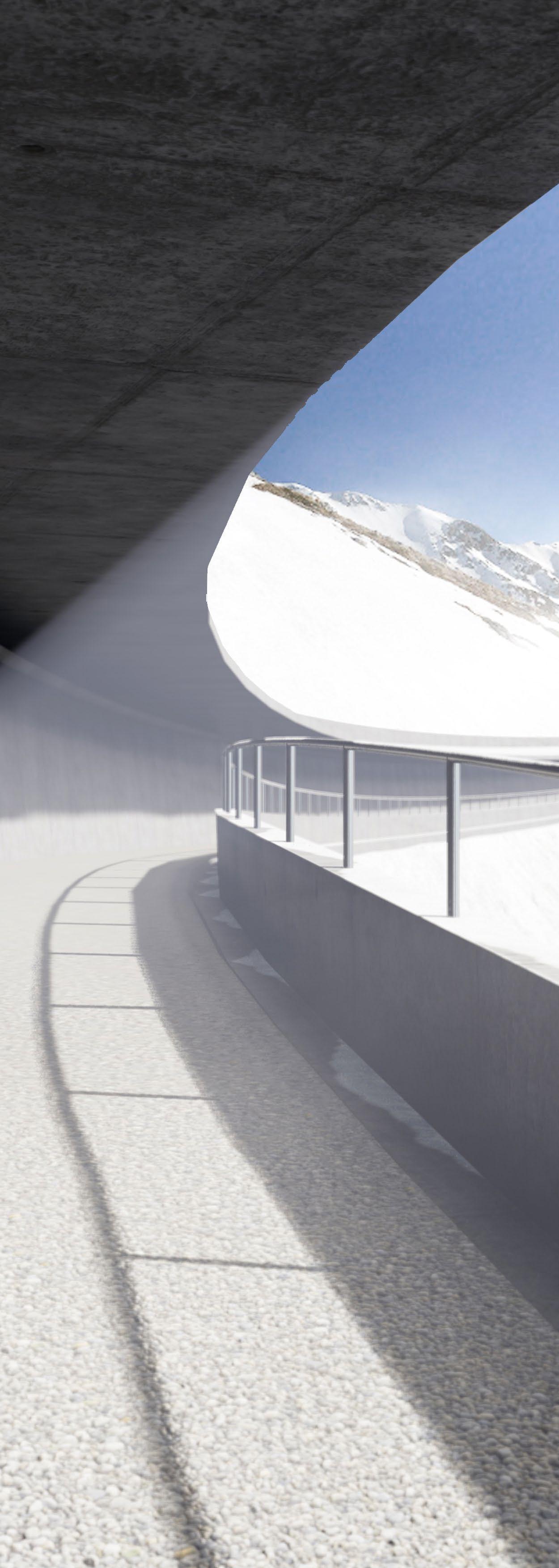
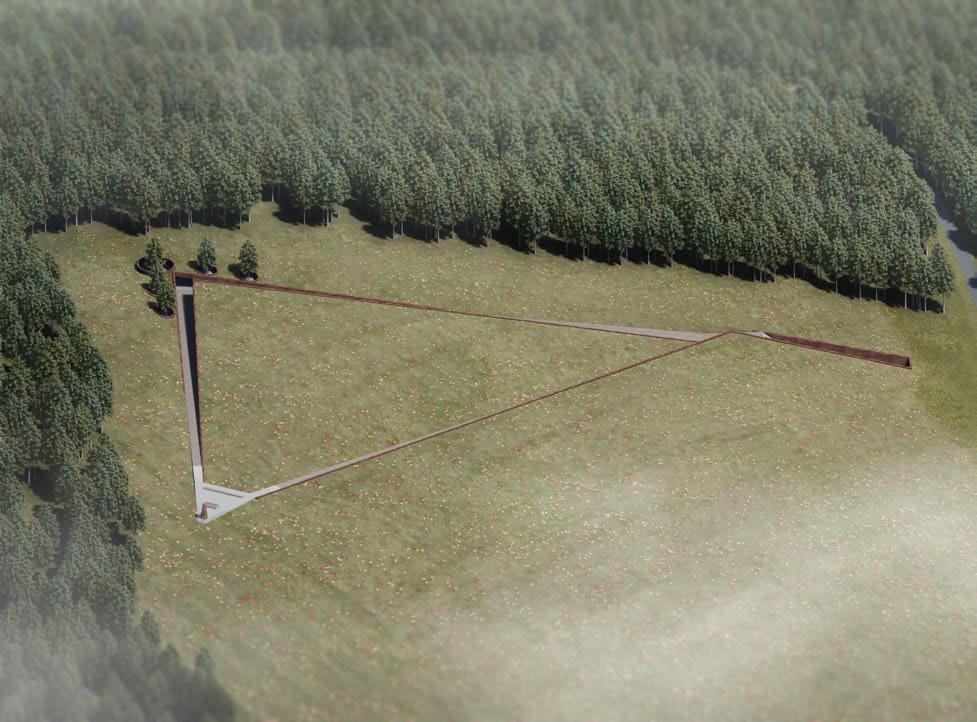
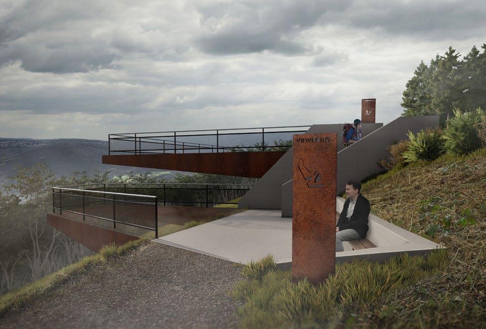
SUBTERRANEAN SECRET LABORATORY
The secret laboratory and learning centre are buried under the summit creating the unobstructed panorama. The area can be accessed only by the tunnel connected to the pathway network to eliminate the cross-circulation between pedestrians and vehicles (see the section below).
The laboratory is used for analysing the collected samples for P. ramorum. Sample Larches are planted here for the visitors to closely inspect the appearance of the tree.
26 - CWMCARN FOREST RENEWAL
CWMCARN FOREST RENEWAL - 27
GRAN SASSO FOR ALL
1st Year Landscape Design Project
Project Year 2020-2021
Advisor: Elise Hunchuck & Nico Alexandroff
The Gran Sasso, a part of the Apennines mountain, situated in the northern part of Abruzzo is the home of beautiful scenery and biodiversity. The northern area itself contains both oceanic and continental climates which define various types of plants and inhabitants.
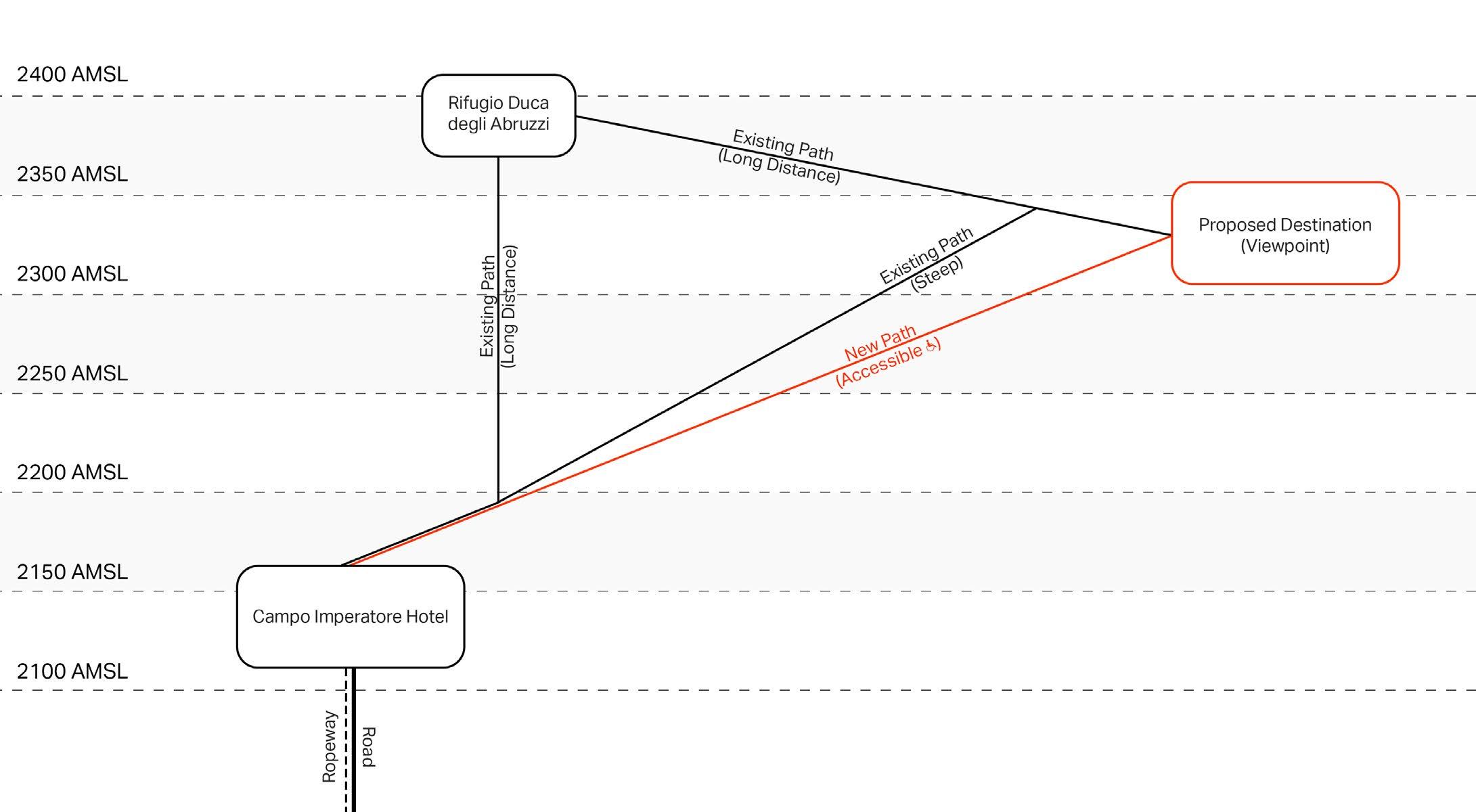
The unpaved walking trails on the Gran Sasso mountain help people get around the mountainous area, as means of leisure. Walking through different elevations enables people to experience different stunning views. In addition to the trails, the existing ropeway and a roadway to Campo Imperatore hotel help non-adventurous people to get from the foothill to the higher elevation with ease.
This design proposal responds to the need for accessibility and introduces the beautiful scenery of Gran Sasso to both local and international visitors. Developing the existing steep pathway that is vulnerable to landslides to allow almost every tourist, including disabled people, to experience hiking is the ultimate goal of the project. The path should address the difficulties and dangers of the area, especially injuries from slips and falls while maintaining the looks and feels of natural surfaces.
At the altitude of the proposed area, there is no tall tree but only grass and flowers that intersperse with each other. Nonetheless, these small plants are vital to the area in terms of biodiversity and they also help retain snow from sliding down the hill in the winter. Due to the increasing temperature yearly caused by global warming, these plants are prone to extinction. This is where the amplification in the growth of these plants is introduced to conserve the nearly extinct species and to maintain the same natural surface.
GRAN SASSO FOR ALL - 29
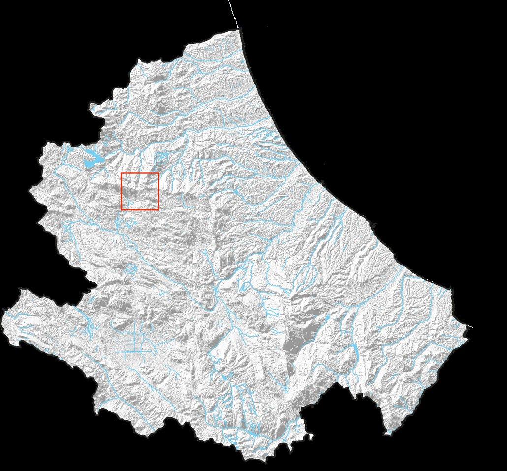
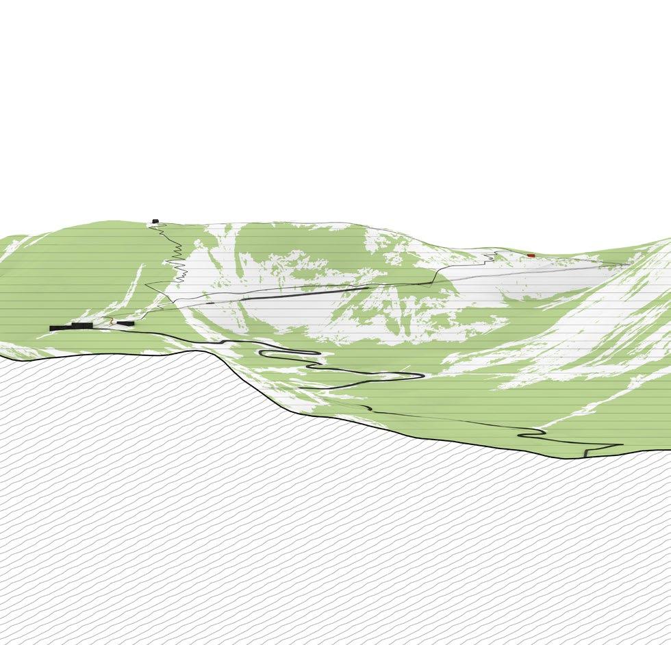
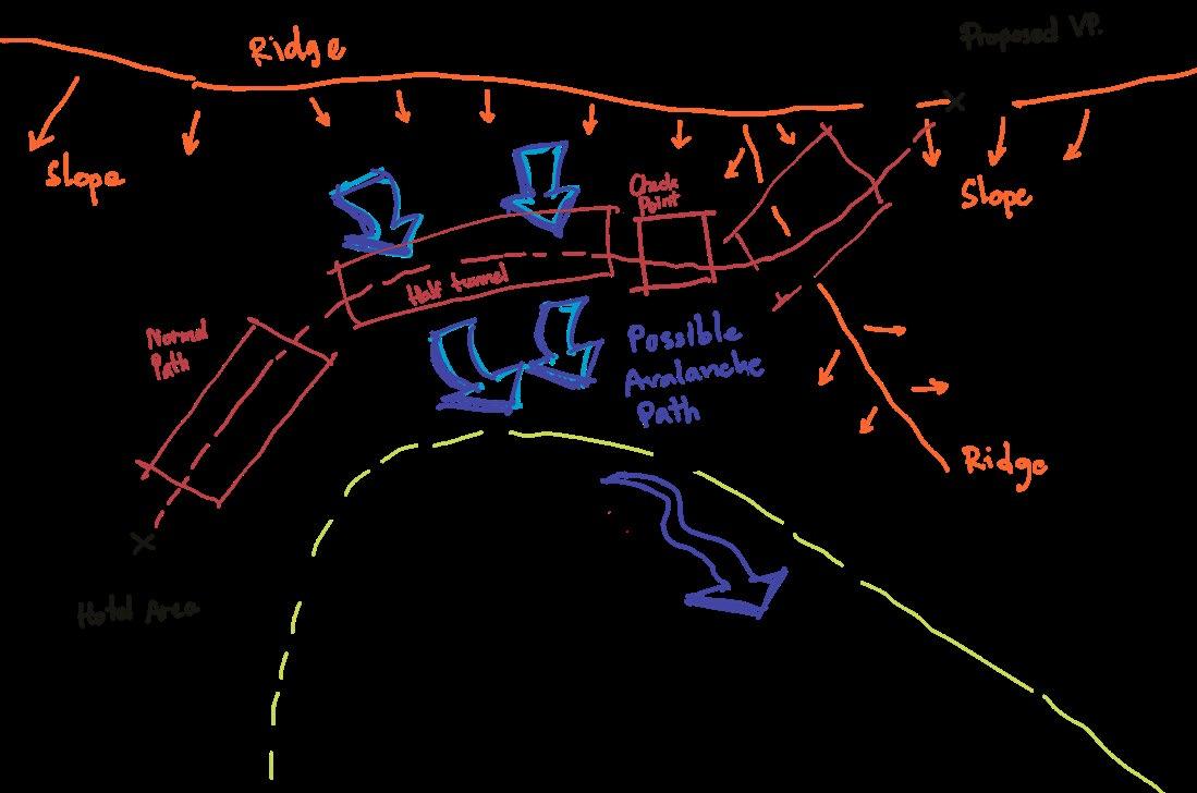
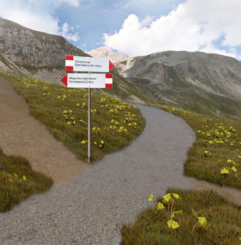
ROUTES TO THE RIDGE
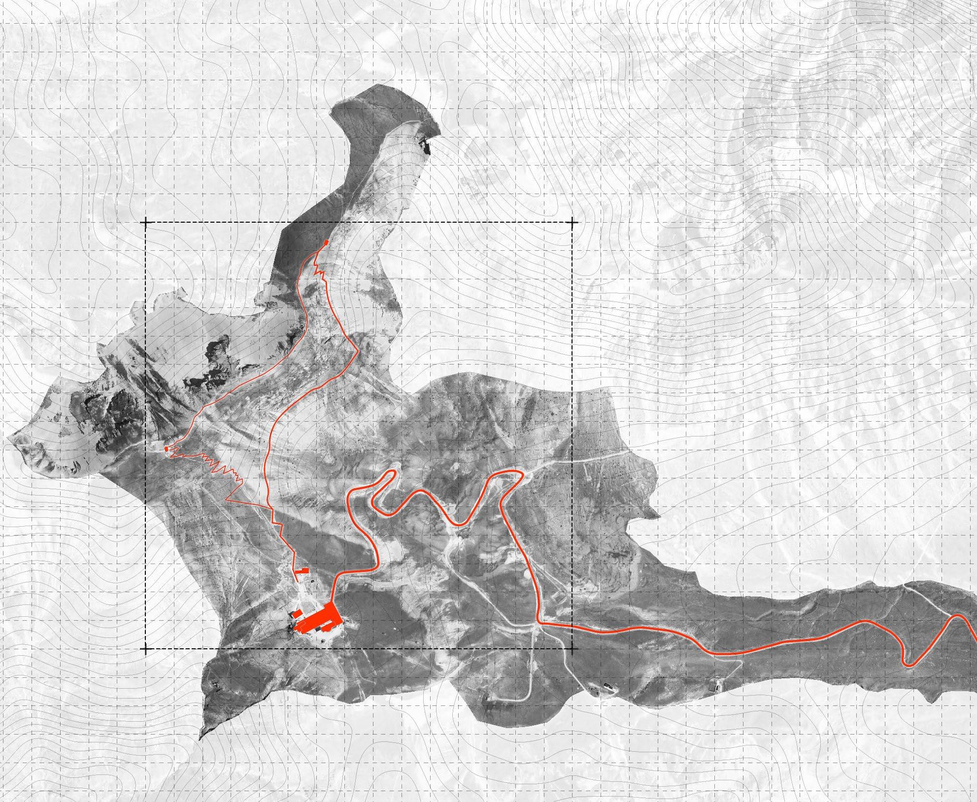
PROJECT AREA
THE RIDGE (PROPOSED VIEWPOINT)
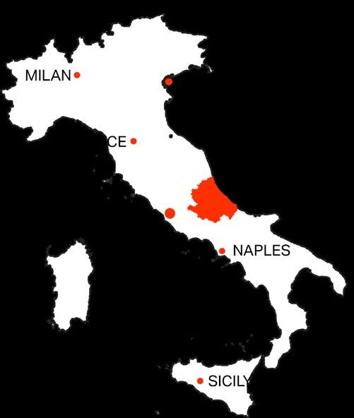
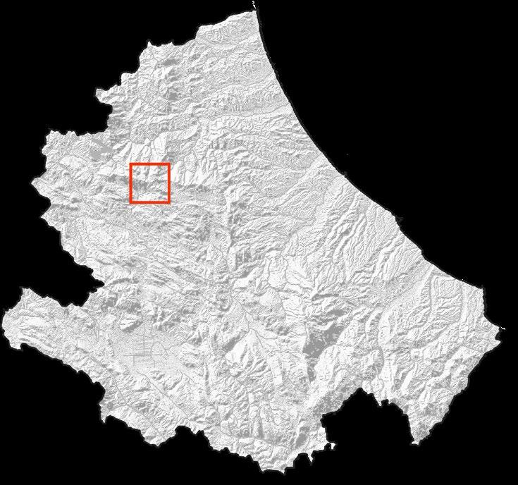
Abruzzo is a picturesque region in Italy featuring an abundance of natural resources such as rare species of animals and plants which is perfect for natural tourism. The region is known to be the greenest region in Italy since it consists of 3 national parks, 1 regional park as well as many natural reserves and protected areas.
The Gran Sasso mountain situated in the northern part of the region is the home of beautiful scenery and biodiversity. The northern area itself contains both oceanic and continental climates which define types of plants and inhabitants.
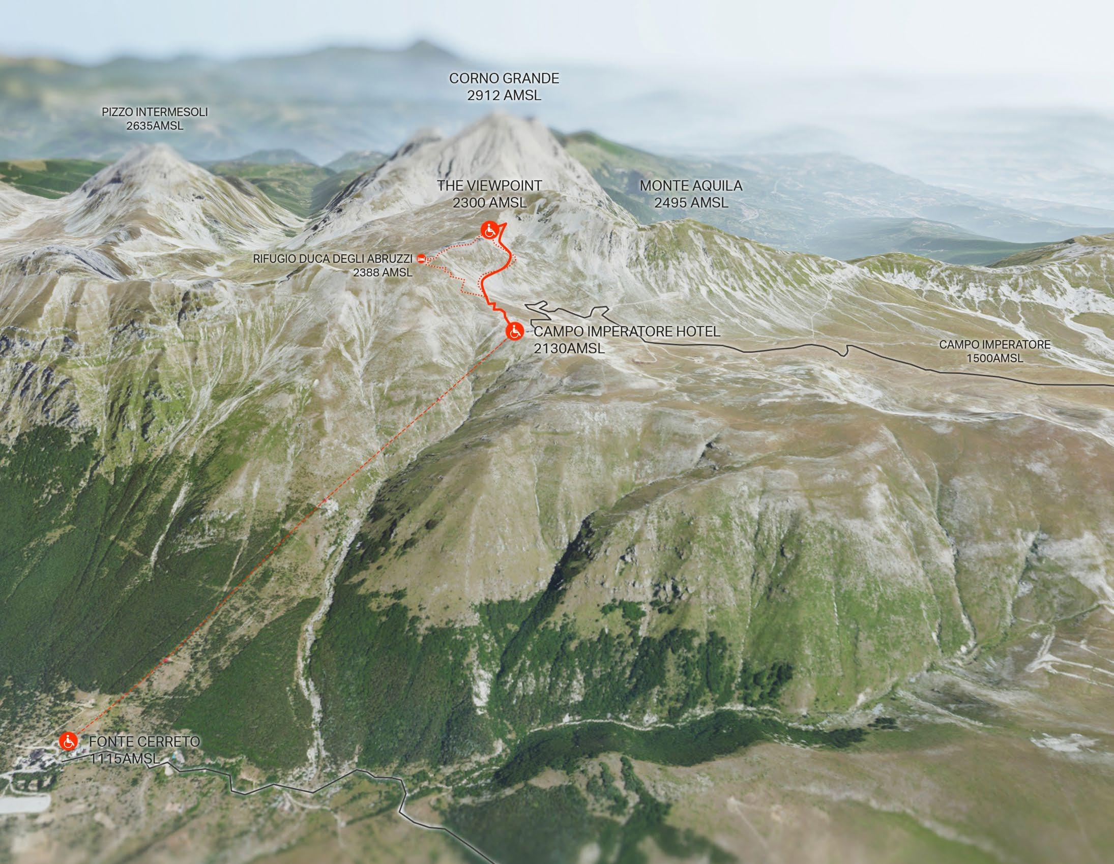
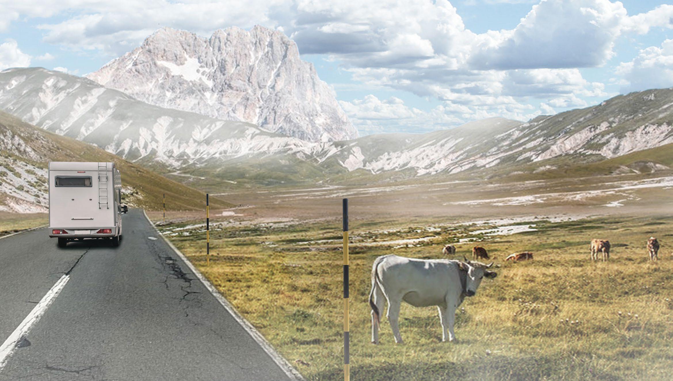
The proposed area is located next to Hotel Campo Imperatore, on the path to Corno Grande (the peak). There are 2 main accesses to the area. One is a 2-lane road connecting the A24 highway to the camp (30 minutes). Other is a ropeway which takes less time (6 minutes).
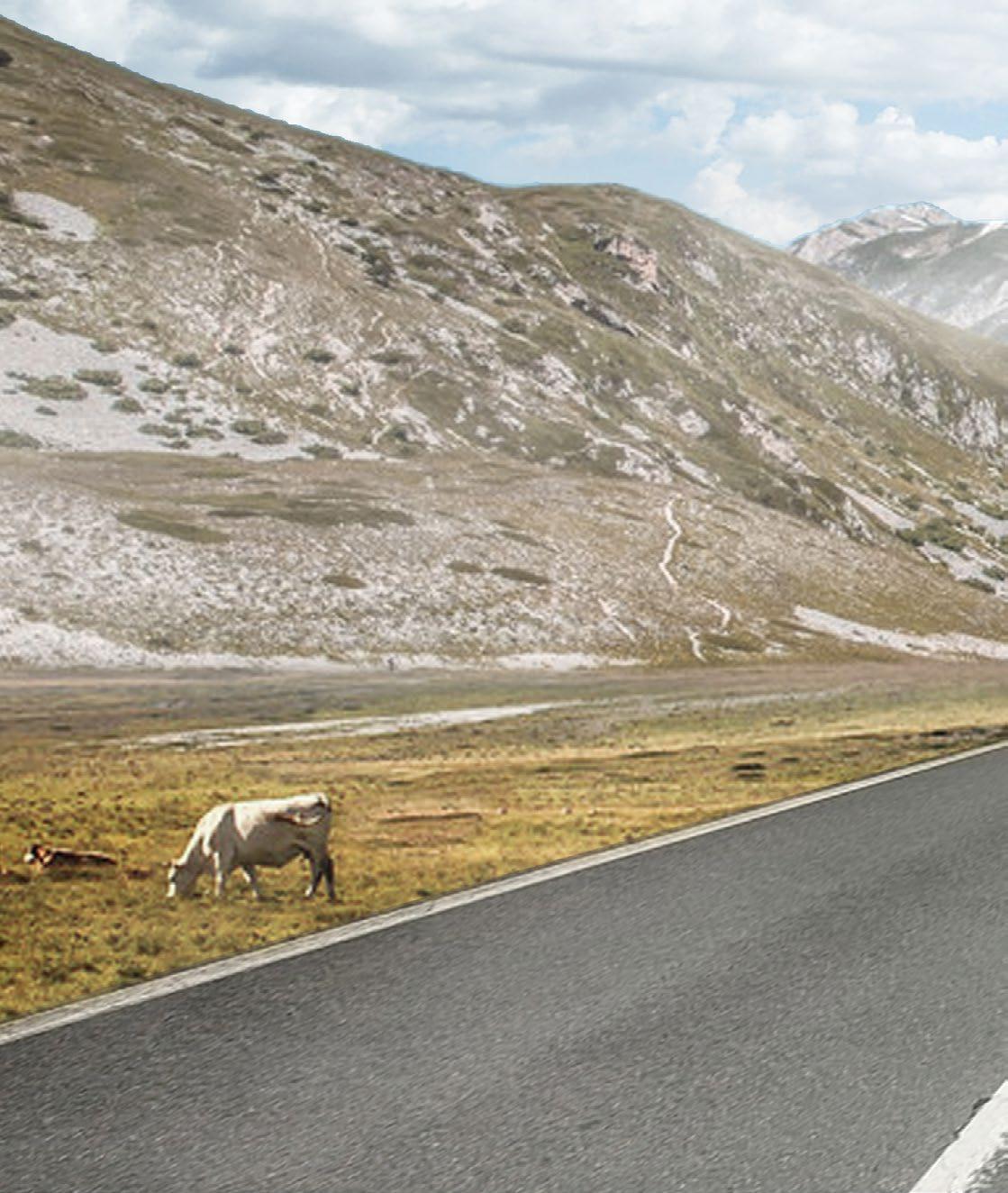
The site overlooks Campo Imperatore Meadow where farmers move their herds of cattle and sheep to feed them in summer.

CORNO GRANDE IN ABRUZZO, ITALY 30 - GRAN SASSO FOR ALL
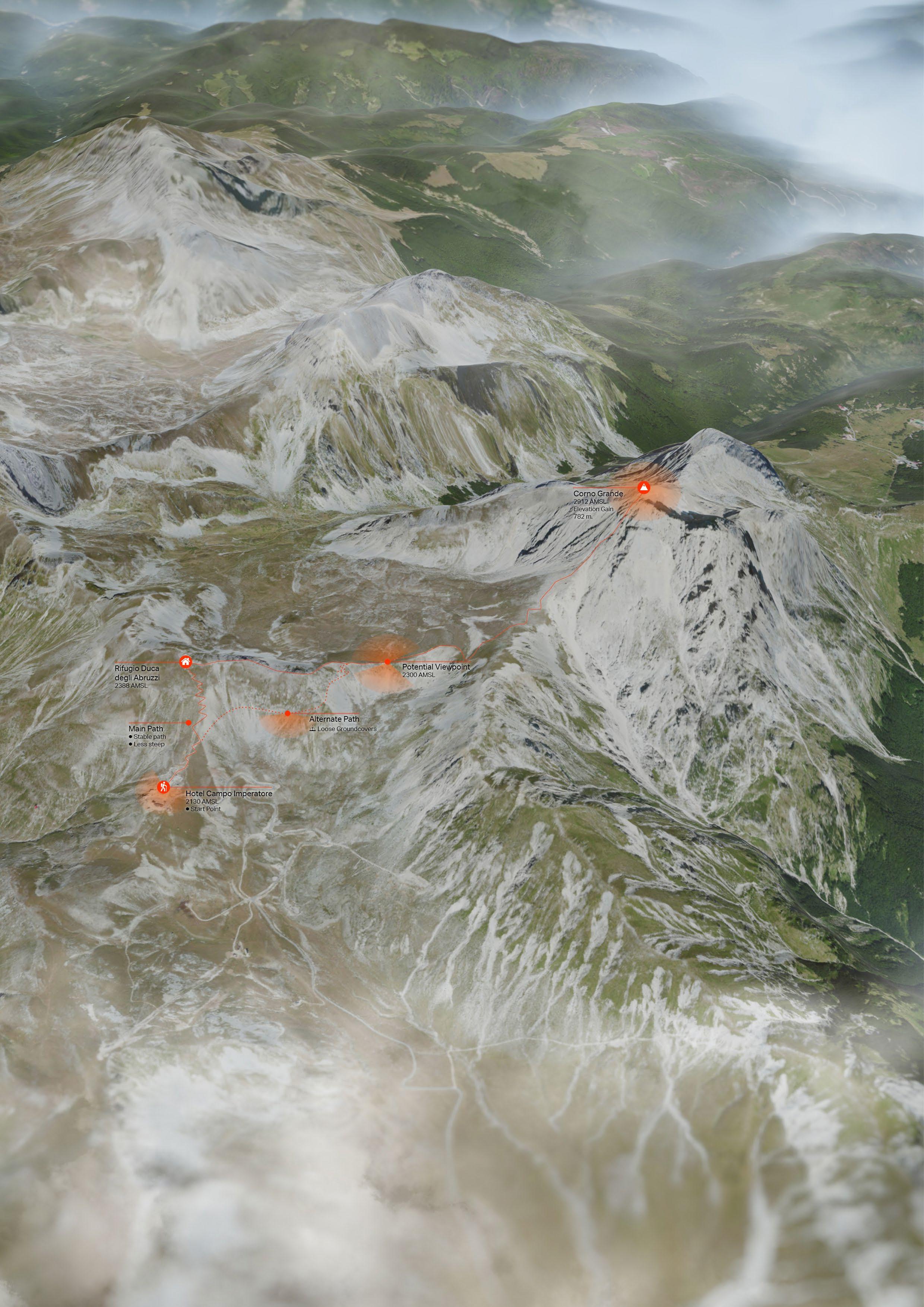
EXISTING CONDITION
The proposed area is located next to Hotel Campo Imperatore, on the path to Corno Grande (the peak).
There are 2 main accesses to the area. One is a 2-lane road connecting the A24 highway to the camp (30 minutes). Another is a ropeway which takes less time (6 minutes)
The site overlooks Campo Imperatore Meadow where farmers move their herd of cattle and sheep in to feed them in summer.
GRAN SASSO FOR ALL - 31
UNREACHABLE PICTURESQUE
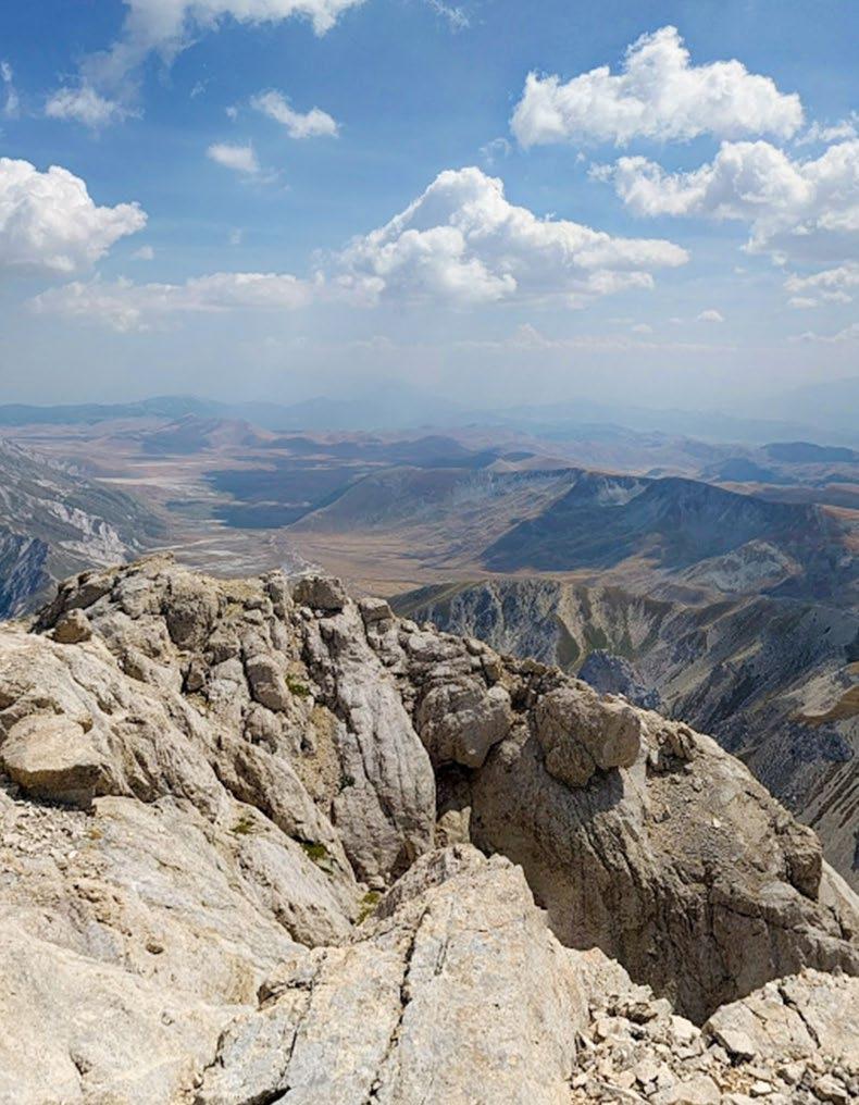
The view from the Corno Grande is stunning; however, getting all people up there is not an easy task. This project questions why these stunning sceneries are limited to only people who are fit enough to climb up the high and dangerous mountain. How can these mountain sceneries be accessible by anyone who can move?
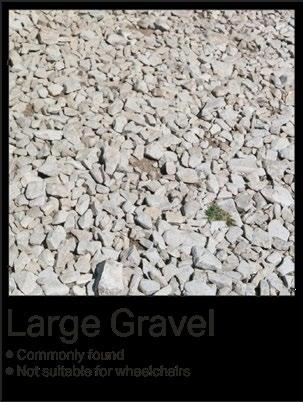
The site selection begins by selecting an area that has a comparable view to the peak. The current condition of the pathway on the mountain is uneven with loose gravel and rocks as paving material.
On the very slope surface (70-130%), the ground is covered by just gravel which cannot adhere to the surface of a thick snow slab in winter. Therefore, an avalanche can occur easily from the seismic force since this area situates on the edges of two tectonic plates (Africa and Eurasian).
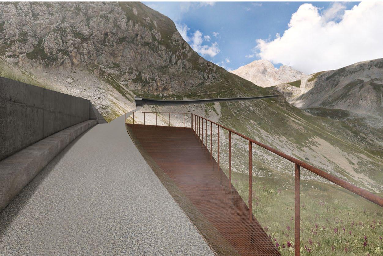
To address these difficulties, a stable path with accessible slope and avalanche protection has to be built from the Campo Imperatore hotel area to the proposed viewpoint.
CAMPO IMPERATORE AREA
The rendered aerial perspective of Corno Grande area made using satellite imagery combined with DEM, rendered in Lumion and Photoshop.
The perspective looking from over 3000 metres above sea level to the east direction shows the path from a foot hill to the viewpoint. It also show an extensive field of Campo Imperatore, the tree mountain peaks, the coastal area covered by mist and the Ionian sea at the horizon.
CORNO GRANDE LOOKING TO THE EAST
32 - GRAN SASSO FOR ALL
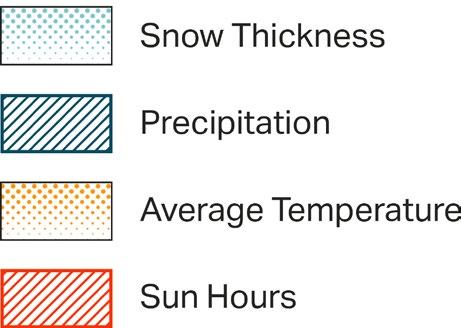
WEATHER MATTERS
The area has been facing heavy amount of snowfall in the winter (December to March) which can cause up to 400 cm. of snow depth on the meadow area. On the other hand, the area in summer is covered by grassland and rocks. The average precipitation is minimal at around 20mm per month throughout a year.
To address these difficulties, a stable path with accessible slope and avalanche protection has to be designed from the Campo Imperatore hotel area to the proposed viewpoint.

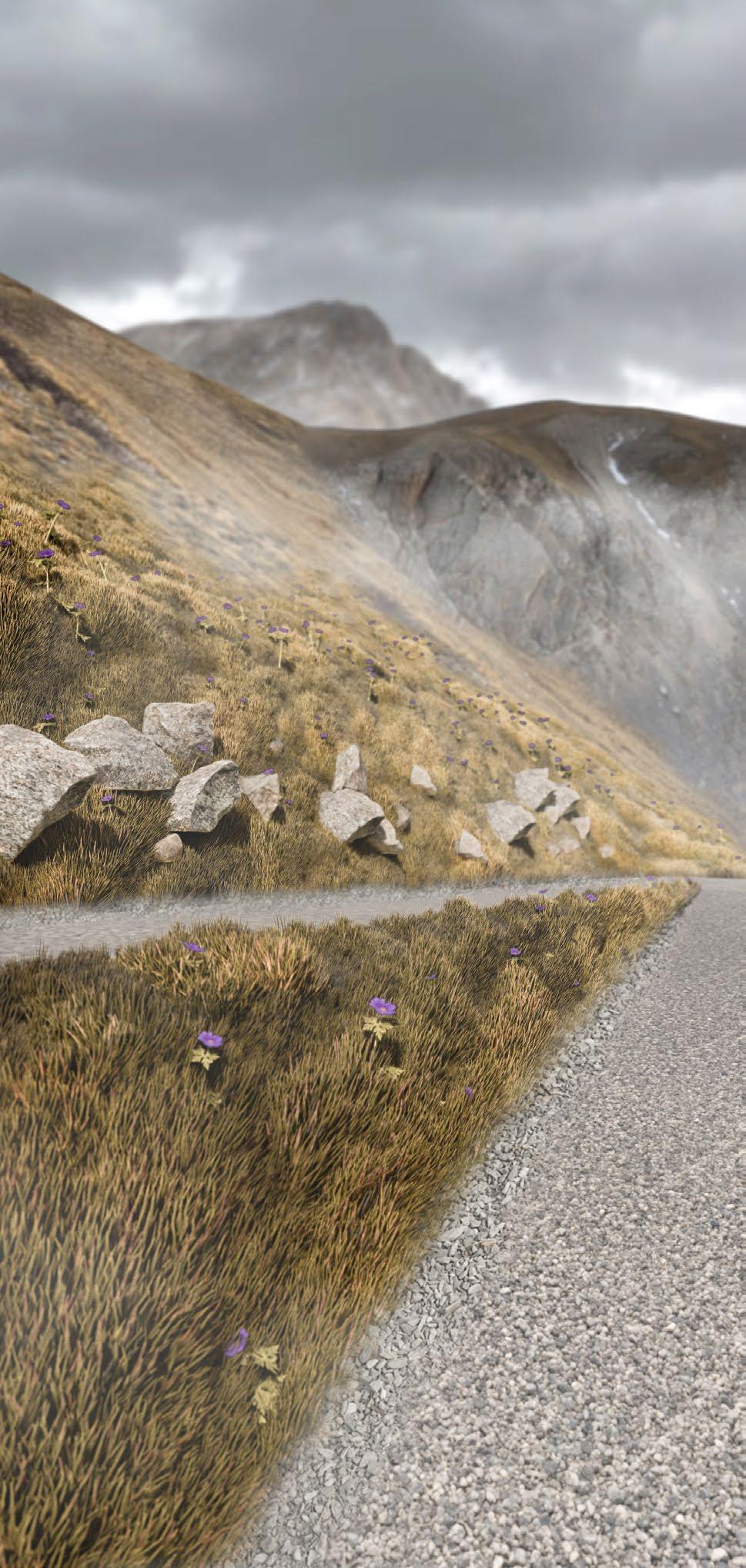
VEGETATIONS AND GROUND COVERS
Due to the increasing temperature, some native plants of Corno Grande are likely to die out. As these plants and grasses have a tendency to retain snow to prevent avalanche, the thick layer of snow in the winter also protect these plants from frozen out in the freezing winter as well.
It is vital to consider the planting design to conserve the native species of this area to maintain biodiversity and balance of the site’s nature.
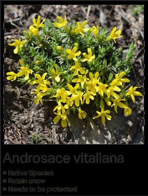
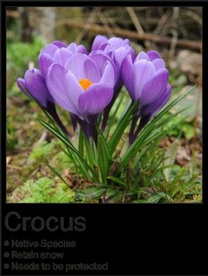
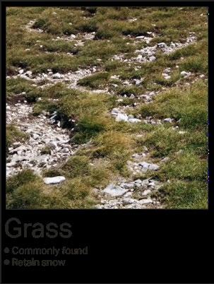
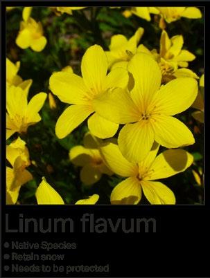
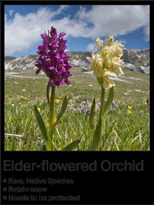
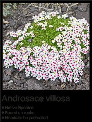
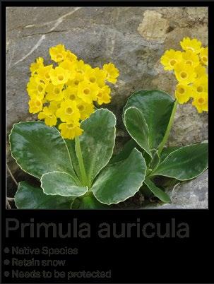
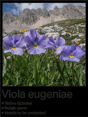
During the hike, hikers will see two types of the surfaces, rocks and grass. The flowers on the diagram above is commonly found growing on rocks and grass. The strategy of planting is to amplify the growth of these flowers in the area.
WEATHER DATA OF CAMPO IMPERATORE GRAN SASSO FOR ALL - 33
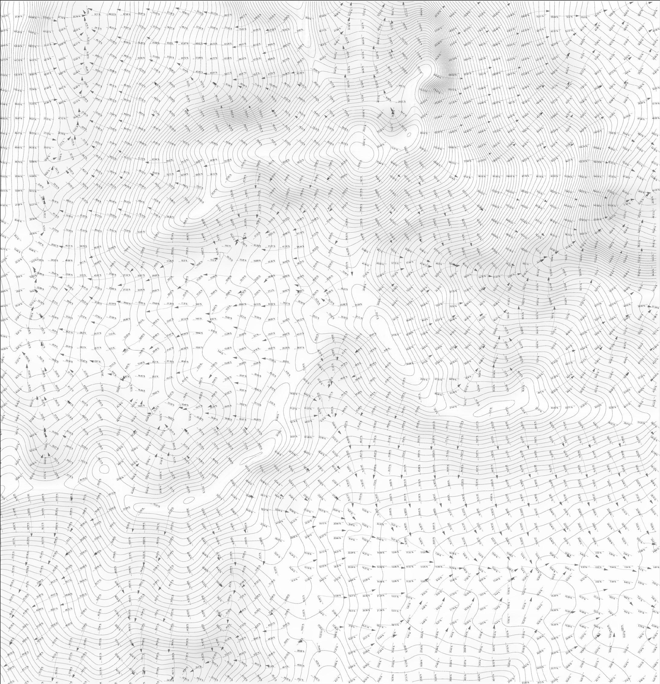
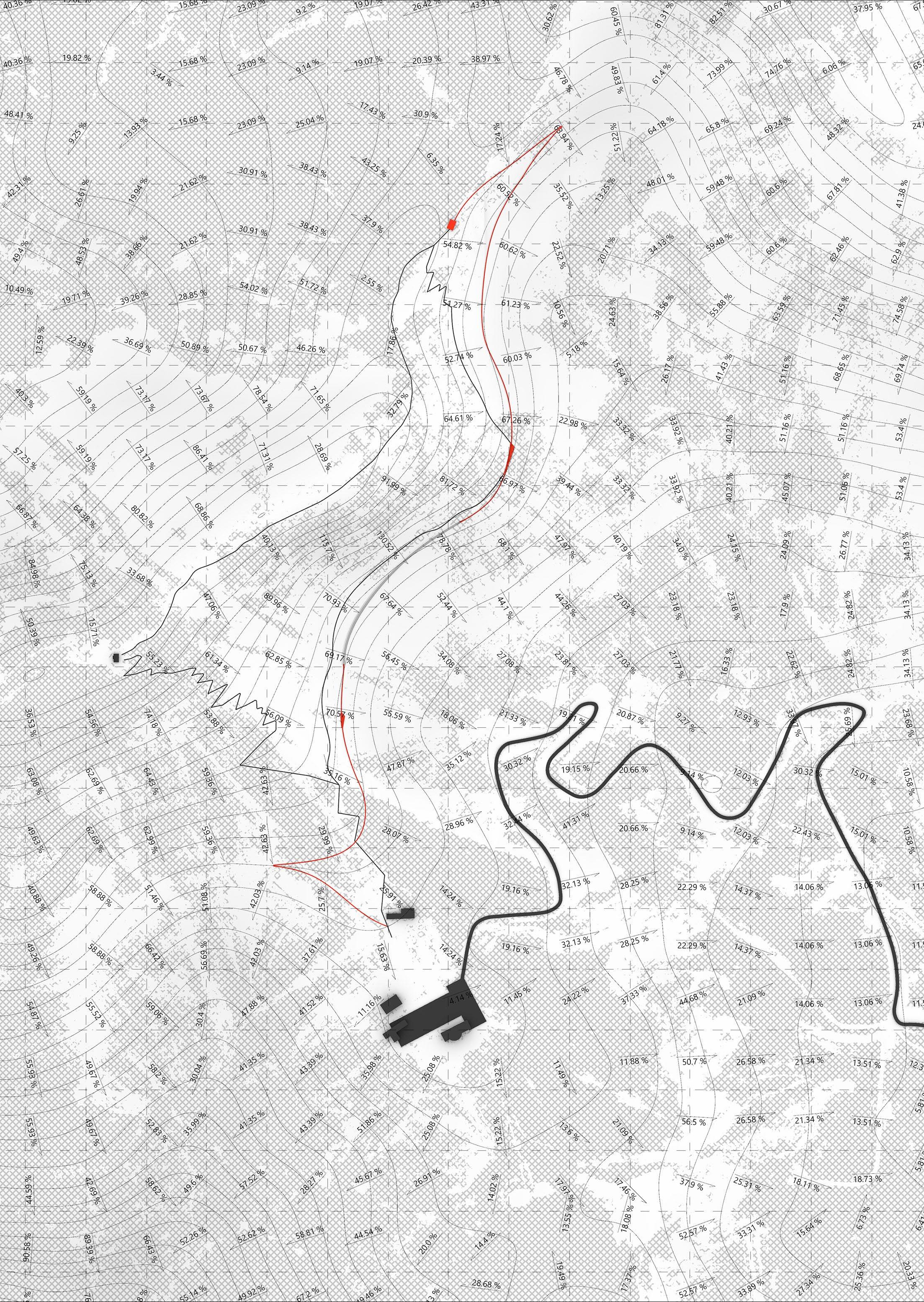
TERRAIN SLOPE & DRAINAGE
The slope of the terrain is analysed in order to find the best possible route for the path with the compatible slope for wheelchairs. If there is no compatible slope in the area, interventions such as half tunnel, switchbacks, and terrain manipulation will be done to achieve the target slope.
The terrain drainage arrows show the direction of the flow of rainwater and the melting snow. This sometimes causes rockfalls and landslides on steeper surfaces. Moreover, in the case of earthquakes, avalanches, which are lethal to hikers, can occur on steeper surfaces.
34 - GRAN SASSO FOR ALL
PROGRAMME & SPACE HIERARCHY
The project aims to support hiking activities for all kinds of people to experience panoramas of the area from the proposed viewpoint. The requirements lead to the introduction of the new pathway. This should address the main difficulties in hiking such as unstable groundcovers and steep terrain. This diagram also illustrates different areas’ heights.
PATHWAY SKETCH


DESIGN DEVELOPMENT
AREA ZONING
After studying the programme and space hierarchy, the area zoning is done in sketch. The zoning helps divide pathways into sections based on the terrain slope, waking distance and viewing orientation.
LOW-IMPACT INTERVENTIONS
In addition to the main focus, which is making the hiking experience accessible to everyone, the interventions need to have a low impact on the original surface. The overall design should be sustainable and maintain surface permeability as chaining how the surface interacts with rainwater and snow can lead to massive landslides and avalanches, especially in this high seismic activity area.
GRAN SASSO FOR ALL - 35
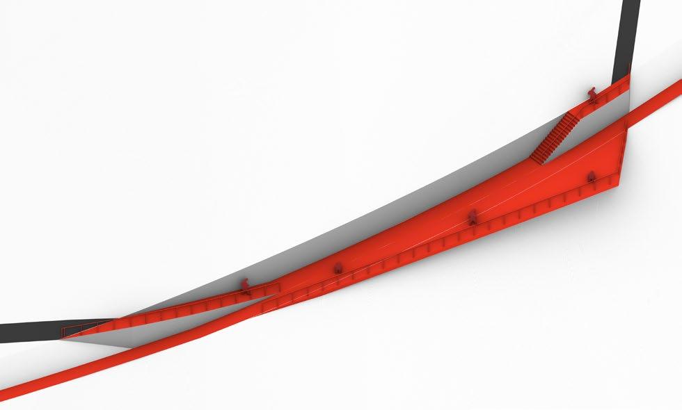
HALF TUNNEL SKETCH
PROPOSED SITE PLAN
The project focuses on developing an existing pathway which is located on the hillside to be an accessible path for both non-hikers and disabled people who want to experience basic hiking and the stunning scenery of the Gran Sasso mountain.
SECTION E
VIEWPOINT
SECTION C
SECTION B
SECTION A
SECTION D
GRID OF 100x100m2 36 - GRAN SASSO FOR ALL
Section A
Terrain Slope: 30-50%

Section B
Terrain Slope: 50-70%

Section C
Terrain Slope: 70-130%
With Half Tunnel

TERRAIN CROSS-SECTION
The terrain cross-section shows the overall altitude of the area. The different altitude of the Campo Imporetore Hotel area and the proposed viewpoint indicates the elevation gain of the hike. It also illustrates the slope of the new pathway which is less steep and has a gradual incline compared to the existing pathway.
PATHWAY DESIGNS
The pathway consists of five types of intervention to deal with different slopes of the existing terrain. All of them are designed to support the activities of hikers. The joy of hiking is not only from gaining elevation uphill to take a natural view and fresh air but also from feeling different ground covers with different traction and sound.
Section D
Terrain Slope: 50-70%
With Crossing Platform
Section E
Terrain Slope: 50-70%
With Switchback

The Viewpoint Mountain Ridge Panoramic View

GRAN SASSO FOR ALL - 37
MATERIAL PALETTE
The materials chosen for the project are focused mainly on the method these materials are transported to the site and their appearance in the natural context. All materials require a low amount of maintenance. Most of them can withstand extreme temperatures without wearing them. The paving gravel can be made from extracted rocks from the site and put back after grinding.


38 - GRAN SASSO FOR ALL
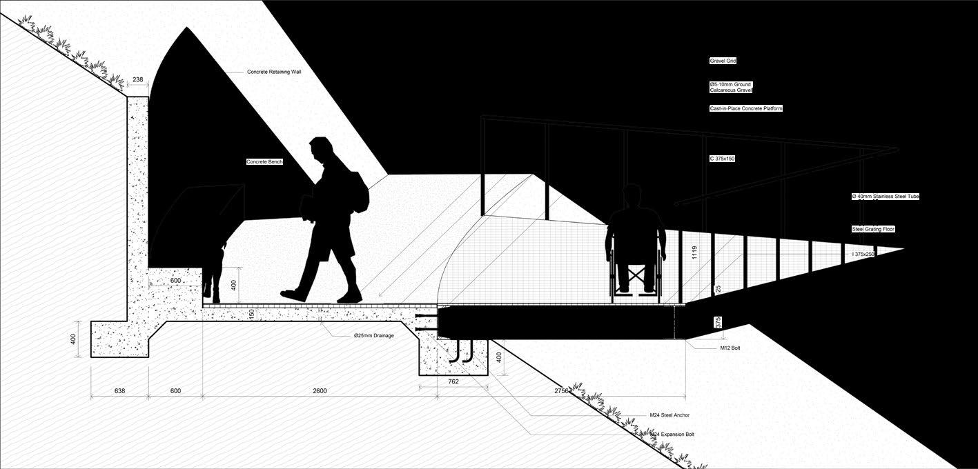
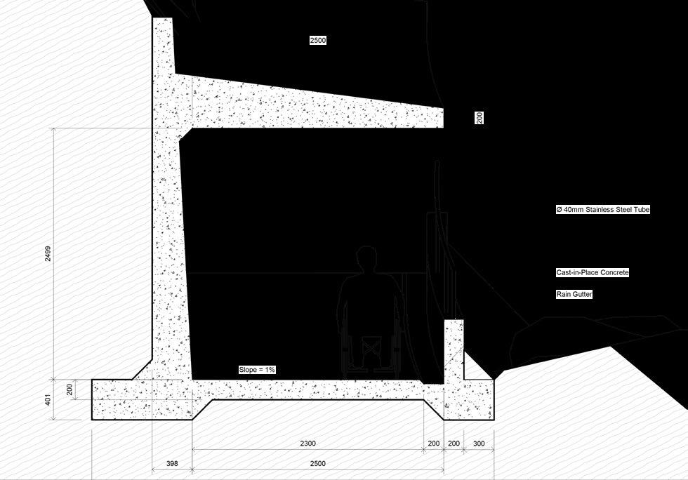
VIEWPOINT CONSTRUCTION


The viewpoint construction is composed of many structural elements, mainly the concrete foundation to both support cantilever steel beams and protect against landslides. The finishing elements are permeable to ensure good drainage.
HALF TUNNEL CONSTRUCTION
The half-concrete tunnel is made of sections of concrete foundations and retaining walls. This modular design allows the construction to be more convenient as the panels to be transported to the site easily.


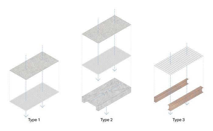
TYPE 1 TYPE 2 TYPE 3 GRAN SASSO FOR ALL - 39
MATERIAL LEGENDS
40 - GRAN SASSO FOR ALL
HIKING FOR ALL
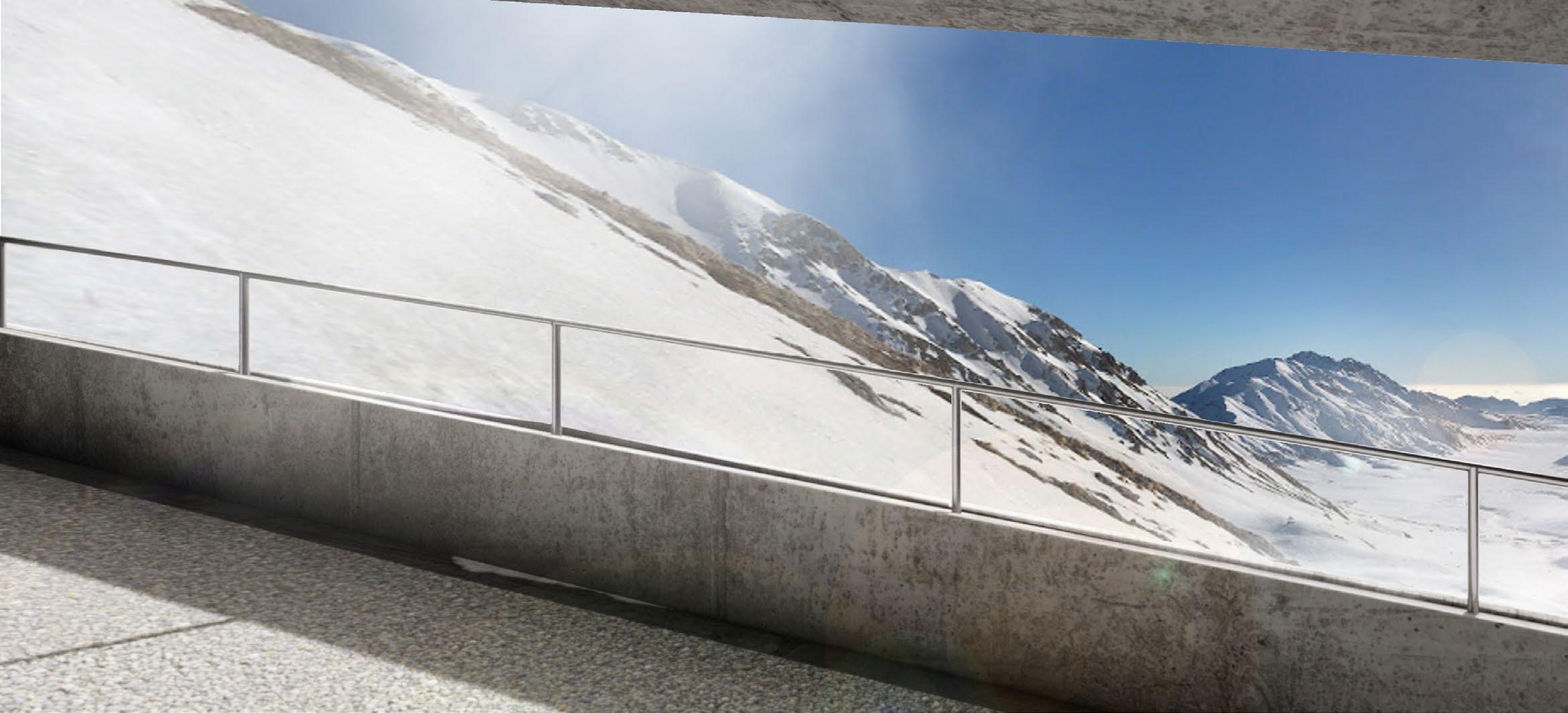
The hotel area connects to the trail network laid over the area of the Gran Sasso mountain. Although every path is connected to each other and the viewpoint, the difficulty is differently defined by types of ground covers and steepness. The new path is the easiest route to walk.
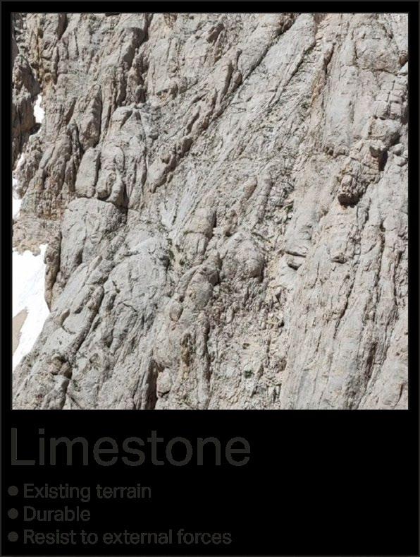
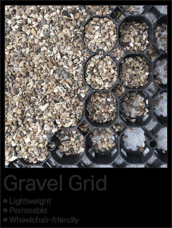
The viewing platforms located along the path provide panoramic balconies looking to Campo Imperatore. The tunnel allows people to walk on the steep surface without worrying about rockfalls and avalanches. The new pathway composes of only gravel grids and limestone gravel to minimise the impact on nature.
GRAN SASSO FOR ALL - 41
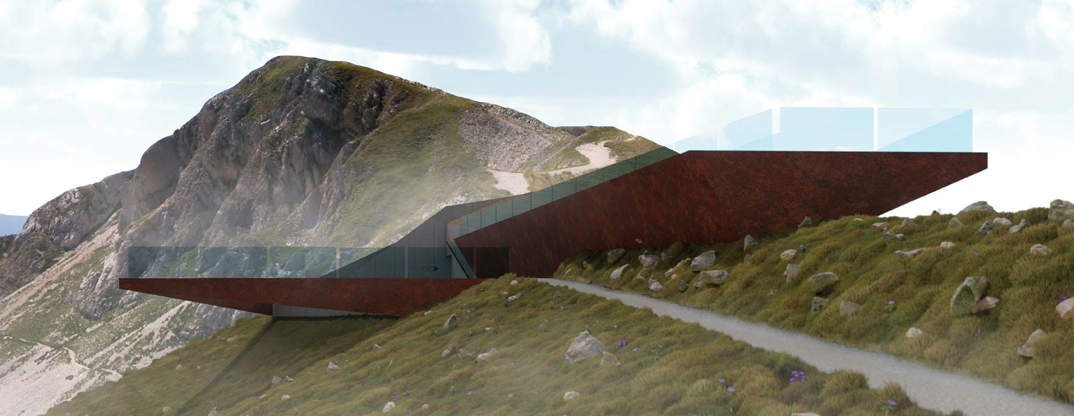
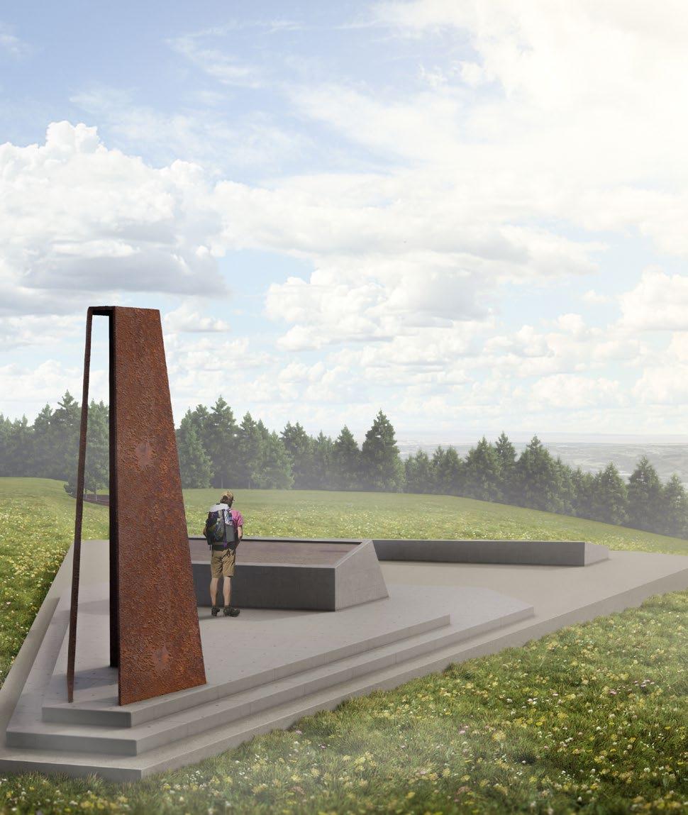
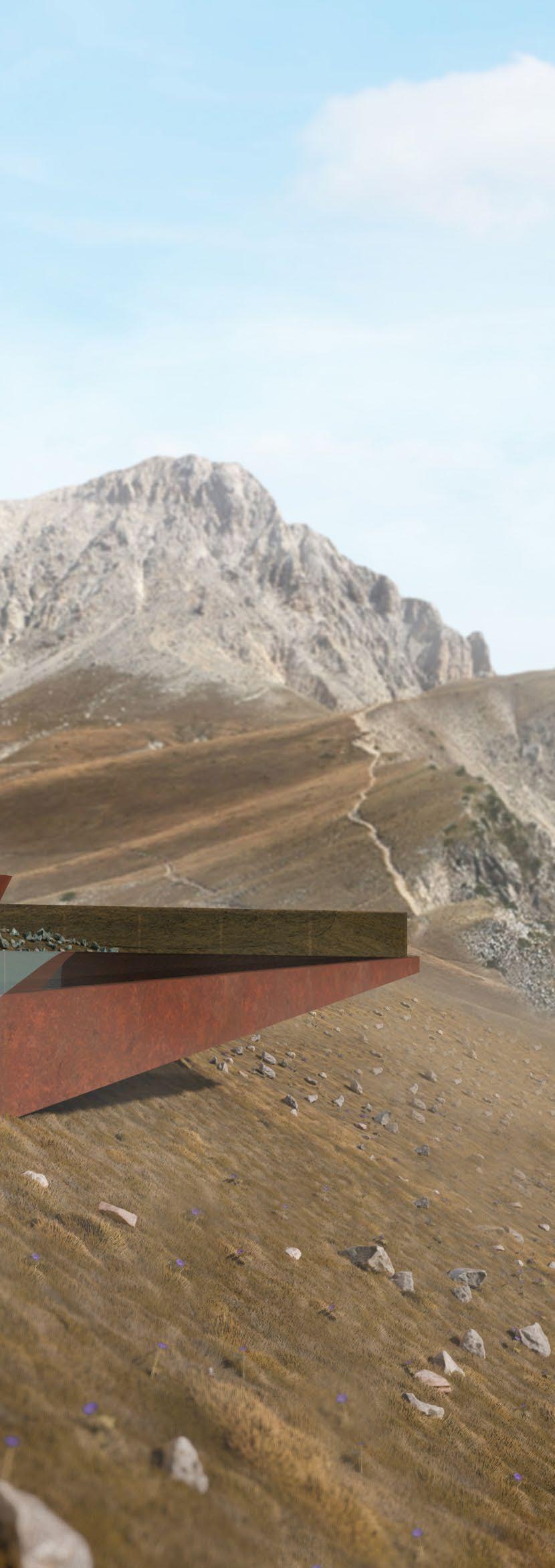
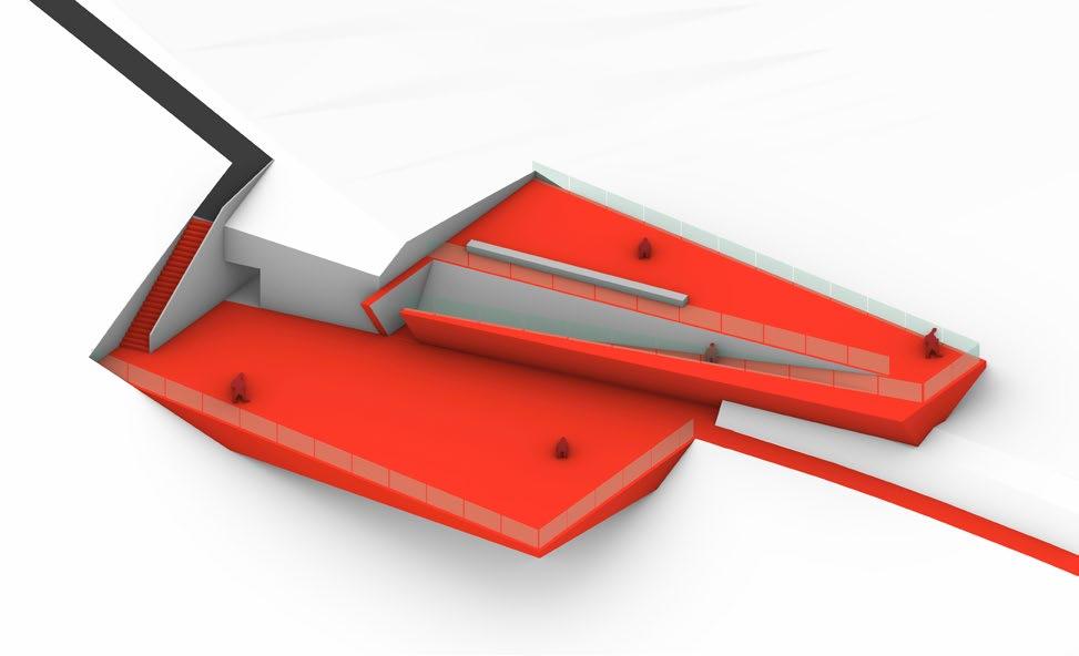
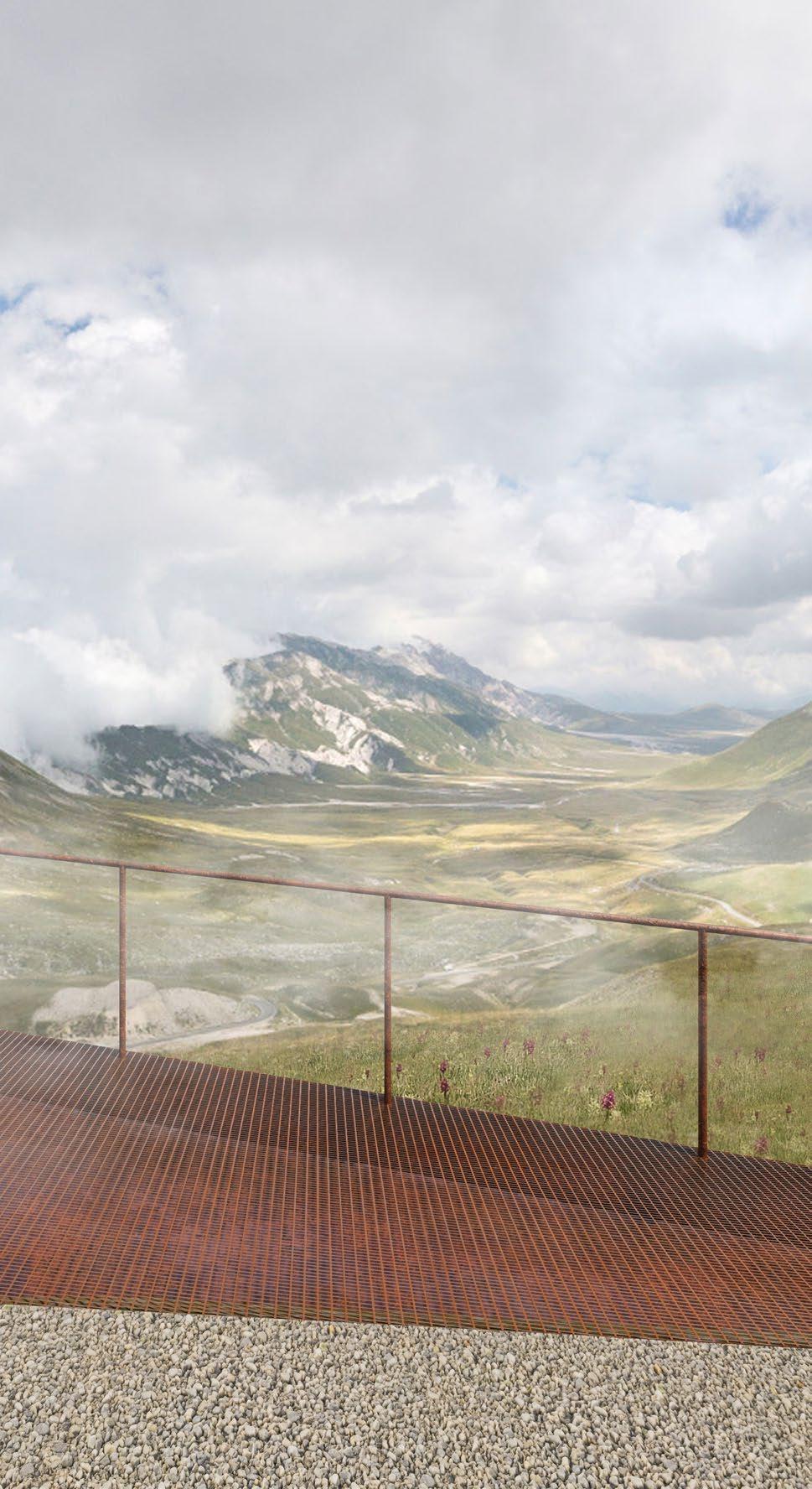
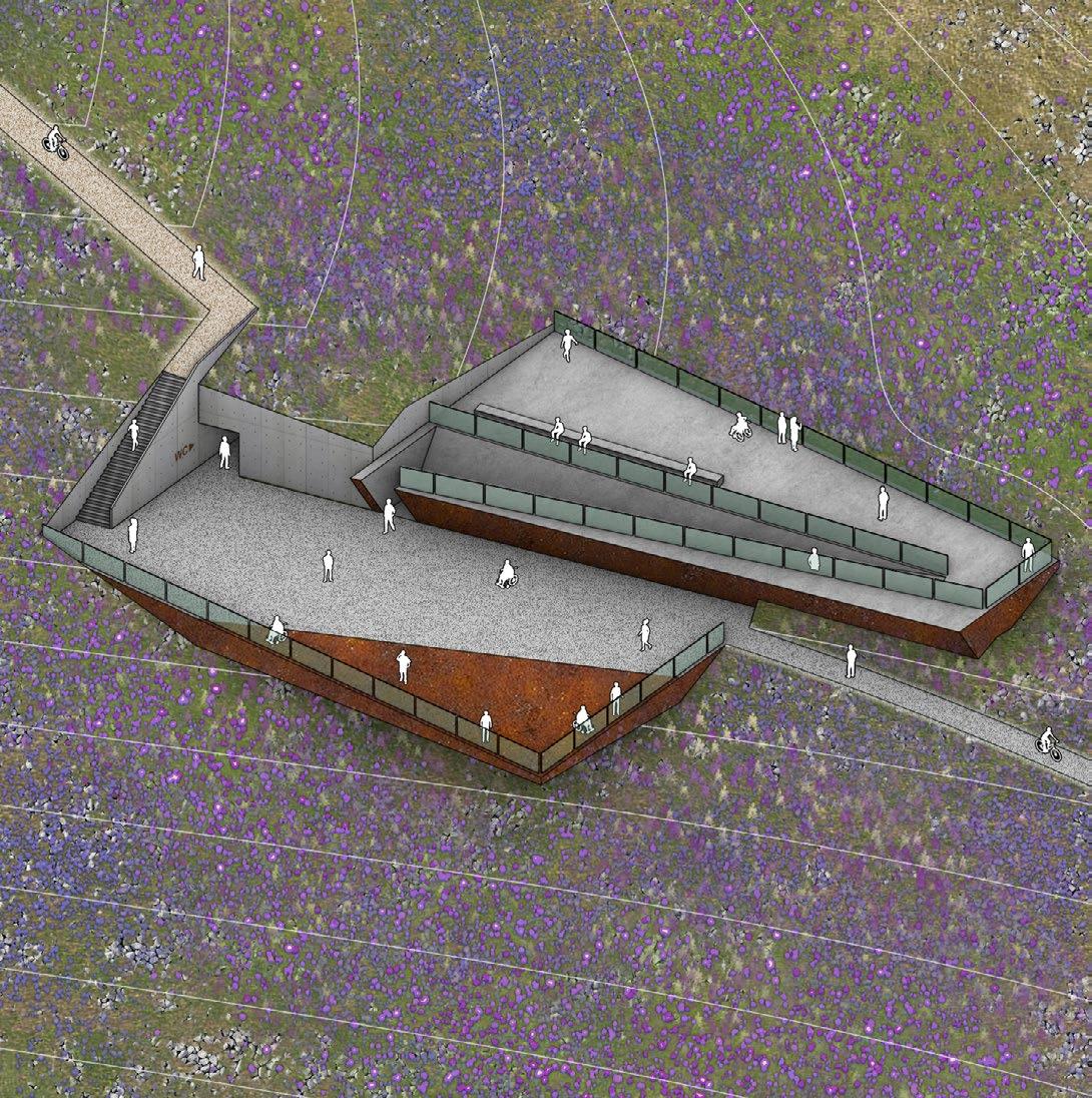
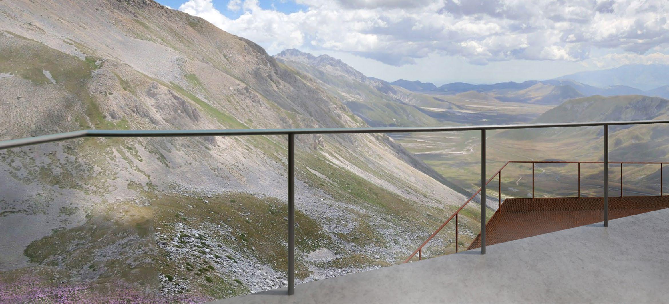
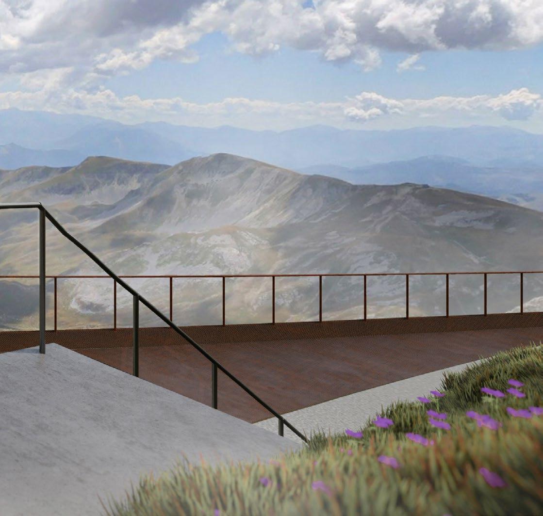
THE ACCESSIBLE VIEWPOINT
The destination of the 2000-metre hike is the viewpoint designed to take a 360 ° view of the mountain without any obstacles. The viewpoint features a double viewing deck with tempered glass railings and public restrooms. The form of the panoramic viewpoint resembles the shape of the “reverse fault” located below the Gran Sasso mountain.
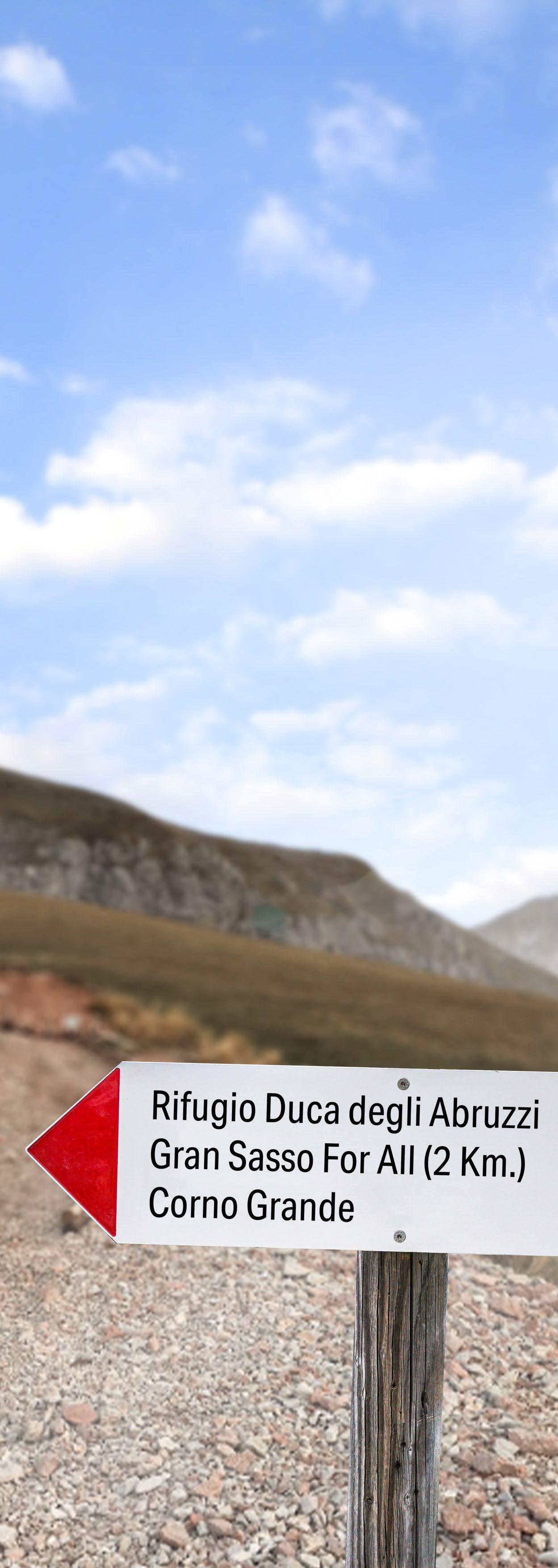
The viewpoint is made of natural-looking materials with a low amount of maintenance. It is also connected by the existing trail between Rifugio Duca degli Abruzzi to the peak of Corno Grande which is the common route for expert hikers. The location of the platform facing both east and west provides rewarding panoramas to people who arrive.
42 - GRAN SASSO FOR ALL

GRAN SASSO FOR ALL - 43
APPENDIX

FROM SKETCHES TO FINAL DESIGNS
One of my preferred workflows begins with a hand sketch, which allows for the initial visualization of ideas without the constraints of software limitations. This approach focuses solely on the proportion and aesthetics of the design.

APPENDIX - 45
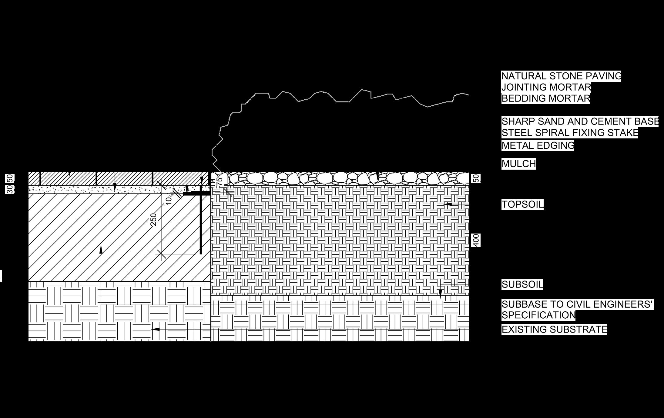
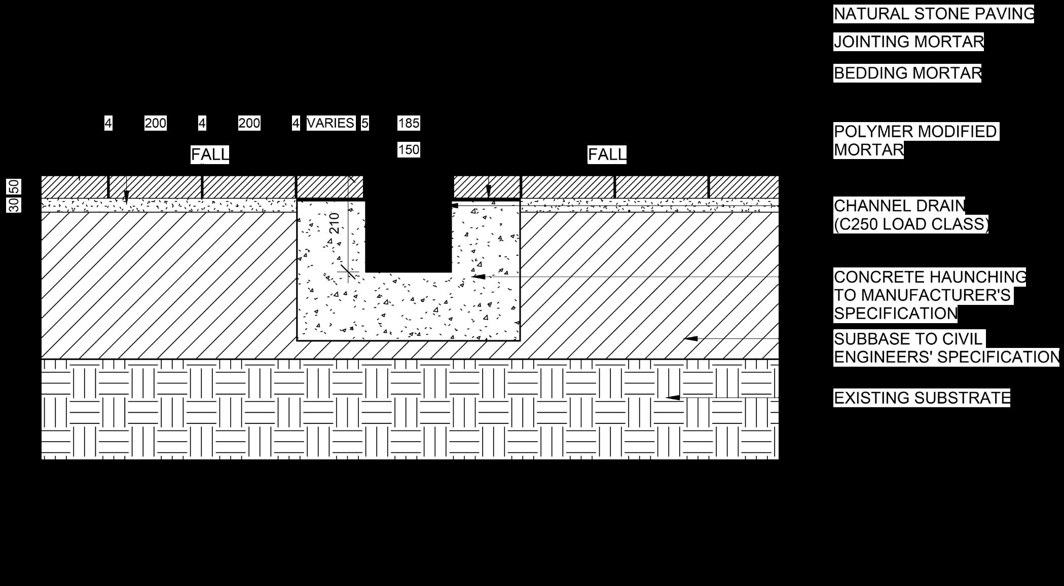
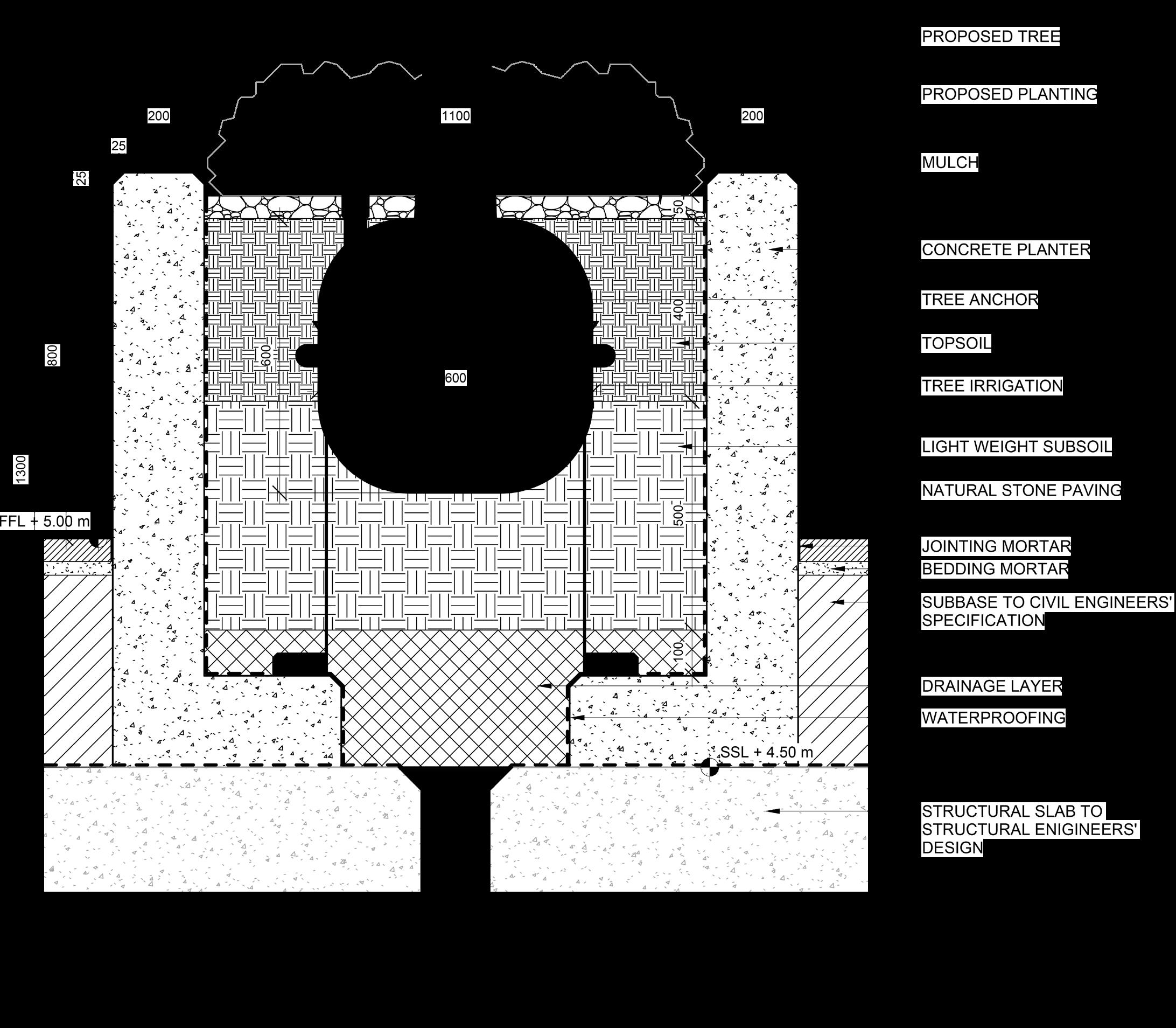
TECHNICAL DRAWINGS USING AUTODESK REVIT
Throughout my career as an Assistant Landscape Architect, I have worked on various projects at RIBA Stages 4 and 5, focusing on technical drawings and coordination. Due to the confidential nature of these projects, I am unable to share those specific drawings. However, I have included sample detailed drawings below that demonstrate the skills and knowledge I have acquired over the course of my career.
My Revit skill includes:
• BIM Modelling
• View and Sheet setup
• View template setup
• Family setup/editing
• CAD link from external DWG from sub consultants
• Working on Annotations and Keynote Tags
• Working on multi-discipline Revit file
• Publish models/drawings to ACC(BIM360)
46 - APPENDIX
APPENDIX - 47
SIRAPAT AJKARN (SAM)

THANKYOU
LinkedIn