
Disaster Resource Guide

➤ 2025 School Emergency Preparedness
➤ Prepare for power outages before they happen
➤ What are fire hazard severity zones?
➤ Home Hardening






EL DORADO HILLS FIRE DEPARTMENT
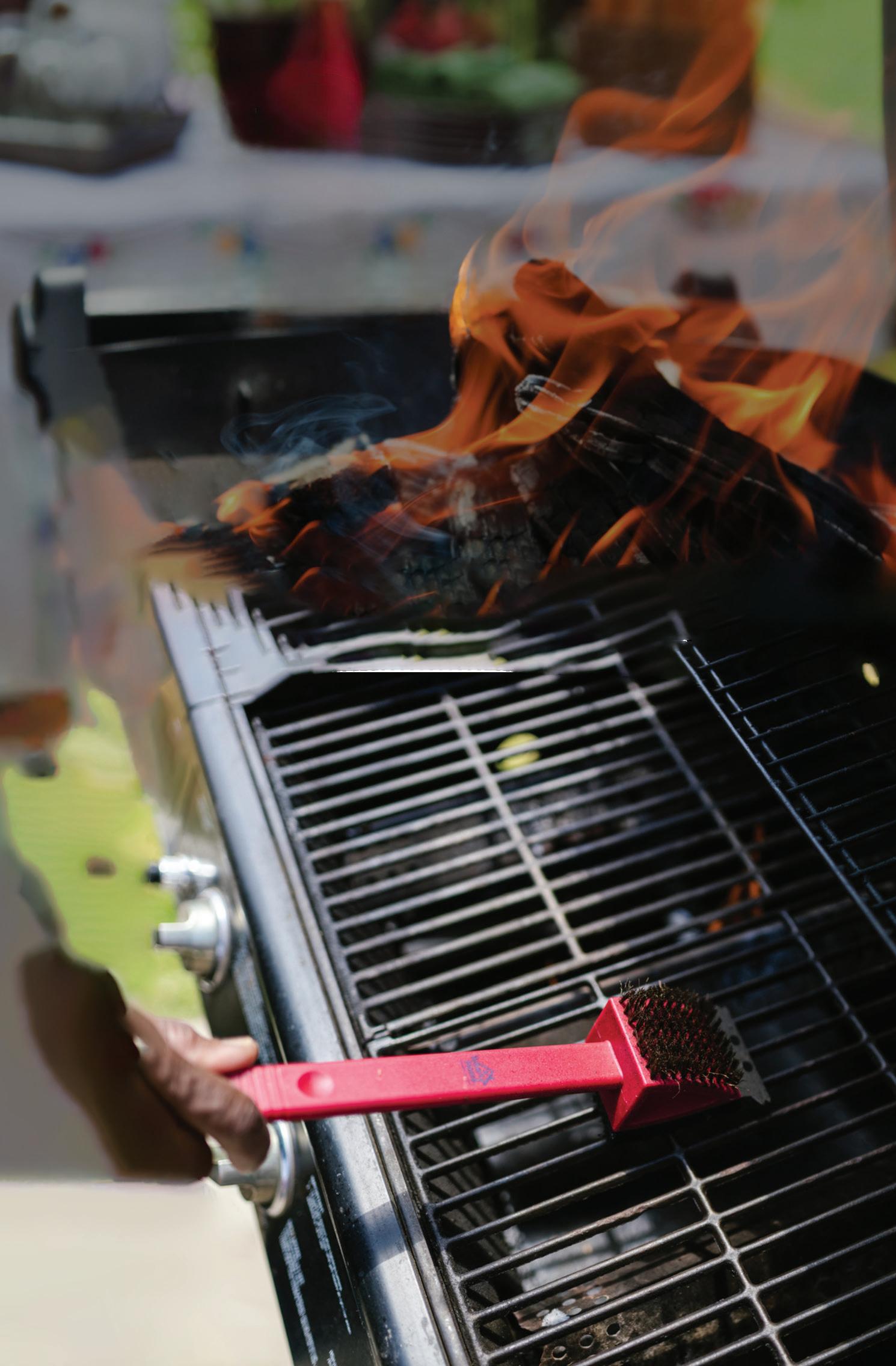
BBQ AND GILLING SAFETY TIPS
Each year, grill fires cause injuries and property damage that could been prevented with simple maintenance and care.
CLEAN YOUR GRILLSTAY SAFE
Grease buildup is one of the leading causes of barbecue fires. Cleaning your grill before every use helps prevent dangerous flare-ups.
• Clean grease traps and trays under the grill.
• Scrape down grates and burners after each use.
• If your BBQ has a chimney flue, please make sure it is cleaned and inspected at least annually.
• For gas BBQs, ensure all gas lines and connections are inspected regularly.
• Keep an extinguisher and baking soda nearby just in case!
• NEVER used water to put out a grease fire!
Help us Protect your home & family - Be prepared for every barbecue!
KEEP YOUR GRILL 10 FEET AWAY
If possible, keep your grill at lease 10 feet away from your house, deck railings, and overhanging branches to prevent the spread of a fire from occurring.
DON’T LEAVE YOUR GRILL UNATTENDED
Never leave your grill unattendedeven for a minute! Always keep children and pets at least 3 feet away from the grilling area.
rom natural disasters to major accidents and more, there’s no benefit in ignoring the catastrophes that could happen in our community. There are, however, plenty of benefits to emergency preparedness.
The Mountain Democrat’s Disaster Guide offers tips and resources for residents as proper planning and prevention can reduce the impacts a disaster may have on individuals, families and property.
Emergency preparedness can be a life-or-death matter. Knowing escape and evacuation routes can ensure people aren’t trapped in dangerous locations. Having accessible stores of water and food can prevent people from suffering while sheltering in place. Emergency shelters can keep people safe from perilous conditions and offer a temporary place to live after a disaster has occurred.
The more people know and the more they prepare, the better off the entire community will be. Find the information you need in this guide.
OPEN THE BBQ LID BEFORE LIGHTING
Keeping the lid open when lighting helps prevent gas buildup. And, ensure propane tanks are stored outside, away from heat or direct sunlight.


2025 SCHOOL EMERGENCY PREPAREDNESS
story by CURTIS WISE / EL DORADO COUNTY OFFICE OF EDUCATION
In El Dorado County, the El Dorado County Office of Education aims to establish one of the finest education systems in California and the nation. Creating a safe and welcoming environment for all students is a foundational belief and aspiration. As a county, it has developed strong collaborations between schools, law enforcement and school community partners to improve campus and community safety. Through the development of strategic initiatives and innovative communication systems, the Office of Education is continuously taking steps to provide safe and engaging teaching and learning environments for the students and staff.
Within El Dorado County, there are county-wide programs (administered by the El Dorado County Office of Education or EDCOE), 15 school districts, 67 schools and several charter schools. EDCOE partners with multiple agencies to ensure school safety. These include all 15 school districts, law enforcement agencies, CalOES, all local fire departments, Health and Human Services, County Behavioral Health, District Attorney’s Office, Child Protective Services, Tribal Health and Fire, and County Coordinated Emergency Response teams.
A robust Threat Assessment process and Team have been evolving over the last two years to prevent targeted acts of school violence.
With guidance and technical assistance from law enforcement partners,


public schools in El Dorado County have developed school safety plans that are regularly reviewed and updated. Plans include procedures for lockdowns, evacuations, threat assessments, wildland fires, earthquakes and more.
Each campus maintains plans tailored to its site and addresses critical needs at that campus. Safety plans include communication protocols for connecting with law enforcement and messaging to families. Plans are formally reviewed annually to ensure that current safety protocols are addressed.
Fire and lockdown drills are scheduled throughout the school year to ensure students and staff are familiar with what is expected of them in the event of an emergency. Additionally, for the past several years, law enforcement and other public agencies have held active shooter drills on school campuses.
Over the 2024-25 school year, EDCOE made several facility enhancements in an effort to improve lockdown procedures. This included extensive communication upgrades, including PA and notification systems (texting, email and Zoom phones), and the implementation of a Workplace Violence Plan with Human Resources. The Sheriff’s Office, along with the California Governor’s Office of Emergency Services (OES), has been instrumental in planning and coordinating meetings, trainings, community events and preparedness for schools, along with educating members of the


community regarding safety.
EDCOE’s Facility and Maintenance Department has also worked extensively to improve fire safety by reducing fuel usage around facilities. This included clearing brush and providing break lines between properties. Facility and Maintenance also participated in more than a dozen meetings in the last year to provide feedback and input into the five-year Local Area Hazard Mitigation Plan. They continue to work diligently on the County Drought Resilience Plan alongside multiple local jurisdictions to align key messaging and preparedness strategies.
This continued work is critical in ensuring every student, family and community member feels safe and welcomed at every school in El Dorado County.



SCLAR COMES TO THE RESCUE
story by ODIN RASCO
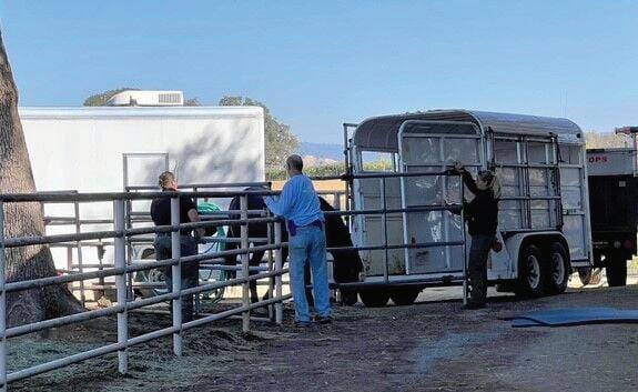
When the Caldor Fire burned 221,835 acres of land and homes in 2021, it took the work of brave Animal Services Staff and community volunteers to evacuate as many residents and animals as they could out of the path of the giant blaze. Many of those evacuation efforts were aided by the South County Large Animal Rescue nonprofit, an all-volunteer team of community members dedicated to help transport livestock and animals of all shapes and sizes out of evacuation zones.
Thanks to SCLAR’s efforts, an estimated 500 large animals were cared for during the Caldor Fire, and another 100 animals were evacuated by the group’s volunteers during the 2022 Mosquito Fire. When some of those animals no longer had homes to go to, SCLAR volunteers went the extra mile and found new homes for them.
“I don’t know how we would have gotten through Caldor without SCLAR,” El Dorado County Animal Services Officer Supervisor Lt. Kimberly Lusby said. “They’ve been assisting our county for at least 20 years. They assist our department with all kinds of assistance when it comes to helping evacuate large animals, small animals, and care for them at the shelter location. It frees up our staff to handle the domestic animals that are here within the shelter — the
dogs, the cats and so forth. They have been extremely dependable and I don’t know how we would have done it without them in some of these fires.”
Though the group started with the intent of evacuating specifically large animals such as horses, cows, sheep, llamas and more, they have adapted their plans over the years to do what they can for any animals they can help.
NO PET LEFT BEHIND
“We soon realized we could not leave other pets behind if we had the opportunity to remove them,” SCLAR’s website states. “Our trailer teams will do their
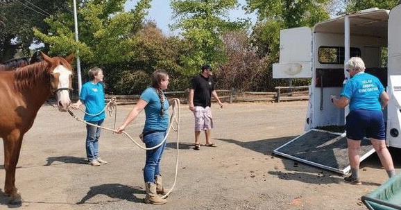
best to remove all pets from danger.” SCLAR works under the direction of El Dorado County Animal Services and the El Dorado County Sheriff’s Office of Emergency Services; when disaster strikes, the nonprofit steps in when the county asks them to help evacuate rural residents’ large animals. Volunteers swear in as registered disaster service workers through the OES and help in a variety of ways, according to their abilities and skill sets. SCLAR volunteers participate in a variety of training and practice situations in order to know how to handle the stressful nature of emergency evacuations. Volunteers take a course to understand Incident Command Systems and National Incident Management Systems, and participate in many of the wildfire evacuation training simulations put on throughout the county, such as one held in January 2024.
Community members 18 or older interested in joining or helping SCLAR are encouraged to learn more about joining at sclar.org. Though access to trailers or experience handling livestock is certainly appreciated and useful, SCLAR welcomes any help, as there are other tasks volunteers can take on that are vital to making evacuation efforts
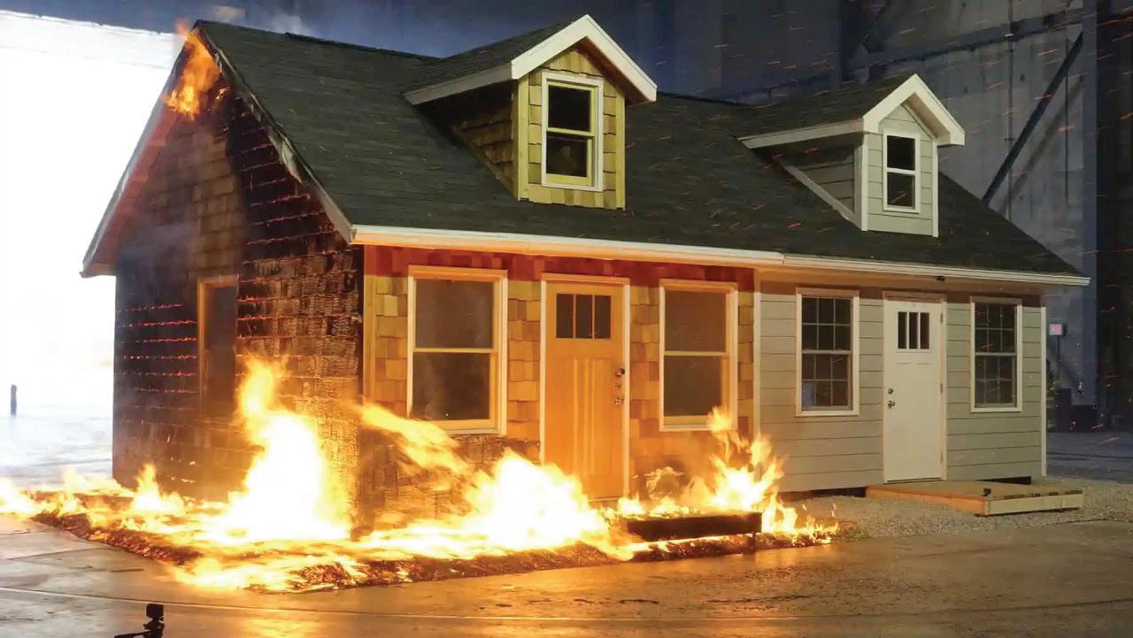
Ember Shield Home Hardening

At Ember Shield Home Hardening, we are general contractors that specialize in safeguarding your home from the devastating impacts of wildfires. Our goal is simple: to keep your family and home safe from the threat of wildfire embers.
Why Choose Ember Shield?
• Expertise You Can Trust: Our team of experienced professionals uses only the latest fire-resistant class “A” rated materials and technologies to protect your home.
• Comprehensive Protection: From roof to foundation, we provide holistic home hardening solutions.
• Tailored Solutions: Every home is different. We offer personalized assessments and solutions for your unique needs.
• At Ember Shield Home Hardening, we believe in a multi-layered approach to protecting your home from the devastating effects of wildfires. Each layer works together to reduce risk and maximize safety, ensuring that your property is as fire-resistant as possible. Protecting Your Home, One Ember at a Time!



PREPARE FOR POWER OUTAGES BEFORE THEY HAPPEN
story by PIONEER ENERGY COMMUNITY
California’s Sierra foothills region — a territory proudly served by Pioneer Community Energy — offers residents and visitors alike a unique blend of beauty and history. However, intertwined with this natural beauty is the ever-present risk of natural disasters that can bring sudden and unexpected power outages.
Disaster resource planning is particularly important to ensure a quick and effective response in the event of outages or other crises.
When outages occur, Pioneer Community Energy has a vested interest in working with energy partners to notify customers in the communities it serves of any impacts — but when safety demands that power be shut off or nature takes its course, being prepared can make a tremendous difference.
BE PREPARED
Start with an outage-ready kit with flashlights, fresh batteries, backup power for phones, a battery-operated radio, drinking water, blankets and nonperishable food and medications to last several days. Maintain a list of emergency information in case there is a need to evacuate, and check with local leaders or community groups for available resources.
KEEP INFORMED
Talk with your family or neighbors about how to stay connected during an outage or other crises. If needed, identify a safe place to meet and check in on vulnerable community members when it’s safe to do so. Sign up for local alert systems to receive real-time updates on emergency services or evacuations.
CONSIDER ADDITIONAL OPTIONS
There are ways to keep the lights on even when the power goes out. For example, Pioneer’s GridGen program is a solar + storage program that can keep the lights on during power interruptions. Customers can install rooftop solar and industry-leading battery systems with no up-front cost and no credit underwriting, allowing customers to power their home with the energy they generate.
Learn more about Pioneer and the GridGen program at PioneerCommunityEnergy.org/GridGen.


Power Through Anything with Solar + Storage.




WHAT ARE FIRE HAZARD SEVERITY ZONES?
story by WENDY OAKS / PUBLIC INFORMATION OFFICER, CAL FIRE AMADOR-EL DORADO UNIT
Fire Hazard Severity Zones (FHSZs)
are areas in California classified as Moderate, High, or Very High based on the potential for wildfire behavior over the next 30 to 50 years. These classifications are made by the California Office of the State Fire Marshal (OSFM) using a scientific model that evaluates factors such as topography, vegetation, fuel loads, ember generation, historical fire patterns and weather conditions.
The FHSZ map evaluates “hazard,” not “risk.” “Hazard” is based on the physical conditions that create a likelihood and expected fire behavior without considering mitigation measures such as home hardening, recent wildfire, or fuel reduction efforts. “Risk” is the potential damage a fire can do to the area under existing conditions, accounting for any modifications such as fuel reduction projects, defensible space and ignition resistant building construction.
WHY FHSZS MATTER
■ Regulatory Guidance: The zones are used for several purposes including to designate areas where California’s defensible space standards and wildland urban interface building codes are required. They can be a factor in real estate disclosure and local governments may consider them in their general plan.
■ Preparedness Planning: FHSZ maps are a valuable tool for homeowners to understand the environmental conditions — such as vegetation, topography and potential fire behavior— that exist around

their homes. This knowledge can help guide personal preparedness efforts, including defensible space, home hardening and evacuation planning.
■ Community Planning: Local governments use these maps to ensure development aligns with wildfire preparedness strategies and mitigation resources.
WHAT INDIVIDUALS CAN DO
■ Know Your Zone: Understanding your FHSZ classification is the first step toward recognizing your wildfire hazard. Visit the OSFM interactive map at osfm. fire.ca.gov/FHSZ to determine if your property is in a Moderate, High, or Very High Fire Hazard Severity Zone.
■ Create Defensible Space: Maintain at least 100 feet of defensible space around your home by clearing flammable vegetation and combustible materials. This reduces fire intensity near structures and gives firefighters a safer area to work.
■ Harden Your Home: Some key steps include using ember-resistant roofing, enclosed eaves, dual-pane windows and non-combustible siding to improve your home’s ability to withstand radiant heat and wind-blown embers. These are just a few of the many measures that can reduce your home’s vulnerability to wildfire.
■ Stay Informed: Monitor FHSZ map updates and participate in public input sessions when your jurisdiction updates or adopts new maps. Stay current on local guidance for vegetation
• 3-7 days of food and supplies
• 14 days of medication
• First aid kit, litter box/supplies, waste bags, sanitary supplies
• Identification papers, vaccination/medical records
management and home hardening.
■ Engage & Advocate: Take part in community fire preparedness efforts by collaborating with neighbors on fuel reduction projects, becoming a Firewise Community, promoting awareness, and supporting local and regional wildfire resilience strategies.
Key Resources, information and contact information
■ FHSZ website and information: osfm. fire.ca.gov/FHSZ
Overview of Fire Hazard Severity Zones, proposed maps and FAQs.
■ Office of the State Fire Marshal website: osfm.fire.ca.gov/
Main site for California’s fire prevention and safety programs, regulations and updates.
■ Public Questions: (916) 633-7655 or FHSZinformation@fire.ca.gov
Direct phone and email support for questions about FHSZ designations and processes.
■ Ready for Wildfire: readyforwildfire. org/
Fire Hazard Severity Zones provide important information about wildfire risk based on location, topography and fuels. Understanding these zones helps individuals and communities make informed decisions, take preventive action and access the right resources. To learn more and explore available tools visit osfm.fire. ca.gov/FHSZ.
• Kennel, leash, comfort items • Microchip your pet, update contact info • Keep collars and ID tags on your pet


PETS HAVE A PLACE TO GO IN AN EMERGENCY
story by ODIN RASCO
When fires, floods, earthquakes and more suddenly strike, making sure your family evacuates safely and has a secure place to shelter is of tantamount importance. Though hotels and motels might have a place for people, what about a place to stay for beloved pets — be they scaly, feathered or furry?
For the moments that come unexpectedly, El Dorado County Animal Services is there for the community, ready to help find places for pets of all shapes and sizes when the time to evacuate comes.
“Anytime there’s mandatory evacuations in place, we will be open for the public to call to ask for assistance,” Animal Services Officer Supervisor Lt. Kimberly Lusby said. “The public can bring animals to us and sometimes, in a lot of cases, they may need assistance with getting their animals out because they’re no longer there.”
In cases where community members need help evacuating animals they can’t get to, Animal Services is equipped to head out and collect a variety of pets in need of transport utilizing their trucks or larger vehicles for livestock. The shelter is equipped to hold hundreds of small domestic animals — Lusby estimated that more than 700 animals were taken in during the Caldor Fire, from dogs and cats to rabbits, livestock and full flocks of chickens. Animal Services doesn’t discriminate in what types of animals it can help, though, with the staff working to make sure they can find places to care for fish, lizards, snakes and more.
“We will find a way; we will always find a way,” Lusby explained. “It doesn’t matter what the animal is. Even if it means reaching out to rescue organizations we have relationships with that maybe can house them, or vet hospitals or things along that nature, we will find those resources.”
PLANS IN PLACE
Animal Services coordinates directly with the El Dorado County Sheriff’s Office of Emergency Services,

planning evacuation procedures and assigning staff to help safely conduct evacuations for animals. In the case of smaller fires or hazards that may arise that don’t lead to an Emergency Operations Center being set up, Chief Michael J. Mazouch, the new Manager of Animal Services, encourages community members to be proactive about communicating their needs to Animal Services. During emergencies, the shelter at 6435 Capitol Ave. in Diamond Springs is kept open and phone lines are manned, though an influx of calls at the onset of an issue is not unusual. The number to reach Animal Services’ main line is (530) 621-5795.
“We will always remain open or reopen if need be, if EDSO directs us and advises us that there’s mandatory evacuations,” Lusby added. “Anytime there’s mandatory evacuations in place, we will be open for the public to call to ask for assistance. We advise the public to call our main shelter line for assistance, and we will always have people on staff answering the phones. If it goes to voicemail, I highly encourage people to leave a voicemail. We’re checking them around the clock.”
To better help county residents plan ahead in the case of emergency, Animal Services has prepared an evacuation
checklist:
CREATE A PLAN
■ Arrange, ahead of time, to stay in another location with family or friends. Ask if they would be able to shelter you and your animals or just your animals, if necessary. If you have more than one pet, you may have to be prepared to house them separately.
■ Contact hotels & motels outside your immediate area to check policies on accepting pets. Ask about any restrictions on number, size and species. Ask if “no pet” polices would be waived in an emergency. Make a list of pet-friendly places and keep it handy. Call ahead for a reservation as soon as you think you might have to leave your home. Make sure you will be able to bring your pets.
■ Make a list of boarding facilities and veterinary offices that might be able to shelter animals in emergencies.
■ Place at least one metal address marker on a metal stake at the entrance to your property.
■ Hide a key to your home in an easy to describe location if you have any animals that live indoors.
■ Take your pets with you whenever possible — conditions change quickly and you may not be able to return home.
DOGS AND CATS
■ Microchipping your dogs and cats to easily identify you as the owner.
■ For each animal, place a metal ID tag on collar (animal’s name, your name, address, phone #) Dogs can use El Dorado County license tags, cats need to have “break away” collars.
■ Place photos of yourself with your pets in your wallet or glove compartment to verify ownership and to help others ID them in case you and your pets become separated.
CREATE A PREPAREDNESS KIT
■ Have copies of important contacts, vet, insurance stored in waterproof container.
■ Registration and veterinary documents (vaccination records and known medical history, medical directives for your pets stored in waterproof container.
■ Written info on feeding schedules, behavior issues, medical issues for each pet.
■ Pet medications (1-2 week supply) and ice chest if needed
■ Food, water, supplements
■ First Aid kit
■ Crates, carriers, cages, pillowcases
■ Leashes, harnesses
■ Bowls, can opener, water bottles
■ Calming meds, thunder shirt
■ Grooming supplies, wipes
■ Disinfectant wipes, paper towels, newspaper, trash bags
■ Pet waste bags, pee pads
■ Litter and disposable pans
■ Towels, bedding
■ Sheets/covers for cages
■ Booties, life jacket
■ Pet beds and toys to reduce stress
BIRDS AND EXOTIC PETS
■ Have photos of yourself with each pet
and medical records, located in wallet or vehicle for proof of ownership.
■ Make sure cage is transportable, otherwise have an alternative carrier for evacuating.
■ Reptiles can be transported in a pillow case or small carrier, take a water bowl for soaking and a heating pad. Try to keep the reptile at a comfortable temperature.
■ Have 1-2 week supply of food and pet medications on hand.
■ Write out dietary instructions and place on or near cage.
■ Metal ID tags can be secured to most bird and small mammal cages and birds can be banded.
■ Label plastic or glass aquariums for ID purposes.
■ DO NOT rely on electricity for filters, heat lamps, or feeding systems, have battery backup or plan to evacuate as soon as possible.
LIVESTOCK
■ Have a list of emergency contacts and/or neighbors established prior and have a disaster plan posted in an accessible place for those that may need to help with removing your animals from your property in the event you are unable to.
■ The animals you plan to transport out of the disaster area should be familiar with entering and exiting a livestock trailer if possible.
■ Have the trailer stocked prior to your emergency (feed, livestock medical supplies, buckets, knife/scissors/wire cutters, duct tape, fire resistant leads and halters, water storage containers).
■ Livestock should be identifiable; have some type of identification if possible. Luggage tags on halters with name and contact number, spray paint symbol, tattoos or ear tags.
■ A current photo of each animal with a matching ID number should be available. Include a close-up of any special identifying marks. Also include yourself in some of the photos as proof of ownership.
■ Make arrangements prior to disaster for locations out of disaster area for livestock to be transported to for temporary sheltering.
DO NOT “CUT ANY ANIMALS LOOSE” DURING A DISASTER
■ Domestic animals do not know how to “save themselves,” they may continue to run and run succumbing to heat exhaustion in their panic.
■ Others may remain where things are familiar, even with a safer location nearby.
■ Make arrangements with a trusted neighbor to take your pets and meet you at a specified location if you are unable to get home to evacuate your pets.
■ Animals located inside of the home or within enclosures are easier to evacuate.
■ Notify El Dorado County Animal Services IMMEDIATELY at (530) 621-5795 if you have been evacuated and were unable to take your animals and would like them to be evacuated.
ANIMALS SHELTERED-IN-PLACE
■ Notify El Dorado County Animal Services IMMEDIATELY at (530) 621-5795 if you have animals in the residence and need them cared for.
■ Signs noting animals, locations and locations of pet’s food.
■ Note disability/dietary needs.
■ Leave hidden key in an easy to describe location to access indoor pets.
■ Gates unlocked.
■ Leave water everywhere possible.





HOME HARDENING
story by EL DORADO COUNTY FIRE SAFE COUNCIL
What does Home Hardening mean? Home Hardening means retrofitting or upgrading your home with fire-resistant materials or implementing preventative measures to keep your home safer from wildfire. Fire-resistant materials are better at battling the impact of embers and radiant heat created by a wildfire. Home hardening is about making your home more resilient to wildfire threats.
EMBERS
Many homes are not destroyed by the main wildfire itself, but rather by windborne embers that can travel long distances, up to a mile or more, and ignite structures. Embers are responsible for an estimated 60% to 90% of structural damage.
So how do you protect your home against embers and radiant heat from flames? Start by identifying vulnerabilities or weaknesses in your home’s structure, such as the roof, windows and entry points.
IS YOUR ROOF PROTECTED?
1. Regularly remove leaves, needles, and other flammable materials from the roof and gutters that could catch on fire from flying embers.
2. Choose or make sure your roofing material is a Class A rated material like metal, tile or composite shingles.
3. Close off any gaps or openings where embers can enter, such as under roof tiles, shingles or eves.
WHAT ABOUT YOUR WINDOWS AND DOORS?
1. Ensure proper sealing around windows and doors. Seal any gaps or cracks to prevent invading embers.
2. Install dual-pane or tempered glass windows. These offer better resistance to heat and shattering.
WHAT
ABOUT THE SPACE CLOSEST TO MY HOUSE?
“Zone 0” or “Ember-Resistant” zone refers to the five-foot area around your home. It has been found to be the most important area to focus on because making the first five feet around your home wildfire resistant, greatly improves the likelihood of your house surviving a wildfire.
WHAT SHOULD I DO IN THE “ZONE 0”?
This area needs to be cleared of combustible (flammable) materials to reduce the risk of your home burning

from wildfire. Those flying embers can start the vegetation next to your house on fire which is the leading cause of a home being lost to a wildfire. Embers can land on dead leaves, shrubs, or even flammable materials such as doormats starting a chain reaction that sets your house on fire.
1. Removing things like mulch, wood chips, dry vegetation, dead plants and wood fences within that Zone 0.
2. Think about replacing the five-foot area with non-flammable materials such as rocks, gravel, stone pavers, bricks, concrete, or just dirt. That way embers just simply burn out without igniting your house.
3. If you have plants close to your house, consider moving or removing them. Embers that land and collect on plants directly under windows or window boxes make these areas particularly vulnerable to catch on fire.
4. Remember that early morning is the best time to do this type of work before the fire danger increases as the temperatures increase. Be careful not to use power tools in the heat of the day.
5. Regularly inspect and maintain your home. Check for and repair any areas of weakness your home has against wildfire.
The goal of Home Hardening is to protect your home from the embers and radiant heat flames that can destroy your valued property.
El Dorado County Fire Safe Council, EDCFSC, offers FREE Home Assessments to all residents of the western slope of El Dorado County (not available in South Lake Tahoe).
These trained volunteers can help you understand what works and why. Where to start, and what help might be available. The El Dorado County Fire Safe Council also offers a Chipping, Defensible Space and Hazardous Tree program. The programs are designed to

help homeowners improve safety and preparedness from wildfire. Make a plan to harden your home that is doable and cost effective for your family or contact EDCFSC for a free home assessment to help you develop a plan. And, as you plan for your home, don’t forget to plan for evacuation to keep your family safe.
BE PROACTIVE! PLAN! BE SAFE! For more information on Home Assessments, Assistance Programs, or to find your local Fire Safe Council, contact the main office at (530) 647-1700 or email Clerk@edcfiresafe.org.
EL DORADO COUNTY ASSOCIATE FIRE SAFE COUNCILS
1. Auburn Lake Trails FSC (5013c)
2. Aukum Fairplay FSC
3. Coloma Lotus FSC
4. Cool Pilot Hill FSC
5. Camino FSC
6. Diamond Springs FSC
7. El Dorado Hills South FSC
8. Fort Jim Fire Safe Council
9. Gallagher Road LA FSC
10. Georgetown Divide FSC
11. Gold Hill Estates FSC

12. Gold Ridge Forest FSC
13. Greater Cameron Park Area FSC
14. Greenstone Country FSC
15. Grizzly Flats FSC
16. Lakehills FSC (5013c)
17. Logtown FSC
18. Mosquito FSC
19. Oak Hill Area FSC
20. Omo Ranch FSC
21. Patterson Ranch FSC
22. Placerville FSC
23. Rancho Del Sol FSC
24. Rescue FSC
25. Royal Equestrian Estates FSC
26. Sand Ridge FSC
27. Serrano FSC
28. Sierra Springs Regional FSC
29. Strawberry FSC
30. Texas Hill Estates FSC
31. Volcanoville FSC
32. Wrights Lake/Dark Lake FSC








WHAT IS DEFENSIBLE SPACE?
Defensible Space is the buffer zone that you create between your home and the plants, brush, trees, or other items surrounding your home that could ignite in the event of a fire. The establishment and maintenance of proper defensible space helps to protect your property and community from the risk and spread of wildfire.


Zone 0 - Ember Resistant Zone
0 - 5 Feet
• Remove all combustible plants and replace with gravel, pavers, or concrete
• Keep roofs, gutters, decks/porches, and stairways clear of vegetation and combustible materials
• Replace combustible fencing, gates, and arbors that are attached to home with noncombustible materials
Zone 1 - Lean, Clean, and Green Zone
5 - 30 Feet
• Remove all dead plants, grass, and weeds
• Clear dead leaves and pine needles from your yard, structures, rain gutters, and roofs
• Remove or separate live flammable ground cover and shrubs
• Remove all branches within 10 ft. of chimneys/stove pipes
Zone 2 - Reduced Fuel Zone
30 - 100 Feet
• Cut or mow annual grass down to a maximum height of 4 in.
• Create horizontal spacing between between shrubs and trees
• Clear lower vegetation that could lead to a fire climbing into the
CREATING FIRE-RESILIENT LANDSCAPES
story by KIT VEERKAMP / UC MASTER GARDENERS OF EL DORADO COUNTY
California, like much of the West has evolved ecosystems with characteristics that are reliant on fire for ecosystem health, but create serious fire hazards for people who live in the urban wildland interface between areas of higher density housing and more natural areas. Sparks from a downed power line, a lawn mower, a catalytic converter, a carelessly tossed cigarette or match, a fire cracker, stray ammunition, or an untended campfire are all it takes to ignite a fire than can erupt into a conflagration that cannot be easily slowed or stopped.
Depending on rainfall, by late spring to mid-summer, soil moisture is depleted, and the growing season essentially over. Native plants respond by entering a state of summer dormancy, often dropping most or all of their foliage in early to mid-summer. As the moisture level in plant tissue is depleted with increasing summer heat and lack of rain, vegetation becomes tinder dry. In autumn, conditions of relative humidity as low as 10 percent combined with hot, dry winds further desiccate the landscape and create exceptionally dangerous conditions.
The adaptations of native and introduced plant species to summer drought contribute to their flammability. Many plants, such as conifers, chamise, Adenostoma fasciculatum; manzanita, Arctostaphylos spp.; coyote brush, Baccharis pilularis; sage, Salvia spp.; and some ceanothus, contain volatile oils and resins that make them more likely to burn than broader leafed plants, especially when moisture content is low. The spread of flammable, invasive, exotic trees and shrubs such as broom, pampas grass, acacia, eucalyptus, etc., create a fire-ladder effect that can allow a fire to rise into the tree canopy.
Fuel is anything flammable that will contribute to the spread of a fire, especially dead or dry vegetation, highly flammable plants, plant litter, firewood, miscellaneous scrap wood or stored

lumber, and wooden structures such as fences, decks and arbors. For the purpose of this discussion, structures are excluded, although their design and placement are key factors in fire safety.
Fuel should be reduced within a zone ranging 30 to 50 feet from a home or other structure.
Fuel reduction should be increased to 100 feet or more on steep slopes and in dense vegetation.
Within these zones, reduce fuel by:
■ Removing dead and dry brush
■ Removing excessive accumulations of dry leaf litter and duff
■ Thinning out trees so that there are 10 to 20 feet between the canopies of single trees or groups of trees
■ Thinning existing shrubs, or planting new shrubs in widely separated islands
■ Raising the limbs of trees to at least eight feed above ground, and 10 feet over roofs, to reduce the fire ladder effect
■ Removing invasive, exotic plants that are highly flammable, such as Scotch broom, Cytisus scoparius; pampas grass, Cortaderia selloana; cotoneaster, cypress and junipers
Following its enactment on July 1, 2021, California Assembly Bill 38 required all homes in high or Very High Fire Hazard Severity Zones (FHSZ) to be compliant with Defensible Space standards. Find your Fire Hazard Severity Zone at osfm.fire. ca.gov/what-we-do/community-wildfire-preparedness-and-mitigation/ fire-hazard-severity-zones.
The new State Defensible Space standards went into effect in 2023, creating zones around our homes. The Immediate or Ember Resistant Zone (Zone 0) is the first five feet immediately adjacent to all structures, including attached amenities such as decks, attached patio covers and trellises. Within this zone, there should be no combustible materials, including organic mulches, to reduce the likelihood of burning plant material igniting the adjacent structure.
The Intermediate Zone (Zone 1), also known as the lean, clean and green zone, is that area between the first five feet (Zone 0) to 30 feet beyond structures or to the property line. The Extended Zone (Zone 2) is an area beyond 30 feet to at least 100 feet from the structures. In this zone, manage natural vegetation to keep it open with
Courtesy photo by Cal Fire Zero to five defensible space is desirable.

Defensible space can save a home from fire.
about 50% coverage and encourage native trees, and remove any exotic, invasives such as broom.
FUNCTIONAL FIREBREAK
Many homeowners mistakenly believe that defensible space requires extensive clearing of trees and shrubs, essentially creating a moonscape. The results are unattractive, and encourage invasive, fire prone plants. Broad paved or graveled paths not only provide access through a yard, but function as a firebreak as well. A continuous ribbon of four-foot-wide walkways around a home provides a safe place for firefighters to defend your home from a threatening wildfire. For sloped sites, utilize non-flammable materials such as masonry, concrete, boulders, or rammed earth to create terraces helping to keep
garden beds manageable while making the overall garden more accessible and aesthetically pleasing.
Defensible Space Zones do not preclude planting or maintaining trees and shrubs, but there is no such thing as fire-proof plants. Any plant will burn if hot enough.
What makes some plants more fire-resistant than others is determined by several factors. Plant structure, size, foliage type, and density are key characteristics to consider. Overgrown plants and those in poor health are going to be less resilient. Bottom line, we all need to give more consideration to the principle of “right plant, right place.”
Plant tissue moisture and soil moisture levels influence a plant’s flammability potential. Even the most fire-resistant
plants, such as succulents, may burn if moisture is depleted by an extremely hot fire. Even though we frequently face serious drought conditions, it is critical to occasionally irrigate any landscaping within 30 feet of structures to maintain adequate moisture levels in the plants in that area. In terms of density of plant material, it aims for no more than approximately 50% total coverage for a mature landscape. This number has been proven to be an optimal density to slow down fires but also support wildlife.
KEEP FIRE IN MIND
As we well know, fire cannot be ignored as a force of nature in the Sierra Nevada. This force must be taken into consideration by all who plan, design, build and live in this environment to reduce the risk to the community at large. Doing nothing is not an option as the consequences of not doing so are made painfully clear each year.
MORE INFO
For more information about the UC Master Gardener classes, events and garden resources, visit the website: mgeldorado.ucanr.edu/.
Also available on the website are the hours and activity information for the Sherwood Demonstration Garden: ucanr. edu/sites/EDC_Master_Gardeners/ Demonstration_Garden/.
Have a gardening question? Use the “Ask a Master Gardener” option on the website or call (530) 621-5512.

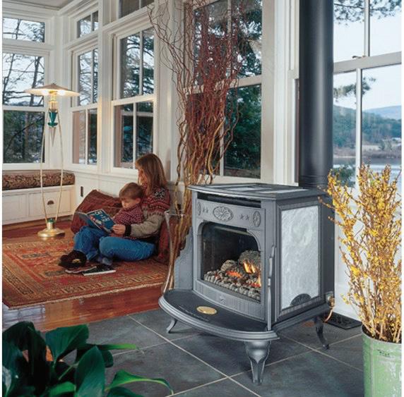
Photo from Pixabay

PALMERO - A LUXURY SENIOR LIFESTYLE COMMUNITY
Peace of Mind for Families When it Matters Most
Independent Living, Assisted Living & Memory Care
Disasters can strike without warning, but at Ponté Palmero, you never have to face it alone. Our senior living community o ers around-the-clock support to ensure residents’ well-being in any situation.
• Sta on-site 24/7
• Coordinated access to medical care and supplies*
• Meals provided even if power goes out

• A network of neighbors and support you can count on
Don’t wait for a crisis. Start enjoying the bene ts of community living at Ponté Palmero today.
Call now to schedule a visit. 530-387-4806

• Daily wellness checks* and frequent communication with loved ones







PONTÉ
THE BENEFITS OF FUEL REDUCTION
PROJECTS FOR WILDFIRE PREPAREDNESS
story by THE EL DORADO AND GEORGETOWN DIVIDE RESOURCE CONSERVATION DISTRICTS
Wildfires pose serious threats to communities, ecosystems and economies, especially in areas with dry conditions and dense vegetation. Fuel reduction projects play a vital role in lowering these risks by managing vegetation to minimize combustible material. These efforts not only slow wildfire spread but also improve safety for residents and first responders.
A notable example is the Fire Adapted 50 Project, which leverages existing fuel breaks and forest treatments to build broader, more resilient firebreaks. One such break was critical in containing the Caldor Fire near Pollock Pines, giving firefighters a defensive advantage and helping protect the community.
The El Dorado and Georgetown Divide Resource Conservation Districts (RCDs) are key partners in regional fuel reduction
efforts, focusing on vegetation removal, forest thinning health and the creation of defensible space. They manage several projects on behalf of the El Dorado County Fire Safe Council (EDCFSC), including:
■ Community wildfire protection projects in Volcanoville, Mosquito, Sierra Springs and Grizzly Flat.
■ Landscape fire prevention projects in the areas of Oak Hill, Omo Ranch, Mt. Aukum, Fair Play, Kelsey and Georgetown.
In addition to planning and implementing these efforts, the RCDs coordinate with stakeholders and ensure projects meet environmental and safety standards.
The RCDs are also active in post-fire recovery, supporting restoration efforts for the Caldor and Mosquito fires. These projects mitigate hazardous trees and

restore forest cover through reforestation. The El Dorado RCD leads the Emergency Forest Restoration Team (EFRT), which provides rapid response in wildfire aftermaths — assessing damage, prioritizing actions and restoring impacted areas.
To support long-term resilience, the RCDs offer technical assistance programs to landowners. These programs promote best practices in defensible space, vegetation management, and fire prevention — empowering communities to be better prepared and more fire-resilient.
Participation is voluntary and free for landowners. For more information about these projects or technical assistance contact the RCD at (53) 295-0120, email edgdrcd@gmail.com or visit eldoradorcd. org.
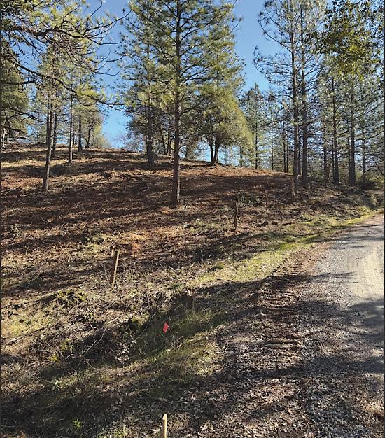
Land before crews came in and cleared the dense growth.
Courtesy photos
The land after crews cleared the growth.












~ Edio Delfino, Owner


