2023
marija satibaldijeva portfolio
About me
Originally from Latvia, I am an urban designer studying Urbanism at the Academy of Architecture, firmly believe in the interconnectedness of everything within cities. I find great joy in working on projects that bring together various disciplines. I aim to create solutions that are inclusive and sustainable, making our cities better places for everyone.
Education
2020 - PRESENT
Urbanism.
MSc
Amsterdam Academie van Bouwkunst
2016 - 2020
International Spatial Development. HBO
Breda University of Applied Sciences
MARIJA SATIBALDIJEVA
Experience
JUN 2021 - NOV 2023
Junior Urban Designer
AMERSFOORT, NL
SVP Architectuur & Stedenbouw
Involved in different projects from start to finish, including research, strategies, design and image quality plans
• Managed tasks independently to ensure projects stayed on track and met deadlines.
• Contributed to several tender projects.
Worked on various assignment projects, like studying new social housing plans and urban expansion projects.
• A few example projects: a high density flexible housing project in Olst, strategic vision in the hospital district in Velp, housing area in Made, dike project Kinderdijk.
JUL 2020 - MAY 2021
OOSTERHOUT, NL
Assistant urban designer Croonenburo5
• Assisted in projects in helping with research, technical design and creating visuals like maps, impressions and 3Ds.
A few projects I was involved: a new expansion in Wijchen West and Moleneind Breda; IVORIM - sustainable infrastructure and public space in Haarlem.
FEB 2020 - JUN 2020
Graduation intern Croonenburo5
OOSTERHOUT, NL
Did research and wrote a thesis on “Inclusive neighborhoods,” presenting a future vision for transforming Hoge Vucht into an inclusive community.
• Provided support on ongoing projects by assisting with various tasks and responsibilities.
MAR 2019 - JUN 2019
Blom&Moors
Adobe
SketchUp
Vectorworks
Qgis
AutoCAD
Microstation
3D printing
(inDesign, Illustrator, Photoshop) Skills Contact
m.satibaldijeva@gmail.com
+31619741873
LinkedIn.com/in/marija-satibaldijeva/
ROTTERDAM & TILBURG, NL
• Conducted research on design possibilities for the Stadsbos013 project
• Provided assistance on various ongoing projects and created visualizations as part of my tasks. Intern
MAY 2018 - DEC 2019
Student Ambassador
BREDA, NL; ABROAD
Breda University of Applied Sciences
• Represented Breda University of Applied Sciences as a student ambassador at international study fairs in the Baltics, Belgium.
• Assisted during orientation and open days, providing guidance and answering inquiries from prospective students regarding academic programs and university life.
AUG 2018 - NOV 2018
BREDA, NL
Research Intern EU project Metamorphosis
• Involved in Metamorphosis, a project issued by the European Commission under the Horizon 2020 program. Metamorphosis is focused on transforming neighbourhoods with a focus on children.
• Researched strategies to encourage active and safe mobility among children.
Urbanism related experience
SEPT 2019 - DEC 2019
Minor “Retrofitting the Sprawled City“
Breda University of Applied Sciences
CALGARY, CANADA
• Participated in the minor “Retrofitting the Sprawled City” at Breda University of Applied Sciences, focusing on redesigning the public realm of the Downtown and Beltline area in Calgary, Canada.
• With a team presented a vision called “Energize Calgary“ which was about implementing designs aimed at reintegrating nature into urban environments, and promoting sustainable mobility.
International projects
NOV 2019
13. Fahrradkommunalkonferenz
WITTENBERG, GERMANY
During the conference, together with my classmate Viesturs Krūmiņliepa, we created and presented a mobility vision for Wittenberg. It included plans inspired by Dutch standards.
OCT 2019
“Freshbrains” project
Pressure cooker
BONN, GERMANY
In one week workshop together with students from Bergische Universitat Wuppertal a vision on how to improve cycling was proposed to the city of Bonn. Also, Urban Guerilla was executed in the problematic area of the city.
Languages
Dutch (B1)
Latvian Russian English
NOV 2017
Transport Hackathon organized by Y4PT
MOSCOW, RUSSIA
During the hackathon, in a team I made a proposal for the Metropolitan of Moscow. Ideas about how to manage crowds during big events were presented to the authorities of the Moscow Metropolitan.
APRIL 2017
“Freshbrains” project Pressure cooker
KASSEL, GERMANY
A project was a part of the assignment of the 1st year at the International Spatial Development. In one week workshop together with students from Bergische Universitat Wuppertal the vision to the city of Kassel in how to promote cycling was proposed.
Awards & honors
Cochlear Graeme Clark Scholarship
I was granted the scholarship in the Eastern European division of Cochlear. Graeme Clark Scholarship is open to cochlear implant recipients to provide financial support in education.
Interests
Drawing, travelling, interior design, technologies, AI, 3d printing, gym.
3
Contents
1 flexwonen in olst-wijhe
Professional project - SVP Architectuur & Stedenbouw
2 OYSTER FARM
Academic project - Amsterdam Academy of Architecture
3 bee the change
Academic project - Amsterdam Academy of Architecture
4 CLIMATE HAVEN
Academic project - Amsterdam Academy of Architecture
5 THE GUILD
Academic project - Amsterdam Academy of Architecture
6 extra curriculum
Urban analysis & Maquettes as a part of design process
7 PERSONAL CREATIONS
Art as a hobby
4
5
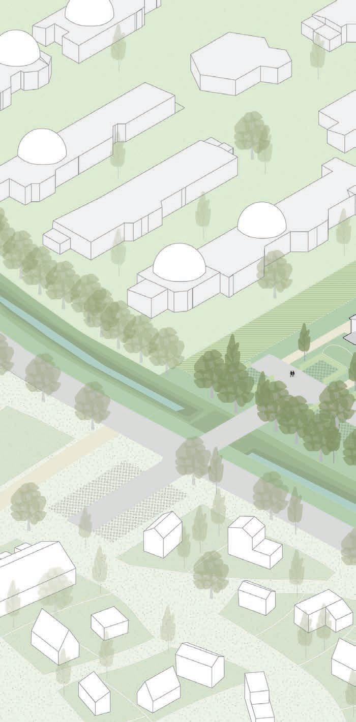
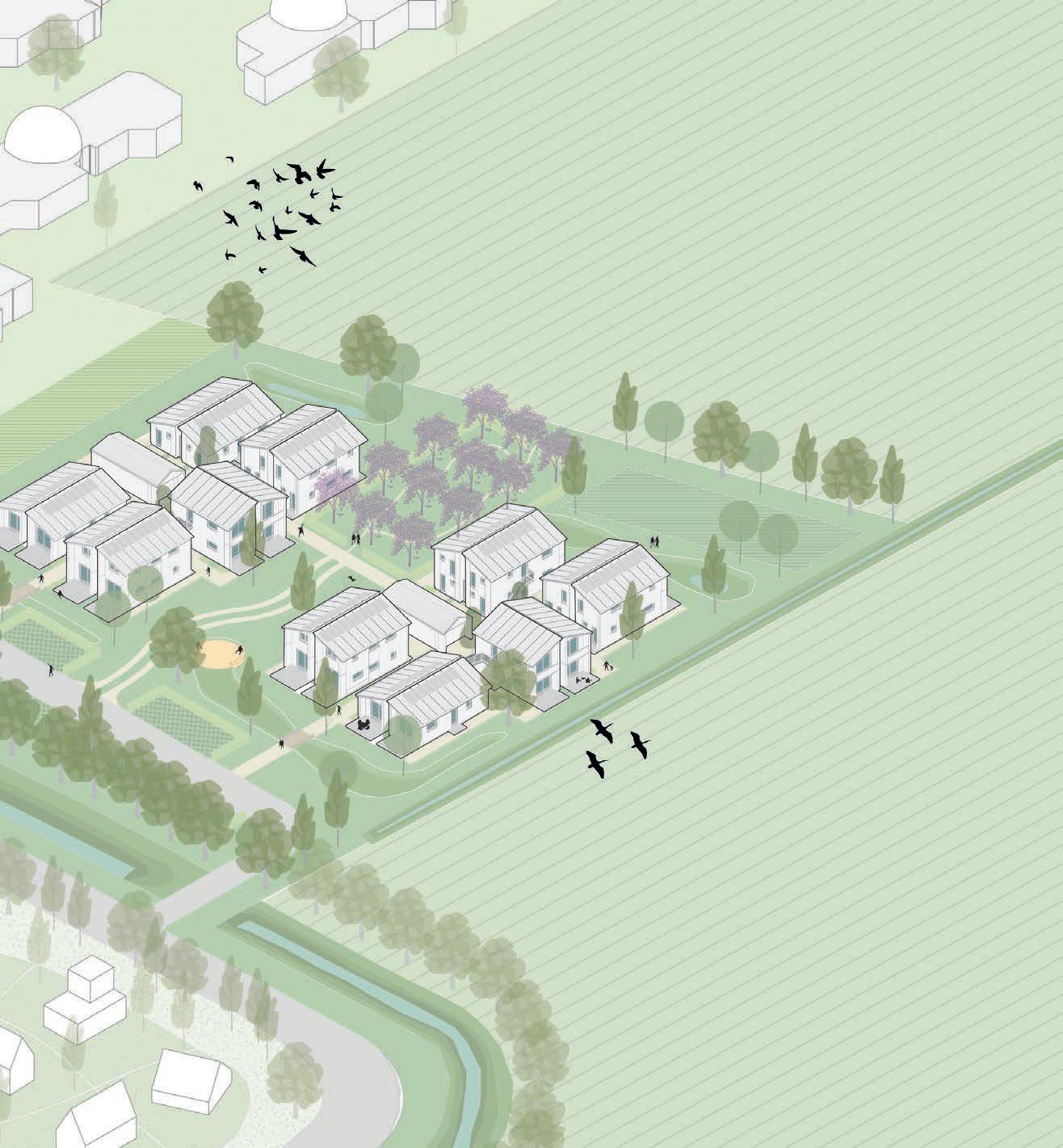
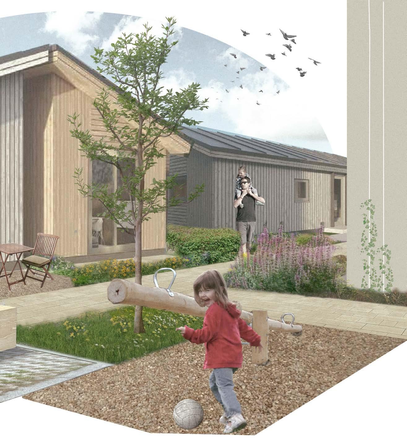
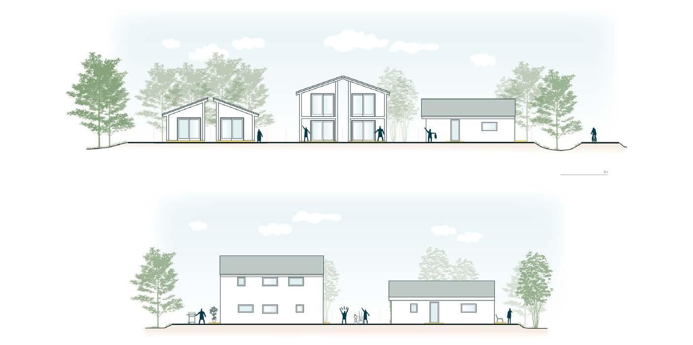
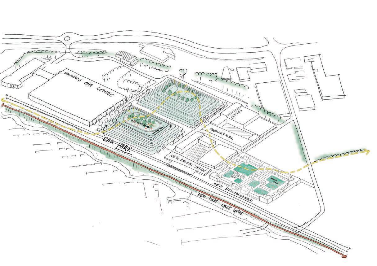
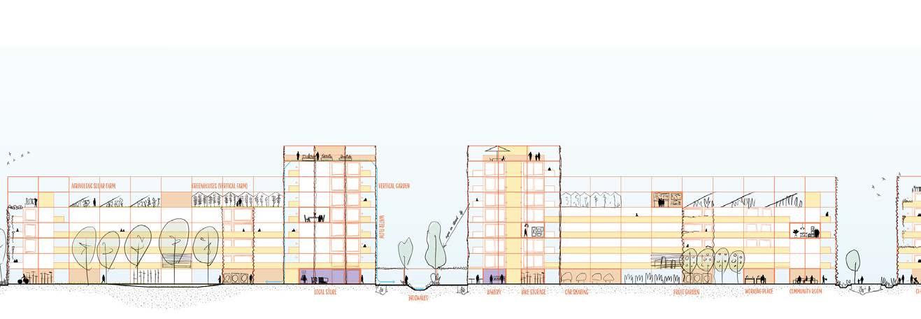
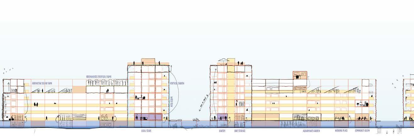
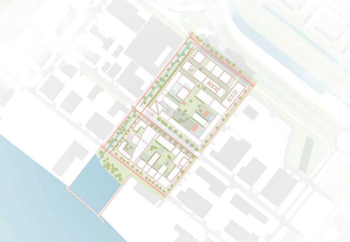
flexwonen in olst-wijhe
with SVP Architectuur & Stedenbouw
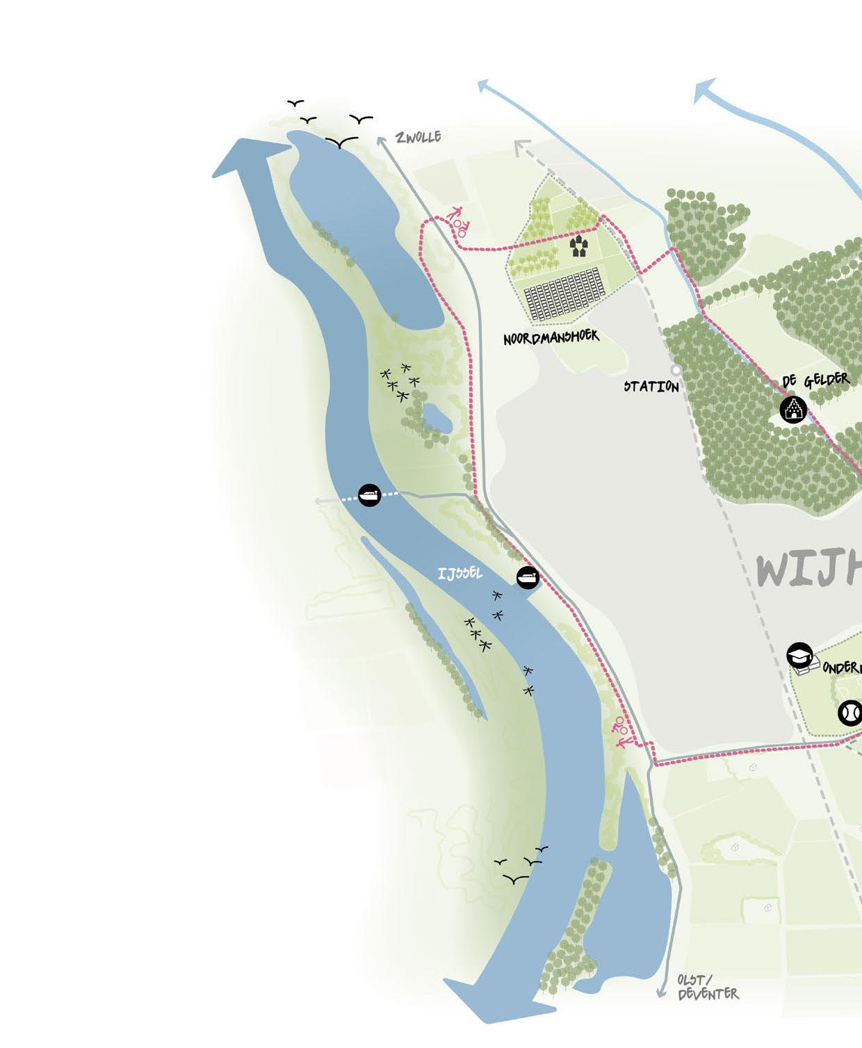
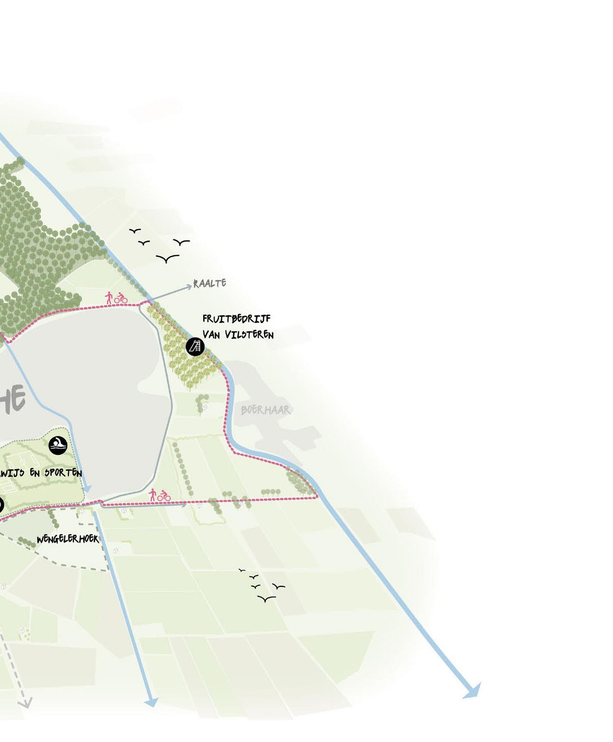
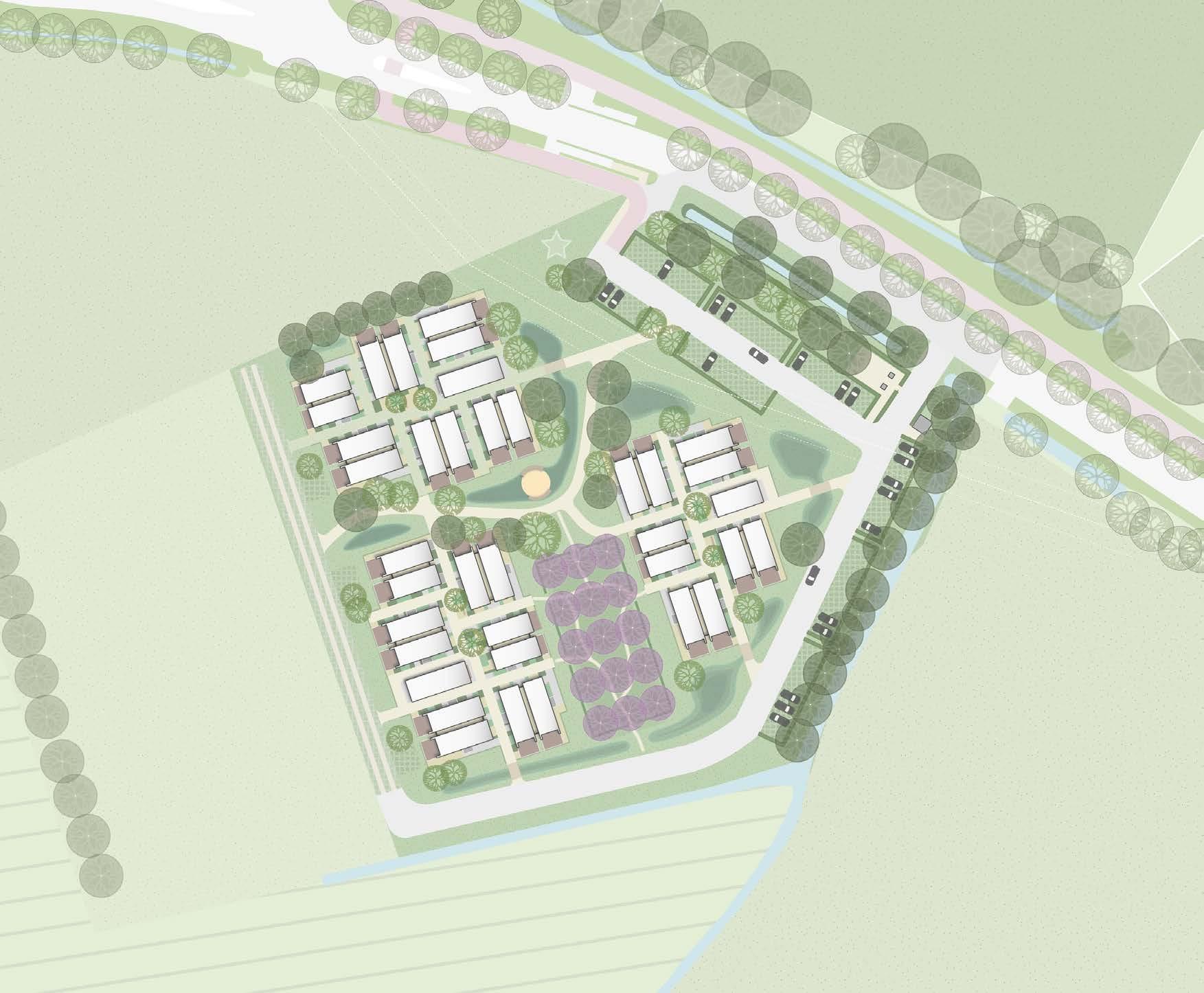
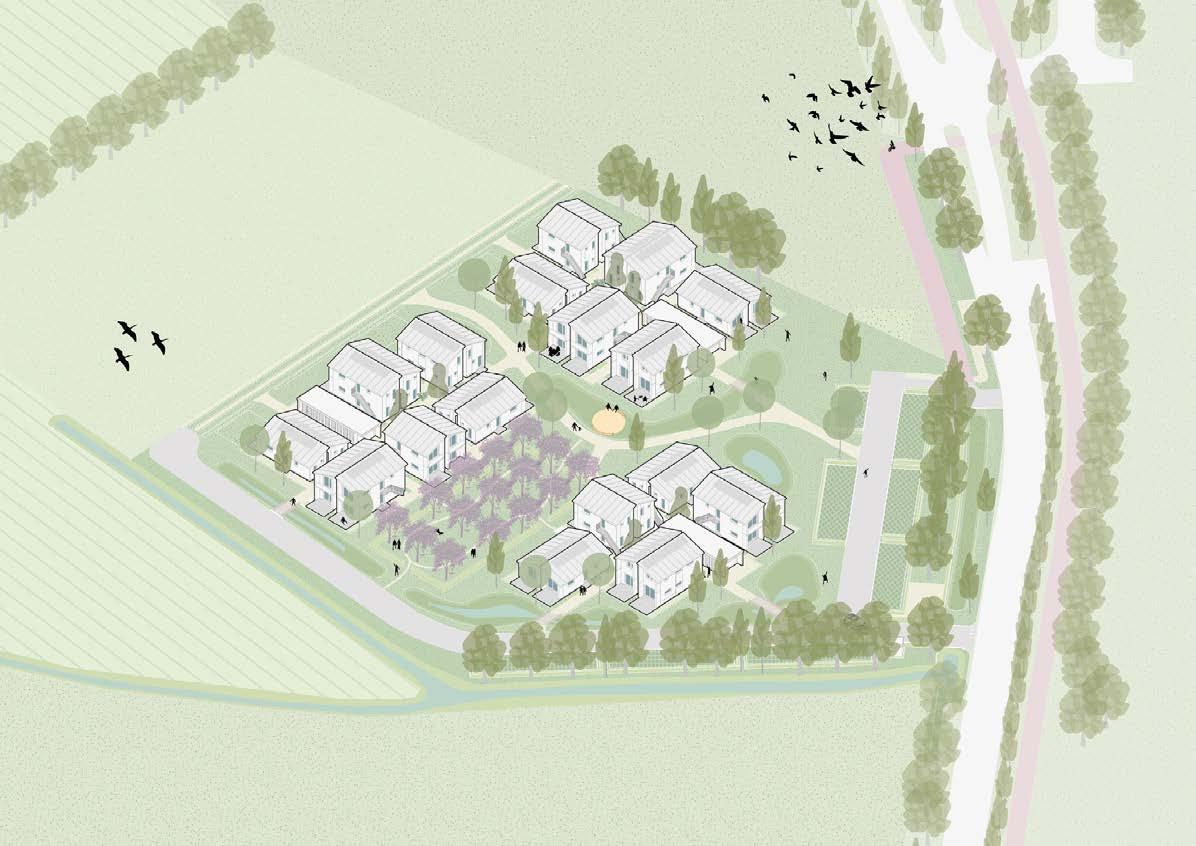
Because of the housing crisis in the Netherlands, solutions must be found on how to accomodate housing needs. The municipality of Olst-Wijhe has comissioned SVP to develop a vision for temporary housing in two locations. Now that this planning has entered its final phases, the municipality has asked Studio BLAD and SVP to look at the total development of Wengelerhoek. This concerns an area of approximately 7 hectares and a total of 200 homes (including 50 flexible homes).
My role in the project was to work thoughout the whole project: research, concepting, designing, creating supporting visuals and preparing the presentations to the client.
Phase: from “Initiative” until “Technical Design”
Project area: Olst and Wijhe
Team: together with Mike Wissing and Ilse van den Berg
Used software:
qGis, Hand drawing, Vectorworks, SketchUp, inDesign, Photoshop, Illustrator, Morpholio
this portfolio are done by me.
6
Visuals presented in
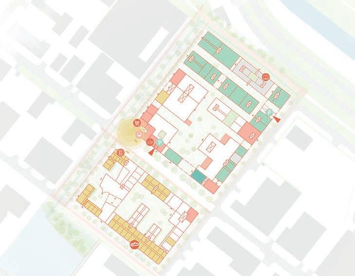
7 Plan of the Vink location
8
9
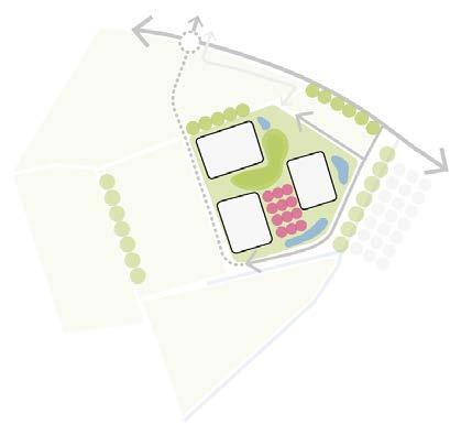
Vision for the Wengelerhoek area on the larger scale

3.
Erven worden omringd door nieuwe en bestaande landschapselementen


Woningen zijn georiënteerd op de zon voor voldoende daglicht en uitzicht
10
om stimuleren Principle schemes
11
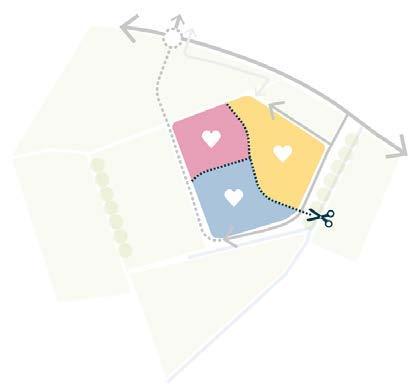
the space inside clusters
Collage of
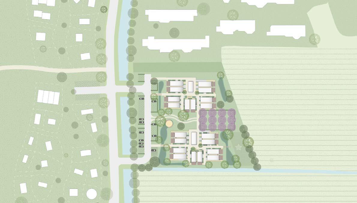
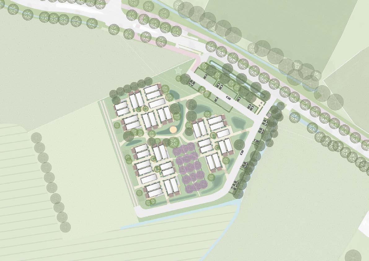
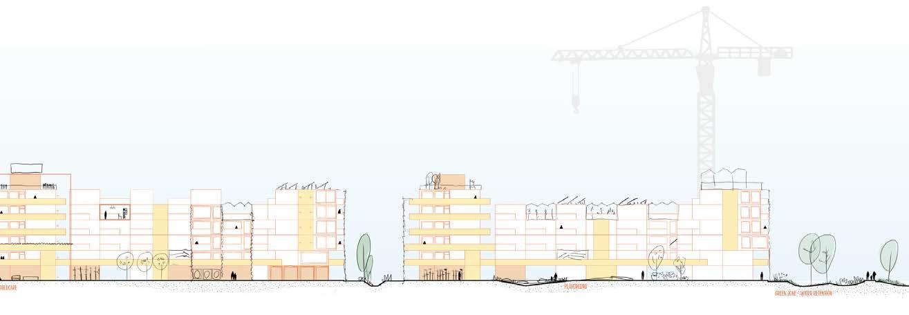
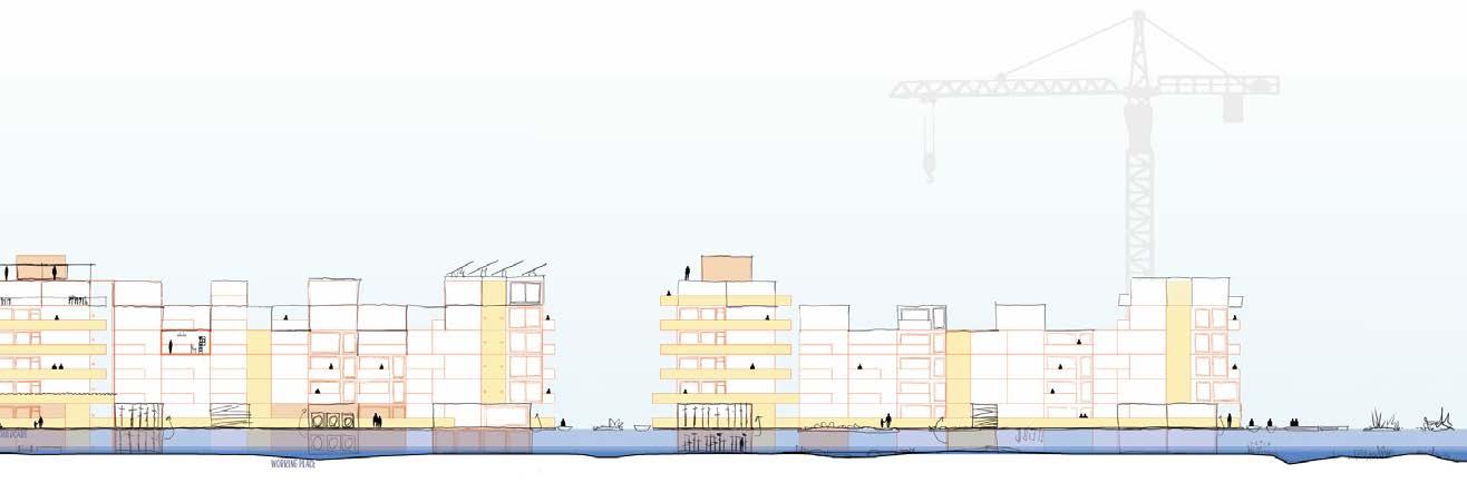
12 Plan for the Vink location Plan for the Wengelerhoek location
13
Cross sections
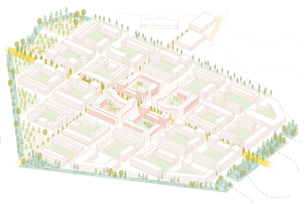
Axonometric visual of the Wengelerhoek area
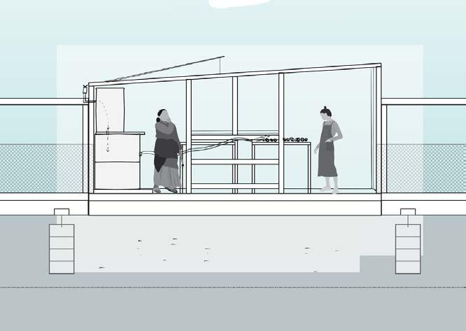
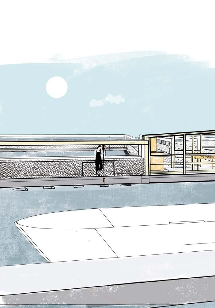
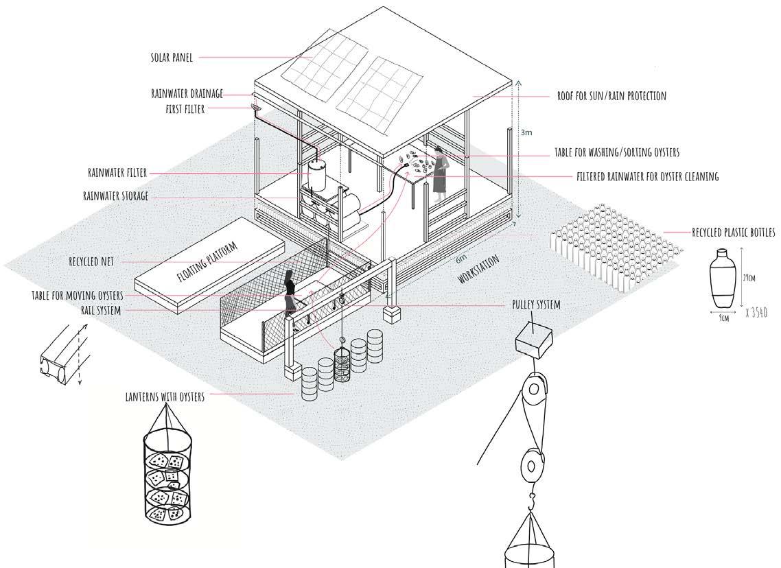
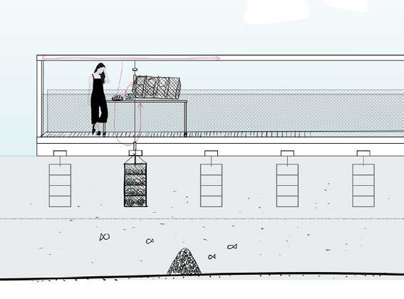
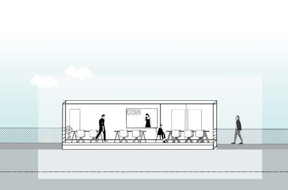
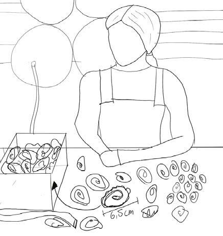
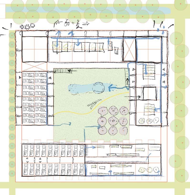
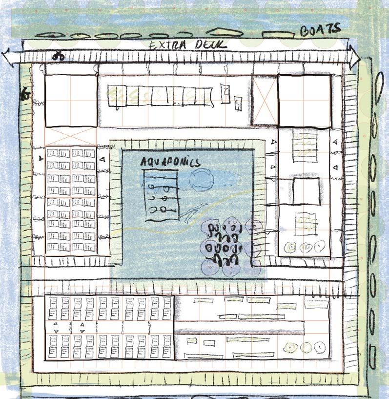
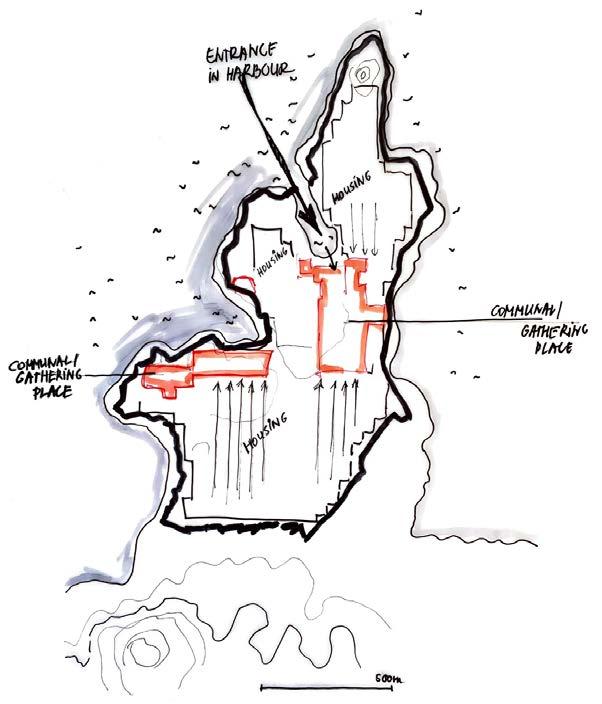
Here is the oyster sorter module. Here working women can easily clean oysters and lanterns with collected, filtered rainwater, sort them, and move back to lanterns.
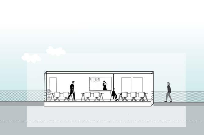

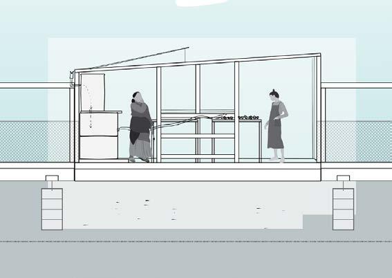
It is the new floating restaurant, where fresh oysters will be delivered. It will become a new hangout spot place for fishermen and islanders.
08:30/start of the day oyster farm platform
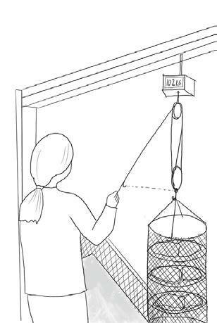
it is so much easier to lift lanterns now. I can just pull it all across the platform.

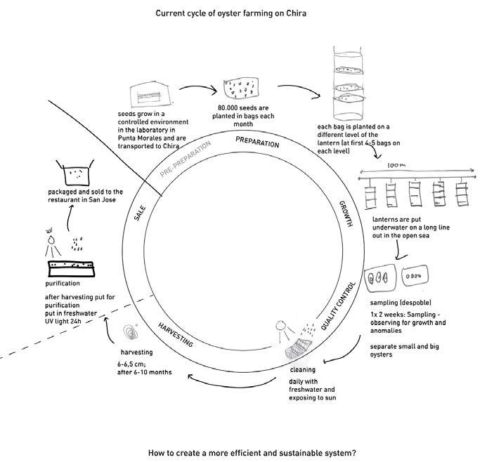
improve their lives. The biggest challenge they face is waste pollution that ends up in the Gulf of Nicoya, that contributes to an overfishing problem and fewer fish for them to catch. This is a big deal because the islanders of Chira are a strong fishing community. People are already taking action, such as implementing oyster farms around Chira, but that is just the start. In this project, I propose a design that could solve multiple related problems for Chira at the same
In this project, I have proposed a design to create a regenerative and sustainable community in Chira. I tried to use existing solutions and further enhance them as much as possible. The solution I focused on most was oyster farming, and I have improved it by proposing to make it more efficient with extra infrastructure.
Project area: island Chira, Costa Rica
Team: individual assignment
Used software:
qGis, Hand drawing, Vectorworks, SketchUp, inDesign, Photoshop, Illustrator, Morpholio
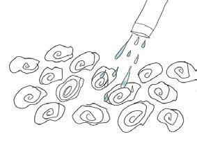
10:30 sorting/washing table at the oyster sorter
Good that i don’t have to go to the coast to wash oysters, i can do ir right away at the sorter!
12:00 - lunch break sorting/washing table
14
B-B C-C 1:50 1:100 rainwater storage sorting table filter
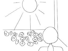
while oysters are exposed sun, i can have lunch!
bottles, nets, and discarded wood.
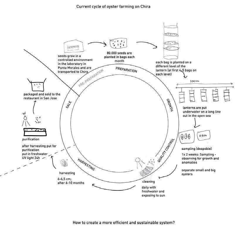
The current platform holds eight lines of 50 meters, which can produce 664 oysters per week, whereas on the old oyster farm number was 1000 oysters from the whole farm.
13:00 sorting/washing table
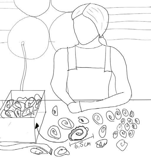
i can sort everything here and move it back on the platform quickly

15:30 sorting/washing table
16:30 restaurant
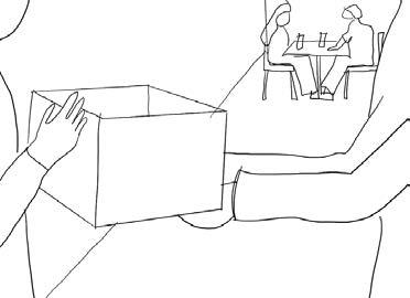
Here are freshly farmed oysters for your restaurant!
16:30 leaving work
There were times when we would start at 8 in the morning and finish after 10-12 hours. Now I am done before 5 pm!
The new farm with 5 modules can produce 3320 oysters per week, which is 3x times more than before!
Life in the improved oyster farm
15
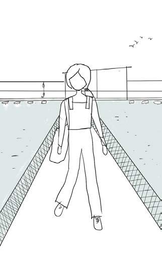
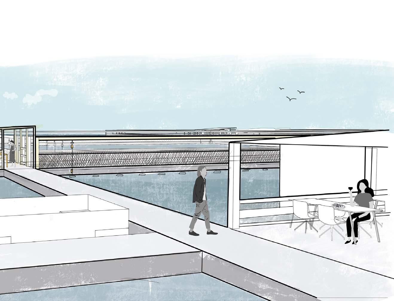
Impression of the new Oyster farm on Chira island
exposed to
16
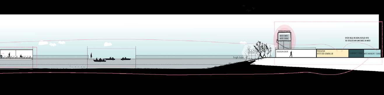
New vision for Chira island
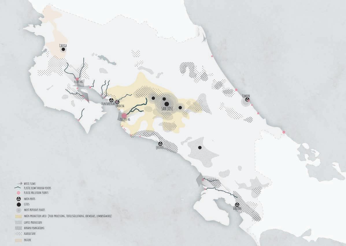
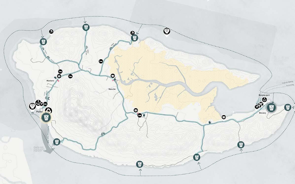
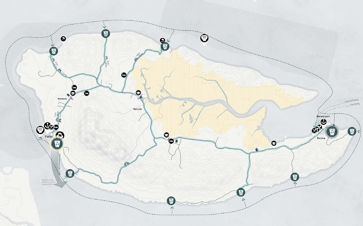
Mapping waste pollution flows in the Guf of Nicoya
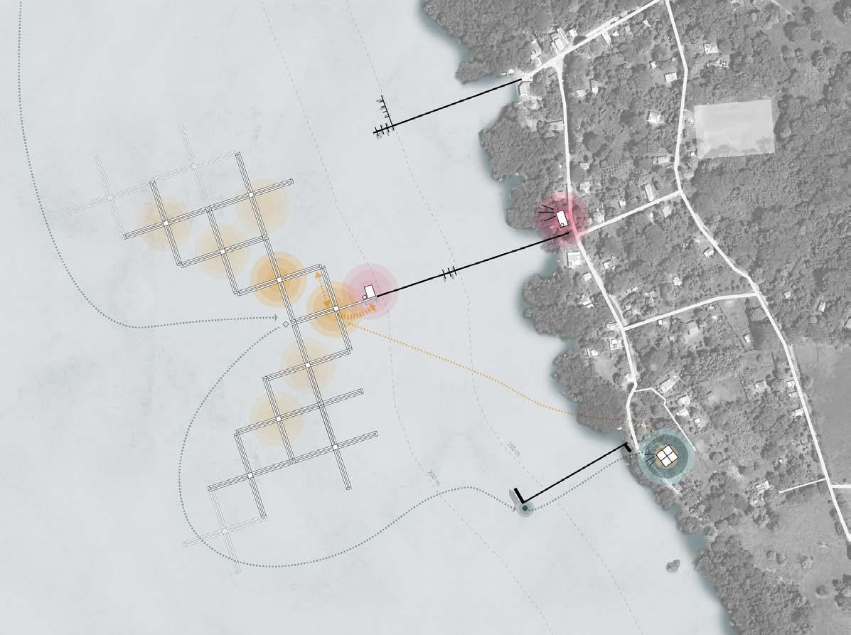
In the new oyster farm, women can do their job far more efficiently and comfortably. The new system also allows for easier expansion with a modular system where oyster farm lines for oyster nets (lanterns) and new platforms are connected. This way, they can do daily cleaning and sorting in the same place.
This new oyster farm was incorporated into the new island’s infrastructure and a newly proposed waste management system. The waste will still be coming to the island’s beaches, and islanders need to get rid of their waste at home instead of burying or burning it. In the new system, new jobs will be created because there will be people who can help collect waste at several points on the island and store it on a moving waste collector, which will eventually bring it to the sorting recycling facility. Recycled waste can be used for parts of the construction of the oyster farm platforms.

17
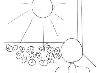
Current situation of the oyster farm
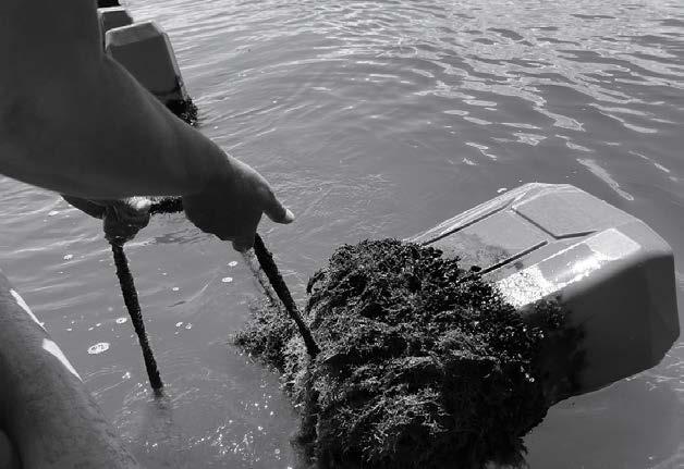
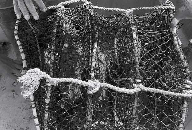
Women have to take each lantern, cleaned it on the coast and put back in water
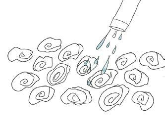
A photo of the lantern where oysters grow
Photo credit: Marija Satibaldijeva
While being one of the most biodiverse countries in the world, Costa Rica has a lot of waste pollution. It comes from the industries of Costa Rica, where agriculture and coffee plantations are. A lot of waste from inland Costa Rica ends up in the gulf of Nicoya. This affects biodiversity in water, and there are fewer fish now. Because of this, the overfishing problem rises.
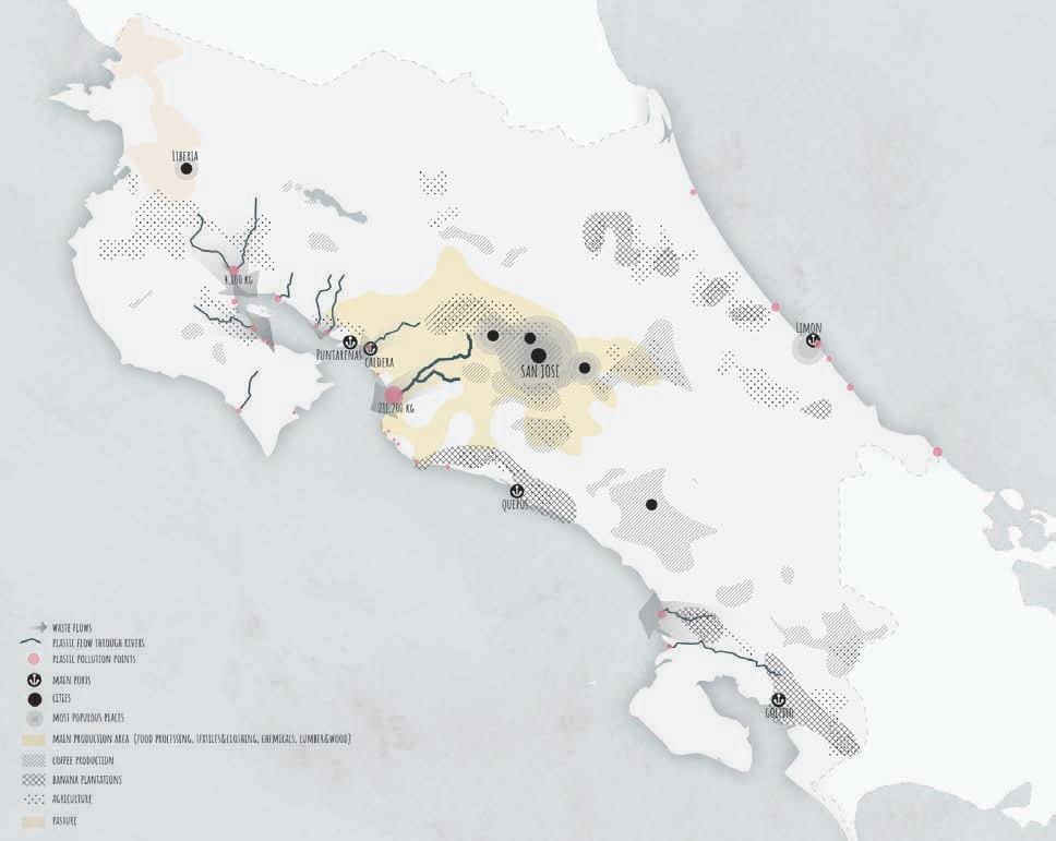
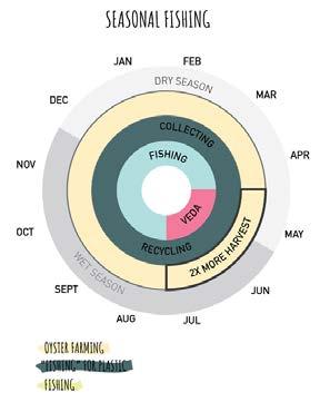
Because of the overfishing problem and the Veda season (periodic ban on fishing) in the Gulf of Nicoya, the people of Chira started implementing oyster farms. There are 12 oyster farms in Costa Rica. It is an alternative to improve water conditions where the fish population is declining.
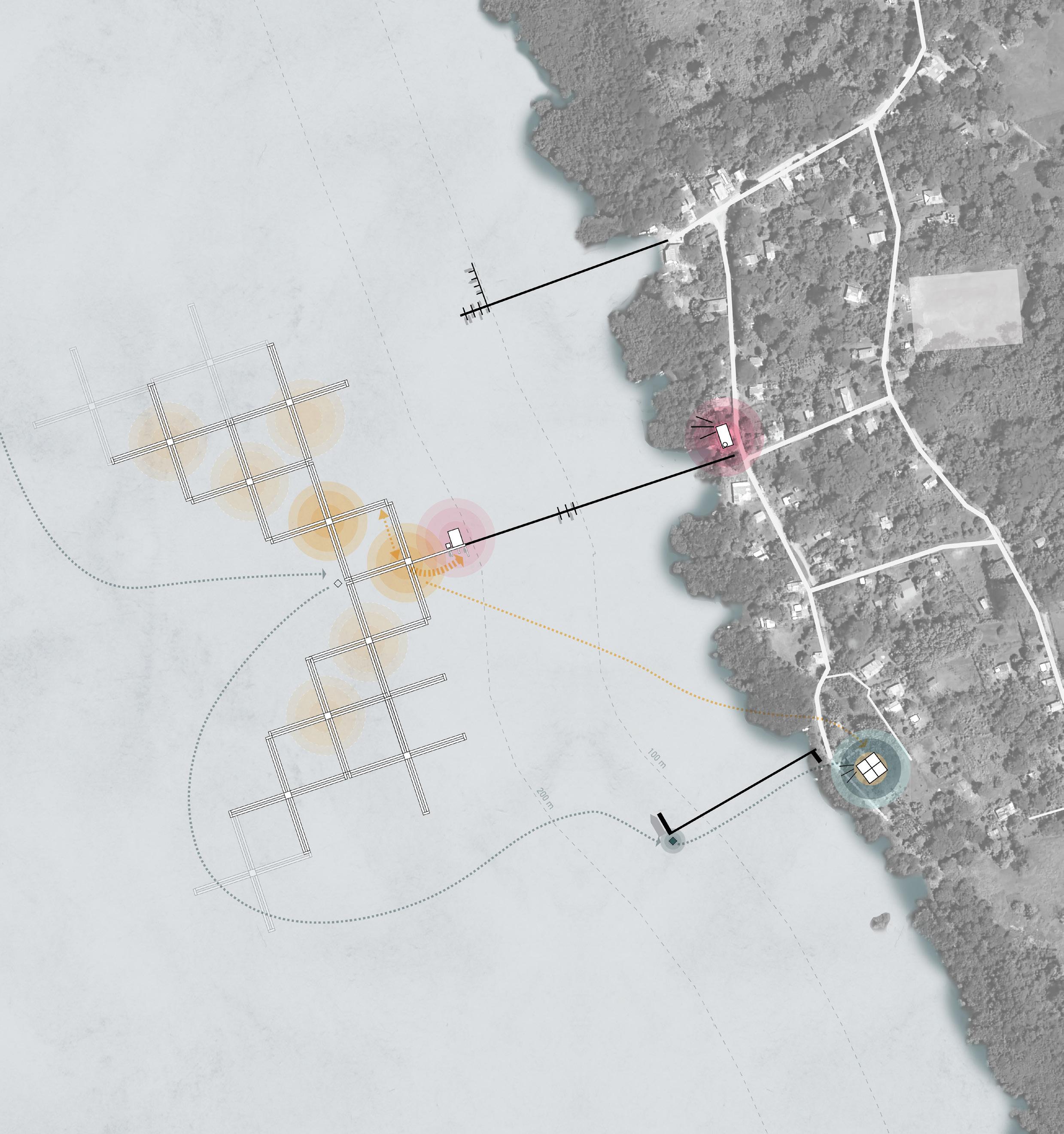
80% of 2000 Chira people are fishermen. Because of the Veda, they are affected. The new design focuses on improving oyster farms and fishing for plastic, which will help to create new job opportunities and restore ecosystems.

08:30/start oyster farm B-BC-C B-B 1:50
new floating Restaurant farm reef for fish and predators made out of used oyster shells (pro table for putting lanterns and easily move them on the table on wheels lantern floating plastic Canister pulley boat deck
is the new principle for taking out oysters, where they can be taken
is the oyster sorter module. Here working women can easily clean oysters and lanterns with collected, filtered rainwater, sort them, and move back to lanterns. Here steps OYSTER WASTE PROBLEM OVERFISHING endangers ecosystems & fishing destabilizes residents annual income
This
Here
agriculture and coffee plantations are. A lot of from inland Costa Rica ends up in the gulf of Nicoya. This affects biodiversity in water, and there fewer fish now. Because of this, the overfishing problem rises.
WASTE PROBLEM OVERFISHING
endangers ecosystems & fishing destabilizes residents annual income
80% of 2000 Chira people are fishermen. Because of the Veda, they are affected. The new design focuses on improving oyster farms and fishing for plastic, which will help to create new job opportunities and restore ecosystems.
Because of the overfishing problem and the Veda season (periodic ban on fishing) in the Gulf of Nicoya, the people of Chira started implementing farms. There are 12 oyster farms in Costa It is an alternative to improve water conditions the fish population is declining.
contributed to a cleaner island and restored ecosystems.
Because of the overfishing problem and the Veda season (periodic ban on fishing) in the Gulf of Nicoya, the people of Chira started implementing oyster farms. There are 12 oyster farms in Costa Rica. It is an alternative to improve water conditions where the fish population is declining.
3km 1:30.000
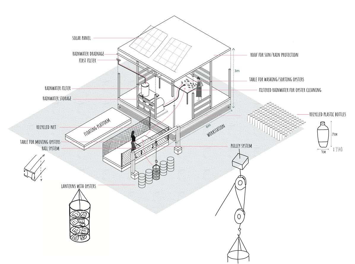
table for putting lanterns and easily move them on the table on wheels
A-A 1:50
OYSTER FARM CYCLE
floating plastic Canister pulley
1:50
A-A
reef for fish and predators made out of used oyster shells (protects oysters on farm)
This is the new principle for taking out oysters, where they can be taken out with the pulley on rails, and easily transported to the oyster sorter area.
Here you can see the system of how the oyster farm works. In the new design, all steps are the same, only done more efficiently.
B-B
1:50
lantern rainwater storage
sorting table filter
Here is the oyster sorter module. Here working women can easily clean oysters and lanterns with collected, filtered rainwater, sort them, and move back to lanterns.
It is the new floating restaurant, where fresh oysters will be delivered. It will become a new hangout spot place for fishermen and islanders.
08:30/start of the day oyster farm platform
it is so much easier to lift lanterns now. I can just pull it all across the platform.
10:30
sorting/washing table at the oyster sorter
12:00 - lunch break
sorting/washing table
Good that i don’t have to go to the coast to wash oysters, i can do ir right away at the sorter! while oysters are exposed to sun, i can have lunch!
08:30/start oyster
farming. It created new jobs for people on Chira to collect and recycle waste.
C-C
1:100
centre lab/storage storage storage
bee the change
Amsterdam Academy of Architecture
3rd year
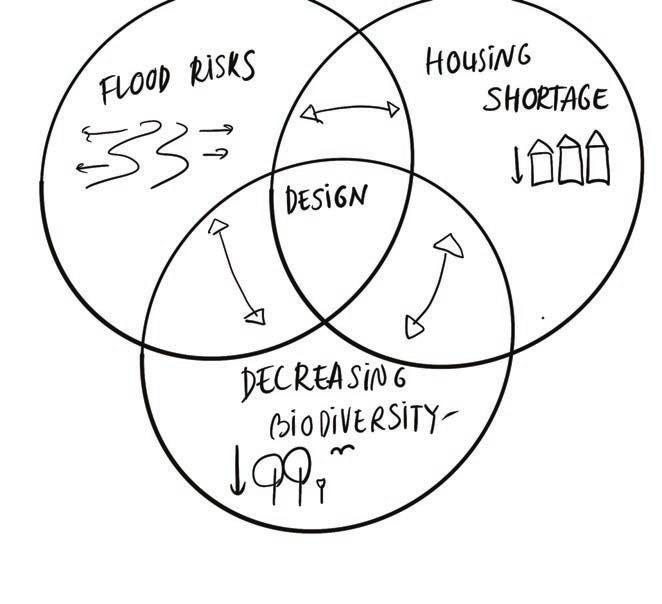
We are faced with the challenge of how to save biodiversity whilst tackling the housing shortage challenge. Biodiversity in the Netherlands is declining and one of the biggest causes is the decline of pollination. 80% of our edible crops and almost 90% of our wild plants are pollinated by bees and other insects. There are almost 360 bee species in the Netherlands and half of these are endangered. Threats to bees include land-use changes for agriculture and urbanisation, which both result in the loss and degradation of their natural habitats.
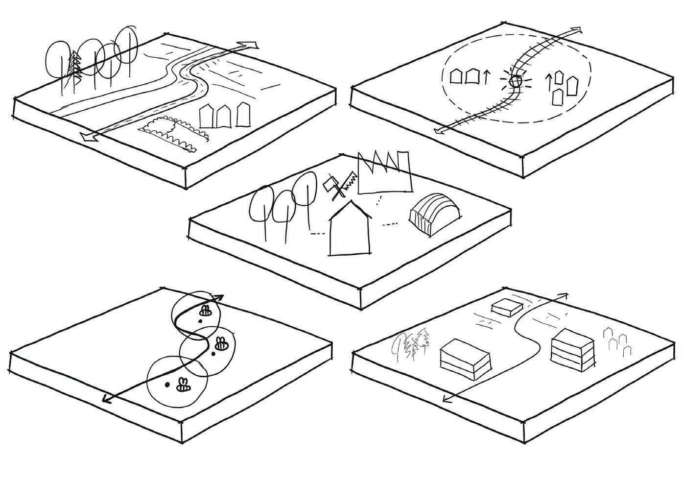
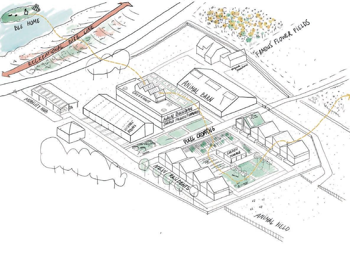
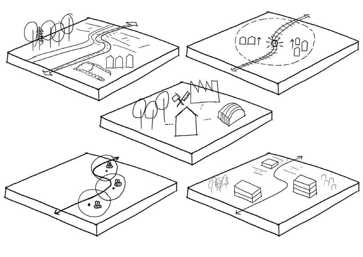
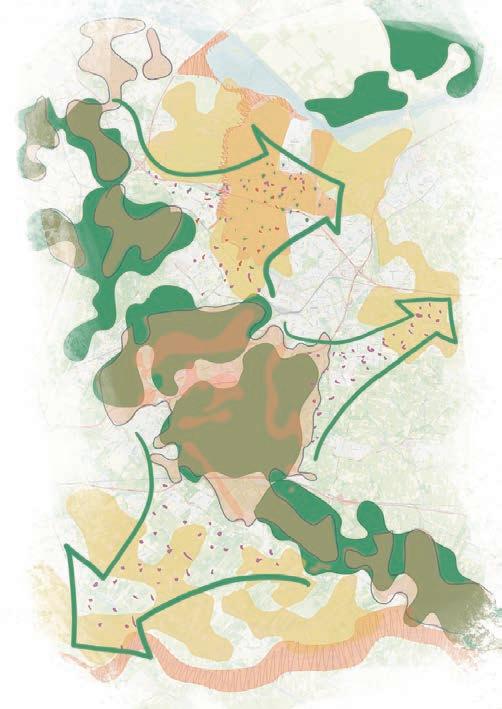
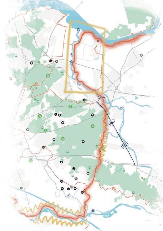
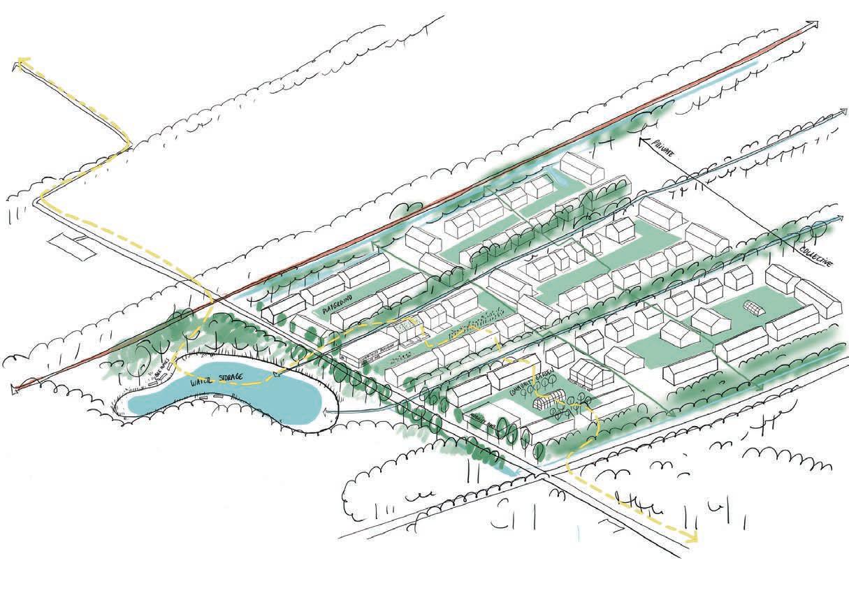
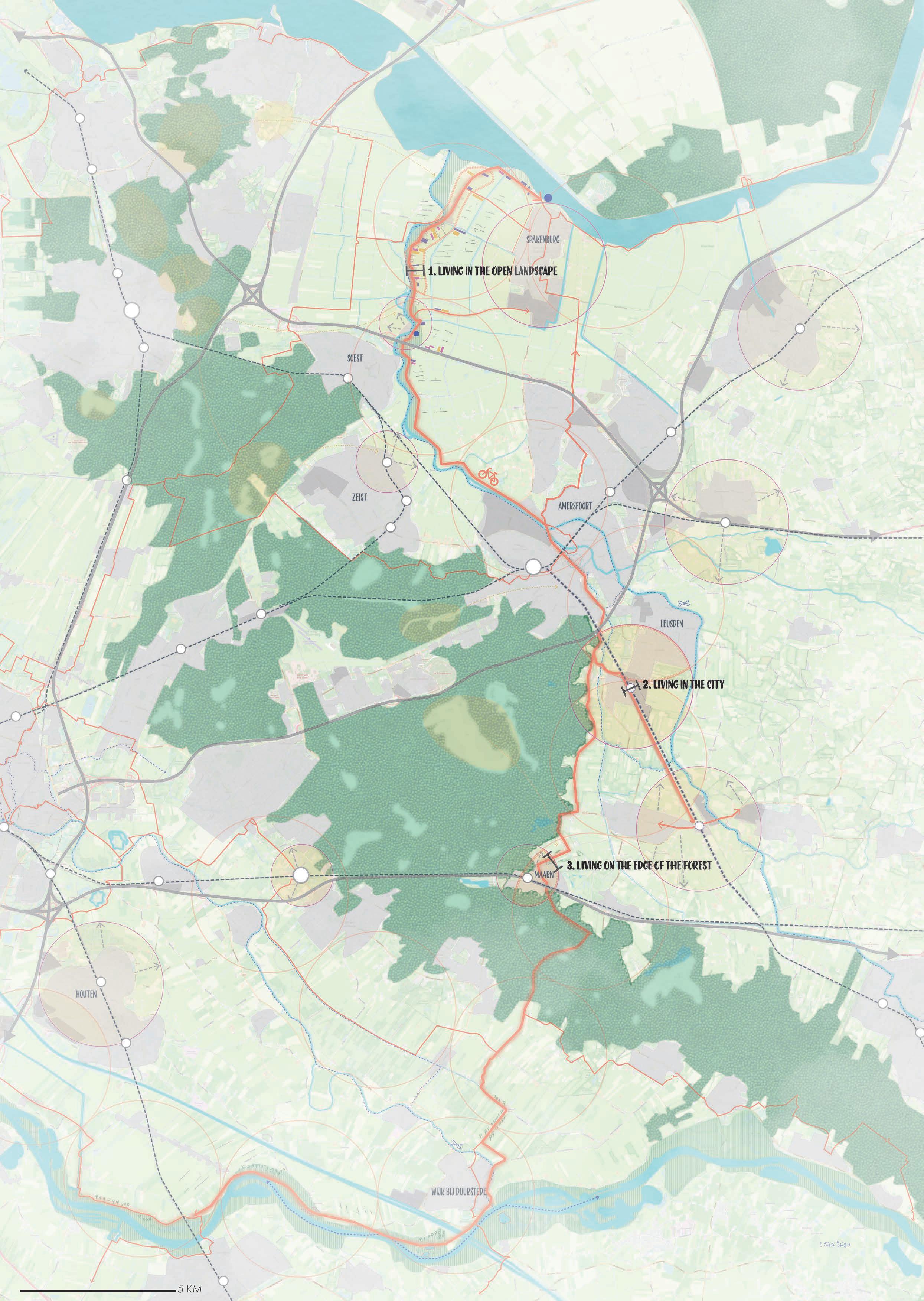
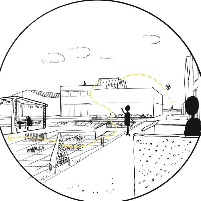
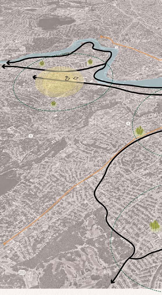
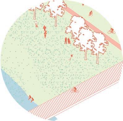
The project is about improving biodiversity by restoring bee populations around the Netherlands, with Utrechtse Heuvelrug as the starting point. Creating places for bees and humans to live in harmony. There will be a new recreational route and a range of new housing development areas. The route and these areas will also create and connect different bee foraging areas.
The route has three stop areas, each of them has its own challenges and vision:
• Promotion of slow tourism;
New way of building within cities.
• Expansion next to the edge of forests.
Project area: Utrechtse Heuvelrug, The Netherlands
Team: individual assignment
20
MAIN QUESTION:
HOW CAN WE INCREASE BIODIVERSITY BY INTEGRATING HABITATS FOR BEES AND HUMANS?
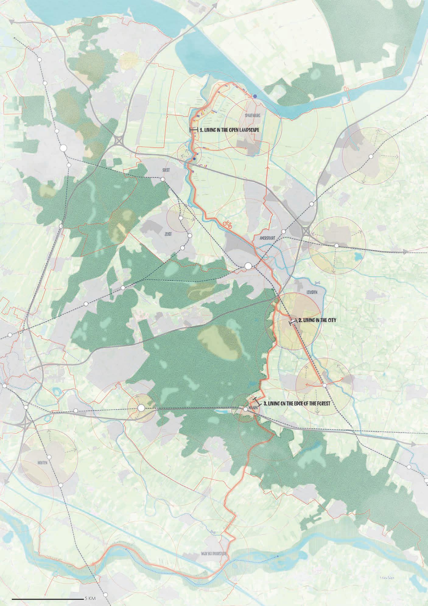
Regional strategy for the Utrecthse Heuvelrug area

to see the whole project scan
the qr code:


new developments within 2 km range from
22 Heuvelrug

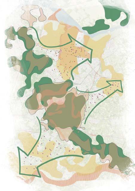
The improved biodiversity will hep to tackle flood risk and drought stress issues as well
least bee species
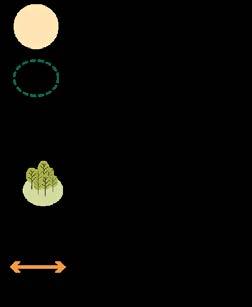
current suitable habitats for bees
flood risk areas
drought stress areas proposed network of habitats for bees
least bee species
least bee species
current suitable habitats for bees
flood risk areas
current suitable habitats for bees
flood risk areas
drought stress areas proposed network of habitats for bees
drought stress areas proposed network of habitats for bees

The improved biodiversity will hep to tackle flood risk and drought stress issues as well

flooding open area without attractions
currentlyno attractions
bees forage in 5km circles and offer different honeys
The recreational route will be improved with the new destinations in the area
different altitudes: different densites
bees forage in 5km circles and offer different different altitudes: different densites
within 2 km range from bees forage in 5km circles honeys
24 new developments within 2 km range from
3. living on 2. living in the
city
3. living on the edge of the forest
to see the whole project scan the qr code:

25 bees forage in 5km circles and offer different honeys
from left to right: Principles of the 3 areas
Impression of living in the landscape
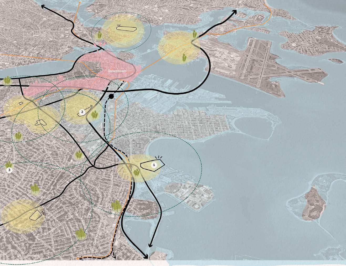
CLIMATE HAVEN
Amsterdam Academy of Architecture
3rd year
Climate Haven is an urban project in Boston transforming parking lots and empty spaces into green havens for vulnerable communities affected by climate change. It aims to accommodate climate refugees, vulnerable groups, and community workers, while addressing rising sea levels and droughts.
The project’s focus on adaptation rather than escape recognizes the pressing reality of rising sea levels and persistent droughts. With a modular and grid system, essential facilities and amenities are strategically located to meet residents’ basic needs, fostering self-sufficiency and community resilience. The project promotes community cohesion, fostering a sense of belonging and shared responsibility.
The Bayside parking lot will serve as a test site. To achieve the project’s goals, Climate Haven will establish a robust infrastructure network, connecting residents to the public transit system. Additionally, measures will be taken to protect waterfront areas and manage water systems effectively.
Ultimately, Climate Haven is a beacon of hope, showing how innovative urban design can create thriving communities in the midst of climate change.
Project area: Boston, MA, USA
Team: individual assignment
Used software:
qGis, Hand drawing, Vectorworks, SketchUp, inDesign, Photoshop, Illustrator, Morpholio
A neighbourhood designed to provide residents with a safe, sustainable, and inclusive living environment in the face of climate change.
26
1.
2. In the existing context
Parks to escape heat + productive forest
27
Adapting to the climate challenges instead of escaping to a safer place.
On the available space
3. On parking lots For climate refugees For all Bostonians Climate Haven
People are forced to move to safer places due to the climate change
Boston statistics
Project climate change issues
Heat stress Rising water level Housing crisis source: Guardian source: Bloomberg

Climate Haven current area: 11,7 ha
living units: 5750 units
living: 75%
working/facilities: 25%
28 AXONOMETRIC
low income 115,600 38,000 units 17,9% housing shortage
29
STANDARD SCENARIO BLOCK EXAMPLE EXREME SCENARIO BLOCK EXAMPLE
block: 350 units
30 CROSS SECTION: STANDARD SCENARIO 2070 CROSS SECTION: EXTREME SCENARIO 2070 when flooded +3m 2070 STANDARD
VS. EXTREME SCENARIO
THE GUILD
Amsterdam Academy of Architecture
2nd year
The site has a rich history of the dutch landscape typology. It was originally water, and then became land as a form of polder.
The riverfront of the IJ has been industrialized for the past 100 years (if not more) and exploited for naval industry and transportation. Today, it fades away with the emerging and urgent need for housing. It appears that city is growing to a larger scale compared to the industry sector, which enables new urban typologies on the old waterfront.
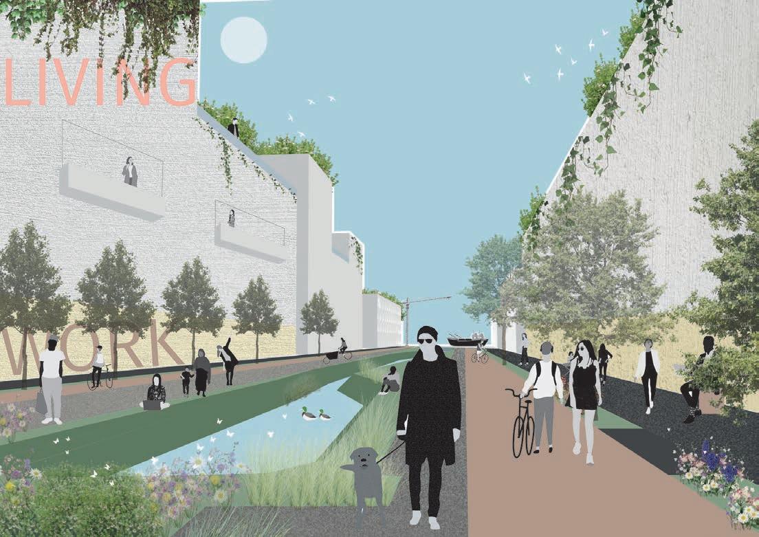
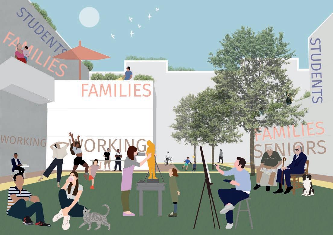
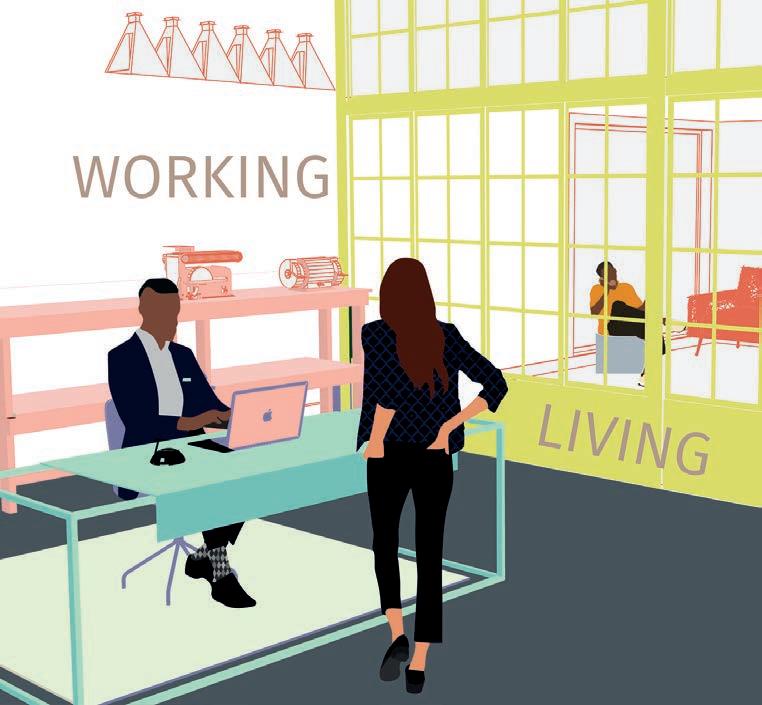
The site has already a strong industry sector that could be a hub for many possible future jobs, but the spaces lacks the quality to become a quality space. It lacks greenery and diversity of program to make out of this land a productive place. A place that has constant movement and growth as well as stimulation. In order to prevent it from becoming a ghost town, a successful approach would involve maintaining a balance between work and living spaces, as observed in previous projects. This strategy contributes to the development of a thriving neighborhood that, ideally, is selfsufficient or, at the very least, fosters selfemployment opportunities.
THE GUILD - a living
MANIFESTO
THE GUILD - The traditional working community. The connectivity between creatives and business owners of a same and different career to creat productive and concious industry.
THE VILLAGE - A place for living and sharing, community space and heritage where living and production meet.
THE POLDER - The rescue of the lanscape heritage of the polder as a connection to the waterfront and the site
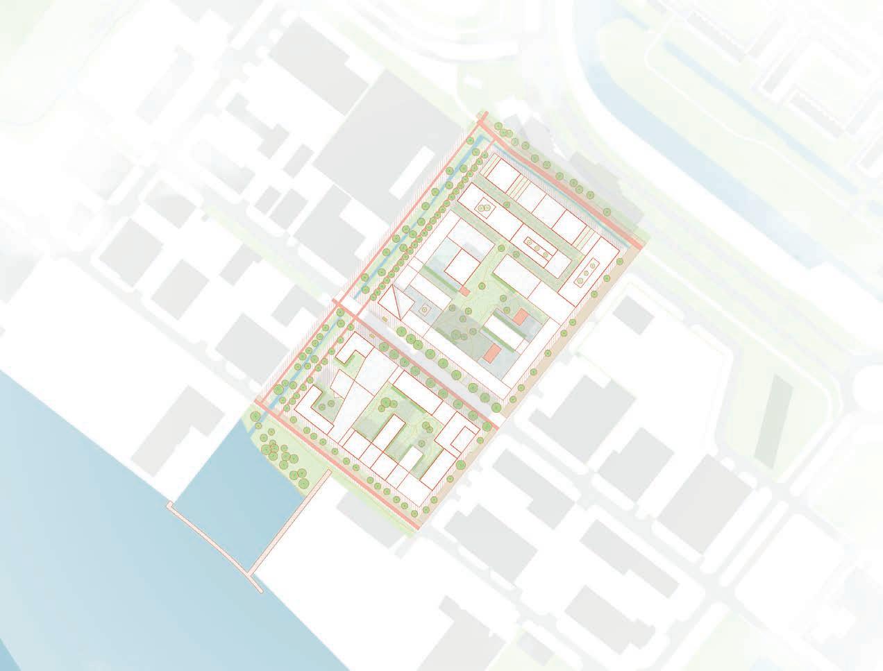
Project area:
Amsterdam Noord, the Netherlands
Team: with Fabia Sainz Fernandez
Used software:
32
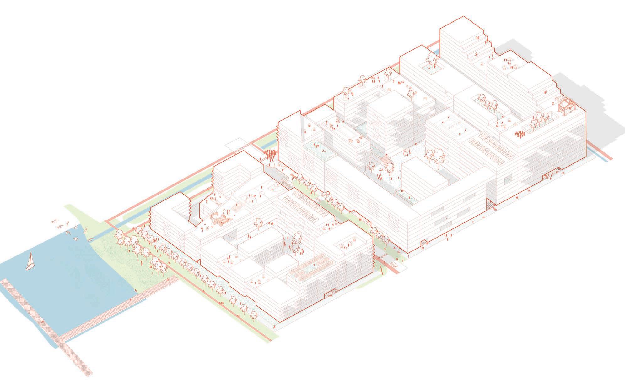
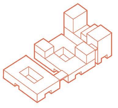
AXONOMETRIC
living learning cycle in community
Axonometric view of the area
A vernacular landscape typology. land as a form The riverfront 100 years (if transportation. urgent need larger scale new urban typologies Productivity sector that could the spaces lacks lacks greenery land a productive and growth a ghost town, previous projects that could be Scale. AS well Human and


33
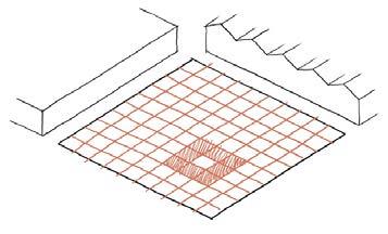
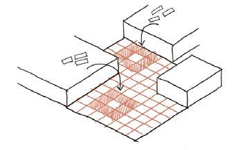
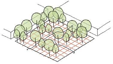
VOLUME PRINCIPLES VERNACULAR low-rise AREA STATISTICS AREA: 56.169m2 GROUND LEVEL: 23.847 m2 BUILT AREA: 235909,8 m2 FAR: 4,2 LIVING: 68% WORKING: 32%
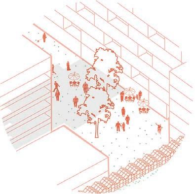
34 Masterpan Functions in the area Legend Startups/ light production Catering industry Retail First need facilities Grocery store Community library Coffee place Bakery Cafe Bus hub Entrance of the parking Offices Legend Highest rooftops Courtyard Deck Private gardens Private terraces Public green Dunes Rooftop Cycling path Car road Sidewalk Path Deck Bus stop Shared street
Human and urban scale must have an equal consideration. space and openness for future growth or desires.
VOLUME PRINCIPLES OF THE AREA


VERNACULAR SYSTEM


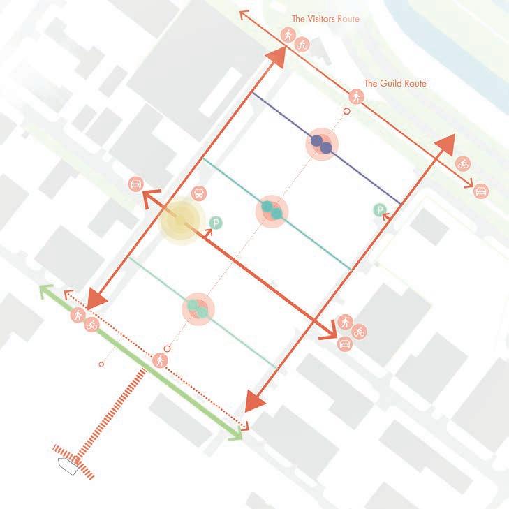


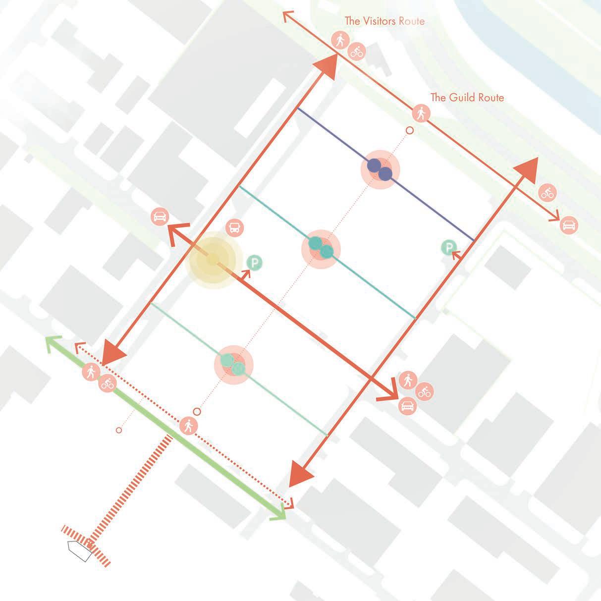
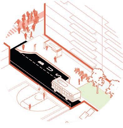
35 Cross section of the project Volume principles of the area Pedestrian/bike Cars Bus Stop/connection to other sites Access to the underground parking Boat access Public nod Community nod High density - towers Medium density - guild Low density - village Polder Legend
High density - towers Medium density - guild Low density - village Legend 36m=12 layers 130m 30m 85m 54m=18 layers middle-rise low-rise high-rise 15m=5 layers Dune structure Polder structure
36
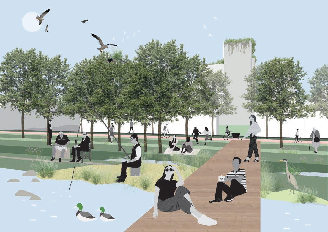
Polder park collage Avenue collage
37
Guild community collage
Working
and Living principle collage
EXTRA CURRICULUM
Sketching/layering method
I enjoy analysing various places by sketching over the plans, and in this way I understand the places, cities more in-depth by looking at their urban fabric and different aspects.
38
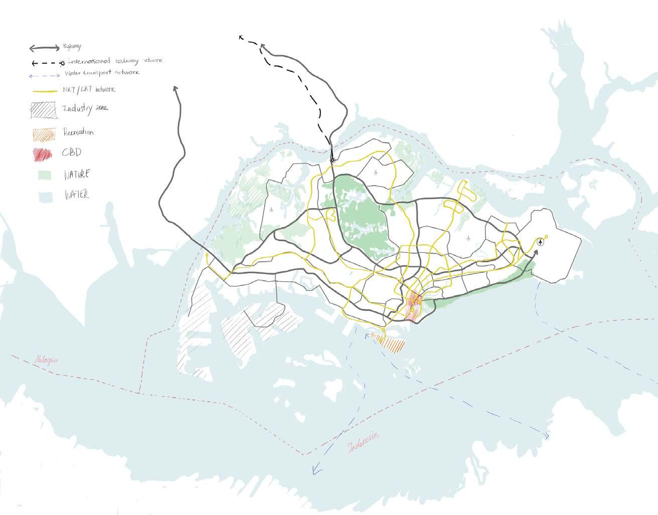
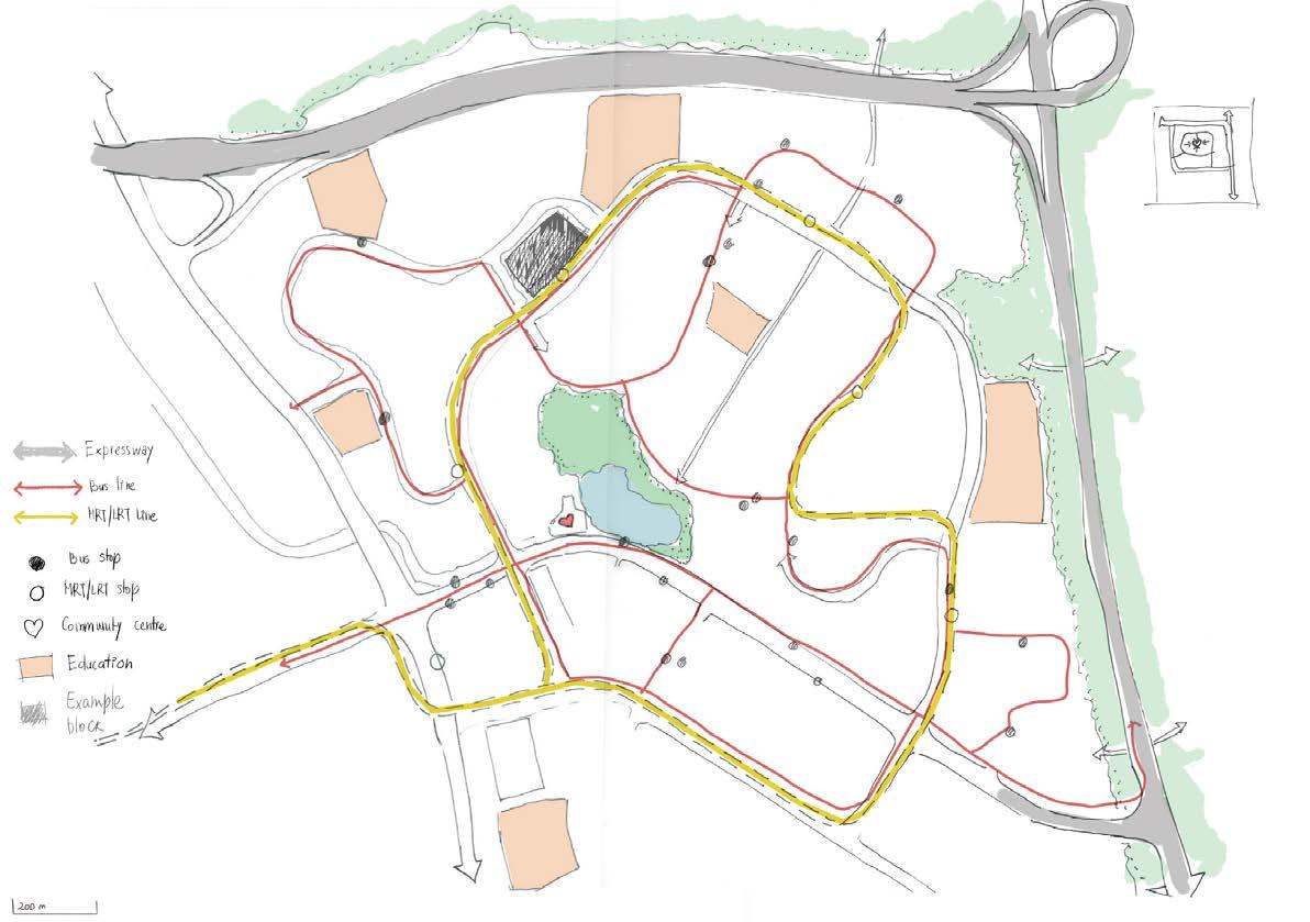
Infrastructure analysis of Singapoure
39
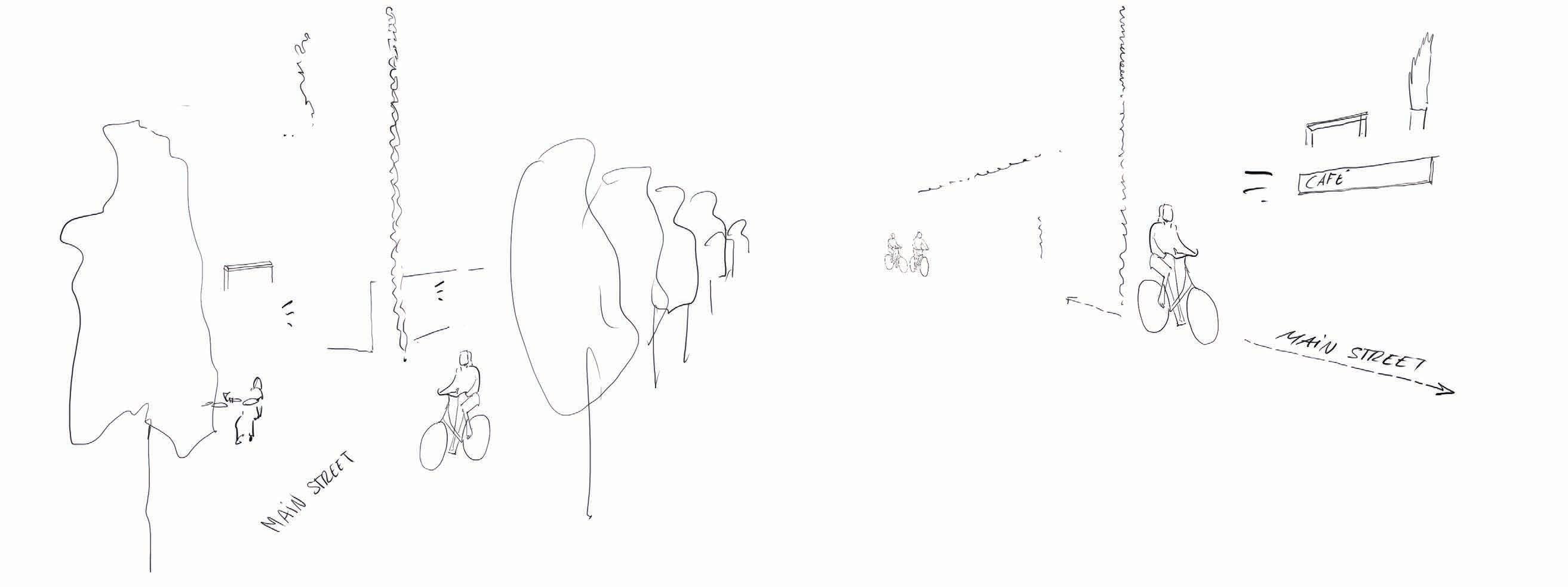
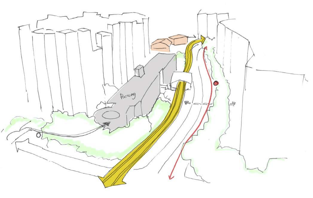
Quick sketch impression of the loop system
Analysis of Bukit Panjang area’s loop system
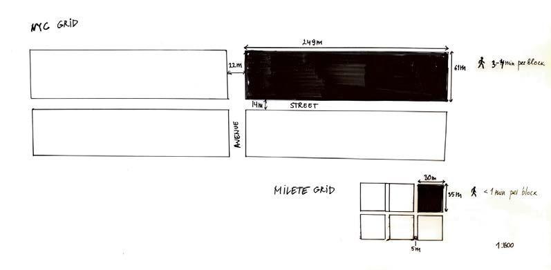
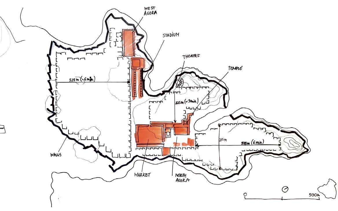
40 Urban analysis of ancient city Miletus
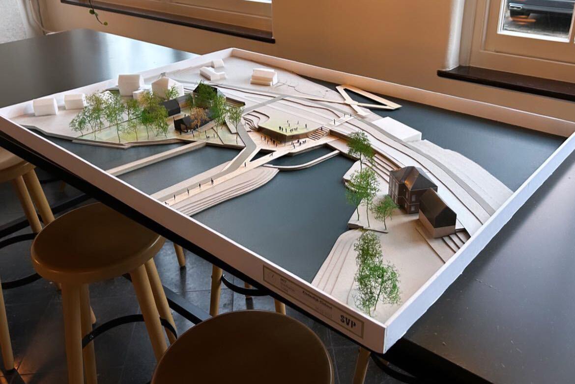
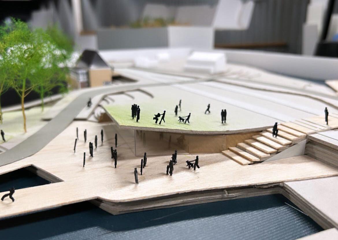
41 A maquette made by me for the project at SVP
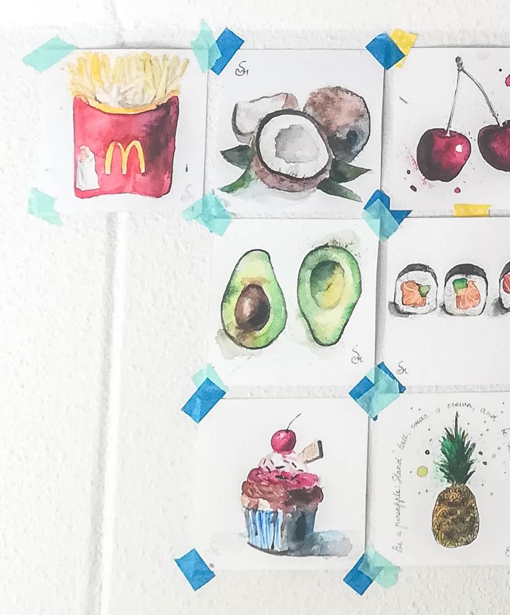
PERSONAL CREATIONS
Art as a hobby
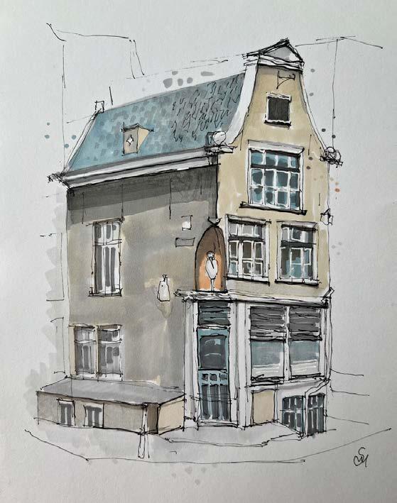
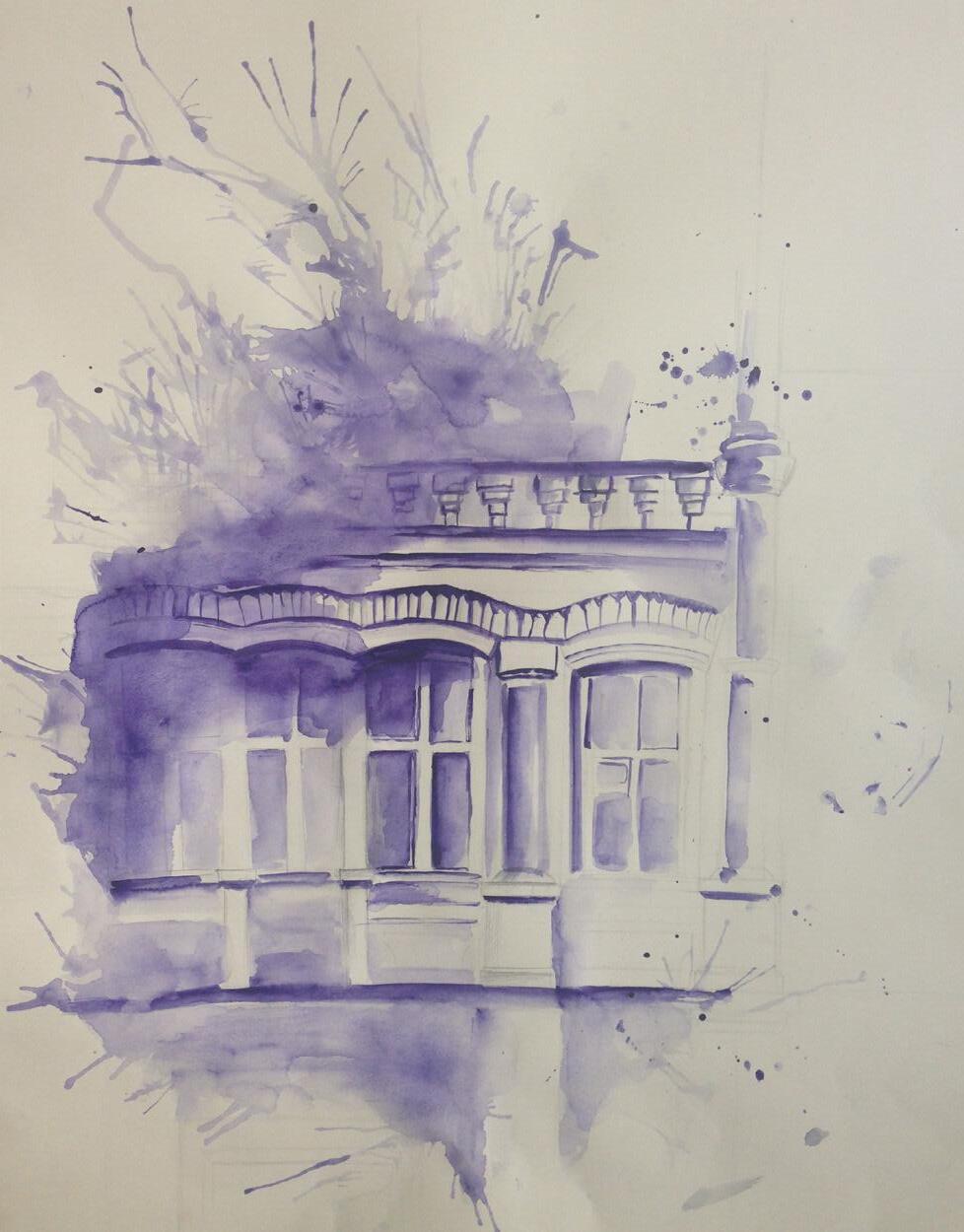
As art has always been my passion, I sometimes draw in my free time. After I got into University and started my studies pursuing in Urbanism, I try to sketch buildings as much as possible and I like to experiment.
42
Quick sketch of the building in Amsterdam
Spontaneous capture of details during a sketching walk
43
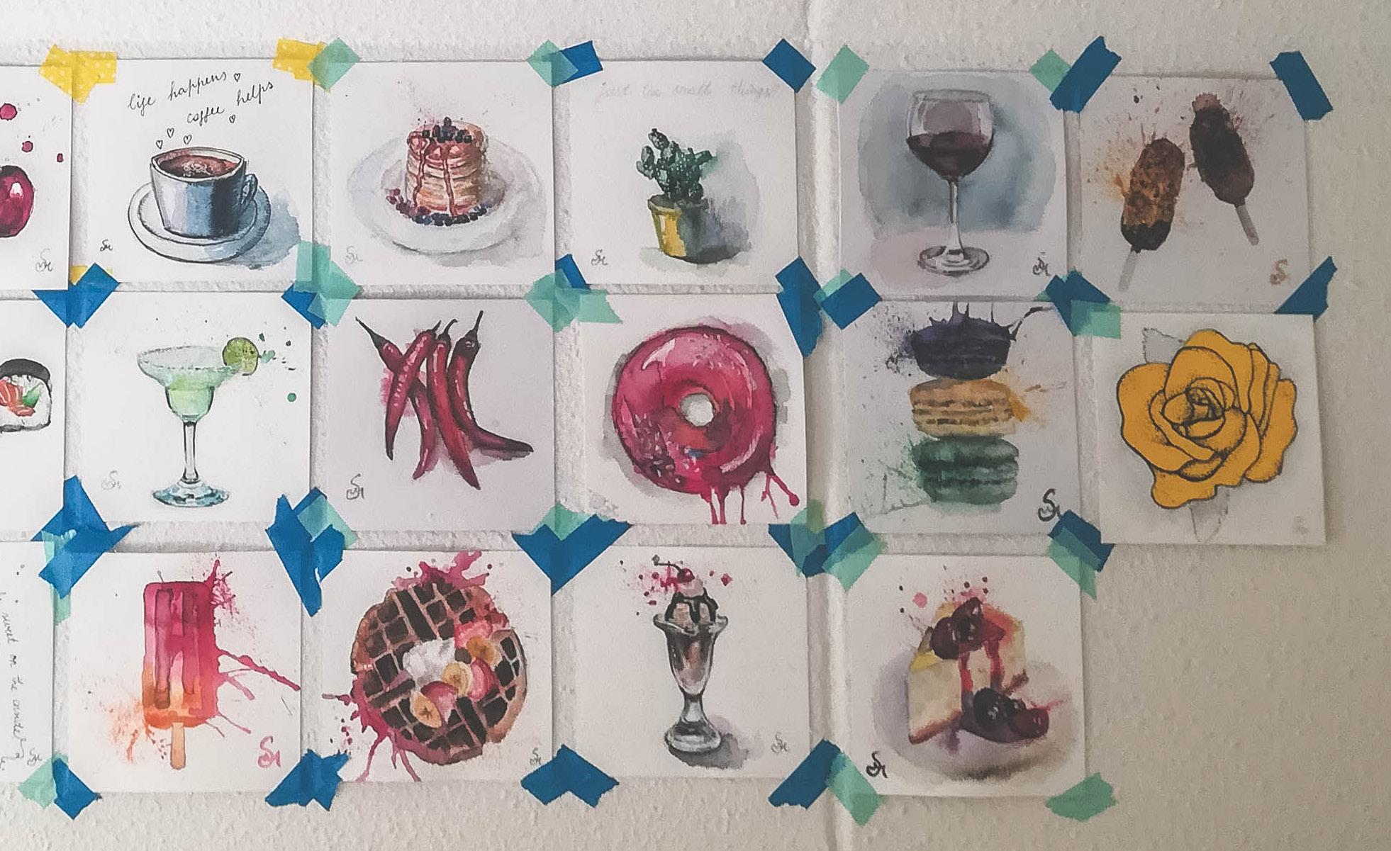
Drawings of the food series
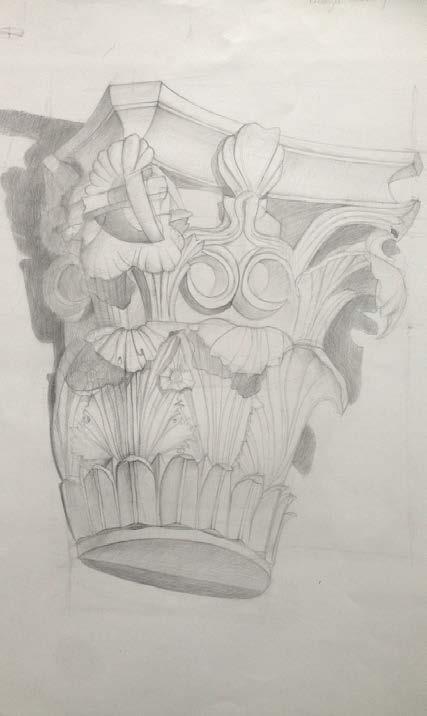
A drawing of the corinthian column details
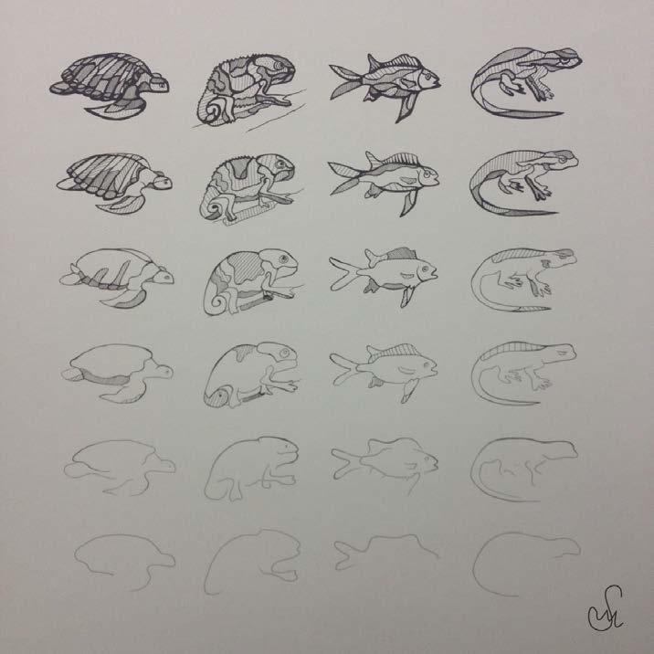
Illustration of stylized animals
www.linkedin.com/in/marija-satibaldijeva
m.satibaldijeva@gmail.com
+31619741873
© 2023 Marija Satibaldijeva ALL RIGHTS RESERVED
