Nature Plan
2025-2035
We acknowledge the Wurundjeri Woi Wurrung and Bunurong peoples of the Kulin Nation as the Traditional Custodians and true sovereigns of these lands. We acknowledge and respect the contribution of all First Nations people who live, work and play within the City of Maribyrnong.
We pay our respects to ancestors and Elders, past and present and acknowledge their continued custodianship of Country. We honour their unique cultural and spiritual relationships to the land, sky, water and sea. We acknowledge Aboriginal and Torres Strait Islander culture as the oldest continuous living culture in the world.
Thank You
Maribyrnong City Council wishes to express its gratitude to the following dedicated nature-based volunteer organisations within the City of Maribyrnong:
The Friends of Cruickshank Park, the Friends of Maribyrnong Valley, the Friends of Newell’s Paddock, the Friends of Stony Creek, the Friends of Braybrook Park, the Friends of Joseph Road, the Footscray Rubbish Runners, the Maribyrnong River Rubbish Club and Love Our Street Yarraville.
We appreciate the significant contribution you have made to the protection and improvement of nature through the provision of your time, expertise, advocacy and passion. Your initiatives, whether it be weeding, tree planting, rubbish collection, securing funding for conservation works, public art, organising community events, undertaking citizen science or providing environmental education, have made a tangible difference to the City’s nature.
Cover photograph: Taken along the Maribyrnong River in Maidstone by Daniel Miller (Practical Ecology).
Maribyrnong City Council would like to recognise Daniel for their invaluable work on this plan and Visionary Creative for the beautiful illustrations and graphics.
1.1 The Importance of Nature 8 1.2 Caring for Country 9
Purpose 10 2. Legislative and Policy Context 12
Legislation 12
Council policy 14 3. The City’s Nature in the Past 16
3.1
City’s Nature Now 25
Monitoring, Evaluation, Reporting and Improvement (MERI) 43
Definitions
Australian Native: Species that would not have occurred in the City of Maribyrnong or the State of Victoria prior to colonisation, but are indigenous to other areas of Australia.
Biodiversity/nature: All living thing are part of biodiversity: the number and variety of plants, animals and other living things, including fungi and micro-organisms, across our land, rivers, coast and ocean. For this document, the words ‘nature’ and ‘biodiversity’ are interchangeable, and mostly refer to indigenous biodiversity values. (Similar terms include ‘the environment’, ‘flora and fauna’ and ‘Country’.)
Conservation: Activities and principles which protect flora, fauna and their habitats.
Exotic/introduced: Flora and fauna species that do not naturally occur within Australia (i.e. its natural range is in other countries/continents).
Fauna/wildlife: Animals (can be indigenous or non-indigenous).
Flora: Plants (can be indigenous or non-indigenous ).
Habitat: The variety of living and non-living parts of an area (i.e. vegetation, water, rocks, logs etc.) that provide the resources needed to support plant and animal species.
Indigenous: Flora or fauna species that naturally occur in a particular area, which is more specific than native. In this document, indigenous flora and fauna are the plants and animals that naturally occur in the City of Maribyrnong.
Threatened Species: A species of flora or fauna that has been determined by either the State or Federal governments to be threatened, and is therefore listed under relevant environmental protection Acts (such as the EPBC Act or FFG Act).
Migratory Species: Fauna listed as migratory under the EPBC Act or protected through international agreements, including the Bonn Convention (Convention on the Conservation of Migratory Species of Wild Animals – CMS), the Japan–Australia Migratory Bird Agreement (JAMBA), the China–Australia Migratory Bird Agreement (CAMBA), and the Republic of Korea–Australia Migratory Bird Agreement (ROKAMBA).
Naturally regenerated vegetation: Vegetation in areas which were cleared in the past, where some of the original plant species have come back. These plants could have come back through seed that was stored in the soil and regrown, or that was blown in from nearby vegetation. These areas are often different from the original/remnant vegetation in that they only have a few of the species that would have occurred in the past, usually have high cover of weeds, and mostly occur in areas where the natural soil profiles have been substantially changed/disturbed.
Nature: See ‘biodiversity’ definition.
Remnant vegetation: Vegetation that has remained since prior to colonisation/was never cleared. Such vegetation may be disturbed/invaded by weeds, but still contains most of/the main original plant species. In some cases, some of the original plants may also be present, such as old Eucalypt trees.
Riparian vegetation: Vegetation that occurs along waterways (rivers/creeks).
Traditional Owner: First Nations, Aboriginal and Torres Strait Islander individuals or groups. In this document, ‘Traditional Owner’ refers to the two formally recognised Traditional Owner groups that are connected to land associated with City of Maribyrnong: Wurundjeri Woi Wurrung and Bunurong peoples of the Kulin Nation. They are represented by the Wurundjeri Woi Wurrung Cultural Heritage Aboriginal Corporation and the Bunurong Land Council Aboriginal Corporation, respectively.
Vegetation: Groupings of a variety of plant species that grow in a defined area, because of the area’s climate, topography, soils, and other factors.
Victorian Native: Species that would not have occurred in the City of Maribyrnong prior to colonisation, but are indigenous to other areas of Victoria.
Weed: The definition of a ‘weed’ varies depending on context. The general definition of a weed is ‘a plant in the wrong place’. This could be an exotic plant species in a natural reserve, or a plant of any origin in a garden where it is not desired. In this document, weed mainly means a plant species that is invasive and would not naturally occur in the local area.
1. INTRODUCTION
1.1 The Importance of Nature
There are many reasons people value nature, from the belief that it has an innate right to exist, through to recognising the usefulness of nature to us. Nature provides us with food, drinking water, connection to Country, and building and manufacturing materials.
Locally, nature improves air and water quality, provides cooling and shading, habitat for wildlife, pollination, erosion protection and places for rest and recreation. Recent studies have even shown that being in nature decreases depression, anxiety, and stress rates.
Based on a recent Council survey, the City’s residents enjoy nature in several ways: relaxation, exercise, dog walking, commuting, birdwatching, and taking part in conservation activities. The locations most appreciated by residents occurred along the Mirrangbamurn/Maribyrnong River and Stony Creek, as well as several urban parks.
When asked why they value nature, residents said:
“Without nature we are nothing. We need to do a lot more to repair damage of generations. If we want to be healthy we need to connect and make nature a part of our everyday lives”;
“To see the sky, green trees, adds to quality of life and keeps us human”; and
“Protecting our environment is the most crucial thing we need to do for future of everyone and everything”.
Respondents highlighted a need to protect and enhance biodiversity by planting more trees, particularly on Council land, and considering nature in all Council decision-making. This plan includes actions that address these and other challenges to biodiversity in the City.
1.2 Caring for Country
This Nature Plan recognises that the City’s nature (including that which was present prior to colonisation and what we see today) is of high importance to its Traditional Owners, the Bunurong and Wurundjeri Woi Wurrung peoples of the Kulin Nation, who have lived on and carefully managed the land for tens of thousands of years. This Nature Plan also recognises that biodiversity management that is led and informed by Traditional Owners results in improved outcomes, both for nature and the community. Because of this, Caring for Country principles have been used to guide the development of this plan.
Caring for Country can be described as “stewardship values for land and sea environments which are deeply embedded in Aboriginal culture. It is the possession of, the sense of responsibility for and the inherent right to manage one’s Country in a way that is ecologically, socially, culturally and economically sustainable. The assertion of Aboriginal rights to remain on Country and to Care for Country is not simply an act of entitlement, rather it is a deep loyalty to fulfilling the responsibilities to Country that have been handed down through generations for tens of thousands of years.”1
In preparing this plan, Maribyrnong City Council met with representatives of Bunurong Land Council Aboriginal Corporation and Wurundjeri Woi Wurrung Cultural Heritage Aboriginal Corporation. Discussions included opportunities for integrating Caring for Country principles into the conservation and restoration of nature within the City, including:
• The importance of restoring Country through the protection of remnant vegetation, revegetation with indigenous plant species and, where possible, supporting natural regeneration. This is the regeneration of indigenous plant seeds stored in the soil, which will often occur after weed control/fire.
• Restoration of waterways through protection from further pollution and the reintroduction of important riparian features such as wetlands, pools and frog bogs that have been removed postcolonisation.
• Protection of indigenous fauna, including birds, from introduced pest animal species, such as rabbits and foxes.
• Using traditional Woi Wurrung names for natural features, such as Mirrangbamurn (Maribyrnong River) and incorporating these and Traditional Owner history, cultural values and stories into interpretive signage.
• Supporting existing practices such as cultural burns in grasslands, providing access to natural resources used for food and other cultural practices, and fostering and encouraging an ongoing connection to Country.
There was also an agreement that establishing stronger relationships, through more regular contact and building trust, would provide a good foundation for ongoing conservation and restoration of nature.
This document aims to integrate these Caring for Country pathways into the purpose, guiding principles and actions detailed throughout the document.
1 Monash University and the City of Melbourne, Caring for Country: An Urban Application - The possibilities for Melbourne (2016).
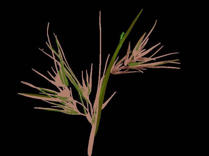
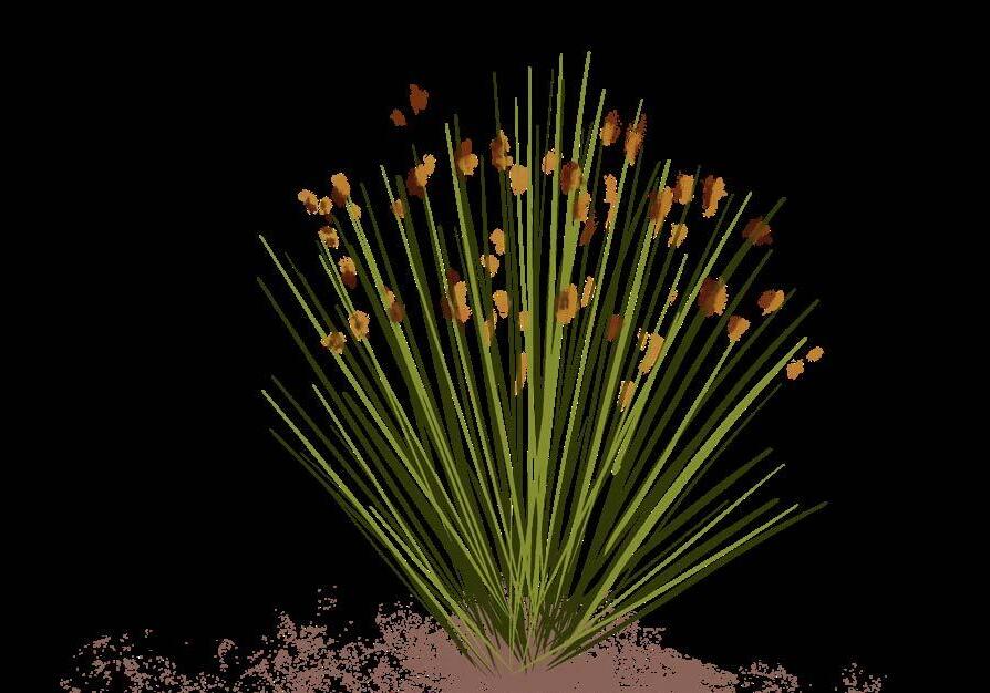
Kangaroo Grass
Purpose
“Climate change and biodiversity loss are twin crises that should be tackled together. Conserving, managing, and restoring ecosystems are key to success.” 2
Human consumption is the main driver of biodiversity loss globally, with over a million species at risk of extinction. If action is not taken to preserve existing natural spaces and restore nature, all life on earth including humans, are at risk of destruction.
This plan aims to stop and reverse biodiversity loss within the City by conserving, managing, and restoring nature. It seeks to guide Council land management decisions towards positive outcomes for indigenous plants and wildlife across the City. Working together with Traditional Owners to utilise traditional ecological knowledge in combination with standard land management approaches is vital to healing Country and the communities’ relationship to it.
United Nations Environmental Program, Tackling Climate Change and Biodiversity Loss Together, 2020, accessed January 22, 2025. https://www.unep-wcmc.org /en/news/tackling-climate-change-andbiodiversity-loss-together


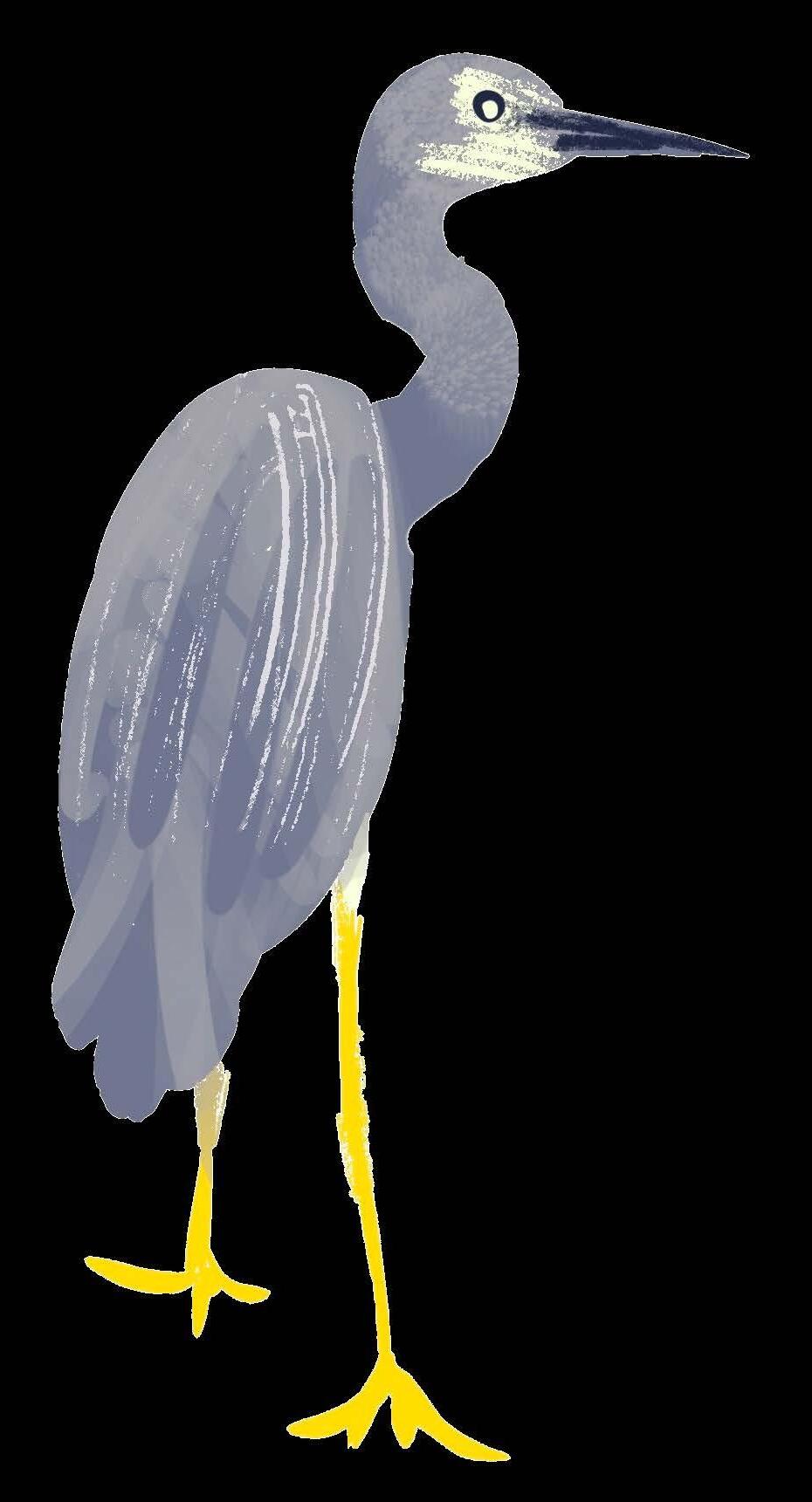
White-faced Heron
The City of Maribyrnong supports a healthy and connected environment, where plants and animals are conserved, managed and restored. Traditional Owners continue to care for Country and the community interacts with and appreciates nature.
The City is a place where all people connect with and are stewards of nature as the health of one affects the health of all.

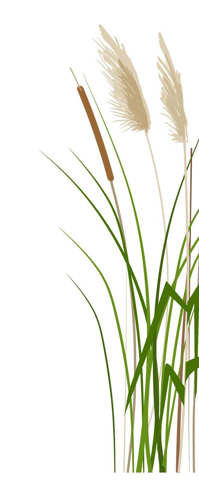


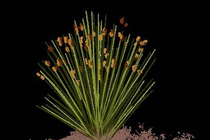
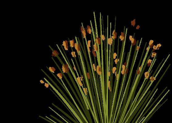
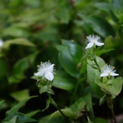
Narrow-leaved Cumbungi
Common Reed
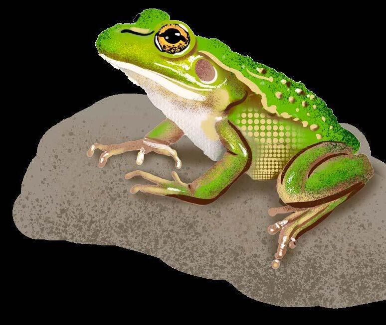
Growling Grass Frog
2. LEGISLATIVE AND POLICY CONTEXT
This Nature Plan exists in the context of several International, Federal, State, and Council policies, Acts, and strategies, with those of particular relevance to this document referenced below.
2.1 Legislation
Relevance to Nature Plan Policy and Legislation
Protection of native flora and fauna, including wildlife welfare and the regulation of potential threats.
Waterways – protection and management of waterways, wetlands, estuaries, and fishing practices within.
• Climate Change Act 2017 (Vic)
• Environment Protection and Biodiversity Conservation Act 1999 (EPBC Act) (Federal)
• Flora and Fauna Guarantee Act 1998 (FFG Act) (Vic)
• Catchment and Land Protection Act 1994 (CaLP Act) (Vic)
• Wildlife Act 1975 (Vic)
• Australian Weeds Strategy 2017-2027 (Federal)
• Australia’s Strategy for Nature 2019-2030 (Federal)
• Protecting Victoria’s Environment – Biodiversity 2037 (Vic)
• Fisheries Act 1995 (Vic)
• Water Act 1989 (Vic)
• Healthy Waterways Strategy 2018-2028 (Greater Melbourne)
• Waterways of the West Action Plan 2021-2026 (within Greater Melbourne)
• Maribyrnong River Valley Design Guidelines 2010 (within Greater Melbourne)
• Maribyrnong Catchment Integrated Water Management Plan (within Greater Melbourne)
Recognition, protection and empowerment of Traditional Owners in relation to their cultural heritage, land rights and access to natural resources.
• Traditional Owner Settlement Act 2010 (Vic)
• Aboriginal Heritage Act 2006 (Vic)
• Water is Life – Traditional Owner Access to Water Roadmap 2022 (Vic)
River Red-gum
Relevance to Nature Plan
Land use management and regulation, including the sustainable use and conservation of natural areas.
Protection of migratory species, in particular birds, that travel between Australia and other countries. This includes habitat conservation and international cooperation.
International frameworks with common objectives around environmental protection, sustainability and global cooperation.
Policy and Legislation
• Planning and Environment Act 1987 (Vic)
• Crown Land (Reserves) Act 1978 (Vic)
• Land Act 1958 (Vic)
• China- Japan- and Republic of Korea-Australia Migratory Bird Agreements (CAMBA, JAMBA and ROKAMBA) (International)
• Convention of the Conservation of Migratory Species of Wild Animals (CMS) (International)
• 2030 Agenda for Sustainable Development, United Nations (International)
• Convention on Biological Diversity (CBD), United Nations (International)
• United Nations Framework Convention on Climate Change (UNFCCC) (International)
Pale Rush
2.2 Council policy
The Nature Plan is a key element towards achieving Council’s community vision of “a sustainable, vibrant city where history is acknowledged, differences are respected, and diverse communities are supported to connect and thrive.”
It is to be considered and implemented alongside other relevant Council policies such as the Open Space Strategy, Domestic Animal Management Plan, Integrated Water Management Plan, Urban Forest Strategy, Reconciliation Action Plan, Heritage Strategy and Climate Emergency Strategy.
These existing policies contain biodiversity related actions (refer to Appendix 3), the delivery of which will be critical to achieving the Nature Plan’s purpose.
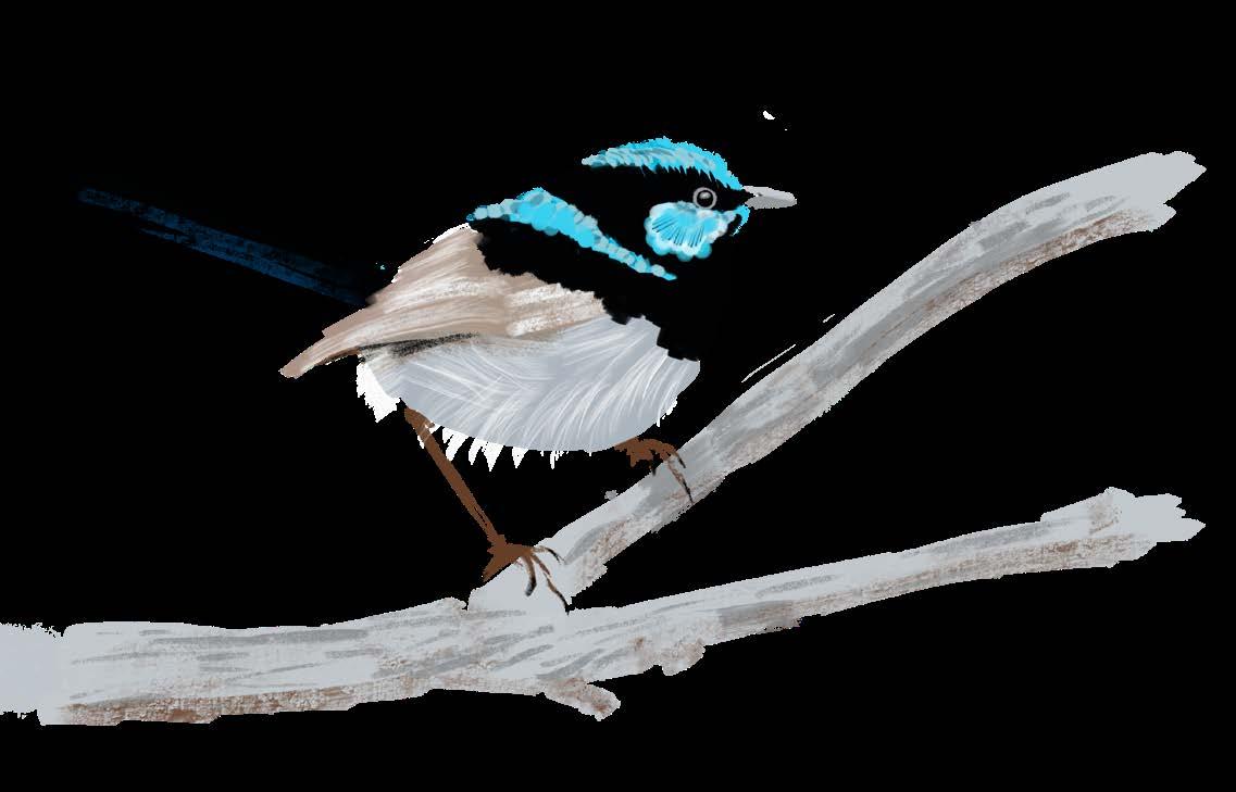
Superb Fairy-wren
Community vision
A sustainable, vibrant city where history is acknowledged, differences are respected, and diverse communities are supported to connect and thrive.
Strategic objectives
Thriving Community
Related themes considered in the nature plan
Relevant council policies
Greening Health & Wellbeing Reconciliation Resiliency Sustainability
• Air Quality Improvement Plan 2022-2027
• Maribyrnong Planning Scheme
• Open Space Strategy 2014-2031
• Urban Forest Strategy 2018-2028
• Towards Zero Waste Strategy 2019-2030
• Reconciliation Action Plan 2020-2022
• Climate Emergency Strategy 2020-2025
• Domestic Animal Management Plan 2026-2029
• Climate Emergency Action Plan 2021-2025
• Integrated Water Management Plan 2023-2033
• Heritage Strategy 2024-2034
• Nature Strip Planting Policy and Guidelines 2025
• Significant Tree Policy and Register 2021
3. THE CITY’S NATURE IN THE PAST
Prior to colonisation, the City was home to a diversity of vegetation which created habitats for a wide variety of flora and fauna. Three main vegetation types dominated: Plains Grasslands and Woodlands, Riparian Woodlands and Shrublands, and Estuarine Flats, as detailed below and shown on Map 1.
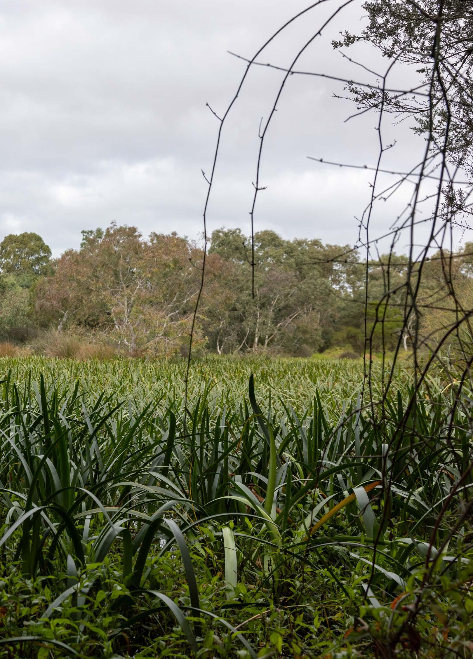
3.1 Plains Grasslands and Woodlands
Throughout most of the City, Plains Grasslands and Woodlands dominated (Map 1). These were open, grassy areas with relatively sparse trees and shrubs (Figure 2). The most common trees would have been River Red-gum, and likely some Wattles and Sheoaks, with the occasional shrub. Lowergrowing plants were dominated by a wide variety of grasses, many wildflowers and orchids.
Some of the most common plants and animals in Plains Grasslands and Woodlands that were likely to have been within the City prior to colonisation are shown in Figure 3.
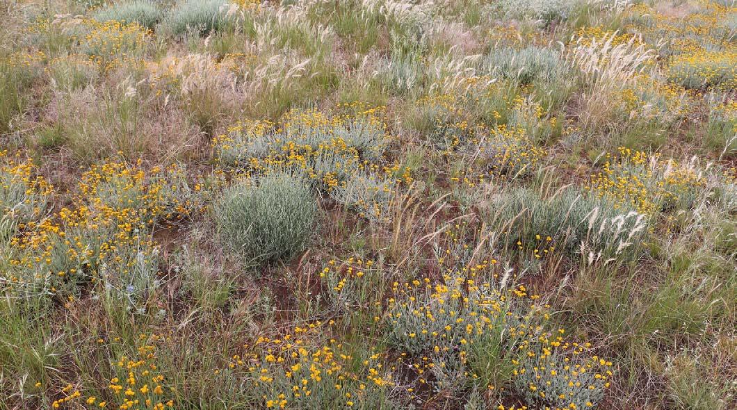
Figure 2. An example of a Plains Grassland to the west of the City in Derrimut. Photograph by Colleen Miller.
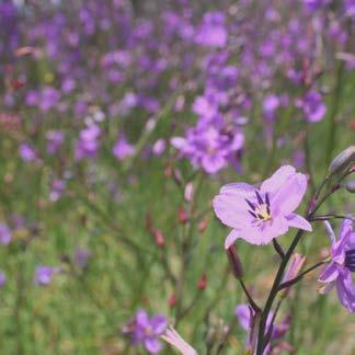
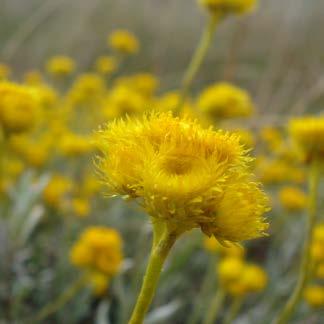
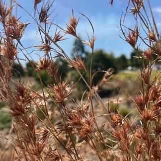
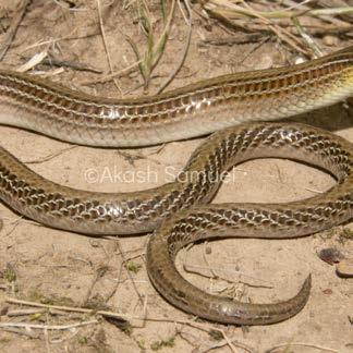
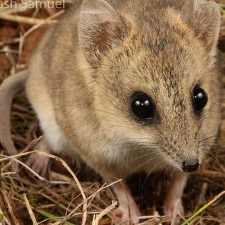
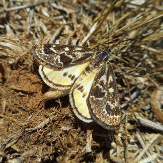
Figure 3. Common plants and animals that were likely to be found in Plains Grassland prior to colonisation.
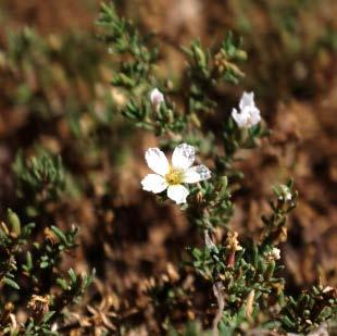
Chocolate Lily
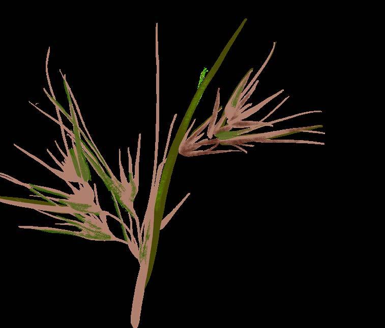
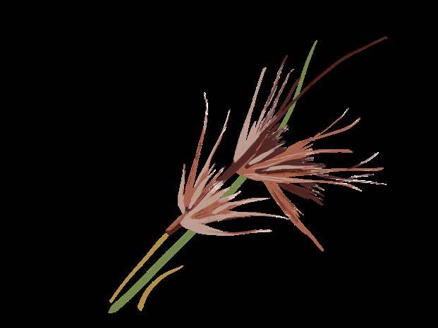
Common Everlasting Kangaroo Grass (Arthropodium strictum) (Chrysocephalum apiculatum) (Themeda triandra)
Steve Sinclair
Steve Sinclair
Heather Graham
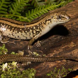
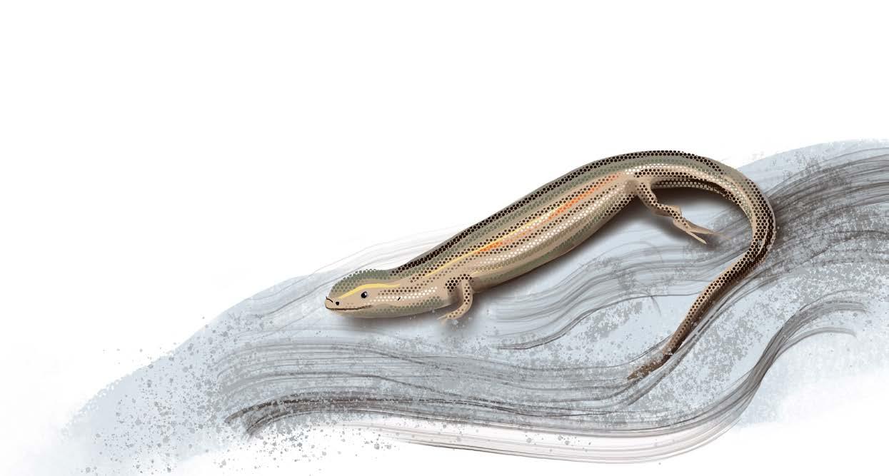
Striped Legless Lizard
Fat-tailed Dunnart
Golden Sun Moth (Delma impar) (Sminthopsisc rassicaudata) (Synemonp Jana)
Akash Samuel
Akash Samuel
Steve Sinclair
MAP 1: PRE-COLONISATION HABITATS
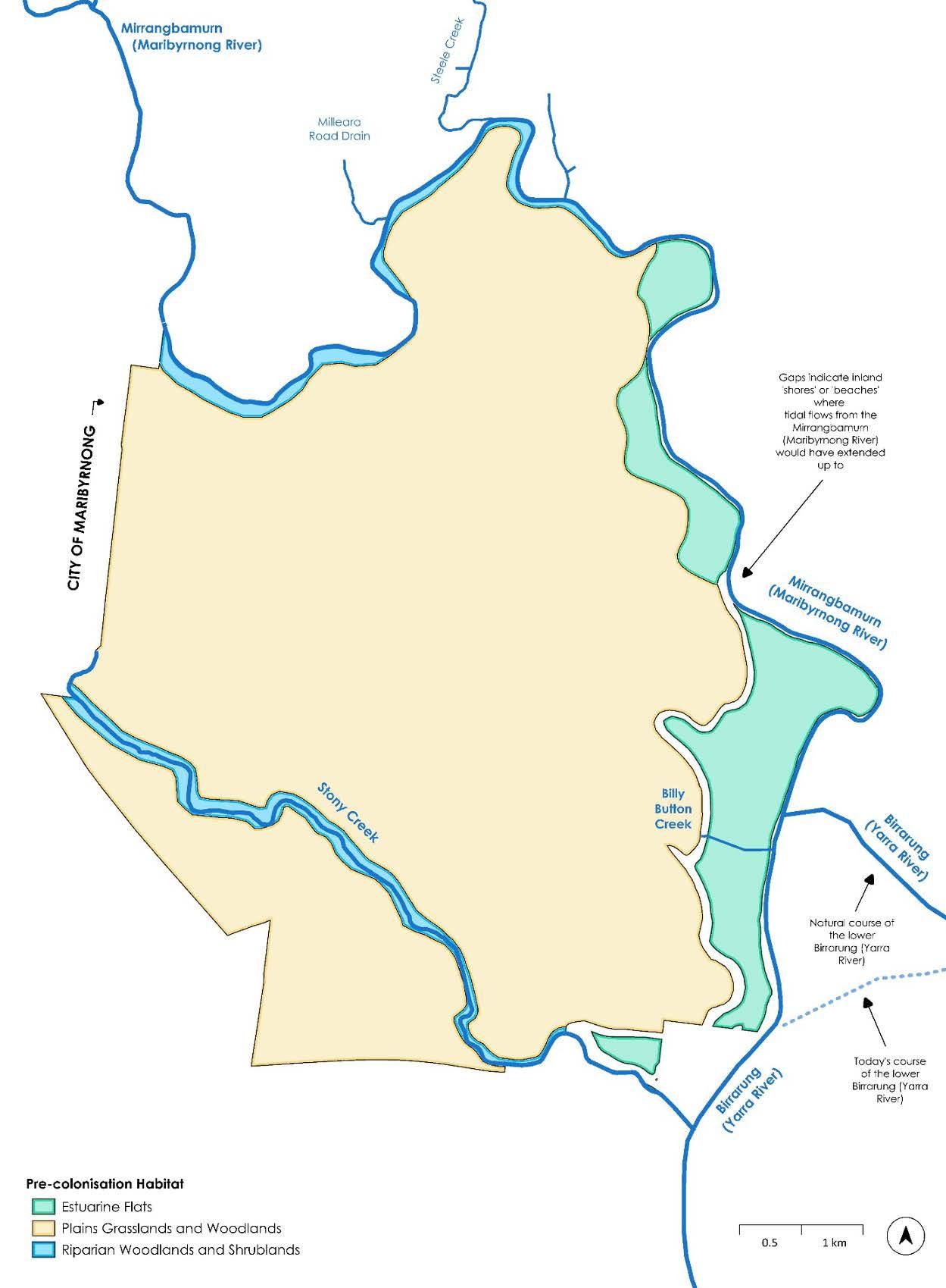
3.2 Riparian Woodlands and Shrublands
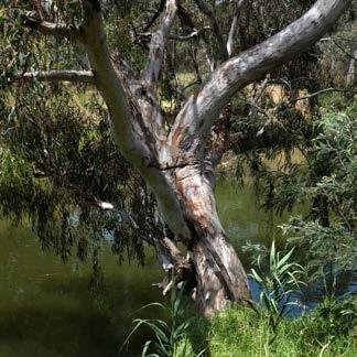
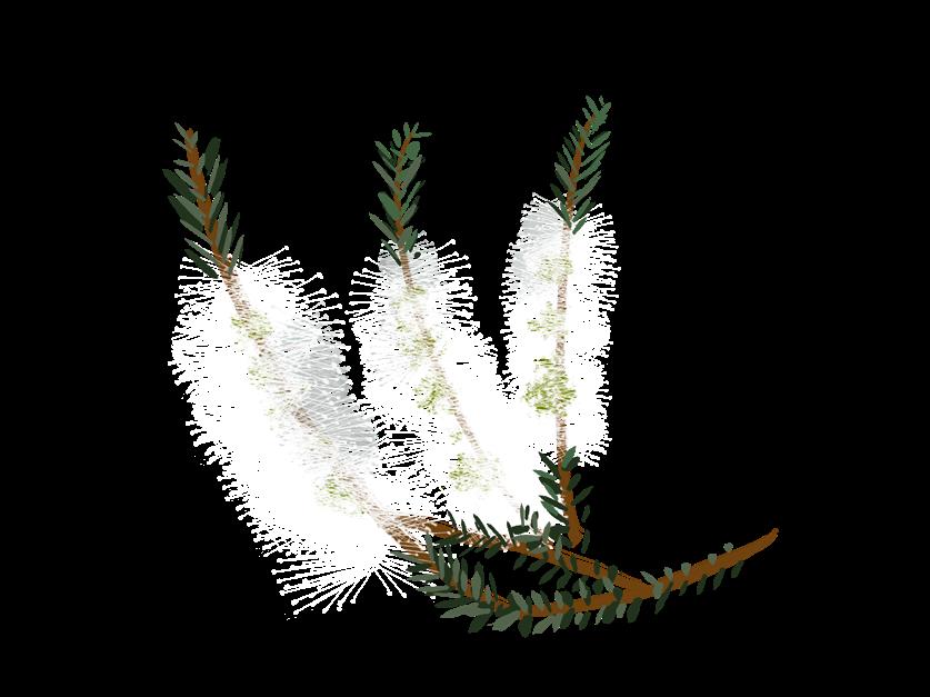
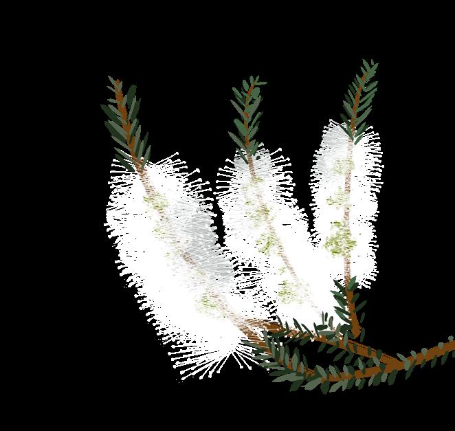
Along the inland portions of Mirrangbamurn/Maribyrnong River and Stony Creek, riverbanks supported Riparian Woodlands and Shrublands (Map 1 and Figure 4). Most of these areas likely had a canopy dominated by River Red-gum, with smaller trees and shrubs, such as shrubby wattles, and Woolly Tea Tree being common. Lower-growing plants included grasses higher up the banks, and a mixture of species fringing the water’s edge and growing within the slower flowing water.
Some of the most common plants and animals in Riparian Woodland and Shrublands that were likely to have been present prior to colonisation are shown in Figure 5.
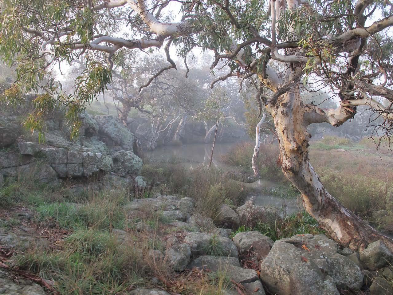
Figure 4. An example of a Riparian Woodland along Lollipop Creek in Wyndham Vale. River Red-gum in foreground, with grasses, rushes and sedges fringing creek. Photograph by Colleen Miller.
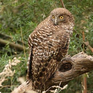
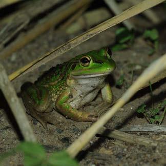
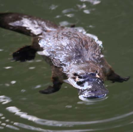
Powerful Owl
Growling Grass Frog Platypus (Nixon strenua) (Litoria raniformis) (Ornithorhynchus anatinus)
Akash Samuel
Richard Akers
Daniel Miller
Sweet Bursaria River Red-gum River Club-sedge (Bursaria spinosa) (Eucalyptus comaldulensis) (Schoenoplectus tabernaemontani)
Daniel Miller
Daniel Miller
Daniel Miller
Figure 5. Common plants and animals that were likely to be found in Riparian Woodlands and Shrublands prior to colonisation.
3.3
Estuarine Flats
Along the sections of Mirrangbamurn/Maribyrnong River and Stony Creek closer to the coast, where water has higher salt content, Estuarine Flats vegetation dominated (Map 1 and Figure 6). The lower section of Mirrangbamurn/Maribyrnong River looked quite different to today, before Birrarung/Yarra River was diverted in the late 19th century to ease flooding. The banks of Mirrangbamurn/Maribyrnong River were not as steep as today, and considerable areas would have experienced tidal flows that brought saltwater inland. People likely brought in a large amount of soil to increase agricultural land, which is thought to have caused topographic change; however, this is only an interpretation of historical mapping.
The Estuarine Flats in the City likely had few trees, and in some places shrubs such as Swamp Paperbark and Grey Mangrove. Lower-growing plants were likely dominated by coastal species and various sedges and rushes.
Some of the most common plants and animals in Estuarine Flats were likely to have been present prior to colonisation are shown in Figure 7.
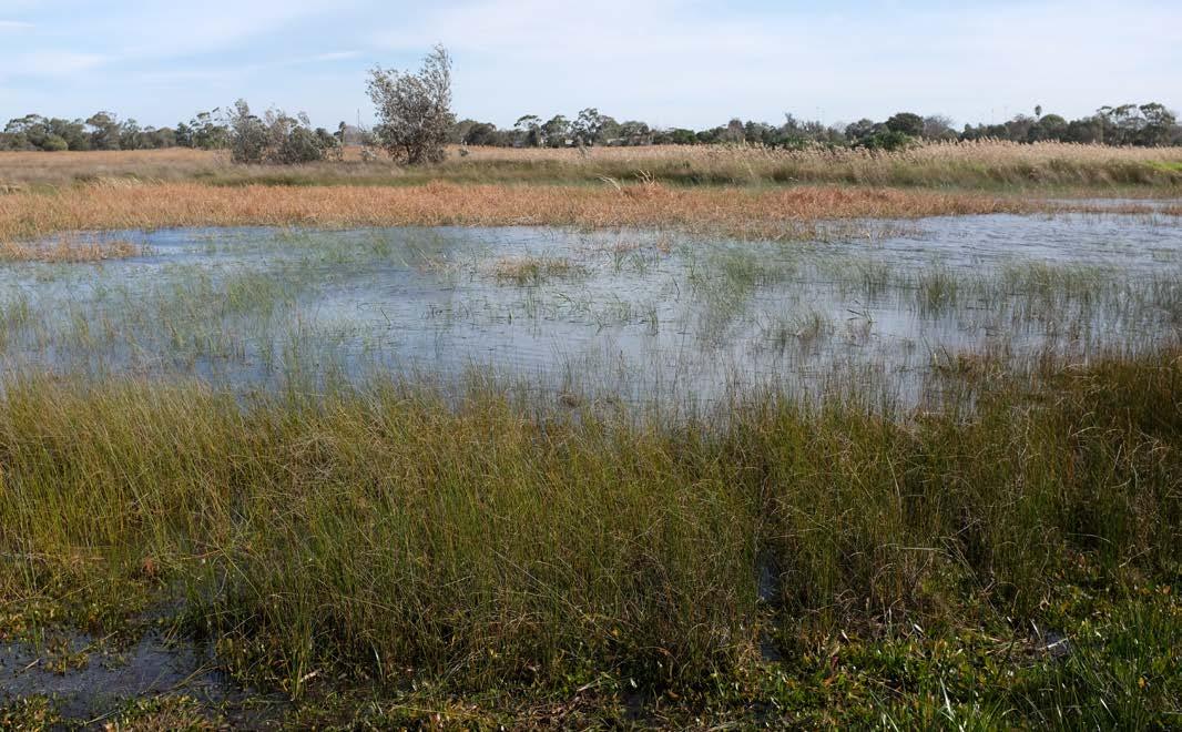
Figure 6. An example of how the banks of the Mirrangbamurn /Maribyrnong River may have looked prior to colonisation. Photograph taken in Seaford by Daniel Miller.
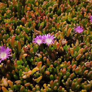
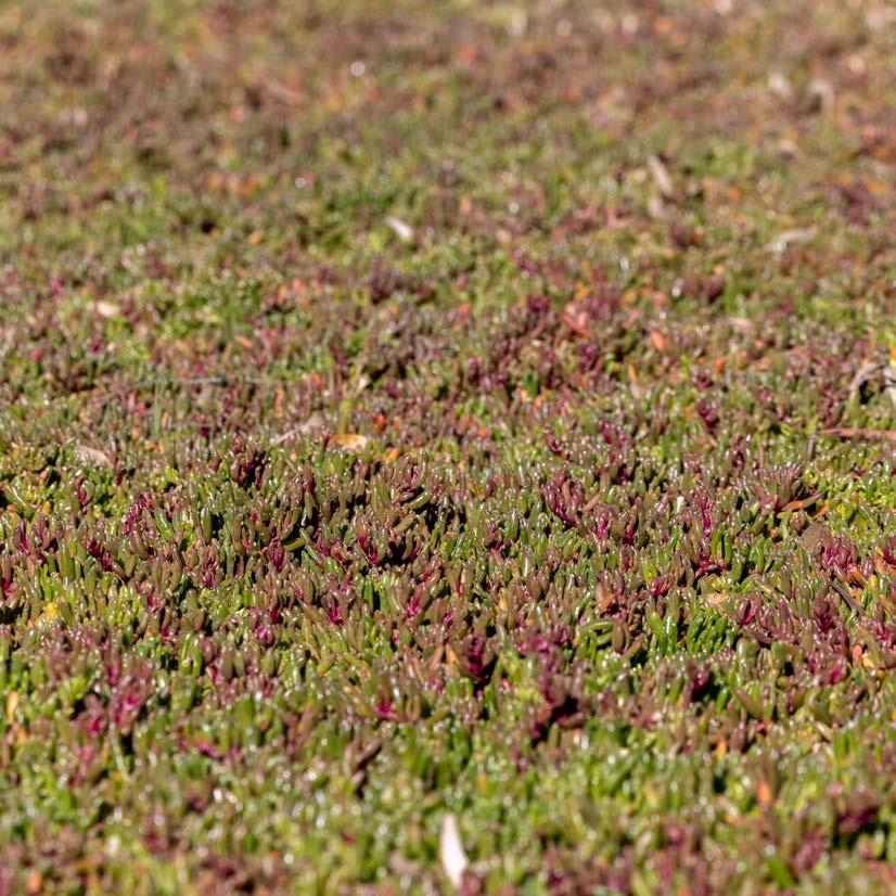
Rounded Noon-flower (Disphyma crassifoliym subsp. Clavellatum)
Colleen Miller
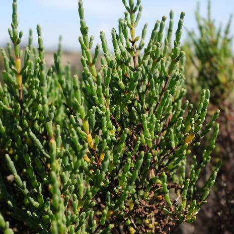
Shrubby Glasswort (Tecticornia arbuscula)
Daniel Miller
Southern Sea-heath (Frankenia pauciflora var.
Daniel
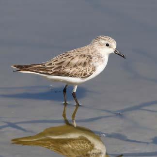
Figure 7. Common plants and animals that were likely to be found in Estuarine Flats prior to colonisation.
gunnii)
Miller
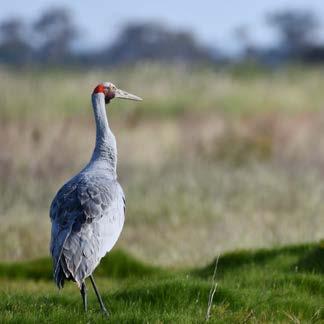
Brolga Swamp Skink Red-necked Stint (Grus rubicunda) (Lissolepis coventryi) (Calidris ruficollis)
Cody McCormack
Akash Samuel
Akash Samuel
3.4 Cultural Land Uses
Within Plains Grasslands and Woodlands, the Wurundjeri Woi Wurrung and Bunurong peoples used the abundant native grasses in a variety of ways. For example, they used Kangaroo Grass as fibre for fishing nets, and may also have ground and baked the seeds. The Wurundjeri Woi Wurrung and Bunurong peoples also used other native tussock grass fibres to make string for nets, baskets and bags. Murnong (Yam Daisy) was also likely common in these areas, and aboriginal women dug them up and people ate them raw or roasted them.
In the Riparian Woodlands and Shrublands and Estuarine Flats, plants like Common Reed and Water Ribbons were important food sources, and the former used as spear shafts. River Red-gums were common along freshwater riparian areas, and the Wurundjeri Woi Wurrung and Bunurong peoples used the bark to make shelters, canoes and shields, collected the sap or gum to seal burns, and soaked leaves for steam baths.
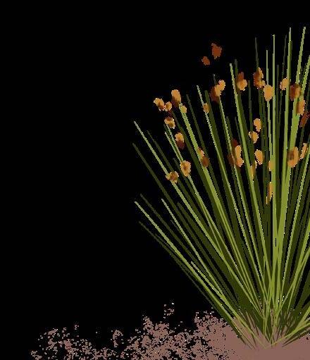
Common Reed
Narrow-leaved Cumbungi
4. THE CITY’S NATURE NOW
4.1
Vegetation Communities
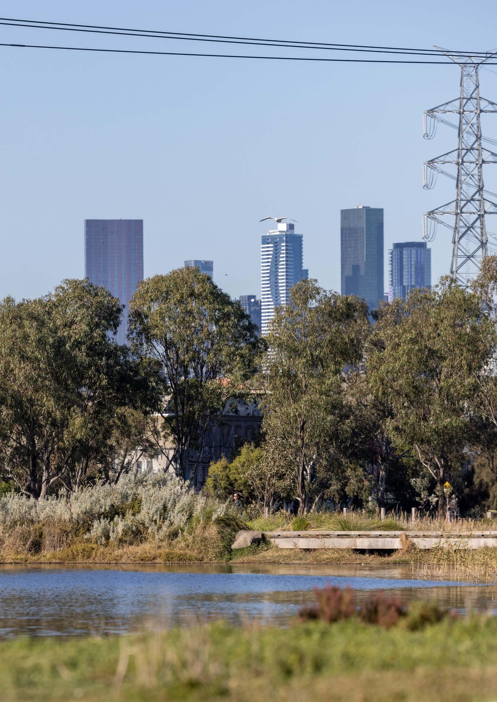
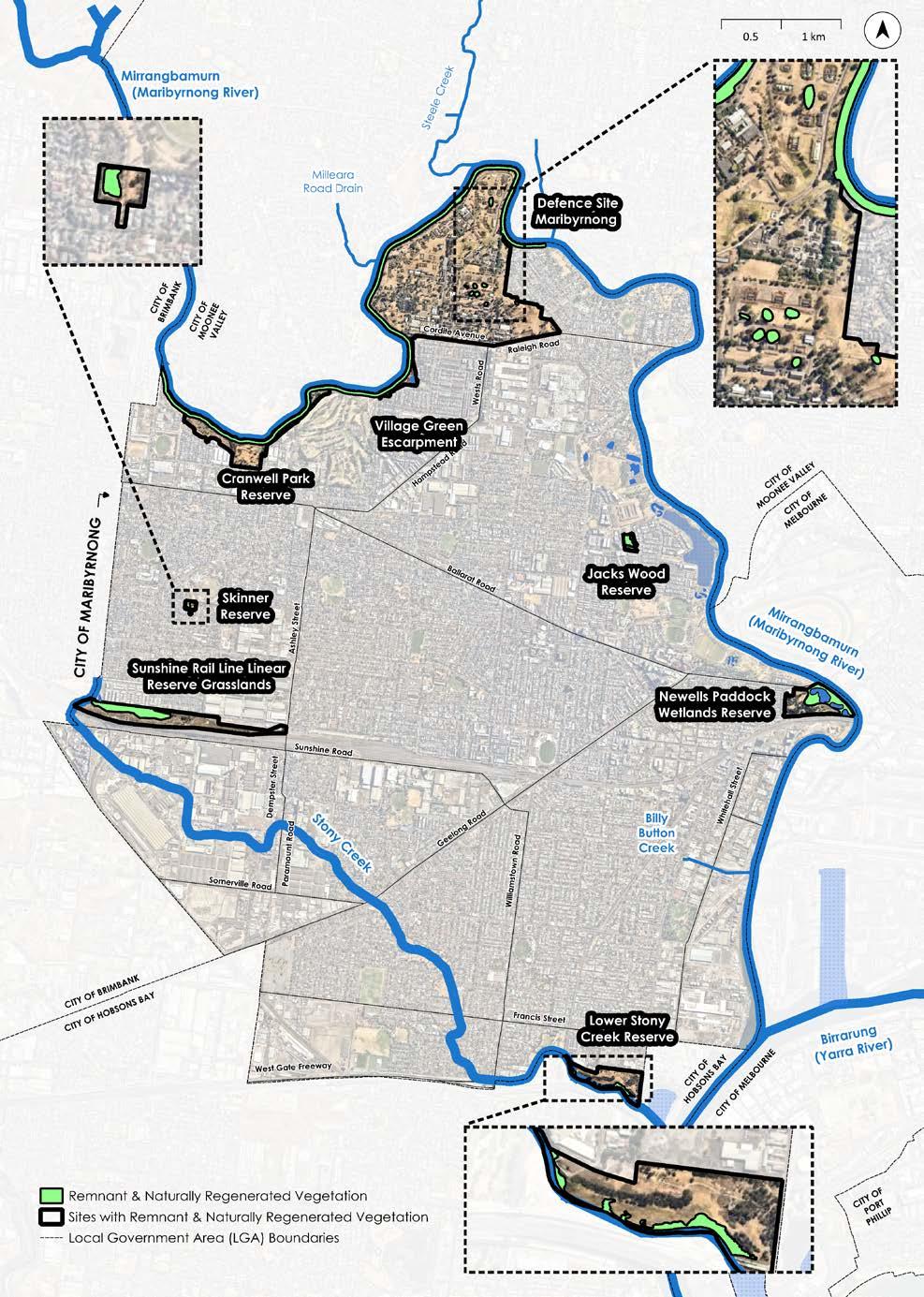
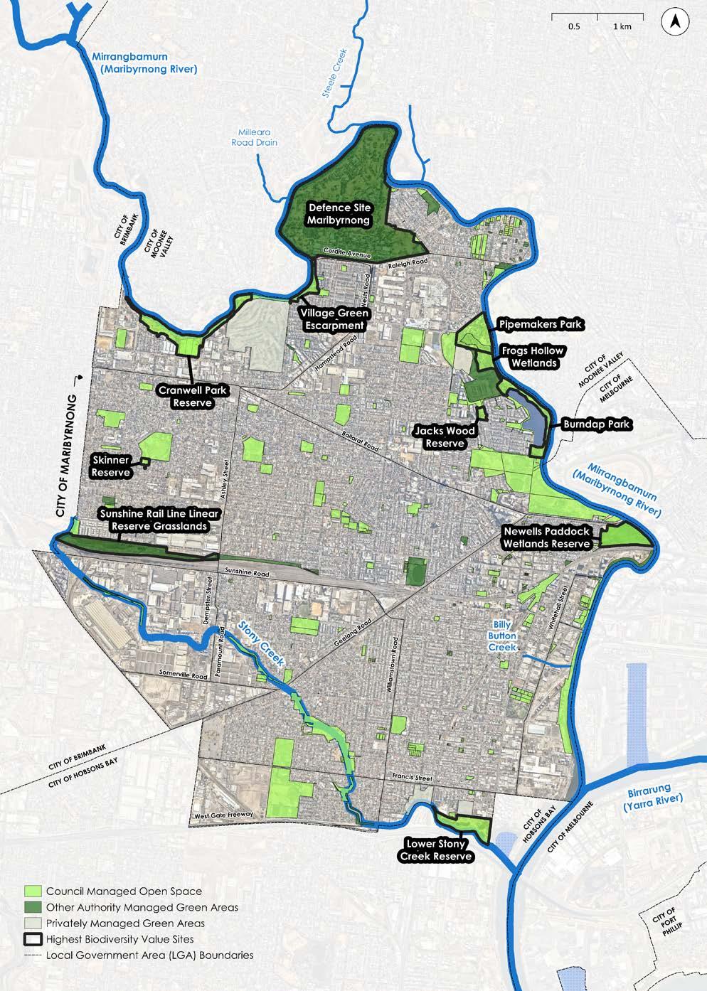
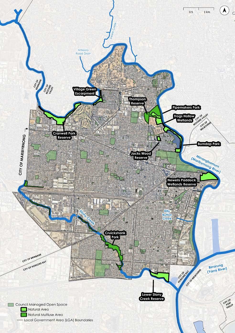
Overall, only around 1% of the City’s original vegetation remains relatively intact, with the remaining 99% of the City being considerably changed or entirely cleared (Figure 8). This remaining vegetation occurs in small pockets throughout the City, such as along Mirrangbamurn/ Maribyrnong River in Braybrook, Sunshine Railway Line Linear Reserve, Skinner Reserve, Jacks Wood Reserve in Maribyrnong, the Defence Site in Maribyrnong, Newell’s Paddock Wetland Reserve and the Lower Stony Creek Reserve (refer to Map 2).
The grassland areas were substantially cleared, because they were easily converted into agricultural, industrial, and residential areas. Across the state, Plains Grasslands once occurred across large areas from Melbourne to the South Australian border. Today, it is estimated that less than 2% remain.
The woodlands and shrublands along the waterways were also cleared, although various areas have been revegetated in recent decades. The estuarine flats that used to be along the lower reaches of the waterways only remain in small fragments, with much of their clearing owing to historic infilling of land along the banks of the Mirrangbamurn/ Maribyrnong River where this vegetation once predominantly occurred.
Past land uses have also resulted in substantial changes to the soils on which these vegetation communities grow. This includes physical changes where soils have been dug up or brought in from other areas, as well as chemical changes where fertilisers may have been used or soils polluted by industrial runoff. These changes to soil structure and nutrients often result in weed invasion, and present an ongoing challenge in restoring and managing the City’s nature.
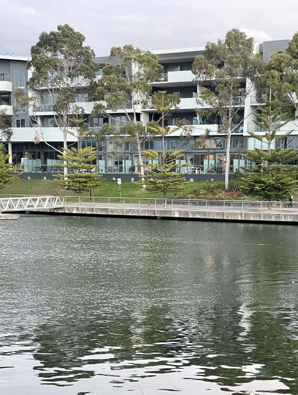
Figure 8. Proportions of land in The City covered by native vegetation or cleared and heavily modified land.
Native Vegetation
Cleared or heavily modified land
MAP 2: REMNANT AND NATURALLY REGENERATED VEGETATION
4.2 Flora
Overall, 378 flora species have been recorded on the Victorian Biodiversity Atlas (VBA) 3 in the City since 1980, of which 168 are indigenous, 8 are Victorian native and 202 are exotic (i.e. species from either other states in Australia or from overseas). This is a relatively low number of species compared with surrounding local government areas, which had between 630 and 1,234 recorded in the same time period (with approximately half being indigenous).
The total number of records (i.e. not the number of different species, but the number of observations) is also relatively low in the City, with only 805 records since 1980. Over the same time period, adjacent local government area records varied between 2,900 and 25,000. This shows that minimal data has been uploaded to the VBA from local flora surveys. While a diversity of indigenous flora is present within the City, the lack of standardised data is an important challenge to address. Good data is essential for biodiversity decision making when creating management plans, and deciding which species should be planted in restoration projects.
Of the flora species recorded in the City, four listed on state and/or federal biodiversity legislation, are known to remain: Grey Mangrove (see Figure 9), Matted Flax-Lily, Glaucous Flax-lily, and Spiny Riceflower (refer to Appendix 1).
Various environmental weeds are also present in the City. While consolidated data on weeds in the City is lacking (though well known by its on-ground staff and conservation volunteers), some examples of the highest threat weeds are shown below (Figure 10).
(Nassella neesiana)
(Tradescantia fluminensis)
3 The VBA is a database managed by DEECA where registered users (mostly environmental consultants, local naturalists, and government agencies) can upload records of flora and fauna (including introduced species). These records have locations attached, and create a large database of records across Victoria which can be downloaded and analysed by registered users.
Chilean Needle-grass
Colleen Miller
Wandering Trad
Daniel Miller
Desert Ash (Fraxinus angustifolia)
Daniel Miller
Figure 10. Common high threat weeds found in the City of Maribyrnong.
Figure 9. Grey Mangroves along Stony Creek estuary
Common Weeds
4.3 Fauna
Many indigenous fauna species have been recorded in the City in recent years, including woodland birds (e.g. Superb Fairy-wren), water birds (e.g. Blue-billed Duck, as illustrated below), terrestrial mammals (e.g. Short-beaked Echidna), arboreal mammals (e.g. Eastern Ring-tailed Possum), aquatic mammals (e.g. Rakali), reptiles (e.g. Common Blue-tongued Lizard), amphibians (e.g. Growling Grass Frog), fish (e.g. Southern Shortfin Eel) and invertebrates (e.g. Australian Admiral Butterfly).
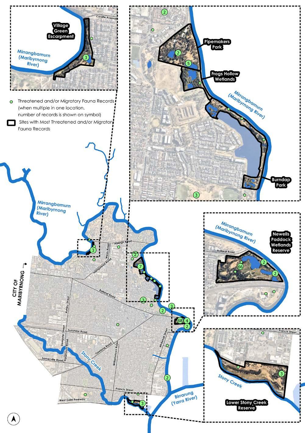
While most fauna species recorded in the City since 1980 are relatively common, there are also several rare species (Refer to Appendix 2 and Map 3), the majority of which were recorded at wetland sites such as Newell’s Paddock, Burndap Park and Pipemakers Park, which provide important habitat for waterbirds. These sites are gradually being restored, and are maintained by Council and conservation volunteers.
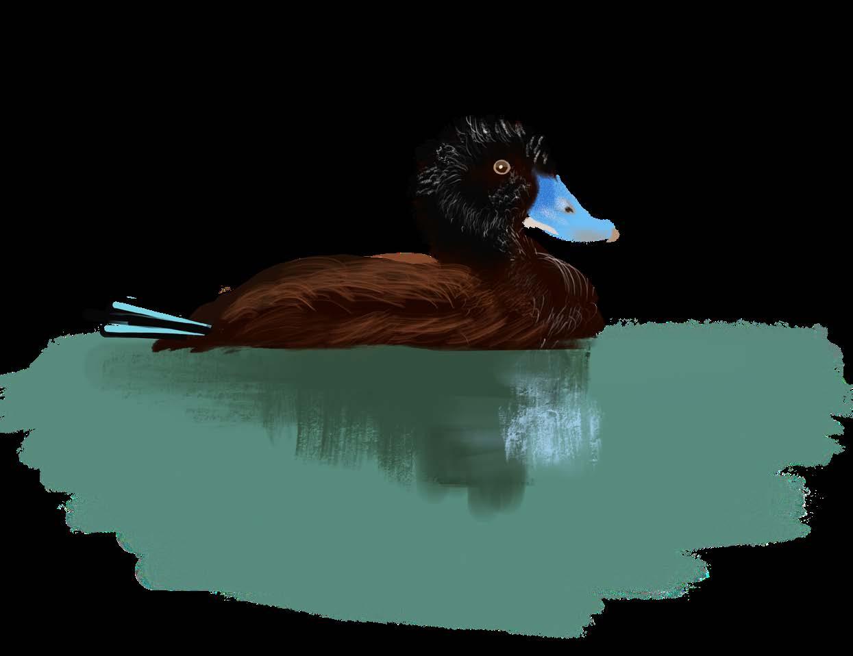
Blue-billed Duck
MAP 3: THREATENED AND MIGRATORY FAUNA RECORDS
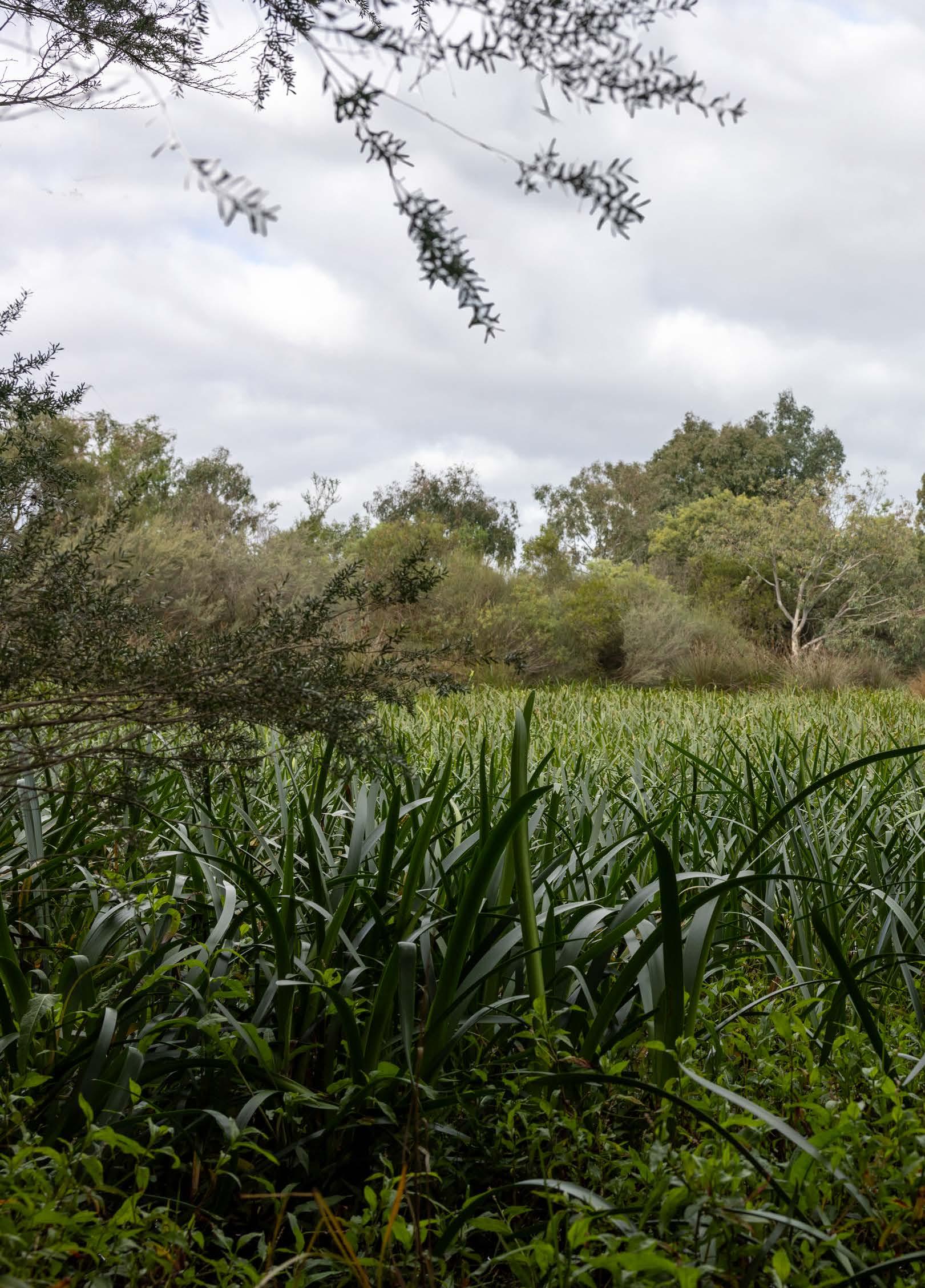
4.4 Waterways and Wetlands
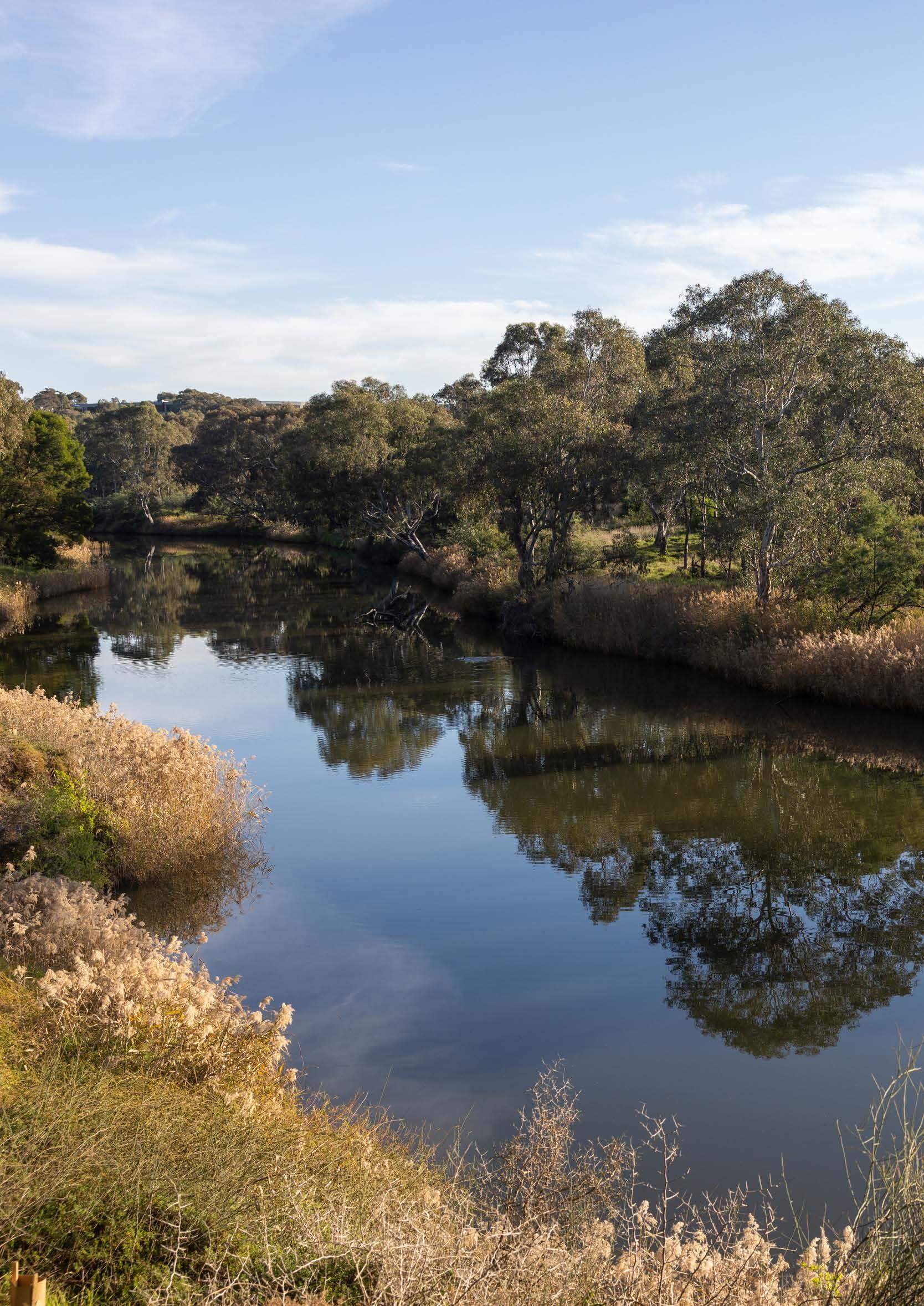
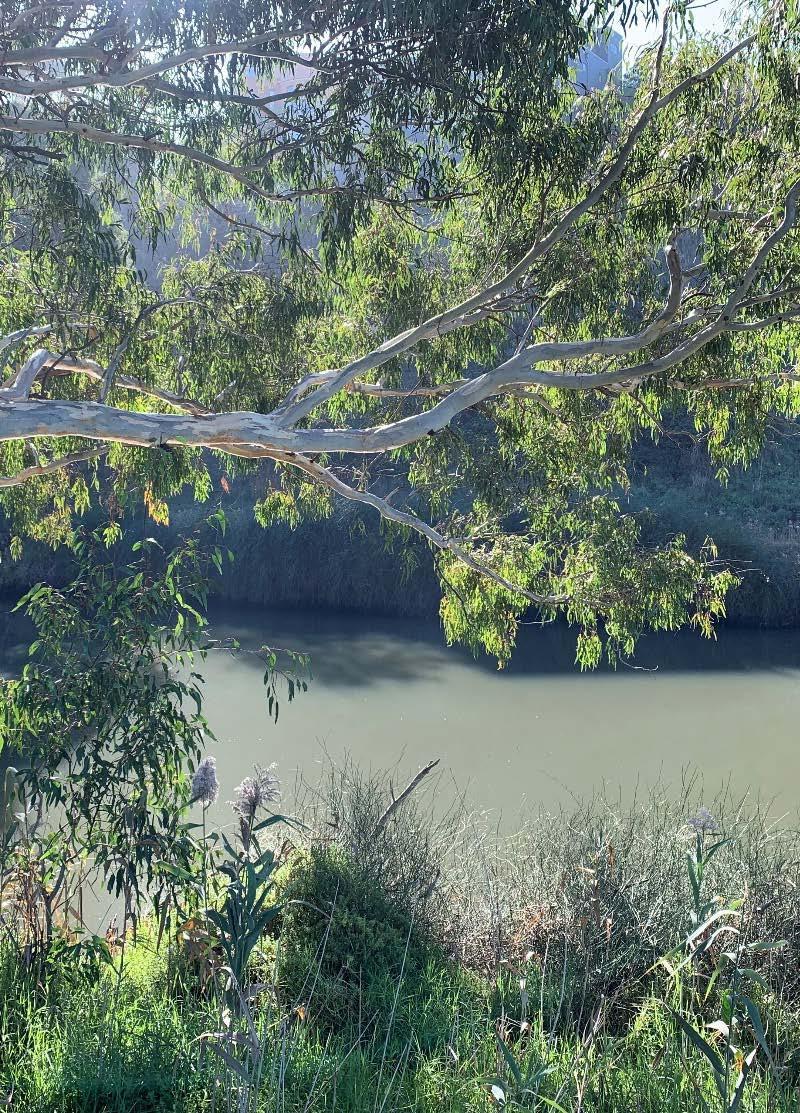
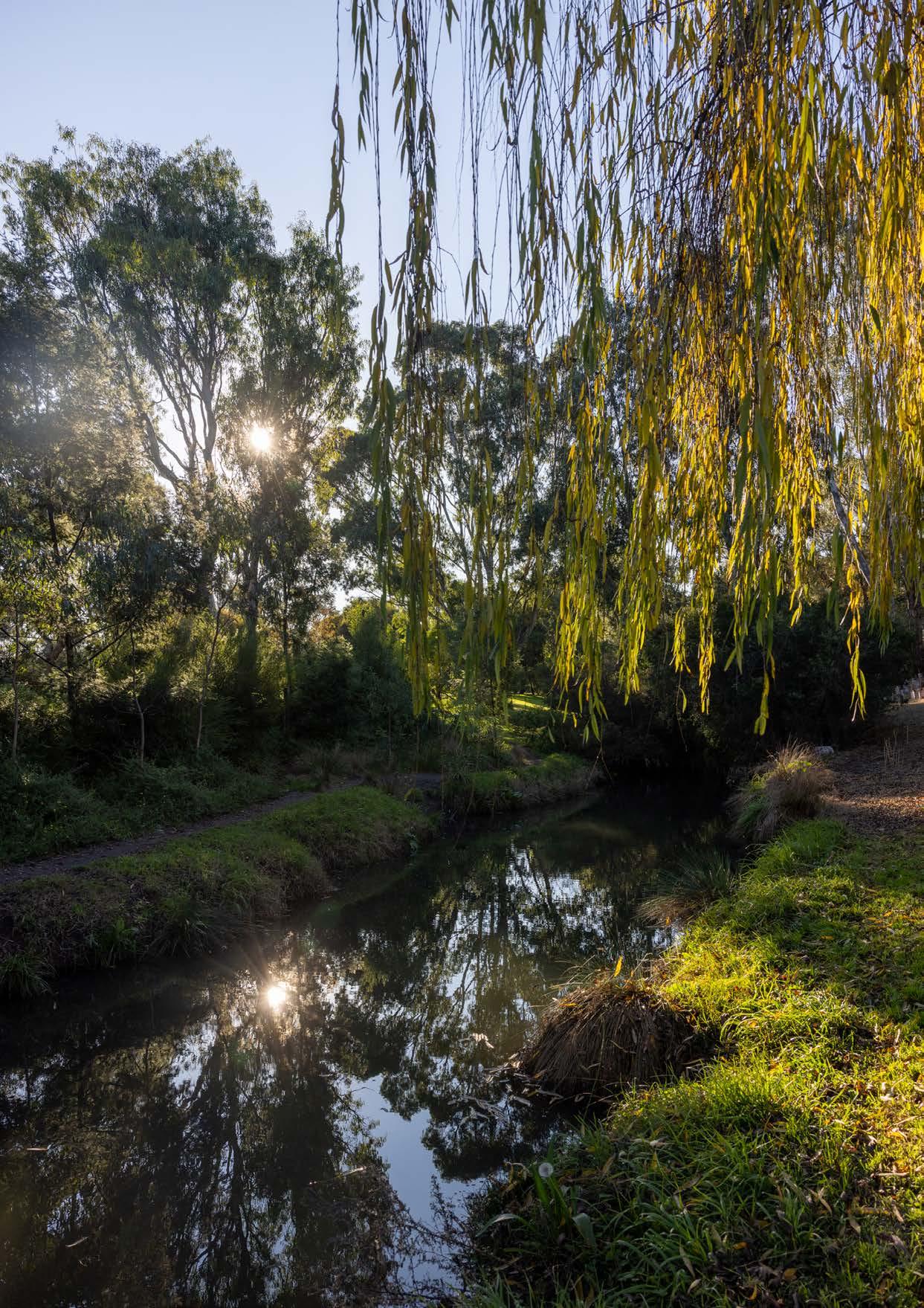
The City’s waterways and wetlands together support the vast majority of its nature, as well as providing connectivity to the wider landscape. They are also significant recreational networks. The value of these waterways and wetlands is vitally important to the City’s nature, and forms a core focus of this Nature Plan.
Mirrangbamurn/Maribyrnong River
Mirrangbamurn/Maribyrnong River is the second largest river in Melbourne after Birrarung/Yarra River. It is culturally, socially, and ecologically significant for the City and Melbourne’s west.
Mirrangbamurn/Maribyrnong River provides a critical habitat corridor through Melbourne’s highly urbanised inner-west and supports important species such as Growling Grass Frog and Greyheaded Flying-fox. The wetlands that occur along the river (Frogs Hollow Wetlands at Pipemakers Park and Newell’s Paddock) also provide important habitat for a range of rare and common fauna species. These wetlands filter stormwater, and improve the quality of water being discharged into the Mirrangbamurn/Maribyrnong River and Port Phillip Bay.
Various areas for nature engagement and recreation also occur along the Mirrangbamurn/Maribyrnong River, such as rowing, extensive cycling and pedestrian paths, reserves, and other open space.
Stony Creek
Stony Creek, which was historically surrounded by quarries, landfills and industry, now contains large areas of open space including Cruickshank Park. While significantly contaminated as a result of its past land uses, the local community greatly values the public open space along Stony Creek for recreation and exercise. Some revegetation along the creek has restored elements of what was present prior to colonisation, which provides important habitat for a diversity of fauna species. At the lower end of the creek at Lower Stony Creek Reserve, the banks also support estuarine habitat, which is rare in the surrounding area.
Some sections of Stony Creek remain directly next to industries, and a section is concrete lined, both of which provide opportunities for further restoration to improve the environmental, aesthetic, and community values of the waterway.
4.5 Land Management
Today, open space within the City is managed by various land agencies. This includes Council, who manages the majority of public open spaces, including parks, gardens, sports reserves, natural areas, median strips and much land adjacent to waterway corridors. Other land managers in the City include state government authorities and private land managers.
Map 4 outlines the land management arrangements of the green areas within the City, categorising them as either Council, other authority or privately managed. It also shows the sites within the City that contain the highest biodiversity values, based on the known locations of remnant or naturally regenerated vegetation and threatened flora or fauna species records (refer to Sections 4.1-4.3). As is evident from this map, high biodiversity values occur on a mixture of both Council and other Authority managed land i.e. Crown, VicTrack, Parks Victoria or Melbourne Water managed land.
MAP 4: LAND MANAGEMENT OF GREEN AREAS
4.5.1 Council-managed Public Open Space
Council’s public open spaces are much-loved and well-used by the community for a variety of recreational and social activities, and contain a range of biodiversity values.
When taking into consideration the identified biodiversity values (Map 4) on Council managed land, existing Council commitments and community usage, the following biodiversity categories have been assigned to a number of Council’s open spaces:
• Natural Areas have the highest biodiversity values and the protection, enhancement and enjoyment of natural values are predominant in management of these areas; and
• Natural Multiuse Areas are spaces where recreation and biodiversity values co-exist
Council open spaces primarily managed for passive recreation or for organised sports such as football, soccer, tennis or Trugo may still contain biodiversity values and provide benefits to nature. Examples include perimeter trees for native birds and possums to feed, roost and nest, irrigated grass for Ibis to feed and rainwater infiltration to recharge groundwater systems and prevent localised flooding. These values are noted and considered before any upgrades or improvements to the reserve so they can be conserved or restored.
While the quality of wildlife habitat varies between areas, together they form important habitat corridors to allow fauna to nest, rest, feed and move across the landscape.
Natural Areas
“One of the most important assets in a community is open space. Within that, those spaces which support original or rehabilitated natural areas for indigenous plants and creatures are critical for both the healing of the land in these times and into the future.”
~ Male resident, 70-74, Seddon
Council, with the assistance of various dedicated volunteers, manage some of the City’s public open spaces with the primary purpose of protecting and improving biodiversity. These sites have comparatively higher existing indigenous flora and fauna values. Recreation at these sites is predominantly passive, with supporting infrastructure such as paths and seats. However, sections of these sites may also be inaccessible to the public to protect the natural values, for example fencing around an important wetland.
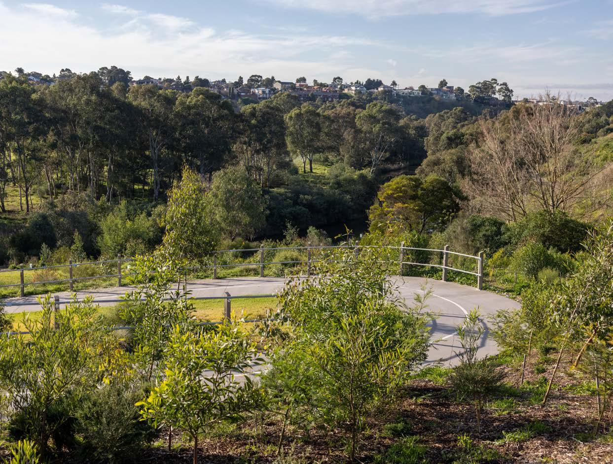
Despite being heavily urbanised, there are several success stories in the City that highlight how biodiversity can be integrated into inner-city areas. Natural Areas within the City include Cranwell Park Reserve, Village Green Escarpment, Frogs Hollow Wetlands, Jack’s Wood Reserve, Burndap Park, Newell’s Paddock Wetlands Reserve, Lower Stony Creek Reserve and the lower wetlands within Pipemakers Park.
Burndap Park, adjacent to the Mirrangbamurn/Maribyrnong River, is a natural area that provides important habitat for waterbirds and other native wildlife. The park includes the land surrounding Edgewater Lake and features two wetlands that were constructed in 2002 to treat stormwater runoff from the adjacent residential development.
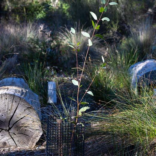
The Park is an important part of the Mirrangbamurn/Maribyrnong River habitat corridor, located between two large wetlands, Newell’s Paddock and Frogs Hollow. Council, with the assistance of volunteers, has revegetated large areas of Burndap Park with indigenous plants and further restoration is planned. Superb Fairy-wren can be spotted enjoying the area.
Natural Multiuse Areas
Natural Multiuse areas are Council managed public open spaces, where important biodiversity values co-exists with a variety of other recreational uses such as dog walking, cycling, running, and children’s playgrounds. Landscape planting in these areas is predominantly indigenous, supporting the existing native wildlife that also use the site. Natural Multiuse Areas are predominantly along Stony Creek, such as Cruickshank Park, however also include Thompson Reserve and sections of Pipemakers Park, near Mirrangbamurn/Maribyrnong River.
Urban Trees
Cruickshank Park and Stony Creek provide a diversity of habitat along seven kilometres through highly urban land. The area was once a series of quarries that provided bluestone (basalt) to Melbourne, prior to being abandoned and becoming informal waste disposal tips. A dedicated group of residents formed a committee in 1971, now known as the Friends of Cruickshank Park, and advocated for rehabilitation of the area. The partnership with Council remains and Stony Creek is now an important urban habitat corridor, including a frog pond, rain garden, and nesting boxes for native wildlife.
While trees were historically located predominantly along the waterways and only sparsely scattered throughout the grasslands prior to colonisation, they are now an important part of nature in the City. Urban trees provide greening and cooling benefits through natural shade and shelter. They reduce air, water and soil pollution, and improve amenity.
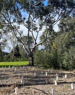
Council manages approximately 50,000 urban trees, which are planted in nature strips, parks and reserves, and public spaces such as plazas. A variety of species are chosen, including indigenous, Victorian native, Australian native and exotic.
Selection is based on considerations including climatic conditions, the availability of space, the location of services (above and below ground), the amount of shade they provide, and maintenance requirements. Dependent on the species, urban trees can provide critical habitat for birds, bats and possums, and act as an important corridor connecting larger areas of public open space within the City. Urban trees are critical for a healthy city and Council’s Urban Forest Strategy (2018) sets a target of increasing canopy cover in the public realm to 20% by 2040.
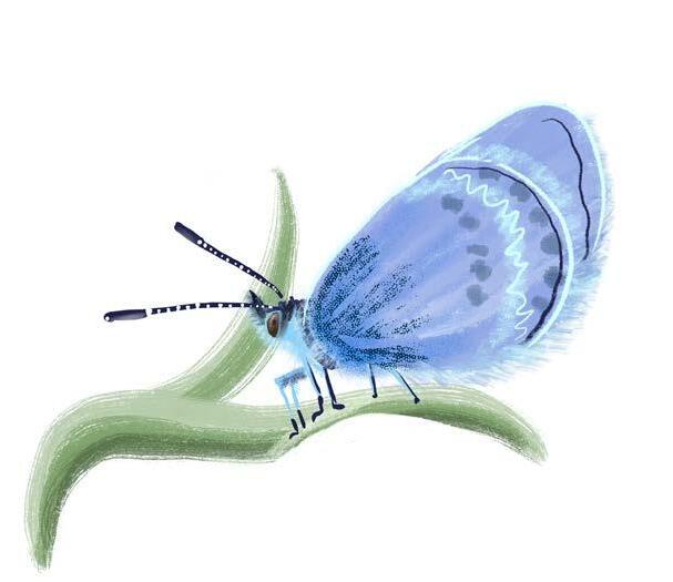
Common Grass Blue butterfly
4.5.2 Other Authority-managed green areas
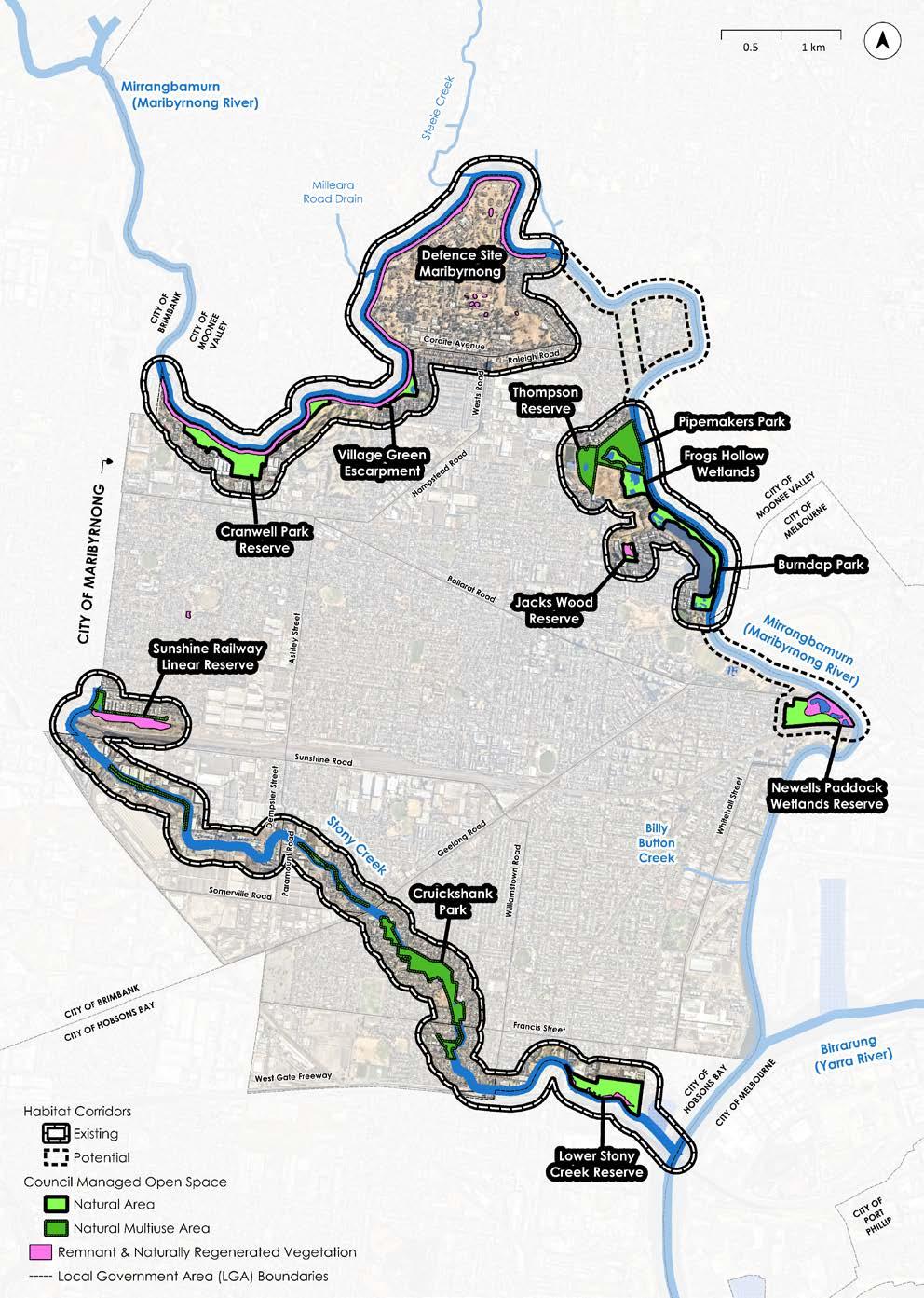
While Council manages most public land within the City, there are other public land managers. Parks Victoria and Melbourne Water manage various parcels of land next to Mirrangbamurn/ Maribyrnong River and Stony Creek. VicRoads manages freeways and arterial roadside vegetation, while VicTrack manages land associated with the rail network, including the significant Sunshine Railway Linear Reserve grasslands. This grassland site is of conservation significance and is protected under legislation. A further important natural site managed by another authority is the Defence Site Maribyrnong.
The Defence Site Maribyrnong, owned by the Commonwealth Government, is located next to Mirrangbamurn/ Maribyrnong River, at the northern border of the City. Besides being a large area with various habitat features, the Defence Site contains particular flora and fauna species, which are encouraging to find in such an urban area. Little Eagles and Australian Masked Owls have been seen in this site, as have White Cypress-pine in one of its southernmost locations. Perhaps the most important feature of the Defence Site, however, is its location, providing habitat connectivity along the river (Map 4).
4.5.3 Privately managed green areas
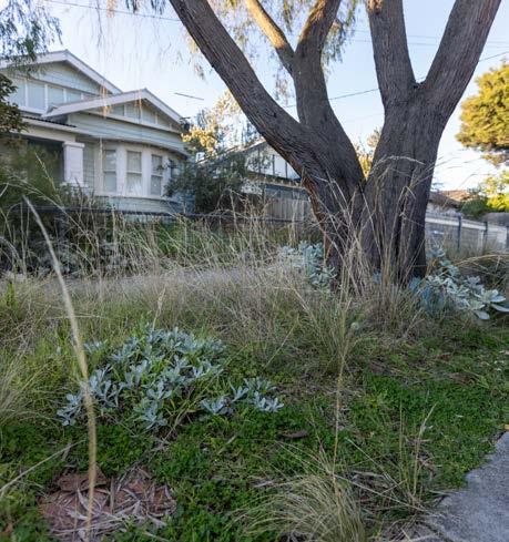
With most of the City comprised of private residential land, this land also contributes to its nature. Residential front and backyards provide an opportunity to support local plants and animals, as do some larger privately owned green spaces, such as golf courses. The Maribyrnong Significant Tree Register 2021 was established to protect significant trees, including those on private land, which are an important part of our City’s nature.
Furthermore, nature strips, which are publicly owned but maintained by the adjacent resident, provide potential habitat opportunities.
This land can be butterfly and bee attracting and provide a stepping stone for wildlife, such as small birds, to move safely across the landscape. Council’s Nature Strip Planting Policy and Guidelines provides information and requirements to residents who want to develop an alternative to grass nature strips. Commercial and industrial premises that include open space, for example landscaped gardens, can also provide this benefit to the City’s nature.
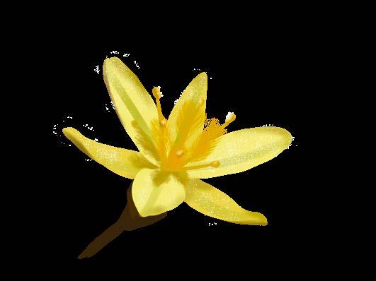
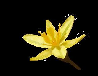
Yellow Rush-lily
MAP 5: COUNCIL MANAGED OPEN SPACE
4.6 Habitat Corridors
Habitat corridors are areas of habitat that allow flora and fauna to move through the landscape. In urban areas these are often corridors of vegetation along creeks and rivers, but can also be lines of street trees, or even a series of separate green areas that act as ‘stepping stones’.
The most important aspect of habitat corridors is that they allow flora and fauna to move between different areas of habitat and not become isolated. This includes animals actively moving between areas to find shelter, food, and mates, however, habitat corridors are also important for plants. For plants, habitat corridors allow seeds to move between areas by wind, water, and be spread by animals, and allowing them to be pollinated by wildlife.
In the City, the main habitat corridors are Mirrangbamurn/Maribyrnong River and Stony Creek, which connect a variety of habitats in Natural and Natural Multiuse Areas (including some remnant and naturally regenerated vegetation), as shown on Map 6. Note that within these habitat corridors however, there are still some areas without habitat and barriers (such as major roads). There are also some areas where habitat corridors could potentially be created to better connect the City’s habitats, as shown on Map 6.
MAP 6: HABITAT CORRIDORS IN
THE CITY OF MARIBYRNONG
5. CHALLENGES AND OPPORTUNITIES
Following the collation of existing data, and analysis of the current state of the City’s nature, various challenges and opportunities were identified, as outlined below.
5.1 Limited and disconnected natural areas in an urban environment
Change in land uses have resulted in the loss of vegetation communities, important habitat features and flora and fauna species throughout the City. Most of the City’s habitats are highly fragmented because of past land clearing. This means that many of the species that would have inhabited the City in the past do not have sufficient habitat to support them. Only relatively mobile, urban-adapted species, such as common backyard birds (e.g. Rainbow Lorikeet and Australian Magpie), can move through much of the landscape.
Furthermore, urban areas have historically been managed without taking biodiversity into consideration. As a result, landscaping is limited in function, often focussed on amenity. In addition, practices such as covering fruit trees with loose netting, can be deadly to native wildlife including flying-foxes, birds, possums and small reptiles. However, there is potential for urban areas to provide natural values and encourage and protect native wildlife. In this way, biodiversity can be integrated into urban landscapes rather than excluded to margins. Given that much of the City is private land, consideration of how biodiversity is managed in the private domain is of central importance to the City’s nature. While many urban areas in the City have relatively low biodiversity values, there are opportunities for improvement.
Opportunities to address these challenges include improving habitat connections, prioritising high habitat-value street trees in key locations, creating site-specific management plans for natural areas, and incorporation of indigenous, or when not suitable, Victorian native plants into landscaping whenever possible. Increasing nature in urban areas could include the development of guidelines and programs to encourage indigenous or Victorian native species planting in recreational reserves and on private land. It could include replacing concrete in public areas, when no longer required with earth and plants, and could be the consideration of private land acquisition for sites with high restoration potential.
5.2 Risk of further habitat loss
A variety of habitat values exist on privately managed or other authority managed green areas within the City, such as rail corridors, landscaped golf courses and residential gardens. While it is unlikely that much remnant vegetation occurs on the privately managed land, there is still good habitat provided by planted vegetation. Ensuring that this habitat is protected wherever possible is essential for minimising future habitat loss.
Within the City, the main potential for further habitat loss is within the Federal Government owned Defence Site Maribyrnong. If developed to a substantial degree, loss of habitats within the site would affect not only the species present within but also lead to reductions in connectivity along Mirrangbamurn/Maribyrnong River Habitat Corridor and negatively impact water quality (refer to Map 4).
Potential opportunities to address this challenge include the consideration of suitable Planning Scheme tools, review of Council guidelines and protocols and advocacy for strong biodiversity outcomes in the future development of the Defence Site Maribyrnong.

5.3 Pollution
Urbanisation has led to increased pollution in various forms, including light pollution, noise pollution and contamination of waterways.
Artificial light alters the natural patterns of light and dark in nature and can affect fauna species in different ways. This can include attraction to or avoidance of certain areas, disorientation, and changes to reproductive behaviours. Noise can also affect wildlife in varying ways, which can cause fauna species to avoid certain locations, altering social and reproductive behaviours, and inducing stress responses. Noise disturbance can include ongoing and regular noise, such as that from a busy road, and intermittent noise, such as construction activities.
Opportunities to address these challenges include the limitation of lighting and use of “wildlife-friendly” lighting options within or in close proximity to the higher value Natural Areas. Also the minimisation of noise through buffer planting on Council managed land and upholding planning permit conditions relating to construction activities nearby to Natural Areas.
Waterways in urban areas are often degraded because of several factors. The most common degrading processes are stormwater runoff (which introduces pollutants), chemical spills and litter. These processes impact water quality and affect flora and fauna, from directly resulting in deaths of wildlife to changes in which types of plants occur. Ongoing collaboration with the EPA and Melbourne Water, particularly along Stony Creek, is critical to addressing the issue of water pollution and improving the water quality of waterways.
The Integrated Water Management Plan (2023) contains key actions for Council to undertake in order to minimise the impact of local stormwater to Mirrangbamurn/Maribyrnong River and Stony Creek. Other opportunities include collaboration and advocacy for catchment/landscape level waterway improvements, and site based restoration of the City’s waterway and wetland habitats.
5.4 Pest plants and animals
Many natural areas in the City, like the banks of Mirrangbamurn/Maribyrnong River in Braybrook, are composed of indigenous trees and shrubs with a ground layer of weeds and/or exotic grasses. In these areas, weeds exclude indigenous plants, and therefore limit habitat for wildlife that rely on lowgrowing indigenous vegetation, such as grasses and wildflowers. While some natural areas have seen great improvements over time because of dedicated Council staff and conservation volunteers, the continuation and expansion of weed control will be required to maintain and improve these important areas.
The effects of pest animals are seen throughout Australia and are especially concentrated in urban areas. Pest animals such as foxes and feral, semi owned or owned cats prey on native wildlife, while rabbits degrade habitat through digging and burrowing, and species such as Noisy Miners can out-compete other indigenous fauna species through competition for resources (e.g. food/ nesting sites). While eradication from the City is not realistic given their abundance in the landscape, concentration of pest control efforts in highvalue areas, and/or implementation of exclusion fencing, is vital to reduce their effects on the City’s biodiversity. This includes reducing the impact of over-abundant indigenous species, such as Noisy Miners, which can reduce the abundance of indigenous small woodland birds.
With individuals known to feed pest animals, such as foxes and feral semi owned or owned cats, continual education and upholding local laws are further opportunities to control pest animals in the City.

Tussock Skink
Pale Rush
5.5 Domestic animals
Dogs off leash in areas with natural values can disturb and disrupt wildlife, leading to deaths and changes in their behaviour, habitat use, and breeding patterns. It is important for dog owners to ensure that their dog is only off leash in designated off lead areas and that they are supervised at all times. Uncollected dog poo can also contribute to water pollution, affecting the health of aquatic environments. With much of the City’s open space being used for recreation, it is important to balance the benefits of dog walking with the responsibility to protect local wildlife.
The roaming and hunting by cats pose a substantial threat to native birds, small mammals, reptiles, and other urban wildlife leading to declines in local populations of native species. Cats that are feral, semi owned or domesticated and owned are estimated to kill an average of 71 animals per year, which equates to 14 million animals killed annually in Victoria alone. As cats are also at risk of road trauma, disease, and fighting, restricting the roaming of cats is of benefit for both wildlife and cats.
The Domestic Animal Management Plan (2026) contains key actions for Council to undertake in order to minimise the impact of domestic animals to wildlife. Relevant actions include a responsible pet ownership education program, a newly introduced dusk to dawn (7pm-7am) cat curfew (with the possibility of transitioning to a 24/7 curfew), mandatory desexing of cats, and proactive patrols of dog off-lead parks and reserves.

5.6 Lack of biodiversity data
There is a lack of standardised biodiversity data for the City. This creates planning challenges, such as knowing which flora species are lacking and should be planted or which native wildlife is threatened and needs protection. It also makes monitoring the progress of restoration works difficult.
A key opportunity to address this challenge is to undertake biodiversity surveys so that native vegetation, habitat, flora and fauna data can be collected. There is also an opportunity to develop standardised frameworks for biodiversity data collection and a central biodiversity database for the City.
5.7 Climate emergency
Climate change poses significant threats to the City of Maribyrnong, including rising temperatures, altered rainfall patterns, seal level rise, storm surges and more frequent extreme weather events such as heatwaves and floods.
Species that are adapted to the City’s current climate may not be able to cope with projected higher temperatures and die off. If plants currently within the City cannot adapt, there is an opportunity for Council to source native plants from warmer areas of Victoria, which may be more suitable to withstand the proposed changes in climate i.e. “climate ready species”.
One of the most imminent threats posed by the climate emergency in the City is rising sea levels, with the potential for various areas along the banks of the City’s river and creek corridors to be inundated. As sea levels rise, the transitions from fresh water to salty water are projected to move further inland. Given much of the City’s biodiversity values are located along its waterways (the Mirrangbamurn/Maribyrnong River and Stony Creek), it is essential to consider the implications of the proposed change in salinity to indigenous vegetation. This presents an opportunity to restore estuarine habitats to increase carbon drawdown and adapt to rising sea levels. Coastal plant communities can store carbon at a rate 30-50 times greater than in forests, and therefore provide additional benefits in reducing carbon in the atmosphere.
Tufted Bluebell
6. IMPLEMENTATION
6.1 Guiding principles
1.
Conserve, manage and restore biodiversity
As the largest public land manager in the City, Council has an important role in conserving biodiversity values, managing our valuable natural areas and restoring indigenous plants and native wildlife habitat throughout the landscape. To do this effectively, there is a need for high quality data to inform strategic, evidence based decision making.
2. Increase connection and engagement with nature
Support from, and engagement with, the wider community is essential to conserve, manage and restore the City’s biodiversity, given its natural areas are intertwined with residential, commercial, industrial, and recreational areas. Giving residents the chance to experience and learn about nature helps them to appreciate the local environment and understand why conserving biodiversity is important.

3. Collaborate with Traditional Owners, private land managers, Melbourne Water, Parks Victoria, VicTrack and other relevant authorities
Traditional Owner perspectives are crucial for successful biodiversity programs, though are often underrepresented in urban areas. In Australia, Traditional Owner managed land has higher biodiversity levels than protected areas. The ability for Traditional Owners to provide management direction is key in improving the biodiversity outcomes of nature in the City. Storytelling and science communication are also valuable ways for indigenous perspective to be showcased, and are vital to include in urban biodiversity programs.
Collaborating with other land managers in the City, including but not limited to Melbourne Water, Parks Victoria, VicTrack and private residents, to collectively manage biodiversity helps to ensure a coordinated approach. This fosters shared responsibility and leads to more effective programs and greater access to resources and expertise. Collaboration in the management of biodiversity is particularly important in the City, given the majority of the land is not managed by Maribyrnong City Council.
4. Embed the conservation and restoration of nature into Council practices and decisions
While the management of public open space is an important role that Council has, it is one of many responsibilities that impact biodiversity both locally and globally. To have the greatest positive impact, it is important for Council to consider biodiversity in all its practices and decisions, such as strategic planning, master planning and asset renewals.
6.2 Action plans
The implementation of the Nature Plan will be via the delivery of three, 3-year Action Plans (refer to table below).
Action Plan 1: Years 1-3
Action Plan 2: Years 4-6
Action Plan 3: Years 7-9
Next plan for managing biodiversity
Endorsed 2026, 2027 & 2028
To be developed 2028 2029, 2030 & 2031
To be developed in 2031 2032, 2033 & 2034
To be developed in 2035 TBC
7. MONITORING, EVALUATION, REPORTING AND IMPROVEMENT (MERI)
The following outlines the Monitoring, Evaluation, Reporting and Improvement (MERI) framework to be adopted as part of the Nature Plan, and aims to support adaptive management of the City’s biodiversity. These MERI frameworks provide for:
Monitoring the implementation of actions.
Evaluation of the effectiveness of actions.
Reporting on the outcomes of monitoring and evaluation, and distributing reports for comment.
Improvement in the continuation and future implementation of actions as informed by the above.
Monitoring, evaluation, reporting and improvement will comprise Frequency
Recording the implementation of actions ongoing
Report on status of actions yearly
Report on the scope, methods and outcomes of works completed under the existing action plan.
Development of the following action plan, based on evaluation of the previous plan and continual improvement.
After 3 years : 2028
After 6 years : 2031
After 9 years : 2034
Commence development of the next plan for managing biodiversity 2035
Monitoring
Monitoring of the Nature Plan will be ongoing. This will involve a consistently updated list of all works completed towards the actions listed in the existing Action Plan.
Several actions in the Action Plan will require the creation of additional plans (e.g. site-specific restoration/management plans for Natural Areas), which themselves will have their own MERI frameworks. The MERI frameworks for these sitespecific plans will define measurable goals which may include, for example, reducing the cover of a priority weed such as Spear Thistle to less than 5% cover at a particular reserve.
The MERI frameworks for these site-specific plans will also include monitoring recommendations, for example, conducting flora surveys and mapping the cover of priority weeds. This will allow the monitoring of the Nature Plan to measure targets objectively for on-ground biodiversity improvements. When created, the MERI frameworks defined in these additional plans will also be summarised and form part of the monitoring for the Nature Plan.
Evaluation
The evaluation of the Nature Plan will occur at the end of each of the Action Plans. The evaluation will be based on reviewing:
• The scope of works undertaken to evaluate the sufficiency of works to address each action.
• The methods of works undertaken and whether alternatives should be explored to better address each action.
• Outcomes of works undertaken, both in regards to on-ground biodiversity improvements* as well as progress on completion of the Nature Plan actions i.e. engagement undertaken, documents/resources/ systems created, internal Council decision making, and commission of expert advice.
*This will include evaluating the progress towards, and/or completion of, targets detailed in sitespecific plans (e.g. in the example of Spear Thistle control as above, whether cover has been reduced to less than 5%).
Reporting
Reporting on actions listed within the Action Plan will occur on an annual basis.
Following the completion of each three year action plan, an evaluation report will be created and distributed within Council, as well as a summary version for the public. These reports will detail the findings of the evaluation as above, summarising the progress to each individual action.
Where the evaluation identifies that changes are required to works programs, the reporting will also inform the changes that will be implemented in the upcoming three year action plan.
Improvement
Once the evaluation and reporting are completed, Council will then adapt the scope and methods of future works programs/Action Plans to ensure that the aims of the Nature Plan are met. Continuous improvement will ensure improved efficiency for delivery.
These improvements will be based on site-specific data wherever possible, and involve adaptive management in regards to refining the techniques used, and changes to resource allocation and staffing. Sometimes, this may also involve changes to the timeframes proposed in the relevant action plan, engaging external experts, and exploring opportunities for external funding.
Overall, this MERI framework aims to ensure that Council can respond and adapt to the priorities for biodiversity within the City, to deliver the Nature Plan successfully.
Moonah


Appendix 1. Threatened flora
species identified in the City of Maribyrnong since 1980
Common Name Habitat
Glaucous Flax-lily grasslands and grassy woodlands
Grey Mangrove estuarine flats
Matted Flax-lily grasslands and grassy woodlands
Spiny Rice-flower grasslands and grassy woodlands
#Sunshine Diuris grasslands
#Tough Scurf-pea grasslands and grassy woodlands
Critically Endangered (S) 06/12/2024
Endangered (S) 06/12/2024
Endangered (F), Critically Endangered (S) 06/12/2024
Critically Endangered (F), Critically Endangered (S) 06/12/2024
Endangered (F), Critically Endangered (S) 15/11/1990
Endangered (S) 26/08/1996
#Yellow Burr-daisy grasslands and grassy woodlands Vulnerable (S) 16/04/1985
S = state listed (FFG Act),
F = federally listed (EPBC Act), Treaty (CAMBA, JAMBA and/or ROKAMBA)
# Recorded on land that has since been developed and is unlikely to still occur in the City today.
River Red-gum
Appendix 2. Threatened and migratory fauna species identified
in the City of Maribyrnong since 1980
Common Name Group
Australian Little Bittern1 Waterbird Wetlands and waterways with dense vegetation Endangered (S) 08/12/2020
Australasian Shoveler1 Waterbird Wetlands with dense vegetation, also open waters and occasionally coastal habitats Vulnerable (S) 27/12/2019
Blue-billed Duck1 Waterbird Large, deep waterbodies Vulnerable (S) 13/08/2021
Blue-winged Parrot Groundfeeding Bird Grasslands, grassy woodlands and wetlands (breeds in tree hollows) Vulnerable (F) 05/11/1998
Caspian Tern Seabird Coastal (wetlands, beaches, estuaries) Vulnerable (S), Treaty 22/03/1988
Common Sandpiper Shorebird Wetlands and estuaries with muddy or rocky shores Vulnerable (S), Treaty 03/08/1988
Crested Tern Seabird Coastal (wetlands, beaches, estuaries)
Eastern Cattle Egret1 Waterbird Wetlands, estuaries, mudflats, flooded grasslands and paddocks
Eastern Great Egret Waterbird Wetlands, estuaries, mudflats, flooded grasslands and paddocks Vulnerable (S) 28/07/2019
Fairy Tern Seabird Coastal (wetlands, beaches, estuaries) Vulnerable (F), Critically Endangered (S) 16/05/2017
Fork-tailed Swift1 Small Bird Inland plains, foothills and coastal areas Treaty 11/03/2024
Freckled Duck1 Waterbird Large, deep waterbodies Endangered (S) 21/01/2024
Gang-gang Cockatoo1 Woodland/ Forest Bird Forests and woodlands (breeds in tree hollows) Endangered (F & S) 02/10/2022
Common Name Group
Glossy Ibis1 Waterbird Wetlands, estuaries, mudflats, flooded grasslands and paddocks Treaty 02/04/2015
Grey Goshawk Bird of Prey Forests, tall woodlands, and treed waterways Endangered (S) 12/08/2006
Grey-headed Flying-fox Mammal Flowering and fruiting trees in woodlands, forests, gardens and parks Vulnerable (F & S) 08/03/2023
Growling Grass Frog Amphibian Vegetated, freshwater wetlands/ponds/lagoons Vulnerable (F & S) 06/03/1995
Latham’s Snipe Shorebird Coastal wetlands and saltmarshes with dense vegetation Vulnerable (F), Treaty 09/01/2007
Lesser Sand Plover1 Shorebird Wetlands and estuaries with muddy or rocky shores Endangered (F & S), Treaty 01/11/2016
Lewin’s Rail Waterbird Wetlands and waterways with dense vegetation Vulnerable (S) 19/01/1991
Little Eagle Bird of Prey Most habitats apart from dense forests Vulnerable (S) 23/02/2024
Little Egret Waterbird Wetlands, estuaries, mudflats, flooded grasslands and paddocks Endangered (S) 30/03/2017
Musk Duck1 Waterbird Large, deep waterbodies Vulnerable (S) 30/07/2020
Platypus1,2 Aquatic Mammal Wetlands and waterways Vulnerable (S) 13/08/2024
Plumed Egret Waterbird Wetlands, estuaries, mudflats, and flooded grasslands and paddocks Critically Endangered (S) 06/08/2000
Powerful Owl1 Bird of Prey Forests and woodlands (breeds in tree hollows) Vulnerable (S) 05/03/2025
Rufous Fantail1 Forest Bird Forests (and various other habitats when on passage) Treaty 10/03/2024
Common Name Group
Satin Flycatcher Forest Bird Forests (and various other habitats when on passage) Treaty 14/11/1982
Square-tailed Kite Bird of Prey Forests and woodlands Vulnerable (S) 06/05/2018
Swift Parrot1 Woodland/ Forest Bird Forests and woodlands (and treed parks when on passage) Critically Endangered (F & S) 27/08/2021
Tussock Skink Reptile Grasslands and grassy woodlands Endangered (S) 03/08/2021
White-bellied Sea-Eagle1 Bird of Prey Various coastal habitats and inland rivers and lakes Endangered (S), Treaty 01/09/2009
Treaty = Listed in one or more of the following treaties: Bonn Convention, China-, Japan- and Republic of Korea- Australia Migratory Bird Agreements.
(F) = federally listed (EPBC Act)
(S) = state listed (FFG Act)
Note: Species observation dates are sourced from the Victorian Biodiversity Atlas, which contains verified records suitable for use in regulatory assessments. More recent observations may be available from citizenscience platforms such as eBird and iNaturalist but are not formally validated.
1 Additional Records from the Atlas of Living Australia (ALA) for species not recorded on the VBA. Note that these are not shown on the listed fauna records map but are from similar locations.
2 Records not certain and may be of Rakali (Hydromys chrysogaster).
Ringtail Possum
Appendix 3. Existing council policy actions relating to biodiversity
1 Work with Registered Aboriginal Parties (RAPs) and other relevant organisations to progress the feasibility of a Traditional Custodian-led Cultural Values Assessment/s. This should include exploring opportunities to collaborate with State Government agencies and understand options to complete the assessment in discrete portions (such as a Maribyrnong River Cultural Values Assessment).
Cultural values assessment along waterways and adjacent floodplains, such as Mirrangbamurn/Maribyrnong River
2
3
Continue to partner with the Wurundjeri Narrap Team to deliver revegetation projects in our parks and investigate partnership opportunities with the Bunurong Land Council to also delivery projects.
Work directly with RAP groups to review and establish a consistent and effective engagement approach, including:
How to engage and work together on projects and master planning
Establish regular meetings with RAP groups and Council’s First Nations Liaison Officer to provide updates on Council projects.
How to better understand and protect Aboriginal cultural heritage in City of Maribyrnong
Ensure appropriate representatives are speaking for matters relating to Aboriginal cultural heritage
4 Prepare a Biodiversity Strategy for the City of Maribyrnong to update the 1999 study and guide the future management of these values through to 2031. This study is to include the identification and mapping of remnant vegetation and will assist council in to assess and recommend appropriate areas for future improvement of biodiversity values in the open space network. Specifically it will assist with planning for the provision of additional open space along the waterway corridors as referred to in Actions 5.1A and 5.1B.
5
Develop a biodiversity / habitat connectivity plan to guide revegetation efforts in areas along the Maribyrnong River and Stony Creek corridors
6 Collaborate with surrounding municipalities, waterway managers and community groups to enhance biodiversity links within and outside of Maribyrnong
7
2018
8
Work with others to identify regional partnership opportunities for drawdown program beyond the municipality, including major bio-link projects
City of Maribyrnong to liaise regularly with Melbourne Water to identify and prioritise future revegetation and other biodiversity protection and improvement projects along the Maribyrnong River & Stony Creek. This will allow both organisations to better align priorities for works in different sections of the waterway.
9 Maribyrnong River Valley Reserve - Continue to maintain, including improving biodiversity values while maintaining clear sightlines for safety and access
Emergency Action Plan 2021
10
Investigate community support for the introduction of a cat curfew. Undertake consultative process and provide residents and key stakeholders with an opportunity to have input via written or verbal submissions. Prepare and implement a Cat Curfew Plan (if supported)
11 Develop a cat desexing promotional package with potential financial support, vouchers and vet support
12
13
Provide education material about cat enclosures and nuisance issues to cat owners. Undertake a media campaign based on responsible pet ownership and security of cats within their yards
Promote responsible pet ownership and consequences of dog attacks. Promotion through newspaper promotions, Council website information, community letter drops, electronic media such as Facebook and educational visits to schools.
Animal Management Plan 2021 Nuisance Obj. 1
Animal Management Plan 2021 Nuisance Obj. 1
Animal Management Plan 2021 Nuisance Obj. 2
Animal Management Plan 2021 Dog Attacks Obj. 1
14
Develop and promote key dog attack prevention messages such as awareness of off leash areas, responsible animal handling and control techniques, promotion of dog obedience training and community awareness of dealing with aggressive dogs
Animal Management Plan 2021 Dog Attacks, Obj. 2
Provide increased foot and pushbike patrols of parklands to ensure compliance with off leash time restrictions
Review current Orders specific to listed parklands pertaining to off leash areas as to suitability and applicable time restrictions currently in place.
- Develop MCC specific internal and external facing guidelines that outline expectations regarding the design and construction of IWM assets…
Ensure that existing Water Sensitive Urban Design (WSUD) assets are operating as designed
Undertake an audit of existing WSUD assets.
Prioritise identified rectification requirements.
land Water Sensitive Urban Design (WSUD)
- Develop and communicate materials in relation to WSUD approaches and outcomes for the redevelopment of industrial land (particularly within creek corridors). (i) Prepare fact sheets that set out the social and economic benefits of greening industrial precincts (ii) Begin to build relationships with land owners and industrial developers (ii) Work with Council and IWM Forum partners to develop and learn from their experiences.
24 Provide plant species selection guidelines for residents e.g. ‘What to plant in your backyard’
25
26
Promote tree and garden planting on private land, including culturally appropriate, climate resilient and high carbon sequestering species, supported by programs such as My Smart Garden
Investigate opportunities to acquire and revegetate land, in alignment with the Open Space Strategy, Tottenham Employment Precinct Framework Plan (2020) and the Stony Creek Directions Plan (2020)
Use of the Reserve fund to accumulate funds for new open space and upgrades to existing open space. Cash contributions toward land acquisition and open space development should be held in the Reserve fund until a suitable site is located and sufficient funds are available to assist Council with purchase or resulting capital works. Funds will continue to be held for upgrades to existing open space where these capital works are to be undertaken in future years.
27
Continue to advocate to the relevant Victorian government agencies for the future provision of Regional open space along the Maribyrnong River as shown in Figure 5A, and as shown in the Maribyrnong River Valley - A Shared Vision for a Vibrant River (2010). This includes proactively liaising to achieve a new open space corridor adjacent to the Maribyrnong Defence Site, and adjacent to the Medway Golf Club The new open space corridor is to be of an adequate width to provide for both protection and improvement of biodiversity values and recreational access. This includes adequate space to construct the shared trail, resting points with excellent visual and physical access between the existing urban areas, proposed development sites and the open space corridor. Future shared trail designs be consistent with the guidelines in Section 7.5.2 of this Strategy.
28
All future open space design is to maximise the use of long-lived trees for long-term shade and carbon capture. Where new open space can incorporate existing long lived trees, it is to be designed to retain the trees. Existing mature trees in open space are to be protected and retained where practical unless it is demonstrated that their retention will significantly impact on the viability and useability of the open space.
29
In future open space design and upgrades allow for protection of all identified remnant indigenous vegetation including remnant Native Grasslands, dead and dying trees. Allow for indigenous regeneration of remnant trees in association with the existing remnant vegetation, and additional indigenous revegetation. Request that for any future development sites with mature remnant indigenous trees, that the trees are retained incorporated into the future open space network.
When assessing and considering appropriate sustainable water re-use and water quality treatment elements, consider the contribution the treatment options can make towards biodiversity values. This is particularly in relation to a water quality treatment wetland also providing opportunities to increase diversity of habitat environments that would not normally be introduced with some biofiltration systems.
30
Protecting trees on private land - Encourage protection of existing significant or larger trees on private property (e.g. this may be defined as having a diameter at breast height of 300mm or greater). This may include resident education or incentives for tree retention (e.g. plant giveaways, reduction in green waste levy or council plantings on private land, such as industry buffers). Refer to Significant Tree Register.
Support youth focused planting events, including fundraising events by Maribyrnong Youth Advisory Committee
Engage friends’ groups to undertake maintenance and planting days along priority reaches of Stony Creek and the Maribyrnong River
Emergency Action Plan 2021
32
33
Work with Traditional Owners/First Nations to actively seek opportunities for drawdown, improved tree cover and understorey planting (including grasses), develop a list of culturally appropriate species for planting, protect cultural heritage, and to better incorporate First Nations living cultural knowledge and land use management practices
Investigate undertaking an Interpretation Strategy to provide a consistent approach and showcase a diverse range of stories in our parks and public spaces. This could include partnering with Traditional Custodians, embedding interpretation into the design of the spaces and using emerging technologies.
34
35
Undertake educational programs in our parks and public spaces to celebrate the natural environments of Maribyrnong, and collaborate with Traditional Custodians to include Aboriginal history and oral traditions.
Work with Melbourne Water and the EPA Victoria to align waterway and wetland health education activities
Integrate water literacy, with themes including the water cycle and waterways health elements such as litter, into existing education offerings for schools.
Increase the visibility of Maribyrnong’s natural assets (including wetlands and waterways) on the Maribyrnong website and ways in which the community can responsibly enjoy them e.g. bike paths to get there, facilities available once there etc.
Promotion at community events like the Stony Creek festival.
Invite citizen scientists and ‘Friends of’ groups to build data on local species e.g. via an app or online form
36
Encourage planting in private space by preparing educational materials that illustrate the value of trees & greening, cooling & property value and consider suggested designs or suitable species.