Design Portfolio


Experienced, creative sustainability strategist and planner with a passion for shaping a sustainable future at city and organisational level. Successfully managed and contributed to 50+ sustainability and climate related projects for governments and multinational corporations. Skilled in sustainability management and urban planning/design.
Thimphu Structure Plan - RTPI International Awards for Planning Excellence 2024 Runner-up of UK National Urban Design Awards 2023 - Concept/Innovation
Email: marco@marcomak.com
Website: marcomak.com
Linkedin: linkedin.com/in/marcomak
WELL AP
Licentiate Member RTPI
Certified Environmental, Social & Governance Analyst (CESGA)
Education
UCL
MSc Urban Design & City Planning - RTPI & RICS accredited
The University of Hong Kong
BSocSc Geography, Earth Sciences & Journalism Skills
Professional
Urban design and masterplanning, Green building standards, Sustainability strategy and governance, Stakeholder engagement, ESG reporting and data, Project management
Creative
Urban design graphics, Photography, Videography, Infographics
Digital
Microsoft Office, Adobe Creative Suite, QGIS, SketchUp, Final Cut Pro
Languages
English, Cantonese, Mandarin Chinese
Prior + Partners | Senior Urban Planner, Climate Champion and ISO Champion
Chow Tai Fook Jewellery Group | Asst. Manager - Corporate Governance (Sustainability Lead)
Business Environment Council | Officer - ESG Advisory
RESET Carbon | Environmental Consulting Intern
Greenpeace | Freelance Communications Assistant
Struggles for Land | Director/Producer
Purpose Exchange | Co-founder
Clients
Government | Ministry of Infrastructure and Transport of Bhutan, Royal Commission of AlUla (Saudi Arabia), London Borough of Brent
Properties | Hong Kong Land, Henderson Land, Wharf, Wharf REIC, Hopewell, KWah, HKR International, Shun Tak, Sunlight REIT
Transportation & Utilities | MTR, Cathay Pacific, Towngas
Hospitality & Entertainment | The Peninsula Hotels, Melco, HKJC, TVB
Retail & Consumer Goods | Viva China, Chow Tai Fook Jewellery, SOGO, Citistore
Food & Beverages | Vitasoy, Cafe de Coral
Finance | CICC, AIA, BEA
Manufacturing & Engineering | FIH Mobile, FSE Engineering, HAECO, Hong Kong Ferry
NGOs & Industry Associations | Greenpeace, BEC, Morning Lane People’s Space

Bhutan is at a turning point. Rural to urban migration – and the whole process of accelerating urbanisation, is placing acute pressure on limited available land, precious natural assets, threatening irreversible damage to the first carbon negative nation in the world.
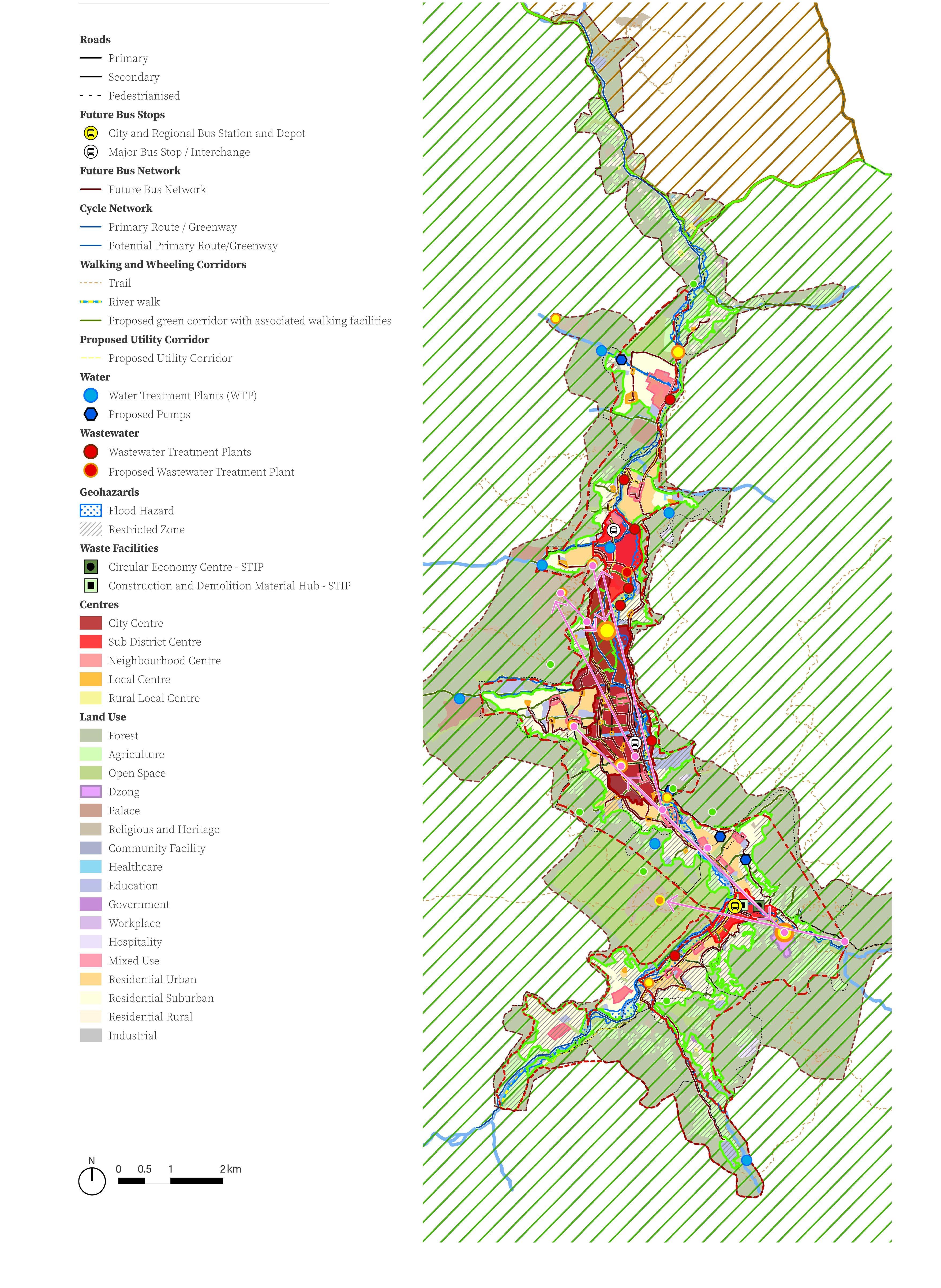
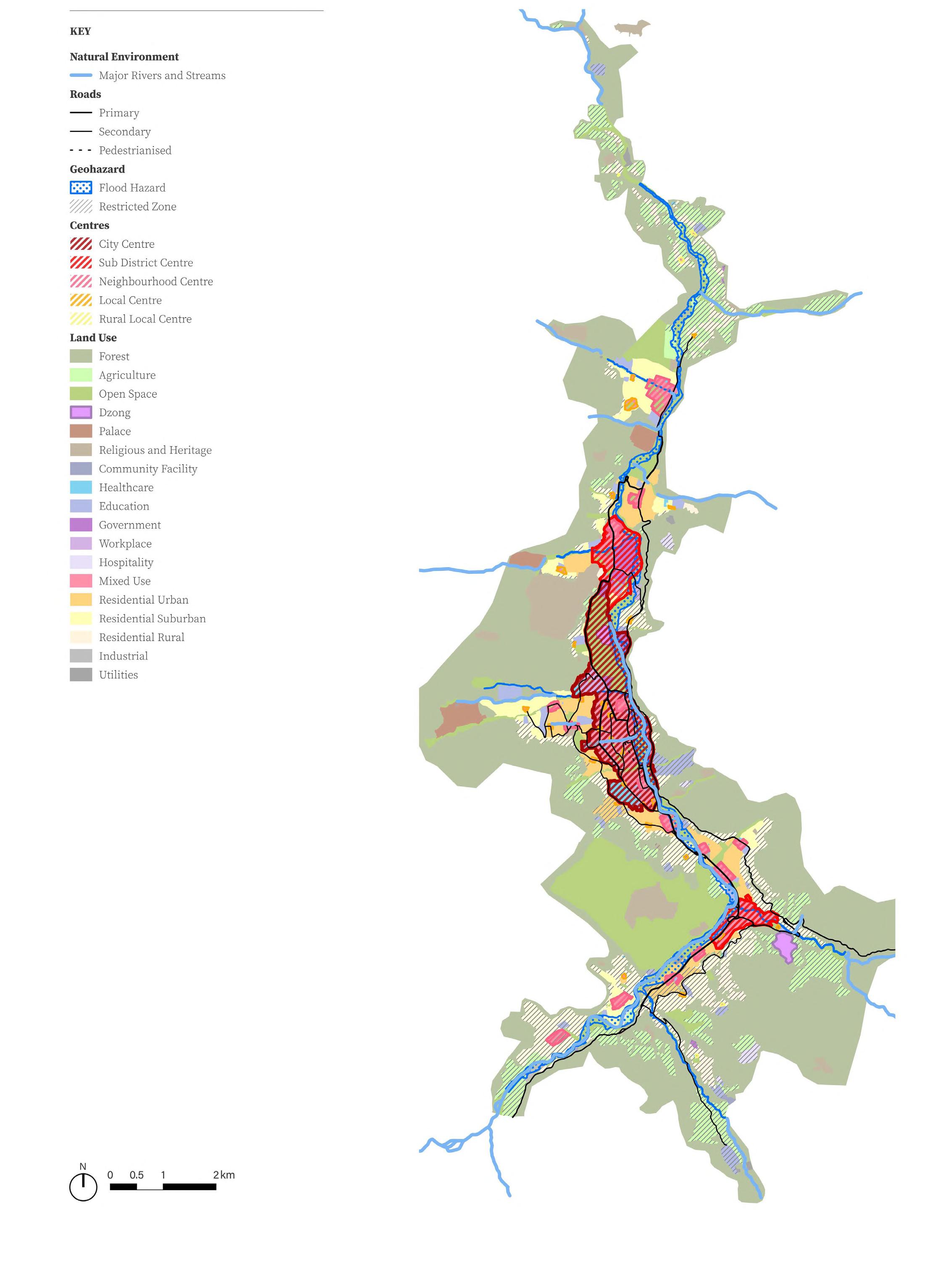
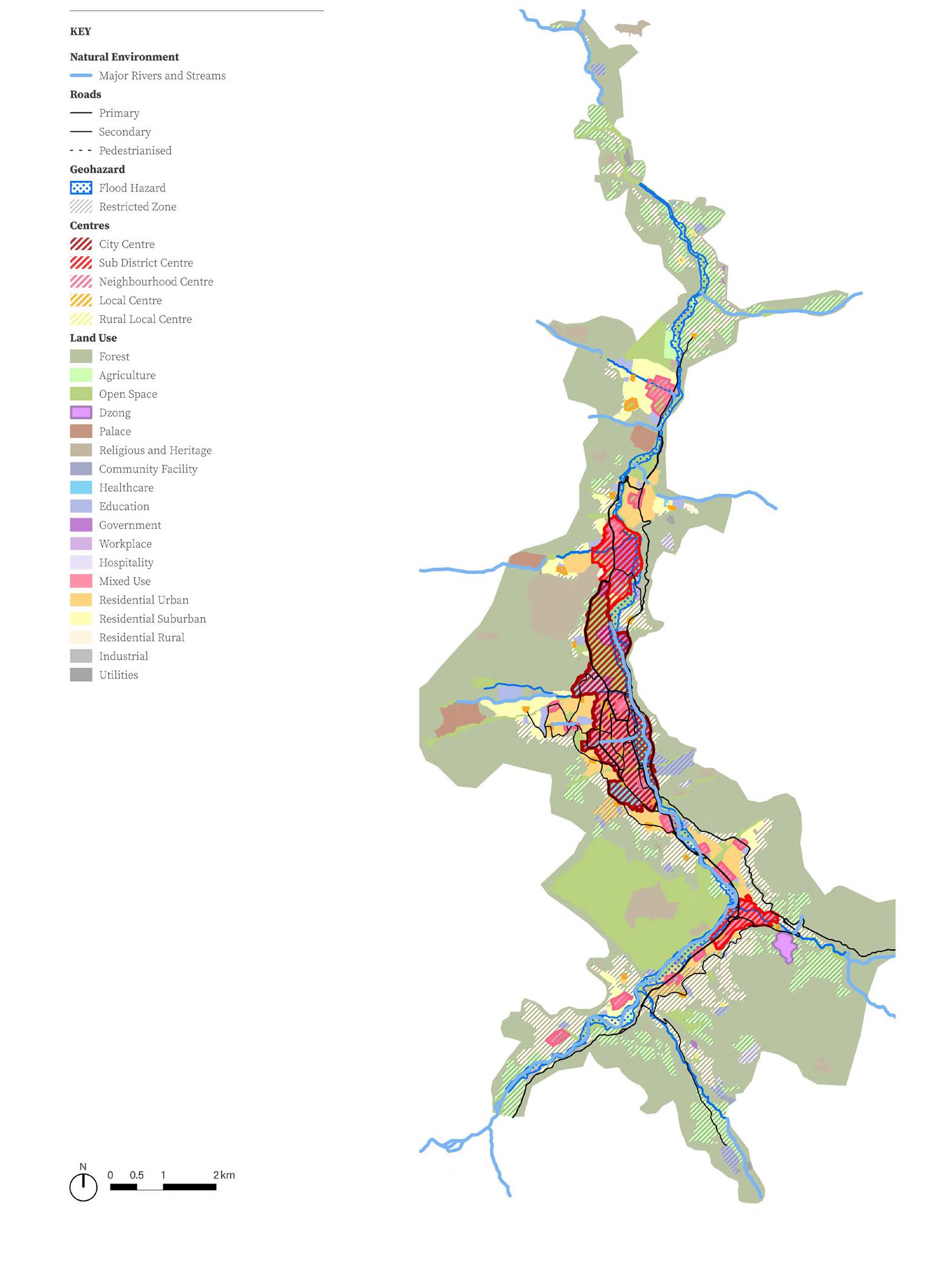
The Thimphu Structure Plan 2023 is the statutory plan guiding decisions on development and regeneration activity within Thimphu up to 2047.
It sets out the approach of ‘good growth in the right places’, focusing investment and resources where positive outcomes can be realised most efficiently and avoiding sprawl to ensure that the city’s character and environment is protected for future generations.
Thimphu’s role as acting as the main administrative and the Country and
Principles have been Plan which is subsequent sections. together the spatial Thimphu Structure
housing and existing urban Thimphu through a and densification. city centre. It is for employment knowledge sector environmental and financial climate change and national centre professional services technology and end tourism and tourism, retail, through the Landscape. to geohazards to less sensitive implementing mitigation heritage features local culture and historic and religious and traditional Improves the cultural heritage, routes and trails, quarter at the city enhancing open sites. district centre at includes a mix of uses retail, restaurants, and small scale manufacturing.
centre in the clustering a Science Innovation Park (STIP) Hub. In addition retail, restaurants, and small scale manufacturing. neighbourhood and local
centres across the city which creates local employment and delivers community facilities.
Redevelop large areas of Government owned land including Kawajangsa, the Royal Bhutan Police, Royal Bhutan Army and Royal Bhutan Bodyguard sites to unlock opportunity in central locations. Uses within these defence sites that are compatible with other urban land uses should be integrated into the city. Uses that are not compatible should be relocated outside of Thimphu.
Reinforces high-value agri-business, develop Green Building Economy facilities and create light manufacturing and distribution facilities in Yusipang and Hungtsho.
• Supports rural livelihoods including Buddhist teaching in Dodena and third sector tourism and high value organic agriculture in Kabesa, Begana and Changtagang
Maintain modest mining growth and develop light industrial and distribution centre in Jemina Refine the road hierarchy. Deliver an integrated bus system. Major public transport stations need to connect to the city centre, sub-district centre and associated Regional Transit Hub, neighbourhood centres and local centres, supported by good quality non-motorised transport and taxis through mobility hubs. Deliver a hierarchy of new and enhanced open spaces including a Green River Corridor along the Wang Chhu and Tashichho Dzong Gardens as a significant Royal Park in the heart of the City.
• Taba Forest Park, the Central River Park and Babesa Ecological Park will function as new City Parks. Each will have a distinctive character and design approach in response to adjacent land use and environmental characteristics. They help to structure the city into distinctive sections.
• Smaller open spaces will be delivered at neighbourhoods and associated with local centres. These spaces will include open space associated with heritage sites.
• Facilitate the transition to the circular economy by expanding resource and waste drop off hubs associated with neighbourhood centres. Deliver material recovery facilities, an industrial transfer station and construction and demolition material hubs.
• Develop a north-south primary utility corridor/duct route to accommodate water,
energy and telecoms infrastructure.
Provide new reservoirs near existing water treatment plants and expand existing service tanks to support the increased demand for clean water.
Upgrade existing waste water treatment plants to meet the future demand. The design of Taba, Jungshina and Babesa have incorporated space-proofing for future expansion. Others may require replacing critical components to add capacity.
• Deliver water sensitive urban design to manage storm water, this includes ‘daylighting’ existing streams that had previously been covered.
Diversify the renewable energy generation network and upgrade existing infrastructure, including overhead distribution. This could include pilot projects on rooftop solar and energy clusters, EV charging infrastructure and develop an underground utility corridor.
Regional renewable energy sources like wind and additional hydropower should be explored.
Support an equitable telecoms network through a significant expansion of underground fixed network infrastructure.

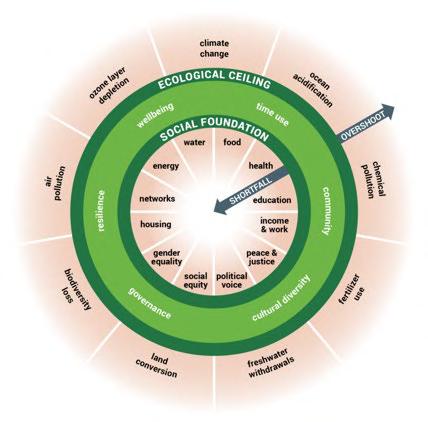
Thimphu’s population growth ceiling is set within the socially just and ecologically safe space defined by the ‘GNH within the Doughnut’ Vision. In other words population can only grow as long as everyone’s social foundation needs can be met without depleting natural resources.
Thimphu’s capacity for growth is defined in Policy US3 Population Distribution.
TSP 2023 will explore the Social Foundation parameters through the following themes:
Working collaboratively with Centre for Bhutan & GNH Studies (CBS) and Doughnut Economics Action Lab (DEAL), the principles of Gross National Happiness (GNH) within the Doughnut are adopted in TSP 2023. It articulates the vision for Thimphu through a regenerative and distributive spatial framework.

Introduction
1.1.3
A REGENERATIVE AND DISTRIBUTIVE THIMPHU
DEGENERATIVE
REGENERATIVE
TSP 2023 seeks to address Thimphu’s socioeconomic challenges and propose a flexible plan that can adapt to its changing needs and cater to a transforming society.
Working collaboratively with Centre for Bhutan & GNH Studies (CBS) and Doughnut Economics Action Lab (DEAL), the principles of Gross National Happiness (GNH) within the Doughnut are adopted in TSP 2023. There are two key principles through which TSP 2023 puts Doughnut Economics into practice:
These principles underpin the TSP vision and key planning policies and spatial framework. They are similar to the Bhutanese concept of Ngar (translated as mettle) –coping well with difficulties and working with spirit and resilience.
• Be distributive. Share opportunity and value with all who co-create it.
• Be regenerative. Aim to work with and within the cycles of the living world.
These principles underpin the TSP vision, key planning policies, and spatial planning framework. They are similar to the Bhutanese
Housing quality
Construction in river buffer zones
Imported materials and labour
Land conversion
Land fragmentation
Risk to life from Geohazards
DIVISIVE
Traffic congestion
Rural-urban migration
Increasing youth unemployment
Private access to parks
Insufficient community facilities
Affordable housing
Healthy rivers and streams
Community forests
Compact development
Flexible, adaptable buildings
DISTRIBUTIVE
Public transport
Equitable distribution of opportunities
Employment opportunities
Public open spaces
Equitably distributed facilities
distributes community land
basic facilities distance of more specialist accessed by a in the most with public
Accessibility: public transport
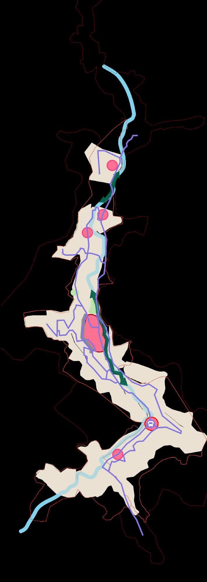
Neighbourhood centre
Residential catchment: 5 - 15,000 people
Catchment radius: 900m
Function: Facilities needed regularly for urban communities
Accessibility: walking and cycling, short public transport journey
Local centre
Residential catchment: 2 - 5,000 people
Catchment radius: 400m
to centres liveable concentrates commercial, retail, This creates resource accessible and variable distributes community land facilities distance of specialist accessed by a the most with public Urban Structure
- Restricted zone over another land use refers to
Hejo-Samteling
Zilukha
Motithang
Changangkha
Changgidaphu
Changzamtog Tshalumarphy
Note - Restricted zone over another land use refers to
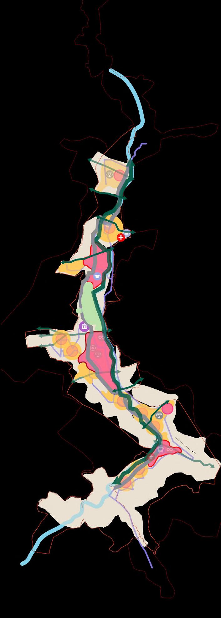
Phase 1 - Immediate (2023-2026)
Phasing
Phase 1 - Short term (2027-2032)
City
Wang Chhu River Corridor
Tashichho Dzong Gardens Valley Park Regional Transit Hub
Dechencholing NC Taba NC
Jungshina NC
Tashichho Dzong Gardens
Utility Corridor along Doebum Lam
Wang Chhu River Corridor along City Centre
Bus Network STIP & New Regional Transit Hub
Babesa NC
Utility Corridor in the North
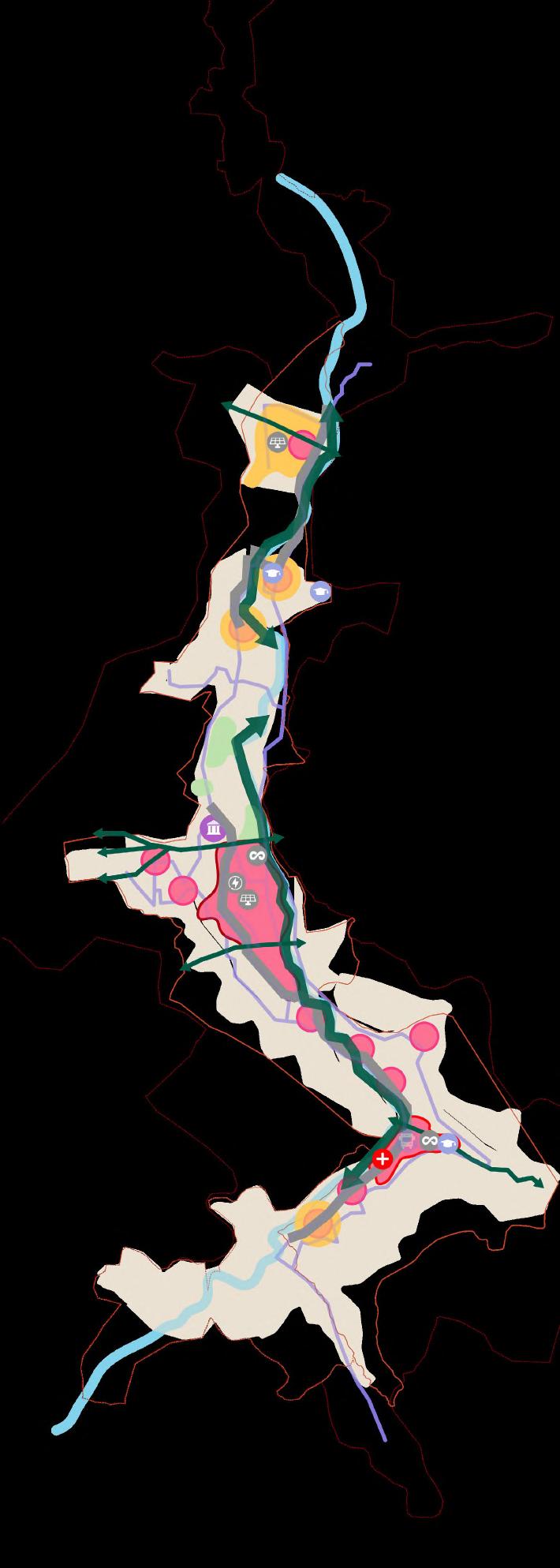
Extending Tashichho Dzong Gardens
Mothithang NC
RBG Site for Housing One Government Estate Changangkha NC
Chamzamtog NC Changjiji NC Olakha NC
Extending Wang Chhu River Corridor
Extending Utility Corridor to the south
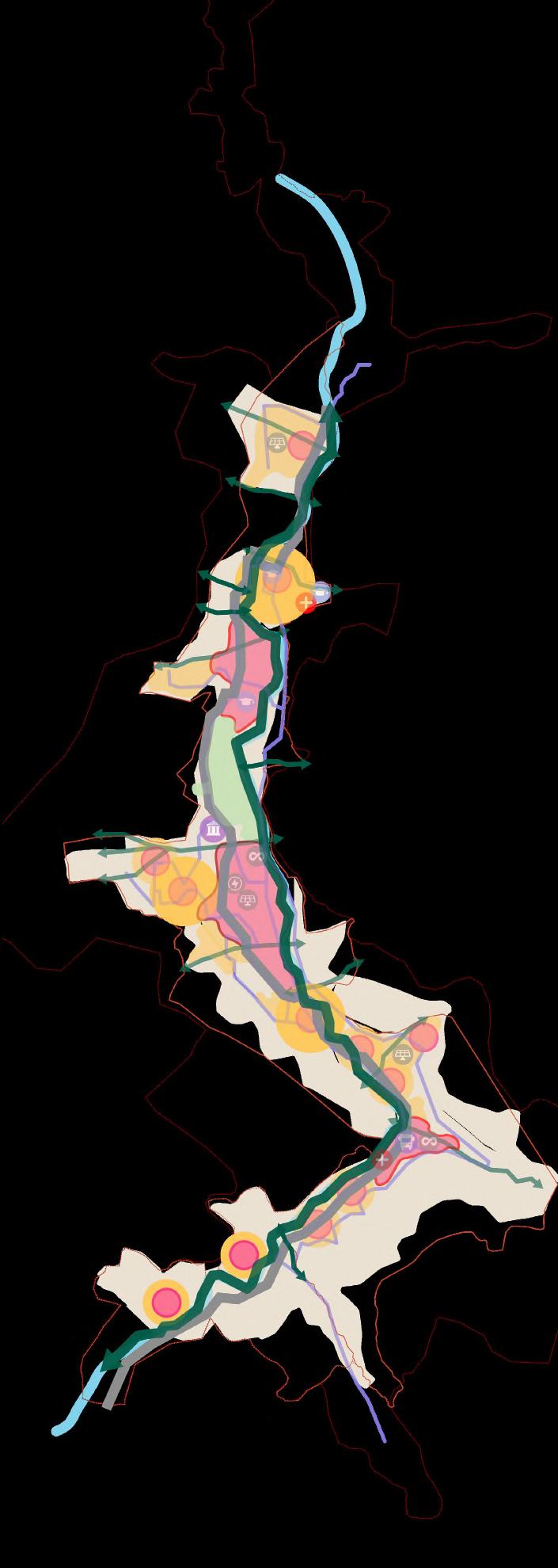
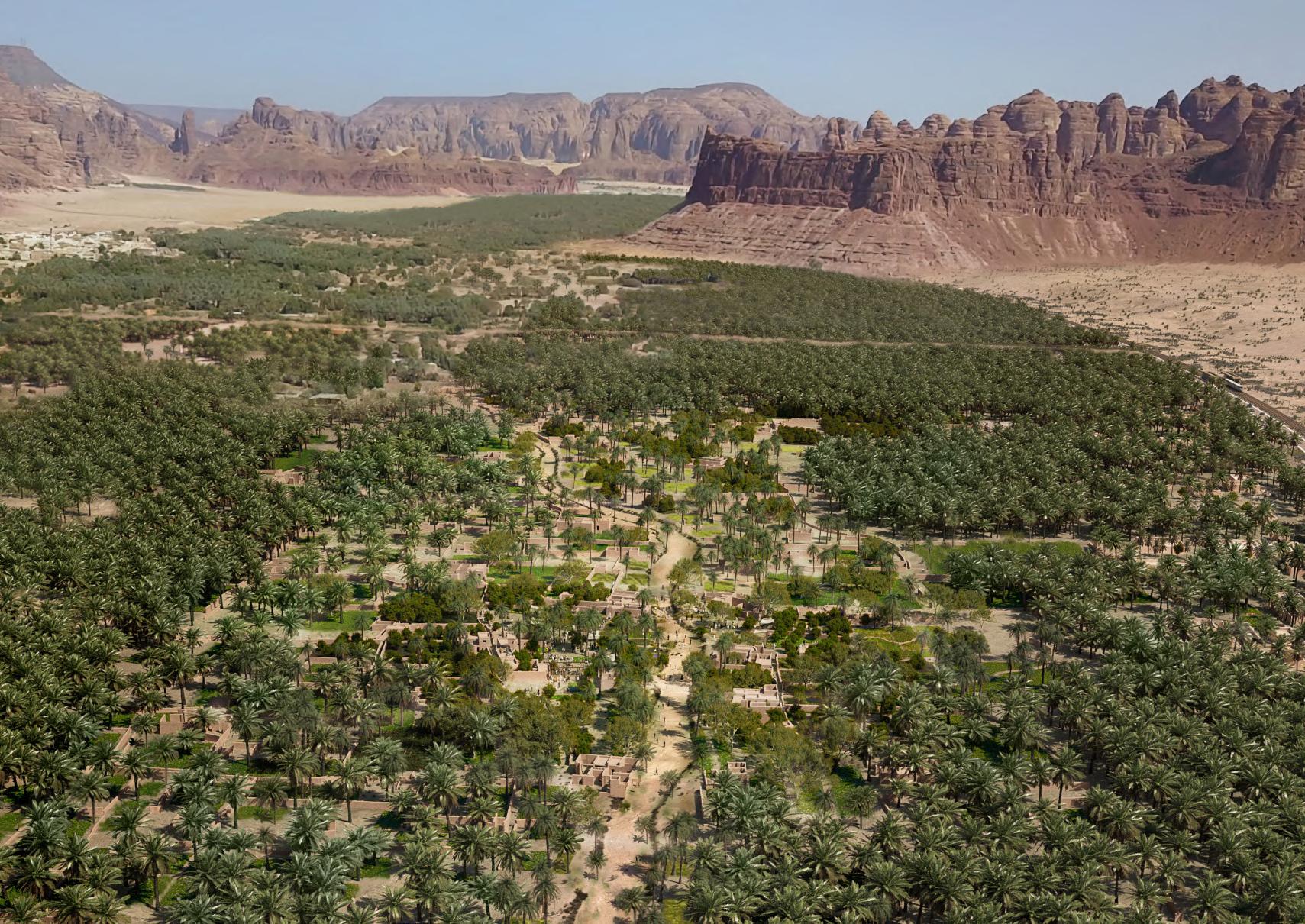
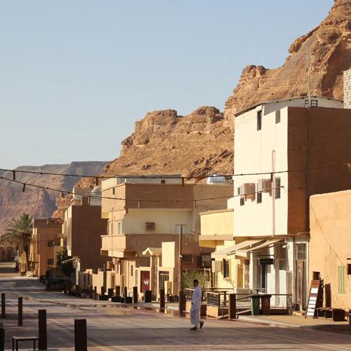
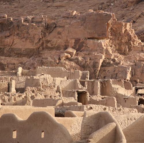
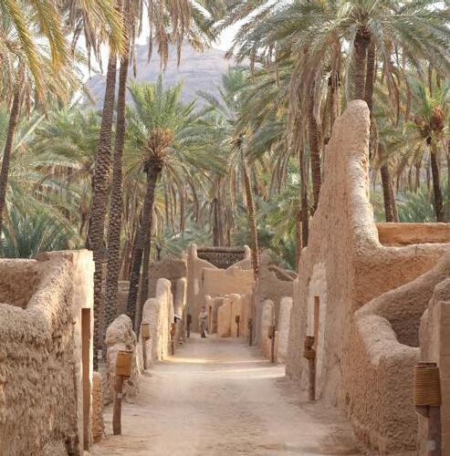
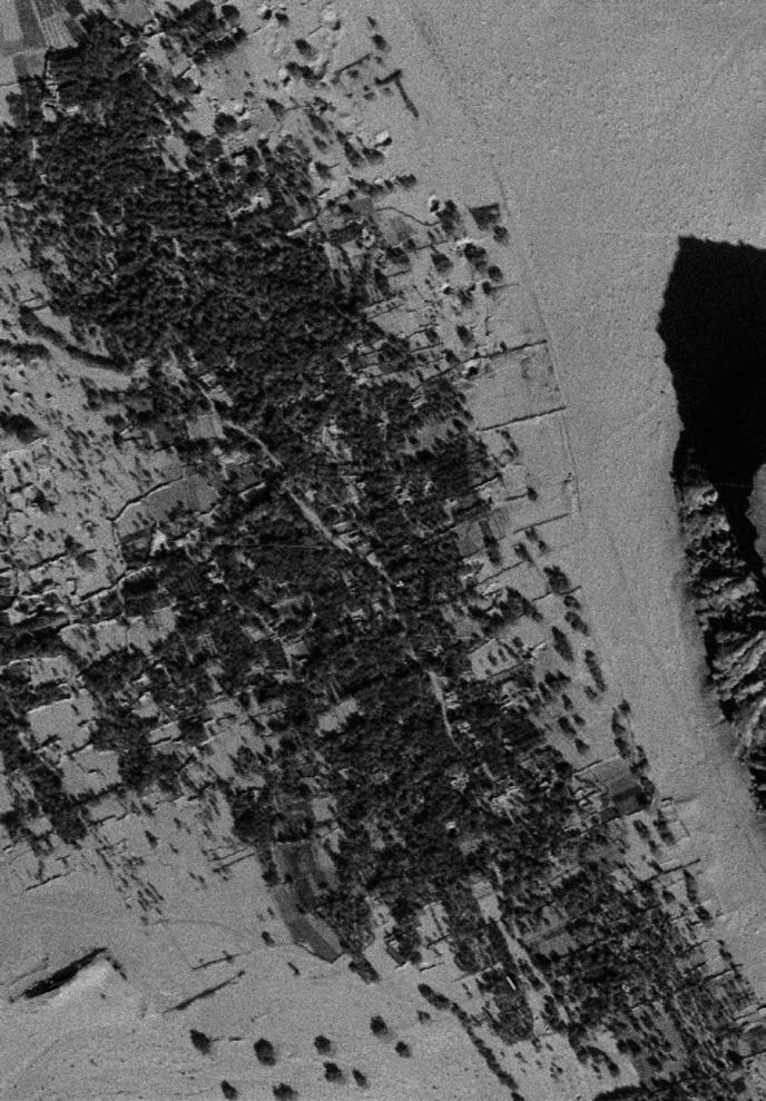
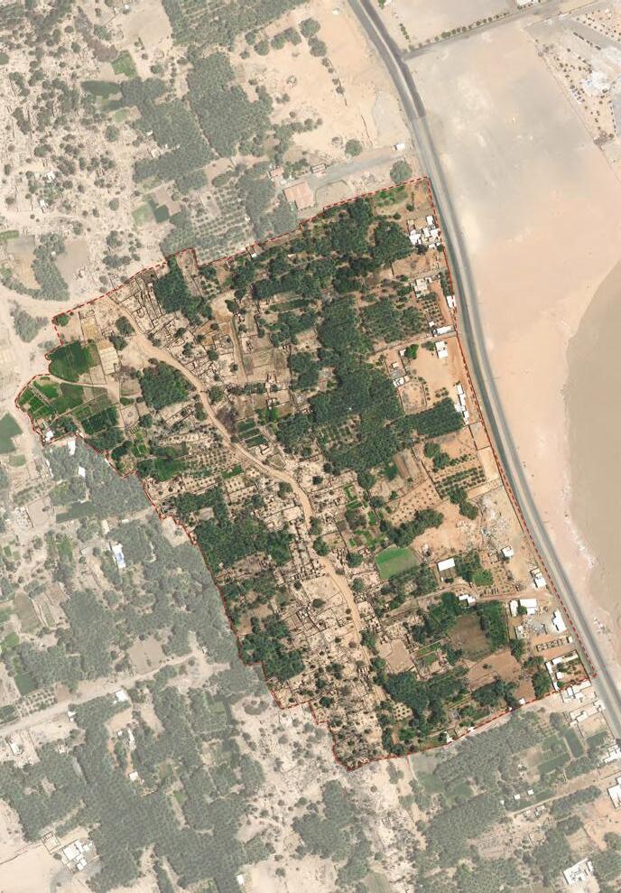
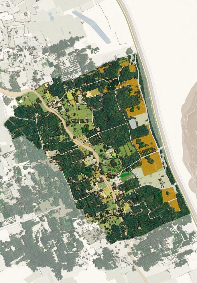
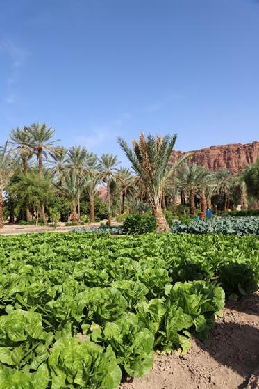
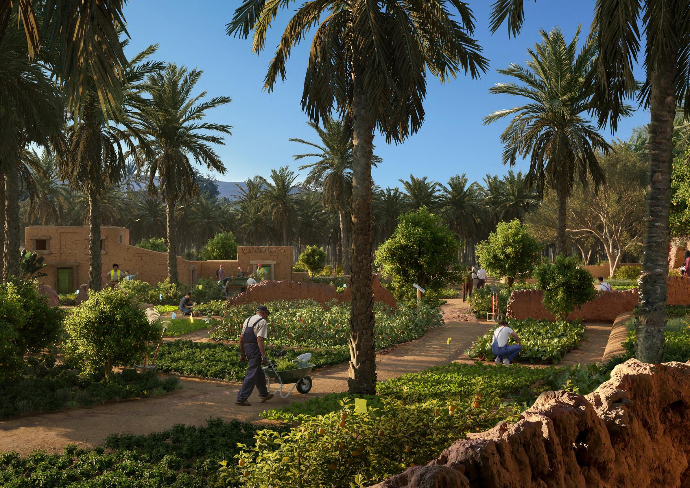
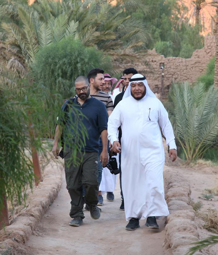
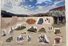
Located in northwestern Saudi Arabia, AlUla Cultural Oasis is at the global crossroad of civilisations. Its site was traversed by the Incense Trade Route roughly between 300 BC and 200 AD, linking the nearby UNESCO heritage site Hegra and other regional destinations.
It features many earth heritage component from the Islamic period, such as the Old Town and the extensive suq network, running through the once lush Oasis farmlands.
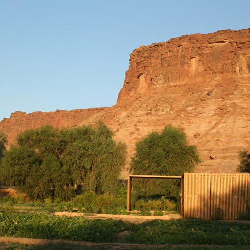
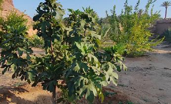
Left derelict and facing water stress due to the climate crisis, the millenniaold Cultural Oasis requires a regeneration approach to bring back its agricultural heritage while integrating sustainable practices.
Defining unique project areas to regenerate the area and creating unique visitor experiences through public realm journeys and destinations.
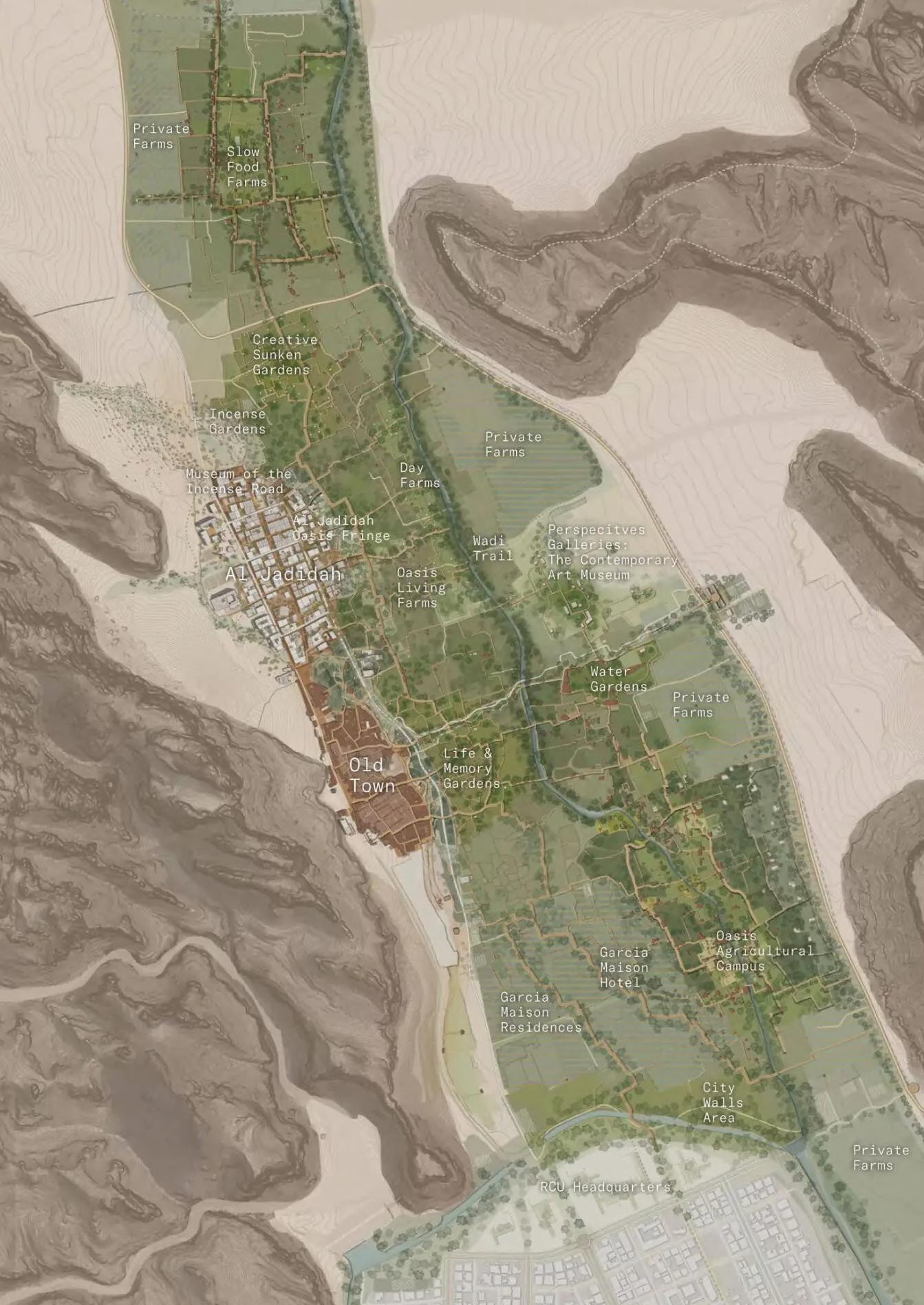
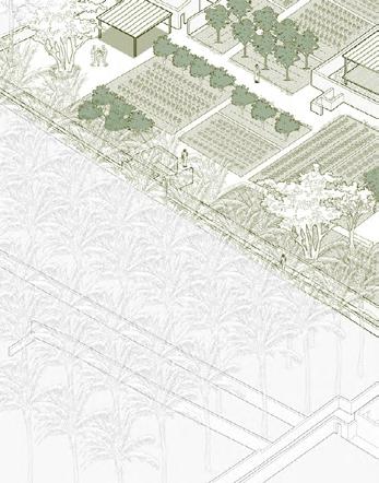
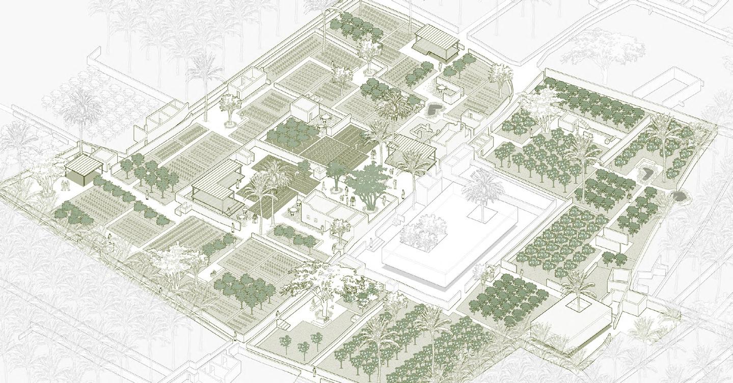
The Oasis Agricultural Campus (OAC) is the first agriculture training campus in the world focused on teaching and learning of local and sustainable agriculture techniques, management and business in oasis agricultural cultural landscapes, catalysing the regeneration of the whole AlUla Cultural Oasis.
It will achieve this through the delivery of:
• State of the art Education Institute and ancillary facilities for agricultural training programme to disseminate traditional knowledge to the next generations to bring back productive agriculture.
• A Cultural Oasis Centre (COC), to act as the powerhouse for managing the ambitious regeneration programme.
• A restored Cultural Landscape, that repairs ecosystem services and conserves its component architectural and integral cultural traditions.
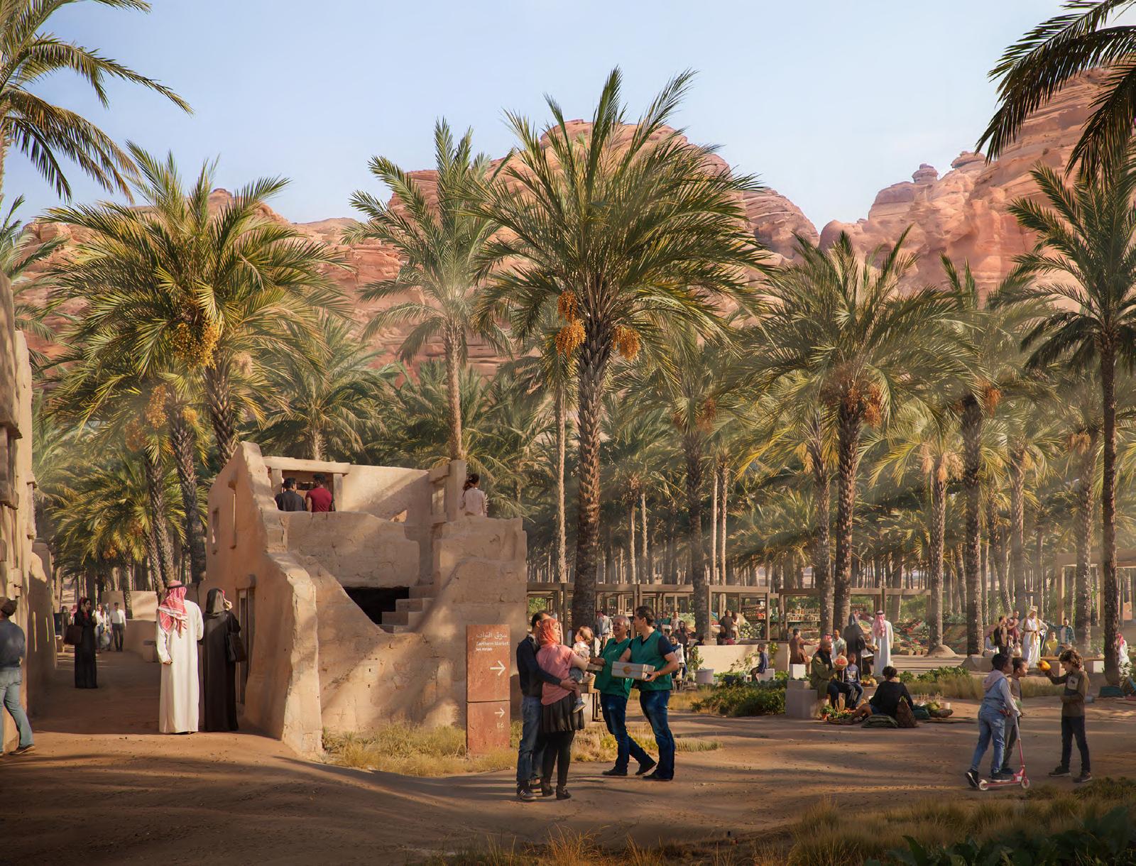
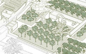
A global destination for farmto-table eco- gastronomy and celebrating culinary arts.
The oasis landscape determines the zoning, land use and programme activities of the project, which come together to form a holistic farm-to-table programme integrated with overnight stays and cutting-edge culinary research.
It
protect built and intangible
and community practices by developing the
gastronomy industry.
Formulating Design Guidelines and Applying to Concept Design
Sustainability should be firmly embedded in the concept design and future stages of the AlUla projects. Leading the sustainability strategy formulation and implementation for multiple AlUla projects, a four-step methodology was applied.
3.3 Design Alignment to Sustainability Framework
Understand international, national and local sustainability commitments and requirements. Different green building standards are required for different types of projects (e.g. LEED Gold for campus and Envision Gold for public realm projects).
Overview of Sustainability Framework
Distil and harmonise sustainability themes across various standards and policies. Conduct workshops with subconsultants.
Sustainability Policies and Guidance
Sustainability Considerations
Stages
Example: AlJadidah Squares, AlUla Public Realm Projects
Step 3: Incorporate Sustainable Design Incorporate sustainable design elements at current concept design stage. Recommend actions for future detailed
3.3.3 AlJadidah Squares Sustainability Considerations
Step 4: Track Sustainable Design Outcomes
Establish sustainable design metrics and track throughout design stages.

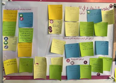
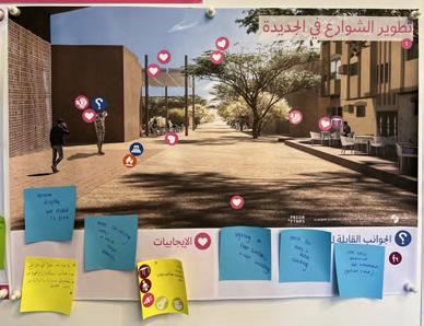
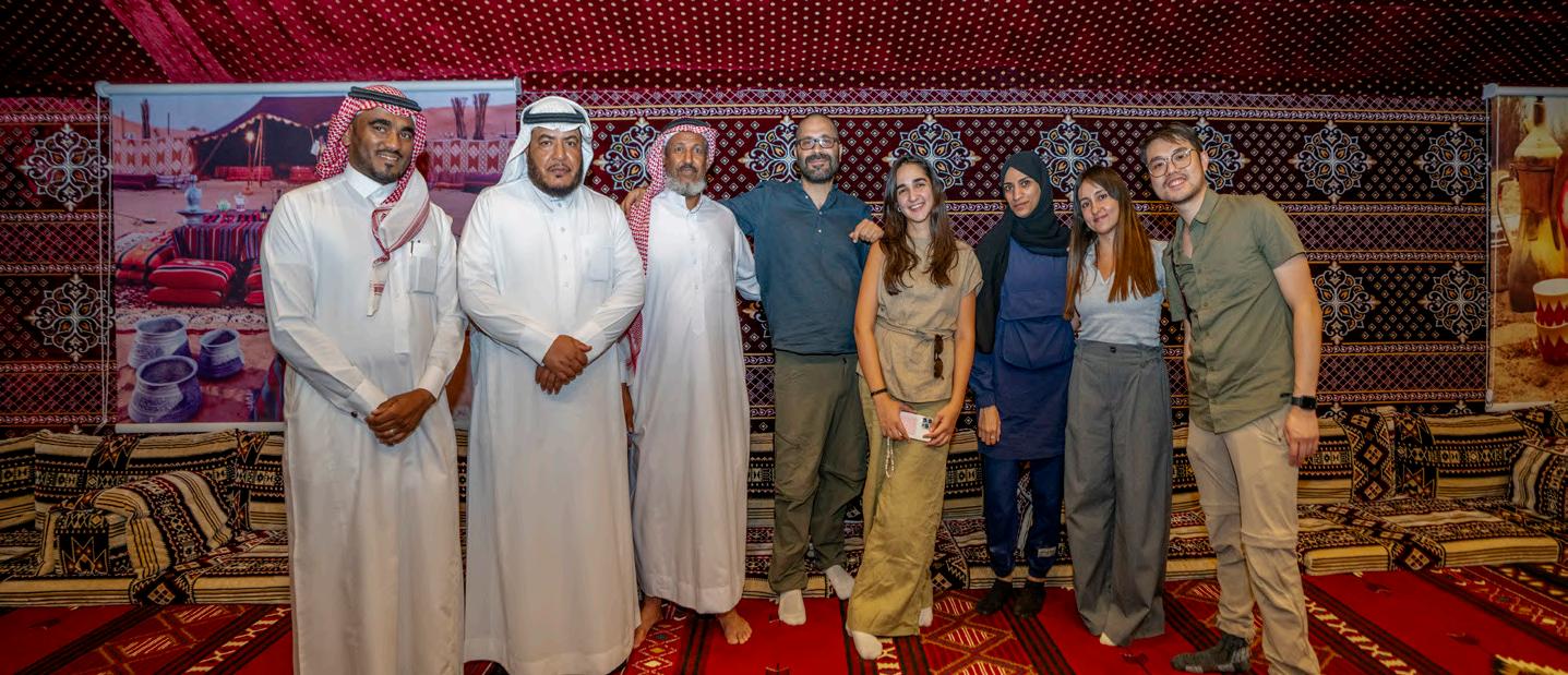
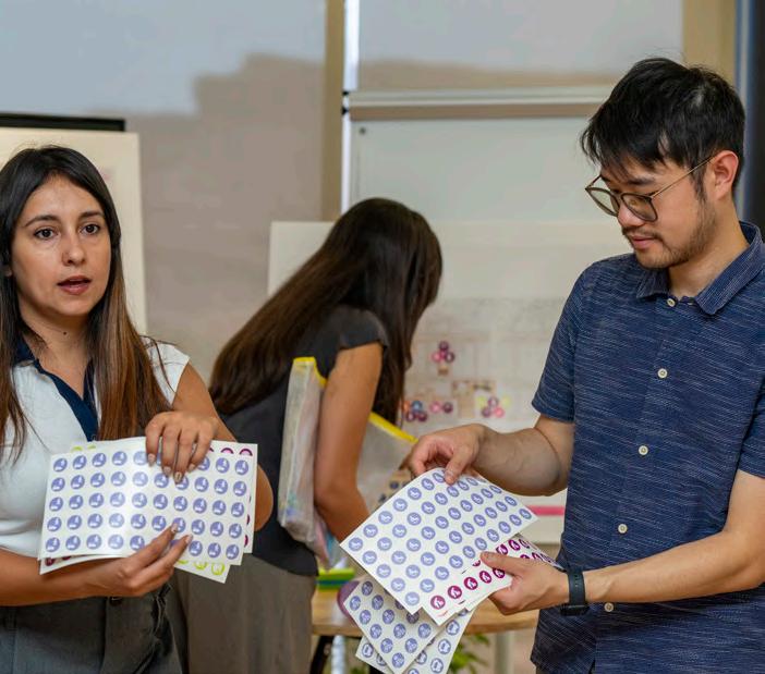
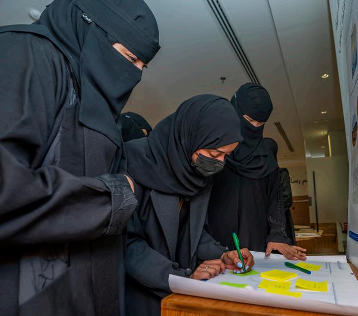
To ensure the local communities of AlUla support the shaping of AlUla public realm projects, a Community Engagement programme was developed and delivered in 2024. To foster inclusivity, diverse segments of the local community of different age and gender were engaged.
Quantitative wider reach
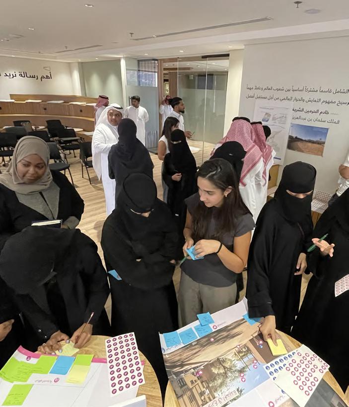
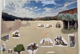
Drop-in sessions in community spaces for community members to provide feedback on emerging concept design and validate project vision.
Sessions conducted: 2
Participants: ~35 local residents and female art school students
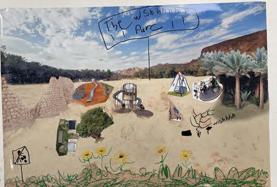
Walk-along interviews with local experts at project sites to understand local history and knowledge on topics like agriculture, natural resources, culture, traditions, etc.
Sessions conducted: 2
Participants: 7 local experts and farmers
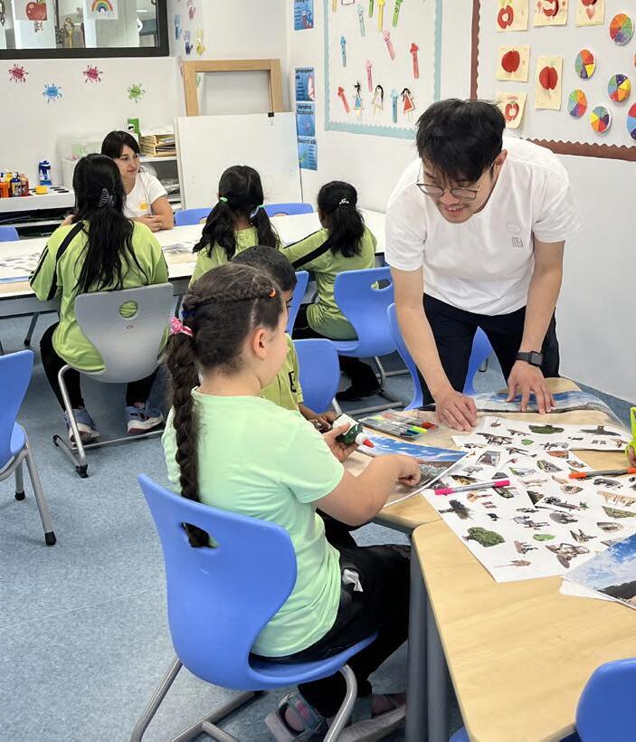
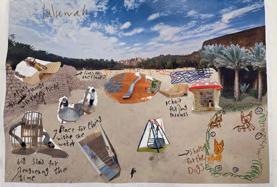
Co-design workshop organised for children in AlUla to collaborate and co-develop concepts for playgrounds in the City Walls Park.
Session conducted: 1
Participants: 13 children age 6-11
Insights from community are collected and analysed. Feasible ideas / comments are incorporated into concept design.
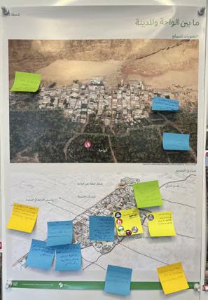
Post-its Stickers
Post cards Quotes Storys Drawings Artworks
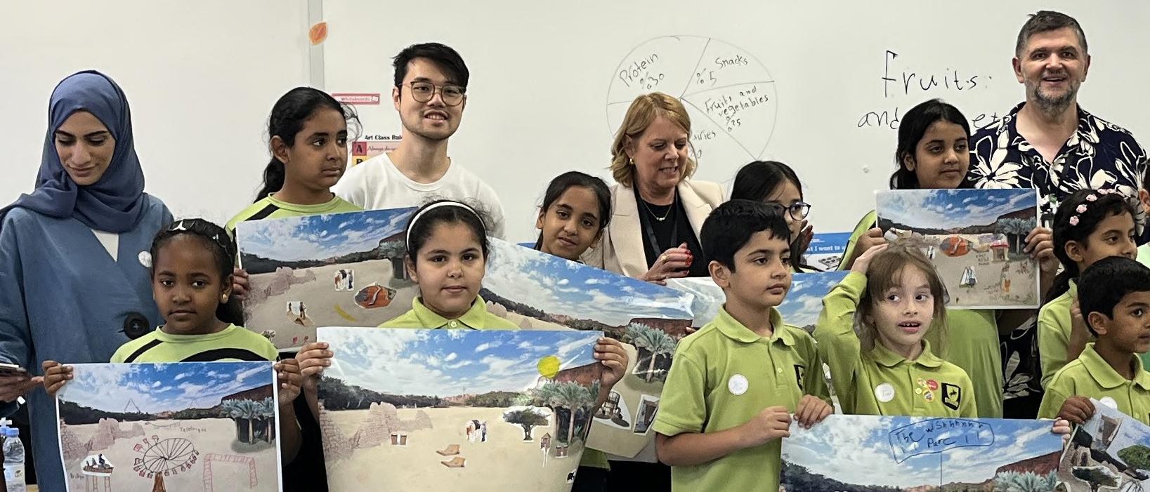
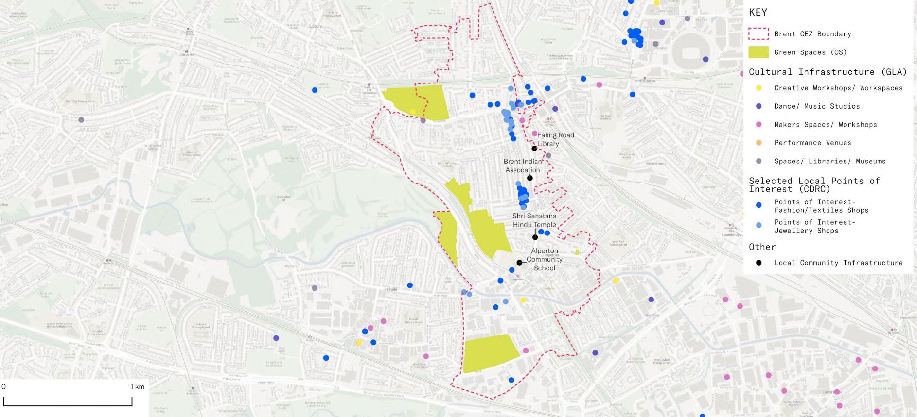
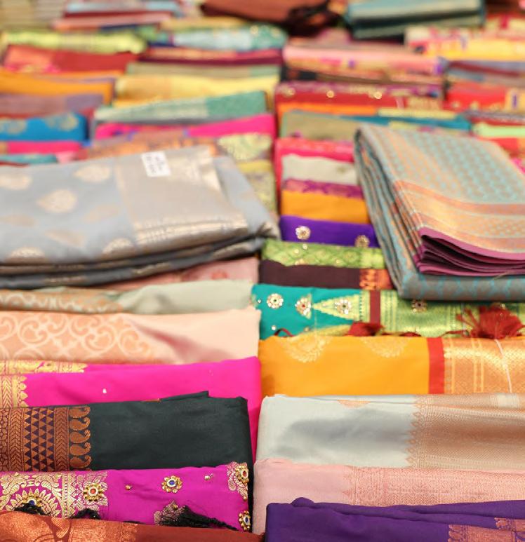
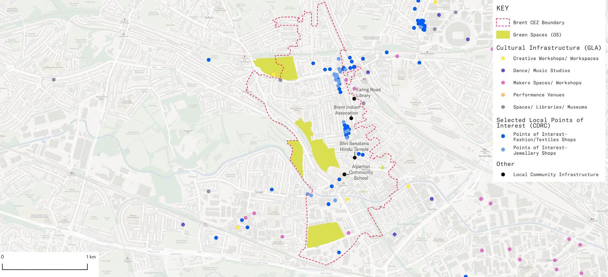
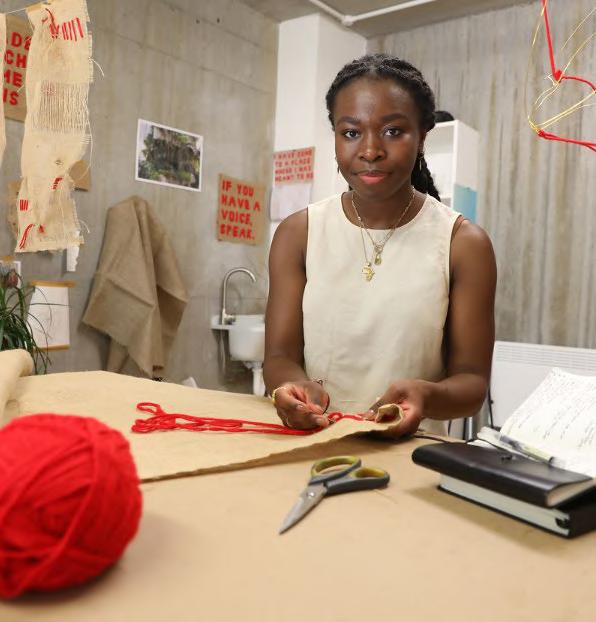
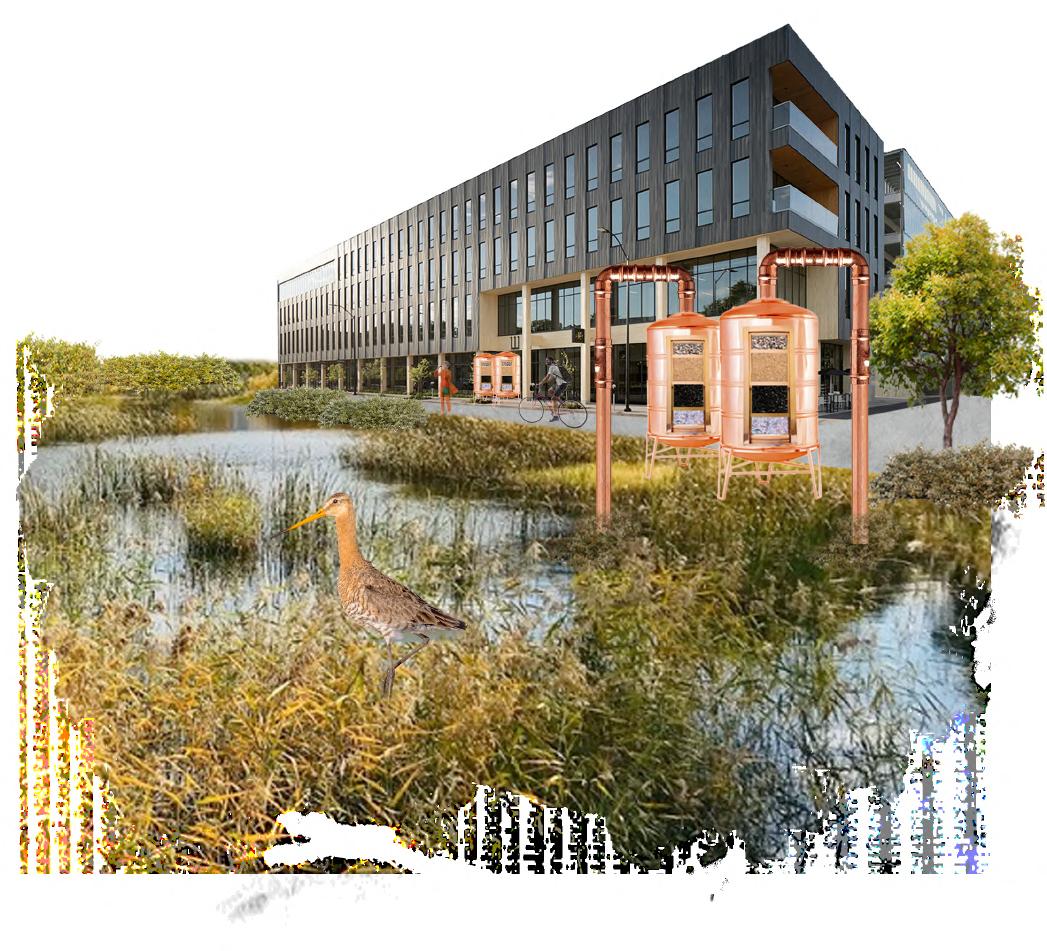
Located in southwest Brent near Wembley Stadium, the Ealing Road and Alperton (ERA) Creative Enterprise Zone (CEZ) has transformed from an industrial area to one of London’s most diverse neighbourhoods, known locally as ‘Little India’. Key creative enterprises located there are the South Asian fashion and

and
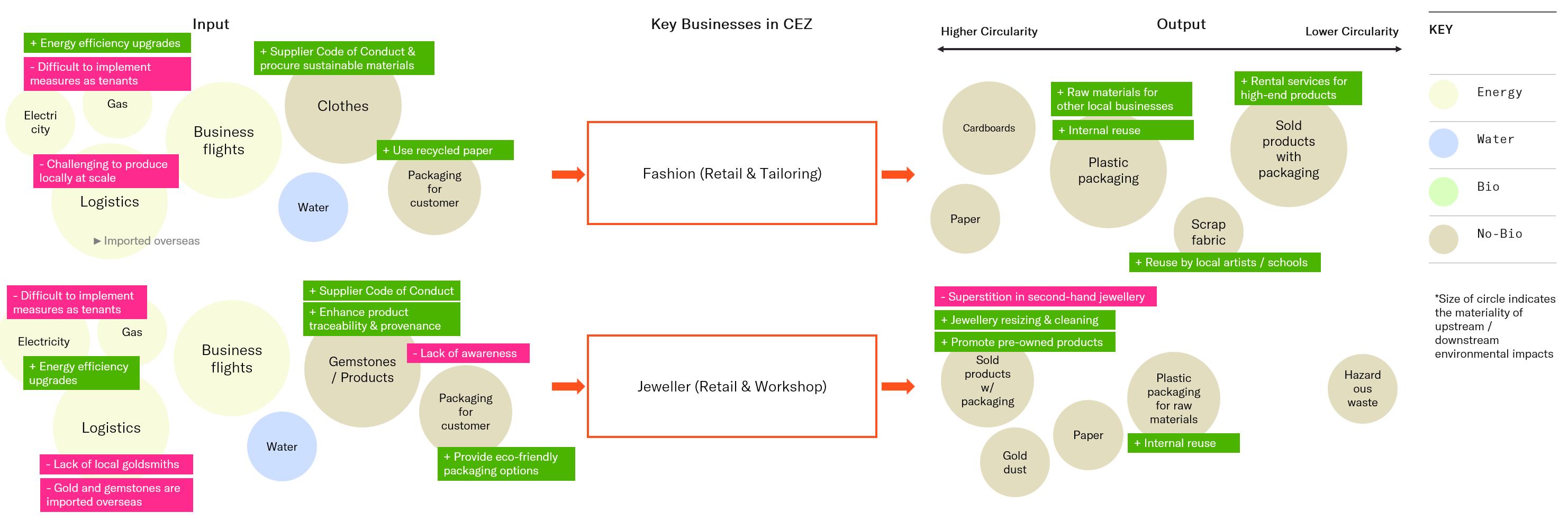
Systems map of challenges (red) and opportunities (green) for sustainability and circularity
System mapping offers a holistic view of industry sustainability by analysing it as an interconnected system. By mapping relationships, inputs, outputs, and feedback loops, it reveals root causes of challenges and potential leverage points for change, uncovering opportunities for innovation. 1. Deliver a new creative workspace
Creative Workspaces
Policy
Skills & Business Support
Community Engagement & Social Inclusion
Environment & Sustainability
Implement energy efficiency upgrades
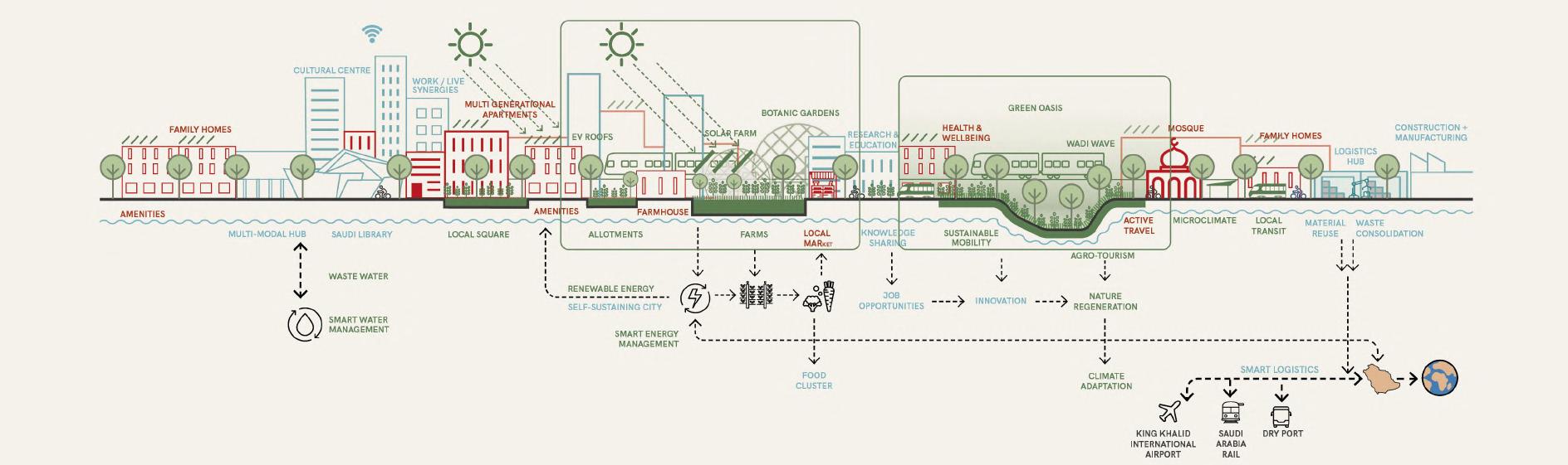
The NE Riyadh Framework Plan envisions a City in the Forest, blending nature, tradition, and innovation for sustainable, high-quality living.
Guided by strong planning principles, it prioritises
designing with nature, fostering vibrant communities, and building a resilient economy. The plan features a multi-layered ecosystem of wadis, biodiverse open spaces, and a unifying Central Park,
alongside flexible mobility solutions ensuring 5-10-15 minute connectivity through metro, light rail, and buses at every scale.


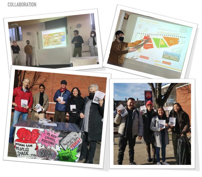
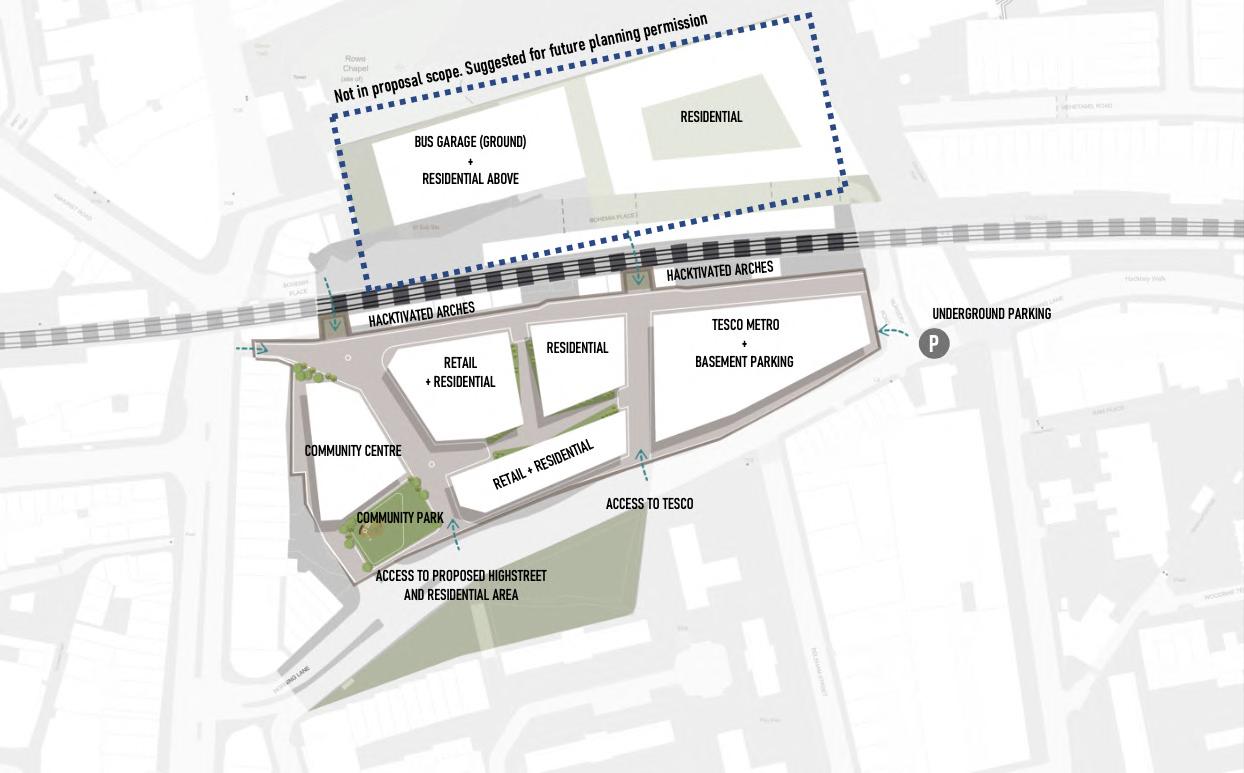
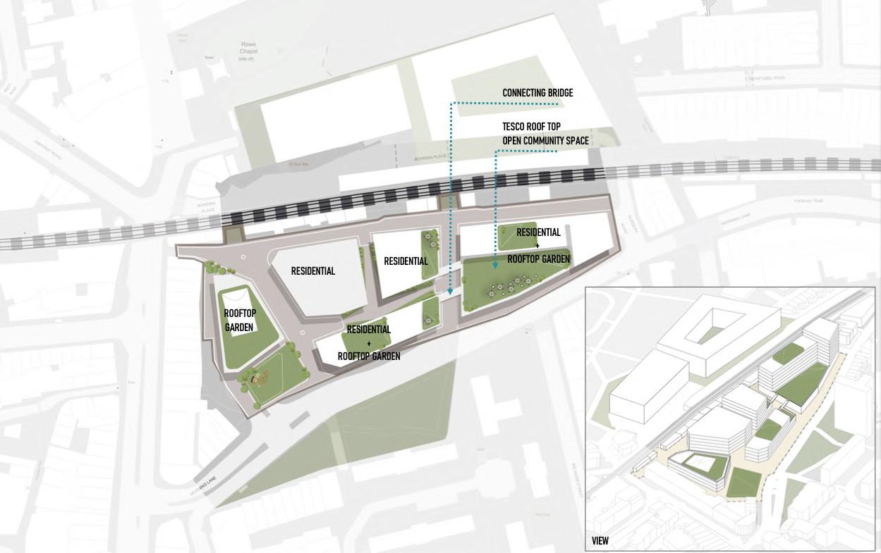
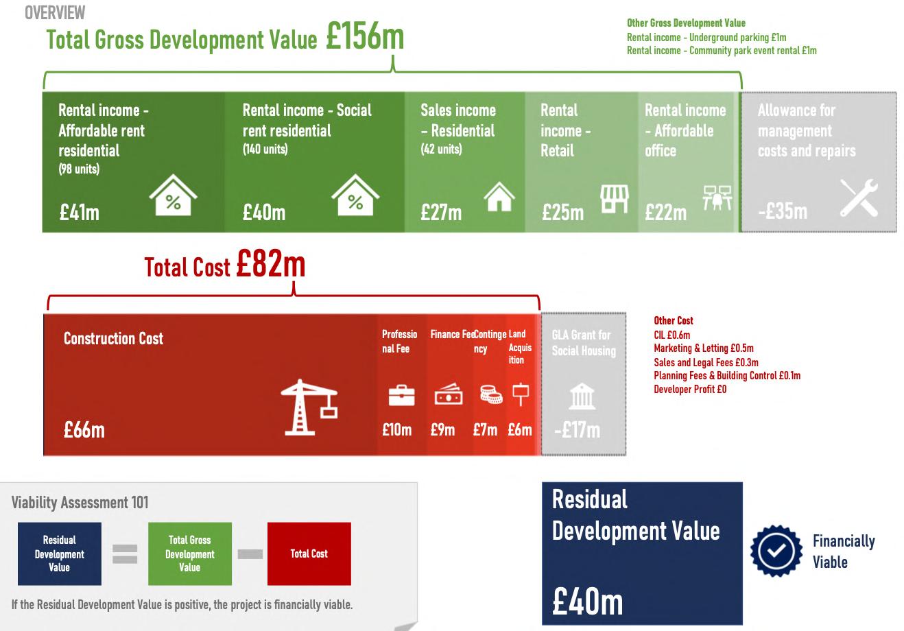
An alternative development proposal for 55 Morning Lane in Hackney, London. Through a series of exploration, ideation and collaboration with a community group, we created a financially viable community-oriented development option for the site.
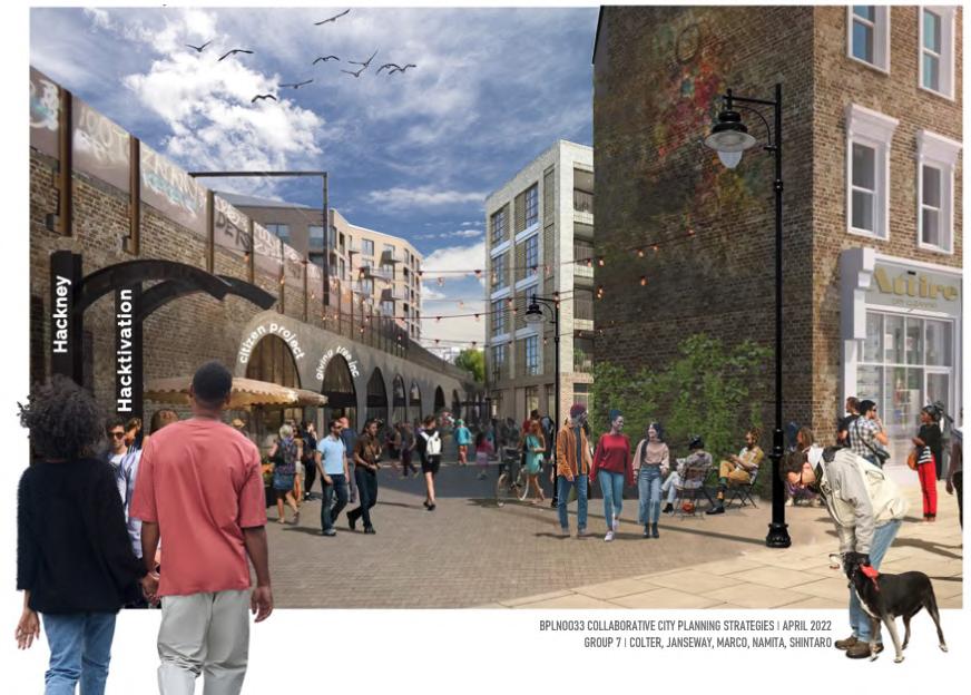
In 2017, the site was bought by Hackney Council for £55m and had made a development agreement with a developer, which has a poor track record involving a failed development of the nearby Fashion Hub. Through limited consultation, they came up with a 75,000 sqm development proposal that focuses on delivering office and retail spaces, and private homes. This sparked the community action by Morning Lane People's Space (MOPS), a community group in Hackney fighting for a more community-focused development option.
• FAR: 2.2
• Density: 206 dwellings/ha
• Ground coverage: 51%
• Average unit size: 64 sqm (Net Internal Area)
• Total units: 280
Rooftop Plan
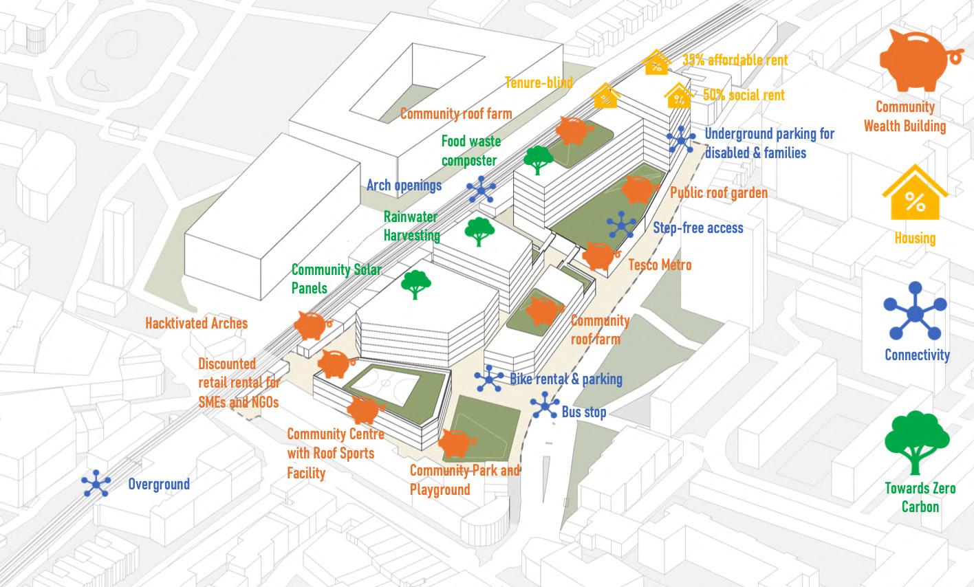
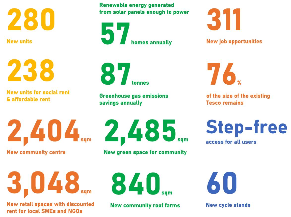
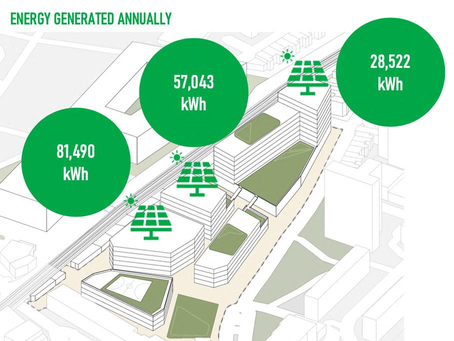
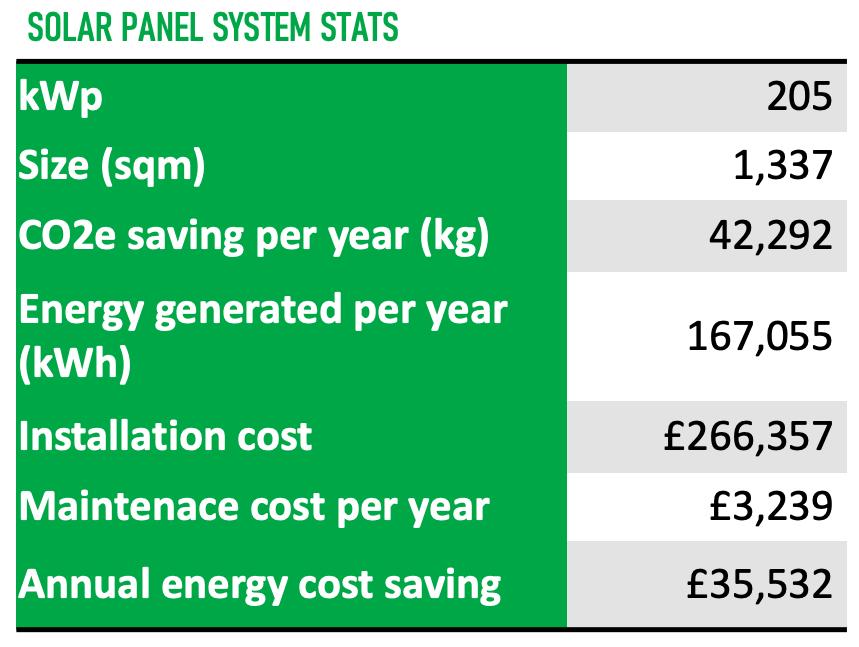
Assuming energy generated will be split between the 140 social rent units at a highly discounted rate of 5.27p per kWh (2021 UK average electricity price is 21.27p per kWh), each social rent family can save up to:
£191 annually
takeaways research the design framework the UK.
economy or developed A more should be context of a hard spaces are not accompanied by programming. Key should be stakeholder enablers success.
system in appropriate and social authorities with collection to multi-
4.2
Conceptual model –
How do materials flow through the city at different level?
Taking inspiration from Williams’ circular cities framework (2019), a conceptual model of material flows and circularity through household, estate and neighbourhood levels is developed.
As the world faces resource scarcity, there is a need to move from the wasteful linear economy to a resourceefficient circular economy, which is not only beneficial for the environment, but also for the economy and the society. To accommodate a circular economic system, circularity principles should be applied to our urban built environment.
Public housing estates in the UK, being economically and socially deprived, can adopt circular strategies at household, estate and neighbourhood level for economic, environmental and social benefits.
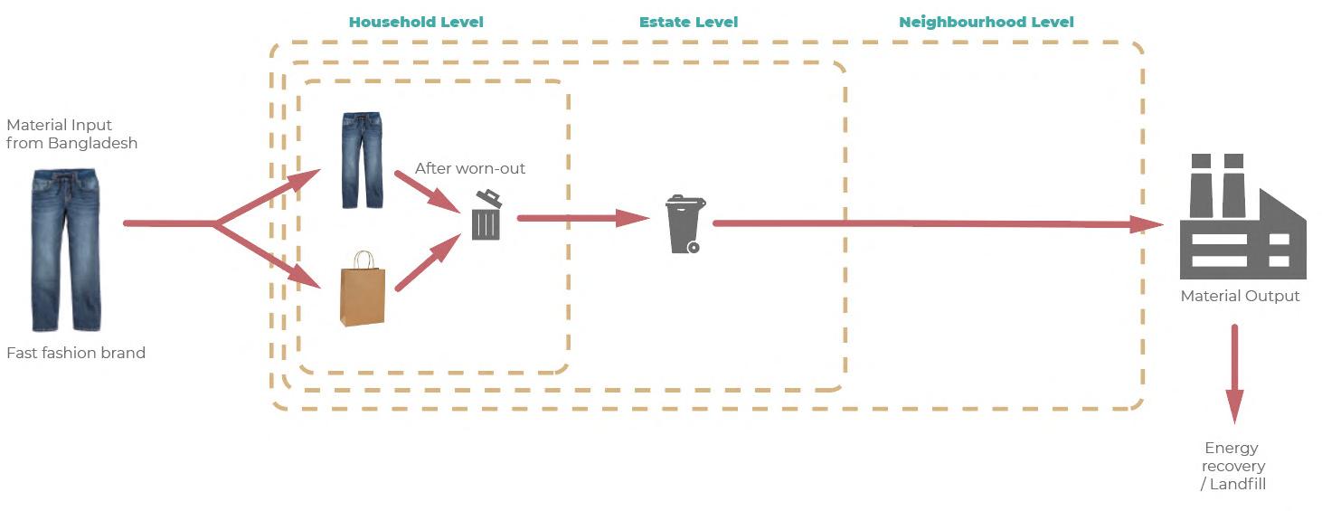
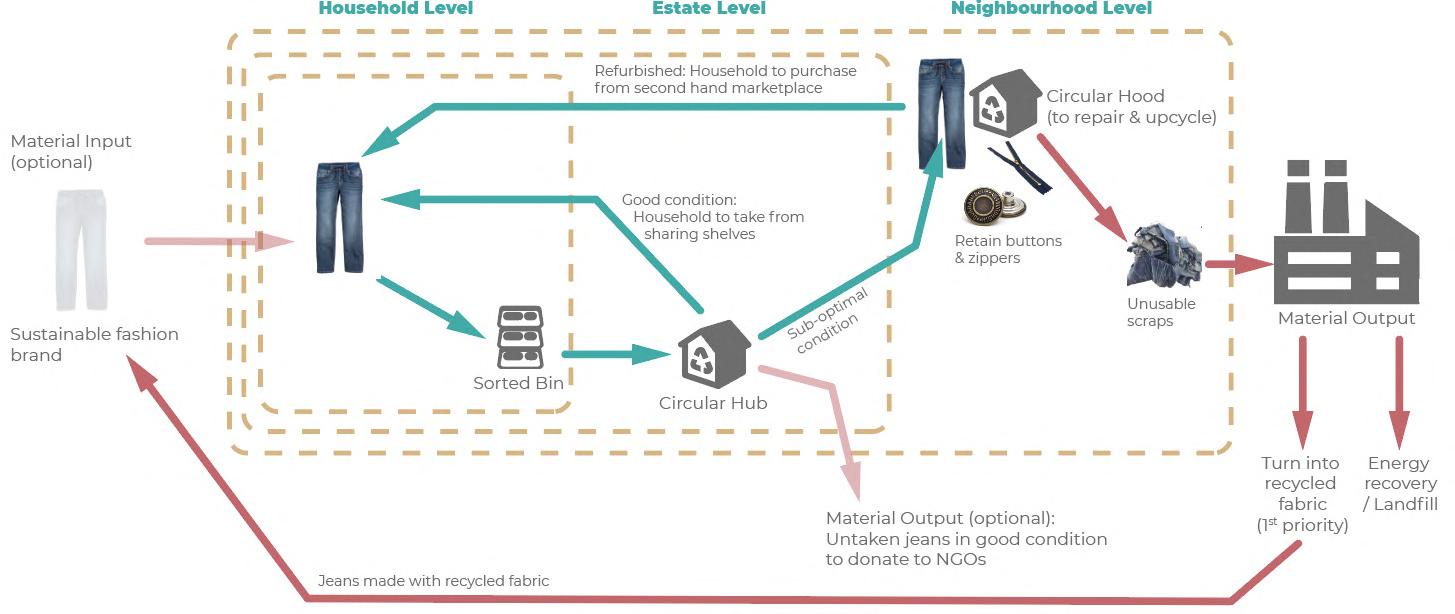
Red lines represent organic and inorganic materials flowing through households, estates, neighbourhoods, and eventually to borough level waste facilities. Some materials are output to landfills or for energy recovery, which are less environmentally sustainable options. Some are output to circular processes like recycling and remanufacturing beyond borough level. However, the further the material outputs travel, the higher the environmental footprint.
Thus, a key research question emerges:

How to enable circular strategies in public housing estates in the UK for environmental, social and economic benefits?
Green lines represent material circularity at different level. When more ‘loops’ (i.e. circular strategies/actions) are created within the system, material input and output of the system can be reduced, hence increasing the system resilience on material demands. The aim of this design project is to create more ‘loops’ at household, estate and neighbourhood level to lower material reliance from outside the neighbourhood systems.
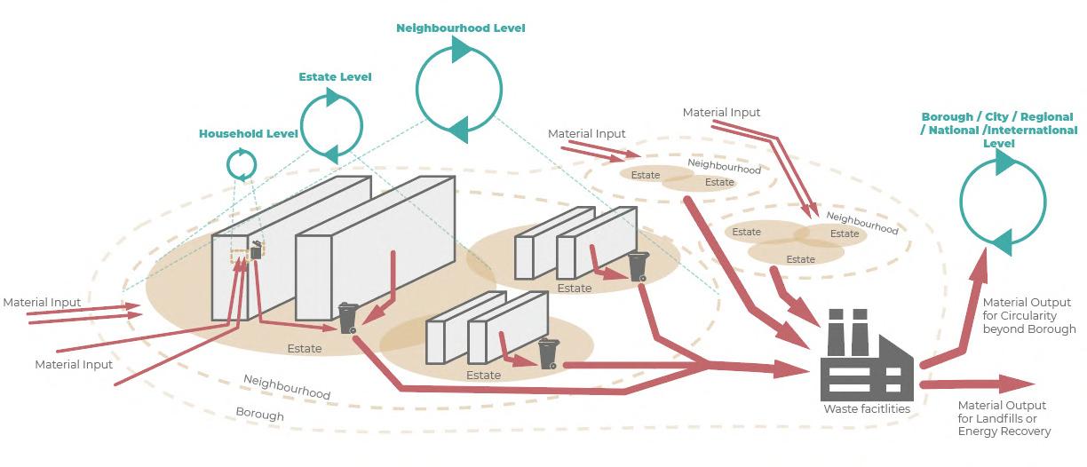
We want to maximise green material loops and minimise red linear material flows.
principles public housing of different implemented across estate and circular system physical spaces, and enablers. the success implementing environmental, economic generated for enhancing the development based on four Regenerate, definitions of the four William (2019) loops by recover and urban ecosystem by swap, and cocapacity community adaptive
systems systems include Programming, (c) Physical Programming at level Circular may activation of enablers frameworks by (2021) housing
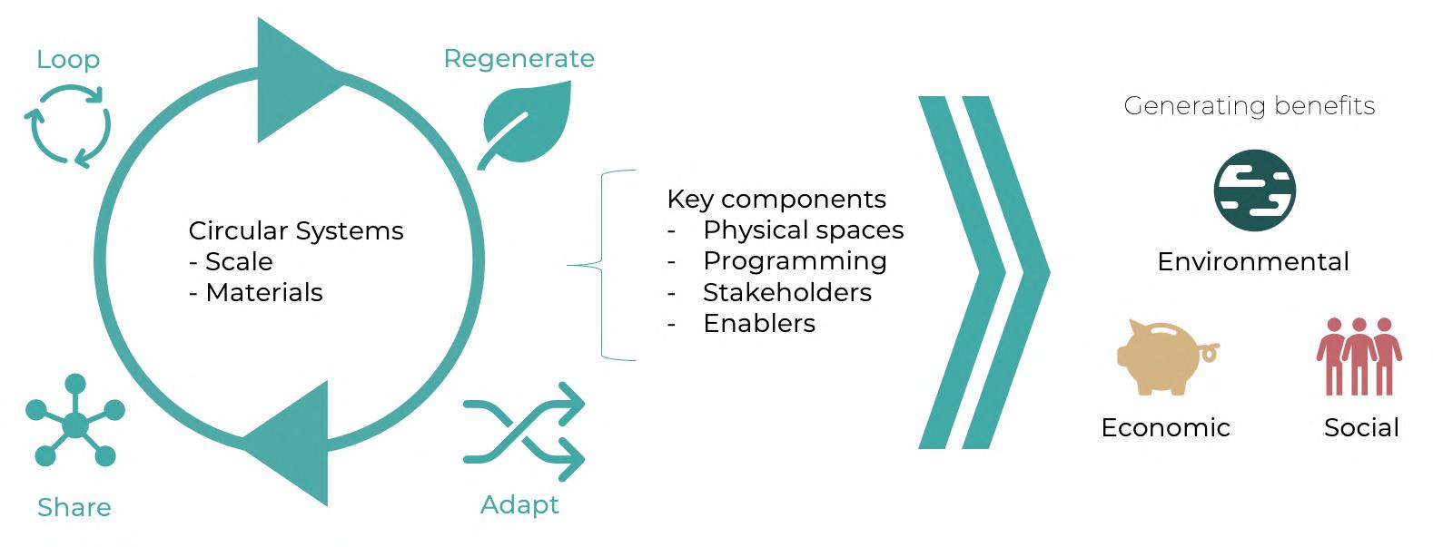
(a) Physical Spaces + (b) Programming
4.3
(d) Enablers coordinate circular circular participate in through planning and currencies, public circularity networking
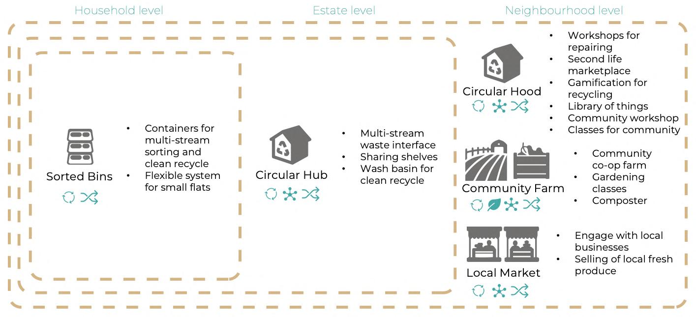
Circular framework and systems
Circular systems of three material flows
(c) Stakeholders
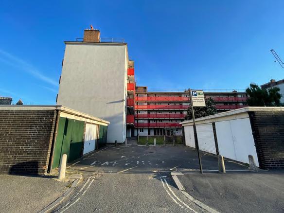
Located in south London, South Bermondsey is a ward within London Borough of Southwark. The site is 54.3 hectares in size. It is dominated by four large public housing estates with diverse building typologies ranging from twostorey terraces to five-storey slabs and 11-storey towers. A railway viaduct with arches runs northwest-southeast through the site, separating the Bermondsey Spa project in the northern part of the site, which is a new build residential regeneration project completed by Levitt Bernstein in 2014.
SOCIAL CORNER Space availble for circular activities, such as outreach and workshops


RECYCLING INFO
Clear instructions and communications to educate residents OUTREACH BY CIRCULAR HUB MANAGER Educates and engages with residents on circular behaviours and habits
ACCESS DOOR Allows access for Circular Hub Manager to organise collected waste
5.6
Based on the proposed framework for benefits and measurements, estimation models are developed to quantify the select environmental, economic and social benefits from the circular interventions. Key assumptions1 are applied in the estimation process, thus, the results below are very likely to vary in real life situation. Detailed assumptions and calculations are available in Appendix (page 53). 1
Based on the proposed framework for benefits and measurements, estimation models are developed to quantify the select environmental, economic and social benefits from the circular interventions. Key assumptions are applied in the estimation process, thus, the results below are very likely to vary in real life situation. Detailed assumptions and calculations are available in Appendix (page 53).
BENEFITS GENERATED FROM 1 X 5 X 5 X
1 Key assumptions: The circular
10%
a
of
households. 10% of their
are looped within
households’ resources/wastes are
looped, regenerated and shared within the system are diverted from combustion for energy recovery.
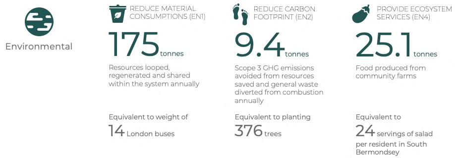

10% of covered households’ resources/wastes are looped within the system. Resources looped, regenerated and shared within the system are diverted from combustion for energy recovery. Covered households’ recycling rate increases from 35% to 50%. Only lettuce, potatoes, tomatoes and cucumbers are planted in community farms. 5% of covered households generate 1 volunteer. x 13,760 BENEFITS GENERATED FROM
Covered households’ recycling rate increases from 35% to 50%.
Only lettuce, potatoes, tomatoes and cucumbers are planted in community farms.
Design proposal
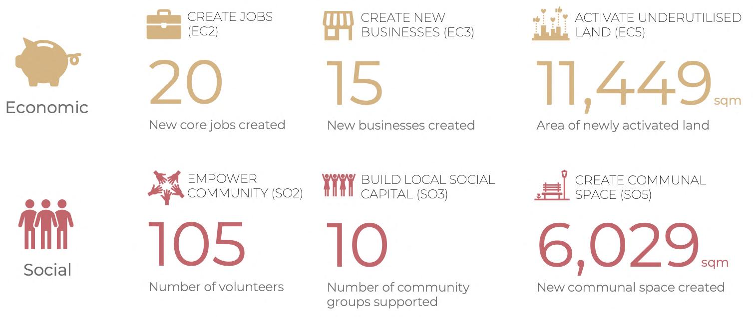
5% of covered households generate 1 volunteer.

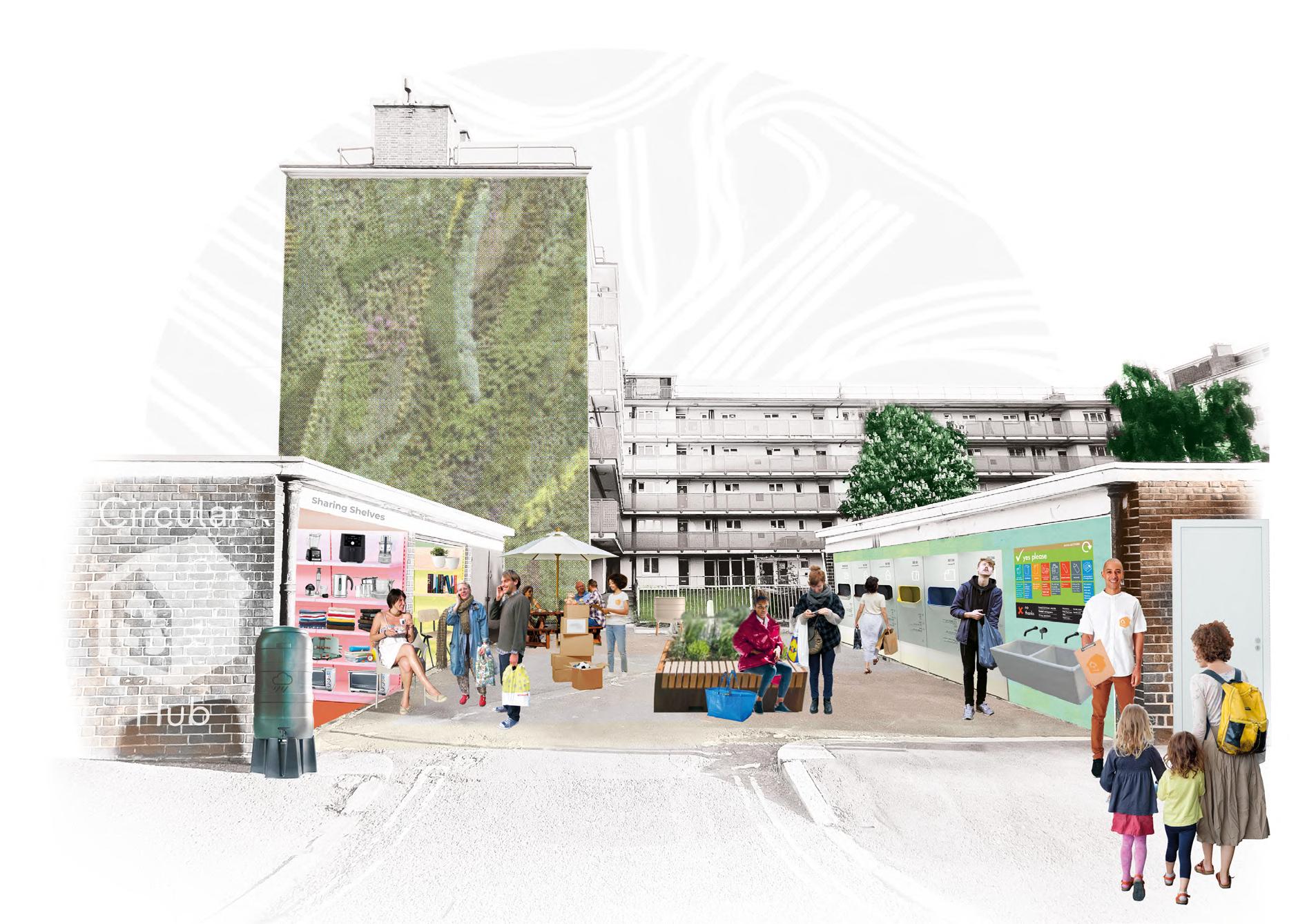
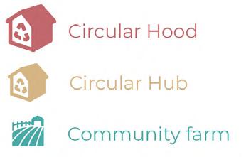
Neighbourhood level –Circular Hood
SITE PROFILE
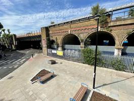
Location: Blue Anchor Lane
Address: Blue Anchor Ln, London SE16 3UL Site area: 3,463 sqm
MULTI-STREAM WASTE COLLECTION INTERFACE
A sleek interface with wash basin for residents to clean and insert pre-sorted recyclables
LOADING ZONE FOR CARGO BIKES
Allows cargo bikes to transport resources between circular facilities
COMMUNAL WORKSHOP
Residents can drop-in to repair their household items with the aid of on-site experts
LIBRARY OF THINGS
SECOND LIFE
ZERO WASTE SHOP
Encourages consumers to purchased goods with zero packaging
GREEN INCUBATOR
Incubator space for sustainable start-ups and makers to benefit from agglomeration of ideas
AFFORDABLE SPACE FOR GREEN BUSINESSES

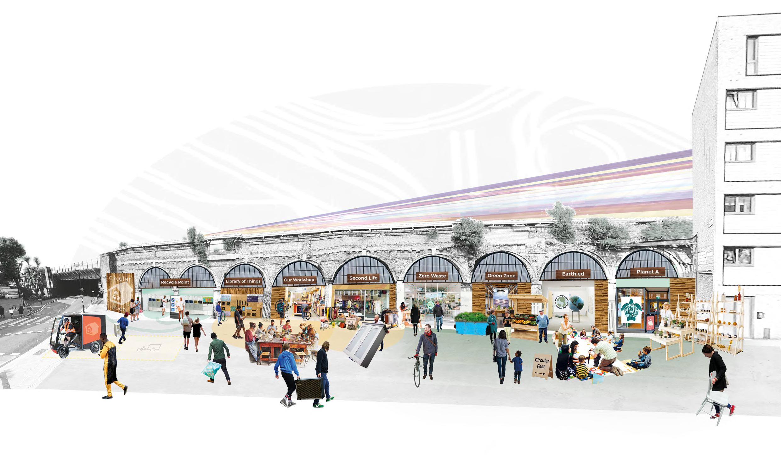
REWARD SYSTEM
Users gain points for recyclables or participation in circular activities and can use points for rewards like daily necessities
Offers a range of tools for residents to borrow shortterm CLASSES AND APPRENTICESHIP
MARTKETPLACE
Refurbished and preowned goods are sold here
EDUCATION CENTRE AND EVENT SPACE
Spaces for visitors to learn about circularity and green NGOs to host events
Green businesses can rent the space at a discounted rate
Allow residents to learn a trade and upskill for new job opportunities
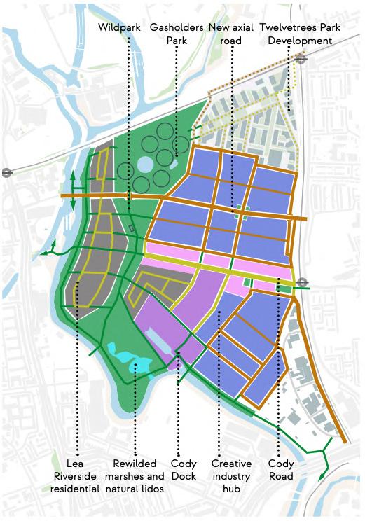
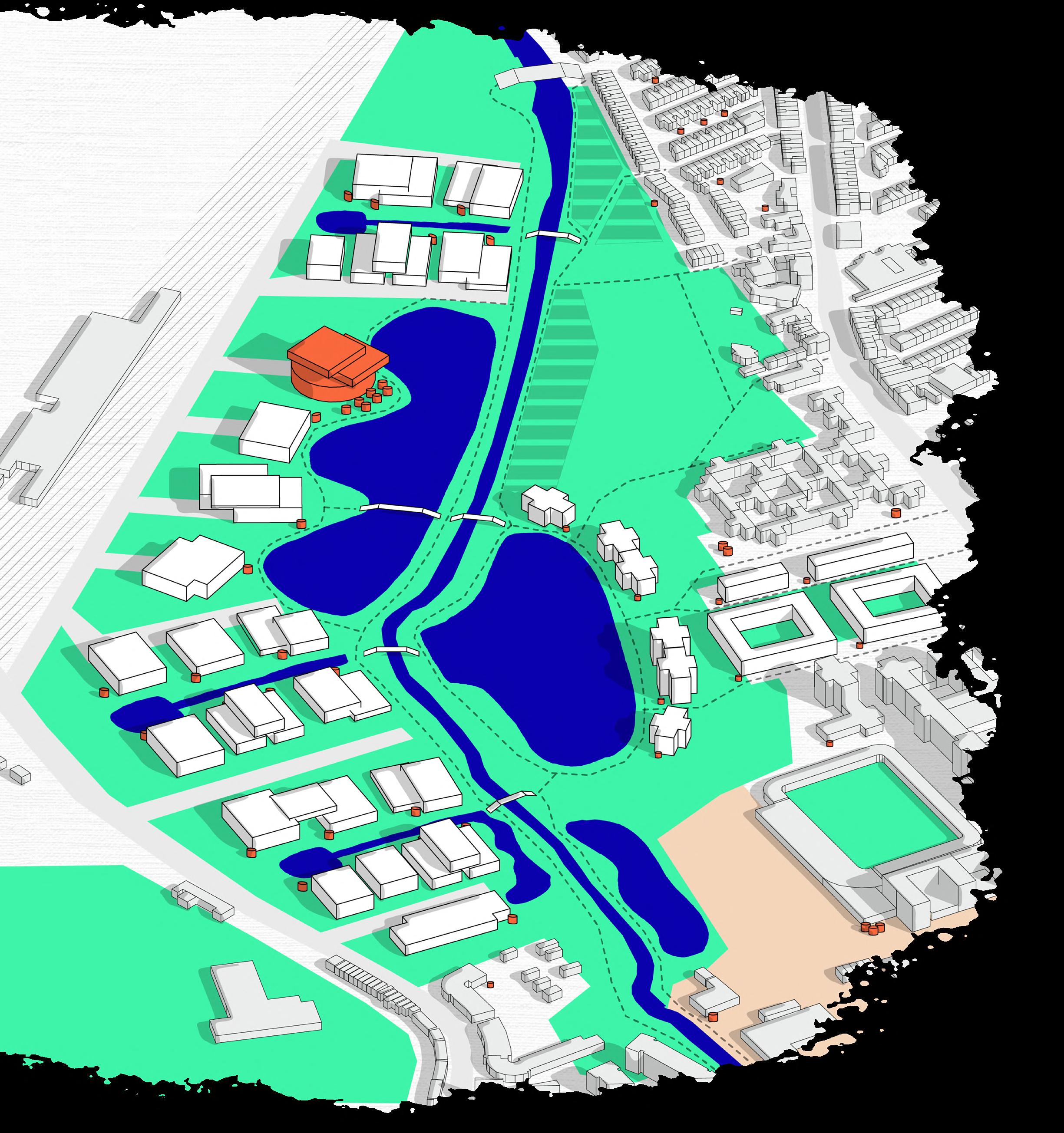
Ablank space; a place with no name; a no man’s land - the Leaside East site in the heart of East London strongly lacks a defined identity.
In response, we have taken the chance to envision one - one that centres on the historically and ecologically important River Lea - one that prioritises connectivity among local workers, residents, and visitors alike - one that envisions a more positive balance among industrial activities, community spaces, and sustainable urban design - one that creates a new sense of place for all.
From big boxes and sheds to modular, adaptable, and high density units
The modular design allows for off- site prefabrication, which reduces construction time of new buildings. Industries with intensive logistic needs can take up units on the ground level, while light industries can use units on the upper storeys.
Shared goods lifts allow smaller industries to operate on upper floors
Shared loading bay allows loading at the back of building
Rainwater harvesting
Rooftop garden for workers to relax
Renewable energy generation
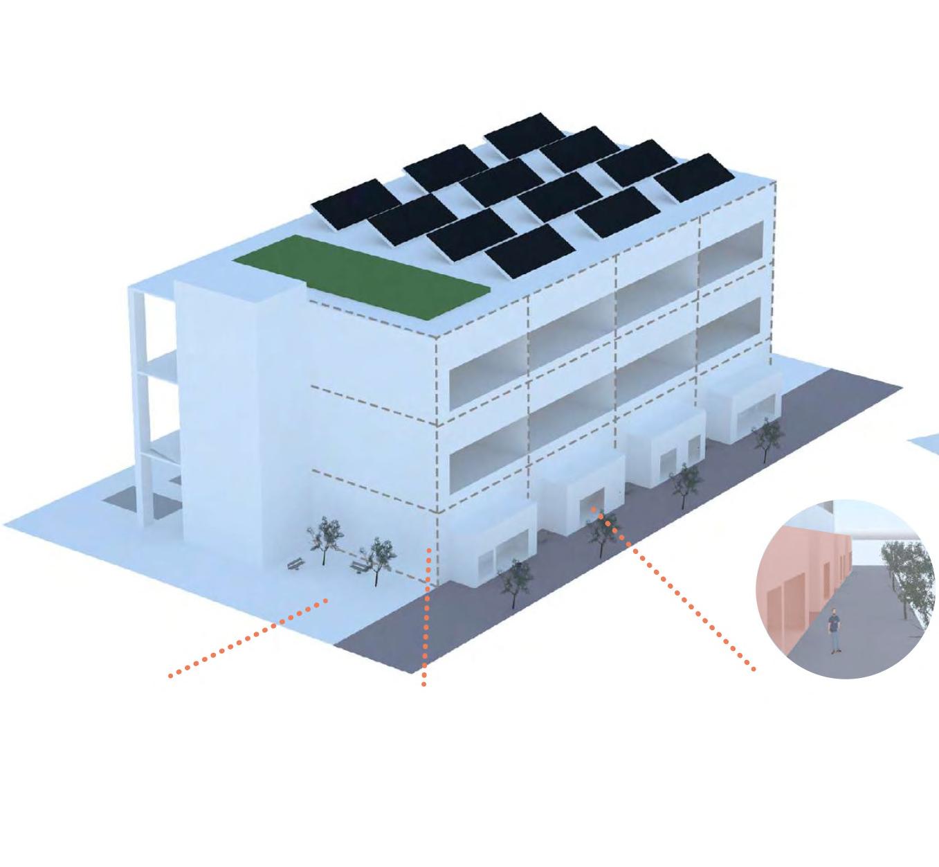
Pockets of communal space allow for workers to interact and relax 8m high modular units: industries can take up multiple units and add mezzanine levels according to their needs
Intensified design for new industrial buildings - Stacked modular units
Vibrant street adds “shop fronts” for industries to display products to enhance edge animation. Adding benches and trees help create a lively streetscape
The wildpark is linked with streams from the Lea to create additional marsh and fen-carr habitats with strands of ash, silver birch, oak and lime, deciduous woodland – a new wild habitat, with boardwalks to criss-cross building on the existing Cody Dock community of conservationists (e.g., bird watchers, volunteers and social networks, etc).
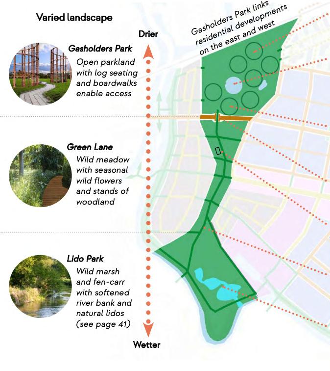
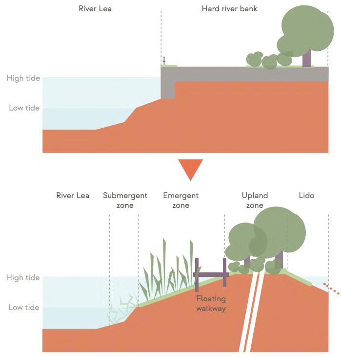
The River Lea bank can be graded and softened to become an intertidal marsh edge, where the junction of water and land blur daily. On the southern tip of the Leaside East Wildpark, ponds/lidos can be created on the marshes.
This punctures the hard Victorian bankside, enabling rewilding of the East bank, creating an extended habitat, a natural Sustainable Urban Drainage Scheme (SUDS), protection against more frequent flooding, and a much needed carbon sink.
A multi-sensory experience, with sound, smell and touch will be offered to all, but particularly disabled visitors and swimmers. Wild swimming and paddling experienced during the pandemic elsewhere along the Lea becomes a common social event at the dedicated Lido Park.
The River’s ecology over time will be cleaned, enhanced with more natural species present in and beside the water, led locally by an active community conservation group supported by London Wildlife Trust.
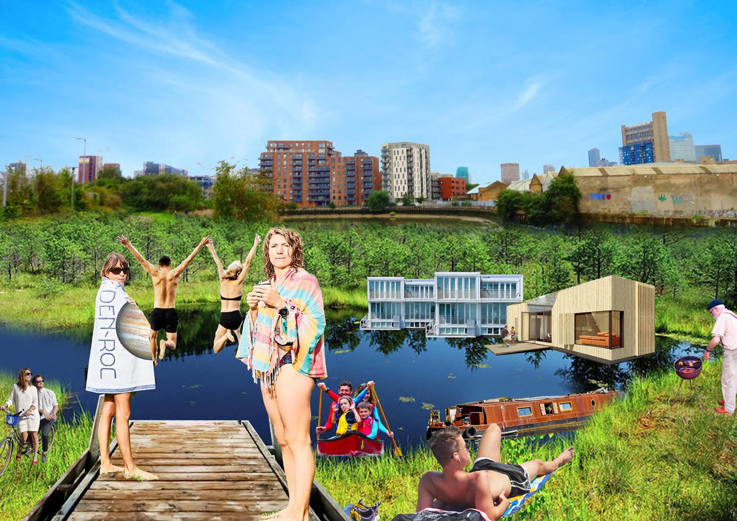
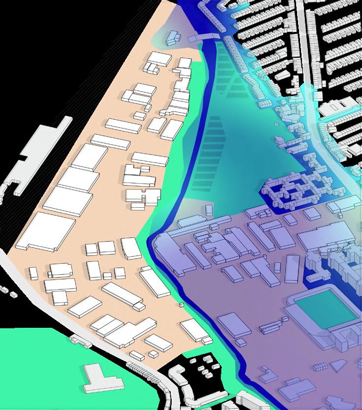
River Wandle had been heavily used by the textile industry in the 18th and 19th centuries. It was highly industrialised, which resulted in human modification of the river course and heavy pollution.
At present, the river is still polluted despite community attempts of river clean ups. As climate change intensifies, flood risk of the Wandle also increases.
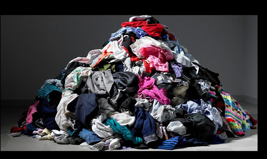
With the technological and logistic advancement of the global textile industry in recent decades, heaps of fast fashion waste pollute cities all over the world. Workers in the textile and apparel industry also suffer under poor working conditions in sweatshops in less developed countries.
How can we save River Wandle and the world?
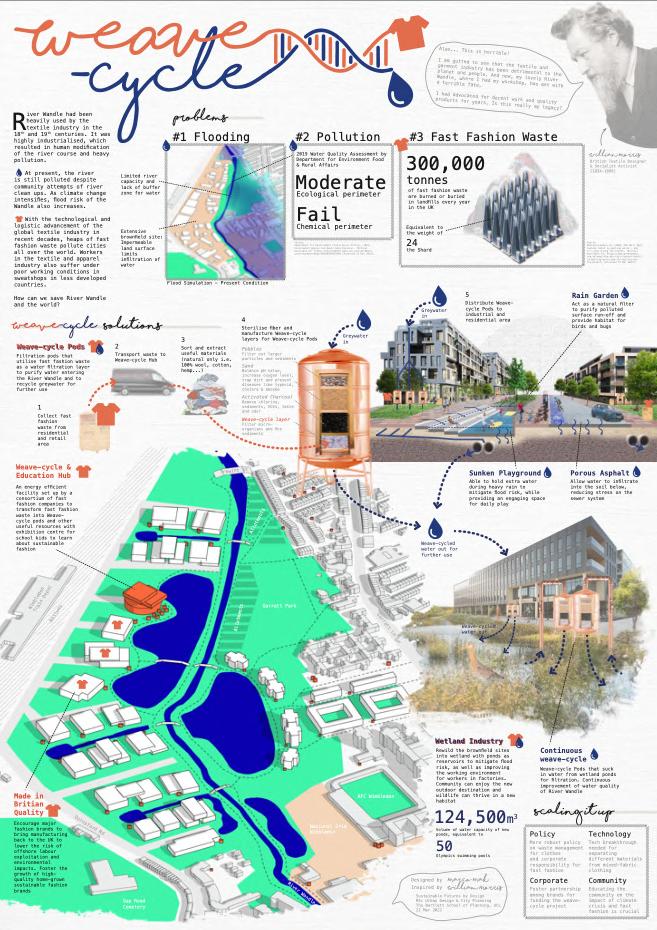
#1 Flooding
Flood Simulation - Present Condition
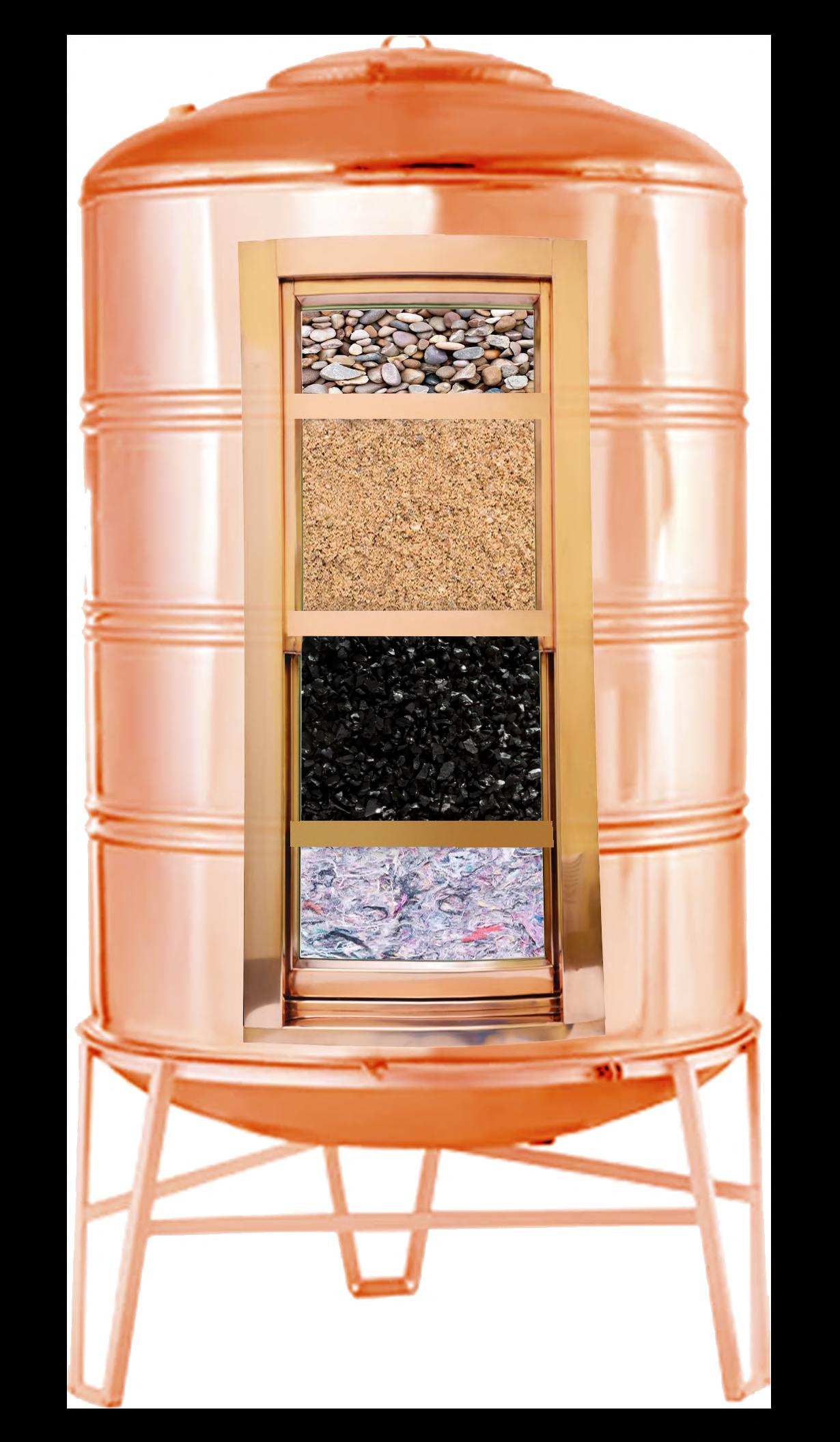
Filtration pods that utilise fast fashion waste (natural only i.e. 100% wool, cotton, hemp...) as a water filtration layer to purify water entering the River Wandle and to recycle greywater for further use
Pebbles
Filter out larger particles and sediments
Sand
Balance pH value, increase oxygen level, trap dirt and prevent diseases like typhoid, cholera & amoeba
Activated Charcoal
Remove chlorine, sediments, VOCs, taste and odor
Weave-cycle layer
Filter micro-organisms and fine sediments
Washing Bag Membrane
Filter micro-plastics
#2 Fast Fashion Waste
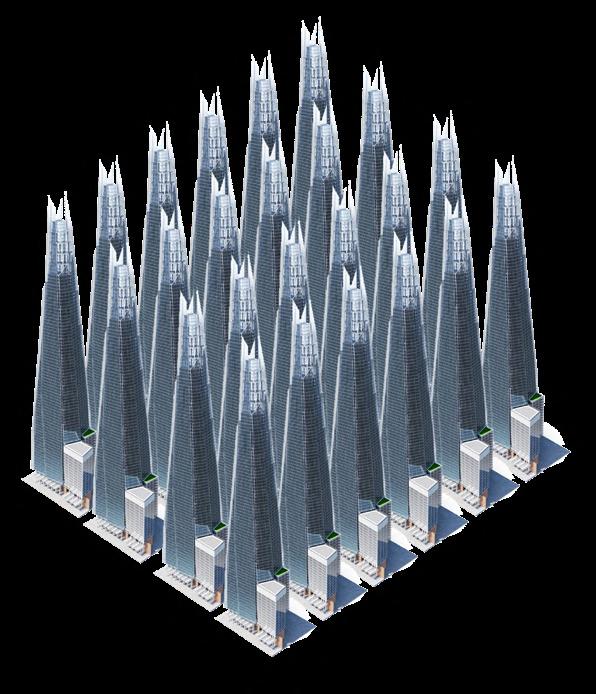
300,000 tonnes
of fast fashion waste are burned or buried in landfills every year in the UK
Equivalent to the weight of 24 the Shard
Weave-cycled water out for further use
An energy efficient facility set up by a consortium of fast fashion companies to transform fast fashion waste into Weave-cycle pods and other useful resources with exhibition centre for school kids to learn about sustainable fashion
Train Depot
Act as a natural filter to purify polluted surface run-off and provide habitat for birds and bugs
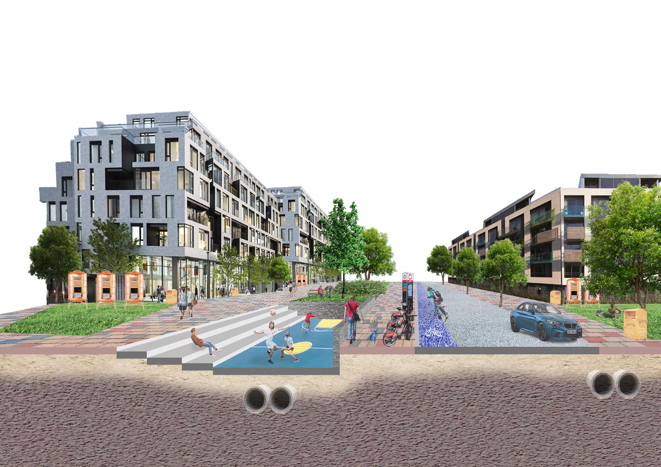
Able to hold extra water during heavy rain to mitigate flood risk, while providing an engaging space for daily play
Allow water to infiltrate into the soil below, reducing stress on the sewer system
Rewild the brownfield sites into wetland with ponds as reservoirs to mitigate flood risk, as well as improving the working environment for workers in factories. Community can enjoy the new outdoor destination and wildlife can thrive in a new habitat
124,500m3
Volume of water capacity of new ponds, equivalent to 50
Olympics swimming pools
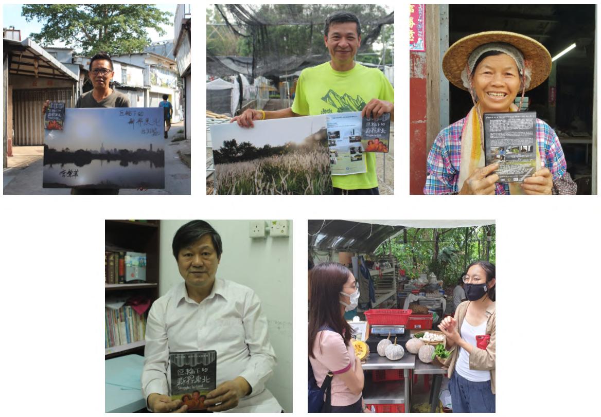
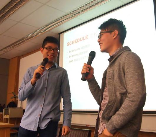
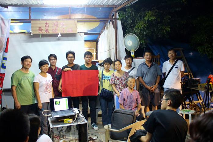
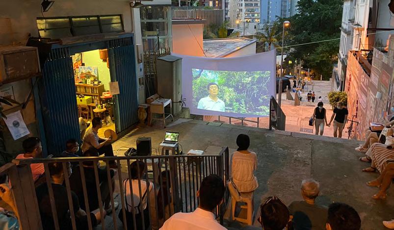
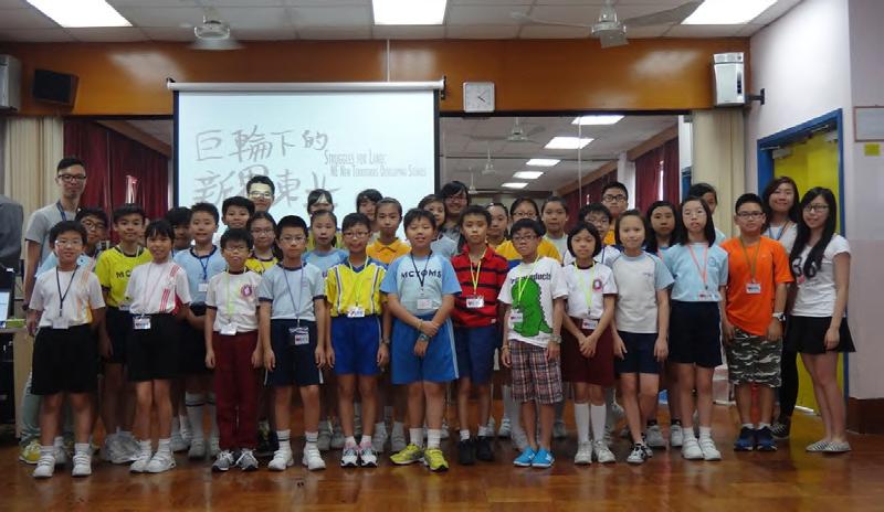
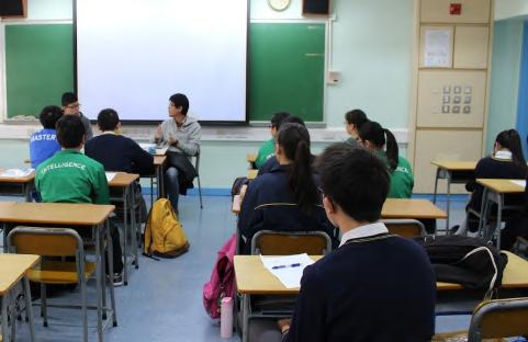
Developing Stories (2014)
Director: Kelvin Yuen & Marco Mak
Duration: 106 minutes
Language: Cantonese (Chinese & English Subtitles)
• CEDARS-GE F:A:C:E: Subsidy Project
• Opening movie of the first “Sangwoodgoon Food and Farming Film Festival” (2014)
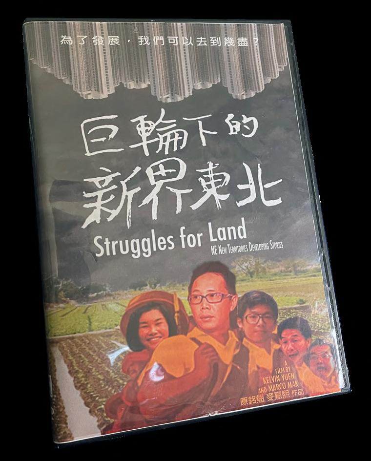
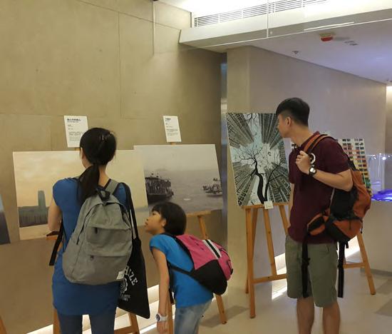
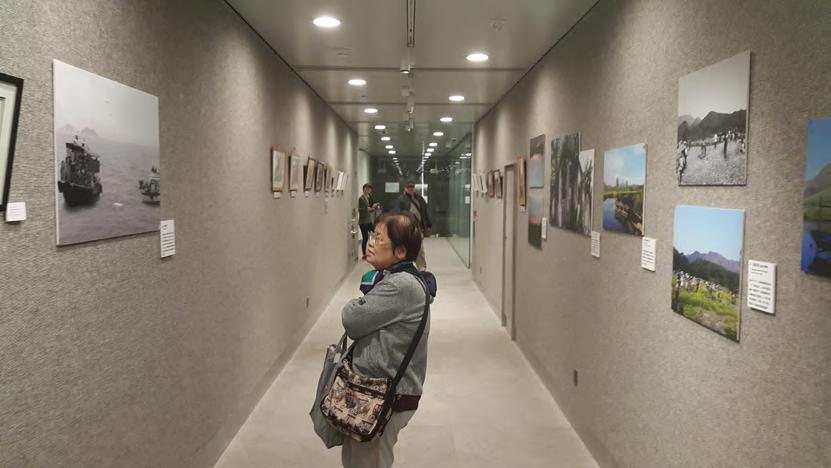
As one of the last piece of rural tranquillity in Hong Kong, the North East New Territories (NENT) is now under threat as the government progresses its new town developmental project, by demolishing homes of thousands and scrapping the most pristine agricultural lands remaining in Hong Kong.
Under these circumstances, a group of undergraduate students has chosen to rediscover the true value of NENT. Through meeting with villagers who are impacted by
forced-migration; interviewing experts from diverse backgrounds, the documentary records countless stories and uncovers the negative impacts, injustice and corruption beneath the project.
The documentary also illustrates contributions younger generation of Hong Kong people had made to support the local villagers, which enables general audiences to re-imagine the meaning of so-called “development”.
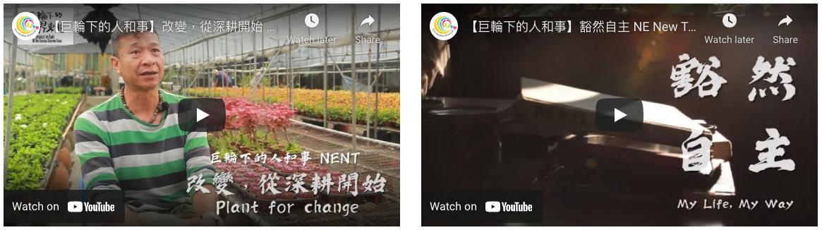
Plant for Change (2020, 7 mins)
Choi Gor’s transition from activism to permaculture [Watch]
My Life, My Way (2019, 6 mins)
Kootyin’s emotional journey of activism and alternative living [Watch]