
TheKeyofSustainability SINTANG,THEAGROPOLIS
Abstract
Strategicspatialplanninghasaroleinencouraging growth and tackling the problems of a region As theheartofBorneo SintangRegency locatedinthe province of West Kalimantan, suffered losses from flooding due to climate change up to IDR 6.538018 million Those hinder the development of Sintang Regency, especially in optimizing natural resource reserves that have not been used up to IDR 138661037 million. So, through analysis and plans usingbackcastingmethodcarriedoutin2021/2022, Sintang Regency planned to be developed as a smart agropolitan regency based on climate change which is projected to increase GRDP up to IDR 16249500 million while increasing regional capacityindextobehigh
PlanningMethod


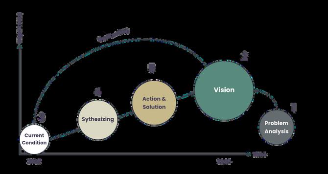
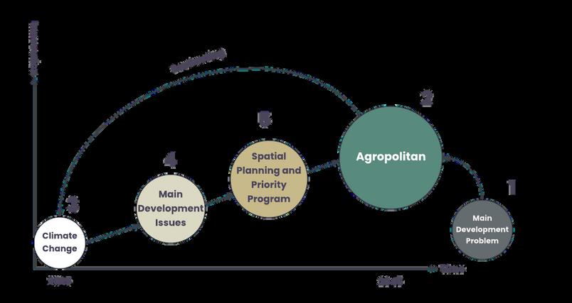
ProblemAnalysis
421.306people
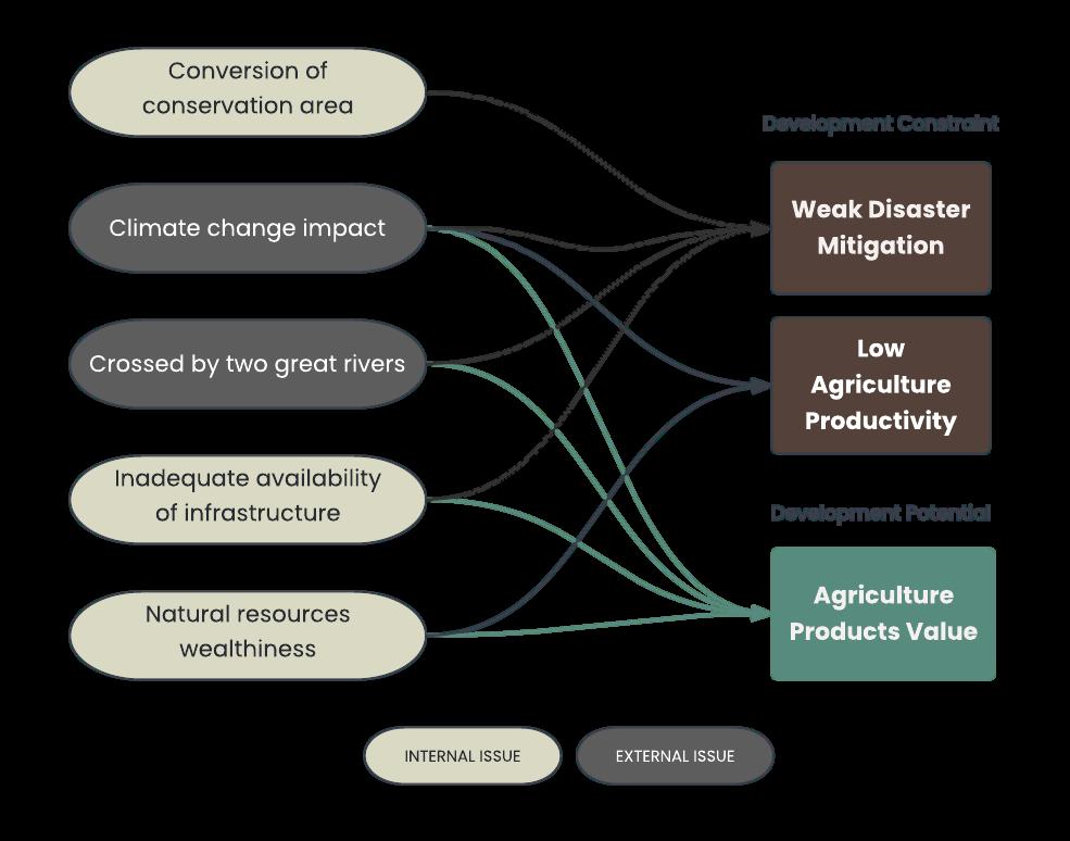
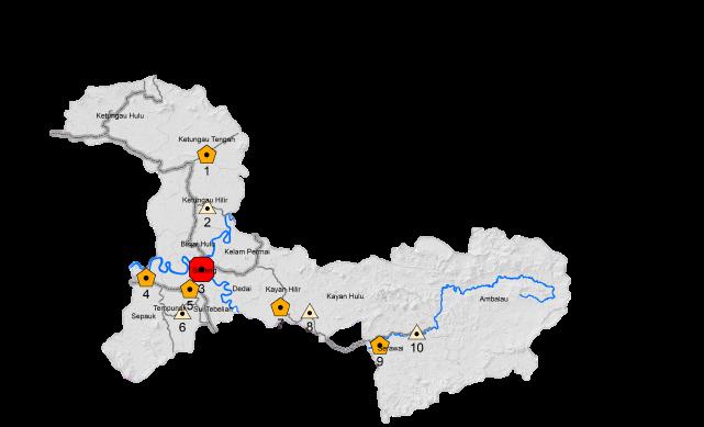
Administration

This region is crossed by the equator and two rivers (Kapuas River and Melawi River) in West Kalimantan
SintangVision
0.60%
Agropolitanregion towardeconomy orienteddevelopment andclimatechange management-basedin 2045


Synthesizing
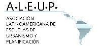
MainDevelopmentIssues

Peoples per capita expenditure in 2020 is IDR 725,500 each month
Regional inequality in Sintang Regency isrelativelylow.
The planning method used is strategic spatial planning which looks at priority issues and considers the availability of regional resources to encourage growth and tackle the problems of a region This planning is accompanied by a backcasting method that begins with identifying regional problems and then making a vision as the primary goal to be achieved and then comparing it with current conditions The formed gaps can be synthesized and elaborated with problems to formulate actions and solution strategies
International Students Competition

b.MainDevelopmentProblem
The fifth-largest poor population in West Kalimantan, 927% of its population

Hosted by: Organized by:

The deforestation rate classified high at526%
Disaster Coping Capacity Index:low(0,24)
Disaster Risk Index: high (2714)
Source author,2022
In Collaboration with GPEAN Members:


Developmentissuesistalkingaboutconstrantand potentalthathaveimpacttochangearegon
Participant ID : Page : 1
ActionandSolution
a.SpatialPlanningGoalTree
ScanMe
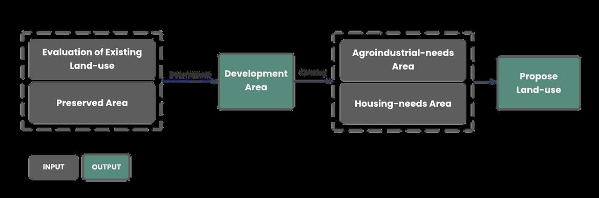
c.ProposeLand-use
Source author,2022
b.Concept
Agropolitan is a concept of creating a region that consists of one or more agricultural-based urban areas (agropolis) by a functional linkagesystem and a spatial hierarchy of settlements, productive units, and agribusiness systems This concept is suitable for improving the regional economy with its natural resource potential Nevertheless, climate change and low income are constraining the implementation of the agropolitan concept. Therefore, this concept needs spatial planning based on climate change adaptation and mitigation.
International Students Competition
existng proposed
IncreasedArea IndustryArea 154637ha Housing 3824,4ha


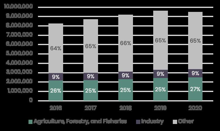
NaturalResourcesAccounting
Source:author 2022
d.ProposeSpatialStructure
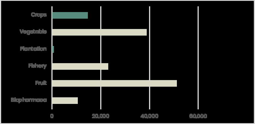
Thecropsandplantationsare
Mono-polycentric: By linking all service points, existing subcenters will support the highest hierarchy of activity center to maketheagropolitanprocessmoreefficient
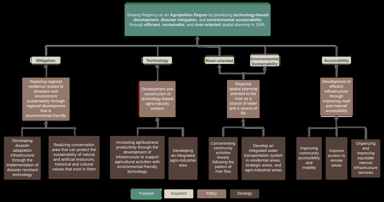

PKW =ProvnceLevelofServce
PKL =Regona Leve o Servce

PPK =CtiesLevelofServce
PPL =DstrictLevelofService
=AgropoitanProcess

wil be focused on beingprotectedareas as an adaptation and mtgaton to cimate change
TrilionIDR
VaueChainEnchancement
Theland-useregulationalso
Hosted by: Organized by: 00 00 00 00
optimizesthenaturalresourcebased onnaturalresourcesaccountinganalysiss

Source author,2022
themostpotentialbecauseof the significant demand for processedcommodities.